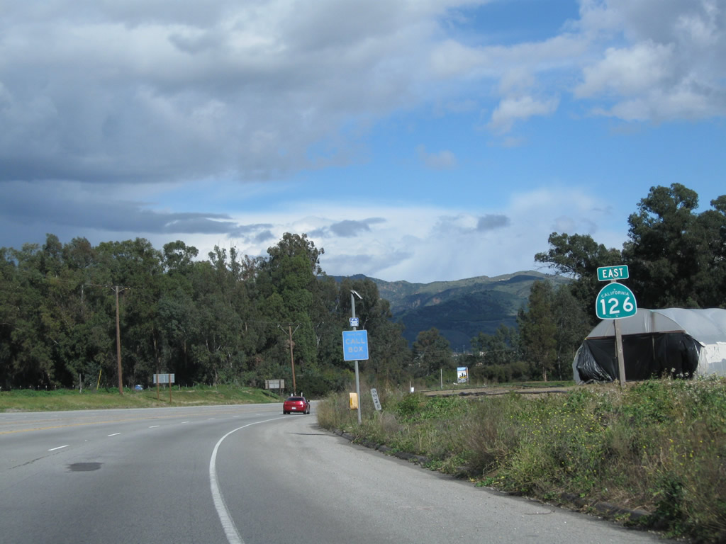
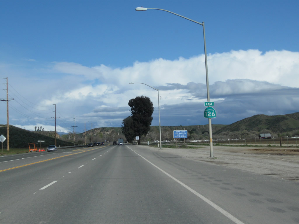
| California 126 east |
|
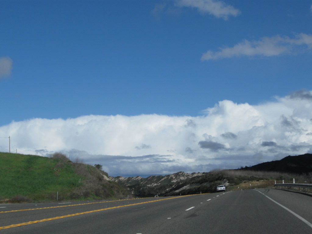
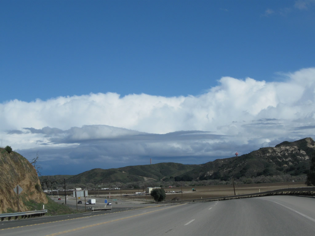
Traveling south (east) on U.S. 101 and California 1 ahead of Exit 66, California 126 east. Stay right for the transition from U.S. 101 south to California 126 east. California 126 begins in the city of San Buenaventura (Ventura), which is the seat of Ventura County and home to 100,916 as of the 2000 Census. Although the city is officially San Buenaventura, it is commonly known as Ventura. Father Junipero Serra founded Mission San Buenaventura in 1782, and the city was incorporated in 1866. Oil played a major role in the early development of this area, and exploration reached out from Ventura inland and toward the sea. The city has a downtown dominated by the mission and Grant Park, and a harbor accessible at Exit 68. Photo taken 02/26/11. |
|
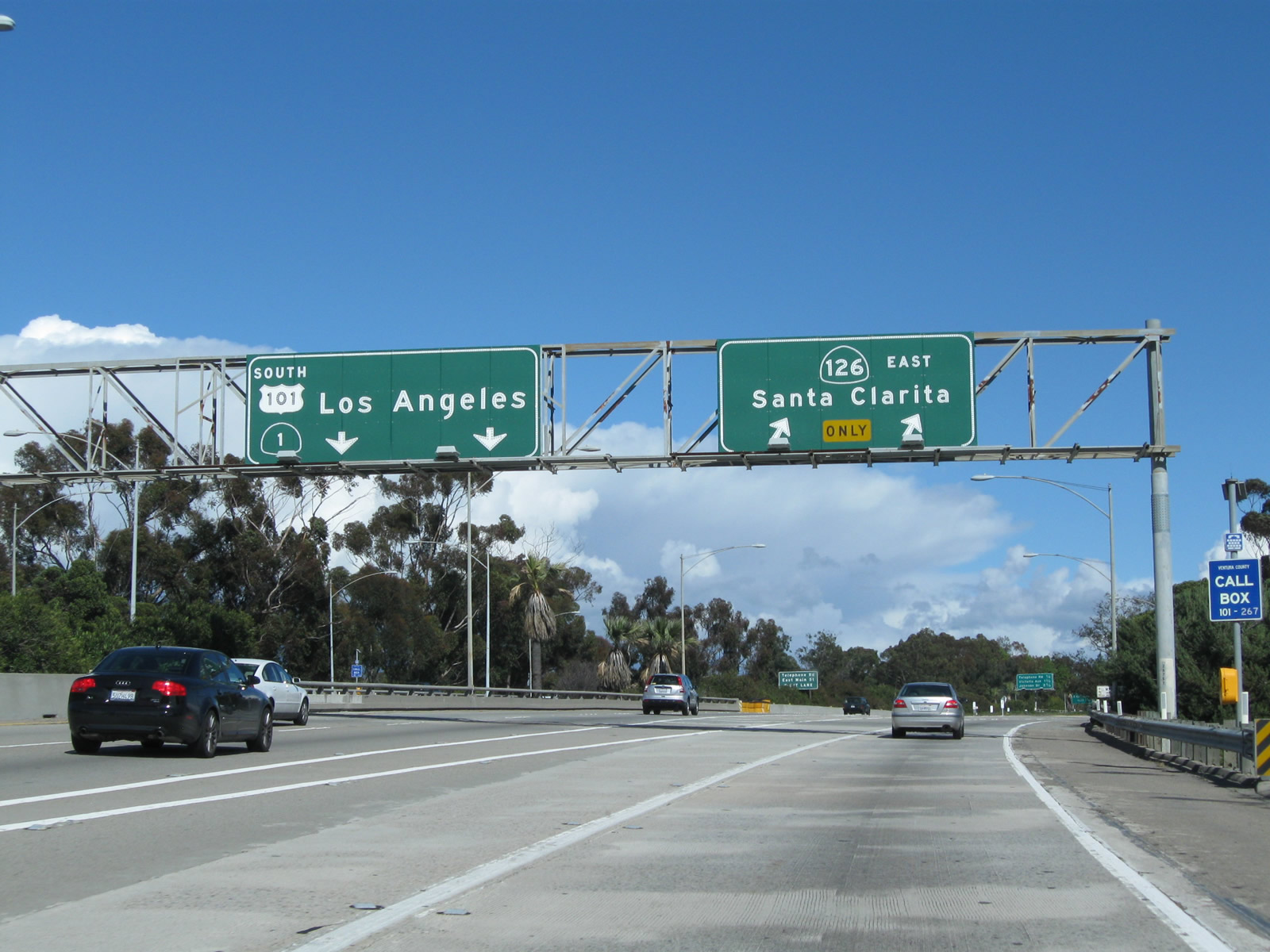
The routes divide shortly thereafter. Stay left for U.S. 101 and California 1 south or depart to the right for the connection to Exit 66, California 126 (Santa Paula Freeway) east. The Ventura Freeway section around the city of Ventura was constructed between 1961 and 1963. Photo taken 02/26/11. |
|
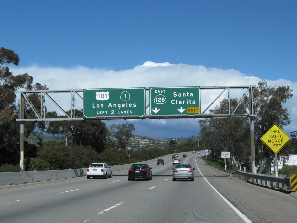
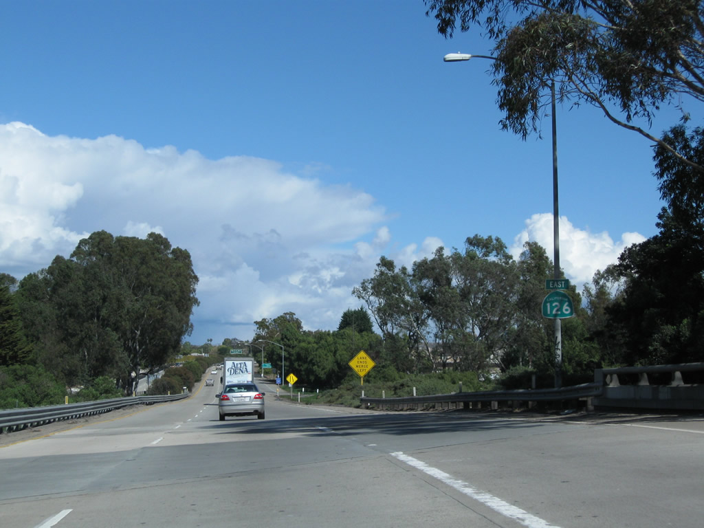
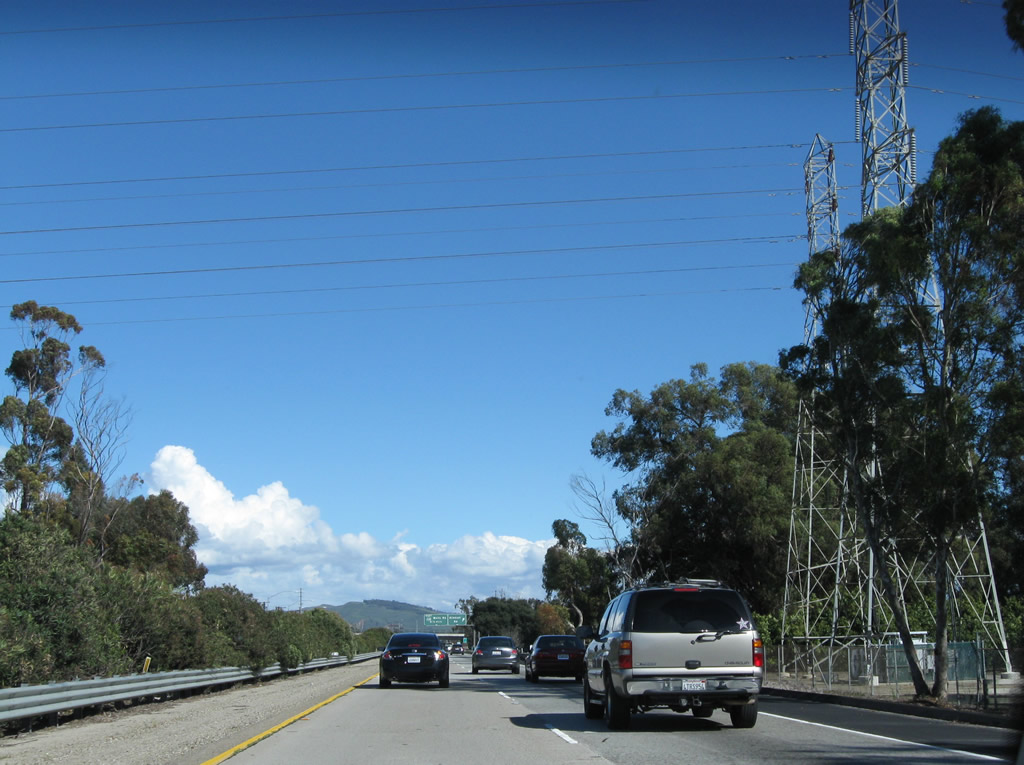
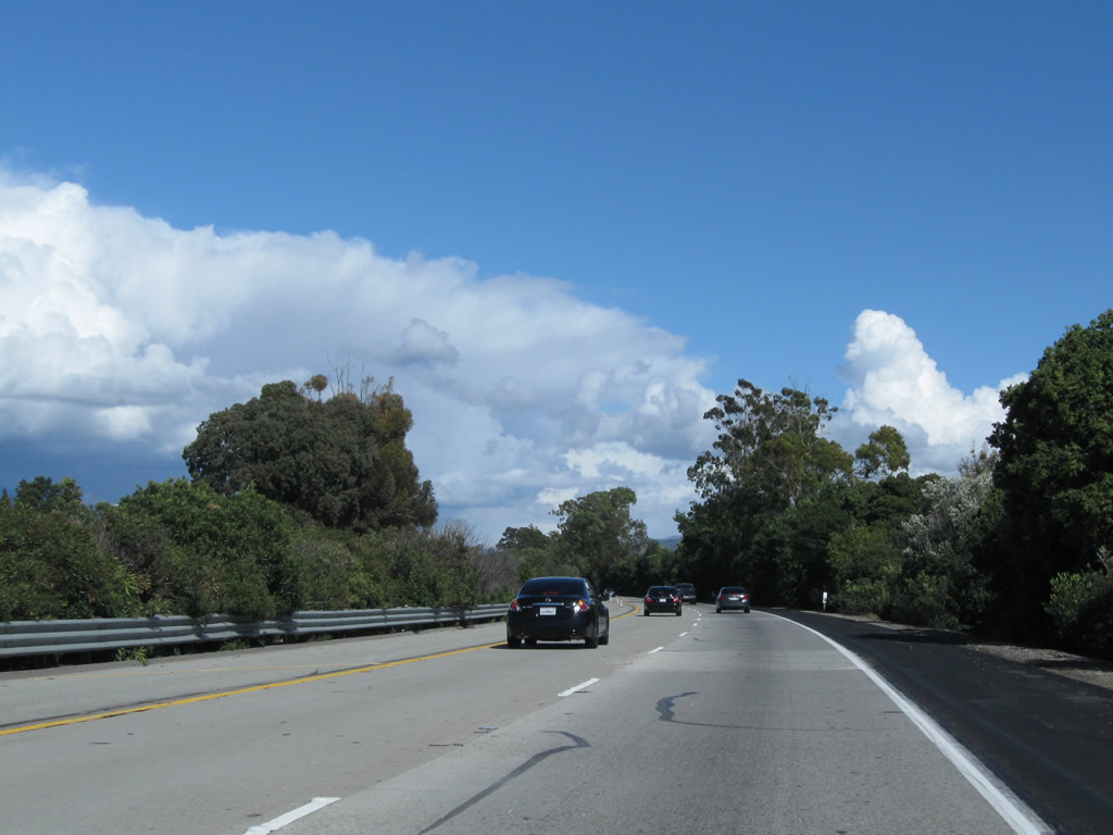
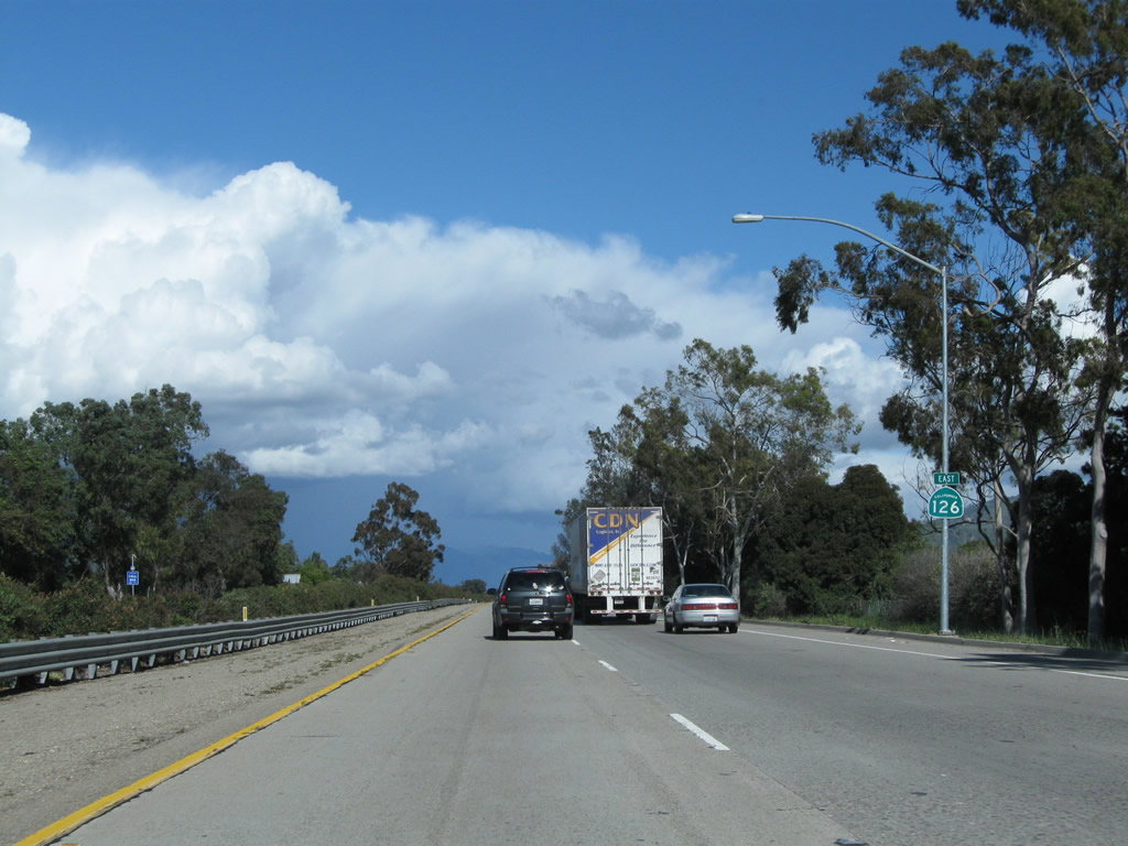
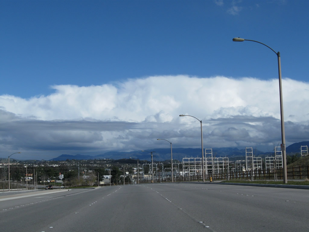
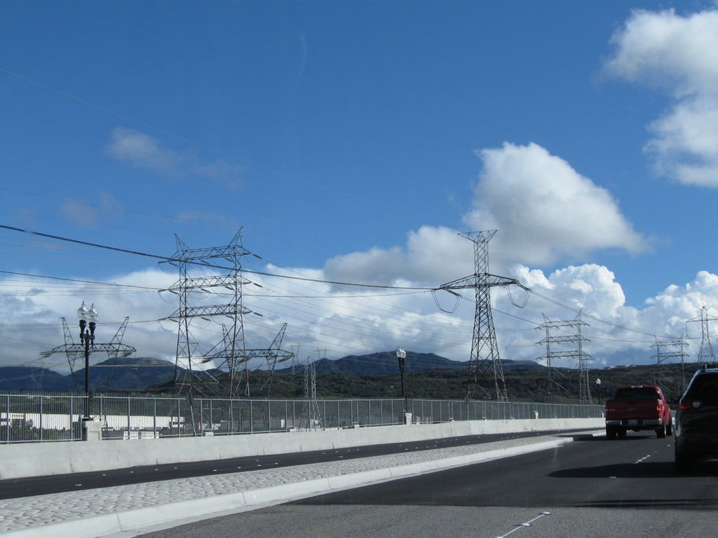
Two lanes carry traffic from U.S. 101 (Ventura Freeway) and California 1 south onto California 126 (Santa Paula Freeway) east. Photo taken 02/26/11. |
|
As the ramp ascends to pass over U.S. 101, traffic from U.S. 101 Business (Main Street) merges onto California 126 (Santa Paula Freeway) east. Photo taken 02/26/11. |
|
The first California 126 east reassurance shield is posted along the Santa Paula Freeway after traffic from Main Street merges onto the freeway. Photo taken 02/26/11. |
|
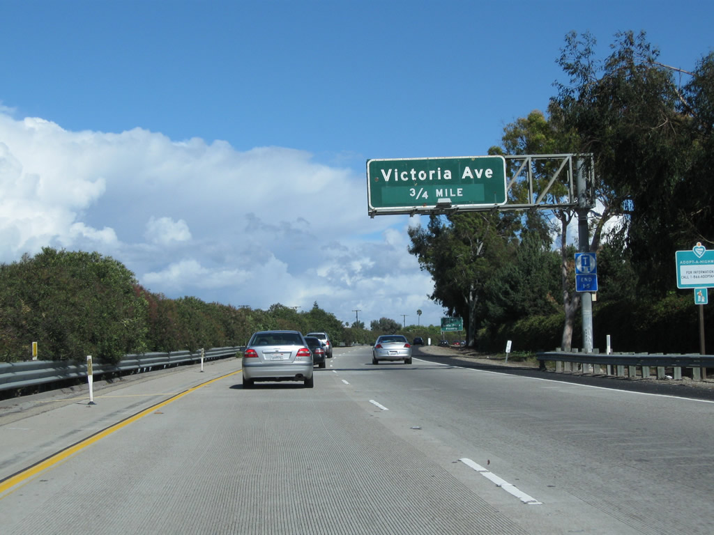
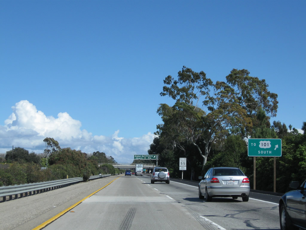
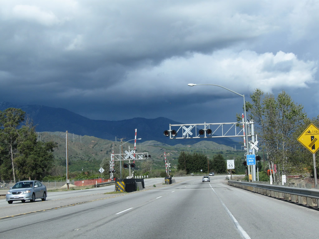
Shortly thereafter, eastbound California 126 (Santa Paula Freeway) approaches its first exit: Exit 1, Victoria Avenue. Photo taken 02/26/11. |
|
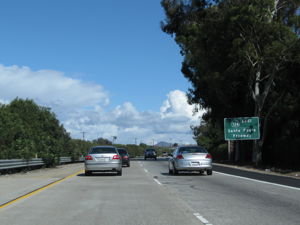
A roadside sign advises that California 126 is the Santa Paula Freeway, a name it will retain from Ventura east to Santa Paula. Photo taken 02/26/11. |
|
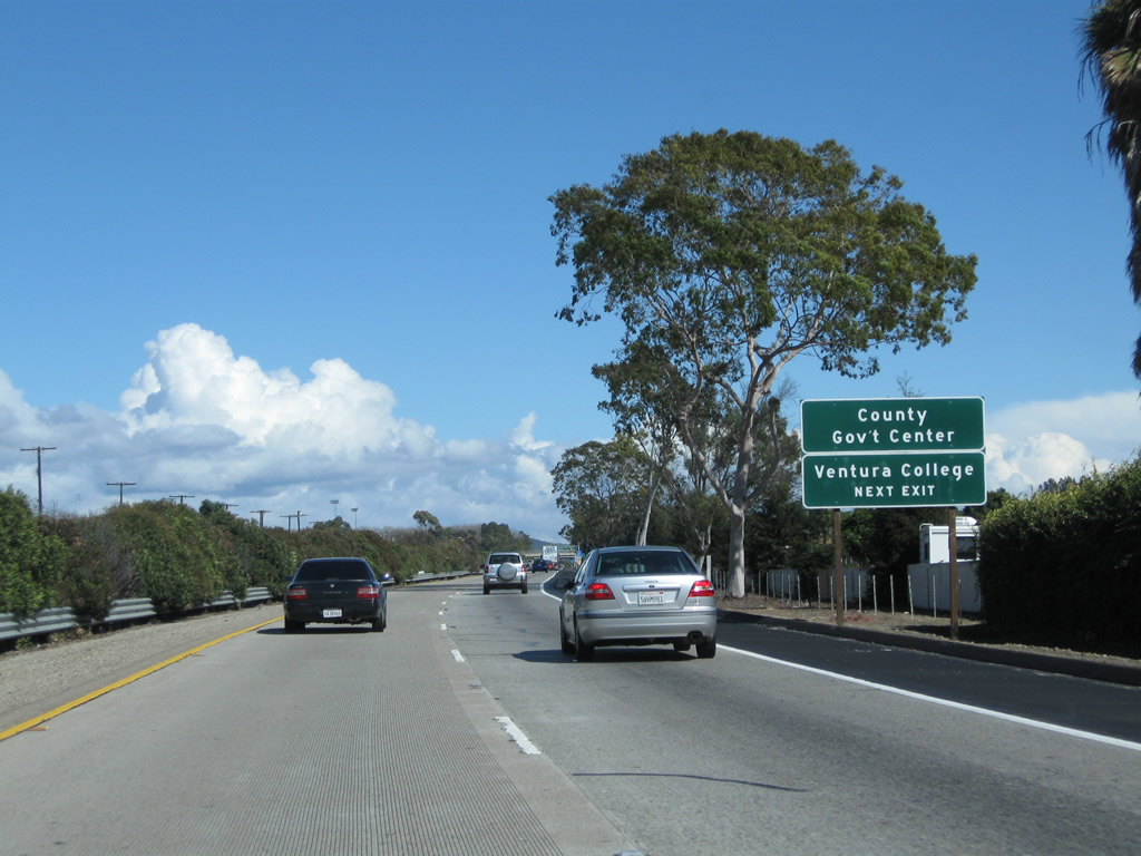
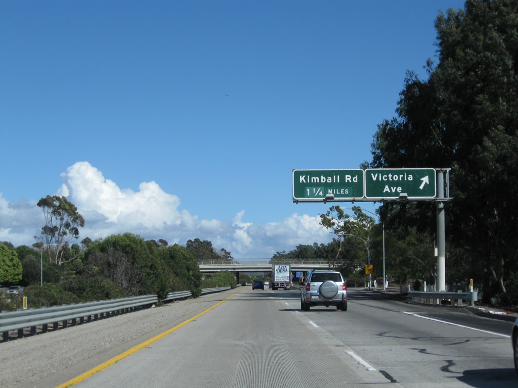
Use the Victoria Avenue exit for Ventura College and the Ventura County Government Center. Photo taken 02/26/11. |
|
Use Victoria Avenue east to the U.S. 101 freeway east. Photo taken 02/26/11. |
|
Eastbound California 126 (Santa Paula Freeway) reaches Exit 1, Victoria Avenue. The next exit along eastbound is Exit 3, Kimball Road. Photo taken 02/26/11. |
|
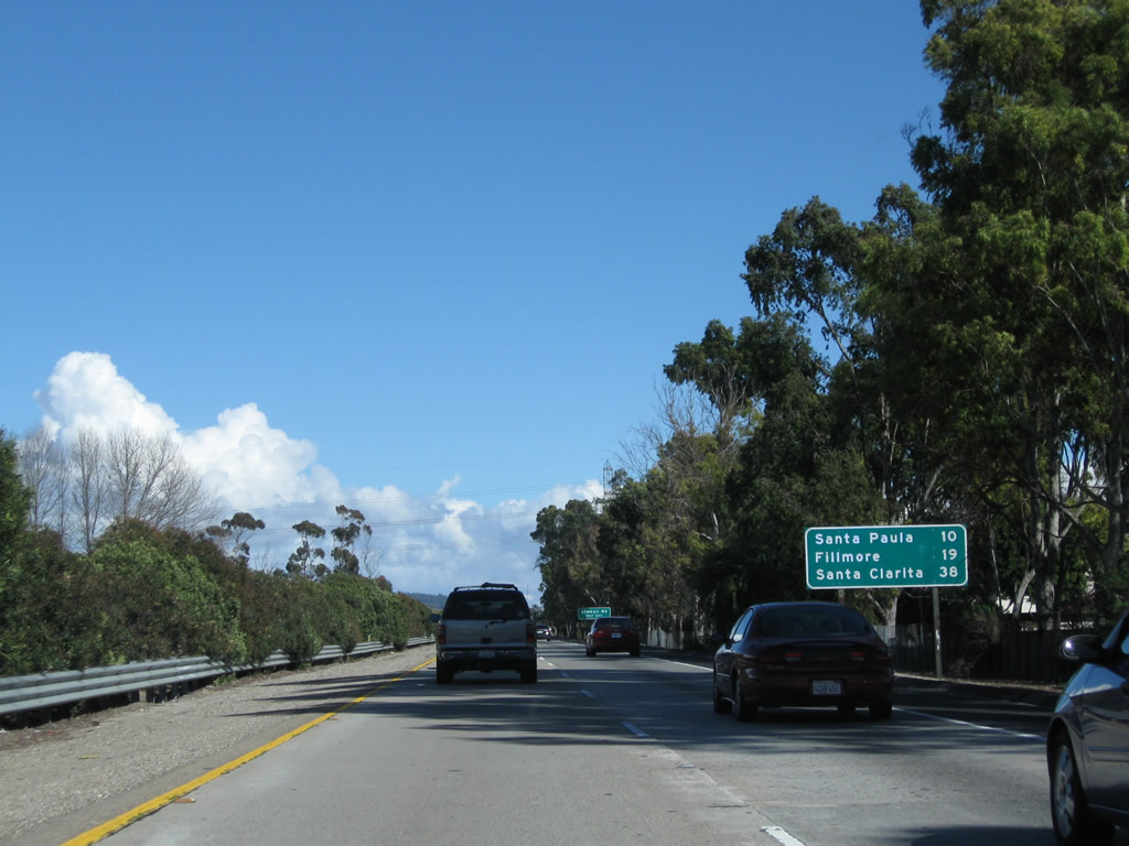
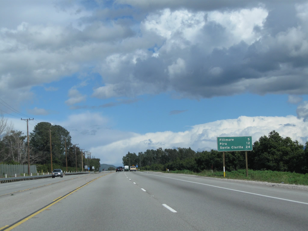
A mileage sign along California 126 (Santa Paula Freeway) east provides the distance to Santa Paula (10 miles), Fillmore (19 miles), and Santa Clarita (38 miles). Photo taken 02/26/11. |
|
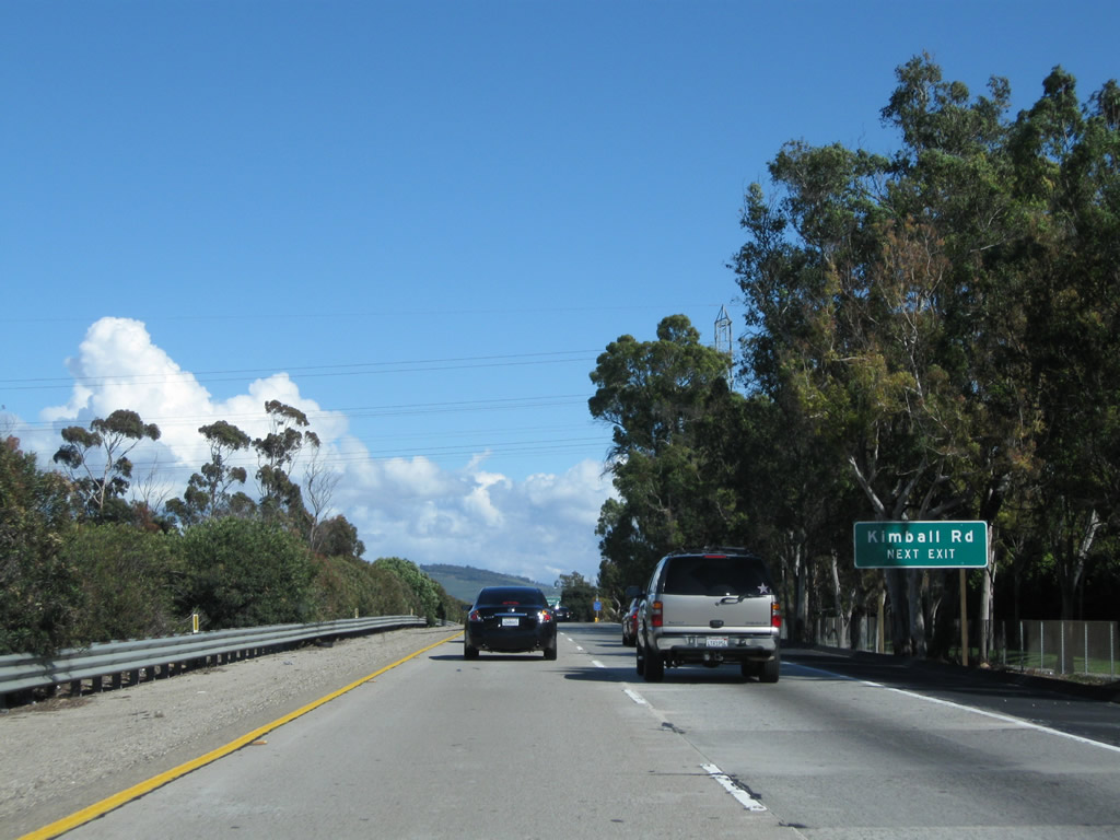
The next interchange along California 126 (Santa Paula Freeway) east is Exit 3, Kimball Road. Photo taken 02/26/11. |
|
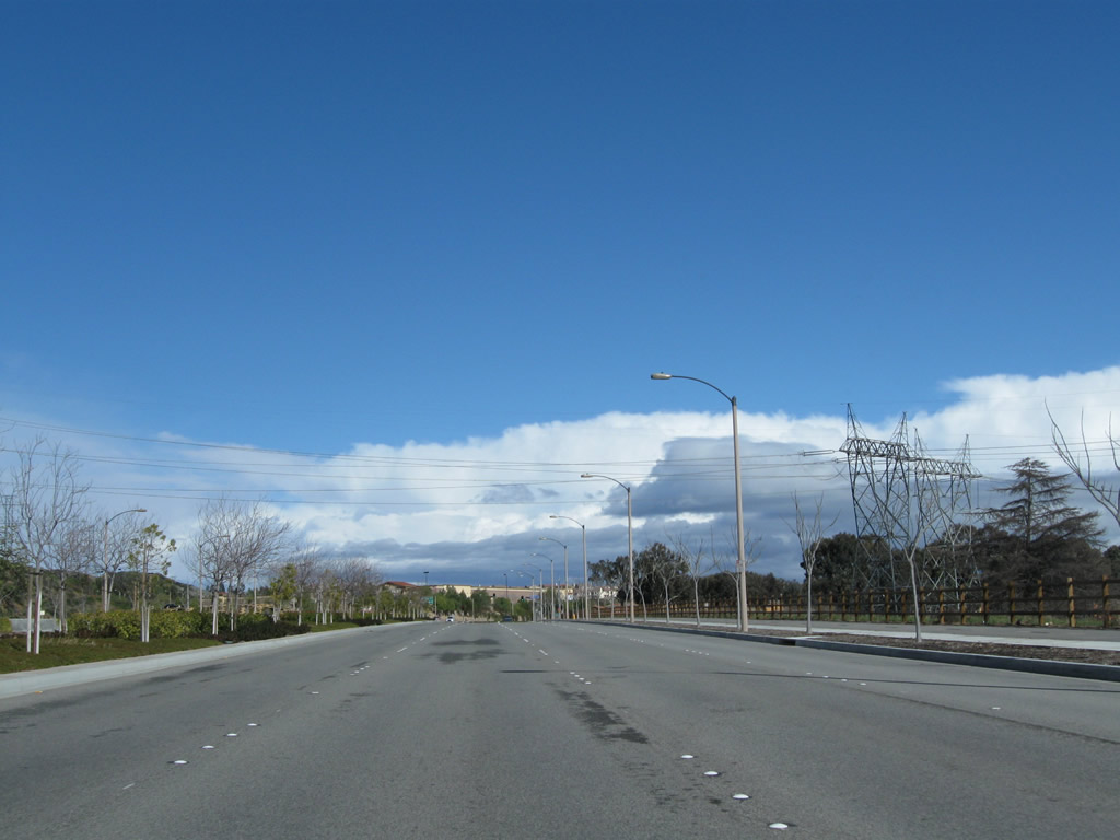
A set of Southern California Edison power lines crosses over California 126 (Santa Paula Freeway). Photo taken 02/26/11. |
|
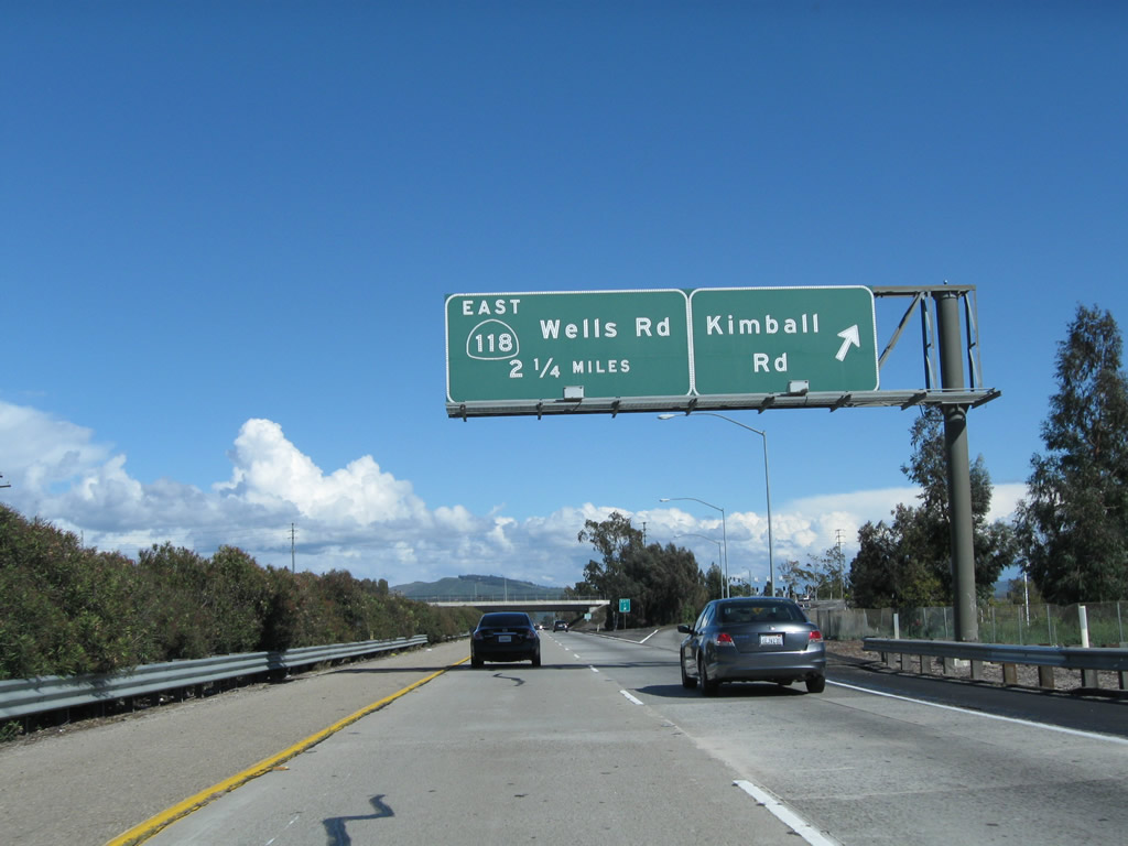
Eastbound California 126 (Santa Paula Freeway) reaches Exit 3, Kimball Road. The next exit along eastbound is Exit 5, California 118 (Wells Road). Photo taken 02/26/11. |
|
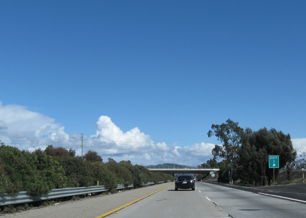
Most exit numbers are not posted yet on California 126 (as of 2011), but here is an exception at the gore point with Exit 3. Photo taken 02/26/11. |
|
This California 126 east reassurance shield is posted on Santa Paula Freeway after the on-ramp from Kimball Road. Photo taken 02/26/11. |
|
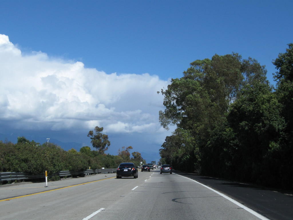
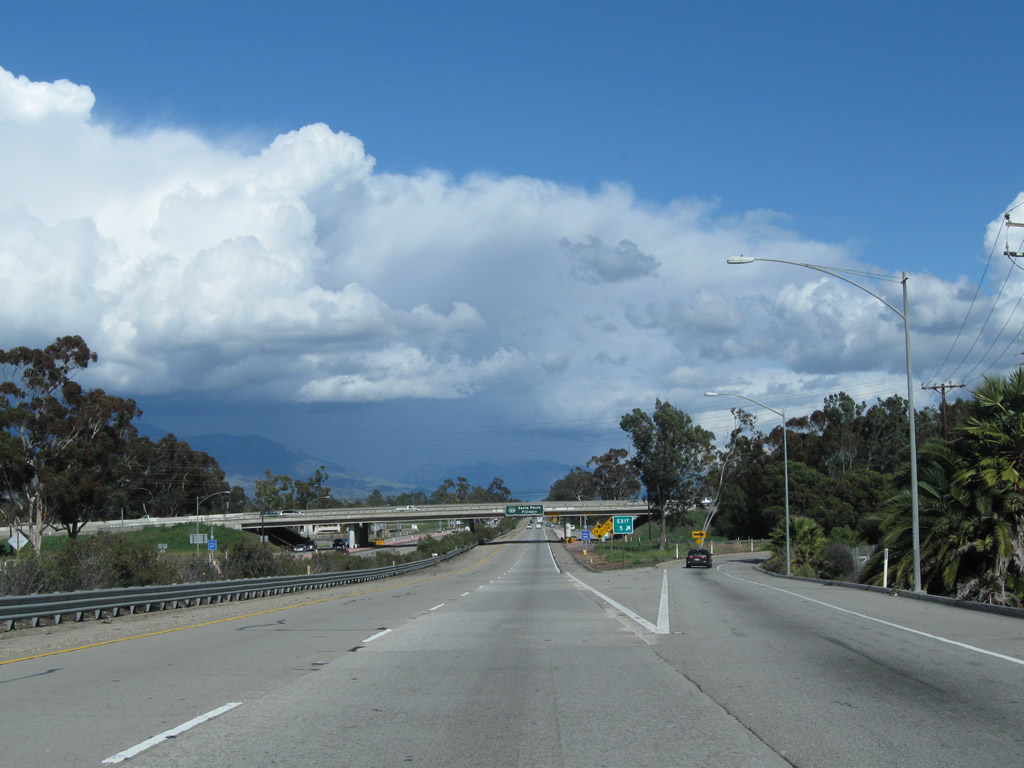
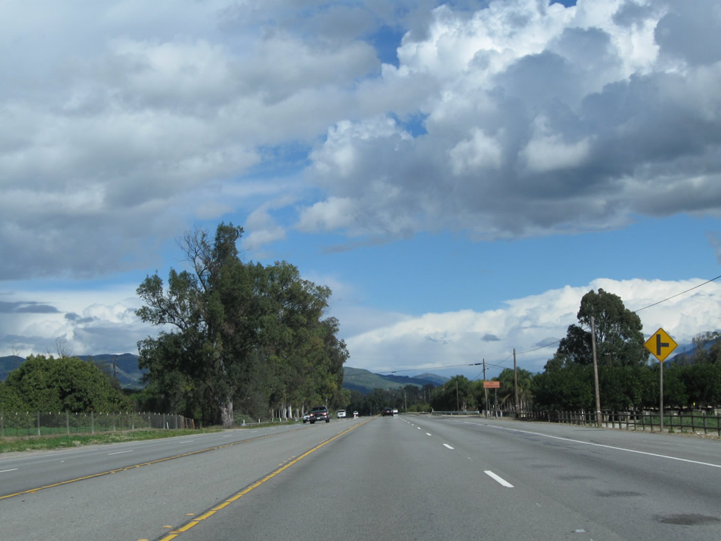
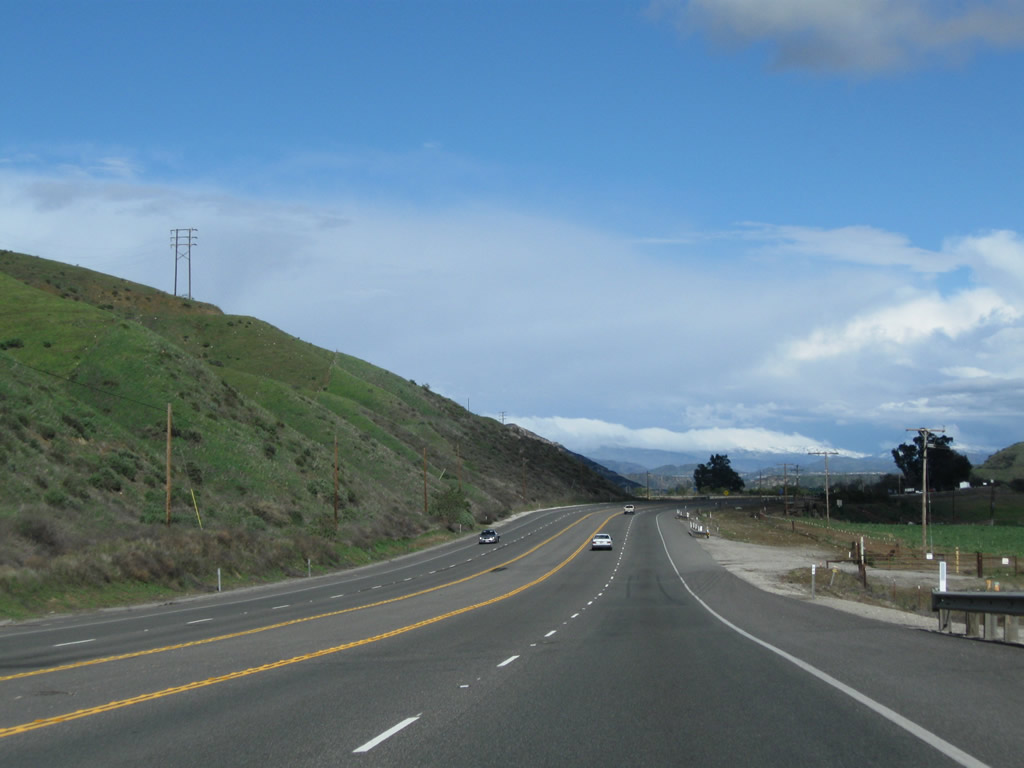
California 126 continues east with two lanes in each direction. Ahead, California 126 will enter Saticoy. Photo taken 02/26/11. |
|
About two miles separate Exits 3 and 5. Photo taken 02/26/11. |
|
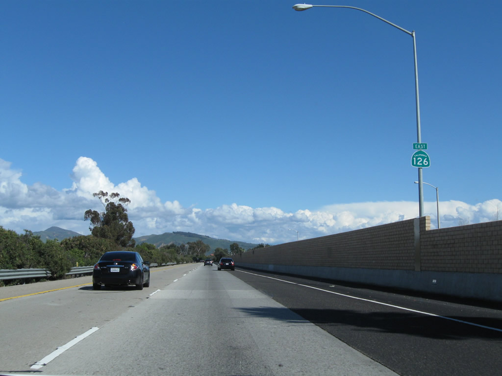
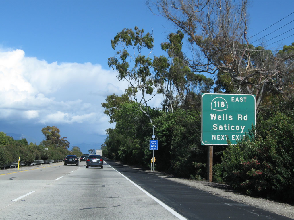
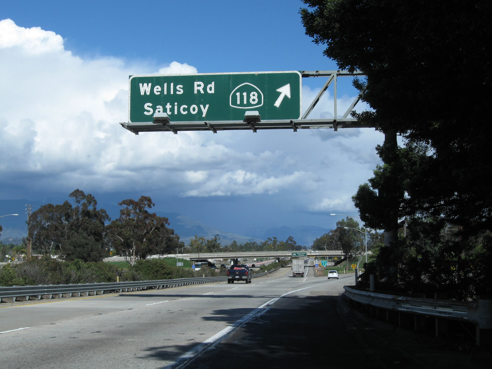
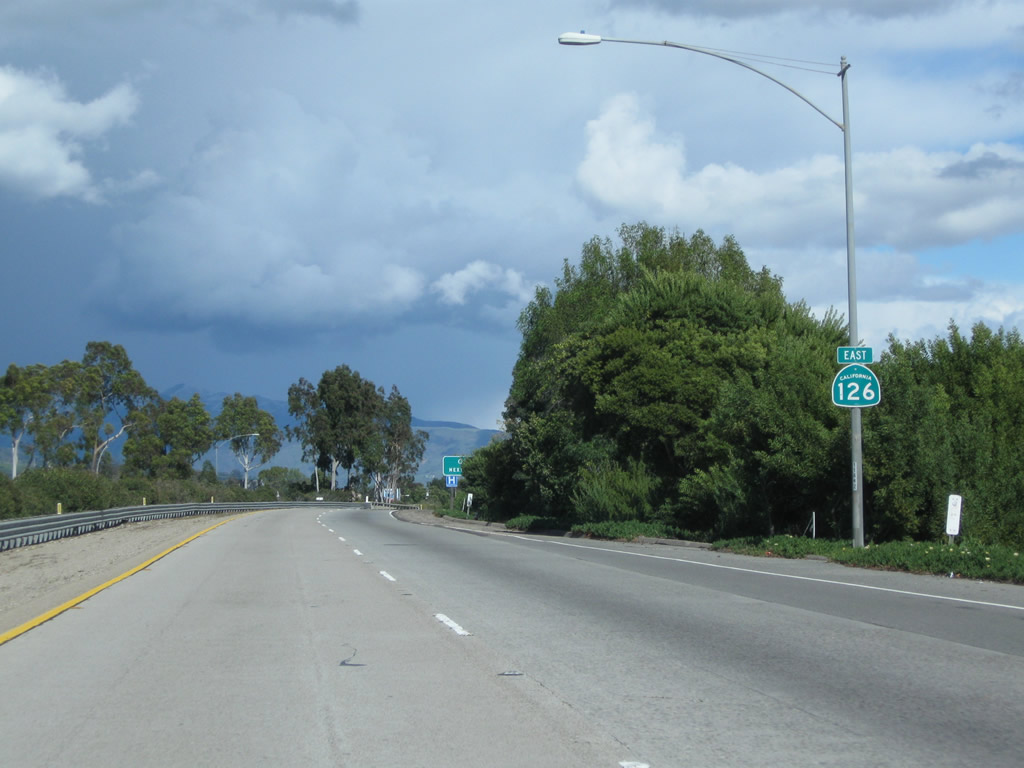
The next exit along California 126 (Santa Paula Freeway) east is Exit 5, California 118 (Wells Road). California 118 (Wells Road) travels east in Saticoy, then changes into Los Angeles Avenue. California 118 (Los Angeles Avenue) continues east, initially as a two-lane highway and later as a full freeway, serving the cities of Moorpark, Simi Valley, and Los Angeles (San Fernando Valley). Photo taken 02/26/11. |
|
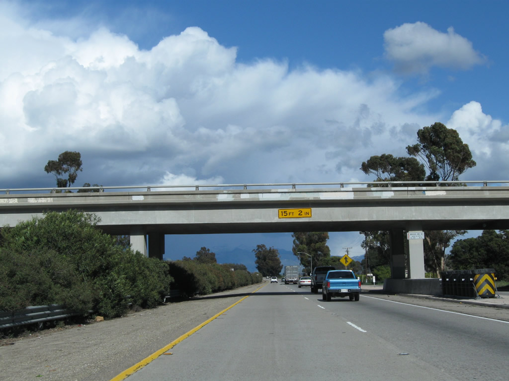
California 126 passes under Saticoy Avenue. Photo taken 02/26/11. |
|
|
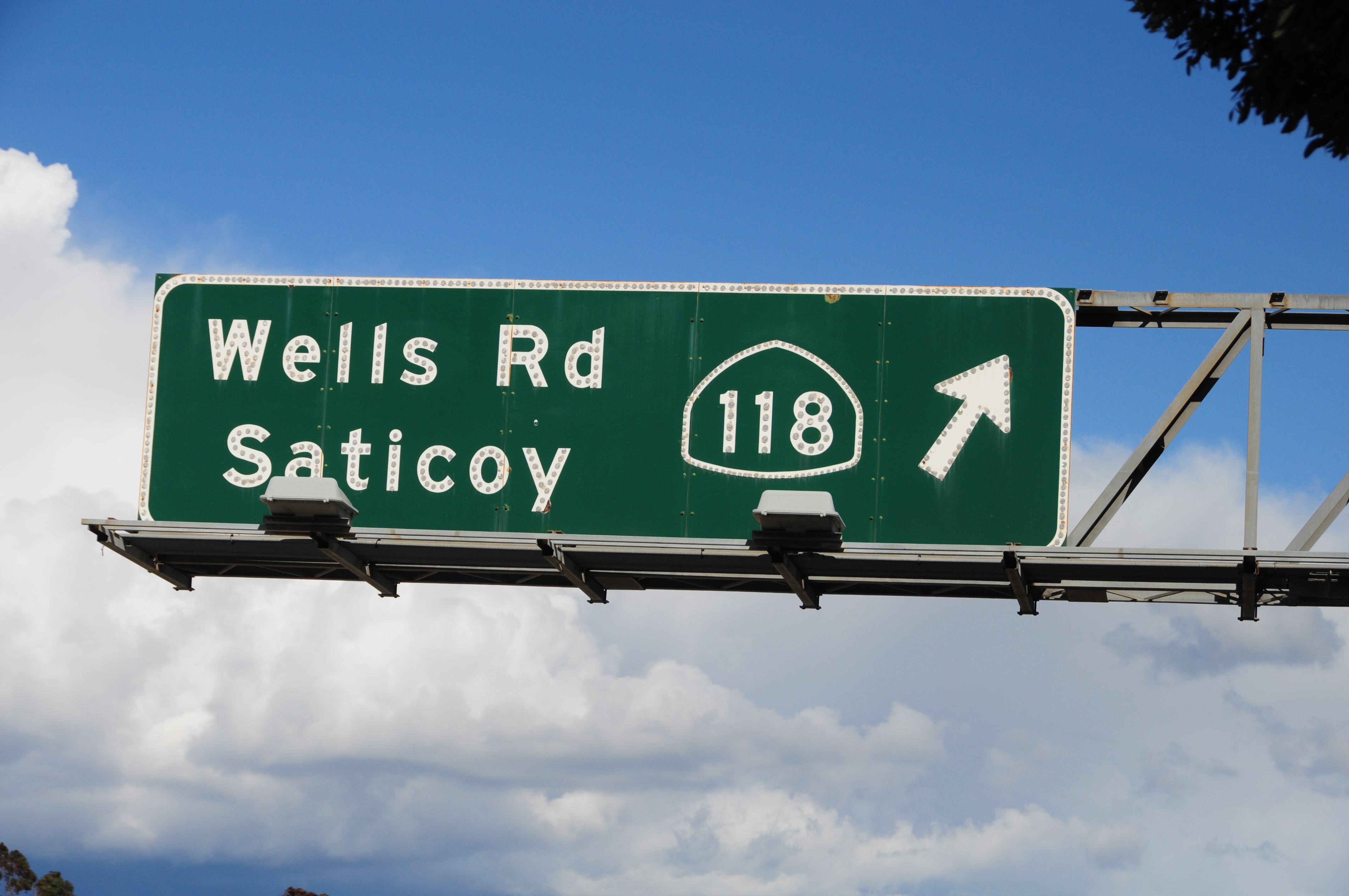
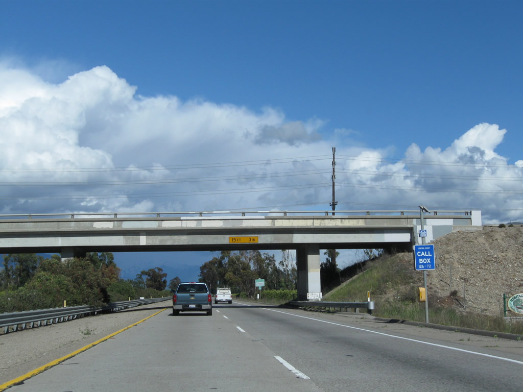
Eastbound California 126 (Santa Paula Freeway) reaches Exit 5, California 118 (Wells Road). Upon exiting, turn left for Wells Road north or right for California 118 east to Moorpark and Simi Valley. The section of California 118 between Saticoy and Moorpark is two lanes, but east of there California 118 becomes a full freeway. This sign, which dates to 1963, includes a very old design for a three-digit state route (note angled spade outline). Photos taken 02/26/11. |
|
An Exit 5 gore point sign is posted along eastbound California 126 at the off-ramp to California 118 and Wells Road. Photos taken 02/26/11. |
|
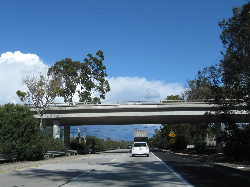
A California 126 east pull-through sign is posted on the Wells Road overpass. This sign is designed at the same time as the exit sign for Exit 5, and the California 126 shield again has the angles seen on the California 118 sign. Photos taken 02/26/11. |
|
This California 126 east reassurance shield is posted on Santa Paula Freeway after the on-ramp from Wells Road. Photo taken 02/26/11. |
|
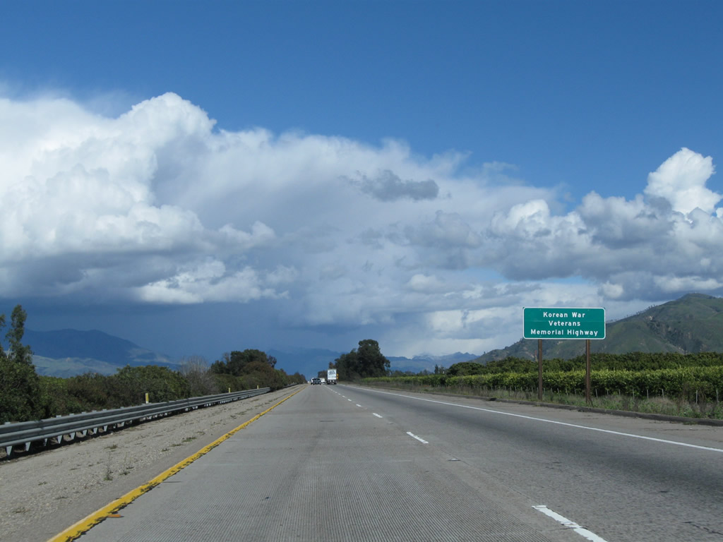
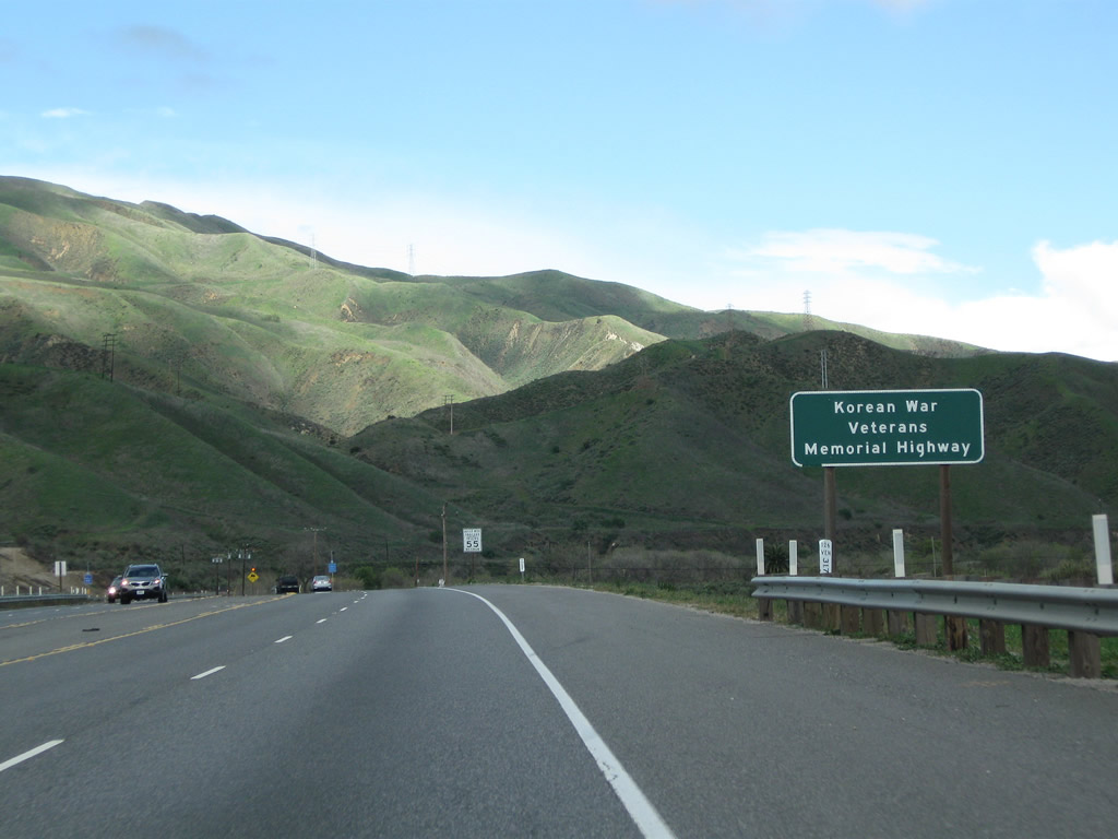
California 126 is also known as the Korean War Veterans Memorial Highway. Now, California 126 enters the fertile agricultural land of the Santa Clara River valley. Photo taken 02/26/11. |
|
California 126 passes under the Edwards Ranch Road overpass. Photo taken 02/26/11. |
|
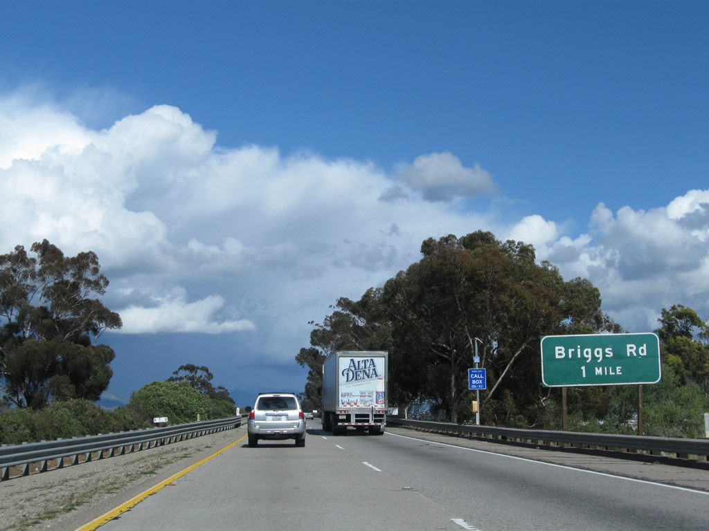
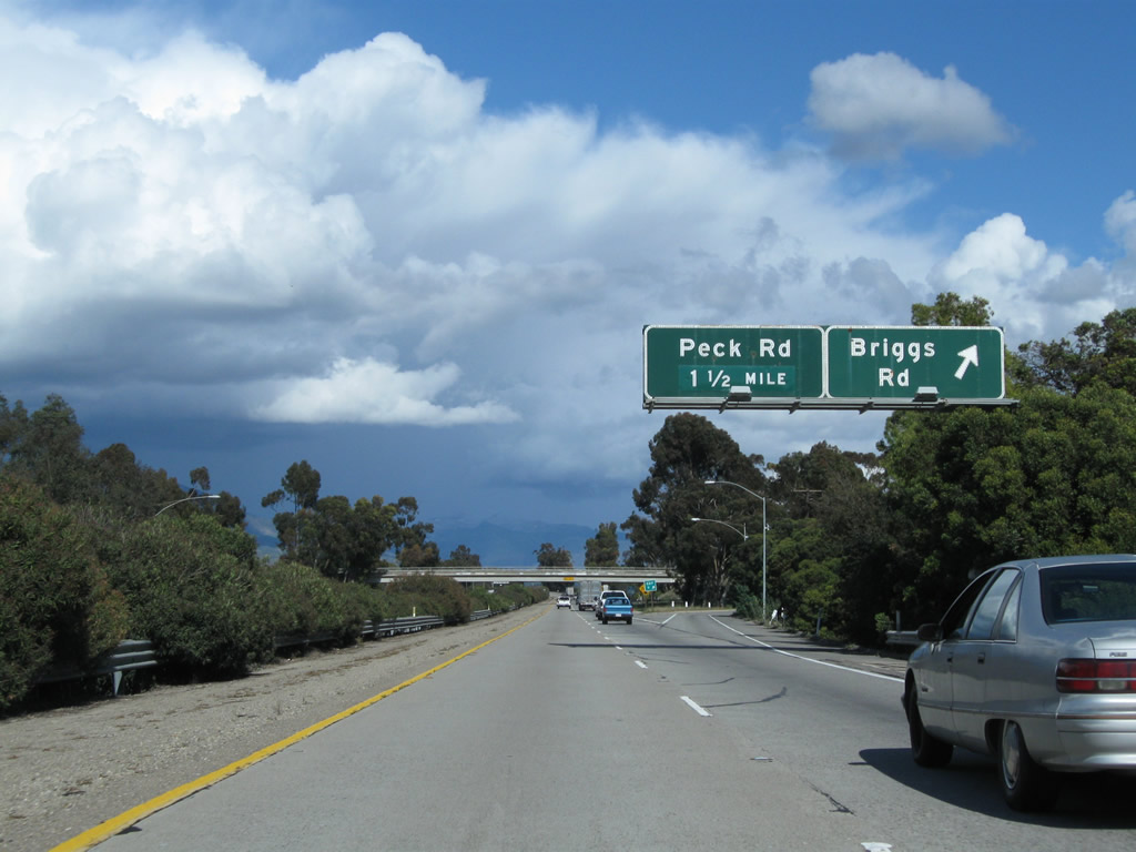
The next exit along California 126 (Santa Paula Freeway) east is Exit 9, Briggs Road (one mile). Photo taken 02/26/11. |
|
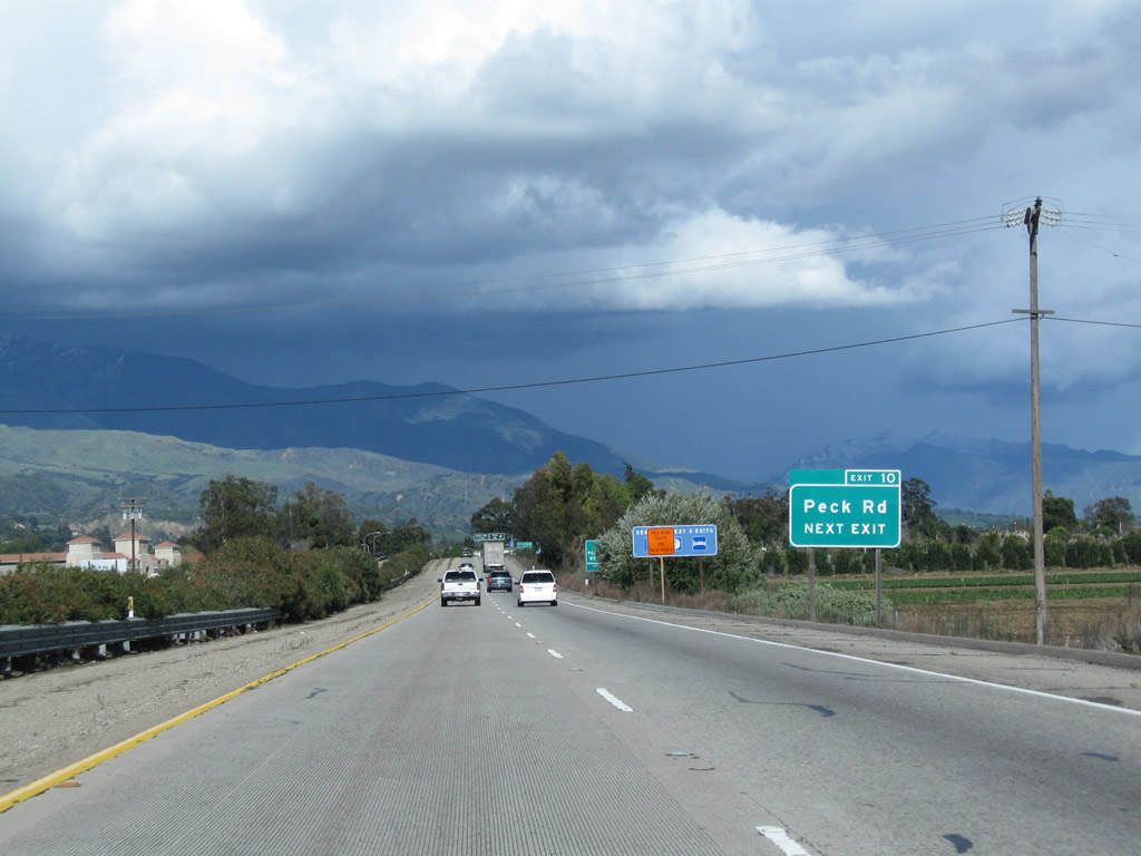
Eastbound California 126 (Santa Paula Freeway) reaches Exit 9, Briggs Road. The next exit is Exit 10, Peck Road. Photo taken 02/26/11. |
|
California 126 passes under Briggs Road. Photo taken 02/26/11. |
|
This California 126 east reassurance shield is posted on Santa Paula Freeway after the on-ramp from Briggs Road. Photo taken 02/26/11. |
|
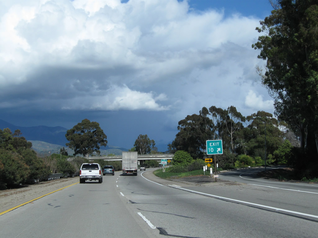
A roadside sign for Exit 10 provides the exit number and distance to Peck Road on California 126 east. Photo taken 02/26/11. |
|
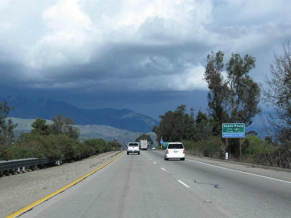
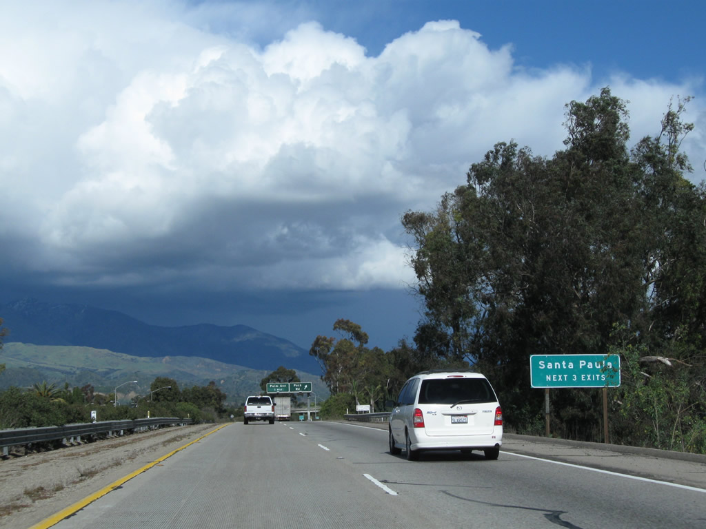
California 126 enters the city of Santa Paula, the "Citrus Capital of the World." Its population was 28,598 as of the 2000 Census. It was incorporated on April 22, 1902. In addition to its location amid valuable farmland and orchards, Santa Paula is also notable as the original corporate headquarters for Union Oil Company of California (referred to as Unocal and incorporated on October 17, 1890). The original building for Unocal now houses the California Oil Museum. Photo taken 02/26/11. |
|
The next three exits along California 126 (Santa Paula Freeway) east serve the city of Santa Paula: Exit 10, Peck Road; Exit 11, Palm Avenue; and Exit 12, California 150 (Tenth Street) to historic downtown Santa Paula. Photo taken 02/26/11. |
|
Eastbound California 126 (Santa Paula Freeway) reaches Exit 10, Peck Road. The next exit along eastbound is Exit 11, Palm Avenue. Photo taken 02/26/11. |
|
The exit ramp from California 126 (Santa Paula Freeway) east to Peck Road is a loop ramp located after the Peck Road overpass. Photo taken 02/26/11. |
|
This California 126 east reassurance shield is posted on Santa Paula Freeway after the on-ramp from Peck Road. Photo taken 02/26/11. |
|
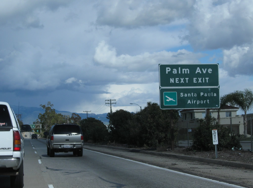
The next exit along California 126 east is Exit 11, Palm Avenue. Between Palm Avenue and Tenth Street, the Santa Paula Airport is located along the south side of California 126. Photo taken 02/26/11. |
|
Eastbound California 126 (Santa Paula Freeway) reaches Exit 11, Palm Avenue to the Santa Paula Airport. Photo taken 02/26/11. |
|
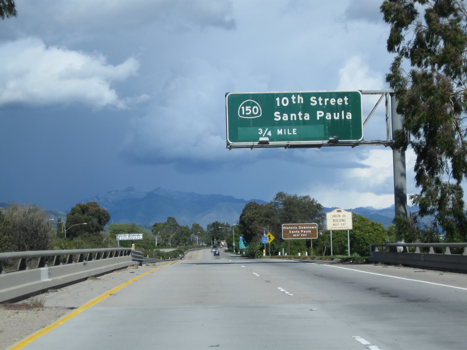
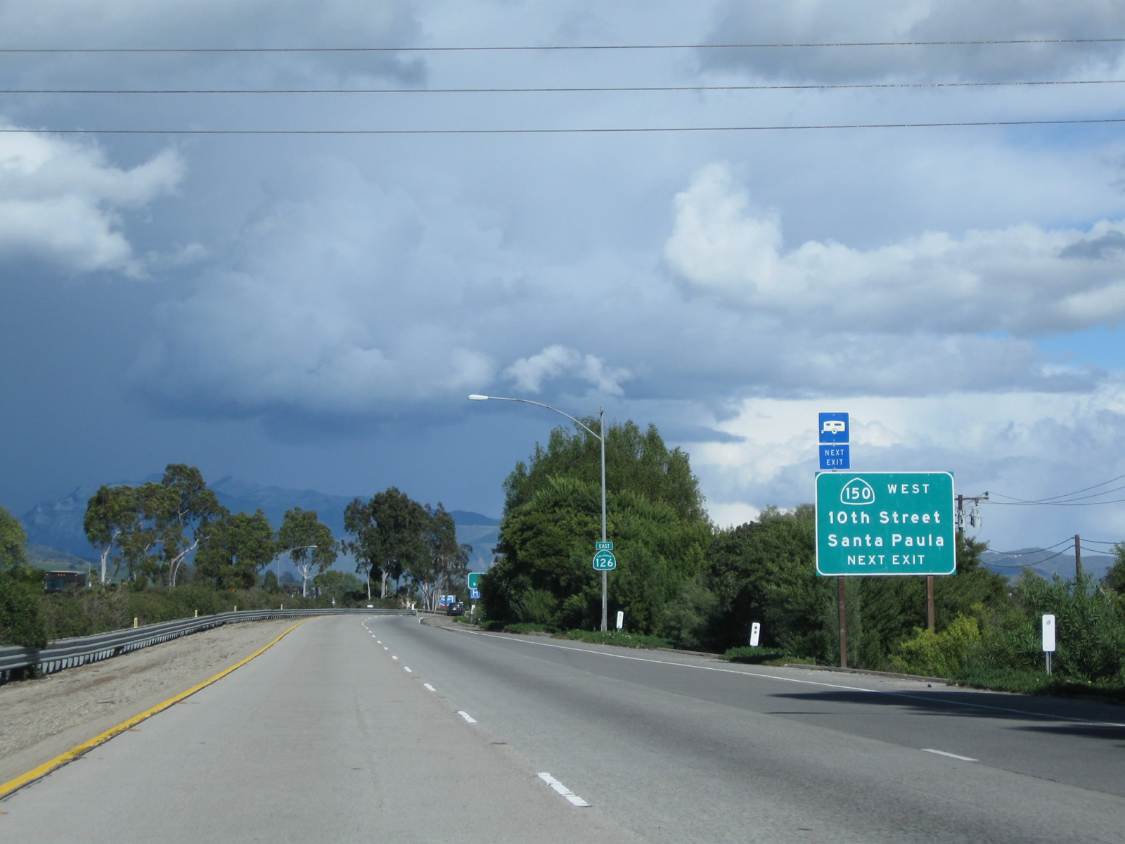
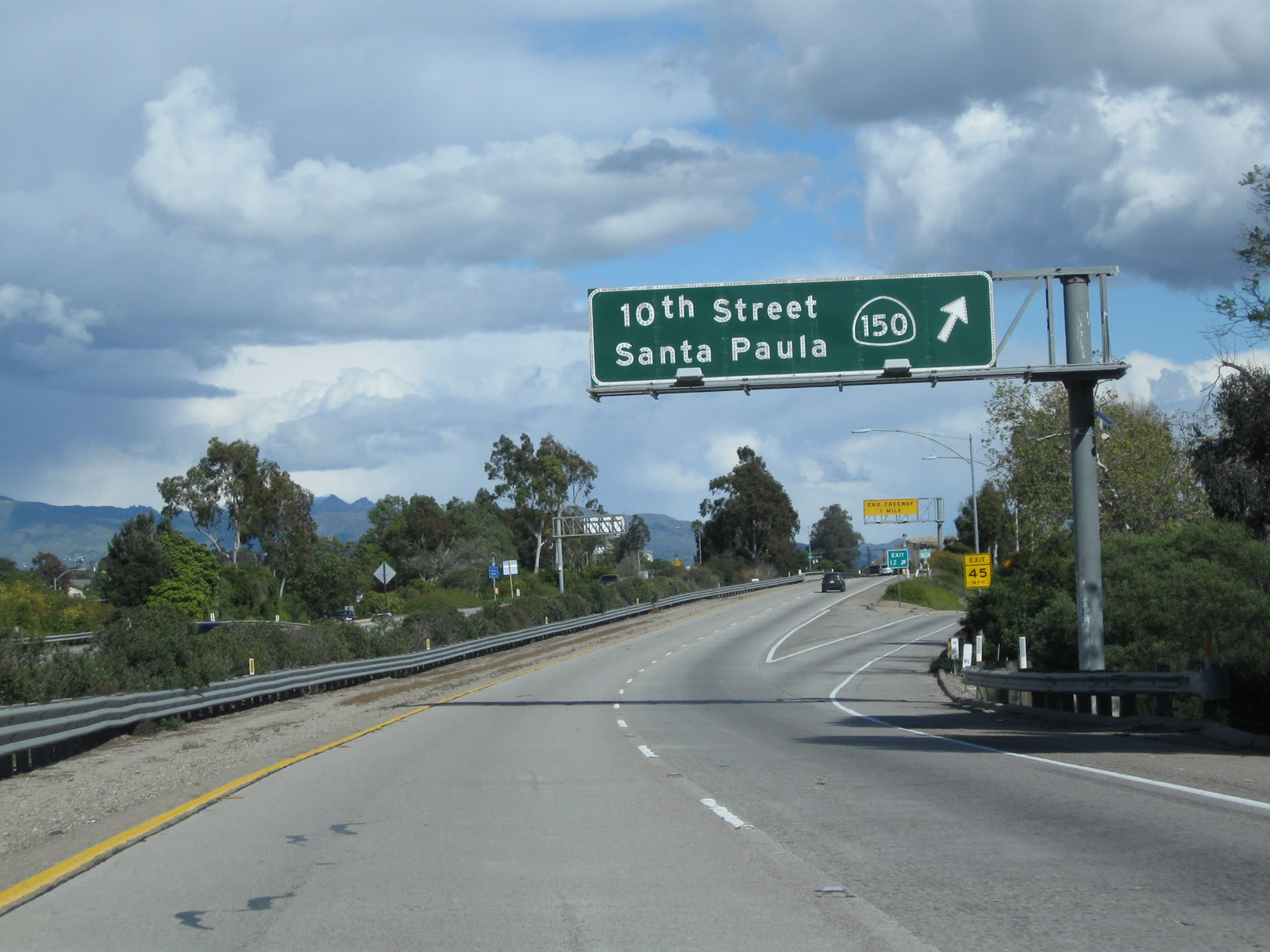
The next exit along California 126 (Santa Paula Freeway) east is Exit 12, California 150 (Tenth Street) to historic downtown Santa Paula. Photo taken 02/26/11. |
|
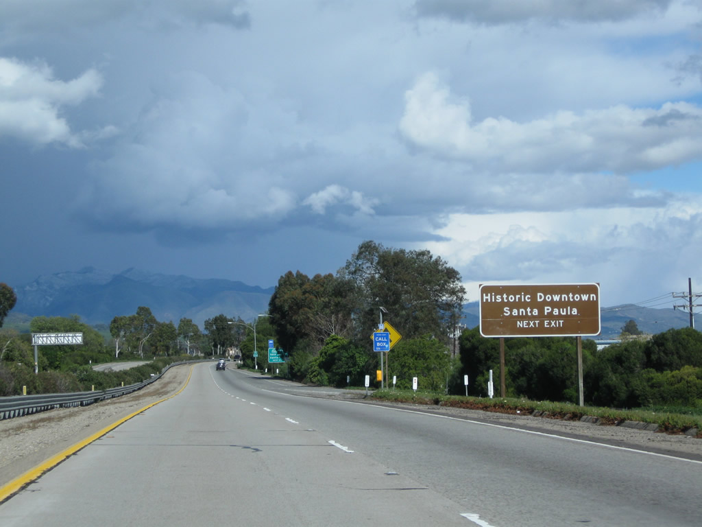
The Santa Paula Historic District incorporates downtown Santa Paula near the intersection of California 150 (Tenth Street) and Main Street (Historic California 126). Photo taken 02/26/11. |
|
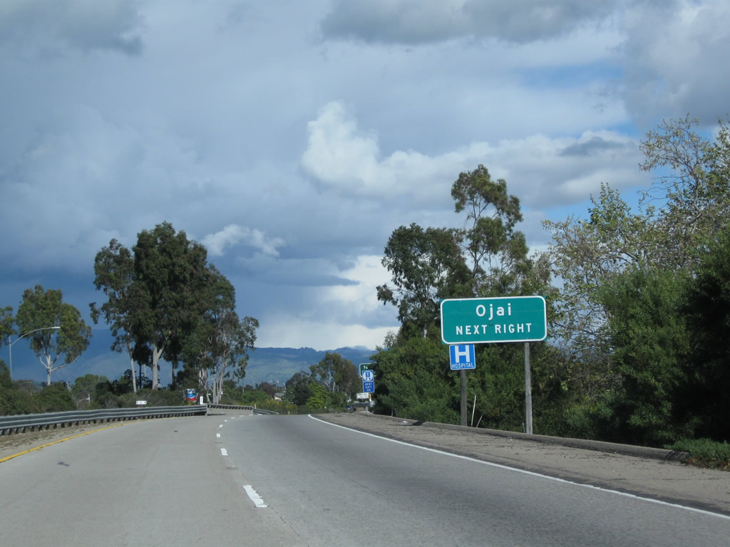
The final exit along California 126 (Santa Paula Freeway) east is Exit 12, California 150 (Tenth Street). California 150 is a looping route that extends from California 126 in Santa Paula northwest to Ojai, then curves west to meet U.S. 101 in western Santa Barbara County. Much of this route is a winding, two-lane highway that travels through the foothills. Photo taken 02/26/11. |
|
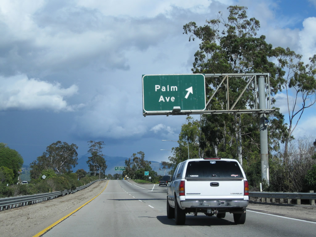
A California 126 east reassurance shield is posted after the on-ramp from Palm Avenue. Photo taken 02/26/11. |
|
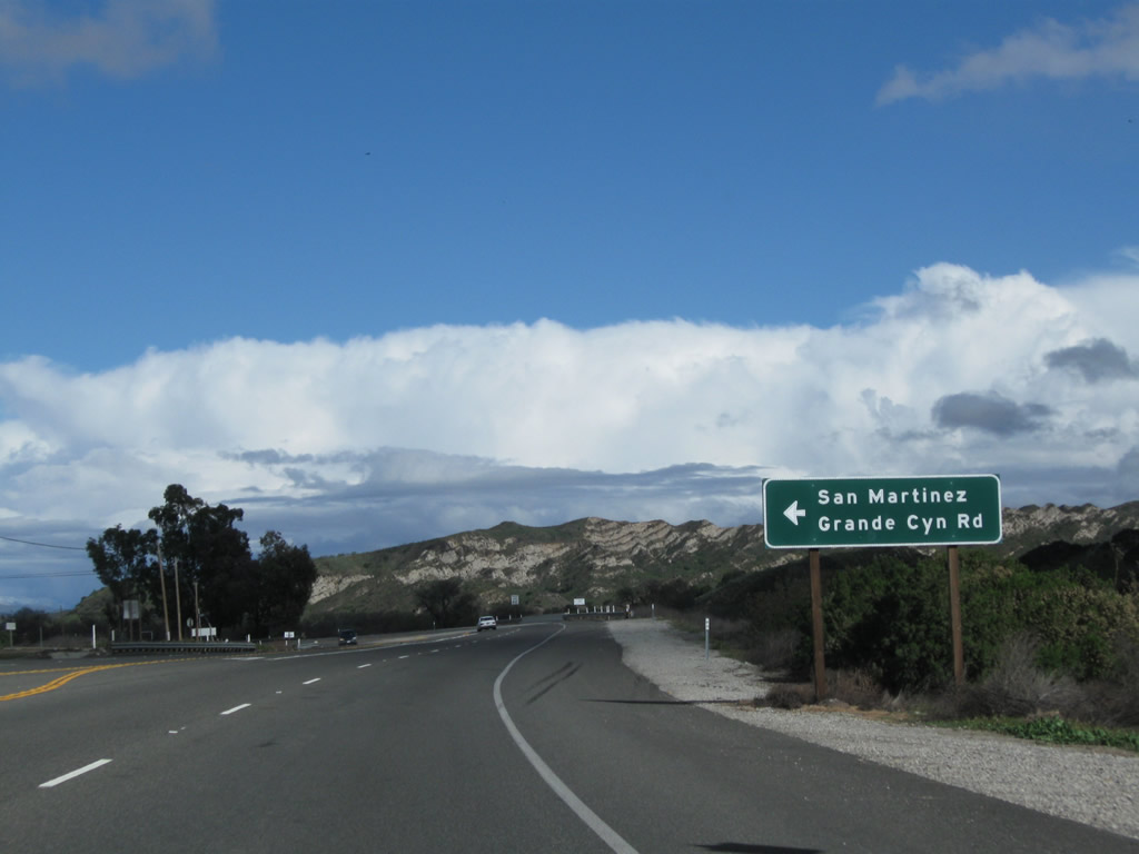
Use California 150 northwest to Ojai. Photo taken 02/26/11. |
|
Eastbound California 126 (Santa Paula Freeway) meets Exit 12, California 150 (Tenth Street) to historic downtown Santa Paula. Use Exit 12 to the California Oil Museum at the original Unocal building. Photo taken 02/26/11. |
|
Exit 12 is posted at the gore point for the connection to California 150. Photo taken 02/26/11. |
|
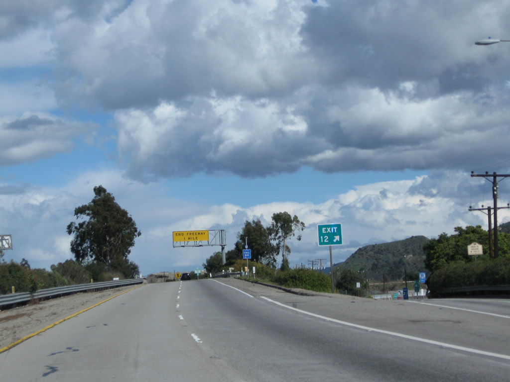
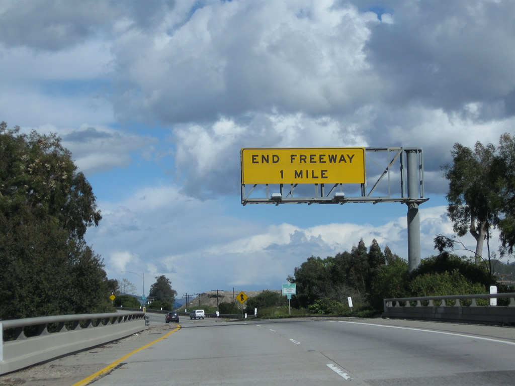
While passing over California 150 (Tenth Street), an end freeway yellow sign is posted over the eastbound lanes of the California 126 freeway. Photo taken 02/26/11. |
|
A California 126 east reassurance shield is posted after the on-ramp from California 150 (Tenth Street). Photo taken 02/26/11. |
|
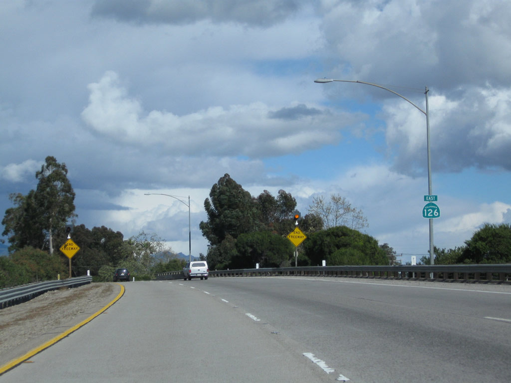
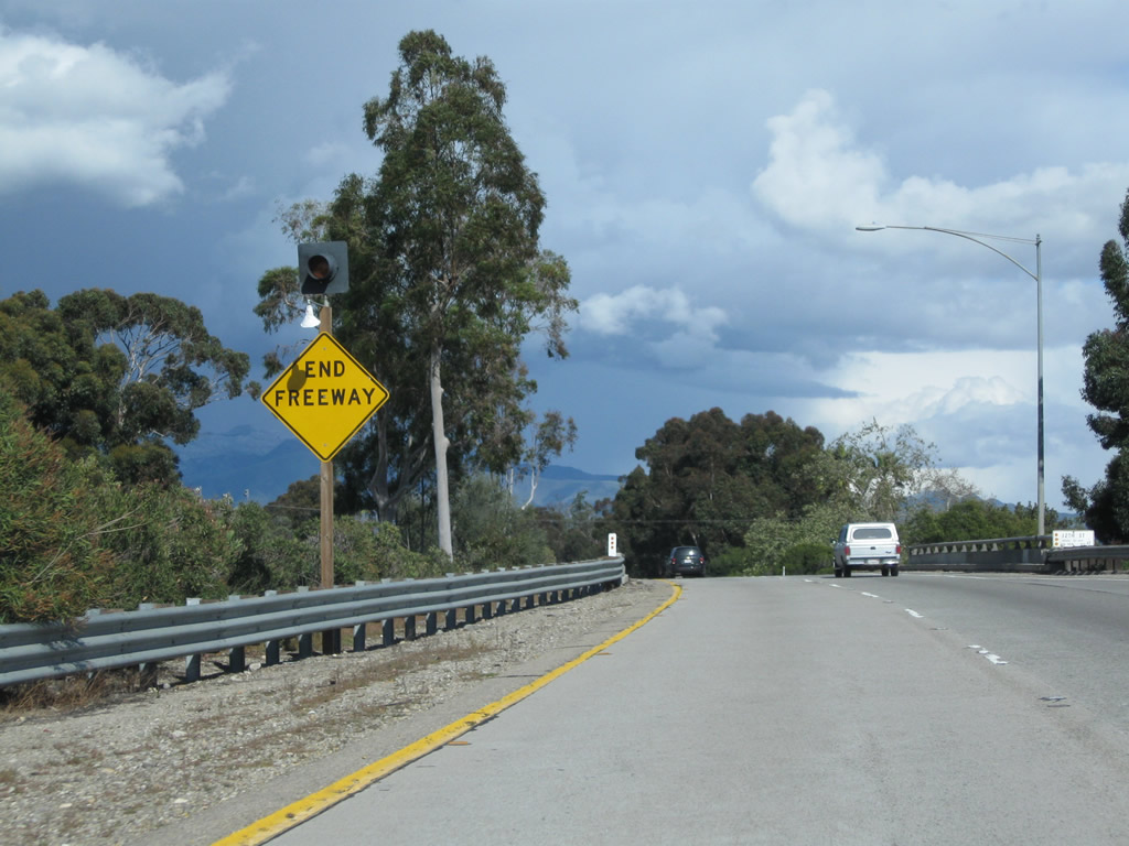
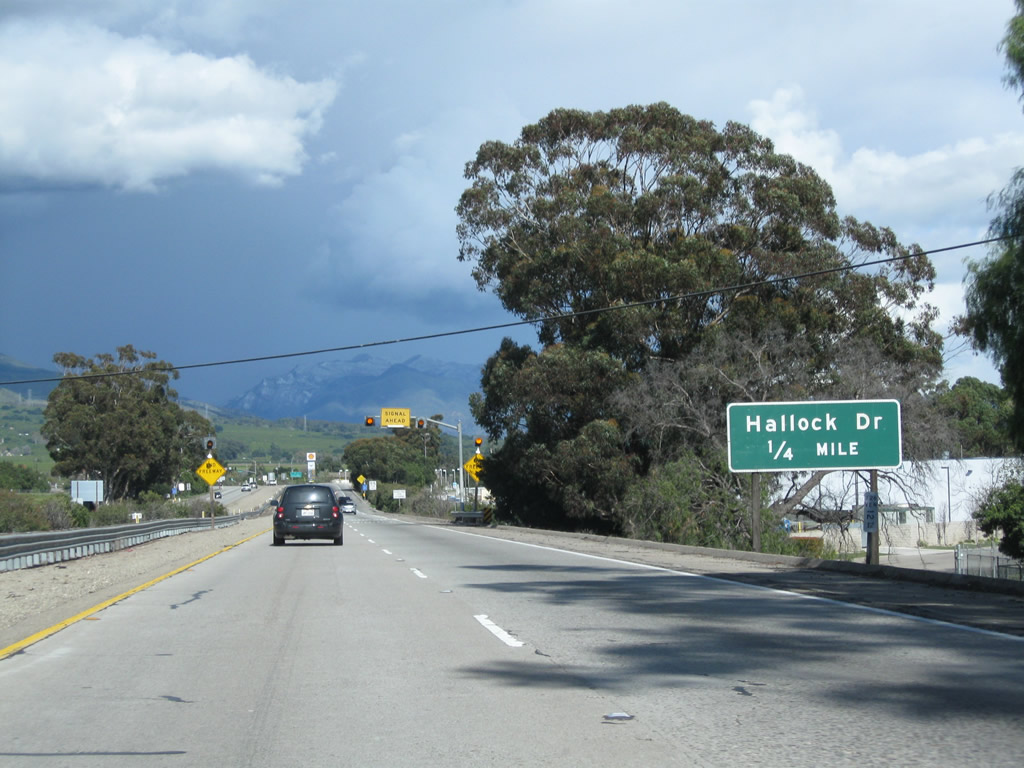
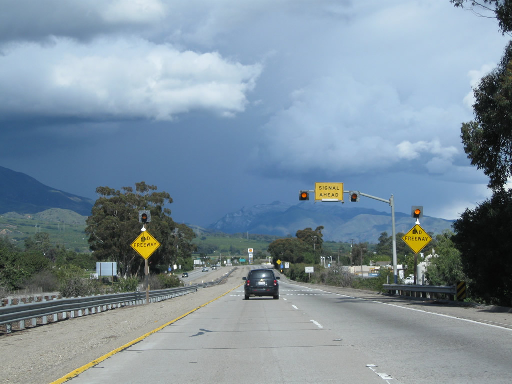
An end freeway warning sign is posted shortly thereafter. Ahead, California 126 will meet Hallock Drive at a traffic signal. Photo taken 02/26/11. |
|
Another end freeway warning sign is posted. Photo taken 02/26/11. |
|
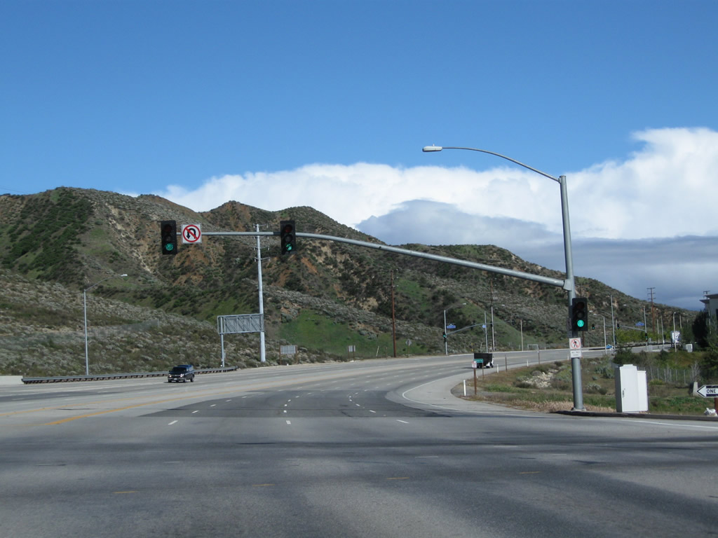
The first traffic signal along California 126 east is with Hallock Drive (0.25 mile). This would be Exit 13 if an interchange were built here. This is the final connection to Santa Paula. Photo taken 02/26/11. |
|
|
|
The freeway comes to a close at Hallock Drive, but California 126 continues as Telegraph Road, a four-lane expressway (excepting the route through Fillmore, which is a city arterial street). Photo taken 02/26/11. |
|
After the Hallock Drive intersection, California 126 becomes Telegraph Road. For the first time, California 126 intersects the Fillmore and Western Railway, which follows the Santa Clara River through the Heritage Valley. Photo taken 02/26/11. |
|
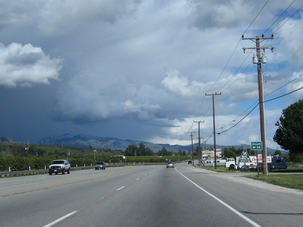
Eastbound California 126 (Telegraph Road) approaches Orcutt Road (next left). Photo taken 02/26/11. |
|
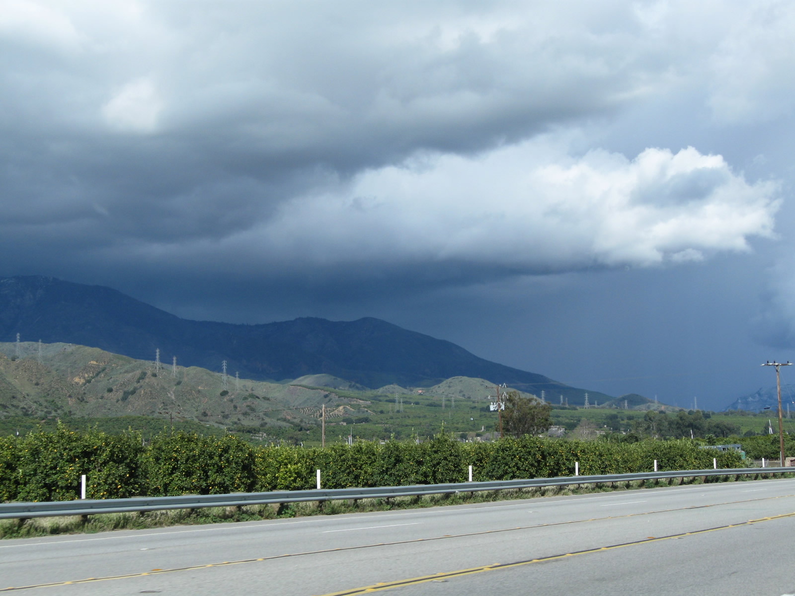
This view looks northeast toward the foothills that follow California 126 as it proceeds east along the Santa Clara River valley. Photo taken 02/26/11. |
|
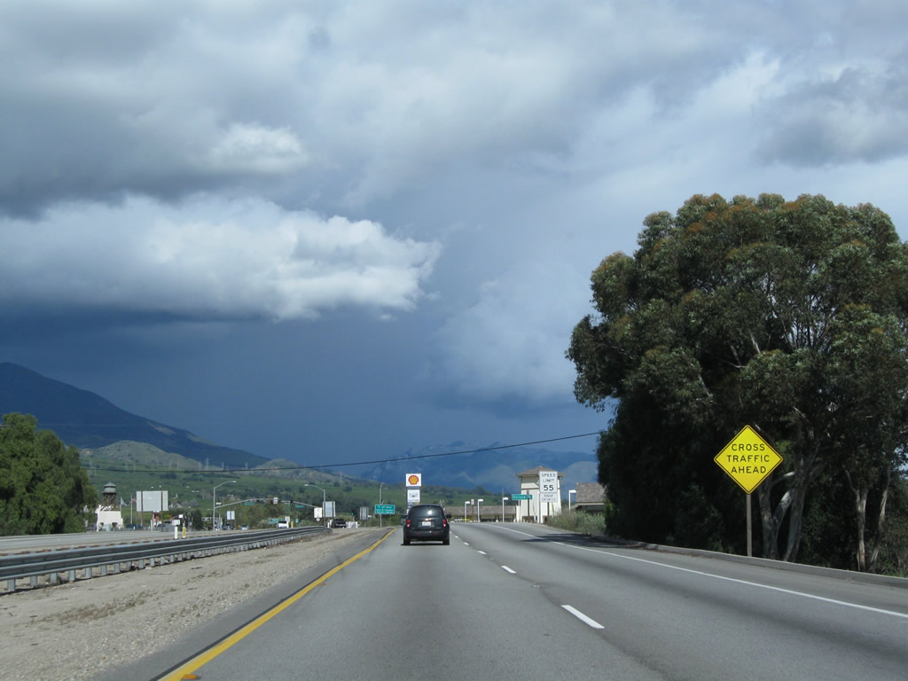
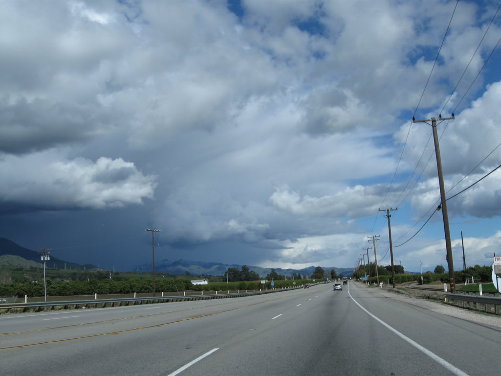
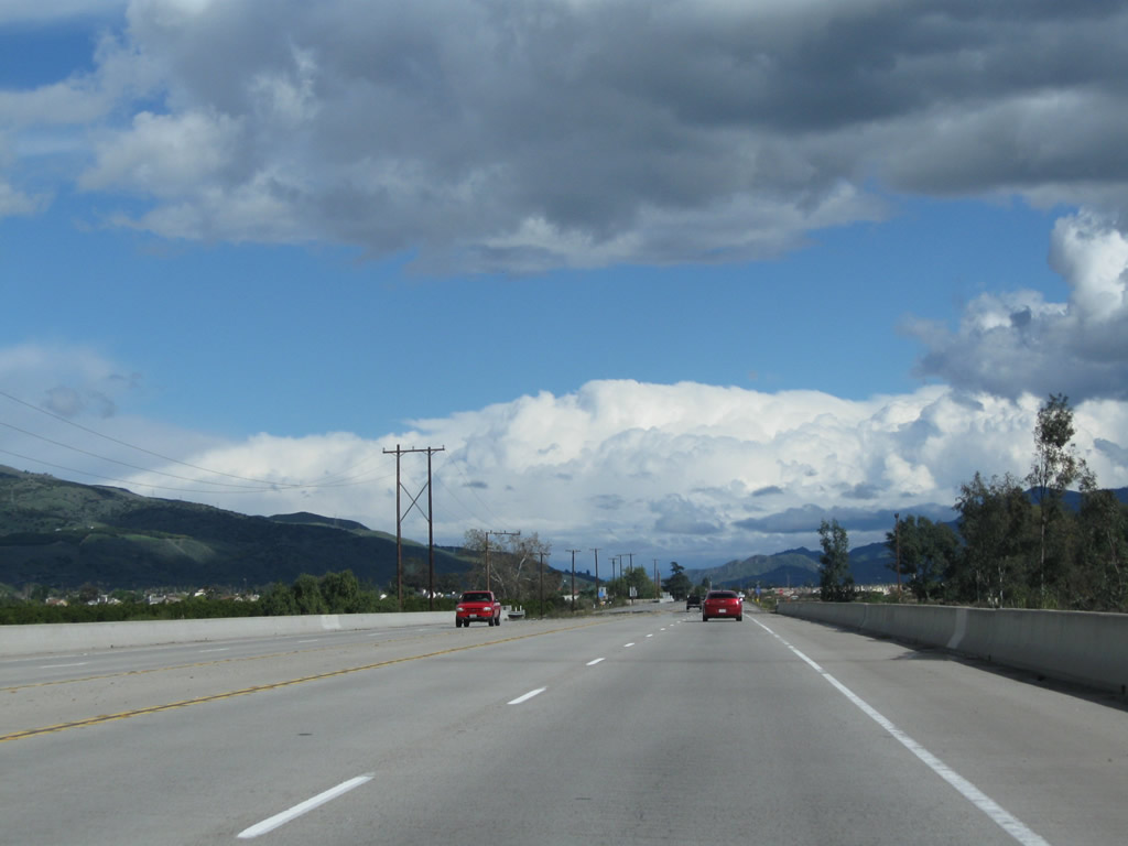
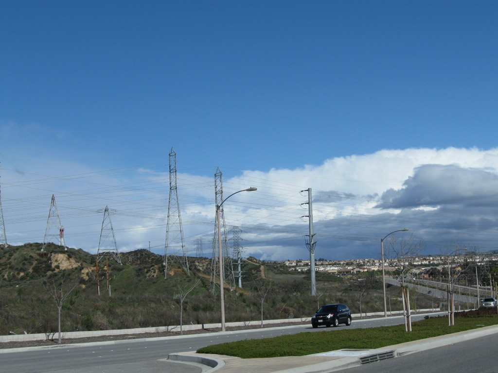
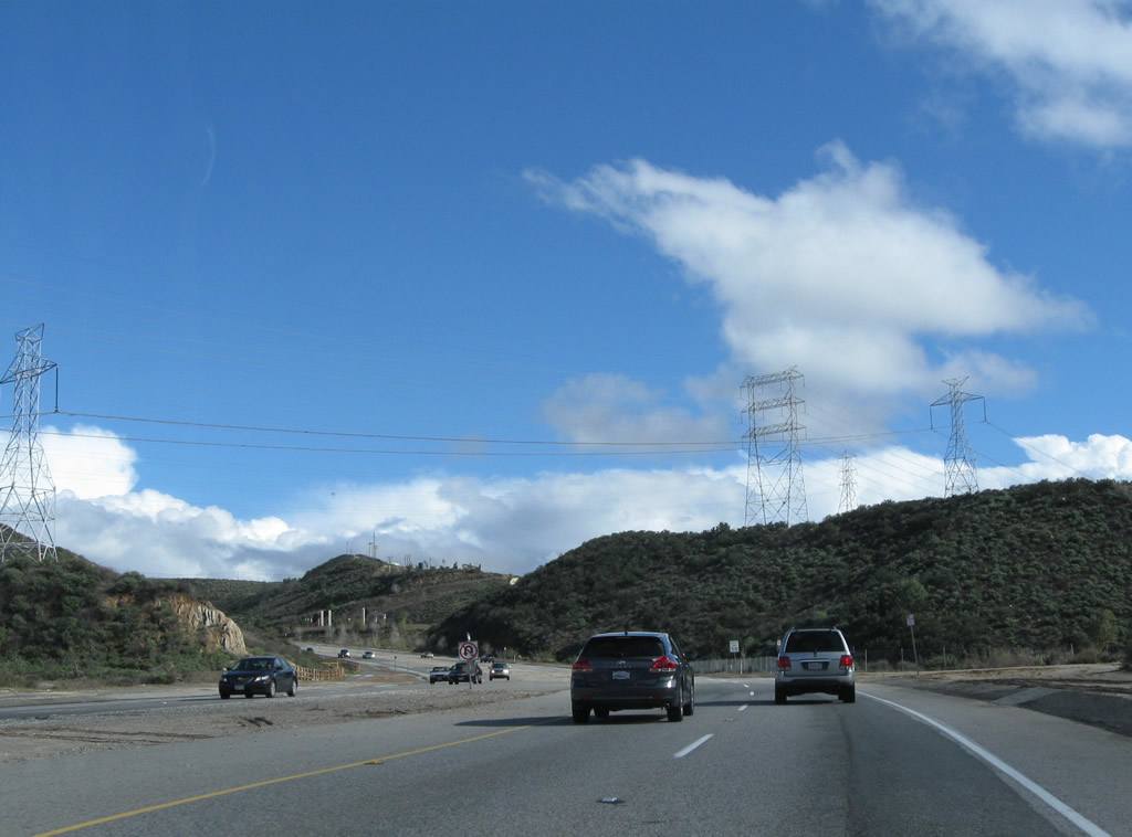
California 126 continues with two lanes in each direction. The area between Santa Paula and Santa Clarita along the Santa Clara River is known as Heritage Valley. Photo taken 02/26/11. |
|
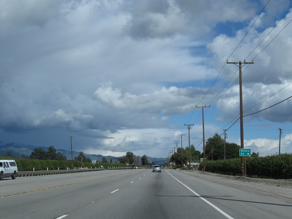
Eastbound California 126 approaches Willard Road. Photo taken 02/26/11. |
|
Citrus orchards line both sides of California 126. Photo taken 02/26/11. |
|
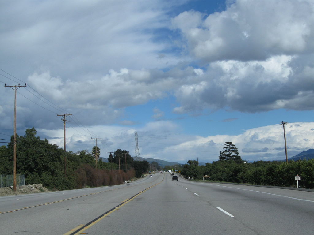
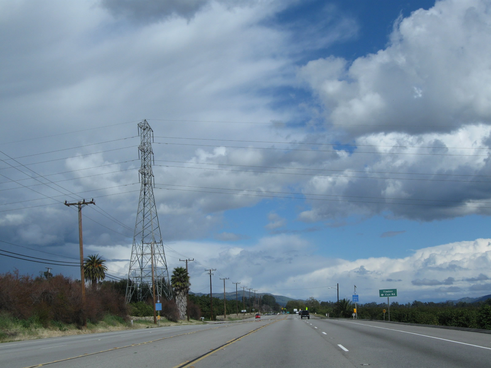
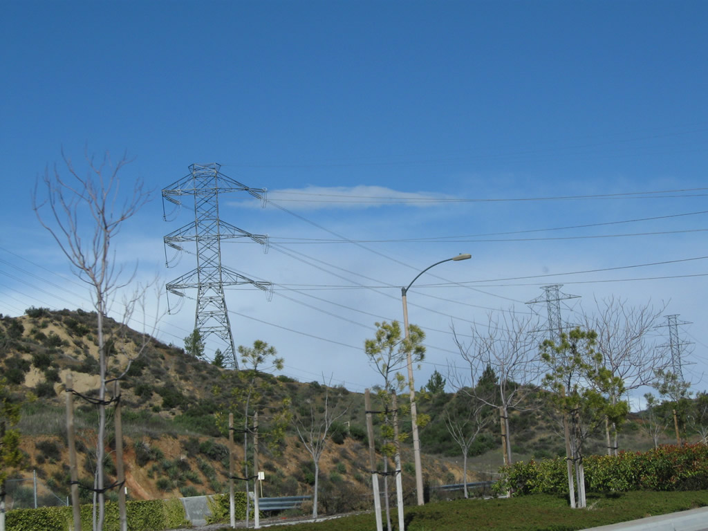
Eastbound California 126 approaches Timber Canyon Road. A Southern California Edison power line crosses overhead Photo taken 02/26/11. |
|
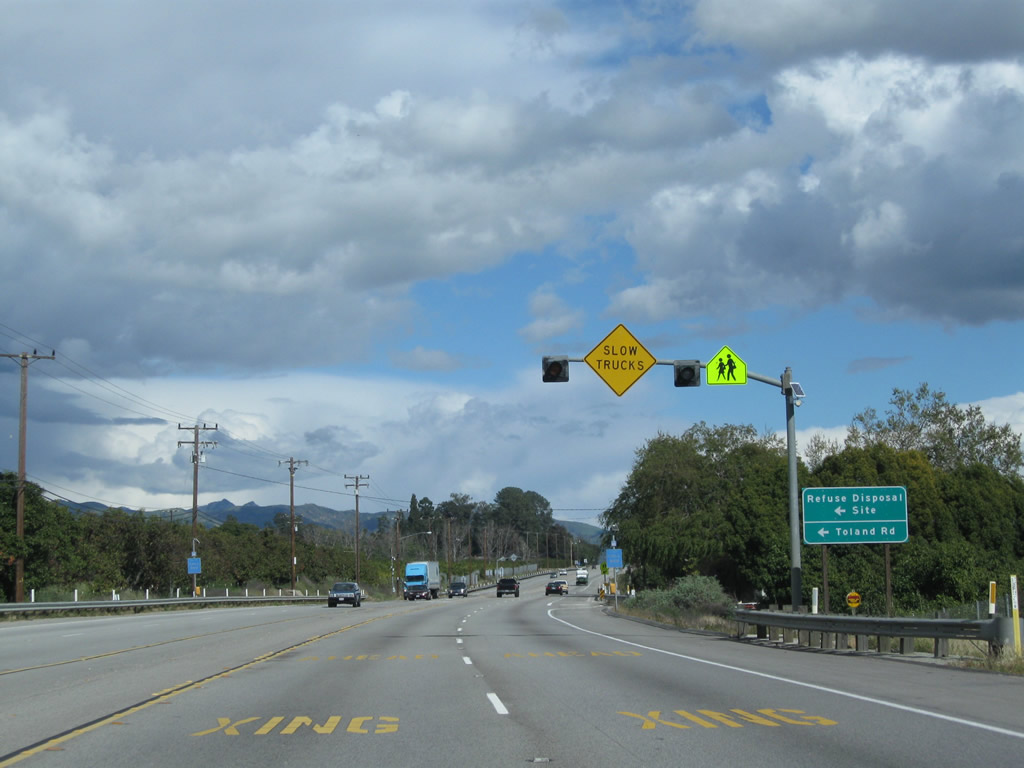
The next major intersection along California 126 east is with Toland Road. Photo taken 02/26/11. |
|
A mileage sign provides the distance to Fillmore (five miles), Piru (12 miles), and Santa Clarita (24 miles). Photo taken 02/26/11. |
|
California 126 again crosses the Fillmore and Western Railway. Photo taken 02/26/11. |
|
Eucalyptus trees line the north side of California 126. Photo taken 02/26/11. |
|
More eucalyptus trees line California 126 on the right side of the highway. Photo taken 02/26/11. |
|
|
|
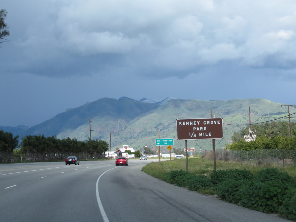
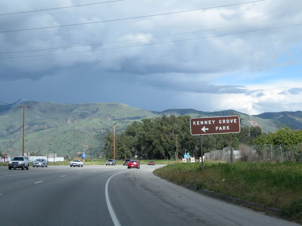
Eastbound California 126 (Telegraph Road) approaches Old Telegraph Road, which is the original alignment of California 126 into Fillmore. Turn left here to Kenney Grove Park. Photos taken 02/26/11. |
|
A California 126 east reassurance shield is posted shortly thereafter. Photo taken 02/26/11. |
|
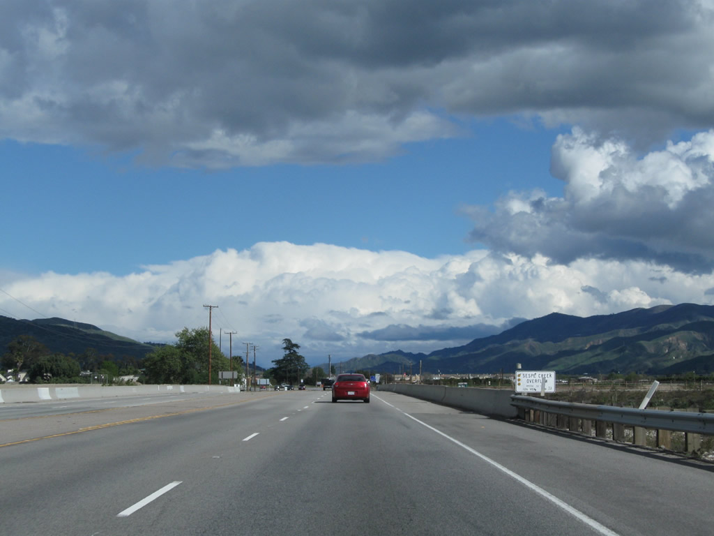
California 126 crosses Sespe Creek. Photo taken 02/26/11. |
|
A second bridge carries California 126 over the Sespe Creek overflow. Photo taken 02/26/11. |
|
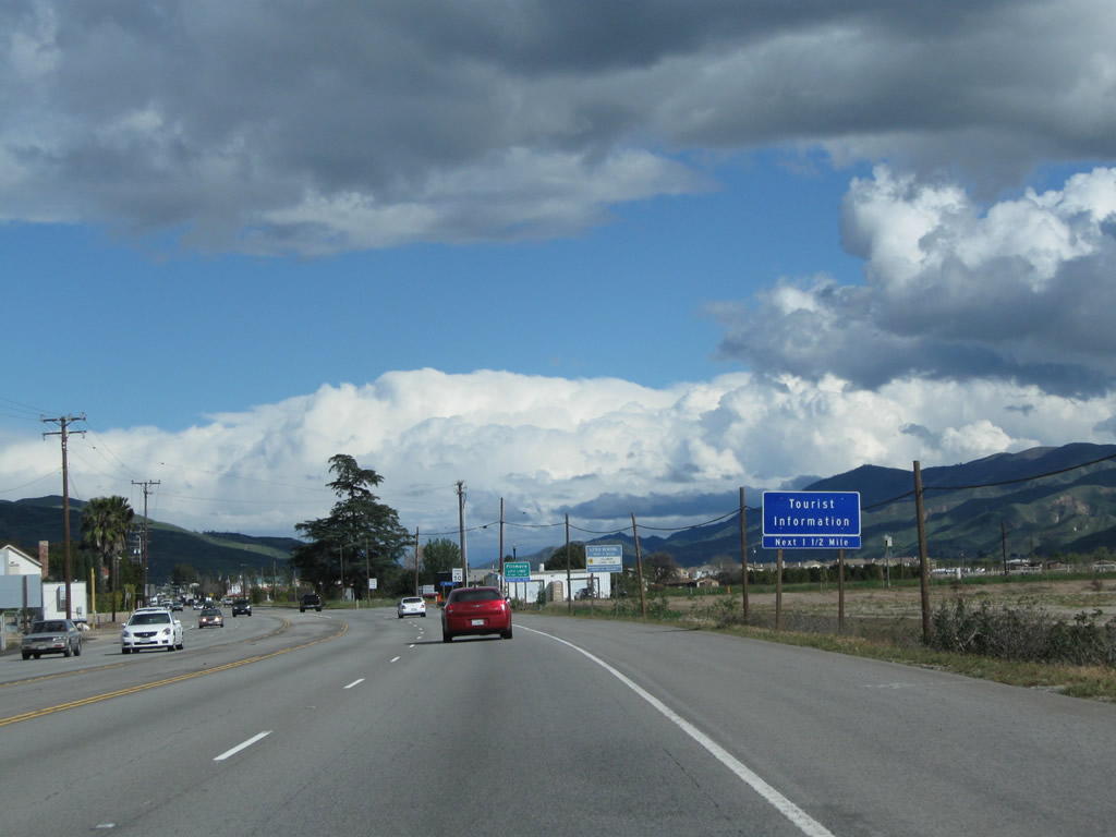
As we approach Fillmore, a tourist information center is available 1.50 miles ahead on California 126 east. Photo taken 02/26/11. |
|
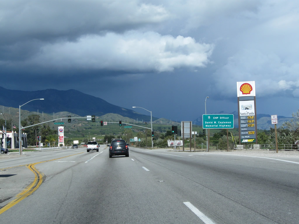
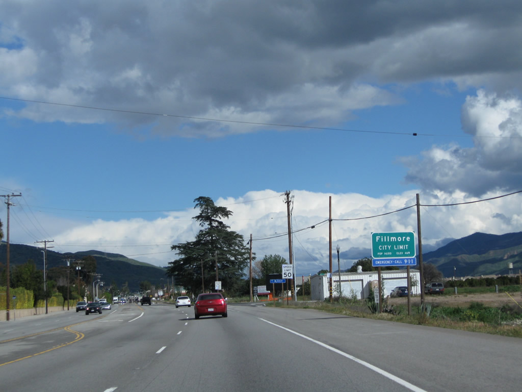
California 126 enters the city of Fillmore and prepares the cross over the Santa Clara River. Fillmore, the "Last Best Small Town," is situated at the intersection of California 23 and California 126. The population of Fillmore was 13,643 as of the 2000 Census. The city was incorporated on July 10, 1914. Photo taken 02/26/11. |
|
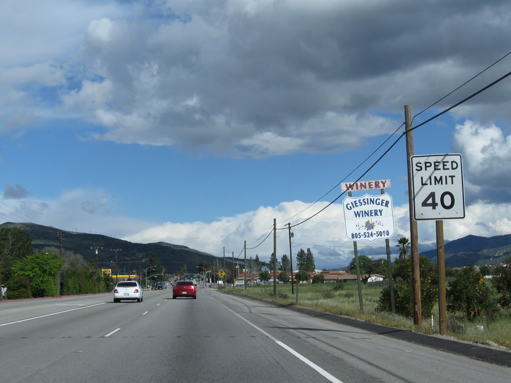
The speed limit reduces as California 126 shifts from an expressway configuration to an arterial city street. Photo taken 02/26/11. |
|
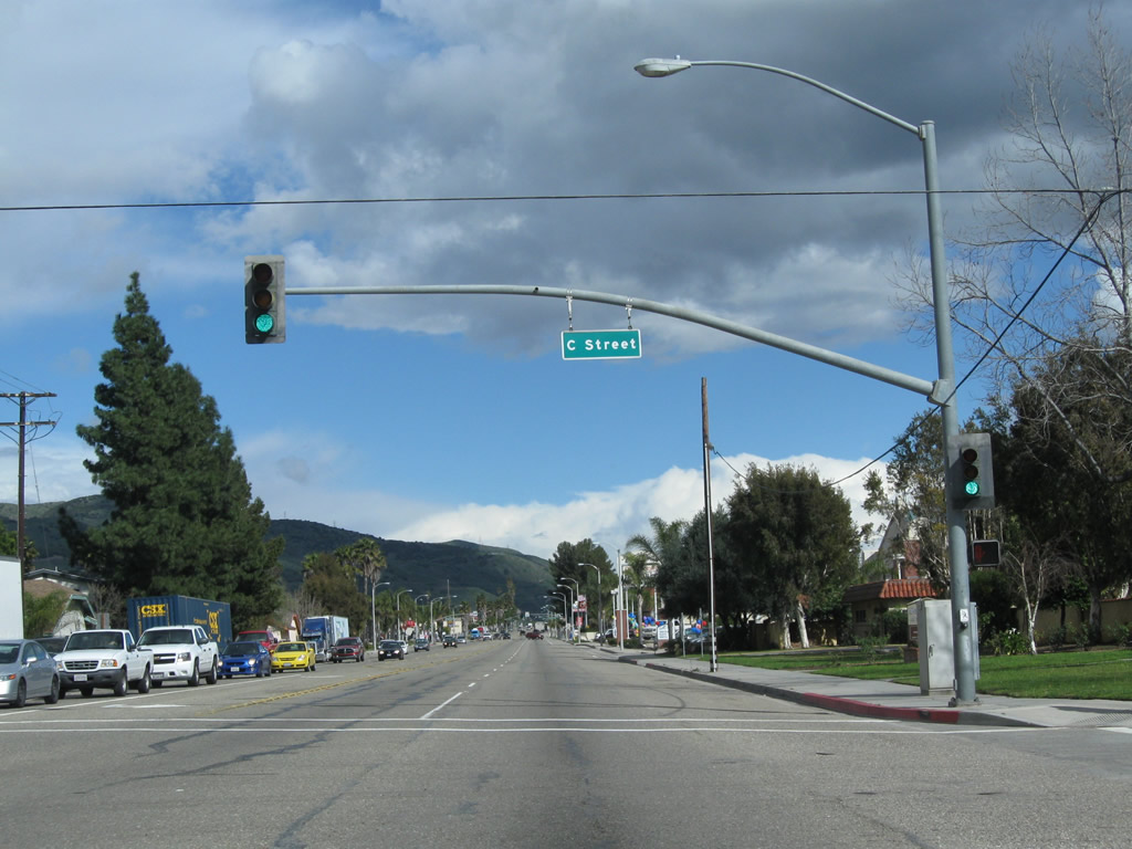
California 126 approaches its first traffic signal in Fillmore at C Street. Through Fillmore, California 126 is known as Ventura Street, but is called Telegraph Road outside of city limits. Photo taken 02/26/11. |
|
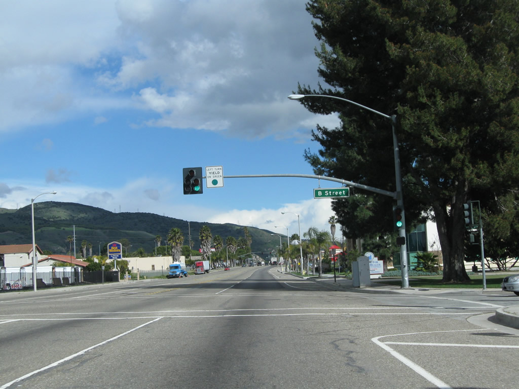
Eastbound California 126 next approaches B Street. Photo taken 02/26/11. |
|
California 126 east meets B Street. Photo taken 02/26/11. |
|
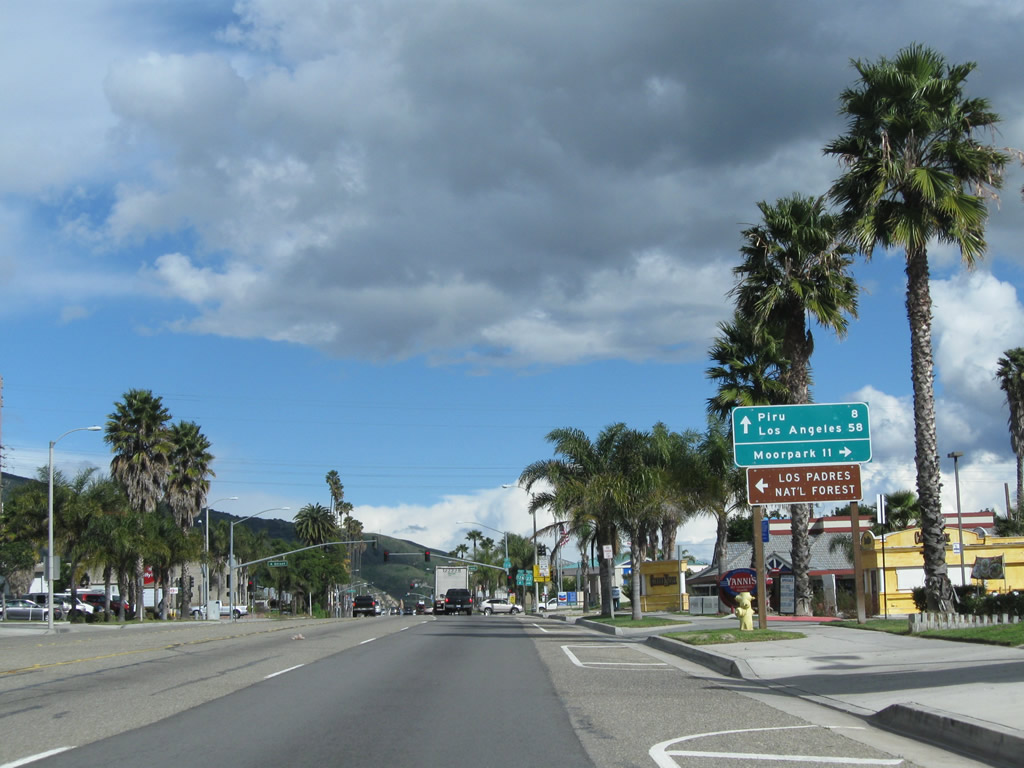
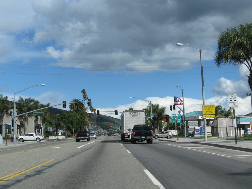
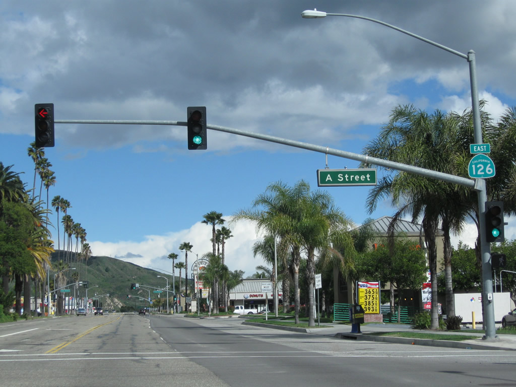
The next major intersection along California 126 east is with California 23 (A Street). Turn right (south) on California 23 to Moorpark and Thousand Oaks. Photo taken 02/26/11. |
|
California 23 travels south to Moorpark, but the section through Grimes Canyon and the uphill grade is winding and twisting. As a result, the highway is not recommended for trucks. Photo taken 02/26/11. |
|
Eastbound California 126 meets California 23 (A Street). This intersection marks the northern terminus of California 23. Photo taken 02/26/11. |
|
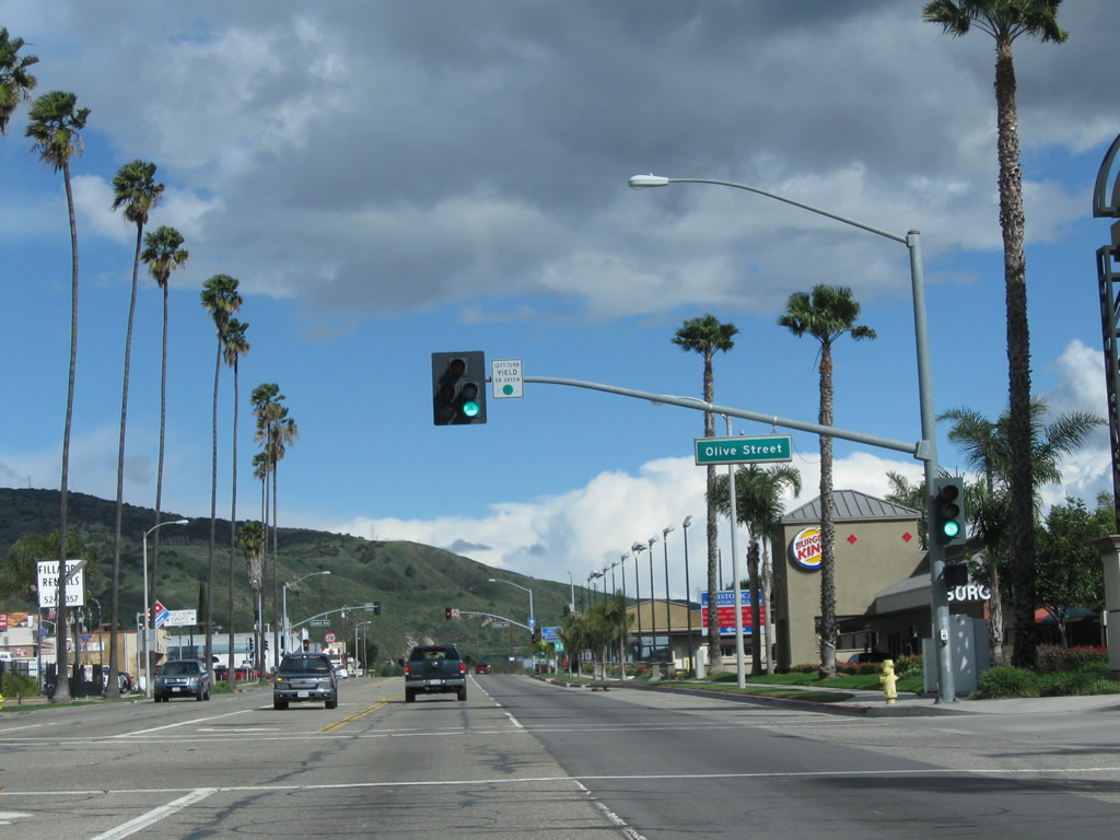
Proceeding east, California 126 approaches Oliver Street at this signalized intersection. Photo taken 02/26/11. |
|
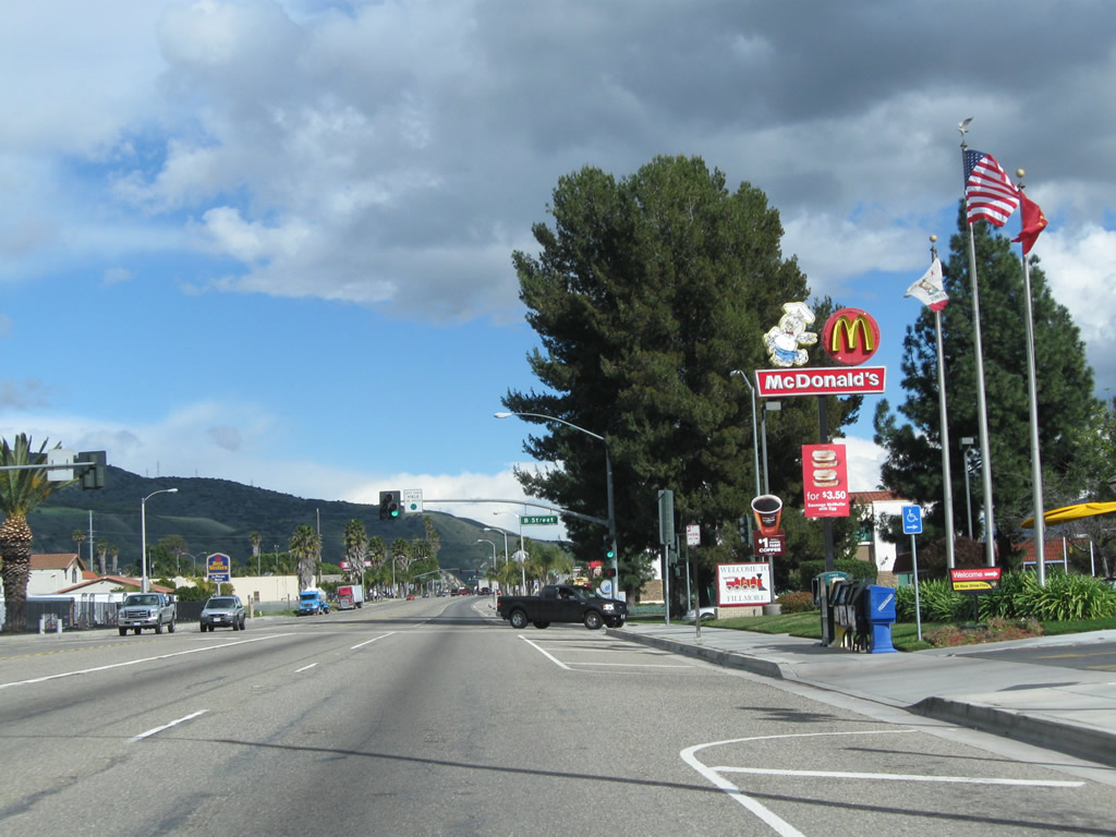
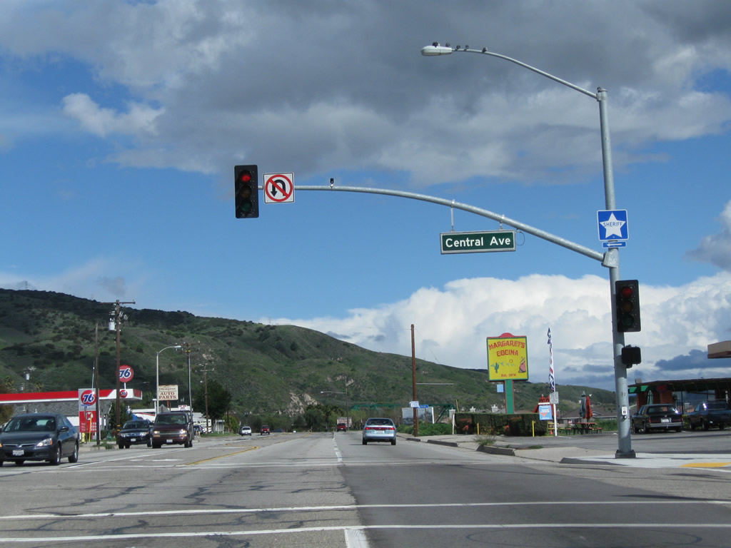
The final signalized intersection in Fillmore along California 126 east is with Central Avenue. Turn left here to downtown Fillmore. Ahead, California 126 will reenter rural areas en route to Piru and Santa Clarita. Photo taken 02/26/11. |
|
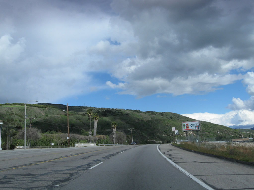
California 126 resumes with an expressway configuration as it leaves Fillmore. Photo taken 02/26/11. |
|
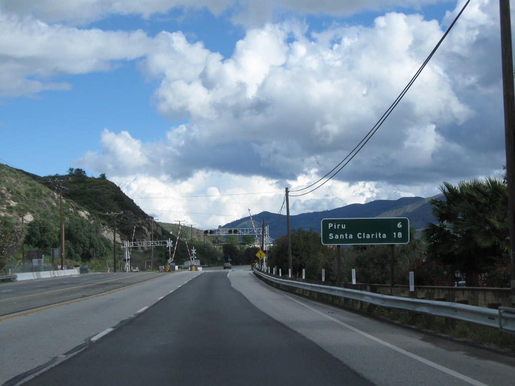
This mileage sign along California 126 east provides the distance to Piru (six miles) and Santa Clarita (18 miles). The highway again crosses the Fillmore & Western Railway. Photo taken 02/26/11. |
|
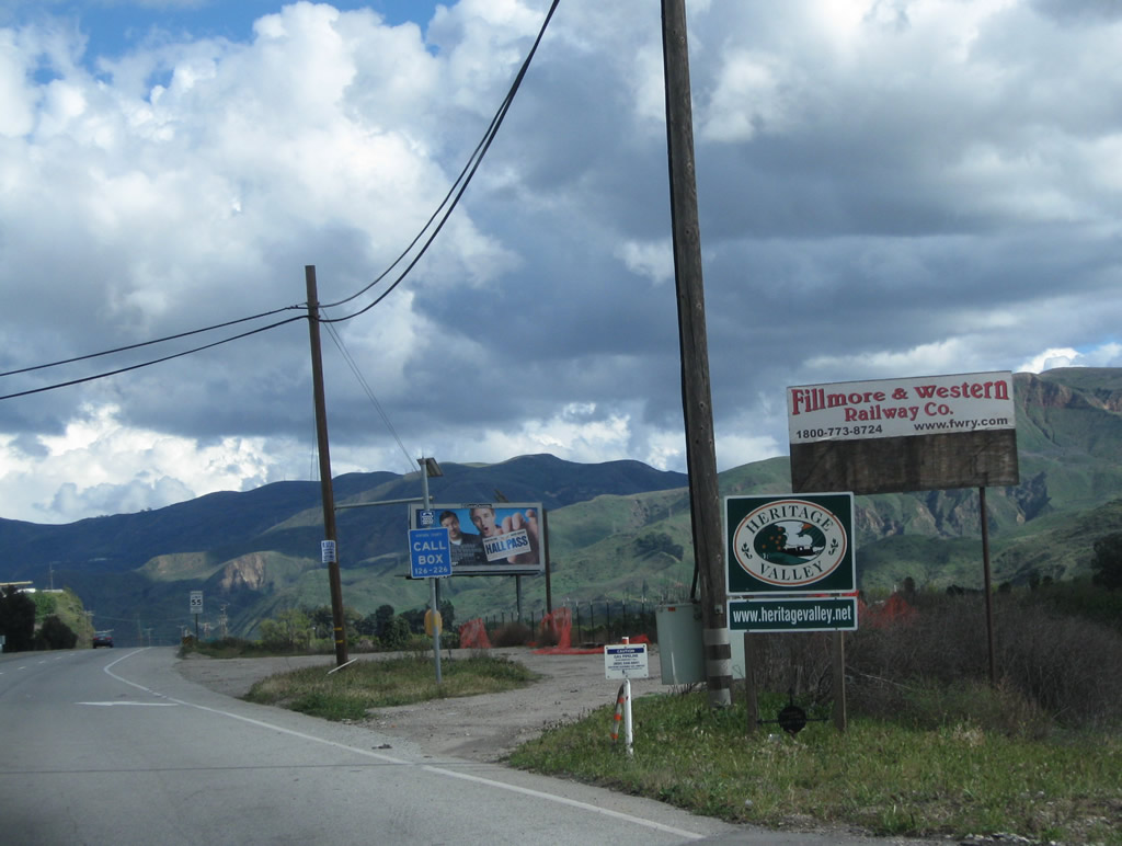
A Fillmore & Western Railway sign is posted after the railroad crossing. Photo taken 02/26/11. |
|
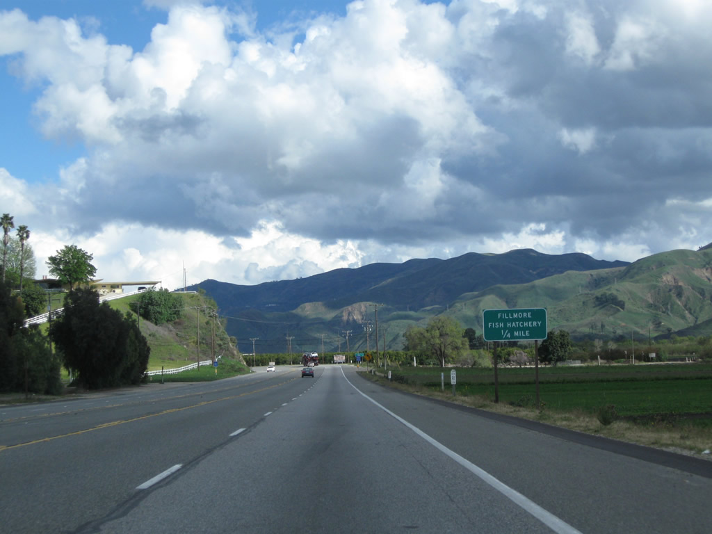
The next right from California 126 east connects to the Fillmore Fish Hatchery. Photo taken 02/26/11. |
|
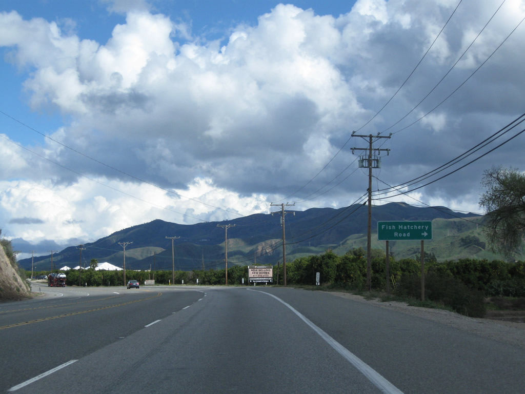
Eastbound California 126 (Telegraph Road) meets Fish Hatchery Road. Photo taken 02/26/11. |
|
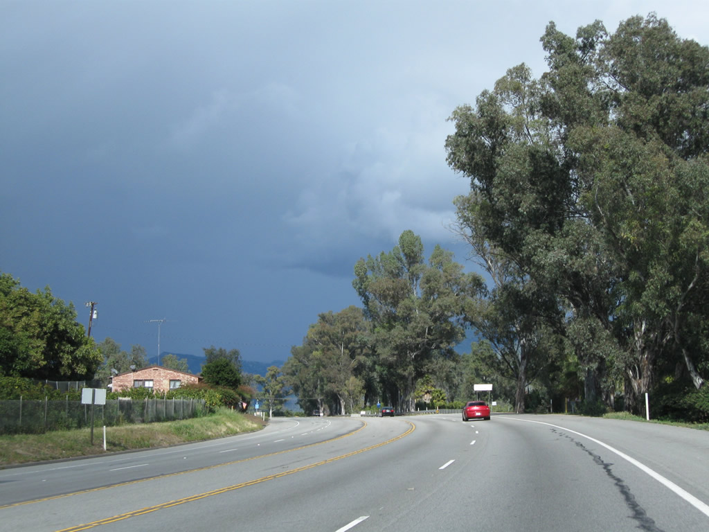
California 126 proceeds east through the fertile Santa Clara River valley. Orchards, vineyards, and ranches line both sides of the state route. Photo taken 02/26/11. |
|
Eastbound California 126 (Telegraph Road) approaches Hopper Canyon Road. Photo taken 02/26/11. |
|
After crossing the Fillmore & Western Railway again, California 126 (Telegraph Road) approaches Powell Road, Pacific Avenue, and Howe Road. Photo taken 02/26/11. |
|
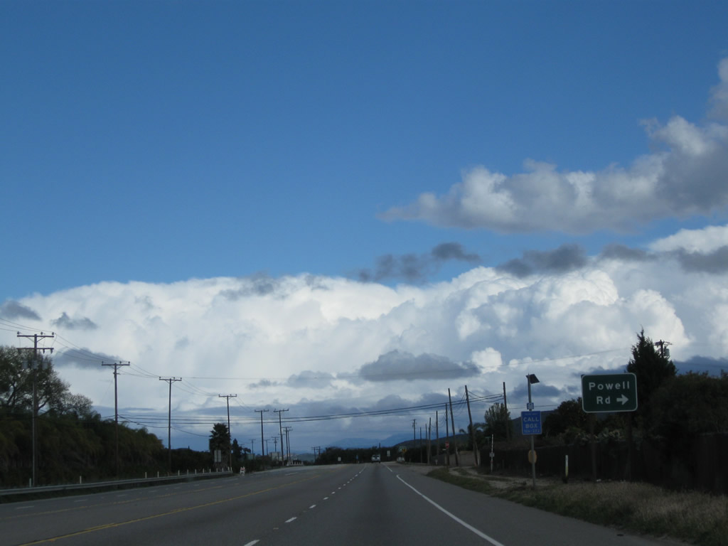
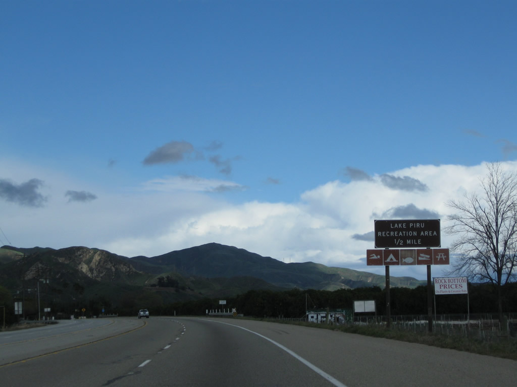
Eastbound California 126 (Telegraph Road) approaches the unincorporated community of Piru and Main Street (next traffic signal in one-half mile). Turn left (north) on Main Street to Lake Piru Recreation Area. Photo taken 02/26/11. |
|
|
|
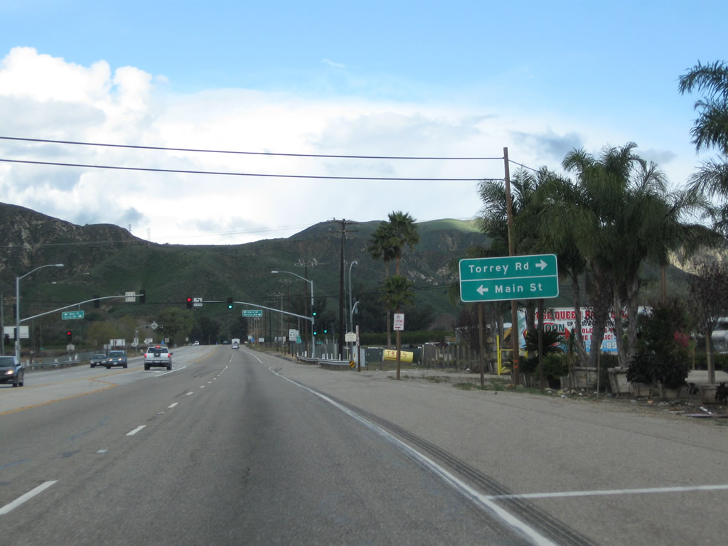
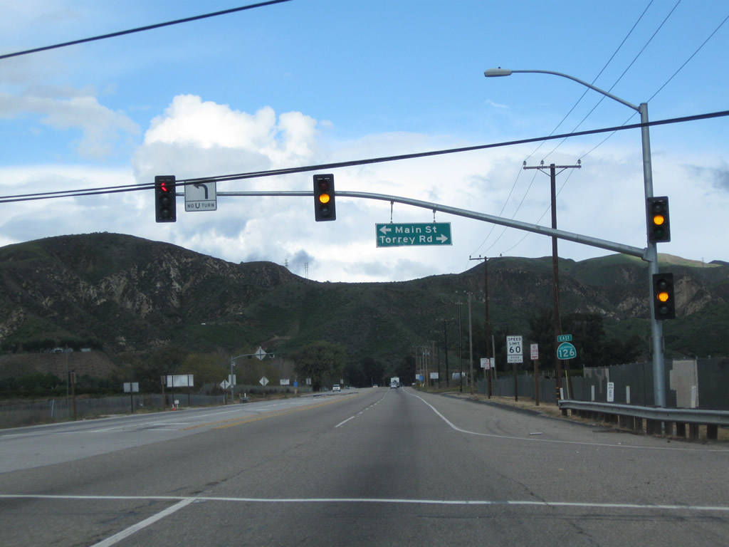
The next traffic signal connects California 126 with Main Street north to Piru and Torrey Road south. A California 126 east reassurance shield is posted after the traffic signal. Photos taken 02/26/11. |
|
California 126 passes over Piru Creek, a major tributary to the Santa Clara River. Photo taken 02/26/11. |
|
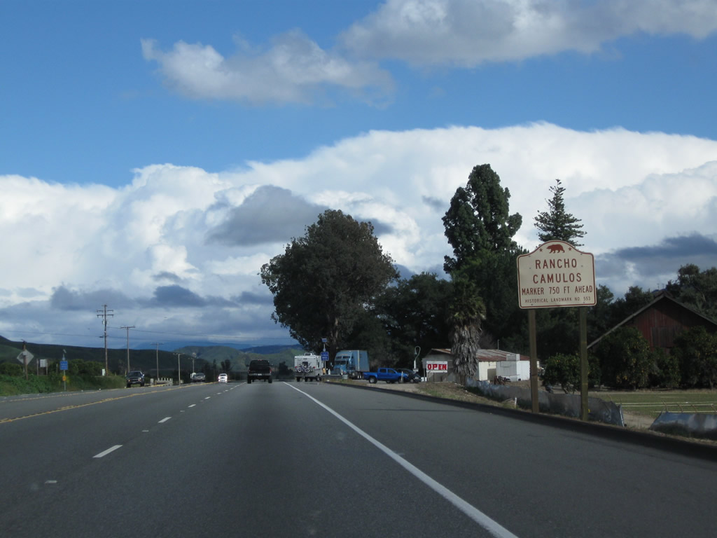
Continuing east, California 126 approaches a historic marker for Rancho Camulos ahead on the right side. Photo taken 02/26/11. |
|
Once again California 126 enters rural country with limited development. Another sign reminds us that California 126 is the Korean War Veterans Memorial Highway. Photo taken 02/26/11. |
|
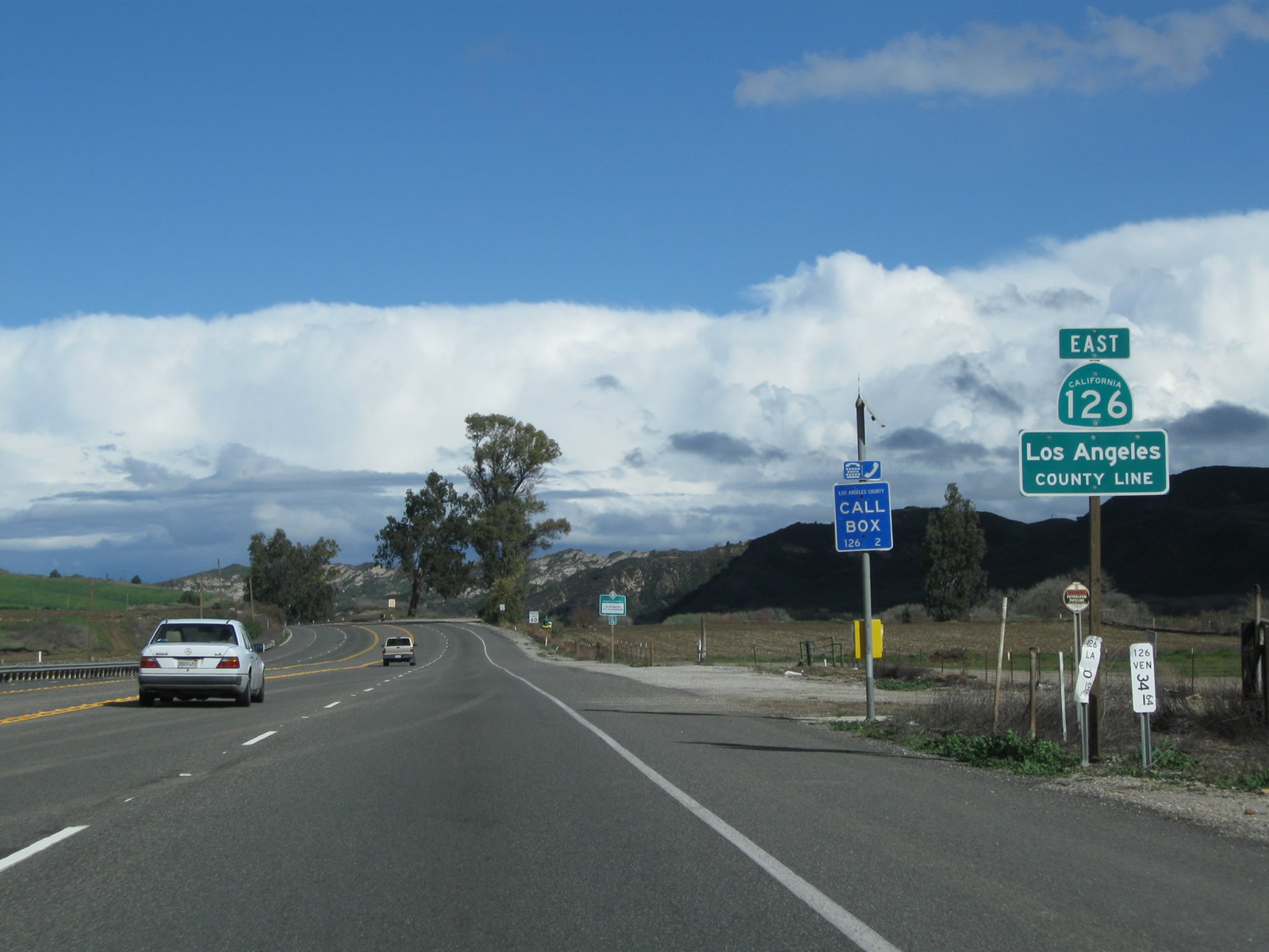
Three miles further east, California 126 leaves Ventura County at Postmile 34.64 and enters Los Angeles County at Postmile 0.00. Only six miles remain for California 126 before meeting Interstate 5 (Golden State Freeway). Photo taken 02/26/11. |
|
California 126 becomes Henry Mayo Drive once in Los Angeles County. Photo taken 02/26/11. |
|
|
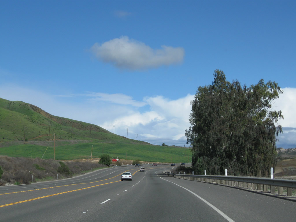
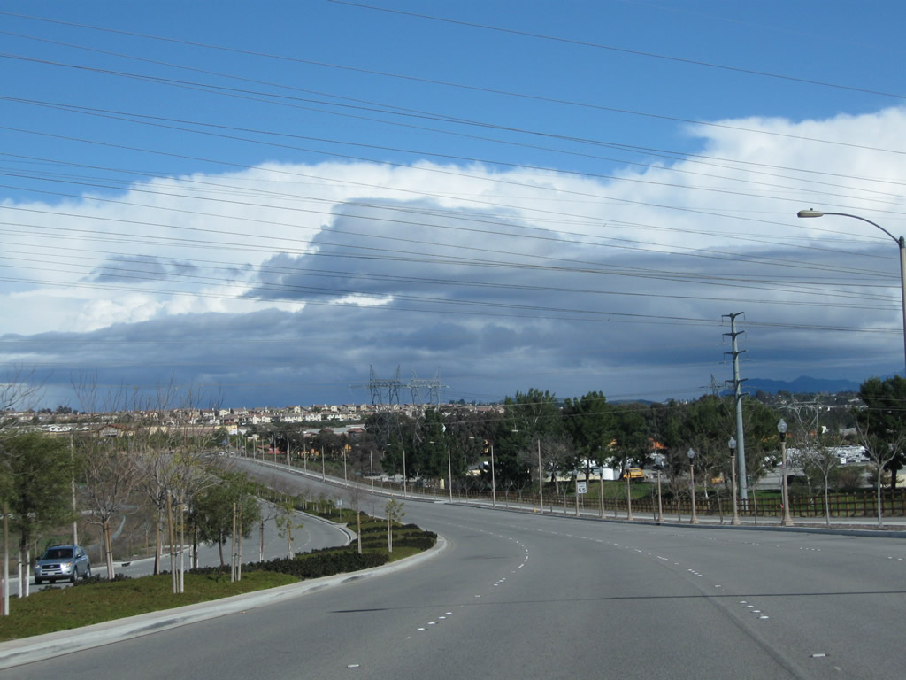
Continuing east after the county line along California 126, the four-lane highway occassionally has limited sight distances due to the terrain. Photos taken 02/26/11. |
|
Eastbound California 126 (Henry Mayo Drive) next approaches San Martinez Grande Canyon Road. Photo taken 02/26/11. |
|
The next major intersection along California 126 east is with Chiquita Canyon Road. Turn left here to Val Verde and Hasley Canyon Road. Photo taken 02/26/11. |
|
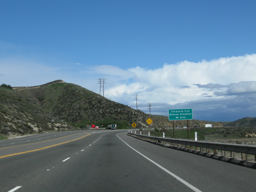
Another left turn connects to Chiquita Canyon Refuse Disposal Site, a landfill. Photo taken 02/26/11. |
|
The area along California 126 between Piru and Interstate 5 may someday look vastly different as development continues to push its way outward from Santa Clarita. Photo taken 02/26/11. |
|
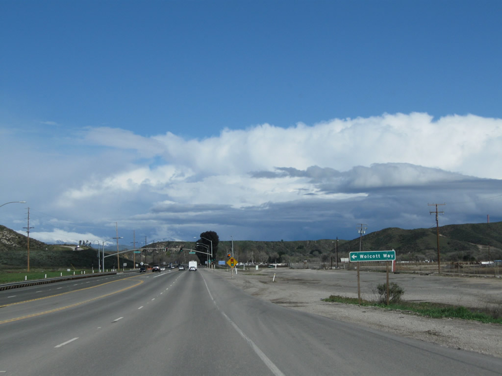
Approaching civilization once again, eastbound California 126 approaches Wolcott Way at the next traffic signal. Photo taken 02/26/11. |
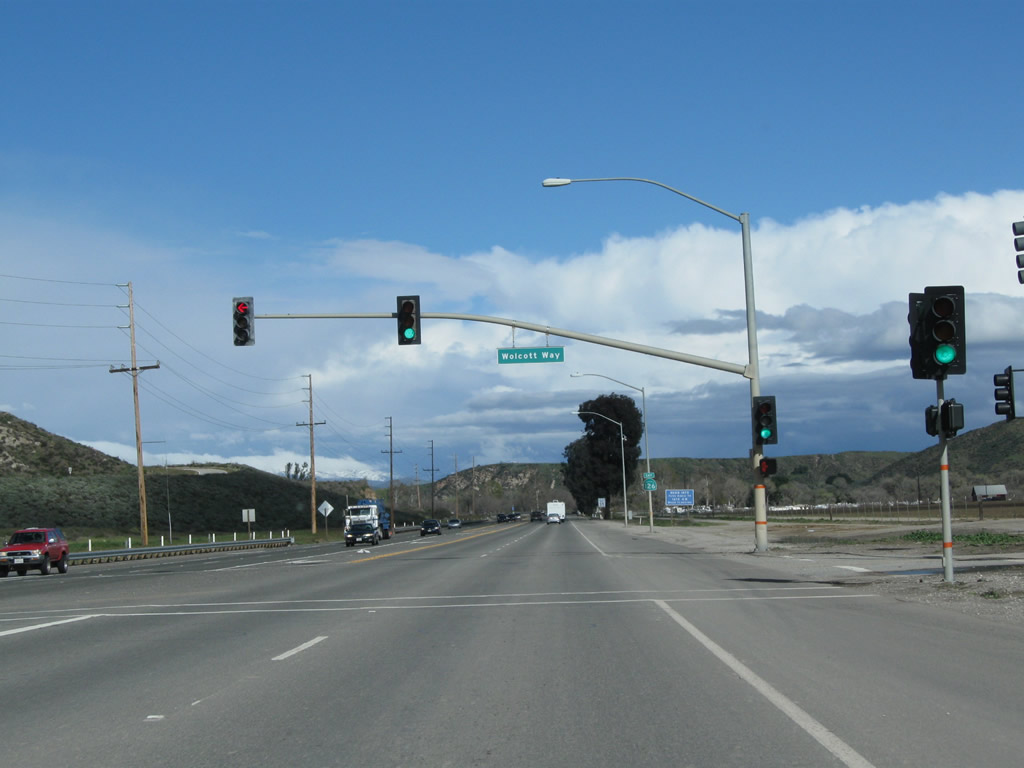
|
Eastbound California 126 meets Wolcott Way at this next traffic signal. Photo taken 02/26/11. |
|
This California 126 east reassurance shield is posted shortly thereafter. Photo taken 02/26/11. |
|
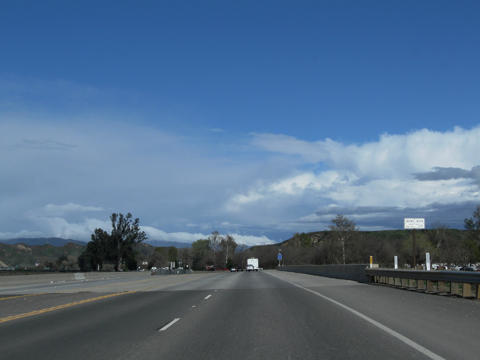
California 126 crosses Castaic Creek, which is another major tributary of the Santa Clara River. Photo taken 02/26/11. |
|
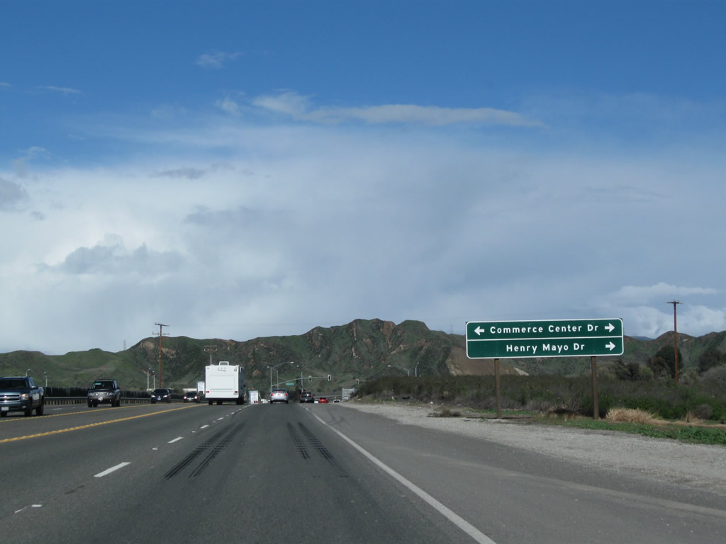
The next traffic signal connects California 126 east with Commerce Center Drive north and Henry Mayo Drive east. Photo taken 02/26/11. |
|
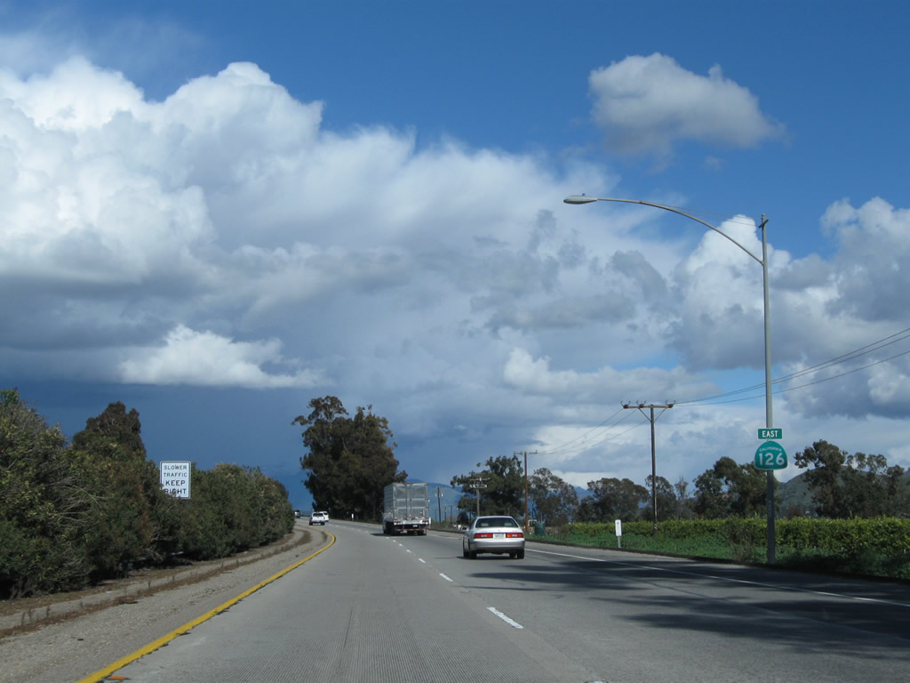
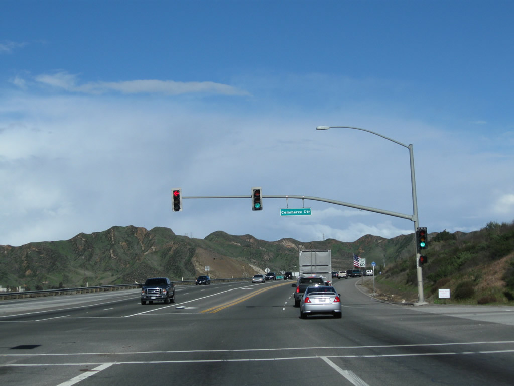
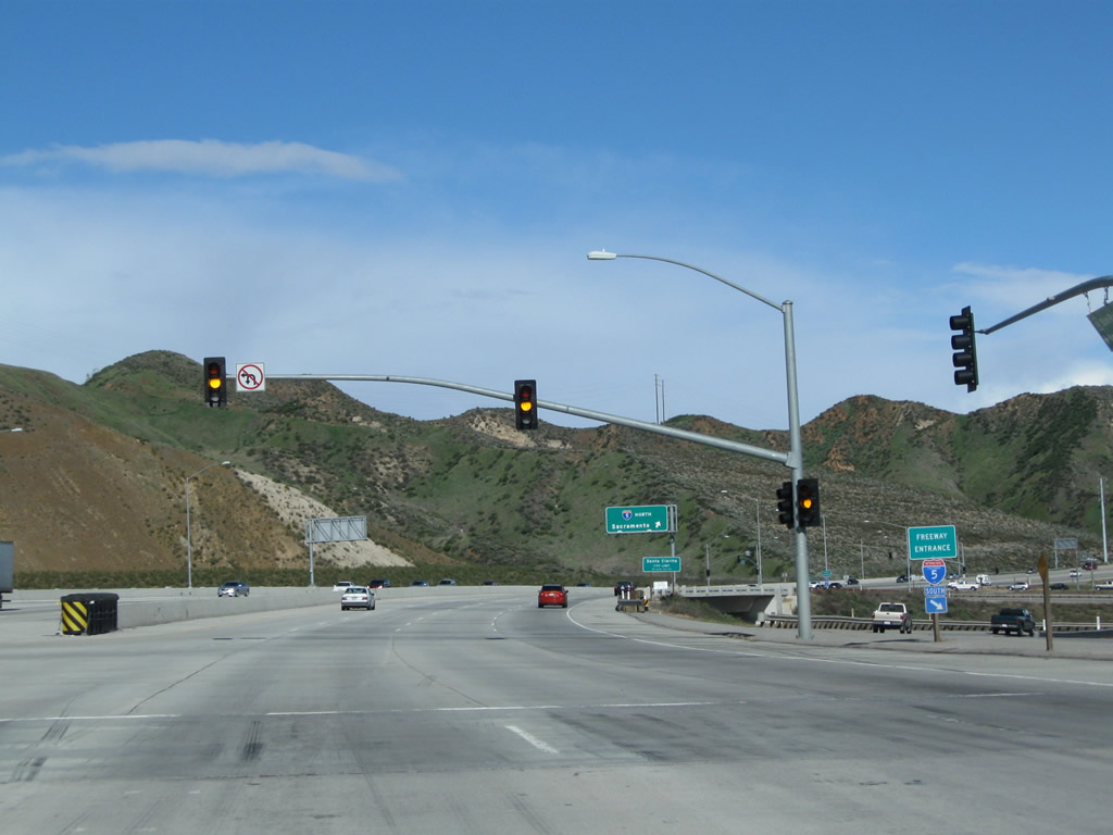
Eastbound California 126 meets Commerce Center Drive north and Henry Mayo Drive east at this signal. A very brief freeway segment continues from this traffic signal to Interstate 5. Photo taken 02/26/11. |
|
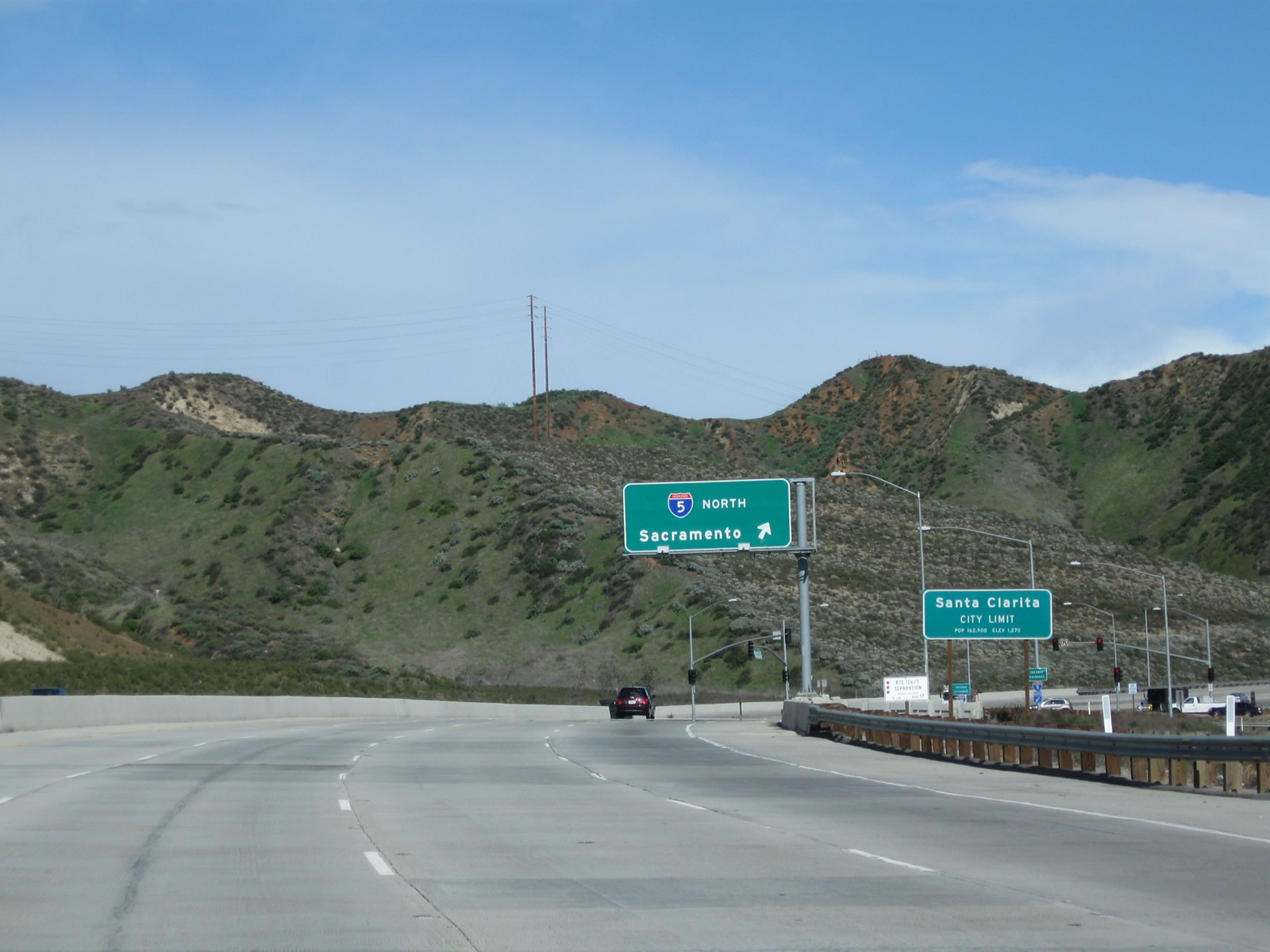
Shortly thereafter, eastbound California 126 meets Exit 40A, Henry Mayo Drive to Golden State Highway (Historic U.S. 99) and Castaic Junction. Stay right for the connections to Exits 40B-C, Interstate 5 (Golden State Freeway) south to Los Angeles and north to Bakersfield and Sacramento. Photo taken 02/26/11. |
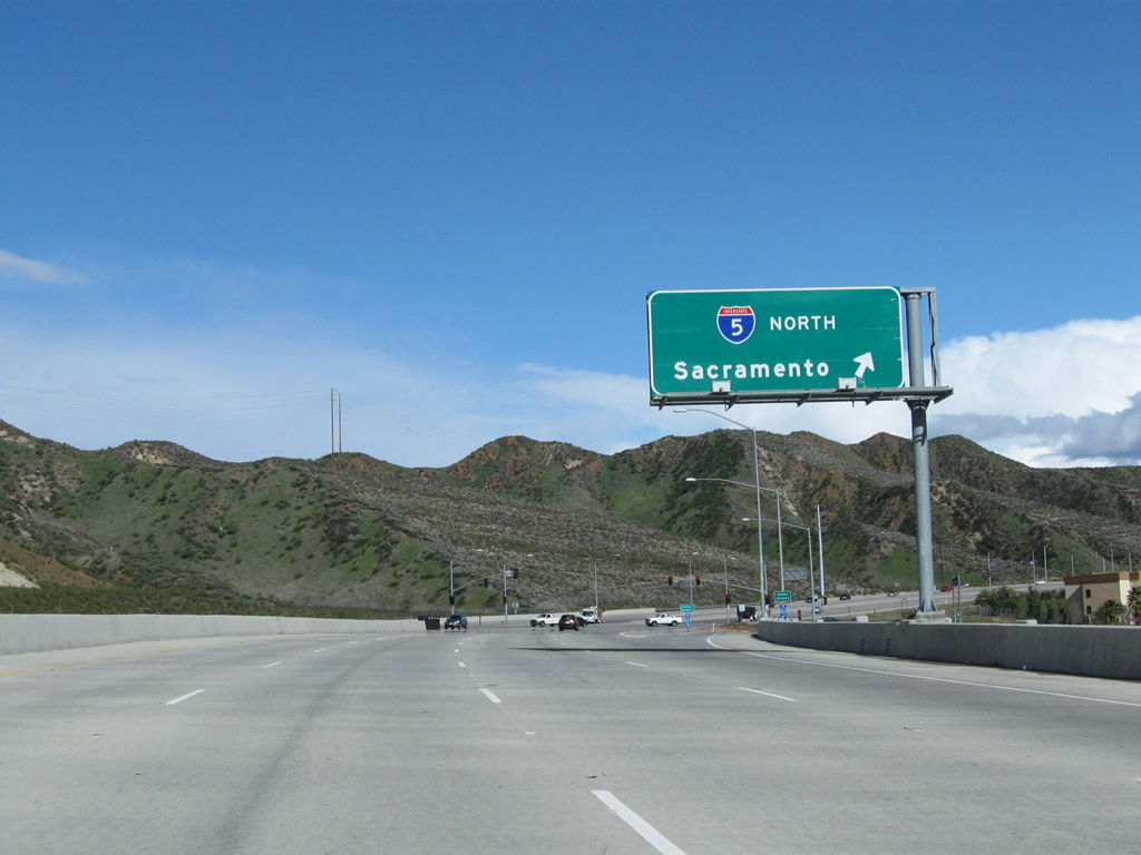
|
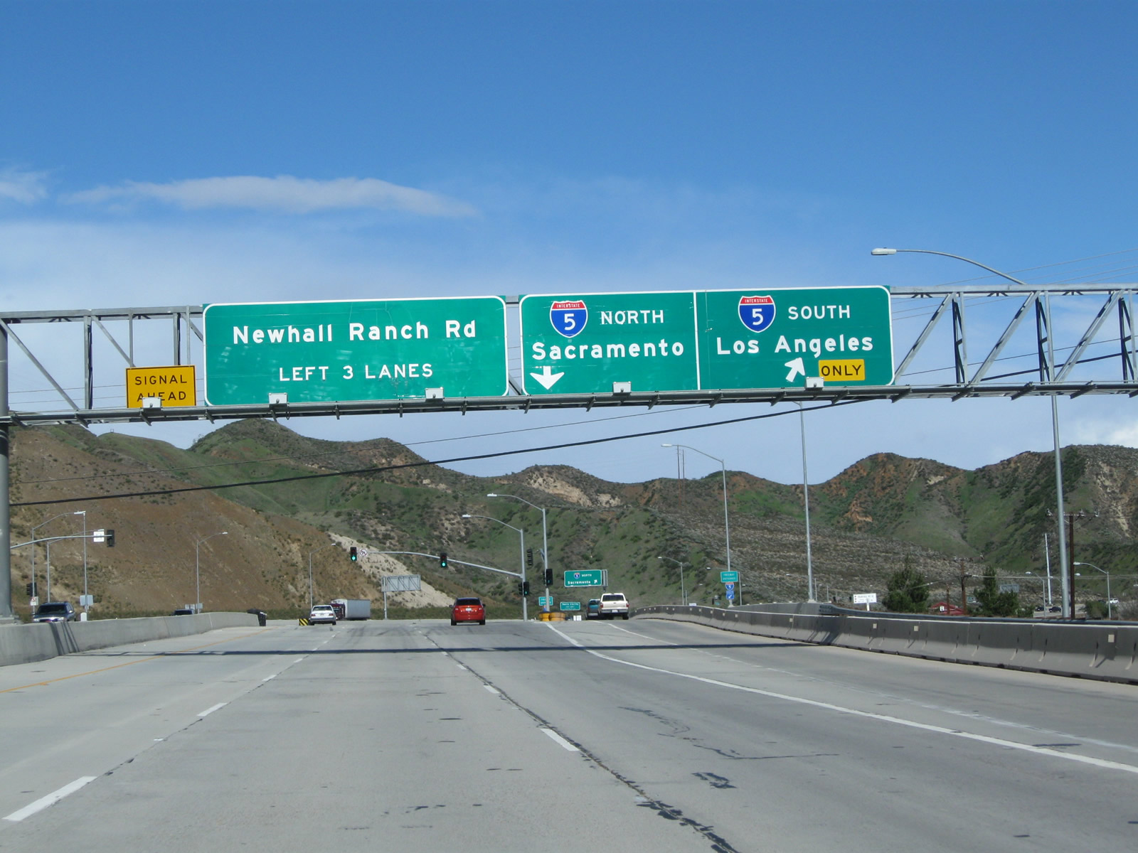
Eastbound California 126 meets Exit 40B, Interstate 5 (Golden State Freeway) south to Los Angeles. The second right connects to Exit 40C, Interstate 5 (Golden State Freeway) north to Bakersfield and Sacramento. This interchange was reconfigured from a trumpet to its current arrangement when Newhall Ranch Road was extended to meet California 126 at this interchange. Photo taken 02/26/11. |
|
A traffic signal governs the flow of traffic from Interstate 5 south to California 126 and Newhall Ranch Road east. This signal was added when the interchange was converted from a trumpet, eliminating the high-speed nature of this interchange in its original design. Photo taken 02/26/11. |
|
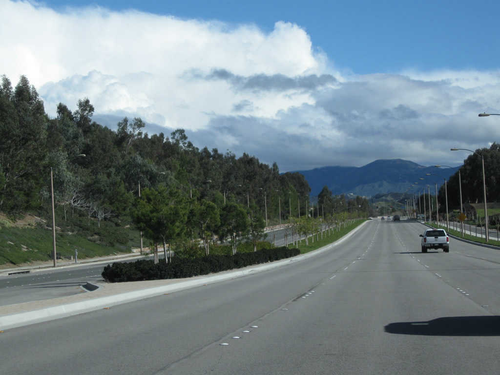
California 126 enters the city of Santa Clarita. Incorporated on December 15, 1987, Santa Clarita had a population of 151,088. The city incorporates Valencia, Newhall, Saugus, and Canyon Country. As a result of explosive development in the 1990s and 2000s, Santa Clarita saw significant population gains. Photo taken 02/26/11. |
|
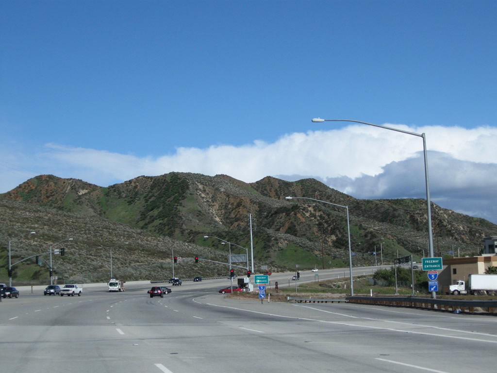
Finally, California 126 east reaches Exit 40C, a loop ramp from California 126 east to Interstate 5 north. Photo taken 02/26/11. |
|
Another set of Interstate 5 north freeway entrance shield assemblies flanks the transition ramp to Interstate 5 north. Photo taken 02/26/11. |
|
Eastbound California 126 ends at the second traffic signal in the Interstate 5 interchange. Traffic departing from Interstate 5 north meets Newhall Ranch Road and California 126 at this point. No end shield is posted for the state route. Ahead, Newhall Ranch Road continues east through Santa Clarita, ultimately leading to Sierra Highway (old U.S. 6) and California 14. Photo taken 02/26/11. |
| Cross Valley Connector east |
|
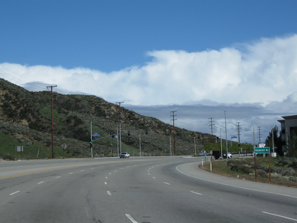
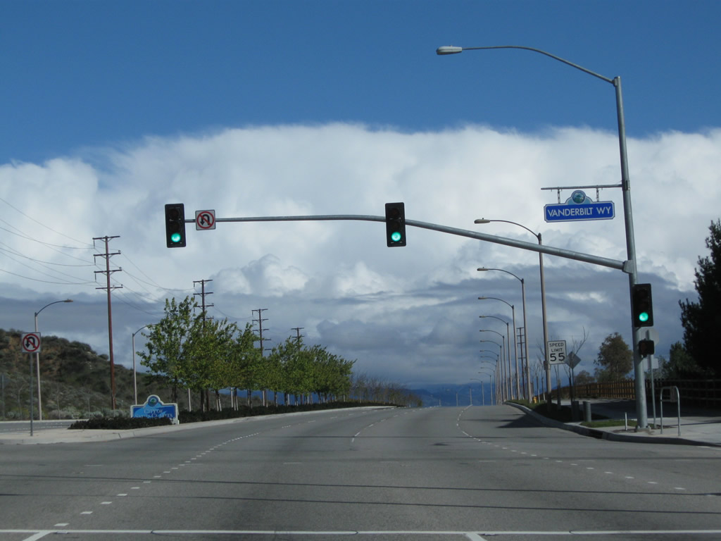
Newhall Ranch Road continues east after the California 126 and Interstate 5 interchange. Also known as part of the Cross Valley Connector, Newhall Ranch Road has four eastbound lanes as it approaches its first standalone traffic signal with Vanderbilt Way. Photo taken 02/26/11. |
|
Eastbound Newhall Ranch Road meets Vanderbilt Way. Four lanes carry eastbound traffic into Santa Clarita. Photo taken 02/26/11. |
|
|
|
|
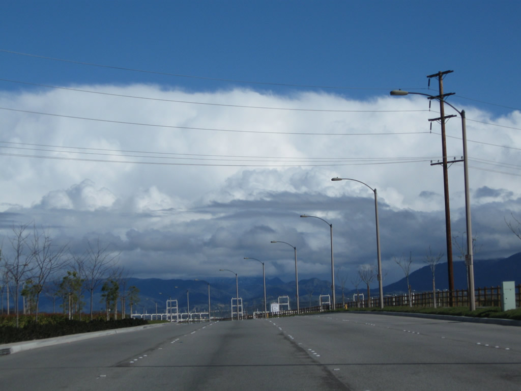
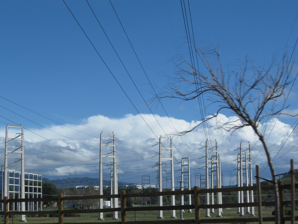
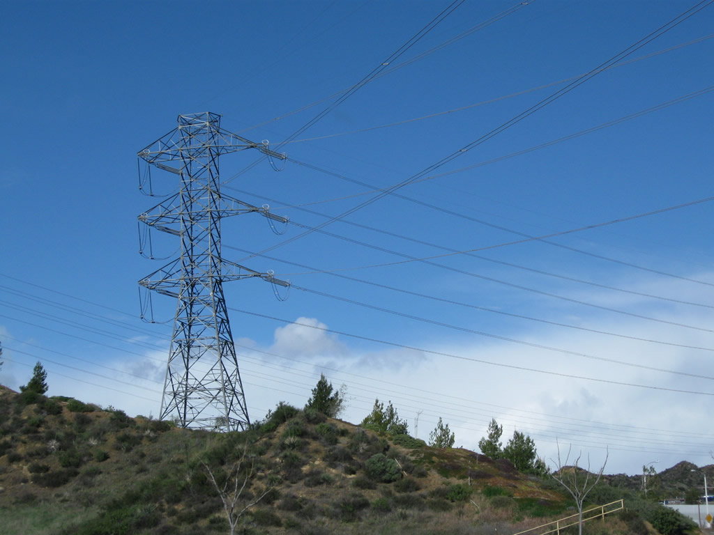
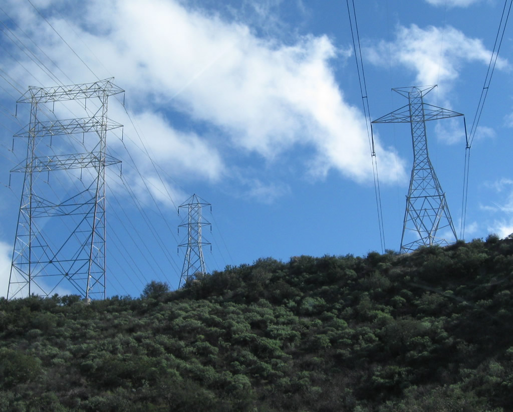
| Cresting over a hill, Newhall Ranch Road passes by the massive Pardee substation, which is owned by Southern California Edison. Photos taken 02/26/11. |
|
|
|
|
| A variety of power lines converge on the Pardee substation, including a double circuit 500kV power line incoming from the Vincent substation and the Tehachapi wind farms. Several 220kV power lines also enter from the north, south, and west. Photos taken 02/26/11. |
|
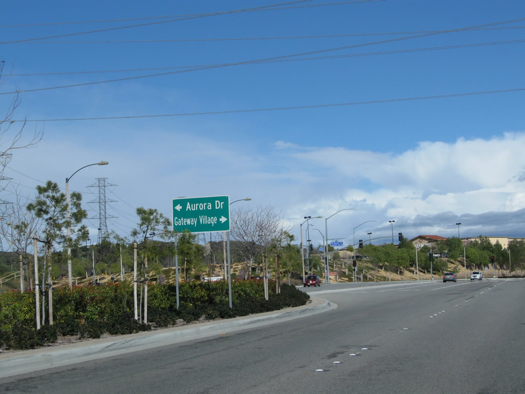
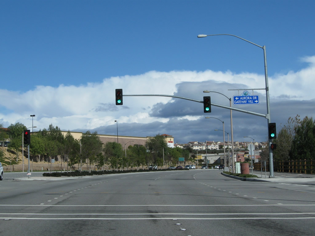
Newhall Ranch Road next approaches its intersection with Aurora Drive and Gateway Village in Santa Clarita. Photo taken 02/26/11. |
|
Eastbound Newhall Ranch Road meets Aurora Drive north to Kelly Johnson Parkway and Gateway Village south to Rye Canyon Road. Photo taken 02/26/11. |
|
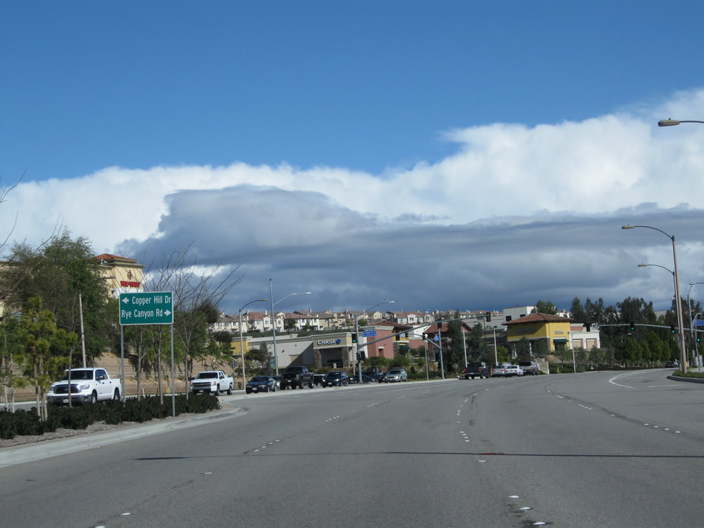
Newhall Ranch Road next approaches its intersection with Rye Canyon Road southwest to The Old Road and Interstate 5 and Copper Hill Drive northeast to serve a variety of subdivisions en route to Bouquet Canyon Road. Photo taken 02/26/11. |
|
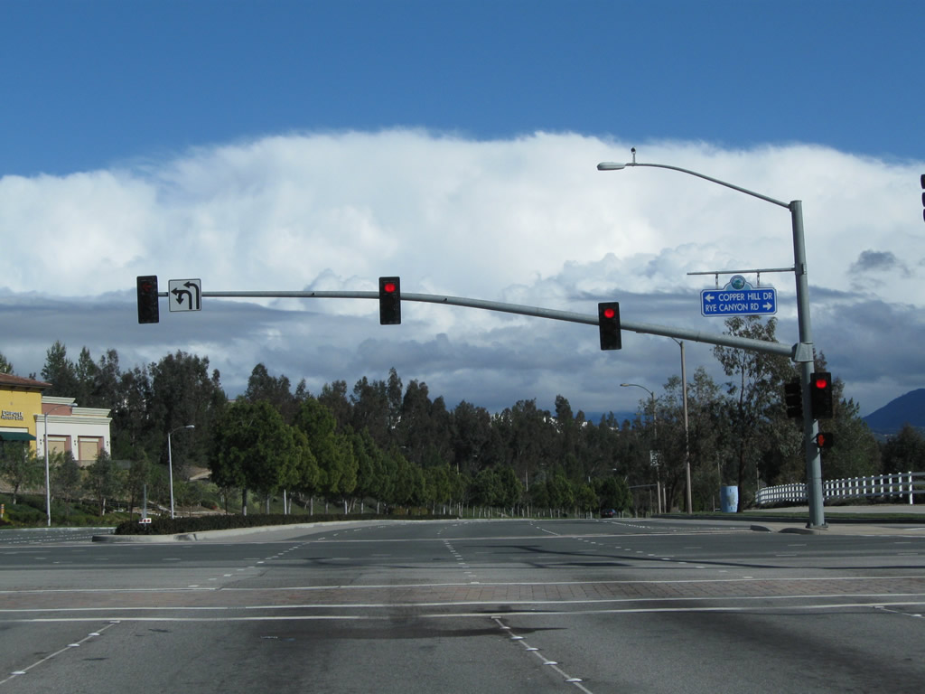
Eastbound Newhall Ranch Road meets Copper Hill Drive northeast and Rye Canyon Road southwest. Photo taken 02/26/11. |
|
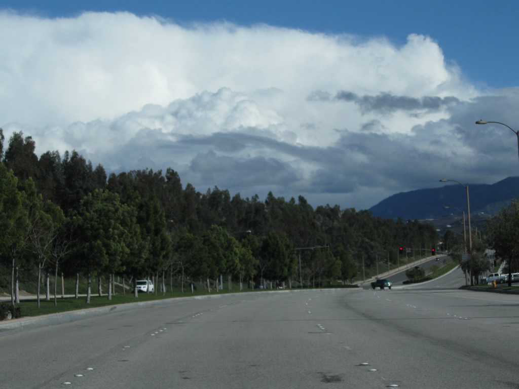
Between Rye Canyon Road and Dickason Drive, Newhall Ranch Road proceeds southeast past an industrial park. Photo taken 02/26/11. |
|
Newhall Ranch Road continues with four eastbound lanes. In the distance is a traffic signal intersection with Dickason Drive north and Avenue Tibbits south. Photo taken 02/26/11. |
|
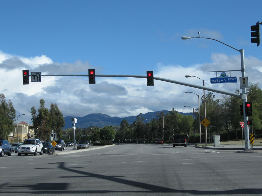
The next signalized intersection along Newhall Ranch Road (after the intersection with Dickason Drive and Avenue Tibbits) is with McBean Parkway. Another major roadway, McBean Parkway travels southwest to connect with Interstate 5 (Golden State Freeway). Photo taken 02/26/11. |
|
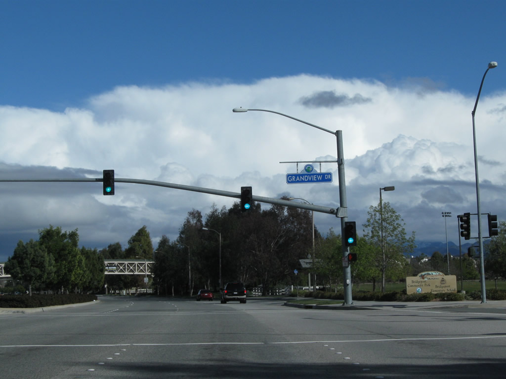
Eastbound Newhall Ranch Road meets Grandview Drive at this intersection. On the right side of the roadway ahead is Bridgeport Park. Photo taken 02/26/11. |
|
A pedestrian bridge passes over Newhall Ranch Road near Bridgeport Park. Photo taken 02/26/11. |
|
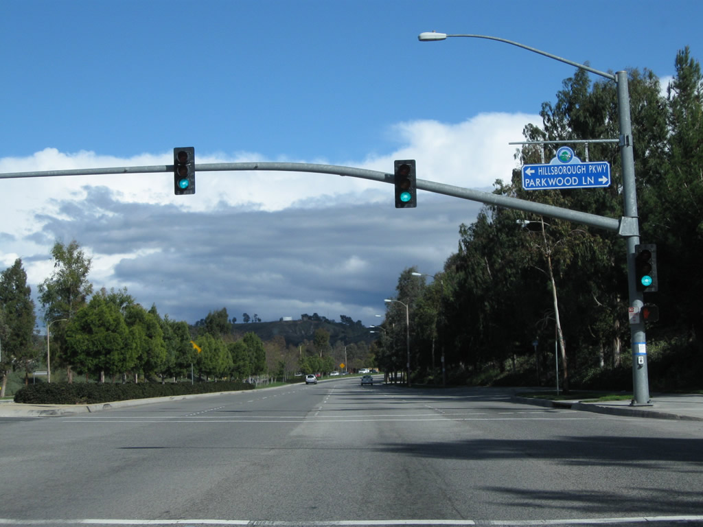
Eastbound Newhall Ranch Road meets Hillsborough Parkway north and Parkwood Lane south. Photo taken 02/26/11. |
|
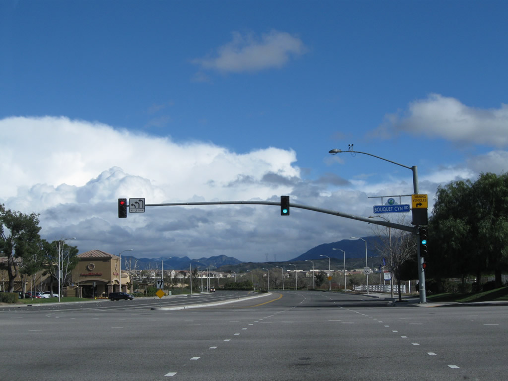
Soon thereafter, Newhall Ranch Road east meets Bouquet Canyon Road. This major arterial travels south into downtown Santa Clarita (via Railroad Avenue and Main Street) and north to Bouquet Canyon and Leona Valley. Photo taken 02/26/11. |
|
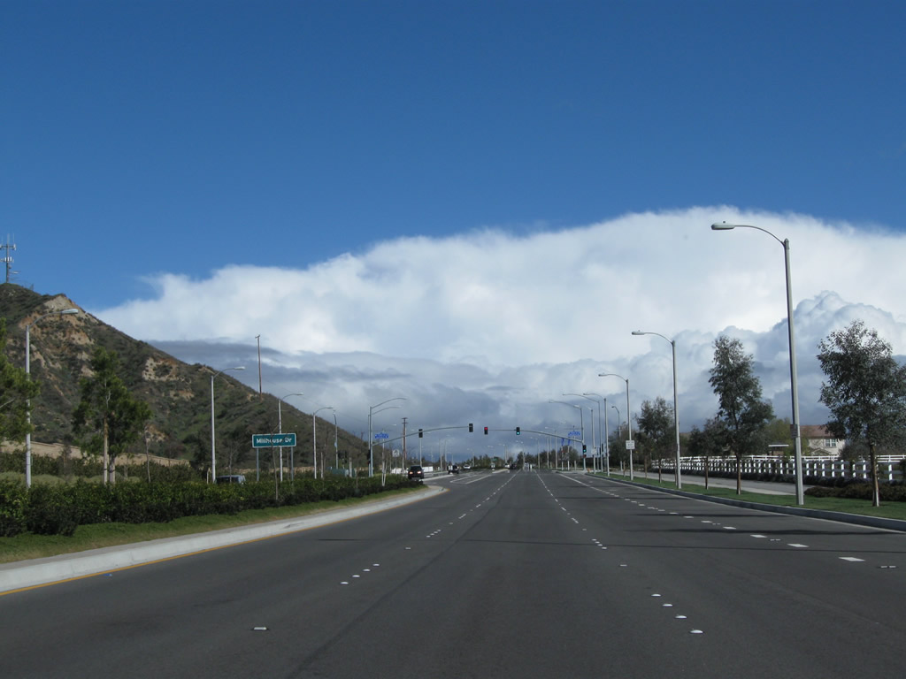
Eastbound Newhall Ranch Road approaches Whisper Hill Circle and Millhouse Drive. Photo taken 02/26/11. |
|
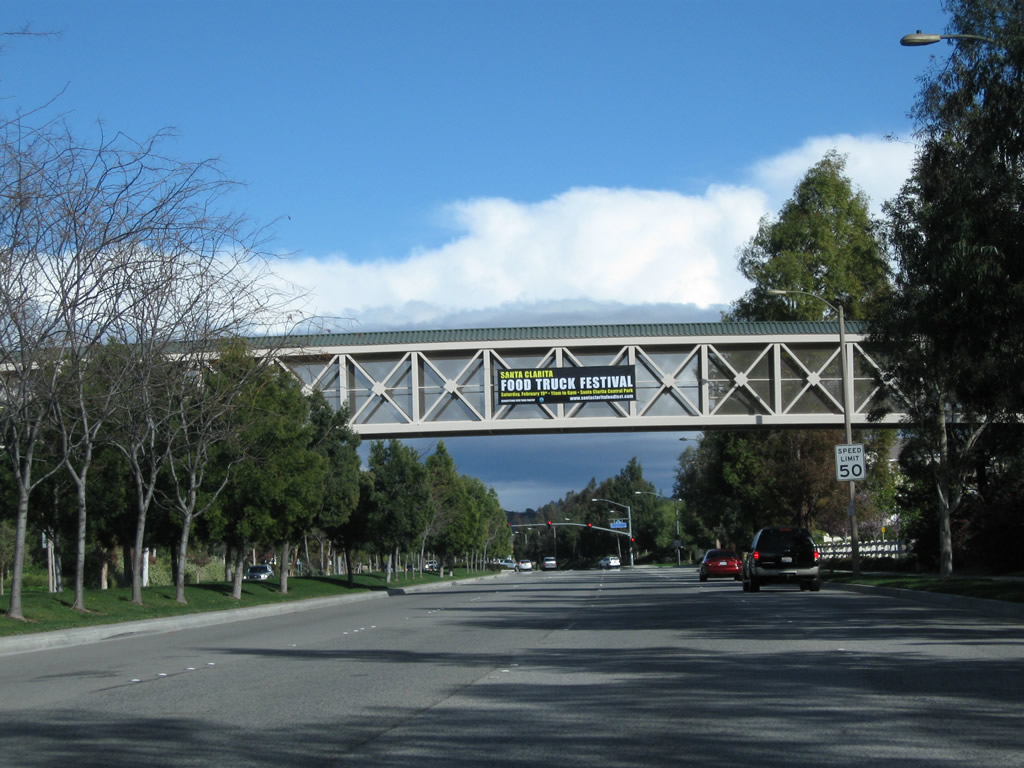
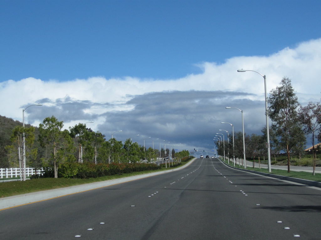
This view looks east on Newhall Ranch Road between Sawmill Lane and Santa Clarita Parkway, which travels south Photo taken 02/26/11. |
|
Preparing to cross the Santa Clara River, Newhall Ranch Road curves south, transitioning directly onto Golden Valley Road. Photo taken 02/26/11. |
|
Newhall Ranch Road curves south onto Golden Valley Road. Ahead is the Santa Clara River bridge. Photo taken 02/26/11. |
|
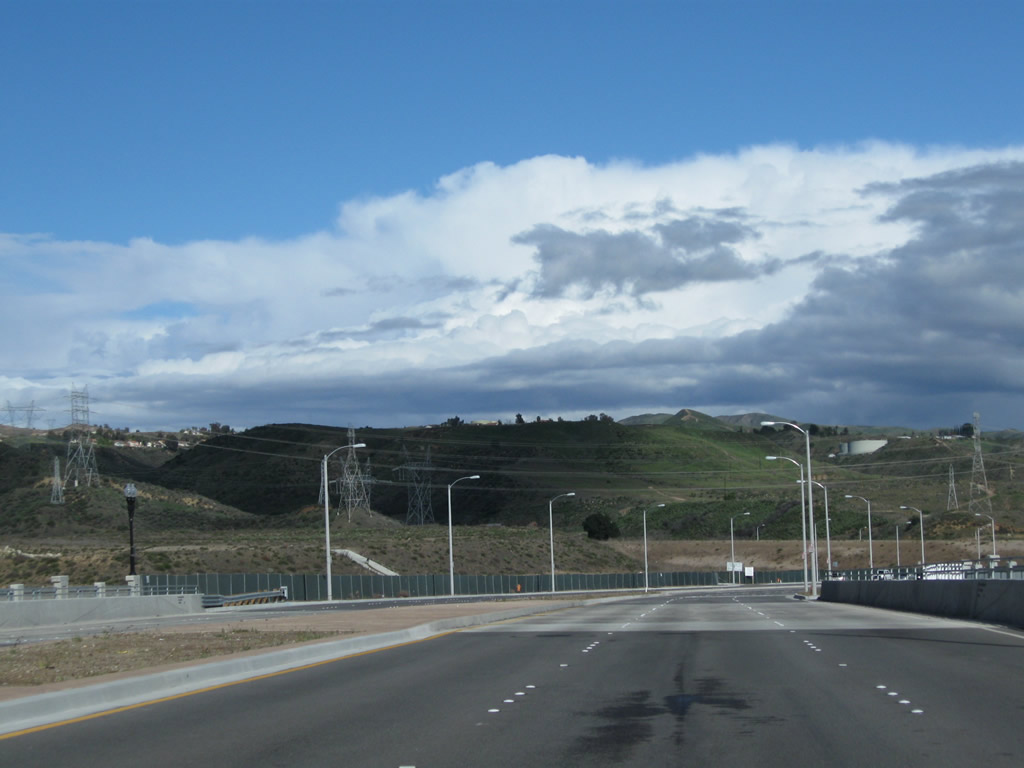
Southbound Golden Valley Road immediately crosses over the Santa Clara River on a bridge that opened on March 27, 2010, with a community celebration. This opening marked the completion of the Cross Valley Connector. Stay right for a connection to Soledad Canyon Road via the upcoming intersection with Valley Center Drive. Photo taken 02/26/11. |
|
Traveling south, Golden Valley Road parallels a major powerline transmission corridor. On the east side of the highway are Path 65 (Pacific Intertie High Voltage Direct Current), two Los Angeles Department of Water and Power 500kV alternating current powerlines, and other transmission lines. Photo taken 02/26/11. |
|
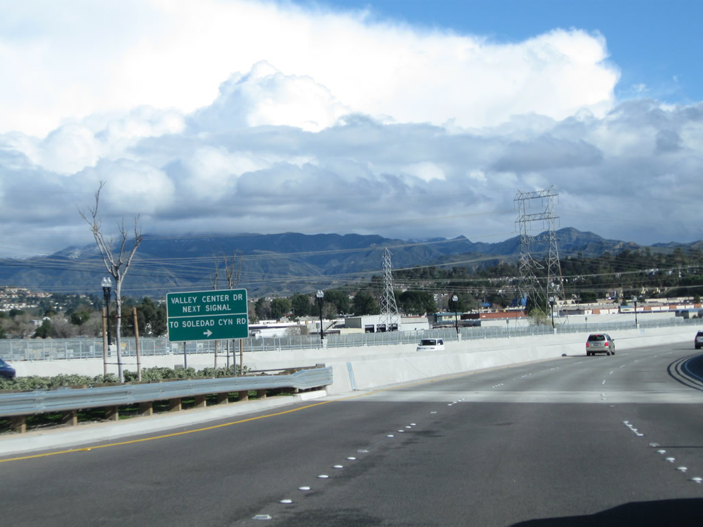
Since Golden Valley Road passes over Soledad Canyon Road, motorists must turn right onto Valley Center Drive to make the connection. Photo taken 02/26/11. |
|
Golden Valley Road remains on an elevated viaduct to cross over Soledad Canyon Road. Photo taken 02/26/11. |
|
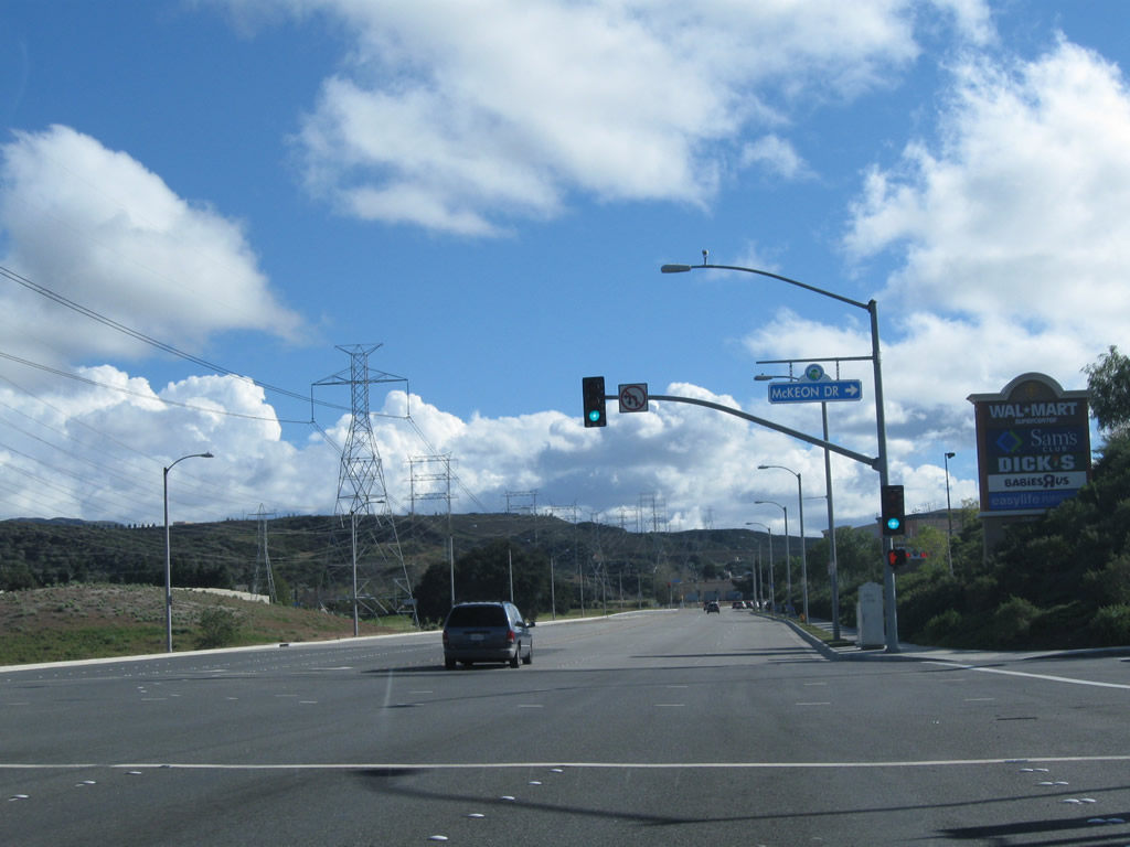
Leaving the viaduct and returning to grade, Golden Valley Road south meets McKeon Drive at this intersection. Photo taken 02/26/11. |
|
After the signalized intersection with Centre Point Parkway, southbound Golden Valley Road gains elevation and curves east for the final distance to Sierra Highway (former U.S. 6) and California 14. Photo taken 02/26/11. |
|
Path 65 passes over Golden Valley Road. After passing under these powerlines, Golden Valley Road will approach a traffic signal with Robert C. Lee Parkway. Photo taken 02/26/11. |
|
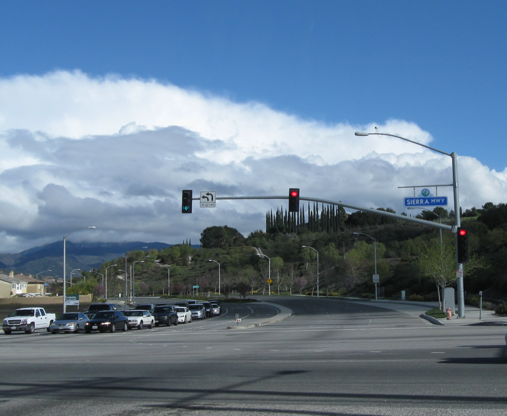
Descending from the hill, eastbound Golden Valley Road meets California 14U and Historic Sierra Highway (old U.S. 6). Turn right for Newhall Pass or left for Mint Canyon. California 14U is the unrelinquished section of Sierra Highway that remains a state-maintained route. 14U extends from Via Princessa (near proposed and never-built California 126 interchange) southwest to Newhall Avenue (former U.S. 99/San Fernando Road) along Sierra Highway (old U.S. 6). Photo taken 02/26/11. |
Page Updated April 6, 2011.