
California 183
California 183 connects California 1 at Castroville with U.S. 101 at Salinas in a northwest to southeast direction. At the southern end, California 183 merges briefly with U.S. 101 Business in Salinas.
| California 183 north & U.S. 101 Business south | |
|---|---|
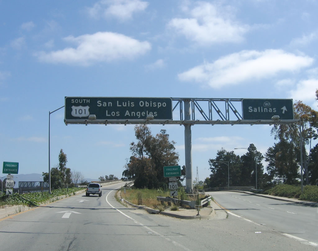 |
At the north end of California 183, southbound Main Street divides. The left lane connects to U.S. 101 (El Camino Real) south to San Luis Obispo and Los Angeles, while the right two lanes connect to U.S. 101 Business south and California 183 north along Main Street to downtown Salinas. Photo taken 07/05/06. |
| California 183 north | |
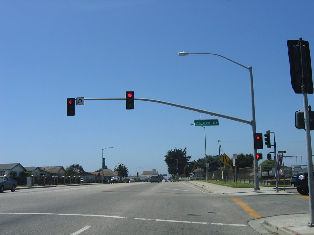 |
After the interchange with California 156, northbound California 183 meets Pajaro Street at this traffic signal. Photo taken 07/05/06. |
 |
South of downtown Castroville, California 183 is three lanes wide, with a center left turn lane, as the state highway follows Merritt Street northwest. Photo taken 07/05/06. |
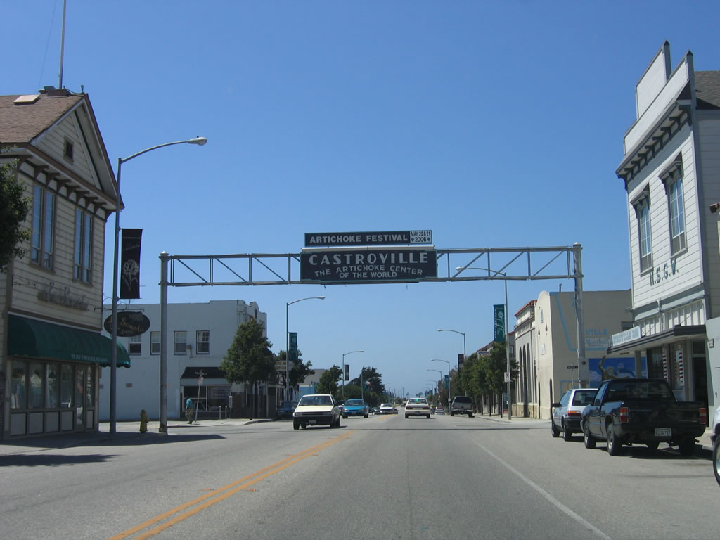 |
Northbound California 183 (Merritt Street) enters downtown Castroville, the "Artichoke Center of the World." Home to 6,724 people as of the 2000 Census, artichokes are produced in vast quantity in the Pajaro Valley along the coastal plain. An annual artichoke festival is held in Castroville. This arch is located near the Preston Street intersection. Photo taken 07/05/06. |
 |
After the arch, California 183 continues north through Castroville. This view is afforded at Speegle Street, one block north of the arch. Photo taken 07/05/06. |
 |
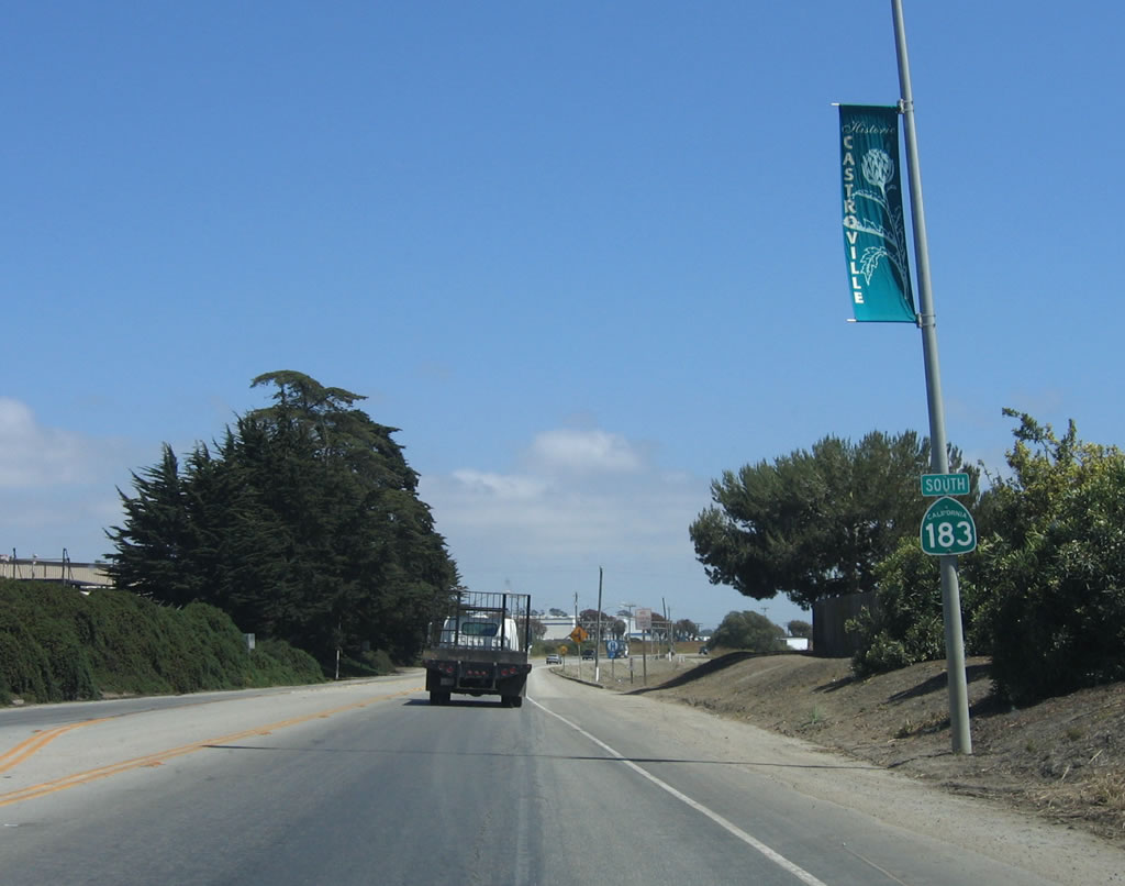
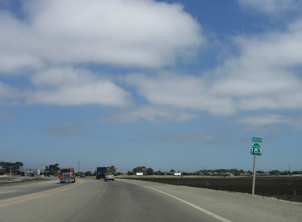
Leaving Castroville, northbound California 183 approaches California 1 (Cabrillo Highway). The intersection with California 1 is at-grade and only allows a transition to northbound California 1 (Cabrillo Highway). No access is permitted for California 1 south from this intersection. Note that California 1 is currently not a freeway at its intersection with California 183. Photo taken 07/05/06. |
 |
Northbound California 183 (Merritt Street) approaches California 1 (Cabrillo Highway). No end shield is present. Photo taken 07/05/06. |
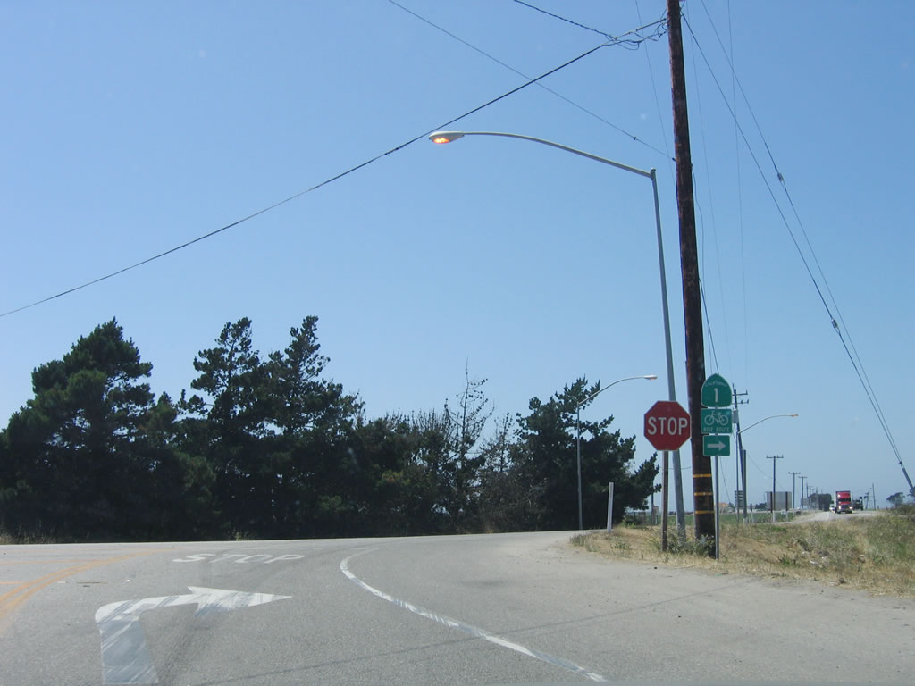 |
California 183 ends at California 1. All traffic must turn right onto California 1 north. Photo taken 07/05/06. |
| California 183 south | |
|---|---|
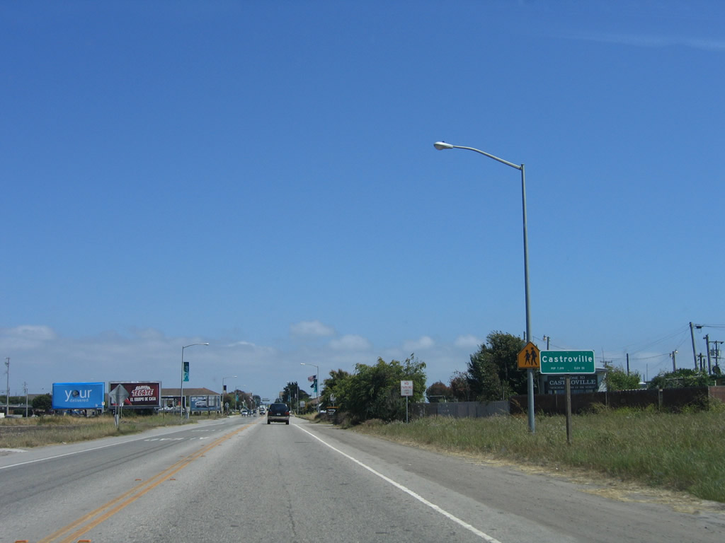 |
Immediately after departing from California 1 (Cabrillo Highway), southbound California 183 enters the unincorporated community of Castroville, the "Artichoke Center of the World." Home to 6,724 people as of the 2000 Census, artichokes are produced in vast quantity in the Pajaro Valley along the coastal plain. An annual artichoke festival is held in Castroville. Photo taken 07/05/06. |
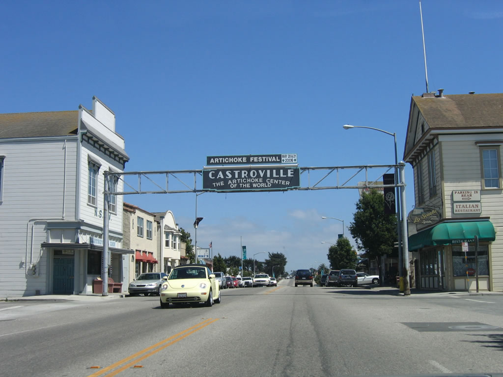 |
California 183 passes under the Castroville arch, located at the intersection with Preston Street. Photo taken 07/05/06. |
 |
Three-lane California 183 (Merritt Street) leaves downtown Castroville and approaches the intersection with Pajaro Street and interchange with California 156. Photo taken 07/05/06. |
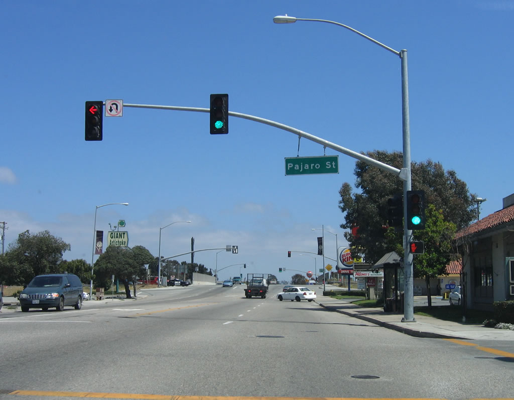 |
Southbound California 183 (Merritt Street) meets Pajaro Street at this traffic signal. Photo taken 07/05/06. |
 |
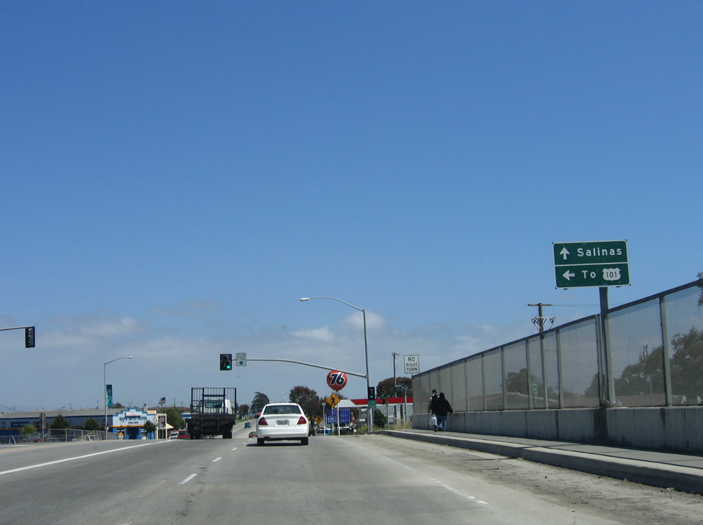
Shortly thereafter, southbound California 183 meets California 156. The first ramp connects to California 156 west to California 1 south to the Monterey Peninsula (cities of Marina, Seaside, Monterey, Pacific Grove, and Carmel-by-the-Sea). The next left is for California 156 east to Prunedale and U.S. 101 (El Camino Real). Continue straight ahead to follow California 183 (Merritt Street) south to Salinas. Photo taken 07/05/06. |
 |
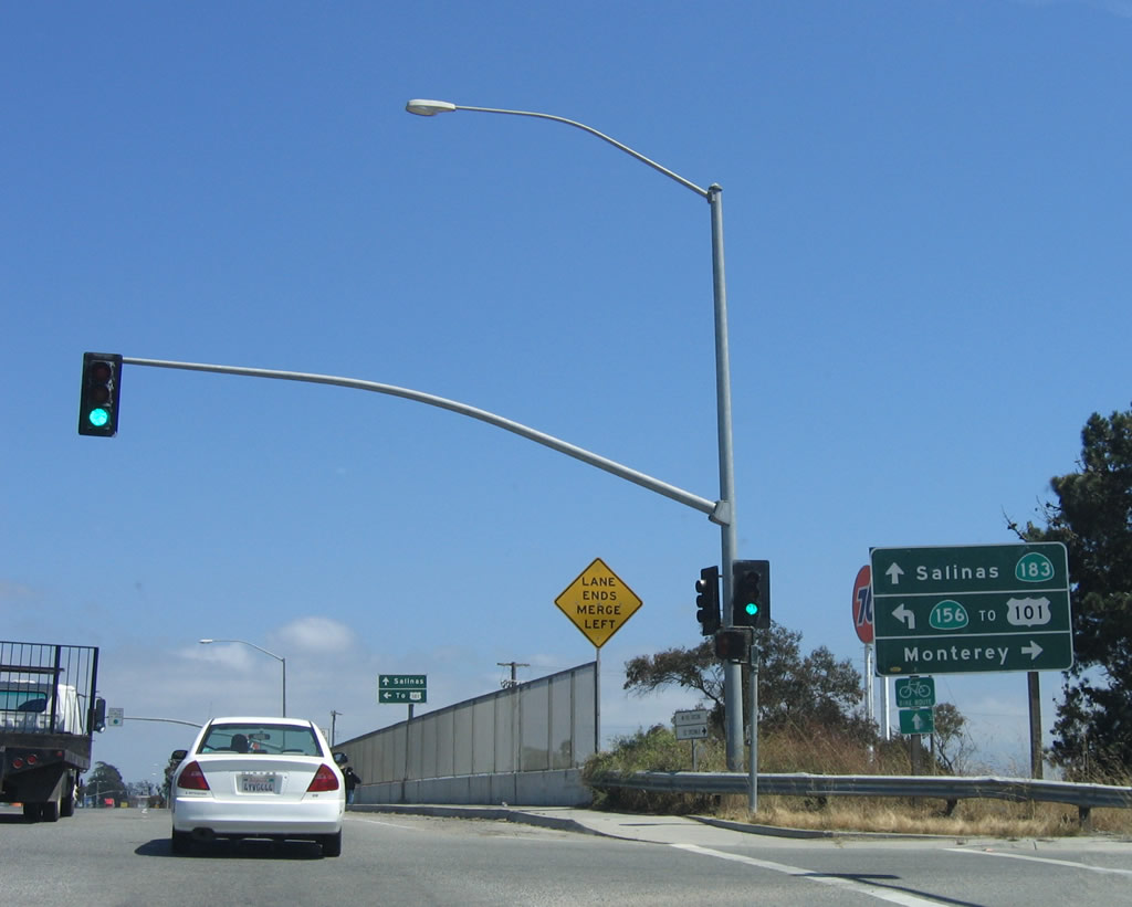
Crossing over the California 156 freeway, southbound California 183 approaches the left turn to California 156 east to Prunedale, San Juan Bautista, Hollister, and all Central Valley points via California 152/Pacheco Pass Highway. Use California 156 east to U.S. 101 north to Gilroy, San Jose, and San Francisco. Follow California 183 south to Salinas and destinations on U.S. 101 south. Photo taken 07/05/06. |
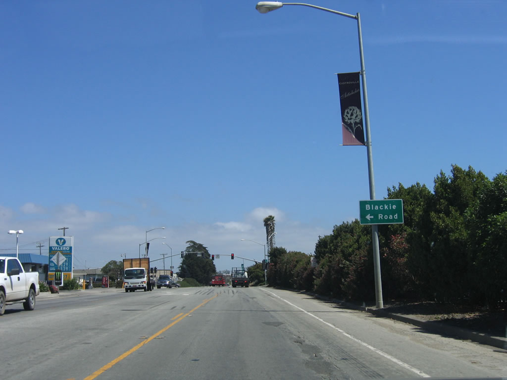 |
The next traffic signal connects California 156 with Blackie Road, which parallels California 156 and travels east to U.S. 101 (El Camino Real) south of the California 156 Prunedale interchange. Photo taken 07/05/06. |
 |
After the Blackie Road intersection is the first reassurance shield for California 183 south. Photo taken 07/05/06. |
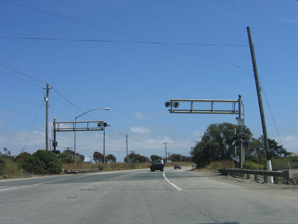 |
California 183 continues southeast across these decommissioned railroad tracks. However, a set of active railroad tracks closely parallels California 183 to the northeast of the state route. Photo taken 07/05/06. |
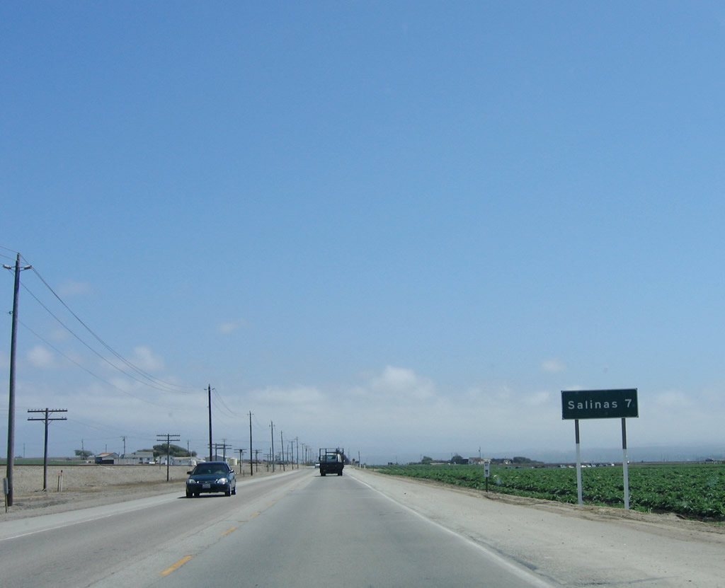 |
Entering the lush agricultural lands of the Salinas Valley, California 183 passes by multiple farms and ranches on its journey southeast toward Salinas, which is seven miles from this point. Photo taken 07/05/06. |
 |
Southbound California 183 (Castroville Road) approaches Espinosa Road, which travels east to Espinosa Lake and U.S. 101 on an alignment parallel to Blackie Road and California 156. Photo taken 07/05/06. |
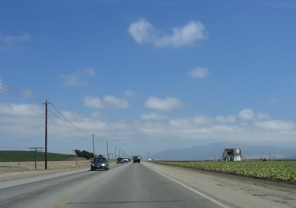 |
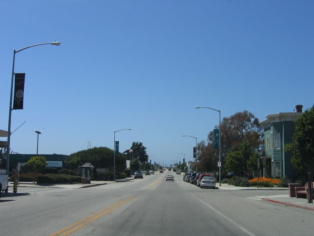
More farms line both sides of California 183 as we continue south toward Salinas on a path parallel to the Salinas River in the fertile Salinas Valley. Photo taken 07/05/06. |
 |
This reassurance shield is posted after the Cooper Road intersection. Cooper Road travels southwest to Blanco Road. A right turn from Cooper Road onto Blanco Road west leads to the city of Marina, California State University at Monterey Bay, Marina Municipal Airport, and California 1 (Cabrillo Highway). Photo taken 07/05/06. |
 |
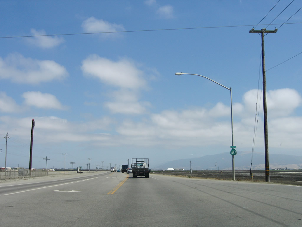
Another California 183 south reassurance shield is posted shortly after leaving the small community of Cooper and after the San Jon Road intersection. Photo taken 07/05/06. |
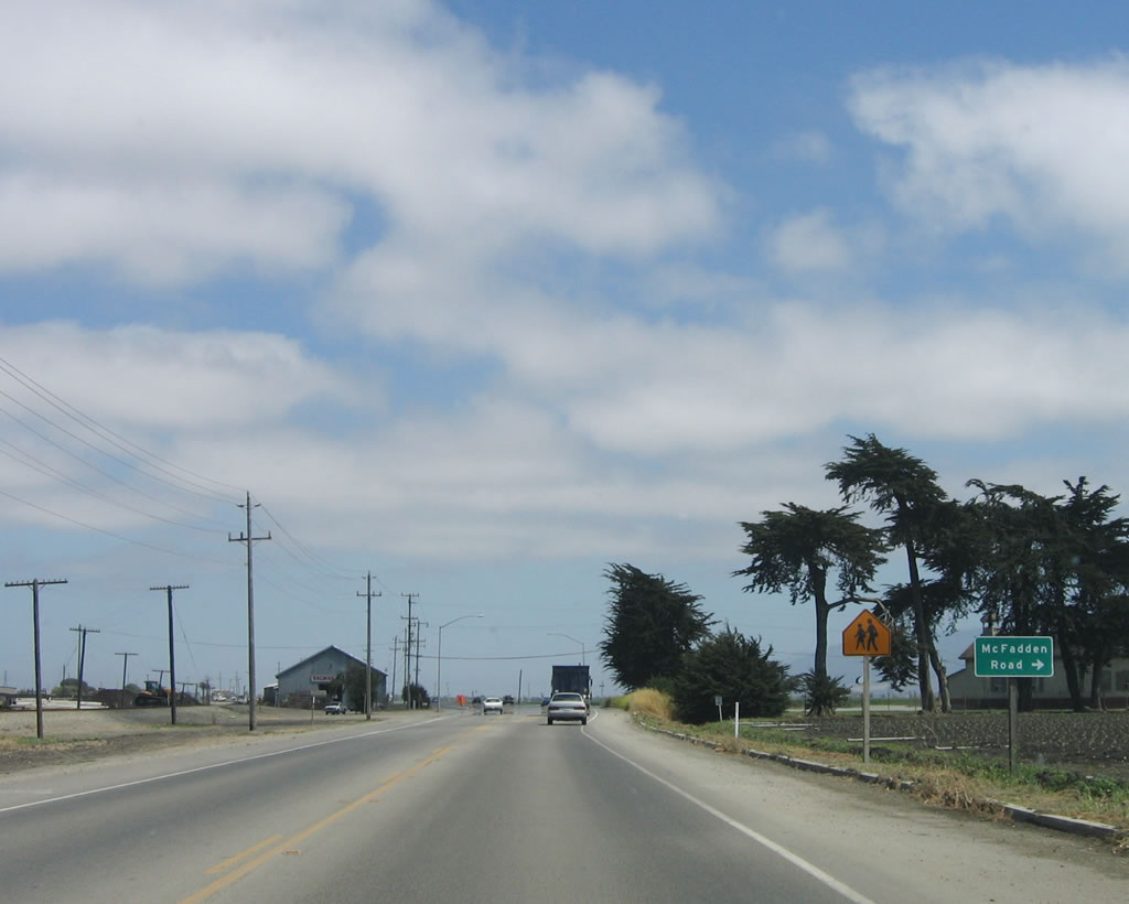 |
The next major intersection along southbound California 183 is with McFadden Road. Photo taken 07/05/06. |
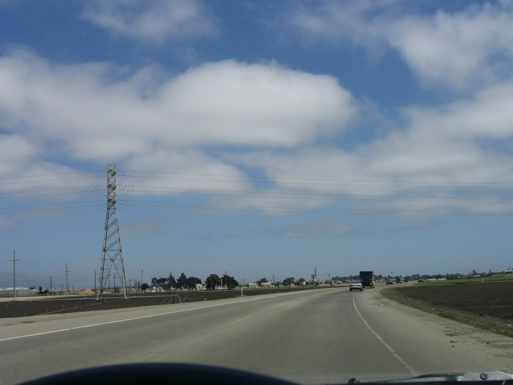 |
A 138 kV power line crosses over California 183. In the distance, the city of Salinas (seat of Monterey County) comes into view. Photo taken 07/05/06. |
 |
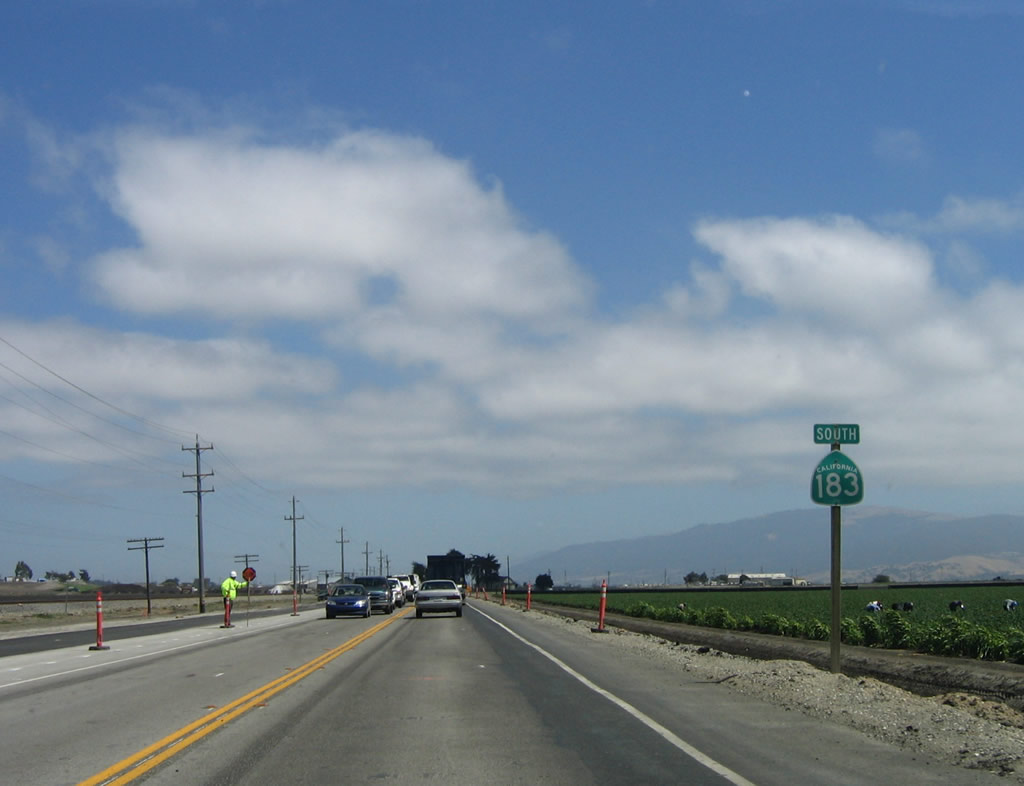
Another California 183 south reassurance shield is posted shortly after the power line crossing. Photo taken 07/05/06. |
 |
Southbound California 183 (Castroville Road) approaches the interchange with Davis Road. Continue straight ahead to follow California 183 (Market Street) south into downtown Salinas. Turn right here to follow South Davis Road south to the western outskirts of Salinas and Reservation Road. Photo taken 07/05/06. |
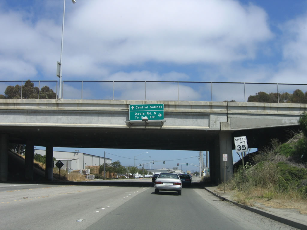 |
Passing under Davis Road, a second right will connect California 183 south with North Davis Road north to U.S. 101 Exit 330. Although not signed here, California 183 continues south along Market Street into downtown Salinas and the Central Business District. Photo taken 07/05/06. |
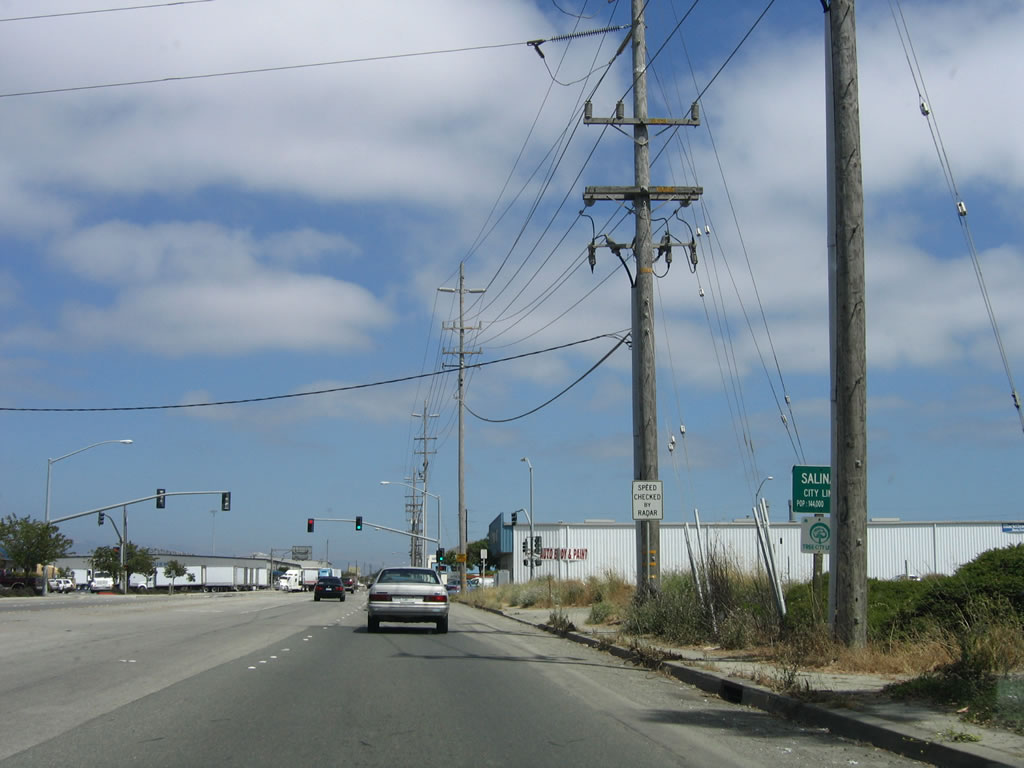 |
The traffic signal ahead serves as the connection to Davis Road north. Turn right to Davis Road north to U.S. 101. At this point, California 183 enters the city of Salinas. Incorporated in 1872, the city of Salinas is perhaps most famous as the home of author John Steinbeck, author of The Grapes of Wrath and many other novels and short stories. Salinas was named for a nearby salt marsh and has about 14.4 inches of precipitation per year. Agriculture reigns in this community, as farms are a key economic engine to this region. Home to 143,920 people in 2000, Salinas is expected to continue to grow dramatically in the coming years. Photo taken 07/05/06. |
 |
After the Davis Road interchange, California 183 ceases to be a truck route. From here, the state highway follows the railroad into downtown Salinas. Photo taken 07/05/06. |
 |
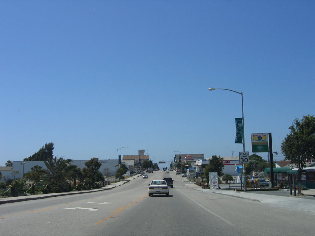
This view of southbound California 183 (Market Street) is afforded near the Villa Street intersection. Photo taken 07/05/06. |
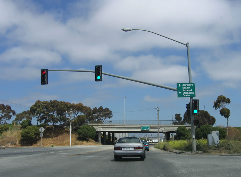
 |
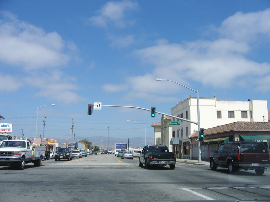
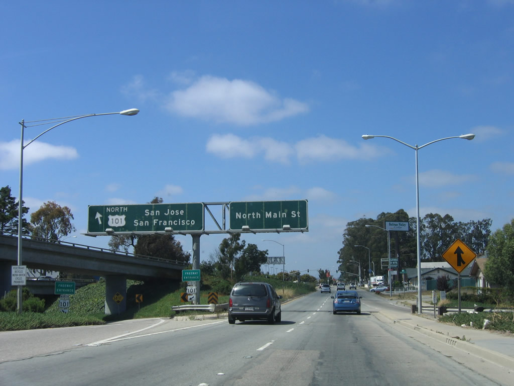
Entering downtown Salinas, southbound California 183 (Market Street) leaves the industrial areas and finds more residential areas. On the left is the Amtrak station. The traffic signal in the distance is with Salinas Street, followed by Monterey Street. Salinas Street and Main Street form a one-way couplet for U.S. 101 Business. At this interchange, California 183 will turn left (north) onto Monterey Street, then end at U.S. 101 (El Camino Real) Exit 329. Meanwhile, Market Street will continue east to U.S. 101 Exit 328 (this is the better route to U.S. 101 south). Photo taken 07/05/06. |
 |
Reaching Salinas Street, turn right (south) to follow U.S. 101 Business/Salinas Street south to downtown Salinas. The next signalized intersection is with Monterey Street; turn left to follow California 183 south and U.S. 101 Business north on Monterey Street to U.S. 101. Note the sign for U.S. 101, which shows the best route to U.S. 101 north and south. Photo taken 07/05/06. |
 |
Southbound California 183 meets U.S. 101 Business (Monterey Street) at this traffic signal. Turn left to continue south on California 183; continue straight ahead to follow Market Street to U.S. 101 south. Photo taken 07/05/06. |
| California 183 south & U.S. 101 Business north | |
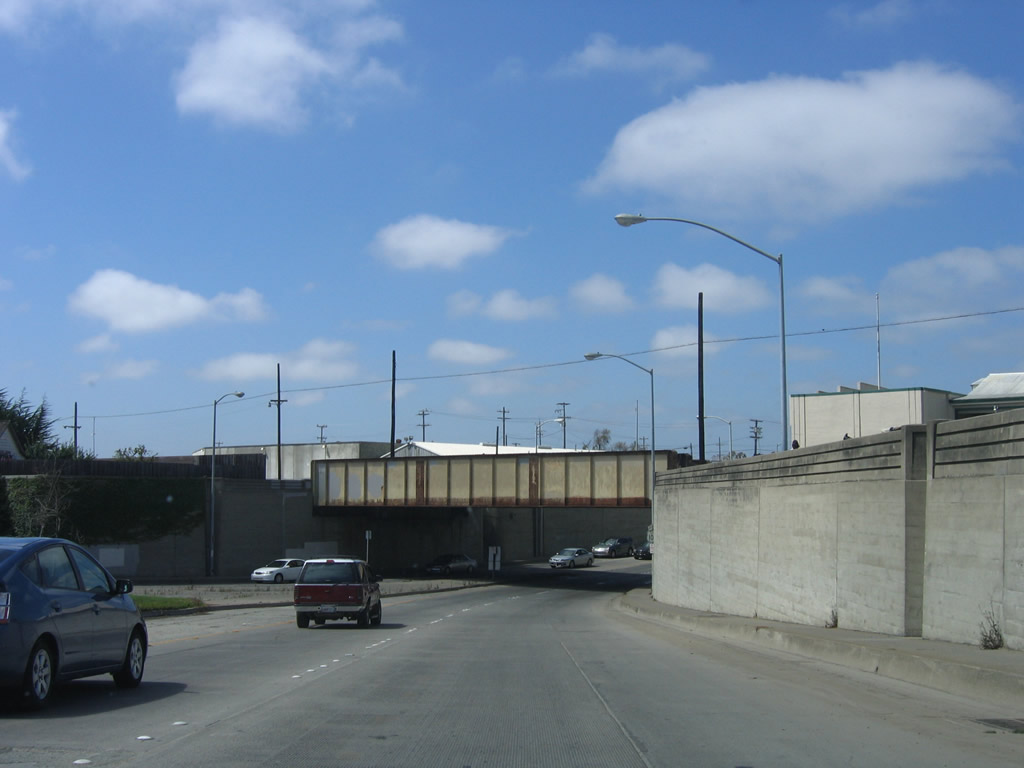 |
Upon turning left at Monterey Street, the U.S. 101 Business one-way couplet reunites to form Main Street. From here, Main Street dives under the Union Pacific Railroad tracks via this subway. U.S. 101 Business and California 183 proceed northeast for a rendezvous with U.S. 101 (El Camino Real). Photo taken 07/05/06. |
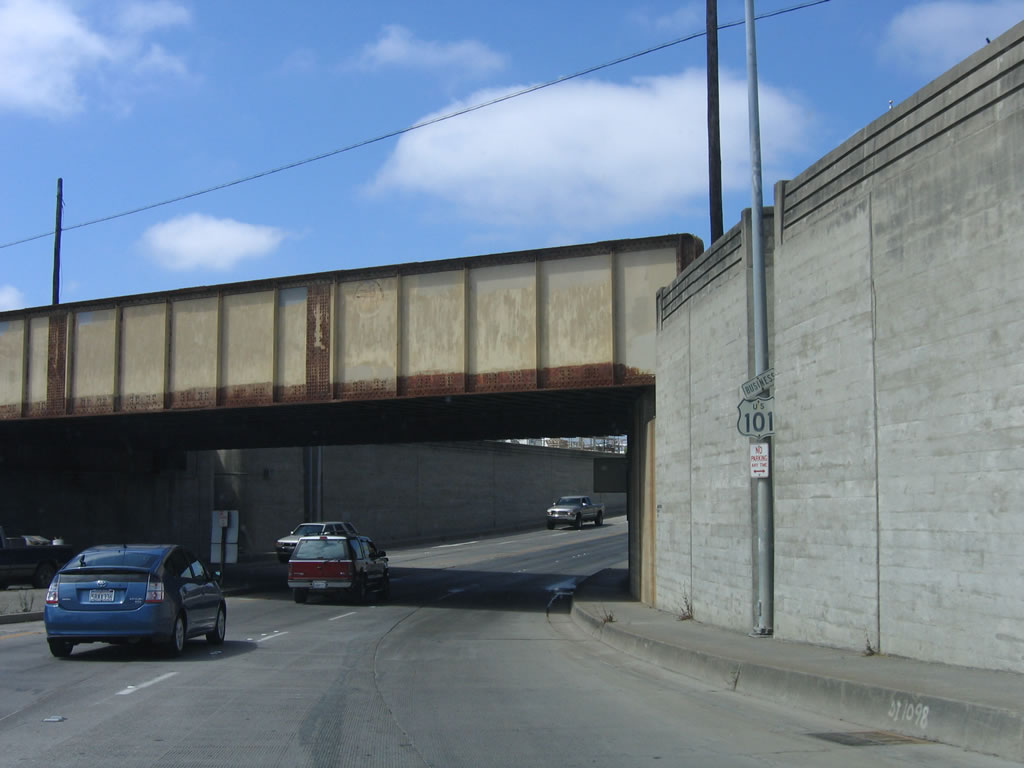 |
Embedded into the wall is a notch for a light post and a U.S. 101 Business reassurance shield. California 183 is not signed here (but will be shortly). Photo taken 07/05/06. |
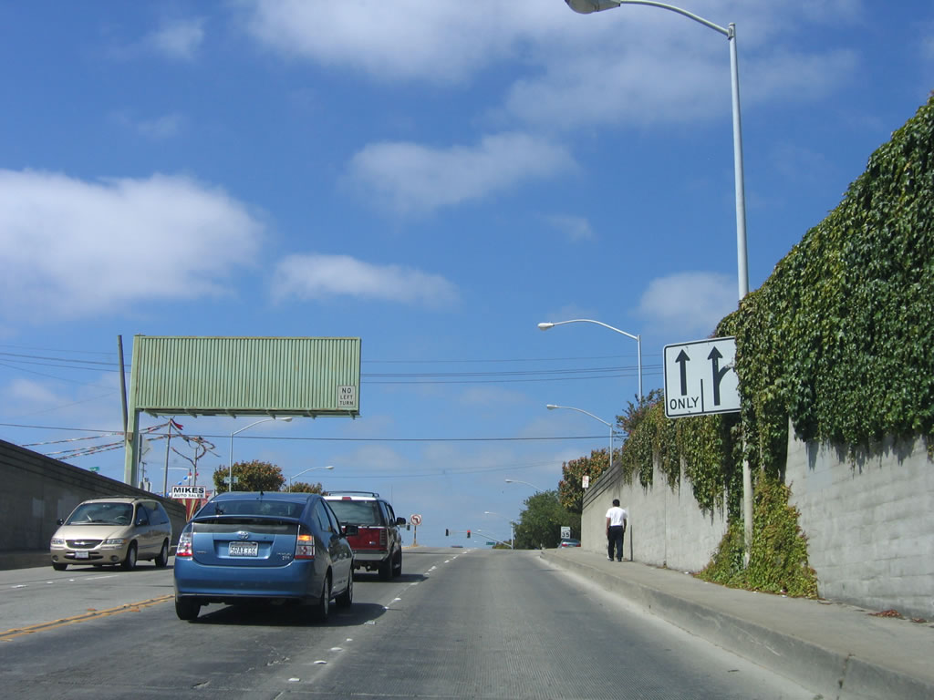 |
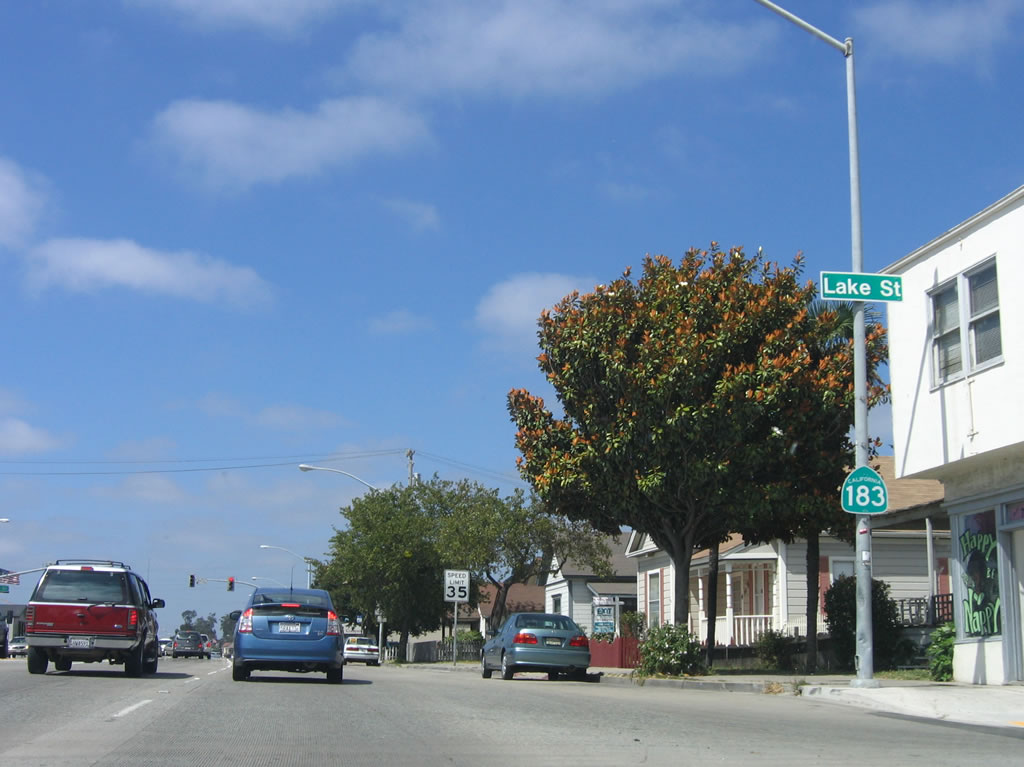
Northbound U.S. 101 Business and southbound California 183 approach the intersection with Lake Street. No left turn is permitted. The overhead guide sign in the other direction shows the split of U.S. 101 Business and California 183 at the Market Street intersection. Photo taken 07/05/06. |
 |
A California 183 reassurance shield is posted alone after the Lake Street intersection (not signalized). Photo taken 07/05/06. |
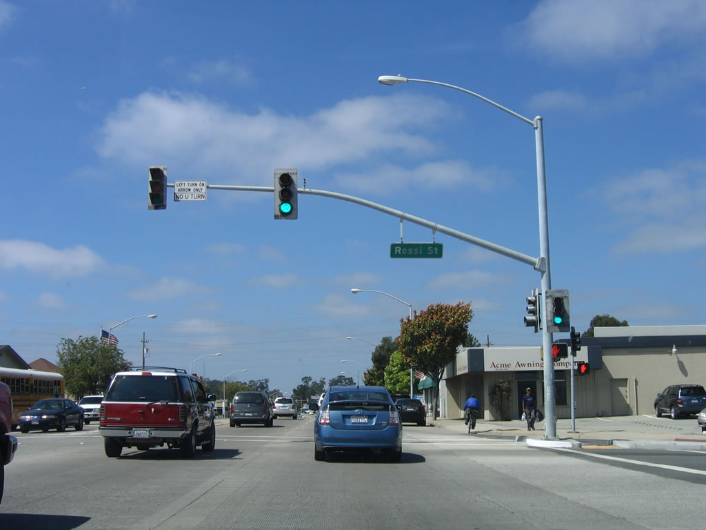 |
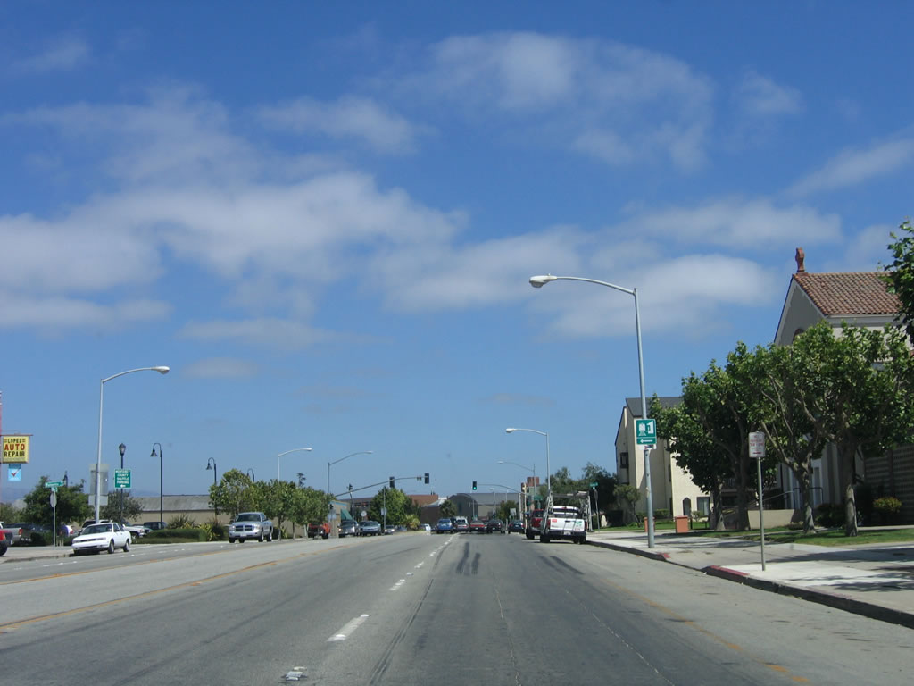
The next traffic signal is with Rossi Street. Photo taken 07/05/06. |
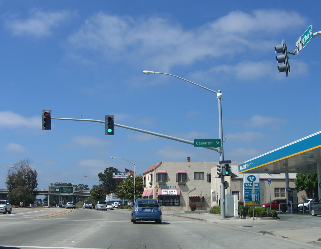 |
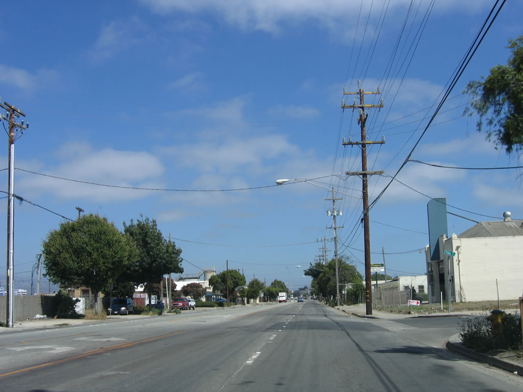
Prior to meeting U.S. 101, northbound U.S. 101 Business and southbound California 183 meet Casentini Road at this traffic signal. Photo taken 07/05/06. |
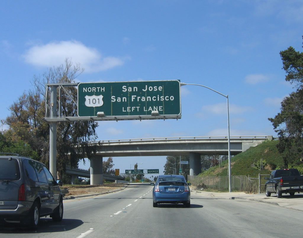 |
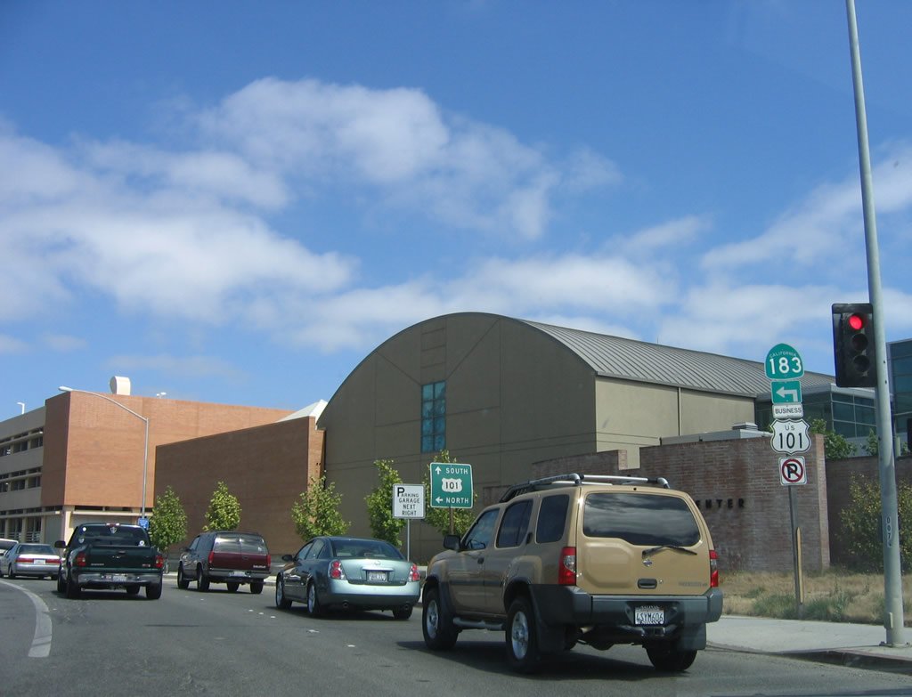
For U.S. 101 (El Camino Real) north, use the left lane. U.S. 101 travels north to Gilroy, Morgan Hill, San Jose, and San Francisco. There is no access to southbound U.S. 101. Photo taken 07/05/06. |
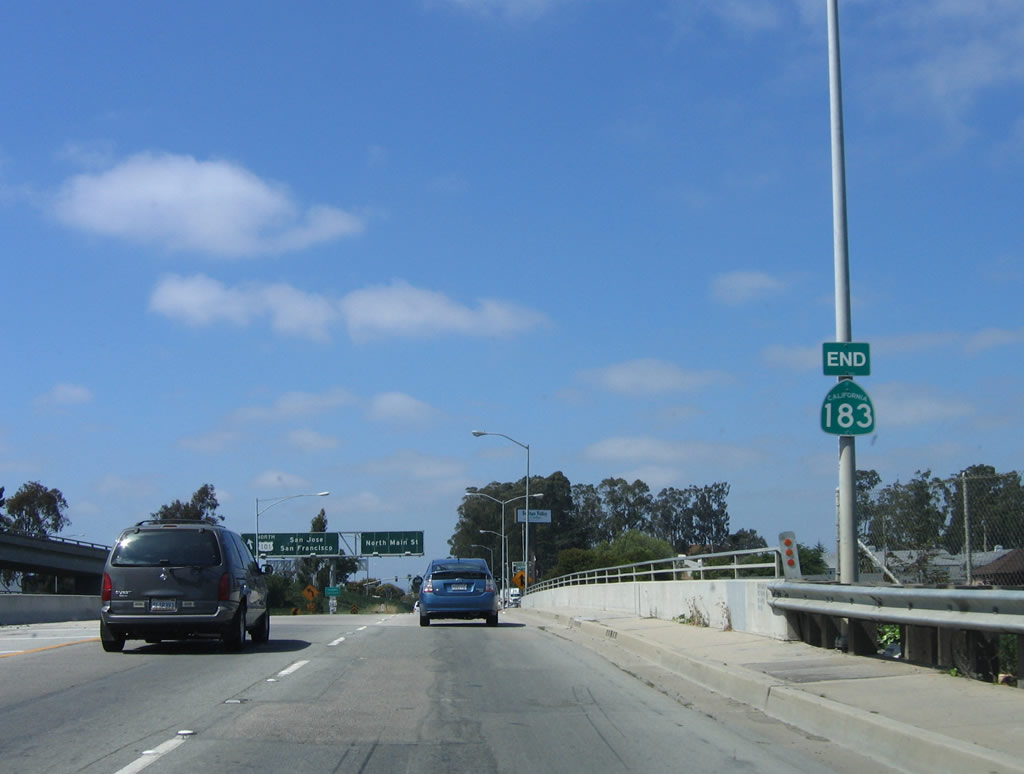 |
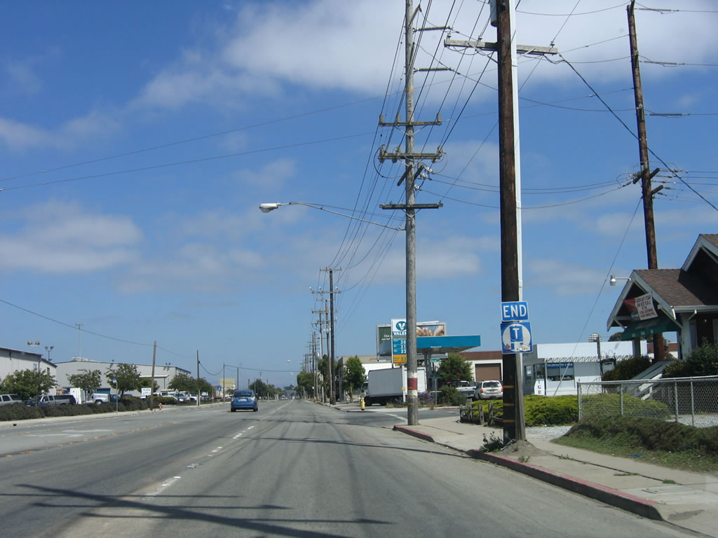
Upon crossing high above U.S. 101, an end California 183 shield assembly is posted. No mention is made of the end of U.S. 101 Business. Photo taken 07/05/06. |
 |
The left lane departs to U.S. 101 north, while the right two lanes continue north on Main Street. Main Street continues north past Sherwood Park and Northridge Mall before reuniting with U.S. 101 at the Espinosa Road/Russell Road intersection north of the Boronda Road interchange. Photo taken 07/05/06. |
| California 183 scenes | |
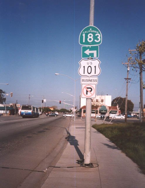 |
These shields for U.S. 101 Business and California 183 are located in northern Salinas. Photo taken by Trevor Carrier (03/09/02). |
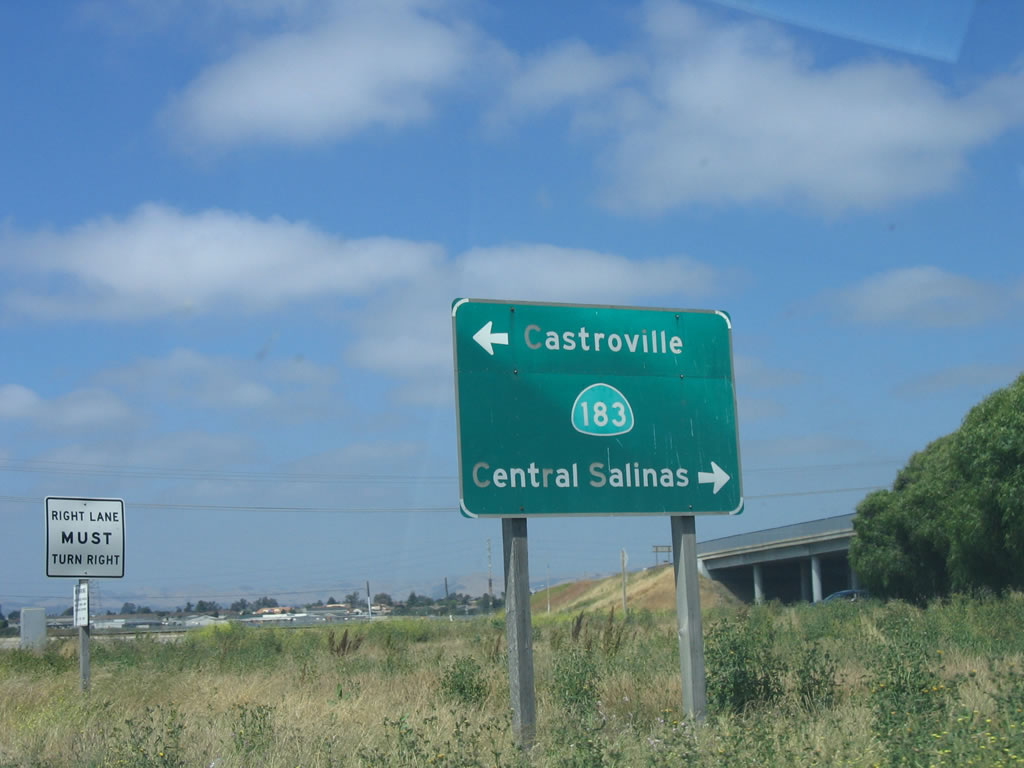 |
On the transition ramp from Davis Road southbound to California 183 (Market Street) in Salinas, this sign points the way to Castroville (left turn/north) and downtown Salinas (right turn/south). Photo taken 07/05/06. |

Page Updated October 20, 2007.
|
About Contact Glossary |
In The News Interstate Guide |
Social Media:
 |
|
© 2000-25 AARoads.com | All Rights Reserved | Privacy Policy / Terms of Use
|
||