| Interstate 5 north |
|
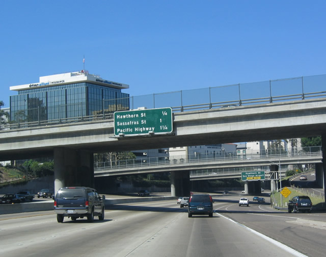
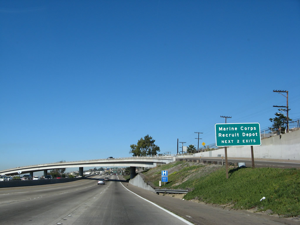
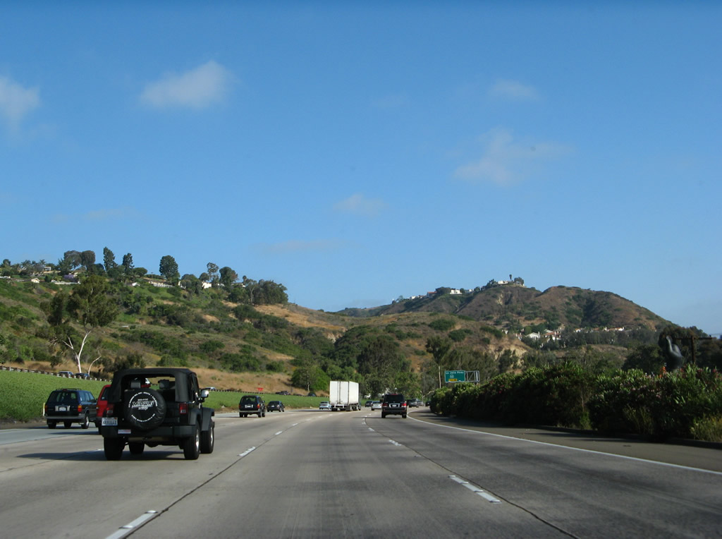
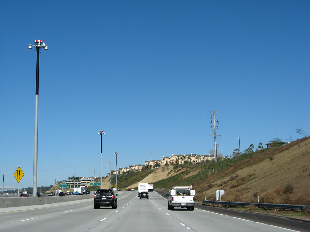
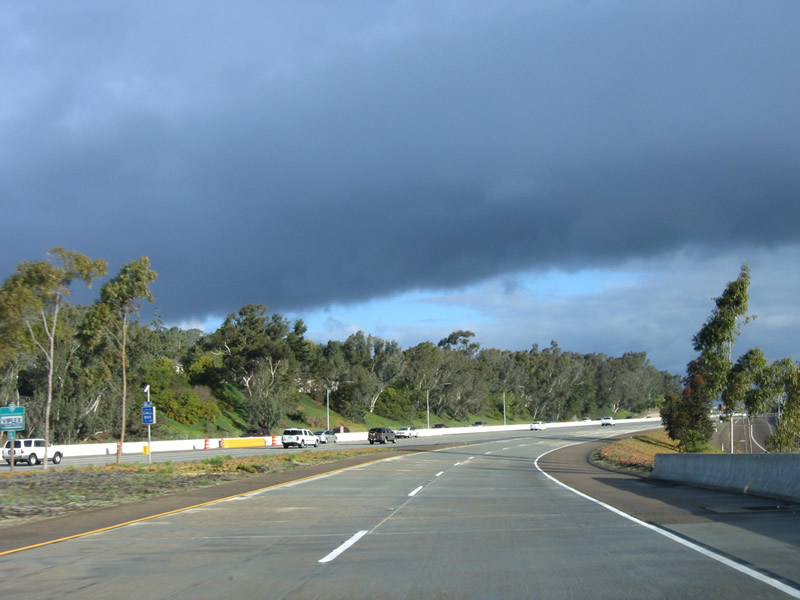
This mileage sign is located along northbound immediately after the Sixth Avenue off-ramp (Exit 16B). The next exit is Exit 17A, Hawthorn Street, which leads to the Bankers Hill and Little Italy neighborhoods as well as Lindbergh Field, San Diego International Airport. When the city grid was laid out by city founder Alonzo Horton in the 1800s, the east-west streets north of the Civic Center were given tree/plant names in ascending alphabetical order. The first such street is Ash Street, followed by (from south to north) Beech, Cedar, Date, Elm, Fir, Grape, Hawthorn, Ivy, Juniper, Kalmia, Laurel, Maple, Nutmeg, Olive, Palm, Quince, Redwood, Spruce, Thorn, Upas, Vine, and Walnut. Although these roads are fashioned into a grid, none of them are continuous roads, as they are interrupted by canyons, hills, Balboa Park, and other obstacles. The next exits after Hawthorn Street are Sassafras Street/India Street and Pacific Highway are the next two exits ahead. Photo taken 05/22/04. |
|
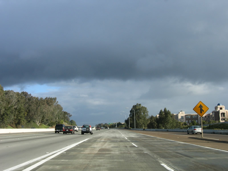
There is no direct freeway connection from Interstate 5 (or any other freeway) to the airport, unlike the airports in most other major metropolitan areas. There have been some proposals to improve access to the airport, including moving the airport terminals from the south/west side of the runway to the north/east side of the runway, but other feel the airport itself should be moved to another location. However, siting such a facility is very difficult in a mountainous terrain, and no residents in the region want to have an airport in their backyard. So the easiest course of action is to leave the airport where it is, make non-controversial upgrades to the existing facility (well, the 1998 expansion of Terminal Two was anything but non-controversial, with costs in excess of $200 million), and keep talking about/studying the same list of alternatives (new airport on military property, new airport at border location, adding a second runway to Lindbergh Field, etc.). It is clear that the current airport does not have enough capacity to do its job, but no solution is in sight at this time. Photo taken 05/22/04. |
|
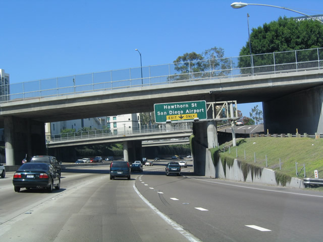
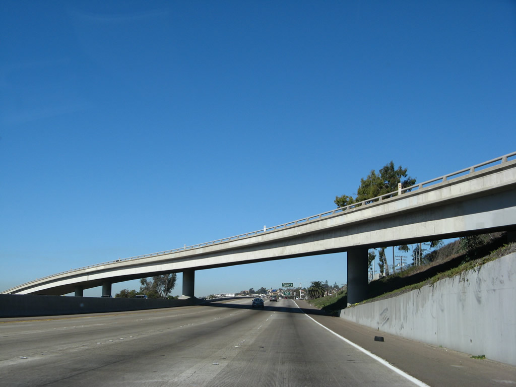
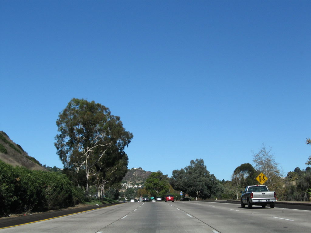
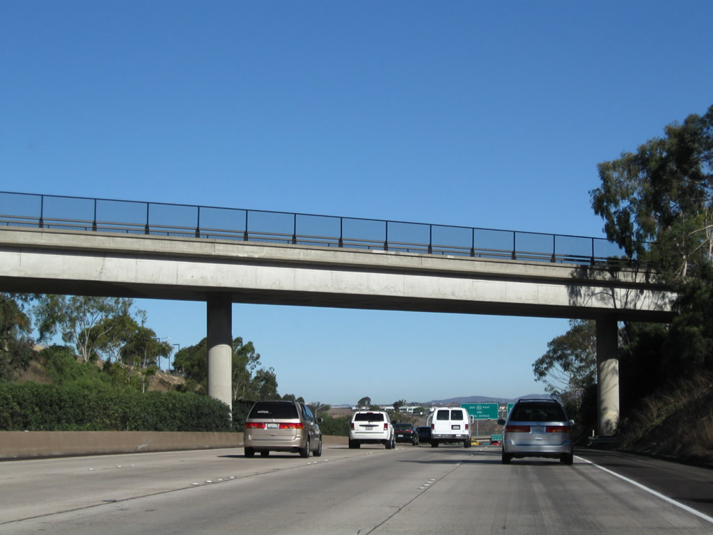
Northbound Interstate 5 reaches Hawthorn Street, Exit 17A. Meanwhile, back on Interstate 5, the curve ahead that takes the freeway to the right means that Interstate 5 will now resume its northward course, as it had been going due west for the past two miles. Photo taken 05/22/04. |
|
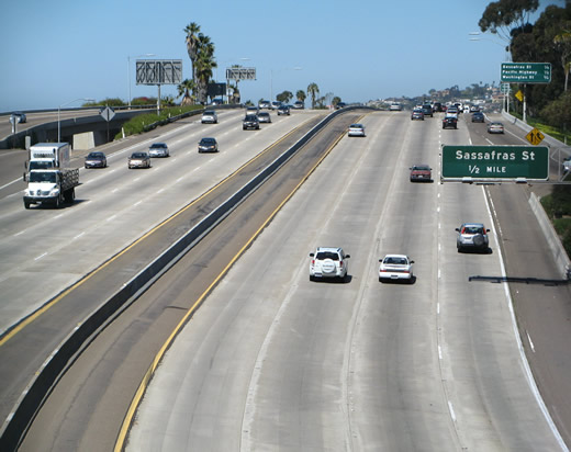
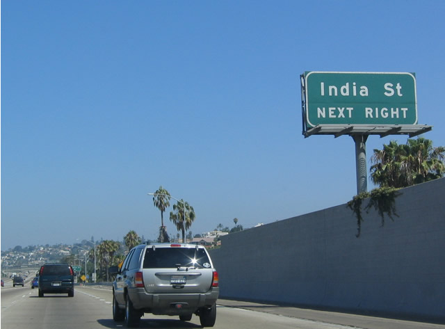
The next exit along northbound is Sassafras Street (Exit 17B). Although it may be tempting to group Sassafras Street into San Diego new town founder Alonzo Horton's list of trees and plants that constitute the names of east-west city streets north of the civic center, Sassafras is not one of them. In that grid, Sassafras actually falls in between Spruce and Thorn. Photo taken 05/22/04. |
|
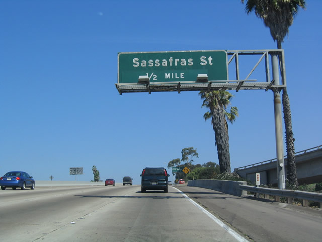
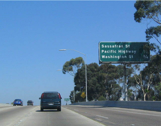
This mileage sign along northbound Interstate 5 approaches Exit 17B, Sassafras Street, one-quarter mile. This mileage sign lists Pacific Highway and Washington Street as the next two exits. Photo taken 05/22/04. |
|
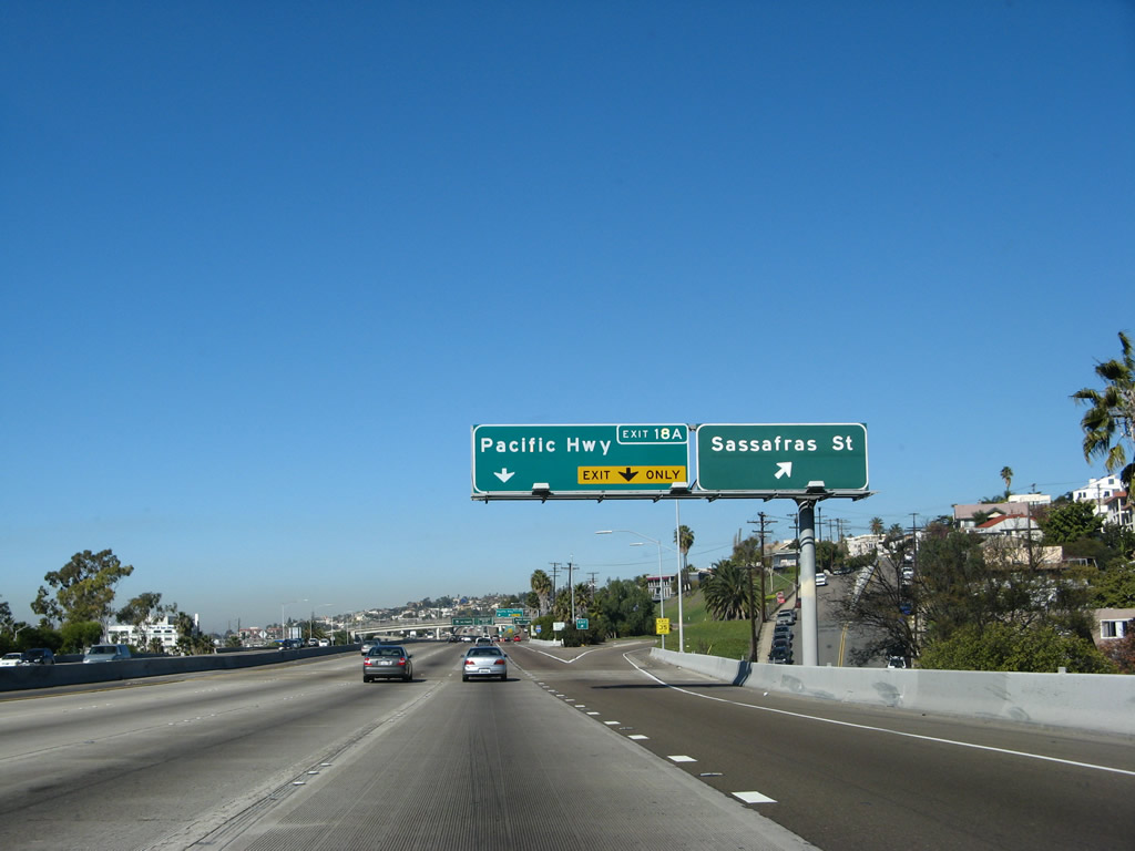
Northbound Interstate 5 reaches Exit 17B, Sassafras Street/India Street. The next exit is for Pacific Highway (Exit 18A). This major interchange is visible in the background of this photo. The section of Interstate 5 (former U.S. 101) was built to its current configuration between 1965 and 1967. Photo taken 01/24/07. |
|
Northbound Interstate 5 next approaches Exit 18A, Pacific Highway. Prior to the completion of Interstate 5 between Downtown and Old Town, consideration was originally given to constructing Interstate 5 along the original U.S. 101 Pacific Highway alignment between Sassafras Street and Rosecrans Street. Parts of this portion of U.S. 101 was upgraded to freeway standards, and it was mileposted as Interstate 5 between Sassafras and Barnett Avenue (a remnant milepost was located at the Washington Street/"Roadside Business" overpass). However, it was later determined that Interstate 5 should be placed on a new alignment (hence the "R" ("realigned") mileage on the Interstate 5 mileposts between Sassafras and Interstate 8). So as a result, the remnant freeway was remanded to the city of San Diego, and it is now maintained by the city rather than by Caltrans. Several original freeway signs still remain on Pacific Highway. U.S. 101, of course, was decommissioned officially in 1964, and signs were completely gone along Interstate 5 by 1970. This approach signage for Pacific Highway/Exit 18A is located on northbound. Photo taken 01/24/07. |
|
Northbound Interstate 5 (San Diego Freeway) reaches Exit 18A, Historic U.S. 101 (Pacific Highway) north. The off-ramp is two lanes, and it links directly onto Pacific Highway. The former alignment of Interstate 5 via Pacific Highway has exits at Washington Street ("Roadside Business"), the Marine Corps Recruit Depot (MCRD), and Barnett Avenue/Midway Drive. After that, the road reverts to a four-lane expressway, with stoplights and cross traffic until Rosecrans Street. Traffic may return to Interstate 5 by continuing north on two-lane Pacific Highway to Sea World Drive, then turn north on the freeway. This routing would make an excellent Business Loop I-5 or -- better yet -- Historic U.S. 101. Photo taken 01/24/07. |
|
Use either Exit 18B (Washington Street) or Exit 19 (Old Town Avenue) west to the U.S. Marine Corps Recruit Depot (MCRD). Photo taken 01/24/07. |
|
The two-lane connector ramp from Interstate 5 north to Pacific Highway north flies over the northbound lanes. Photo taken 01/24/07. |
|
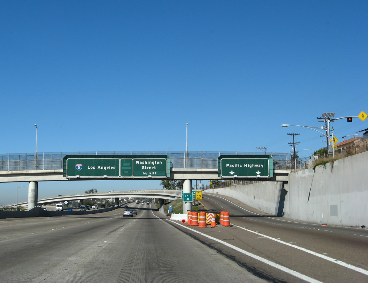
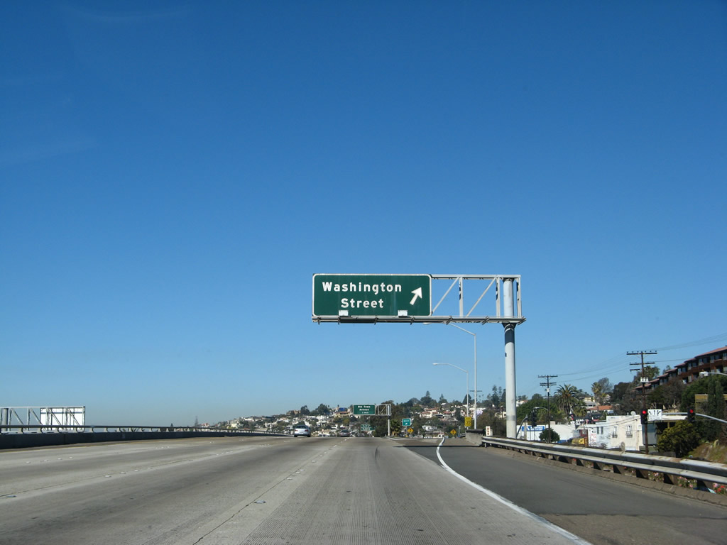
Northbound Interstate 5 reaches Exit 18B, Washington Street to Mission Hills and Middletown neighborhoods of San Diego. Washington Street is a major east-west city street that passes through the neighborhoods of Mission Hills and Hillcrest en route to Mid-City. It becomes Business Loop I-8 once it crosses California 163 (Cabrillo Freeway) in Hillcrest. The section of Washington Street between Interstate 5 and University Avenue is an older expressway, complete with concrete and an exit at University Avenue. Photo taken 01/24/07. |
|
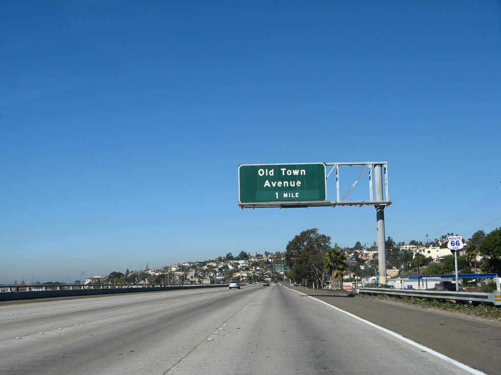
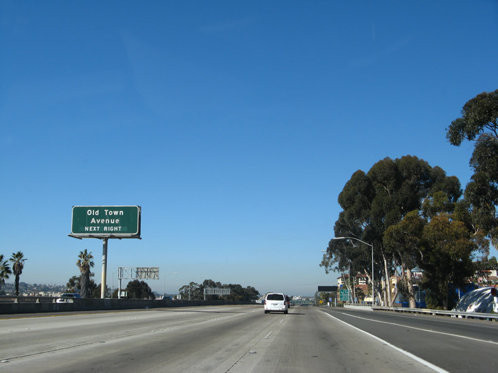
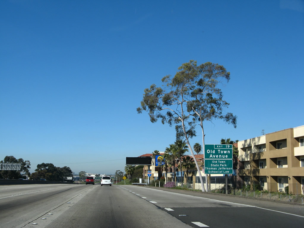
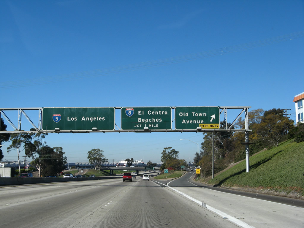
The next exit along northbound after Washington Street is Exit 19, Old Town Avenue. As the freeway travels away from downtown, the exits are usually spaced at a rate of one per mile. Old Town Avenue is Exit 19, although it is not signed as such in this picture. Photo taken 01/24/07. |
|
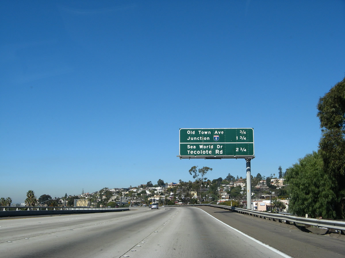
This mileage sign along Interstate 5 provides the distance to the next three exits: Exit 19, Old Town Avenue (three-quarters of a mile); Exit 20, Interstate 8 (Mission Valley Freeway) east to El Centro and Interstate 8 (Ocean Beach Freeway) west to Ocean Beach and Mission Bay Park (one and three-quarters miles); and Exit 21, Sea World Drive and Tecolote Road (two and three-quarter miles). Photo taken 01/24/07. |
|
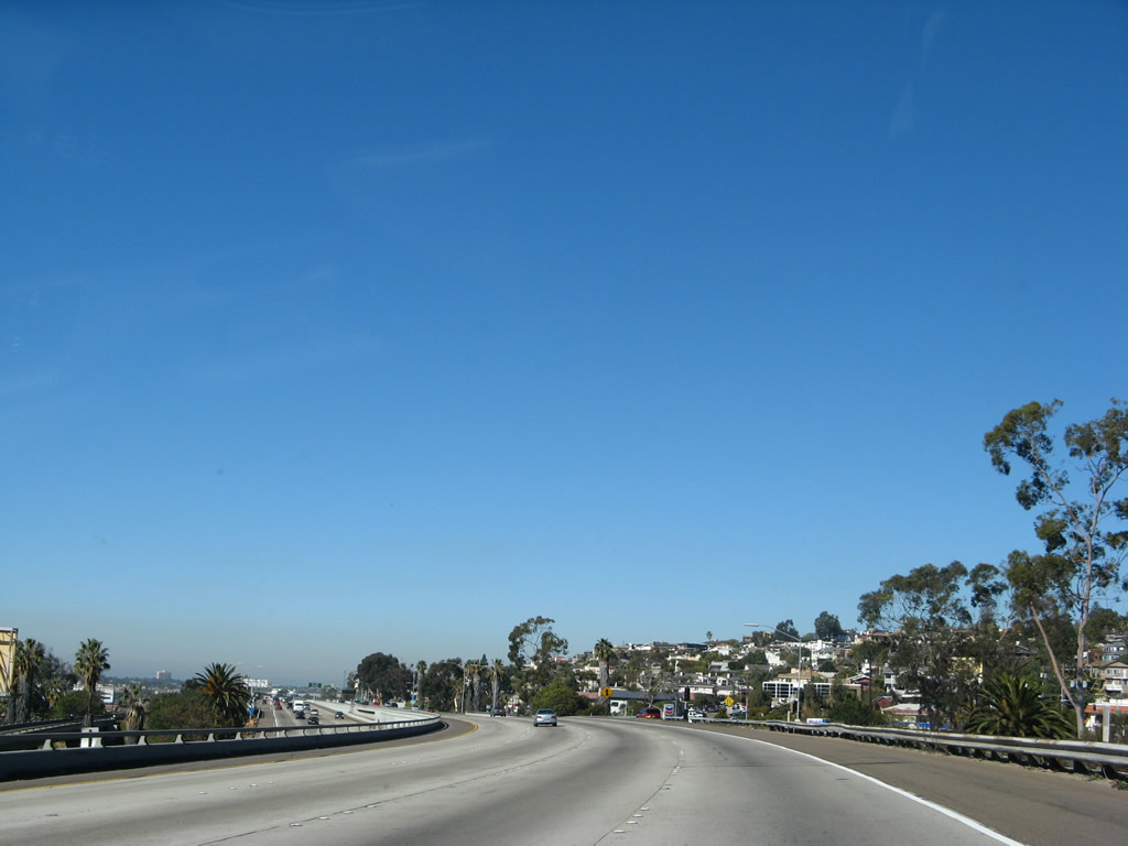
The northbound lanes of Interstate 5 are higher than the southbound lanes. Photo taken 01/24/07. |
|
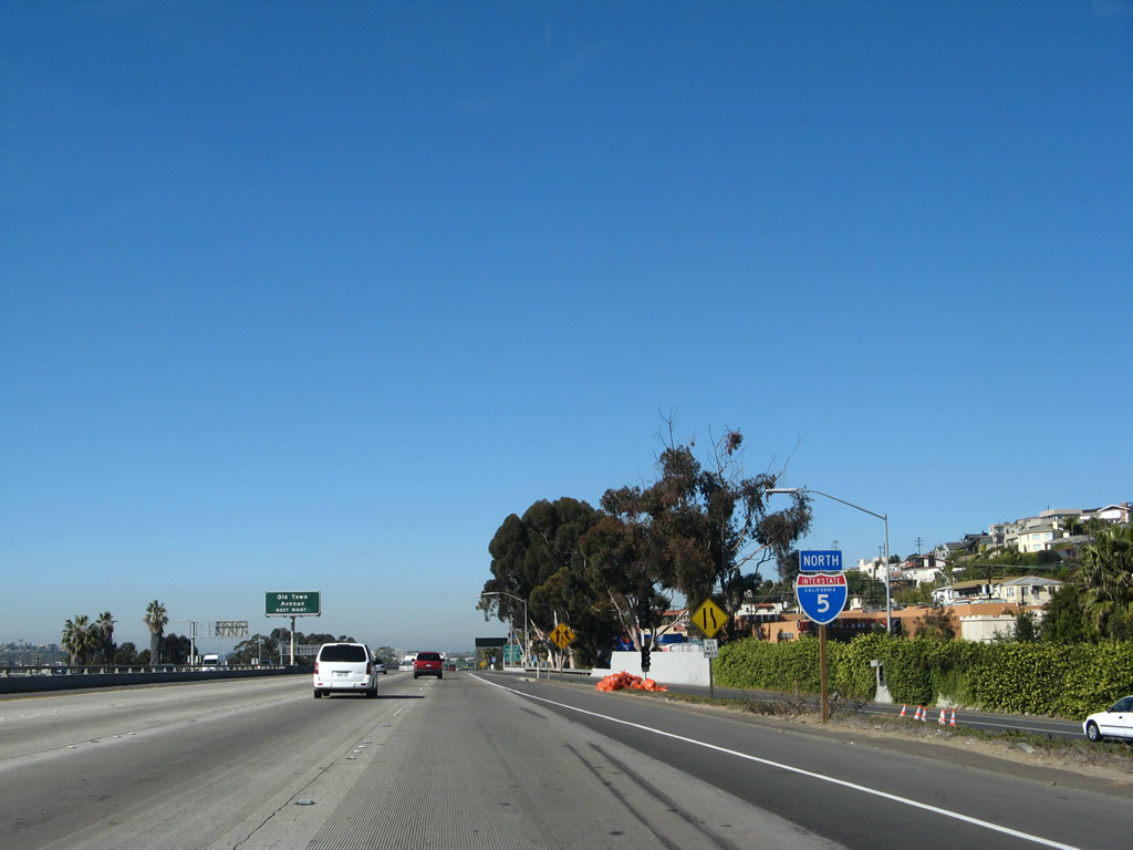
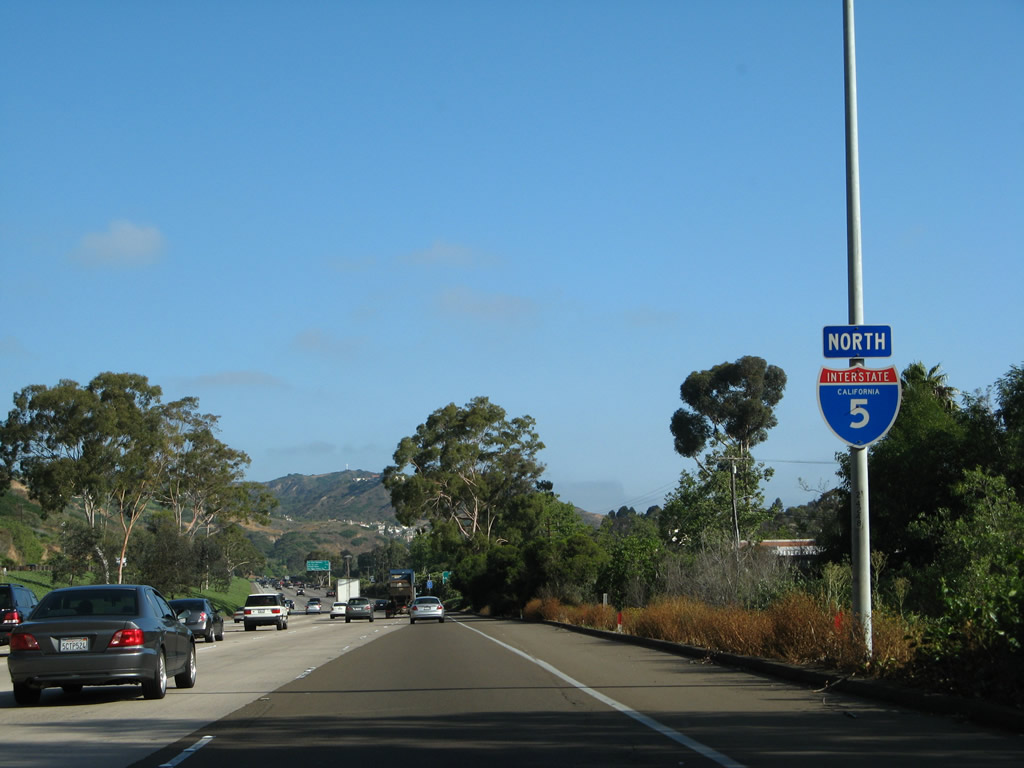
This Interstate 5 reassurance shield is posted prior to the on-ramp from San Diego Avenue and Washington Street. Photo taken 01/24/07. |
|
Old Town Avenue is the best route from northbound Interstate 5 into the Old Town community, which is the original location of the city's downtown. Old Town features a state historical park that has authentic buildings from the original downtown area, shops, and some of the best Mexican food in the city is located in Bazaar del Mundo. The area also features some intriguing bars, such as O'Hungry's, home of the yard beer. The District 11 Caltrans Headquarters is located off Juan Street in Old Town. Finally, the San Diego Trolley passes through here, and there is a large park and ride underneath the Interstate 5 viaduct for those who want free parking. The San Diego Trolley is an excellent means to reach downtown, Mission Valley shopping centers, and Qualcomm Stadium (home of the San Diego Chargers football team). Photo taken 01/24/07. |
|
Exit 19, Old Town Avenue serves Old Town State Park and the Thomas Jefferson School of Law. This is the only exit number sign for Exit 19. Photo taken 01/24/07. |
|
Northbound Interstate 5 reaches Old Town Avenue, Exit 19. Old Town Avenue is merely a connector route; to reach the state historic park, exit Old Town Avenue eastbound and then turn north along San Diego Avenue. The heart of Old Town begins where San Diego Avenue meets with Congress Street at a fork in the road. To reach the trolley and park and ride parking lot, use Congress Street to Taylor Street. Photo taken 01/24/07. |
|
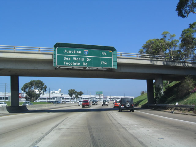
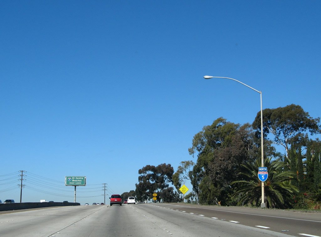
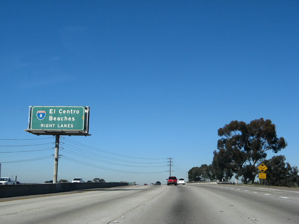
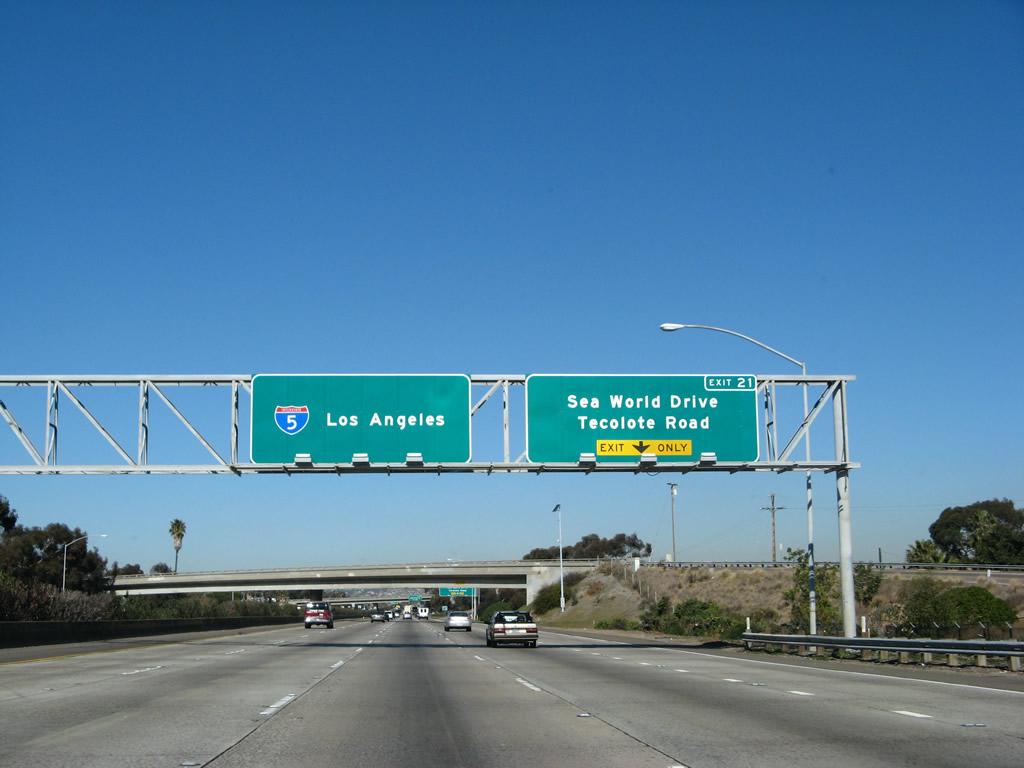
The next exit along northbound Interstate 5 is Interstate 8 (Exit 20), three-quarters of a mile. This interchange was completely revised and reconstructed in 1969. The following exit is for Sea World Drive and Tecolote Drive (Exit 21). Photo taken 05/22/04. |
|
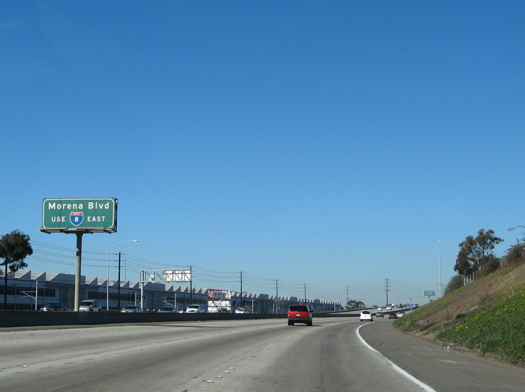
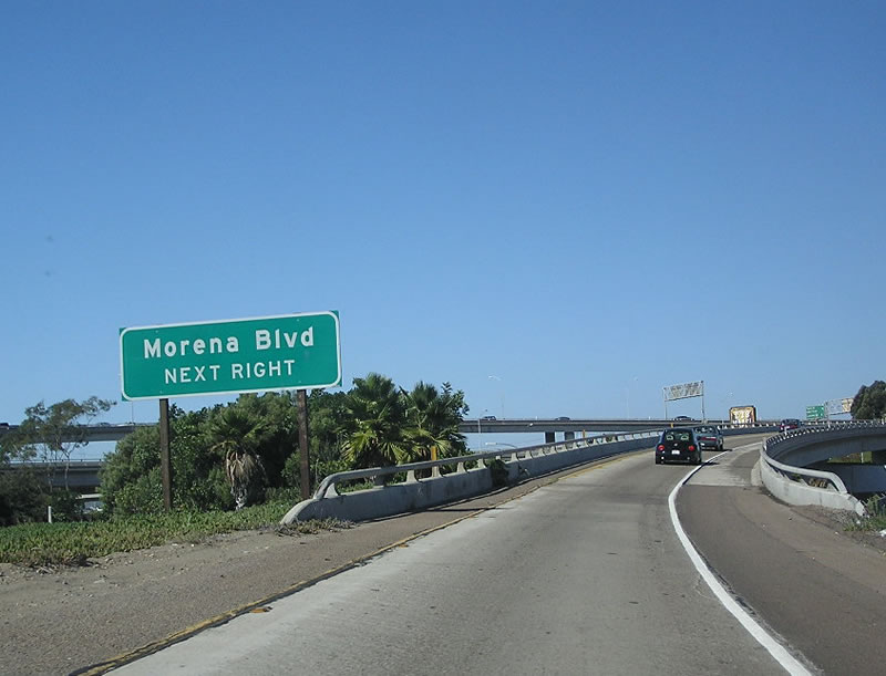
The exit from Interstate 5 northbound to Interstate 8 eastbound connects to a ramp leading to Morena Boulevard, which parallels Interstate 5 between Interstate 8 and Balboa Avenue. Morena Boulevard is the best way to reach the University of San Diego, a private Catholic school located in the community of Linda Vista. In addition, many warehouses and big box stores are located along Morena Boulevard in the northeast quadrant of the Interstate 5/8 interchange, and this exit is the best way to get to them. This exit does not lead to Old Town; it only goes to northbound Morena Boulevard. Morena is generally pronounced "More-ee-nah" by locals, even though that is not how the word is properly pronounced in Spanish. Photo taken 01/24/07. |
|
At the on-ramp from Old Town Avenue is another Interstate 5 north reassurance shield. Brackets on the pole remain below the Interstate 5 shield for the former U.S. 101 shield that was previously posted at this location. Photo taken 01/24/07. |
|
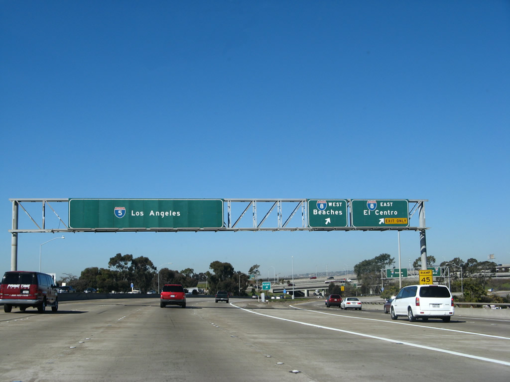
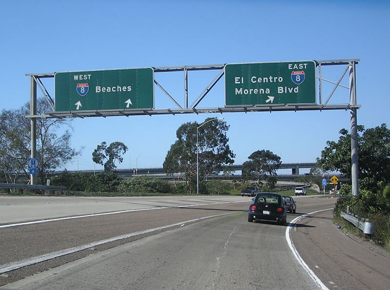
Interstate 8 is the Ocean Beach Freeway west of here and the Mission Valley / Alvarado Freeway east of here. It is also known as the Kumeyaay Highway, which is named after a local band of Native Americans. Interstate 8 was briefly known as California 109 west of this interchange and as U.S. 80 east of this interchange before the arrival of the Interstate designation. The control city of "Beaches" is used here, along westbound Interstate 8 after it passes the San Diego City Limits near 70th Street, and at its interchanges with California 163, Interstate 15, and Interstate 805. El Centro, the eastbound control city, is a relatively small desert community situated in the heart of the Imperial Valley agricultural region. Photo taken 01/24/07. |
|
Northbound Interstate 5 meets Interstate 8 at Exit 20. Here the exit opens up to two lanes for the off-ramp. However, since this is a one-lane exit along mainline Interstate 5, traffic frequently tightens up and slows significantly during rush hours and other periods of high traffic volume. Interestingly, although there are two lanes allocated to westbound Interstate 8 from northbound Interstate 5, more traffic uses the one-lane ramp to eastbound Interstate 8. This ramp needs to be expanded to two lanes, but due to the quantity of lanes merging onto Interstate 8 here (Camino del Rio/former California 209 comes in from the south and additional traffic merges on from Morena Boulevard), the choke point has to occur somewhere. Photo taken 01/24/07. |
|
Now on the transition ramp, these porcelain enamel signs (which likely date back to the early to mid 1960s) advise of lane allocation for the connection to Interstate 8 from northbound Interstate 5. Unlike southbound, there is access to Interstate 8 in both directions from northbound Interstate 5. Photo taken 09/23/06. |
|
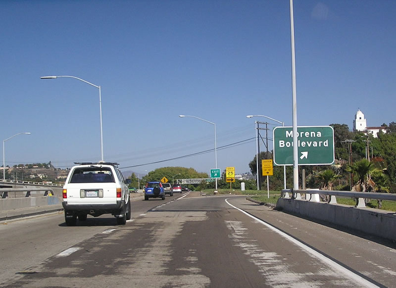
In addition to serving as the transition from northbound Interstate 5 to eastbound Interstate 8, this ramp also connects to Historic U.S. 101 northbound via Morena Boulevard. Morena Boulevard serves as an alternative to Interstate 5 between Old Town and Balboa Avenue (former California 274). U.S. 101 used to follow Morena Boulevard until the parallel section of Interstate 5 was constructed in 1967. Photo taken 09/23/06. |
|
Traffic merges onto the transition ramp from southbound Morena Boulevard. Stay in the left lane to connect to Interstate 8 east; merge right to follow Morena Boulevard north via a loop ramp. Photo taken 09/23/06. |
|
Reaching the ramp to Morena Boulevard (U.S. 101) north, the transition ramp from Interstate 5 north prepares to merge onto Interstate 8 east. Photo taken 09/23/06. |
|
Returning to the mainline, the next exit along northbound Interstate 5 is Exit 21, Sea World Drive/Tecolote Road as the freeway crosses over the San Diego River and Friars Road. For whatever reason, Caltrans does not have any signage to tell motorists that they are crossing the San Diego River. In fact, all of the freeway crossings over the San Diego River are unsigned. Photo taken 01/24/07. |
|
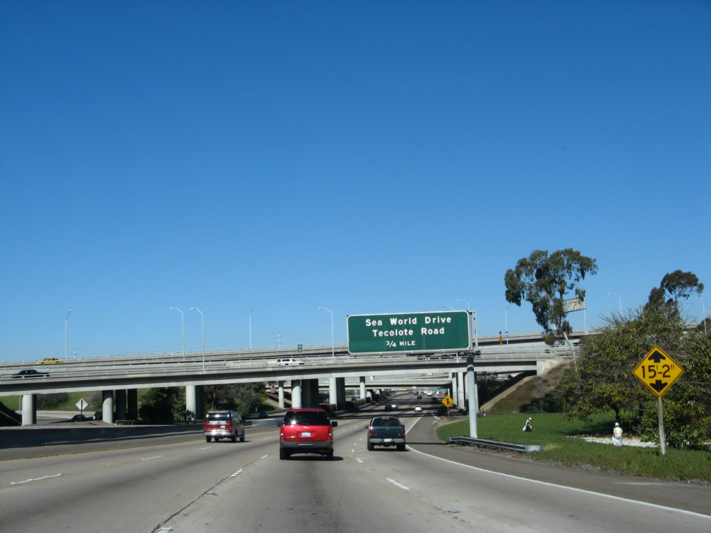
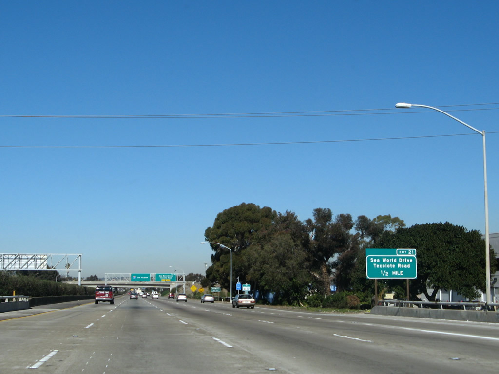
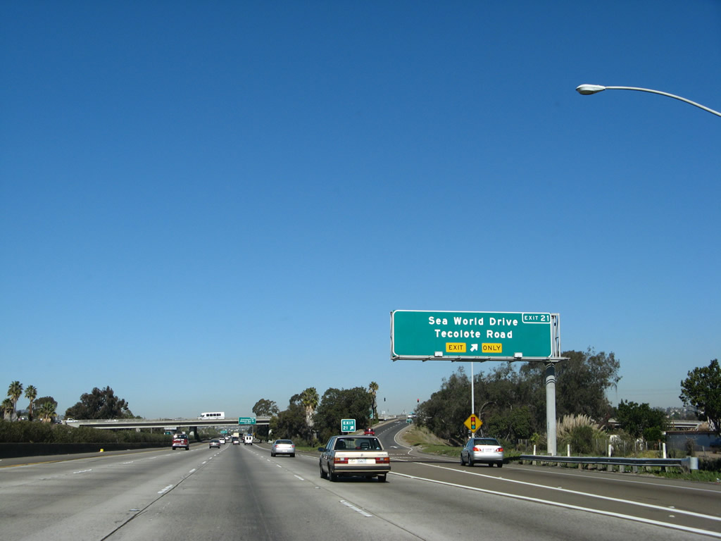
Northbound Interstate 5 (San Diego Freeway) approaches Exit 21, Sea World Drive/Tecolote Road. This exit leads to Sea World along westbound Sea World Drive, as the name implies. In addition, following Tecolote Road eastbound leads to a parking area for Tecolote Canyon Natural Park, situated in a canyon between Linda Vista and Clairemont Mesa. There are hiking and mountain biking trails located in Tecolote Canyon Natural Park. This sign was replaced the week of April 1, 2003. Photo taken 01/24/07. |
|
After this exit, Mission Bay comes into view. This large, saltwater inlet of water was created in 1960 with the dredging of the salt marsh that used to exist in this area. The result is a large water park, with plenty of opportunities for boating and other recreational opportunities. This sign was replaced the week of April 1, 2003. Photo taken 01/24/07. |
|
The right lane becomes exit only to Sea World Drive/Tecolote Road. Use Tecolote Road east to reach Tecolote Canyon, a popular open space canyon suitable for hiking and mountain biking. Photo taken 01/24/07. |
|
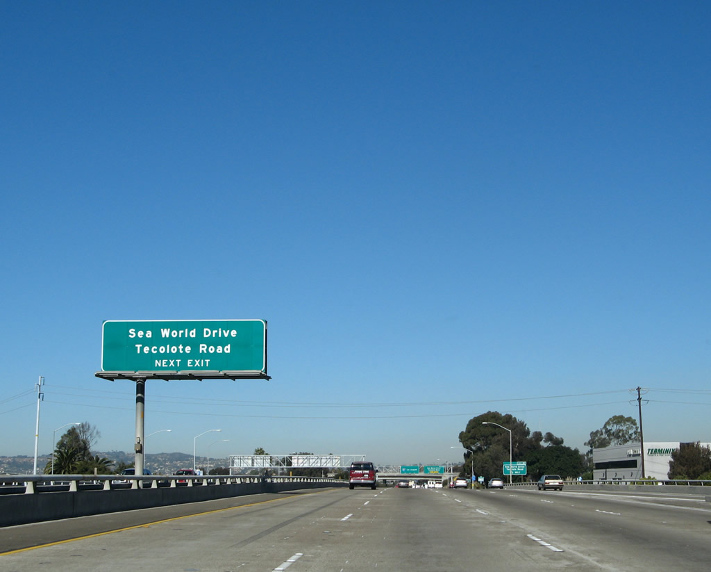
Northbound Interstate 5 reaches Exit 21, Sea World Drive/Tecolote Road. This gore point sign was replaced in late August 2002 with a numbered exit gore point sign. Photo taken 01/24/07. |
|
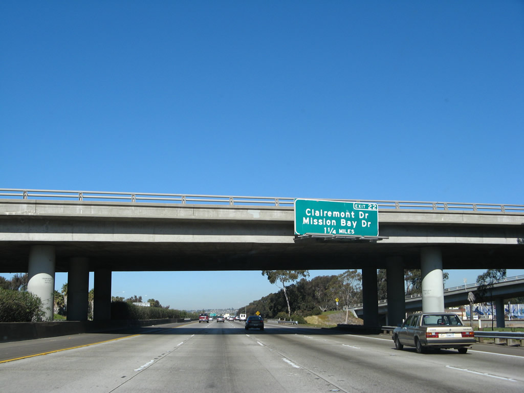
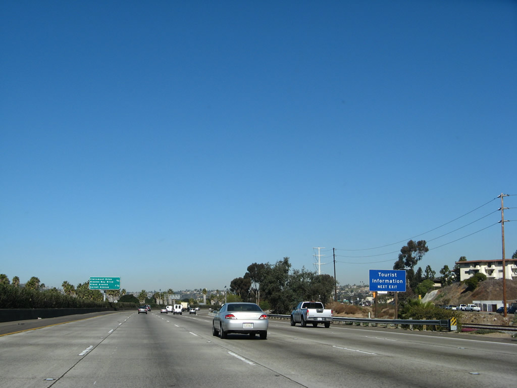
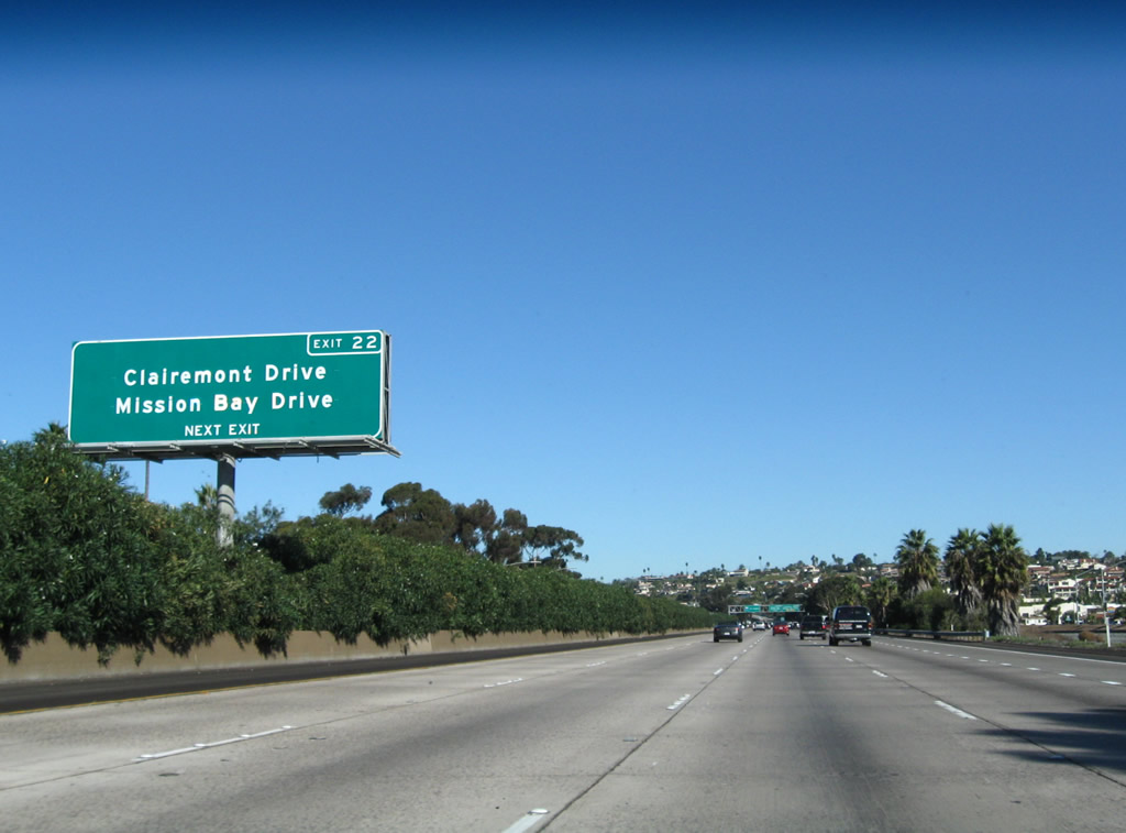
The next exit along northbound Interstate 5 is Exit 22, Clairemont Drive / Mission Bay Drive, 1.25 miles. Photo taken 01/24/07. |
|
A tourist information center is located on the eastern shore of Mission Bay. Use Exit 22 and follow the signs to Mission Bay Drive. The center is only a few blocks west of Interstate 5. Restrooms are available. Photo taken 01/24/07. |
|
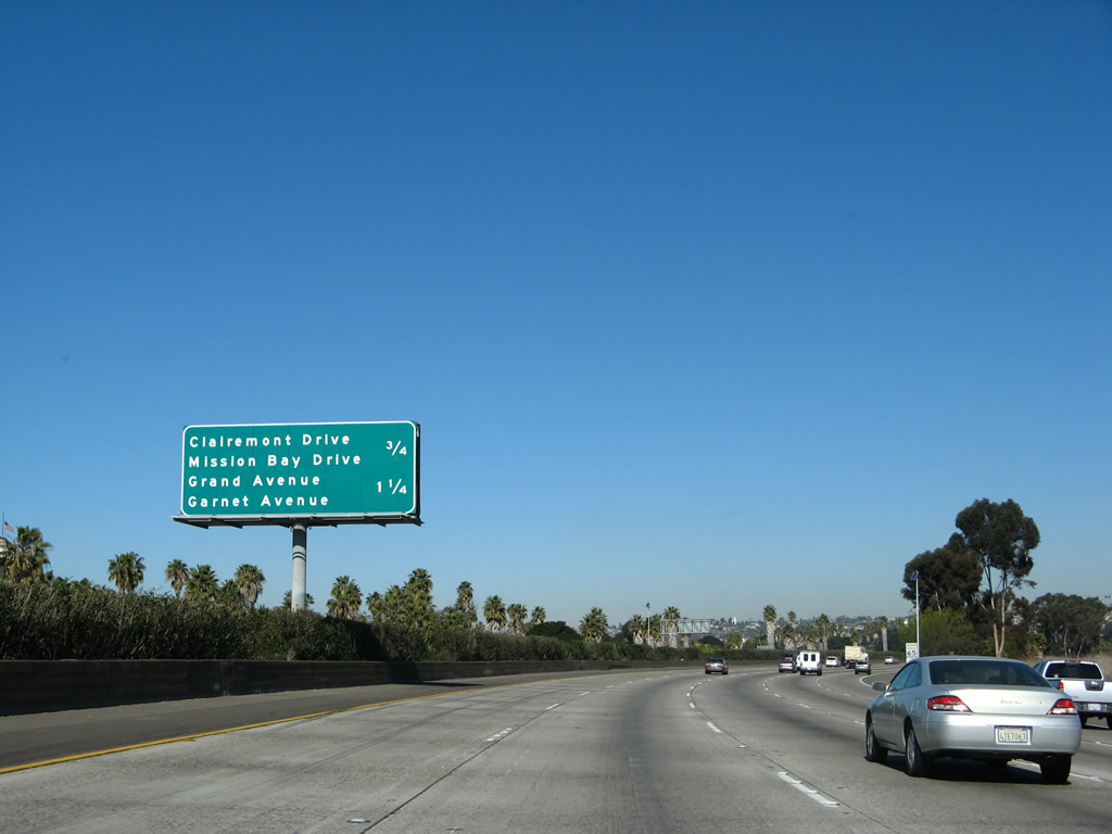
This mileage sign is posted along northbound Interstate 5 prior to Exit 22, Clairemont Drive / Mission Bay Drive, three-quarters of a mile. This mileage sign also provides the distance to Exit 23A, Grand Avenue/Garnet Avenue/Mission Bay Drive (Business Loop I-5). This sign was replaced the week of April 1, 2003. Photos taken 01/24/07. |
|
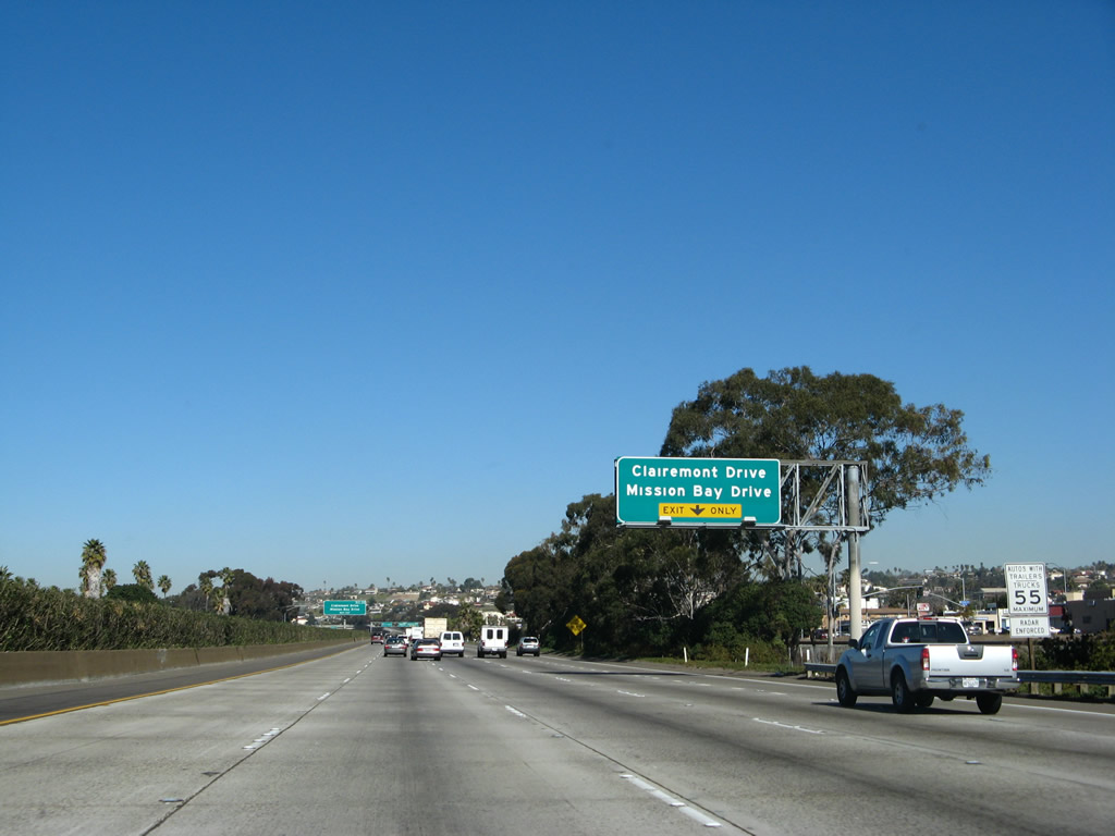
As Interstate 5 north approaches Exit 22, Clairemont Drive / Mission Bay Drive, the number five lane (far right hand lane) shifts from being the on-ramp from Sea World Drive to being the exit-only for Clairemont Drive. Clairemont Drive leads east and north from this interchange to serve the neighborhoods of Bay Park and Clairemont. Mission Bay Drive parallels the freeway to the west, and it provides access to the day-use picnic areas along the bayshore. This sign was replaced the week of April 1, 2003. On the new sign, it looks like Caltrans forgot to dot most of its "i's." Photo taken 01/24/07. |
|
This northbound sign in the median reminds motorists to get into the right lane if they intend to exit Interstate 5 to reach Clairemont Drive / Mission Bay Drive. Photo taken 11/08/08. |
|
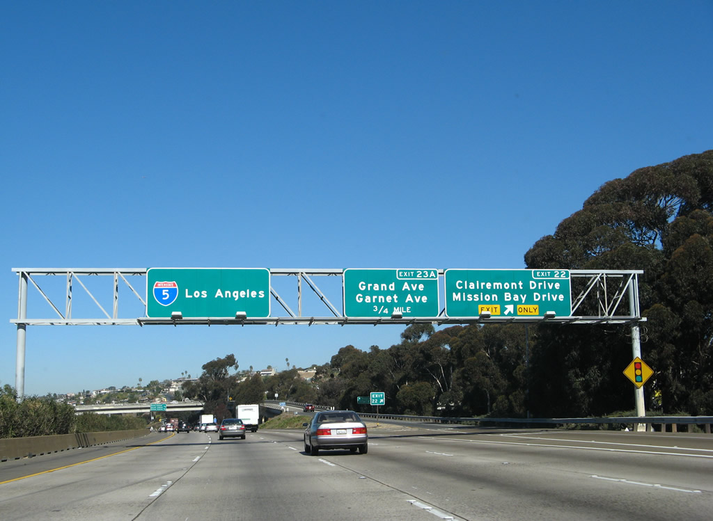
Northbound Interstate 5 reaches Exit 22, Clairemont Drive / Mission Bay Drive. The next exit is for Grand Avenue/Garnet Avenue (Exit 23A), which is the primary route into the community of Pacific Beach from northbound. This sign was replaced the week of April 1, 2003. Photo taken 01/24/07. |
|
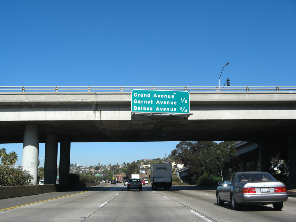
The next exit along Interstate 5 north is Exit 23A, Business Loop I-5 (Mission Bay Drive) north to Grand Avenue/Garnet Avenue (DeAnza Offramp). The Interstate 5 (formerly U.S. 101) bypass around Pacific Beach (between the north and south off-ramps for Exit 23A and Exit 23) was built in 1954 and expanded in 1969. The next exit is for former California 274, Balboa Avenue (Exit 23B). The Balboa Avenue exit only goes east, so Exit 23B may not be used to go west toward the beach. This sign was replaced the week of April 1, 2003. Photo taken 01/24/07. |
|
The on-ramp from Clairemont Boulevard becomes the off-ramp for Grand Avenue and Garnet Avenue. Upon making this exit, motorists are defaulted onto Mission Bay Drive; the first signal is Grand Avenue headed westbound. Garnet Avenue is a few signals further north, and it is also known as Balboa Avenue. (Garnet and Balboa Avenues more or less share pavement between Donaldson Drive/Fogg Street and Morena Boulevard, but it is signed as Garnet Avenue only through this section.) The intersection between Mission Bay Drive and Garnet / Balboa Avenues is considered to be among the busiest in the city of San Diego. This sign was replaced the week of April 1, 2003. Photo taken 11/08/08. |
|
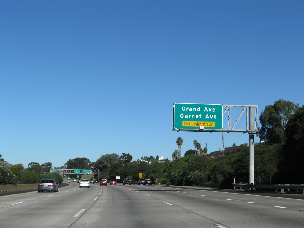
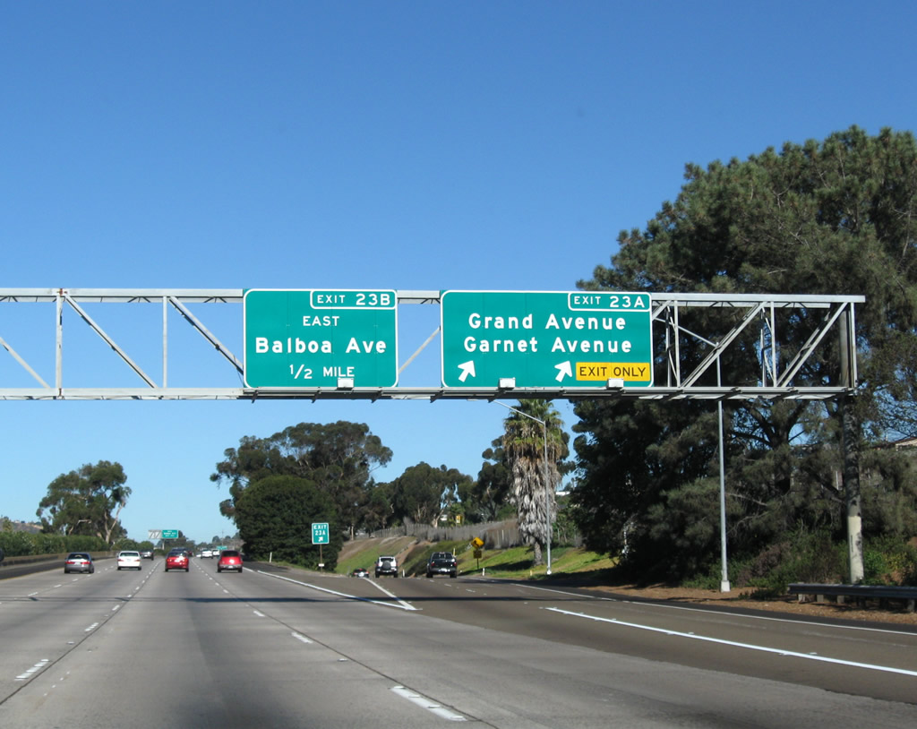
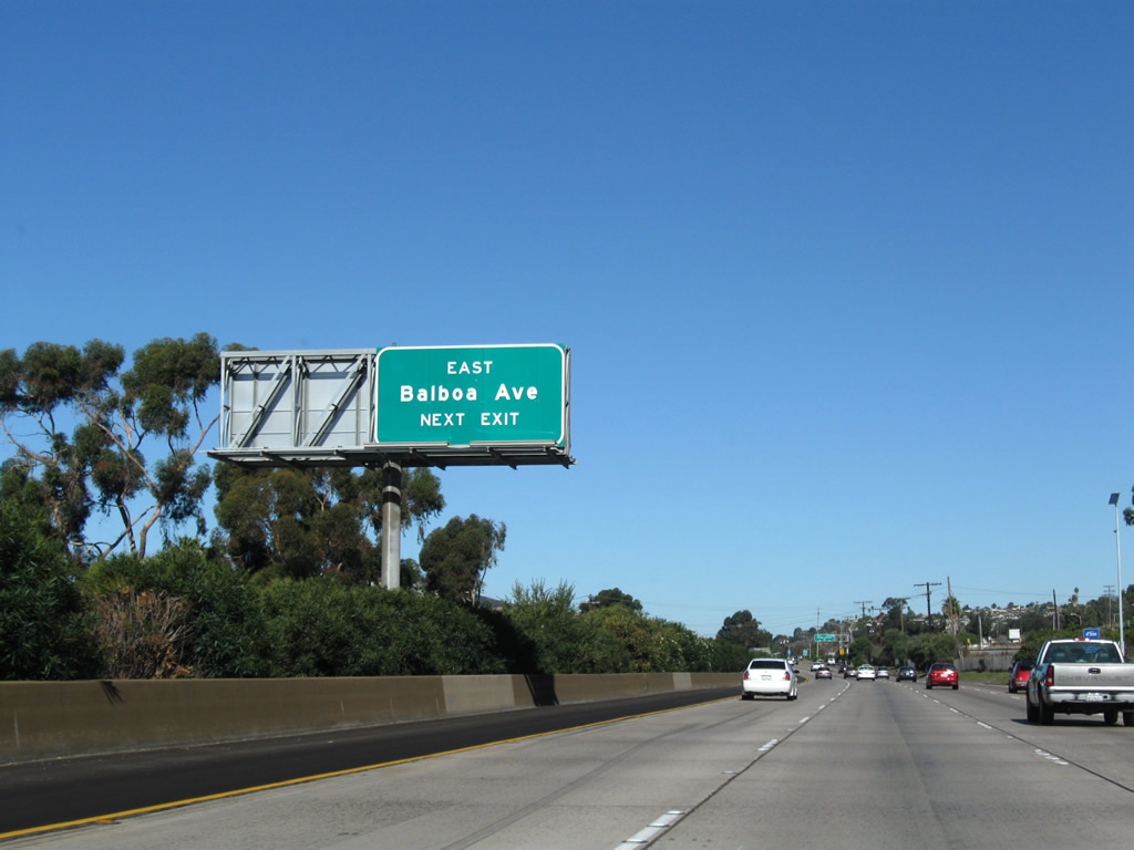
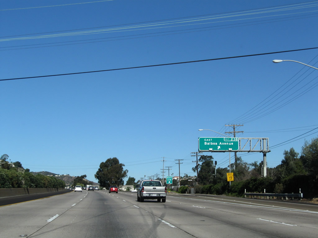
Northbound Interstate 5 reaches Exit 23A, Grand and Garnet Avenues. This exit actually is the southern terminus of Business Loop I-5 (Mission Bay Drive) between this exit and just north of Balboa Avenue, where Mission Bay Drive rejoins Interstate 5. There are plenty of businesses along this stretch, including gas, food, and lodging. On this overhead sign, the California 274 was omitted, both when it was an official state route and now that it is decommissioned. This sign was replaced the week of April 1, 2003. Photo taken 11/08/08. |
|
The next exit along northbound is Exit 23B, Balboa Avenue east. Balboa Avenue east of Interstate 5 was designated as California 274 until 2001, when it was deeded to the city of San Diego. Shields for California 274 remain in place as of August 2004. Photo taken 11/08/08. |
|
Northbound Interstate 5 reaches Exit 23B, Balboa Avenue (former California 274) east to Clairemont and Kearny Mesa. There is no direct access to westbound Balboa Avenue west into Pacific Beach (you should have used Exit 23A instead!). Photo taken 11/08/08. |
|
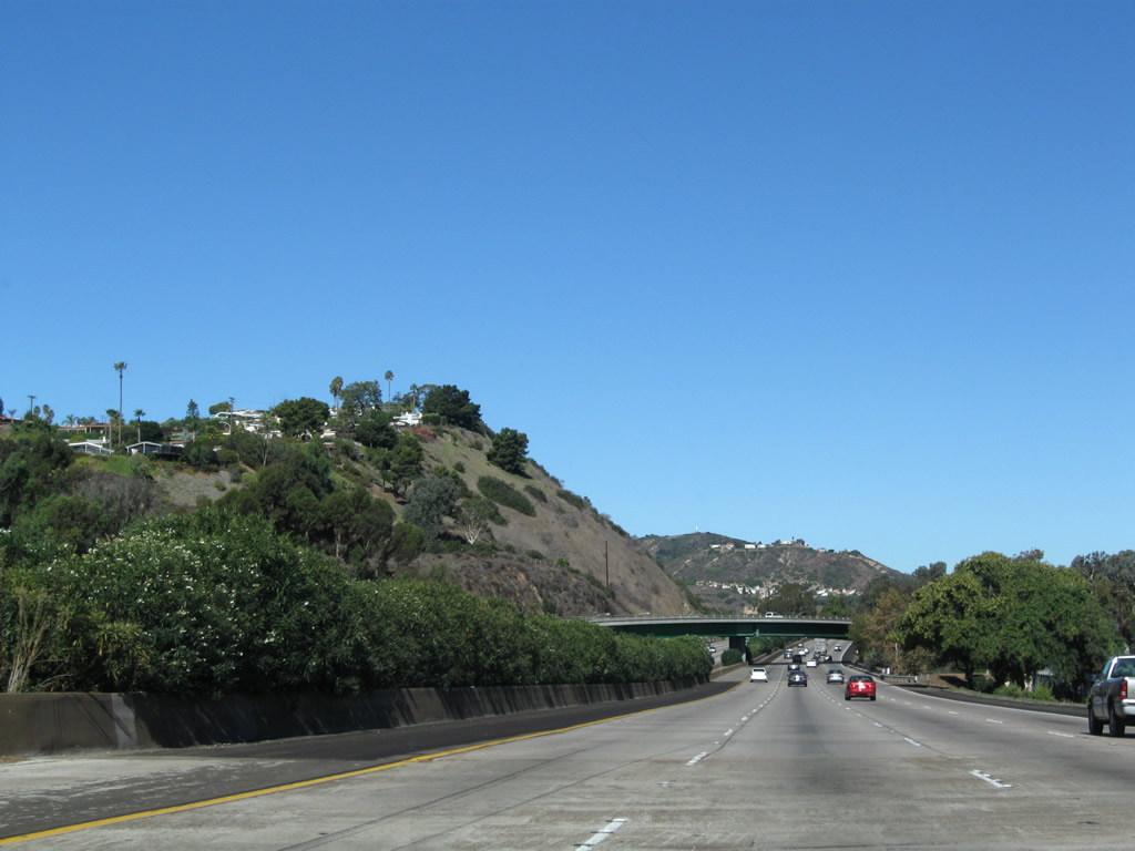
Interstate 5 will cross Rose Creek, then enter Rose Canyon after the Balboa Avenue interchange. Photo taken 11/08/08. |
|
After crossing Rose Creek, a flyover ramp that connects Mission Bay Drive (Business Loop I-5) back to Interstate 5 north will pass over the freeway. Photo taken 11/08/08. |
|
Traffic from Business Loop I-5 (Mission Bay Drive) merges onto Interstate 5 (San Diego Freeway) north from the right. Now in Rose Canyon, Interstate 5 passes along the east side of towering Mount Soledad. Photo taken 11/08/08. |
|
An Interstate 5 reassurance shield is posted after traffic from Pacific Beach merges back onto the northbound freeway. Photo taken 05/30/08. |
|
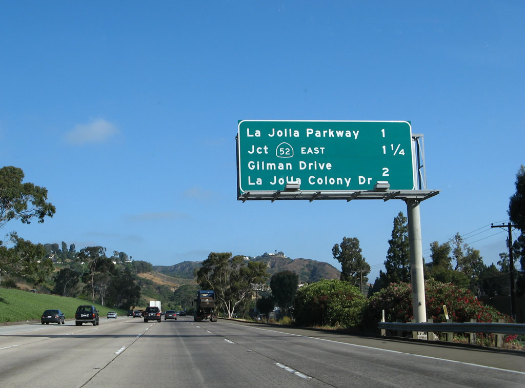
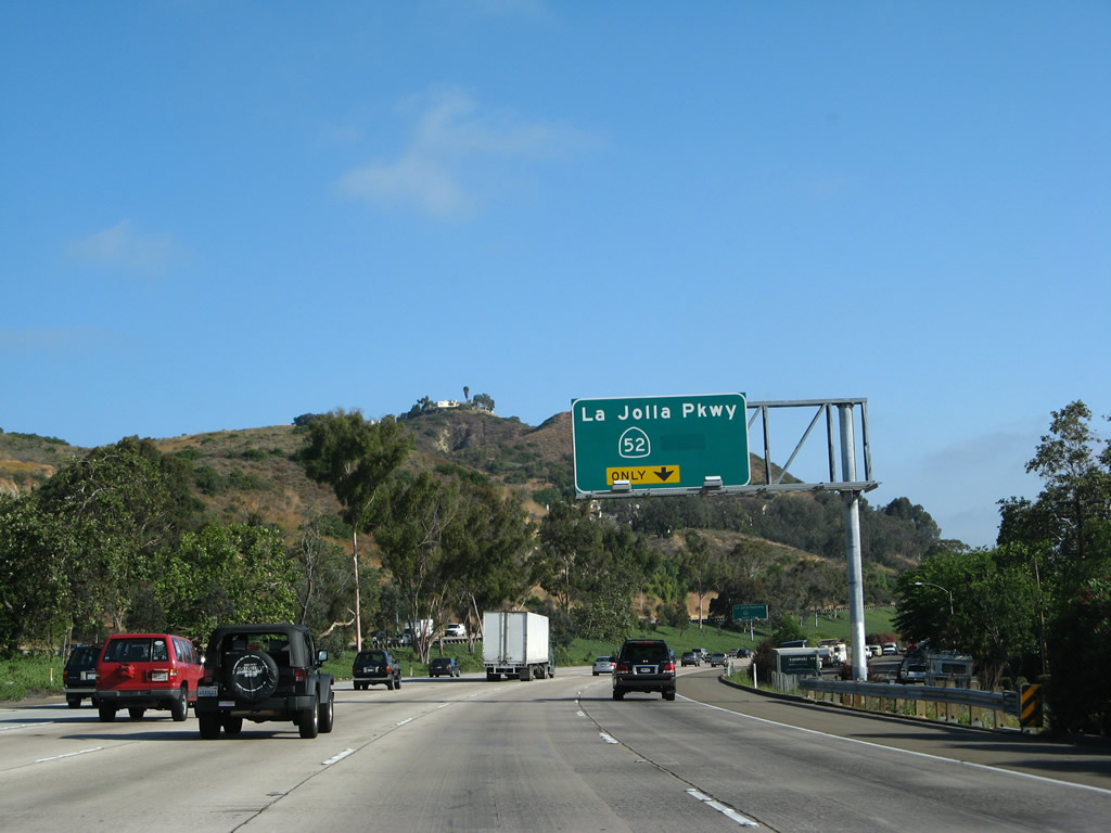
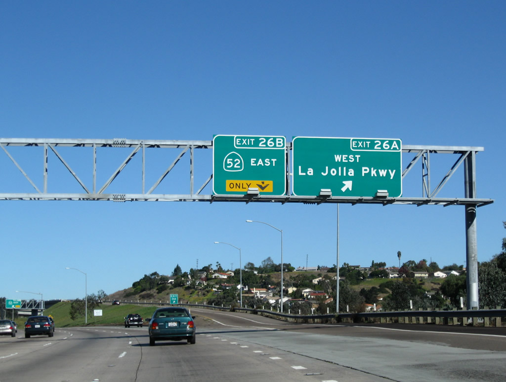
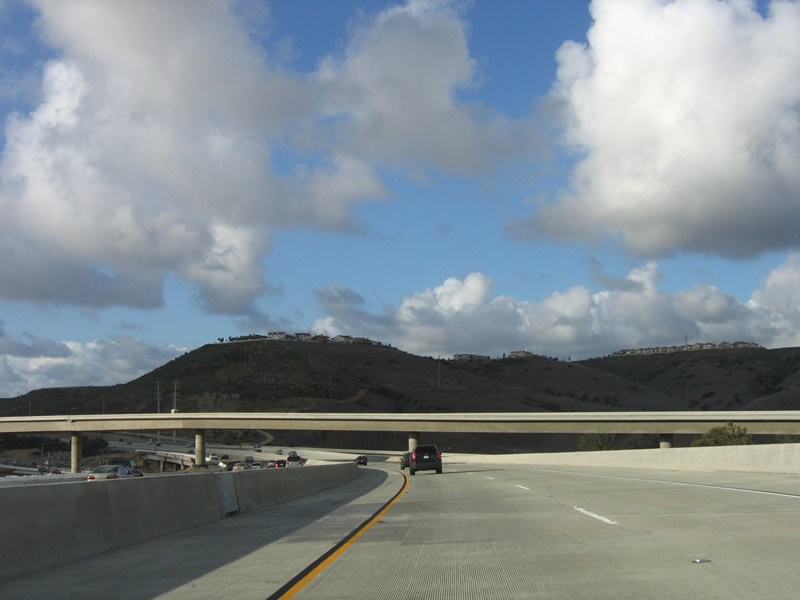
The next three exits along northbound Interstate 5 are Exit 26A, La Jolla Parkway; Exit 26B, California 52 East; and Exit 27, Gilman Drive/La Jolla Colony Drive. This section of Interstate 5 (from Exit 23 north to the Interstate 805 merge) was constructed in 1966. Photo taken 05/30/08. |
|
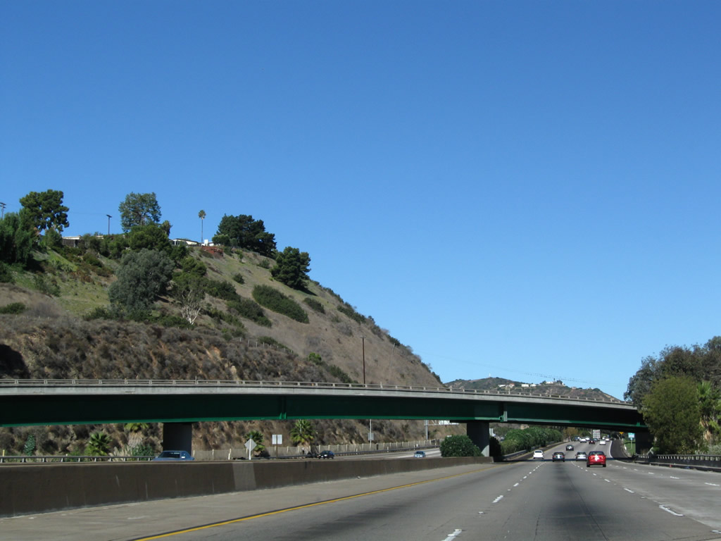
Interstate 5 travels through Rose Canyon between the Mission Bay Drive on-ramp and California 52, and there are no exits for this two-mile distance. The frontage road, Santa Fe Drive, may only be reached from Mission Bay Drive just north of Garnet Avenue. On the west side of the freeway lies Mount Soledad, which separates the freeway from the ocean. Considered part of La Jolla (within the City of San Diego), Mount Soledad mostly covered in homes but recently suffered a series of landslides that destroyed a few homes on the eastern flank. Photo taken 05/30/08. |
|
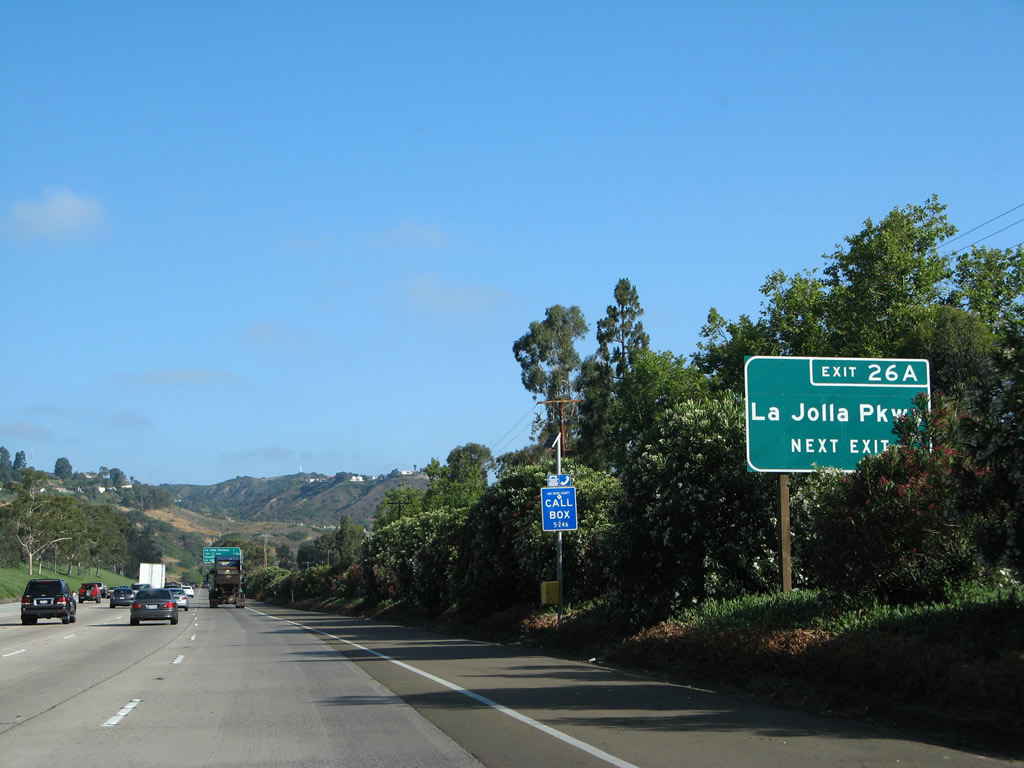
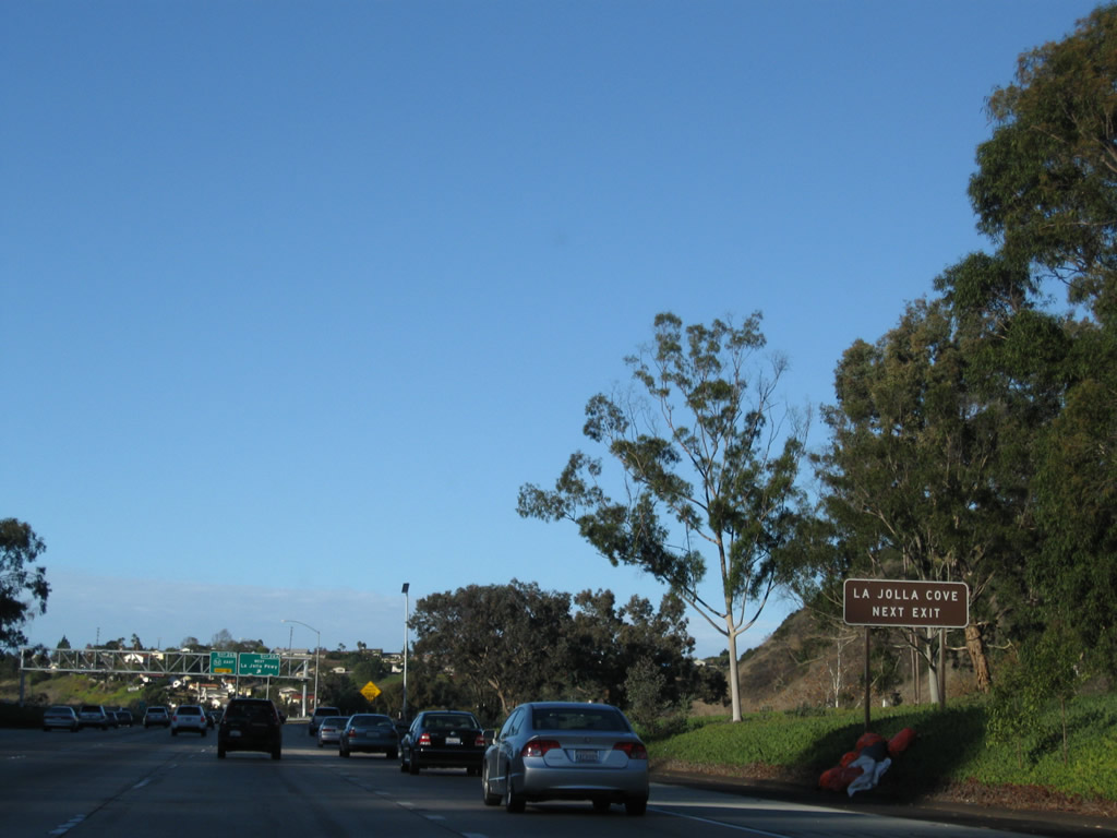
La Jolla Parkway is the best route from I-5 north to downtown La Jolla. It also connects to La Jolla Cove, well-known for underwater diving. Photo taken 12/16/08. |
|
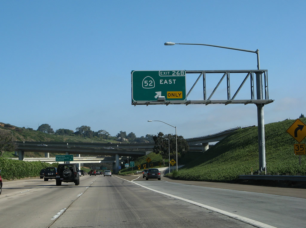
Exit 26A leaves I-5 north for La Jolla Parkway west. Sign replacements for Exit 26B made by 2003 eliminated the control point of San Clemente Canyon for SR 52 east. Photo taken 05/30/08. |
|
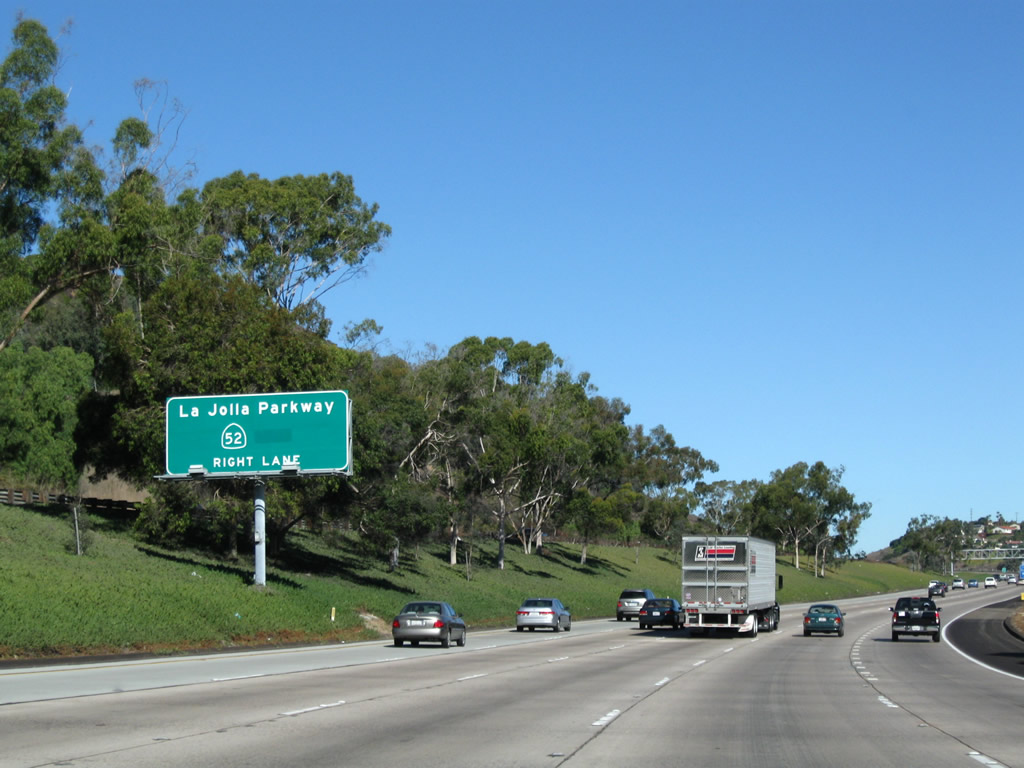
Known as the San Clemente Freeway, California 52 leads east from Exit 26B as the bottom third of the Golden Triangle (I-5 and I-805 form the other boundarys of the triangle). The Golden Triangle is a financial center, home to a variety of investment banks along La Jolla Village Drive. East of Interstate 805, California 52 crosses the San Diego Landfill and Mission Trails Regional Park on its way to Santee. Photo taken 05/30/08. |
|
The multi level interchange with La Jolla Parkway interchange sits on some of the most seismically vulnerable land in San Diego, as the Rose Canyon fault parallels I-5 between Exits 23 and 26. The fault turns west toward the ocean at La Jolla Shores. Geologists suggest that this fault may cause a major earthquake, so the Rose Canyon fault is constantly monitored. Photo taken 11/08/08. |
|
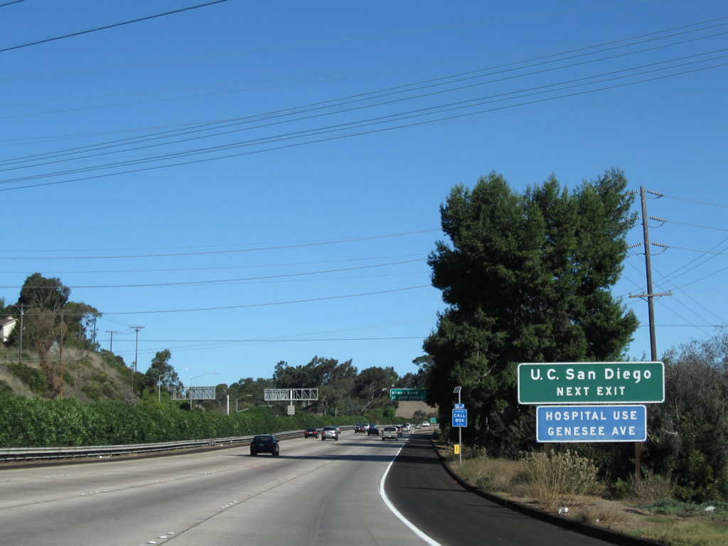
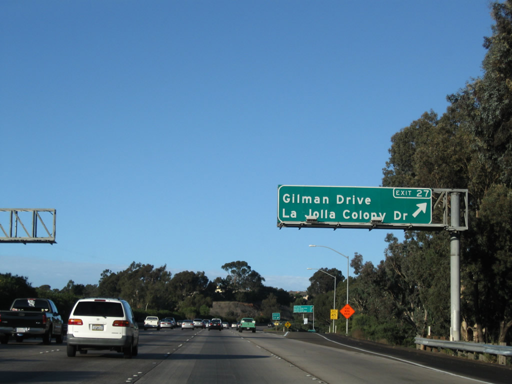
Northbound Interstate 5 approaching Gilman Drive and La Jolla Colony Drive. Gilman Drive leads west, then parallels Interstate 5. Gilman Drive is the original alignment of U.S. 101. Old U.S. 101 between Mission Bay Drive and Gilman Drive was buried by Interstate 5, but the extant route leads north from this interchange toward its connection with North Torrey Pines Road (although part of that alignment of U.S. 101 is buried under the University of California at San Diego - UCSD). This sign was installed during the week of April 1, 2003. Photo taken 11/08/08. |
|
Use Exit 27/Gilman Street (old U.S. 101) north to reach the University of California at San Diego (UCSD). Since passing the Mission Bay Drive merge, Interstate 5 was built on top of old U.S. 101. At Gilman Drive, old U.S. 101 again splits from the freeway, opting to follow Gilman Drive onto the UCSD campus. The old road was removed, and the campus was built on top of Old U.S. 101. U.S. 101 reemerges north of the university at the intersection of North Torrey Pines Road/Genesee Avenue; U.S. 101 continues north along North Torrey Pines Road into the city of Del Mar. Photo taken 11/08/08. |
|
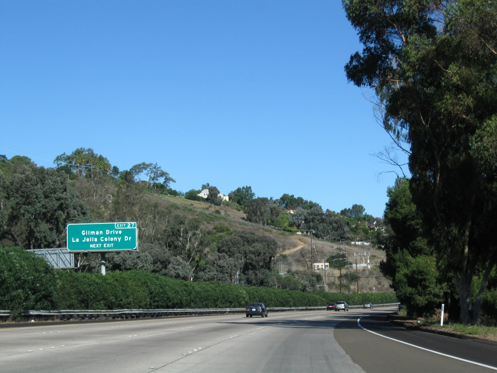
Northbound Interstate 5 reaches Exit 27, Gilman Drive and La Jolla Colony Drive. La Jolla Colony Drive leads east and north into the La Jolla Colony development. This street follows Rose Canyon as Rose Creek turns northeast away from the freeway. None of the canyon is developed, and it features a dirt bike trail. This sign was replaced the week of April 1, 2003. Photo taken 12/16/08. |
|
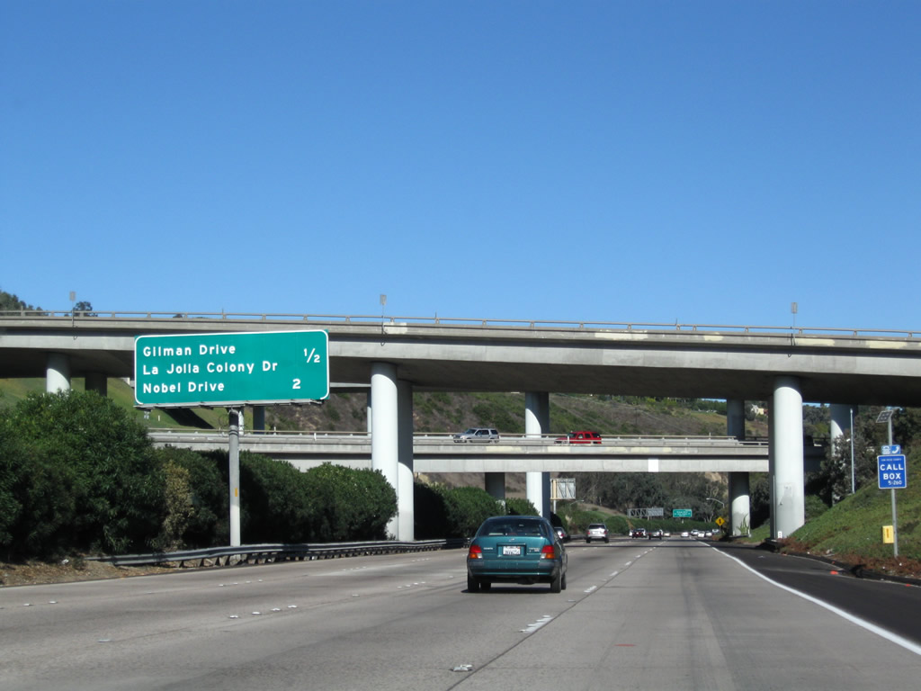
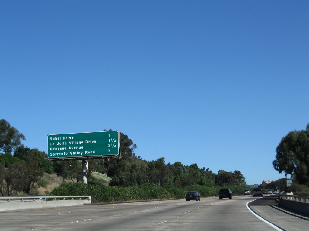
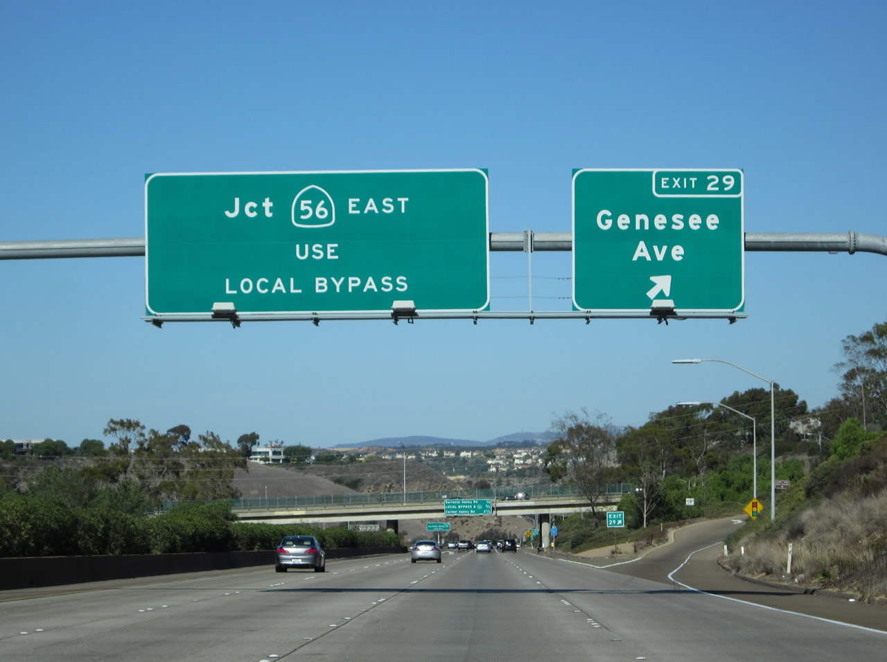
This mileage sign provides the distance to Exit 28A, Nobel Drive; Exit 28B, La Jolla Village Drive; and Exit 29, Genesee Avenue (San Diego County S-21). Photo taken 11/08/08. |
|
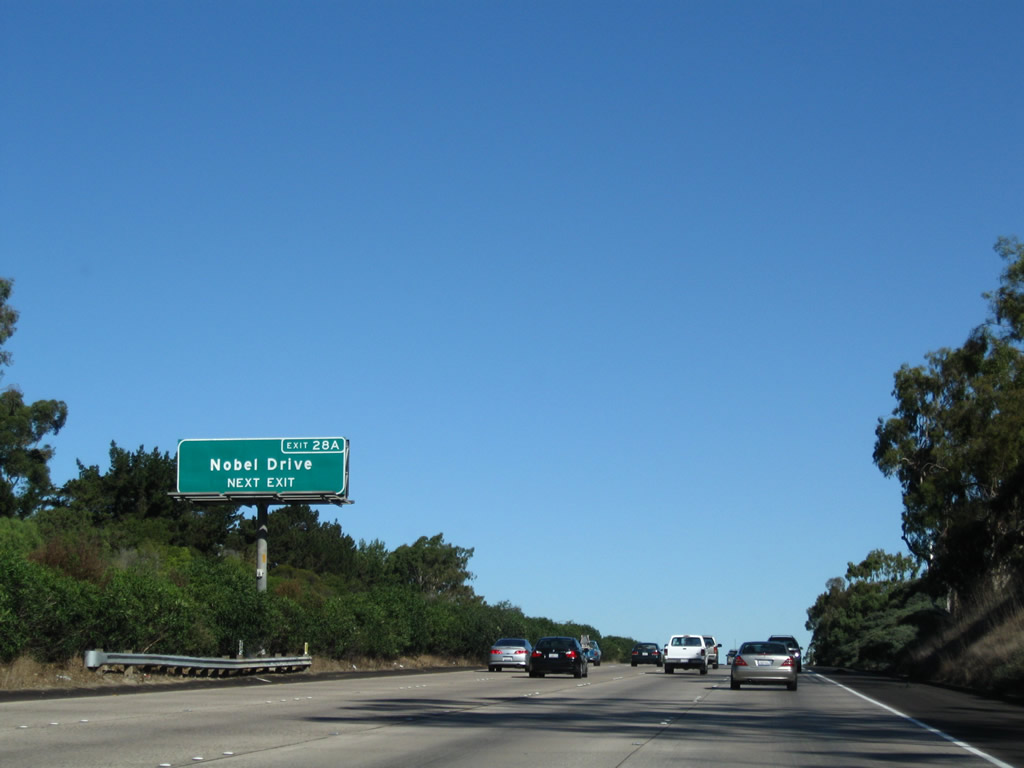
The next exit along northbound Interstate 5 is Exit 28A, Nobel Drive, next right. Photo taken 11/08/08. |
|
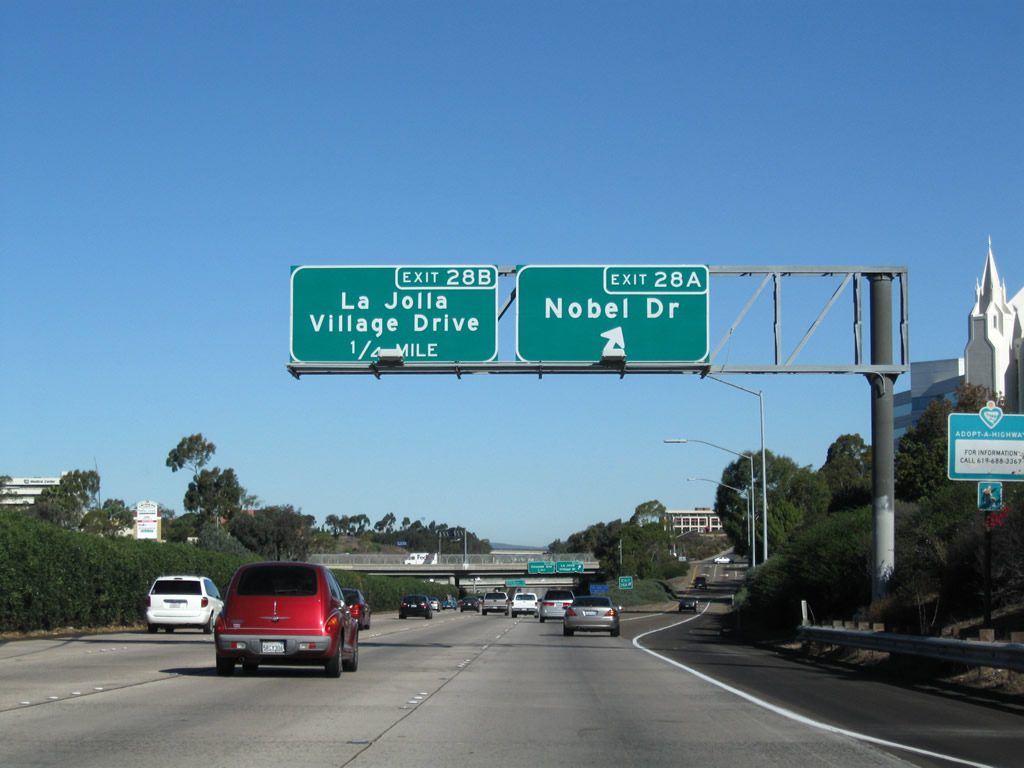
Northbound Interstate 5 reaches Exit 28A, Nobel Drive. This accesses the large Villa La Jolla shopping center in the southwest quadrant of the Interstate 5/Nobel Drive interchange. In addition, the large regional Mormon (Church of Latter-Day Saints) dominates the view along northbound at this exit. This church was completed in the early 1990s, and it is closed to non-Mormons. It is kept immaculately white year-round, making it contrast sharply with many of the colored and stuccoed buildings in the area. The next exit is La Jolla Village Drive (Exit 28B). These signs were installed during the week of April 1, 2003. Photos taken 11/08/08. |
|
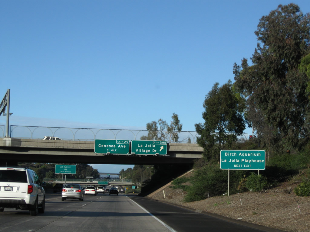
The next exit along northbound is Exit 28B, La Jolla Village Drive. Use La Jolla Village Drive west to the Birch Aquarium (located near the Scripps Institute of Oceanography) and the La Jolla Playhouse, which is situated on the University of California at San Diego campus. Photo taken 12/16/08. |
|
Northbound Interstate 5 reaches Exit 28B, La Jolla Village Drive. La Jolla Village Drive is the main east-west route across the La Jolla/University community areas. It is six lanes throughout, and it connects to the University Town Center shopping mall, several large hotels, and the new financial center. The high rises are not visible along northbound, but they can be seen on top of a hillside along southbound at the Interstate 5/805 split. Photo taken 11/08/08. |
|
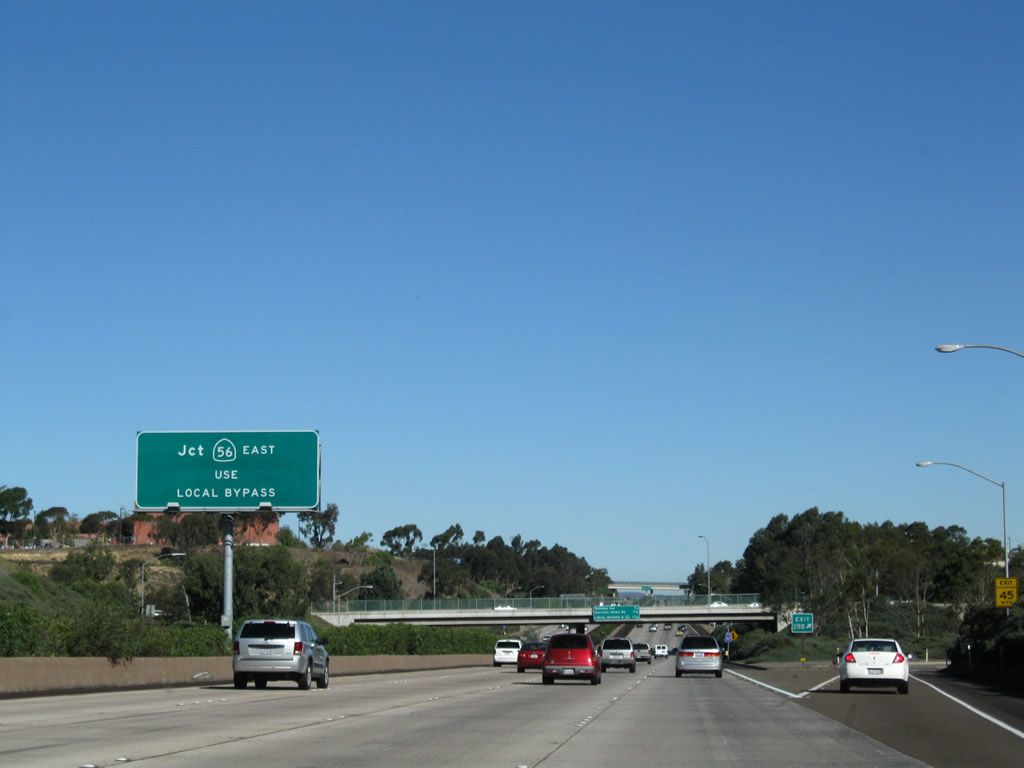
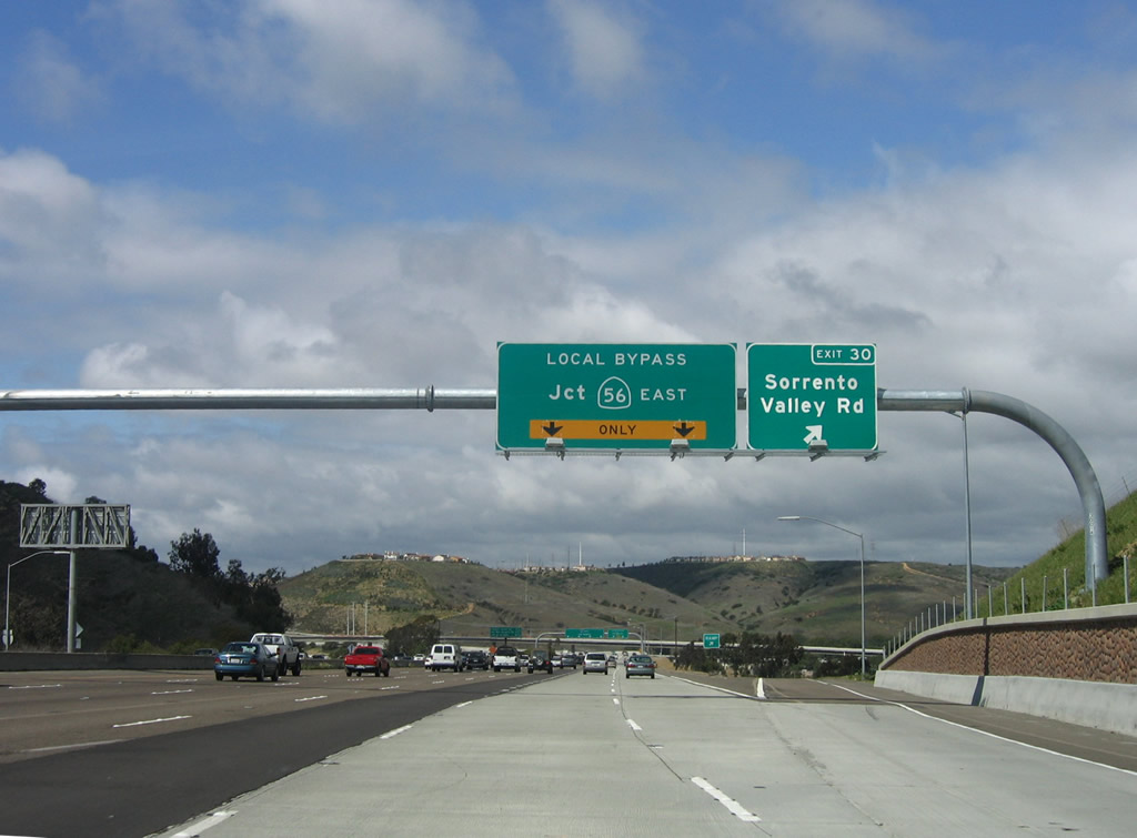
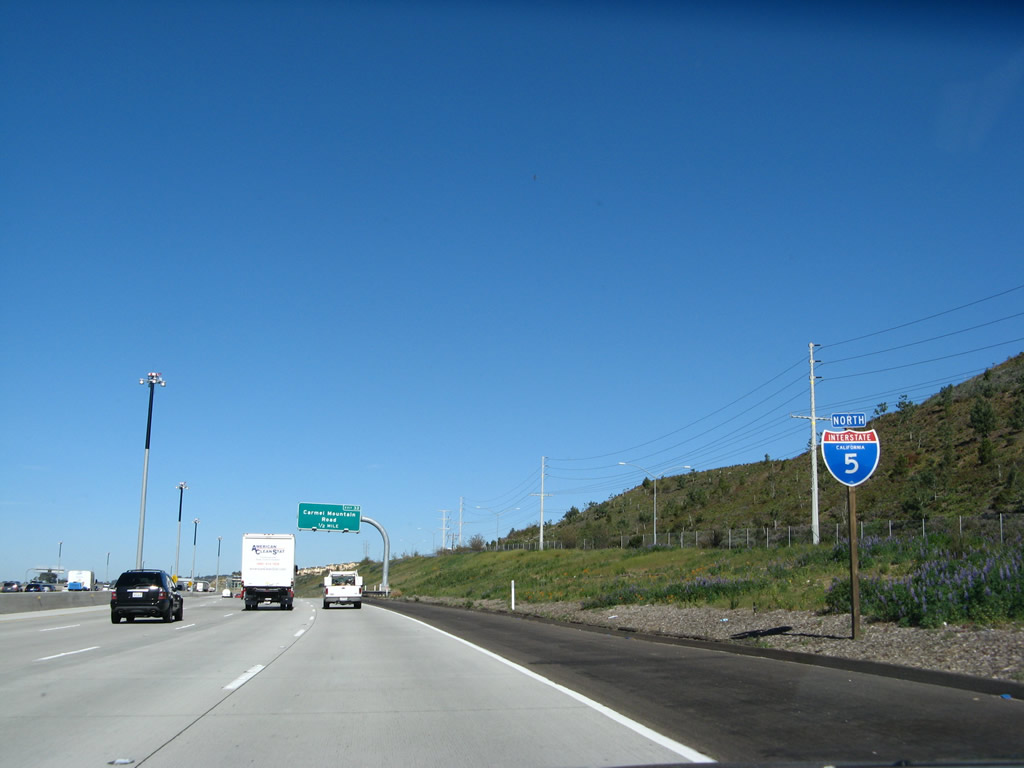
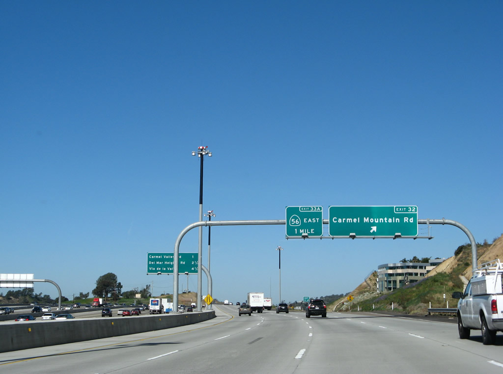
This is the first indication of the pending junction with California 56 and the Interstate 5 split between main lanes and the local bypass. Traffic for Carmel Mountain Road and California 56 should use the local bypass; through traffic should follow the main lanes through the Interstate 5 and Interstate 805 merge. Photo taken 11/08/08. |
|
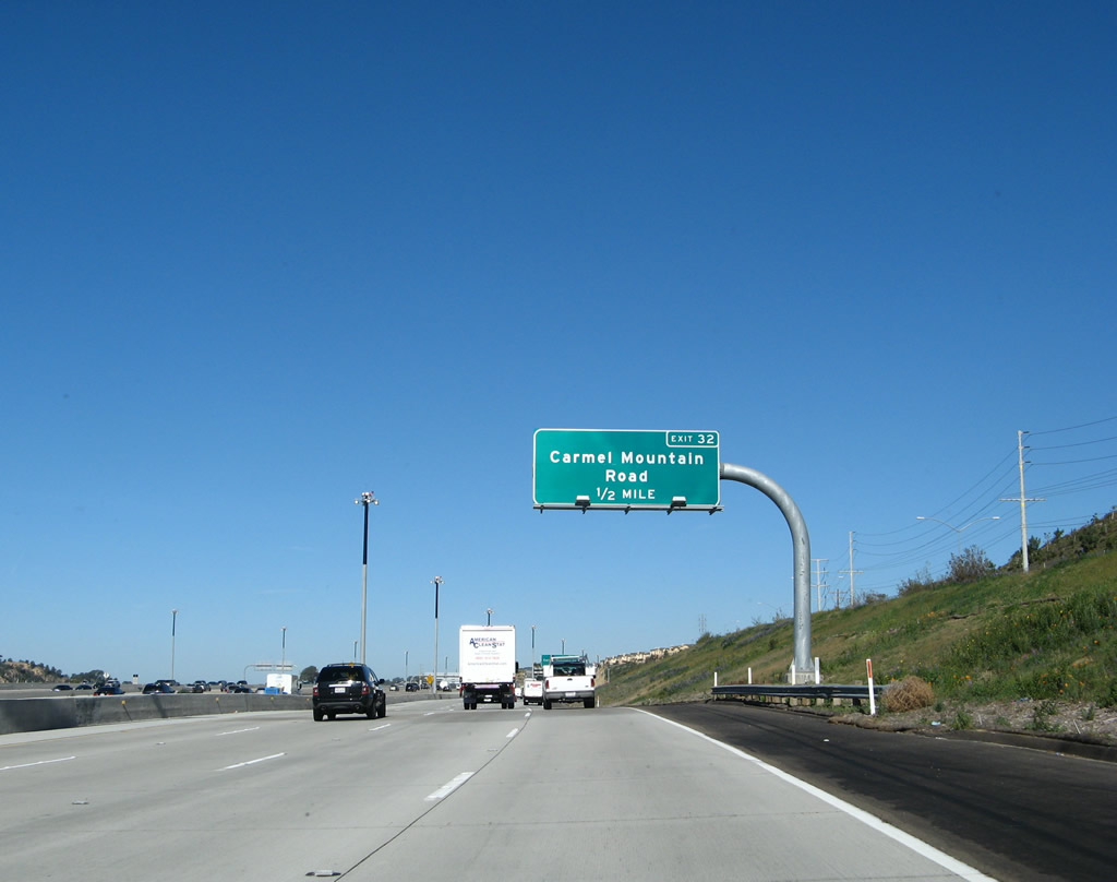
This roadside sign indicates that traffic for Exit 32, Carmel Mountain Road should use the Local Bypass (which is also signed for California 56 (Ted Williams Freeway) east). Photo taken 11/08/08. |
|
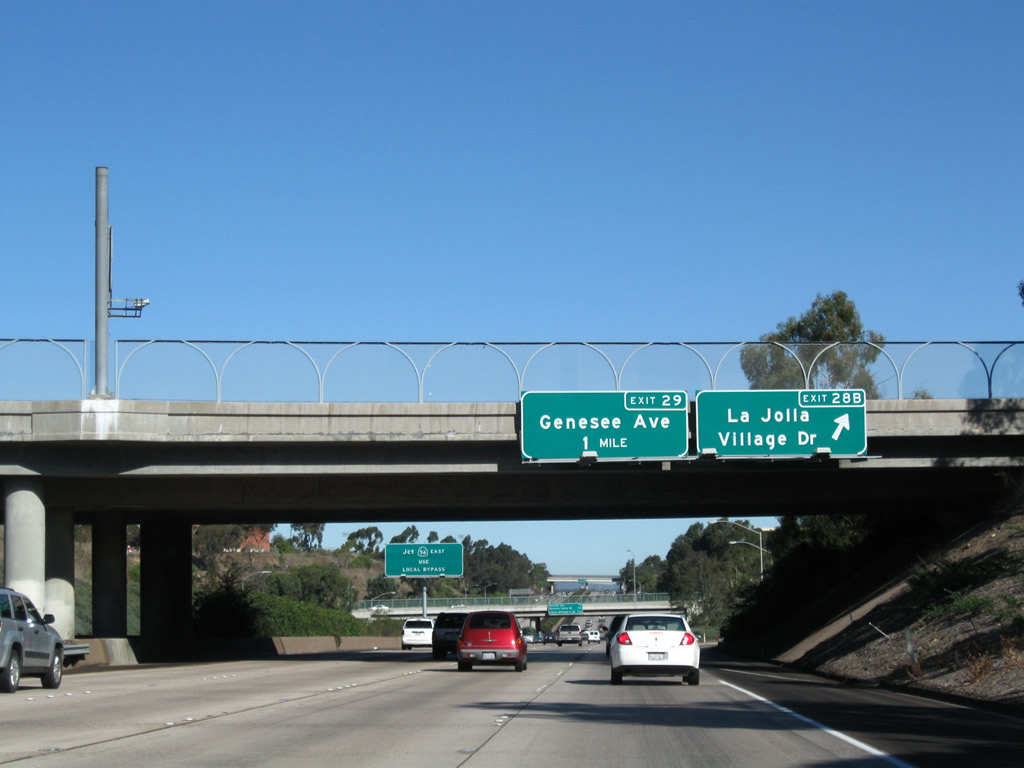
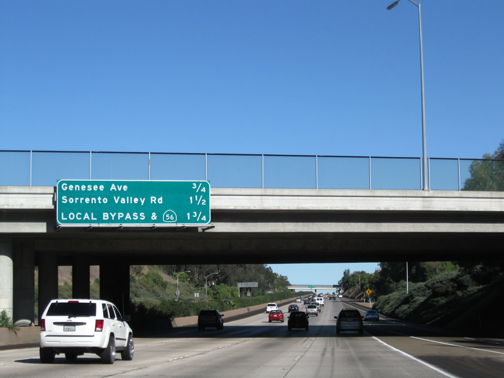
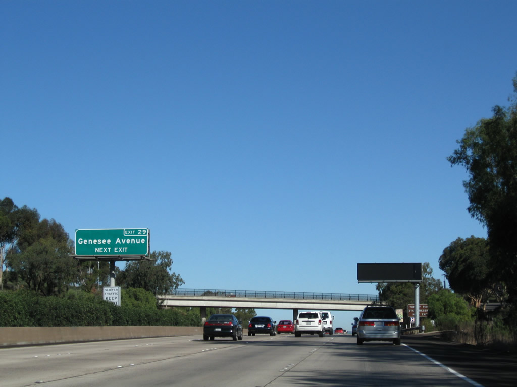
Northbound Interstate 5 approaches Genesee Avenue, Exit 29. This is the best route from Interstate 5 to the Torrey Pines State Reserve and beach located northwest of this exit. In addition, Genesee Avenue leads to North Torrey Pines Road, which is old U.S. 101 and the beginning of Coast Highway 101, which leads through the northern San Diego County communities of Del Mar, Solana Beach, Encinitas (Cardiff and Leucadia), Carlsbad, and Oceanside. Between Exits 28 and 29, Interstate 5 passes through the campus of the University of California at San Diego (UCSD). Photo taken 11/08/08. |
|
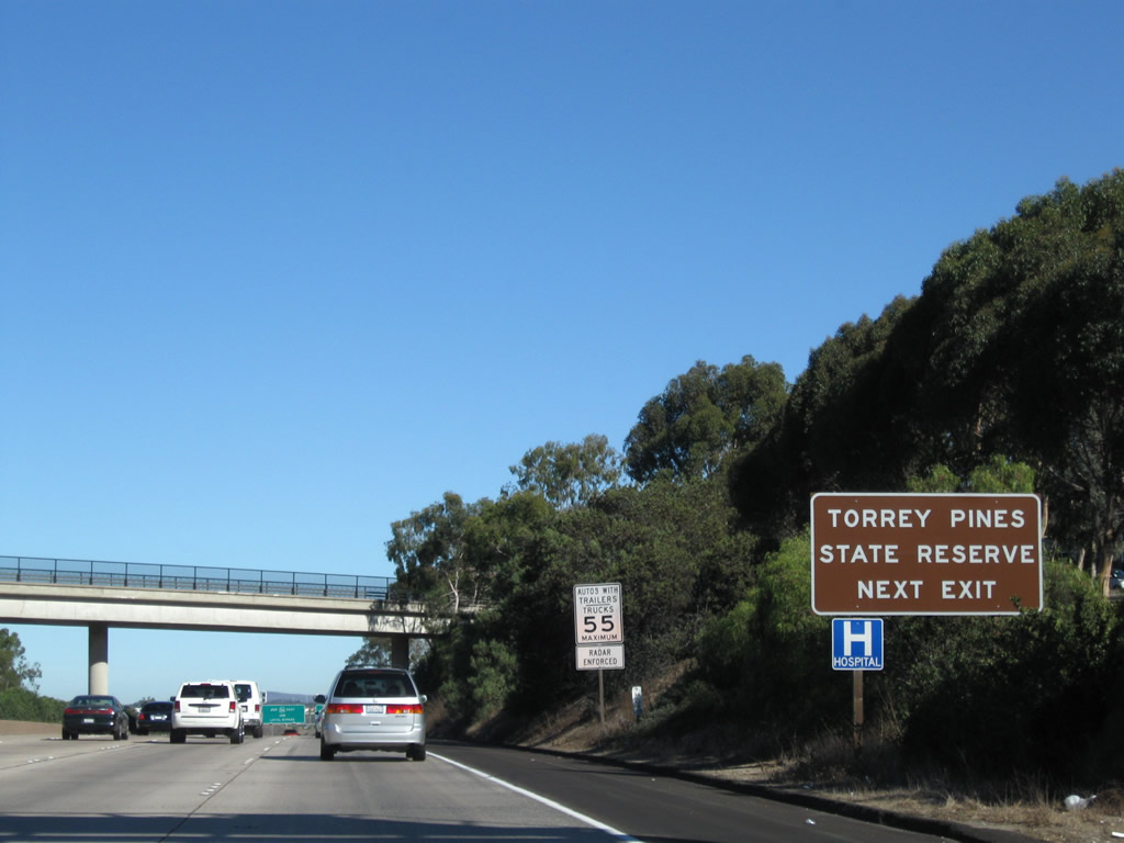
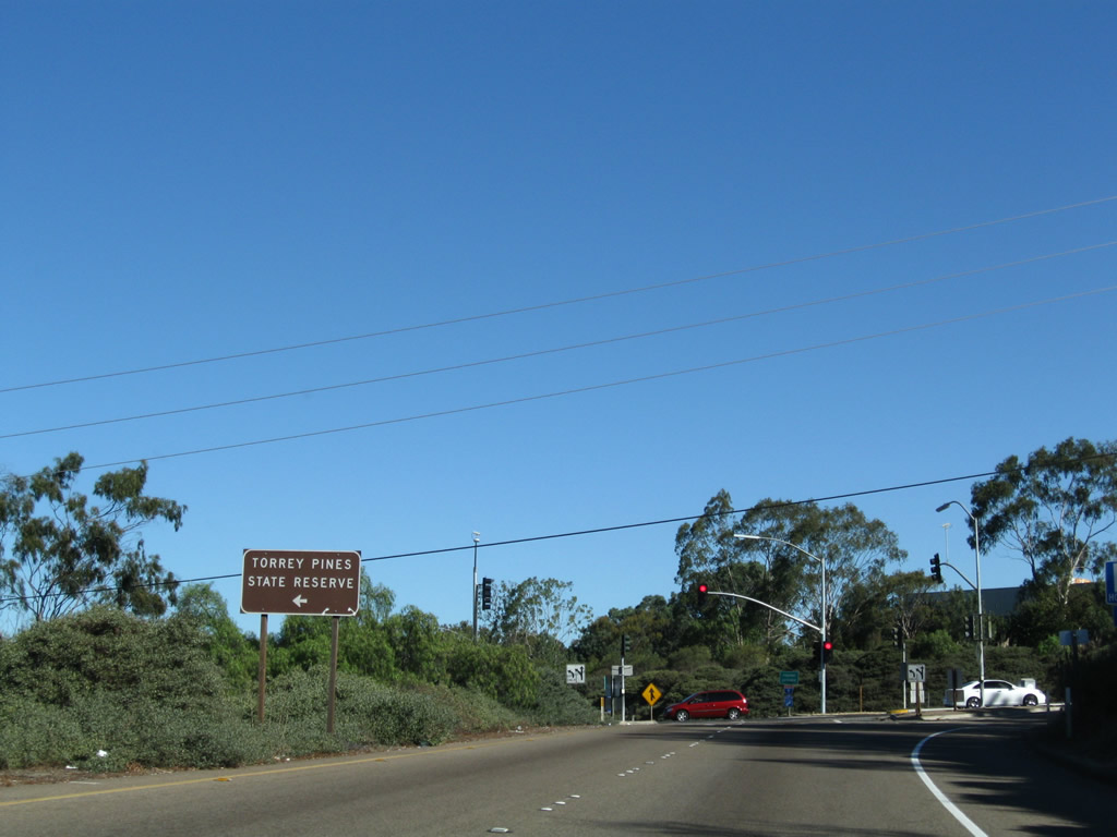
Use Exit 29 to Torrey Pines State Reserve. This state park contains a wide variety of hiking trails and bicycling paths as well as beach access. At sunset, the views of the ocean at Torrey Pines State Reserve are unparalleled in San Diego. Photo taken 11/08/08. |
|
Passing through the University of California at San Diego (UCSD) campus, Voight Drive passes overhead. This road connects the main campus with the health care areas on the east side of the freeway. Voight Drive used to be Miramar Road until the University City area to the east was developed. Photo taken 11/08/08. |
|
Northbound Interstate 5 reaches Exit 29, Genesee Avenue. Genesee Avenue is unsigned San Diego County S-21. Only one shield for this county route exists within the city limits of San Diego (near the Torrey Pines Golf Course). Genesee Avenue leads north-south from Torrey Pines Road south to California 163 in Serra Mesa. Photo taken 11/11/12. |
|
Genesee Avenue leads west to the University of California at San Diego (UCSD), the Torrey Pines Gliderport, Torrey Pines Municipal Golf Course and the Torrey Pines State Reserve. The arterial east continues to Campus Point and the UCSD hospital. Photo taken 11/08/08. |
|
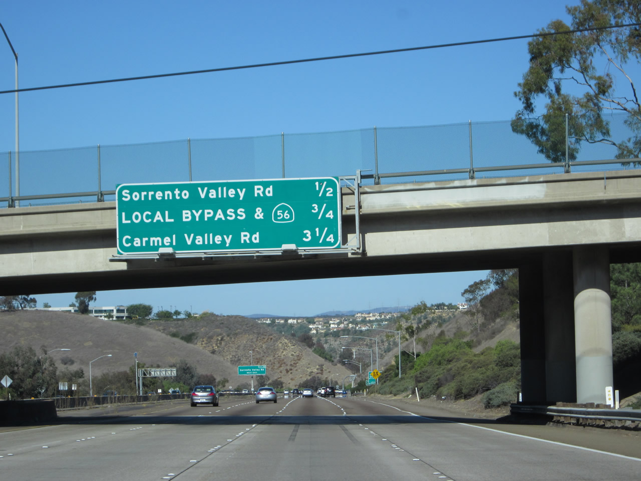
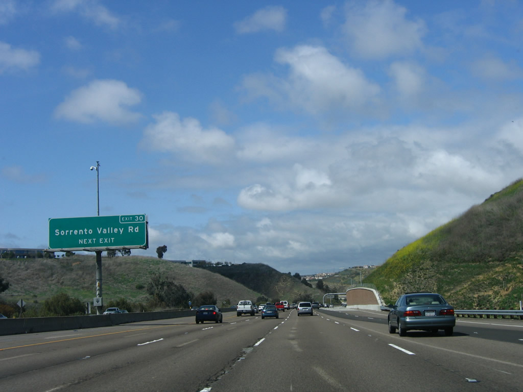
The next exit along northbound Interstate 5 is Exit 30, Sorrento Valley Road and Roselle Street. Since there is no frontage road here, the shoulder of Interstate 5 between Exits 29 and 30 is a designated bike route. No bikes are allowed on the freeway north or south of this point. Luckily for northbound bikes, most of the route is downhill to the Sorrento Valley Road exit, thus making the trip go by a little bit faster (when compared to southbound bicyclists). Exit 30 allows leads to a Coaster rail station. The Coaster is a rail facility for commuters between Northern San Diego County and downtown. This station is to serve employees of companies in Sorrento Valley. Photo taken 11/11/12. |
|
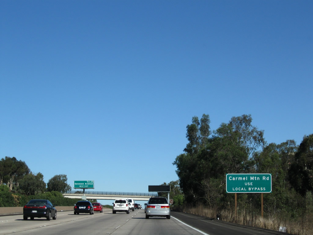
A roadside sign provides the exit numbers for both off-ramps that can only be accessed via the Local Bypass. The two off-ramps are Exit 32, Carmel Mountain Road and Exit 33A, California 56 (Ted Williams Freeway) east through Carmel Valley to the city of Poway. This sign was in place by 2008. Photo taken 11/11/12. |
|
Northbound Interstate 5 approaches Exit 30, Sorrento Valley Road, next right. Photos taken 04/15/06. |
|
Northbound Interstate 5 reaches Exit 30, Sorrento Valley Road/Roselle Street. Sorrento Valley Road leads southeast from here to connect to the businesses located along Mira Mesa Road in Sorrento Valley. Qualcomm, one of the few Fortune 500 companies in San Diego, is headquartered in Sorrento Valley. Photo taken 04/15/06. |
|
Interstate 5 north will merge with Interstate 805 north. Both the Main Lanes and Local Bypass of I-5 will fly over I-805, then the main lanes will merge onto I-805 from the right, while the Local Bypass merges with I-805's Local Bypass from the left. Photo taken 12/16/08. |
|
After the Sorrento Valley Road exit, Interstate 5 splits. Local traffic connecting to Carmel Mountain Road and California 56 should use the Local Bypass, which follows the right lanes. There are no signs for Interstate 805 because there is no access from northbound Interstate 5 onto southbound Interstate 805. Prior to the opening of the Local Bypass, four lanes of Interstate 5 northbound and four lanes of Interstate 805 northbound had to merge into five through lanes over the course of three miles. The road used to constrict to five lanes by Exit 33 (California 56), and the result used to be thick traffic through this corridor. The Local Bypass has vastly improved this situation. It opened to traffic in March 2006. Photo taken 12/16/08. |
|
Once the local bypass lanes from Interstate 5 and Interstate 805 merge together, this reassurance shield for Interstate 5 north is posted prior to the off-ramp to Carmel Mountain Road (Exit 23). Photo taken 02/15/08. |
|
The first exit from the Local Bypass is Exit 32, Carmel Mountain Road. This interchange serves the community of Torrey Hills to the east and Sorrento Valley to the west. The Local Bypass continues north to serve California 56. Photo taken 02/15/08. |
|
Continuing north, the local bypass approaches the off-ramp for Exit 32, Carmel Mountain Road. Photo taken 02/15/08. |
|
An interesting yet odd aspect of the Interstate 5 Local Bypass is the presence of mid-mast lighting along the freeway between the Interstate 805 merge and the Carmel Mountain Road interchange. This kind of lighting is not present anywhere else in San Diego County, and is rarely found elsewhere in California. Photo taken 02/15/08. |
|
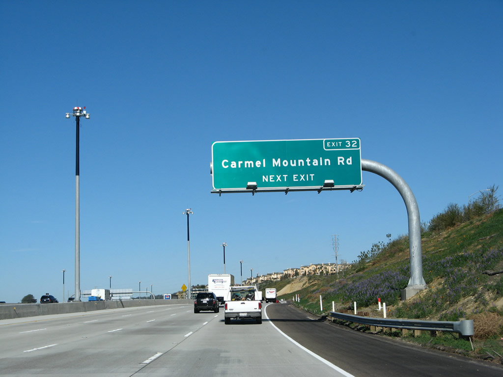
Northbound Interstate 5 (Local Bypass) reaches Exit 32, Carmel Mountain Road. The next exit on the Local Bypass is Exit 33A, California 56 East. Photo taken 02/15/08. |
|
Interstate 5 crosses over Carmel Mountain Road. Much of the development east of the freeway occurred in the late 1990s and early 2000s with the construction of the Torrey Hills community. Developer funding was used to construct the Carmel Mountain Road interchange, which did not exist until the Local Bypass opened in 2006. Photo taken 02/15/08. |
|
Crossing over Carmel Mountain Road, the Local Bypass still carries four through lanes. This photo was taken soon after the Local Bypass opened to traffic. Photo taken 03/18/06. |
|
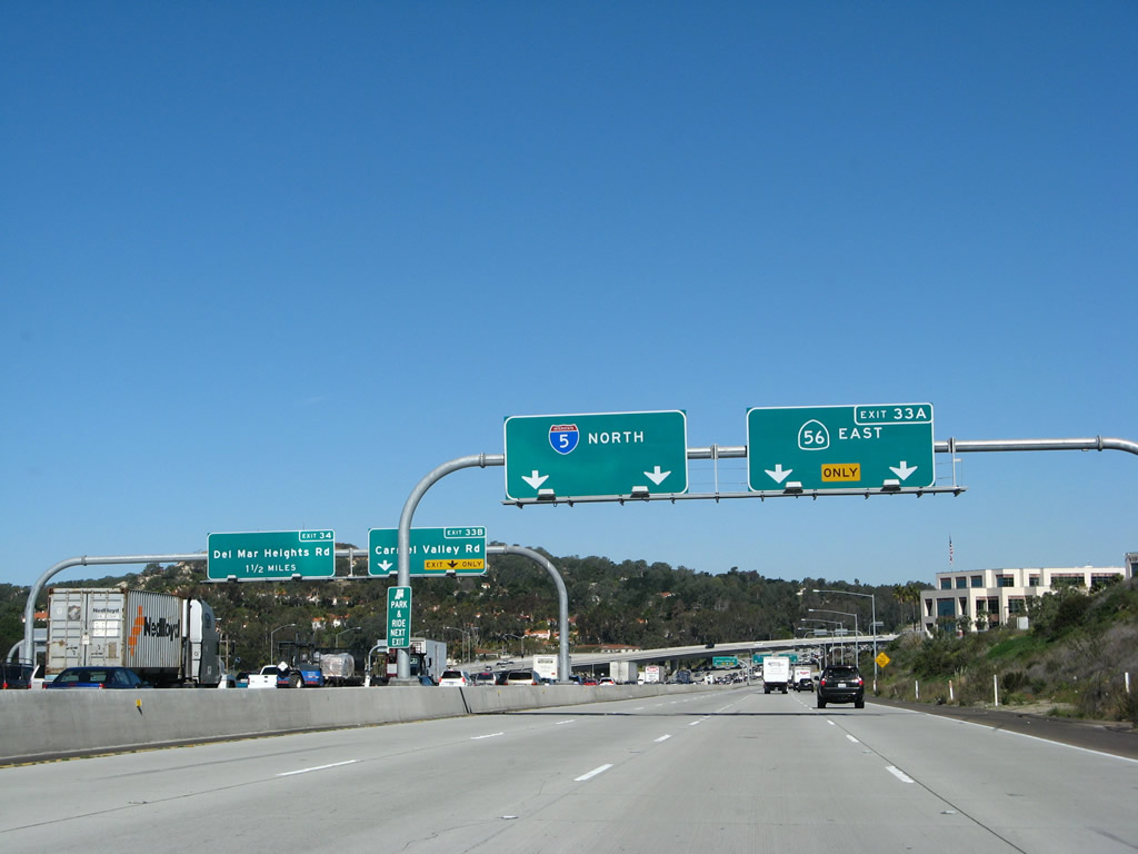
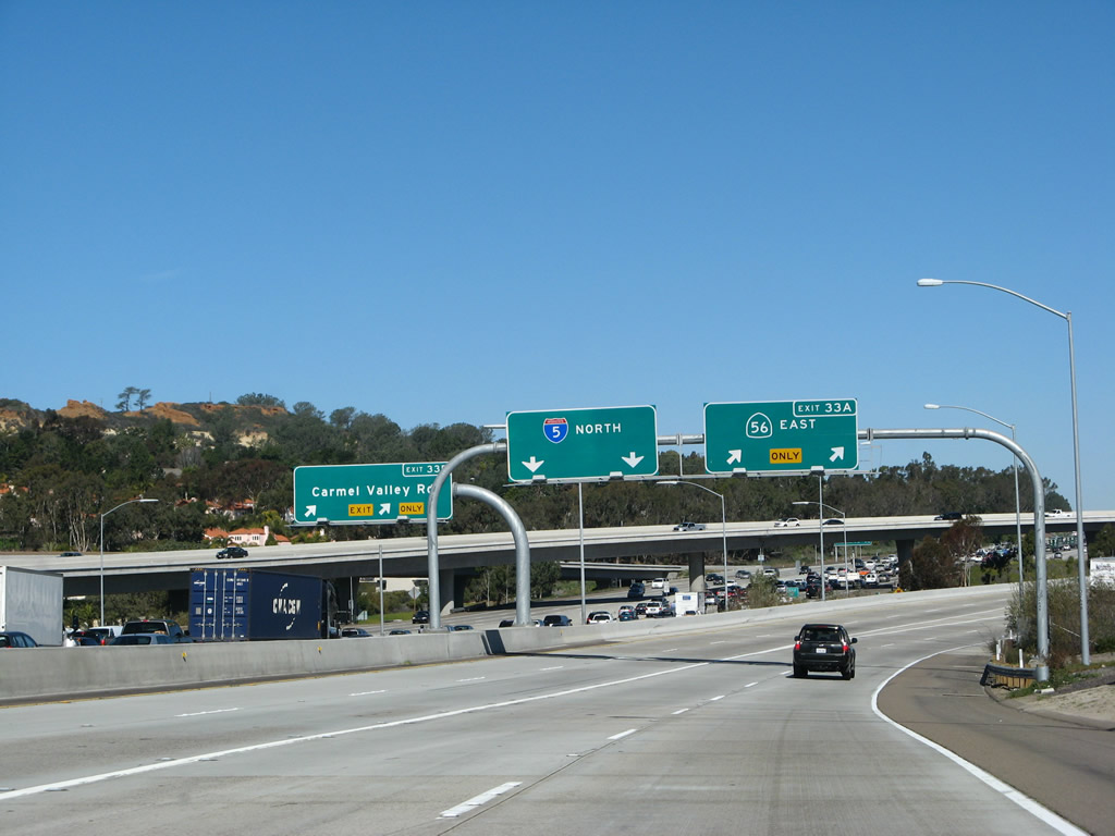
The next exit on the Local Bypass is Exit 33A, California 56 East. More than likely, there will not be a control city for California 56. Now that California 56 is complete, the freeway connects Interstate 5 to Interstate 15, the only such east-west link between California 52 in the south and California 78 in the north. And no, Del Dios Highway does not count! Use the two right lanes to connect to eastbound California 56, or follow the two left lanes to continue north back onto the main lanes of Interstate 5. Photo taken 02/15/08. |
|
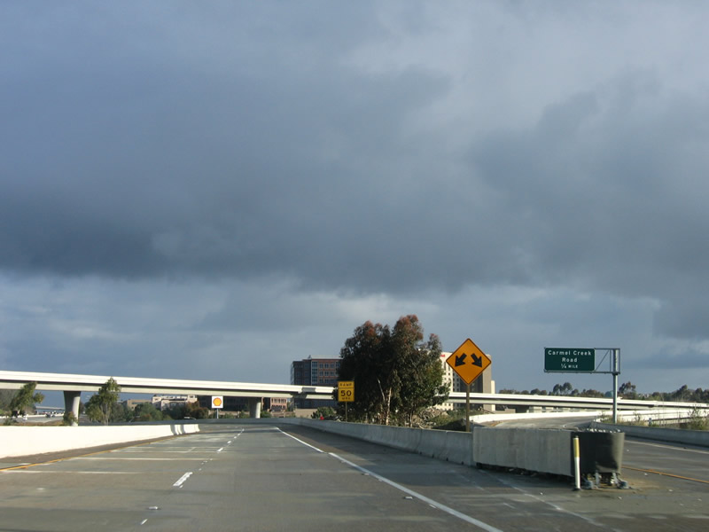
Continuing north on the Local Bypass, two lanes prepare to return to Interstate 5. Note the sign for first exit along eastbound California 56 (Carmel Creek Road) is visible from the Local Bypass. Photo taken 03/18/06. |
|
The Local Bypass passes under the flyover ramp that connects westbound California 56 with southbound Interstate 5. Photo taken 04/26/08. |
|
Interstate 5 northbound comes into view as the Local Bypass prepares to merge back with the Main Lanes. The Local Bypass becomes the two right lanes of northbound Interstate 5. Photo taken 03/18/06. |
|
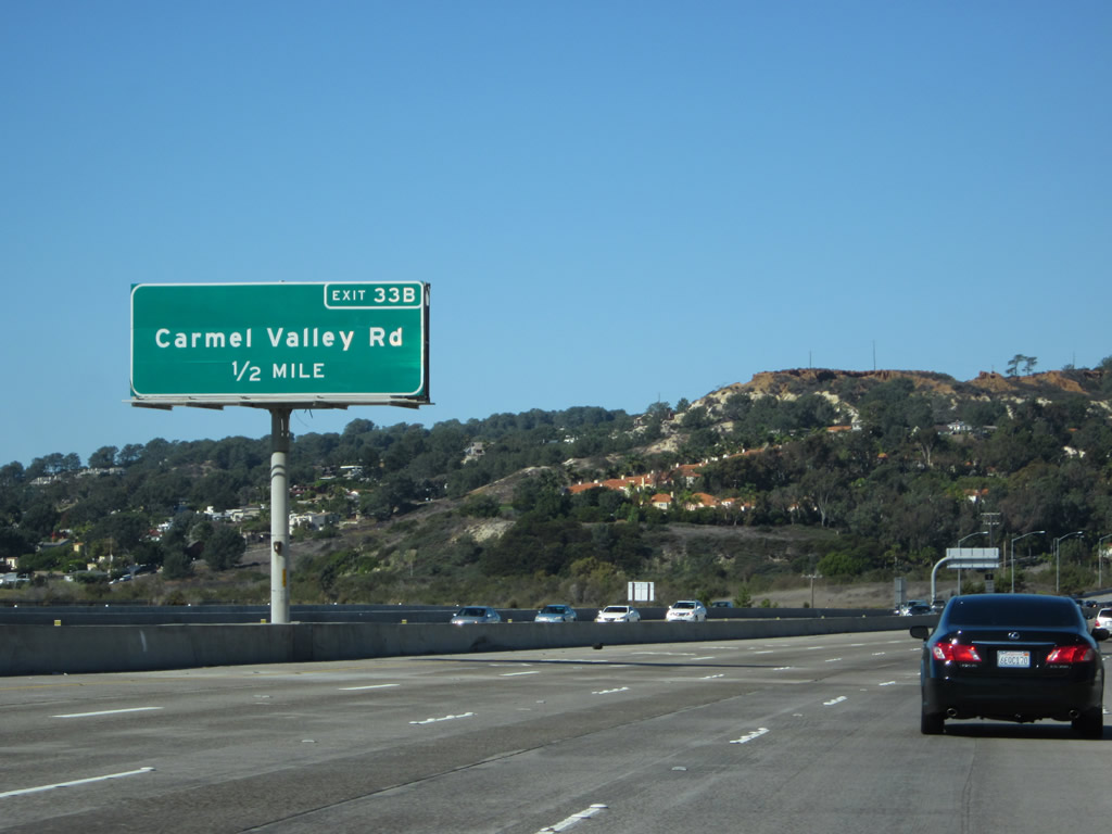
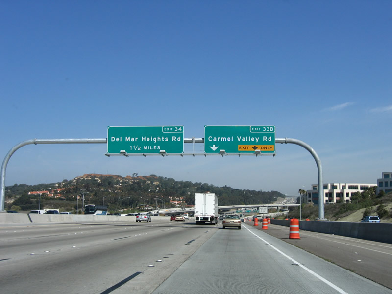
The two right lanes of the Local Bypass will default into the lanes that connect to Exit 34, Del Mar Heights Road. An on-ramp brings traffic from westbound California 56 and Carmel Valley Road onto northbound Interstate 5. The Local Bypass ends here and rejoins the main lanes of Interstate 5. Photo taken 03/18/06. |
| Interstate 5 north |
Page Updated November 12, 2012.