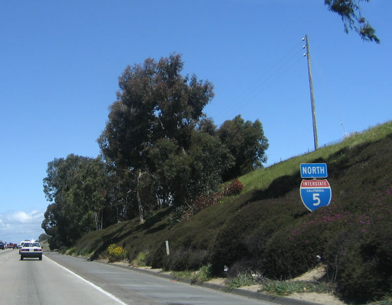
| Interstate 5 north |
|
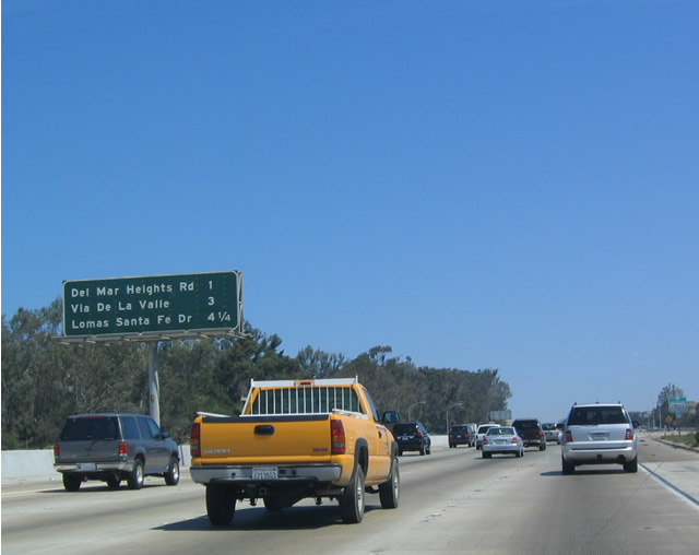
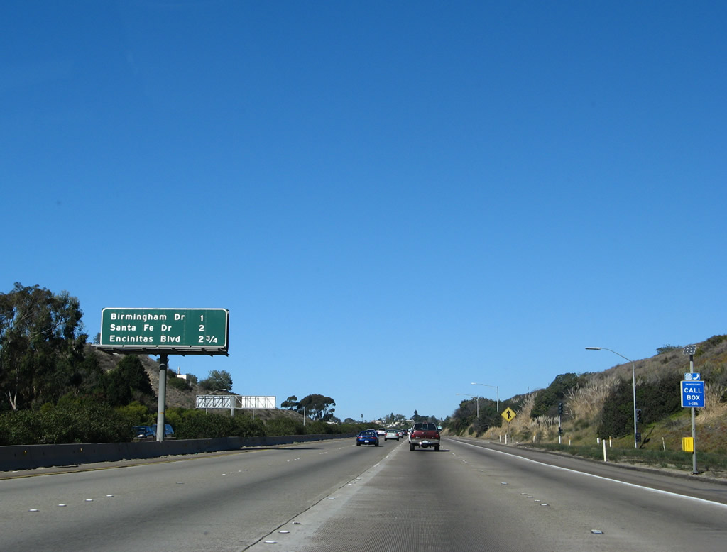
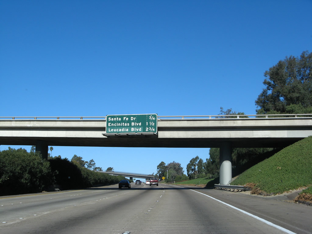
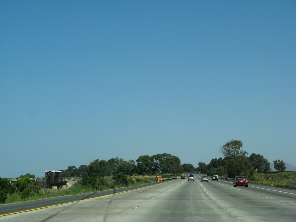
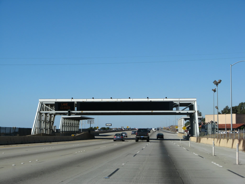
This mileage sign provides the distance to the next three exits along northbound: Exit 34, Del Mar Heights Road; Exit 36, San Diego County S-6 (Via de la Valle); and Exit 37, San Diego County S-8 (Lomas Santa Fe Drive). The original high occupancy vehicle lanes were placed between Interstate 805 and Del Mar Heights Road; they have since been extended to Via de la Valle in Del Mar/Solana Beach. Photo taken 05/22/04. |
|
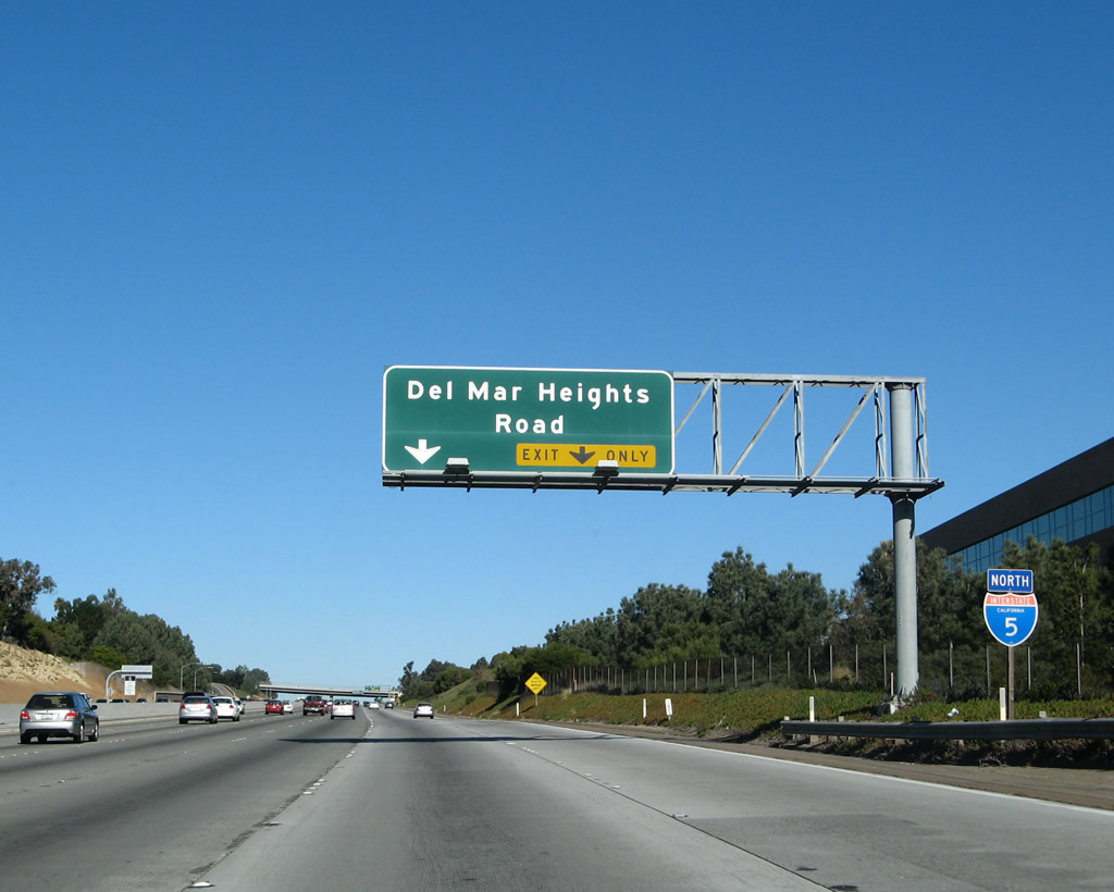
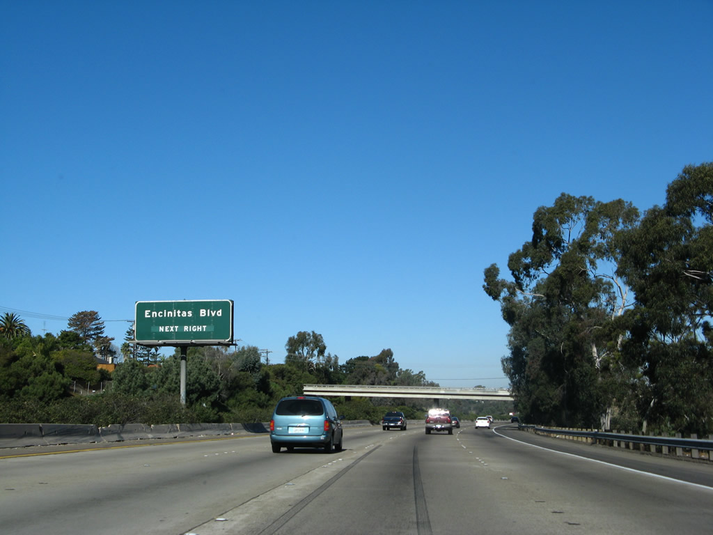
The next exit along northbound Interstate 5 after Carmel Valley Road (Exit 33B) is Exit 34, Del Mar Heights Road east to Carmel Valley and west to the city of Del Mar. Photo taken 01/14/07. |
|
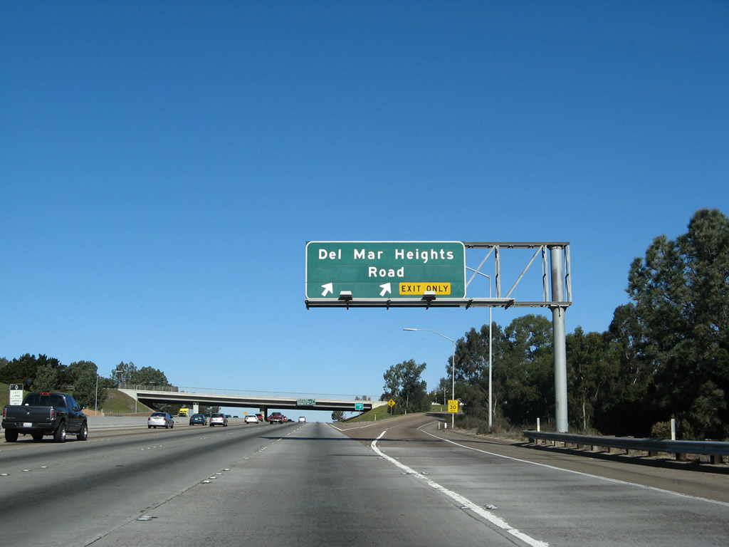
Northbound Interstate 5 reaches Exit 34, Del Mar Heights Road. Use Del Mar Heights Road east to the Carmel Valley community of the city of San Diego, while westbound Del Mar Heights Road leads into the small city of Del Mar along the coast. Photo taken 01/14/07. |
|
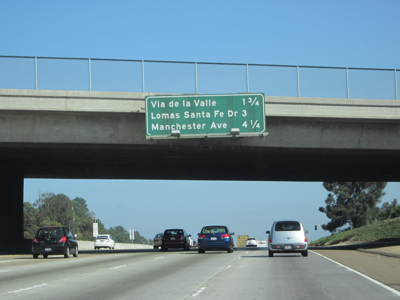
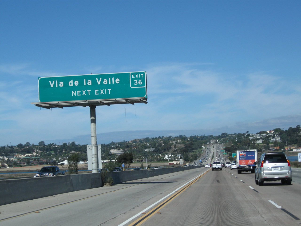
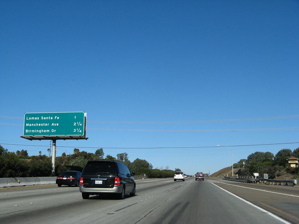
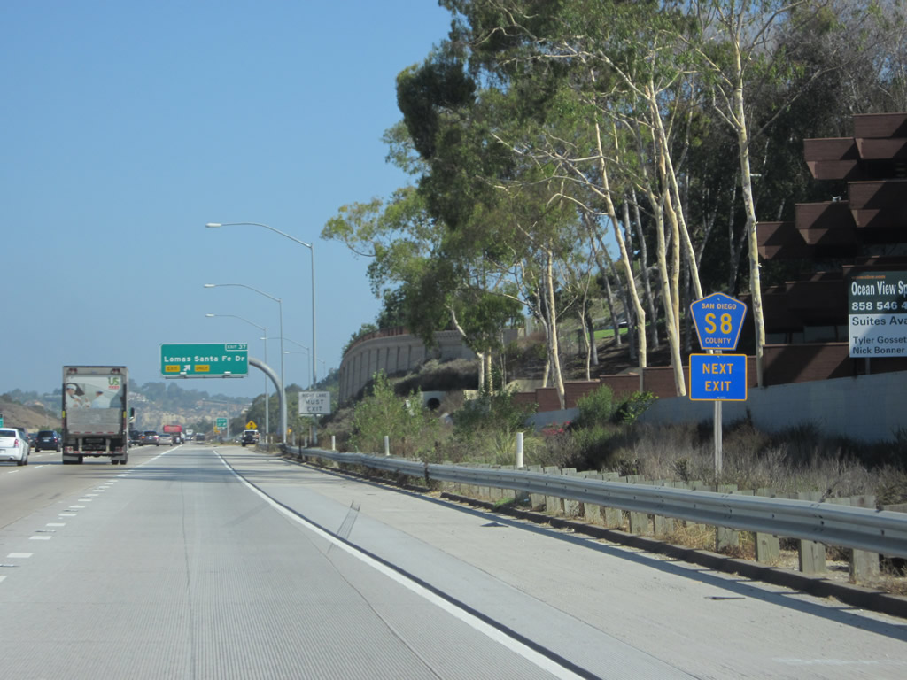
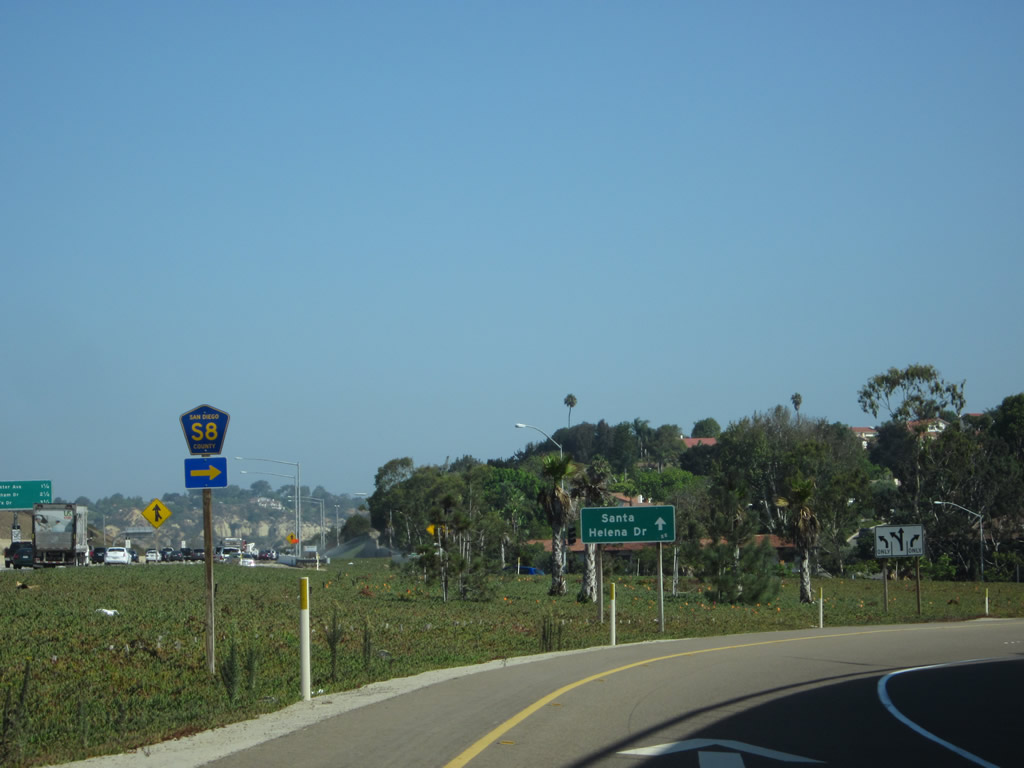
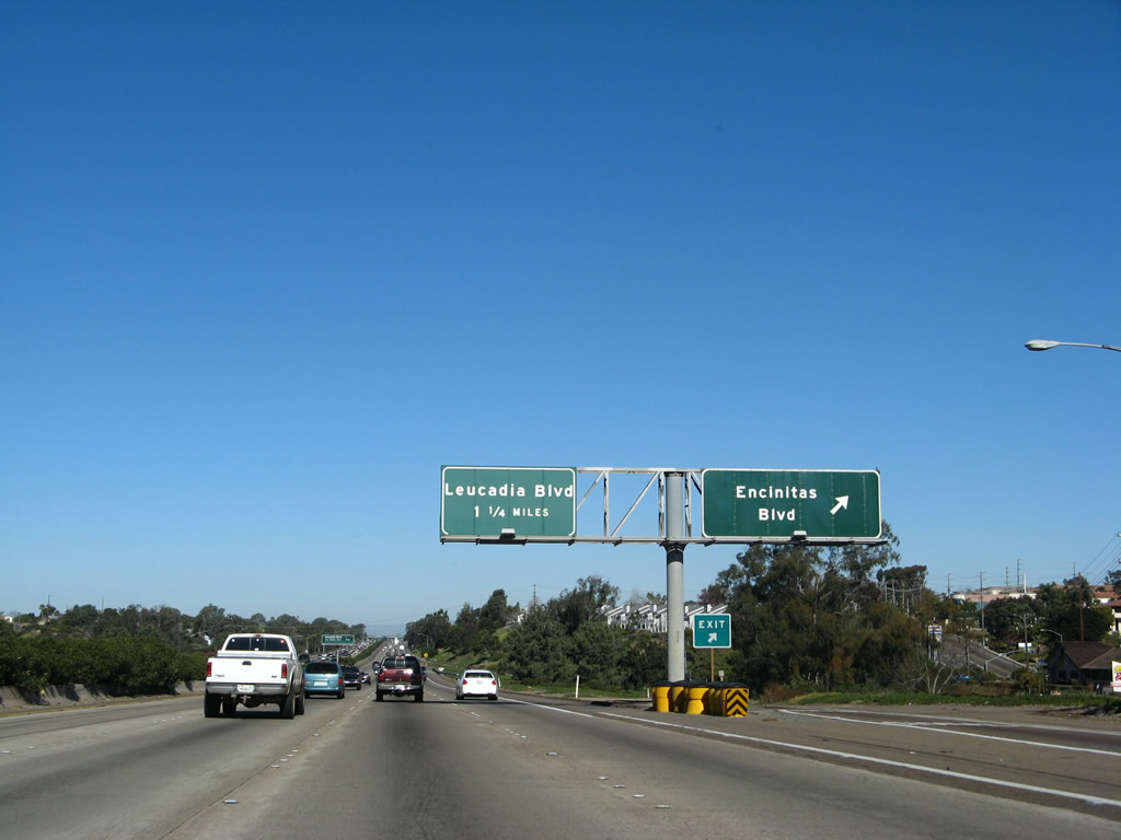
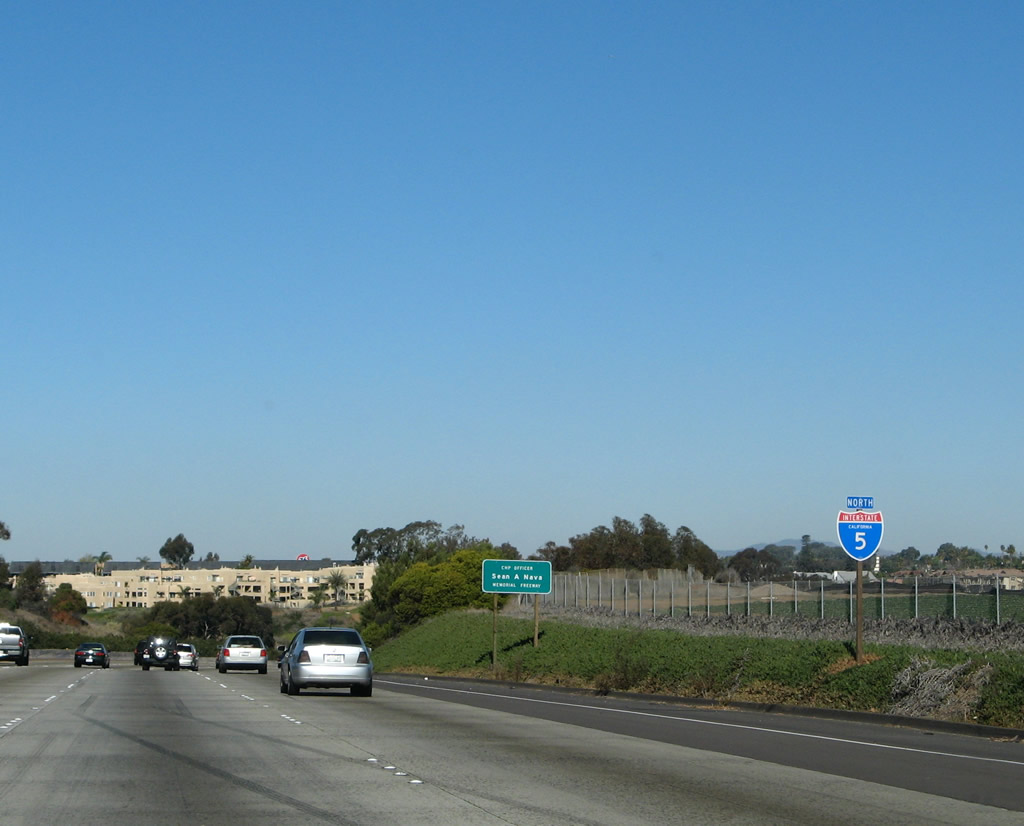
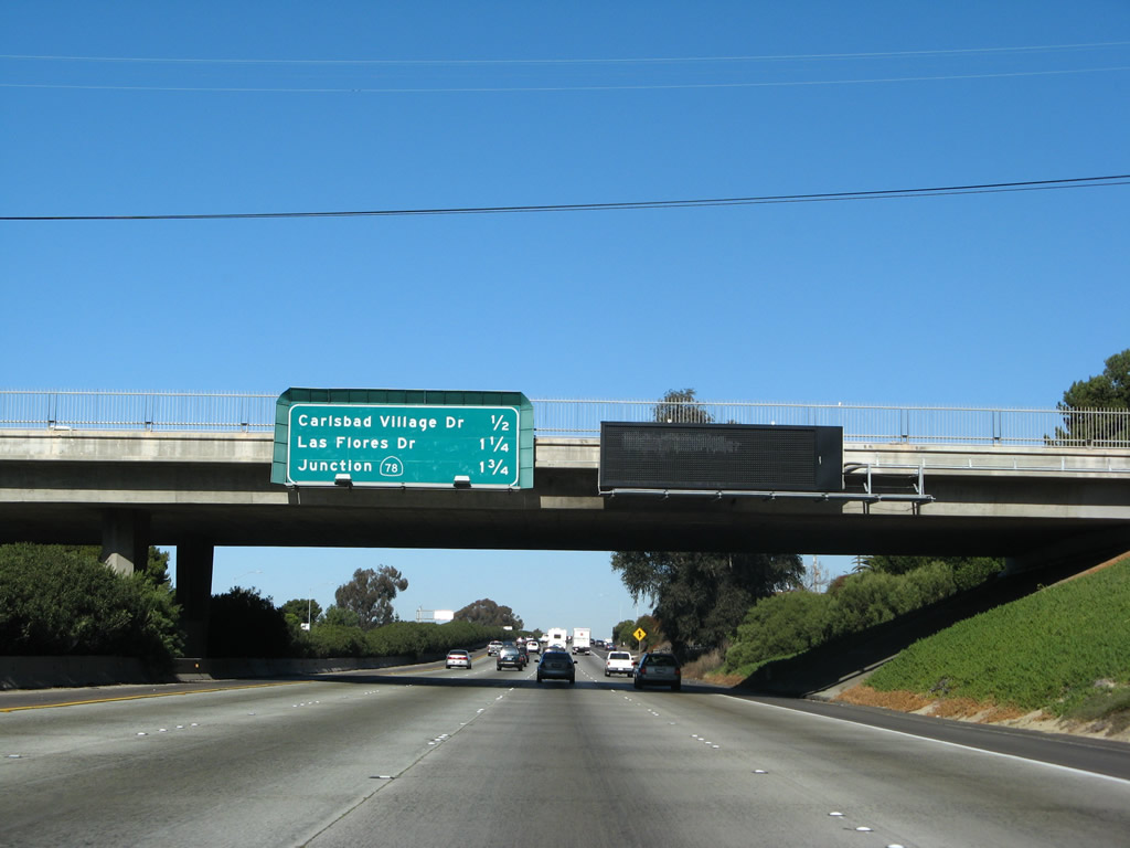
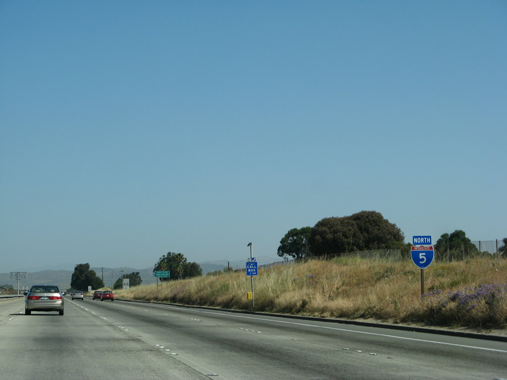
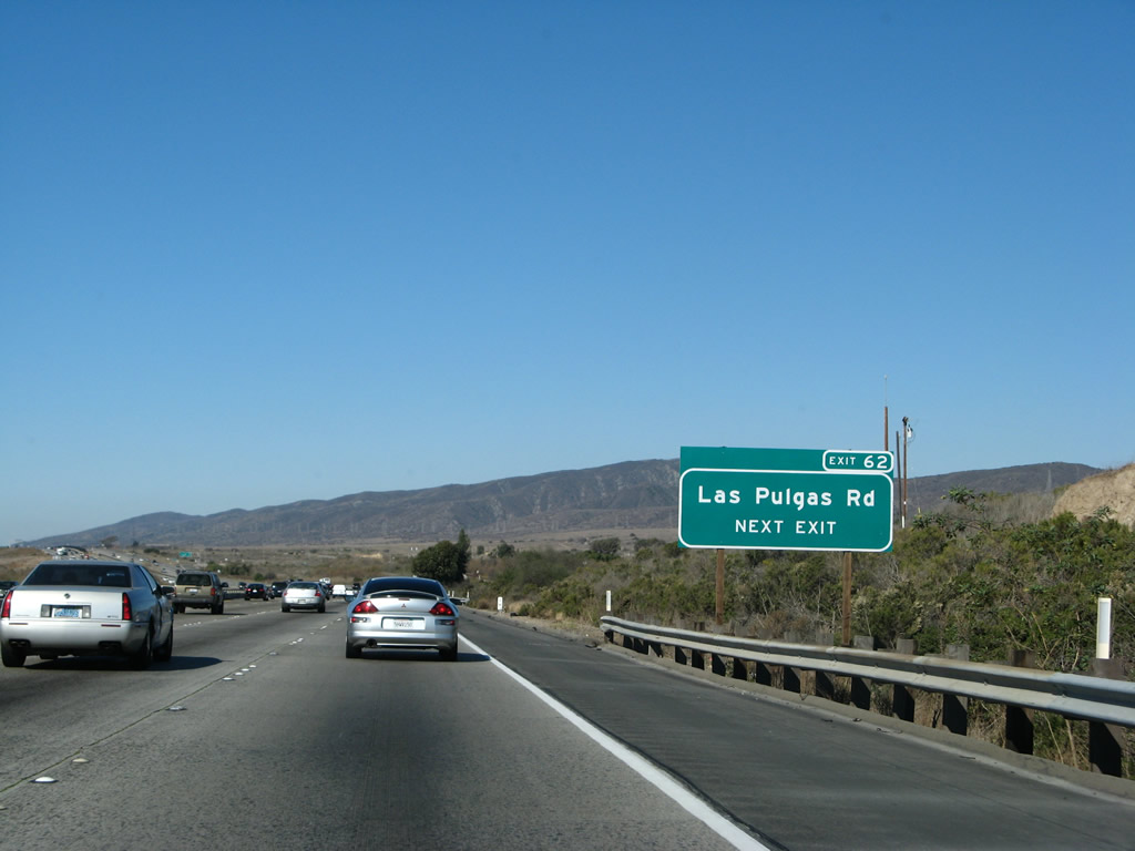
This mileage sign provides the distance to next three exits along northbound Interstate 5: Exit 36, Via de la Valle; Exit 37, Lomas Santa Fe Drive; and Exit 39, Manchester Avenue. "Via de la Valle" means "Way of the Valley," but it is grammatically incorrect Spanish. It should be Via del Valle since "valle" is a Spanish masculine word that should be prefaced by the word "el" rather than "la." Photo taken 09/01/12. |
|
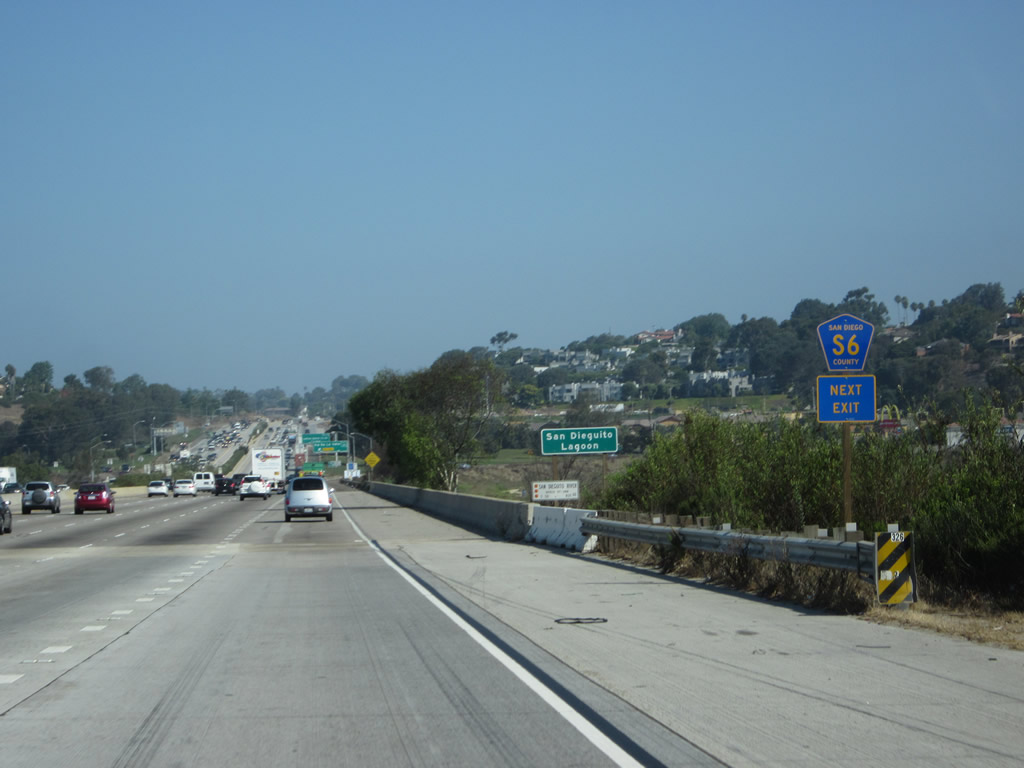
Via de la Valle is also signed as San Diego County S-6. County Route S-6 begins at its junction with Coast Highway 101 (Historic U.S. 101 / San Diego County S-21) and leads northeasterly from here to Rancho Santa Fe, then bends north-northeast via Del Dios Highway to Escondido. The route comes to its end at the entrance to the Mount Palomar Observatory some forty miles away from here. This method of using a single trailblazer along the freeway to sign a county route is the Caltrans standard. Use Via de la Valle west to reach the Del Mar Racetrack, home to the San Diego County Fair. Photo taken 01/14/07. |
|
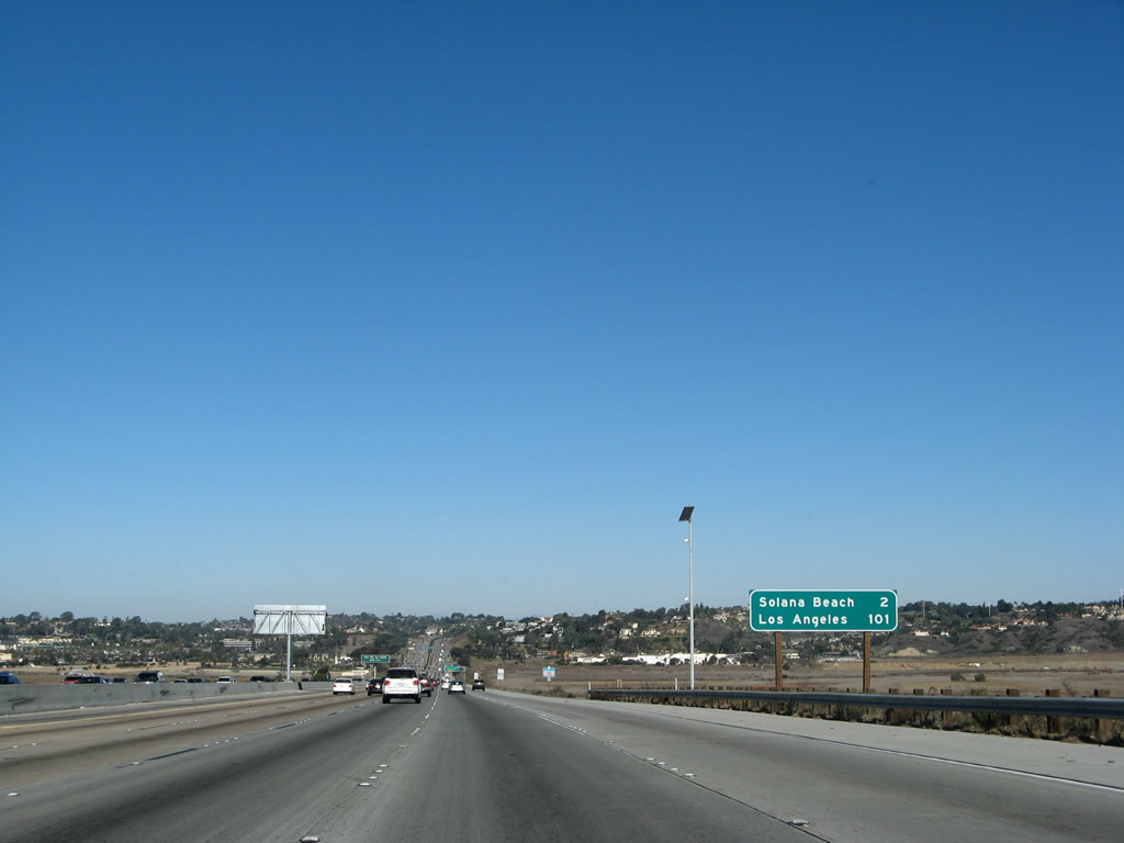
Another mileage sign provides the distance to Solana Beach (two miles) and Los Angeles (101 miles). A "Route 5 Business" sign was posted here until 2000; it was removed when an additional right lane opened between Del Mar Heights Road and Via de la Valle in 2004. Photo taken 01/14/07. |
|
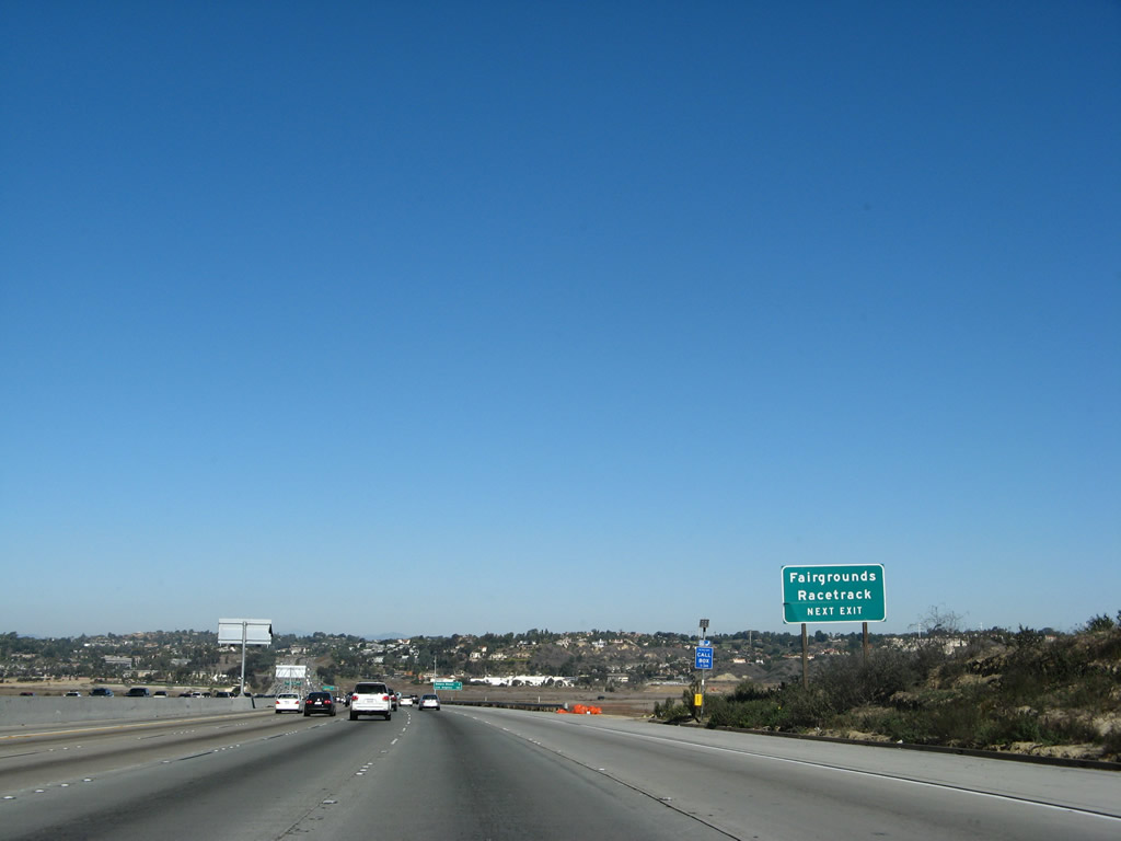
As Interstate 5 descends into the San Dieguito River Valley, the freeway approaches its next interchange along northbound: Exit 36, San Diego County S-6 (Via de la Valle) east to Rancho Santa Fe and Del Dios and west to Del Mar and Solana Beach. The large cleared area to the left (west) of the freeway is the Del Mar Racetrack, home to the San Diego County Fair in June-July and to thoroughbred racing in July-August-September. During these time periods, Interstate 5 can see appreciable increases in traffic as a result of events at the racetrack and fairgrounds. Photo taken 11/07/10. |
|
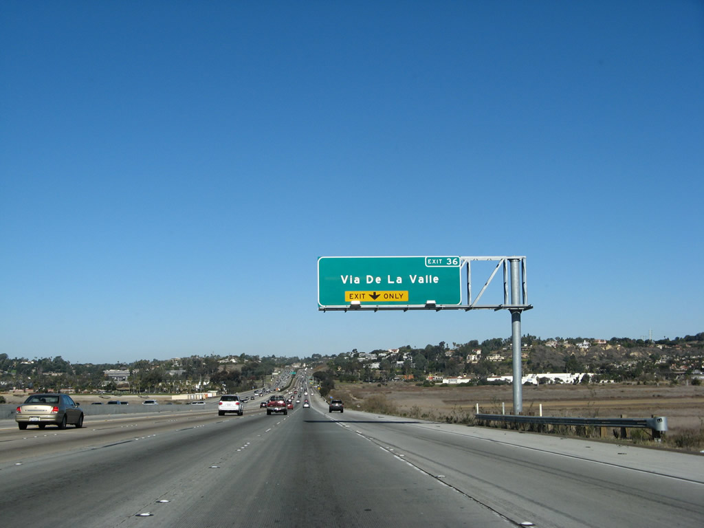
A lane drop occurs at forthcoming Exit 36 for Via de la Valle and San Diego County S-6. Photo taken 01/14/07. |
|
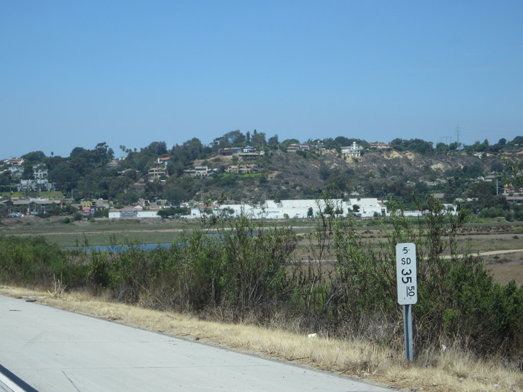
This white postmile paddle marker notes the 35.50 mile along Interstate 5 north in San Diego County. Photo taken 08/18/12. |
|
Via de la Valle is also signed as San Diego County S-6. County Route S-6 begins at its junction with Coast Highway 101 (Historic U.S. 101 / San Diego County S-21) and leads northeasterly from here to Rancho Santa Fe, then bends north-northeast via Del Dios Highway to Escondido. The route comes to its end at the entrance to the Mount Palomar Observatory some forty miles away from here. This method of using a single trailblazer along the freeway to sign a county route is the Caltrans standard. Use Via de la Valle west to reach the Del Mar Racetrack, home to the San Diego County Fair. Photo taken 09/01/12. |
|
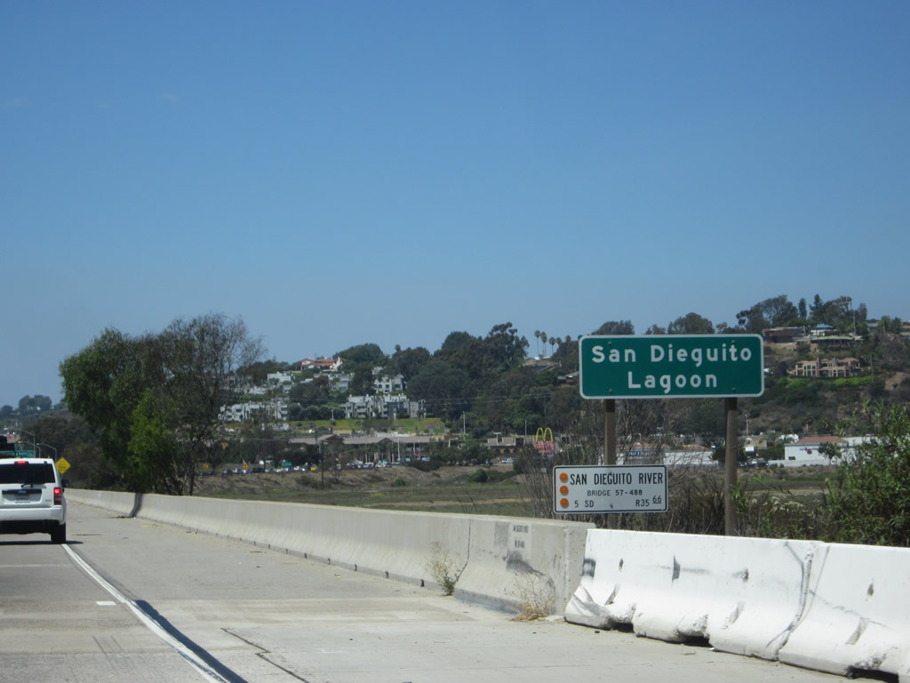
Interstate 5 crosses over the San Dieguito River and Lagoon on this very wide bridge. This large valley was carved out by the San Dieguito River, which created the wetlands on either side of the highway. Photo taken 08/18/12. |
|
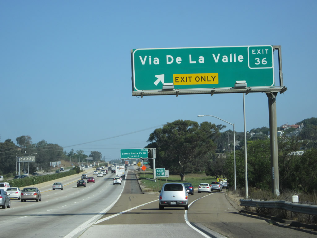
Exit 36 departs from Interstate 5 north for Via de la Valle (CR S-6). The Del Mar Racetrack and fairgrounds, which is popular in the early summer for the annual San Diego County Fair and again in late summer for horse racing, lies to the west. Photo taken 09/01/127. |
|
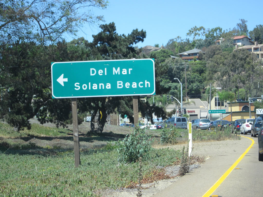
Via de la Valle west links I-5 to the cities of Del Mar and Solana Beach. Via de la Valle used to form part of a business route for I-5 through Solana Beach. Photo taken 08/18/12. |
|
|
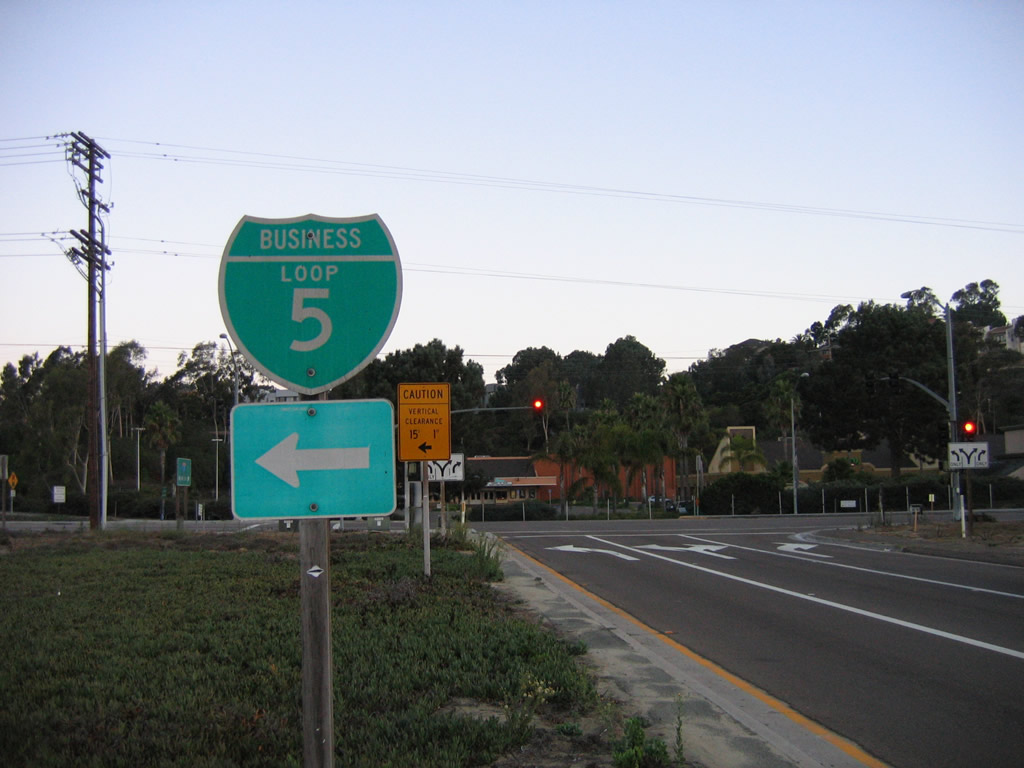
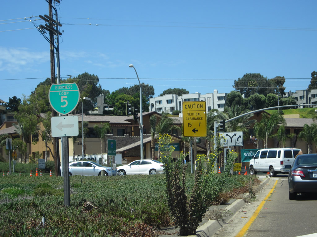
One of the two remaining shields for the Sola Beach Business Loop from Interstate 5 appeared along the northbound off-ramp. An end ehidl was also posted nearby eastbound Via de la Valle. Photos taken 10/07/06 and 08/18/12. |
|
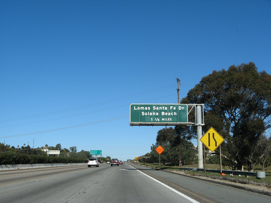
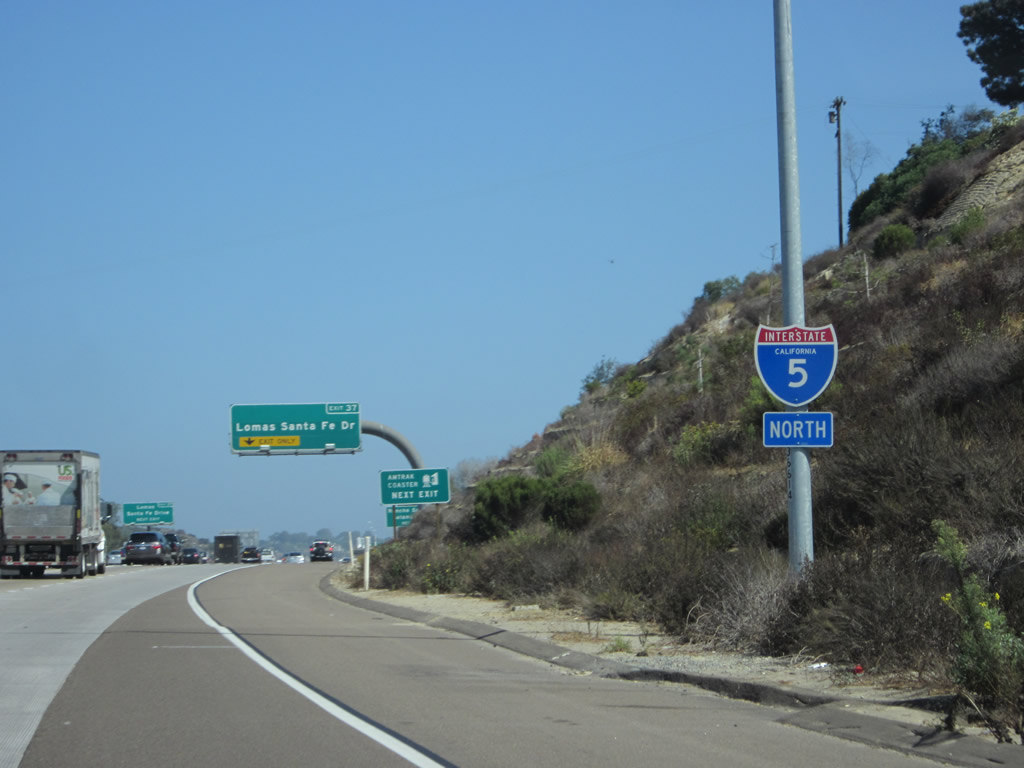
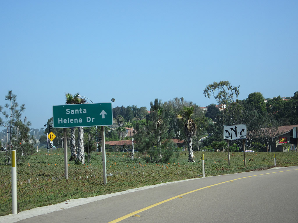
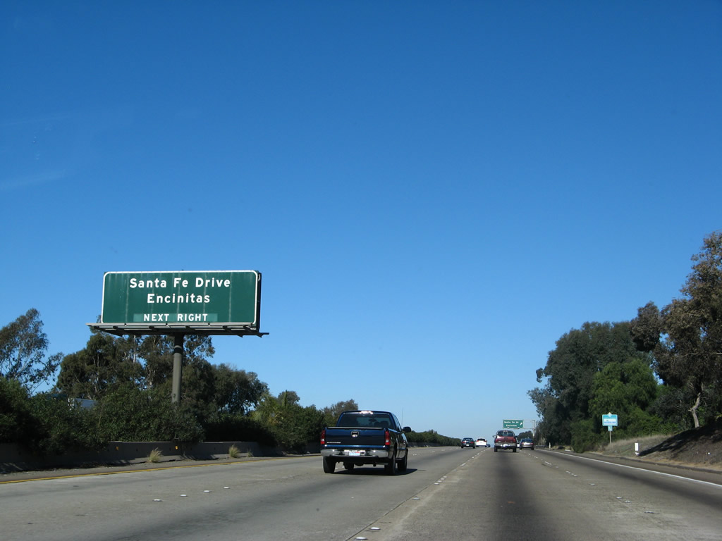
The next exit along northbound Interstate 5 is Exit 37, San Diego County S-8, Lomas Santa Fe Drive, one and a quarter miles. This sign has been replaced with a reflective sign (no picture available here yet). Photo taken 01/14/07. |
|
This mileage sign is posted next to the left lane along Interstate 5 north; it provides the distance to the next three exits, including Exit 37, San Diego County S-8 (Lomas Santa Fe Drive). Photo taken 01/14/07. |
|
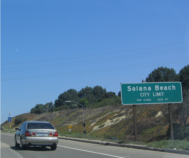
Interstate 5 leaves the city of San Diego and enters the city of Solana Beach. Solana Beach has a population of 13,835 as of the 2000 Census. Interstate 5 completely avoids entering the city of Del Mar. Photo taken 05/22/04. |
|
Traffic from westbound Via de la Valle joins Interstate 5 north ahead of this reassurance shield. Photo taken 09/01/12. |
|
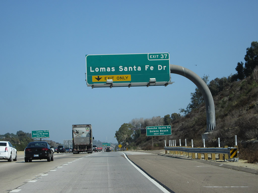
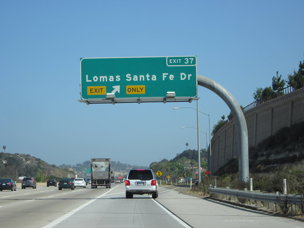
The right lane of Interstate 5 north drops at Exit 37 for Lomas Santa Fe Drive. Photo taken 09/01/12. |
|
This approach sign for Exit 37 was installed by fall 2009 as part of an interchange widening project. Solana Beach is the second in a string of coastal cities located along old U.S. 101 between San Diego and Oceanside. From south to north, these cities are Del Mar, Solana Beach, Encinitas, and Carlsbad. Photo taken 10/24/09. |
|
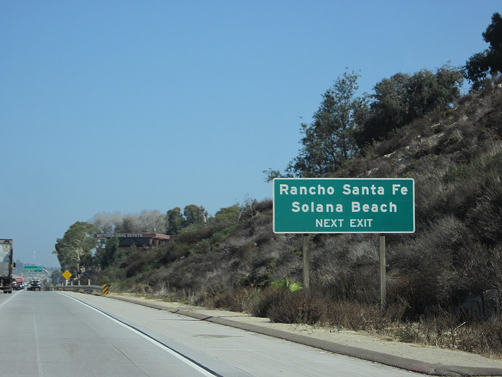
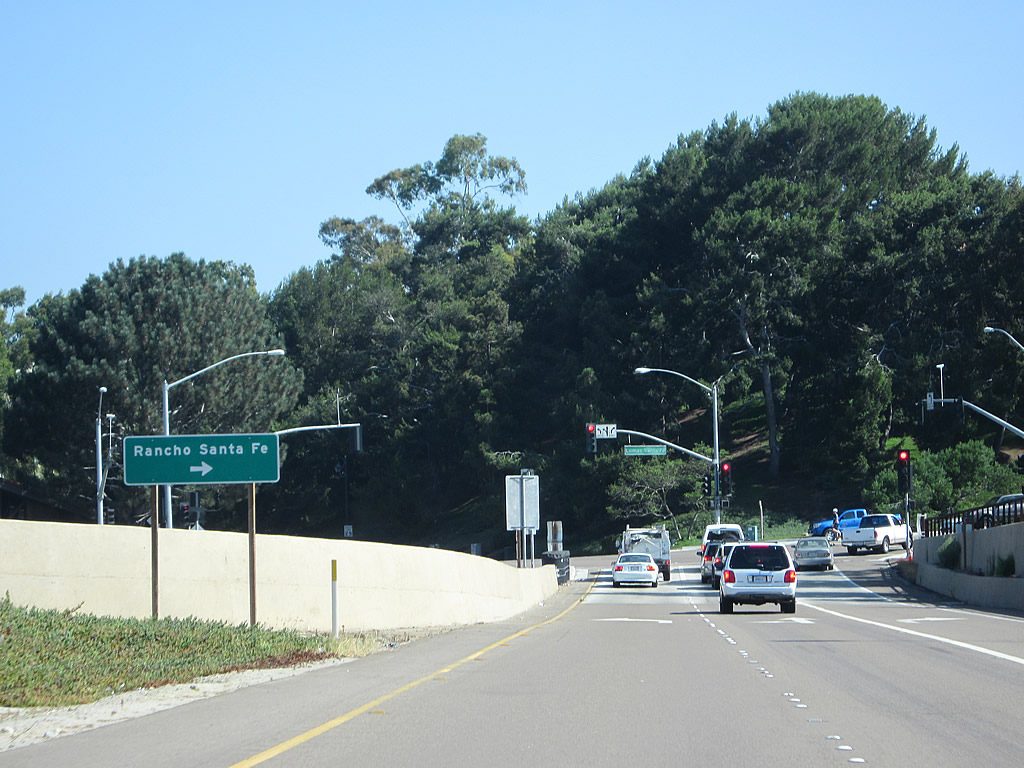
San Diego County S-8 follows Lomas Santa Fe Drive west to Solana Beach and east to Rancho Santa Fe Golf Club. Photo taken 09/01/12. |
|
Lomas Santa Fe Drive links I-5 with Rancho Santa Fe to the eat and Solana Beach to the west. Taking Lomas Santa Fe Drive east leads to Linea del Cielo, and it merges with San Diego County S-6 (Via de la Valle) near the Rancho Santa Fe Golf Club. Photo taken 09/01/12. |
|
San Diego County S-8 follows Lomas Santa Fe Drive east to San Dieguito County Park, then angles northeast along Linea del Cielo before ending at San Diego County S-6 in Rancho Santa Fe. Westbound San Diego County S-8 follows Lomas Santa Fe Drive into Solana Beach, ending at Coast Highway 101/San Diego County S-21. Photo taken 09/01/12. |
|
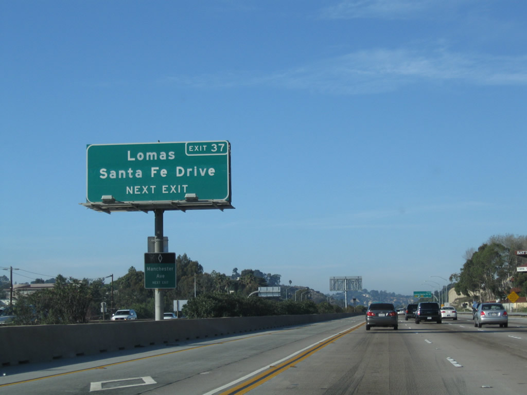
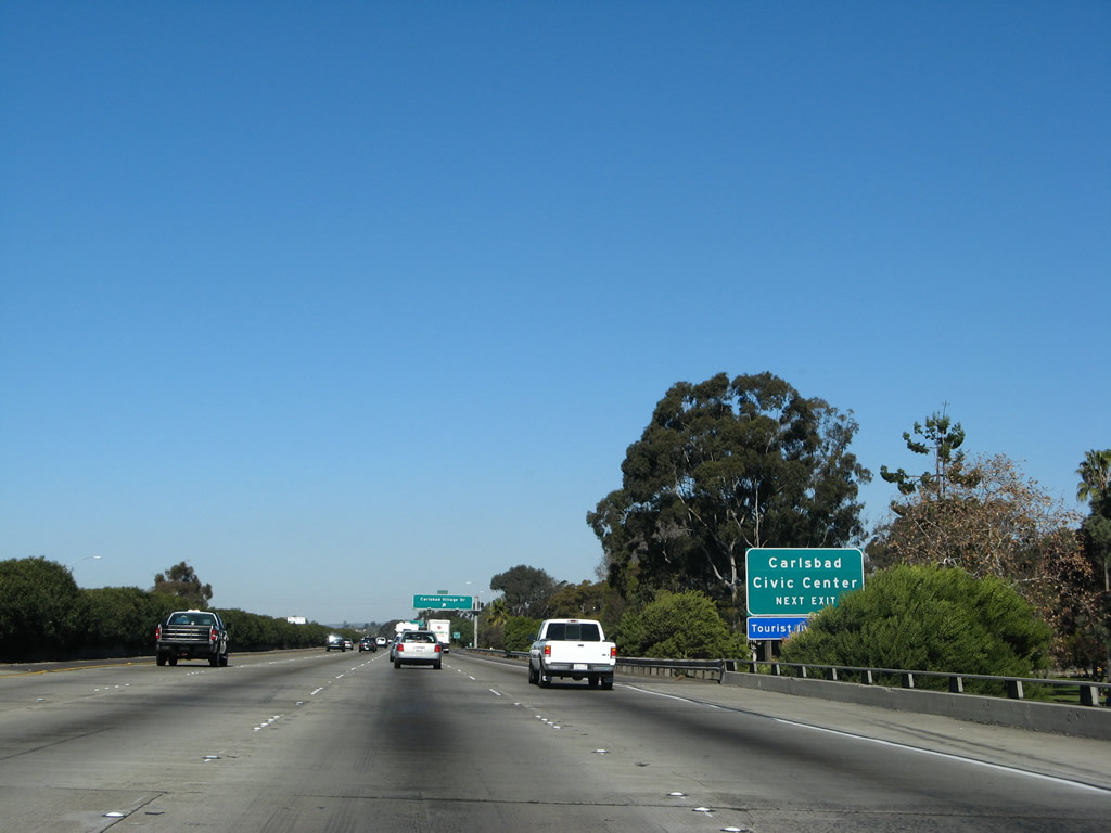
Northbound Interstate 5 (San Diego Freeway) reaches Exit 37, San Diego County S-8, Lomas Santa Fe Drive. This is the best route to access downtown Solana Beach, which is located just north of Del Mar. This is also the only freeway interchange located wholly within Solana Beach. Construction of the interchange expansion here and an extended HOV lane was completed in 2009. Photo taken 09/01/12. |
|
|
|
This series of pictures follows the off-ramp from Interstate 5 north to Exit 37, San Diego County S-8 (Lomas Santa Fe Drive). Photos taken 09/01/12. |
|
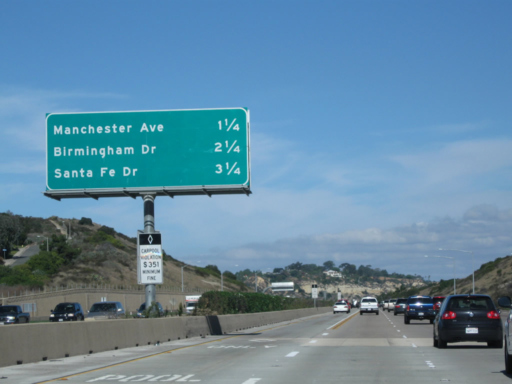
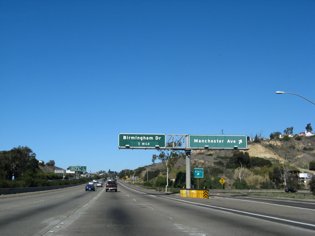
This mileage sign provides the distance to the next three exits along northbound: Exit 39, Manchester Avenue; Exit 40, Birmingham Drive; and Exit 41A, Santa Fe Drive. Photo taken 11/07/10. |
|
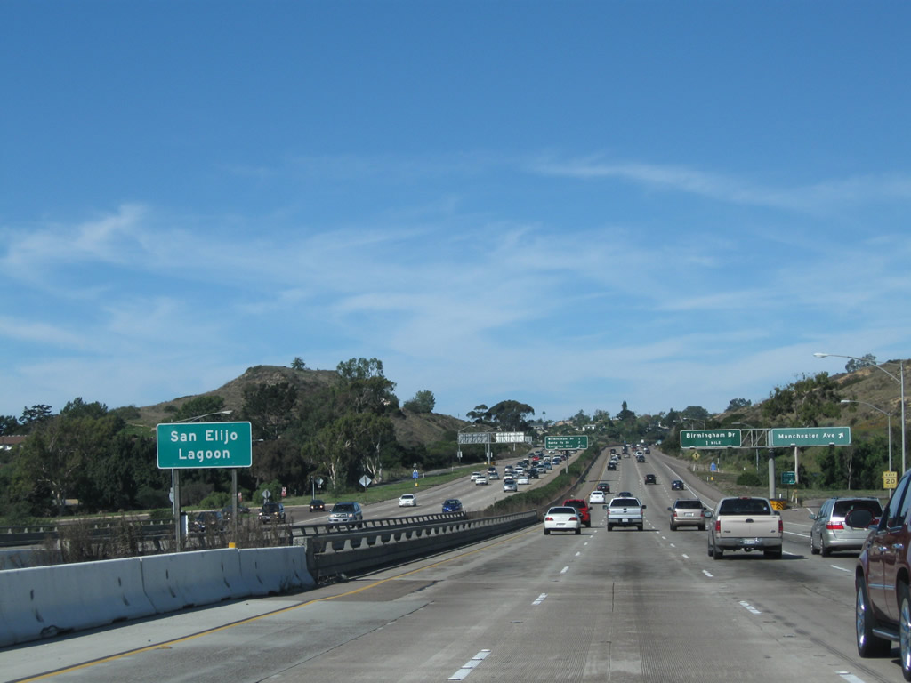
Interstate 5 dips into the San Elijo Lagoon as the freeway approaches Exit 39 for Manchester Avenue in Encinitas. Photo taken 11/07/10. |
|
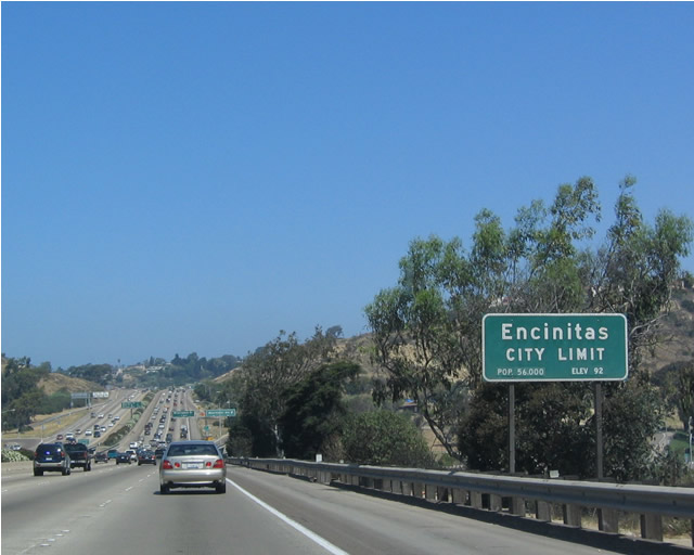
Prior to crossing the San Elijo Lagoon, Interstate 5 departs Solana Beach and enters the city of Encinitas. Encinitas is located between the Batiquitos Lagoon to the north and the San Elijo Lagoon to the south, and it consists of the communities of Leucadia, Encinitas, and Cardiff along the coast and New Encinitas (along El Camino Real) and Olivenhain west of Interstate 5. The city was incorporated on October 1, 1986, making it one of the younger cities along the coast. As of the 2000 Census, 58,014 people resided in Encinitas. The city consists of 19.4 square miles. Photo taken 05/22/04. |
|
Prior to the Manchester Avenue exit, the carpool lane ends and Interstate 5 crosses over San Elijo Lagoon. Photo taken 11/07/10. |
|
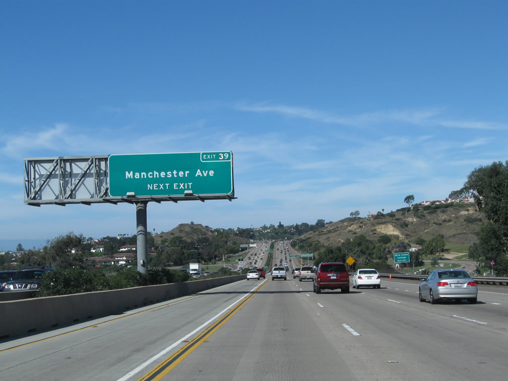
Northbound Interstate 5 reaches Exit 39, Manchester Avenue. Use Manchester Avenue east to reach El Camino Real in Encinitas and west to connect to San Elijo Avenue in Cardiff-by-the-Sea. Manchester Avenue is named after a local developer. Photo taken 01/14/07. |
|
This mileage sign provides the distance to the next three exits along northbound: Exit 40, Birmingham Drive; Exit 41A, Santa Fe Drive; and Exit 41B, Encinitas Boulevard. Photo taken 01/14/07. |
|
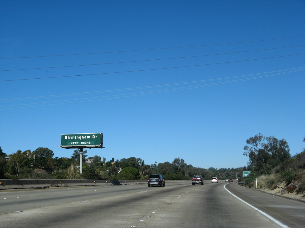
This median sign is the next advance guide sign for Exit 40, Birmingham Drive. Photo taken 01/14/07. |
|
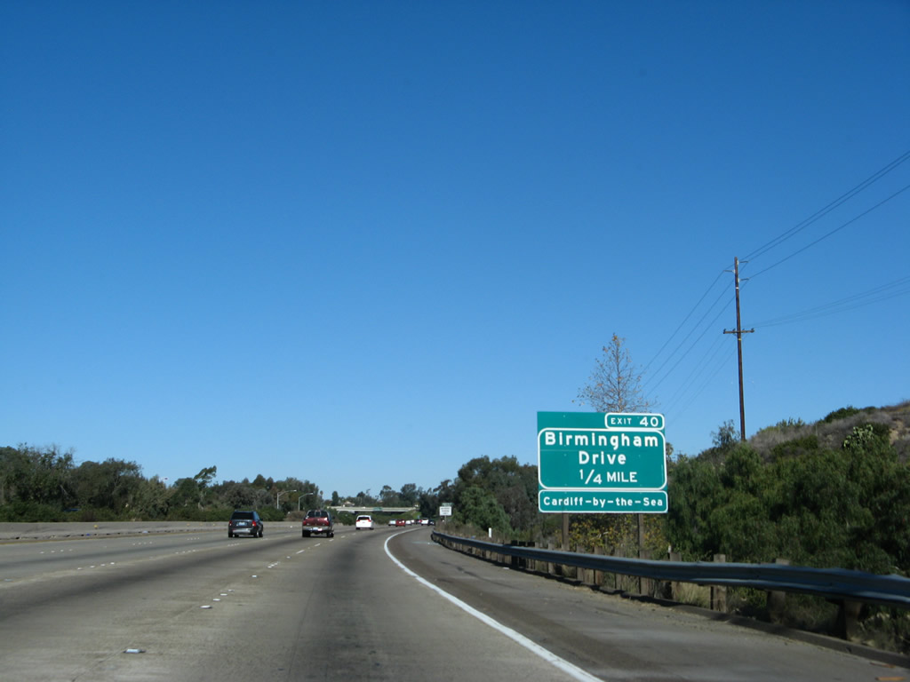
This roadside exit number sign for Exit 40, Birmingham Drive was added in July 2003. Photo taken 01/14/07. |
|
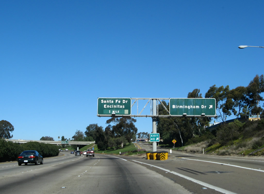
Northbound Interstate 5 (San Diego Freeway) reaches Exit 40, Birmingham Drive in Encinitas. Birmingham Drive is the second Encinitas exit, leading east to some local neighborhoods and west to Cardiff-by-the-Sea, the southernmost portion of Encinitas. Photo taken 01/14/07. |
|
This mileage sign provides the distance to the next three exits: Exit 41A, Santa Fe Drive; Exit 41B, San Diego County S-9 (Encinitas Boulevard); and Exit 43, Leucadia Boulevard. Photo taken 01/14/07. |
|
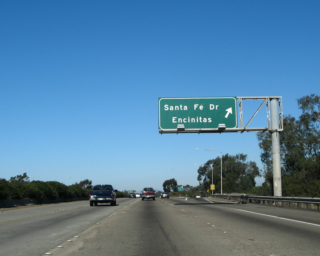
The next exit along northbound Interstate 5 is Exit 41A, Santa Fe Drive. This is major east-west route leading west into the heart of Encinitas and as far east as El Camino Real. Photo taken 01/14/07. |
|
Northbound Interstate 5 reaches Exit 41A, Santa Fe Drive. Photo taken 05/22/04. |
|
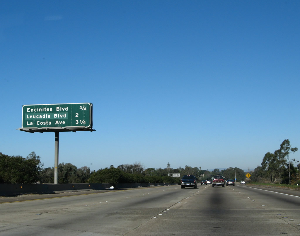
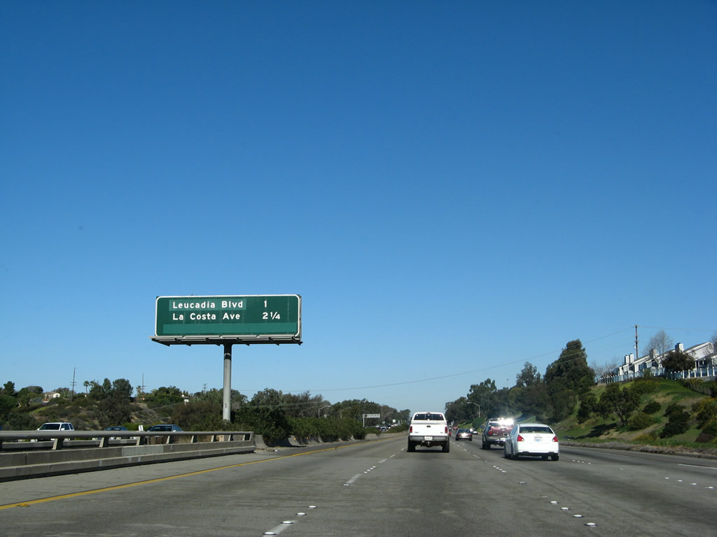
This mileage sign provides the distance to the next three exits: Exit 41B, San Diego County S-9 (Encinitas Boulevard); Exit 43, Leucadia Boulevard; and Exit 44, La Costa Avenue. Photo taken 01/14/07. |
|
The next exit along northbound Interstate 5 is Exit 41B, San Diego County S-9 (Encinitas Boulevard). Photo taken 01/14/07. |
|
Northbound Interstate 5 reaches Exit 41B, San Diego County S-9 (Encinitas Boulevard). Use San Diego County S-9 east to reaches Oakcrest Park and a variety of shopping centers at its intersection with El Camino Real (San Diego County S-11). From there, San Diego County S-9 departs Encinitas and ends at San Diego County S-8 in Rancho Santa Fe. Photo taken 01/14/07. |
|
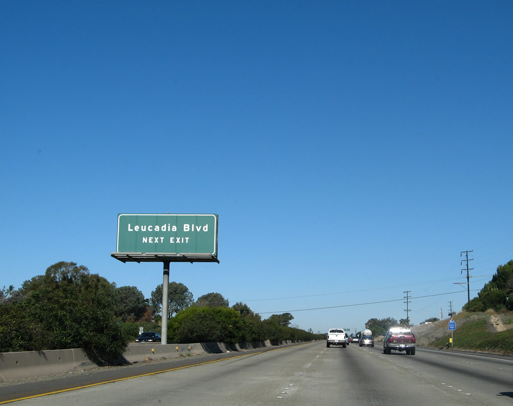
The next exit along northbound Interstate 5 is Exit 43, Leucadia Boulevard (one mile). Prior to the incorporation of Encinitas in the 1980s, Leucadia was a separate, unincorporated community of San Diego, just like Cardiff-by-the-Sea. Photo taken 01/14/07. |
|
This northbound Interstate 5 reassurance shield is up to its neck in colorful plants that turn purple in the springtime. Photo taken 04/23/06. |
|
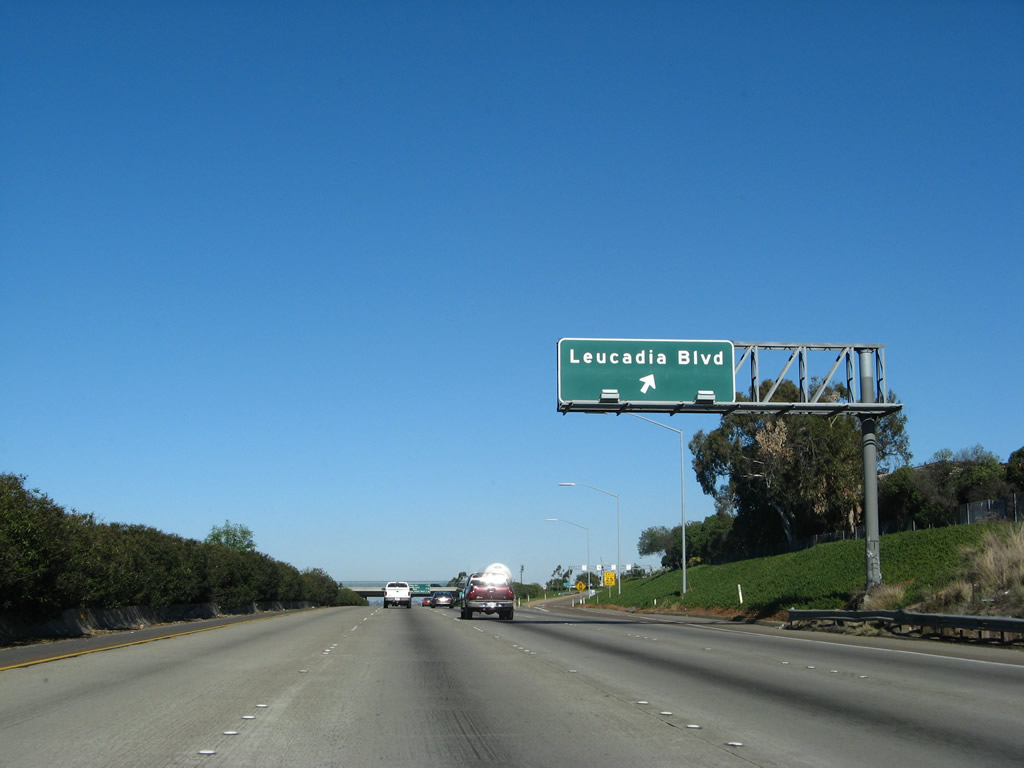
Leucadia Boulevard is an east-west route that connects the Leucadia beach areas and downtown with El Camino Real (San Diego County S-11) and Olivenhain Road/Rancho Santa Fe Road (San Diego County S-10) in Carlsbad. Photo taken 01/14/07. |
|
Northbound Interstate 5 reaches Leucadia Boulevard, Exit 43. A vintage stretch of U.S. 101 expressway is located along Coast Highway 101 in Leucadia between Leucadia Boulevard and La Costa Avenue (Batiquitos Lagoon). Photo taken 01/14/07. |
|
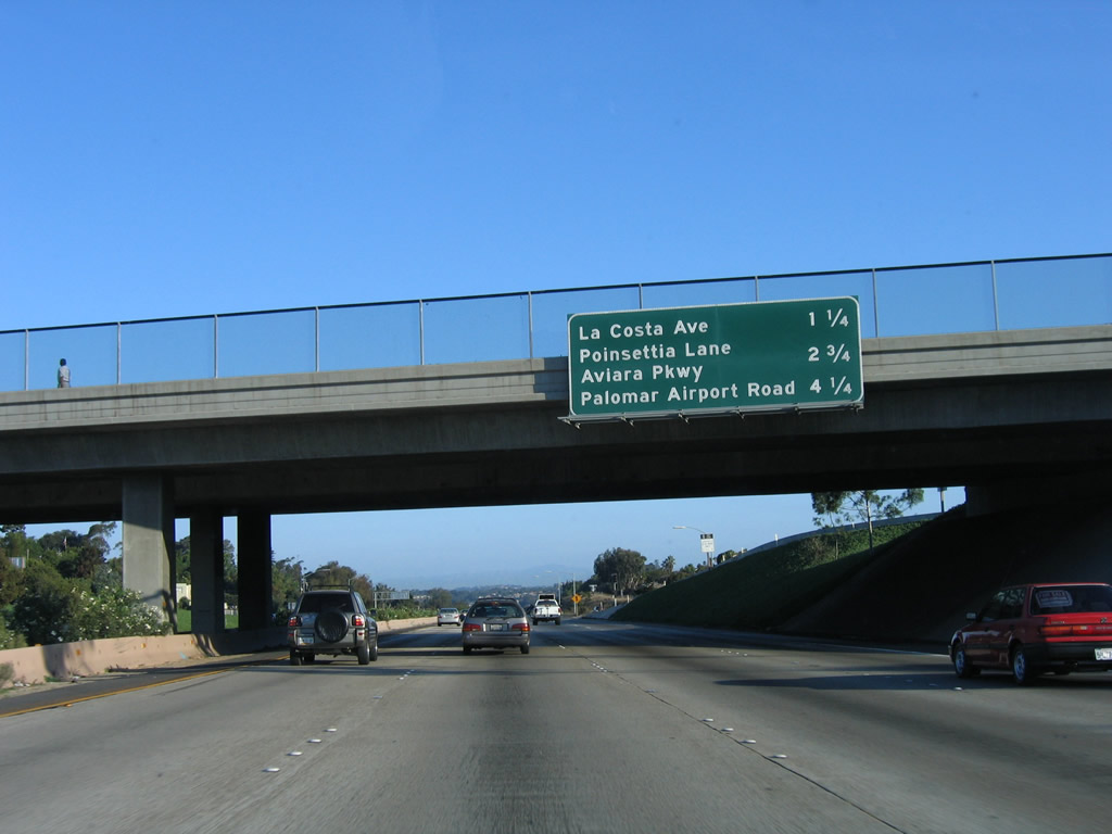
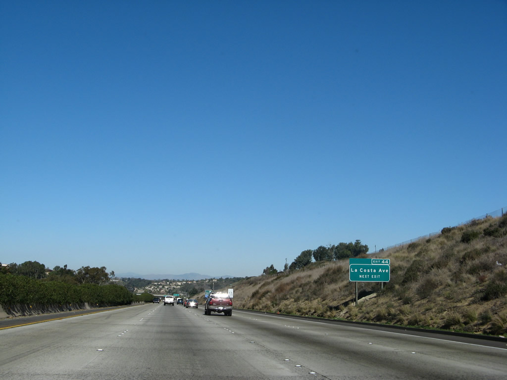
This mileage sign along northbound Interstate 5 provides the distance to the next three exits: Exit 44, La Costa Avenue; Exit 45, Aviara Parkway / Poinsettia Lane; and Exit 47, San Diego County S-12 (Palomar Airport Road). Photo taken 10/07/06. |
|
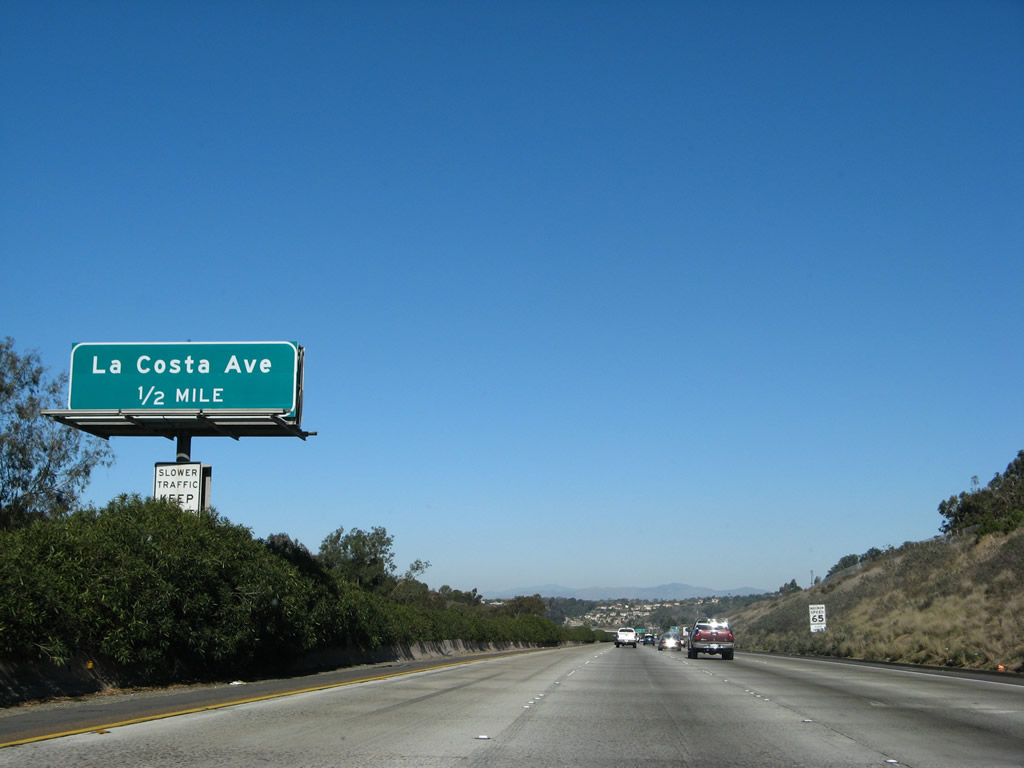
The next exit along northbound Interstate 5 is Exit 44, La Costa Boulevard. This is the last Encinitas exit. The Batiquitos Lagoon is just beyond this exit, and Carlsbad lies beyond the lagoon. Photo taken 10/07/06. |
|
A roadside exit number sign for Exit 44, La Costa Avenue is posted shortly thereafter. It seems like the exit number should have been on the overhead sign posted in the median rather than adding a new sign. This kind of signage is common from here north to Carlsbad; the new reflective signs along this stretch were placed in 2006. Photo taken 01/14/07. |
|
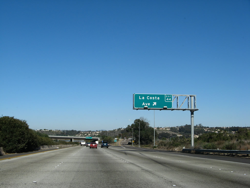
Northbound Interstate 5 reaches Exit 44, La Costa Boulevard. Located east of the freeway, La Costa is known nationally in the golfing community as the host of professional golfing tournaments and other events. Photo taken 01/14/07. |
|
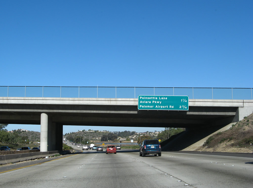
The next two exits along Interstate 5 (San Diego Freeway) north are Exit 45, Poinsettia Lane / Aviara Parkway (1.25 miles) followed by Exit 47, Palomar Airport Road (San Diego County S-12). Photo taken 01/14/07. |
|
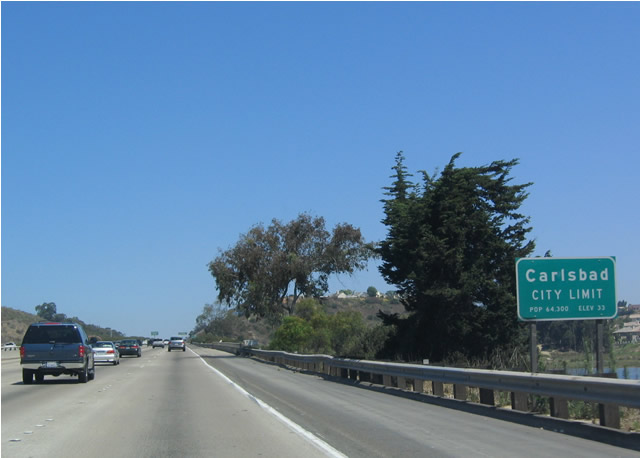
Upon passing Exit 44, Interstate 5 leaves the city of Encinitas and enters the city of Carlsbad. This sign is located along northbound as the freeway crosses Batiquitos Lagoon, which generally separates Encinitas from Carlsbad. Home to the famous Carlsbad Flower Fields, Carlsbad was incorporated on July 16, 1952, and it is home to 78,247 people as of the 2000 Census. Significant growth occurred, especially on its eastern side, with expansion from 7.5 square miles in 1952 to nearly 42 square miles in 2005. Photo taken 05/22/04. |
|
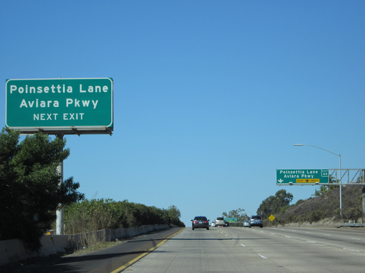
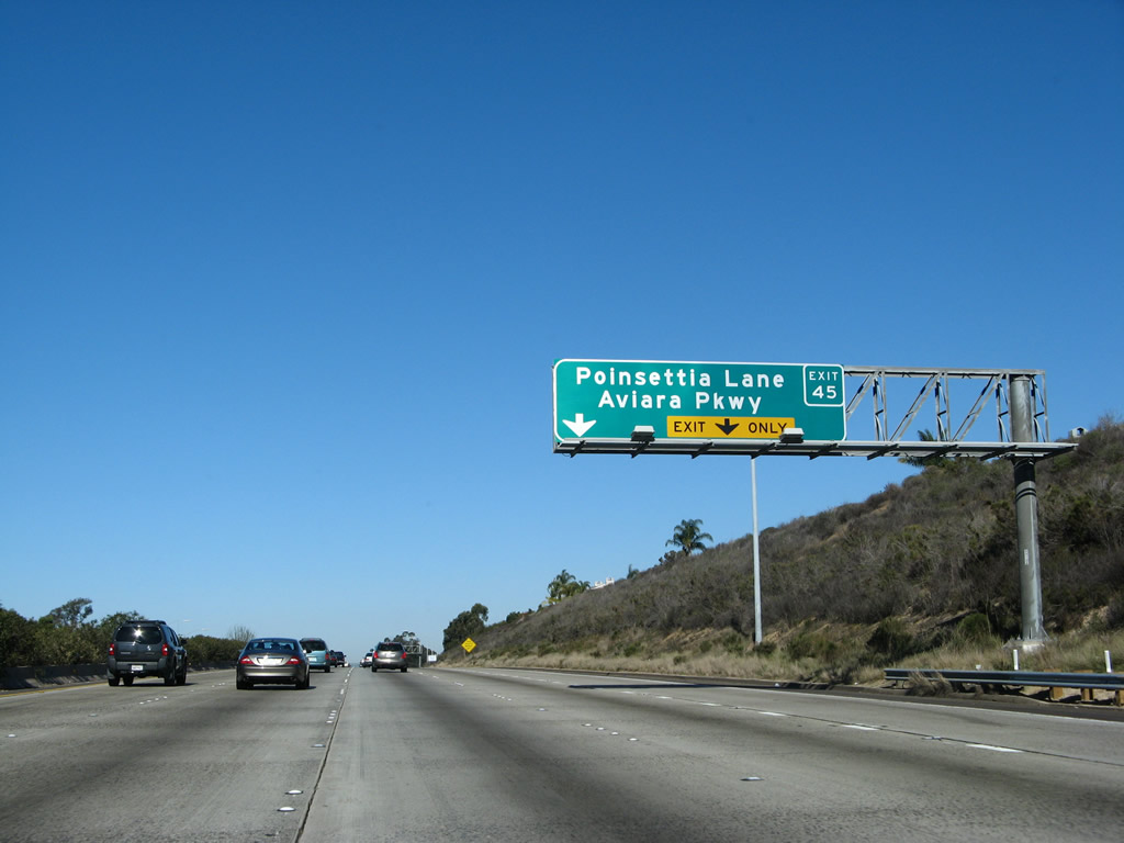
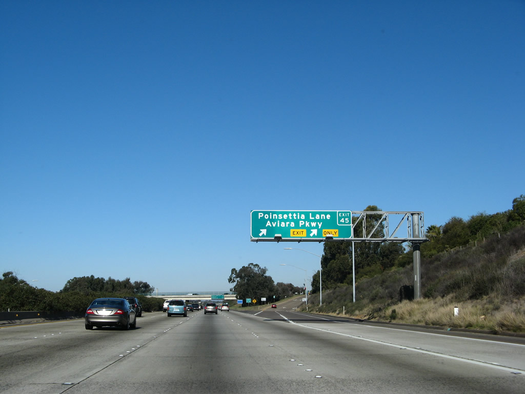
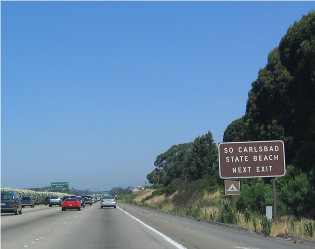
Northbound Interstate 5 approaching Poinsettia Lane / Aviara Parkway, Exit 45, right-lane exit only signage. Poinsettia Lane leads due east to meet San Diego County S-21 (Coast Highway) in front of the South Carlsbad State Beach from this interchange. Photo taken 11/11/12. |
|
An auxiliary lane is formed for traffic utilizing the exit Aviara Parkway and Poinsettia Lane. Photos taken 01/14/074. |
|
Northbound Interstate 5 reaches Exit 45, Poinsettia Lane to Aviara Parkway. In an unusual move, Caltrans has signed Aviara Parkway, even though it does not truly intersect Interstate 5 and is actually located a little less than a mile east of the Interstate 5 / Poinsettia Lane interchange. Aviara Parkway is really a loop route that begins at Palomar Airport Road (County Route S-12) and arcs to the southeast all the way to El Camino Real (County Route S-11). North of Palomar Airport Road, Aviara Parkway becomes College Boulevard, and it loops back toward El Camino Real north of McClellan Palomar Airport. Photo taken 01/14/07. |
|
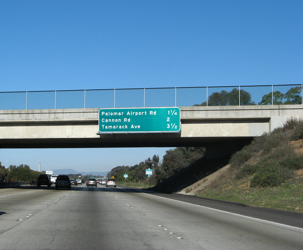
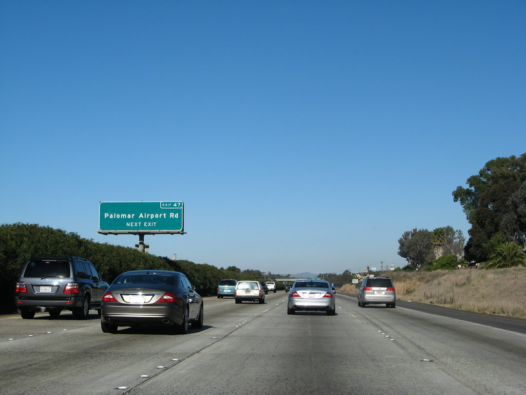
This mileage sign along northbound Interstate 5 provides the distance to the next three exits: Exit 47, Palomar Airport Road (San Diego County S-12), followed by Exit 48, Cannon Road and Exit 49, Tamarack Road. Photo taken 01/14/07. |
|
Use Palomar Airport Road/San Diego County S-12 west to reach South Carlsbad State Beach along Coast Highway 101. Photo taken 05/22/04. |
|
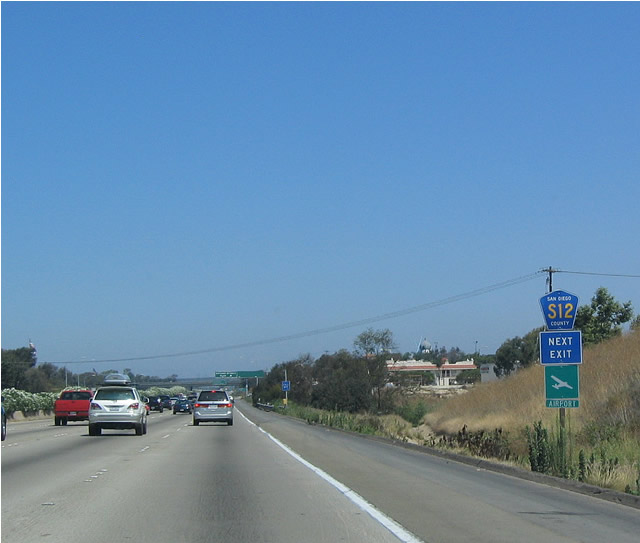
The next along northbound is Exit 47, San Diego County S-12 (Palomar Airport Road). Photo taken 01/14/07. |
|
San Diego County S-12 begins at Coast Highway 101 (San Diego County S-21) and follows Palomar Airport Road east past Interstate 5, McClellan Palomar Airport, El Camino Real/San Diego County S-11, Rancho Santa Fe Road/San Diego County S-10, and California 78 (Ronald Packard Highway) before reaching Twin Oaks Drive. At Twin Oaks Drive, San Diego County S-12 heads north along Twin Oaks Valley Road and Deer Springs Road, ultimately culminating at Interstate 15 (Exit 37). Photo taken 05/22/04. |
|
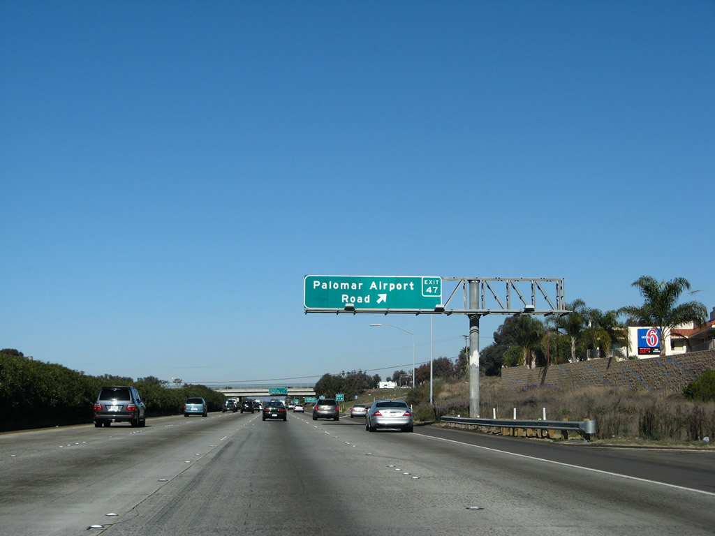
Northbound Interstate 5 reaches Exit 47, Palomar Airport Road (San Diego County S-12). Per its name, Palomar Airport Road leads to McClellan Palomar Airport in Carlsbad, which is one of the larger airports in the county. It has full-service commercial service to a variety of locales, but it is more expensive for commercial flights than San Diego International Airport in many cases. Photo taken 01/14/07. |
|
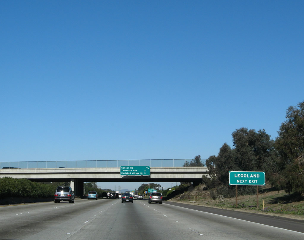
Located off Exit 48, Legoland is a theme park for children based on the popular toy. Photo taken 01/14/07. |
|
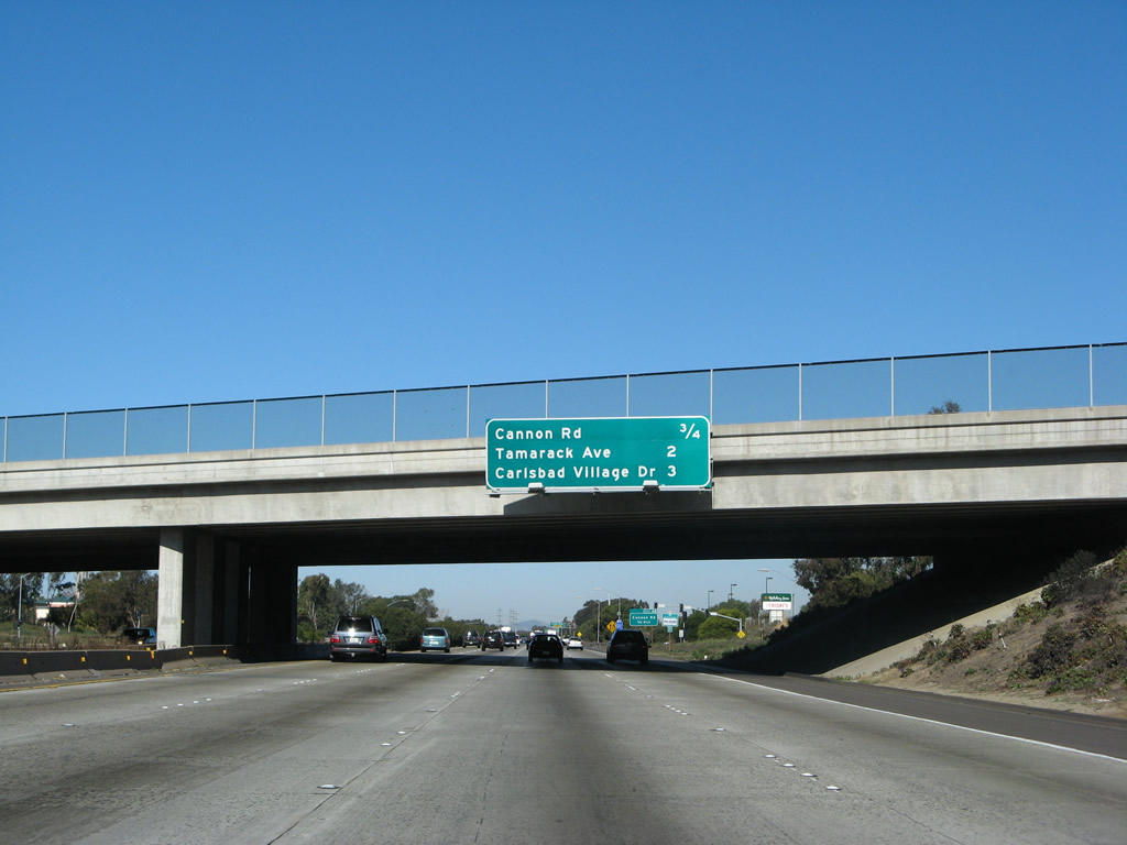
This mileage sign along northbound Interstate 5 provides the distance to Exit 48, Cannon Road; Exit 49, Tamarack Avenue; and Exit 50, Carlsbad Village Road. Photo taken 01/14/07. |
|
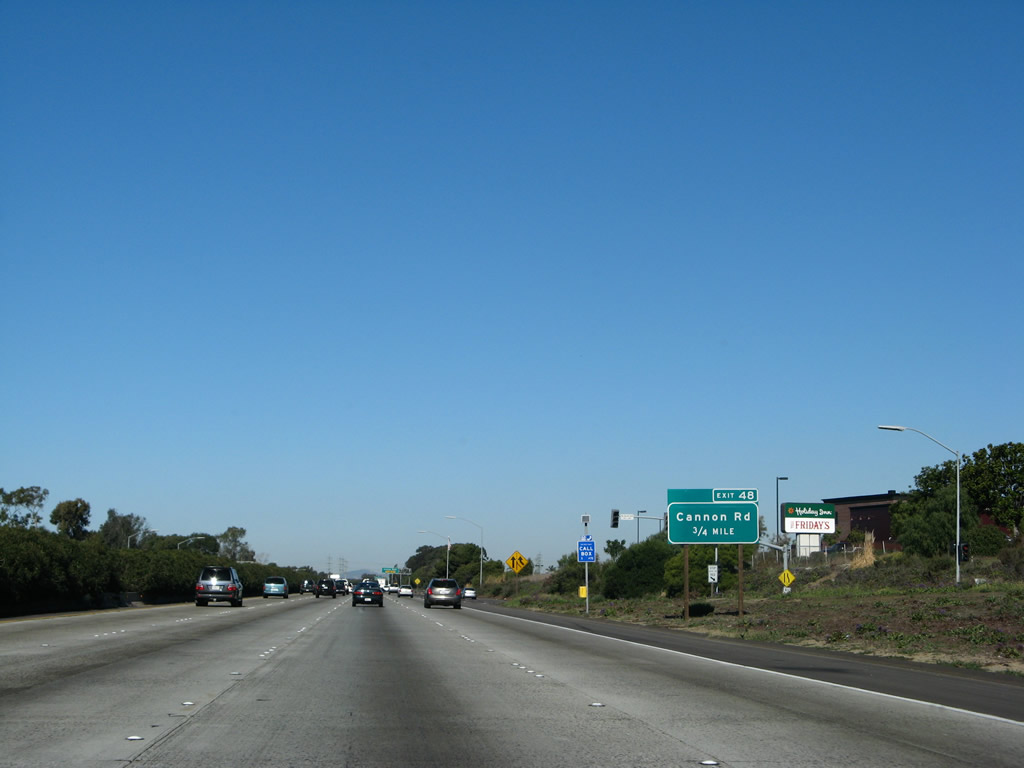
A roadside exit number sign for Cannon Road (Exit 48) is posted shortly thereafter. Despite the replacement of all overhead signs for Cannon Road in 2006, this ground level sign was the only including the exit number. Photo taken 01/14/07. |
|
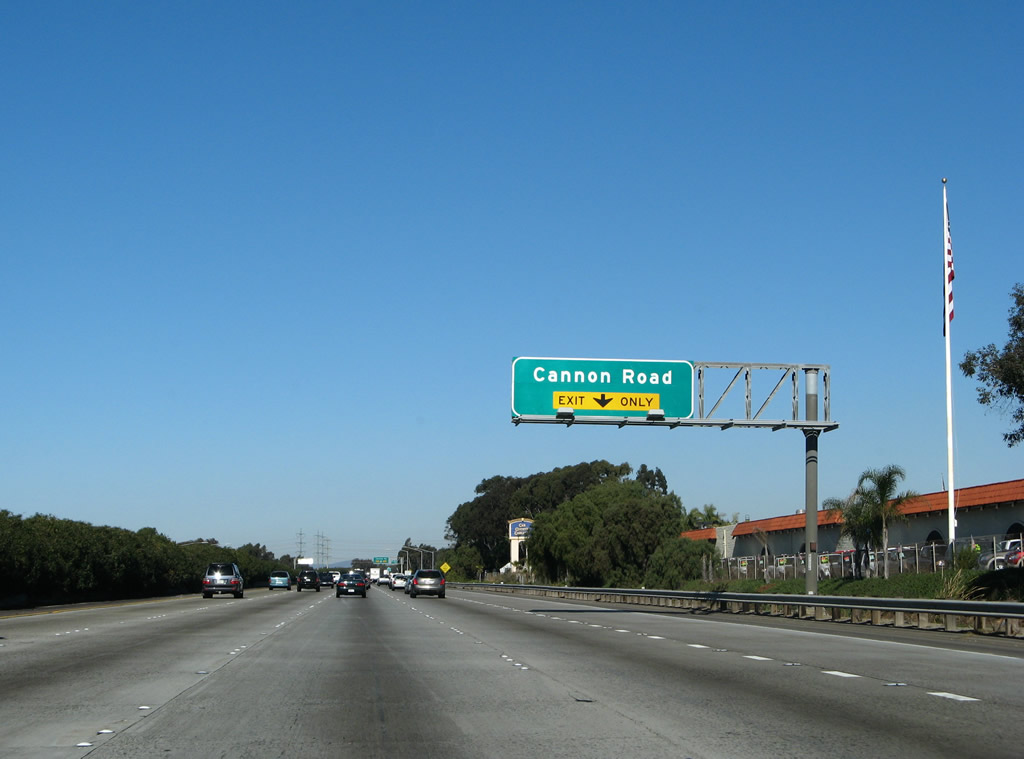
The right lane gained from the on-ramp from Palomar Airport Road drops at Exit 48 for Cannon Road. Photo taken 01/14/07. |
|
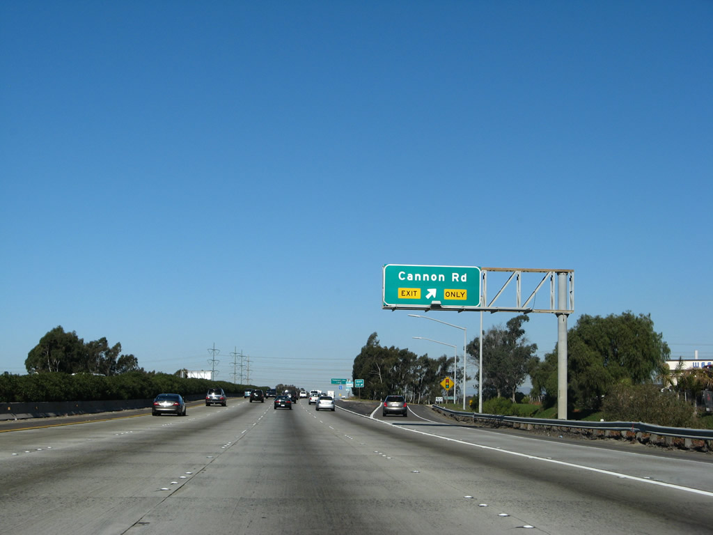
Northbound Interstate 5 reaches Exit 48, Cannon Road in Carlsbad. Heading east, Cannon Road becomes Faraday Avenue and connects with San Diego County S-11 (El Camino Real). Heading west, Cannon Road meets Coast Highway 101 near Cannon Park. Photo taken 01/14/07. |
|
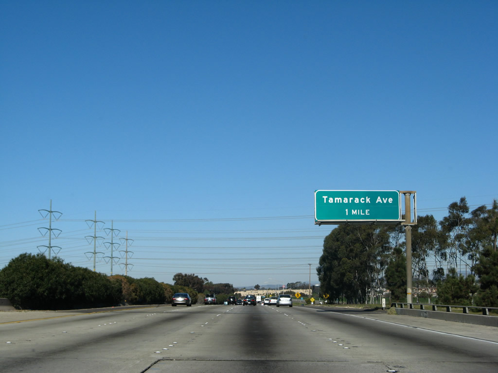
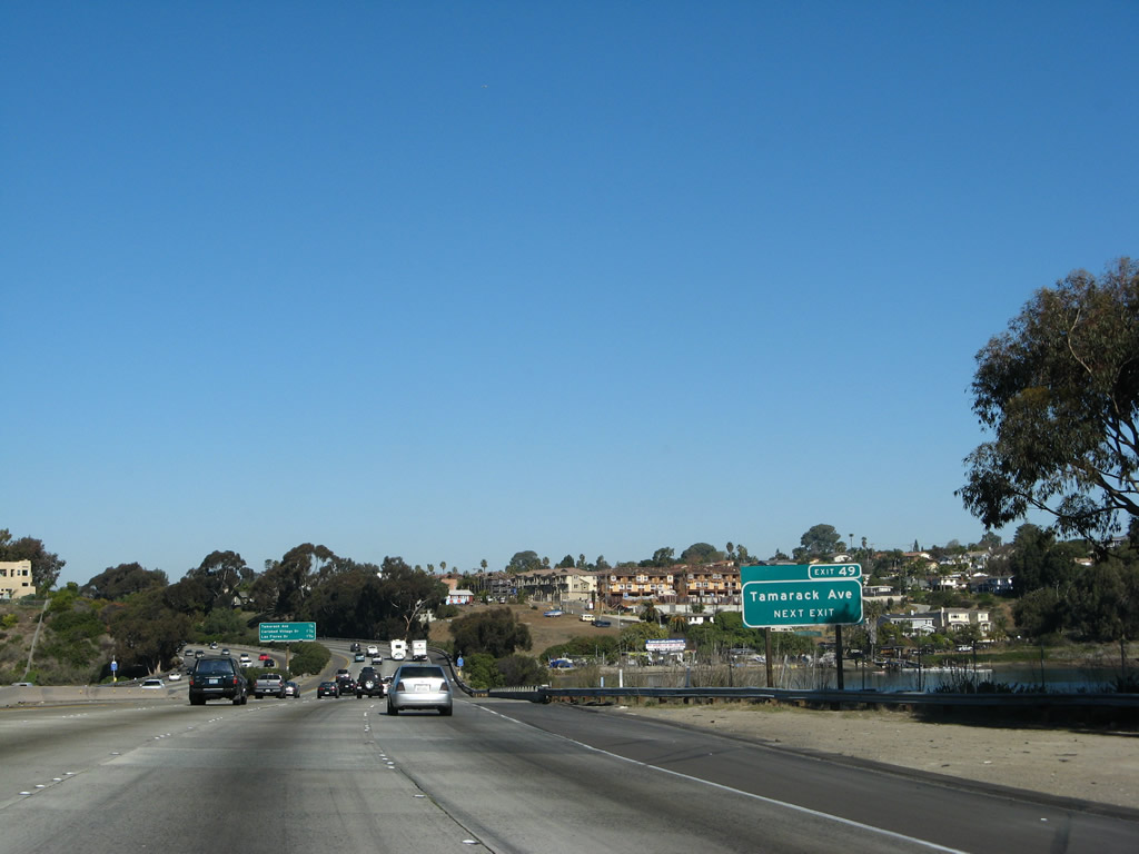
The next exit along Interstate 5 north is Exit 49, Tamarack Avenue (one mile). The series of high voltage transmission lines in the distance connect the Carlsbad natural gas electricity generation plant to the San Diego power grid. Photo taken 01/14/07. |
|
|
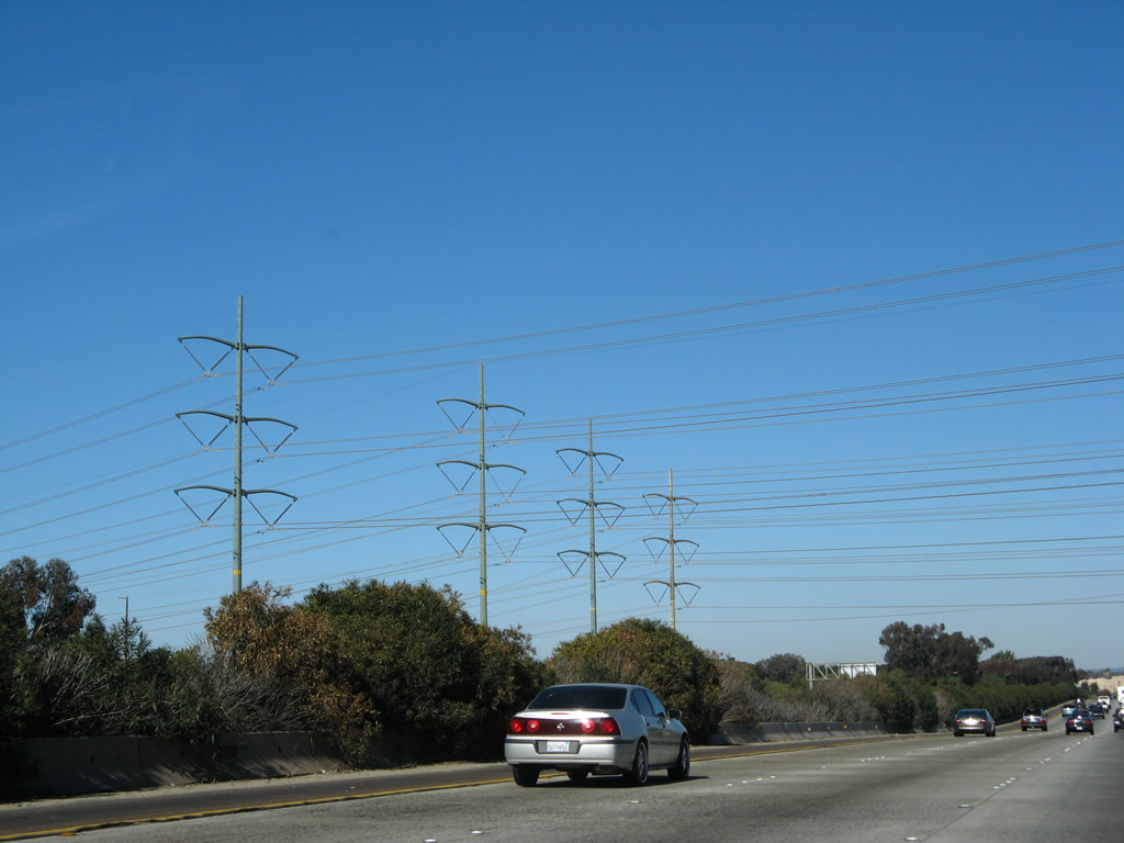
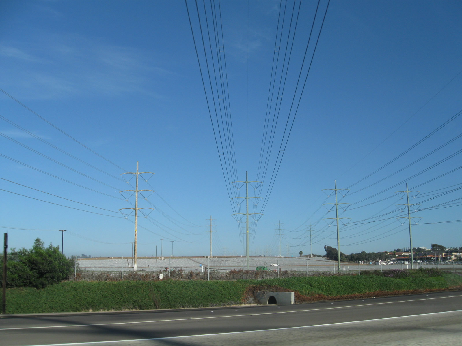
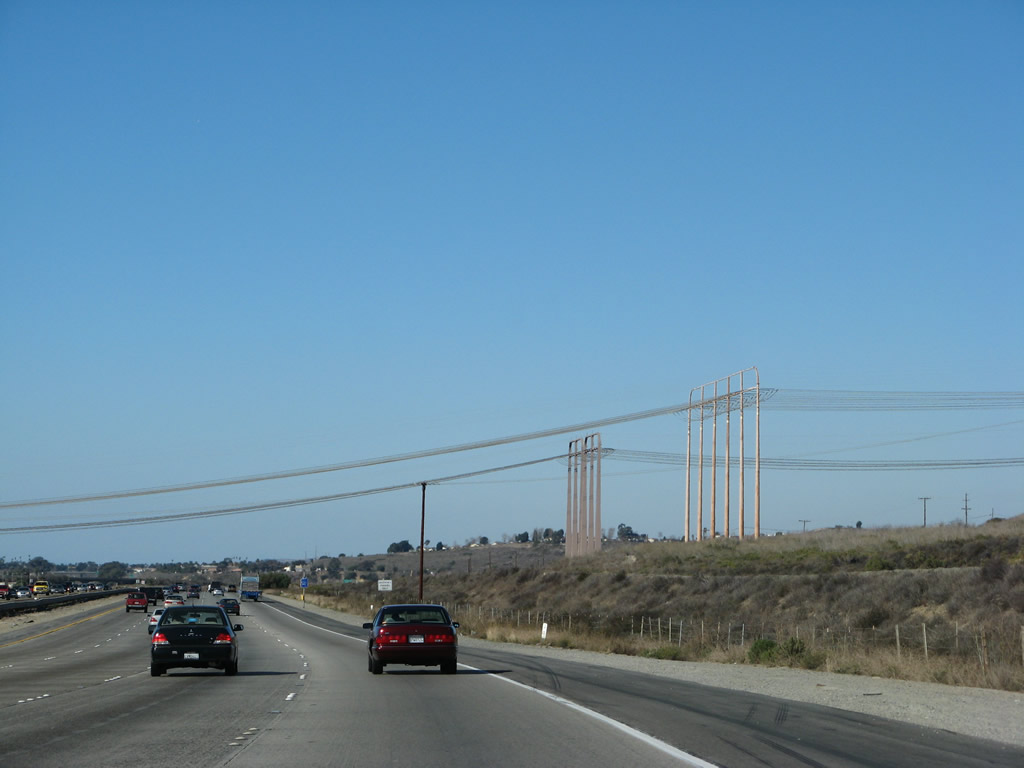
Four double-circuit, 230kV power line towers cross Interstate 5. These lines originate at the Encina power generating station located on the coast and include a substation to connect transmission coming from the north (including San Onofre Nuclear Generating Station and other power plants in Orange County and Los Angeles). On the east side of the freeway, the power lines pass over the Carlsbad strawberry fields. Photos taken 01/14/07 and 10/24/09. |
|
This Interstate 5 reassurance shield is posted on northbound after the on-ramp from Cannon Road. Photo taken 01/14/07. |
|
A roadside exit number sign is posted for Exit 49, Tamarack Avenue in Carlsbad. The Agua Hedionda Lagoon comes into view on the east side of the freeway. Photo taken 01/14/07. |
|
Northbound Interstate 5 passes over the Agua Hedionda Lagoon in central Carlsbad, one-quarter mile south of the Tamarack Avenue interchange (Exit 49). Photo taken 01/14/07. |
|
Northbound Interstate 5 reaches Tamarack Avenue (Exit 49) just beyond the Agua Hedionda Lagoon. The next exit is Carlsbad Village Road, the main route into downtown Carlsbad. Photo taken 01/14/07. |
|
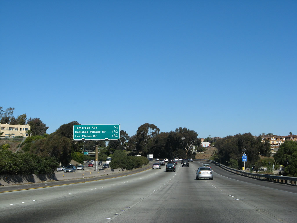
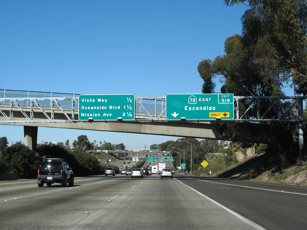
This mileage sign provides the distance to the next three exits: Exit 50, Carlsbad Village Road; Exit 51A, Las Flores Drive; and Exit 51B, California 78 east to Escondido. Photo taken 01/14/07. |
|
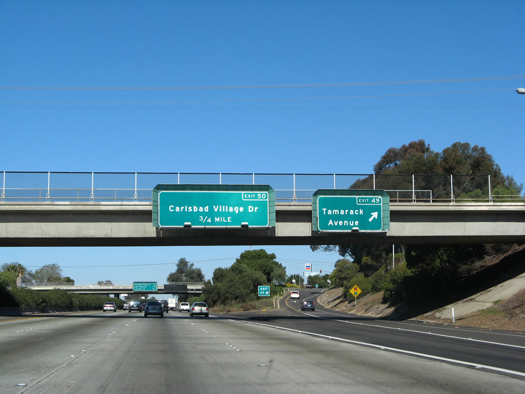
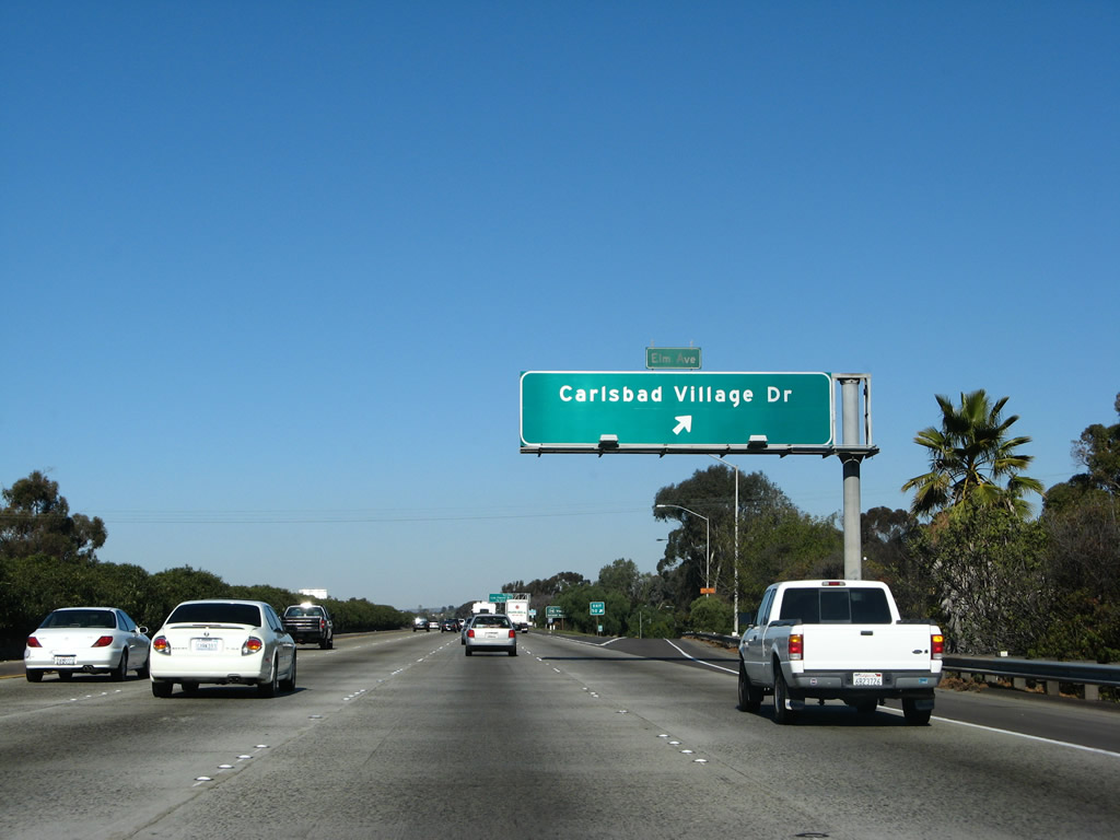
Northbound Interstate 5 (San Diego Freeway) approaches Carlsbad Village Road (formerly Elm Avenue), which leads into downtown Carlsbad to the west. Photo taken 01/14/07. |
|
Northbound Interstate 5 (San Diego Freeway) reaches Exit 50, Carlsbad Village Road. Carlsbad Village Road was previously named Elm Avenue. Photo taken 01/14/07. |
|
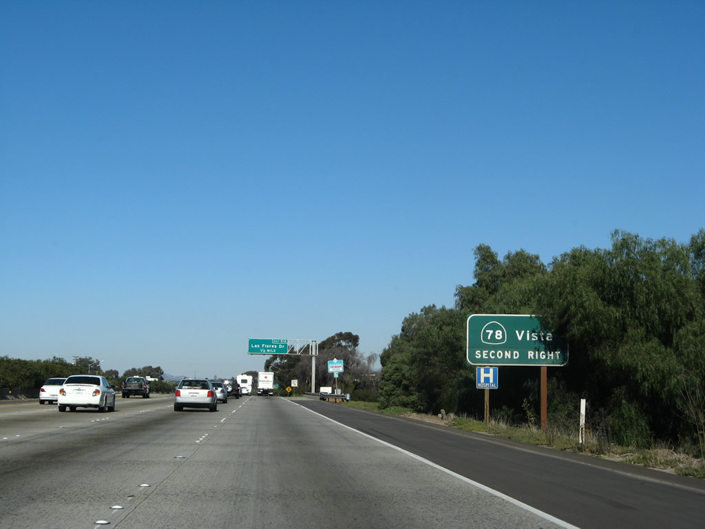
This mileage sign provides the distance to the next two exits on northbound: Exit 51A, Las Flores Avenue and Exit 51B, California 78 (Ron Packard Freeway). California 78 between Oceanside and Escondido is a major east-west freeway across northern San Diego County. Photo taken 01/14/07. |
|
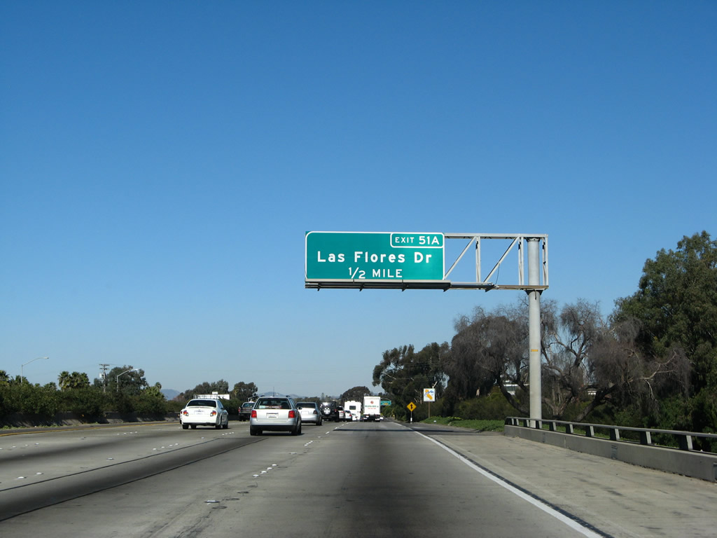
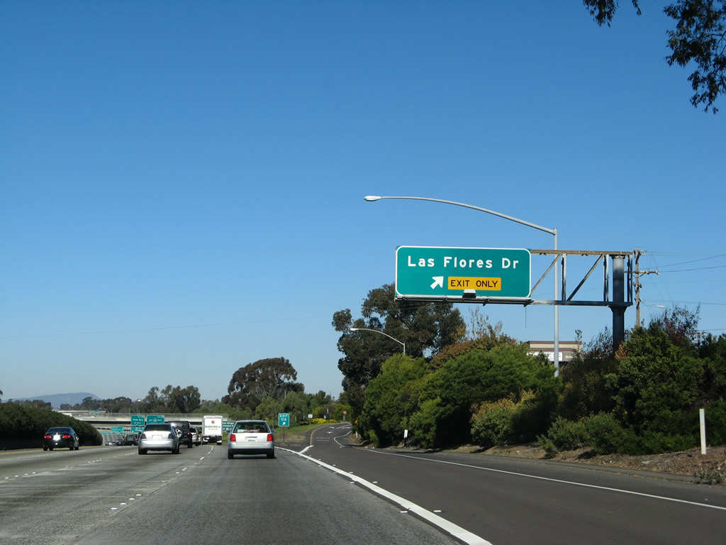
The next exit along Interstate 5 north is Las Flores Drive (Exit 51A). Photo taken 01/14/07. |
|
Northbound Interstate 5 (San Diego Freeway) reaches Exit 51A, Las Flores Drive. Photo taken 01/14/07. |
|
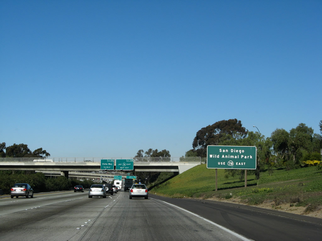
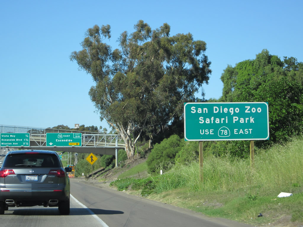
Use California 78 east via Exit 51B to reach the San Diego Wild Animal Park. Photo taken 01/14/07. |
|
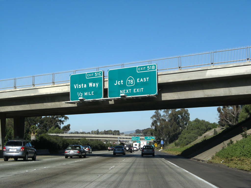
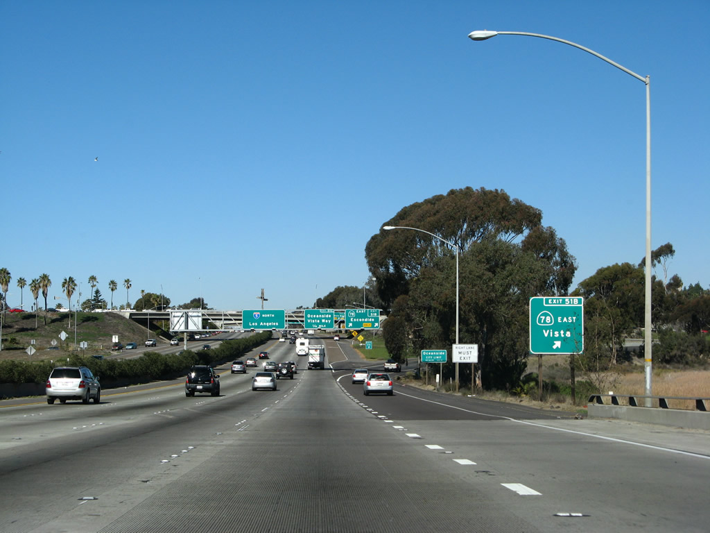
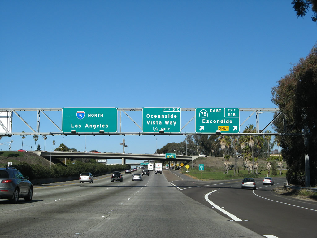
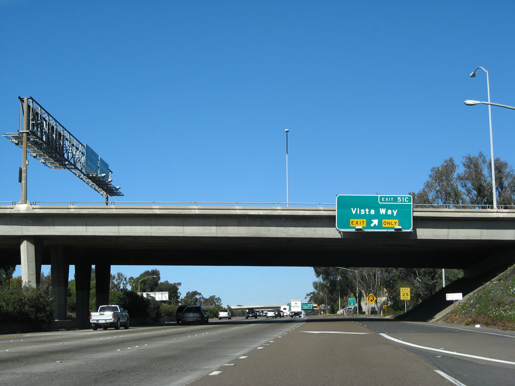
The first of seven exits for the city of Oceanside depart over the ensuing half mile of I-5 north for SR 78 east (Exit 51B) and Vista Way (Exit 51C). Photo taken 01/14/07. |
|
Take California 78 (Ronald Packard Parkway) east to the San Diego Zoo Safari Park, which was formerly known as the San Diego Wild Animal Park. This popular, regional attraction offers an expansive pasture full of range animals from around the world. It is located in the San Pasqual Valley (part of the city of San Diego) east of Escondido. Photo taken 01/14/07. |
|
The right two lanes of Interstate 5 north connect to California 78 (Ronald Packard Parkway) east (Exit 51B) in one-quarter mile. A new sign bridge was erected in front of the overcrossing in 2003, and the sign mounted on the bridge was removed. Photo taken 01/14/07. |
|
The ramp from northbound Interstate 5 to eastbound California 78 is tight because the ramp does not go into the lagoon to the east of the freeway here. Photo taken 01/14/07. |
|
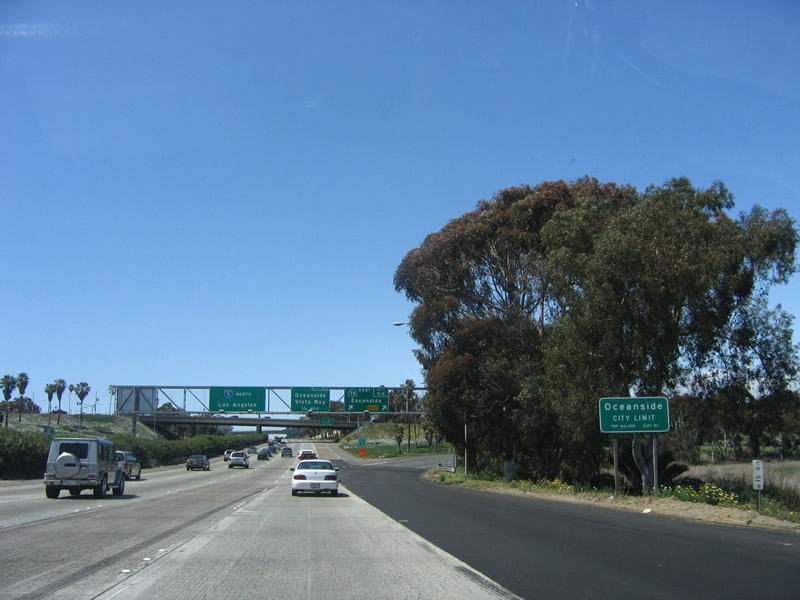
The freeway enters the city of Oceanside as it crosses the Buena Vista Lagoon. Oceanside is the last of several communities nestled along the Interstate 5 corridor that form coastal "North County," a reference to their location in the northern part of San Diego County. Oceanside is a 42-square-mile city that was founded on July 3, 1888, and it is home to 173,303 people as of a 2005 estimate (the highway sign says 164,500 people as of the 2000 Census). Photo taken 04/23/06. |
|
Northbound Interstate 5 reaches Exit 51B, California 78 (Ron Packard Freeway) east to Vista and Escondido. California 78 is also known as the Ronald Packard Parkway. Interstate 5 enters the city of Oceanside upon crossing the Buena Vista Lagoon after Las Flores Drive (Exit 51A). Photo taken 01/14/07. |
|
As part of the same modified cloverleaf, northbound Interstate 5 next meets Exit 51C, Vista Way westbound, which is the original California 78 before it was replaced by the freeway. This route leads into downtown Oceanside, connecting to Coast Highway 101. Photo taken 01/14/07. |
|
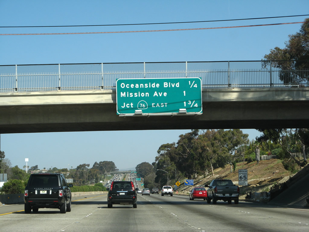
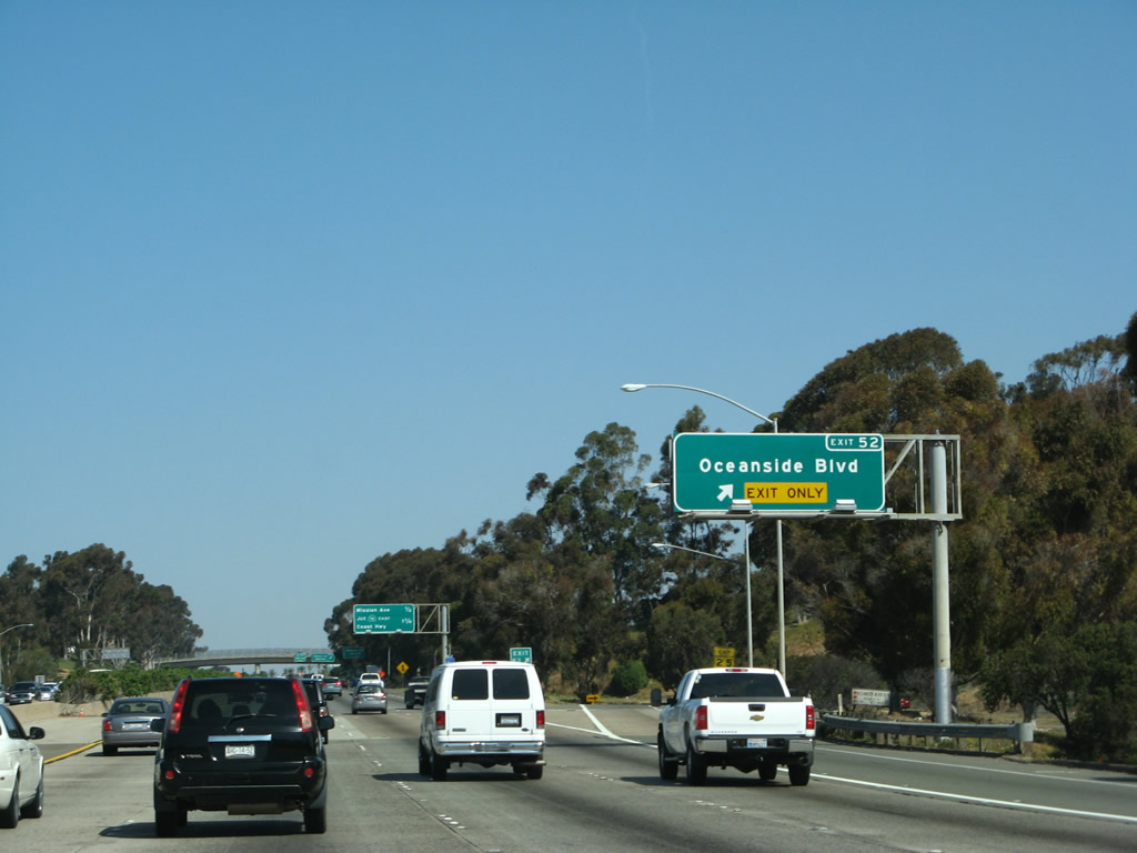
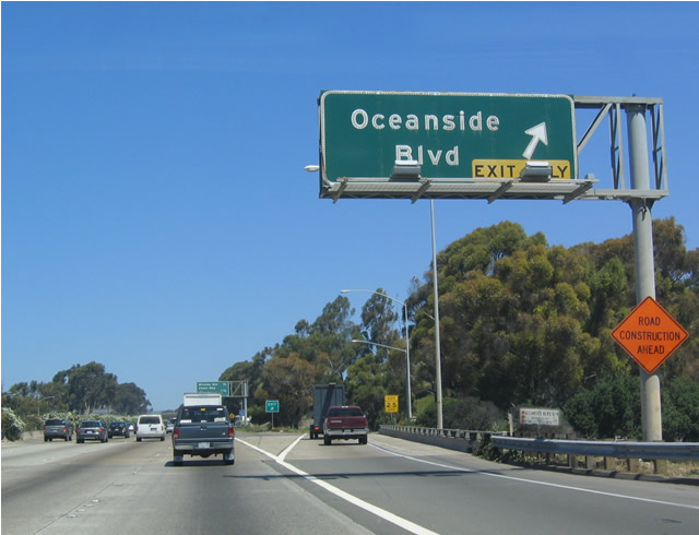
The next exit along Interstate 5 (San Diego Freeway) north is Exit 52, Oceanside Boulevard, three-quarters of a mile. The former Califoria Street off-ramp departed from I-5 here. It was one of the original exits dating back to when Interstate 5 was the U.S. 101 Bypass around Carlsbad and Oceanside (between Palomar Airport Road and Camp Pendleton). The California Street exit was removed when the westbound SR 78 to northbound I-5 connector was widened.1 Photos taken 04/26/08. |
|
An Interstate 5 north shield is posted soon thereafter. Photo taken 11/11/12. |
|
This mileage sign is located along northbound Interstate 5 as it approaches Oceanside Boulevard (Exit 52), one-quarter of a mile. Photo taken 04/26/08. |
|
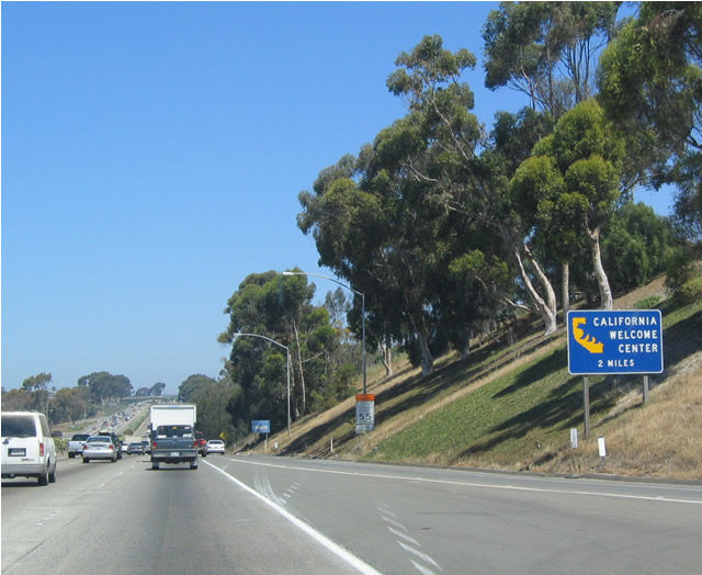
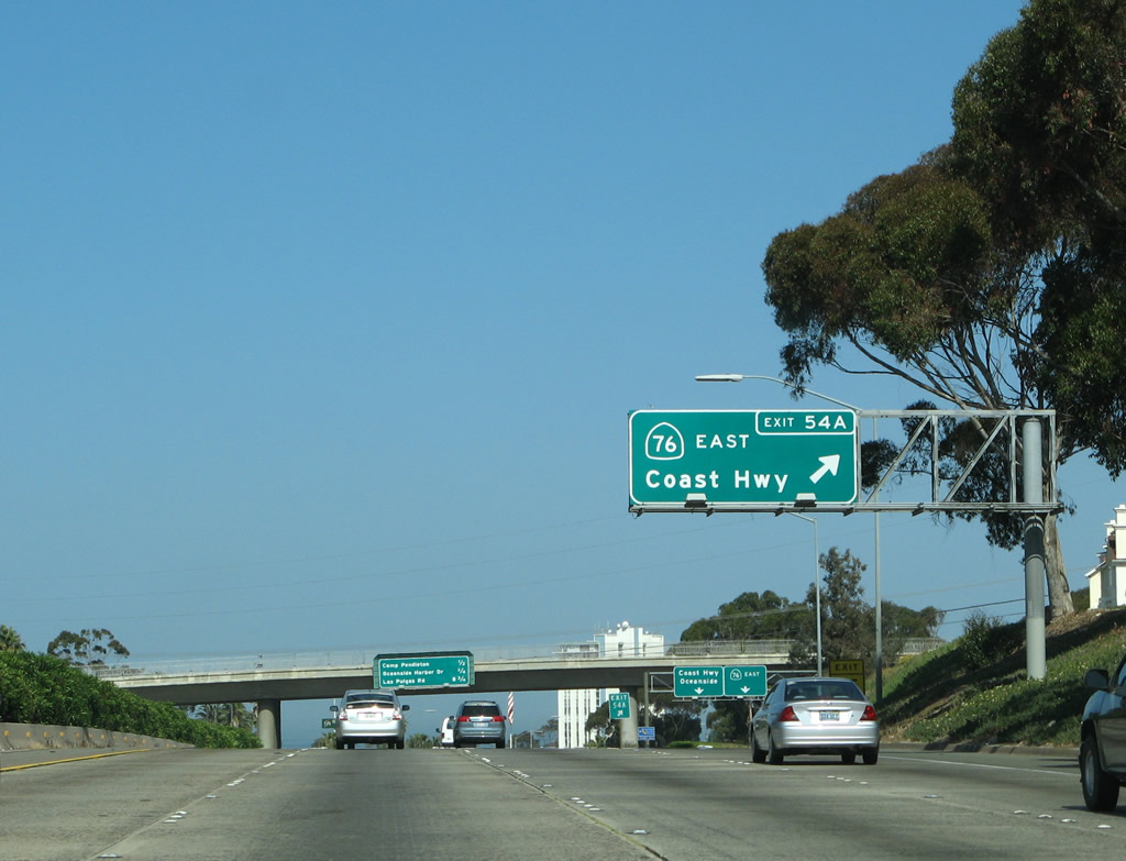
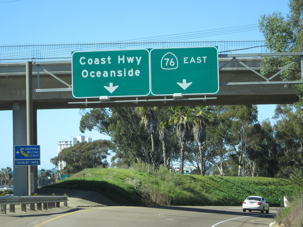
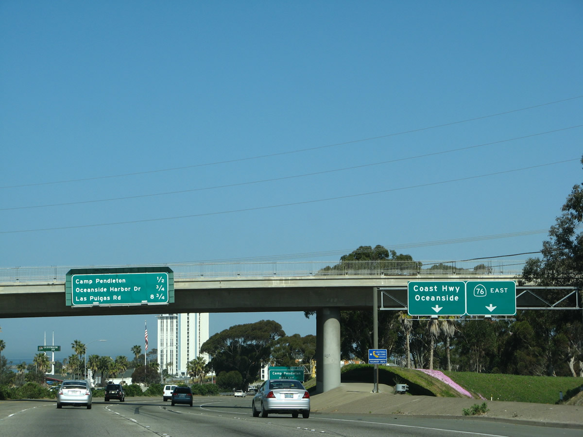
Use Exit 54A (California 76 west) to reach a California Welcome Center (two miles ahead). Photo taken 05/22/04. |
|
|
Northbound Interstate 5 reaches Exit 52, Oceanside Boulevard, as the freeway continues north along the former U.S. 101 Bypass Route around Carlsbad and Oceanside. Photos taken 11/11/12 and 05/22/04. |
|
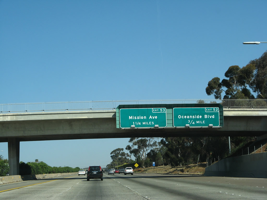
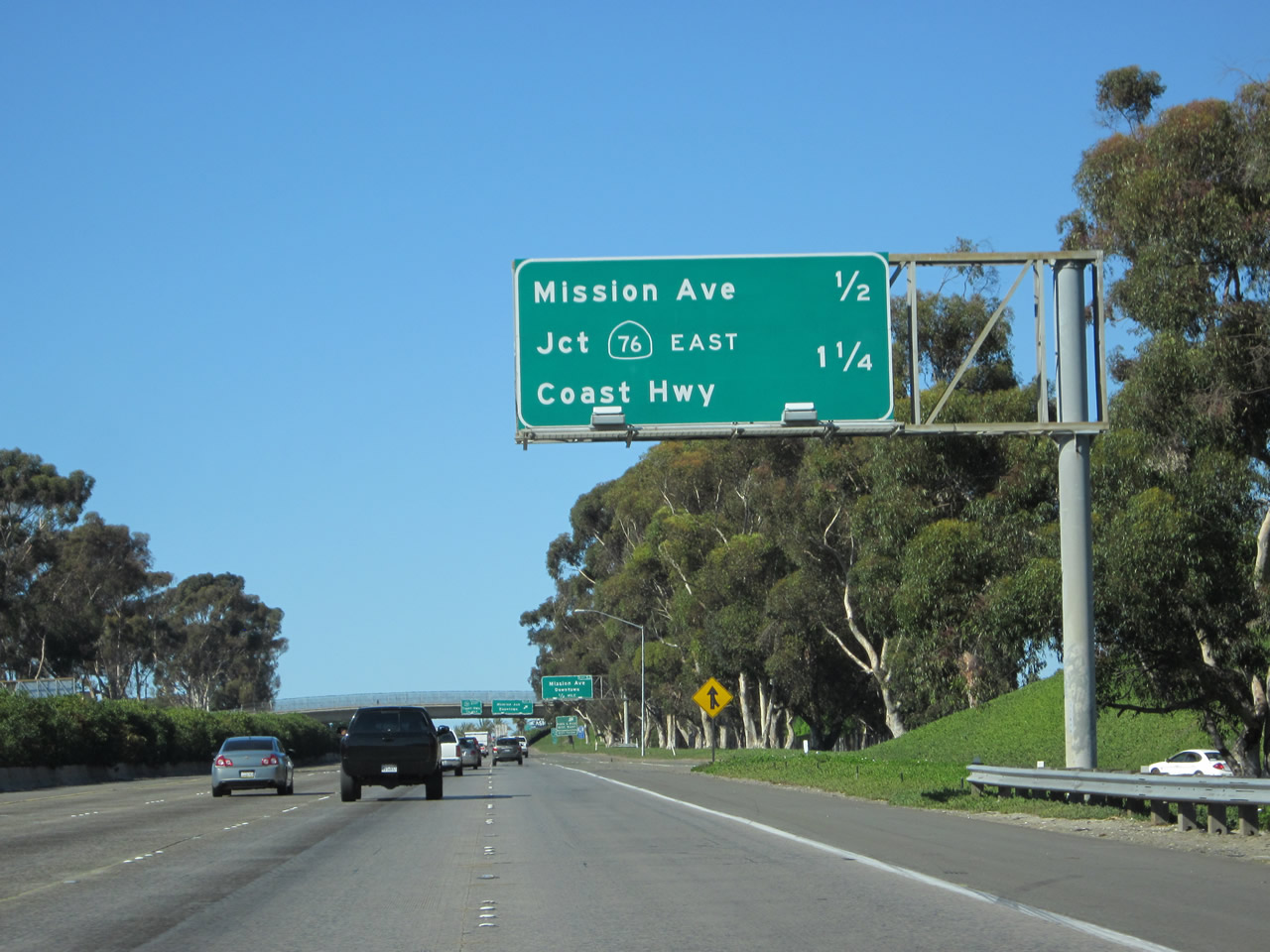
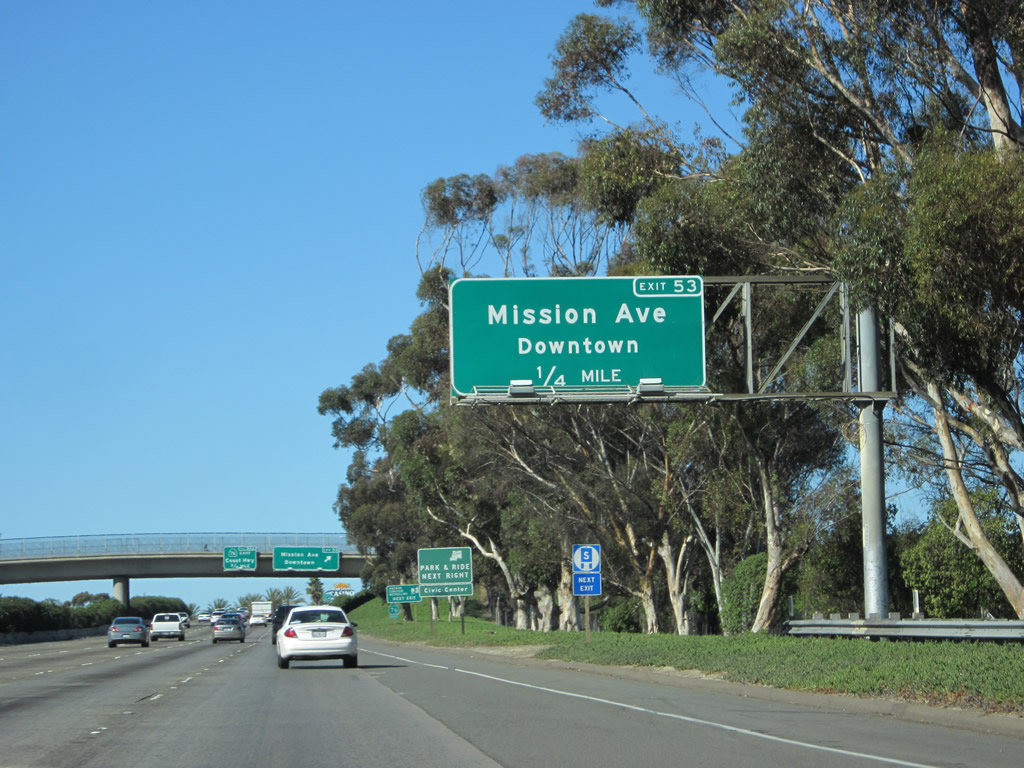
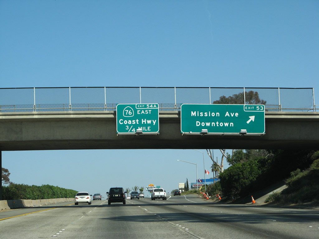
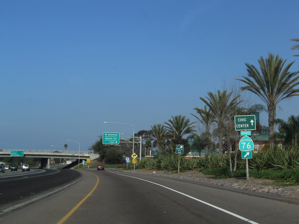
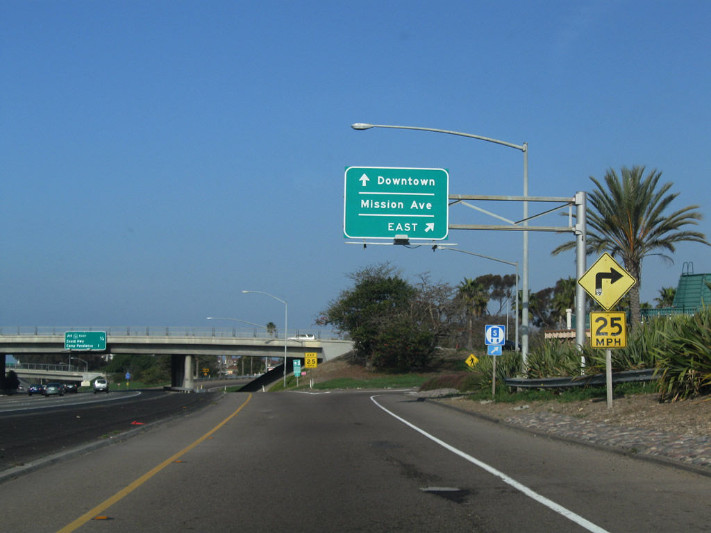
The next exit along northbound Interstate 5 (San Diego Freeway) is Exit 53, California 76 Business (Mission Avenue), one-half of a mile. The next exit (Exit 54A) is for California 76 and southbound Coast Highway 101. Photo taken 04/26/08. |
|
Northbound Interstate 5 approaches Exit 53, California 76 Business (Mission Avenue). An official state welcome center is at Exit 54A, not Exit 53. Photo taken 11/11/12. |
|
California 76 Business is well-signed from both direction of Interstate 5 (at least for Caltrans standards) on the approach to the Mission Avenue interchange, but is unmarked on Mission Avenue near Interstate 5 or in downtown Oceanside. Photo taken 11/11/12. |
|
Northbound Interstate 5 (San Diego Freeway) reaches Exit 53, California 76 Business (Mission Avenue). Mission Avenue is the original alignment of California 76 before it was moved to a new expressway just north of here. Photos taken 04/26/08. |
|
The first ramp of Exit 53 connects with Mission Avenue east for California 76 Business. Photo taken 01/31/10. |
|
View of the distribution lane from northbound Interstate 5 onto east/west Mission Avenue. Photo taken 01/31/10. |
|
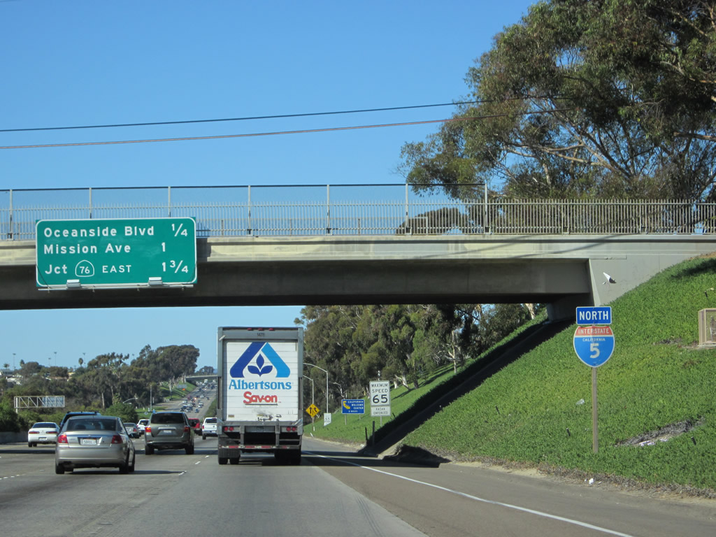
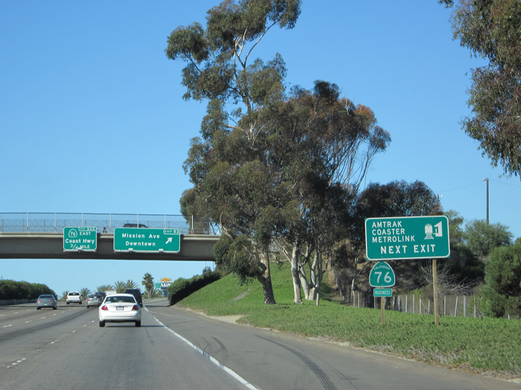
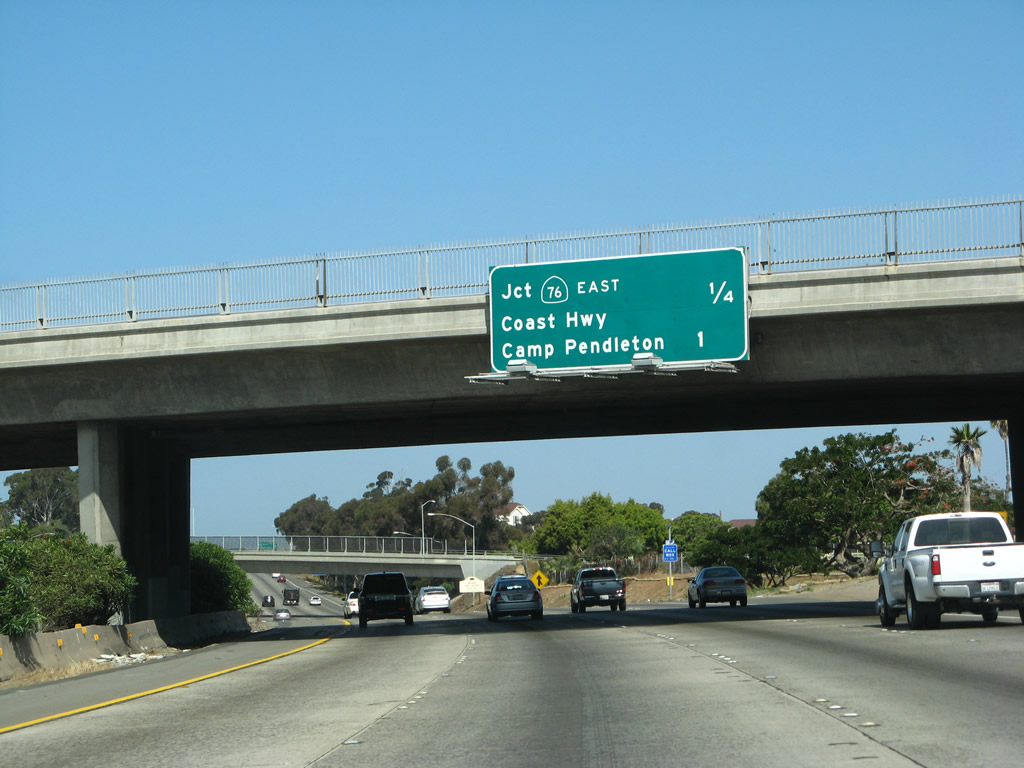
The next exit along northbound Interstate 5 (San Diego Freeway) is Exit 54A, California 76 (San Luis Rey Mission Expressway) east and California 76 west to San Diego County S-21 (Coast Highway / Historic U.S. 101). Photo taken 04/26/08. |
|
Northbound Interstate 5 reaches Exit 54A, California 76 (San Luis Rey Expressway) east to Bonsall and west to Coast Highway 101. California 76 leads east from Oceanside toward Fallbrook, Pala, and Palomar Mountain before terminating at California 79 near Lake Henshaw/Morettis, about midway between Warner Springs and Santa Ysabel. Meanwhile, Historic U.S. 101 ends its journey as the Coast Highway (San Diego County S-21), and it merges back onto Interstate 5. Although there are plenty of lost sections of old U.S. 101 in Camp Pendleton, not much of it is open to the driving general public. As such, Historic U.S. 101 is not accessible by car again until Orange County. Photo taken 04/26/08. |
|
|
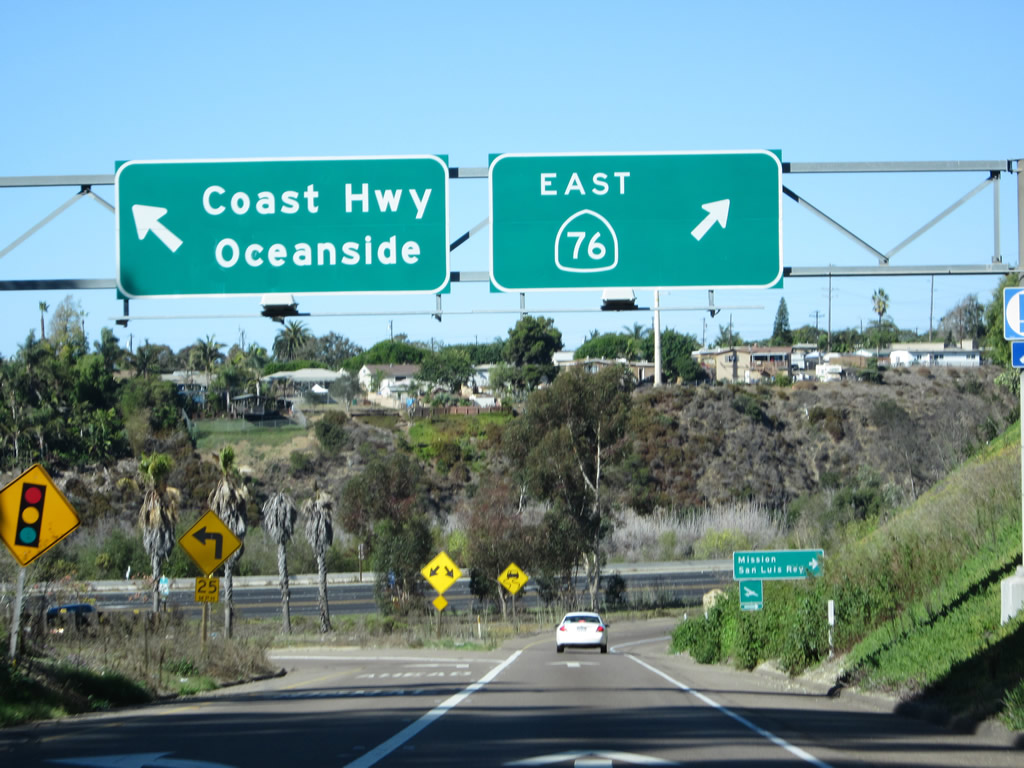
Following the ramp from Interstate 5 north to California 76 (San Luis Rey Mission Expressway) east and California 76 west to Historic U.S. 101 (Coast Highway) and a California Welcome Center in Oceanside. Photos taken 11/11/12. |
|
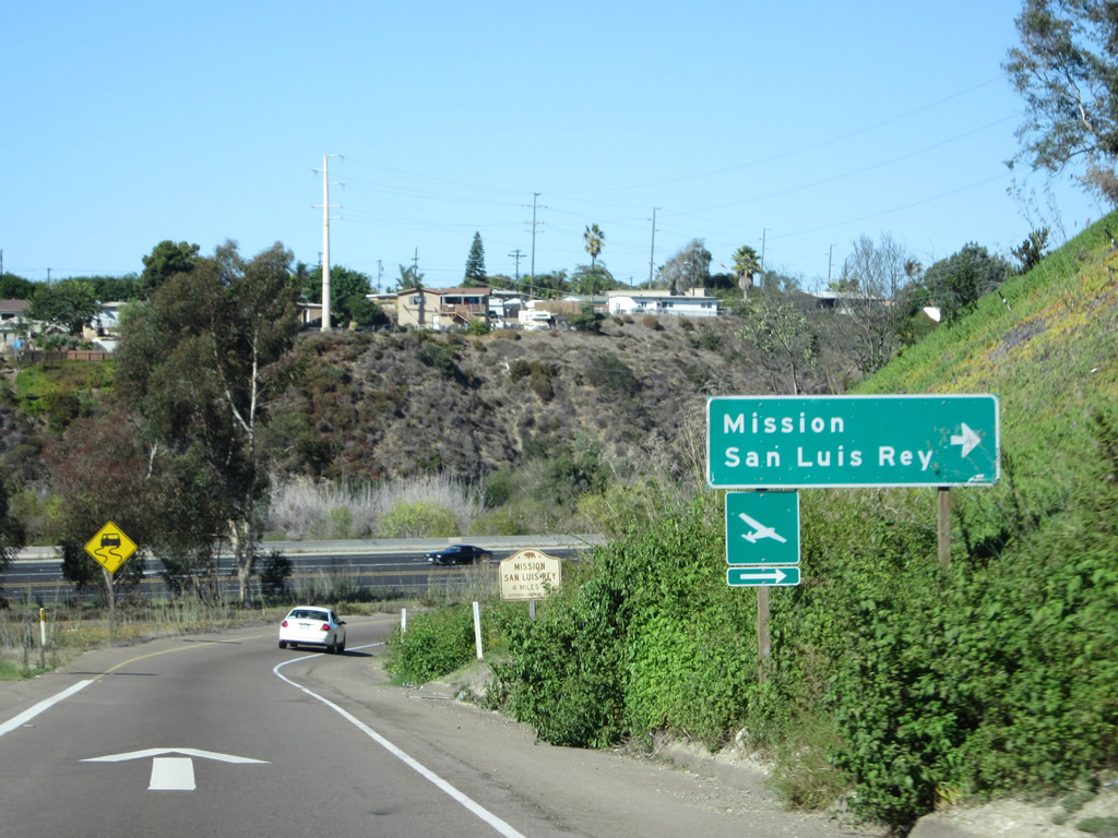
California 76 (San Luis Rey Mission Expressway) east links I-5 with the San Luis Rey de Francia Mission, one of the historic missions along El Camino Real that extends from San Diego north to Los Angeles, San Francisco, and Sonoma along the Interstate 5 and U.S. 101 corridors. The San Luis Rey de Francia Mission was founded on June 13, 1798. Photo taken 11/11/12. |
|
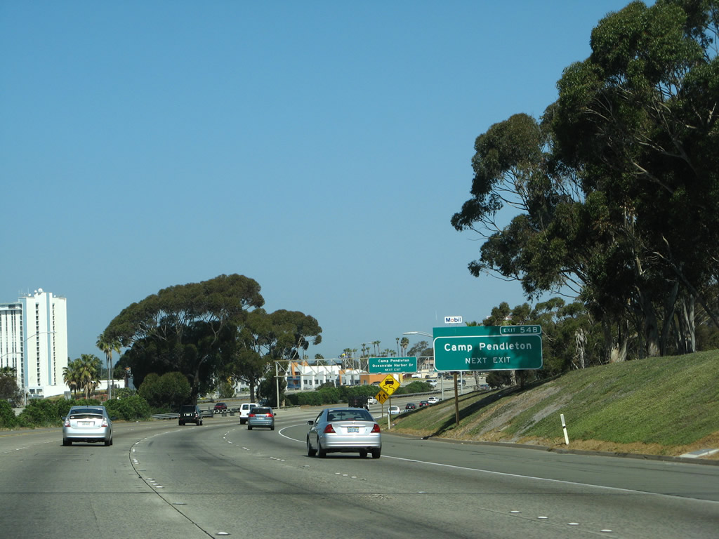
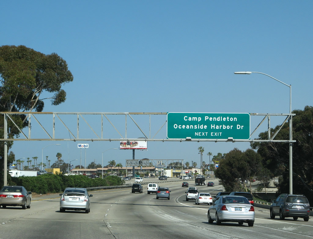
The Interstate 5 mainline adavances north to Camp Pendleton, the expansive Marine base that occupies northernmost reaches of San Diego County. Photo taken 04/26/08. |
|
A roadside exit number sign for Exit 54B, Vandegrift Boulevard north to Camp Pendleton. Photo taken 04/26/08. |
|
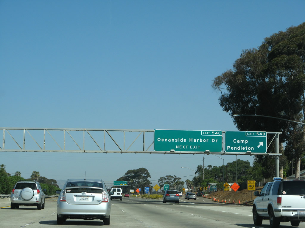
Northbound Interstate 5 approaches the exit for Vandegrift Boulevard north to Camp Pendleton (Exit 54B) and Oceanside Harbor Drive (Exit 54C). Photo taken 04/26/08. |
|
Northbound Interstate 5 reaches Exit 54B, Vandegrift Boulevard north to Camp Pendleton. Photo taken 04/26/08. |
|
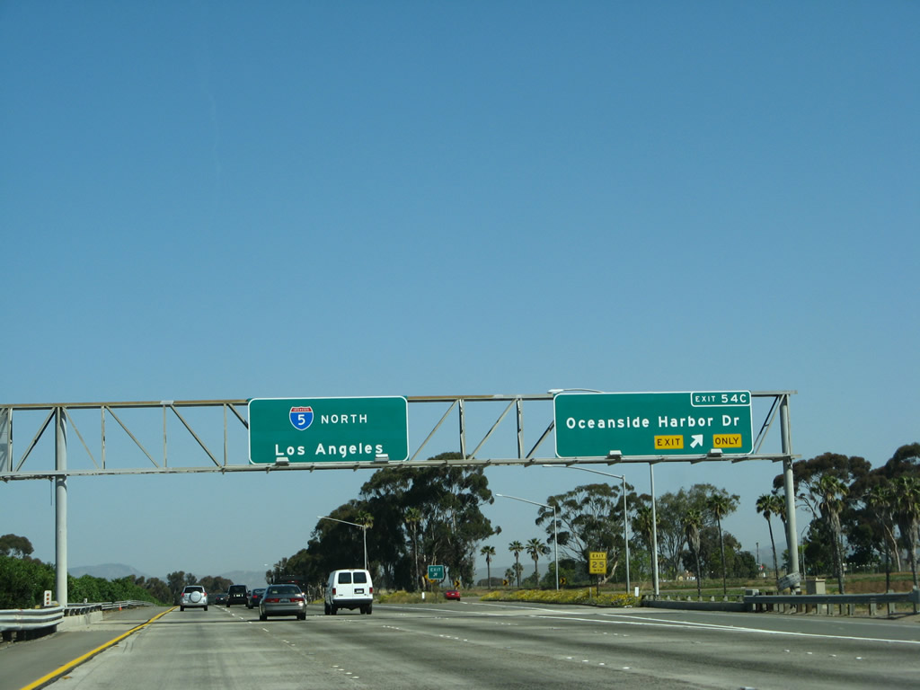
Immediately thereafter, Interstate 5 (San Diego Freeway) north meets Exit 54C, Oceanside Harbor Drive. This is the last exit along northbound until about midway through the Camp Pendleton reserve (Las Pulgas Road). Photo taken 04/26/08 |
|
This confirming marker for Interstate 5 north was installed in 2008. Photo taken 04/26/08. |
|
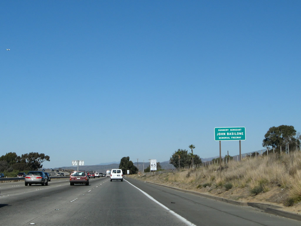
Interstate 5 between Exit 54C and the San Diego-Orange County Line is designated the Gunnery Sergeant John Basilone Memorial Freeway. Bicycles are allowed on the freeway briefly, between Exit 54C (Oceanside Harbor Drive) and Exit 62 (Las Pulgas Road) due to the lack of a parallel, non-freeway route. Photo taken 01/14/07. |
|
|
|
Descending again, Interstate 5 and the parallel railroad cross the Santa Margarita River. The steel through truss bridge in the center carries the railroad over the river, but it is slated for replacement once the railroad is expanded to twin tracks through this area. The railroad carries the Amtrak and Metrolink passenger rail as well as freight rail from points north toward Oceanside. Photos taken 04/26/08. |
|
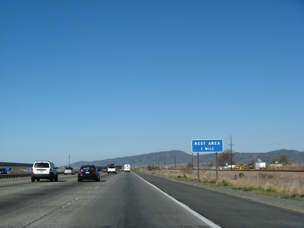
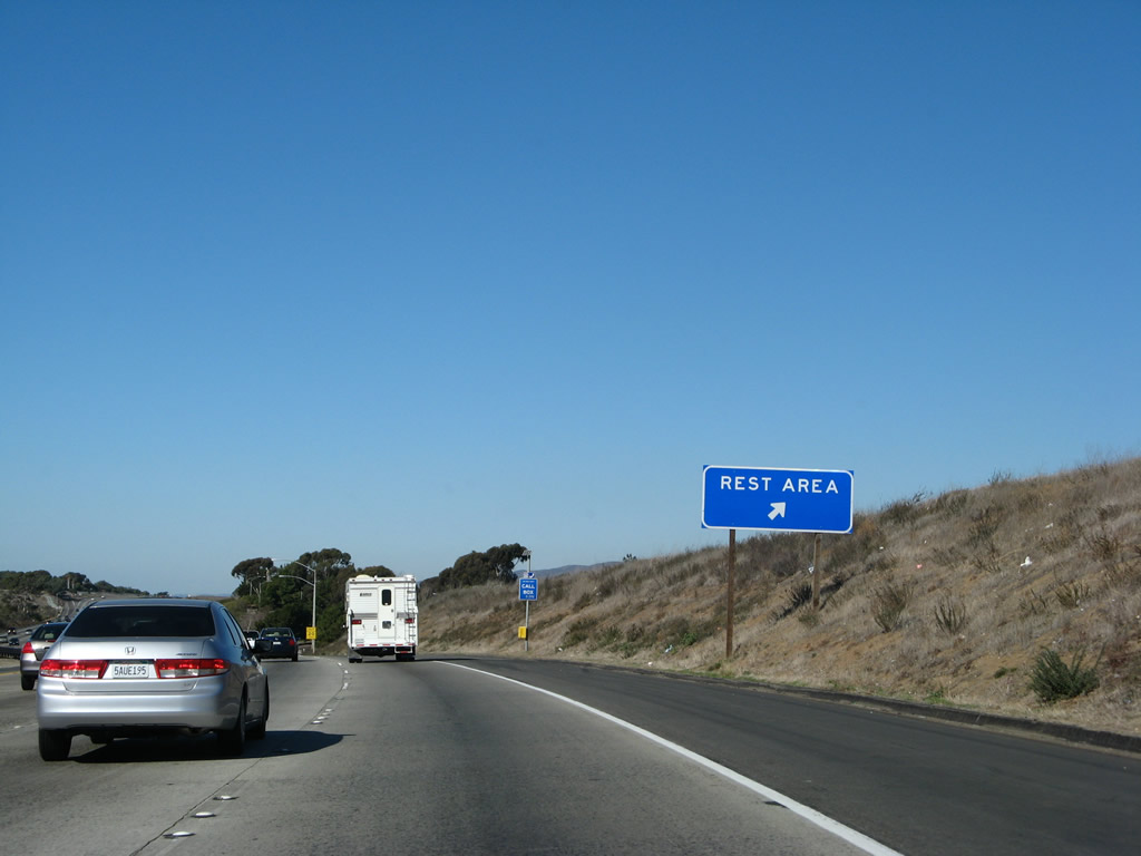
The first northbound rest area is the lone facility along Interstate 5 between San Diego and Los Angeles. Photo taken 01/14/07. |
|
Now that the freeway is on the Camp Pendleton Marine Base, the entire look and feel of Interstate 5 has changed. No longer surrounded by homes, shopping centers, and development, there is much more open space. Photo taken 01/14/07. |
|
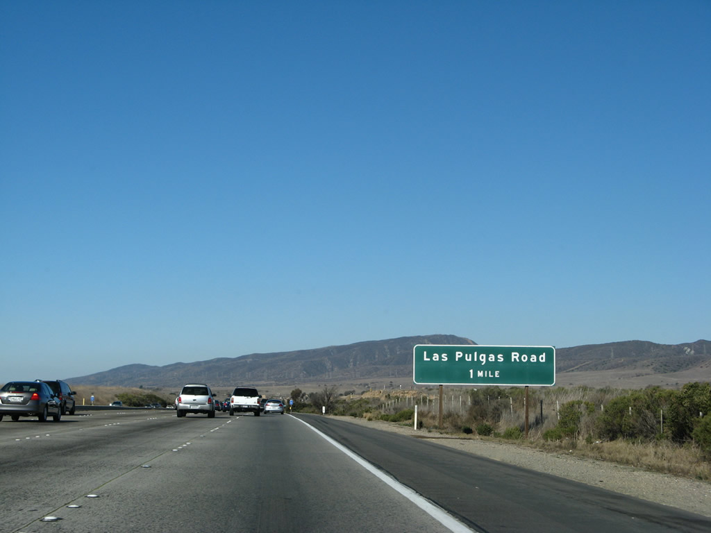
A nearly eight mile exit less stretch along northbound Interstate 5 concludes at Las Pulgas Road in one mile. Photo taken 01/14/07. |
|
Las Pulgas Road provides access to the center of the Camp Pendleton Marine Base. Photo taken 01/14/07. |
|
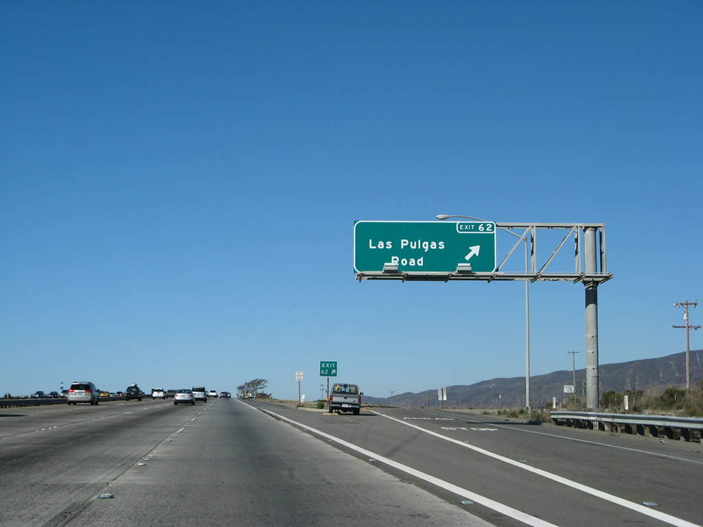
Northbound Interstate 5 reaches Exit 62, Las Pulgas Road. This exit serves the Marine base, and it connects a staging area for those who wish to bike an extant section of Old U.S. 101 that is currently open only to pedestrians and bicyclists. All bicycles must exit the freeway at this point. The original alignment of U.S. 101, although located on Marine property as part of Camp Pendleton, may be bicycled between Las Pulgas Road and San Clemente (via San Onofre). Old U.S. 101 is a fascinating bike ride, as it once served as the primary route between Los Angeles and San Diego. Photo taken 01/14/07. |
|
This Interstate 5 reassurance shield is posted after the on-ramp from Las Pulgas Road. Photo taken 04/26/08. |
|
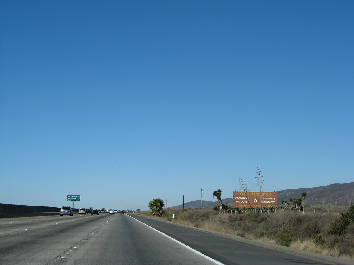
This Camp Pendleton welcome sign is located after the Las Pulgas Road interchange. Photo taken 01/14/07. |
|
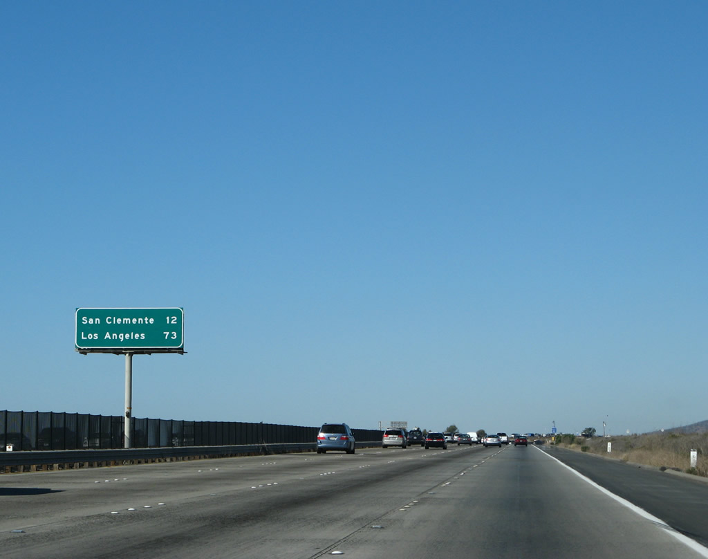
A mileage sign shortly thereafter provides the distance to San Clemente (12 miles) and Los Angeles (73 miles). The officially recognized control city of Santa Ana, which is the seat of Orange County, is omitted on all northbound mileage signs until Interstate 5 enters Orange County. At that point, Santa Ana will appear on most pull-through guide and mileage signs. Photo taken 01/14/07. |
|
|
|
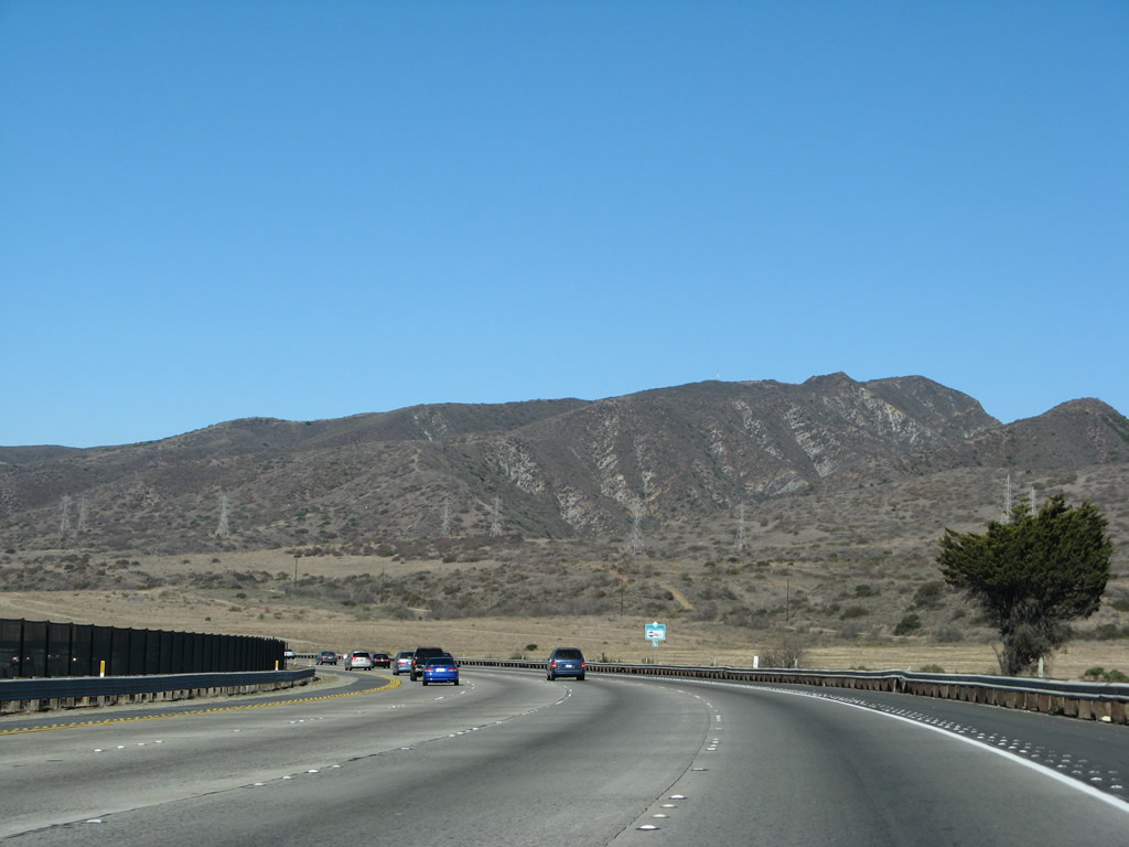
| Much of Camp Pendleton remains in its pristine state, and travelers on Interstate 5 may see some of the last remaining undeveloped coastal land in Southern California as a result. The oft-congested, eight-lane freeway does despoil the view somewhat. Photos taken 01/14/07. |
|
|
|
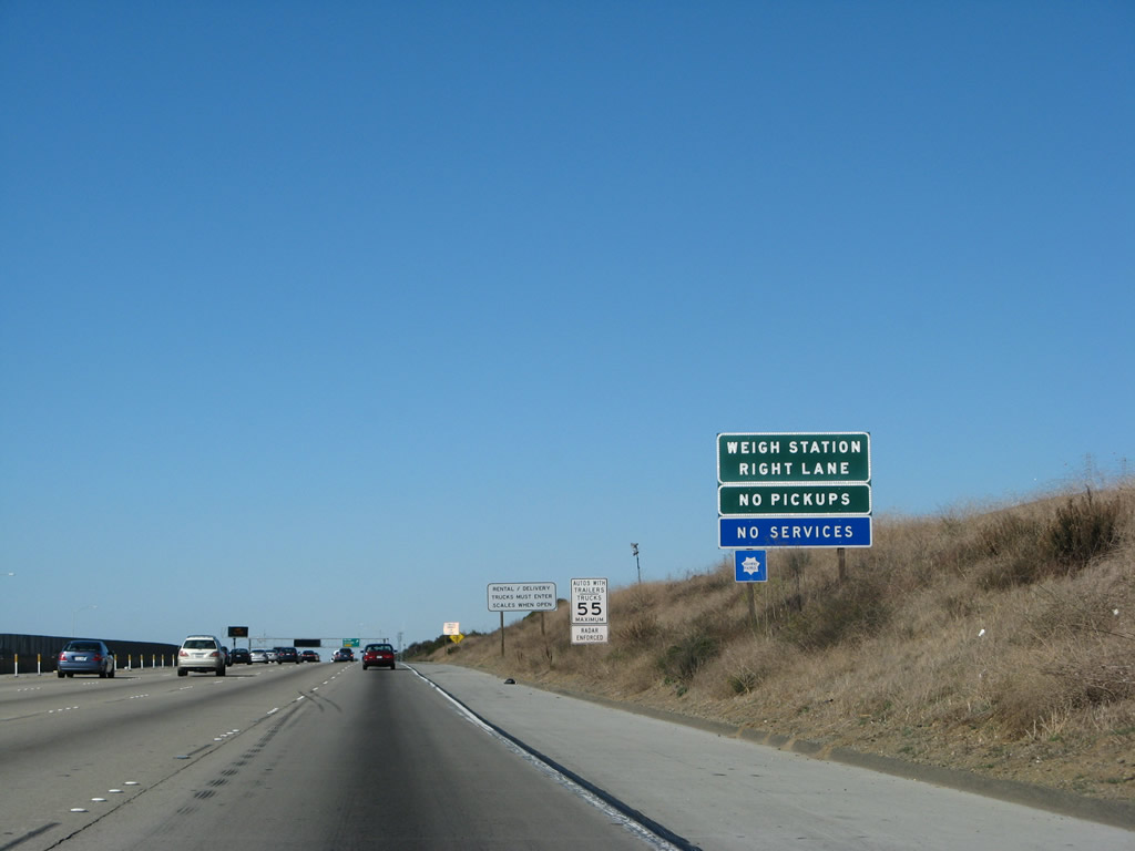
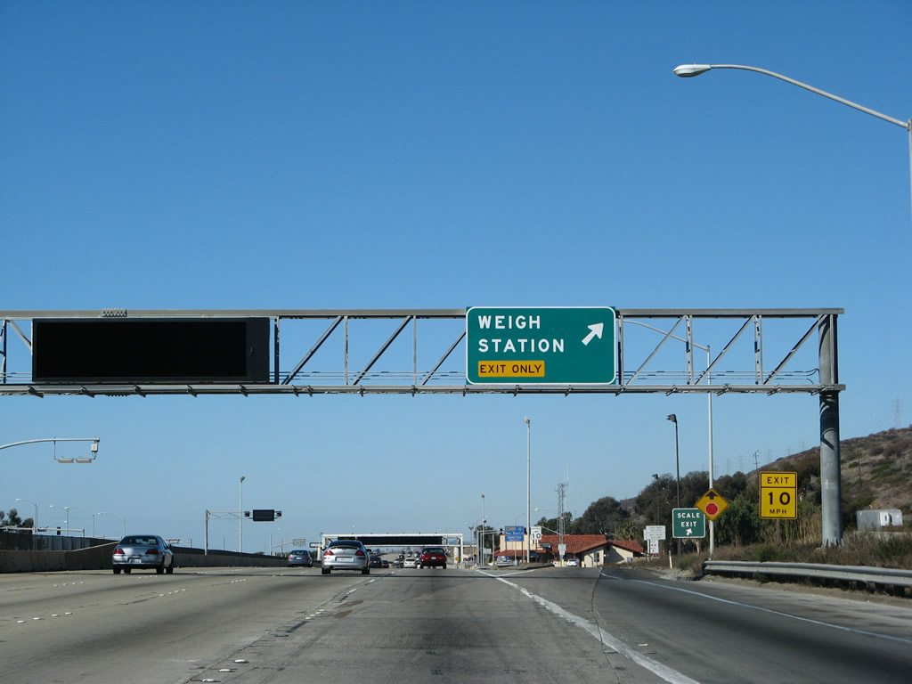
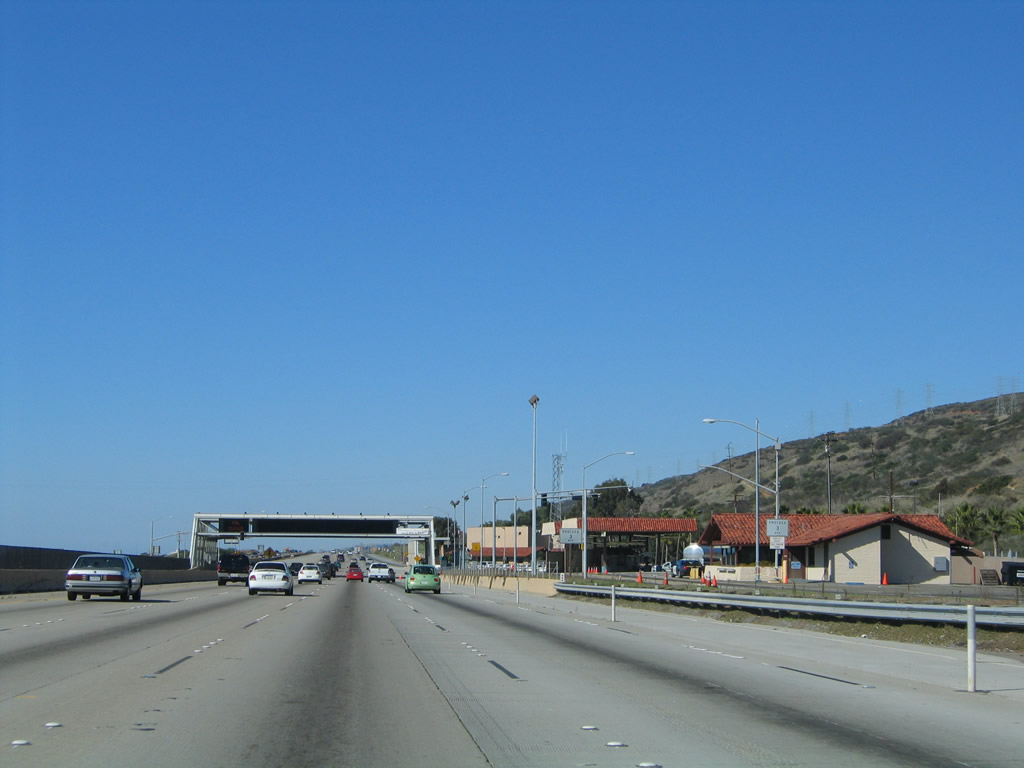
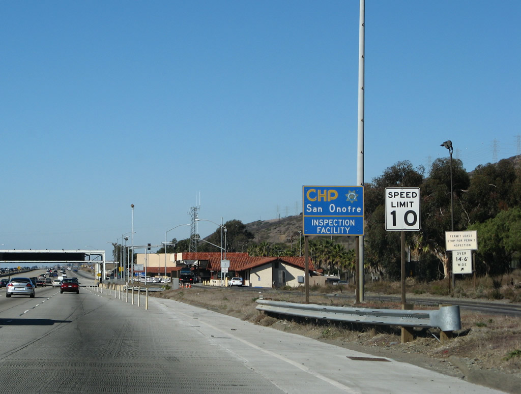
| Located approximately near Milepost 67, traffic along northbound Interstate 5 crosses the Border Patrol inspection station. It is located adjacent to a Caltrans Weigh Station, and it operates on an irregular basis. Even when the checkpoint is closed, Border Patrol agents monitor traffic as they pass the inspection station to look for suspicious vehicles or activity. Photos taken 01/14/07. |
|
|
|
| Traffic is not always required to stop at the checkpoint, but when it is in operation, traffic delays may last for several miles. The checkpoint is in place to prevent illegal immigrants from leaving San Diego County and continuing north into Los Angeles and the Central Valley in search of work. The checkpoint has also resulted in some drug seizures and the return of undocumented immigrants back their countries of origin. Photos taken 01/14/07. |
|
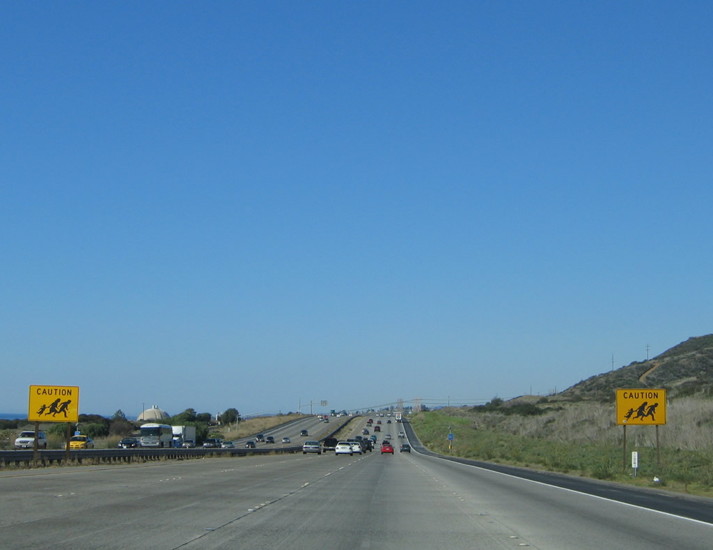
No longer posted, these signs warned motorists that people may be fleeing authorities at the Border Patrol checkpoint in Camp Pendleton. Photo taken 11/14/04. |
|
|
|
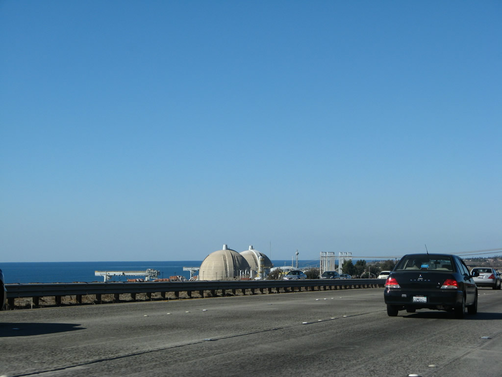
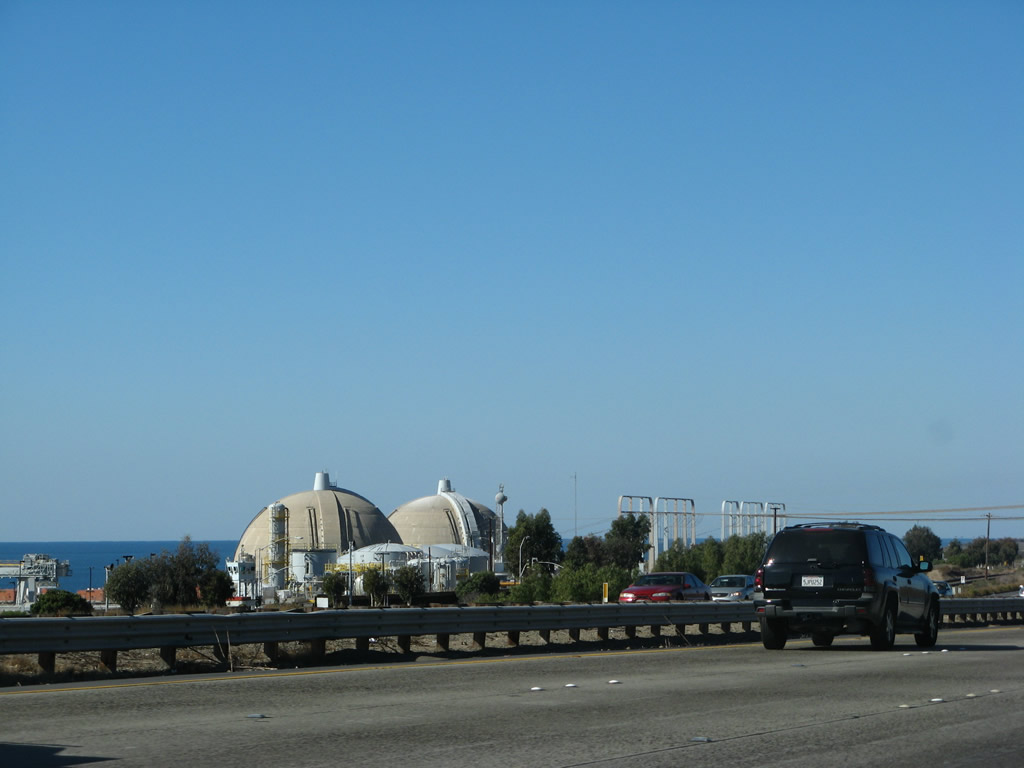
The San Onofre Nuclear Power Plant is adjacent to San Onofre State Beach on the west side of the freeway. As one of the few nuclear power plants in California, San Onofre generates a significant share of electricity for Southern California Edison and San Diego Gas and Electric. The twin domes that contain the reactors were made famous in the movie Naked Gun when Lieutenant Frank Drebin said, "Everywhere I go, something reminds me of her." Photos taken 01/14/07. |
|
A significant number of power lines cross over Interstate 5 to connect San Onofre Nuclear Generating Station (often abbreviated as SONGS) with the local power grid. This facility is the only one of its kind in Southern California; there is only one other active nuclear generating station in California, and it is located at Diablo Canyon near San Luis Obispo on the Central Coast. Power lines swarm into this facility, as it is an important substation for both San Diego Gas and Electric (SDG&E) and Southern California Edison (SCE). Photo taken 01/14/07. |
|
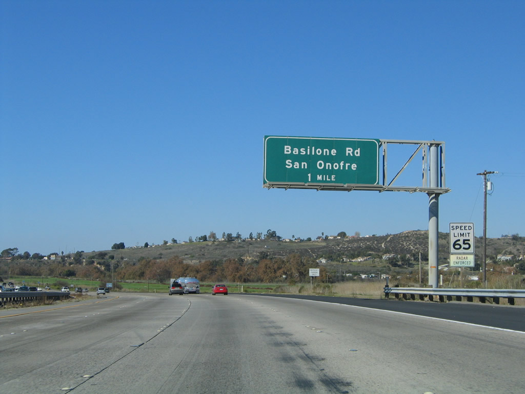
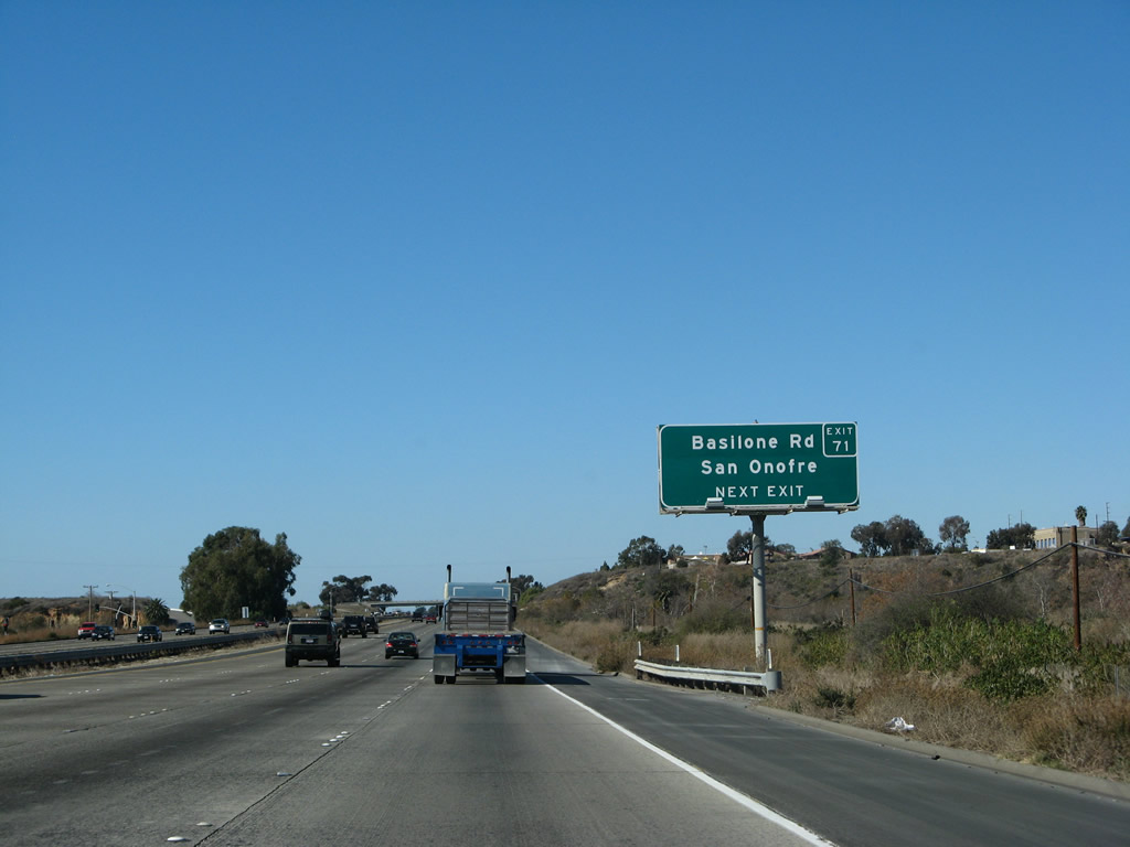
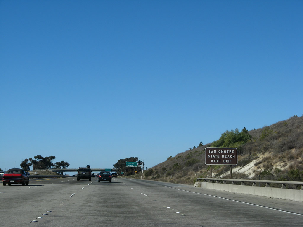
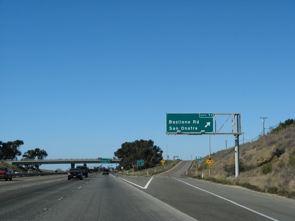
The next exit along northbound Interstate 5 (San Diego Freeway) is Exit 71, Basilone Road (one mile). This exit is the last one serving Camp Pendleton, and it connects to San Onofre. San Onofre is notable for two things: the state beach and the nuclear power plant. The San Onofre State Beach is known locally as a good surfing location and as a nude beach. The surfing is considered better because of the beach's orientation toward the waves. Since it is a relatively secluded beach (even with the extremely busy Interstate 5 nearby), the southern portion of it has become a documented spot for nudists to congregate. Photo taken 01/14/07. |
|
Basilone Road is named for Gunnery Sergeant John Basilone, who was a war hero from World War II. Enlisting in the U.S. Army in 1934, he found himself in the front lines of World War II. On October 25, 1942, Basilone was instrumental in holding off a Japanese assault at Guadalcanal in the Solomon Islands. His heroism and bravery in this battle resulted in his receipt of the Medal of Honor. Although he returned to U.S. soil to receive his award, he returned to battle. Basilone and several of his men were killed in a mortar shell explosion on February 19, 1945, on Iwo Jima. Basilone is memorialized here in Camp Pendleton, both as the name of the Basilone Road and as the name of this stretch of Interstate 5. Photo taken 01/14/07. |
|
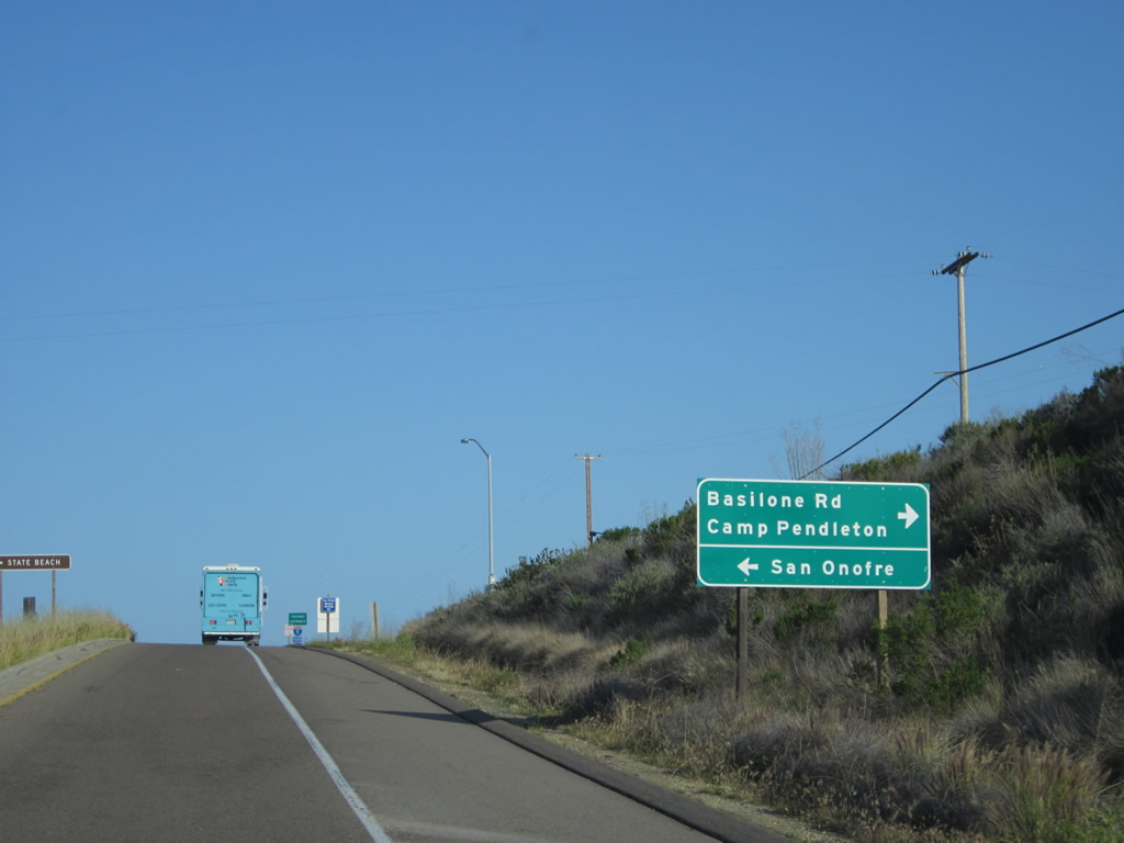
Use Basilone Road west to reach San Onofre State Beach. San Mateo Creek passes under the freeway here, and the locally famous Trestles surfing break is located offshore here. The portion of the beach that extends into the military property is more secluded, and thus several nudists have established themselves along that section of the beach. Photo taken 01/14/07. |
|
Northbound Interstate 5 reaches Exit 71, Basilone Road to north Camp Pendleton, San Onofre Nuclear Generating Station, and San Onofre State Beach. Photo taken 01/14/07. |
|
|
|
This set of pictures shows the off-ramp from Interstate 5 north to Exit 71, Basilone Road. Upon reaching the top of the ramp, turn left for San Onofre or right for Camp Pendleton. Since this is a diamond interchange, motorists may proceed straight ahead here to return to the northbound freeway. Photos taken 04/06/12. |
|
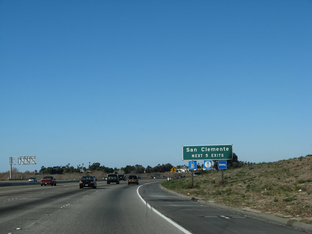
Returning to the mainline, northbound Interstate 5 next approaches the final interchange located in San Diego County. The next exit along Interstate north is Exit 72, Cristianitos Road. Photo taken 01/14/07. |
|
The next six exits (used to be five exits, but the Vista Hermosa exit was added in Summer 2002) serve San Clemente, the southernmost community in Orange County. Photo taken 01/14/07. |
|
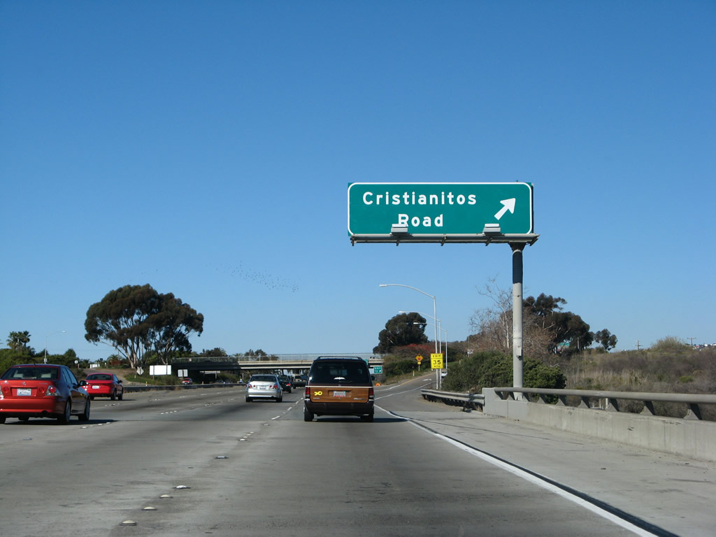
Northbound Interstate 5 approaches Cristianitos Road, Exit 72, next right. It is within this area that the proposed California 241 Foothill South Corridor tollway was to tie into Interstate 5. Due to the route of the toll road through a state park and ending here near the famous Trestles break, the 241 extension was very controversial. Photo taken 01/14/07. |
|
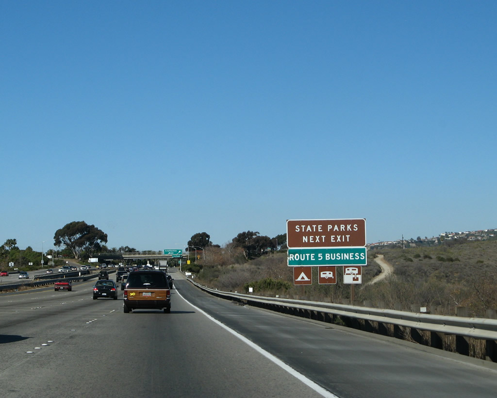
The Cristianitos Road exit is the southern terminus of San Clemente's Business Loop I-5, which follows El Camino Real (Historic U.S. 101) through San Clemente and is basically unsigned aside from this one advance sign along northbound. Photo taken 01/14/07. |
|
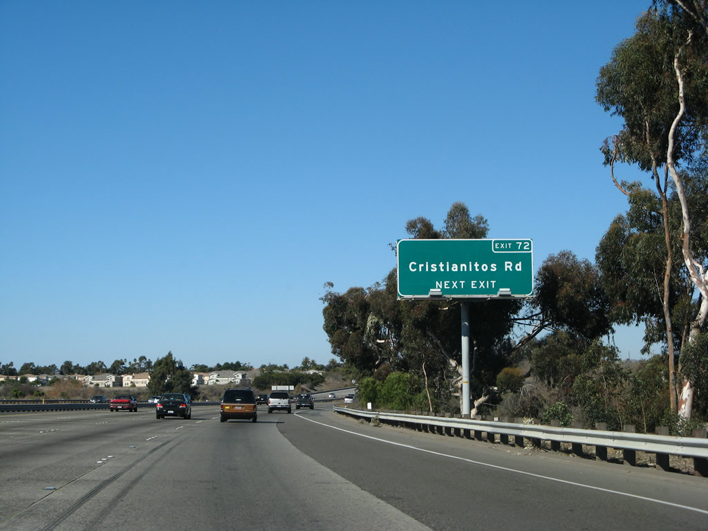
After crossing San Mateo Creek, northbound Interstate 5 (San Diego Freeway) meets Cristianitos Road. This is the first San Clemente exit and the last one located in San Diego County. Photo taken 01/14/07. |
|
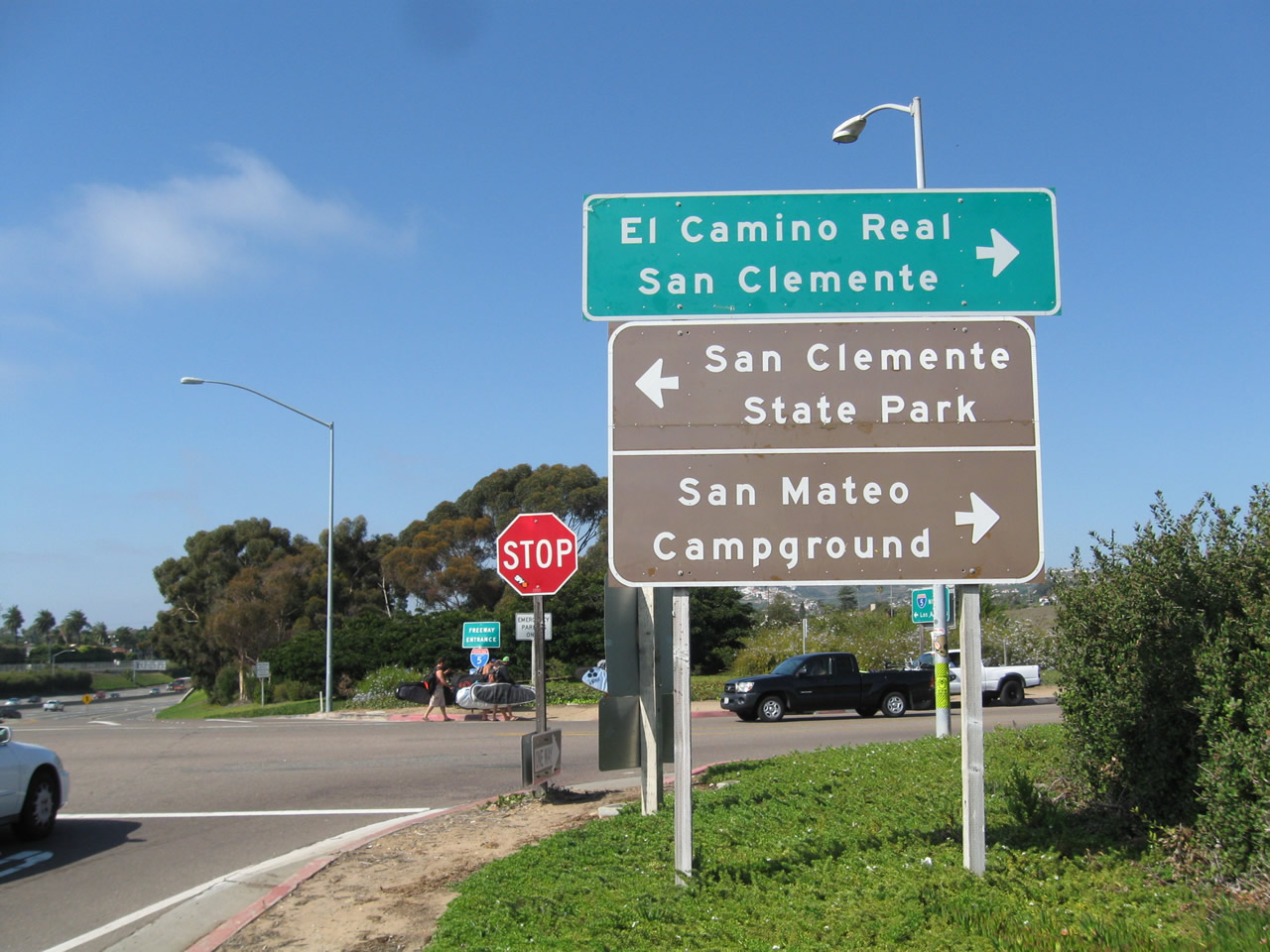
Sign posted at the top of the off-ramp for El Camino Real (Old U.S. 101) north into San Clemente or San Clemente State Park. Photos taken 10/15/11. |
|
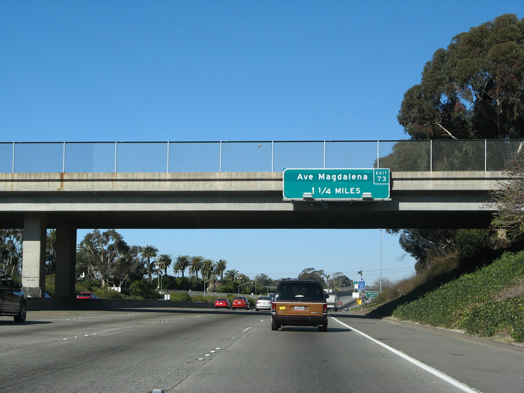
Passing under Cristianitos Road, I-5 progresses north 1.25 miles to Avenida Magdalena (Exit 73). Avenida Magdalena serves the central part of San Clemente. Photo taken 01/14/07. |
|
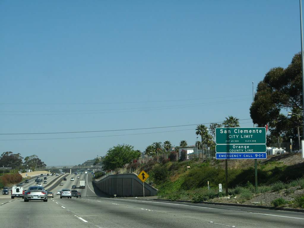
Interstate 5 leaves San Diego County and enters Orange County upon crossing under Cristianitos Road. Orange County is perhaps best known as "The O.C." as a result of the popular drama television series. Home to many beaches and suburban life, Orange County used to be better known as the home of Disneyland and countless orange groves. With a population and development expansion that has pushed the urbanized areas to the feet of the mountains, Orange County is rapidly approaching its limit on new development. Upon passing the county line, Interstate 5 enters the city of San Clemente. Photo taken 01/14/07. |
Page Updated November 12, 2012.