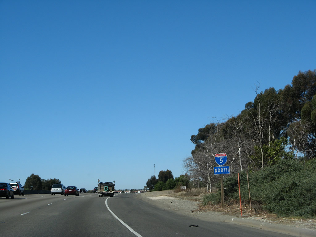
| Interstate 5 north |
|
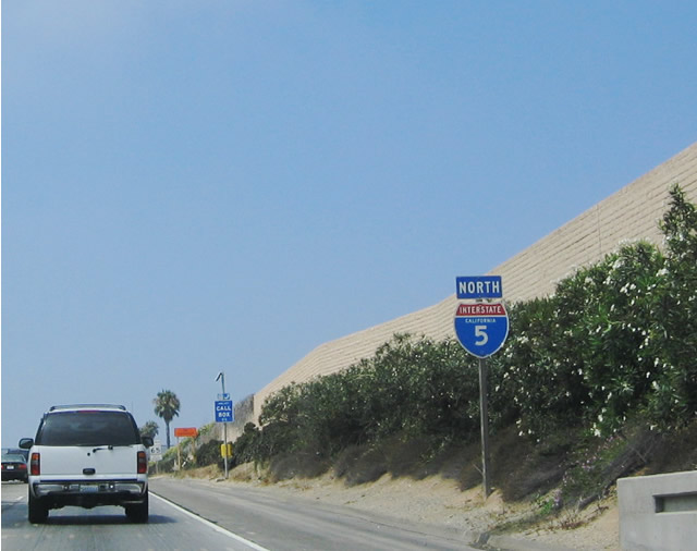
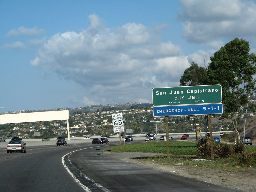
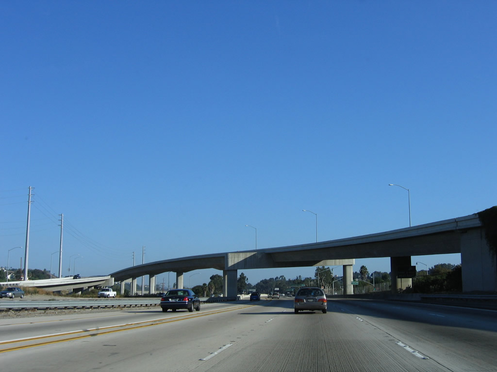
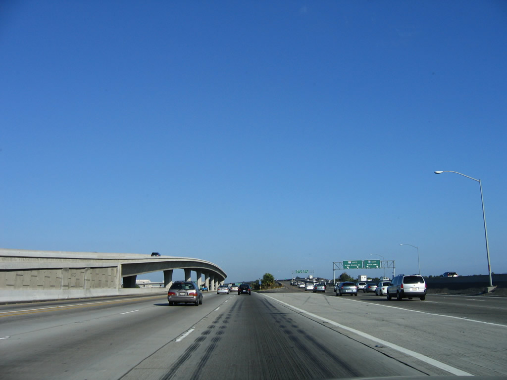
The first shield along Interstate 5 after the on-ramp from Cristianitos Road (Business Loop I-5) is a more traditional shield with state name. Interstate 5 passes through the city of San Clemente, the first of several cities along Interstate 5's path through Orange County. Incorporated on February 28, 1928, San Clemente consists of 18.45 square miles, sits at an average elevation of 250 feet, and receives 12.24 inches of rainfall annually. As of the 2000 Census, 49,936 people lived in San Clemente. Like other cities in Orange County, this number has increased significantly through the decade as the area has continued to grow (the 2006 population estimate from the Census Bureau for San Clemente was 61,050). Photo taken 08/07/04. |
|
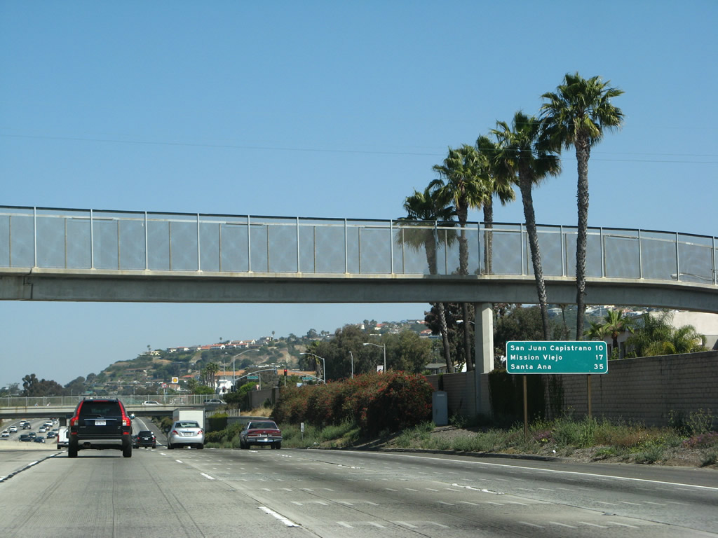
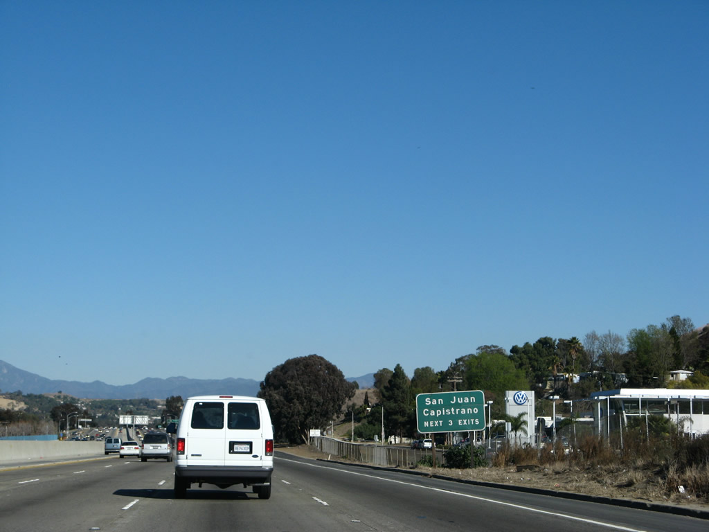
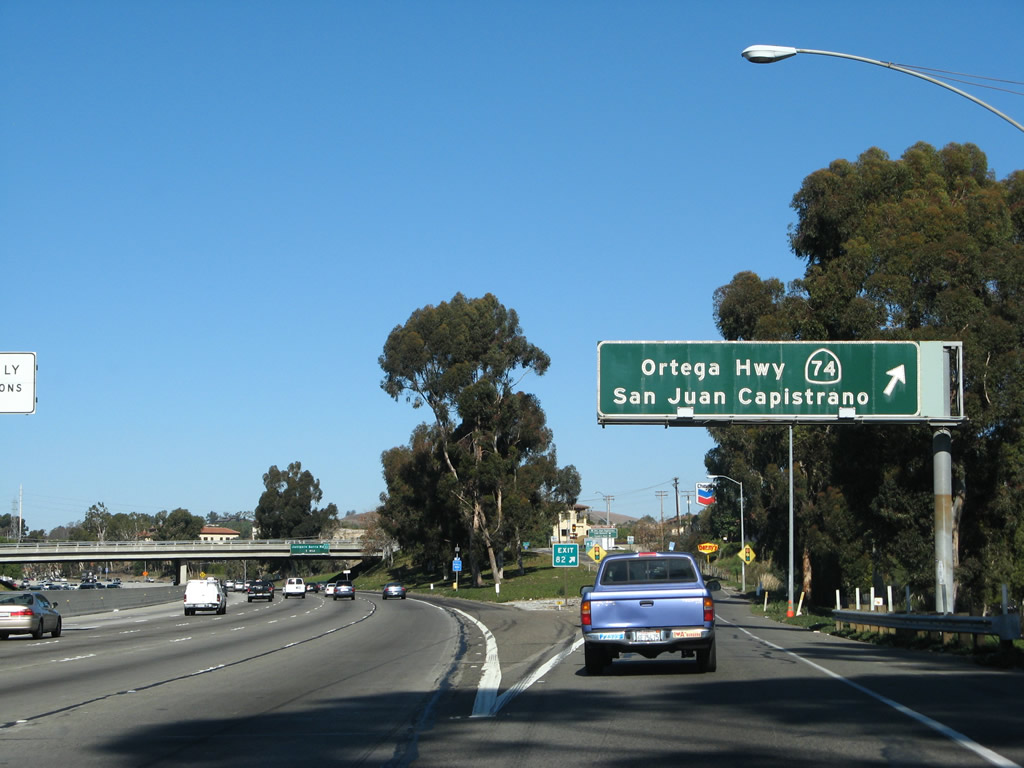
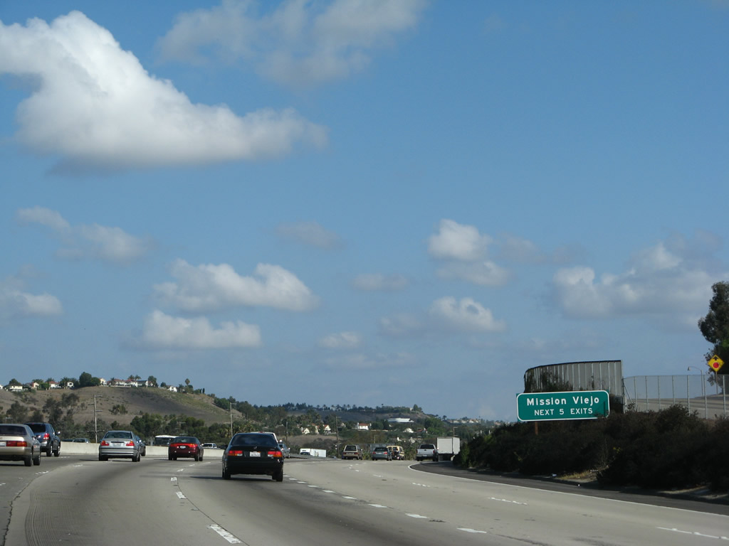
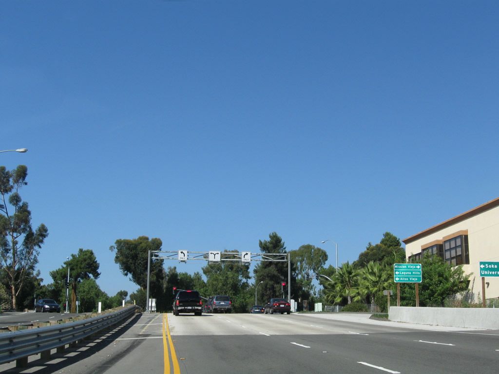
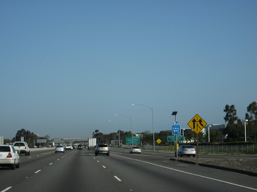
Immediately thereafter, this mileage sign provides the distance to three prominent cities in Orange County: San Juan Capistrano (California 74), Mission Viejo, and Santa Ana. Although most northbound signs for Interstate 5 refer to the control city of Los Angeles, the official northbound control city north of San Diego is Santa Ana. Photo taken 04/26/08. |
|
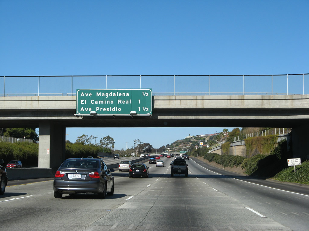
The next overpass carries Avenida San Luis Rey over Interstate 5 in the city of San Clemente; a mileage sign for the next three exits is affixed to the bridge. The next three exits are: Exit 73, Avenida Magdalena; Exit 74, El Camino Real; and Exit 75, Avenida Presidio. Photo taken 01/14/07. |
|
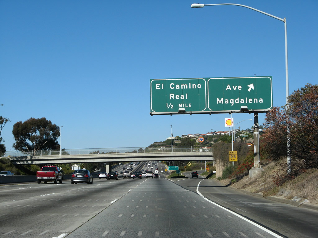
Interstate 5 northbound reaches Exit 73, Avenida Magdalena. The next exit is Exit 74, El Camino Real. Photo taken 01/14/07. |
|
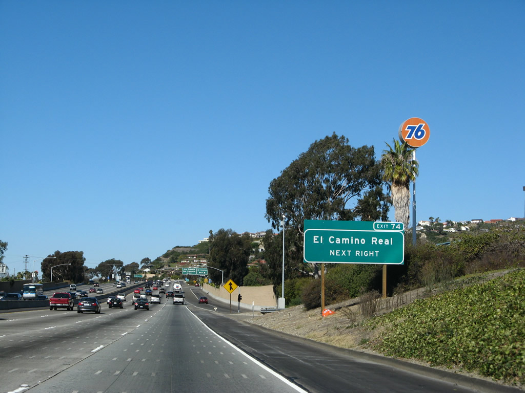
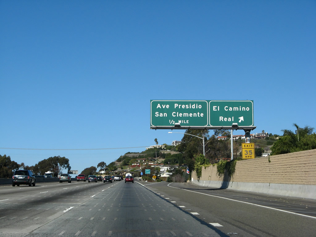
The next exit along Interstate 5 (San Diego Freeway) north is Exit 74, El Camino Real. This city street is old U.S. 101, but it is not continuous with the road of the same name in San Diego County, because the highway does not cross Camp Pendleton. However, El Camino Real is still so named because it is the original name for U.S. 101 from San Francisco south to San Diego. Having said that, El Camino Real in San Diego County is not an old alignment of U.S. 101, but it does parallel Coast Highway 101 (Historic U.S. 101) a mile or two east of Interstate 5. El Camino Real literally means "the King's Road." El Camino Real is widely regarded as the first road built in the state of California, as it was constructed in 1769. Photo taken 01/14/07. |
|
Northbound Interstate 5 reaches Exit 74, El Camino Real. This exit connects with the business route that began at Exit 72 (Cristianitos Road). Photo taken 01/14/07. |
|
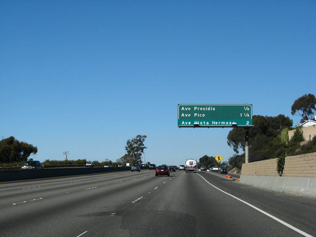
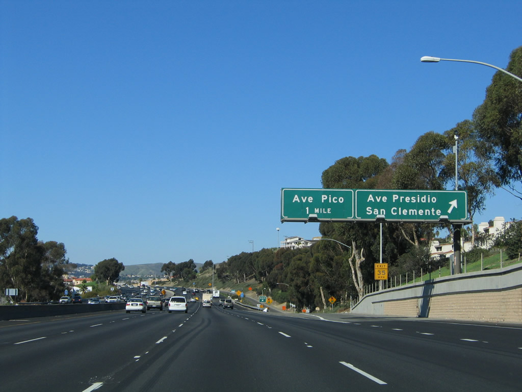
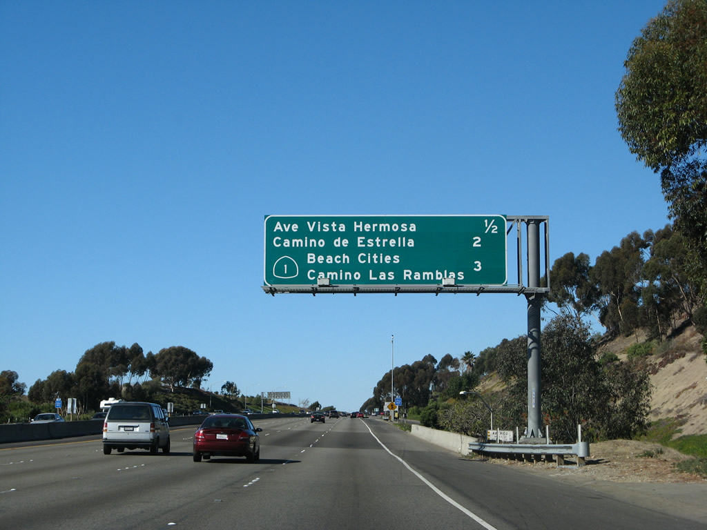
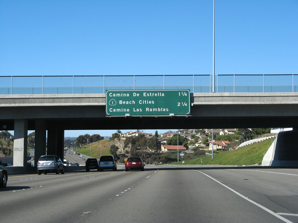
This mileage sign provides the distance to the next three exits along northbound Interstate 5: Exit 75, Avenida Presidio (0.25 mile); Exit 76, Avenida Pico; and Exit 77, Avenida Vista Hermosa. With the creation of the Avenida Vista Hermosa interchange in 2001, a green overlay panel covers up the third entry on the sign, which used to read "Camino de Estrella" (which is Exit 78). Exit 77 is relatively new, and modified signs with reflective overlay are used to incorporate the new exit into the mileage sign. Photo taken 01/14/07. |
|
|
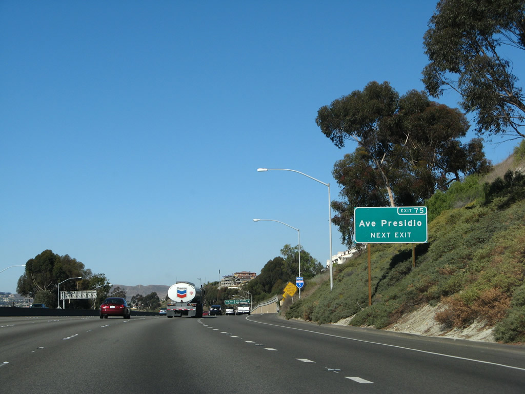
Avenida Presidio serves the historic downtown area of San Clemente. Use Exit 75 to reach the historic downtown as well as La Cristianita, a historical landmark. Note the change in signs between 2007 and 2008 to incorporate the nature of the exit. Photos taken 04/26/08 and 01/14/07. |
|
Northbound Interstate 5 (San Diego Freeway) reaches Exit 75, Avenida Presidio. The next exit is for Avenida Pico (Exit 76). Photo taken 11/14/04. |
|
This interchange sequence sign along northbound Interstate 5 provides the distance to the next three exits: Exit 76, Avenida Pico; Exit 77, Avenida Vista Hermosa; and Exit 78, Camino de Estrella. Photo taken 01/14/07. |
|
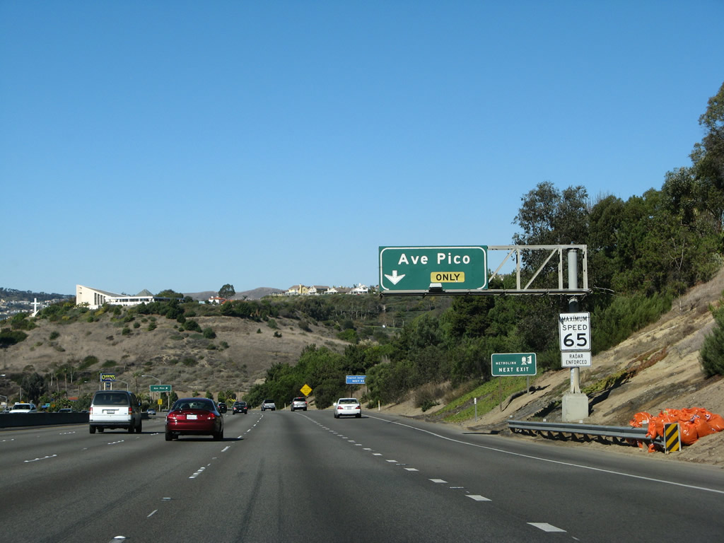
The next exit along northbound Interstate 5 is Exit 76, Avenida Pico, next right. Photo taken 01/14/07. |
|
The right lane of Interstate 5 north becomes exit only for Exit 76. The left four lanes continue north toward Santa Ana and Los Angeles. Use Exit 76 to a tourist information center in San Clemente. Photo taken 01/14/07. |
|
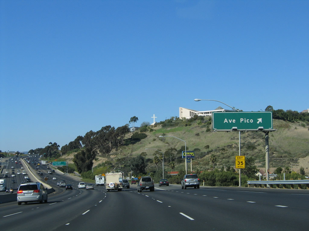
Northbound Interstate 5 reaches Exit 76, Avenida Pico. Photo taken 11/14/04. |
|
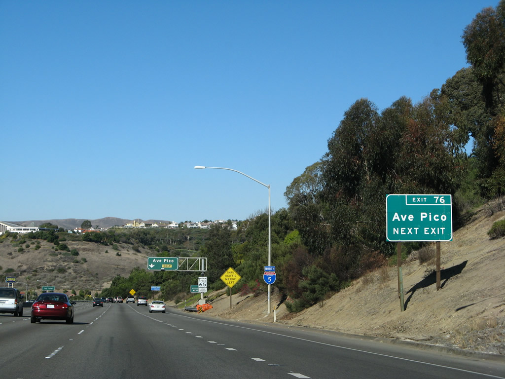
This mileage sign provides the distance to the next three exits along Interstate 5 (San Diego Freeway) north: Exit 77, Avenida Vista Hermosa; Exit 78, Camino de Estrella; and Exit 79, California 1 (Pacific Coast Highway) and Camino las Ramblas. Unlike most of the other advance signs we've seen in San Clemente, this sign is entirely reflective. Photo taken 01/14/07. |
|
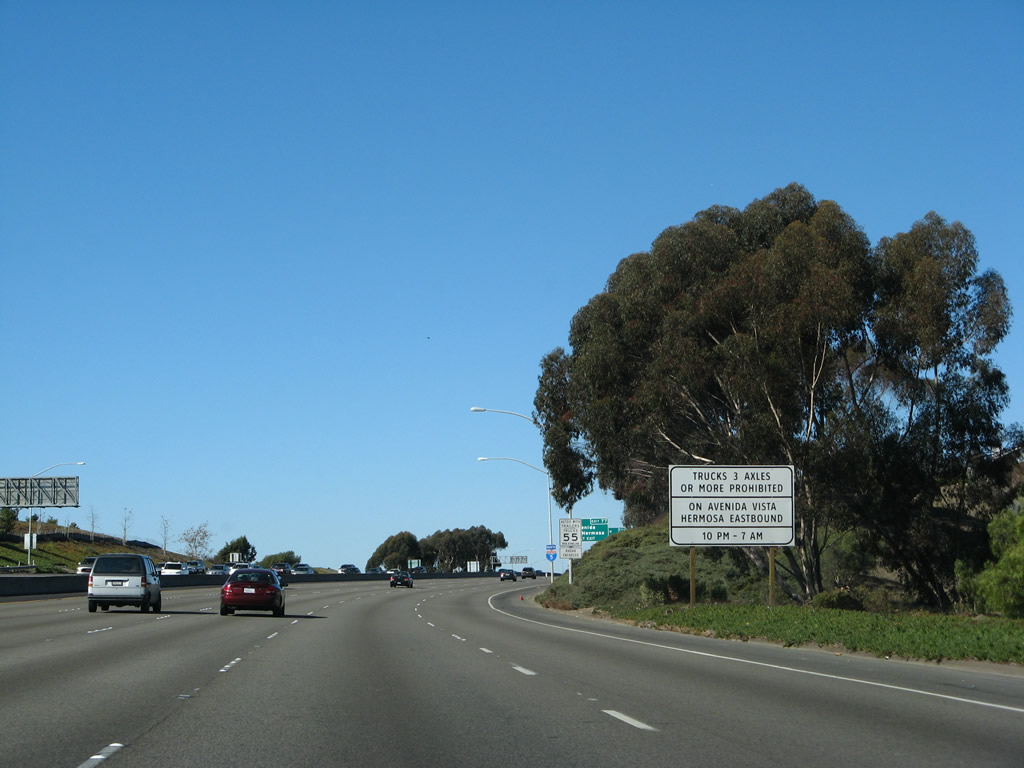
A rare Clearview sign details the overnight truck restrictions on Avenida Vista Hermosa. An identical sign is posted on southbound. Photo taken 01/14/07. |
|
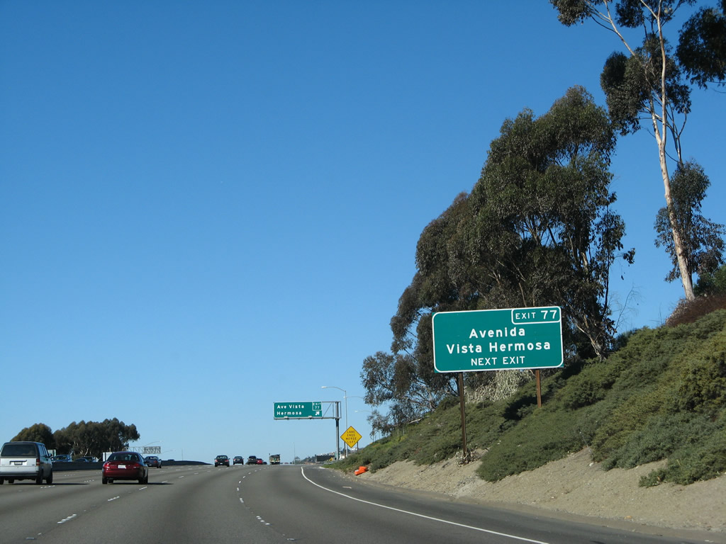
This Exit 77 sign was added a year after the original signage was installed along northbound. It is the first indication that this is Exit 77, and the sign is located only a short distance before the actual exit ramp. Photo taken 01/14/07. |
|
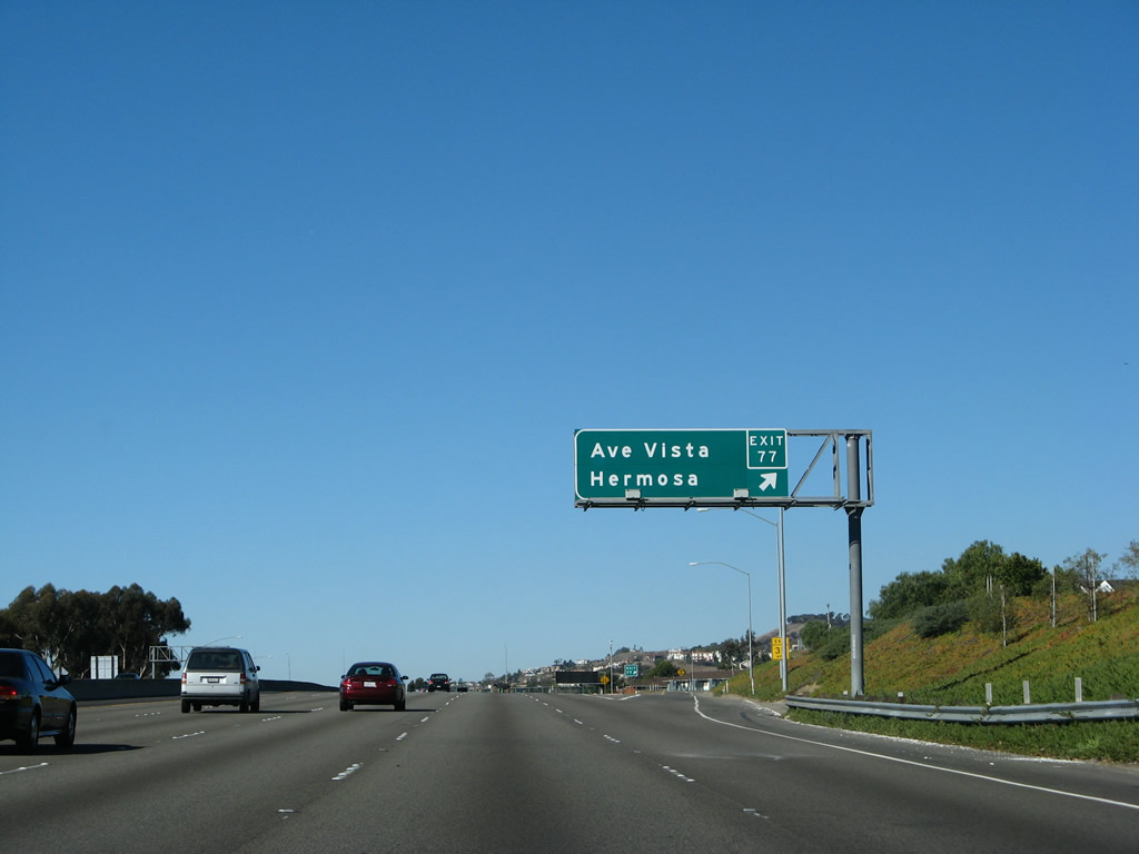
Northbound Interstate 5 reaches Exit 77, Avenida Vista Hermosa. This interchange was constructed in 2000-2002 and opened to traffic in 2002. The overpass itself is much older, but it did not directly connect to the local road network, so for a time it was a bridge with no traffic. Now it gets frequent use by users of the interchange. The signs do not carry exit numbers because the exit number was not included in the sign specifications at the time the construction contract was bid. Photo taken 01/14/07. |
|
Another mileage sign is posted on the Avenida Vista Hermosa overpass for the next two exits: Exit 78, Camino de Estrella and Exit 79, California 1 (Pacific Coast Highway) north and Camino Las Ramblas. Photo taken 01/14/07. |
|
An Interstate 5 north reassurance shield is posted after the on-ramp from Avenida Vista Hermosa. Photo taken 01/14/07. |
|
|
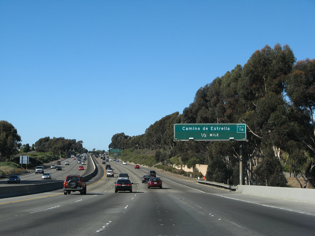
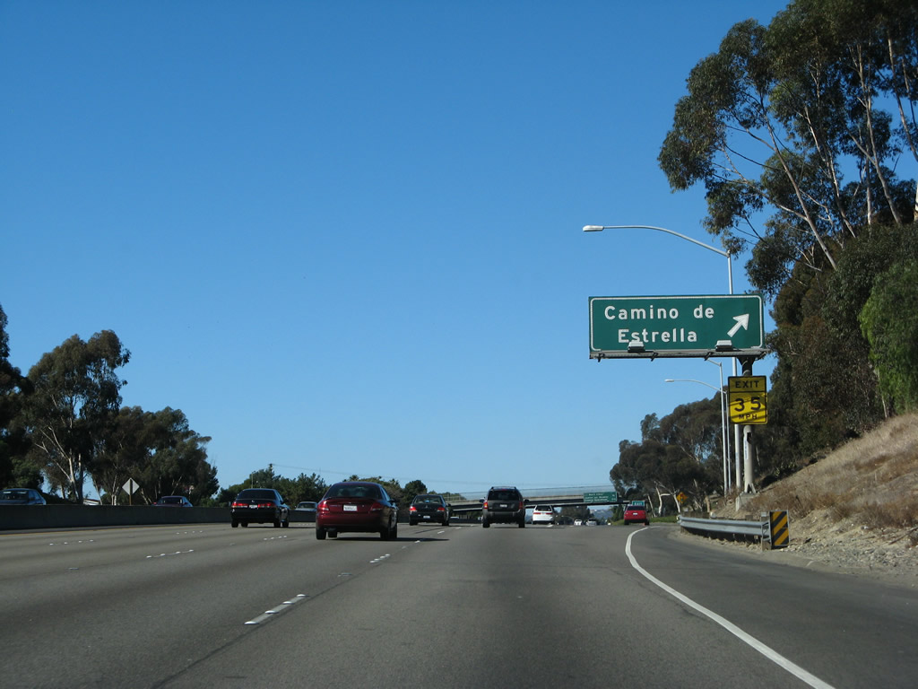
Exit 78 serves Camino de Estrella, which is the final San Clemente exit. An exit number was retrofitted onto the pre-existing sign between 2004 and 2006. Photos taken 01/14/07 and 11/14/04. |
|
The second exit after Exit 78, Camino de Estrella is Exit 79, California 1 (Pacific Coast Highway) north. Photo taken 01/14/07. |
|
Northbound Interstate 5 (San Diego Freeway) meets Exit 78, Camino de Estrella. The freeway remains close to the ocean here, but after Exit 79, it will turn sharply inland. The freeway leaves San Clemente, passes by Capistrano Beach and will enter Dana Point. Photo taken 01/14/07. |
|
The next exit along northbound Interstate 5 is Exit 79, California 1 (Pacific Coast Highway) north and Camino las Ramblas east. Photo taken 01/14/07. |
|
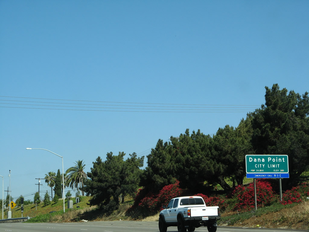
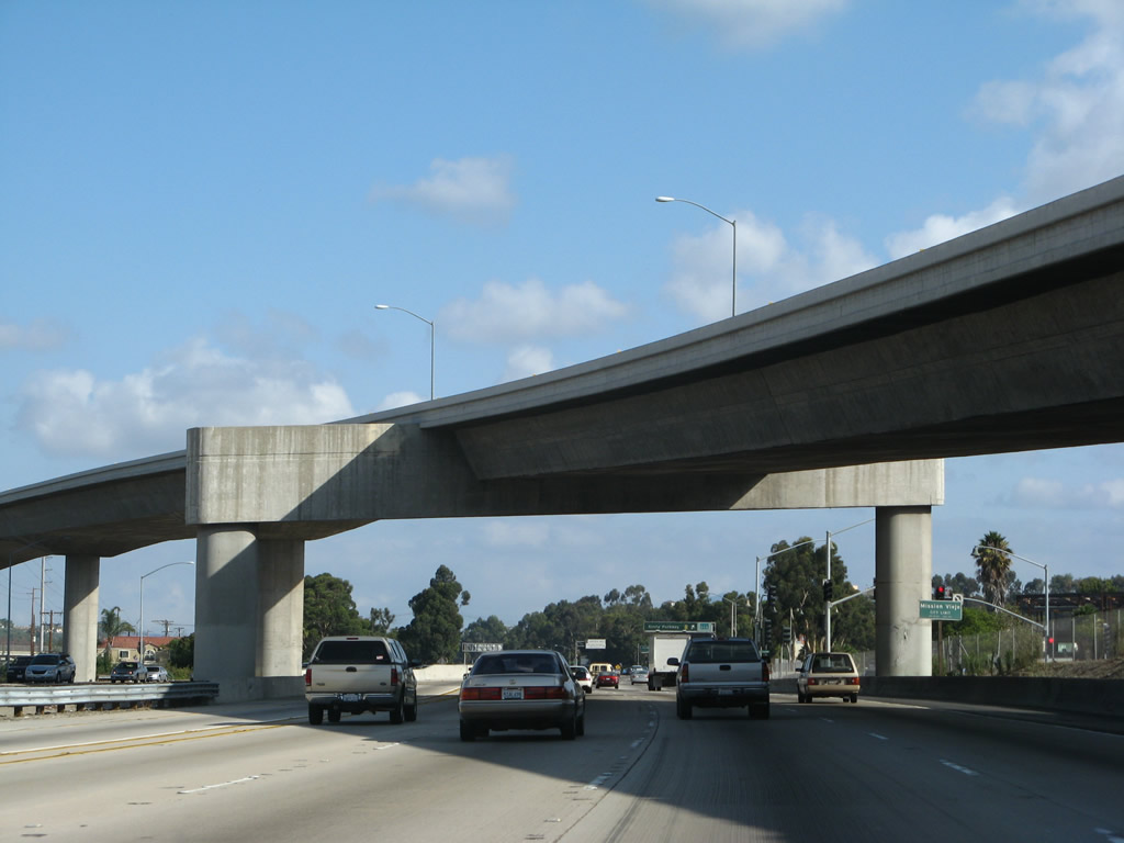
As noted earlier, Interstate 5 enters the city of Dana Point "Harboring the Good Life". Dana Point is home to 35,110 people per the 2000 Census. A small harbor and beautiful beaches offer a beautiful backdrop to this coastal city. The community of Capistrano Beach is part of the city of Dana Point. Photo taken 08/07/04. |
|
|
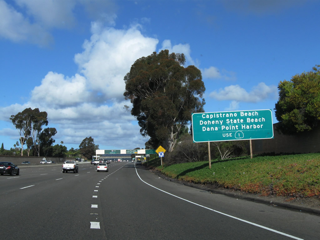
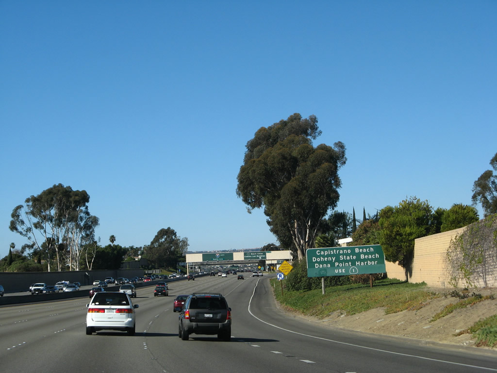
For Capistrano Beach, Doheny State Beach, and Dana Point, use Exit 79, California 1 (Pacific Coast Highway) north. California 1 is former U.S. 101 Alternate, and it follows the coastline between Capistrano Beach and Oxnard before being subsumed into the U.S. 101 freeway en route to Ventura County. Although U.S. 101 and California 1 are merged for a good distance, they split in Central California, with California 1 serving the rugged yet incredibly scenic Big Sur region and Monterey. Photos taken 02/26/11 and 01/14/07. |
|
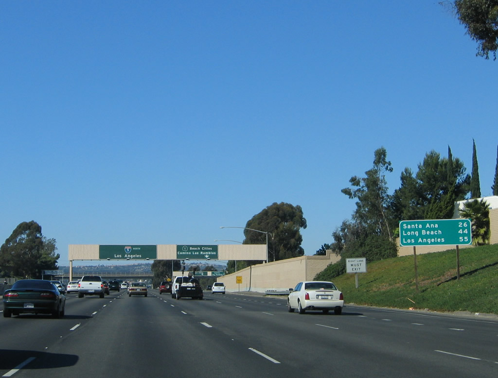
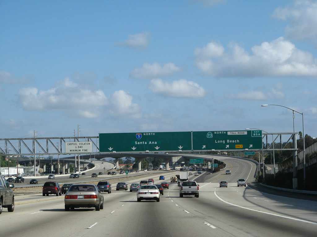
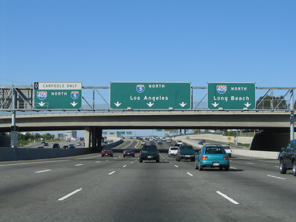
This mileage sign provides the distance to Santa Ana, Long Beach (via Interstate 405), and Los Angeles. Photo taken 11/14/04. |
|
|
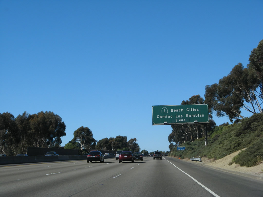
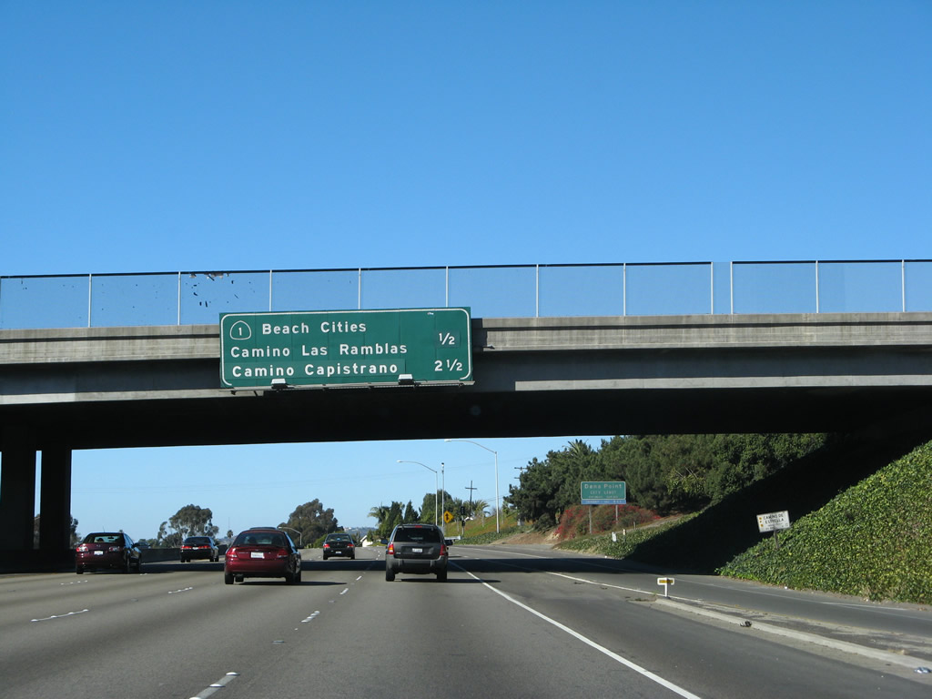
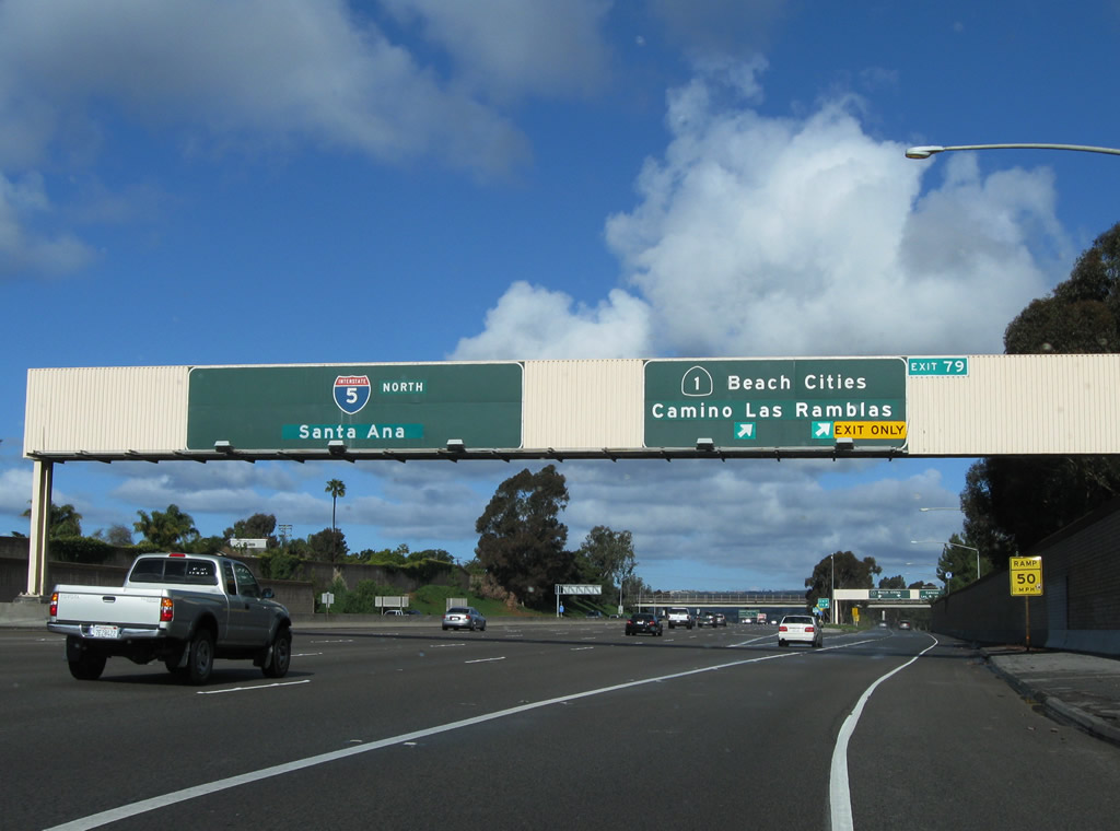
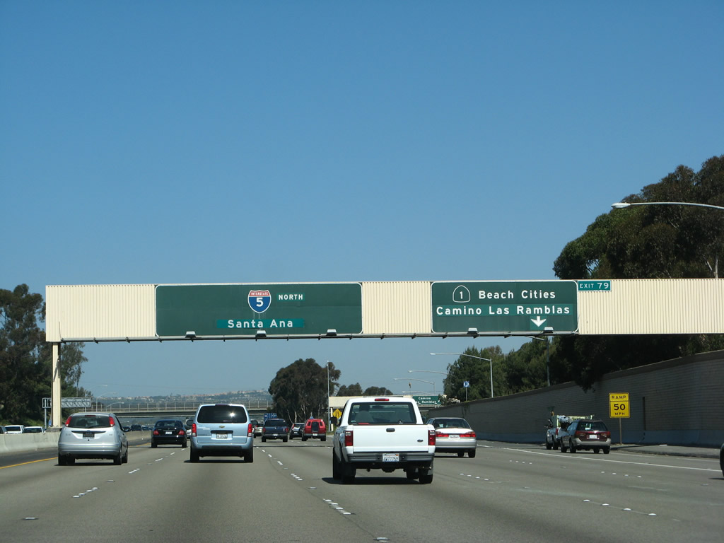
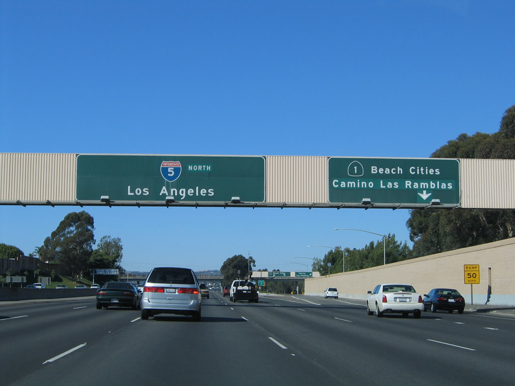
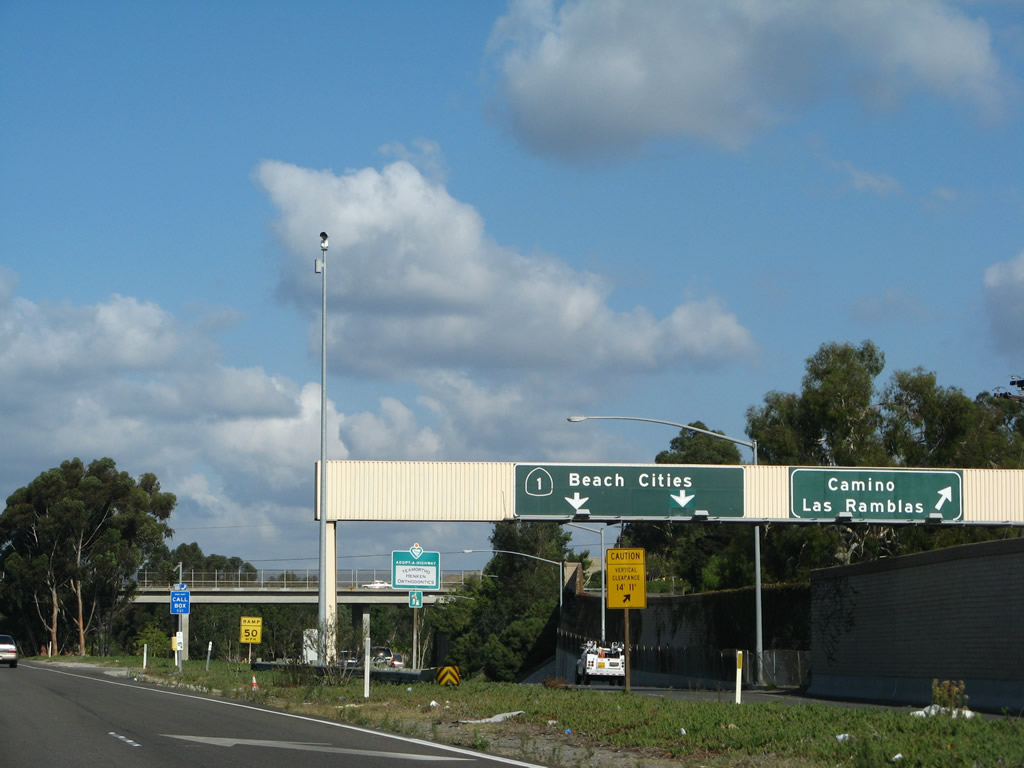
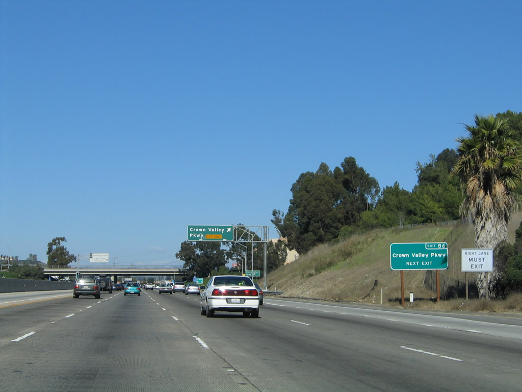
Northbound Interstate 5 (San Diego Freeway) reaches Exit 79, California 1 (Pacific Coast Highway) north and Camino las Ramblas east. This is the first exit along northbound in San Juan Capistrano. California 1 is the best route to the beach cities of Orange County, such as Dana Point, Laguna Beach, and Newport Beach. Originally, plans called for all of California 1 from San Juan Capistrano north to Malibu to be a coastal freeway, and some preliminary models showed the highway extending out over the ocean. This freeway plan was never implemented, and it is no longer a consideration given the extreme environmental costs and degradation of the beach and coastal areas. Photos taken 02/26/11, 04/26/08, and 11/14/04. |
|
|
|
|
Looking at the off-ramp, this view shows the signage for California 1 (Pacific Coast Highway) north to Dana Point, Laguna Beach, and Newport Beach. While the left two lanes of the ramp connect to California 1 north, the right lane also has an off-ramp to Camino las Ramblas. Photos taken 09/29/07 and 02/26/11. |
|
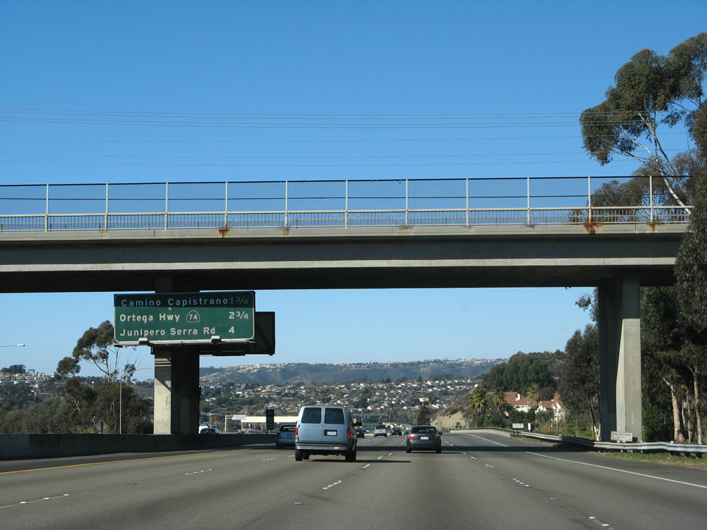
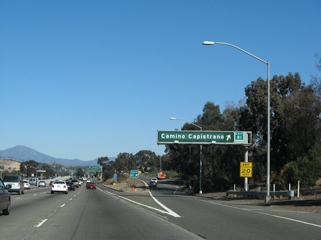
This mileage sign provides the distance to the next three exits on Interstate 5 (San Diego Freeway) north: Exit 81, Camino Capistrano; Exit 82, California 74 (Ortega Highway) east to Lake Elsinore and west to San Juan Capistrano; and Exit 83, Father Junipero Serra Road. Photo taken 01/14/07. |
|
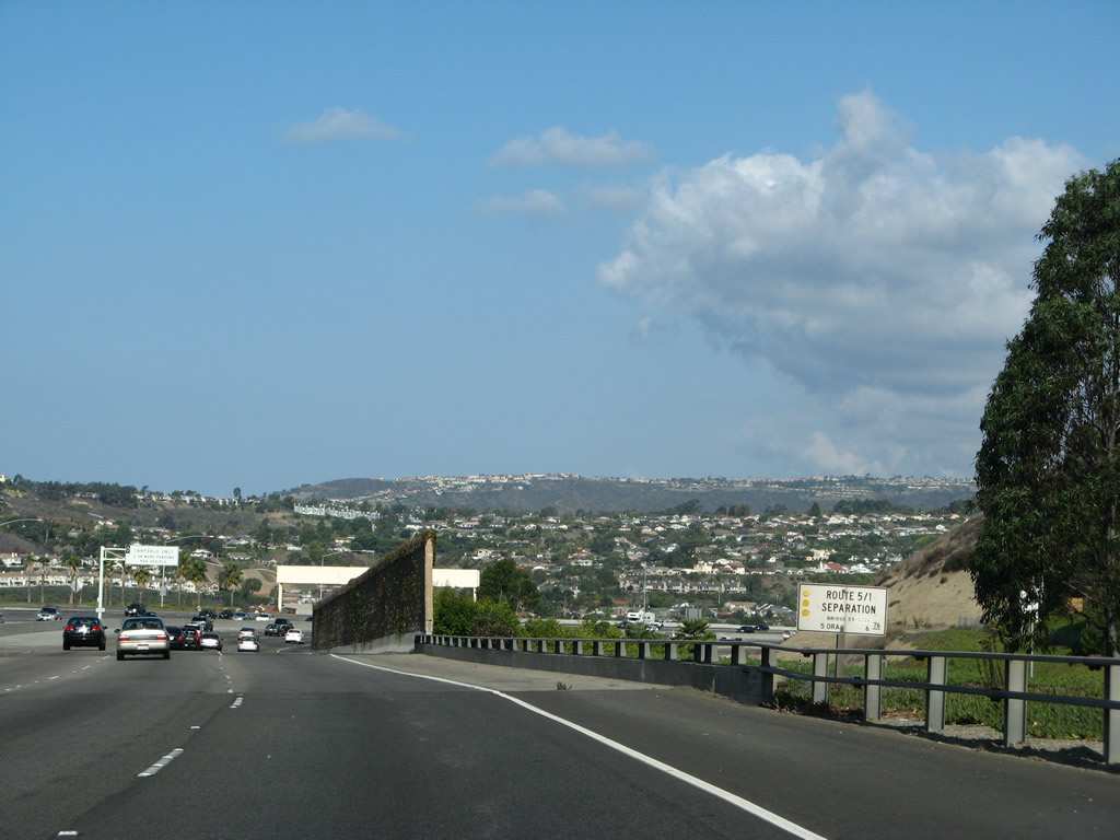
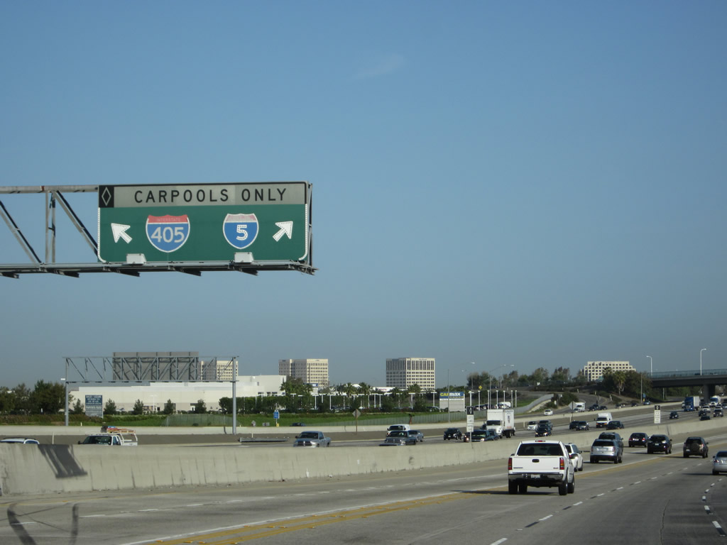
A Route 5/1 Separation sign is posted at the point where Interstate 5 passes over California 1. These bridge signs are common on most California freeways; they typically include the route number, post mile location, and name of structure. Photo taken 09/29/07. |
|
Interstate 5 leaves the city of Dana Point and enters the city of San Juan Capistrano "Preserving the Past to Enhance the Future". The population of this Orange County city was 33,826 as of the 2000 Census. Founded in 1776, Mission San Juan Capistrano forms the nucleus of today's city and is the seventh of 21 missions founded by Franciscan friars during that era. One of the oldest buildings still in use is located in the chapel at the mission, and one of California's earliest wineries was located here as well. Photo taken 09/29/07. |
|
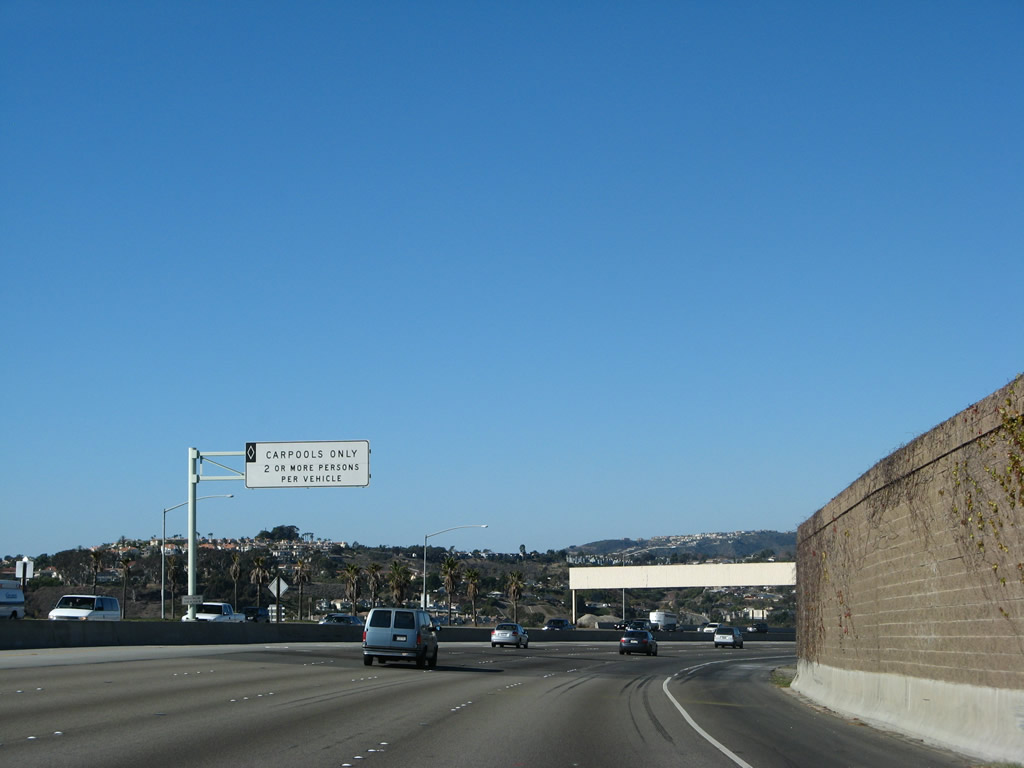
Upon entering the city of San Juan Capistrano, the northbound high occupancy vehicle (carpool) lane begins. This carpool lane will continue north through Santa Ana until ending at the Orange-Los Angeles County Line. The HOV lane is scheduled to be extended north to East Los Angeles, but that will not be completed for some time. Photo taken 01/14/07. |
|
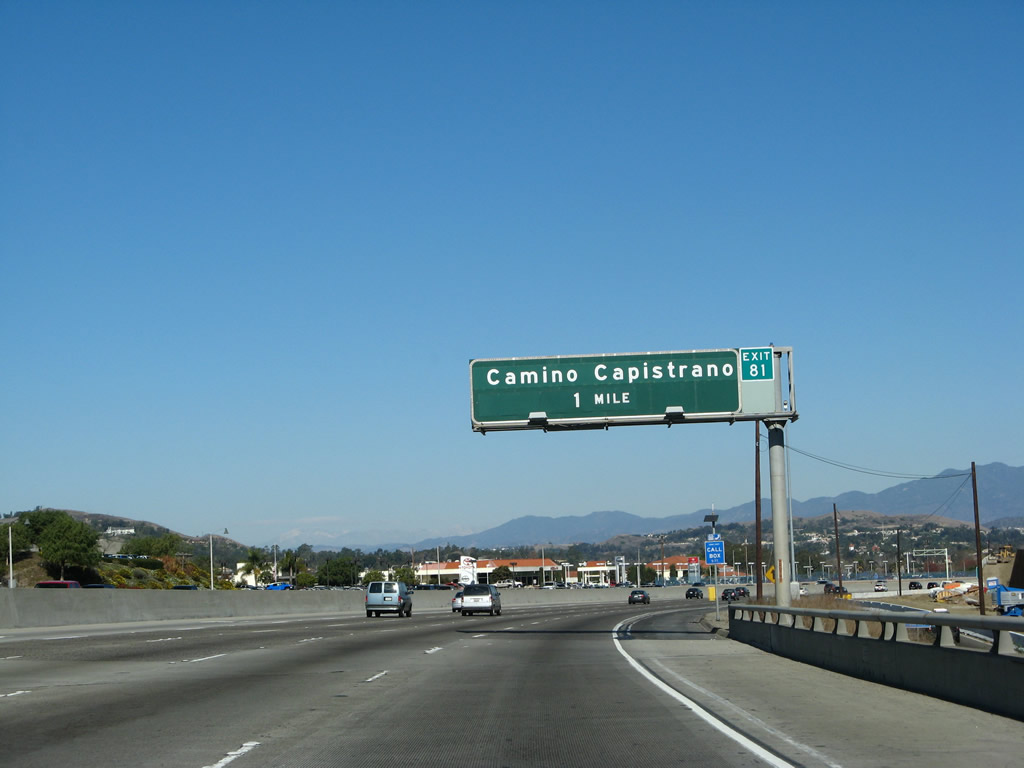
The next exit along Interstate 5 north is Exit 81, Camino Capistrano (one mile). The Camino Capistrano exit (exit 81) used to be signed as San Juan Creek Road. According to Mark Furqueron, the road name changed around 1990. The exit tab for Exit 81 was added in 2003. Photo taken 01/14/07. |
|
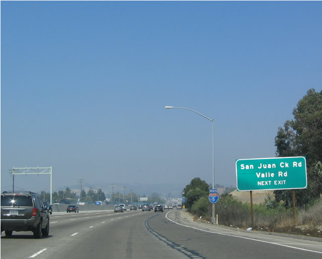
San Juan Creek Road and Valle Road are both signed on this ancillary sign for Exit 81. This area was reconstructed in 2007 to add a new auxiliary lane. Photo taken 03/30/03. |
|
Leaving Dana Point, the next three exits along Interstate 5 serve the city of San Juan Capistrano. Photo taken 01/14/07. |
|
Northbound Interstate 5 reaches Exit 81, Camino Capistrano. Photo taken 01/14/07. |
|
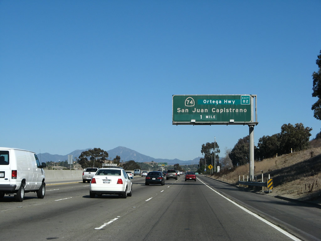
The next exit along northbound is Exit 82, California 74 (Ortega Highway) east to the Cleveland National Forest, San Juan Canyon, and Lake Elsinore in Riverside County and Ortega Highway west to San Juan Capistrano. Photo taken 01/14/07. |
|
This mileage sign provides the distance to Exit 82, California 74 and Ortega Highway; Exit 83, Junipero Serra Road; and Exit 85A, California 73 (San Joaquin Foothills Corridor). Photo taken 01/14/07. |
|
Take Exit 83 and follow Ortega Highway west into San Juan Capistrano to the San Juan Capistrano Mission. Photo taken 01/14/07. |
|
Northbound Interstate 5 (San Diego Freeway) reaches Exit 82, California 74 (Ortega Highway) east and Ortega Highway west. This interchange marks the western terminus of California 74; it does not extend all the way to California 1. Interchange improvements are being considered here, but construction has not yet begun. Photo taken 01/14/07. |
|
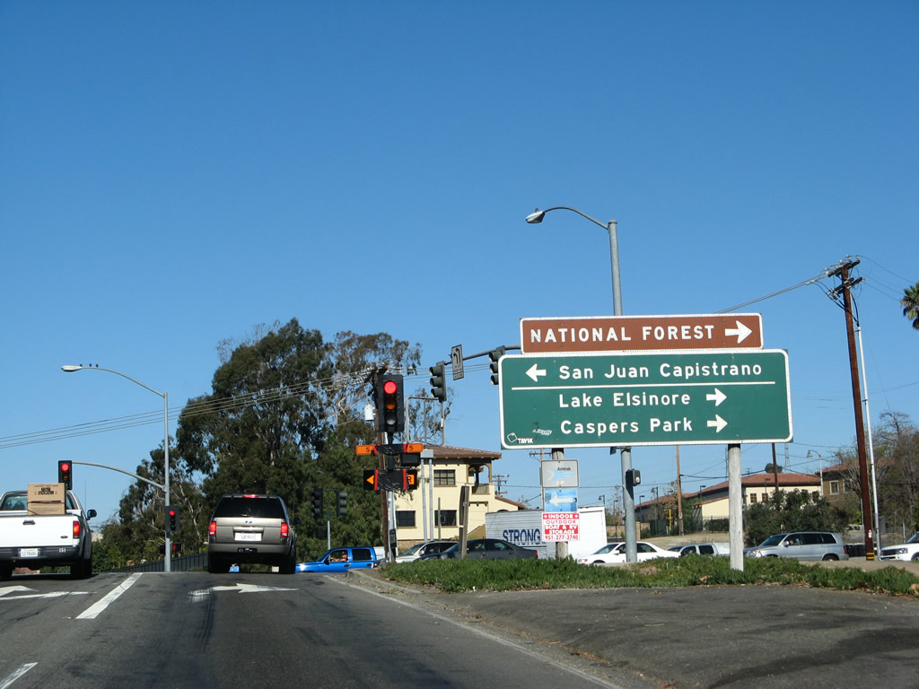
Now on the transition ramp to California 74 and the Ortega Highway, a right turn follows California 74 (Ortega Highway) east to Ladera Ranch, Cleveland National Forest, Caspers Park, and Lake Elsinore (where California 74 meets Interstate 15). Turn left to follow Ortega Highway to downtown San Juan Capistrano and the historic mission. Photo taken 01/14/07. |
|
|
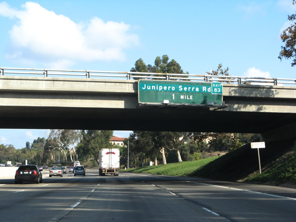
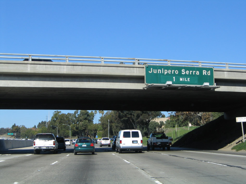
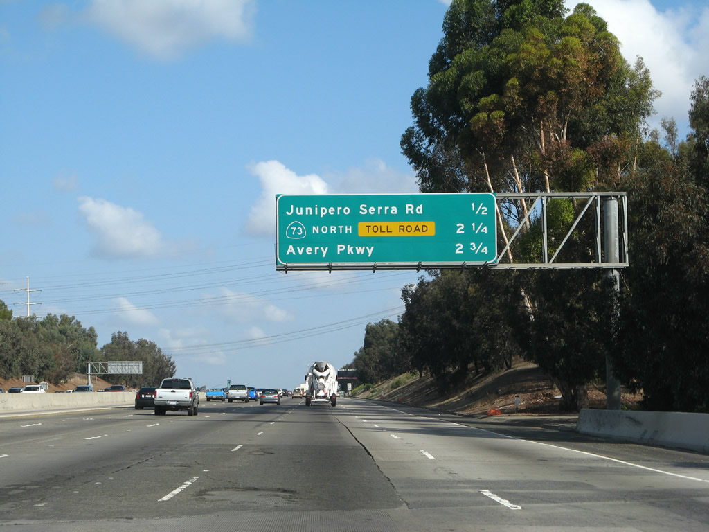
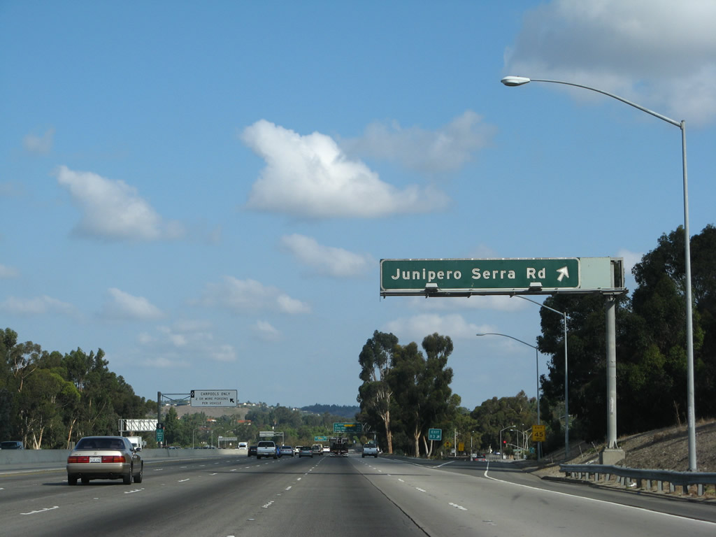
The next exit along northbound Interstate 5 is Exit 83, Junipero Serra Road. Father Junipero Serra was a Catholic missionary (Franciscan Friar) who helped to establish the missionaries between San Francisco and San Diego. His name adorns several highways and locations in California due to his influence. The power lines in the background belong to San Diego Gas and Electric. This is the northern extent of their territory; the remainder of Orange County is served by Southern California Edison. Photo taken 09/29/07 and 11/14/04. |
|
Many of the signs for the toll road have been replaced since the completion of the California 73/Interstate 5 interchange. This is because the original signs were non-reflective, aqua-green, which is a non-standard color for regular exit signage. In 2002-2003, all of the aqua-green signs were replaced with reflective signs such as this sign and the darker reflective signs found in the following photoboxes. The next three exits are Exit 83, Junipero Serra Road; Exit 85A, California 73/San Joaquin Hills Corridor north; and Exit 85B, Avery Parkway. Photo taken 09/29/07. |
|
|
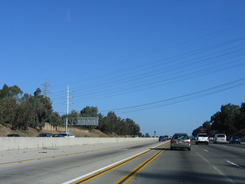
The service area for San Diego Gas and Electric extends as far north as southern Orange County. These 138kV power lines are owned by San Diego Gas and Electric, and they transmit electricity into Laguna Hills and Mission Viejo. Photos taken 10/07/06 and 09/29/07. |
|
|
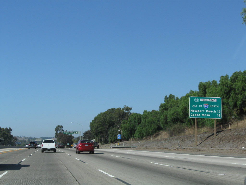
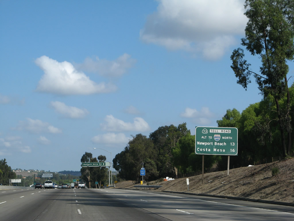
This mileage sign is placed after the variable message signs installed by the Orange County Toll Road Authority to allow for messages about the toll roads and variable pricing. Use California 73 north as an alternate route to Interstate 405 north to Newport Beach and Costa Mesa as well as Long Beach and Los Angeles International Airport. Photos taken 10/15/11 and 09/29/07. |
|
Northbound Interstate 5 (San Diego Freeway) reaches Exit 83, Junipero Serra Road. Photo taken 09/29/07. |
|
This mileage sign is an example of the new, darker reflective signage placed by the toll road authority in advance of the California 73 interchange. Note the light green California 73 shield amidst a darker green background. Photo taken 11/14/04. |
|
This Interstate 5 reassurance shield, which features 1979 specifications, was installed by the Orange County Toll Road Authority when the California 73 interchange opened to traffic. Photo taken 09/29/07. |
|
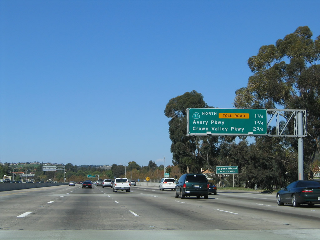
The next exit along Interstate 5 north is Exit 85A, California 73 north to Costa Mesa and Long Beach. California 73 is the San Joaquin Hills Corridor, a toll road that connects Interstate 5 in Laguna Hills and Mission Viejo with Interstate 405 in Costa Mesa. The toll road takes a route along the ridge of the San Joaquin Hills, passing through mostly rural areas between Aliso Viejo and Irvine. Despite the shorter distance of this toll road to points northwest, it is not as heavily used as California 241. Photo taken 09/29/07. |
|
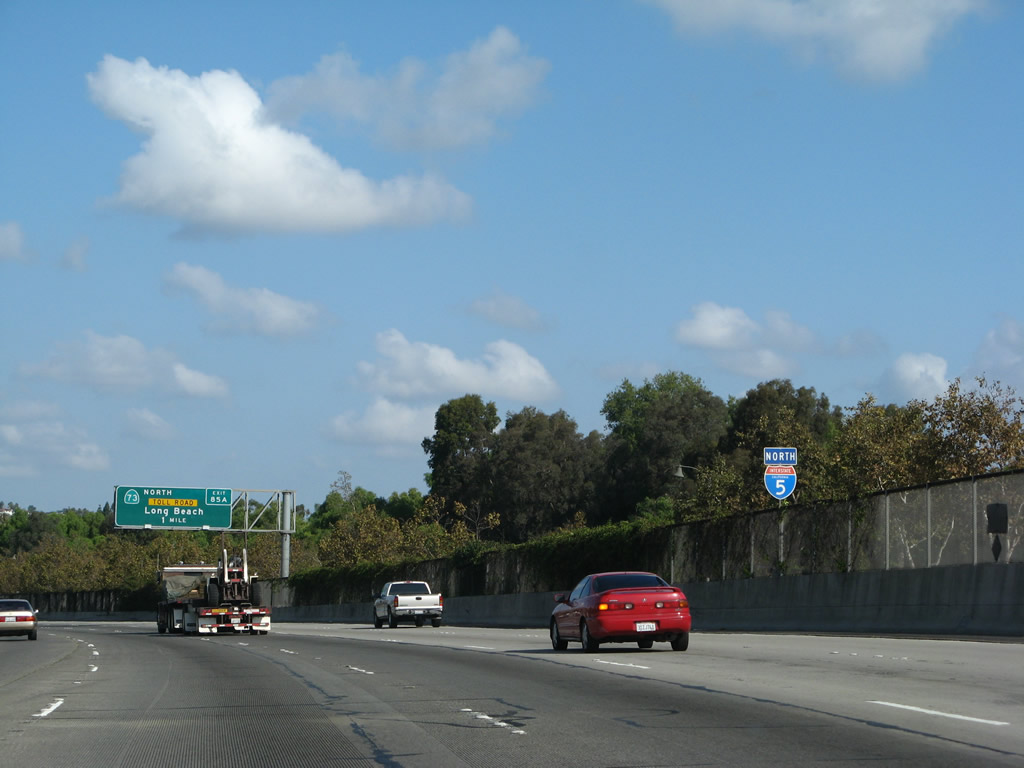
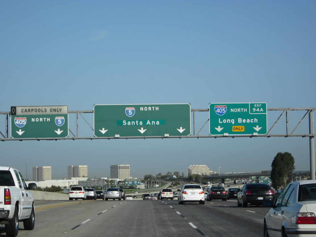
For a brief time when the California 73 toll road first opened, the original "control city" on the advance signs for California 73 was "SJH Toll Road", which did not last very long. Also, according to Mark Furqueron, the California 73 overhead exit signs (and the southbound California 74 overhead exit signs) only seem to have the portion of green behind the shield in reflective green while the rest of the green doesn't look reflective. The more recently placed signs show the control city for California 73 as Long Beach in Los Angeles County. Of course, the control city on the Interstate 5 north pull-through sign changed in Summer 2007 from Los Angeles to Santa Ana. Photo taken 09/29/07. |
|
The next five exits along northbound Interstate 5 serve the city of Mission Viejo, which is the next city served by Interstate 5. At the 5-73 split interchange, Interstate 5 will leave San Juan Capistrano and enter Mission Viejo. Photo taken 09/29/07. |
|
Northbound Interstate 5 (San Diego Freeway) reaches Exit 85A, California 73/San Joaquin Hills Corridor toll road. California 73 was authorized along with California 241, California 133 (extension), and California 261 in 1987. Additional toll roads were authorized in 1989, the California legislature, under AB-680, authorized the construction of various toll roads in the state: California 91 Express Lanes, California 125 between California 54 and California 905, California 57 from Interstate 5 south to Interstate 405, and the Mid-State Tollway from California 4/160 junction south to Interstate 680/California 84 junction with a spur via California 239 southeast to the Interstate 205/580 interchange. Of these routes, only California 91 and California 125 (South Bay Expressway) have been constructed. The others are under design/construction, are canceled, or are on hold for a variety of reasons, including litigation. For more, visit Public/Private Toll Facilities in California. Photo taken 09/29/07. |
|
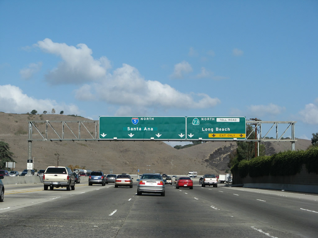
The left five lanes (including the high occupancy vehicle/carpool lane) split left to remain on Interstate 5, while the right three lanes depart for California 73 north to Costa Mesa and Long Beach. For the latest toll rates, visit the Orange County Toll Authority. Photo taken 09/29/07. |
|
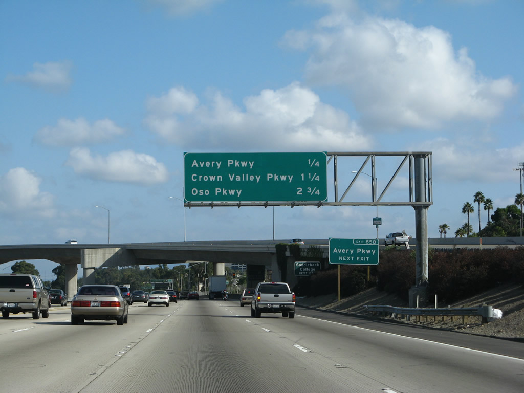
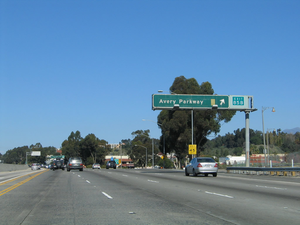
The next exit along Interstate 5 north is Exit 85B, Avery Parkway. This is the first exit after the split with California 73. This route leads directly into Mission Viejo and serves Saddleback College. The next exits are Exit 86, Crown Valley Parkway and Exit 88, Oso Parkway. Photo taken 09/29/07. |
|
Three lanes of California 73 north pass over the main lanes of Interstate 5 prior to the Avery Parkway exit. Photo taken 10/07/06. |
|
At the base of the overpass, Interstate 5 leaves San Juan Capistrano and enters the city of Mission Viejo. The city consists of 19 square miles, has a population of 93,102 per the 2000 Census, and is a master planned community that developed in stages through the 1970s. A barely noticeable city limits sign is posted under the California 73 separation overpass. Photo taken 09/29/07. |
|
Northbound Interstate 5 (San Diego Freeway) reaches Exit 85B, Avery Parkway. Clearly, this sign has seen better days. It should be a larger sign to ease legibility. Between Avery Parkway and Alicia parkway, Interstate 5 acts as the dividing line between Mission Viejo (located to the east of Interstate 5) and Laguna Hills (to the west of Interstate 5). Both cities have seen monumental increases in population in the last 20 years, as new housing developments continue to be constructed in the once-rural backcountry of Orange County. The Orange County toll roads (California 73, 133, 241, and 261) help foster these new developments by providing freeway access to homeowners located a good distance away from the original freeway system in Orange County. Photo taken 11/14/04. |
|
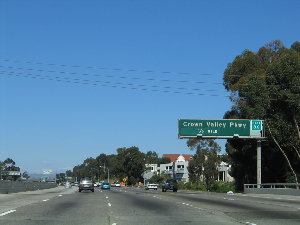
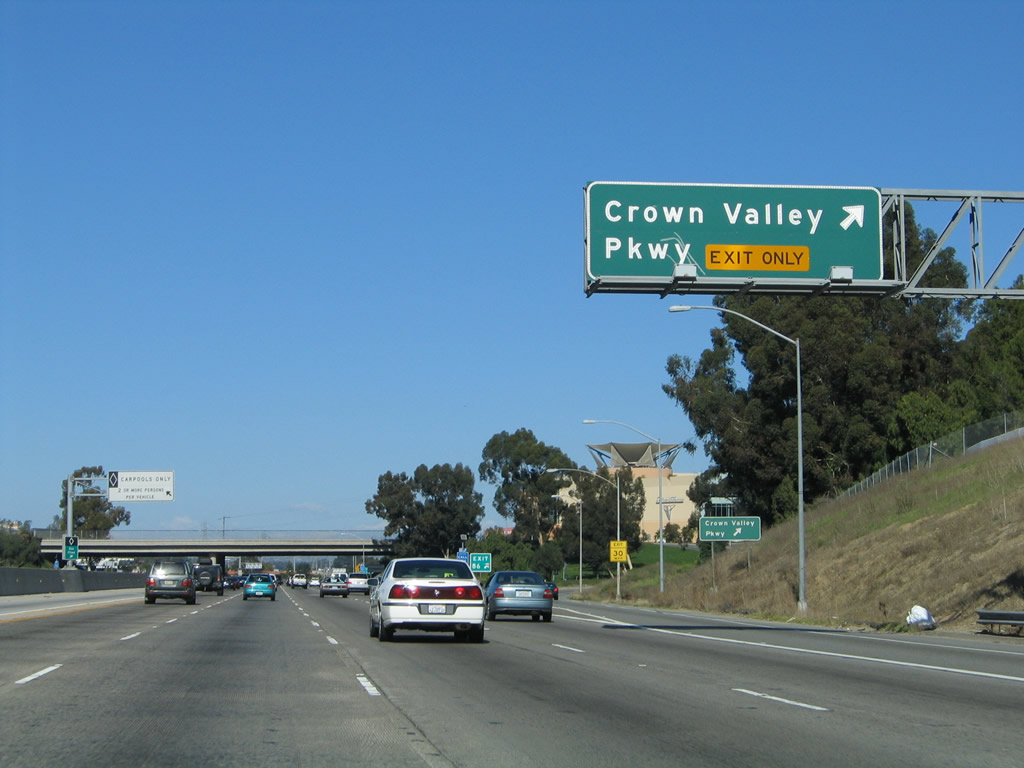
The next exit along northbound Interstate 5 is Exit 86, Crown Valley Parkway. Crown Valley Parkway leads east to the new Ladera Ranch community via a new (2002) bridge over Trabuco Creek and southwest into Laguna Niguel. Photo taken 11/14/04. |
|
The right lane becomes exit-only for Exit 86, Crown Valley Parkway. Photo taken 11/14/04. |
|
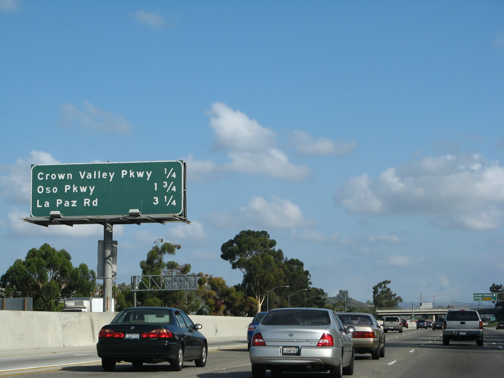
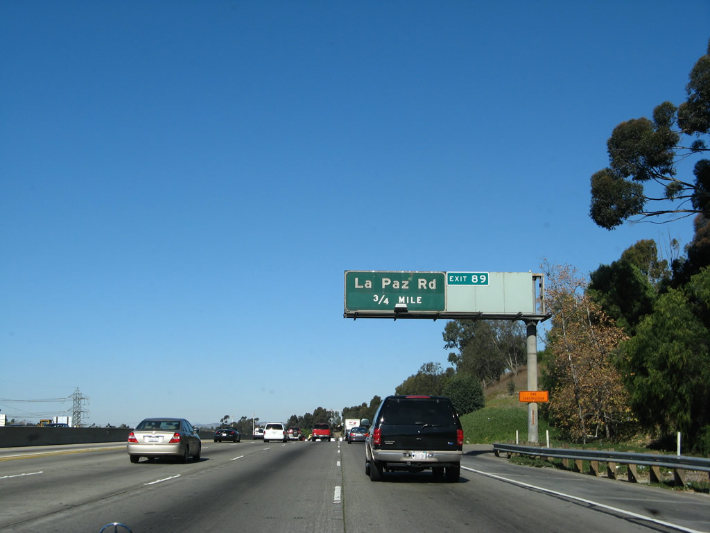
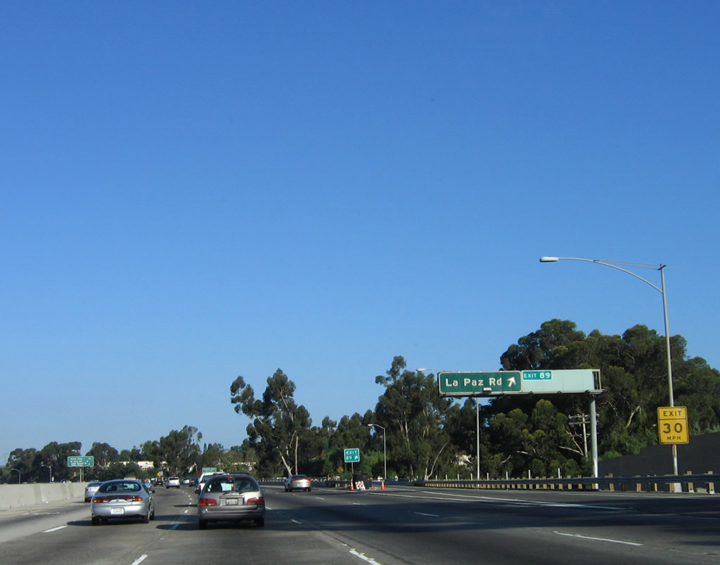
This mileage sign provides the distance to the next three exits: Exit 86, Crown Valley Parkway; Exit 88, Oso Parkway; and Exit 89, La Paz Road. Photo taken 09/29/07. |
|
This exit number sign is located after the overhead sign shown in the previous photo. This is the first of four signs in rapid succession for Exit 86. Photo taken 11/14/04. |
|
Northbound Interstate 5 reaches Exit 86, Crown Valley Parkway. Use Crown Valley Parkway east to Mission Viejo and Ladera Ranch. To the west, Crown Valley Parkway travels into Laguna Niguel. A second "Crown Valley Road arrow" sign is posted below and behind the overhead sign. Photo taken 11/14/04. |
|
An Interstate 5 north reassurance shield is posted after the on-ramp from Crown Valley Parkway (Exit 86). The right lane becomes exit only for Exit 88, Oso Parkway. Photo taken 01/14/07. |
|
|
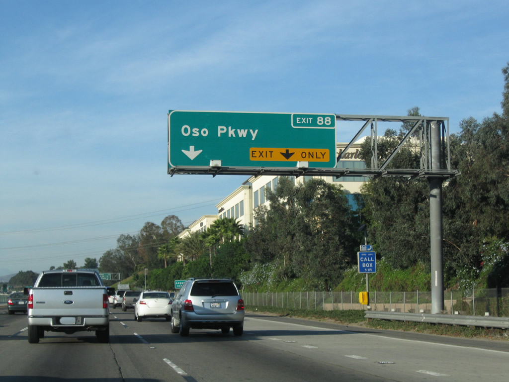
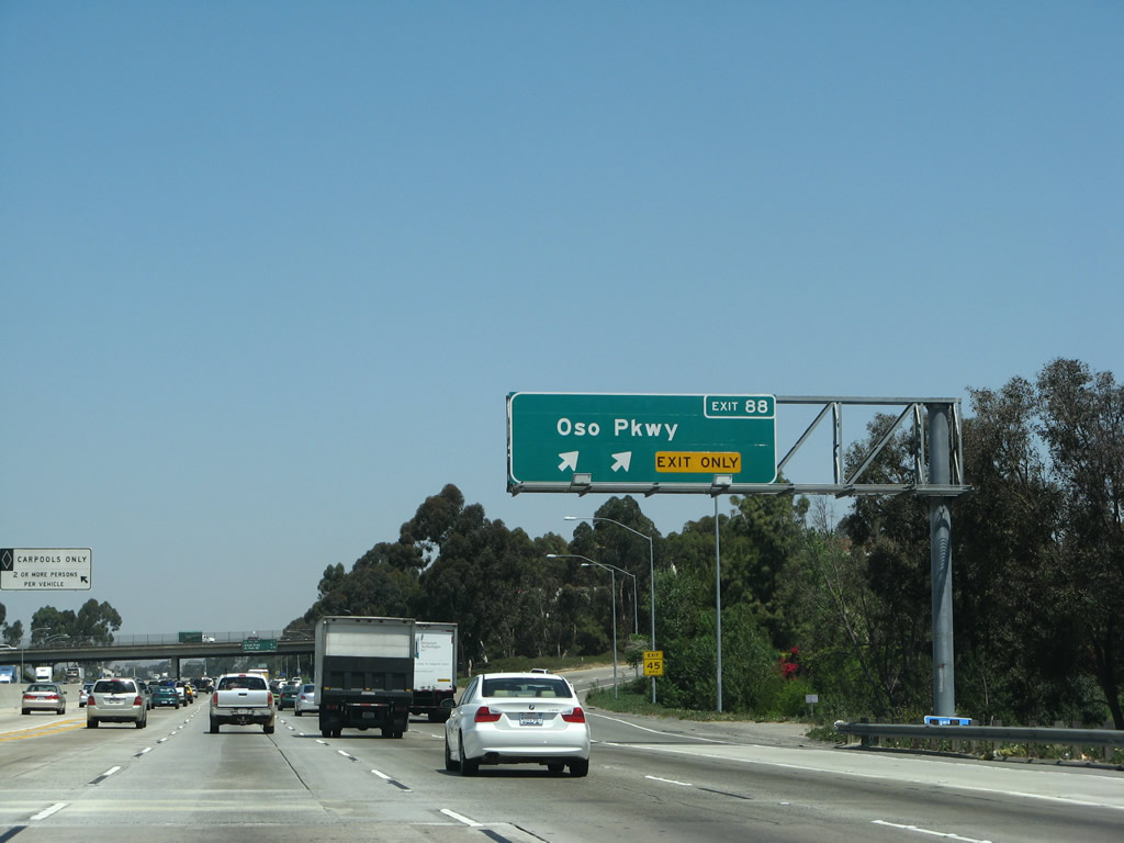
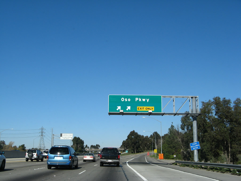
The next exit along Interstate 5 north is Exit 88, Oso Parkway. Note the change in signage between 2007 and 2008 to reflect the exit number. This reflective sign shown in the 2007 photo was placed in Fall 2001 as a result of interchange reconstruction. It was one of the last of the new signs to be placed prior to the exit numbering directive. Photos taken 10/24/09 and 01/14/07. |
|
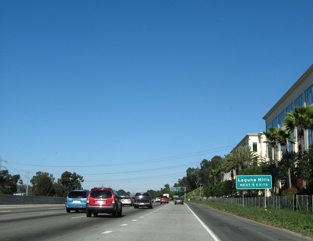
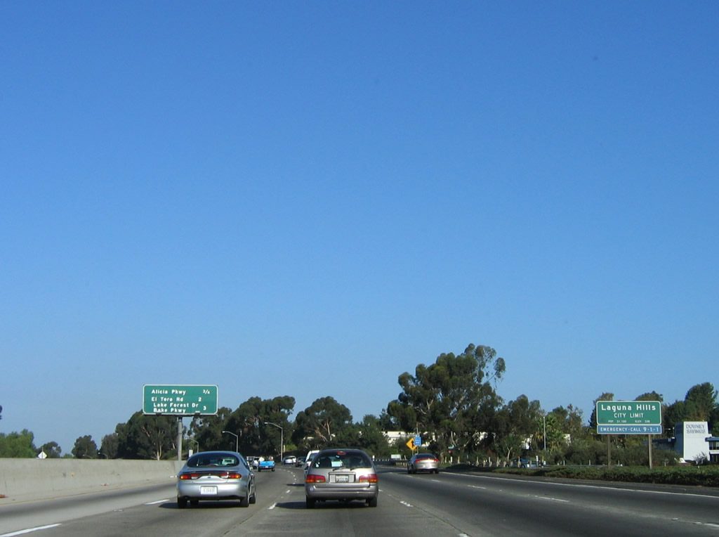
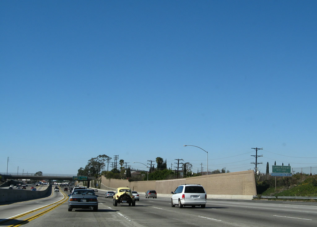
The next five exits along Interstate 5 north serve the city of Laguna Hills: Exit 88, Oso Parkway; Exit 89, La Paz Road; Exit 90, Alicia Parkway; Exit 91, El Toro Road; and Exit 92A, Lake Forest Drive. Photo taken 01/14/07. |
|
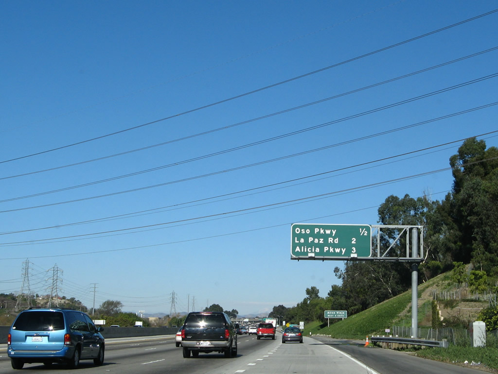
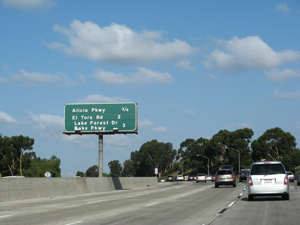
This mileage sign provides the distance to the next three exits along Interstate 5 north: Exit 88, Oso Parkway; Exit 89, La Paz Road; and Exit 90, Alicia Parkway. Mark Furqueron writes, "For a few years in the 1980s, prior to Laguna Hills incorporating, Oso Parkway west of Interstate 5 was renamed Pacific Park Drive by the Mission Viejo Company. This was presumably to promote the Pacific Park industrial park in the new community of Aliso Viejo, which was being developed by the Mission Viejo Company. At this time, the exit signs were changed to say Oso Parkway/Pacific Park Drive. Later, the city of Laguna Hills, upset with Mission Viejo's plan to put in the big box commercial development (Best Buy, CompUSA, etc.) in the small strip of Mission Viejo west of Interstate 5 and east of the railroad (Laguna Hills would get all the traffic and Mission Viejo would get the tax revenue), reverted the name back to Oso Parkway in the city. Shortly after this, Caltrans put up new signs with just Oso Parkway on them. Pacific Park Drive now starts a couple of miles west in Laguna Niguel." Photo taken 01/14/07. |
|
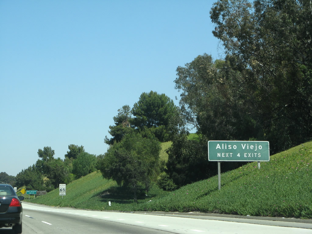
The next four exits along Interstate 5 north serve the city of Aliso Viejo: Exit 88, Oso Parkway; Exit 89, La Paz Road; Exit 90, Alicia Parkway; and Exit 91, El Toro Road. Photo taken 04/26/08. |
|
|
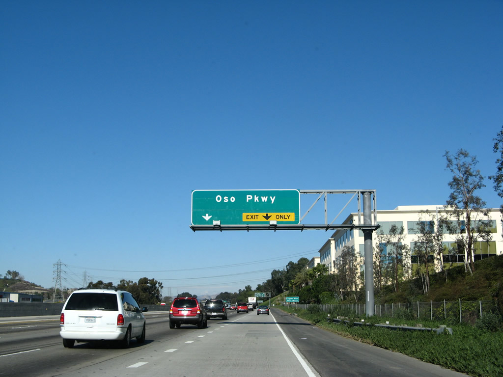
Northbound Interstate 5 (San Diego Freeway) reaches Exit 88, Oso Parkway. Oso Parkway leads east to the Coto de Caza development as well as the current southern terminus of California 241. Heading west, Oso Parkway leads into Laguna Hills. Use Oso Parkway west to Pacific Park Drive. Photos taken 04/26/08 and 01/14/07. |
|
|
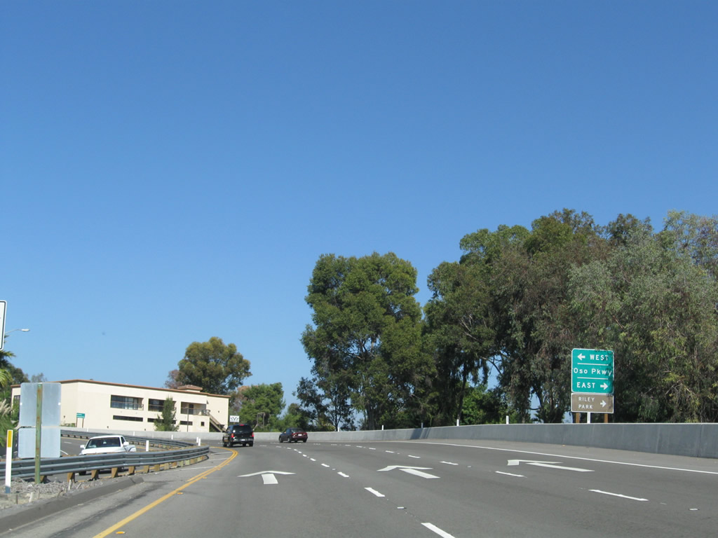
These signs are posted on the off-ramp from Interstate 5 north to Oso Parkway. Turn right for Mission Viejo or left for Laguna Hills and Aliso Viejo. Photos taken 10/15/11. |
|
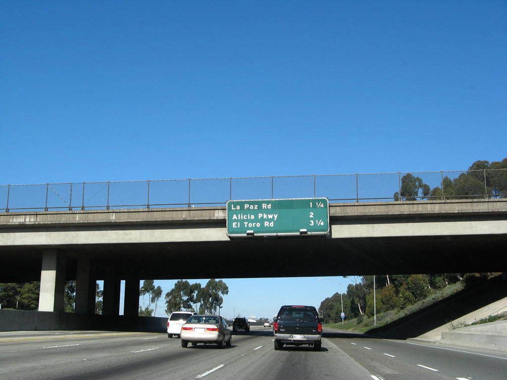
This mileage sign provides the distance to the next three exits along Interstate 5 (San Diego Freeway) north are Exit 89, La Paz Road; Exit 90, Alicia Parkway; and Exit 91, El Toro Road. This porcelain enamel sign was modified when Exits 90 and 91 were added. According to Casey Cooper, underneath the green overlay panel is what would have been the first mention of the junction with Interstate 405. Photo taken 04/26/08. |
|
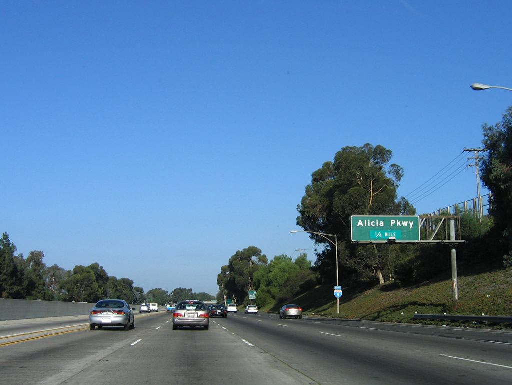
The next exit along Interstate 5 north is Exit 89, La Paz Road. Use La Paz Road east to Mission Viejo and west to Laguna Hills. Along this stretch, Interstate 5 almost perfectly straddles the two cities. Notably, Old U.S. 101 sits mostly unused adjacent to the railroad corridor that parallels Interstate 5 in the valley on the west side of the freeway. While portions of the old route are traversable, other portions lie directly under the freeway. Photo taken 04/26/08. |
|
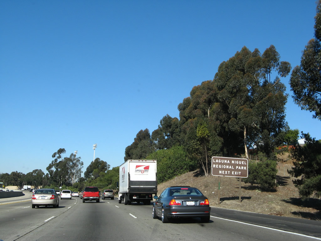
Use La Paz Road east to the Mission Viejo Village Center, Oso Viejo Community Park, and O'Neill Regional Park. Use La Paz Road southwest to Laguna Niguel Regional Park in Laguna Niguel. Photo taken 04/26/08. |
|
Northbound Interstate 5 (San Diego Freeway) reaches Exit 89, La Paz Road. Photo taken 10/07/06. |
|
At the La Paz Road interchange, Interstate 5 leaves Mission Viejo and enters the city of Laguna Hills. Home to 31,178 people as of the 2000 Census, Laguna Hills is located north of Laguna Niguel, east of Mission Viejo, west of Laguna Woods, and south of Lake Forest. Interstate 5 continues to follow the border between Laguna Hills and Mission Viejo as it continues generally northwest toward Santa Ana and Los Angeles. Photo taken 10/07/06. |
|
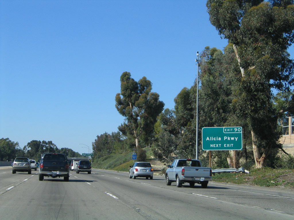
This mileage sign provides the distance to the next three exits along Interstate 5 north: Exit 90, Alicia Parkway; Exit 91, Orange County S-18 (El Toro Road); and Exit 92A, Lake Forest Drive and Bake Parkway. Photo taken 09/29/07. |
|
Northbound Interstate 5 approaches Exit 90, Alicia Parkway (one-quarter mile). Photo taken 10/07/06. |
|
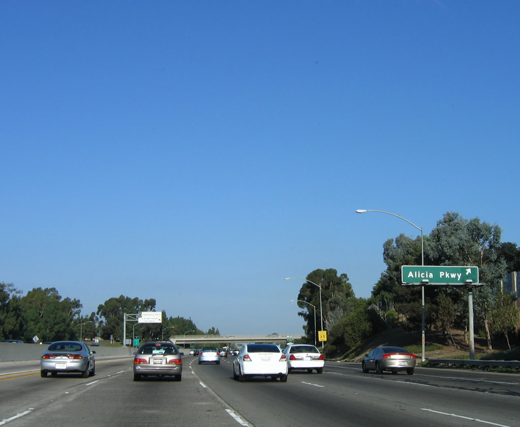
A roadside exit number sign for Exit 90, Alicia Parkway is posted shortly thereafter on northbound. Alicia Parkway leads northeast into Mission Viejo and west into Laguna Hills. Photo taken on 11/14/04. |
|
Northbound Interstate 5 (San Diego Freeway) reaches Exit 90, Alicia Parkway south to Laguna Hills and north to Mission Viejo. At this point, Interstate 5 is traveling in a northwesterly direction. Photo taken 10/07/06. |
|
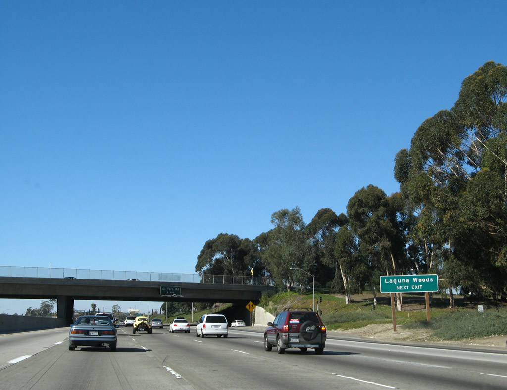
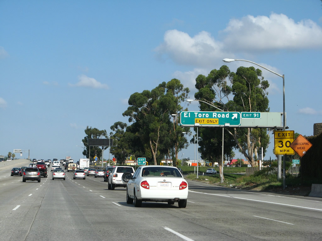
The next exit along Interstate 5 (San Diego Freeway) north is Exit 91, El Toro Road. Use El Toro Road west to the city of Laguna Woods, which mostly consists of Leisure World, a retirement community built on the former Moulton Ranch. The city incorporated on March 2, 1999. The average age in this city is 78 years old according to the city's official web page. Interstate 5 does not pass into Laguna Woods but rather skirts the west edge after Exit 91 (El Toro Road). Photo taken 04/26/08. |
|
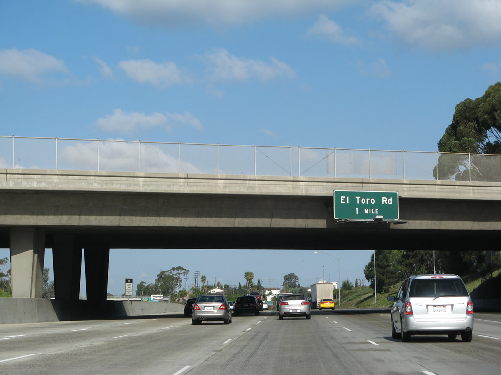
Passing under the Alicia Parkway overpass, the first guide sign for the next interchange (Exit 91, El Toro Road) is posted on the overpass. Photo taken 09/29/07. |
|
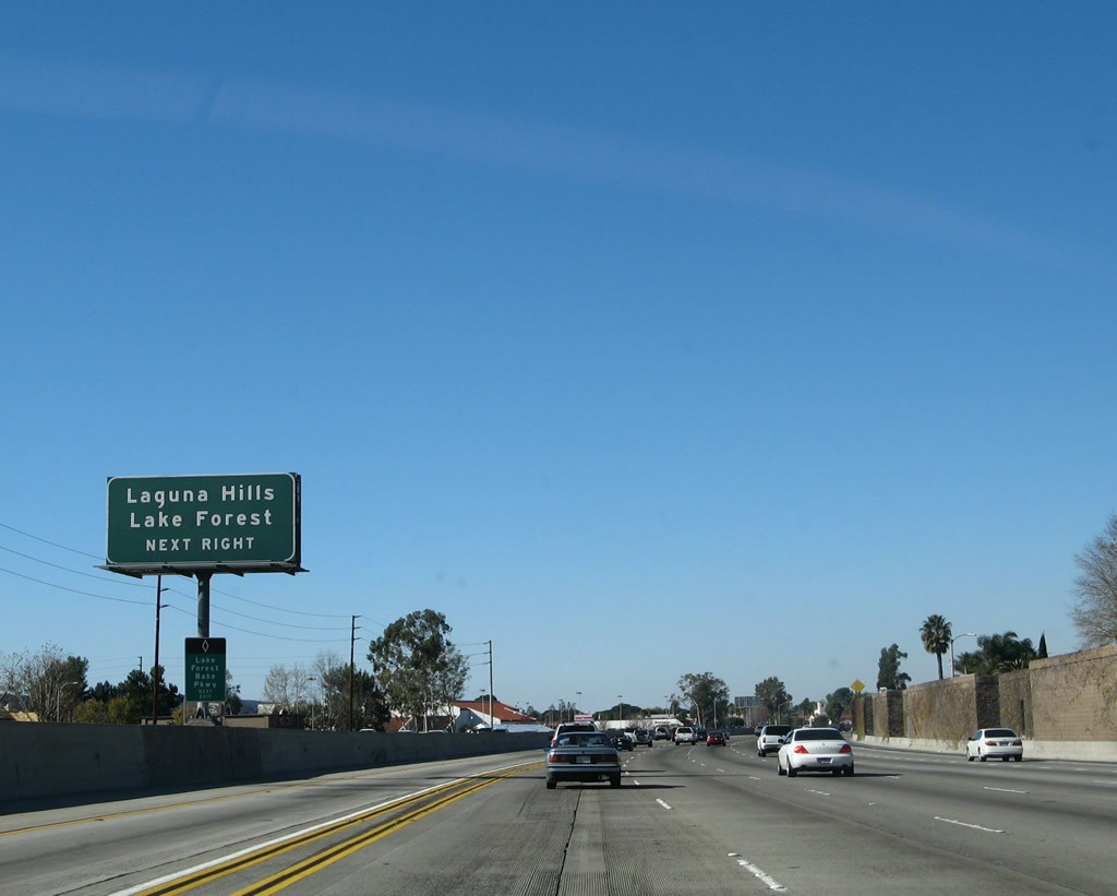
Soon thereafter, Interstate 5 leaves Laguna Hills and enters the city of Lake Forest. Incorporated on December 20, 1991, Lake Forest consists of 16.6 square miles, sits at an elevation of 394 feet, and was home to 58,707 people as of the 2000 Census. This area is also known as El Toro due to its name prior to the city's incorporation. Interstate 5 will remain in Lake Forest briefly, only until after Exit 92A. Photo taken 09/29/07. |
|
The right lane of Interstate 5 north becomes exit only for Exit 91, Orange County S-18 (El Toro Road). Orange County S-18 begins at California 133 near the California 73/133 interchange, then heads northeast via El Toro Road through Laguna Woods and Lake Forest. It then turns north to follow the foothills, terminating near Limestone Canyon Regional Park. This is one of two signed Orange Countys (although signage on El Toro Road is marginal at best, if not nonexistent). Mark Furqueron adds, "The northbound El Toro Road exit was re-signed (during Summer 2003) when the lanes were realigned. It used to be misleading (as shown in in the 2004 photo) because the right lane was an exit only lane, but the overhead just noted the truck route with 'two miles' oddly in the yellow background, rather than the correct signage now used. The new signage has the truck route sign on the left and the El Toro exit on the right, with 'Exit Only' for El Toro Road on a yellow background." Photos taken on 10/07/06 and 02/15/04. |
|
|
El Toro Road leads northeast to Lake Forest and southwest to Laguna Hills. Orange County S-18 follows El Toro Road southwest until it ends at its junction with California 133. Photo taken 01/14/07. |
|
Northbound Interstate 5 (San Diego Freeway) reaches Exit 91, Orange County S-18 (El Toro Road). Note the placement of the exit number to the right of the sign on the sign bridge. Photo taken 09/29/07. |
|
At the bottom of the ramp to Exit 91 is an Orange County S-18 trailblazer. Photo taken 07/13/09. |
|
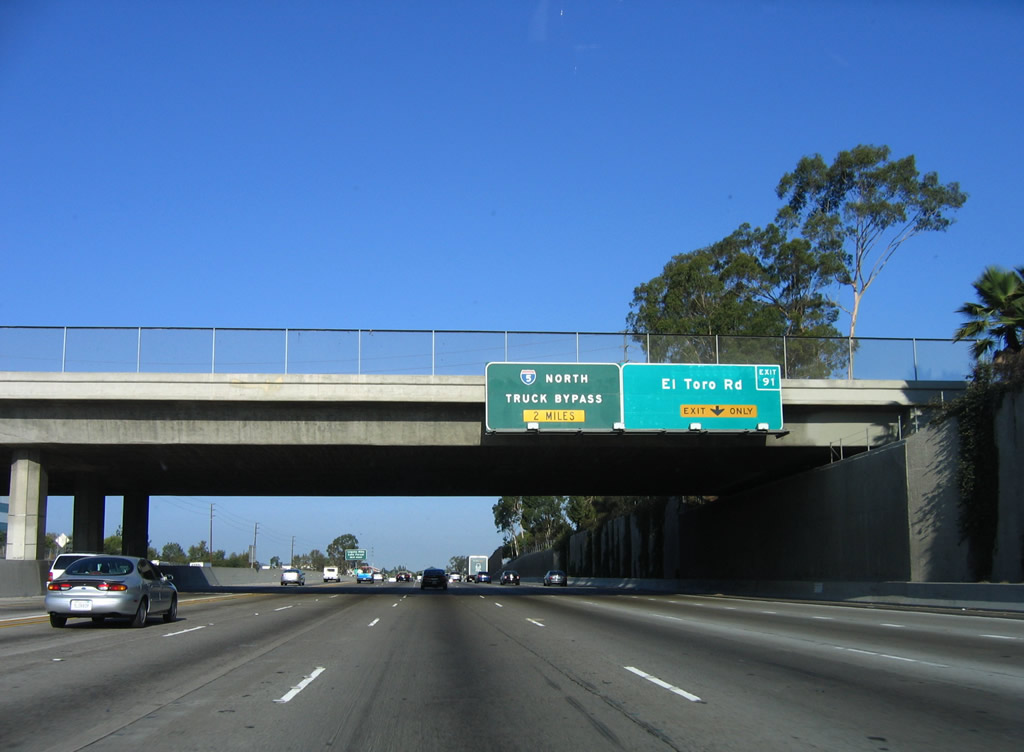
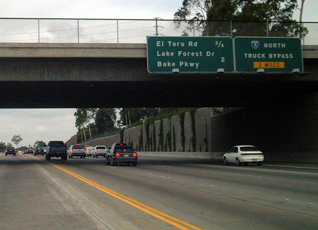
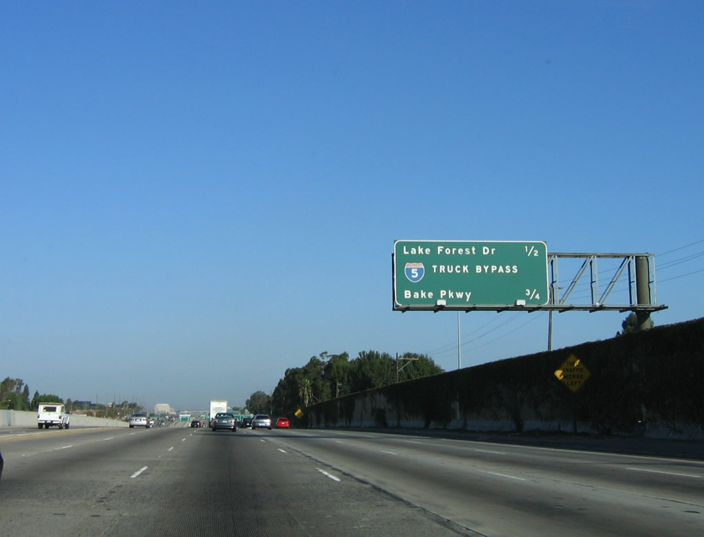
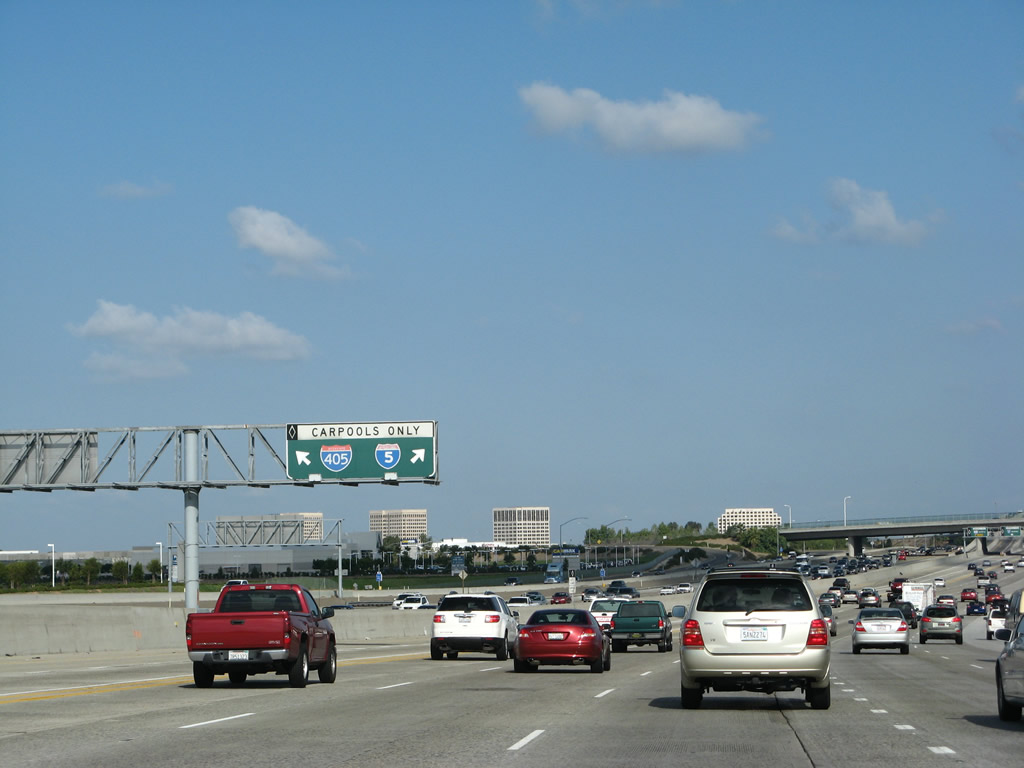
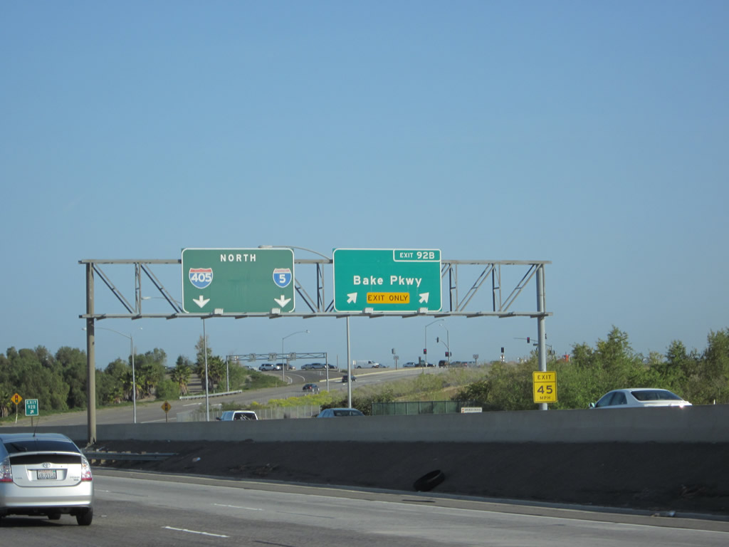
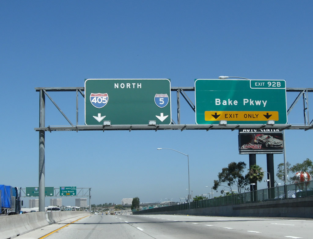
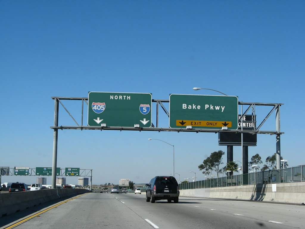
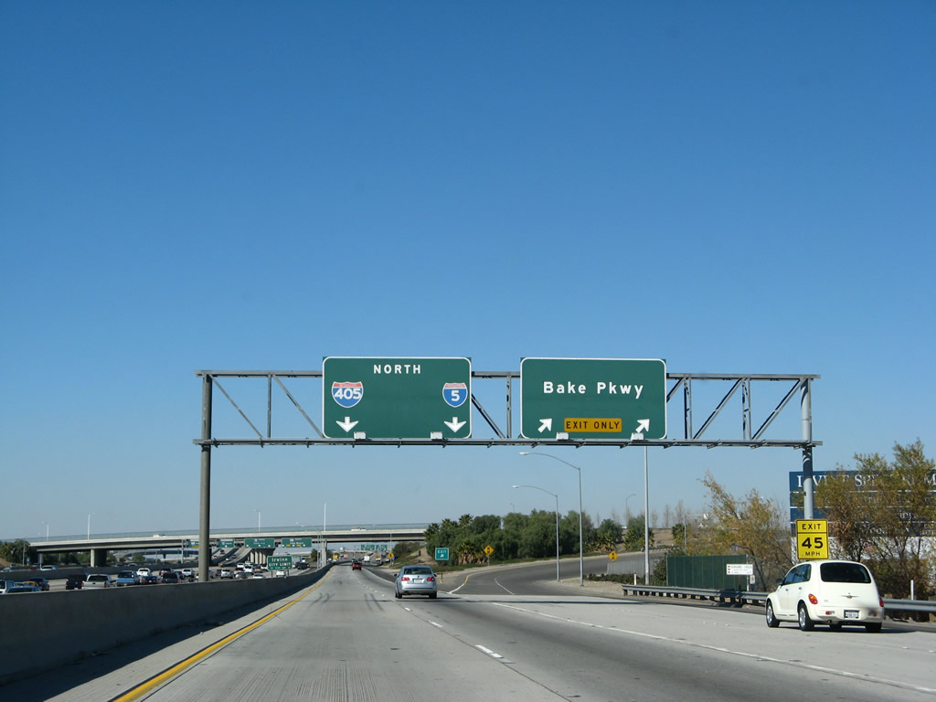
This mileage sign provides the distance to the next three exits: Exit 92A, Lake Forest Drive; Exit 92B, Bake Parkway; and Exit 94A, Interstate 405 (San Diego Freeway) north to Long Beach, Los Angeles International Airport, and Santa Monica. Photo taken 10/07/06. |
|
|
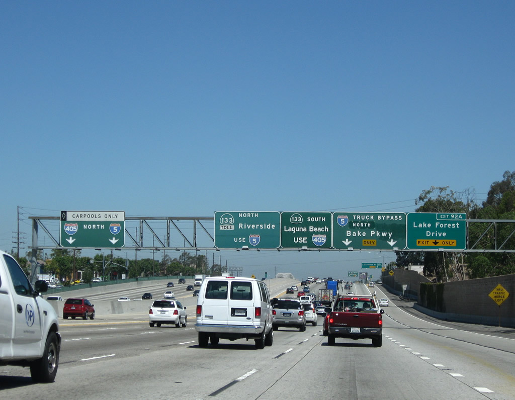
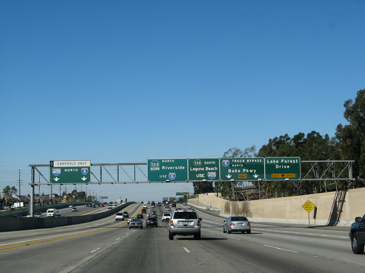
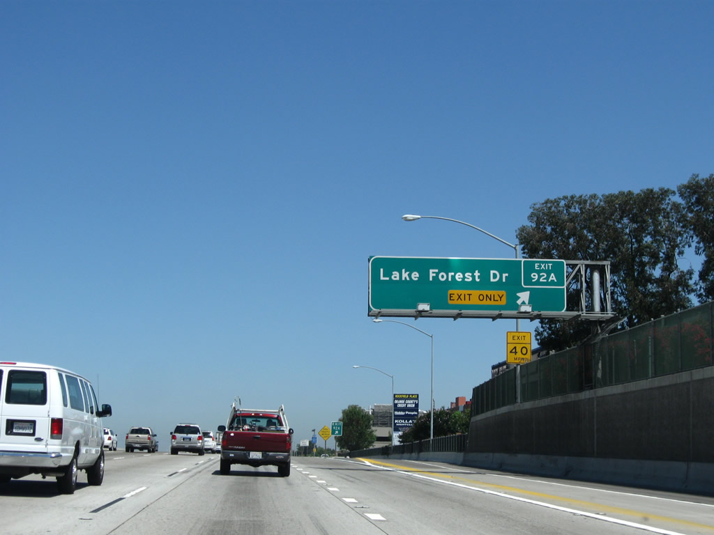
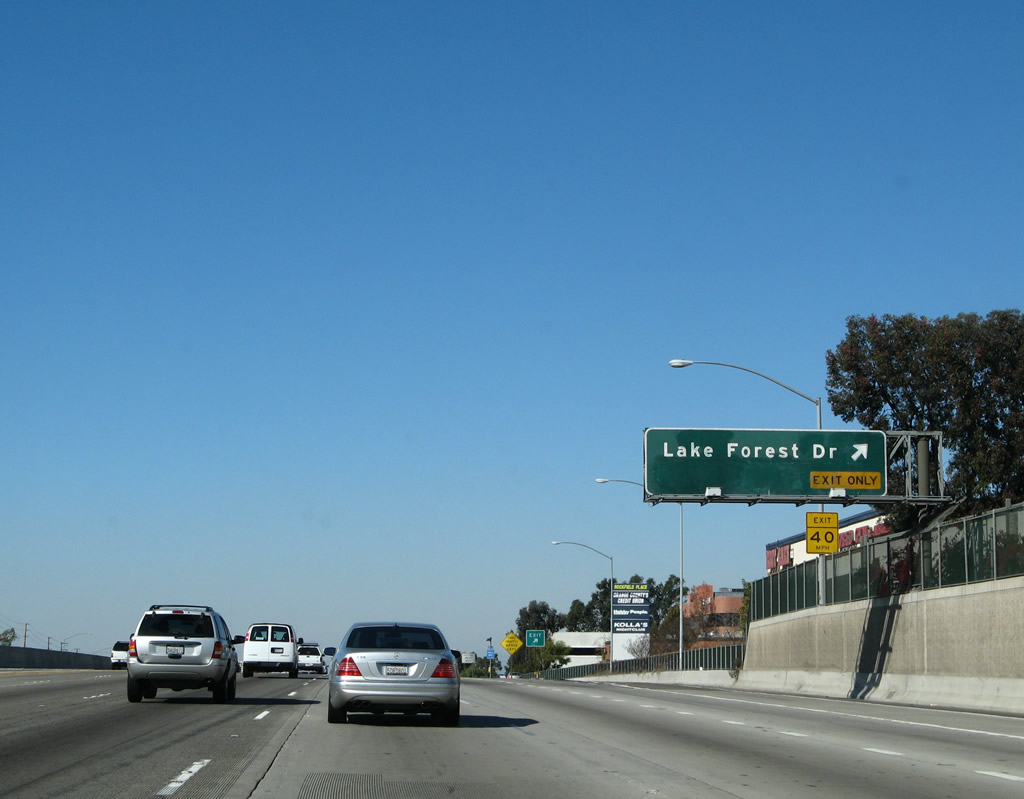
Use the right lane of northbound Interstate 5 (San Diego Freeway) to Exit 92A, Lake Forest Drive. This sign advises of the lane allocations for the other exits coming in the next couple of miles: Interstate 5 Truck Bypass north to Exit 92B, Bake Parkway and Exit 94A, Interstate 405. The middle two signs indicate the best route to California 133 (Laguna Freeway): For California 133 north, use Interstate 5 north; for California 133 south, use Interstate 405 north. At the far left of the sign bridge, the HOV lane sign indicates there is a direct connection to Interstate 405 north. So, there are a total of three different connectors to Interstate 405 north (from left to right): HOV lanes, main lanes, and truck bypass. An exit number was added here in between 2007 and 2009 for the Lake Forest Drive panel. Photos taken on 07/13/09 and 01/14/07. |
|
|
Northbound Interstate 5 (San Diego Freeway) reaches Exit 92A, Lake Forest Drive. After Exit 92A, Interstate 5 approaches the 5/405 merge, which is located in the vicinity of the former El Toro military base, which adjacent to the city of Irvine. El Toro had been considered for a new international airport until the early 2000s, but that was not approved by voters. Now redevelopment plans for the former base include conversion of portions of the base into a regional park, new housing, and other redevelopment. The former military base consists of the open space seen on the northeast side of the freeway. An exit number was added here in between 2007 and 2009. Photos taken 07/13/09 and 01/14/07. |
|
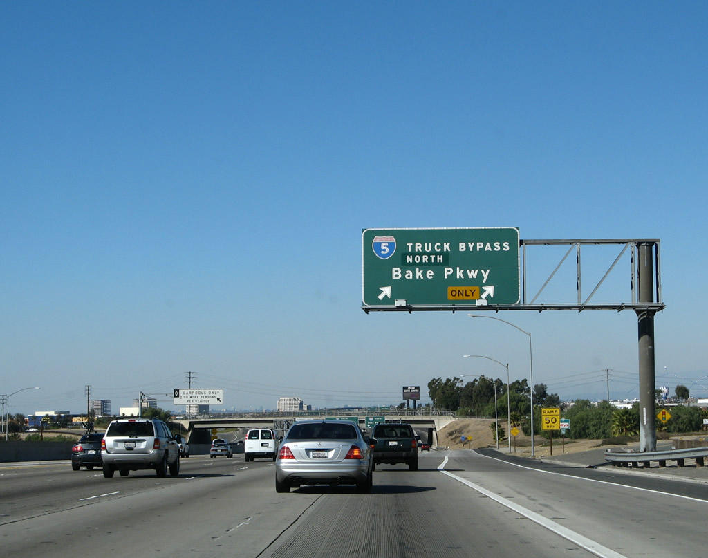
Immediately thereafter, Interstate 5 splits. The left six lanes continue north along the main lanes, while the right two lanes connect to the Truck Bypass. To Exit 92B (Bake Parkway), use the Interstate 5 Truck Bypass. All through/local trucks should use this exit to ensure an easier merge point onto both Interstate 5 north and Interstate 405 north. The separation of trucks and cars through the upcoming Interstate 5/405 interchange encourages traffic flow through the upcoming Interstate 405 interchange (Exit 94A). For photos of the truck bypass, see the truck bypass section below. Photo taken 01/14/07. |
|
|
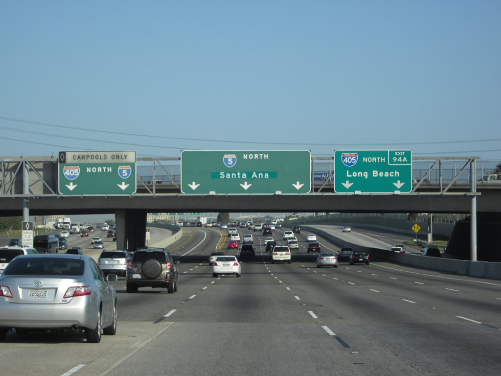
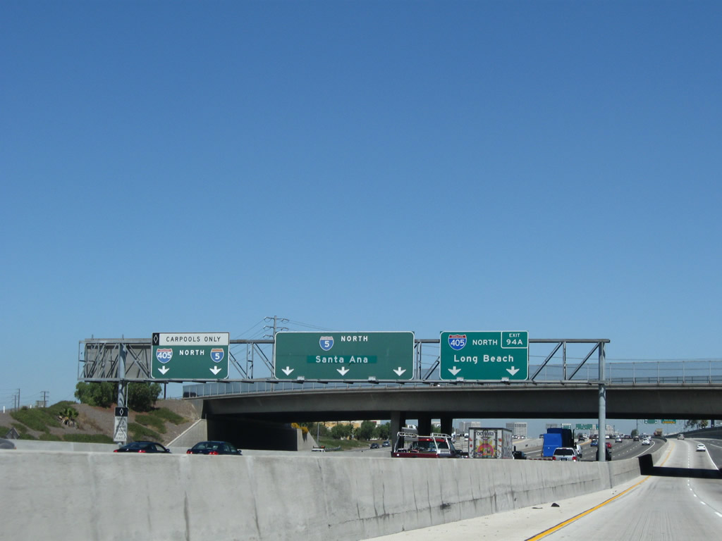
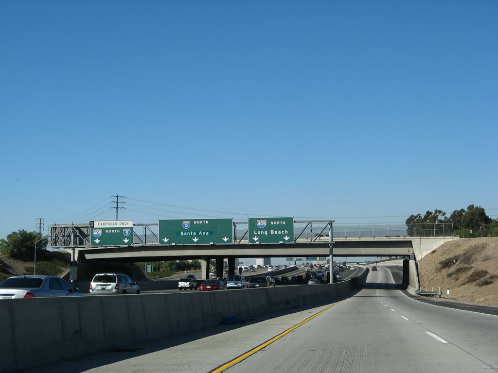
After the truck bypass departs, the main lanes of Interstate 5 approach Exit 94A, Interstate 405 (San Diego Freeway). This is widely considered to be one of the busiest interchanges in all of Southern California. It was expanded to its present configuration in the mid to late 1990s, but according to Casey Cooper, the interchange merge has only improved to a level of service "C." Having said that, the separation of trucks and automobiles at this location has improved traffic flow substantially. As part of this mega-interchange, the high occupancy vehicles (HOV) are allocated their own transition lane that leaves the left lane of Interstate 5 northbound and merges onto the left lane of Interstate 405 northbound. An exit number was added to this sign panel assembly around 2009. Photos taken 04/06/12 and 11/14/04. |
|
|
The right two lanes directly transition onto Interstate 405 north, while the left three main lanes continue north on Interstate 5. At this point, northbound Interstate 5 enters the city of Irvine. Home to 143,072 people as of the 2000 Census, Irvine has grown substantially as the city continues to develop. Incorporated on December 28, 1971, Irvine is mostly a master planned community and is home to the University of California at Irvine and the Irvine Spectrum Center nestled between Interstate 5 and Interstate 405. Photos taken 04/06/12 and 10/07/06. |
|
|
A dedicated ramp (from left lane to left lane) takes high occupancy vehicle (HOV) and carpool traffic from the northbound HOV lane directly onto the northbound Interstate 405 HOV lane. Photos taken on 04/06/12 and 10/07/06. |
|
This view shows the off-ramp to Exit 92B, Bake Parkway, on the Truck Bypass as seen from the main lanes of Interstate 5. See below for a view of this sign from the Truck Bypass itself. Photo taken 04/06/12. |
|
|
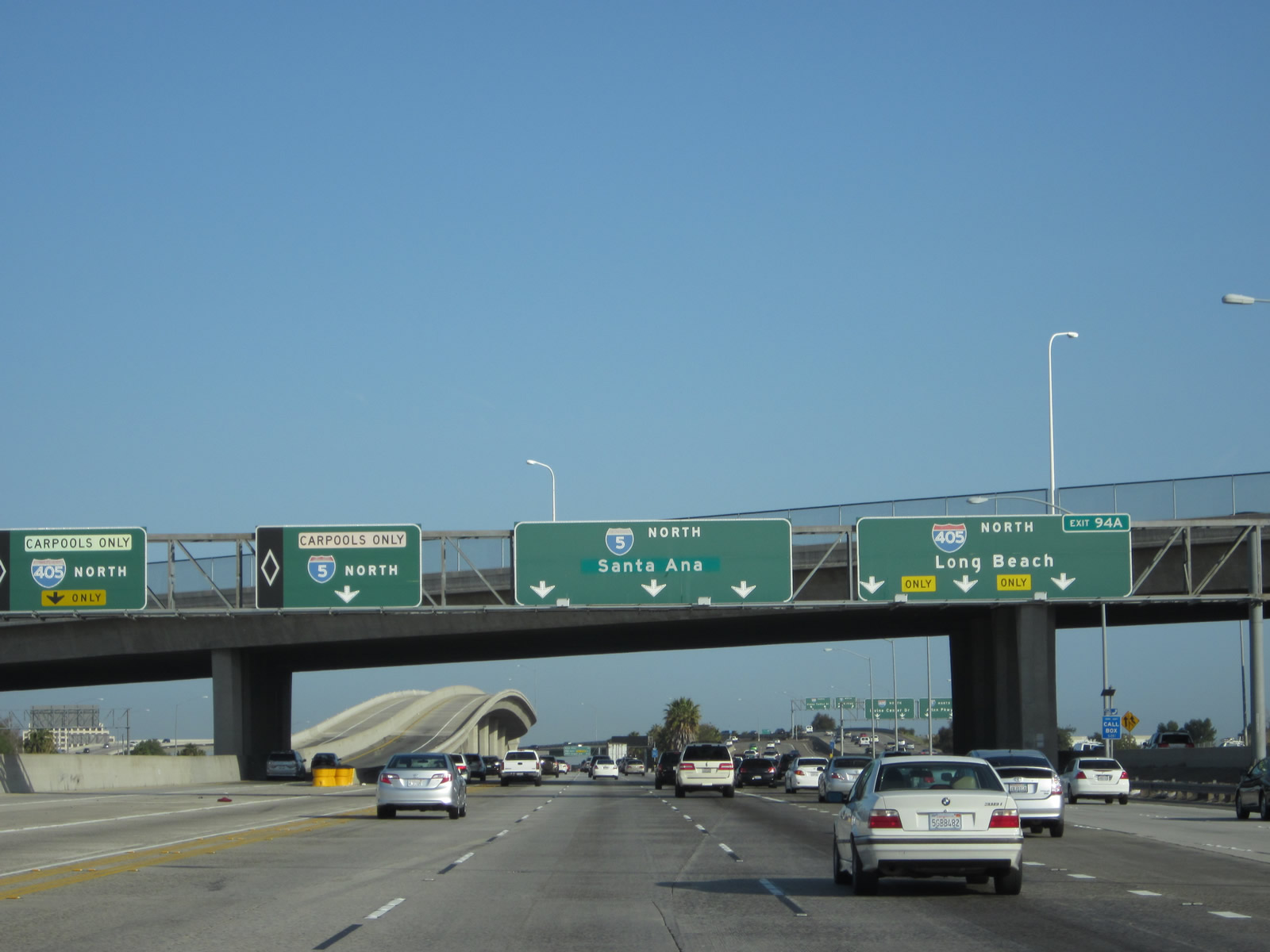
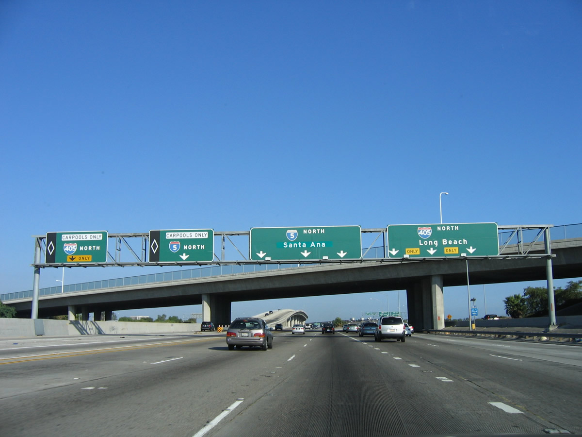
Soon thereafter, Interstate 5 and Interstate 405 split at Exit 94A. This interchange marks the southern terminus of Interstate 405. In terms of naming convention, the San Diego Freeway shifts from Interstate 5 northbound onto Interstate 405 northbound. The Santa Ana Freeway begins its northward journey toward downtown Los Angeles from this point. An exit number tab was embedded on the older exit sign for Interstate 405 around 2009. Photos taken 04/06/12 and 10/07/06. |
|
This view shows the three connections from Interstate 5 north to Interstate 405 north, including the HOV direct connection ramp, the Interstate 5 main lanes, the Interstate 405 ramp, and the truck bypass. Photo taken 10/07/06. |
|
As the main lanes of Interstate 5 north pass under the Interstate 405 transition ramp, a mileage sign provides the distance to the next three exits: Exit 94B, Alton Parkway; Exit 95, California 133 (Eastern Transportation Corridor) Toll Road north to Riverside; and Exit 96, Sand Canyon Avenue. Photo taken 10/07/06. |
|
Traffic from the Truck Bypass merges back onto the main lanes of Interstate 5 at this point. Ahead, Interstate 5 will proceed northwest toward Santa Ana and Los Angeles via the Santa Ana Freeway. Continue reading below to follow the Truck Bypass through the Interstate 405 interchange. Photo taken 04/06/12. |
| Interstate 5 - Truck Bypass north |
|
|
Now looking at the truck bypass, this series of photos follows the bypass as the freeway approaches Bake Parkway and Interstate 405. Signage for the main lanes are readily visible in the truck bypass lanes. Photos taken 07/13/09 and 01/14/07. |
|
|
Interstate 5 is essentially split now between the local/truck lanes (shown here), the express lanes (to the left), and the high occupancy vehicle lanes (far left), which creates one very wide freeway! The left two lanes continue north to Interstate 405 and Interstate 5, while the right two lanes connect to Exit 92B, Bake Parkway. Exit numbers have since been added to the Bake Parkway signs. Photos taken 07/13/09 and 01/14/07. |
|
|
Northbound Interstate 5 Truck Bypass splits with Bake Parkway at Exit 92B. The left two lanes connect to Interstate 5 and Interstate 405, while the right two lanes depart here. Photos taken 07/13/09 and 01/14/07. |
|
Interstate 5 enters the city of Irvine. Photo taken 01/14/07. |
|
This view shows the cornucopia of signs on the main lanes, while the truck bypass prepares to split between Interstate 5 (Santa Ana Freeway) and Interstate 405 (San Diego Freeway). Photo taken 01/14/07. |
|
Immediately thereafter, Interstate 5 and Interstate 405 prepare to split. Between the HOV lanes, main lanes, and truck bypass, there are three separate ramps that connect from northbound Interstate 5 to northbound Interstate 405! Photo taken 07/13/09. |
|
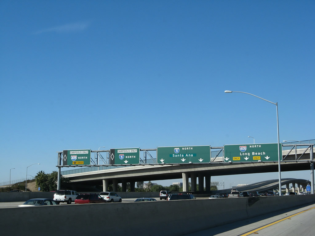
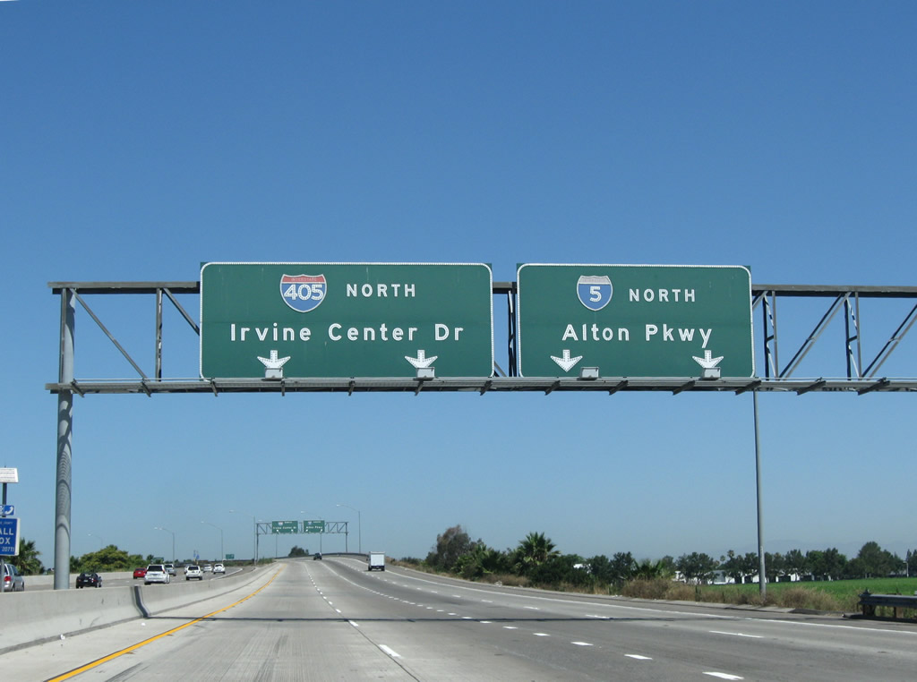
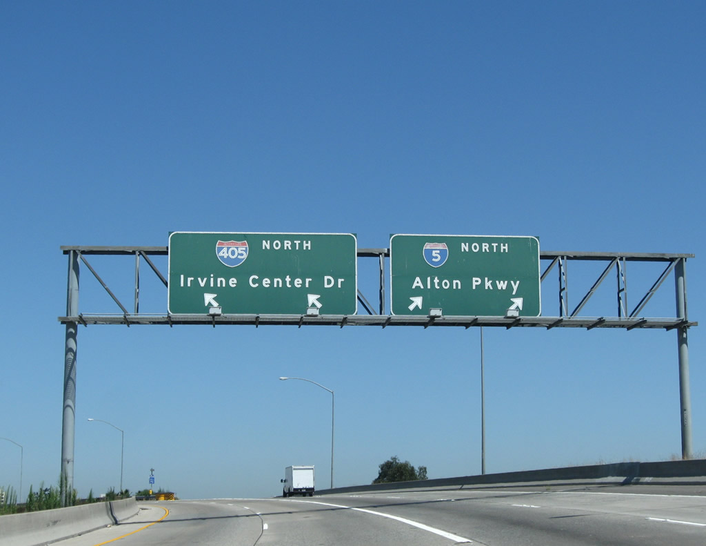
Interstate 5 (Santa Ana Freeway) and Interstate 405 (San Diego Freeway) (Exit 94A) split here. Note that the overhead signs also indicate the next surface street exit (Irvine Center Road/Exit 1 for northbound Interstate 405 and Alton Parkway/Exit 94B for Interstate 5). Also note that there is another, smaller city of Irvine sign located here. Photo taken 07/13/09. |
|
After the Interstate 405 split, the truck bypass merges back onto the Interstate 5 mainline at this merge point. Ahead, Interstate 5 proceeds into central Orange County en route to the county seat, Santa Ana. Photo taken 04/18/04. |
Page Updated September 13, 2012.