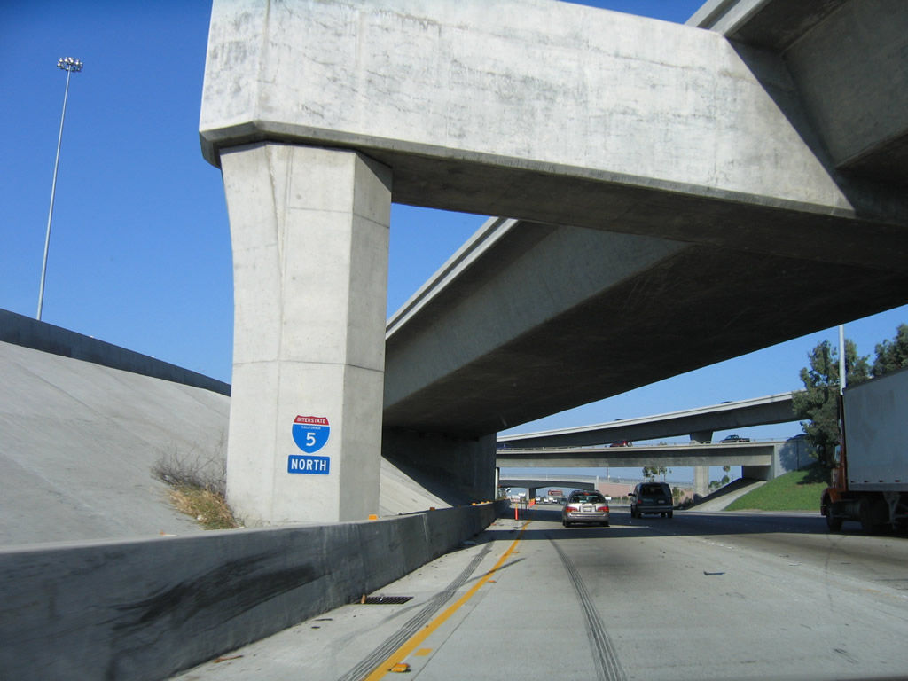
| Interstate 5 north |
|
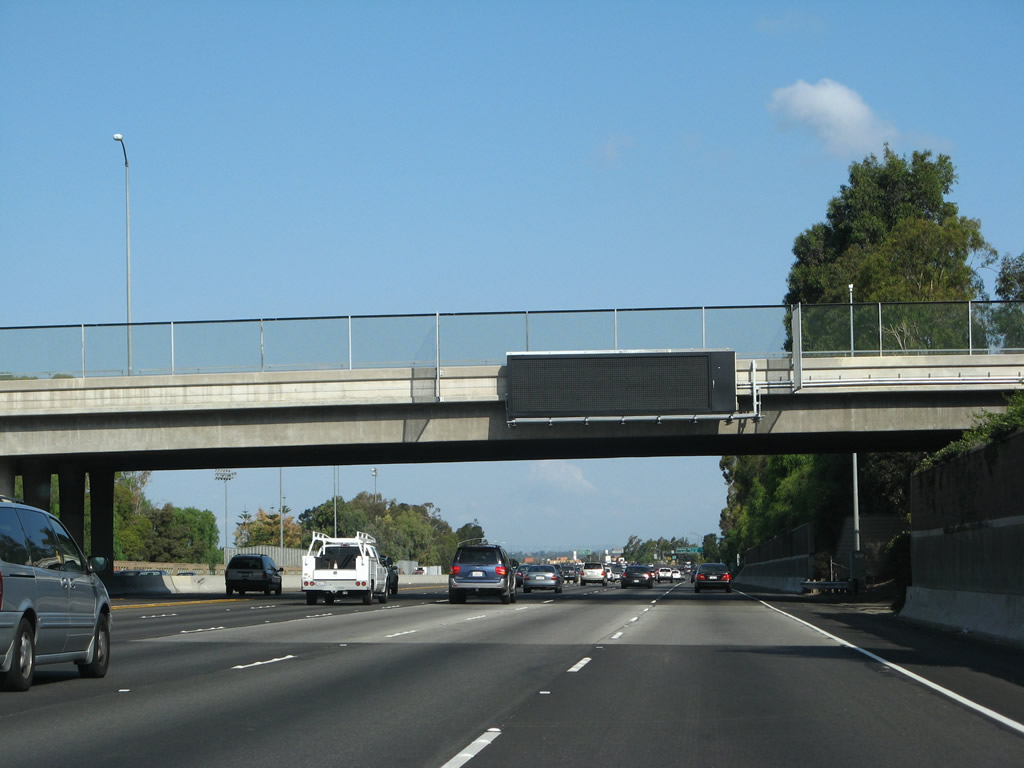
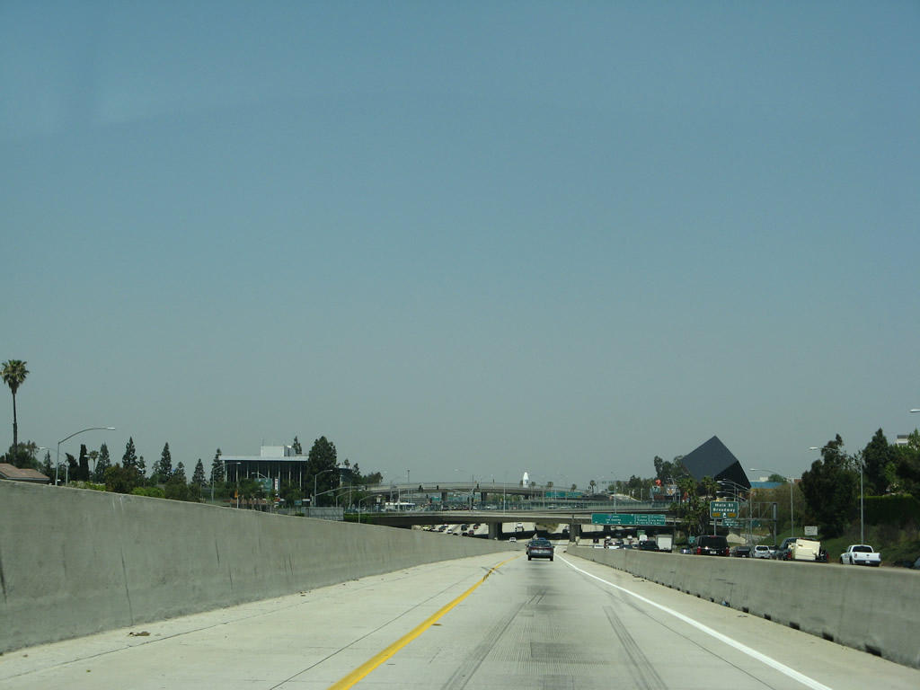
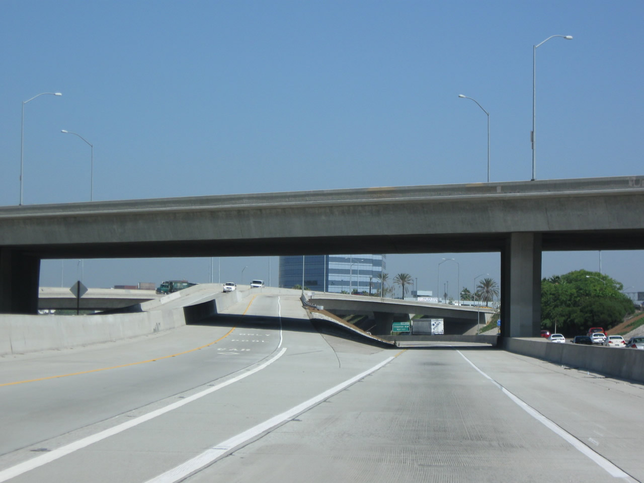
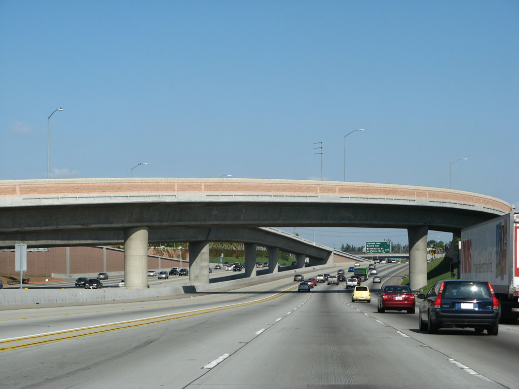
As the main lanes of Interstate 5 north pass under the Interstate 405 transition ramp, a mileage sign provides the distance to the next three exits: Exit 94B, Alton Parkway; Exit 95, California 133 (Eastern Transportation Corridor) Toll Road north to Riverside; and Exit 96, Sand Canyon Avenue. Photo taken 10/07/06. |
|
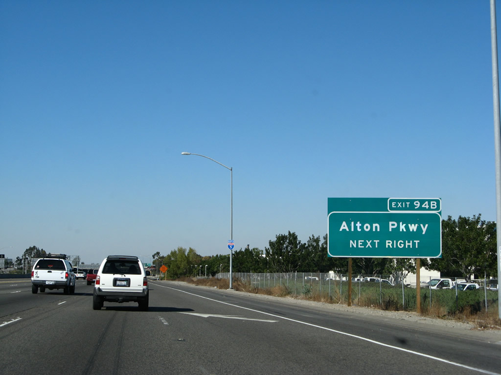
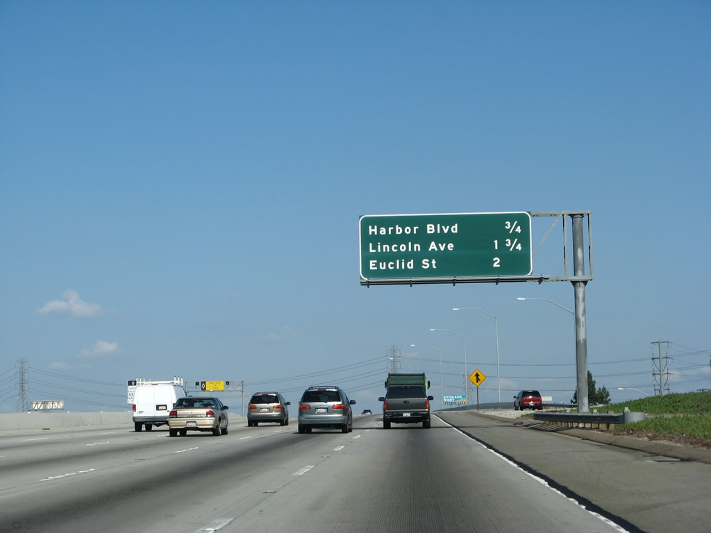
The next exit along Interstate 5 (Santa Ana Freeway) north is Exit 94B, Alton Parkway. This roadside sign is posted at the end of the truck bypass lanes prior to the off-ramp. Photo taken 01/14/07. |
|
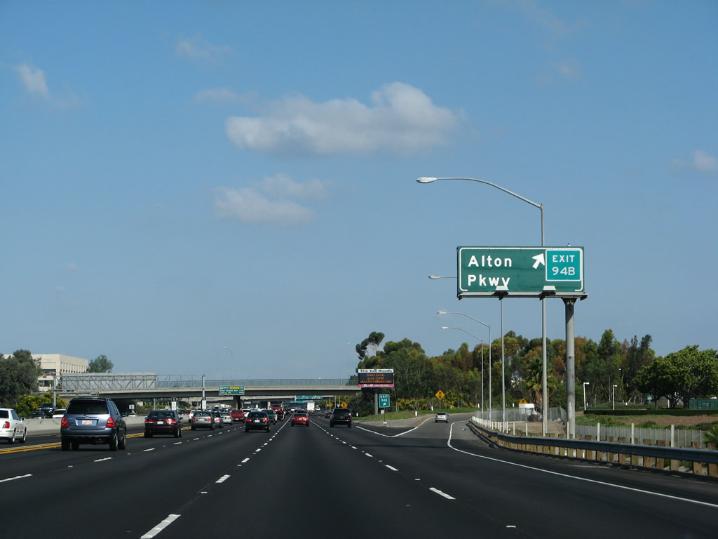
Northbound Interstate 5 (Santa Ana Freeway) reaches Exit 94B, Alton Parkway. This exit serves the city of Irvine and connects to the former Marine Corps Air Station El Toro, which was decommissioned in 1999. Photo taken 09/29/07. |
|
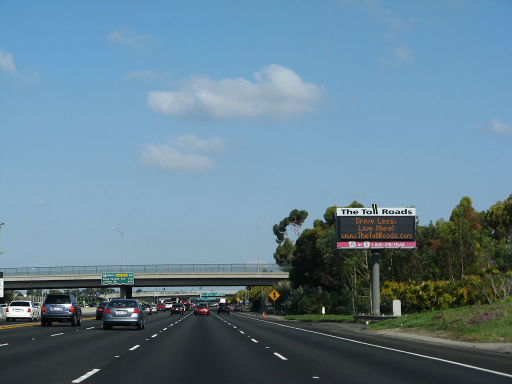
A variable message sign for the Orange County toll road system is posted after Exit 95. Both Exit 95 and Exit 100 (Jamboree Road) connect to the Orange County Toll Road network. Photo taken 09/29/07. |
|
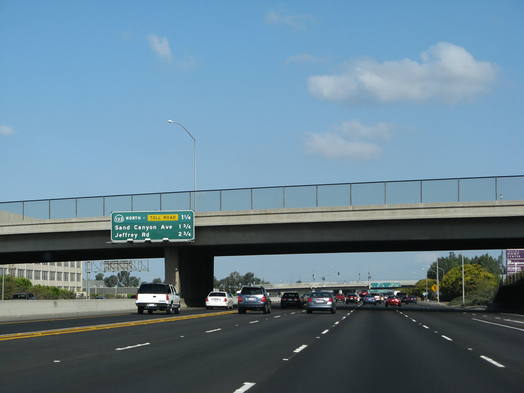
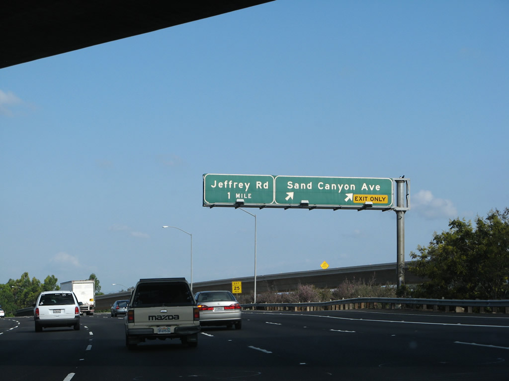
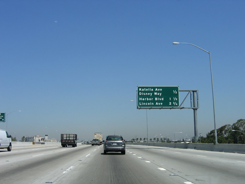
This mileage sign along Interstate 5 (Santa Ana Freeway) north provides the distance to the next three exits: Exit 95, California 133 (Eastern Transportation Corridor) Toll Road north to Riverside (there is no connection to California 133 south to Laguna Beach); Exit 96, Sand Canyon Avenue; and Exit 97, Jeffrey Road. Photo taken 09/29/07. |
|
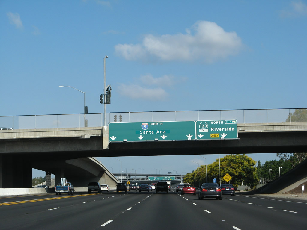
A set of overheads for Interstate 5 north to Santa Ana and Los Angeles is placed side by side with the advance sign for Exit 95, California 133 (Eastern Transportation Corridor) Toll Road north to Riverside. This sign is mounted on the Barranca Parkway overpass. California 133 itself does not travel all the way to Riverside; instead, the toll road connects to California 241, which in turn connects to California 91 (Riverside Freeway) east to Riverside and San Bernardino. A high-occupancy vehicle on-ramp connects Barranca Parkway onto the HOV lane. Photo taken 09/29/07. |
|
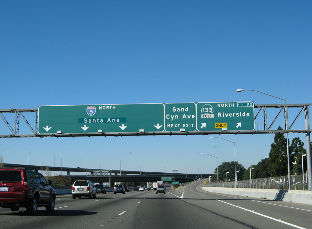
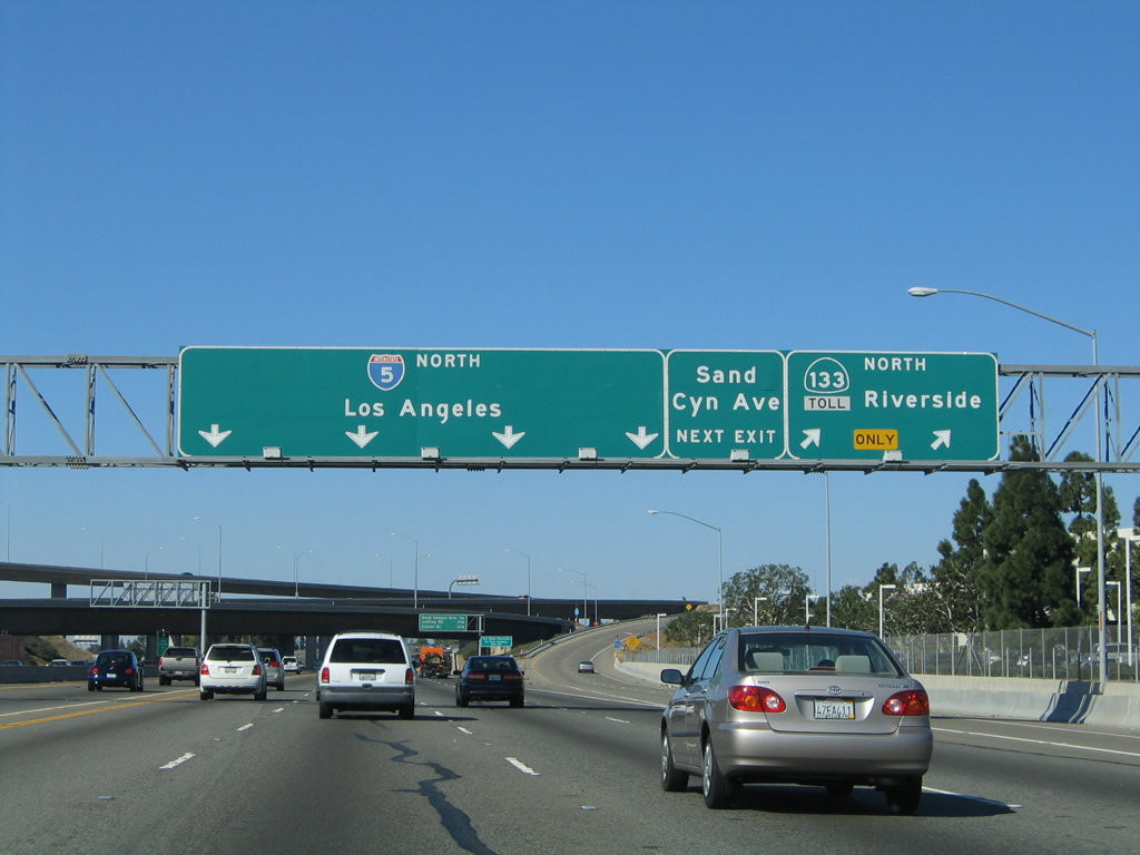
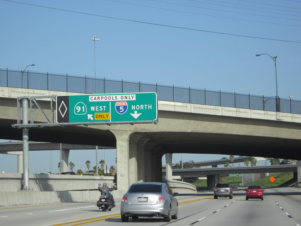
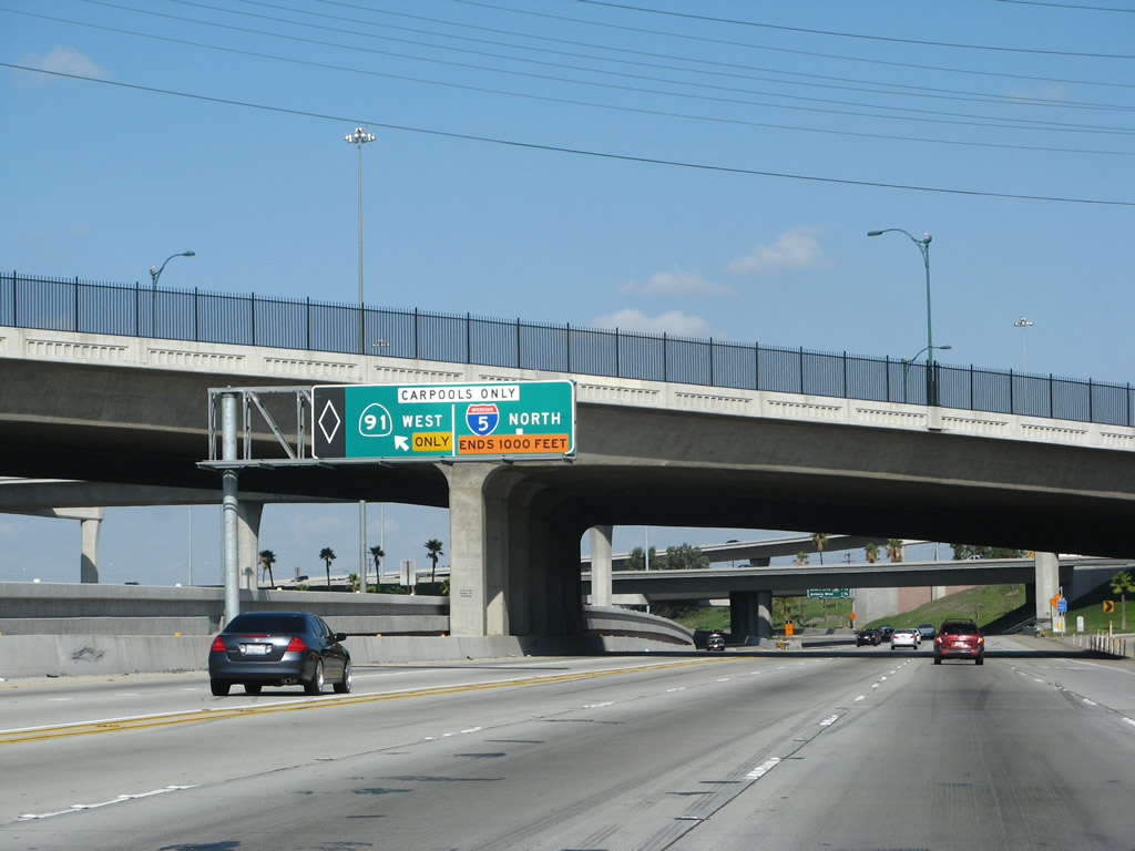
Northbound Interstate 5 reaches Exit 95, California 133 (Eastern Transportation Corridor) Toll Road. California 133 starts in Laguna Beach as a conventional highway, but it becomes an expressway after crossing under California 73 and eventually changes into the Laguna Freeway in Irvine on the approach to Interstate 405 (San Diego Freeway). North of Interstate 5, California 133 shifts directly onto the toll road, and California 133 ends at California 241 (Foothill Transportation Corridor) a few miles north of this interchange. The next exit on Interstate 5 (Santa Ana Freeway) north after Exit 95, California 133 north is Exit 96, Sand Canyon Road. Sand Canyon Road parallels California 133 northbound between Interstate 5 and Portola Parkway. Between 2004 and 2007, note the changes to the control city and addition of an exit number. Photos taken 01/14/07 and 04/18/04. |
|
|
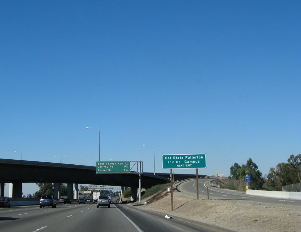
Use Exit 96 (Sand Canyon Avenue) to the Irvine satellite campus of California State University - Fullerton. Photo taken 01/14/07. |
|
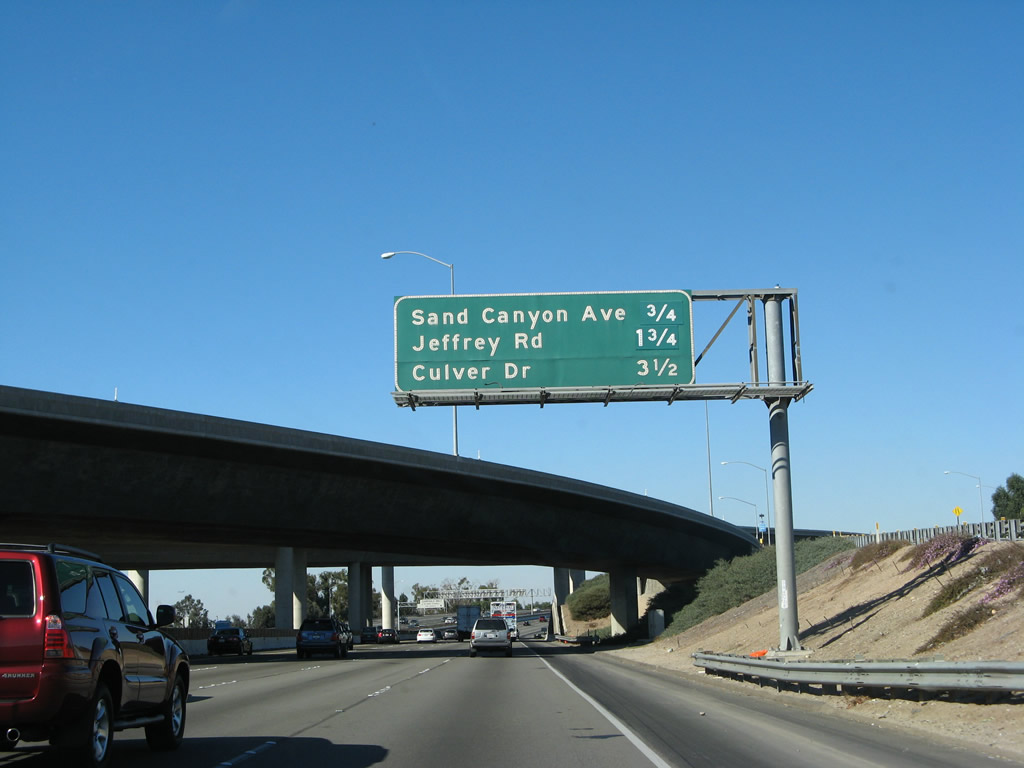
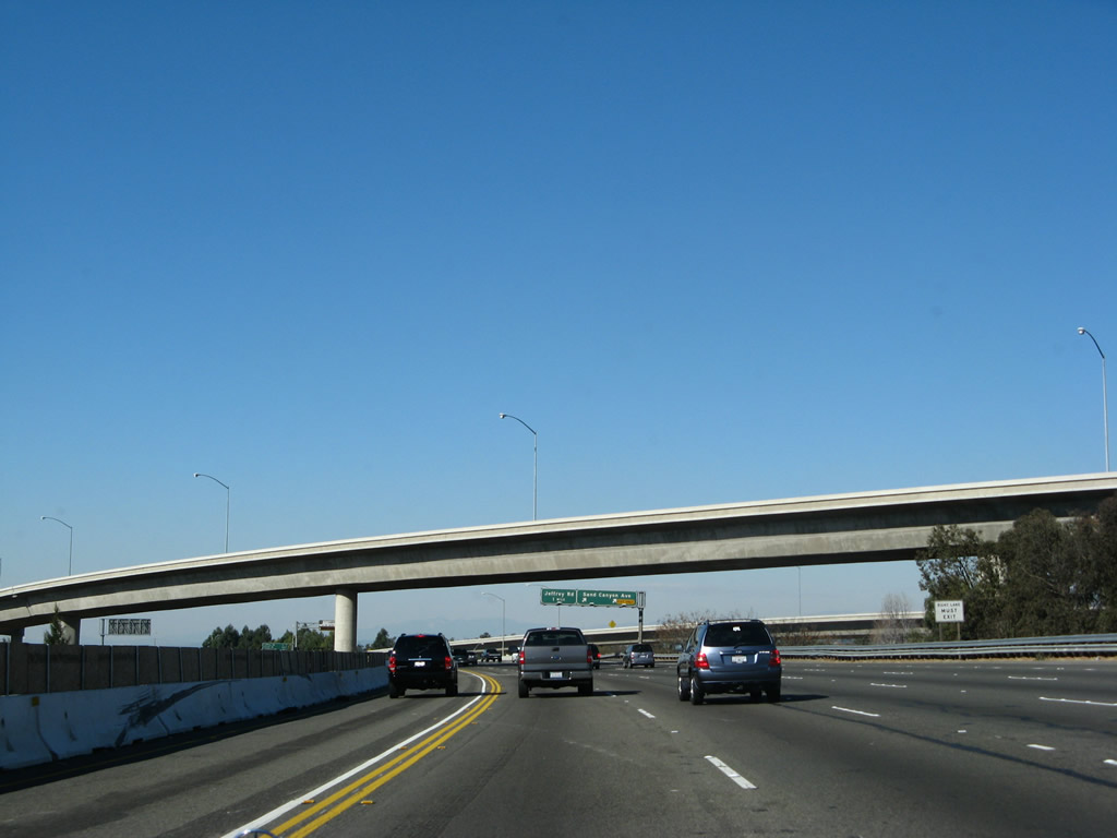
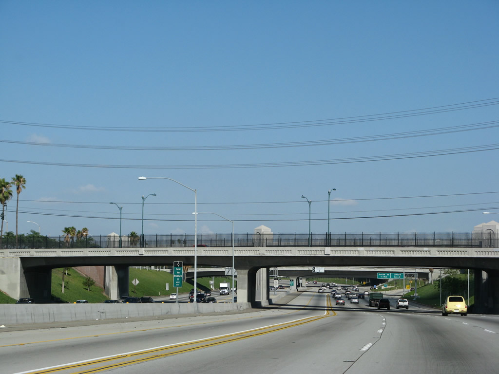
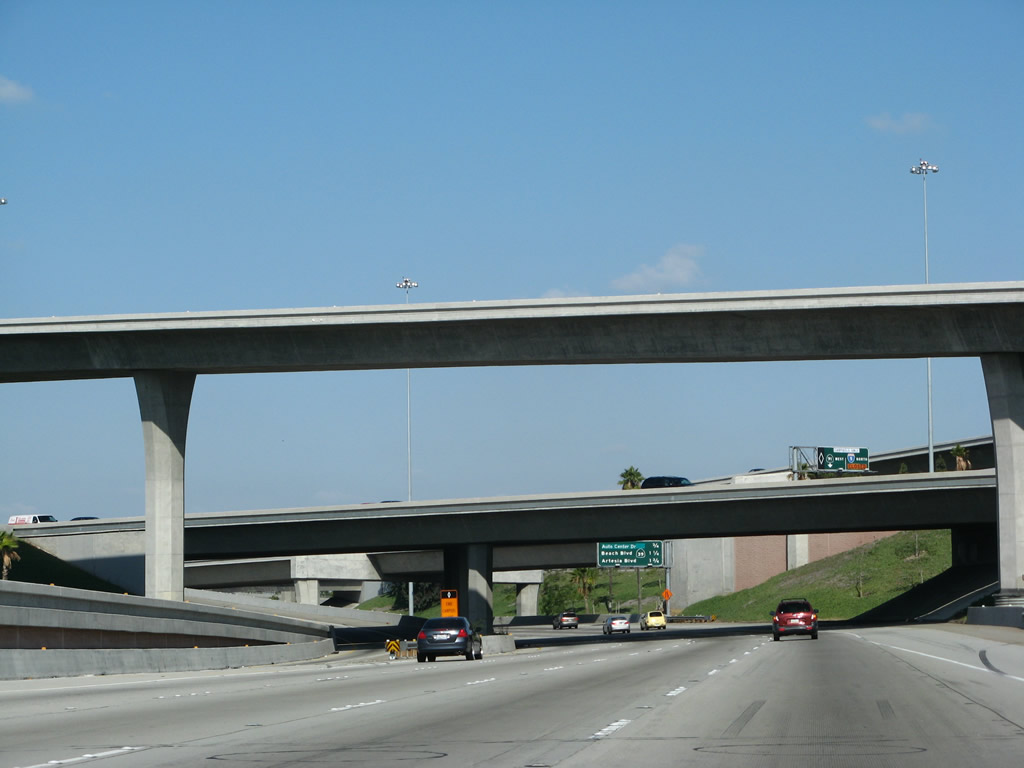
This mileage sign along Interstate 5 (Santa Ana Freeway) north provides the distance to the next three exits: Exit 96, Sand Canyon Avenue; Exit 97, Jeffrey Road; and Exit 99, Culver Drive. The overpass in the background carries California 133 (Eastern Transportation Corridor) traffic over Interstate 5. Photo taken 01/14/07. |
|
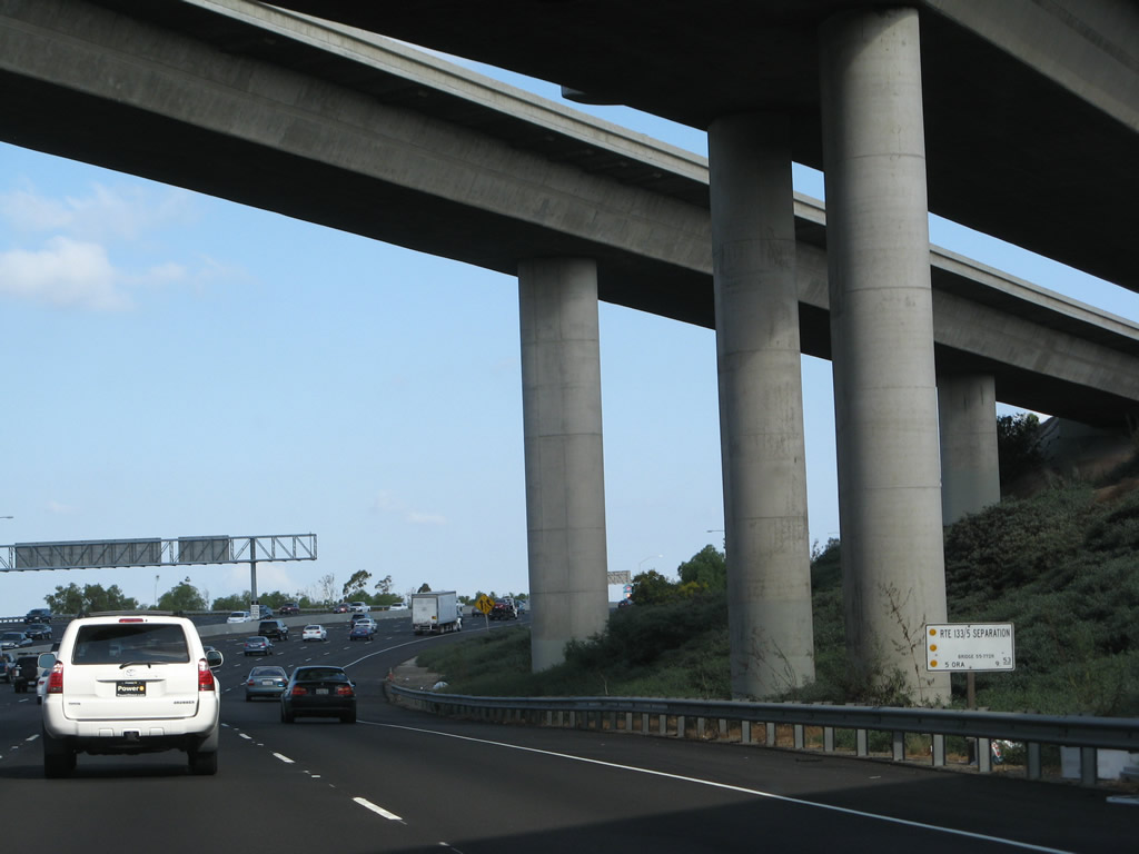
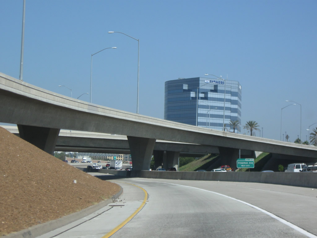
The Route 5 and Route 133 Separation structure sign is posted at the foot of the bridge. Photo taken 09/29/07. |
|
The right two lanes of Interstate 5 north will connect to Exit 96, Sand Canyon Avenue. Photo taken 09/29/07. |
|
This flyover ramp connects Interstate 5 south with California 133 north. Photo taken 01/14/07. |
|
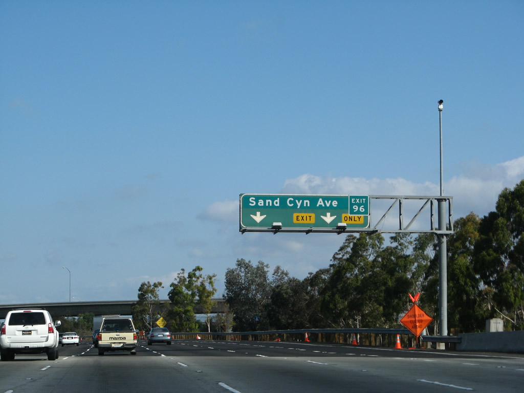
Northbound Interstate 5 (Santa Ana Freeway) reaches Exit 96, Sand Canyon Avenue. The next exit is Exit 97, Jeffrey Road. Photo taken 09/29/07. |
|
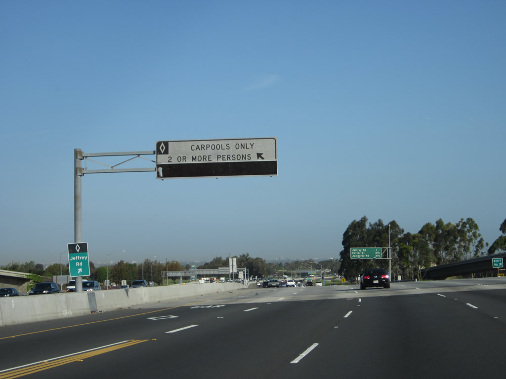
A left lane access point connects to the high occupancy carpool lane. Photo taken 04/06/12. |
|
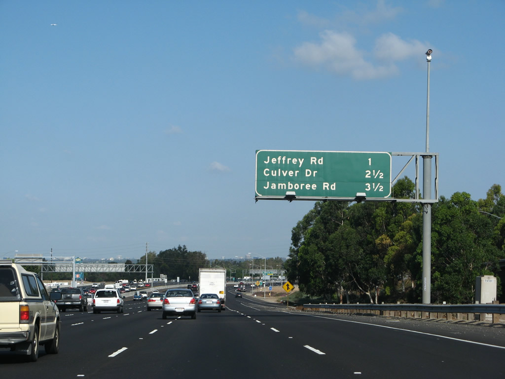
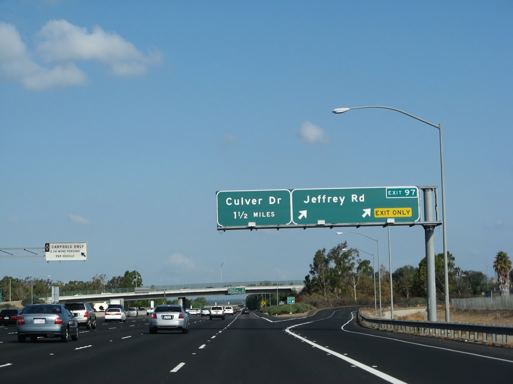
This mileage sign along Interstate 5 (Santa Ana Freeway) north provides the distance to the next three exits: Exit 97, Jeffrey Road; Exit 99, Culver Drive; and Exit 100, Jamboree Road. Photo taken 09/29/07. |
|
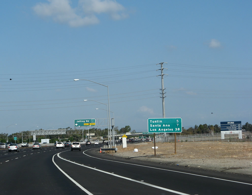
A second mileage sign provides the distance to Tustin (five miles), Santa Ana (seven miles), and Los Angeles (38 miles). Photo taken 09/29/07. |
|
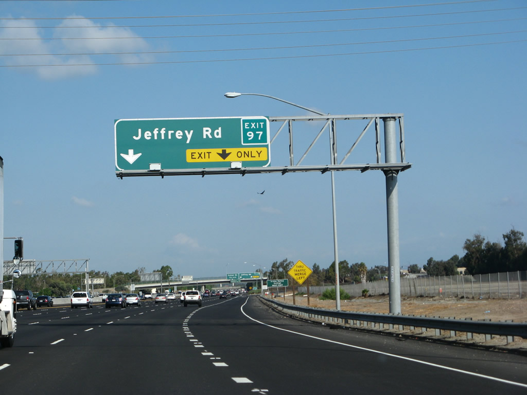
The right two lanes of Interstate 5 north will connect to Exit 97, Jeffrey Road. Photo taken 09/29/07. |
|
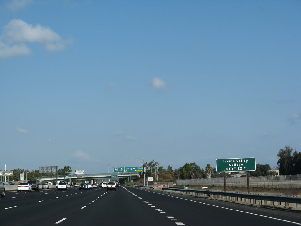
Exit 97 also serves the city of Irvine; follow Jeffrey Road southwest to Irvine Valley College and Interstate 405 Exit 4. Photo taken 09/29/07. |
|
Northbound Interstate 5 (Santa Ana Freeway) reaches Exit 97, Jeffrey Road. The next exit along northbound is Exit 99, Culver Drive. Photo taken 09/29/07. |
|
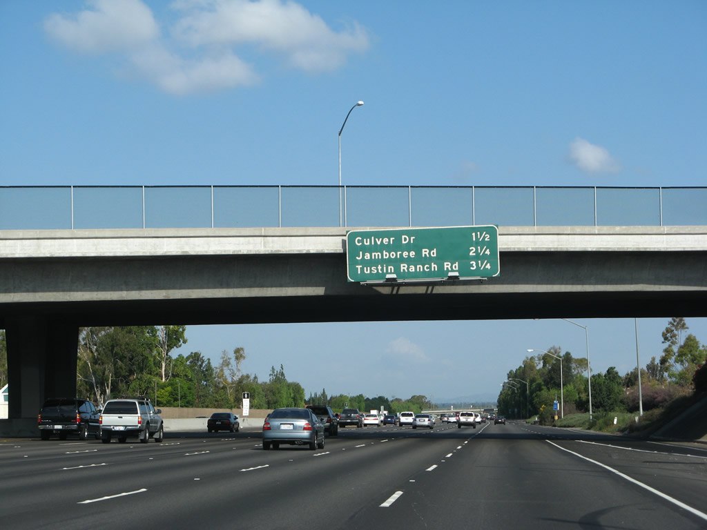
This mileage sign along Interstate 5 (Santa Ana Freeway) north provides the distance to the next three exits: Exit 99, Culver Drive; Exit 100, Jamboree Road to California 261; and Exit 101A, Tustin Ranch Road. Photo taken 09/29/07. |
|
As Interstate 5 passes under Yale Avenue in Irvine, a variable message sign is posted on the overpass. Photo taken 09/29/07. |
|
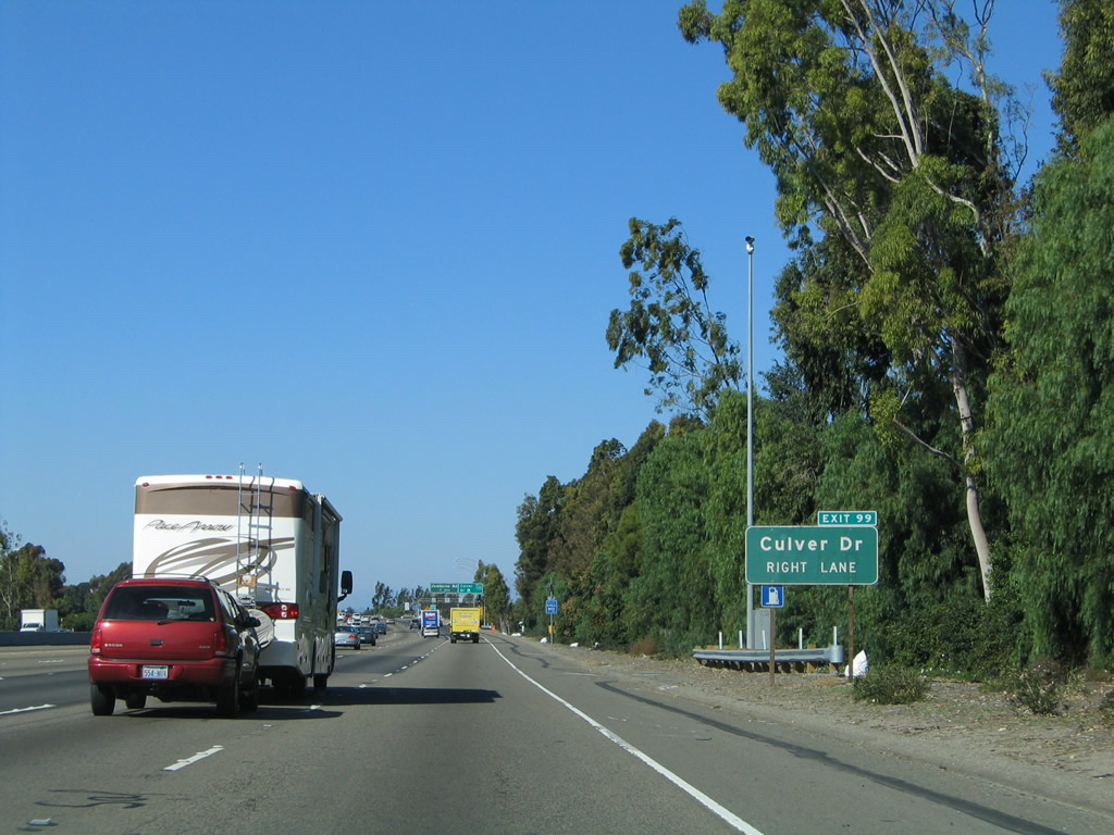
The first exit number posted in Orange County is this roadside sign prior to Exit 99, Culver Drive. Photo taken 11/14/04. |
|
Northbound Interstate 5 (Santa Ana Freeway) reaches Exit 99, Culver Drive. Like many arterial roadways in Irvine, Culver Drive travels in a northeast-southwest direction through the city. The exit sign was replaced in late 2003 to include an exit number. Photo taken 11/14/04. |
|
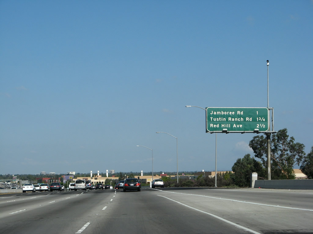
This mileage sign along Interstate 5 (Santa Ana Freeway) north provides the distance to the next three exits: Exit 100, Jamboree Road to California 261; Exit 101A, Tustin Ranch Road; and Exit 101B, Red Hill Avenue. Exit 100 is the final city of Irvine interchange; Exits 101A and 101B both serve the city of Tustin. Photo taken 09/29/07. |
|
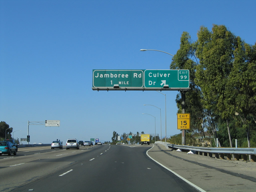
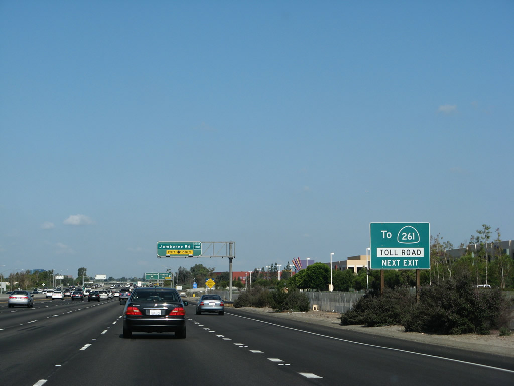
Only a single roadside sign advises that via Exit 100, northeastbound Jamboree Road connects to California 261. The state route designation is reserved only for the toll section of the Eastern Transportation Corridor that connects Irvine with California 241. However, most of Jamboree Road between Interstate 405 and the beginning of California 261 is an expressway. Photo taken 09/29/07. |
|
Jamboree Road is a major divided highway that separates Irvine from Tustin on a southwest to northeast trajectory. Jamboree Road begins at California 1 (Pacific Coast Highway) in Newport Beach, then connects with Interstate 405 Exit 7 and Interstate 5 Exit 100 before transitioning directly into California 261/Orange County Toll Road System. Use Jamboree Road north to reach California 261 north, which connects with California 241 en route to a junction with California 91 in Yorba Linda. In effect, California 261/241 act as an alternative to California 55. Photo taken 09/29/07. |
|
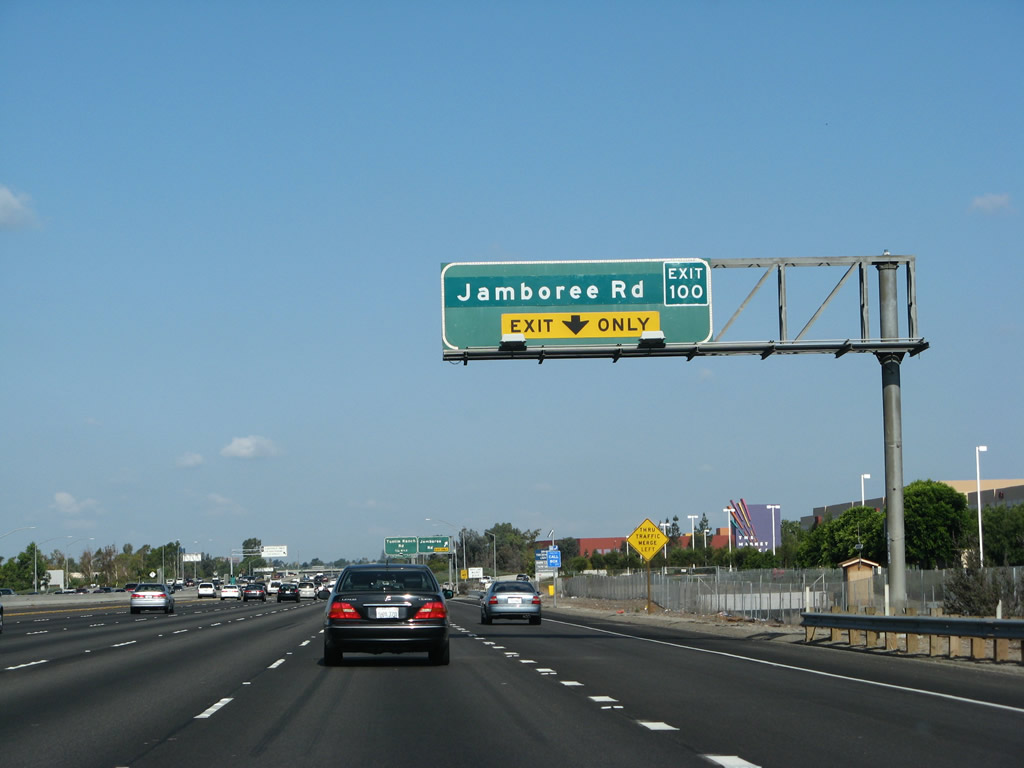
Northbound Interstate 5 (Santa Ana Freeway) reaches Exit 100, Jamboree Road to California 261. The next exit along northbound is Exit 101A, Tustin Ranch Road in the city of Tustin. Photo taken 09/29/07. |
|
This mileage sign along Interstate 5 (Santa Ana Freeway) north provides the distance to the next four exits: Exit 101A, Tustin Ranch Road; Exit 101B, Red Hill Avenue; and Exits 103A-B, California 55 (Costa Mesa Freeway) north to Riverside and south to Costa Mesa and Newport Beach. Photo taken 09/29/07. |
|
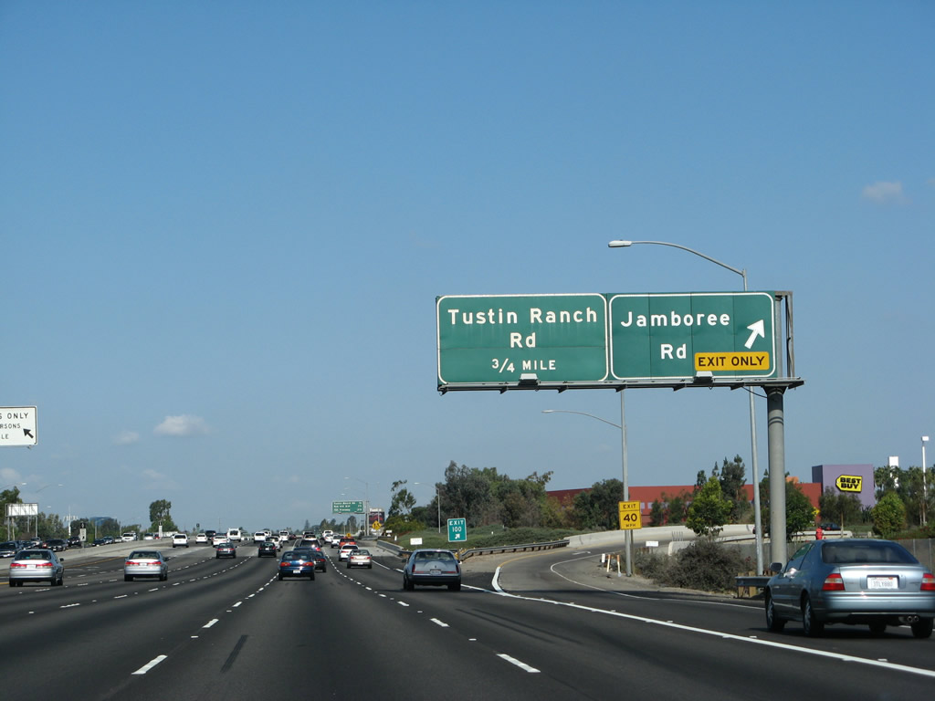
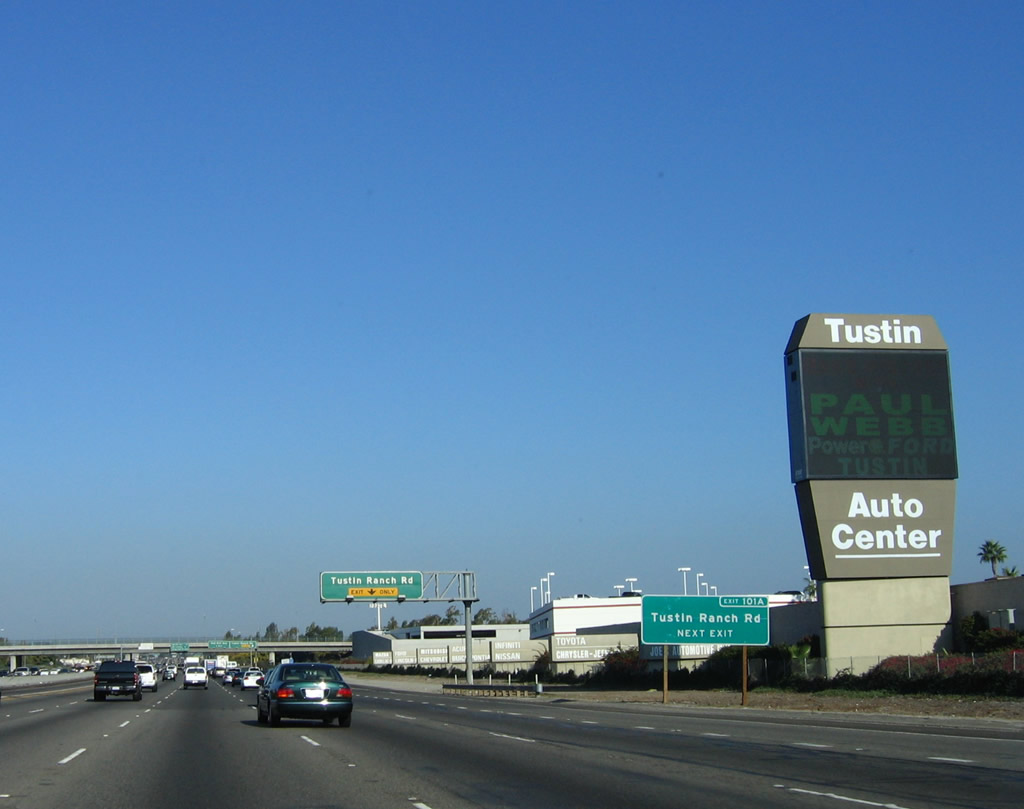
A roadside exit number sign posted sometime between 2004 and 2006 is posted along Interstate 5 (Santa Ana Freeway) north for Exit 101A, Tustin Ranch Road. Interstate 5 leaves the city of Irvine and enters the city of Tustin "Community Trees History Future". Tustin incorporated in 1927, consists of 11.4 square miles, and was home to 67,504 people as of the 2000 Census. Photo taken 09/29/07. |
|
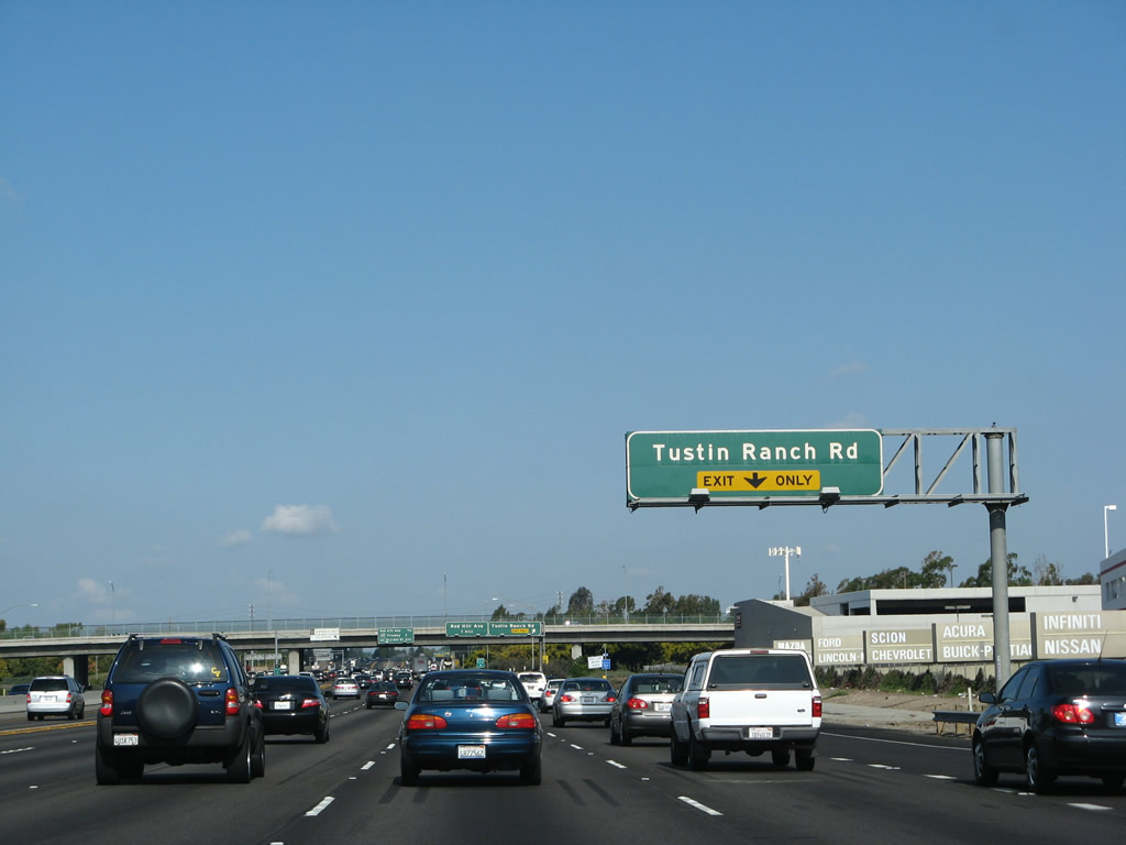
The right lane becomes exit only for Exit 101A, Tustin Ranch Road. The left five lanes (including high occupancy vehicle lane) continue north on Interstate 5 toward Santa Ana. Photo taken 09/29/07. |
|
Northbound Interstate 5 (Santa Ana Freeway) reaches Exit 101A, Tustin Ranch Road. The next exit along northbound is Exit 101B, Red Hill Avenue. Exits 101A, 101B, and 103A all serve the city of Tustin. Photo taken 09/29/07. |
|
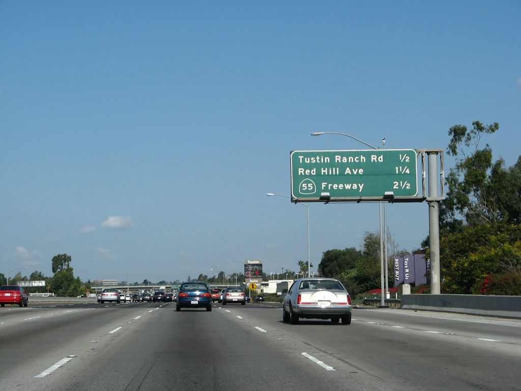
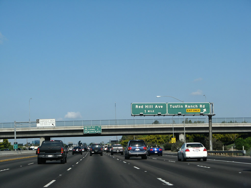
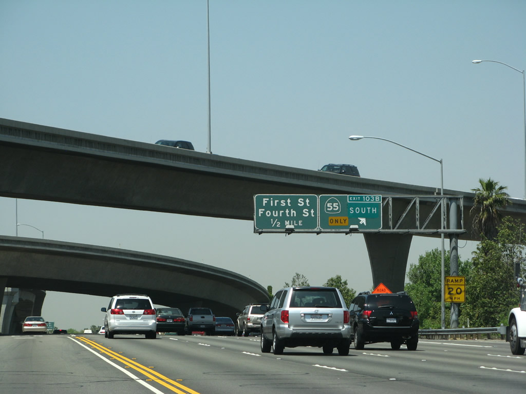
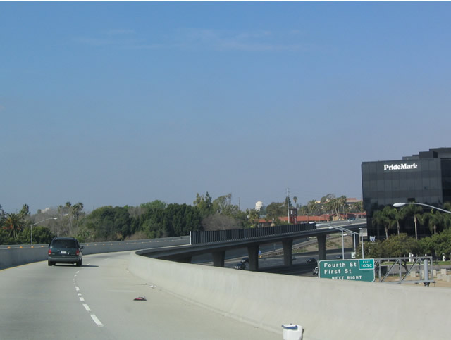
This interchange sequence sign along Interstate 5 (Santa Ana Freeway) north provides the distance to the next three exits: Exit 101B, Red Hill Avenue; Exit 103, California 55 (Costa Mesa Freeway) north to Riverside and south to Costa Mesa and Newport Beach; and Exit 104A, First Street and Fourth Street (first exit to serve the city of Santa Ana). Note that there is no direct access from Interstate 5 north to Newport Avenue, but a connection via El Camino Real (which closely parallels Interstate 5 on the northeast side between Jamboree Road and Newport Avenue) allows for that connection. Photo taken 09/29/07. |
|
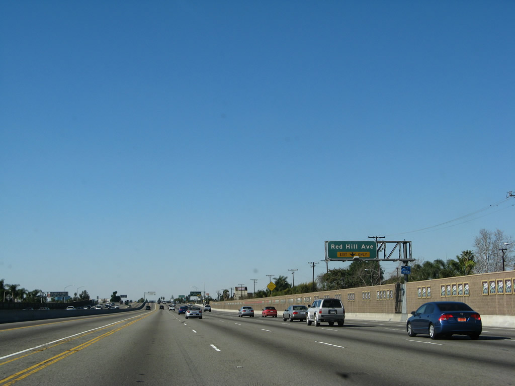
The right lane becomes exit only for Exit 101B, Red Hill Avenue. This section of Interstate 5 is notable for its soundwalls, which are tan in color and contain small decorative tiles with the same pattern repeated multiple times. Photo taken 01/14/07. |
|
|
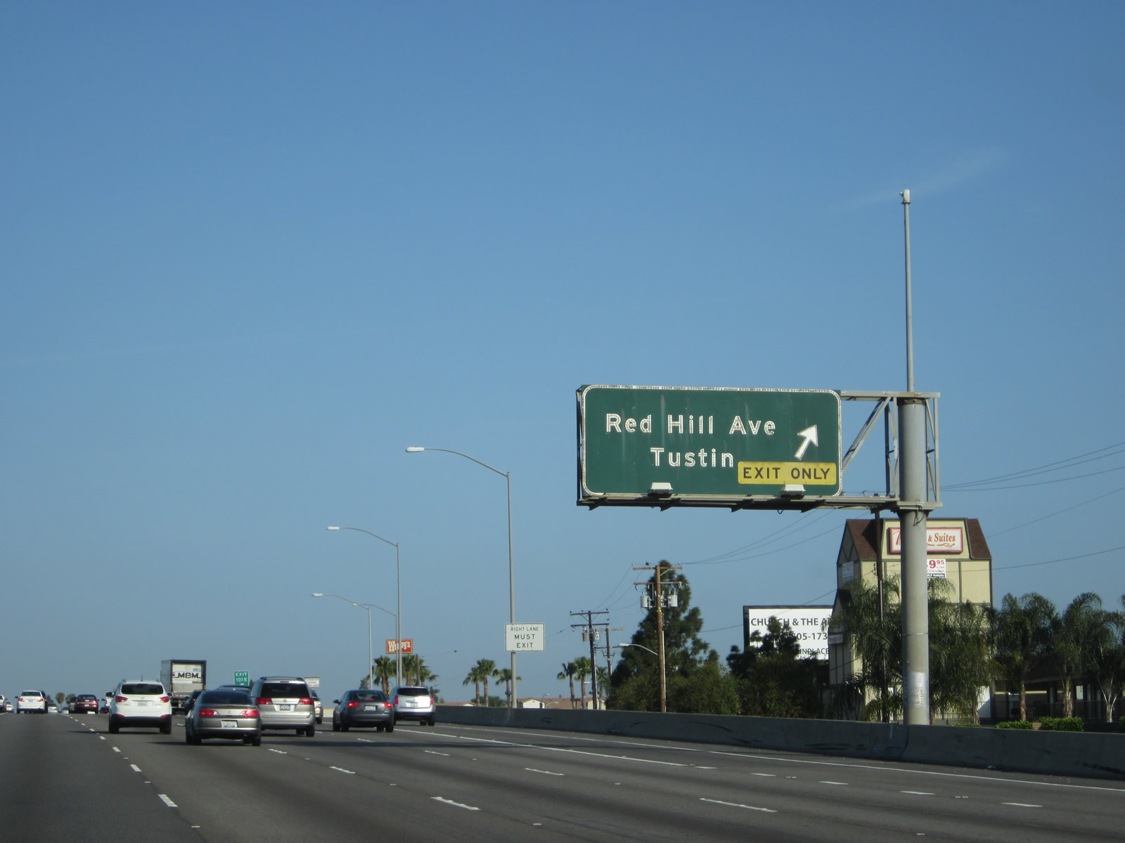
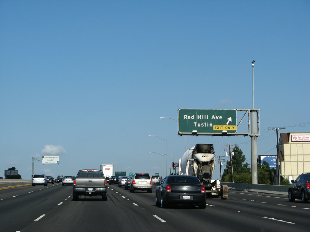
Northbound Interstate 5 reaches Exit 101B, Red Hill Avenue, which leads into Tustin. This porcelain enamel sign (from the late 1960s/early 1970s) is one of the few left untouched (i.e., without exit numbers affixed) in Orange County. It has survived well into 2012. Photos taken 04/06/12 and 09/29/07. |
|
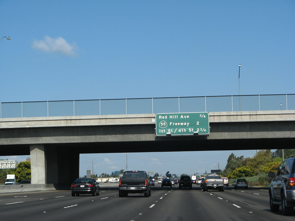
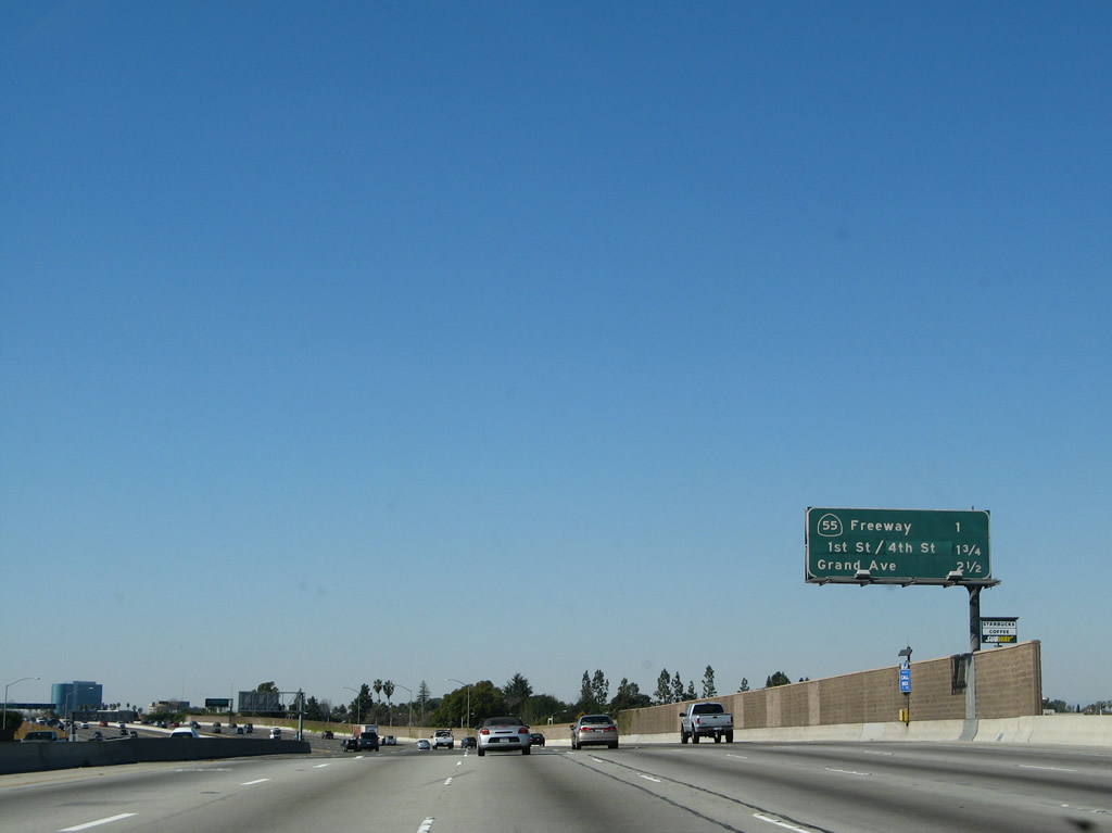
This mileage sign along Interstate 5 (Santa Ana Freeway) north provides the distance to the next four exits: Exits 103A-B, California 55 (Costa Mesa Freeway) north to Riverside and south to Costa Mesa and Newport Beach; Exit 103C, First Street and Fourth Street; and Exit 104, Grand Avenue. Photo taken 09/29/07. |
|
|
California 55 (Costa Mesa Freeway) north provides a quick route to California 91 (Riverside Freeway) east toward Corona, Riverside, and San Bernardino. In addition, northbound California 55 serves the cities of Tustin, eastern Santa Ana, Orange, and northeast Anaheim. California 55 south travels into Costa Mesa and has a direct connection to Newport Boulevard southwest to the city of Newport Beach. California 55 south also connects to Interstate 405 and California 73. Photos taken 09/29/07 and 11/14/04. |
|
The right lanes of Interstate 5 north becomes exit only for California 55 north and south. California 55 is a major north-south freeway in Orange County, starting in Newport Beach, crossing Interstate 5 in Tustin, and ending at California 91 in Anaheim. Between California 55 and California 57, Interstate 5 passes along the eastern portion of the city of Santa Ana. The exit sign for Exit 103A (northbound California 55) can be seen in the distance; the exit for southbound California 55 (Exit 103B) is located just beyond. Also note the high occupancy vehicle lane signage for the next HOV-only exit, which is Grand Avenue (Exit 104). Photo taken 09/29/07. |
|
|
The right two lanes connect to Exit 103A, California 55 (Costa Mesa Freeway) north to Riverside. The second ramp connects to California 55 south to Newport Beach and Costa Mesa. Photos taken 11/08/08 and 09/29/07. |
|
An old-style reassurance shield is posted along Interstate 5 north prior to the exit ramp to California 55 north after the on-ramp from Newport Avenue. Photo taken 11/14/04. |
|
A height advisory sign for the ramp connecting Interstate 5 north to California 55 south (Exit 103B) is posted shortly thereafter. This yellow advisory sign is unusual since it incorporates the green California 55 shield. Photo taken 11/14/04. |
|
|
Northbound Interstate 5 (Santa Ana Freeway) reaches Exit 103A, California 55 (Costa Mesa Freeway) north to the eastern edge of Anaheim and to California 91 east to Corona and Riverside via the Santa Ana River canyon. This sign was dramatically altered between 2007 and 2008 when a full sign bridge was erected and all of the signs were replaced. New pull-through signs for both the carpool lanes and main lanes were added as well. Photo taken 04/26/08 and 09/29/07. |
|
|
Immediately thereafter, Interstate 5 north connects to Exit 103B, California 55 (Costa Mesa Freeway) south to Costa Mesa and Newport Beach. The exit sign was retrofitted with exit numbers in Fall 2007 or Winter 2008. Photos taken 04/26/08 and 09/29/07. |
|
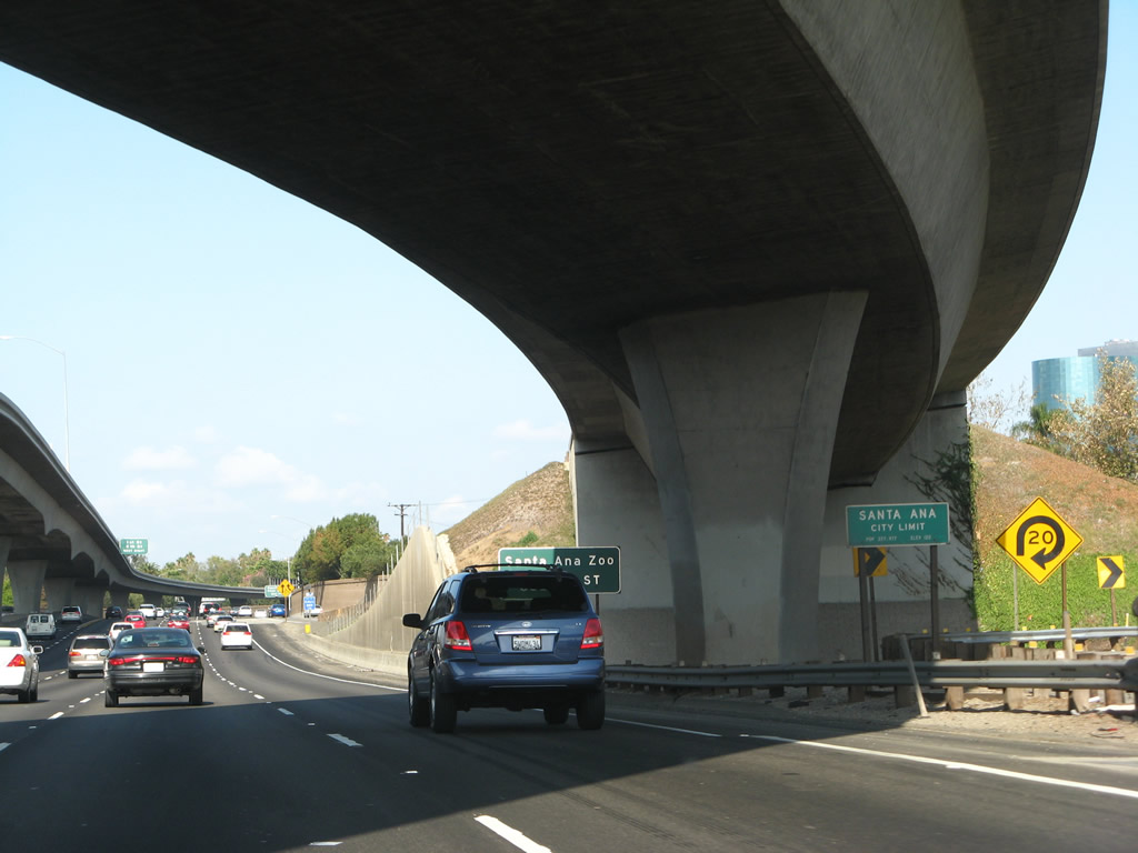
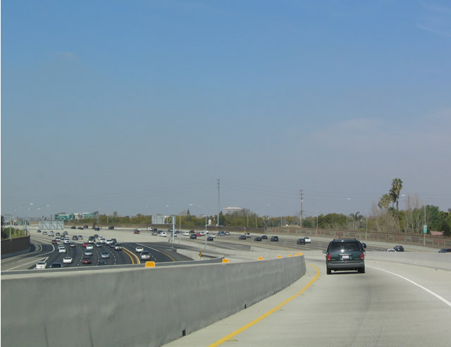
After the loop ramp to California 55 south, Interstate 5 (Santa Ana Freeway) enters the city of Santa Ana, which sits at an elevation of 135 feet, consists of 27.2 square miles, and receives an average of nearly 13 inches of rainfall annually. Incorporated in 1886, Santa Ana became the seat of Orange County when Orange County split from Los Angeles County in 1889. As of the 2000 Census, Santa Ana had a population of 337,977 people; that number climbed to a total of 353,428 per a 2007 California Department of Finance Estimate. The city is 76% Latino or Hispanic per the 2000 Census, and Santa Ana therefore has one of the nation's largest urban populations of that ethnic group. The character of Interstate 5 changes quite a bit as we enter the city of Santa Ana. Photo taken 09/29/07. |
|
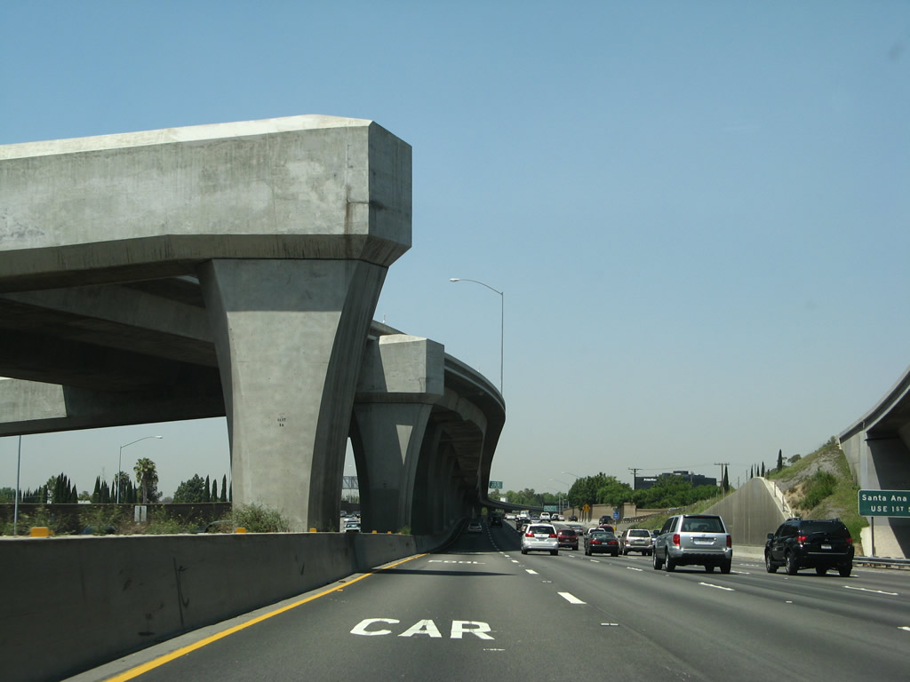
For the next mile or so, a set of overhead lanes carry HOV traffic connecting between California 55 north and Interstate 5 north as well as between Interstate 5 south and California 55 south. These lanes will eventually come down to ground level; for now, Interstate 5's main lanes will go below grade into a trench section. Photo taken 04/26/08. |
|
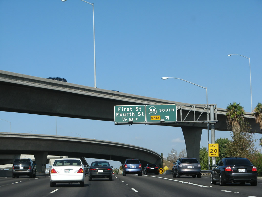
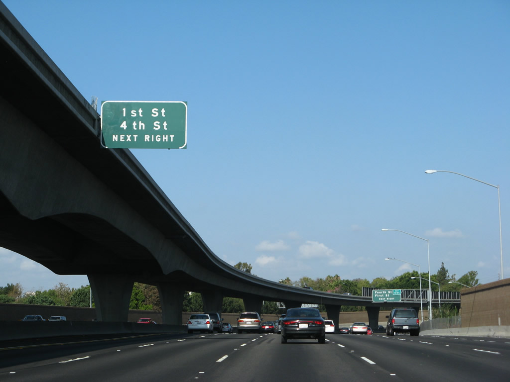
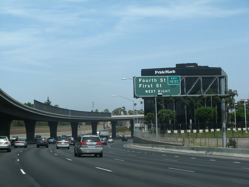
The next exit along Interstate 5 (Santa Ana Freeway) is Exit 103C, First Street/Fourth Street. Use the First Street exit to the Santa Ana Zoo, which is nestled on the west side of the Santa Ana Freeway north of Chestnut Avenue. Photo taken 09/26/07. |
|
An exit number was retrofitted onto an existing sign for Exit 103C, First Street/Fourth Street. Use the right two lanes to Exit 103C. Fourth Street is a major east-west arterial that travels into downtown Santa Ana and connects its library, civic center, and stadium to the freeway. Photo taken 07/04/07. |
|
Northbound Interstate 5 (Santa Ana Freeway) reaches Exit 103C, First Street and Fourth Street. Use First Street west to Artists Village. Fourth Street is an important east-west arterial toward downtown Santa Ana. This section of Interstate 5 has a separated carpool lane located on the viaduct running through the middle of the freeway. Traffic from California 55 uses this viaduct for a few miles, then merges into the "regular" carpool lanes along northbound Interstate 5. Photo taken 09/26/07. |
|
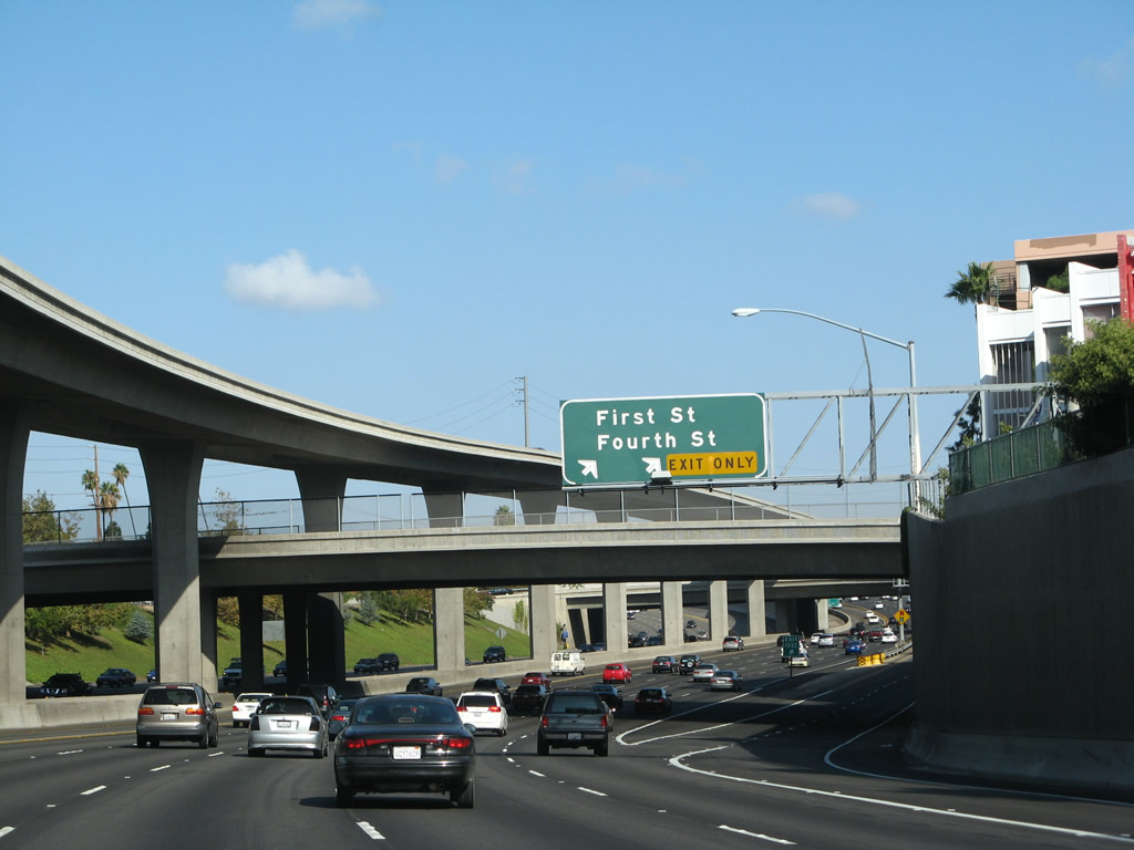
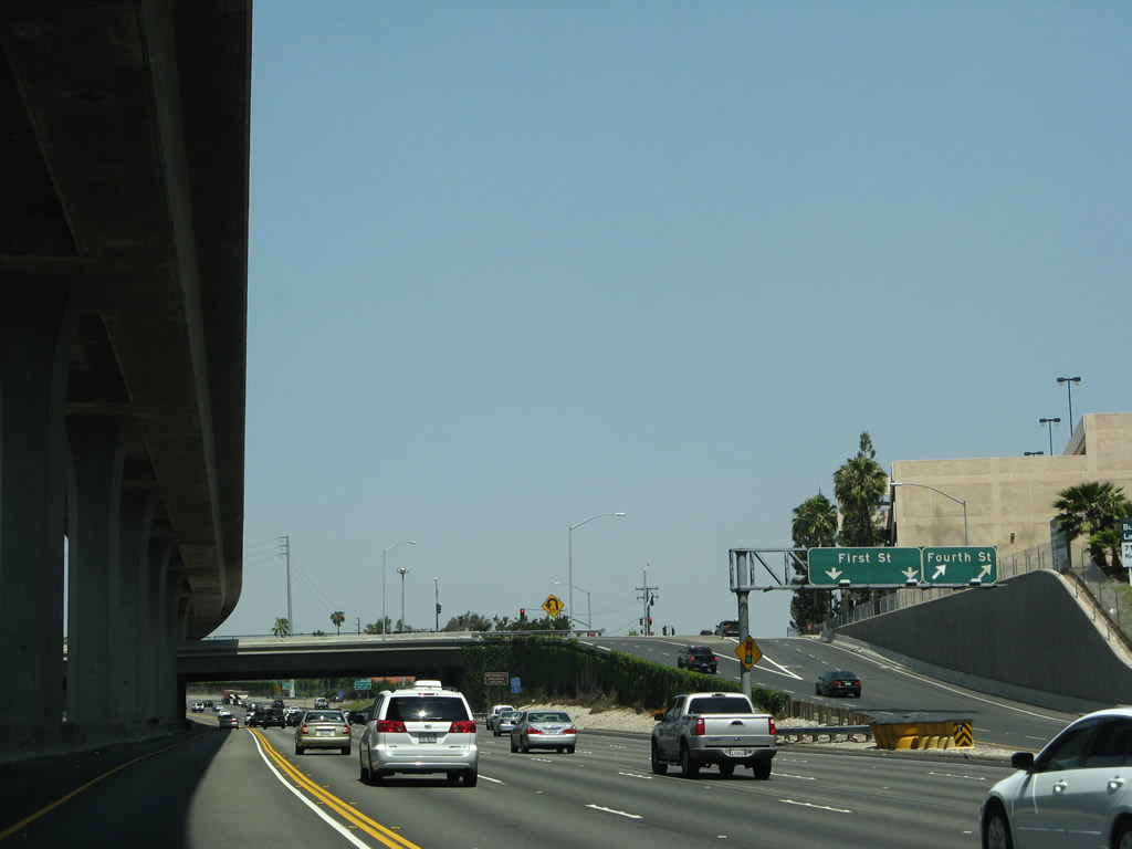
This view shows the exit ramp to First Street and Fourth Street at Exit 103C. The left two lanes on the ramp connect to First Street, while the right two lanes of the ramp connect to Fourth Street. Photo taken 04/26/08. |
|
Now on the elevated High Occupancy Vehicle (HOV) transition ramp from northbound California 55 to northbound Interstate 5 flies over Interstate 5 for a short distance north of that interchange. The exit for Exit 103C is visible on the mainline below the viaduct. This viaduct is visible in several of the preceding photoboxes. Photo taken 02/15/04. |
|
Returning to ground level, the high occupancy vehicle transition lane returns to the main flow of Interstate 5 to meet the mainline high occupancy lanes. The next exit from the high occupancy vehicle lanes is Exit 104, Grand Avenue and Santa Ana Boulevard. Photo taken 02/15/04. |
|
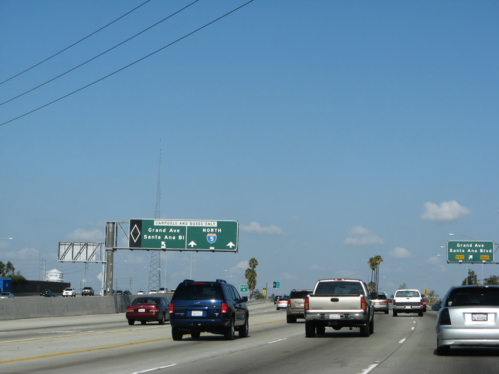
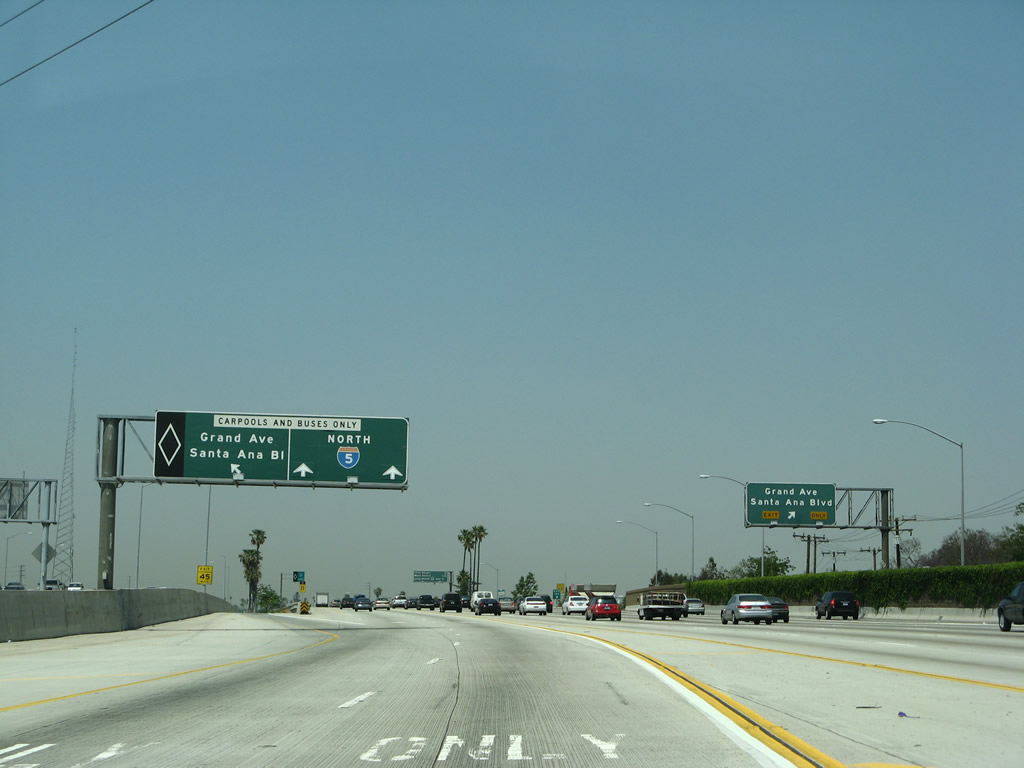
Back on the mainline, this mileage sign provides the next three exits from the high occupancy vehicle (HOV) lanes. The first HOV-only along Interstate 5 (Santa Ana Freeway) north is Exit 104, Grand Avenue and Santa Ana Boulevard. This mileage sign is located just as the central viaduct from California 55 merges into the northbound Interstate 5 high-occupancy vehicle lane. Photo taken 04/26/08. |
|
On the right shoulder of the freeway, prior to the on-ramp from First Street, is an exit number sign for Exit 104, Grand Avenue and Santa Ana Boulevard. Photo taken 09/29/07. |
|
|
Looking at the HOV lanes, a left exit connects the carpool lanes directly with Exit 104, Grand Avenue and Santa Ana Boulevard. The regular exit for all vehicles is a right exit about an eighth of a mile ahead. Photos taken 09/29/07 and 04/26/08. |
|
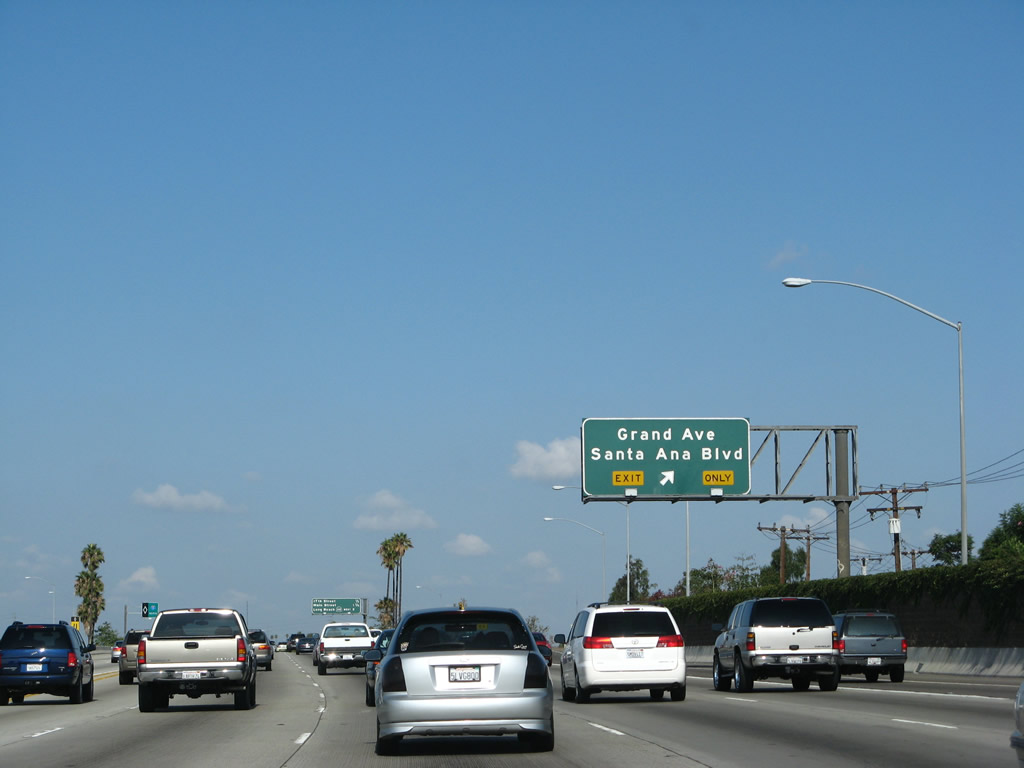
Northbound Interstate 5 (Santa Ana Freeway) reaches Exit 104, Grand Avenue and Santa Ana Boulevard. Photo taken 09/29/07. |
|
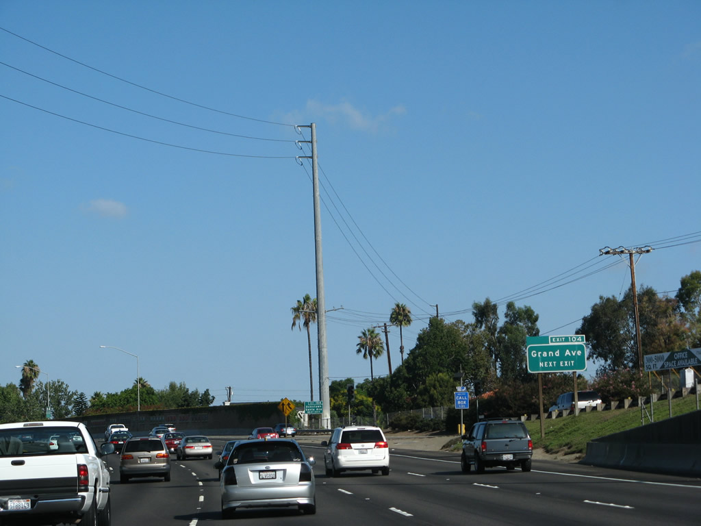
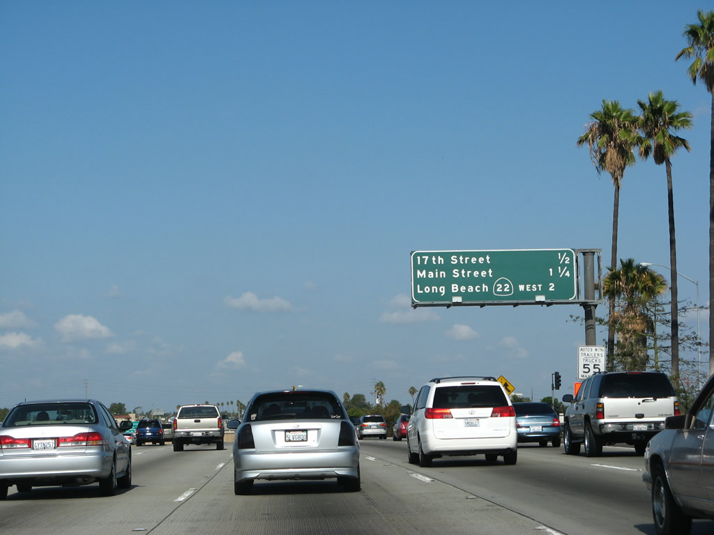
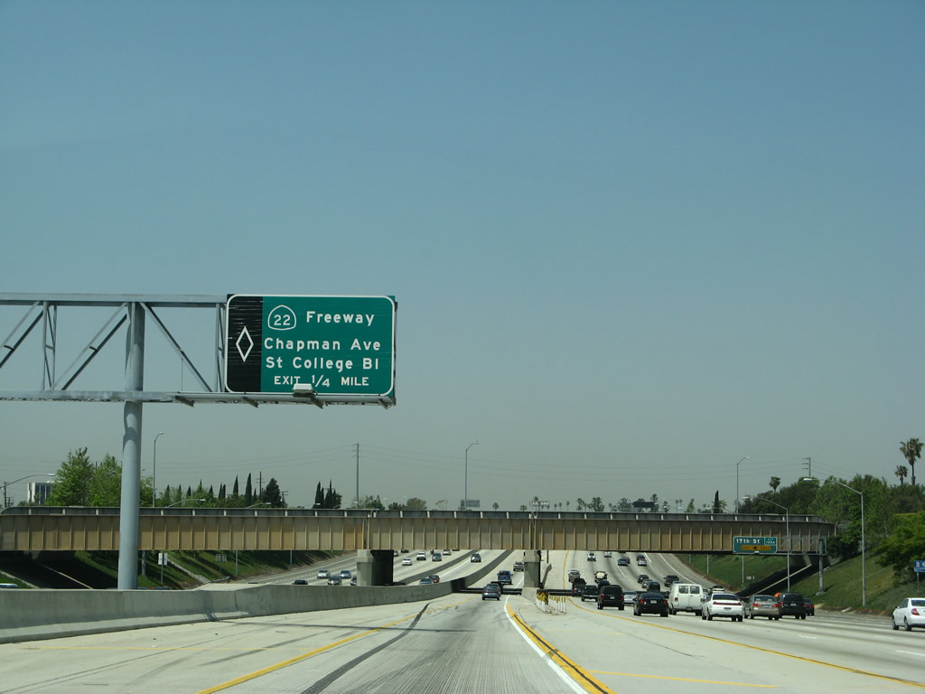
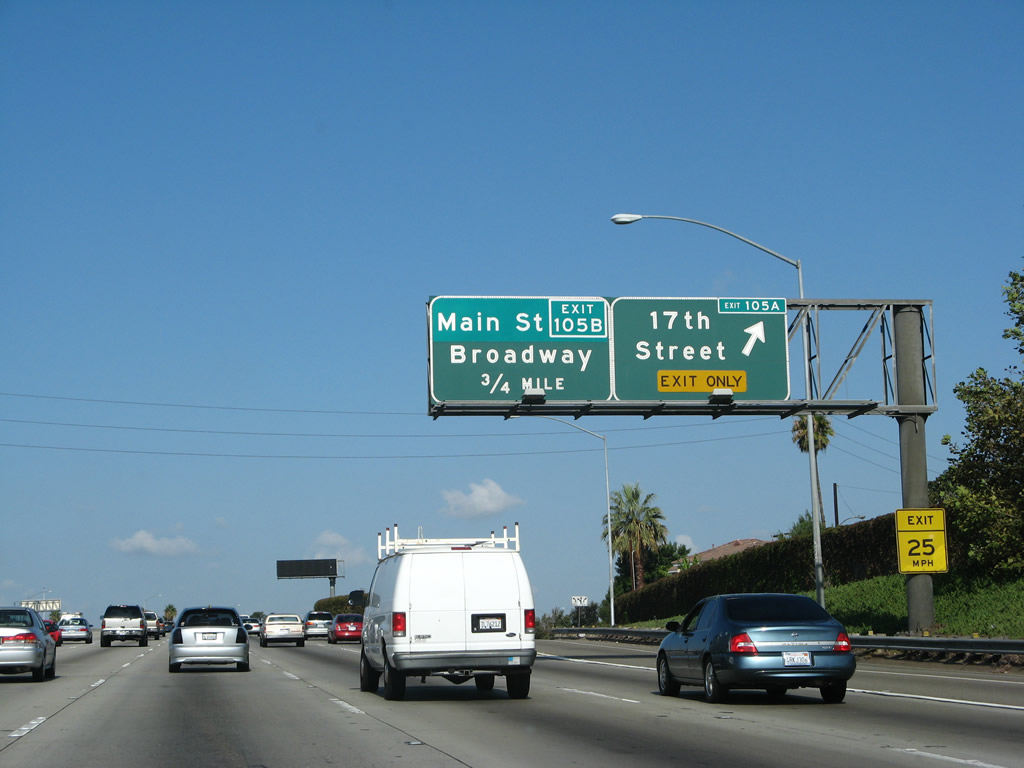
This mileage sign provides the distance to the next three exits along Interstate 5 (Santa Ana Freeway) north: Exit 105A, Seventeenth Street; Exit 105B, Main Street; and Exit 106, California 22 (Garden Grove Freeway) west to Long Beach. Photo taken 09/29/07. |
|
|
Since there is no direct access to California 22 from the high-occupancy vehicle lanes, a separate sign advises motorists to leave the carpool lanes and merge back onto the main lanes. Notably, the high occupancy vehicle lane shifts away from the main lanes to skirt to the left of the upcoming bridge support (as Interstate 5 will pass under the OCTA Metrolink rail bridge). Photos taken 09/29/07 and 04/26/08. |
|
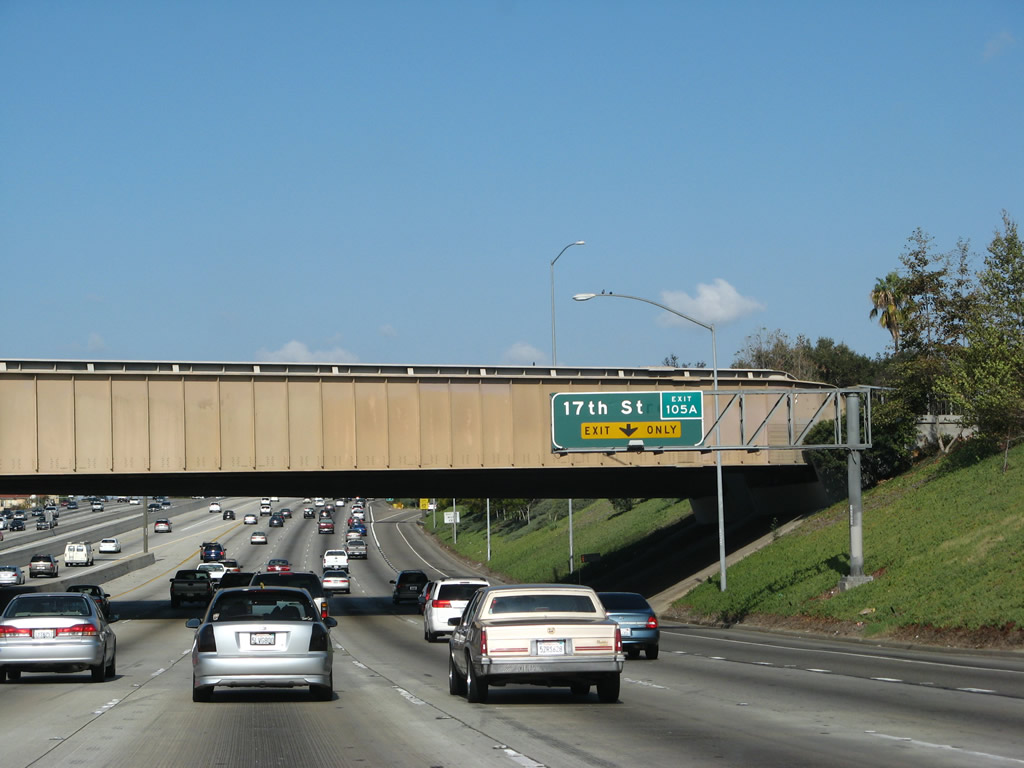
The right lane of Interstate 5 becomes exit only for Exit 105A, Seventeenth Street. Photo taken 09/29/07. |
|
|
This point of egress leads from the high occupancy vehicle lane back to the mainline for access to Exits 106, 107B, and 107C. Exit 106 is California 22 (Garden Grove Freeway); Exit107B is Chapman Avenue, and Exit 107C is The City Drive/State College Boulevard. There is a direct connection from the high occupancy vehicle lanes to northbound California 57, so there's no need to exit here to reach that freeway (which is Exit 107A). Photos taken 09/29/07 and 04/26/08. |
|
Northbound Interstate 5 (Santa Ana Freeway) reaches Exit 105A, 17th Street. Seventeenth Street plies through Santa Ana, ultimately leading east into North Tustin and west toward Santa Ana College, Garden Grove, and Westminster. It changes names to Westminster Boulevard upon entering that city and crossing Interstate 405 at Exit 19. Photo taken 09/29/07. |
|
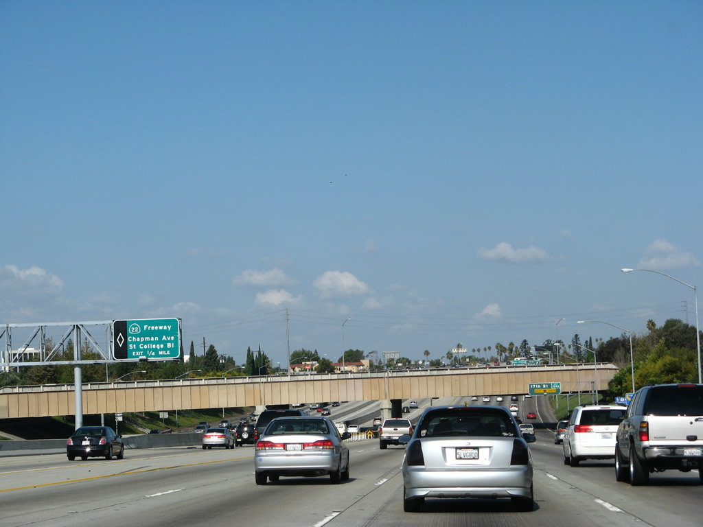
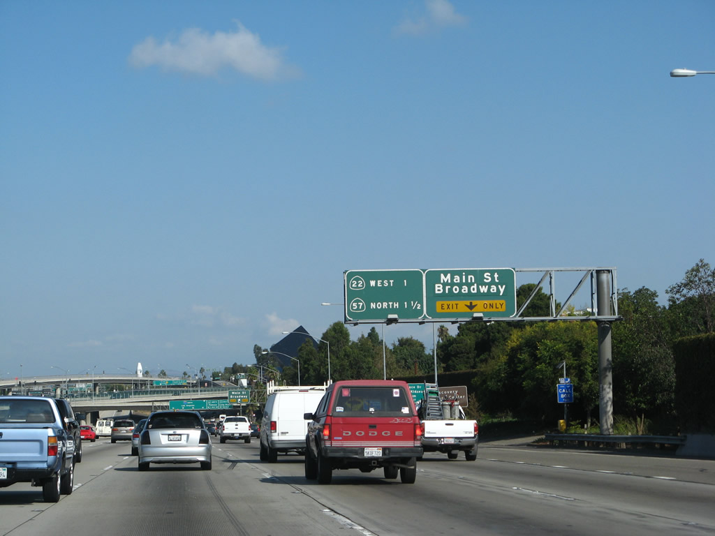
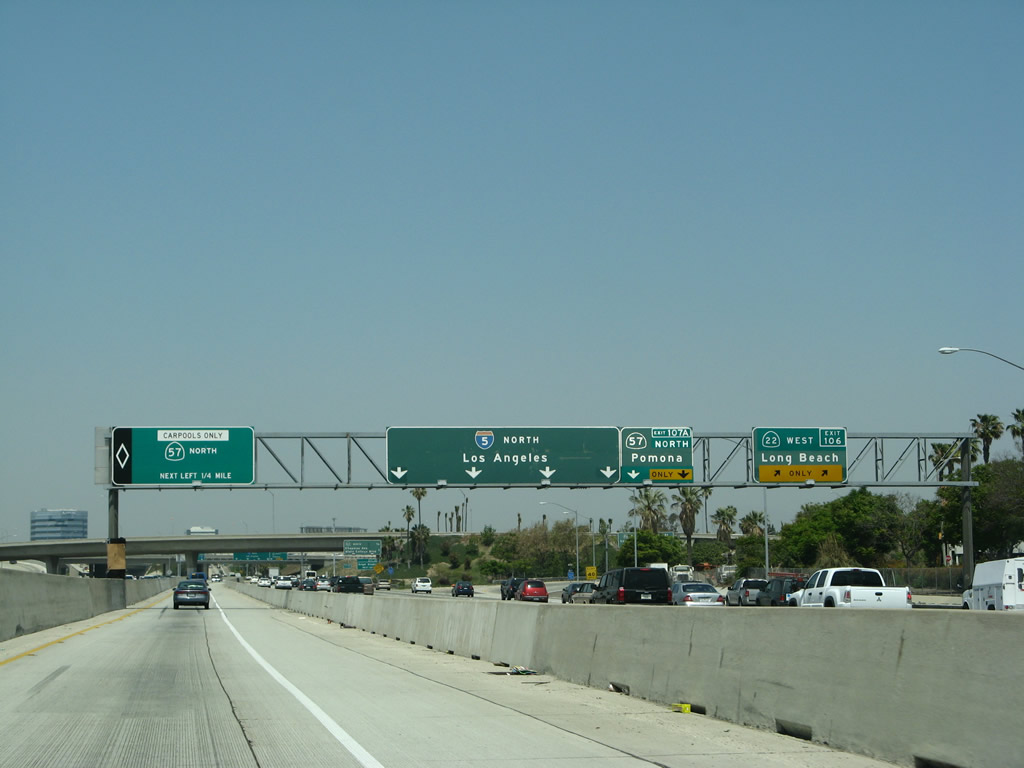
The next exit along northbound Interstate 5 (Santa Ana Freeway) is Exit 105B, Main Street. A mileage sign indicates the next two major exits to California 22 (Garden Grove Freeway) west and California 57 (Orange Freeway) north. This tangle of ramps is called the Orange Crush Interchange, as three major freeways (Interstate 5, California 22, and California 57 come together at this spot in northern Santa Ana. Photo taken 09/29/07. |
|
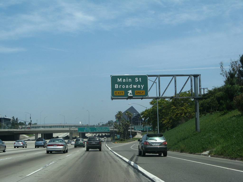
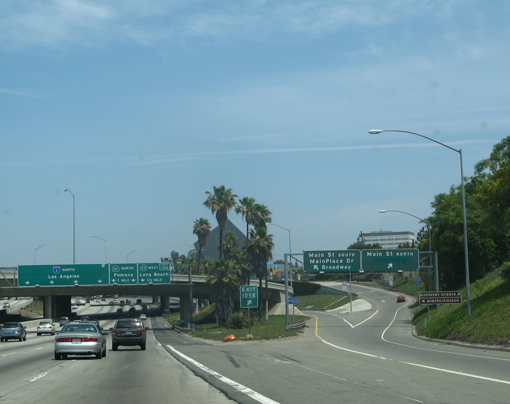
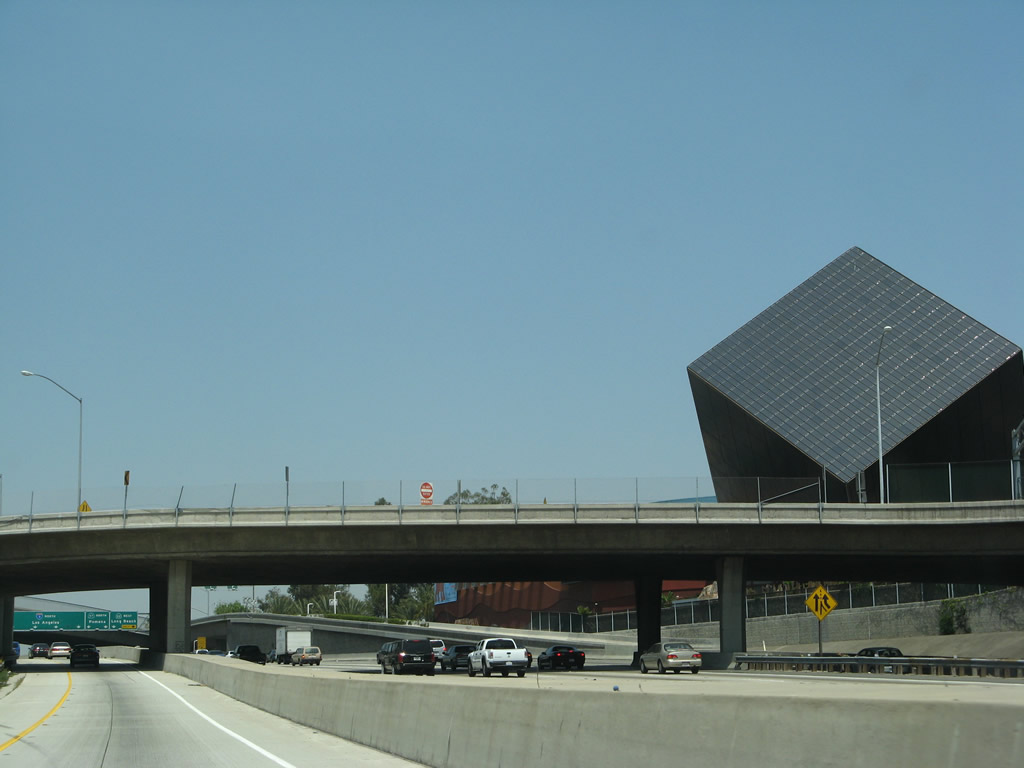
Northbound Interstate 5 (Santa Ana Freeway) reaches Exit 105B, Main Street. Several attractions are located at or near this interchange, including the Discovery Science Center (the tilted cube that is visible on the right side of this picture), Bowers/Kidseum Museum, and the shopping center at Mainplace Drive. This shopping mall is located in the southeastern quadrant of the Interstate 5 and California 22 interchange. From this interchange, Main Street leads north into the city of Orange and south into Santa Ana. Photo taken 07/04/07. |
|
The off-ramp to Exit 105B splits, with the left lane connecting to Main Place Drive, Broadway, and southbound Main Street. The right lane connects to northbound Main Street. Photo taken 07/04/07. |
|
Meanwhile, the HOV lanes are completely separated from the main lanes by a jersey barrier. Photo taken 04/26/08. |
|
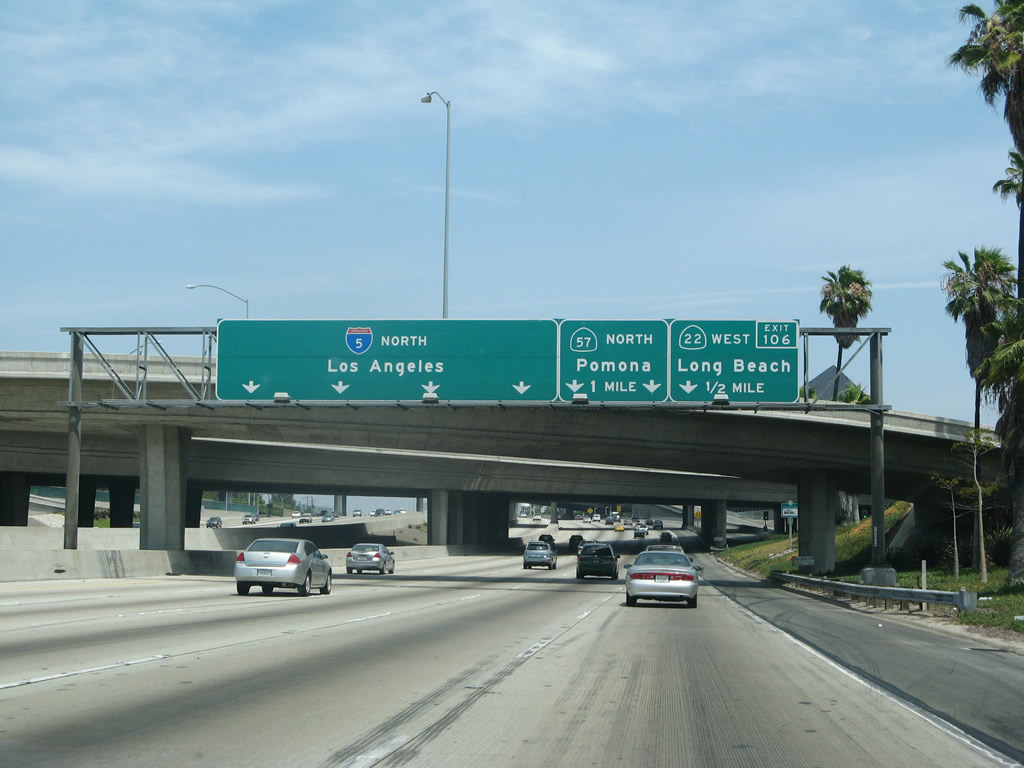
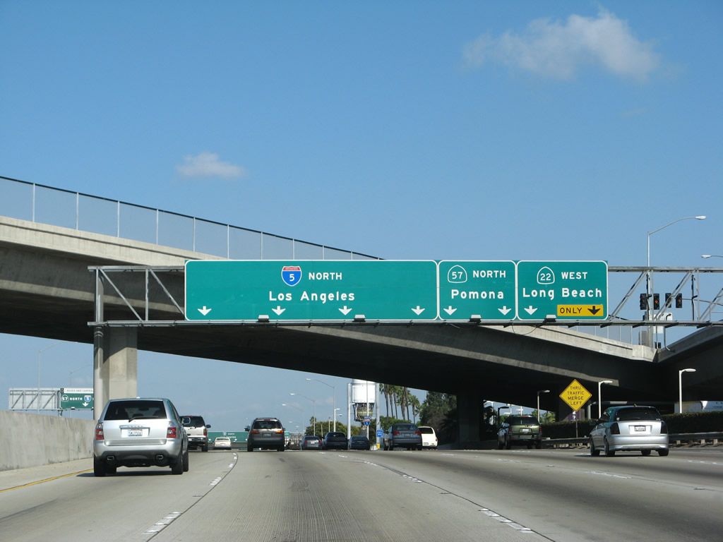
The Orange Crush interchange features the confluence of three major freeways: Interstate 5 (Santa Ana Freeway), California 22 (Garden Grove Freeway), and California 57 (Orange Freeway). This interchange was reconstructed in the late 1990s and early 2000s as part of a reconstruction of the Interstate 5 corridor through Orange County. The right two lanes reach Exit 106/California 22 and Exit 107A/California 57. Photo taken 07/04/07. |
|
The massive Discovery Science Center cube looks like a dice about to roll onto the freeway. At night, the perimeter of the cube illuminates in multiple colors. Photo taken 04/26/08. |
|
Entering the Orange Crush Interchange, the right two lanes connect directly from Interstate 5 north to California 22 (Garden Grove Freeway) west to Long Beach. The second exit is the ramp to California 57 (Orange Freeway) north to Pomona and San Dimas. Photo taken 09/29/07. |
|
A similar sign in the HOV lanes advises that motorists must choose between California 57 north or Interstate 5 north (there is no direct access from the HOV lanes to California 22). Photo taken 07/15/09. |
|
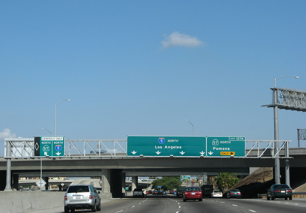
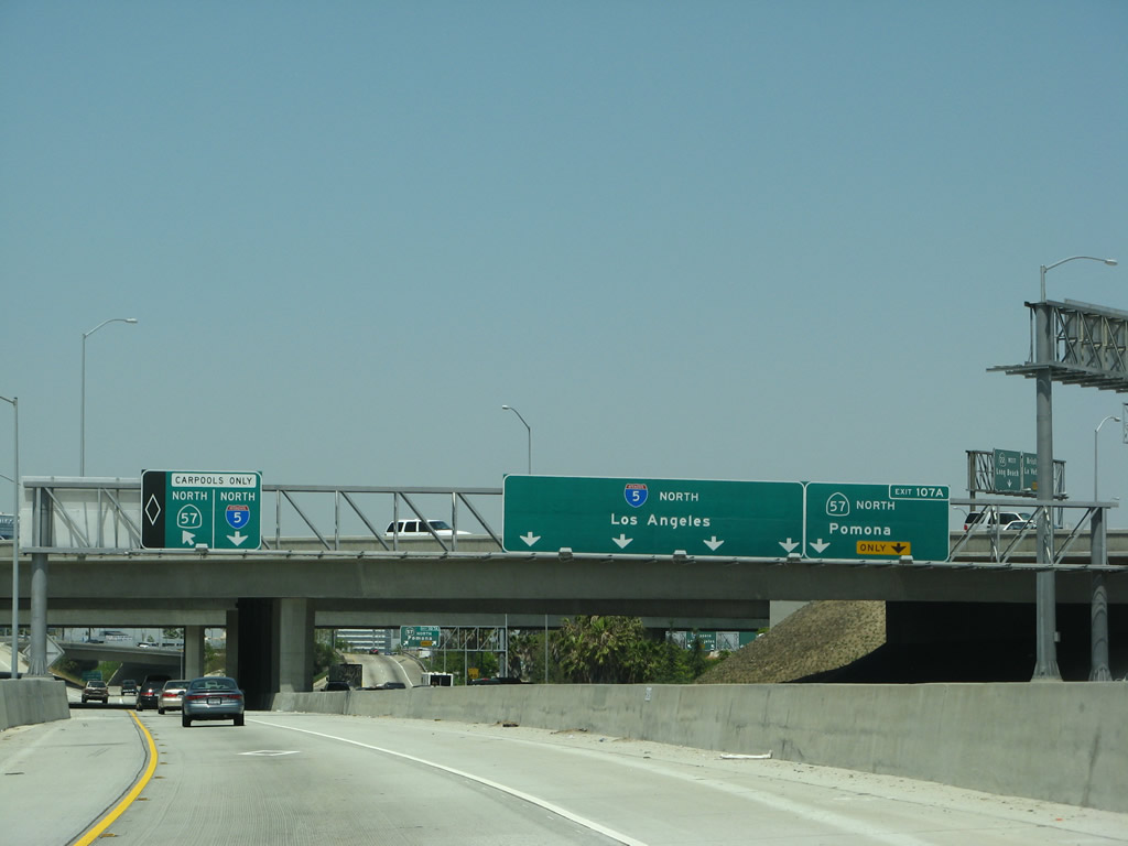
Back in the main lanes, northbound Interstate 5 (Santa Ana Freeway) meets Exit 106, California 22 (Garden Grove Freeway) west to Long Beach. There is no direct access to California 22 east. The second exit is Exit 107A, California 57 (Orange Freeway) north to Pomona and San Dimas. For the first time since entering Orange County, the northbound control city is again Los Angeles. Photo taken 09/29/07. |
|
This mileage sign along northbound provides the distance for the next three exits: Exit 107A, California 57 (Orange Freeway) north; Exit 107B, Chapman Avenue; and Exit 107C, The City Drive and State College Boulevard. California 57 is the Orange Freeway, which follows the Santa Ana River between Interstate 5 and California 91, then continues north through Fullerton and Brea en route to Diamond Bar and Pomona. California 57 currently shifts into Interstate 210 at the Kellogg Interchange (Interstate 10), but it was legislatively extended north to California 210 as a result of the extension of that highway east to Redlands. Photo taken 07/04/07. |
|
Use California 57 (Orange Freeway) north to Exit 1B or Exit 2 to Angel Stadium, home of Major League Baseball's Los Angeles Angels of Anaheim (American League). Photo taken 07/04/07. |
|
Interstate 5 leaves Santa Ana and enters the city of Orange. Consisting of 23.6 square miles, Orange incorporated on April 6, 1888, and is home to 128,821 people per the 2000 Census. The city retains a historic core downtown ("Old Towne, Orange Historic District"), which includes many older buildings than typically found in other Orange County cities. Photo taken 09/29/07. |
|
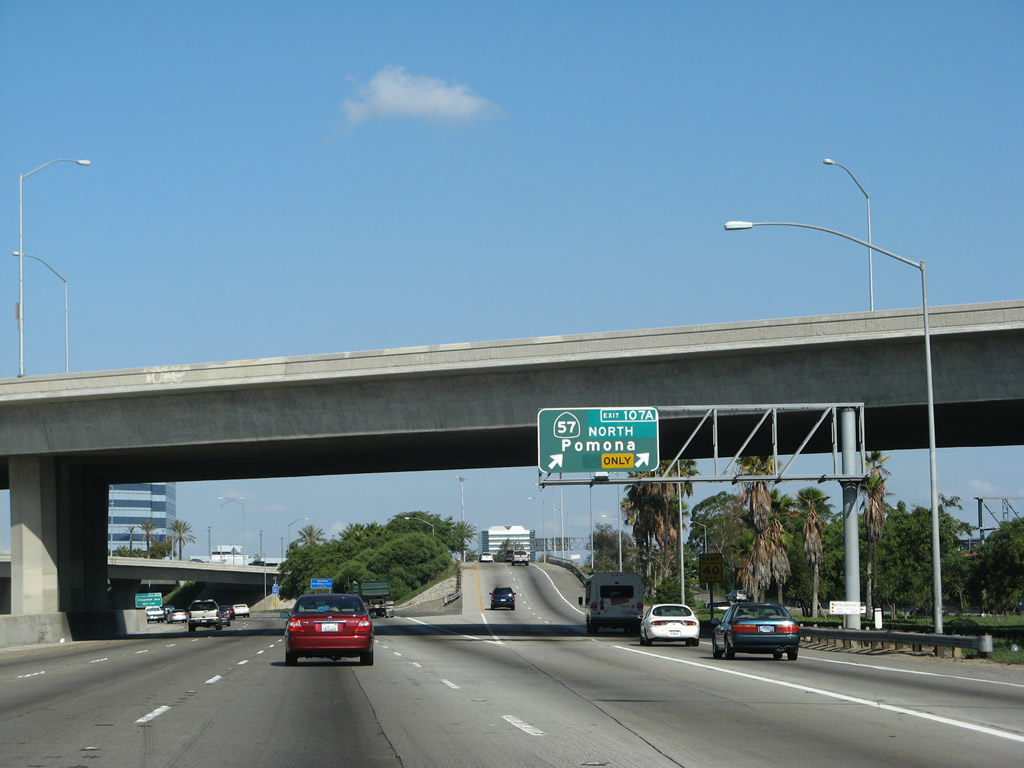
The next exit along Interstate 5 north is Exit 107A, California 57 (Orange Freeway) north to Pomona. The Orange Freeway travels due north to Interstate 210, and bypassing traffic may choose to use California 57 and Interstate 210 to avoid downtown Los Angeles. Photo taken 09/29/07. |
|
Northbound Interstate 5 (Santa Ana Freeway) reaches Exit 107A, California 57 (Orange Freeway) north to Pomona. Interstate 5 continues north toward Los Angeles. Photo taken 09/29/07. |
|
Looking again at the HOV lanes, northbound Interstate 5 approaches a left exit to California 57 (Orange Freeway) north. The transition directly connects the Interstate 5 HOV lanes with the California 57 HOV lanes. Photo taken 04/26/08. |
|
Approaching the HOV split from Interstate 5 north to California 57 north. Through this segment of Interstate 5, the HOV lanes remain separated from the main lanes. Photo taken 04/26/08. |
|
The left HOV lane exits onto California 57 north, and the right HOV lane stays north on Interstate 5. Photo taken 07/15/09. |
|
This view looks northbound from the HOV lanes after the California 57 exit. The sign for Exit 107B can be seen in the main lanes (see next picture). Photo taken 09/29/07. |
|
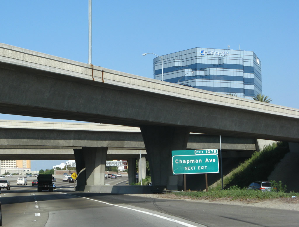
Back on the mainline, the next exit along Interstate 5 (Santa Ana Freeway) is Exit 107B, Chapman Avenue. This is the first of two exits to serve the city of Orange. Use Chapman Avenue west to the Block at Orange and east to Santa Fe Depot, Plaza Square Park (traffic circle at intersection with Glassell Street), and Chapman University. Photo taken 09/29/07. |
|
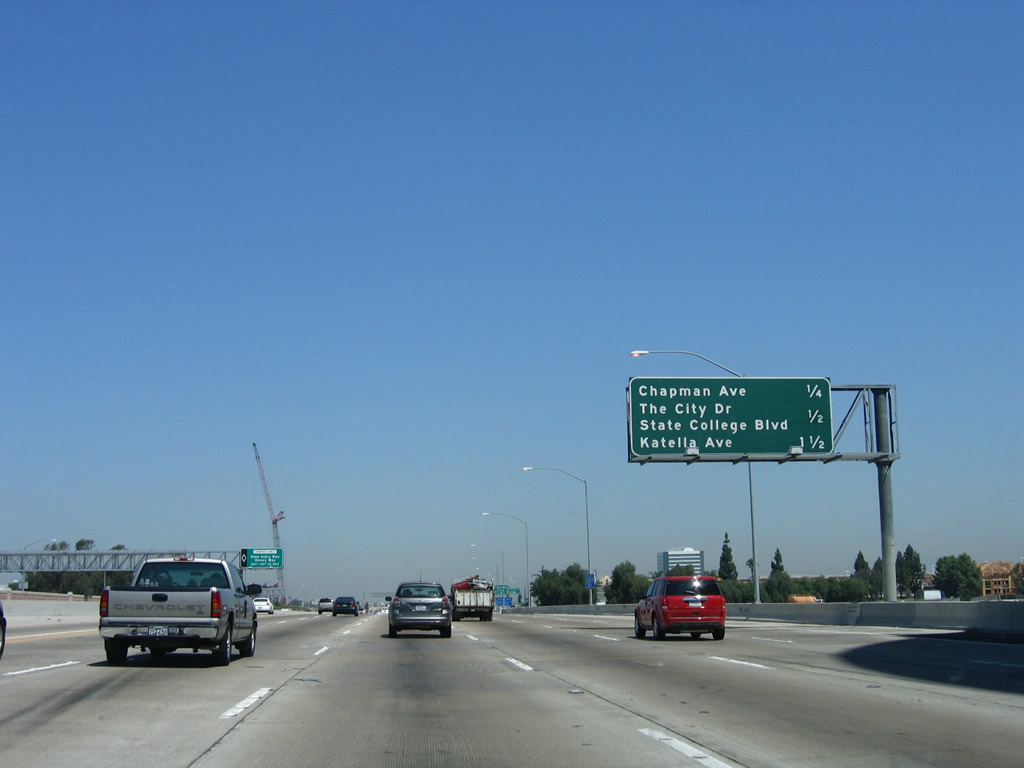
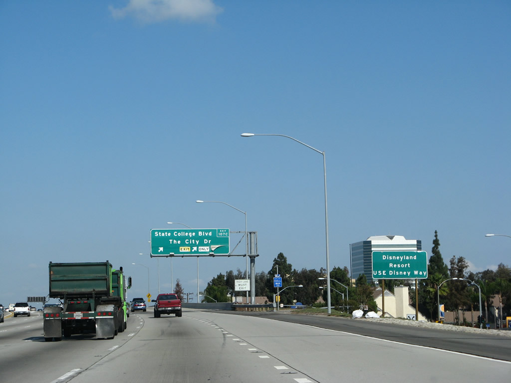
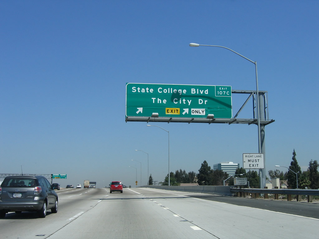
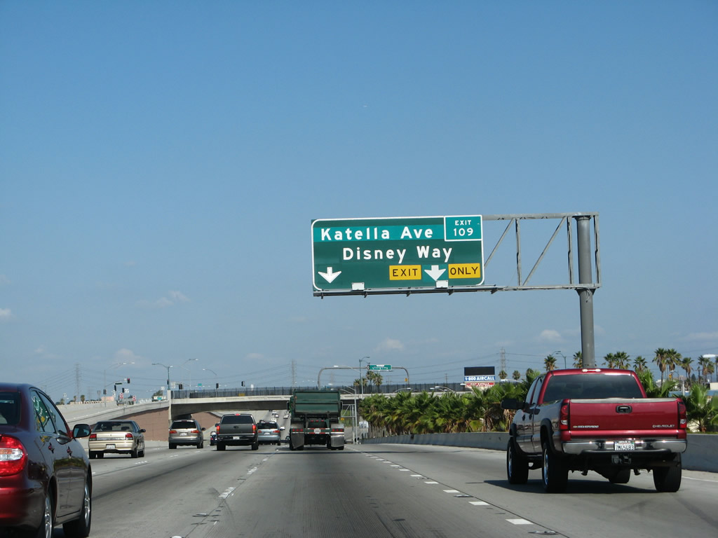
This mileage sign on Interstate 5 (Santa Ana Freeway) north provides the distance to Exit 107B, Chapman Avenue; Exit 107C, The City Drive and State College Boulevard; and Exit 109, Katella Avenue and Disney Way. Photo taken 06/28/06. |
|
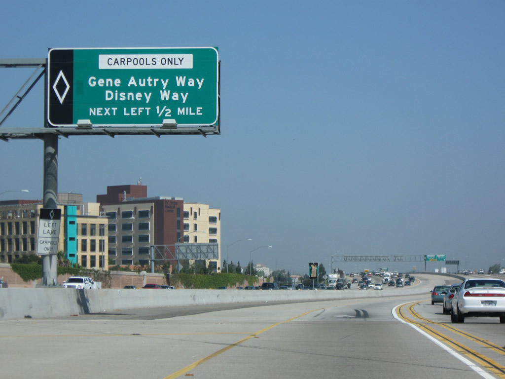
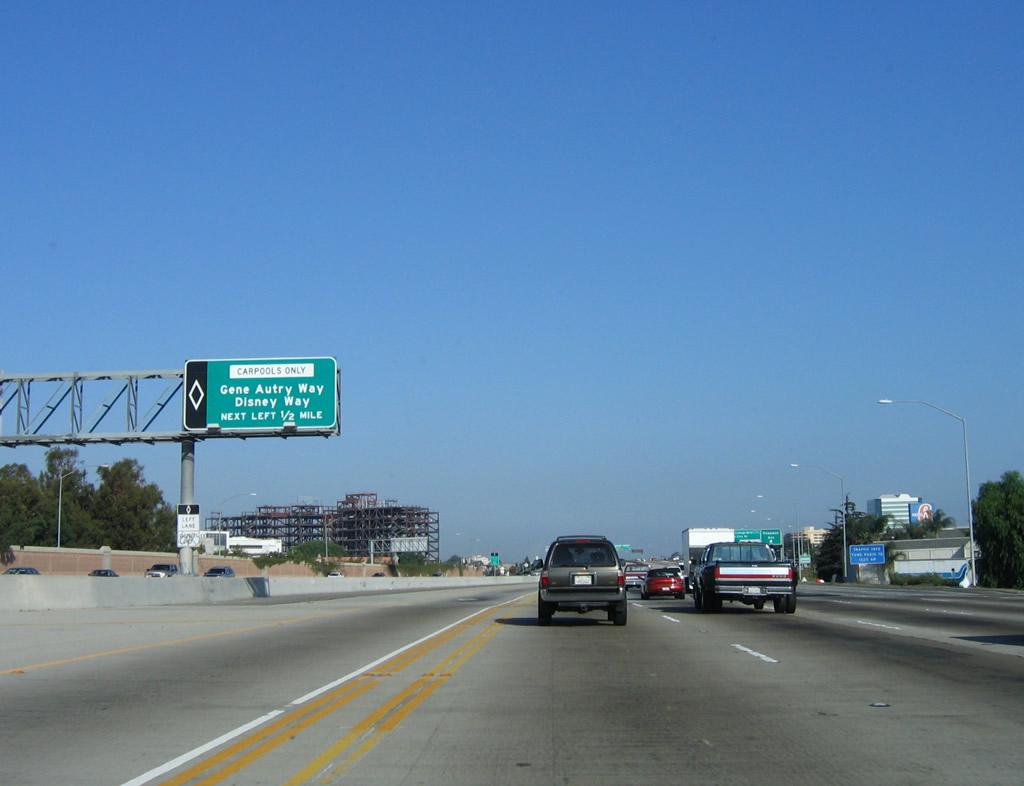
|
Over in the HOV lanes, a dedicated exit to Gene Autry Way and Disney Way is afforded by a left exit in 0.50 mile. Photos taken 07/15/09 and 10/07/06. |
|
|
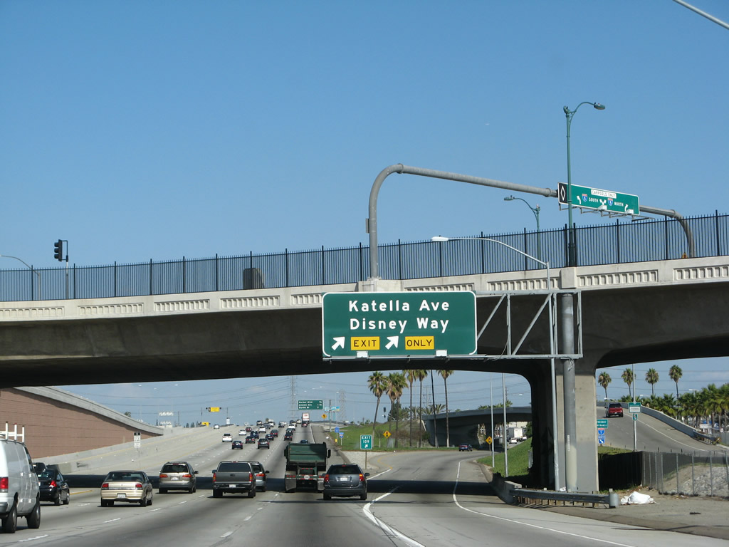
Northbound Interstate 5 (Santa Ana Freeway) reaches Exit 107B, Chapman Avenue, followed by Exit 107C, The City Drive and State College Boulevard. Photos taken 09/29/07 and 06/28/06. |
|
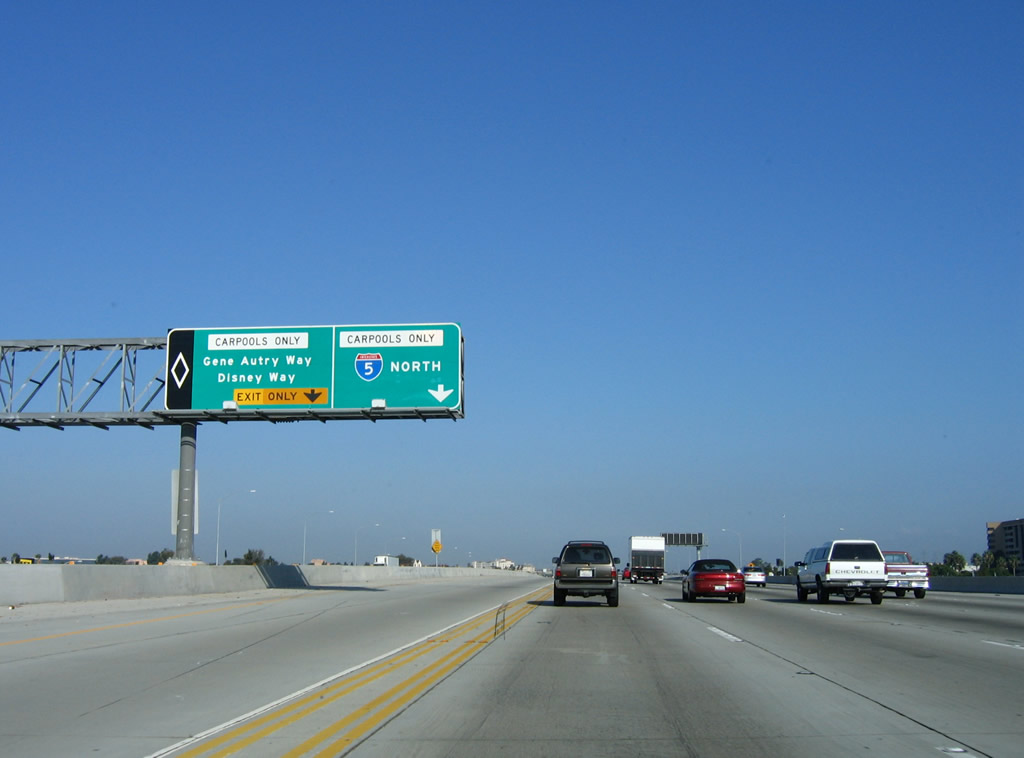
This auxiliary sign advises traffic en route to Disneyland to use Exit 109, Disney Way. Carpools may also use Exit 108, an exclusive left exit for HOV traffic leading to Disney Way. Built in 1954 and 1955, Disneyland transformed surrounding Anaheim from a rural, agricultural community into the thriving metropolis it is today. With nearby attractions such as Knotts Berry Farm, Disneyland attracts millions of tourists annually to Anaheim. Photo taken 09/29/07. |
|
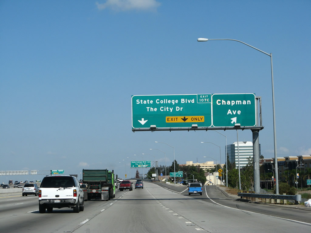
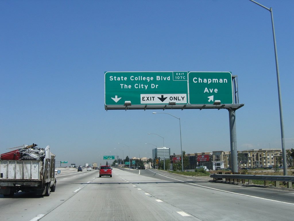
Northbound Interstate 5 reaches Exit 107C, The City Drive and State College Boulevard. These are actually the same north-south city street in Anaheim, and it connects to Angel Stadium, home of the Los Angeles Angels of Anaheim baseball team. This section of Interstate 5 was reconstructed in the late 1990s, and this section opened to traffic by 2001. Photo taken 09/29/07. |
|
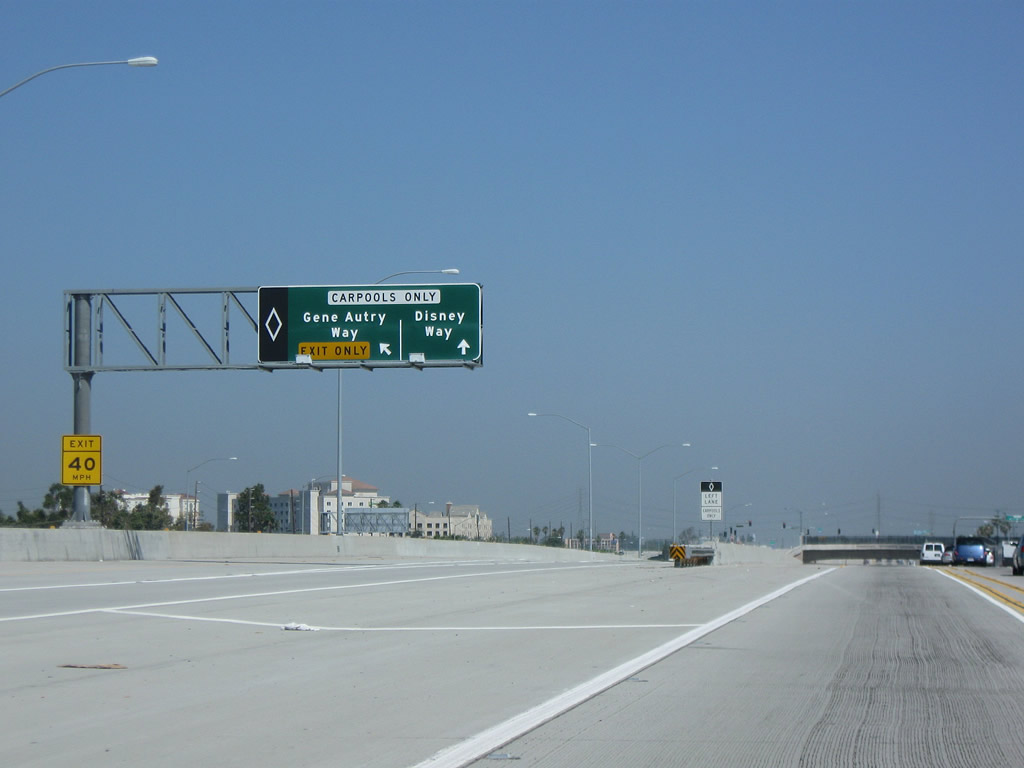
Meanwhile the HOV lanes prepare to split for the Disney Way exit. A left exit leads to Gene Autry Drive and Disney Way (Exit 108). Photo taken 10/07/06. |
|
Northbound Interstate 5 HOV Lanes meet Exit 108, Gene Autry Drive and Disney Way (left exit). Photo taken 07/15/09. |
|
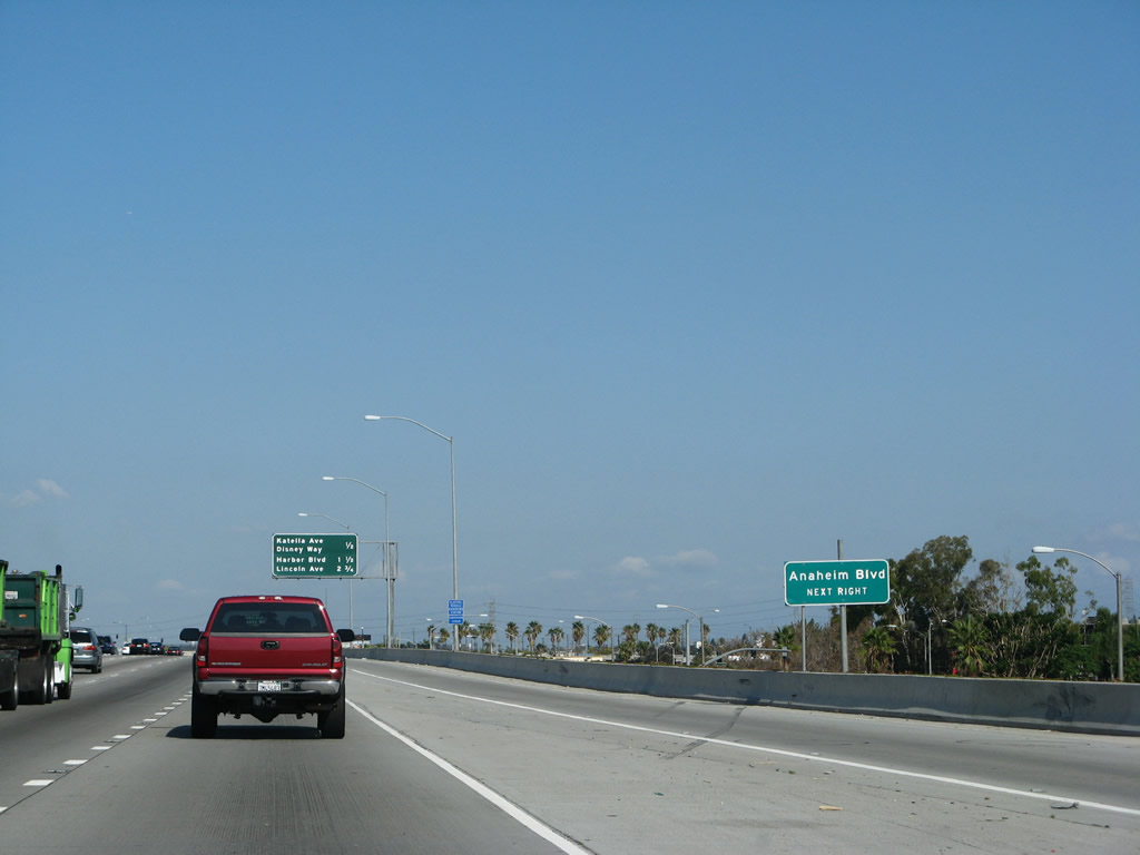
The next mainline exit is Exit 109, Anaheim Boulevard, Katella Avenue, and Disney Way. Around this point, Interstate 5 leaves the city or Orange and enters the city of Anaheim. Founded in 1857 and incorporated on March 18, 1876, Anaheim has a population of 345,556 people (per the 2000 Census) and consists of 50.5 square miles of area. Photo taken 09/29/07. |
|
The next exit along northbound Interstate 5 (Santa Ana Freeway) is Exit 109, Katella Avenue and Disney Way. Orange County (Caltrans District 12) has been retrofitting its existing signs with green overlays to allow for inclusion of the exit number on its overhead guide signs. Photo taken 06/28/06. |
|
The right two lanes of Interstate 5 (Santa Ana Freeway) north will connect to Exit 109, Katella Avenue and Disney Way. This is the best exit from the freeway to Disneyland. Photo taken 09/29/07. |
|
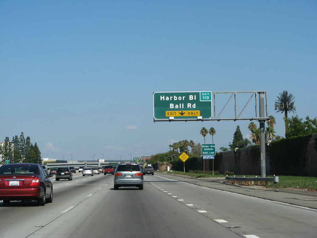
Northbound Interstate 5 (Santa Ana Freeway) reaches Exit 109, Katella Avenue and Disney Way. At the name implies, Disney Way reaches the Disneyland Resort, but only via hotels that line the eastern boundary of Disneyland. However, to reach the resort, use Katella Avenue west to Disneyland Drive, then north on Disneyland Drive. Another way to reach the Magic Kingdom and California Adventure would be to use Exit 110, Ball Road west. Photo taken 09/29/07. |
|
An Interstate 5 reassurance shield is posted shortly thereafter with an oversized "north" banner. Photo taken 09/29/07. |
|
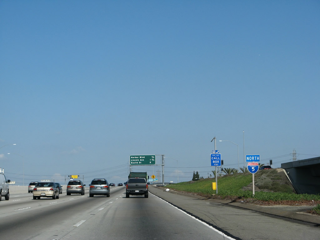
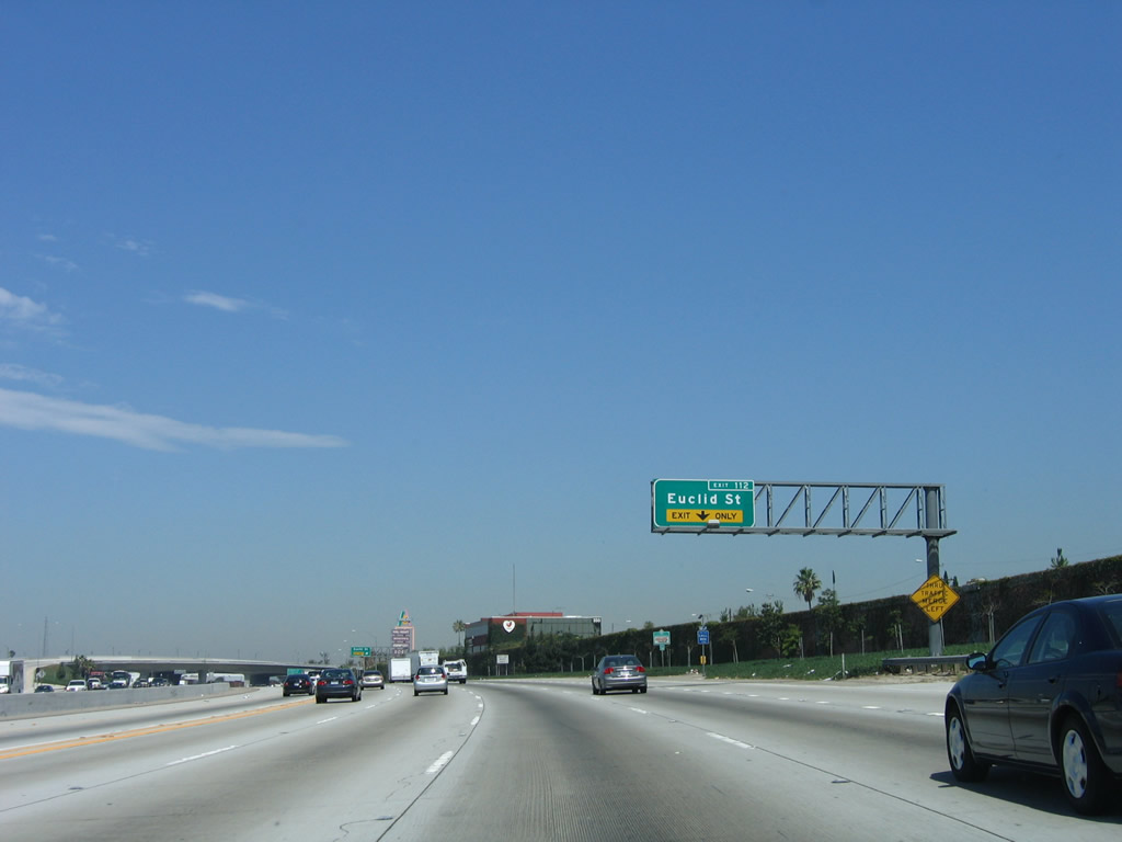
This mileage sign provides the distance to the next three exits: Exit 110, Harbor Boulevard and Ball Road; Exit 111, Lincoln Avenue; and Exit 112, Euclid Street. Photo taken 09/29/07. |
|
|
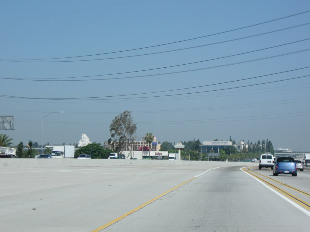
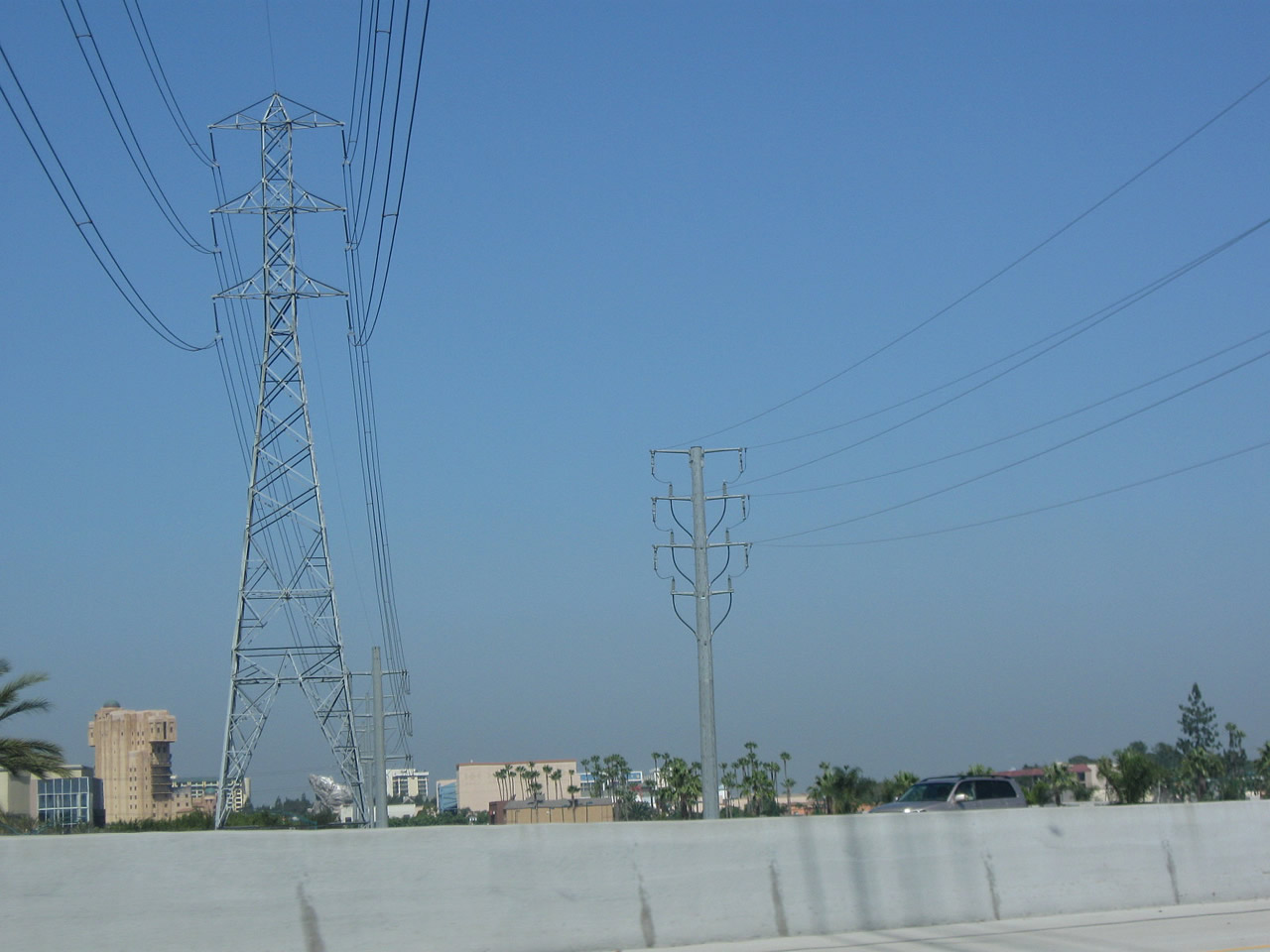
Portions of Disneyland can be seen from the freeway when looking on the left side of Interstate 5 prior to the Harbor Boulevard and Ball Road interchange. Visible in the first photo is the Disney replica of the Matterhorn. In the second picture is a set of Southern California Edison 220kV power lines that were built to be less intrusive and noticeable for park visitors by being shorter and with a monopole rather than steel lattice design. Photos taken 07/15/09. |
|
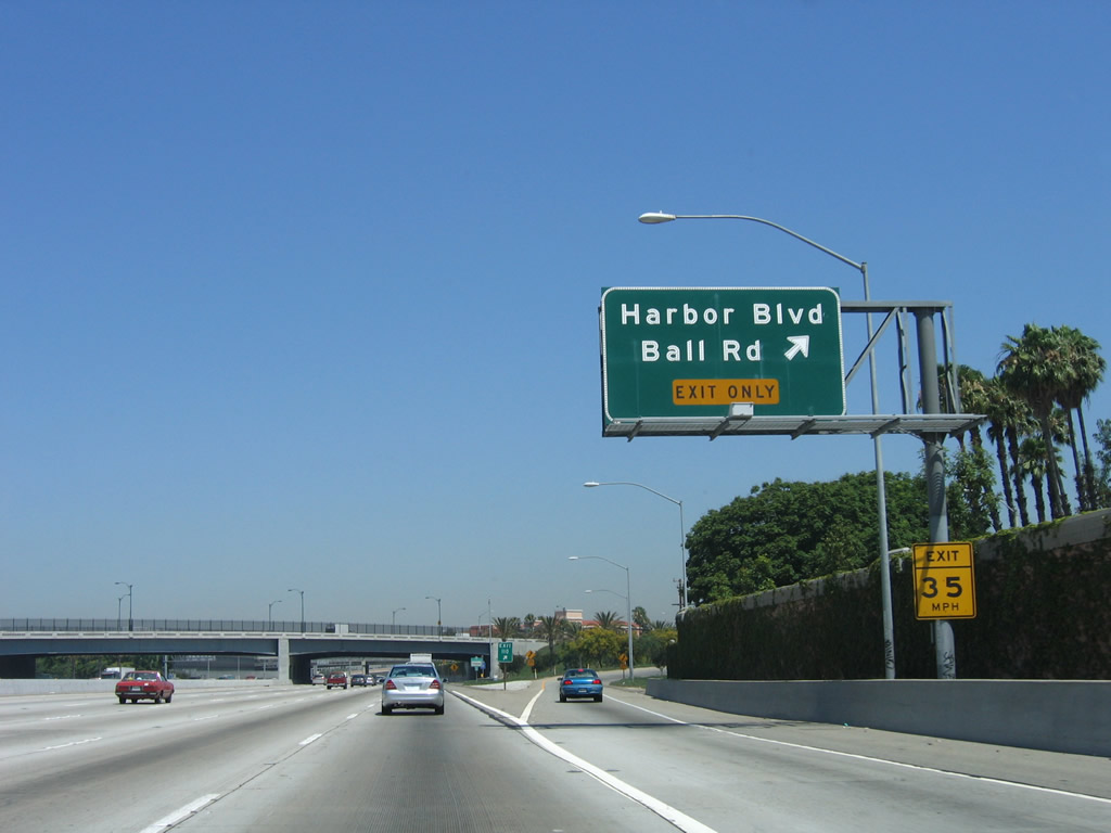
The next exit is Exit 110, Harbor Boulevard and Ball Road. Harbor Boulevard follows Historic U.S. 101 north to Fullerton and La Habra. The old alignment of U.S. 101 then turns northwest via California 72/Whittier Boulevard to reach downtown Los Angeles. At one time, this stretch of Harbor Boulevard was part of California 72, but it has since been removed from state maintenance. Photo taken 09/29/07. |
|
Northbound Interstate 5 reaches Exit 110, Harbor Boulevard and Ball Road. The exit is configured so that motorists exit onto Harbor Boulevard, and Ball Road may be reached by taking Harbor Boulevard north to the intersection. To reach Disneyland, use Exit 110 (Harbor Boulevard north to Ball Road west, then Disneyland Drive south). Photo taken 06/28/06. |
|
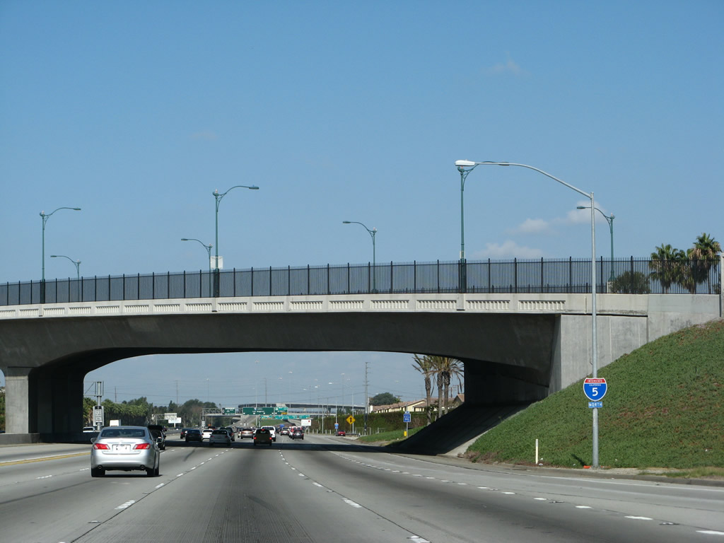
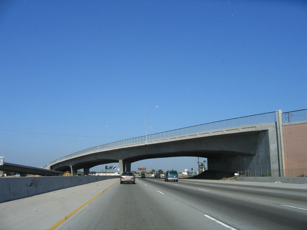
The overpass that carries Harbor Boulevard over Interstate 5 is indicative of the design features on this stretch of the Santa Ana Freeway. When reconstructed in the late 1990s and early 2000s, the overpasses were designed to emulate older styles of bridge railing while meeting modern design standards, and slight arches and other decorative touches were added to enhance the aesthetics of the newly widened freeway. Photo taken 09/29/07. |
|
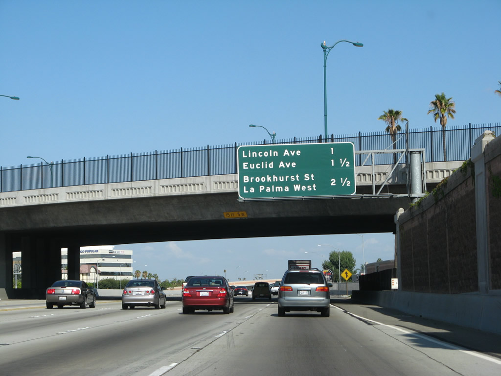
This mileage sign, which is positioned in front of the Ball Road overpass, provides the distance to the next three exits along northwest-bound Interstate 5: Exit 111, Lincoln Avenue (east-west); Exit 112, Euclid Street (north-south); and Exits 113A-B, La Palma Avenue (east-west) and Brookhurst Street (north-south). The freeway will continue at this sharp angle northwest into Los Angeles County. Photo taken 09/29/07. |
|
A flyover ramp carries traffic from northbound Disneyland Drive onto Interstate 5 north. Photo taken 09/29/07. |
|
Another interchange sequence sign with the same three exits is posted shortly thereafter. Photo taken 06/28/06. |
|
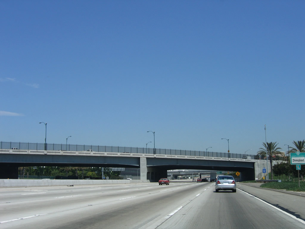
As Interstate 5 lowers below grade, two more decorative bridges pass over the Santa Ana Freeway. Photo taken 09/29/07. |
|
Northbound Interstate 5 reaches Exit 111, Lincoln Avenue. Lincoln Avenue is the old alignment of U.S. 91 and California 18, which used to travel east-west through Anaheim. The replacement freeway (California 91) was built in stages in the 1960s, but the U.S. 91 designation was eliminated in 1964 along with a host of other U.S. highways in California. Pre-1964, U.S. 91 used to follow Lincoln Avenue west to Lakewood Boulevard south, then turned west again on the Pacific Coast Highway (California 1) until the intersection with former California 15 (Atlantic Avenue). At that intersection, both U.S. 91 and U.S. 6 came to an end. Both routes were retracted from that intersection in 1964. The next exit on Interstate 5 north is Exit 112, Euclid Street. Photo taken 06/28/06. |
|
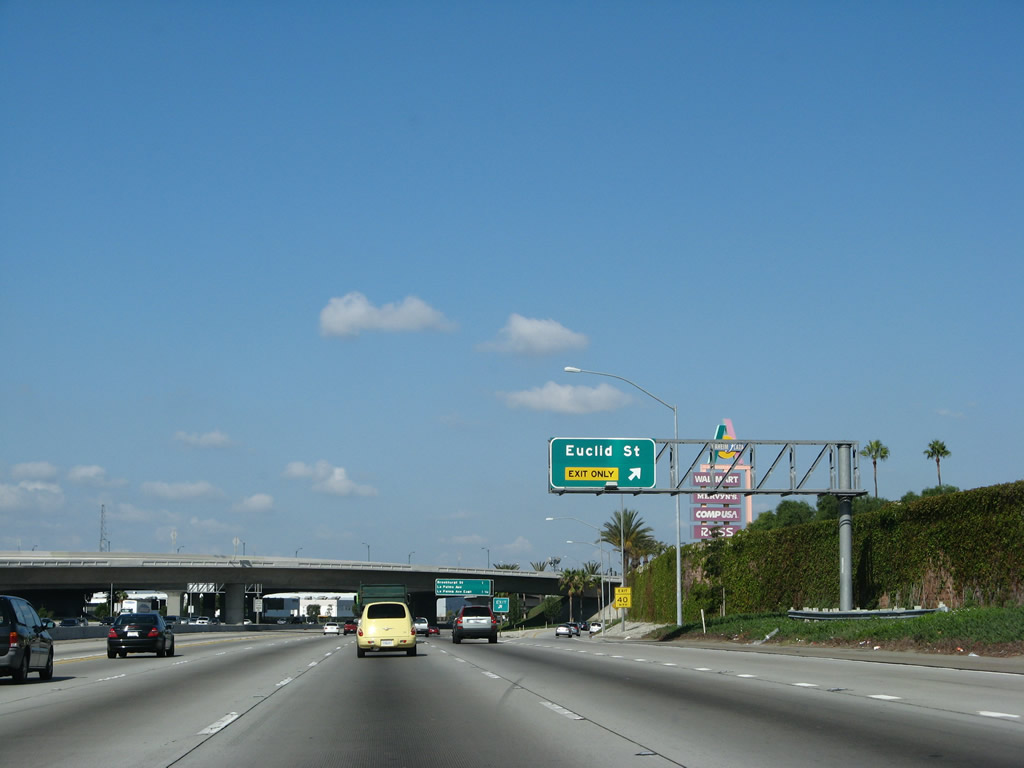
The next exit along Interstate 5 (Santa Ana Freeway) north is Exit 112, Euclid Street (right lane exit only). An exit number tab was affixed to this overhead sign. Photo taken 06/28/06. |
|
Northbound Interstate 5 reaches Exit 112, Euclid Street. This is all along a completely reconstructed Interstate 5 between the Orange Crush and California 91. Photo taken 09/29/07. |
|
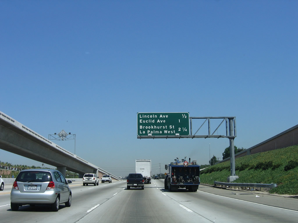
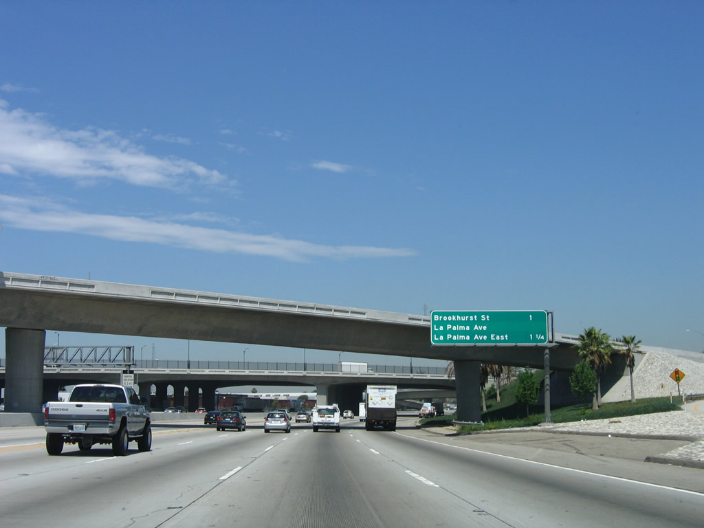
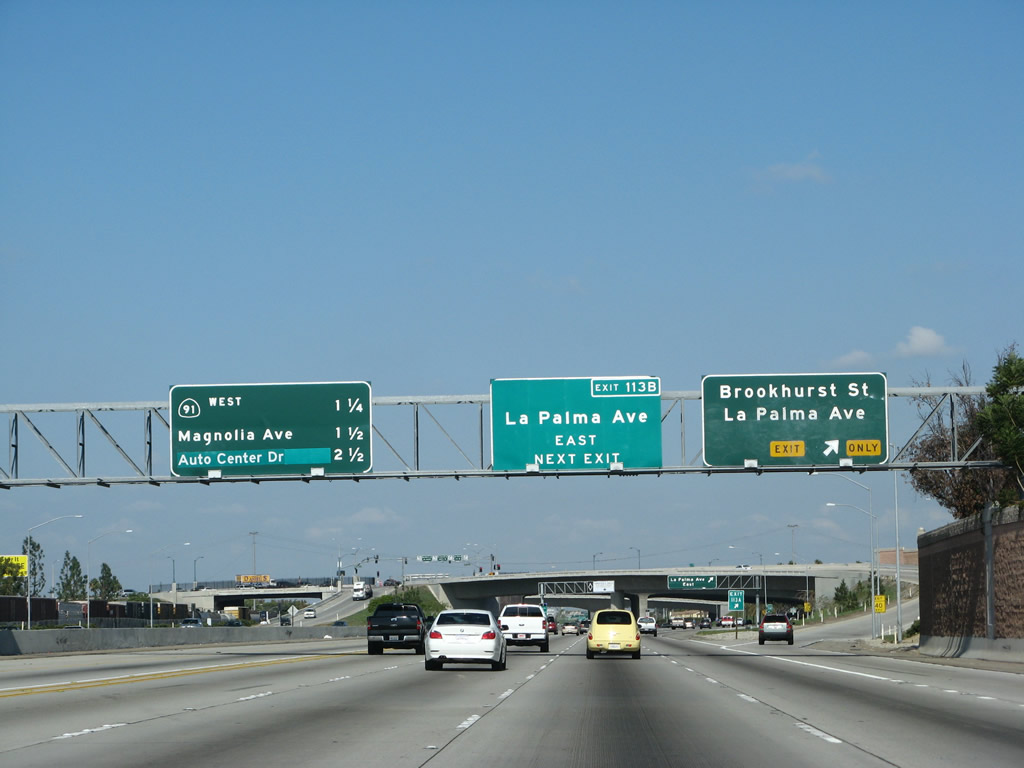
This mileage sign, which is positioned in front of the Euclid Street overpass, provides the distance to the next two exits along northwest-bound Interstate 5: Exits 113A-B, La Palma Avenue (east-west) and Brookhurst Street (north-south). Photo taken 06/28/06. |
|
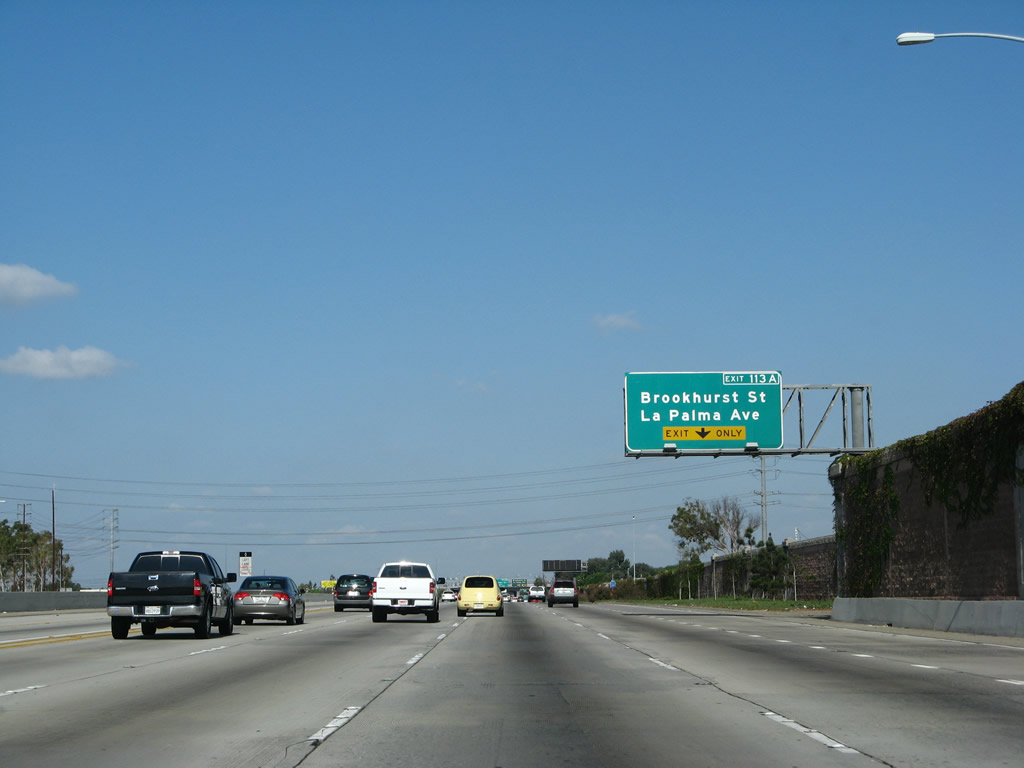
The right lane of Interstate 5 (Santa Ana Freeway) north becomes exit only for Exit 113A, Brookhurst Street to La Palma Avenue west. Photo taken 09/29/07. |
|
Northbound Interstate 5 (Santa Ana Freeway) reaches Exit 113A, Brookhurst Street north to La Palma Avenue west. The next four exits are Exit 113B, La Palma Avenue east; Exit 113C, California 91 (Artesia Freeway); Exit 114, Magnolia Avenue to California 91 (Riverside Freeway) east; and Exit 115, Manchester Boulevard and Auto Center Drive. Photo taken 09/29/07. |
|
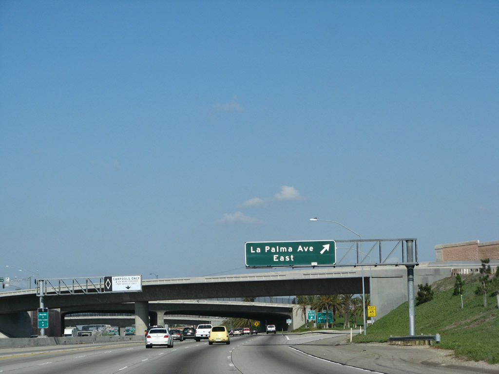
The next exit along Interstate 5 (Santa Ana Freeway) north is Exit 113B, La Palma Avenue east. Photo taken 09/29/07. |
|
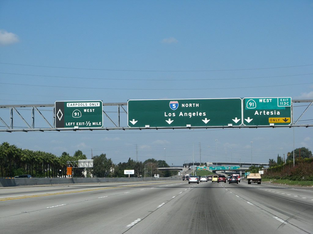
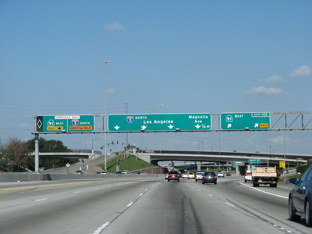
The next two exits along Interstate 5 (Santa Ana Freeway) north are Exit 113C, California 91 (Artesia Freeway) west to Artesia and Exit 114, Magnolia Avenue to California 91 (Riverside Freeway) east to Corona and Riverside. The connection to California 91 east is afforded via a surface street connection due to the angle at which Interstate 5 approaches California 91. This roadside exit number sign is pointing to the second exit (Exit 114), not the direct connection ramp to California 91 west. Photo taken 09/29/07. |
|
An Interstate 5 north reassurance shield assembly is posted after the on-ramp from Brookhurst Street. Photo taken 09/29/07. |
|
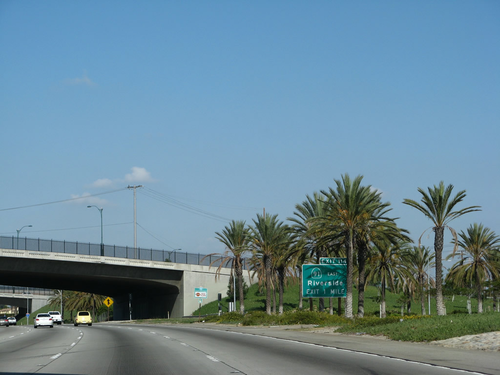
California 91 is a major east-west freeway that travels west to Artesia before shifting to a surface street alignment. There is no direct connection from northbound Interstate 5 to eastbound California 91 due to the angle at which these two roads interchange; access must be had via Exit 114 (Magnolia Avenue). At night, this interchange is one of the most well-lit in Orange County, as tall mast lights increase nighttime visibility. Photo taken 09/29/07. |
|
Use Magnolia Avenue (Exit 114) to California 91 west to Riverside. Photo taken 06/28/06. |
|
Northbound Interstate 5 reaches Exit 113C, California 91 (Artesia Freeway) west to Artesia and Beach Cities. This sign is reflective, while the approach sign was nonreflective. This is because the sign orders for this construction job came while the policy regarding sign type changed during 1999, which was in the latter part of the Interstate 5 expansion project. The exit number was retroactively added to the California 91 exit panel. A dedicated left exit to the California 91 HOV lanes is also provided at this interchange. Photo taken 09/29/07. |
|
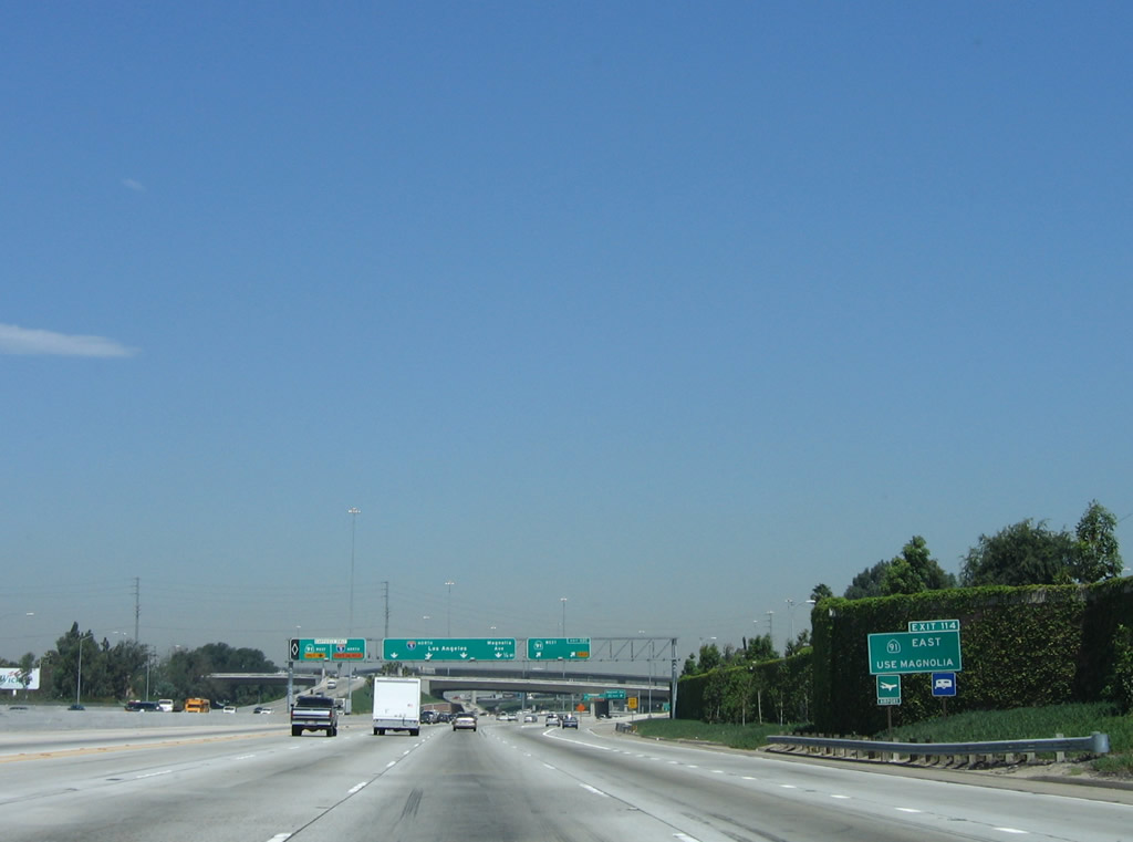
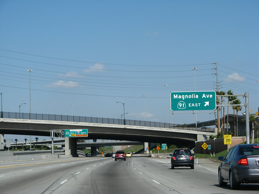
Immediately after the direct connection from northbound Interstate 5 to westbound California 91 is Exit 114, which provides access to eastbound California 91 via Magnolia Street. There is no direct connection from northbound Interstate 5 to eastbound California 91. However, California 91 eastbound may be reached via Magnolia Avenue. The off-ramp for Magnolia is visible under the California 91 interchange. Photo taken 09/29/07. |
|
|
In addition to the direct connection from northbound Interstate 5 to westbound California 91, there is also a ramp from the carpool/high occupancy vehicle lane to the high occupancy vehicle lane on California 91, as seen in this image. This exit is located at nearly the same location as Exit 114/Magnolia Avenue. Photos taken 04/06/12 and 09/29/07. |
|
Tall flyover ramps and tall mast lighting are indicative of this massive interchange between Interstate 5 and California 91. Photo taken 09/29/07. |
|
|
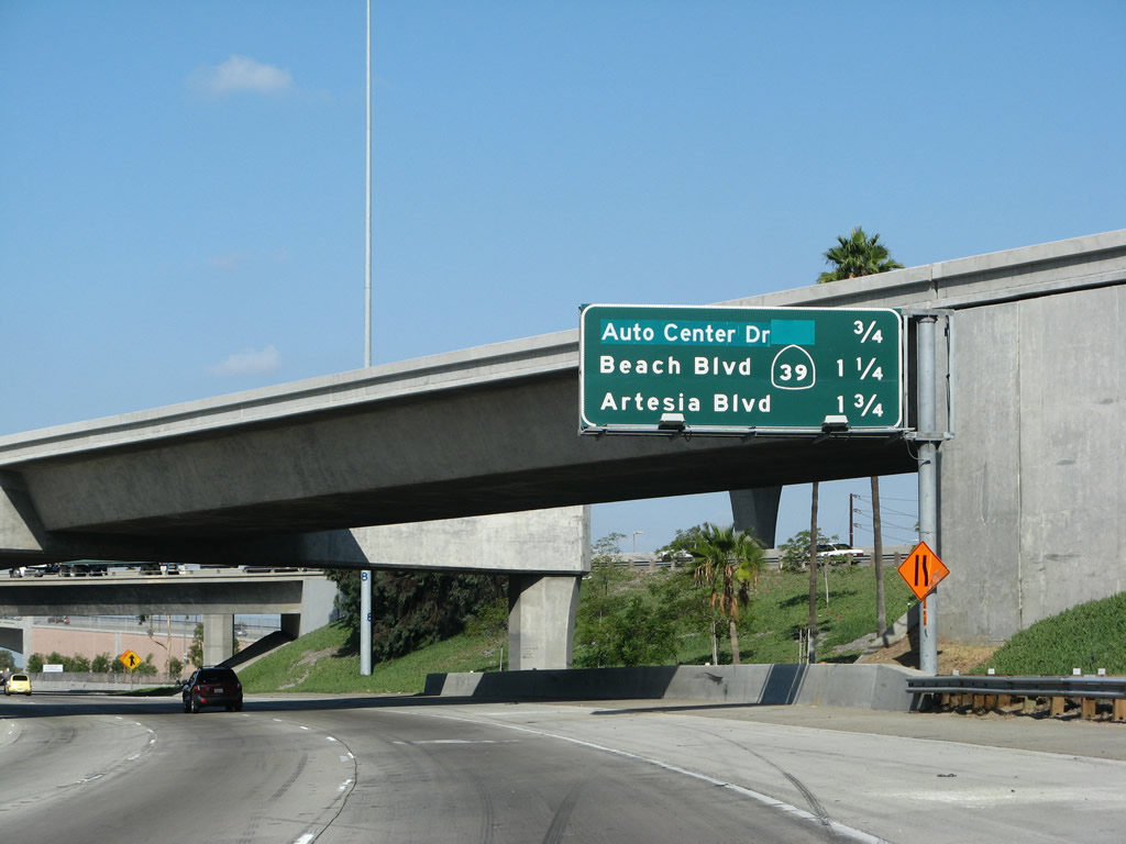
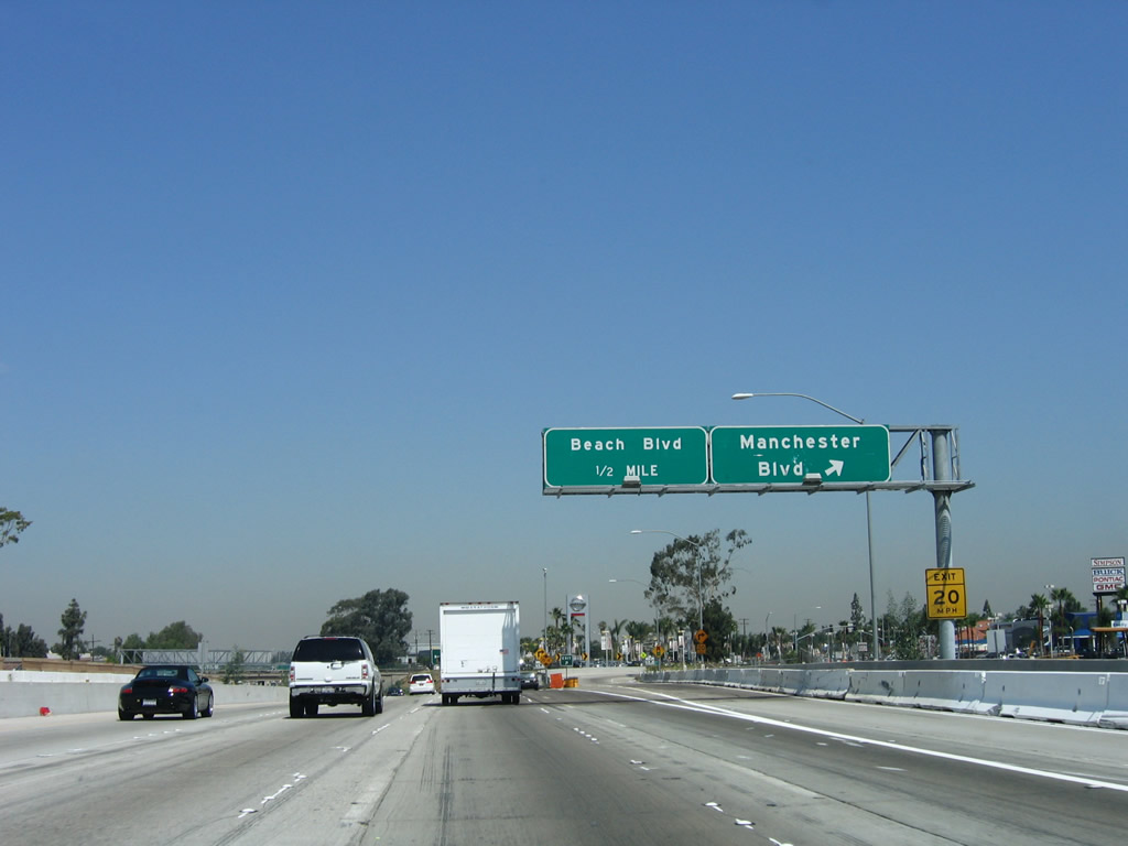
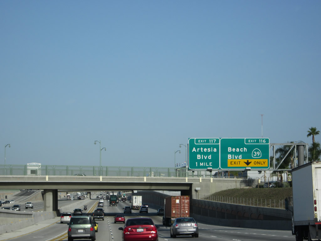
This mileage sign provides the distance to Exit 115, Manchester Boulevard and Auto Center Drive; Exit 116, California 39 (Beach Boulevard); and Exit 117, Artesia Boulevard (former California 14). Photos taken 09/29/07 and 06/28/06. |
|
An Interstate 5 north reassurance shield is pasted onto one of the supporting bents in the California 91 interchange. Photo taken 10/07/06. |
|
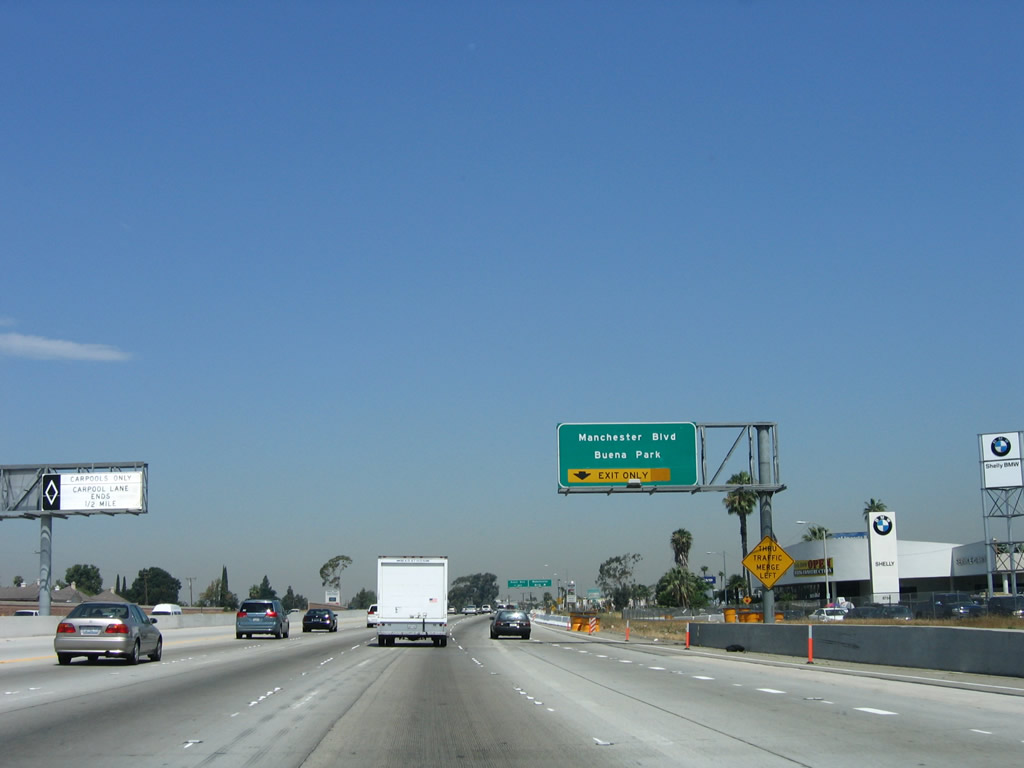
Leaving the California 91 interchange, this bridge carries Orangethorpe Avenue over Interstate 5. At this point, Interstate 5 skirts the southwestern corner of the city of Fullerton, then enters the city of Buena Park, the "Center of the Southland." Incorporated in 1953, Buena Park had a population of 78,282 people as of the 2000 Census. Photo taken 10/07/06. |
|
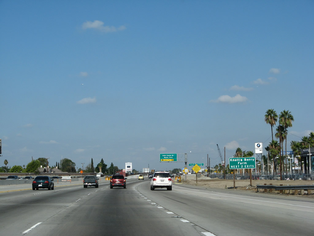
The next two exits (Exit 115 and Exit 116) connect Interstate 5 with Knotts Berry Farm, an theme park popular for its roller coasters and other attractions. Photo taken 06/28/06. |
|
|
|
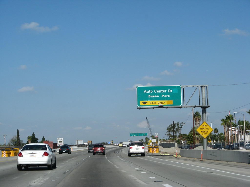
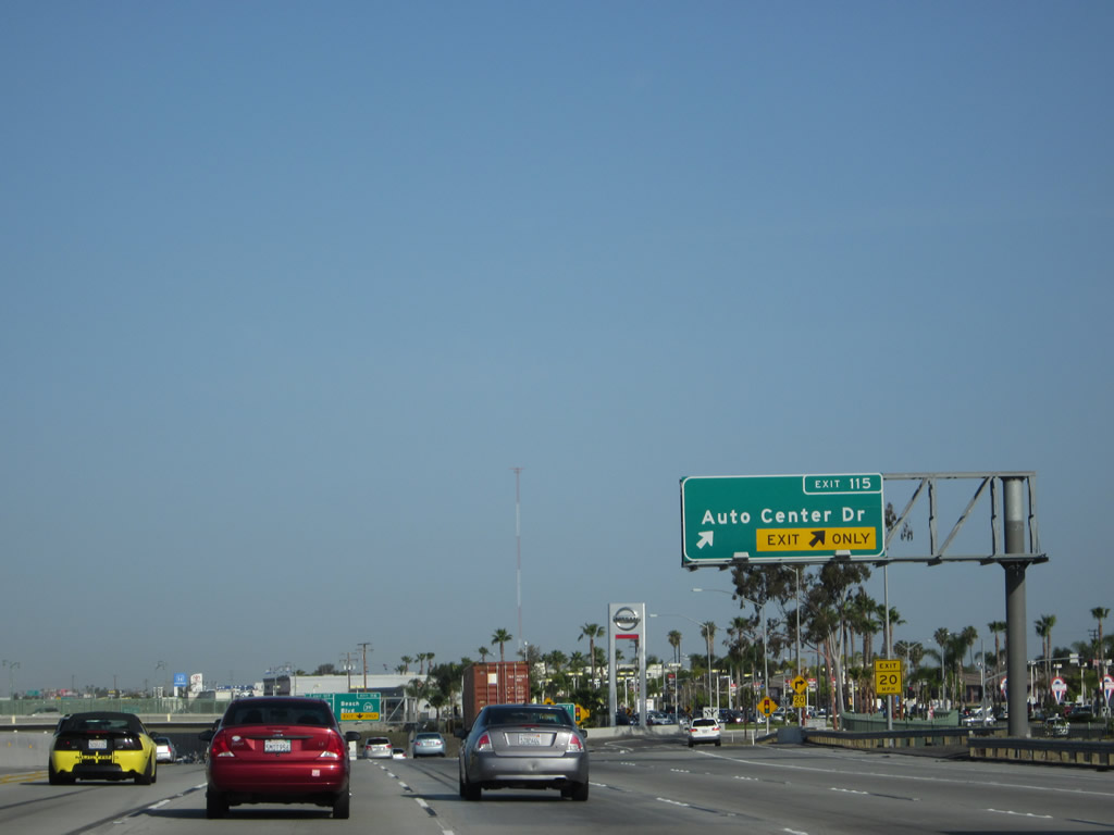
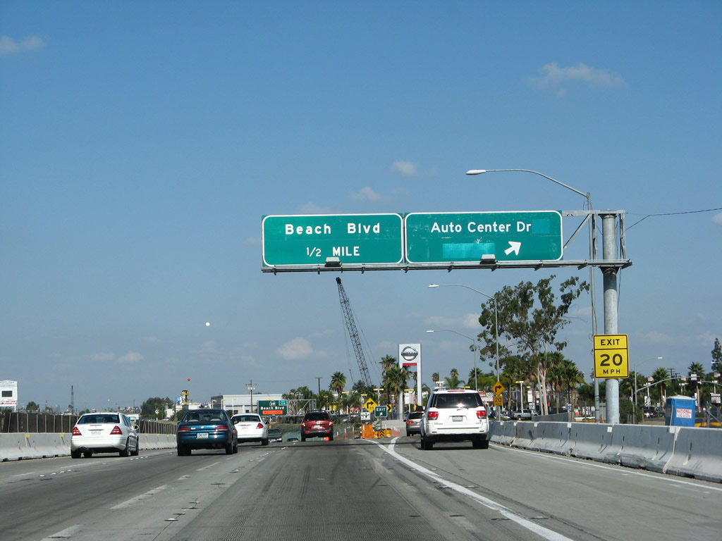
The right lane becomes exit only for Exit 115, Manchester Boulevard and Auto Center Drive. This is the first exit to serve the city of Buena Park. The segment of Interstate 5 through from here north to the Orange-Los Angeles County Line was the last segment of Interstate 5 to be widened in sequence starting from near the El Toro Y (5/405 Split). Roadwork through here largely wrapped up in 2011. Photos taken 04/06/12, 09/29/07, and 06/28/06. |
|
|
|
Northbound Interstate 5 (Santa Ana Freeway) reaches Exit 115, Auto Center Drive (Manchester Avenue). The next exit is Exit 116, California 39 (Beach Boulevard). Photos taken 04/06/12, 09/29/07, and 06/28/06. |
|
|
|
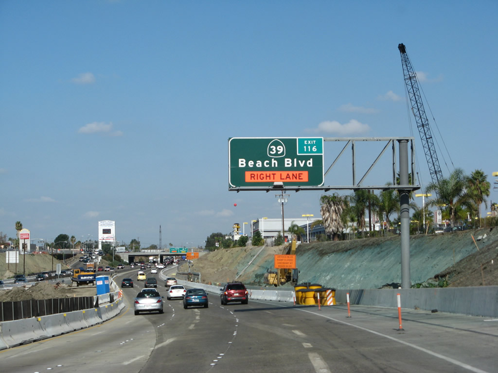
From here, Interstate 5 dramatically changes. Northbound Interstate 5, as it leaves Orange County, shifts from a ten to twelve-lane freeway to a six-lane freeway almost right at the county line. The change is that dramatic. Watch for slowing traffic and changing conditions. Interstate 5 is slated for improvements north of California 39 (Beach Boulevard), but the improvements are currently under construction. The next exit is Exit 116, California 39 (Beach Boulevard). Photos taken 04/06/12, 09/29/07, and 06/28/06. |
|
|
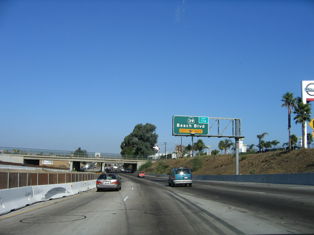
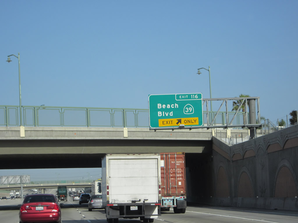
Northbound Interstate 5 (Santa Ana Freeway) meets Exit 116, California 39 (Beach Boulevard). This area has completely changed due to the freeway expansion project. Photos taken 04/06/12 and 10/07/06. |
|
|
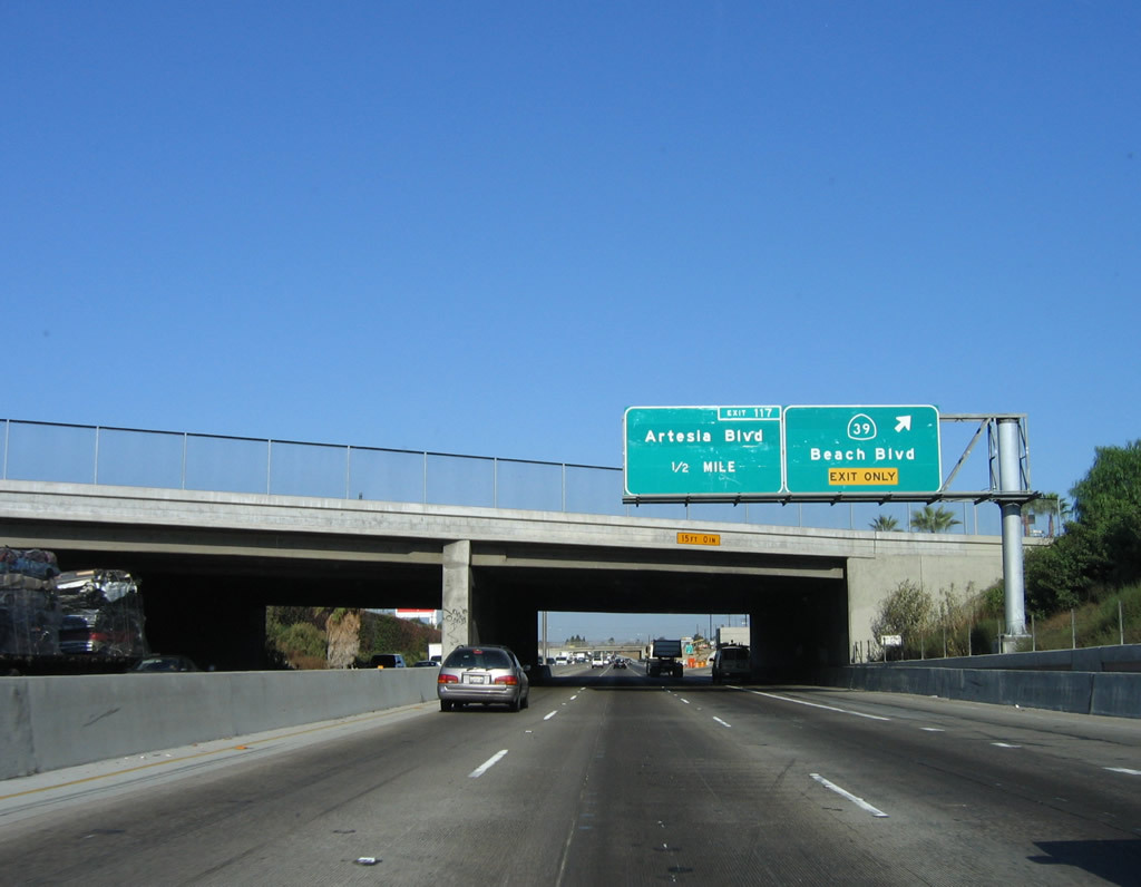
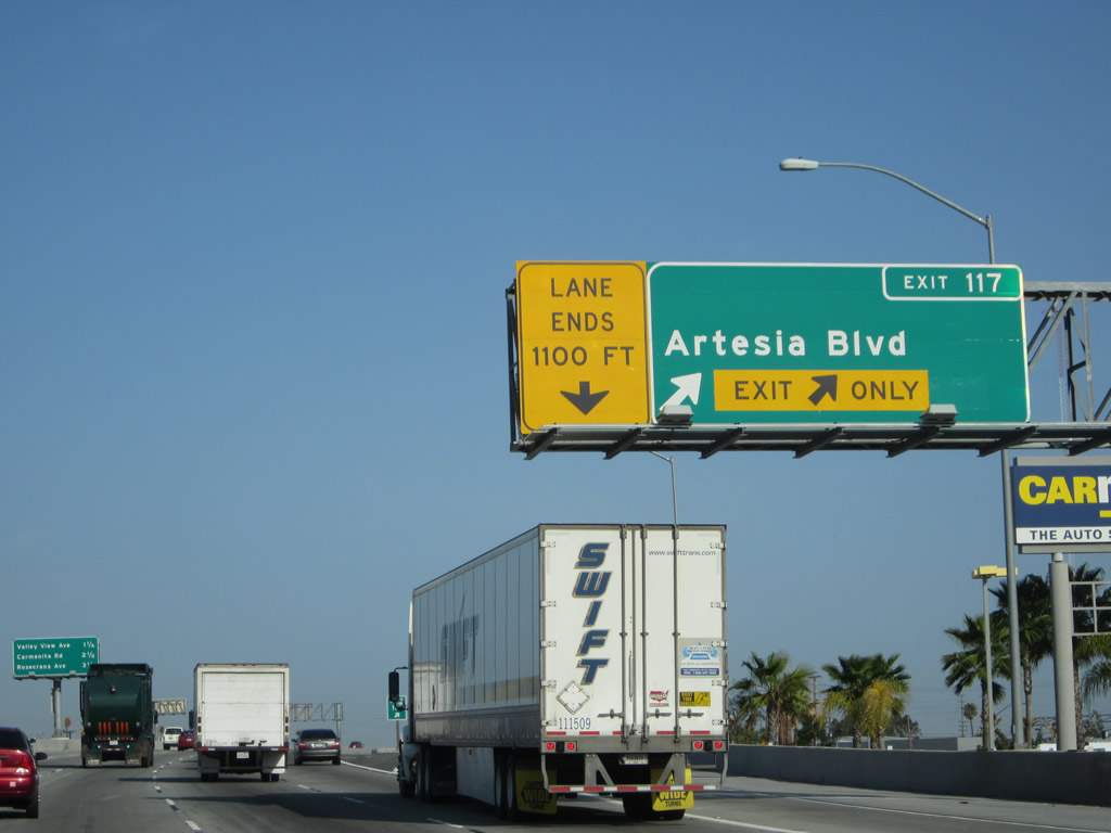
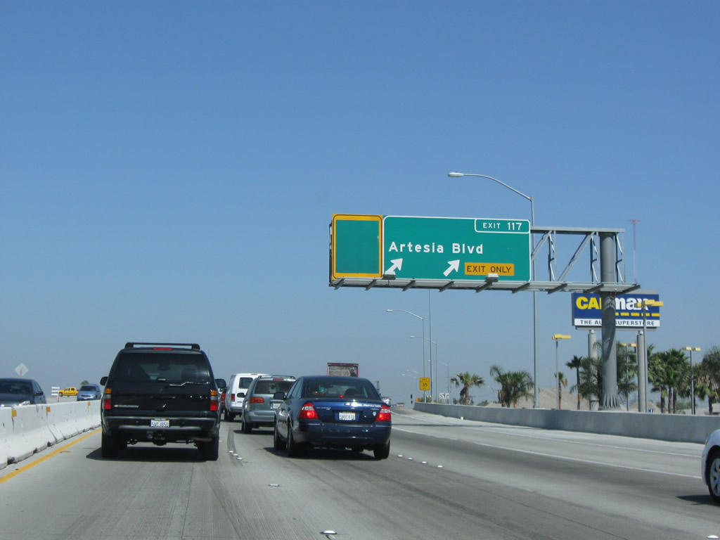
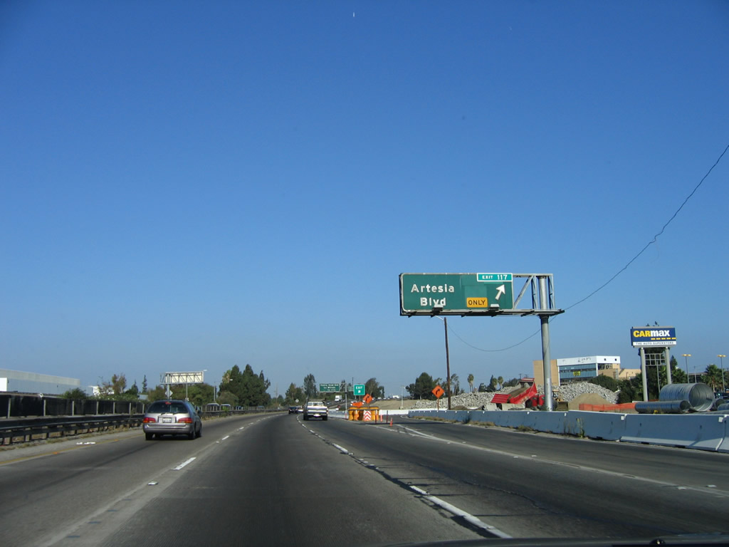
The next exit along Interstate 5 (Santa Ana Freeway) north is Exit 117, Artesia Boulevard (next right). Photos taken 04/06/12 and 10/07/06. |
|
|
|
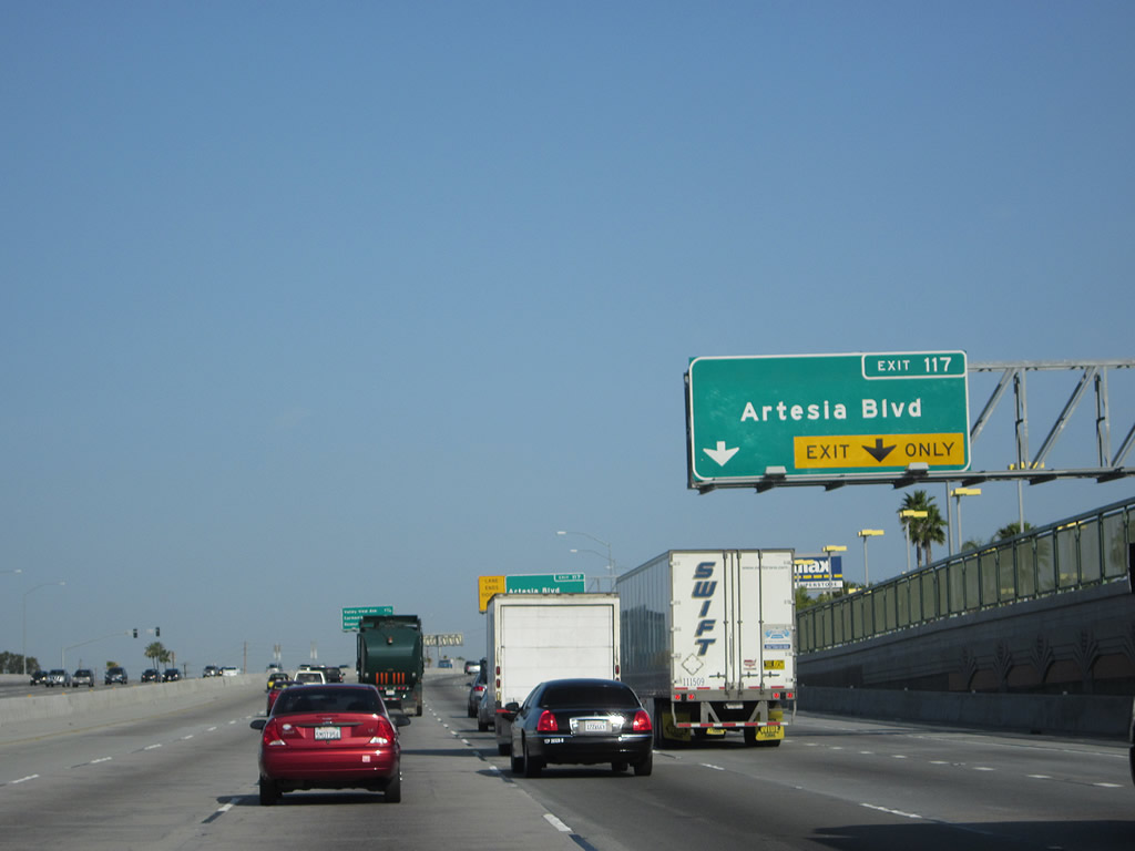
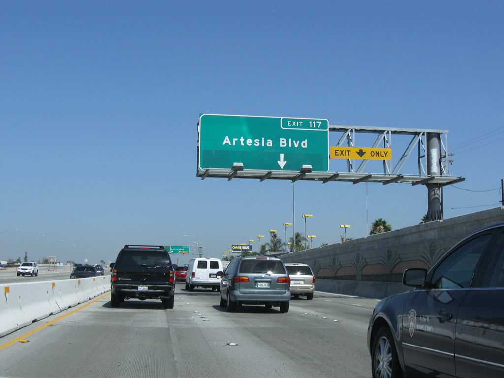
Soon thereafter, northbound Interstate 5 (Santa Ana Freeway) reaches Exit 117, Artesia Boulevard. This old porcelain enamel sign used to have a California 14 shield until the state route was decommissioned (after the California 91 freeway was built). This exit was closed in Spring 2008 due to the ongoing widening project; look for changes coming soon to this area. Photos taken 04/06/12, 07/15/09, and 10/07/06. |
|
|
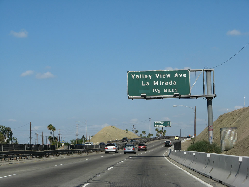
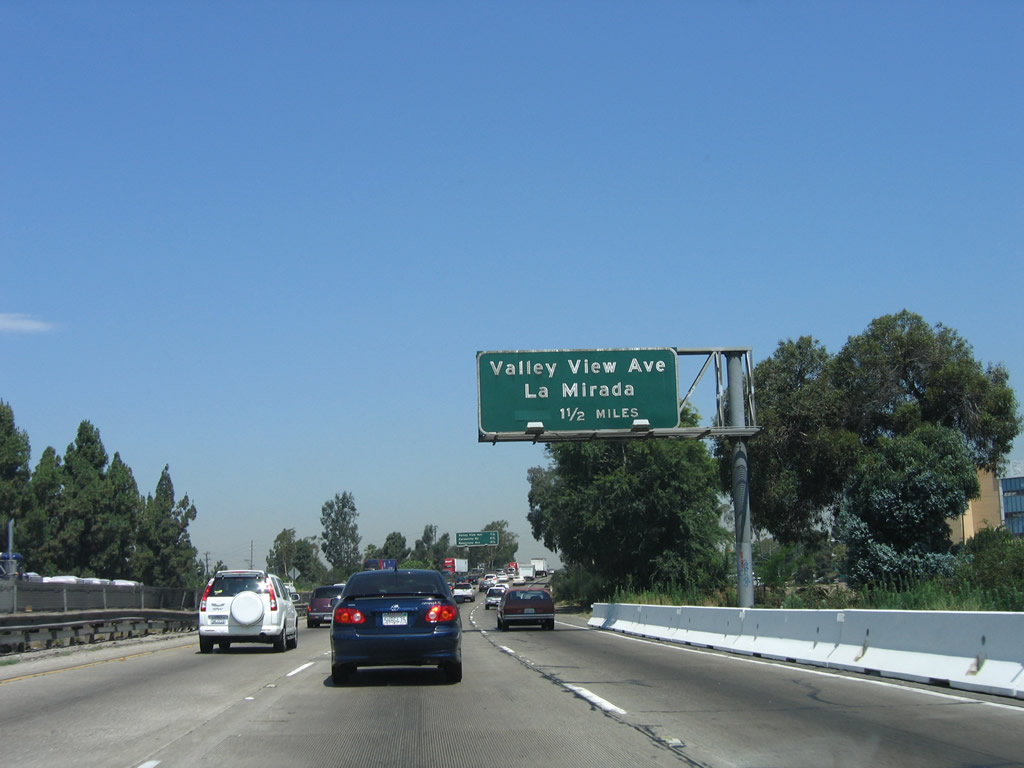
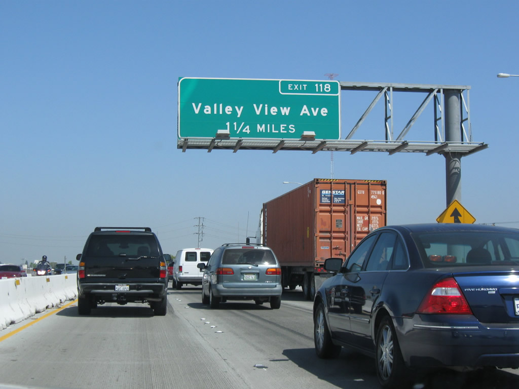
The next exit along Interstate 5 (Santa Ana Freeway) north is Exit 118, Valley View Boulevard to the city of La Mirada. Photos taken 09/29/07 and 06/28/06. |
|
|
|
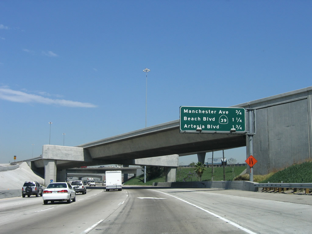
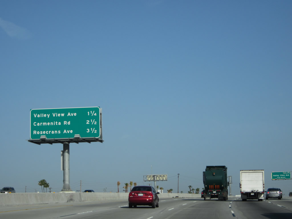
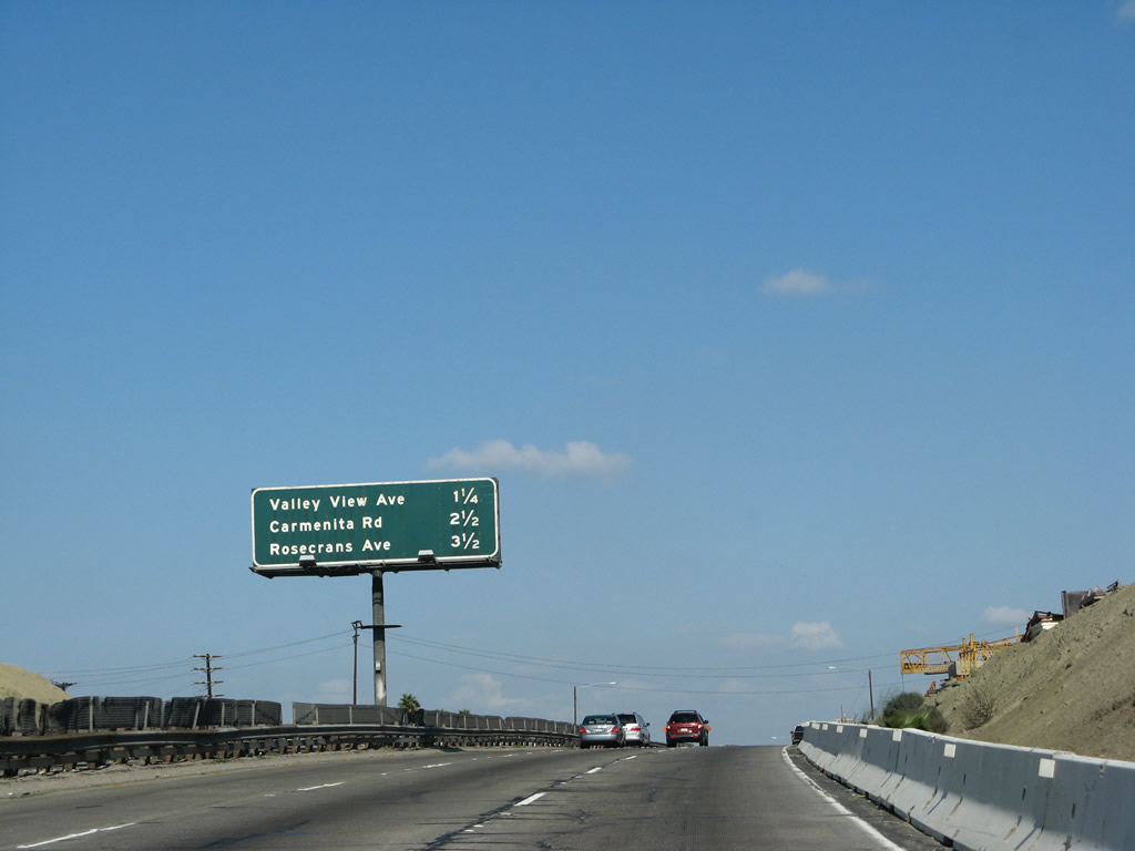
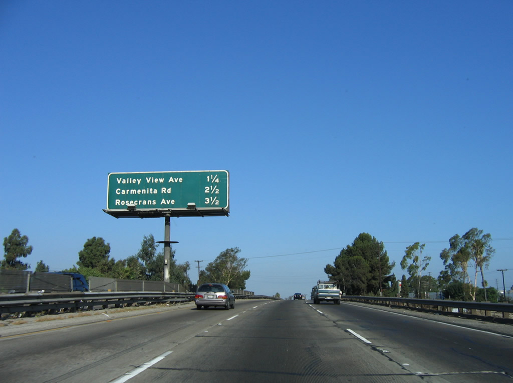
This mileage sign provides the distance to the next three exits along Interstate 5 (Santa Ana Freeway) north: Exit 118, Valley View Boulevard to La Mirada; Exit 119, Carmenita Road; and Exit 120A, Rosecrans Avenue. When Interstate 5 was expanded through here in 2011, the sign was replaced. Photos taken 04/06/12, 09/29/07, and 06/28/06. |
|
A new 1.25-mile advance sign for Exit 118 was placed by 2009. Photo taken 07/15/09. |
|
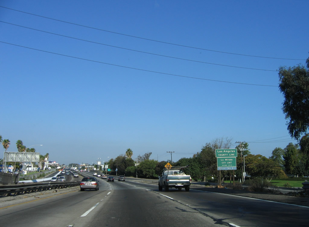
Prior to the off-ramp for Exit 118, northbound Interstate 5 (Santa Ana Freeway) leaves Orange County and the city of Buena Park and enters Los Angeles County and the city of La Mirada. Photo taken 10/07/06. |
Page Updated September 13, 2012.