| Interstate 5 north |
|
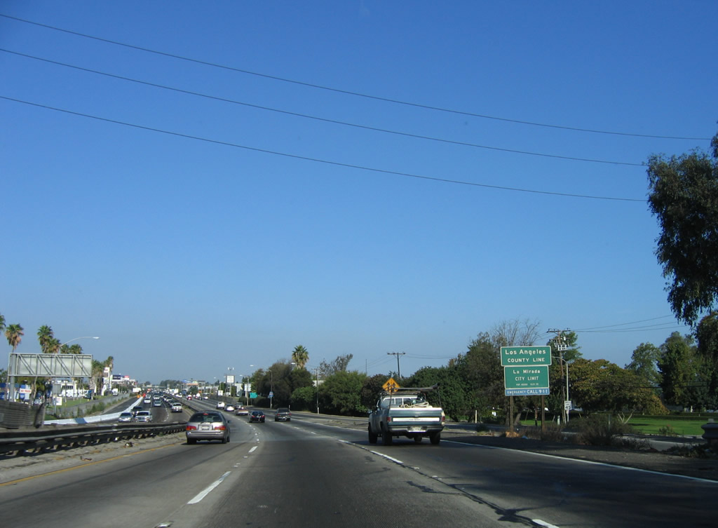
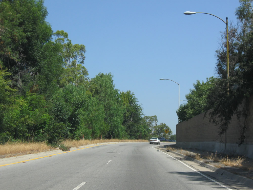
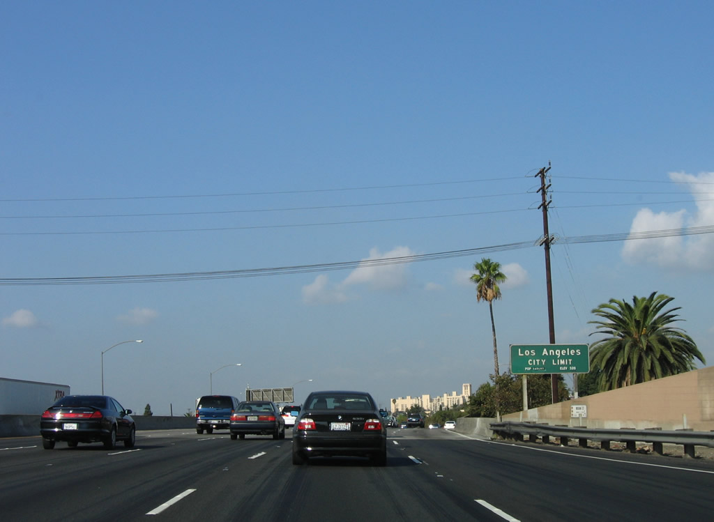
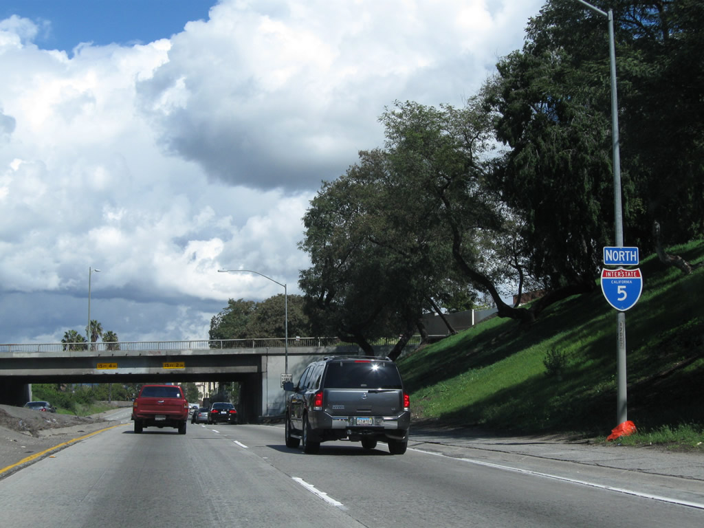
Prior to Exit 118, northbound Interstate 5 (Santa Ana Freeway) leaves Orange County and the city of Buena Park and enters Los Angeles County and the city of La Mirada. La Mirada had a population of 46,783 as of the 2000 Census and 48,527 as of the 2010 Census. The city was incorporated on March 23, 1960. Photo taken 10/07/06. |
|
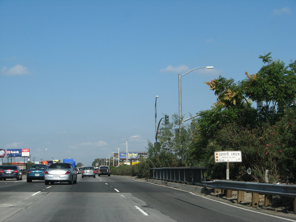
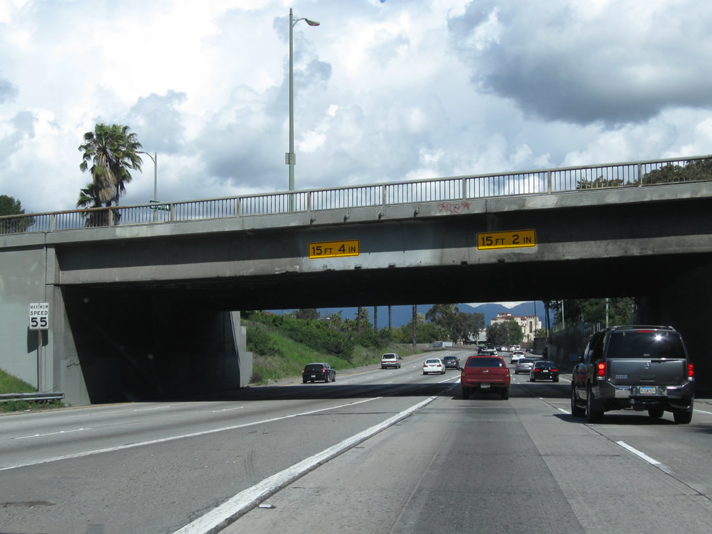
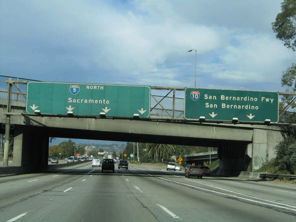
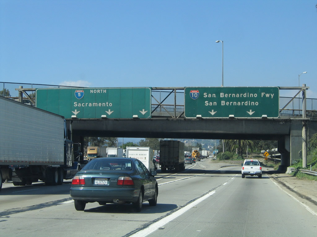
Interstate 5 has much older design standards along this stretch of the Santa Ana Freeway. While reconstruction and expansion of Interstate 5 from here northwest to the East Los Angeles Interchange is planned, the original road is still in use today. Here, Interstate 5 north crosses over Coyote Creek (bridge built in 1934 and widened in 1959). At this location, there are no shoulders either. Photo taken 09/29/07. |
|
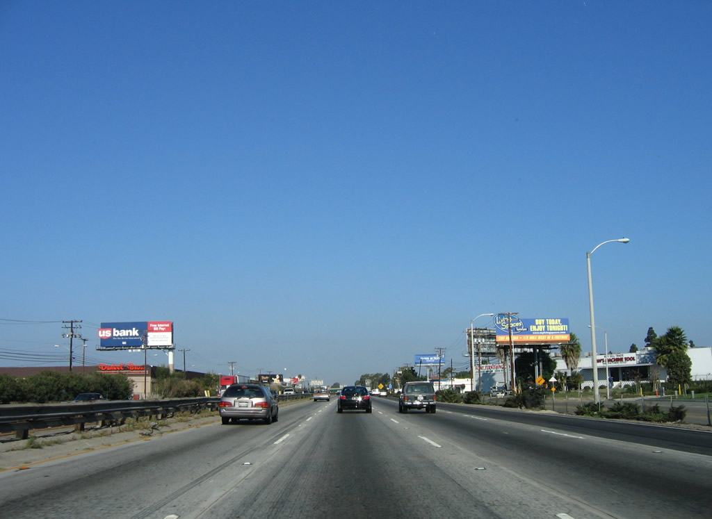
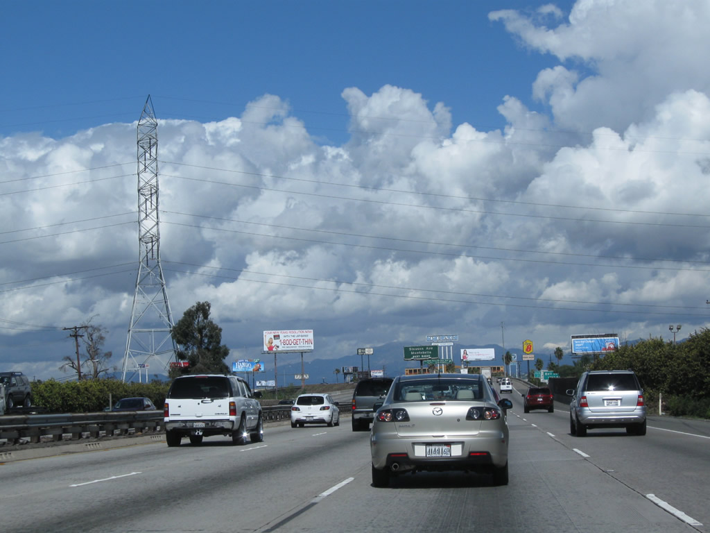
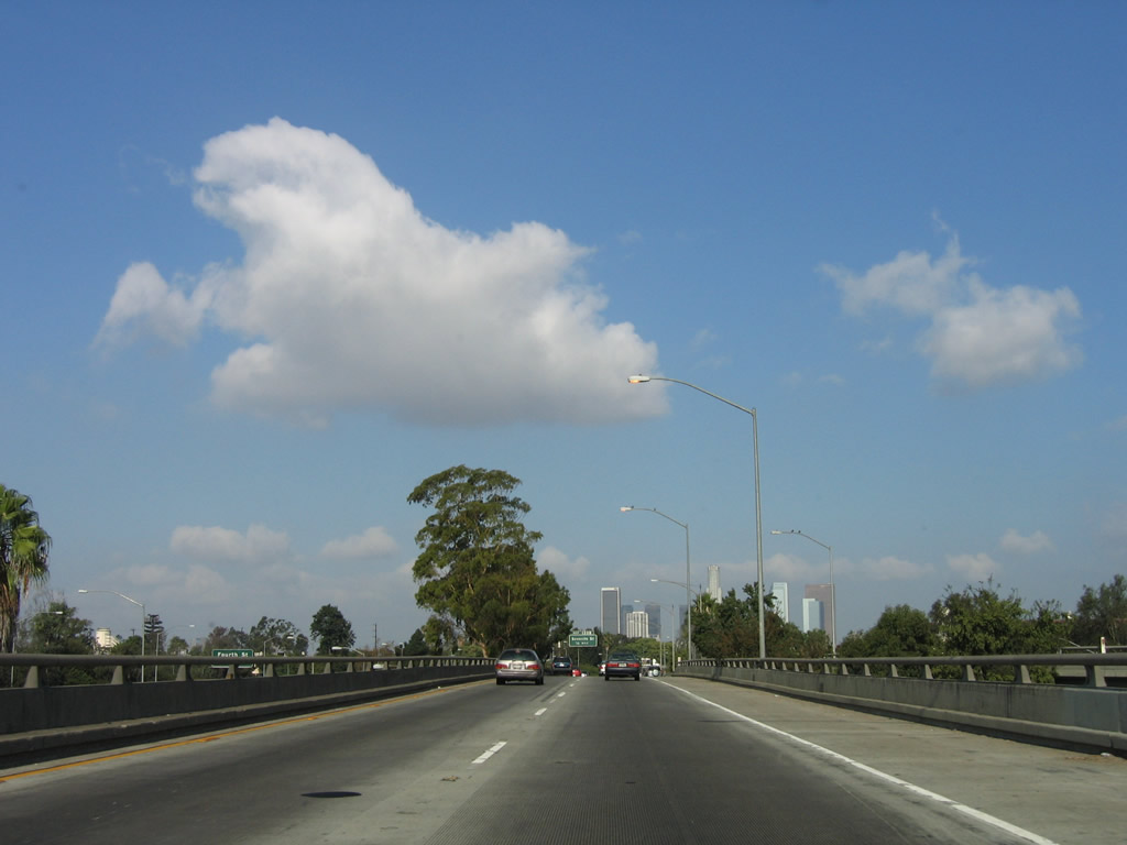
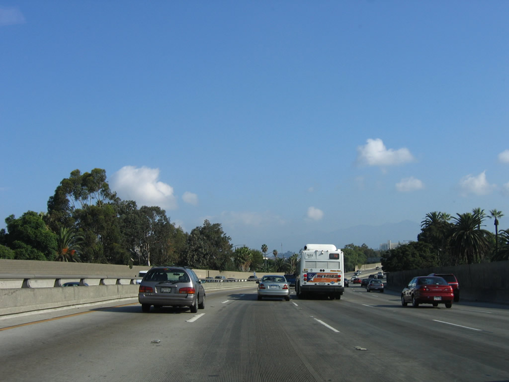
This is a typical view of the Santa Ana Freeway in southern Los Angeles County: frontage roads with businesses on either side of the freeway, along with a planted median (with divoted curbing) and three through lanes in each direction (with occasional auxiliary lanes such as the one shown here). Most of this section of freeway dates back to the mid-1950s, when the original Santa Ana Freeway was built as part of U.S. 101. Photo taken 10/07/06. |
|
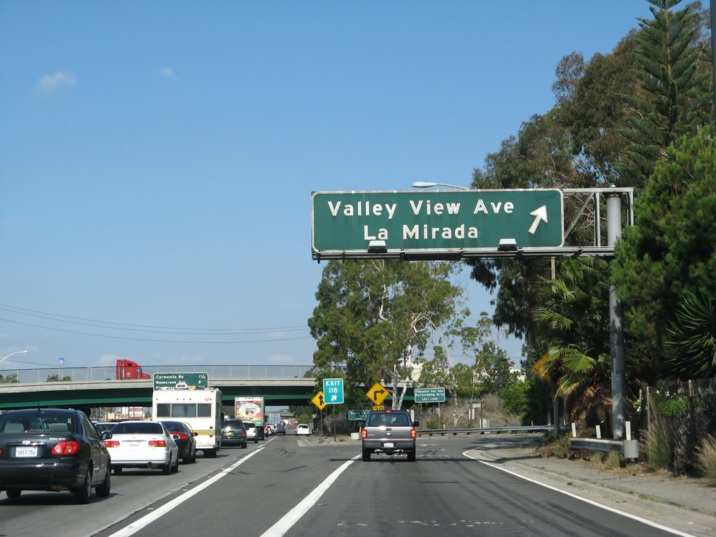
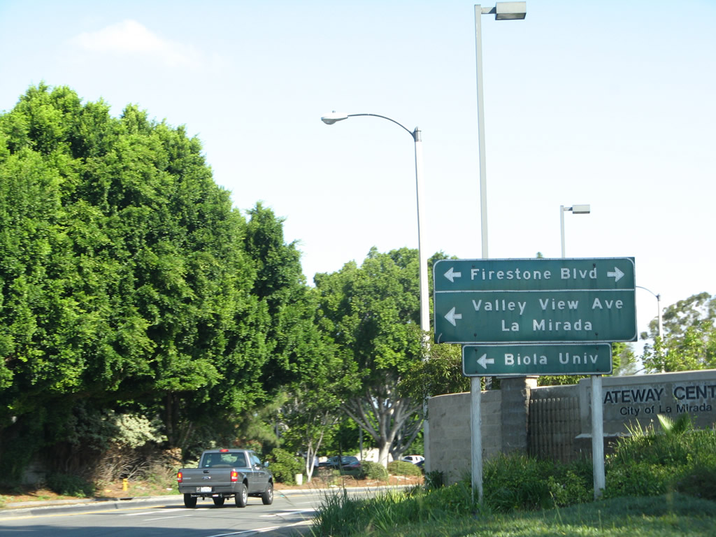
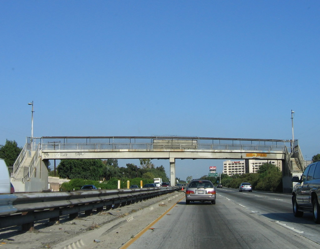
Northbound Interstate 5 (Santa Ana Freeway) reaches Exit 118, Valley View Avenue to La Mirada. Photo taken 09/29/07. |
|
Now on the off-ramp, this sign is posted on for Rosecrans Avenue and Valley View Avenue in La Mirada. Photo taken 09/29/07. |
|
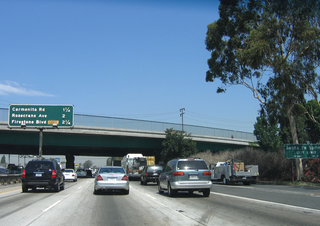
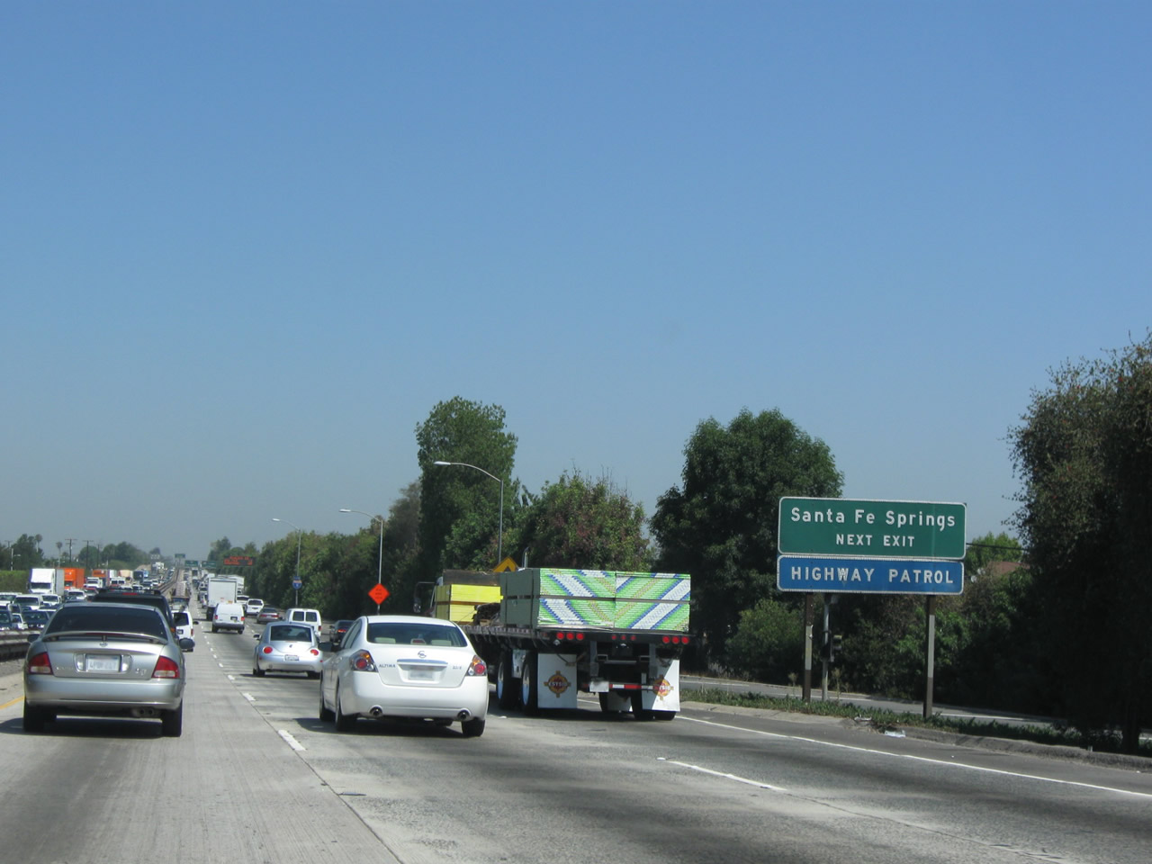
This mileage sign provides the distance to the next three exits along Interstate 5 (Santa Ana Freeway): Exit 119, Carmenita Road; Exit 120A, Rosecrans Avenue; and Exit 120B, Firestone Boulevard. At this point, Interstate 5 leaves La Mirada and enters Santa Fe Springs. Home to 17,438 people as of the 2000 Census, Santa Fe Springs consists of 8.9 square miles and is part of the Gateway Cities Council of Governments. The Gateway Cities generally extends from Interstate 110 (Harbor Freeway) near Long Beach east to the Los Angeles-Orange County Line and north to California 60 (Pomona Freeway). Photo taken 06/28/06. |
|
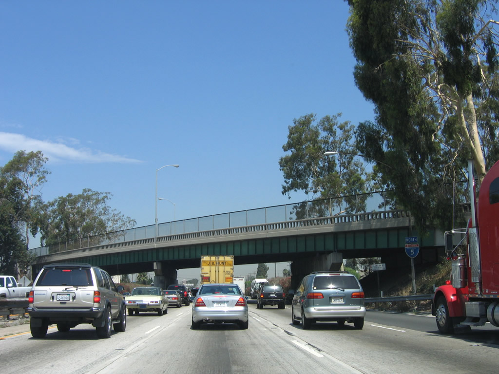
The next exit along Interstate 5 (Santa Ana Freeway) north is Exit 119, Carmenita Road. Photo taken 06/28/06. |
|
This bridge carries Alondra Boulevard over Interstate 5 (built in 1955). While there are no off-ramps to Alondra Boulevard, there are a couple of on-ramps to Interstate 5 north and south. Photo taken 06/28/06. |
|
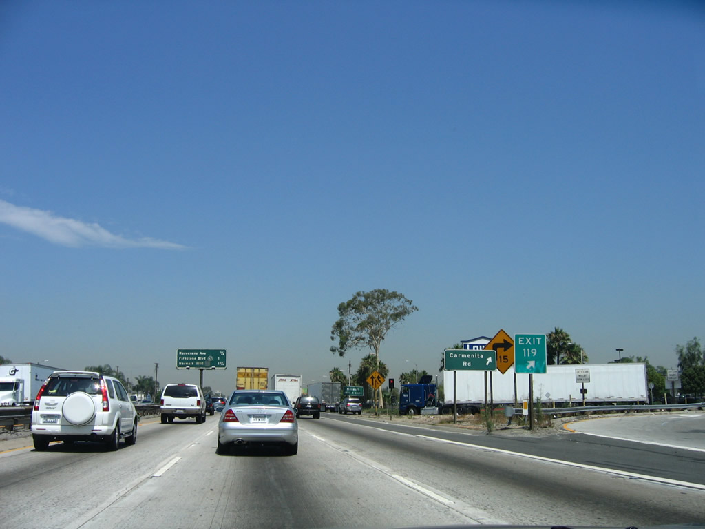
Northbound Interstate 5 (Santa Ana Freeway) reaches Exit 119, Carmenita Road (overpass built in 1955). This is the first exit to serve the city of Norwalk, which was home to 103,298 residents as of the 2000 Census. The city was incorporated in 1957, around the same time the Interstate 5 freeway was first built (as part of U.S. 101). Norwalk consists of 9.35 square miles. Photo taken 06/28/06. |
|
At the gore point is an exit number and another auxiliary sign for Carmenita Road. Norwalk is a place of great freeway controversy, first because they were instrumental in ensuring that Interstate 105, the Century Freeway, would not continue very far east of Interstate 605 (San Gabriel River freeway). As such, the usefulness of Interstate 105 as a route to Los Angeles International Airport from Interstate 5 as an alternative to Interstate 405 is compromised, unless motorists use California 91 and Interstate 605 or passes through Norwalk, perhaps via former California 42 (Firestone Boulevard). In addition to its role in Interstate 105, Norwalk also had concerns with the original plans for the expansion of Interstate 5, saying it did not want its businesses and homes to be affected by the increased need for right of way. A compromise has since been reached, and Caltrans is already designing the replacement Interstate 5 freeway. Photo taken 06/28/06. |
|
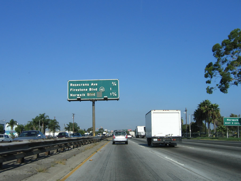
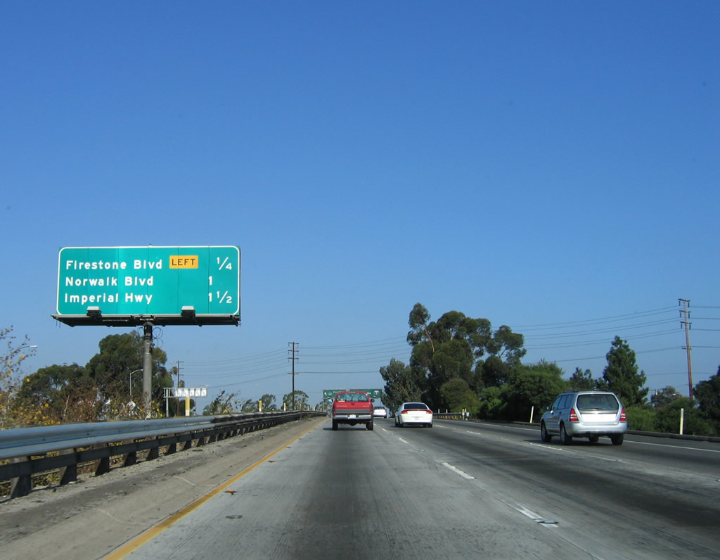
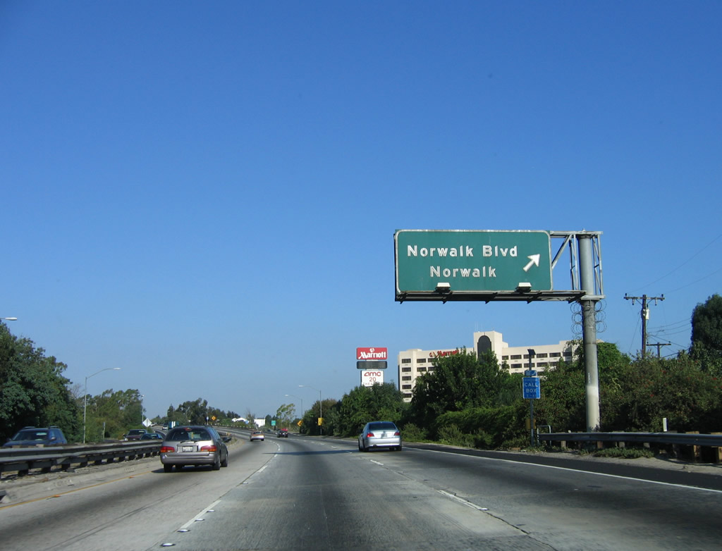
This mileage sign provides the distance to the next three exits along Interstate 5 (Santa Ana Freeway) north: Exit 120A, Rosecrans Avenue; Exit 120B, Firestone Boulevard (former California 42); and Exit 121, Norwalk Boulevard. Photo taken 06/28/06. |
|
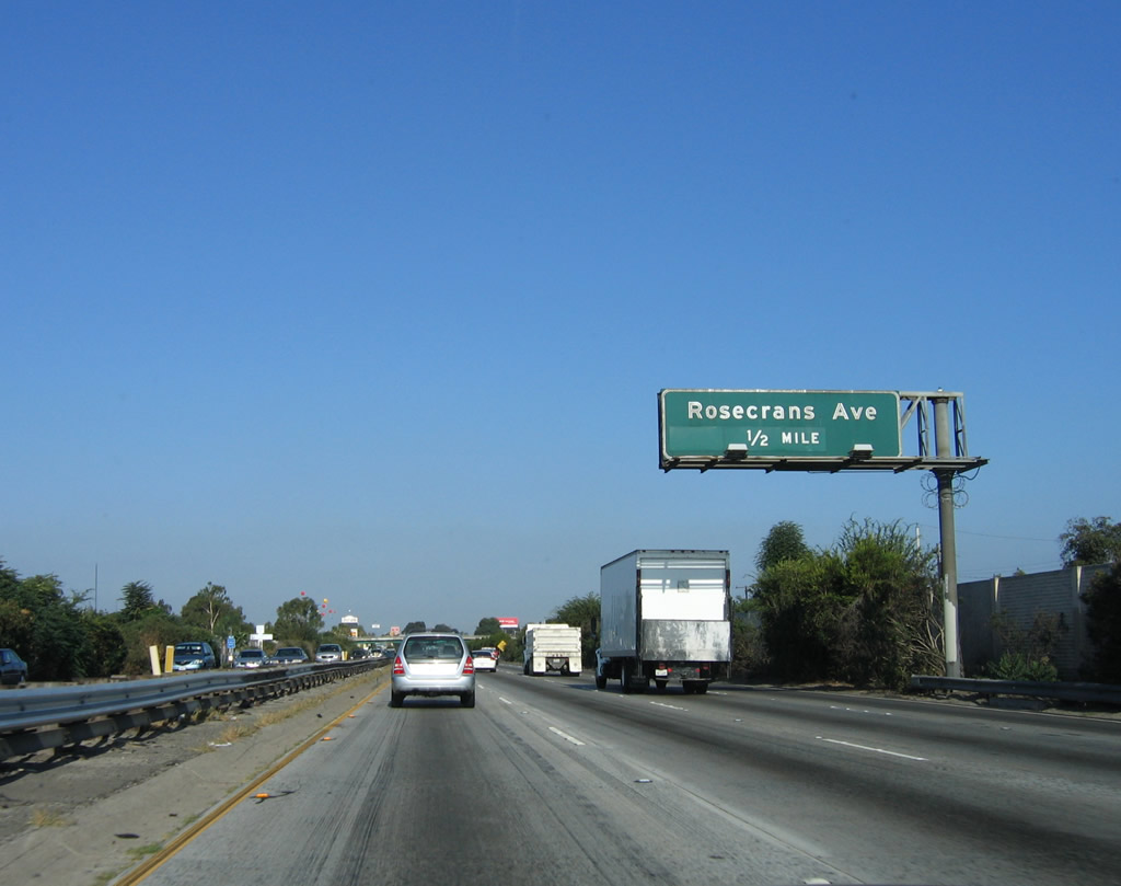
The next exit along Interstate 5 (Santa Ana Freeway) north is Exit 120A, Rosecrans Avenue. The section of the Santa Ana Freeway between Rosecrans Avenue and Orr and Day Road was originally built in 1954. Photo taken 06/28/06. |
|
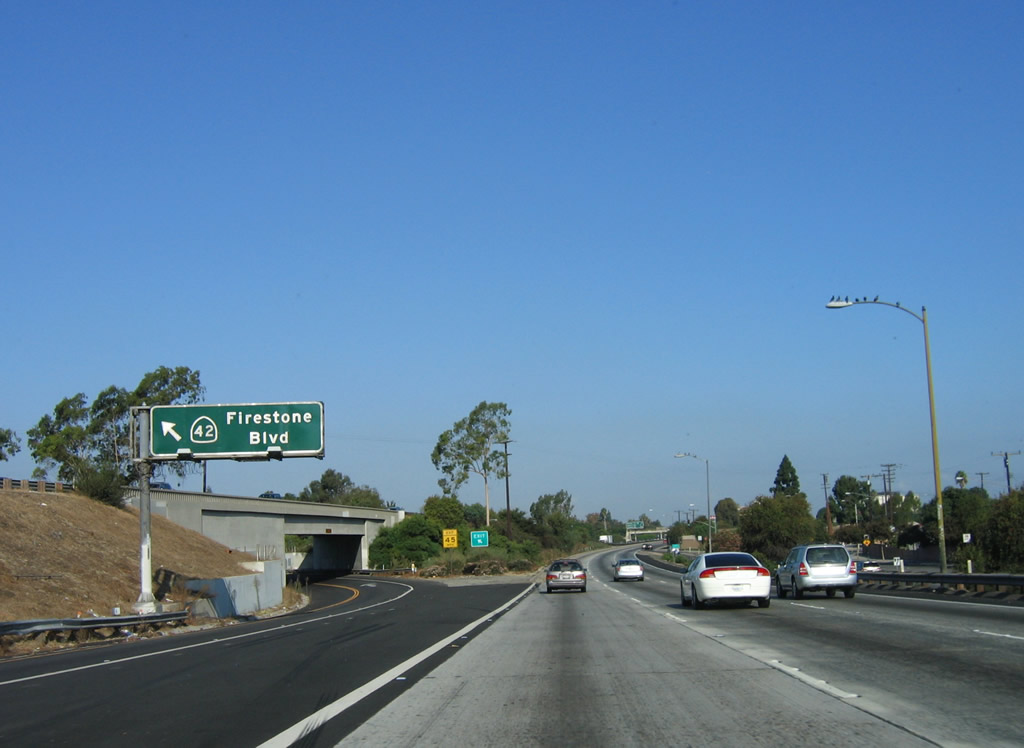
Two signs that still list former California 42 are posted prior to Exit 120A and Exit 120B, Firestone Boulevard. The California 42 shield is still in place on this sign, but it is likely to be removed once this segment of Interstate 5 is reconstructed. Photo taken 10/07/06. |
|
California 42 was established in 1960 and fully relinquished to local control in 2000. The route used to extend from California 1 (Pacific Coast Highway) in Westchester to Interstate 5 (former U.S. 101) in Norwalk. The route was decommissioned once Interstate 105 (Century Freeway) was opened to traffic in 1994. The route passes through Inglewood, South Gate, and Downey. The route initially followed Manchester Avenue in Los Angeles, then in Downey, California 42 transitioned onto southeastbound Firestone Boulevard. Photo taken 06/28/06. |
|
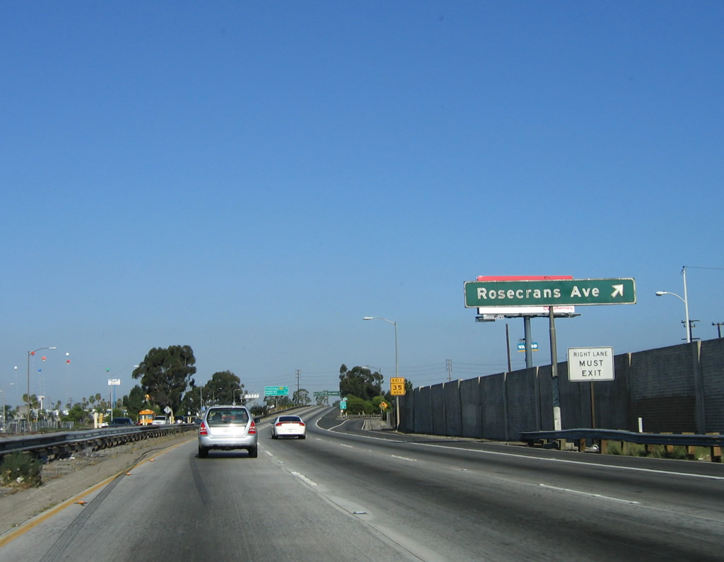
Northbound Interstate 5 (Santa Ana Freeway) reaches Exit 120A, Rosecrans Avenue. Photo taken 10/07/06. |
|
This mileage sign provides the distance to the next three exits along northbound Interstate 5 (Santa Ana Freeway): Exit 120B, Firestone Boulevard (former California 42); Exit 121, Norwalk Boulevard; and Exit 122, Imperial Highway. Photo taken 10/07/06. |
|
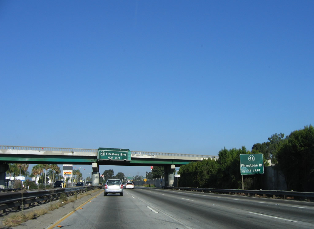
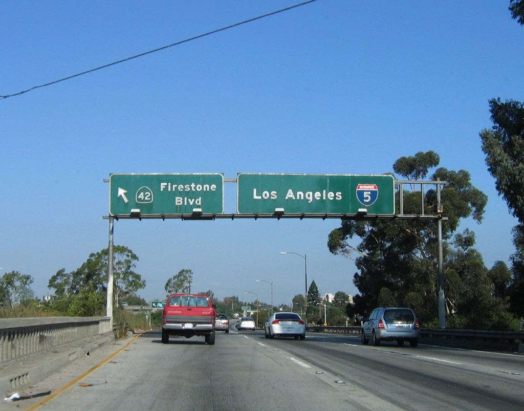
The connection from Interstate 5 (Santa Ana Freeway) north to Exit 120B, Firestone Boulevard (former California 42) is a left exit. This one of a handful of left exits left on this stretch of freeway. This sign bridge is very old and likely dates to the original construction of the freeway (mid-1950s). This kind of support assembly is not typically used in California now. The porcelain enamel signs are not that much younger, but they feature Highway Gothic font so they probably date back to the mid-1960s. Photo taken 10/07/06. |
|
A second sign is posted at the gore point for Exit 120B. Again this sign shows a California 42 shield. This off-ramp and bridge were built in 1954; this design standard remains on a few sections of U.S. 101 and California 99, but there are few examples of this on Interstate 5. Photo taken 10/07/06. |
|
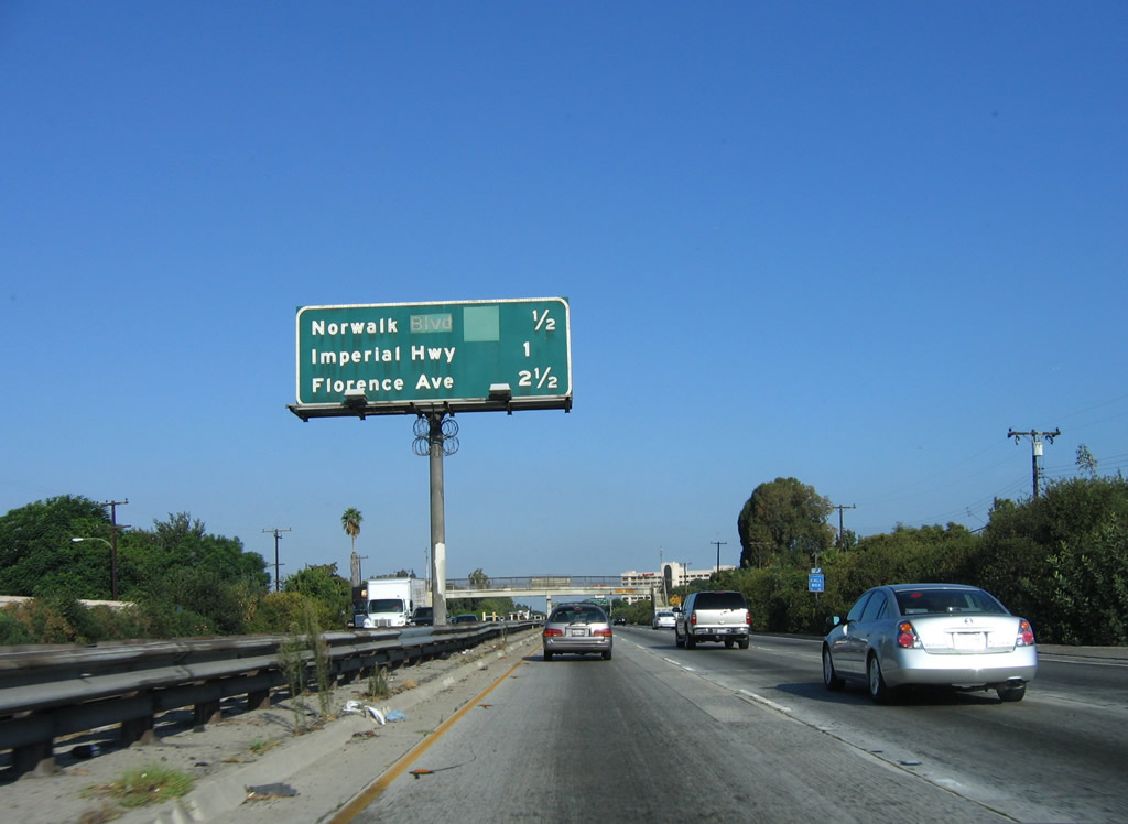
This mileage sign provides the distance to the next three exits along northbound Interstate 5 (Santa Ana Freeway): Exit 121, Norwalk Boulevard/San Antonio Drive; Exit 122, Imperial Highway; and Exit 123, Florence Avenue. Photo taken 10/07/06. |
|
A pedestrian bridge crosses over Interstate 5 prior to Exit 121. Photo taken 10/07/06. |
|
Northbound Interstate 5 (Santa Ana Freeway) reaches Exit 121, Norwalk Boulevard north to Santa Fe Springs and San Antonio Drive southwest to downtown Norwalk. Photo taken 10/07/06. |
|
After the on-ramp from Norwalk Boulevard, this Interstate 5 shield is posted prior to Exit 122, Imperial Highway. This kind of shield has been appearing on California's interstates with increasing frequency, much to the chagrin of sign specification purists. But this design, which is more angular, retains the state name, unlike the legions of neutered shields elsewhere. This particular shield was placed back in 2001, and it is already fading due to the sunny skies of Southern California. Photo taken 06/28/06. |
|
This mileage sign provides the distance to the next three exits along Interstate 5 (Santa Ana Freeway) north: Exit 122, Imperial Highway; Exit 123, Florence Avenue; and Exit 124, Interstate 605 (San Gabriel River Freeway). Photo taken 06/28/06. |
|
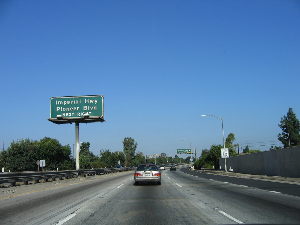
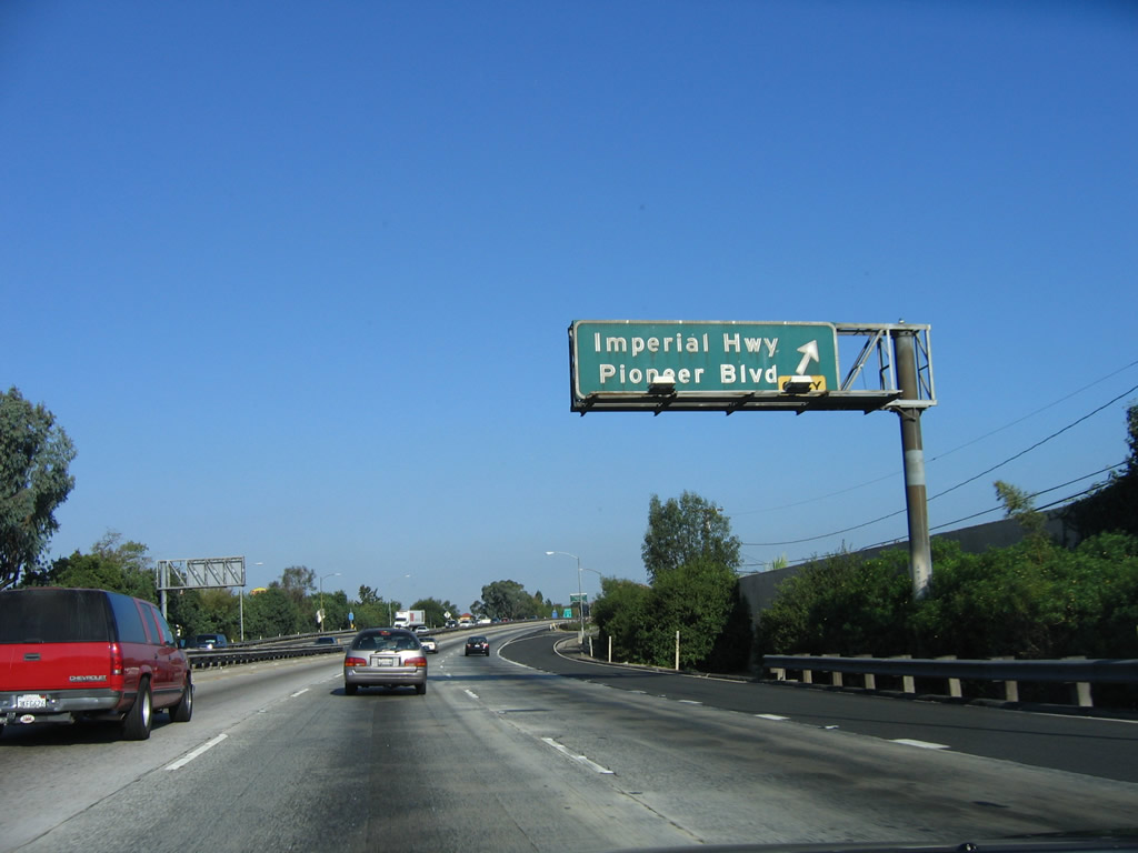
Exit 122 connects to Imperial Highway west to Downey and east to La Mirada. Imperial Highway generally parallels Interstate 105/Century Freeway from Norwalk west to Los Angeles International Airport and El Segundo. North-south Pioneer Boulevard also connects to Interstate 5 at this interchange. Photo taken 10/07/06. |
|
Northbound Interstate 5 (Santa Ana Freeway) reaches Exit 122, Imperial Highway and Pioneer Boulevard. This is the final interchange to serve the city of Norwalk. Photo taken 10/07/06. |
|
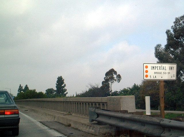
Northbound Interstate 5 white bridge information sign. This kind of sign provides the name of the road, river, or railroad that is being traversed; the route number; the bridge number; and the county postmile marker number. This sign is located at Exit 122, Imperial Highway. Photo taken 12/23/01. |
|
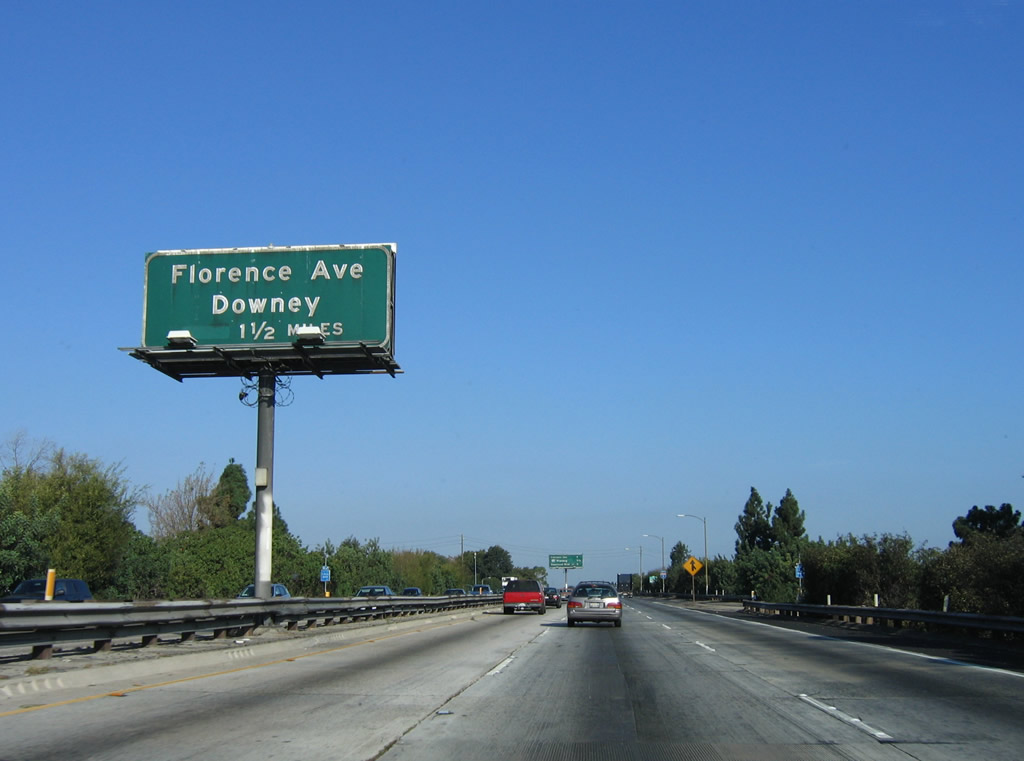
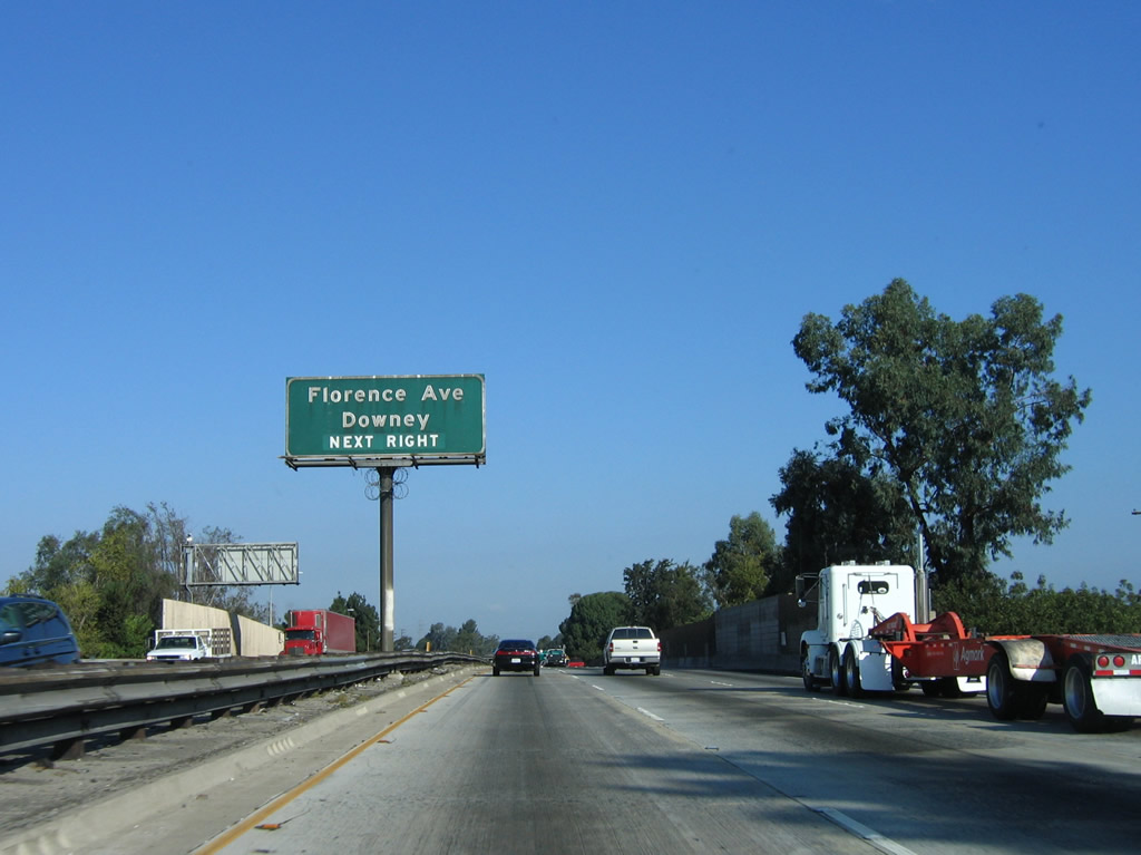
The next exit along northbound Interstate 5 is Exit 123, Florence Avenue (east-west) and Orr and Day Road (north-south) in 1.25 miles. Exit 123 serves the city of Santa Fe Springs to the east and the city of Downey to the west. Photo taken 10/07/06. |
|
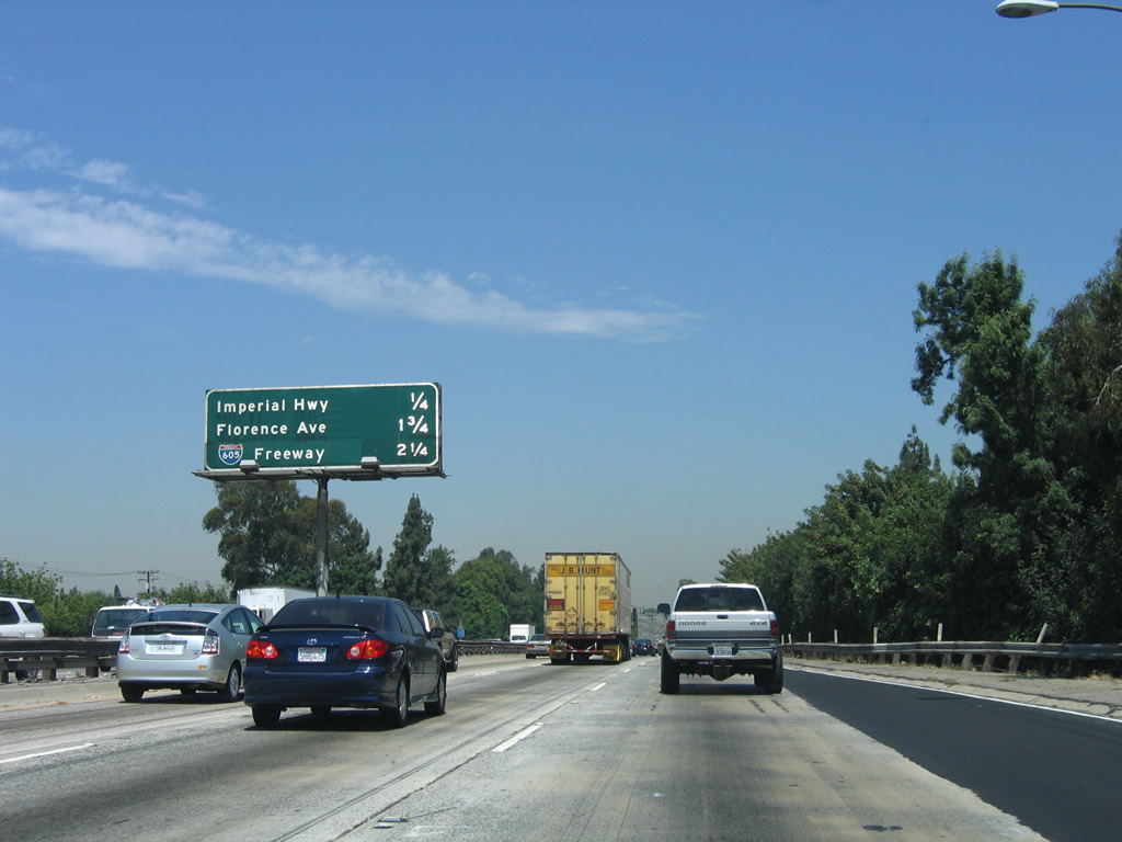
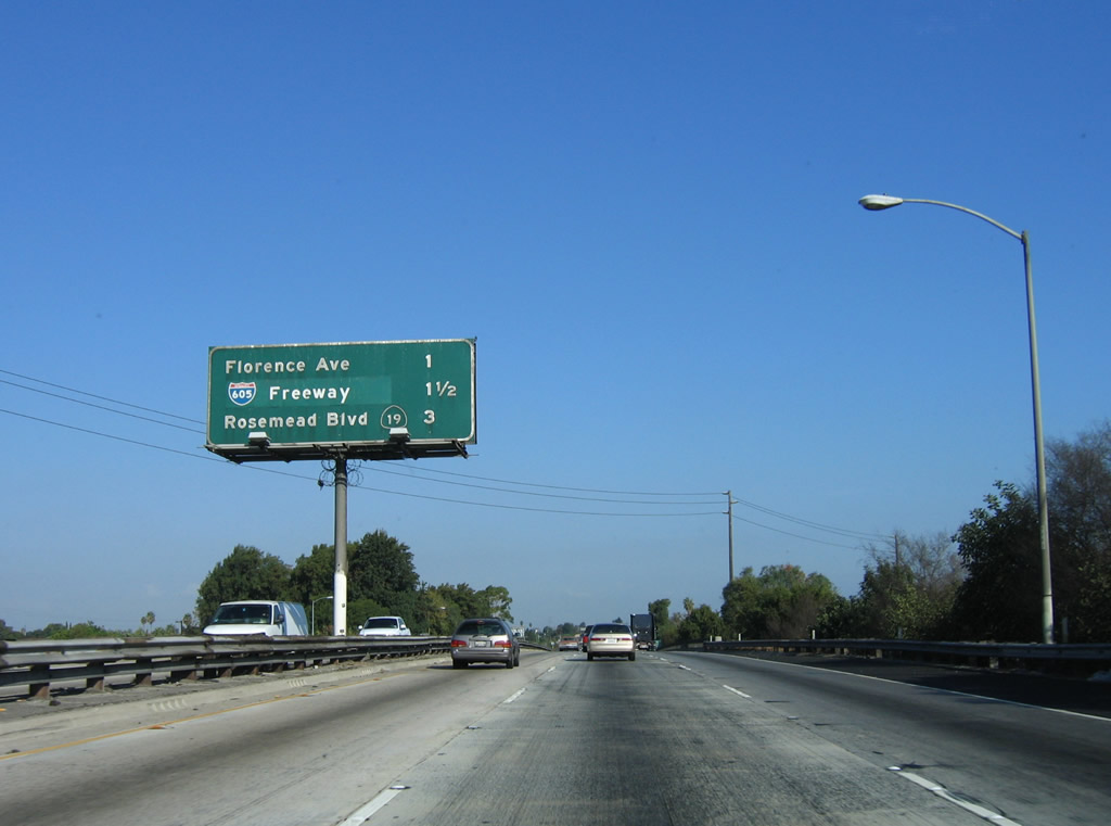
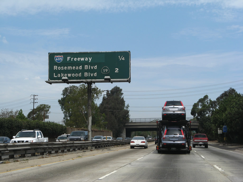
This mileage sign provides the distance to the next three exits along northbound Interstate 5 (Santa Ana Freeway): Exit 123, Florence Avenue (one mile); Exit 124, Interstate 605 (San Gabriel River Freeway) (1.25 miles); and Exit 125, California 19 (Lakewood Boulevard) south and California 19 (Rosemead Boulevard) north. Photo taken 10/07/06. |
|
Use Florence Avenue east to the city of Santa Fe Springs. Interstate 5 briefly passed through a southern extension of that city around Exit 118 and Exit 119. Photo taken 07/15/09. |
|
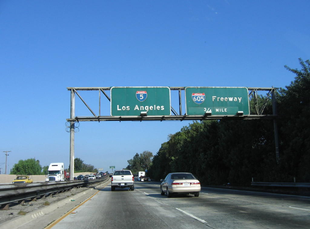
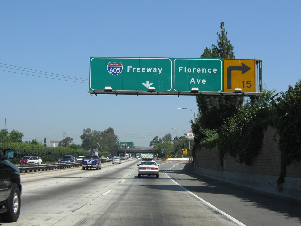
Prior to the Florence Avenue exit, this overhead sign advises of the pending junction with Interstate 605. This freeway was originally planned as California 35, but it was changed once the route gained Interstate status. Interstate 605 travels north to Duarte and south to Seal Beach just east of Long Beach generally along the San Gabriel River corridor. Photo taken 10/07/06. |
|
The next exit is Exit 123, Florence Avenue. At this exit, Interstate 5 leaves Norwalk and enters the city of Downey and skirts the western edge of Santa Fe Springs. Photo taken 10/07/06. |
|
Northbound Interstate 5 (Santa Ana Freeway) reaches Exit 123, Florence Avenue and Orr and Day Road. The section of the Santa Ana Freeway between Orr and Day Road and Slauson Avenue was built in 1953. Photo taken 07/15/09. |
|
The next exit along Interstate 5 north is Exit 124, Interstate 605 (San Gabriel River Freeway). For a freeway connection to Interstate 105 west, motorists can exit here and use the loop ramp to Interstate 605 south, then connect to Interstate 105 west shortly thereafter. However, this route is circuitous and indirect. Photo taken 08/26/07. |
|
Northbound Interstate 5 reaches Exit 124, Interstate 605 (San Gabriel River Freeway). There are no control cities used on Interstate 605 except for "THRU TRAFFIC." The left three lanes continue north on Interstate 5, while the right two lanes connect to Interstate 605 north. Photo taken 10/07/06. |
|
Departing Interstate 5, the transition ramp to Interstate 605 splits. Stay left for Interstate 605 south to Seal Beach or stay right for Interstate 605 north to Duarte. These old, porcelain-enamel signs are relatively uncommon since they were never retrofitted with button copy lettering in the early to mid-1970s (unlike most signs from that era). Photo taken 07/15/09. |
|
The two-lane transition from Interstate 5 north to Interstate 605 north narrows from two lanes to one lane before merging onto the Interstate 605 freeway northbound lanes. Photo taken 07/15/09. |
|
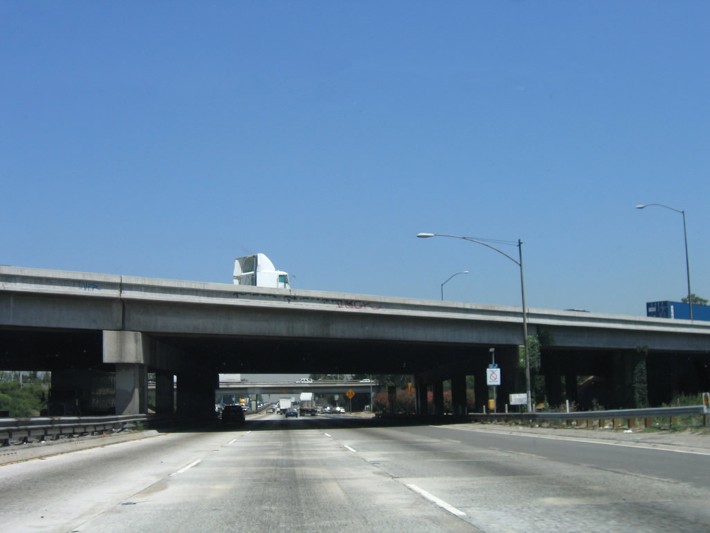
Returning to Interstate 5's northbound mainline, Interstate 605 glides over Interstate 5 on this overpass, which was built in 1965 and expanded in 1996. This was one of the newest structures seen on Interstate 5 since entering Los Angeles County until completion of freeway expansion leading north from California 39 into Santa Fe Springs and Norwalk. Photo taken 06/28/06. |
|
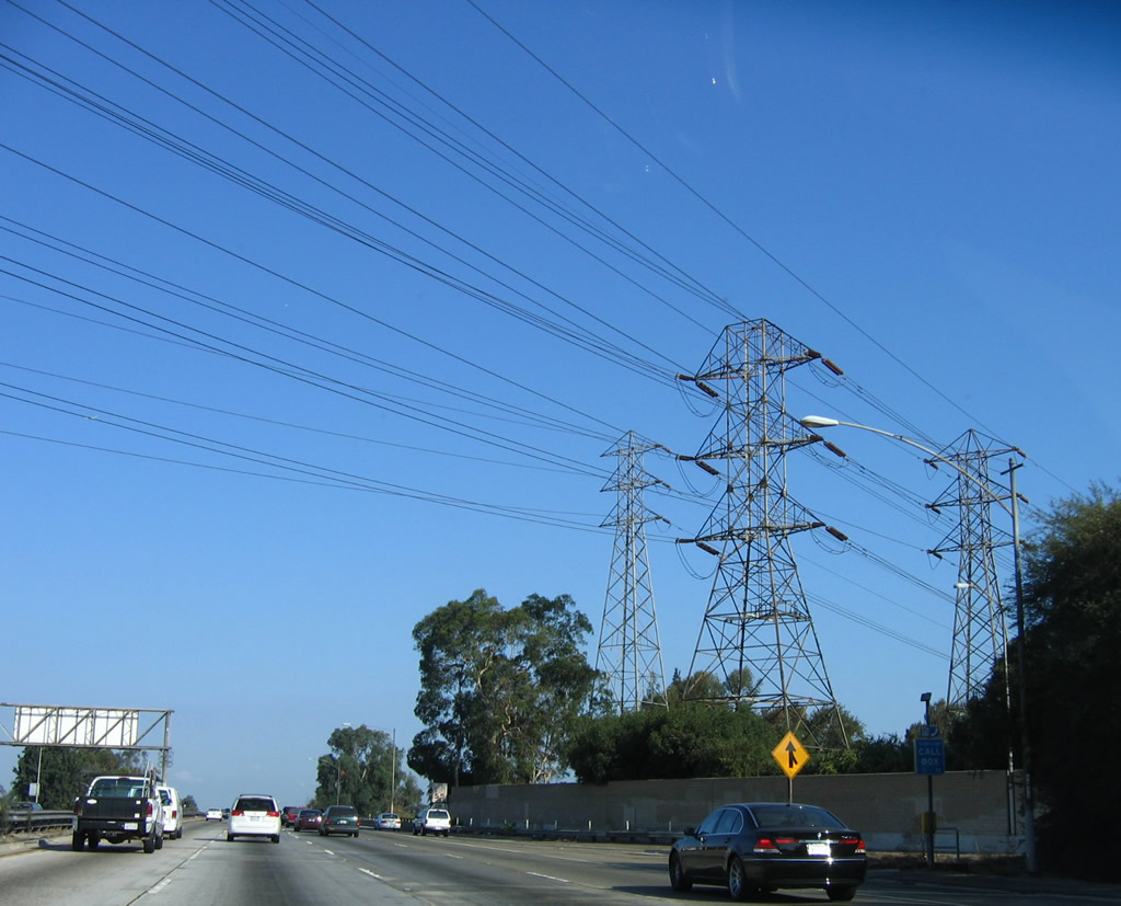
A set of Southern California Edison power lines cross Interstate 5 at this point; power lines parallel most of the Interstate 605 corridor from end to end. Around this point, Interstate 5 crosses over the San Gabriel River on a 1953 bridge (expanded in 1965). Photo taken 10/07/06. |
|
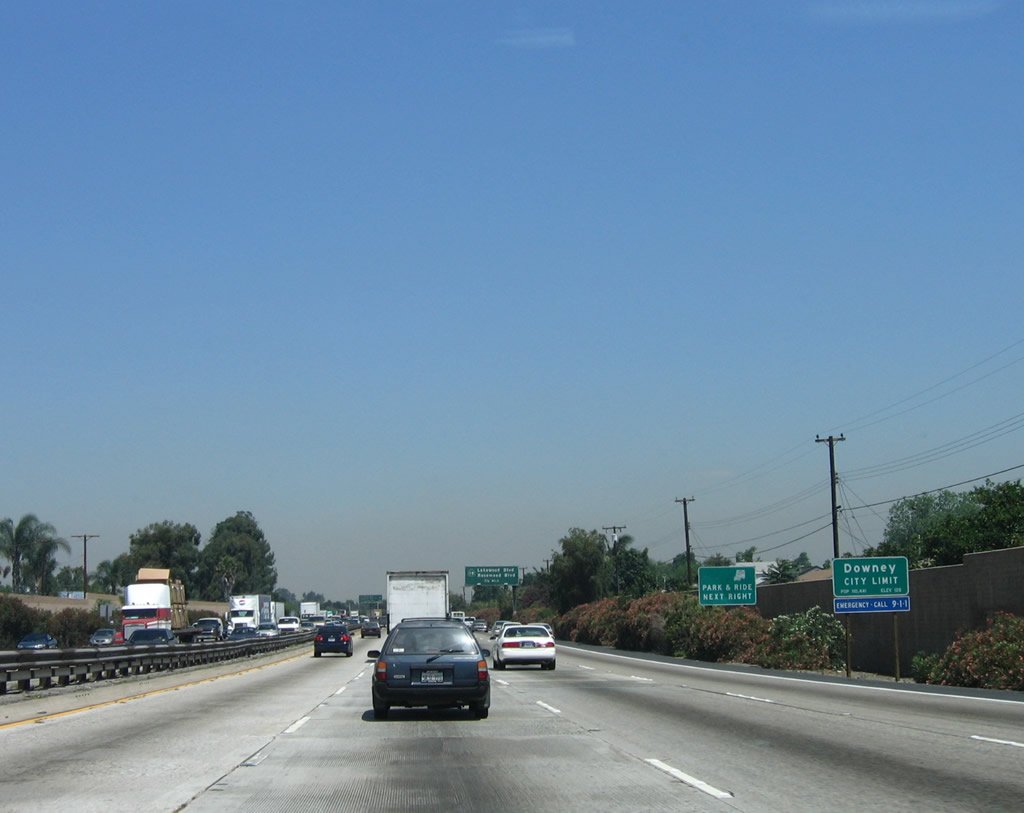
As noted earlier, Interstate 5 north enters the city of Downey. Home to 107,323 people as of the 2000 Census, Downey was incorporated in 1956. Photo taken 06/28/06. |
|
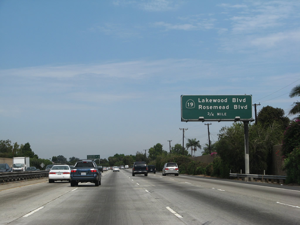
The next exit along Interstate 5 (Santa Ana Freeway) north is Exit 125, California 19 (Lakewood Boulevard) south and California 19 (Rosemead Boulevard) north. Photo taken 08/26/07. |
|
This mileage sign provides the distance to the next two exits along Interstate 5 (Santa Ana Freeway) north: Exit 125, California 19 (Lakewood Boulevard) south and California 19 (Rosemead Boulevard) north and Exit 126A, Paramount Boulevard. Photo taken 10/07/06. |
|
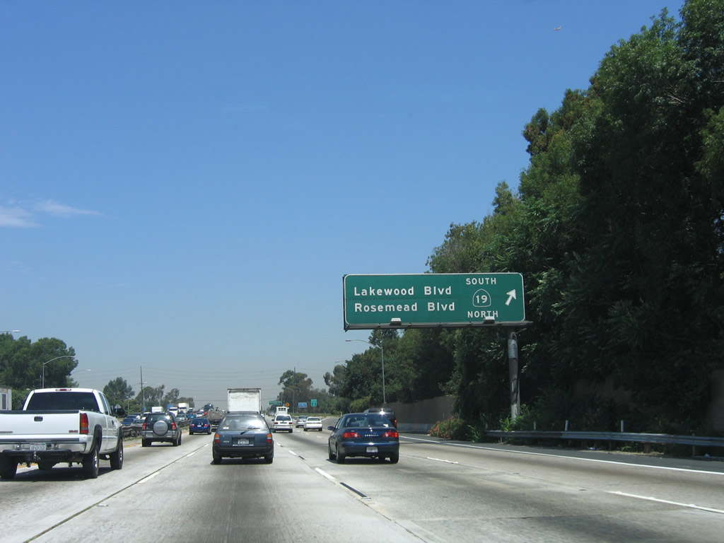
Northbound Interstate 5 (Santa Ana Freeway) reaches Exit 125, California 19 (Lakewood Boulevard) south and California 19 (Rosemead Boulevard) north. California 19 roughly parallels Interstate 605 from Long Beach north to Pasadena. It is almost entirely a four-lane surface street, and it is not freeway. Caltrans is slowly decommissioning California 19 as various cities and local jurisdictions along the route take over maintenance of segments within their boundaries. It is unclear how much if any of California 19 would be left after this effort to decommission the route is completed. Photo taken 06/28/06. |
|
A Route 5/19 Separation sign is posted on the Interstate 5 bridge over California 19. Photo taken 02/26/11. |
|
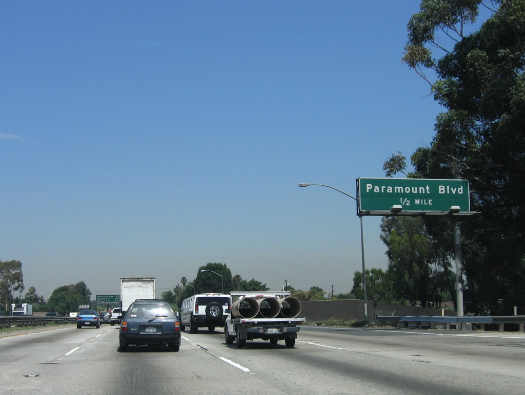
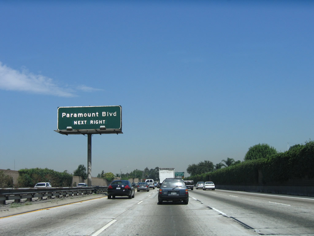
The next exit along Interstate 5 (Santa Ana Freeway) north is Exit 126A, Paramount Boulevard. This is the last interchange to serve the city of Downey. Photo taken 06/28/06. |
|
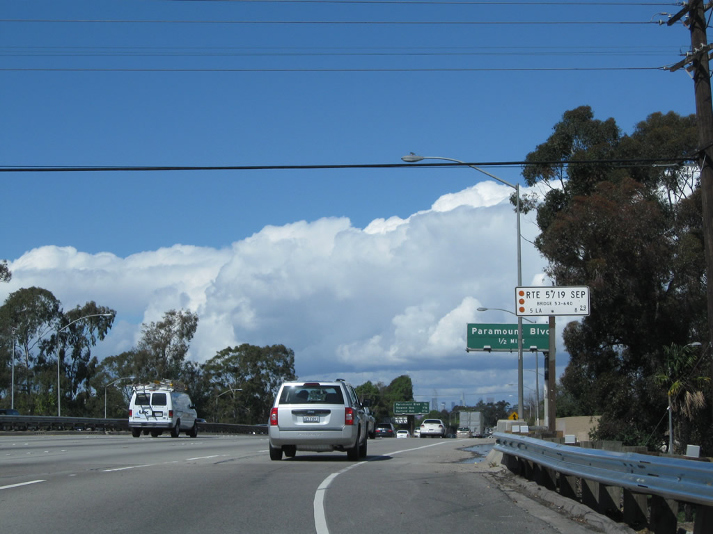
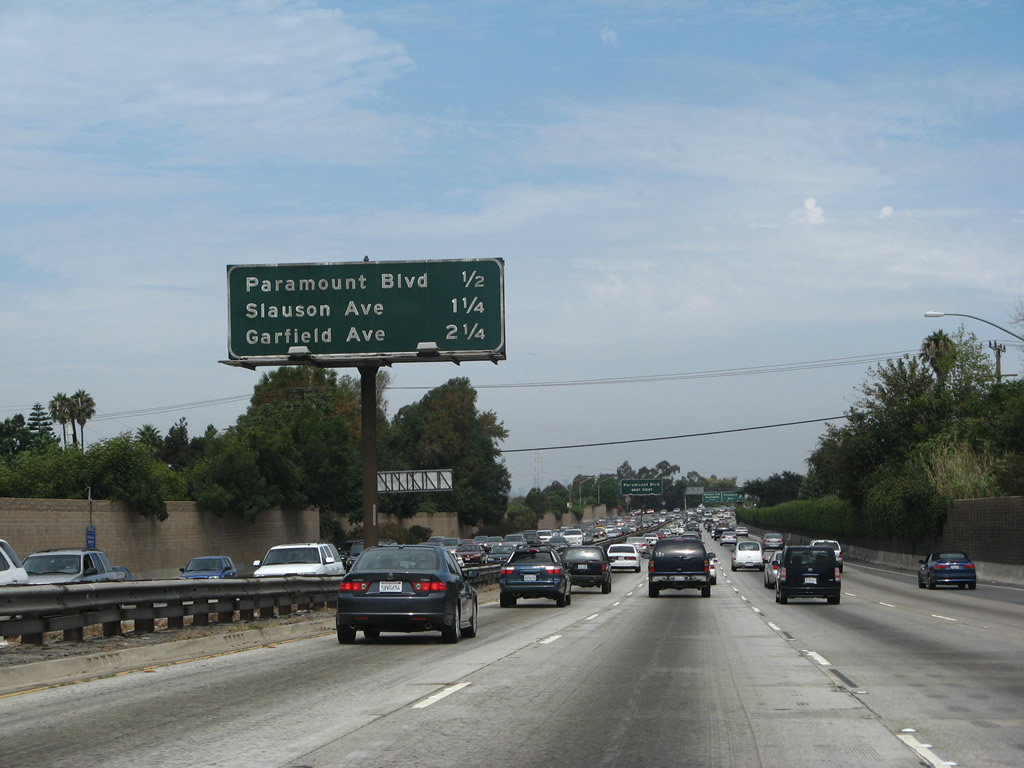
This mileage sign provides the distance to the next three exits along Interstate 5 (Santa Ana Freeway) north: Exit 126A, Paramount Boulevard; Exit 126B, Slauson Avenue; and Exit 128A, Garfield Avenue. Photo taken 08/26/07. |
|
Paramount Boulevard roughly parallels California 19 on the east and an often-dry tributary to the Los Angeles River on the west as it passes through the communities of Paramount, Downey, and Pico Rivera along its north-south journey. It ends at Carson Street in Lakewood. Photo taken 06/28/06. |
|
Northbound Interstate 5 (Santa Ana Freeway) reaches Exit 126A, Paramount Boulevard. It ends at Carson Street in Lakewood. Photo taken 10/07/06. |
|
The next six exits all serve the city of Commerce, which was incorporated in 1960 and covers mostly industrial and commercial land. A total of 12,568 people lived in the city as of the 2000 Census. Photo taken 06/28/06. |
|
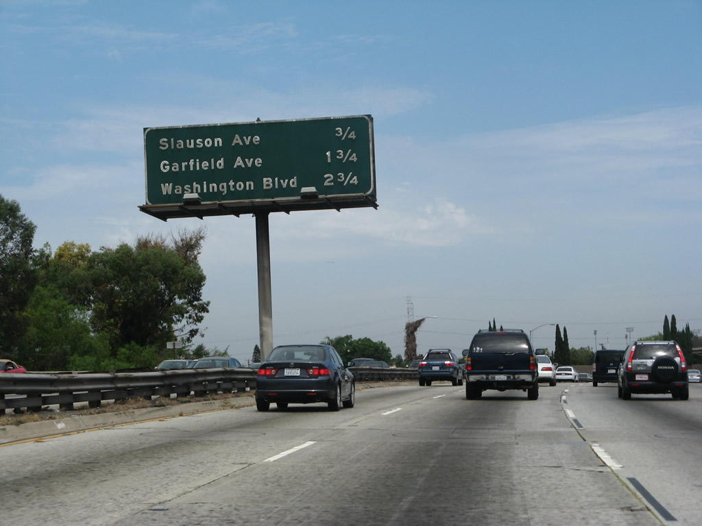
This mileage sign provides the distance to the next three exits along Interstate 5 (Santa Ana Freeway) north: Exit 126B, Slauson Avenue; Exit 128A, Garfield Avenue; and Exit 128B, Washington Boulevard. Photo taken 08/26/07. |
|
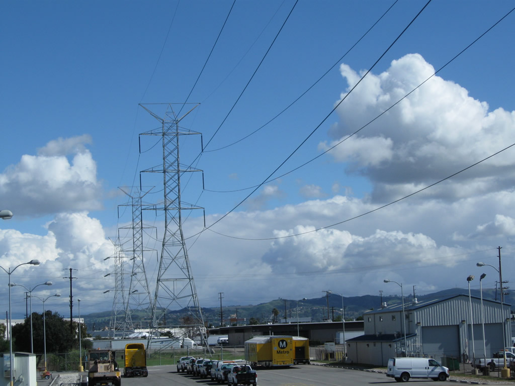
A Los Angeles Department of Water and Power electric transmission line passes over Interstate 5 prior to the Slauson Avenue interchange. Photo taken 02/26/11. |
|
This view looks northeast to follow the Los Angeles Department of Water and Power electric transmission line. Photo taken 02/26/11. |
|
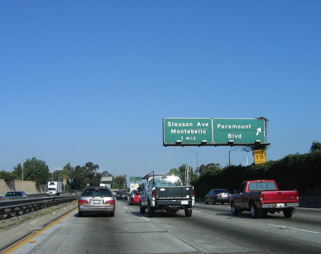
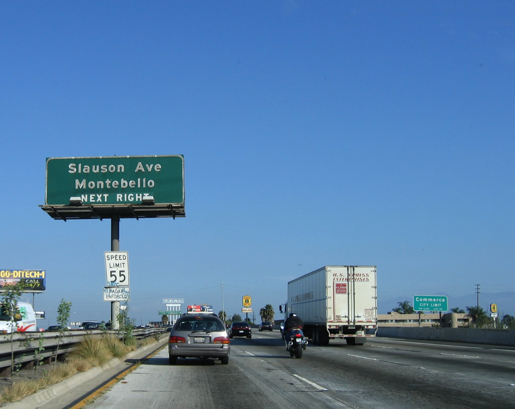
Use Exit 126B, Slauson Avenue east to the city of Montebello and Pico Rivera. Use Slauson Avenue west to the city of Commerce. As of the 2000 Census, Montebello had a total population of 62,150 people. The area was first settled during the days of Father Junipero Serra when the original San Gabriel Mission was established on on September 9, 1771; the mission was moved to San Gabriel in 1776 due to flooding. The mission was located near where San Gabriel Boulevard crosses the Rio Hondo River. The city of Montebello incorporated on October 19, 1920; the Spanish translation is "beautiful hill." Oil was discovered in and around Montebello, and that hastened the area's development in the early 20th Century. Photo taken 10/07/06. |
|
Northbound Interstate 5 (Santa Ana Freeway) reaches Exit 126B, Slauson Avenue. The next exit along northbound is Exit 128A, Garfield Avenue. Photo taken 08/26/07. |
|
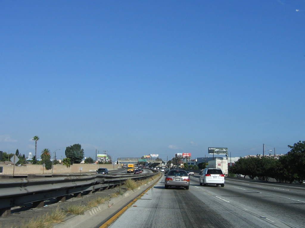
This section of the Santa Ana Freeway carries four lanes in each direction with no left shoulder. Divoted curbing and metal guardrail separate the two directions of traffic. Built in the early 1950s, this section of freeway was expanded in 1982. Photo taken 10/07/06. |
|
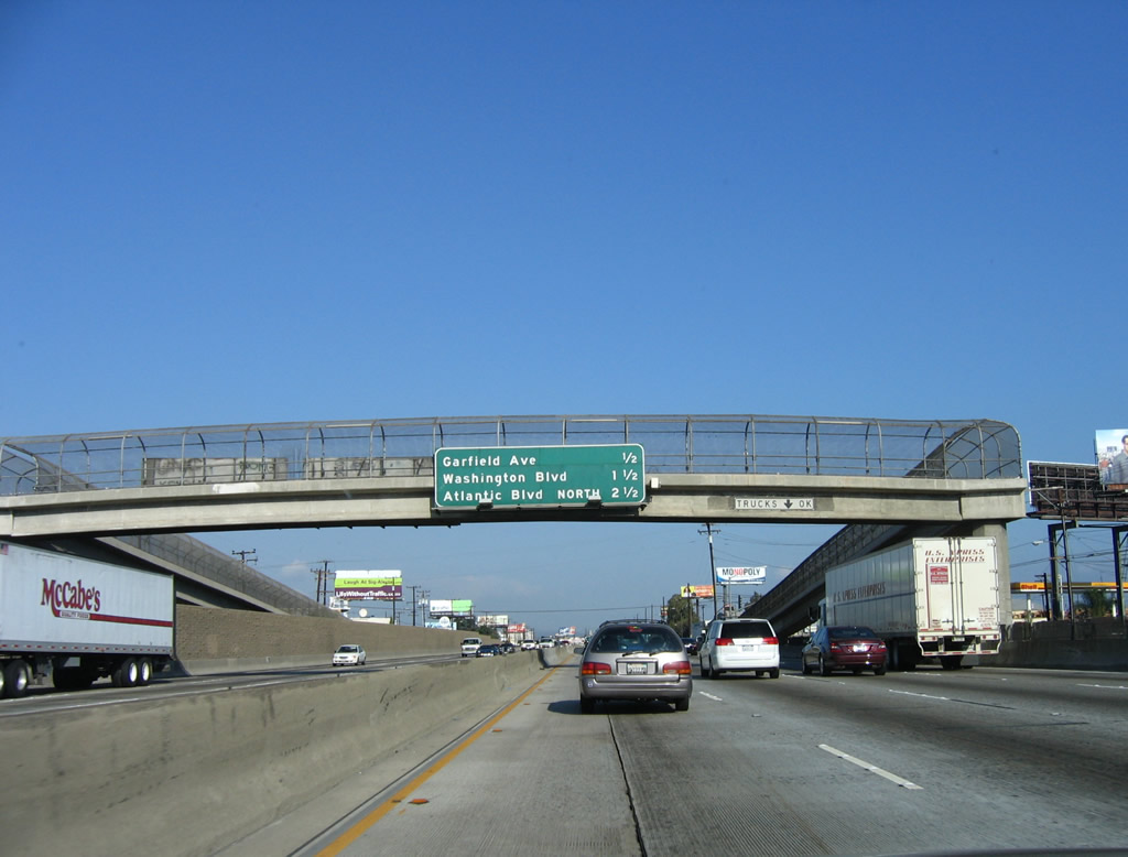
The Greenwood Avenue pedestrian overcrossing was built in 1978. Note the change in median from guardrail/divoted curbing to concrete jersey barrier. This mileage sign provides the distance to the next three exits: Exit 128A, Garfield Avenue; Exit 128B, Washington Boulevard; and Exit 129, northbound Atlantic Boulevard. Photo taken 10/07/06. |
|
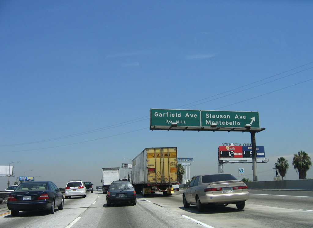
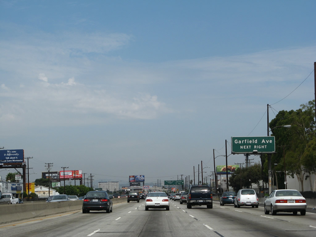
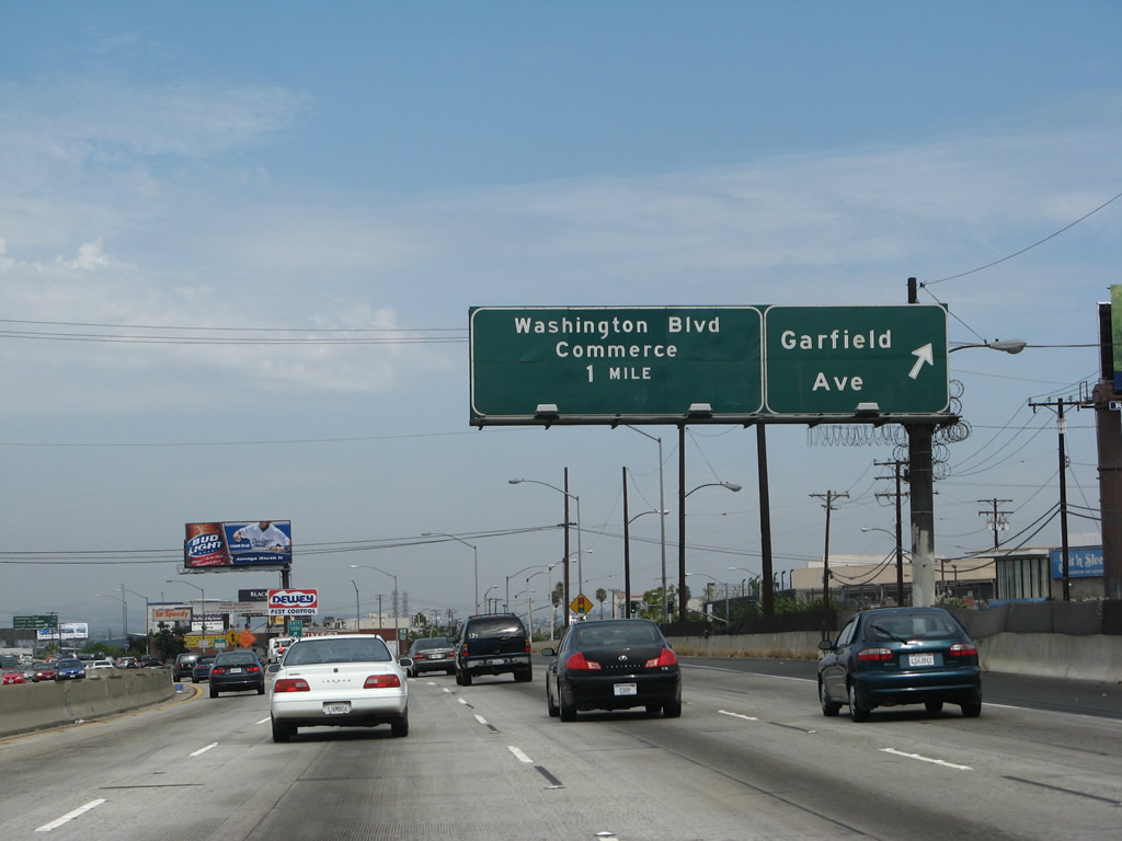
Garfield Avenue travels south through the city of Commerce to the cities of Bell Gardens, South Gate, Paramount, and Long Beach. To the north, Garfield Avenue passes through the city of Commerce, Montebello, Monterey Park, and Alhambra. Photo taken 08/26/07. |
|
Northbound Interstate 5 (Santa Ana Freeway) reaches Exit 128A, Garfield Avenue. This overpass was built in 1952 and expanded in 1982. Photo taken 08/26/07. |
|
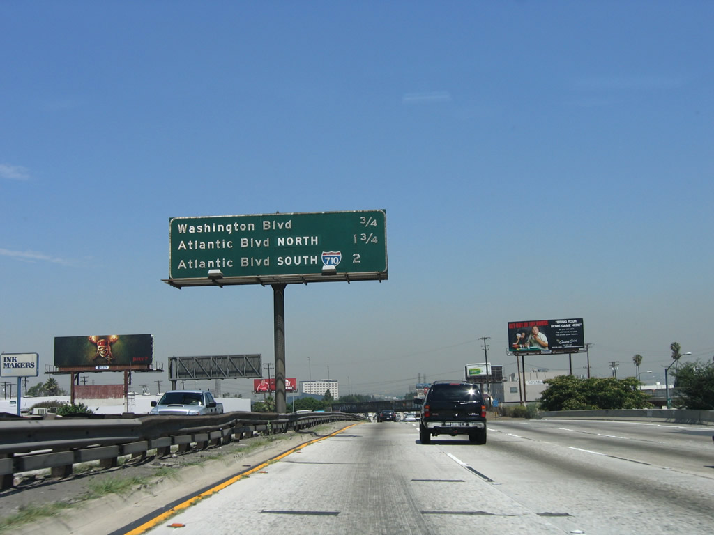
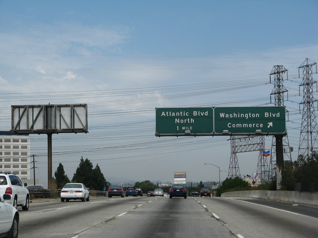
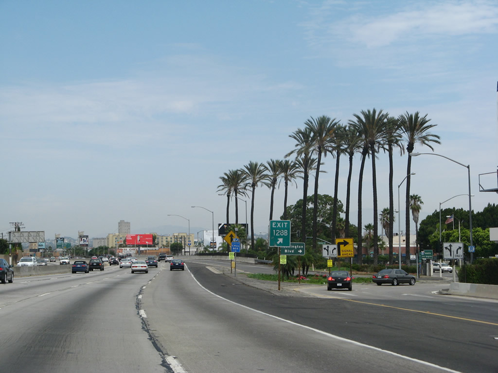
This mileage sign provides the distance to the next three exits along Interstate 5 (Santa Ana Freeway) north: Exit 128B, Washington Boulevard; Exit 129, northbound Atlantic Boulevard; and Exit 130A, Atlantic Boulevard south to Interstate 710 (Long Beach Freeway) south. Photo taken 06/28/06. |
|
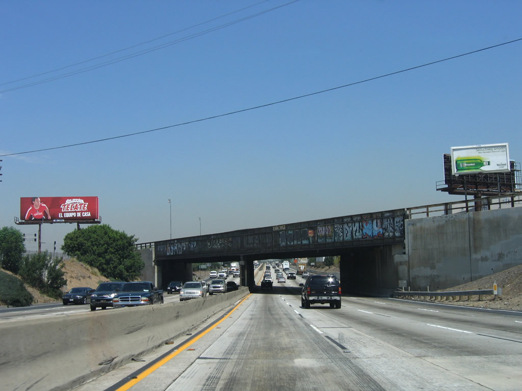
Interstate 5 (Santa Ana Freeway) passes under the Simon Union Pacific Railroad bridge (built in 1952). Photo taken 06/28/06. |
|
Northbound Interstate 5 (Santa Ana Freeway) reaches Exit 128B, Washington Boulevard, in the City of Commerce. Washington Boulevard travels northwest from this interchange into downtown Los Angeles. The segment of Interstate 5 that passes through the City of Commerce lives up to its name, with industrial and commercial facilities located throughout. In addition, a large amount of railroad infrastructure is present in the City of Commerce. The following exit is Exit 129, Atlantic Boulevard north. Atlantic Boulevard roughly parallels Interstate 710, which is the next exit after Atlantic. It leads north from the City of Commerce into the community of East Los Angeles, then north into the cities of Monterey Park and Alhambra. Heading southbound, Atlantic Avenue crosses Interstate 710 (Long Beach Freeway), then heads south toward Maywood, Cudahy, Lynwood, and Compton. Photo taken 08/26/07. |
|
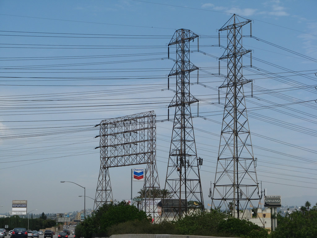
Large power transmission lines service this area. These tall power lines interconnect various substations and power generation facilities with the large commercial uses in the city of Commerce. Photo taken 08/26/07. |
|
The off-ramp to Exit 128B connects directly to Telegraph Road, which acts as a frontage road on the east side of Interstate 5. Upon exiting, turn right on Telegraph Road to the Washington Boulevard traffic signal. Use Exit 128B to Telegraph Road north to the Citadel outlets on the northeast side of Interstate 5. Photo taken 08/26/07. |
|
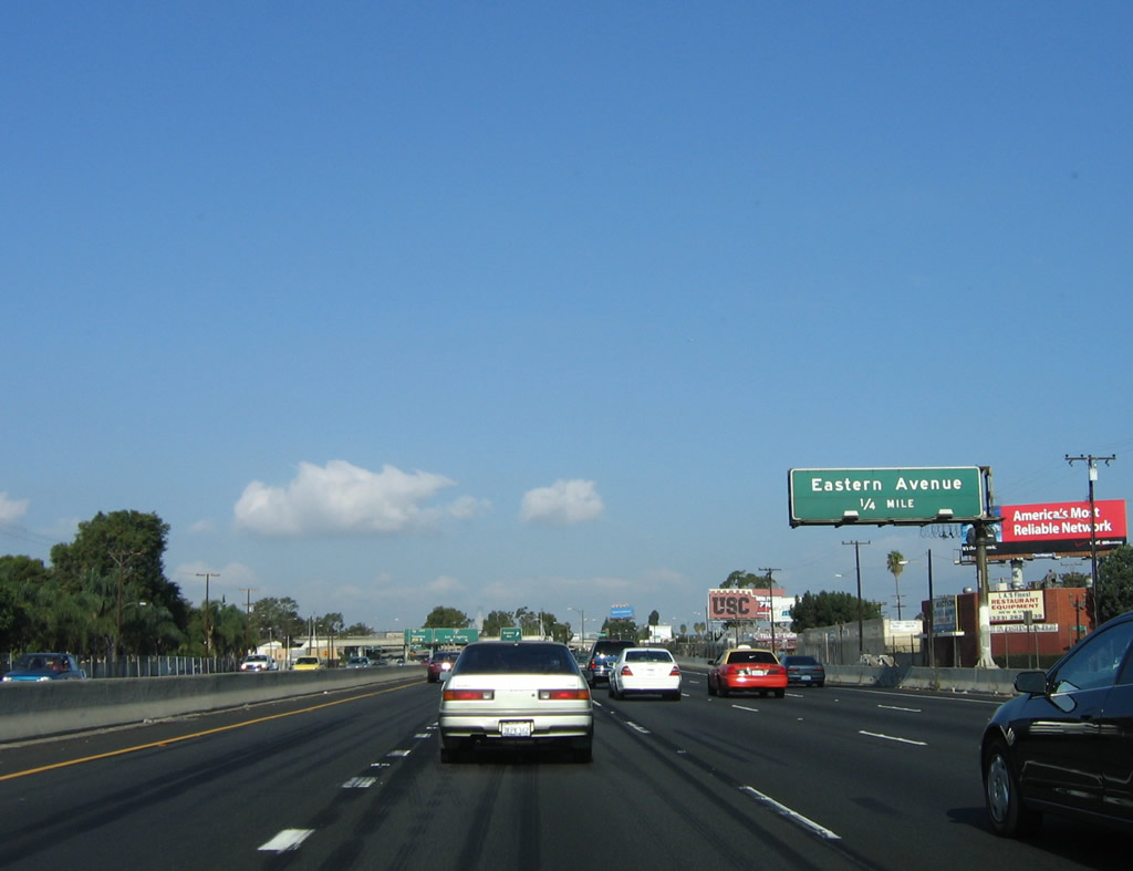
This mileage sign provides the distance to three of the next four exits along Interstate 5 (Santa Ana Freeway) north: Exit 129, northbound Atlantic Boulevard; Exit 130A, Atlantic Boulevard south to Interstate 710 (Long Beach Freeway) south; (Exit 130B, Telegraph Road to Eastern Avenue); and Exit 130C, Interstate 710 (Long Beach Freeway) north (left exit). Photo taken 08/26/07. |
|
The Citadel outlets and their glowing marquee billboards come into view on the east side of Interstate 5 as the freeway angles northwest toward downtown Los Angeles. Photo taken 08/26/07. |
|
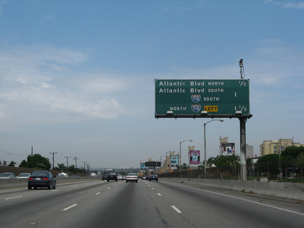
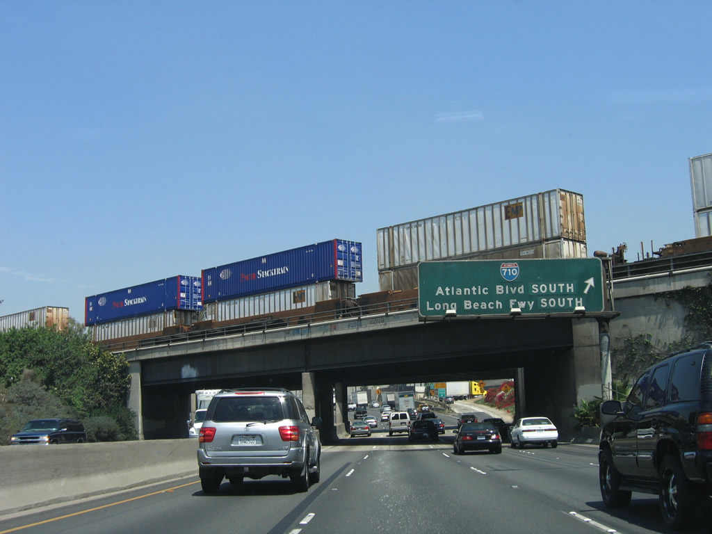
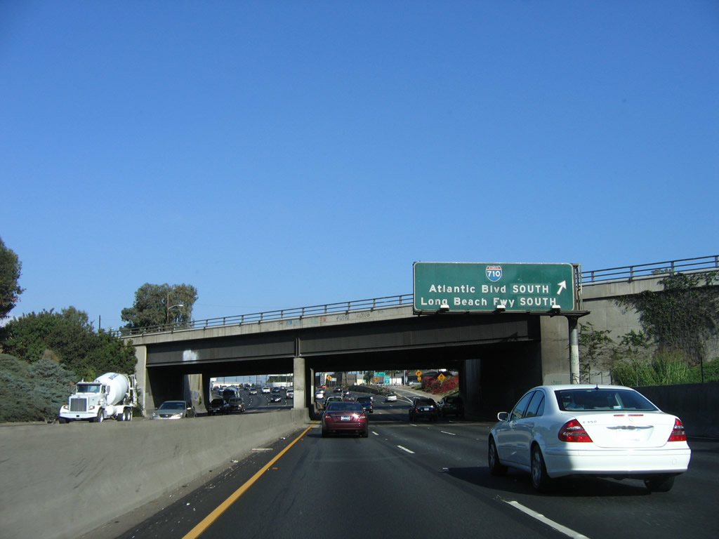
Northbound Interstate 5 (Santa Ana Freeway) reaches Exit 129, northbound Atlantic Boulevard. The next exit along northbound is Exit 130A, Atlantic Boulevard south to Interstate 710 (Long Beach Freeway) south. Photo taken 08/26/07. |
|
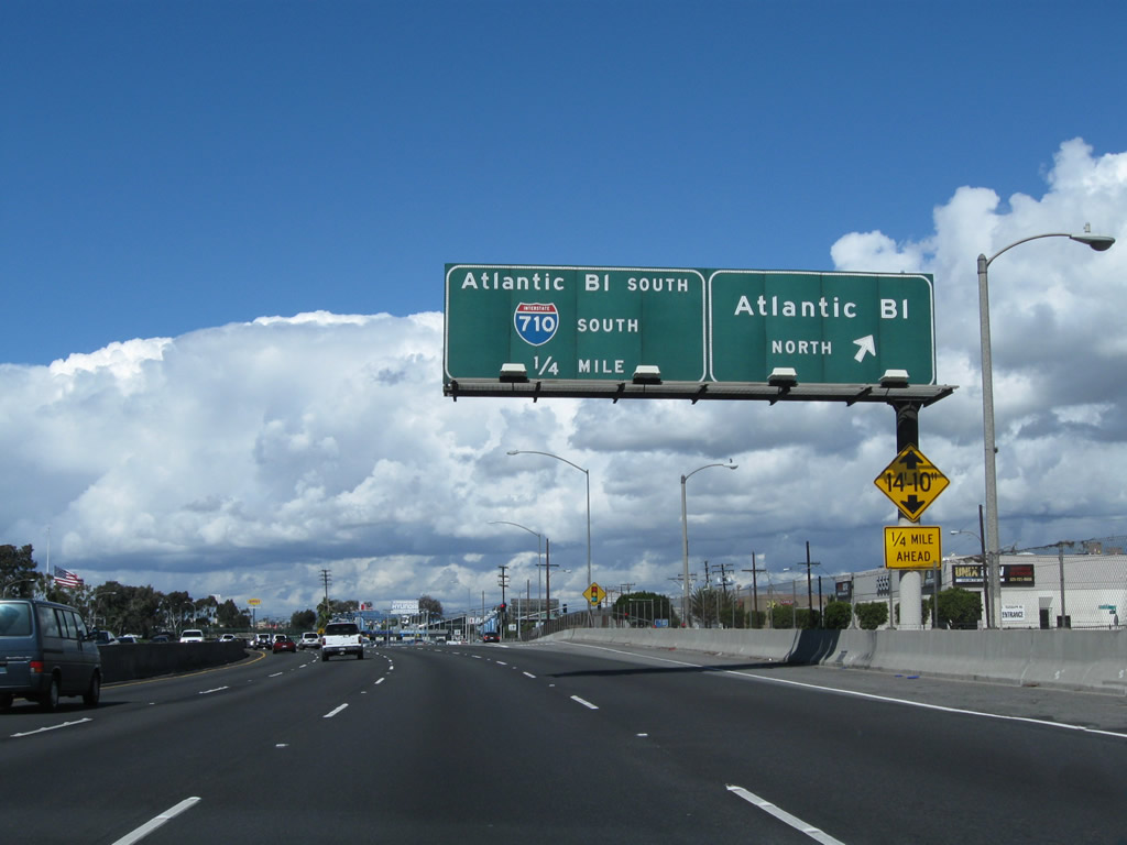
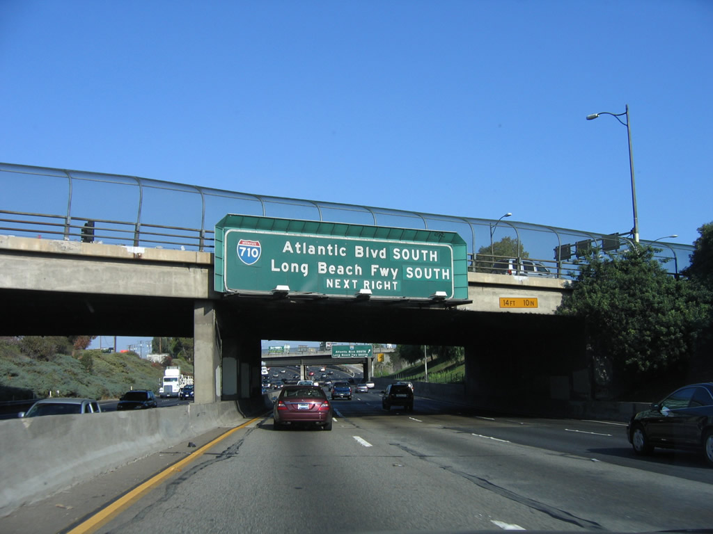
A large sign announces the next off-ramp is Exit 130A, Atlantic Boulevard south to Interstate 710 (Long Beach Freeway) south. This sign is mounted on the Atlantic Boulevard overcrossing (built in 1950). Exit 130A is not a direct connection to Interstate 710; the link is made via Atlantic Boulevard southwest. Photo taken 10/06/07. |
|
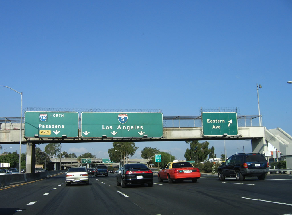
A new left lane forms for the connection from Interstate 5 north to Exit 130C, Interstate 710 (Long Beach Freeway) north to Alhambra (signed as Pasadena for the future extension proposed through South Pasadena to Interstate 210). Currently, Interstate 710 leads north to connect with Interstate 10, then ends at Valley Boulevard a short distance north of Interstate 10 near the border between Alhambra and Los Angeles. It is proposed to be extended north to Pasadena. This extension is hotly contested, and no construction has begun as of 2008. So for now, the control city of Pasadena assumes that someday Interstate 710 will reach that far north. Photo taken 10/06/07. |
|
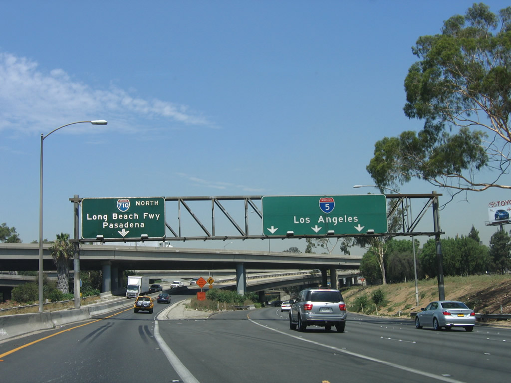
Prior to Exit 130C, the next exit along Interstate 5 north is Exit 130B, Telegraph Road to Eastern Avenue. Telegraph Road is the frontage road that follows Interstate 5 through the city of Commerce, and it provides a direct connection to both Eastern Avenue north into unincorporated East Los Angeles and Olympic Boulevard west into the city of Los Angeles. Photo taken 06/28/06. |
|
Northbound Interstate 5 (Santa Ana Freeway) reaches Exit 130B, Telegraph Road to Eastern Avenue and Olympic Boulevard. The left lane is exit only for Exit 130C, Interstate 710 north. A major truck route between the Ports of Long Beach and Los Angeles to Interstate 10, the Long Beach Freeway carries a great deal of freight and commuter traffic. Photo taken 06/28/06. |
|
Northbound Interstate 5 reaches Exit 130C, Interstate 710 (Long Beach Freeway) north to California 60 (Pomona Freeway) east. This major north-south freeway was originally constructed as a relocated California 15 in the 1950s, but its designation was changed in 1964 to California 7 to avoid confusion with Interstate 15. By that time, former California 15 (Atlantic Avenue) was decommissioned and California 7 (Sepulveda Boulevard) was largely replaced by Interstate 405 (San Diego Freeway). Many of the northbound signs for Interstate 710 feature Interstate shields that were laid over the older signs featuring California 7 shields, as these signs are much older than the mid-1980s sign changeover. Also note this is a left exit, which is not uncommon along this portion of Interstate 5 (the Santa Ana Freeway). Photo taken 06/28/06. |
|
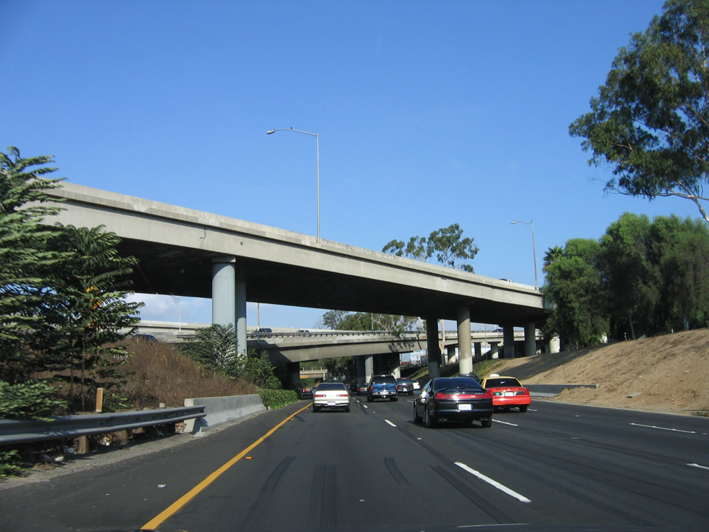
The right four lanes of Interstate 5 (Santa Ana Freeway) continue north under the Interstate 710 mainline and connecting ramps. These ramps were built in 1955 and expanded in 1967. Photo taken 10/07/06. |
|
On the north side of the Interstate 710 overpass, traffic streams onto Interstate 5 north from Interstate 710. At this point, Interstate 5 leaves the city of Commerce and briefly enters unincorporated East Los Angeles (commonly referred to as East L.A.). The skyscrapers of downtown Los Angeles can be seen in the distance straight ahead on a clear day. Photo taken 10/07/06. |
|
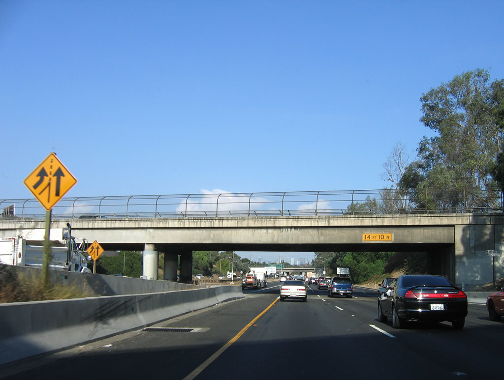
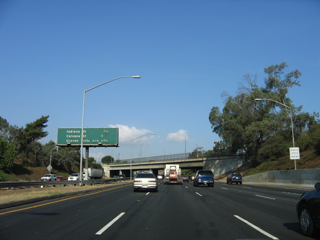
This mileage sign provides the distance to the next three exits: Exit 131, Ditman Avenue to Indiana Street; Exit 132, Calzona Street; and Exit 133, Grande Vista Avenue. The speed limit will soon reduce from 65 miles per hour to 55 miles per hour for the somewhat confusing and unusual East Los Angeles Interchange. Five lanes for Interstate 5 continue north until the U.S. 101 split; through traffic on U.S. 101 (Santa Ana Freeway) north should stay left, while through traffic on Interstate 5 (Golden State Freeway) should stay right. Photo taken 10/07/06. |
|
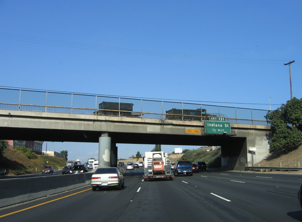
Between Interstate 710 and the East Los Angeles Interchange, Interstate 5 (Santa Ana Freeway) travels almost due west. The next exit along Interstate 5 is north-south Indiana Street at Exit 131. In the 1970s, Caltrans District 7 experimented with the use of exit numbers, and this exit number is from that experimental era. Photo taken 10/07/06. |
|
Northbound Interstate 5 (Santa Ana Freeway) reaches Exit 131, Ditman Avenue to Indiana Street; the next exit is Exit 132, Calzona Street. Indiana Street is a major north-south arterial; it serves as the boundary between the city of Los Angeles and the unincorporated community of East Los Angeles. Photo taken 10/07/06. |
|
Passing over the Indiana Street bridge (built 1948 expanded 1975), Interstate 5 (Santa Ana Freeway) finally enters the city of Los Angeles. Photo taken 10/07/06. |
|
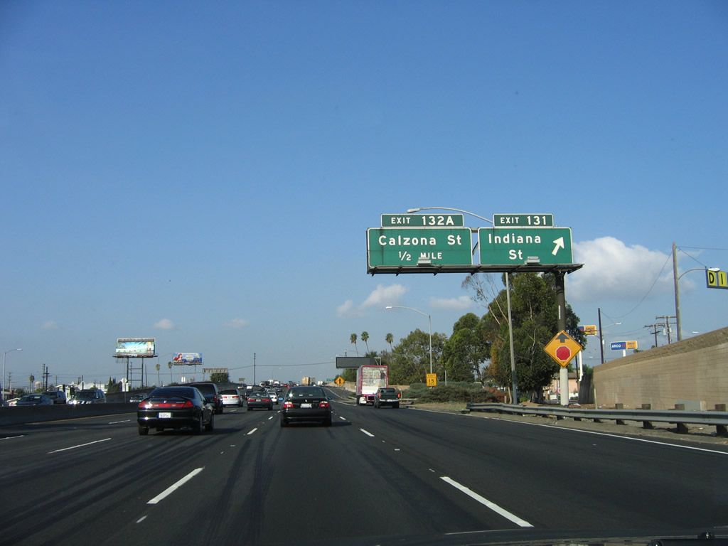
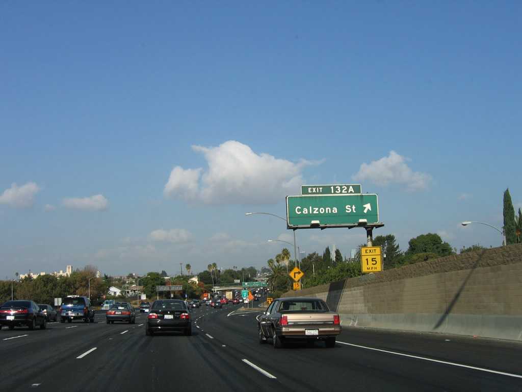
Northbound Interstate 5 (Santa Ana Freeway) reaches Exit 132, Calzona Street (the original exit number of 132A is now officially 132, but the signs have not been changed). Calzona Street is a major north-south arterial; it serves as the boundary between the city of Los Angeles and the unincorporated community of East Los Angeles. Photo taken 10/07/06. |
|
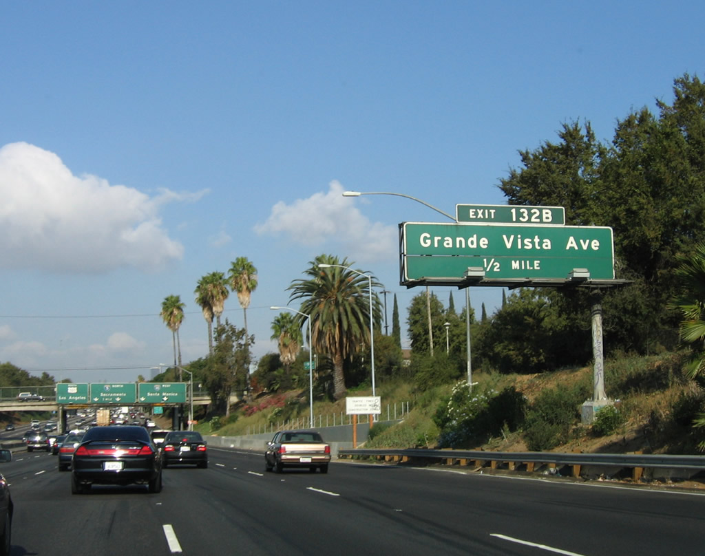
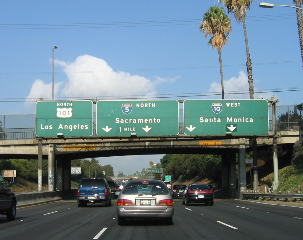
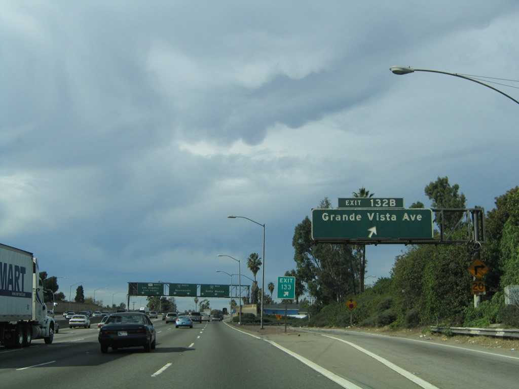
The next exit on Interstate 5 (Santa Ana Freeway) is Exit 133, Grande Vista Avenue (not Exit 132B as shown on this overhead sign). The next exit posted on this mileage sign shows both Interstate 5 and Interstate 10 shields, even though traffic is currently traveling north on Interstate 5. This is meant to signify that motorists have reached the colossal downtown interchange complex, which features not just Interstates 5 and 10 but also California 60 and U.S. 101. Even though this interchange handles an incredibly high amount of traffic, it is still nowhere near large enough to handle existing traffic loads. Photo taken 10/07/06. |
|
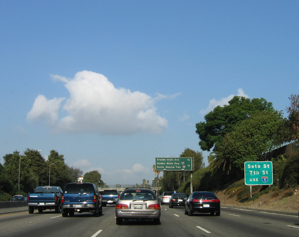
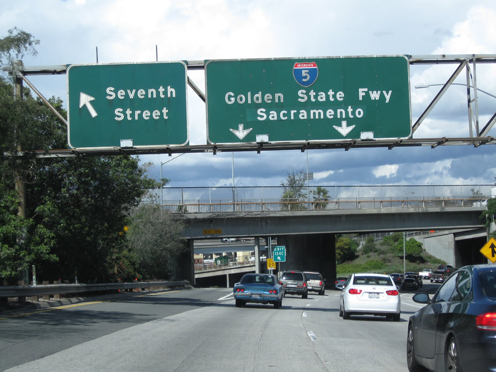
This roadside sign advises that motorists for 134B, Soto Street and Exit 134C, Seventh Street (left exit) should follow the signs for Interstate 5 (Golden State Freeway) north. Photo taken 10/07/06. |
|
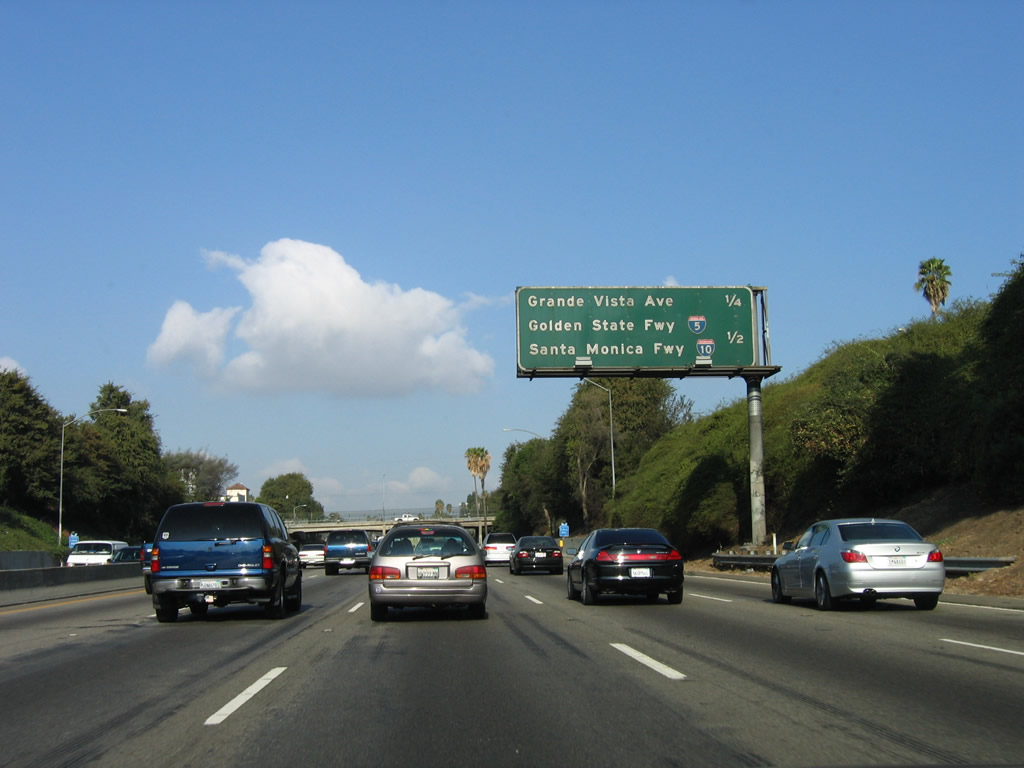
This mileage sign provides the distance to the next three exits on Interstate 5 (Santa Ana Freeway): Exit 133, Grande Vista Avenue; Exit 134A, U.S. 101 (Santa Ana Freeway) north to downtown Los Angeles; and Exit 134B, Interstate 10 (Santa Monica Freeway) west to Santa Monica. Photo taken 10/07/06. |
|
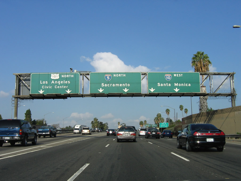
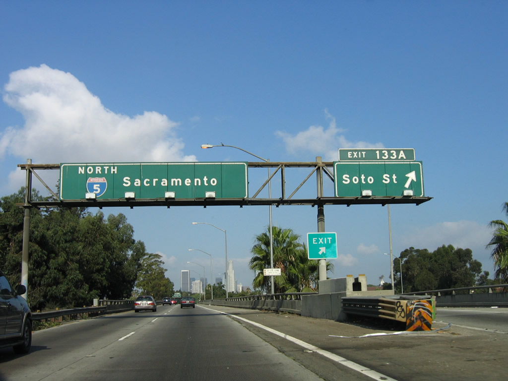
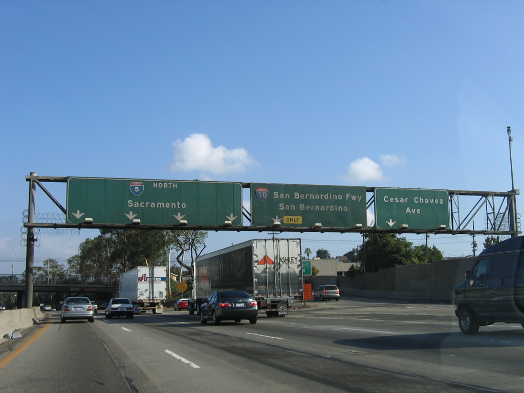
Northbound Interstate 5 (Santa Ana Freeway) reaches Exit 133, Grande Vista Avenue. Even though Indiana Street (Exit 132) has the correct exit number from the old numbering experiment, Grande Vista Avenue does not have the correct number. The experimental number was Exit 132B, but it will be renumbered as Exit 133 when new signs are placed. The next set of overhead signs indicates where traffic should go for U.S. 101, Interstate 5, and Interstate 10. Built in 1959 and 1960, the East Los Angeles Interchange is a tangled maze of ramps that connects five freeways together and moves traffic around the eastern edge of downtown Los Angeles. Interstate 5 will soon reduce to only two northbound lanes, so through traffic should watch signs carefully to avoid ending up on the wrong ramp. Back-ups can occur through this interchange at any time of day, so be mindful of congestion through the next several miles. Photo taken 12/10/05. |
|
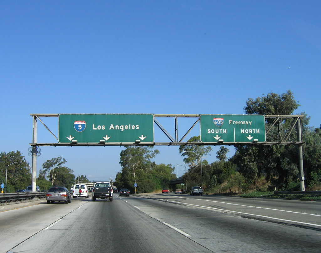
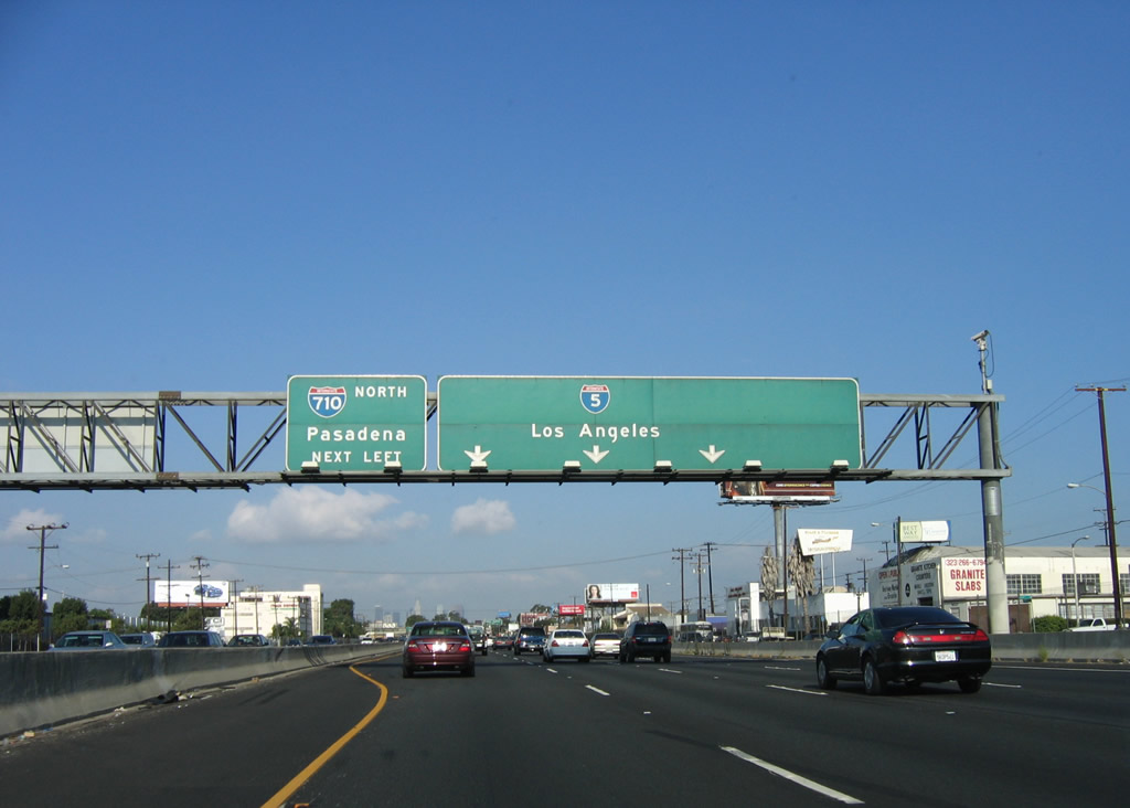
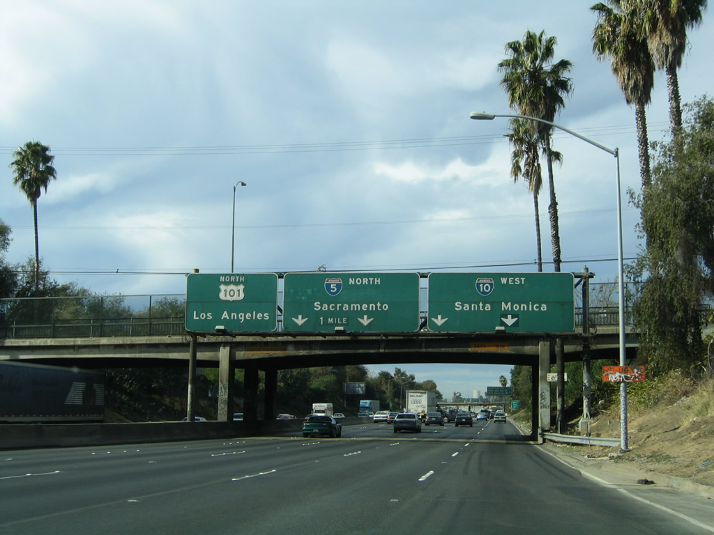
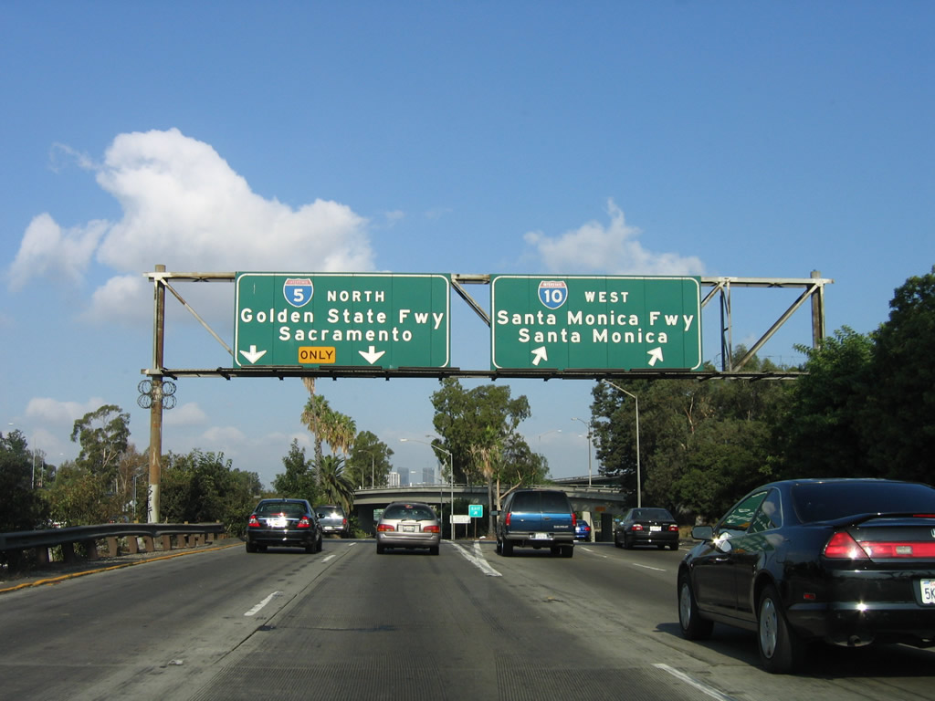
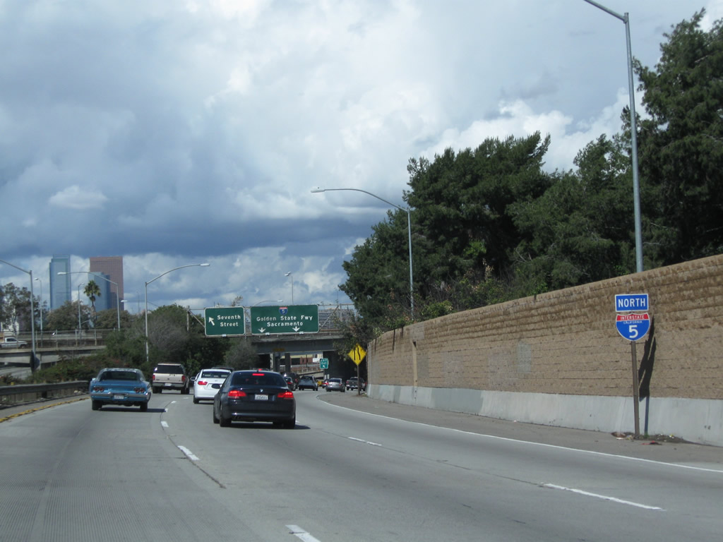
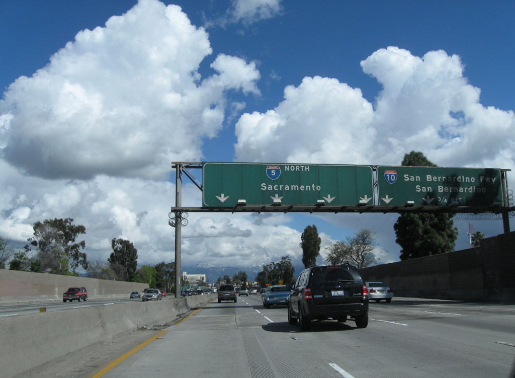
Immediately thereafter, the routes divide. Interstate 5 and U.S. 101 split, and they will not see each other again until Olympia, Washington. Traffic to U.S. 101 north defaults to the left lanes, as the Santa Ana Freeway follows U.S. 101, and the right lanes continue on Interstate 5 and the Golden State Freeway north. Currently there is no no assigned exit number for the split between Interstate 5 and U.S. 101. Interstate 5 skirts the eastern edge of downtown Los Angeles and gains a new control city of Sacramento (the control city was Bakersfield until the 1980s). The Santa Ana Freeway breaks into the following components: the left two lanes continue north on the Santa Ana Freeway to U.S. 101 north; the middle two lanes continue north on Interstate 5 (Golden State Freeway) to the San Fernando Valley and all points north; and right two lanes connect to California 60 west to Interstate 10 west to Santa Monica (signed only as Interstate 10 west). Although not mentioned here, Interstate 10 eastbound merges with Interstate 5 northbound. Hopefully, the new signs will correct this oversight. Finally, California 60 (Pomona Freeway) east does not have an exit because it is assumed that traffic wishing to reach California 60 would have taken Interstate 710 north to California 60 east. Of course, the same assumption could be made about traffic trying to reach eastbound Interstate 10 from here. Photo taken 10/07/06. |
|
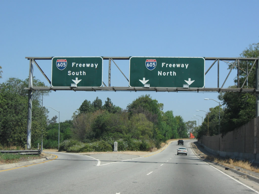
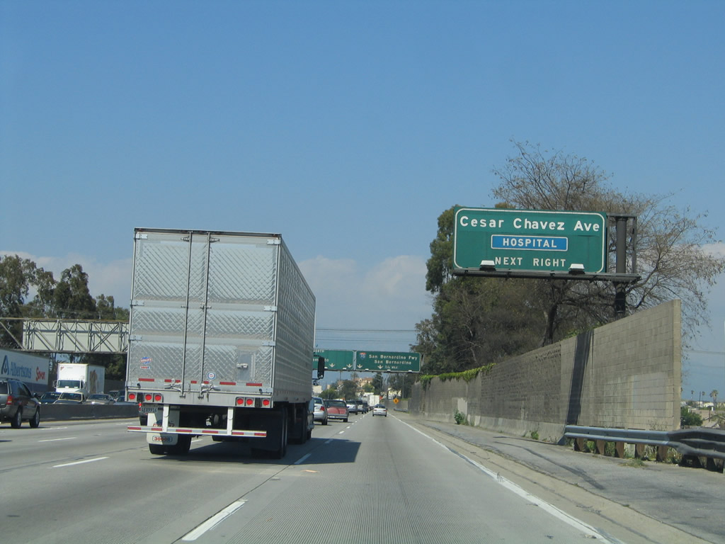
After splitting from U.S. 101, Interstate 5 now follows the Golden State Freeway from this point north to the California 99 split in Kern County (Exit 221). This roadside sign advises that motorists for 134B, Soto Street and Exit 134C, Seventh Street (left exit) should follow the signs for Interstate 5 (Golden State Freeway) north. Photo taken 10/07/06. |
|
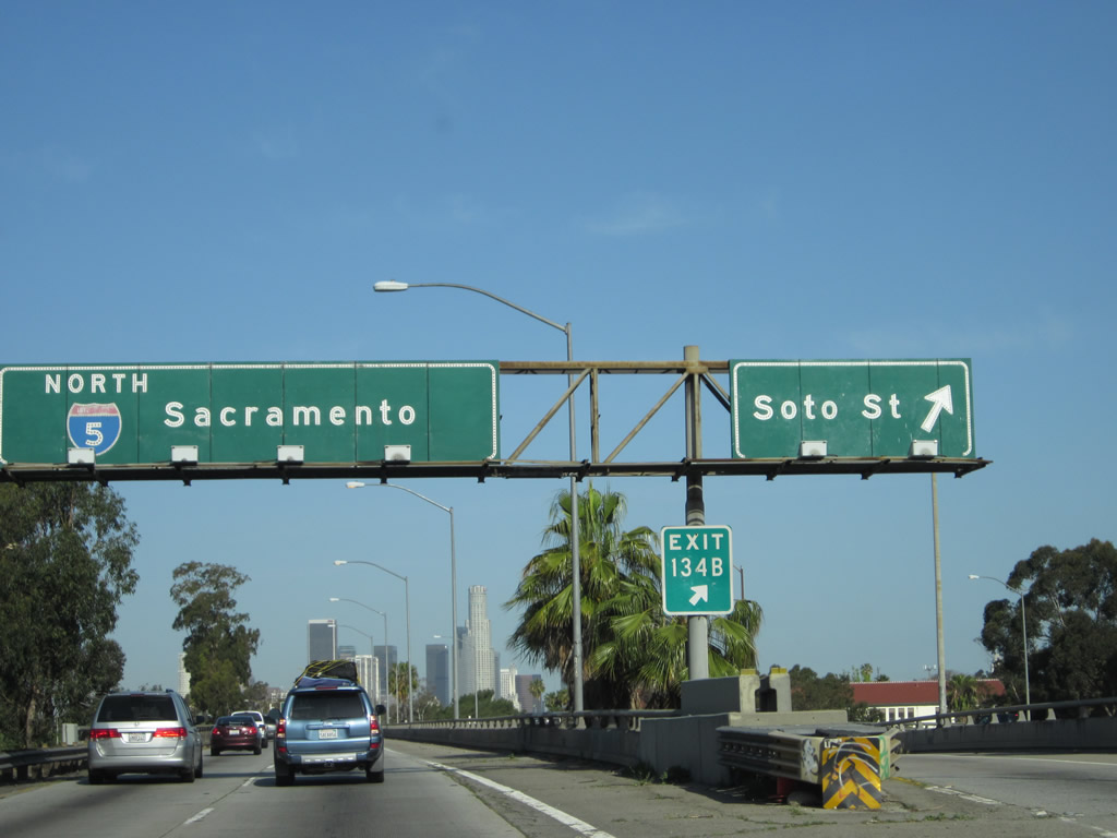
Northbound Interstate 5 (Golden State Freeway) reaches Exit 134A, California 60 west to Interstate 10 (Santa Monica Freeway) west. Eastbound Interstate 10 is not listed on this sign, but it should be shown on the pull-through sign alongside the Interstate 5 north shield. Northbound Interstate 5 reduces to only two through lanes of traffic as it merges with eastbound Interstate 10. Photo taken 10/07/06. |
|
Only two through lanes of Interstate 5 (Golden State Freeway) continue north after splitting from Exit 134A. Photo taken 10/07/06. |
|
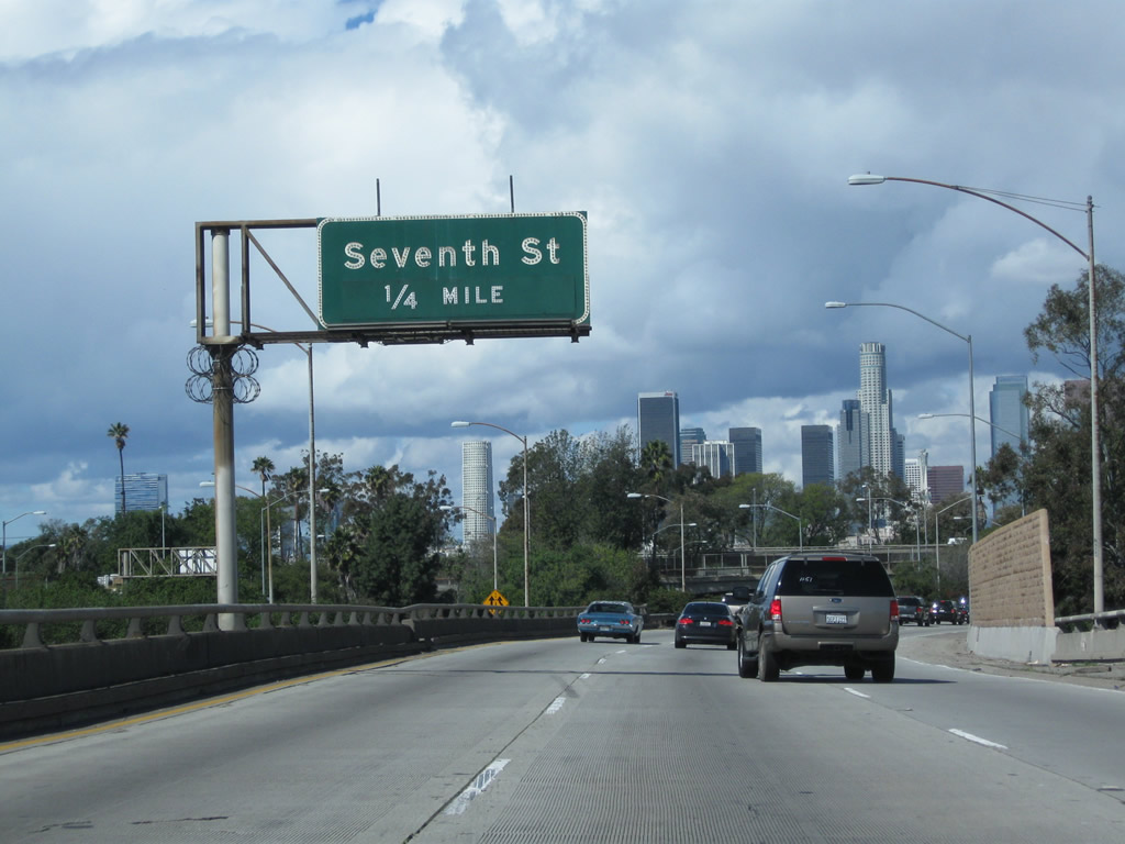
A newer advance guide sign for Exit 134C, Seventh Street replaces the one seen in the next picture. Photo taken 02/26/11. |
|
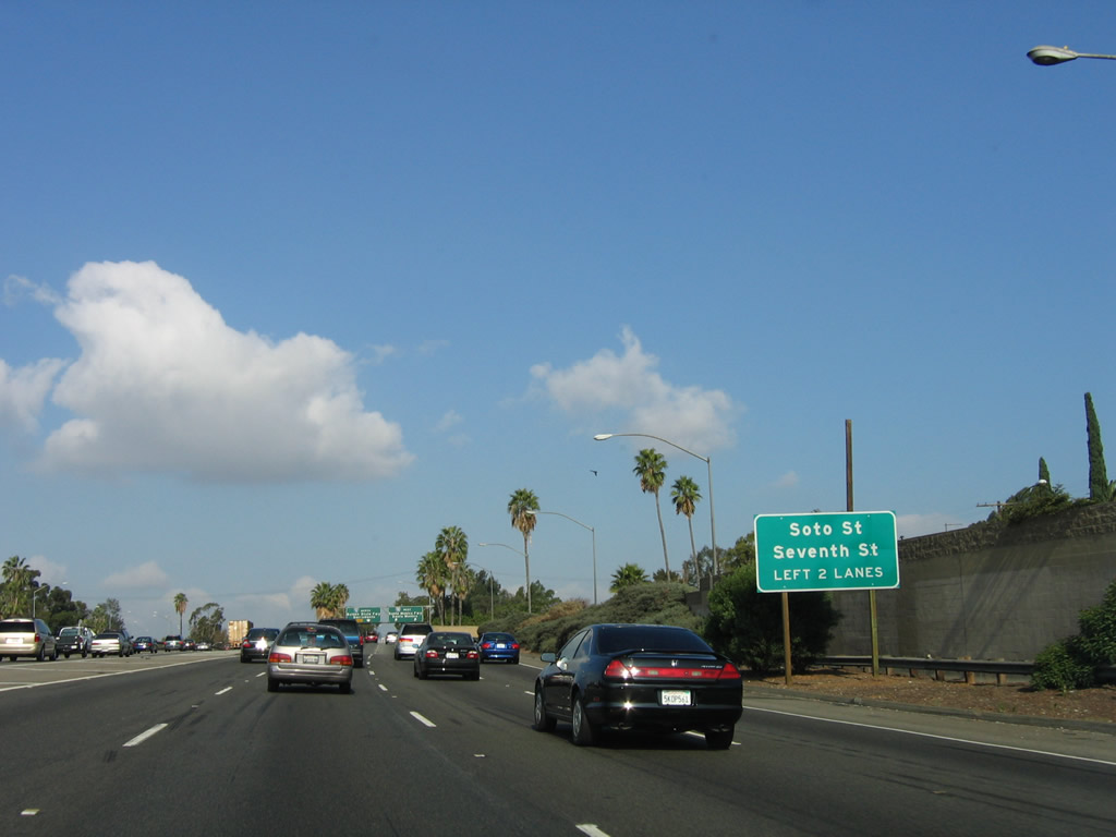
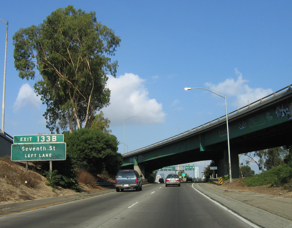
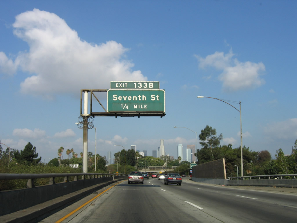
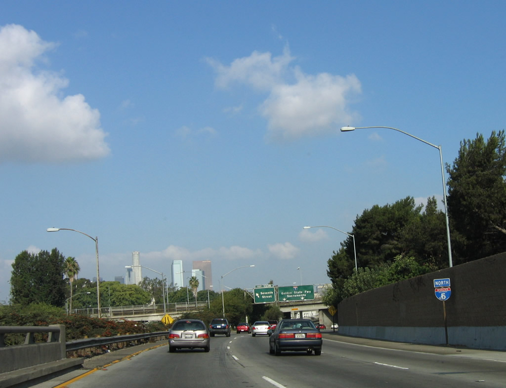
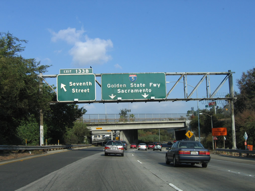
The next two exits along Interstate 5 (Golden State Freeway) north are Exit 134B, Soto Street, and Exit 134C, Seventh Street. The posted exit number here (133B) is no longer the official exit number (134C). Photo taken 10/07/06. |
|
|
Northbound Interstate 5 (Golden State Freeway) reaches Exit 134B, Soto Street (the posted exit number 133A is no longer valid, and by 2009 the exit tab was removed from this overhead sign). The skyscrapers of downtown Los Angeles can be seen ahead, but the freeway will soon turn from west to north upon reaching the off-ramp for Exit 134C. An effort was made to remove some of the older, erroneous exit tabs such as this one for Soto Street. Photos taken 04/06/12 and 10/07/06. |
|
A two-lane viaduct carries Interstate 5's northbound lanes through the East Los Angeles Interchange. Photo taken 10/07/06. |
|
|
The next exit along Interstate 5 (Golden State Freeway) north is Exit 134C, Seventh Street (one-quarter mile). The exit tab was removed by 2011 since this exit has a new exit number (as compared to the 1971 exit numbering effort). Photos taken 02/26/11 and 10/07/06. |
|
|
This Interstate 5 reassurance shield is posted along northbound Golden State Freeway prior to Exit 134C, Seventh Street. Interstate 5 remains independent for a little while longer, until it merges with Interstate 10 east. Photos taken 02/26/11 and 10/07/06. |
|
|
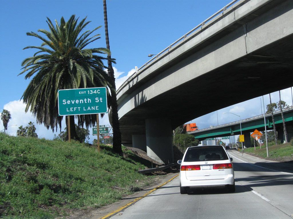
Northbound Interstate 5 (Golden State Freeway) reaches Exit 134C (not 133B), Seventh Street (left exit). The right two lanes continue north on Interstate 5. Photos taken 02/26/11 and 10/07/06. |
|
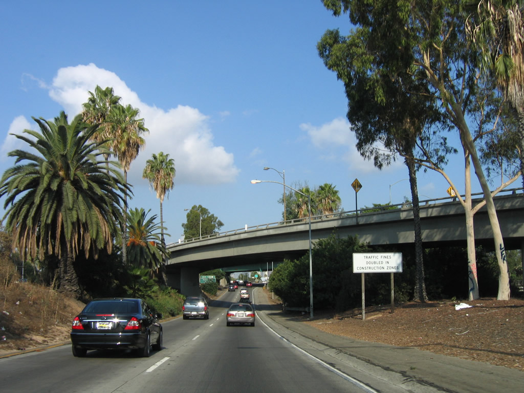
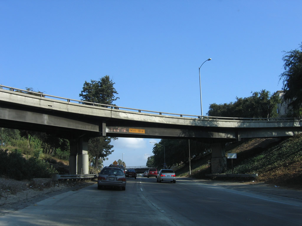
Interstate 5 climbs a short grade and passes under a bridge prior to merging with Interstate 10 east. Photo taken 10/07/06. |
|
|
Shortly thereafter, two new left lanes from Interstate 10 east merge onto Interstate 5 (Golden State Freeway) north. An Interstate 5 reassurance shield is posted just prior to the merge. Despite the fact that Interstate 5 and Interstate 10 will share alignment, there are no dual shields along this shared stretch of Golden State Freeway. Photos taken 02/26/11 and 10/07/06. |
|
The East Los Angeles Interchange is almost always busy and carries a great deal of traffic through it. Interstate 10 merges with Interstate 5 north at this point from the left. Photo taken 02/26/11. |
| Interstate 5 (Golden State Freeway) north and Interstate 10 east |
|
|
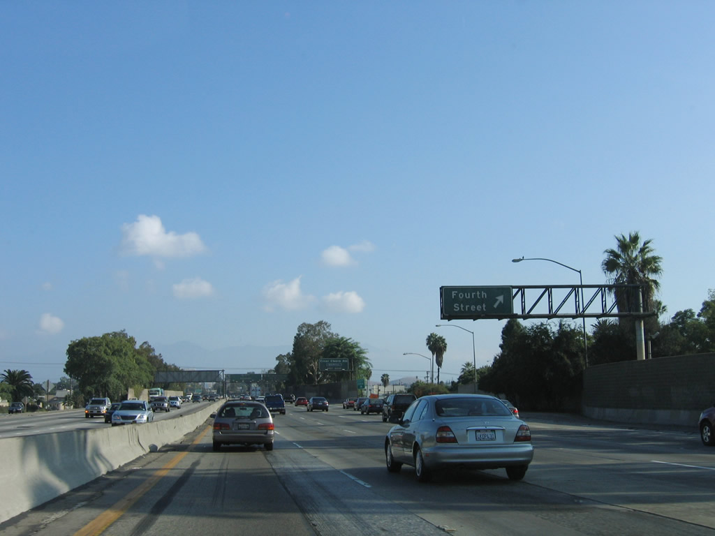
After merging with Interstate 10 east, Interstate 5 (Golden State Freeway) north now has five through lanes. The next exit along Interstate 5 north and Interstate 10 east is Exit 135A, Fourth Street. Photos taken 02/26/11 and 10/07/06. |
Page Updated September 13, 2012.