| Interstate 5 north |
|
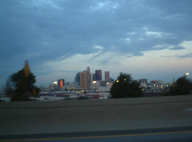
Looking west from the freeway during the pre-dawn hours, this view of downtown Los Angeles appears after the Interstate 10 (San Bernardino Freeway) split. Photo taken 11/28/02. |
|
|
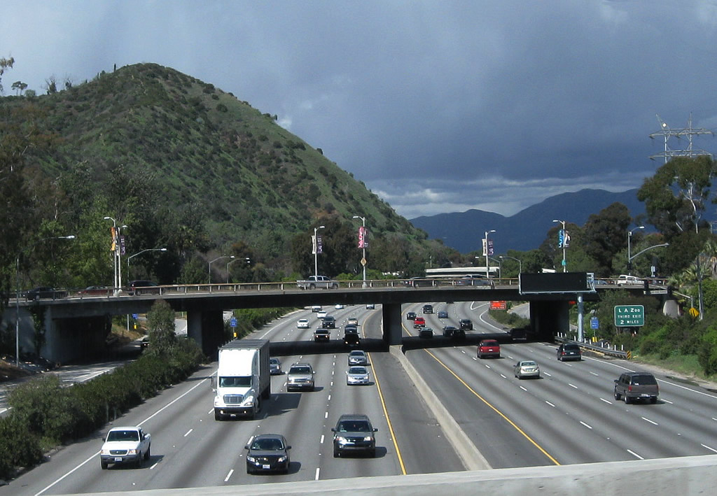
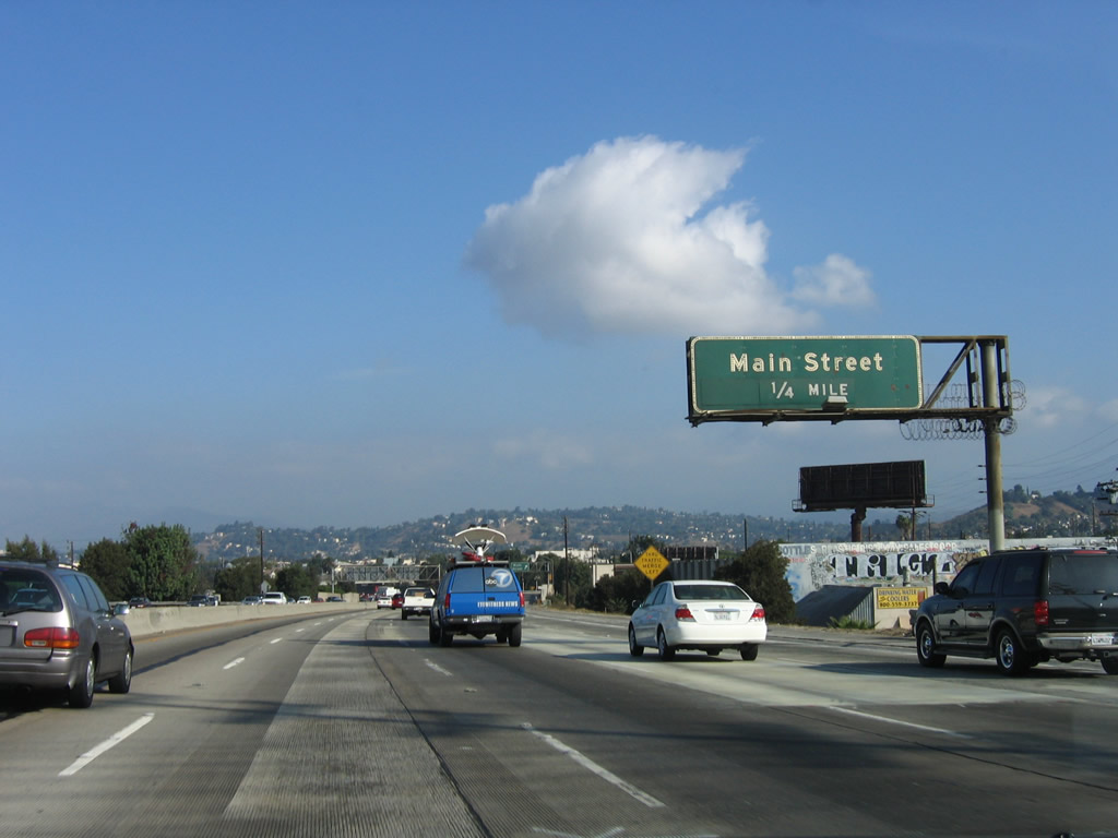
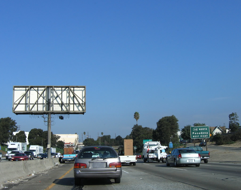
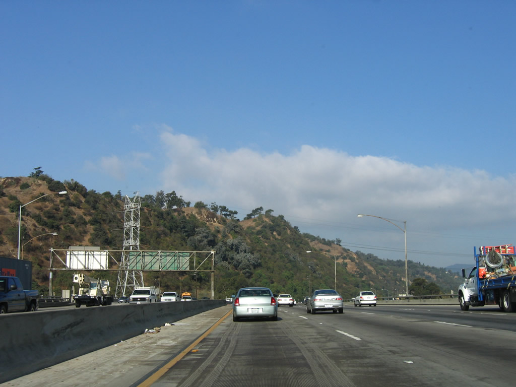
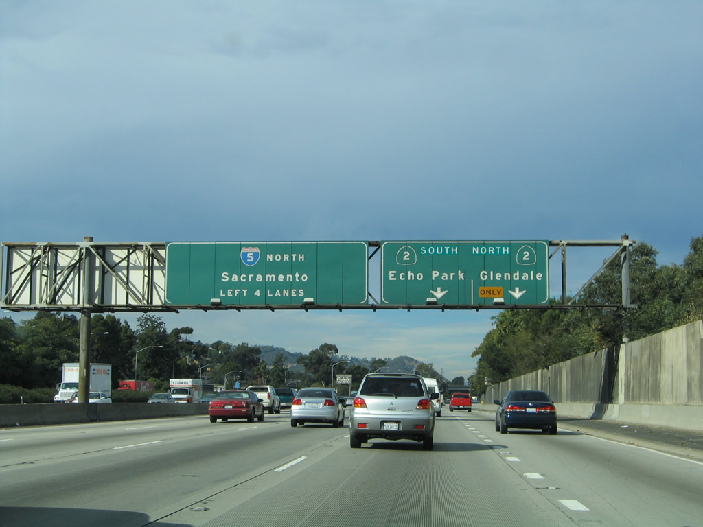
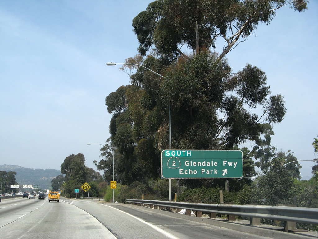
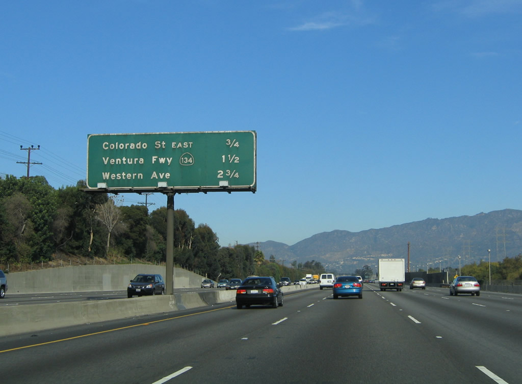
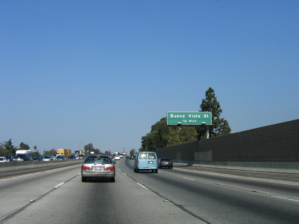
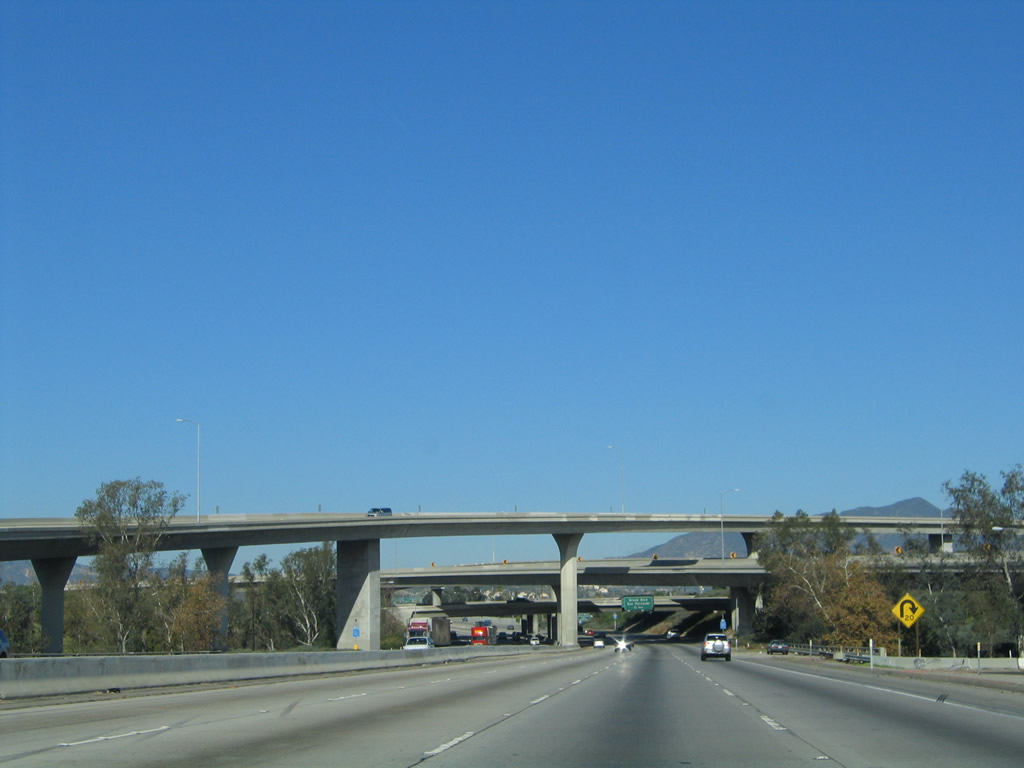
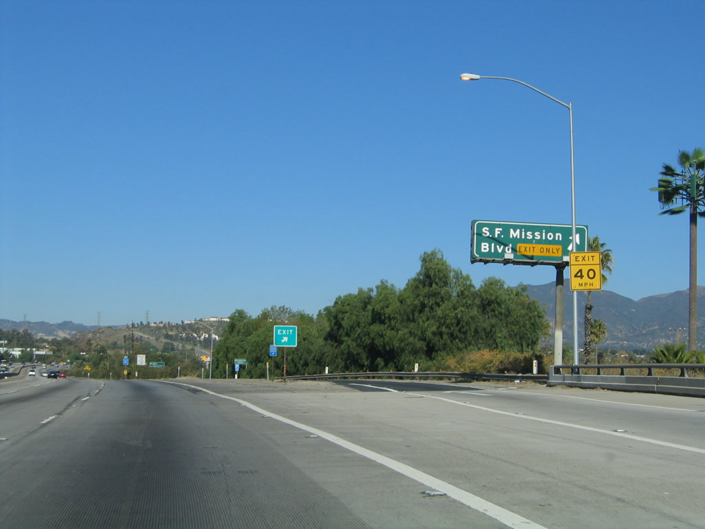
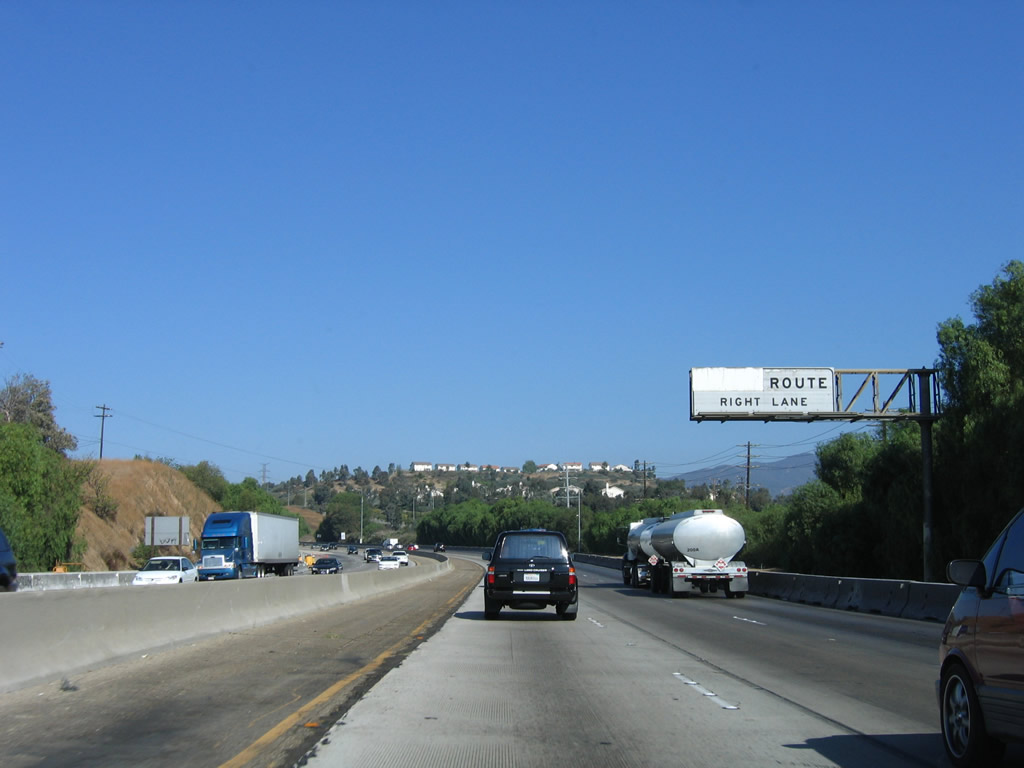
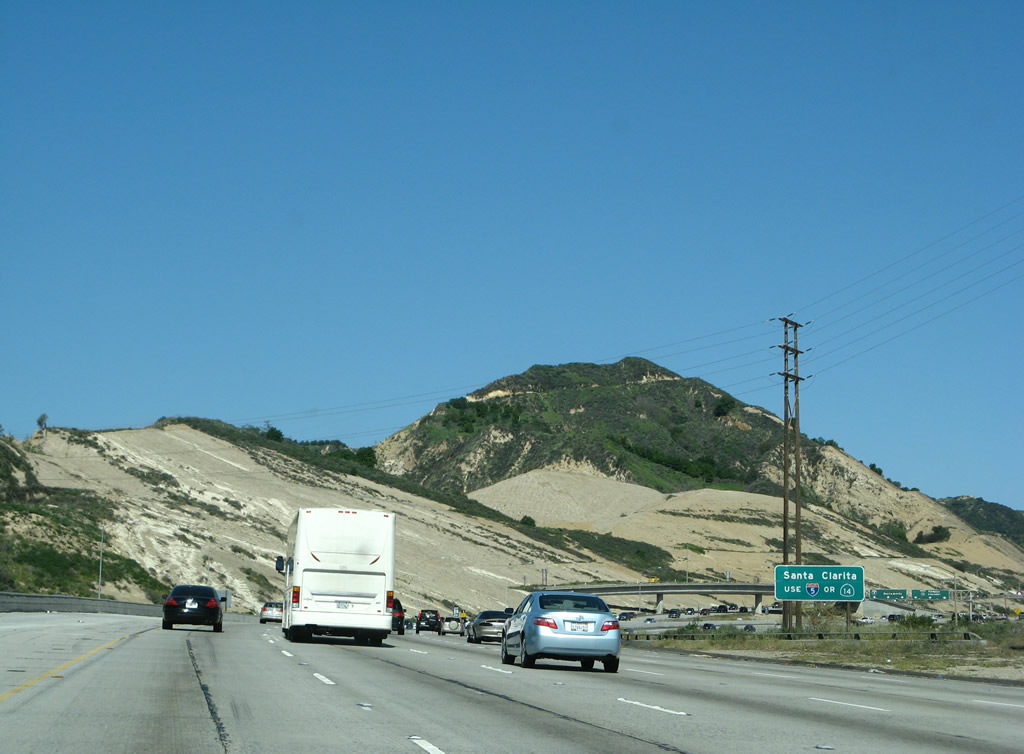
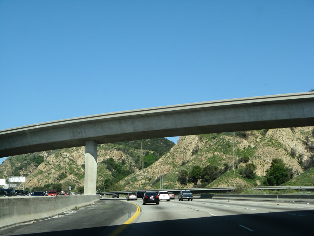
This mileage sign on Interstate 5 (Golden State Freeway) north provides the distance to the next four exits: Exit 136A, Daly Street to Main Street; Exit 136B, Broadway (Historic U.S. 66); Exit 137A, Avenue 26 to U.S. 66/Figueroa Street; and Exit 137B, California 110 (Pasadena Freeway) (Arroyo Seco Parkway) north to Pasadena. There is no direct connection from Interstate 5 north to California 110 south; one must use Avenue 26 (Exit 137A). Note the sign replacement from 2010 that refers to California 110 north as "Parkway." Photos taken 02/26/11 and 10/07/06. |
|
To the east of Interstate 5, Main Street serves the community of Lincoln Heights and Lincoln Park northeast of downtown Los Angeles. Main Street connects to Mission Road northeast, and Daly Street south turns into Marengo Street. To the southwest, Main Street angles toward downtown Los Angeles, passing through Chinatown, El Pueblo de Los Angeles State Historic Park, and the Civic Center along the way. (Main Street becomes one-way northbound south of Alameda Street, so through traffic southbound must use Broadway through downtown. Photo taken 10/07/06. |
|
Northbound Interstate 5 (Golden State Freeway) reaches Exit 136A, Daly Street to Main Street. Photo taken 10/07/06. |
|
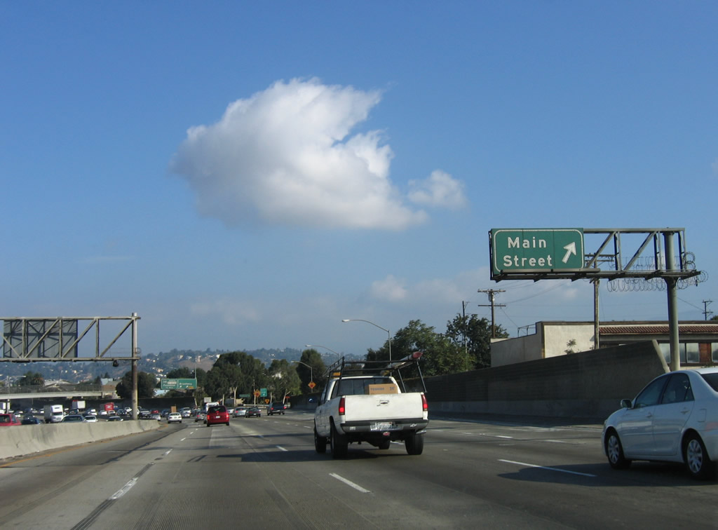
Immediately thereafter, Interstate 5 (Golden State Freeway) north reaches Exit 136B, Broadway. Use Broadway east to follow old U.S. 66 to Mission Road, Huntington Drive, and Fair Oaks Avenue en route to Pasadena. The next exit along northbound is Exit 137, California 110 (Arroyo Seco Parkway / Pasadena Freeway) north to Pasadena. Photo taken 10/07/06. |
|
|
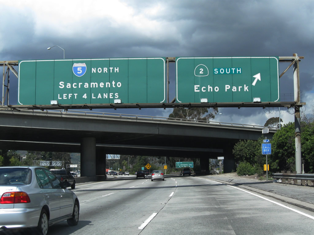
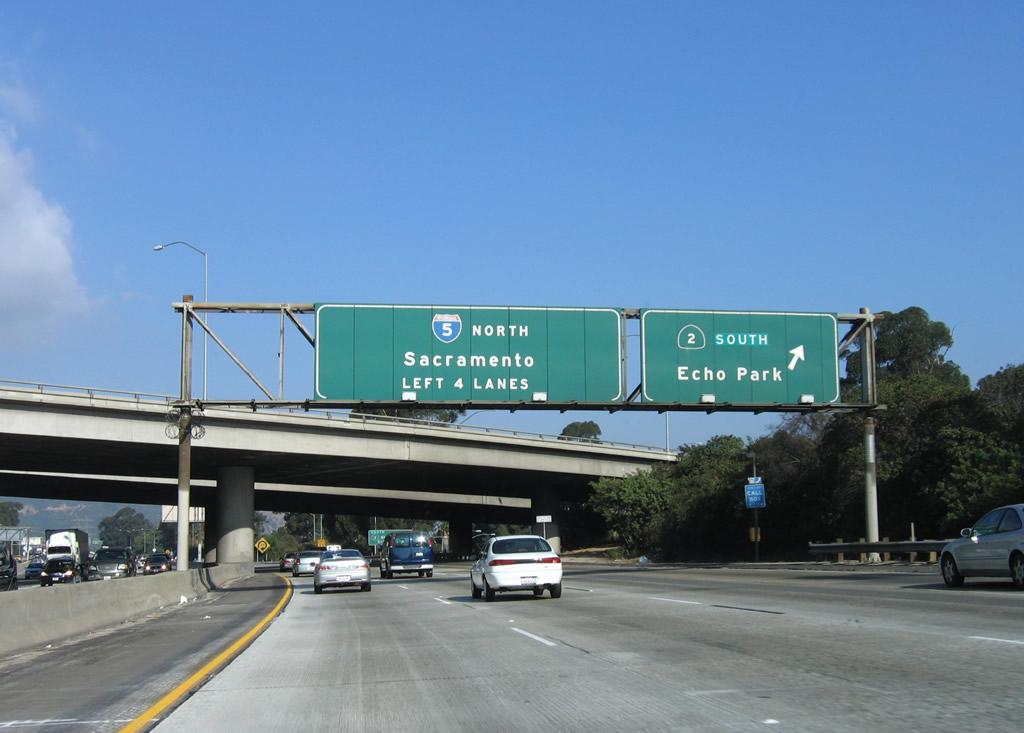
The next exit along Interstate 5 (Golden State Freeway) north is the connecting ramp to Exits 137A-B, Avenue 26/Figueroa Street and California 110/Arroyo Seco Parkway north to Pasadena. There is no direct connection from Interstate 5 north to California 110 south; one must use Avenue 26. Photos taken 02/26/11 and 10/07/06. |
|
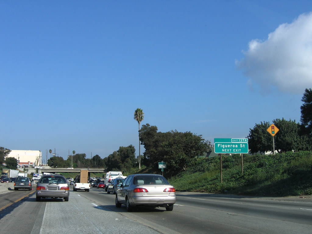
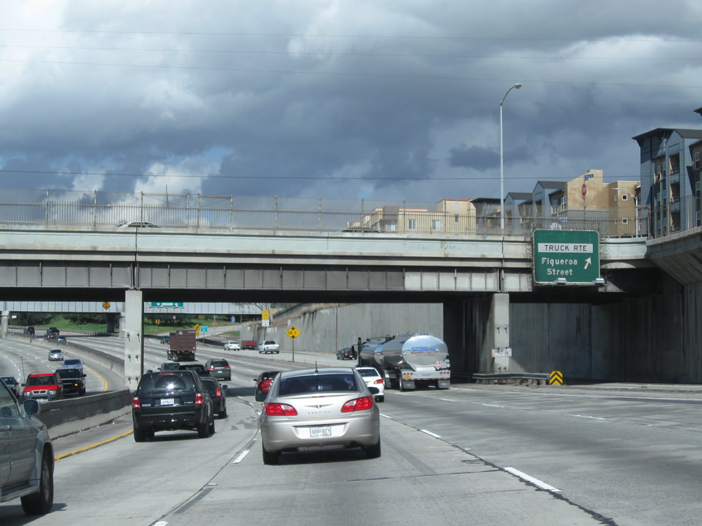
To the Figueroa Street alignment of U.S. 66, use Exit 137A (use the California 110 north ramp, then depart at Exit 137A, Avenue 26). U.S. 66 had three separate alignments between Pasadena and downtown Los Angeles: (1) Broadway, Mission Road, Huntington Drive, and Fair Oaks Avenue; (2) Figueroa Street and Colorado Street; and (3) Arroyo Seco Parkway (California 110). All three alignments are identified in the Los Angeles Thomas Guide as Historic U.S. 66 alignments. Photo taken 10/07/06. |
|
|
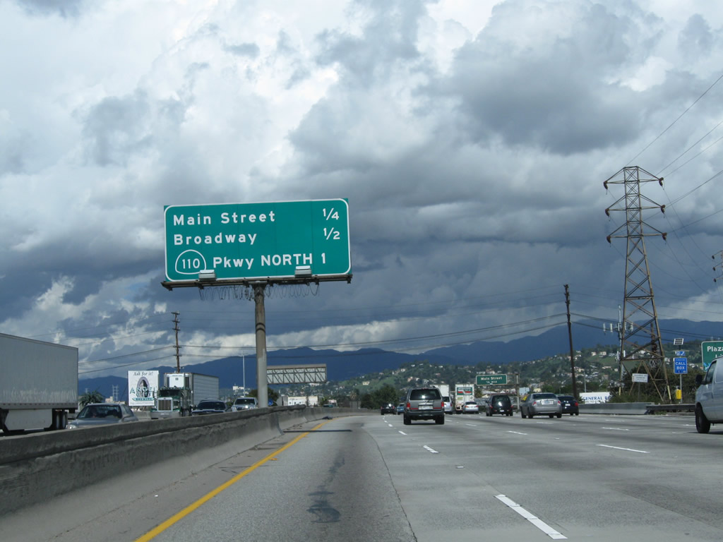
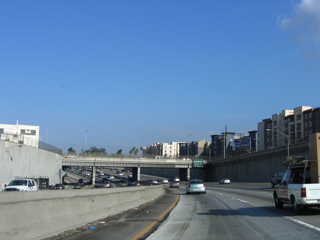
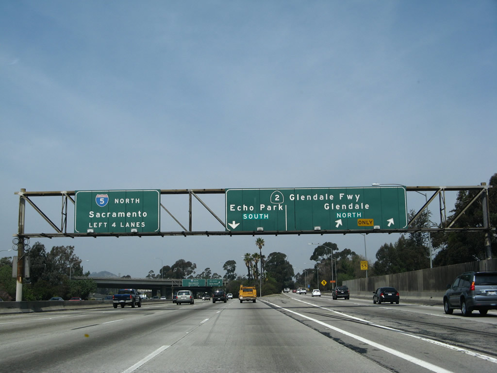
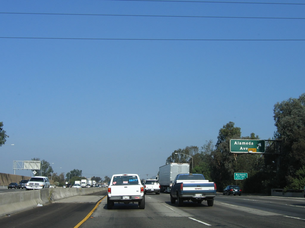
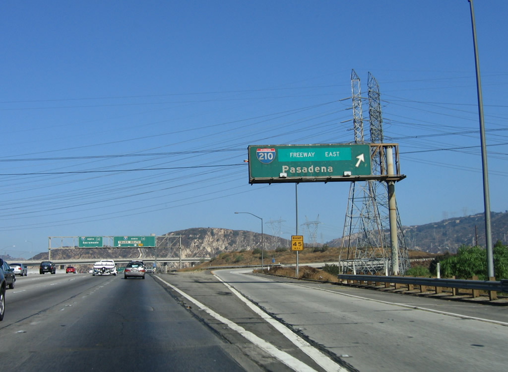
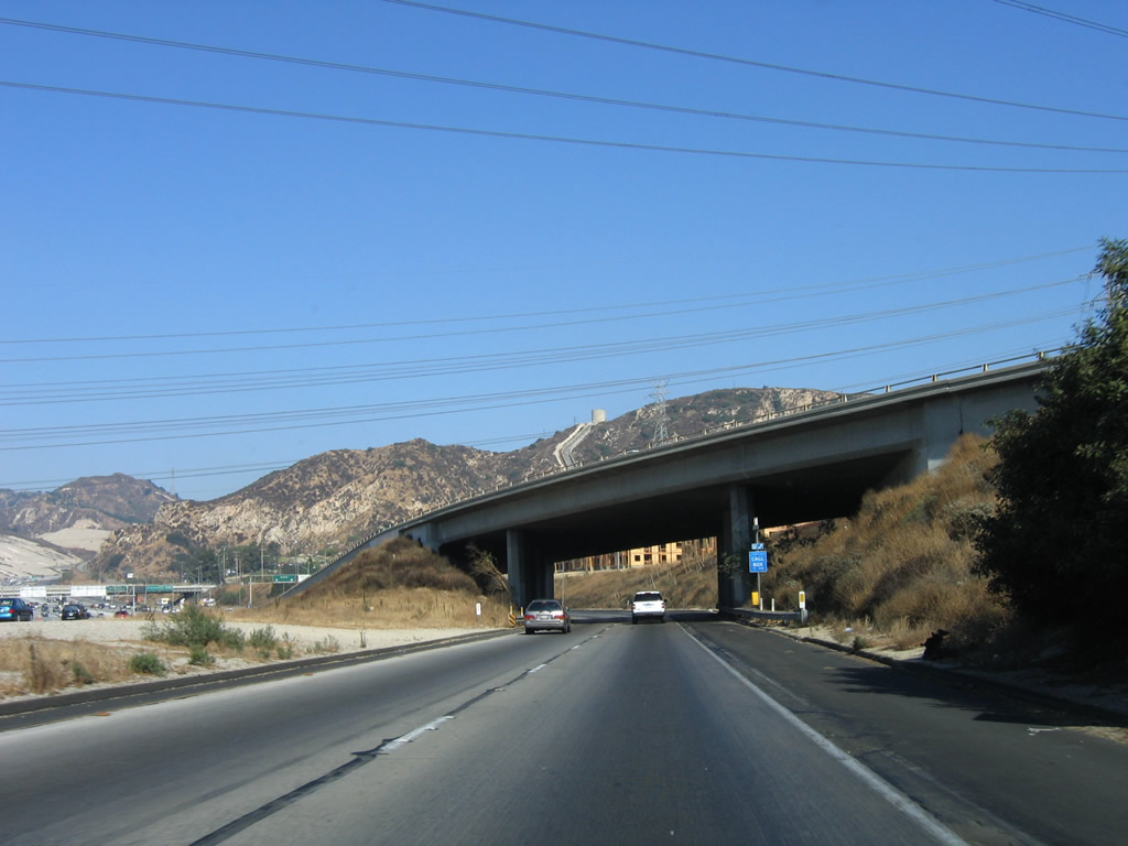
Northbound Interstate 5 (Golden State Freeway) meets the off-ramp to Exits 137A-B, Avenue 26 to Historic U.S. 66/Figueroa Street and California 110 south (Exit 137A) and California 110/Arroyo Seco Parkway north (Exit 137B). The exit lanes will stay close to the main lanes briefly as shown in the next photo. Both the pull-through sign and exit sign were replaced to incorporate the "Parkway" designation of California 110 and the exit number. Photos taken 02/26/11 and 10/07/06. |
|
Looking north after the Exits 137A-B off-ramp, Interstate 5 (Golden State Freeway) enters a below-grade segment with tall retaining walls on both sides of the freeway. Photo taken 10/07/06. |
|
|
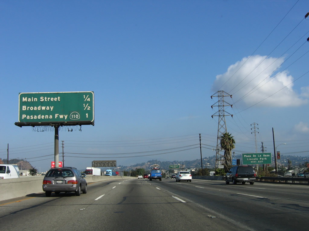
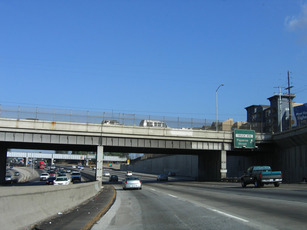
The transition ramp from Interstate 5 north to California 110 has two separate exits: Exit 137A, Avenue 26 to Historic U.S. 66/Figueroa Street and California 110 (Pasadena Freeway) south and Exit 137B, California 110/Arroyo Seco Parkway north to Pasadena. This view shows the off-ramp to Exit 137A. Photos taken 02/26/11 and 10/07/06. |
|
|
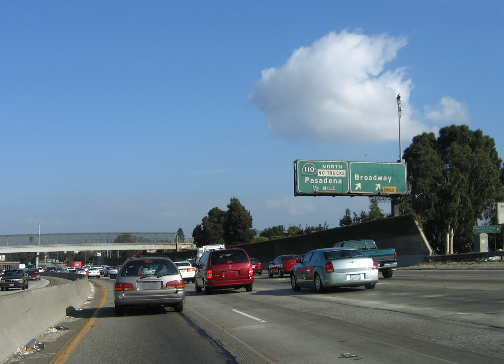
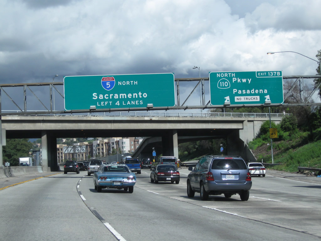
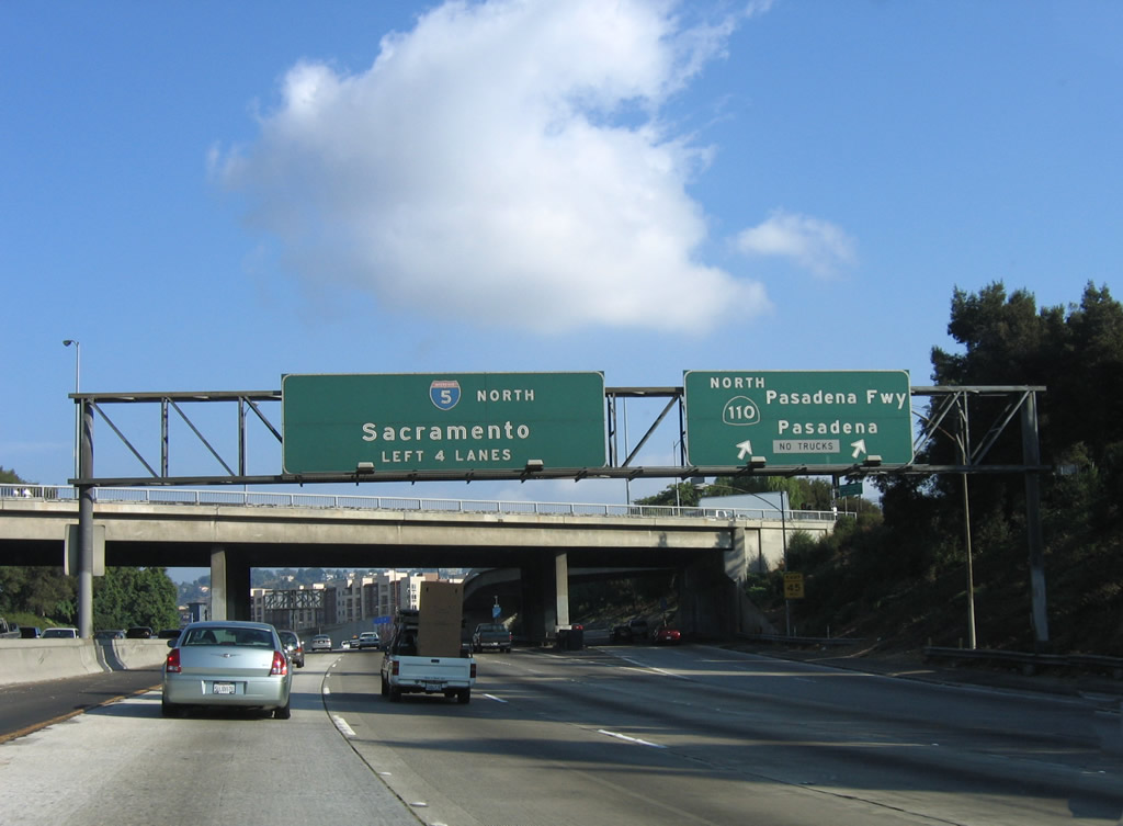
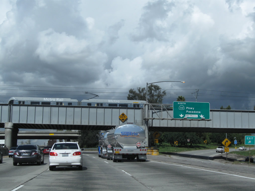
Shortly thereafter, the transition ramp connects directly with Exit 137B, California 110/Arroyo Seco Parkway north At this point, the Metro Gold Line passes over Interstate 5; the light rail travels northeast toward Pasadena, then briefly merges into the median of Interstate 210 before ending in eastern Pasadena. The 2011 picture shows a Metro Gold Line train passing overhead as well as the sign replacement indicating California 110 as "Parkway." Photos taken 02/26/11 and 10/07/06. |
|
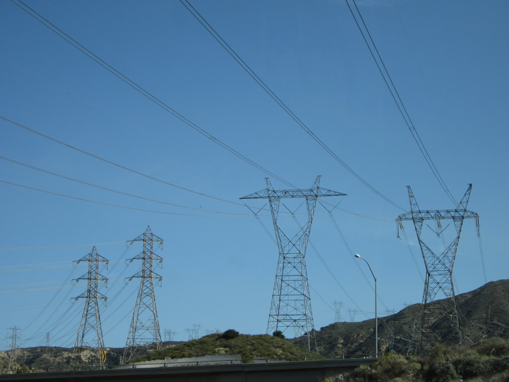
Griffith Park comes into view as Interstate 5 (Golden State Freeway) returns to ground level and then passes over California 110 (Pasadena Freeway). The tall electricity transmission tower belongs to the Los Angeles Department of Water and Power. That tower also marks where Interstate 5 passes over the Los Angeles River for the first time. It will pass over the river again near the California 134 interchange. Photo taken 10/07/06. |
|
Skirting the edge of Elysian Park, northbound Interstate 5 (Golden State Freeway) carries four northbound lanes as the freeway crosses California 110 (Pasadena Freeway). There is no access to California 110 south from Interstate 5 north. Photo taken 10/07/06. |
|
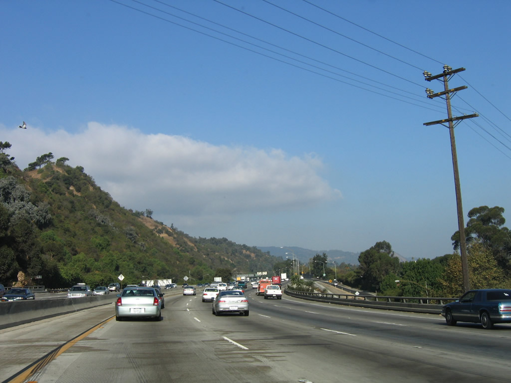
Looking northeast is this view of the Los Angeles River and the LADWP power lines that parallel it. Also on the east bank of the river is Historic U.S. 99/San Fernando Road (former Business Loop I-5), Metrolink rail, and the Union Pacific Railroad. In the distance are the towering San Gabriel Mountains that frame the north edge of San Fernando and San Gabriel Valleys. On a smog-free day like today, the mountains frame a beautiful view (including storm clouds from a departing storm). Photo taken 02/26/11. |
|
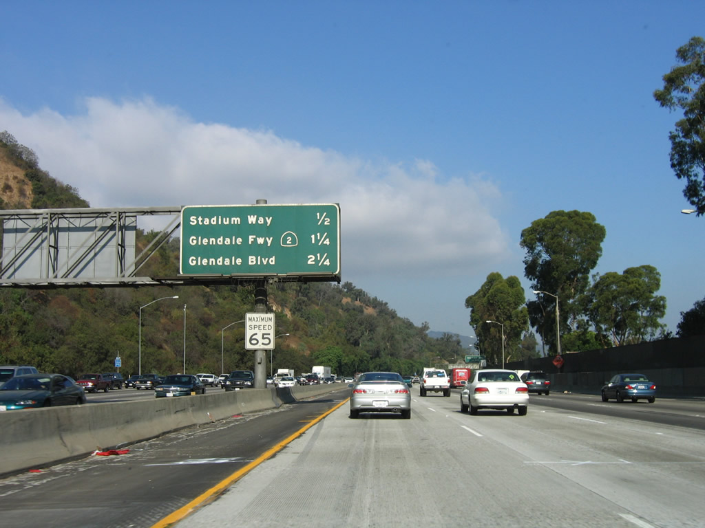
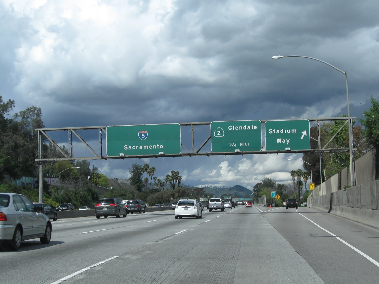
The next four exits along Interstate 5 (Golden State Freeway) north are Exit 138, Stadium Way; Exit 139A, California 2 (Glendale Freeway) north to Glendale; Exit 139B, California 2 (Glendale Freeway) south to Alvarado Boulevard and the Echo Park community of Los Angeles; and Exit 140, Glendale Boulevard. This interchange sequence sign is posted in the median of the freeway. Photo taken 10/07/06. |
|
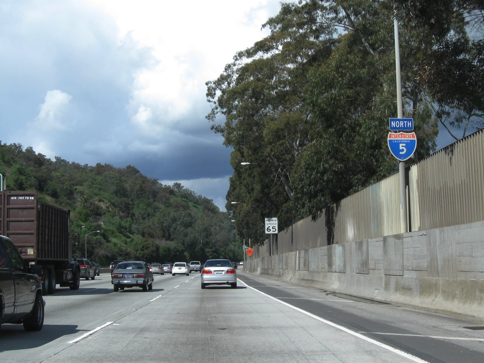
On the right side of the freeway is this Interstate 5 north reassurance shield, located immediately after the transition ramp from California 110 north. Photo taken 02/26/11. |
|
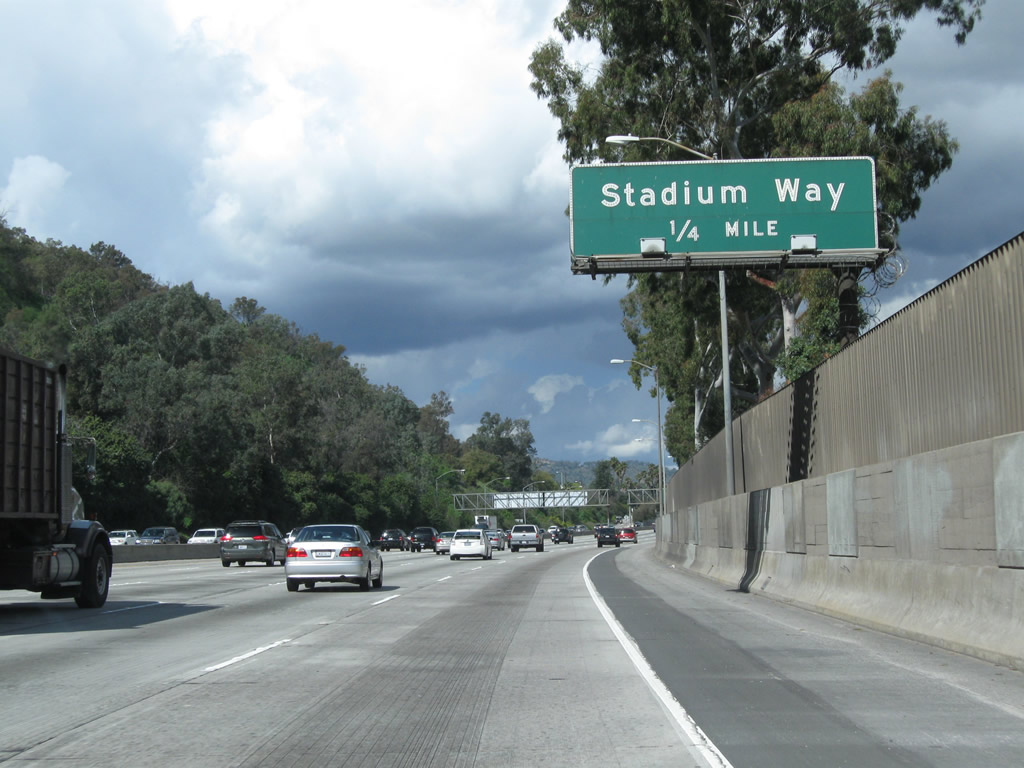
Exit 138 connects Interstate 5 north with Stadium Way, which travels through Elysian Park and Chavez Ravine to Major League Baseball's Los Angeles Dodger Stadium. Founded in 1886, Elysian Park is the oldest park in the city of Los Angeles. Photo taken 02/26/11. |
|
Northbound Interstate 5 (Golden State Freeway) reaches Exit 138, Stadium Way. Following Stadium Way westbound will connect to Dodger Stadium located in Chavez Ravine. The stadium was built between 1959 and 1962, opening on April 10, 1962. Photo taken 02/26/11. |
|
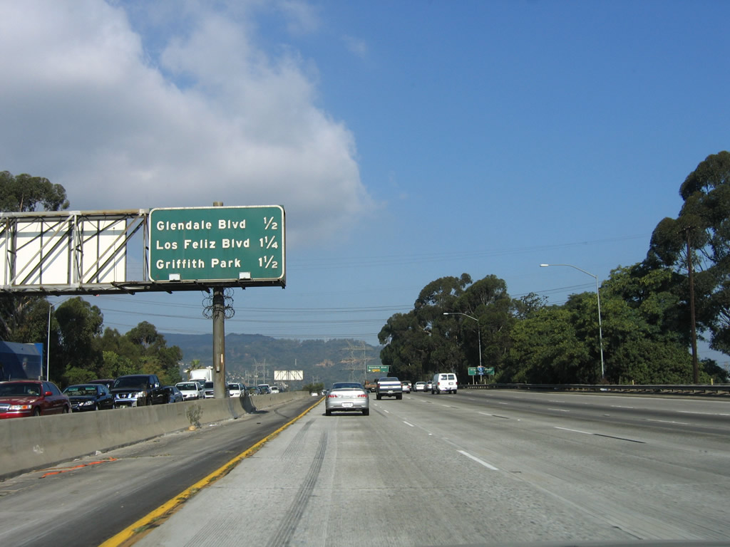
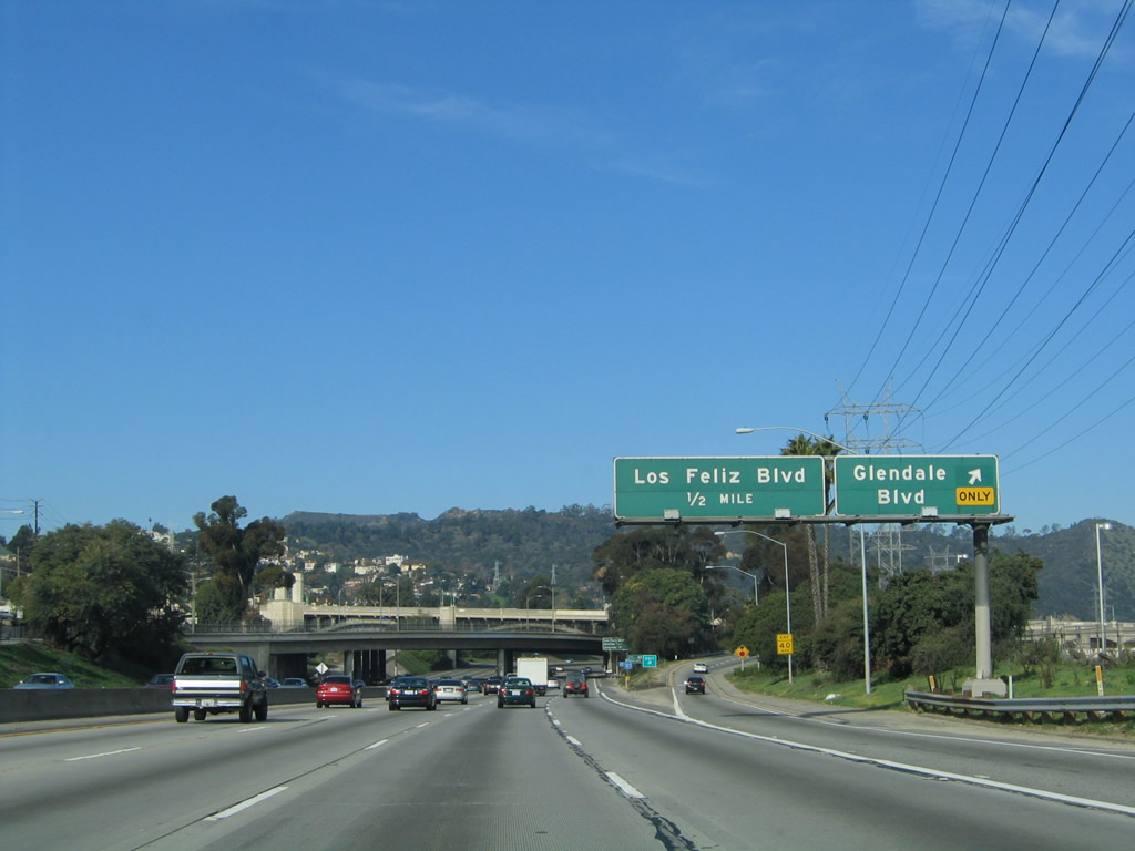
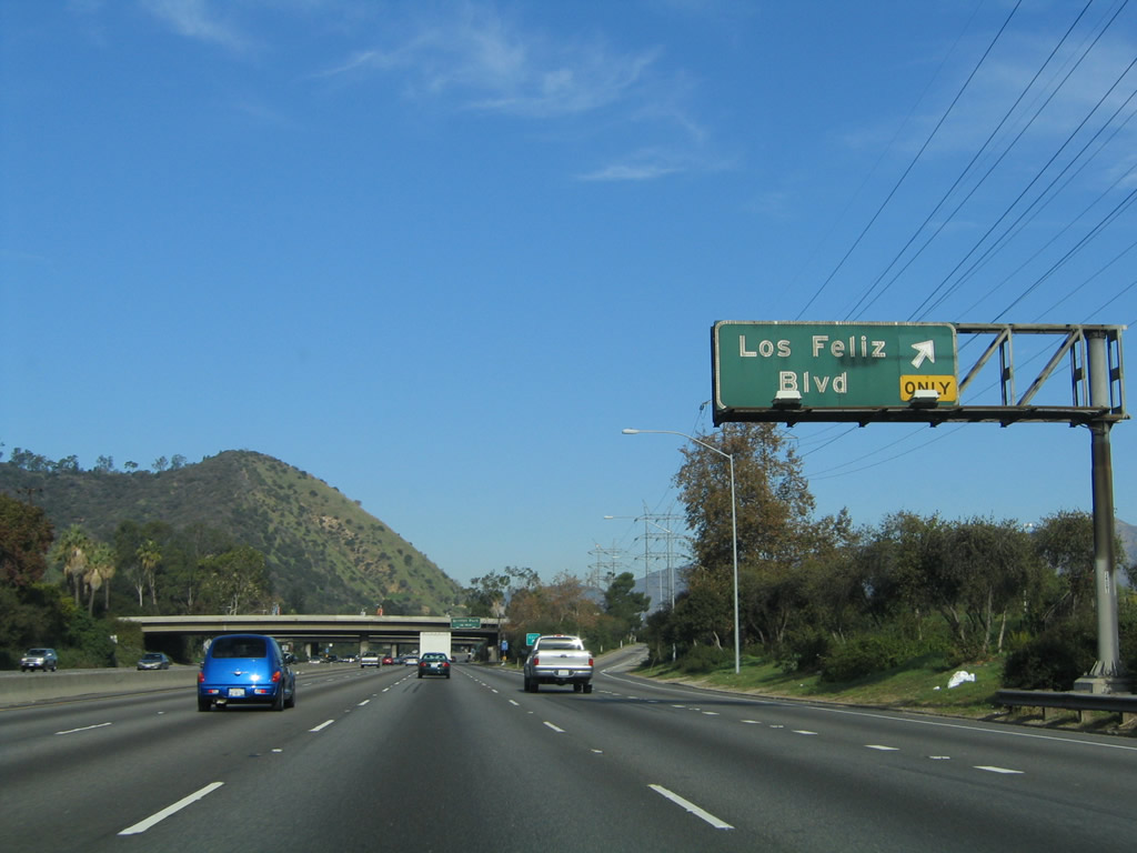
The next four exits along Interstate 5 (Golden State Freeway) north are Exit 139A, California 2 (Glendale Freeway) north to Glendale; Exit 139B, California 2 (Glendale Freeway) south to Alvarado Boulevard and the Echo Park community of Los Angeles; Exit 140, Glendale Boulevard; and Exit 141A, Los Feliz Boulevard. Photo taken 10/07/06. |
|
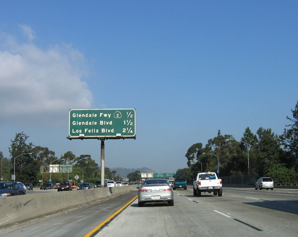
The left four lanes of northbound Interstate 5 carry through traffic, while the right two lanes connect to Exits 139A-B, California 2 (Glendale Freeway). Where California 2 intersects Interstate 5, it is a freeway. While California 2 travels northeast of here as a freeway, it reverts to a city street southwest of this interchange. At one time, California 2 was proposed as a freeway to the southwest, passing through Echo Park, Hollywood, West Hollywood, and Beverly Hills on its way to Santa Monica. The freeway idea was abandoned due to local opposition. Even so, California 2 remains a very important route and carries a great deal of traffic. Northbound Interstate 5 (Golden State Freeway) approaches Exits 139A-B, California 2 (Glendale Freeway). Photo taken 12/10/05. |
|
While the left four lanes continue north along Interstate 5, while the right two lanes connect to Exit 139A, California 2 north to Glendale. North of Interstate 210, California 2 becomes part of the Angeles Crest Highway, which travels northeast into the Angeles National Forest. Photo taken 03/25/07. |
|
|
The next exit ramp connects northbound Interstate 5 (Golden State Freeway) with Exit 139B, California 2 (Glendale Freeway) south to Echo Park. California 2 is a freeway briefly, but quickly downgrades as it merges onto Glendale Boulevard, then shifts onto Alvarado Street. California 2 follows city streets to serve communities such as Echo Park, Silver Lake, and Westlake. Photo taken 02/26/11 and 10/07/06. |
|
Northbound Interstate 5 (Golden State Freeway) reaches Exit 139B, California 2 (Glendale Freeway) south. Photo taken 03/25/07. |
|
The next three exits along Interstate 5 (Golden State Freeway) north are Exit 140, Glendale Boulevard; Exit 141A, Los Feliz Boulevard; and Exit 141B, Griffith Park Drive to Griffith Park. Photo taken 10/07/06. |
|
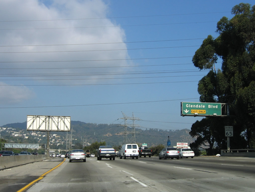
The right lane of Interstate 5 (Golden State Freeway) north becomes exit only for Exit 140, Glendale Boulevard. Glendale Boulevard travels northeast from this interchange through the Atwater Village community of Los Angeles, then enters the city of Glendale. It is part of the old alignment of California 2 before the freeway was constructed. Photo taken 10/07/06. |
|
The Los Angeles River flows just west of Interstate 5 through this area, and many of the famous scenes of concrete river channels are filmed in the Los Angeles River near here. An arch bridge, which carries Hyperion Avenue over Interstate 5 and joins with Glendale Boulevard to cross the river, comes into view in the distance ahead. The large concrete culver on the right side of the freeway is the Los Angeles River. Photo taken 11/25/04. |
|
Northbound Interstate 5 (Golden State Freeway) reaches Exit 140, Glendale Boulevard. Photo taken 11/25/04. |
|
As Interstate 5 passes under the Glendale Boulevard overpass, this mileage sign provides the distance to the next three exits along Interstate 5 (Golden State Freeway) north: Exit 141A, Los Feliz Boulevard; Exit 141B, Griffith Park Drive to Griffith Park; and Exit 142, Colorado Street. Photo taken 11/25/04. |
|
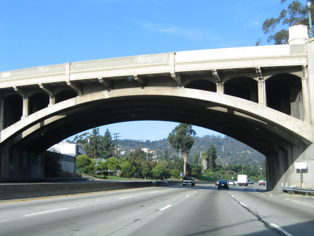
Immediately thereafter, northbound Interstate 5 passes under the Hyperion Avenue overpass, which is a magnificent concrete arch bridge. Photo taken 11/25/04. |
|
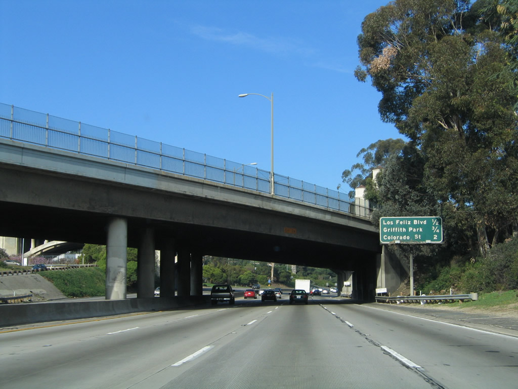
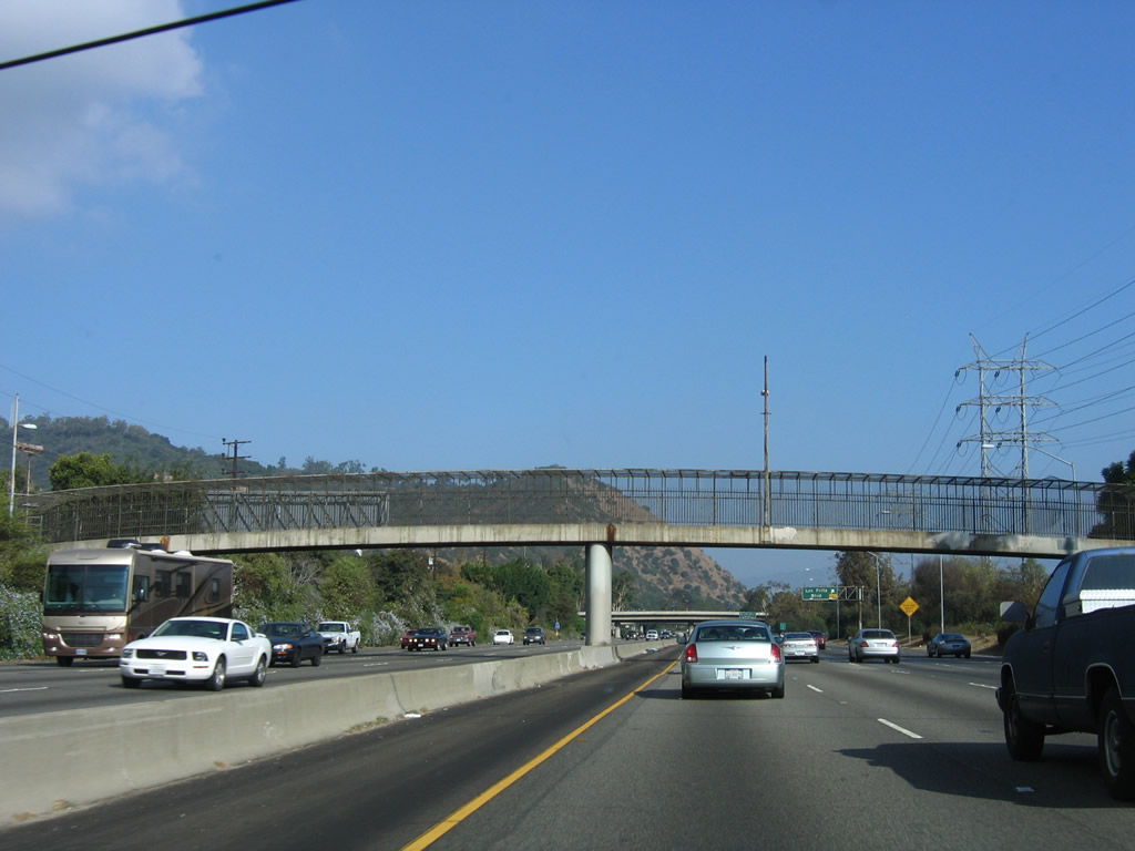
A pedestrian bridge crosses over the Golden State Freeway shortly thereafter. Photo taken 10/07/06. |
|
Northbound Interstate 5 (Golden State Freeway) reaches Exit 141A, Los Feliz Boulevard. Photo taken 11/25/04. |
|
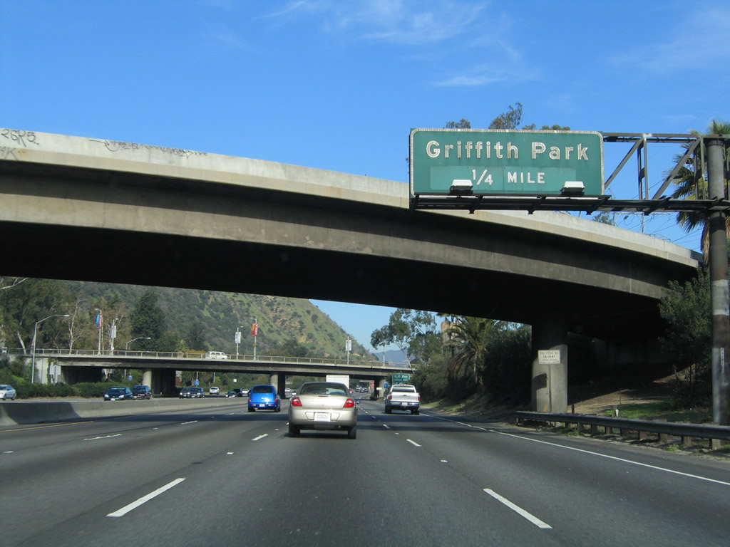
The next exit along Interstate 5 (Golden State Freeway) north is Exit 141B, Griffith Park Boulevard, one-quarter mile. Griffith Park is a huge park bounded by Interstate 5 on the east and California 134 (Ventura Freeway) on the north. Founded in 1896, Griffith Park is the largest city park in Los Angeles with 4,210 acres. Originally part of the Spanish land grant Rancho Los Feliz, Colonel Griffith gifted 3,015 acres to the city of Los Angeles as a Christmas gift on December 16, 1896. Griffith left funds after his death in 1919 for the eventual construction of the Greek Theatre in 1930 and world-famous Griffith Observatory in 1935. Photo taken 11/25/04. |
|
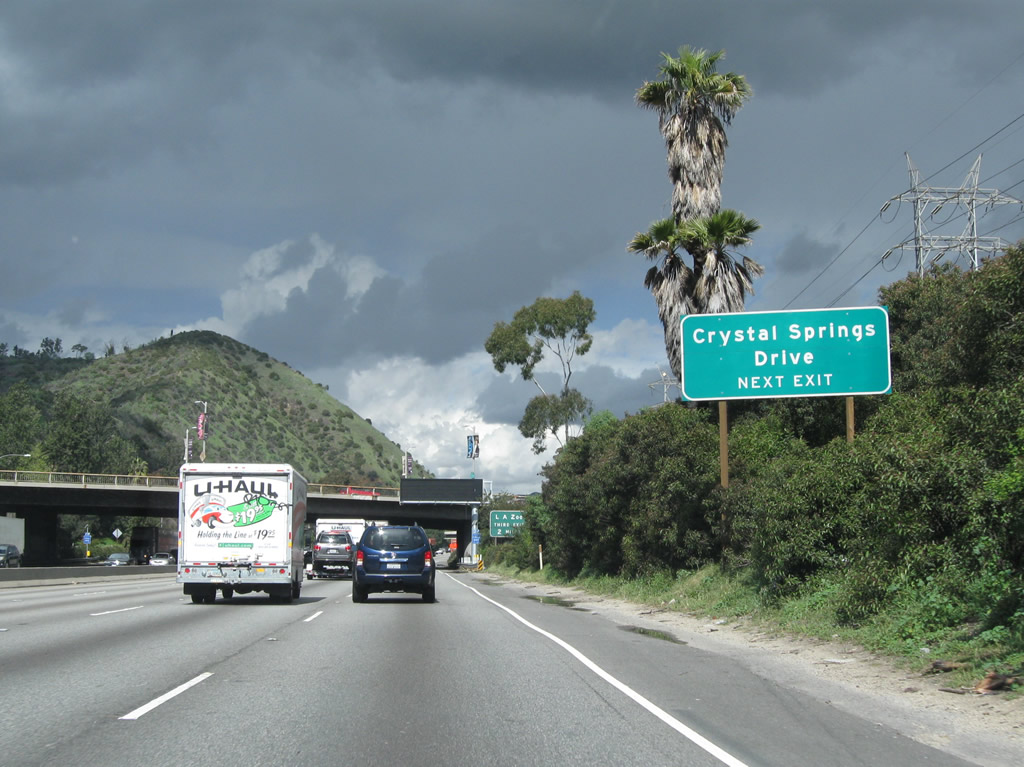
Use Exit 141B to Crystal Springs Drive and Griffith Park Drive (a one-way couplet, with the off-ramp from Interstate 5 merging directly onto Crystal Springs Drive northbound). The two roads de-couple near Wilson Municipal Golf Course; Griffith Park Drive curves northwest toward the golf clubhouse and Travel Town Museum, while Crystal Springs Drive continues north toward the Los Angeles Zoo and Botanical Gardens. Photo taken 02/26/11. |
|
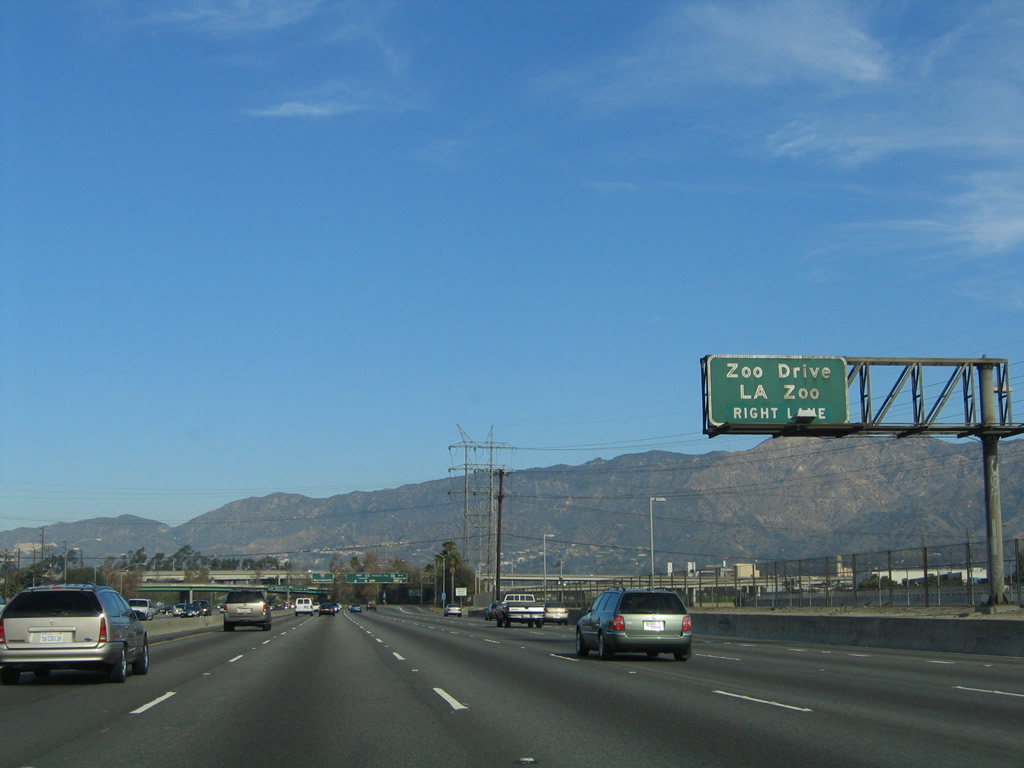
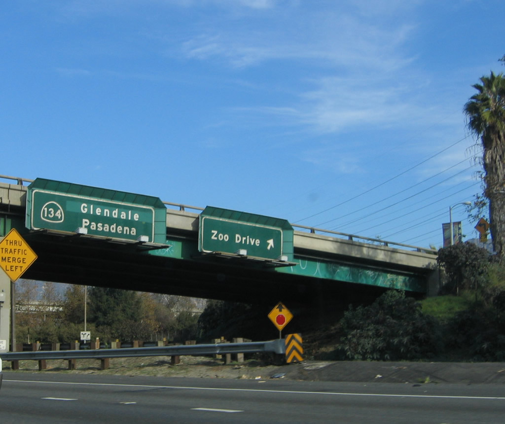
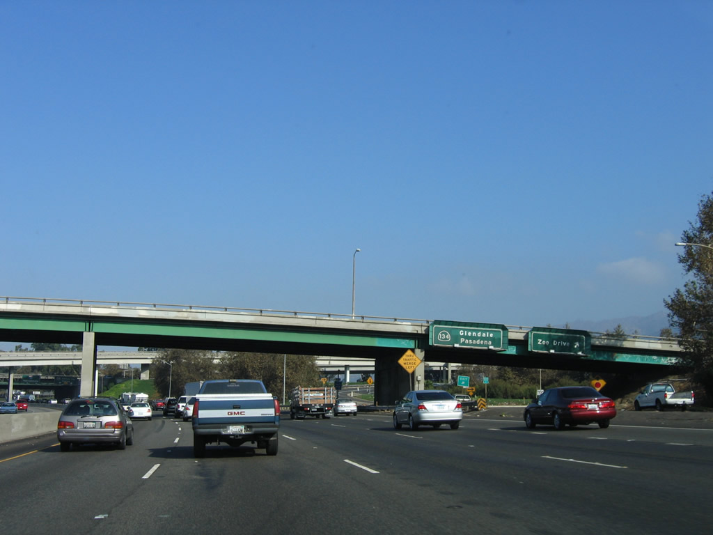
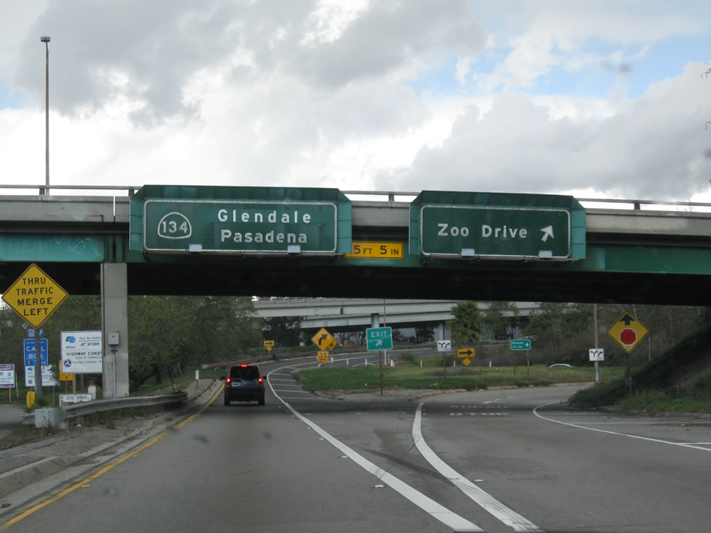
Speaking of the Los Angeles Zoo and Botanical Gardens, Exit 141B is not the preferred route. Instead, stay on Interstate 5 north and use Exit 144A, which connects to both California 134 (Ventura Freeway) east and Zoo Drive. The transition ramp to California 134 east has its direct access ramp to the zoo. Photo taken 02/26/11. |
|
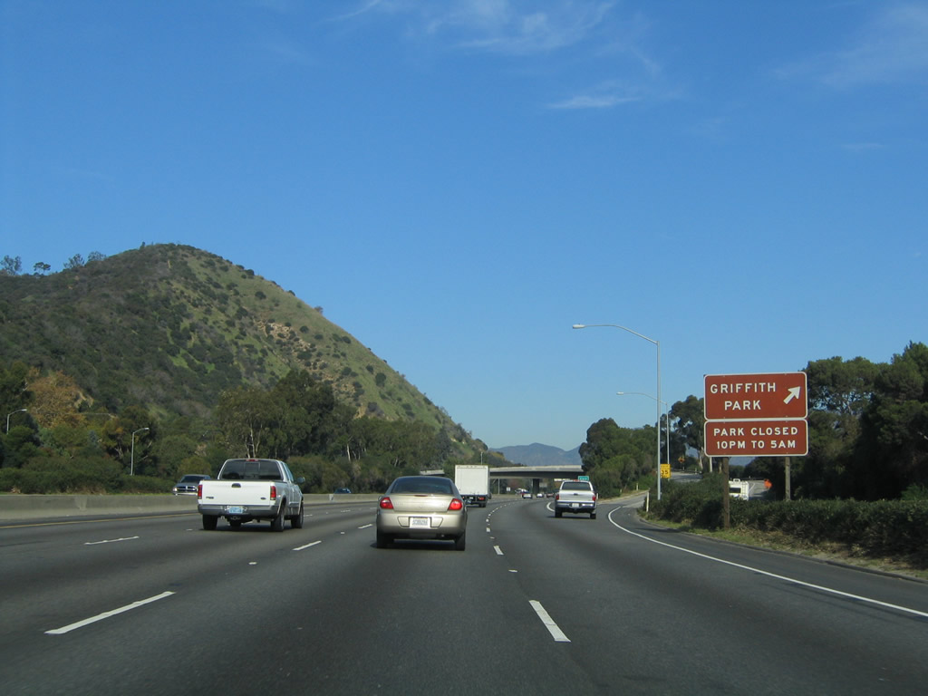
Northbound Interstate 5 (Golden State Freeway) meets Exit 141B, Griffith Park Boulevard. Note the use of this small, substandard brown sign for the actual park exit. Photo taken 11/25/04. |
|
This mileage sign provides the distance to the next four exits along Interstate 5 (Golden State Freeway) north: Exit 142, Colorado Street; Exits 144A-B, California 134 (Ventura Freeway) east to Glendale/Pasadena and west to North Hollywood and Ventura; and Exit 145, Western Avenue. Photo taken 11/25/04. |
|
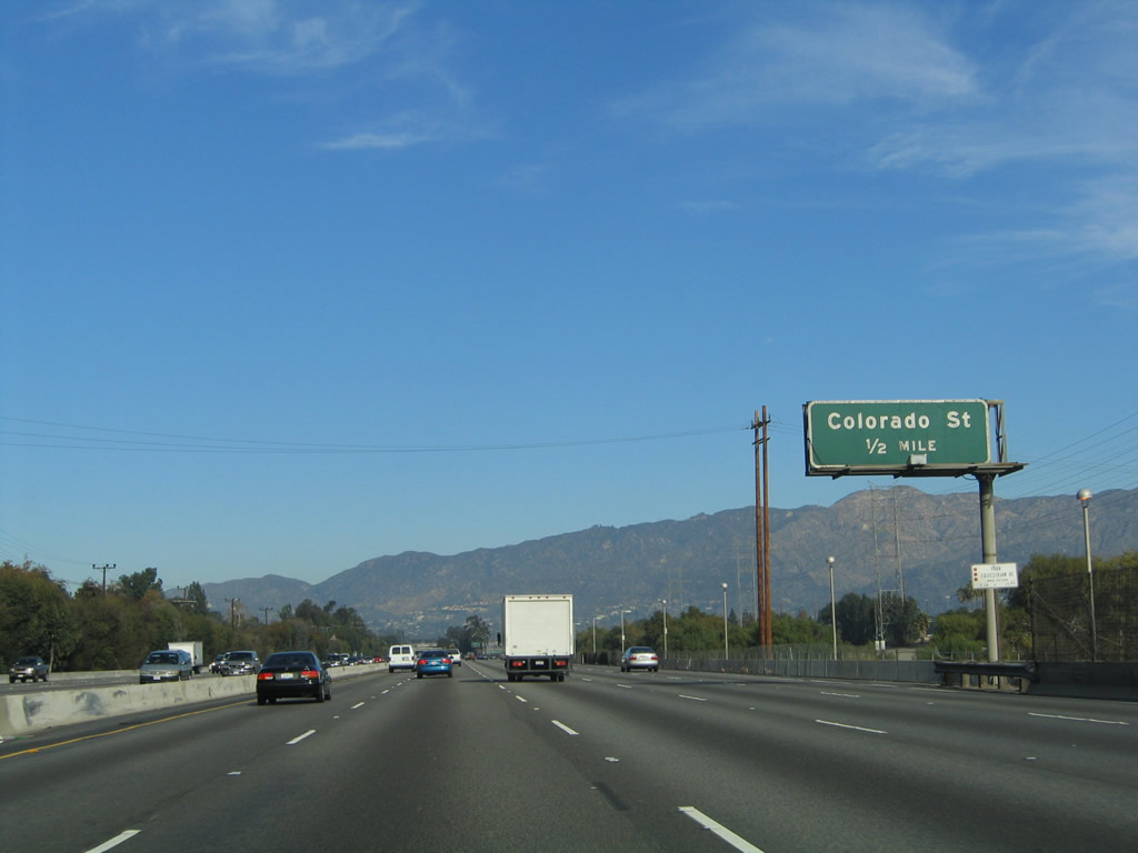
The next exit along Interstate 5 (Golden State Freeway) north is Exit 142, Colorado Street. Use Colorado Street east into Glendale (one-half mile). Photo taken 11/25/04. |
|
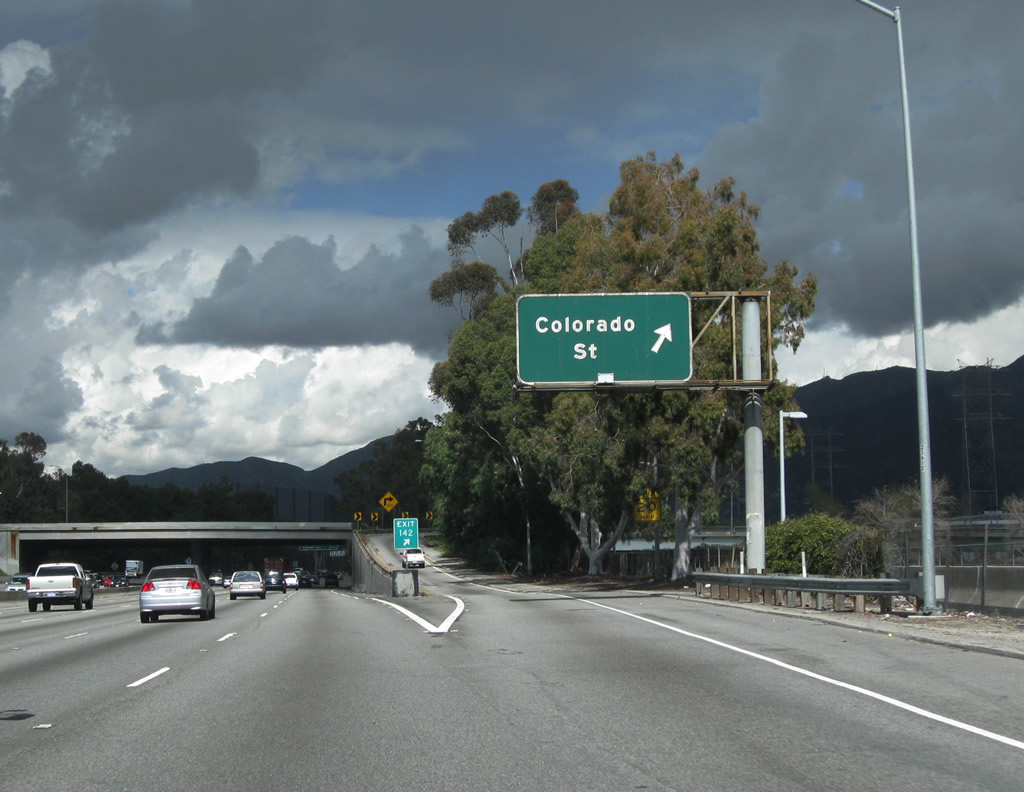
Northbound Interstate 5 (Golden State Freeway) reaches Exit 142, Colorado Street. While this pseudo-freeway spur has an interesting historical look to it, it is not part of former U.S. 66. A portion of U.S. 66 was routed along Colorado Street east of Figueroa Street. Photo taken 02/26/11. |
|
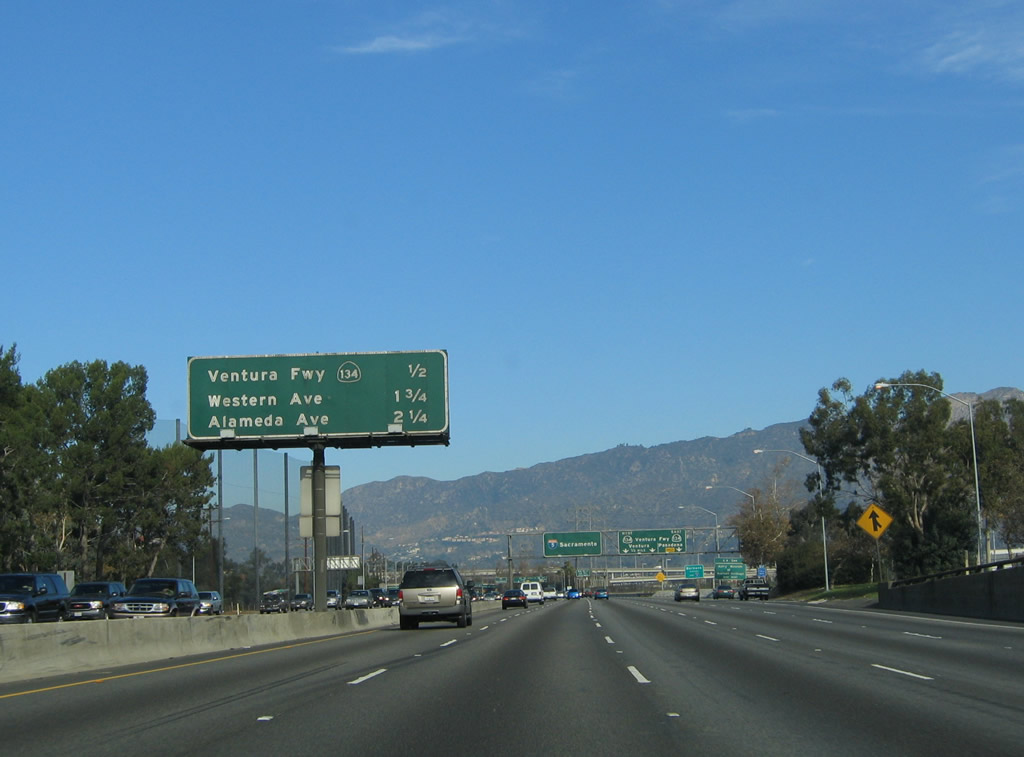
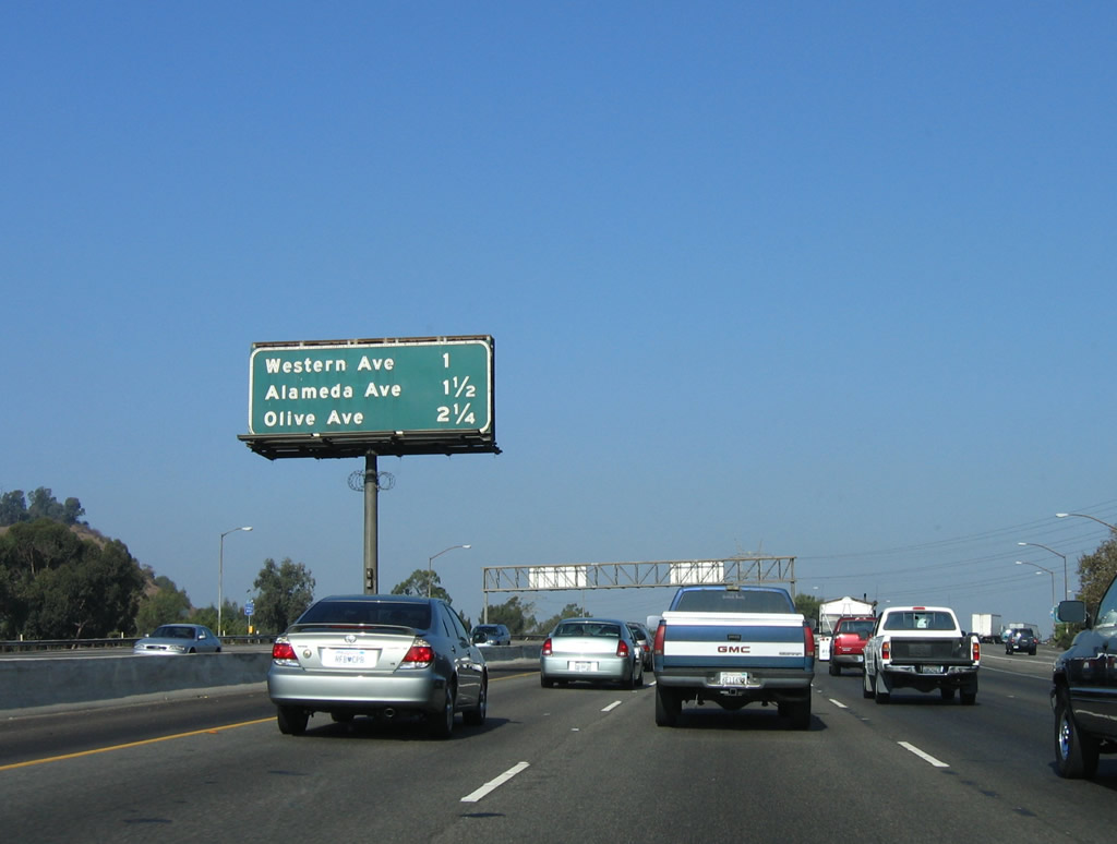
This mileage sign provides the distance to the next four exits along Interstate 5 (Golden State Freeway) north: Exits 144A-B, California 134 (Ventura Freeway); Exit 145A, Western Avenue; and Exit 145B, Alameda Avenue. Photo taken 11/25/04. |
|
The right two lanes provide access to Exit 144A, California 134 (Ventura Freeway) east and Zoo Drive and Exit 144B, California 134B/Ventura Freeway west. Photo taken 11/25/04. |
|
To the Los Angeles Zoo and Botanical Gardens in Griffith Park, use the ramp to Exit 144A, California 134 (Ventura Freeway) east, then transition onto Zoo Drive. Photo taken 11/25/04. |
|
Northbound Interstate 5 (Golden State Freeway) reaches Exit 144A, California 134 (Ventura Freeway) east to Glendale and Pasadena to Interstate 210 west. Exit 144A also connects to Zoo Drive and the Los Angeles Zoo and Botanical Gardens. The next exit is Exit 144B, California 134 (Ventura Freeway) west to U.S. 101 north to Ventura. Photo taken 10/07/06. |
|
|
|
Looking at the off-ramp to Exit 144A, the first sign advises of the split between California 134 east to Glendale and Pasadena and Zoo Drive to the Los Angeles Zoo and Botanical Gardens. Photos taken 11/25/04, 10/07/06, and 02/26/11. |
|
Immediately thereafter, Interstate 5 (Golden State Freeway) north connects with Exit 144B, California 134 (Ventura Freeway) west to U.S. 101 and Ventura. At this point, Interstate 5 leaves the city of Los Angeles and enters the city of Glendale, incorporated in 1906. Located northeast of downtown Los Angeles, Glendale had a population of 194,973 as of the 2000 Census and consists of 30.7 square miles. Photo taken 11/25/04. |
|
This mileage sign provides the distance to the next three exits along Interstate 5 (Golden State Freeway) north: Exit 145A, Western Avenue; Exit 145B, Alameda Avenue; and Exit 146A, Olive Avenue. Photo taken 10/07/06. |
|
A reassurance guide sign and shield assembly are posted after the California 134 interchange. Photo taken 02/26/11. |
|
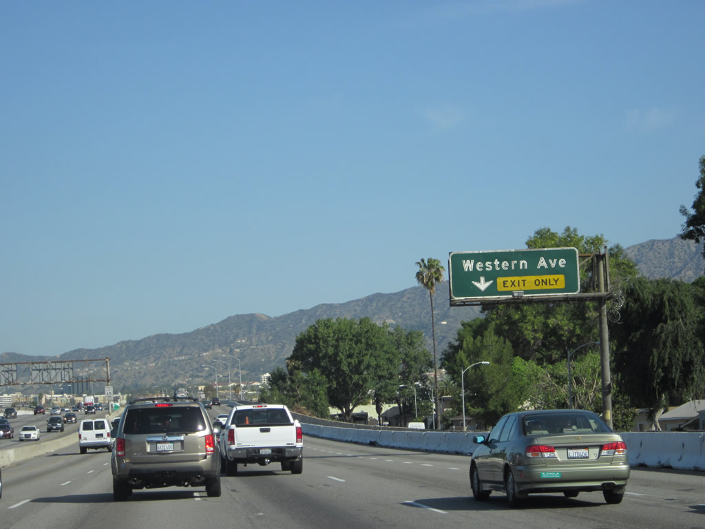
The right lane of Interstate 5 (Golden State Freeway) north becomes exit only for Exit 145A, Western Avenue. Photo taken 04/06/12. |
|
Northbound Interstate 5 (Golden State Freeway) reaches Exit 145A, Western Avenue. This is the only interchange on Interstate 5 to serve the city of Glendale. Photo taken 10/07/06. |
|
This mileage sign provides the distance to the next three exits along Interstate 5 (Golden State Freeway) north: Exit 145B, Alameda Avenue; Exit 146A, Olive Avenue; and Exit 146B, Burbank Boulevard. Photo taken 10/07/06. |
|
Interstate 5 (Golden State Freeway) leaves Glendale and enters the city of Burbank, the "Media Capital of the World." The next several exits will serve the city of Burbank, starting with Exit 145B, Alameda Avenue. Located at the eastern edge of the San Fernando Valley, the city of Burbank had a population of 100,316 as of the 2000 Census and size of 17.4 square miles. The city incorporated on July 8, 1911, and it quickly grew in both size and population. Photo taken 10/07/06. |
|
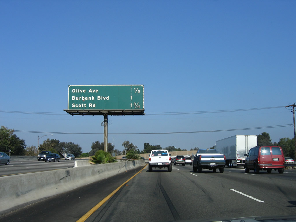
This mileage sign provides the distance to the next three exits along Interstate 5 (Golden State Freeway) north: Exit 146A, Olive Avenue; Exit 146B, Burbank Boulevard; and Exit 147A, Scott Road. Photo taken 10/07/06. |
|
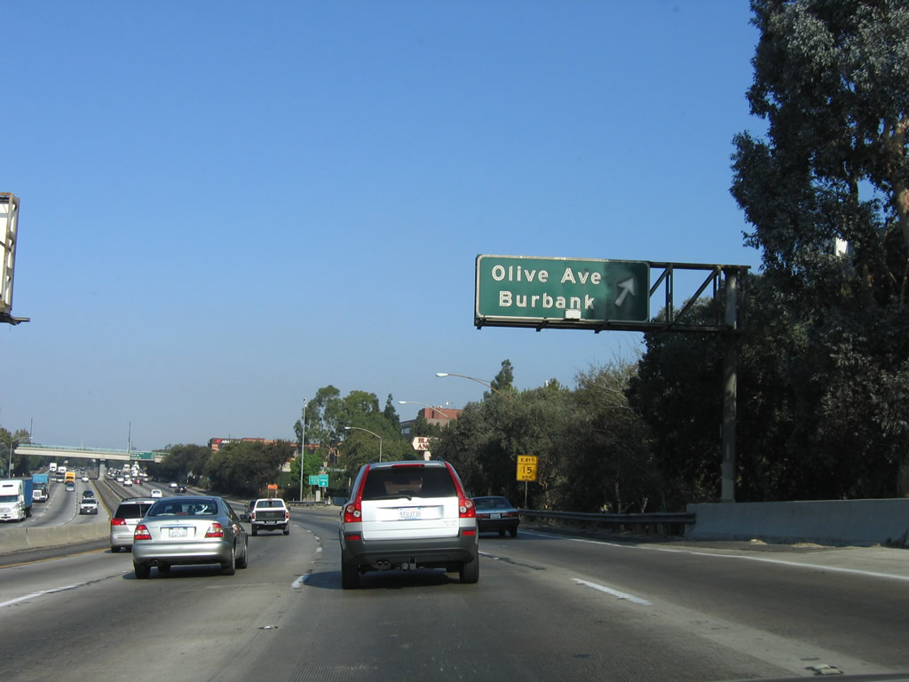
Northbound Interstate 5 (Golden State Freeway) reaches Exit 146A, Olive Avenue in Burbank. Photo taken 10/07/06. |
|
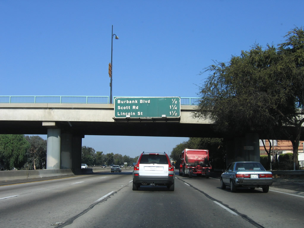
This mileage sign provides the distance to the next three exits along Interstate 5 (Golden State Freeway) north: Exit 146B, Burbank Boulevard; Exit 147A, Scott Road; and Exit 147B, Lincoln Street. Photo taken 10/07/06. |
|
Northbound Interstate 5 (Golden State Freeway) reaches Exit 146B, Burbank Boulevard. Photo taken 10/07/06. |
|
Now on the off-ramp to Burbank Boulevard, this sign advises of the split between westbound and eastbound traffic. Use Burbank Boulevard east to downtown Burbank and the Media City Center. Photo taken 10/07/06. |
|
The off-ramp to Burbank Boulevard splits, with the left lane connecting to westbound Burbank Boulevard and the right lane connecting to eastbound Burbank Boulevard and old U.S. 99/San Fernando Road. North of downtown Los Angeles, Interstate 5 was preceded by U.S. 6-99 (San Fernando Road) through Burbank; the routes divided in Santa Clarita (with U.S. 99 continuing north along the present Interstate 5 and California 99 corridor toward Bakersfield and U.S. 6 traveling north toward Mojave and Bishop). Photo taken 10/07/06. |
|
This mileage sign provides the distance to the next three exits along Interstate 5 (Golden State Freeway) north: Exit 147A, Scott Road; Exit 147B, Lincoln Street; and Exit 148, Buena Vista Street. Photo taken 04/06/12. |
|
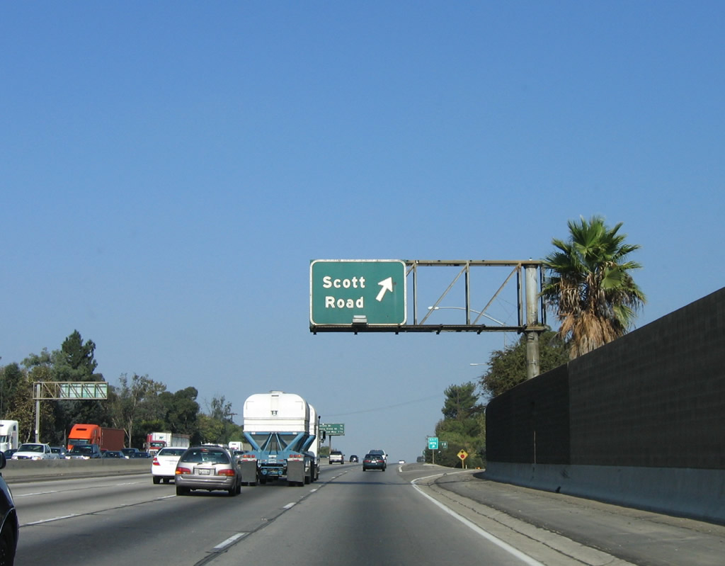
Back on the mainline, Interstate 5 (Golden State Freeway) north reaches Exit 147A, Scott Road. Photo taken 10/07/06. |
|
This mileage sign provides the distance to the next three exits along Interstate 5 (Golden State Freeway) north: Exit 147B, Lincoln Street; Exit 148, Buena Vista Street; and Exit 149, Hollywood Way. Photo taken 04/06/12. |
|
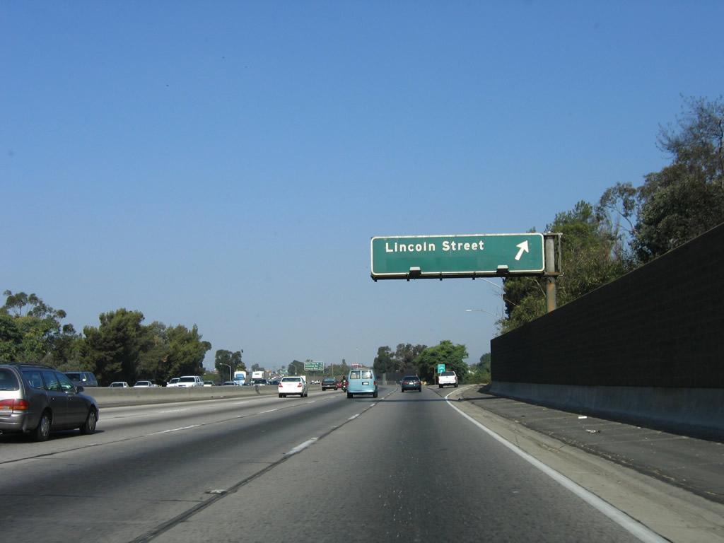
Immediately thereafter, northbound Interstate 5 (Golden State Freeway) reaches Exit 147B, Lincoln Street. Photo taken 10/07/06. |
|
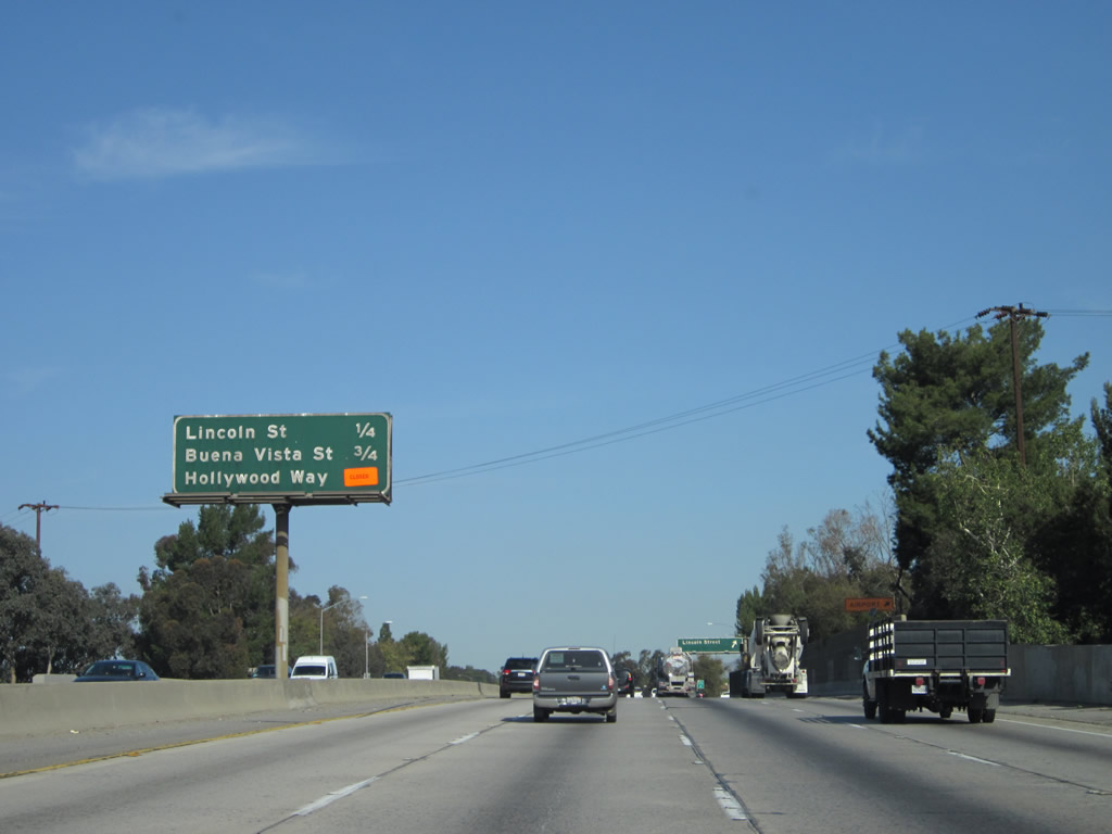
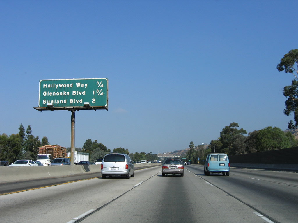
This mileage sign provides the distance to the next three exits along Interstate 5 (Golden State Freeway) north: Exit 148, Buena Vista Street; Exit 149, Hollywood Way; and Exit 150A, Glenoaks Boulevard. Photo taken 10/07/06. |
|
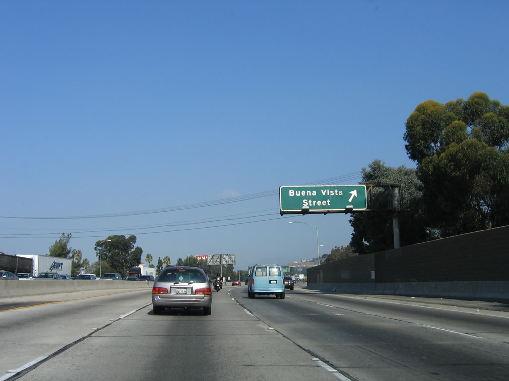
Exit 148 connects Interstate 5 to Buena Vista Street. This is the final exit to serve the city of Burbank. Photo taken 10/07/06. |
|
Northbound Interstate 5 (Golden State Freeway) reaches Exit 148, Buena Vista Street. Photo taken 10/07/06. |
|
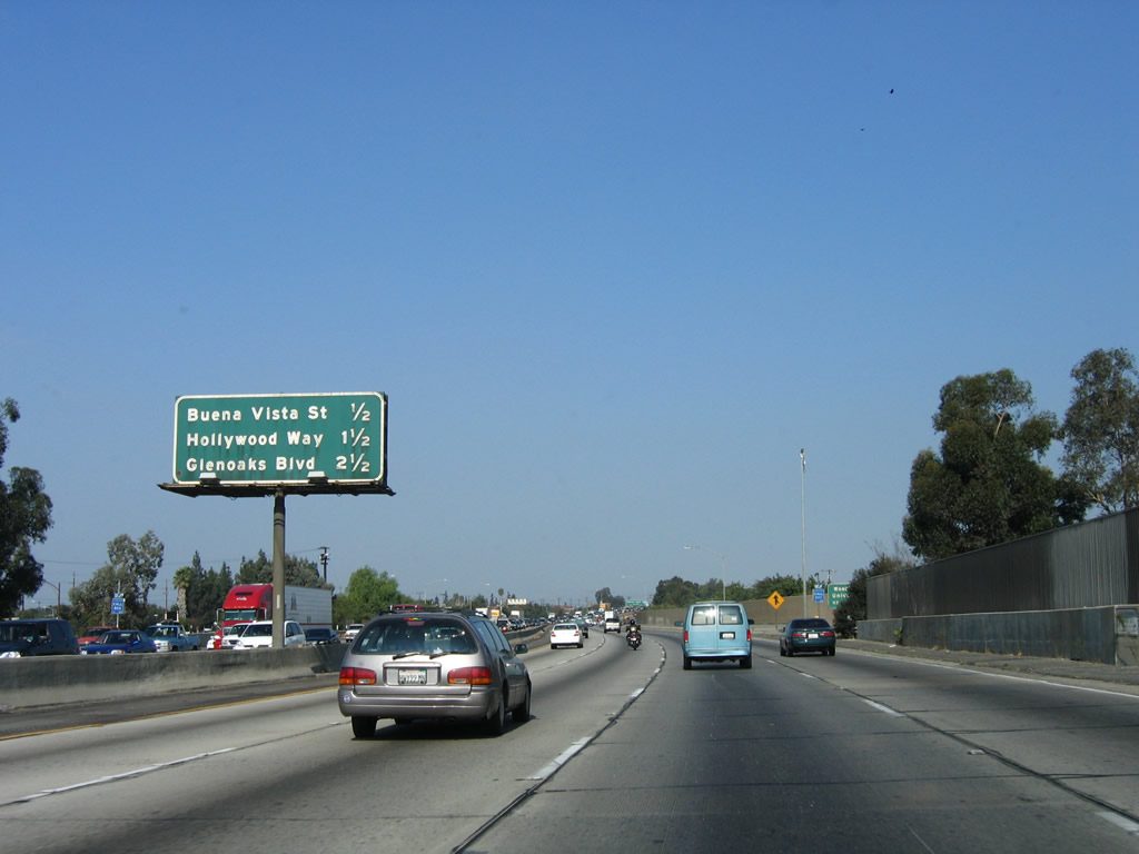
This mileage sign provides the distance to the next three exits along Interstate 5 (Golden State Freeway) north: Exit 149, Hollywood Way; Exit 150A, Glenoaks Boulevard.; and Exit 150B, Sunland Boulevard. Photo taken 10/07/06. |
|
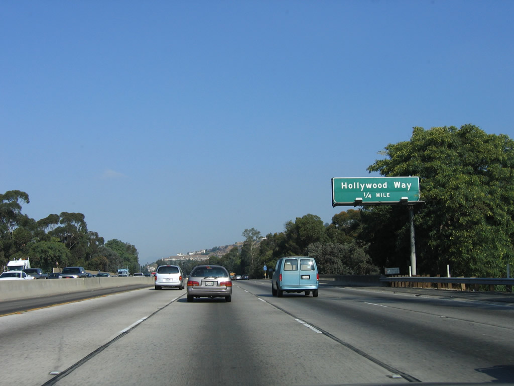
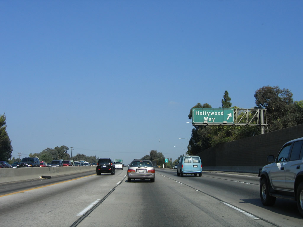
The next exit along Interstate 5 (Golden State Freeway) north is Exit 149, Hollywood Way, one-half mile. At this point, Interstate 5 leaves the city of Burbank and reenters the city of Los Angeles in the San Fernando Valley. Photo taken 10/07/06. |
|
Northbound Interstate 5 (Golden State Freeway) reaches Exit 149, Hollywood Way. Photo taken 10/07/06. |
|
This mileage sign provides the distance to the next three exits along Interstate 5 (Golden State Freeway) north: Exit 150A, Glenoaks Boulevard.; Exit 150B, Sunland Boulevard; and Exit 151, Penrose Street. Photo taken 10/07/06. |
|
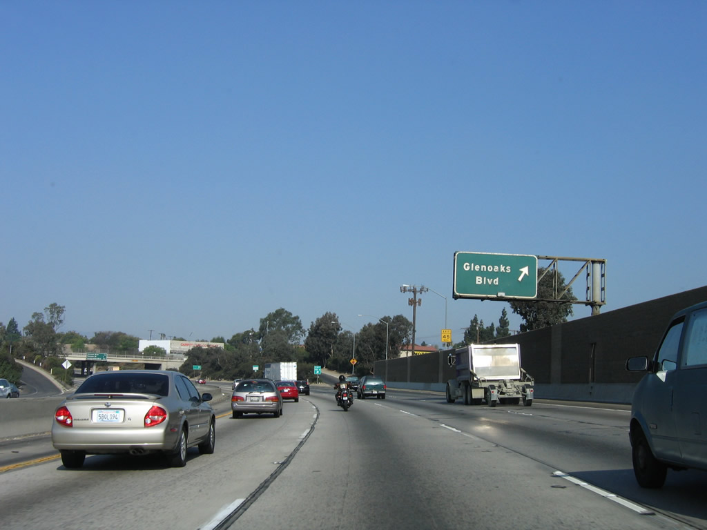
The next exit along Interstate 5 (Golden State Freeway) north is Exit 150A, Glenoaks Boulevard. (one-half mile). Photo taken 10/07/06. |
|
Northbound Interstate 5 (Golden State Freeway) reaches Exit 150A, Glenoaks Boulevard. Photo taken 10/07/06. |
|
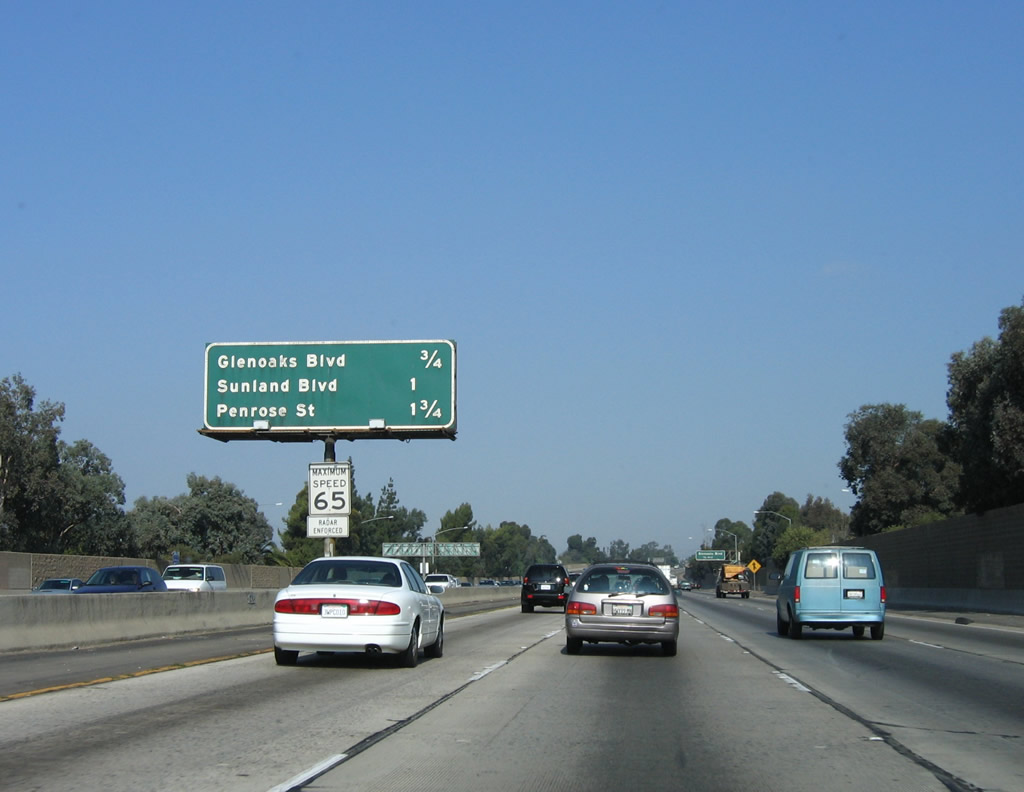
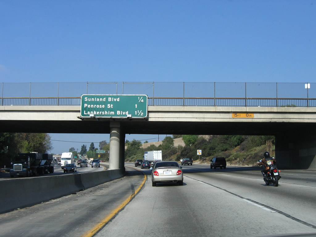
This mileage sign provides the distance to the next three exits along Interstate 5 (Golden State Freeway) north: Exit 150B, Sunland Boulevard; Exit 151, Penrose Street; and Exit 152, Lankershim Boulevard and Tuxford Street. Photo taken 10/07/06. |
|
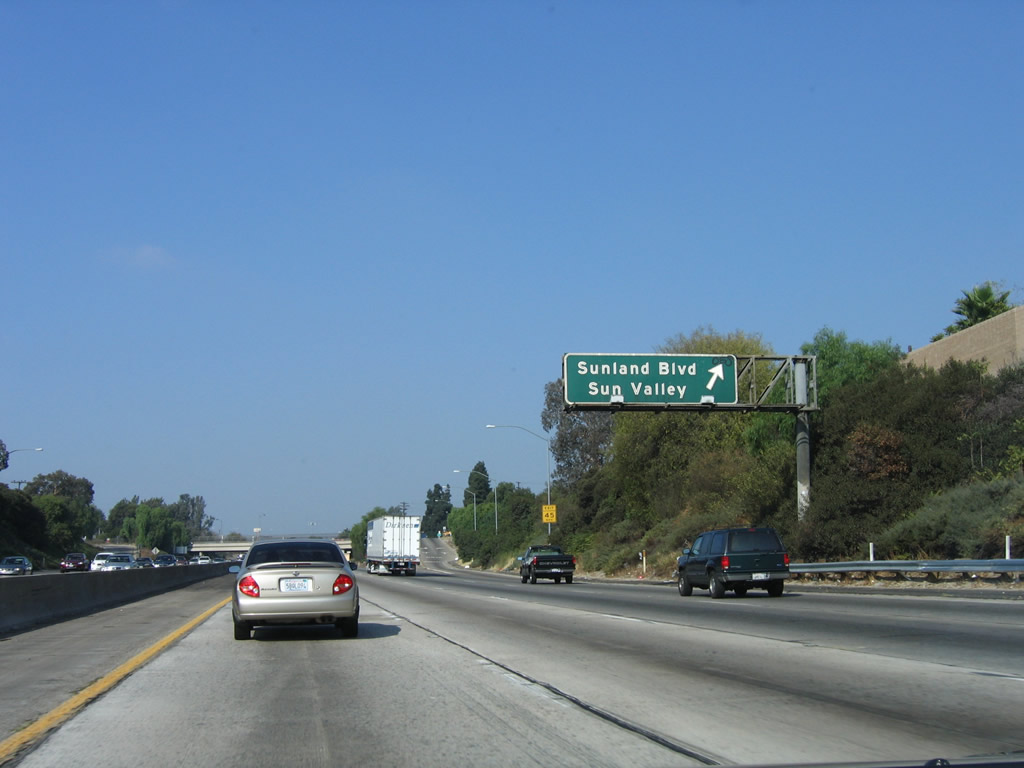
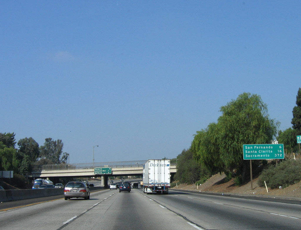
Northbound Interstate 5 (Golden State Freeway) reaches Exit 150B, Sunland Boulevard to the Sun Valley community of the city of Los Angeles. Photo taken 10/07/06. |
|
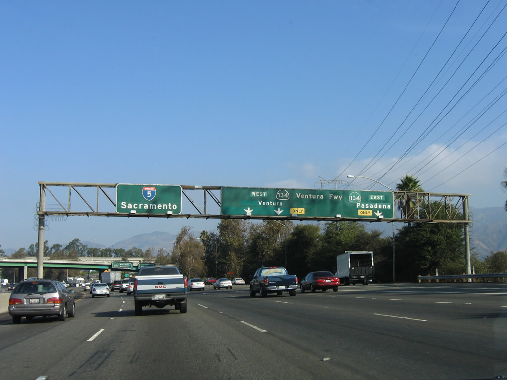
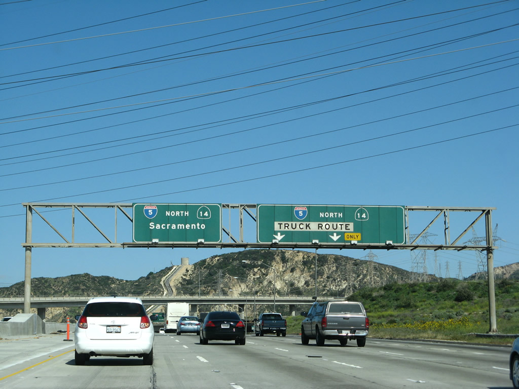
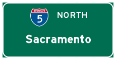
This mileage sign provides the distance to San Fernando (six miles), Santa Clarita (16 miles), and the control city of Sacramento (372 miles). Photo taken 10/07/06. |
|
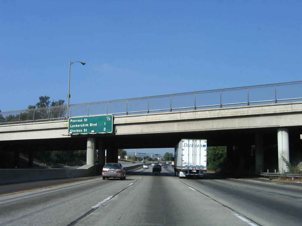
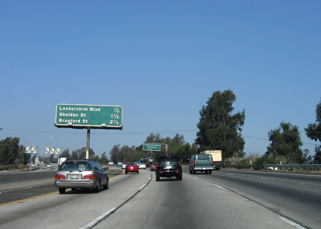
This interchange sequence sign provides the distance to the next three exits along Interstate 5 (Golden State Freeway) north: Exit 151, Penrose Street; Exit 152, Lankershim Boulevard and Tuxford Street; and Exit 153A, Sheldon Street. Photo taken 10/07/06. |
|
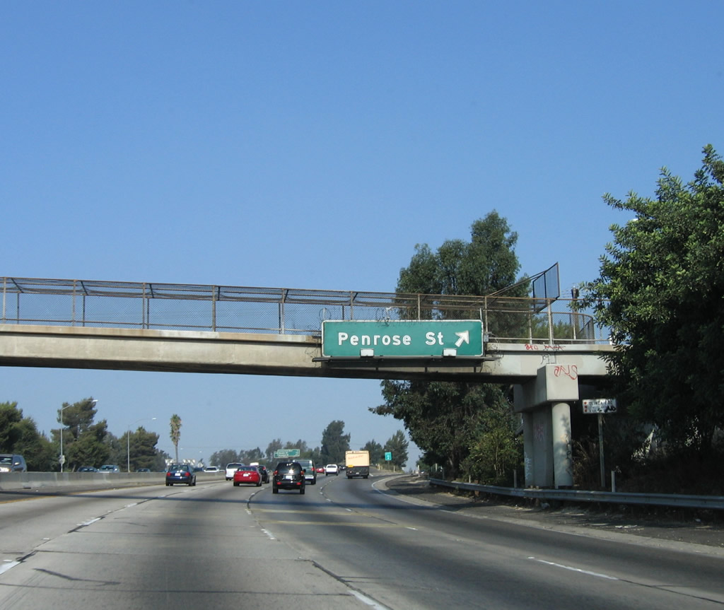
Northbound Interstate 5 (Golden State Freeway) reaches Exit 151, Penrose Street. Photo taken 10/07/06. |
|
This interchange sequence sign provides the distance to the next three exits along Interstate 5 (Golden State Freeway) north: Exit 152, Lankershim Boulevard and Tuxford Street; Exit 153A, Sheldon Street; and Exit 153B, Branford Street. Photo taken 10/07/06. |
|
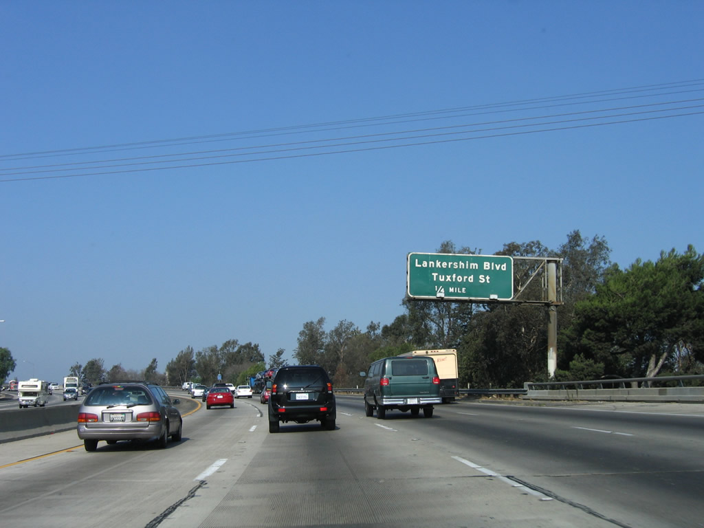
The next exit along Interstate 5 (Golden State Freeway) north is Exit 152, Lankershim Boulevard and Tuxford Street. Photo taken 10/07/06. |
|
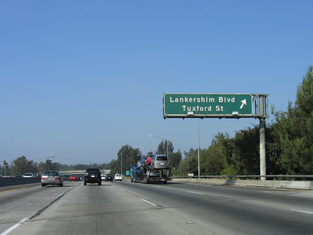
Northbound Interstate 5 (Golden State Freeway) reaches Exit 152, Lankershim Boulevard and Tuxford Street. Photo taken 10/07/06. |
|
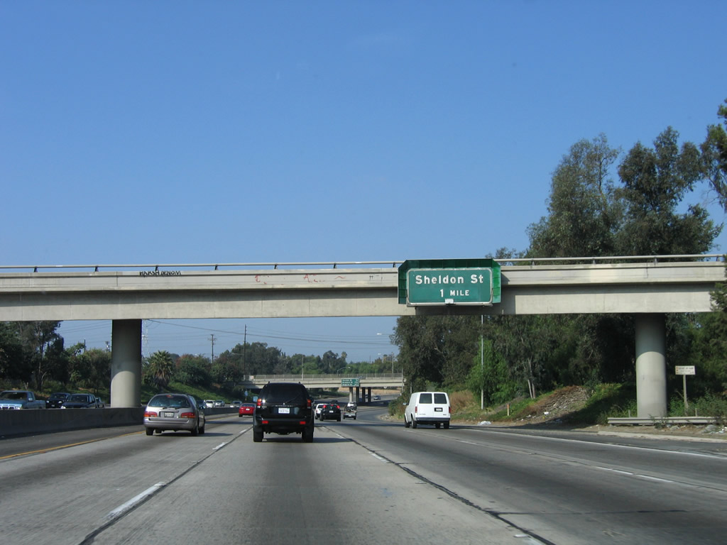
The next exit along Interstate 5 (Golden State Freeway) north is Exit 153A, Sheldon Street (one mile). Photo taken 10/07/06. |
|
|
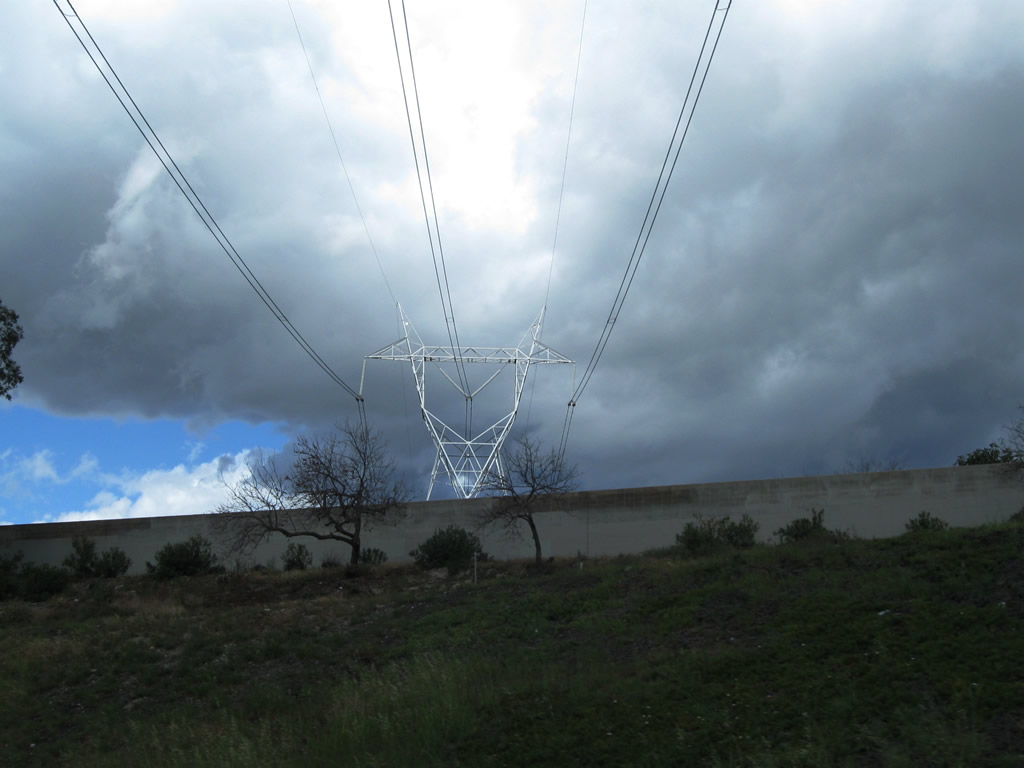
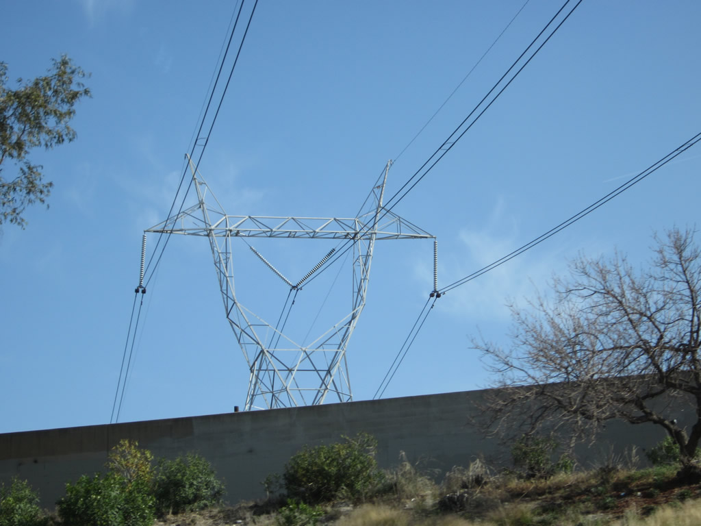
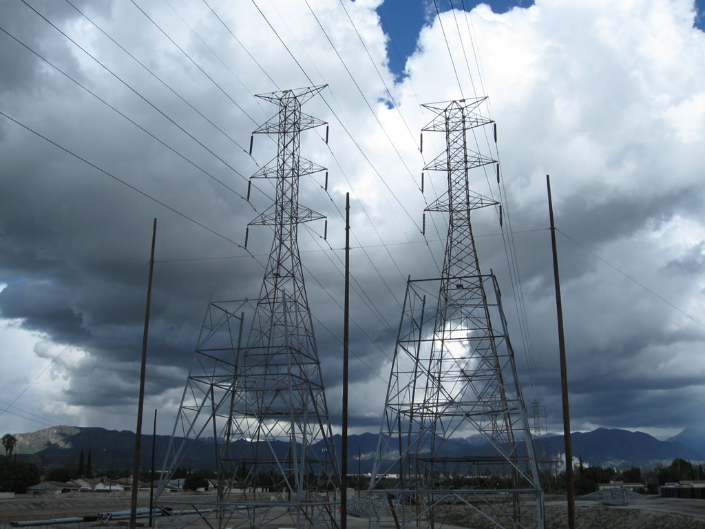
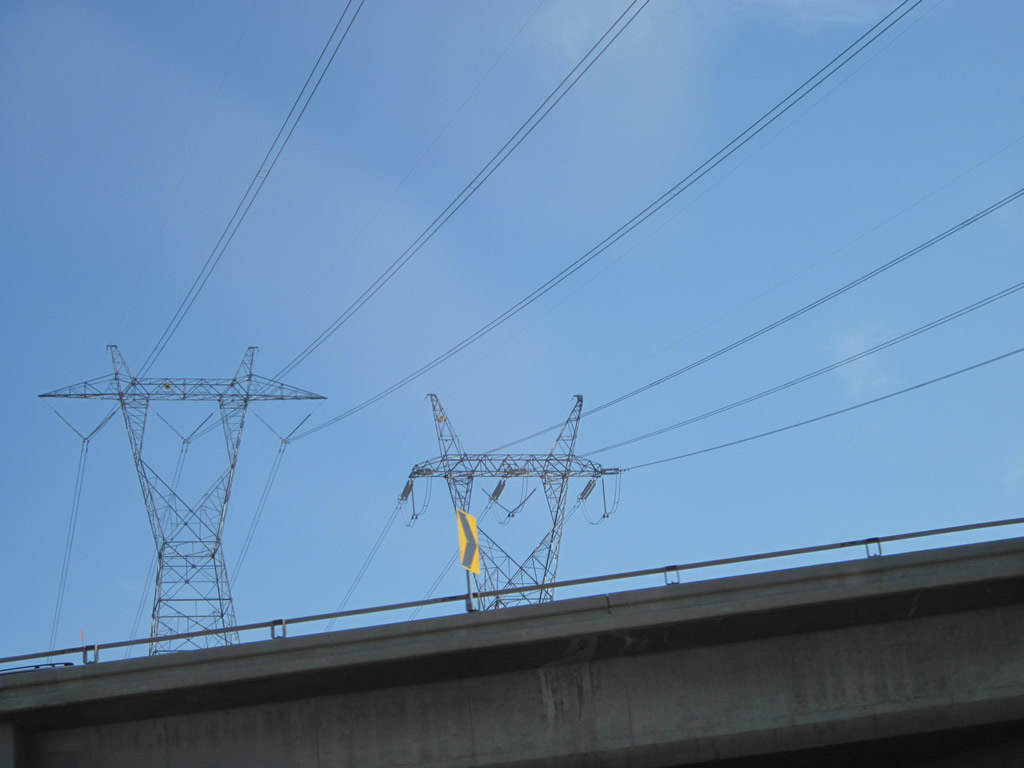
A 500kV power line crosses over Interstate 5. This particular line leads from a substation near Whitnall Highway and travels northeast into the San Gabriel Mountains, connecting with the Los Angeles Department of Water and Power grid at a massive substation in Adelanto. Hydroelectric facilities at Hoover Dam and power generated at a facility near Delta, Utah, are brought into Los Angeles via this and other 500kV power lines leading into the region. The structure of this tower varies slightly from other LADWP 500kV lines seen from Interstate 5 near Sylmar, a bit north of here. Photos taken 10/07/06 and 04/06/12. |
|
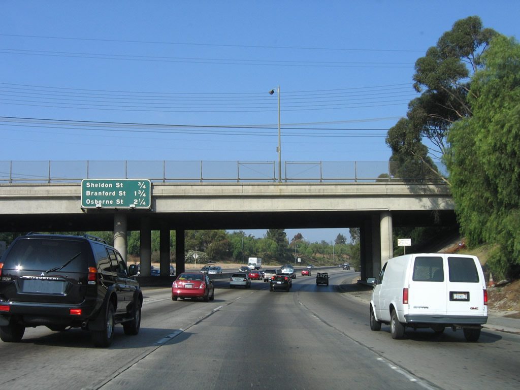
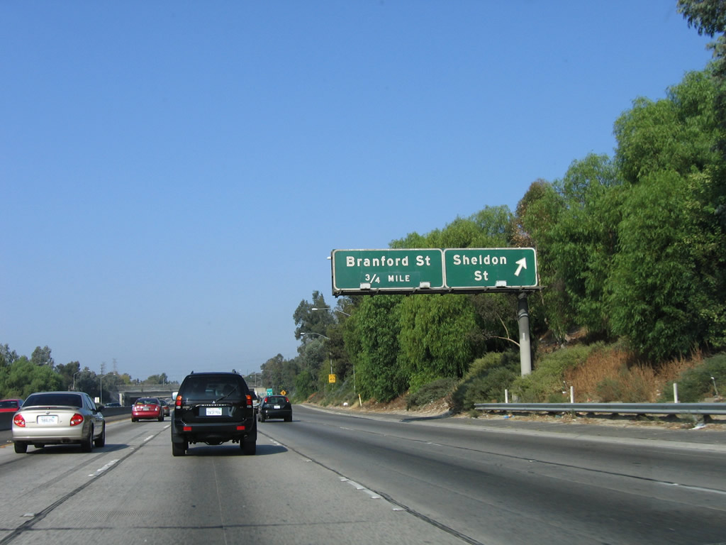
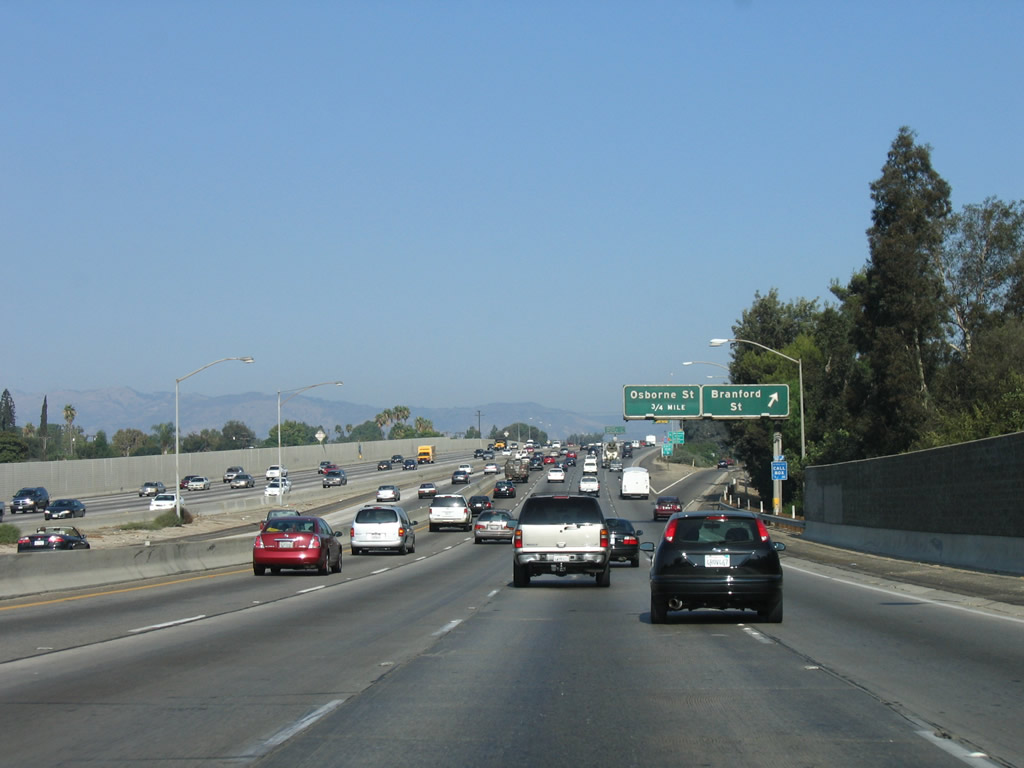
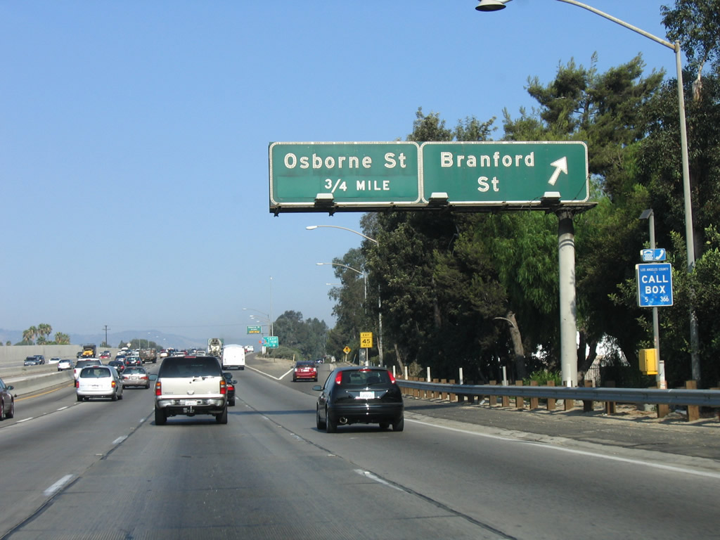
This interchange sequence sign provides the distance to the next three exits along Interstate 5 (Golden State Freeway) north: Exit 153A, Sheldon Street; Exit 153B, Branford Street; and Exit 154, Osbourne Street. Photo taken 10/07/06. |
|
Sheldon Street travels northeast toward Hansen Dam Park and southwest toward Panorama City (part of the city of Los Angeles). Photo taken 10/07/06. |
|
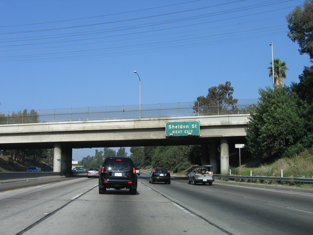
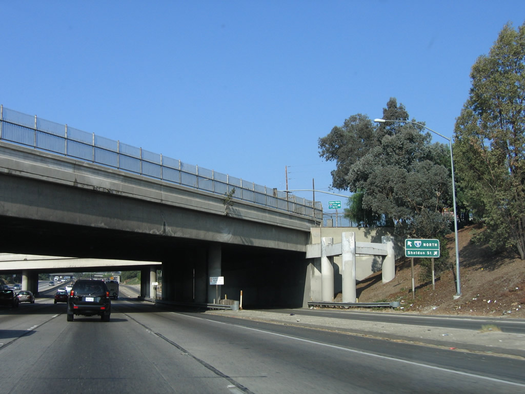
Northbound Interstate 5 (Golden State Freeway) reaches Exit 153A, Sheldon Street. Photo taken 10/07/06. |
|
This view shows the transition ramp to Sheldon Street. Photo taken 10/07/06. |
|
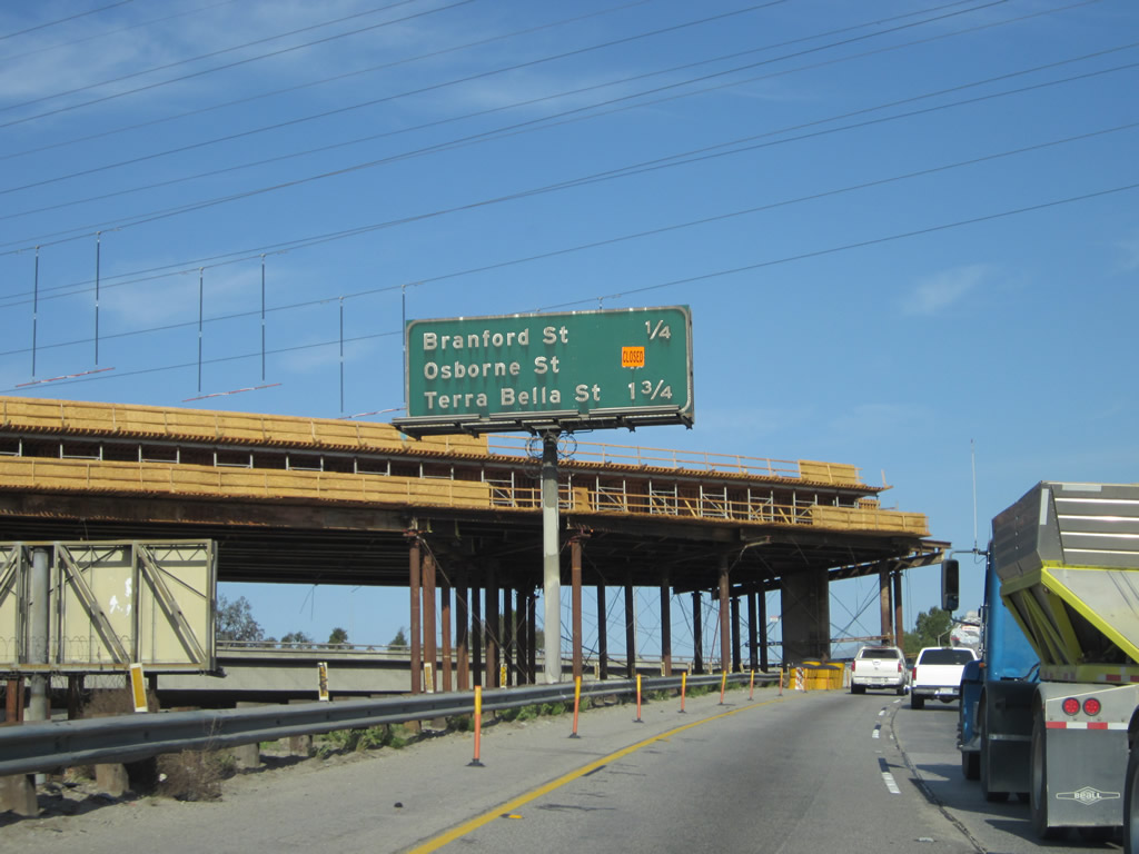
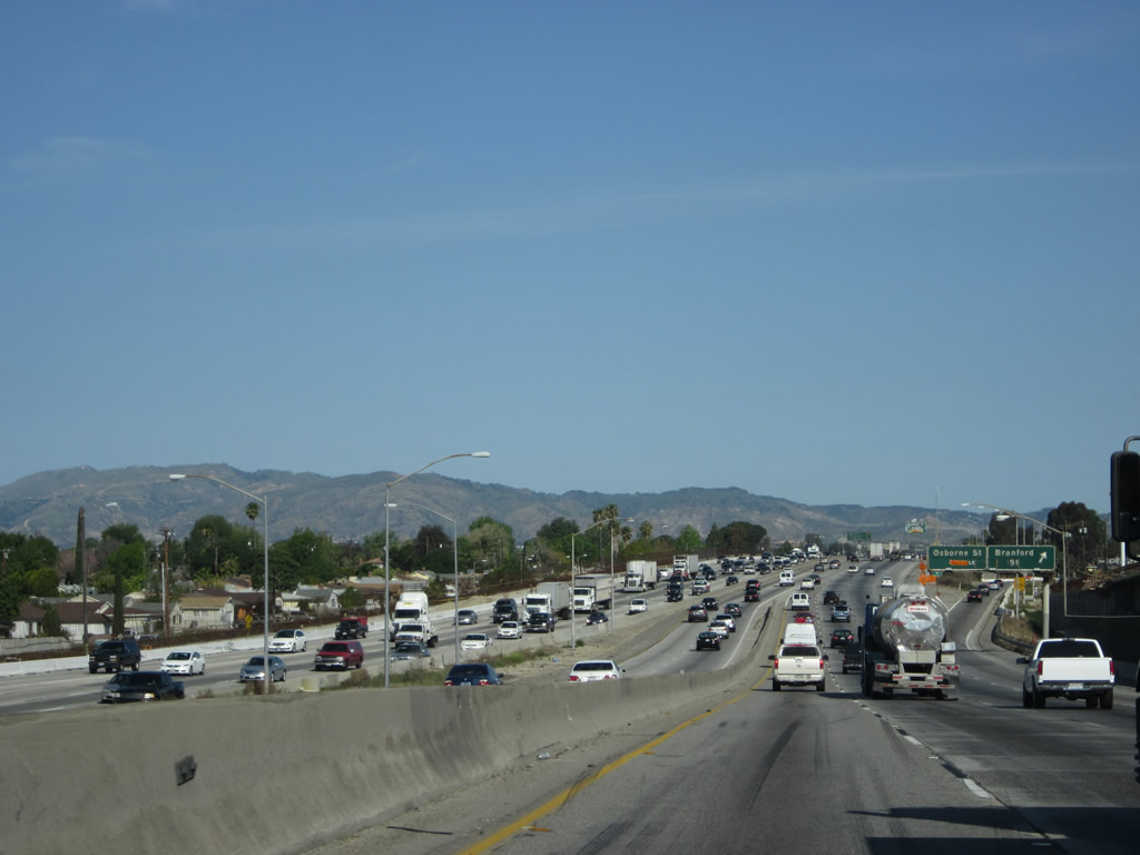
Meanwhile, looking at the center of the freeway, a project was underway in 2011-2012 to add new connectors between California 170 (Hollywood Freeway) north and Interstate 5 north. These will facilitate HOV links between the two busy freeways. Next to the under-construction connector is a mileage sign providing the distance to the next three exits on Interstate 5: Exit 153B, Branford Street; Exit 154, Osbourne Street; and Exit 155A, Terra Bella Street. (There's no access to California 170 south.) Photo taken 02/26/11. |
|
|
Traffic from California 170 (Hollywood Freeway) merges onto Interstate 5 (Golden State Freeway) from the left side of the freeway. There is no access from Interstate 5 north to California 170 south. Note that the jersey barrier effectively prevents traffic along California 170 from connecting to Interstate 5's next exit along northbound, which is Exit 153B, Branford Street. Look for changes here in the future once the new connectors are in place. Photos taken 04/06/12 and 10/07/06. |
|
These Los Angeles Department of Water and Power transmission lines were relocated to allow for additional space for carpool lane connectors between Interstate 5 and California 170. Photo taken 02/26/11. |
|
Northbound Interstate 5 (Golden State Freeway) reaches Exit 153B, Branford Street. The next exit along northbound is Exit 154, Osbourne Street. Photo taken 10/07/06. |
|
Use Osbourne Street east to Whitman Airpark. This interchange serves the community of Arleta, which is also part of the city of Los Angeles. Photo taken 10/07/06. |
|
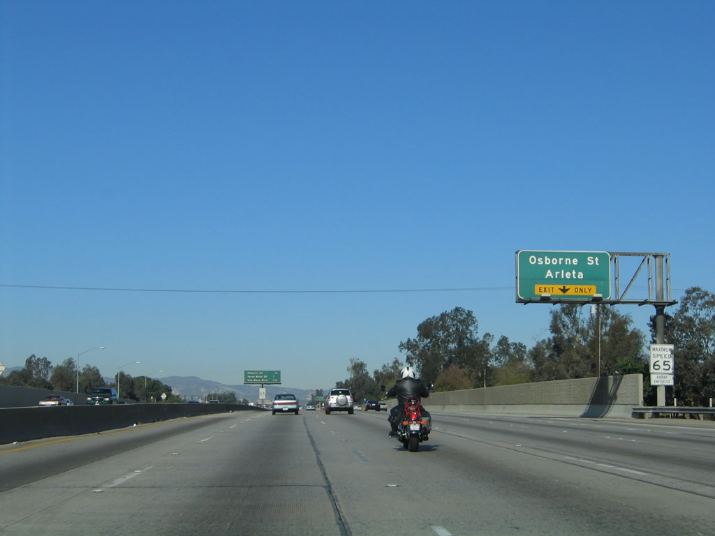
The right lane of Interstate 5 (Golden State Freeway) north becomes exit only for Exit 154, Osbourne Street to Arleta. Photo taken 11/25/04. |
|
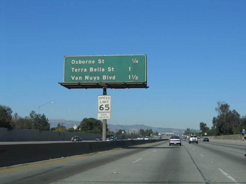
This mileage sign along Interstate 5 (Golden State Freeway) north provides the distance to the next three exits: Exit 154, Osbourne Street to Arleta; Exit 155A, Terra Bella Street; and Exit 155B, Van Nuys Boulevard. Photo taken 11/25/04. |
|
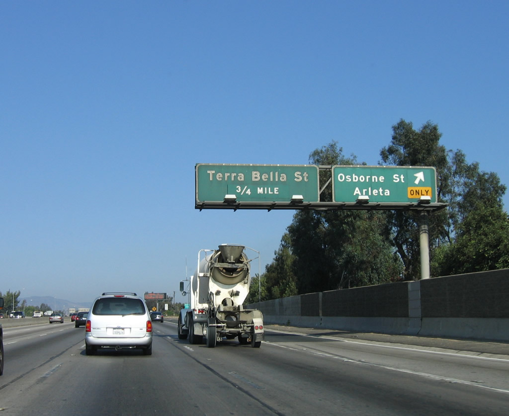
Northbound Interstate 5 (Golden State Freeway) reaches Exit 154, Osbourne Street to Arleta. Photo taken 10/07/06. |
|
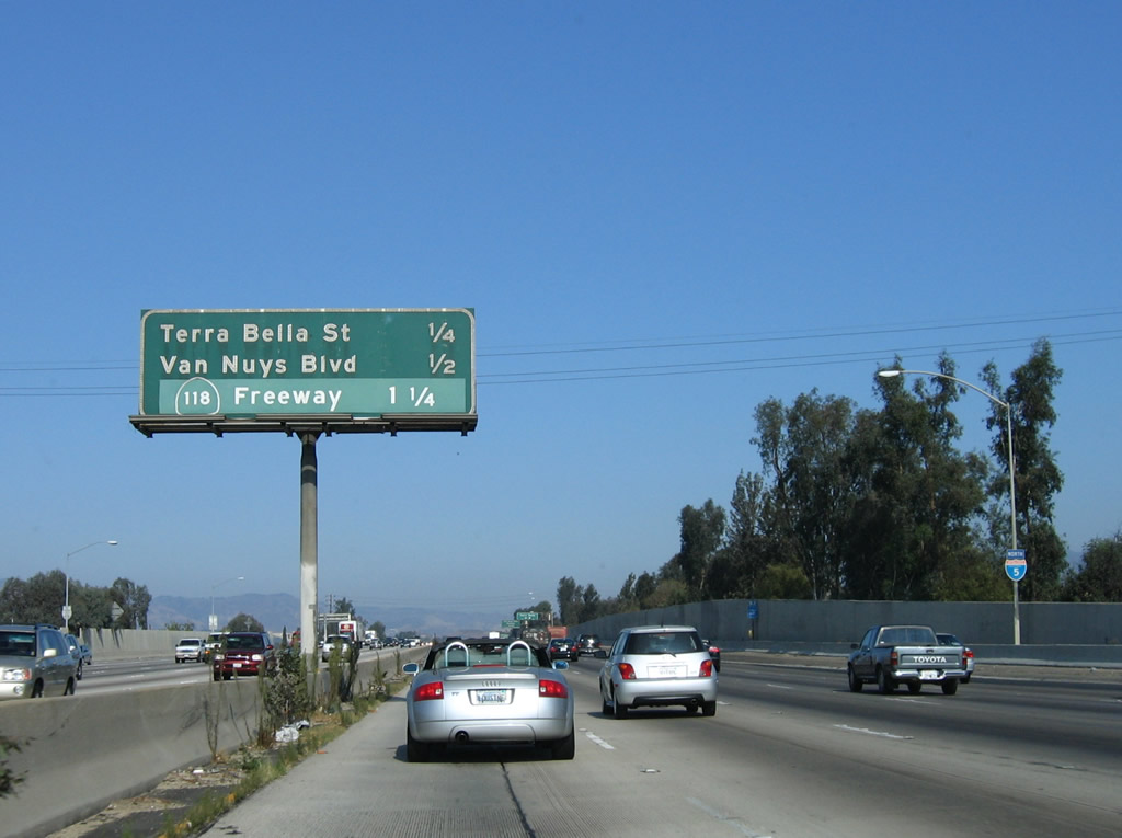
This mileage sign along Interstate 5 (Golden State Freeway) north provides the distance to the next three exits: Exit 155A, Terra Bella Street; Exit 155B, Van Nuys Boulevard; and Exit 156A, California 118 (Ronald Reagan [Simi Valley] Freeway). Photo taken 11/25/04. |
|
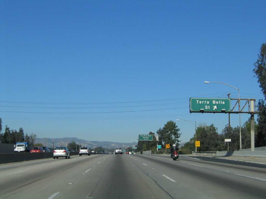
Northbound Interstate 5 (Golden State Freeway) reaches Exit 155A, Terra Bella Street. Photo taken 11/25/04. |
|
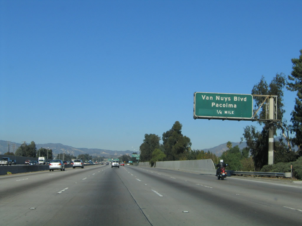
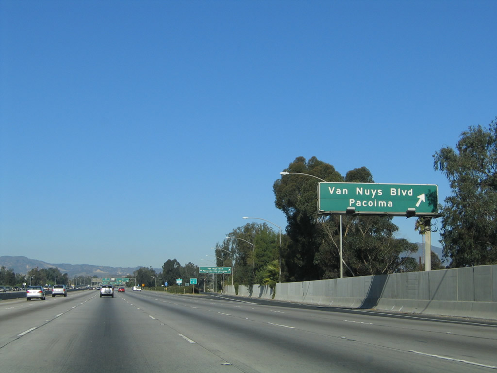
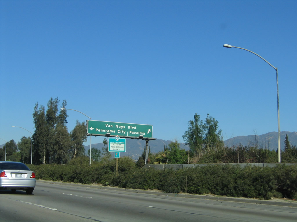
The next exit along Interstate 5 (Golden State Freeway) north is Exit 155B, Van Nuys Boulevard to the communities of Panorama City and Pacoima (also part of the city of Los Angeles). Photo taken 11/25/04. |
|
Northbound Interstate 5 (Golden State Freeway) reaches Exit 155B, Van Nuys Boulevard. Photo taken 11/25/04. |
|
Upon exiting, the ramp for Exit 155B, Van Nuys Boulevard splits between northeast to Pacoima and southwest to Panorama City. Photo taken 11/25/04. |
|
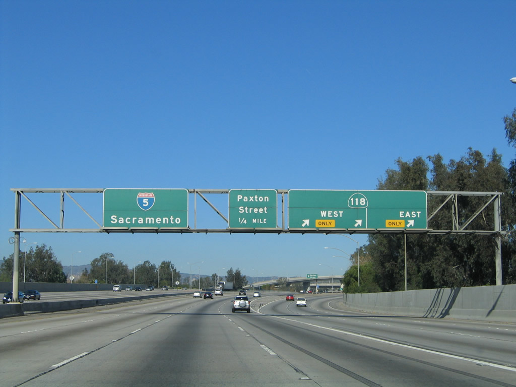
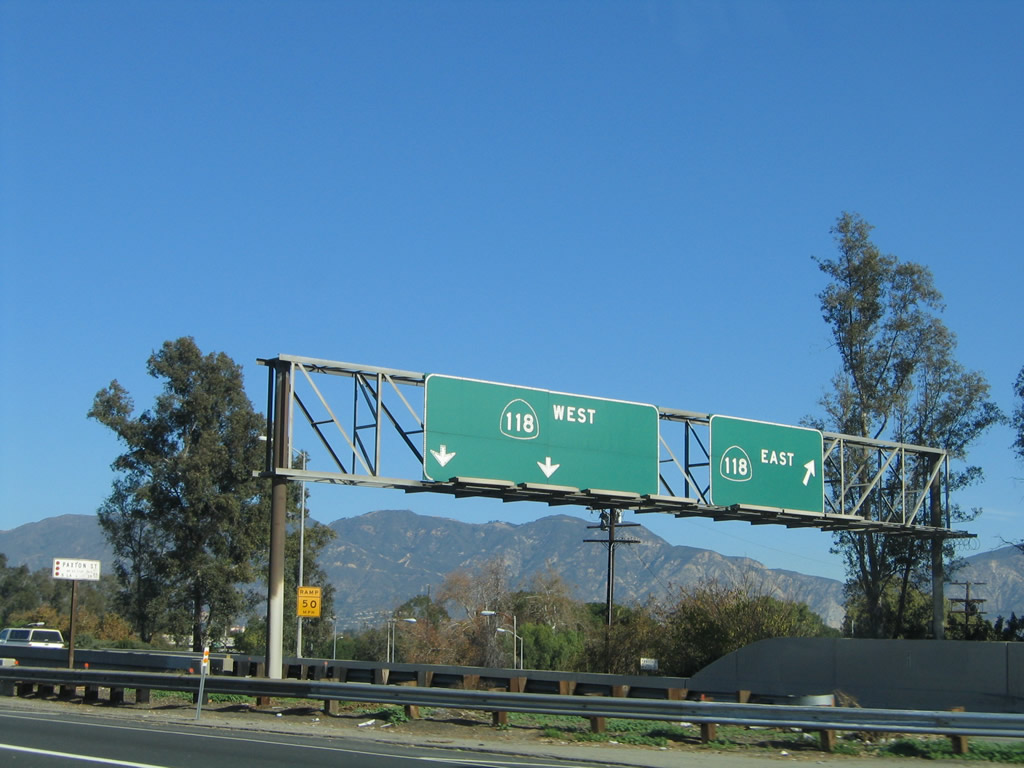
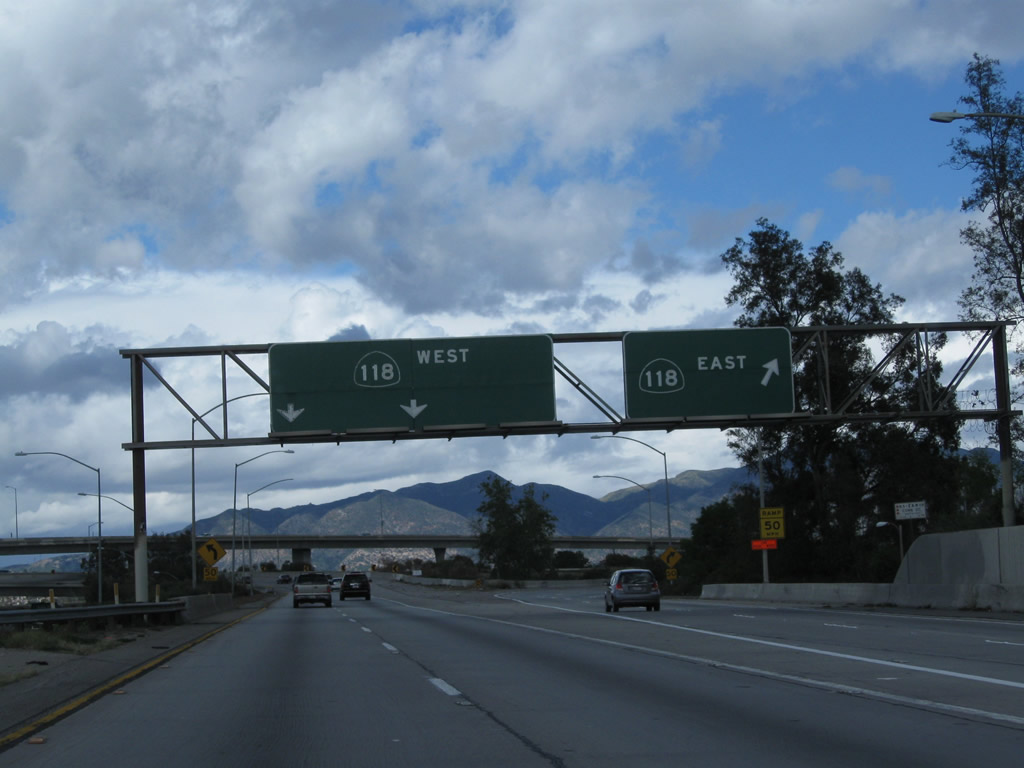
The next exit along Interstate 5 (Golden State Freeway) north is Exit 156A, California 118 (Ronald Reagan [Simi Valley] Freeway). California 118 travels east toward Ventura and west toward Interstate 210 en route to Pasadena. Photo taken 11/25/04. |
|
Northbound Interstate 5 reaches Exit 156A, California 118 (Ronald Reagan [Simi Valley] Freeway). Photo taken 11/25/04. |
|
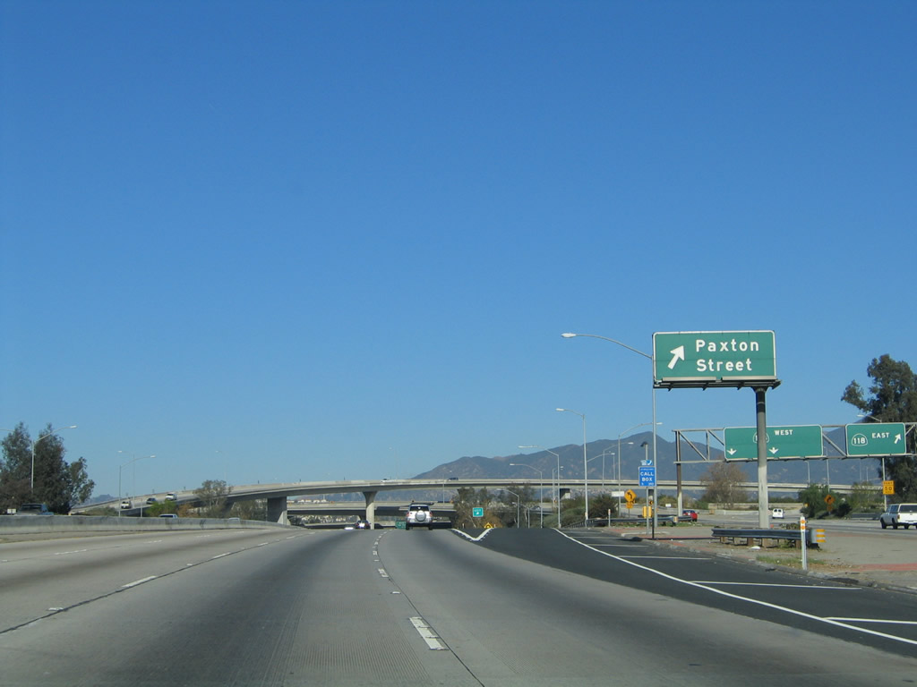
With the transition ramp from Interstate 5 north to California 118 east/west in the background, the next exit along Interstate 5 (Golden State Freeway) north is Exit 156B, Paxton Street. Photo taken 11/25/04. |
|
|
Looking at the transition ramp for California 118 (Ronald Reagan [Simi Valley] Freeway), the left two lanes of the ramp connect to California 118 west to Simi Valley, while the right lane connects to California 118 east to Interstate 210. Photos taken 11/25/04 and 02/26/11. |
|
This view shows the interchange between Interstate 5 and California 118. Photo taken 11/25/04. |
|
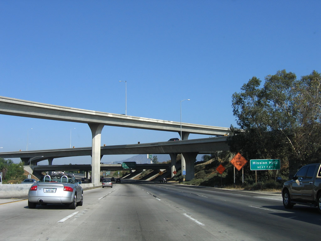
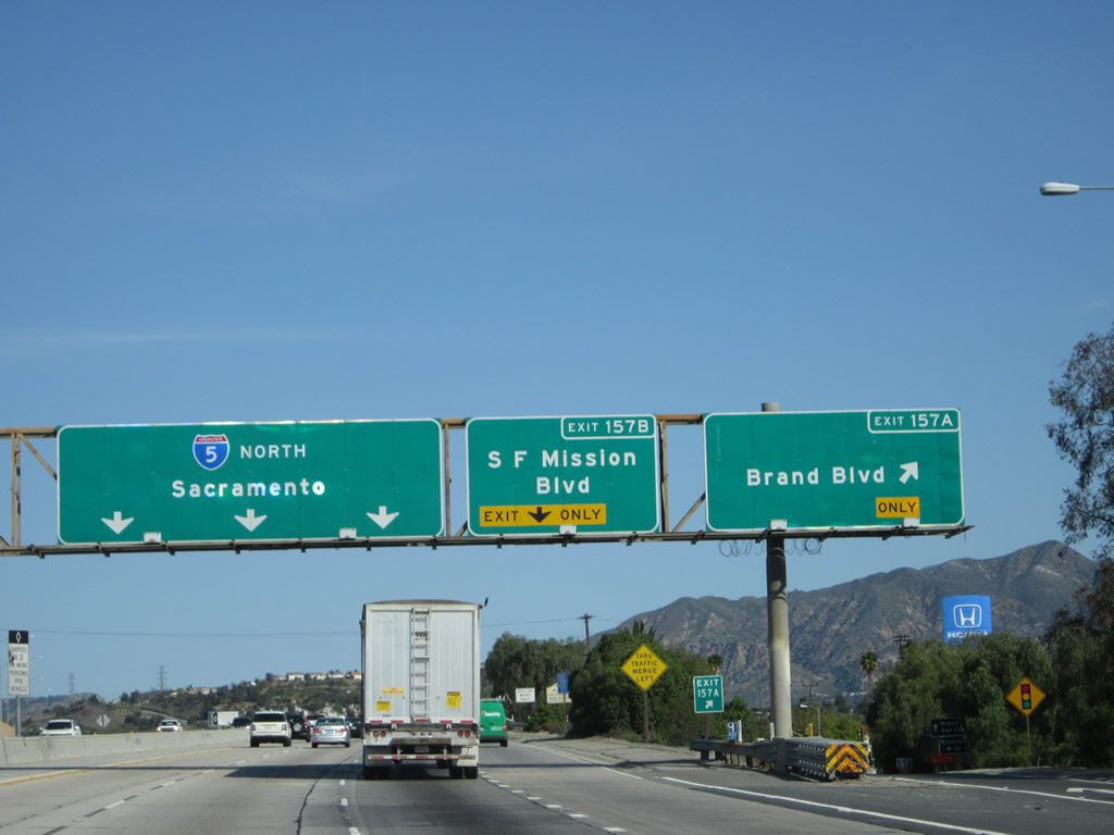
The next exit along Interstate 5 north is Exit 157A, Brand Boulevard. Use Brand Boulevard west to the Mission Hills community of the city of Los Angeles and east to the city of San Fernando. Neither Interstate 5 nor Interstate 210 enter the city limits of San Fernando, which is surrounded entirely by the city of Los Angeles. San Fernando had a population of 23,564 as of the 2000 Census and consists of 2.38 square miles. Photo taken 10/07/06. |
|
The freeway interchange between Interstate 5 and California 118 is almost a symmetrical stack interchange but is missing certain connectors. Photo taken 11/25/04. |
|
Northbound Interstate 5 approaches Exit 157A, Brand Boulevard west to Mission Hills east to the city of San Fernando. This sign is posted on an overpass within the California 118 interchange complex. Photo taken 11/25/04. |
|
|
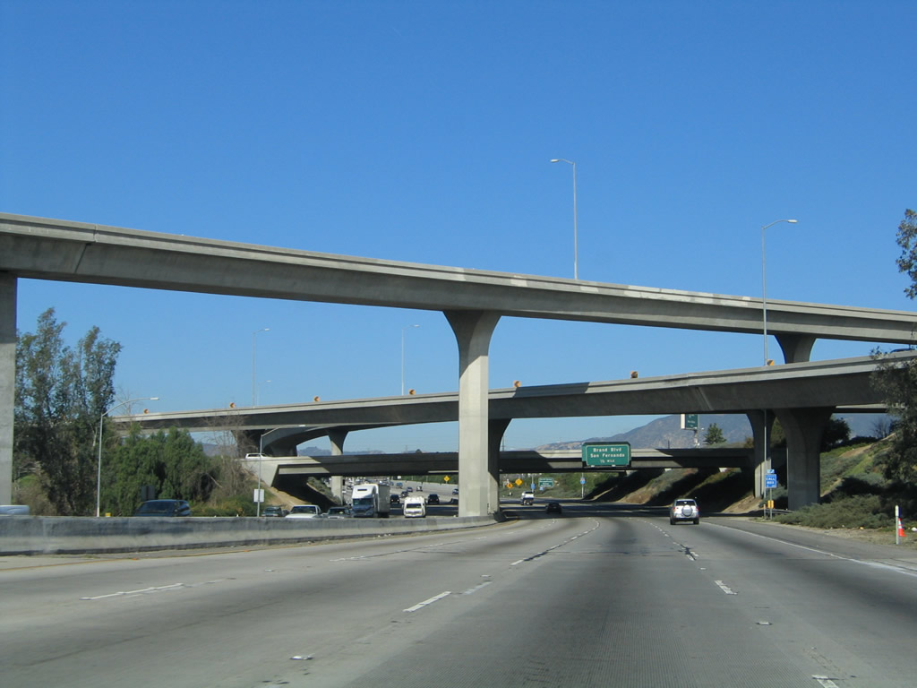
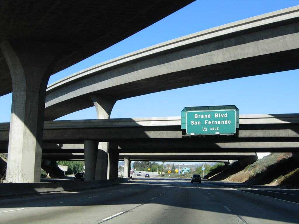
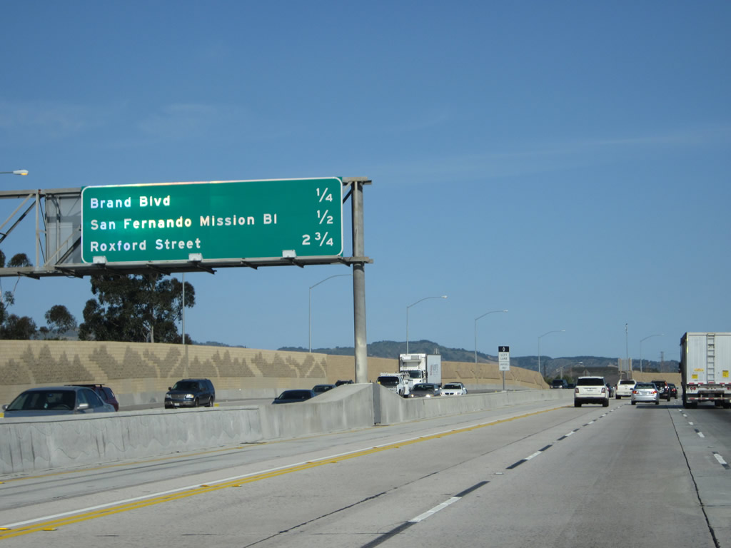
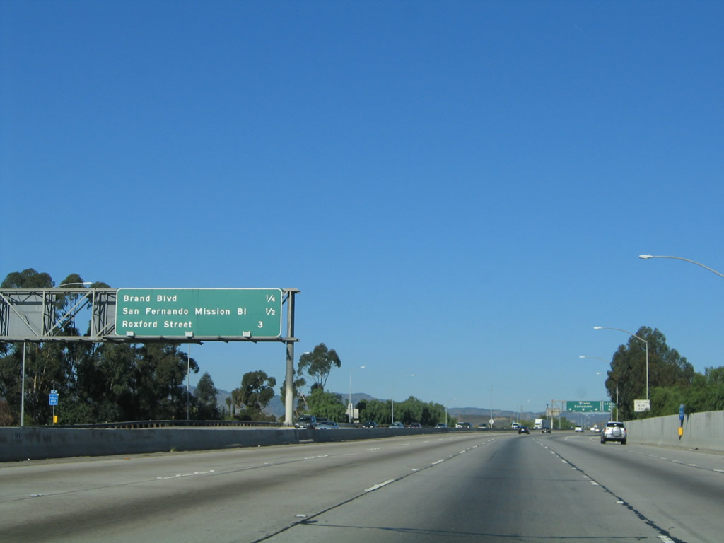
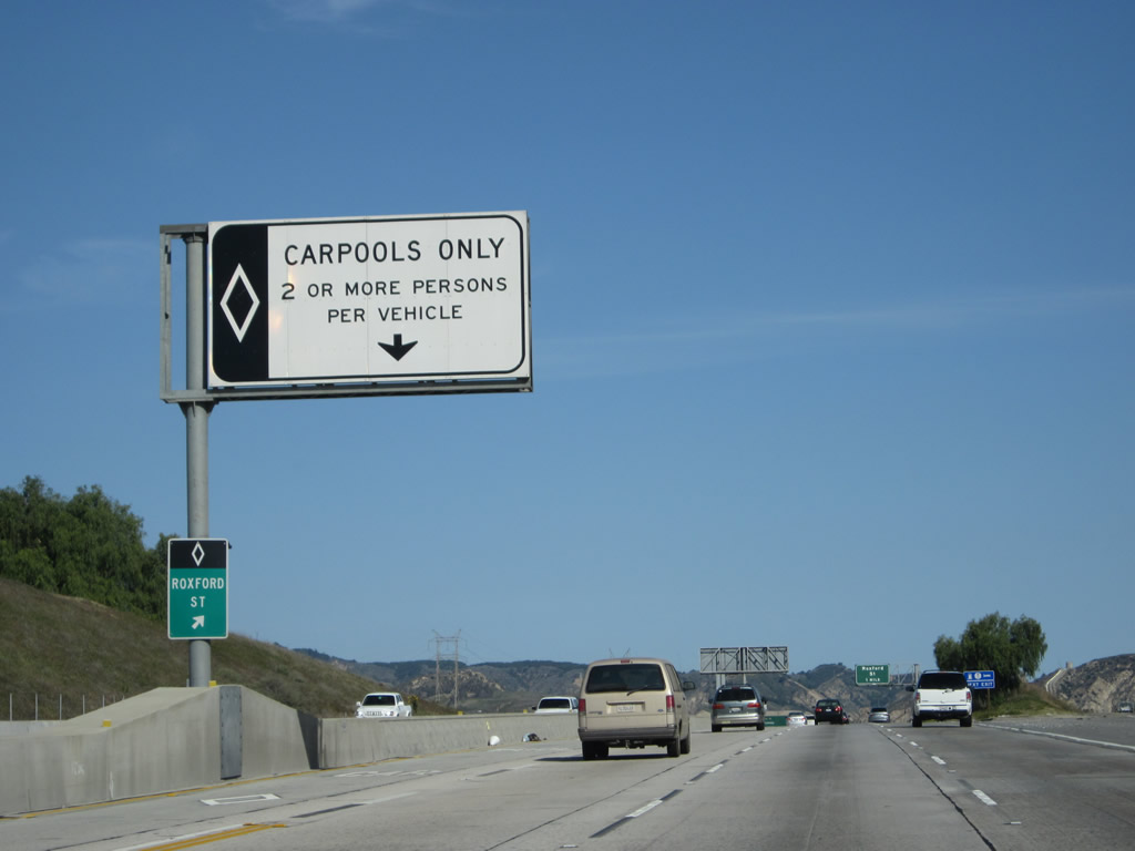
This mileage sign along Interstate 5 (Golden State Freeway) north provides the distance to three of the next four exits: Exit 157A, Brand Boulevard; Exit 157B, San Fernando Mission Boulevard; (Exit 158, Truck Bypass for Interstate 405 merge;) and Exit 159, Roxford Street. This sign was replaced when the new HOV (carpool) lane was added through here in 2010. Photos taken 04/06/12 and 11/25/04. |
|
|
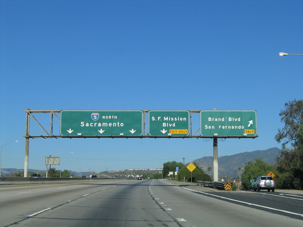
Northbound Interstate 5 reaches Exit 157A, Brand Boulevard west to Mission Hills east to the city of San Fernando. The next exit is Exit 157B, San Fernando Mission Boulevard. All of these overhead signs were replaced by 2010 with new reflective signs that incorporate the exit numbers for both Exits 157A and 157B. Photos taken 04/06/12 and 11/25/04. |
|
Immediately thereafter, Interstate 5 (Golden State Freeway) reaches Exit 157B, San Fernando Mission Boulevard. Use San Fernando Mission Boulevard west to the Mission Hills and Granada Hills communities of the city of Los Angeles. To the northeast, San Fernando Mission Boulevard leads into downtown San Fernando. Photo taken 11/25/04. |
|
Access to the HOV lane is permitted right after northbound Interstate 5 (Golden State Freeway) meets Exit 157B, San Fernando Mission Boulevard. Photo taken 04/06/12. |
|
This view looks north along Interstate 5 (Golden State Freeway) north as it passes through the Exit 157B, San Fernando Mission Boulevard interchange. Photo taken 04/06/12. |
|
|
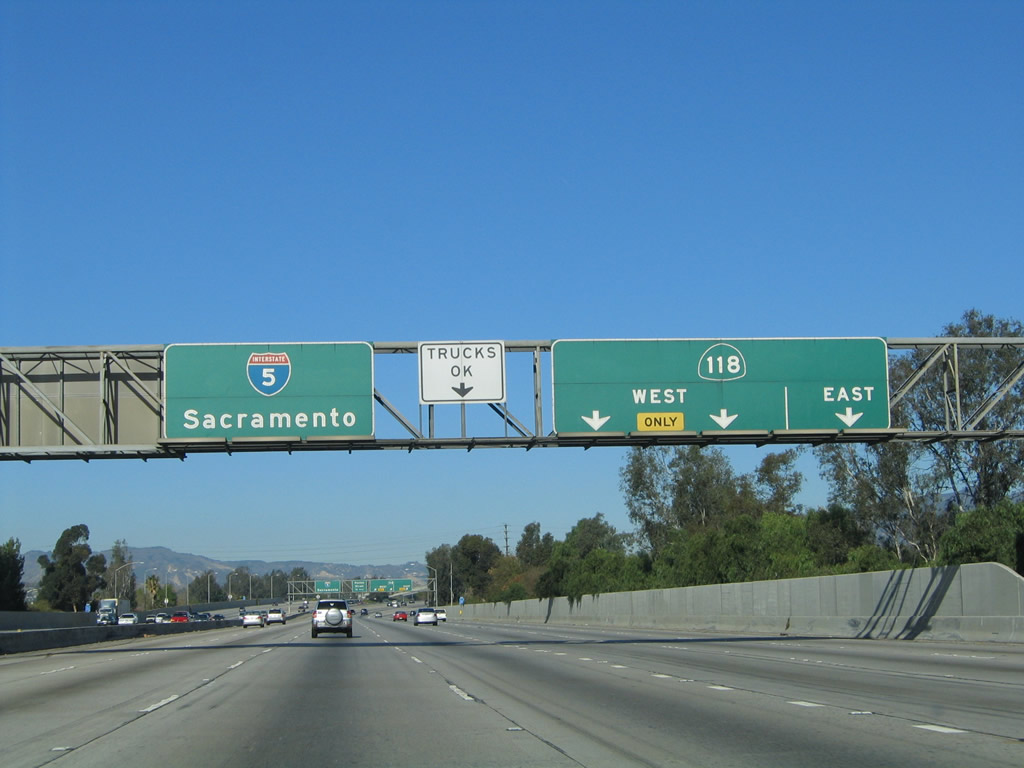
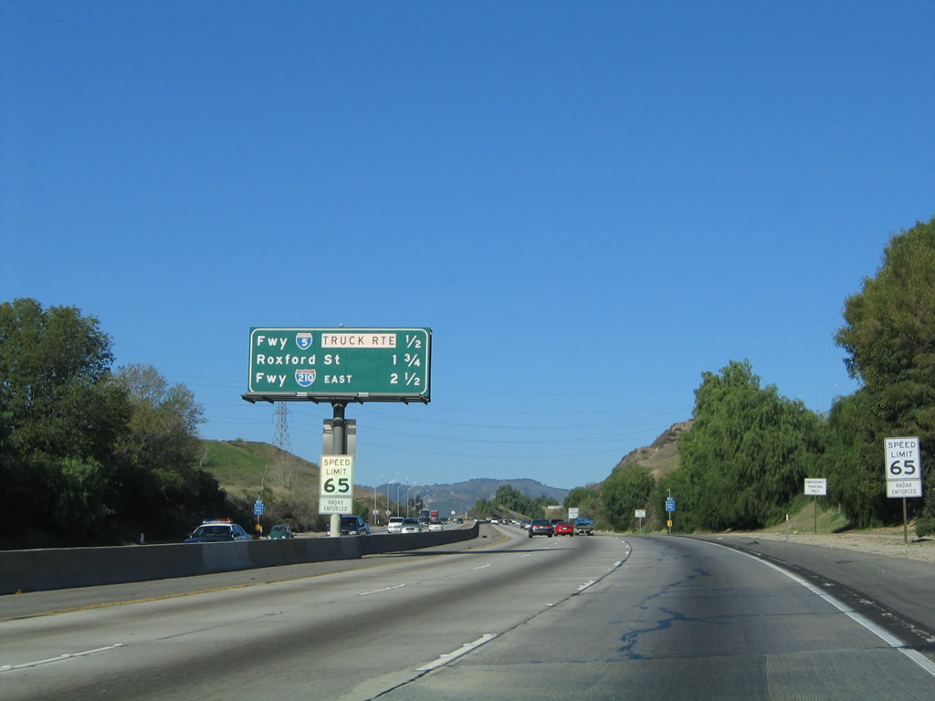
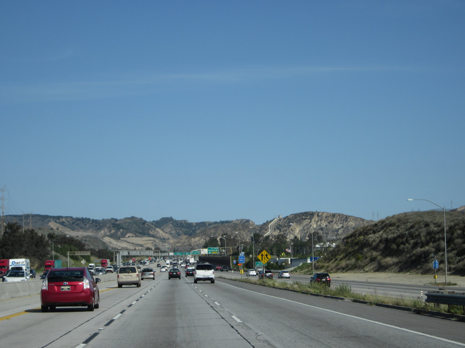
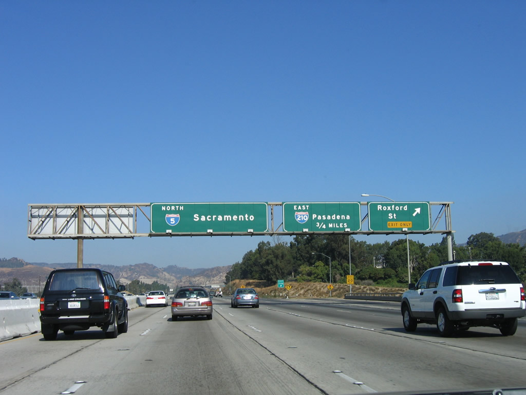
Between San Fernando Mission Boulevard and Roxford Street, Interstate 5 (Golden State Freeway) will merge with Interstate 405 (San Diego Freeway). There is no direct connection from Interstate 5 north to Interstate 405 south. To ensure smooth traffic flow for northbound traffic, slower traffic may use Exit 158, which is a freeway truck bypass and allows trucks to stay in the right lane through the merge. This bypass is part of a system that will allow for a separation of cars and trucks to help manage traffic flow through the merge with Interstate 405 and again at the junction with Interstate 210 (Foothill Freeway) that separates traffic through the Newhall Pass interchange with California 14 (Antelope Valley Freeway). The sign for the Truck Bypass was replaced by 2012 to coincide with installation of a new soundwall on the east side of the freeway. Photos taken 04/06/12 and 10/07/06. |
|
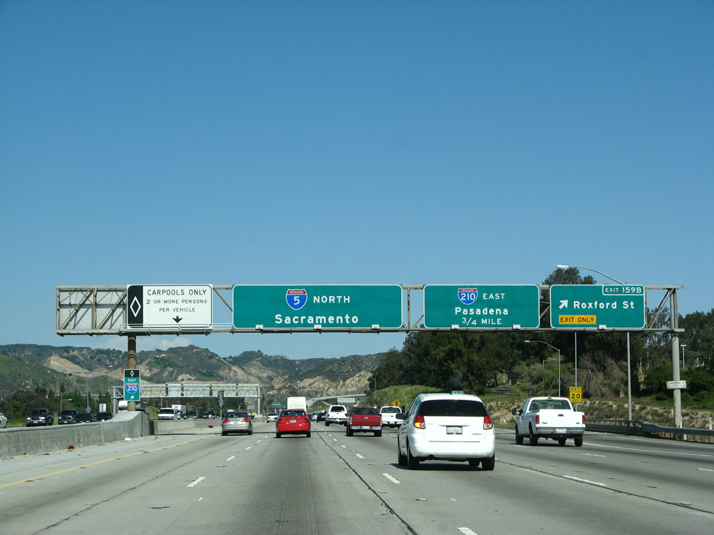
This interchange sequence sign along northbound Interstate 5 (Golden State Freeway) provides the distance to the next three exits: Exit 158, the truck bypass; Exit 159, Roxford Street; and Exit 161A, Interstate 210 (Foothill Freeway) east to Pasadena and San Bernardino. Photo taken 11/25/04. |
|
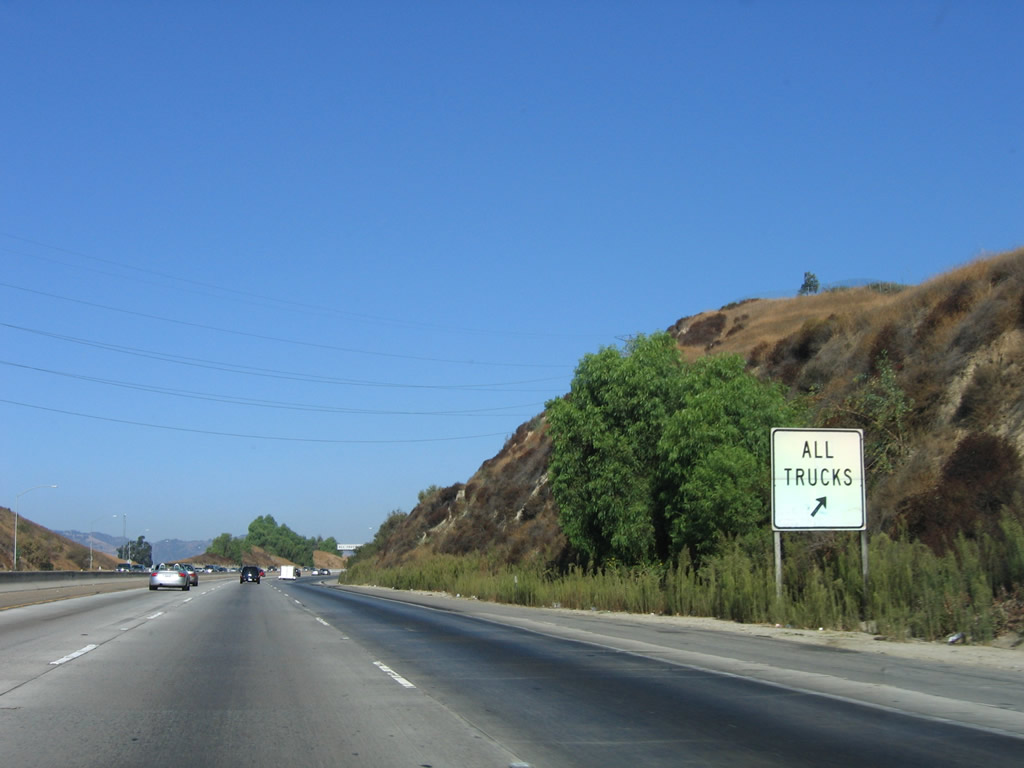
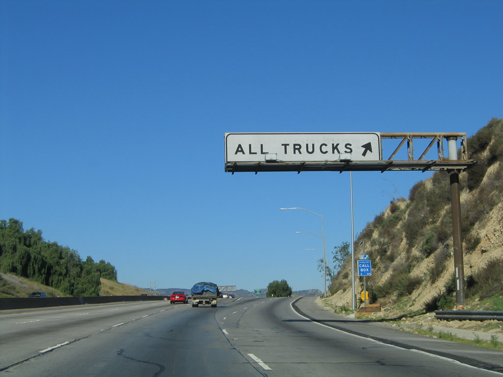
All trucks must use the truck bypass to facilitate traffic flow at the northern Interstate 5/405 merge. This interchange marks the northern terminus of Interstate 405 (San Diego Freeway). Photo taken 10/07/06. |
|
Northbound Interstate 5 (Golden State Freeway) reaches Exit 158, Truck Bypass (around the Interstate 405 (San Diego Freeway) merge). Photo taken 11/25/04. |
|
Another HOV lane access point is located after the Truck Bypass off-ramp. Photo taken 04/06/12. |
|
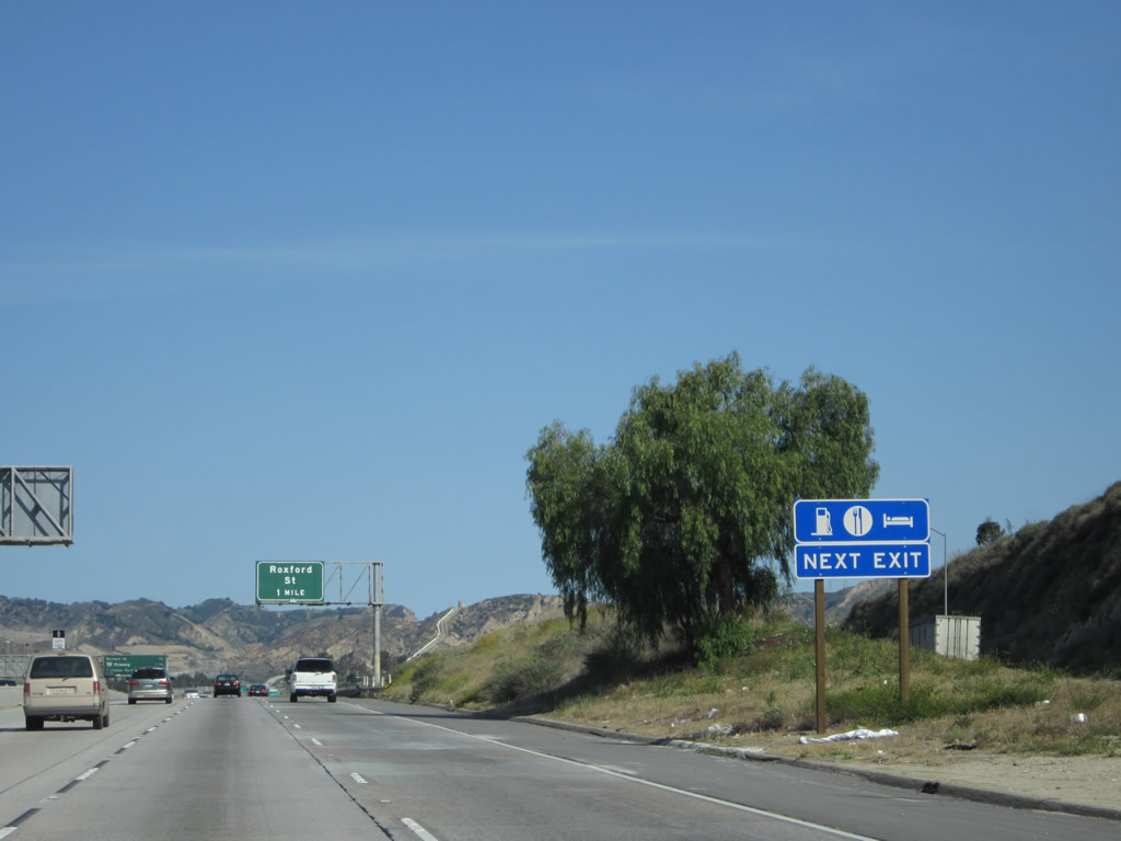
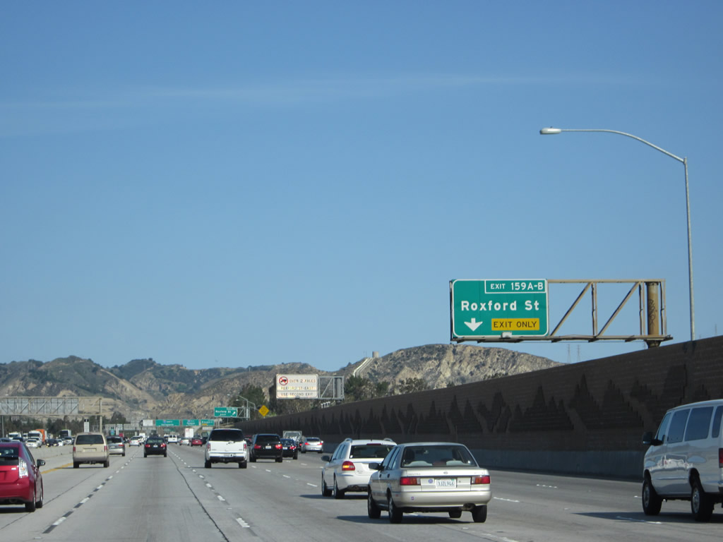
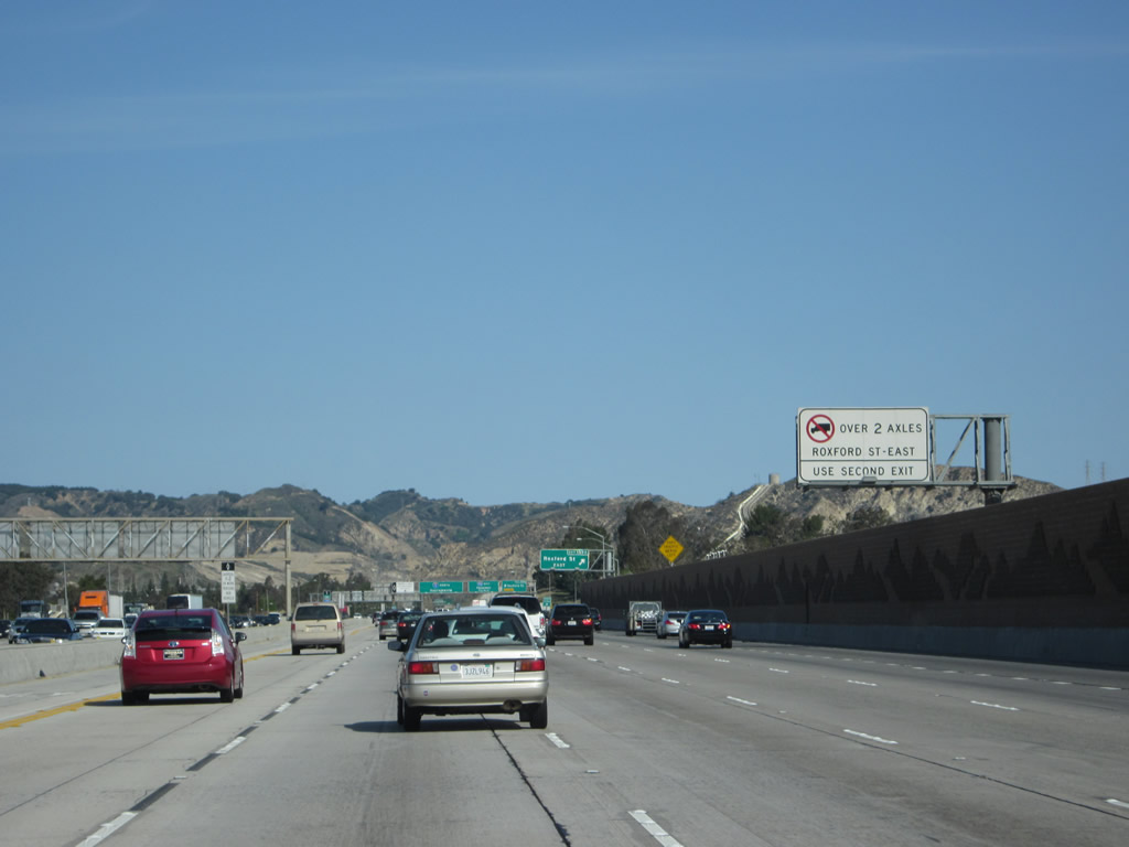
All motorist services can be found at Exit 159A, Roxford Street east. Photo taken 04/06/12. |
|
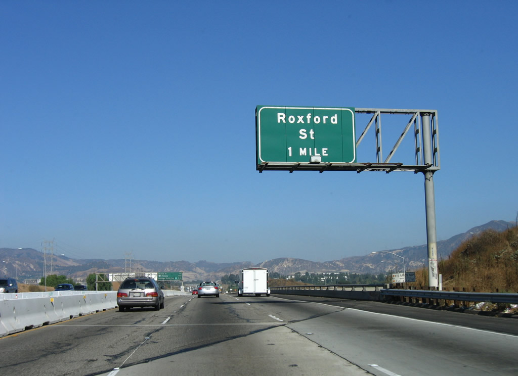
The next exit along Interstate 5 (Golden State Freeway) north is Exits 159A-B, Roxford Street (one mile). This sign is posted on the bridge that carries Interstate 5 over the northbound lanes of Interstate 405. Traffic from Interstate 405 north will merge onto Interstate 5 north from the right. The truck bypass lanes stay on the right side of both the Interstate 5 main lanes and the Interstate 405 main lanes. At the time this picture was taken, the HOV lane was still under construction. Photo taken 10/07/06. |
|
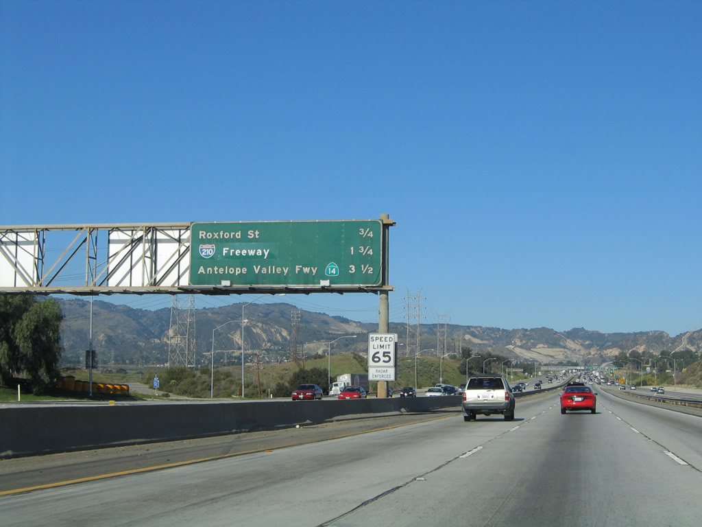
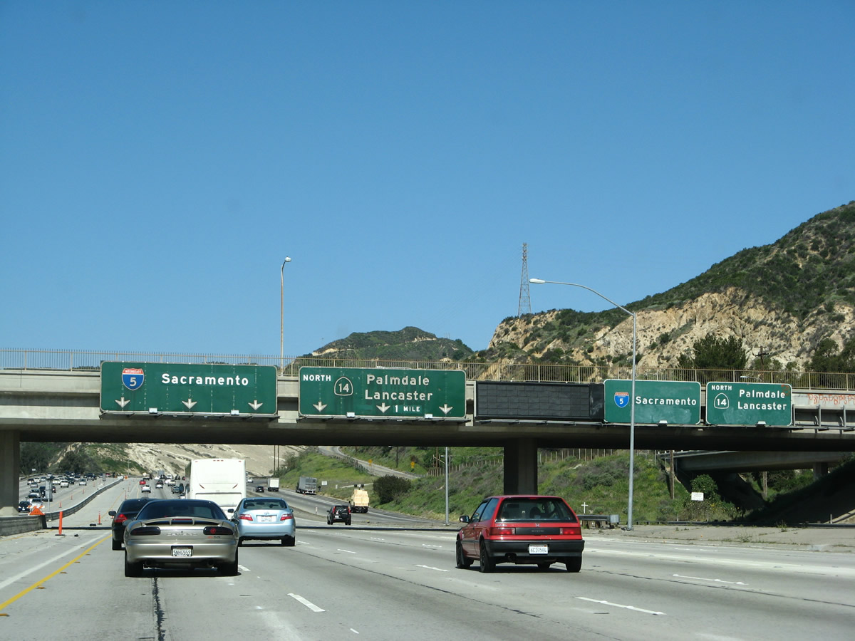
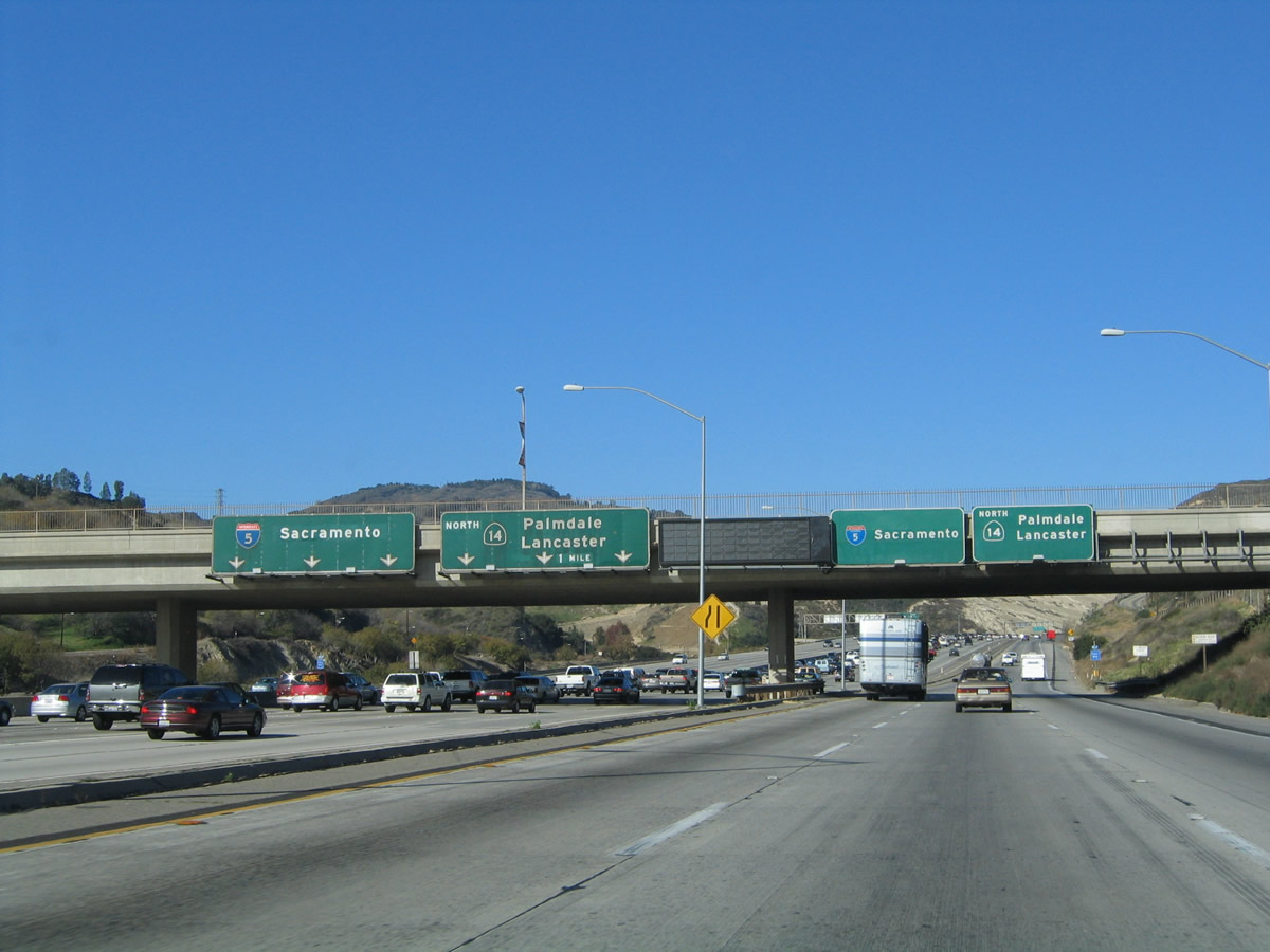
This mileage sign along northbound Interstate 5 (Golden State Freeway) provides the distance to the next four exits along Interstate 5 north: Exits 159A-B, Roxford Street east/west; Exit 161A, Truck Bypass; Exit 161B, Interstate 210 east to Pasadena and San Bernardino; and Exit 162, California 14 north to Lancaster-Palmdale and Mojave, thence onward to Bishop via U.S. 395. Photo taken 11/25/04. |
|
|
Traffic from Interstate 405 merges onto Interstate 5 north. This marks the northern terminus of Interstate 405. The 2012 picture shows the completed HOV lane; there is no direct connection between Interstate 405's northbound HOV lane and Interstate 5's northbound HOV lane. Photos taken 04/06/12 and 10/07/06. |
|
|
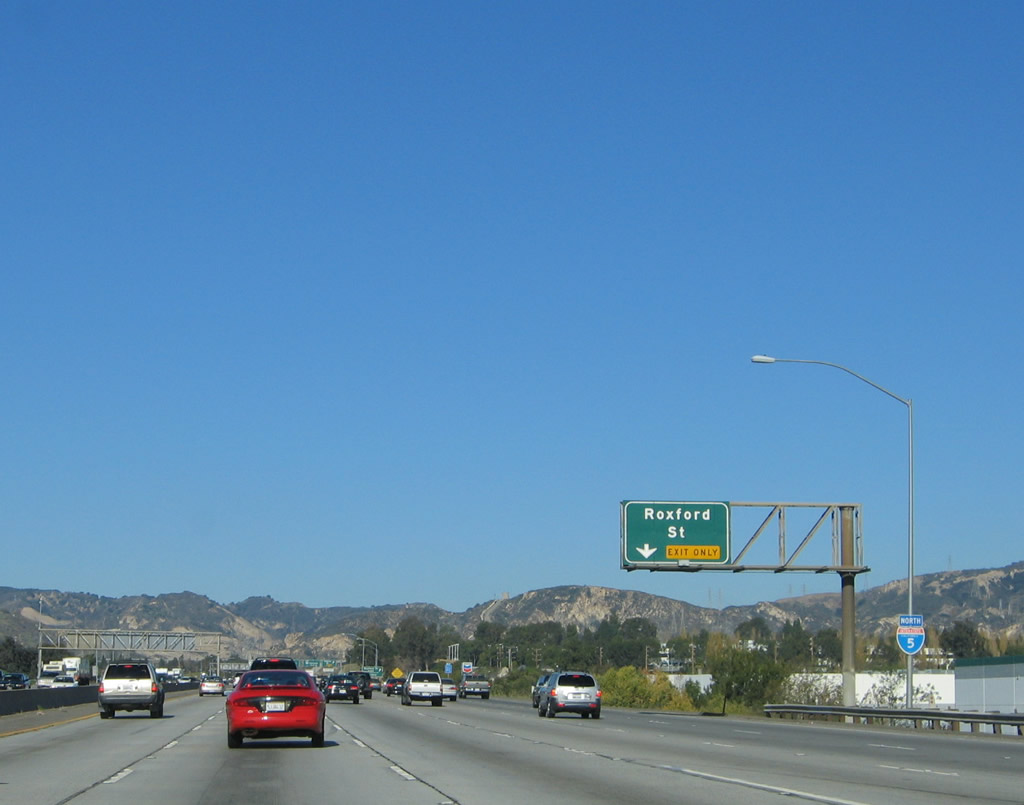
After merging with Interstate 405, the right lane of Interstate 5 (Golden State Freeway) becomes exit only for Exits 159A-B, Roxford Street. Photos taken 04/06/12 and 11/25/04. |
|
Trucks are restricted on Roxford Street east (Exit 159A) per this overhead sign. Photo taken 04/06/12. |
|
|
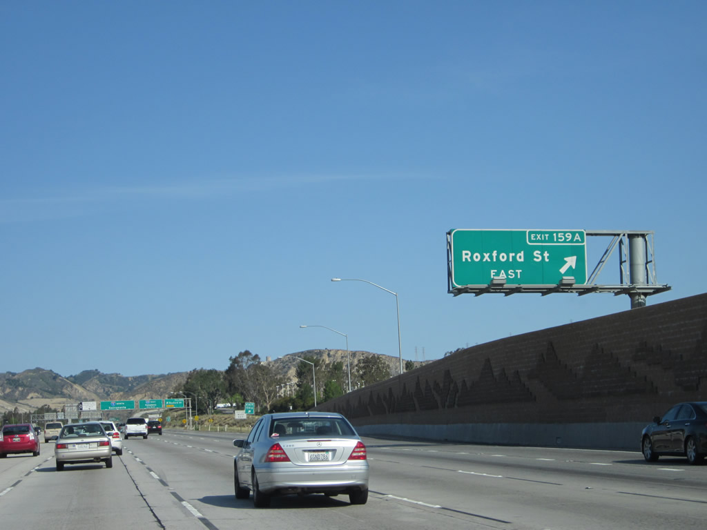
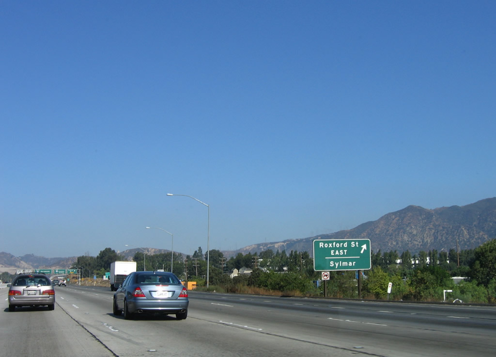
Northbound Interstate 5 meets Exit 159A, Roxford Street east. Prior to the completion of the soundwall project, a roadside sign for Exit 159A, Roxford Street east advised that the community of Sylmar (within the city of Los Angeles) is located northeast of Interstate 5 via Roxford Street. This sign is now replaced with the overhead sign seen in 2012. Photos taken 04/06/12 and 10/07/06. |
|
|
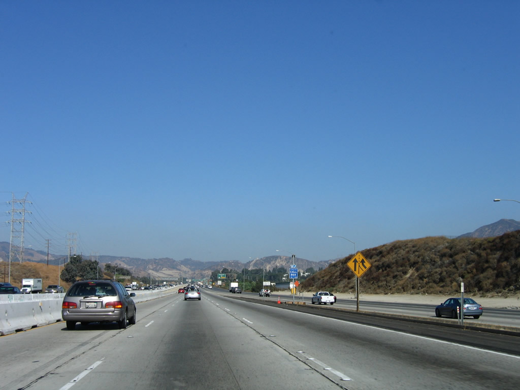
Immediately thereafter, northbound Interstate 5 (Golden State Freeway) next meets Exit 159B, Roxford Street west. The next two exits along northbound are Exit 161A, Truck Bypass around the Interstate 210 split and Exit 161B, Interstate 210 (Foothill Freeway). A new High Occupancy Vehicle (HOV or carpool) lane was under construction at the time the 2008 photo was taken; the goal is to extend this lane north through the California 14 interchange. Photos taken 03/15/08 and 10/07/06. |
|
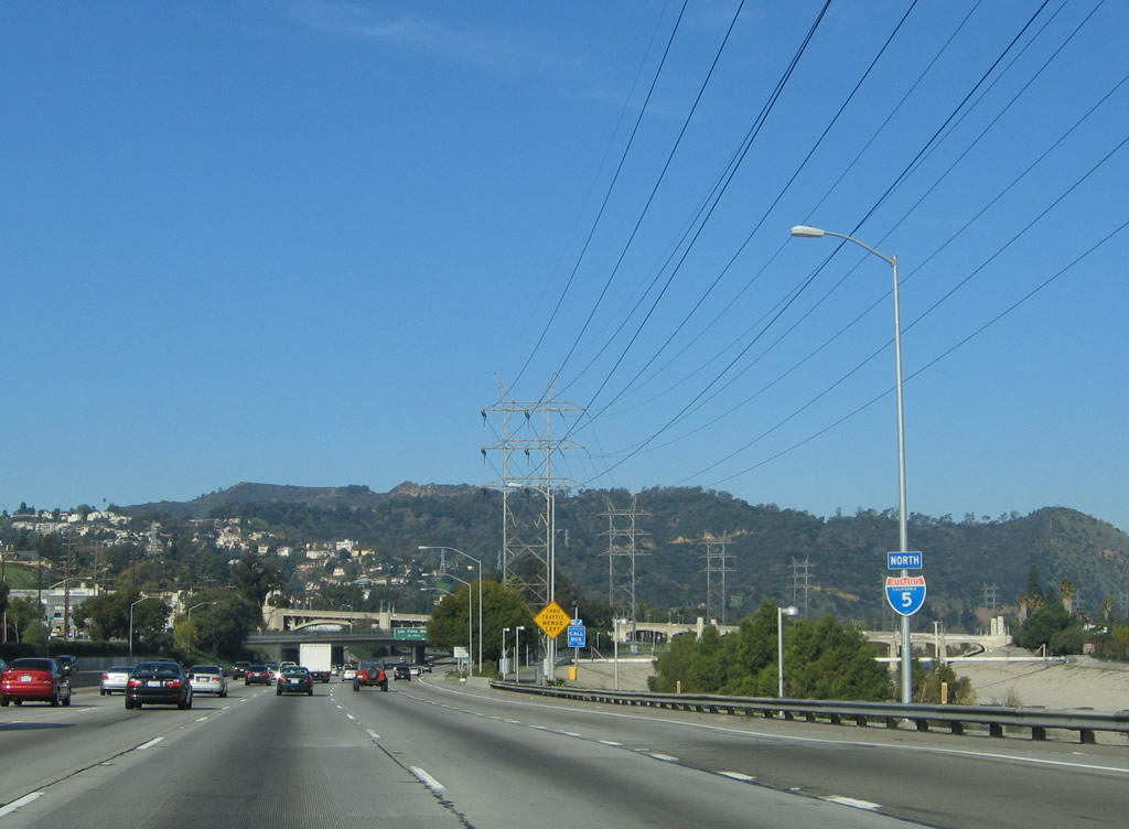
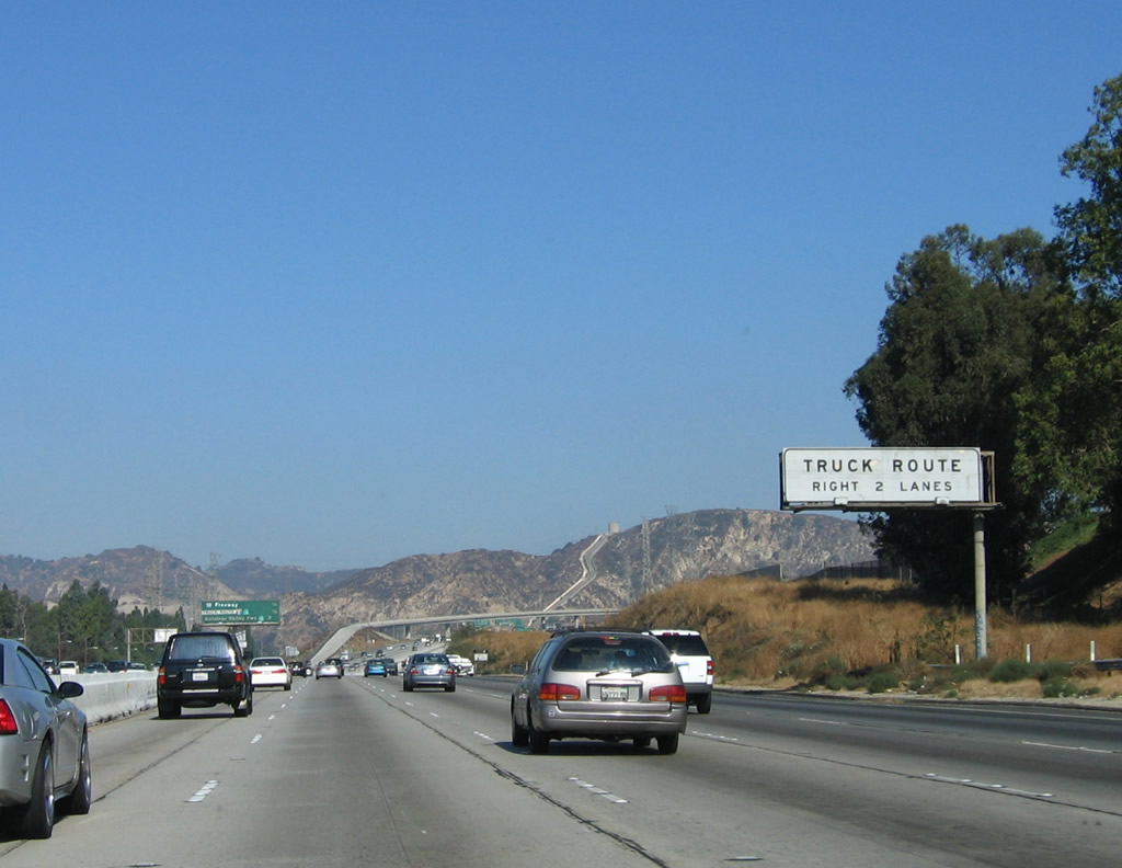
The next truck bypass (Exit 161A) will separate traffic for northbound traffic between the Interstate 210 exit and the California 14 interchange. The auto lanes follows a newer alignment; the truck bypass follows the original Interstate 5/U.S. 99 lanes through the Newhall Pass interchange. Interstate 210 is the Foothill Freeway, which leads southeast toward Pasadena, then east to serve the foothill cities of Los Angeles and San Bernardino Counties. The last section of future Interstate 210 (between Interstate 15 and Interstate 215) opened to traffic in July 2007. Photo taken 10/07/06. |
|
This mileage sign along Interstate 5 (Golden State Freeway) north provides the distance to Exit 161B, Interstate 210; Exit 161A, the Interstate 5/California 14 Truck Bypass; and Exit 162, California 14 (Antelope Valley Freeway) north to Lancaster-Palmdale, Mojave, and Bishop. For some reason, Exit 161B comes prior to Exit 161A on northbound. Photo taken 10/07/06. |
|
|
Northbound Interstate 5 (Golden State Freeway) reaches Exit 161B, Interstate 210 (Foothill Freeway). All trucks should merge right in anticipation of the truck bypass for the California 14 interchange. The distance of Interstate 5 between Interstate 210 and California 14 is one of the busiest sections, and traffic delays are common. Watch for lane changes and sudden moves as people find the correct lane to continue north. Photos taken 03/15/08 and 10/07/06. |
|
|
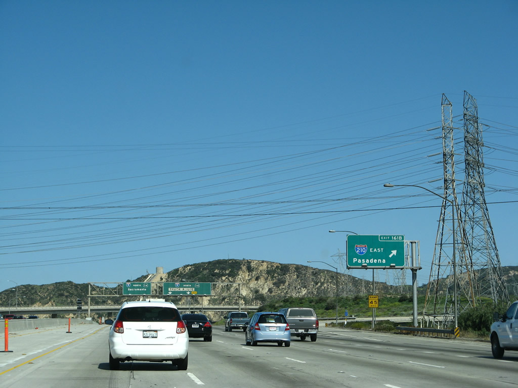
Near the Interstate 210 interchange, note that many power lines converge near this interchange; power lines from the Los Angeles Department of Water and Power and Southern California Edison bring electricity from places near and far to the largest city in the Western United States. Massive Path 65 (Pacific DC Intertie, which originates at Celilo, Oregon, near the Columbia River's massive hydroelectric facilities and travels without stopping at any substations) and several 500kV Los Angeles Department of Water and Power lines converge here. Together with Path 26 (which connects to north-south Path 15 at the Midway substation near Buttonwillow near the Interstate 5 and California 58 interchange), these lines help interconnect power facilities near Hoover Dam with the main power grid carrying electricity north and south across the western coastal states. Photos taken 04/06/12. |
|
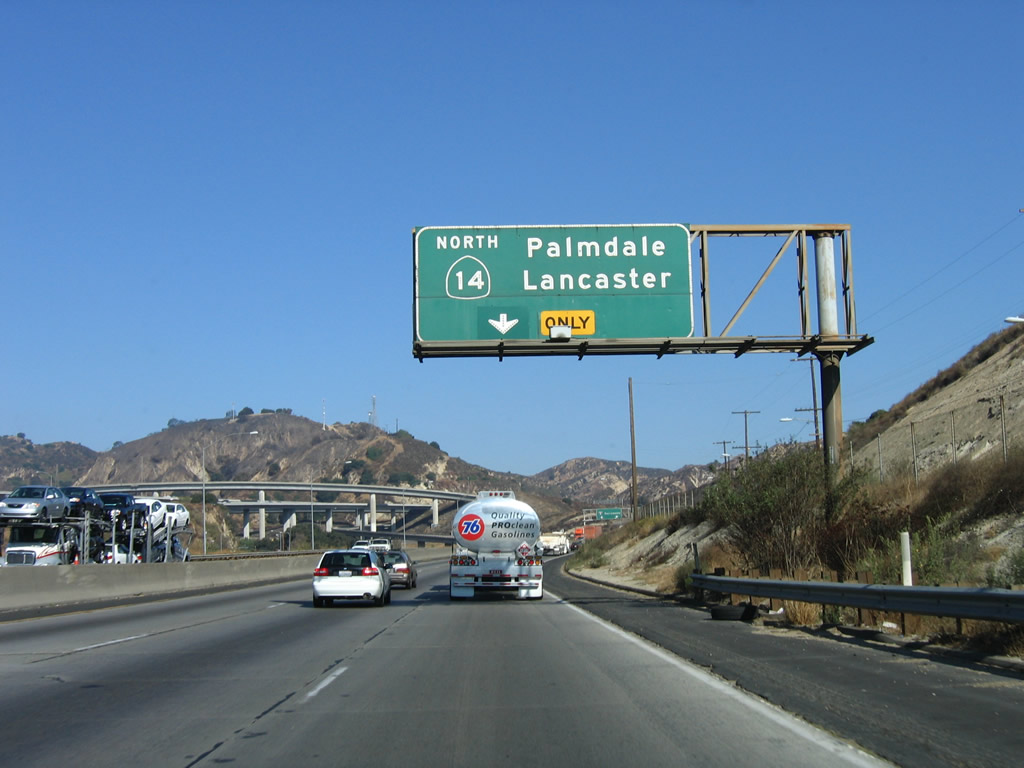
The right two lanes become exit only for the Interstate 5 Truck Bypass. This bypass allows for slower vehicles to be separated from the main lanes; access is provided to Interstate 5 (Golden State Freeway) north and Exit 162, California 14 (Antelope Valley Freeway) north to Lancaster-Palmdale, Mojave, and Bishop. This truck bypass connection is considered Exit 161A even though it is located after the ramp to Interstate 210 east (Exit 161B). Note the construction of the new high occupancy vehicle lanes in the 2008 picture. Photo taken 03/15/08. |
|
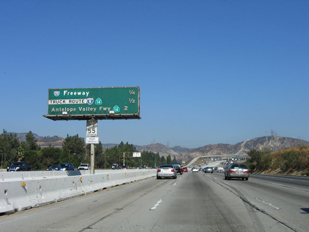
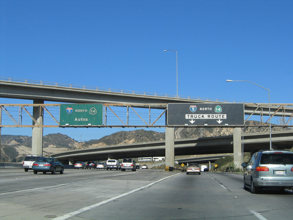
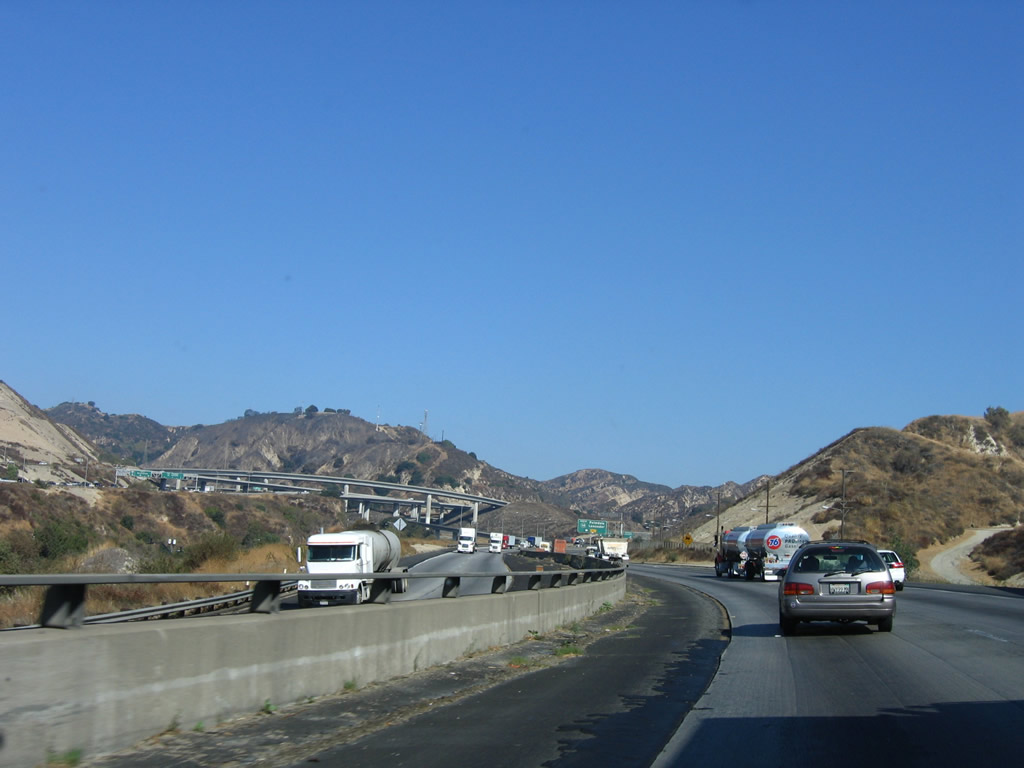
The auto and truck lanes split at Exit 161A and ascend toward the Newhall Pass, in which the Newhall Pass interchange is located. The left four lanes (soon to be four plus one high occupancy vehicle lane) connect to the Interstate 5 Auto Lanes, while the right two lanes merge onto the Interstate 5 Truck Bypass. For the next several miles, Interstate 5 features a dual freeway with separated lanes of traffic. California 14 is the Antelope Valley Freeway, which follows the alignment of Former U.S. 6 (Sierra Highway) through Santa Clarita on its way to Lancaster and Palmdale in the high desert. Since California 14 is such a major traffic corridor between Los Angeles and Lancaster, it is very busy, and the area where Interstate 5 and California 14 split has frequent traffic delays. To alleviate traffic issues, Interstate 5 splits into truck/auto lanes, which helps keep larger vehicles separate from automotive traffic. Note that the truck lanes sign is black rather than green. Photo taken 03/15/08. |
| Interstate 5 (Golden State Freeway) AUTO LANES north |
|
|
We first visit the northbound Interstate 5 (Golden State Freeway) auto lanes as we climb toward Newhall Pass. This view shows the signage located on the transition ramp from Interstate 210 west to Interstate 5 north. Motorists on Interstate 210 have the choice of using either the truck lanes or the auto lanes. Photos taken 04/06/12 and 03/15/08. |
|
Immediately thereafter, this view shows the two sets of travel lanes and nearly identical signage between the Auto Lanes and the Truck Bypass Lanes. The next exit is Exit 162, California 14 (Antelope Valley Freeway) north to Palmdale, Lancaster, Mojave, and Bishop. Photo taken 03/15/08. |
|
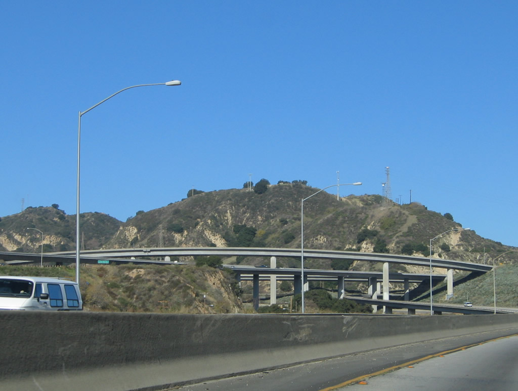
The Interstate 5 and California 14 interchange (called the Newhall Pass interchange) is almost wholly located within the city of Los Angeles. However, the northern end of the Interstate 5/California 14 interchange is within the city of Santa Clarita. Both Interstate 5 and California 14 serve Santa Clarita, which incorporated in 1987 when several communities (Canyon Country, Newhall, Saugus, and Valencia) merged together. As a suburb, Santa Clarita has experienced an incredible boom; the 2000 Census population was 151,088 but that number has increased by over 20,000 as of 2007 according to more recent estimates. Photo taken 03/15/08. |
|
Work was underway in 2012 to build a new HOV direct connector from Interstate 5 north to California 14 north. The freeway interchange footprinted had to be widened to accommodate the additional lanes required to make this connection. Note that the overhead sign for the mainline split between Interstate 5 and California 14 was not in place at the time this picture was taken. Photo taken 04/06/12. |
|
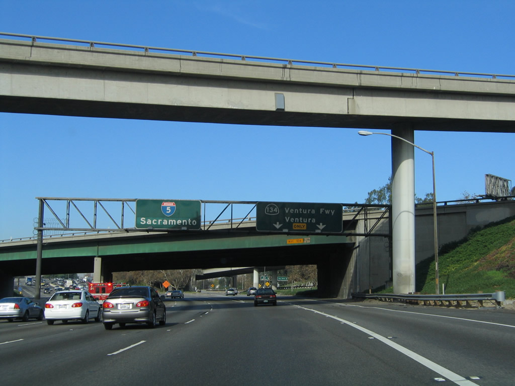
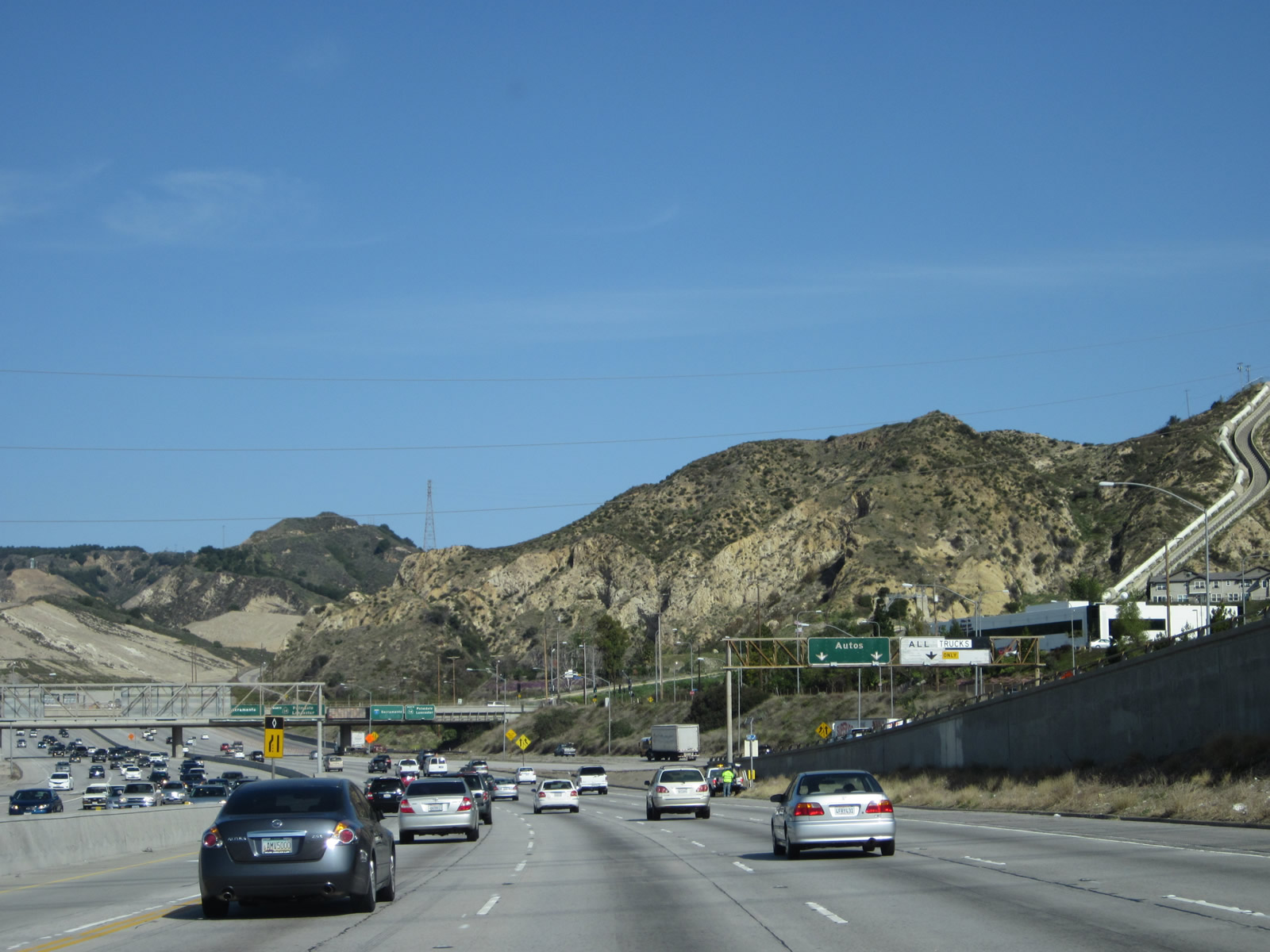
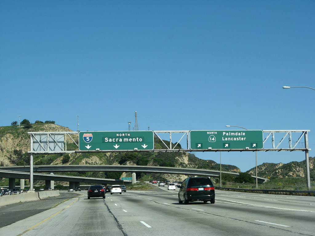
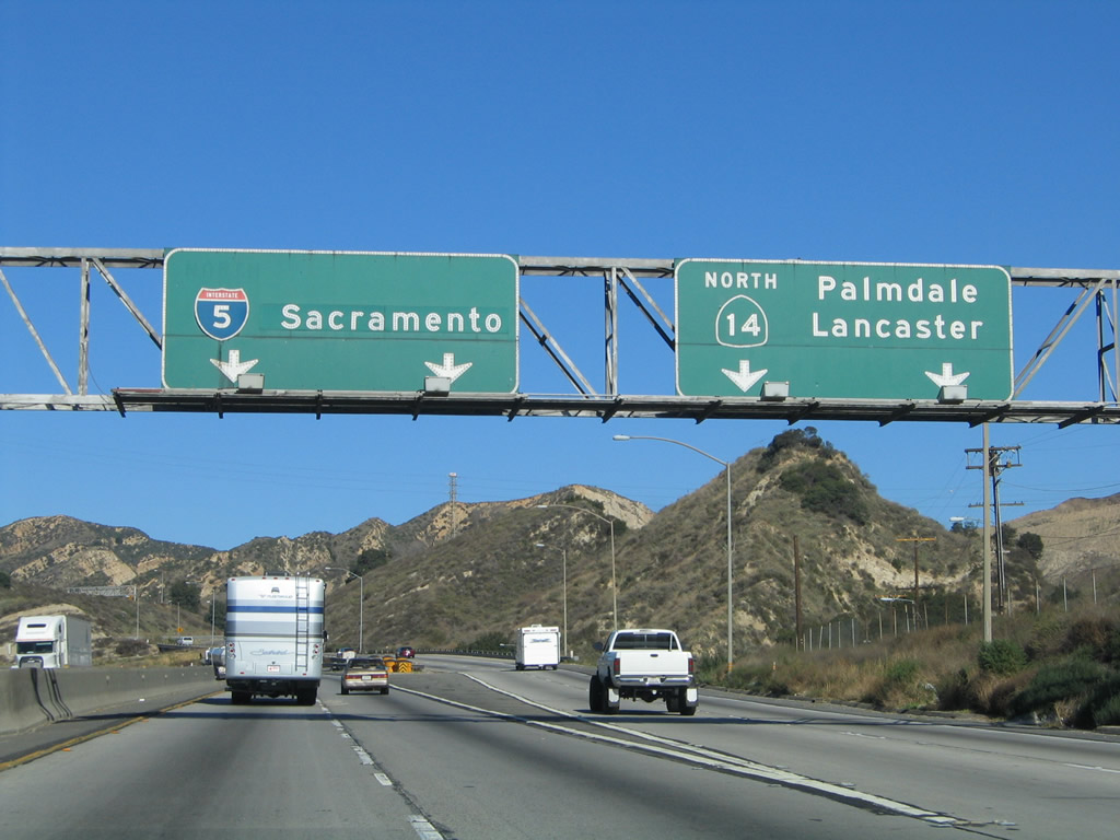
Nearing the top of Newhall Pass, the auto lanes of Interstate 5 north split with California 14 at Exit 162. This marks the point where historically U.S. 6 and U.S. 99 split apart after passing through the San Fernando Valley together. U.S. 6 used to follow the California 14 corridor northeast toward Palmdale, Lancaster, and Mojave, while U.S. 99 used to generally follow the Interstate 5 corridor north toward Castaic, Tejon Pass, and the Grapevine. At Wheeler Ridge, U.S. 99 used to continue along California 99 toward Bakersfield, while Interstate 5 follows the Westside Highway toward Coalinga, Tracy, and Sacramento. Both U.S. 6 and U.S. 99 were legislatively decommissioned in 1964, but U.S. 99 remained as signed route in various parts of California until the early 1970s. Historic shields for both routes are found on selected old alignments, including U.S. 6 in Lancaster-Palmdale and U.S. 99 in Indio, Los Angeles, and Calexico. The green overlay for the control city "Sacramento" covers "Bakersfield," which used to be the northbound control city for Interstate 5 north leaving Los Angeles. Photo taken 03/15/08. |
|
Looking again at the 2012 construction of the future HOV lane connection between northbound Interstate 5 and northbound California 14, the three remaining main lanes for Interstate 5 north pass under the temporary wooden and metal structure en route to Santa Clarita. Photo taken 04/06/12. |
|
The three northbound lanes of Interstate 5 (Golden State Freeway) (auto lanes) passes through the Newhall Pass interchange. This interchange suffered in the San Fernando Earthquake (6.6 on the Richter scale on February 9, 1971) and again in the Northridge Earthquake (6.7 on the Richter scale on January 17, 1994). In the latter quake, a City of Los Angeles Police Department motorcycle officer (Clarence W. Dean) was on a transition flyover ramp, and the ramp collapsed before he had time to stop in the dark pre-dawn hours. Sadly, he perished when he fell off the ramp. Photo taken 11/28/02. |
|
Passing through the interchange, the auto lanes of Interstate 5 (Golden State Freeway) north maintains three lanes after the California 14 split. Photo taken 03/15/08. |
|
As the auto lanes and truck lanes merge back together, Interstate 5 north has four lanes. Photo taken 10/07/06. |
|
The truck bypass lanes will merge back with the auto lanes of northbound Interstate 5 (Golden State Freeway) after passing through the Newhall Pass interchange. Photo taken 06/28/06. |
|
Interstate 5 will again see four northbound lanes soon thereafter. Ahead is Santa Clarita. Photo taken 04/06/12. |
| Interstate 5 (Golden State Freeway) Truck Bypass LANES north |
|
The truck lanes remain to the east of the automobile lanes and carry two through lanes. The overpass above carries traffic transitioning from Interstate 210 west to Interstate 5 north. Photo taken 10/07/06. |
|
Traffic from Interstate 210 will merge onto the truck lanes from the left. Photo taken 10/07/06. |
|
This sign bridge, located on the Interstate 210 transition ramp to Interstate 5 north, allows vehicles to use either the auto lanes or truck lanes. Note that slow moving vehicles may use the truck lanes, even if the vehicle is not a truck. Photo taken 11/25/04. |
|
This view shows the two sets of travel lanes and nearly identical signage between the Auto Lanes and the Truck Bypass Lanes after the merge with traffic from Interstate 210. The next exit is Exit 162, California 14 (Antelope Valley Freeway) north to Palmdale, Lancaster, Mojave, and Bishop. Photo taken 11/25/04. |
|
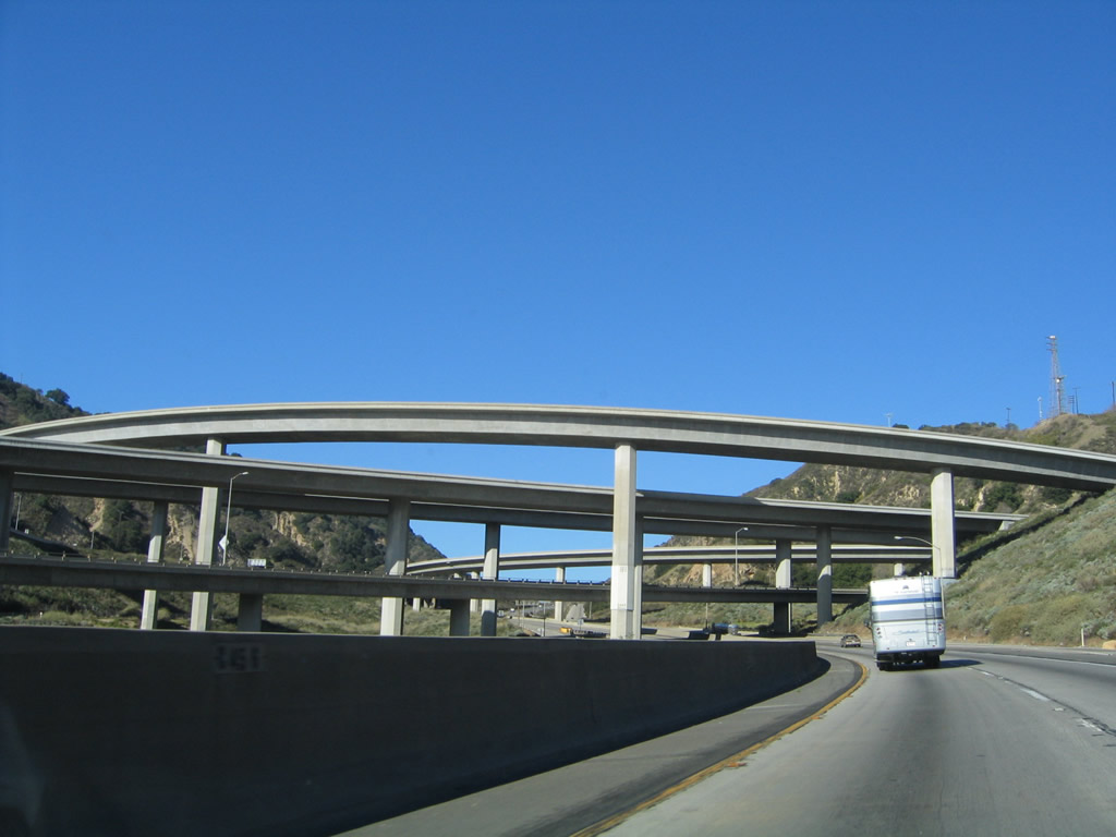
The massive Newhall Pass interchange comes into focus as the truck bypass lanes separate completely from the auto lanes. The truck bypass lanes form a separate four-lane freeway alignment, with wide shoulders on either side. Photo taken 10/07/06. |
|
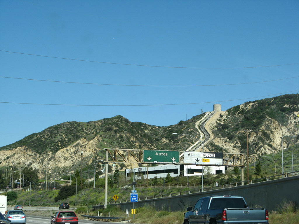
The northbound truck bypass lanes widen out to three lanes. The right lane becomes exit only for California 14 (Antelope Valley Freeway) north to Palmdale, Lancaster, Mojave, and Bishop. The left two lanes continue north on Interstate 5 (Golden State Freeway). Photo taken 10/07/06. |
|
Perhaps the best view of the Newhall Pass interchange is seen from the truck lanes, which pass at ground level through the interchange before rejoining the auto lanes just north of the interchange. Photo taken 11/25/04. |
|
Northbound Interstate 5 and California 14 truck lanes split at this point. The right two lanes transition over to California 14 north and the left two lanes continue north on Interstate 5. Photo taken 11/25/04. |
|
|
The truck bypass lanes travel near the bottom of the Newhall Pass Interchange, offering views of the massive stack interchange that was built in 1971 yet had failing components in the 1971 and 1994 earthquakes. After passing through the interchange, the truck lanes prepare to merge back onto the auto lanes on the north side of the interchange. Photos taken 11/25/04. |
Page Updated September 16, 2012.