| Interstate 5 north |
|
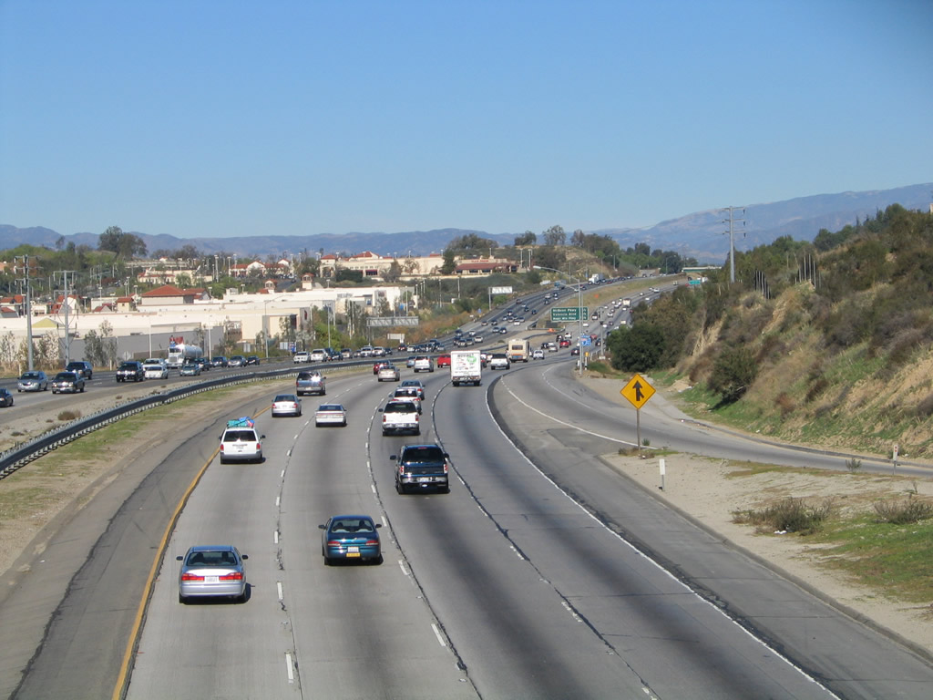
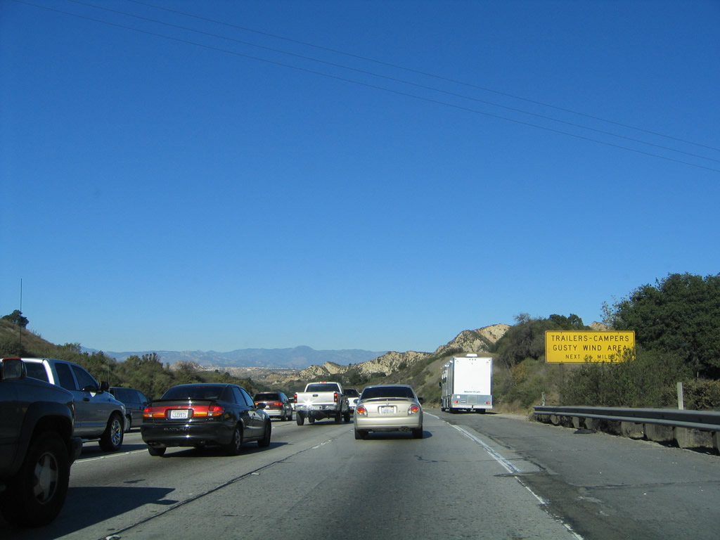
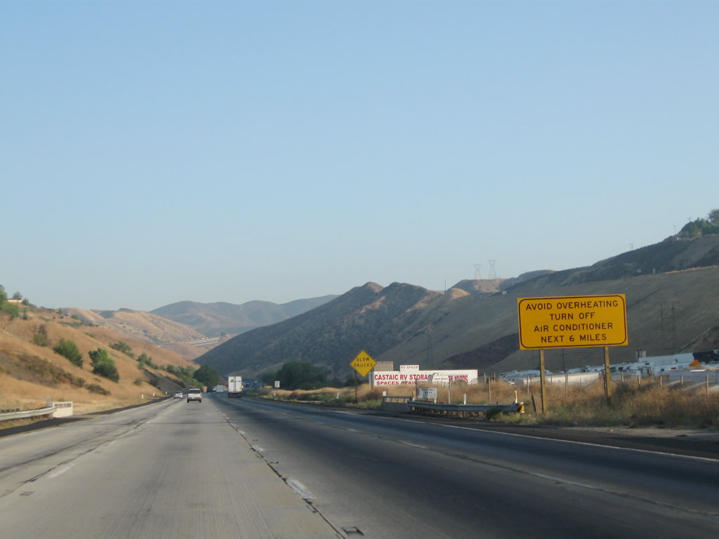
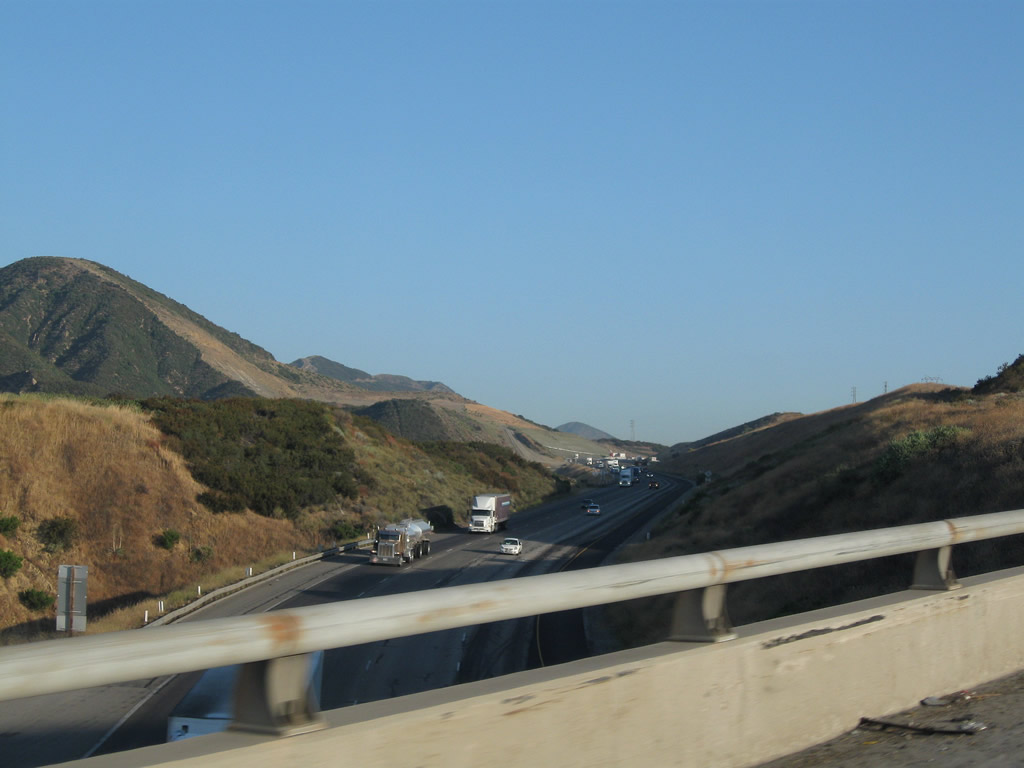
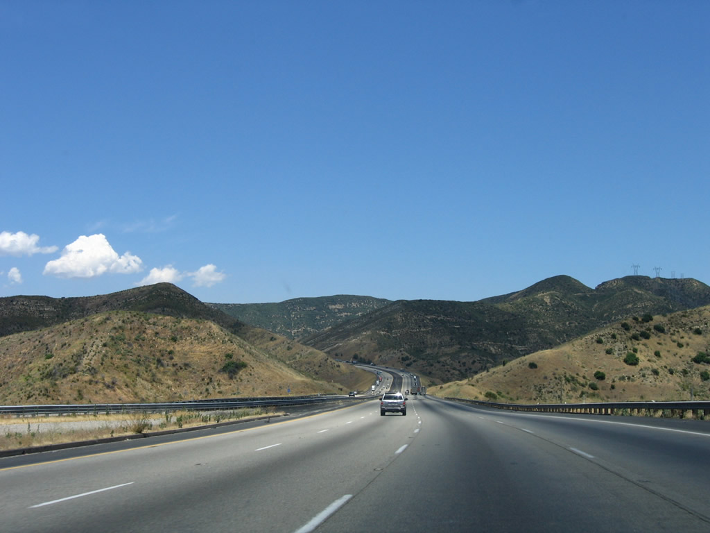
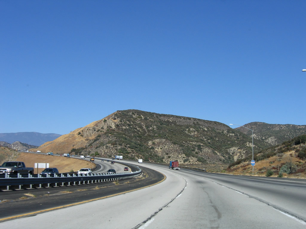
After the massive California 14 interchange, Interstate 5 crosses Newhall Pass. This sign warns of potentially strong winds along Interstate 5 for the next 56 miles (basically from Newhall Pass through Castaic and Violin Summit to Tejon Pass, the Grapevine, and the Central Valley). Photo taken 11/25/04. |
|
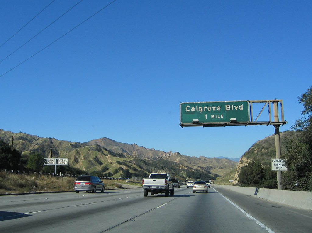
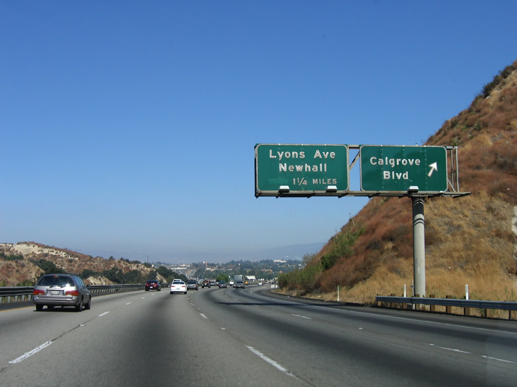
The next exit along Interstate 5 north is Exit 166, Calgrove Boulevard. Photo taken 11/25/04. |
|
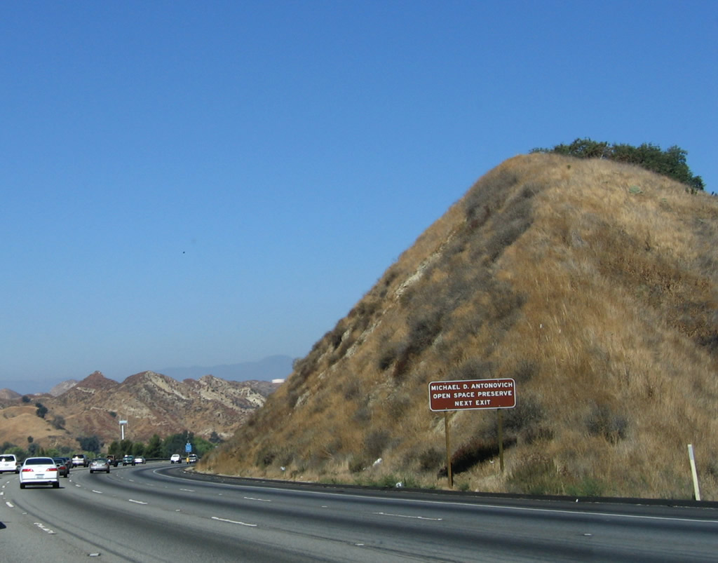
Use Exit 166 (Calgrove Boulevard) to Michael D. Antonovich Open Space Preserve. Dedicated on August 12, 2002, the 500-acre park is part of the larger 4,000-acre Santa Clarita Woodlands Park. The park is managed by the Mountains Recreation and Conservation Authority (MRCA). Photo taken 10/07/06. |
|
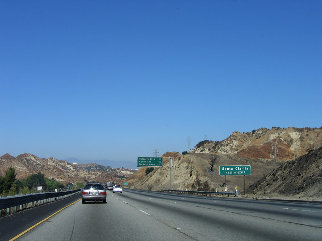
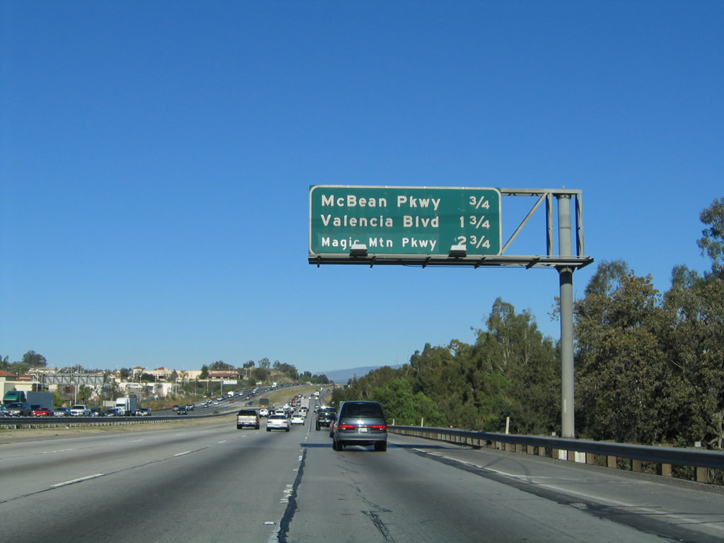
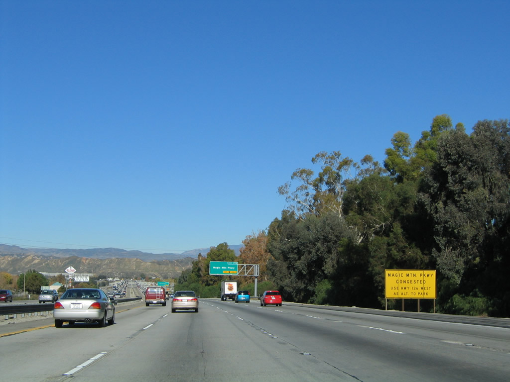
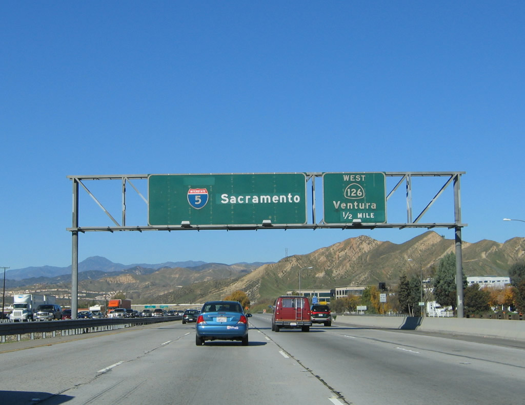
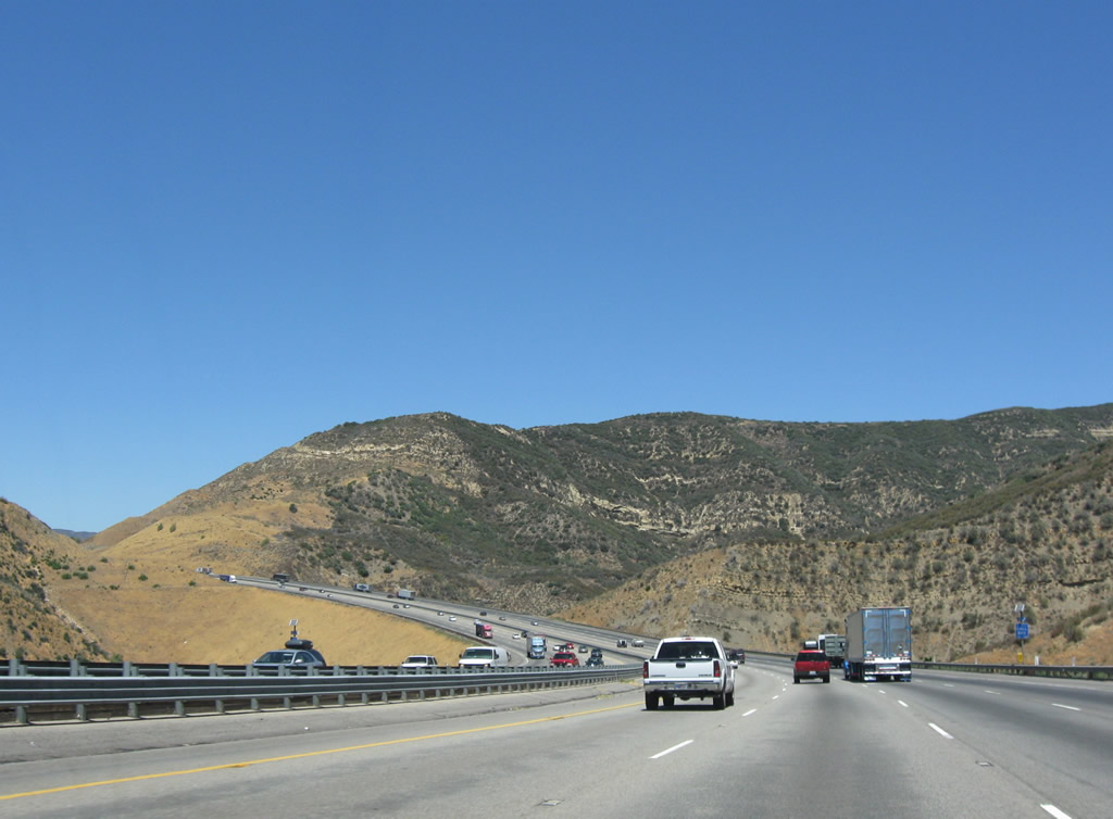
The next six exits serve the city of Santa Clarita: Exit 166, Calgrove Blvd; Exit 167, Lyons Avenue and Pico Canyon Road; Exit 168, McBean Parkway; Exit 169, Valencia Boulevard; Exit 170, Magic Mountain Parkway; and Exit 172, California 126 (Henry Mayo Drive) west to Ventura and Newhall Ranch Road east to Santa Clarita. Photo taken 10/07/06. |
|
|
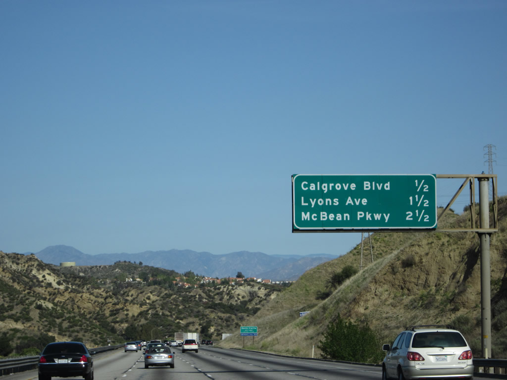
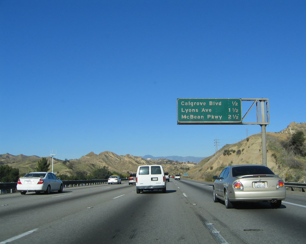
This milage sign provides the distance to the next three exits: Exit 166, Calgrove Blvd; Exit 167, Lyons Avenue and Pico Canyon Road; and Exit 168, McBean Parkway. Photos taken 04/06/12 and 11/25/04. |
|
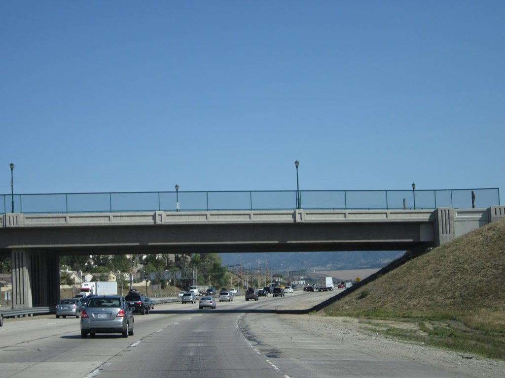
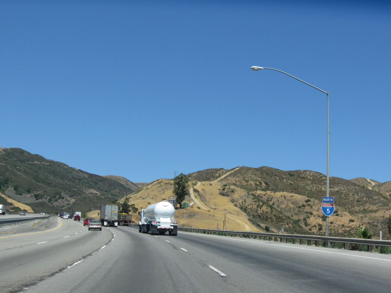
Now entering the northernmost suburb of the Los Angeles area along the Interstate 5 corridor, the Golden State Freeway 5 enters the city of Santa Clarita, which has grown substantially through the 1980s, 1990s, and 2000s as it has annexed nearby lands to create more suburban living. With the creation of new housing tracts in formerly rural areas, large tract home developments and commercial areas have grown along with traffic congestion. Originally built as a through route, Interstate 5 has taken on the role of commuter route to carry people from their homes in Santa Clarita and nearby ranch tract developments to their jobs in Los Angeles. Photo taken 10/07/06. |
|
Northbound Interstate 5 (Golden State Freeway) reaches Exit 166, Calgrove Boulevard. Photo taken 10/07/06. |
|
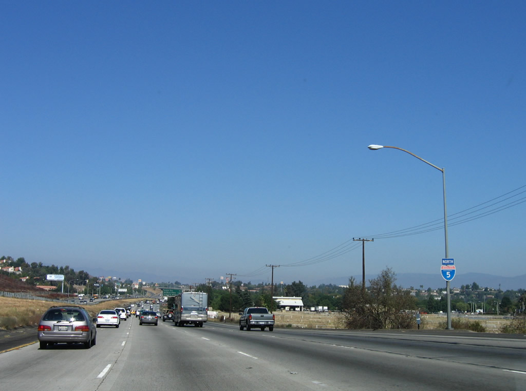
This reassurance shield for Interstate 5 north is posted after the on-ramp from Calgrove Boulevard. Photo taken 10/07/06. |
|
A mileage sign along northbound Interstate 5 (Golden State Freeway) provides the distance to the next three exits: Exit 167, Lyons Avenue; Exit 168, McBean Parkway; and Exit 169, Valencia Boulevard. This is a very old, porcelain enamel sign. Photo taken 10/07/06. |
|
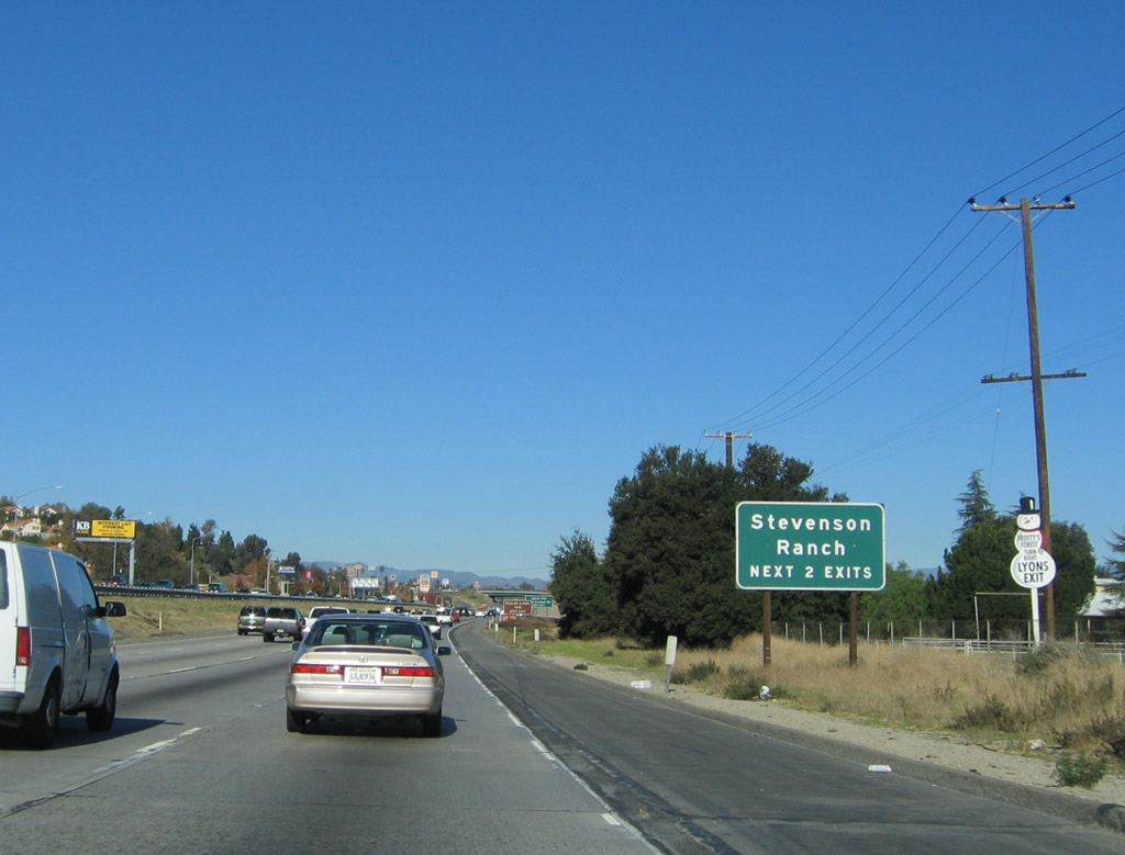
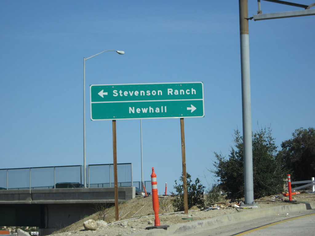
Both Exit 167, Lyons Avenue/Pico Canyon Road and Exit 168, McBean Parkway connect to Stevenson Ranch, an unincorporated community located east of Interstate 5. Photo taken 11/25/04. |
|
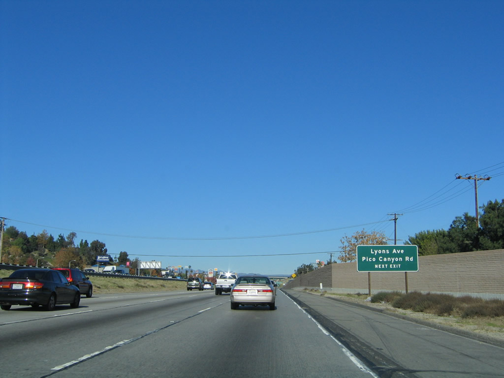
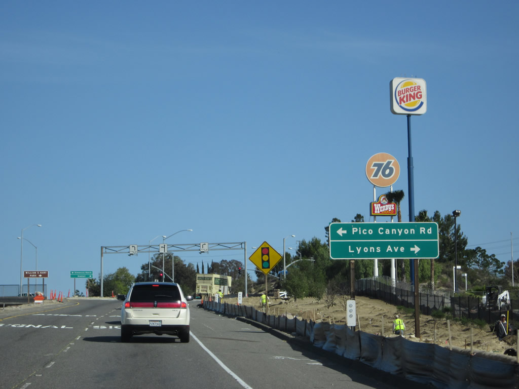
A roadside sign for Exit 167, Lyons Avenue east to Santa Clarita and Pico Canyon Road west to Stevenson Ranch is posted shortly thereafter. Photo taken 11/25/04. |
|
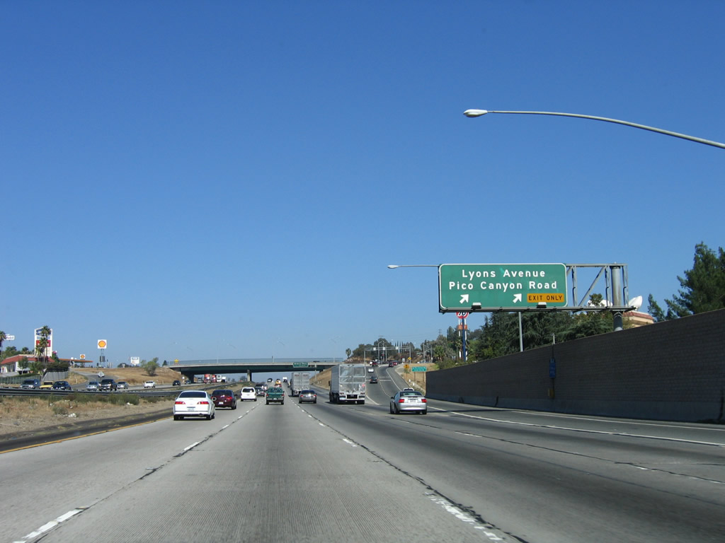
Northbound Interstate 5 (Golden State Freeway) reaches Exit 167, Lyons Avenue/Pico Canyon Road. Photo taken 10/07/06. |
|
|
Upon exiting from Interstate 5 north, turn left for Pico Canyon Road west to Stevenson Ranch (unincorporated area) or turn right for Lyons Avenue east to Newhall within the city of Santa Clarita. All motorist services (gas, food, lodging, shopping) is available at or near this interchange. Photos taken 04/06/12. |
|
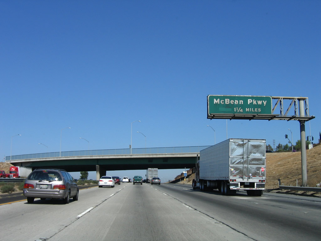
Back on the mainline freeway, the next exit along Interstate 5 north is Exit 168, McBean Parkway (1.25 miles). This guide sign is mounted on the Lyons Avenue and Pico Canyon Road overcrossing. Photo taken 10/07/06. |
|
This mileage sign along northbound Interstate 5 (Golden State Freeway) provides the distance to the next three exits: Exit 168, McBean Parkway; Exit 169, Valencia Boulevard; and Exit 170, Magic Mountain Parkway. Photo taken 11/25/04. |
|
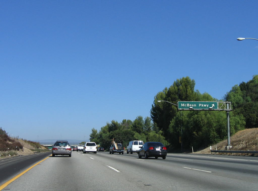
Northbound Interstate 5 (Golden State Freeway) reaches Exit 168, McBean Parkway east to Santa Clarita and west to Stevenson Ranch. Photo taken 10/07/06. |
|
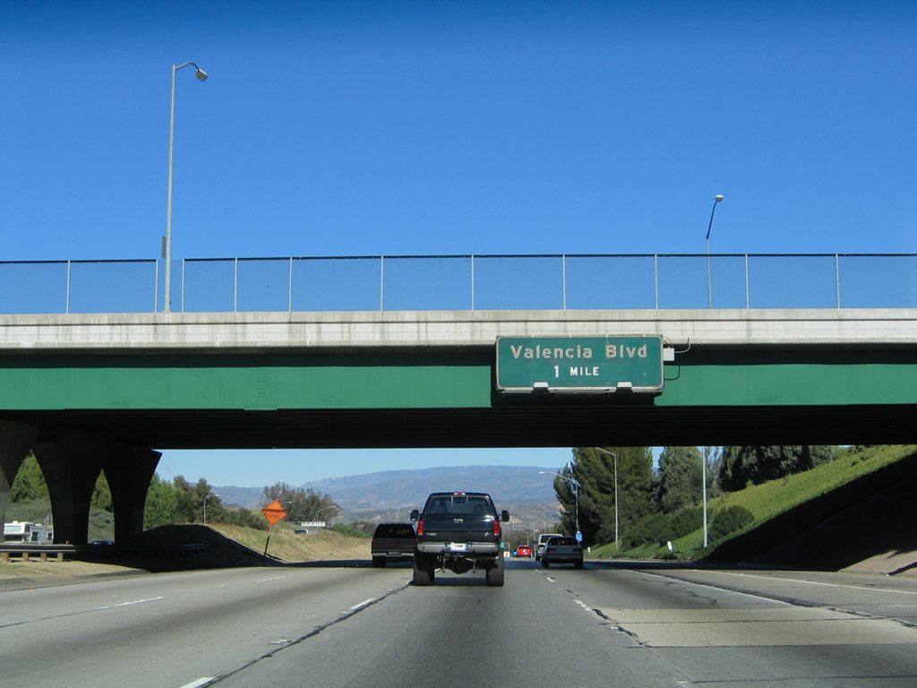
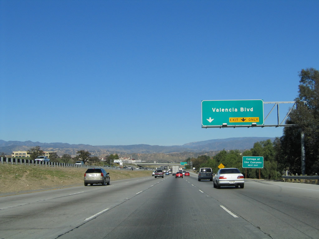
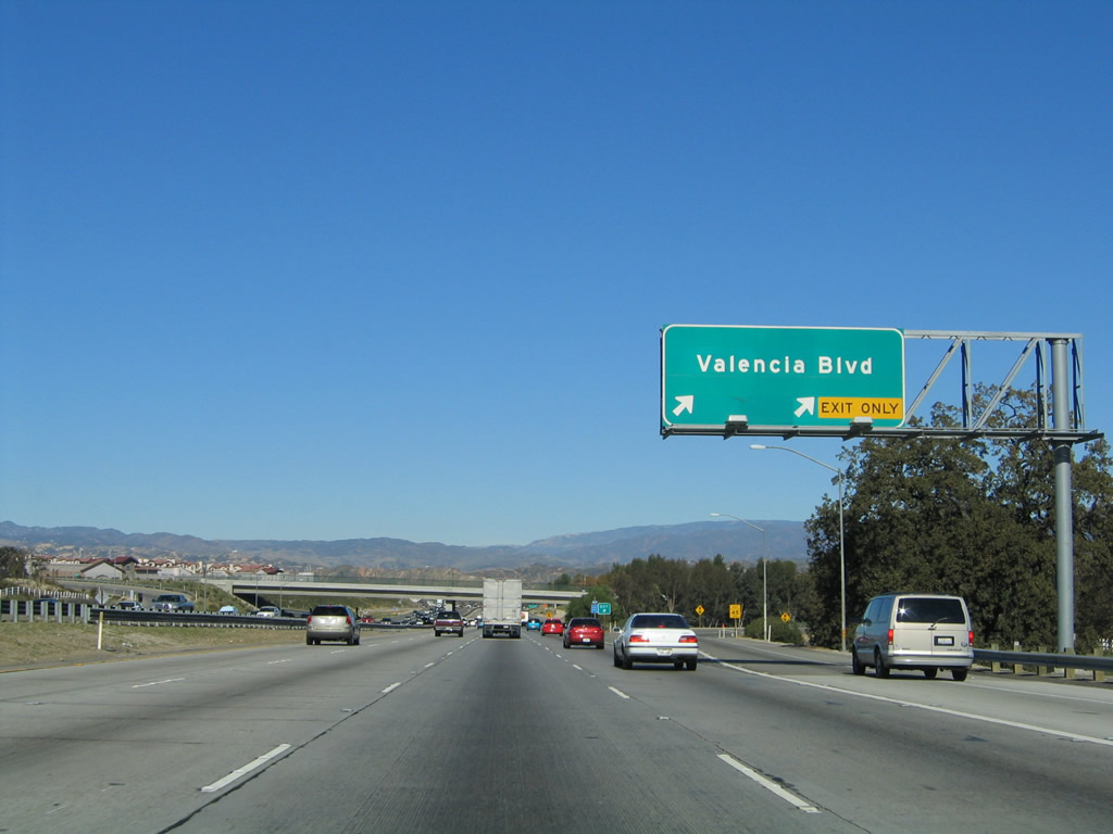
The next exit along Interstate 5 (Golden State Freeway) north is Exit 169, Valencia Boulevard. This sign is mounted on the McBean Parkway overpass. Photo taken 11/25/04. |
|
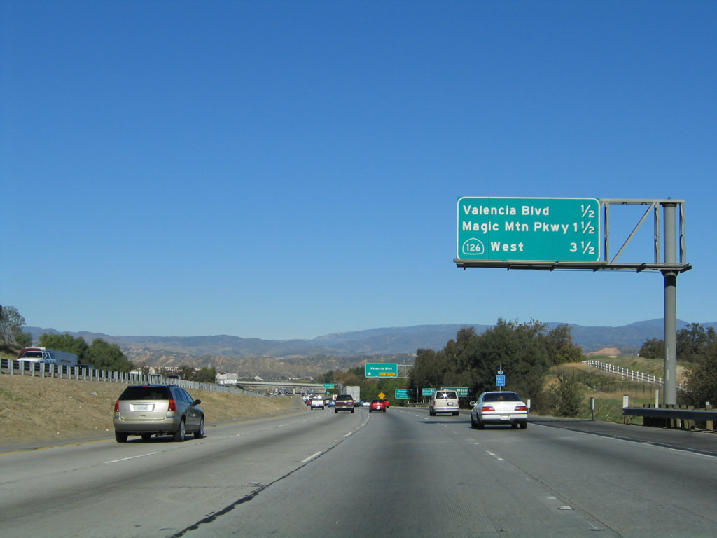
This mileage sign along northbound Interstate 5 (Golden State Freeway) provides the distance to the next three exits: Exit 169, Valencia Boulevard; Exit 170, Magic Mountain Parkway; (Exit 171, Weigh Station,) and Exit 172, California 126 west to Ventura and Newhall Ranch Road east to Santa Clarita. Photo taken 11/25/04. |
|
The right two lanes of Interstate 5 (Golden State Freeway) north will connect to Exit 169, Valencia Boulevard. Use Valencia Parkway east to the Valencia Town Center. At Bouquet Canyon Road, Valencia Parkway changes into Soledad Canyon Road. Photo taken 11/25/04. |
|
Northbound Interstate 5 (Golden State Freeway) reaches Exit 169, Valencia Boulevard. To the west, Valencia Parkway connects with The Old Road, which is a frontage road along the west side of Interstate 5 and offers a connection to Six Flags Magic Mountain amusement park. Photo taken 11/25/04. |
|
|
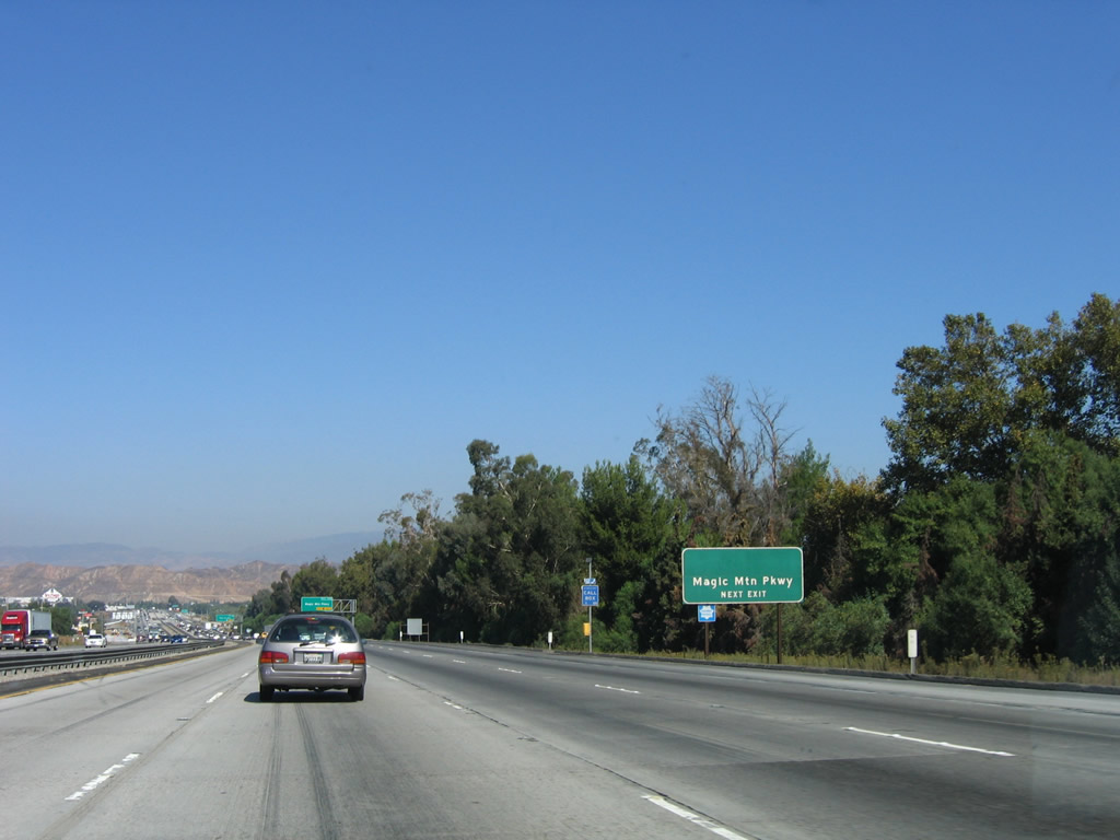
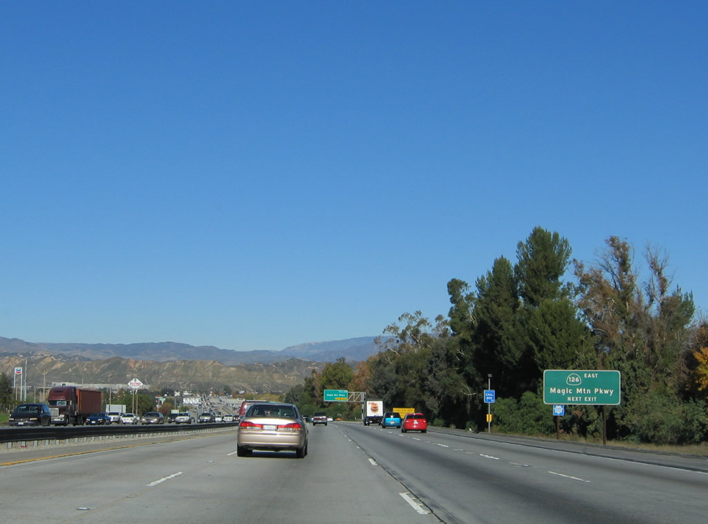
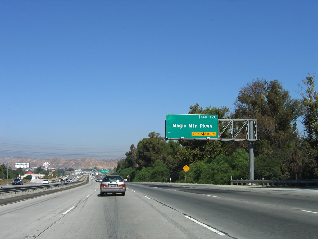
The next exit along northbound Interstate 5 is Exit 170, Magic Mountain Parkway. Until 2006, this sign used to show the former designation of Magic Mountain Parkway as part of an extended California 126. The state route was eliminated from Magic Mountain Parkway and San Fernando Road on September 25, 2003, with a state legislative amendment to the state's Streets and Highways Code. California 126 was determined not to extend east of Interstate 5 when the city of Santa Clarita determined not to construct the proposed freeway alignment of California 126 between Interstate 5 and California 14. The Cross Valley Connector (at Exit 172, see below) is planned as a non-state highway that would connect the two freeways. Photos taken 10/07/06 and 11/25/04. |
|
Due to the popularity of Six Flags Magic Mountain amusement park, congestion can occur on Magic Mountain Parkway. Motorists may choose to use the California 126 west interchange to avoid congestion. Photo taken 11/25/04. |
|
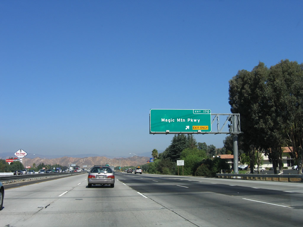
The right lane of Interstate 5 becomes exit only for Exit 170, Magic Mountain Parkway. This sign was placed in 2004. Photo taken 10/07/06. |
|
Northbound Interstate 5 (Golden State Freeway) meets Exit 170, Magic Mountain Parkway. Photo taken 11/25/04. |
|
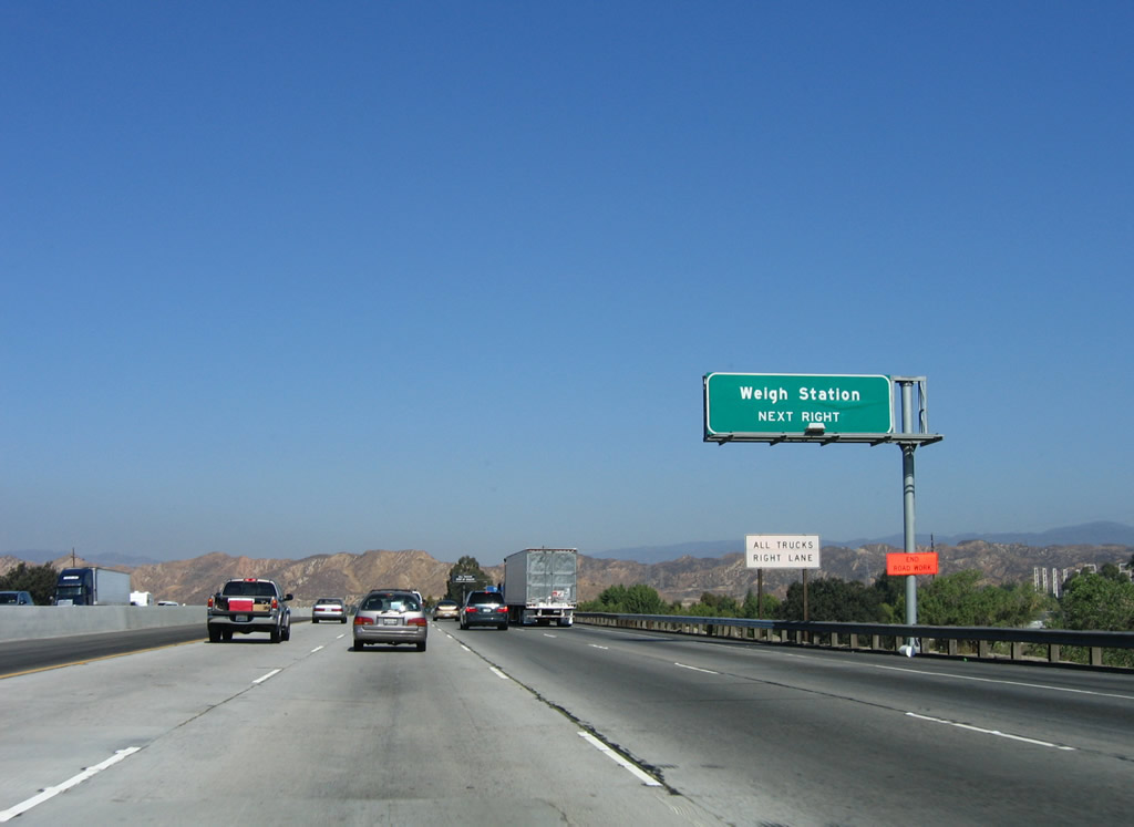
The next two exits along Interstate 5 (Golden State Freeway) north are Exit 171, Weigh Station and Exit 172, California 126 west and Newhall Ranch Road east. Photo taken 10/07/06. |
|
All commercial vehicles must depart the freeway when the truck scales and weigh station are open. Photo taken 10/07/06. |
|
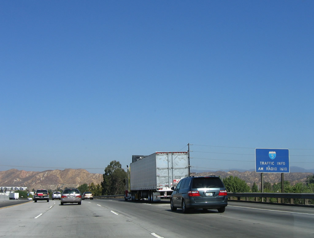
When weather and traffic conditions warrant, tune to AM 1610 for updates on Interstate 5 over Violin Summit (uphill), Tejon Pass (highest point), and the Grapevine (downhill). Photo taken 10/07/06. |
|
Northbound Interstate 5 meets Exit 171, Weigh Station. Photo taken 10/07/06. |
|
|
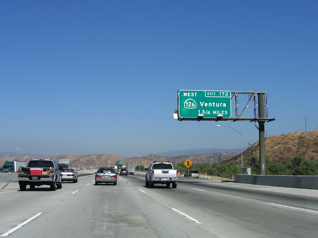
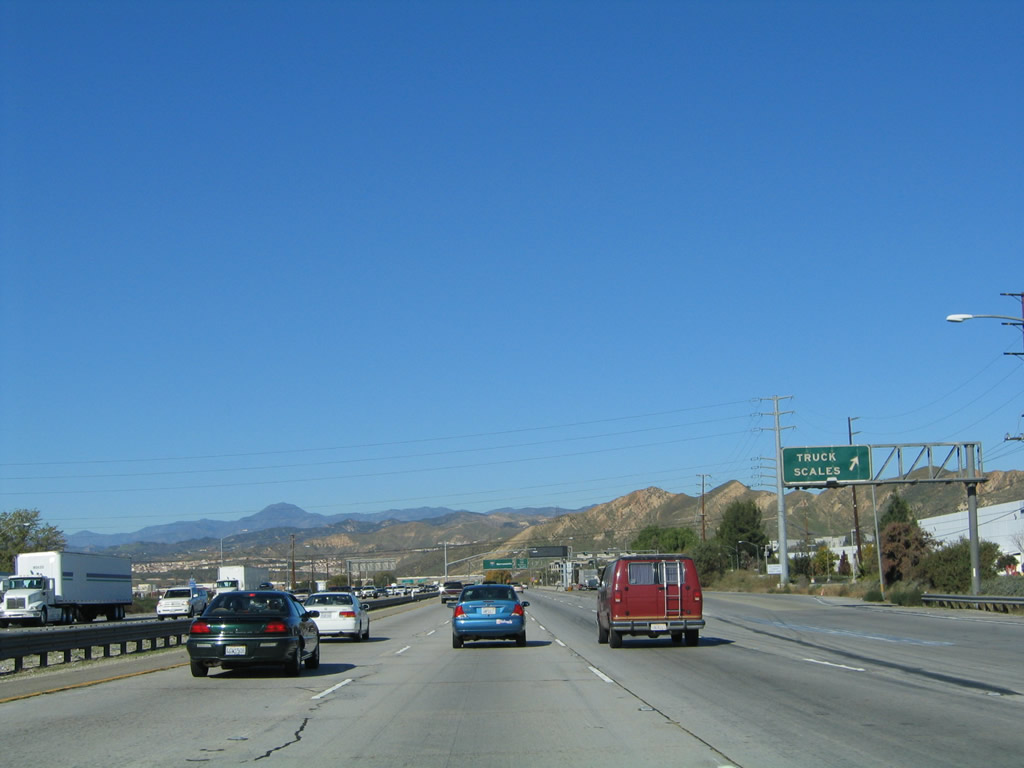
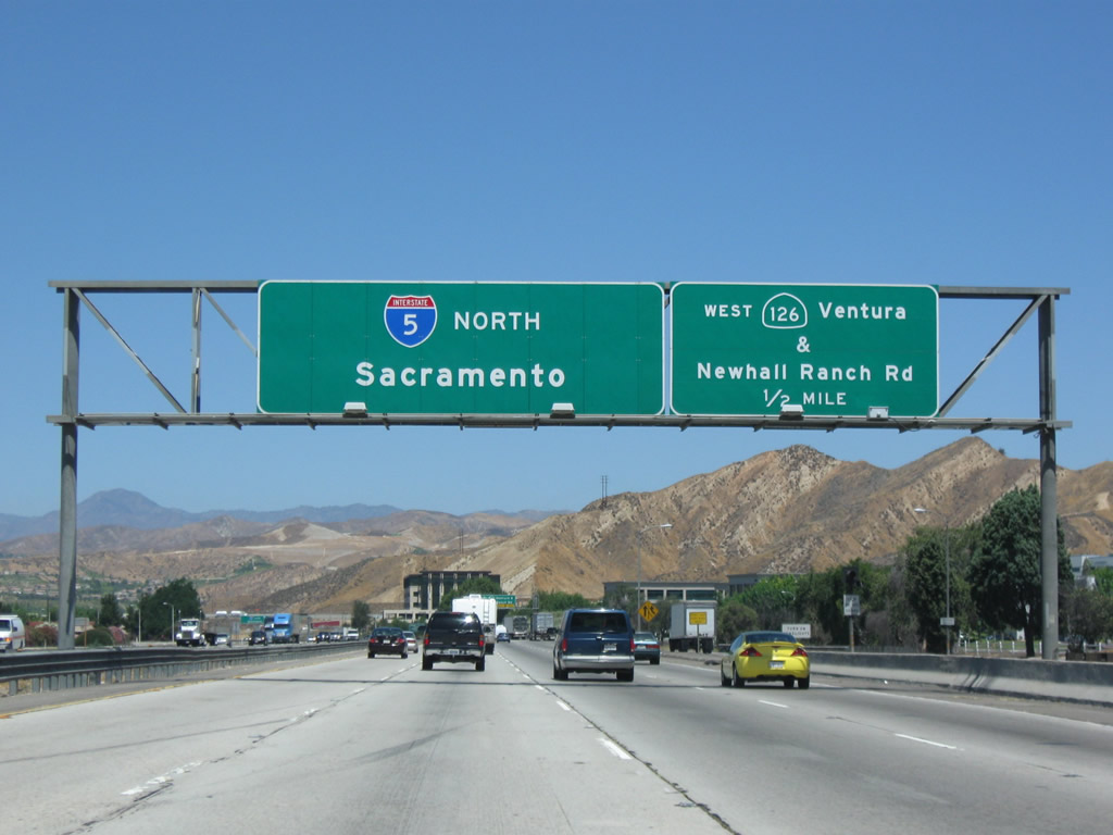
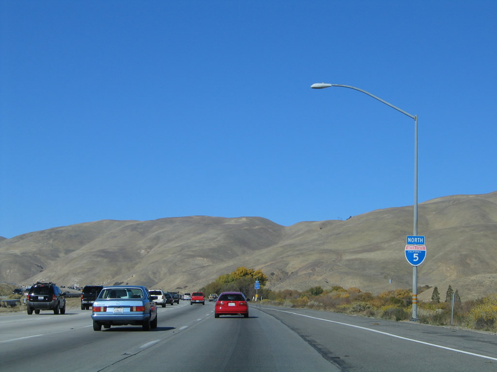
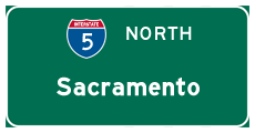
Next to the weigh station, northbound Interstate 5 (Golden State Freeway) next approaches Exit 172, westbound California 126, one-half mile. This old sign features several pieces of overlay on the Interstate 5 reassurance sign: Sacramento covers up the original control city of Bakersfield, and the "NORTH" directional banner has been covered up completely. Photo taken 07/15/09 and 02/15/04. |
|
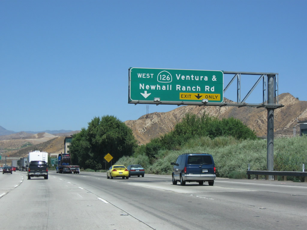
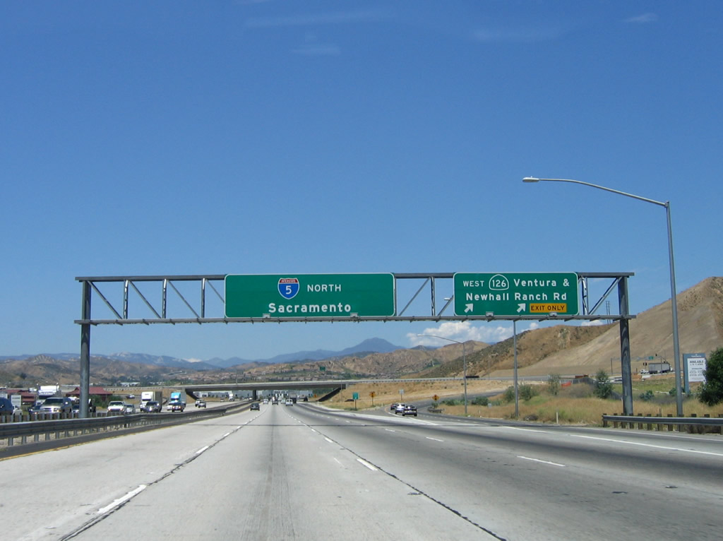
The right two lanes will connect to Exit 172, California 126 west and Newhall Ranch Road (Cross Valley Connector) east. Newhall Ranch Road travels east along the Cross Valley Connector to serve residential areas of Santa Clarita and ultimately connect with California 14. Photo taken 07/15/09. |
|
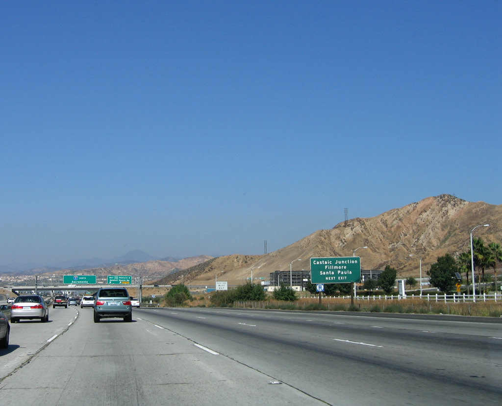
From this interchange, California 126 travels west to Castaic Junction, Fillmore, Santa Paula, and Ventura. Photo taken 10/07/06. |
|
Northbound Interstate 5 (Golden State Freeway) meets Exit 172, California 126 west and Newhall Ranch Road east. At one time, California 126 was considered for upgrade to freeway standards, but opposition and environmental concerns has precluded that for now. However, with the ongoing suburbanization of the foothills, it is likely that an east-west freeway will someday be required. California 126 leads west to Fillmore and Santa Paula before merging with northbound U.S. 101 in Ventura. The western one-quarter of its route is a freeway; the rest of the route is being upgraded to expressway standards. Photo taken 10/07/06. |
|
|
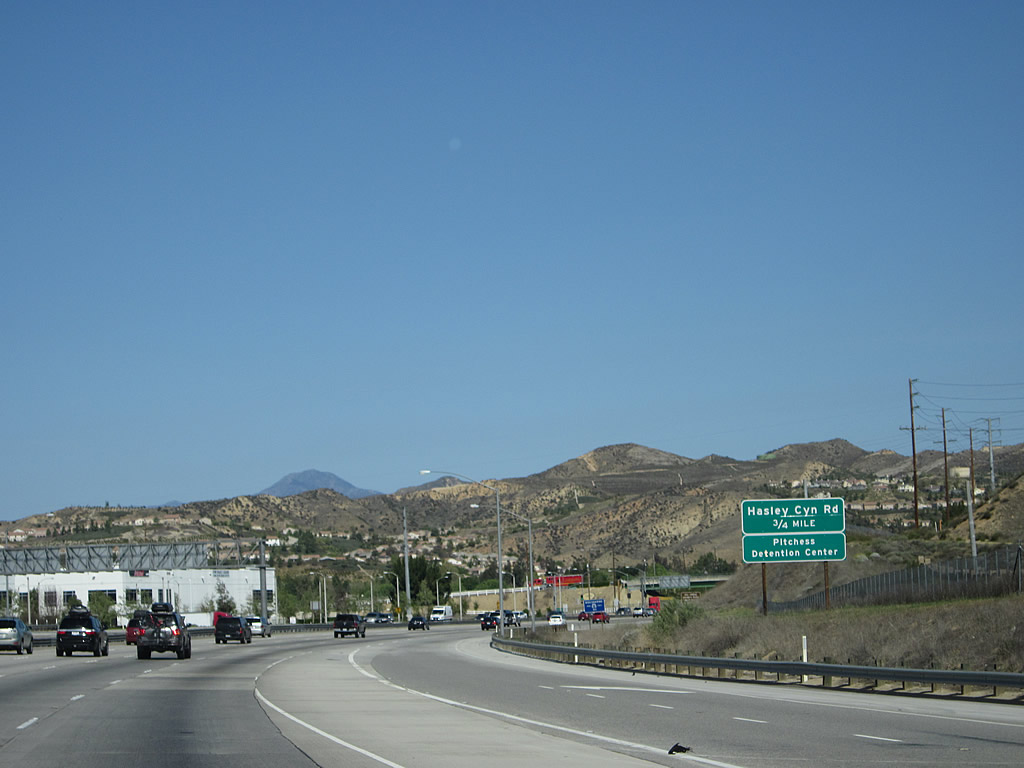
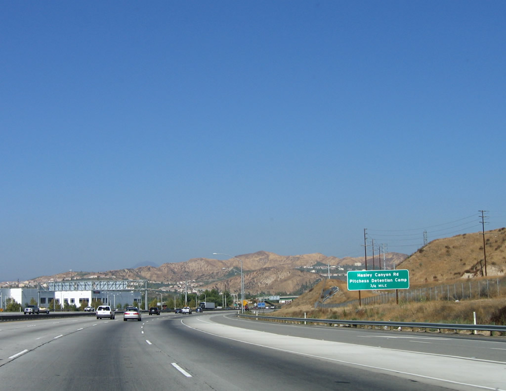
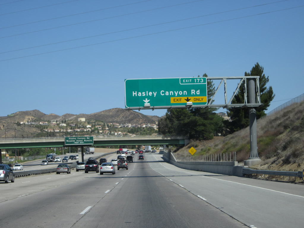
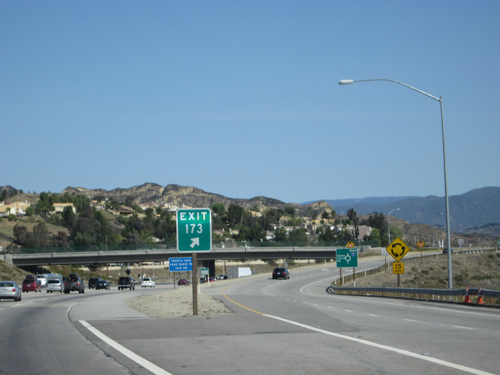
The next exit along Interstate 5 north is Exit 173, Hasley Canyon Road and Wayside Honor Ranchero (Pitchess Detention Camp). Photos taken 04/06/12 and 10/07/06. |
|
|
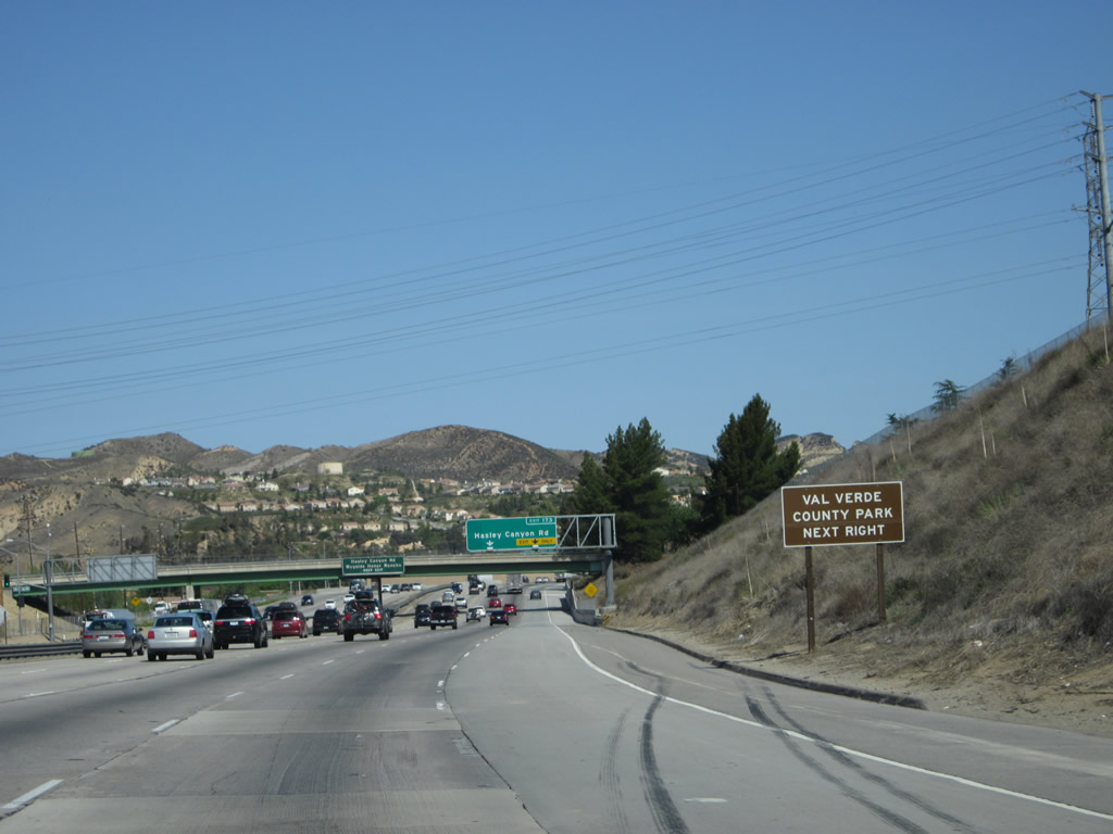
Use Exit 173 (Hasley Canyon Road) to Val Verde County Park. Roadway improvements resulted in the extension of the right lane all the way to the Exit 173 off-ramp. Photos taken 04/06/12 and 10/07/06. |
|
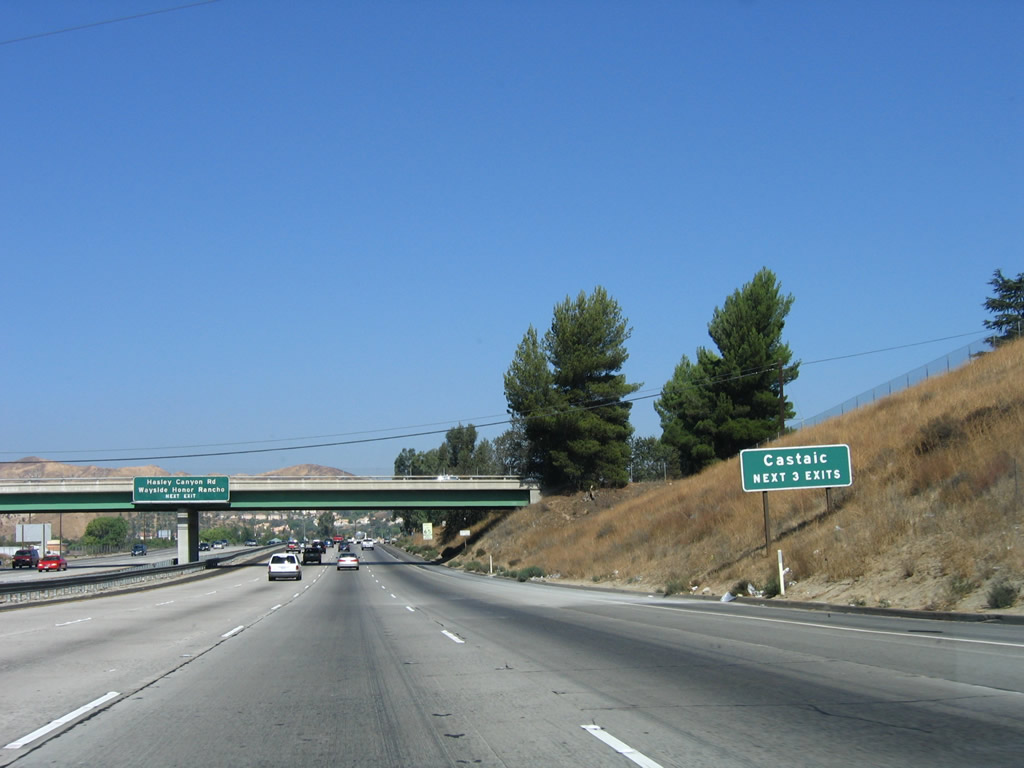
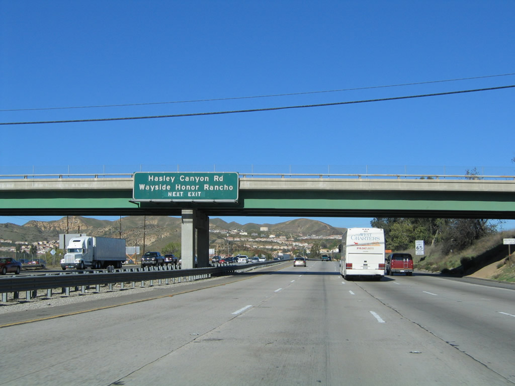
The next three exits serve the community of Castaic: Exit 173, Hasley Canyon Road and L.A. County Pitchess Detention Center (Wayside Honor Ranchero); Exit 176A, Parker Road; and Exit 176B, Lake Hughes Road and Castaic Lake. This sign was gone by 2011, having been replaced by the overhead lane allocation sign. Photo taken 10/07/06. |
|
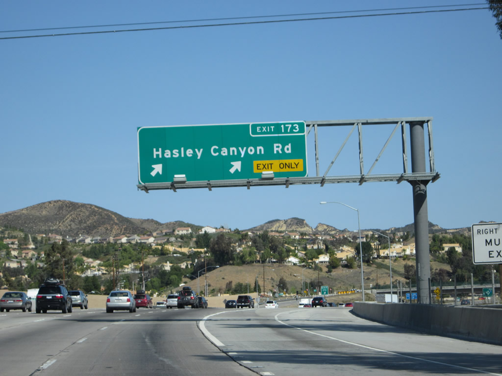
The right two lanes will connect to Exit 173, Hasley Canyon Road. This interchange was upgraded to accommodate a new residential development built in the late 2000s and early 2010s west of Interstate 5. Photo taken 04/06/12. |
|
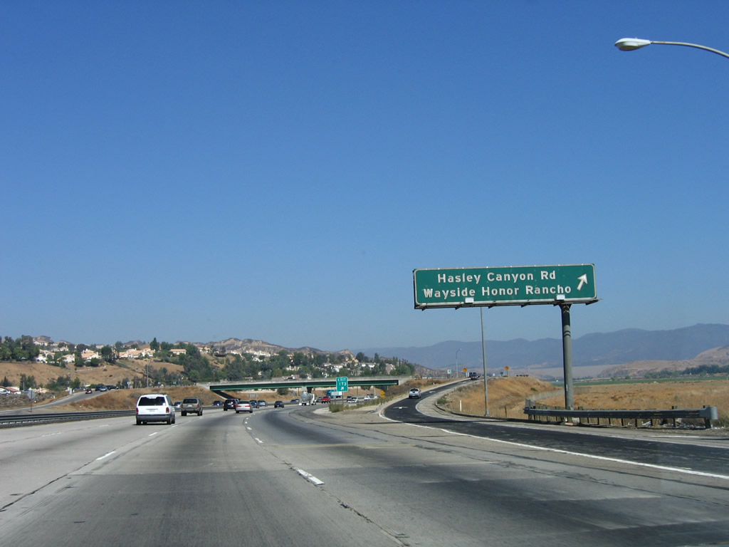
Another sign for Exit 173, Hasley Canyon Road and Pitchess Detention Camp, remains posted on the bridge that carries Biscailuz Drive over Interstate 5. The detention camp is a facility of Los Angeles County. Photo taken 10/07/06. |
|
|
Northbound Interstate 5 (Golden State Freeway) meets Exit 173, Hasley Canyon Road and Pitchess Detention Camp (Wayside Honor Ranchero). Photos taken 04/06/12 and 10/07/06. |
|
|
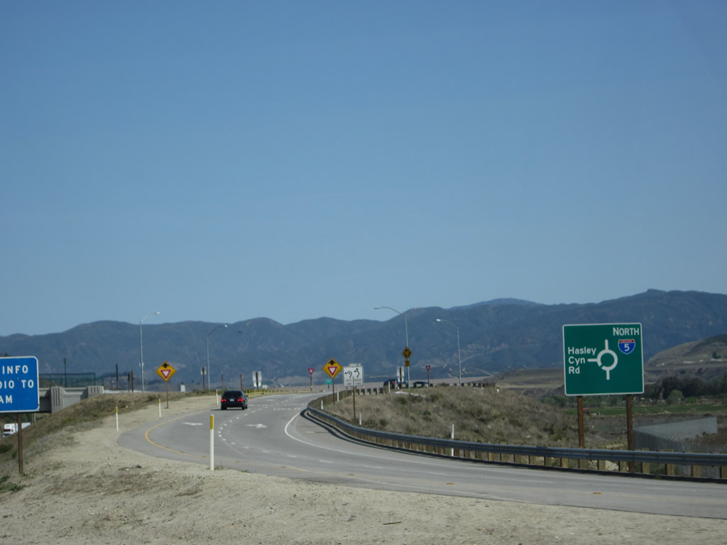
The off-ramp to Exit 173, Hasley Canyon Road leads into a roundabout to facilitate traffic flow. Roundabouts at the end of freeway off-ramps is becoming increasingly common as a way of controlling traffic without using traffic signals. Photos taken 04/06/12. |
|
The Hasley Canyon Road overpass was improved as part of the capacity improvement project at Exit 173. Photo taken 04/06/12. |
|
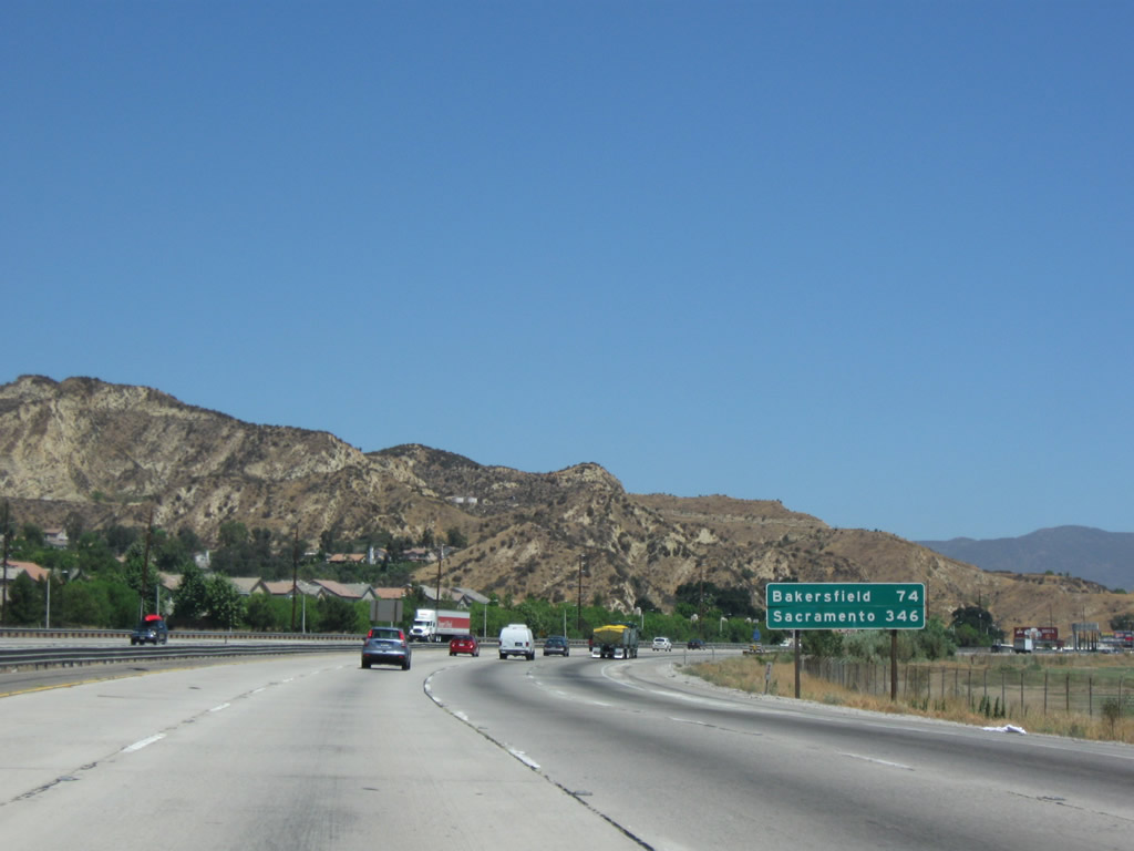
This mileage sign along Interstate 5 (Golden State Freeway) north provides the distance to Bakersfield and Sacramento. There are not many cities along Interstate 5 between here and Sacramento, but there are plenty along the California 99 corridor. Photo taken 07/15/09. |
|
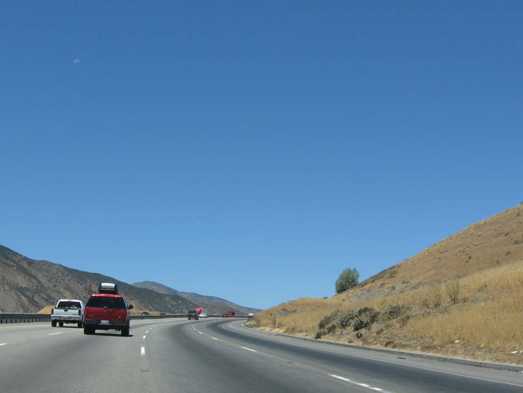
Castaic is the next exit along northbound Interstate 5, and it is the last stop for most services (especially fast food) until the Frazier Park Road exit. Photo taken 10/07/06. |
|
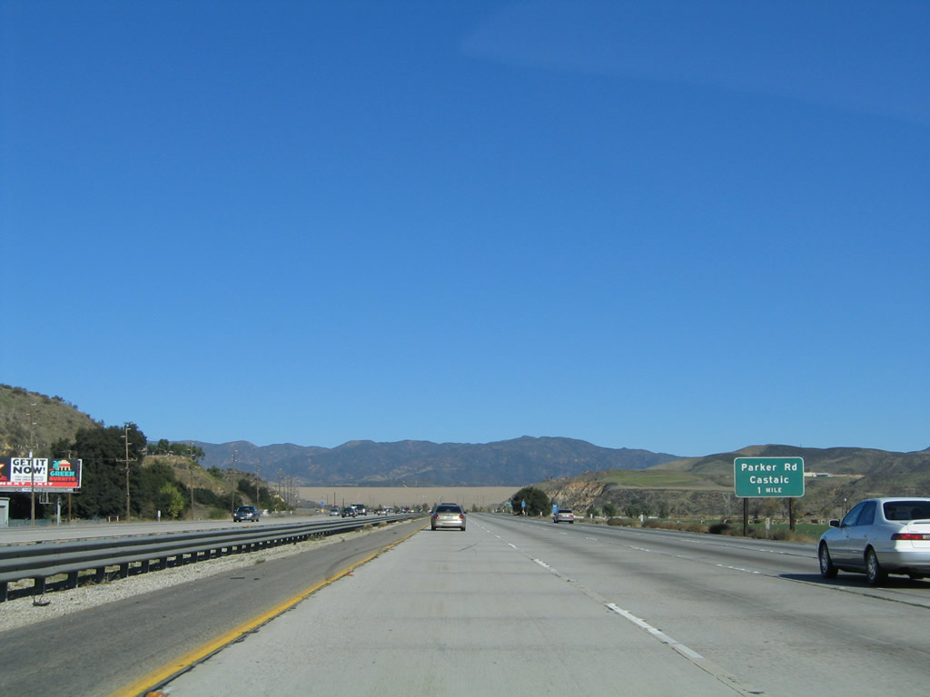
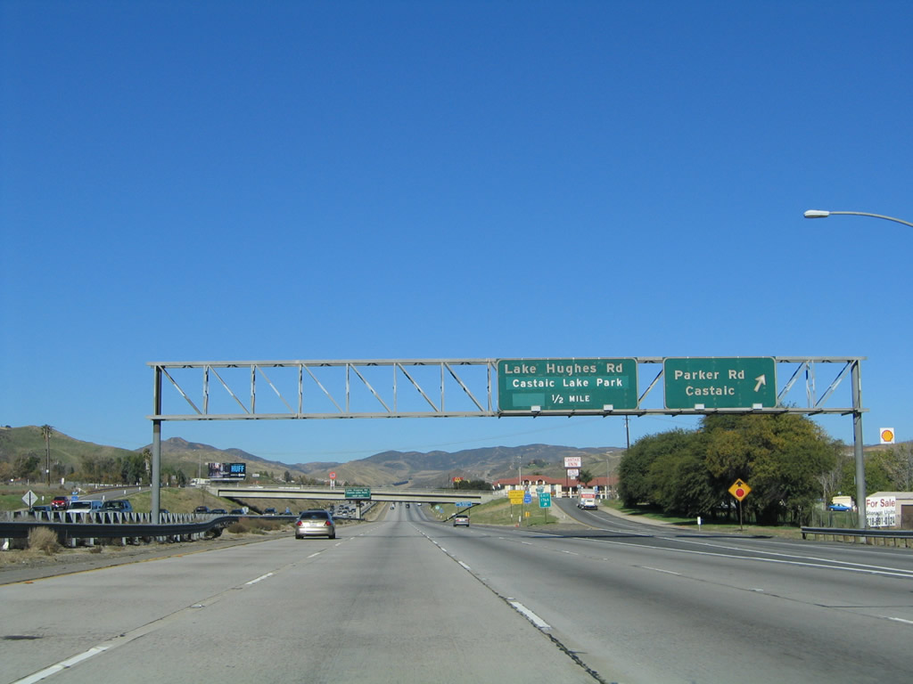
Signs like this would be much less confusing with the implementation of exit numbers. It would be helpful to have the Lake Hughes Road/Castaic Lake exit numbered here as Exit 176B to distinguish that exit from the next exit, Exit 176A, Parker Road. Photo taken 10/07/06. |
|
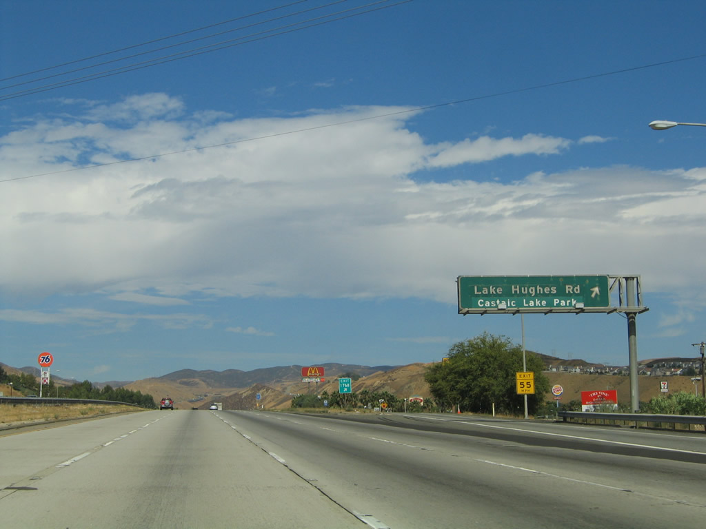
Castaic Lake, held back by the massive Castaic Dam that is visible along this stretch of Interstate 5, has many recreational opportunities including boating and fishing. The lake is accessed via Exit 176B, Lake Hughes Road/Castaic Lake Park. Photo taken 10/07/06. |
|
Northbound Interstate 5 (Golden State Freeway) meets Exit 176A, Parker Road, which leads into Castaic but also connects to one of the most historic routes in Southern California: the Ridge Route. The Ridge Route is the original connection of U.S. 99 over the mountains between Castaic and California 138. Much of the old road remains intact, although many sections are dirt/gravel and may be impassable after storms. For those with an afternoon to investigate old road, the Ridge Route is a must-visit. Photo taken 09/25/05. |
|
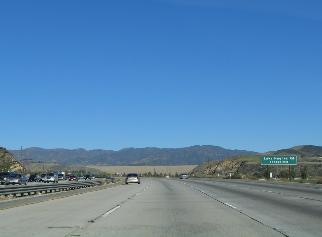
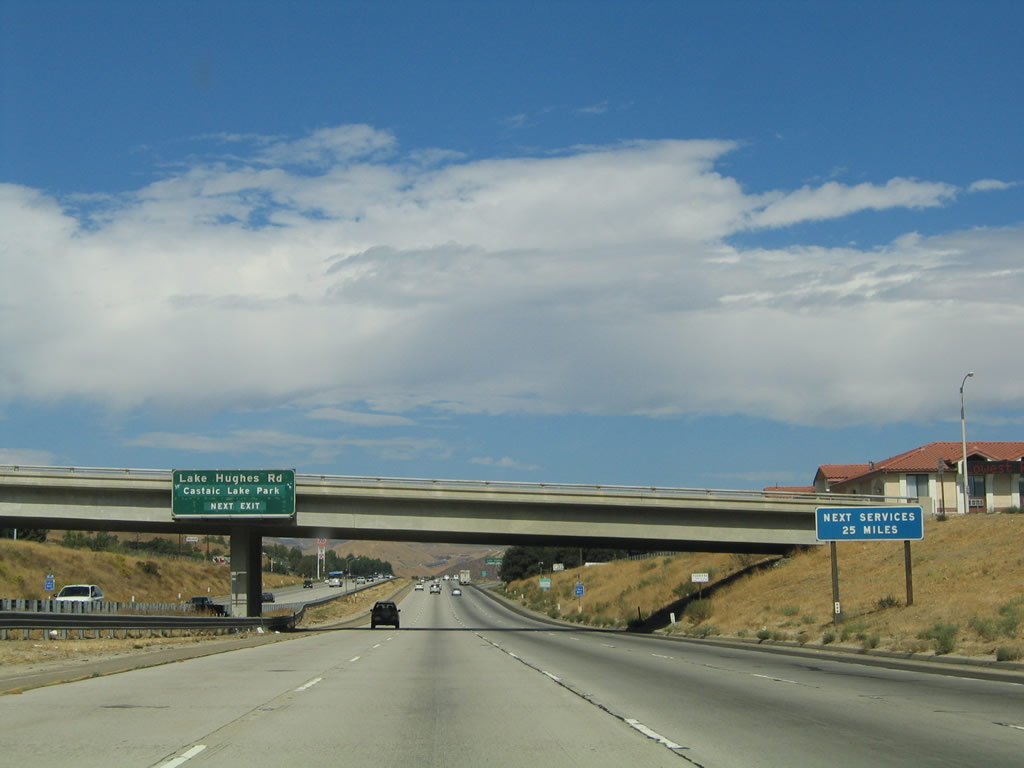
No services are found on Interstate 5 until the Frazier Park Road and Gorman interchanges, a distance of 25 miles. Above the median, an advance sign indicates that the next exit on Interstate 5 (Golden State Freeway) north is Exit 176B, Lake Hughes Road/Castaic Lake Park. Photo taken 09/25/05. |
|
The overhead sign for Exit 176B for Lake Hughes Road and Castaic Lake Park was replaced by 2011, but no exit number was posted. Photo taken 07/30/11. |
|
Northbound Interstate 5 (Golden State Freeway) meets Exit 176B, Lake Hughes Road and Castaic Lake Park. Photo taken 09/25/05. |
|
To allow for an easier upgrade and downgrade on the Castaic Grade up to Violin Summit, northbound Interstate 5 and southbound Interstate 5 change sides so that northbound is on the left and southbound is on the right. The approaching overpass carries southbound traffic over the top of northbound lanes. Photo taken 09/25/05. |
|
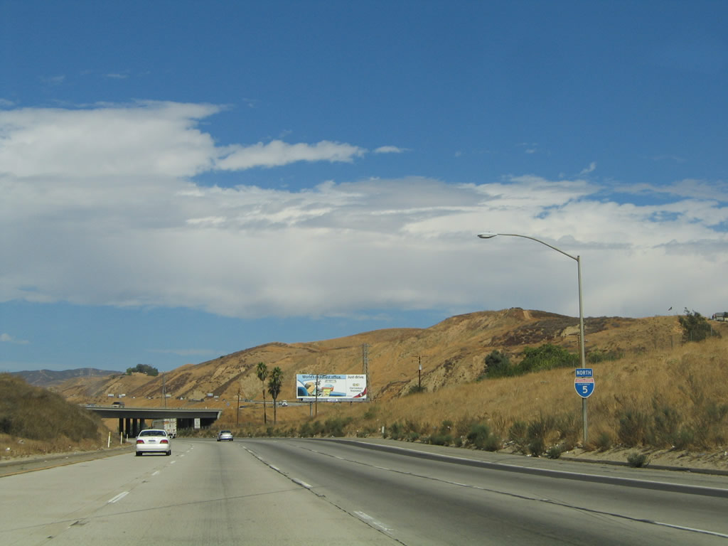
A reassurance shield for Interstate 5 is posted shortly after traffic merges from the Lake Hughes Road on-ramp. The weaving of the northbound and southbound carriageways can be seen ahead. Photo taken 09/25/05. |
|
|
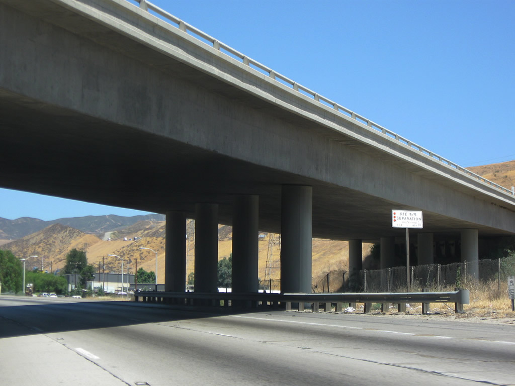
The "Route 5/5 Separation" structure allows northbound Interstate 5 to pass under the southbound lanes. For the next several miles as we climb Violin Summit, the northbound lanes will be west of the southbound lanes. This reversed configuration is uncommon and is typically used to allow for easier uphill grades. Photos taken 07/15/09 and 09/05/05. |
|
"Social intercourse" is served at Rocky's every daily. Very catchy billboard. Photo taken 07/15/09. |
|
|
Interstate 5 (Golden State Freeway) ascends the Castaic Grade in the Tehachapi Mountains. This grade takes the freeway to elevations in excess of 4,000 feet, and the grade that returns Interstate 5 back to near sea level in the Central Valley is the Grapevine, which is located in Kern County. Snow can be common during winter months along Interstate 5. Photos taken 07/30/11 and 09/05/05. |
|
|
For most of the length of Interstate 5 between Exits 176B and 183, the northbound lanes are to the left and southbound lanes are the to right. This configuration allows for easier grades for both directions of traffic given the contour of the landscape. Photos taken 07/15/09 and 09/05/05. |
|
|
The northbound and southbound lanes are separated by nearly a half-mile at certain intervals along the Castaic Grade to Violin Summit. Southbound lanes are visible in the distance in this picture. Photos taken 09/05/05. |
|
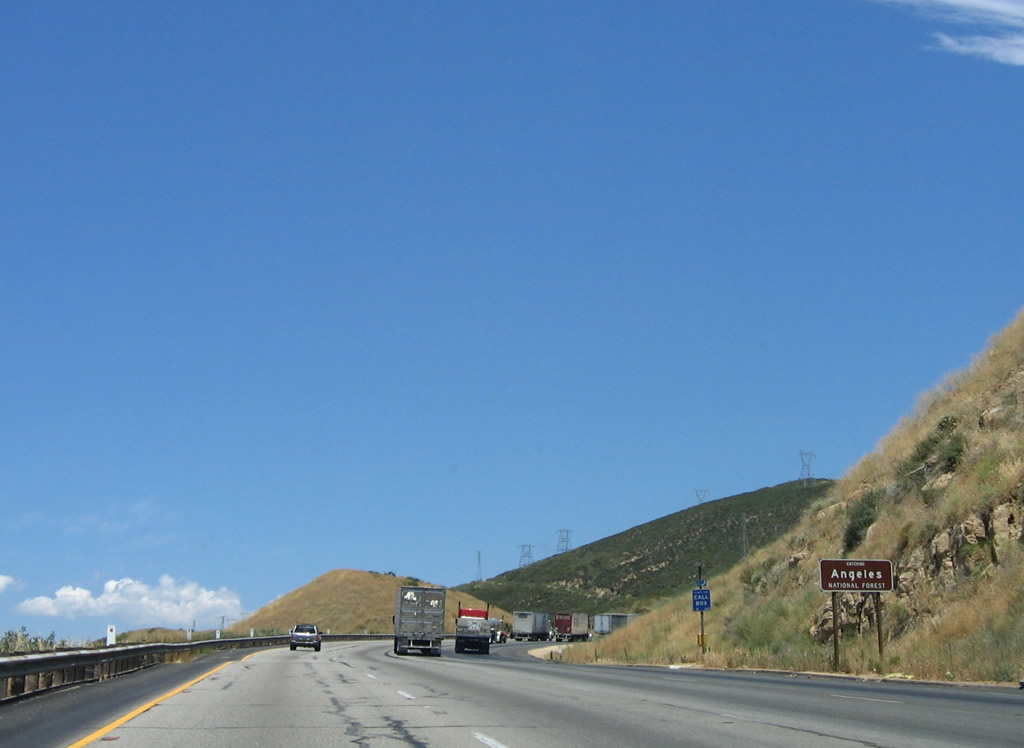
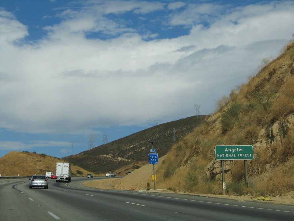
|
The freeway enters Angeles National Forest as Interstate 5 ascends the Castaic Grade to Violin Summit. Photos taken 10/07/06 and 09/25/05. |
|
Northbound Interstate 5 (Golden State Freeway) crosses over the southbound lanes to resume a normal configuration (where the northbound lanes stay to the right of the southbound lanes). Photo taken 07/30/11. |
|
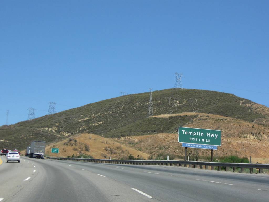
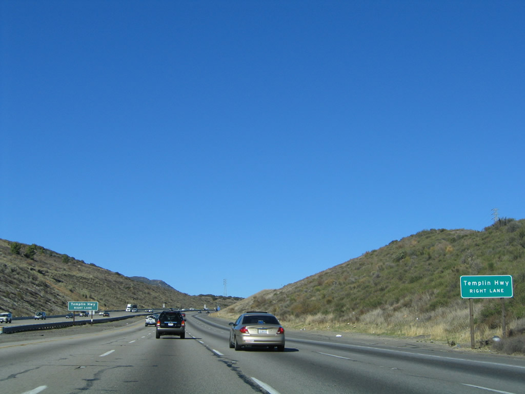
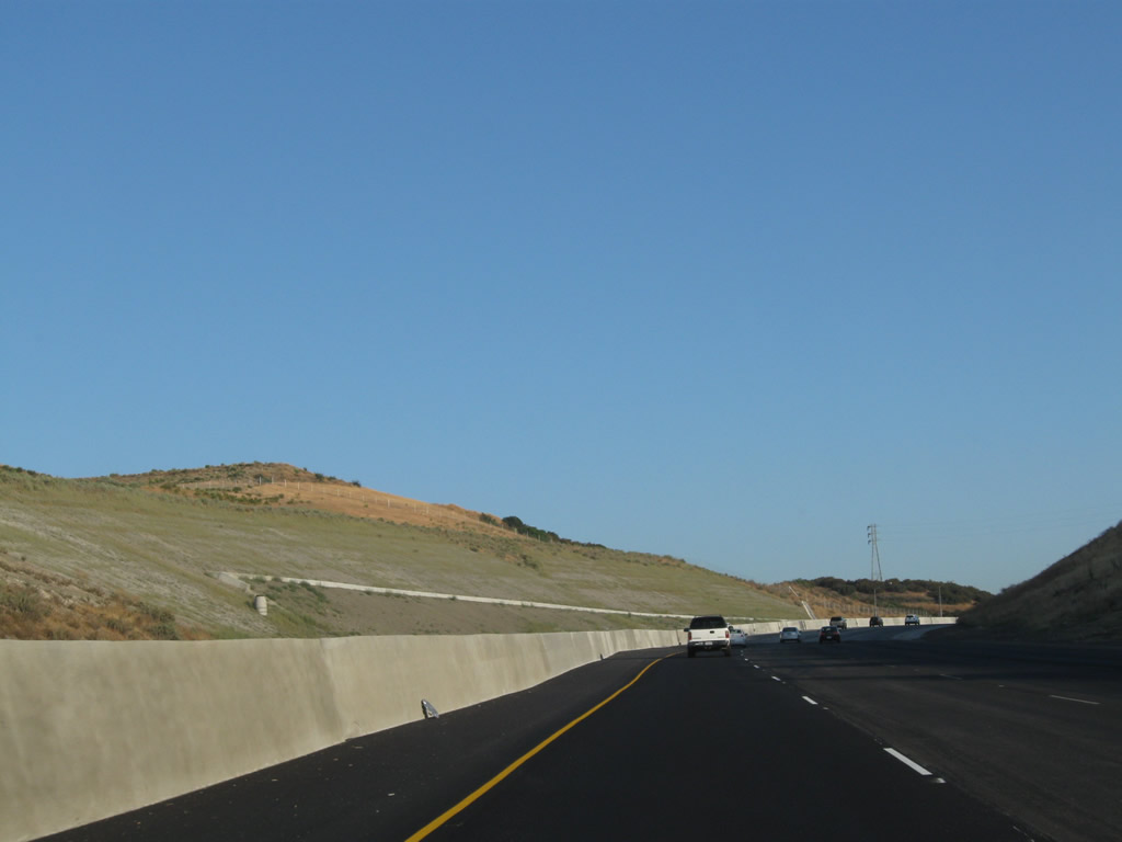
Nearing the top of Violin Summit, the next exit along Interstate 5 (Golden State Freeway) is Exit 183, Templin Highway (one mile). Photo taken 07/15/09. |
|
|
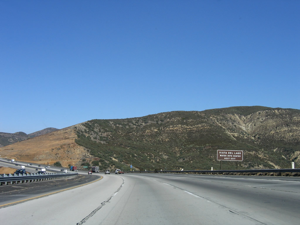
To the Pyramid Lake recreation areas, use Exit 195. An overlook of the lake can be seen from the Vista del Lago at Exit 191. Photos taken 07/15/09 and 09/25/05. |
|
Templin Highway is a fairly short east-west road that links old U.S. 99/Golden State Highway on the west end with public lands to the east. For historical highway buffs, this is an excellent turn off to see some vintage 1950s-era expressway. Take Exit 183 left (north) on Templin Highway, and the highway widens out to four lanes. This highway is seldom used now because it does not go anywhere and reaches a dead end at its southernmost point. The highway no longer connects because it is now under the waters of Pyramid Lake, which did not exist when U.S. 99 followed the Ridge Route Alternate. Golden State Highway reaches its end at the southern edge of Pyramid Lake near the dam, and portions of the highway further south of there are now flooded under the waters of that reservoir. Photo taken 09/25/05. |
|
|
Major earth movement from the winter of 2004-2005 resulted in a major excavacation project to protect the freeway prior to the Templin Highway interchange. Temporary lane closures and traffic realignments have been necessary through here to keep earth movements from impacting travel lanes. Photos taken 07/15/09 and 07/30/11. |
|
|
Grading activities are evident in these pictures, which show how close the earth movement came to the freeway. Photos taken 07/15/09 and 07/30/11. |
|
Templin Highway connects to old U.S. 99/Ridge Route Alternate (today named as "Golden State Highway"). This sign was removed as a result of the project to fix the erosion caused during the winter storms of 2004-2005. Photo taken 02/15/04. |
|
|
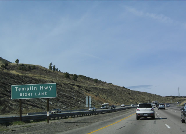
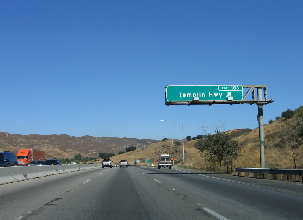
Northbound Interstate 5 (Golden State Freeway) reaches Exit 183, Templin Highway. Templin Highway connects to Historic U.S. 99, which was replaced by Interstate 5 once the freeway was constructed. Interstate 5 follows Historic U.S. 99 between downtown Los Angeles and the Interstate 5/California 99 split north of Grapevine in Kern County. A new sign featuring an exit number was placed in 2003; this sign is much easier to read than its predecessor. Photos taken 11/28/02 and 09/25/05. |
|
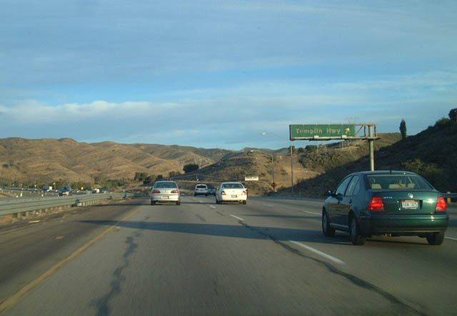
This view looks north on northbound Interstate 5 (Golden State Freeway) after Exit 183, Templin Highway. Photo taken 11/28/02. |
|
An Interstate 5 north reassurance shield is posted after the on-ramp from Templin Highway. Photo taken 07/15/09. |
|
|
|
|
|
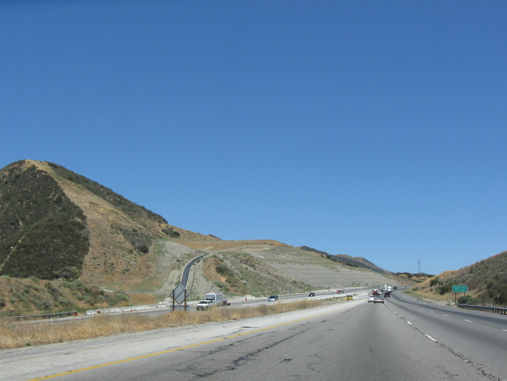
| This series of pictures follows Interstate 5 between Templin Highway and Vista del Lago Road as the freeway follows a ridge that stays above Pyramid Lake. The lake remains mostly invisible from the northbound lanes (but can be seen more easily from the other direction). To see the lake, depart the freeway at Exit 191 and go to the visitors center. When we passed through the area, a brush fire has scorched portions of the hillside east of Interstate 5. Photos taken 07/15/09. |
|
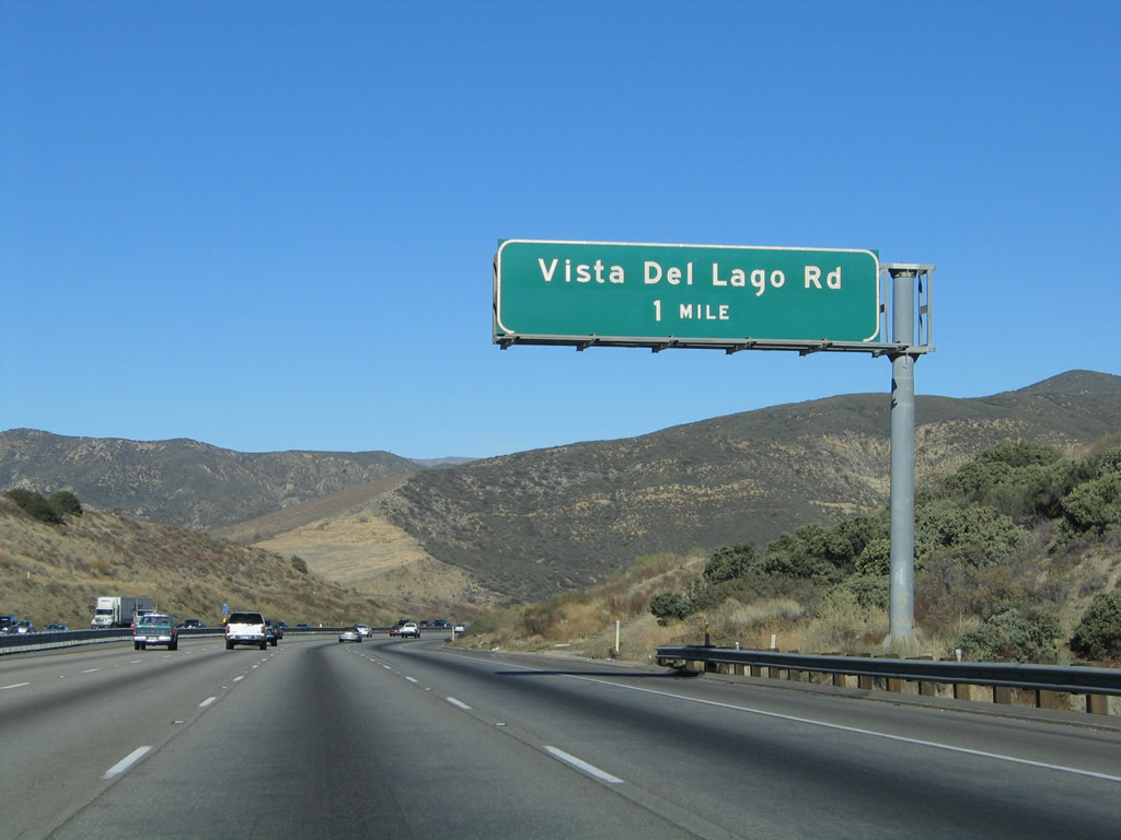
The next exit along northbound Interstate 5 (Golden State Freeway) is Exit 191, Vista del Lago Road (one mile). This exit connects to the Pyramid Lake reservoir. Historic U.S. 99 does not reach this exit; it is discontinuous as a parallel road because part of it is flooded under Pyramid Lake. Photo taken 10/07/06. |
|
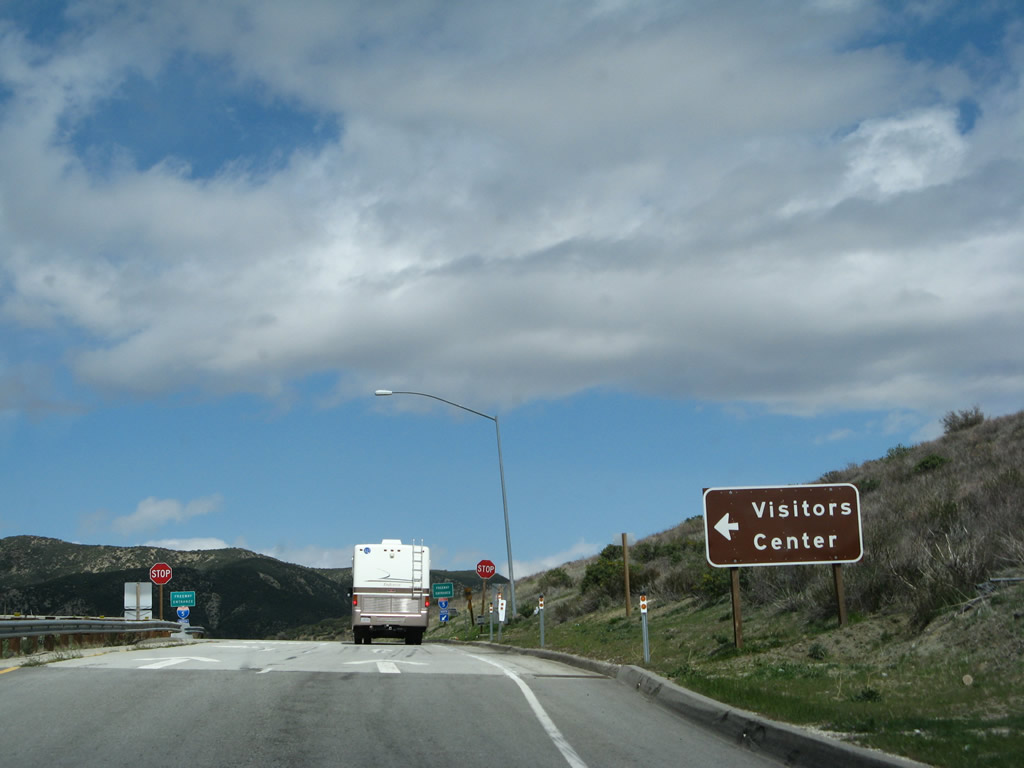
During the drought years of the early 2000s, several aspects of Historic U.S. 99 have emerged as Pyramid Lake has lowered in level. There is a visitors center at this exit, as well as an incredible view of Pyramid Lake and Pyramid Dam. Photo taken 10/07/06. |
|
The land holding Interstate 5 on this ridge above Pyramid Lake is moving, and landslides have been a problem along this section of Interstate 5. A lane was closed at the time this photo was taken due to a slide on the southbound side of Interstate 5. Photo taken 10/07/06. |
|
Northbound Interstate 5 (Golden State Freeway) reaches Exit 191, Vista del Lago Road. Photo taken 10/07/06. |
|
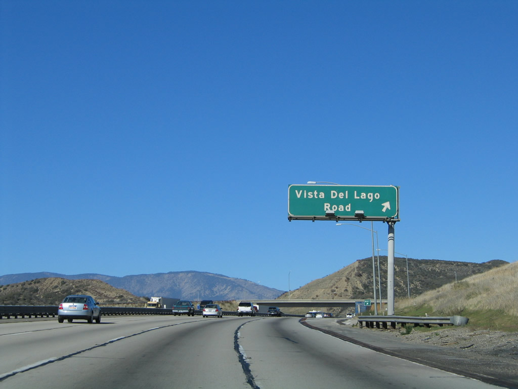
Upon departing Interstate 5 (Golden State Freeway), turn left (west) on Vista del Lago Road to the California Water Project Visitors Center. Photo taken 10/07/06. |
|
An Interstate 5 north reassurance shield route marker is posted shortly after the Vista del Lago on-ramp. Photo taken 10/07/06. |
|
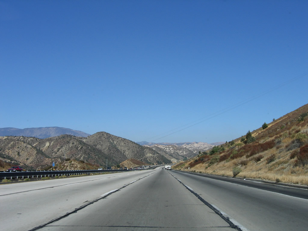
Interstate 5 has four northbound lanes as the freeway proceeds between Vista del Lago Road and Smokey Bear Road. Photo taken 10/07/06. |
|
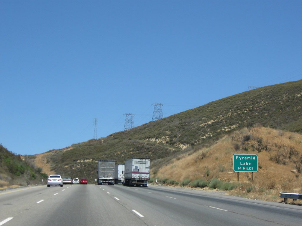
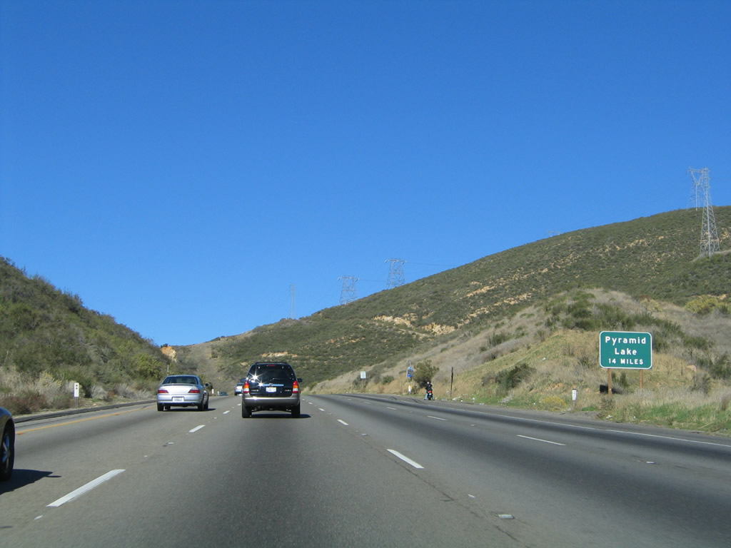
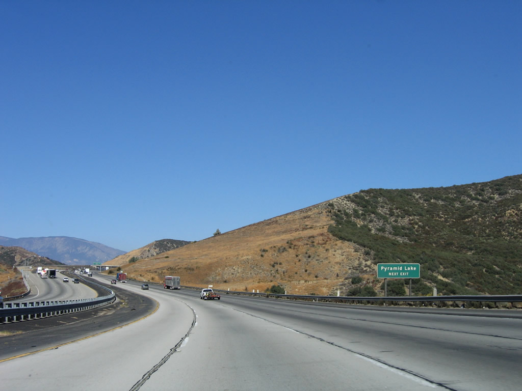
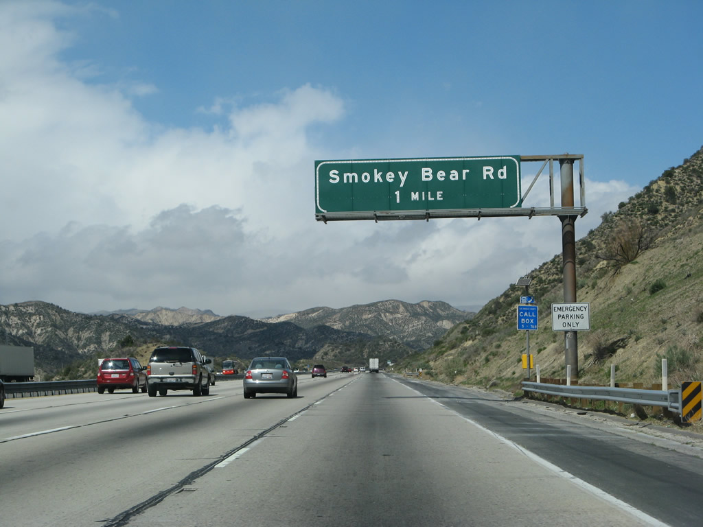
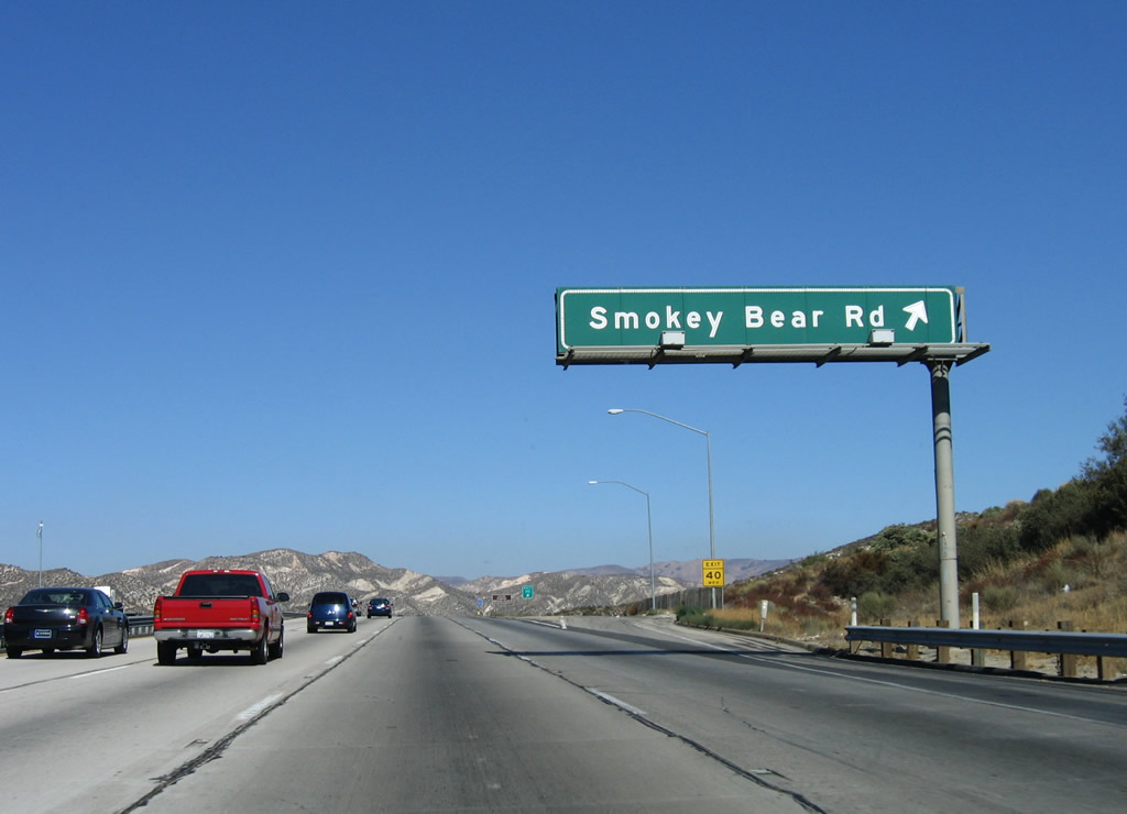
The next exit along northbound Interstate 5 (Golden State Freeway) is Exit 195, Smokey Bear Road (one mile). This exit provides access to recreational facilities at Los Alamos and Hard Luck, as well as the southern end of Hungry Valley. Photo taken 10/07/06. |
|
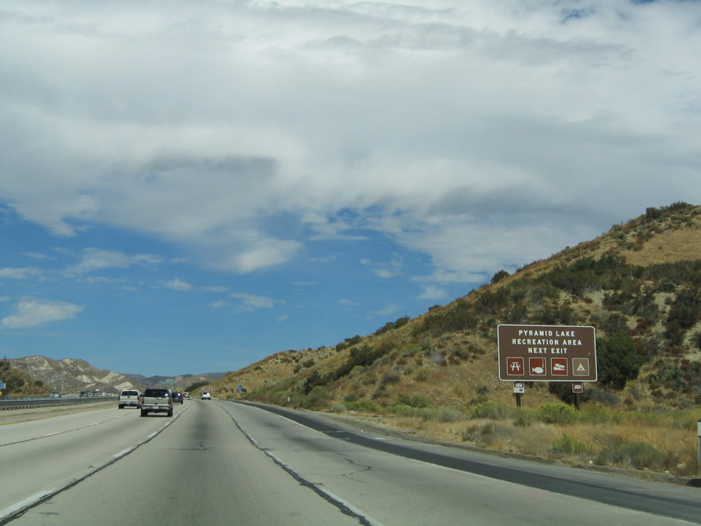
Use Exit 195 to Pyramid Lake Recreation Area for picnicking, fishing, boating, and caming. Photo taken 10/07/06. |
|
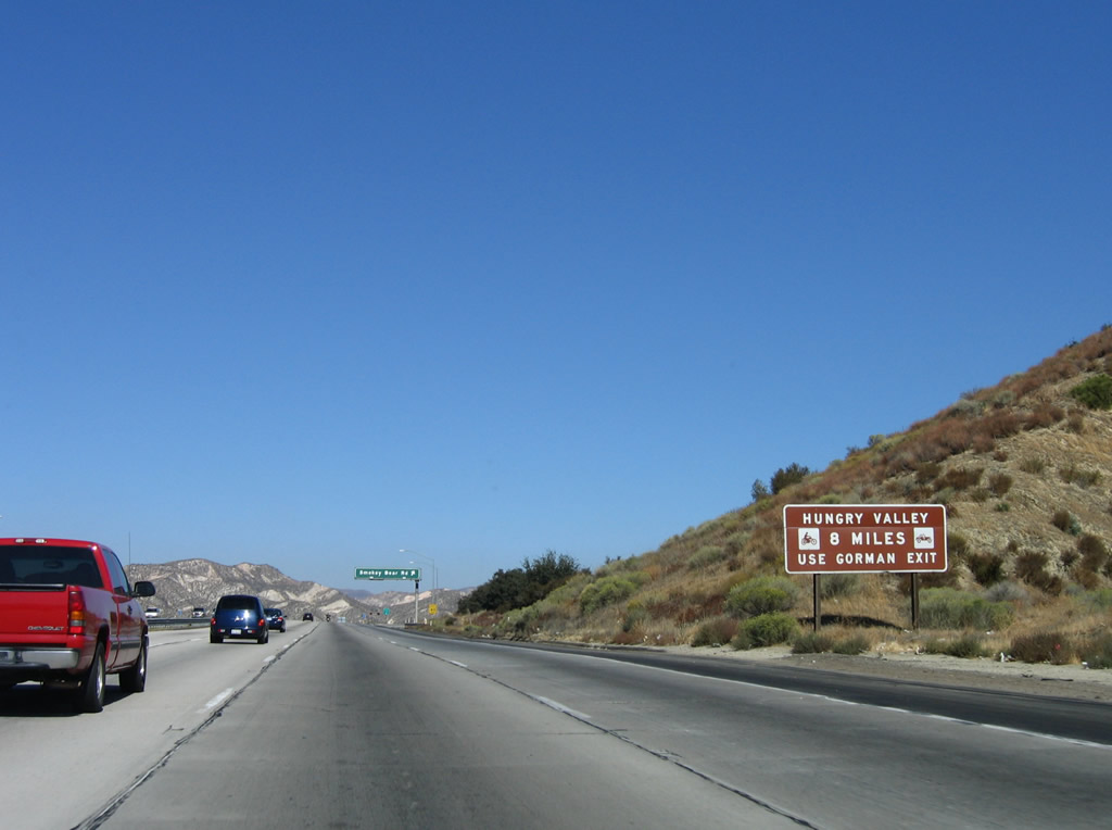
For access to the Hungry Valley off-road area, use Exit 202 (Gorman) rather than Exit 195. Photo taken 10/07/06. |
|
Northbound Interstate 5 (Golden State Freeway) reaches Exit 195, Smokey Bear Road. Photo taken 10/07/06. |
|
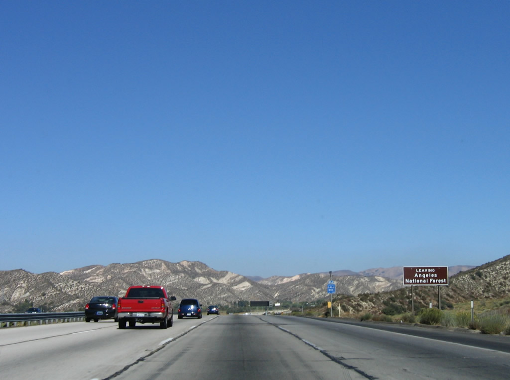
Interstate 5 leaves the Angeles National Forest between Exit 195 and Exit 198A. Photo taken 10/07/06. |
|
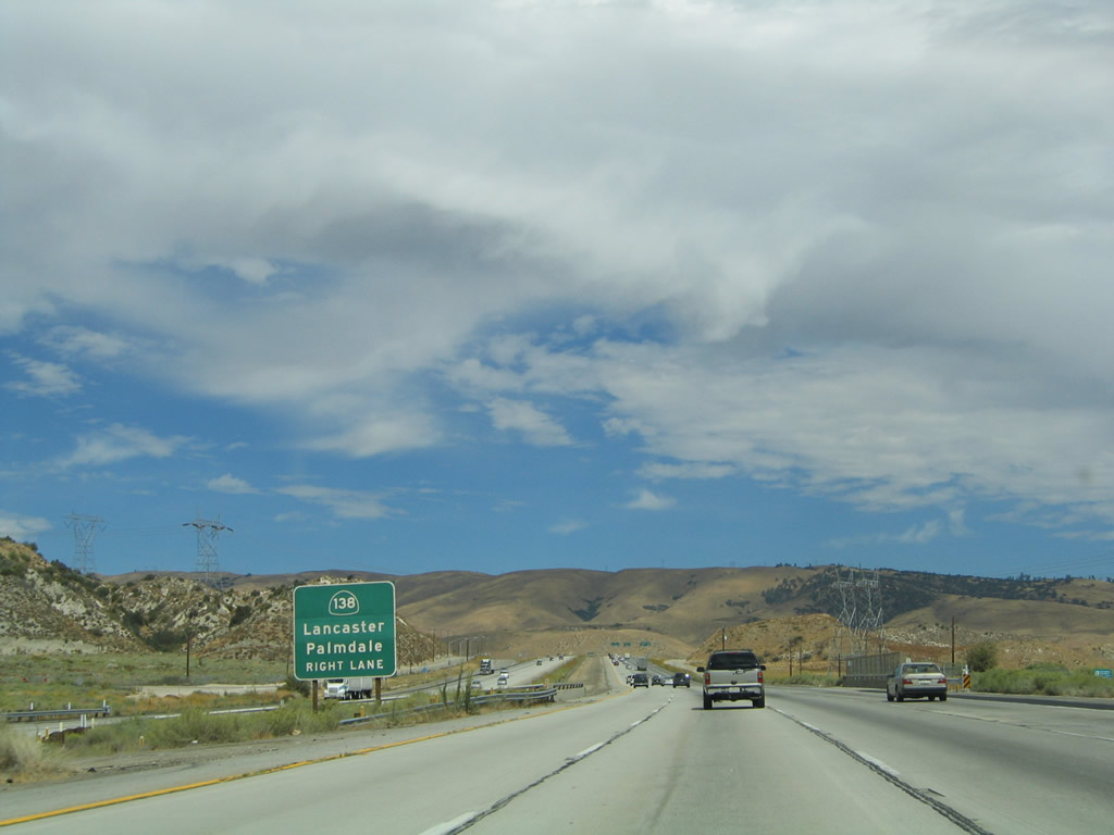
The next exit along Interstate 5 north is Exit 198A, California 138 east to Lancaster and Palmdale, one mile. At one point, California 138 was to have been constructed as the Metropolitan Bypass, a freeway route that would connect Interstate 5 and Interstate 15 with a freeway-grade facility. That plan is on the shelf due to the controversial nature of the project and lack of funding. From time to time, proposals to build a freeway using toll financing comes forward, but no proposal has resulted in concrete plans to build the high-speed highway yet. Photo taken 10/07/06. |
|
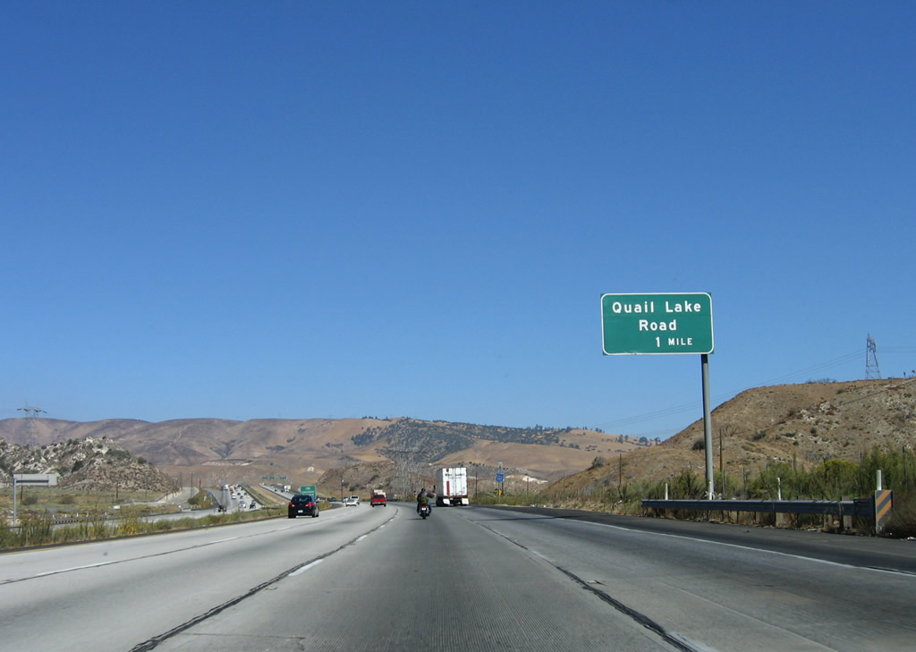
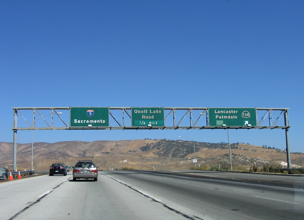
A second ramp within the upcoming interchange complex is Exit 198B, Quail Lake Road. Photo taken 10/07/06. |
|
California 138 leads east through Neenach, Lancaster, Palmdale, Littlerock, Pearblossom, Llano, Pinon Hills, and Phelan before reaching Interstate 15. The highway continues east past Interstate 15 via the Rim of the World Highway and over Cajon Pass before reaching its terminus at California 18 at Crestline. Photo taken 09/25/05. |
|
At this interchange, two Southern California Edison 500 kV power lines cross over Interstate 5; they connect the Vincent substation (near the interchange of California 14 and the Angeles Forest Highway) with the Midway substation near Buttonwillow in Kern County. Photo taken 10/07/06. |
|
Northbound Interstate 5 (Golden State Freeway) meets Exit 198A, California 138. California 138 is a fairly busy road that still retains two lanes of travel for most of its length, excepting a stretch where it is merged with the California 14 freeway. Meanwhile, the next exit along northbound Interstate 5 is Exit 198B, Quail Lake Road. Quail Lake itself is located just east of this interchange. Photo taken 10/07/06. |
|
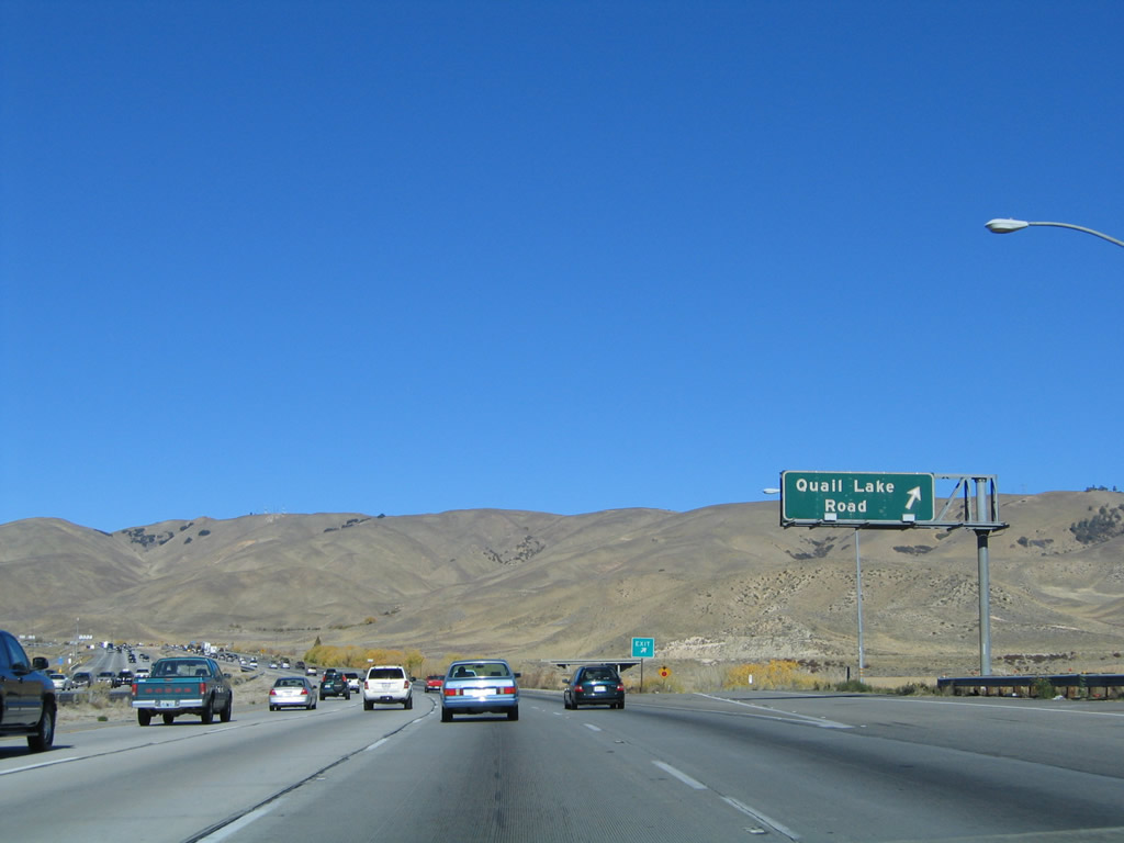
The second exit ramp as part of this interchange along northbound Interstate 5 at Exit 198B, Quail Lake Road. The bridge in the distance is California 138 westbound, and the bridge is part of the transition ramp onto northbound Interstate 5. The interchange complex with California 138 is sizable. Photo taken 10/07/06. |
|
An end California 138 shield assembly was posted on the transition ramp from California 138 east to Interstate 5 north; that shield is gone as of 2009. Photo taken 10/07/06. |
|
This reassurance shield is posted shortly after the last on-ramp from the Exits 198A-B interchange complex. Photo taken 10/07/06. |
|
|
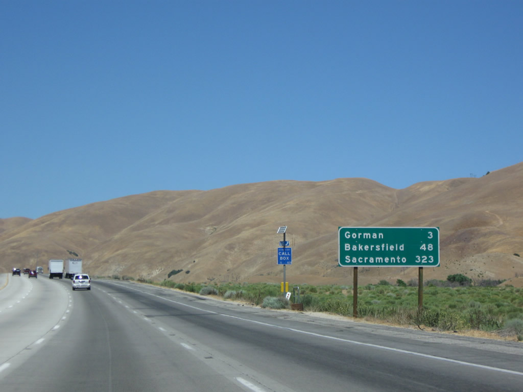
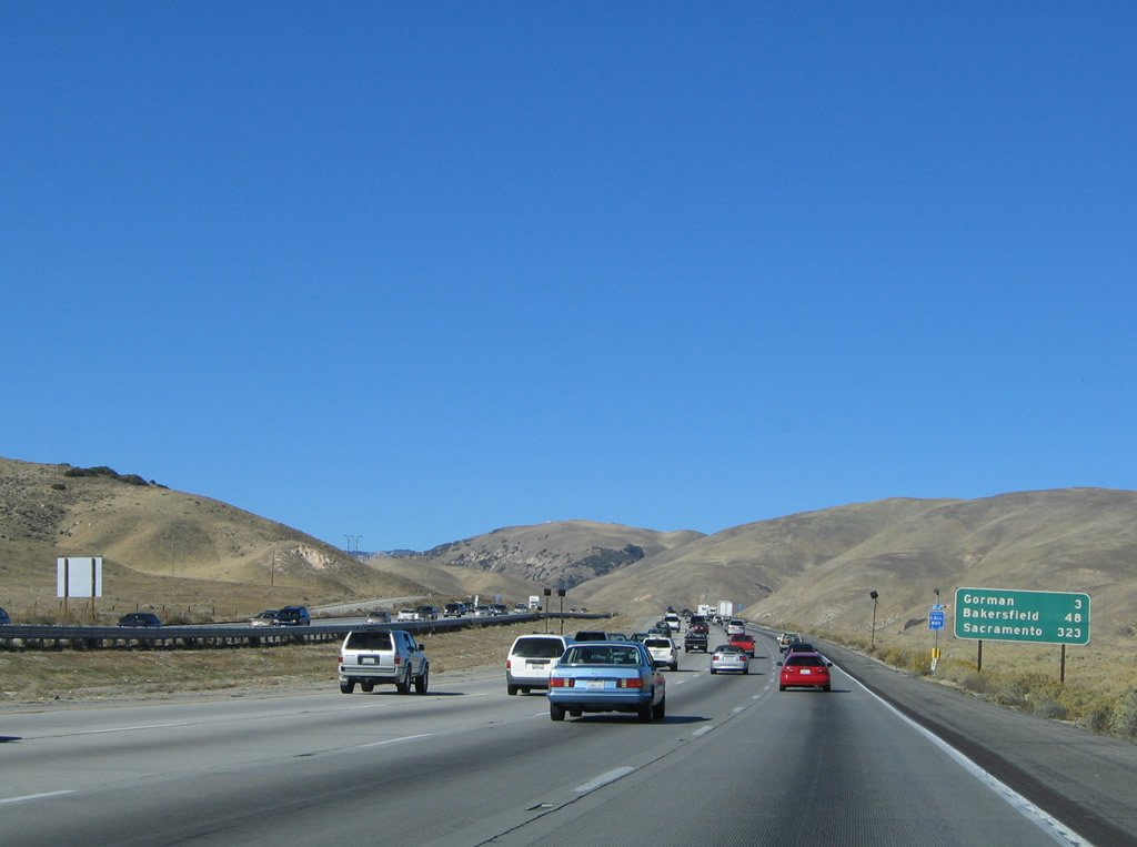
This mileage sign provides the distance to Gorman (three miles), Bakersfield (48 miles), and Sacramento (323 miles). These mileage signs will start tracking the distance to both Sacramento and San Francisco upon crossing into Kern County. Photos taken 07/15/09 and 10/07/06. |
|
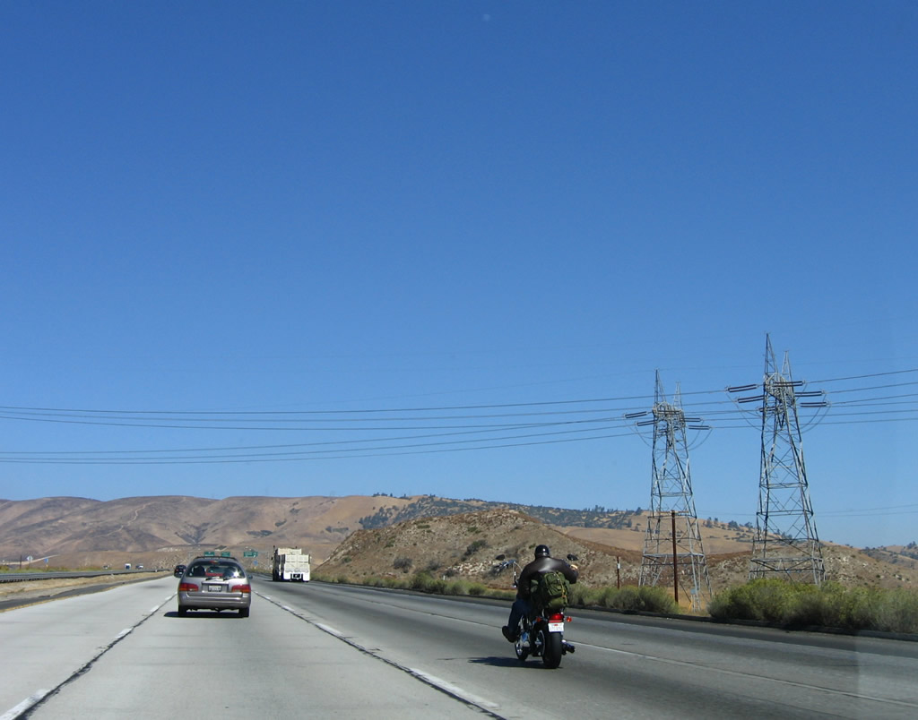
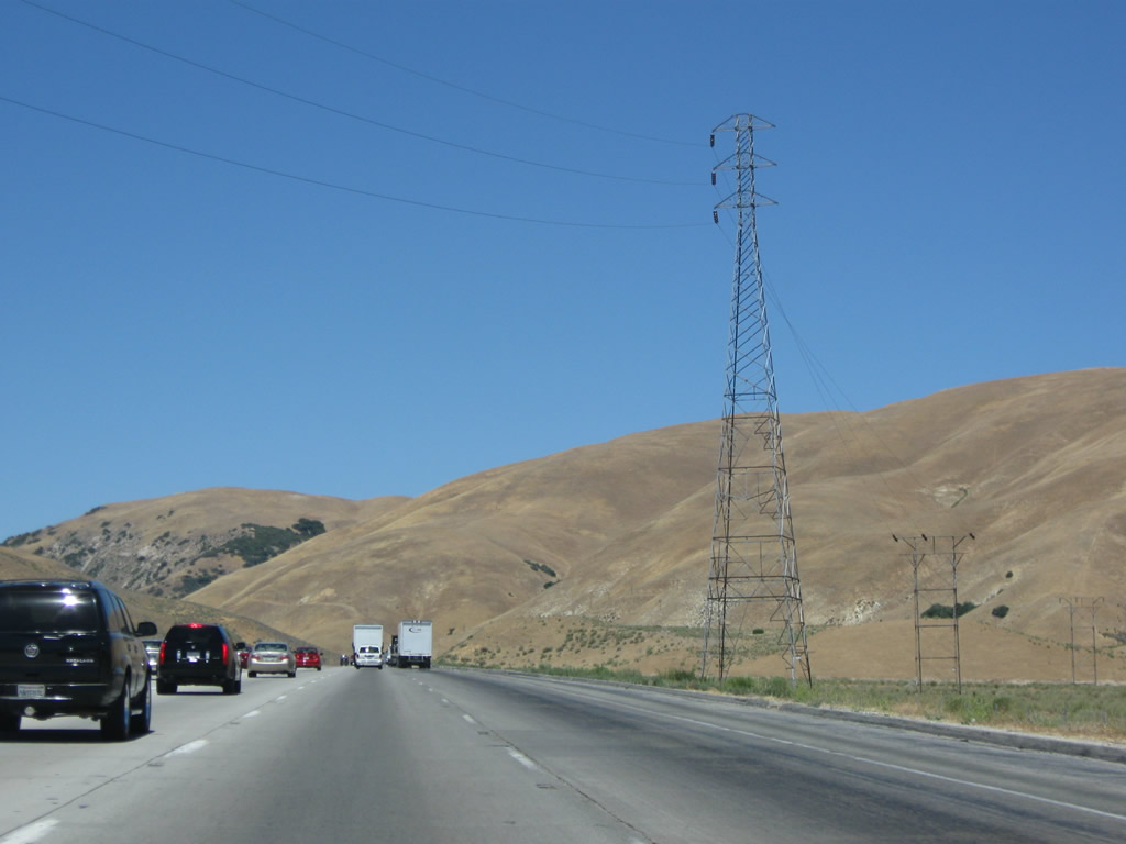
One of the oldest power transmission lines in Southern California, which links hydroelectic facilities in the Kern River Canyon with Greater Los Angeles, crosses over Interstate 5 here. While these towers are relatively new, several other nearby towers are original. Photo taken 10/07/06. |
|
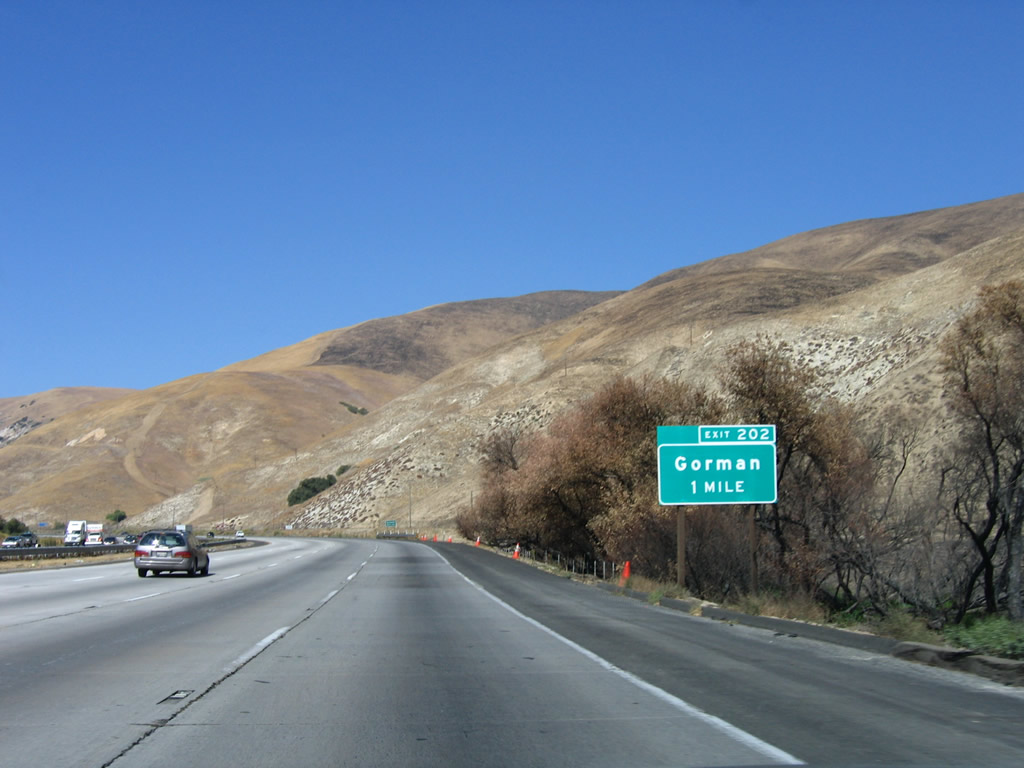
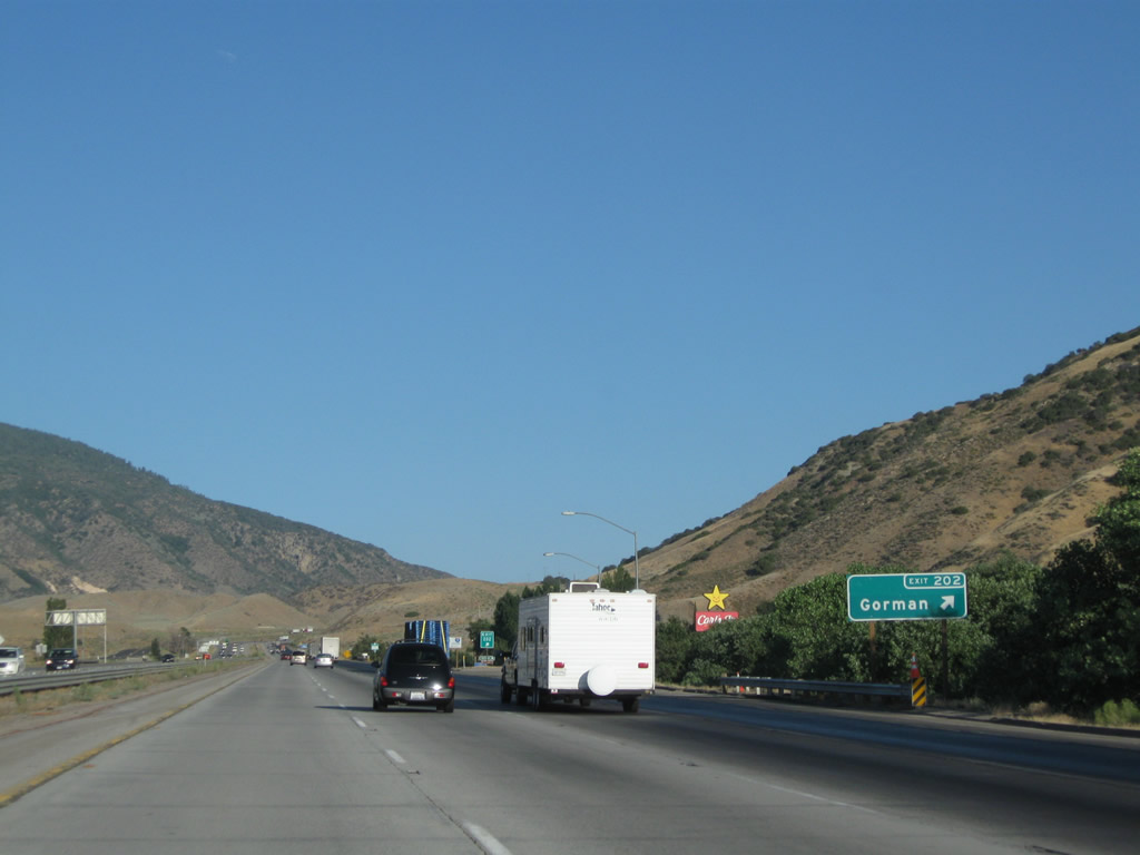
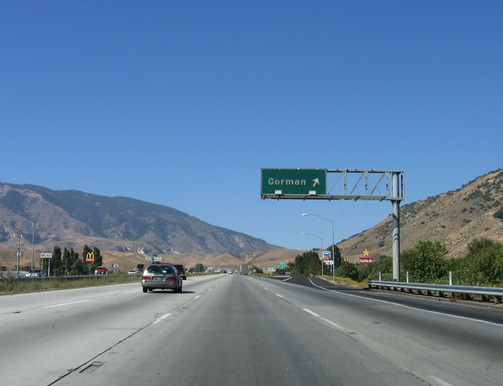
The next exit along northbound Interstate 5 (Golden State Freeway) is Exit 202, Historic U.S. 99/Gorman Post Road-Peace Valley Road to Gorman (one mile). The unincorporated community of Gorman lies to the northeast of the freeway. Photo taken 10/07/06. |
|
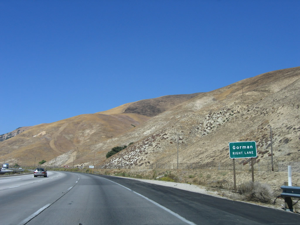
A tiny "Gorman Right Lane" sign is posted shortly after the previous exit number sign. Photo taken 10/07/06. |
|
Exit 202 accesses Historic U.S. 99, which follows Peace Valley Road north of here and Gorman Post Road south of here to meet California 138 near Quail Lake. In addition, this exit accesses Gold Hill Road, which heads south into Hungry Valley, a state vehicular recreation area. Photo taken 10/07/06. |
|
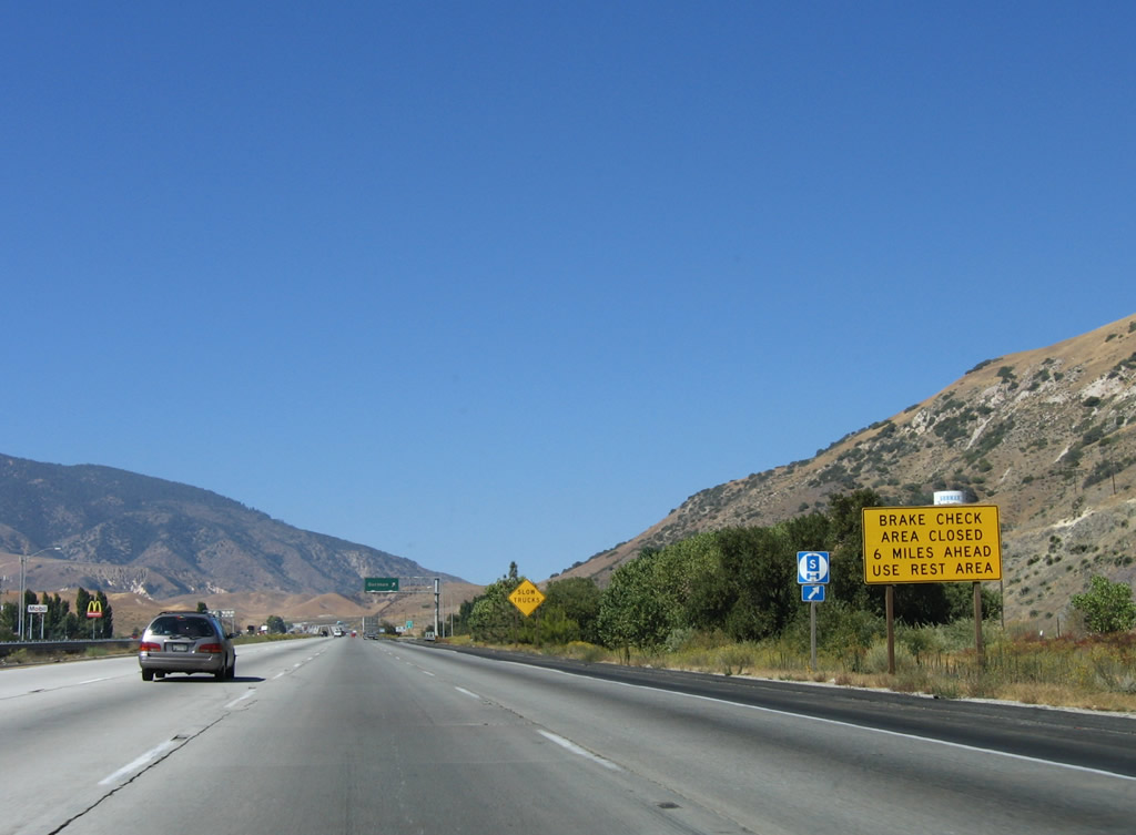
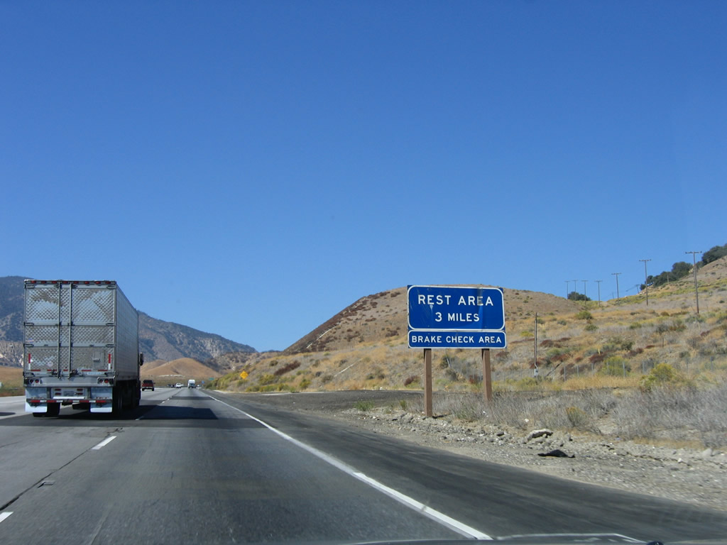
The brake check area was closed at the time this picture was taken, so truckers were directed to use the rest area instead to test brakes before going downhill on the Grapevine. Photo taken 10/07/06. |
|
|
/Northbound Interstate 5 reaches Exit 202, Gorman Post Road and Peace Valley Road. Most of the signage along northbound Interstate 5 (Golden State Freeway) in Los Angeles County is older, but some of the signage is being replaced. This is the second to last exit in Los Angeles County; the final exit is Frazier Park Road (Exit 205) at the county line. Photos taken 07/30/11 and 10/07/06. |
|
In three miles (at Exit 204), Interstate 5 will have its first full-service rest area since the Camp Pendleton Rest Area near Milepost 60. The upcoming rest area is located near Milepost 206 after the Kern County Line. Photo taken 10/07/06. |
|
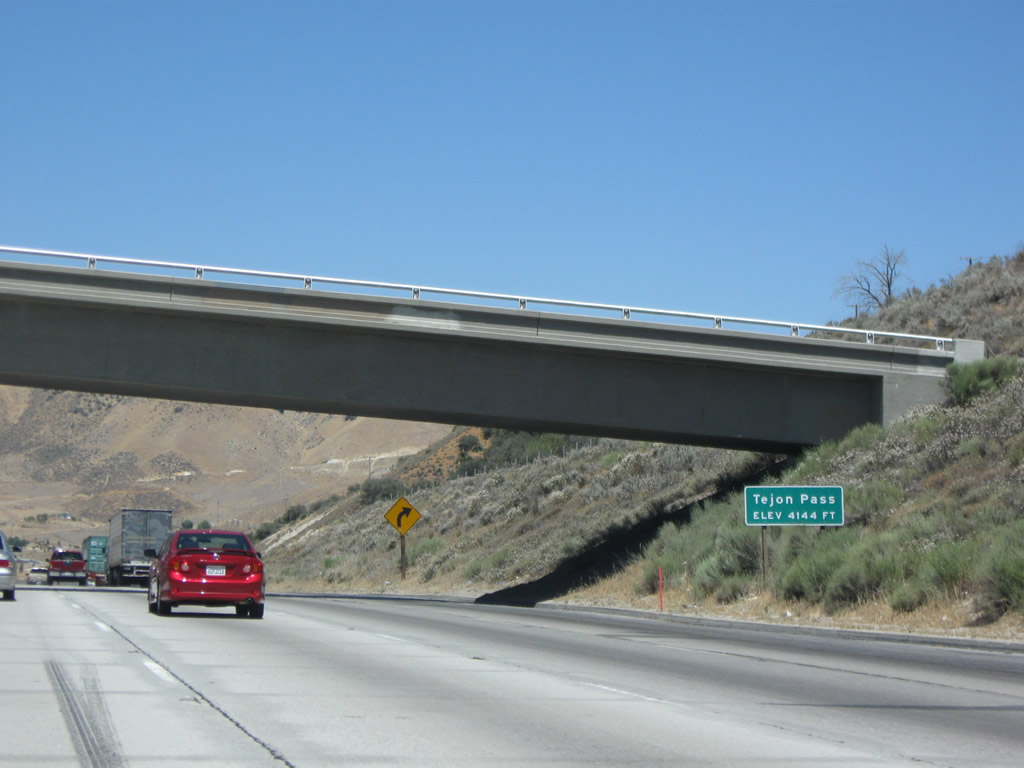
Interstate 5 crosses Tejon Pass at this point. The elevation is 4,183 feet according to the Rand McNally 2003 Atlas, but this sign shows the elevation at 4,144 feet. This is the highest point on Interstate 5 in Southern California, and Interstate 5 will not see this kind of altitude again until north of Redding, some 500 miles from here. Photo taken 07/15/09. |
|
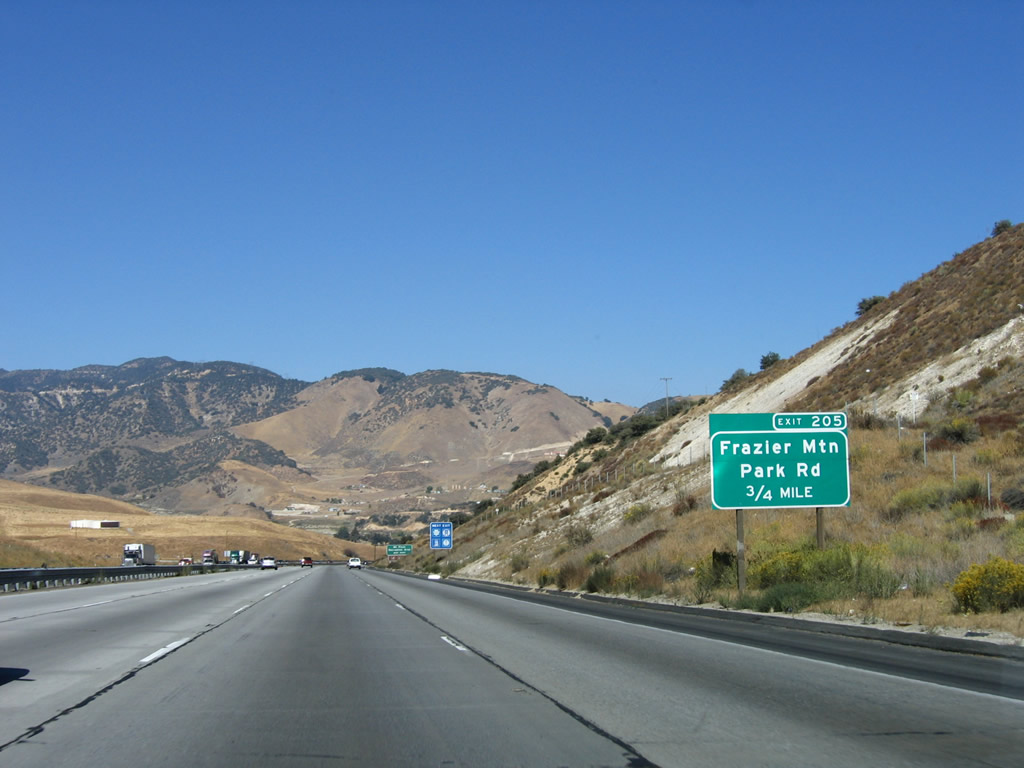
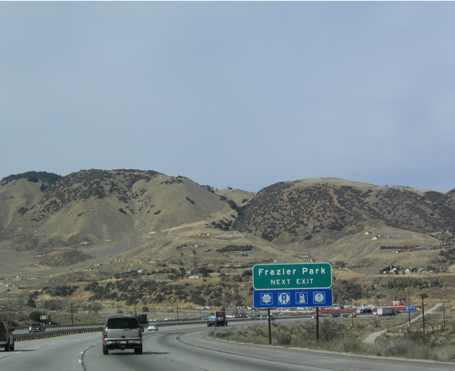
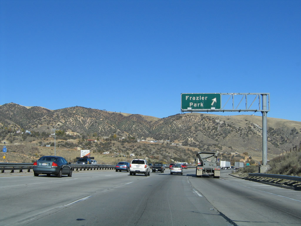
The next exit along Interstate 5 (Golden State Freeway) north is Exit 205, Frazier Park Road. This is the final Los Angeles County interchange on Interstate 5. Photo taken 10/07/06. |
|
|
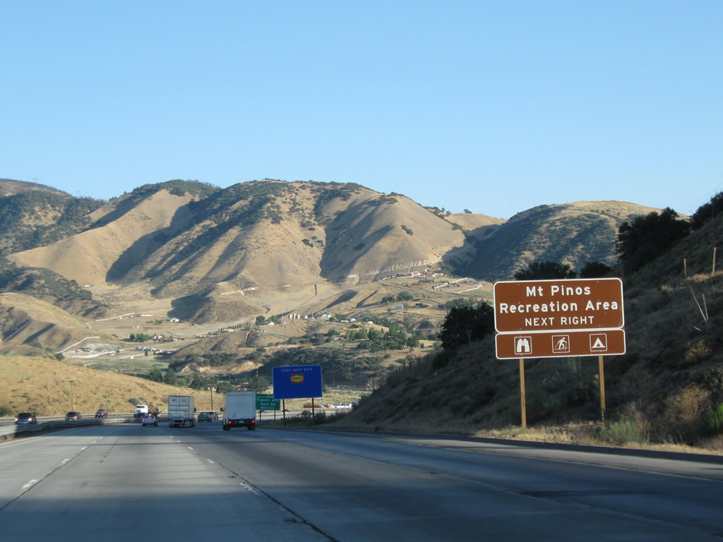
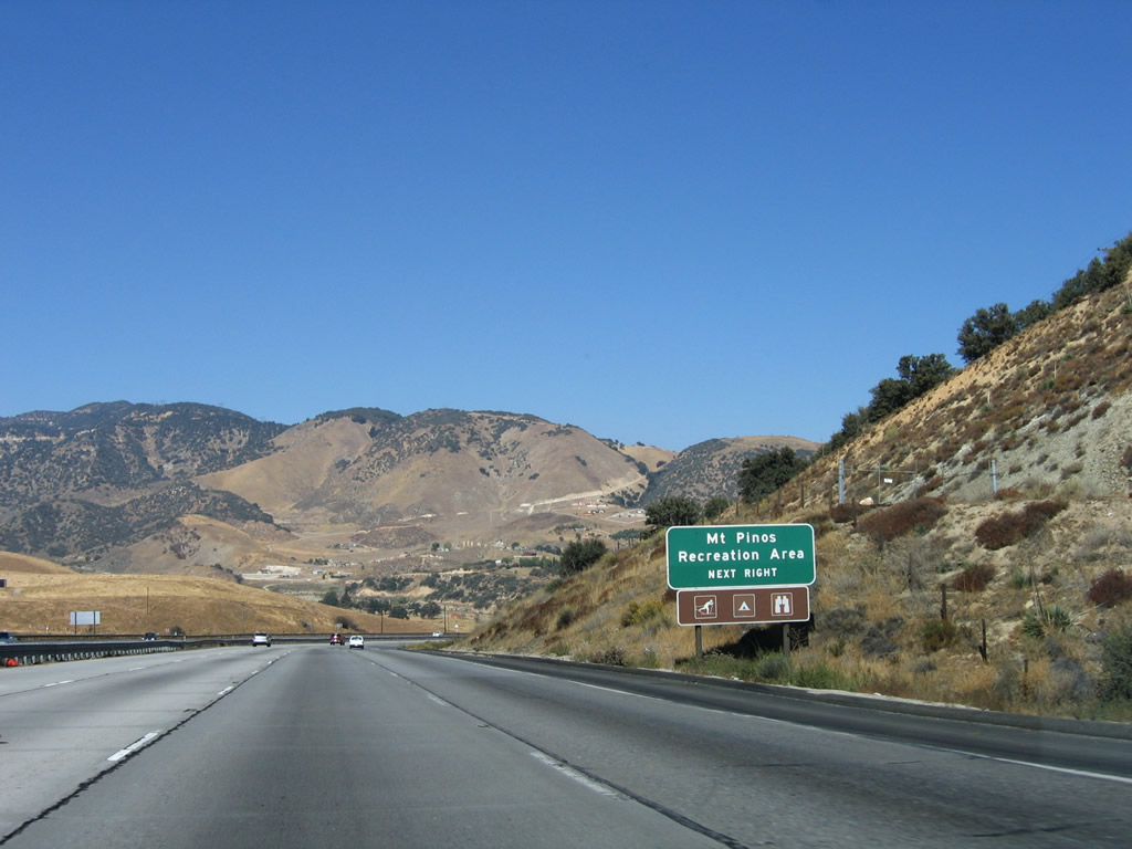
Use Exit 205 to the Mount Pinos Recreation Area to the west of here via Frazier Park Road. The sign was changed in 2011 from green/guide sign to the brown recreation/park standard sign. Photos taken 07/30/11 and 10/07/06. |
|
Northbound Interstate 5 (Golden State Freeway) approaches Exit 205, Frazier Park Road (next right). Frazier Park Road leads west to Frazier Park, Lake of the Woods, Cuddy Valley, and Pine Mountain. With a connection via Cerro Noroeste Road, this road connects with California 33-166 southeast of Carrizo Plains National Monument southwest of Maricopa. Photo taken 02/15/04. |
|
|
Northbound Interstate 5 reaches Exit 205, Frazier Park Road. This is the Los Angeles-Kern county line. Taking Frazier Park Road west will lead to Historic U.S. 99/Peace Valley Road. Shortly after this interchange, Interstate 5 leaves Los Angeles County and enters Kern County. The rest area is Exit 204 and is located after the Frazier Park Road interchange in Kern County. Photos taken 10/07/06 and 09/25/05. |
Page Updated September 16, 2012.