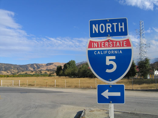
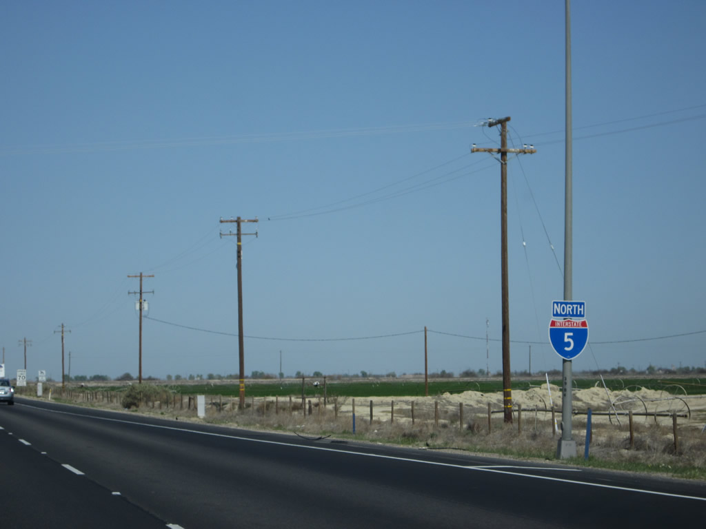
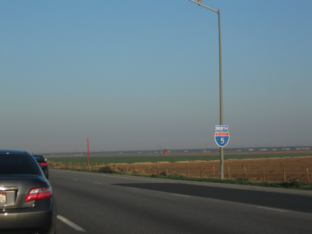
| Interstate 5 north |
|
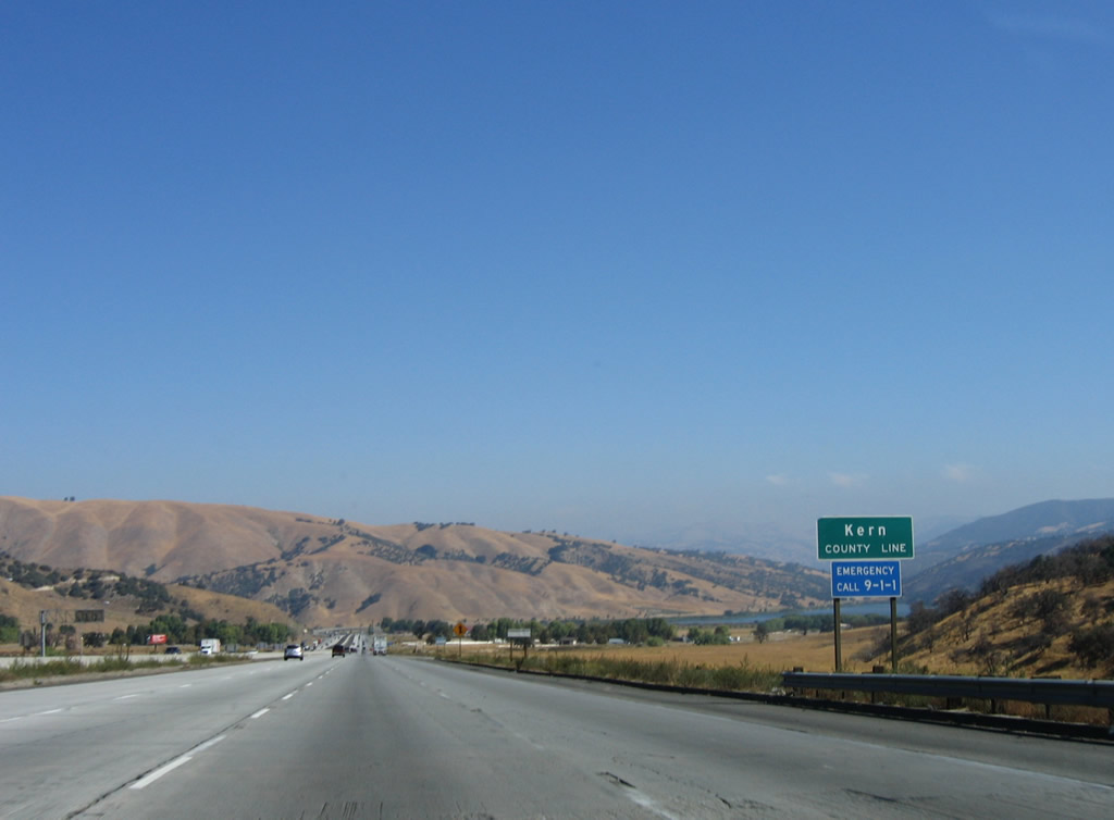
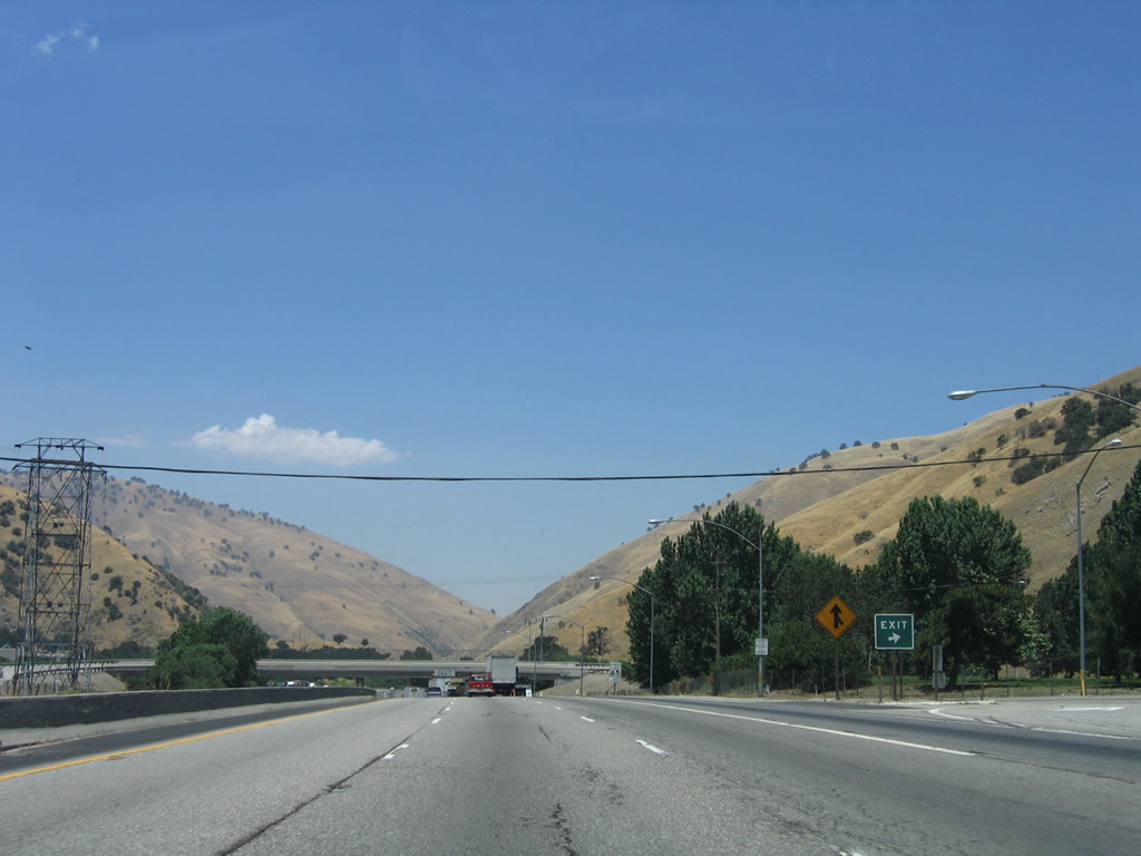
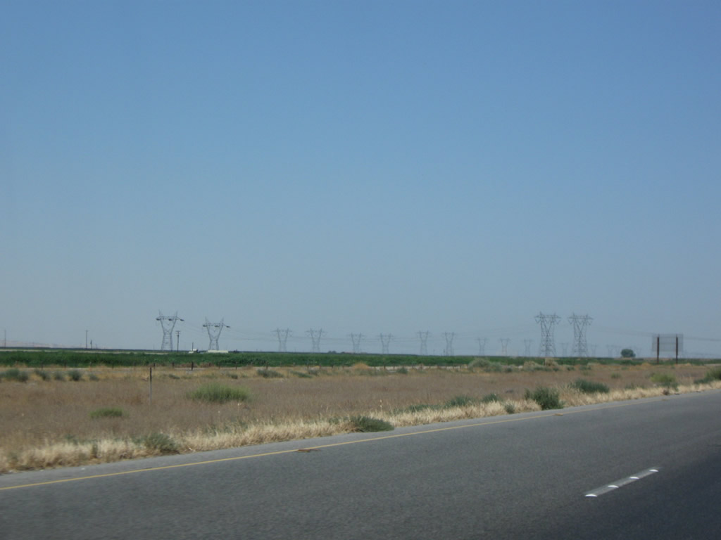
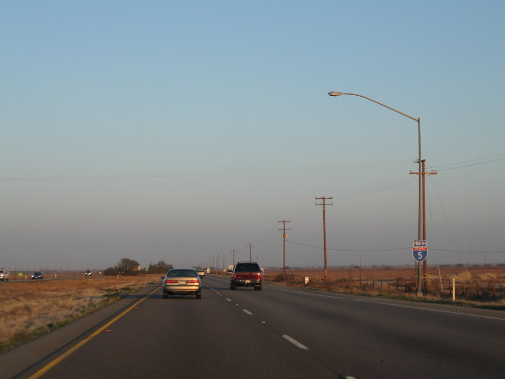
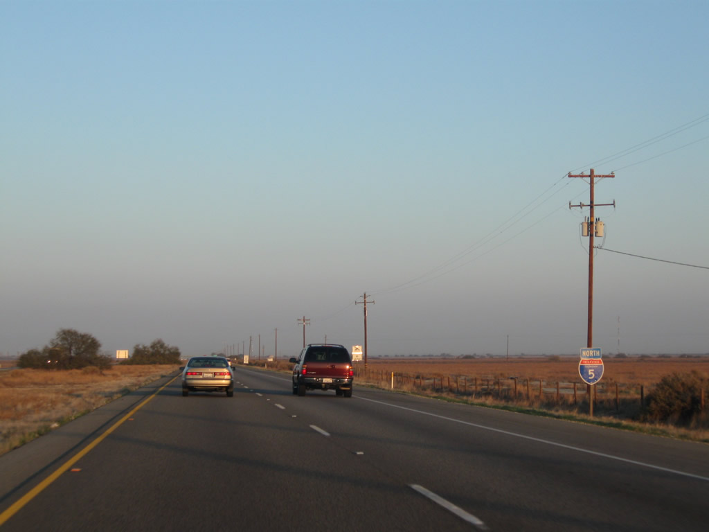
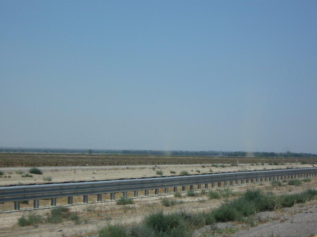
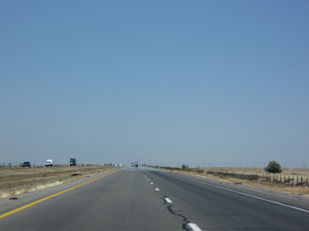
Now leaving Los Angeles County, Interstate 5 enters Kern County. Interstate 5 mostly passes through rural, undeveloped sections of Kern County and avoids the county seat of Bakersfield. Photo taken 10/07/06. |
|
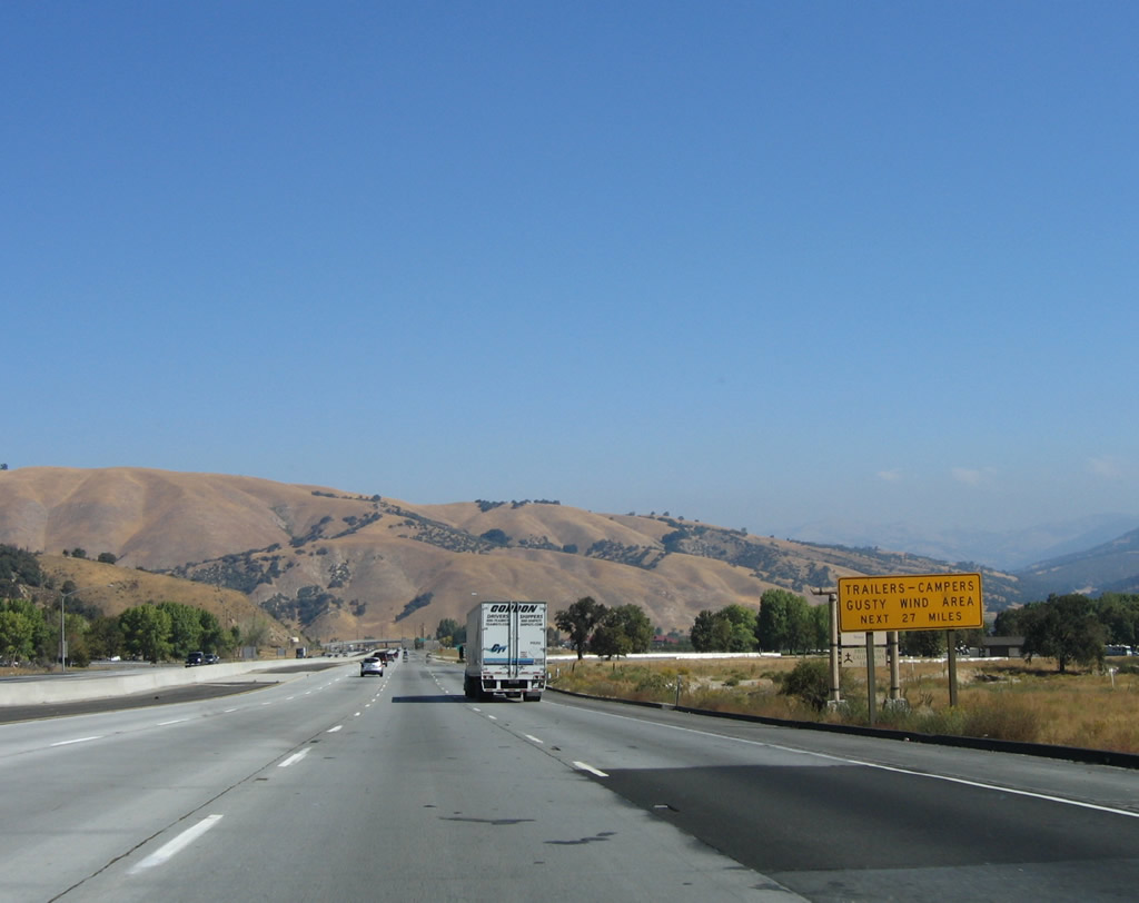
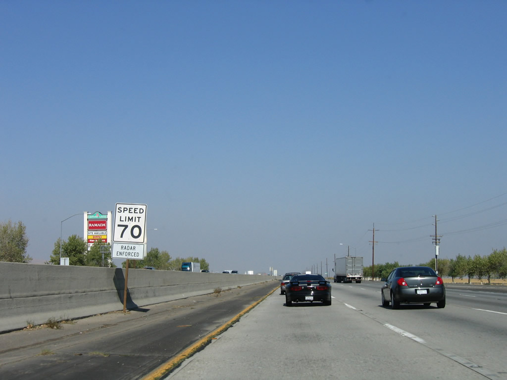
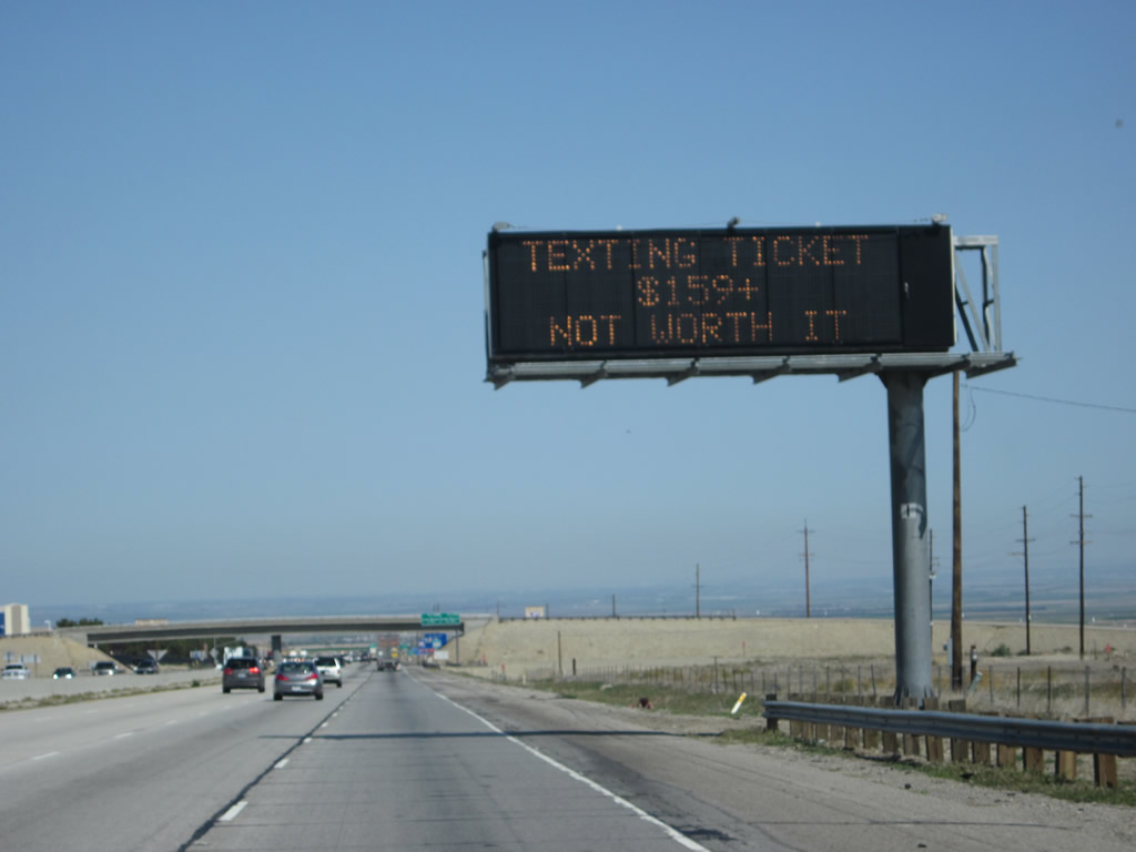
A truck warning sign is posted for the high winds common along this stretch of freeway. Additionally, Interstate 5 will soon drop several thousand feet in elevation at the Grapevine, so motorists are advised to check their brakes at the Exit 206 Rest Area. Photo taken 10/07/06. |
|
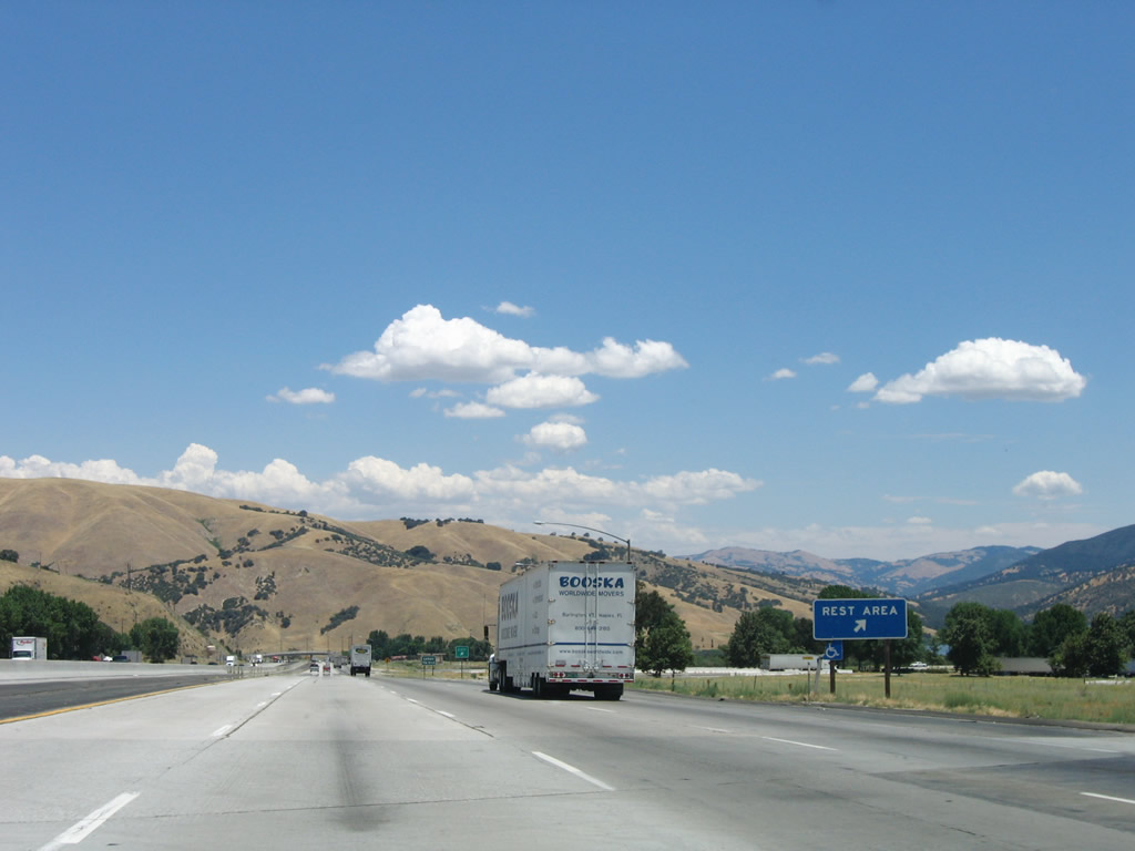
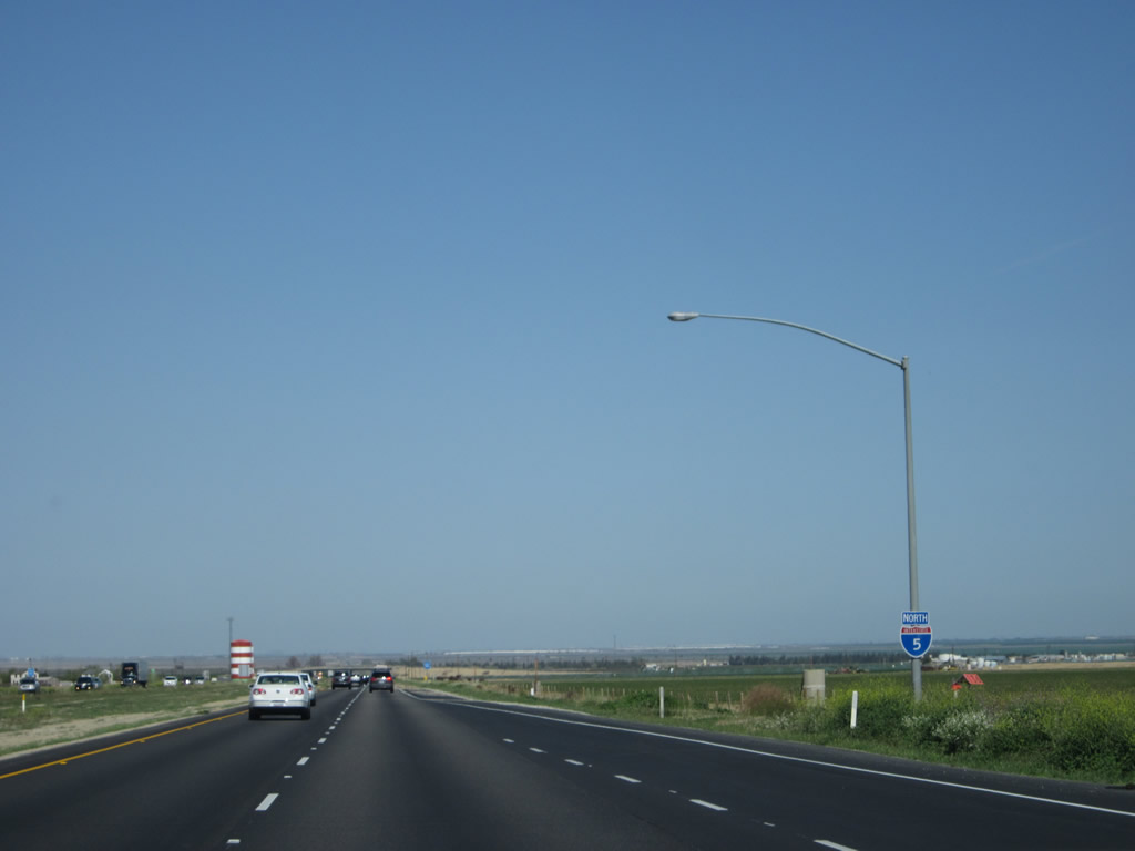
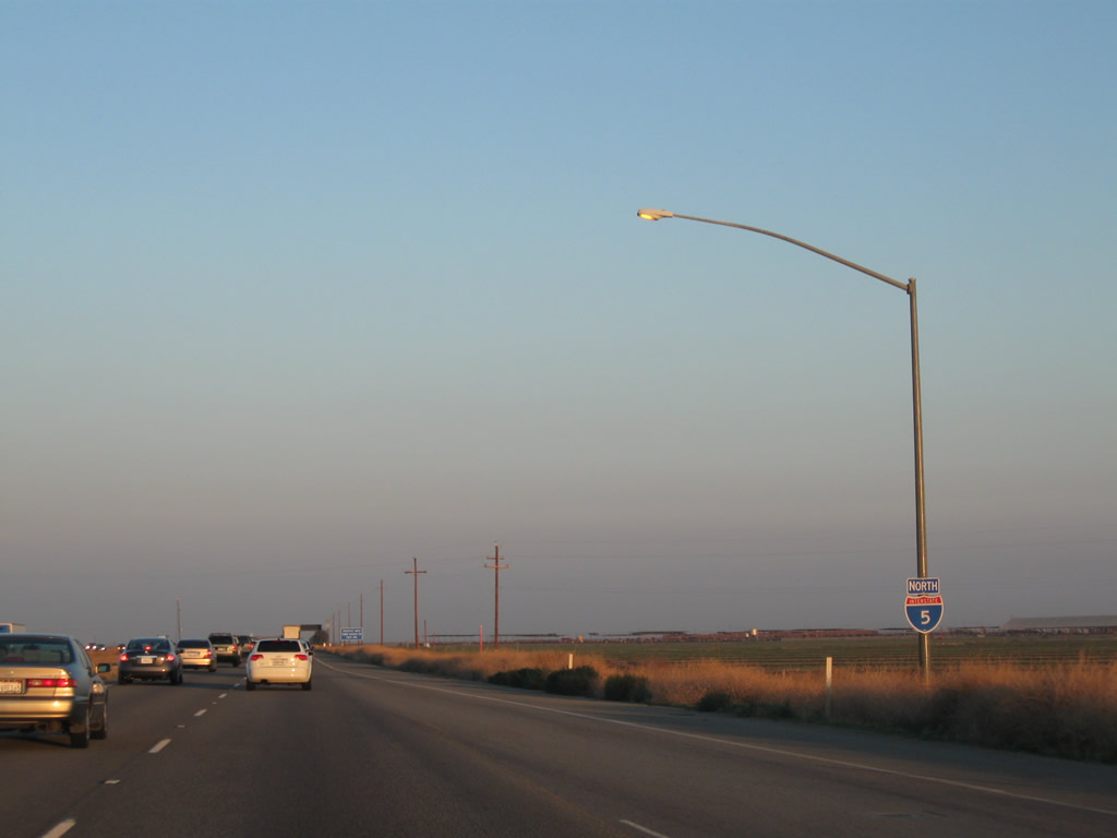
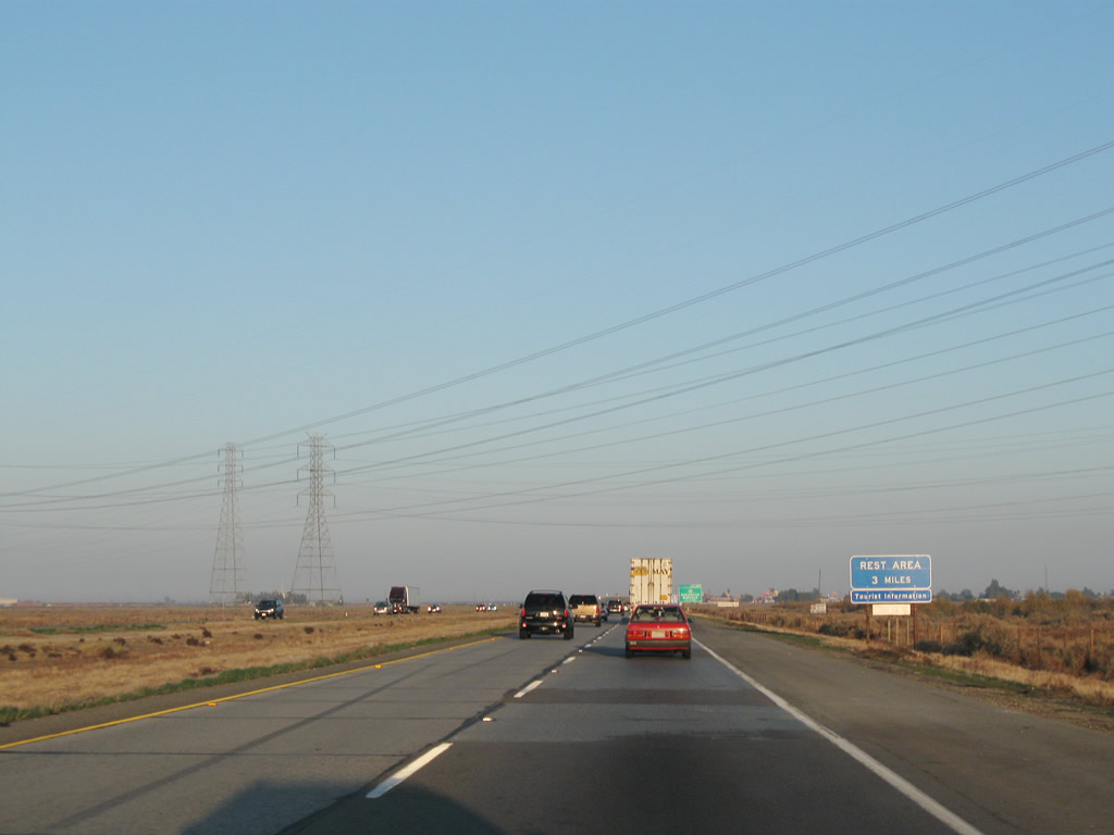
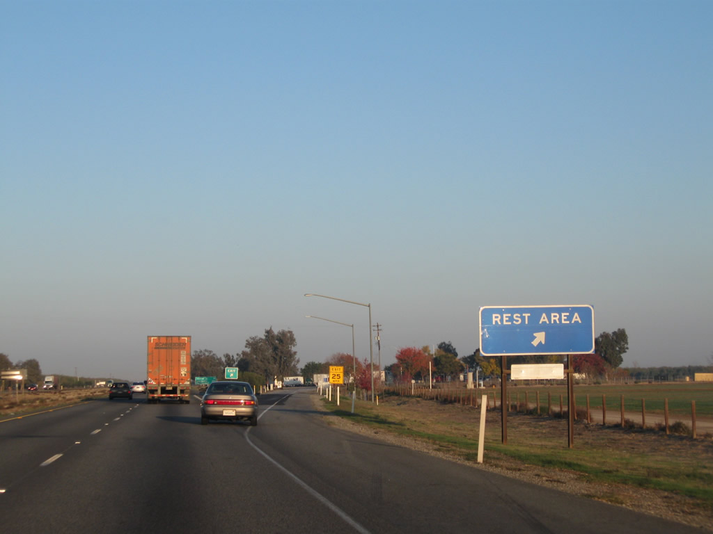
Northbound Interstate 5 (Golden State Freeway) meets Exit 206, Rest Area and Brake Inspection Area. This is only the second rest area along northbound Interstate 5; the only other rest area seen along northbound Interstate 5 was in Camp Pendleton, located midway between Oceanside and San Clemente. There are no rest areas on Interstate 5 in Los Angeles County. The rest area was under reconstruction in 2009-2011. Photo taken 06/28/06. |
|
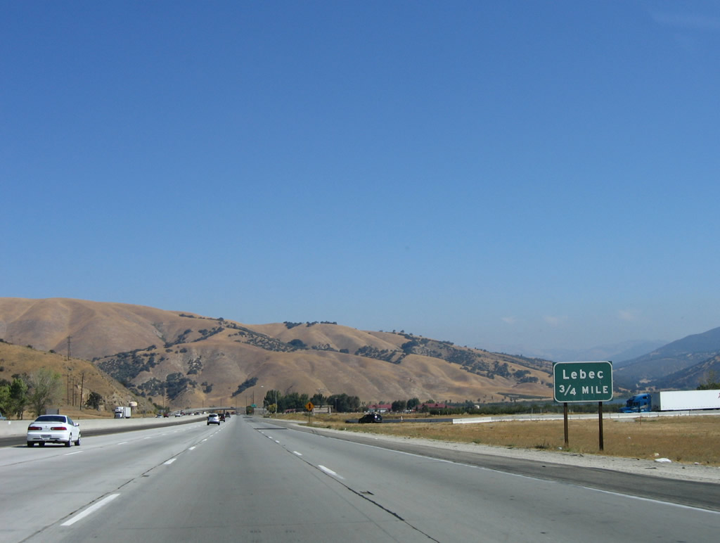
Now Interstate 5 is slowly descending from its prior heights of Tejon Pass (el. 4,183 feet), but it remains fairly level between Frazier Park Road and Lebec. The next exit along Interstate 5 (Golden State Freeway) north is Exit 207, Lebec. Photo taken 09/25/05. |
|
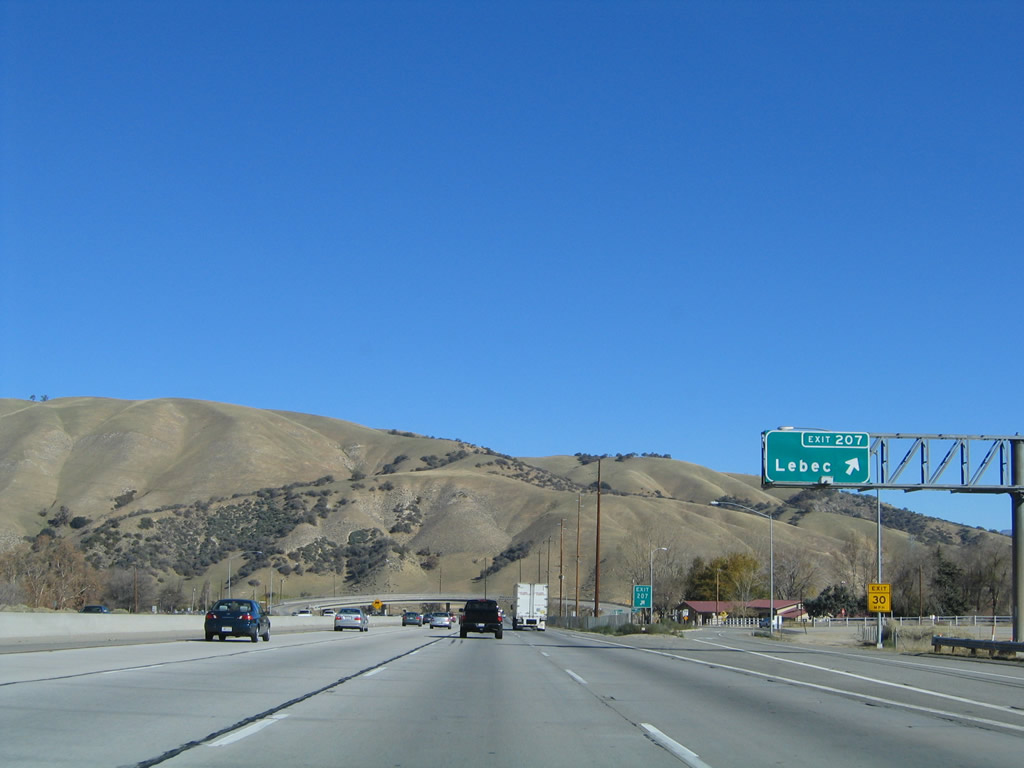
Northbound Interstate 5 meets Exit 207, To Historic U.S. 99 and Lebec. The unincorporated community of Lebec is located mostly on the west side of the freeway, including an antique store and post office. Photo taken 11/25/04. |
|
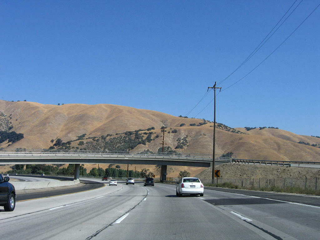
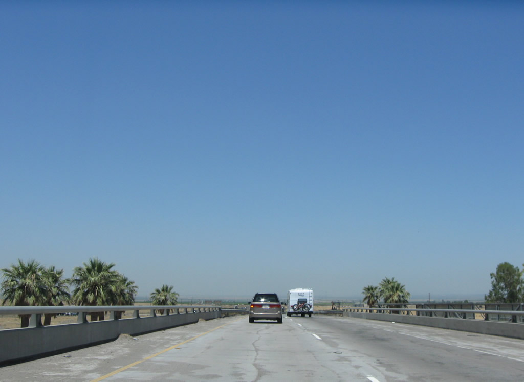
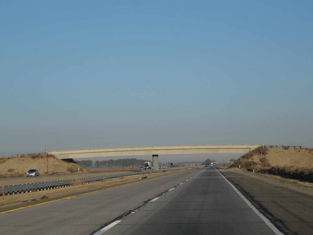
The Lebec overpass crosses Interstate 5 as the freeway bends a bit to the northwest. Between Lebec and Fort Tejon, the old alignment of U.S. 99 remains on the west side of the freeway and provides local access. U.S. 99 returns back to Interstate 5 at Exit 210, Fort Tejon. Photo taken 10/07/06. |
|
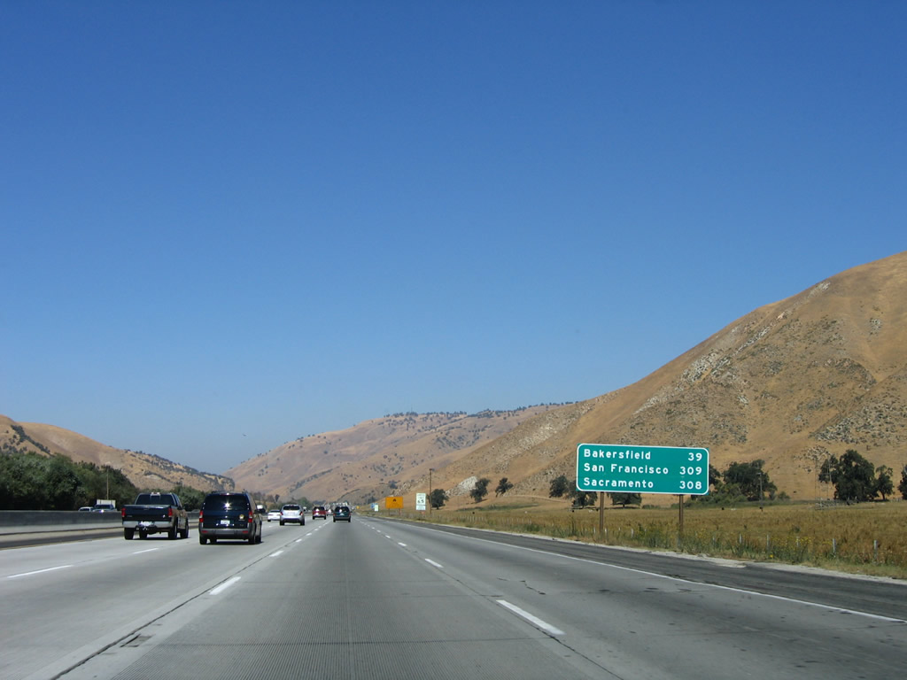
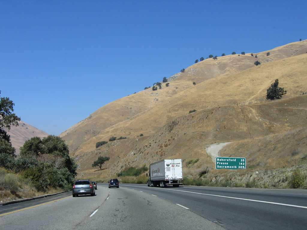
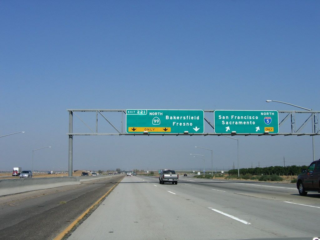
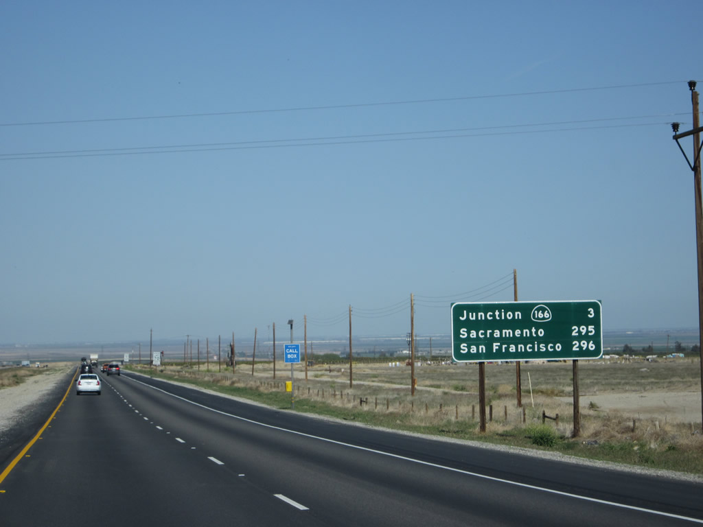
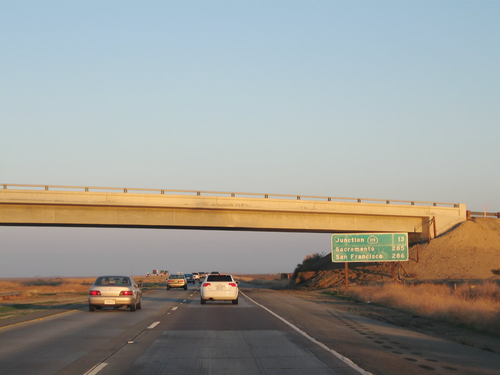
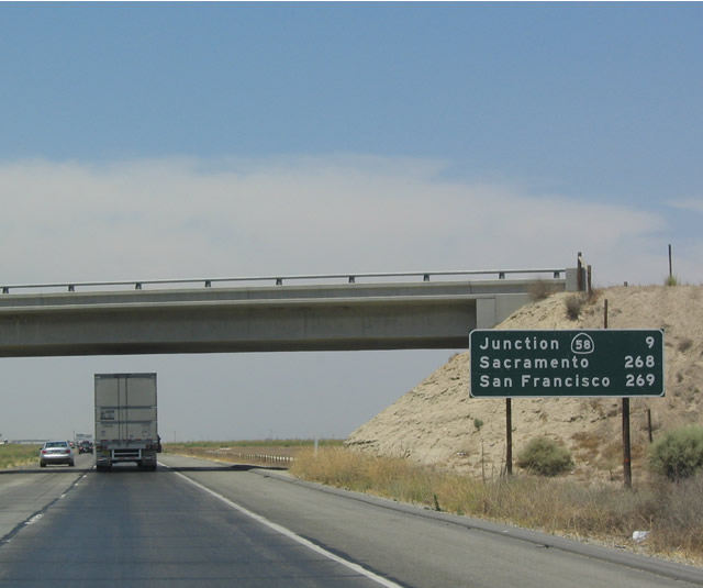
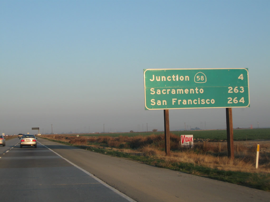
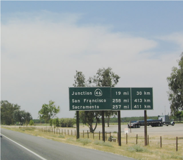
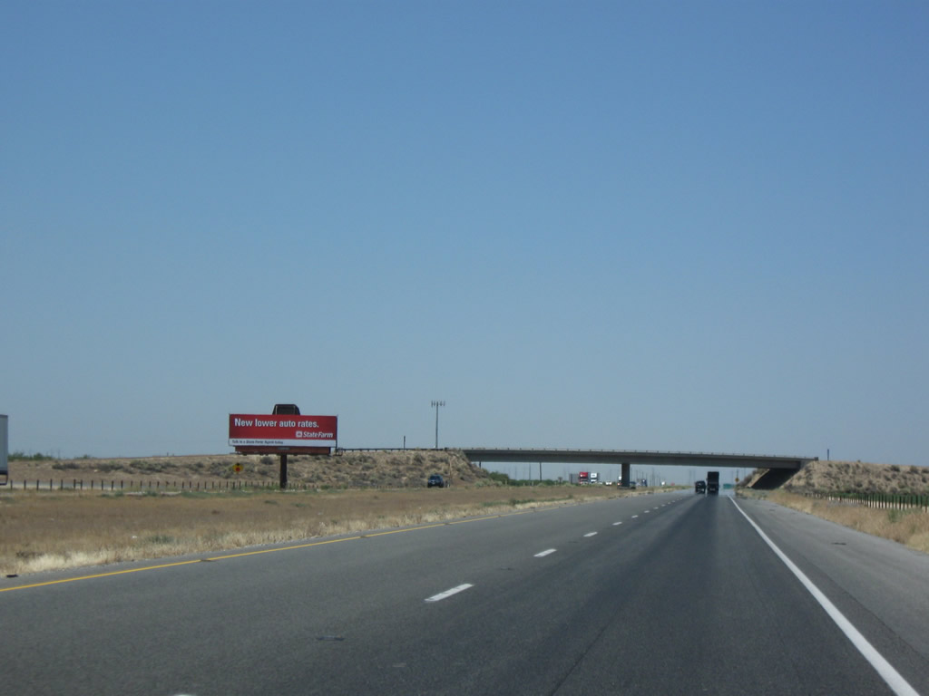
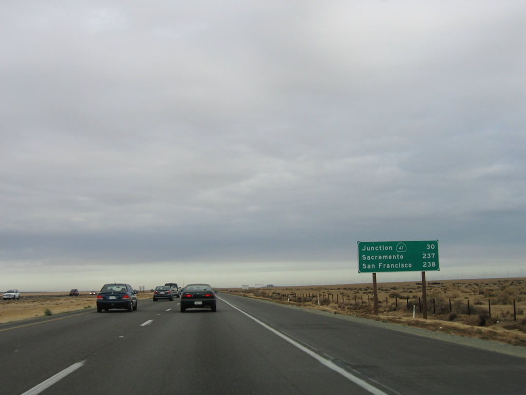
This mileage sign provides the distance to Bakersfield, Sacramento, and San Francisco. Interstate 5 itself only serves Sacramento, but it connects to Bakersfield via California 99 and San Francisco via Interstate 580 and Interstate 80. Photo taken 10/07/06. |
|
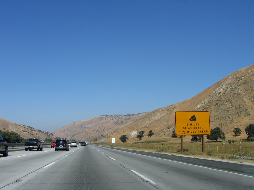
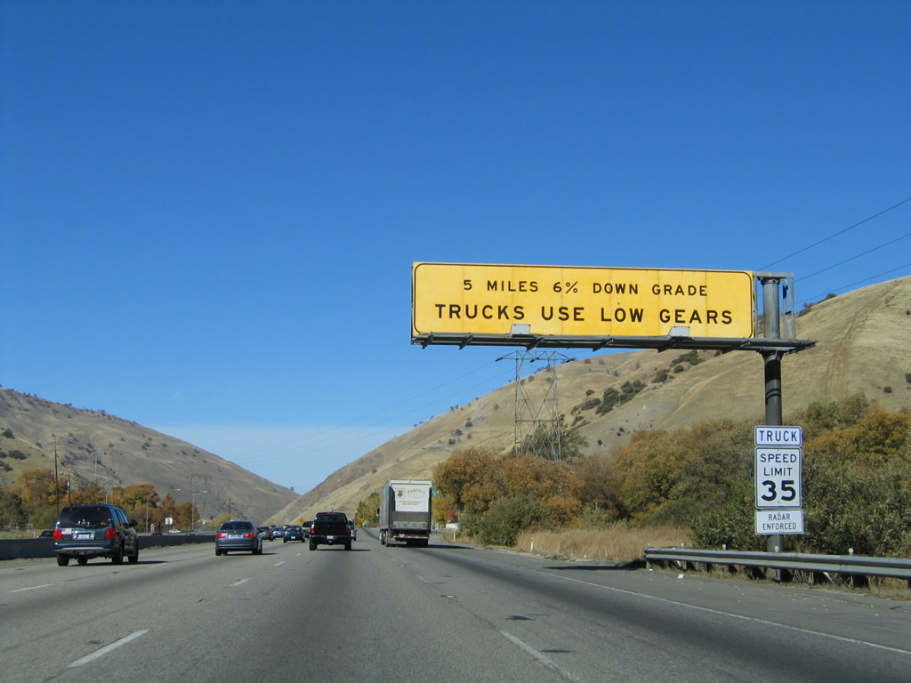
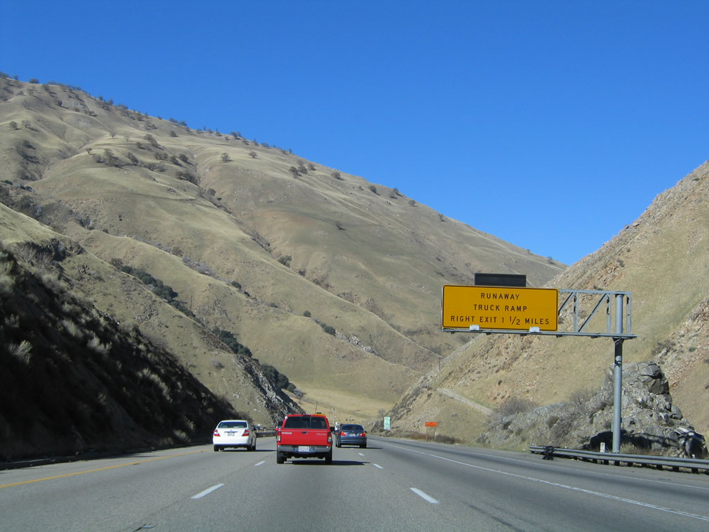
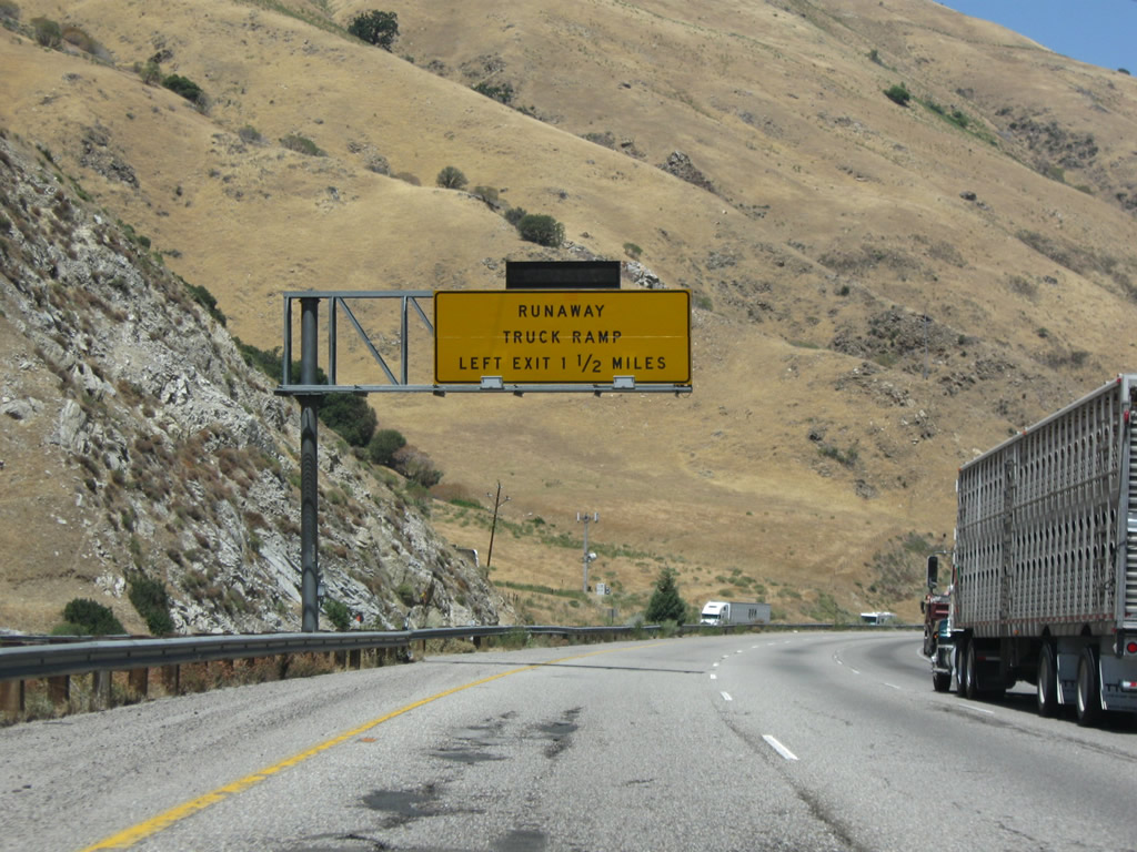
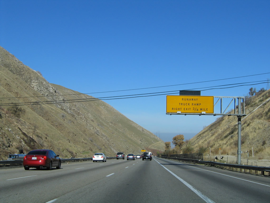
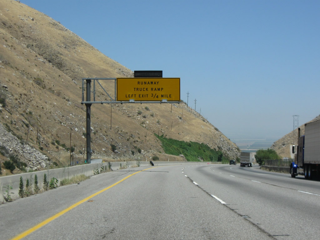
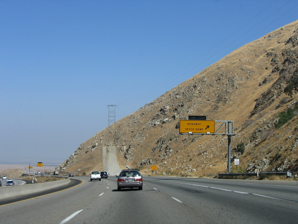
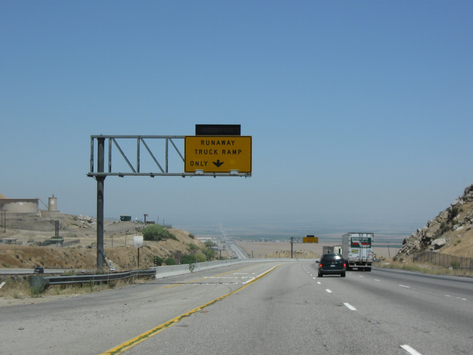
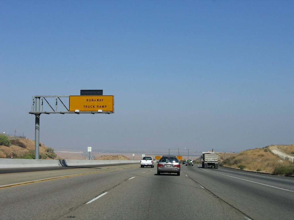
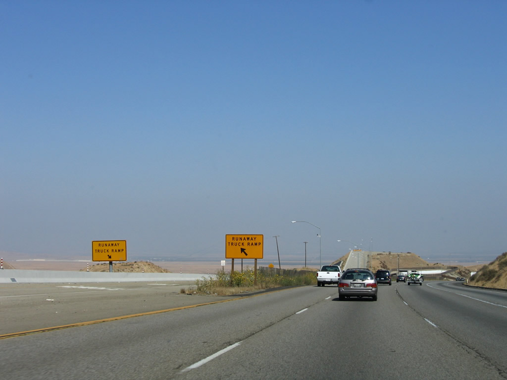
Between Fort Tejon and Wheeler Ridge, Interstate 5 will make a steep descent from the 4,183-foot Tejon Pass to the nearly sea level Central Valley. This warning sign indicates that trucks should be mindful of a 6% grade on the five-mile downslope along Interstate 5 into the Central Valley. This five-mile section of steep downgrade is known as The Grapevine. In winter, this section can be especially dangerous with wet, slick roadways and significant truck traffic. Photo taken 10/07/06. |
|
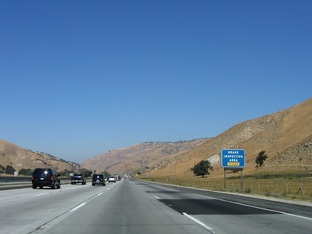
The original brake inspection area has been closed for several years and remains closed as of this writing (in November 2011). Photo taken 10/07/06. |
|
Cones and barricades blocked access to the Brake Check Area. Photo taken 10/07/06. |
|
|
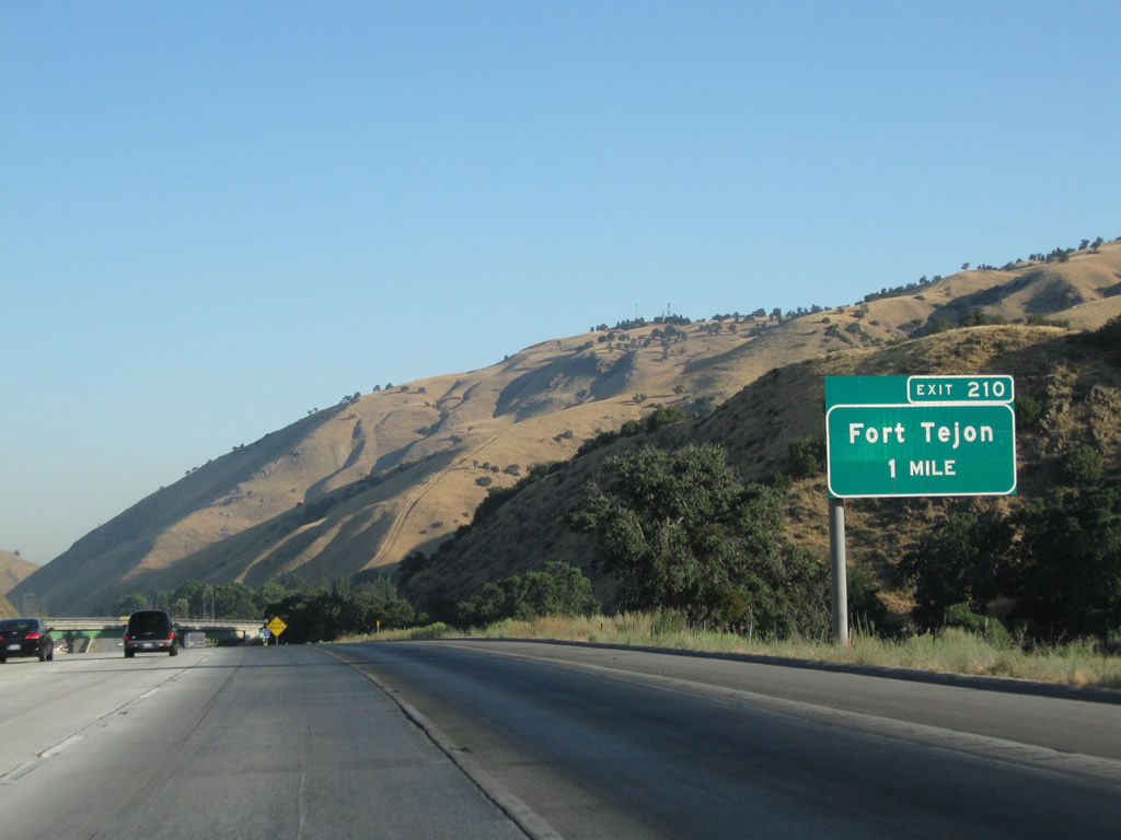
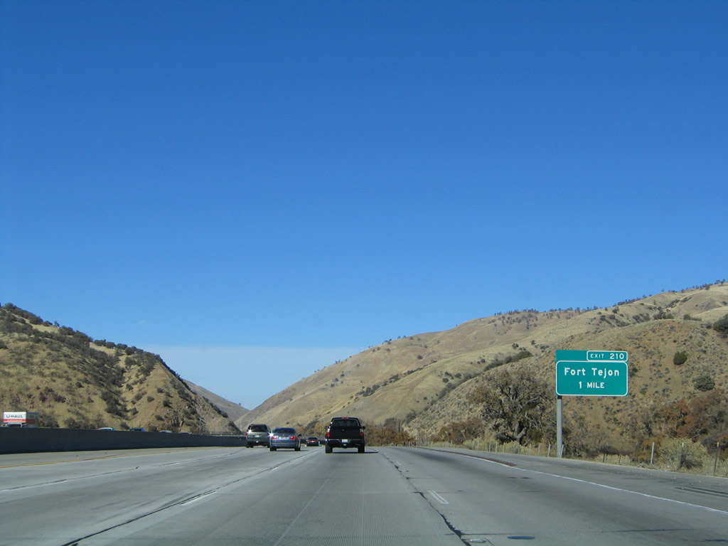
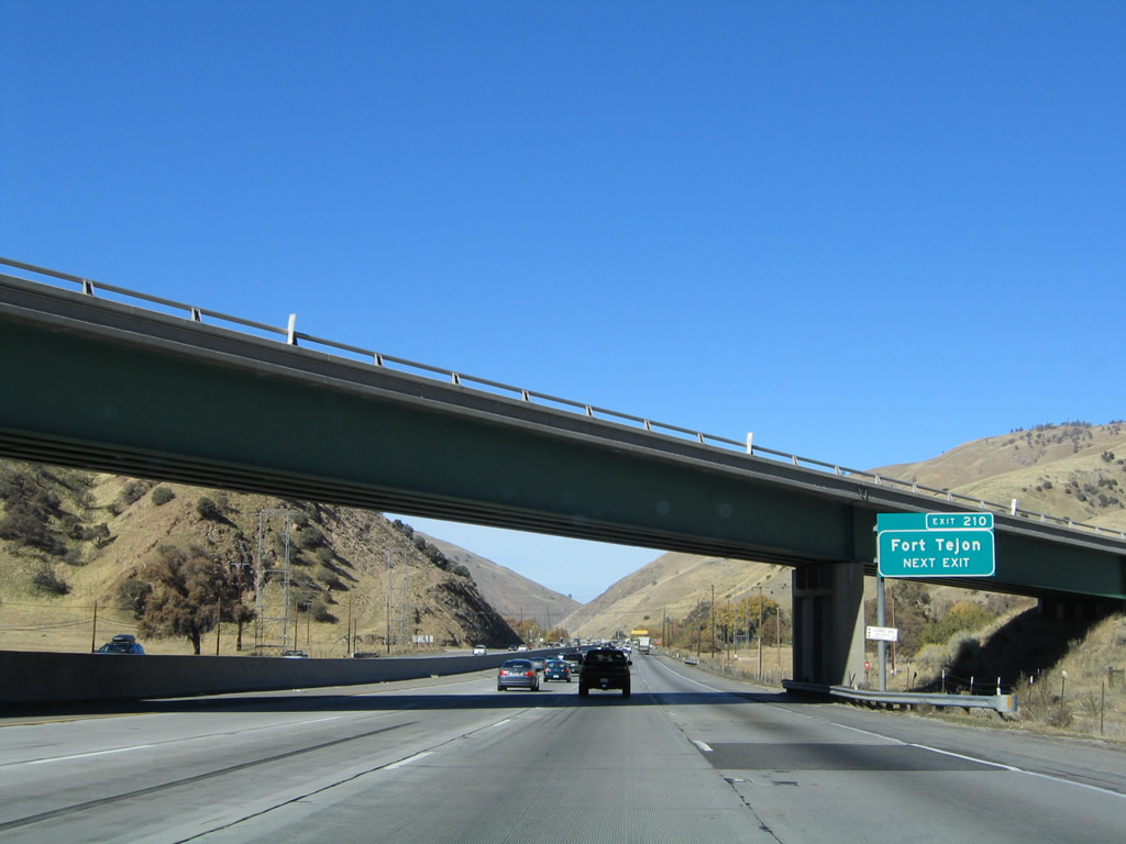
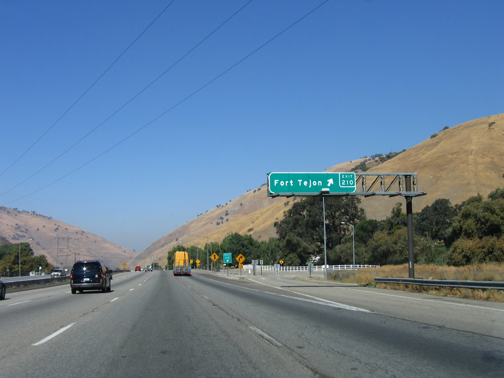
The next exit along Interstate 5 (Golden State Freeway) north is Exit 210, Fort Tejon to Historic U.S. 99. The extant portions of U.S. 99 that are not buried under Pyramid Lake or underneath the freeway are still accessible by many of the exits between Castaic and Fort Tejon, including Lebec, Frazier Park, and Smokey Bear Road. However, these segments of Old U.S. 99 do not necessarily form a continuous, alternative route that completely avoids Interstate 5. Some segments reach dead-ends. Photos taken 07/30/11 and 11/25/04. |
|
The Fort Tejon interchange is one of the first sections of Interstate 5 in Kern County to receive an exit number in 2003. Photo taken 11/25/04. |
|
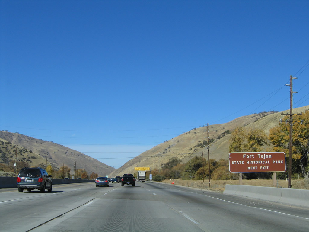
Use Exit 210 to Fort Tejon State Historical Park. This fort, located at the top of Grapevine Canyon, had strategic uses in the early days of California. According to the state park webpage, "The fort was established to protect and control the Indians who were living on the Sebastian Indian Reservation, and to protect both the Indians and white settlers from raids by the Paiutes, Chemeheui, Mojave, and other Indian groups of the desert regions to the south east." Photo taken 11/25/04. |
|
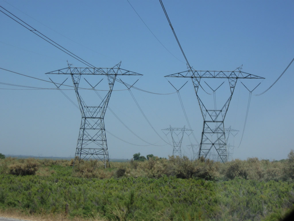
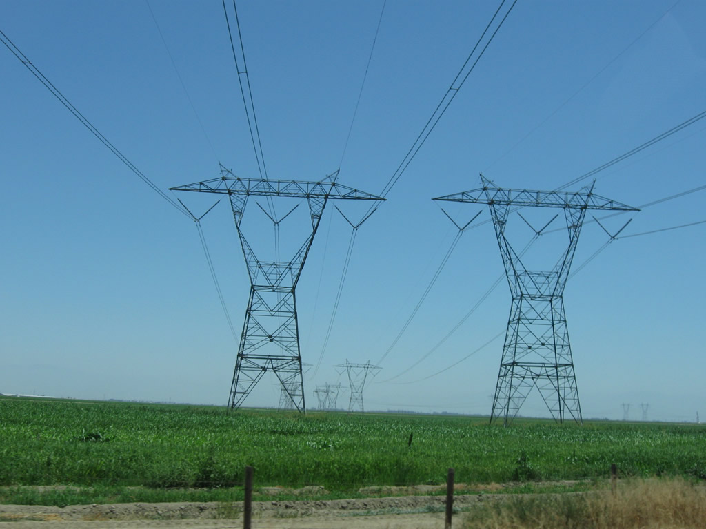
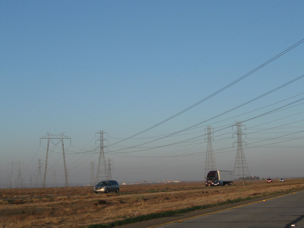
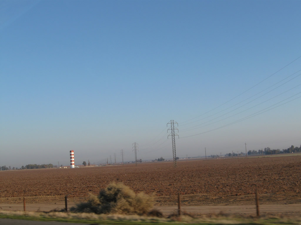
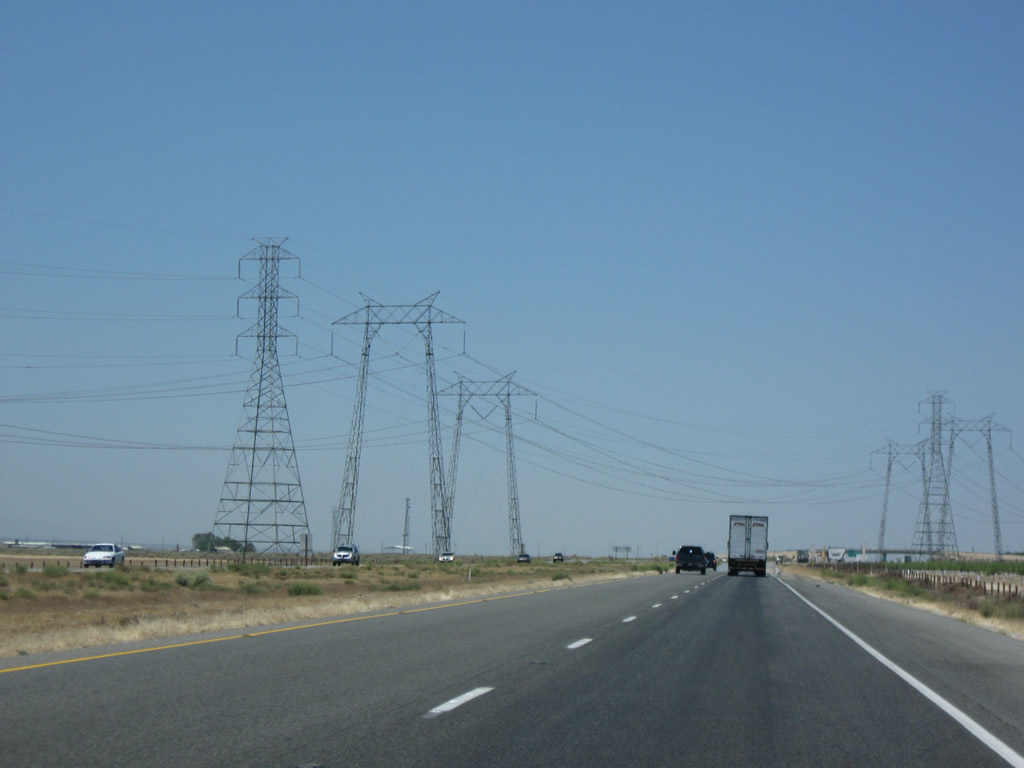
Watch for Slow Trucks for the next five miles. The downslope to the Central Valley begins here at Exit 210 and extends north until Exit 215, Grapevine. These power lines (behind the yellow overhead sign) connects power generation facilities in the Kern River Canyon with the city of Los Angeles. These lines are among the oldest transmission lines still in service in the Golden State. They connect hydroelectric facilities along Kern Canyon with the megalopolis to the south, and they were originally constructed in 1909. Photo taken 11/25/04. |
|
Northbound Interstate 5 (Golden State Freeway) reaches Exit 210, Fort Tejon. Oddly, there are two exit ramps from Interstate 5 north to Exit 210. This is the last exit on northbound before descending the Grapevine grade into the Central Valley, with five miles of a six percent downgrade. Note that there is no alternate route through the Grapevine; old U.S. 99 was directly replaced by the freeway. Photo taken 10/07/06. |
|
|
A second ramp to Exit 210 is located shortly thereafter. This second ramp to Exit 210 is very sharp. Watch for slow trucks upon making this exit. Compare this exit ramp during normal weather and foggy, rainy weather. Photos taken 06/28/06 and 11/23/06. |
|
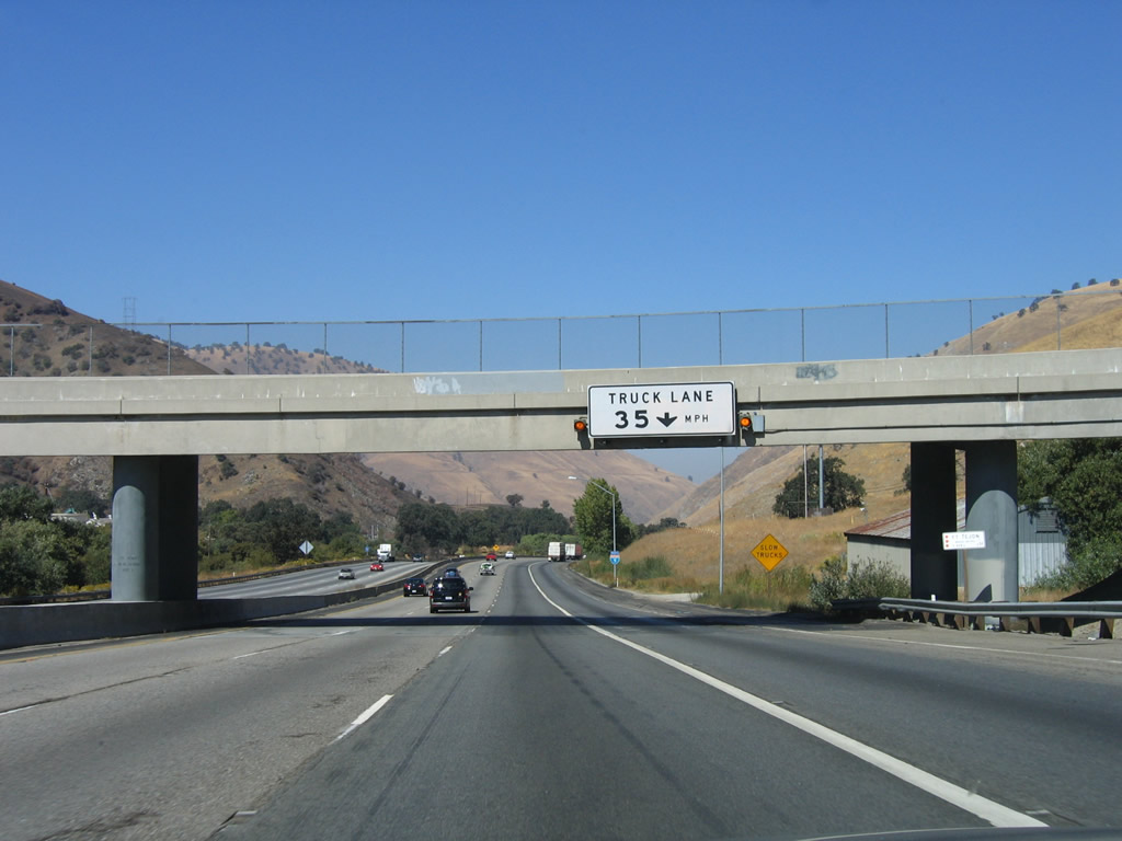
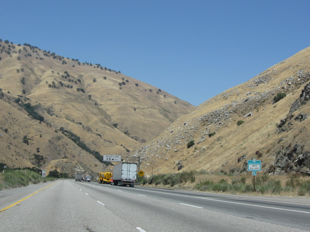
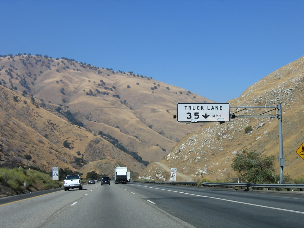
Upon reaching the Fort Tejon overcrossing, the right lane of Interstate 5 northbound becomes a truck-only lane with a 35 miles-per-hour speed limit. This is designed to keep slower traffic to the right as the freeway descends from the 4,000-foot plus Tejon Pass to the floor of the Central Valley, which is only slightly above sea level in elevation. Most of the downgrades are at six percent, as noted in the previous sign. For a comparable descent, see Interstate 70 in Colorado on the freeway descent on eastbound toward Denver. Photo taken 10/07/06. |
|
The right lane is marked with a solid white line to indicate its role as a truck lane. Photo taken 10/07/06. |
|
Quickly, the descent gets steep. Most cars will stay in the left lanes, while trucks will stay right. Watch for slowing traffic and sudden lane changes. Photo taken 06/28/06. |
|
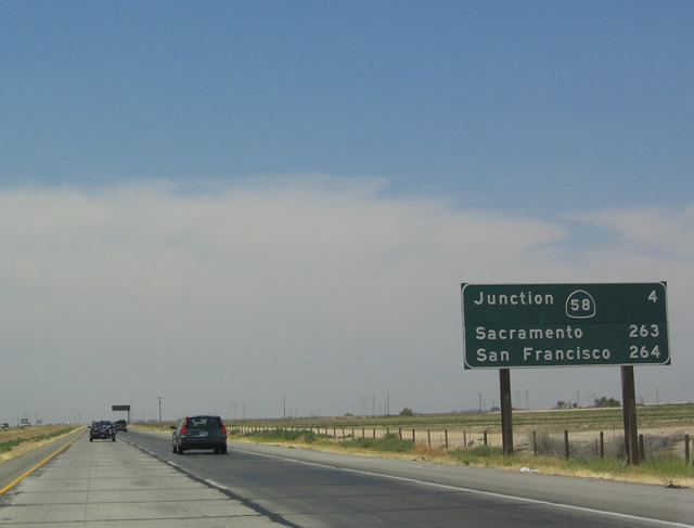
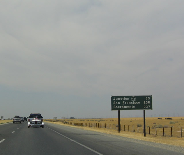
Each of the destinations as well as the control city listed on this mileage sign are directly accessible via California 99, while only Sacramento may be reached via Interstate 5. Through the Central Valley, California 99 serves most of the large population centers, while Interstate 5 prefers to remain on the west side of the valley, avoiding most metropolitan areas until reaching the Tracy-Manteca area. Photo taken 10/07/06. |
|
Michael Ballard, who is a well-known highway historian and road (and geology) enthusiast from Southern California, adopted this stretch of Interstate 5 (in both directions) through the Grapevine. Photo taken 07/15/09. |
|
An overhead sign reminds motorists of the lowered speed limit for the Truck Lane. Photo taken 10/07/06. |
|
|
|
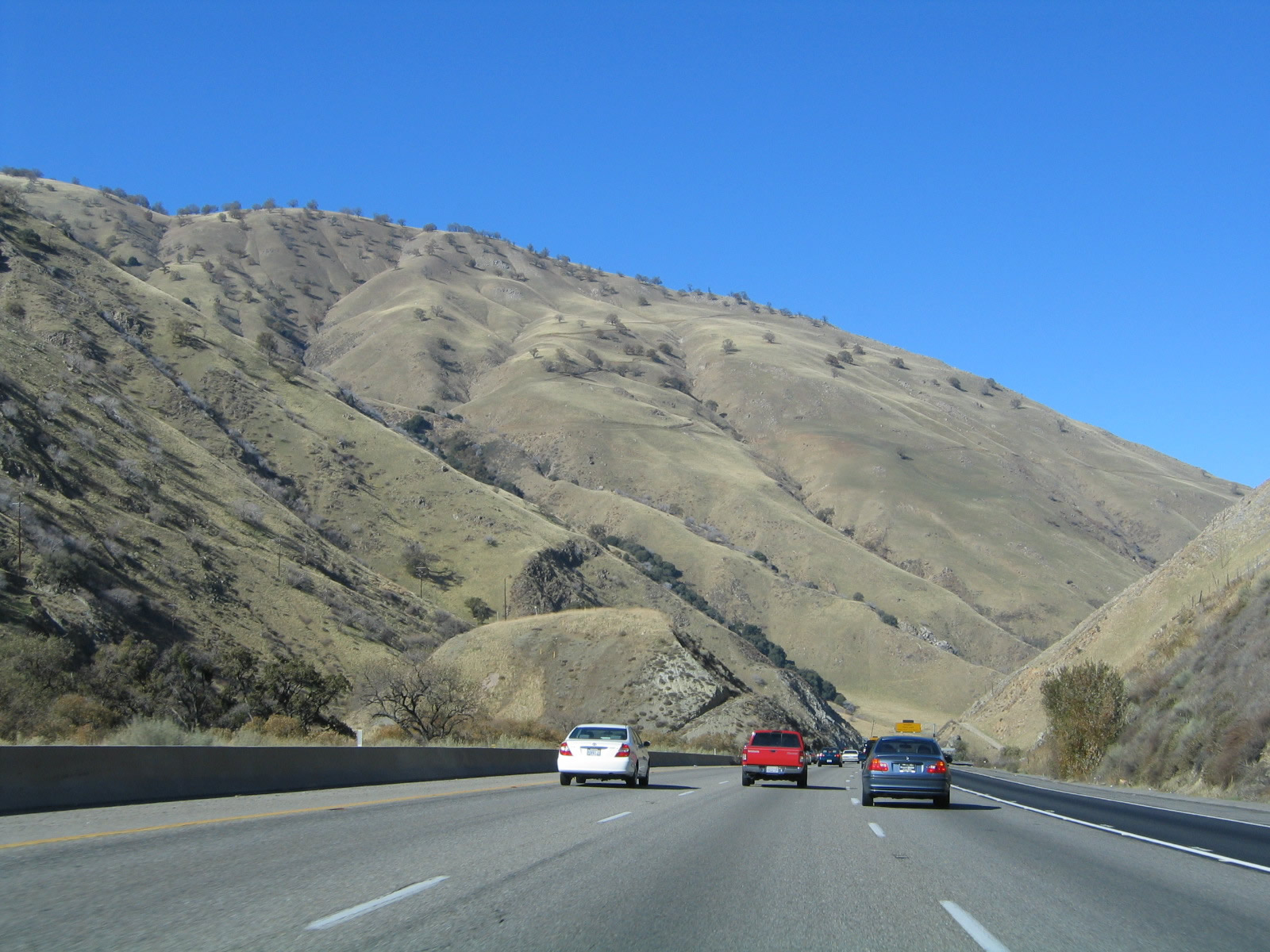
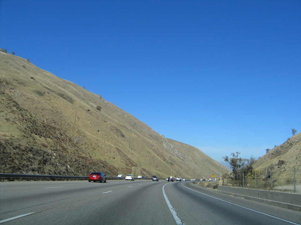
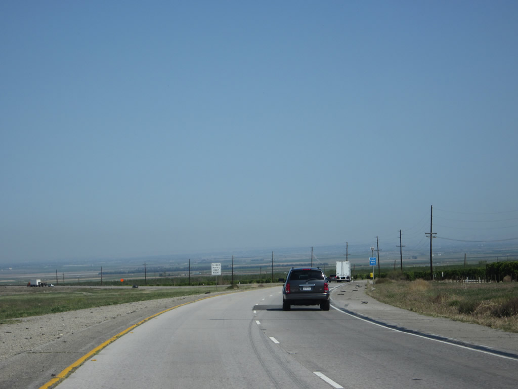
After passing Fort Tejon, northbound Interstate 5 descends into the Central Valley. These pictures chronicle the descent of the freeway, which features a lane dedicated to trucks so that they can maintain a slower speed limit than passenger vehicles might be traveling. This grade, commonly known as the Grapevine, can be treacherous in wet or foggy weather, but it also affords spectacular views of the mammoth Central Valley sprawling in the distance. The fact that the mountains end here and the valley begins is no accident; this is close to where the infamous San Andreas Fault passes Interstate 5. Julian Balgobin writes that the San Andreas Fault actually meets up with the highway just south of Gorman and runs parallel to the freeway. Interstate 5 then crosses the fault at Tejon Pass, where the fault then trends in a westerly direction through Cuddy Valley, while Interstate 5 makes a sharp right hand turn to heads toward for Lake Castaic. The San Andreas Fault, meanwhile, heads northwesterly parallel to the coast en route to San Francisco and easterly toward the Salton Sea basin, which is the southern end of the San Andreas Fault. These mountains, and the valley below, are all the result of the earth's constant geological motion and development, including plate tectonics, earthquakes, erosion, weathering, and uplift. Photos taken 11/25/04, 06/28/06, 10/07/06, and 07/15/09. |
|
|
|
|
|
|
|
The second truck escape ramp is a left exit. Photo taken 11/25/04. |
|
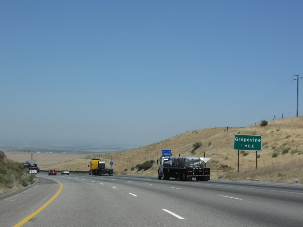
The next exit along northbound is Exit 215, Grapevine (one mile). Photo taken 07/15/09. |
|
Another extant section of Old U.S. 99 is available to drive by taking Exit 215, Grapevine. Photo taken 11/25/04. |
|
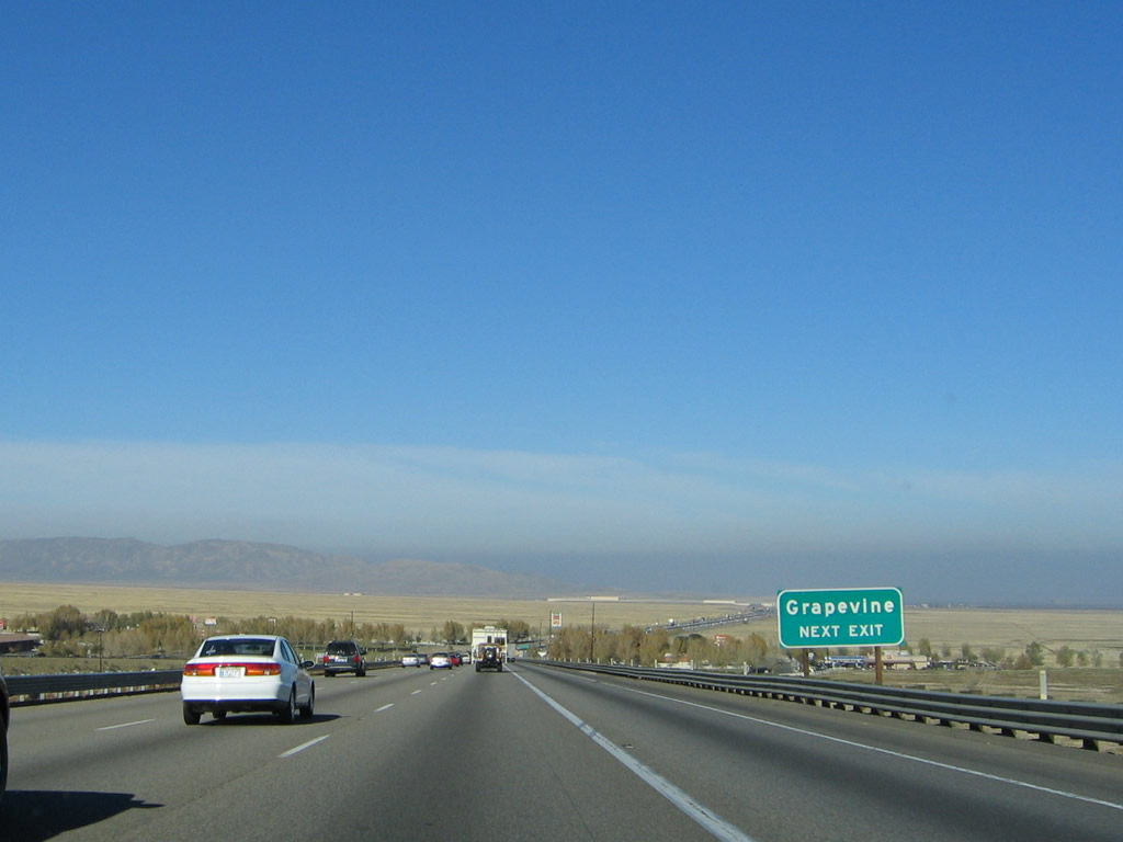
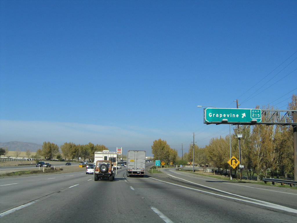
Coming close to the bottom of the Grapevine Canyon grade, northbound Interstate 5 reaches Exit 215, Grapevine. It can be tricky to reach this exit because motorists must cross the slow-moving truck lane to make the exit. Photo taken 11/25/04. |
|
The speed limit climbs back to 70 miles per hour after the Grapevine interchange. Photo taken 10/07/06. |
|
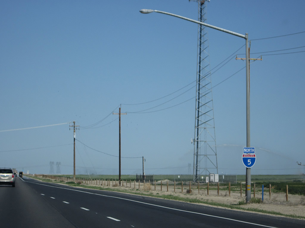
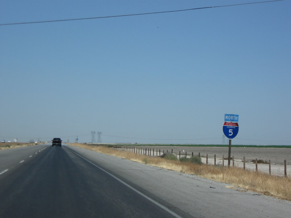
An Interstate 5 north reassurance shield is posted after the on-ramp from Grapevine. Photo taken 07/15/09. |
|
|
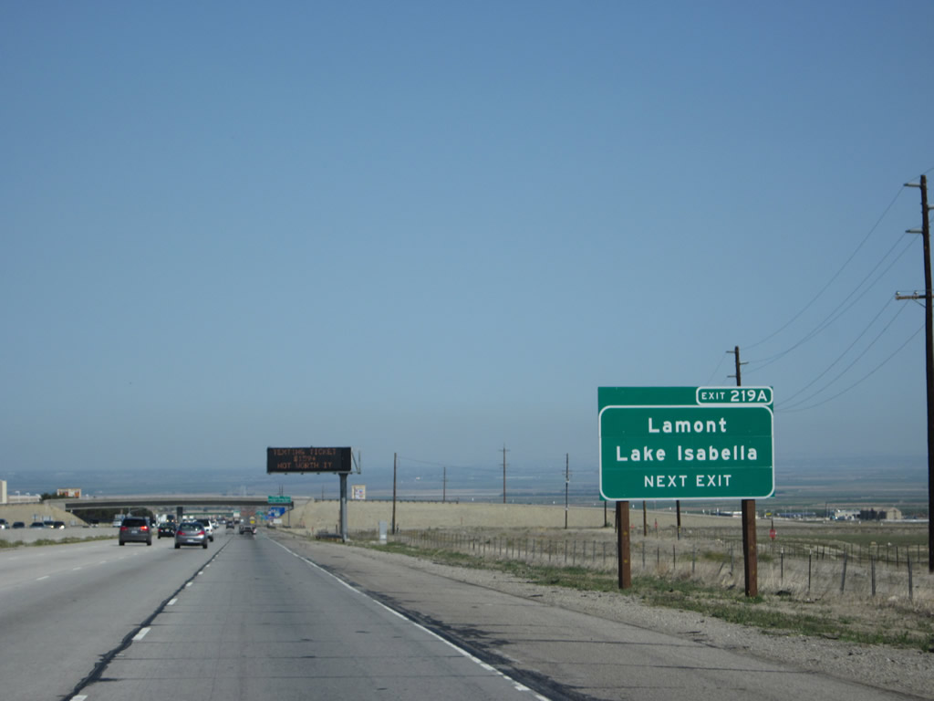
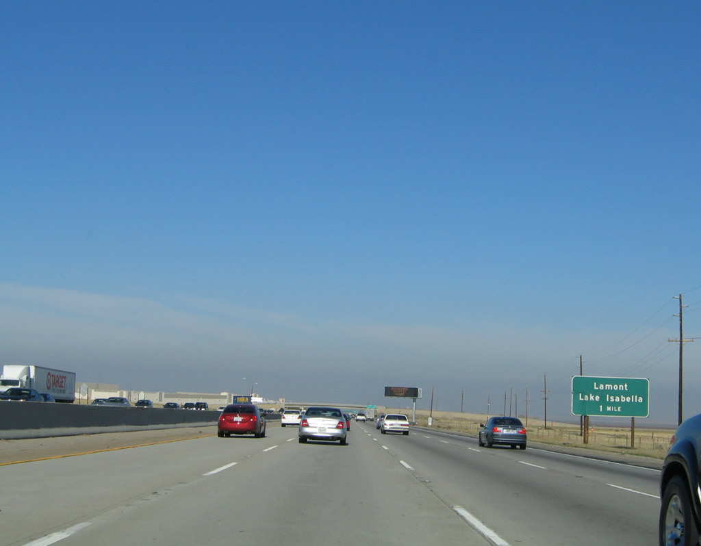
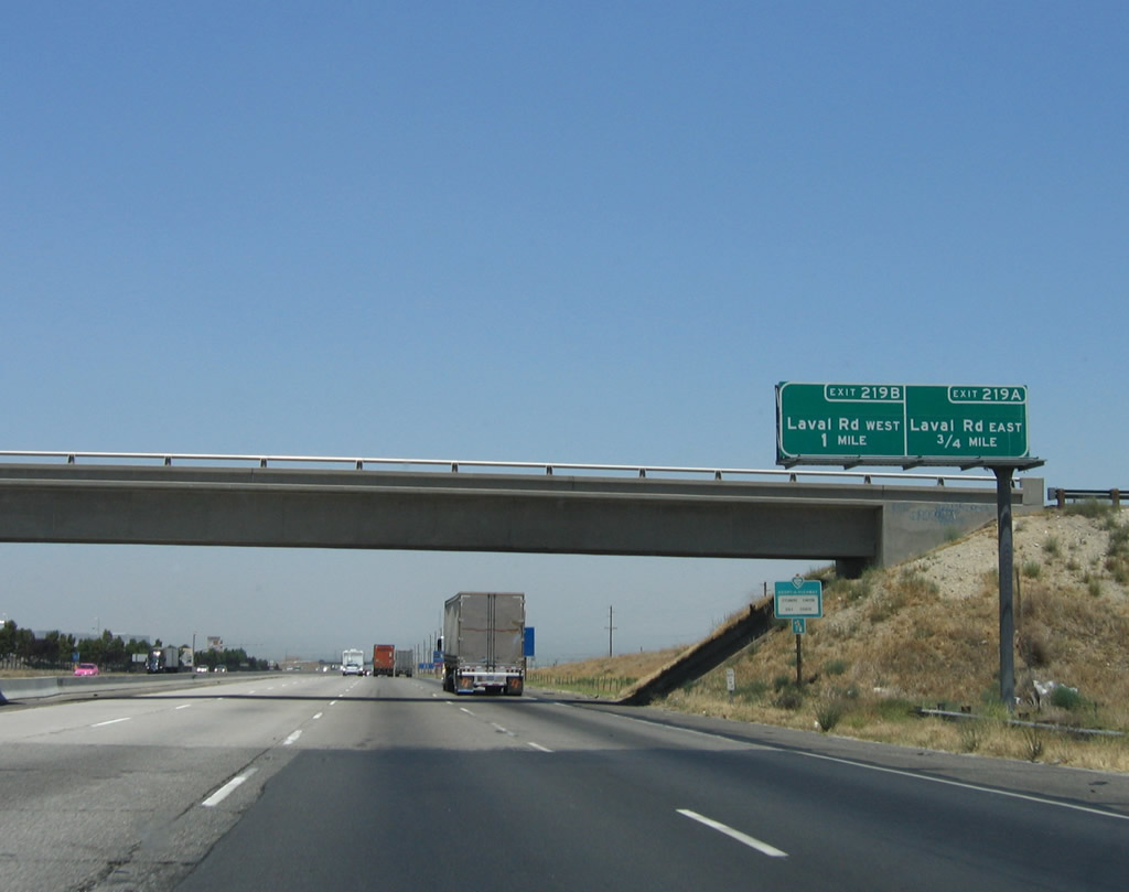
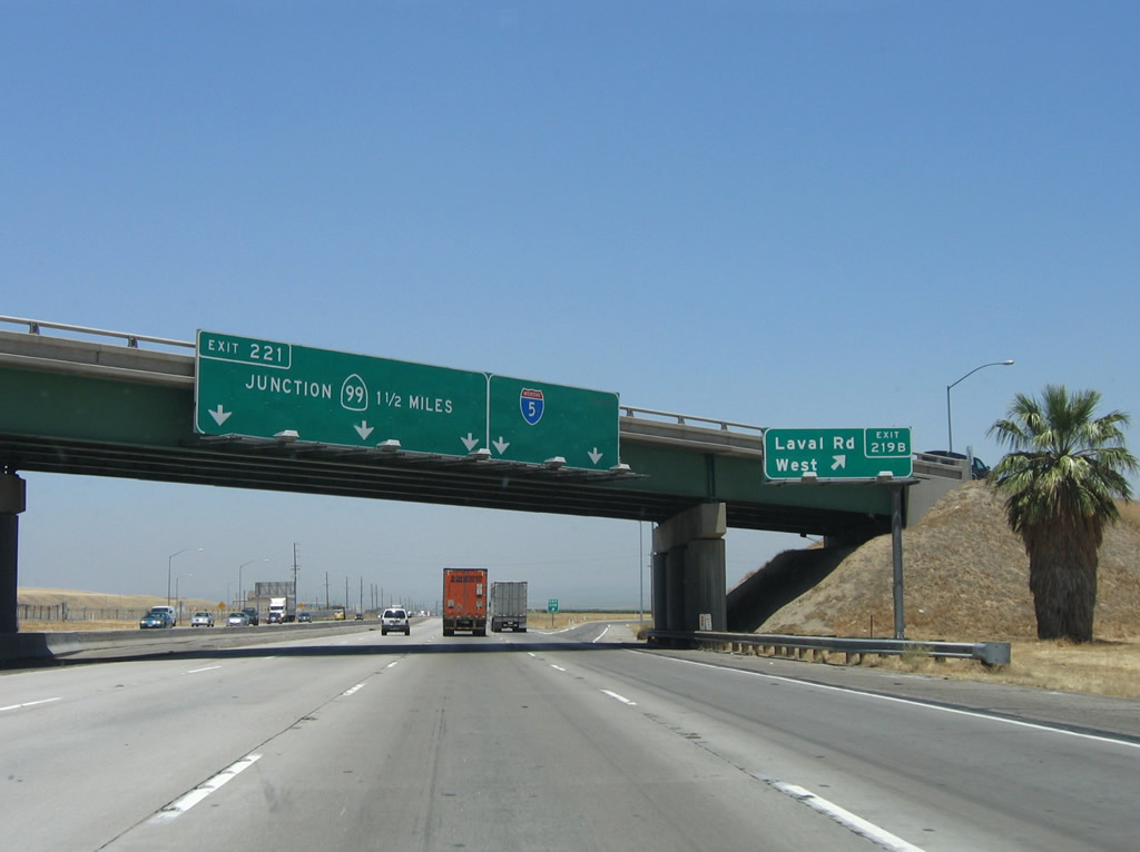
The next interchange on Interstate 5 (Golden State Freeway) north is Exits 219A-B, Laval Road. This interchange serves Wheeler Ridge (el. 964 feet) and connects to Wheeler Ridge Road (former California 184) north to Lamont and Lake Isabella (via California 178). Plenty of growth has occurred at or near this interchange, both from the Tejon Ranch service center and the nearby industrial parks and distribution centers. Photos taken 04/06/12 and 11/25/04. |
|
A dynamic message sign is posted soon thereafter. Traffic, construction, and weather conditions (such as winter tule fog) can be posted on this sign as conditions warrant. Photo taken 04/06/12. |
|
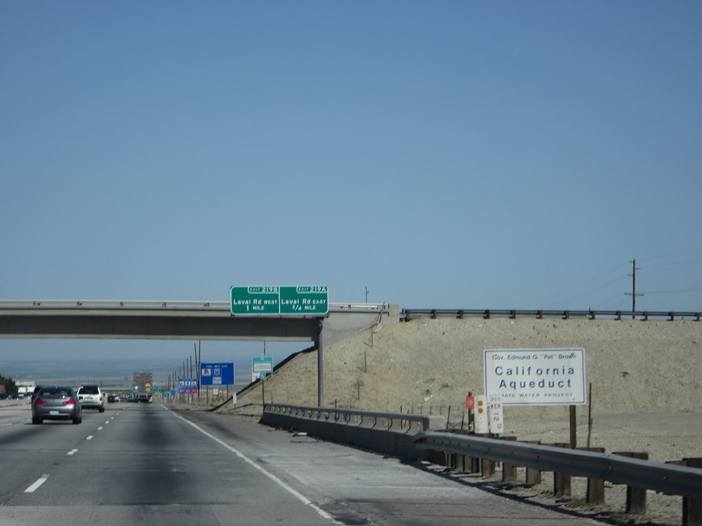
Interstate 5 passes over the California Aqueduct prior to the Laval Road interchange. From here north to the California Delta, Interstate 5 and the aqueduct will spend miles following each other along the western edge of the Central Valley. Photo taken 04/06/12. |
|
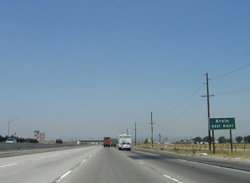
An overhead sign advises of Exit 219A, Laval Road east to Wheeler Ridge north to Arvin, Lamont, and Lake Isabella and Exit 129B, Laval Road west to Wheeler Ridge. Several large-scale distribution centers are located at this interchange. Photo taken 06/28/06. |
|
|
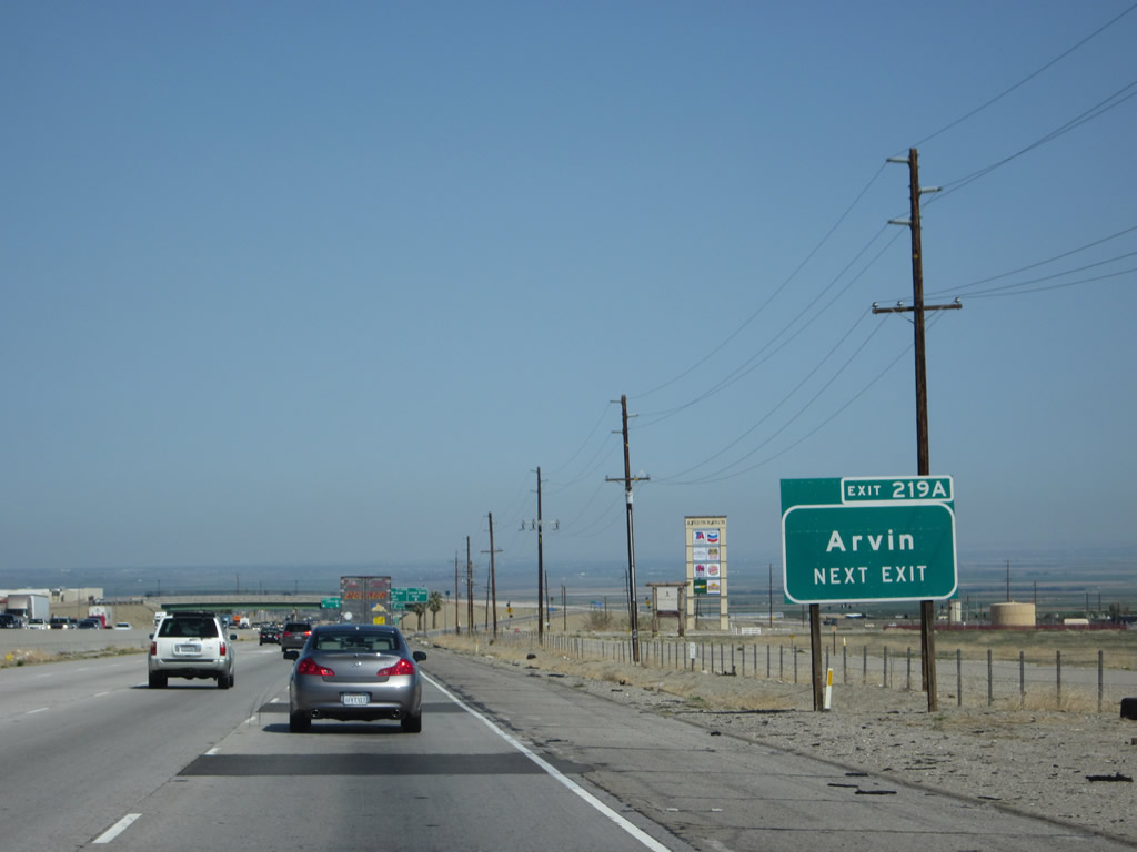
Use Wheeler Ridge north to Arvin, which is located on California 223 (Bear Mountain Road) east of Weedpatch and southeast of Lamont. An exit number was added to this sign by 2009. Photos taken 04/06/12 and 06/28/06. |
|
|
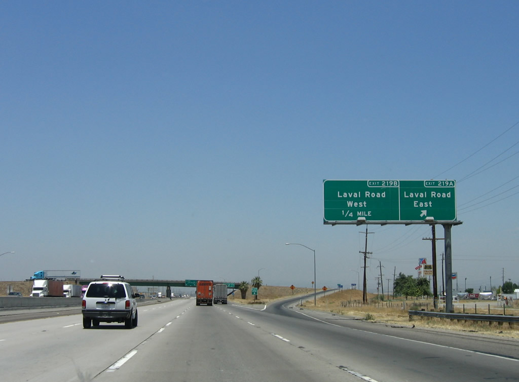
Northbound Interstate 5 reaches Exit 219A, Laval Road east; the following ramp connects to Exit 219B, westbound Laval Road. All motorist services (including truck stops) are located at this interchange. Photos taken 06/28/06 and 04/06/12. |
|
|
|
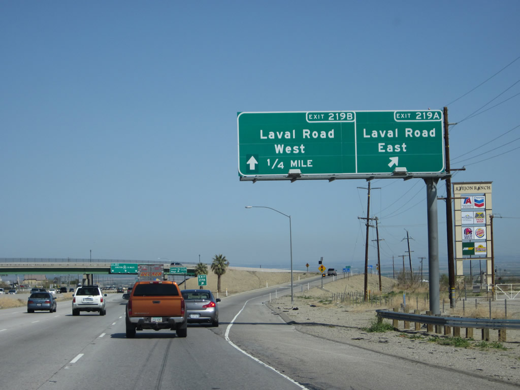
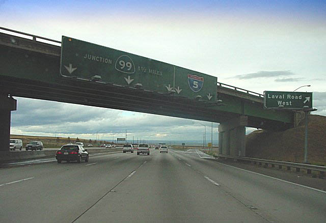
| Northbound Interstate 5 reaches Exit 219B, Laval Road west. The next exit is the Interstate 5/California 99 split (Exit 221). Compare the picture from October 2001 to the picture from June 2006. The shields on the original overhead signs were probably the largest on any overhead sign in California; the replacement signs were installed in 2002. Now the signs have been replaced with reflective signage, and shields have been reduced in size (and exit numbers have been added, making this the first instance we've seen of an exit number on a freeway-to-freeway connection). California 99 serves the more populated east side of the Central Valley and foothills, while Interstate 5 follows the west side of the valley. Technically, the Golden State Freeway continues north along California 99, while the West Side Freeway follows Interstate 5 northbound. By this point, most travelers refer to this as Interstate 5 or "the 5," not the Golden State Freeway or West Side Freeway. Photos taken 04/16/12, 06/28/06, and 10/22/01. |
|
A beautiful sunrise greeted us on the drive on this autumn morning between Exits 219B and 221. Photo taken 11/24/11. |
|
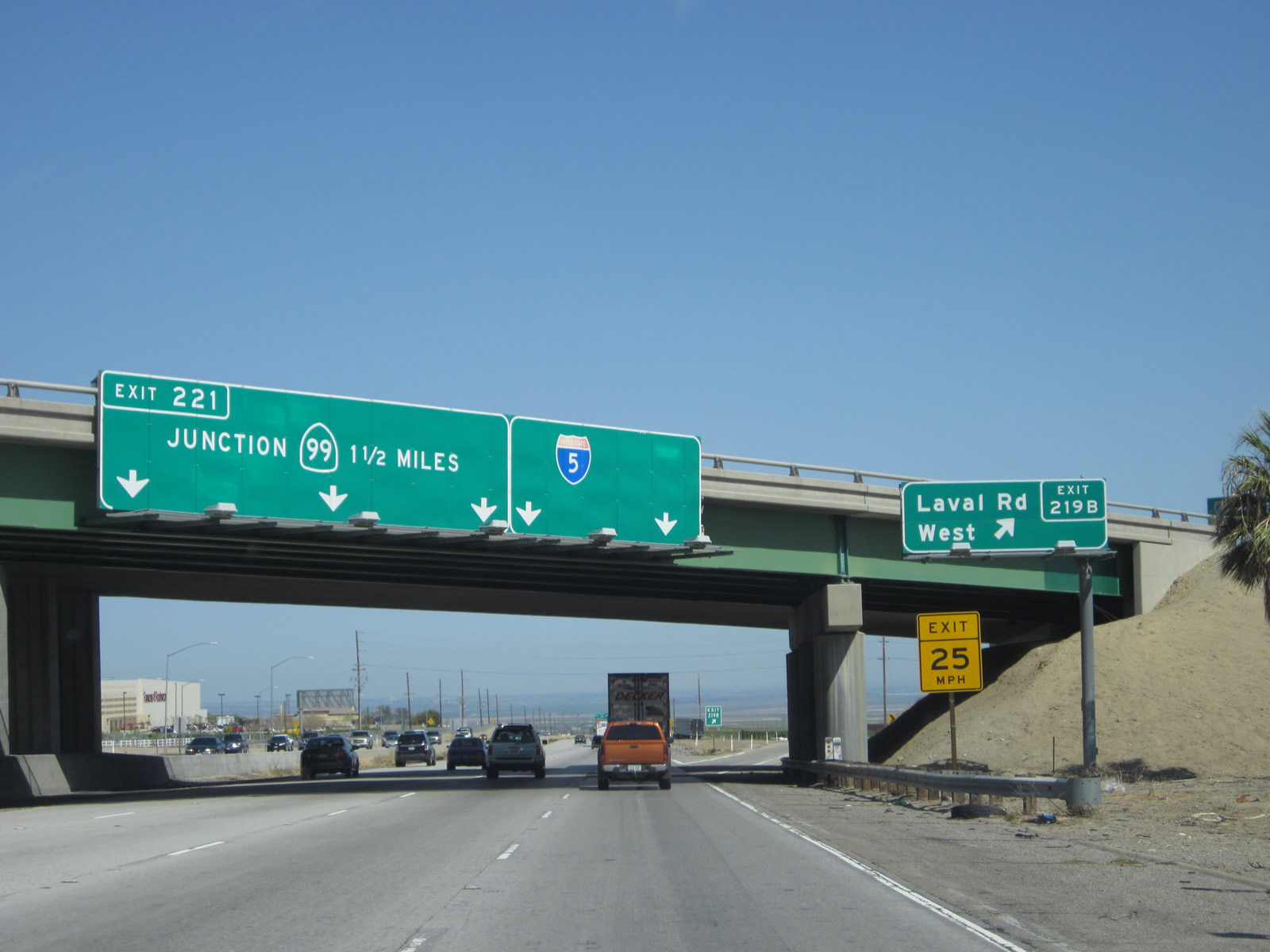
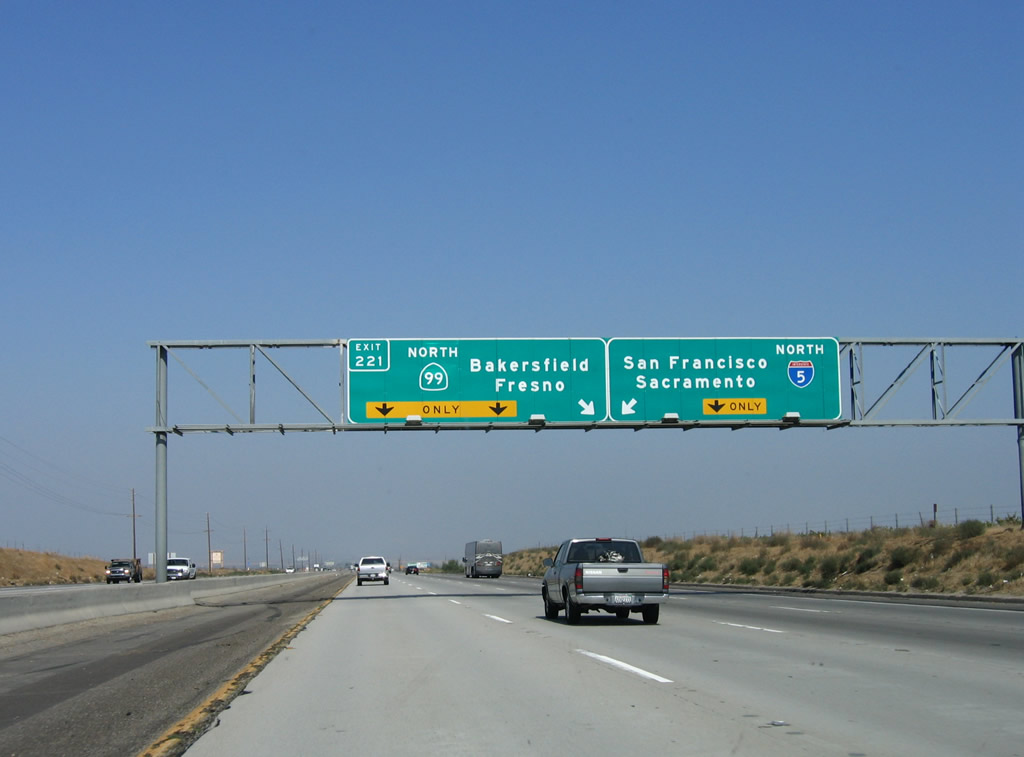
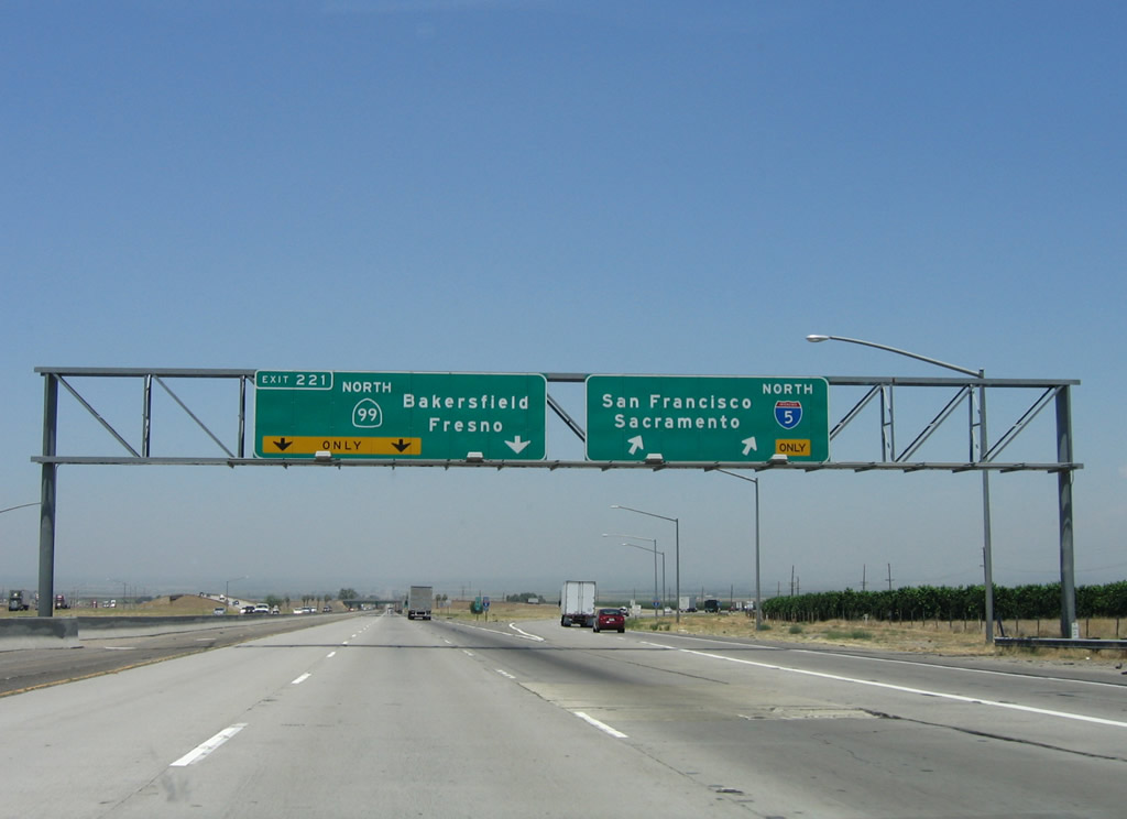
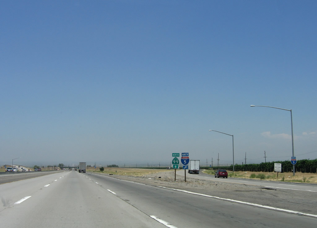
The next exit on Interstate 5 (Golden State Freeway) north is Exit 221, California 99 (Golden State Freeway) north. California 99 is the original route of U.S. 99 through the Central Valley, and it serves cities such as Bakersfield, Fresno, Modesto, Stockton, and Sacramento. It is only a few miles longer than Interstate 5, but it passes through many cities, making it more congested than Interstate 5. Through traffic is recommended to use Interstate 5, as is traffic headed for the San Francisco Bay Area. Photo taken 10/07/06. |
|
|
Northbound Interstate 5 reaches Exit 221, California 99 (Golden State Freeway) north. As shown by comparing the November 2002 pictures with the January 2002 pictures, all original signage at this interchange has been replaced. Photos taken 06/28/06 and 10/07/06. |
|
|
|
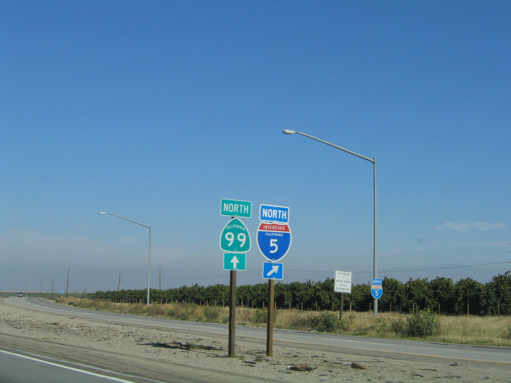
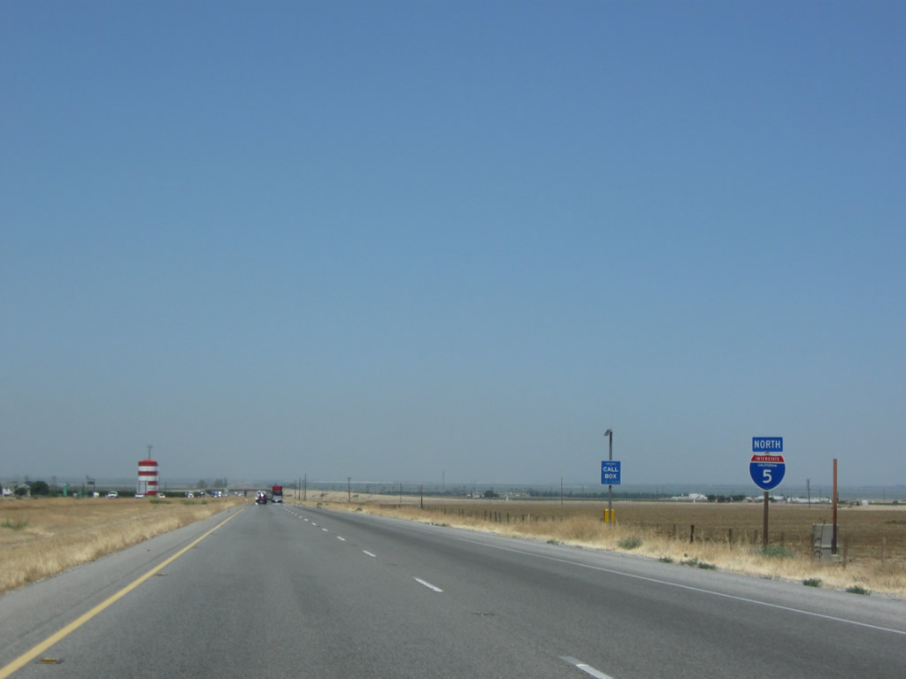
A set of trailblazers for California 99 and Interstate 5 are posted at the split of the two routes. This view shows the two shields as seen from the California 99 exit. This is the point where U.S. 99 deviates from Interstate 5. Historic U.S. 99 does not rejoin and parallel Interstate 5 until Woodland, where Historic U.S. 99W parallels the freeway from that point north to Red Bluff (where Historic U.S. 99E merges with U.S. 99W to become U.S. 99 once again). Photos taken 11/25/04, 10/07/06, and 04/06/12. |
| Interstate 5 (West Side Freeway) north |
|---|
|
|
|
After splitting with California 99, northbound Interstate 5 carries two lanes that swing wide around the interchange and then crosses over the main lanes of California 99. Photos taken 04/06/12, 07/15/09, and 07/02/04. |
|
|
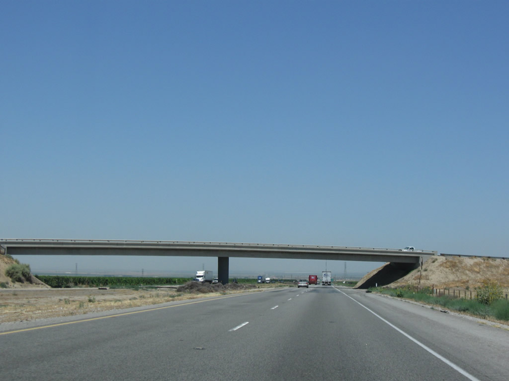
Northbound Interstate 5 (West Side Freeway) approaches and passes over California 99 on this bridge. The two routes will remain split until they reconverge in Sacramento. After California 99 splits away from northbound Interstate 5, the freeway becomes a four-lane (two lanes each way) freeway for the first time on its northbound journey. It will remain this way until reaching Interstate 205 near Tracy. Photos taken 04/06/12 and 07/15/09. |
|
This mileage sign is located along northbound immediately after Exit 221, California 99. Even though this is the southern end of the Central Valley, agriculture is not as prominent as it is farther north due to the lack of rainfall and lower quality soil. It is interesting to see how the valley changes from arid/semi-desert into a fertile growing region as Interstate 5 continues northward. Photo taken 04/06/12. |
|
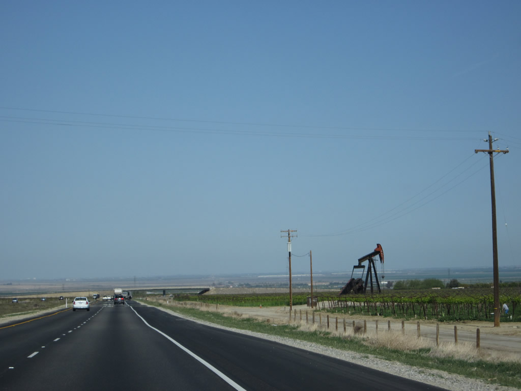
Although much of the southern end of the Central Valley is dominated by agriculture, oil exploration continues as seen by this oil derrick working for an oil claim. Major oilfields are scattered across the southern Central Valley, including a large one at the north bank of the Kern River in Oildale (off California 99 north of Bakersfield) and several along California 33 near Taft. Photo taken 04/06/12. |
|
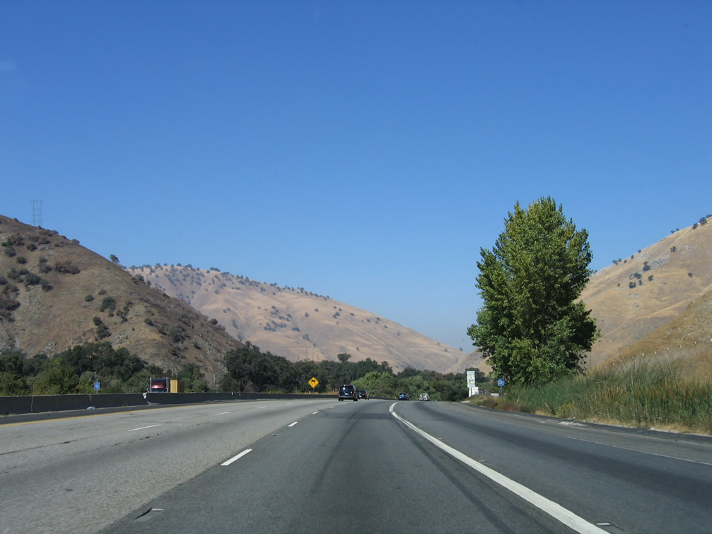
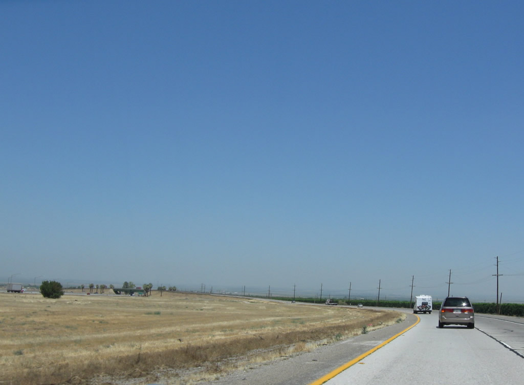
In the Central Valley, Interstate 5 has a completely different persona than it did while passing through the urban areas of Southern California and the Tehachapi Mountains north of Santa Clarita and Castaic. Farms and ranches line both sides of many sections of the freeway, including this area between the California 99 and California 166 interchanges. Photo taken 07/15/09. |
|
Kern County is one such agrarian area, and local roads criss-cross Interstate 5 to connect farms with local towns and markets. Photo taken 07/15/09. |
|
|
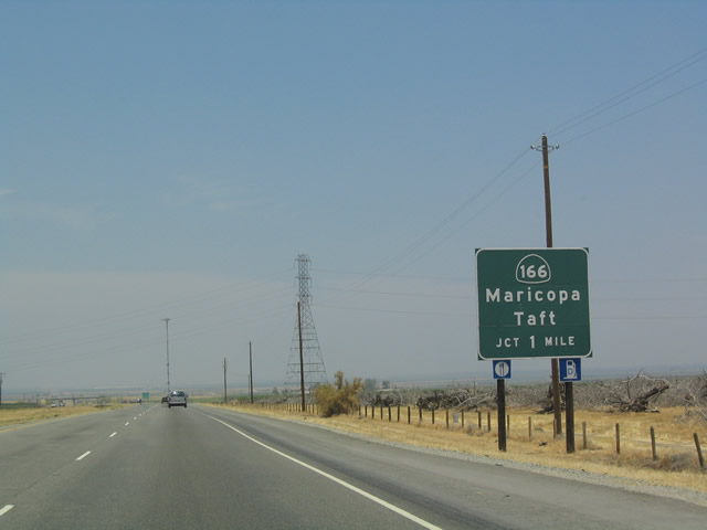
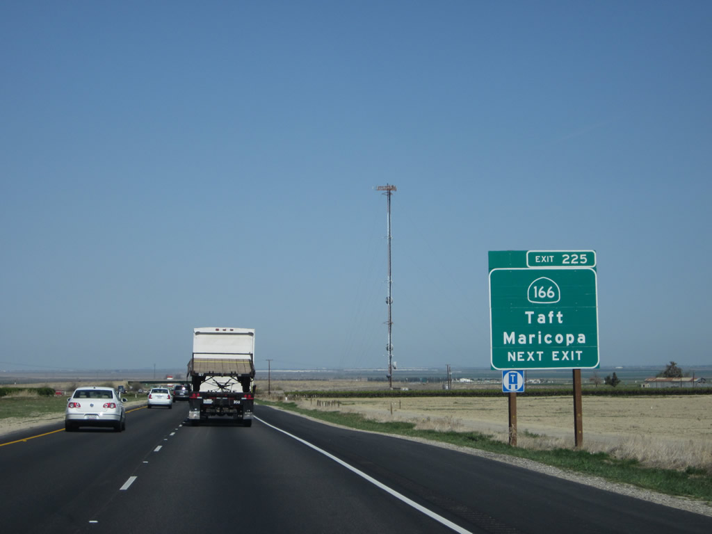
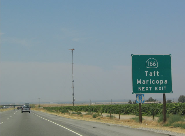
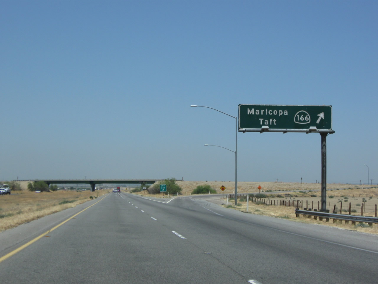
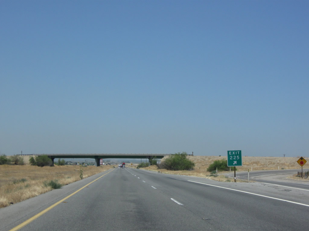
The next exit along Interstate 5 north is Exit 225, California 166 (one mile). California 166 travels east to connect to California 99, but it does not extend any further east beyond 99. To the west, California 166 links to California 33 near Maricopa, then continues east to meet U.S. 101 at Santa Maria and California 1 near the coast at Guadalupe. An exit number was added to this sign by 2009. Photo taken 04/06/12 and 07/02/04. |
|
|
Even though Interstate 5 has only two northbound lanes, it can be quite busy! Notice all the trucks in the July 2009 picture. Overhead, a Pacific Gas & Electric power transmission line crosses above Interstate 5. The freeway left Southern California Edison territory and entered the southern reaches of Pacific Gas & Electric territory after splitting from California 99. Photos taken 07/15/09 and 11/25/10. |
|
Use California 166 west to reach the California Aqueduct pumping stations just west of Wheeler Ridge. The California Aqueduct parallels Interstate 5 from Los Angeles north through the Central Valley to the Sacramento/San Joaquin River Delta. To pump the water up and over the 4,000 foot mountains that divide the Central Valley from Los Angeles, massive pumping stations push the water uphill to ensure water is received by the megalopolis. These pumping stations use so much power that their usage had to be curtailed during the power crisis of the summer of 2001. Photo taken 11/28/02. |
|
|
Interstate 5 (West Side Freeway) north approaches Exit 225, California 166. This advance sign changed between 2004 and 2011 to incorporate the exit number. Photos taken 04/06/12 and 07/02/04. |
|
|
Northbound Interstate 5 meets Exit 225, California 166 east to California 99 or west to Santa Maria. Photos taken 07/15/09. |
|
Interstate 5 through the Central Valley between California 99 and Interstate 580 opened in large segments through the early 1970s. As a result, many of the design features along this long stretch of freeway are shared. An example of this are the green, steel girder bridges such as the California 166 overpass. Photo taken 07/15/09. |
|
|
An Interstate 5 north shield is posted after the on-ramp from California 166. Kern County seems to have an ample supply of neutered Interstate 5 route markers that were placed along this segment of Interstate 5 (between California 99 and California 58). In 2010 and 2011, the local Caltrans district started replacing some of the Interstate 5 reassurance shields with neutered shields (no state name and often with a more angular shape than the standard shield). Photos taken 04/06/12 and 07/15/09. |
|
|
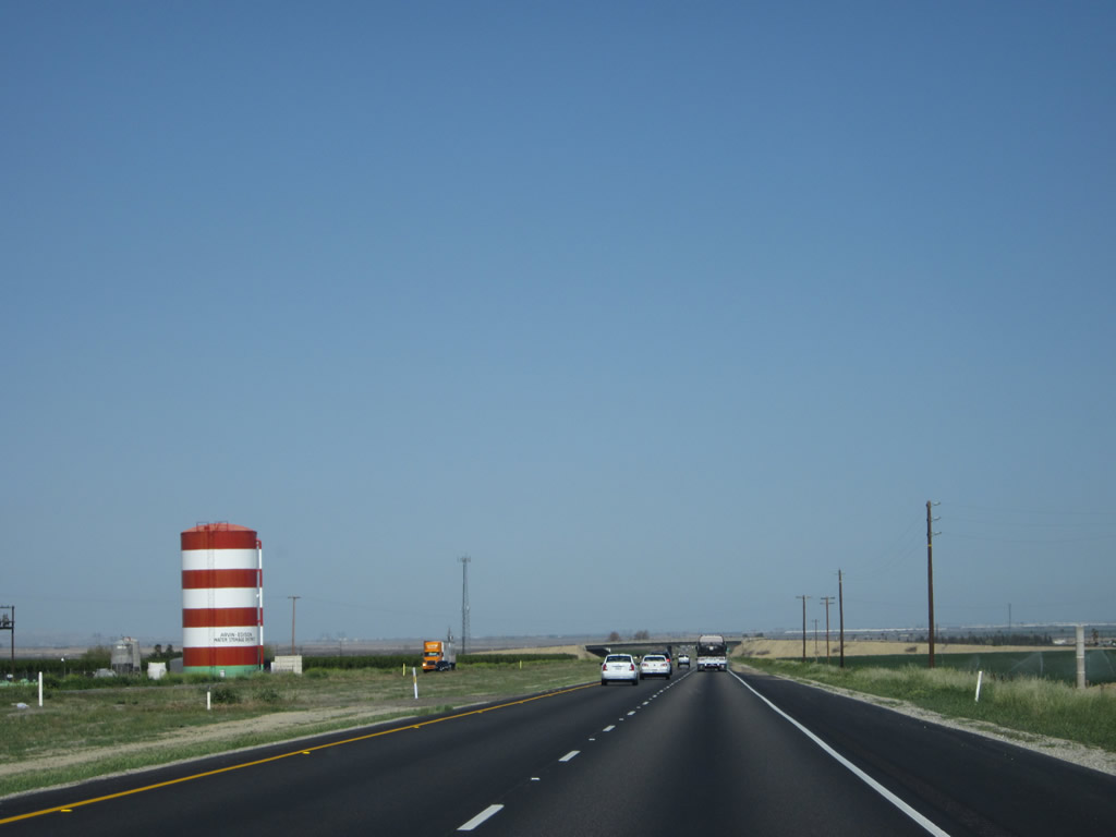
These red and white water towers are commonly seen along both Interstate 5 and California 99 in southern Kern County. Owned by the Arwin-Edison Water Storage District, these towers remind us of the Cat in the Hat. Photos taken 04/06/12 and 11/25/10. |
|
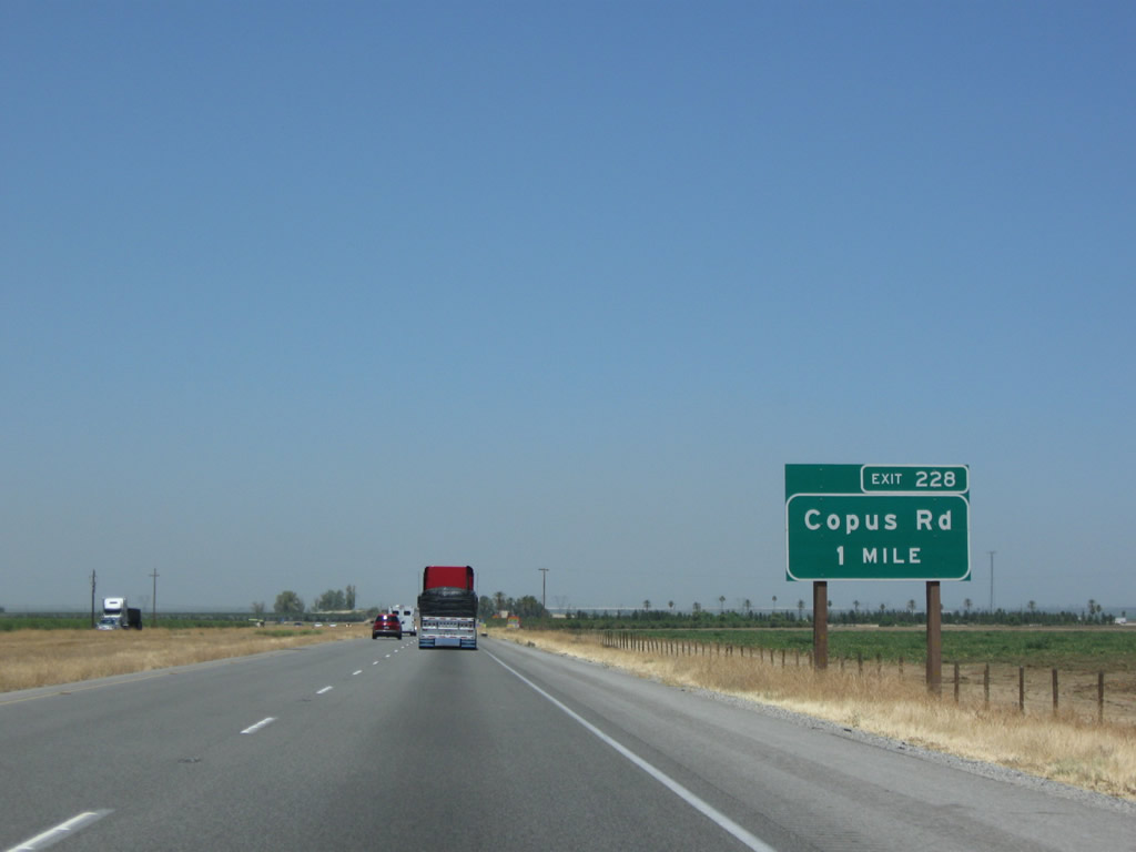
The next exit along northbound Interstate 5 (West Side Freeway) is Exit 228, Copus Road (one mile). Copus Road provides local, farm-to-market access. Photo taken 07/15/09. |
|
Northbound Interstate 5 meets Exit 228, Copus Road. Photo taken 07/15/09. |
|
In an adjustment from the urban driving conditions of Interstate 5, the feel of the freeway is vastly different as drivers become accustomed to a wide, expansive valley with little or no development. An Interstate 5 reassurance marker is posted after the on-ramp from Copus Road. Photo taken 07/15/09. |
|
|
|
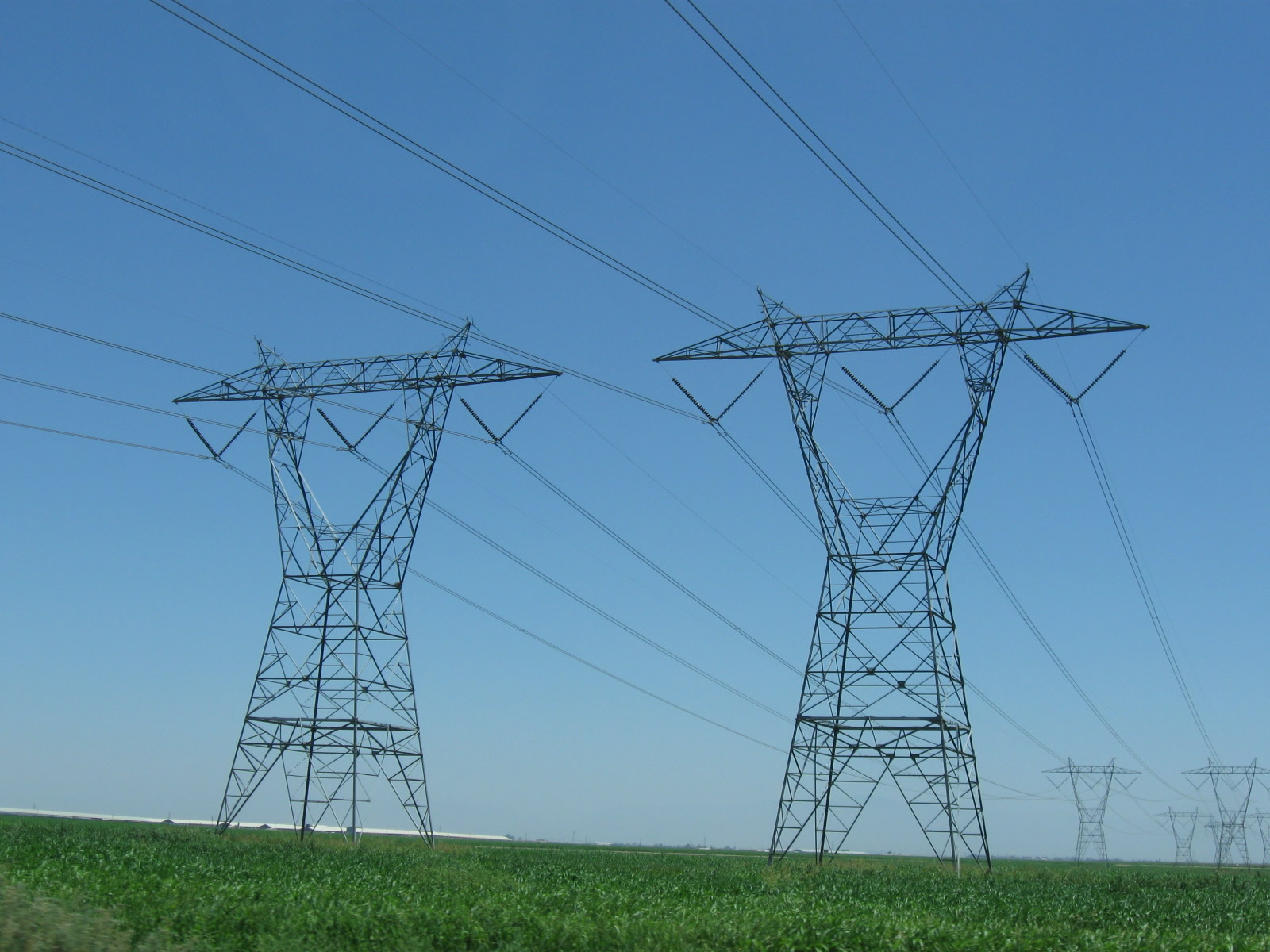
The Path 26 power lines -- which consists of two Southern California Edison 500kV lines -- were last seen crossing Interstate 5 at the California 138 interchange near Quail Lake Road. They again cross over Interstate 5 here. These two lines are still on their way north to the Midway Substation in Buttonwillow, where they will meet several other regional 500kV power lines that converge at Midway, including several that bring electricity generated by the Diablo Canyon Nuclear Generating Station. At Midway, Path 26 ends and directly connects with Path 15, which continues the journey north to the Los Banos Substation. Photos taken 07/15/09. |
|
|
|
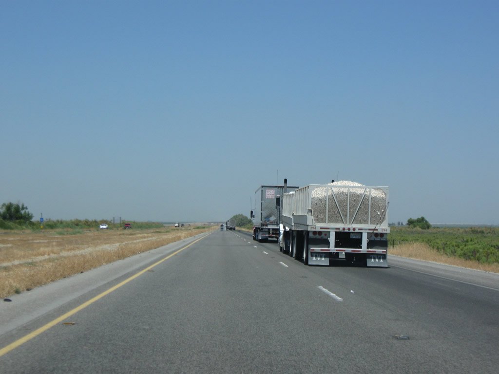
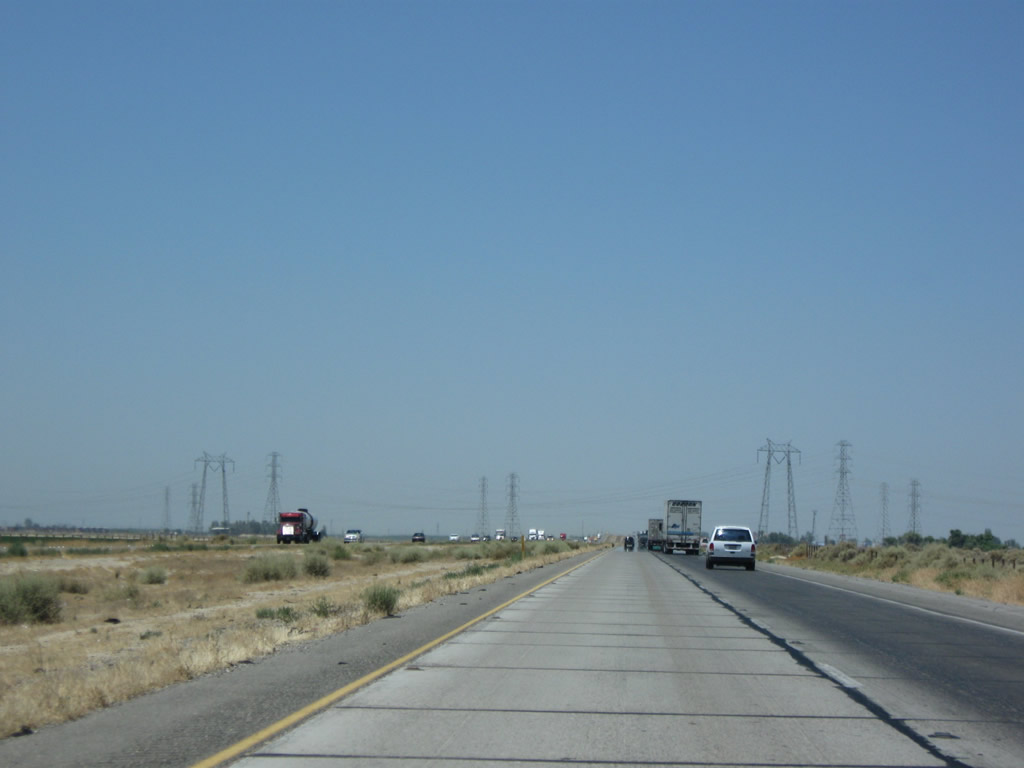
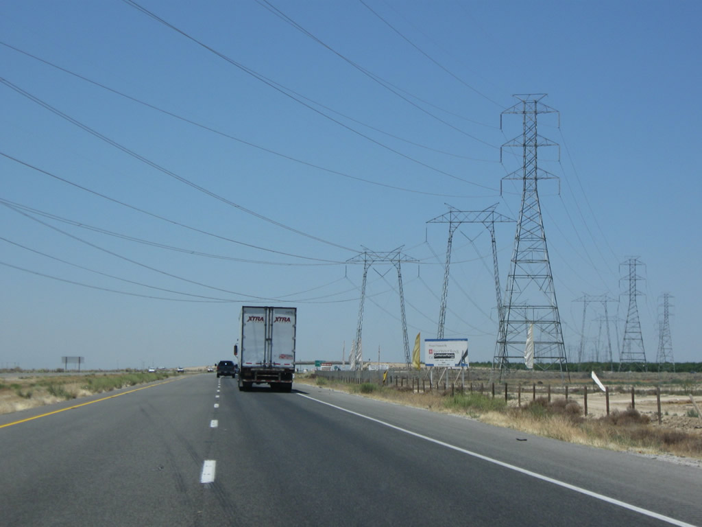
Interstate 5 through the Central Valley is a major trucking corridor. Since Interstate 5 avoids the cities along the California 99 corridor, it is a preferable through route for trucks. Some of the trucks carry agricultural cargo, such as onions, garlic, tomatoes, and citrus. Photos taken 07/15/09. |
|
|
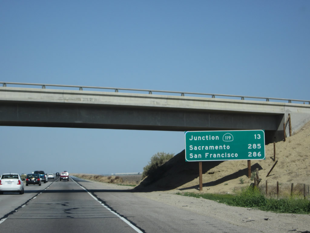
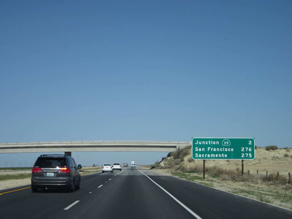
For the next 200 miles, mileage signs on northbound Interstate 5 such as this will follow a pattern. The first line will usually point to the next major highway interchange (usually a state route). The second two lines will provide the distance to the twin control points of Sacramento and San Francisco. This standard is rigorously followed in Kern, King, and Fresno Counties (but only San Francisco is provided on similar signs in Merced and Stanislaus Counties). So for this sign, the next "major" interchange is with California 119 (13 miles). Sacramento is 285 miles distant, while San Francisco is 286 miles distant. Photos taken 04/06/12 and 11/25/10. |
|
Although we are in a valley, it is uncommon to see the mountains walls at either side of the valley. Inversion layers trap haze, fog, smog, and smoke in the Central Valley, making it difficult to see the foothills and mountains except on the clearest days (typically the day after a storm passes through the area). Photo taken 07/15/09. |
|
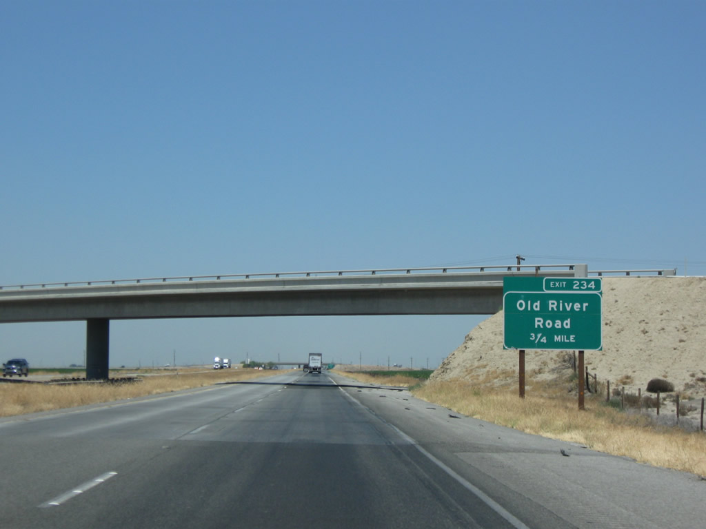
The next exit along Interstate 5 (West Side Freeway) is Exit 234, Old River Road (0.75 mile). Photo taken 07/15/09. |
|
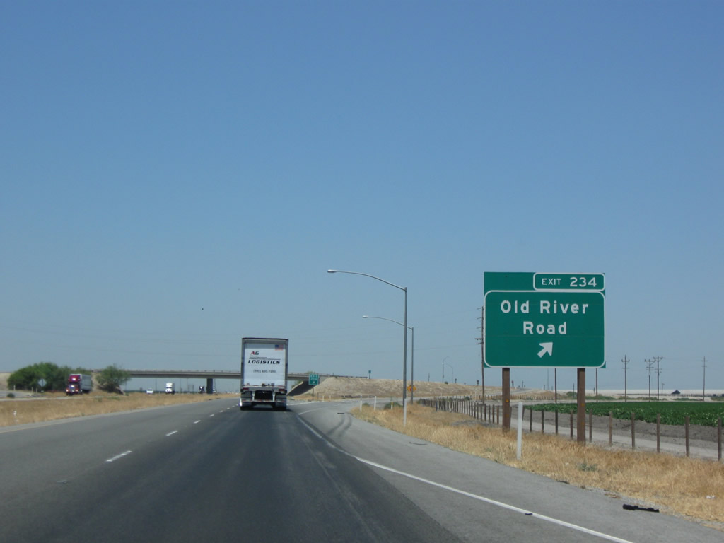
Northbound Interstate 5 (West Side Freeway) meets Exit 234, Old River Road. This local road provides access to the county road system, which links ranches and farms. Photo taken 07/15/09. |
|
An Interstate 5 north route marker is posted after the on-ramp from Old River Road. Photo taken 11/25/10. |
|
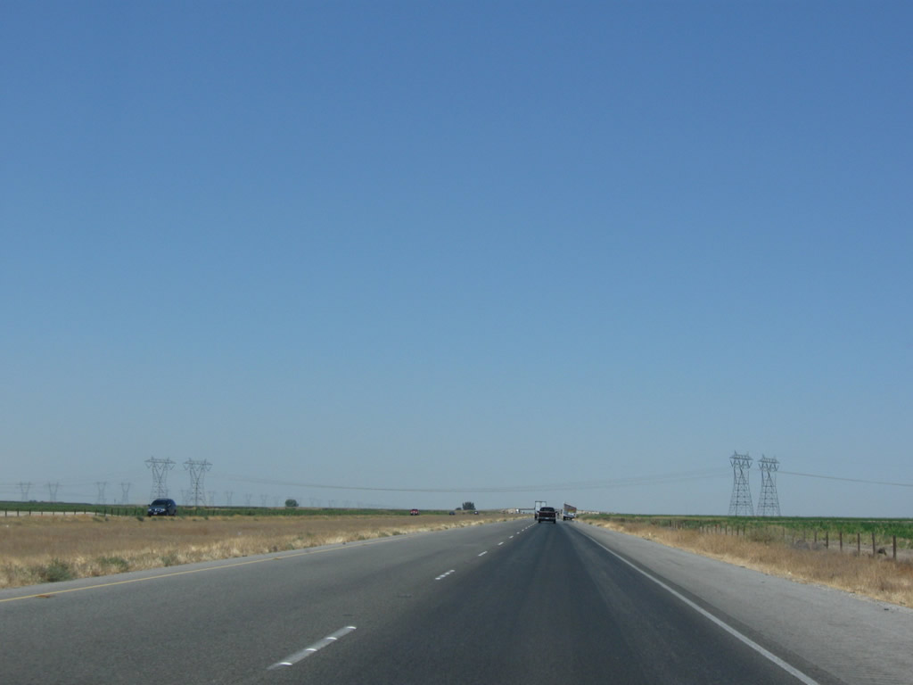
Despite its route through mostly unpopulated areas, Interstate 5 is still a very busy roadway. On holiday weekends, travelers between Southern California and the Bay Area can create significant traffic jams along the freeway; it is a good idea to double check the traffic information radio to see if weather or traffic merit a change in travel plans. Photo taken 07/15/09. |
|
|
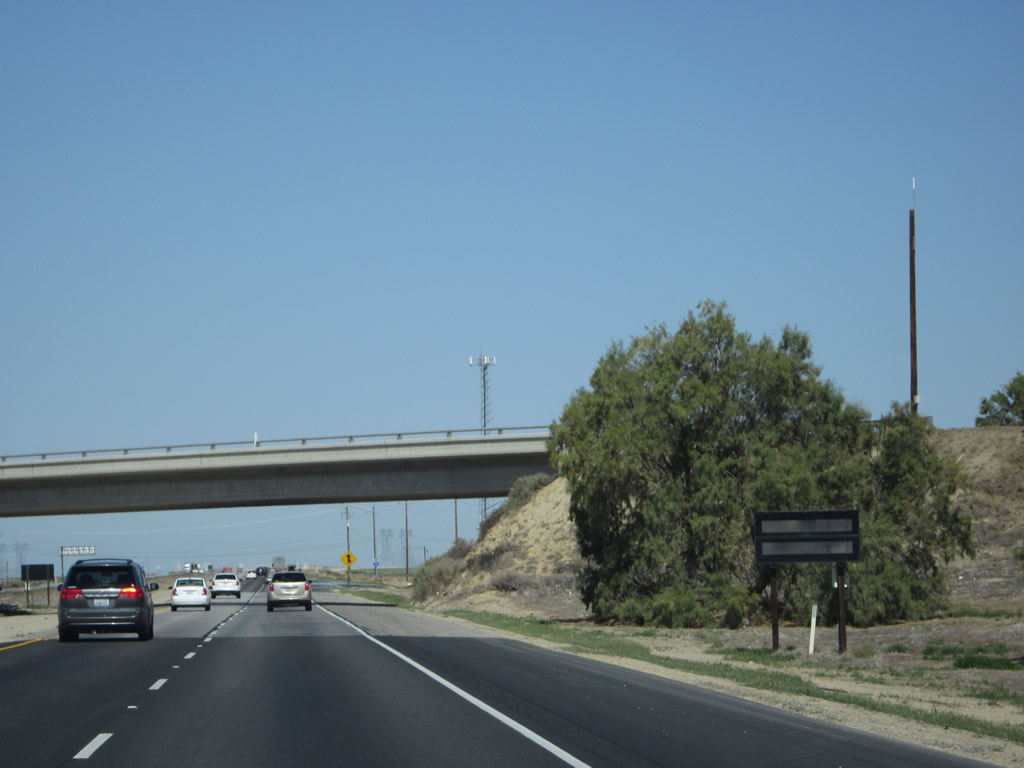
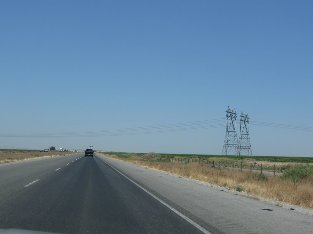
These views are taken along Interstate 5 north between Old River Road and California 223 (Bear Mountain Road). Photos taken 07/15/09. |
|
|
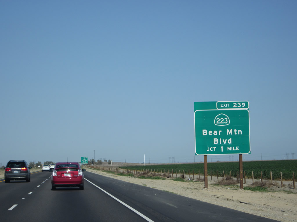
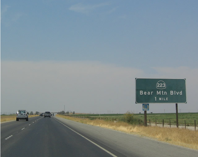
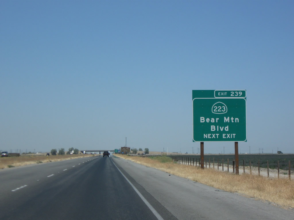
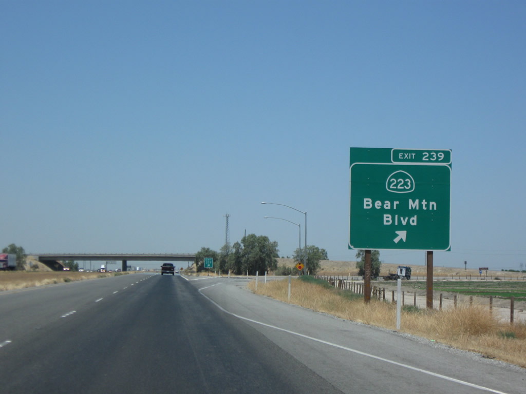
The next exit along Interstate 5 (West Side Freeway) is Exit 239, California 223 (Bear Mountain Boulevard) (one mile). California 223 is a moderately long state highway that travels east to meet California 99 (Golden State Freeway) south of Bakersfield and California 58 east of Arvin. Photos taken 04/06/12 and 07/02/04. |
|
California 223 is an east-west state route that begins at Exit 239 and extends east past California 99 to end at California 58 near Caliente. Photo taken 07/15/09. |
|
|
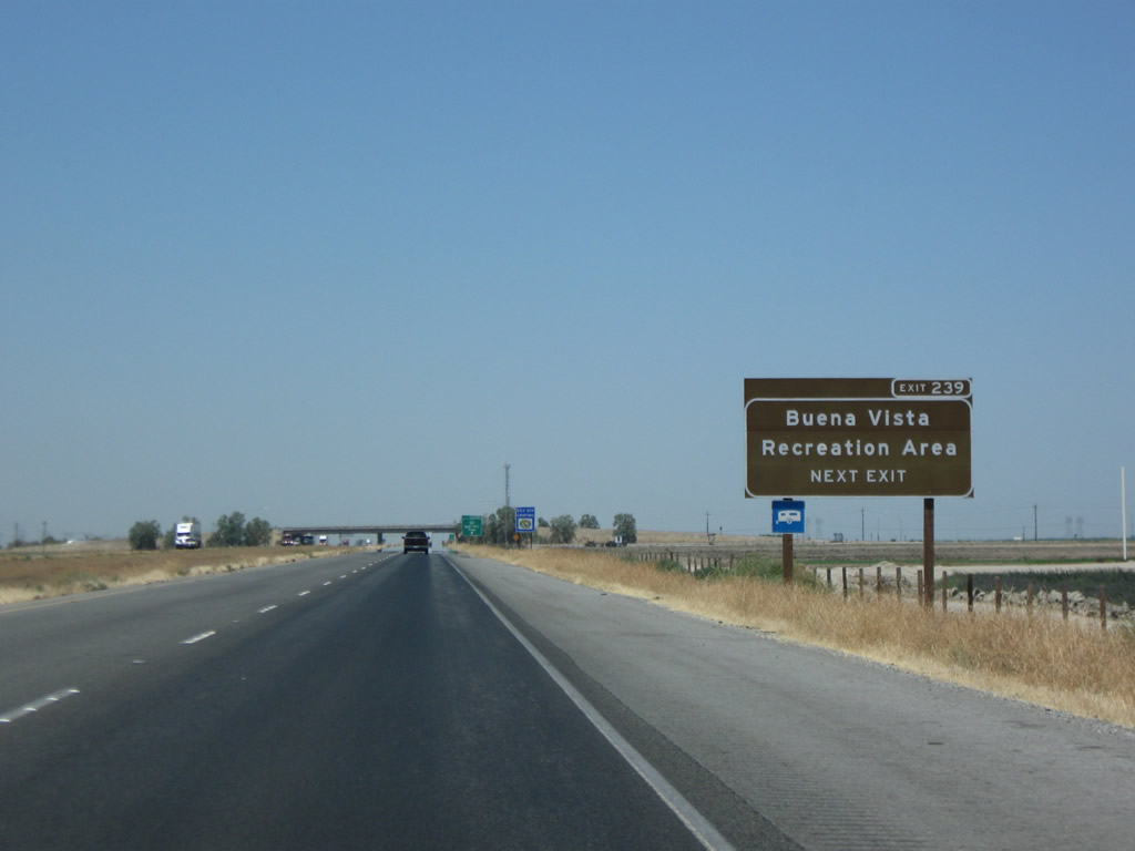
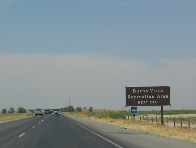
Use California 223 (Bear Mountain Boulevard) to connect to the Buena Vista Recreation Area. Guide signs along Interstate 5 in Kern County were among the first in the state to be convert to retroreflective sheeting with exit numbers (mostly initially converted between 2003 and 2005). Photos taken 07/15/09 and 07/02/04. |
|
|
Northbound Interstate 5 (West Side Freeway) meets Exit 239, California 223 (Bear Mountain Boulevard) east. Photos taken 07/15/09 and 07/02/04. |
|
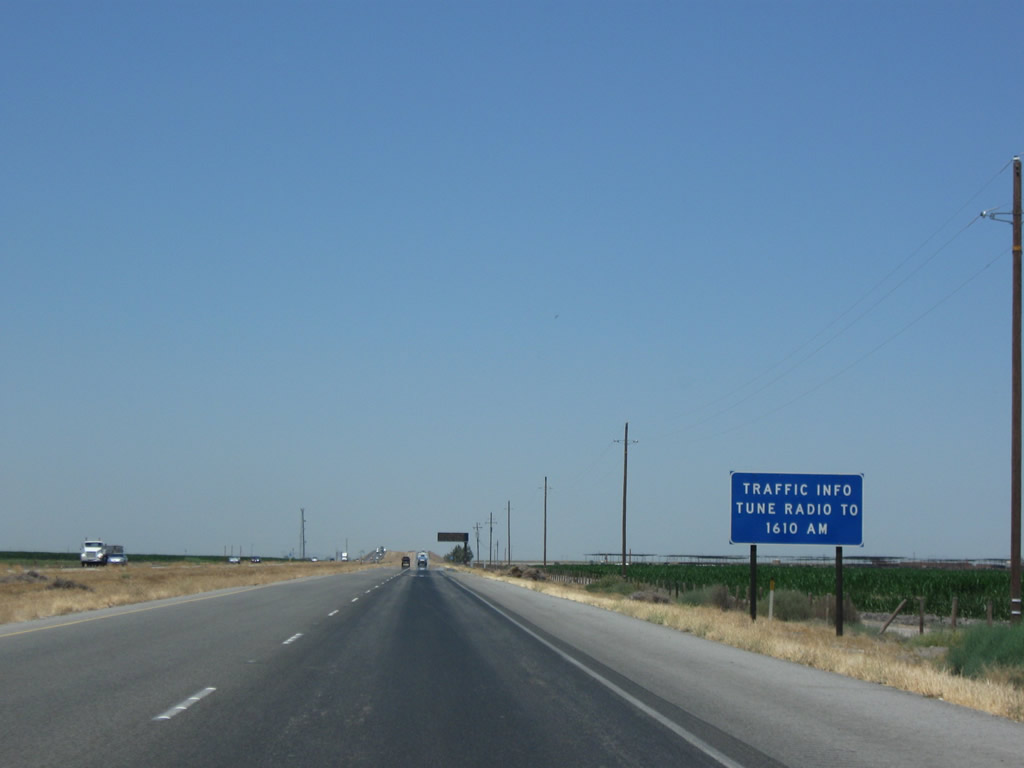
This small, black box is activated when necessary to advise motorists of specific weather, traffic, and construction issues along Interstate 5. When activated, it will advise motorists to tune into a local AM station to get needed information. Photo taken 04/06/12. |
|
|
An Interstate 5 north reassurance shield is posted after the on-ramp from California 223. The shield was relocated and neutered between 2009 and 2012. Photos taken 04/06/12 and 07/15/09. |
|
|
|
|
|
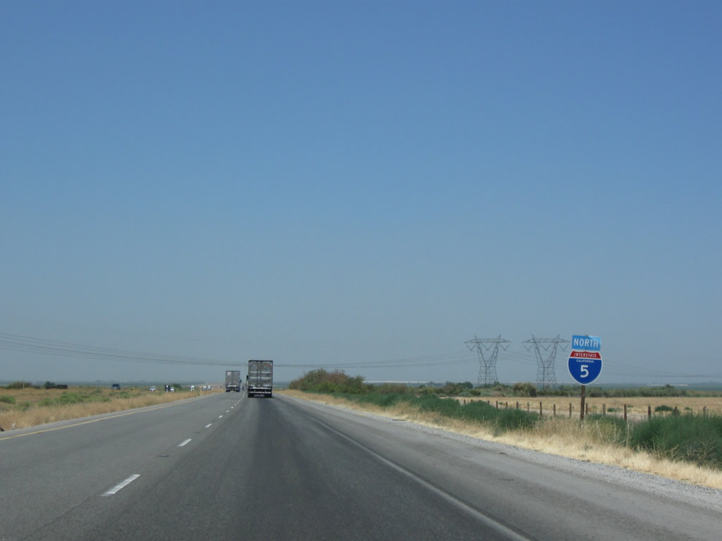
| Interstate 5 proceeds northwest along the flat valley floor through the semi-arid southern Central Valley. While plying through the ranches and farms that dot the landscape in Kern County, the Southern California Edison 500kV (part of Path 26) power lines again approach and cross Interstate 5. The lines will turn northwest to parallel Interstate 5 from here north to the California 58 interchange, where they will join the western power grid at the Midway substation near Buttonwillow. Photos taken 07/15/09. |
|
|
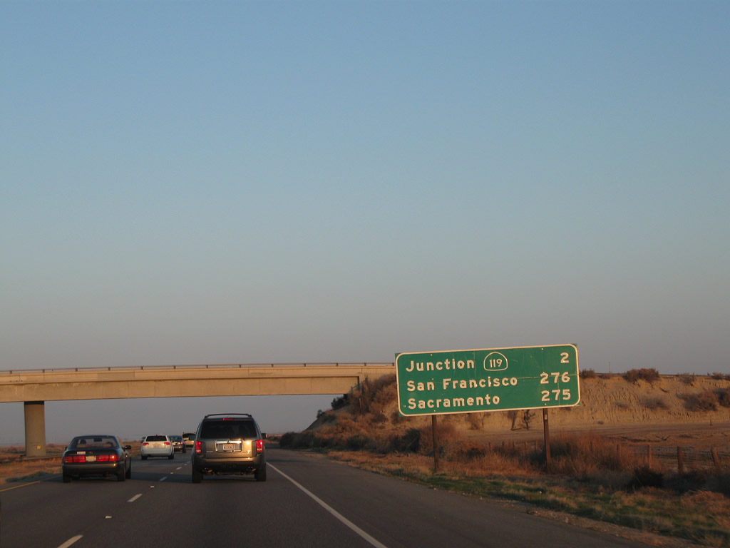
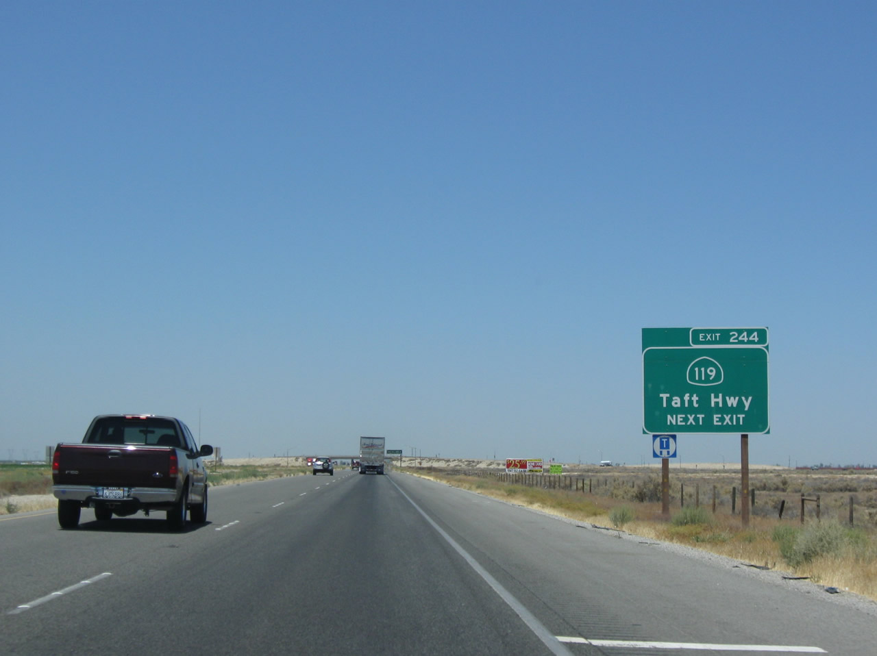
This mileage sign provides the distance to the next exit (Exit 244, California 119 (Taft Highway)) in two miles plus the distance to the control cities of Sacramento (275 miles) and San Francisco (276 miles). It is interesting to note that there is only a one mile difference in the distance to Sacramento and San Francisco. Photos taken 04/06/12 and 11/25/10. |
|
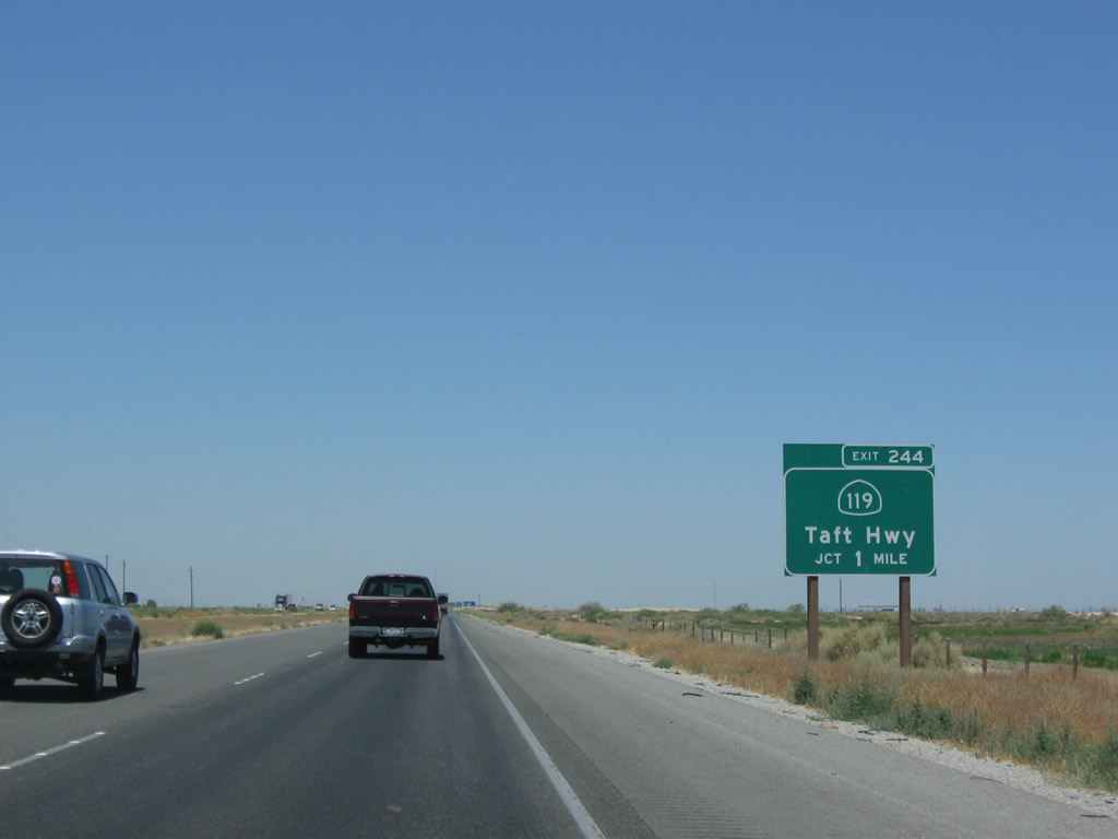
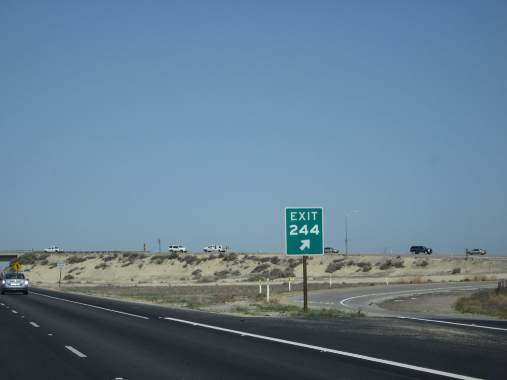
The next exit along Interstate 5 north is Exit 244, California 119 (Taft Highway) (one mile). California 119 is is the old alignment of U.S. 399, which was decommissioned in 1964. U.S. 399 used to extend north from Ventura via California 33 to Taft, then northeast via California 119 and U.S. 99 to Bakersfield, ending at U.S. 466. Photo taken 07/15/09. |
|
|
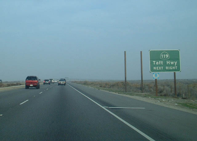
Northbound Interstate 5 approaching Exit 244, California 119, next right. The poles behind this sign are for the replacement reflective sign that will feature an exit number. The new sign was in place by 2003, and the 2009 photo shows the new exit number sign. Photos taken 07/15/09 and 11/28/02. |
|
|
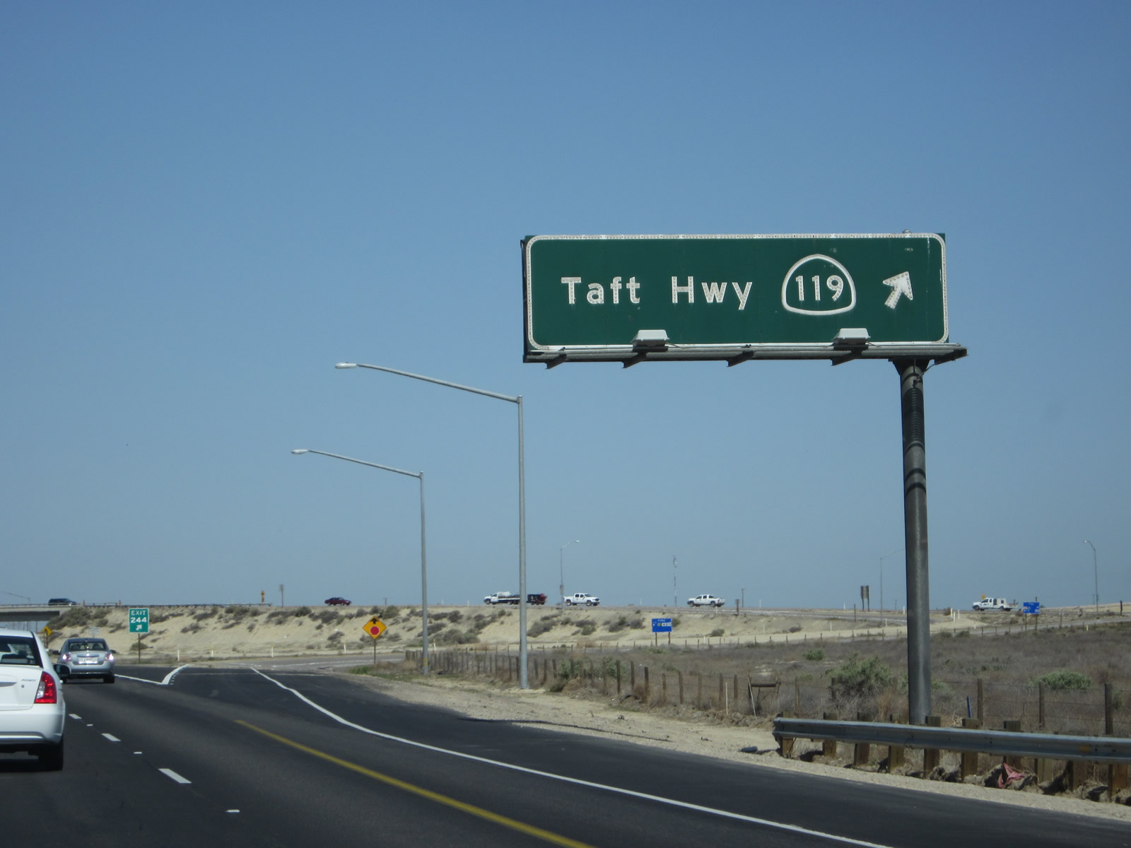
Northbound Interstate 5 meets Exit 244, California 119 (Taft Highway) (old U.S. 399). The original porcelain enamel overhead sign for California 119 remains in place at the off-ramp for Exit 244, along with a much newer exit number sign. Photos taken 04/06/12. |
|
|
|
Two Interstate 5 reassurance markers, one without the state name and the other with the state name, are posted along northbound after the on-ramp from California 119 (Historic U.S. 399). Photos taken 11/25/10 and 04/06/12. |
|
|
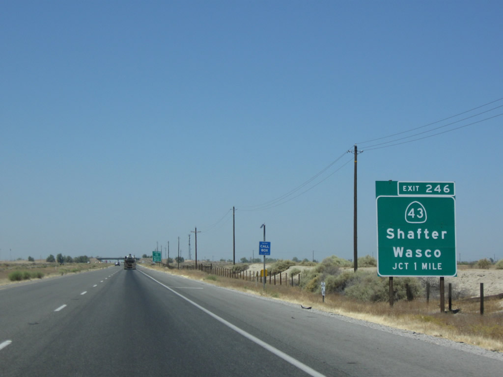
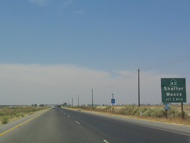
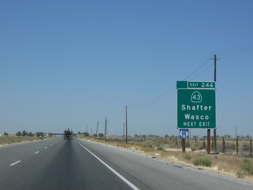
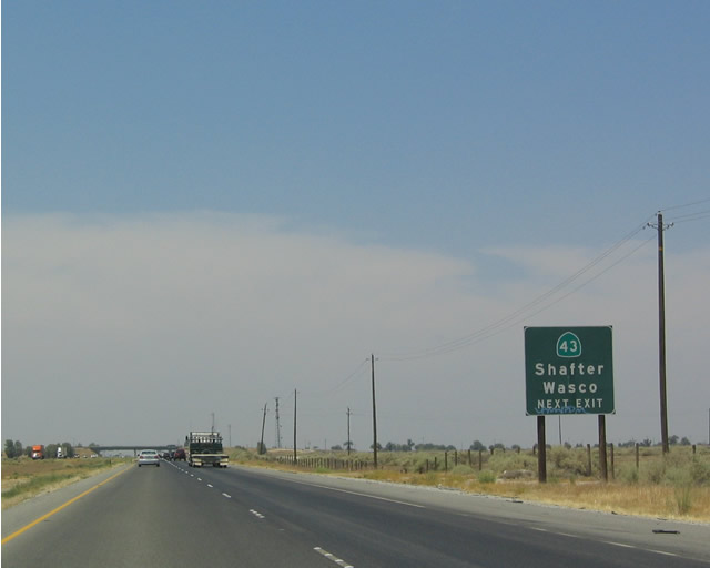
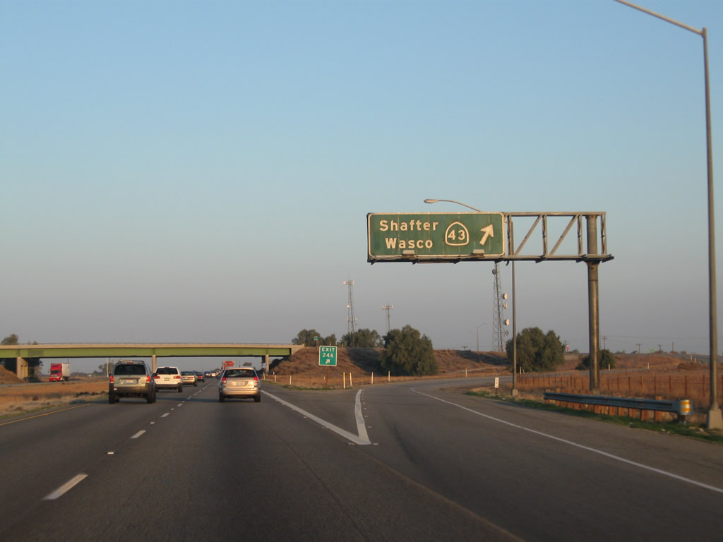
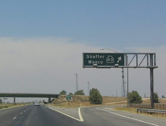
The next exit along Interstate 5 (West Side Freeway) north is Exit 246, California 43 (one mile). Photos taken 07/15/09 and 07/20/04. |
|
|
California 43 travels north-south through the southern Central Valley. Beginning at California 119, California 43 travels north through Shafter, Wasco, Corcoran, and Hanford before ending at California 99 in Selma. The 2004 sign is reflective, but it is not the standard reflective sheeting featuring the brighter green that is becoming more and more prominent on California's highways. It was replaced shortly after the 2004 photo was taken. Photos taken 07/15/09 and 07/20/04. |
|
|
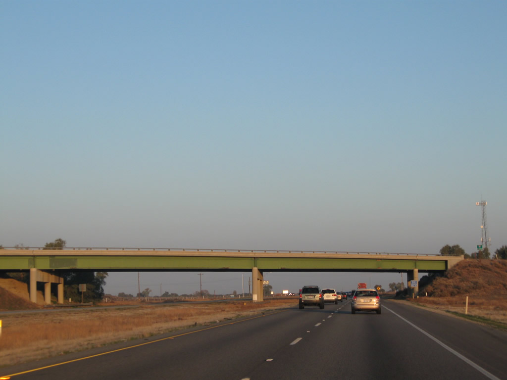
Northbound Interstate 5 (West Side Freeway) meets Exit 246, California 43. This porcelain enamel overhead sign remains in place as of 2010. Photos taken 11/25/10 and 07/20/04. |
|
Interstate 5 passes under another green steel girder bridge at the California 43 interchange. Photo taken 11/25/10. |
|
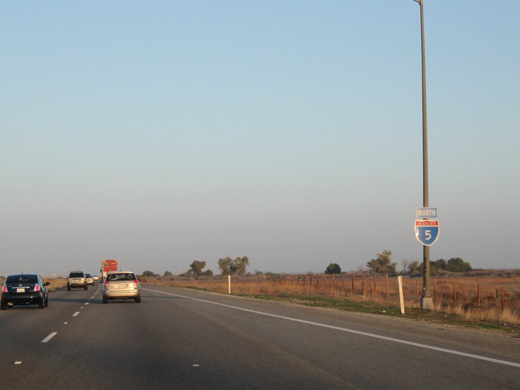
An Interstate 5 reassurance shield is posted after the on-ramp from California 43. Photo taken 11/25/10. |
|
|
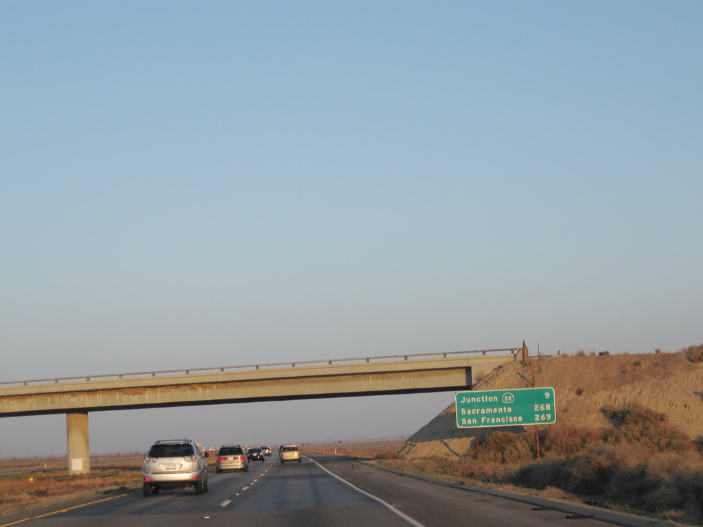
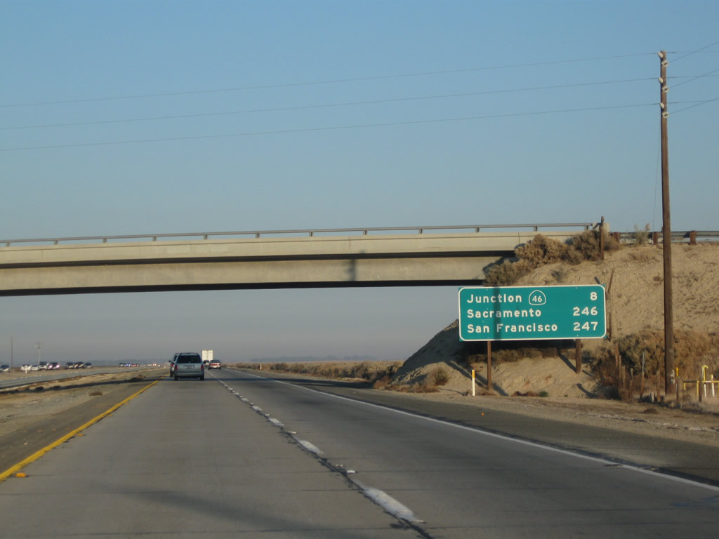
This mileage sign provides the distance to Lost Hills (California 46), San Francisco, and Sacramento. This is the same format used for most mileage signs in Kern County. By 2010, the sign had been replaced with a reflective mileage sign. Photos taken 11/25/10 and 07/02/04. |
|
While Interstate 5 was originally constructed as a concrete highway in Kern County, recent projects have gradually converted sections to asphalt. A repaving project for significant segments of Interstate 5 was underway in 2010-2011. Photo taken 07/15/09. |
|
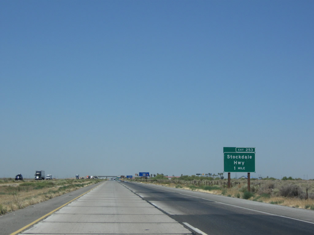
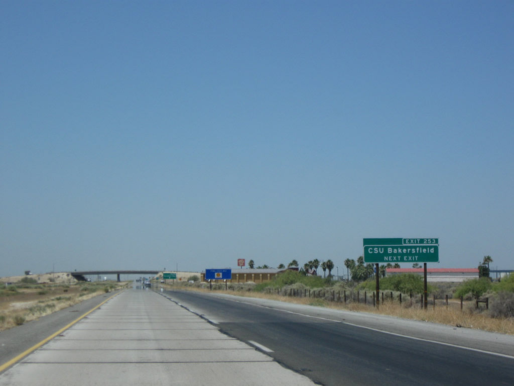
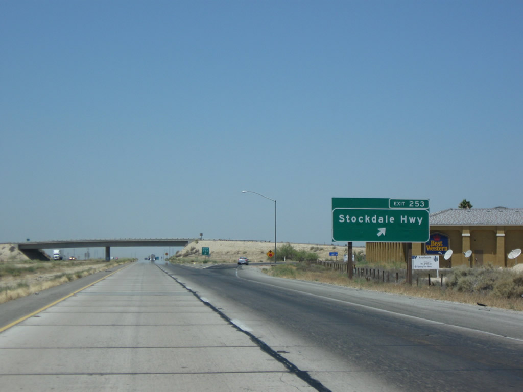
The next exit along northbound Interstate 5 is Exit 253, Stockdale Highway. Stockdale Highway leads due east into Bakersfield. One of the options being considered for a freeway connection from Bakersfield to Interstate 5 would be to overlay such a route on Stockdale Highway. Photo taken 07/15/09. |
|
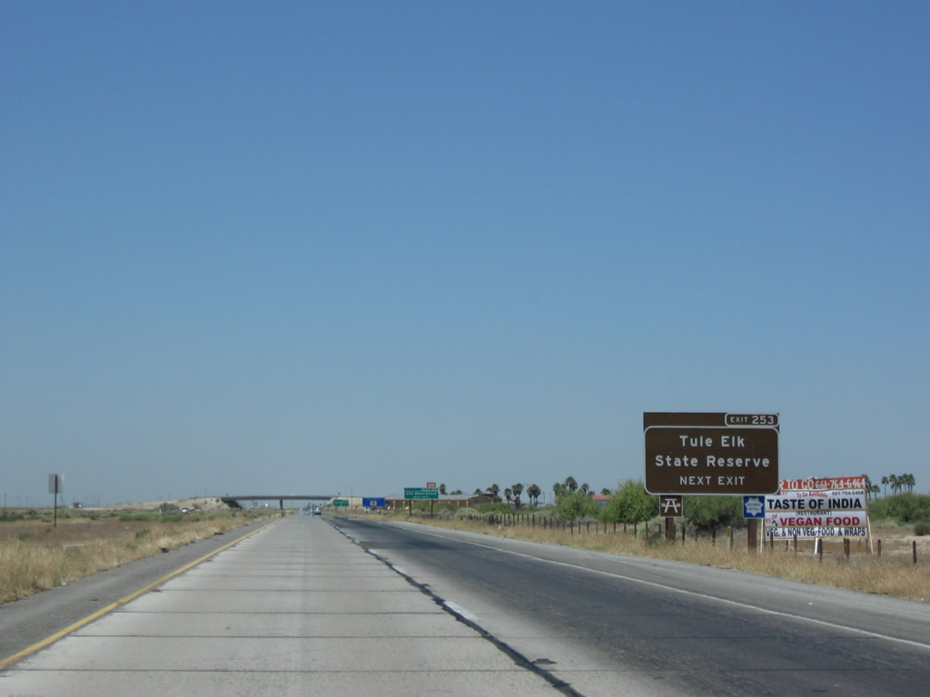
Use Stockdale Highway west to reach the Tule Elk Reserve, which is administered by California State Parks. Photo taken 07/15/09. |
|
Use Stockdale Highway east to Bakersfield and California State University at Bakersfield. Photo taken 07/15/09. |
|
Northbound Interstate 5 (West Side Freeway) meets Exit 253, Stockdale Highway. Over the years, regional leaders have considered possible connections between the California 58 freeway in Bakersfield with Interstate 5, and Stockdale Highway has been considered off and on as a possible corridor for such a freeway corridor. Photo taken 07/15/09. |
|
|
A pair of Interstate 5 north reassurance shields are posted after Stockdale Highway. Photos taken 11/25/10 and 07/15/09. |
|
|
This mileage sign provides the distance to Buttonwillow (California 58), San Francisco, and Sacramento. This is the same format used for most mileage signs in Kern County. Photos taken 11/25/10 and 07/02/04. |
|
|
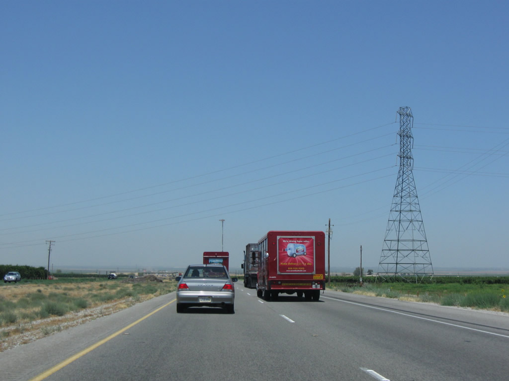
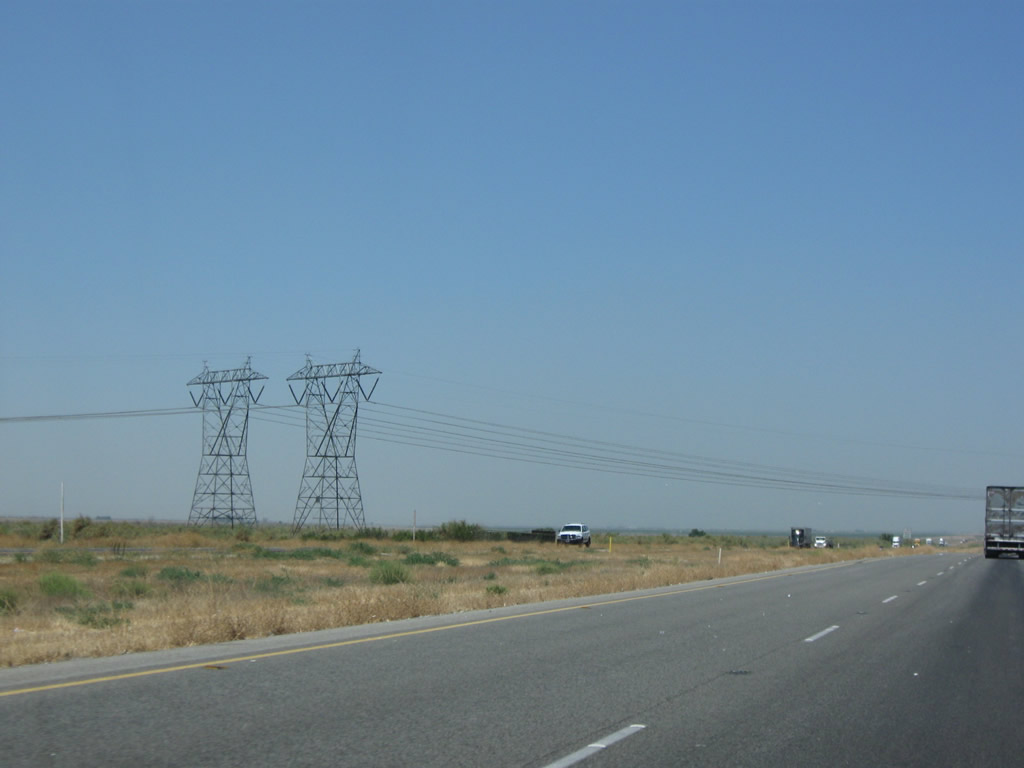
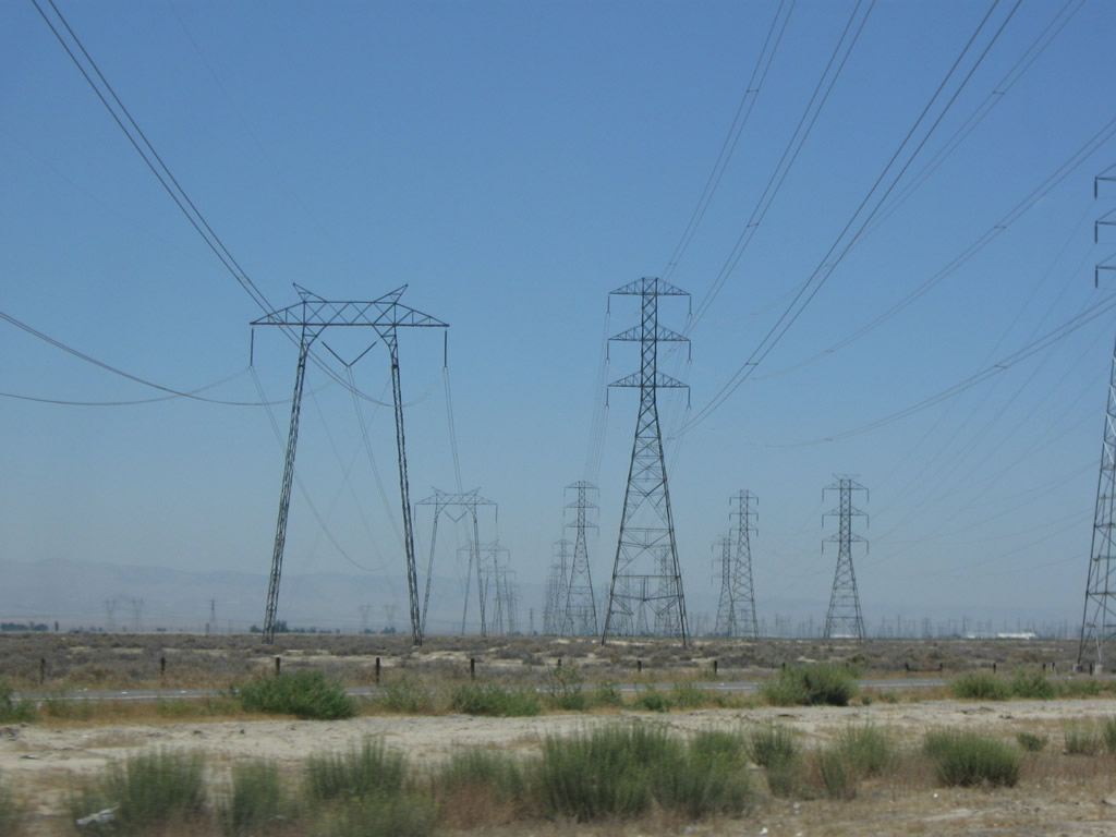
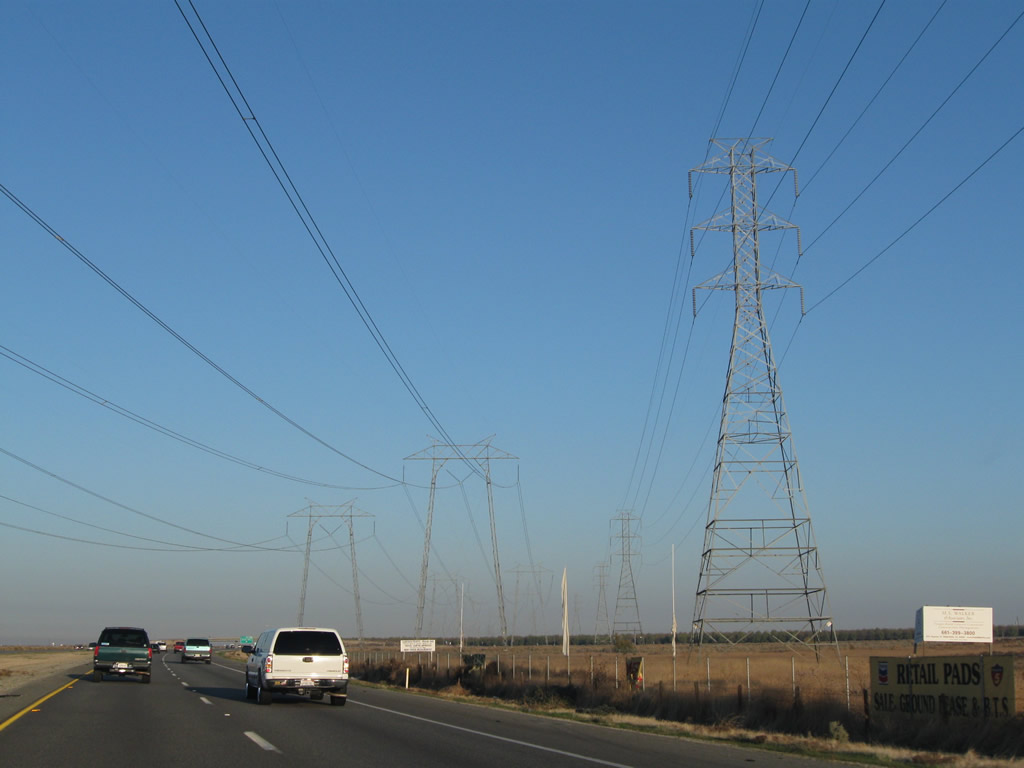
Like the Southern California Edison 500kV power lines seen crossing Interstate 5, these lines are also part of Path 26. Three 500kV power lines link the Midway and Vincent substations. Two of them have been generally following Interstate 5 since the California 138 interchange. The third line crosses Interstate 5 here; it follows a path far east of the other two lines and cuts a path through remote sections of Tejon Ranch in the Tehachapi Mountains. The three 500kV power lines of Path 26 connect with Path 15 and Path 66 to create a backbone north-south transmission line that connects power generation facilities between the Pacific Northwest, California, and Southwest, including the Colorado River dams, the Diablo Canyon Nuclear Power Generating Station, hydroelectric power in the Pacific Northwest, and even power from fossil fuel generation plants located around the Four Corners region. These particular 500kV towers were placed by Pacific Gas and Electric (PG&E) and are part of Path 26, but they change into a standard Southern California Edison (SCE) 500kV tower design at a remote location within the Tehachapi Mountains. Photos taken 07/15/09. |
|
|
While passing under these PG&E power lines, a blue sign advises of Exit 259, which serves the Buttonwillow Safety Rest Area located three miles north of here, just after the California 58 interchange. Photos taken 07/15/09 and 11/25/10. |
|
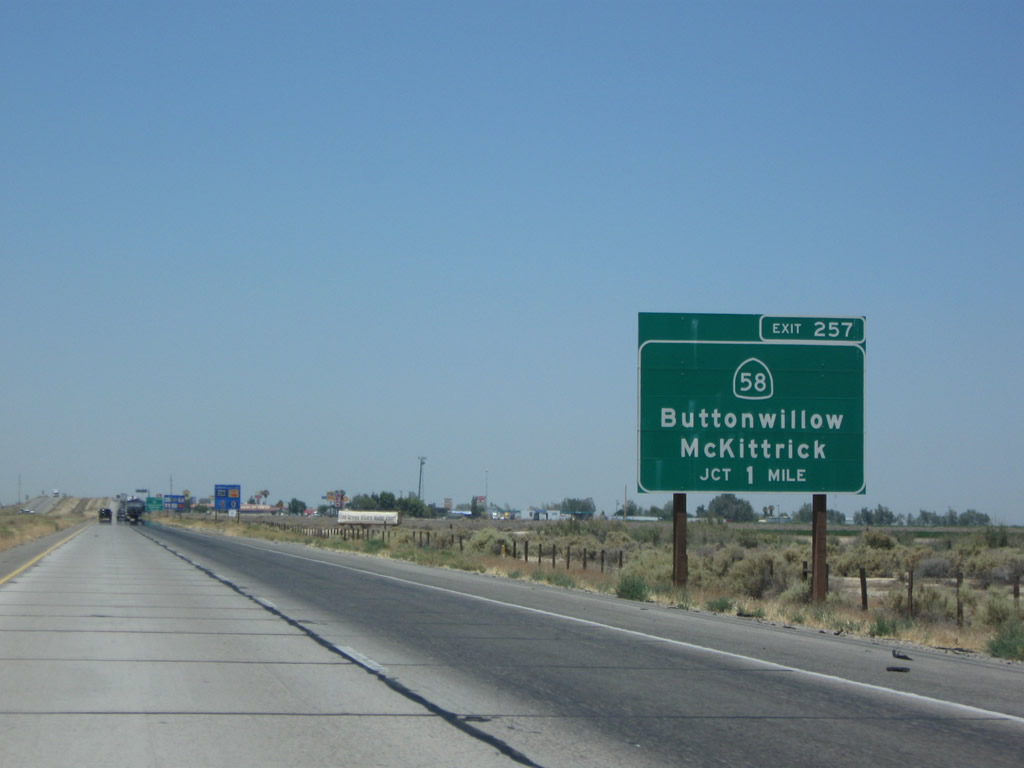
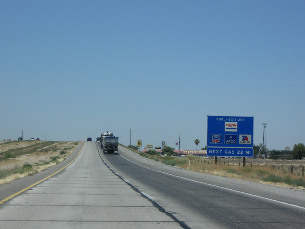
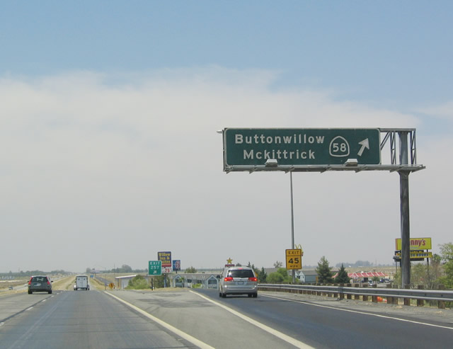
The next exit along northbound Interstate 5 is Exit 257, California 58, Buttonwillow, McKittrick, and Bakersfield (one mile). California 58 leads east to Bakersfield and west to San Luis Obispo. Photo taken 07/15/09. |
|
Exit 257 (California 58) is the first exit with a full array of motorist services since the Wheeler Ridge interchange (Exit 215). California 58 is also noteworthy for what it is not: a freeway. In spite of the fact that most of California 58 east of Bakersfield/California 99 is a freeway, this stretch of highway is only two lanes. In fact, the average daily traffic counts are fairly low on this portion of highway, and they get even lower west of California 33. The reason for this is because most east-west traffic uses California 46 (old U.S. 466) to reach the Central Coast rather than California 58. If an extension to the freeway were constructed west to Interstate 5, it is more than likely that it would utilize California 46 rather than California 58 due to traffic counts. However, much depends on the future expansion of the Bakersfield metropolitan area, which is pushing further west. Photo taken 07/15/09. |
|
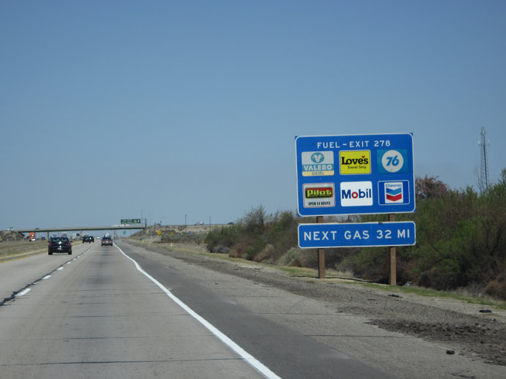
The next gas available along northbound (after Exit 257, California 58 west to Buttonwillow and McKittrick and east to Bakersfield) is the interchange with California 46 at Lost Hills, which is 22 miles distant. It is a good idea to plan ahead for food and gas stops on this well-traveled yet remote segment of Interstate 5. Photo taken 07/15/09. |
|
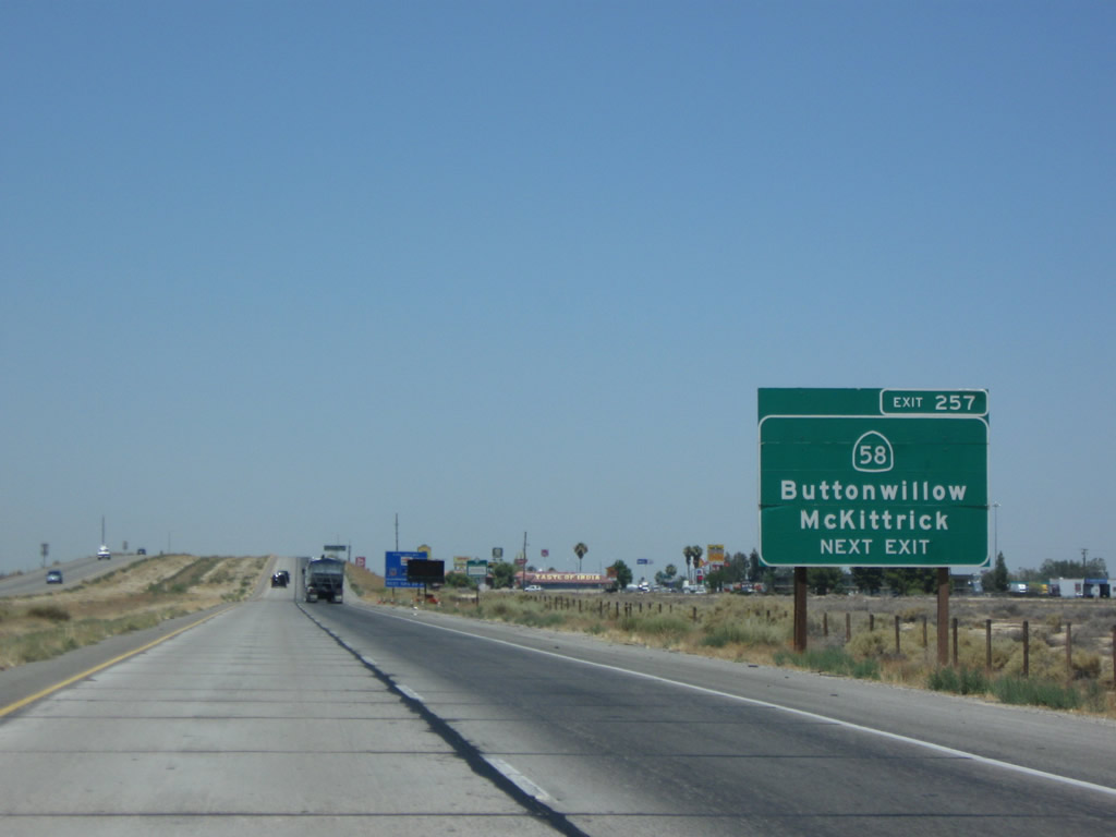
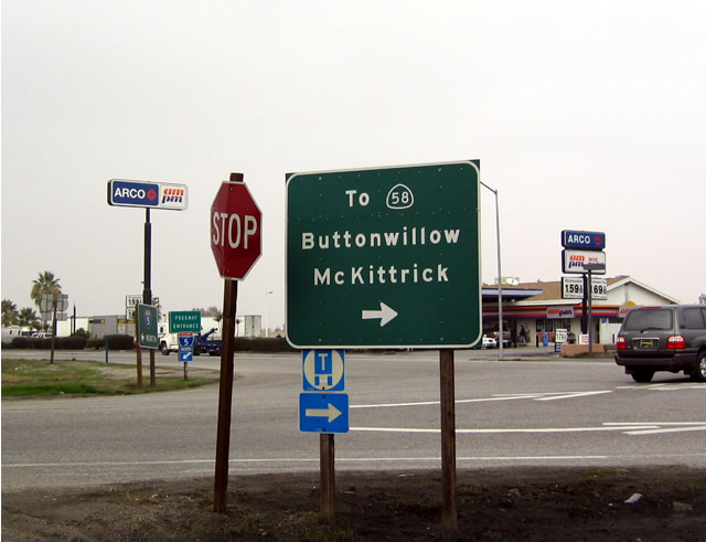
Northbound Interstate 5 (West Side Freeway) meets Exit 257, California 58 west to Buttonwillow and McKittrick and east to Bakersfield. The connection between the freeway and California 58 is achieved via a frontage road. This porcelain enamel overhead sign is very old and probably dates to the original construction of the freeway. Photo taken 07/02/04. |
|
|
|
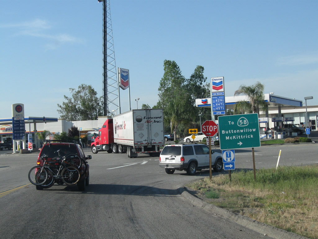
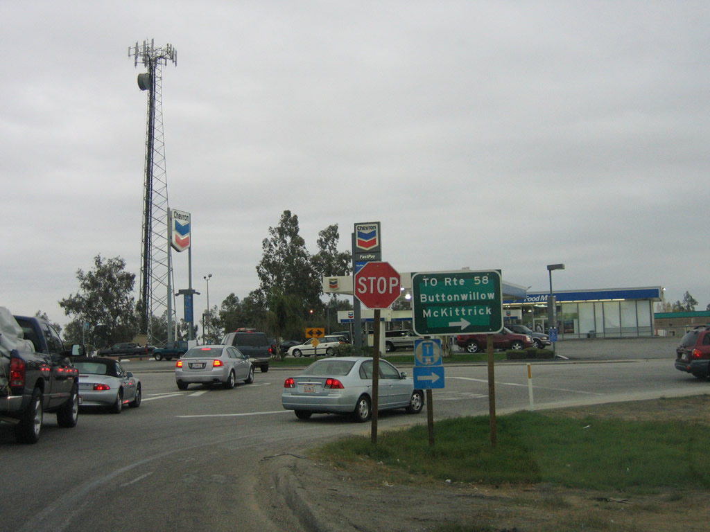
The off-ramp from northbound Interstate 5 to California 58 makes a sharp, 90-degree turn, then connects to a stop sign at the frontage road (Tracy Avenue) on the east side of the freeway. To reach California 58, traffic must turn right (south) on the frontage road, pass by the various gas stations, restaurants, and other motorist amenities, and then reach a second stop sign at the highway. A left turn at this stop sign is eastbound California 58; a right turn is westbound California 58. Photos taken 05/13/11, 11/23/06, and 01/21/04. |
|
This Interstate 5 south reassurance shield is posted after the on-ramp from California 58 near Buttonwillow. Photo taken 11/25/10. |
|
The next exit along northbound Interstate 5 is the Buttonwillow Rest Area located near Milepost 259. Like other similar facilities along Interstate 5, the rest area offers restrooms, drinking water, picnic tables, telephone, and pet walking area. During hot summer months it is important to be mindful of the outside temperature. Photo taken 11/25/10. |
|
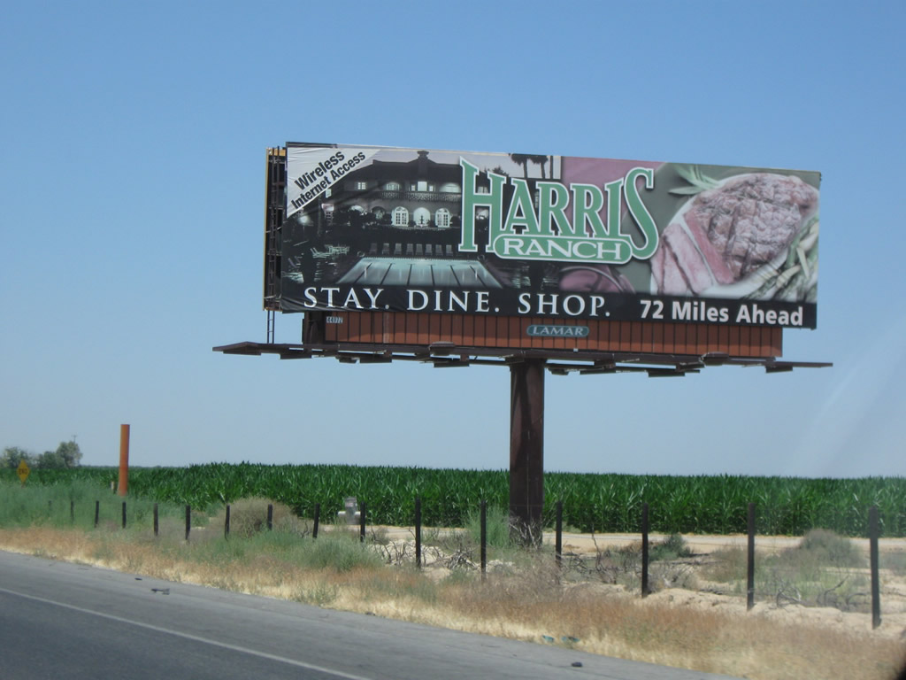
Harris Ranch, located 72 miles north of here, is worth a stop ... continue north on Interstate 5 to the California 198 interchange. The ranch -- which includes acres of land including a major cattle ranch -- features a hotel, restaurant, butcher's shop, and gift shop. Photo taken 07/15/09. |
|
Northbound Interstate 5 meets Exit 259, Buttonwillow Rest Area. This rest area was remodeled in 2009 and reopened in 2010 (along with many other rest areas throughout the state). Photo taken 11/25/10. |
|
This mileage sign along northbound Interstate 5 provided the distance to the next major exit (California 46) as well as San Francisco and Sacramento. This sign was located after the on-ramp from Exit 257 (California 58) and next to the rest area. The next major interchange according to this sign is Exit 278, California 46 (former U.S. 466) in Lost Hills. This mileage sign was one of the few remaining in the Central Valley segment of Interstate 5 to feature distance in kilometers. Photo taken 07/02/04. |
|
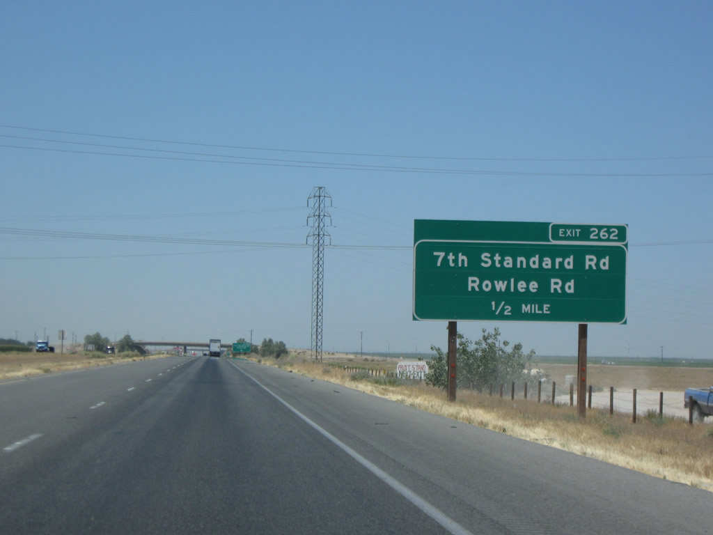
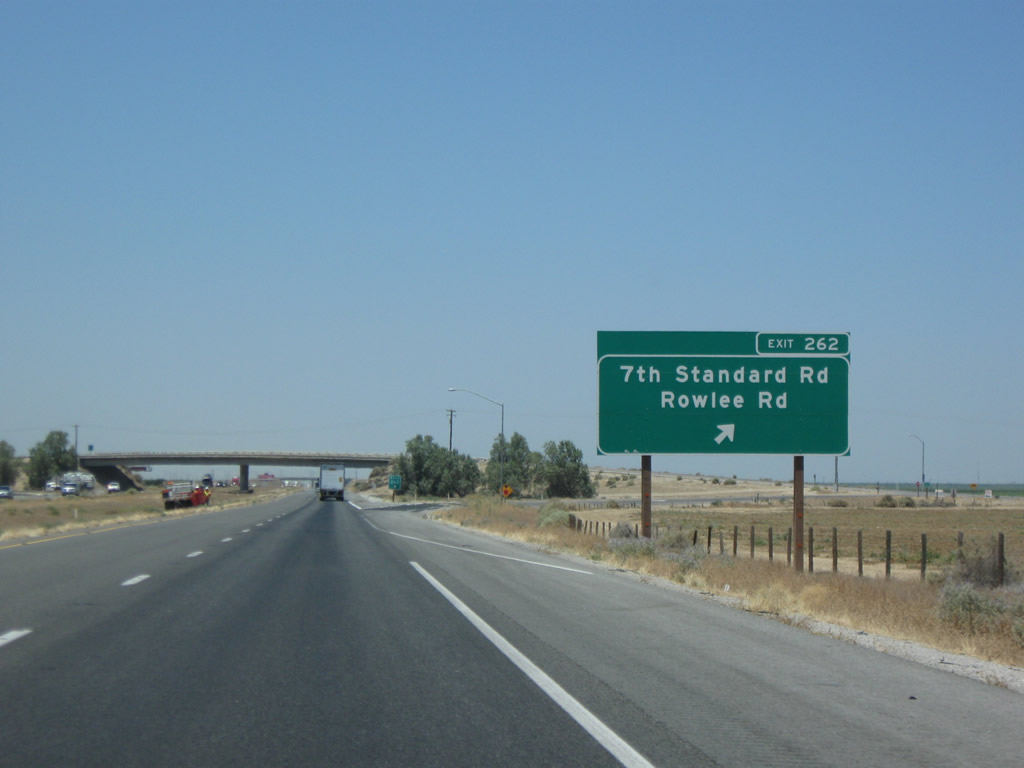
The next exit along Interstate 5 north is Exit 262, Seventh Standard Road. Upon exiting, use Seventh standard Road west to Buttonwillow Drive, which becomes Rowlee Road north of the Interstate 5 Exit 263 interchange. Photo taken 07/15/09. |
|
|
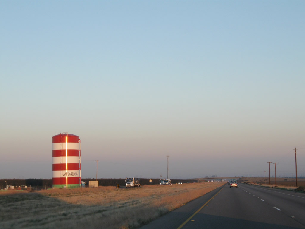
Prior to the Exit 262 off-ramp, Interstate 5 passes under this Pacific Gas & Electric power line. In the distance to the northeast is another one of those red and white "Cat in the Hat" water towers distinctive of the Arwin-Edison Water Storage District. Photos taken 11/25/10. |
|
Northbound Interstate 5 (West Side Freeway) meets Exit 262, Seventh Standard Road and Rowlee Road. This is a half-diamond interchange with service only for northbound exit and southbound entrance. If you depart the freeway here, you will have to take Seventh Standard Road west to either the west frontage road north or Buttonwillow Drive (which becomes Rowlee Road) north to return to Interstate 5 at Exit 263. That interchange, just like Exit 262, is only a half-diamond, so there is no direct access to Buttonwillow Drive from Interstate 5 north. Photo taken 07/15/09. |
|
This Interstate 5 south reassurance shield is posted after the on-ramp from Buttonwillow Drive (there is no on-ramp from Seventh Standard Road since it is a half diamond interchange). Once again, it is neutered and of the unique, angular shield shape common in California but obscure elsewhere. Photo taken 11/25/10. |
|
Interstate 5 proceeds north through the flat farm and ranch lands of the southern Central Valley. Photo taken 07/15/09. |
|
Not every local road that crosses Interstate 5 has an interchange; however, access to the freeway are limited to exits every five or so miles in this vast expanse. Photo taken 07/15/09. |
|
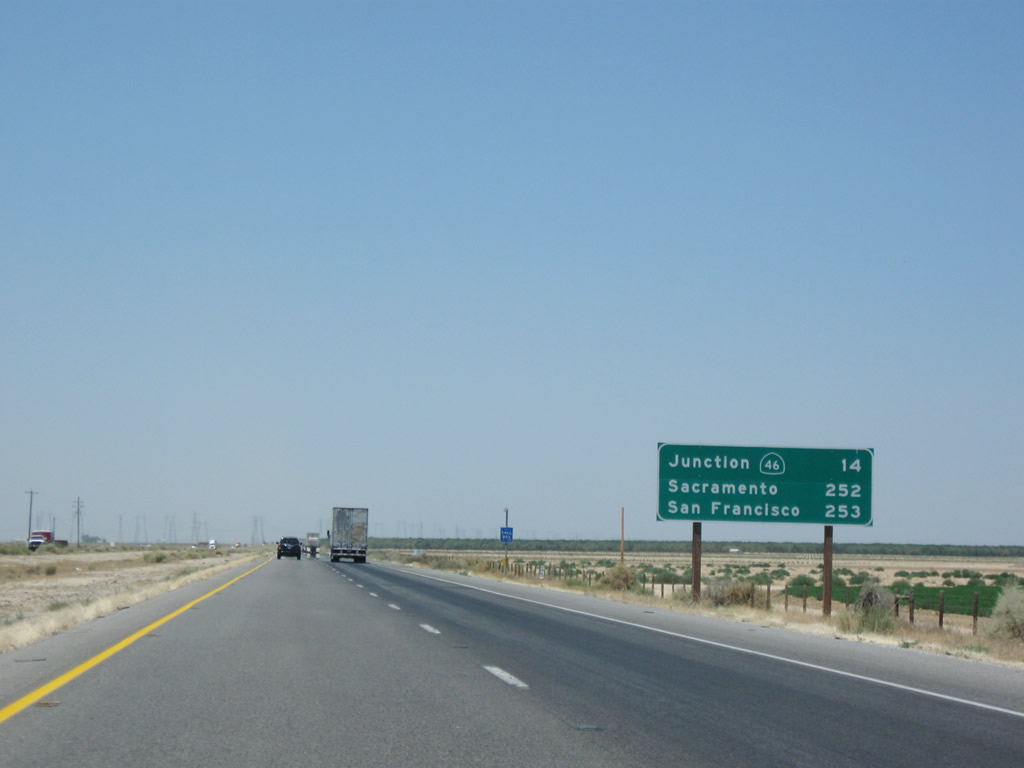
This mileage sign provides the distance to California 46 (14 miles), Sacramento (252 miles), and San Francisco (253 miles). Photo taken 07/15/09. |
|
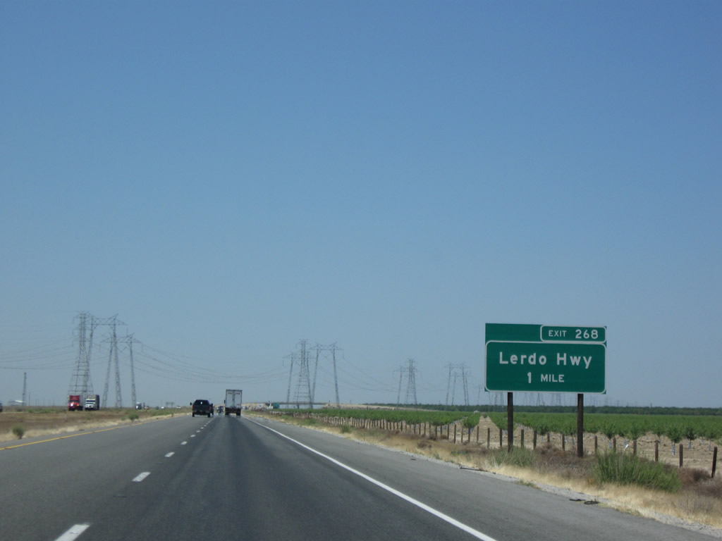
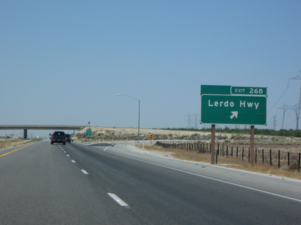
The next exit along northbound Interstate 5 (West Side Freeway) is Exit 268, Lerdo Highway (one mile). Photo taken 07/15/09. |
|
|
|
|
|
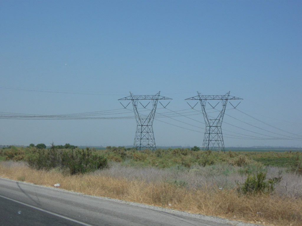
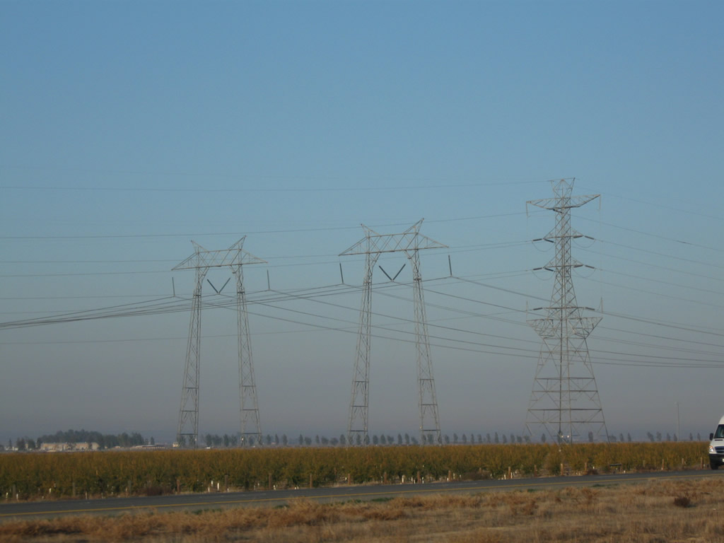
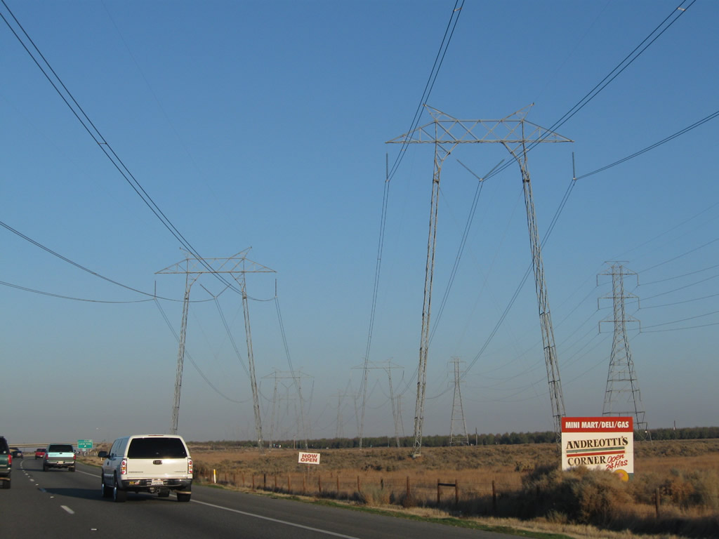
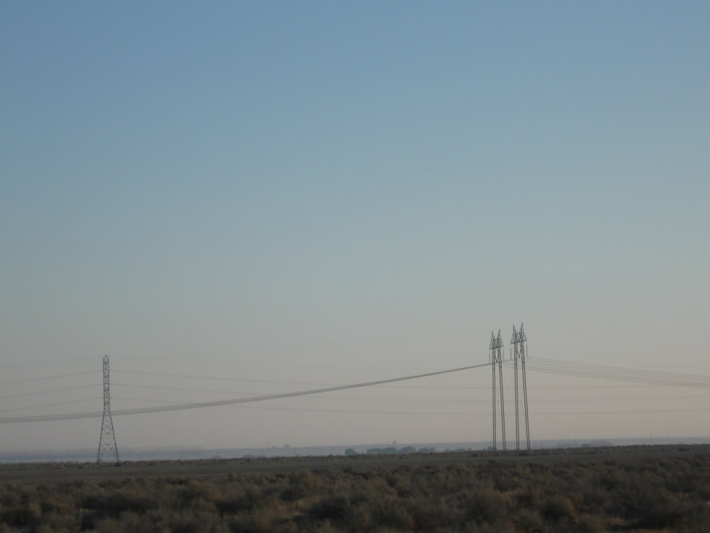
| These Pacific Gas & Electric power lines are part of Path 15, a major transmission corridor that originates at the Midway Substation near Buttonwillow and travels north-south between Midway and Los Banos substations. From there, several transmission lines continue north into the California Delta region, including several major substations close to Tracy. These lines interconnect with Path 26, which consists of the Southern California Edison lines seen crossing Interstate 5 several times south of the California 58 interchange that terminate at Midway. Since these lines provide the primary electricity transmission corridor between southern and northern California, they carry a tremendous load of power in both directions depending on power generation capacity, demand, and line availability. These lines will cross the freeway multiple times between here and Woodland, then generally follow their own path on a northeasterly direction toward a large substation near Malin, Oregon. Photos taken 07/15/09 and 11/25/10. |
|
Northbound Interstate 5 (West Side Freeway) meets Exit 268, Lerdo Highway. This major arterial/county-maintained roadway travels east-west across the Central Valley, linking California 33/Westside Highway at the west end with California 43 (Central Valley Highway) in Shafter, California 99 (Golden State Freeway) in Cawelo (at Exit 37), and California 65 (Porterville Highway) at the east end. Photo taken 07/15/09. |
|
|
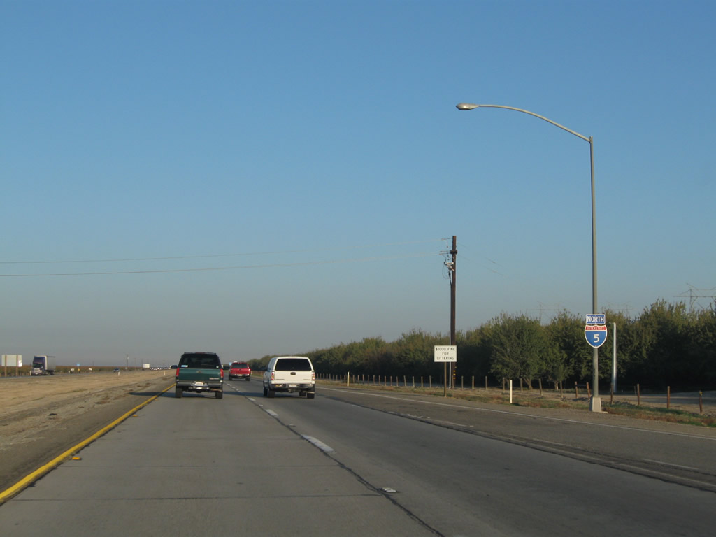
An Interstate 5 reassurance shield is posted after the on-ramp from Lerdo Highway. The 2009 shield image shows a neutered shield with a Series C "5," and the 2010 shield image shows a more typical neutered Interstate 5 shield with Series D "5." Photos taken 11/25/10 and 07/15/09. |
|
Continuing north after the Lerdo Highway interchange, an orchard is on the east side of the freeway, while land to the west lays fallow. With scarce water imports from the north via the California Aqueduct and limited groundwater supplies, farming has become much more expensive in the southern Central Valley. Additionally, water transfers from the north have been reduced due to a variety of issues including the environmental health of the California Delta. With the land along the western edge of the Central Valley arid and in some cases less fertile than other areas, fallow farms become more common Interstate 5 progresses northwest. Photo taken 07/15/09. |
|
This mileage sign provides the distance to California 46 and Lost Hills (8 miles), Sacramento (246 miles), and San Francisco (247 miles). Photo taken 07/15/09. |
|
|
|
|
|
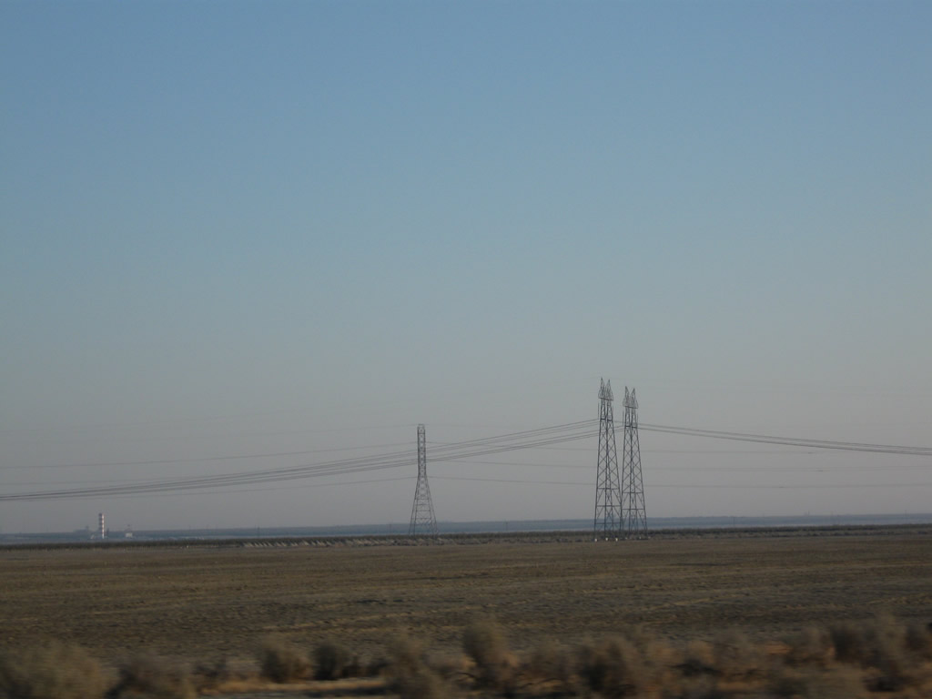
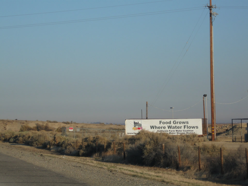
| This series of pictures follows the landscape of the Central Valley as seen from Interstate 5 between Buttonwillow Drive/Rowlee Road and California 46 at Lost Hills. The Path 15 power lines stay to the east of the freeway for now, and several dust devils sprang up in July 2009 very close to a billboard stating that "Food Grows where Water Flows." Water has been and probably always will be a major issue in a region where natural rainfall is not enough to sustain regular agricultural output. Some corners of the southern Central Valley receive less than ten inches of rain each year. Photos taken 07/15/09 and 11/25/10. |
|
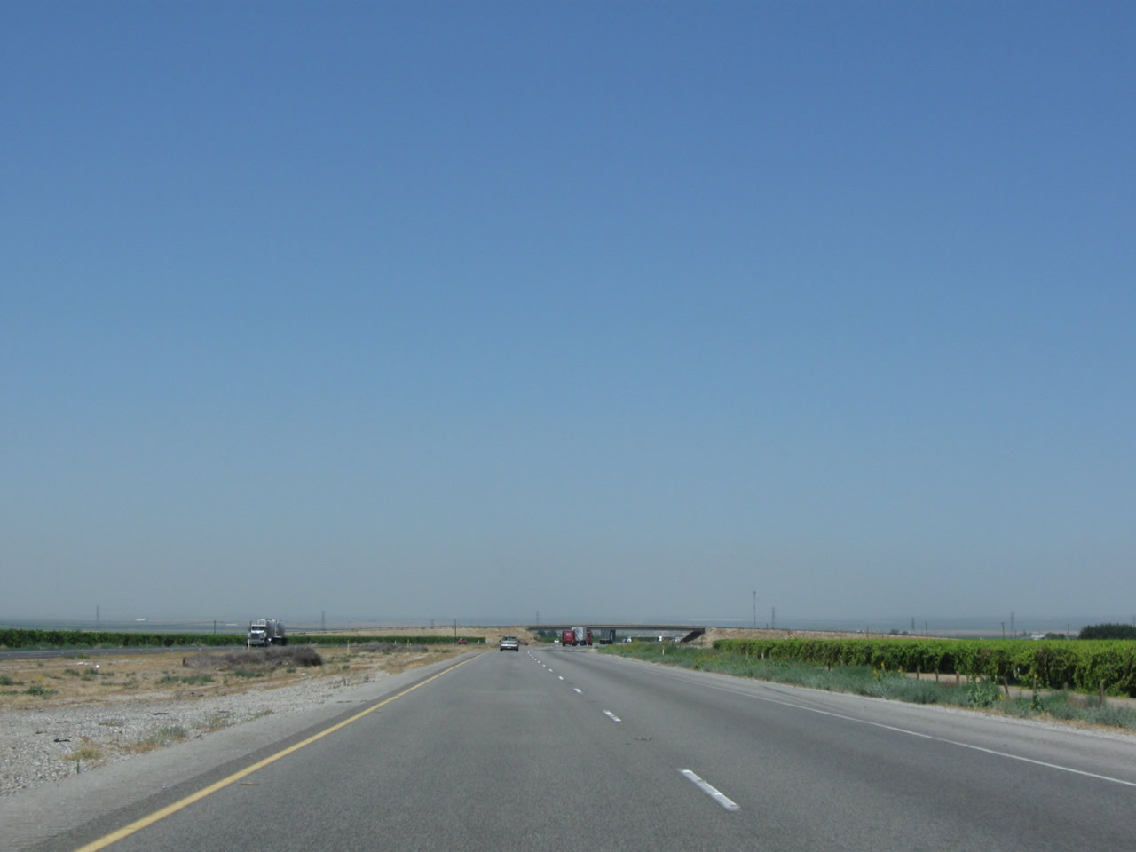
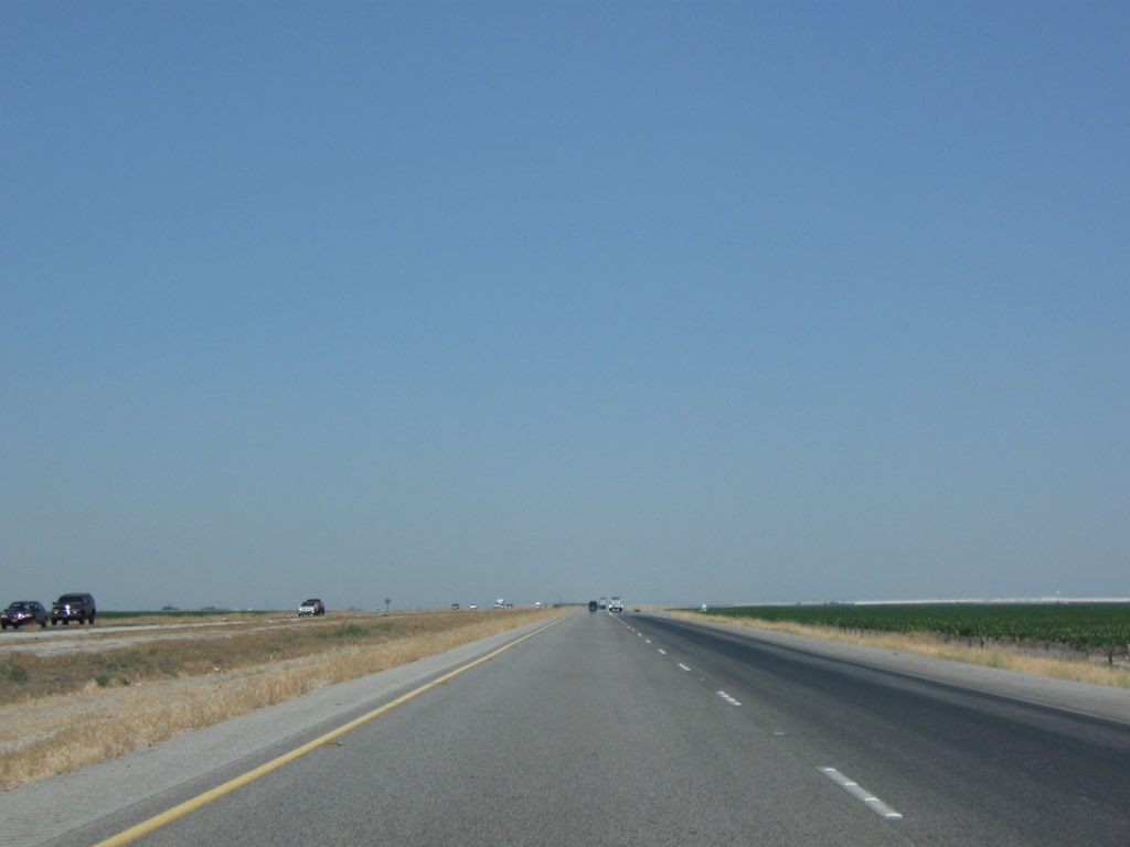
Interstate 5 can have consistent heavy traffic, or it can see spotty traffic in between "wolf packs" of cars. This sometimes allows pictures like this with long, straight stretches with seemingly no traffic. But don't be fooled ... this freeway is rarely quiet and even less commonly as empty as it seems to appear here. Photo taken 04/06/12. |
|
|
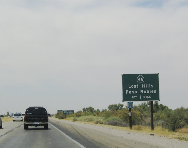
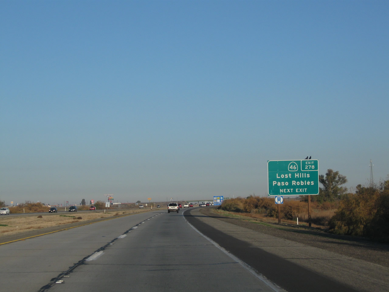
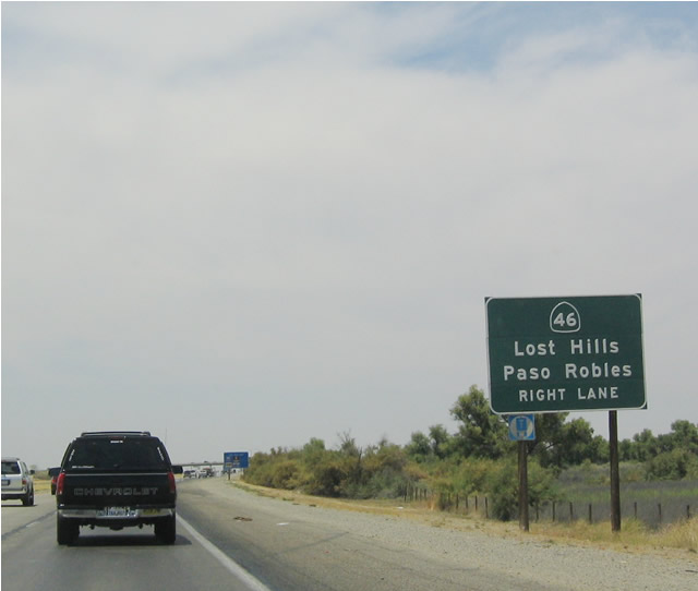
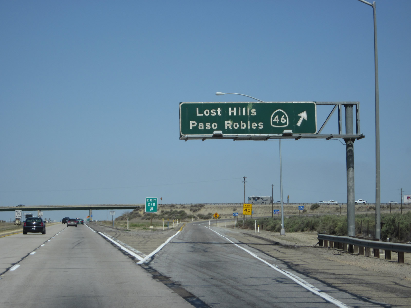
The next exit along northbound Interstate 5 is Exit 278, California 46/Paso Robles Highway east to Wasco and west to Lost Hills and Paso Robles (one mile). Westbound California 46 follows historic U.S. 466 west toward Lost Hills and Paso Robles (although U.S. 466 used to follow California 41 southwest to Atascadero and Morro Bay). Lost Hills is very close to the freeway, and the restaurants and gas stations that sprang up at this interchange have Lost Hills addresses. Photos taken 11/25/10 and 11/28/02. |
|
|
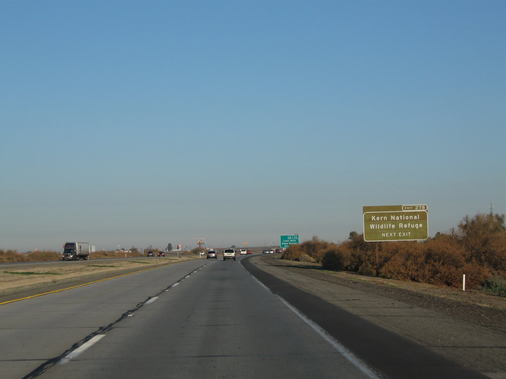
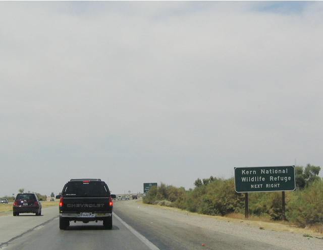
Use Exit 278 to reach the Kern National Wildlife Refuge, which was established to preserve a section of the southern Central Valley (San Joaquin Valley). The preserve was created on November 18, 1960. The headquarters to the refuge is located at the intersection of Garces Highway and Corcoran Road. From here, take California 46 east to Corcoran Road north to the refuge. Photos taken 11/25/10 and 07/02/04. |
|
|
Nearly every motorist service is available at Exit 278, including food and gas. Photos taken 11/25/10 and 11/28/02. |
|
|
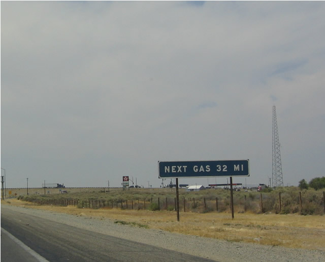
The next gas on the freeway (along northbound) is 32 miles ahead at Exit 309, California 41. Photos taken 04/06/12 and 07/02/04. |
|
Northbound Interstate 5 (West Side Freeway) reaches Exit 278, California 46/Paso Robles Highway to Lost Hills. Eastbound California 46 leads to Wasco before culminating at California 99. At a seemingly arbitrary point north of California 46 and south of Utica Avenue, northbound Interstate 5 crosses from Kern County into Kings County. Photo taken 04/06/12. |
|
An Interstate 5 reassurance shield is posted after the on-ramp from California 46. The 2009 shield image shows a neutered shield common to this segment of Interstate 5 in Kern County. Photo taken 07/15/09. |
|
|
This mileage sign along northbound Interstate 5 provides the distance to California 41, San Francisco, and Sacramento. Photos taken 11/23/06 and 07/02/04. |
|
|
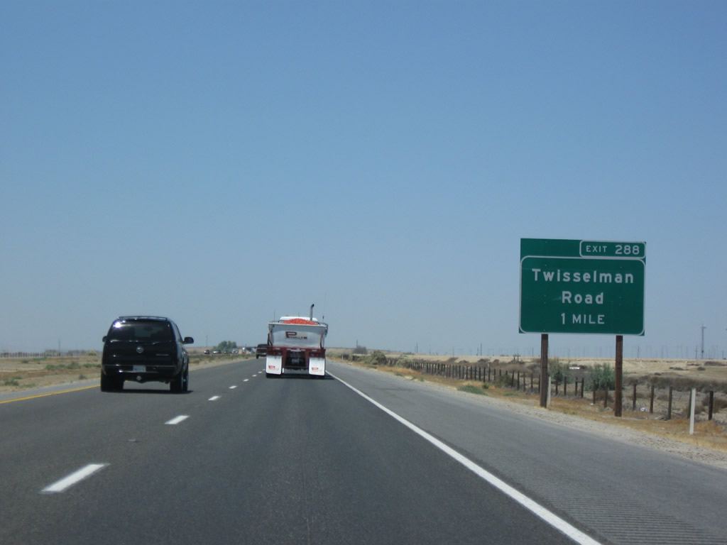
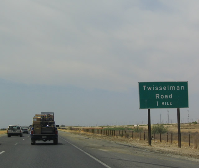
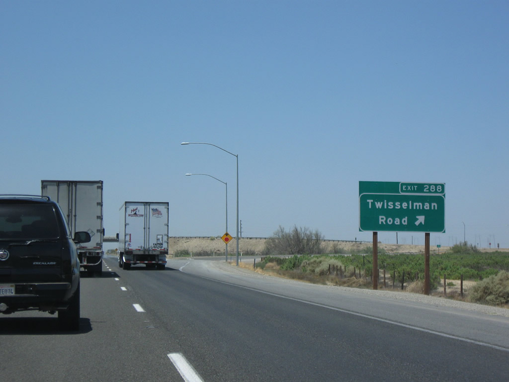
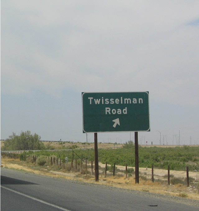
The next exit along northbound Interstate 5 (West Side Freeway) is Exit 288, Twisselman Road. Photos taken 07/15/09 and 07/02/04. |
|
|
Northbound Interstate 5 meets Exit 288, Twisselman Road, which travels west over to the California 33 corridor. This is the final Kern County interchange. Exit numbers at this interchange were introduced in the 2004-2005 time frame. Photos taken 07/15/09 and 07/02/04. |
|
|
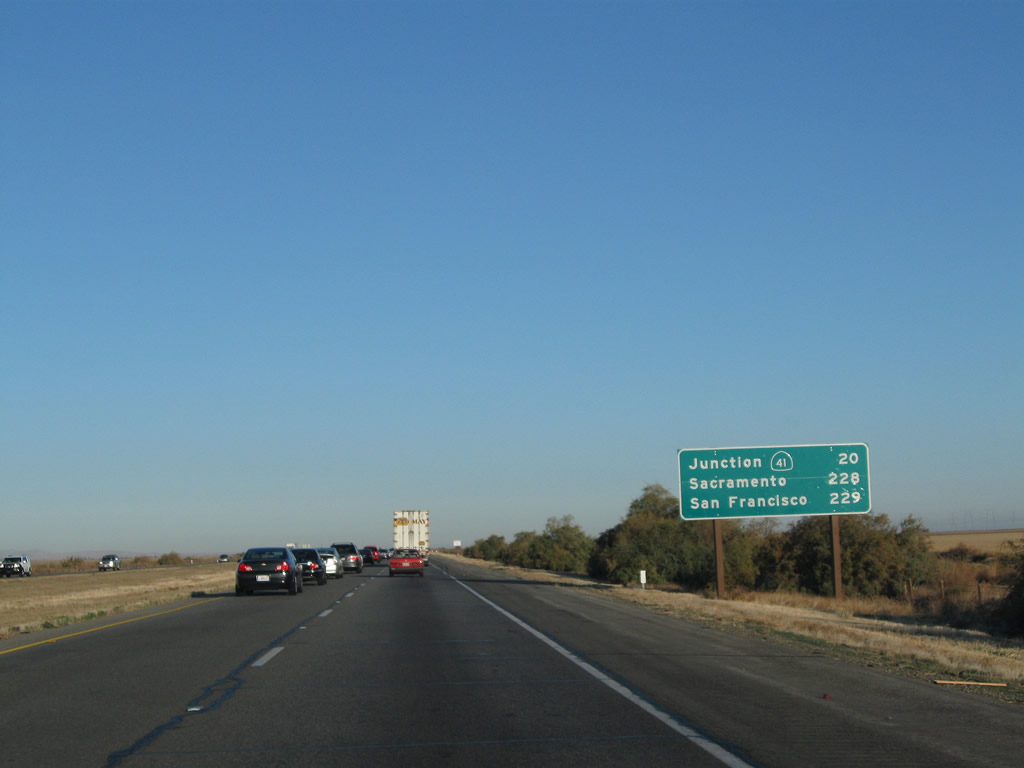
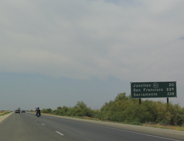
After the Twisselman Road interchange, this mileage sign along northbound Interstate 5 provides the distance to California 41, San Francisco, and Sacramento. From here, Interstate 5 departs Kern County and enters Kings County around Milepost 292. Photos taken 11/25/10 and 07/02/04. |
|
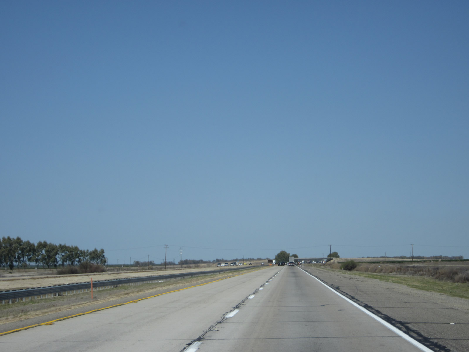
Not much development can be found along this segment of Interstate 5, not even farms. As we trend along the west side of the Central Valley in the rain shadow of the Coast Range, rainfall is scant and the ground is less fertile than lands at the southern end of the Central Valley. Photo taken 07/15/09. |
|
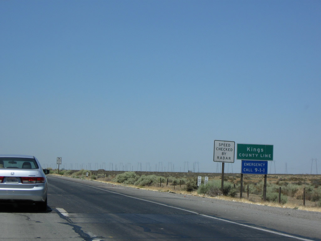
Soon after this point, Interstate 5 leaves Kern County and enters Kings County. This Central Valley county had a population of 152,982 as of the 2010 Census. Most of the agricultural and urban development of the county lies away from Interstate 5, mostly on California 198 (the county seat is Hanford, and nearby Lemoore is home to a military base). However, Interstate 5 will pass through the city of Avenal before leaving Kings County and entering Fresno County. Photo taken 07/15/09. |
| Interstate 5 scenes |
|
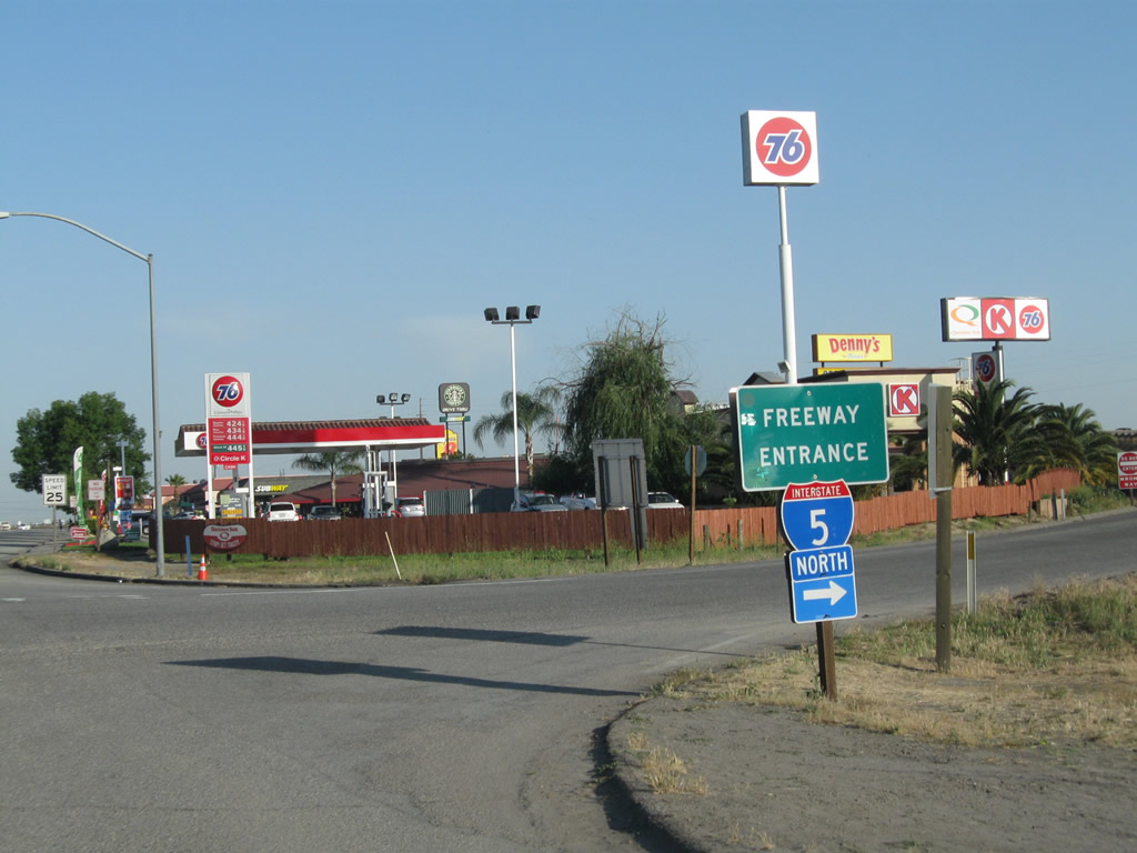
This freeway entrance sign is located on the southbound eastern frontage road at the California 58 interchange. Photo taken 05/13/11. |
Page Updated September 16, 2012.