| Interstate 5 (West Side Freeway) north |
|---|
|
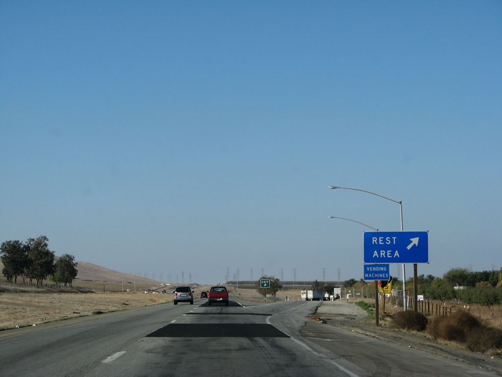
Upon leaving Fresno County and entering Merced County, Interstate 5 connects to Exit 386, John "Chuck" Erreca Safety Rest Area. Restrooms, water, pet walking area, and telephone are available here. Photo taken 11/22/07. |
|
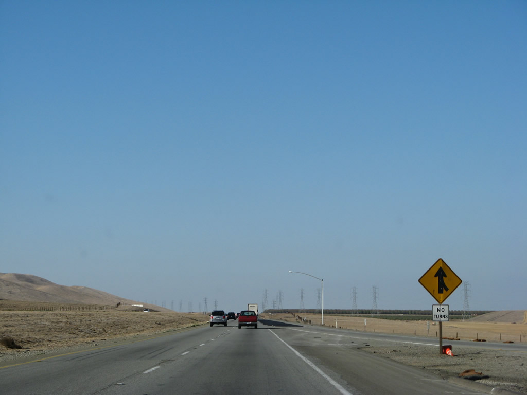
Traffic merges from the John "Chuck" Erreca Rest Area back onto Interstate 5 north. Photo taken 11/22/07. |
|
|
|
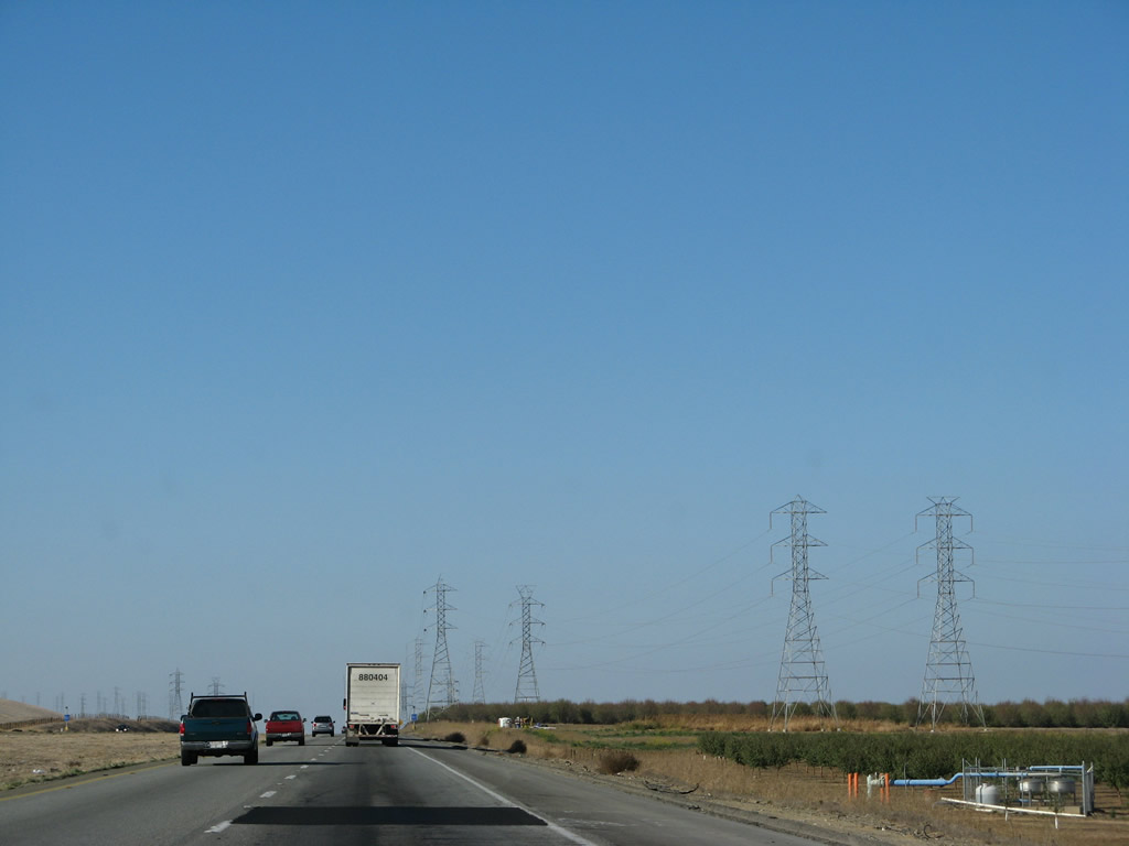
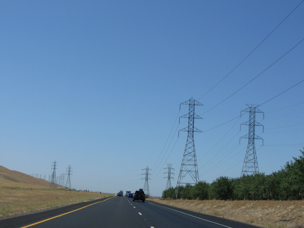
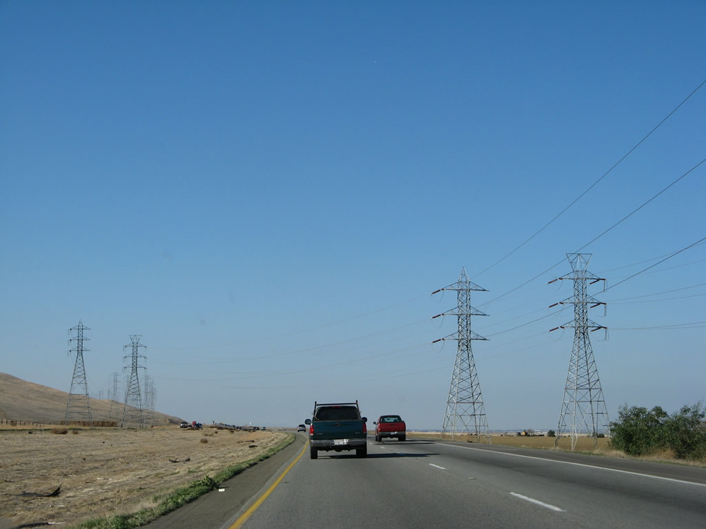
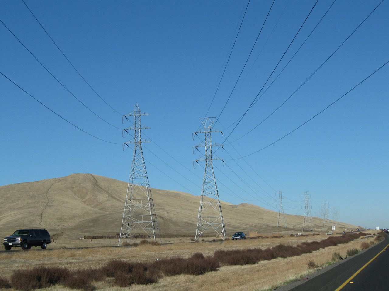
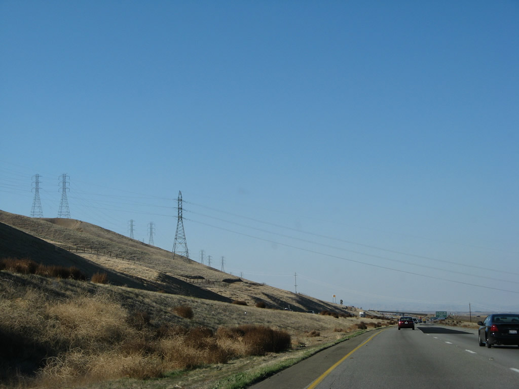
A set of Pacific Gas & Electric 230kV power lines approach and cross Interstate 5 after the rest area. These lines cross the freeway near Milepost 388 and will join and follow the Path 15 500kV power lines north toward the Los Banos substation (near the Interstate 5 and California 152 interchange). Photos taken 11/22/07, 07/15/09, and 11/25/10. |
|
|
|
|
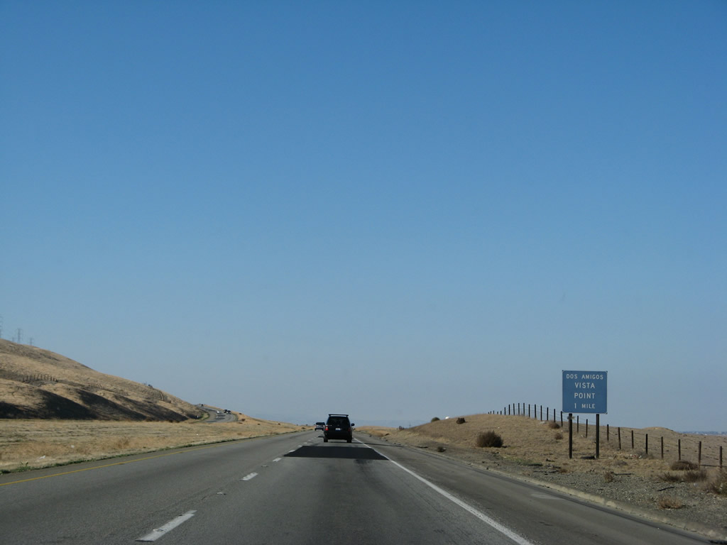
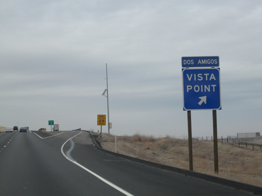
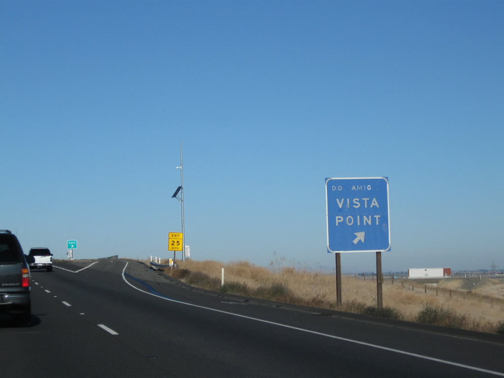
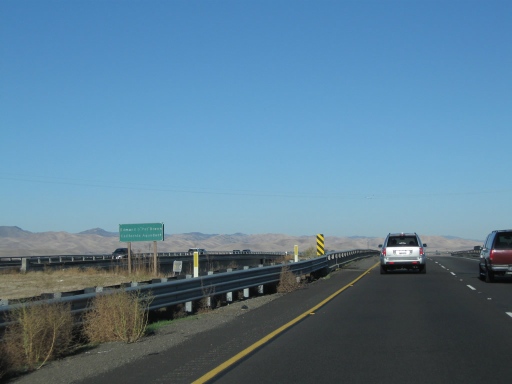
The next exit along Interstate 5 north is Exit 390, Dos Amigos Vista Point. There are no facilities at this exit. The view looks down on the California Aqueduct, one of the great engineering marvels in California history. The aqueduct, which is part of the California State Water Project, conveys water from the California Delta (where the Sacramento and San Joaquin Rivers converge) and takes it south through the Central Valley, then pumps it over the Tehachapi Mountains into Southern California for use by the large populations of that region. Photo taken 11/22/07. |
|
|
Northbound Interstate 5 connects to the Dos Amigos Vista Point at Exit 390. This vista point/parking area provides a view of the Central Valley and one of the pumping stations along the California Aqueduct. Photos taken 11/24/11 and 11/25/10. |
|
|
|
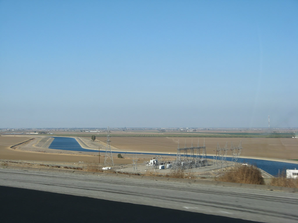
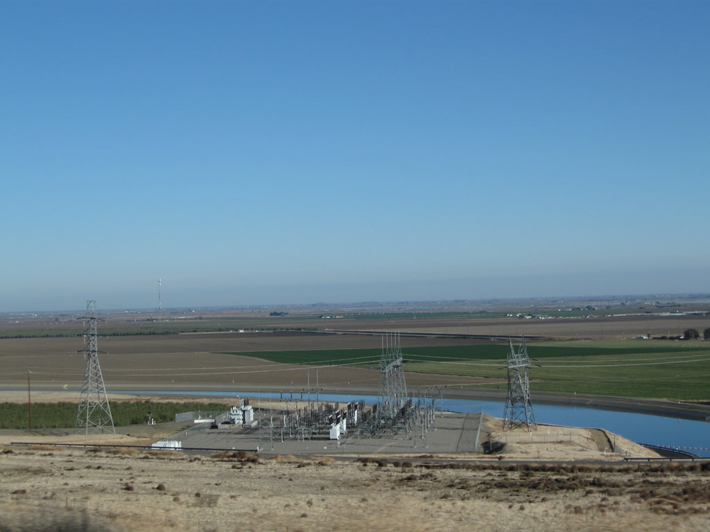
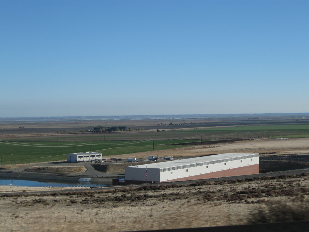
These pictures provide a clear view of the California Aqueduct and the Dos Amigos pumping station. These views can be seen after the Dos Amigos Vista Point exit. Photos taken 11/22/07 and 11/25/10. |
|
This power line connects the pumping station to the Path 15 power corridor, which follows the ridge west of Interstate 5 (West Side Freeway). Photo taken 11/22/07. |
|
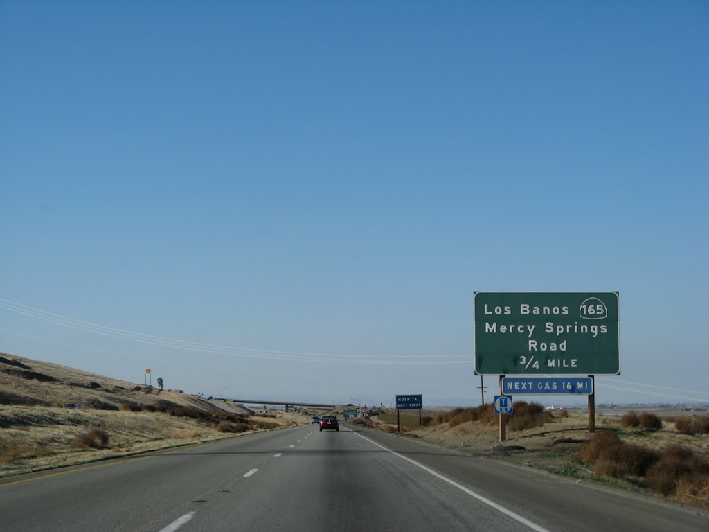
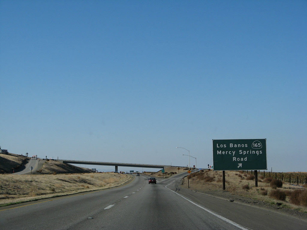
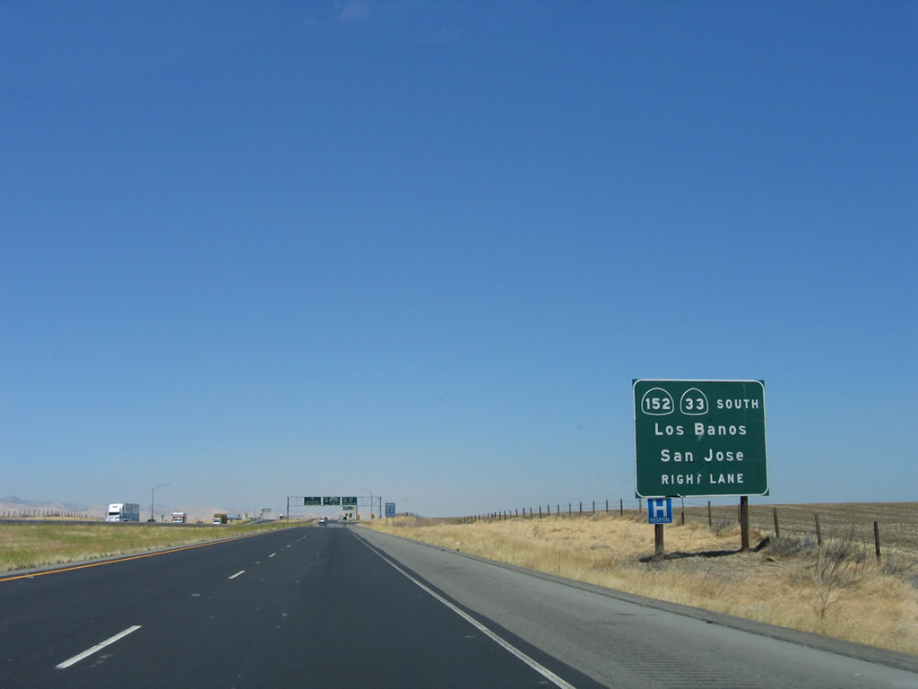
The next exit along Interstate 5 north is Exit 391, California 165/Mercy Springs Road north to Los Banos. The city of Los Banos is located at the intersection of California 165 and California 33-152. North of Los Banos, California 165 continues north to California 99 in Turlock. Photo taken 11/22/07. |
|
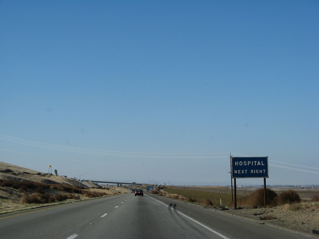
A hospital is located in Los Banos via California 165 north. Photo taken 11/22/07. |
|
Northbound Interstate 5 (West Side Freeway) meets Exit 391, California 165/Mercy Springs Road north to Los Banos and Turlock. Photo taken 11/22/07. |
|
A faded Interstate 5 north shield is posted after the on-ramp from California 165/Mercy Springs Road. Photo taken 11/22/07. |
|
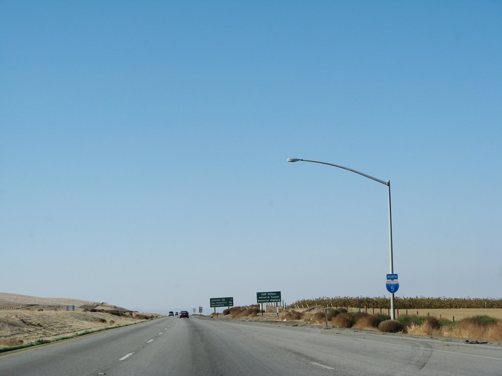
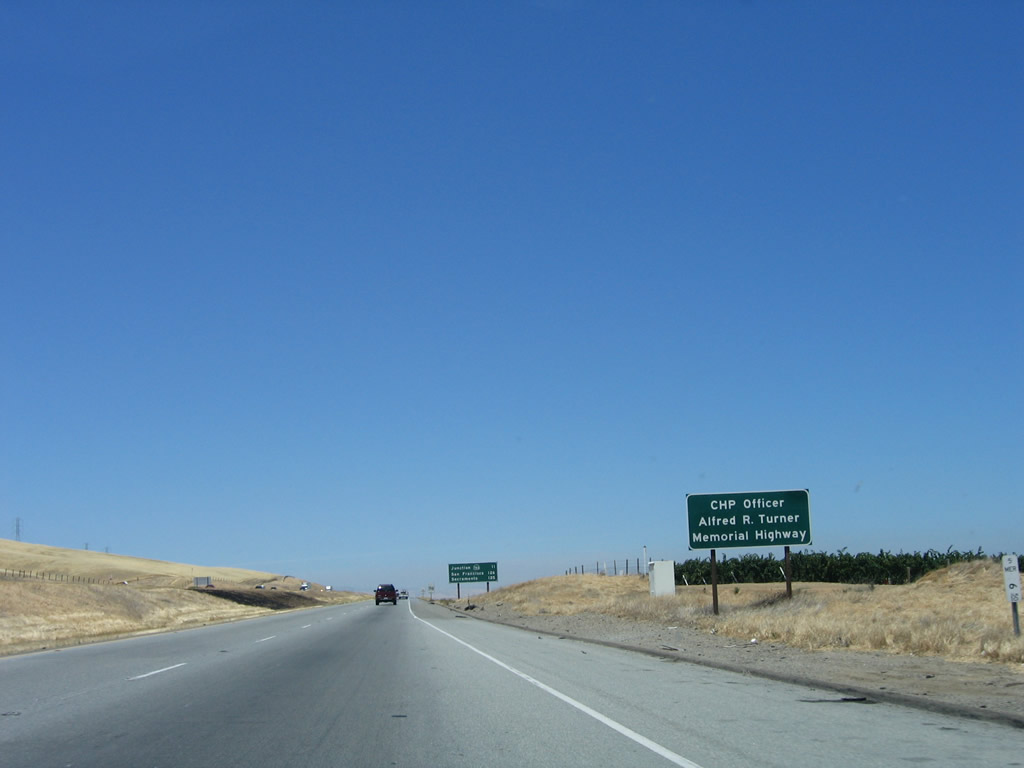
Within Merced County north of the California 165 interchange, Interstate 5 is designated in honor of CHP Officer Alfred R. Turner. Photo taken 07/05/06. |
|
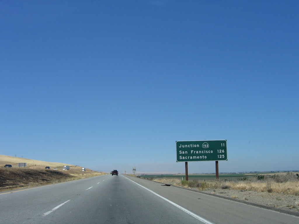
This mileage sign provides the distance to the next interchange (Exits 403A-B, California 152) and the control cities of San Francisco (106 miles via Interstate 580) and Sacramento (105 miles via Interstate 5). Photo taken 07/05/06. |
|
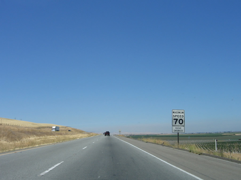
The speed limit along Interstate 5 remains 70 miles per hour. Photo taken 07/05/06. |
|
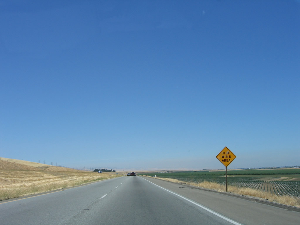
Due to its location in the western foothills, Interstate 5 can see some high winds especially during storms or summer wind events. Dust storms have plagued this stretch of freeway through the Central Valley in the past, causing accidents due to low visibility. Photo taken 07/05/06. |
|
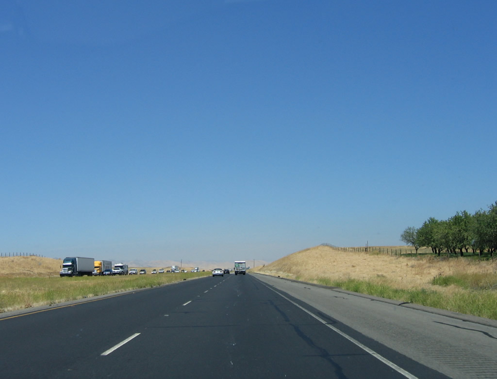
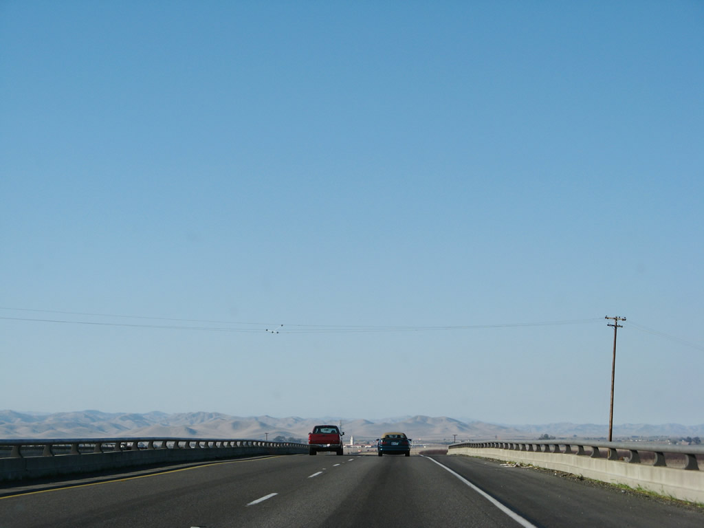
Plenty of trucks commonly use Interstate 5 through the Central Valley. As the freeway continues north, it enters more arable land with more plentiful water (well, plentiful in comparison with the driest corners of Kings and Kern Counties). Photo taken 07/05/06. |
|
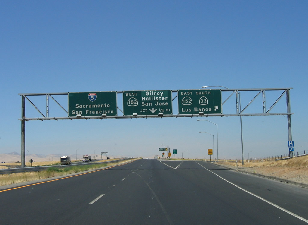
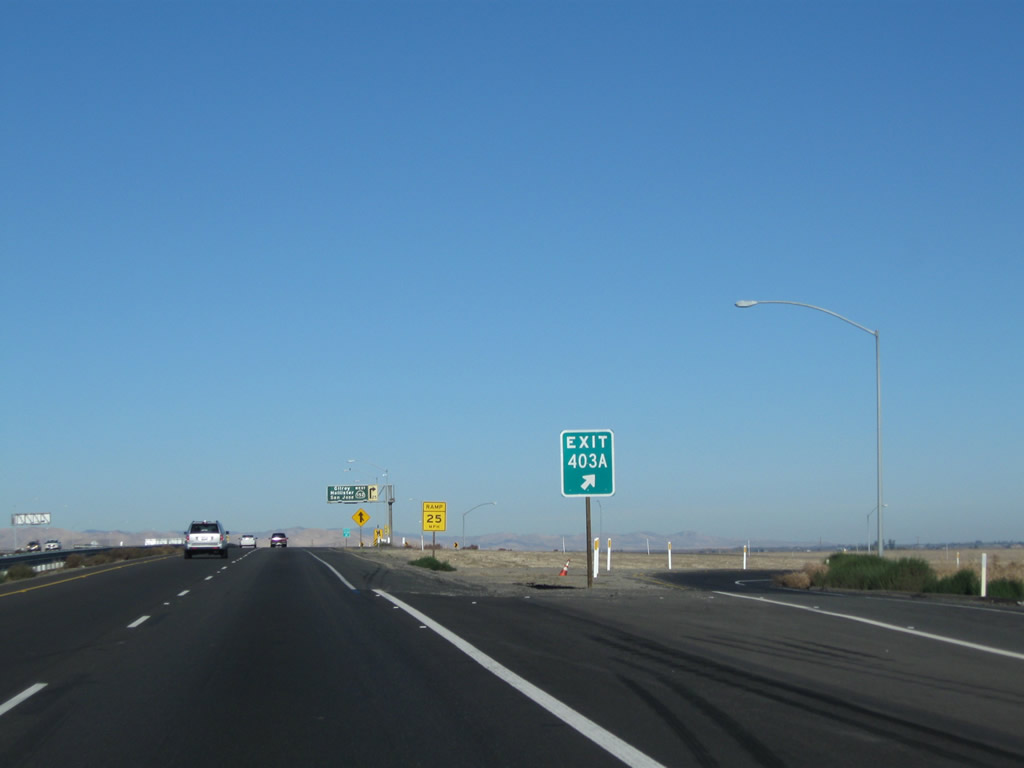
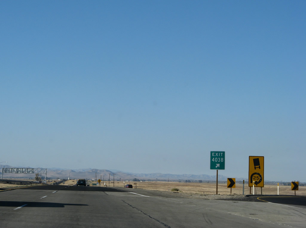
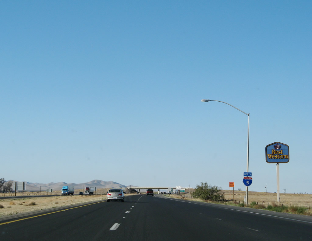
The next exit along northbound Interstate 5 is Exit 403A, California 33 south and California 152 east to Los Banos, three-quarters of a mile. This interchange is a cloverleaf, so the following exit is Exit 403B, California 33 north and California 152 west to Hollister and Monterey (not shown here). Photo taken 11/22/07. |
|
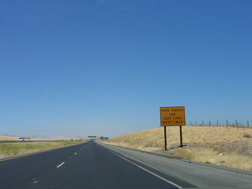
Exits 403A-B can be a congested, busy interchange. Through traffic is advised to use the left lane to avoid merging traffic when passing through this interchange. Traffic destined for San Jose, Santa Cruz, and Monterey will want to use this exit. Photo taken 07/05/06. |
|
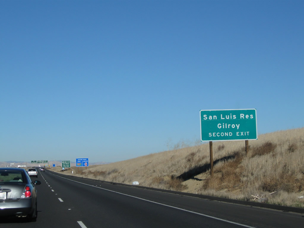
A sign was added in 2007 that advises that Exit 403B (California 152 west) leads to San Luis Reservoir and the city of Gilroy on the U.S. 101 corridor. Photo taken 11/25/10. |
|
While we've already seen north-south California 33 intersect Interstate 5 in Fresno County, Exits 403A-B represent the only interchange between Interstate 5 and California 152. This major east-west expressway corridor is a multi-lane divided highway, offering the most direct east-west service between U.S. 101, Interstate 5, and California 99 between Gilroy, Los Banos, and Chowchilla. As an expressway, California 152 is very busy and can see delays during peak hours. Through the cities of Los Banos and Gilroy, California 152 becomes part of the arterial network and thus has traffic signals and heavier traffic. Photo taken 07/05/06. |
|
Northbound Interstate 5 reaches Exit 403A, California 33 south and California 152 east to Los Banos. The next exit in this cloverleaf interchange is Exit 403B, California 33 north and California 152 west to San Jose, Hollister, and Monterey. Note that the California 33 north shield is omitted on this overhead sign for Exit 403B. These porcelain enamel signs date back to the early 1970s, when the Interstate 5 freeway was first constructed through this area. Photo taken 07/05/06. |
|
The exit number is provided on the gore point sign for Exit 403A. Photo taken 11/25/10. |
|
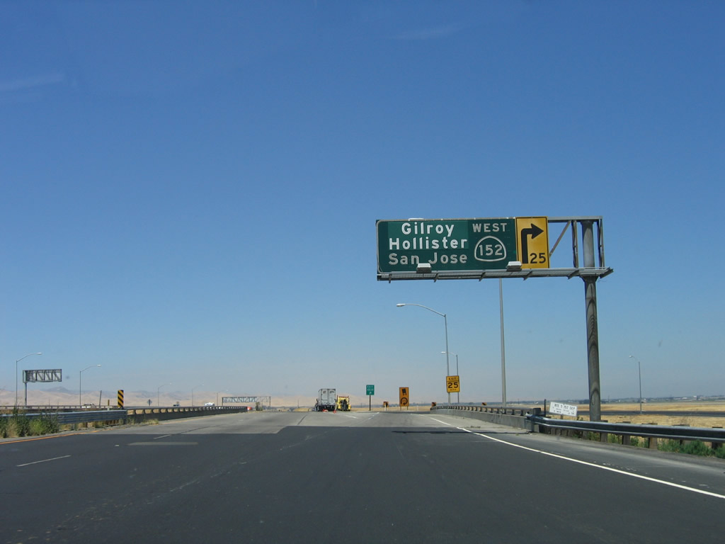
Immediately thereafter, Interstate 5 north meets Exit 403B, California 33 north and California 152 west to San Jose, Hollister, and Monterey. As this is a cloverleaf interchange, exiting traffic must slow down significantly to transition onto California 152 west. For those wanting to take California 33 north to Gustine, a more direct route is to follow Interstate 5 north to Exit 407, California 33 in Santa Nella. Photo taken 07/05/06. |
|
An exit number gore point sign is posted for Exit 403B, California 33 north and California 152 west. Photo taken 11/22/07. |
|
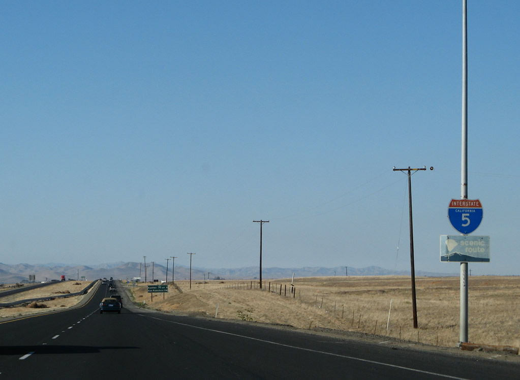
After the California 152 interchange, Interstate 5 becomes an officially recognized scenic route as evidenced by this weathered scenic route marker. This reassurance shield is located after the on-ramp from California 152 west and California 33 north. Photo taken 11/22/07. |
|
This mileage sign along northbound Interstate 5 provides the distance to Exit 407, California 33 in Santa Nella and the city of San Francisco. For the first time, Sacramento (the official control city for Interstate 5 north) is omitted. Photo taken 11/22/07. |
|
|
|
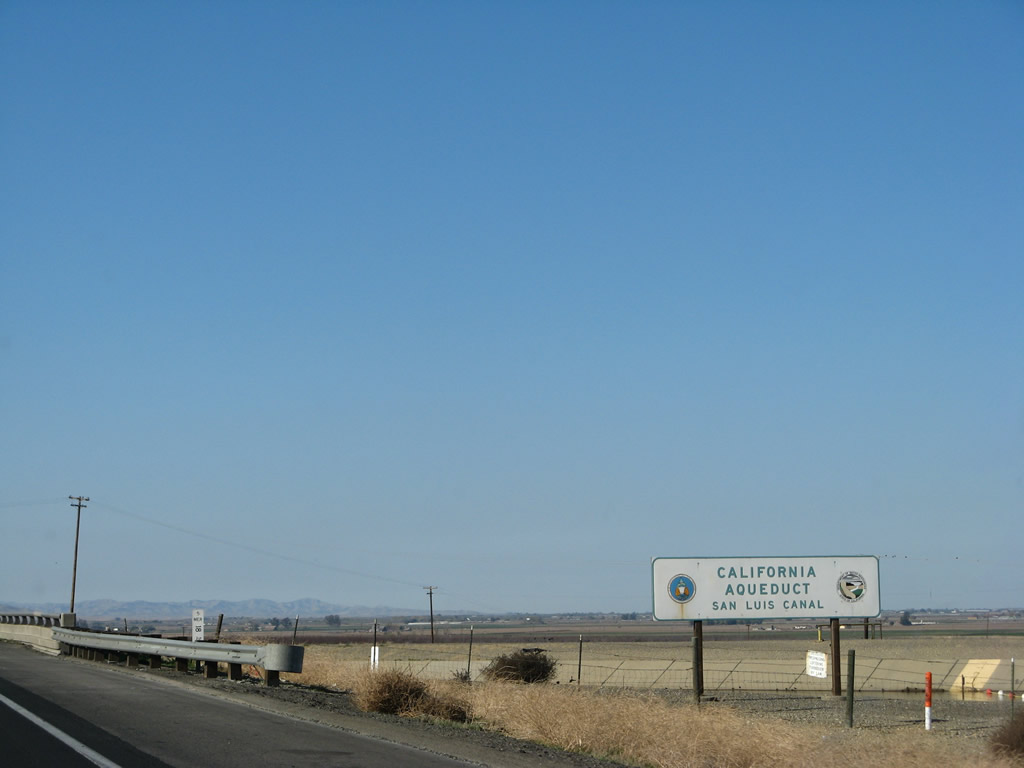
Interstate 5 crosses over the San Luis Canal, which links the San Luis Reservoir with the north-south California Aqueduct. Water is pumped through the canal to send water between the aqueduct and the reservoir depending on the season and levels of demand for water and power. Photos taken 11/22/07 and 11/25/10. |
|
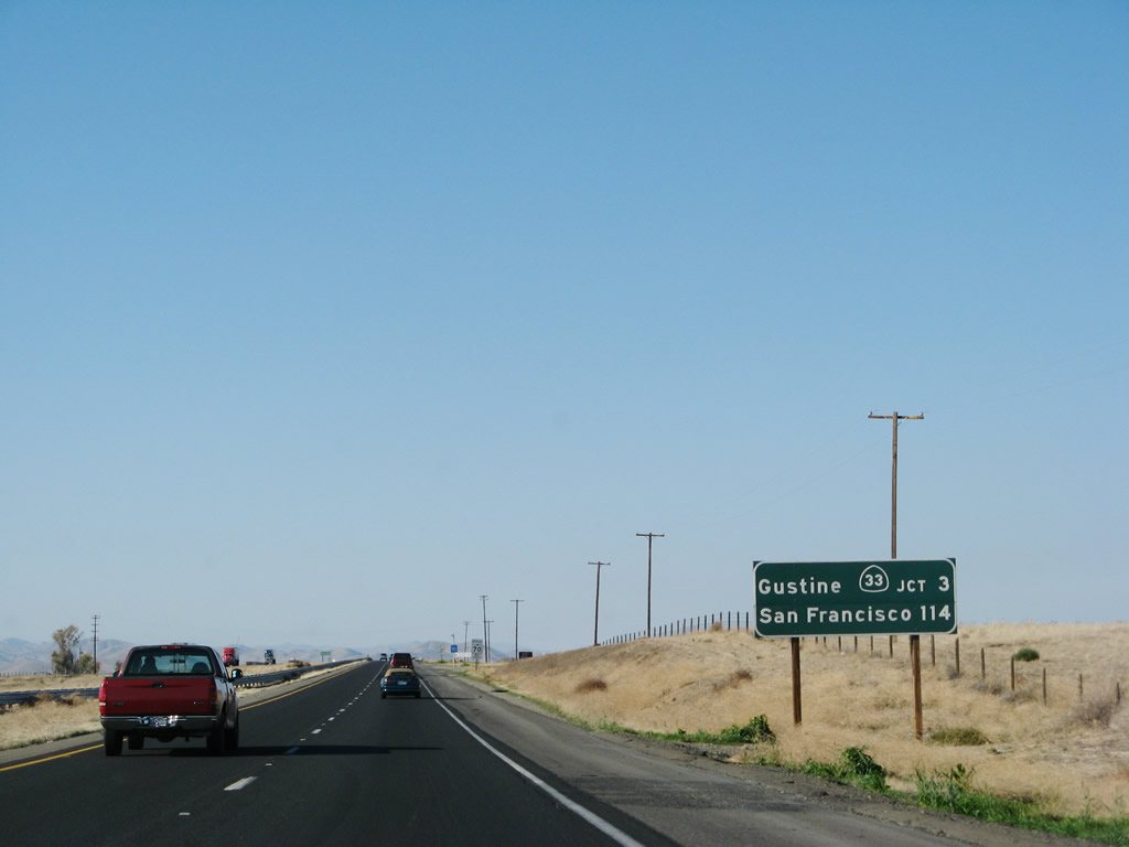
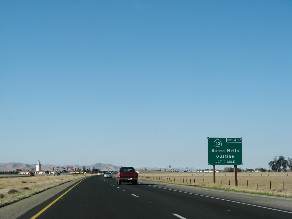
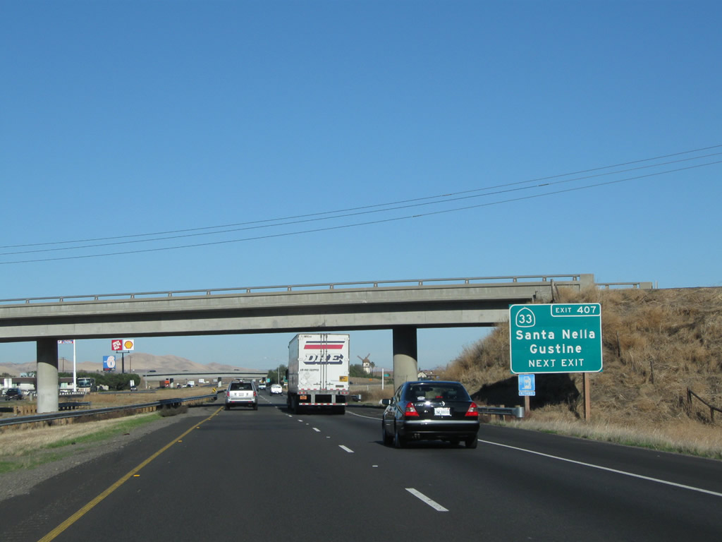
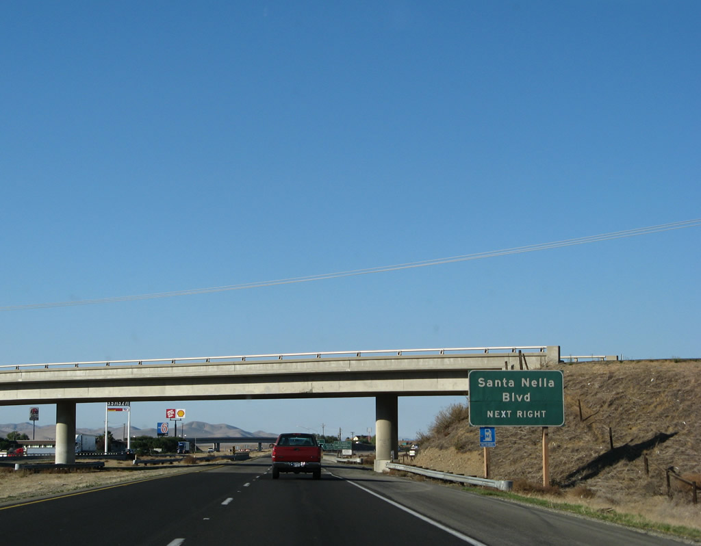
As mentioned earlier, the next exit along northbound Interstate 5 is Exit 407, California 33/Santa Nella Boulevard north to Gustine and south to Santa Nella. Photo taken 11/22/07. |
|
|
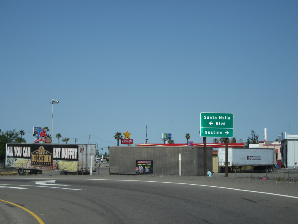
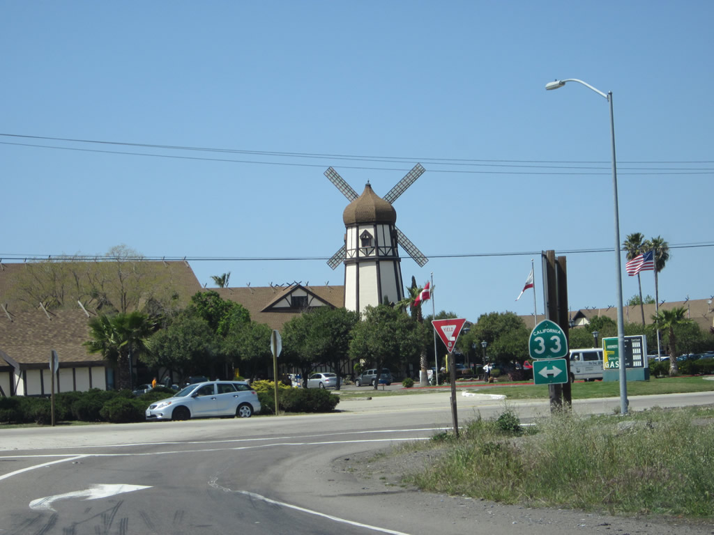
Santa Nella makes no secret that it exists primarily as an Interstate stopover with all motorist services (gas, food, lodging, and camping). Photos taken 11/25/10 and 11/22/07. |
|
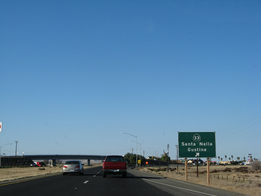
Northbound Interstate 5 meets Exit 407, California 33/Santa Nella Boulevard. California 33 leads north to Gustine and Newman, but it remains fairly close to Interstate 5 between Santa Nella and Tracy. Photo taken 11/22/07. |
|
|
A lone California 33 trailblazer is posted at the top of the off-ramp from Interstate 5 north. Photos taken 04/06/12. |
|
|
Back on the mainline, this Interstate 5 north reassurance shield is posted after the California 33 on-ramp. Photos taken 11/25/10 and 11/22/07. |
|
|
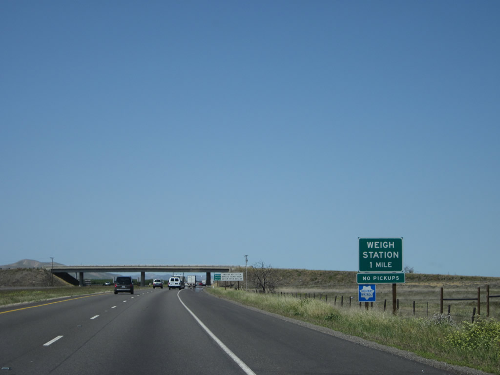
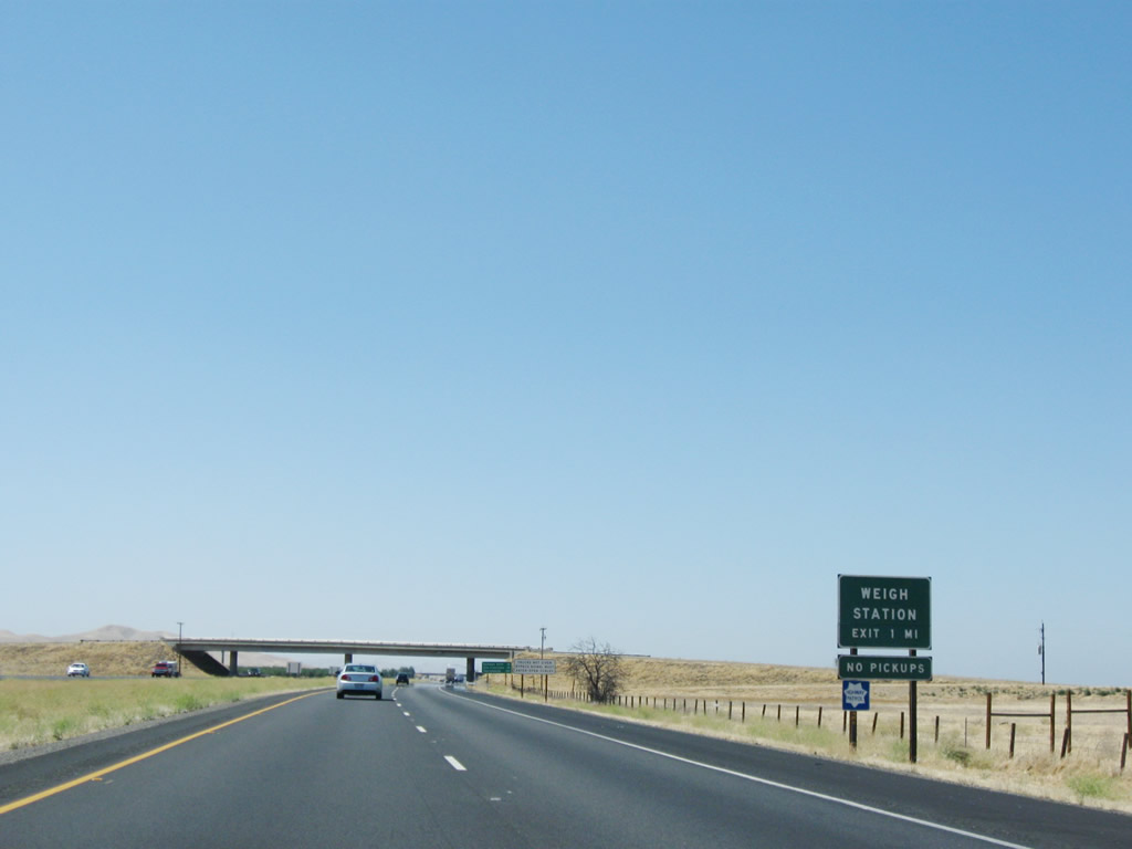
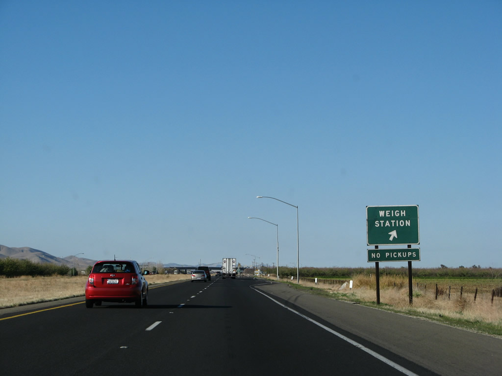
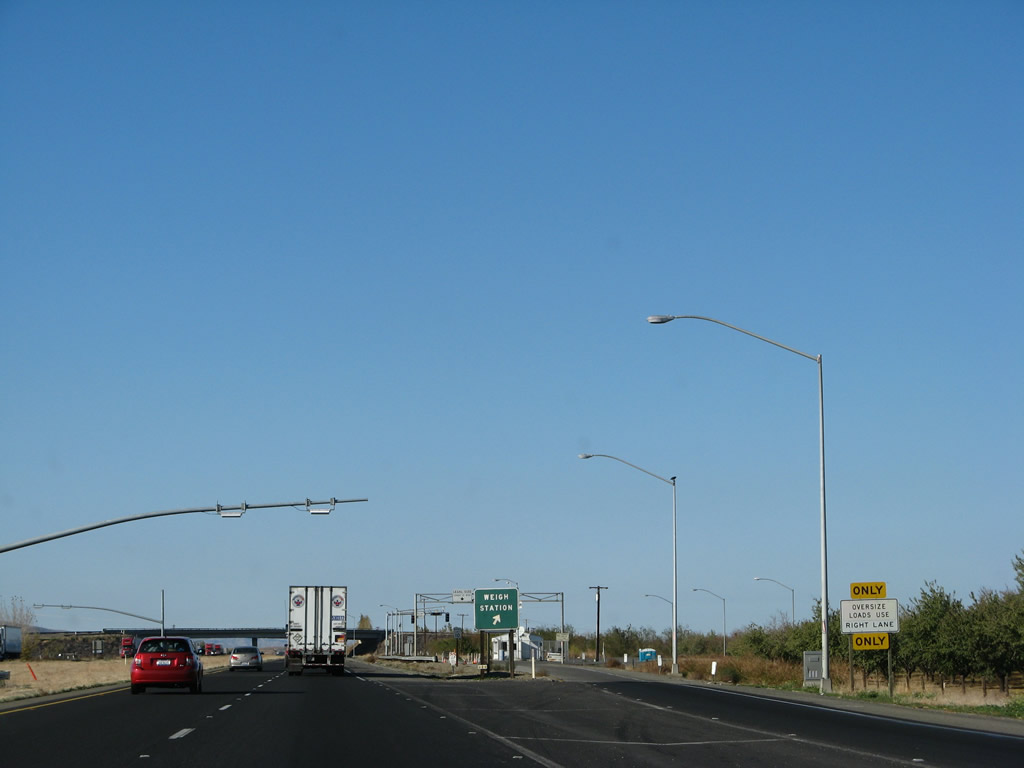
The next exit along Interstate 5 (West Side Freeway) north is Exit 408, Weigh Station (one mile). Photos taken 04/06/12 and 07/15/09. |
|
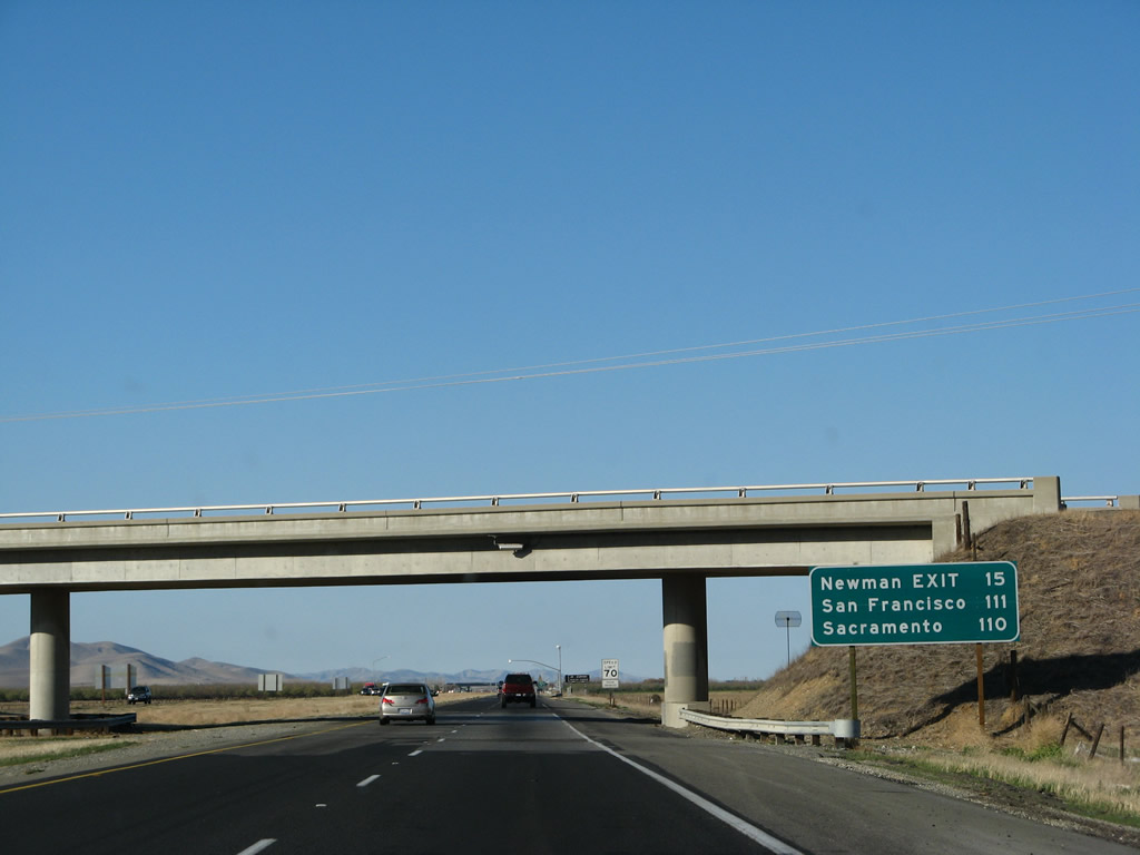
This mileage sign provides the distance to the Newman interchange (Exit 423, Stanislaus County J-18 (Stuhr Road)). Omitted from this sign is the Weigh Station (Exit 408) and Exit 418, California 140. The sign also provides the distance to the control cities of San Francisco and Sacramento. Photo taken 11/22/07. |
|
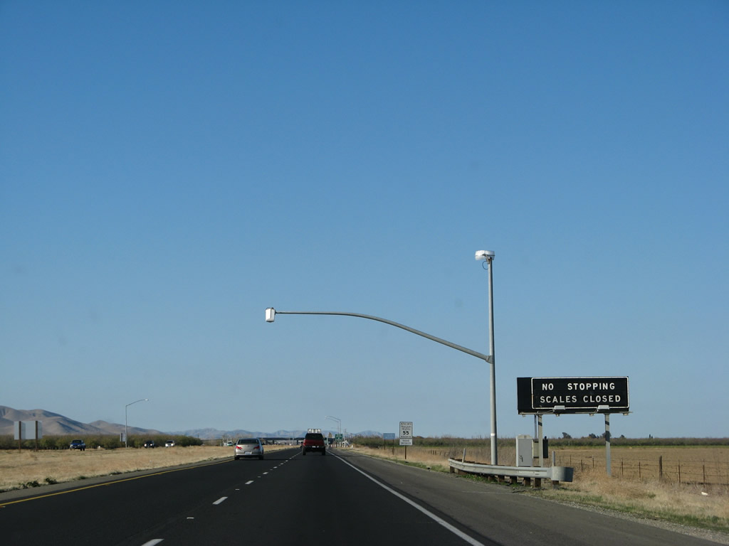
The next exit along northbound Interstate 5 is Exit 408, a weigh station located just north of the Santa Nella interchange. Photo taken 11/22/07. |
|
Northbound Interstate 5 reaches Exit 408, weigh station. Photo taken 11/22/07. |
|
The weigh station was closed on this Thanksgiving Day. Photo taken 11/22/07. |
|
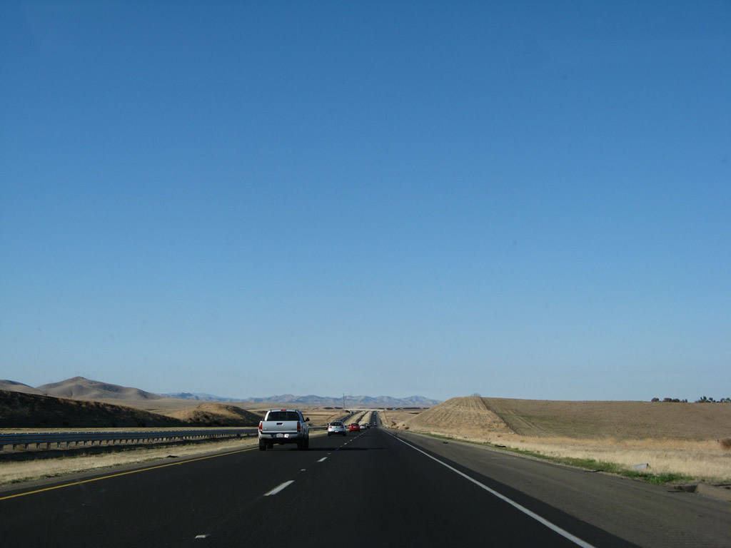
This view of northbound Interstate 5 is located after Santa Nella (Exit 408). Photo taken 11/22/07. |
|
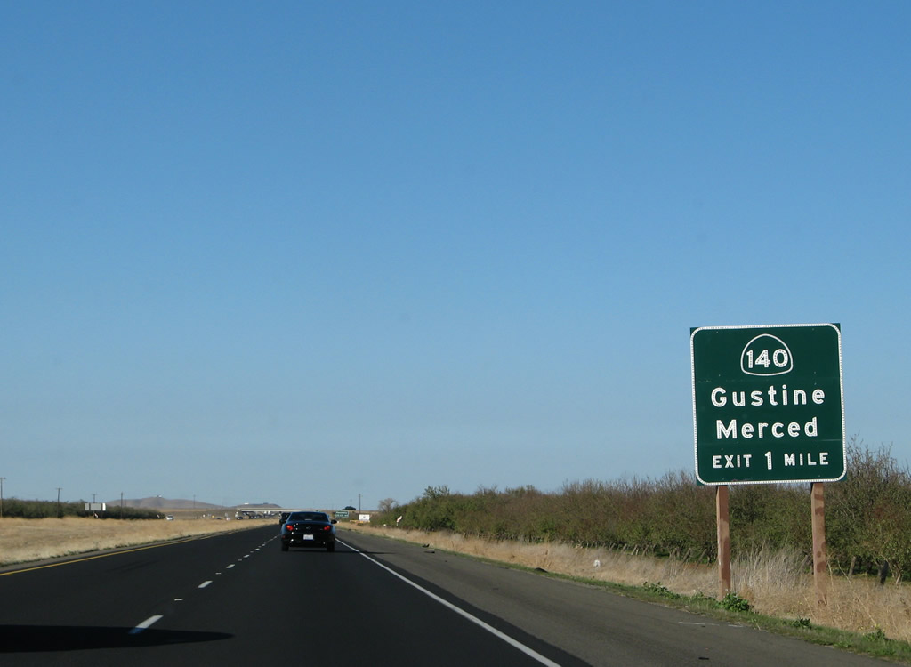
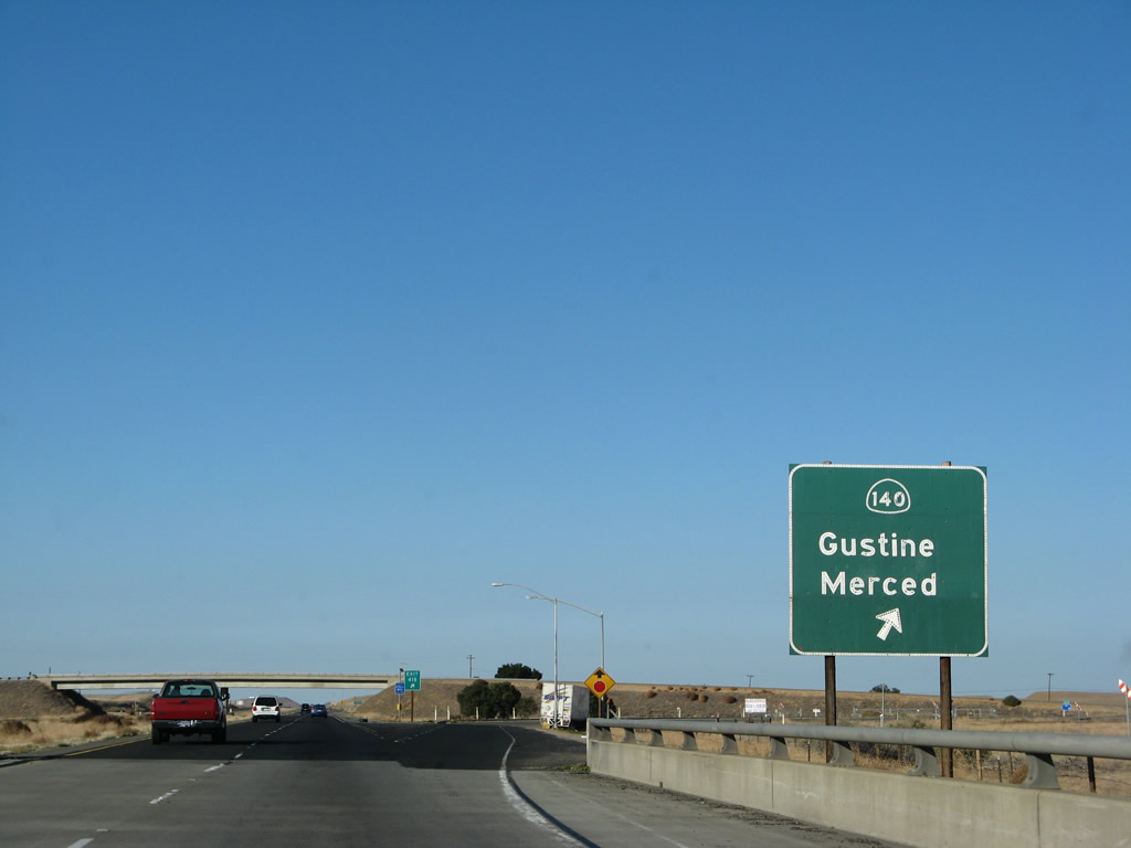
The next exit along northbound Interstate 5 is Exit 418, California 140/Sullivan Road. California 140 travels east to meet California 33 in Gustine and continues across the Central Valley (San Joaquin Valley) into Merced and Yosemite National Park. Photo taken 11/22/07. |
|
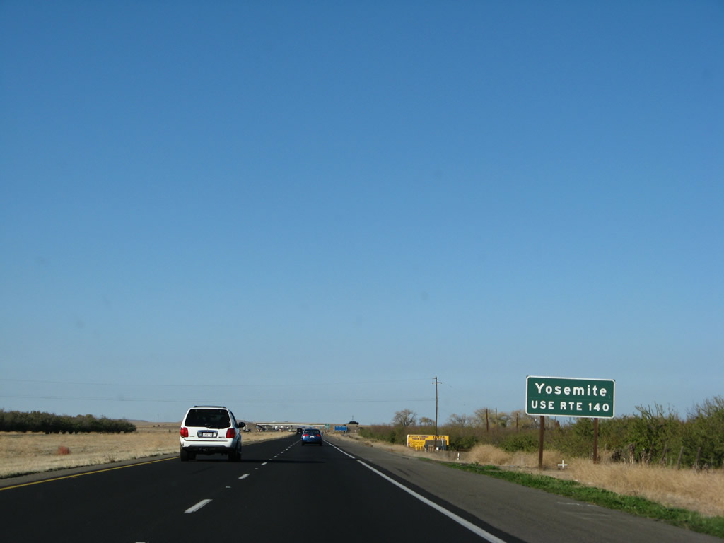
Interstate 5 serves as the western terminus of California 140, which is shown here approaching Exit 418, California 140. Use California 140 east to Yosemite National Park after passing through Merced. California 140 passes through the Merced River Canyon to connect directly into Yosemite Valley, unlike California 120 and California 41 (both of which require traveling over significant grades to get into Yosemite Valley). Photo taken 11/22/07. |
|
Northbound Interstate 5 meets Exit 418, California 140/Sullivan Road after the state highway crosses Garzas Creek. Some motorist services are available here, and the end of California 140 is posted. Photo taken 11/22/07. |
|
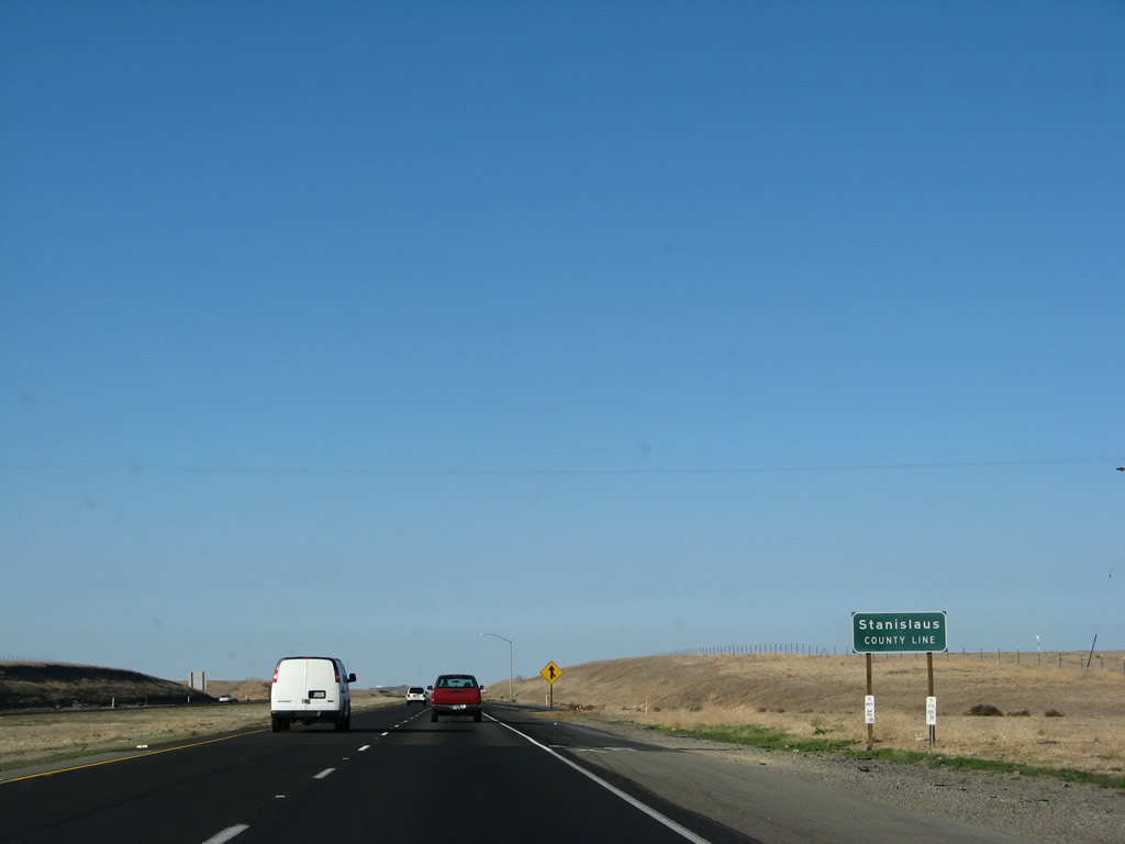
While within the footprint of the California 140 interchange, Interstate 5 departs Merced County and enters Stanislaus County ("In the Heart of Central California"), which had a population of 514,453 as of the 2010 Census. The county seat is Modesto, which is located on the California 99 corridor. Photo taken 11/22/07. |
Page Updated September 16, 2012.