

Interstate 5 South - Tehama County
| Interstate 5 south | |
|---|---|
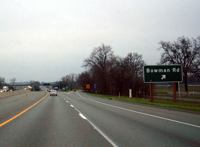 |
Southbound Interstate 5 meets Exit 662, Tehama County A-5/Bowman Road/northbound Business Loop I-5 to Cottonwood. Tehama County A-5 leads southwest to meet California 36 west of Red Bluff. Photo taken 01/20/03. |
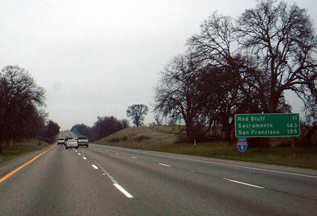 |
From the dramatic scenery of extreme northern California, with its mountains, forests, and natural beauty, southbound Interstate 5 starts to mellow its scenery considerably. This foothill area between Redding and Red Bluff marks the landscape's transition from the mountains to the massive Central Valley. Photo taken 01/20/03. |
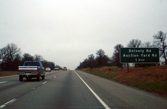 |
The next exit along Interstate 5 south is Exit 659, Snively Road, one mile. Photo taken 01/20/03. |
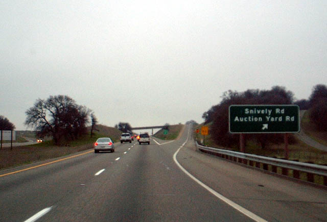 |
Southbound Interstate 5 meets Exit 659, Snively Road. Snively Road actually parallels Interstate 5 for a stretch from here north to Lake California Drive/Tehama County A-5. Photo taken 01/20/03. |
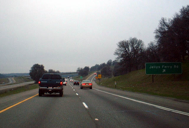 |
Southbound Interstate 5 meets Exit 653, Jellys Ferry Road. Jellys Ferry Road leads northeast parallel to the Sacramento River. It ends at its junction with Shasta County A-17 (Balls Ferry Road/Ash Creek Road). Photo taken 01/20/03. |
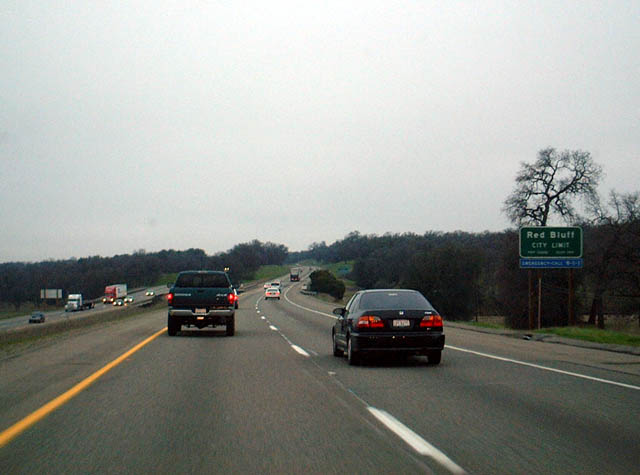 |
Leaving the foothill country, Interstate 5 finally enters the Central Valley, and the valley will dominate the freeway for the next 400 miles. To give a mileage comparison, this photo of Interstate 5 southbound was taken near Milepost 652; the freeway will not leave the Central Valley until near Milepost 215 at the Grapevine. Weather in the valley typically result in cold, moist air near the ground during the winter (hence the fog pattern on this winter day). However, hot, dry air is very common in the summer, resulting in temperatures well over 100 degrees in June, July, and August. Welcome to Red Bluff. Photo taken 01/20/03. |
 |
If only they would use a business loop shield! This is The next exit along Interstate 5 south is Exit 651, Business Loop I-5/Red Bluff. In fact, there are no "Route 5 Business Next Right" signs either, but the loop itself has several shields along the business route. Photo taken 01/20/03. |
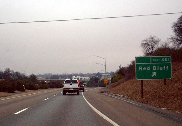 |
Southbound Interstate 5 meets Exit 651, Business Loop I-5/Red Bluff. The business route returns to the freeway via Tehama County A-8/Main Street. This exit is the best route to West California 36, even though it is not signed here. Photo taken 01/20/03. |
 |
The next exit along Interstate 5 south is Exit 649, California 36, one mile. Photo taken 01/20/03. |
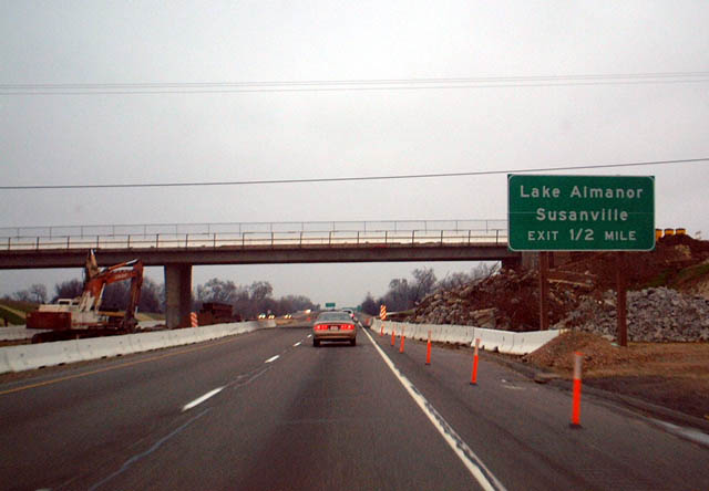 |
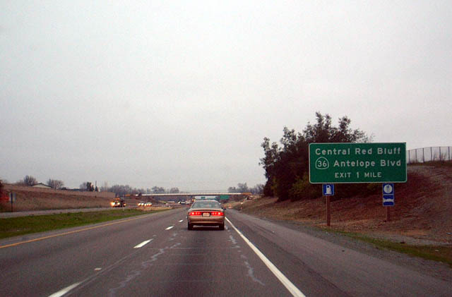
The next exit along Interstate 5 south is Exit 649, California 36, one-half mile. East California 36 leads to Lake Almanor and Susanville. Photo taken 01/20/03. |
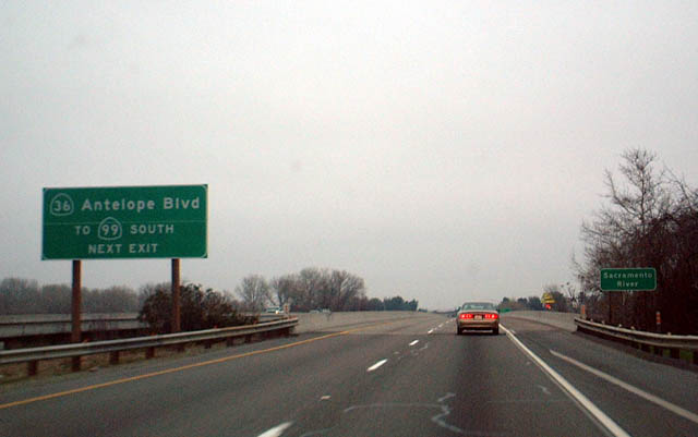 |
East California 36 leads to Southbound California 99. California 99 leads to Chico, Oroville, Marysville, and Yuba City before rejoining Interstate 5 near Sacramento International Airport. This photo was taken on the approach to Exit 649 along southbound. Photo taken 01/20/03. |
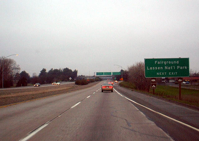 |
In addition, east California 36 leads to Lassen National Volcanic Park. The Tehama County Fairgrounds are also at this exit. Photo taken 01/20/03. |
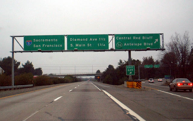 |
Southbound Interstate 5 meets Exit 649, California 36. The next exits are for Diamond Avenue and northbound Business Loop I-5/Tehama County A-8/Main Street. Photo taken 01/20/03. |
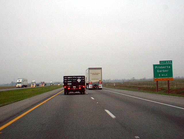 |
Finally, California uses an exit numbering standard more in line with most other states. This is The next exit along Interstate 5 south is Exit 642, Flores Avenue to Proberta and Gerber. Both Proberta and Gerber are located along Tehama County A-8 north of the town of Tehama. In fact, Old U.S. 99W splits from Tehama County A-8 at Proberta; County Route A-8 continues south toward Gerber and Tehama, while Old U.S. 99W angles southwest back toward Interstate 5 at Corning. Photo taken 01/20/03. |
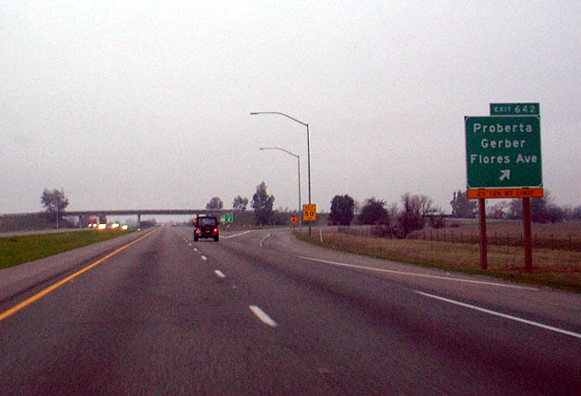 |
Southbound Interstate 5 meets Exit 649, Flores Avenue east to Proberta and Gerber. Flores Avenue also leads west, connecting with Dusty Way, Paskenta Road, and Rawson Road. Photo taken 01/20/03. |
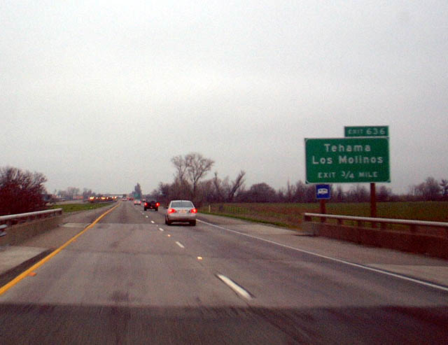 |
The light is starting to fade on this late winter afternoon, but the exit numbered signs continue to use the tabs. This photo shows The next exit along Interstate 5 south is Exit 636, eastbound Tehama County A-11 (Gyle Road) to Tehama and Los Molinos. Photo taken 01/20/03. |
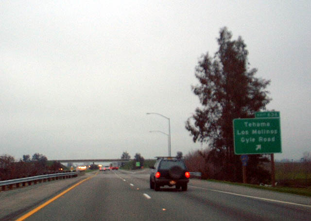 |
The next exit along Interstate 5 south is Exit 636, eastbound Tehama County A-11 (Gyle Road) to Tehama and Los Molinos. Note that this exit sign has the auxiliary county route shield (Caltrans standard) and also mentions Gyle Road. County Route A-11 leads east into Tehama, connecting with County Route A-8 and California 99 via Aramayo Road over the Sacramento River. Photo taken 01/20/03. |
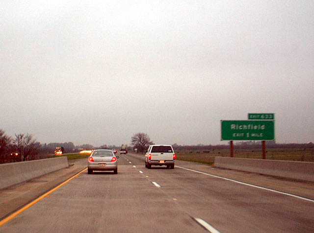 |
The next exit along Interstate 5 south is Exit 633, Finnell Avenue/Richfield, one mile. Photo taken 01/20/03. |
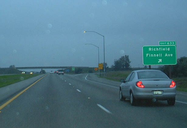 |
Southbound Interstate 5 meets Exit 633, Finnell Avenue/Richfield. This time we used flash photography, hence why the background is suddenly much darker than the previous picture. Photo taken 01/20/03. |
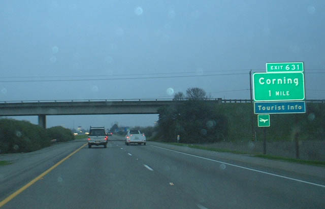 |
The next exit along Interstate 5 south is Exit 631, Tehama County A-9, Corning Road/Solano Street. Although not designated, this is the main business route into Corning. Photo taken 01/20/03. |
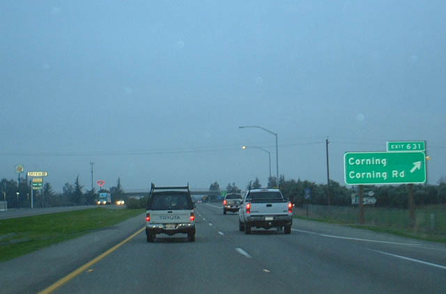 |
Southbound Interstate 5 meets Exit 631, Tehama County A-9, Corning Road/Solano Street. Tehama County A-9 runs east-west, leading east to Vina and California 99 via Hall Road and South Avenue across the Sacramento River. Heading west, Tehama County A-9 connects with Paskenta Road en route to Paskenta and Round Valley in the Mendocino National Forest. It does not connect to any other state highway, but travelers can loop back to either California 162 or Interstate 5 via Newville Road. Photo taken 01/20/03. |
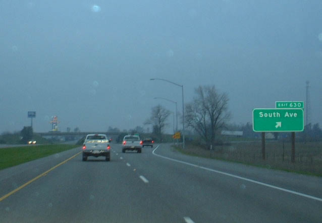 |
Southbound Interstate 5 meets Exit 630, South Avenue. South Avenue eastbound catches up with Tehama County A-9 at Ball Road, then ends at California 99 in Vina. Photo taken 01/20/03. |
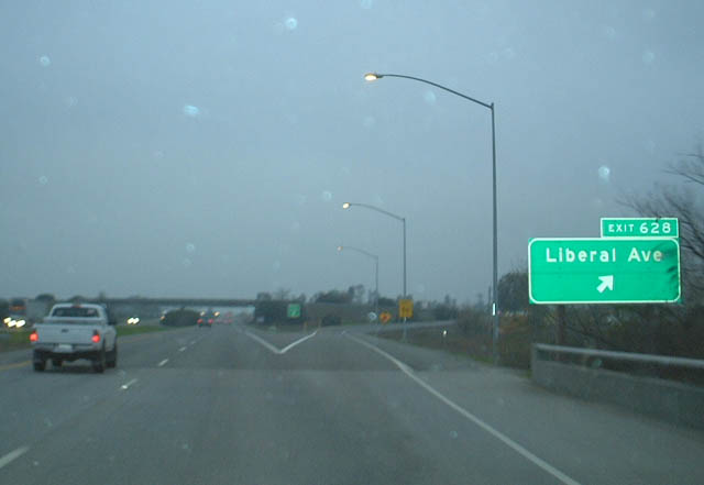 |
Southbound Interstate 5 meets Exit 628, Liberal Avenue. Photo taken 01/20/03. |


Page Updated July 27, 2004.
|
About Contact Glossary |
In The News Interstate Guide |
Social Media:
 |
|
© 2000-25 AARoads.com | All Rights Reserved | Privacy Policy / Terms of Use
|
||