| Interstate 5 south |
|
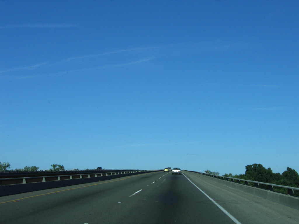
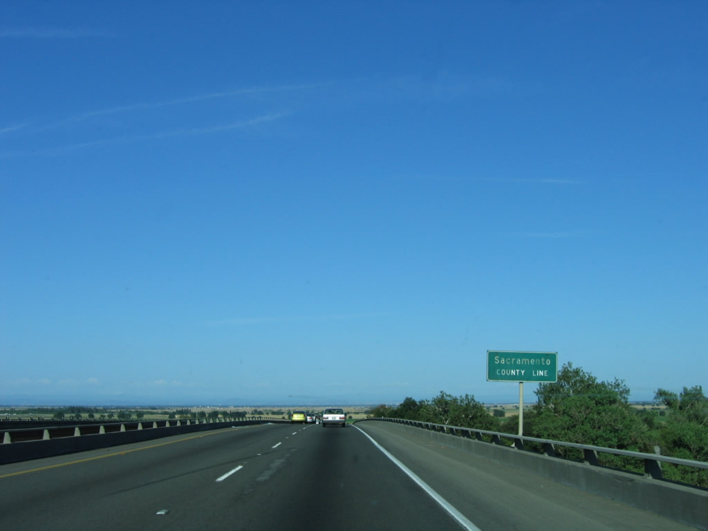
Interstate 5 leaves Colusa County and enters Yolo County upon crossing under County Line Road. The section of Interstate 5 from the county line south to Interstate 505 was built in 1968. Photo taken 05/29/06. |
|
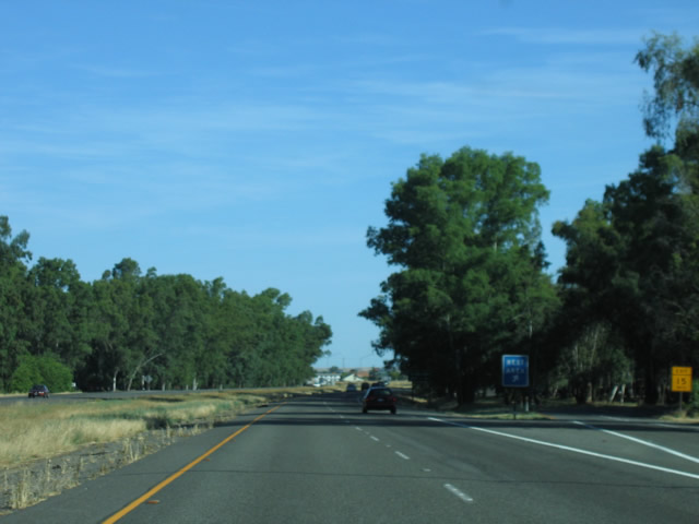
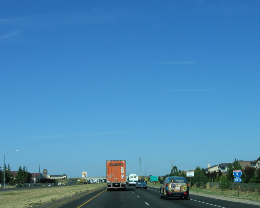
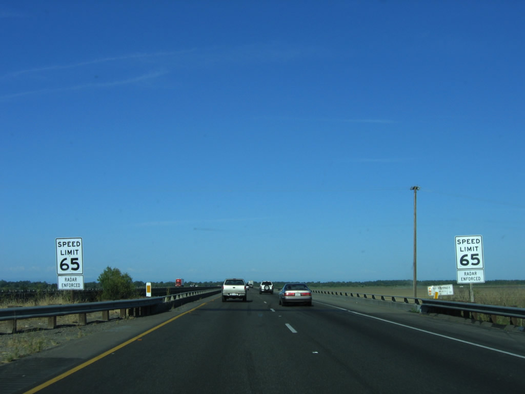
In Yolo County and south into Sacramento County, Interstate 5 has call boxes for emergencies, starting at the County Line Road interchange. Photo taken 05/29/06. |
|
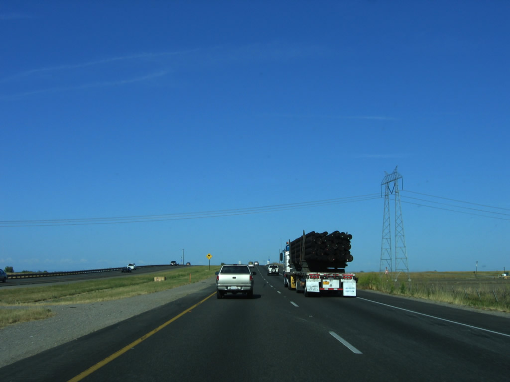
After the County Line Road interchange, this mileage sign provides the distance to Dunnigan (three miles) and Sacramento (41 miles). Photo taken 05/29/06. |
|
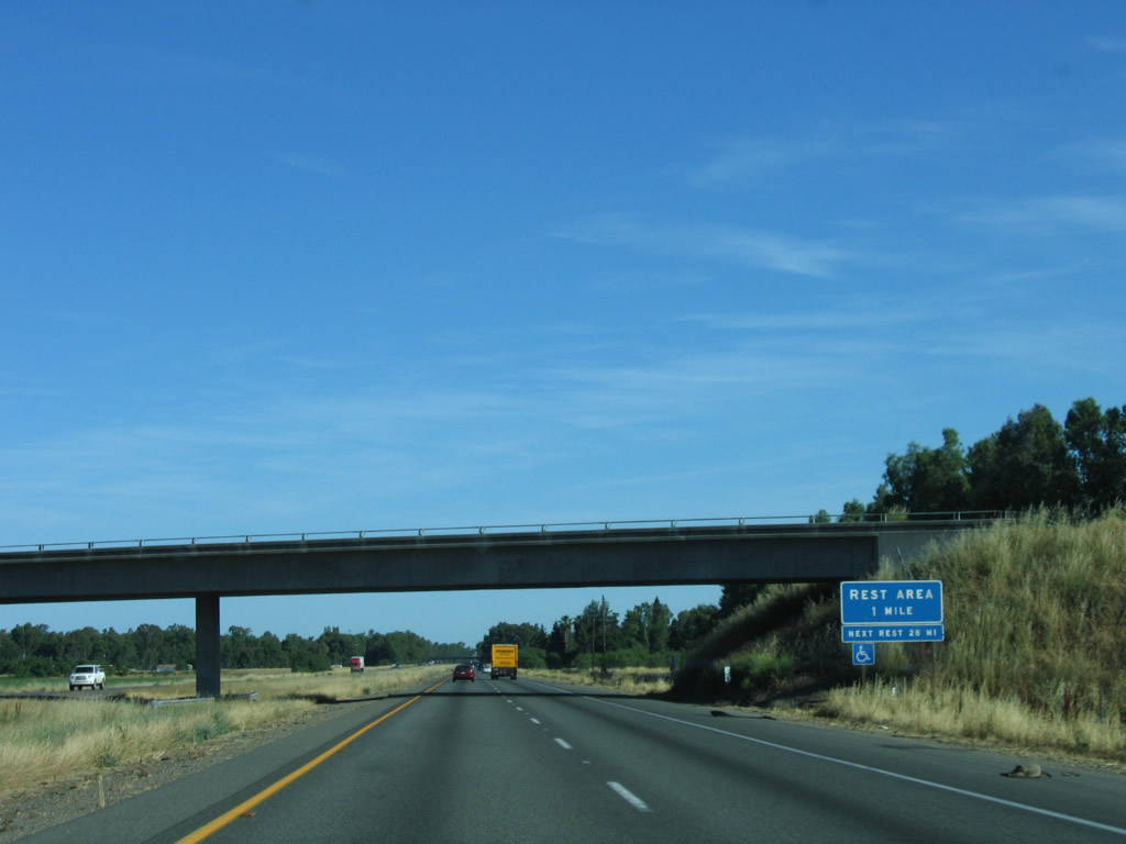
Passing under Road 2, the next exit is a rest area (near milepost 557). Photo taken 05/29/06. |
|
Southbound Interstate 5 meets the rest area exit about a mile and a half north of Exit 559. Photo taken 05/29/06. |
|
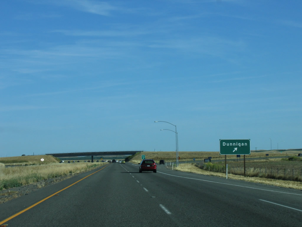
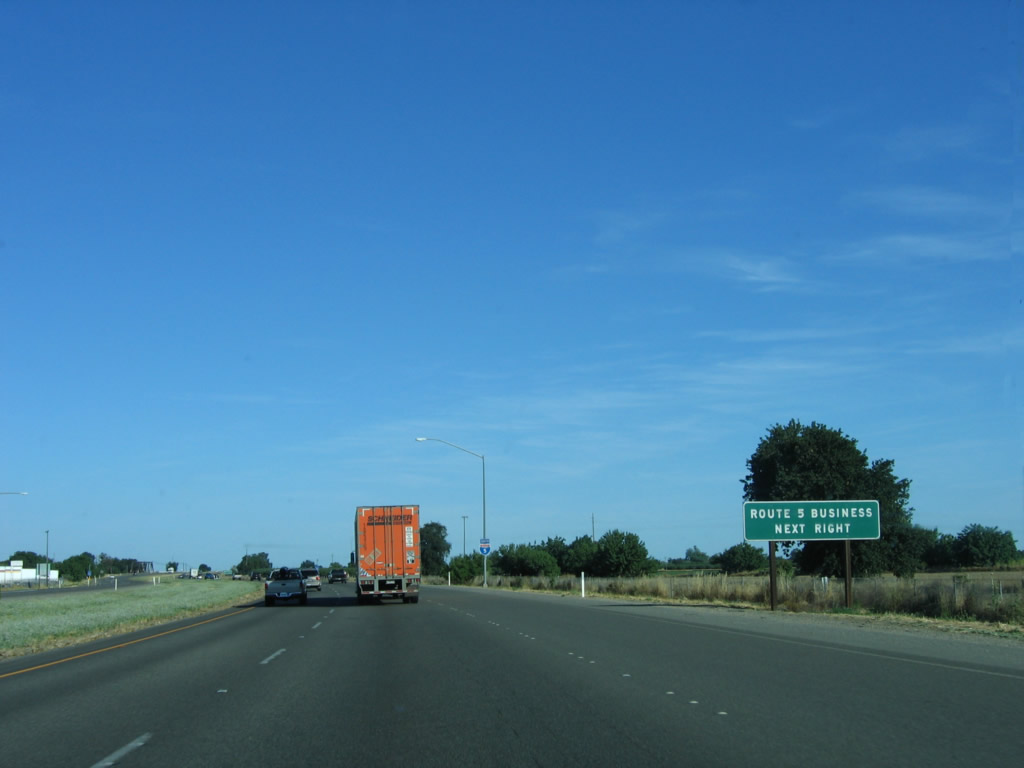
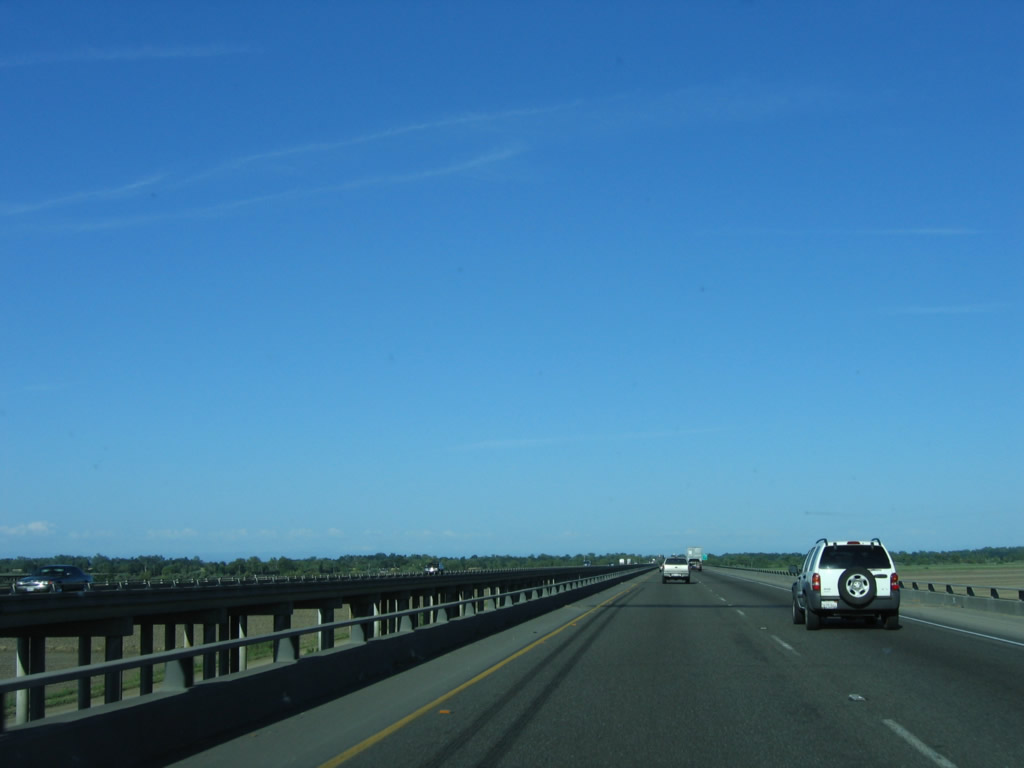
After the rest area, southbound Interstate 5 approaches and intersects Road 6 at Exit 556. Use Road 6 east to the town of Dunnigan, which is unincorporated and home to 897 people as of the 2000 Census. Photo taken 05/29/06. |
|
At the off-ramp is the only exit-number sign for Exit 556. From here, Interstate 5 continues south toward a major junction: Interstate 5 southeast to Sacramento and Interstate 505 southwest to Interstate 80 at Vacaville. Photo taken 05/29/06. |
|
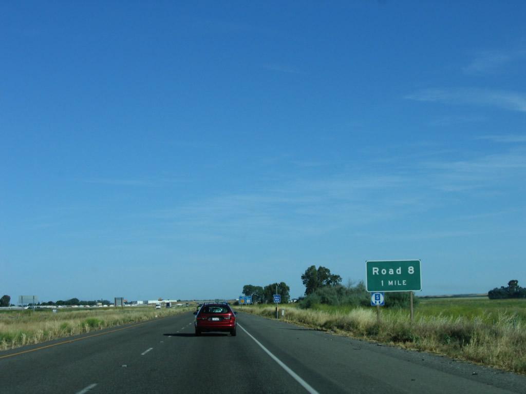
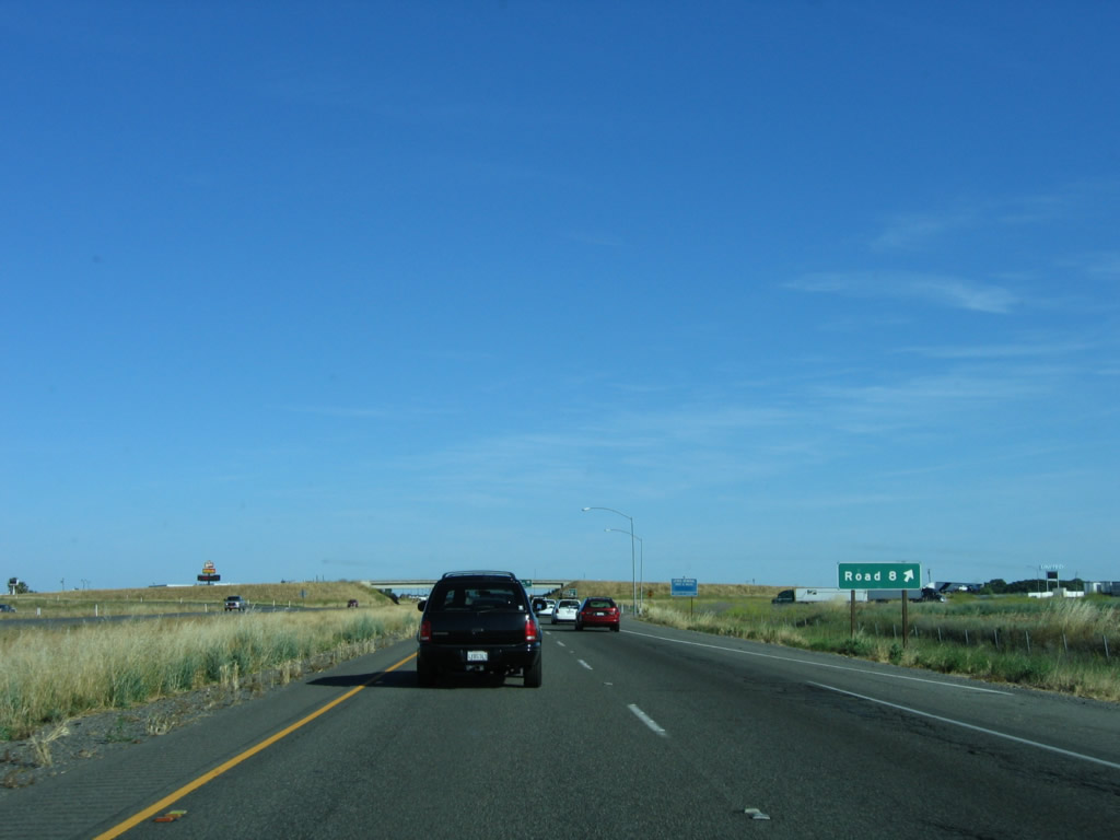
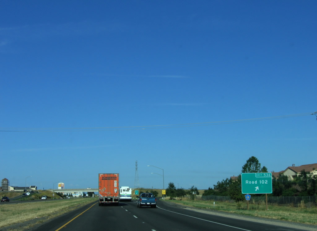
The next exit along Interstate 5 is Exit 554, Road 8. This exit also serves the community of Dunnigan and features a truck stop (gas and food are available). Photo taken 05/29/06. |
|
Southbound Interstate 5 reaches Exit 554, Road 8. The county road network in Yolo County is based on miles from the northern county line, so Road 8 is located eight miles south of the Yolo-Colusa County Line. These numbered roads are not necessarily signed with county pentagon shields, although some of the through county roads are part of the state's signed county route system. After this interchange, southbound Interstate 5 prepares to split with Interstate 505 south. Photo taken 05/29/06. |
|
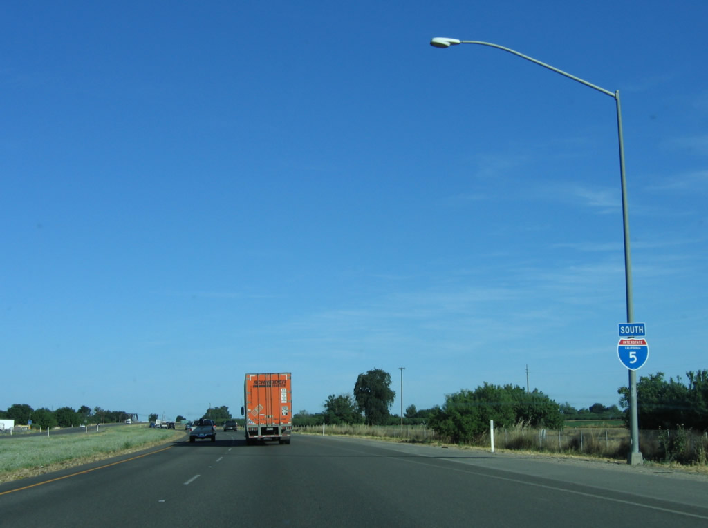
The next exit along southbound Interstate 5 after the Dunnigan on-ramp is Exit 553, Interstate 505, one mile. Interstate 505 is the best route from southbound Interstate 5 to San Francisco, cutting off the southeasterly trip to Sacramento. Interstate 505 meets Interstate 80 at Vacaville. Photo taken 05/29/06. |
|
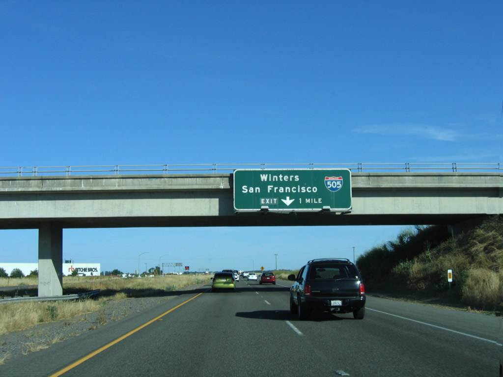
Interstate 5 and Interstate 505 split at Exit 553. Interstate 505 was originally slated to be part of Interstate 5W, which was envisioned as a loop route from Interstate 5 southwest to Oakland, then east to rejoin Interstate 5 south of Tracy via today's Interstate 580. Interstate 5W was only briefly signed in the 1960s before its route was split between Interstate 505, 80, and 580. Winters is a small town about midway along rural Interstate 505 at the junction with California 128. It gains prominence on this sign, since Winters is the only town of consequence along the 30 or so miles of Interstate 505. Photo taken 05/29/06. |
|
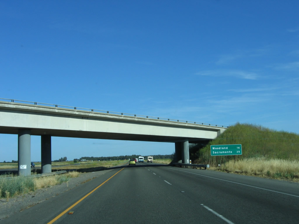
This overpass carries traffic from Interstate 505 north onto Interstate 5 north. At the base of the bridge is a mileage sign for Woodland (16 miles) and Sacramento (35 miles). Photo taken 05/29/06. |
|
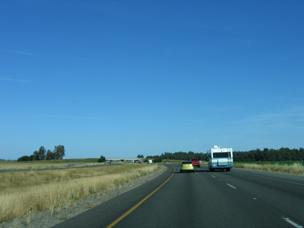
Interstate 5 continues south through farm and ranch land after splitting with Interstate 505. This section of freeway from Interstate 505 south to California 16 was built in 1970. The freeway continues alongside Old U.S. 99W, which remains on the east side of Interstate 5 serving as a frontage road south to the first Woodland interchange (Exit 541). Photo taken 05/29/06. |
|
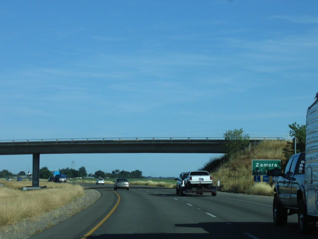
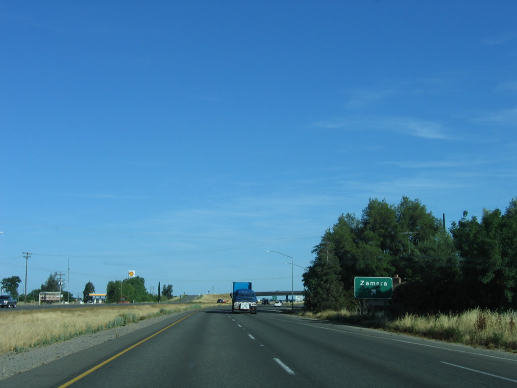
The next exit along southbound Interstate 5 is Exit 548, Road 13 to Zamora. Photo taken 05/29/06. |
|
A grain elevator is located on the east side of Interstate 5 along U.S. 99W. The downtown area of Zamora is located in the northwest corner of the next interchange. Photo taken 05/29/06. |
|
Southbound Interstate 5 reaches Exit 548, Road 13. Use Road 13 east to Road 14 and Interstate 505. To the west, Road 13 leads to California 113 north to Knights Landing and Yolo County E-11 north to California 45. Photo taken 05/29/06. |
|
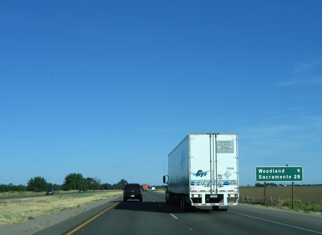
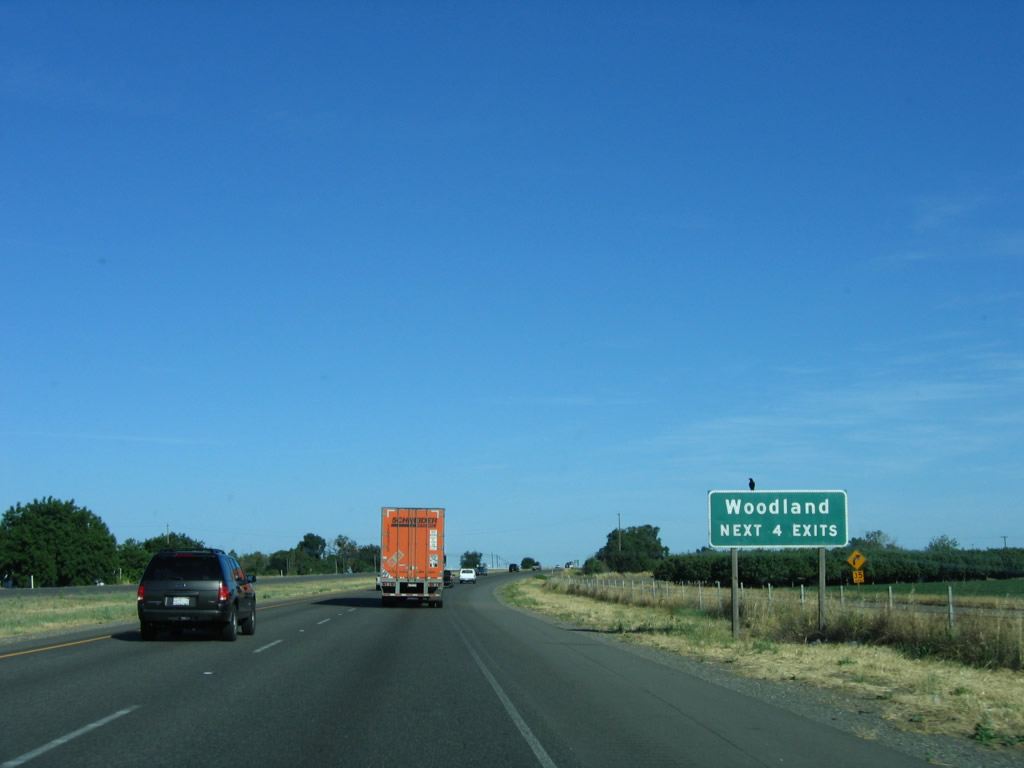
The next mileage sign provides the distance to Woodland (nine miles) and Sacramento (28 miles). Photo taken 05/29/06. |
|
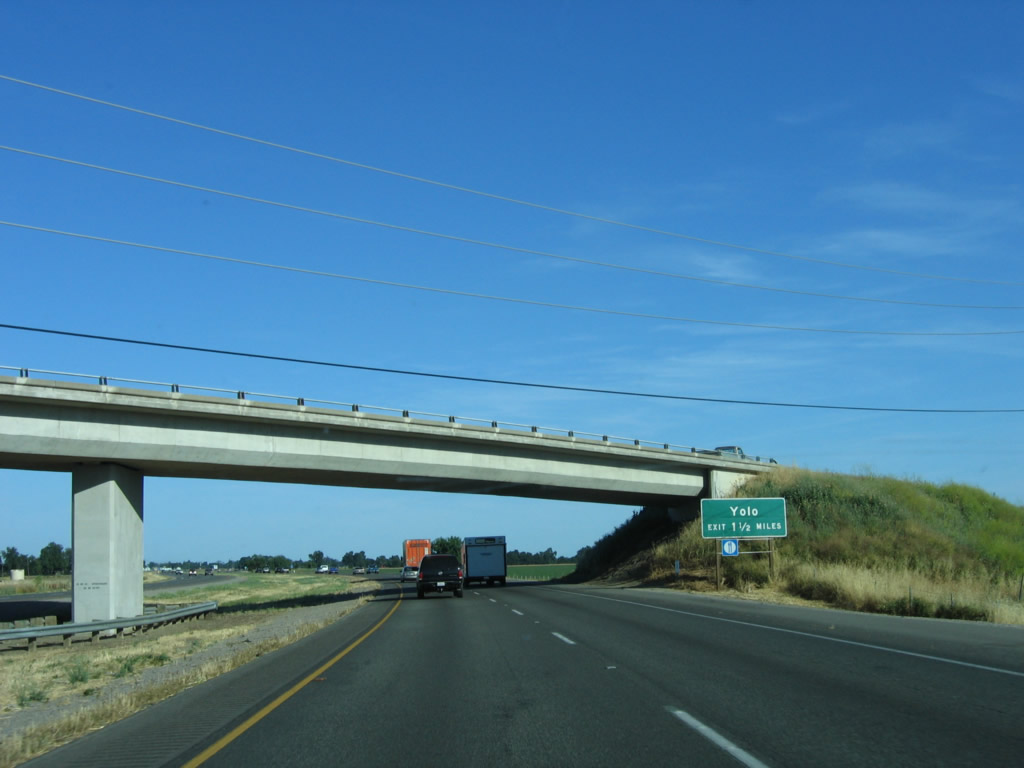
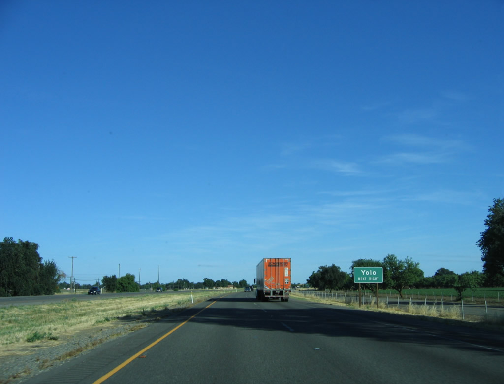
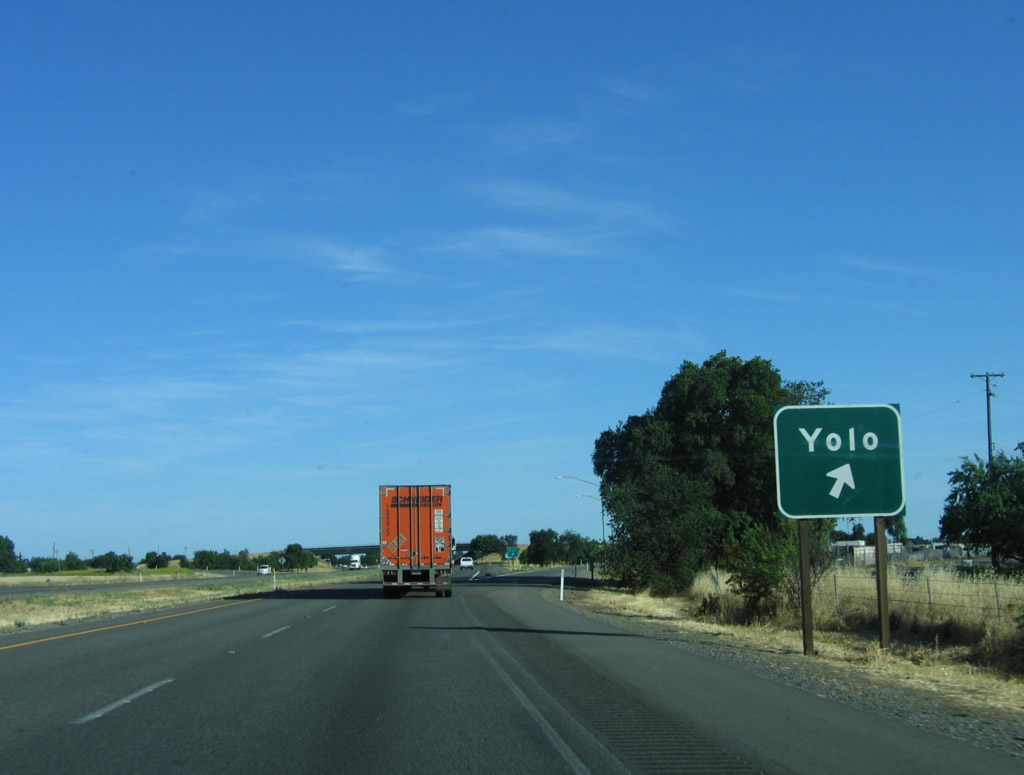
The next exit along Interstate 5 south is Exit 542, Road 17 to the unincorporated community of Yolo. Photo taken 05/29/06. |
|
The community of Yolo (located on the east side of Interstate 5) was originally known as Cacheville due to its location on Cache Creek. It served as Yolo County seat briefly, but that role was transferred to the town of Yolo City, which later became the city of Woodland. The name of Cacheville still appears as the name of Old U.S. 99W (Cacheville Road). Photo taken 05/29/06. |
|
Southbound Interstate 5 reaches Exit 542, Road 17 to the community of Yolo. Photo taken 05/29/06. |
|
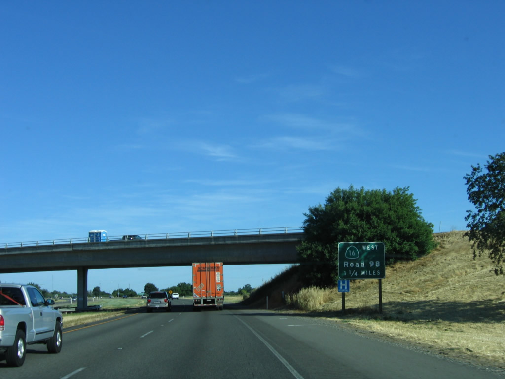
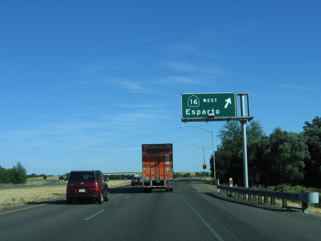
The next exit along Interstate 5 south is Exit 541, California 16 and Business Loop I-5 in Woodland. California 16 leads northwest from here, toward California 20 and Clear Lake, roughly following Cache Creek. The business loop follows old California 16 through the city of Woodland, and it returns to Interstate 5 at the California 113 southbound interchange. Photo taken 05/29/06. |
|
A roadside sign advises that Exit 541 connects to Business Loop I-5 south to Woodland. From this interchange, California 16 west and Business Loop I-5 travel south along Road 98 to Main Street, following Old U.S. 99W as the old route moves to the west side of the freeway. At Main Street, the routes divide: California 16 turns west toward Esparto, while Business Loop I-5 follows Main Street east into downtown Woodland. Photo taken 05/29/06. |
|
An Interstate 5 south reassurance shield is posted after the on-ramp from Road 17. The section of Interstate 5 from California 16 to Yolo County E-8/Road 102 was built in 1973. Photo taken 05/29/06. |
|
The next four exits all serve the city of Woodland: Exit 541, Business Loop I-5 and California 16/Road 98 south; Exit 540, West Street and Road 99; Exit 538, California 113 north and East Street; and Exit 537, California 113 (Vic Fazio Highway) south to Business Loop I-5 (Main Street) west into Woodland. Photo taken 05/29/06. |
|
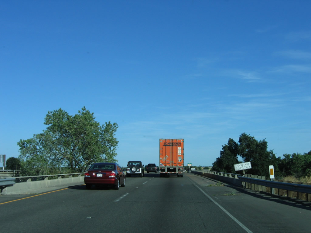
Interstate 5 crosses over Cache Creek, which drains from Clear Lake in Lake County southeast to the Sacramento River. California 16 generally follows Cache Creek northwest to its eventual intersection with California 20. Photo taken 05/29/06. |
|
Southbound Interstate 5 reaches Exit 541, California 16 west and Business Loop I-5 south via Road 98. Esparto is a town located along California 16 on its way northwest toward Rumsey and Cache Creek Canyon. California 16 has two segments: one from Woodland to California 20 and the other from U.S. 50 east to California 49. Photo taken 05/29/06. |
|
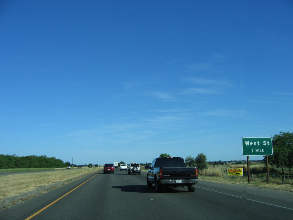
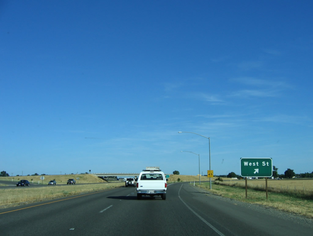
The next exit along southbound Interstate 5 is Exit 540, West Street and Road 99. Photo taken 05/29/06. |
|
Southbound Interstate 5 reaches Exit 540, West Street and Road 99. Use West Street south to downtown Woodland; use Road 99 north to farm and ranch access. Photo taken 05/29/06. |
|
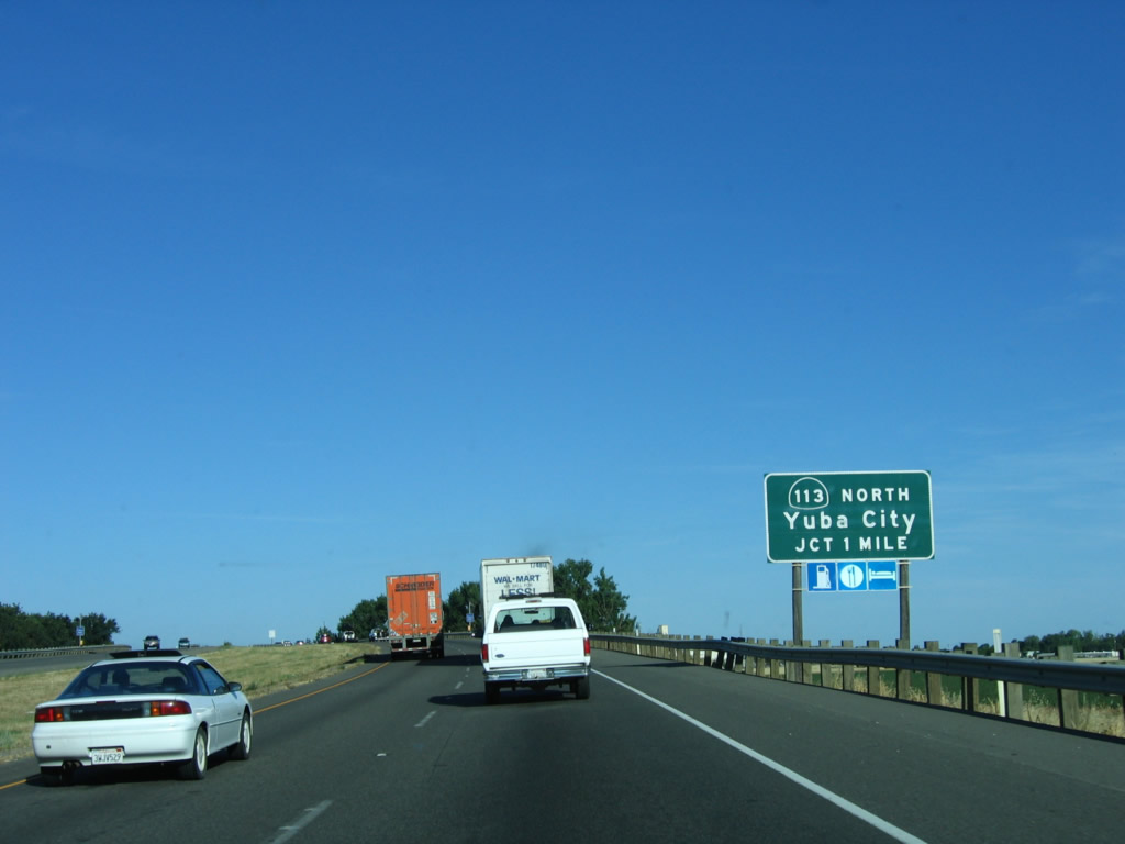
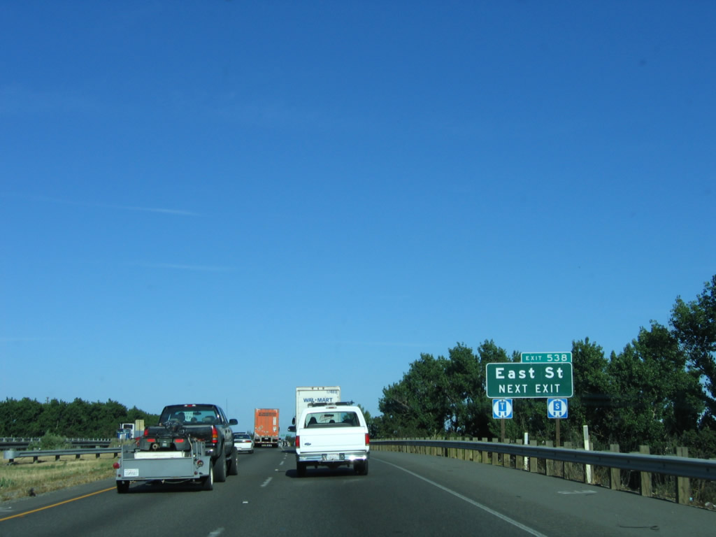
The next exit along Interstate 5 south is Exit 538, California 113 north and East Street south into downtown Woodland. After this interchange, Interstate 5 and California 113 will briefly merge south, then split at Exit 537. California 113 was formerly part of U.S. 40 Alternate until 1964, when the alternate route was decommissioned. Photo taken 05/29/06. |
|
East Street travels south into downtown Woodland. Photo taken 05/29/06. |
|
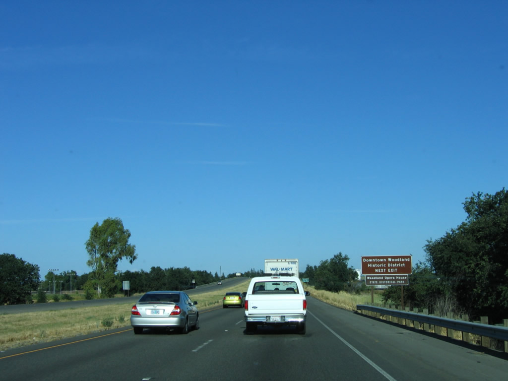
Historic downtown Woodland, including Woodland Opera House State Historical Park, is best reached via southbound East Street. Photo taken 05/29/06. |
|
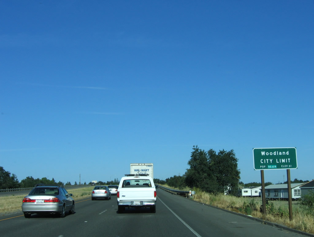
Interstate 5 enters the city of Woodland, which serves as the seat of Yolo County and is home to 49,151 people as the 2000 Census and consists of 10.3 square miles. Photo taken 05/29/06. |
|
Southbound Interstate 5 reaches Exit 538, California 113 (former U.S. 40 Alternate) north to Yuba City and East Street south to downtown Woodland. Photo taken 05/29/06. |
| Interstate 5 and California 113 south |
|
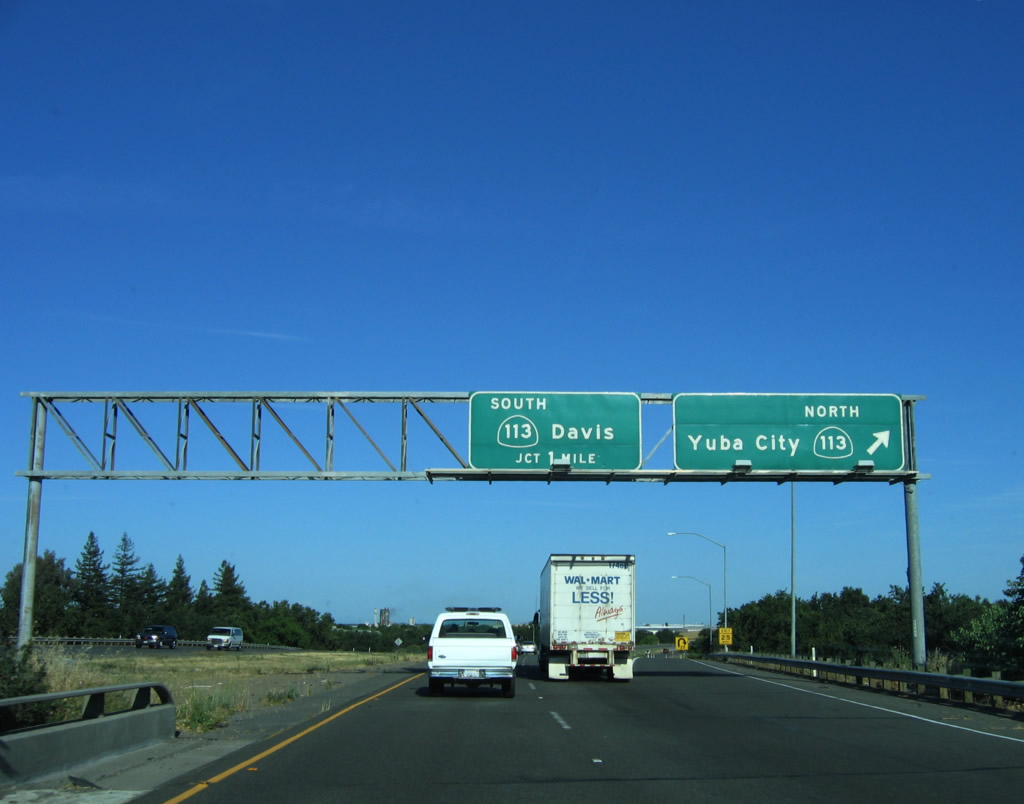
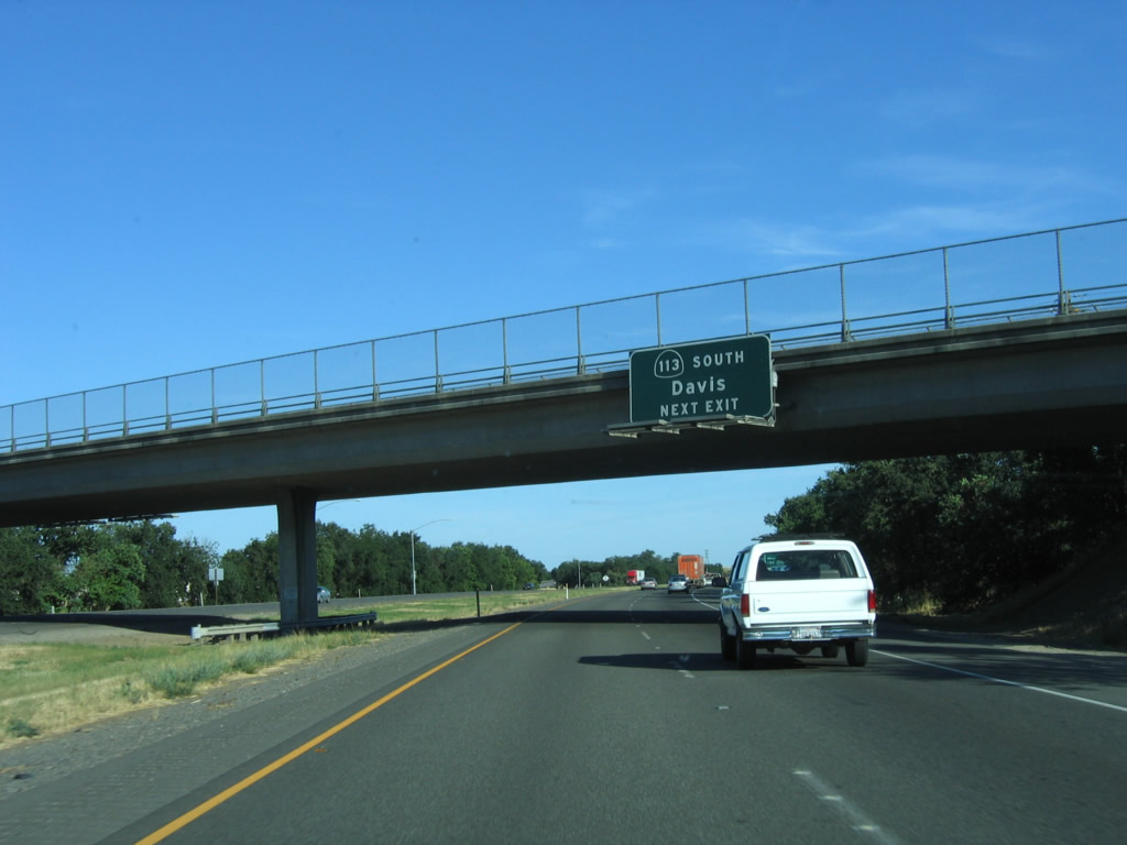
The next exit along southbound Interstate 5 is Exit 537, California 113 (Vic Fazio Highway) south to Davis. This section of California 113 is a freeway, and it offers a good connection to Interstate 80 west to Dixon, Vacaville, and Fairfield without having to travel through West Sacramento. Photo taken 05/29/06. |
|
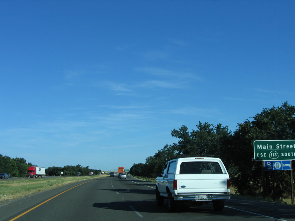
Exit 537/California 113 south also serves as the connection to Business Loop I-5 (Main Street) west to downtown Woodland. There is no direct connection from Interstate 5 south to Business Loop I-5 west to Woodland. Historic U.S. 99W and former U.S. 40 Alternate follow the California 113 corridor from Woodland south to Davis; it did not continue along the Interstate 5 corridor. Photo taken 05/29/06. |
|
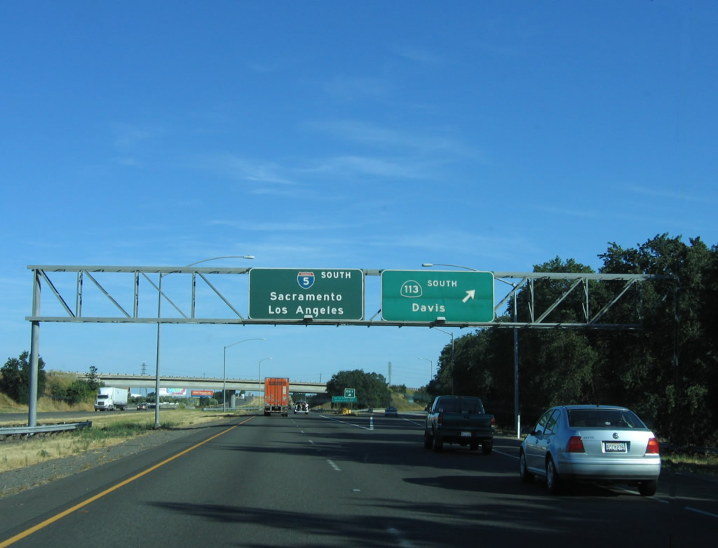
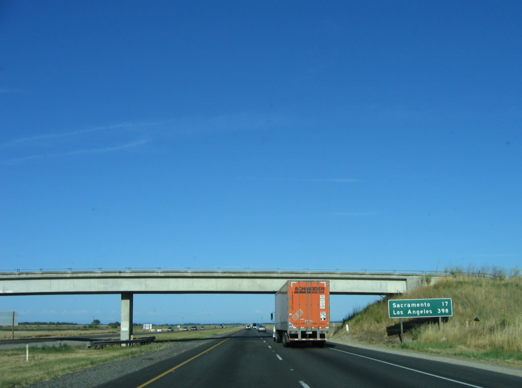
Southbound Interstate 5 reaches Exit 537, California 113 south to Business Loop I-5 (Main Street) west and to the city of Davis. This freeway connects to Interstate 80 at Davis, and it provides a westerly bypass around Sacramento between Interstate 5 and Interstate 80. california 113 continues south of Interstate 80 as a rural road, terminating at California 12 west of Rio Vista. For the first time, Interstate 5 is signed for both Sacramento and Los Angeles. Los Angeles will remain the southbound control city from here south all the way to near the Interstate 10 interchange near downtown Los Angeles. Photo taken 05/29/06. |
| Interstate 5 south |
|
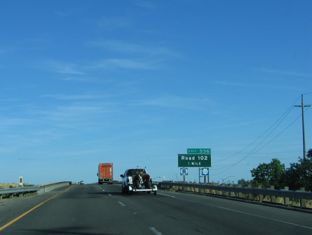
The next exit along southbound Interstate 5 is Exit 536, Yolo County E-8/Road 102. Interstate 5 between Road 102 and the Sacramento River bridge was built in 1969. Photo taken 05/29/06. |
|
Use Yolo County E-8/Road 102 to the Yolo County Sheriff Detention Facility and Woodland Community College. Photo taken 05/29/06. |
|
After the on-ramp from Business Loop I-5 (Main Street), southbound Interstate 5 turns due east to leave Woodland. Development for new housing has increased as Woodland has grown into a bedroom community for nearby Sacramento. The houses on the south side of Interstate 5 (right side of freeway) were not there in the early 1990s and are evidence of the increased demand for housing in this region. Photo taken 05/29/06. |
|
Southbound Interstate 5 reaches Exit 536, Yolo County E-8/Road 102. Photo taken 05/29/06. |
|
A mileage sign provides the distance to the two southbound Interstate 5 control cities: Sacramento (17 miles) and Los Angeles (398 miles). Photo taken 05/29/06. |
|
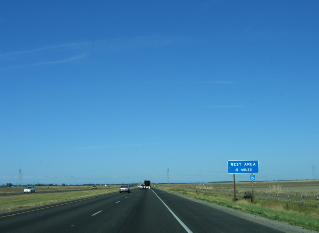
Leaving Woodland, Interstate 5 will next cross the Yolo Bypass, connect to a rest area, and then connect with Sacramento International Airport. Photo taken 05/29/06. |
|
|
Interstate 5 passes under one-half of the Path 15 500 kV power lines prior to ascending onto the Yolo Bypass bridge/causeway. This power line carries power from north to south throughout the state. Photos taken 05/29/06 and 01/16/06. |
|
The speed limit reduces from 70 to 65 miles per hour as Interstate 5 crosses the Yolo Bypass via the Elkhorn Causeway. The causeway carries Interstate 5 south (east) across the Yolo Bypass, which carries floodwater around the city of Sacramento and its suburbs. A series of dikes and weirs direct extra water from the Sacramento River and Cache Creek into the bypass, which keeps the river from cresting significantly within the urban areas near Sacramento and West Sacramento. During wet years, the Yolo Bypass can be completely full of water. This bypass eventually rejoins the river near Rio Vista after passing under Interstate 80's Yolo Causeway (which used to be part of U.S. 99W and U.S. 40 before Interstate 80 was completed). Photo taken 05/29/06. |
|
|
|
This suite of photos follows southbound Interstate 5 east as it crosses the Yolo Bypass via the Elkhorn Causeway, which was built in 1969. Since U.S. 99W followed California 113, the modern Interstate 5 freeway route over the Yolo Bypass was not preceded by an older U.S. highway. Photos taken 05/29/06. |
|
|
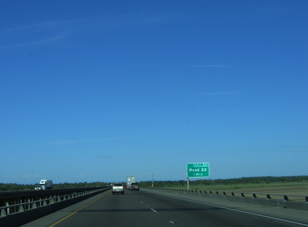
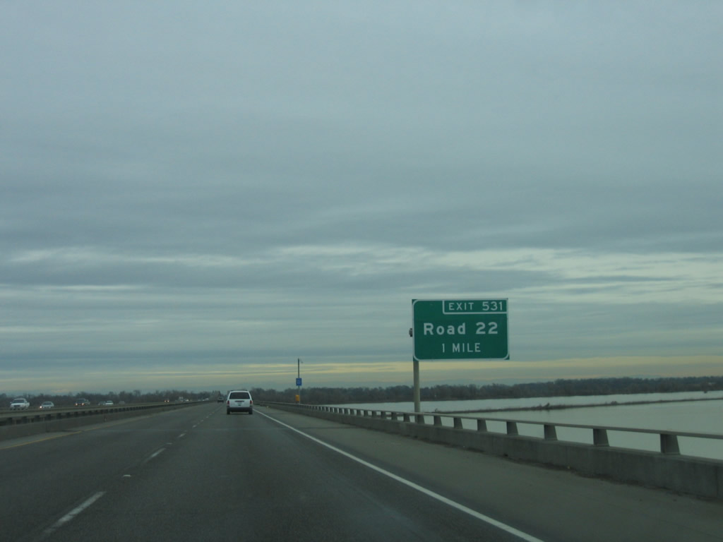
The next exit along Interstate 5 south is Exit 531, Road 22 and Old River Road. This interchange is located on a small strip of land that sits between the Yolo Causeway and the Sacramento River. Note the May 2006 photo shows no water in the bypass, but the January 2006 photo shows water in the bypass. Photos taken 05/29/06 and 01/16/06. |
|
Southbound Interstate 5 reaches Exit 531, Road 22 and Old River Road. This exit provides local access to ranches and farms, some of which are located in the flood-prone Yolo Bypass. Photo taken 05/29/06. |
|
An Interstate 5 shield (triangular) is located after the on-ramp from Road 22. The highway begins to ascend onto the Sacramento River bridge. Photo taken 05/29/06. |
|
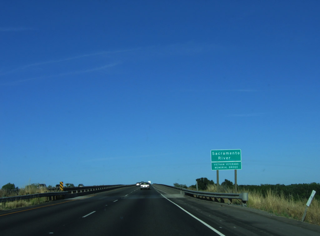
Interstate 5 crosses over the Sacramento River. This bridge was built in 1969 (the same year as the Yolo Bypass). Photo taken 05/29/06. |
|
The Interstate 5 Sacramento River bridge was constructed as a high-level bridge to allow for shipping and boating traffic on the river. Photo taken 05/29/06. |
|
At the top of the Sacramento River bridge, Interstate 5 leaves Yolo County and enters Sacramento County. Photo taken 05/29/06. |
Page Updated January 21, 2012.