| Interstate 5 (West Side Freeway) south |
|
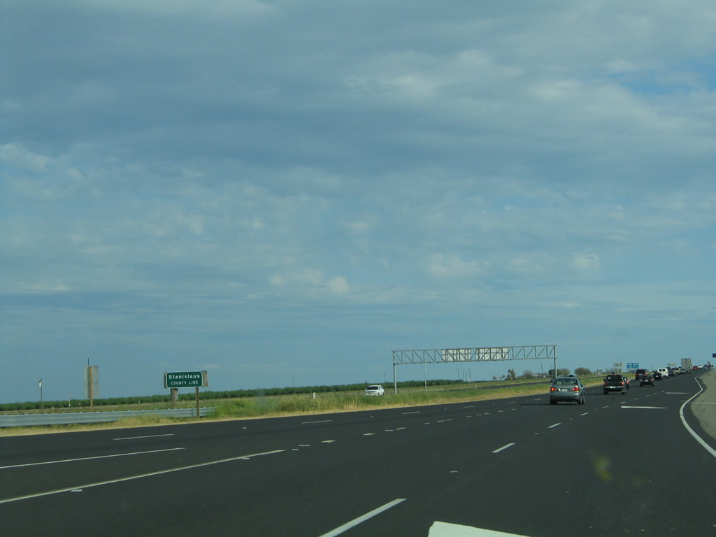
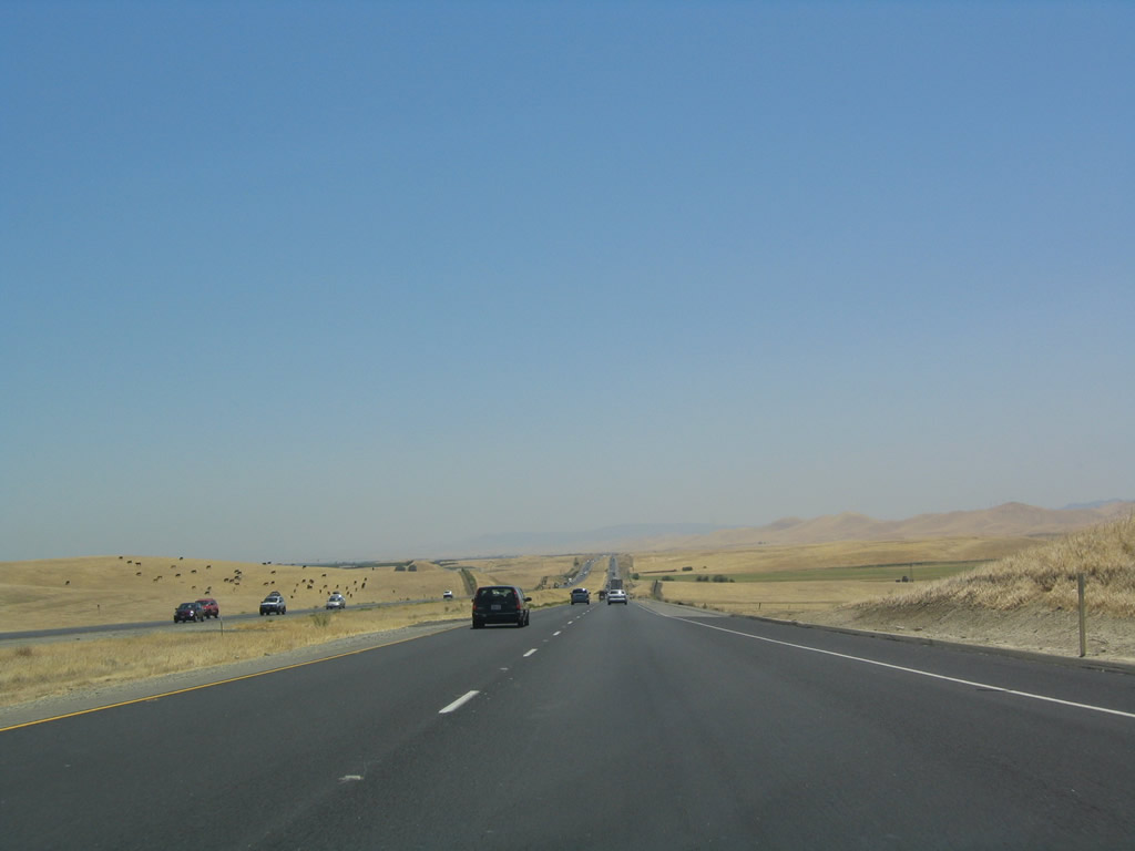
At the merge point between Interstate 5 and Interstate 580, the freeway leaves San Joaquin County and enters Stanislaus County. There is no access from southbound Interstate 5 onto westbound Interstate 580. Photo taken 04/03/05. |
|
|
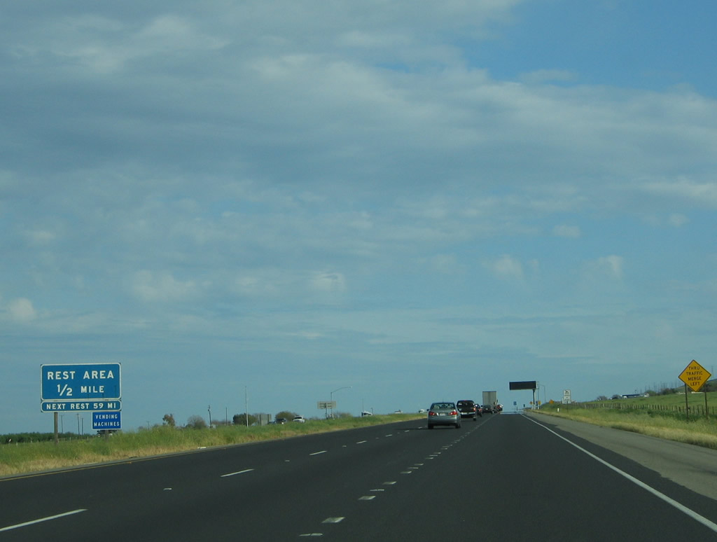
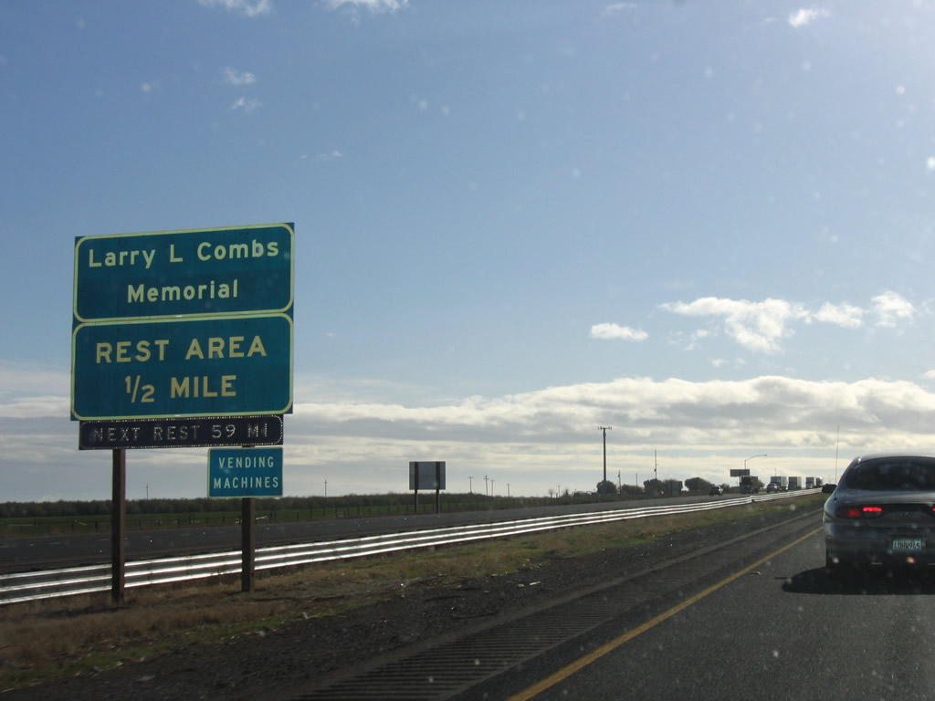
The main lanes for Interstate 5 merge into one lane, which in turn becomes the exit lane into the rest area (Exit 445). Note the change in signage for the rest area between 2005 and 2006. Photos taken 04/03/05 and 11/23/06. |
|
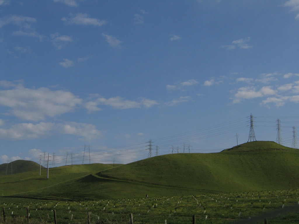
Southbound Interstate 5 reaches Exit 445, Rest Area. The next rest area is 59 miles south from here. From here, Interstate 5 becomes a state scenic highway south to the California 152 interchange (Exits 403B-A). Photo taken 04/03/05. |
|
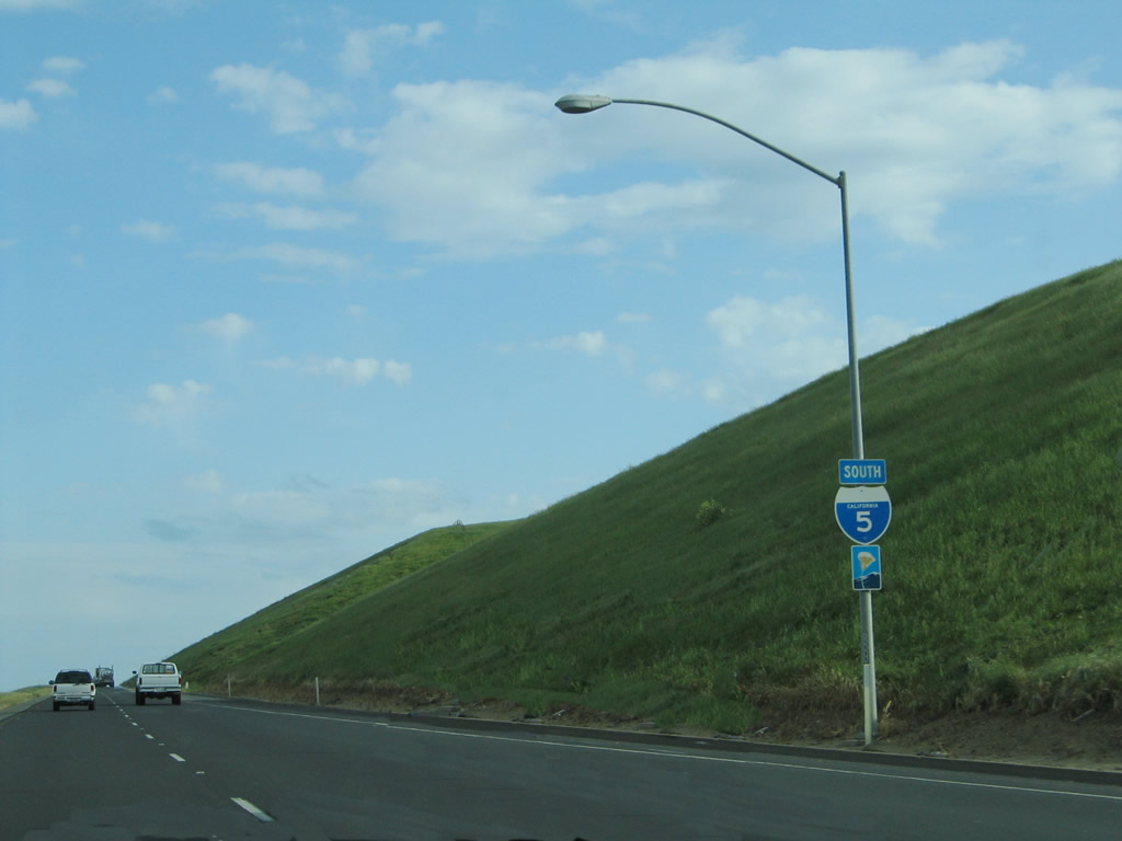
This reassurance shield for Interstate 5 is posted after the Larry L. Combs Memorial Rest Area on-ramp. Photo taken 04/03/05. |
|
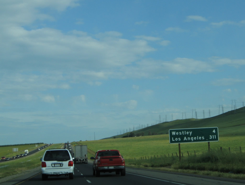
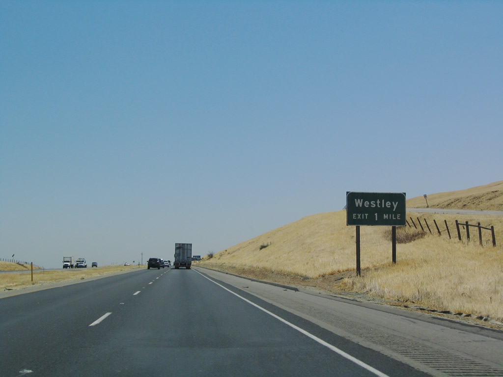
A mileage sign for Interstate 5 south provides the distance to Exit 441, Stanislaus County J-16/Howard Road east to Westley and the control city of Los Angeles. Photo taken 04/03/05. |
|
|
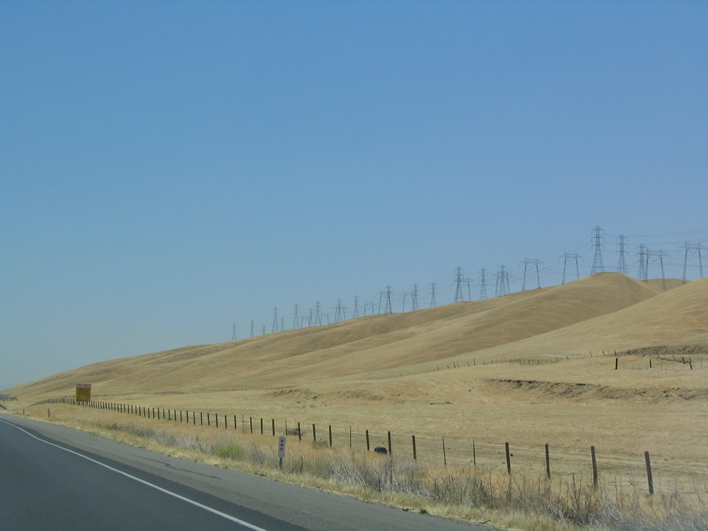
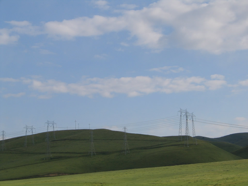
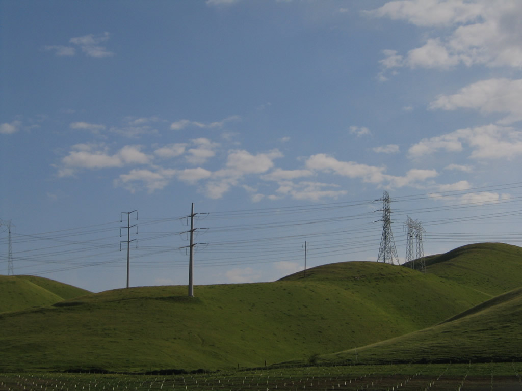
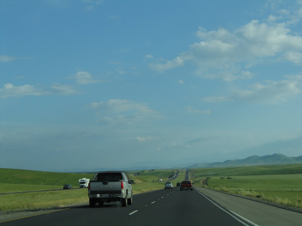
While Interstate 5 remains to the west of most populated areas in the Central Valley, other infrastructure, including power lines (to the west on the top of the hill) and the California Aqueduct closely parallel Interstate 5 for its journey south to Los Angeles. Note the differences between the summer and early spring photos - brown grass versus green grass. Photos taken 07/06/04 and 04/03/05. |
|
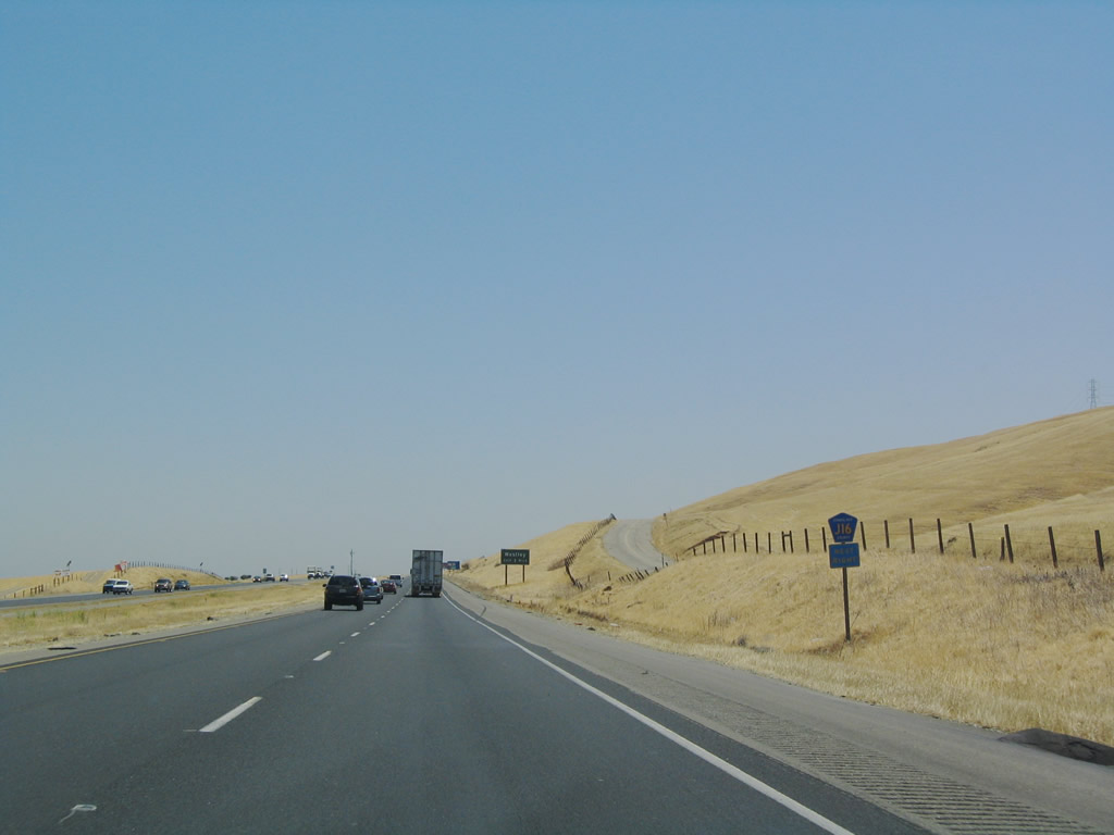
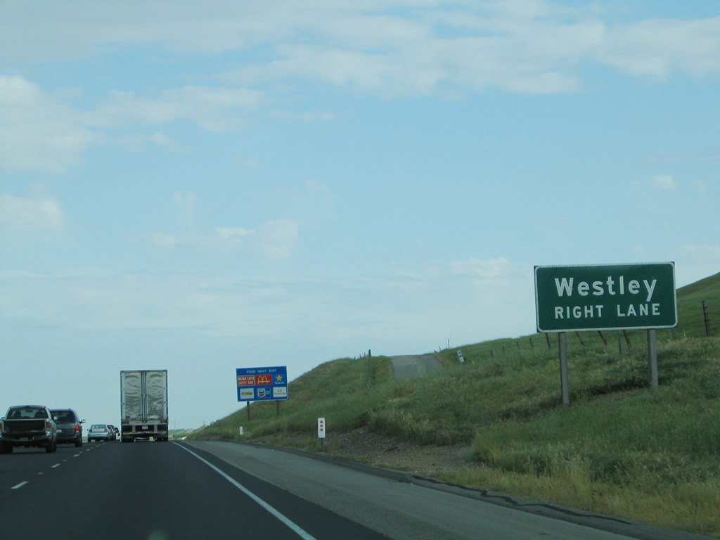
The first exit along southbound Interstate 5 after the Interstate 580 merge and rest area is Exit 441, Stanislaus County J-16, Howard Road east to Westley. There is also a connection to Ingram Creek Road west into the foothills. Photo taken 07/06/04. |
|
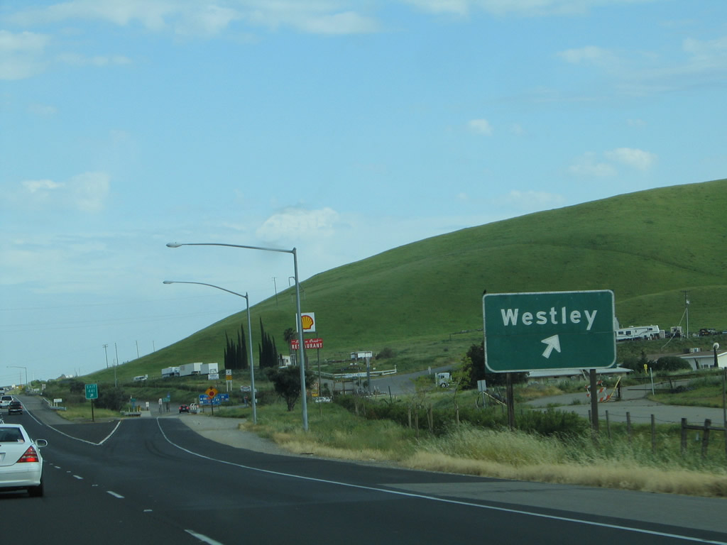
Currently, Exit 441 is signed merely as Westley, but newer signs will likely mention both Howard Road and Ingram Creek Road. Use Stanislaus County J-16 east to reach Westley at its intersection with California 33 just west of Grayson and the San Joaquin River. Photo taken 07/06/04. |
|
Stanislaus County J-16/Howard Road continues east of Westley and Grayson, changing into Grayson Road and then turning south onto Crows Landing Road and then east along Keyes Road before meeting California 99. Stanislaus County J-16 becomes Merced County J-16, and it meets California 59/Merced County J-59 in Snelling. In this vicinity will be an interchange with the future California 65/Eastside Freeway (if it is constructed). East of Snelling, Merced County J-16 enters the foothills, and it uses Merced Falls Road and Bear Valley Road to reach California 49 (Gold Country Highway) in Bear Valley. Photo taken 04/03/05. |
|
Southbound Interstate 5 reaches Exit 441, Stanislaus County J-16/Howard Road east and Ingram Creek Road west. This interchange marks the western terminus of Stanislaus County J-16. Photo taken 04/03/05. |
|
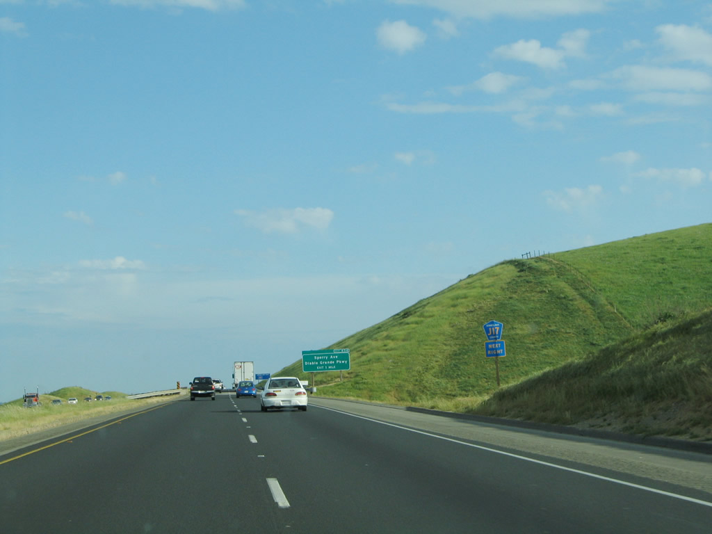
After the Howard Road interchange, a mileage sign provides the distance to the next exit (Exit 434/Diablo Grande Parkway and Del Puerto Canyon Road) and the control city of Los Angeles. Photo taken 04/03/05. |
|
|
|
Power lines from the Modesto Irrigation District interconnect with the Pacific Gas and Electric transmission power lines as well as Path 15, which follows Interstate 5 south toward Southern California. Photos taken 04/03/05 and 11/23/06. |
|
Continuing south, the California Aqueduct comes into clear view of Interstate 5 as the freeway rises above the Central Valley. The power lines remain perched on the hillside to the west. Photo taken 04/03/05. |
|
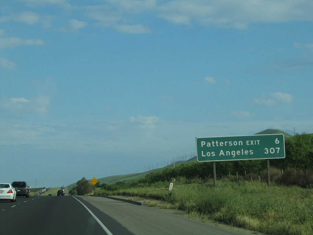
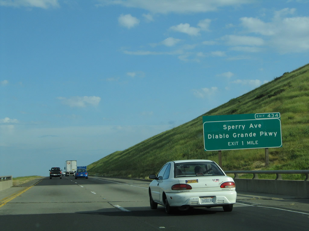
The next exit along southbound Interstate 5 is Exit 434, Stanislaus County J-17/Diablo Grande Parkway/Sperry Avenue to Del Puerto Canyon Road west to Mount Hamilton and to California 130 west. This interchange marks the western terminus of Stanislaus County J-17. Photo taken 04/03/05. |
|
Southbound Interstate 5 approaches Exit 434, Stanislaus County J-17/Diablo Grande Parkway/Sperry Avenue to Del Puerto Canyon Road west, one mile. Stanislaus County J-17 continues east past the San Joaquin River to serve the city of Turlock, where it meets California 99. The county route enters Merced County after passing Santa Fe Avenue (Stanislaus County J-7), and it ends upon reaching California 59 east of Hopeton and southwest of Snelling. Photo taken 04/03/05. |
|
Use Stanislaus County J-17/Sperry Avenue east to reach Patterson. Unmentioned on any of these highway signs is the fact that Del Puerto Canyon Road provides a two-lane, winding route to San Jose. If California 130 were extended east from San Jose as proposed by the state legislature in the Streets and Highways Code, that route would meet Interstate 5 near Exit 434. To California 130 west, use Del Puerto Canyon Road and San Antonio Valley Road west to Mount Hamilton. This is a back route into the city of San Jose. Photo taken 04/03/05. |
|
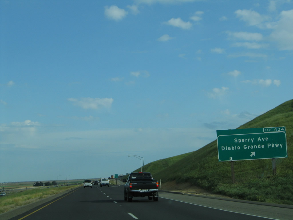
Southbound Interstate 5 reaches Exit 434, Stanislaus County J-17/Diablo Grande Parkway/Sperry Avenue to Del Puerto Canyon Road west to Mount Hamilton and to California 130 west to San Jose (the long way to San Jose). Photo taken 04/03/05. |
|
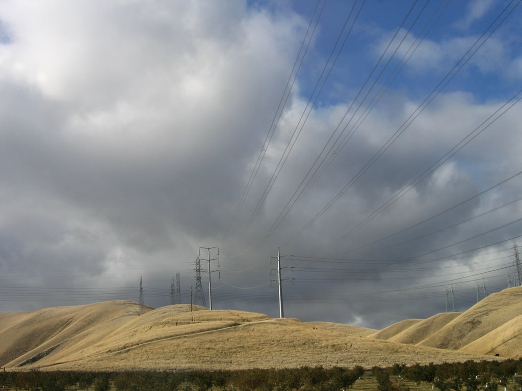
This reassurance shield is posted after the on-ramp from Exit 434. From here, Interstate 5 ascends a hill as it stays above the floor of the Central Valley. During the summer, these hills are a golden brown, but in the winter, the rain brings green grasses and lush foliage. Since the rains generally end in April-May, the grasses dry out within a month thereafter. Photo taken 04/03/05. |
|
Unlike the northbound Interstate 5 mileage signs, it is very clear as to control city along southbound: Los Angeles. Cities in Orange and San Diego Counties to the south are not mentioned on any mileage signs along southbound. (Along northbound, the mileage signs point to Sacramento and San Francisco.) Photo taken 04/03/05. |
|
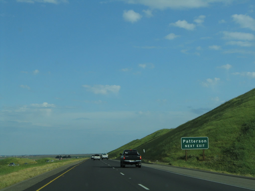
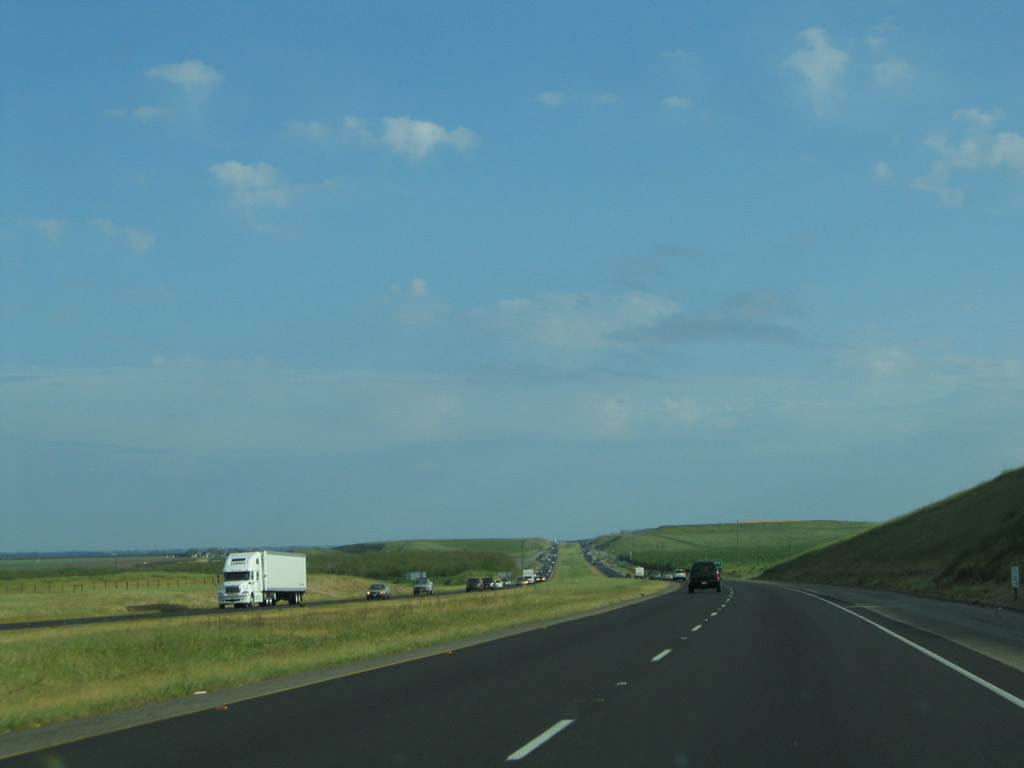
View of scenic Interstate 5 south between the Patterson and Crows Landing interchanges in rural Stanislaus County. Photo taken 04/03/05. |
|
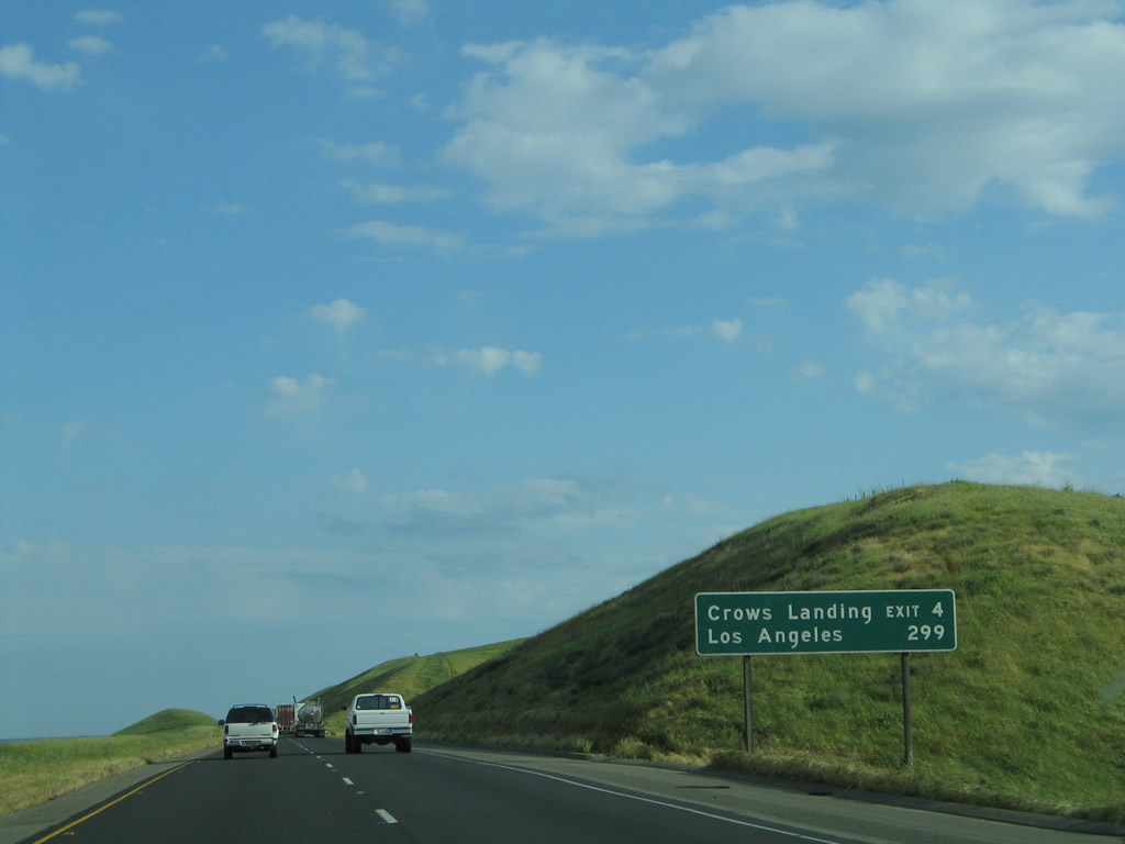
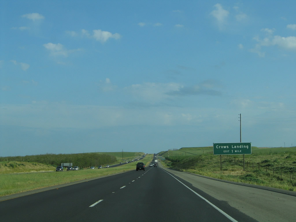
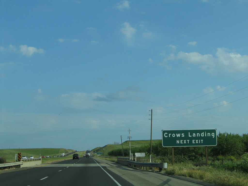
The next exit along southbound Interstate 5 is Exit 428, Fink Road east to Crows Landing (California 33), one mile. Photo taken 04/03/05. |
|
Currently, Fink Road is not mentioned on the advance guide signs for Exit 428, but this is expected to change once the signs are replaced for the exit numbering project. Photo taken 04/03/05. |
|
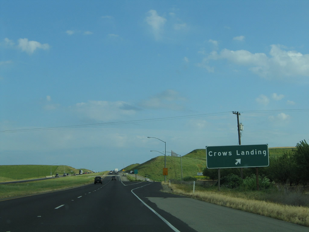
Southbound Interstate 5 reaches Exit 428, Fink Road east to California 33 and Crows Landing. If constructed south of Modesto as proposed in the state Streets and Highways Code, California 108 is anticipated to meet Interstate 5 somewhere in this general vicinity. Photo taken 04/03/05. |
|
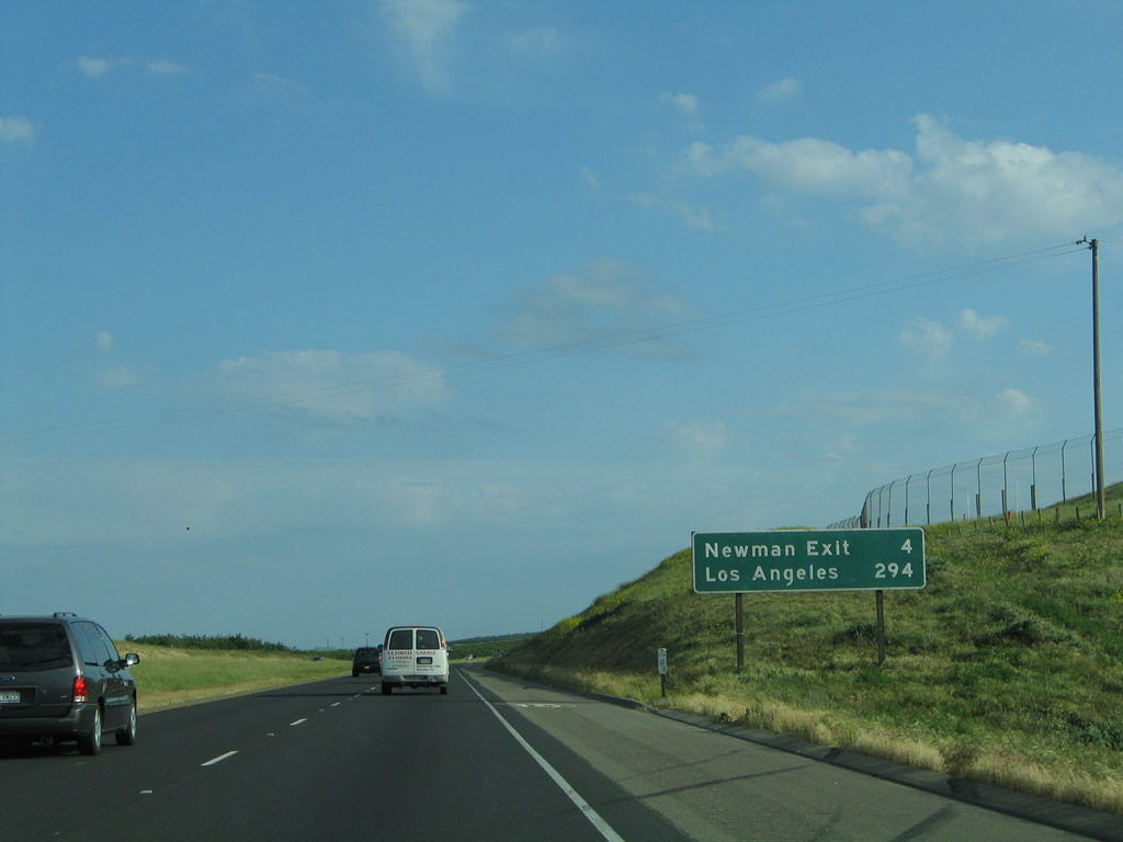
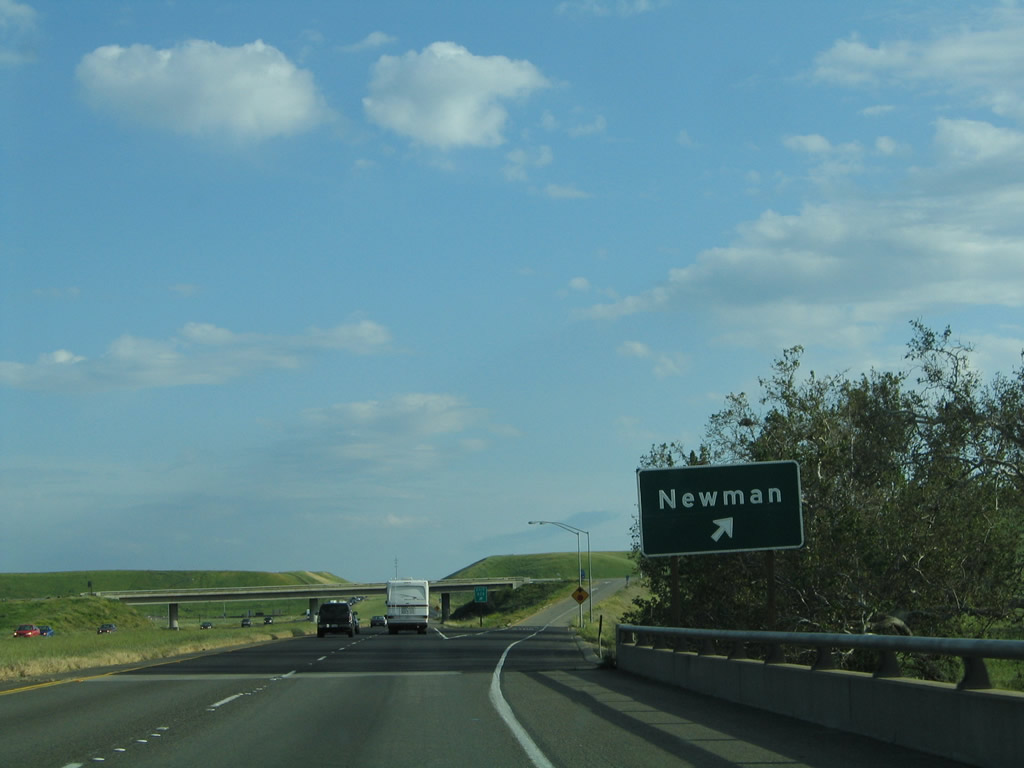
Another mileage sign provides the distance to Exit 423, Stanislaus County J-18 (Stuhr Road) east (to Newman) and 294 miles to the City of Angels. Photo taken 04/03/05. |
|
Use Stanislaus County J-18 (Stuhr Road) east to reach the town of Newman, which is located south of Stanislaus County J-18 along California 33. After passing California 33 and crossing the San Joaquin River (which is still closely paralleling the freeway to the east), Stanislaus County J-18 becomes Merced County J-18 along Westside Boulevard. The county route ends at California 99 midway between Atwater and Livingston. Photo taken 04/03/05. |
|
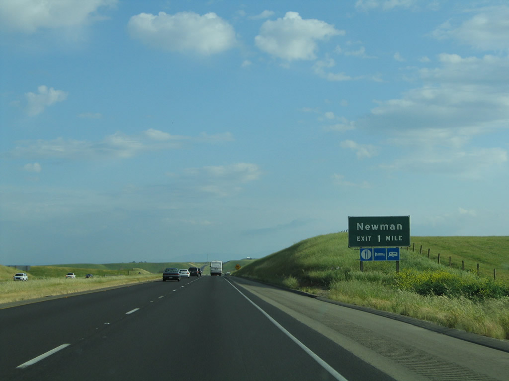
Southbound Interstate 5 reaches Exit 423, Stanislaus County J-18 (Stuhr Road) east to Newman. Photo taken 04/03/05. |
|
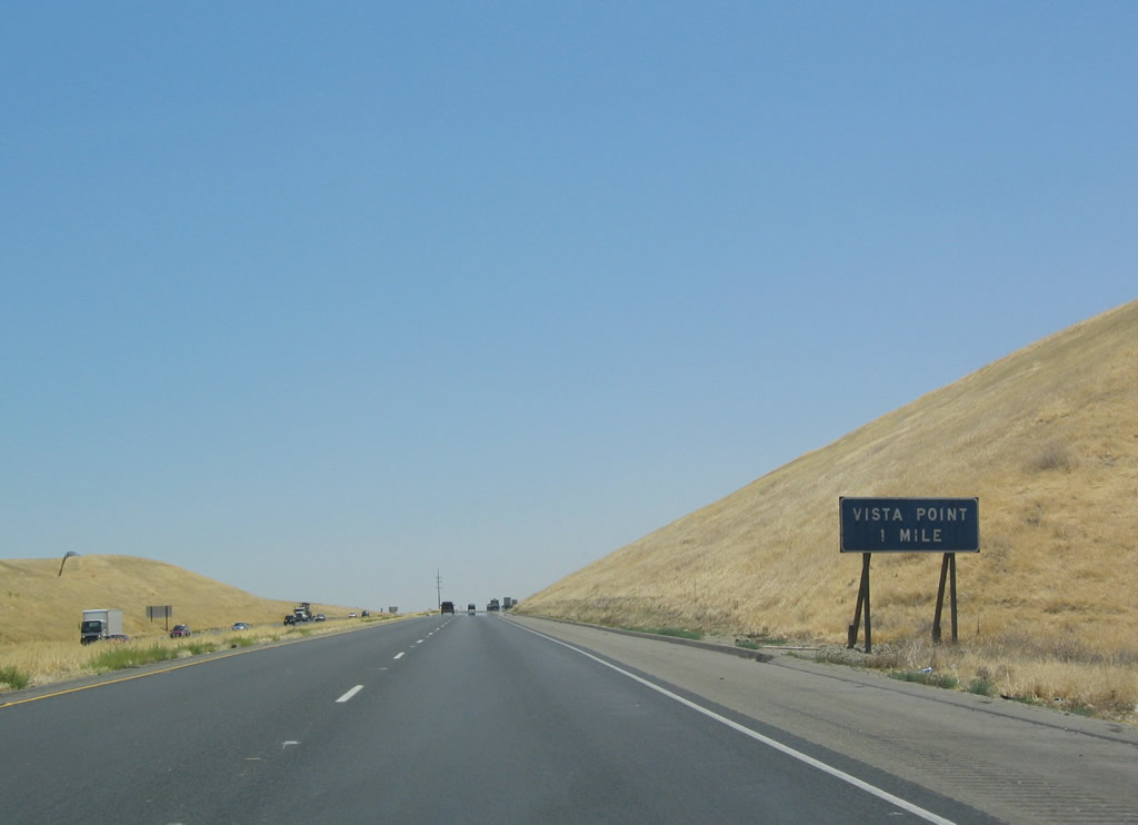
After Exit 423, Interstate 5 approaches a vista point, with views of the California Aqueduct, San Joaquin River, and Central Valley. On clear days, the Sierra Nevada Mountains on the opposite side of the valley is visible. Photo taken 07/06/04. |
|
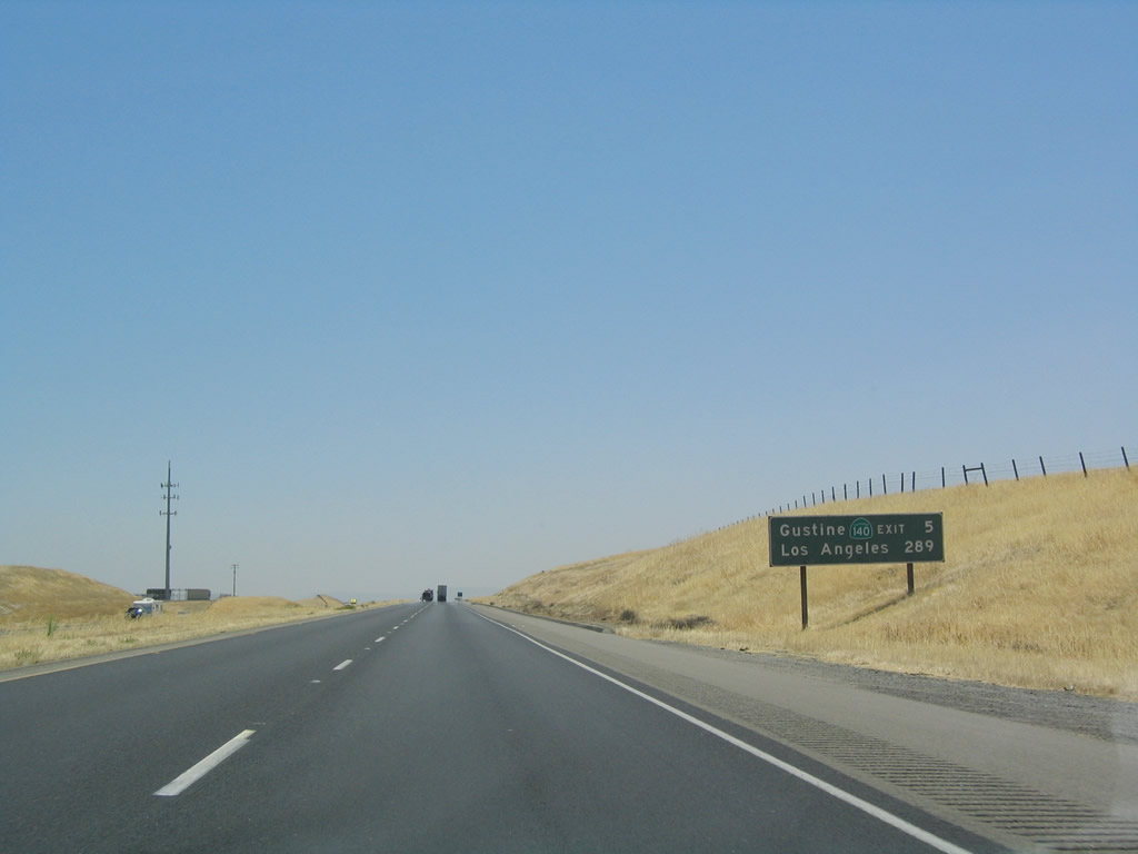
The next exit along southbound after the vista point is Exit 418, California 140 east to Gustine, Merced, and ultimately Yosemite National Park. Photo taken 07/06/04. |
|
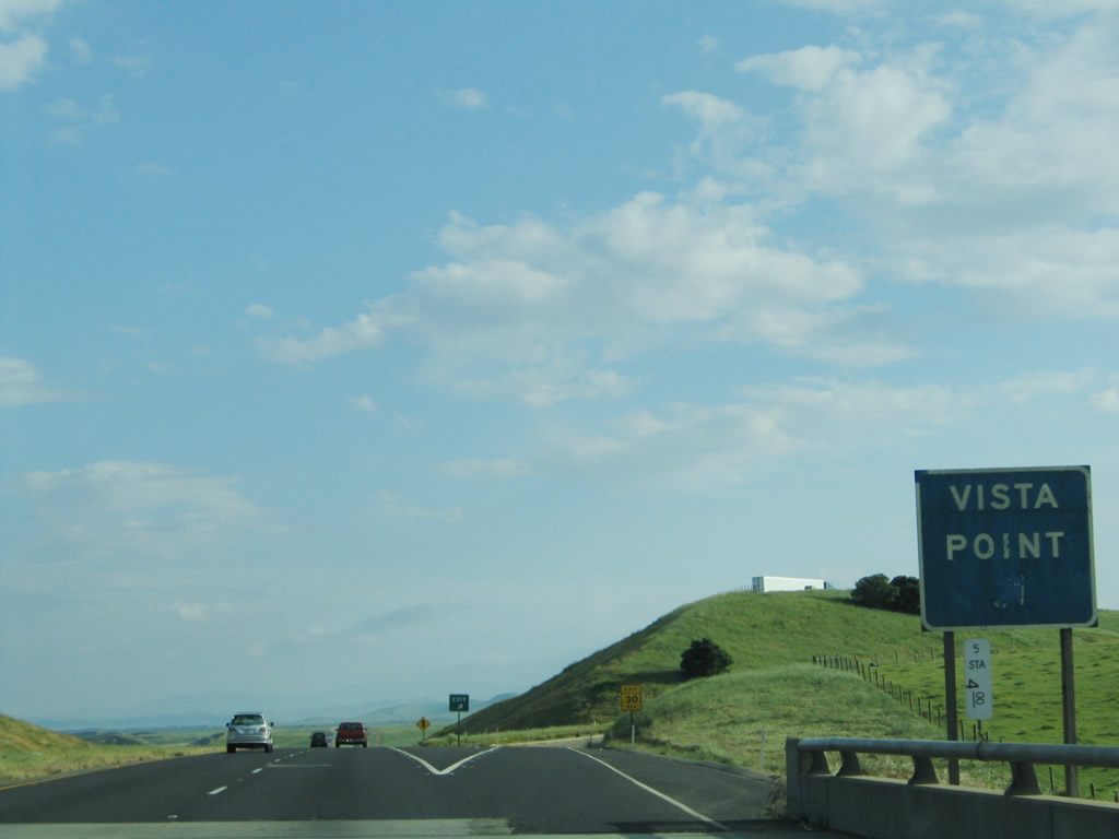
Southbound Interstate 5 reaches Exit 422, Vista Point. Note the Stanislaus County white postmile marker mounted beneath the gore point sign, which shows that it is only four miles from this point south to the Merced County Line. Photo taken 04/03/05. |
|
|
This view of the western Central Valley is afforded from the southbound freeway as it passes by the Vista Point. Compare the yellow grass of summer with the green grass of early spring. Photos taken 07/06/04 and 04/03/05. |
|
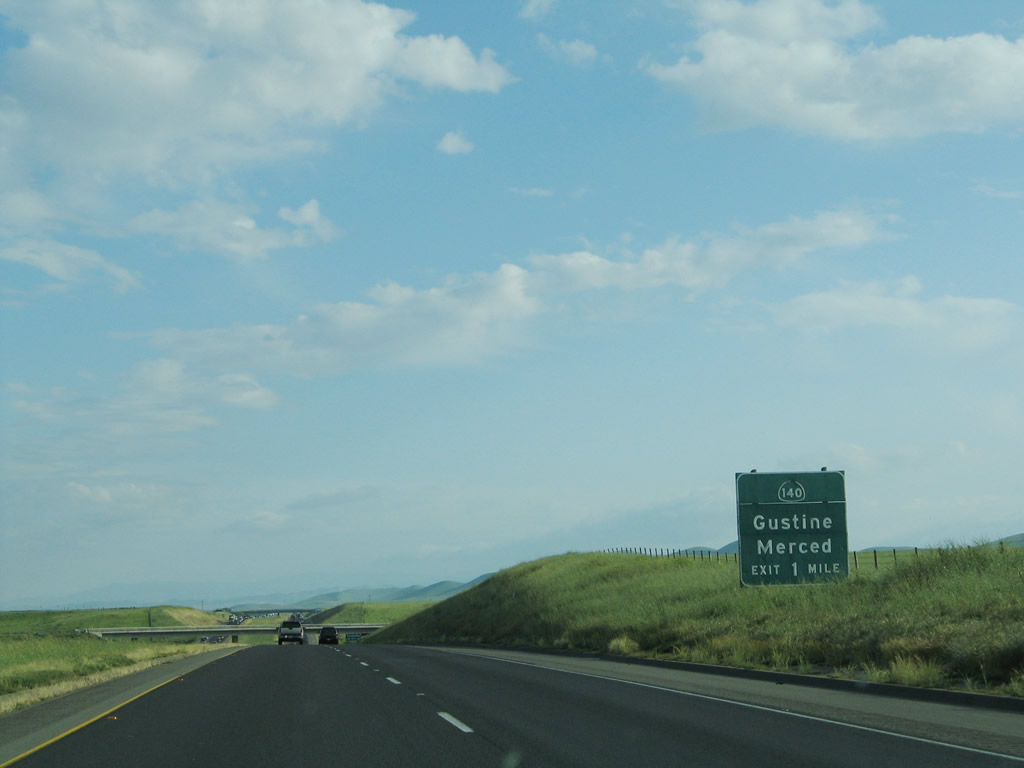
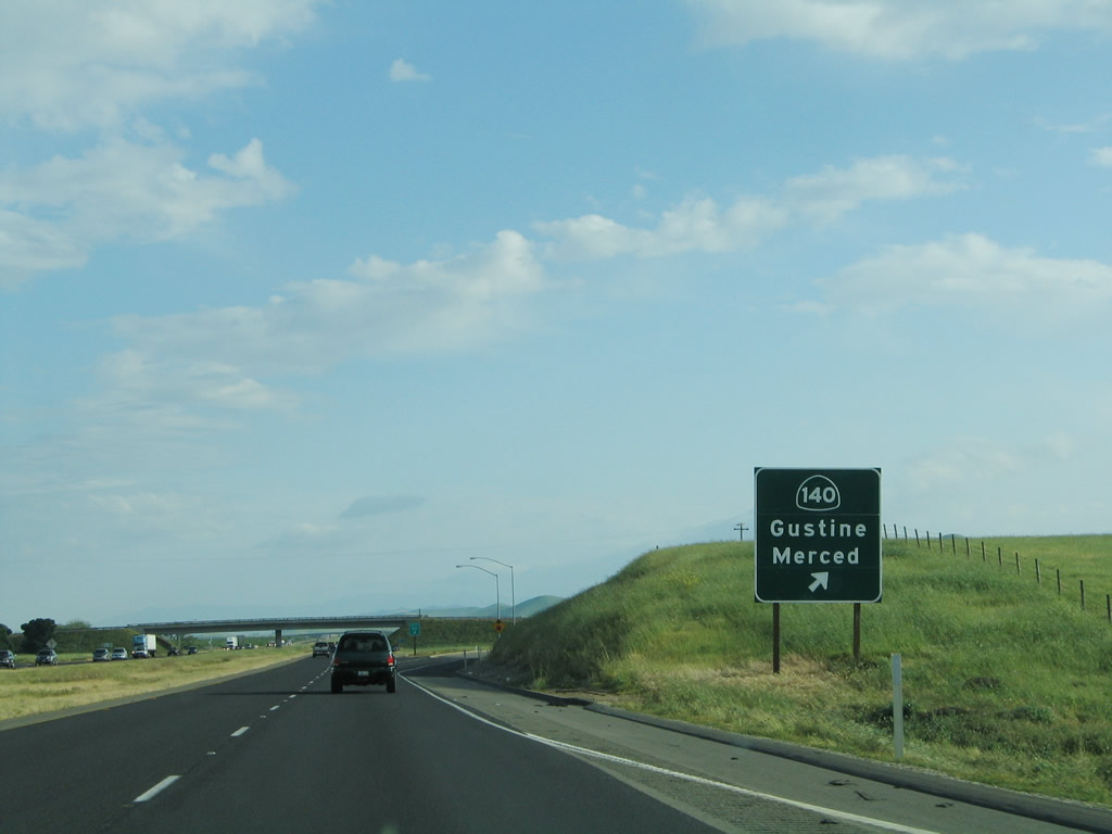
The next exit along southbound is Exit 418, California 140 east to Gustine and Merced, one mile. Photo taken 04/03/05. |
|
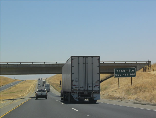
California 140 is a major east-west route across the Central Valley, and it connects Interstate 5 with Merced and the eastern entrance into Yosemite National Park. Photo taken 07/06/04. |
|
Upon reaching the California 140 interchange (Exit 418), southbound Interstate 5 departs Stanislaus County and enters Merced County. Photo taken 04/03/05. |
|
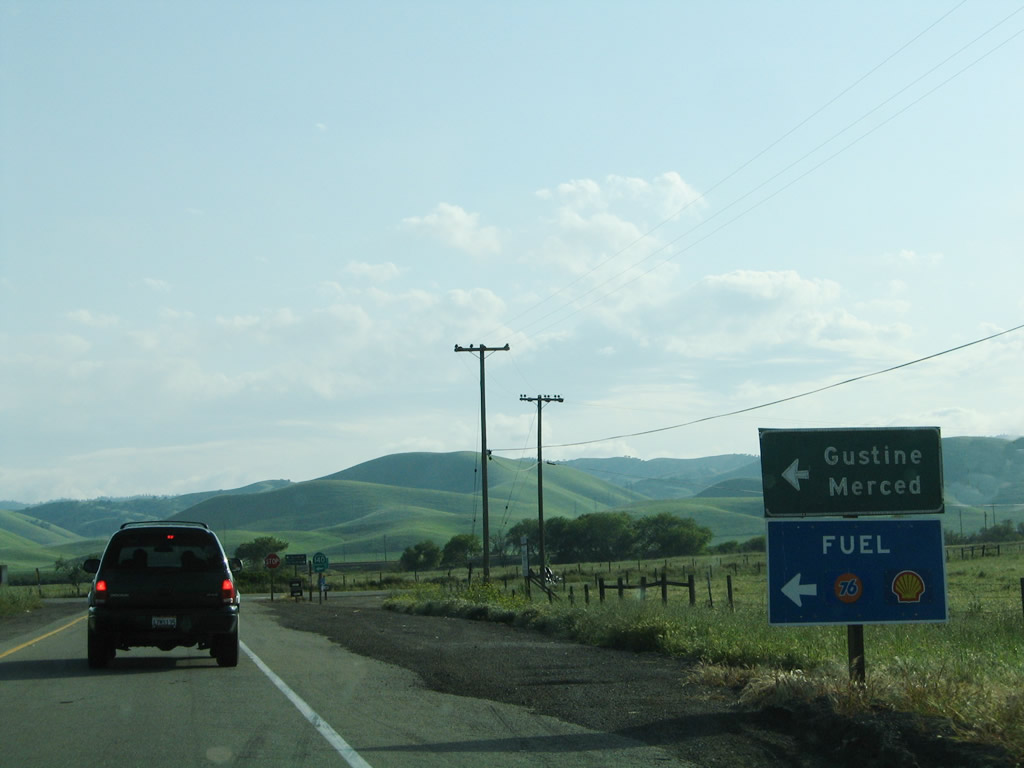
Now on the off-ramp from Interstate 5 south to California 140 east, all services and the cities of Gustine and Merced to are located to the east by turning left at the stop sign. Photo taken 04/03/05. |
|
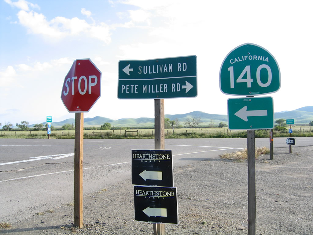
At the to[p of the off-ramp, turn left to follow California 140/Sullivan Road east to Gustine and Merced. Turn right to follow Pete Miller Road west to ranches along Carcas Creek. The is no paved route through the Diablo Range west of here. Photo taken 04/03/05. |
Page Updated January 21, 2008.