

Interstate 5 South - Kings County
| Interstate 5 south | |
|---|---|
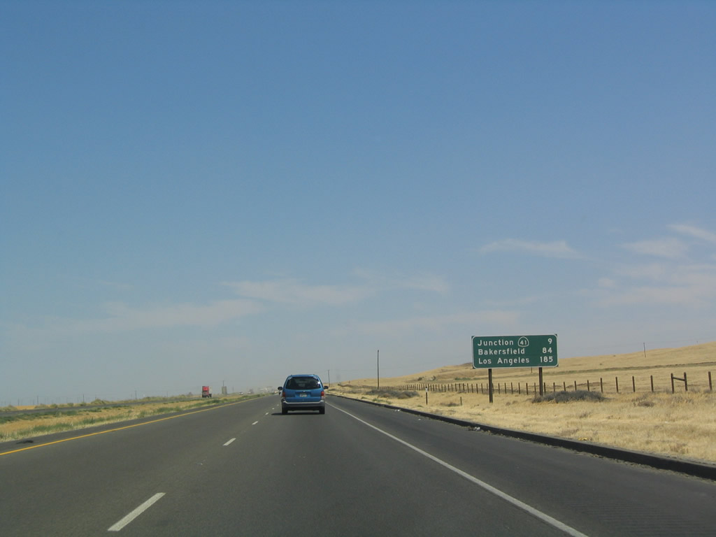 |
After the California 269 exit ramp but before passing through the interchange (Exit 319), southbound Interstate 5 departs Fresno County and enters Kings County/City of Avenal. The first mileage sign in Kings County points to the next interchange, Exit 309, California 41 as well as the cities of Bakersfield and Los Angeles. It is still another 185 miles (three hours) south to the City of Angels. Photo taken 07/06/04. |
 |
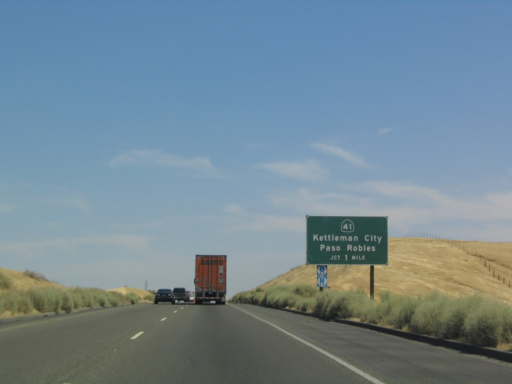 |
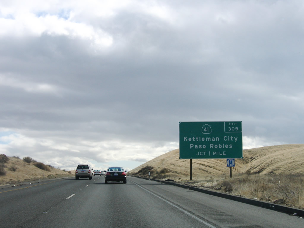
California 41 travels southwest toward the Central Coast (with a connection to Paso Robles via California 46 west), connecting to U.S. 101 at Atascadero and ultimately California 1 at Morro Bay. Heading northeast, California 41 angles toward Fresno and the south entrance of Yosemite National Park via Kettleman City. Photos taken 11/27/06 and 07/06/04. |
 |
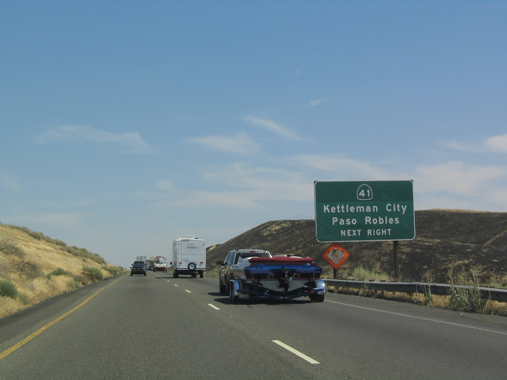 |
In the 2004 photo, a small fire had burned the grasslands to the southwest of Interstate 5 as the freeway approaches Exit 309, California 41 southwest to Paso Robles and northeast to Kettleman City. The 2006 photo shows the replacement exit number sign. Photos taken 11/27/06 and 07/06/04. |
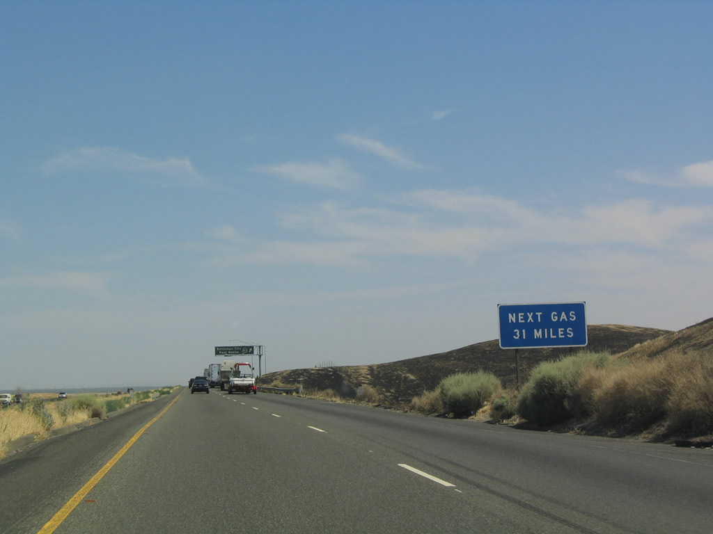 |
The next gas on the freeway is 31 miles after this interchange, so exit here for services if you're low on fuel. Photo taken 07/06/04. |
 |
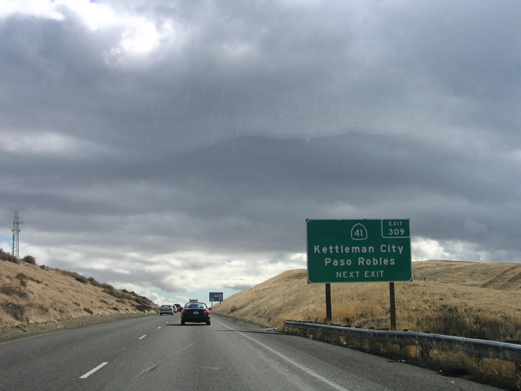
Southbound Interstate 5 reaches Exit 309, California 41. Kettleman City is only a short drive northeast of Interstate 5, and some services are located there. Paso Robles, which may be reached via California 46 west, is best known as a wine country second in the state to the Napa-Sonoma-Mendocino-Lake County region in Northern California. Photo taken 07/06/04. |
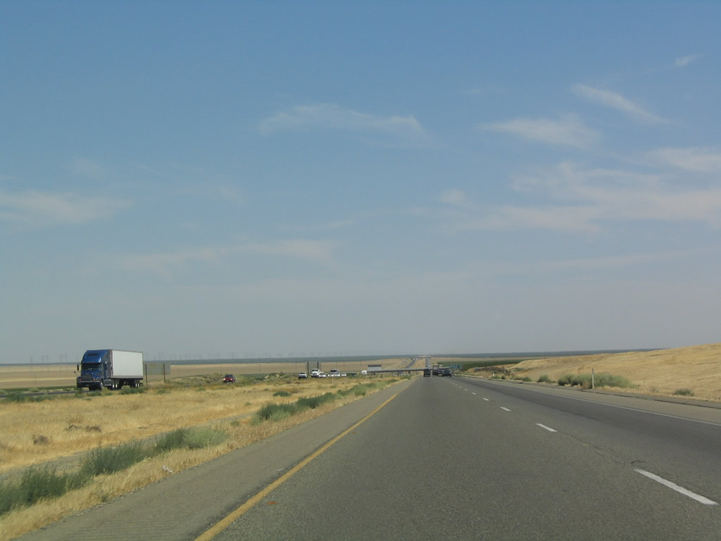 |
Here is another view of southbound Interstate 5 as it passes through rural Kings County. Photo taken 07/06/04. | |
 |
 |
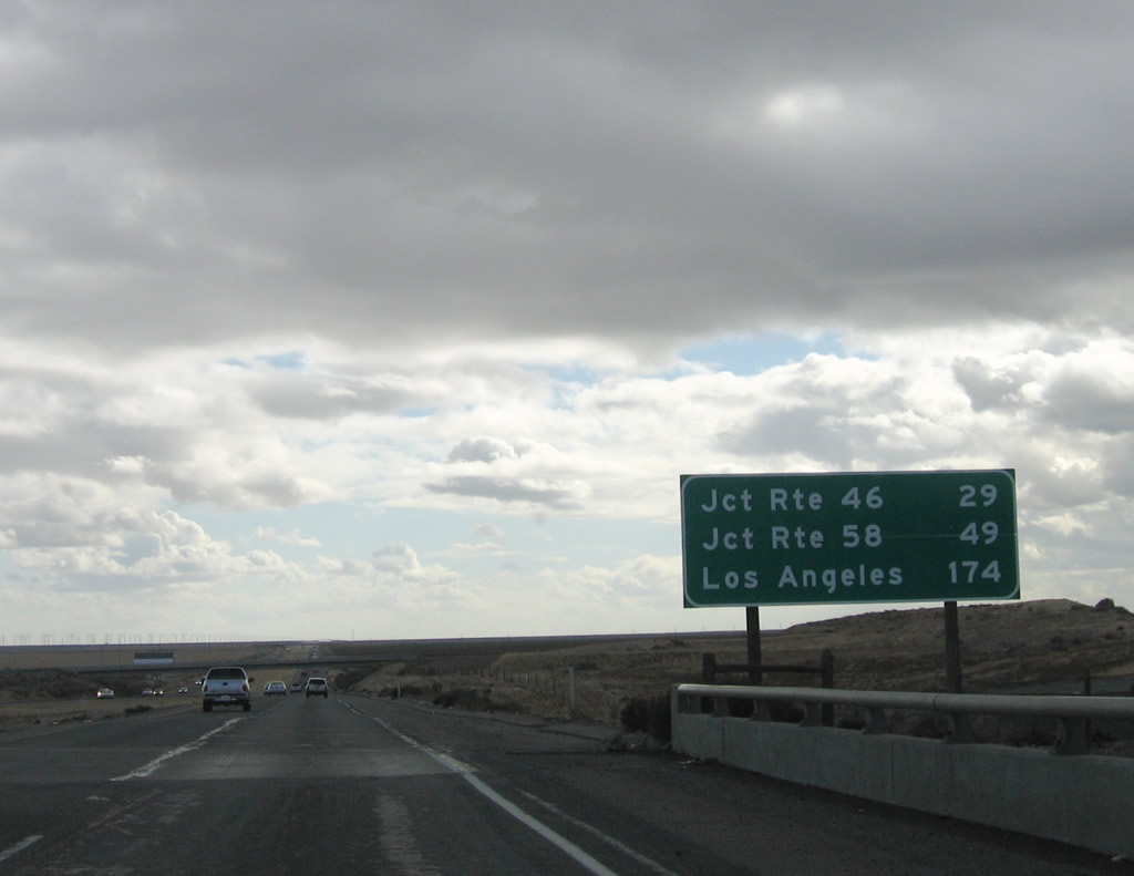
The version of this mileage sign provided the distance to the interchange with California 46 (Exit 278 at Lost Hills, which is the next exit with services), Bakersfield, and Los Angeles. However, the 2006 version removed Bakersfield and replaced it with the interchange with California 58, which in turn travels east toward Bakersfield. Photos taken 11/27/06 and 07/06/04. |
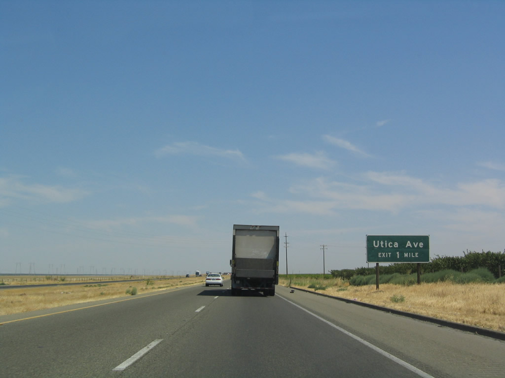 |
The next exit along southbound is Exit 305, Utica Avenue, one mile. Photo taken 07/06/04. |
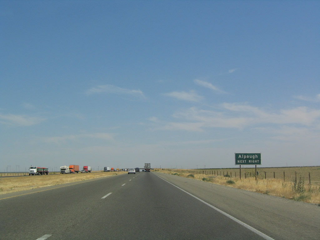 |
Use Utica Avenue east to Fourth Avenue south to Avenue 54 east to reach Alpaugh in Tulare County. Photo taken 07/06/04. |
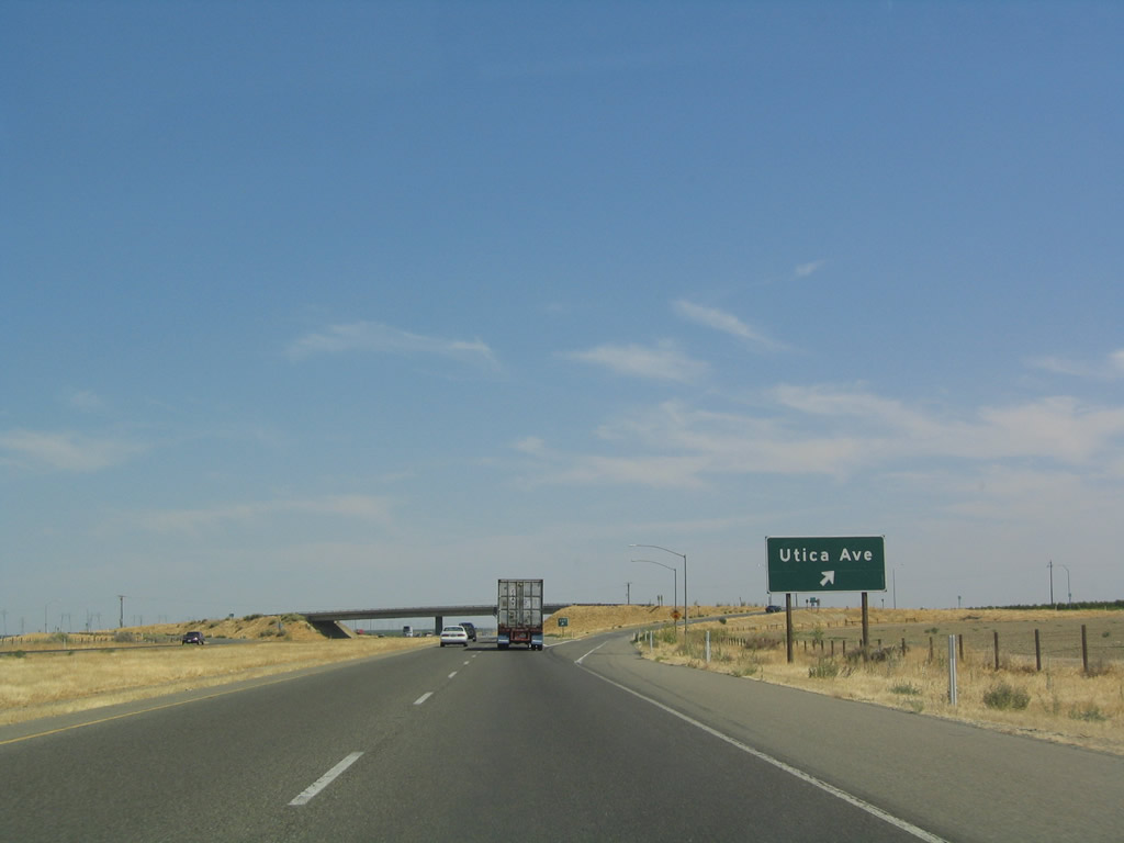 |
Southbound Interstate 5 reaches Exit 305, Utica Avenue. This is the final exit in Kings County. Photo taken 07/06/04. |
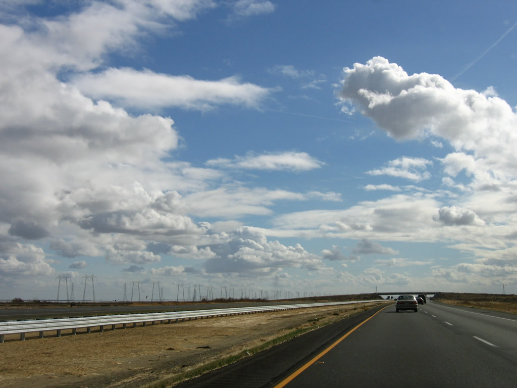 |
Path 15 power lines parallel Interstate 5 to the east of the freeway. These lines will continue south toward the masive Midway substation near Buttonwillow, where incoming lines from Diablo Canyon Nuclear Power Generating Station and the Southern California Ediscon (SCE) 500kV grid converge. Photo taken 11/27/06. |
 |
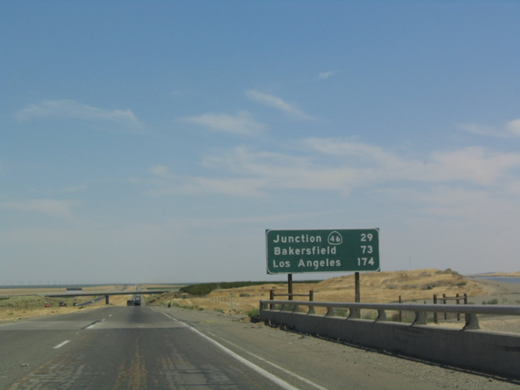
This mileage sign along southbound provides the distance to the next major interchange (California 46 at Lost Hills in Kern County), Bakersfield, and Los Angeles. Photo taken 07/06/04. |
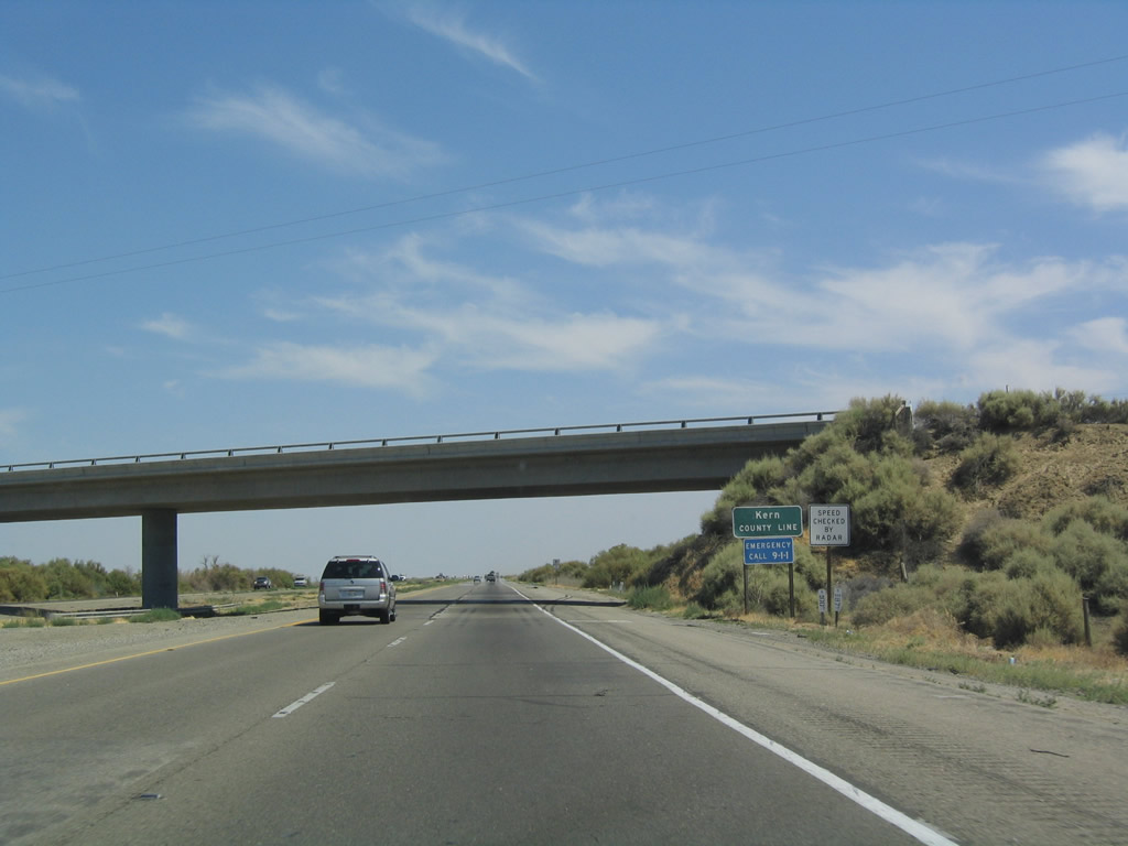 |
Interstate 5 departs Kings County and enters Kern County at this overpass (County Line Road). Photo taken 07/06/04. |


Page Updated September 6, 2008.
|
About Contact Glossary |
In The News Interstate Guide |
Social Media:
 |
|
© 2000-25 AARoads.com | All Rights Reserved | Privacy Policy / Terms of Use
|
||