| Interstate 5 (West Side Freeway) south |
|
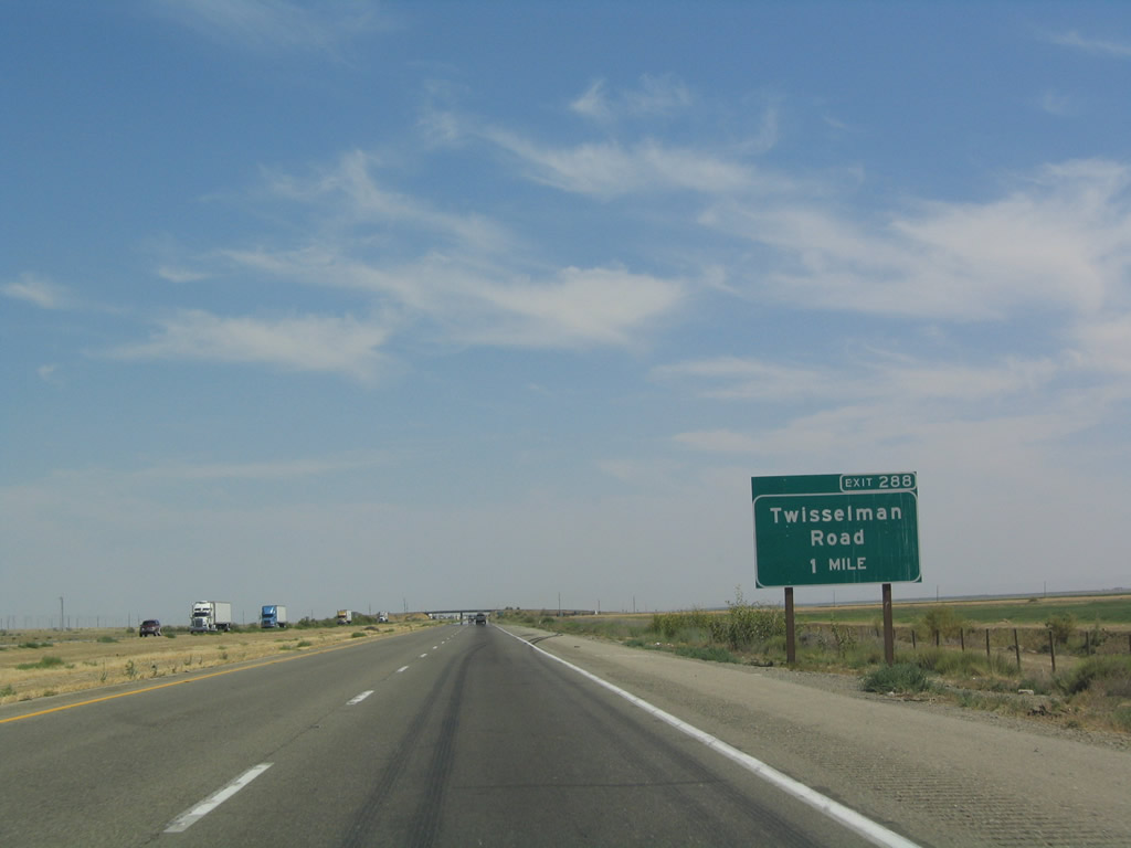
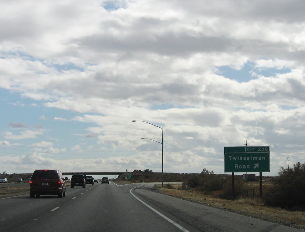
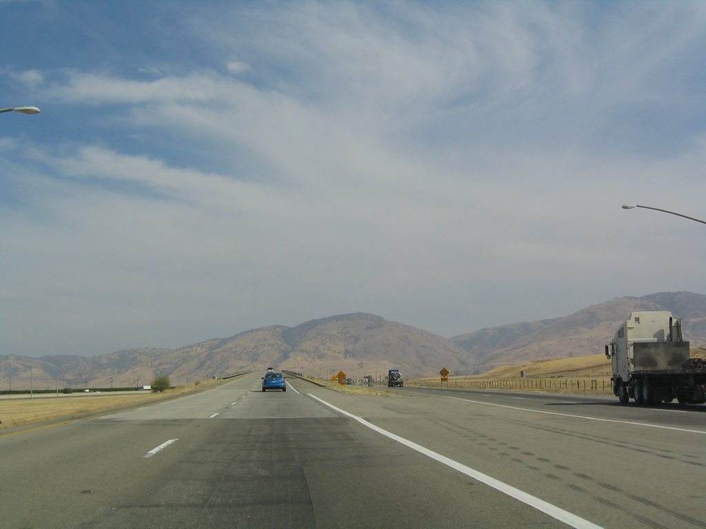
The first interchange in Kern County along southbound is Exit 288, Twisselman Road, one mile. Most exits within Kern County were signed with exit numbers between 2001 and 2004. Photo taken 07/06/04. |
|
|
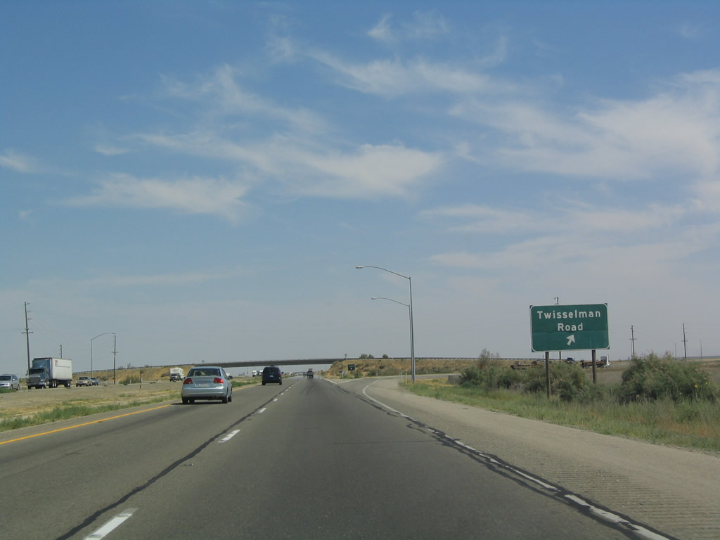
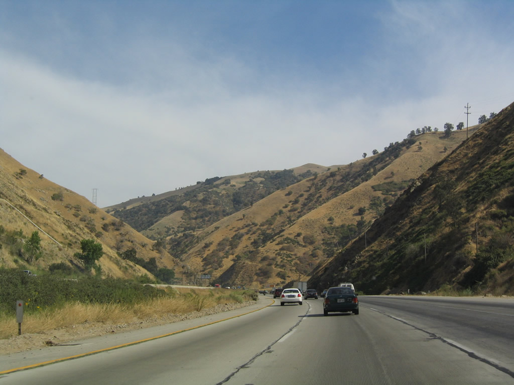
Southbound Interstate 5 reaches Exit 288, Twisselman Road. Use Twisselman Road east to Lost Hills Road and west to California 33 in the Antelope Plain. Photos taken 11/27/06 and 07/06/04. |
|
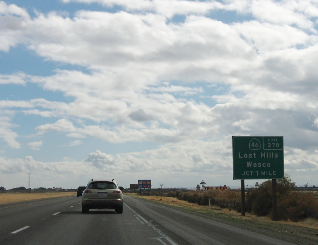
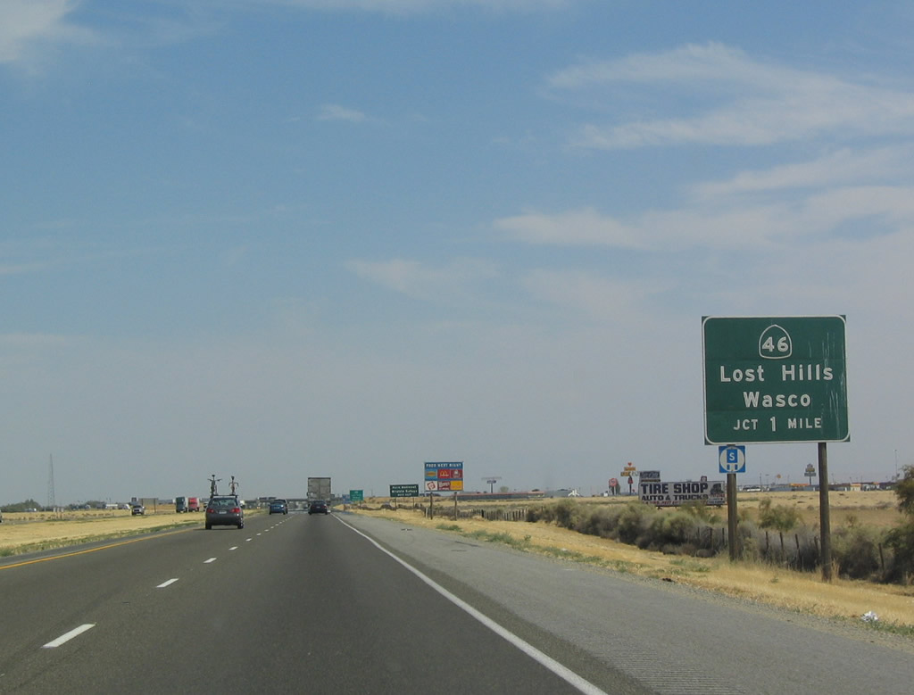
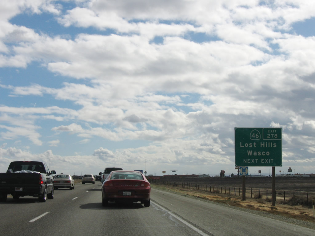
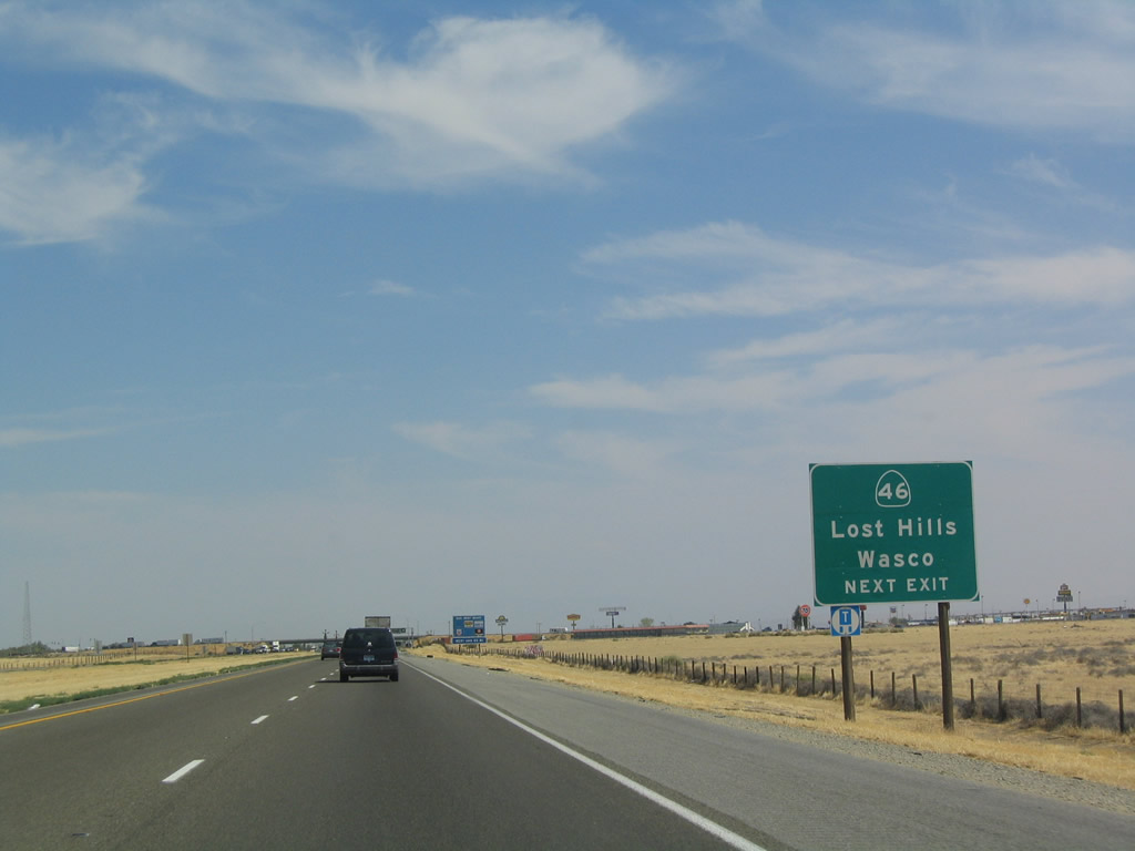
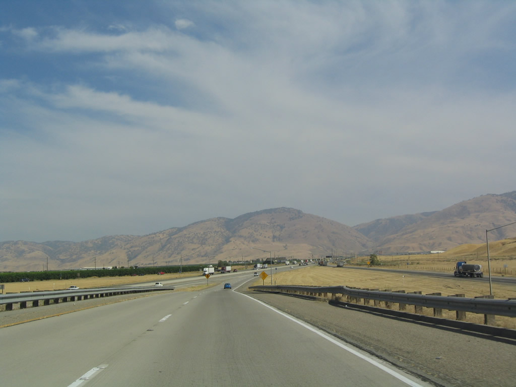
The next exit along southbound is Exit 278, California 46/Lost Hills, seven miles. All motorist services are available at Exit 278. Photo taken 07/06/04. |
|
|
Use Exit 278 to follow California 46 east to Wasco (California 43) and Famoso (California 99). Famoso marks the eastern terminus of California 46. From Famoso, California 99 heads south into Bakersfield. Together with California 58 east of Bakersfield, California 46 follows the original alignment of U.S. 466. Photos taken 11/27/06 and 07/06/04. |
|
|
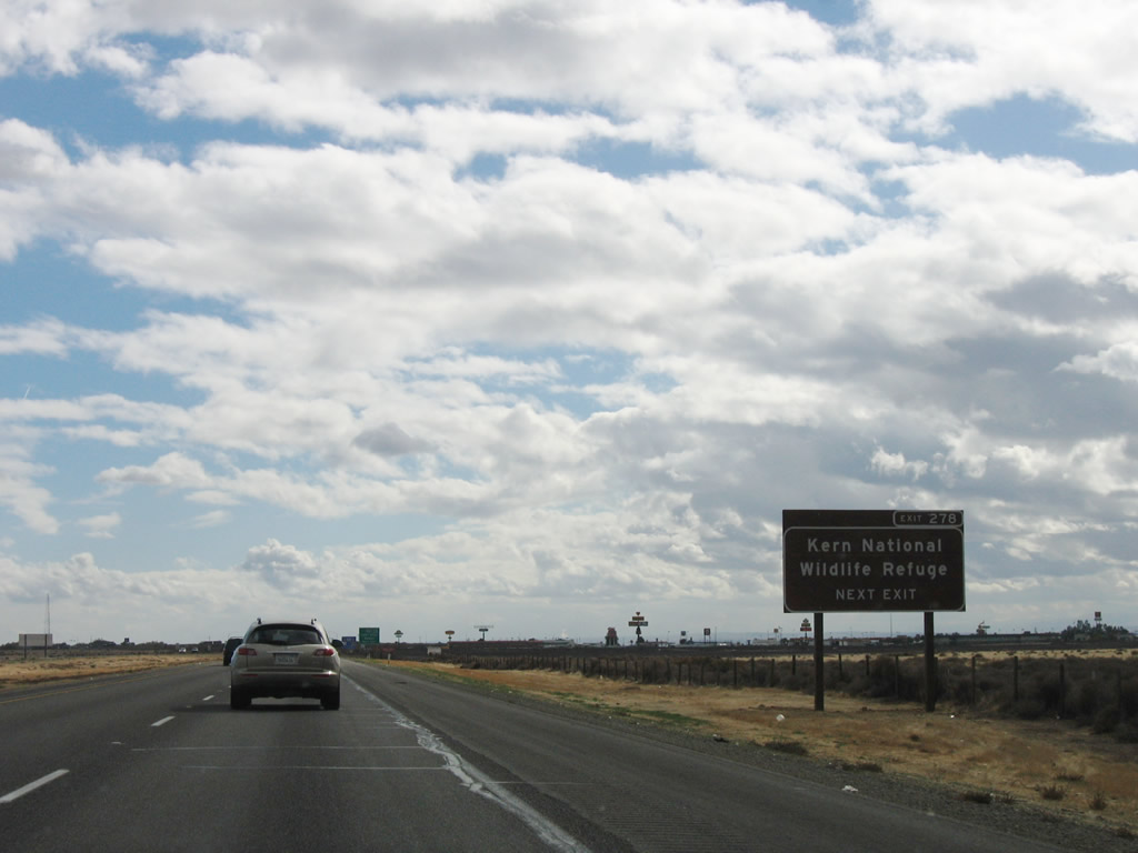
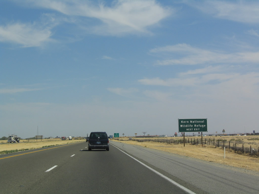
To Kern National Wildlife Refuge, follow California 46 east to Corcoran Road north. The refuge headquarters are at the intersection with Garces Road. Photos taken 11/27/06 and 07/06/04. |
|
|
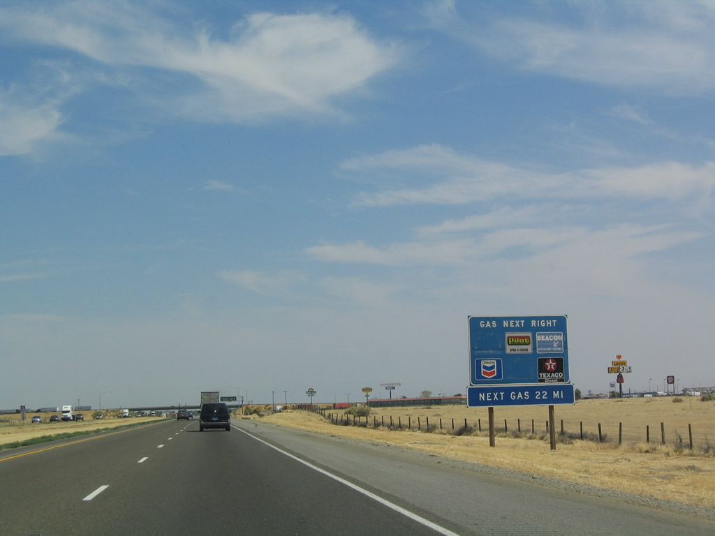
The town center of Lost Hills is located just west of Interstate 5, but most visitors to Lost Hills are exiting here to use the motorist services, including food, gas, and lodging. Photos taken 11/27/06 and 07/06/04. |
|
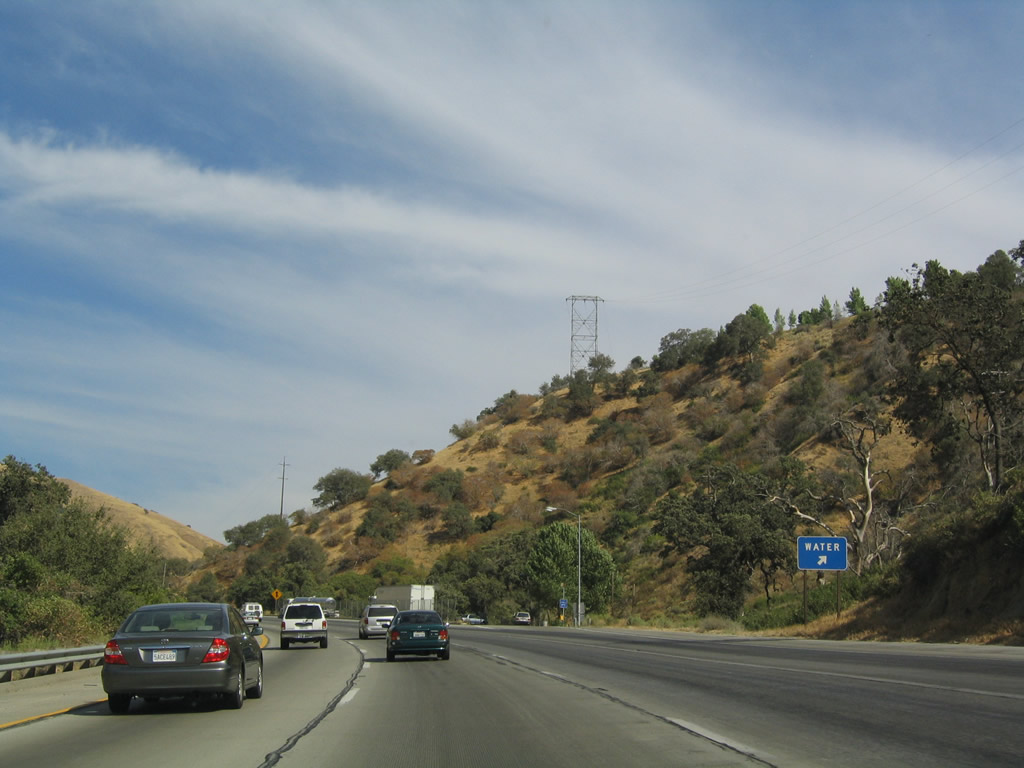
After Lost Hills, the next gas on the freeway is 22 miles ahead, at Exit 257, California 58 at Buttonwillow. Photo taken 07/06/04. |
|
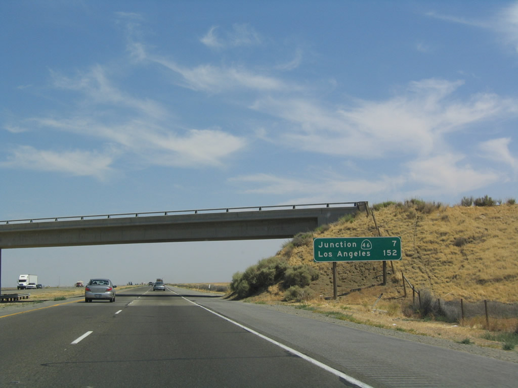
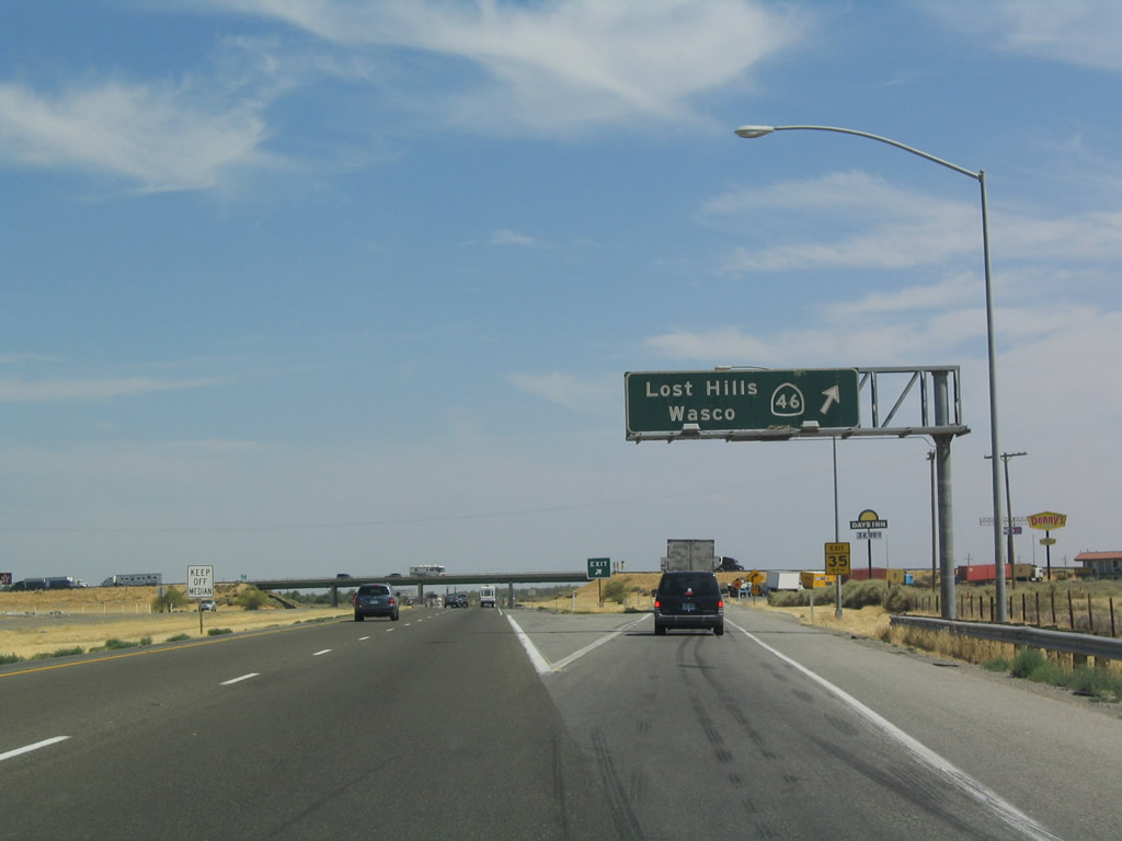
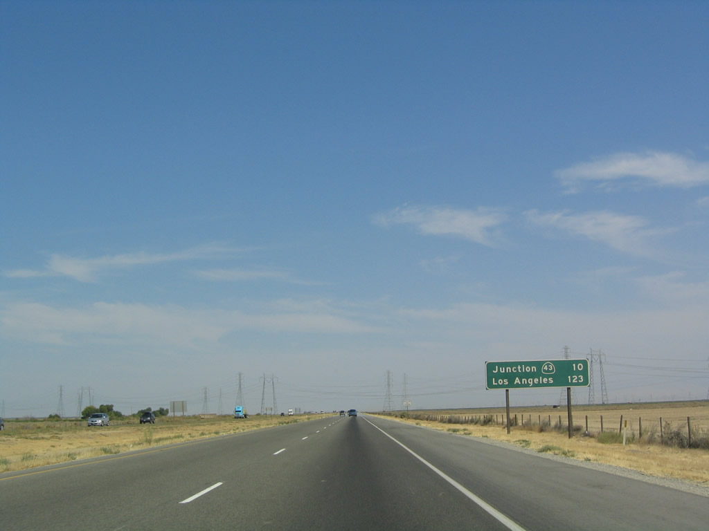
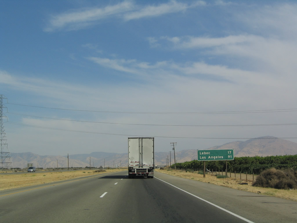
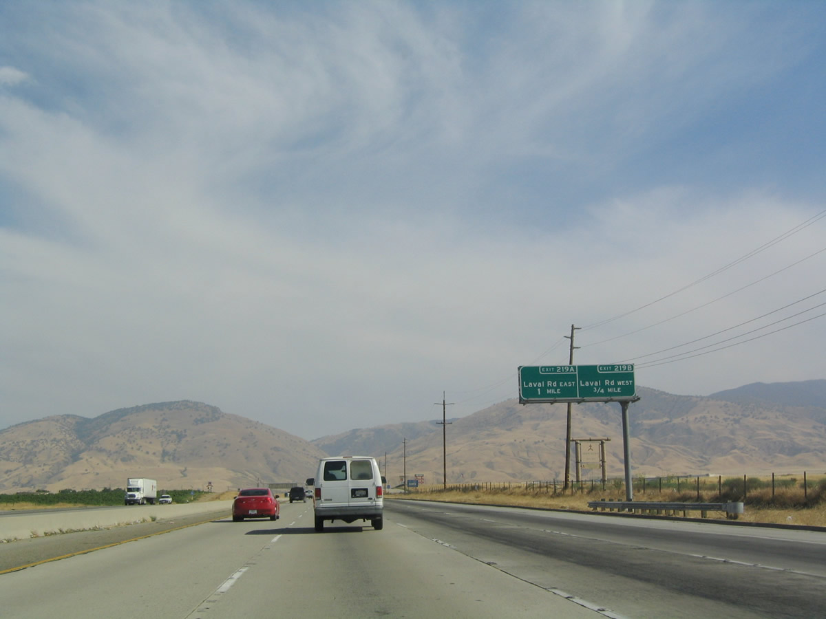
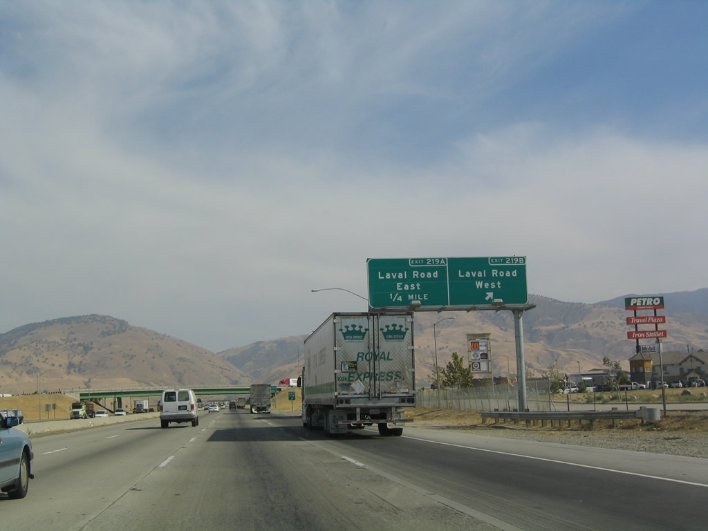
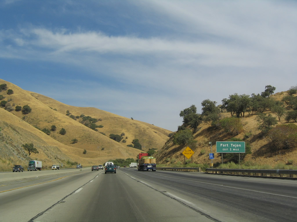
Southbound Interstate 5 (West Side Freeway) meets Exit 278, California 46 west to Lost Hills and east to Wasco. Looking farther west, California 46 continues along old U.S. 466 to meet California 41 near Cholame, and California 46 heads due east to meet U.S. 101 in Paso Robles. From there, California 46 continues west to the coast, ending at California 1 between Cambria and Harmony. Photo taken 07/06/04. |
|
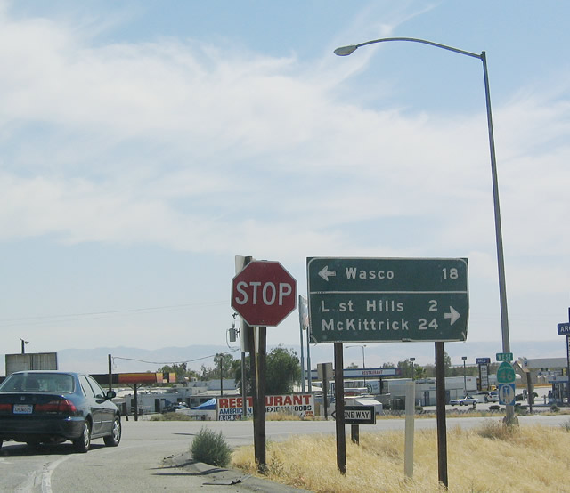
At the top of the ramp from southbound Interstate 5 to California 46 (Exit 278) is this old directional signage, which provides the distance to Wasco, Lost Hills, and McKittrick. Photo taken 07/06/04. |
|
|
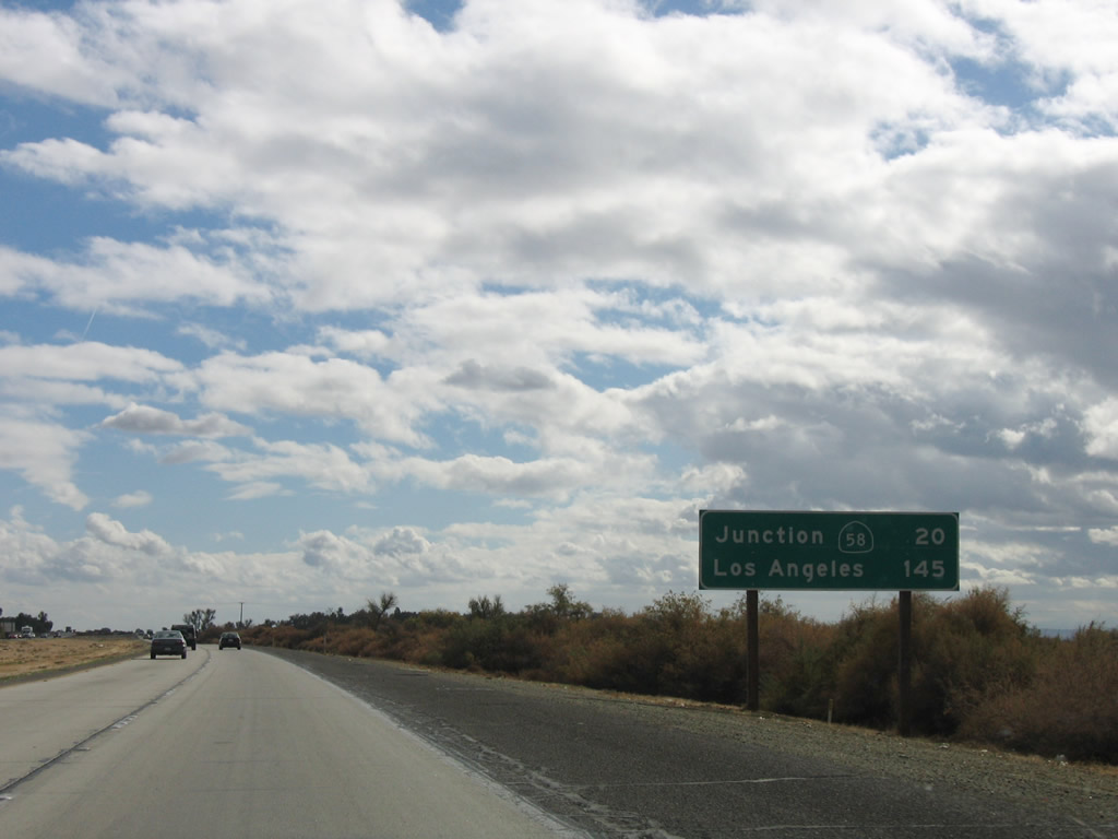
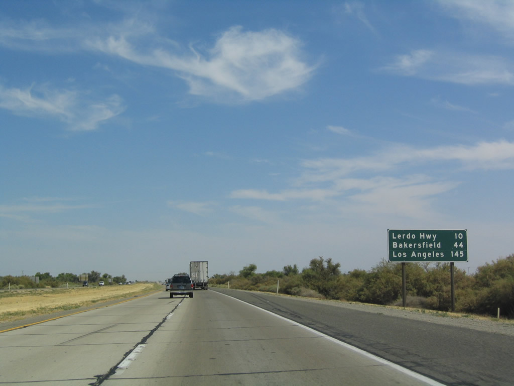
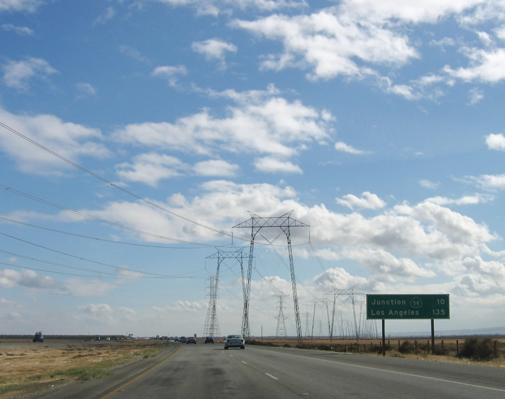
In 2004, the next mileage sign along southbound Interstate 5 provided the distance to the next exit (Exit 268, Lerdo Highway) as well as Bakersfield and Los Angeles. As of 2006, this mileage sign provides the distance to California 58 interchange and the same control city of Los Angeles. Photos taken 11/27/06 and 07/06/04. |
|
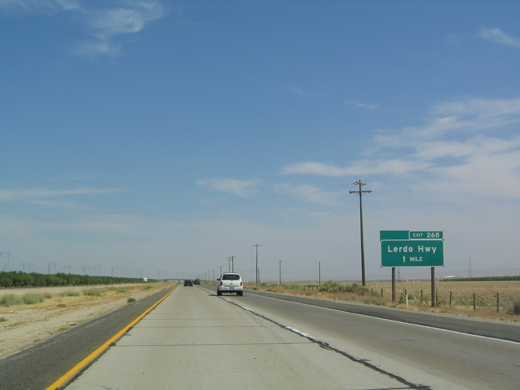
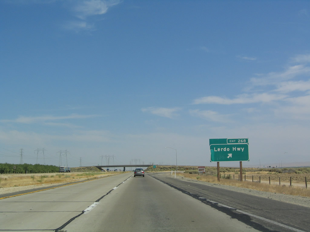
The next exit along southbound is Exit 268, Lerdo Highway west to the Buttonwillow Raceway and the Belridge Oil Fields (at California 33) and east to Shafter, Cawelo, and the Premier and Kern Front Oil Fields (via California 65). Photo taken 07/06/04. |
|
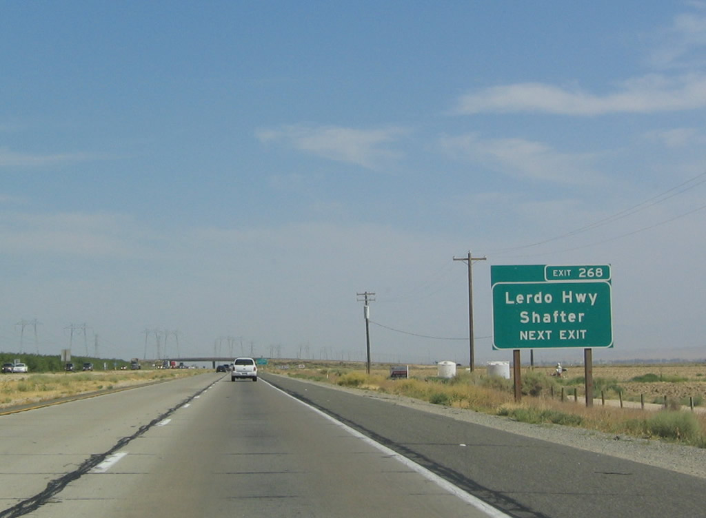
The second advance guide sign for Lerdo Highway mentions that it heads east to Shafter (where the highway meets California 43). Photo taken 07/06/04. |
|
Southbound Interstate 5 reaches Exit 268, Lerdo Highway. Photo taken 07/06/04. |
|
|
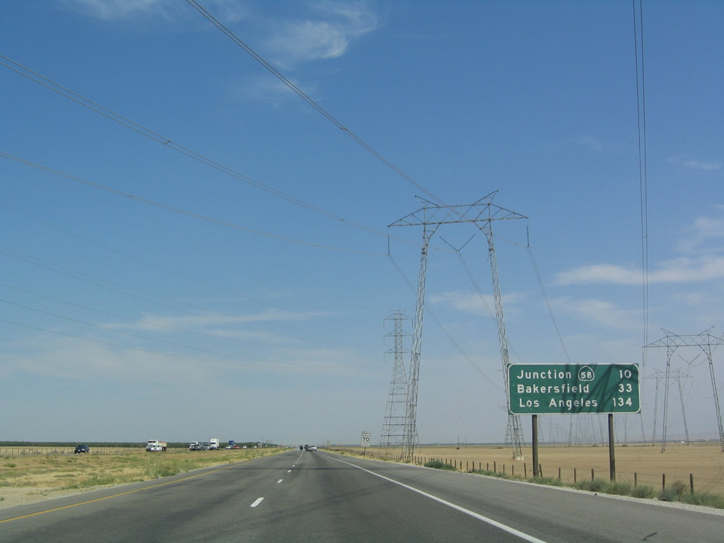
A mileage sign is posted after the Lerdo Highway interchange. The sign was changed between 2004 and 2006. The next exit along southbound is Exit 263 (Rowlee Road), followed by Exit 257, California 58 (ten miles). The distance to Bakersfield was removed by 2006. The distance to the control city of Los Angeles is still provided; it is still 134 miles to Los Angeles. Photos taken 11/27/06 and 07/06/04. |
|
|
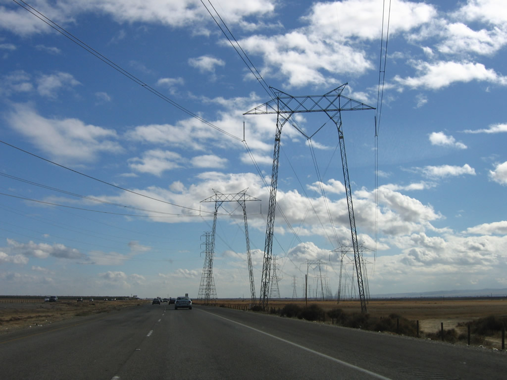
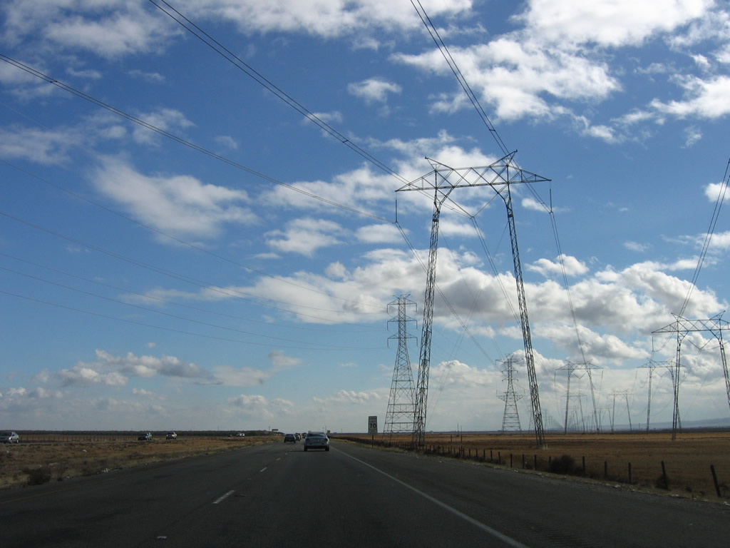
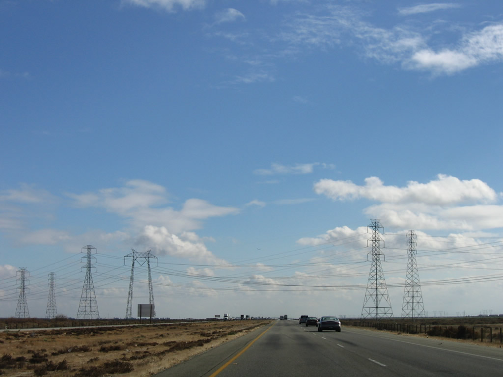
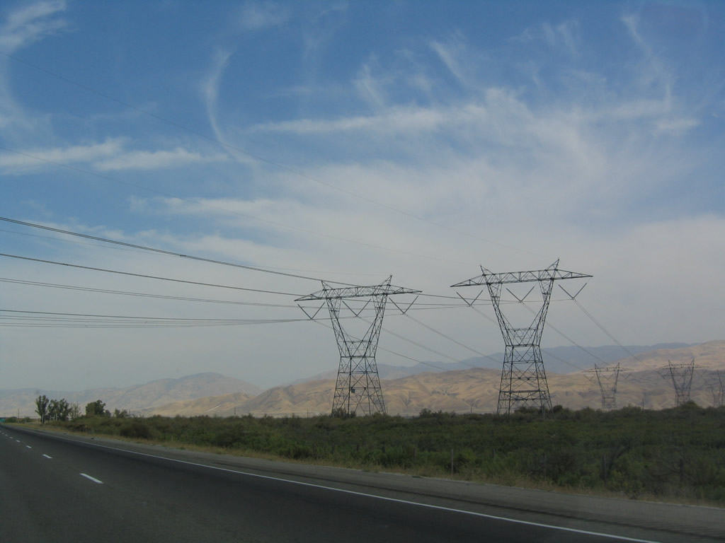
The Path 15 power lines again cross Interstate 5, as they head to one of the largest power substations in the region near Buttonwillow. At the Midway Substation near Buttonwillow, major transmission lines such as these convergence from Path 15, the Diablo Canyon Nuclear Power Plant, Los Angeles Basin, and the greater Southwestern Power Grid (carrying electricity from the Colorado River Dams and coal-fire power plants of Arizona and New Mexico). Photos taken 11/27/06. |
|
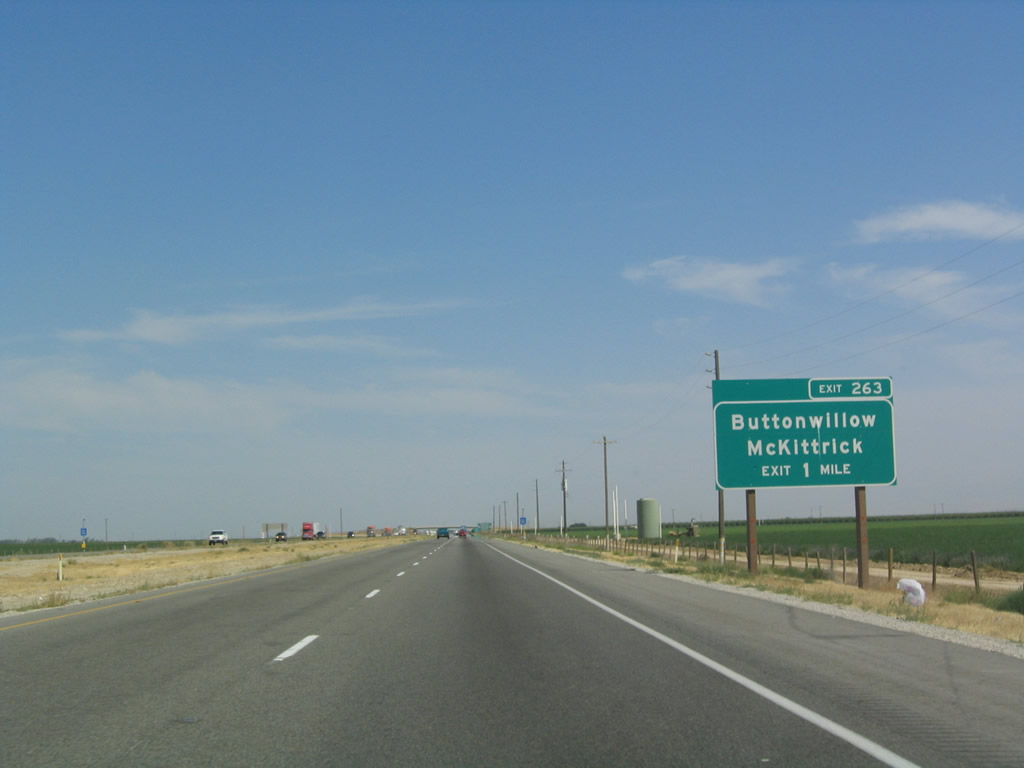
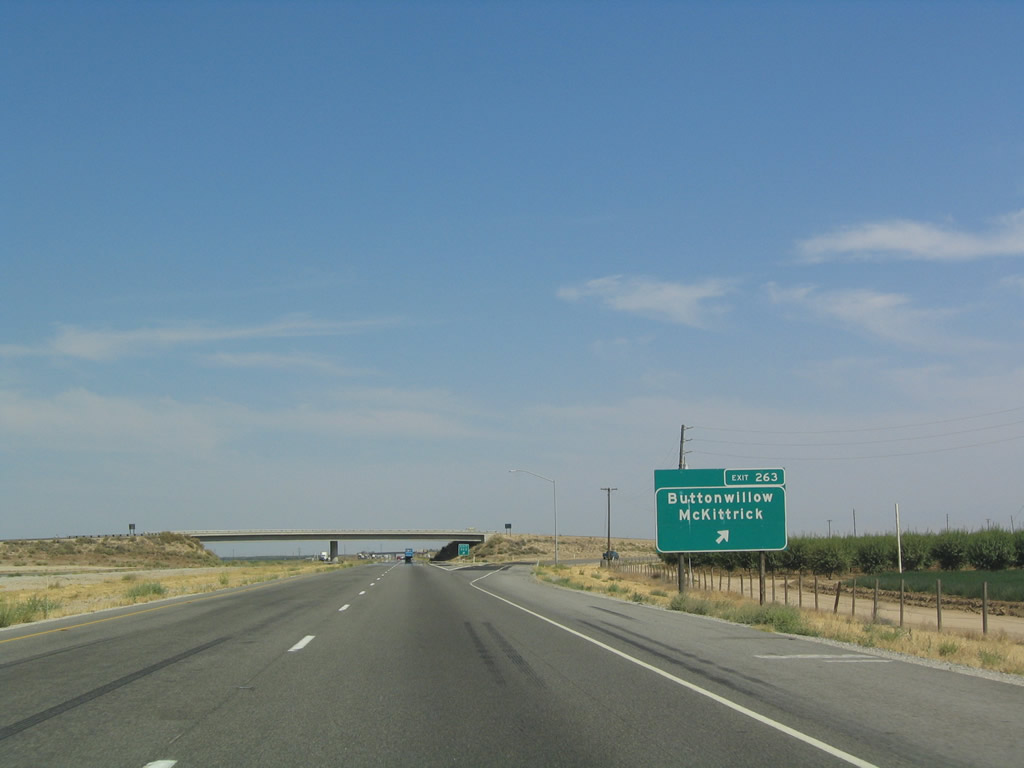
The next exit along southbound Interstate 5 (West Side Freeway) is Exit 263, Buttonwillow Drive south and Rowlee Road north. Buttonwillow Drive travels south to Buttonwillow and McKittrick (the latter via a connection with California 58 west). Photo taken 07/06/04. |
|
|
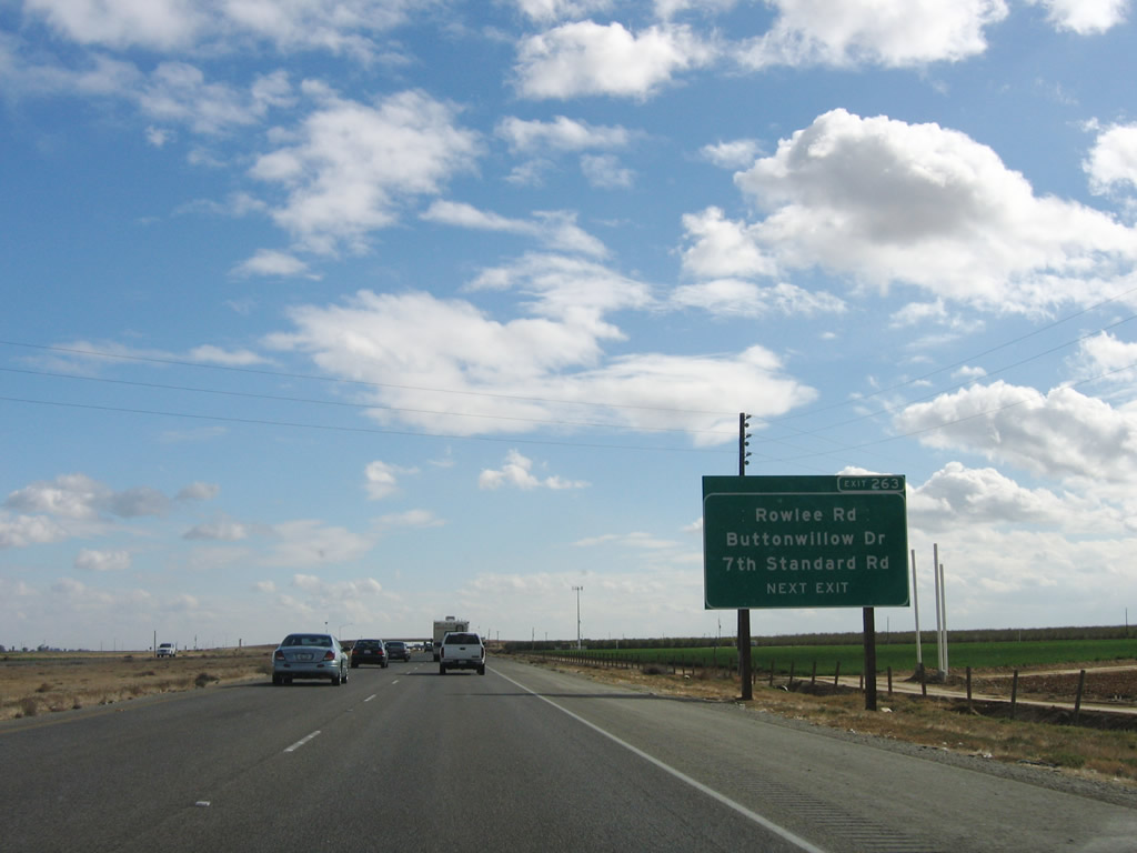
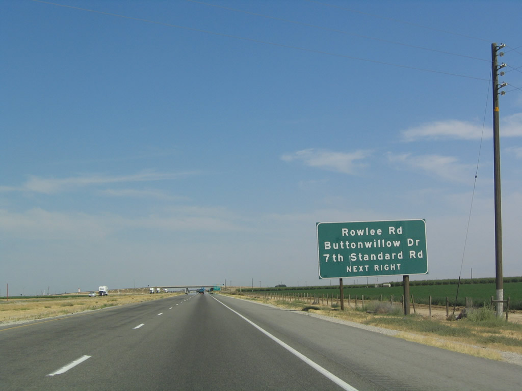
In addition to Rowlee Road, Exit 263 provides access to Seventh Standard Road, an east-west highway that connects Interstate 5 with California 99 north of Bakersfield. Photos taken 11/27/06 and 07/06/04. |
|
Southbound Interstate 5 reaches Exit 263, Rowlee Road and Buttonwillow Drive to Seventh Standard Road, Buttonwillow, McKittrick, and Oildale (north Bakersfield). Photo taken 07/06/04. |
|
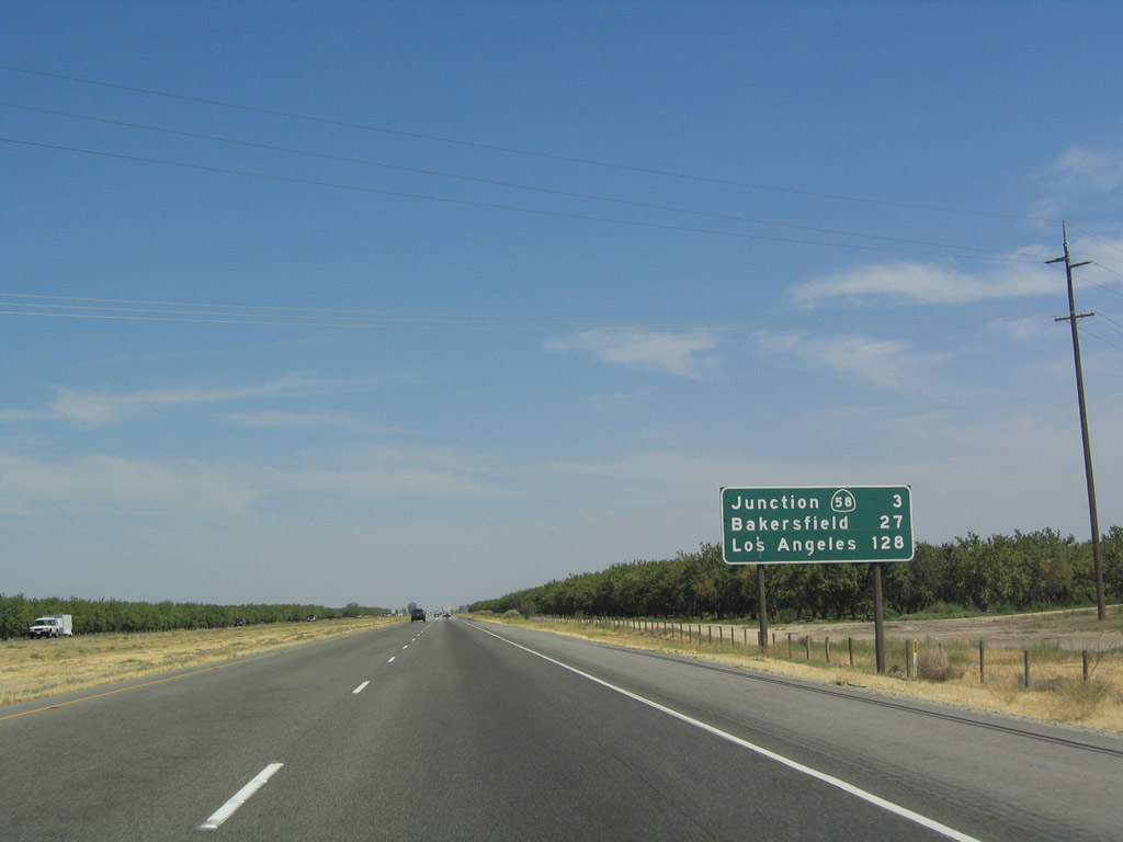
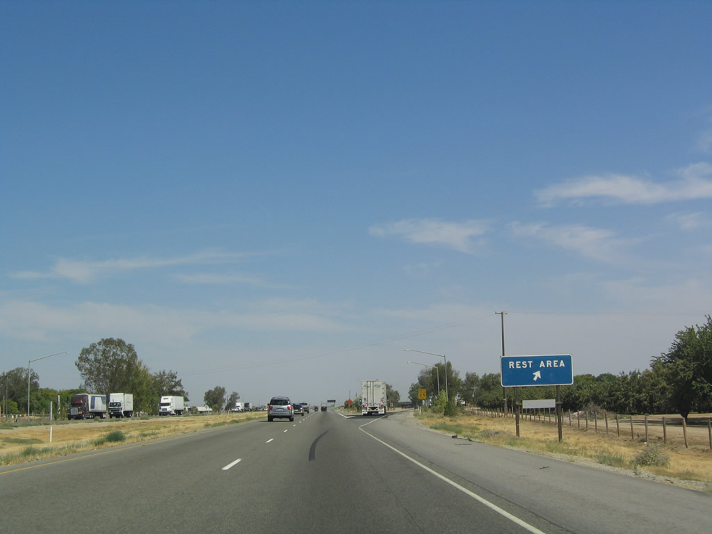
This mileage sign provides the distance to the next interchange (Exit 257, California 58/McKittrick Highway) as well as Bakersfield and Los Angeles. The next exit will be Exit 259, Buttonwillow Safety Rest Area. Photo taken 07/06/04. |
|
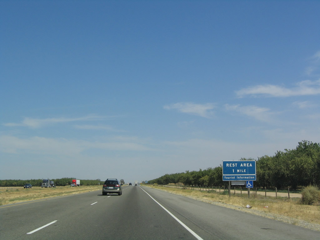
Southbound Interstate 5 approaches Exit 259, Buttonwillow Rest Area (one mile). This rest area was remodeled in 2009 and reopened in 2010 (along with many other rest areas throughout the state). Like other similar facilities along Interstaet 5, the rest area offers restrooms, drinking water, picnic tables, telephone, and pet walking area. During hot summer months it is important to be mindful of the outside temperature. Photo taken 07/06/04. |
|
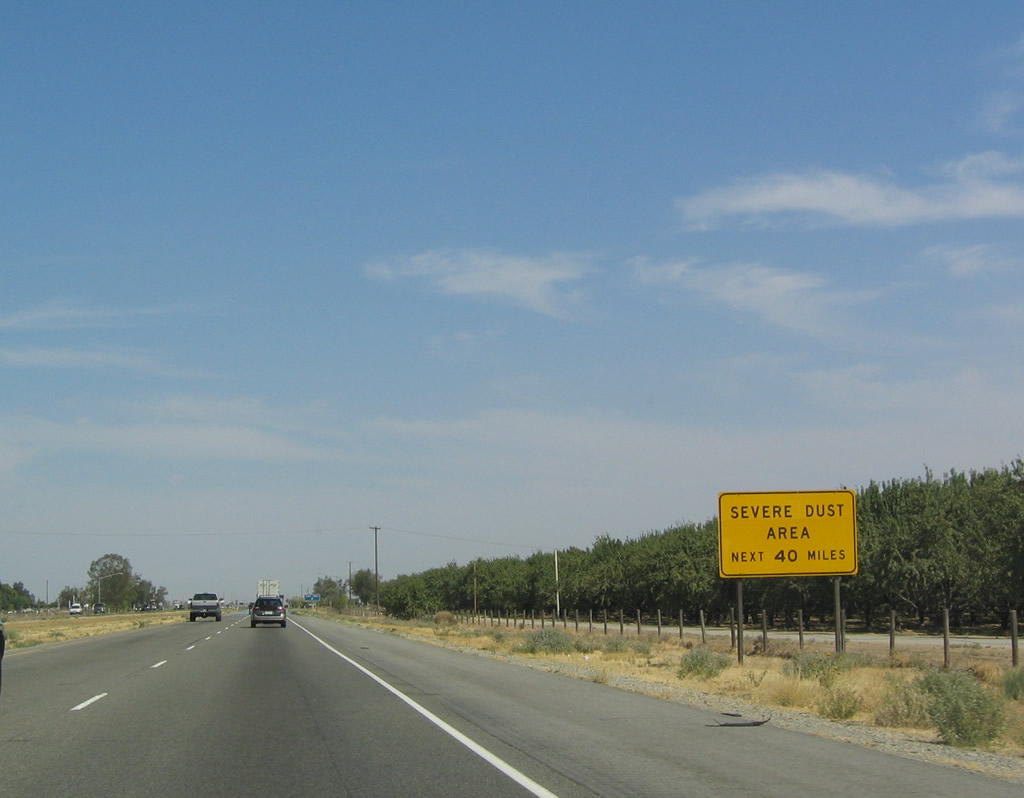
Due to the arid nature of the area and the presence of potentially strong winds in conjunction with dust in the region, Interstate 5 passes through a severe dust storm zone for the next 40 miles (until reaching Exit 219 at Wheeler Ridge) as mentioned in this sign. Photo taken 07/06/04. |
|
Southbound Interstate 5 reaches Exit 259, Rest Area. The next rest area is Exit 206, 53 miles south of here between Lebec and Gorman. Photo taken 07/06/04. |
|
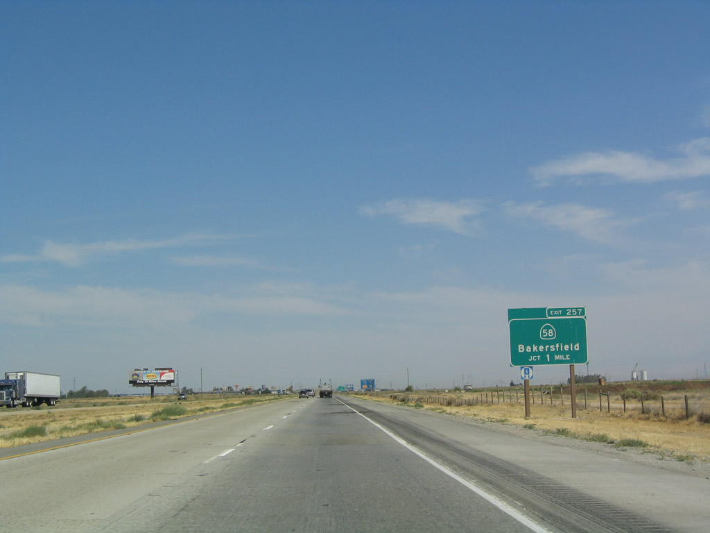
Finally southbound Interstate 5 (West Side Freeway) approaches Exit 257, California 58 east to Bakersfield and west to McKittrick and Santa Margarita (U.S. 101). The mileage signs will no longer list Bakersfield as a destination city along southbound. Photo taken 07/06/04. |
|
Although California 58 is a two-lane, rural highway between Interstate 5 and California 43, it greets suburbia quickly thereafter as it enters the outskirts of the Bakersfield metropolitan area, especially in Greenacres. At times, this stretch of California 58 can be congested. Photo taken 07/06/04. |
|
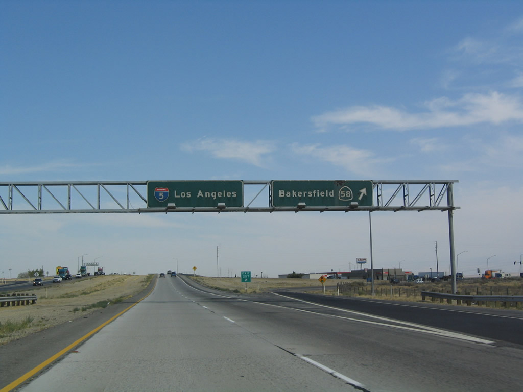
These overhead signs, which date back to the original freeway construction in the 1970s, greet southbound travelers as they reach Exit 257, California 58. Photo taken 07/06/04. |
|
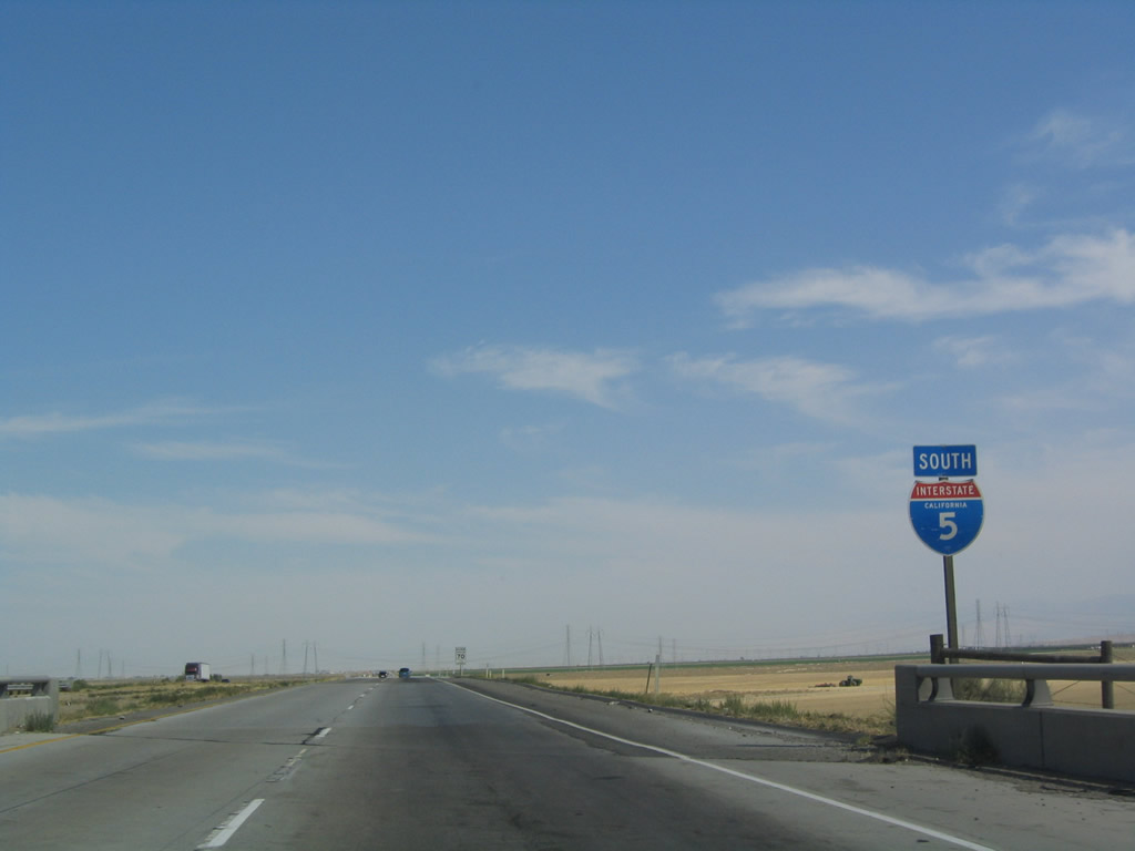
After Exit 257, this reassurance marker for Interstate 5 south appears. Photo taken 07/06/04. |
|
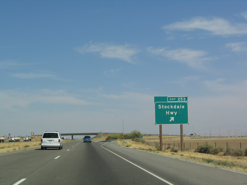
This mileage sign provides the distance to Exit 246, California 43 and the city of Los Angeles. The next exit will be Exit 253, Stockdale Highway. Photo taken 07/06/04. |
|
|
For a final time on southbound Interstate 5, a Pacific Gas and Electric (PG&E) 500kV power line crosses the freeway. All 500kV power lines that cross Interstate 5 south of here belong either to Southern California Edison (SCE) or the city of Los Angeles Department of Water and Power (LADWP). This particular 500kV travels southeast to cross a remote stretch of the Tehachapi Mountains. At a point in the mountains, the pole structure changes from PG&E's standard H-frame structure to SCE's standard delta pylon structure. The SCE line continues southeast, linking with the rest of the SCE grid northwest of Lancaster at the Vincent substation near California 14. This particular 500kV power line is considered part of Path 26; the Path 15 line's southern terminus is at the Midway substation near Buttonwillow. The 230kV and 138kV power lines travel east to connect to Bakersfield's power grid. Photos taken 11/27/06. |
|
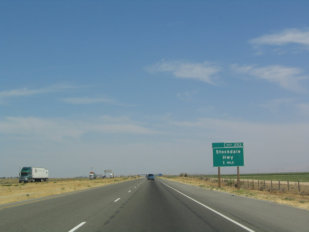
The next exit along southbound is Exit 253, Stockdale Highway, one mile. Photo taken 07/06/04. |
|
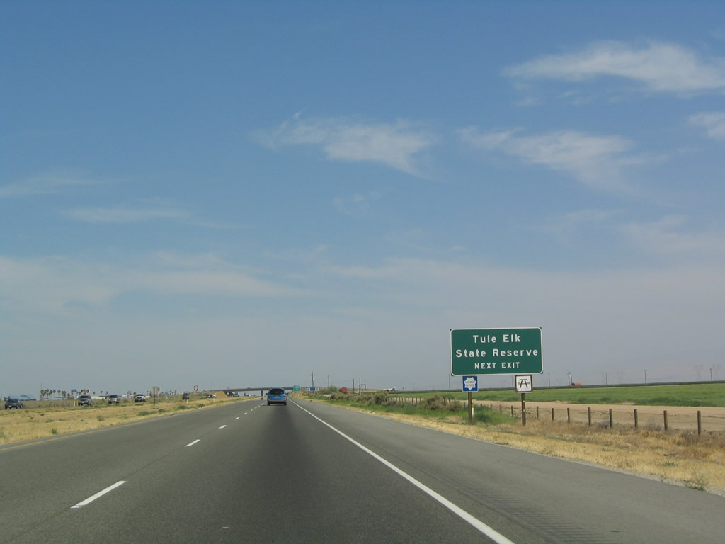
Use Stockdale Highway west to reach the Tule Elk State Reserve. Stockdale Highway east heads into Bakersfield, parallel to California 58. In some respects, Stockdale Highway may be a comparably quick route to Bakersfield. It passes through Kern City before entering the city of Bakersfield. Photo taken 07/06/04. |
|
Southbound Interstate 5 reaches Exit 253, Stockdale Highway. Photo taken 07/06/04. |
|
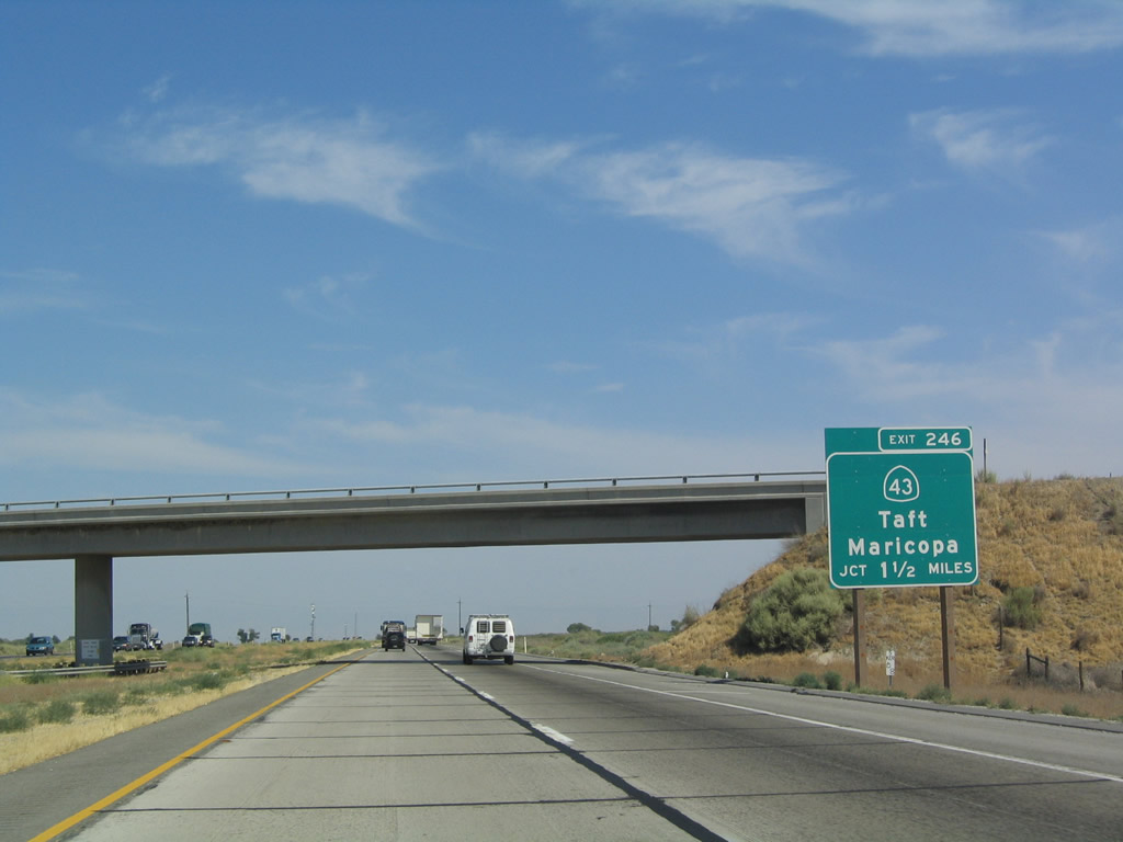
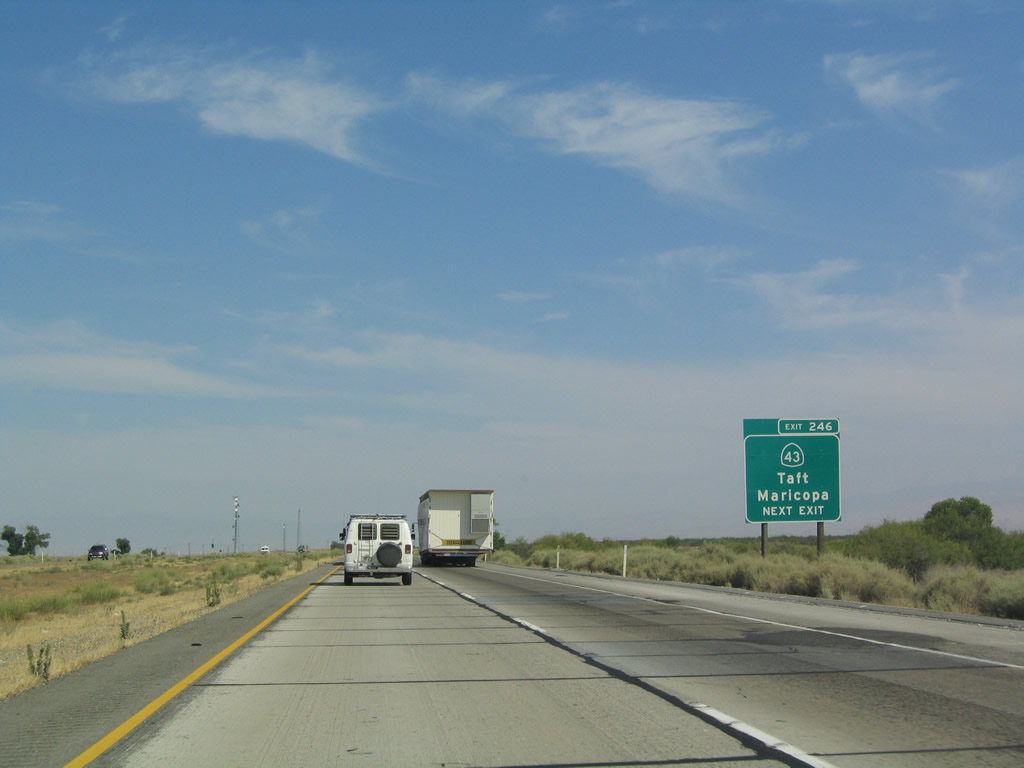
The next exit along southbound is Exit 246, California 43, 1.50 miles. Photo taken 07/06/04. |
|
Use California 43/Enos Lane north to reach Shafter and south to reach California 119 near the Elk Hills. Photo taken 07/06/04. |
|
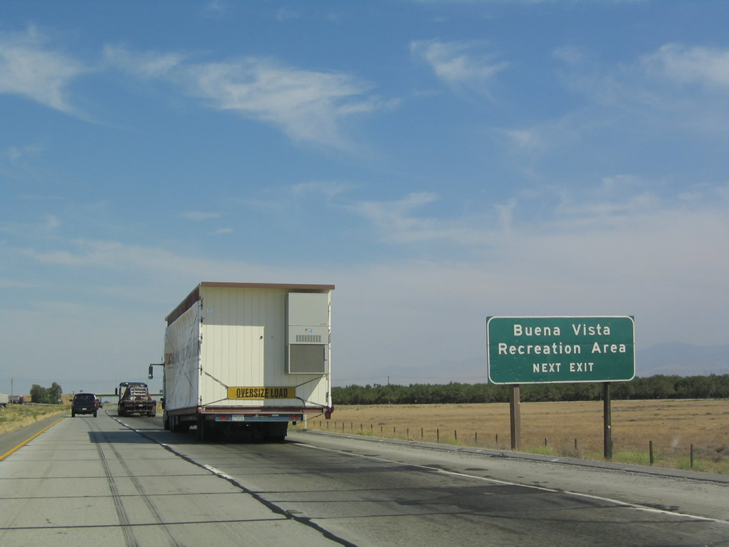
To reach the Buena Vista Recreation Center, follow California 43 south to California 119, then continue south along Enos Lane to reach Lake Webb, which is located within the Buena Vista Lake Bed. Photo taken 07/06/04. |
|
Southbound Interstate 5 reaches Exit 246, California 43. Photo taken 07/06/04. |
|
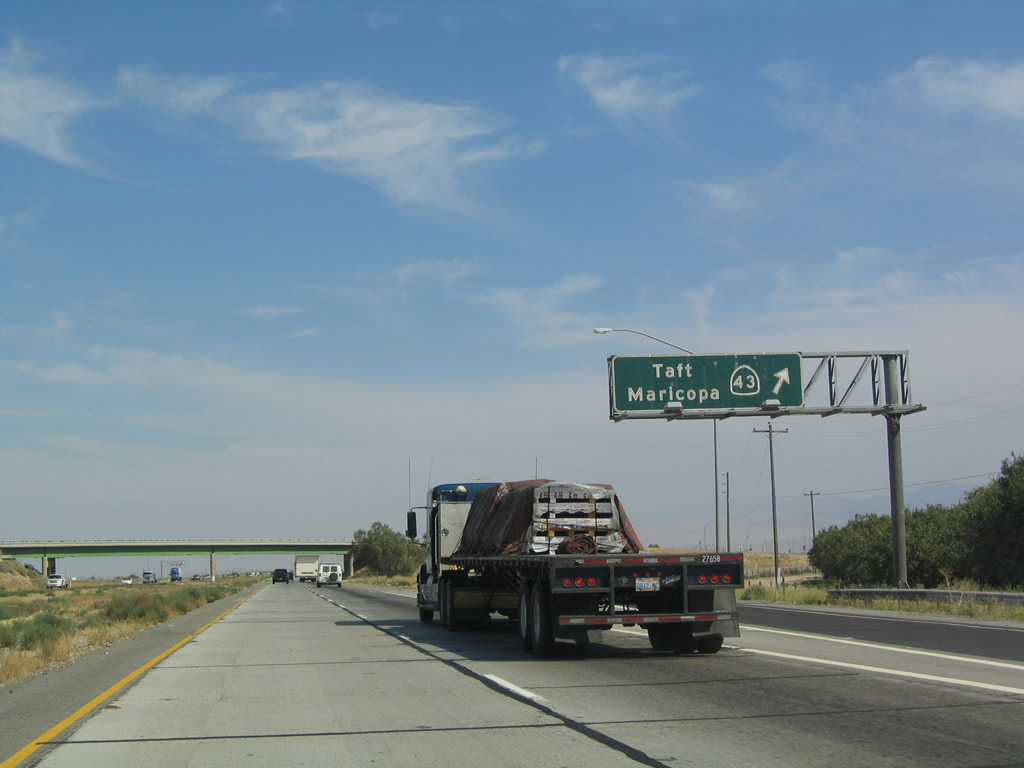
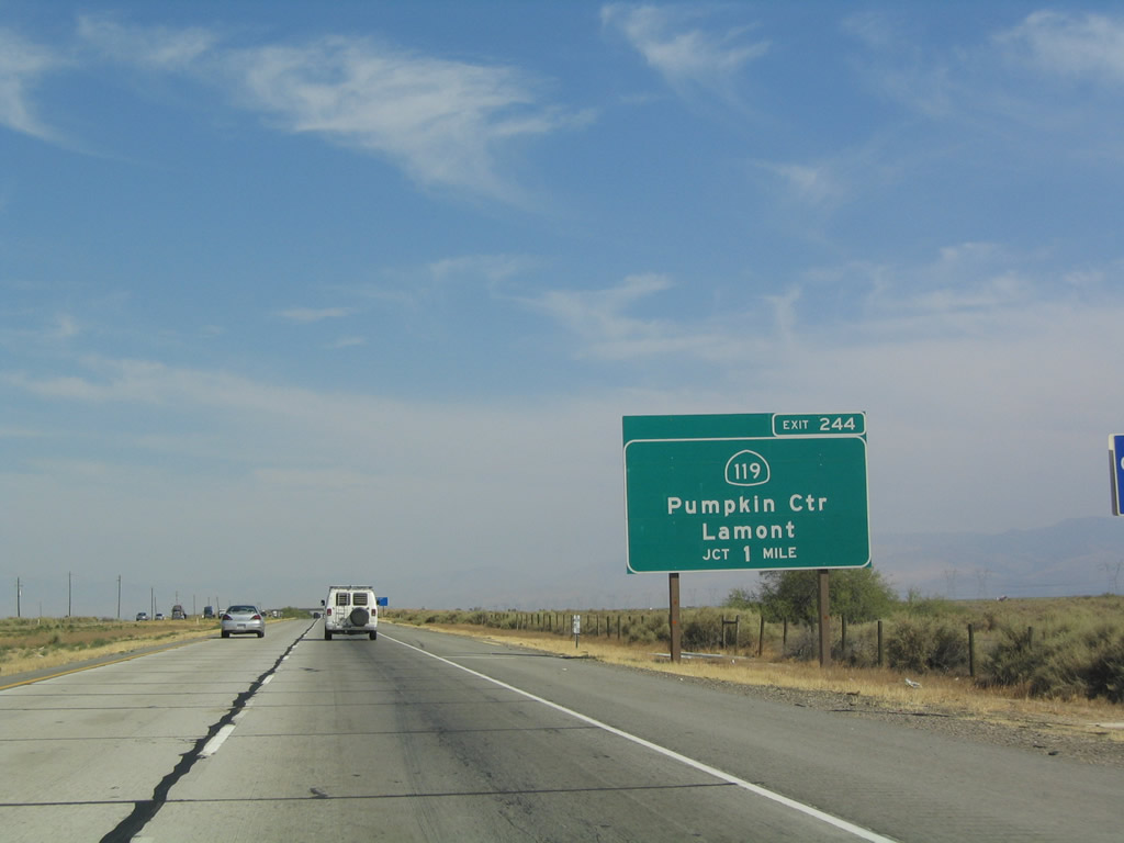
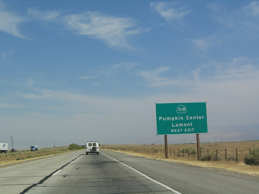
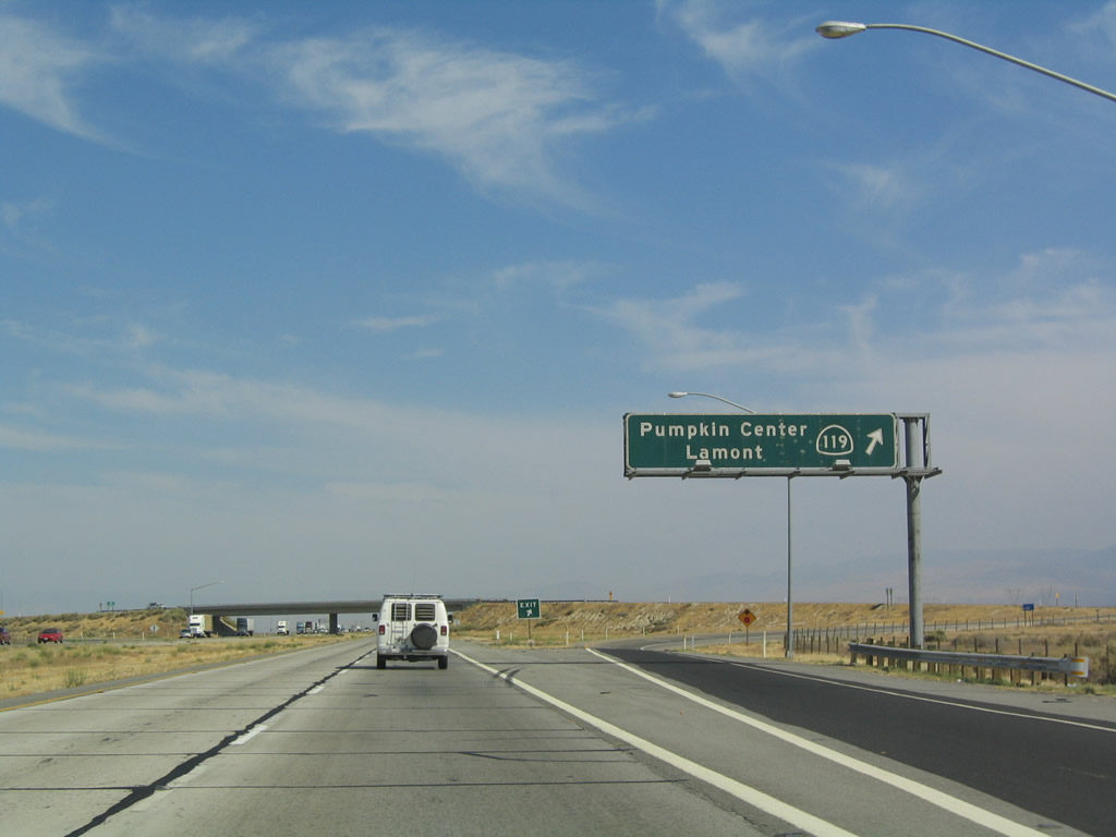
The next exit along southbound is Exit 244, California 119. Photo taken 07/06/04. |
|
California 119 follows the original alignment of U.S. 399 between California 99 south of Bakersfield and California 33 in Taft. This is where Interstate 5 would have met U.S. 399, had the freeway been in place in 1964! Since it was not, the two routes never met. Photo taken 07/06/04. |
|
Southbound Interstate 5 reaches Exit 244, California 119. Use California 119 southwest to reach Elk Hills, Valley Acres, Taft, and Maricopa. Use California 119 east to reach Old River, Pumpkin Center, Greenfield, Lamont, and Weedpatch. Photo taken 07/06/04. |
|
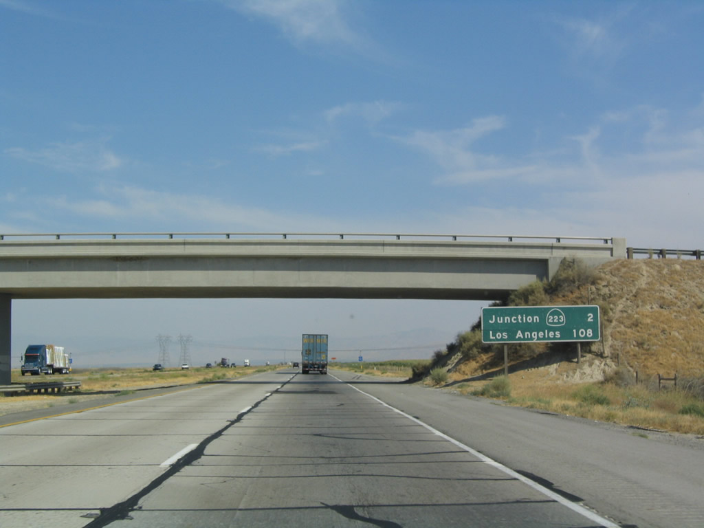
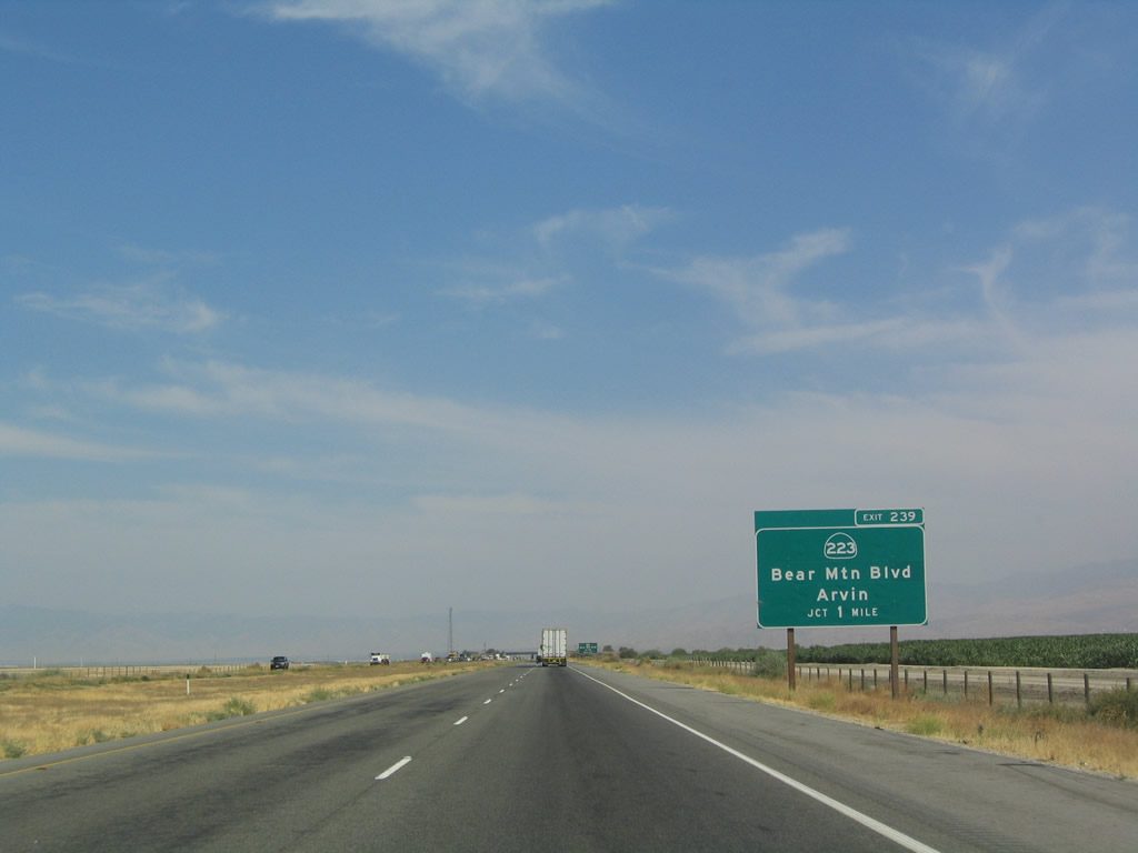
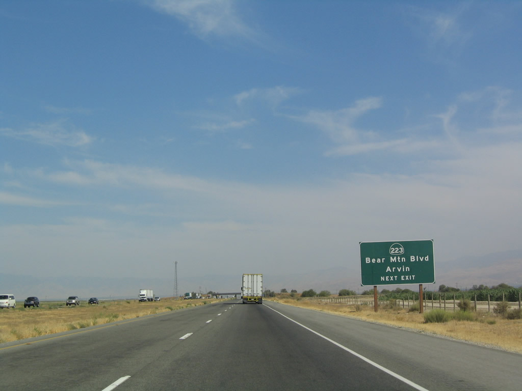
The next exit along southbound is Exit 239, California 223 (Bear Mountain Boulevard). Photo taken 07/06/04. |
|
|
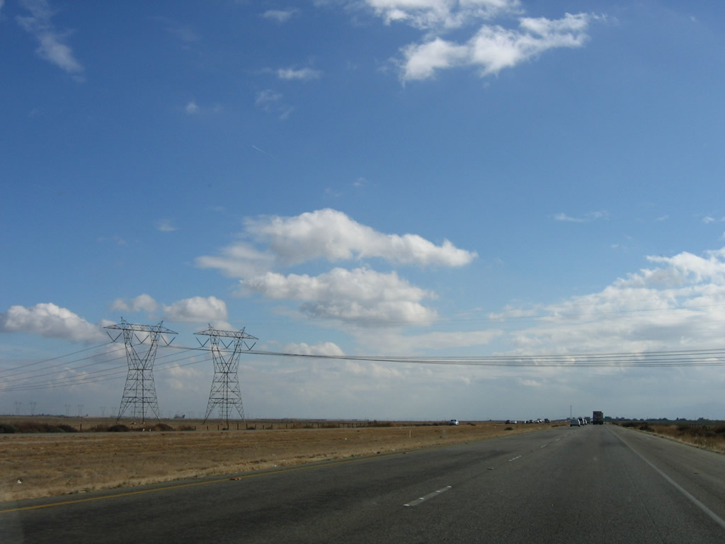
Path 26 power lines cross over Interstate 5. These Southern California Edison lines, which originate in the Midway substation near Buttonwillow, cross Interstate 5 for the first time at this point, just before the California 223 interchange. These lines will generally follow Interstate 5 south until near the California 138 interchange. These lines will eventually connect to the Vincent substation near Soledad Pass on California 14, then connect to the Sylmar substation near the Interstate 210 interchange in Los Angeles. Photos taken 11/27/06. |
|
Use California 223 (Bear Mountain Boulevard) east to reach Arvin and to connect with California 58 en route to Tehachapi. This is the western terminus of California 223; Bear Mountain Boulevard continues west to meet Coles Levee Road adjacent to the Buena Vista Lake Bed near the Buena Vista Aquatic Center. Photo taken 07/06/04. |
|
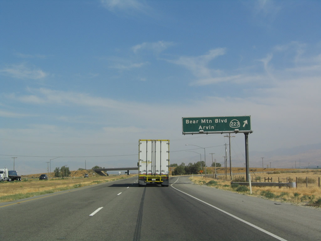
Southbound Interstate 5 approaches Exit 239, California 223 (Bear Mountain Boulevard). To reach northbound California 99 or the southern edge of the Bakersfield metropolitan area, use Exit 239. Photo taken 07/06/04. |
|
Southbound Interstate 5 reaches Exit 239, California 223 (Bear Mountain Boulevard). Photo taken 07/06/04. |
|
|
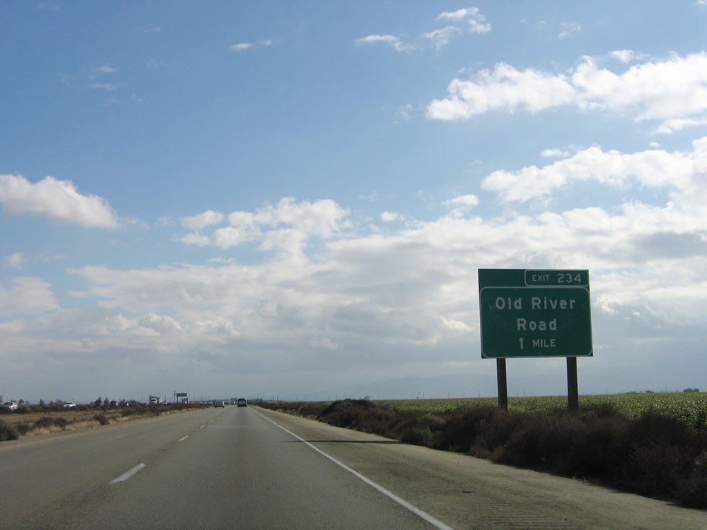
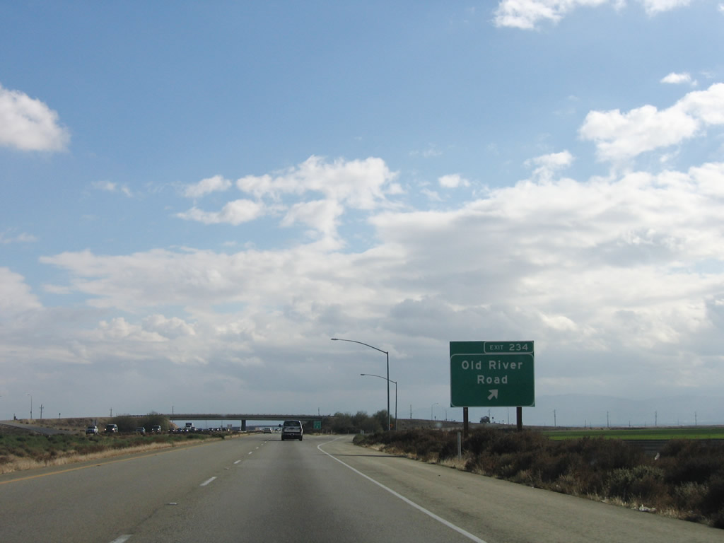
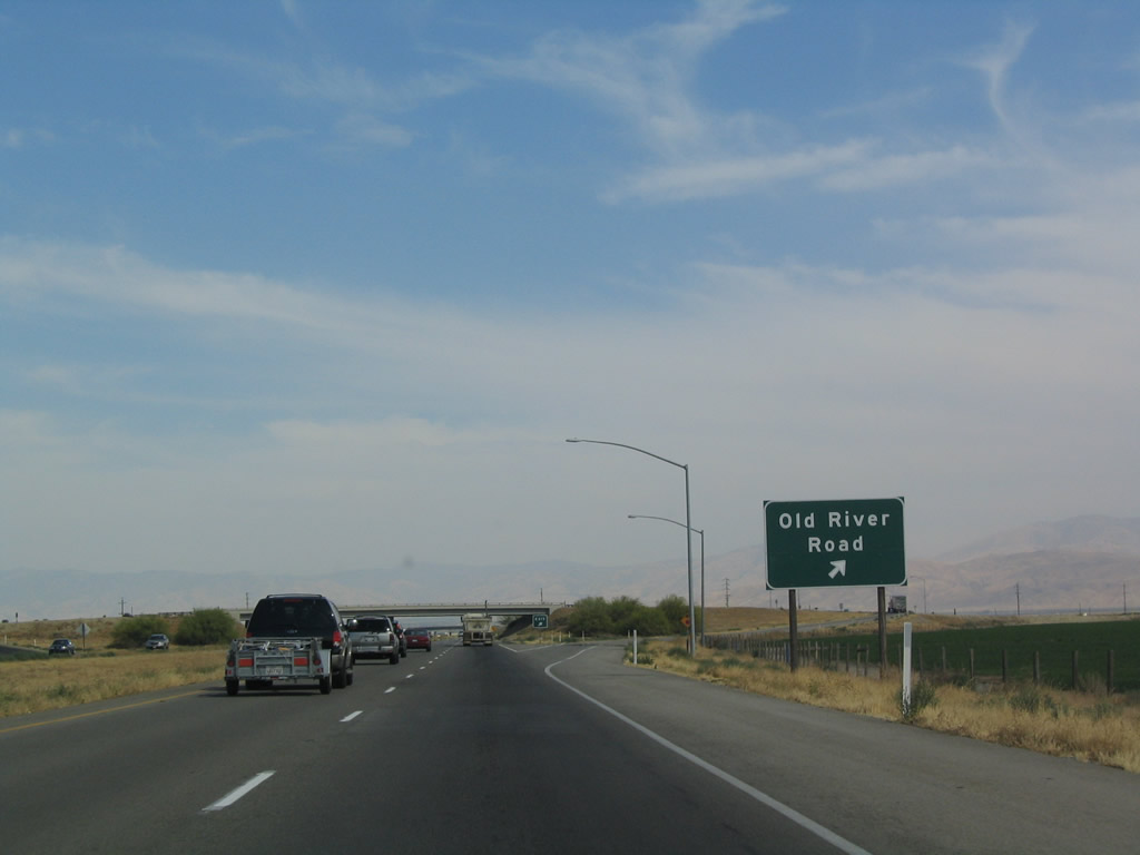
Continuing south after the Bear Mountain Boulevard interchange, the next exit along southbound Interstate 5 is Exit 234, Old River Road. Photos taken 11/27/06 and 07/06/04. |
|
|
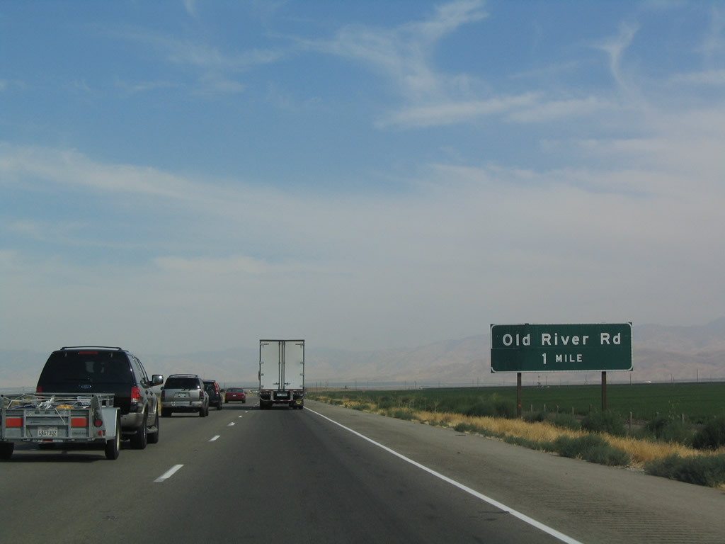
Southbound Interstate 5 reaches Exit 234, Old River Road. Use Old River Road north to meet California 119 in Old River and south to Lakeview (at intersection with Copus Road) and ultimately California 166/Maricopa Highway between Maricopa and Mettler. Photos taken 11/27/06 and 07/06/04. |
|
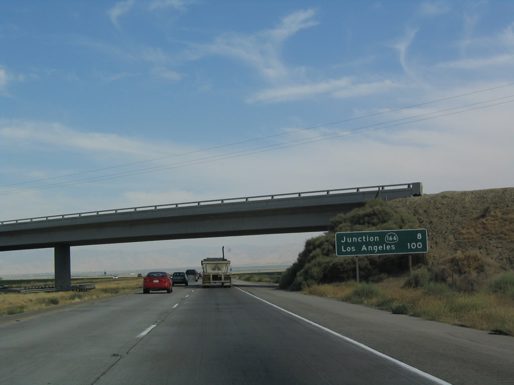
This mileage sign provides the distance to Exit 225, California 166/Maricopa Highway and the city of Los Angeles. Photo taken 07/06/04. |
|
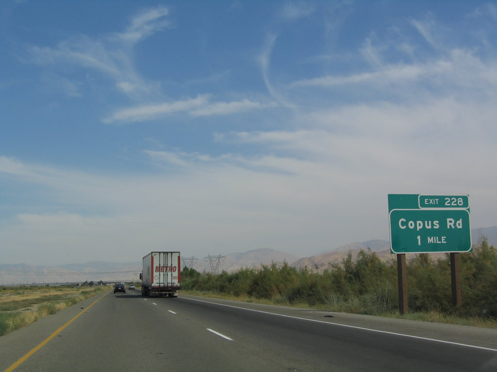
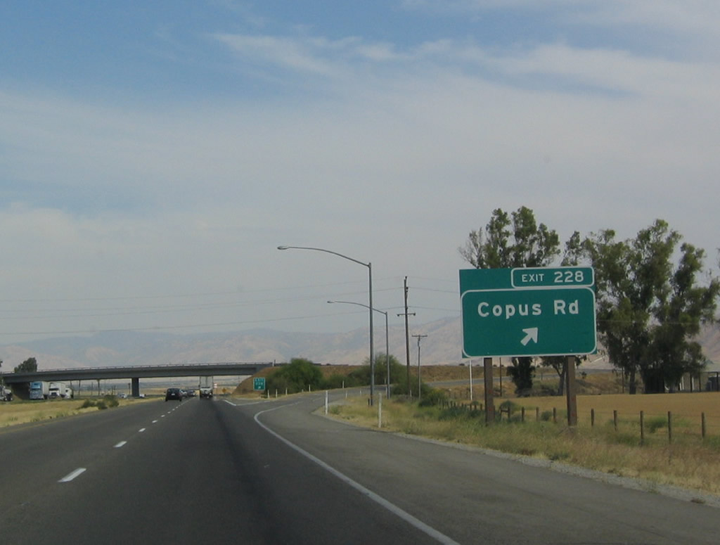
The next exit along southbound is Exit 228, Copus Road, one mile. Use Copus Road east to reach California 99 at the David Road interchange and west to connect to Lakeview and California 33 midway between Maricopa and Taft. Photo taken 07/06/04. |
|
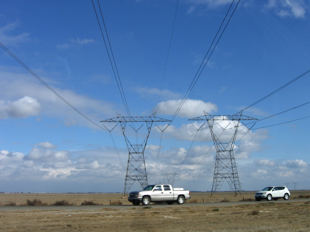
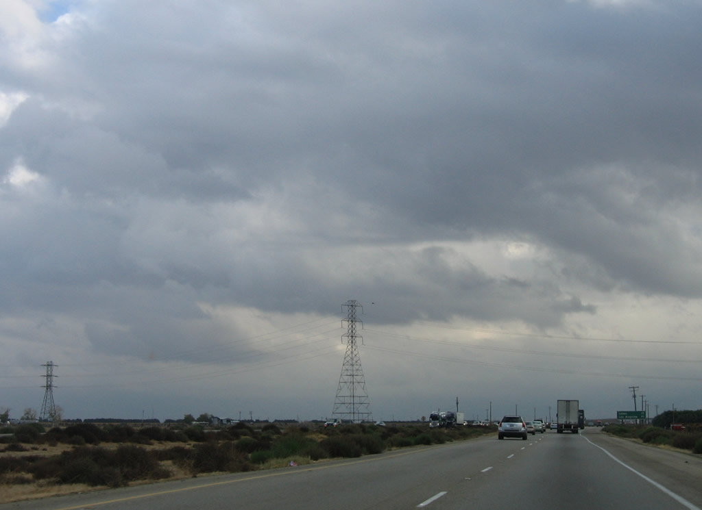
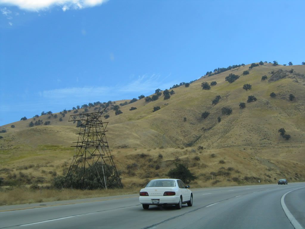
Once again, the Path 26 Southern California Edison 500kV power lines cross over Interstate 5. This Y-shaped power pole design, known as a "delta pylon" structure, is commonly found throughout Southern California, Arizona, and Nevada, and these larger models interconnect the 500 kilovolt (kV) power lines between the hydroelectrical facilities along the Colorado River, the fossil fuel plants in the Four Corners region in Arizona, and other electricity generation stations scattered about the Southwest. Southern California Edison, Los Angeles Department of Water and Power, San Diego Gas and Electric, Arizona Public Service (APS), Nevada Power, and the Western Area Power Administration (WAPA) all use the delta pylon design for their 500kV power line systems. Their role is to carry that power to the megalopolis of Los Angeles. Photo taken 07/06/04. |
|
Southbound Interstate 5 reaches Exit 228, Copus Road. Photo taken 07/06/04. |
|
|
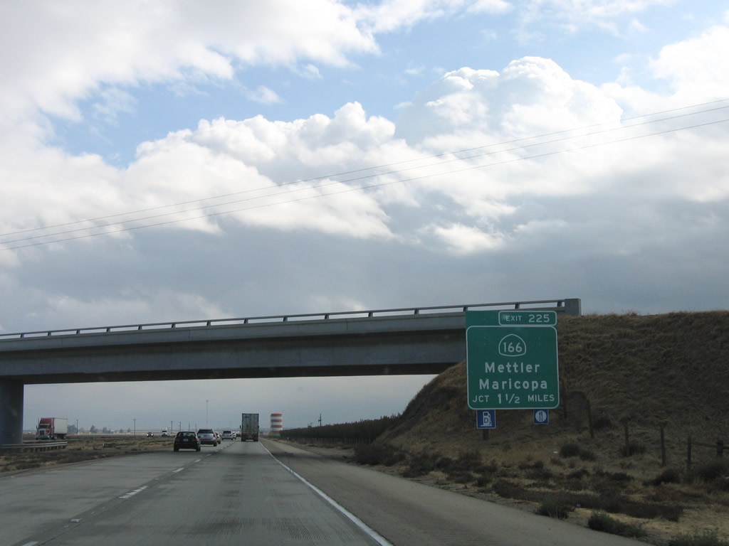
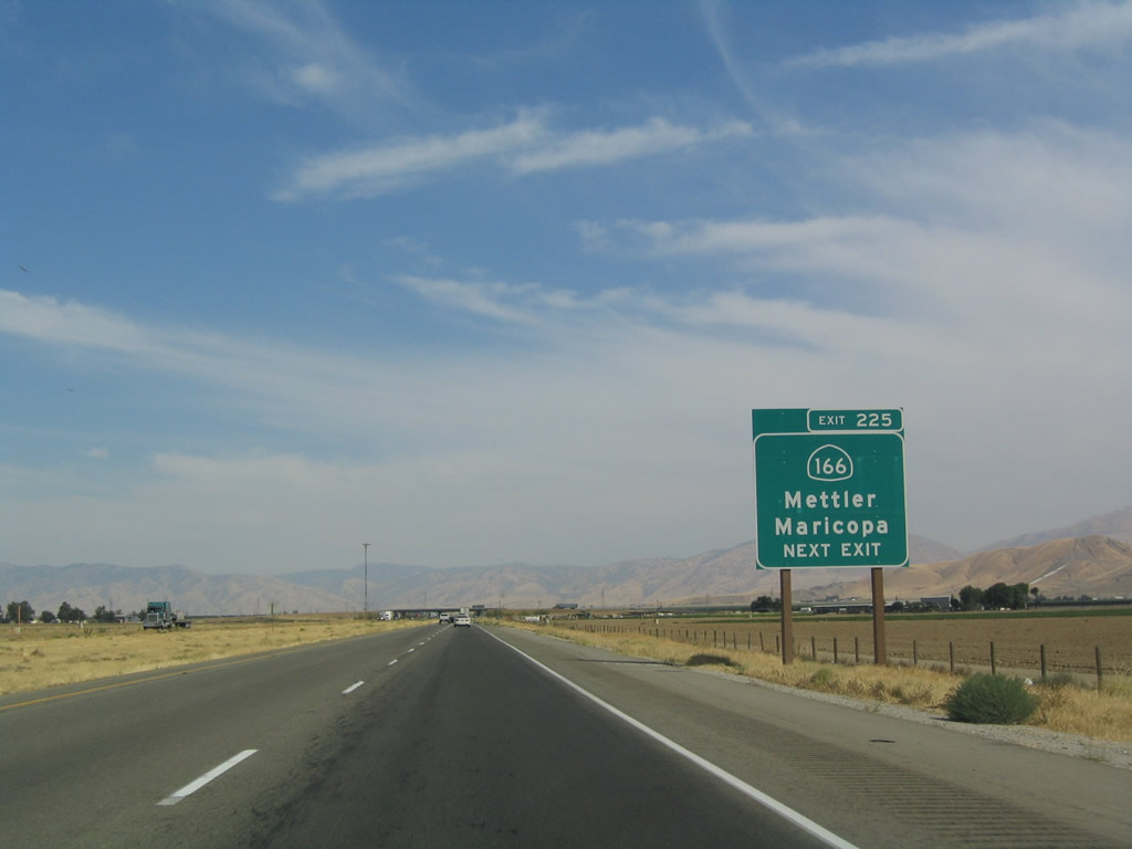
The next exit along southbound Interstate 5 (Westside Highway) is Exit 225, California 166/Maricopa Highway east to Mettler and west to Maricopa. Photos taken 11/27/06 and 07/06/04. |
|
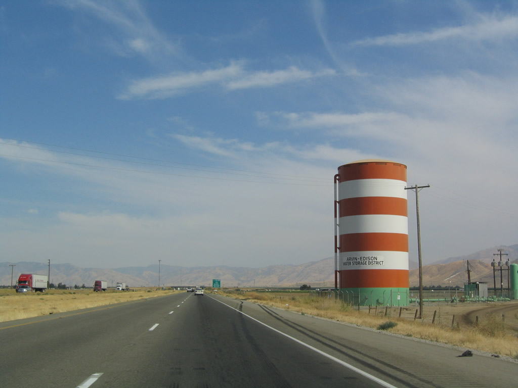
The Arvin-Edison Water Storage District uses red and white striped water towers throughout this part of Kern County to store water adjacent to agricultural areas. They look somewhat like a Dr. Suess "Cat in the Hat" hat. Photo taken 07/06/04. |
|
California 166/Maricopa Highway extends west to Maricopa, then merges with southbound California 33 as it angles toward Cuyama. Skirting the southern edge of Carrizo Plain National Monument, California 166 meets U.S. 101 midway between Santa Maria and Nipomo. California 166 finishes its westerly journey at its intersection with California 1 in Guadalupe. Photo taken 07/06/04. |
|
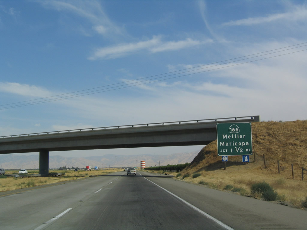
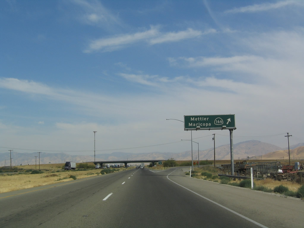
Southbound Interstate 5 reaches Exit 225, California 166/Maricopa Highway east to Mettler and west to Maricopa. Photo taken 07/06/04. |
|
A 230kV Pacific Gas and Electric power line crosses Interstate 5. Although the 500kV power transmission lines are Southern California Edison, we are still in PG&E territory until we ascend the Grapevine into the Tehachapi Mountains. This particular 230kV line serves one of the large pumps that carry water from the California Aqueduct toward Southern California. Photo taken 11/27/06. |
|
After the California 166 interchange, this mileage sign provides the distance to Lebec (Exit 207, at the top of the Grapevine Grade) and Los Angeles. Photo taken 07/06/04. |
|
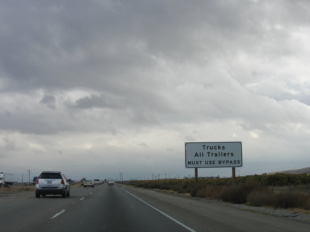
This roadside sign is the first to announce the truck bypass for through traffic in anticipation of the merge with California 99. There is no connection from Interstate 5 south to California 99 north. Photo taken 11/27/06. |
|
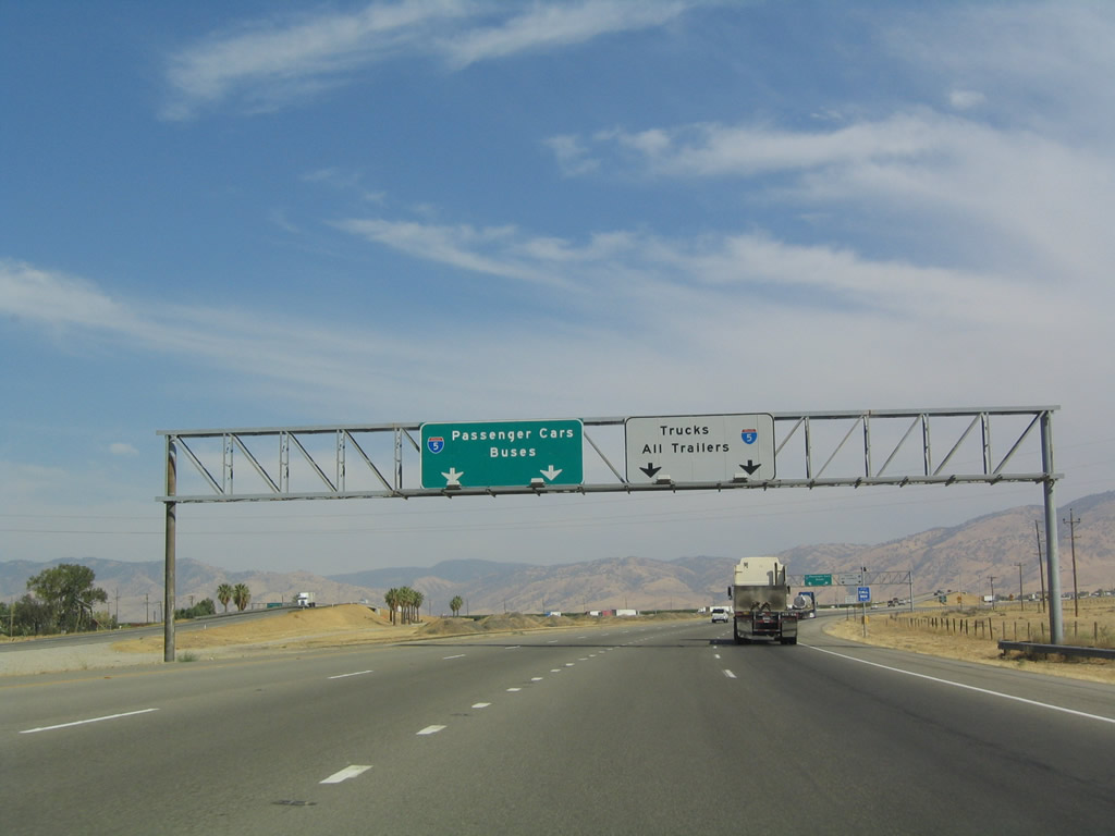
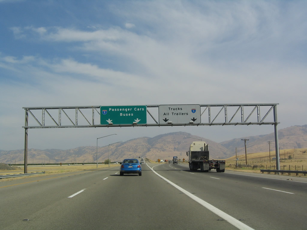
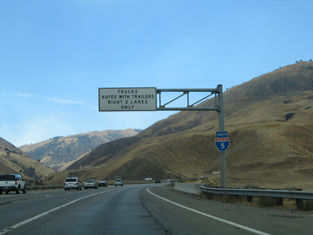
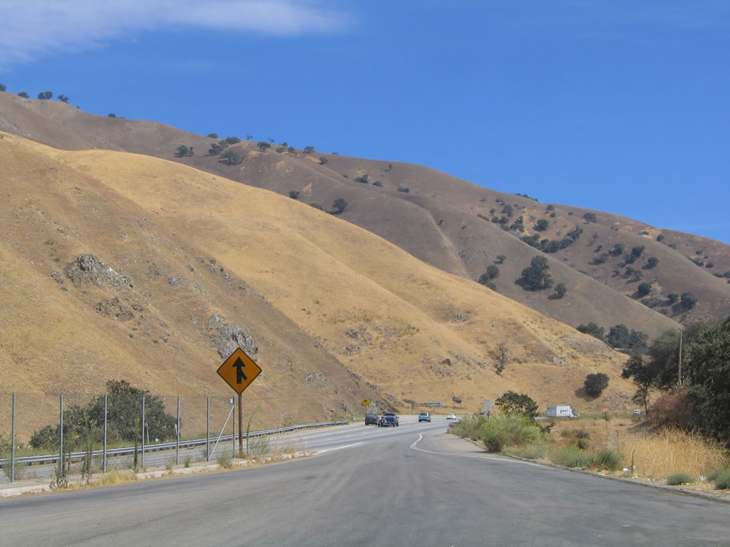
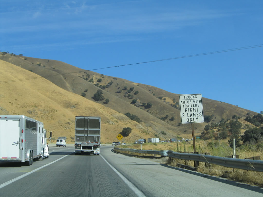
As Interstate 5 approaches its merge with California 99, the freeway splits into auto and truck lanes. All trucks, cars with trailers, and slower vehicles should use the truck lanes, while through automobile traffic should remain in the left lanes. The reason for this split is to allow slower traffic to merge separately from faster traffic. Photo taken 07/06/04. |
|
Interstate 5 splits into auto and truck lanes. There is no access from southbound Interstate 5 to northbound California 99. Photo taken 07/06/04. |
|
|
Views of the Interstate 5 auto and truck lanes as seen from the southbound auto lanes. Photo taken 07/06/04. |
| Interstate 5 (Golden State Freeway) south |
|
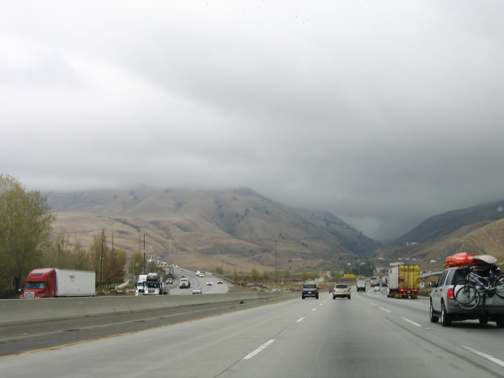
Now that it has merged with California 99, the character of Interstate 5 changes permanently for the remainder of its southbound journey. With the exception of the oldest stretch of Interstate 5 east of downtown Los Angeles south to the Orange County line, the rest of Interstate 5 is at least four lanes in each direction, for 221 miles! The merging traffic from California 99 is thick, and the freeway begins to head up hill toward the Grapevine. Photo taken 07/06/04. |
|
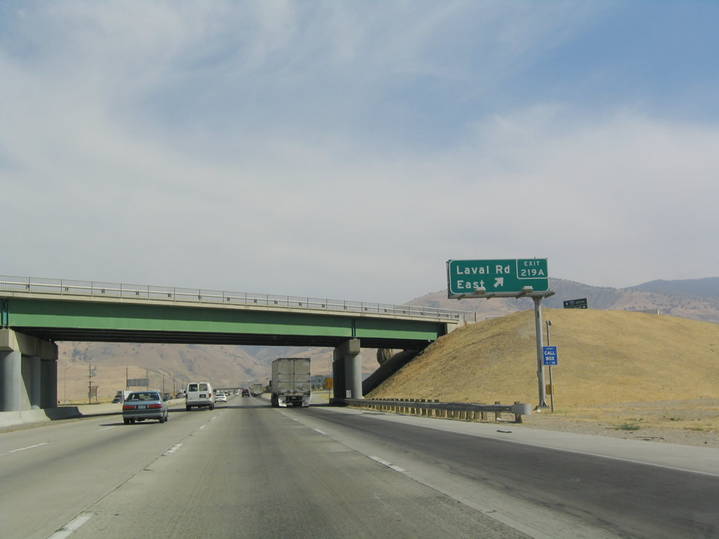
The next exit along southbound Interstate 5 (now known as the Golden State Freeway) is Exits 219B-A, Laval Road west and east. Photo taken 07/06/04. |
|
Southbound Interstate 5 reaches Exit 219B, Laval Road west to Wheeler Ridge, home of the deepest drill site in the United States. The next exit in this cloverleaf interchange is Exit 219A for Laval Road east. Photo taken 07/06/04. |
|
Southbound Interstate 5 reaches Exit 219A, Laval Road east. Photo taken 07/06/04. |
|
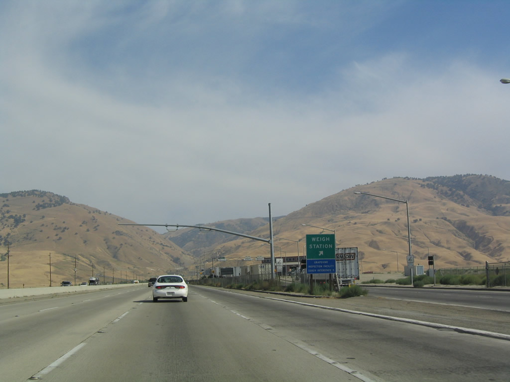
A weigh station is located at Milepost 218 after the Laval Road interchange along southbound Interstate 5. Photo taken 07/06/04. |
|
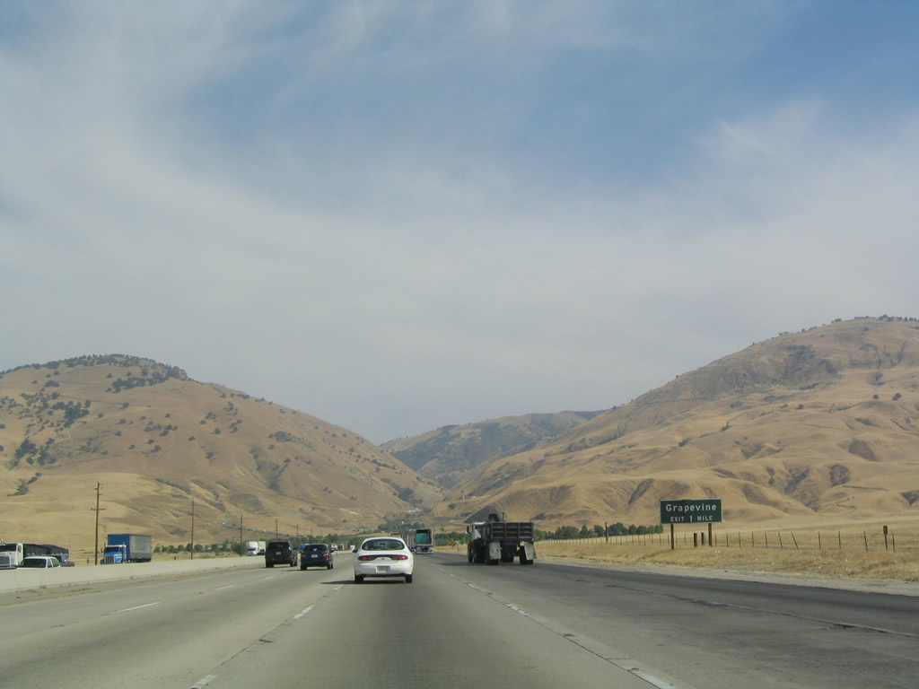
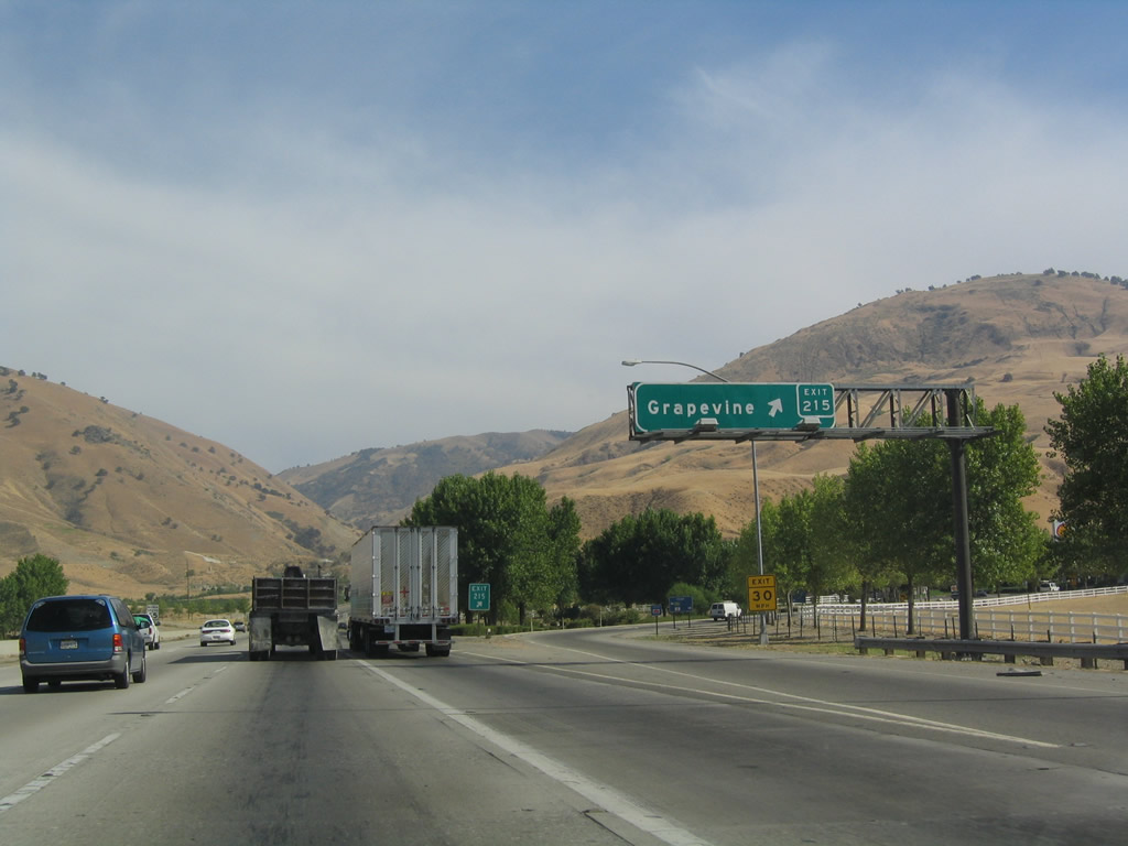
The next exit along southbound Interstate 5 (Golden State Freeway) is Exit 215, Grapevine. Grapevine is at elevation 1,758 feet, while Wheeler Ridge is only 964 feet, a net gain in elevation for the freeway of 800 feet over three miles. Interstate 5 will now ascend the Grapevine Grade, which cuts between the San Emigdio Mountains and the Tehachapi Mountains. Photo taken 07/06/04. |
|
Grapevine Grade is clearly visible as southbound Interstate 5 approaches its first mountains since leaving Redding. Interstate 5 now ascends toward Tejon Pass at an elevation of over 4,000 feet. Photo taken 07/06/04. |
|
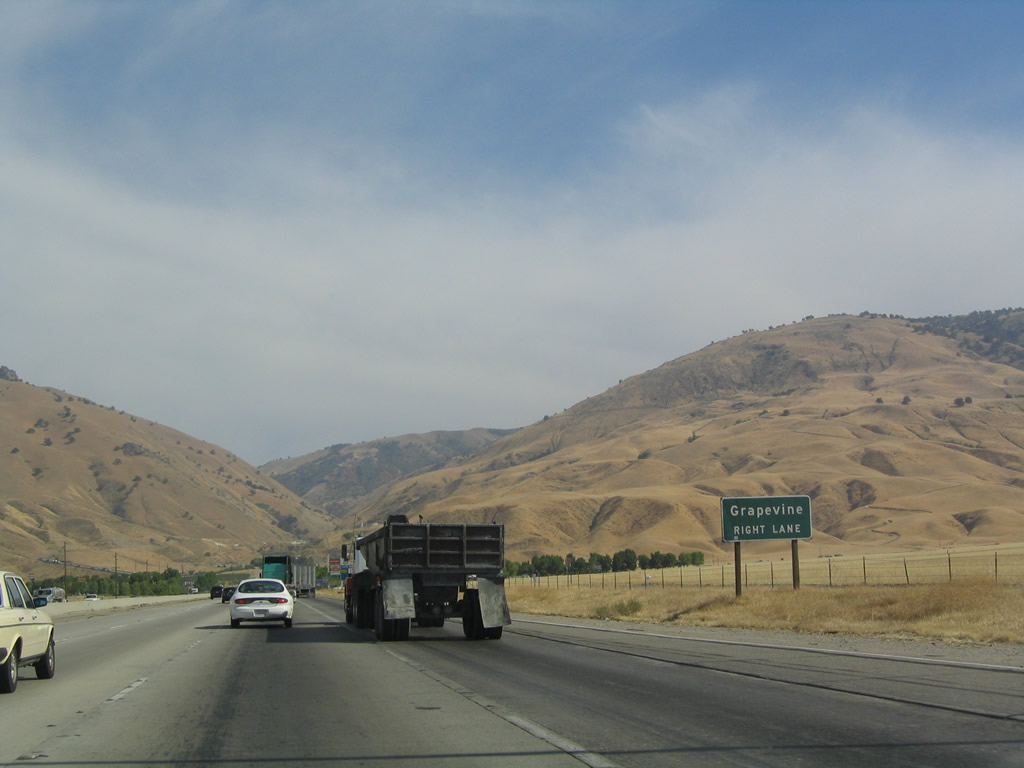
Southbound Interstate 5 reaches Exit 215, Grapevine. The freeway keeps climbing up the grade. Use this exit to reach a segment of old U.S. 99 in the median between the two directions of travel. Photo taken 07/06/04. |
|
|
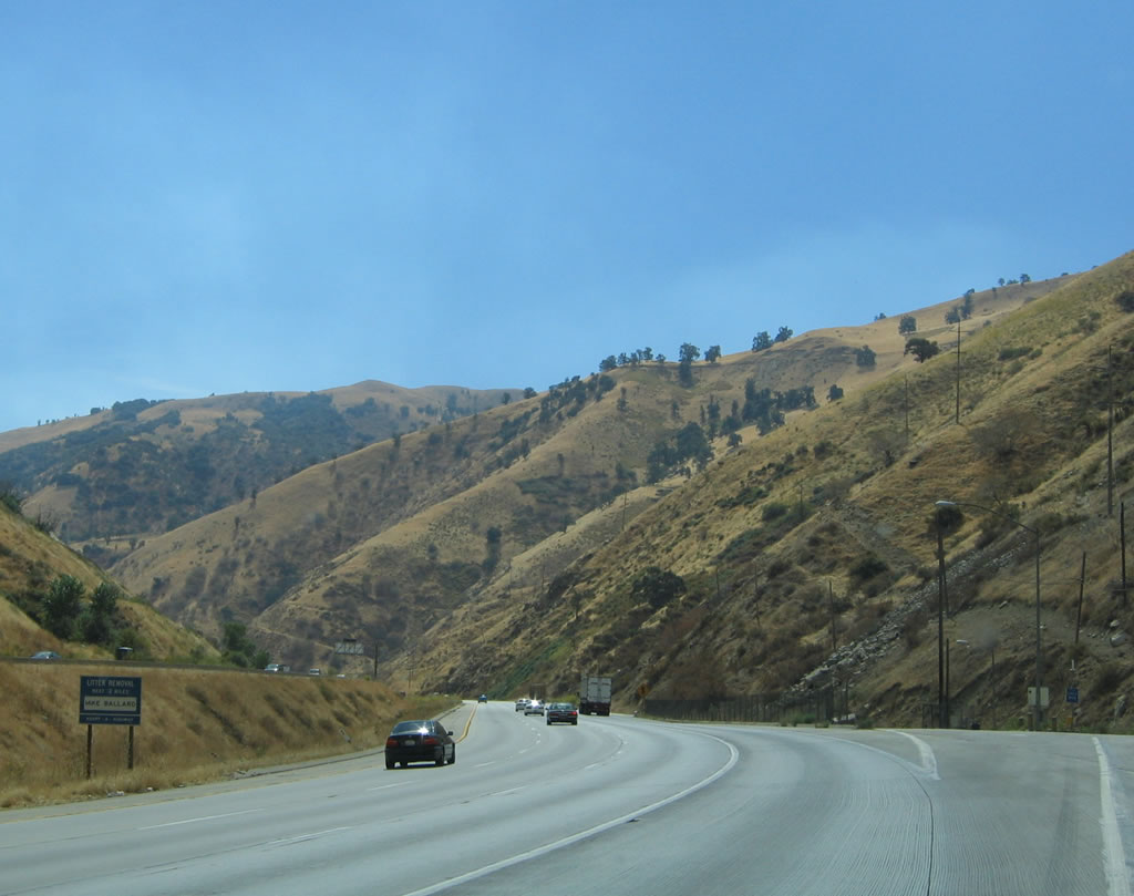
For next five miles, southbound Interstate 5 climbs the Grapevine grade. The right lane is dedicated for trucks, cars with trailers, and slower traffic. Photos taken 11/27/06 and 07/06/04. |
|
|
Due to the steepness of the grade, it is advised that air conditioning be turned off to avoid overheating. Photos taken 07/06/04 and 09/25/05. |
|
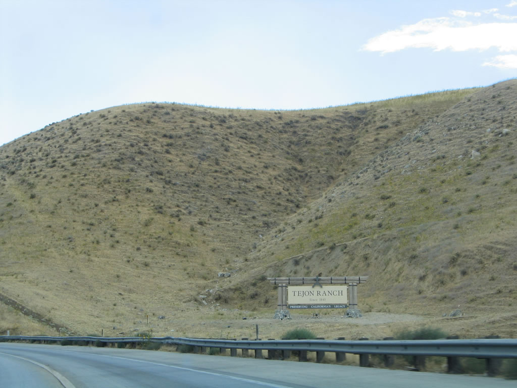
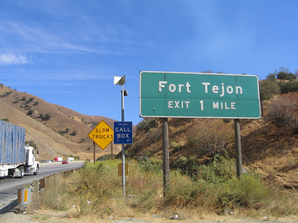
"Fort Tejon: Preserving California's Legacy" (since 1843) is signed as we begin the journey up the Grapevine grade to cross the Tehachapi Mountains en route to Ls Angeles. Photo taken 09/25/05. |
|
This old crumpled pylon is all that remains of an old Union 76 gas station sign tower that used to advertise for motorists to visit the Grapevine Union 76 gas station. (This pylon was removed in 2007.) Old postcards of U.S. 99 at the Grapevine grade show this tower in its prime. Since this picture was taken, the crumpled pylon was removed. Despite the fact it looks like an old power pylon, it never served in that capacity. Photo taken 09/25/05. |
|
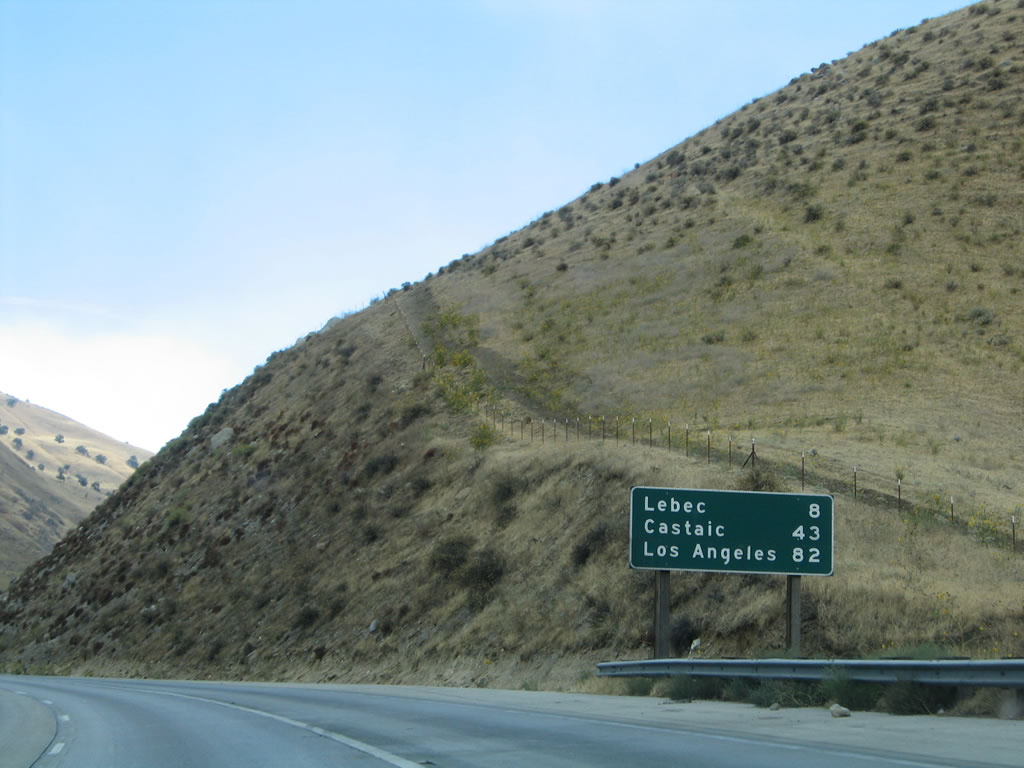
The southbound and northbound carriageways separate dramatically for much of the grade, and the freeways have different slope gradients as a result. This mileage sign provides the distance to Lebec (at the top of the grade), Castaic, and Los Angeles. Photo taken 09/25/05. |
|
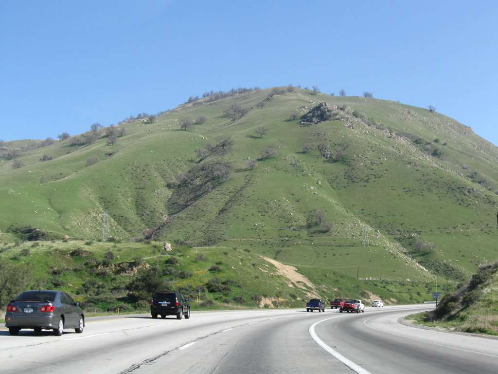
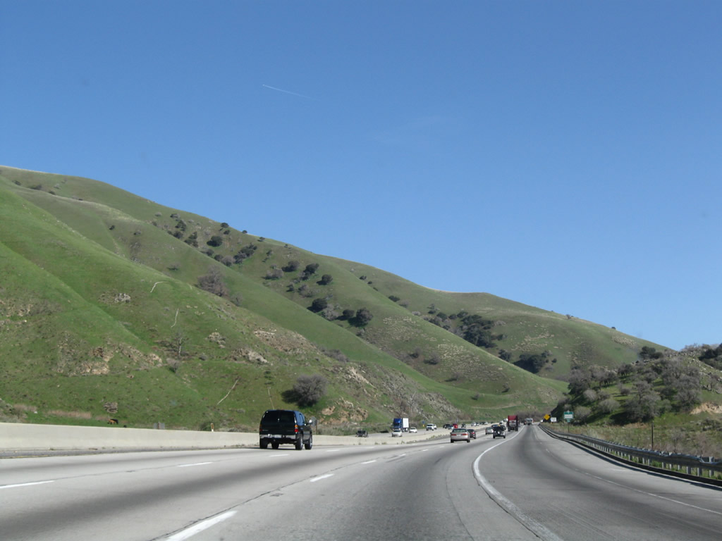
During the spring after winter rains have fallen, the brown hills of the Grapevine turn a verdant green. Photo taken 03/15/09. |
|
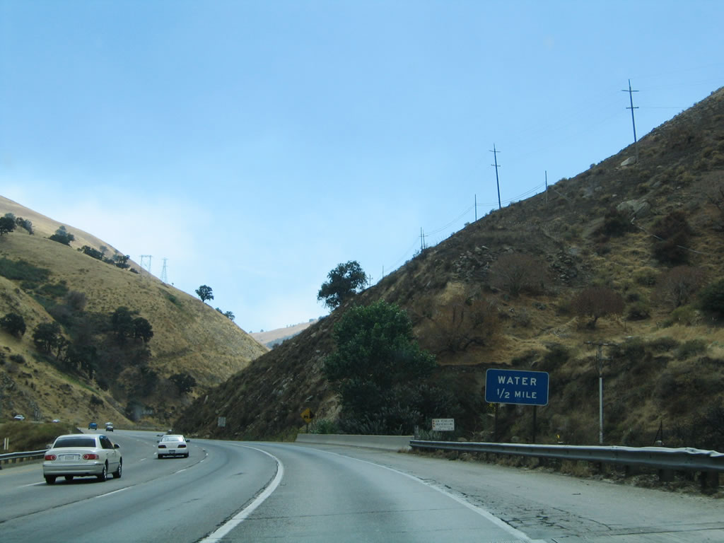
Since summertime temperatures frequently exceed 100 degrees here, and the grade is so dramatic, cars may need water for their radiators. Water is placed alongside the roadway in intervals, with signs like this reading "Water" one-half mile in advance of the water station. Photo taken 09/25/05. |
|
|
The first water station also serves as a parking area and a safe location to use the Emergency Call Box. Photo taken 09/25/05. |
|
Looking at the spring series of photos, more green grasses beautify the hills above the Grapevine. Photo taken 03/15/09. |
|
This view shows the twin carriageways of Interstate 5 ascending the Grapevine Grade. Photo taken 07/06/04. |
|
|
A second turnout is available here for people to obtain water for their cars. This water is not potable (drinkable). Photos taken 09/25/05. |
|
This small sign (located after the second water stop/parking area) reminds motorists that the right lane is for slower traffic only. Photo taken 07/06/04. |
|
|
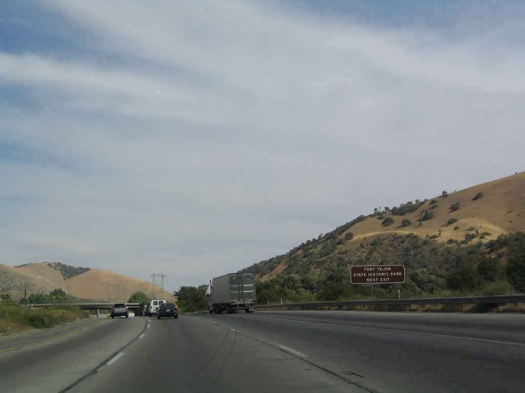
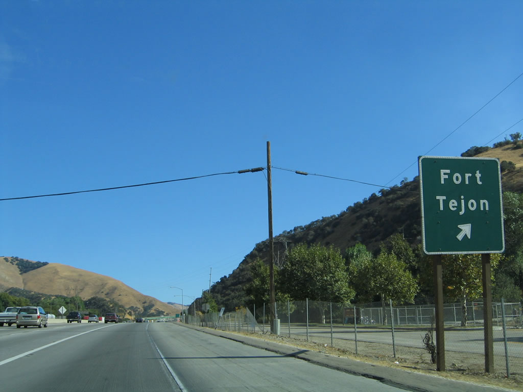
The next exit along southbound is Exit 210, Fort Tejon Road. At this sign, a section of rarely-seen old alignment of U.S. 99 single-slab concrete can be found, but it is not possible to see it from the freeway easily. The Exit 210 interchange marks the south end of the Grapevine grade. Photos taken 07/06/04 and 09/25/05. |
|
To reach the Fort Tejon State Historic Park, use Exit 210, then turn west on Fort Tejon Road to reach the park. Photo taken 07/06/04. |
|
Southbound Interstate 5 reaches Exit 210, Fort Tejon Road. Use this exit to follow Historic U.S. 99 south to Lebec. Photo taken 09/25/05. |
|
|
Although not signed anywhere else on southbound, the gore point sign features "Exit 210." A year later, the middle digit fell off, making this look like Exit 20. Photos taken 07/06/04 and 09/25/05. |
|
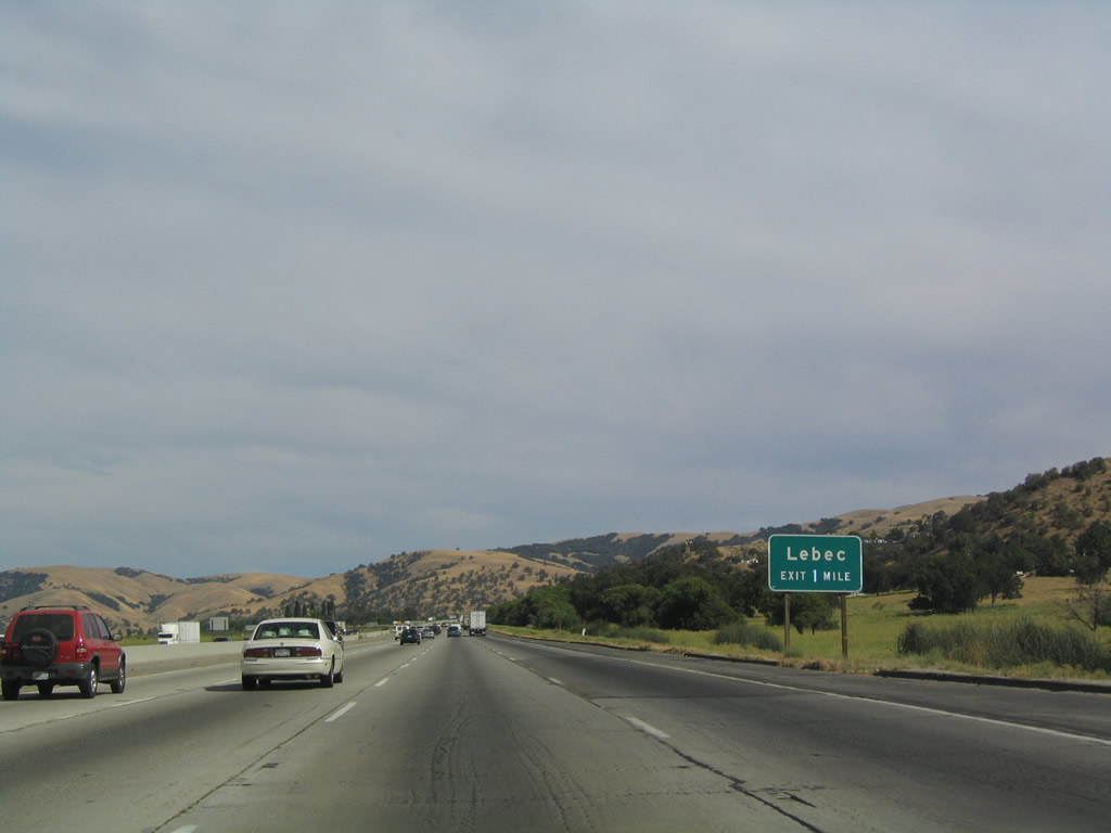
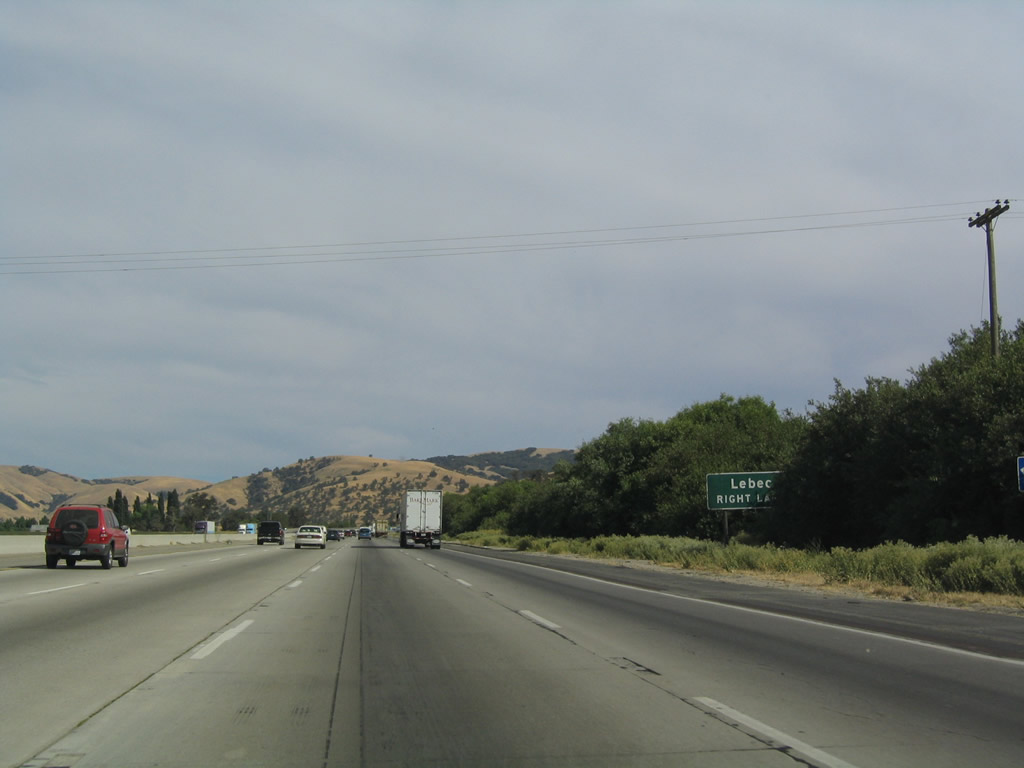
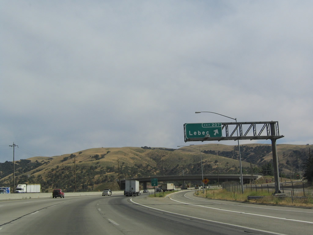
The next exit is Exit 207, Lebec, followed by a rest area two miles south of this sign. A special note about these power lines: they are part of the Kern River Project, and they were installed in 1909, which makes them into antiquities of their own right. They are still in use today. Photo taken 07/06/04. |
|
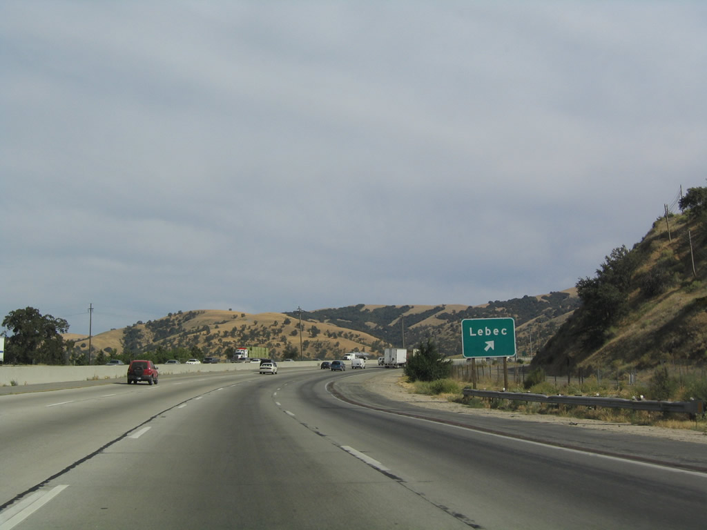
Southbound Interstate 5 (Golden State Freeway) approaches Exit 207, Lebec Road, one mile. Photo taken 07/06/04. |
|
Interstate 5 retains its eight-lane configuration now that it is on flat ground. The freeway will ascend to Tejon Pass (el. 4,144 feet) after the Frazier Park Road interchange. Photo taken 07/06/04. |
|
|
Southbound Interstate 5 reaches Exit 207, Lebec Road east to Castac Lake and west to Lebec. Photos taken 07/06/04. |
|
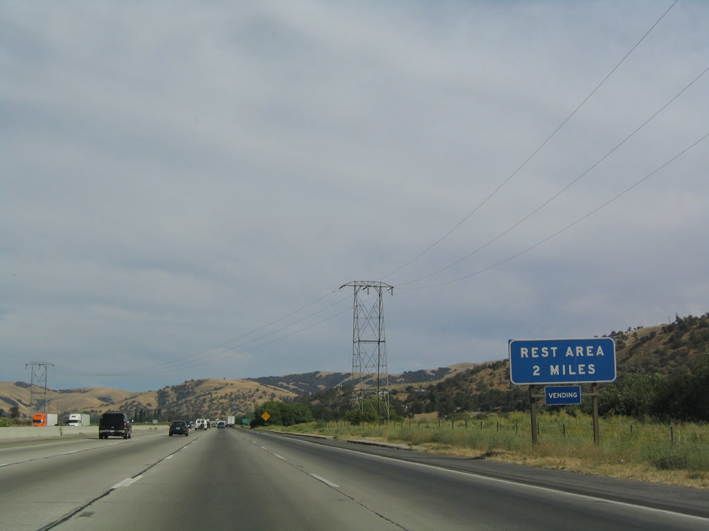
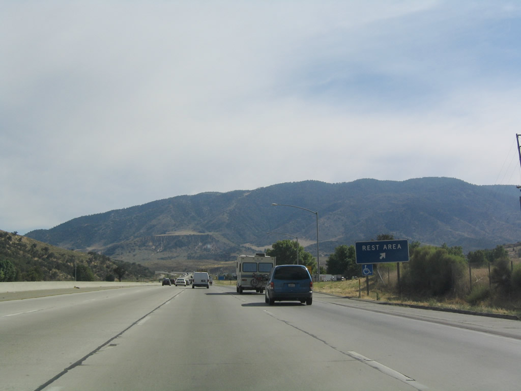
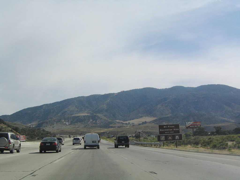
The aforementioned rest area is the next exit (Exit 206), and there is not another rest area along southbound Interstate 5 until Exit 60 in Camp Pendleton, some 146 miles south of here. Photo taken 07/06/04. |
|
|
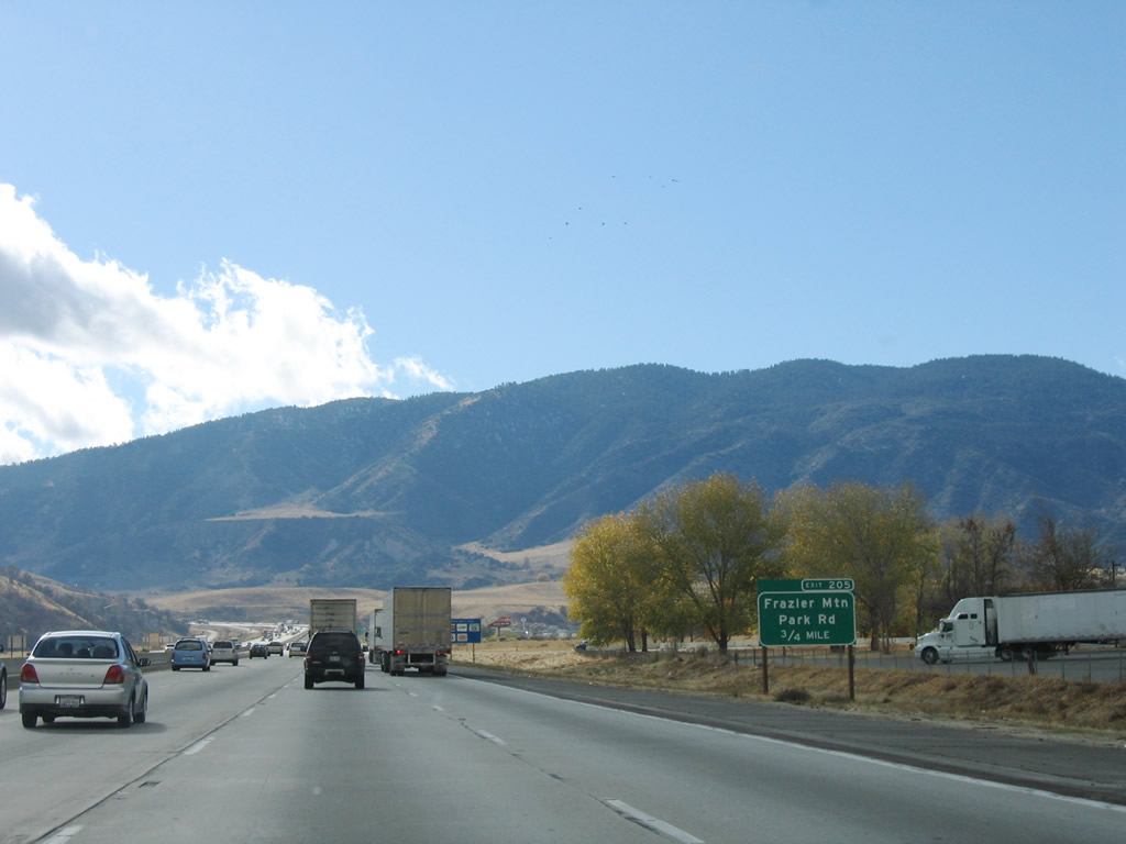
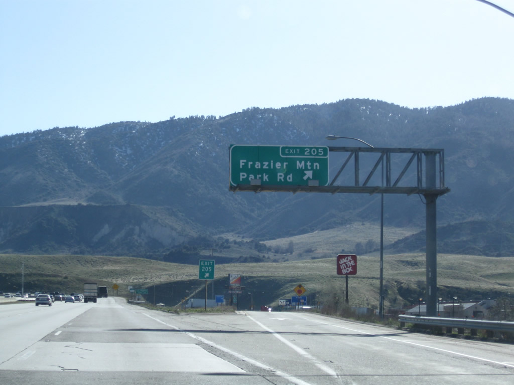
The next exit along southbound Interstate 5 (Golden State Freeway) is Exit 205, Frazier Park Road (0.75 mile). Photos taken 11/27/06 and 07/06/04. |
|
Use Frazier Park Road west to reach Frazier Park, Lake of the Woods, and Lockwood Valley. To the west, Frazier Park Road connects to Pine Mountain via Cuddy Valley Highway and Potrero Highway. Photo taken 07/06/04. |
|
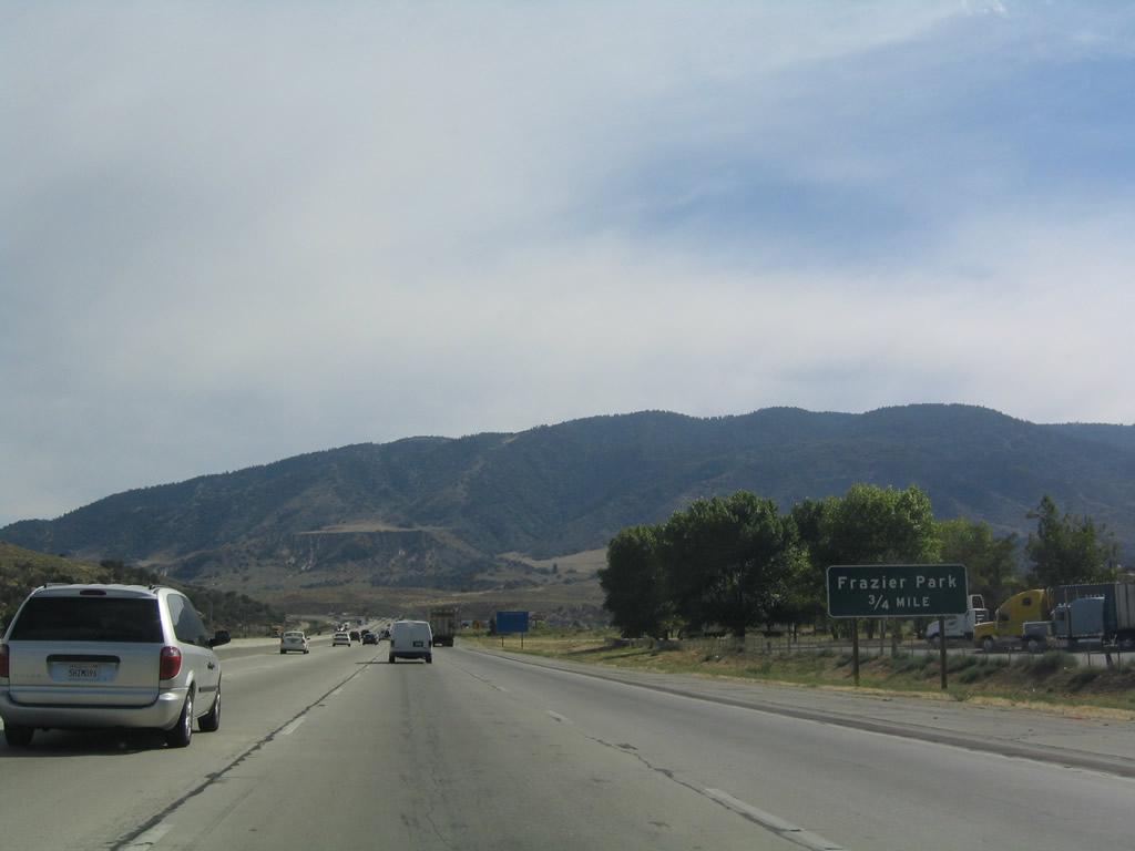
Southbound Interstate 5 (Golden State Freeway) reaches Exit 205, Frazier Park Road. Photo taken 03/15/09. |
|
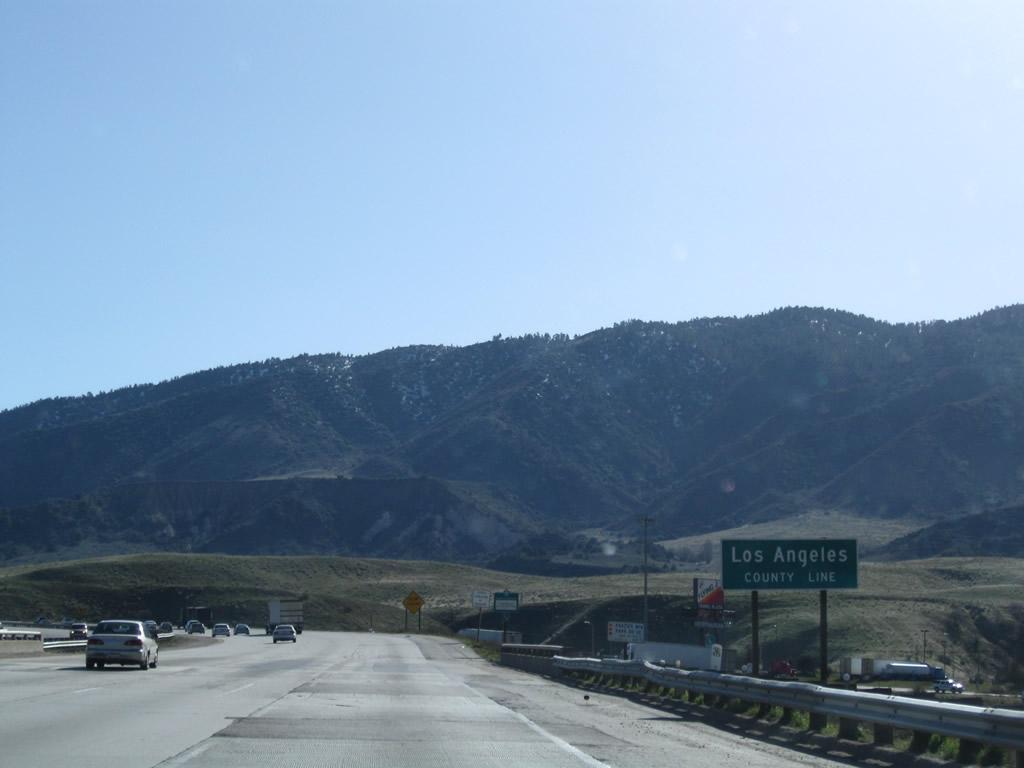
Upon crossing Frazier Park Road, Interstate 5 departs Kern County and enters Los Angeles County. Photo taken 03/15/09. |
Page Updated September 22, 2009.


