| Interstate 5 (Golden State Freeway) south |
|
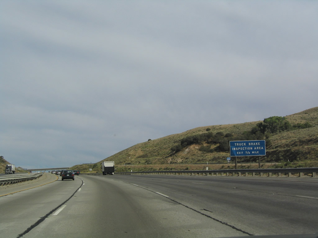
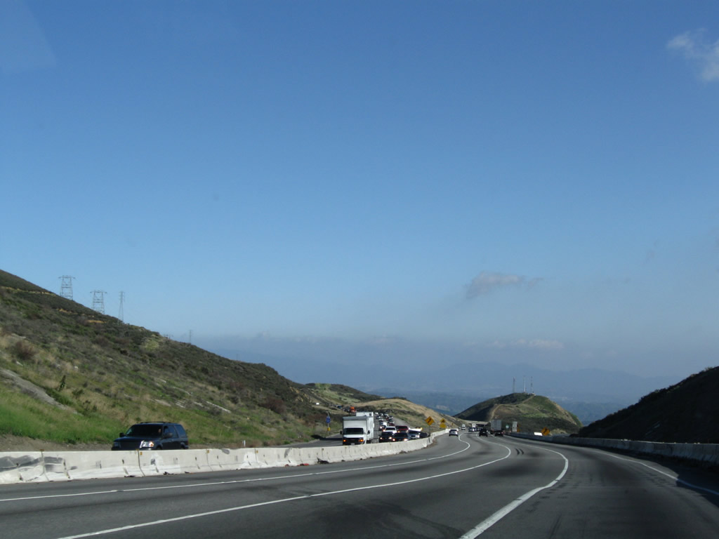
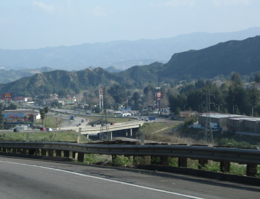
Upon entering Los Angeles County, the most populous county in California, the first exit along southbound is actually a parking area for trucks and cars to inspect brakes prior to going down the Castaic Grade. Exit 204 serves as the truck brake inspection area. Photo taken 07/06/04. |
|
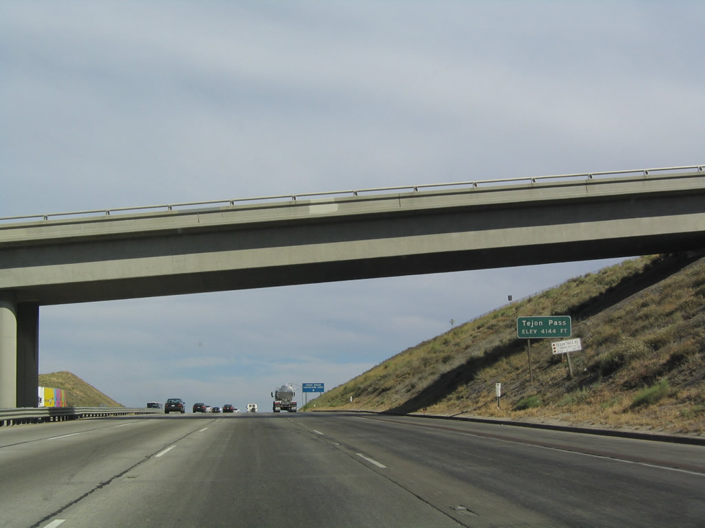
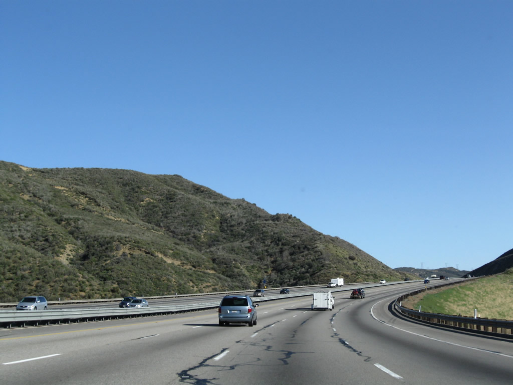
Interstate 5 reaches its highest point in Southern California upon reaching Tejon Pass, elevation 4.144 feet. It is not uncommon to encounter winter weather conditions along this stretch of freeway, and chains may be required during major winter storms. Photo taken 07/06/04. |
|
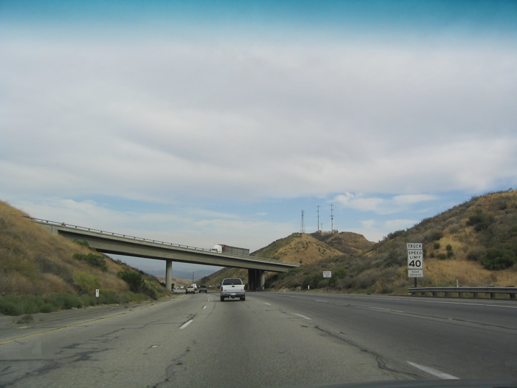
Southbound Interstate 5 reaches Exit 204, Truck Brake Inspection Area. This is not a Weigh Station. Photo taken 07/06/04. |
|
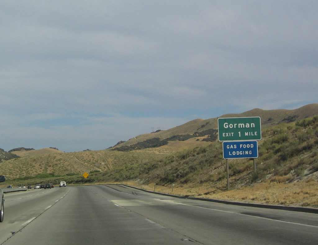
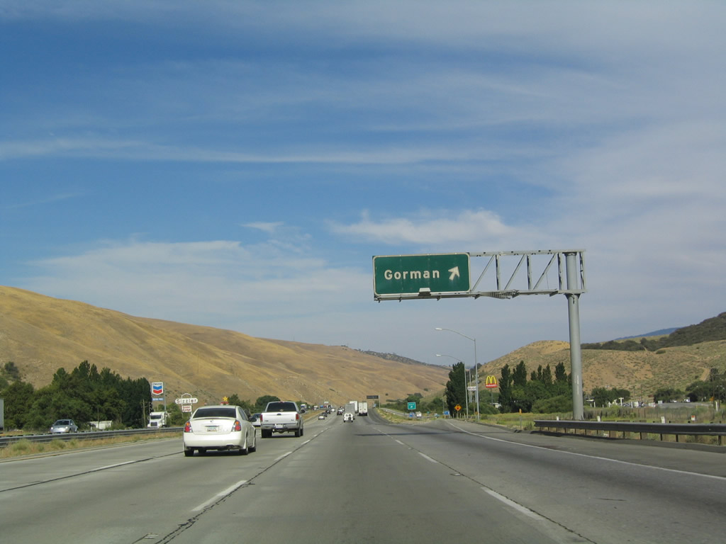
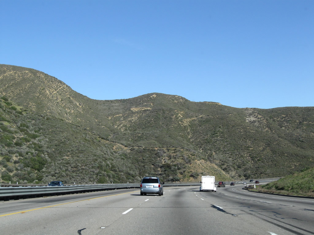
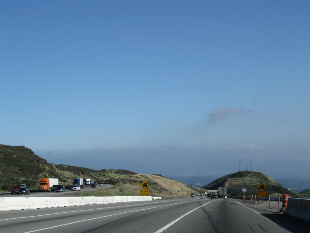
The next exit along southbound Interstate 5 is Exit 202, Gorman Road, one mile. Photo taken 07/06/04. |
|
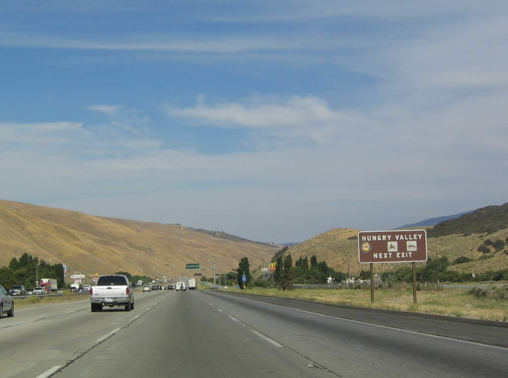
Use Gorman Road south to Peace Valley Road (old U.S. 99) north to Gold Hill Road south to reach the Hungry Valley Recreation Area. Photo taken 07/06/04. |
|
Southbound Interstate 5 reaches Exit 202, Gorman Road. Photo taken 07/06/04. |
|
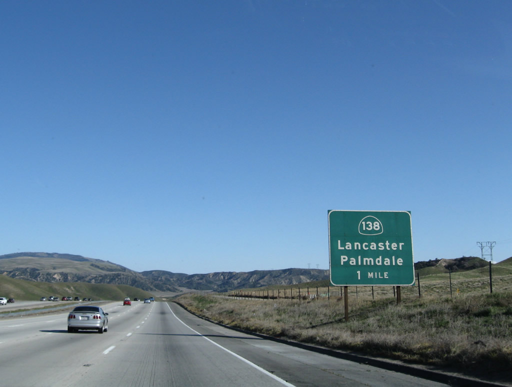
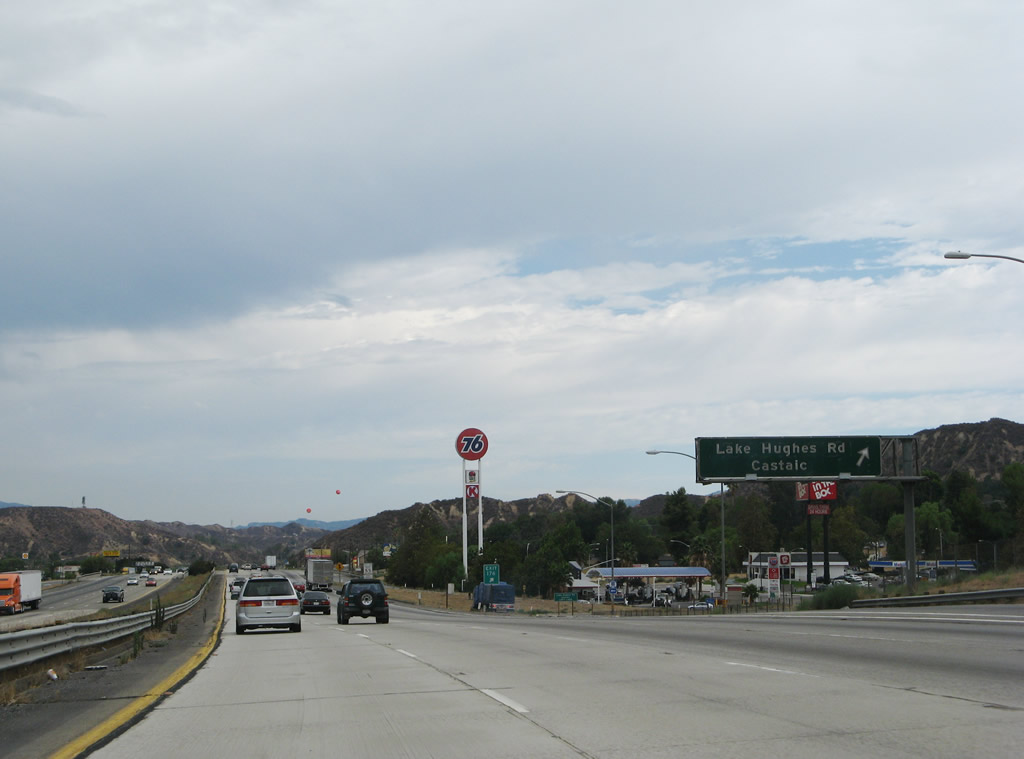
The next exit along southbound Interstate 5 is Exit 199, California 138 east to Lancaster and Palmdale, one mile. Use California 138 east to Los Angeles County N-2 south to the old alignment of U.S. 99: the Ridge Route. A one to two lane dirt/semi-paved road, the Ridge Route was at one time the main connecting route from the Central Valley to Los Angeles (before Interstate 5 was built). The Ridge Route today makes for a great day-trip; check for local conditions before driving. The southern end of the Ridge Route is in Castaic, and it reconnects with Interstate 5 at Exit 176. Photo taken 03/15/09. |
|
California 138 follows the proposed alignment of the Metropolitan Bypass, a freeway that would arc to the southeast around the urbanized parts of the Los Angeles Basin, providing a freeway connection between Interstate 5, California 14, and Interstate 15. This freeway was originally to be built in the 1970s, but it has been shelved indefinitely. Occasionally the proposal is resurrected, but thus far, no one has plans to construct it any time soon. Photo taken 07/06/04. |
|
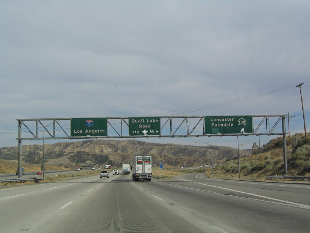
Southbound Interstate 5 reaches Exit 199, California 138 east to the Antelope Valley via Lancaster Road and Avenue D. California 138 merges onto southbound California 14 between Lancaster and Palmdale, and it then continues east from Palmdale to Interstate 15 via Littlerock, Pearblossom, Llano, and Phelan. California 138 crosses Interstate 15, and it becomes part of the Rim of the World Highway as it approaches Crestline (where it ends at its junction with California 18). Photo taken 07/06/04. |
|
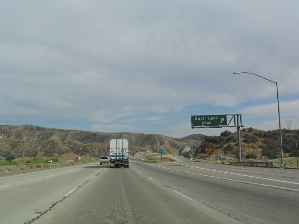
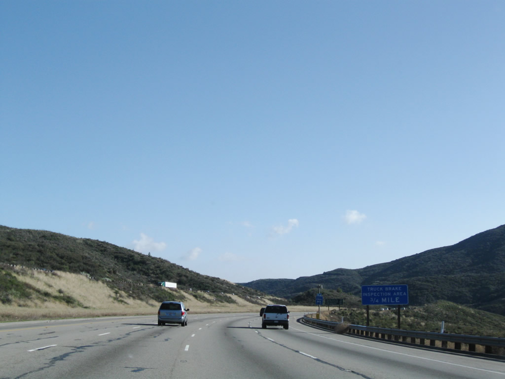
The next exit along southbound is Exit 198, Quail Lake Road west toward Hungry Valley. Photo taken 07/06/04. |
|
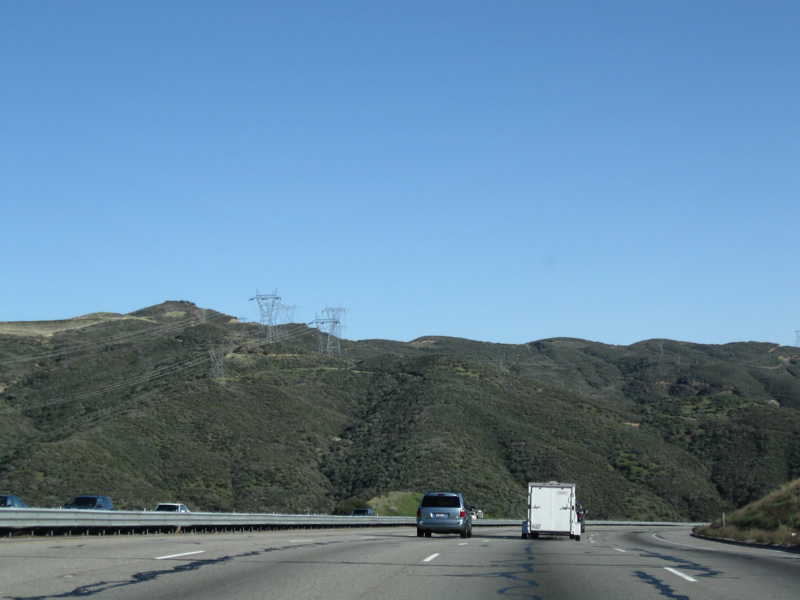
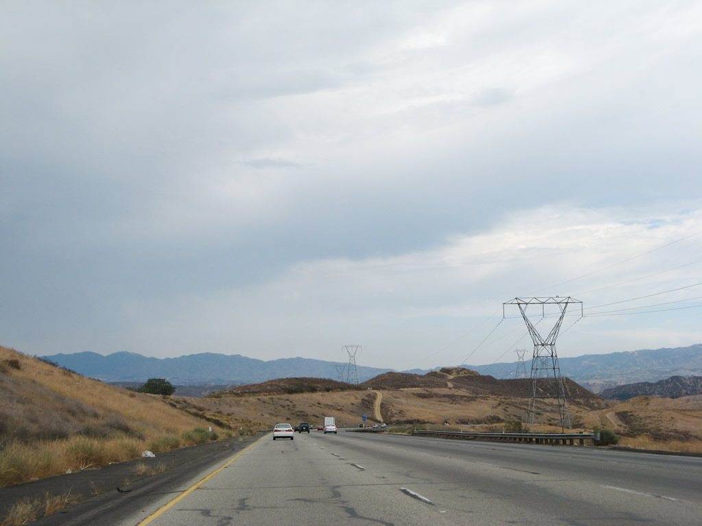
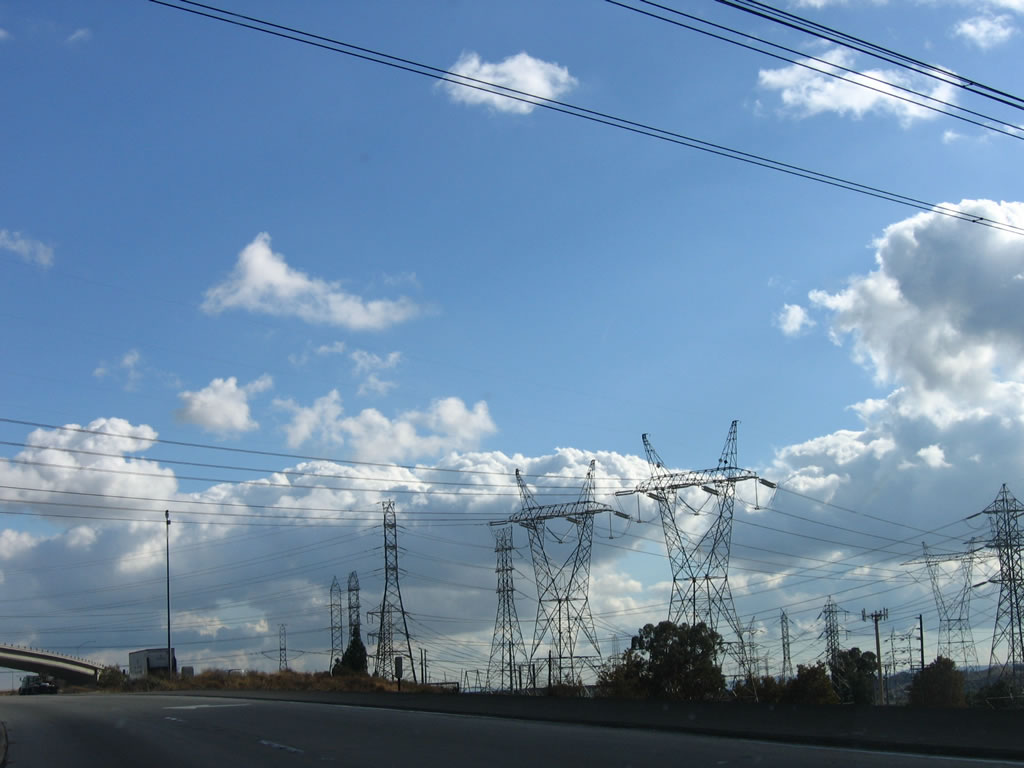
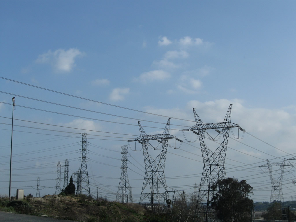
The Path 26 Southern California Edison 500kV power lines cross Interstate 5 for a third time. These lines travel southeast toward the Vincent substation near California 14, then turn southwest to the Sylmar substation near the Interstate 5 and Interstate 210 interchange in Los Angeles. Photo taken 11/27/06. |
|
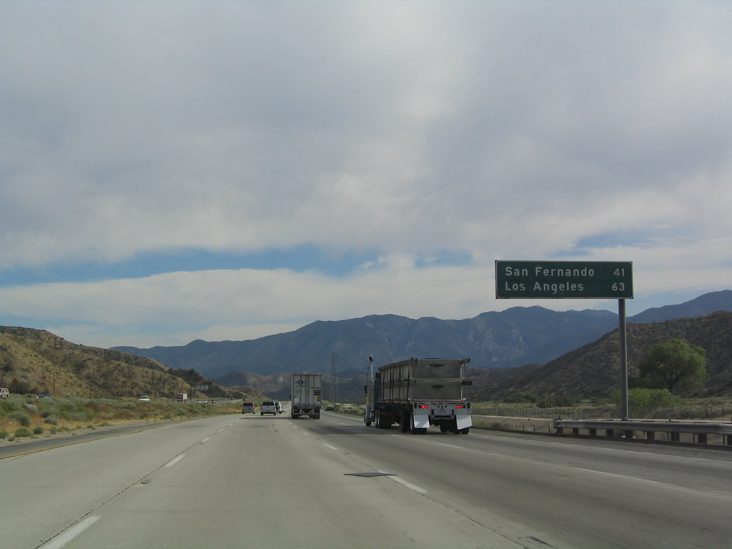
After the California 138 interchange complex (Exits 199-198), Interstate 5 approaches this mileage sign, which features the distance to San Fernando and Los Angeles. San Fernando is a small city (23,564 population in 2000) surrounded on all sides by Los Angeles, and it is not to be confused with the greater San Fernando Valley. Photo taken 07/06/04. |
|
Here is another view of those 1909 power lines from Kern River that closely follow Interstate 5 as it approaches Pyramid Lake. Photo taken 07/06/04. |
|
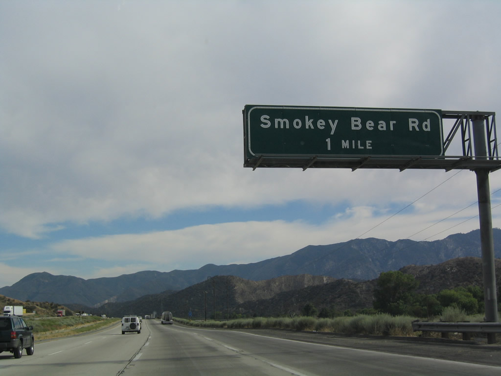
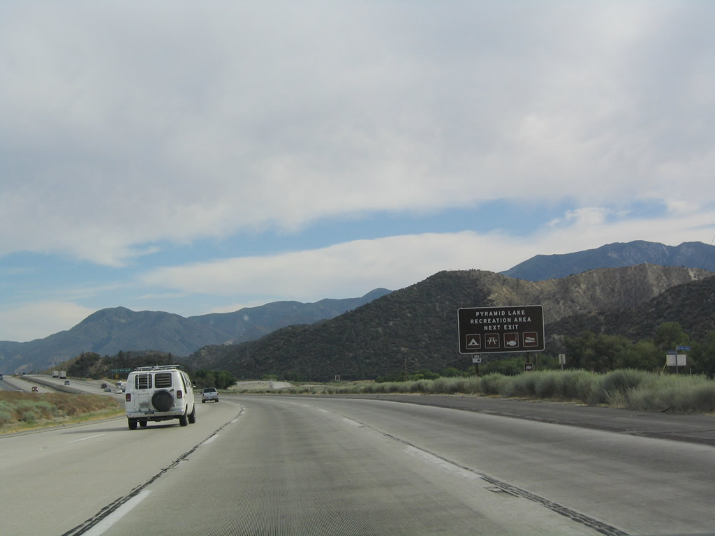
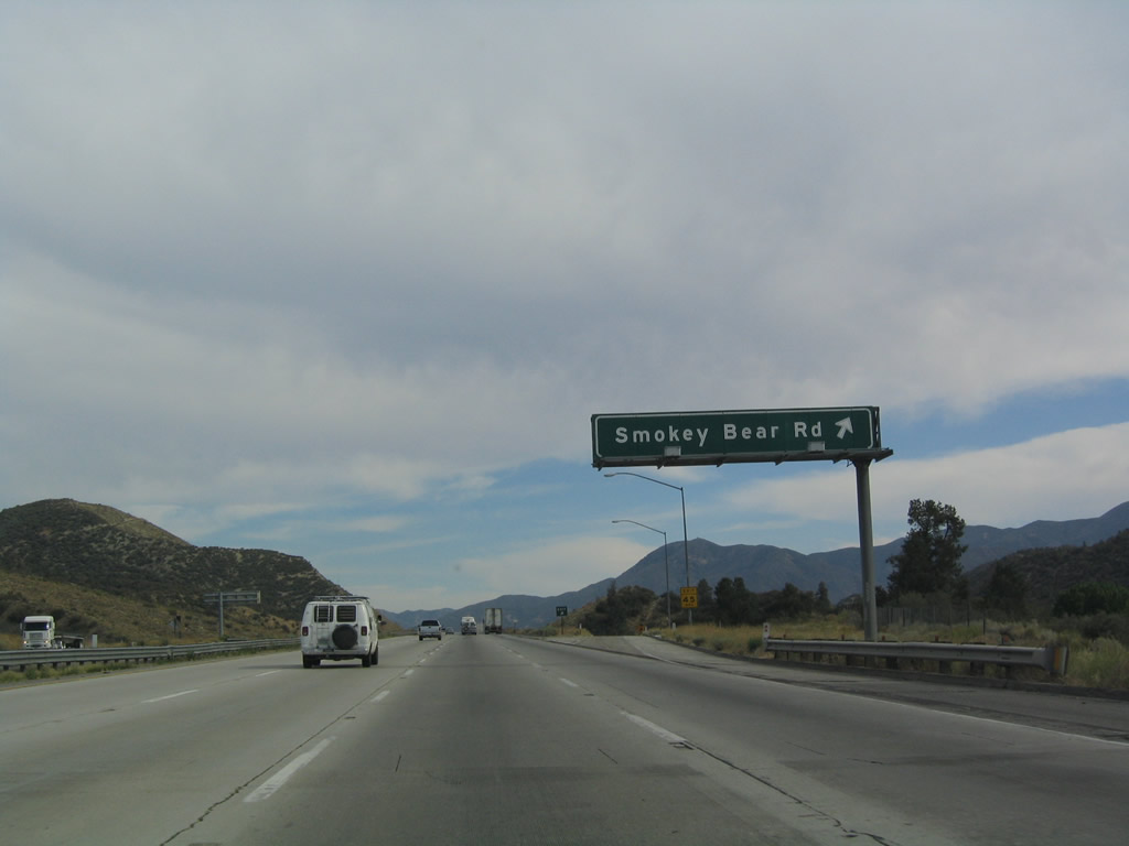
The next exit along southbound is Exit 195, Smokey Bear Road, one mile. Photo taken 07/06/04. |
|
Use Smokey Bear Road west to reach the Pyramid Lake recreation areas. Pyramid Lake is a relatively recently constructed reservoir, as former U.S. 99 used to pass through land that is now at the bottom of the lake. During low water periods, sections of old U.S. 99 may become visible, including an old bridge. Photo taken 07/06/04. |
|
Southbound Interstate 5 reaches Exit 195, Smokey Bear Road. Photo taken 07/06/04. |
|
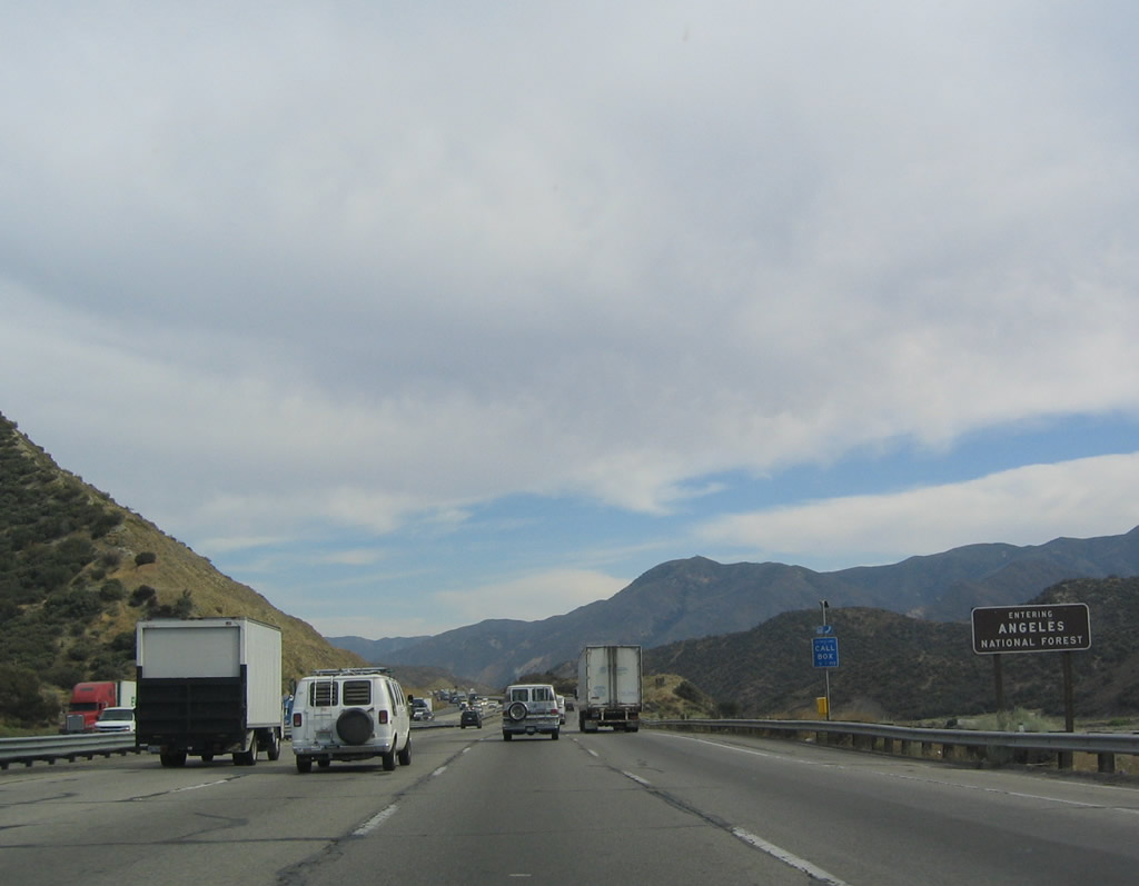
After Exit 195, Smokey Bear Road, Interstate 5 enters the Angeles National Forest. Photo taken 07/06/04. |
|
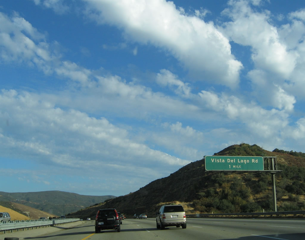
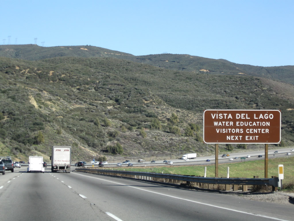
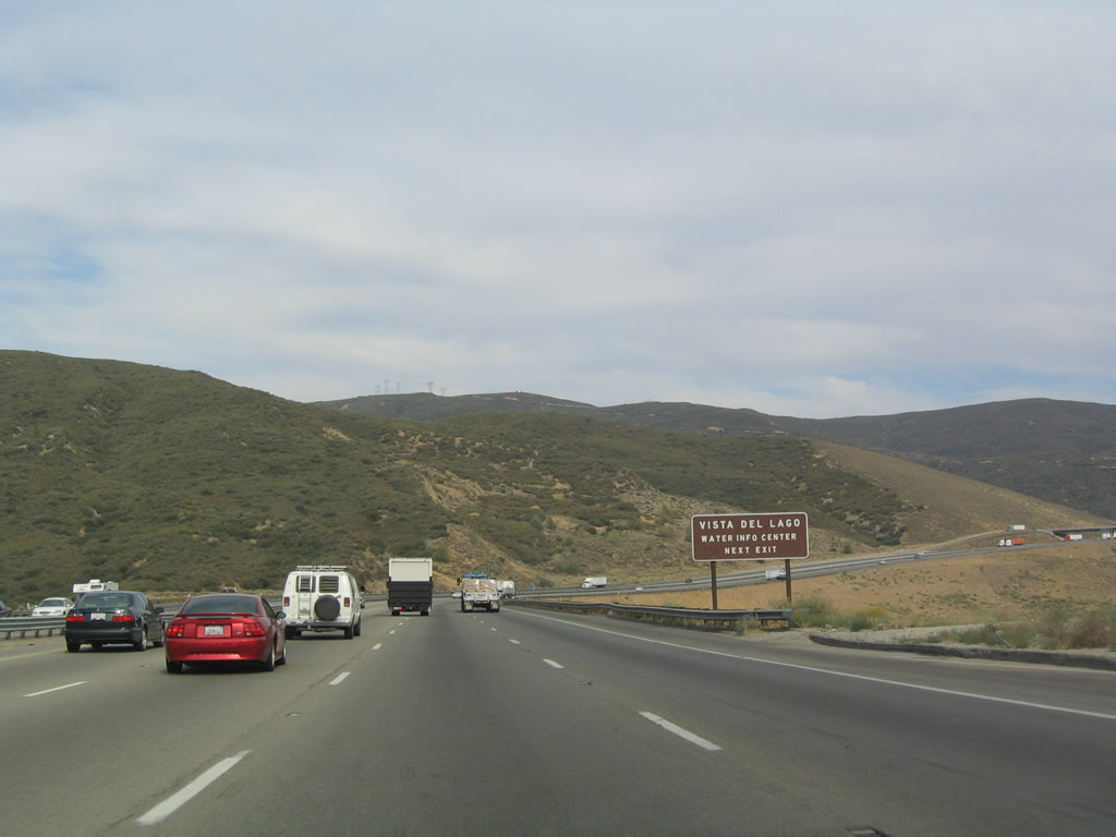
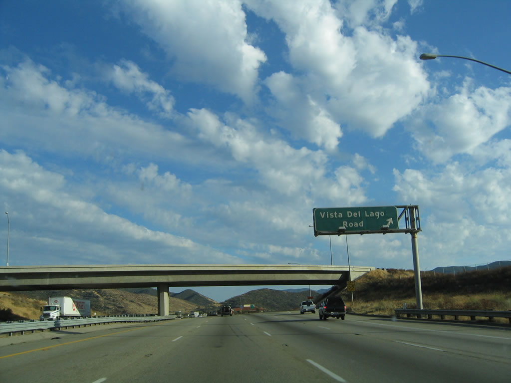
The first exit along southbound Interstate 5 within the national forest is Exit 191, Vista del Lago Road, one mile. Photo taken 09/25/05. |
|
|
A visitors center for Pyramid Lake is located at the Vista del Lago Road interchange (Exit 191). Excellent views of the lake are also available. Photos taken 03/15/09 and 07/06/04. |
|
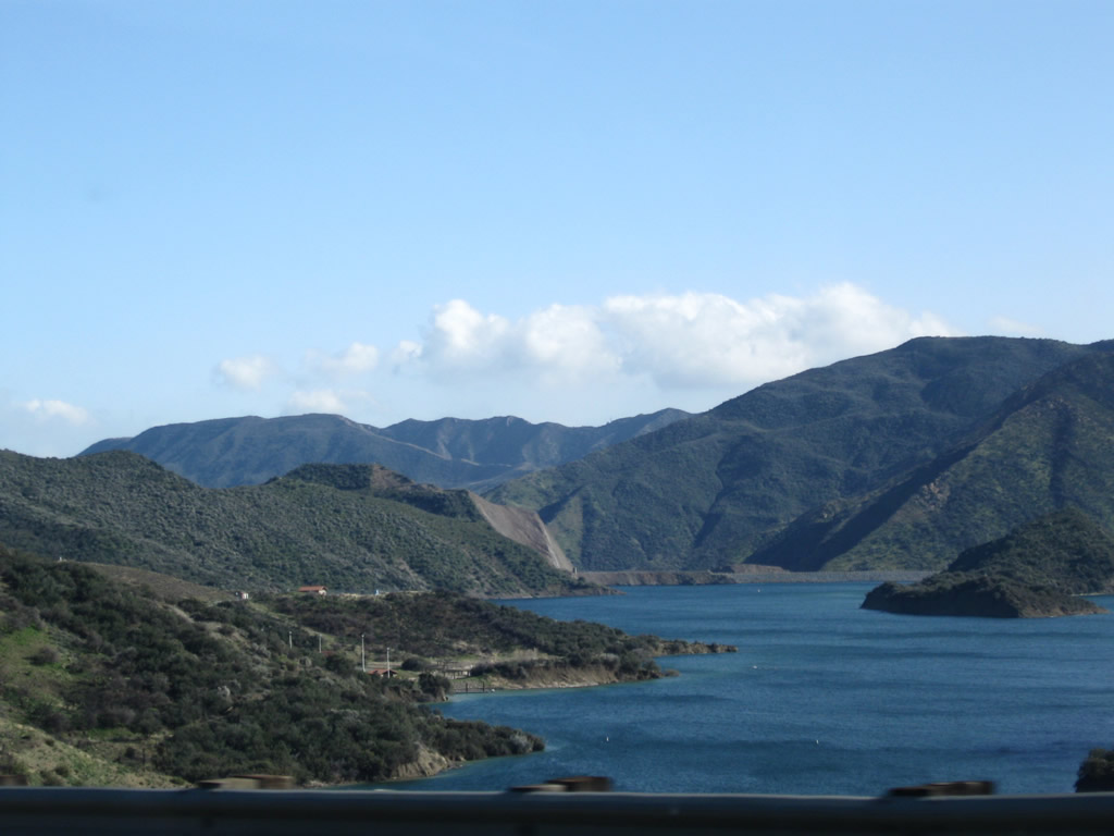
Look to the side of the freeway to the Pyramid Lake reservoir. Water is brought south via the California Aqueduct to this point, and it is then stored for use by the urban communities of Greater Los Angeles. Photo taken 03/15/09. |
|
Pyramid Lake, the reservoir that partially covers a portion of old U.S. 99 (the Ridge Route Alternate), can be accessed via Exit 191. Photo taken 09/25/05. |
|
Southbound Interstate 5 (Golden State Freeway) reaches Exit 191, Vista del Lago Road. Photo taken 09/25/05. |
|
After Exit 191, beautiful views of the Angeles National Foerst and nearby mountains line Interstate 5 (Golden State Freeway). Photo taken 09/25/05. |
|
An Interstate 5 south reassurance shield is posted after the on-ramp from Vista del Lago Road. Photo taken 03/15/09. |
|
As the highway continues between Vista del Lago Road and Templin Highway, Interstate 5 stays above Pyramid Lake and the old "Ridge Route Alternate" of U.S. 99. This second generation alignment of U.S. 99 is now under the waters of Pyramid Lake. While the freeway retains four lanes in each direction, watch for landslides and other construction activities that might reduce lanes in this area. Photo taken 03/15/09. |
|
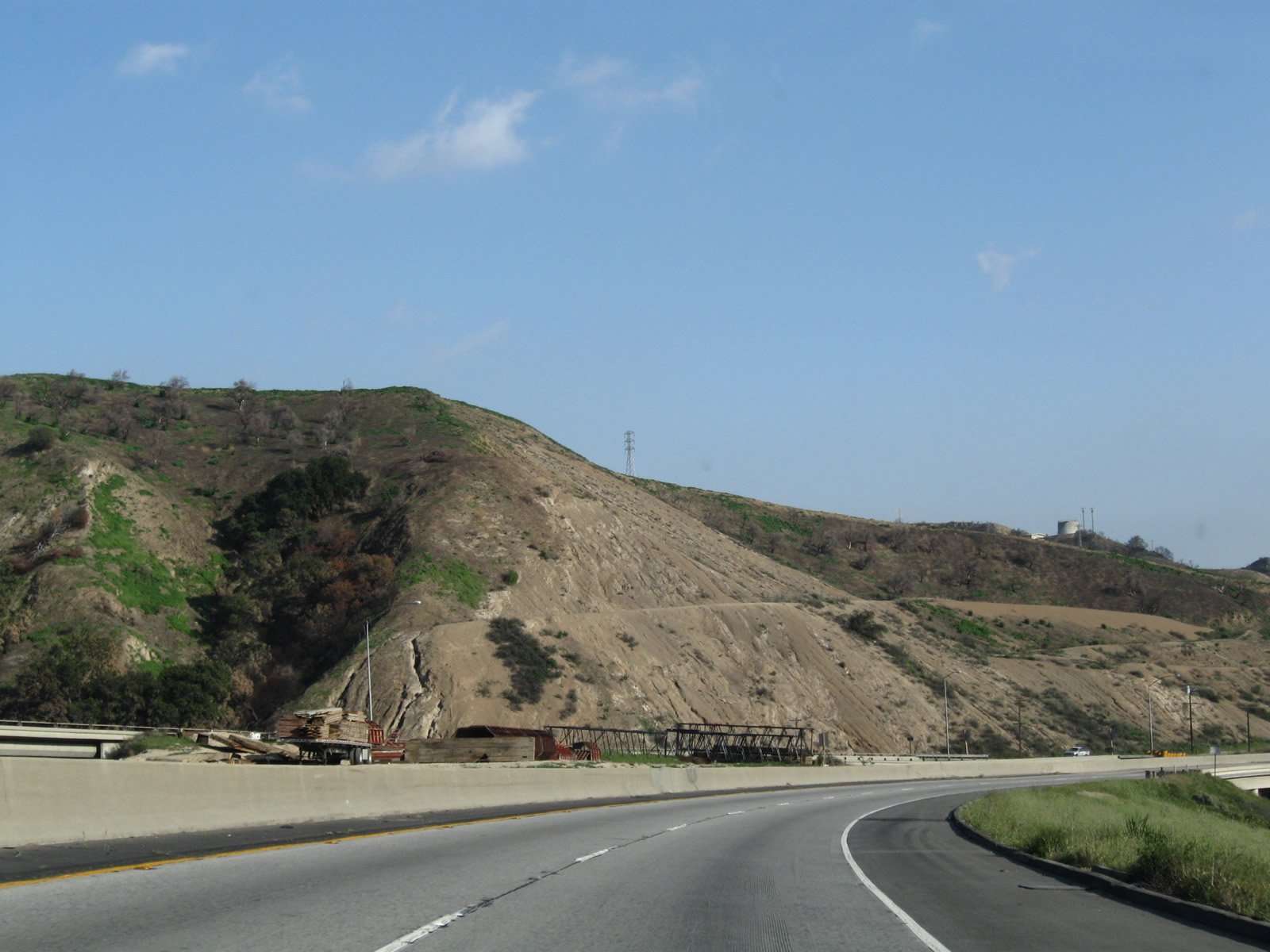
Interstate 5 follows the western edge of the Tehachapi Mountains. West of here, the mountains parallel the coastline and separate the coast from the Central Valley. Photo taken 03/15/09. |
|
To even out the hills and valleys, this section of Interstate 5 was made flat by use of fills, such as the one seen on the right side of this photo. The only problem is that sometimes these fills are damaged during heavy rains, resulting in the freeway losing its support. Photo taken 03/15/09. |
|
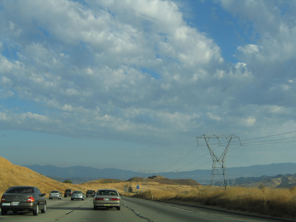
The Ridge Route, which is the original alignment of U.S. 99, follows the ridge visible in the distance, just below the power lines. These power lines are the last time Interstate 5 will see Southern California Edison's western branch of Path 26. These lines will head east from here toward the massive Vincent substation near the interchange of California 14 and Angeles Forest Highway. At that substation, the 500kV power lines will meet the eastern branch of Path 26. From Vincent, 500kV power lines continue east toward the Lugo substation, where it connects to Path 46 (West of Colorado River). Photo taken 03/15/09. |
|
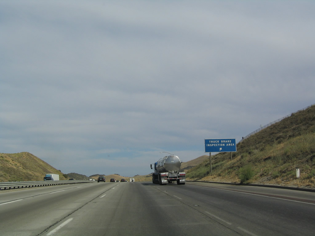
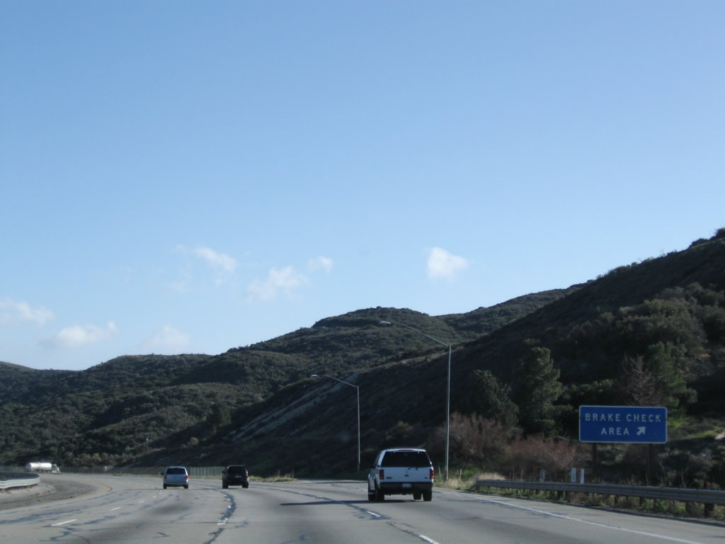
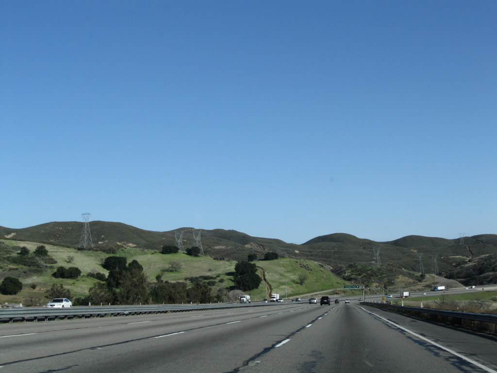
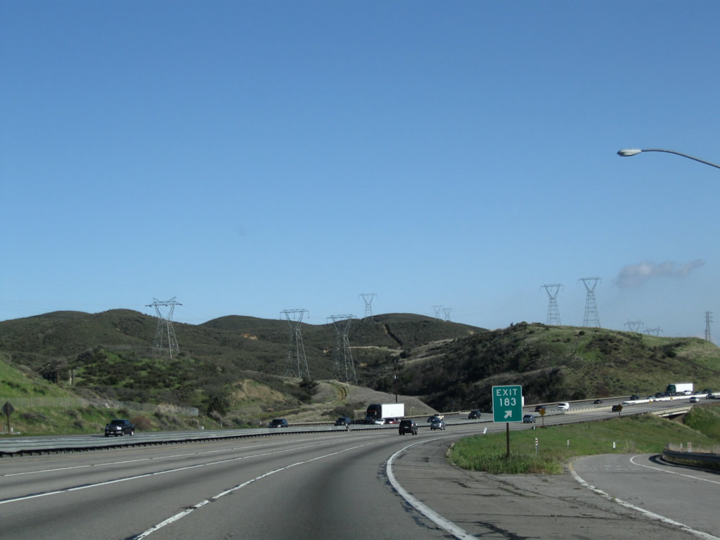
The next exit along Interstate 5 south is Exit 185, Truck Brake Inspection Area (0.75 mile). This is a good place to stop prior to the descent from Violin Summit into Castaic. Photo taken 03/15/09. |
|
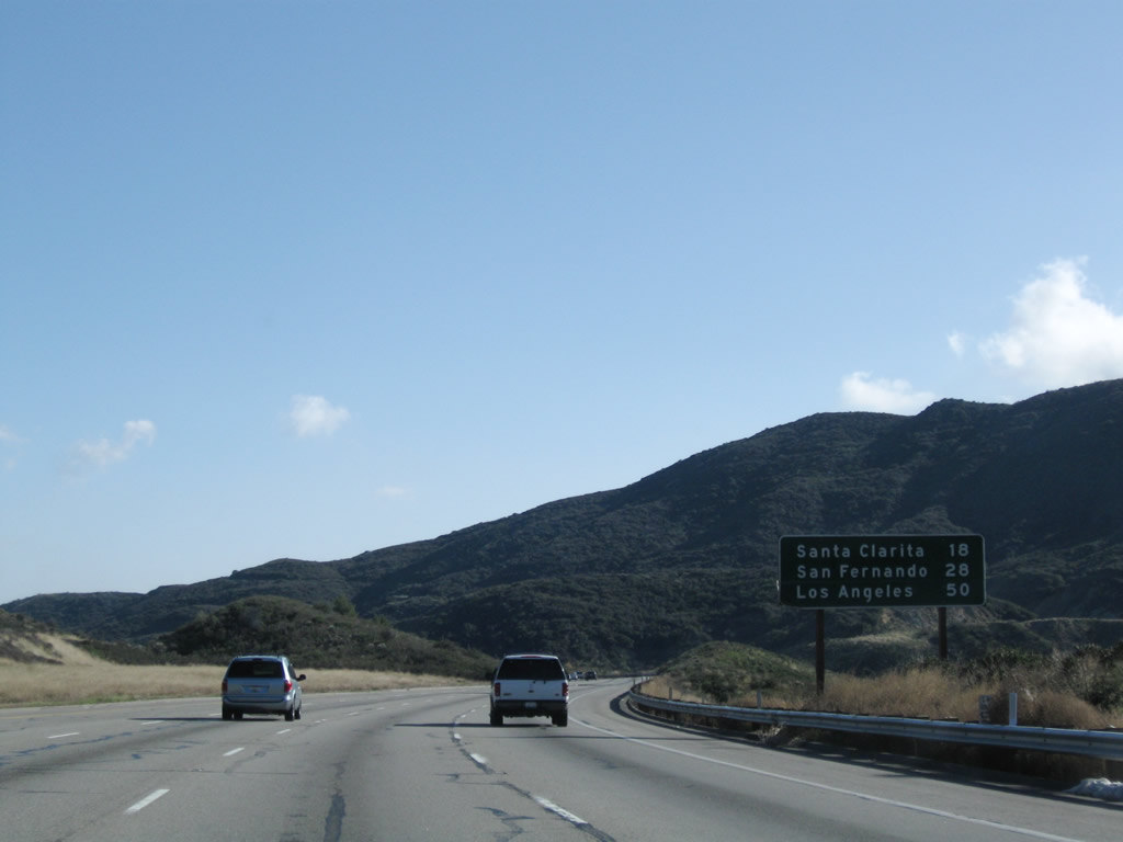
This mileage sign provides the distance to Santa Clarita (18 miles), San Fernando (28 miles), and downtown Los Angeles (50 miles). Photo taken 03/15/09. |
|
Southbound Interstate 5 (Golden State Freeway) reaches Exit 185, Truck Brake Inspection Area. Photo taken 03/15/09. |
|
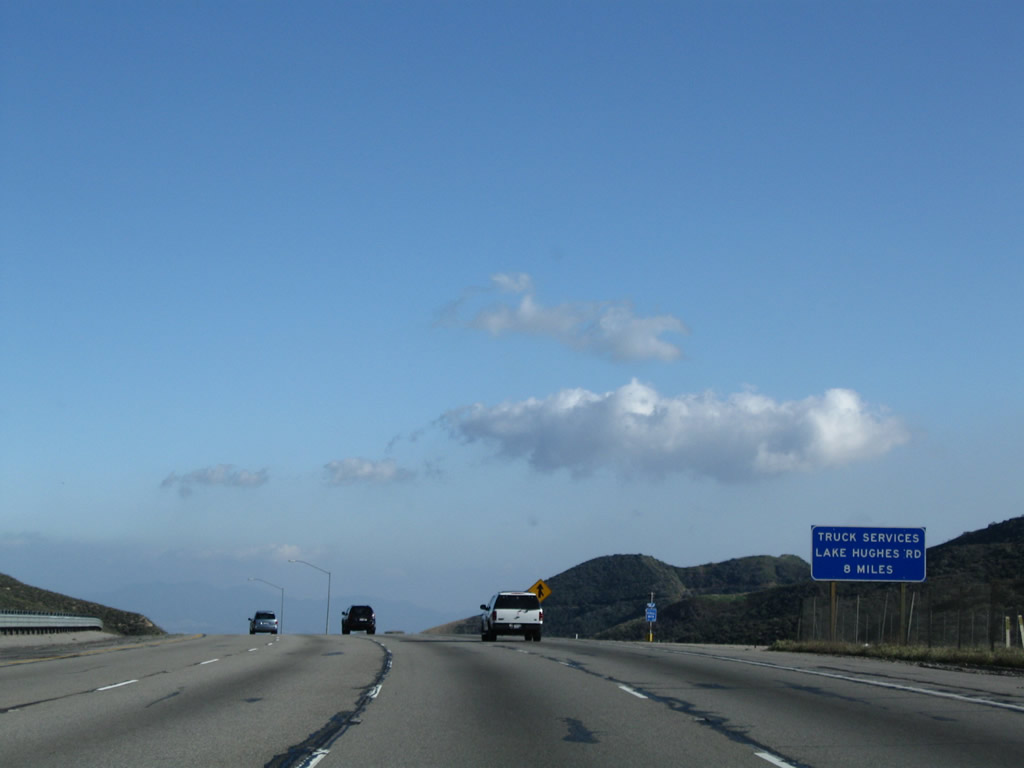
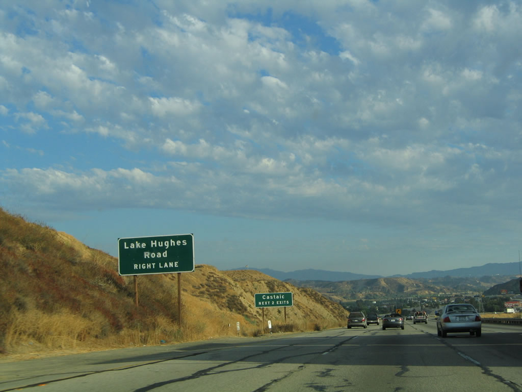
All motorist services are available at Exit 176, Lake Hughes Road (eight miles ahead). No services are available at the truck brake inspection area. Photo taken 03/15/09. |
|
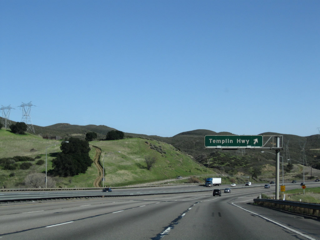
The next exit along southbound Interstate 5 is Exit 183, Templin Highway (which includes a ranger station). Templin Highway connects to the old Golden State Highway (Ridge Route Alternate), which was signed as U.S. 99. This section of old road is a dead end, as it heads north toward its watery end near the Pyramid Lake dam. Of course, Templin Highway is a newer alignment as compared to the original Ridge Route alignment of U.S. 99 located in the hills east of Interstate 5. Photo taken 03/15/09. |
|
Three 220kV power lines come into view on the east side of Interstate 5. These lines connect a substation near Bakersfield with a substation in Santa Clarita. Photo taken 03/15/09. |
|
Southbound Interstate 5 reaches Exit 183, Templin Highway. Use Templin Highway west to the Ridge Route Alternate, which is Old U.S. 99/Golden State Highway. The road leads north to its dead end near the massive Pyramid Lake dam. Photo taken 03/15/09. |
|
The only exit number for Exit 183 is posted at the gore point. Photo taken 03/15/09. |
|
|
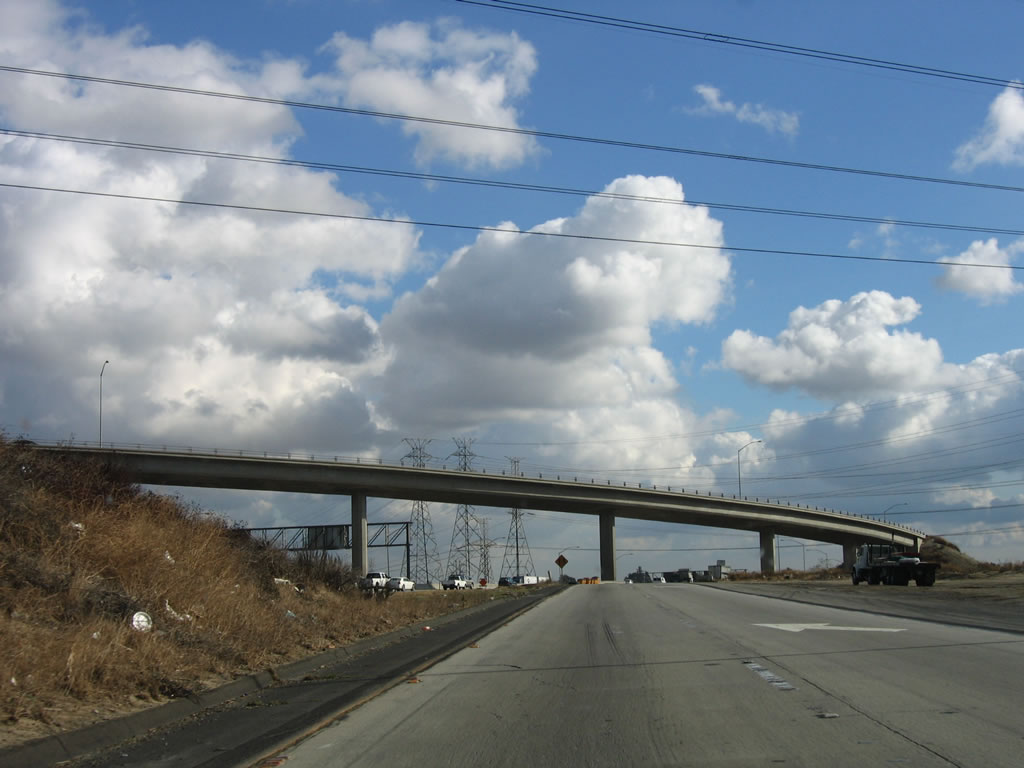
Due to some earth movements around Exit 183, a realignment was necessary just south of Templin Highway. You can see the old path the lanes took and how winding the new temporary lanes are. Photos taken 03/15/09. |
|
|
|
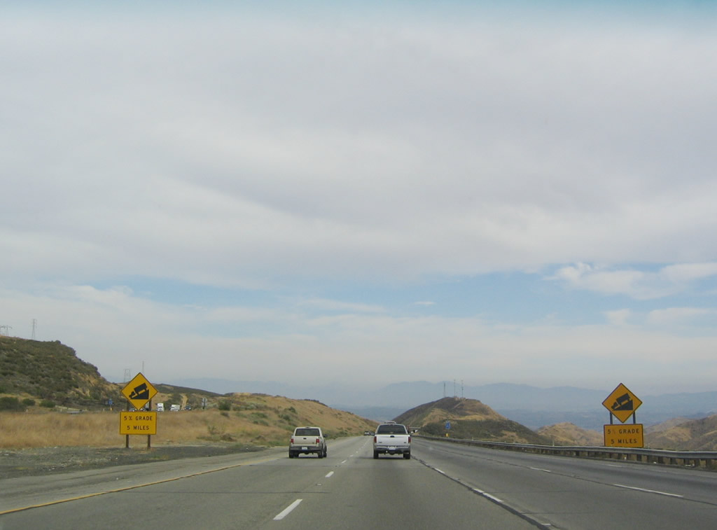
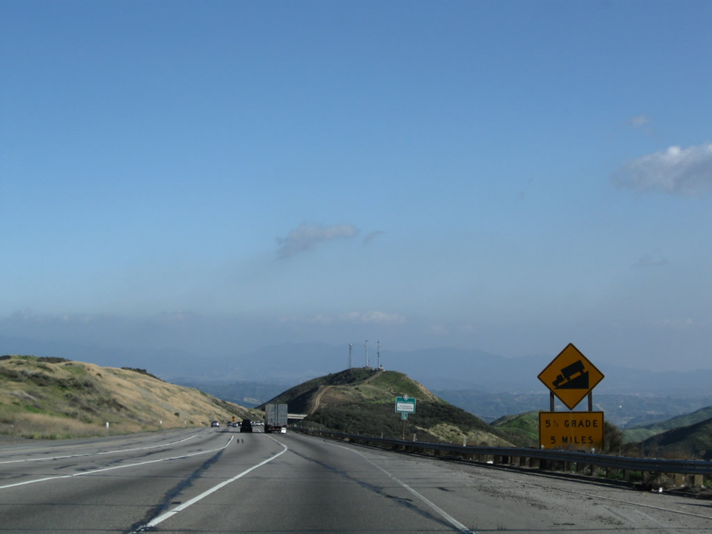
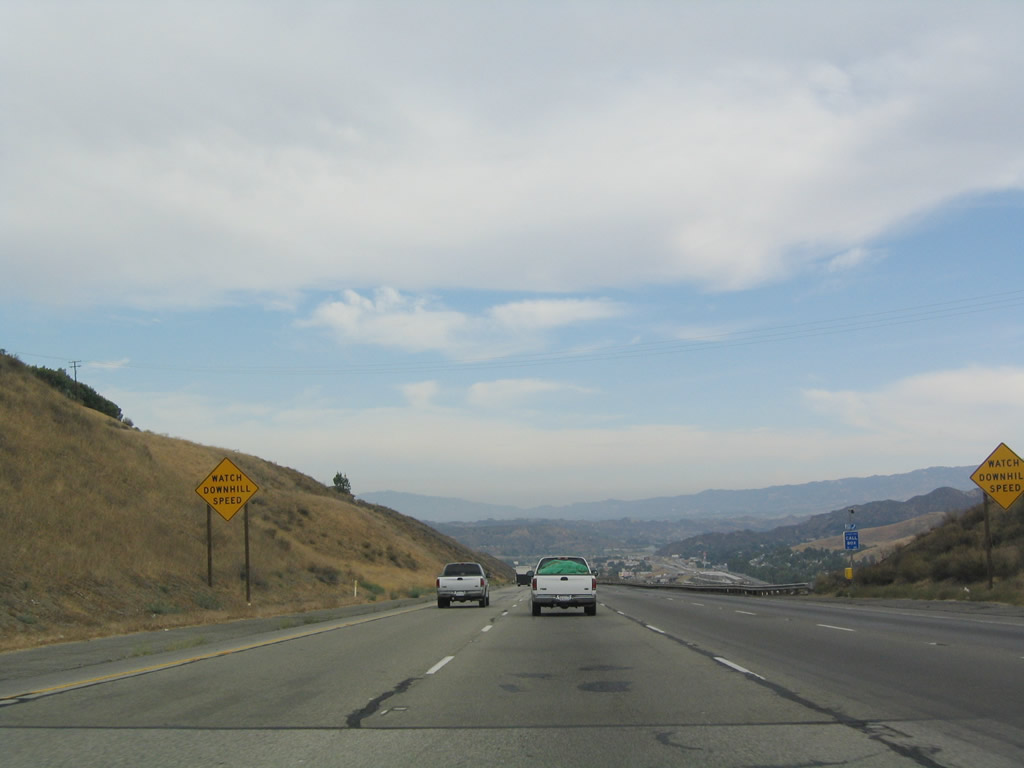
After Exit 183/Templin Highway, Interstate 5 begins its descent from Violin Summit (el. 2,591 feet) to Castaic (el. 1,232 feet). The grade is five percent. Compare the changes to this area between 2004 and 2009; the rains of 2004-2005 led to some significant landslides here. Photos taken 03/15/09 and 07/06/04. |
|
|
To allow for varying degrees of grade for northbound and southbound, Interstate 5 southbound crosses under Interstate 5 northbound for much of the grade down to Castaic. For this duration, Interstate 5 southbound lanes are to the left of the northbound lanes, which is an uncommon phenomenon in North America. Photos taken 07/06/04 and 08/26/07. |
|
Interstate 5 departs Angeles National Forest as the freeway continues south. Although the portion of national forest crossed by the freeway does not have many trees, the higher elevations of the mountains east and west of here do. Photo taken 07/06/04. |
|
|
A set of 138kV power lines travels alongside Interstate 5 (Golden State Freeway) south as we continue down the five percent grade from Violin Summit. Trucks often line up on this stretch of freeway due to the extended downhill grade. On this day, a summer season monsoonal storm gathered over Los Angeles, offering rain-bearing cloud formations in the typically dry month of August. Photos taken 08/26/07 and 09/25/05. |
|
As Interstate 5 makes its way down the grade, look right to see the northbound traffic climbing up to Violin Summit. Photo taken 07/06/04. |
|
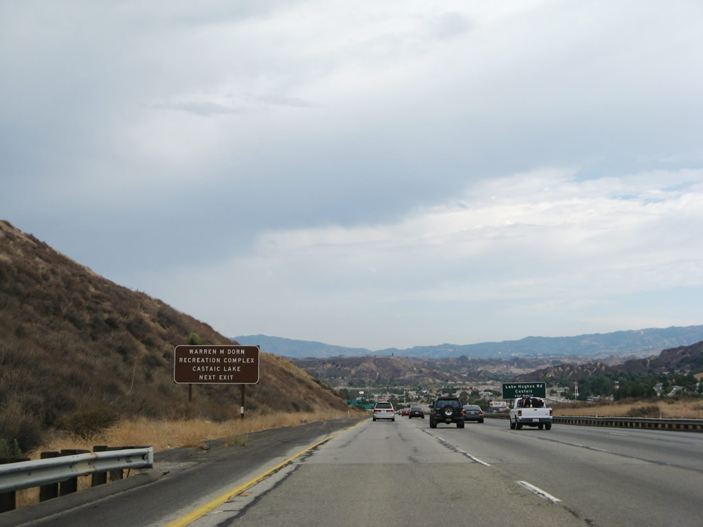
Exit 176 features the Warren M. Dorn Recreation Complex and Castaic Lake. Photo taken 08/26/07. |
|
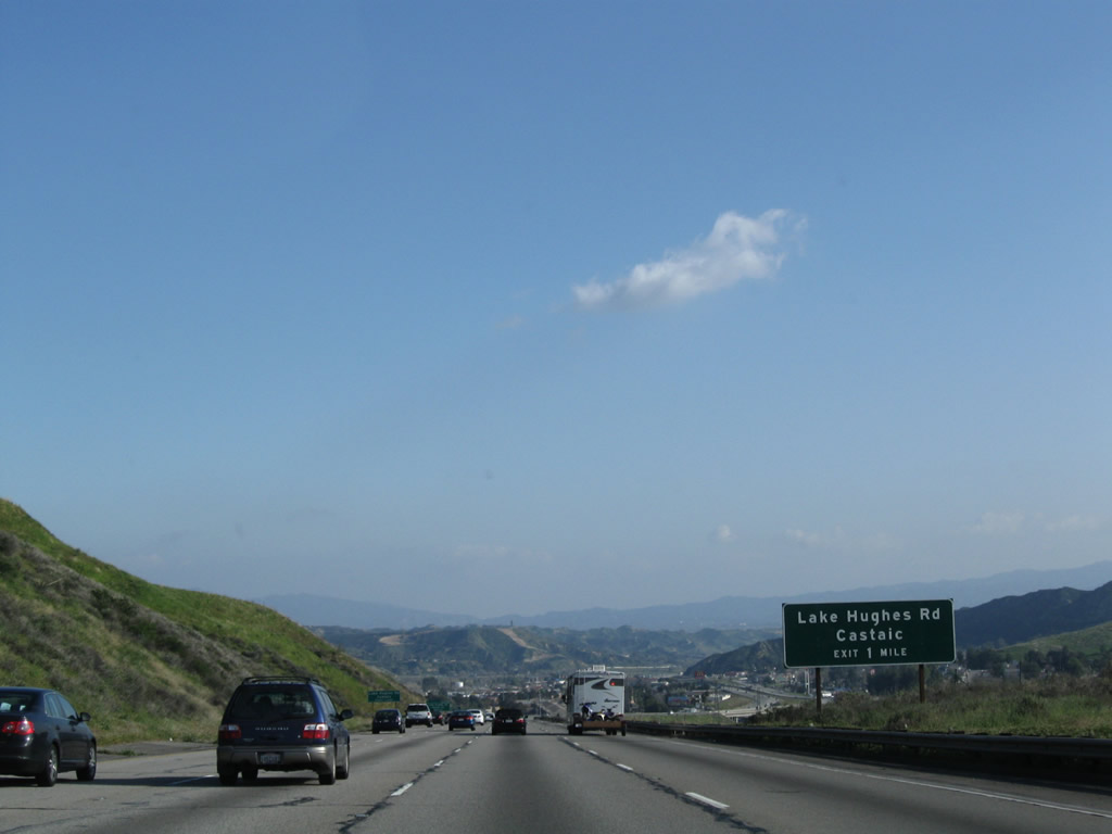
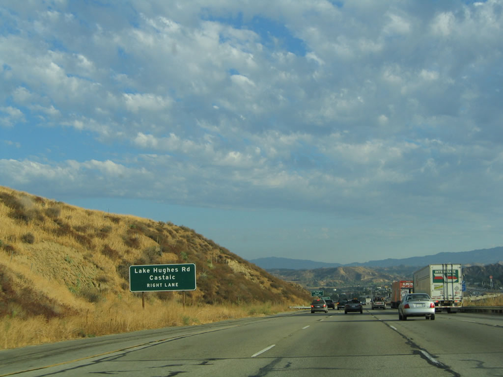
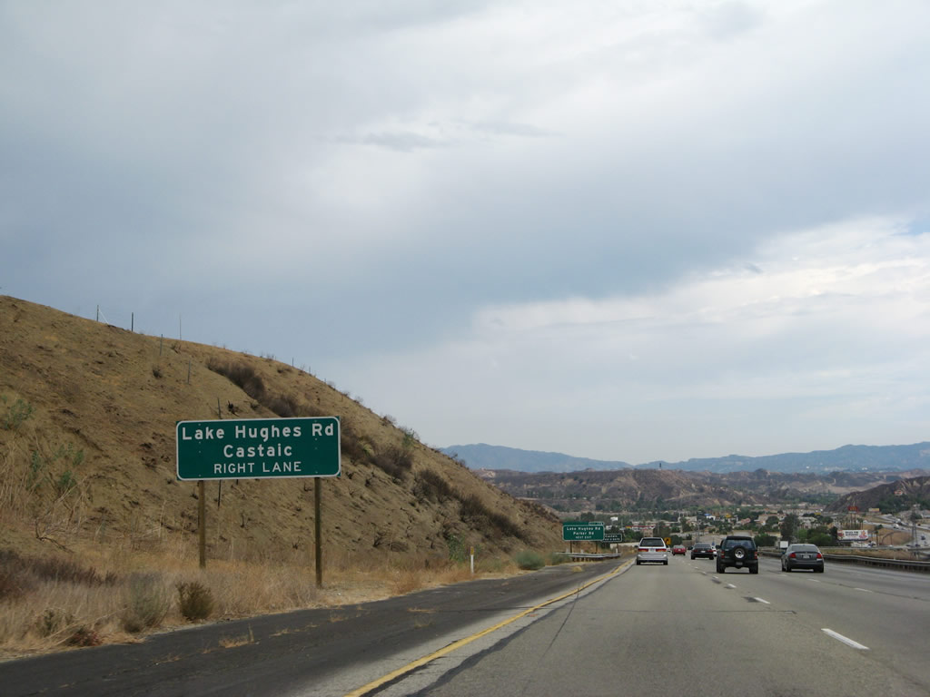
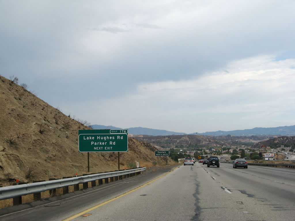
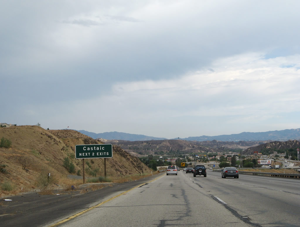
The next exit along southbound Interstate 5 is Exit 176, Lake Hughes Road to Castaic. Most motorist services are available at the Castaic interchange. Photo taken 03/15/09. |
|
|
By the time Interstate 5 reaches Exit 176, the southbound lanes will again be on the right side of the freeway. Therefore, all traffic for Lake Hughes Road and Castaic should merge right. This sign was replaced with a reflective sign between 2005 and 2007. Photos taken 09/25/05 and 08/26/07. |
|
|
The town of Castaic is served by Exits 176 and 173 from southbound Interstate 5. This sign was replaced with an exit number sign sometime between 2005 and 2007. Photos taken 09/25/05 and 08/26/07. |
|
The next two exits serve the unincorporated community of Castaic. Photo taken 08/26/07. |
|
Southbound Interstate 5 turns right to cross over northbound Interstate 5 so that the correct order of carriageways is restored. The town of Castaic also comes into view. Photo taken 08/26/07. |
|
Look southwest to see the crossover between the Interstate 5 southbound and Interstate 5 northbound lanes. Photo taken 03/15/09. |
|
The southbound lanes of Interstate 5 crosses over the northbound lanes of Interstate 5. After this, the southbound lanes remain on the right side of the freeway, and the northbound lanes on the left (at least when traveling south!). Photo taken 08/26/07. |
|
Southbound Interstate 5 reaches Exit 176, Lake Hughes Road to Castaic. Photo taken 08/26/07. |
|
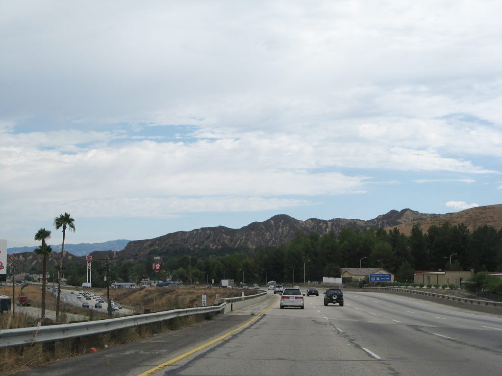
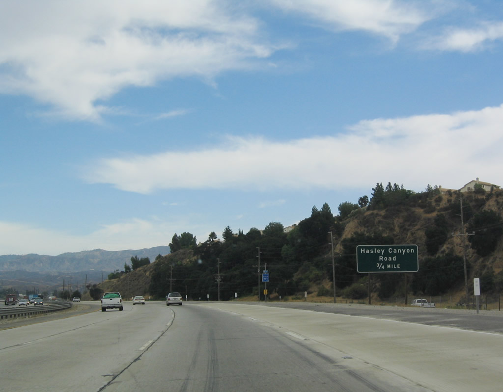
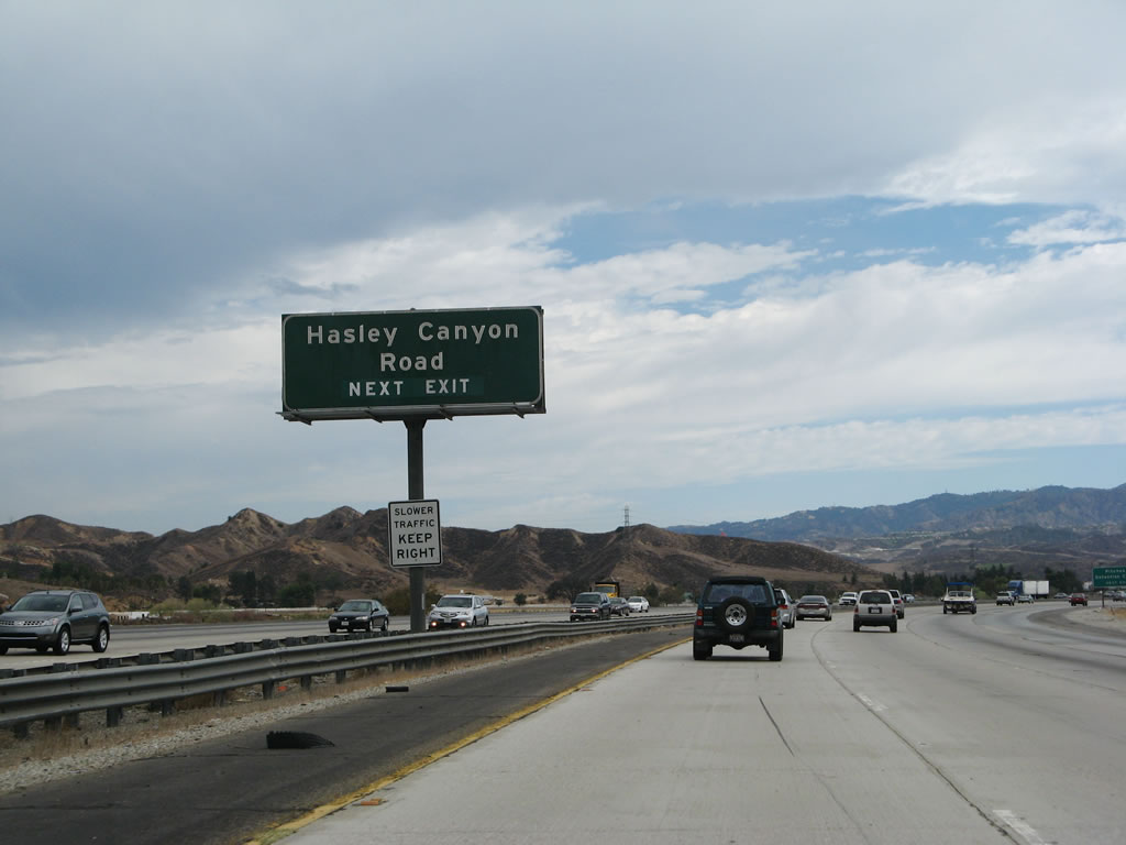
The next exit along southbound Interstate 5 is Exit 173, Hasley Canyon Road, 0.75 mile. Photo taken 07/06/04. |
|
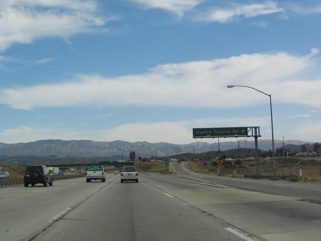
Use the Hasley Canyon Road exit to reach the old U.S. 99 frontage road, which can be helpful if the traffic is thick near Magic Mountain (which is just ahead). This exit also serves Castaic and Val Verde. Photo taken 08/26/07. |
|
Southbound Interstate 5 (Golden State Freeway) reaches Exit 173, Hasley Canyon Road. Due to the reconstruction of the Hasley Canyon Road interchange, this sign was removed by 2009. Photo taken 07/06/04. |
|
|
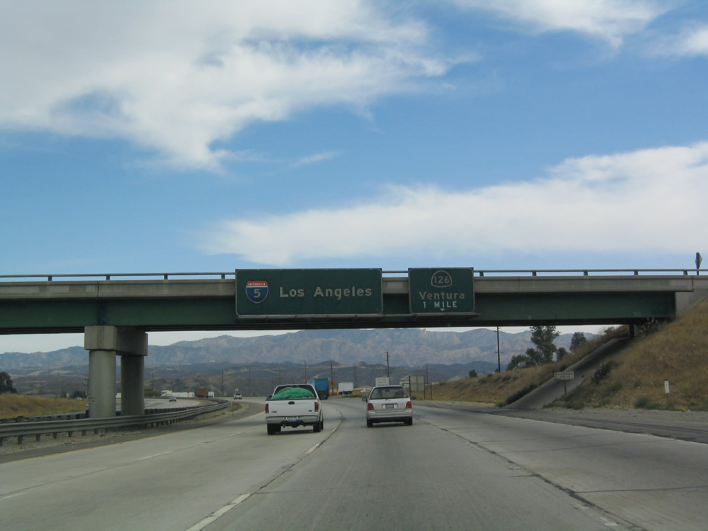
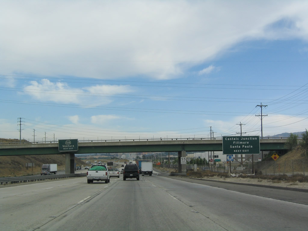
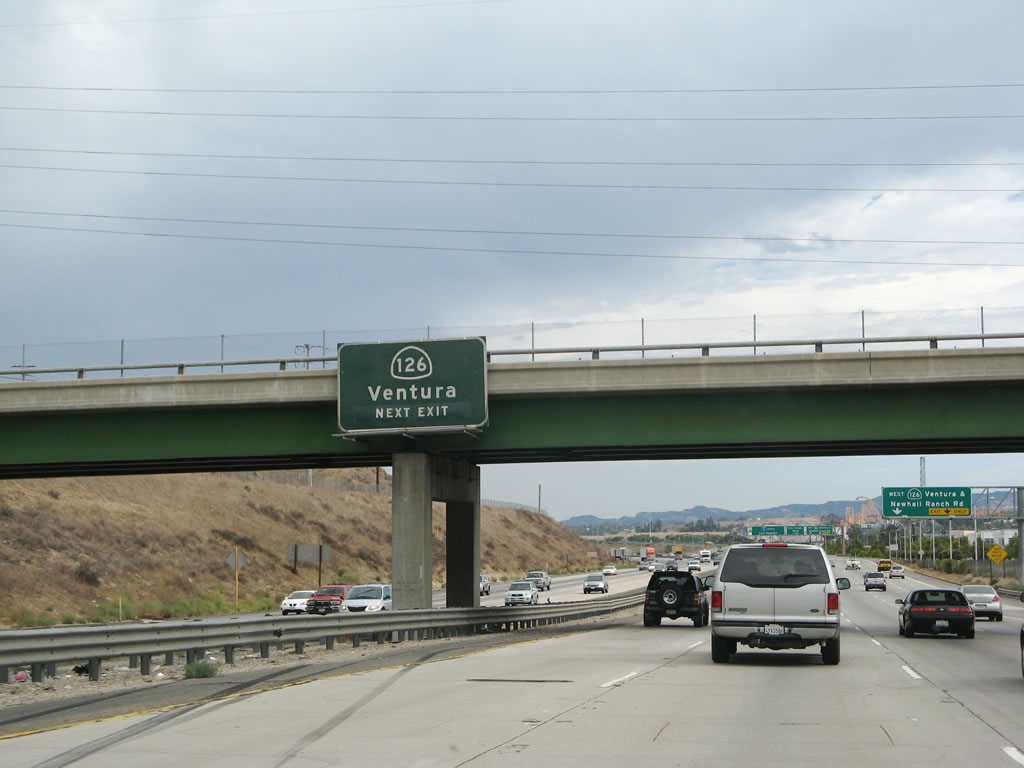
The next exit along southbound Interstate 5 is Exit 172, California 126/Santa Paula Highway west to Ventura, one mile. Photos taken 07/06/04 and 08/26/07. |
|
|
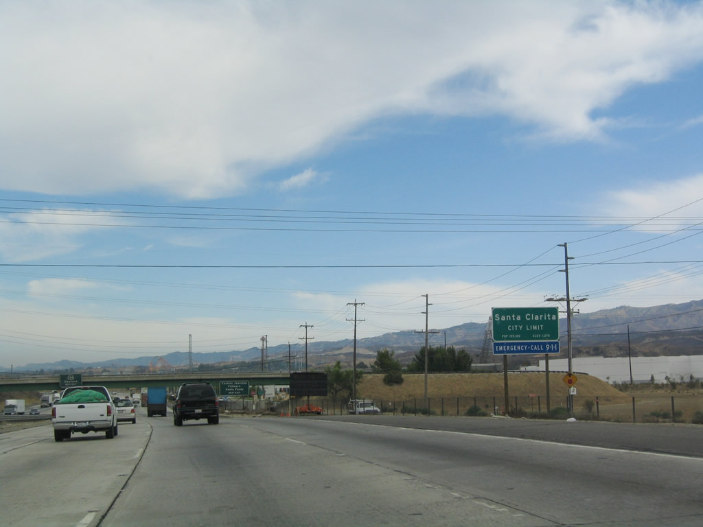
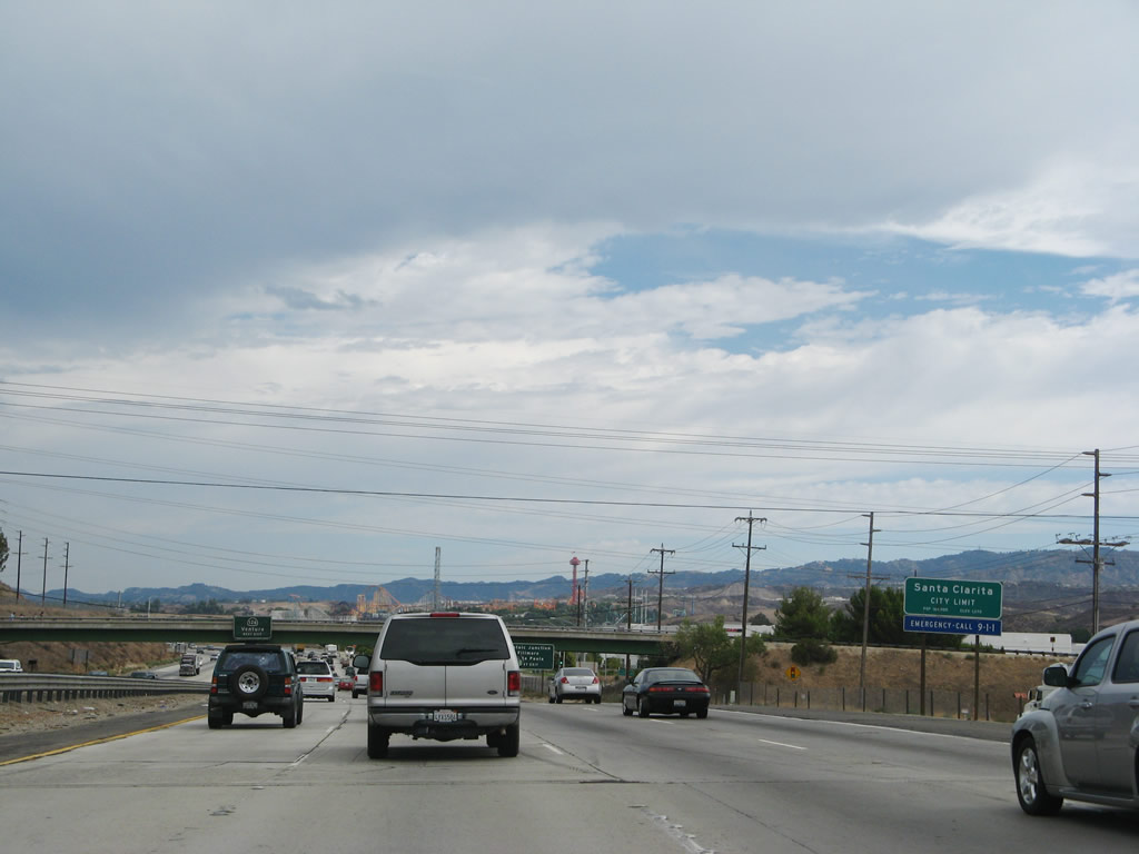
Interstate 5 enters the city of Santa Clarita. Incorporated on December 15, 1987, Santa Clarita had a population of 151,088. The city incorporates Valencia, Newhall, Saugus, and Canyon Country. As a result of explosive development in the 1990s and 2000s, Santa Clarita saw significant population gains. Photos taken 07/06/04 and 08/26/07. |
|
|
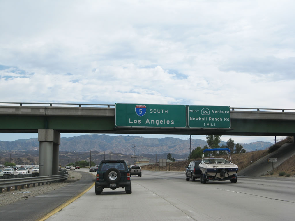
Use California 126 west to reach Castaic Junction, Fillmore, and Santa Paula in addition to Ventura. This area was under construction at the time this photo was taken. To the east, the Santa Clarita Cross Valley Connector (a federal high priority corridor) begins its journey east toward California 14 (Antelope Valley Freeway) (completed on March 27, 2010). This interchange used to be a trumpet interchange, but it was reconfigured with traffic signals with the addition of the new Cross Valley Connector. Photos taken 07/06/04 and 08/26/07. |
|
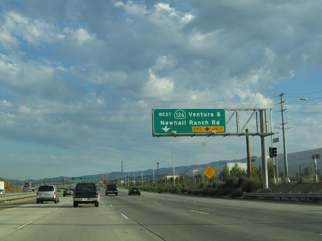
Southbound Interstate 5 approaches Exit 172, California 126 west. Once planned as a freeway corridor (Santa Paula Freeway), California 126 is slated to be an expressway with traffic signals for much of its route, with the remainder a freeway from Santa Paula west to Ventura. Eastbound California 126 used to merge onto southbound Interstate 5 briefly before entering Santa Clarita, but that section was decommissioned. To the east, Newhall Ranch Road (the Santa Clarita Cross Valley Connector) leads into Santa Clarita and its rapidly expanding suburban communities. Photo taken 08/26/07. |
|
|
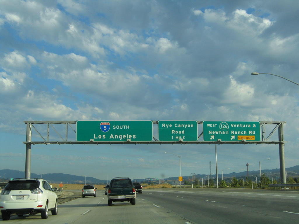
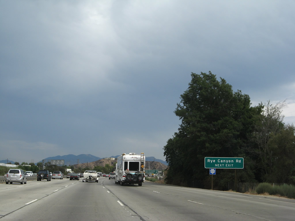
Shortly thereafter, Interstate 5 (Golden State Freeway) reaches Exit 172, California 126 west. The next exit along southbound Interstate 5 is Exit 171, Rye Canyon Road, one mile. In the 2004 photo, the ramp to California 126 was aligned differently due to construction; by 2007, the replacement overhead signage was posted, and the Cross Valley Connector was opened to the east. Photos taken 07/06/04 and 08/26/07. |
|
A newly widened and reconfigured bridge carries California 126 and Newhall Ranch Road traffic over Interstate 5. The former trumpet interchange ramps are gone in favor of this new interchange. Photo taken 08/26/07. |
|
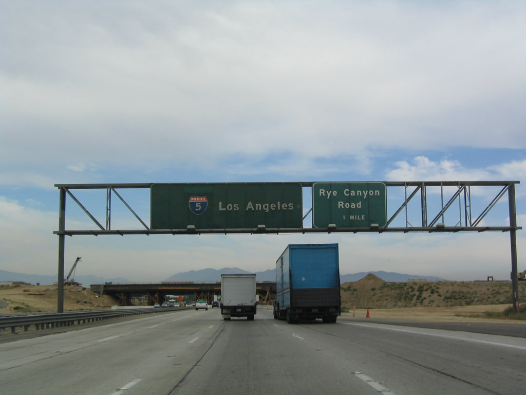
The next exit along southbound Interstate 5 (Golden State Freeway) is Exit 171, Rye Canyon Road. Photo taken 08/26/07. |
|
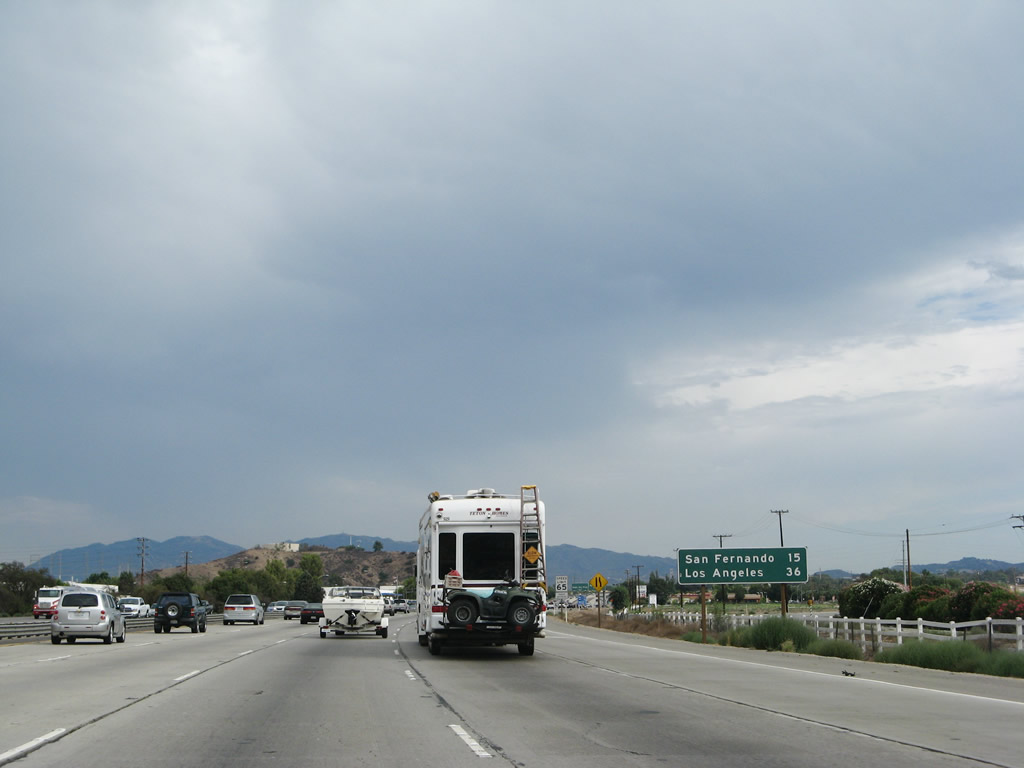
This mileage sign provides the distance to the city of San Fernando (15 miles) and downtown Los Angeles (36 miles). During morning commuting hours, those 36 miles can take hours to traverse. The city limits for Los Angeles are actually much closer, as Interstate 5 will cross from Santa Clarita into Los Angeles at Exit 163 (Truck Route Split at California 14). Photo taken 08/26/07. |
|
|
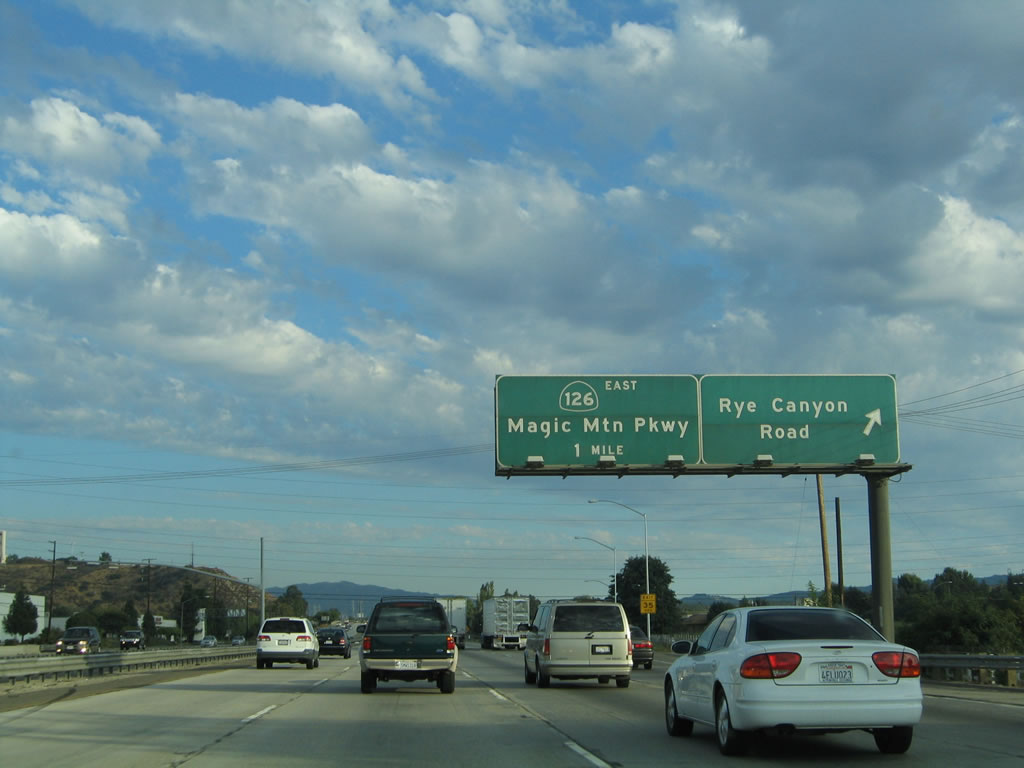
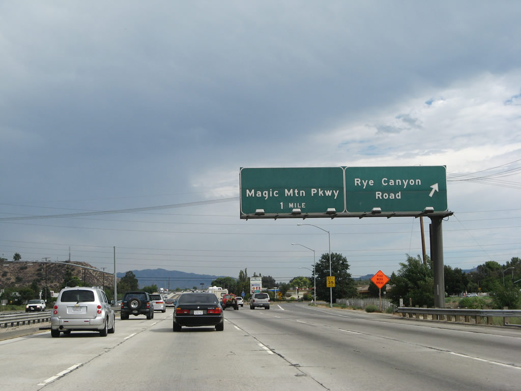
Southbound Interstate 5 reaches Exit 171, Rye Canyon Road. The next exit is Magic Mountain Parkway (Exit 170). Between 2004 and 2007, the California 126 shield that used to grace the Magic Mountain Parkway sign was scraped off. Photos taken 09/25/05 and 08/26/07. |
|
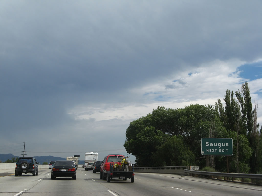
As the freeway crosses over Rye Canyon Road, this auxiliary sign advises that Exit 170 serves the community of Saugus, which is part of the city of Santa Clarita. Photo taken 08/26/07. |
|
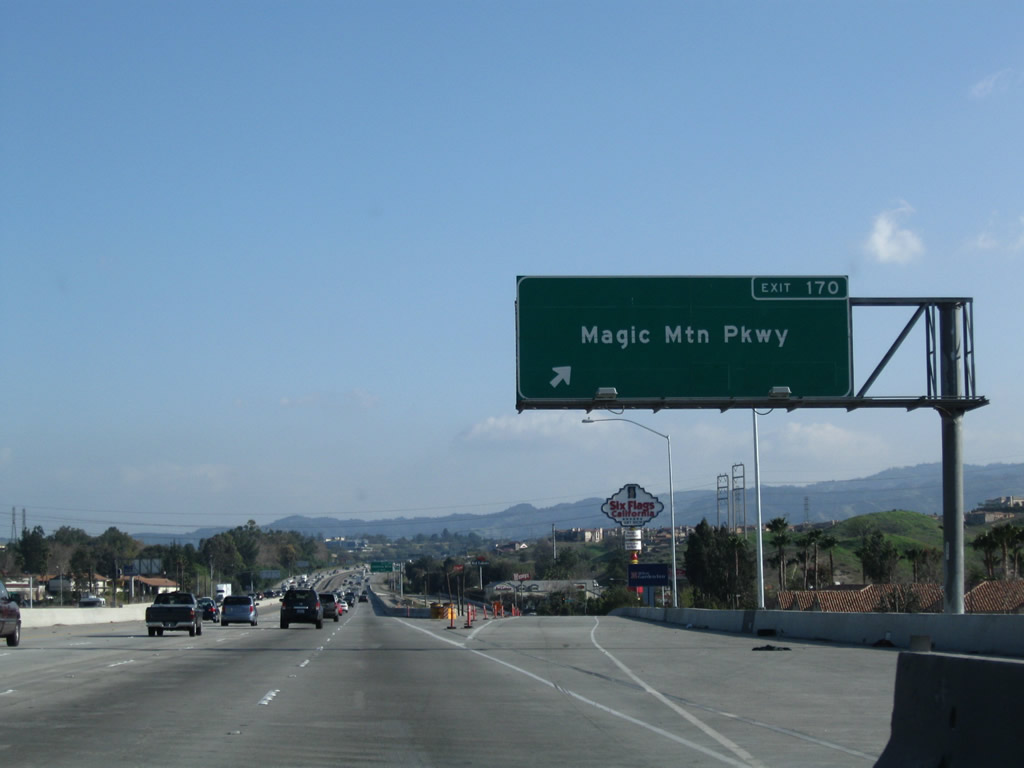
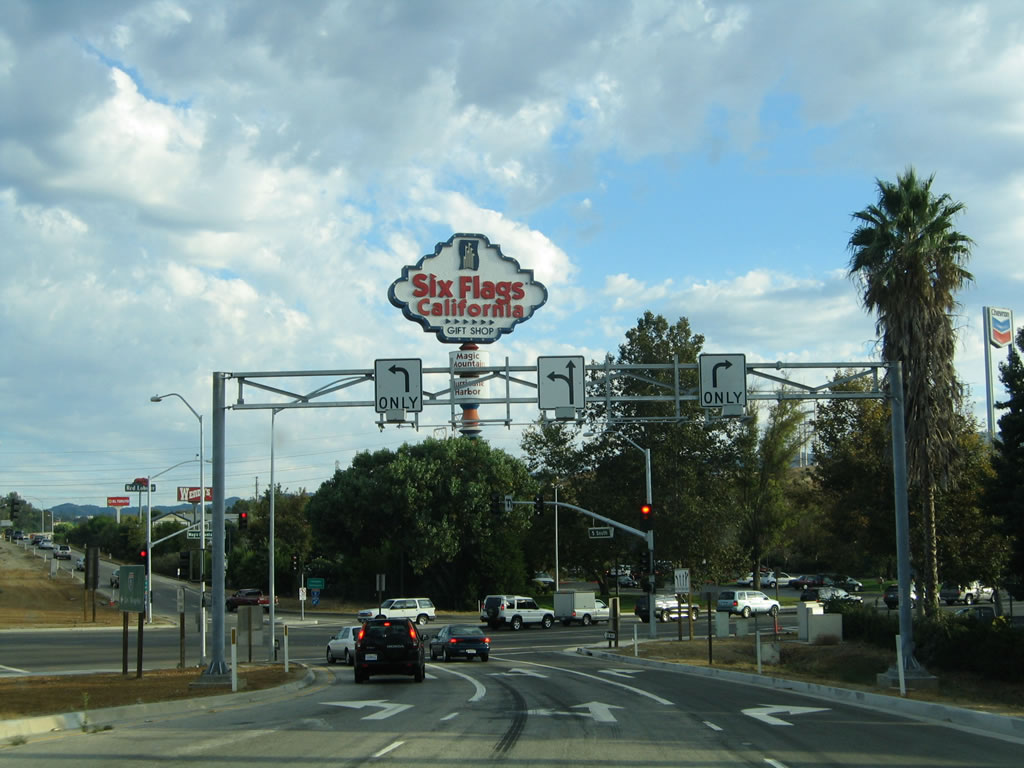
The next exit along southbound Interstate 5 is Exit 170, Magic Mountain Parkway (former California 126 east). As the name implies, this is the exit to take to reach Six Flags Magic Mountain amusement park. The rides are visible to the west of the freeway. California 126 was planned to extend east of here as a freeway connecting to California 14, but that plan was eliminated in favor of the Cross Valley Connector project. Photo taken 03/15/09. |
|
Southbound Interstate 5 (Golden State Freeway) reaches Exit 170, Magic Mountain Parkway (former California 126 east). Construction is still underway at this site as of 2009, but this sign is gone. Note the limited deceleration lane. Photo taken 09/25/05. |
|
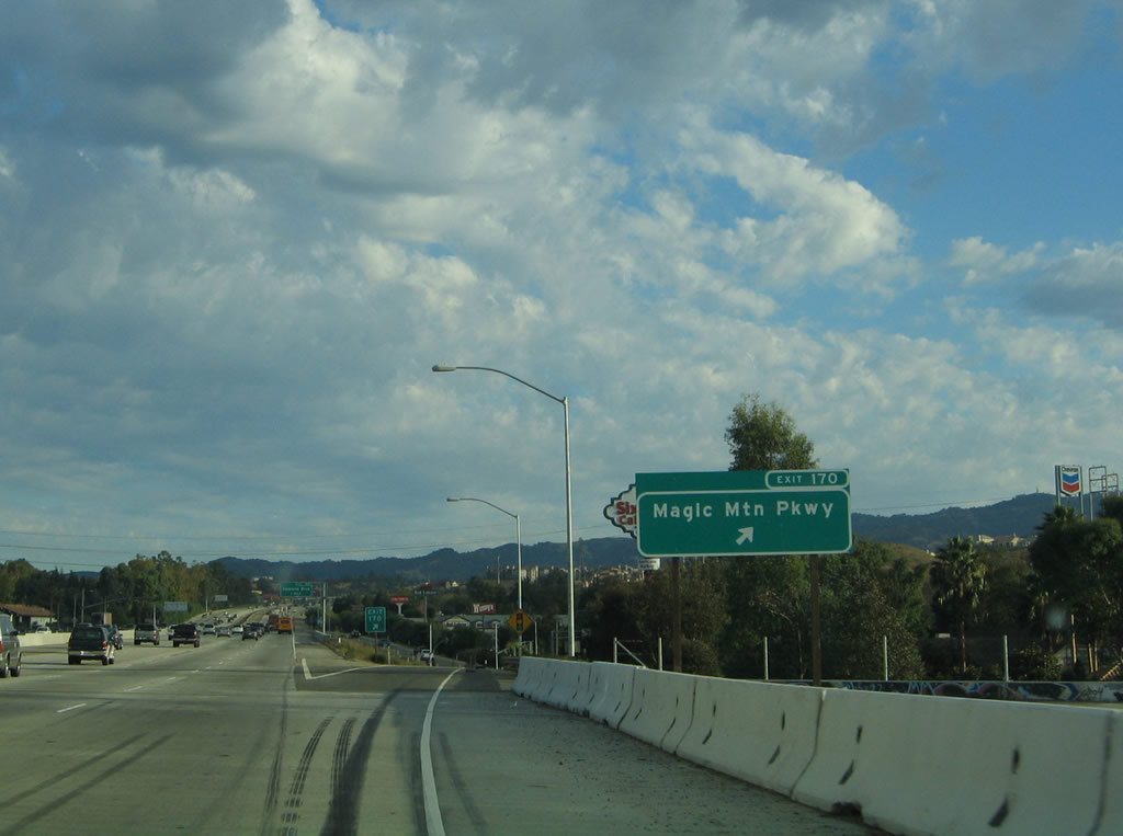
Exiting at Magic Mountain Parkway (Exit 170), no signs remain of former California 126. Magic Mountain is located just west of here via old U.S. 99 (frontage road); a left turn leads into Santa Clarita. Photo taken 09/25/05. |
|
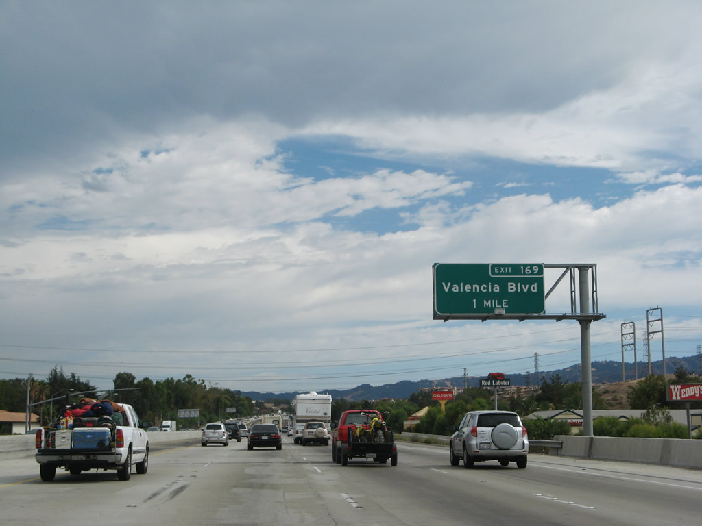
The next exit is Exit 169, Valencia Parkway (one mile), which is now signed with this new exit number sign. Valencia Parkway also serves the city of Santa Clarita. Photo taken 08/26/07. |
|
|
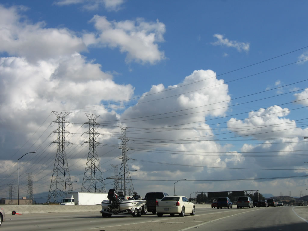
Several power lines cross Interstate 5 at this point. These lines originate at a large substation just east of the freeway in Santa Clarita and travel west toward western Los Angeles County and Ventura County. Photos taken 03/15/09. |
|
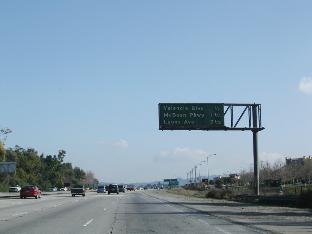
After Exit 170/Magic Mountain Parkway, the next exit is Exit 169, Valencia Parkway (0.50 mile) followed by Exit 168, McBean Parkway and Exit 167, Lyons Avenue. To warrant a mileage sign like this, clearly Interstate 5 has left the rural areas and has entered the suburbs of Los Angeles. Photo taken 03/15/09. |
|
Southbound Interstate 5 reaches Exit 169, Valencia Parkway. The next exit is Exit 168, McBean Parkway, followed by Exit 167, Lyons Avenue. Photo taken 08/26/07. |
|
This mileage sign, located after Exit 169 to Valencia Parkway, provides the distance to Exit 168, McBean Parkway; Exit 167, Lyons Avenue; and Exit 166, Calgrove Avenue. Photo taken 07/06/04. |
|
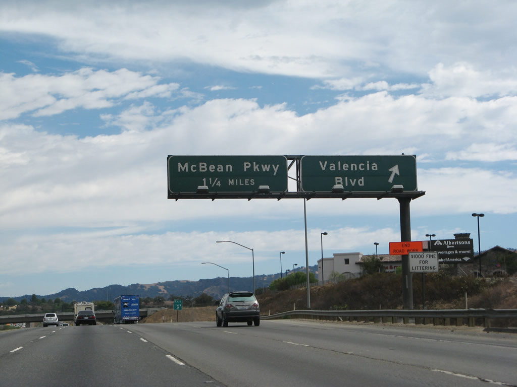
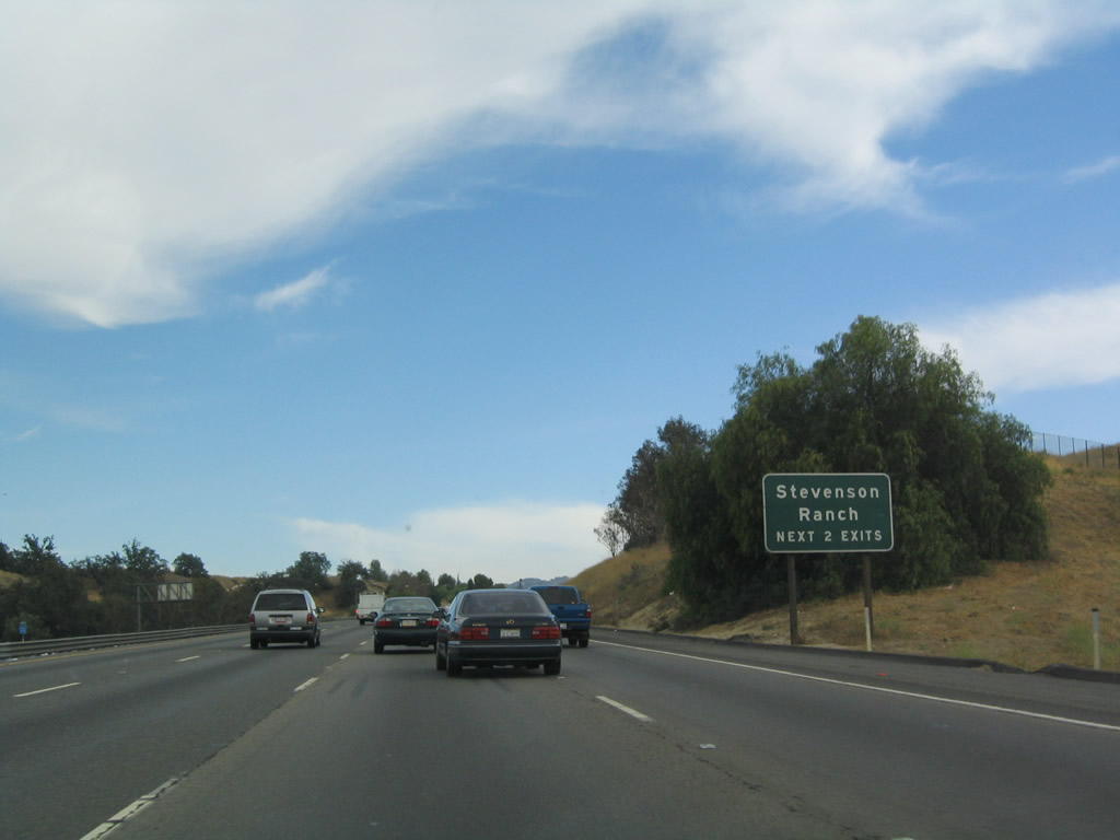
Use either Exit 168, McBean Parkway or Exit 167, Lyons Avenue to reach Stevenson Ranch, which is located west of Interstate 5 and Santa Clarita. Photo taken 07/06/04. |
|
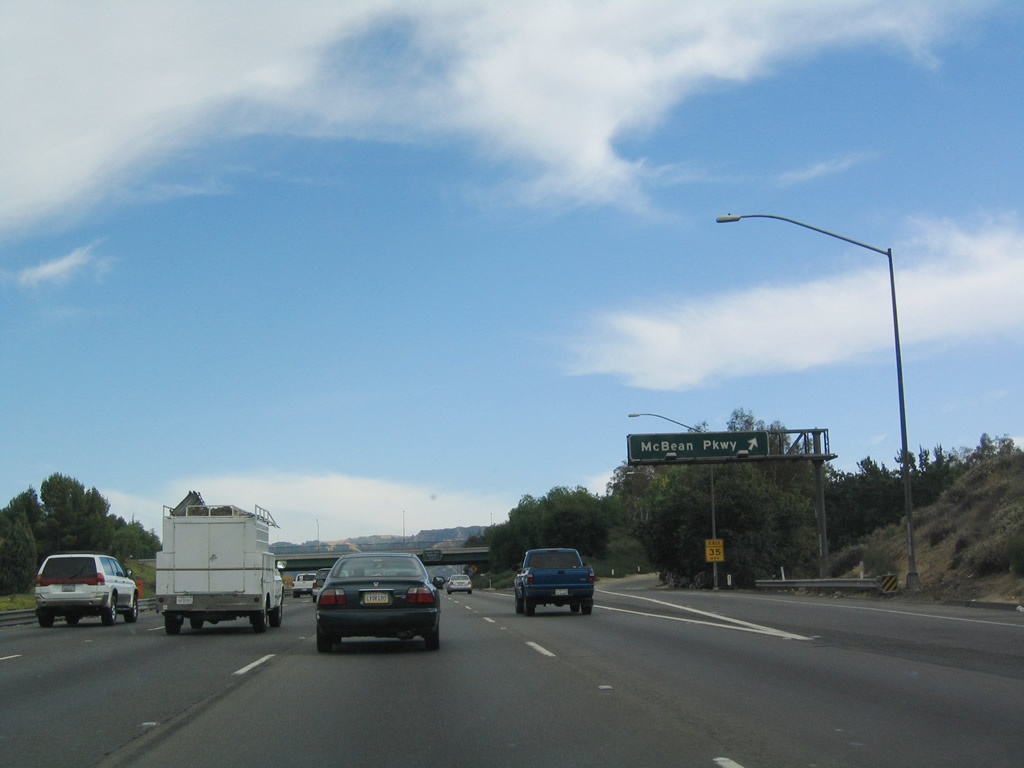
Southbound Interstate 5 reaches Exit 168, McBean Parkway. During heavy traffic conditions, it is not uncommon for the freeway to back up in this vicinity in anticipation of the California 14 merge (Exit 162). Photo taken 07/06/04. |
|
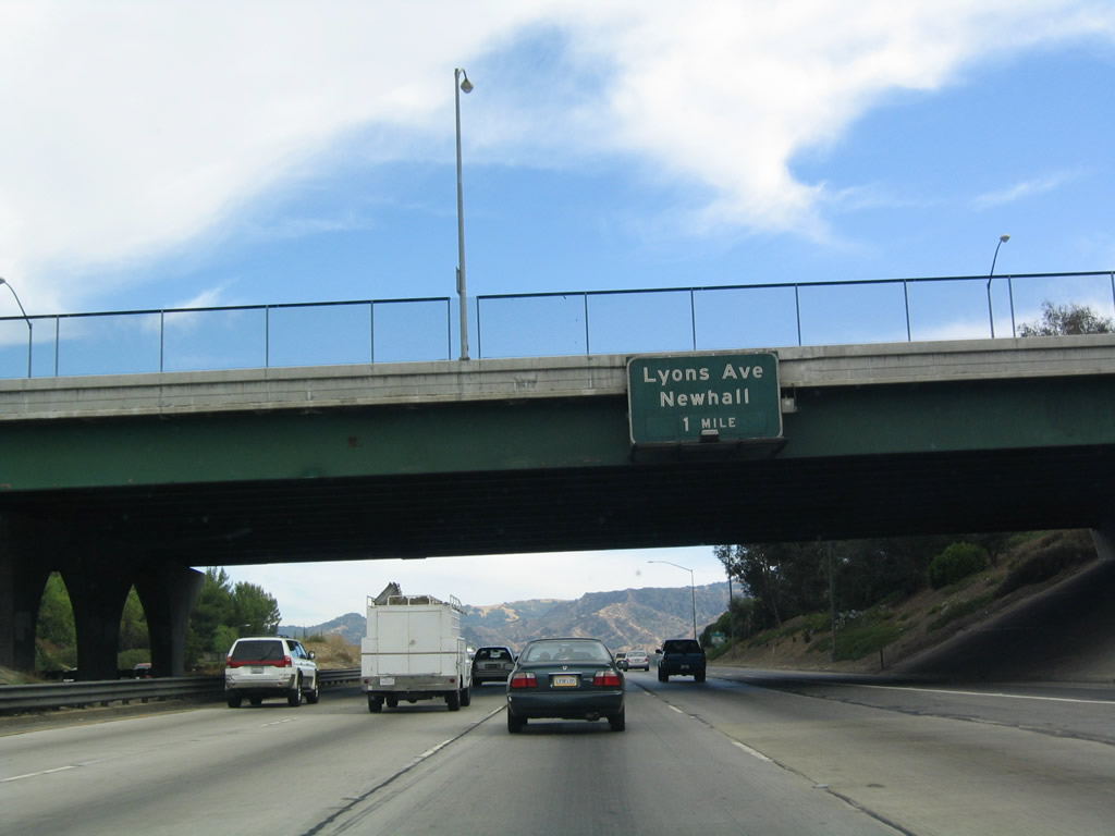
The next exit along southbound is Exit 167, Lyons Avenue, one mile. The Lyons Avenue interchange serves Newhall (part of Santa Clarita) to the east and Stevenson Ranch to the west. Photo taken 07/06/04. |
|
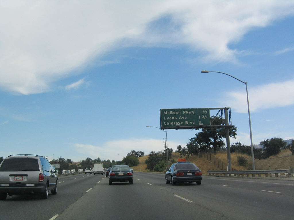
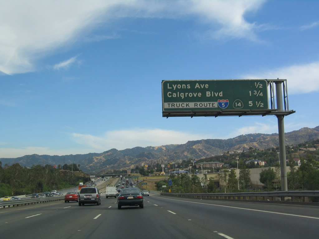
This mileage sign provides the distance to the next three exits: Exit 167, Lyons Avenue; Exit 166, Calgrove Avenue; and Exit 162, Truck Route for California 14 (Antelope Valley Freeway) north. Photo taken 07/06/04. |
|
Southbound Interstate 5 reaches Exit 167, Lyons Avenue to Stevenson Ranch and Santa Clarita/Newhall. A wide variety of services, including upscale restaurants and shopping, is available at this interchange. Photo taken 07/06/04. |
|
This mileage sign provides the distance to the next three exits: Exit 166, Calgrove Avenue; Exit 163, the split for the Truck Route bypass for both California 14 (Antelope Valley Freeway) north and truck traffic continuing south on Interstate 5, and Exit 162, California 14 (Antelope Valley Freeway) north. Photo taken 07/06/04. |
|
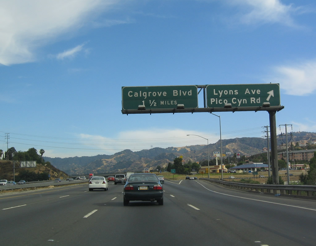
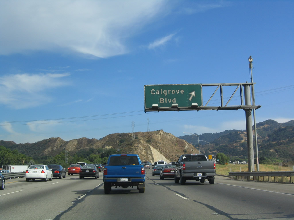
Southbound Interstate 5 next reaches Exit 166, Calgrove Avenue, which heads east into Santa Clarita, with connections to Valley Canyon Road and Valley Street. This is the final Santa Clarita exit (unless you plan to use California 14 east to the other end of town). Photo taken 07/06/04. |
|
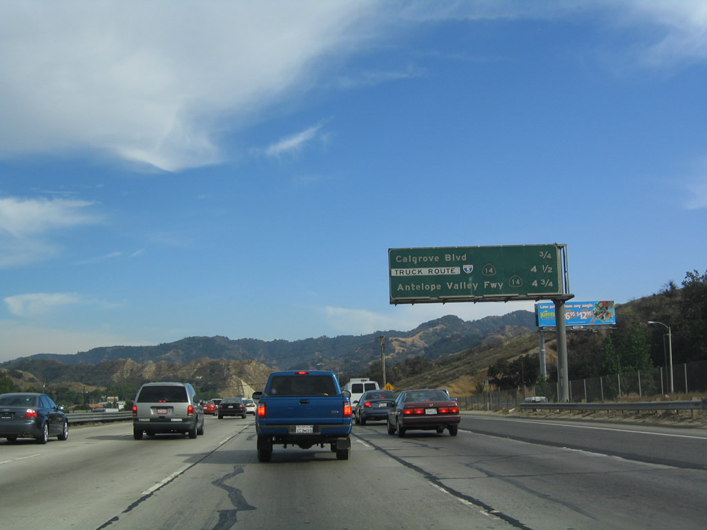
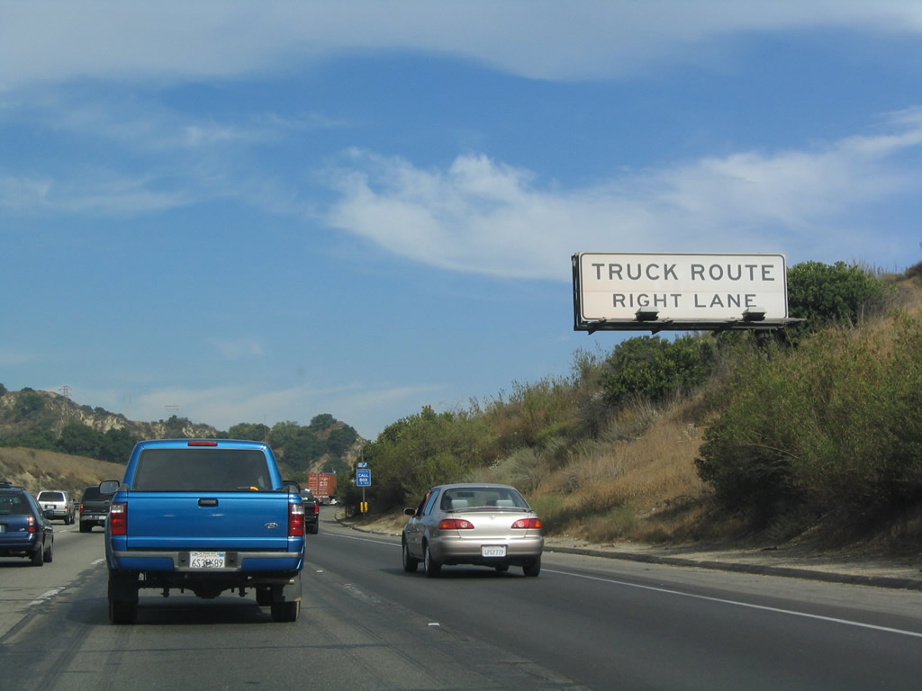
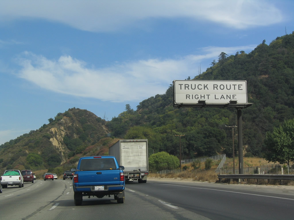
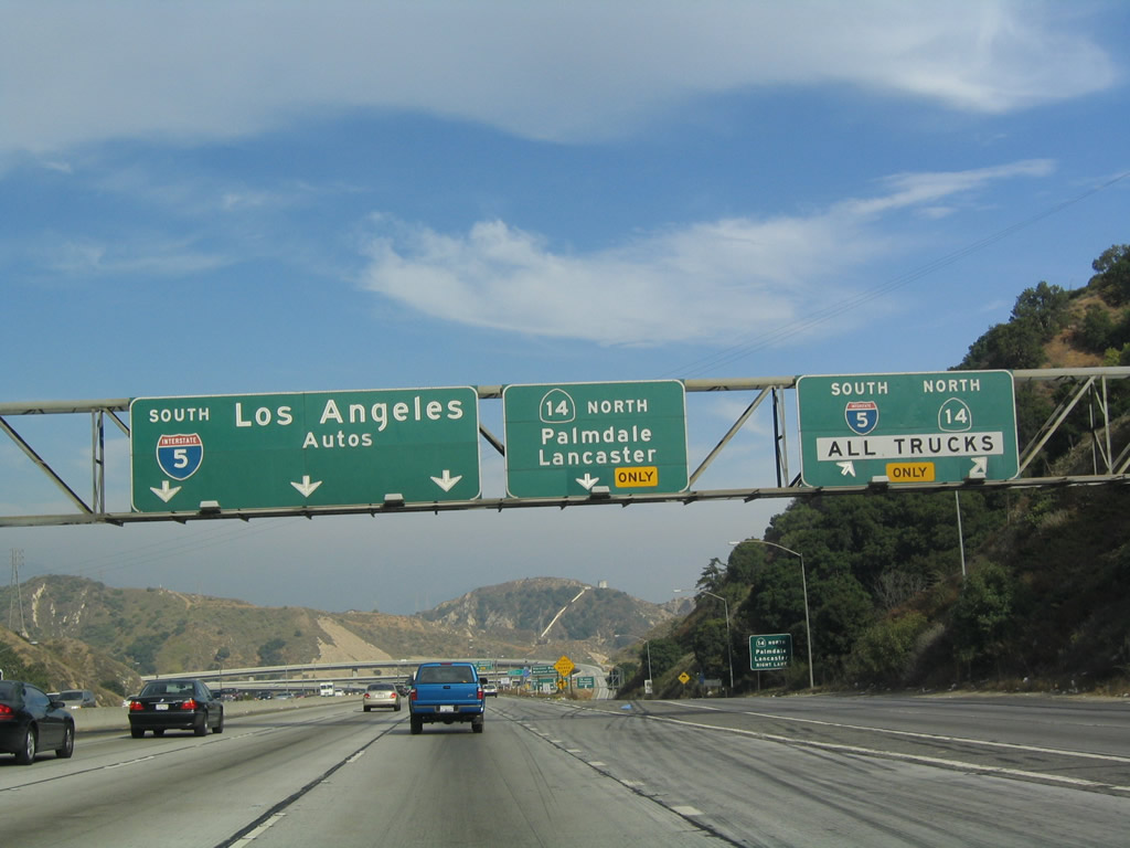
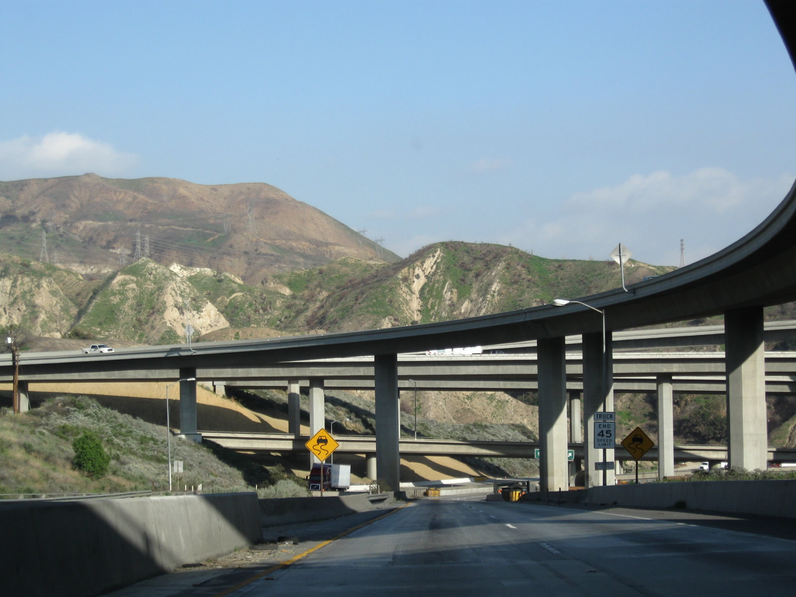
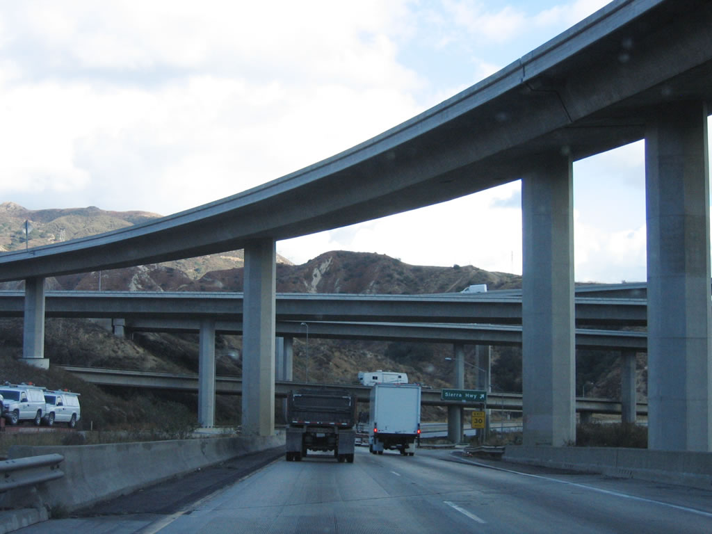
After the Calgrove interchange (Exit 166), the next three miles of southbound prepare the freeway for the Sylmar interchange: California 14 and Interstate 210 (Exits 163-161B-A). This involves the confluence of two eight-lane freeways (Interstate 5 and California 14) and the Interstate 210 split. Additionally, the entire interchange is built into a tight canyon, making the connections and grade vary. As a result, the freeway is split into auto/truck lanes, with all trucks required to use the right lanes and all automobiles to use the left lanes. This white sign is the first warning of the truck restriction. Exit 163, the first split in the Sylmar interchange, takes all trucks onto the Truck Bypass. Photo taken 07/06/04. |
|
The right lanes will become the Truck Route bypass for both California 14 (Antelope Valley Freeway) north and truck traffic continuing south on Interstate 5 (Exit 163). All trucks must use these right lanes. Similar to the California 99 merge, the objective of the auto/truck bypass is to allow slower traffic to merge with slower traffic first and faster traffic to merge with faster traffic. On this day, the freeway was moving at a good pace, but sudden backups and delays are common through the Sylmar Interchange. Use caution. Photo taken 07/06/04. |
|
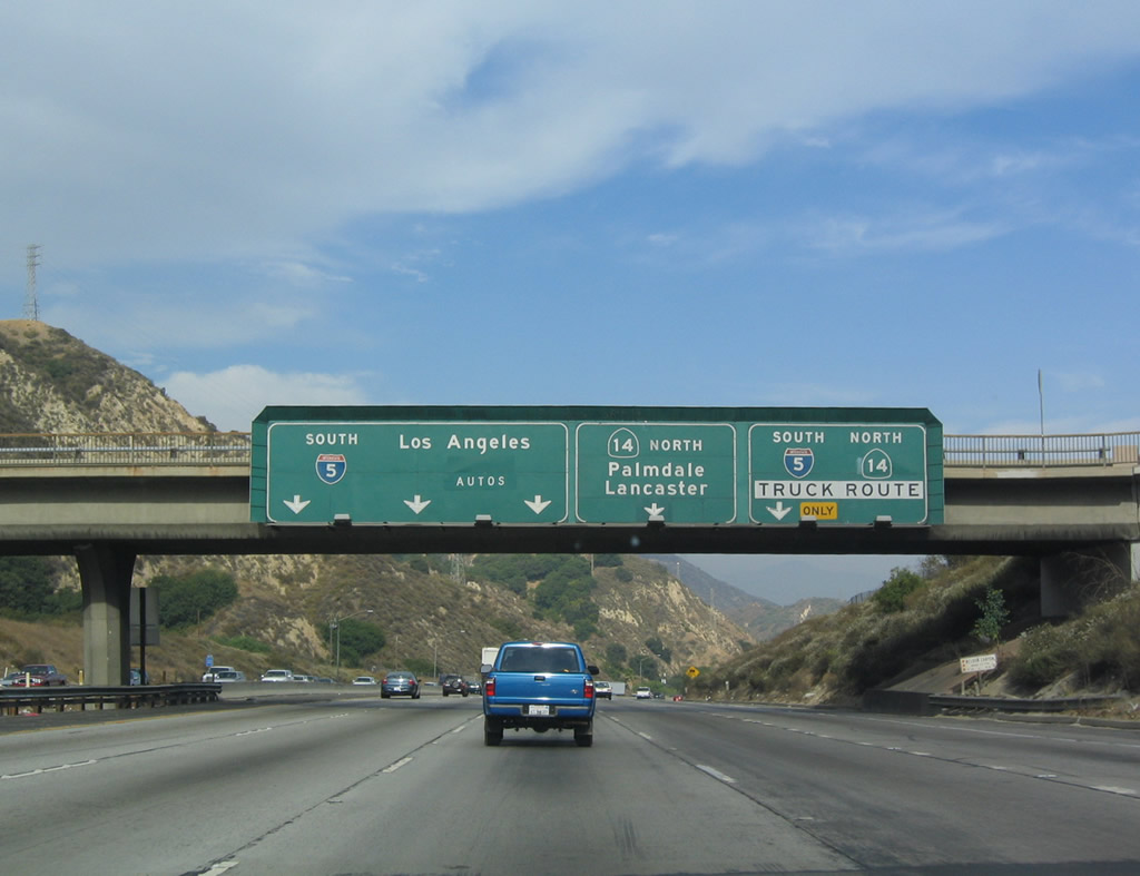
This is the first sign providing direction for lane usage on southbound. The right lane constitutes Exit 163, the split for the Truck Route bypass for both California 14 (Antelope Valley Freeway) north and truck traffic continuing south on Interstate 5. The next lane over from the right (#4 lane) is an exit-only lane for Exit 162, California 14 (Antelope Valley Freeway) north (even though it is not shown as exit-only on this overhead sign). The three left lanes continue as Interstate 5 south to Los Angeles. Photo taken 07/06/04. |
|
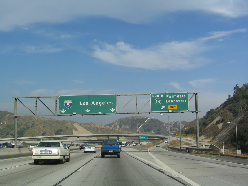
At this point, trucks are split onto the Truck Route bypass. As noted earlier, this truck bypass has connections to both California 14 (Antelope Valley Freeway) north and south Interstate 5. The next exit is Exit 162, California 14 (Antelope Valley Freeway) north. This interchange marks the southern terminus of California 14, which is a freeway that heads northeast toward Palmdale, Lancaster, and Mojave. Ultimately California 14 merges into U.S. 395 northwest of Ridgecrest. Prior to 1964, California 14 was designated as U.S. 6, but the U.S. route was decommissioned during the Great Purge of 1964. This is one of the few decommissioned routes that was not replaced by an Interstate. Nevertheless, California 14 is Interstate standard from Interstate 5 north to the Los Angeles-Kern County Line north of Lancaster. Ahead, one of the most infamous stack interchanges in the Los Angeles region comes into view. Photo taken 07/06/04. |
| Interstate 5 - Auto Bypass south |
|
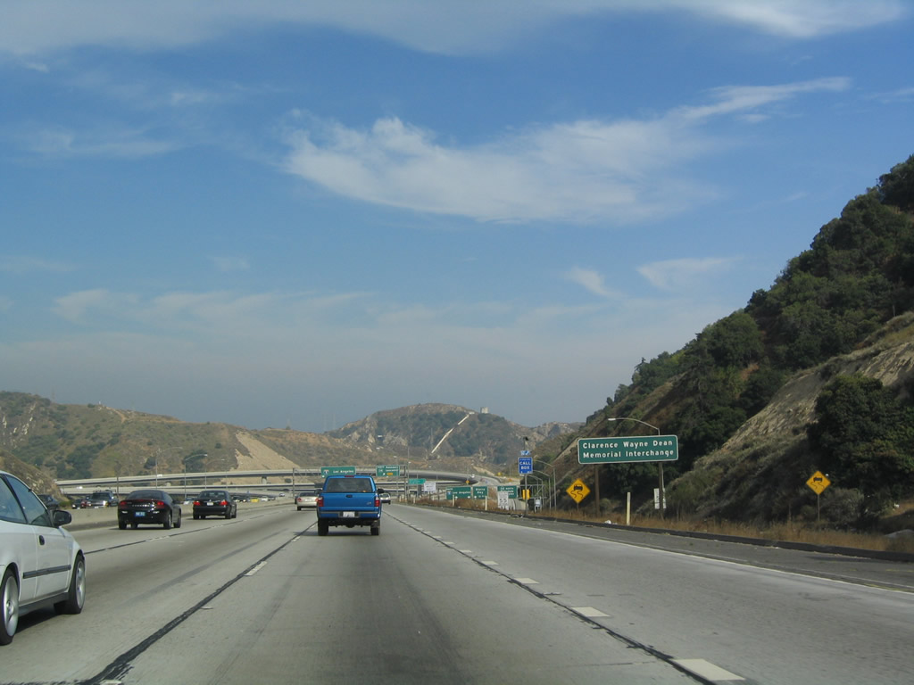
The Sylmar Interchange is infamous for its collapses. It was damaged initially during the 1971 Sylmar Earthquake, it was again heavily damaged in the 1994 Northridge Earthquake, and the north tunnel (which carries Truck Interstate 5 south prior to the California 14 split) was damaged severely during an explosion on October 12, 2007, that killed three people. During the 1994 quake, a flyover ramp crumbled, sending Los Angeles Police Officer Clarence Wayne Dean to his death on January 17, 1994, while riding his motorcycle onto a ramp that was no longer there. The Sylmar interchange (Interstate 5/California 14) has since been rebuilt, and it is named in his memory. The 2007 explosion was caused by a chain reaction accident/collision involving several trucks and cars within the narrow tunnel that carries Truck Interstate 5 south under the main lanes of both directions of Interstate 5. Photo taken 07/06/04. |
|
Southbound Interstate 5/Auto Route reaches Exit 162, California 14 (Antelope Valley Freeway) north. Note the truck bypass, which is a parallel freeway situated at a lower grade to the right in this photo. The next exit (not mentioned) is Interstate 210 east. For traffic preparing to bypass Los Angeles via Interstate 210 (Foothill Freeway) and California 57 (Orange Freeway), merge right after passing the ramp for Exit 162. Photo taken 07/06/04. |
|
This mileage sign provides the distance to the next two exits as Interstate 5 passes through the Sylmar stack interchange: Exit 161B, Balboa Boulevard and San Fernando Road (Former Business Loop I-5 and U.S. 6-99 Business) and Exit 161A, Interstate 210 (Foothill Freeway) east. Photo taken 07/06/04. |
|
San Fernando Road generally parallels Interstate 5 (Golden State Freeway) through San Fernando, Los Angeles/San Fernando Valley, Burbank, Glendale, and Los Angeles. It follows the original route of U.S. 6-99 as they angled southeasterly toward downtown. After Interstate 5 was constructed, San Fernando Road was briefly signed as Business Loop I-5, but that route was decommissioned by the 1970s (even though Rand McNally continued to show the business route on its maps well into the 1990s). Photo taken 07/06/04. |
|
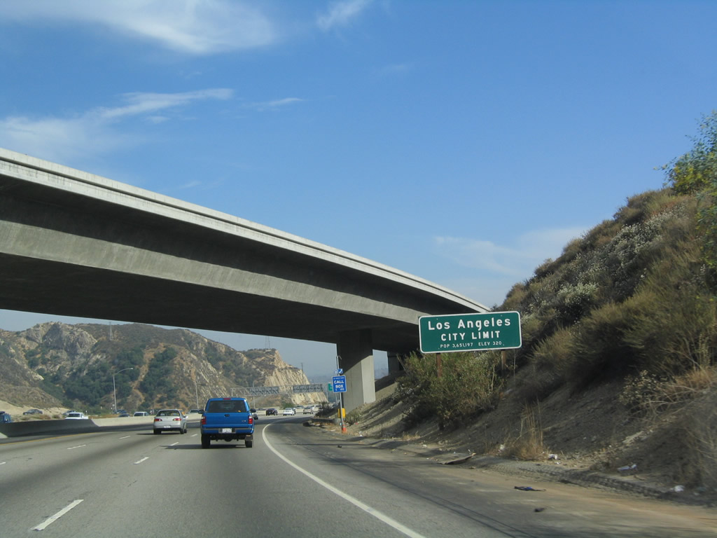
After countless miles of wide valley and open space, Interstate 5 (Golden State Freeway) crosses into the city of Los Angeles. Photo taken 07/06/04. |
|
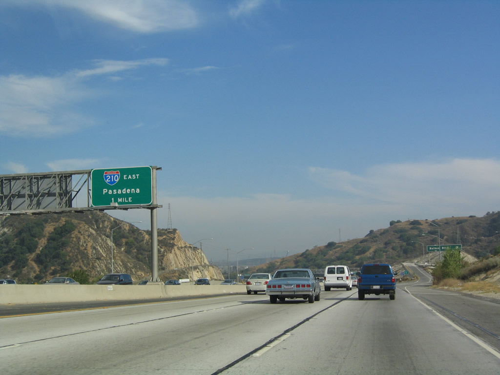
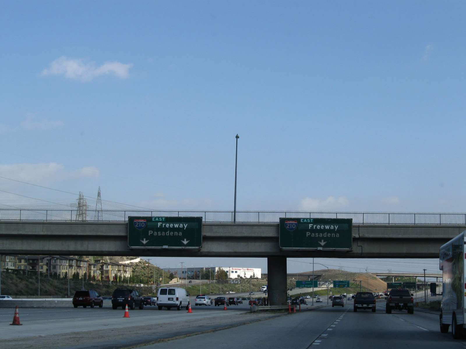
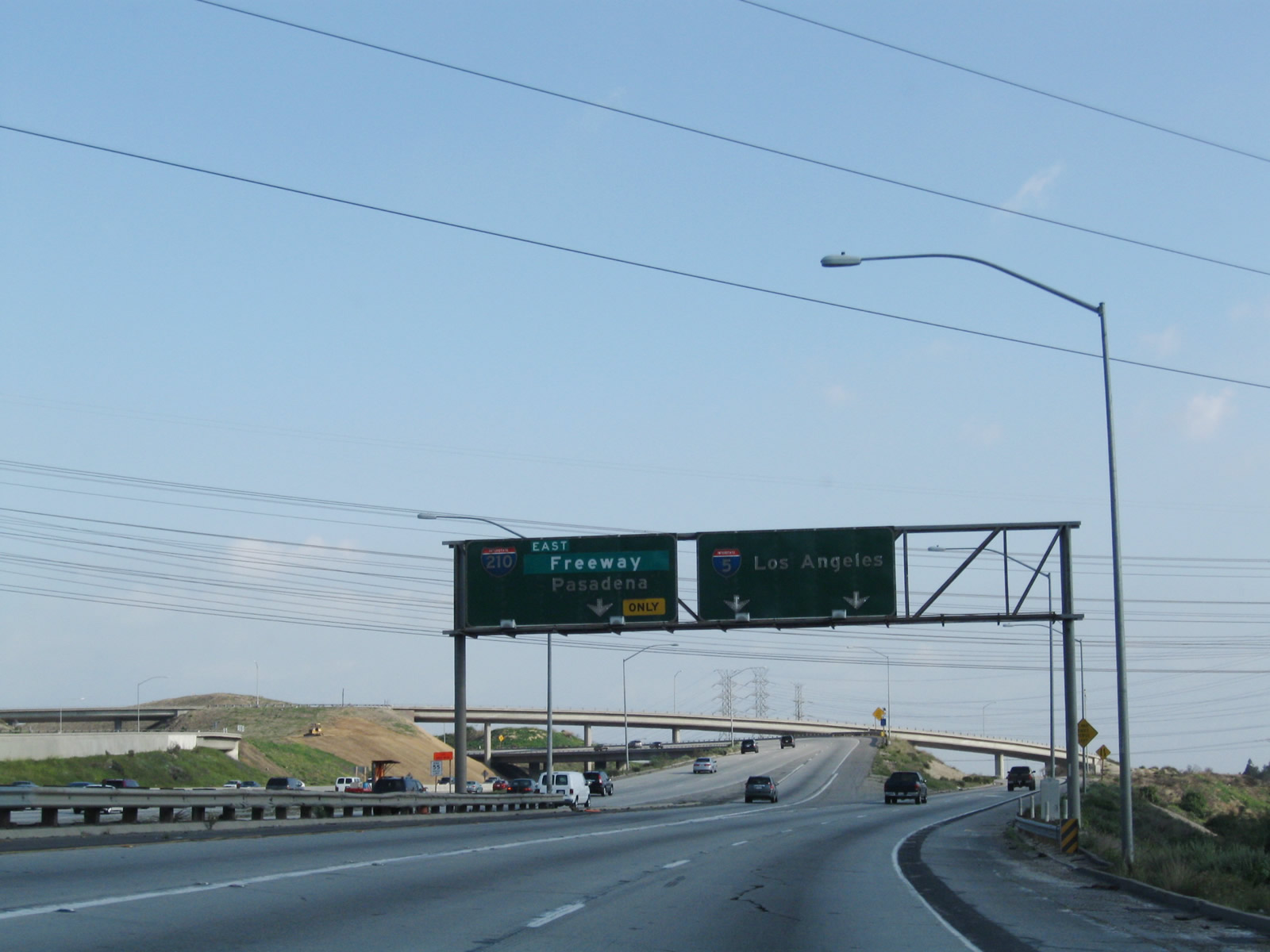
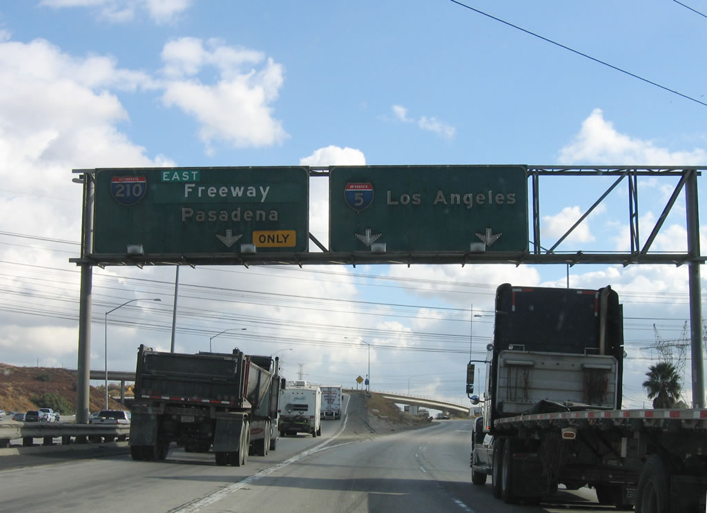
Almost lost in the shuffle of the Sylmar interchange is the split with Interstate 210 (Exit 161A), one mile. Interstate 210 follows the Foothill Freeway southeast to Pasadena, then east toward San Dimas, Claremont, and San Bernardino. The freeway is still incomplete roughly between Interstate 15 and Interstate 215; the remaining segment was completed in July 2007. Photo taken 07/06/04. |
|
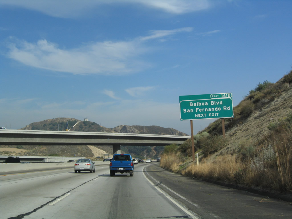
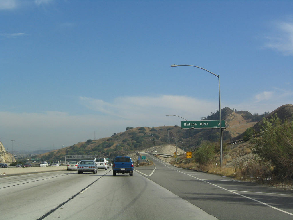
Southbound Interstate 5 (Golden State Freeway) reaches Exit 161B, San Fernando Road (former U.S. 6-99 and former Business Loop I-5) and Balboa Boulevard, which heads due south from this interchange through Granada Hills, Reseda, and Encino before ending at Ventura Boulevard. Balboa Boulevard parallels Interstate 405 to the west for its entire length. Note that Interstate 5 is only three lanes wide through here; that changes once traffic from southbound California 14 join the freeway after this exit ramp (Exit 161B). Photo taken 07/06/04. |
| Interstate 5 (Golden State Freeway) TRUCK ROUTE south |
|
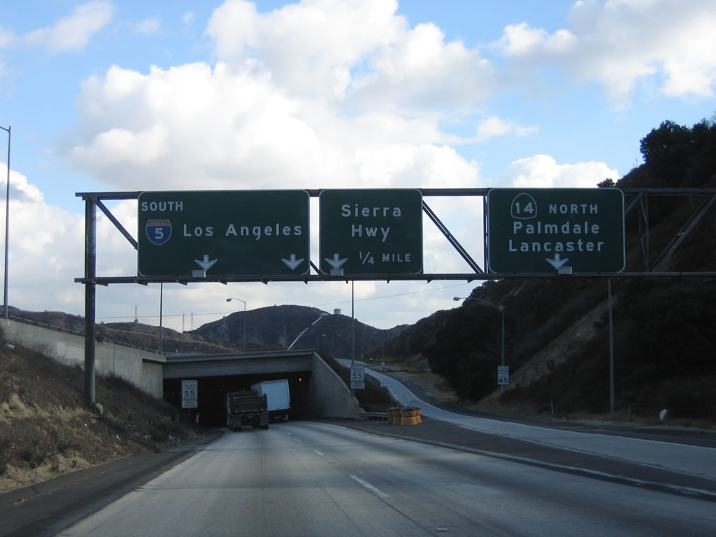
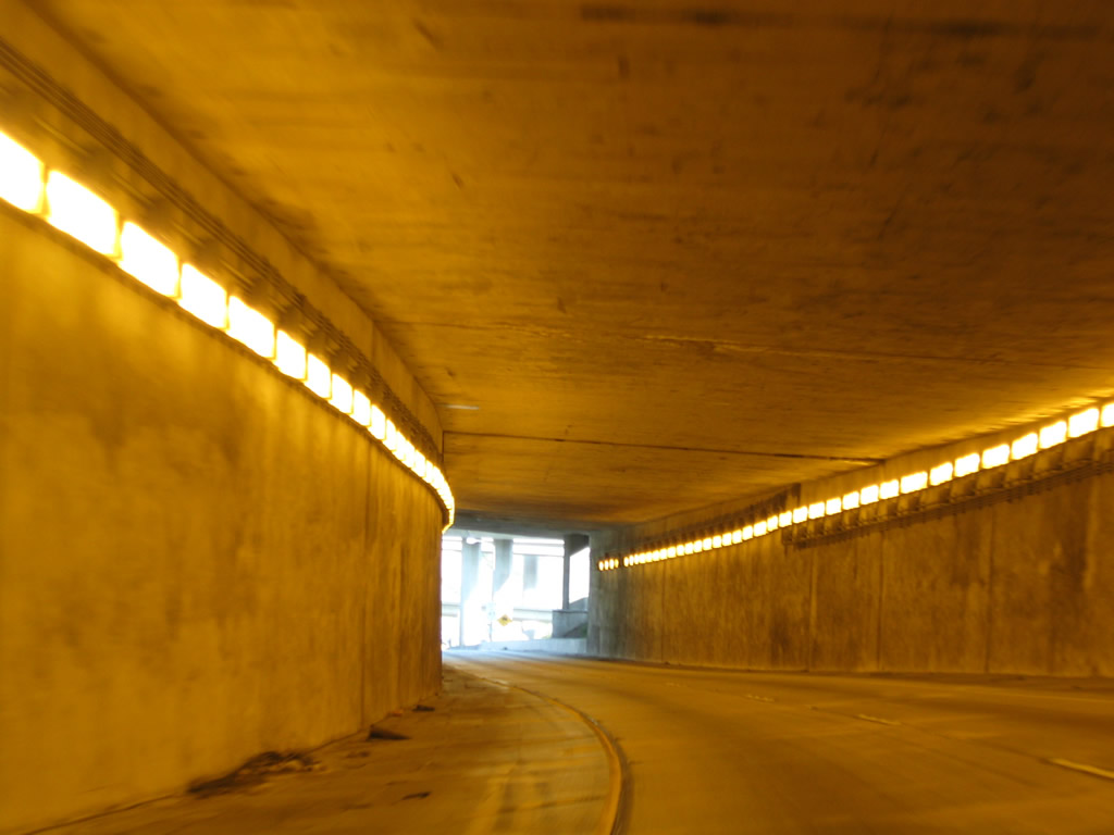
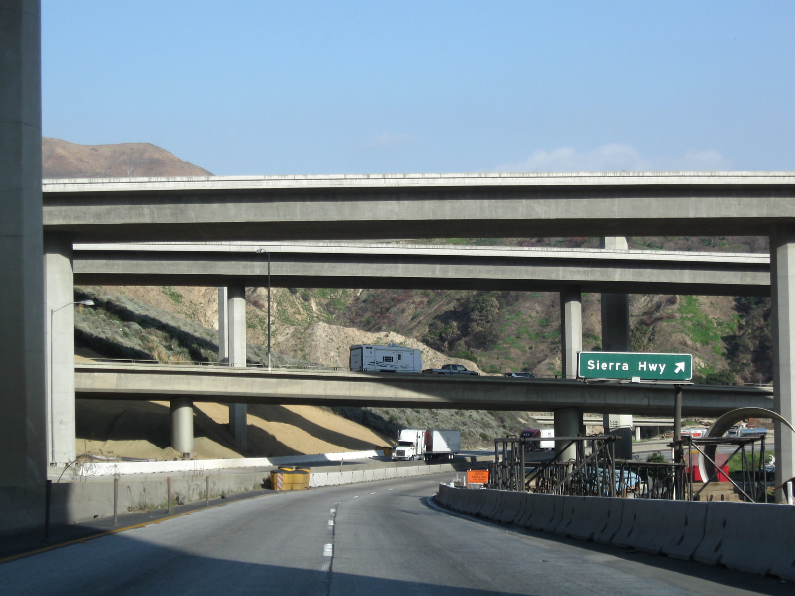
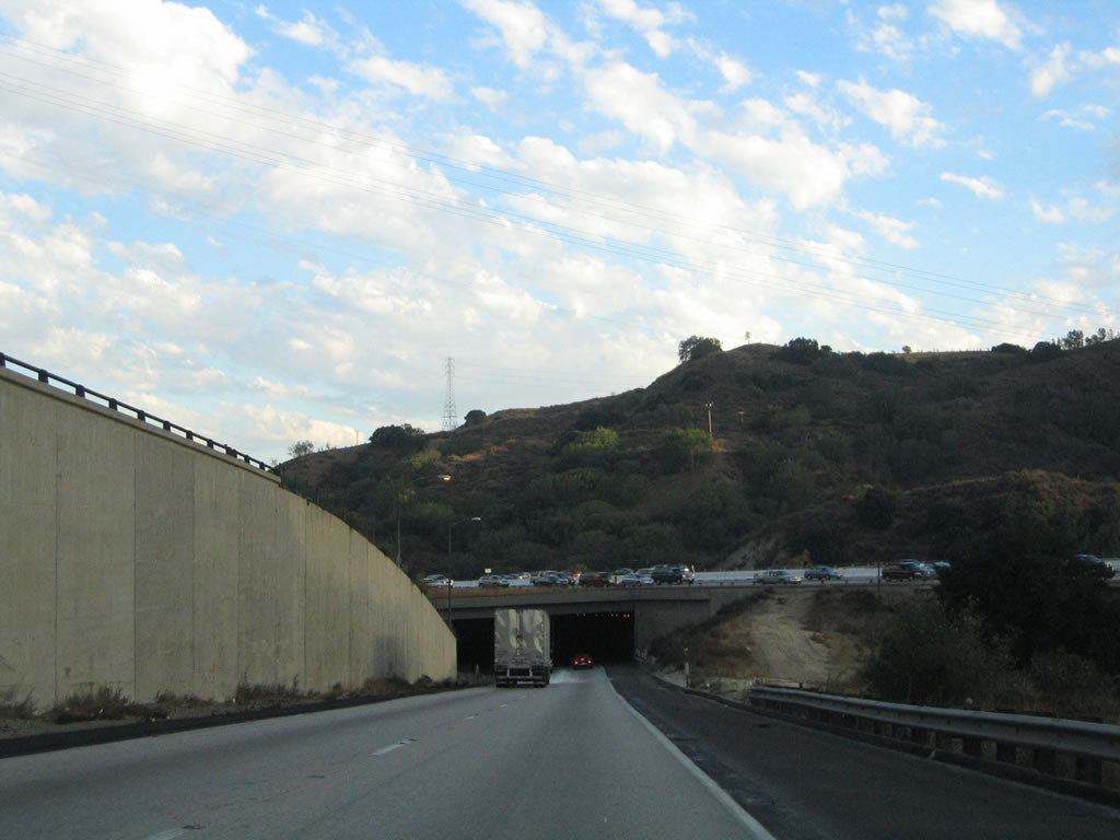
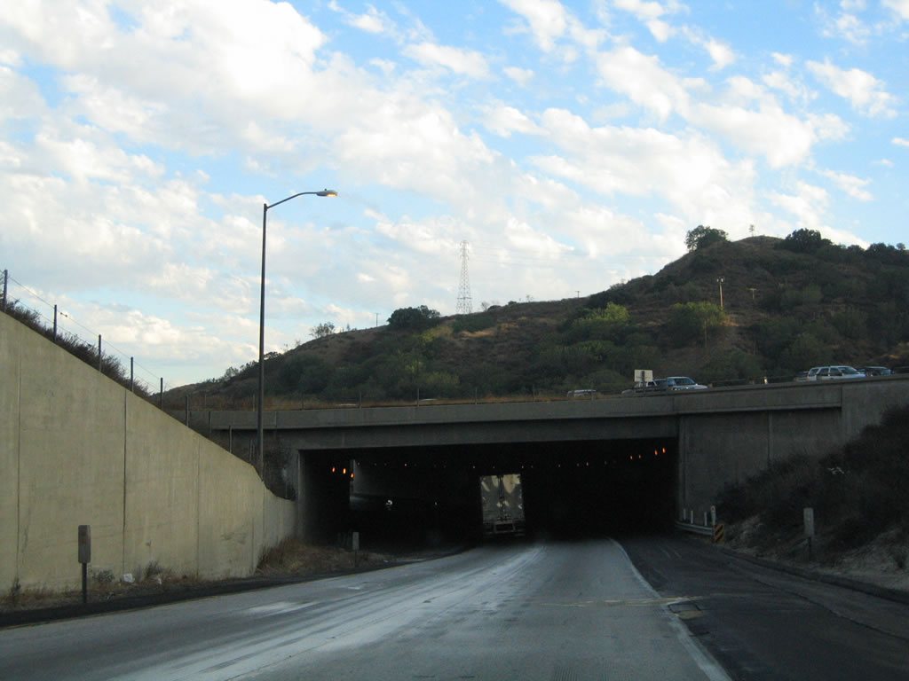
Now on the Interstate 5 Truck Route, the first exit is the link to California 14 (Antelope Valley Freeway) north to Lancaster and Mojave. The next exit along the Truck Route is Exit 163A, Sierra Highway (Old U.S. 6) northeast to Santa Clarita. After California 14 splits, the two-lane truck route enters the notorious northern tunnel that was the scene of a violent accident resulting in the deaths of several motorists late on Friday, October 12, 2007. This tunnel is very narrow with limited sight distance and plenty of trucks, so be careful upon entering. Photo taken 11/27/06. |
|
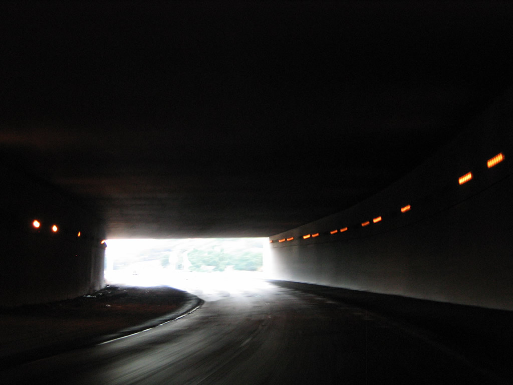
Truck Interstate 5 enters the first of two tunnels on the southbound truck route. This is the scene of the fiery crash on 10/12/07; it was caused when two trucks collided on the wet, rain-slickened roadway around 11:00 p.m. The collision involved 31 vehicles (including trucks and passenger cars, which are allowed to use the truck lanes). The ensuing blaze was fueled by the truck cargo for several hours after the fire started. It was so hot, flames leapt out of both portals of the tunnel -- some reports indicate that the flames rose over one hundred feet above the portals, and temperatures rose to nearly 1,400 degrees Fahrenheit. Three people were killed in the inferno (including a child), and at least ten were injured. According to reports, "the intensity of the fire cause the 550-foot tunnel's concrete to crack, melt, and explode - a reaction known as sprawling." The main lanes of the freeway were closed for a period to ensure no structural deficiencies occurred as a result of the fire and intense heat.1, 2, 3 Photos taken 03/15/09 and 11/27/06. |
|
|
|
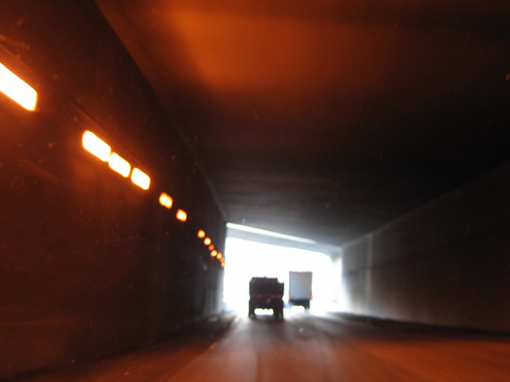
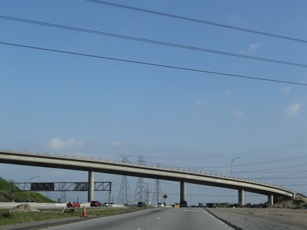
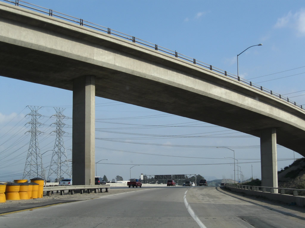
Emerging from the tunnel, the truck lanes find themselves east of the main lanes of Interstate 5. The off-ramp for Sierra Highway can be seen ahead, and towering ramps (some of which were damaged during the Sylmar Earthquake of 1971 and Northridge Earthquake of 1994) loom high above the truck bypass. Photos taken 03/15/09 and 11/27/06. |
|
Southbound Truck Interstate 5 (Golden State Freeway) reaches Exit 163, Sierra Highway. This off-ramp connects to old U.S. 6, which used to travel northeast from here to Palmdale, Lancaster, Mojave, and Bishop before turning into Nevada west of Hawthorne. The route has been replaced by California 14 through the Antelope Valley and by U.S. 395 north of Ridgecrest. U.S. 6 now begins its eastbound journey in Bishop. Photo taken 03/15/09. |
|
After the off-ramp to Sierra Highway (U.S. 6), southbound Interstate 5's truck lanes retain two through lanes. Watch ahead for the merge with California 14's truck lanes. Construction was underway for the new high occupancy vehicle lanes to be routed through this massive interchange. Photo taken 03/15/09. |
|
Shortly thereafter, the Interstate 5 truck lanes merge with the California 14 truck lanes (incoming from the right). Photo taken 03/15/09. |
|
|
|
Continuing south on the truck lanes, the two-lane truck route prepares to cross back under Interstate 5 (Golden State Freeway)'s main lanes through a second tunnel. Unlike the northern tunnel, the second tunnel is wider with shoulders. Photos taken 09/25/05. |
|
|
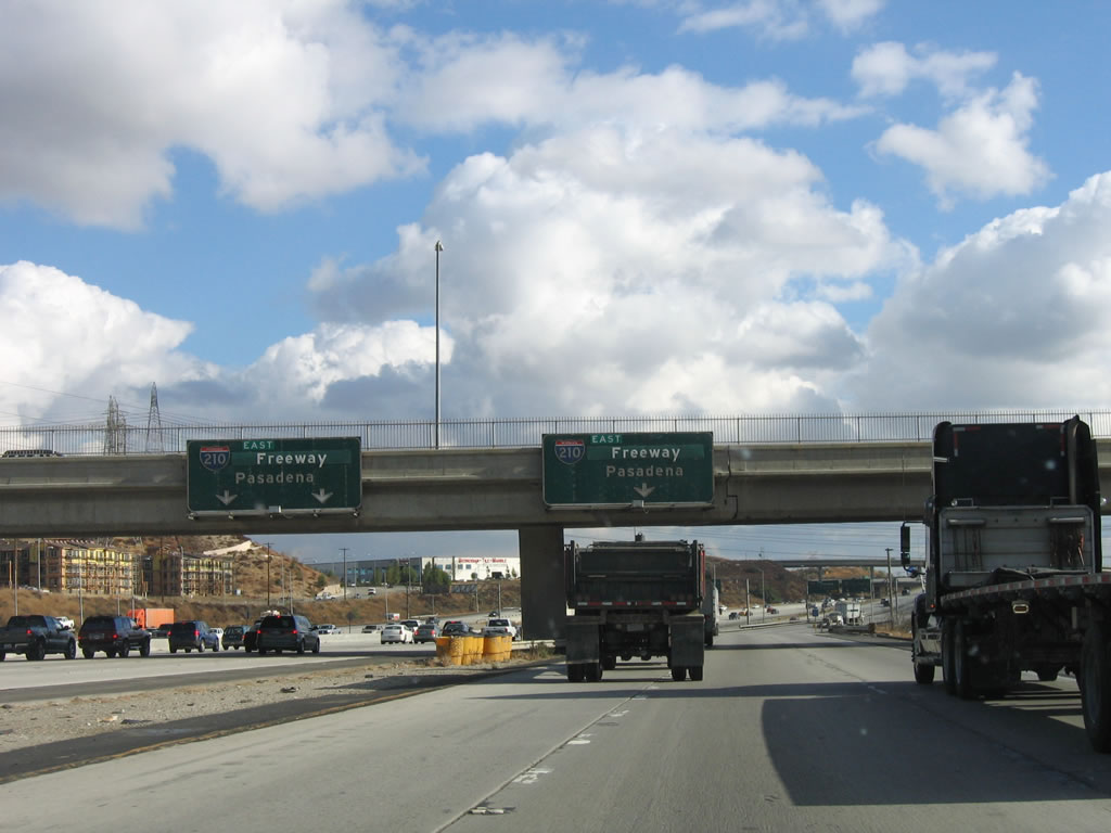
A third lane joins the truck bypass after leaving the south tunnel. The next exit along southbound Truck Interstate 5 is Exit 161A, Interstate 210 (Foothill Freeway) east to Pasadena and San Bernardino. Photos taken 03/15/09 and 11/27/06. |
|
|
The left lane becomes exit only for Exit 161A, Interstate 210 (Foothill Freeway) east to Pasadena and San Bernardino. Use the right two lanes to rejoin Interstate 5 (Golden State Freeway) south to downtown Los Angeles. Photos taken 03/15/09 and 11/27/06. |
|
|
The truck lanes of southbound Interstate 5 (Golden State Freeway) reduce to one lane after splitting with Interstate 210. Photos taken 03/15/09. |
|
|
|
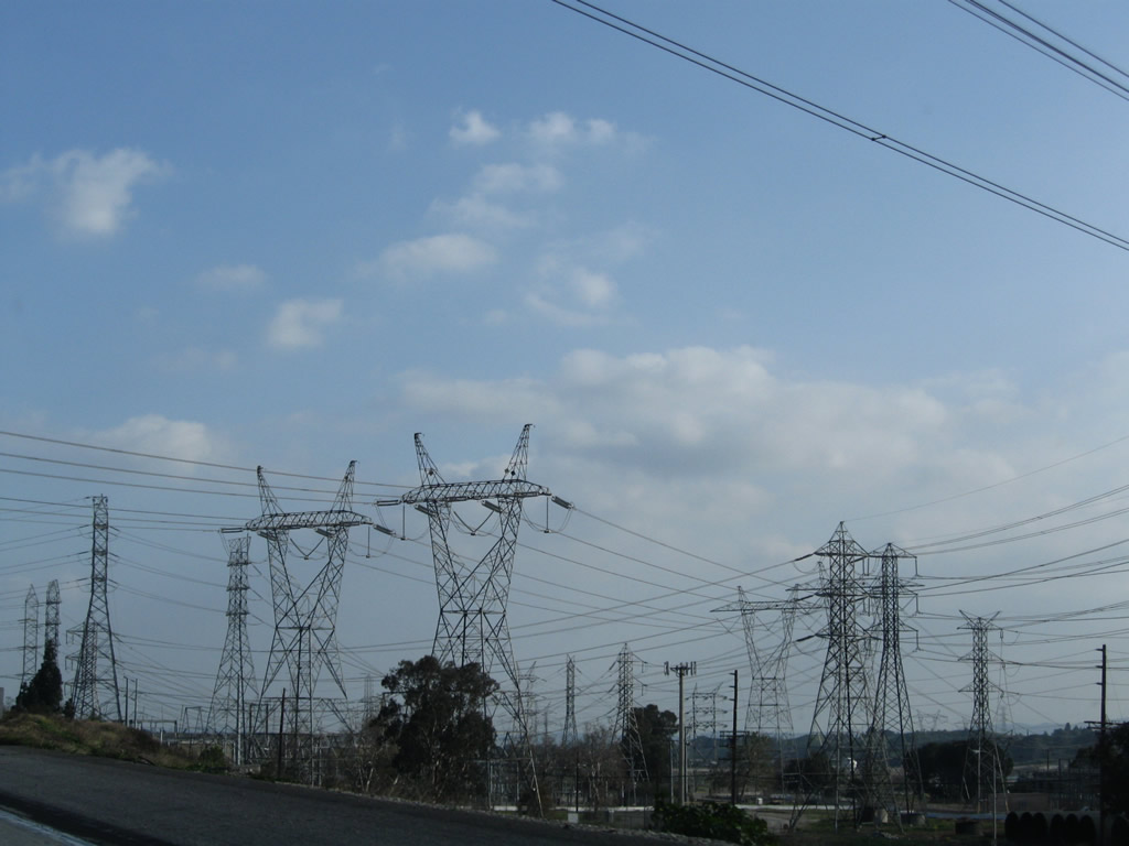
To the west of the truck lanes is a large power substation where several power tranmission lines converge. A pair of 500kV Los Angeles Department of Water and Power (LADWP) power lines cross over Interstate 5 here; these are not directly connected to the Path 26 lines we last saw near Templin Highway. These lines carry power from across the Mojave Desert southwest to the Sylmar area. Photos taken 11/27/06 and 03/15/09. |
|
|
|
Page Updated March 28, 2011.