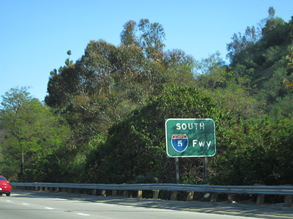
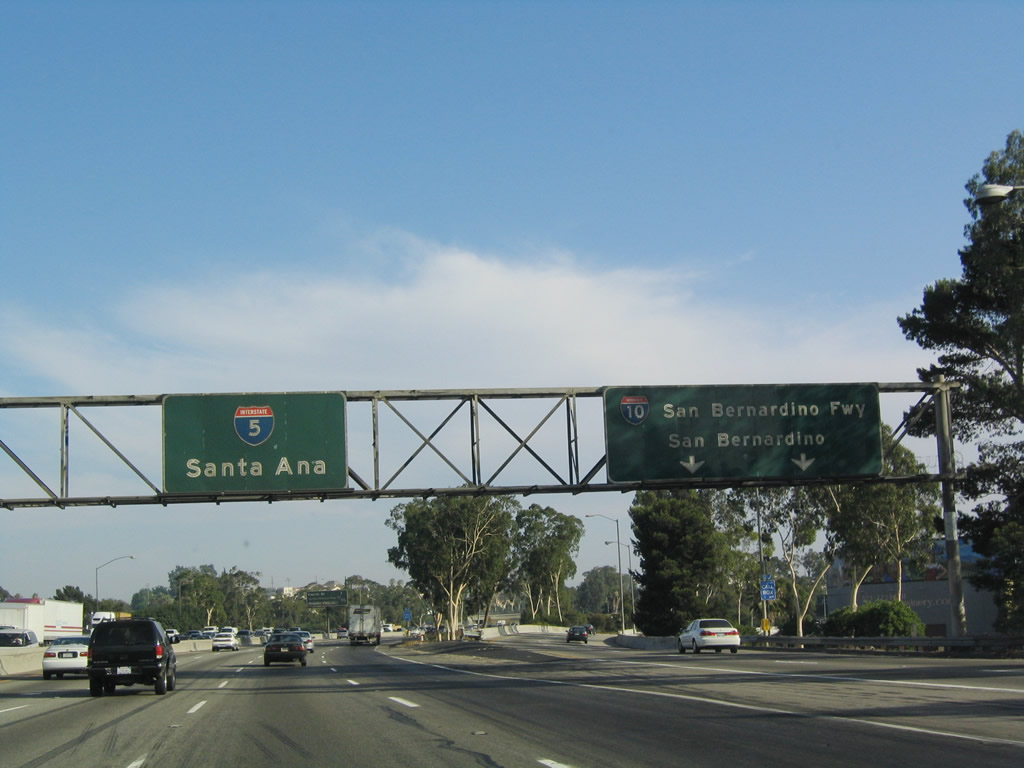
| Interstate 5 (Golden State Freeway) AUTO BYPASS south |
|
|
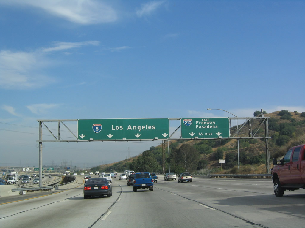
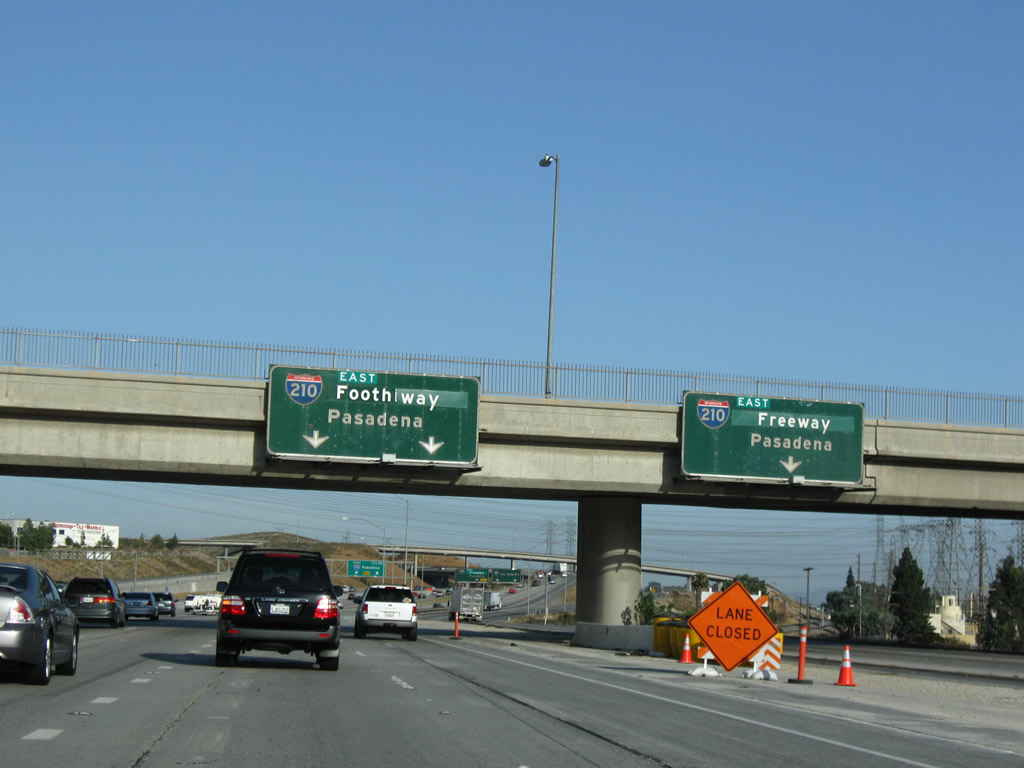
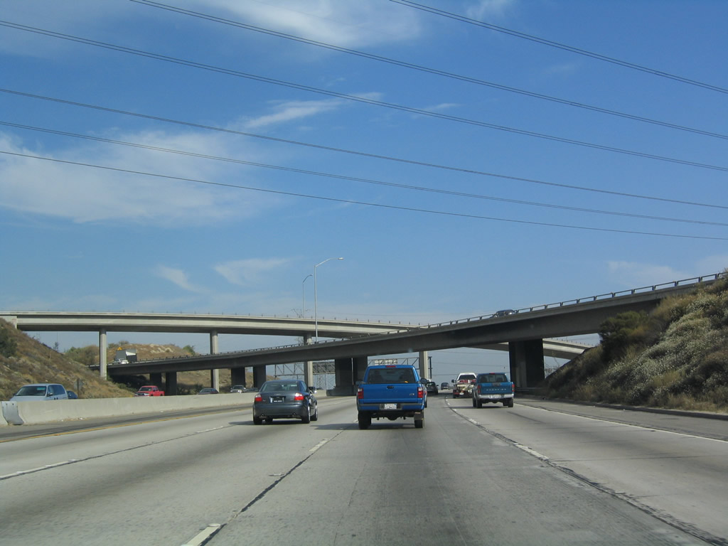
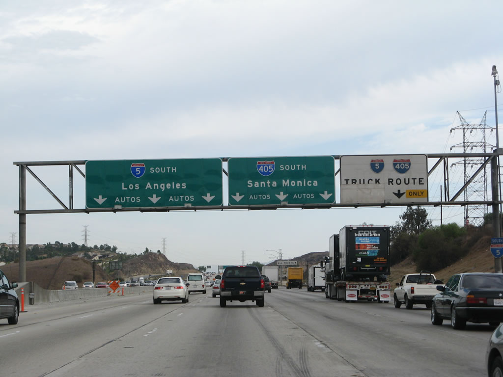
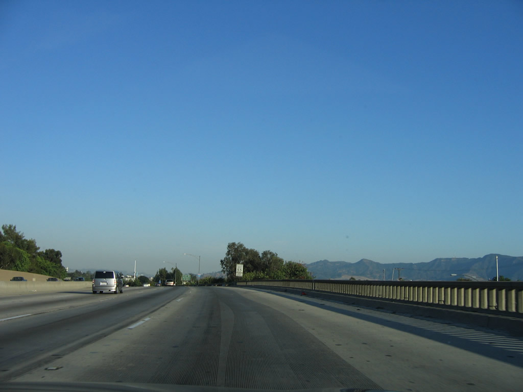
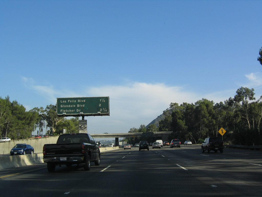
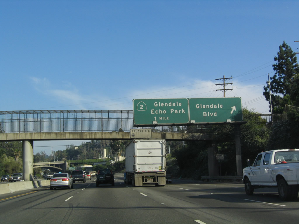
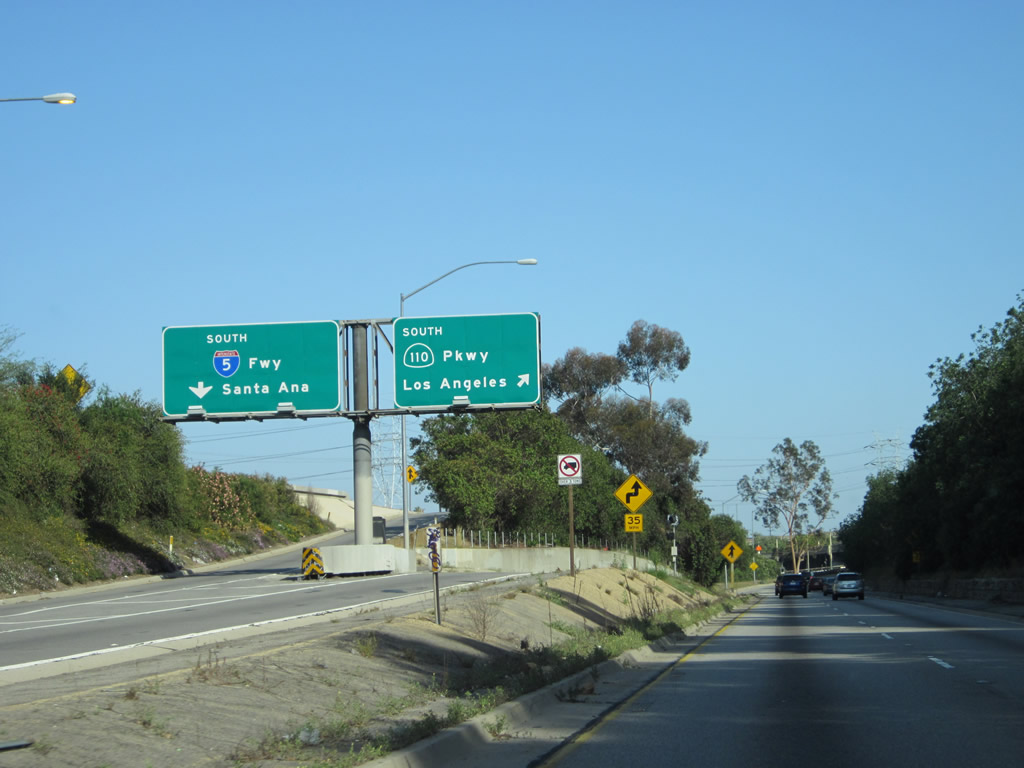
After the California 14 auto traffic joins the mainline freeway, the next set of overhead signs assign the two right lanes (formerly part of the transition ramp from California 14) as the exit lanes for Interstate 210 (Foothill Freeway) east. The four left lanes continue as Interstate 5 south to Los Angeles. Note the removal of the overhead signs in 2007; this was likely due to the project to add high occupancy vehicle lanes through this interchange. Photos taken 07/06/04 and 08/26/07. |
|
|
As is the case throughout Los Angeles, signs that were installed decades ago still remain on many segments of the freeway system, including these signs which feature a variety of overlays to cover up prior variations of route numbers and destinations. The two right lanes become exit only for eastbound Interstate 210 (Foothill Freeway) (Exit 161A). Remember the truck lanes? They are visible to the right; they have not yet merged back into the mainline freeway. Photos taken 07/06/04 and 08/26/07. |
|
|
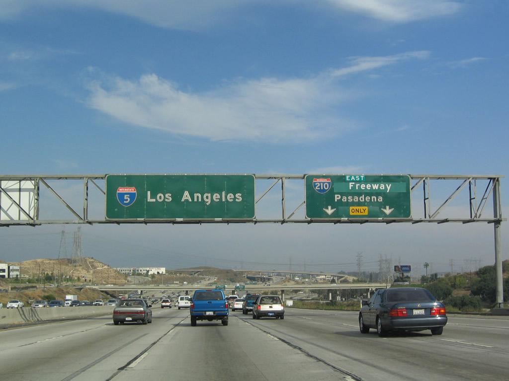
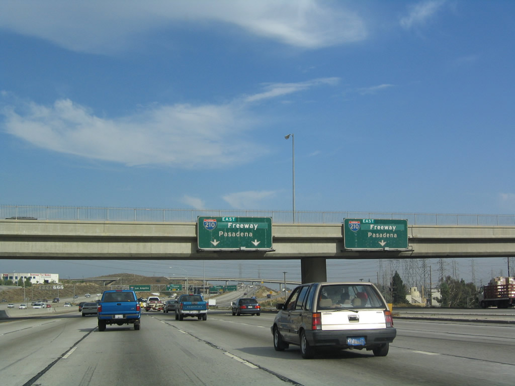
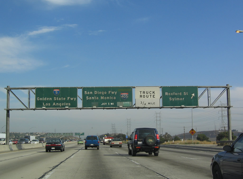
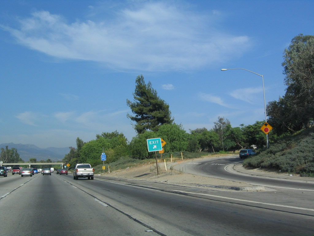
Both the truck lanes and the two right lanes of the main freeway prepare for Exit 161A, Interstate 210 (Foothill Freeway) east. The 2009 picture shows the green overlay falling off the overhead sign, revealing "Foothill Freeway" was part of the original sign before being covered up. Photos taken 07/19/09 and 07/06/04. |
|
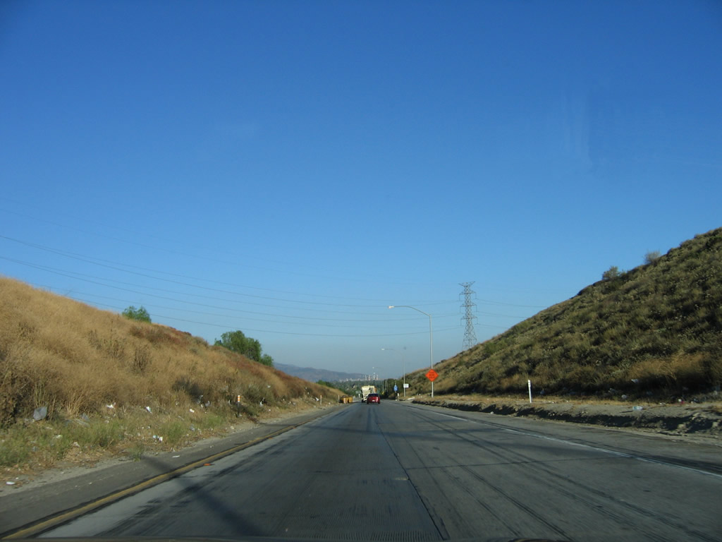
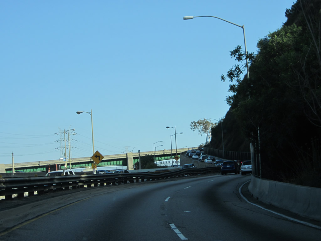
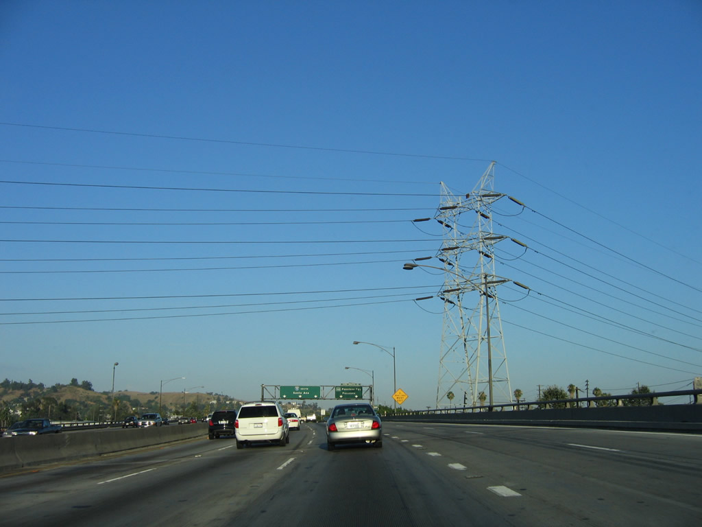
Continuing south is this view of the second stack interchange, with the ramp carrying traffic from southbound Interstate 5 auto/truck ramps to eastbound Interstate 210 (Foothill Freeway). Los Angeles Department of Water and Power 500kV power lines cross over Interstate 5 as they make their way from a substation near Adelanto to the substation near Sylmar. Photo taken 07/06/04. |
| Interstate 5 (Golden State Freeway) south |
|
|
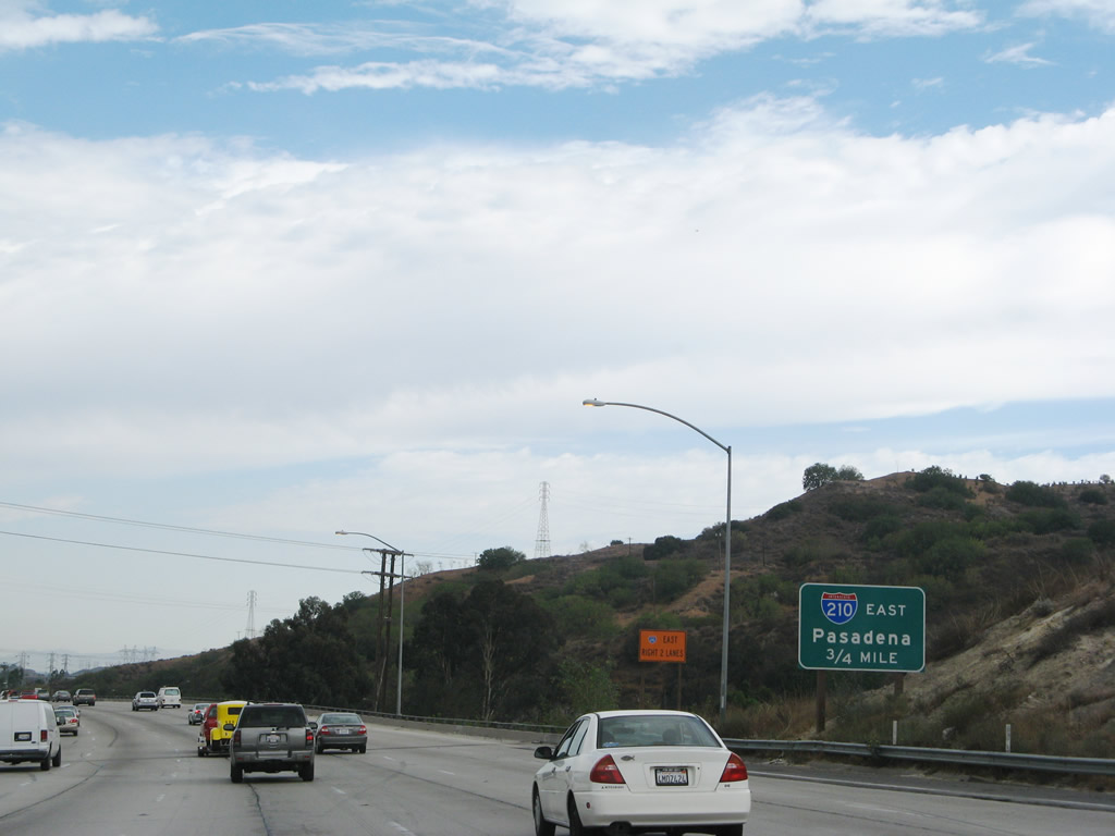
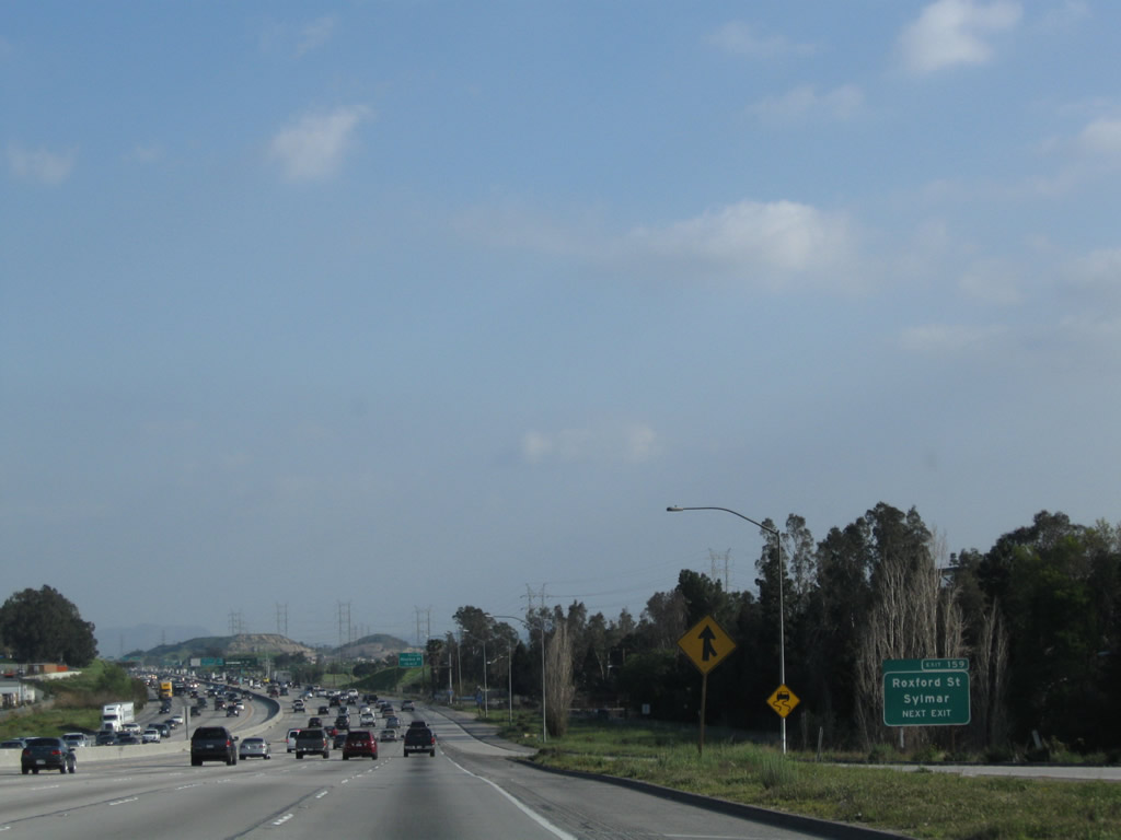
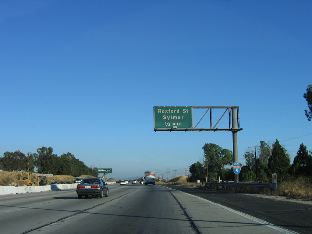
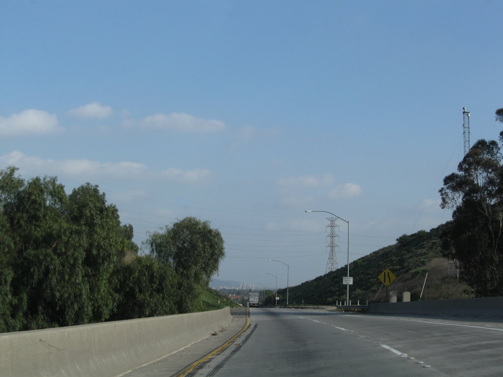
As traffic from Interstate 210 west merges onto Interstate 5 south, a roadside sign advises of the next interchange: Exit 159, Roxford Street. Photos taken 03/15/09 and 07/15/06. |
|
|
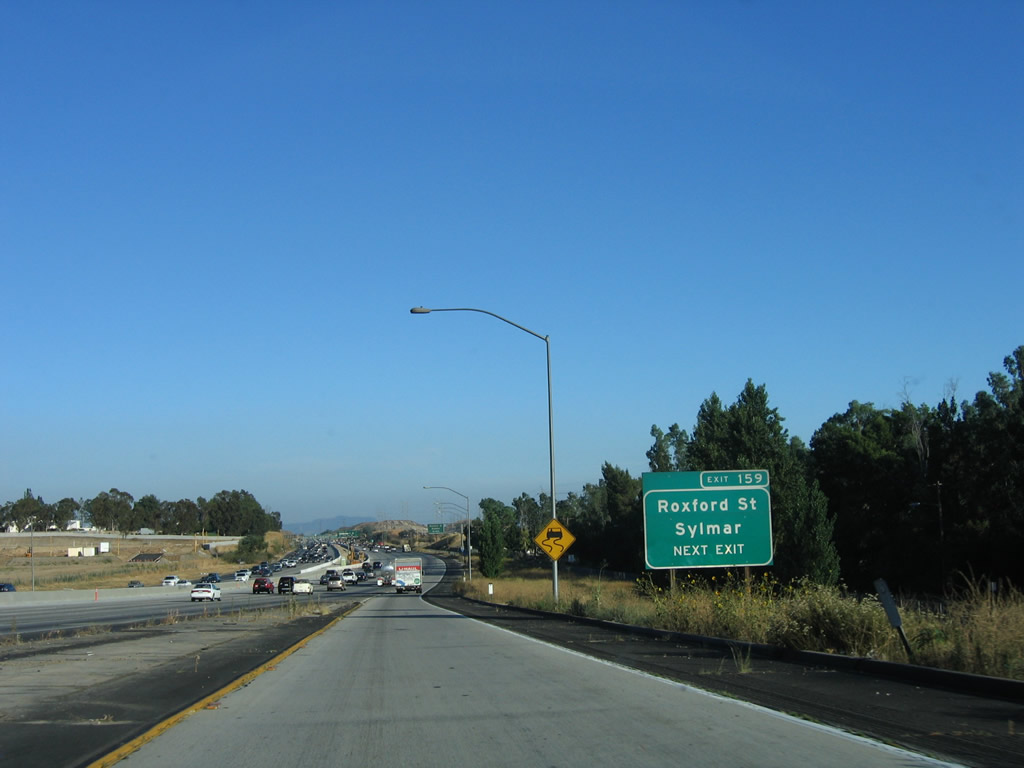
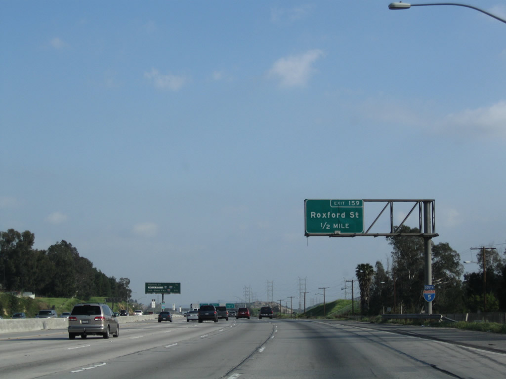
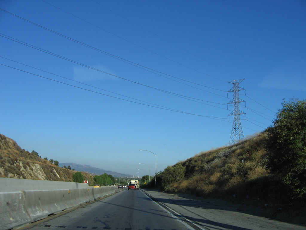
After the ramp to Interstate 210, the truck lanes merge back onto the mainline. The next exit along southbound is Exit 159, Roxford Street, 0.50 mile. A new exit number sign was added in 2006-2007. Photos taken 03/15/09 and 07/15/06. |
|
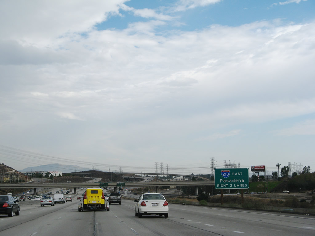
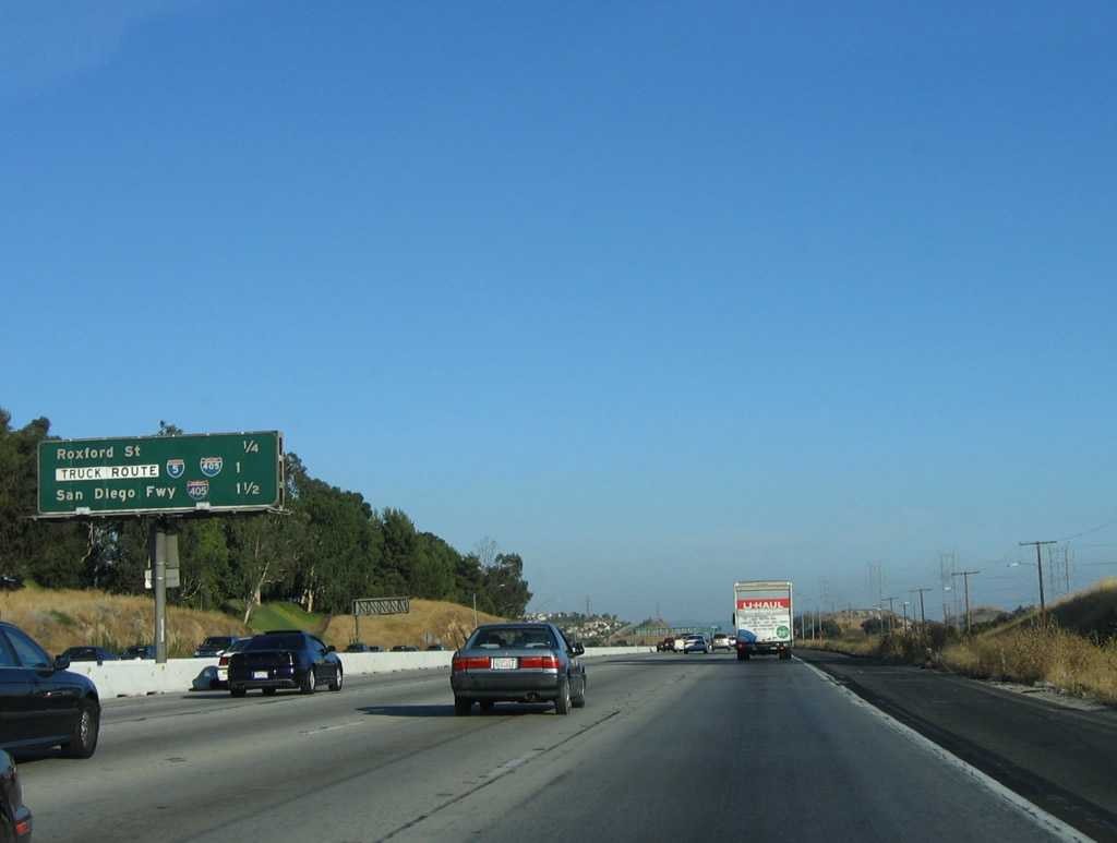
This mileage sign provides the distance to the next three exits along southbound: Exit 159, Roxford Street; Exit 158B, Truck Bypass for Interstates 5/405; and Exit 158A, Interstate 405 (San Diego Freeway) south. Once again, with the split with Interstate 405, the freeway separates auto and truck traffic to ease merging. Photo taken 07/15/06. |
|
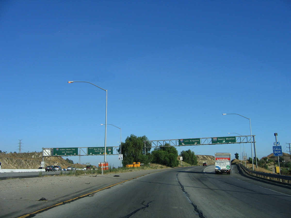
All trucks must exit the mainline freeway at Exit 158B, Truck Bypass for Interstates 5/405; all cars continue south along the main lanes. The next exit is Exit 158A, Interstate 405 (San Diego Freeway) south. Photo taken 03/15/09. |
|
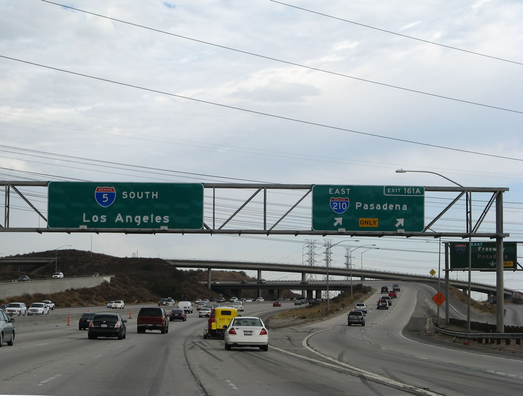
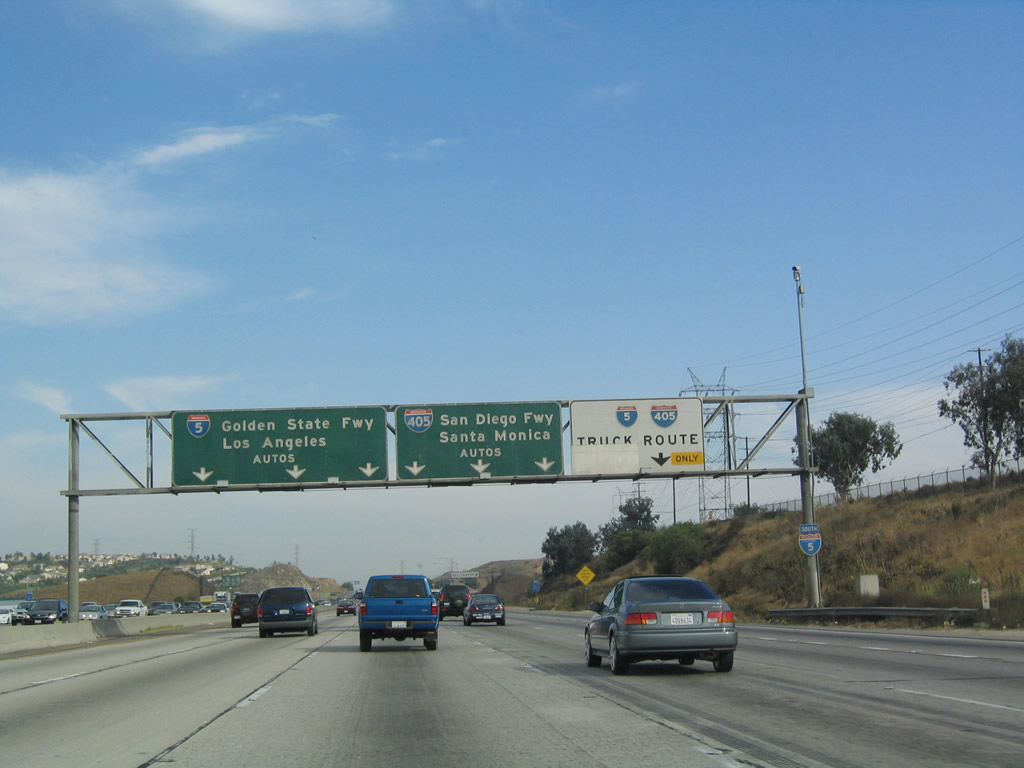
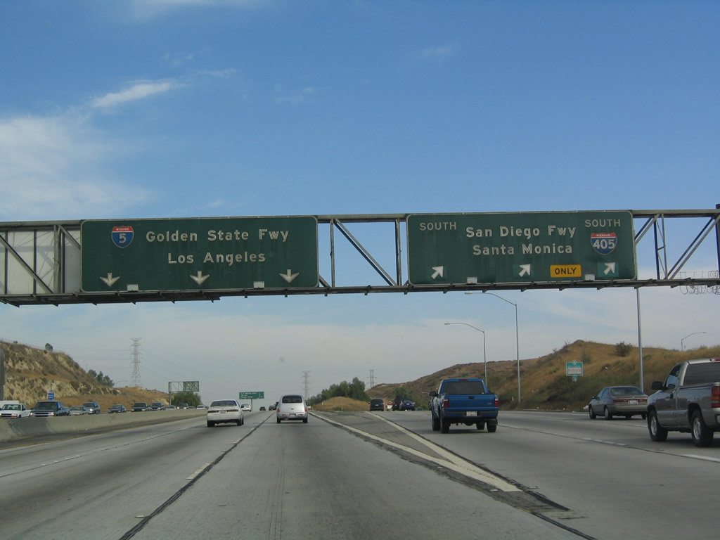
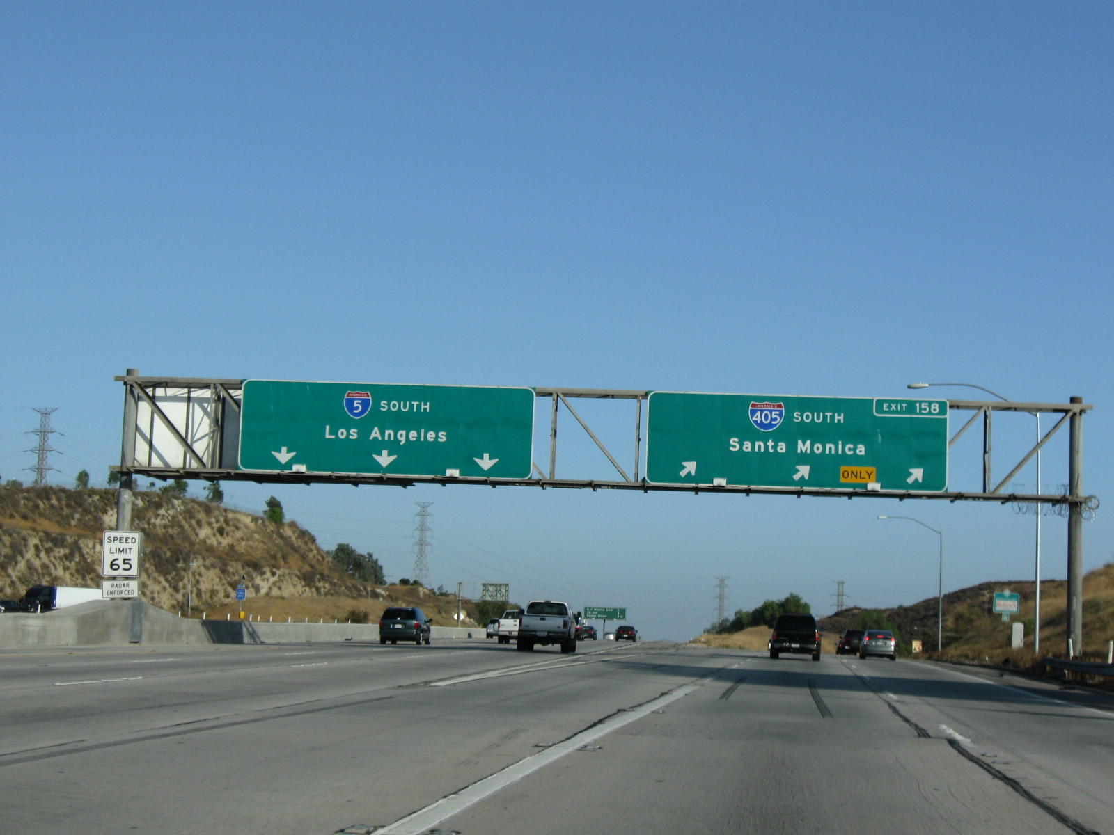
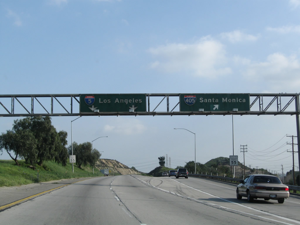
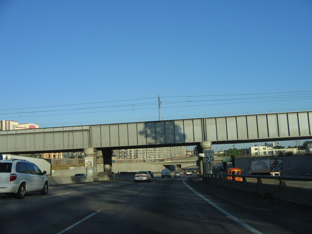
Southbound Interstate 5 (Golden State Freeway) meets Exit 158A, Interstate 405 (San Diego Freeway) south. An exit number sign was added in 2007. Interstate 405 south serves the east end of the San Fernando Valley and provides a shorter route to California 118 (Ronald Reagan Freeway) westbound and U.S. 101 (Ventura Freeway) northwestbound. South of there, Interstate 405 is the most direct route to Los Angeles International Airport, but the stretch of Interstate 405 between U.S. 101 and Interstate 105 (including the Interstate 10 (Santa Monica Freeway) interchange) can be among the most congested at all hours of any day. After the airport, Interstate 405 parallels California 1 (Pacific Coast Highway), connecting to a variety of beach/coastal cities including Manhattan Beach, Redondo Beach, and Long Beach. Upon entering Orange County, Interstate 405 angles southeast to rejoin Interstate 5 near Irvine. Although it is named the San Diego Freeway, Interstate 405 is not always the best route to San Diego. At times, Interstate 5 and Interstate 210/California 57 provide a faster through route, depending upon traffic congestion. Photos taken 07/06/04 and 07/19/09. |
|
| Interstate 5 (Golden State Freeway) at Interstate 405 Truck Bypass south |
|
|
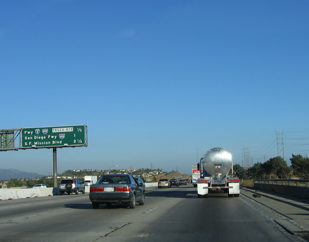
Now on the truck bypass that connects Interstate 5 south with Interstate 405, a second set of porcelain-enamel signs are posted for trucks and other slow vehicles. Photos taken 07/15/06 and 03/15/09. |
|
|
After Interstate 5 and Interstate 405 split, the truck bypass lanes continue south to rejoin the Golden State Freeway. Two lanes merge to one lane prior to rejoining the mainline. Photos taken 07/15/06. |
|
|
The truck lanes prepare to merge back onto Interstate 5 (Golden State Freeway) south. Construction was ongoing due to the HOV lane construction. Photos taken 03/15/09 and 07/15/06. |
| Interstate 5 (Golden State Freeway) south |
|
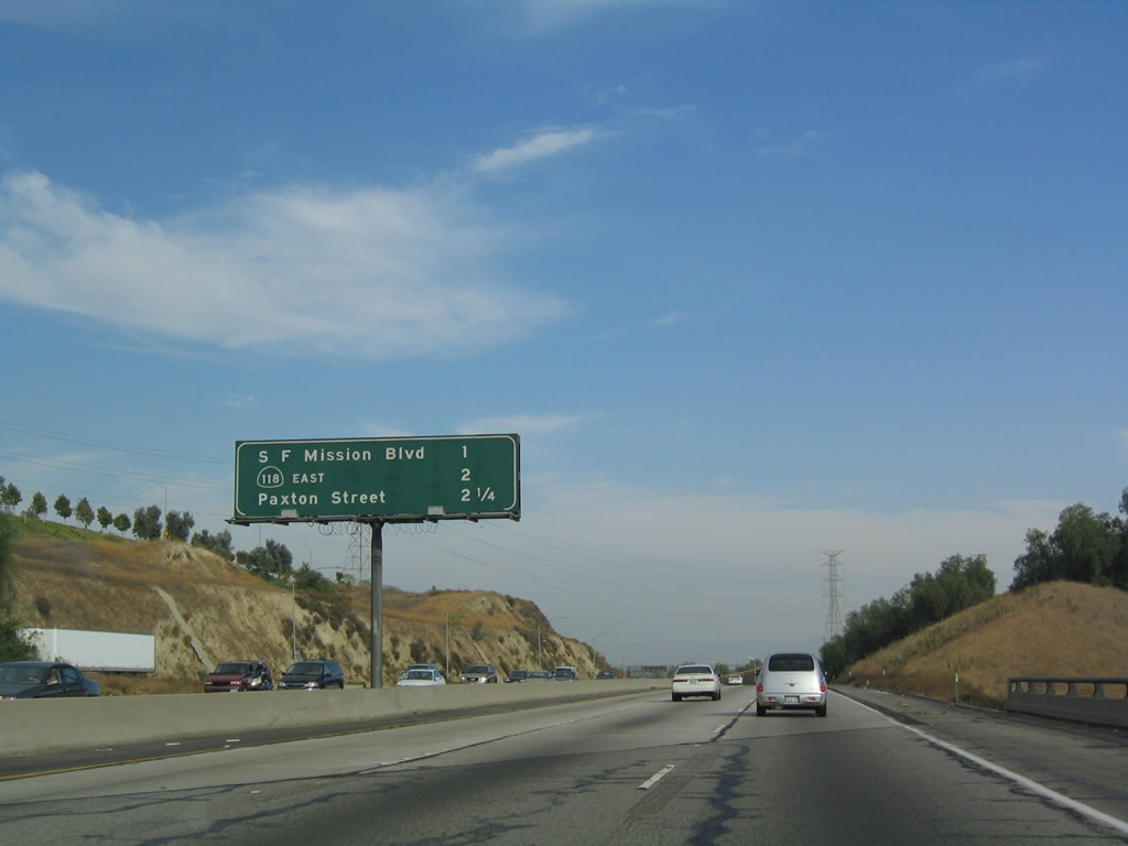
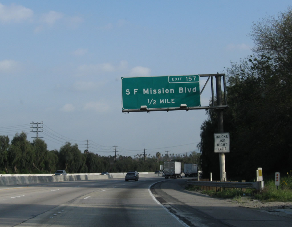
This mileage sign provides the distance to the next three exits along southbound: Exit 157, San Fernando Mission Boulevard; Exit 156B, California 118 (Ronald Reagan Freeway) (formerly Simi Valley Freeway) east; and Exit 156A, Paxton Street to California 118 west. Photo taken 07/06/04. |
|
|
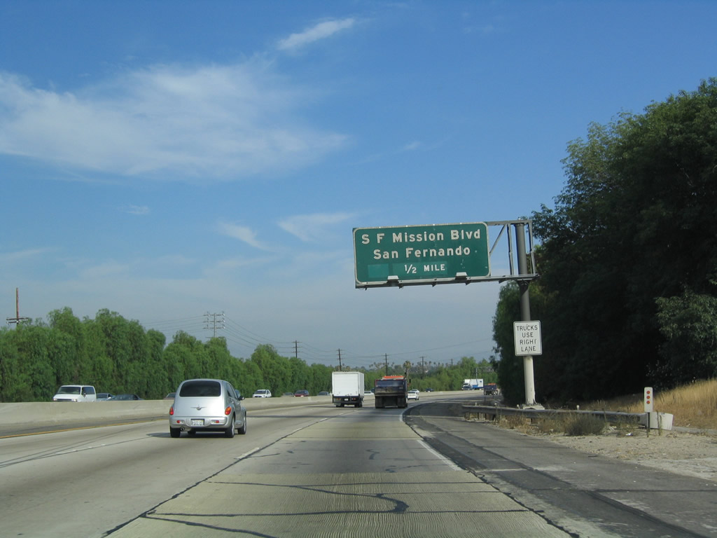
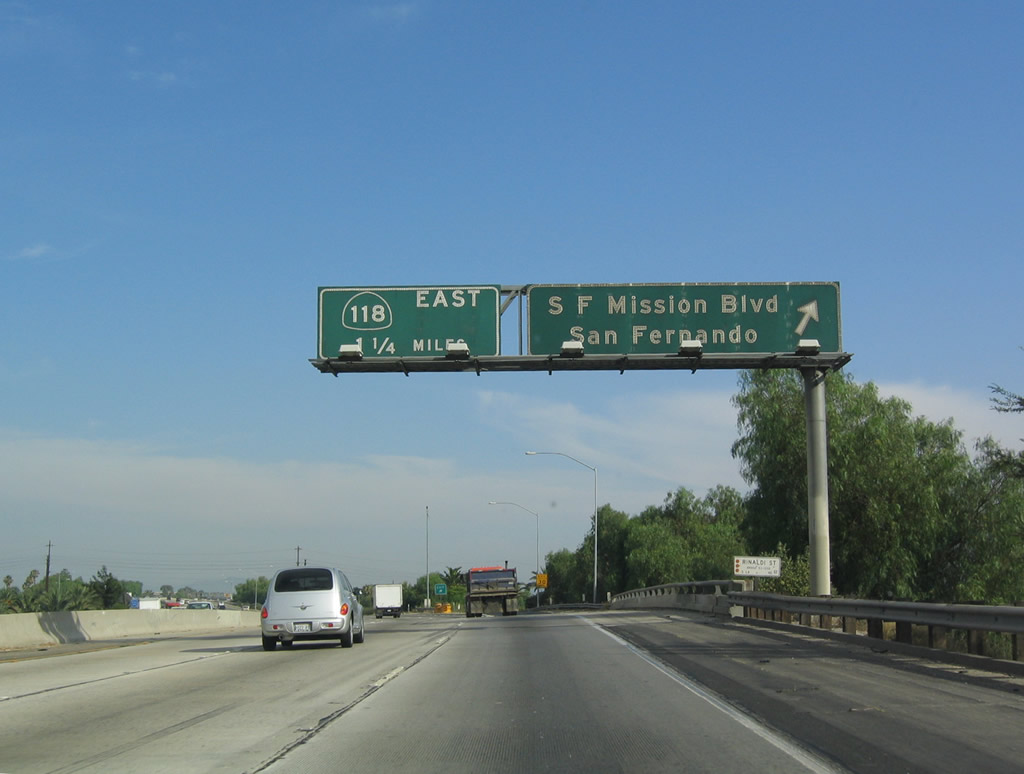
Use Exit 157 for San Fernando Mission Boulevard. San Fernando Mission Boulevard east goes to the heart of the city of San Fernando, while westbound parallels California 118 through Mission Hills and other valley communities of the city of Los Angeles. Photo taken 07/06/04. |
|
Use San Fernando Mission Boulevard west to the Los Angeles community of Mission Hills. Photo taken 07/06/04. |
|
|
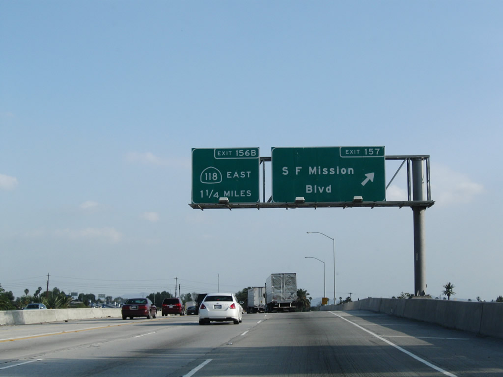
Southbound Interstate 5 reaches Exit 157, San Fernando Mission Boulevard; the next exit is Exit 156B, California 118 (Ronald Reagan Freeway) (formerly Simi Valley Freeway) east. A temporary sign for Exit 158B was placed due to construction in 2006 with permanent signage in place by 2009. Photos taken 03/15/09 and 07/06/04. |
|
|
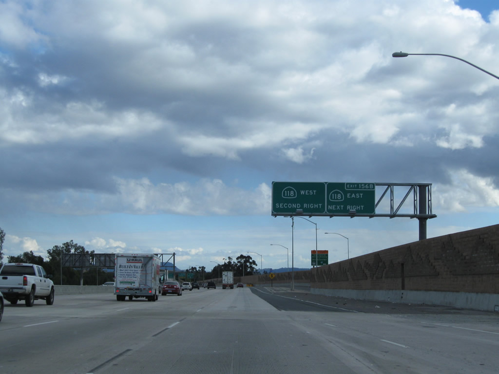
The next exit along southbound is Exit 156B, California 118 (Ronald Reagan Freeway) (formerly Simi Valley Freeway) east. A soundwall project resulted in the replacement of the advance sign for this exit. Photos taken 02/26/11 and 07/15/06. |
|
There is no direct connection from southbound Interstate 5 to westbound California 118; use Exit 156A, Paxton Street to California 118 west. Photo taken 07/06/04. |
|
|
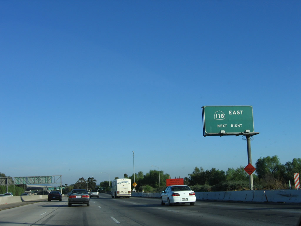
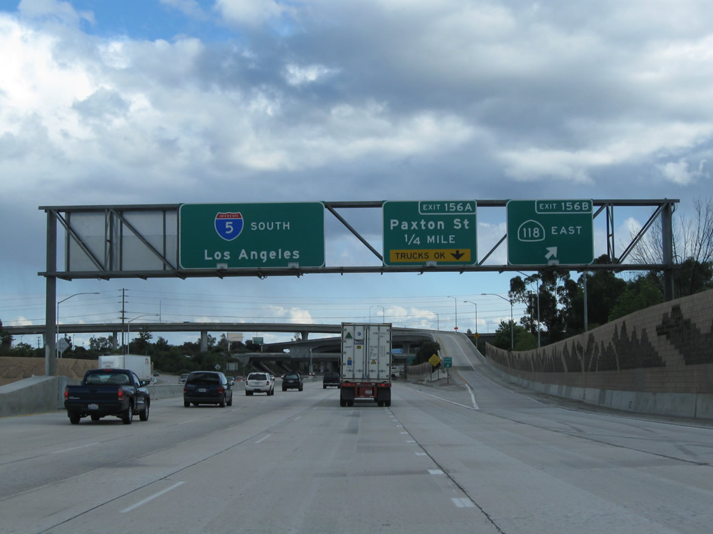
Southbound Interstate 5 (Golden State Freeway) reaches Exit 156B, California 118 (Ronald Reagan Freeway) (formerly Simi Valley Freeway) east. Use California 118 east to reach Interstate 210 (Foothill Freeway) just east of San Fernando. The next exit is Exit 156A, Paxton Street to California 118 west. Photos taken 02/26/11 and 07/06/04. |
|
|
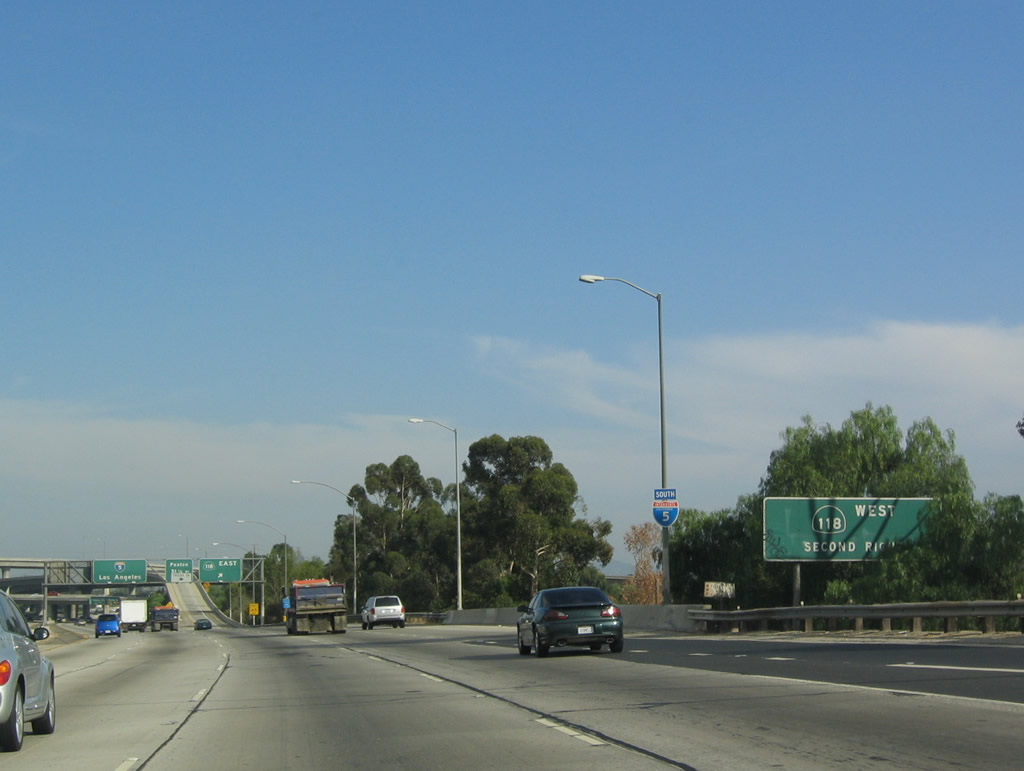
To California 118 (Ronald Reagan [Simi Valley] Freeway) west, use Exit 156A, Paxton Street. The connection requires the use of local surface streets; there is no direct freeway-to-freeway link from Interstate 5 south to California 118 east. Photos taken 02/26/11 and 07/06/04. |
|
Southbound Interstate 5 (Golden State Freeway) reaches Exit 156A, Paxton Street to California 118 (Ronald Reagan [Simi Valley] Freeway) west. Photo taken 07/15/06. |
|
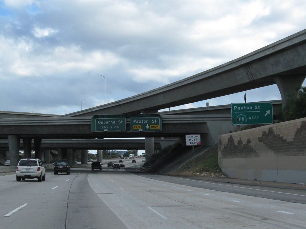
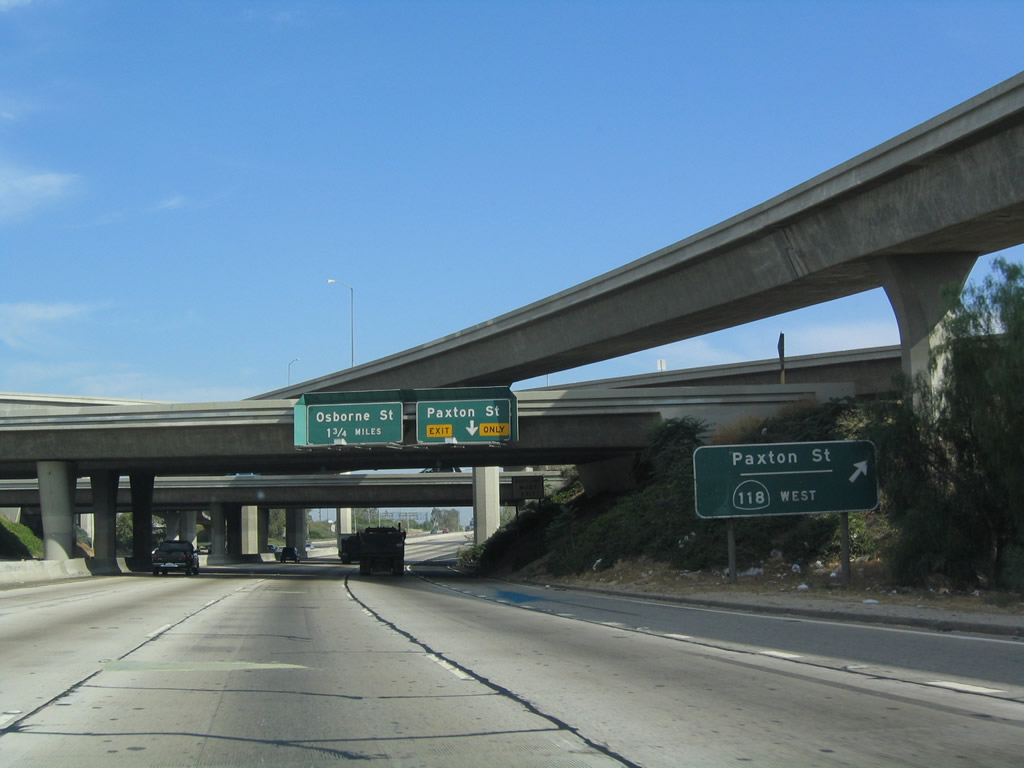
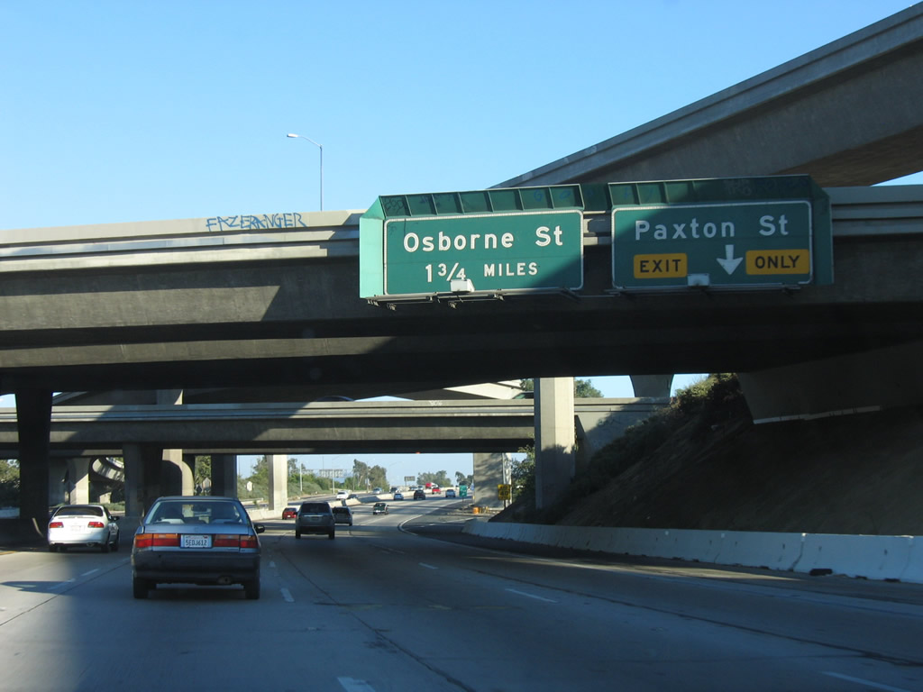
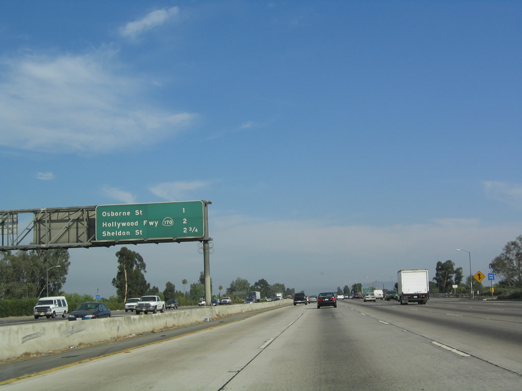
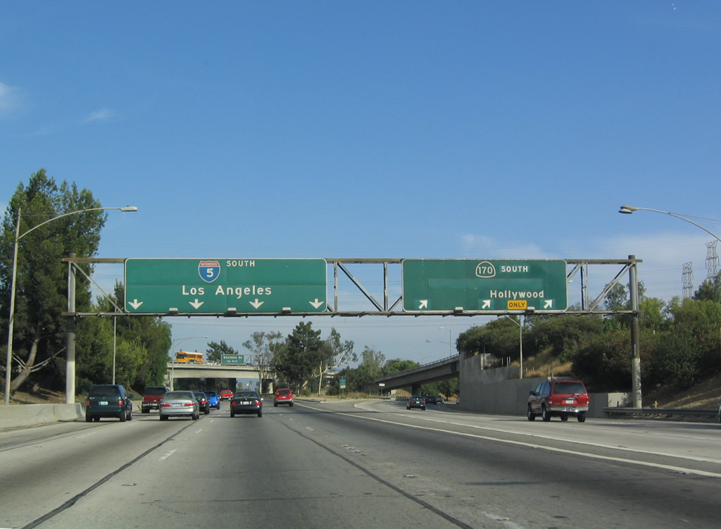
This mileage sign provides the distance to the next three exits along southbound: Exit 154, Osbourne Street; Exit 153B, California 170 (Hollywood Freeway) south; and Exit 153A, Sheldon Street. Photo taken 07/06/04. |
|
Osbourne Street runs southwest to northeast between Panorama City and Arleta northeast to Hansen Dam Park near Interstate 210 via Whiteman Airport. Photo taken 07/15/06. |
|
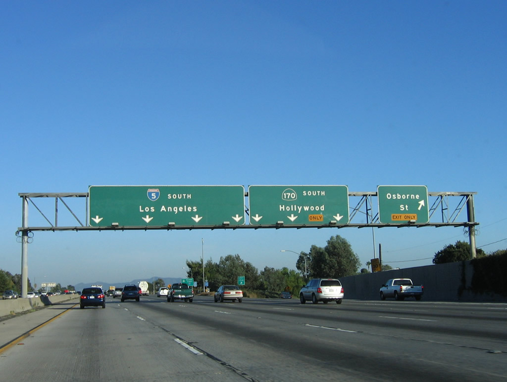
Southbound Interstate 5 reaches Exit 154, Osbourne Street. The next exit is another freeway split (after the Interstate 210 and Interstate 405 splits): California 170 (Hollywood Freeway) south to Hollywood. Interstate 5 remains on the Golden State Freeway. Photo taken 07/15/06. |
|
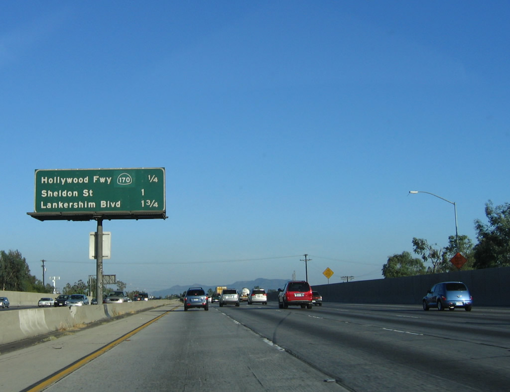
This mileage sign provides the distance to the next three exits along southbound: Exit 153B, California 170 (Hollywood Freeway) south; Exit 153A, Sheldon Street; and Exit 152, Lankershim Boulevard. Photo taken 07/15/06. |
|
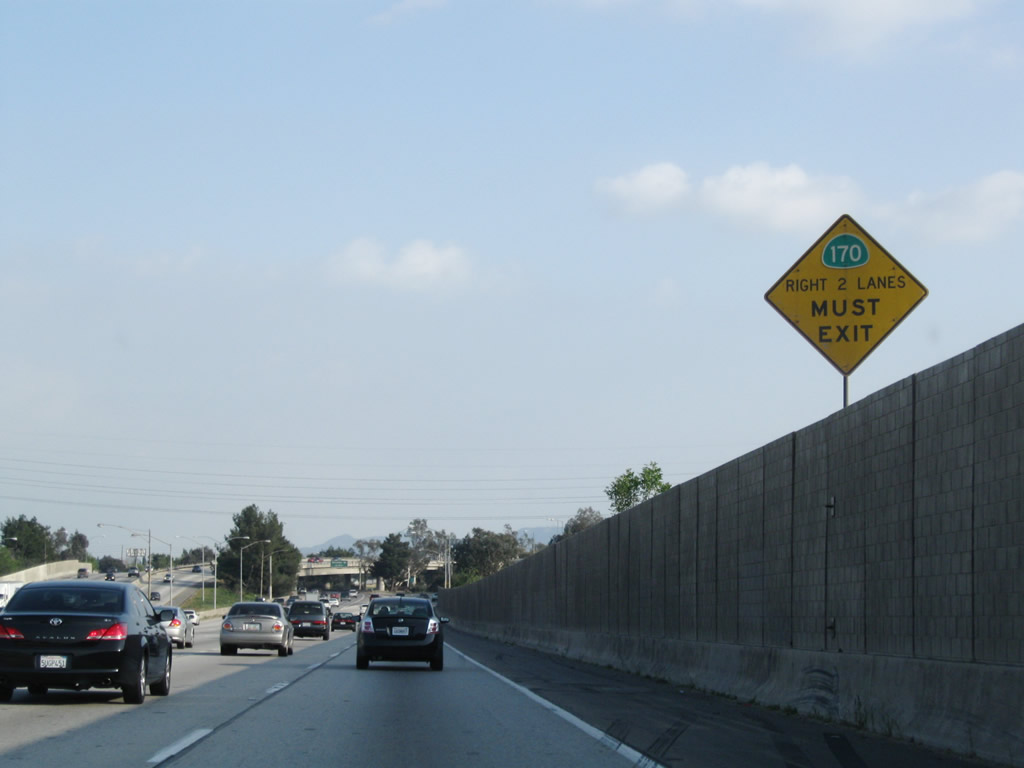
A small yellow warning sign advises that the right two lanes will transition onto California 170 south. Photo taken 03/15/09. |
|
Southbound Interstate 5 (Golden State Freeway) reaches Exit 153B, California 170 (Hollywood Freeway) south. This freeway provides an alternate route downtown and also connects to U.S. 101 north/Ventura Freeway west. This overhead sign assembly was damaged and removed and is now gone. No replacement sign has been installed as of 2009. Photo taken 07/06/04. |
|
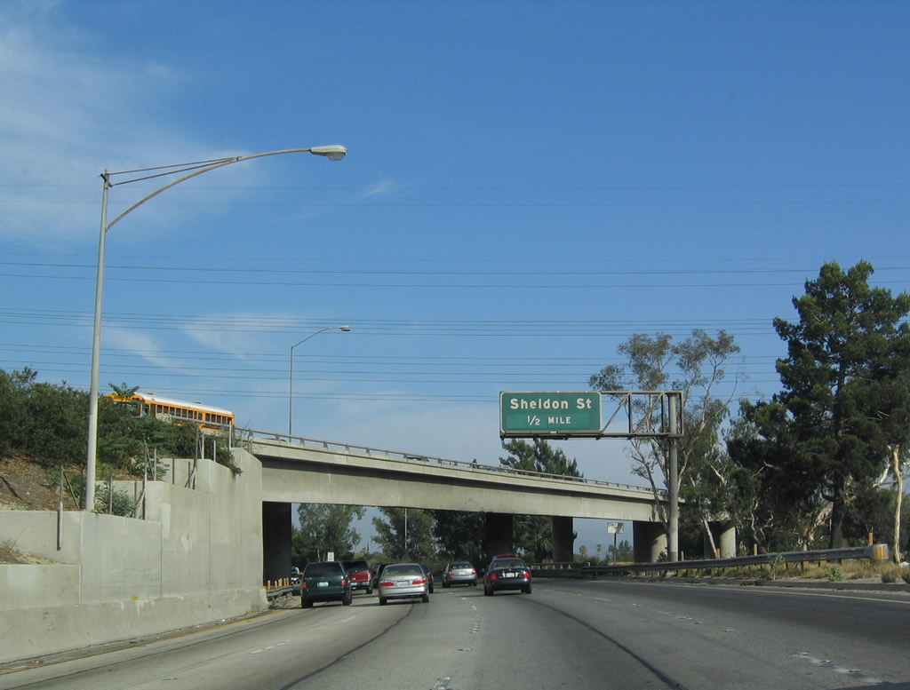
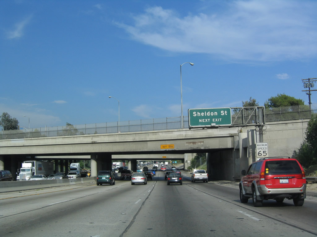
The next exit along Interstate 5 (Golden State Freeway) south is Exit 153A, Sheldon Street. Interstate 5 south passes under the transition ramp from northbound California 170 (Hollywood Freeway) to northbound Interstate 5. Photo taken 07/06/04. |
|
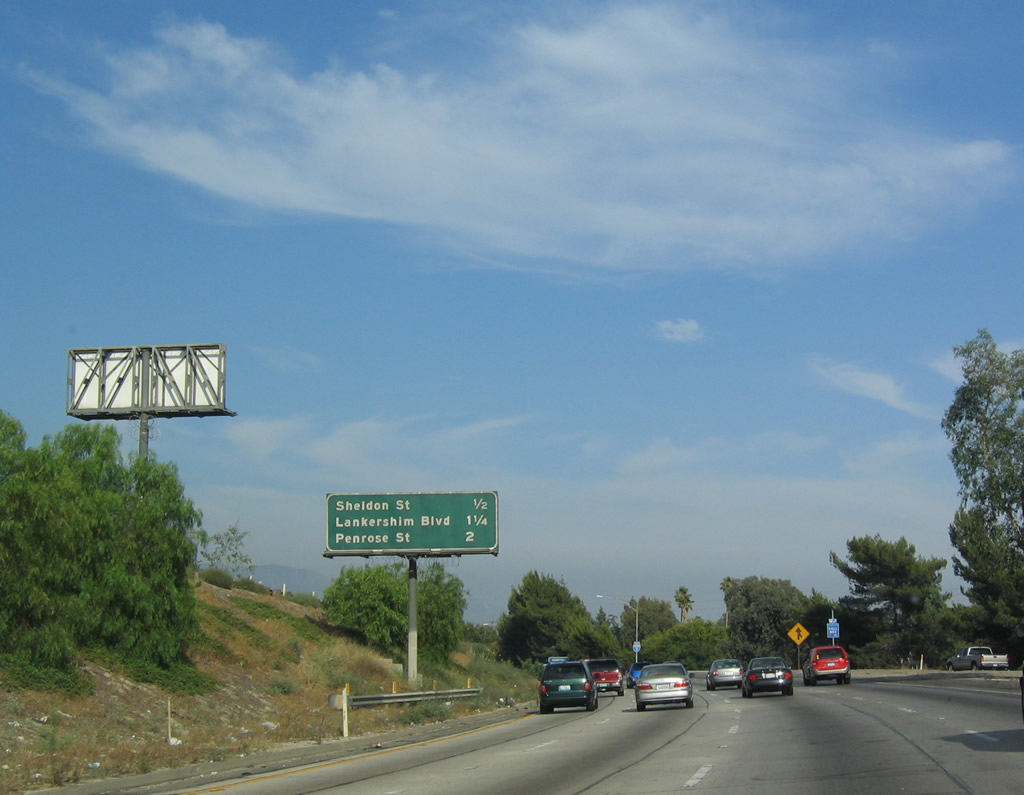
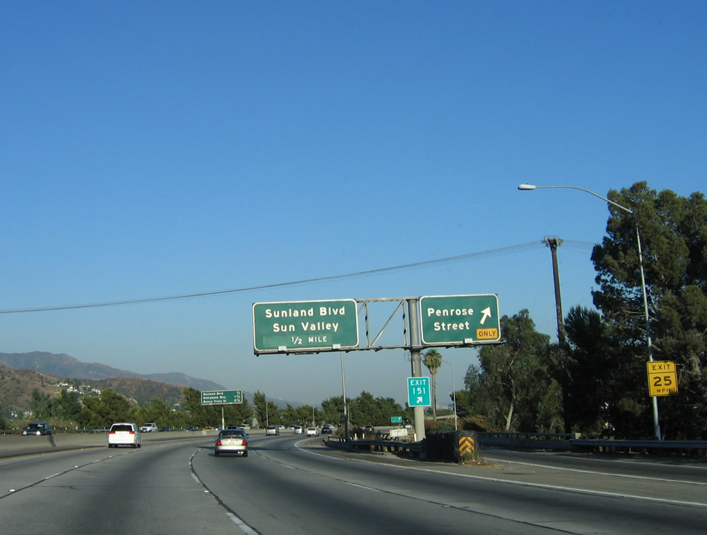
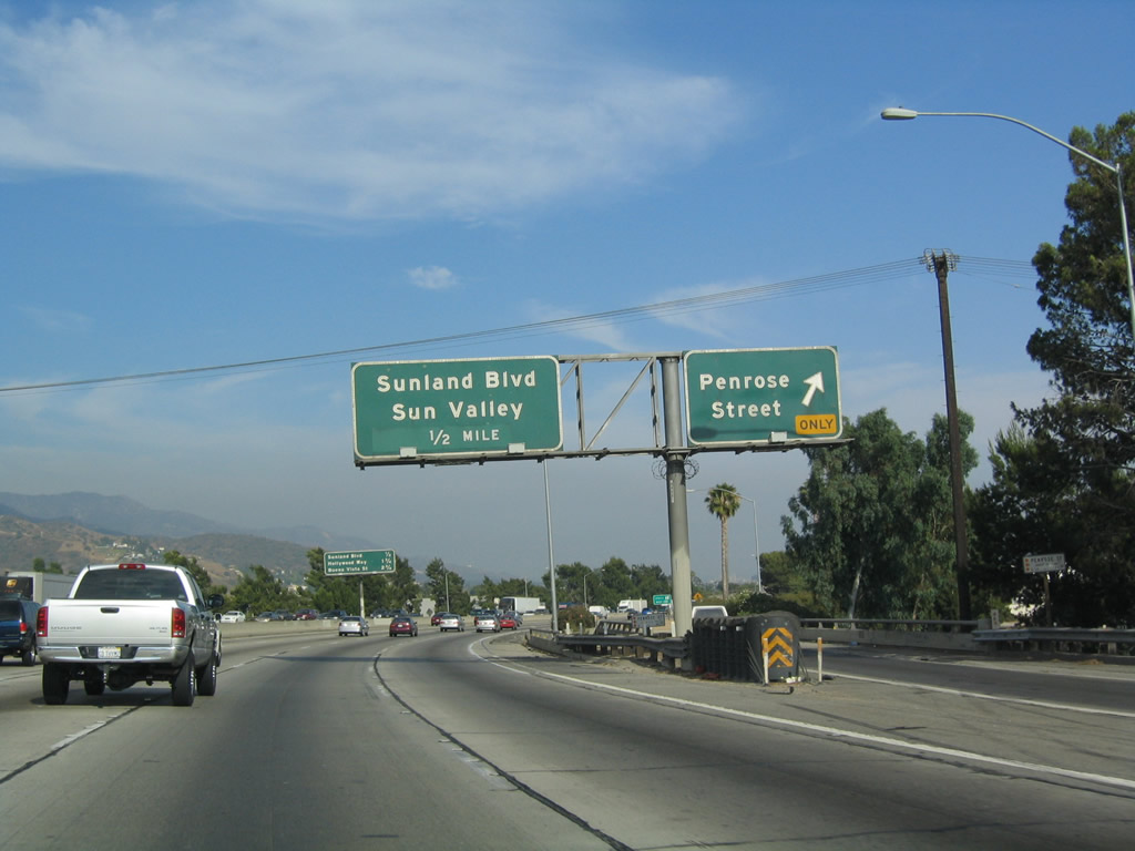
This mileage sign provides the distance to the next three exits along southbound: Exit 153A, Sheldon Street; Exit 152, Lankershim Boulevard; and Exit 151, Penrose Street. Photo taken 07/06/04. |
|
Sheldon Street is another city street that travels southwest to northeast, roughly parallel to Osbourne Street. It connects to Wentworth Street in the vicinity of Shadow Hills. Photo taken 07/06/04. |
|
Southbound Interstate 5 (Golden State Freeway) reaches Exit 153A, Sheldon Street. Photo taken 07/06/04. |
|
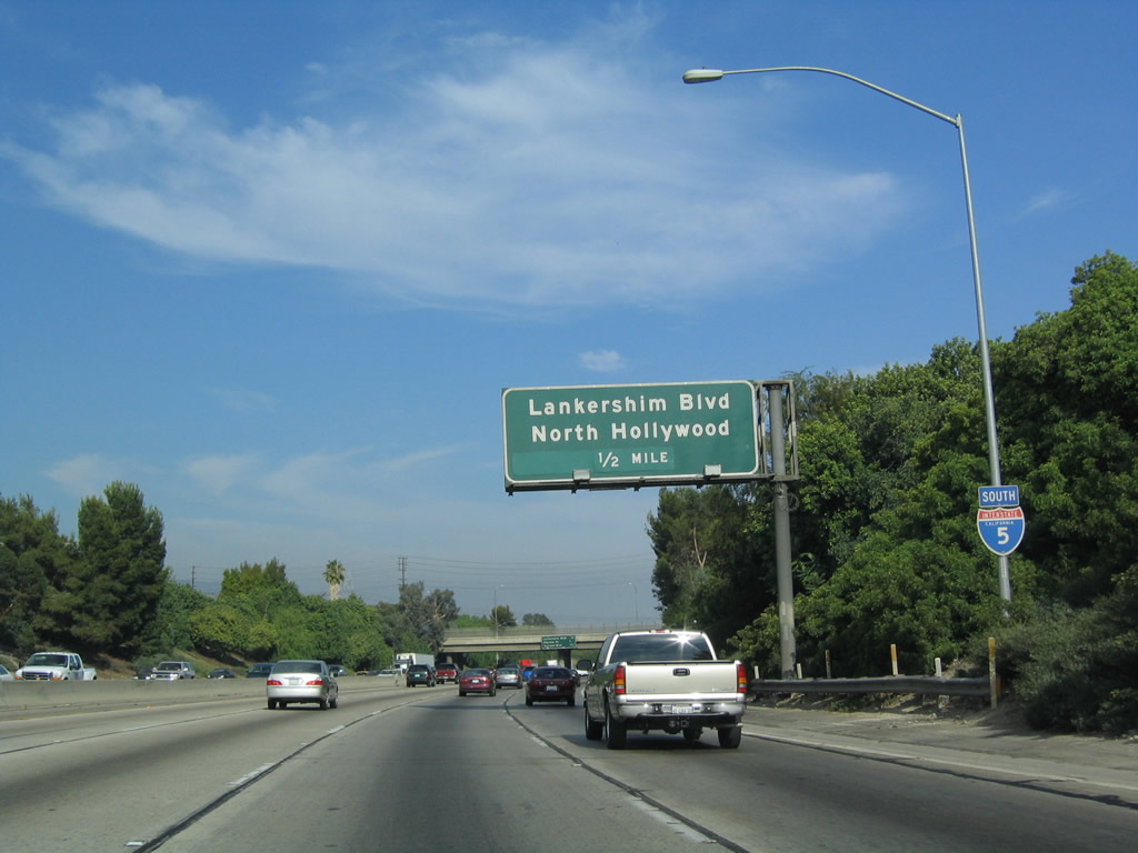
The next exit along southbound is Exit 152, Lankershim Boulevard to North Hollywood. Lankershim Boulevard is a north-south city street that crosses Interstate 5 as the freeway heads southeast toward downtown Los Angeles. Lankershim Boulevard ultimately connects with U.S. 101 near Universal City just south of the California 134/170 interchange. Photo taken 07/06/04. |
|
This mileage sign provides the distance to the next three exits along southbound: Exit 152, Lankershim Boulevard; Exit 151, Penrose Street; and Exit 150, Sunland Boulevard. Photo taken 07/06/04. |
|
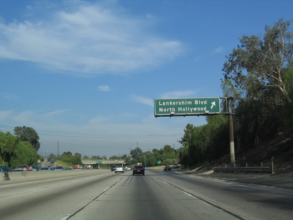
Southbound Interstate 5 (Golden State Freeway) reaches Exit 152, Lankershim Boulevard. Photo taken 07/06/04. |
|
A City of Los Angeles Department of Water and Power (LADWP) 500kV power line crosses Interstate 5 at the Lankershim Boulevard interchange. Photo taken 07/15/06. |
|
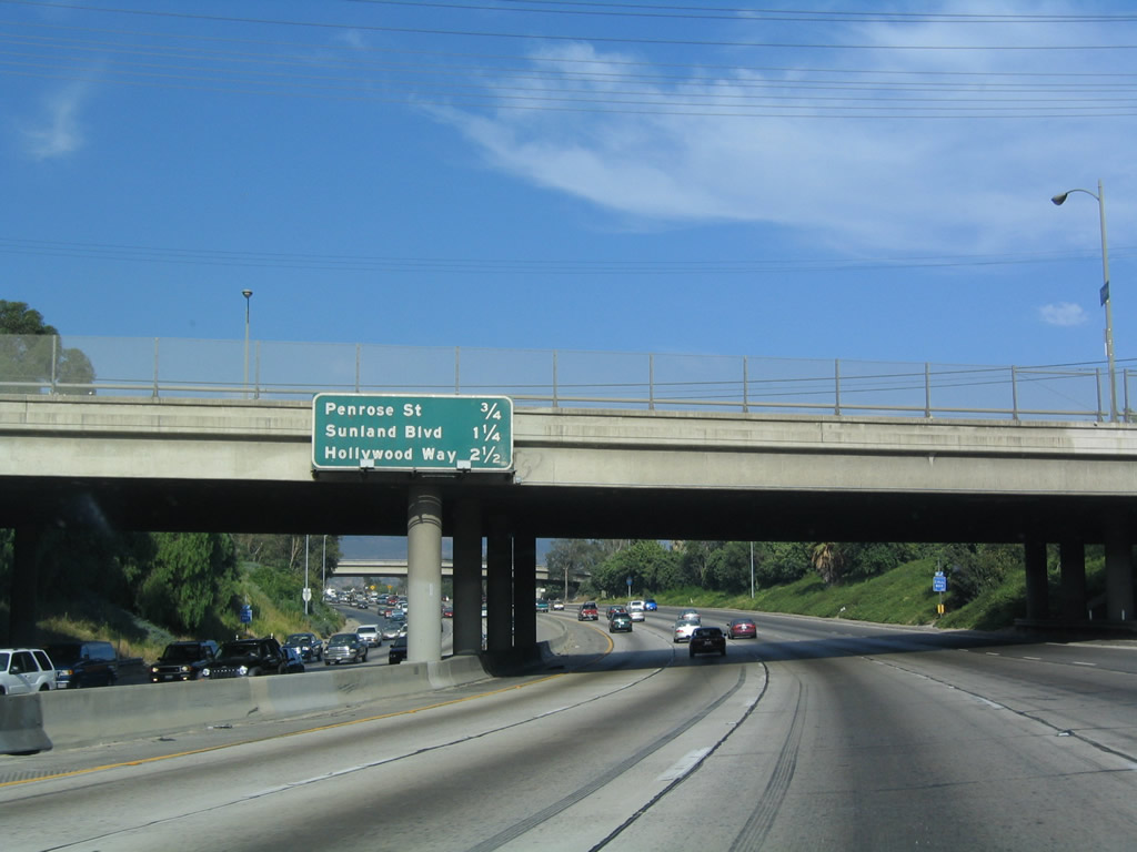
This mileage sign provides the distance to the next three exits along southbound: Exit 151, Penrose Street; Exit 150, Sunland Boulevard; and Exit 149, Hollywood Way. Photo taken 07/06/04. |
|
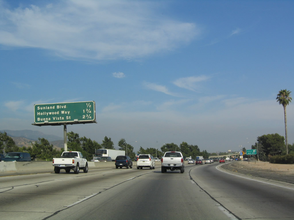
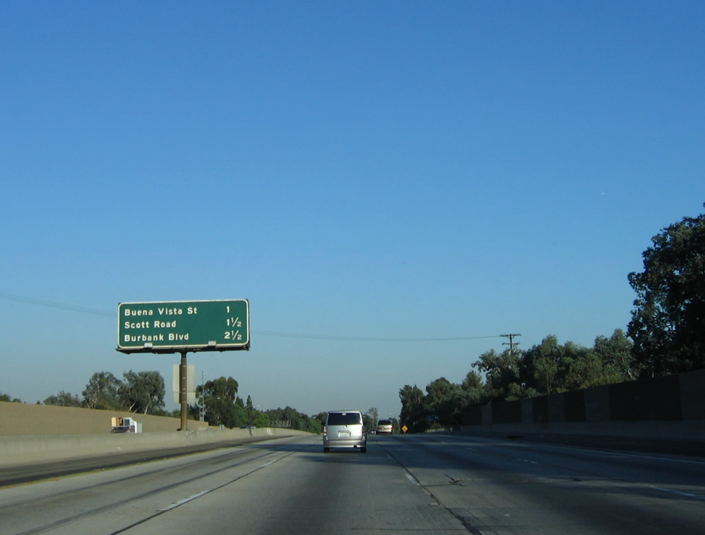
This mileage sign provides the distance to the next three exits along southbound: Exit 150, Sunland Boulevard; Exit 149, Hollywood Way; and Exit 148, Buena Vista Street. Photo taken 07/06/04. |
|
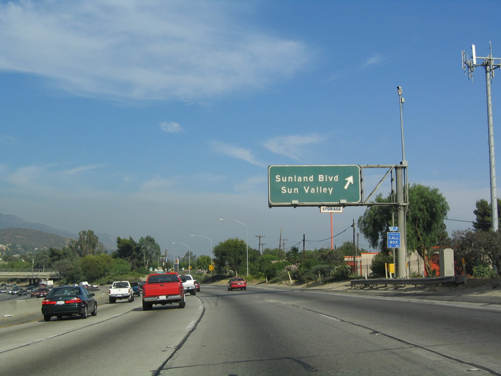
Southbound Interstate 5 (Golden State Freeway) reaches Exit 150, Sunland Boulevard, which heads south into Sun Valley. Photo taken 07/06/04. |
|
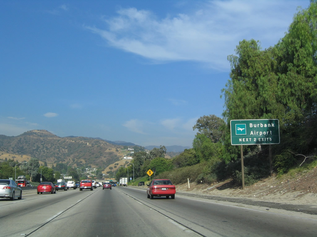
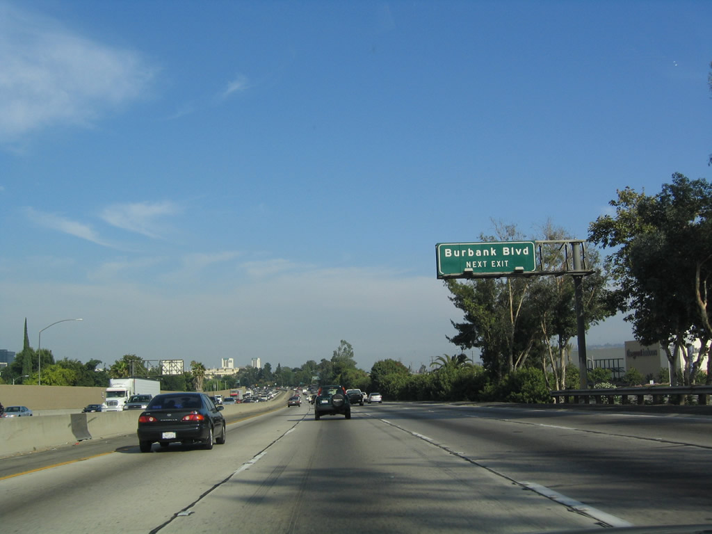
To reach Burbank Airport, use either Exit 149, Hollywood Way or Exit 148, Buena Vista Street. The airport is located southwest of the freeway. Interstate 5 departs Los Angeles briefly and enters the city of Burbank. Photo taken 07/06/04. |
|
Burbank, the "Media Capital of the World," is a city of 100,316 people per the 2000 Census with an area of 17.155 square miles. Six exits that serve the city from Interstate 5 southbound: Exit 149, Hollywood Way; Exit 148, Buena Vista Street; Exit 147B, San Fernando Boulevard (old U.S. 6-99) and Empire Avenue; Exit 147A, Scott Road; Exit 146B, Burbank Boulevard; and Exit 146A, Verdugo Avenue. Exit 145B, Alameda Avenue, also serves Burbank. Photo taken 07/06/04. |
|
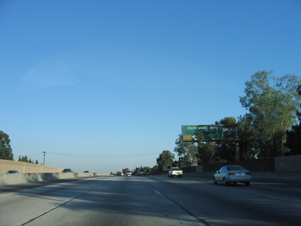
The right lane of Interstate 5 (Golden State Freeway) south becomes exit only for Exit 149, Hollywood Way. Photo taken 07/15/06. |
|
Interstate 5 southbound reaches Exit 149, Hollywood Way, the first exit into Burbank. Photo taken 07/06/04. |
|
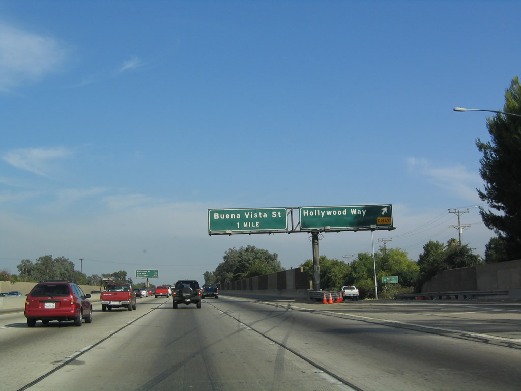
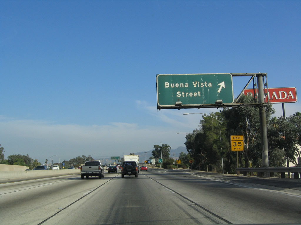
The next exit along southbound is Exit 148, Buena Vista Street. Hollywood Way and Buena Vista Street run roughly north-south, and they parallel each other through urban Burbank. Photo taken 07/15/06. |
|
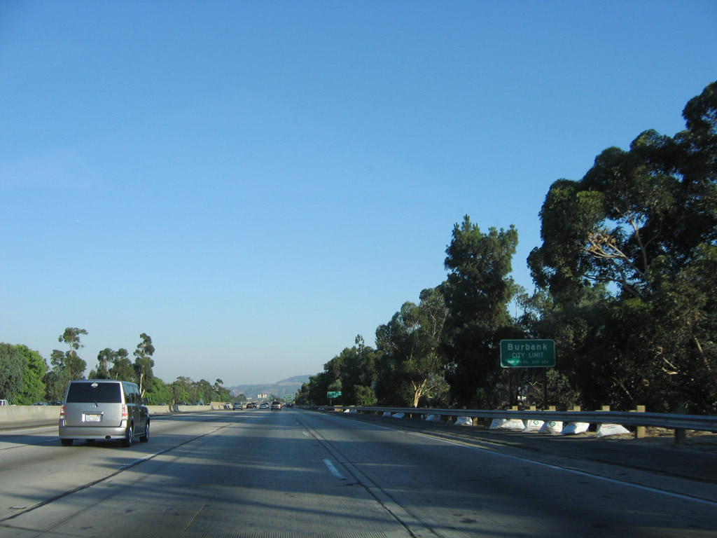
Interstate 5 (Golden State Freeway) leaves Los Angeles and enters the city of Burbank, the "Media Capital of the World." The next several exits will serve the city of Burbank, including Exit 148, Buena Vista Street. Located at the eastern edge of the San Fernando Valley, the city of Burbank had a population of 100,316 as of the 2000 Census and size of 17.4 square miles. The city incorporated on July 8, 1911, and it quickly grew in both size and population. Photo taken 07/15/06. |
|
Southbound Interstate 5 (Golden State Freeway) reaches Exit 148, Buena Vista Street. Photo taken 07/15/06. |
|
The next four (three) exits are: (Exit 147B, San Fernando Boulevard [old U.S. 6-99] and Empire Avenue - not listed on this interchange sequence sign); Exit 147A, Scott Road; Exit 146B, Burbank Boulevard; and Exit 146A, Verdugo Avenue. Photo taken 07/15/06. |
|
Old style concrete bridge railing remains in use along the west side of Interstate 5 prior to the Scott Road interchange. Photo taken 07/15/06. |
|
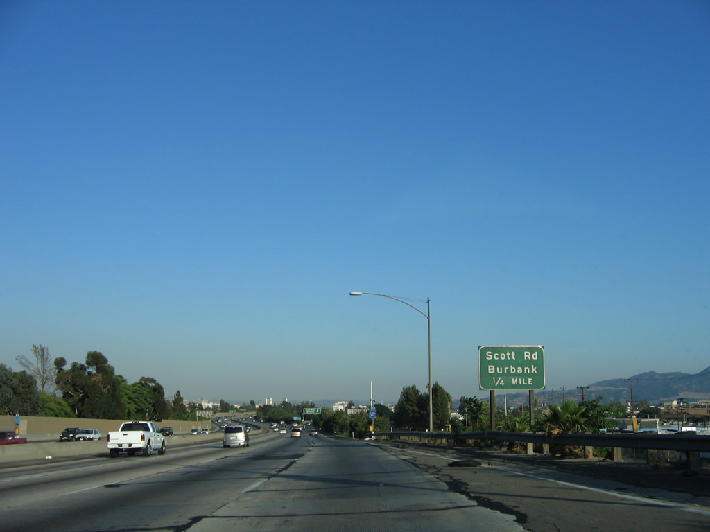
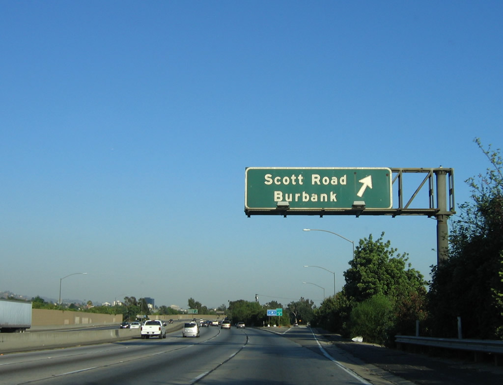
The next exit along southbound is Exit 147A for Scott Road. Photo taken 07/15/06. |
|
Southbound Interstate 5 reaches Exit 147A, Scott Road in Burbank. Photo taken 07/15/06. |
|
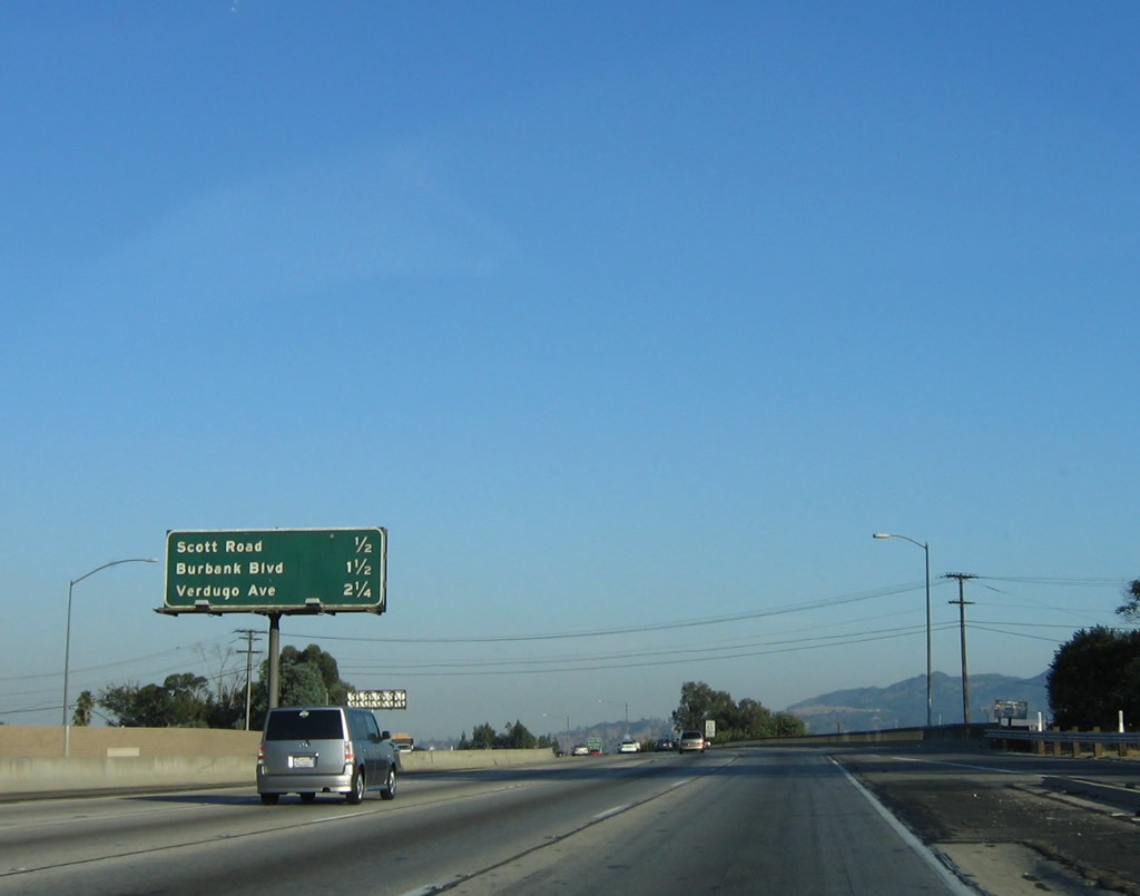
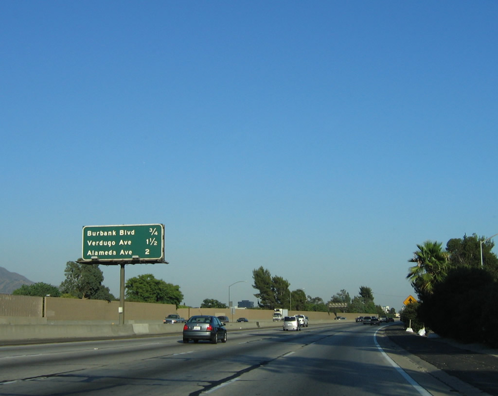
The next three exits along the southbound Golden State Freeway are: Exit 146B, Burbank Boulevard; Exit 146A, Verdugo Avenue; and Exit 145B, Alameda Avenue. Photo taken 07/06/04. |
|
Burbank Boulevard, an east-west city street, leads into downtown Burbank with connections to the Burbank Empire Center and Media City Center. Photo taken 07/12/03.
|
|
To downtown Burbank, use Exit 146A, Verdugo Avenue. Photo taken 07/15/06. |
|
Southbound Interstate 5 (Golden State Freeway) reaches Exit 146B, Burbank Boulevard. Photo taken 07/06/04. |
|
The next three exits along the southbound Golden State Freeway are: Exit 146A, Verdugo Avenue; Exit 145B, Alameda Avenue; and Exit 145A, Western Avenue. Photo taken 07/15/06. |
|
Verdugo Avenue is an east-west city street that plies through Burbank south of downtown, parallel to Burbank Boulevard. Photo taken 07/06/04. |
|
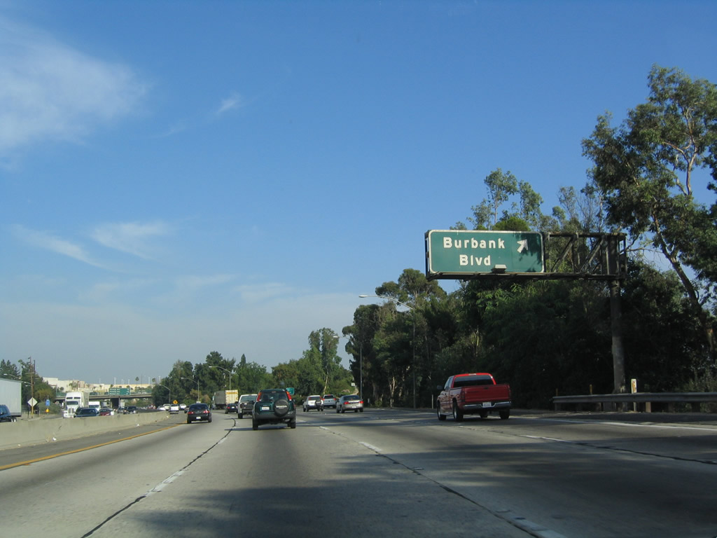
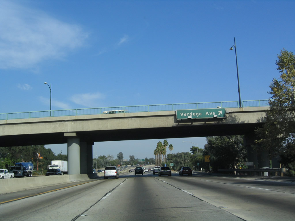
Southbound Interstate 5 (Golden State Freeway) reaches Exit 146A, Verdugo Avenue. Use Verdugo Avenue west to reach Warner Bros. Ranch. Photo taken 07/06/04. |
|
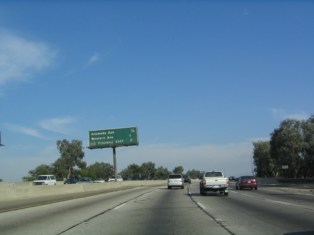
The next three exits along southbound are: Exit 145B, Alameda Avenue; Exit 145A, Western Avenue; and Exit 144, California 134 (Ventura Freeway) east. Photo taken 07/06/04. |
|
Southbound Interstate 5 (Golden State Freeway) reaches Exit 145B, Alameda Avenue, which heads west into Burbank. Use Alameda Avenue west to reach Disney Studios. Interstate 5 leaves Burbank and enters the western fringes of Glendale. Photo taken 07/06/04. |
|
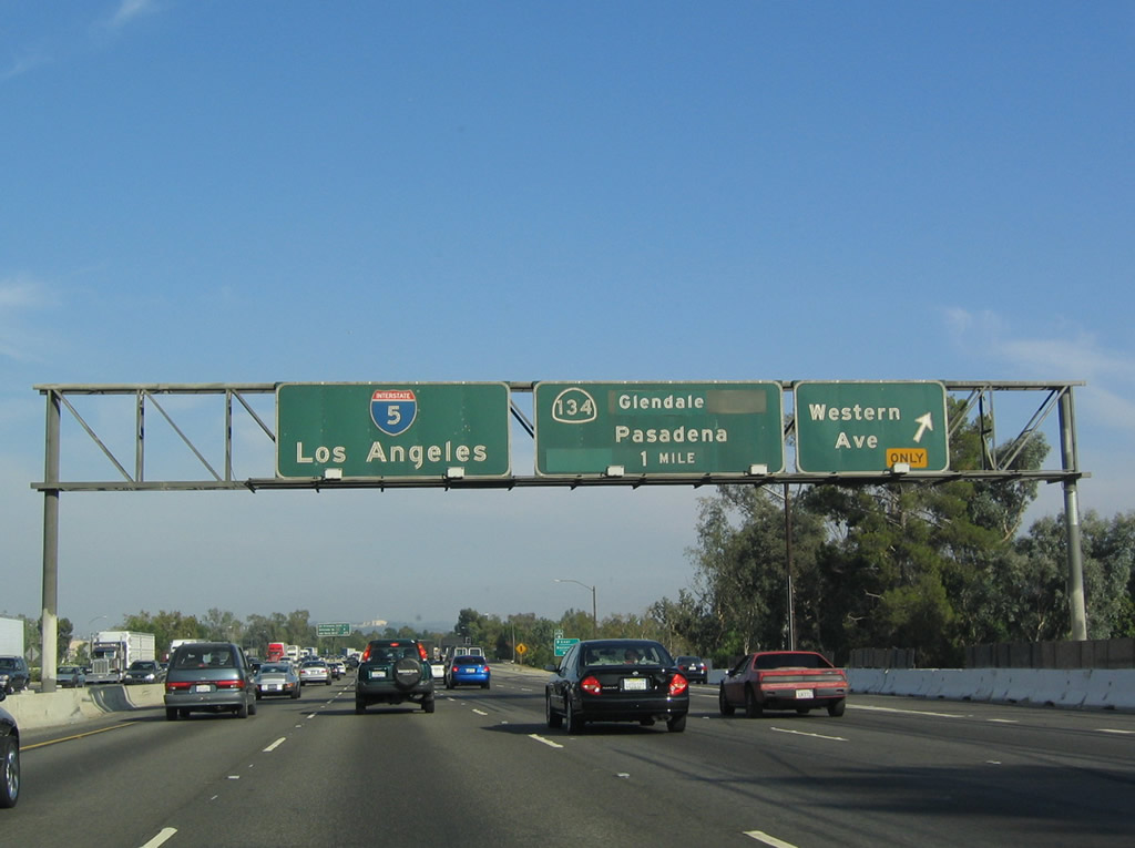
The next three exits along southbound are: Exit 145A, Western Avenue; Exit 144, California 134 (Ventura Freeway) east; and Exit 142, Colorado Street (a U.S. 66 shield is covered by the green overlay panel on this particular sign). Visit Casey Cooper's Historic U.S. Highways for a vintage photograph of this sign when it used to show the U.S. 66 shield. Photo taken 07/15/06. |
|
An overhead exit number sign for Exit 145A was added in 2006. Around this point, Interstate 5 leaves the city of Burbank and enters the city of Glendale, incorporated in 1906. Located northeast of downtown Los Angeles, Glendale had a population of 194,973 as of the 2000 Census and consists of 30.7 square miles. Photo taken 07/15/06. |
|
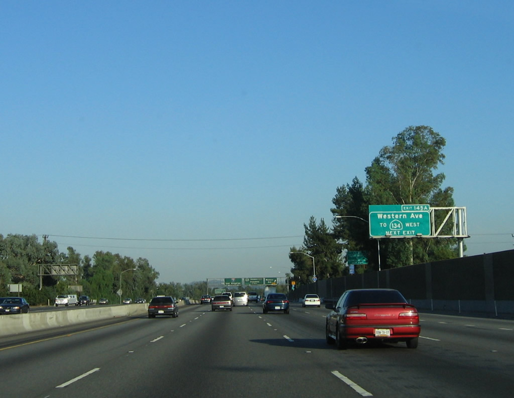
Southbound Interstate 5 reaches Exit 145A, Western Avenue. The next exit is Exit 144, California 134 (Ventura Freeway) east, which heads east through Glendale to Pasadena (Interstate 210/California 710 spur). Photo taken 07/06/04. |
|
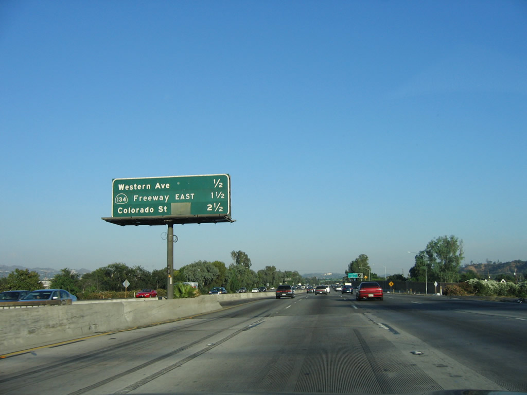
The next three exits along southbound are: Exit 144, California 134 (Ventura Freeway) east; Exit 142, Colorado Street (once again, a U.S. 66 shield is covered by the green overlay panel); Exit 141, Los Feliz Boulevard/Griffith Park Drive. Photo taken 07/06/04. |
|
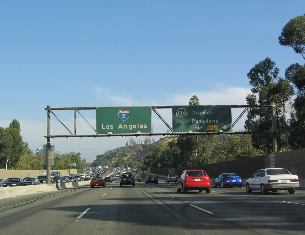
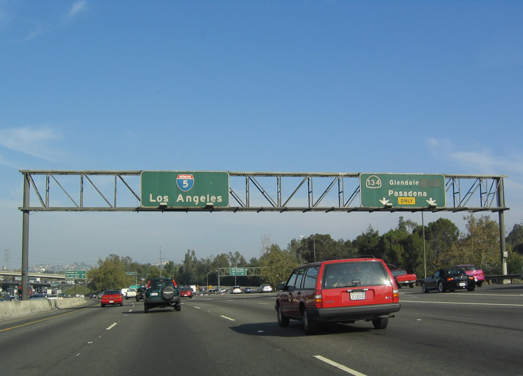
Most of these photos were taken during the evening rush hour, and heading toward downtown is a cinch. By comparison, getting out of downtown is not. The oncoming traffic is extremely thick, and it would pose a problem on southbound once south of Los Angeles. The next exit is Exit 144, California 134 (Ventura Freeway). Photo taken 07/06/04. |
|
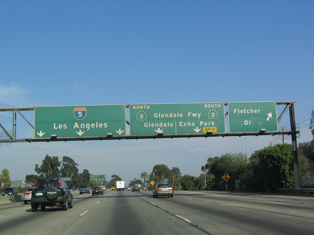
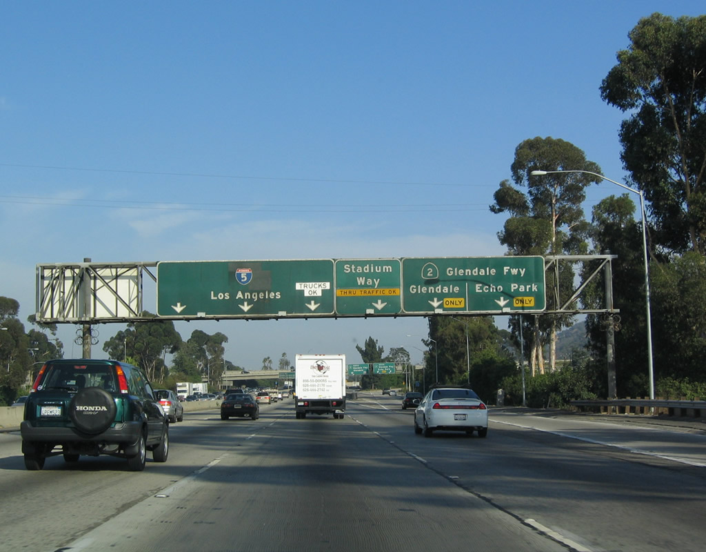
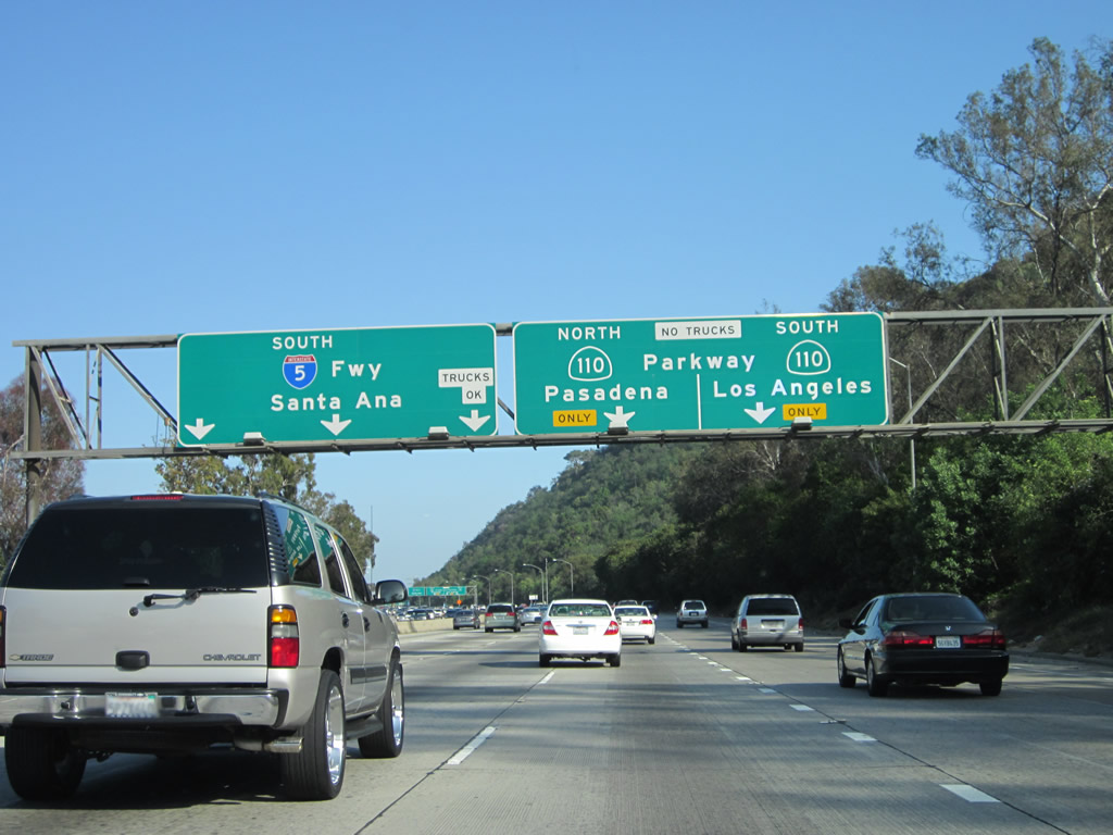
The four left lanes continue along mainline Interstate 5, while the two right lanes exit only onto Exit 144, California 134 (Ventura Freeway) east. There is no direct connection from Interstate 5 south to California 134 west under the theory that traffic targeting westbound Ventura Freeway would use California 170 instead. Interstate 5 departs Glendale and reenters Los Angeles. Photo taken 07/06/04. |
|
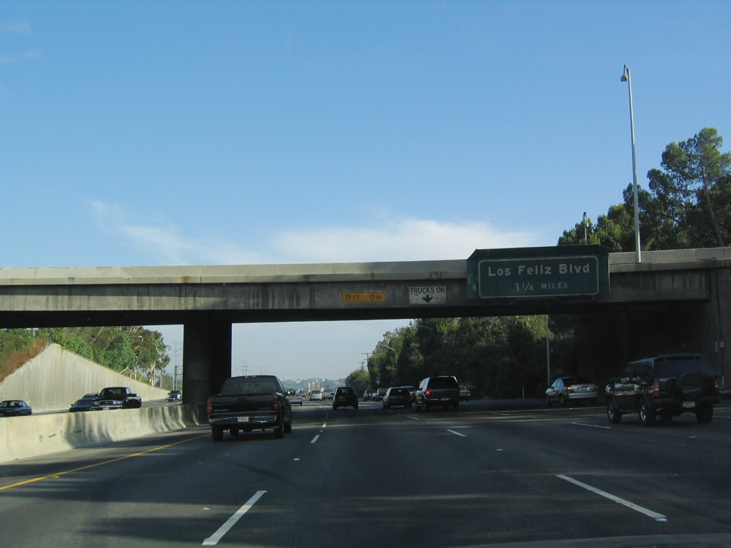
The next three exits along southbound are: Exit 142, Colorado Street; Exit 141, Los Feliz Boulevard and Griffith Park Drive; and Exit 140B, Glendale Boulevard. To the east of Interstate 5, the famous Los Angeles River comes into view in the valley. The river will closely follow Interstate 5 into downtown. Many of the bridges that span the river in this vicinity have been made famous on hundreds of car commercials and movies. Photo taken 07/06/04. |
|
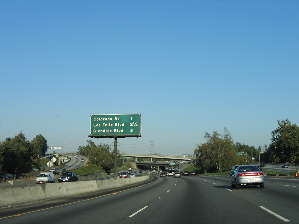
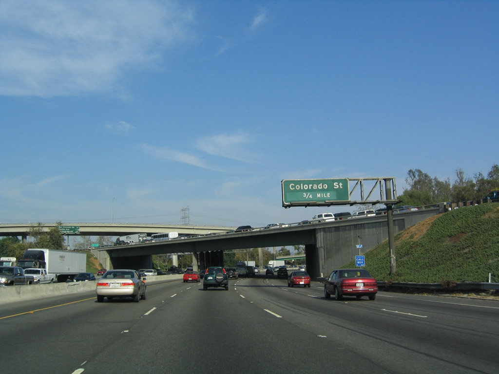
Exit 142 is a short freeway spur (Colorado Street Freeway Extension) that connects Interstate 5 (Golden State Freeway) with Colorado Street, which is former U.S. 66. This ramp also connects to San Fernando Road, which is former U.S. 6-99. Historically, U.S. 66 followed Colorado Street west from Pasadena through Glendale, then turned south on San Fernando Road with U.S. 99 just east of here. Once the Golden State Freeway was constructed and U.S. 6-99 were moved to the new road, Colorado Street / Colorado Boulevard was extended as a short-freeway between San Fernando Road and the freeway via an arch bridge over the Los Angeles River. So historically, from this interchange south to downtown, Interstate 5 (Golden State Freeway) was previously U.S. 6-66 west and U.S. 99 south. Photo taken 07/06/04. |
|
East of here, Colorado Street travels due east out of Los Angeles, and it passes through Glendale and back into Los Angeles (in the area of Eagle Rock) before entering Pasadena. Once in Pasadena, it will change into Colorado Boulevard as it parallels California 134 and Interstate 210 on the south side of the freeways through Pasadena en route to Arcadia. Colorado Boulevard carries Historic U.S. 66 signage, and it even has a few old expressway segments that are still in use today. By the time U.S. 66 reaches Monrovia, it moves from Colorado Boulevard to Huntington Drive and then Foothill Boulevard further east. Photo taken 07/06/04. |
|
A golf driving range is located at the Harding Municipal Golf Course, which is part of Griffith Park, which is part of the city of Los Angeles. Interstate 5 left the city of Glendale at the California 134 interchange and now reenters the city of Los Angeles. Photo taken 07/06/04. |
|
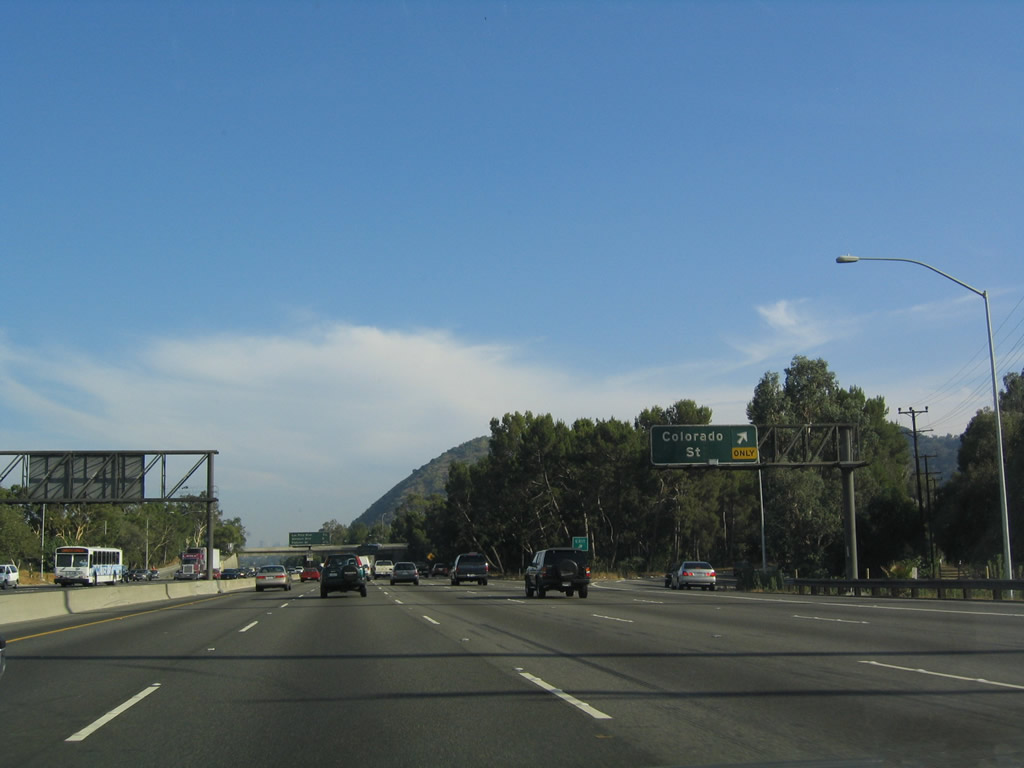
Southbound Interstate 5 reaches Exit 142, Colorado Street (Old U.S. 66). Photo taken 07/06/04. |
|
The next three exits along southbound are: Exit 141, Los Feliz Boulevard/Griffith Park Drive; Exit 140B, Glendale Boulevard; and Exit 140A, Fletcher Drive. Photo taken 07/06/04. |
|
Interstate 5 sees a brief hiatus in the frequency of exits because the freeway is sandwiched between the Los Angeles River on the east and sprawling Griffith Park to the west. Griffith Park is home to the Griffith Observatory, and the Los Angeles Zoo. The park dates back to 1896. The park originally met the Los Angeles River until the Interstate 5 cut off access between the park and the river. Over 10 million people visit the park annually, and the park is managed by the City of Los Angeles. Photo taken 07/06/04. |
|
Southbound Interstate 5 reaches Exit 141, Los Feliz Boulevard/Griffith Park Drive; the next exit is Exit 140B, Glendale Boulevard. Photo taken 07/06/04. |
|
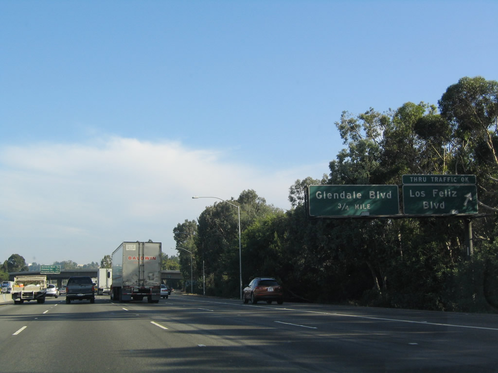
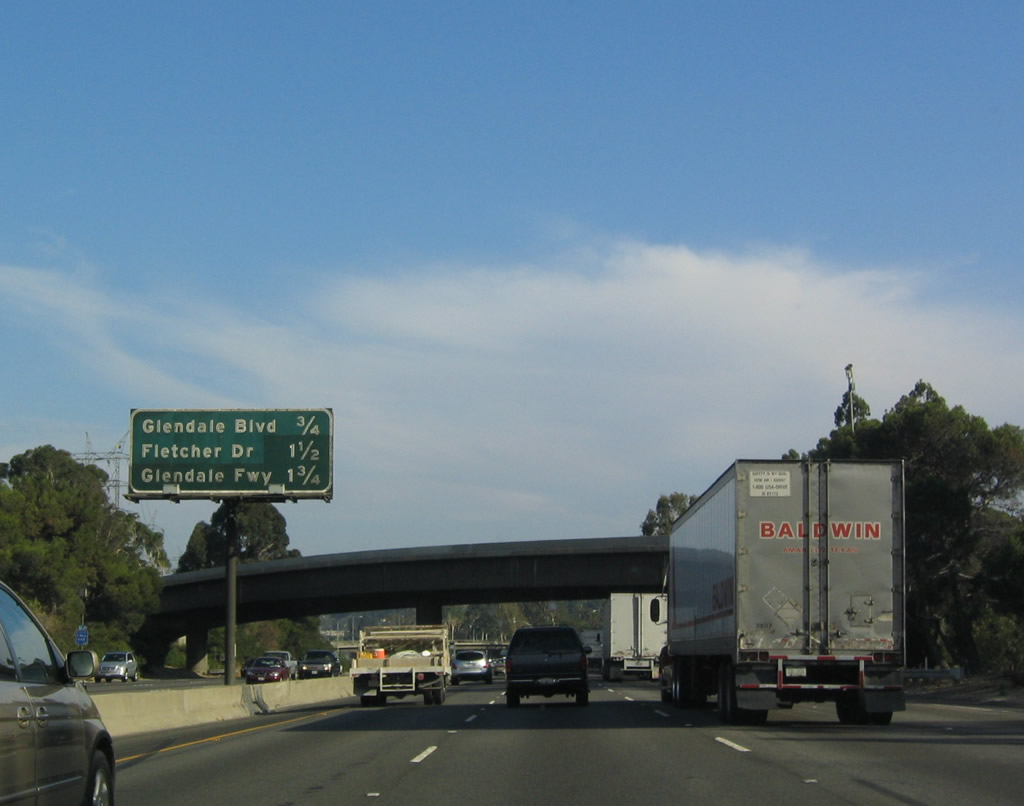
The next three exits along southbound are: Exit 140B, Glendale Boulevard; Exit 140A, Fletcher Drive; and Exit 139, California 2 (Glendale Freeway). Photo taken 07/06/04. |
|
Southbound Interstate 5 reaches Exit 140B, Glendale Boulevard, which heads northeast through Atwater Village into Glendale and southwest to Hyperion Avenue en route to Santa Monica Boulevard. Photo taken 07/06/04. |
|
Use Exit 140A/Fletcher Drive to reach Glendale Boulevard southbound. This overpass carries Glendale Boulevard over Interstate 5. Photo taken 07/06/04. |
|
Massive LADWP power lines follow Interstate 5 and the Los Angeles River as they follow the east side of Griffith Park. Photo taken 07/15/06. |
|
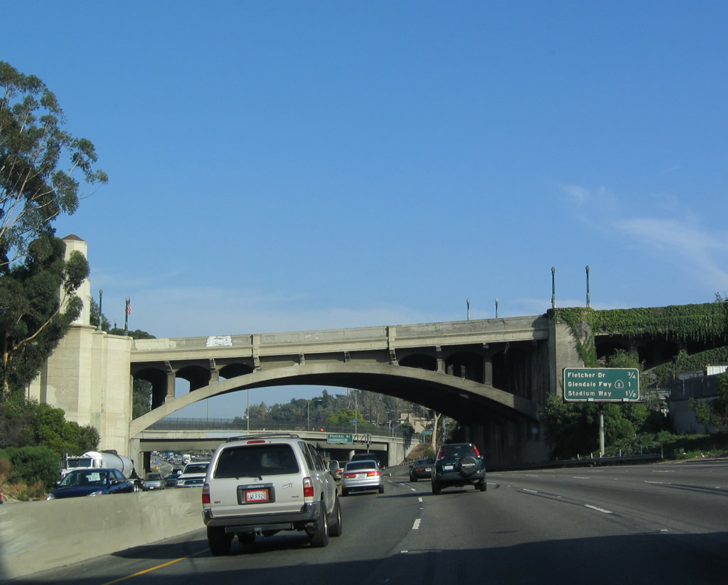
Southbound Interstate 5 reaches Exit 140A, Fletcher Drive. The next exit is Exit 139, California 2 (Glendale Freeway), and unlike certain other freeway to freeway interchanges (such as California 118 and California 134), ample connections for all directions of traffic are provided here. Originally, California 2 south/west was supposed to continue as a freeway all the way to U.S. 101, but Echo Park residents put a halt to that. As a result, California 2 changes into a city street shortly after passing Interstate 5. Photo taken 07/06/04. |
|
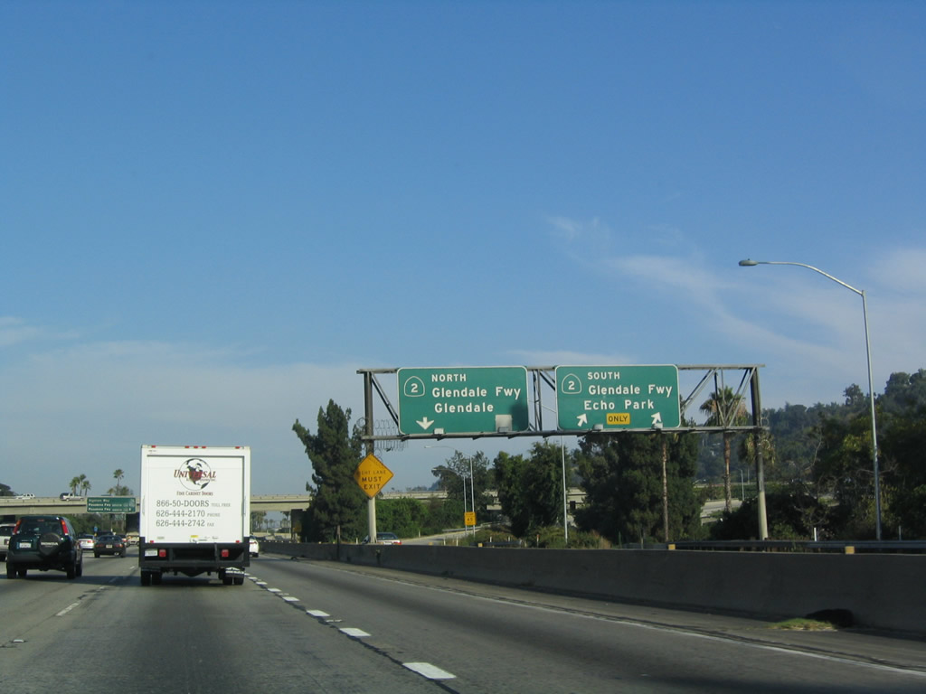
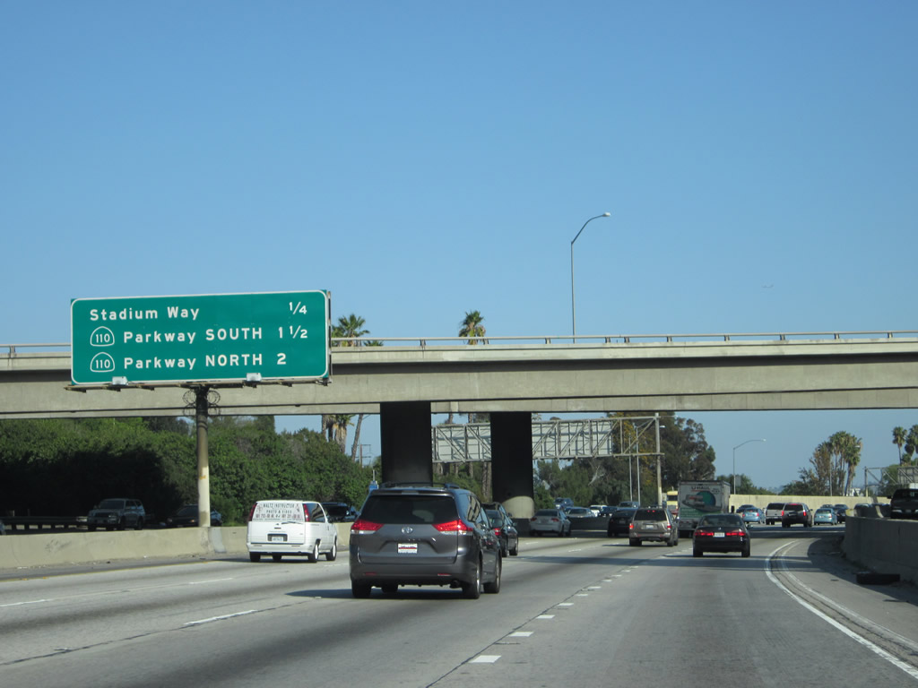
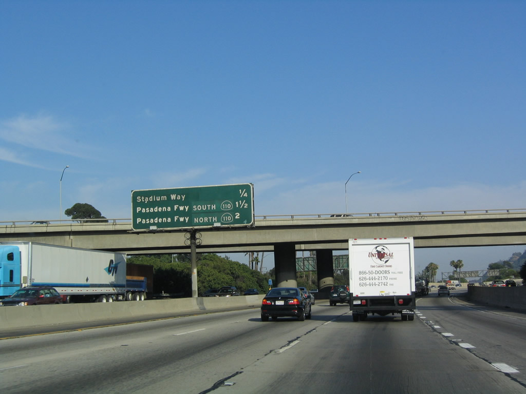
The next three exits along southbound are: Exit 139, California 2 (Glendale Freeway); Exit 138, Stadium Way; and Exits 137B-A, California 110 (Pasadena Freeway) (formerly the Arroyo Seco Parkway). Photo taken 07/15/06. |
|
The right two lanes become exit only for Exit 139, California 2 (Glendale Freeway). The next exit is Exit 138, Stadium Way. Remain in the three left lanes to continue south on Interstate 5 (Golden State Freeway). Photo taken 07/06/04. |
|
View of the collector distributor lanes for Exit 139, California 2 (Glendale Freeway) as seen from the mainline. Photo taken 07/06/04. |
|
As the name implies, use Exit 138/Stadium Way to reach the Los Angeles Dodgers stadium, Dodger Stadium. Stadium Way wraps around the stadium to the north and west, then provides connections to the stadium from all directions in a circular fashion. Photo taken 07/15/06. |
|
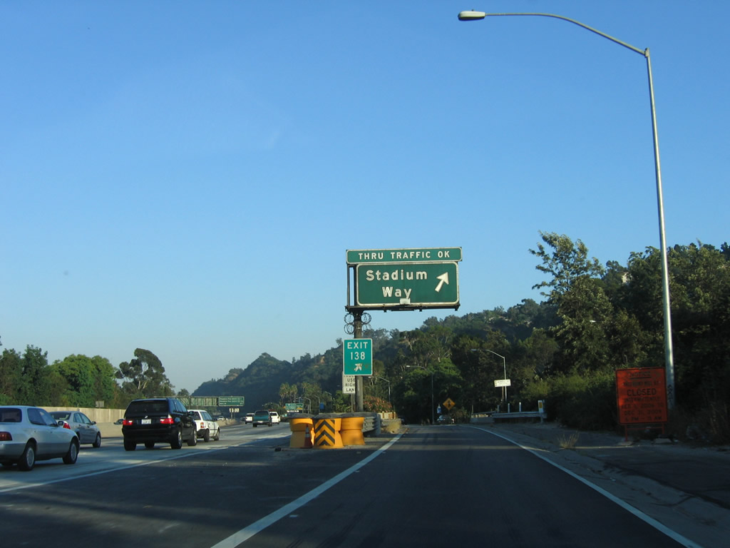
An Interstate 5 reassurance guide sign is posted on the collector distributor lanes for Exit 138. Photo taken 05/05/12. |
|
Still on the collector distributor lanes from Interstate 5 (Golden State Freeway) south, the ramp divides with the right lane connecting to Exit 138, Stadium Way to Chavez Ravine. The left two lanes will return back to Interstate 5 south. Photo taken 07/15/06. |
|
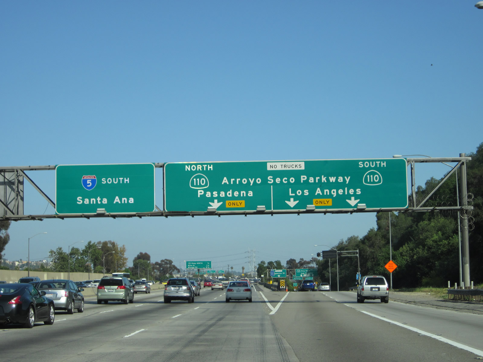
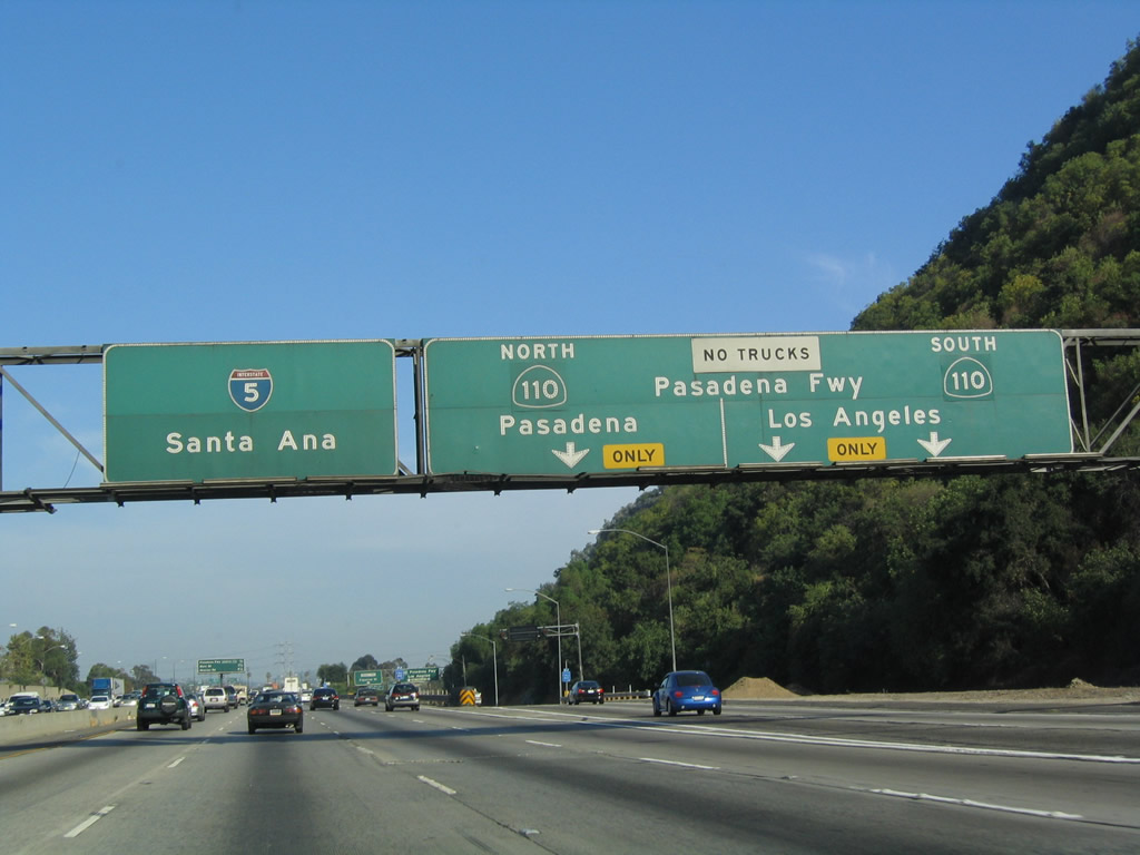
Back on the mainline, the next three exits along southbound are: Exit 137B, California 110 (Pasadena Freeway) south; Exit 137A, California 110 (Arroyo Seco Parkway / Pasadena Freeway) north; and Exit 136, Main Street. This sign has been replaced (but is not pictured here). In the history of the freeway system, at one time the Pasadena Freeway was designated as U.S. 66 (rather than Colorado Boulevard); the covered up shields may have a U.S. 66 marker hidden from view, but it definitely hides California 11, which was the interim designation for the freeway. Photo taken 07/06/04. |
|
|
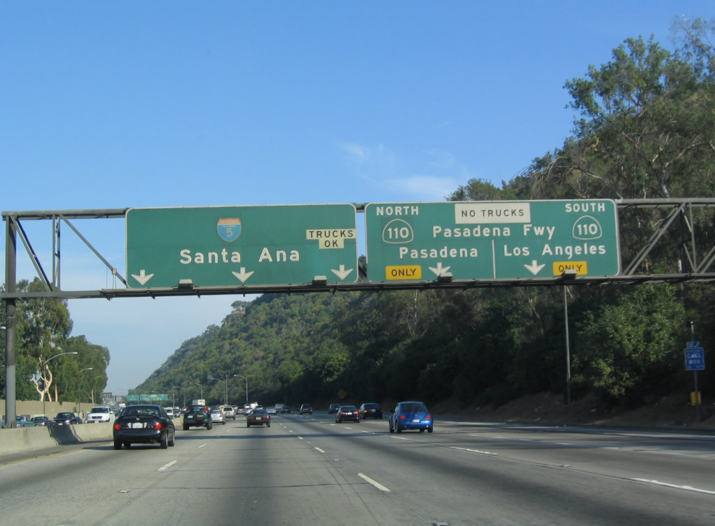
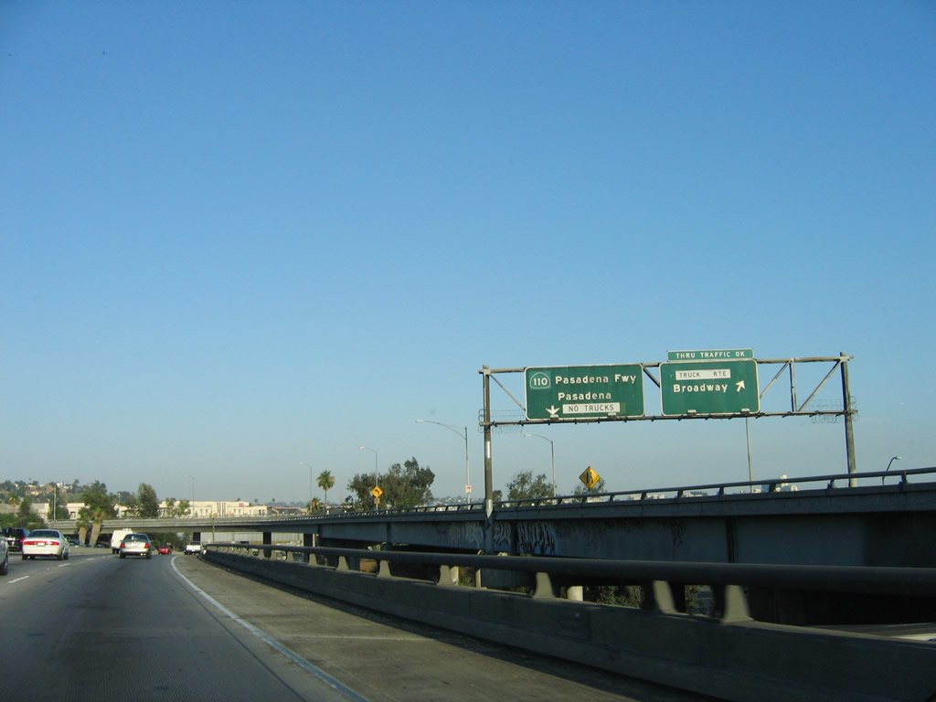
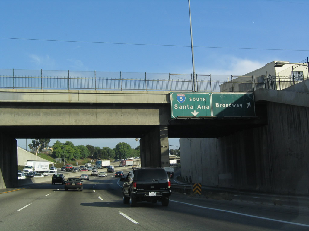
Use California 110 (Arroyo Seco Parkway / Pasadena Freeway) south (Exit 137B) to connect to downtown Los Angeles. California 110 cuts along the northwestern edges of downtown and is far more direct than Interstate 5, which skirts downtown well to the east. California 110 changes into the Harbor Freeway upon crossing U.S. 101 and the Four-Level Interchange. South of Interstate 10 (Santa Monica Freeway), California 110 becomes Interstate 110, and that freeway heads south toward Long Beach, the Port of Los Angeles, and San Pedro. This sign was changed in 2010 to reflect the renaming of California 110 north of the Four-Level Interchange from the Pasadena Freeway to the Arroyo Seco Parkway. Photos taken 05/05/12 and 07/06/04. |
|
|
As for California 110 (Arroyo Seco Parkway / Pasadena Freeway) north, the freeway follows the Arroyo Seco (translated as "Dry Creek") northeast into Pasadena. It was originally part of Historic U.S. 66 and California 11. The freeway ends upon reaching the southern edge of downtown Pasadena. With a meandering design that features some on-ramps with no acceleration lanes and narrow or nonexistent shoulders, the Pasadena Freeway exemplifies a much older era of freeway construction. At this point, southbound California 110 traffic departs from southbound Interstate 5. Photos taken 05/05/12 and 07/06/04. |
|
|
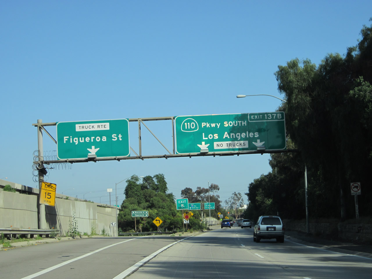
This series of pictures follows the connection from Interstate 5 (Golden State Freeway) south to California 110 (Arroyo Seco Parkway / Pasadena Freeway) south via Exit 137B near Elysian Park. Upon exiting, an immediate left exit connects to Riverside Drive and Figueroa Street. The the two-lane transition ramp curves to make a sharp turn before merging with California 110 south. Photos taken 05/05/12. |
|
|
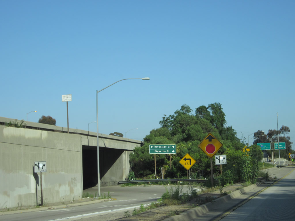
A bit further along the transition ramp, traffic enters the ramp from Riverside Drive and Figueroa Street. These reflective signs were replaced in 2010 when the Arroyo Seco Parkway designation was resurrected after its elimination in 1954 in favor of the Pasadena Freeway. Photos taken 05/05/12. |
|
|
The two-lane ramp narrows as it approaches the merge with California 110. Photos taken 05/05/12. |
|
Back on mainline Interstate 5 south, this view shows the split from Interstate 5 (Golden State Freeway) south to California 110 south and Figueroa Street (Exit 137B) as seen from the mainline. Photo taken 07/15/06. |
|
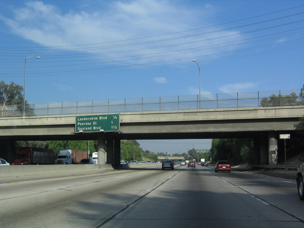
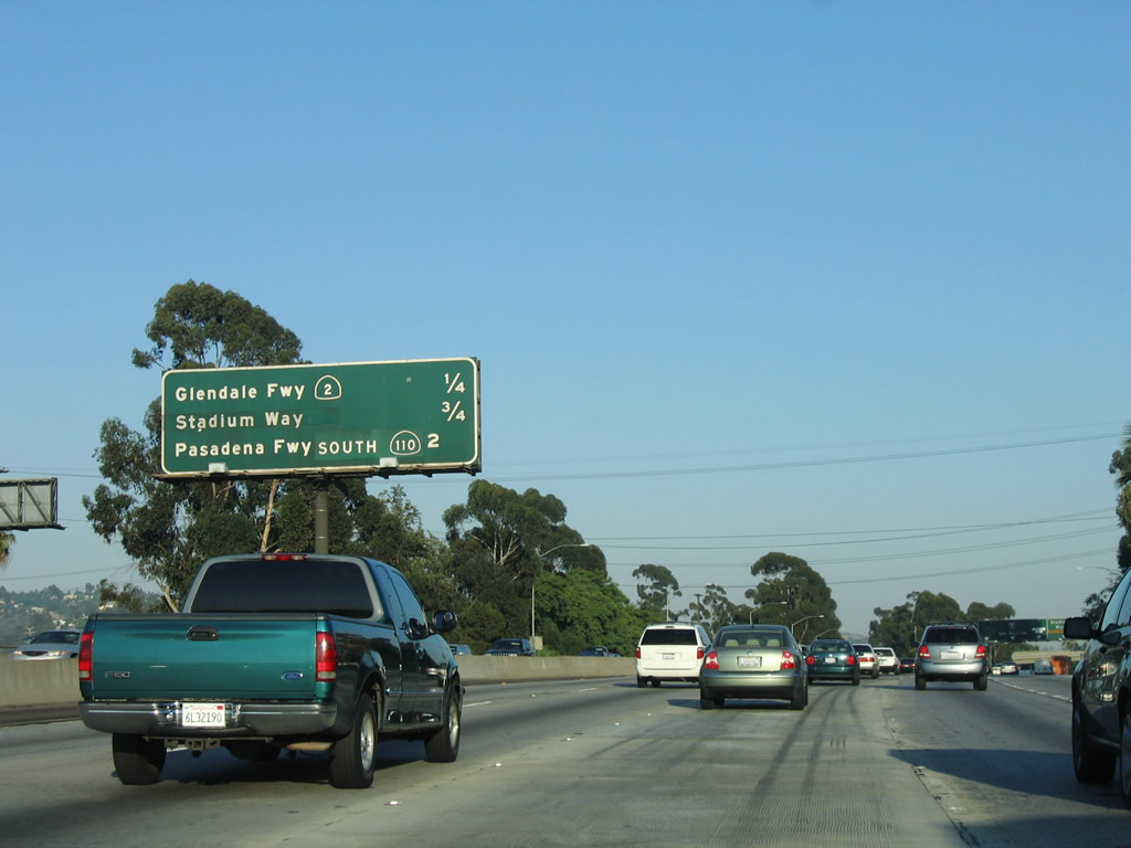
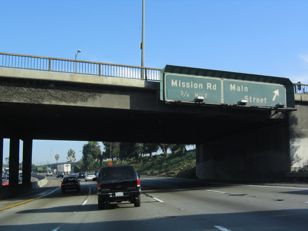
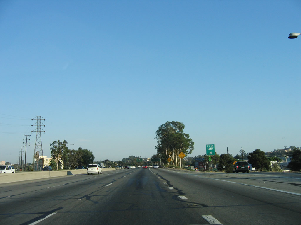
This mileage sign also appears in the previous photo. It is still a good one-half mile before Interstate 5 reaches the exit ramp for Exit 137A, California 110 (Pasadena Freeway) north. The following two exits are Exit 136, Main Street and Exit 135C, Mission Road. Photo taken 07/06/04. |
|
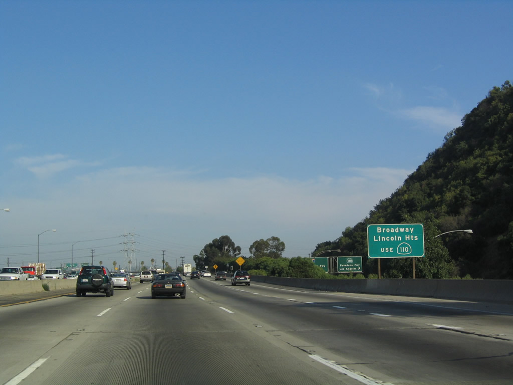
Use the off-ramp to California 110 (Pasadena Freeway) north for the exit for Broadway and the community of Lincoln Heights. Photo taken 07/06/04. |
|
A massive LADWP power line crosses over Interstate 5 prior to the California 110 north exit. Photo taken 07/15/06. |
|
Southbound Interstate 5 reaches Exit 137A, California 110 (Pasadena Freeway) north. In addition to providing the exit, the "Through Traffic OK" emblem means that traffic continuing south on Interstate 5 may exit here and still return to Interstate 5 south without having to exit the freeway. To the Broadway exit, use this off-ramp. Photo taken 07/06/04. |
|
This view shows the ramp from Interstate 5 south to California 110 and to Broadway. Through traffic back to Interstate 5 may use the Broadway connecting ramp. Photo taken 07/15/06. |
|
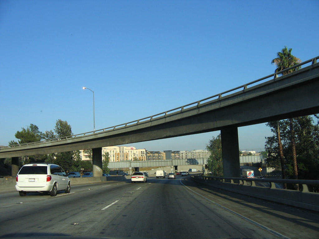
The transition ramp from Interstate 5 south to California 110 north flies over the mainline. Photo taken 07/15/06. |
|
The Metro Gold Line light rail passes over Interstate 5 on this bridge; the rail connects Pasadena with downtown Los Angeles at Union Station. Photo taken 07/15/06. |
|
After the California 110 interchange, this picture shows the view of southbound Interstate 5 at the point where Broadway exits off of the collector distributor lanes from California 110. To get to the Broadway exit, one must take the California 110 north exit. The next exit is Exit 136, Main Street. Photo taken 07/06/04. |
|
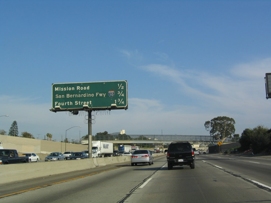
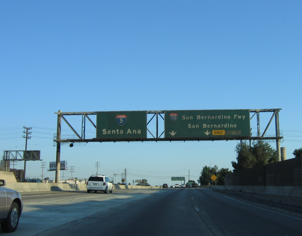
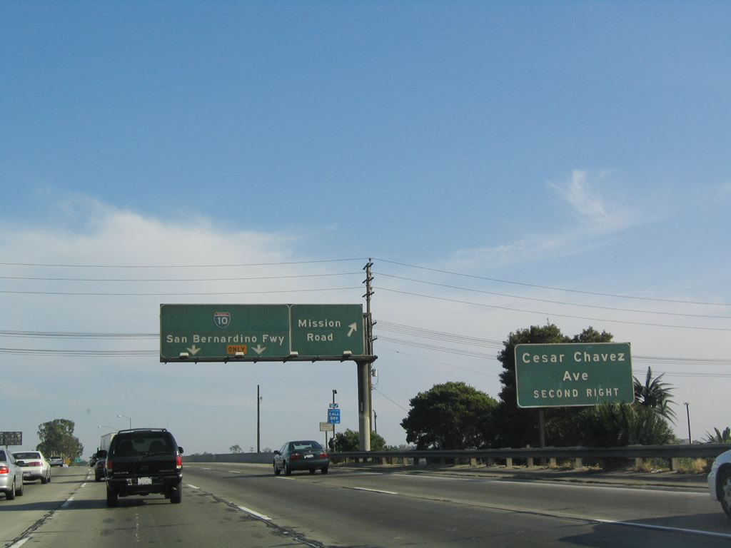
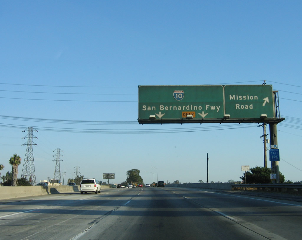
The next three exits along southbound are Exit 136, Main Street; Exit 135C, Mission Road; and Exit 135B, Interstate 10 (San Bernardino Freeway) east. Photo taken 07/06/04. |
|
Southbound Interstate 5 reaches Exit 136, Main Street; the next exit is Exit 135C, Mission Road. Photo taken 07/06/04. |
|
The next three exits from southbound are Exit 135C, Mission Road; Exit 135B, Interstate 10 east; and Exit 135A, Fourth Street. Photo taken 07/06/04. |
|
Although these signs indicate lane assignments for southbound Interstate 5 and eastbound Interstate 10, the next exit from southbound is Exit 135C, Mission Road. Note that there is no sign here for westbound Interstate 10. Photo taken 07/15/06. |
|
This roadside sign advises that the next exit connects to Exit 135B, Cesar Chavez Avenue (the same ramp also connects to Interstate 10 (San Bernardino Freeway) east). Photo taken 07/15/06. |
|
Southbound Interstate 5 (Golden State Freeway) reaches Exit 135C, Mission Road. The next exit is eastbound Interstate 10. Note that there is no access to northbound U.S. 101 at this interchange. Photo taken 07/06/04. |
|
A gore point sign advises the ramp for Exit 135C, Mission Road. Photo taken 07/15/06. |
|
Immediately thereafter, Interstate 5 (Golden State Freeway) south reaches Exit 135B, Interstate 10 (San Bernardino Freeway) east to San Bernardino. Although not clearly signed here, Interstate 10 west merges with Interstate 5 south for about a mile on the Golden State Freeway, until Interstate 10 continues its trek west via the Santa Monica Freeway (Exit 134C). Photo taken 07/06/04. |
Page Updated May 6, 2012.