| Interstate 5 south |
|
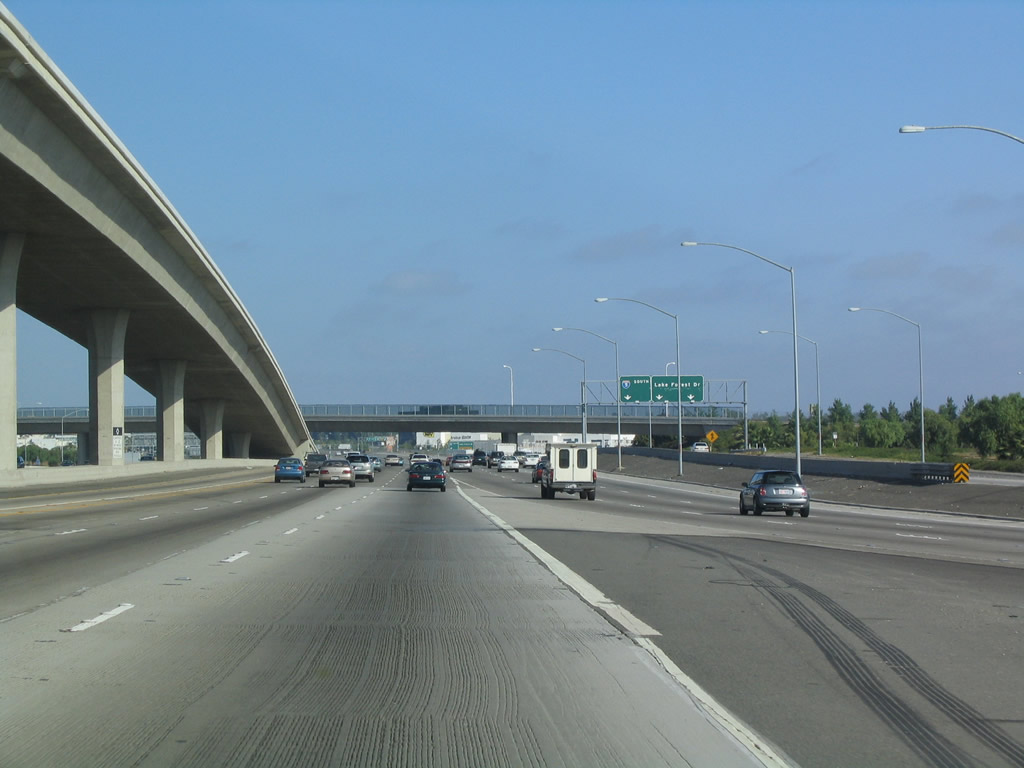
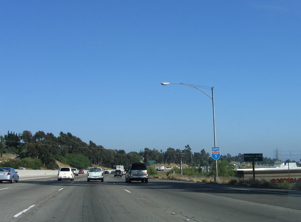
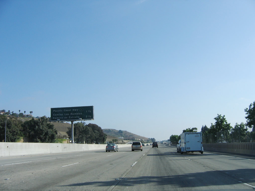
The main lanes of Interstate 405 (San Diego Freeway) merge into the main lanes of Interstate 5 (Santa Ana Freeway) from the right, thus marking the southern terminus of Interstate 405. At this interchange, the Santa Ana Freeway is absorbed into the San Diego Freeway. For the remainder of Interstate 5 south to downtown San Diego, the freeway is named as the San Diego Freeway (with certain segments of Interstate 5 also carrying names in memory of various people as designated by the State Legislature from time to time). Photo taken 06/27/04. |
|
|
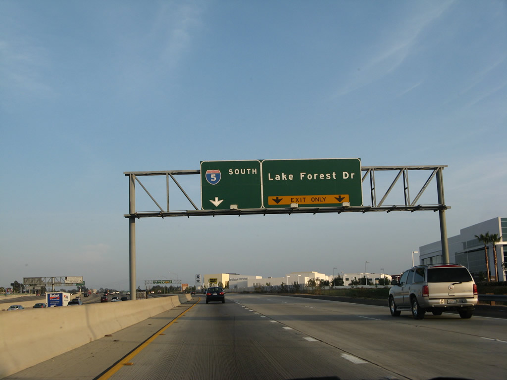
Now looking at the truck lanes after Interstate 5 and Interstate 405 merge, the left lane connects to Interstate 5 (San Diego Freeway) south and the right two lanes connect to Exit 92, Lake Forest Drive. Photo taken 06/17/06 and 03/25/07. |
|
|
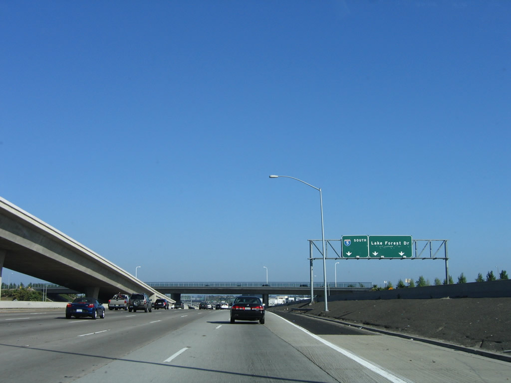
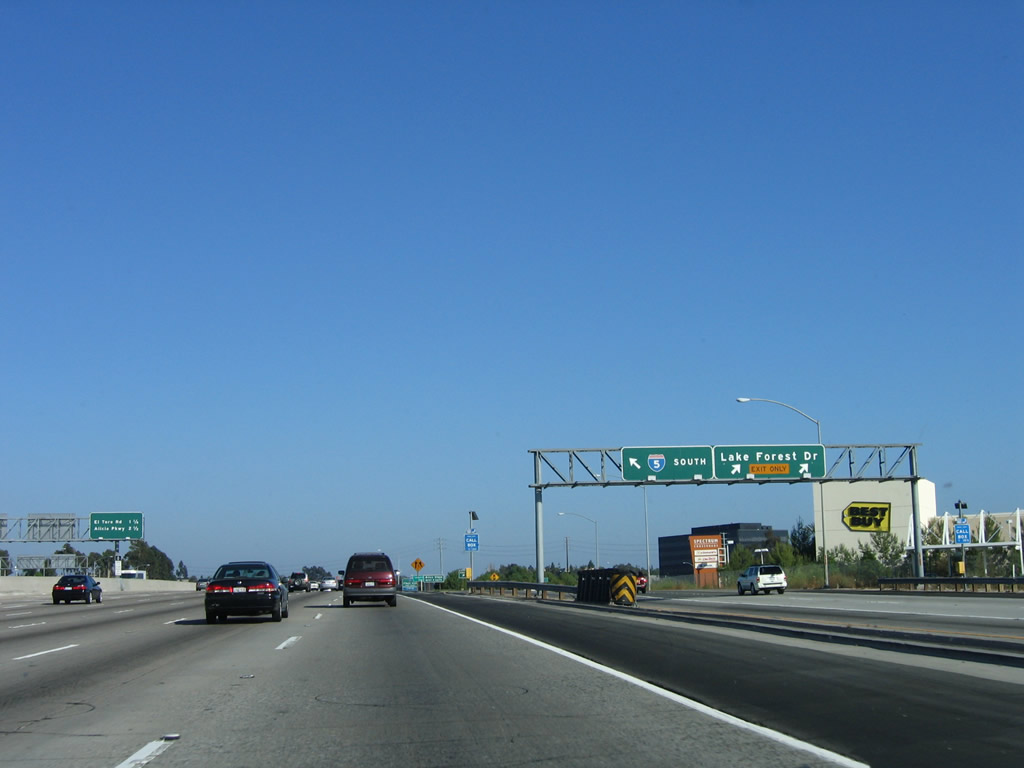
This view shows the truck bypass/local lanes at the Lake Forest Drive off-ramp (Exit 92) as seen from the main lanes of southbound Interstate 5 (San Diego Freeway). Photos taken 06/27/04 and 03/25/07. |
|
|
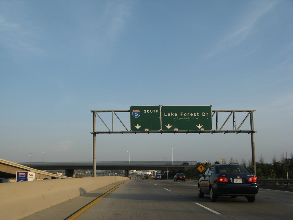
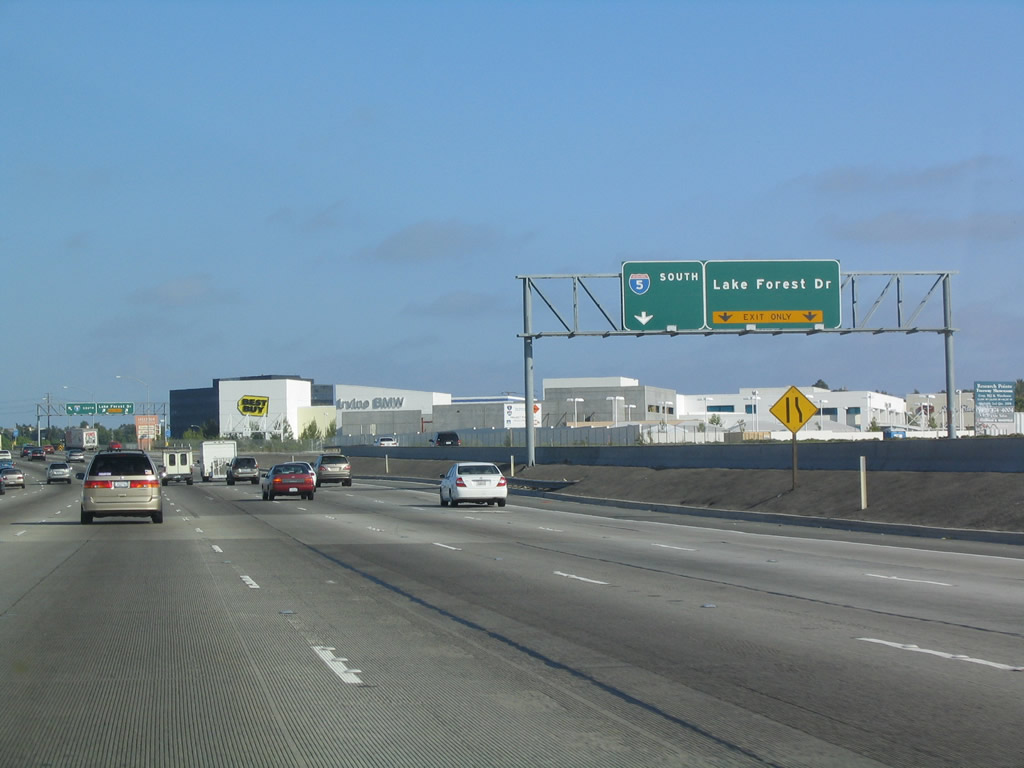
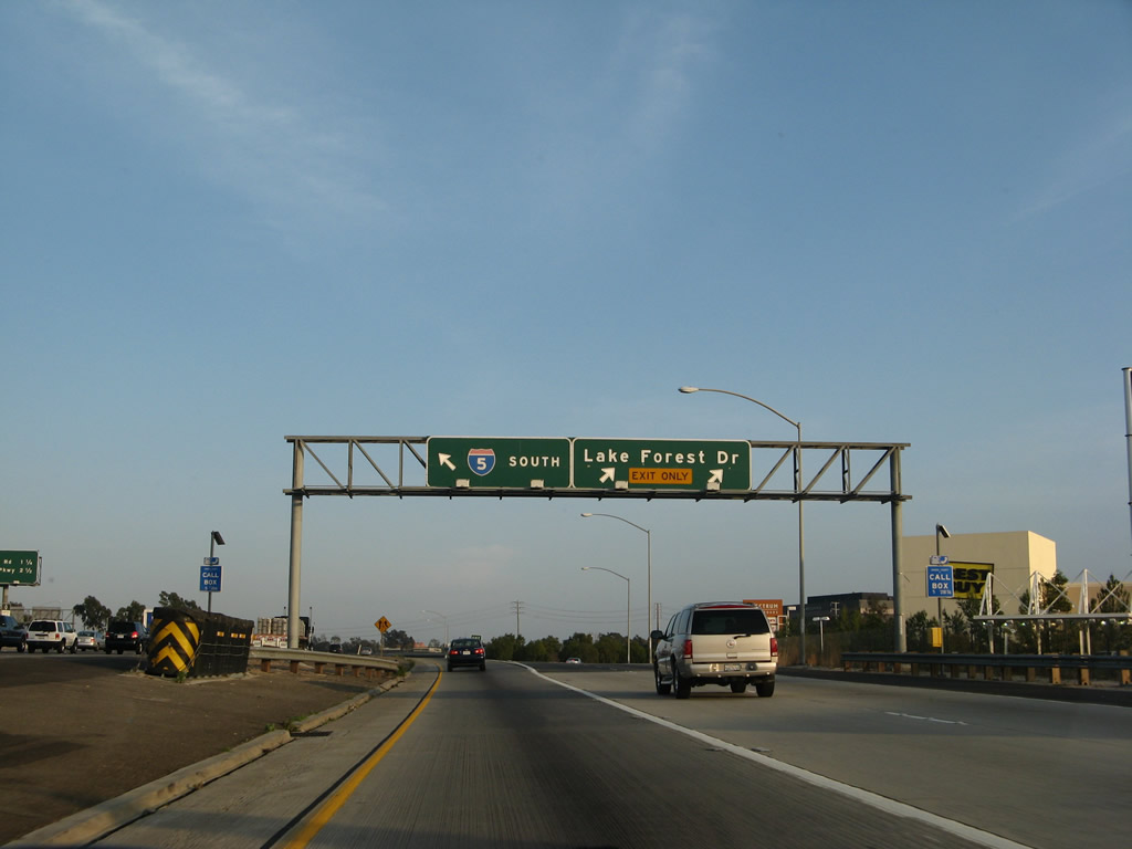
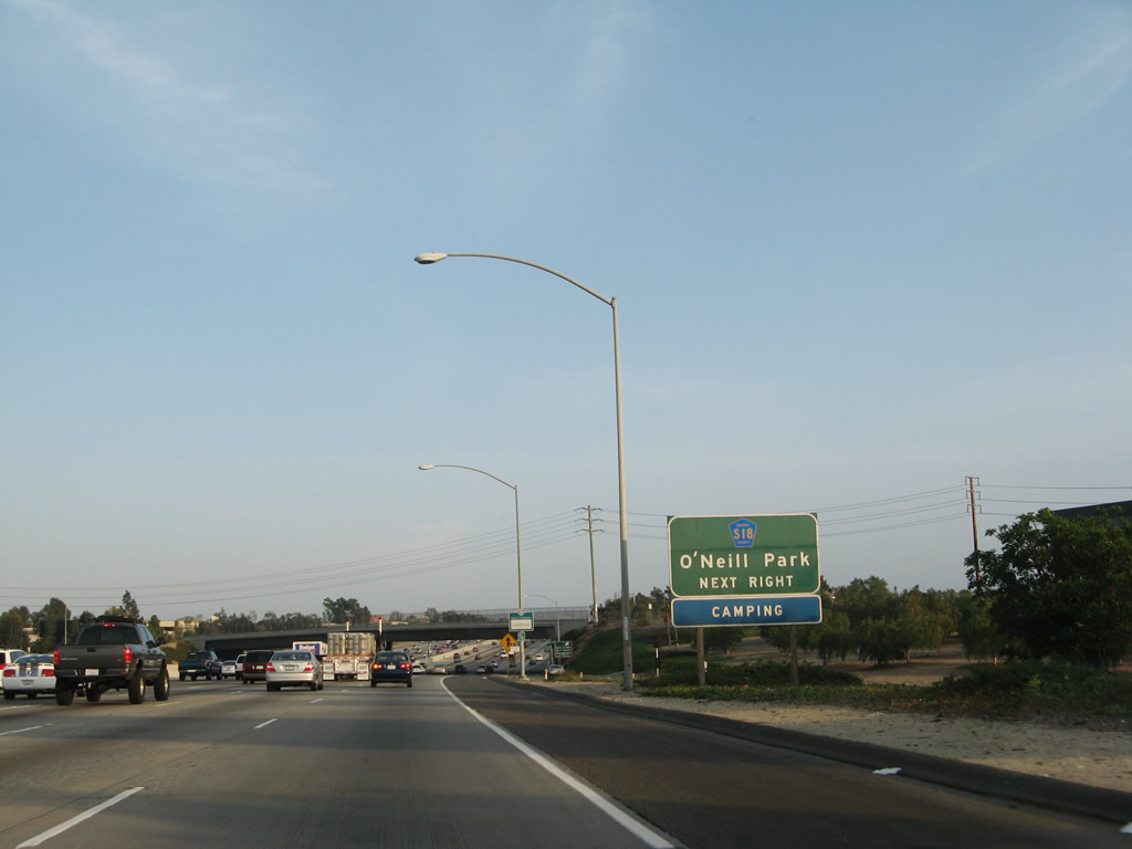
The truck lanes of southbound Interstate 5 reach Exit 92, Lake Forest Drive. After this exit, the truck lanes return to the mainline of Interstate 5. At this point, Interstate 5 leaves the city of Irvine and now straddles the cities of Laguna Hills (population 31,178 at the 2000 Census) and Lake Forest. Incorporated on December 20, 1991, Lake Forest consists of 16.6 square miles, sits at an elevation of 394 feet, and was home to 58,707 people as of the 2000 Census. Photos taken 06/17/06 and 03/25/07. |
|
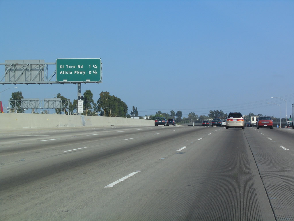
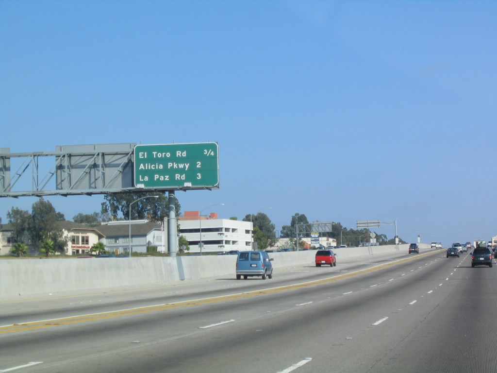
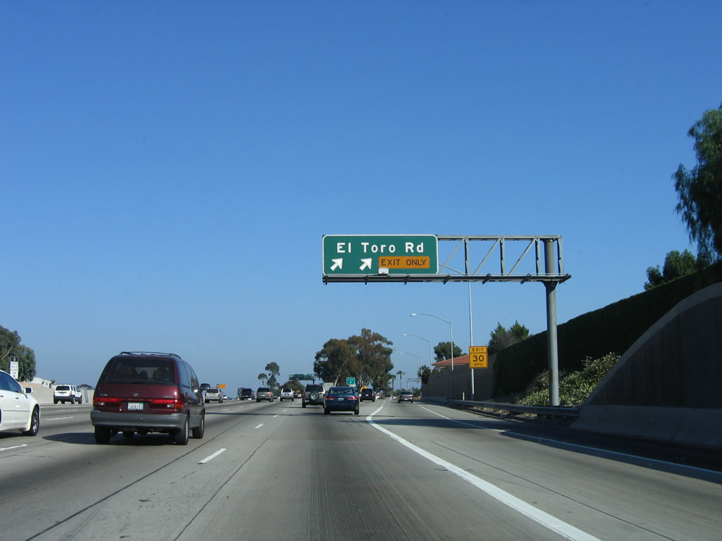
The next two exits along southbound Interstate 5 (San Diego Freeway) are Exit 91, El Toro Road and Exit 90, Alicia Parkway. Photo taken 06/27/04. |
|
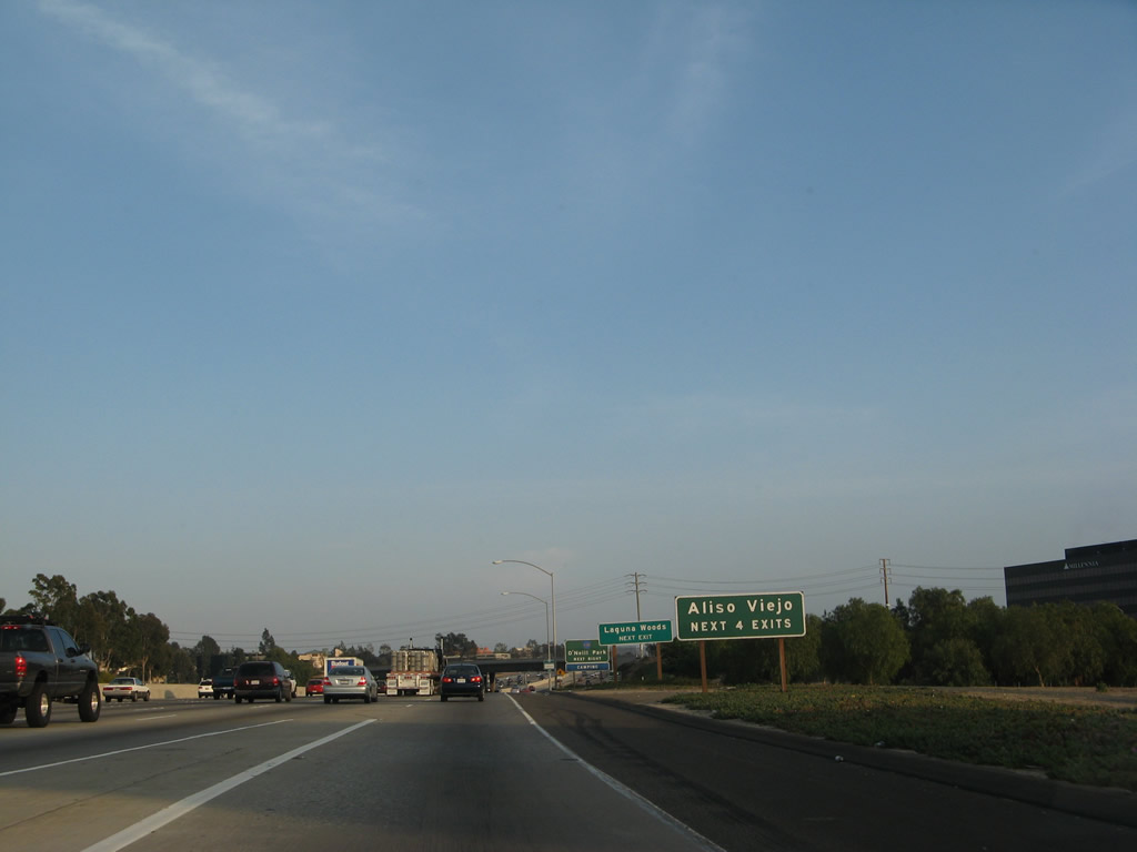
The next four exits along southbound Interstate 5 (San Diego Freeway) serve the city of Aliso Viejo (population 40,166 at 2000 Census), which is not directly served by Interstate 5 but is located southwest of Interstate 5 and thus served by prime and major arterials that travel west from the freeway. The next exit serves the city of Laguna Woods. Incorporated on March 2, 1999, the city mostly consists of Leisure World, a retirement community built on the former Moulton Ranch. The average age in this city is 78 years old according to the city's official web page. Interstate 5 does not pass into Laguna Woods but rather skirts the west edge between Ridge Route Drive and Exit 91 (El Toro Road). Photo taken 03/25/07. |
|
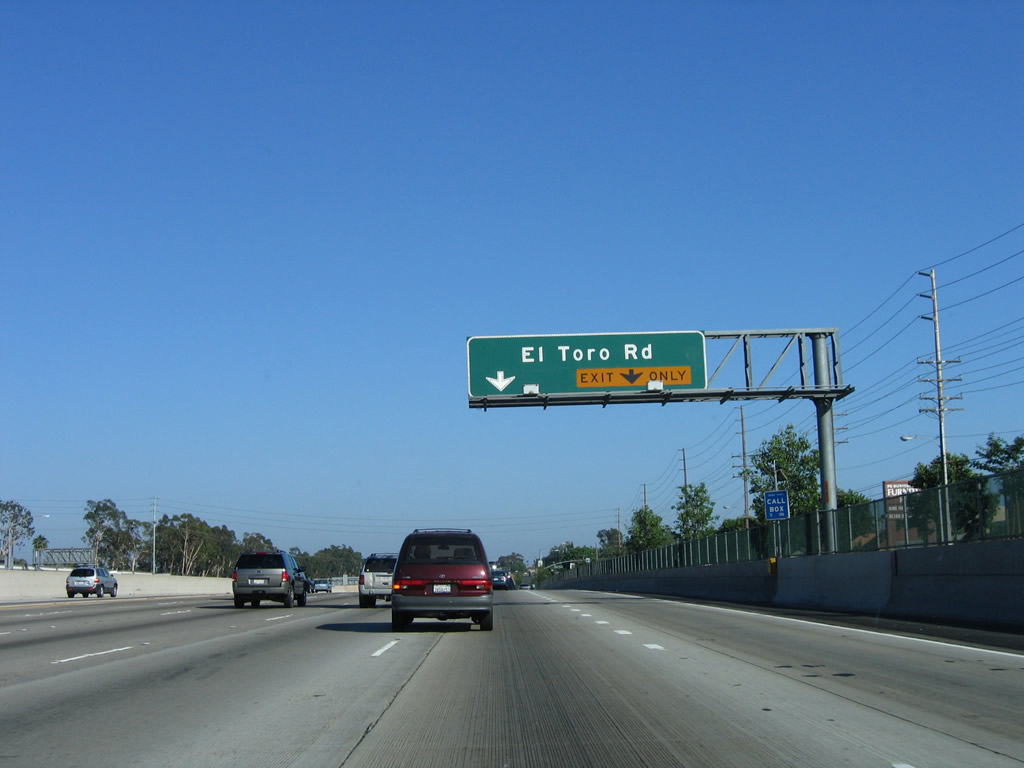
Immediately after Interstate 5 merges with Interstate 405, the next exit is Exit 91, Orange County S-18 (El Toro Road). The sign is unique in that the county shield is posted on a green guide sign. Orange County S-18 begins at its junction with California 133 in Aliso Viejo, then heads northeast via El Toro Road through Aliso Viejo, Laguna Woods, and Lake Forest. Orange County S-18 then turns north at its intersection with Orange County S-19 (Live Oak Canyon Road), changing into Santiago Canyon Road. Santiago Canyon Road changes into Villa Park Road at Hewes Street in Orange, then Orange County S-18 turns west along Katella Avenue. Orange County S-18 finally ends at its junction with California 55/Exit 15. Photo taken 03/25/07. |
|
This mileage sign along southbound Interstate 5 (San Diego Freeway) provides the distance to the next three exits, including Exit 91, Orange County S-18 (El Toro Road) (three-quarters of a mile). This is the first standalone exit after the merge with southbound Interstate 405 traffic and the end of the truck bypass. The Interstate 405 interchange was reconstructed in the mid-1990s, resulting in as many as seven undivided lanes heading southbound at once. The entire merge has up to 22 lanes at its widest point (between main, HOV, and truck lanes). Photo taken 06/27/04. |
|
The right two lanes will connect to Exit 91, with the right lane becoming exit only. Orange County S-18 (El Toro Road) heads southwest into Laguna Hills and Laguna Woods and northeast into Lake Forest. This is one of the few signed county routes in Orange County; most of the signed routes travel through the more rural portions of the county especially along the California 241 toll road corridor. Photo taken 06/27/04. |
|
Southbound Interstate 5 reaches Exit 91, Orange County S-18 (El Toro Road). Despite the name, El Toro Road does not connect directly to the former Marine Base of the same name. Between Exits 91 and 90, Interstate 5 straddles the cities of Lake Forest on the northeast and Laguna Hills on the southwest. Between Exits 90 and 89, Interstate 5 straddles the cities of Mission Viejo on the northeast and Laguna Hills on the southwest. At Exit 89, Interstate 5 will fully enter the city of Mission Viejo. Photo taken 06/27/04. |
|
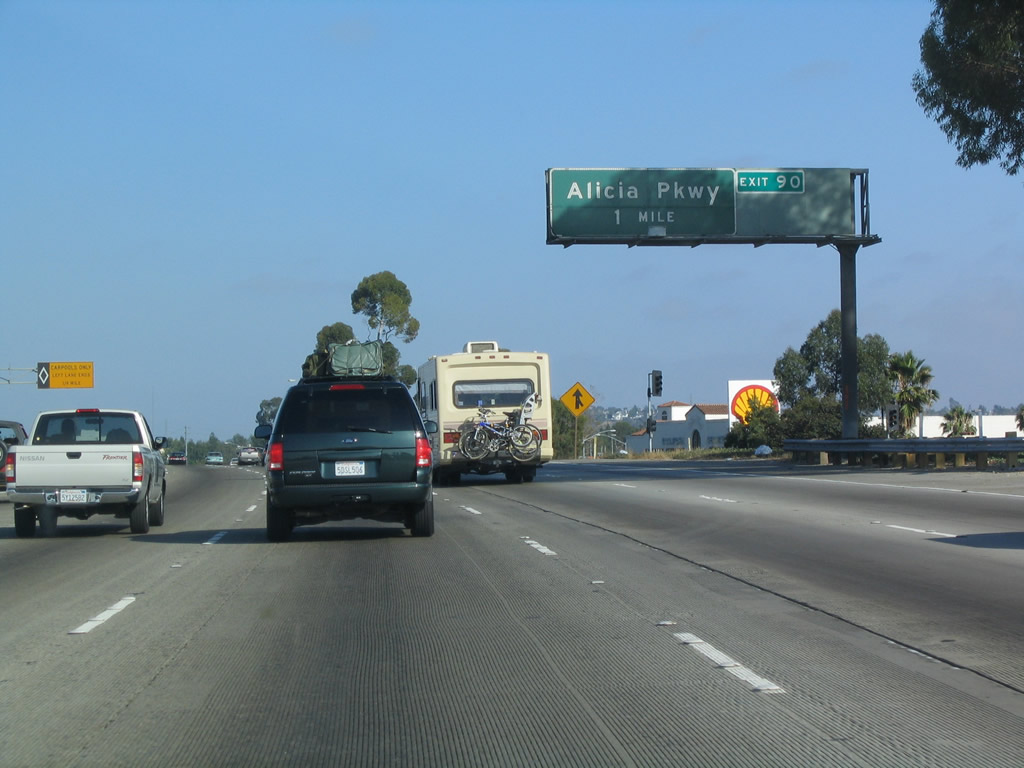
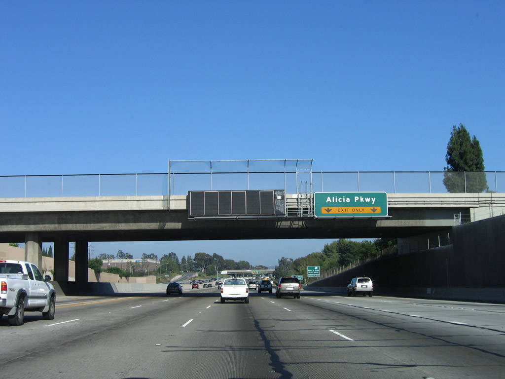
The next exit along Interstate 5 (San Diego Freeway) is Exit 90, Alicia Parkway, one mile. Alicia Parkway leads east into Mission Viejo and Rancho Santa Margarita. Southbound Alicia Parkway leads to Laguna Nigel via Laguna Hills and Aliso Viejo. Photo taken 06/27/04. |
|
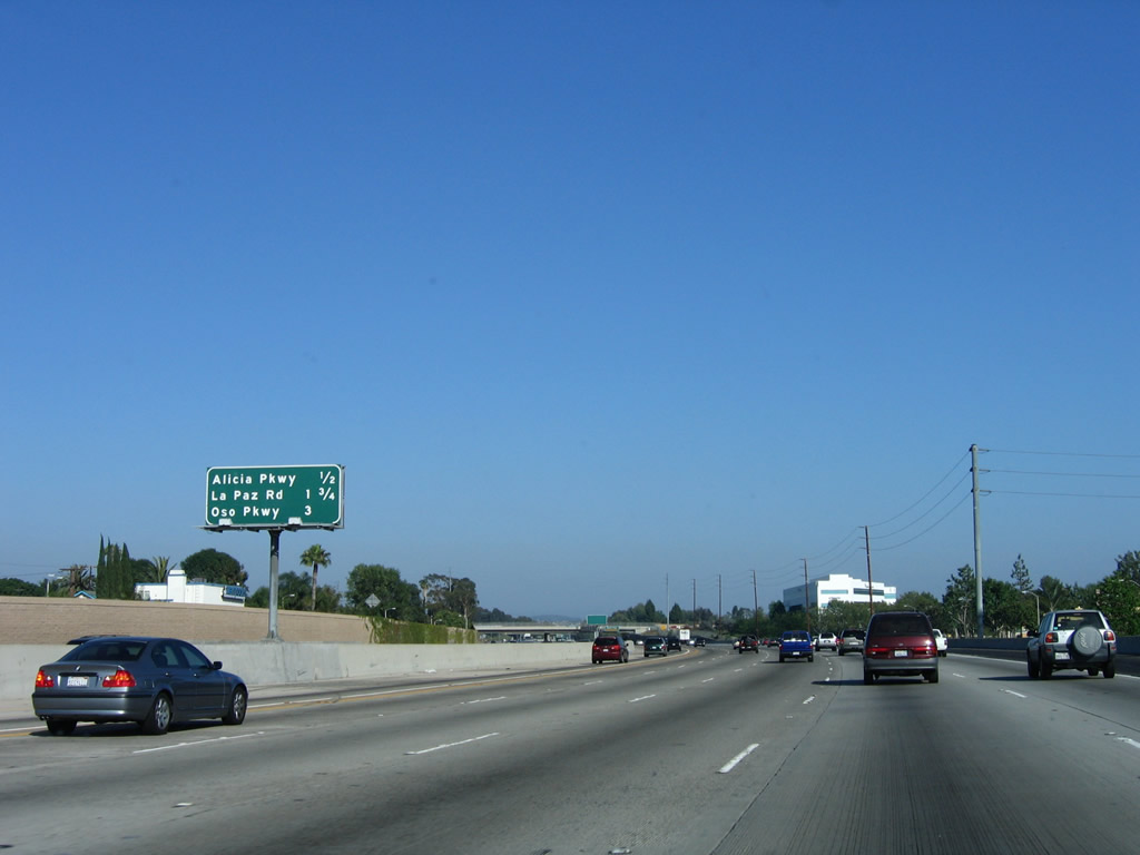
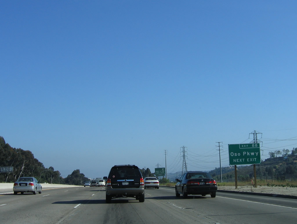
This mileage sign provides the distance to Exit 90, Alicia Parkway; Exit 89, La Paz Road; and Exit 88, Oso Parkway. Photo taken 06/17/06. |
|
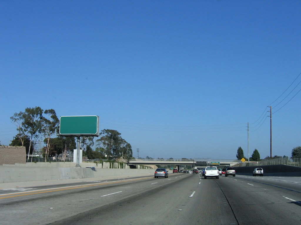
This blank sign is located along southbound Interstate 5 as it approaches Exit 90, Alicia Parkway. Since it is green, it is unlikely that it was originally intended to be a carpool sign, which would have typically been white during the time period in which it was erected. (Sign guidelines changed with the issuance of the standard MUTCD, and now green carpool guide signs are becoming more common.) Photo taken 06/17/06. |
|
Southbound Interstate 5 approaches Exit 90, Alicia Parkway, next right. Note the Variable Message Sign mounted on the overpass next to the guide sign. Photo taken 06/17/06. |
|
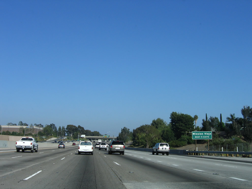
The next five exits all serve the city of Mission Viejo. The city consists of 19 square miles, has a population of 93,102 per the 2000 Census, and is a master planned community that developed in stages through the 1970s. Photo taken 06/17/06. |
|
Southbound Interstate 5 reaches Exit 90, Alicia Parkway. Photo taken 06/17/06. |
|
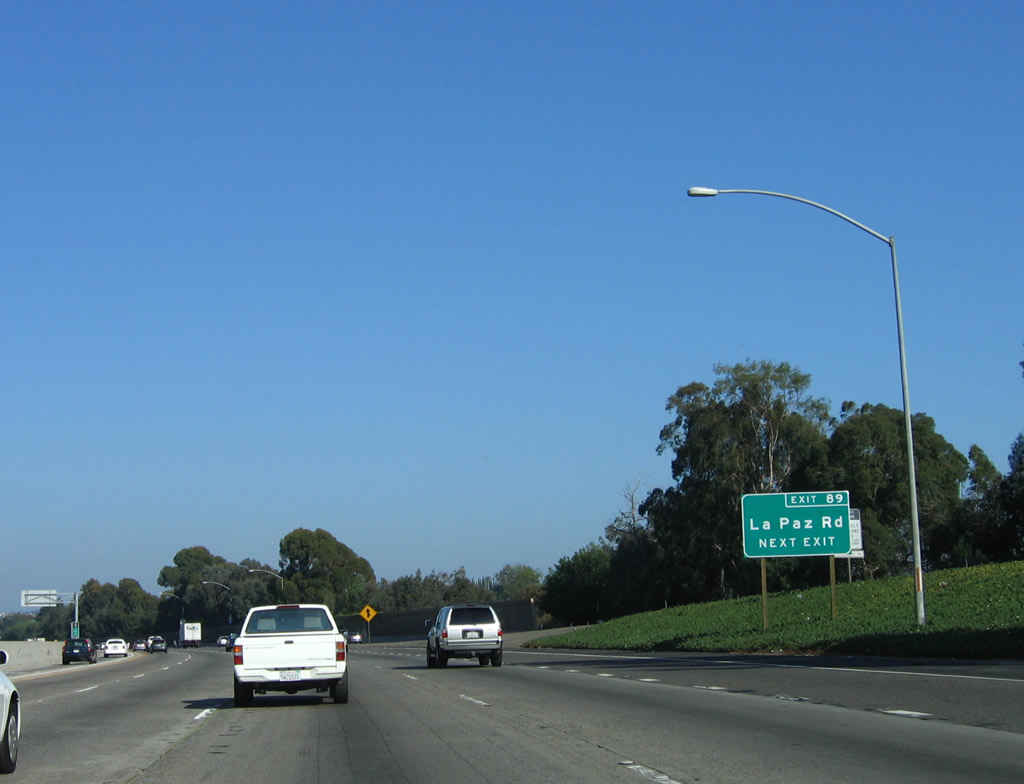
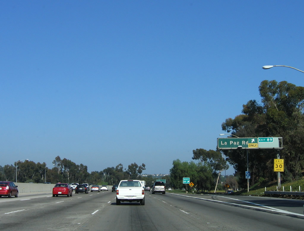
The next exit along Interstate 5 (San Diego Freeway) south is Exit 89, La Paz Road. A roadside sign including exit number was installed aroundn 2004. Photo taken 06/17/06. |
|
Southbound Interstate 5 (San Diego Freeway) reaches Exit 89, La Paz Road. La Paz Road roughly parallels Alicia Parkway, but it is located about a mile south of Alicia Parkway. This kind of small overhead sign is fairly common along this stretch of northbound and southbound Interstate 5. Photo taken 06/17/06. |
|
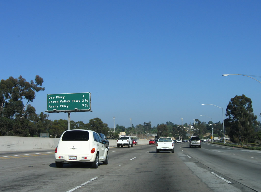
This mileage sign provides the distance to the next three exits along Interstate 5 (San Diego Freeway) south: Exit 88, Oso Parkway; Exit 86, Crown Valley Parkway; and Exit 85, Avery Parkway. Photo taken 06/17/06. |
|
At the on-ramp from La Paz Road, Interstate 5 no longer straddles two cities and now enters the city of Mission Viejo. Photo taken 06/17/06. |
|
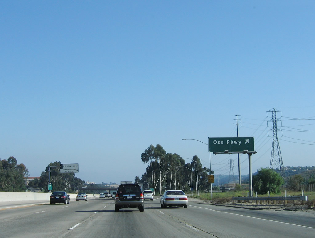
The next exit along Interstate 5 (San Diego Freeway) is Exit 88, Oso Parkway (one-half mile). The power lines in the distance (west/right of the freeway) carry power from the San Onofre Nuclear Power Plant into the Southern California Edison electricity grid. Beneath the wires is a sizable shopping center with a variety of "big box" anchor stores as principal tenants. Photo taken 06/27/04. |
|
A roadside exit number sign for Exit 88 (Oso Parkway) was added in 2005-2006. Oso Parkway leads east through Mission Viejo to Coto de Caza and west through Laguna Hills to meet California 73 and Alicia Parkway in Aliso Viejo. Photo taken 06/17/06. |
|
Southbound Interstate 5 (San Diego Freeway) reaches Exit 88, Oso Parkway. Photo taken 06/17/06. |
|
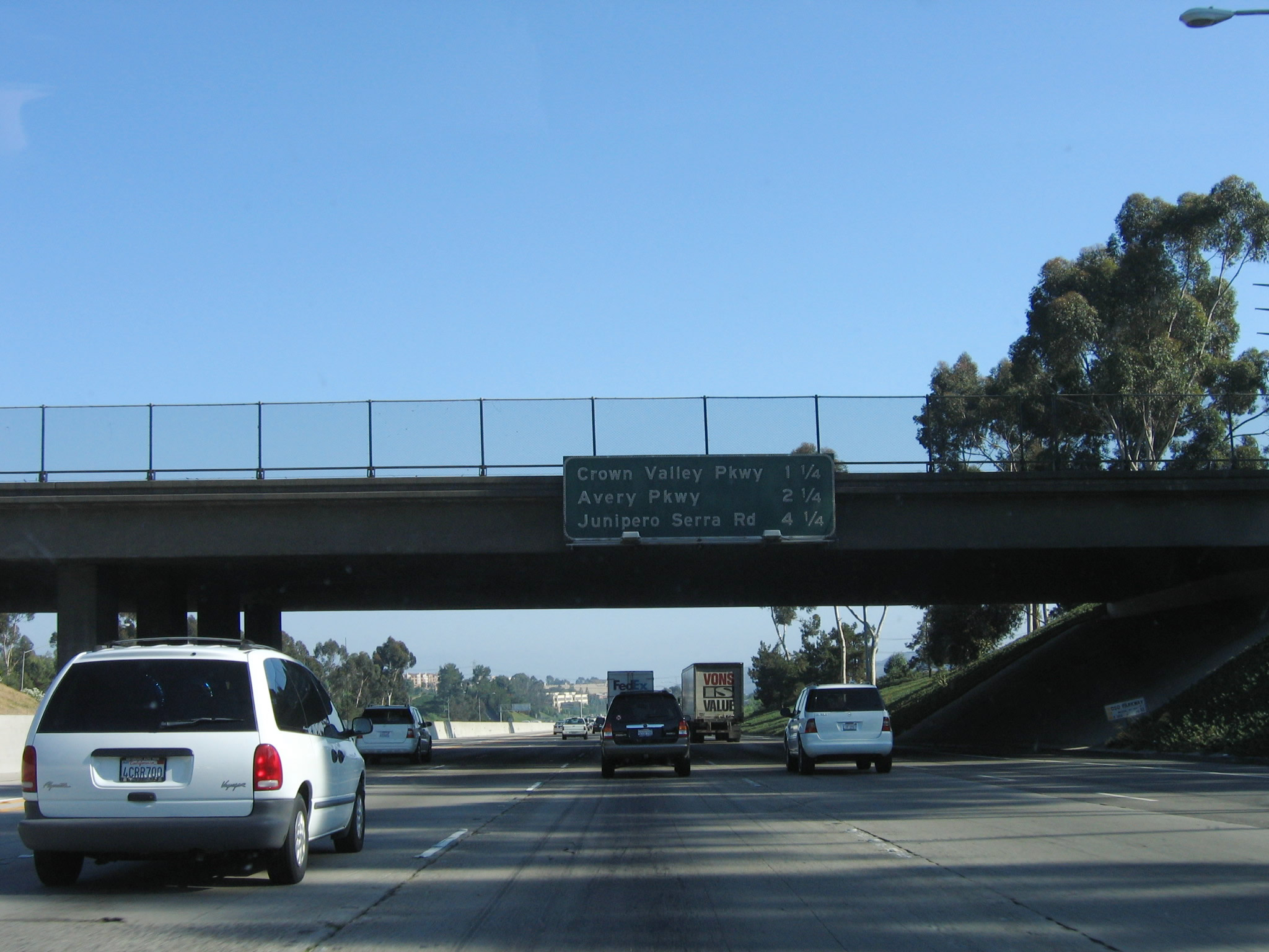
This mileage sign provides the distance to the next three exits along Interstate 5 (San Diego Freeway) south: Exit 86, Crown Valley Parkway; Exit 85, Avery Parkway; and Exit 83, Junipero Serra Road. Photo taken 06/17/06. |
|
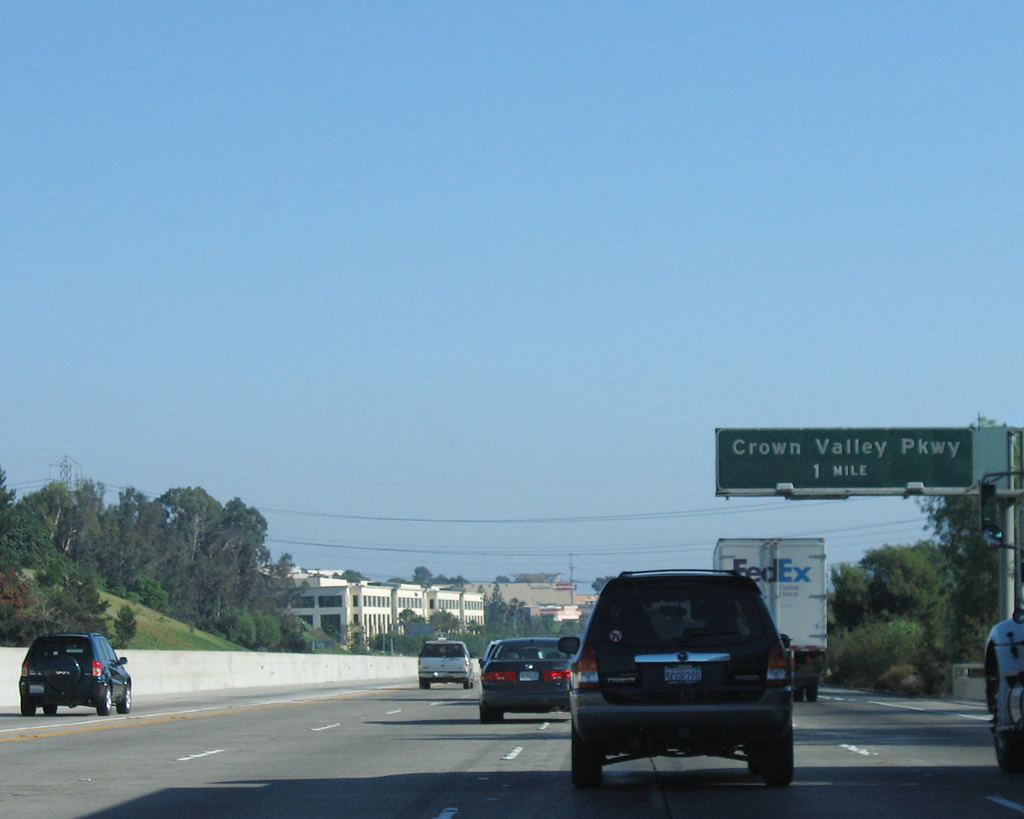
The next exit along Interstate 5 (San Diego Freeway) south is Exit 86, Crown Valley Parkway. Use Crown Valley Parkway east to the Shops at Mission Viejo and the unincorporated community of Ladera Ranch. Crown Valley Parkway also travels west into the north end of the city of Laguna Niguel. Photo taken 06/17/06. |
|
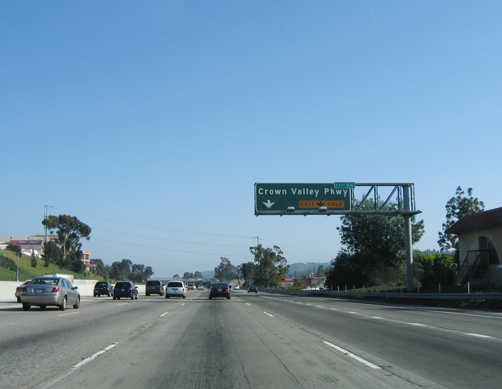
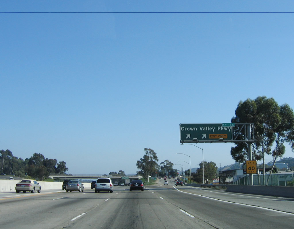
A small exit tab is attached to this overhead sign for Exit 86, Crown Valley Parkway. Photo taken 06/17/06. |
|
Southbound Interstate 5 (San Diego Freeway) reaches Exit 86, Crown Valley Parkway. Photo taken 06/17/06. |
|
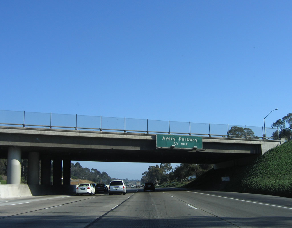
The next exit along southbound Interstate 5 is Exit 85, Avery Parkway. This sign is mounted on the Crown Valley Parkway overpass. Photo taken 06/17/06. |
|
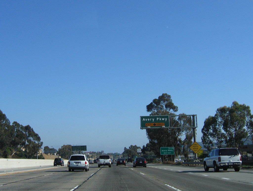
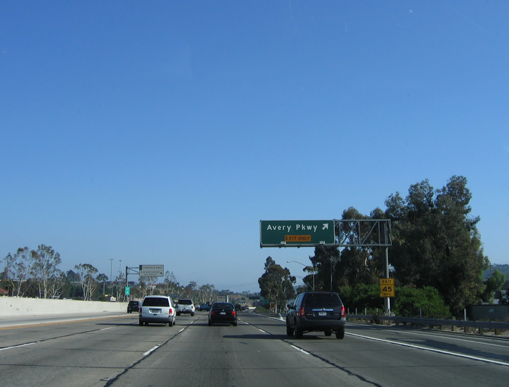
The right lane of Interstate 5 (San Diego Freeway) south becomes exit only for Exit 85, Avery Parkway. Photo taken 06/17/06. |
|
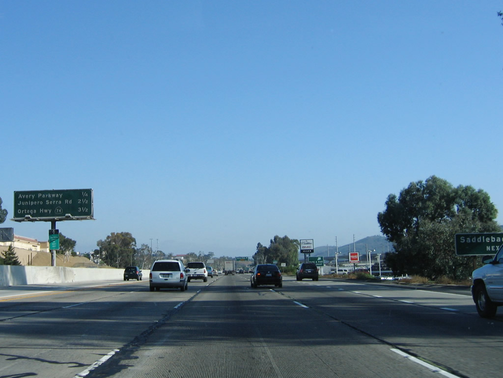
This mileage sign provides the distance to the next three exits along Interstate 5 (San Diego Freeway) south: Exit 85, Avery Parkway; Exit 83, Junipero Serra Road; and Exit 82, California 74 (Ortega Highway). Photo taken 06/17/06. |
|
Southbound Interstate 5 reaches Exit 85, Avery Parkway. Photo taken 06/17/06. |
|
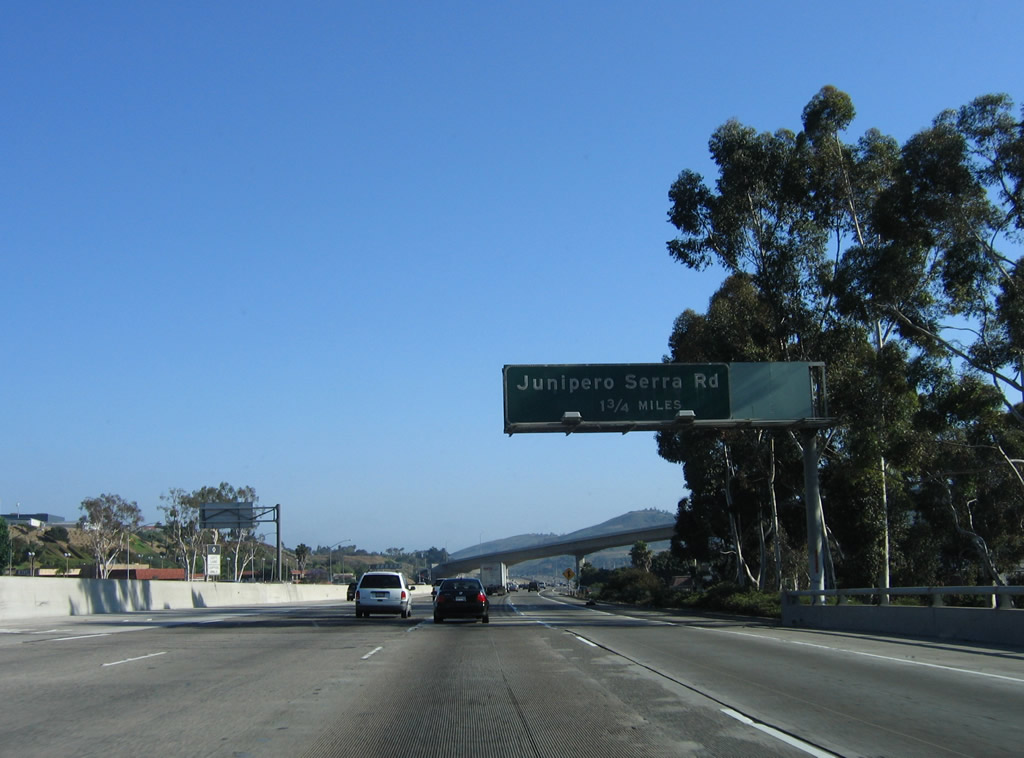
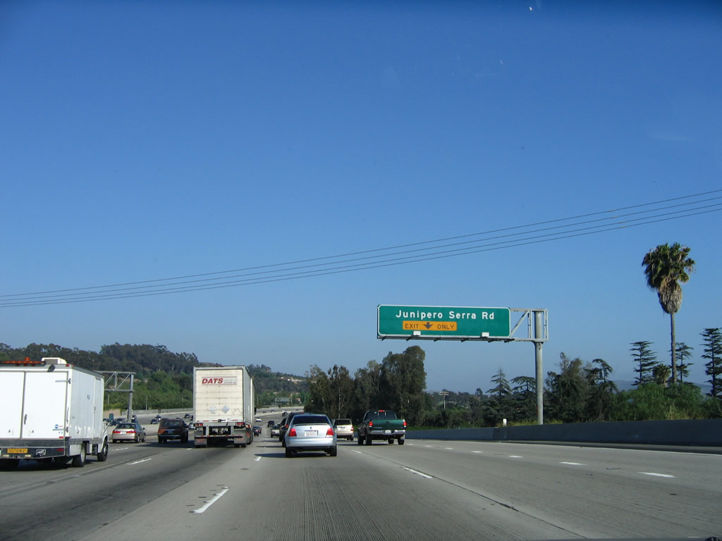
After the Avery Parkway interchange, southbound Interstate 5 next approaches Exit 83, Junipero Serra Road (1.75 miles). The overpass in the distance is part of the California 73 interchange. There is no access from southbound Interstate 5 to northbound California 73. Photo taken 06/17/06. |
|
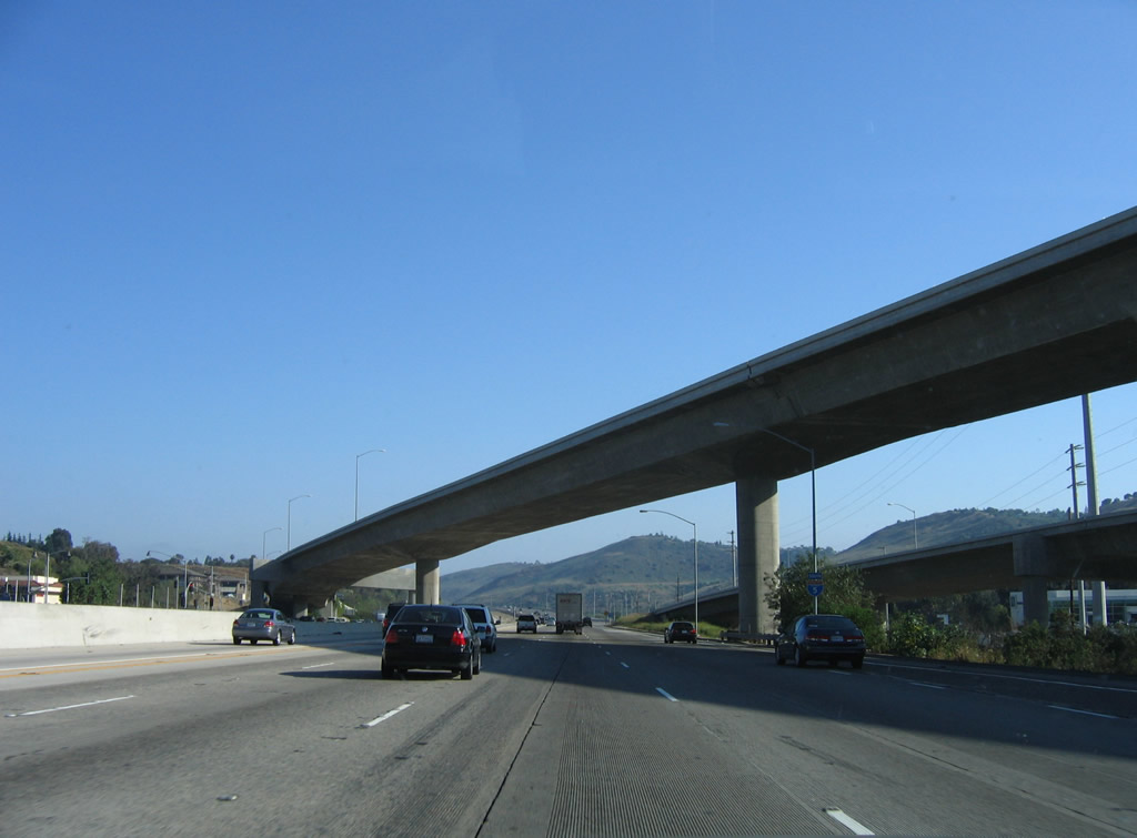
Southbound Interstate 5 passes under the California 73 interchange prior to the Junipero Serra Road off-ramp. At this point, Interstate 5 leaves the city of Mission Viejo and enters the city of San Juan Capistrano. For the latest toll rates on California 73 (and other Orange County toll roads), visit the Orange County Toll Authority webpage. Photo taken 06/17/06. |
|
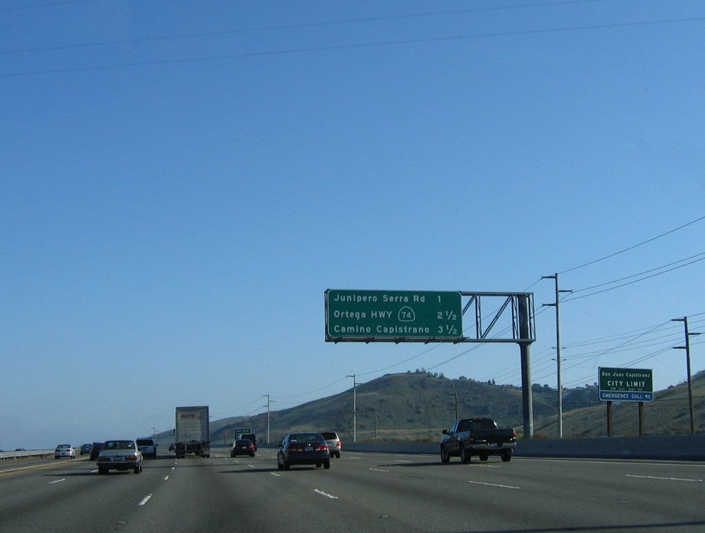
This mileage sign provides the distance to the next three exits: Exit 83, Junipero Serra Road; Exit 82, California 74; and Exit 81, Camino Capistrano. Interstate 5 gains additional lanes due to the merge with California 73; the freeway will remain wider than the typical five-lane configuration until the California 74 interchange. Photo taken 06/17/06. |
|
The next three exits all serve the city of San Juan Capistrano ("Preserving the Past to Enhance the Future"). The population of this Orange County city was 33,826 as of the 2000 Census. Founded in 1776, Mission San Juan Capistrano forms the nucleus of today's city and is the seventh of 21 missions founded by Franciscan friars during that era. One of the oldest buildings still in use is located in the chapel at the mission, and one of California's earliest wineries was located here as well. Photo taken 06/17/06. |
|
The right lane of Interstate 5 (San Diego Freeway) south becomes exit only for Exit 83, Junipero Serra Road. The auxiliary lane here was formed from the California 73 south on-ramp. Photo taken 06/17/06. |
|
Southbound Interstate 5 (San Diego Freeway) reaches Exit 83, Junipero Serra Road. This is another sign that is too small for the amount of text on it; an exit tab was placed on top of the exit sign in apparent violation of Caltrans exit number signage. However, this practice is common in all other states that use overhead signs for exit numbering. Photo taken 06/17/06. |
|
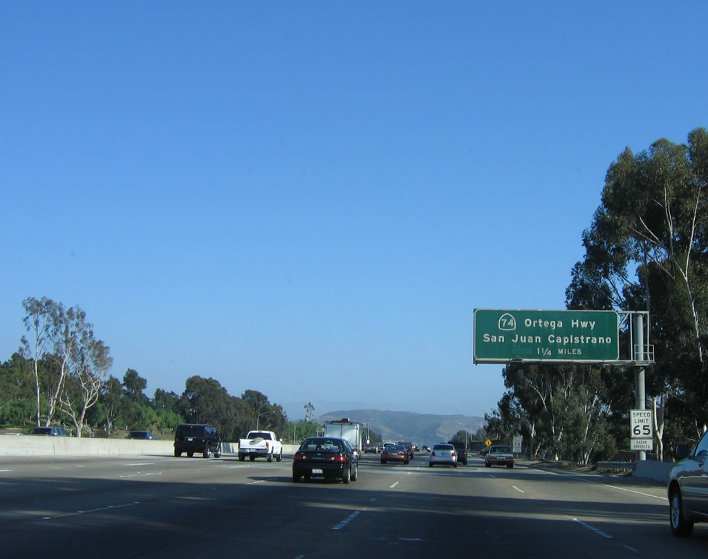
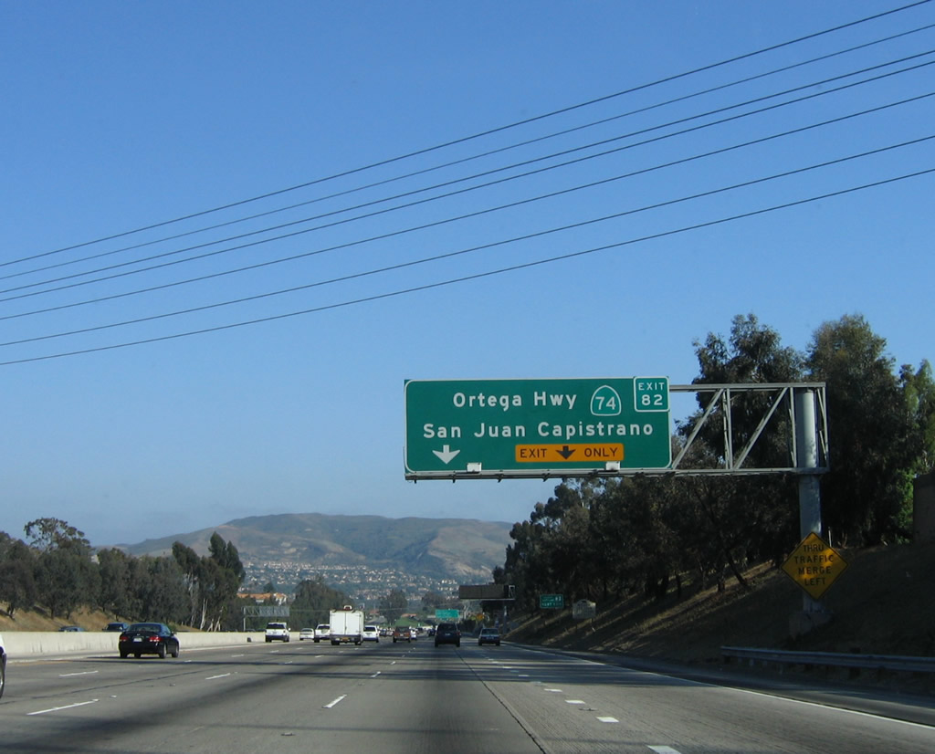
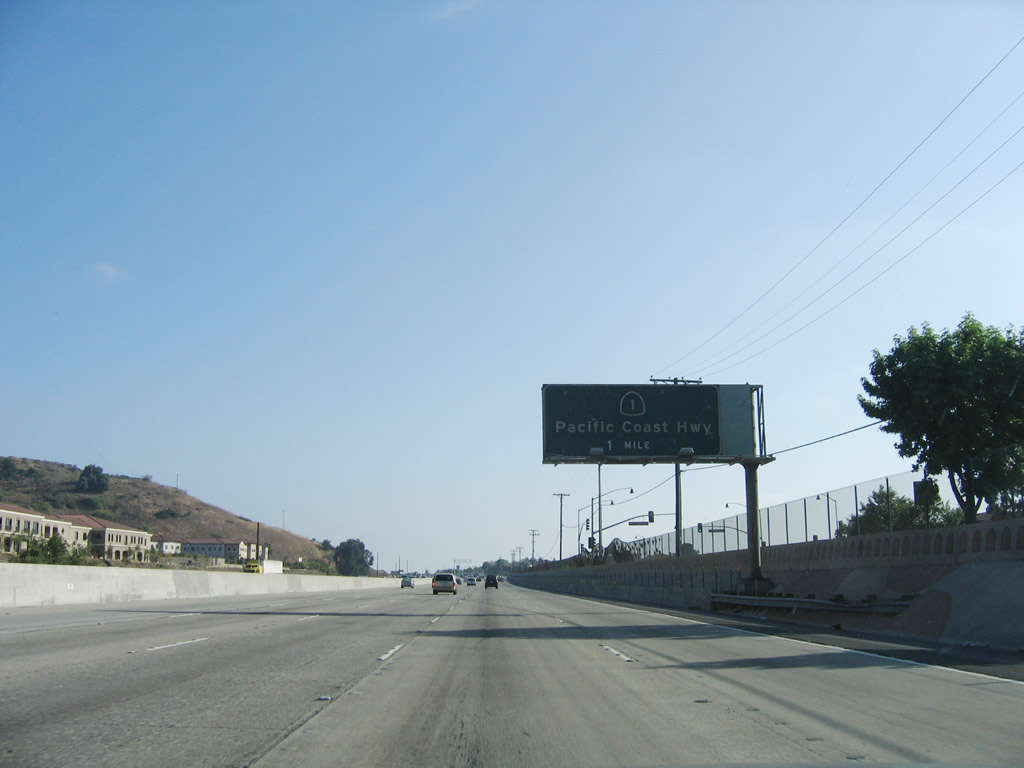
The next exit along southbound Interstate 5 is Exit 82, California 74 (Ortega Highway) (1.75 miles). Photo taken 06/17/06. |
|
|
An older advance sign on southbound Interstate 5 (San Diego Freeway) was posted for Exit 82, California 74 (Ortega Highway) one mile prior to the off-ramp. However, this sign has been removed since the time this photo was taken. The 2006 photo shows nearly the same spot (after the on-ramp from Junipero Serra Road); both the one-mile advance sign and the centerline mileage sign show in the 2000 photo are now gone. Photos taken 08/00 and 06/17/06. |
|
California 74 is a major trans-mountain route that crosses into Riverside County and connects to Interstate 15 at Lake Elsinore. Most of this route is a two-lane, rural highway. Construction to improve safety aspects of the mountain road were made in Orange County in 2007 and 2008. Photo taken 06/17/06. |
|
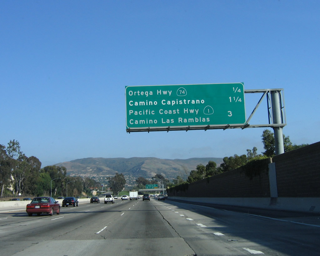
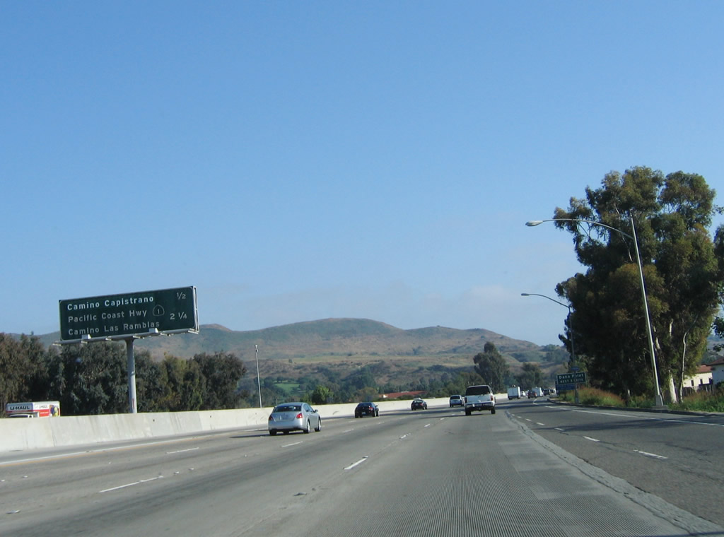
The next three exits along southbound are Exit 82, California 74; Exit 81, Camino Capistrano; and Exit 79, California 1 (Pacific Coast Highway). Photo taken 06/17/06. |
|
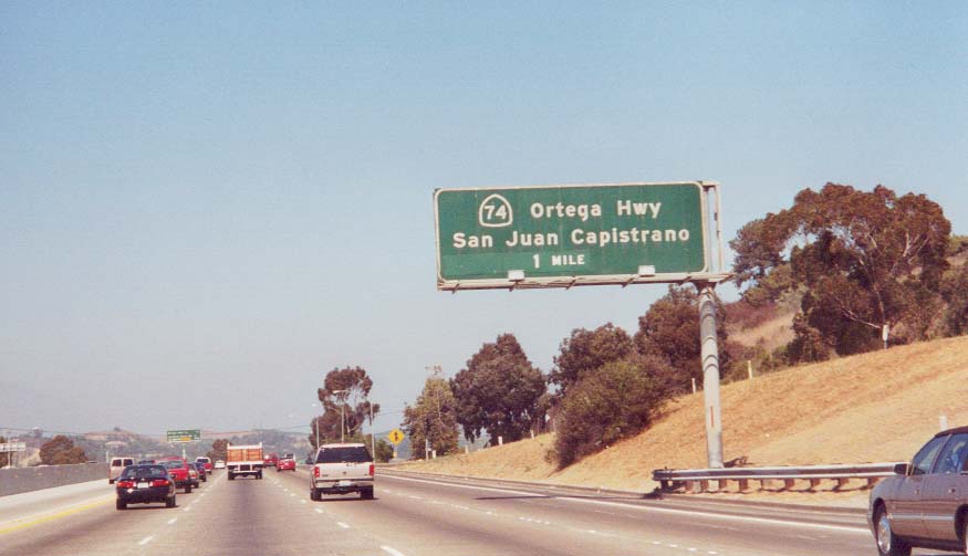
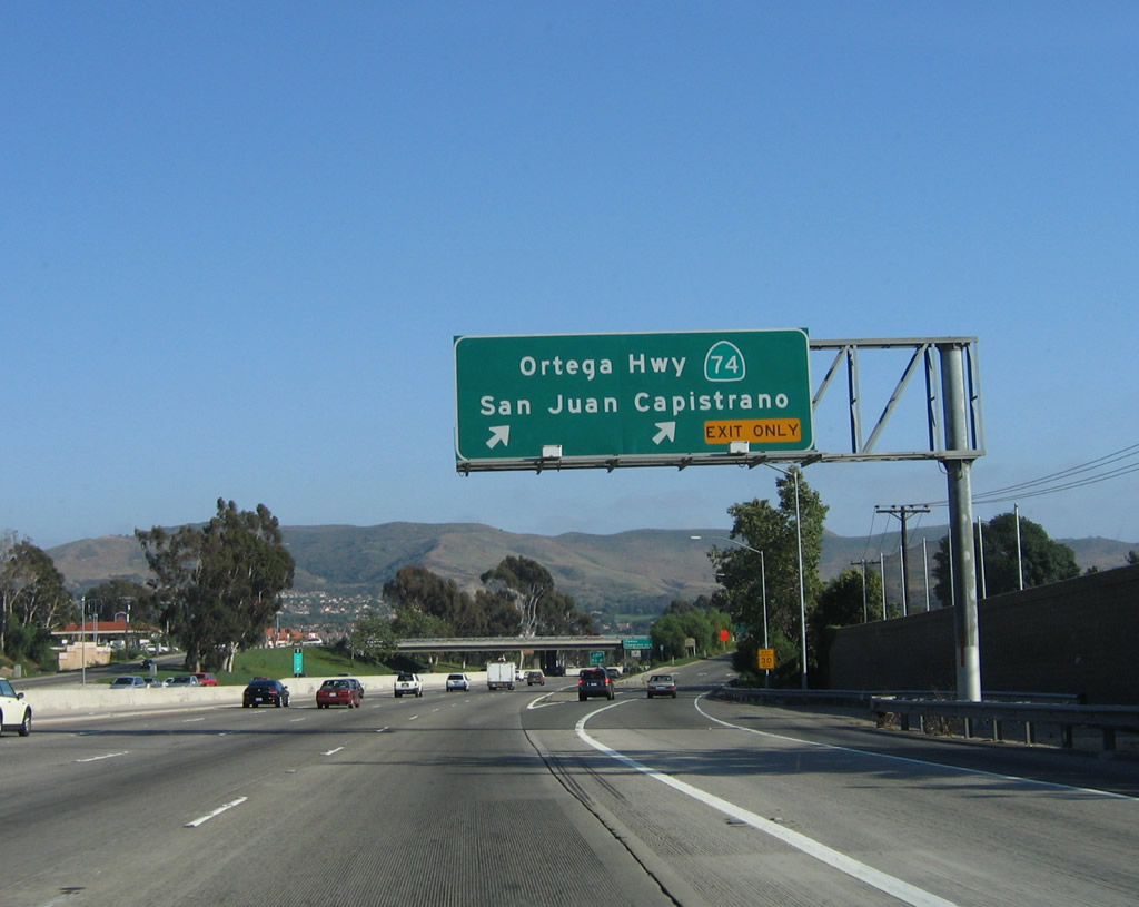
Southbound Interstate 5 (San Diego Freeway) reaches Exit 82, California 74 (Ortega Highway) east to Ladera Ranch, Cleveland National Forest, and Lake Elsinore. This exit also serves Ortega Highway west to downtown San Juan Capistrano. Photo taken 06/17/06. |
|
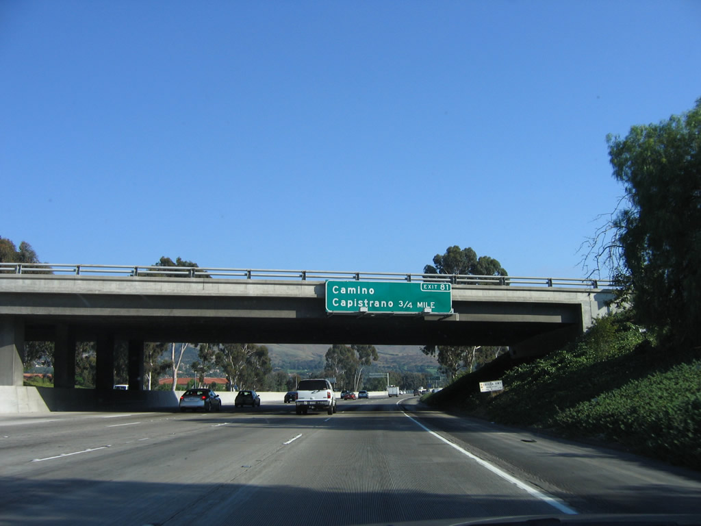
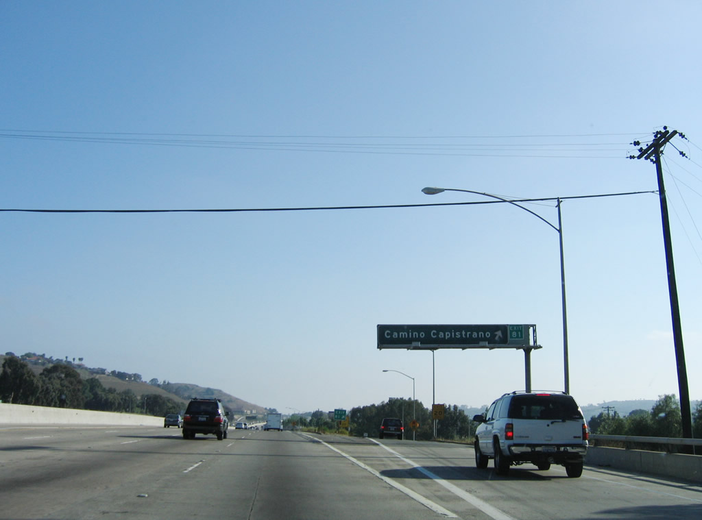
The next exit along southbound Interstate 5 (San Diego Freeway) is Exit 81, Camino Capistrano. Photo taken 06/17/06. |
|
This interchange sequence sign provides the distance to the next two exits along southbound are Exit 81, Camino Capistrano and Exit 79, California 1 (Pacific Coast Highway). Photo taken 06/17/06. |
|
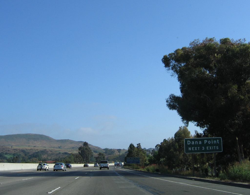
The next three exits all serve the city of Dana Point, which sits on the coast west of the freeway. As Interstate 5 continues southwest toward the ocean, Interstate 5 will enter the city of Dana Point near the California 1 (Pacific Coast Highway) interchange (Exit 79). Photo taken 06/17/06. |
|
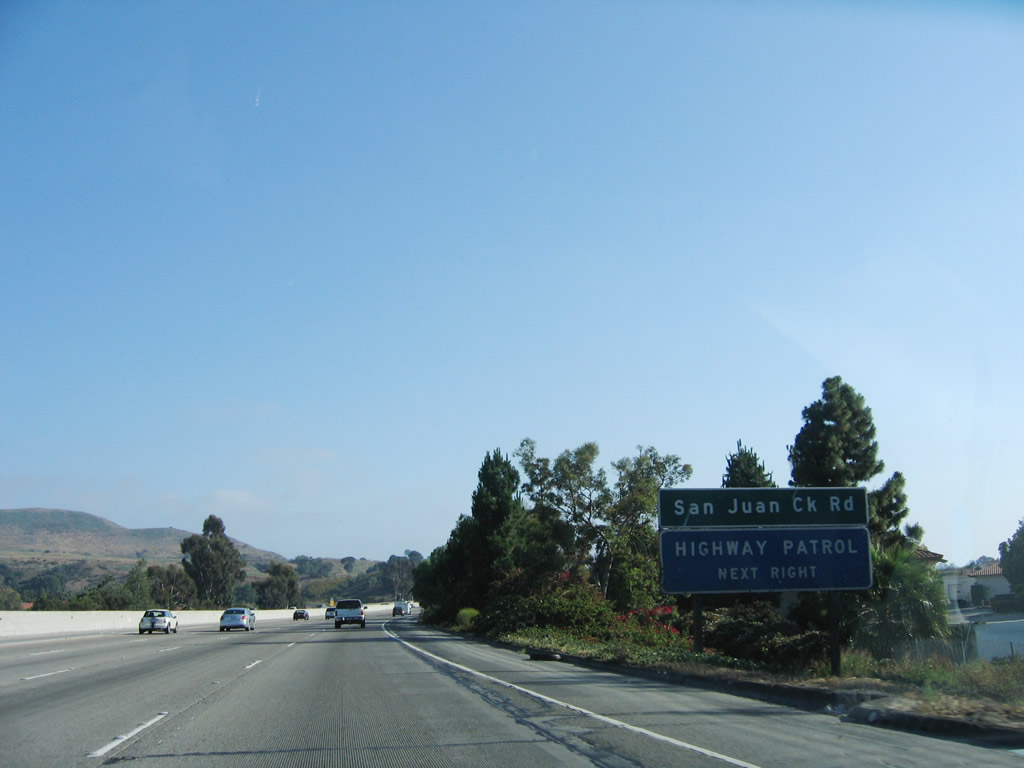
Use Exit 81 to San Juan Creek Road and the San Juan Hills Golf Course. Photo taken 06/17/06. |
|
Southbound Interstate 5 (San Diego Freeway) reaches Exit 81, Camino Capistrano; the next exit is Exit 79, California 1 (Pacific Coast Highway). Photo taken 06/17/06. |
|
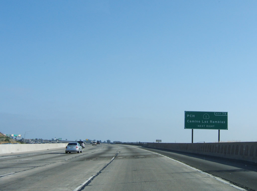
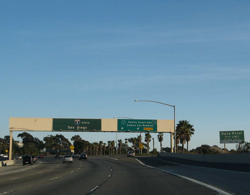
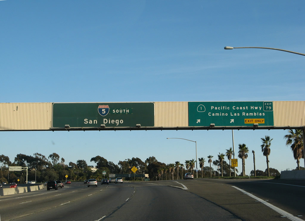
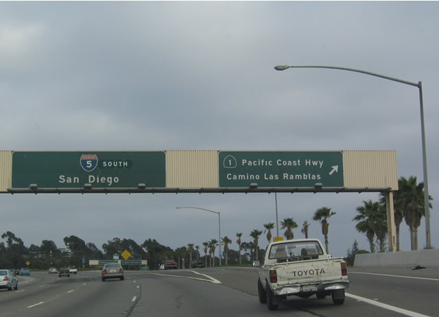
The next two exits along southbound are Exit 79, California 1 (Pacific Coast Highway) and Camino las Ramblas and Exit 78, Camino de Estrella. Photo taken 06/17/06. |
|
California 1 (Pacific Coast Highway) begins its northwesterly journey from this interchange toward the coastal communities of Orange and Los Angeles Counties. The highway eventually connects Big Sur, Monterey, and coastal Sonoma/Mendocino with the rest of the state. Photo taken 06/17/06. |
|
A roadside sign provides an exit number for Exit 79, California 1 (Pacific Coast Highway) and to Camino las Ramblas. Photo taken 06/17/06. |
|
A variety of state beaches may be accessed via California 1 (Pacific Coast Highway) north. The scenic coastal road leads to Laguna Beach, Newport Beach, Hunington Beach, and Long Beach. Photo taken 06/17/06. |
|
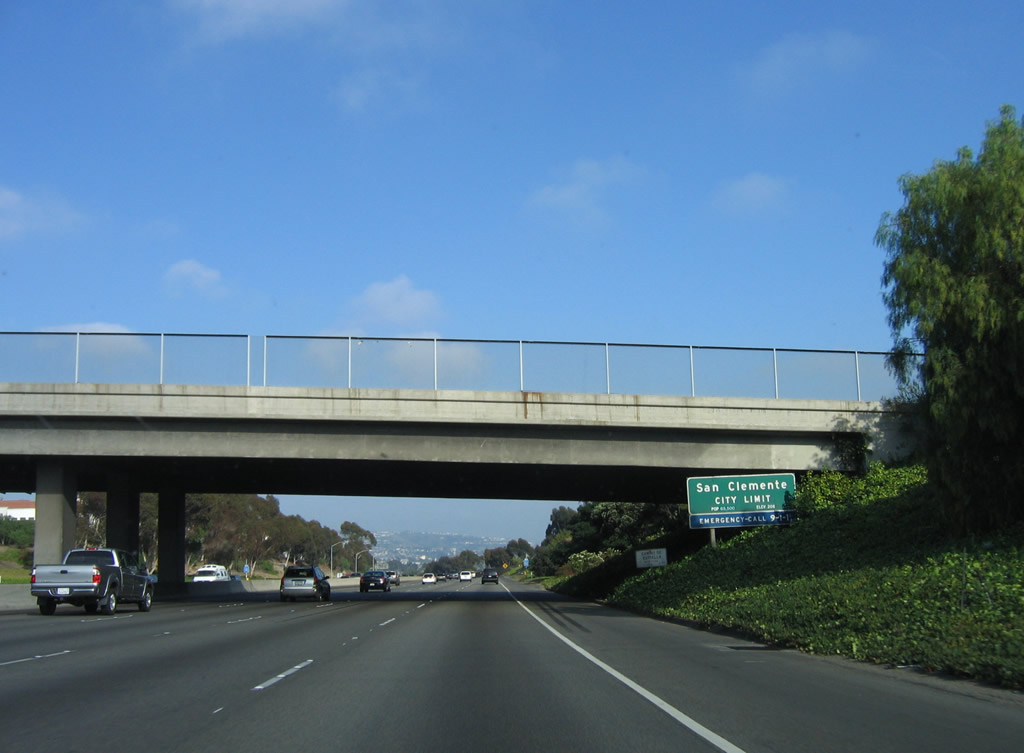
Prior to the California 1 interchange, Interstate 5 enters the city of Dana Point "Harboring the Good Life". Dana Point is home to 35,110 people per the 2000 Census. A small harbor and beautiful beaches offer a beautiful backdrop to this coastal city. The community of Capistrano Beach is part of the city of Dana Point. Photo taken 03/09/08. |
|
|
Southbound Interstate 5 reaches Exit 79, California 1 (Pacific Coast Highway). This marks the southern terminus of California 1. An exit number sign was added to this sign bridge in 2006. Photos taken 03/09/08 and 07/06/04. |
|
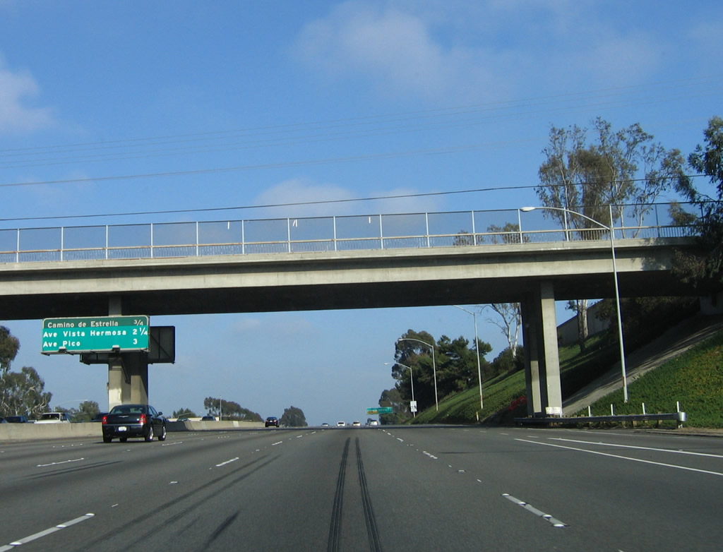
This mileage sign provides the distance to the next three exits along southbound Interstate 5: Exit 78, Camino de Estrella; Exit 77, Avenida Vista Hermosa; and Exit 76, Avenida Pico. Photo taken 06/17/06. |
|
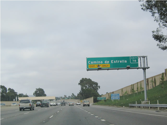
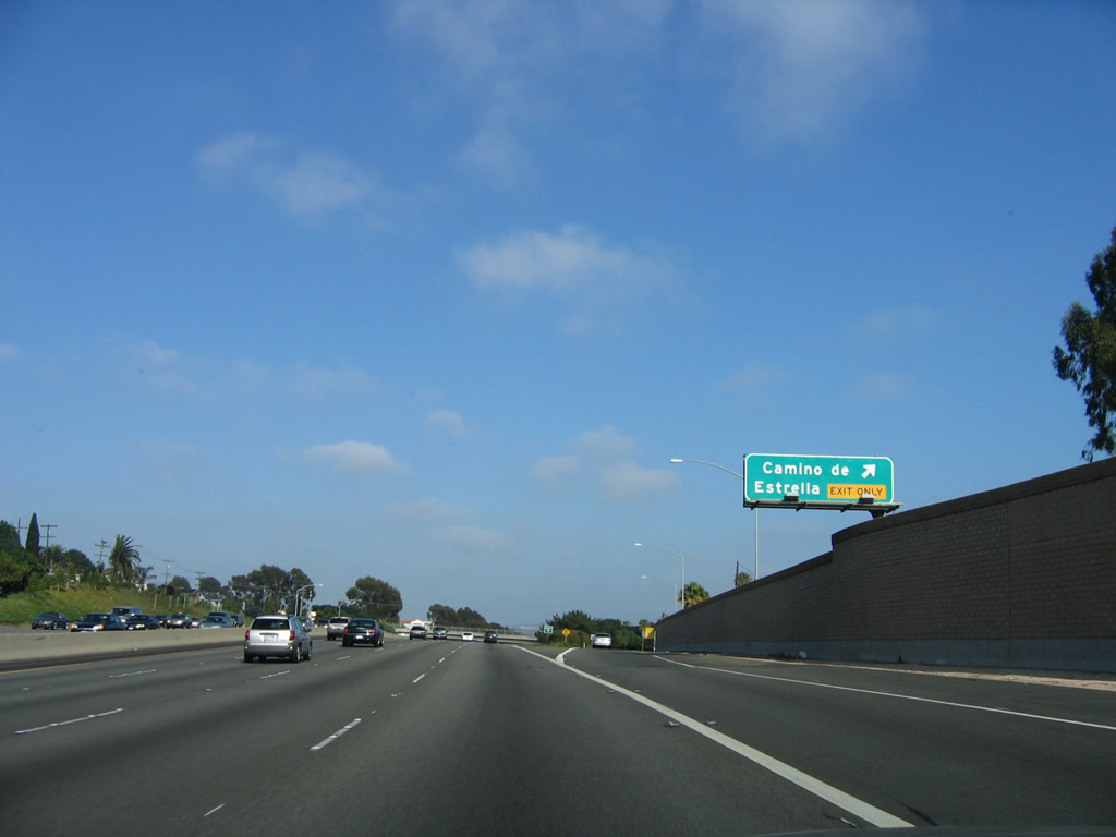
Southbound Interstate 5 (San Diego Freeway) approaches Exit 78, Camino de Estrella, next right/exit only. This is the first of five interchanges to serve the city of San Clemente, which is the southernmost cities in Orange County. Photo taken 07/06/04. |
|
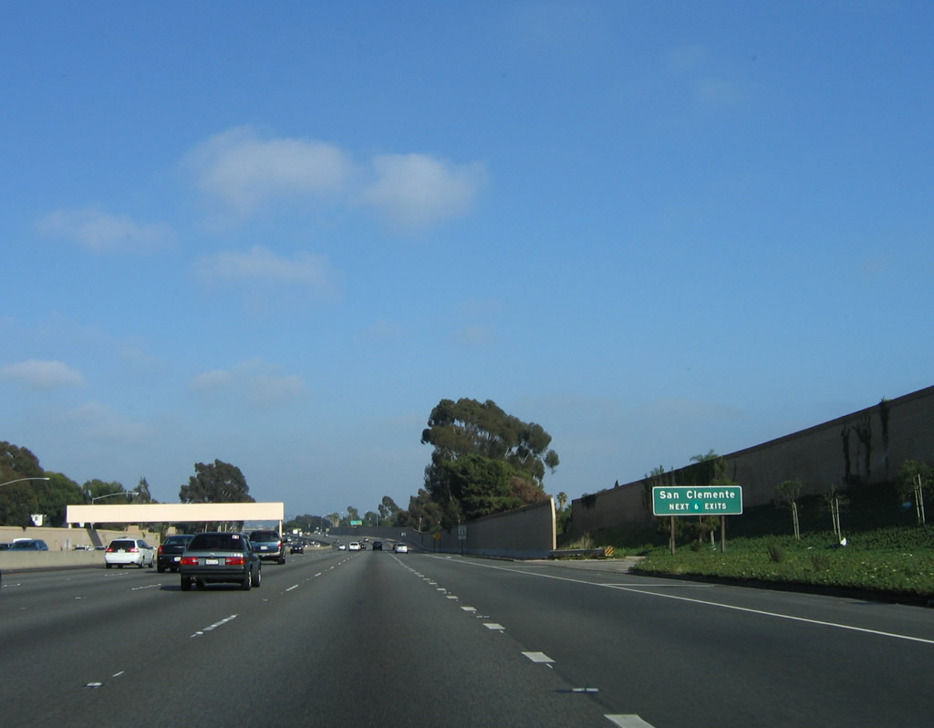
The next six exits serve the city of San Clemente. The sign was changed in 2001 with the opening of the Avenida Vista Hermosa to show six rather than five exits serving the southernmost city in Orange County. Photo taken 06/17/06. |
|
Southbound Interstate 5 (San Diego Freeway) reaches Exit 78, Camino de Estrella, which leads into San Clemente and Capistrano Beach. Photo taken 06/17/06. |
|
The next five exits serve the city of San Clemente, the first of several cities along Interstate 5's path through Orange County. Incorporated on February 28, 1928, San Clemente consists of 18.45 square miles, sits at an average elevation of 250 feet, and receives 12.24 inches of rainfall annually. As of the 2000 Census, 49,936 people lived in San Clemente. Like other cities in Orange County, this number has increased significantly through the decade as the area has continued to grow (the 2006 population estimate from the Census Bureau for San Clemente was 61,050). Photo taken 06/17/06. |
|
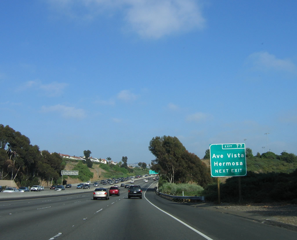
The next exit along Interstate 5 (San Diego Freeway) south is Exit 77, Avenida Vista Hermosa. Photo taken 06/17/06. |
|
This mileage sign provides the distance to the next three exits along Interstate 5 (San Diego Freeway) south. The next exit is Exit 77, Avenida Vista Hermosa (translated as "Pretty View Avenue" from Spanish), one mile. This interchange opened in 2001 to serve new residential development and to serve as a new route into San Clemente. Photo taken 03/09/08. |
|
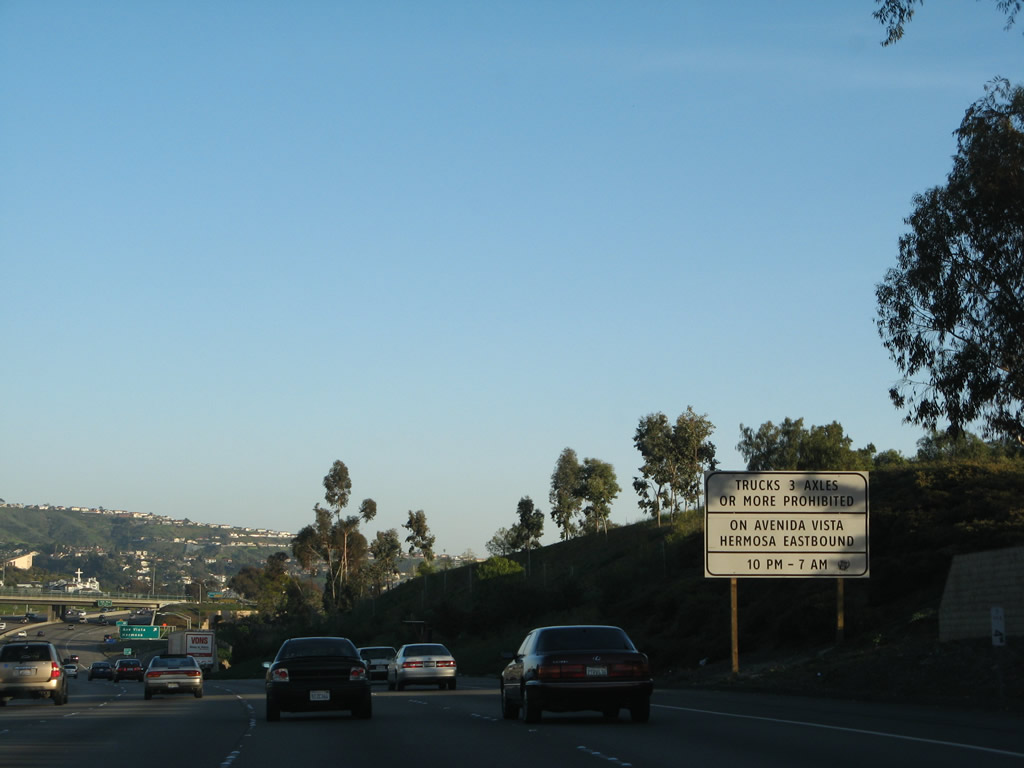
A recently installed Clearview sign advises that trucks over three axles are prohibited between 10:00 p.m. and 7:00 a.m. on Avenida Vista Hermosa east. At the time this sign was installed, it was one of three Clearview signs in the state of California. Photo taken 03/09/08. |
|
|
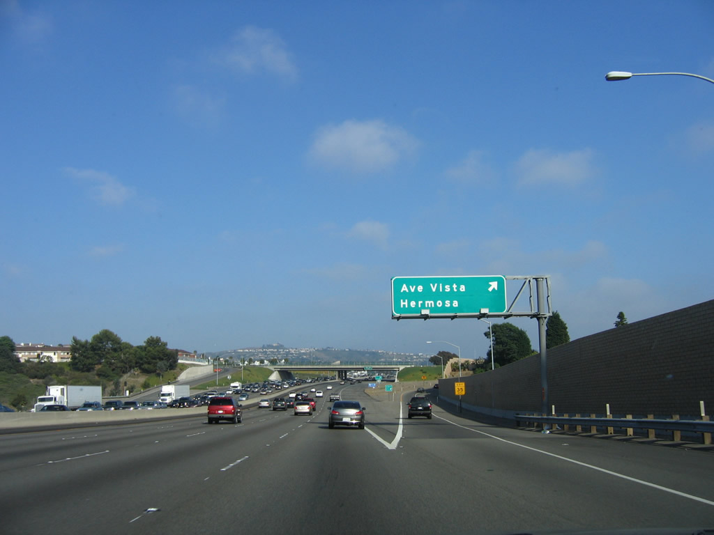
Southbound Interstate 5 (San Diego Freeway) reaches Exit 77, Avenida Vista Hermosa. This exit opened to traffic in 2001; although the exits feature reflective signs, there are still no exit numbers added onto the sign as of March 2008. Photos taken 03/09/08 and 06/17/06. |
|
|
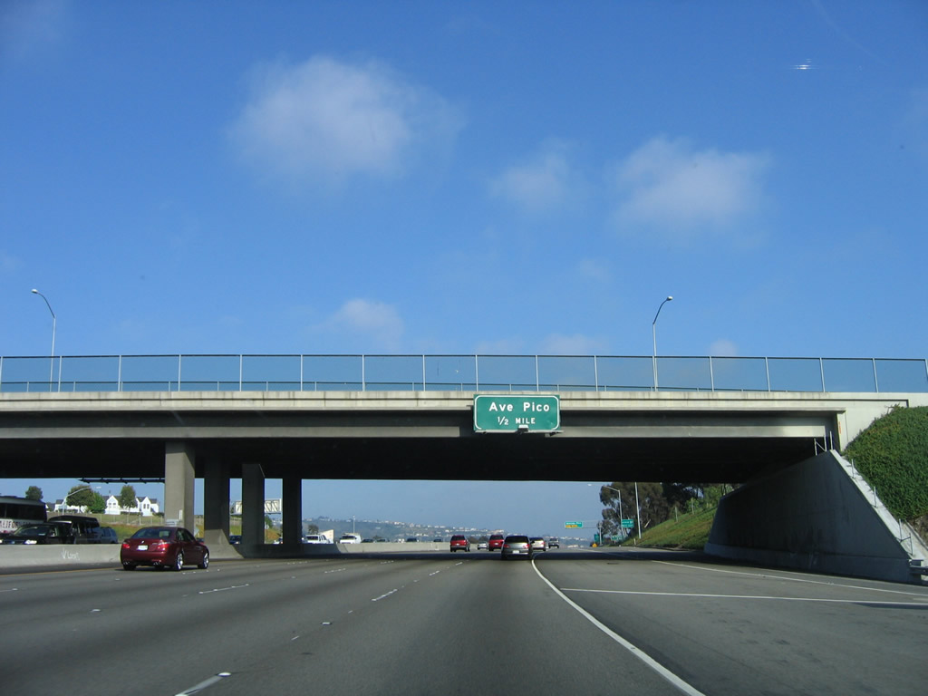
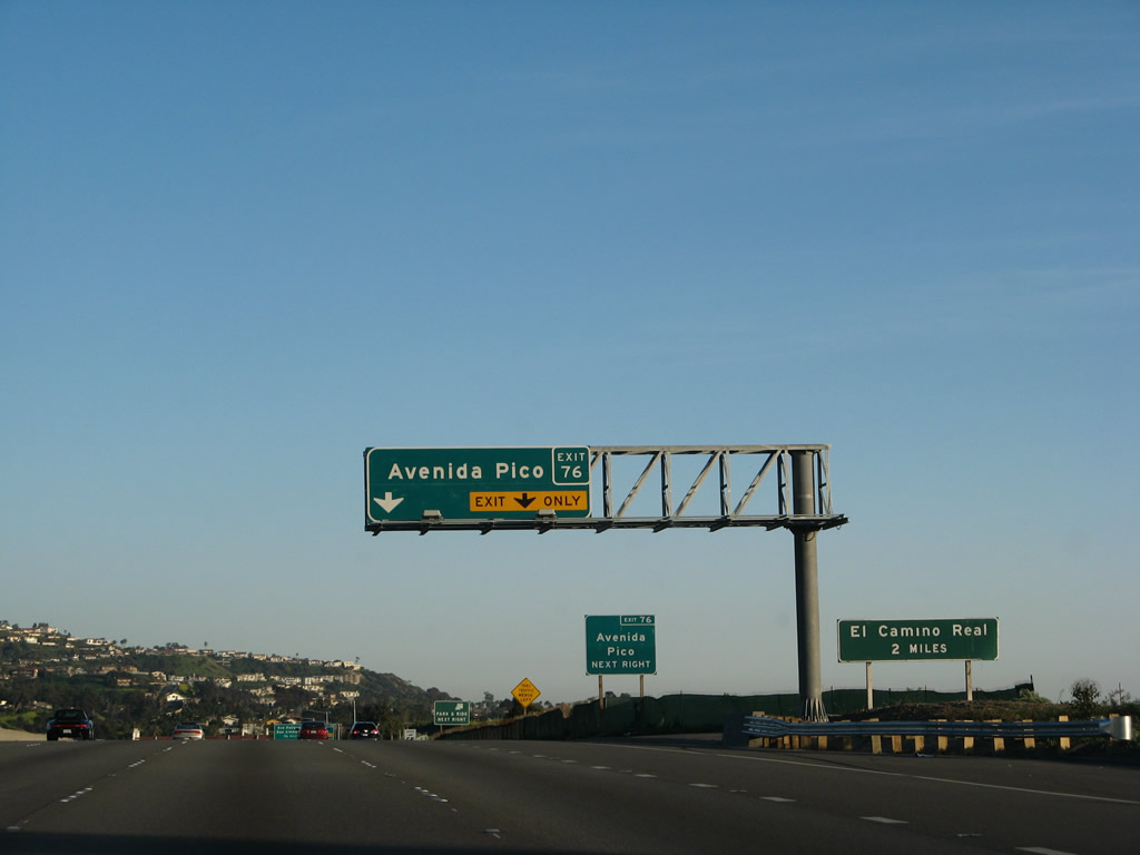
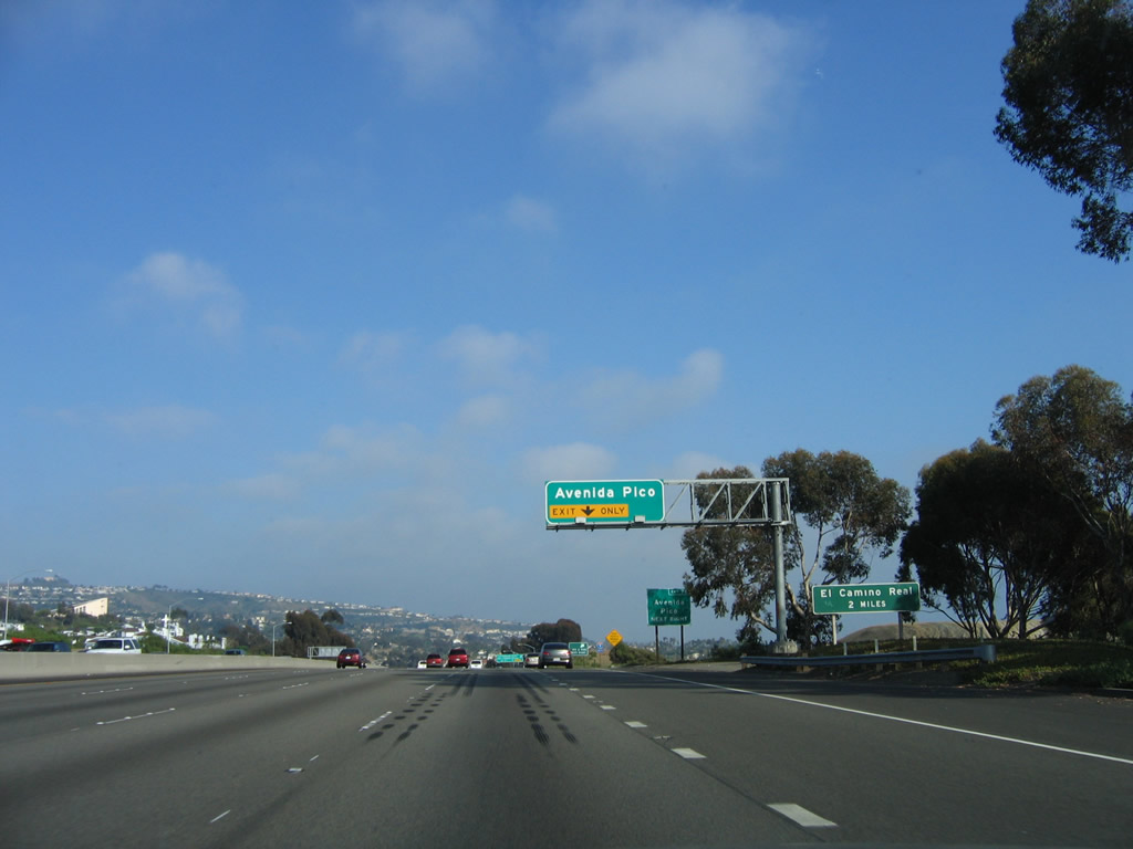
The next exit along southbound Interstate 5 (San Diego Freeway) is Exit 76, Avenida Pico, one-half mile. Photos taken 03/09/08 and 06/17/06. |
|
|
Avenida Pico serves the city of San Clemente, the last city along Interstate 5 before it departs Orange County and enters San Diego County. Photos taken 03/09/08 and 06/17/06. |
|
|
Southbound Interstate 5 reaches Exit 76, Avenida Pico. Photos taken 03/09/08 and 06/17/06. |
|
The city of San Clemente is built along the beach and on the hills above the ocean. Million-dollar homes look down on stunning views of the Pacific Ocean. This view shows Interstate 5 south after the off-ramp to Avenida Pico. Photo taken 03/09/08. |
|
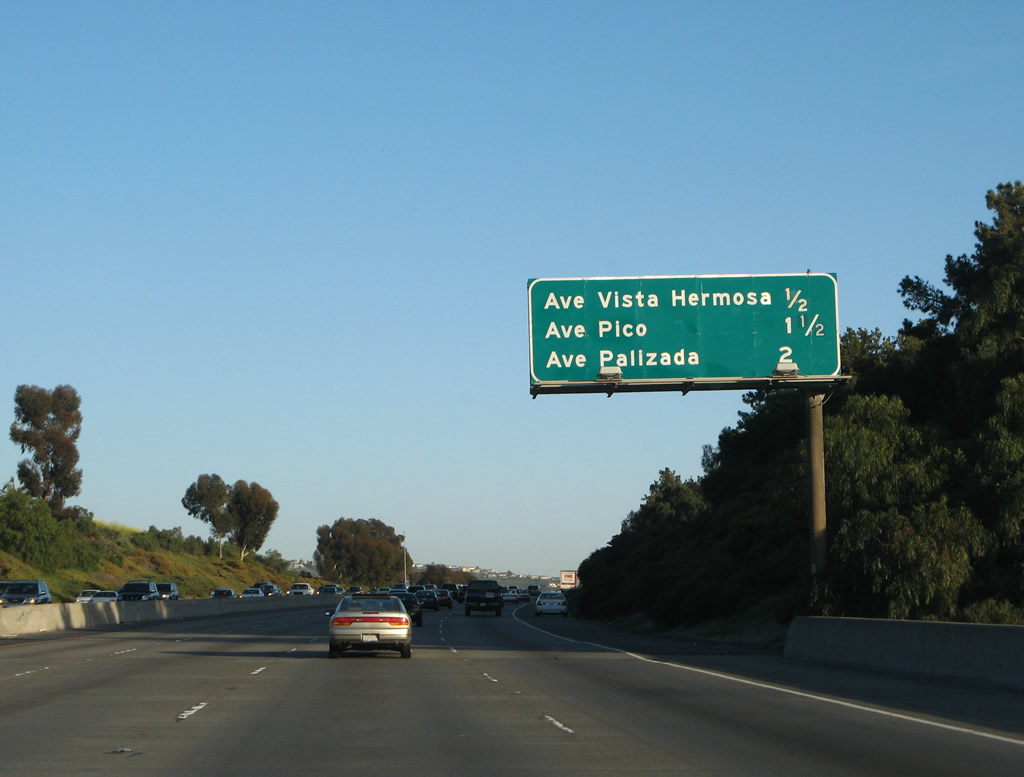
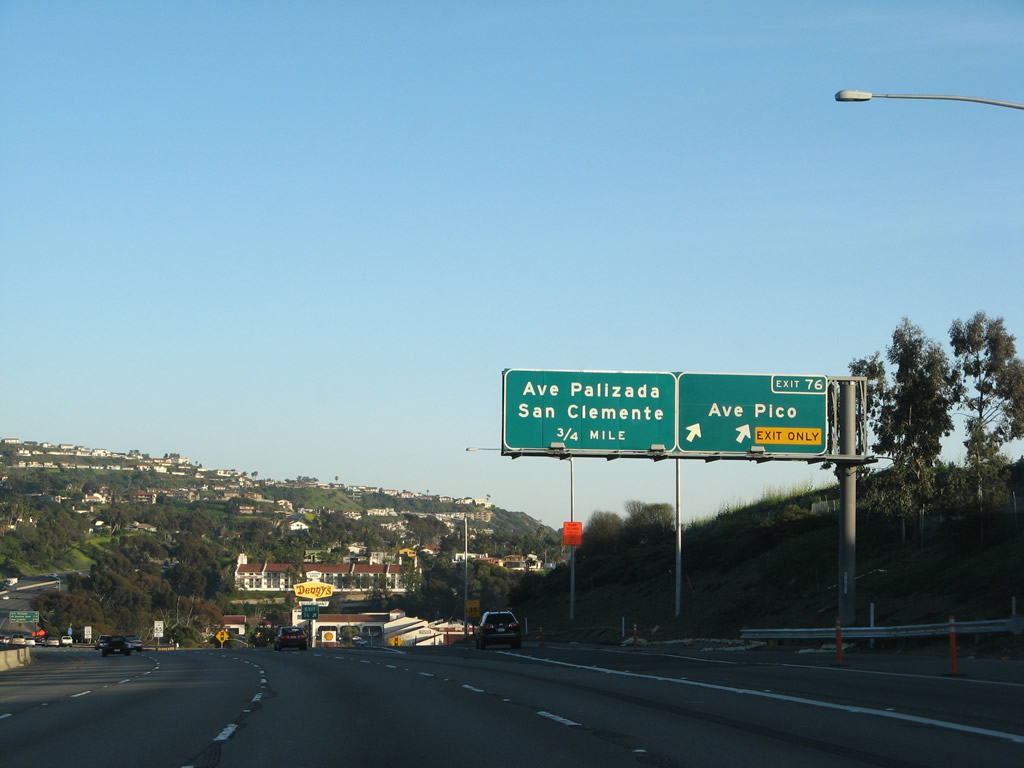
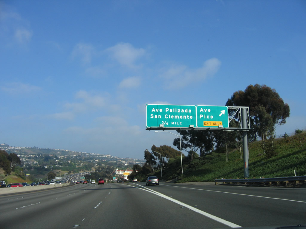
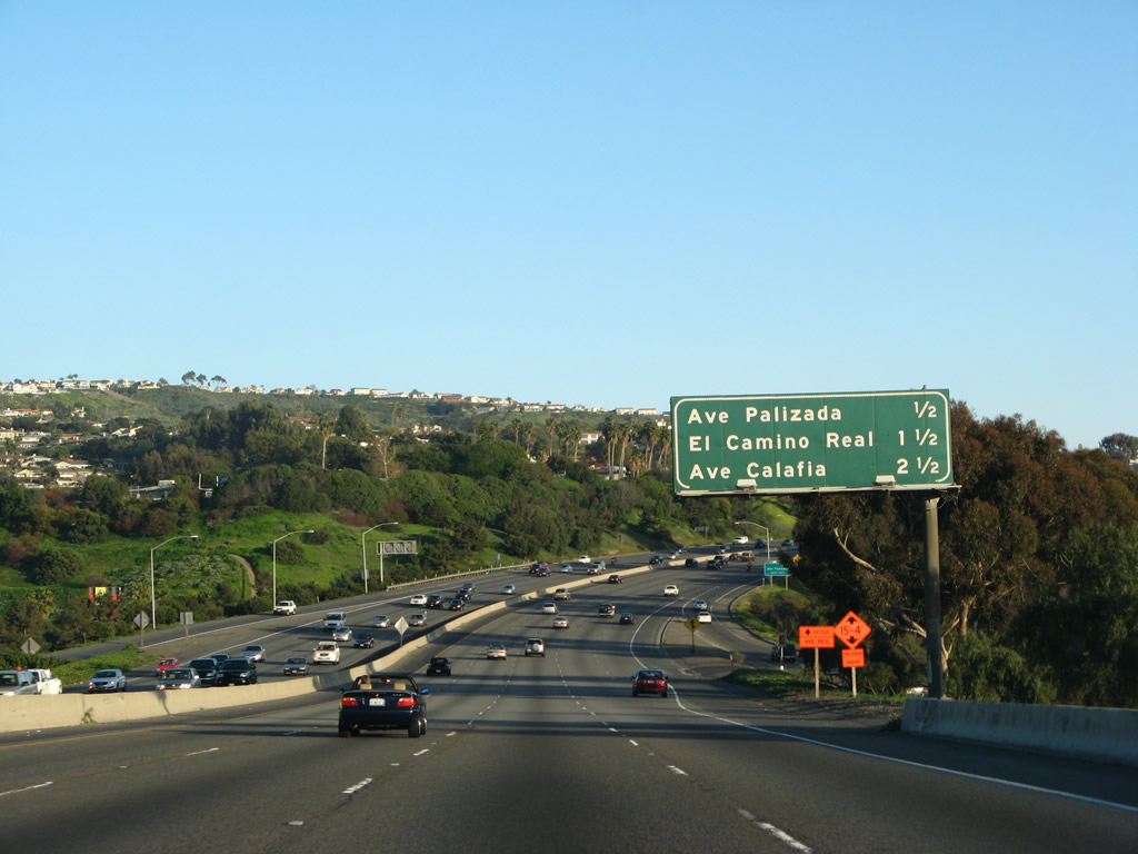
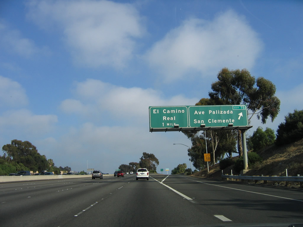
This mileage sign provides the distance to the next three exits along southbound are Exit 75, Avenida Palizada; Exit 74, El Camino Real; and Exit 73, Avenida Calafia. Photo taken 03/09/08. |
|
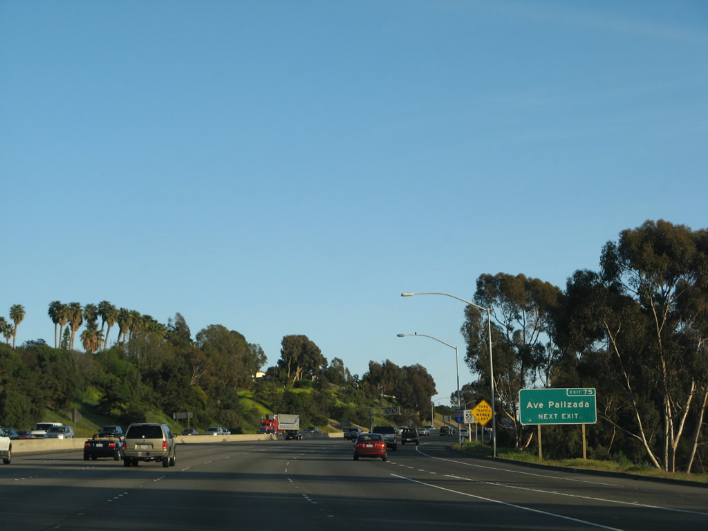
As part of the Caltrans exit numbering program, District XII placed this roadside exit number sign for Exit 75, Avenida Palizada and later added an exit number panel to the existing overhead sign at the gore point. Photo taken 03/09/08. |
|
Southbound Interstate 5 reaches Exit 75, Business Loop I-5/Avenida Palizada. The business loop is not identified on any sign along southbound and is more or less decommissioned. The only remnant signage is currently found along Interstate 5 north prior to the Cristianitos Road interchange (Exit 72). An exit number panel was added to this button copy sign. Photo taken 06/17/06. |
|
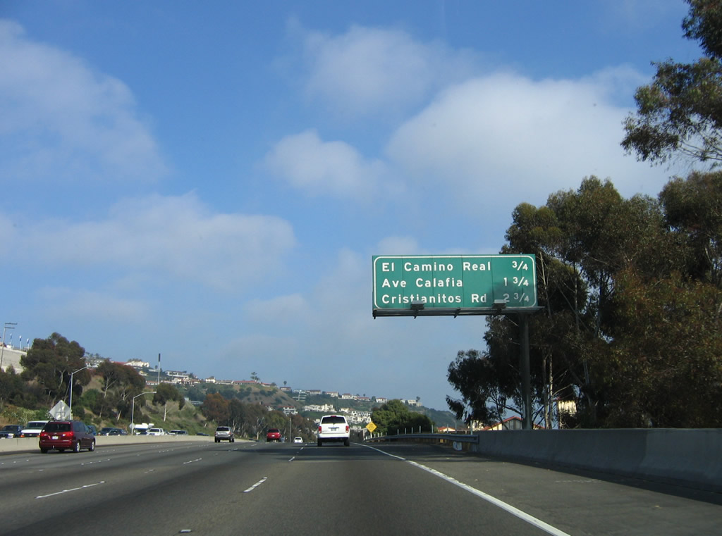
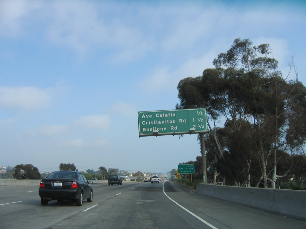
This mileage sign provides the distance to the next three exits along southbound are Exit 74, El Camino Real; Exit 73, Avenida Calafia; and Exit 72, Cristianitos Road. Photo taken 06/17/06. |
|
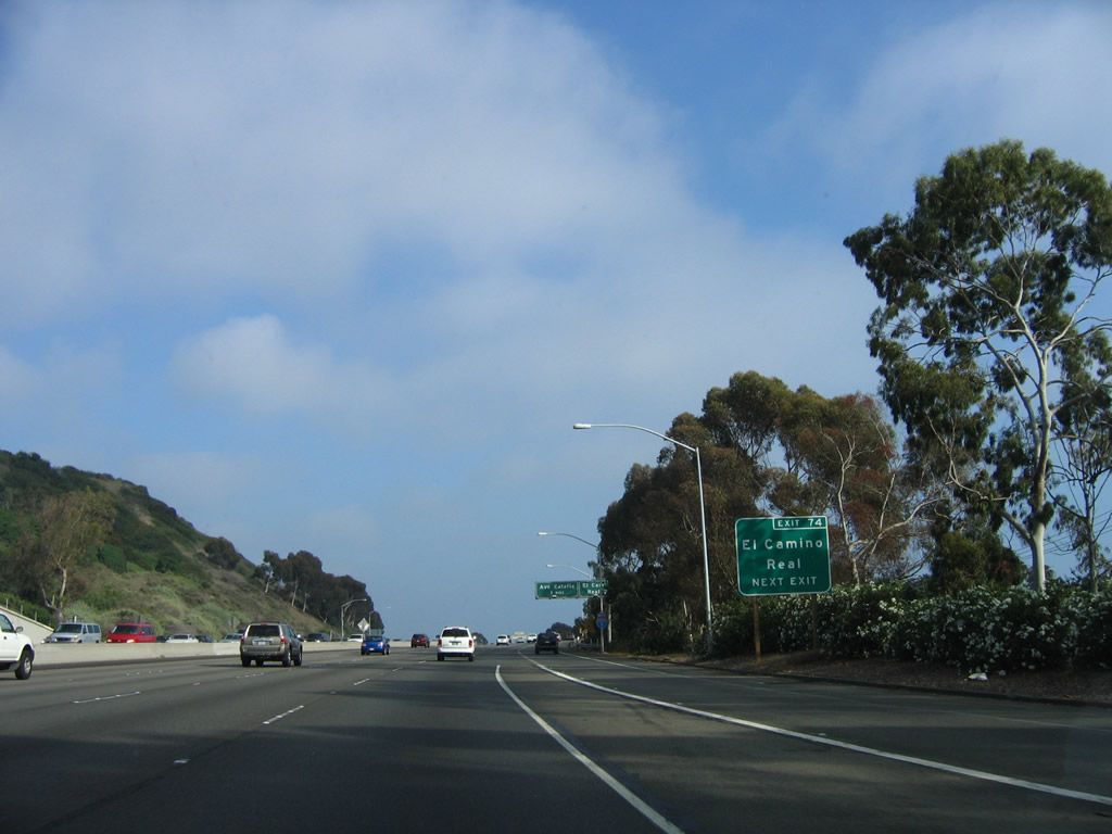
A roadside exit number sign is posted for Exit 74, El Camino Real (Business Loop I-5). Photo taken 06/17/06. |
|
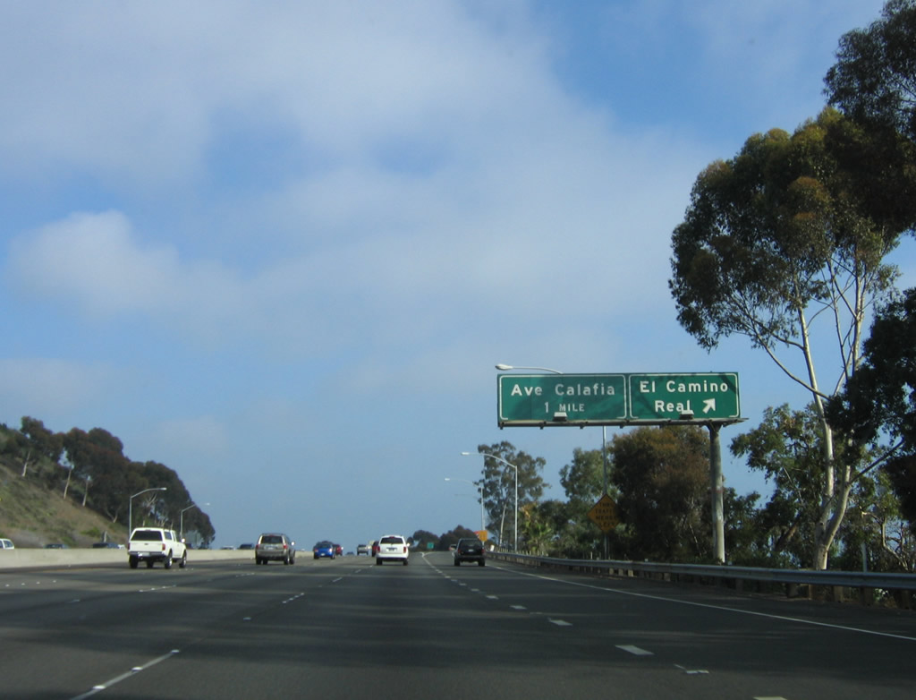
Southbound Interstate 5 reaches Exit 74, El Camino Real. El Camino Real connects to Business Loop I-5 (former U.S. 101). The next exit is Avenida Calafia (Exit 73). Photo taken 06/17/06. |
|
Use Exit 73, Avenida Calafia to San Clemente State Beach. Photo taken 06/17/06. |
|
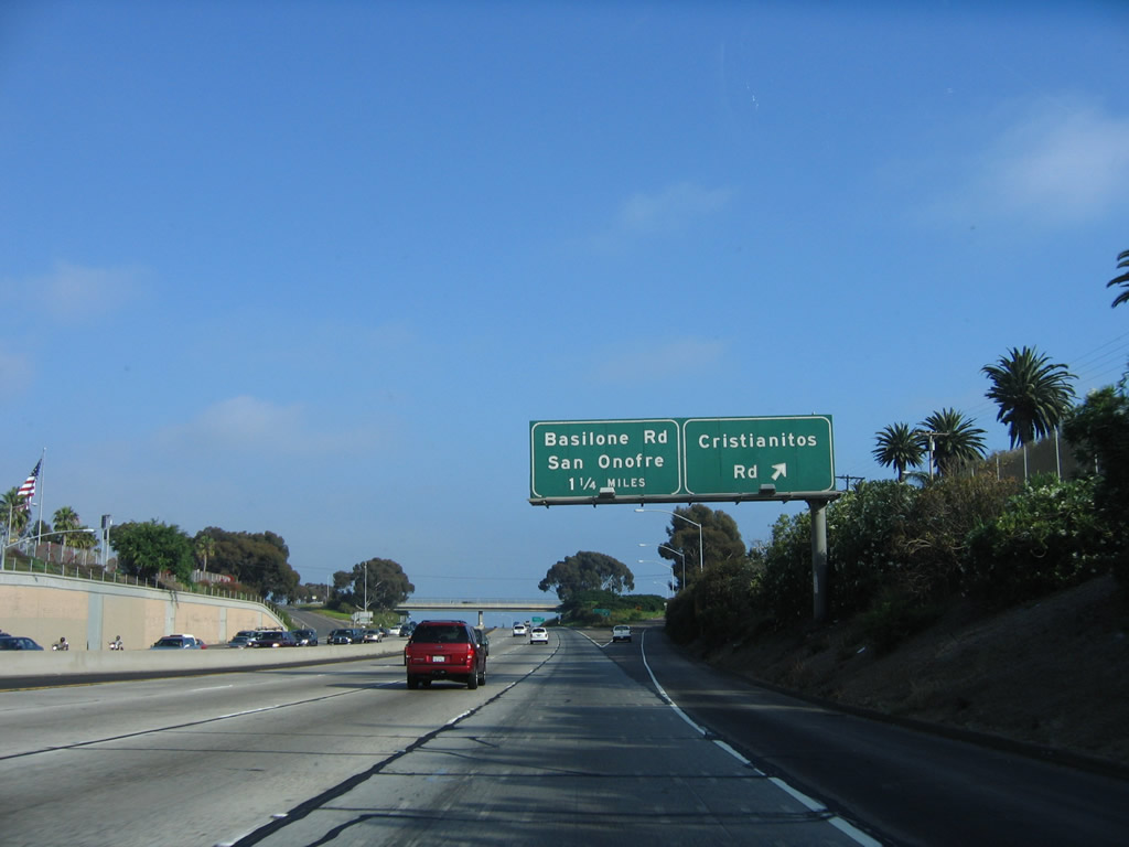
The next three exits along southbound are Exit 73, Avenida Calafia; Exit 72, Business Loop I-5/Cristianitos Road; and Exit 71, Basilone Road. Photo taken 06/17/06. |
|
Avenida Calafia serves downtown San Clemente. Photo taken 06/17/06. |
|
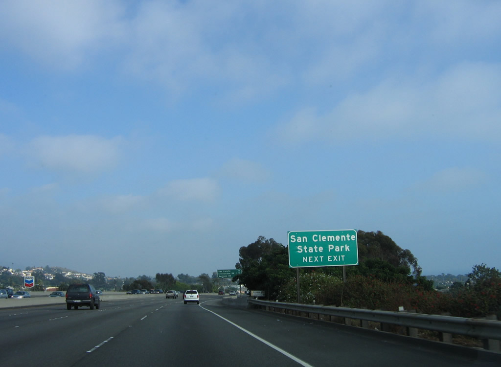
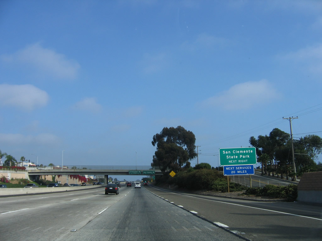
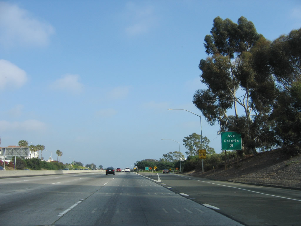
Exit 73, Avenida Calafia is the last exit with services until reaching Oceanside in San Diego County (20 miles). Sprawling Camp Pendleton (a Marine Corps base) lies ahead. Use Exit 73 to reach San Clemente State Park. Photo taken 06/17/06. |
|
|
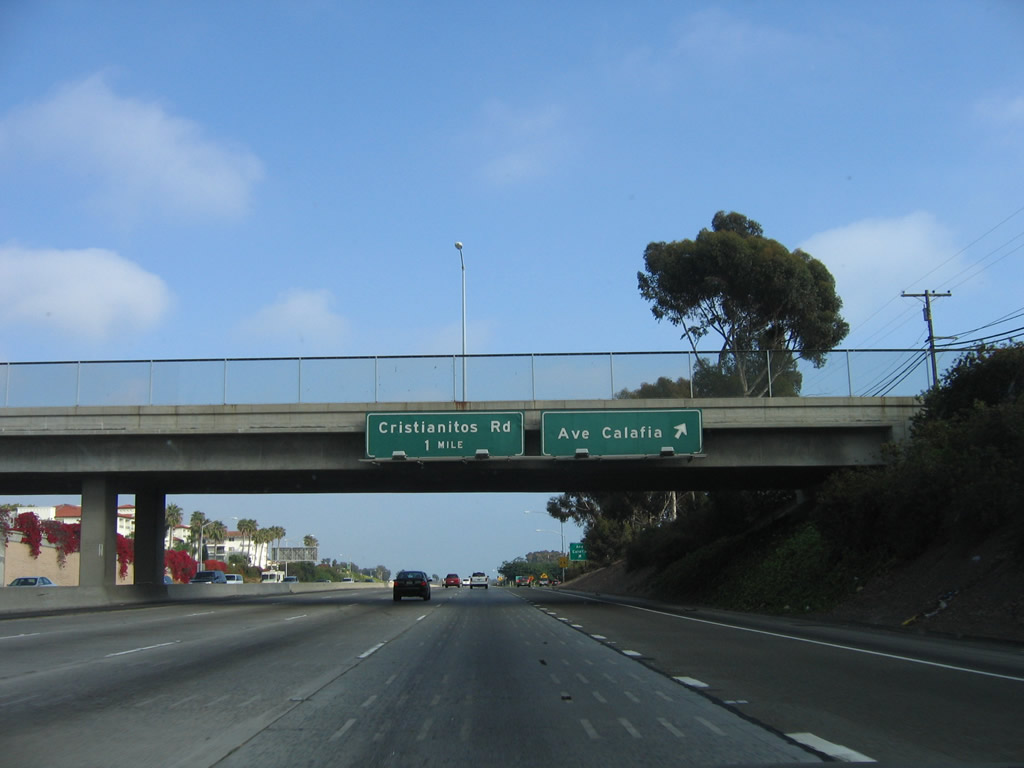
Southbound Interstate 5 (San Diego Freeway) reaches Exit 73, Avenida Calafia. The next exit is for Cristianitos Road, which serves as the Orange-San Diego County Line. Photos taken 06/17/06. |
|
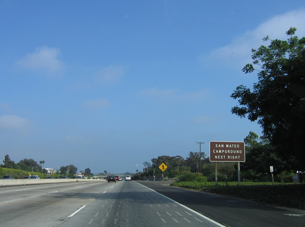
Use Exit 72, Cristianitos Road to San Mateo Campground. This campground is (as of 2008) the subject of debate due to the impact that a proposed toll road (California 241) would have on the campground and the adjacent state parks. Photo taken 06/17/06. |
|
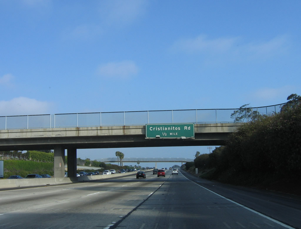
The next exit along southbound is Exit 72, Cristianitos Road. This exit connects to the southern end of the San Clemente business loop. Photo taken 06/17/06. |
|
Southbound Interstate 5 (San Diego Freeway) reaches Exit 72, Cristianitos Road (Business Loop I-5). This is the final San Clemente interchange; after this exit, Interstate 5 will enter rural areas in northern San Diego County and pass through Camp Pendleton, a sprawling Marine Corps base. The San Onofre Nuclear Power Generating Station will also come into view on the west side of the freeway. Photo taken 06/17/06. |
|
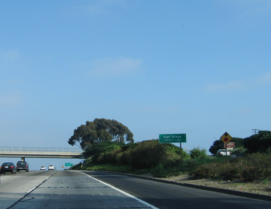
Exit 72 is the final exit in Orange County, and at this point Interstate 5 leaves Caltrans District XII and enters Caltrans District XI. Look for subtle differences in road design, signage, and amenities between Caltrans districts. Interstate 5 enters its final county, San Diego. Photo taken 06/17/06. |
Page Updated October 5, 2008.