| Interstate 5 (San Diego Freeway) south |
|
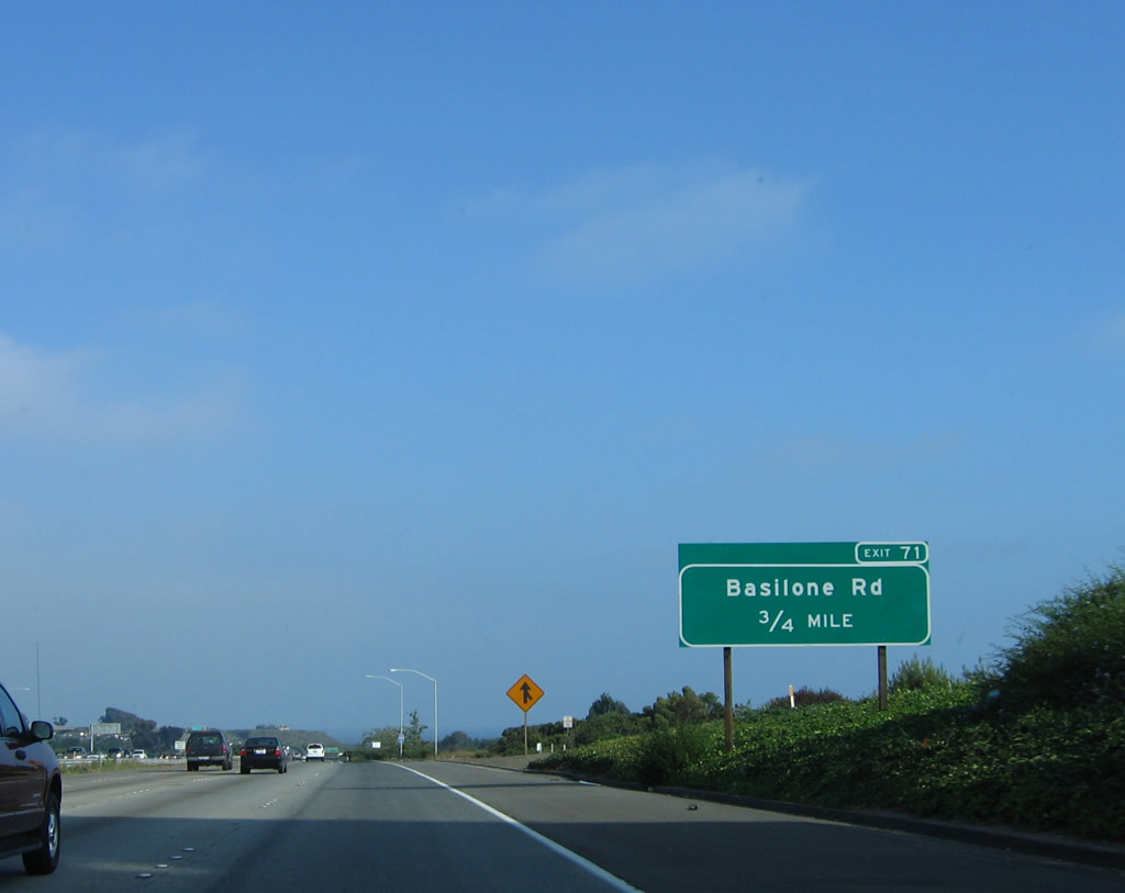
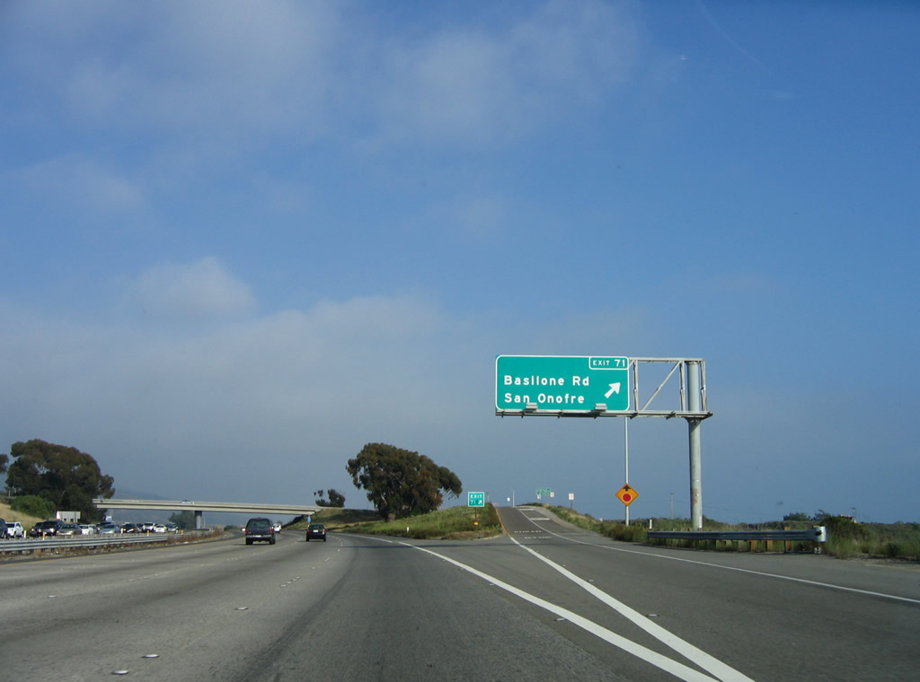
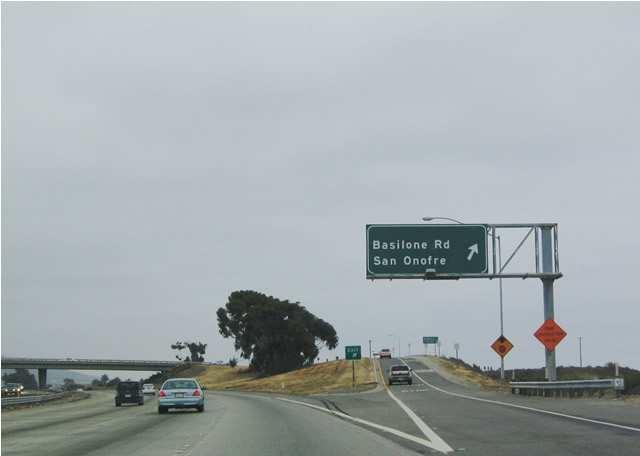
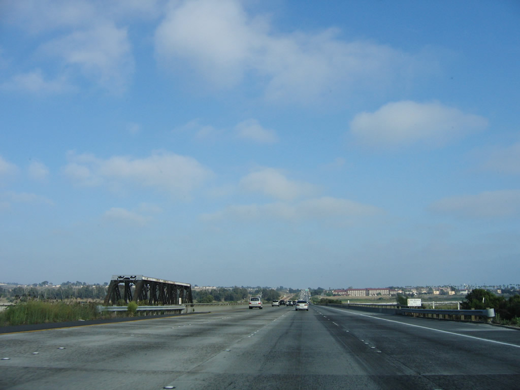
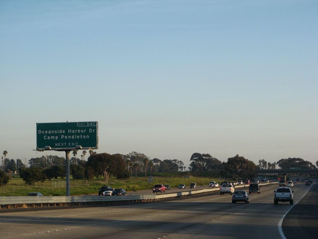
The first exit along Interstate 5 (San Diego Freeway) south in San Diego County is Exit 71, Basilone Road (0.75 mile). Photo taken 06/17/06. |
|
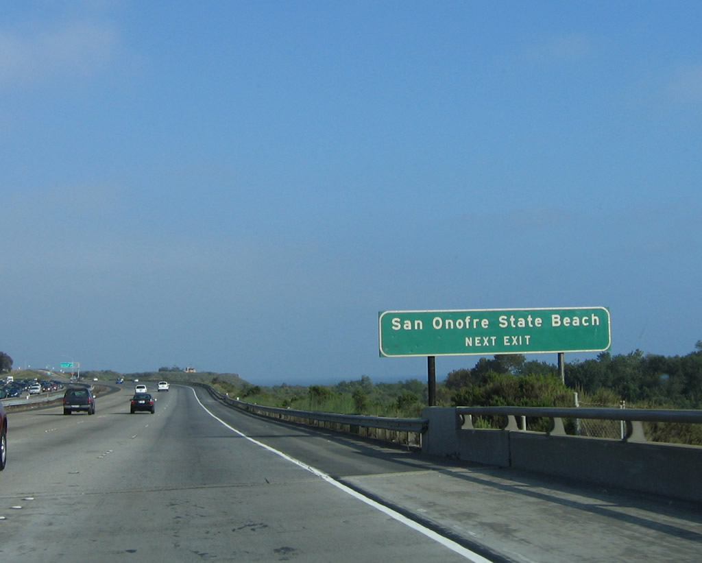
Now departing Orange County and entering San Diego County, Interstate 5 passes under Cristianitos Road and approaches its first interchange in San Diego County: Exit 71, Basilone Road. At this point, Interstate 5 becomes the coastal highway, and for the first time, views of the ocean are available from Interstate 5 (former U.S. 101). Use Exit 71 to reach San Onofre State Beach, which features swimming and camping right along the water. Photo taken 06/17/06. |
|
|
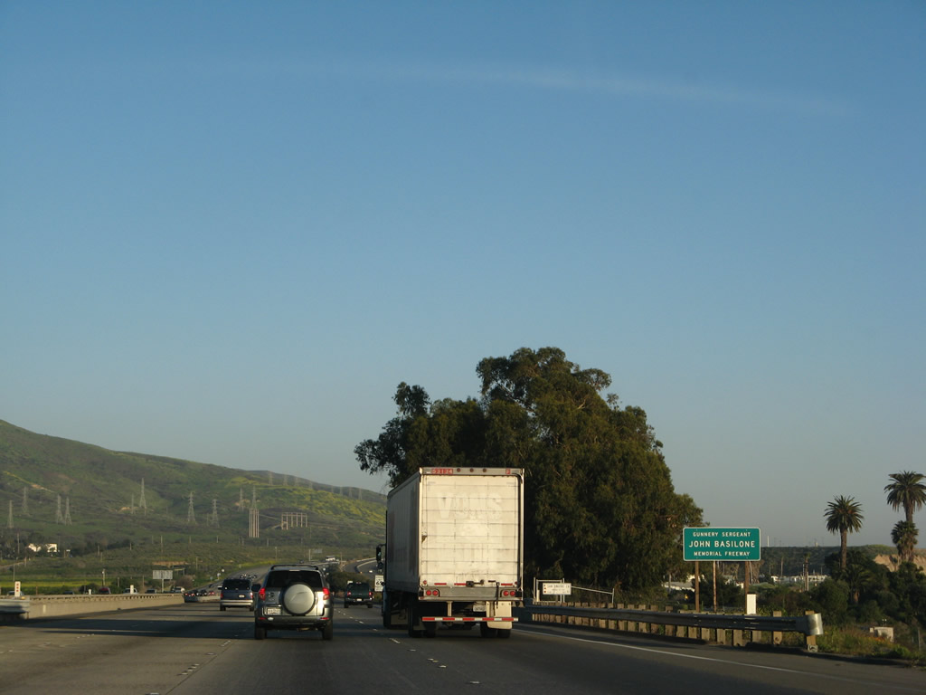
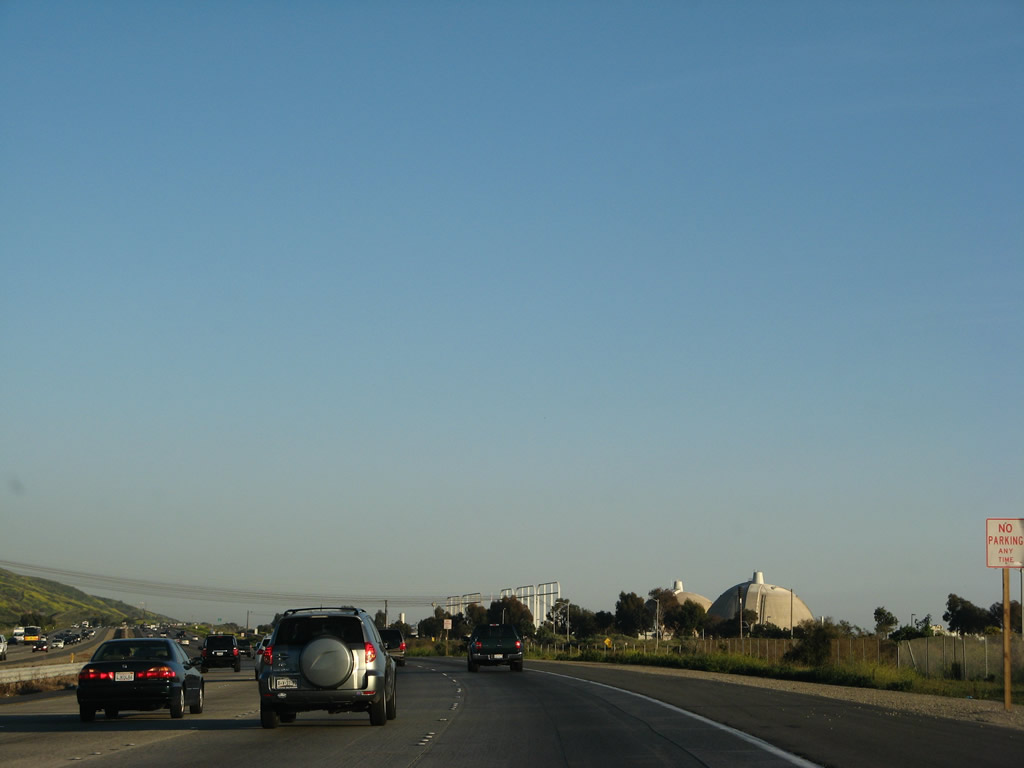
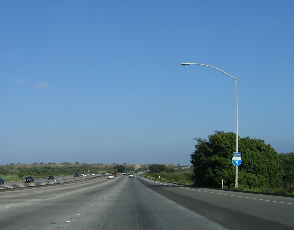
Southbound Interstate 5 reaches Exit 71, Basilone Road. The San Onofre Nuclear Power Generating Station is also located at Exit 71, and it is situated at the south end of the state beach, near the north end of Camp Pendleton (see below). Photos taken 06/17/06 and 07/06/04. |
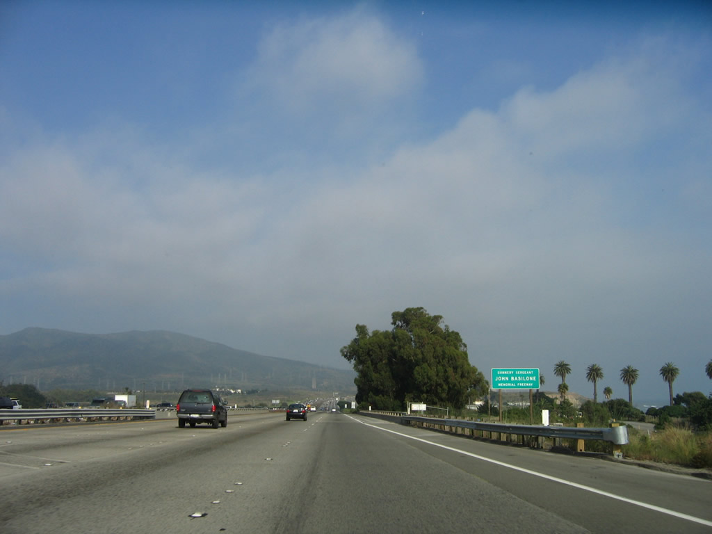
| Interstate 5/San Diego (Gunnery Sergeant John Basilone Memorial) Freeway south |
|
|
Interstate 5 through Camp Pendleton Marine Corps Base is known as the Basilone Freeway. Near this point, the proposed California 241 toll road extension would connect to Interstate 5 near the Trestles Beach. This toll road interchange is extremely controversial; it was voted down by the California Coastal Commission in February 2008 and is currently under appeal at the federal level. Photo taken 03/09/08 and 06/17/06. |
|
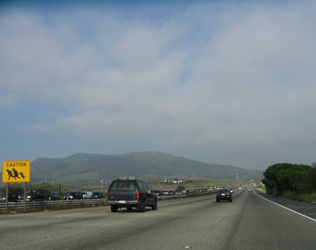
Due to the presence of a Border Patrol checkpoint to the south, a sign showing people running was posted along southbound Interstate 5 as it passed through Camp Pendleton Marine Corps Base prior to the U.S. Border Patrol Checkpoint. This sign (seen as a humiliating and discriminating sign by some) disappeared sometime in late 2006 or early 2007; it was not replaced. Photo taken 06/17/06. |
|
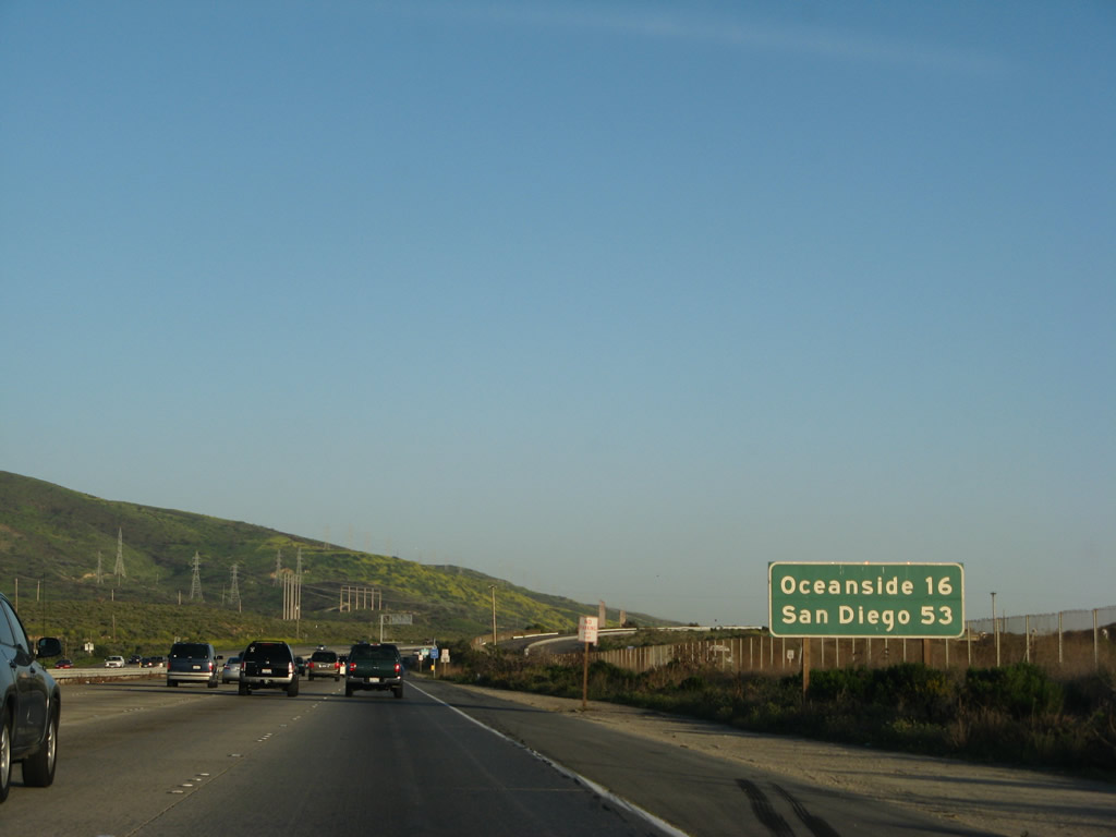
This mileage sign provides the distance to Oceanside (16 miles) and San Diego (53 miles). For the next 15 or so miles, Interstate 5 will hug the coastline and offer stunning views of the Pacific Ocean. Photo taken 03/09/08. |
|
The twin domes of the San Onofre Nuclear Generating Station (SONGS) dominate the beach scenery. This nuclear power plant is one of two major plants currently in service in the state of California; the other is Diablo Canyon (which is operated by Pacific Gas and Electric in a remote coastal area northwest of San Luis Obispo). Another nearby nuclear power plant is the Palo Verde Nuclear Generating Station in Arizona west of Phoenix. Photo taken 03/09/08. |
|
|
|
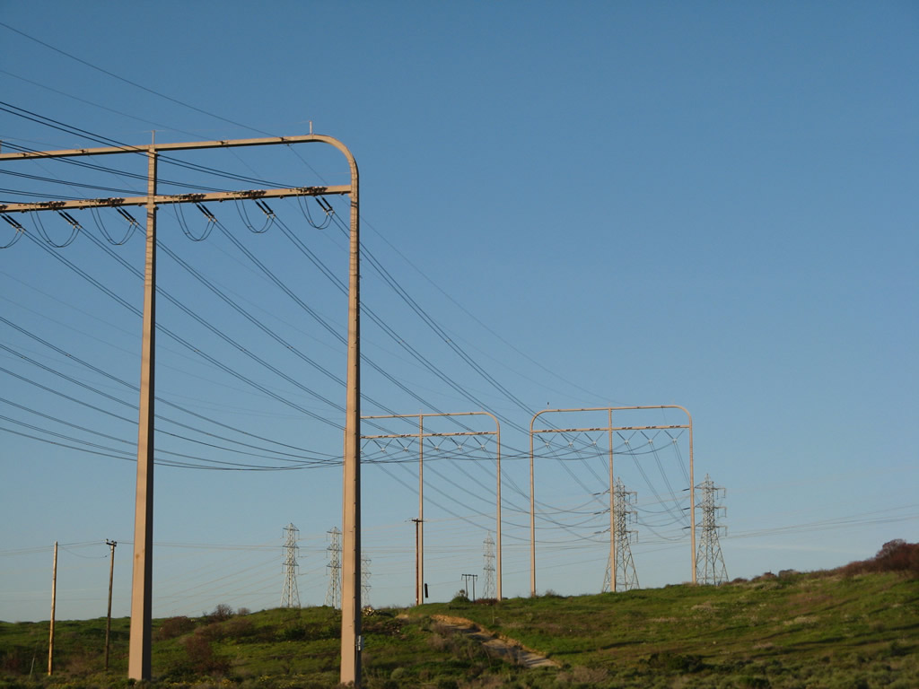
Several sets of 230kV power lines cross Interstate 5 to connect the Southern California Edison and San Diego Gas and Electric power grids with San Onofre Nuclear Generating Station (SONGS). Photos taken 03/09/08. |
|
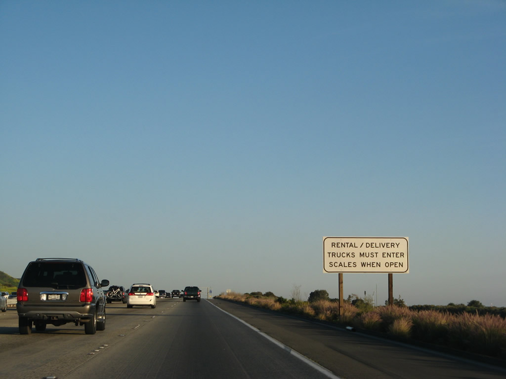
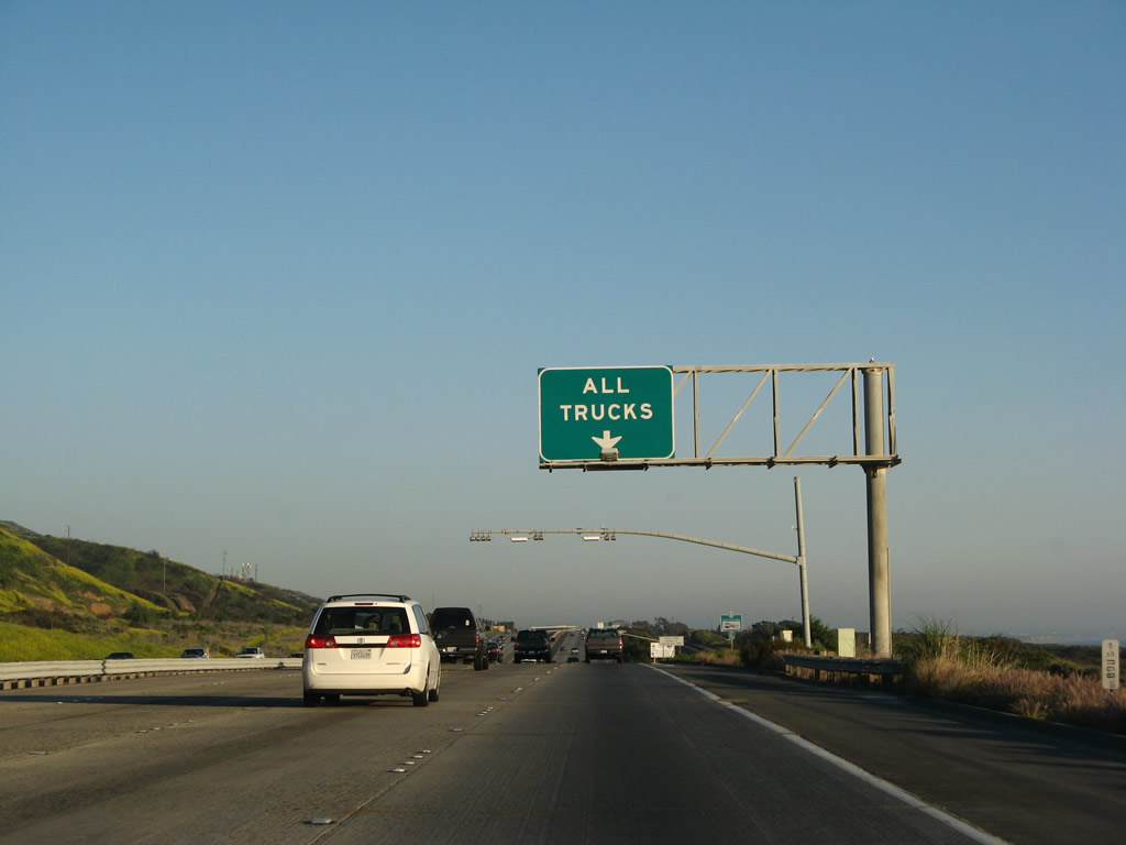
All trucks must use the right lane to queue for the weigh station, including delivery and rental trucks. Photo taken 03/09/08. |
|
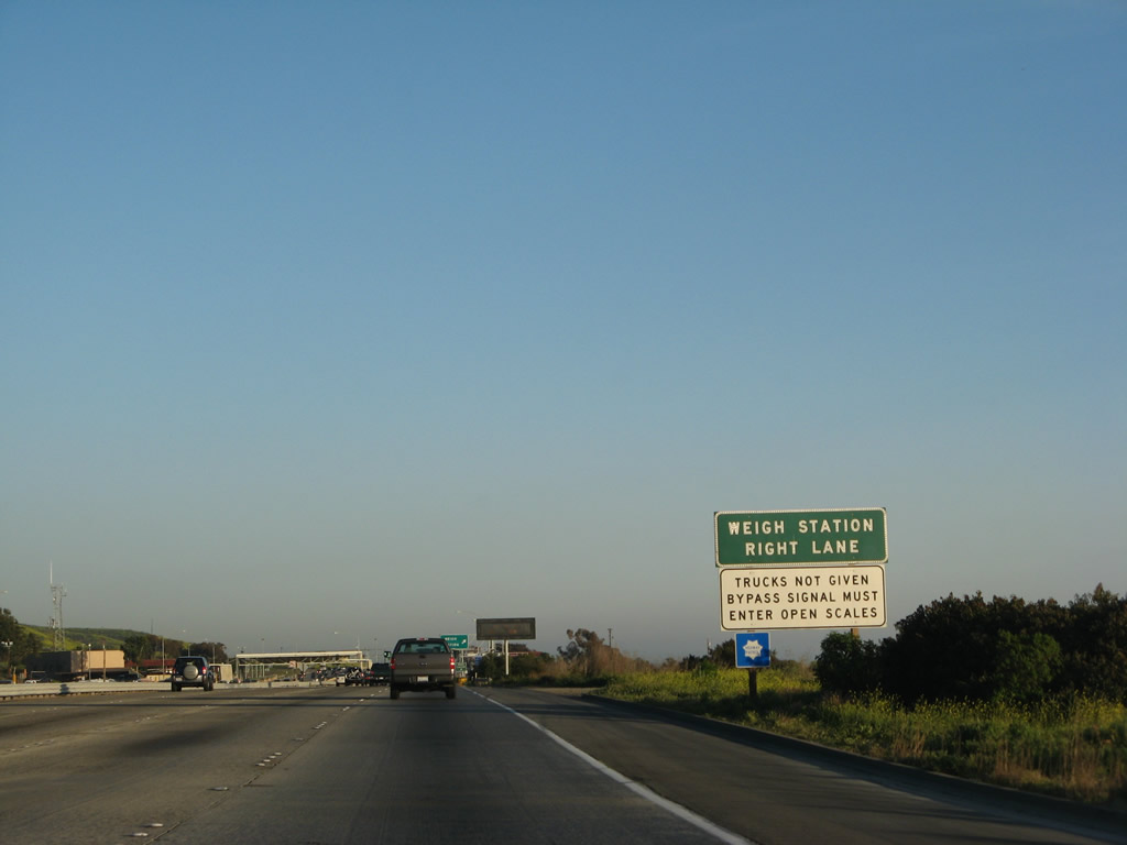
The right lane connects to the weigh station, which is located adjacent to the northbound U.S. Border Patrol Station and weigh station. The weigh station is located at Milepost 67 but is not assigned an exit number. Photo taken 03/09/08. |
|
A second roadside sign for the weigh station is posted soon thereafter; this weigh station also serves as a California Highway Patrol post. Photo taken 03/09/08. |
|
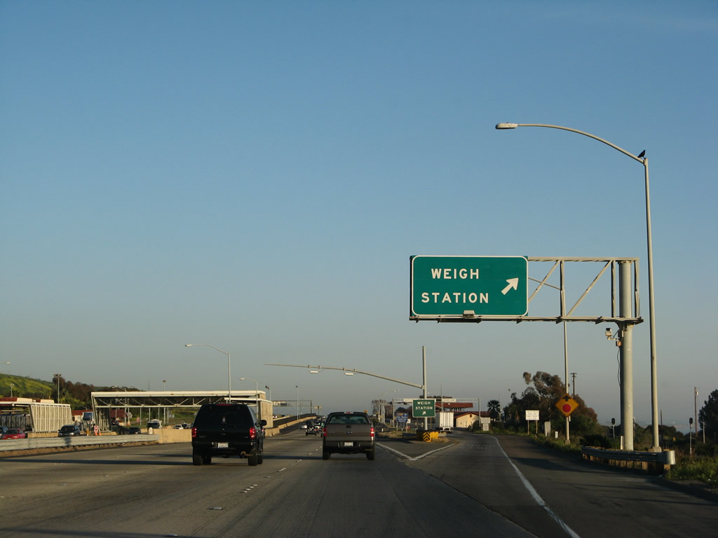
Southbound Interstate 5 reaches (Exit 67), Weigh Station. This station is located adjacent to the U.S. Border Patrol checkpoint found along northbound. Photo taken 03/09/08. |
|
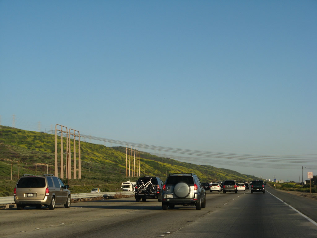
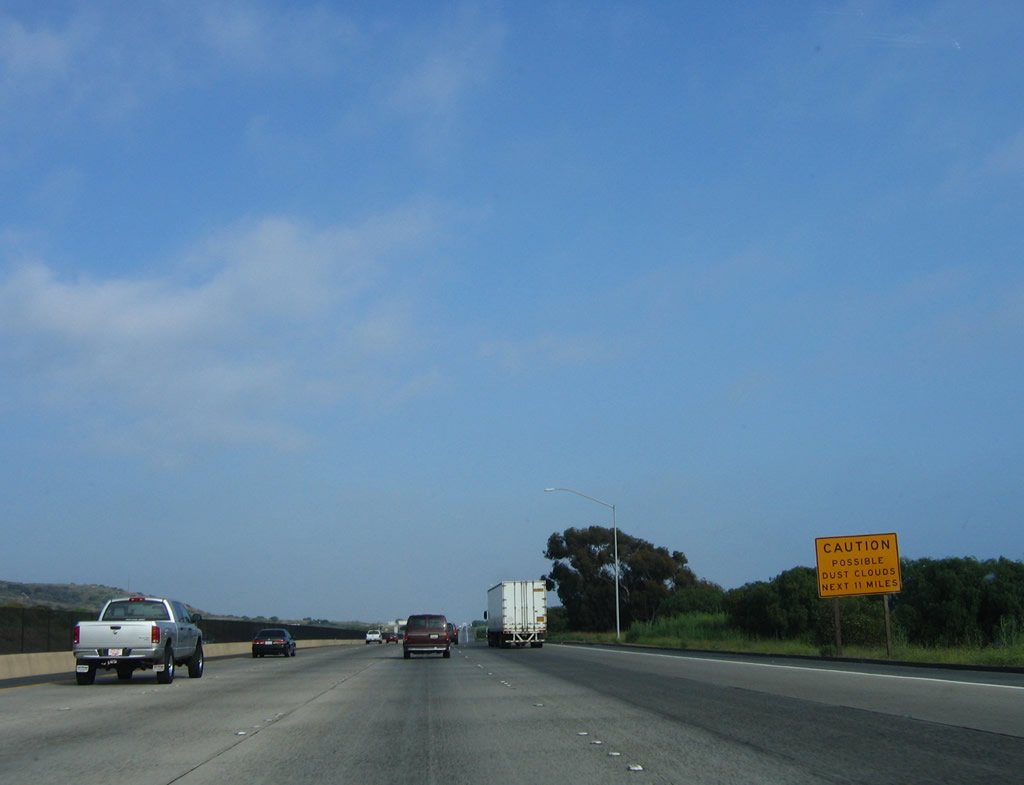
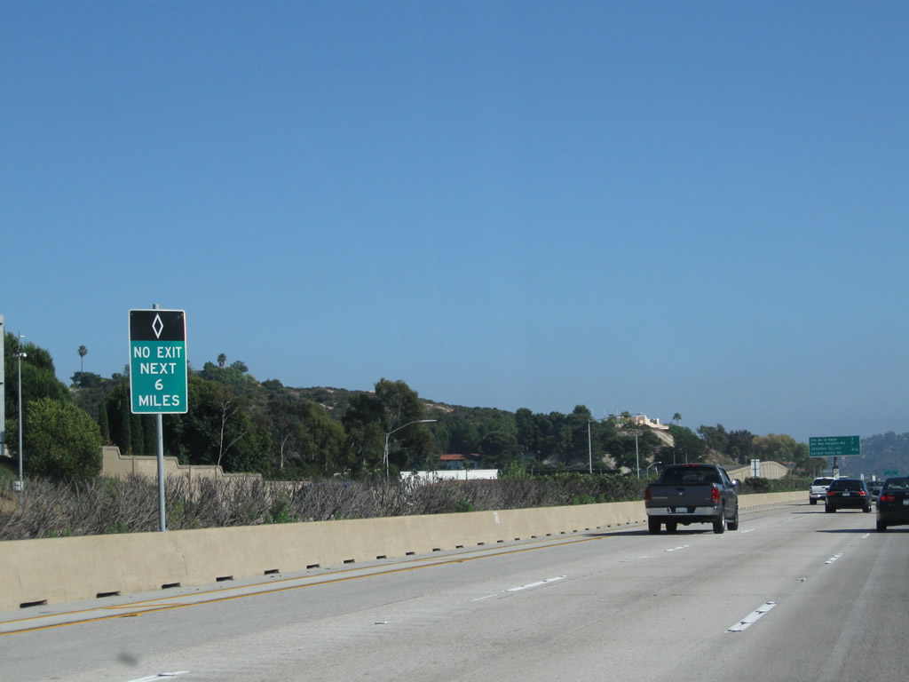
Due to training activities and occasion high winds, dust clouds are possible along the Interstate 5 freeway between San Clemente and Oceanside. Use caution, especially in the presence of helicopter activities. Photo taken 06/17/06. |
|
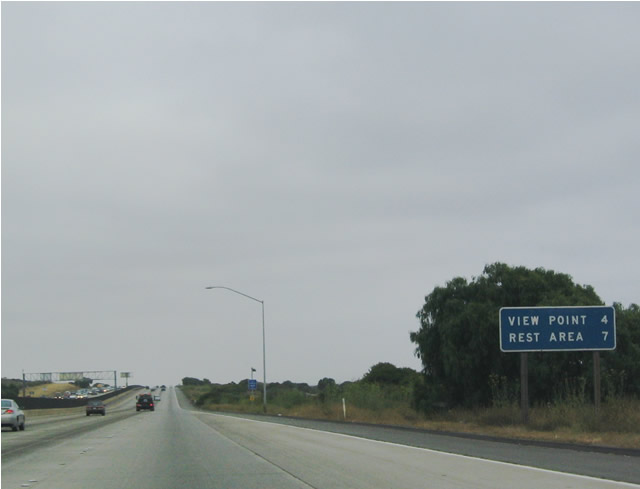
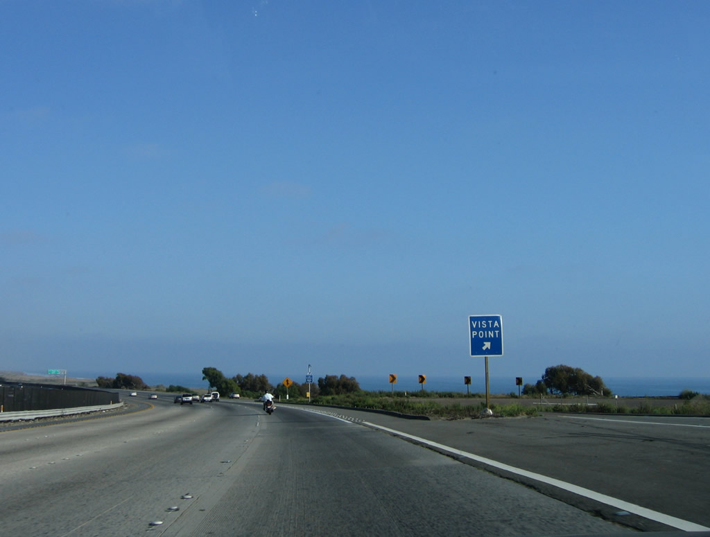
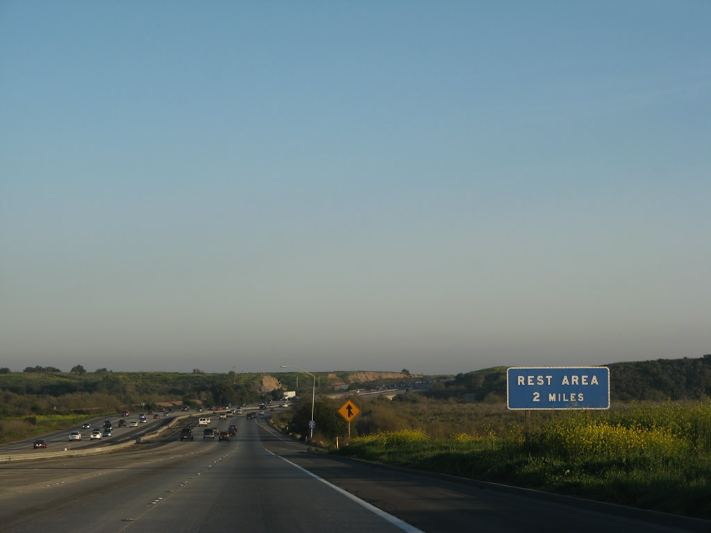
The next exit along southbound is a vista point, one of the few vista points along Interstate 5 in Southern California (four miles), followed by a Rest Area (seven miles). Not listed on this mileage sign is Exit 62, Las Pulgas Road, which is situated approximately one mile south of the vista point. Photo taken 07/06/04. |
|
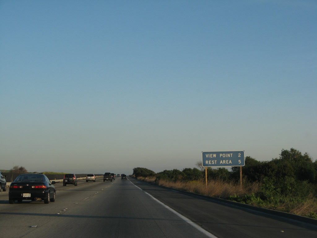
Another mileage sign for the View Point and Rest Area is posted shortly thereafter. Photo taken 03/09/08. |
|
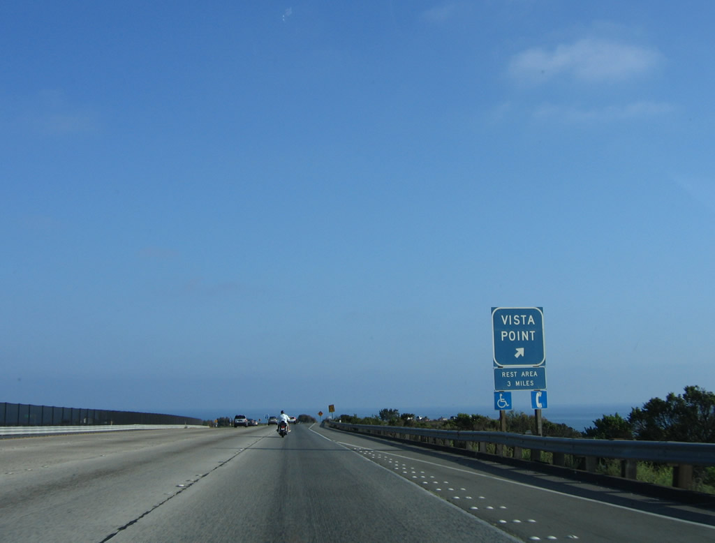
Southbound Interstate 5 reaches Exit 63, Vista Point, which provides outstanding views of the ocean and the surrounding military base. Again note that the rest area with full facilities is only three miles ahead (the rest areas is located after Exit 62, Las Pulgas Road). Photo taken 06/17/06. |
|
The vista point gore signage has the ocean as its backdrop. Photo taken 06/17/06. |
|
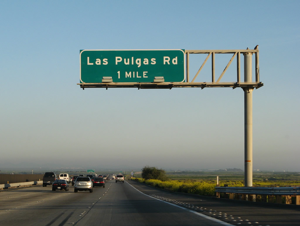
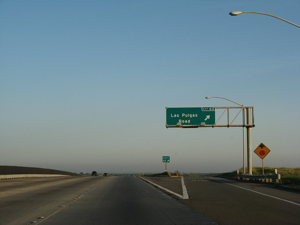
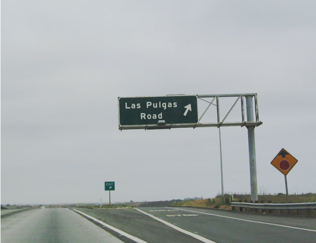
The next exit along southbound Interstate 5/San Diego (John Basilone Memorial) Freeway is Exit 62, Las Pulgas Road to Camp Pendleton (one mile). To the Historic U.S. 101 bicycle route, use Exit 62, follow Las Pulgas Road east, and park at the parking area prior to the Camp Pendleton gate. Photo taken 03/09/08. |
|
|
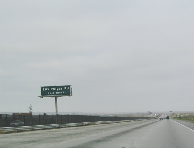
Las Pulgas Road connects Interstate 5 with the central portion of the Camp Pendleton Marine Corps Base. It does not provide a route for through traffic. Photos taken 03/09/08 and 07/06/04. |
|
|
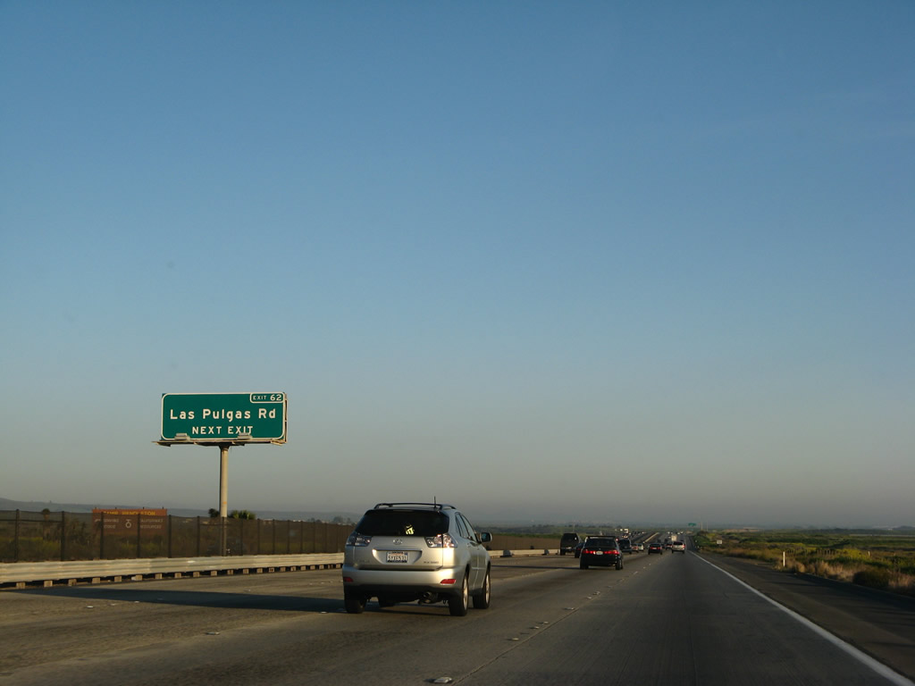
Southbound Interstate 5 reaches Exit 62, Las Pulgas Road. No services are available at this interchange. A launching point for bicycling along the old alignment of U.S. 101 through the northern part of Camp Pendleton is available at this interchange. During 2005, signs along this stretch of Interstate 5 were replaced, including this one. Photos taken 03/09/08 and 07/06/04. |
|
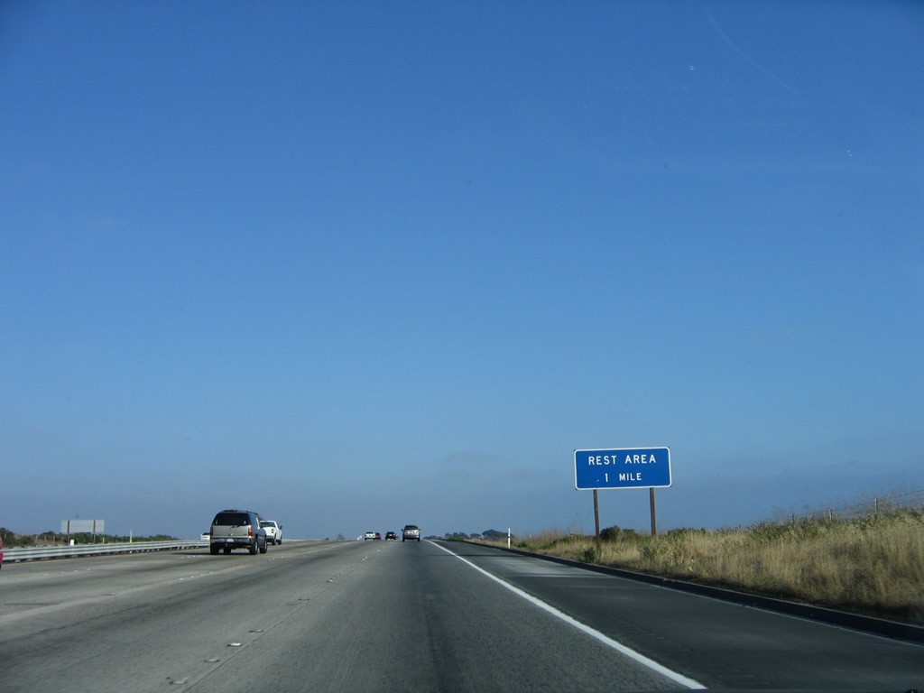
After the Vista Point and Las Pulgas Road interchange, southbound Interstate 5 next approaches a rest area (Exit 60), two miles. Photo taken 03/09/08. |
|
|
At the end of the on-ramp from Las Pulgas Road to Interstate 5 south is an example of a recent disturbing trend: a neutered Interstate 5 south reassurance shield. These new shields, which started appearing soon after the October 2007 wildfires, exclude the state name of California and are in the oddly angular Interstate shield now commonly found throughout California. Several more of these neutered reassurance shields are placed along Interstate 5 in northern San Diego County. Photos taken 03/09/08 and 06/17/06. |
|
This mileage sign provides the distance to the cities of Oceanside (7 miles) and San Diego (44 miles). Photo taken 06/17/06. |
|
Watch for slowing traffic as Interstate 5 south approaches Exit 60, rest area (one mile). Photo taken 06/17/06. |
|
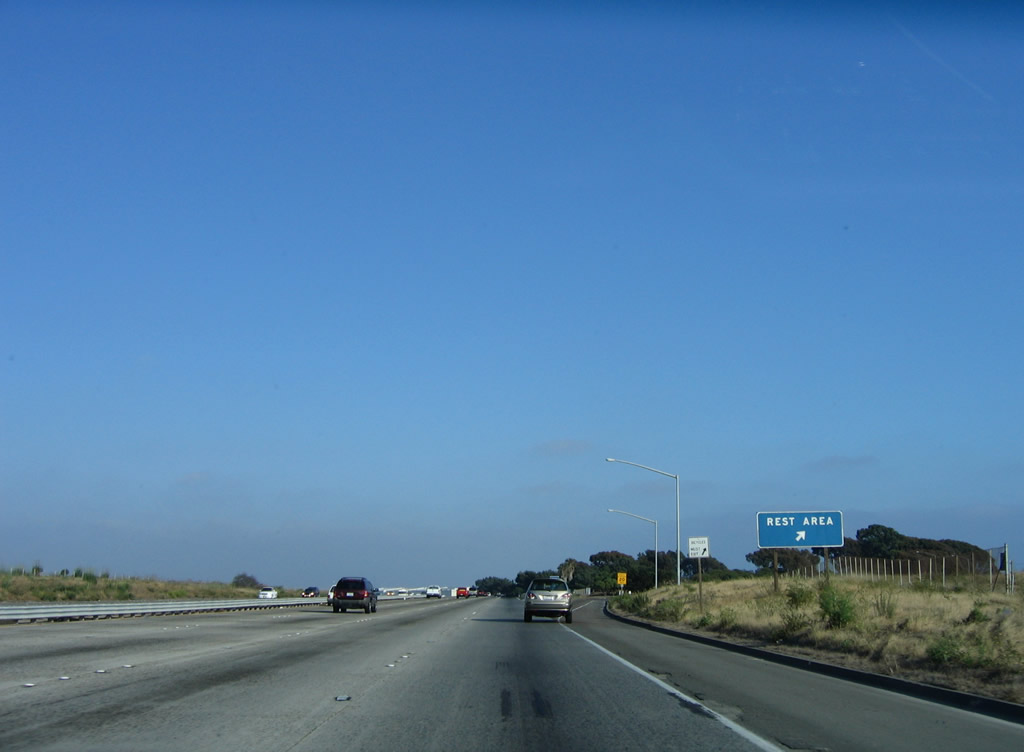
Southbound Interstate 5 (San Diego Freeway) reaches Exit 60, Rest Area. This is the last rest area along southbound Interstate 5 (and the only one since entering the Southern California megalopolis on southbound). Photo taken 06/17/06. |
|
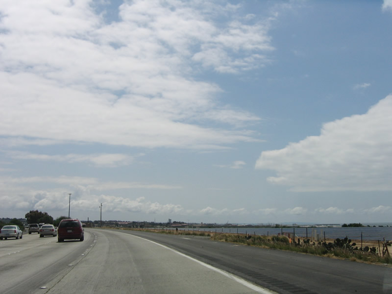
At the southern end of Camp Pendleton, some of the land is used for agriculture and farming. In this view along southbound Interstate 5, agricultural lands blend into the ocean that is still visible in the distance. Photo taken 04/16/06. |
|
Crossing the Santa Margarita River, the SDNR Railroad (which carries freight rail, Amtrak, and Metrolink) enters the median of Interstate 5 and crosses the river on a truss bridge (which is slated for replacement later this decade). Look for the commuter rail yards for Metrolink and the San Diego Coaster to the left. Photo taken 06/17/06. |
|
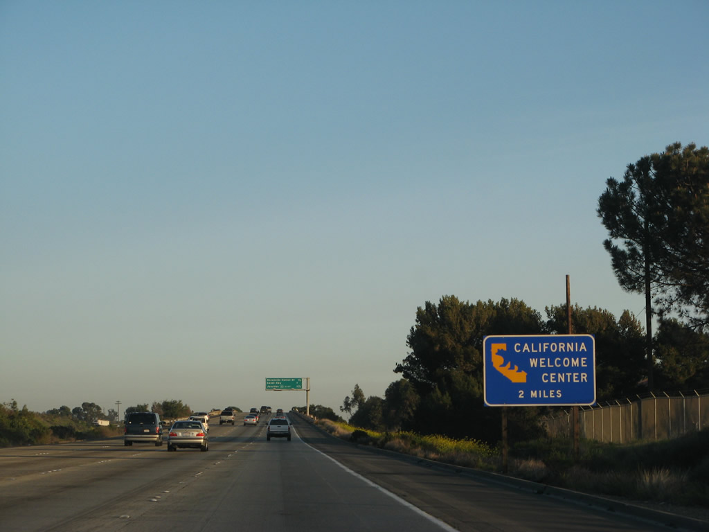
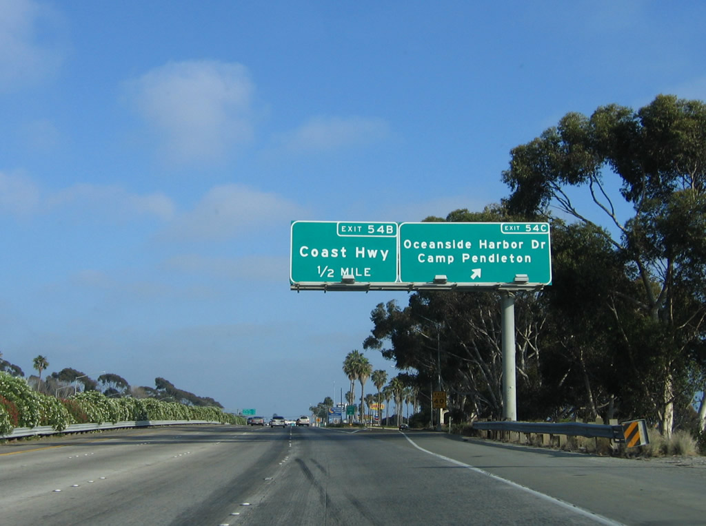
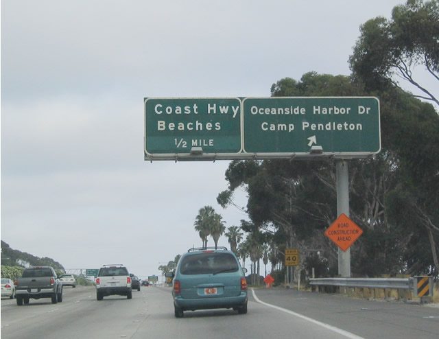
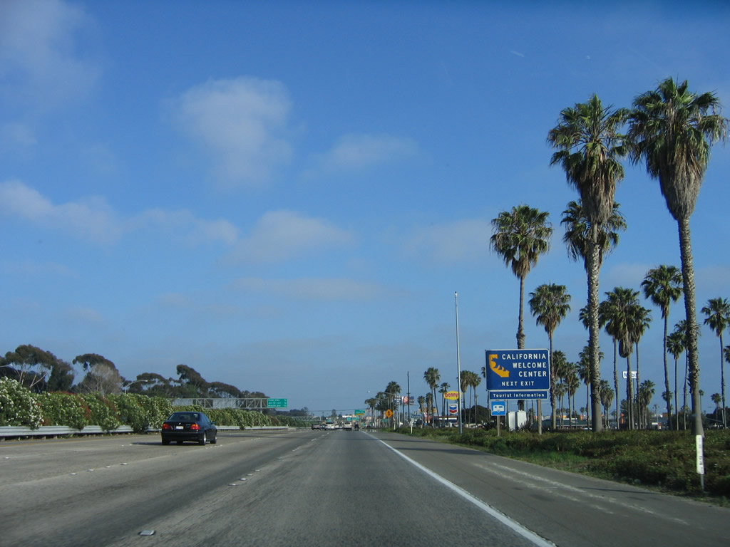
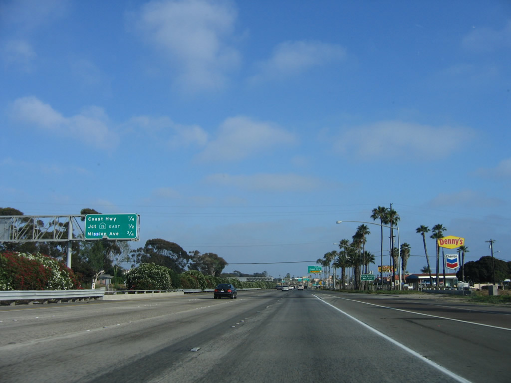
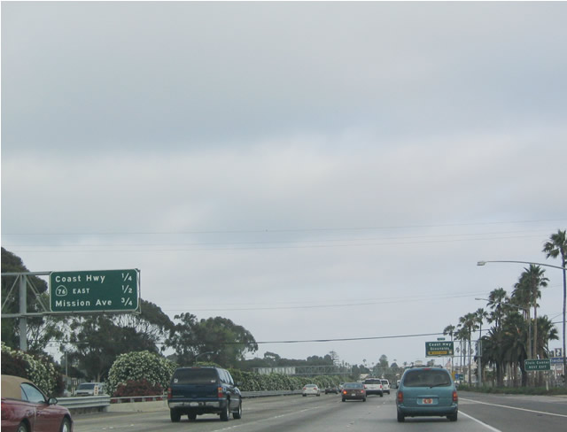
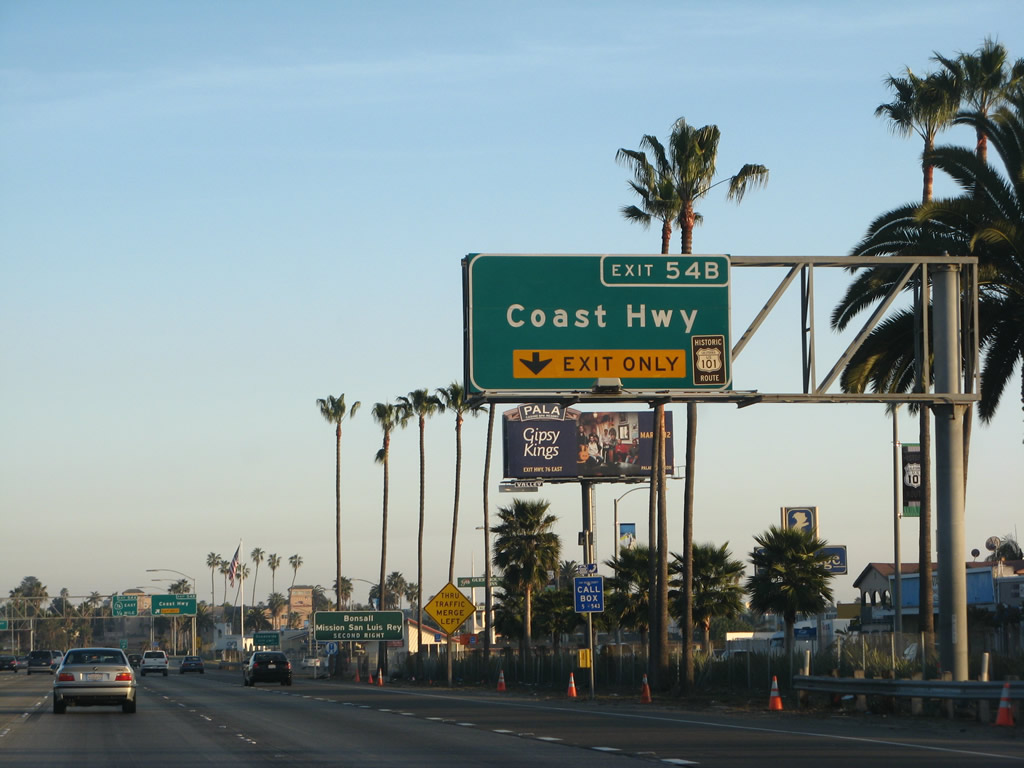
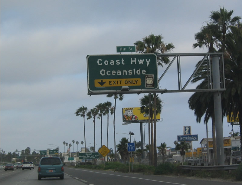
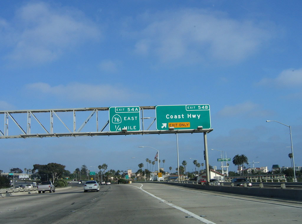
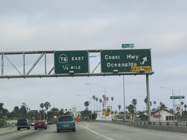
Use Exit 54B (Junction Old U.S. 101 South, Coast Highway) to the Official California Welcome Center at Oceanside. Tourist information, maps, and restrooms are available at the welcome center. Photo taken 03/09/08. |
|
|
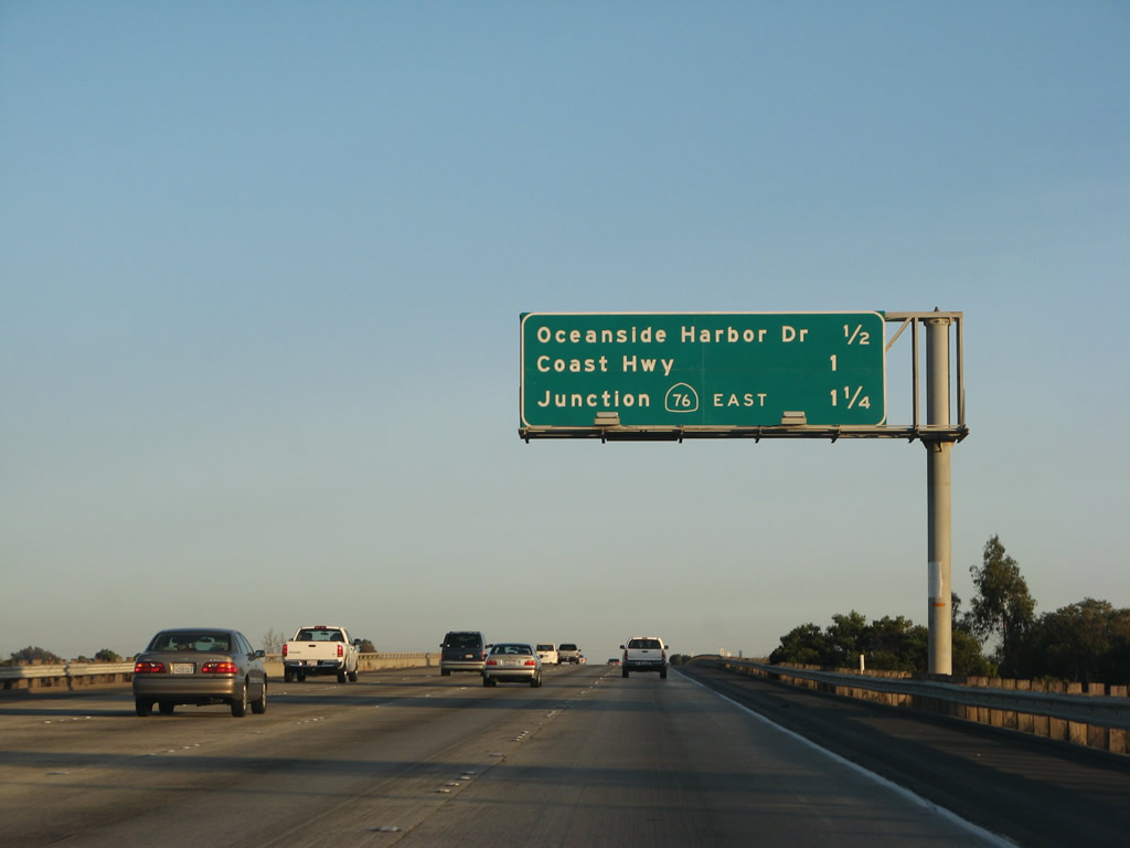
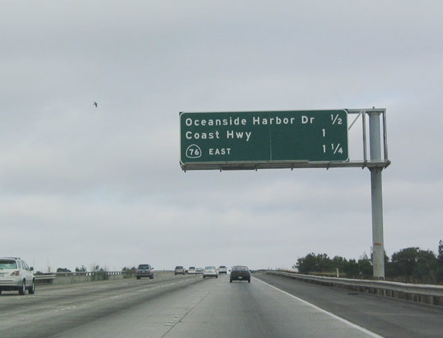
Six miles south of the Rest Area, southbound Interstate 5 approaches its next interchange: Exit 54C, San Diego County S-21 (Old U.S. 101), Oceanside Harbor Drive to the southern entrance to Camp Pendleton and Oceanside Harbor. This is the first exit since the Las Pulgas Road interchange (Exit 62) along southbound. Photos taken 03/09/08 and 07/06/04. |
|
Oceanside Harbor Drive heads south toward Oceanside (which is signed as San Diego County S-21 and connects to Old U.S. Highway 101) and north to Camp Pendleton. For the first time since entering San Diego County, motorist services are available at this interchange. Photo taken 03/09/08. |
|
|
Southbound Interstate 5 (San Diego Freeway) reaches Exit 54C, San Diego County S-21, Oceanside Harbor Drive to Camp Pendleton and Oceanside Harbor. San Diego County S-21 traces Old U.S. 101 from Oceanside south to San Diego; use either this exit or Exit 54B to Old U.S. 101 southbound). Photos taken 06/17/06 and 07/06/04. |
| Interstate 5 (San Diego Freeway) south |
|
Use Exit 54B to the State of California Welcome Center. Photo taken 06/17/06. |
|
|
The next exit along southbound Interstate 5 is Exit 54B, Historic U.S. 101 (Coast Highway) (formerly Hill Street/San Diego County S-21 south). While Interstate 5 remains east of the city centers of Oceanside, Carlsbad, Encinitas, Solana Beach, and Del Mar, Old Coast Highway 101 passes through the downtowns of each city. Photos taken 06/17/06 and 07/06/04. |
|
|
The right lane of southbound Interstate 5 becomes exit only for Exit 54B, Historic U.S. 101 (Coast Highway). Coast Highway was formerly known as Hill Street, hence the old tab affixed to the top of the old sign. Notice the U.S. 101 shield affixed to this overhead sign (it survived intact to the new sign, but the glue seems to have worn off). Photos taken 03/09/08 and 07/06/04. |
|
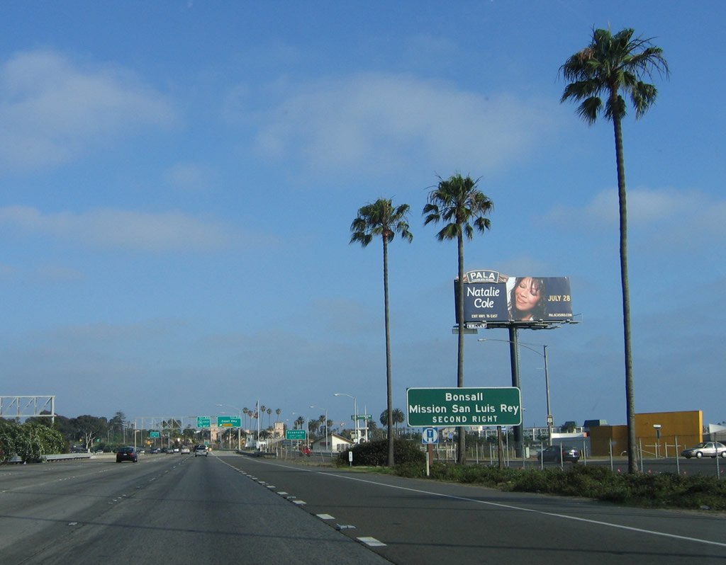
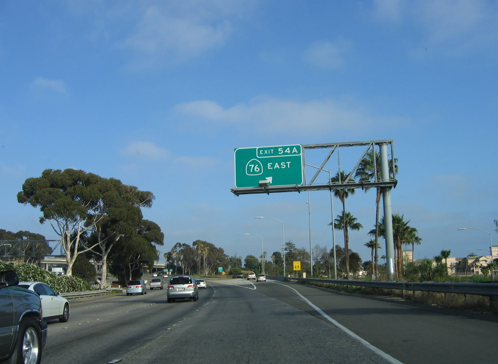
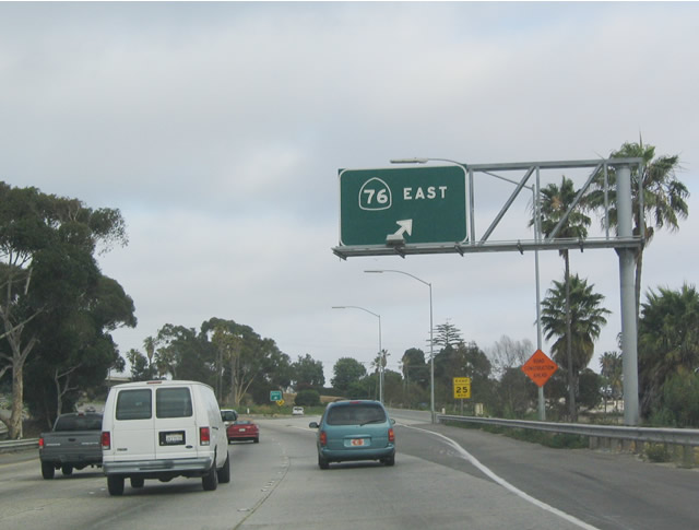
Use California 76 east (Exit 54A) to Bonsall, Fallbrook, and Mission San Luis Rey. Photo taken 06/17/06. |
|
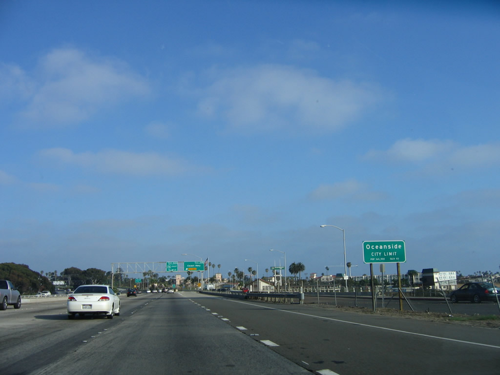
For the first time since leaving San Clemente in Orange County, Interstate 5 enters an incorporated area: the city of Oceanside. Oceanside is the first of several communities nestled along the Interstate 5 corridor that form coastal "North County," a reference to their location in the northern part of San Diego County. Oceanside is a 42-square-mile city that was founded on July 3, 1888, and it is home to 173,303 people as of a 2005 estimate (the highway sign says 164,500 people as of the 2000 Census). After this sign, Interstate 5 crosses the San Luis Rey River. An Old U.S. 101 bridge also spans the river to the west of Interstate 5. Photo taken 06/17/06. |
|
|
Historic U.S. 101 is signed sporadically along the coastal route, at least as far south as the city of Del Mar. Historic U.S. 101 shields have not been placed within the city of San Diego. Exit 54B is the exit to southbound Historic U.S. 101 and Coast Highway. The next exit is Exit 54A, California 76 east to Bonsall and Mission San Luis Rey. Photos taken 06/17/06 and 07/06/04. |
|
No destination or control cities are placed on this overhead sign, but eastbound California 76 passes through northeastern Oceanside, then turns northeast to Bonsall, Pala Mesa (Interstate 15), Pala, Pauma, Rincon, and Lake Henshaw. California 76 ends at its intersection with California 79 in Morettis. California 76 is currently an expressway from Interstate 5 east to the Oceanside city limits, but it is planned for expansion to expressway standards as far east as Interstate 15 if not all the way to Rincon and the Palomar Mountain turnoff. Traffic on the two-lane sections of California 76 near Bonsall can be thick, especially during commuting hours. Such improvements are still an indeterminate distance away from becoming reality. This photo shows Interstate 5 at Exit 54A, eastbound California 76 (San Luis Rey River Expressway). Photos taken 06/17/06 and 07/06/04. |
|
|
|
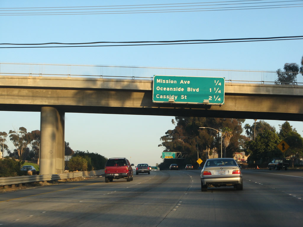
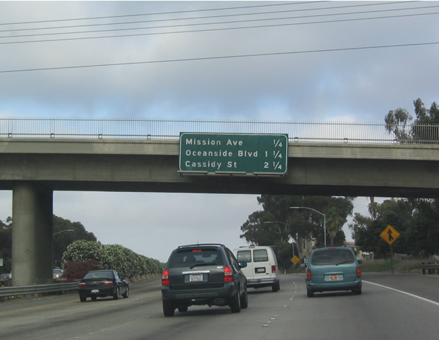
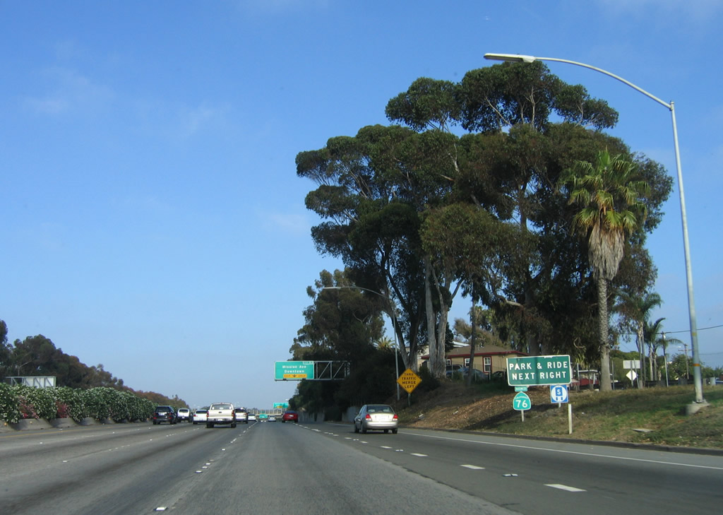
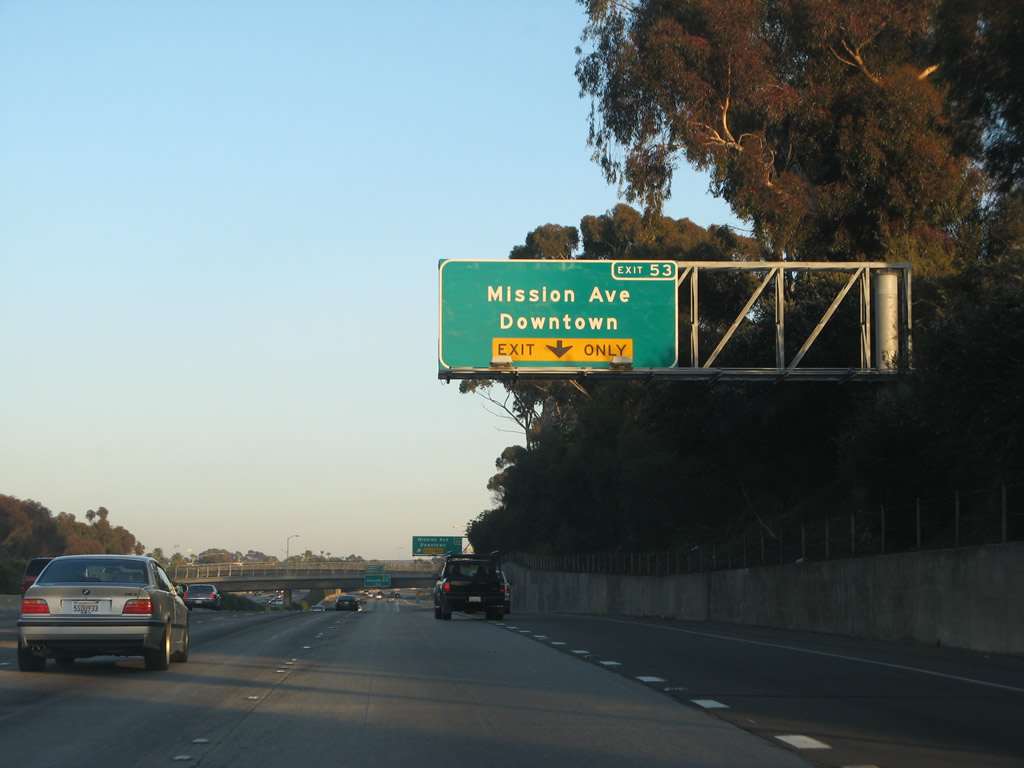
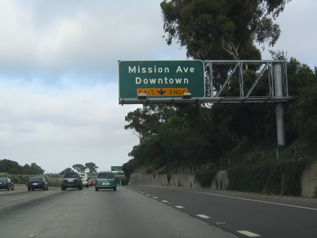
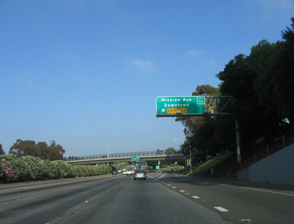
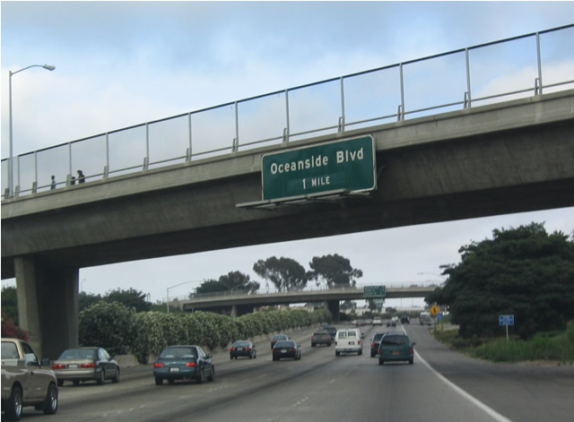
The next exit along southbound Interstate 5 is Exit 53, California 76 Business (Mission Avenue), followed by Exit 52, Oceanside Boulevard and Exit 51C, Cassidy Street. This mileage sign was replaced with a reflective sign in 2005. Photos taken 03/09/08 and 07/06/04. |
|
A lone California 76 Business shield is posted beneath the Park and Ride guide sign. Photo taken 06/17/06. |
|
|
Mission Avenue was the original alignment of California 76 before the San Luis Rey River Expressway was constructed in the late 1990s. Once that expressway opened, the old alignment became known as California 76 Business. California 76 Business is signed from Interstate 5, but it is generally not signed along Mission Avenue itself. Photos taken 03/09/08 and 07/06/04. |
|
|
Southbound Interstate 5 reaches Exit 53, California 76 Business, Mission Avenue. To the west, Mission Avenue connects with San Diego County S-21 (Old U.S. 101). Photos taken 06/17/06 and 07/06/04. |
|
Now on the off-ramp from southbound Interstate 5, this trailblazer indicates that Interstate 5 is the western terminus of California 76 Business, even though Mission Avenue goes both east and west. Photo taken 07/06/04. |
|
As noted earlier, Mission Avenue heads east to rejoin California 76 in east Oceanside. Take Mission Avenue west to reach Coast Highway 101/San Diego County S-21. Note that continuing straight through the upcoming traffic signal will deposit travelers into the parking lot for Oceanside High School. Photo taken 07/06/04. |
|
|
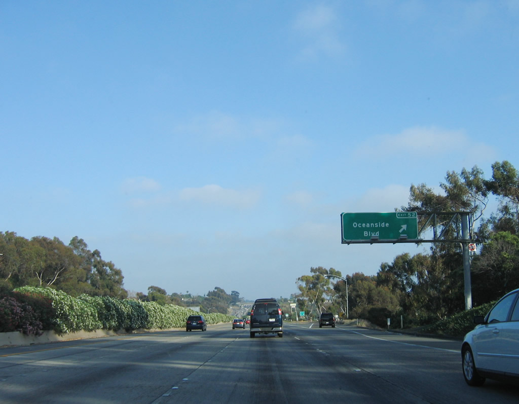
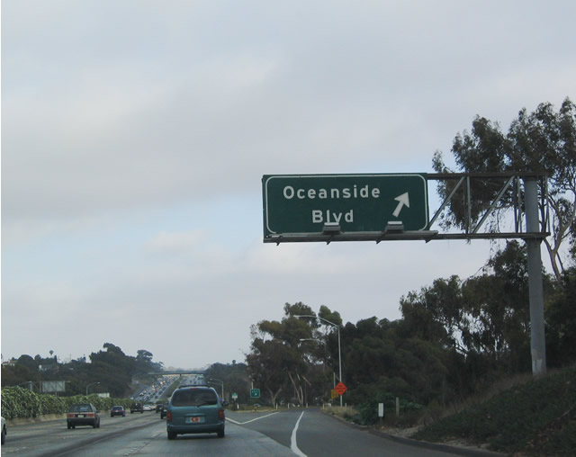
The next exit along southbound Interstate 5 is Exit 52, Oceanside Boulevard, one mile. Photos taken 06/17/06 and 07/06/04. |
|
|
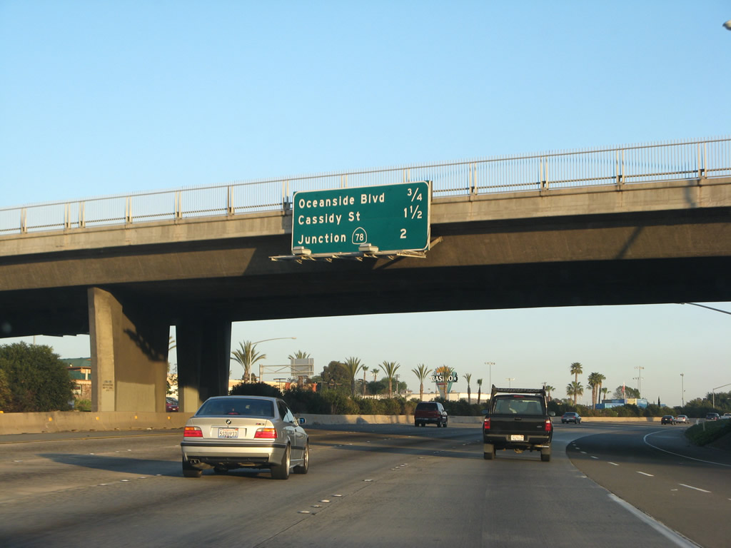
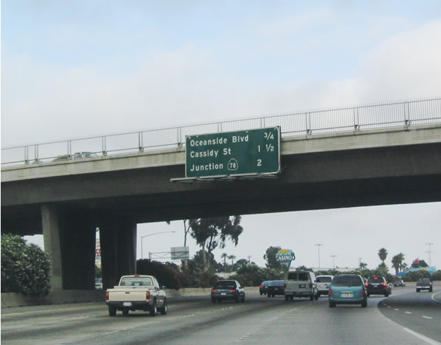
This mileage sign provides the distance to the next three exits along southbound Interstate 5 (San Diego Freeway): Exit 52, Oceanside Boulevard; Exit 51C, Cassidy Street; and Exit 51B, California 78/Vista Way. Photos taken 03/09/08 and 07/06/04. |
|
|
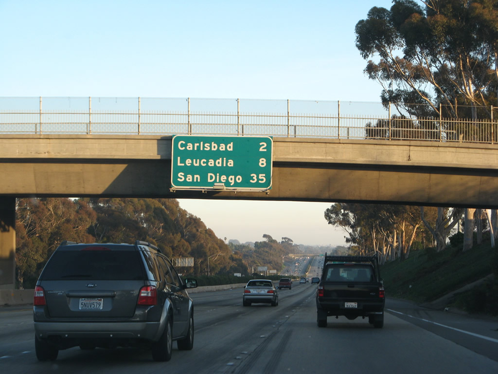
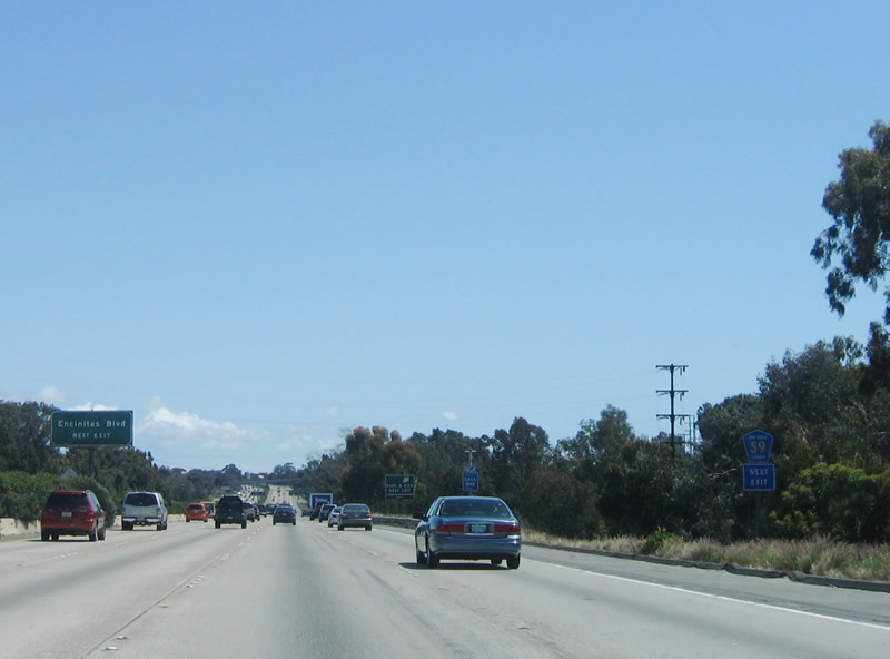
Another mileage sign is posted thereafter along southbound Interstate 5 for Carlsbad (the next city south of Oceanside), Leucadia, and San Diego. Since Leucadia is now part of Encinitas, this mileage sign should read Encinitas rather than Leucadia in keeping with Caltrans policy of not placing unincorporated areas on distance signs. Photos taken 03/09/08 and 07/06/04. |
|
|
Southbound Interstate 5 (San Diego Freeway) reaches Exit 52, Oceanside Boulevard. Photos taken 06/17/06 and 07/06/04. |
|
|
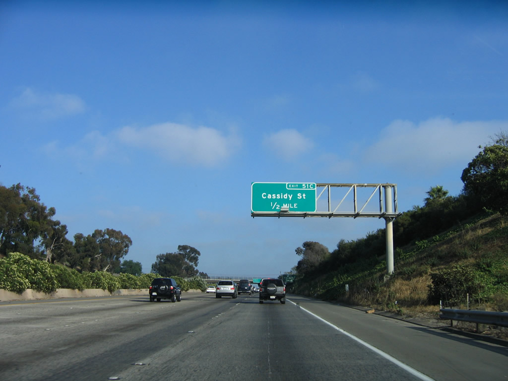
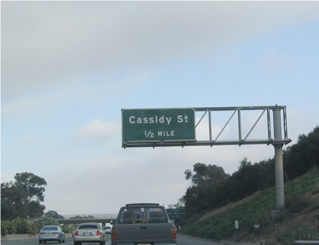
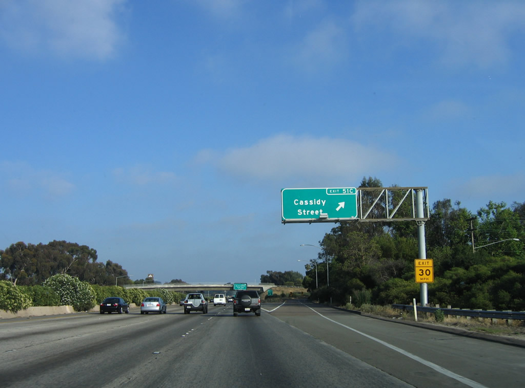
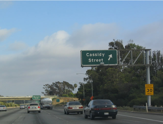
The next exit along southbound Interstate 5 is Exit 51C, Cassidy Street, one-half mile. Cassidy Street and Vista Way both connect with downtown Oceanside and its pier. Photos taken 06/17/06 and 07/06/04. |
|
|
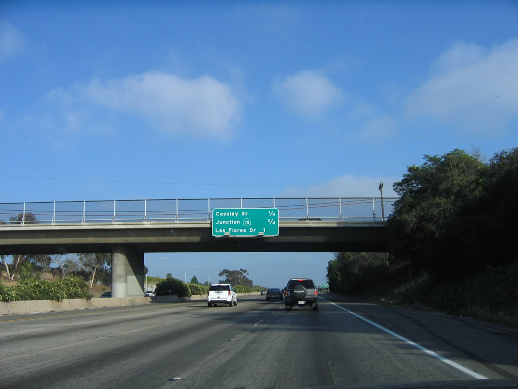
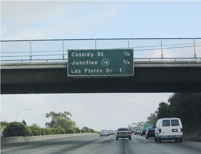
This mileage sign provides the distance to the next three exits along southbound Interstate 5 (San Diego Freeway): Exit 51C, Cassidy Street; Exit 51B, California 78/Vista Way; and Exit 51A, Las Flores Drive. Photos taken 06/17/06 and 07/06/04. |
|
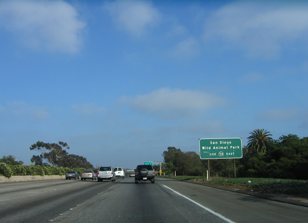
Use California 78 east to the San Diego Wild Animal Park in San Pasqual Valley. Photo taken 06/17/06. |
|
|
Southbound Interstate 5 reaches Exit 51C, Cassidy Street. The first photo shows the original sign, while the second shows the new sign featuring the exit number. Photos taken 06/17/06 and 07/06/04. |
|
|
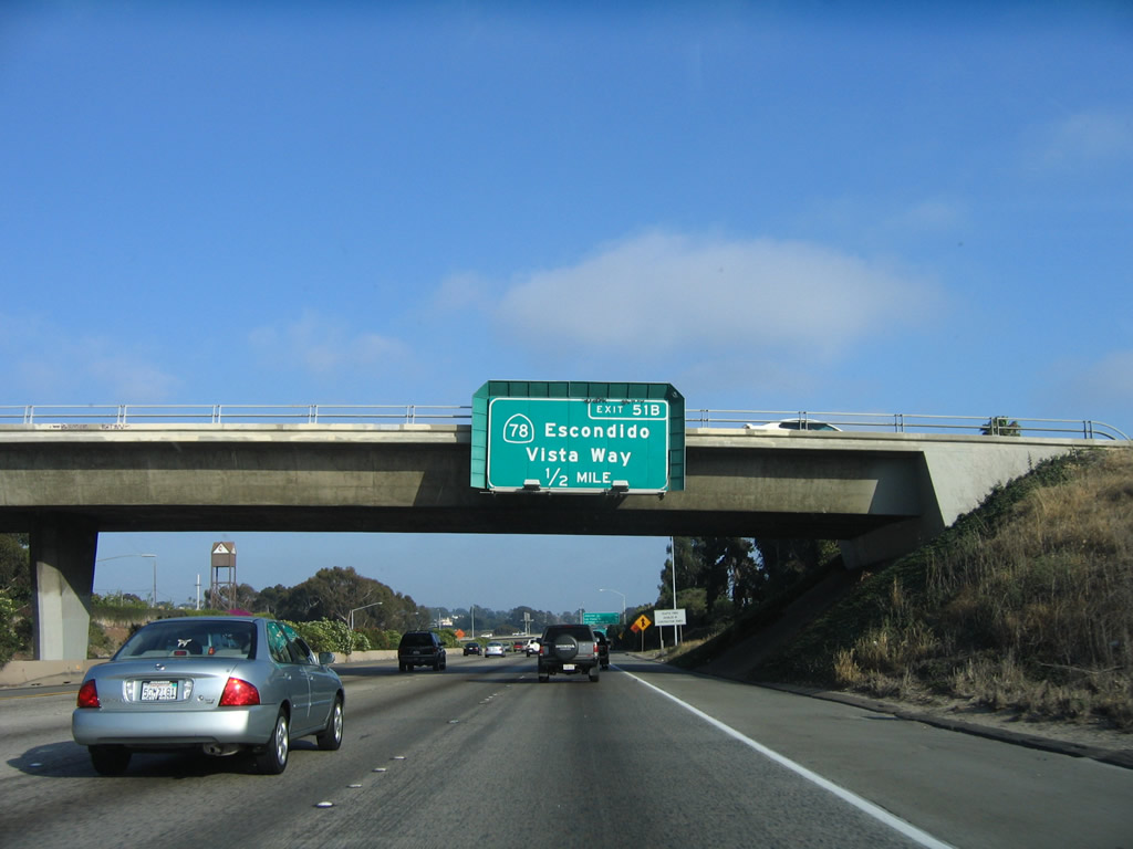
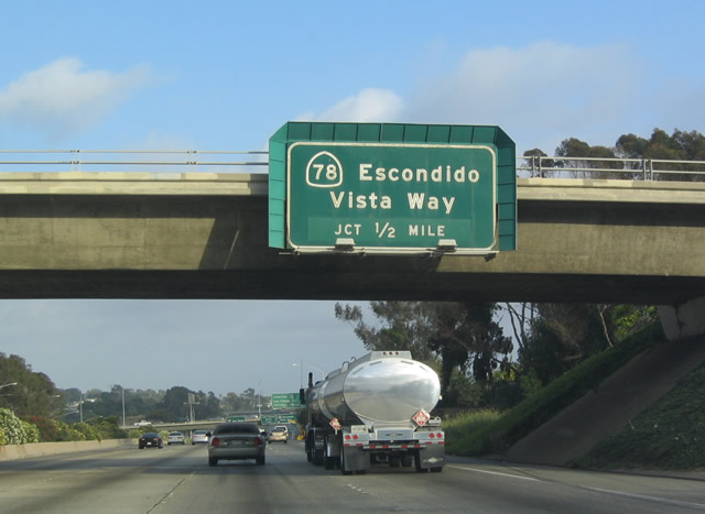
The next exit along southbound Interstate 5 is Exit 51B, California 78 east to Escondido and Vista Way west into downtown Oceanside, one-half mile. Photos taken 06/17/06 and 07/06/04. |
|
|
California 78 is a major east-west highway across Southern California, connecting Oceanside and Escondido via a six-lane freeway. East of Escondido, California 78 traverses the Laguna Mountains, passing through Santa Ysabel, Wynola, and Julian along the way. Upon reaching Imperial County, California 78 skirts the southern edge of the Salton Sea, then crosses the Imperial Sand Dunes near Glamis. The highway reaches its eastern terminus at its interchange with Interstate 10 just west of Blythe near the Arizona state line/Colorado River. Photos taken 06/17/06 and 07/06/04. |
|
|
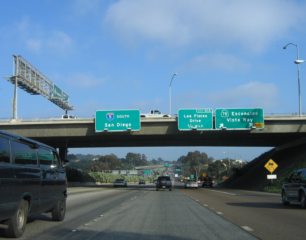
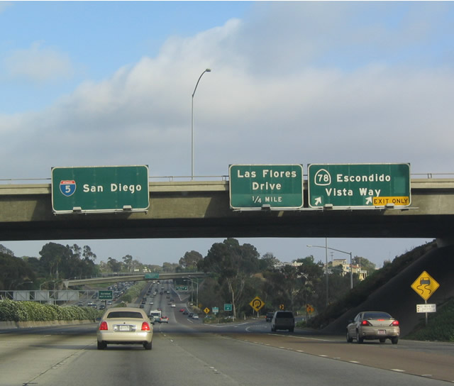
Southbound Interstate 5 reaches Exit 51B: California 78 (Ron Packard Freeway) east to Escondido and Vista Way west to Coast Highway in Oceanside. Even though California 78 is a freeway, this interchange is very underpowered, and back-ups ensue during periods of rush hour and heavy usage. This is because some of the connections (including this movement) are governed by a traffic signal rather than a transition ramp. As seen by the overhead sign on the bridge crossing over Interstate 5, both directions are on the bridge. Photos taken 06/17/06 and 07/06/04. |
|
|
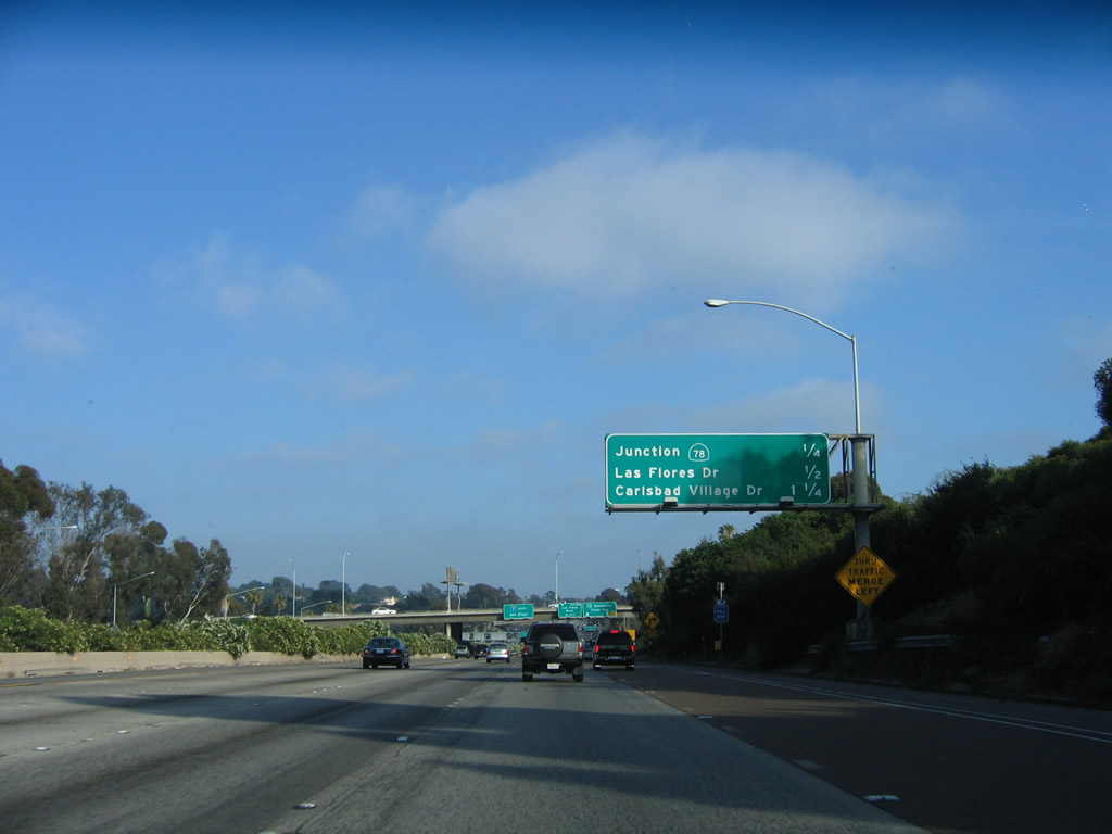
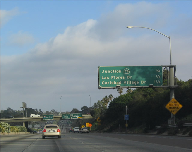
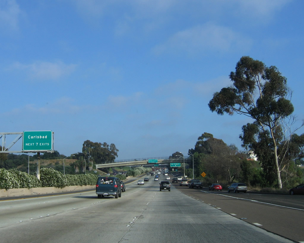
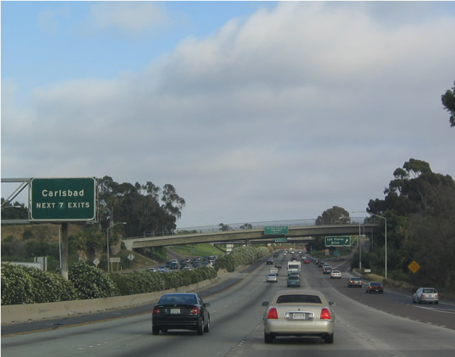
The next seven exits serve the city of Carlsbad: Exit 51A, Las Flores Drive; Exit 50, Carlsbad Village Drive/Elm Avenue; Exit 49, Tamarack Avenue; Exit 48, Cannon Road; Exit 47, Palomar Airport Road; Exit 45, Poinsettia Lane/Aviara Parkway; and Exit 44, La Costa Avenue. Interstate 5 will shortly depart Oceanside and enter Carlsbad after crossing the lagoon. Photos taken 06/17/06 and 07/06/04. |
|
|
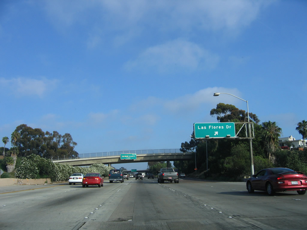
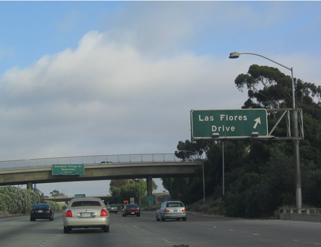
Southbound Interstate 5 (San Diego Freeway) reaches Exit 51A, Las Flores Drive. Interstate 5 is now in the City of Carlsbad. Photos taken 06/17/06 and 07/06/04. |
|
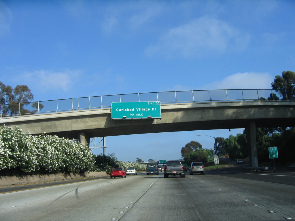
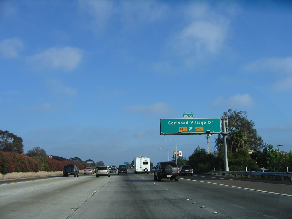
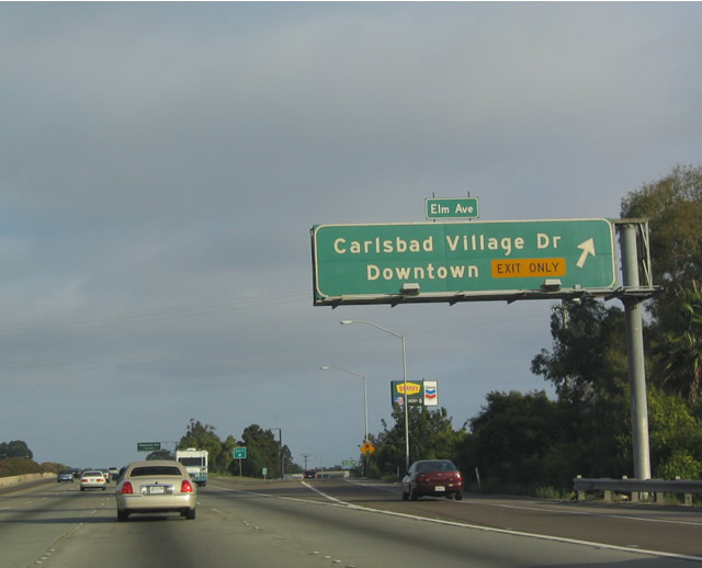
The next exit along southbound Interstate 5 is Exit 50, Carlsbad Village Drive. Photo taken 06/17/06. |
|
|
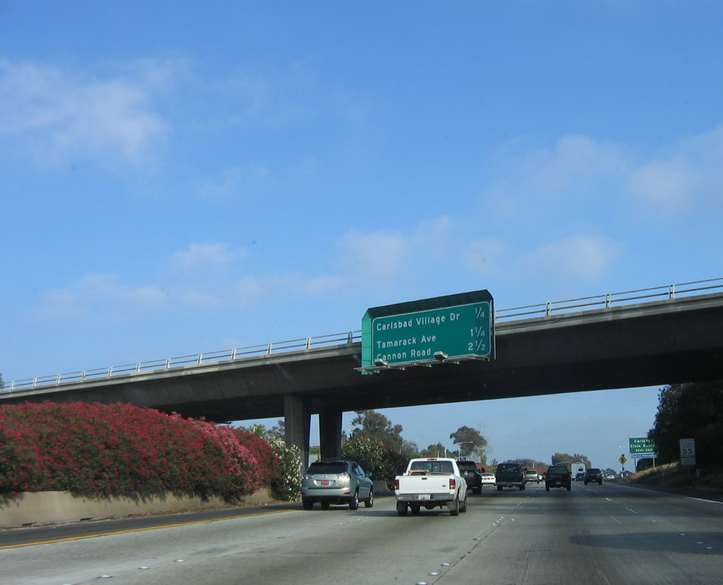
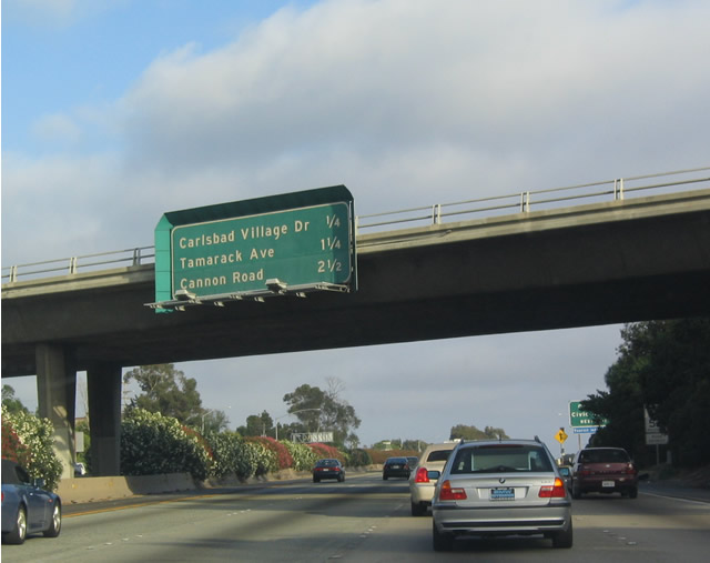
This interchange sequence sign provides the distance to the next three exits along southbound Interstate 5: Exit 50, Carlsbad Village Drive; Exit 49, Tamarack Avenue; and Exit 48, Cannon Road. This exit leads directly into downtown Carlsbad. Photos taken 06/17/06 and 07/06/04. |
|
Home to the famous Carlsbad Flower Fields, the city of Carlsbad was incorporated on July 16, 1952, and it is home to 78,247 people as of the 2000 Census. It is still growing, especially on its eastern side with new developments such as San Elijo Hills. Carlsbad has grown from 7.5 square miles in 1952 to nearly 42 square miles in 2005. Photo taken 06/17/06. |
|
|
Southbound Interstate 5 (San Diego Freeway) reaches Exit 50, Carlsbad Village Drive. Oddly, when sign replacement occurred along this stretch of Interstate 5 in April 2006, exit numbers were not placed on every signs, leaving most exits through Carlsbad only minimally compliant despite a mass replacement of nearly every overhead sign and most roadside signs. Photos taken 06/17/06 and 07/06/04. |
|
|
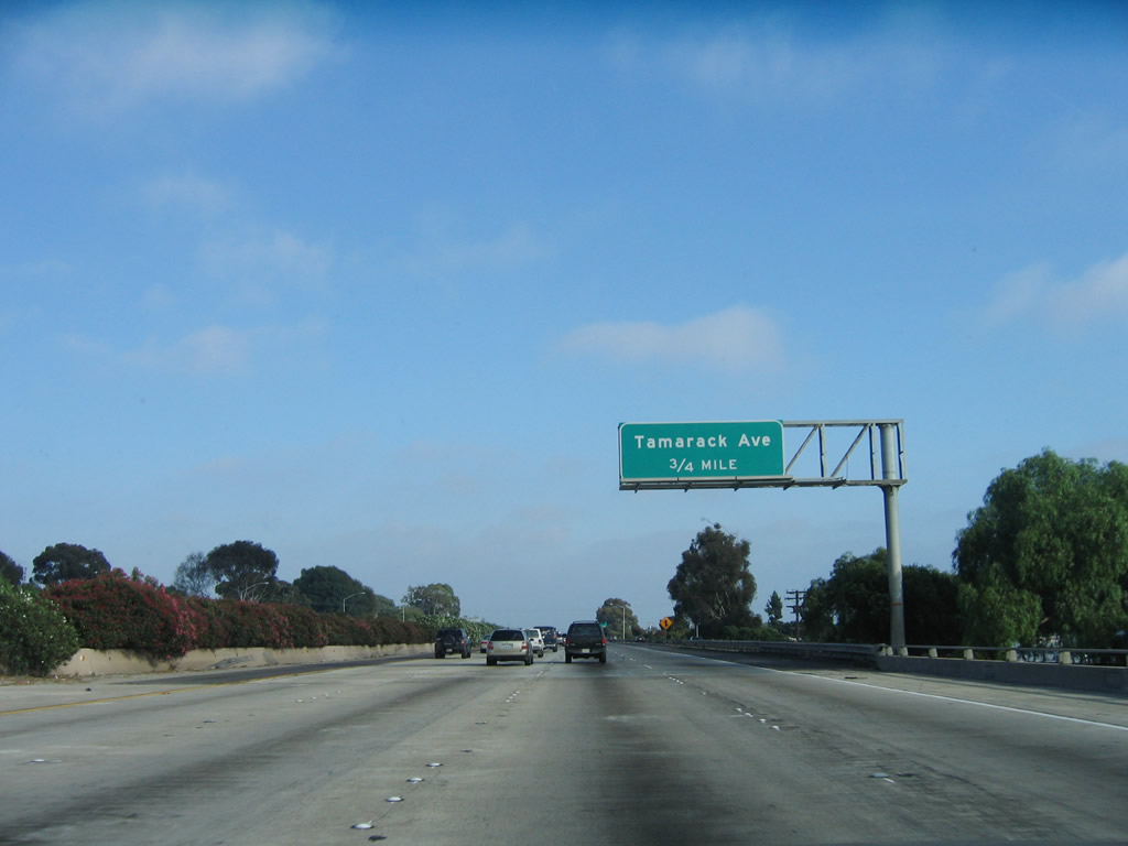
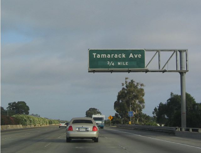
The next exit along southbound Interstate 5 is Exit 49, Tamarack Avenue. Once again, no exit number is provided. Photos taken 06/17/06 and 07/06/04. |
|
|
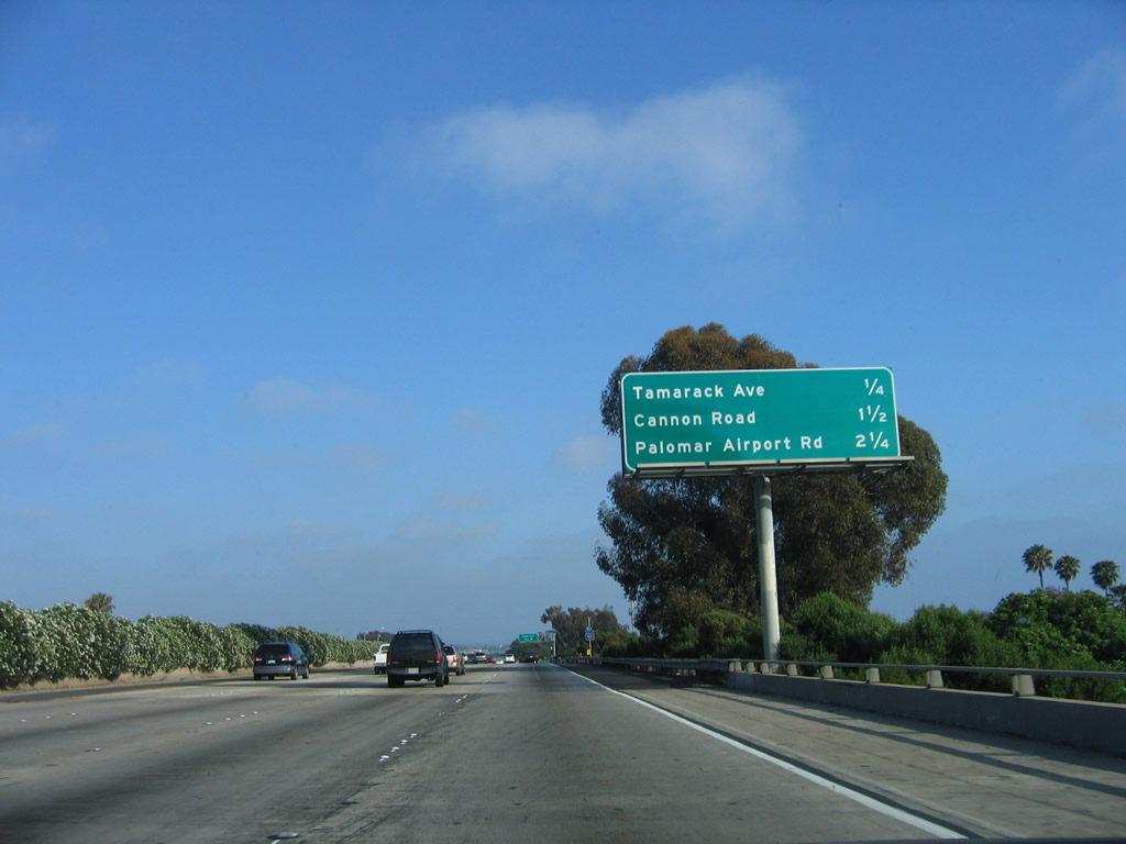
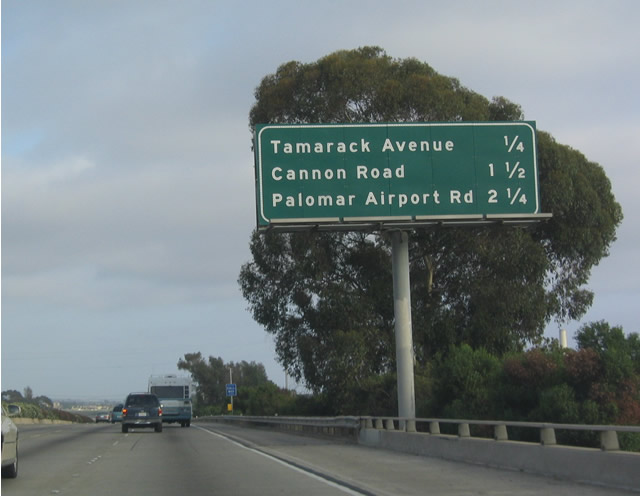
The next three exits all serve the city of Carlsbad: Exit 49, Tamarack Avenue; Exit 48, Cannon Road; and Exit 47, Palomar Airport Road. This sign was also replaced in April 2006. Photos taken 06/17/06 and 07/06/04. |
|
|
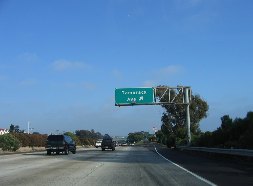
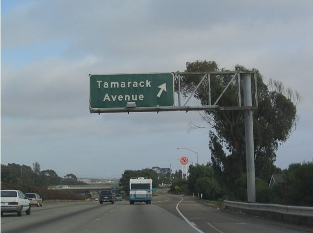
Southbound Interstate 5 (San Diego Freeway) reaches Exit 49, Tamarack Avenue. Photos taken 06/17/06 and 07/06/04. |
|
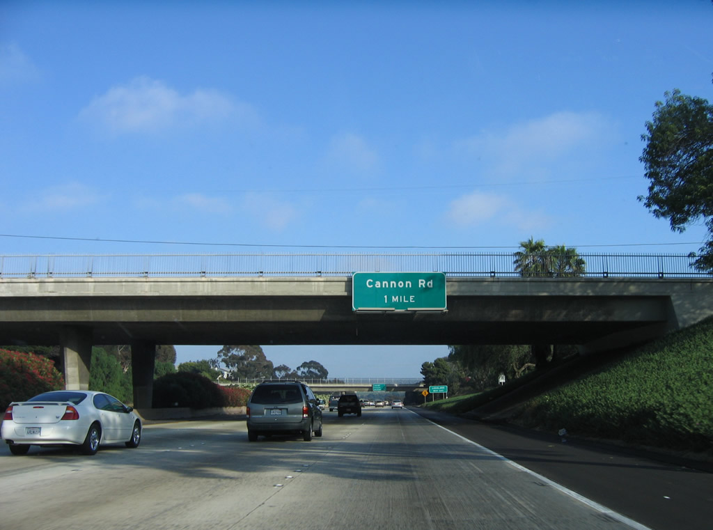
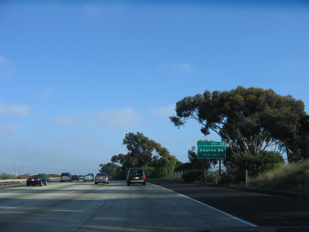
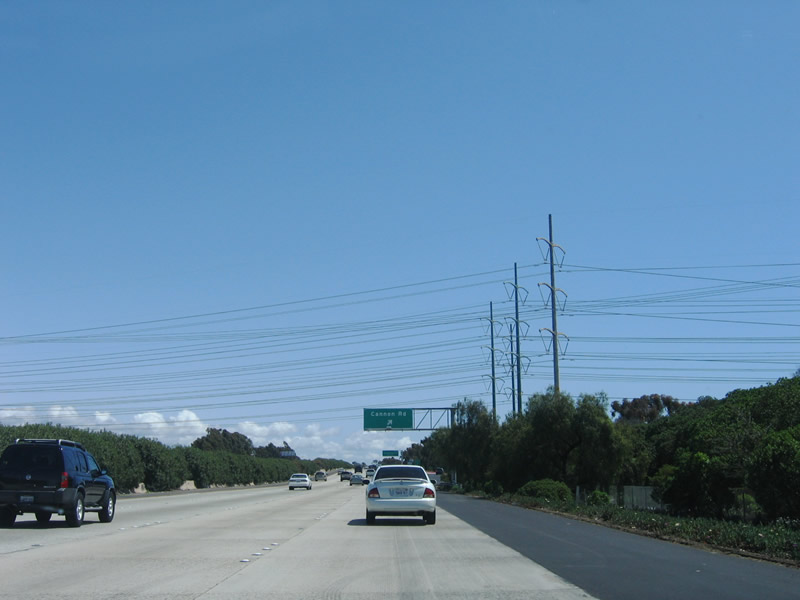
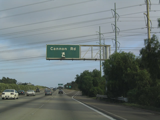
The next exit along southbound Interstate 5 is Exit 48, Cannon Road. Although this sign was replaced in April 2006, it does not have an exit number. Photo taken 04/23/06. |
|
|
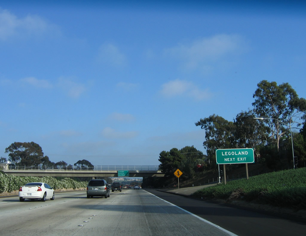
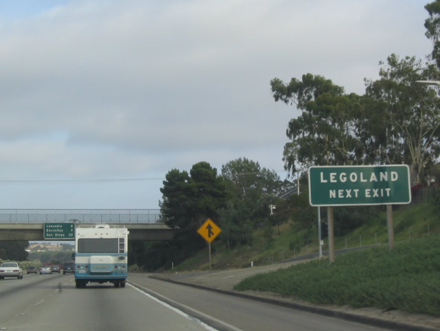
Use Cannon Road east (Exit 48) to reach Legoland, one of San Diego County's newest tourist attractions. Photos taken 06/17/06 and 07/06/04. |
|
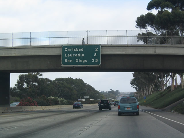
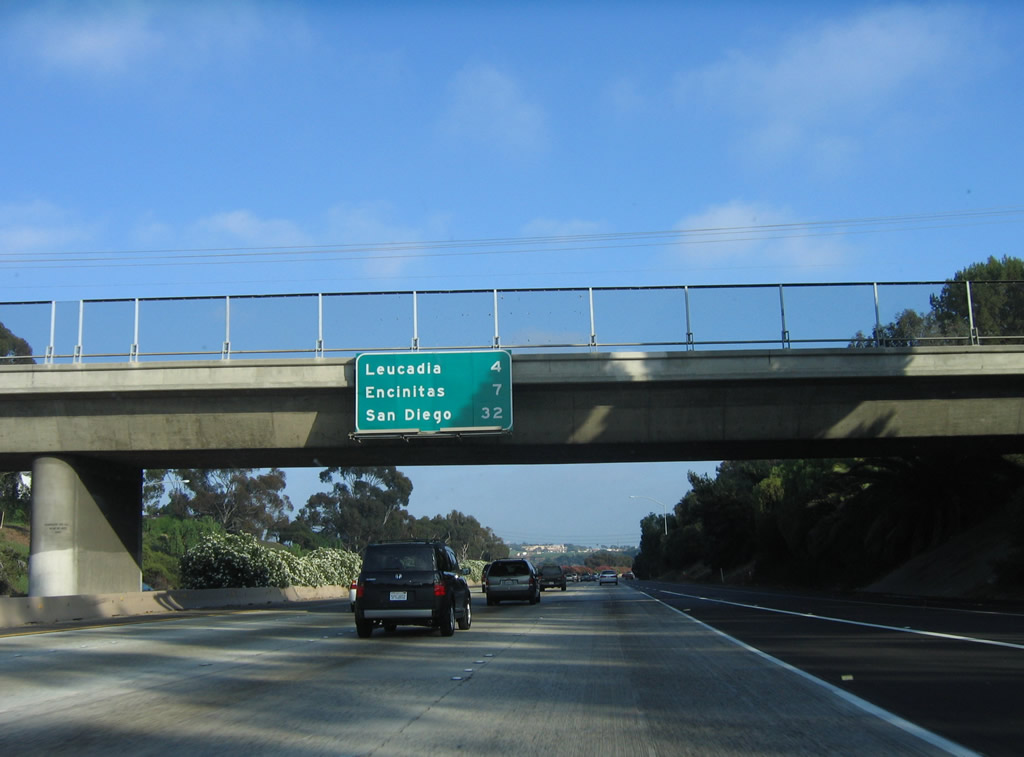
This destination mileage sign provides the distance to Leucadia (which is part of the city of Encinitas), downtown Encinitas, and downtown San Diego. Photo taken 06/17/06. |
|
|
This interchange sequence sign provides the distance to the next three exits along southbound: Exit 48, Cannon Road; Exit 47, Palomar Airport Road; and Exit 45, Poinsettia Lane and Aviara Parkway. Photos taken 06/17/06 and 07/06/04. |
|
A roadside exit number sign for Exit 48 is posted soon thereafter; it is the only advance exit number sign despite all signs being replaced in April 2006. Photo taken 06/17/06. |
|
|
|
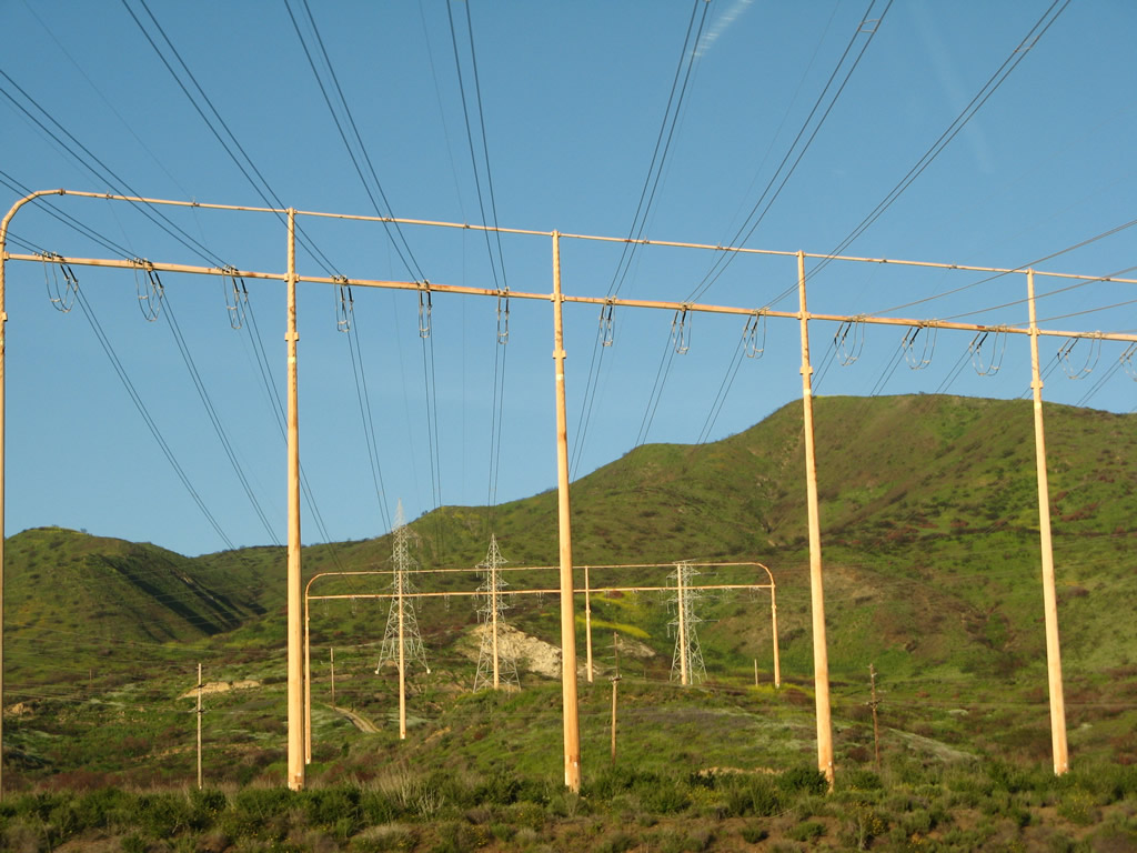
Southbound Interstate 5 (San Diego Freeway) reaches Exit 48, Cannon Road to Legoland and Carlsbad. The power lines distribute electricity generated by the natural gas generation facility located along the coast in Carlsbad (the Encina facility). Photos taken 06/17/06, 04/23/06, and 07/06/04. |
|
|
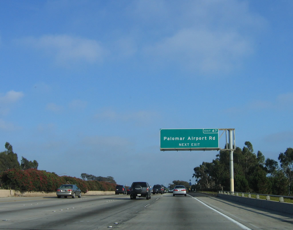
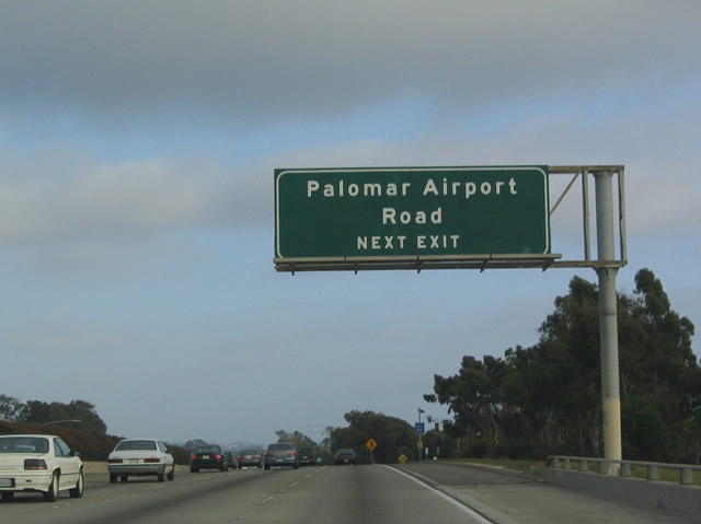
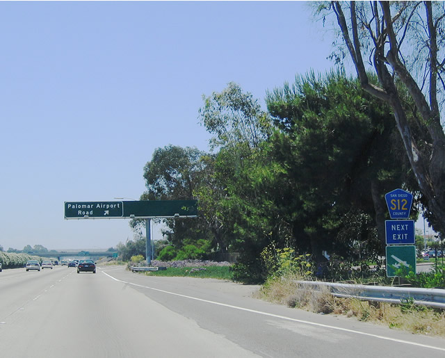
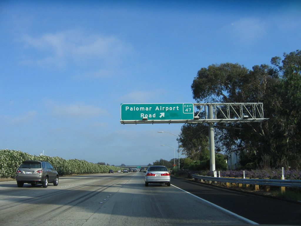
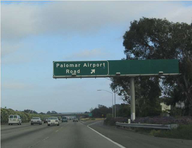
The next exit along southbound Interstate 5 is Exit 47, Palomar Airport Road/San Diego County S-12, next right. Photos taken 06/17/06 and 07/06/04. |
|
Use Palomar Airport Road/San Diego County S-12 west to reach Coast Highway 101/San Diego County S-21. Photo taken 04/23/06. |
|
A standalone trailblazer provides the sole indication that Palomar Airport Road is also designated as San Diego County S-12. Photo taken 07/06/04. |
|
|
Southbound Interstate 5 (San Diego Freeway) reaches Exit 47, Palomar Airport Road/San Diego County S-12. As the name implies, Palomar Airport Road leads east to McClellan-Palomar Airport. Photos taken 06/17/06 and 07/06/04. |
|
|
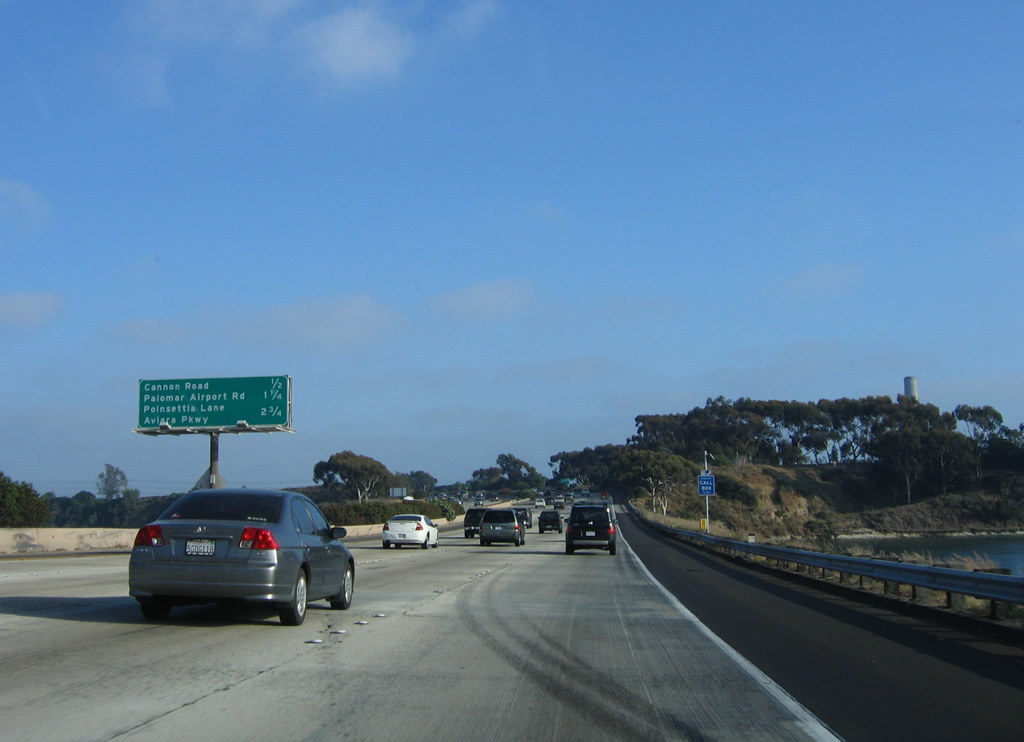
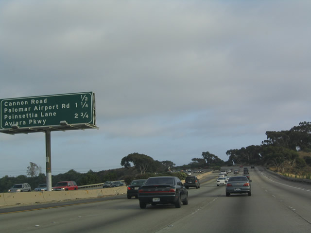
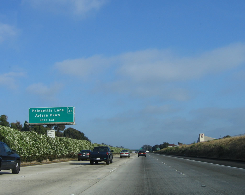
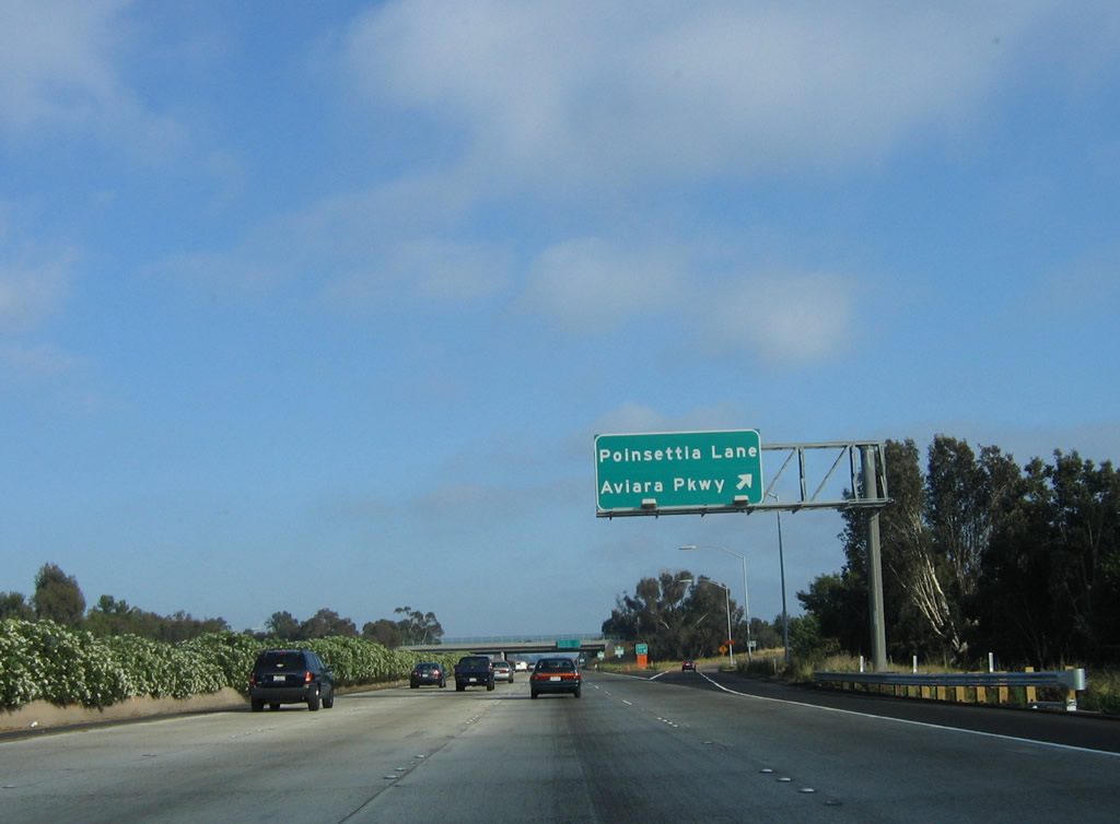
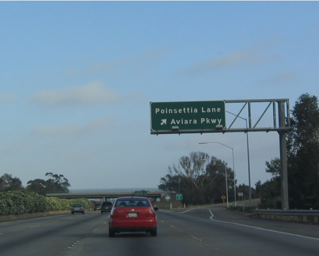
The next exit along southbound Interstate 5 is Exit 45, Poinsettia Lane/Aviary Parkway followed by Exit 44, La Costa Avenue. Photos taken 06/17/06 and 07/06/04. |
|
|
Some of the newest residential communities within Carlsbad may be reached by taking Poinsettia Lane/Aviary Parkway east. This sign was replaced in April 2006 with a new reflective, exit number sign. Photos taken 06/17/06 and 07/06/04. |
|
|
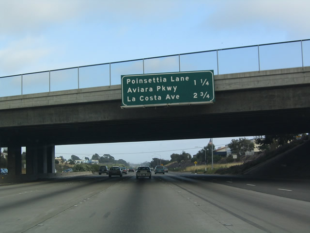
Southbound Interstate 5 (San Diego Freeway) reaches Exit 45, Poinsettia Lane/Aviara Parkway in Carlsbad. Photos taken 06/17/06 and 07/06/04. |
|
|
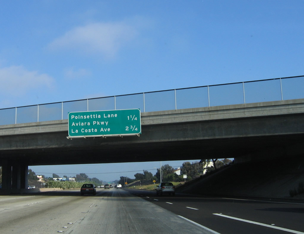
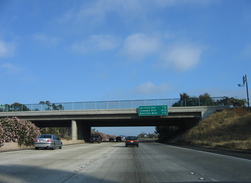
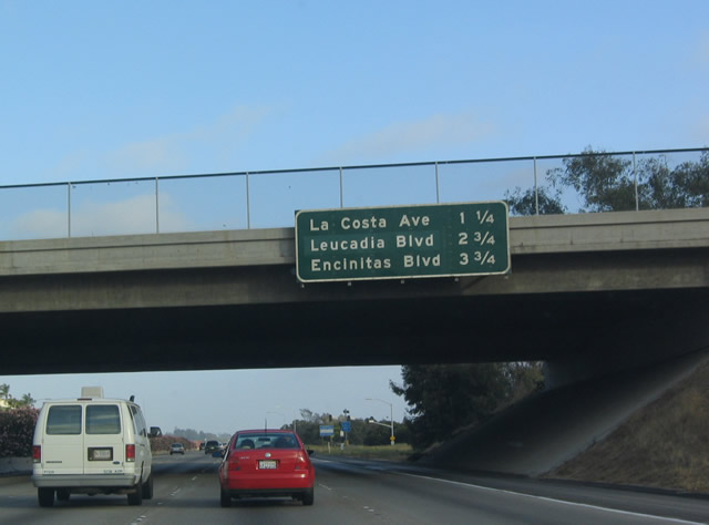
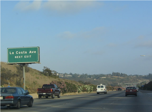
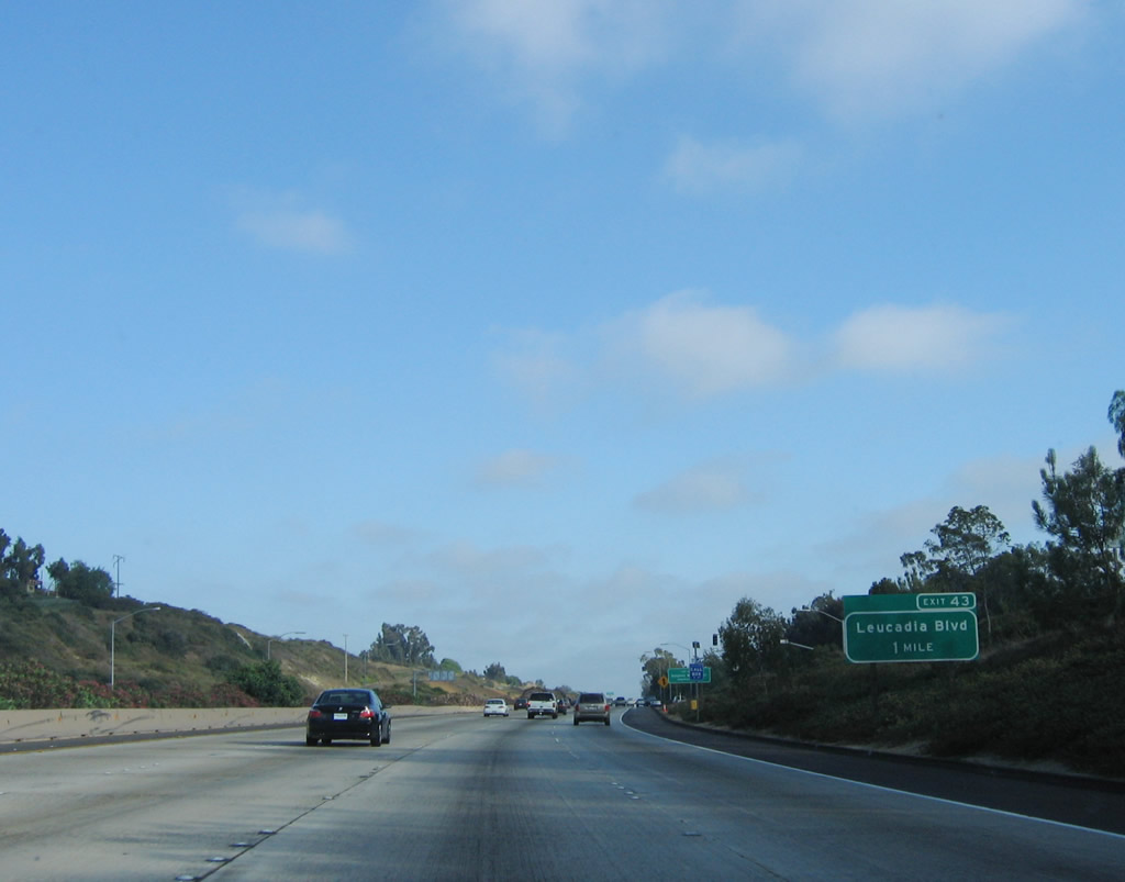
This mileage sign (posted on the Poinsettia Lane overpass) provides the distance to the next three exits along southbound Interstate 5 (San Diego Freeway): Exit 44, La Costa Avenue; Exit 43, Leucadia Boulevard; and Exit 41B, Encinitas Boulevard. Photos taken 06/17/06 and 07/06/04. |
|
An Interstate 5 south reassurance shield is posted after the on-ramp from Poinsettia Lane. Photo taken 06/17/06. |
|
|
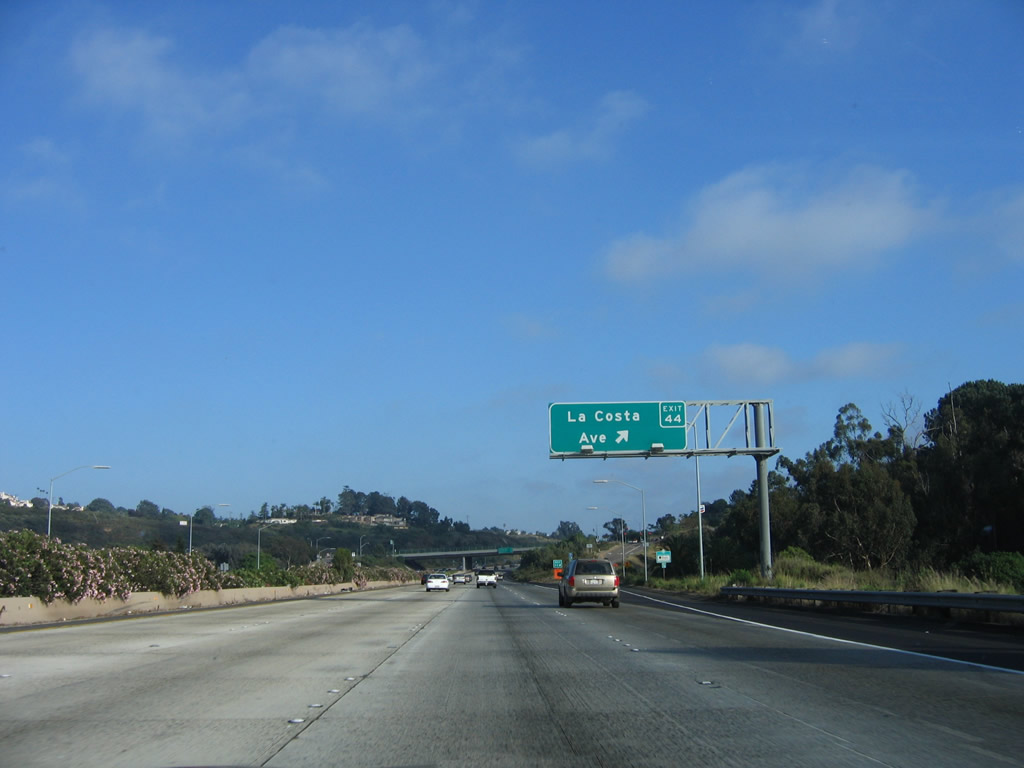
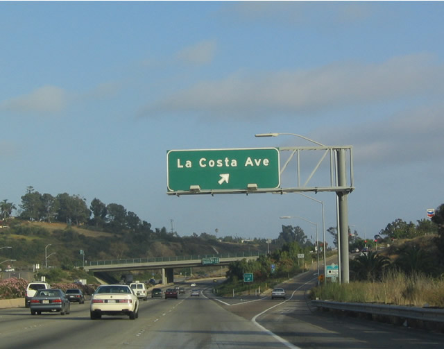
Use La Costa Avenue east to La Costa Country Club, which has hosted professional (PGA) golf tournaments in previous years. Photos taken 06/17/06 and 07/06/04. |
|
|
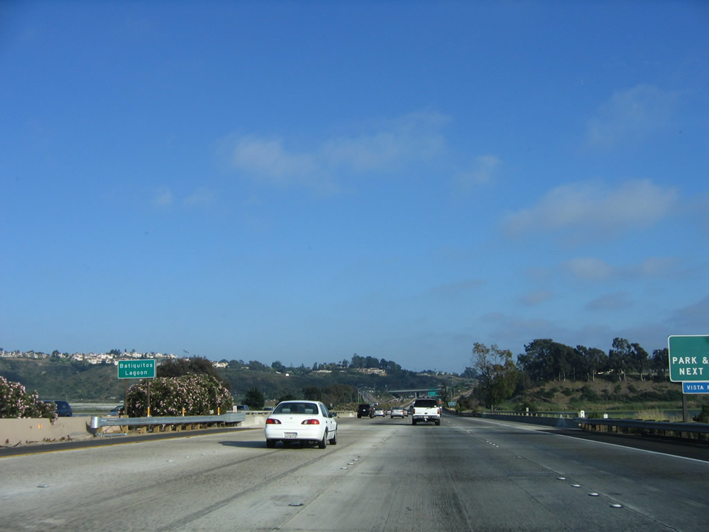
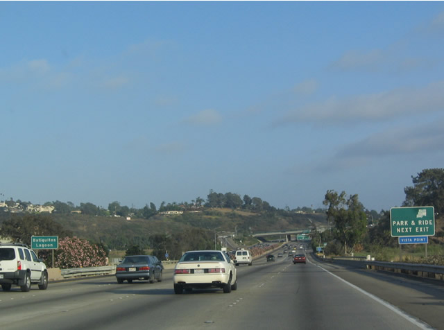
A Vista Point that doubles as a park and ride is located at Exit 44. Interstate 5 crosses Batiquitos Lagoon, another in a series of lagoons the freeway crosses in Northern San Diego County. Photos taken 06/17/06 and 07/06/04. |
|
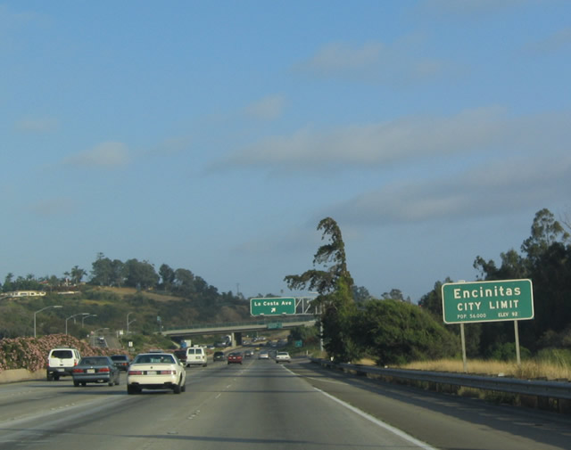
Upon crossing the lagoon, Interstate 5 departs Carlsbad and enters Encinitas. Nevertheless, La Costa Avenue east reenters Carlsbad after passing El Camino Real/San Diego County S-11. Encinitas is located between the Batiquitos Lagoon to the north and the San Elijo Lagoon to the south, and it consists of the communities of Leucadia, Encinitas, and Cardiff along the coast and New Encinitas (along El Camino Real) and Olivenhain west of Interstate 5. The city was incorporated on October 1, 1986, making it one of the younger cities along the coast. As of the 2000 Census, 58,014 people resided in Encinitas. The city consists of 19.4 square miles. Photo taken 07/06/04. |
|
|
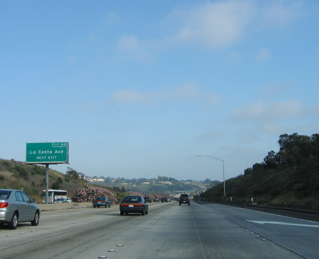
The next exit along southbound Interstate 5 is Exit 44, La Costa Avenue, followed by Exit 43, Leucadia Boulevard and Exit 41B, Encinitas Boulevard. Photos taken 06/17/06 and 07/06/04. |
|
|
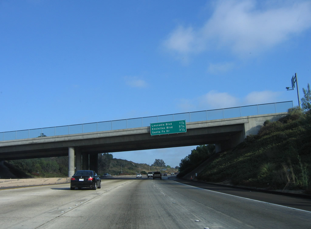
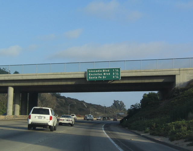
This mileage sign provides the distance to the next three exits along Interstate 5 (San Diego Freeway) south: Exit 43, Leucadia Boulevard; Exit 41B, Encinitas Boulevard; and Exit 41A, Santa Fe Drive. Photos taken 06/17/06 and 07/06/04. |
|
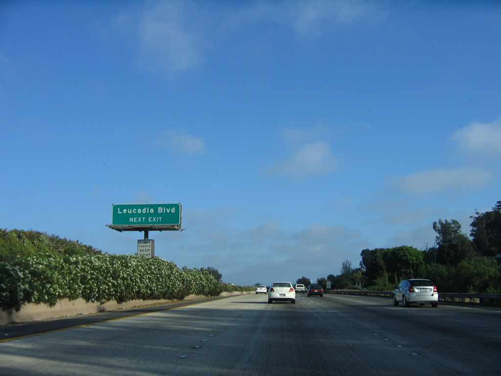
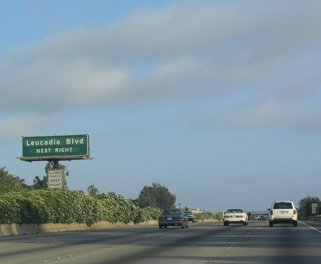
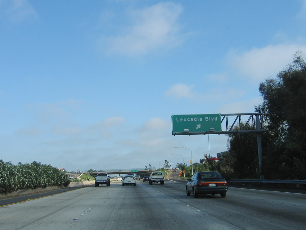
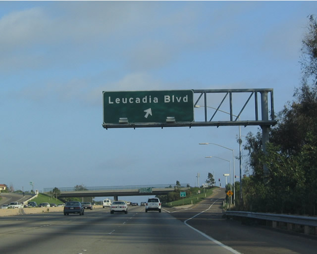
A roadside exit number sign is posted for Exit 43, Leucadia Boulevard. Photo taken 06/17/06. |
|
|
Leucadia Boulevard heads west into the heart of Leucadia, a community located within the city of Encinitas. Photos taken 06/17/06 and 07/06/04. |
|
|
Southbound Interstate 5 (San Diego Freeway) reaches Exit 43, Leucadia Boulevard in Encinitas. Photos taken 06/17/06 and 07/06/04. |
|
|
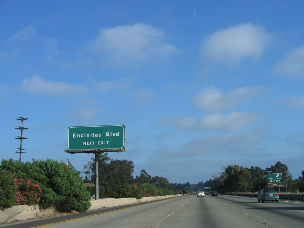
The next exit along southbound Interstate 5 is Exit 41B, San Diego County S-9 (Encinitas Boulevard), followed by Exit 41A, Santa Fe Drive and Exit 40, Birmingham Drive. Photos taken 06/17/06 and 07/06/04. |
|
San Diego County S-9 follows Encinitas Boulevard east and then south to Rancho Santa Fe, where it ends at its junction with San Diego County S-8 (Paseo Delicias). Photo taken 07/06/04. |
|
A centerline approach sign for Exit 41B is posted shortly thereafter. Photo taken 06/17/06. |
|
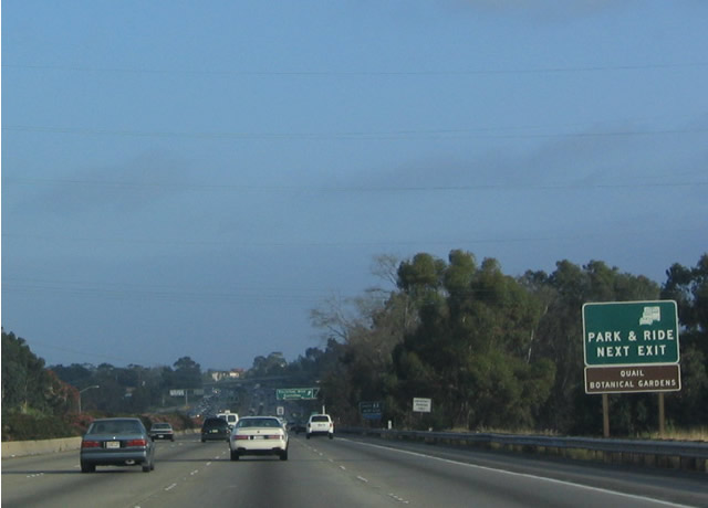
Use San Diego County S-9 (Encinitas Boulevard) to the San Diego Botanic Garden, which was known as Quail Botanic Garden back when this picture was taken. Photo taken 07/06/04. |
|
Southbound Interstate 5 (San Diego Freeway) reaches Exit 41B, San Diego County S-9 (Encinitas Boulevard). Photo taken 06/17/06. |
|
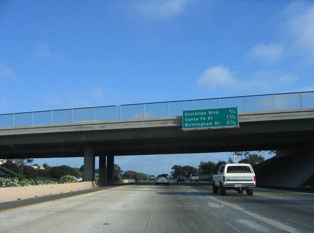
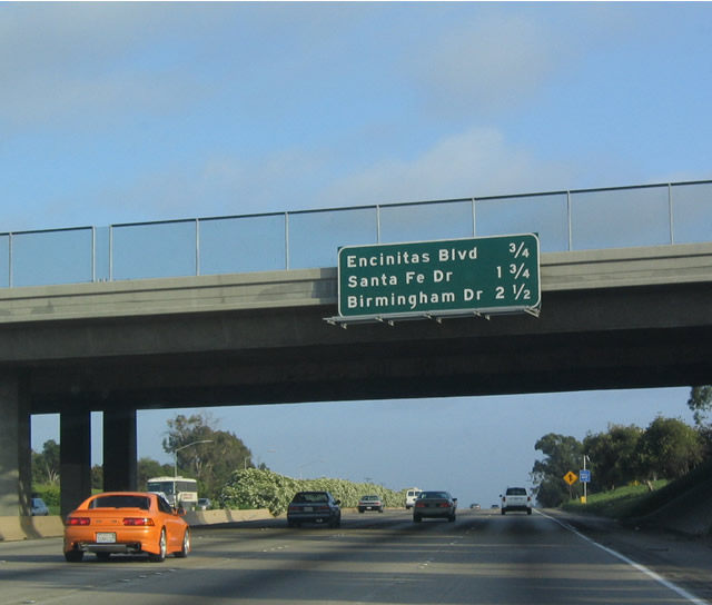
This mileage sign provides the distance to the next three exits along southbound Interstate 5 (San Diego Freeway): Exit 41A, Santa Fe Drive; Exit 40, Birmingham Drive; and Exit 39, Manchester Drive. Photo taken 06/17/06. |
|
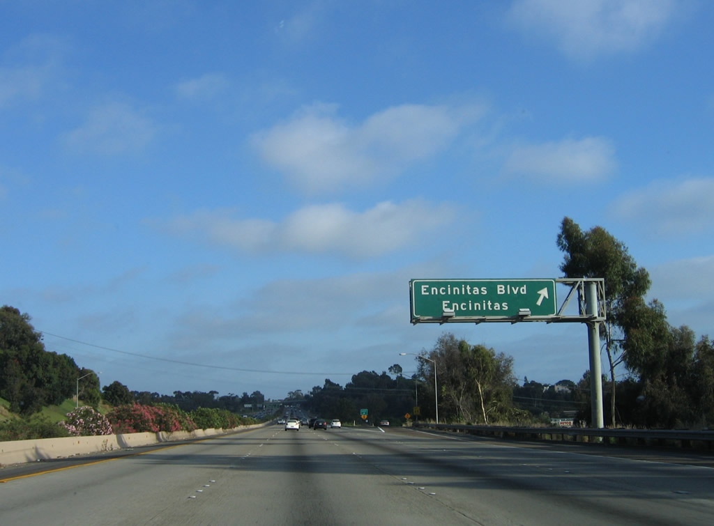
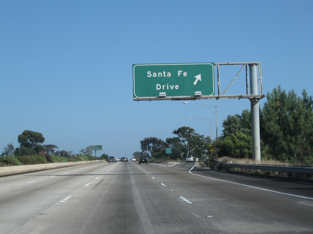
Exit 41A, which connects to Santa Fe Drive, is the next exit along southbound Interstate 5. Photo taken 06/17/06. |
|
Southbound Interstate 5 (San Diego Freeway) meets Exit 41A, Santa Fe Drive. Gas, food, and shopping are available at this exit. Use Santa Fe Drive west to downtown Encinitas and east to El Camino Real. Photo taken 06/26/11. |
|
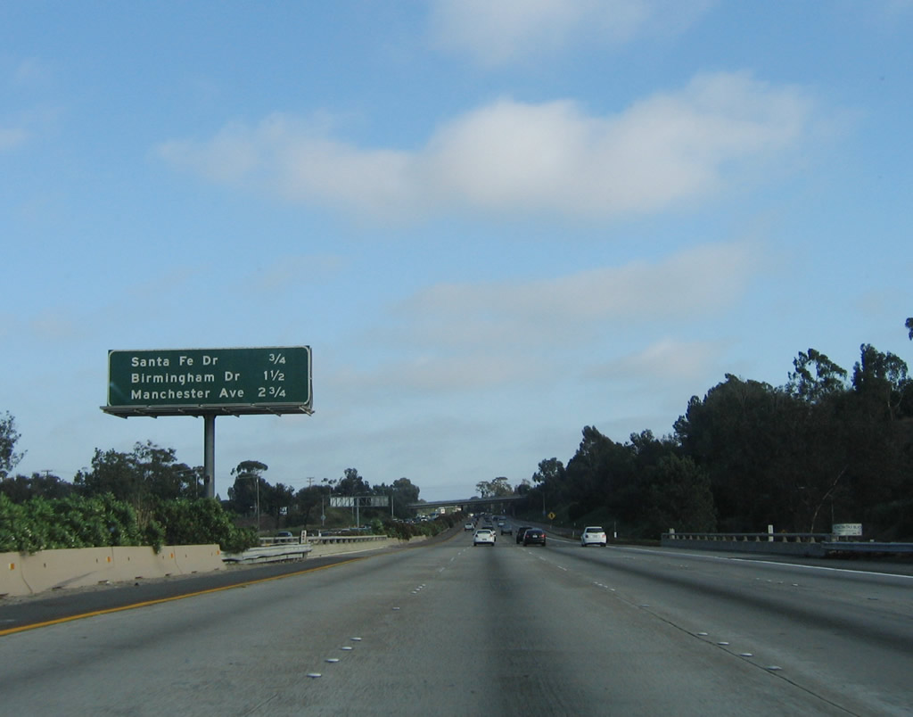
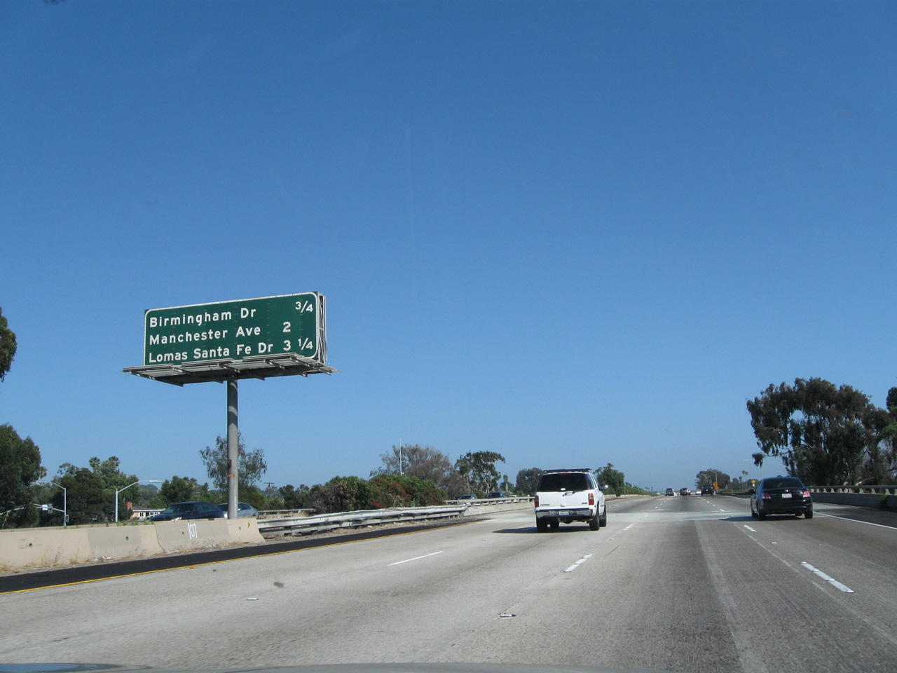
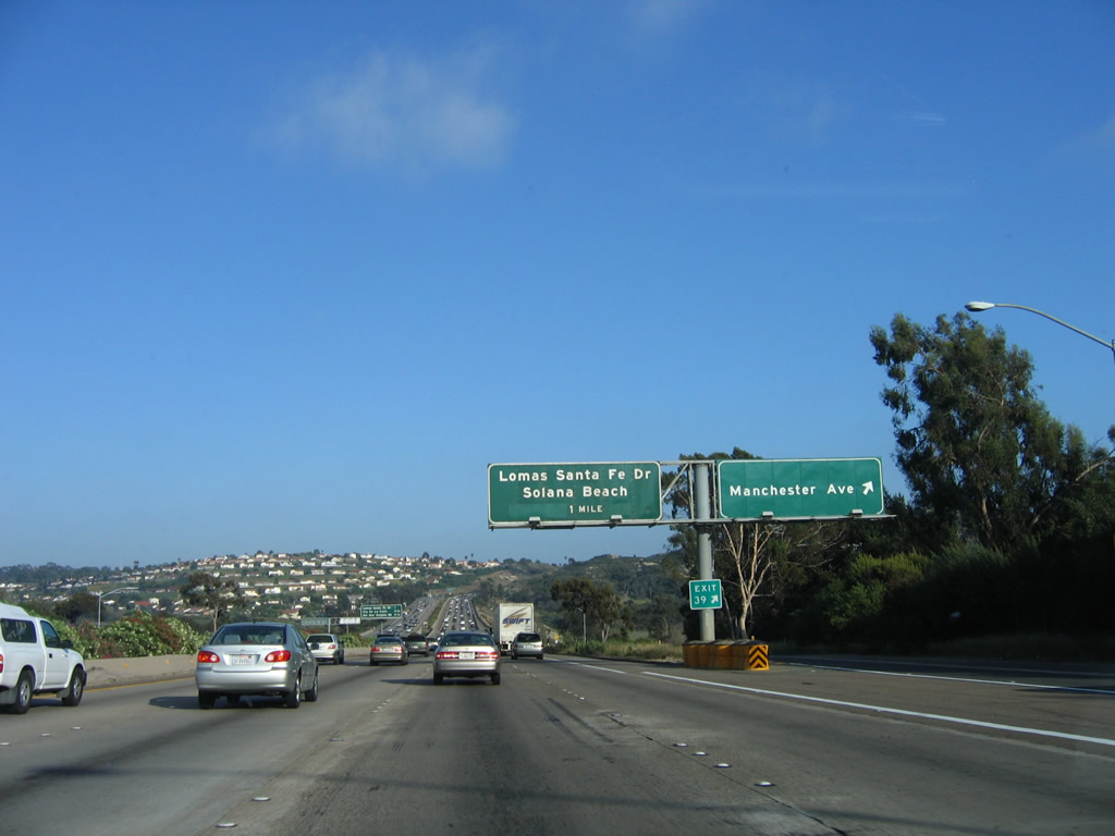
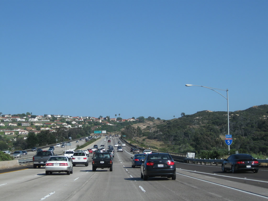
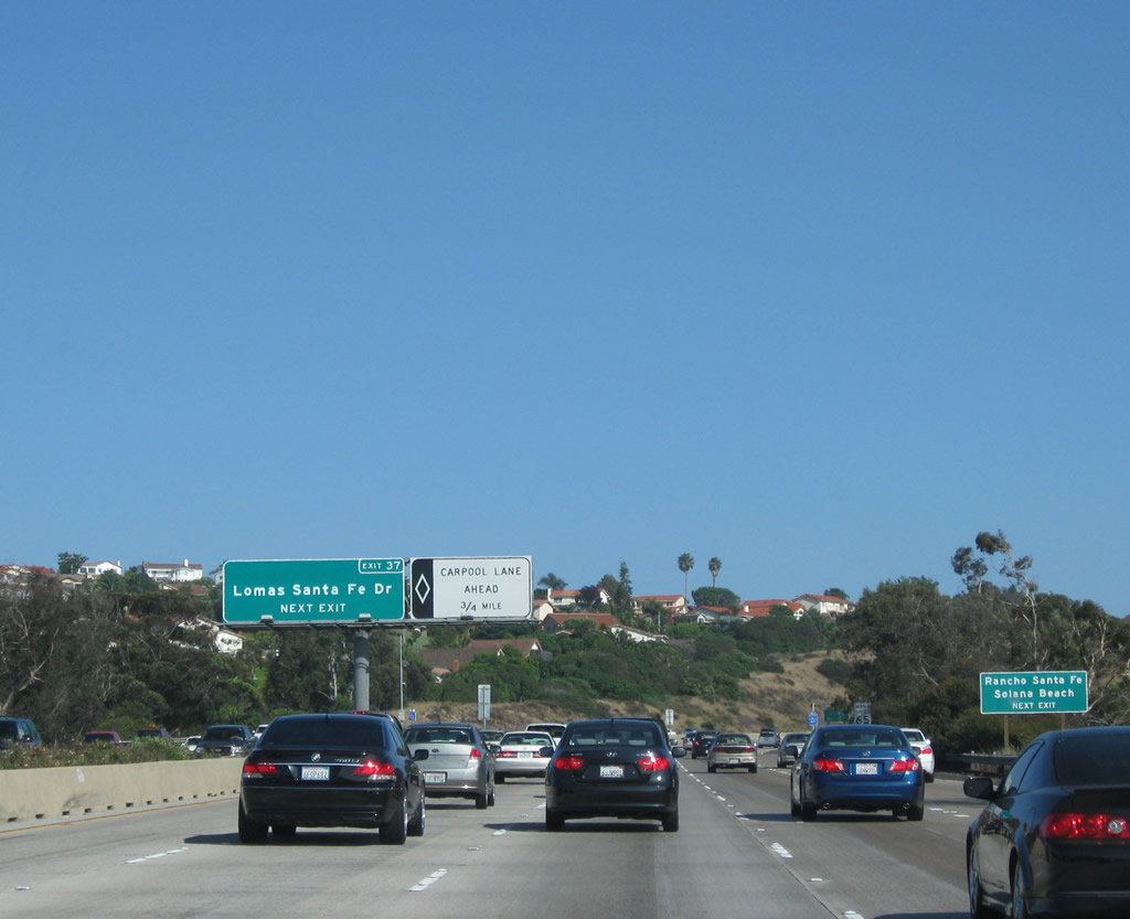
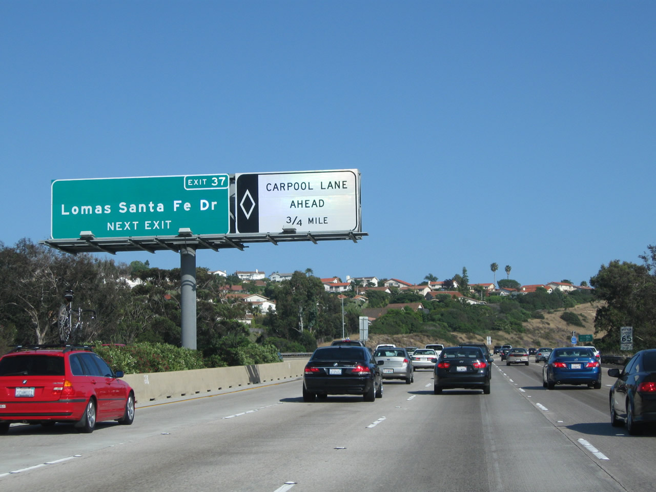
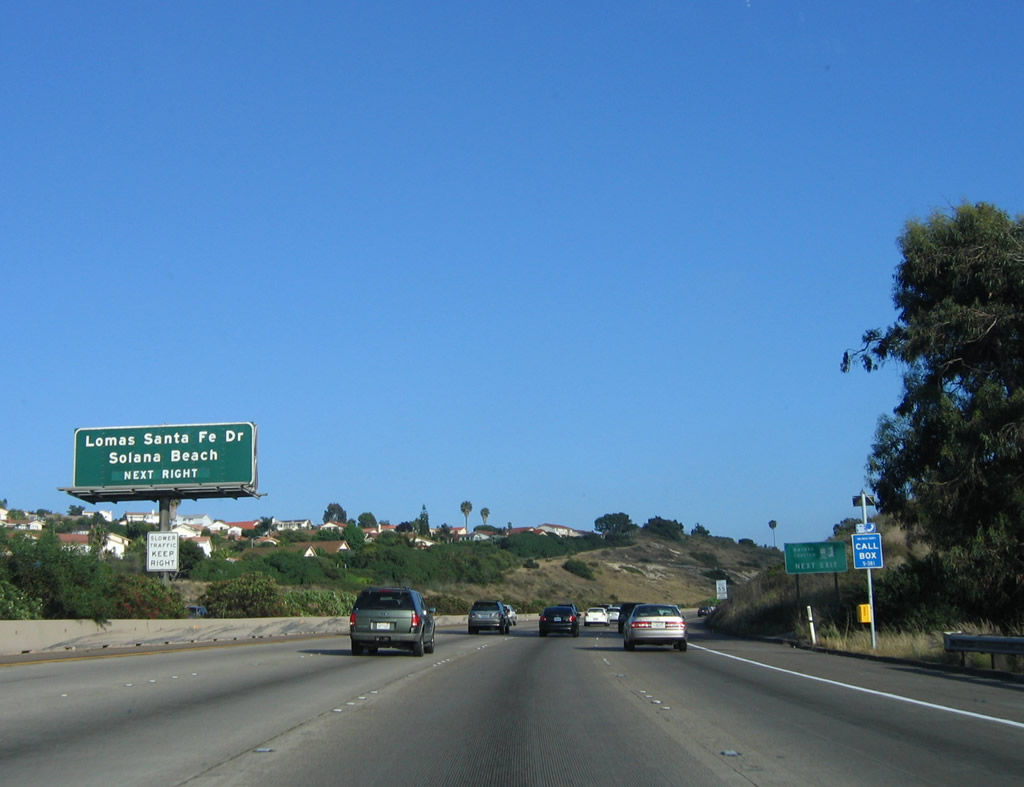
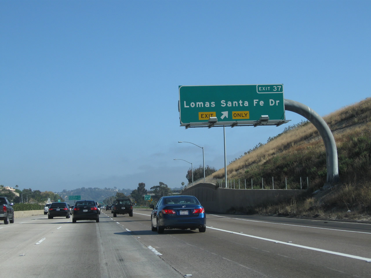
This mileage sign provides the distance to the next three exits along southbound Interstate 5 (San Diego Freeway): Exit 40, Birmingham Drive; Exit 39, Manchester Drive; and Exit 37, Lomas Santa Fe Drive to Solana Beach (San Diego County S-8). Photo taken 06/26/11. |
|
An Interstate 5 south reassurance shield is posted after the on-ramp from Santa Fe Drive. Photo taken 06/26/11. |
|
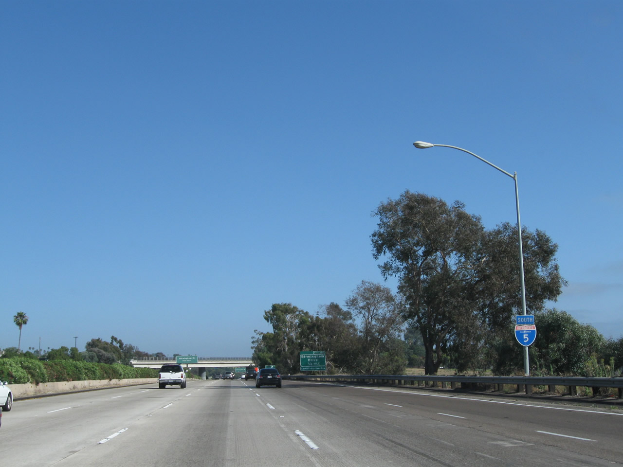
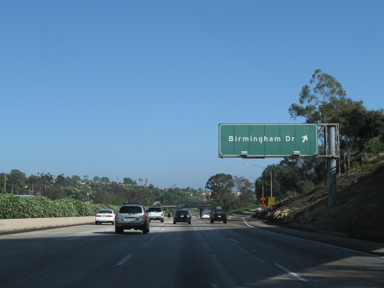
One of the first exit-number signs to be installed along Interstate 5 in 2002 was this roadside approach sign for Exit 40, Birmingham Drive. Most of the original exit numbers to be installed in California were roadside signs such as this one; later assemblies added the exit number to overhead guide signs. Photo taken 07/06/04. |
|
A centerline guide sign for Exit 40, Birmingham Drive is posted shortly thereafter. Use Birmingham Drive west to reach Cardiff by the Sea, the southernmost part of Encinitas. Photo taken 06/17/06. |
|
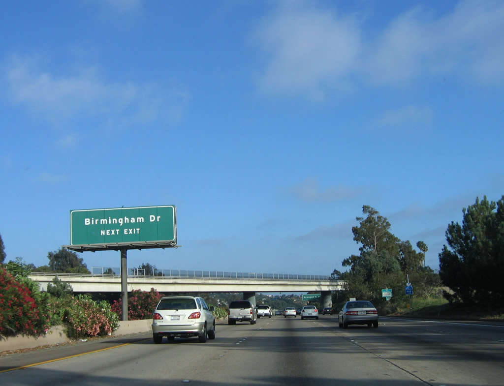
Southbound Interstate 5 (San Diego Freeway) meets Exit 40, Birmingham Drive in Encinitas. Photo taken 06/17/06. |
|
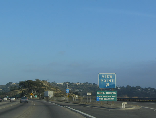
The next exit along Interstate 5 south is a Vista Point midway between Exits 40 and 39. The ocean is visible from this vista point by looking west. Photo taken 07/06/04. |
|
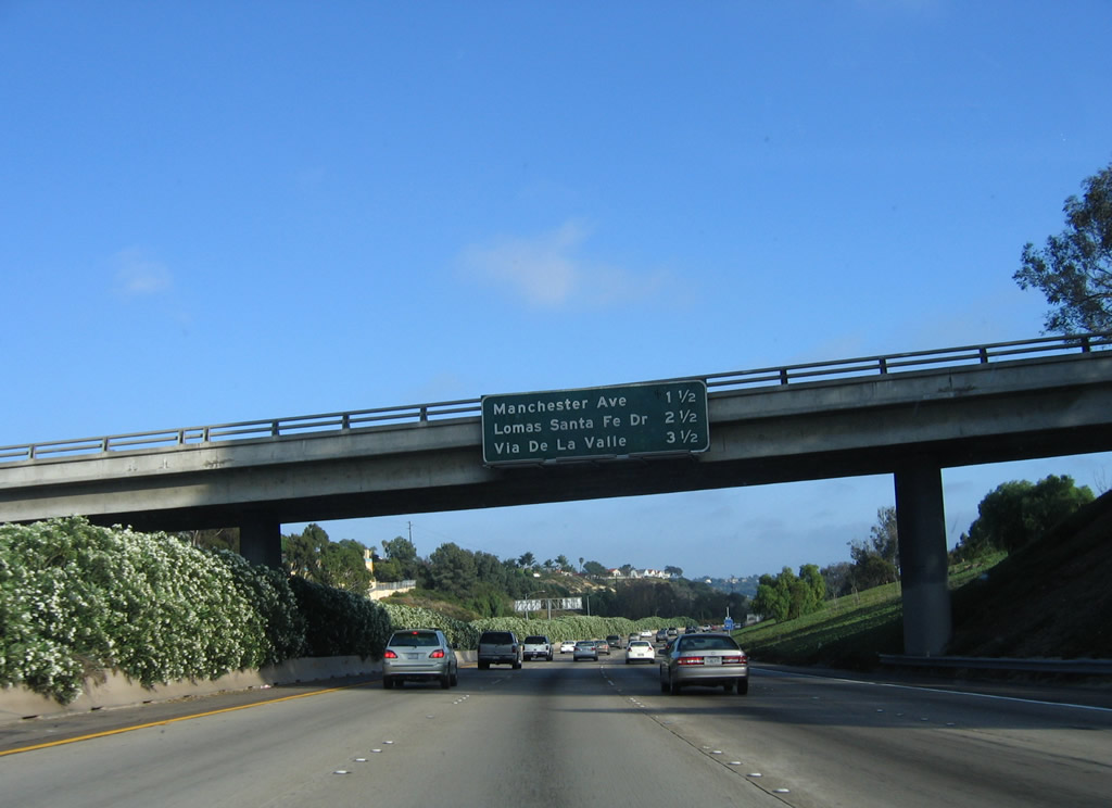
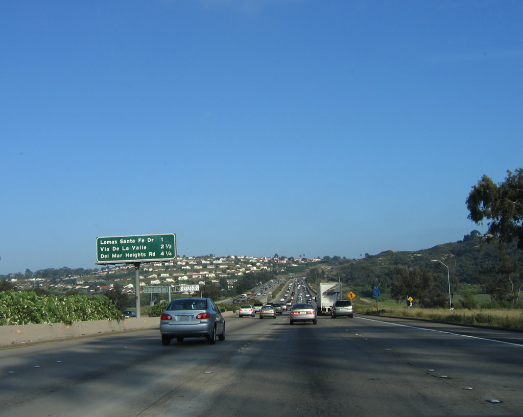
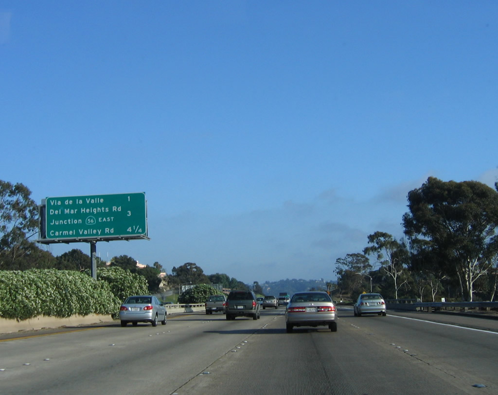
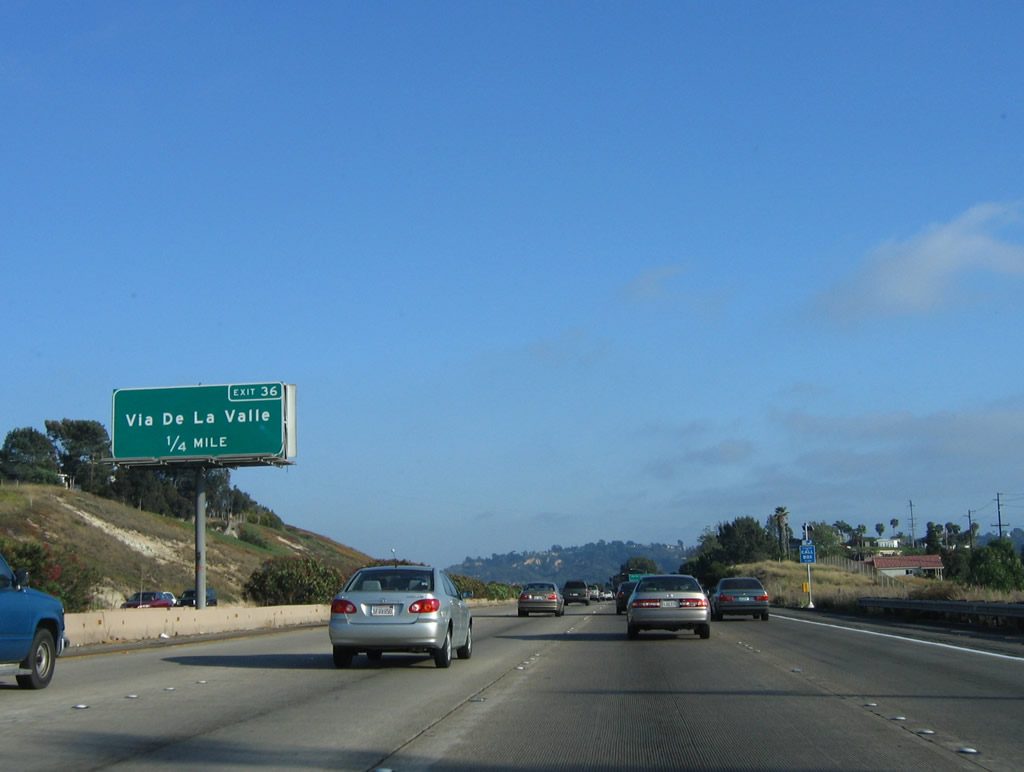
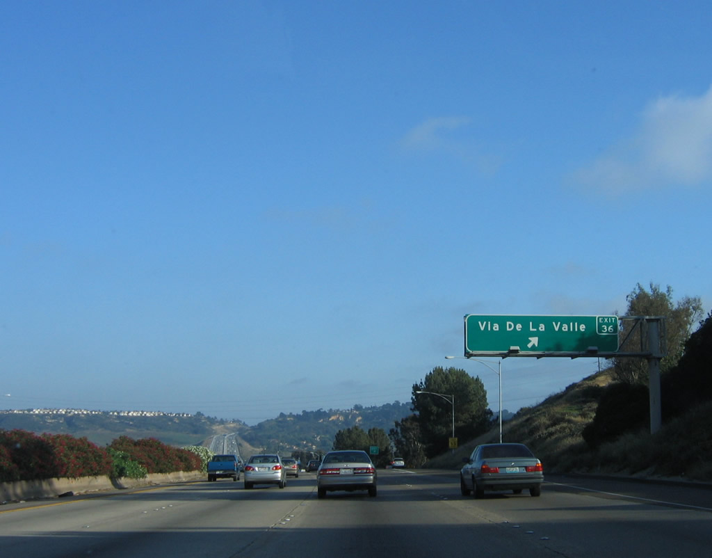
This mileage sign provides the distance to the next three exits along southbound Interstate 5 (excluding the vista point): Exit 39, Manchester Drive; Exit 37, Lomas Santa Fe Drive to Solana Beach (San Diego County S-8); and Exit 36, Via de la Valle (San Diego County S-6 and former Business Loop I-5). Photo taken 06/17/06. |
|
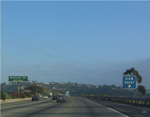
For a view of the Pacific Ocean, exit here. A small parking area without any facilities is located here. Photo taken 07/06/04. |
|
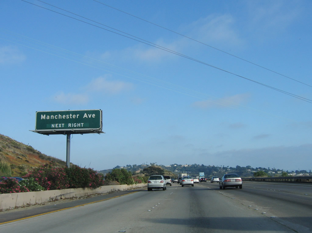
A centerline guide sign for Exit 39, Manchester Drive is posted near the Vista Point. Photo taken 06/17/06. |
|
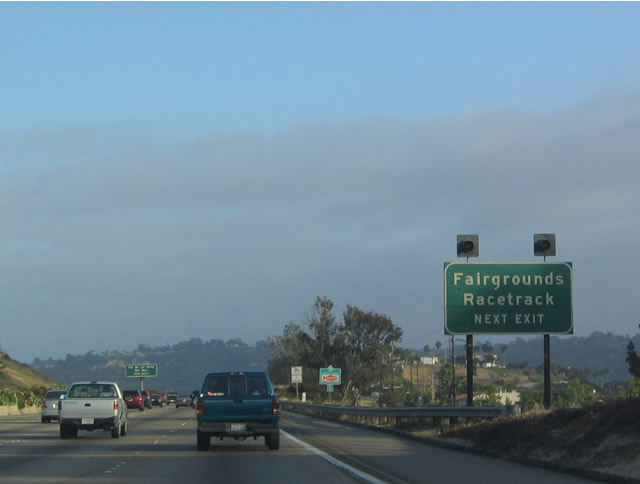
The view point has no facilities; at the time this photo was taken, the San Diego County Fair was just wrapping up, and the sign on the gore point indicated that fairgoers would not be able to take a shuttle from the viewpoint; they instead need to use the next exit. Photo taken 07/06/04. |
|
|
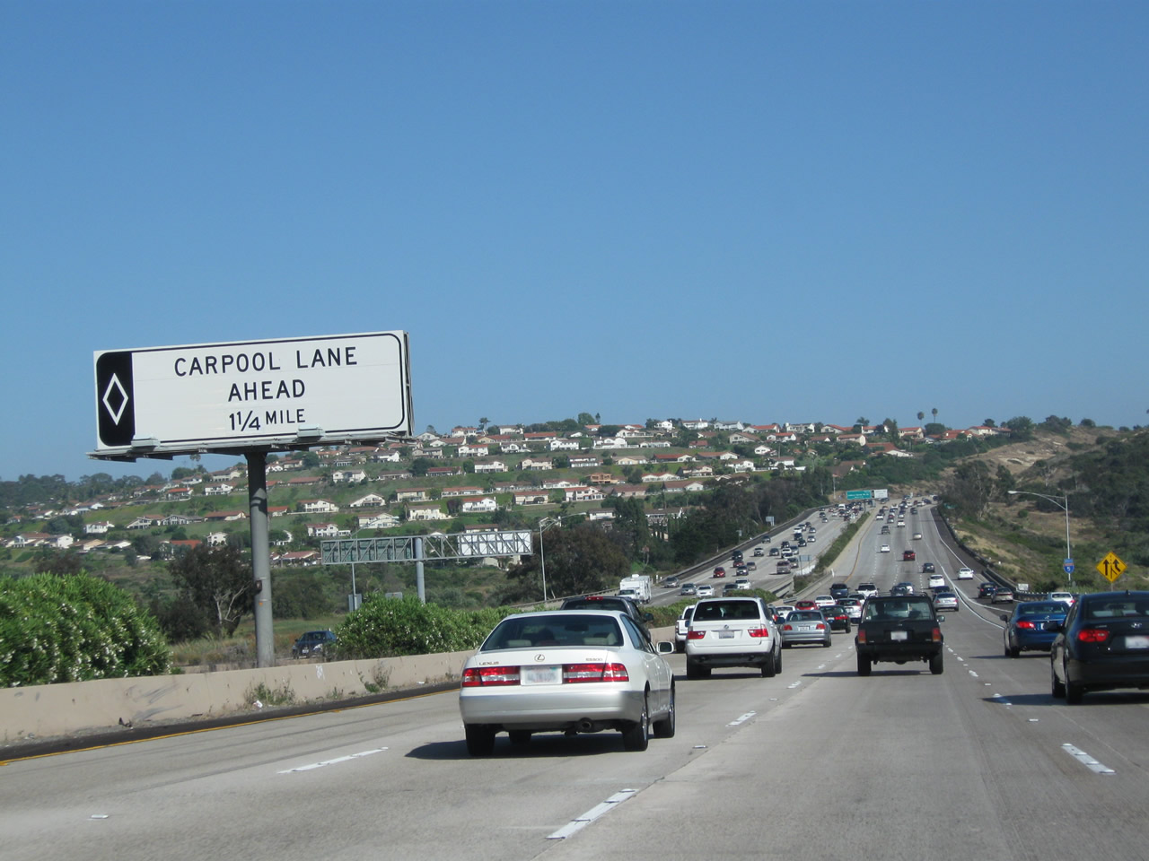
Southbound Interstate 5 (San Diego Freeway) reaches Exit 39, Manchester Avenue. After this exit, the carpool (high occupancy vehicle) lane begins; it was not yet built as of 2006. Photos taken 06/26/11 and 06/17/06. |
|
|
A carpool lane begins in 1.25 miles. This lane was built in 2010; it is planned to be extended north of here in the coming years as part of Interstate 5 improvements. This carpool lane extends south directly onto Interstate 805 with no exits; through traffic on Interstate 5 may wish to avoid the carpool lanes. Prior to the installation of the carpool lanes, a mileage sign used to be posted here that provided the distance to the next three exits along Interstate 5 (San Diego Freeway) south: Exit 37, Lomas Santa Fe Drive/Solana Beach (San Diego County S-8); Exit 36, Via de la Valle (San Diego County S-6 and former Business Loop I-5); and Exit 34, Del Mar Heights Road. Photos taken 06/26/11 and 06/17/06. |
|
A neutered Interstate 5 south route marker was posted after the on-ramp from Manchester Avenue in 2009. It is one of several that appeared along Interstate 5 in northern San Diego County between 2008 and 2011. Photo taken 06/26/11. |
|
|
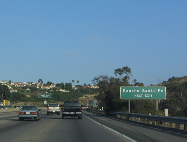
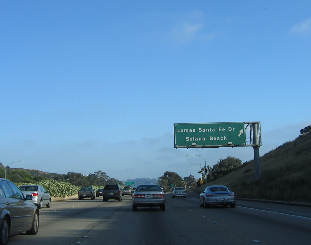
Use Lomas Santa Fe Drive (San Diego County S-8) east to reach the unincorporated yet exclusive community of Rancho Santa Fe. This sign was modified in 2010 to include Solana Beach as a destination by traveling west. Photos taken 06/26/11 and 07/06/04. |
|
|
San Diego County S-8 is a fairly short county route that connects San Diego County S-21/U.S. 101 in Solana Beach to the west with San Diego County S-6 in Rancho Santa Fe to the east via Lomas Santa Fe Drive and Linea del Cielo. Photos taken 06/26/11 and 06/17/06. |
|
|
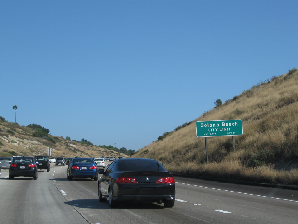
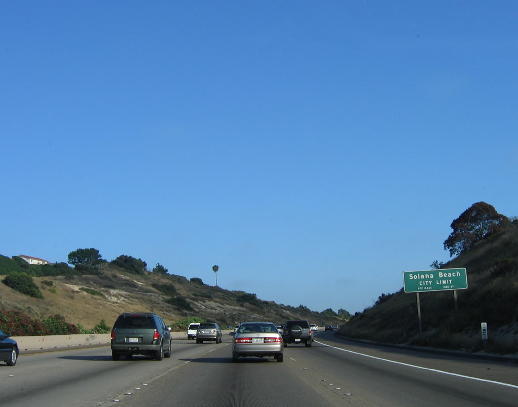
Interstate 5 departs Encinitas and enters the city of Solana Beach after crossing the San Elijo Lagoon. Solana Beach has a population of 13,835 as of the 2000 Census. This sign was replaced in 2010 as a result of the carpool lane project. Photos taken 06/26/11 and 06/17/06. |
|
San Diego County S-8 travels west to the Cedros Design District in downtown Solana Beach via Lomas Santa Fe. To the east, San Diego County S-8 connects to Linea del Cielo, then enters Rancho Santa Fe, where it connects to San Diego County S-9 and ends at San Diego County S-6 (Del Dios Highway). Del Dios Highway is a diagonal route that travels northeast past Lake Hodges en route to Escondido. Photo taken 04/23/06. |
|
|
Southbound Interstate 5 (San Diego Freeway) meets Exit 37, Lomas Santa Fe Drive (San Diego County S-8) to Solana Beach and Rancho Santa Fe. Due to ongoing construction of high occupancy vehicle lanes through this area between 2008 and 2010, both signage and lane configuration changed. Photos taken 06/26/11 and 06/17/06. |
|
Speaking of the carpool lanes, there is no exit from the carpool lanes from the entrance near Manchester Avenue until after the Interstate 5/Interstate 805 split, six miles south of here. Photo taken 06/26/11. |
|
|
|
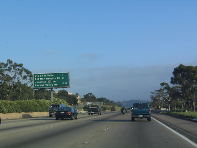
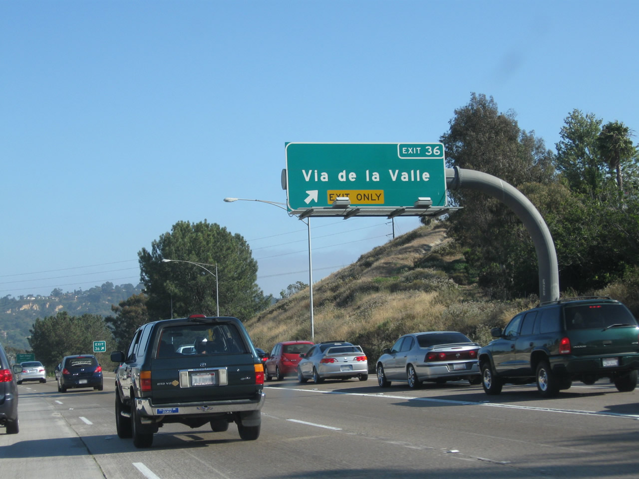
The next exit along southbound Interstate 5 is Exit 36, San Diego County S-6 (Via de la Valle), followed by Exit 34, Del Mar Heights Road and Exit 33, Carmel Valley Road to California 56 freeway east. The sign was replaced during the project to widen Interstate 5 in 2007 and 2008. The subsequent completion of the carpool lane in 2010 resulted in further changes here. Photos taken 06/26/11, 06/17/06 and 07/06/04. |
|
|
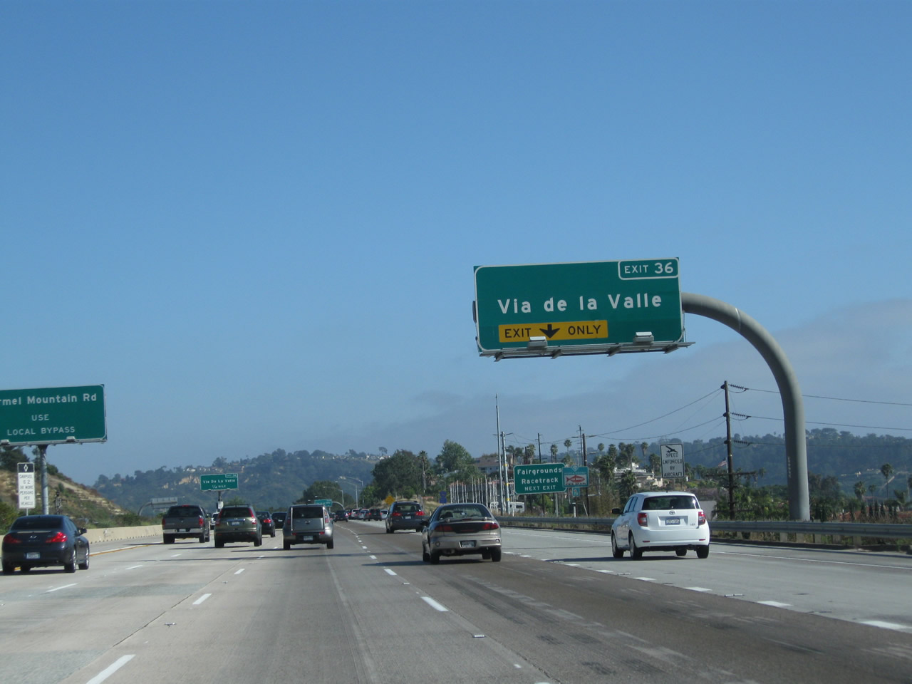
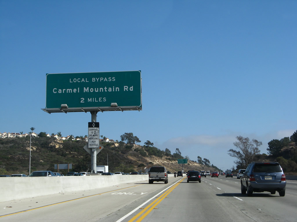
Use Via de la Valle/San Diego County S-6 west to reach the San Diego County Fairgrounds and Del Mar Racetrack, home to horse racing during the latter part of summer. During race events and the annual county fair in June, traffic may swell a bit along the freeway as it approaches the Via de la Valle interchange (hence the warning lights). Due to the expansion project, a new lane was added through here (resulting in a new exit-only advance sign). Additionally, new signage for the southbound Local Bypass was added in 2007. Photos taken 06/26/11 and 07/06/04. |
|
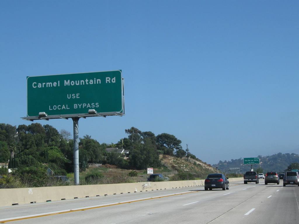
For traffic to Carmel Mountain Road (Exit 32) en route to Torrey Hills and Sorrento Valley in the city of San Diego, use the "Local Bypass" lanes (stay right). The Local Bypass lanes begin near the off-ramp to Exit 33. Photo taken 06/26/11. |
|
|
Additionally, use Via de la Valle west to enter the city of Del Mar, which is an exclusive community along the coast sandwiched between San Diego and Solana Beach. This area has changed due to the new lanes added between 2008-2010. Photos taken 06/17/06 and 07/06/04 . |
|
|
|
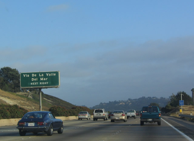
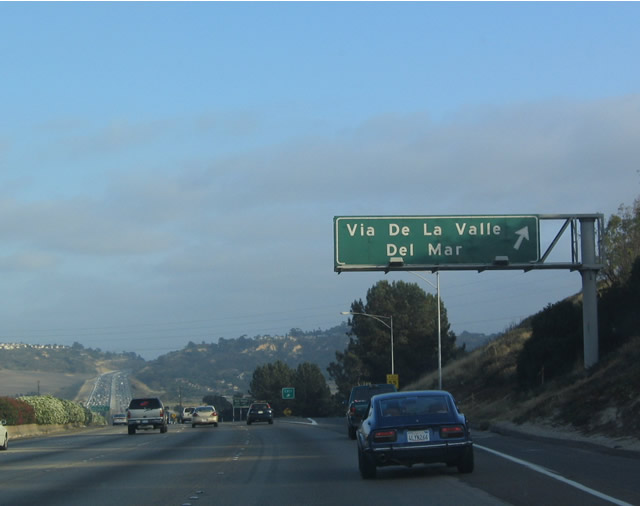
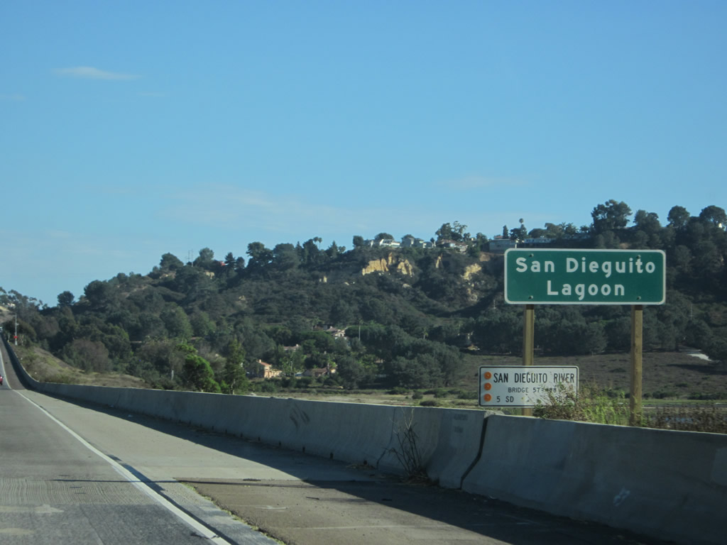
Southbound Interstate 5 reaches Exit 36, San Diego County S-6 (Via de la Valle) (this is Former Business Loop I-5; only a couple of signs remain) to Del Mar. The annual San Diego County Fair is held at the Del Mar Race Track every year, and this exit is situated close to the race track. Horse racing is popular at Del Mar Racetrack during July, August, and September each year. Interstate 5 dips into the San Dieguito River Valley in the distance. Note the changes in signage over the seven years. Photos taken 06/26/11, 06/17/06, and 07/06/04. |
|
|
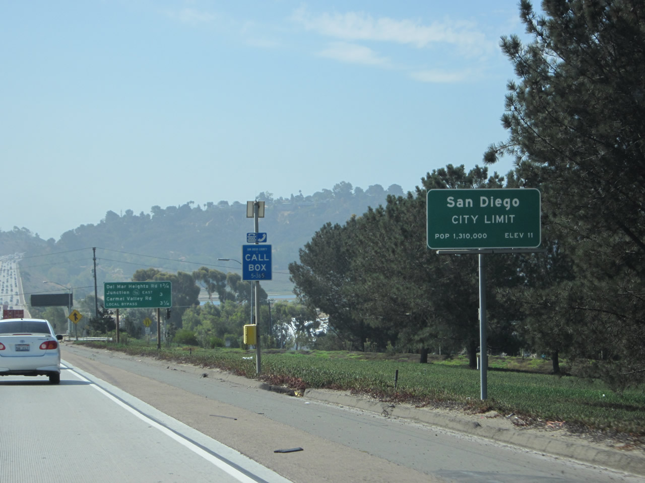
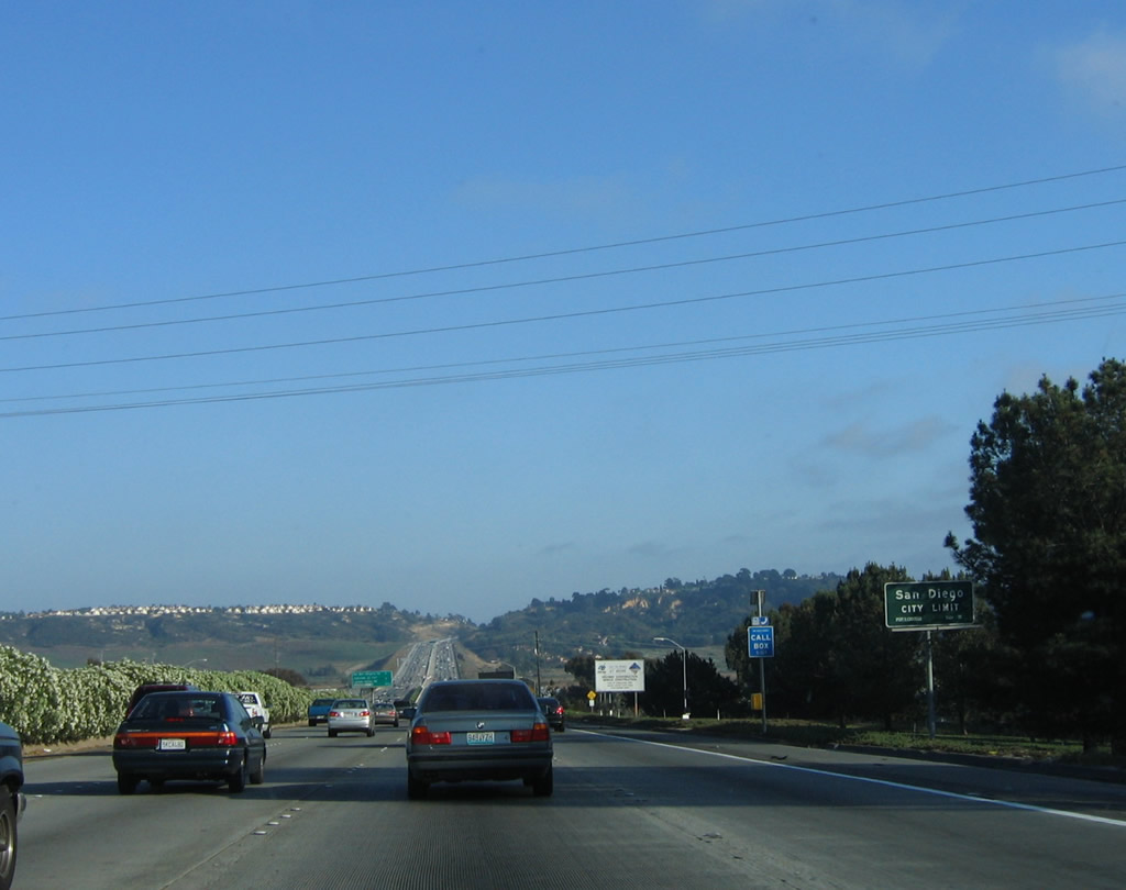
Passing through the Via de la Valle interchange, Interstate 5 (San Diego Freeway) departs from Solana Beach/Del Mar and enters the city of San Diego. Home to 1,223,400 people as of the 2000 Census and 1,301,617 people as of the 2010 Census, San Diego is the seventh-largest city in the United States and is second only to Los Angeles in size within the state of California. It is nicknamed as "America's Finest City." According to the official site, the total land area is 219,000 acres, of which 30,600 acres are roads or freeways. San Diego was founded on July 16, 1769, and was incorporated on March 27, 1850. Photos taken 08/31/12 and 06/17/06. |
|
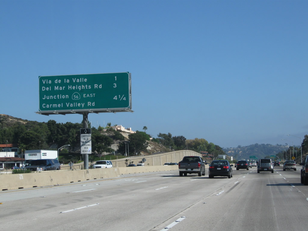
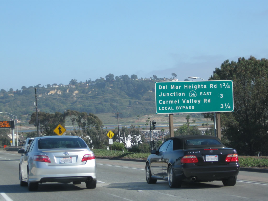
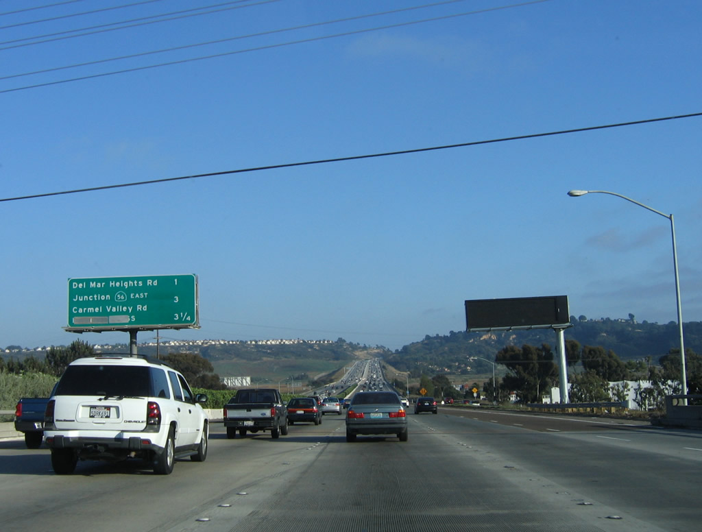
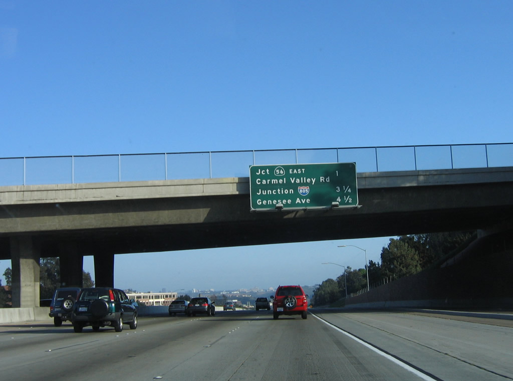
A mileage sign is posted after the city limits, providing the distance to Exit 34, Del Mar Heights Road east to Carmel Valley and west to Del Mar; Exit 33, Carmel Valley Road east to California 56 (Ted Williams Freeway) and west to Del Mar Terrace; and Exit 32, Carmel Mountain Road (via Local Bypass only). This sign replaces a mileage sign that used to be posted in the median near the variable message sign. Photo taken 06/26/11. |
|
In Caltrans District 11, bridge identification signs such this were becoming uncommon in the early 2000s, but Caltrans started posted these signs again starting in 2009. Bridge identification and postmile information can be painted on the bridge itself or placed on a sign such as this one. This sign is located after the on-ramp from westbound Via de la Valle. At this point, Interstate 5 crosses over Via de la Valle. Photo taken 08/01/08. |
|
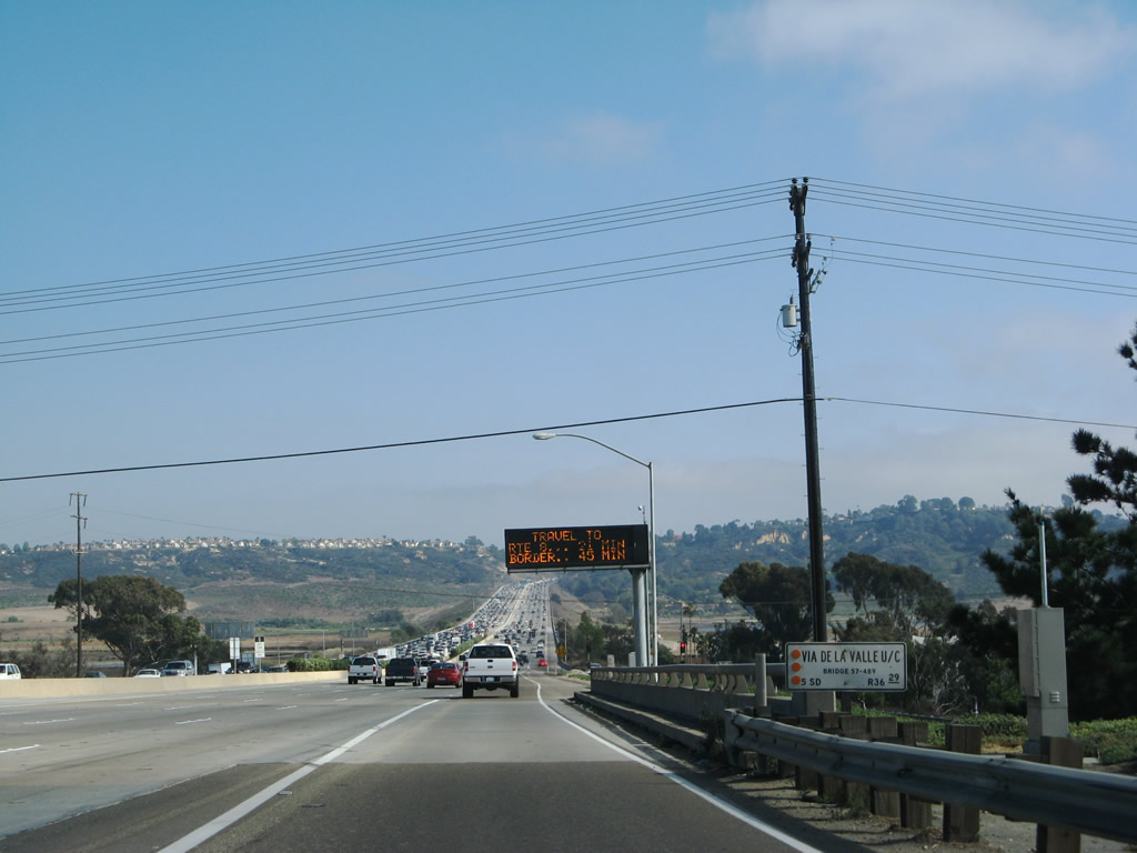
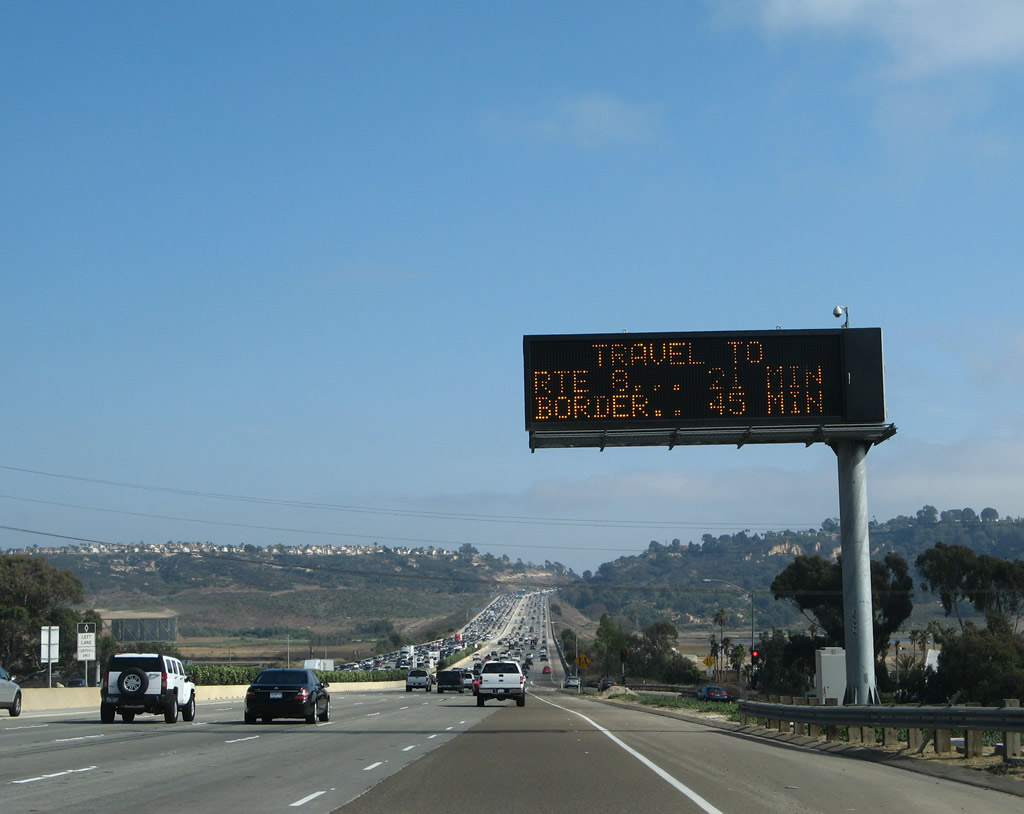
After passing over Via de la Valle, southbound Interstate 5 passes under a variable message sign that provides the current travel time to Interstate 8 and the International Border. This is the first sign to advise of the border as a control point. Presumably, through traffic to the International Border would follow Interstate 805, which is shorter and bypasses Interstate 5 through San Diego. Photo taken 08/01/08. |
|
|
This sign was removed by 2010 in conjunction with the carpool lane project. As noted in the roadside mileage sign, the next four exits along southbound Interstate 5 are Exit 34, Del Mar Heights Road; Exit 33, Carmel Valley Road (east to California 56 and west to old U.S. 101/Camino del Mar); Exit 32, Carmel Mountain Road; and Exit 31, Interstate 805 (Dekema/Inland Freeway) south. Neither Exit 31 nor Exit 32 were mentioned on the 2004 interchange sequence sign. This sign (and the median oleander landscaping) was removed in 2007 as part of the Interstate 5 expansion project heading north from Via de la Valle; the replacement sign only lasted for another couple of years before being removed in its entirety. Photos taken 06/17/06 and 07/06/04. |
|
|
Another brand new neutered Interstate 5 south shield is posted after the on-ramp from eastbound Via de la Valle. Interstate 5 now passes over the San Dieguito River, which widens out into a lagoon adjacent to the Del Mar Racetrack. This shield was added in 2008; the 2006 photo shows the original shield. Photos taken 08/01/08 and 06/17/06. |
|
|
Interstate 5 crosses the San Dieguito Lagoon. To the west lies the massive Del Mar Racetrack, and agricultural fields lay to the east. This section of freeway has changed significantly with the addition of the new carpool (high occupancy vehicle) lane (which was not yet in operation when this photo was taken in 2006). Many changes along Interstate 5 between Via de la Valle and Interstate 805 occurred between 1999 and 2007, including the Local Bypass. Photos taken 04/23/06 and 08/18/12. |
|
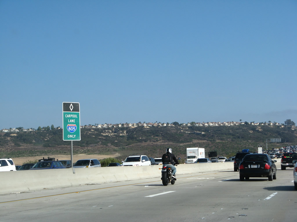
The carpool (high occupancy vehicle) lane was opened to traffic in 2007, several years after the companion HOV lane opened for northbound traffic. This sign advises that traffic choosing to use the HOV lane will end up on Interstate 805 south; there is NO access currently from the HOV lane to Interstate 5 south. Photo taken 08/01/08. |
|
|
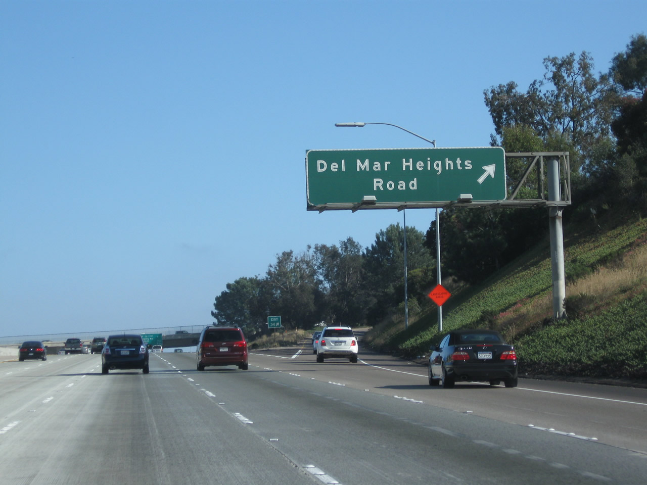
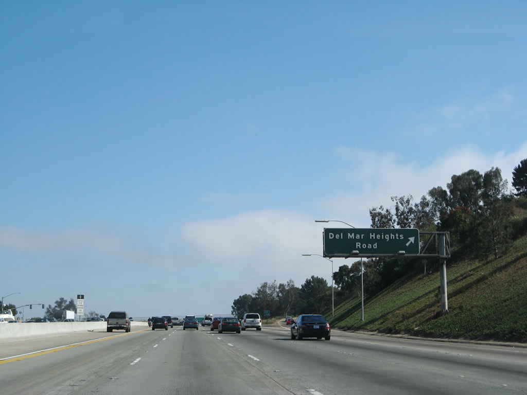
Del Mar Heights Road connects Interstate 5 with the city of San Diego community of Torrey Pines (Del Mar Heights) and the city of Del Mar to the west and the community of Carmel Valley to the east. The porcelain enamel sign here was replaced with a reflective sign, but no exit number was added to the new sign. Photos taken 08/01/08 and 04/23/06. |
|
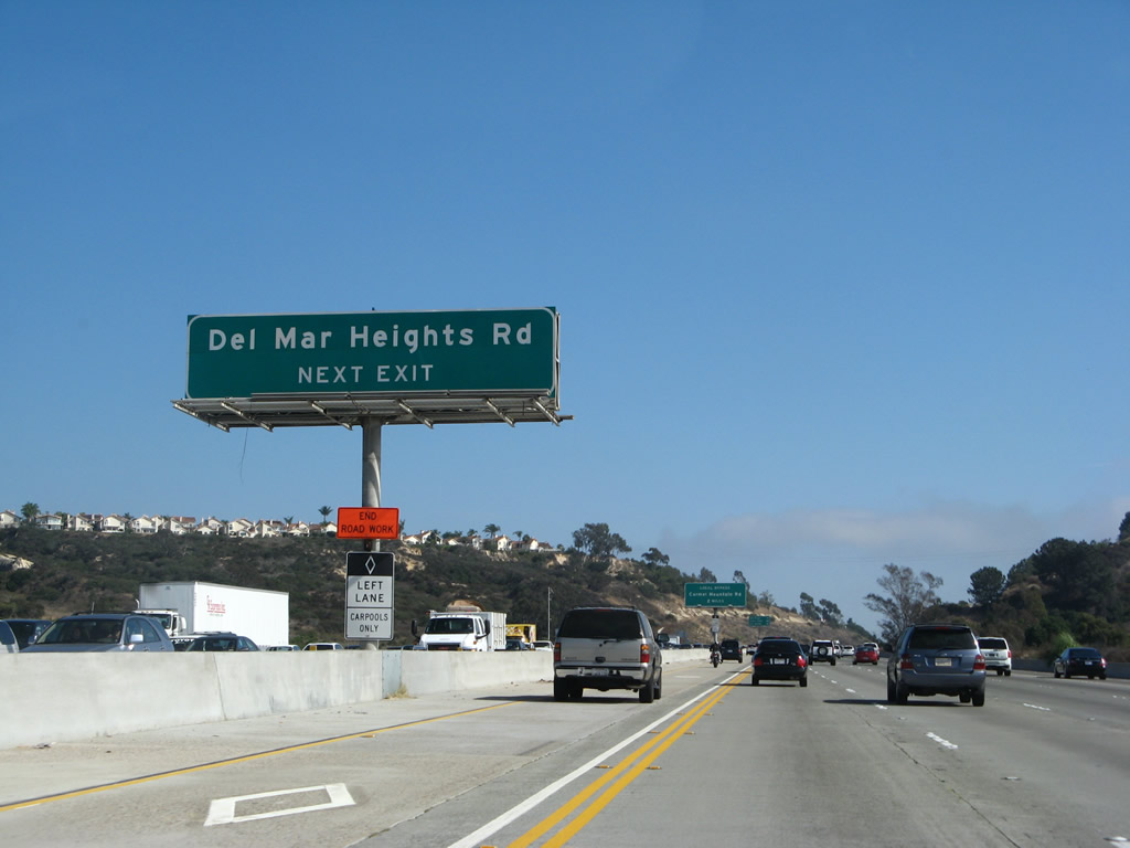
After the Del Mar Heights Road interchange (Exit 34), southbound Interstate 5 will widen in advance of the Local Bypass. This sign is the first to advise of the pending local bypass configuration. All traffic for Exits 33 (California 56) and 32 (Carmel Mountain Road) should merge right. Through traffic should merge left. Trucks may prefer to use the Local Bypass for easier merging onto Interstate 805 south. Oddly, this sign for the Local Bypass and Carmel Mountain Road (Exit 32) appears before any sign mentions the interchange with California 56. This might be because the direct freeway to freeway connecting ramps proposed for Exit 33 have not been constructed yet. Photo taken 08/01/08. |
|
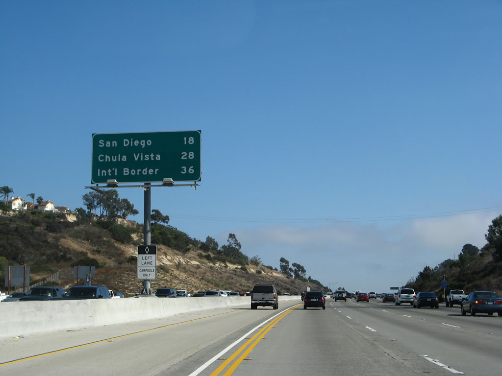
A new mileage sign provides the distance to downtown San Diego (18 miles), Chula Vista (28 miles), and the international border with Mexico (36 miles). This distance to the border is via Interstate 5 south, not Interstate 805 south, and it is not completely congruent with the mileage-based exit numbers. As noted earlier, it is more direct to take Interstate 805 south to the border. This mileage sign is the first permanent sign to show the International Border as the new control point for southbound Interstate 5. Photo taken 08/01/08. |
|
|
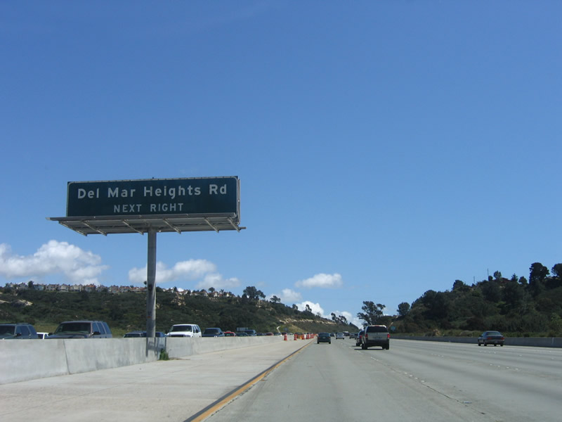
Southbound Interstate 5 reaches Exit 34, Del Mar Heights Road. Del Mar Heights Road leads east into the Carmel Valley community of San Diego (with a connection to Carmel Valley Road in Pacific Highlands Ranch) and west into the City of Del Mar. Photos taken 06/26/11 and 04/23/06. |
|
|
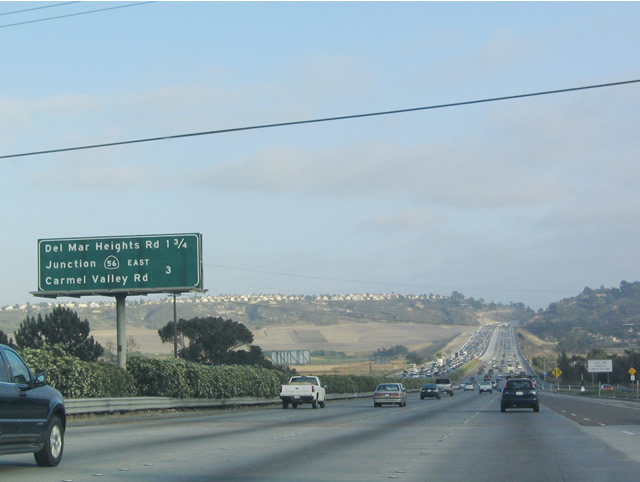
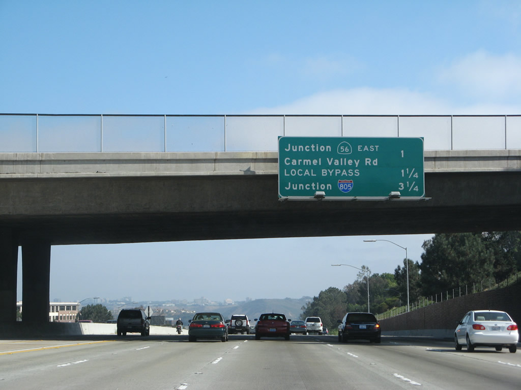
This mileage sign (which was replaced in 2007) provides the distance to the next several exits. The sign is posted on the Del Mar Heights Road overpass. Southbound Interstate 5 (San Diego Freeway) next approaches Exit 33, Carmel Valley Road. To reach eastbound California 56, motorists must use eastbound Carmel Valley Road. Westbound Carmel Valley Road goes into Del Mar, where it meets Camino Del Mar (Historic U.S. 101). Photos taken 08/01/08 and 06/17/06. |
Page Updated September 10, 2012.