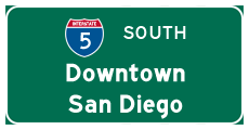
| Interstate 5 (San Diego Freeway) south |
|
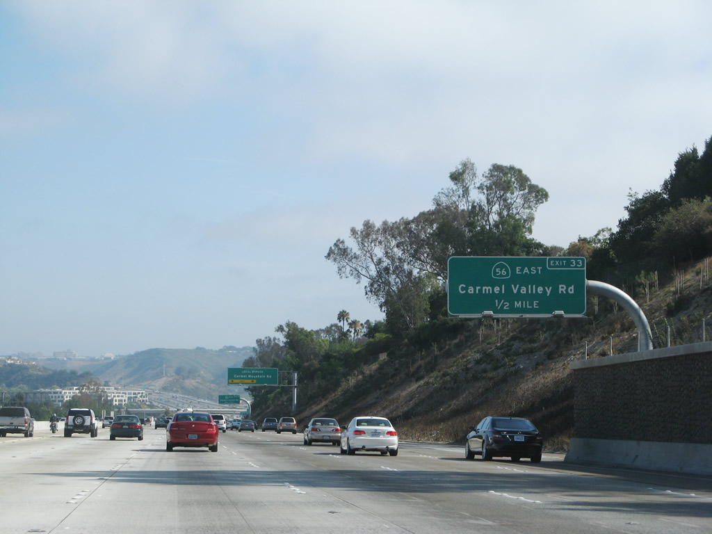
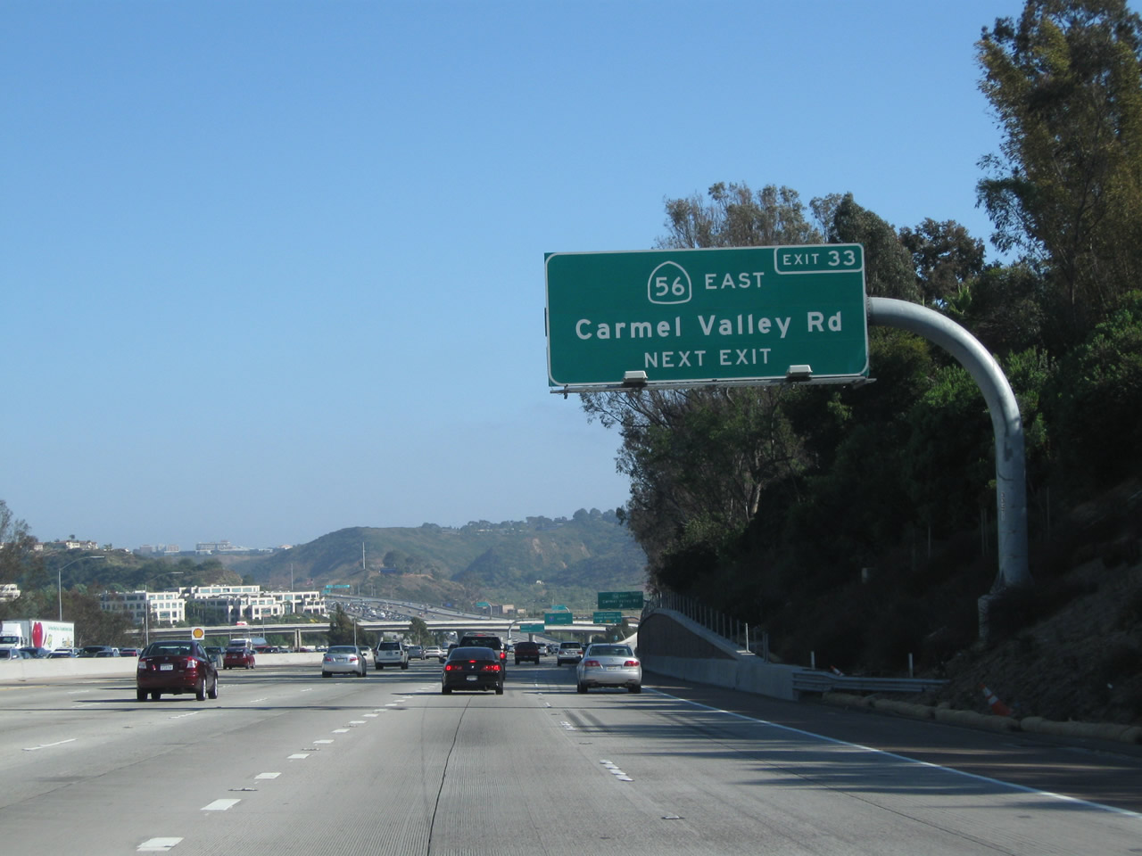
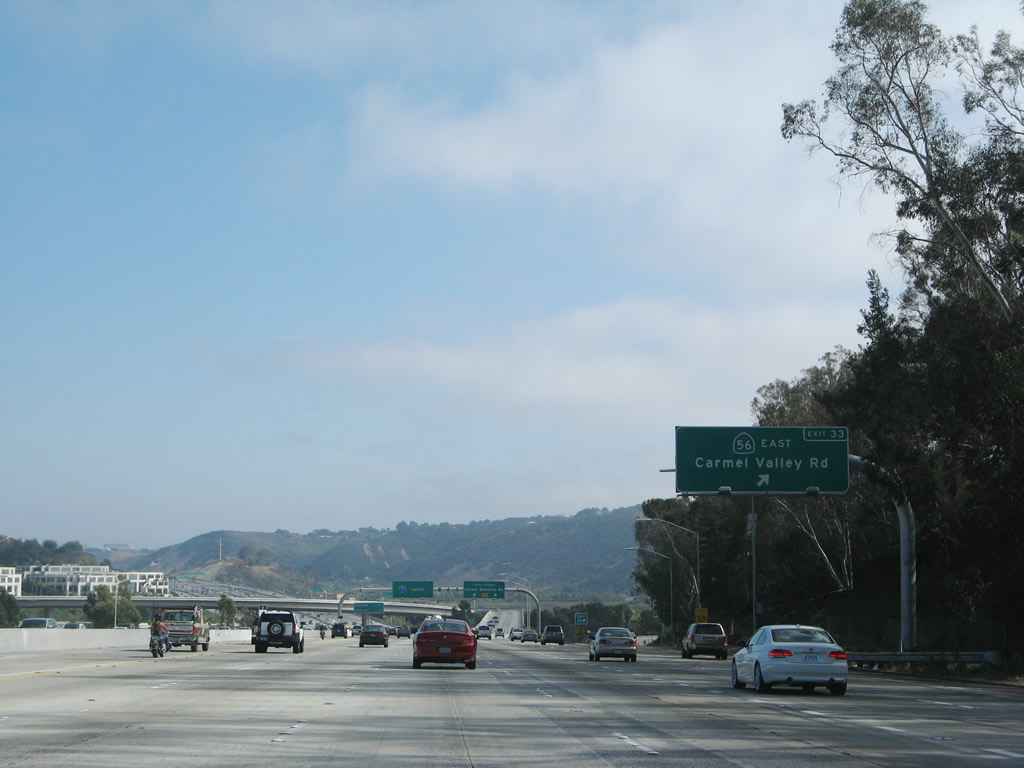
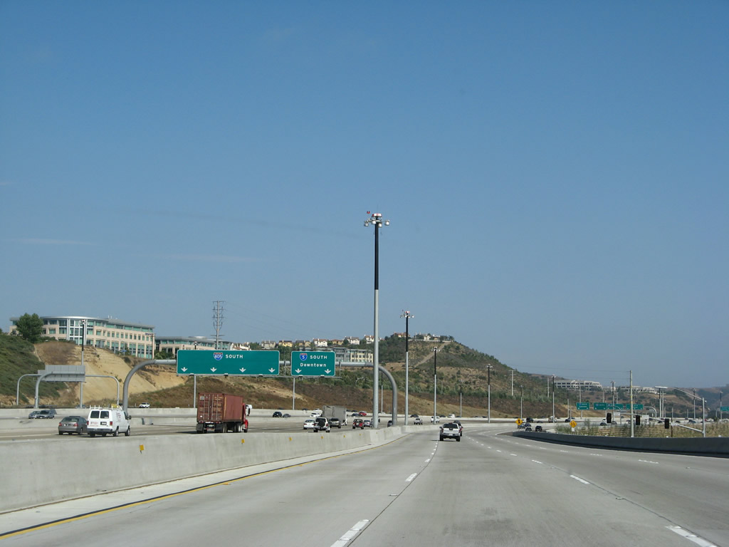
The next exit along Interstate 5 (San Diego Freeway) south is Exit 33, Carmel Valley Road and California 56 east. An auxiliary lane makes the connection to Carmel Valley Road, which acts as the connection to California 56 east. Photo taken 08/01/08. |
|
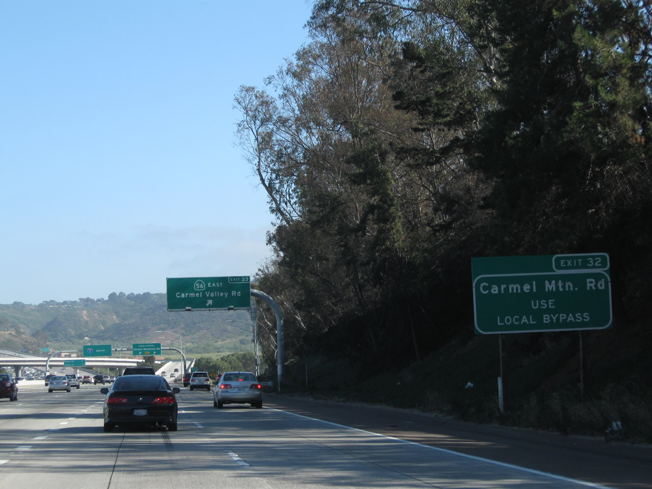
Immediately thereafter, the right two lanes become exit only for the Local Bypass and Exit 33, Carmel Valley Road to California 56 east. The exit to Carmel Valley Road is the far right lane; the right two lanes will connect to the southbound Local Bypass. Photo taken 08/01/08. |
|
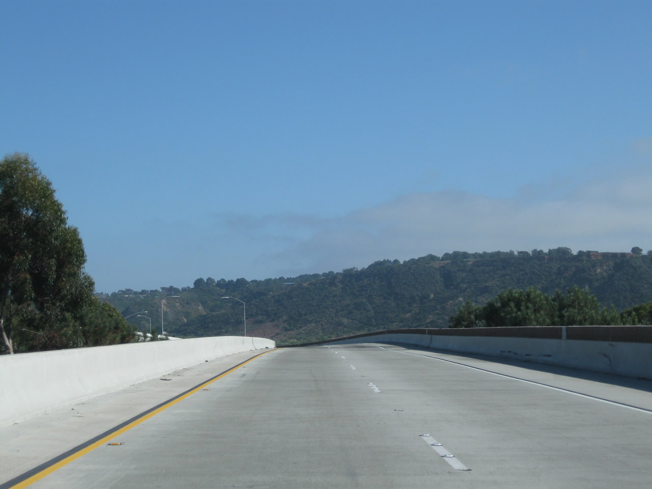
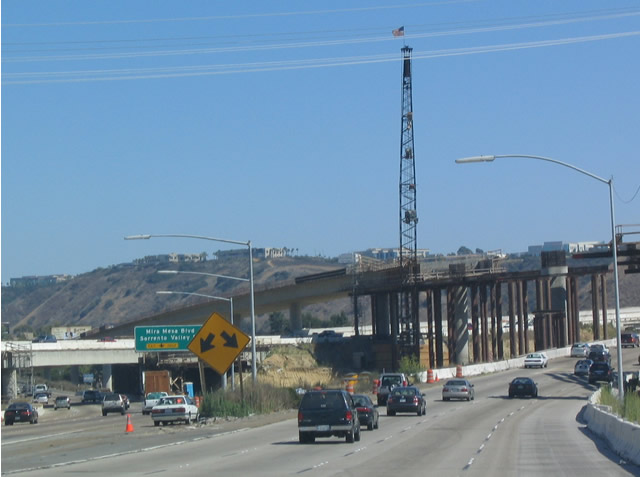
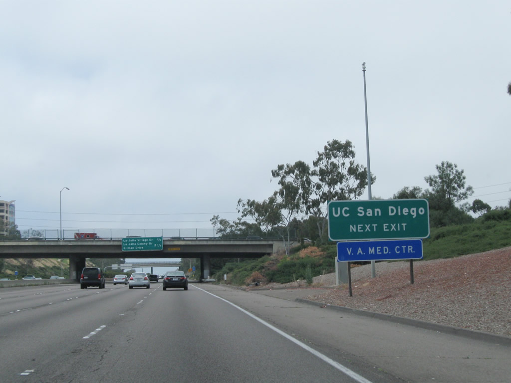
California 56 (Ted Williams Freeway) connects Carmel Valley, Del Mar Mesa, Pacific Highlands Ranch, Torrey Highlands, and Rancho Penasquitos together before culminating at Interstate 15 in Sabre Springs/Carmel Mountain Ranch. The last gap in the California 56 freeway was completed in 2004. Photo taken 08/01/08. |
|
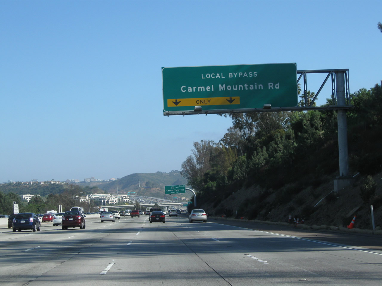
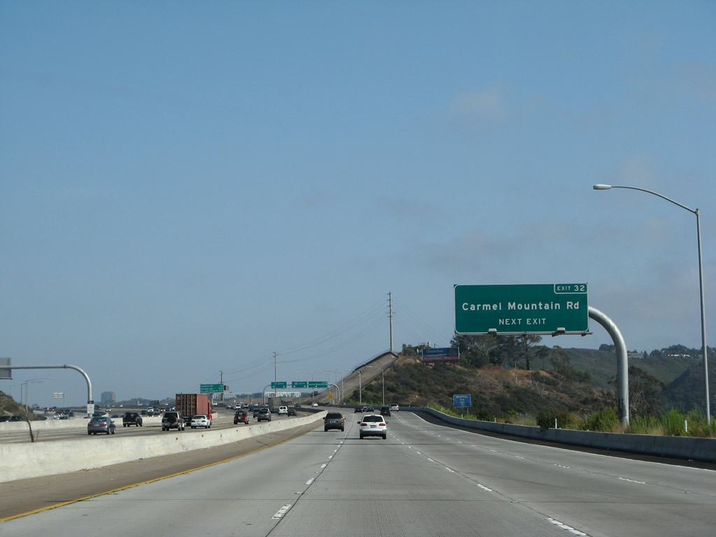
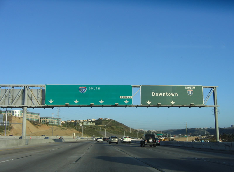
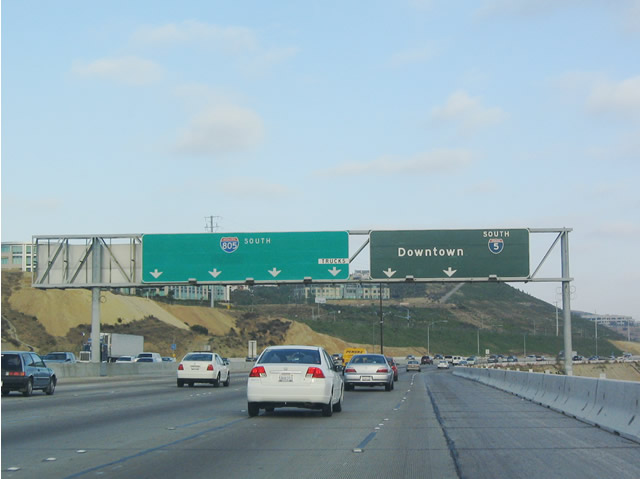
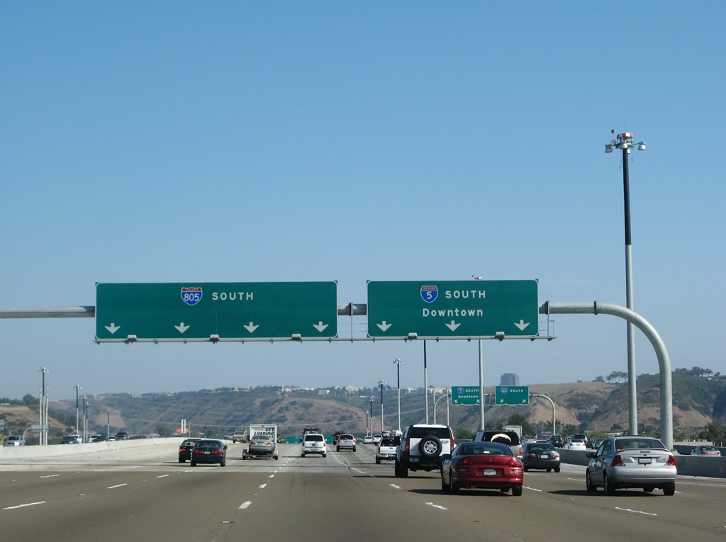
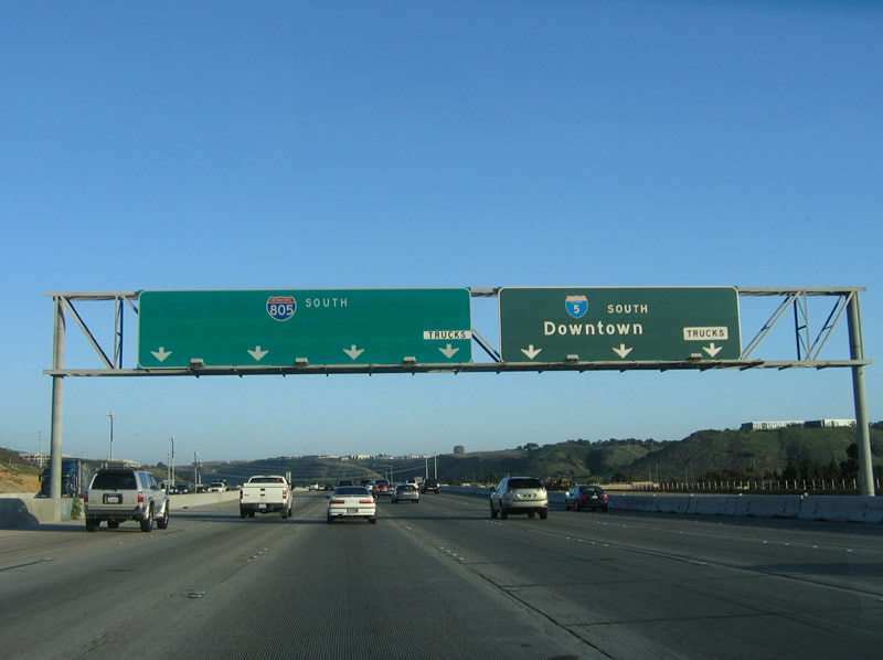
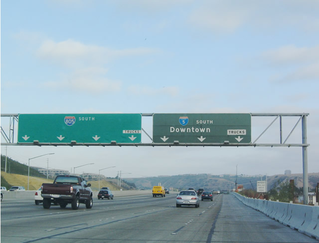
Use the Local Bypass to Exit 32, Carmel Mountain Road. The Local Bypass is also the best route for through trucks to Interstate 805 south (limited merging). Photo taken 08/01/08. |
|
|
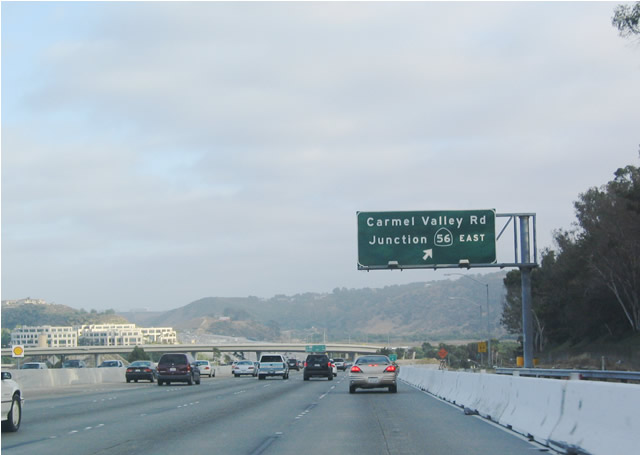
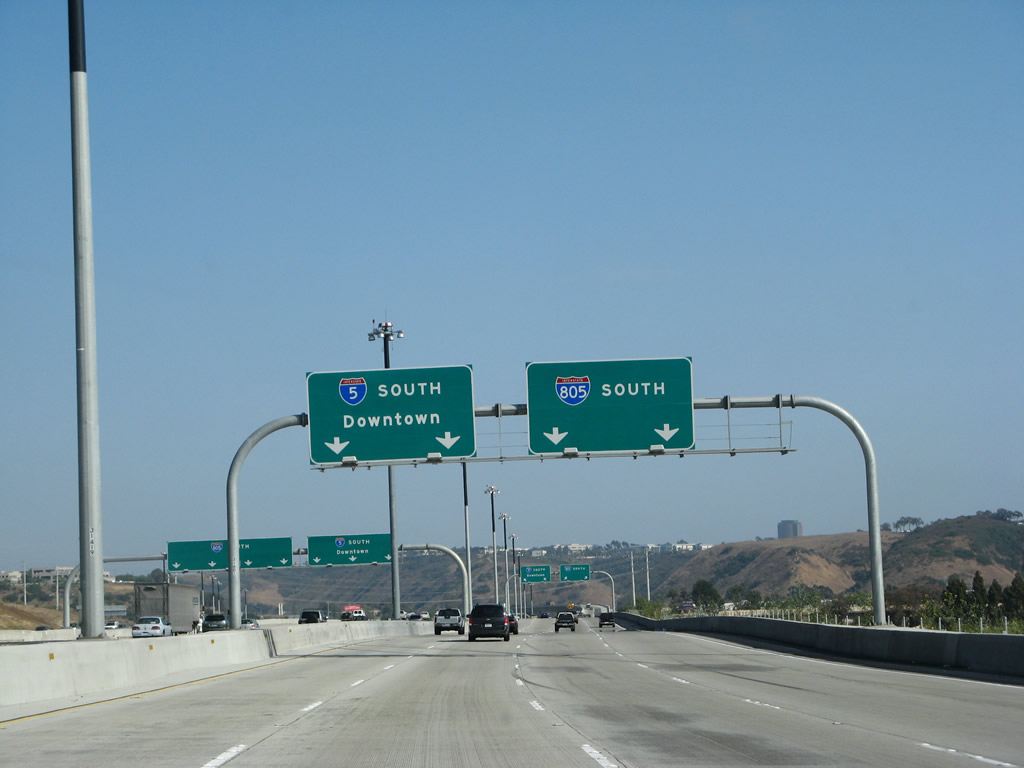
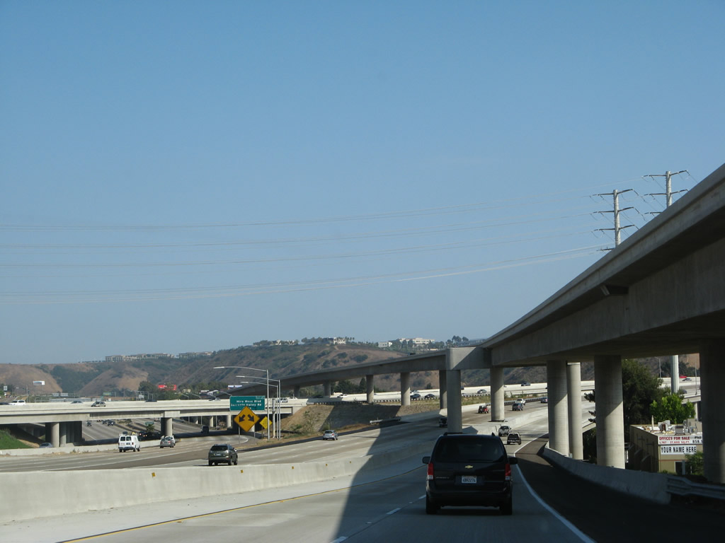
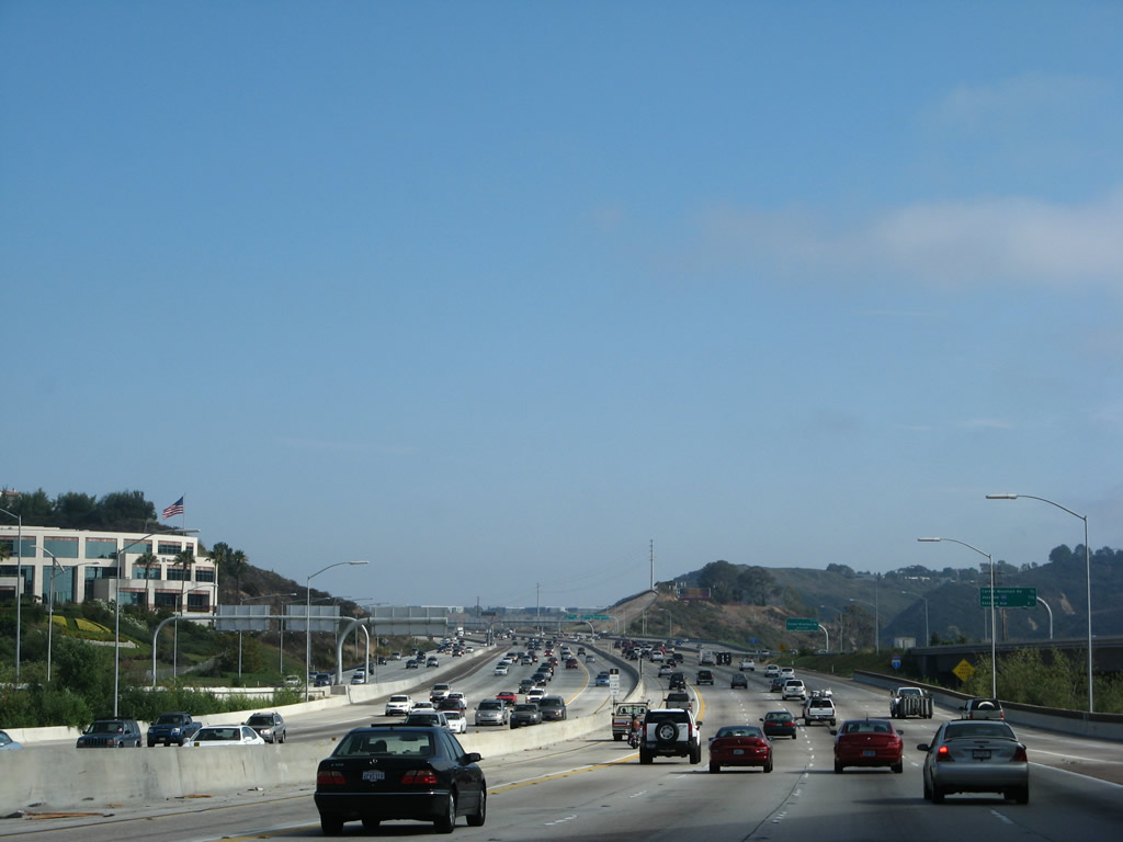
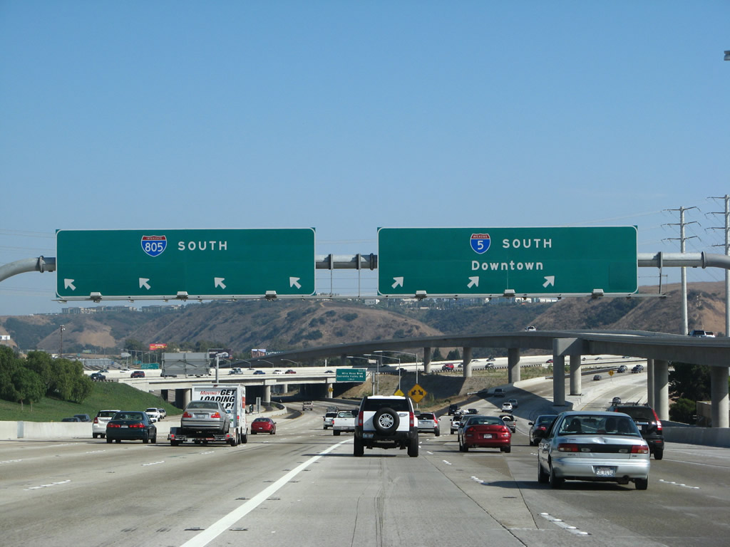
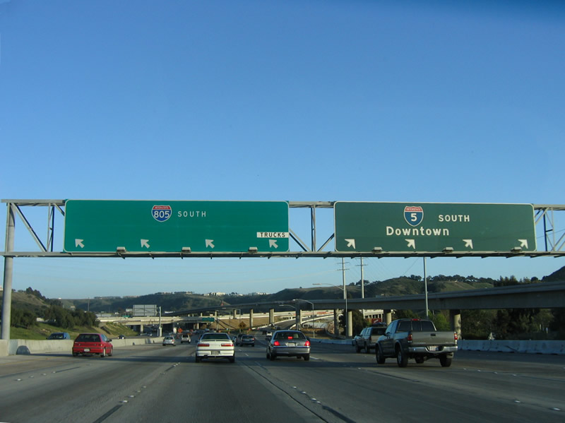
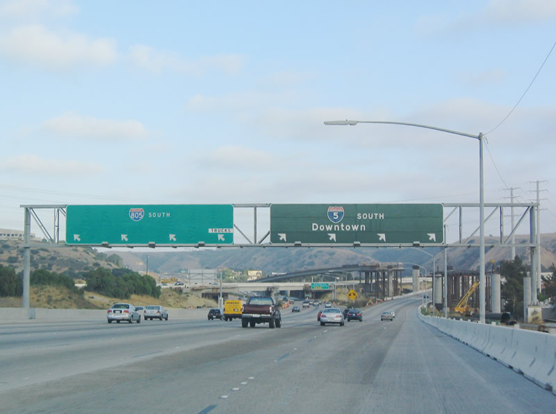
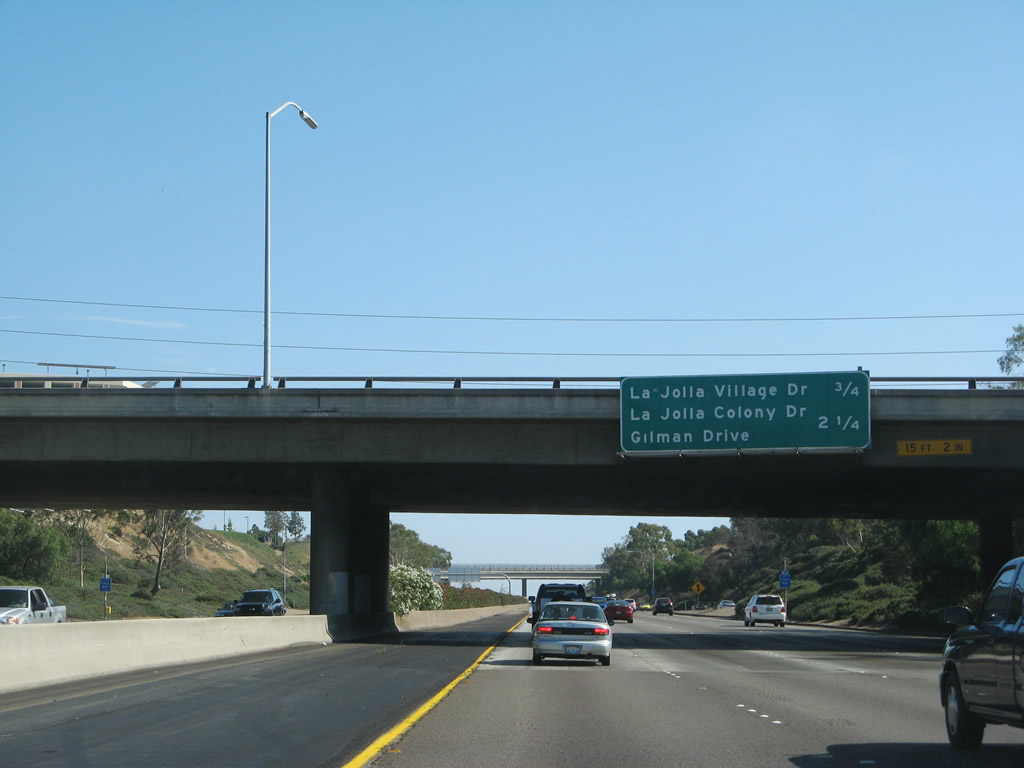
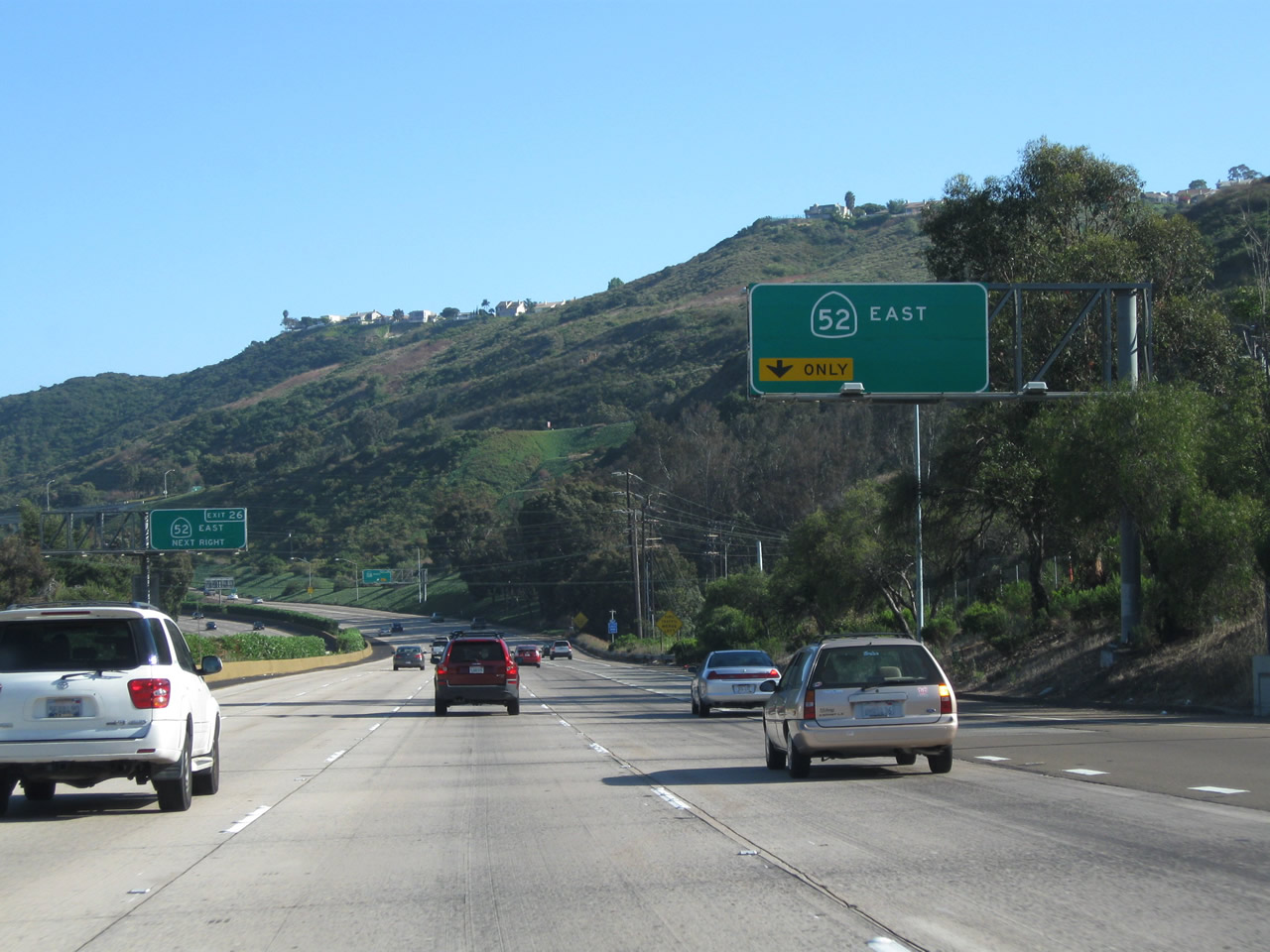
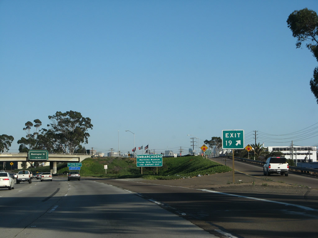
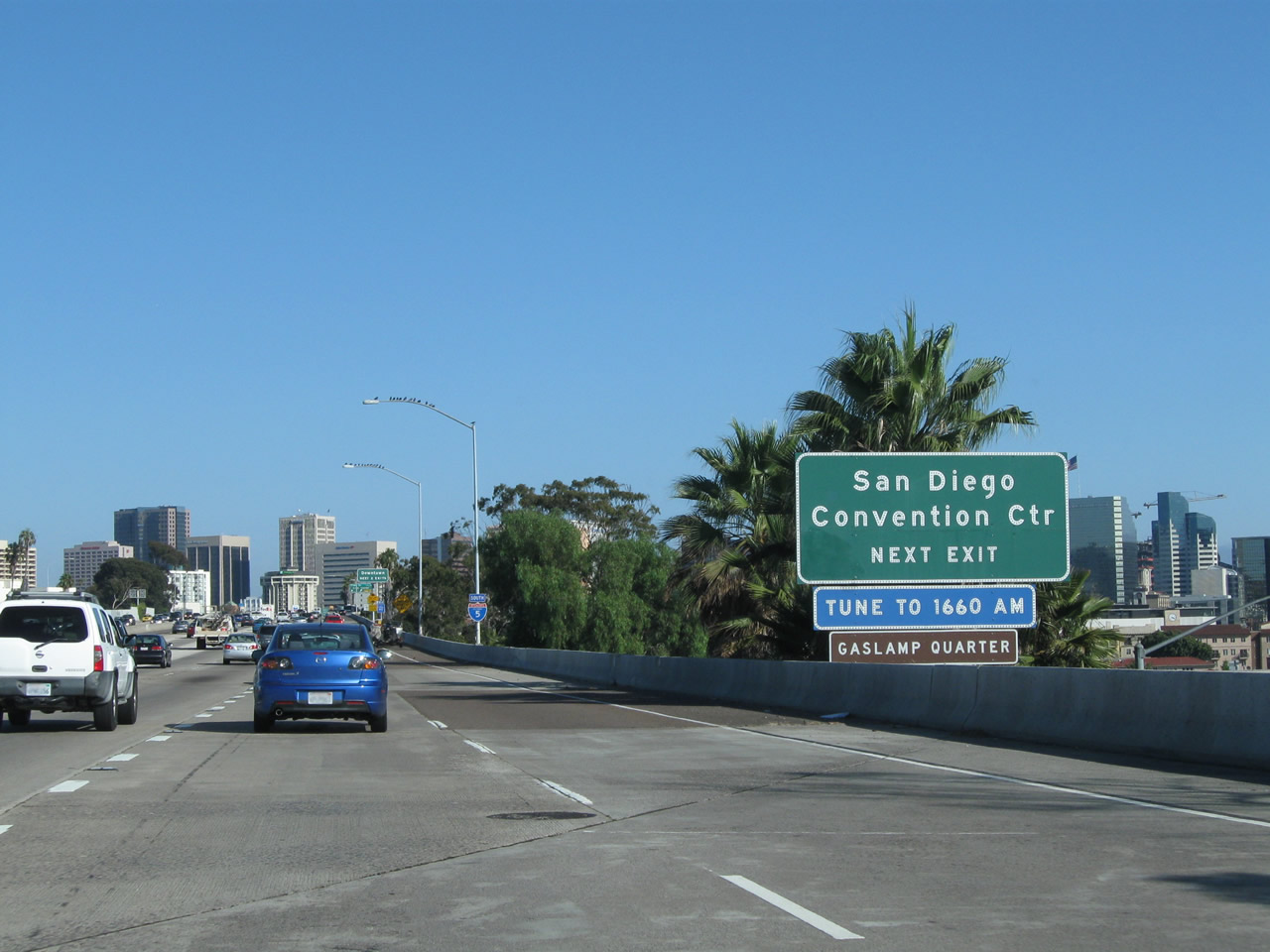
Southbound Interstate 5 (San Diego Freeway) connects with Exit 33, Carmel Valley Road shortly prior to the departure of the Local Bypass lanes. Since there is currently no direct connection from southbound Interstate 5 to eastbound California 56, travelers must use Carmel Valley Road east for a little less than a mile to get onto the eastbound freeway. To the west, Carmel Valley Road passes through Del Mar Terrace before ending at U.S. 101/Camino del Mar in the city of Del Mar. Photos taken 08/01/08 and 07/06/04. |
|
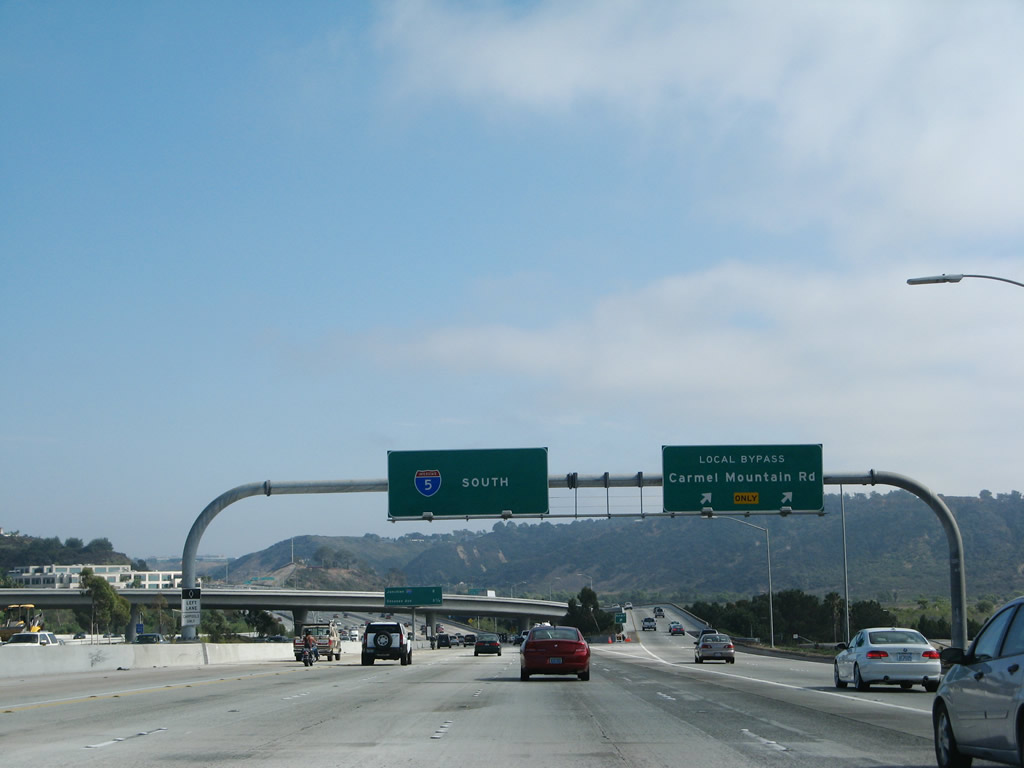
Immediately after the off-ramp to Exit 33 (Carmel Valley Road), Interstate 5 (San Diego Freeway) south splits into a dual freeway configuration: the left five lanes continue along the main lanes and the right two lanes merge onto the Local Bypass. Photo taken 08/01/08. |
| LOCAL BYPASS - Interstate 5 (San Diego Freeway) south |
|
|
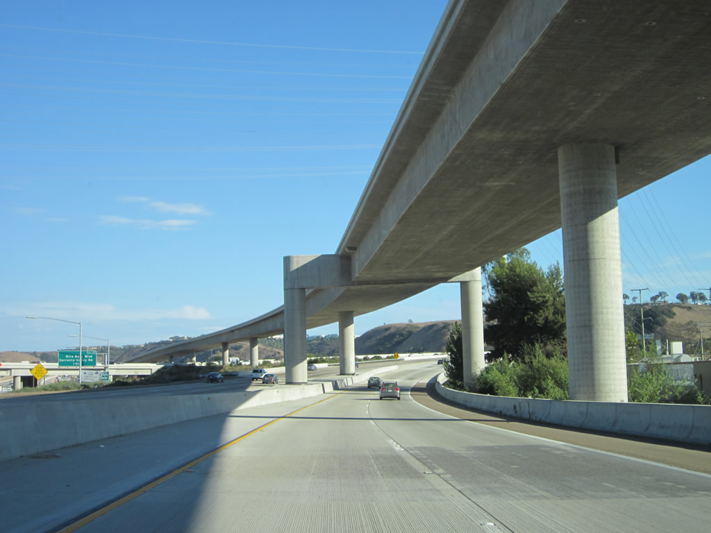
Continuing onto the Local Bypass first, Interstate 5 carries two lanes for the connection to Exit 32, Carmel Mountain Road and a truck bypass connection to Exit 31, Interstate 805 south. Trucks may prefer to use the local bypass since an exit here will allow trucks to exit right and merge from the right without having to make lane changes to the left lanes (which would be required from the main lanes of Interstate 5). Photos taken 06/26/11. |
|
|
|
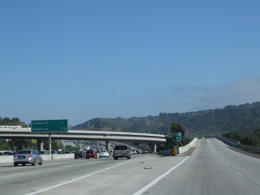
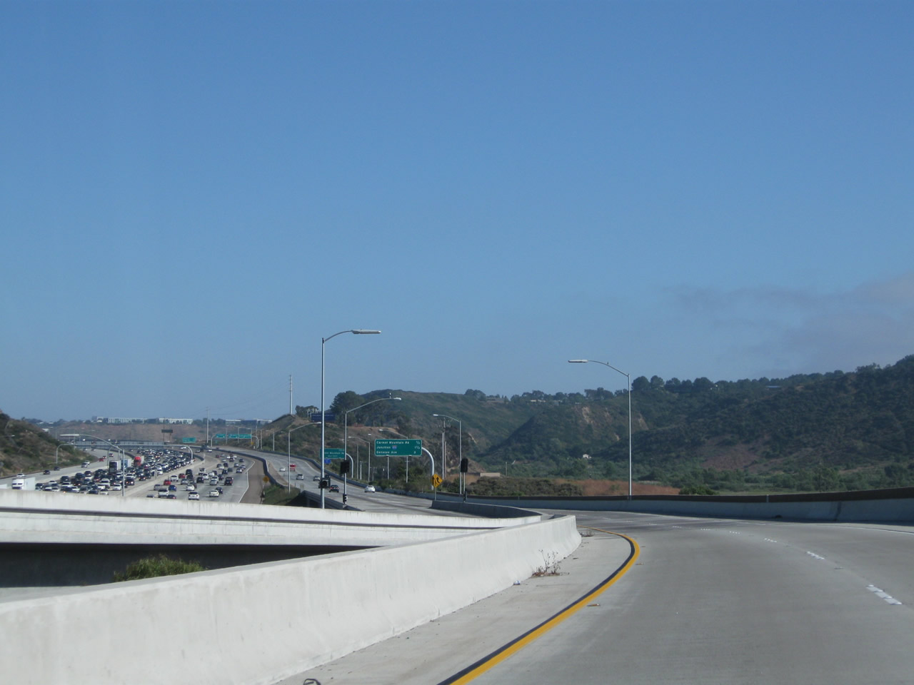
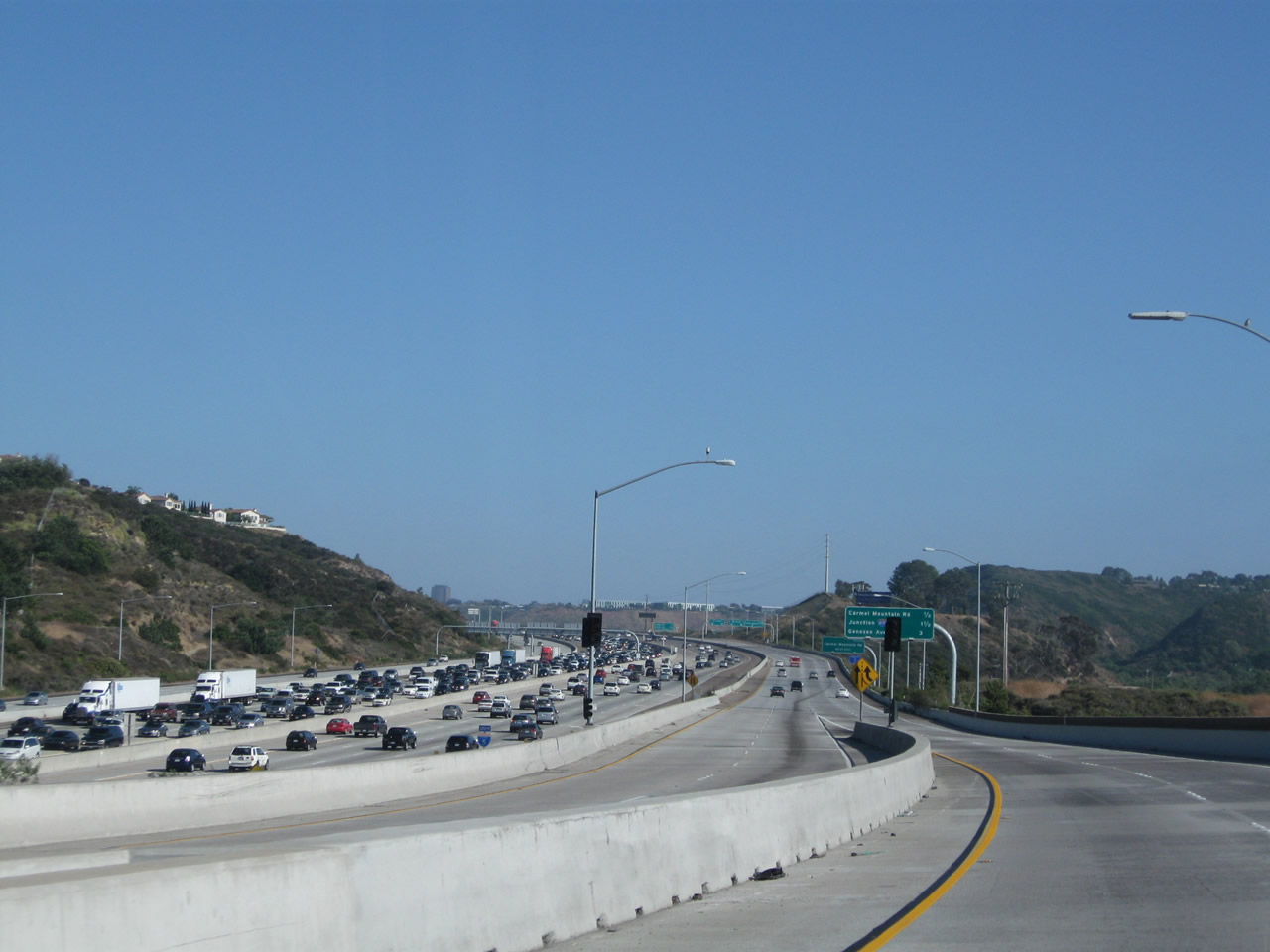
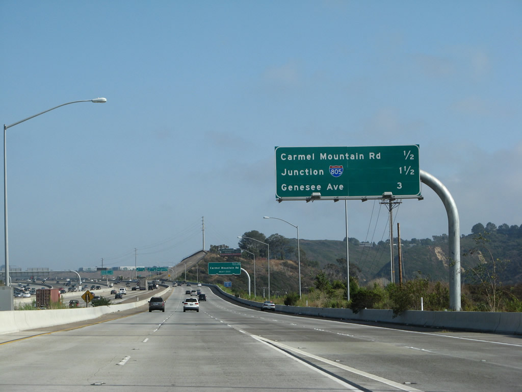
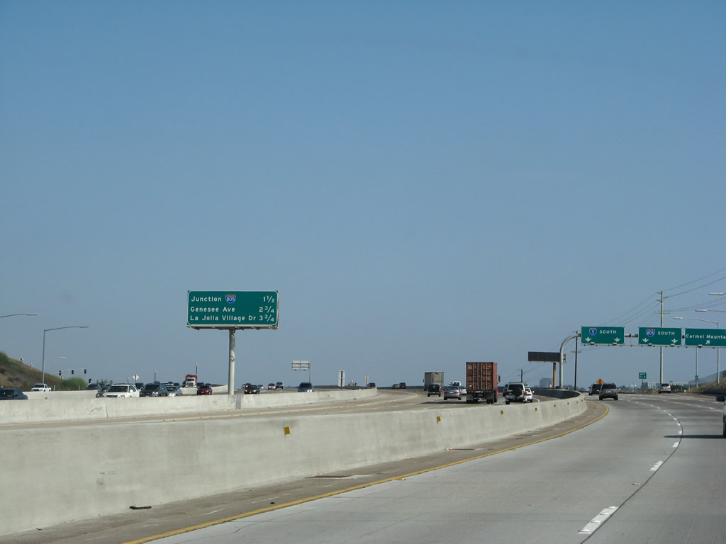
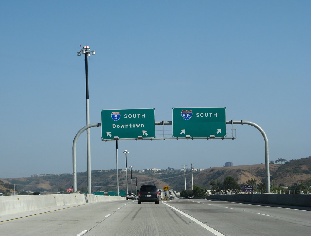
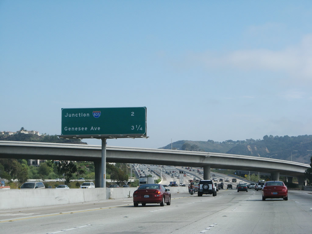
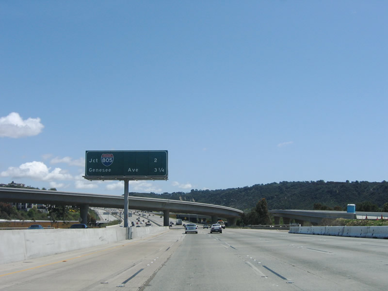
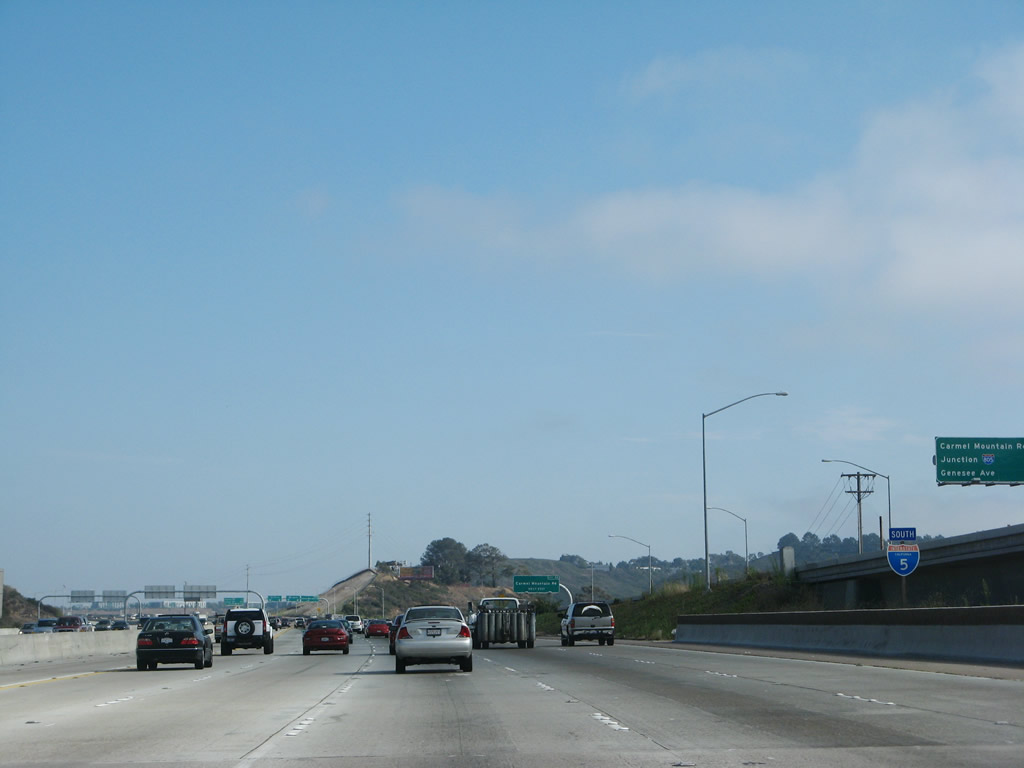
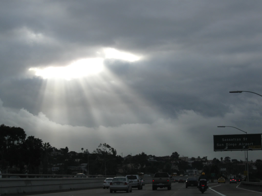
The two-lane Local Bypass connects with a ramp from California 56 west, which merges onto the Local Bypass from the left. Now four lanes wide, southbound Interstate 5/Local Bypass has an interchange sequence sign for Exit 32, Carmel Mountain Road; Exit 31, Interstate 805 (Dekema Freeway) south; and Exit 29, Genesee Avenue (San Diego County S-21). Photo taken 07/14/08. |
|
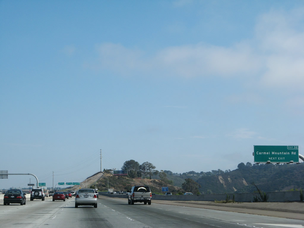
The next exit along southbound Interstate 5 Local Bypass is Exit 32, Carmel Mountain Road. This exit serves the communities of Torrey Hills and southern Carmel Valley. Photo taken 07/14/08. |
|
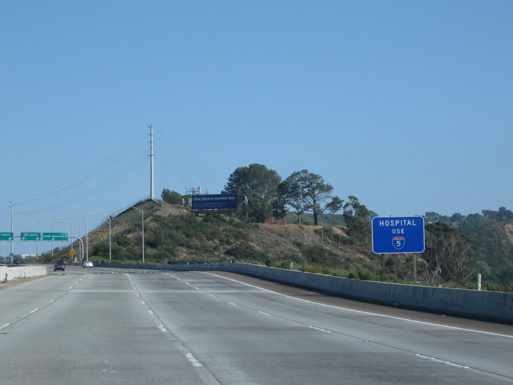
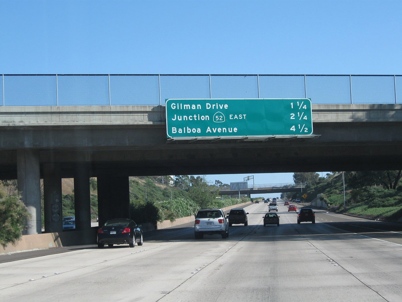
To the nearest hospital, follow Interstate 5 south to Exit 29, Genesee Avenue south. Photo taken 06/26/11. |
|
This view shows the main lanes as seen from the southbound Local Bypass. A mileage sign is posted in the median for mainline traffic. Photo taken 07/14/08. |
|
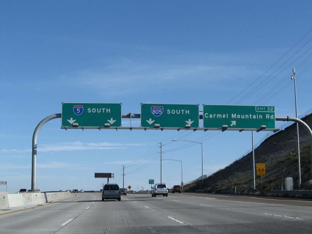
Southbound Interstate 5/Local Bypass reaches Exit 32, Carmel Mountain Road. The left two lanes will continue south on Interstate 5, and the right two lanes will merge onto Interstate 805 south (Exit 31). Photo taken 04/20/09. |
|
The community of Torrey Hills lies on the east side of Interstate 5 as the Local Bypass travels over Carmel Mountain Road. The next exit is Exit 31, Interstate 805/Jacob Dekema Freeway. Photo taken 07/14/08. |
|
After traffic merges onto the Local Bypass from Carmel Mountain Road, use the left two lanes to Interstate 5 south and the right two lanes to Interstate 805 south. Photo taken 07/14/08. |
|
The Local Bypass configuration ends at the point where Interstate 805 south traffic departs using the right two lanes. Through traffic on Interstate 5 south uses the left two lanes to rejoin the mainline. Photo taken 07/14/08. |
|
This view shows the southbound Local Bypass lanes at the point where the main lanes split between Interstate 5 south and Interstate 805 south. Photo taken 08/18/12. |
|
After the Local Bypass split, the Interstate 5 transition lanes pass under the Interstate 805 Local Bypass flyover ramp. From here, the two lanes merge back into the mainline prior to the on-ramp from Sorrento Valley Road (there is no access from Interstate 5 south to Sorrento Valley Road). Photo taken 07/14/08. |
|
The ramp to Interstate 5 south passes under the ramp to Interstate 805 south. Photo taken 08/18/12. |
| MAINLINE - Interstate 5 (San Diego Freeway) south |
|
|
This mileage sign provides the distance for the next two exits along southbound Interstate 5: Exit 31, Interstate 805 south and Exit 29, Genesee Avenue. Omitted here is the first exit for Interstate 805/Jacob Dekema Freeway southbound. Photos taken 08/01/08 and 04/23/06. |
|
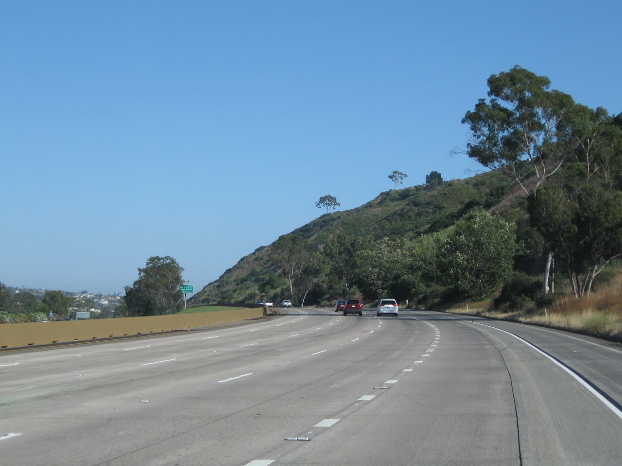
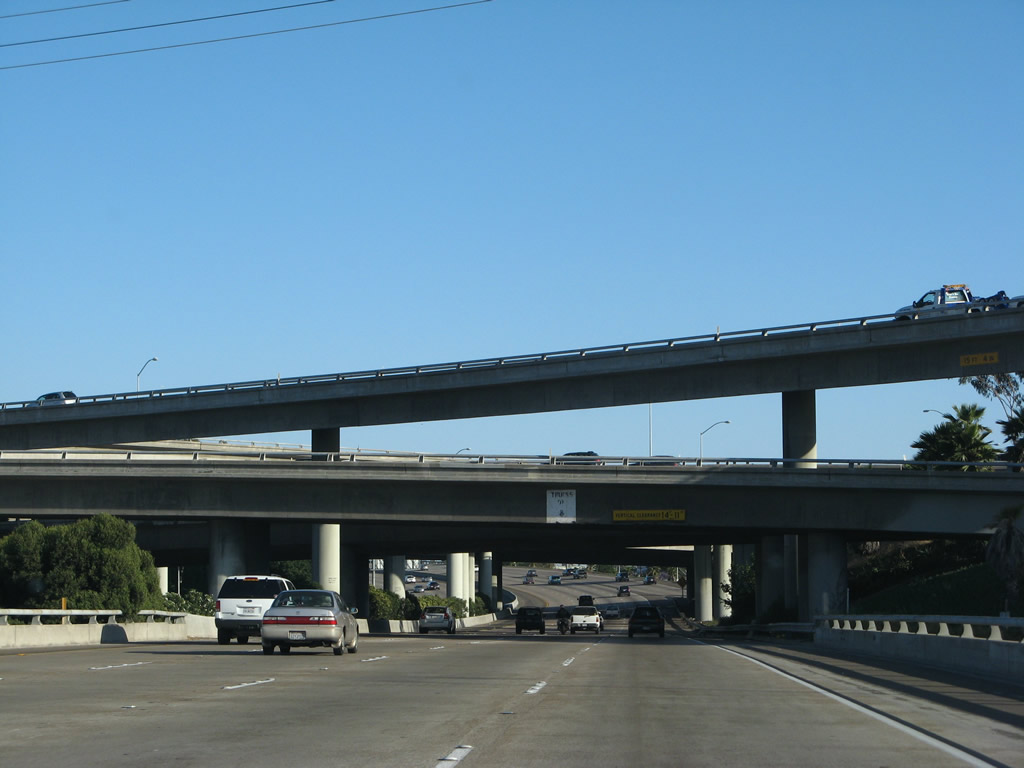
The dual freeway configuration of Interstate 5 (San Diego Freeway) covers approximately 18 through lanes: four lanes in the southbound Local Bypass, five lanes in the southbound main lanes, five lanes in the northbound main lanes, and four lanes in the northbound Local Bypass (excluding auxiliary and merge lanes). Through here, the freeway cuts between Torrey Hills and the Los Peñasquitos Lagoon. Photo taken 08/01/08. |
|
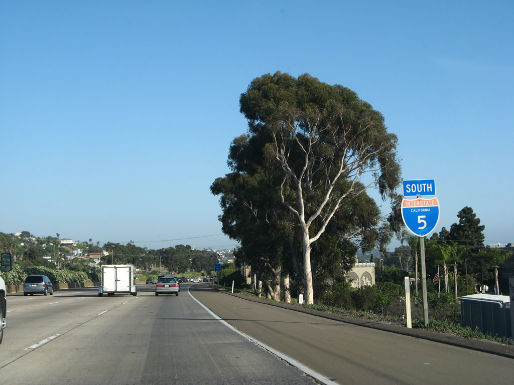
An Interstate 5 reassurance shield is posted after the on-ramp from Carmel Valley Road. An interchange sequence sign on the Local Bypass can be seen in the background. Photo taken 08/01/08. |
|
Exit 32, which serves Carmel Mountain Road, has an exit from the Local Bypass (see above), but there is no access from the main lanes. Traffic from westbound California 56 merges onto the Local Bypass, so the main lanes do not see any significant merge from California 56 traffic until after the Interstate 5-805 split. Photo taken 08/01/08. |
|
|
|
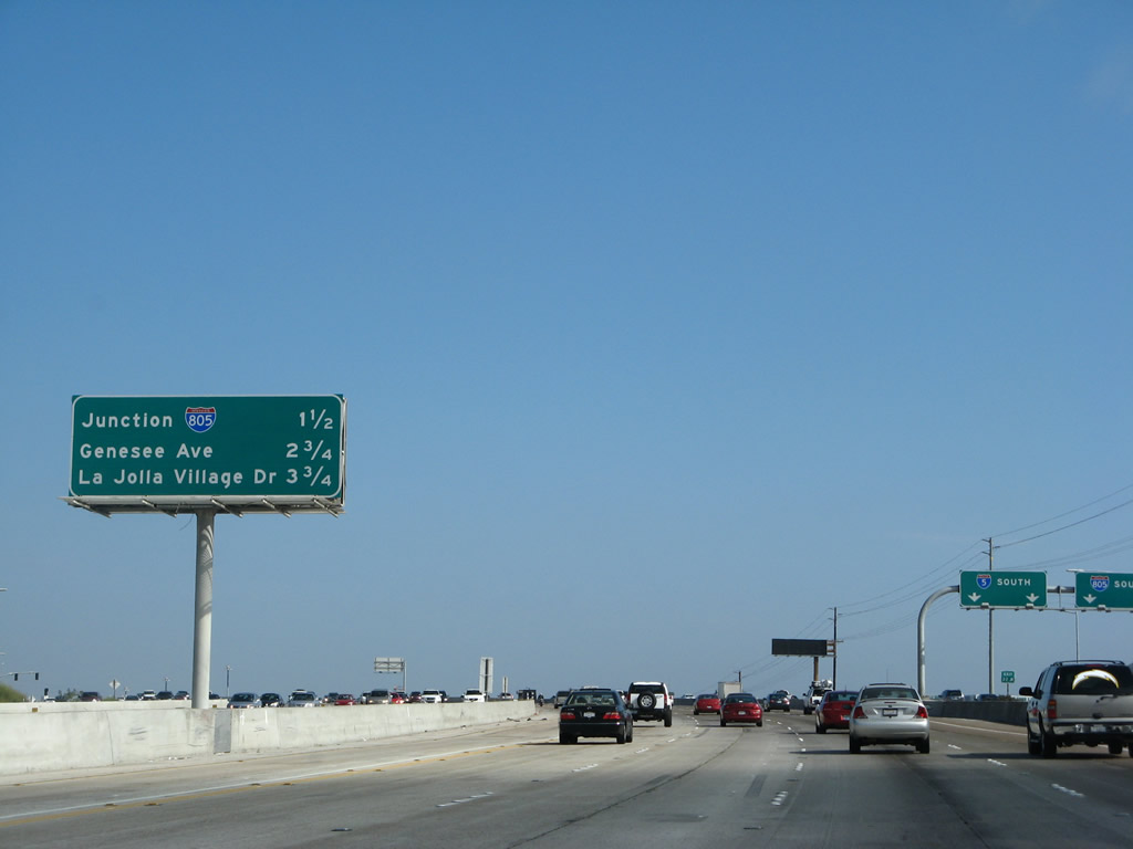
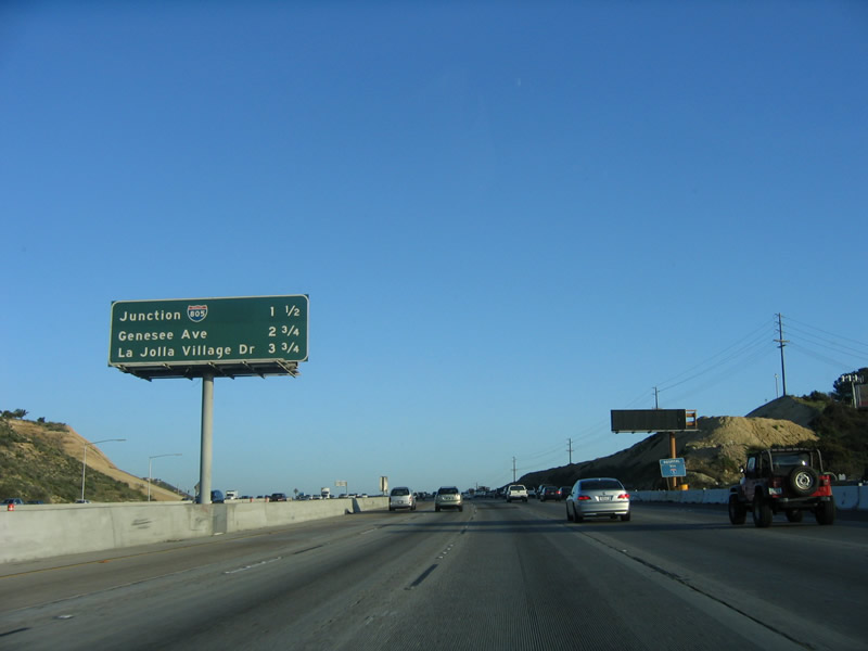
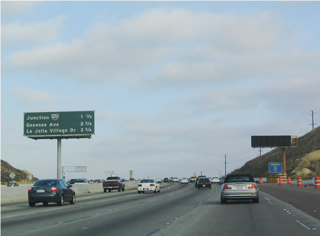
Soon thereafter, another mileage sign provides distances to the next three exits along southbound Interstate 5: Interstate 805 south, Genesee Avenue, and La Jolla Village Drive. During the 2006 photo, this area was under construction for expansion to the dual freeway concept. Photos taken 08/01/08, 04/18/06, and 07/06/04. |
|
The carpool (high occupancy vehicle) lane comes to an end at the point where Interstate 5 and Interstate 805 split as shown by this sign. Traffic in the HOV lane must connect to Interstate 805 south and may not cross travel lanes to Interstate 5 south, which will depart via the right lanes. Photo taken 08/01/08. |
|
|
|
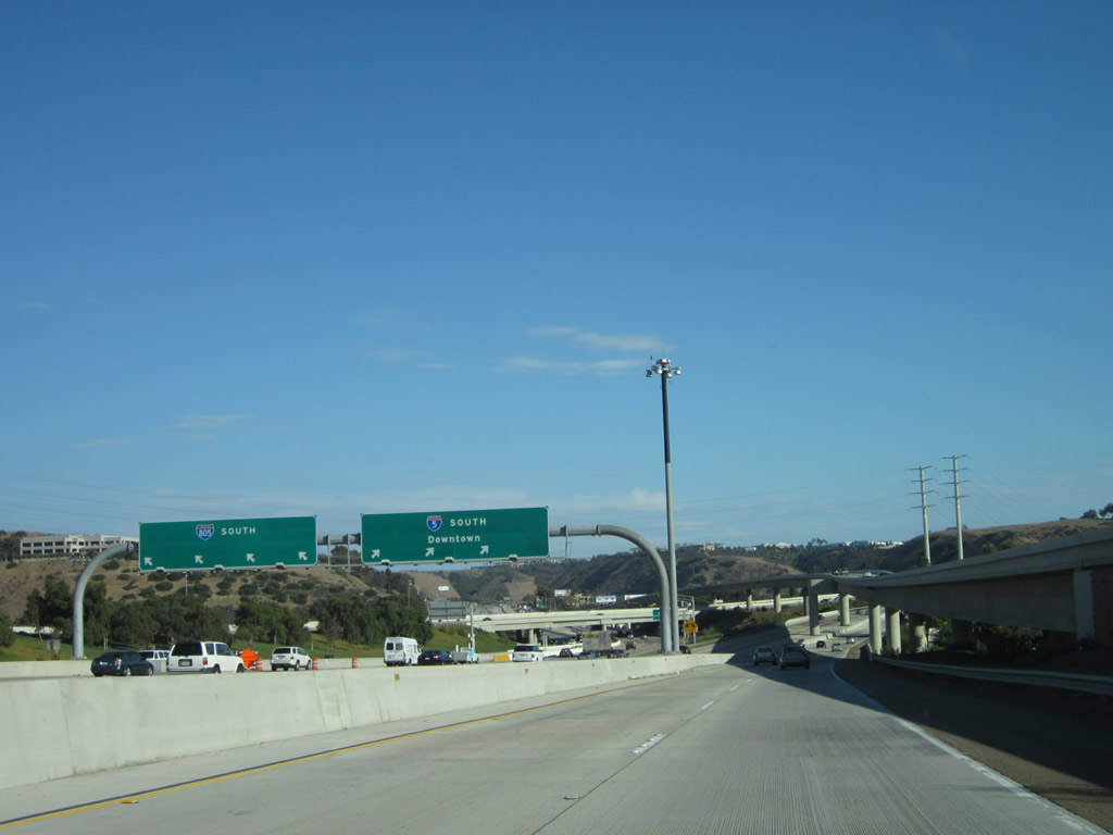
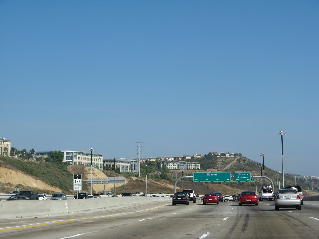
Southbound Interstate 5 (San Diego Freeway) prepares to split with Interstate 805/Jacob Dekema Freeway at Exit 31. The main lanes of the freeway will rapidly expand between California 56 to accommodate a four-lane left exit from southbound Interstate 5 to southbound Interstate 805. Note the gradual addition of lanes as motorists approach the split between the two routes. Photos taken 08/01/08, 04/18/06, and 07/06/04. |
|
|
|
Note that Interstate 805 is a left exit, and modifications to this interchange will be forthcoming due to the under-construction dual freeway and the construction of high-occupancy vehicle lanes. Photos taken 08/01/08, 04/18/06, and 07/06/04. |
|
|
|
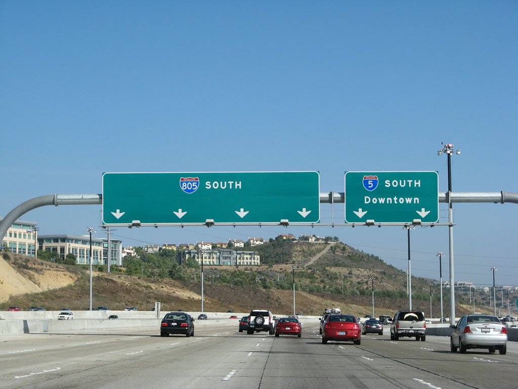
Southbound Interstate 5 reaches Exit 31 as Interstate 805 splits from the four left lanes, while Interstate 5 continues south along the four right lanes. The Interstate 805 reflective overhead sign was placed, perhaps as an experiment, side-by-side with an older Interstate 5 nonreflective overhead sign. Photos taken 08/01/08, 04/18/06, and 07/06/04. |
|
|
This massive gore point sign also provides the foreground for a bridge being constructed as part of an expansion project for the Interstate 5/805 interchange. When completed, there will be a complete truck bypass (just like the Interstate 405 interchanges in Orange and Los Angeles Counties) and a dual freeway concept that will separate local and express traffic between Del Mar Heights Road and Genesee Avenue. The northbound local bypass was completed in early 2006, while the southbound local bypass opened in spring 2007. Photos taken 04/18/06 and 07/06/04. |
| Interstate 5 (San Diego Freeway) south |
|
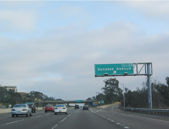
After the Mainline and Local Bypass sections of Interstate 5 unify, the next exit along southbound Interstate 5 is Exit 29, Genesee Avenue, one mile. An upcoming construction project plans to expand this section of Interstate 5 to include more lanes and to create high occupancy vehicle (HOV) lanes. This exit serves as the southern terminus of San Diego County S-21, which is largely unsigned in the San Diego city limits. Photo taken 08/01/08. |
|
Use Genesee Avenue north to the University of California at San Diego. At the top of the hill (Torrey Pines Mesa), turn left to La Jolla Shores and all university destinations (including Rimac Center). Turn right onto North Torrey Pines Road to follow Old U.S. 101 (San Diego COunty Route S-21) north to Torrey Pines Golf Course (home of the 2008 U.S. Open) and Torrey Pines State Reserve. Some of the best hiking in the region can be found at Torrey Pines State Reserve. Photo taken 08/01/08. |
|
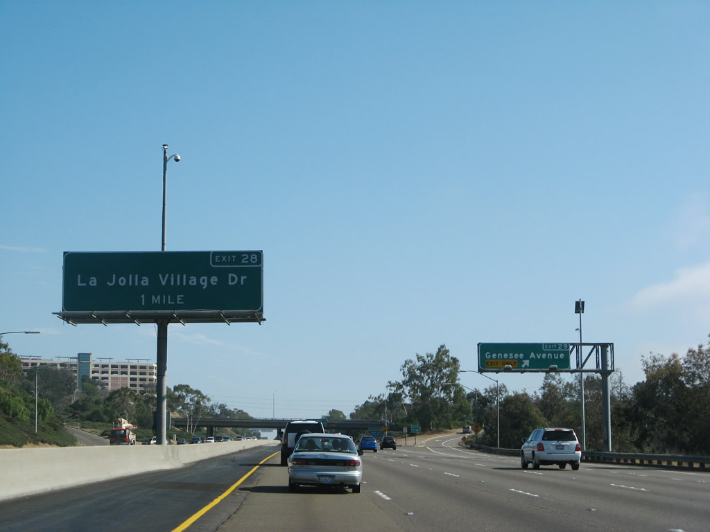
In the median, this overhead sign advises of the next exit, which is Exit 28, La Jolla Village Drive. At this point is the exit to Genesee Avenue (Exit 29). Photo taken 08/01/08. |
|
Southbound Interstate 5 reaches Exit 29, Genesee Avenue. Photo taken 09/10/03. |
|
To the University of California at San Diego (UCSD), use Exit 28, La Jolla Village Drive west to Gilman Drive north. Photo taken 06/24/11. |
|
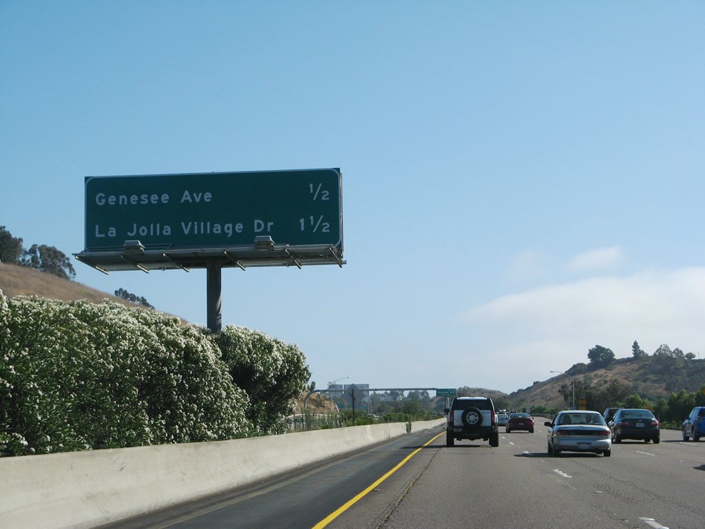
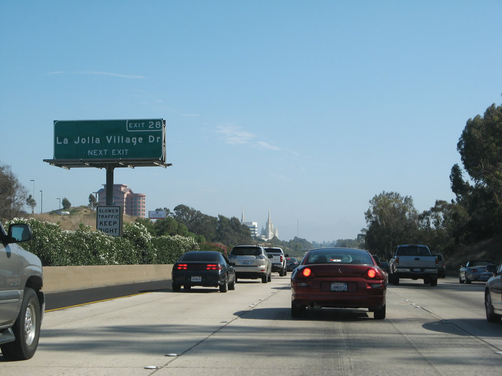
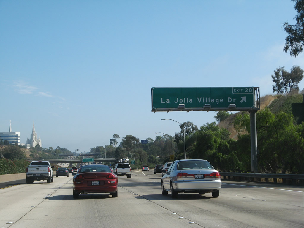
The next exit along southbound Interstate 5 is Exit 28, La Jolla Village Drive, three-quarters of a mile. La Jolla Village Drive is the best route from southbound into downtown La Jolla via Torrey Pines Road. Photo taken 08/01/08. |
|
Follow La Jolla Village Drive east to enter University City and the high rises that create a second downtown bounded by Interstate 5, Interstate 805, and California 52. Known as the Golden Triangle, banks, research companies, and hotels all have a presence in University City. The area is aptly named given the proximity of the University of California at San Diego. Photo taken 08/01/08. |
|
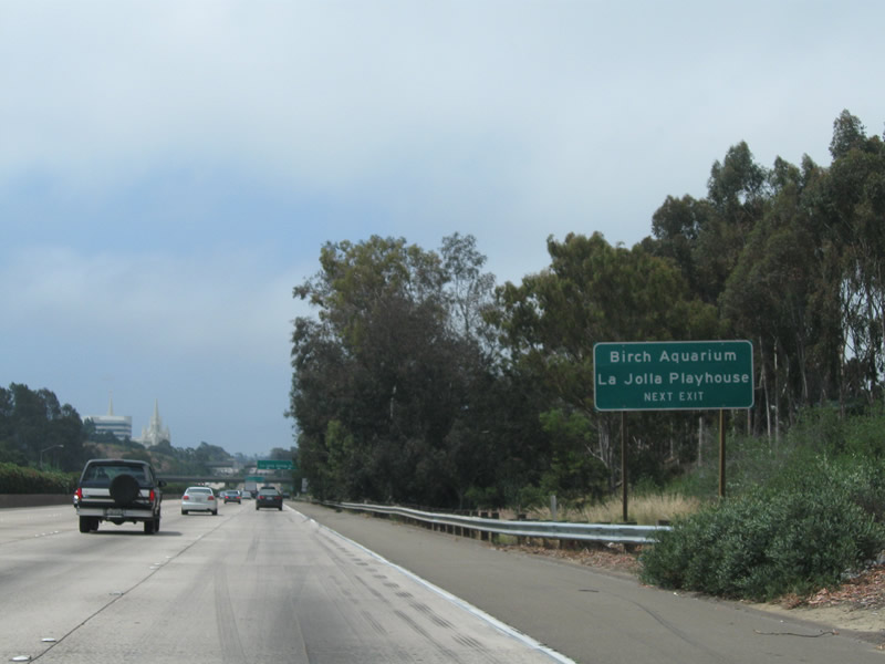
Use La Jolla Village Drive west to the Birch Aquarium (Scripps Institution of Oceanography) and La Jolla Playhouse. Photo taken 06/24/11. |
|
Southbound Interstate 5 (San Diego Freeway) meets Exit 28, La Jolla Village Drive. There is no access to Nobel Drive from Interstate 5 south, so use La Jolla Village Drive east to the University City community of San Diego and west to La Jolla and the south end of the University of California at San Diego (UCSD) campus. Photo taken 08/01/08. |
|
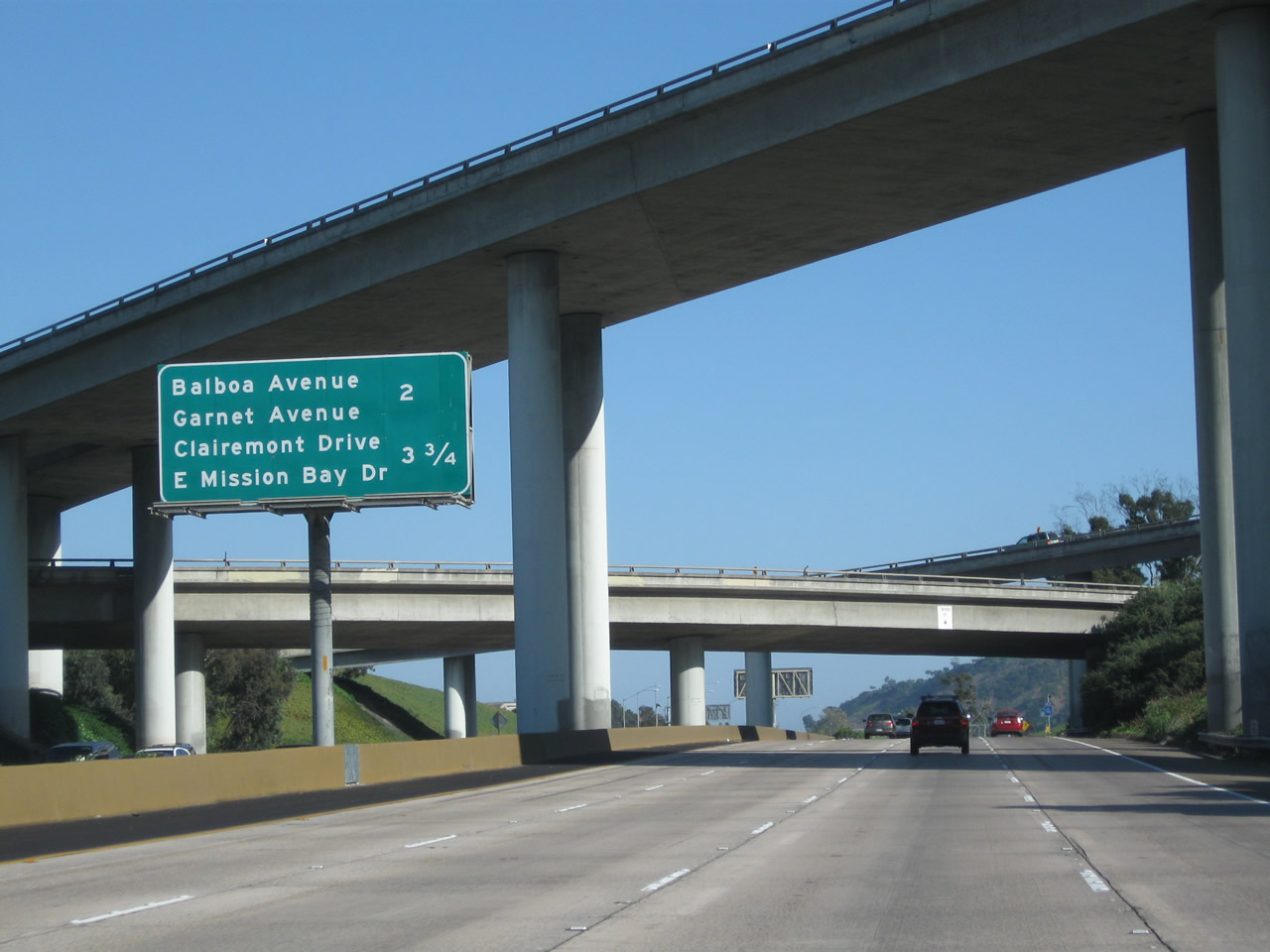
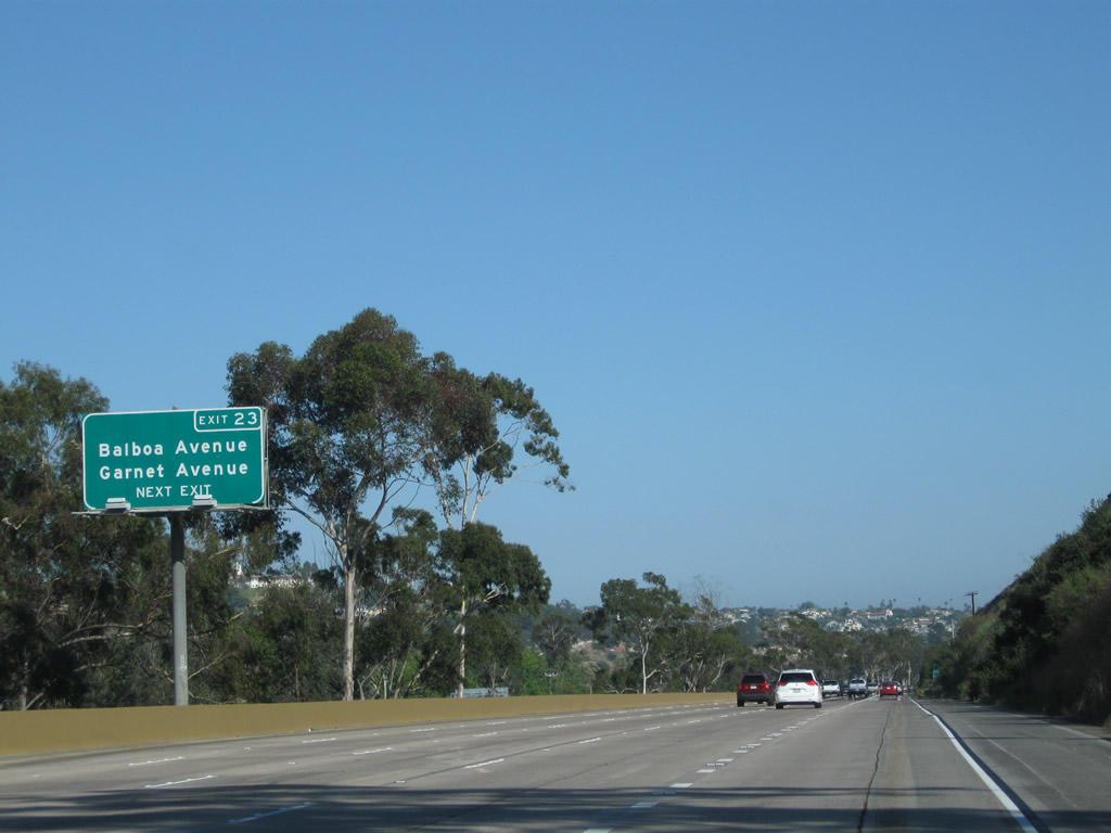
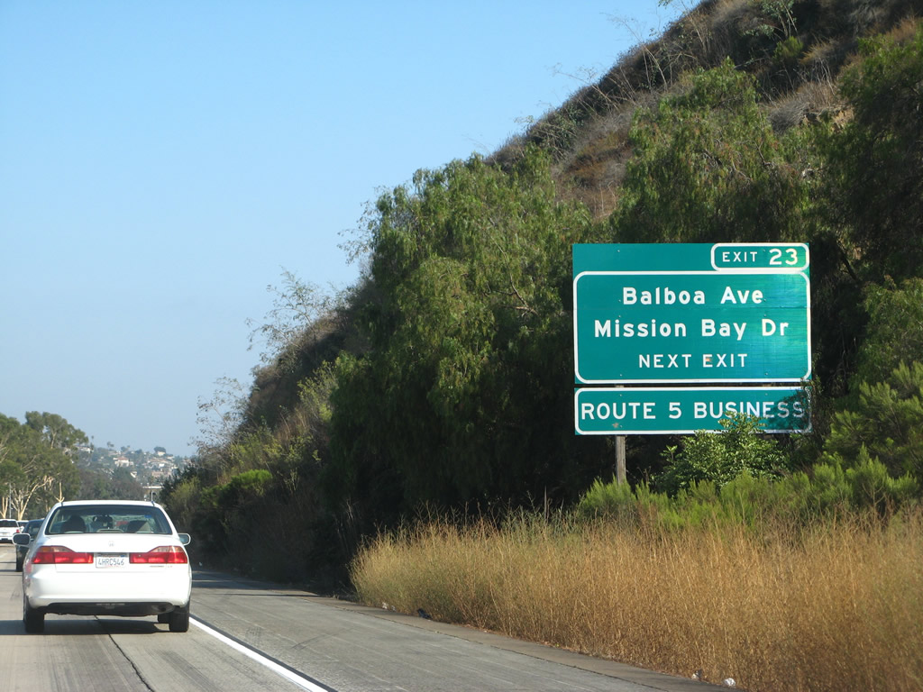
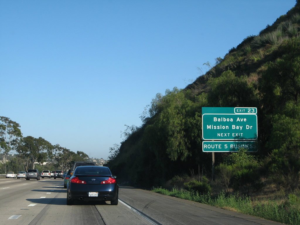
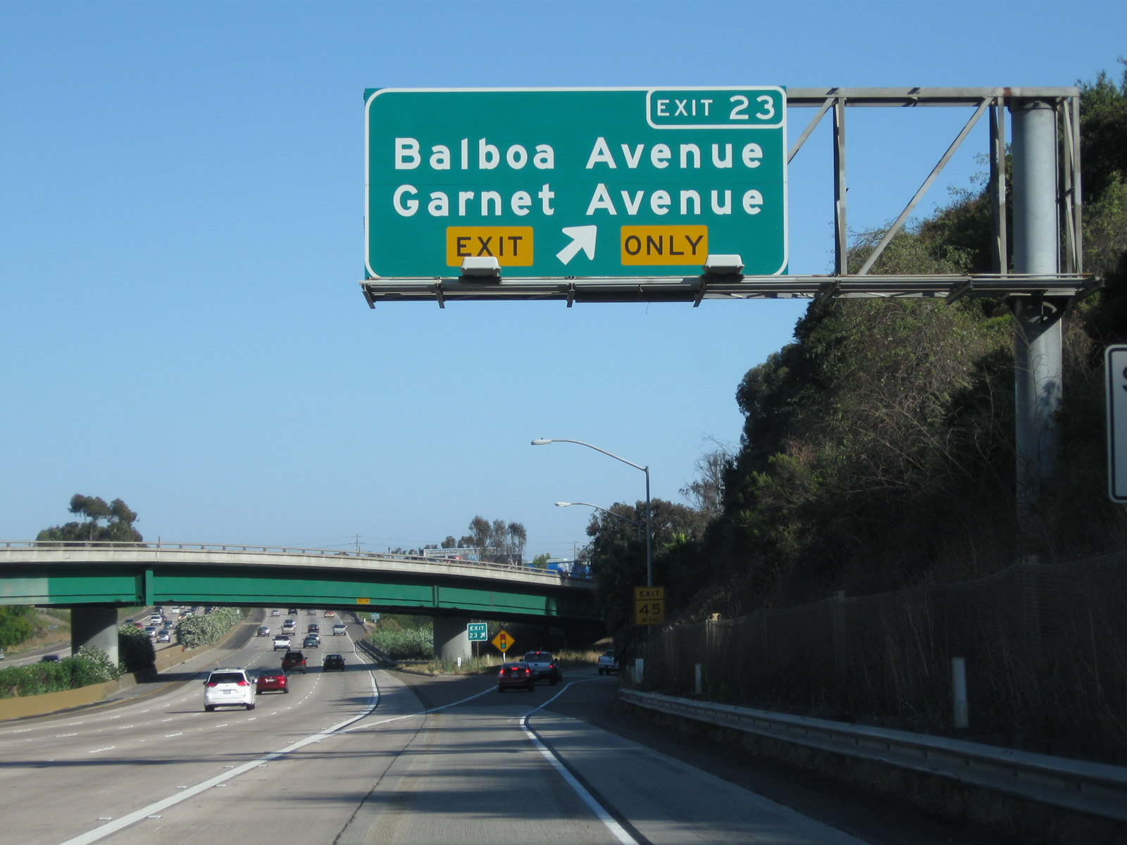
This interchange sequence sign along southbound Interstate 5 provides the distance to the next three exits: Exit 27, Gilman Drive/La Jolla Colony Drive; Exit 26, California 52; and Exit 23, Business Loop I-5 (Mission Bay Drive) south to Balboa Avenue (Former California 274) east and Garnet Avenue west. This sign was replaced in early October 2003. Photo taken 06/26/11. |
|
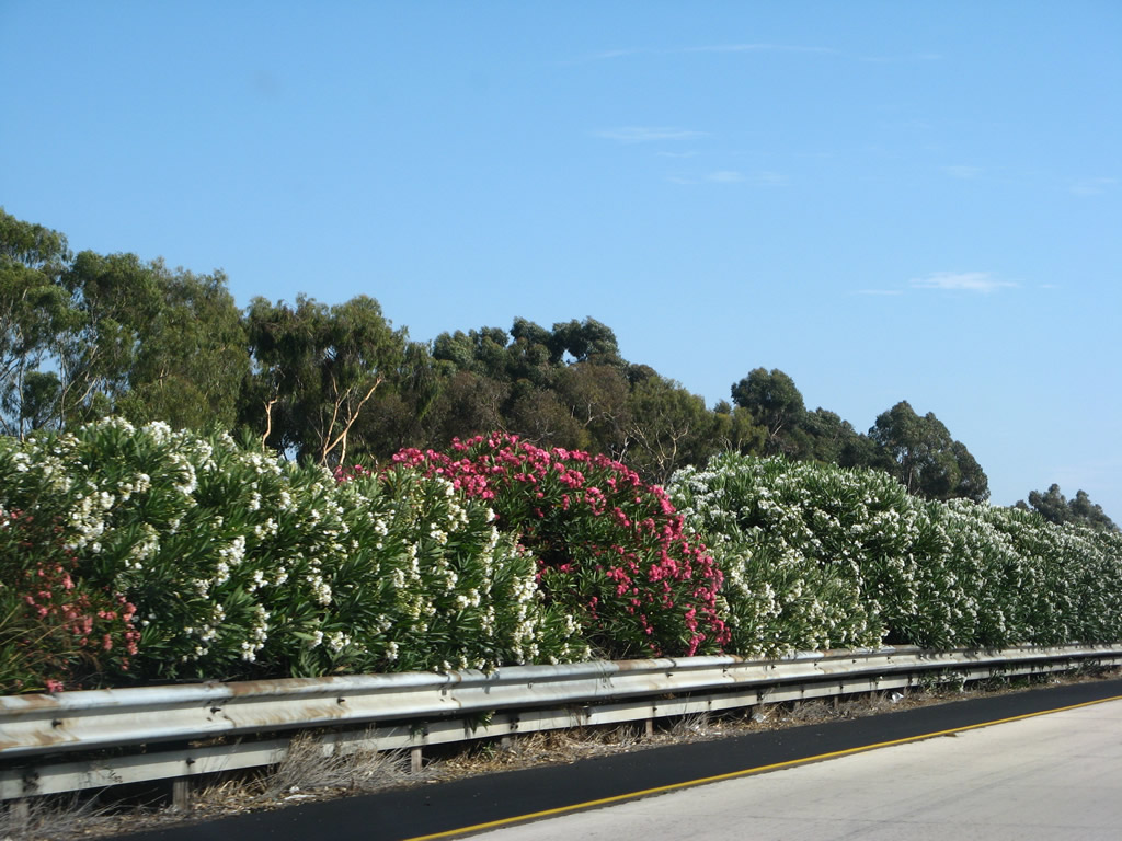
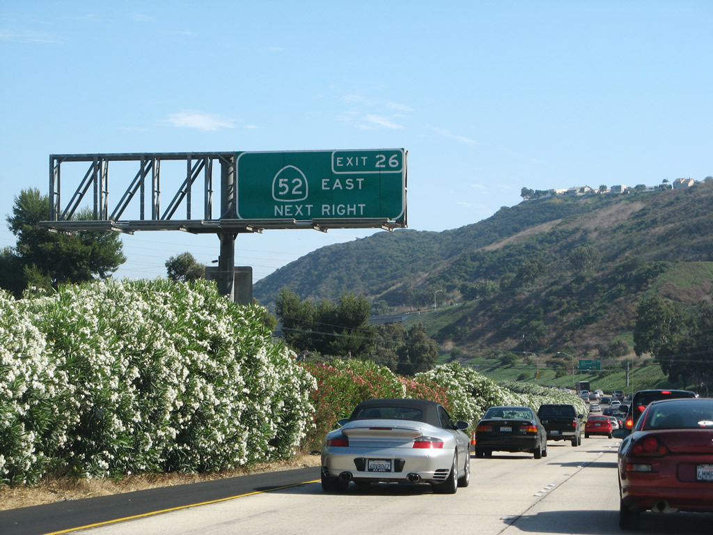
At the time this photo was taken, the freeway median consisted of planted oleander bushes. Colorful flowers dominate during the summer and fall months. With plans to construct a high occupancy vehicle (carpool) lane in both directions, these oleander bushes are not likely to be around much longer. Photo taken 08/01/08. |
|
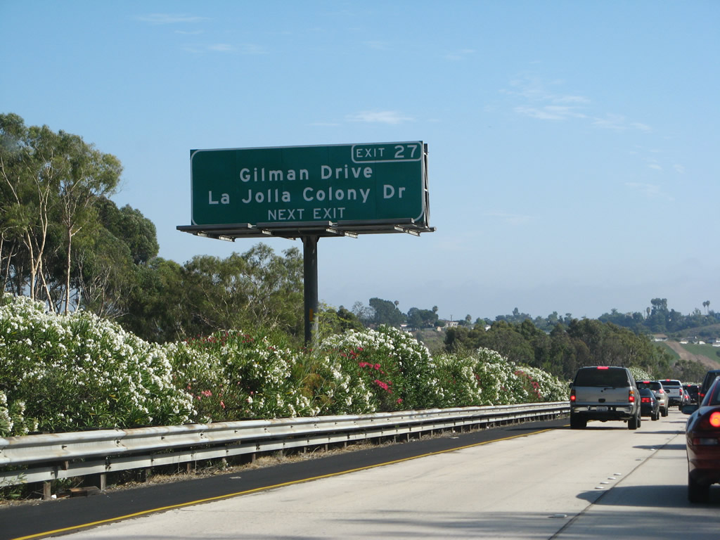
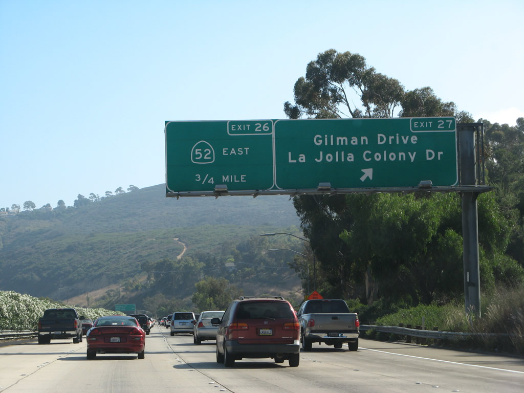
Gilman Drive heads north along an old section of U.S. 101 to the southern entrance of the University of California at San Diego, while La Jolla Colony Drive enters a subdivision of north University City that features homes and condominiums. South of here, U.S. 101 used to follow today's Interstate 5 alignment all the way to Exit 23 (Mission Bay Drive). Photo taken 08/01/08. |
|
Southbound Interstate 5 reaches Exit 27, Gilman Drive and La Jolla Colony Drive; the next exit is Exit 26 for California 52. This sign was replaced in early October 2003. Interstate 5 between Exit 27 (Gilman Drive) and prior to Exit 19 (Old Town Avenue) closely parallels the railroad on the east side of the freeway. South of Old Town, the railroad remains on the west side of the freeway all the way into downtown. Currently, the railroad rights of way includes service by the Coaster (passenger commuter rail from downtown San Diego north to Oceanside), Amtrak, and freight rail. Photo taken 06/26/11. |
|
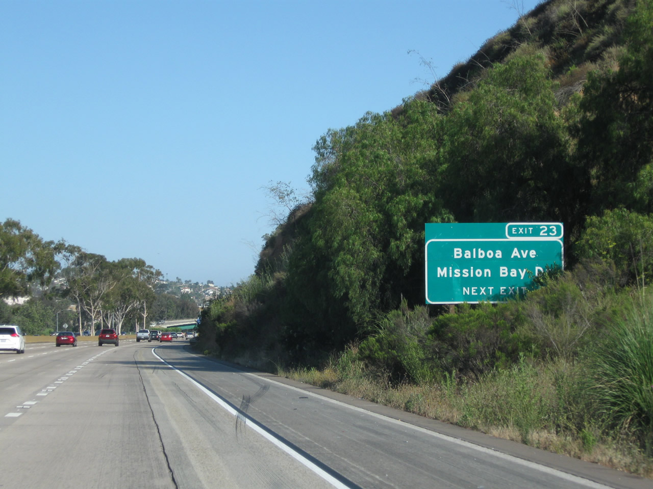
The next two exits along southbound are Exit 26, California 52 (Soledad Freeway) east to Santee and Exit 23, Mission Bay Drive (Business Route 5 and Historic U.S. 101) south to Balboa Avenue and Garnet Avenue. Photo taken 08/01/08. |
|
The right lane begins with the on-ramp from Gilman Drive and becomes the exit only for Exit 26, California 52 (Soledad Freeway) east. Photo taken 06/26/11. |
|
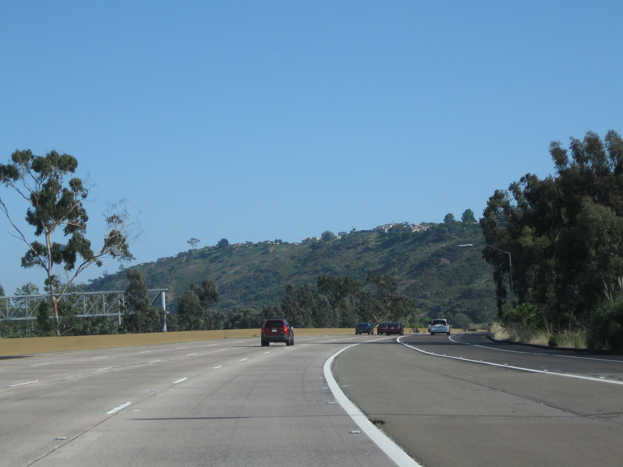
Southbound Interstate 5 approaches Exit 26, California 52 east, a freeway that extends east to Mission Trails Regional Park and the city of Santee. There is no access to La Jolla Parkway (former Ardath Road) west from Interstate 5. Getting into downtown La Jolla from Interstate 5 south requires a somewhat indirect route via La Jolla Village Drive west to Torrey Pines Road south. Towering Mount Soledad will dominate the view looking west as Interstate 5 passes through Rose Canyon (which separates the communities of Clairemont and La Jolla south of California 52). Photo taken 08/01/08. |
|
Southbound Interstate 5 (San Diego Freeway) reaches Exit 26, California 52 (Soledad Freeway) east. The control city used to be San Clemente Canyon, which is the canyon in which California 52 is located between Interstate 5 and Interstate 805. The new signs, installed in October 2003, removed the control city entirely from the California 52 signs (even though they should say "Santee"). Photo taken 06/26/11. |
|
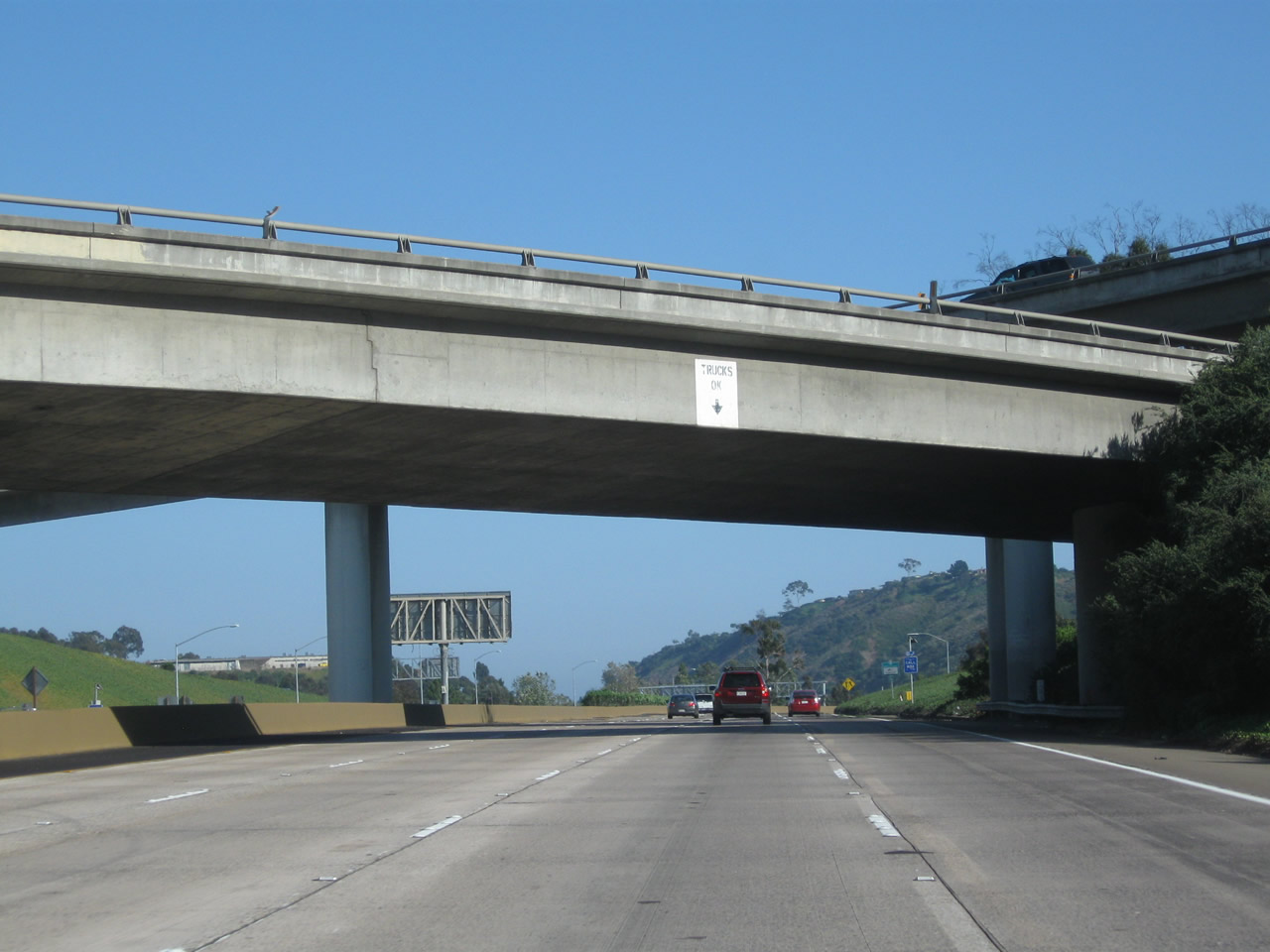
Interstate 5 passes through the California 52 stack interchange. This interchange is located in Rose Canyon off the Rose Canyon fault. Interstate 5 will follow Rose Canyon and Rose Creek south for the next several miles until just after the Pacific Beach off-ramp. This mileage sign provides the distance to Exit 23, Historic U.S. 101/Mission Bay Drive south to Balboa Avenue east to Clairemont and Garnet Avenue west to Pacific Beach and Exit 22, East Mission Bay Drive and Clairemont Drive. Photo taken 06/26/11. |
|
|
|
This overhead ramp carries traffic from California 52 west to Interstate 5 south. These motorists merge onto Interstate 5 shortly thereafter, and the freeway expands to five lanes with an auxiliary lane that will extend from the California 52 interchange south to Exit 23, Mission Bay Drive (former U.S. 101). Photos taken 06/26/11. |
|
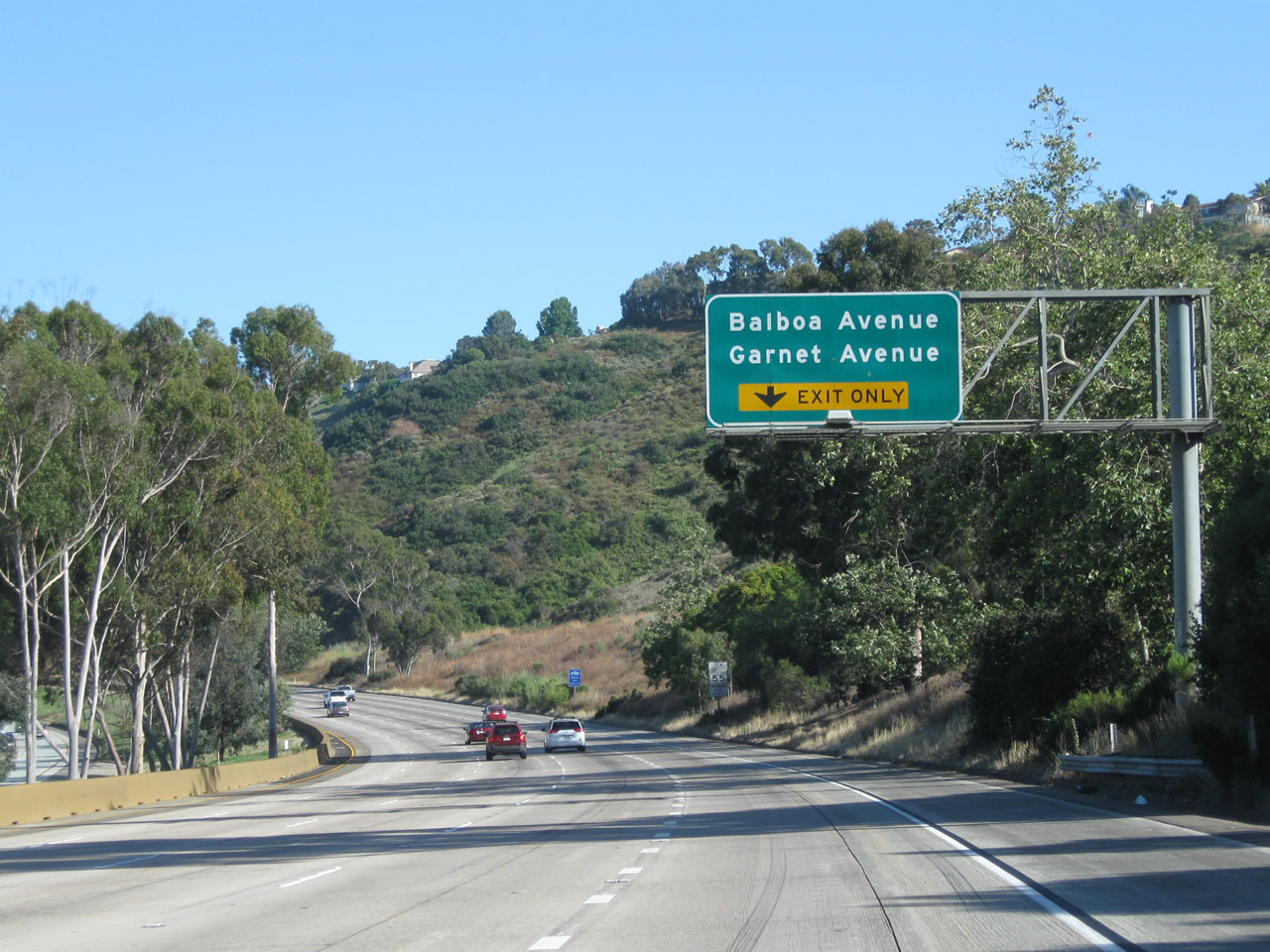
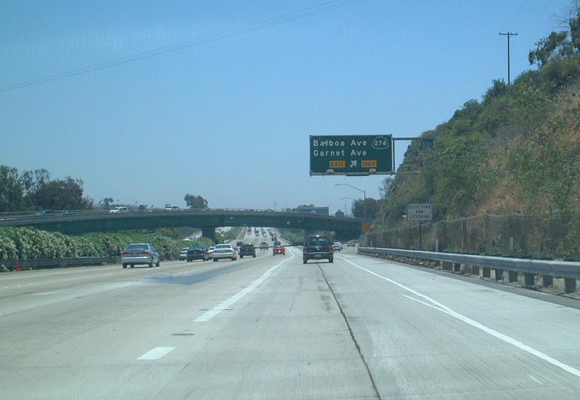
The next exit along southbound Interstate 5 (San Diego Freeway) is Exit 23, former California 274 and Balboa Avenue/Garnet Avenue. A new exit only lane is formed from the on-ramp from the California 52 and La Jolla Parkway (former Ardath Road) transition. Photo taken 05/19/08. |
|
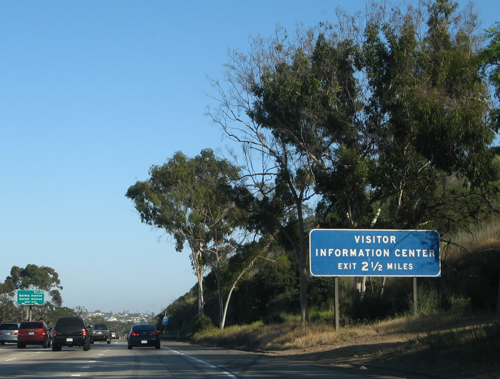
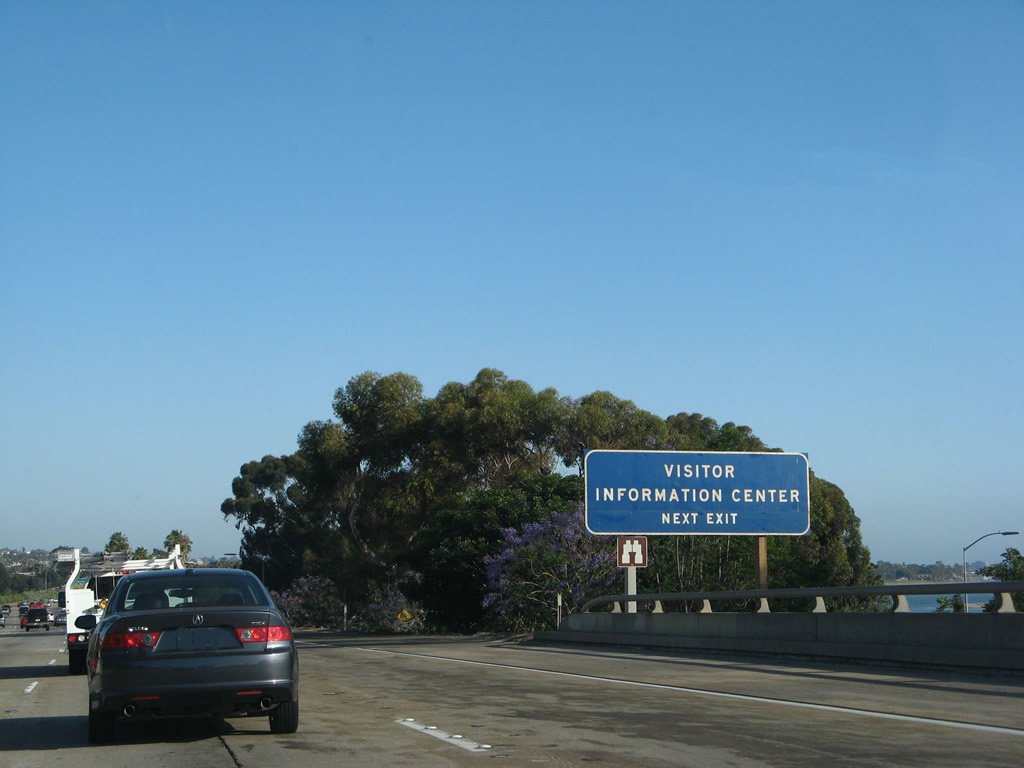
A Visitors Information Center for Mission Bay Park used to be located at Exit 22 (Clairemont Drive and East Mission Bay Drive interchange); this sign was removed in 2010 with the center's closure. When it was open, the visitors center was located on a knoll west of the freeway that overlooks one of the nation's largest urban water-based parks, Mission Bay Park. Fishing, boating, swimming, picnicking, and plenty of other activities abound at this free park. Photo taken 05/19/08. |
|
The brown colored barrier on the left side of the travel lanes was installed in 2010 to prevent crossover accidents. Photo taken 06/26/11. |
|
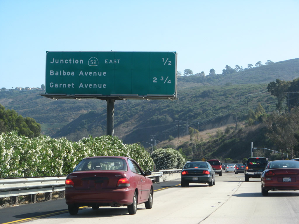
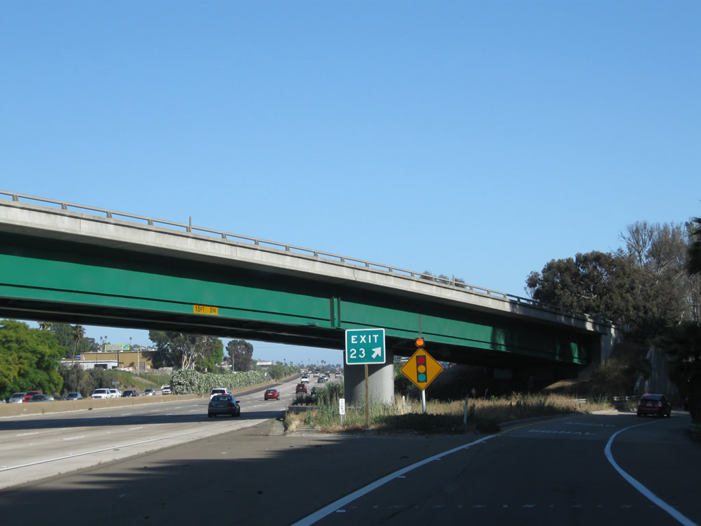
Exit 23 serves former California 274, which was decommissioned in 2001 (and signs were removed in 2003 when new exit number signs were installed). In addition to connecting to Balboa Avenue east to Clairemont and Garnet Avenue west to Pacific Beach, this exit also connects to the final business route along Interstate 5 south. Business Loop I-5 is a little over a mile long and follows Old U.S. 101 through the business section of Mission Bay Drive between Hillside Drive and East Mission Bay Drive. One must follow the business route briefly to connect to Balboa Avenue, Garnet Avenue, or Grand Avenue. This is a major exit because it is one of the few exits along southbound that actually heads west. All exits between Genesee Avenue and Balboa Avenue primarily provide connections eastbound, not westbound. Sure, a few of them go a mile or so west, but none of them actually make it to beach without having to take some twists and turns. Photo taken 06/26/11. |
|
|
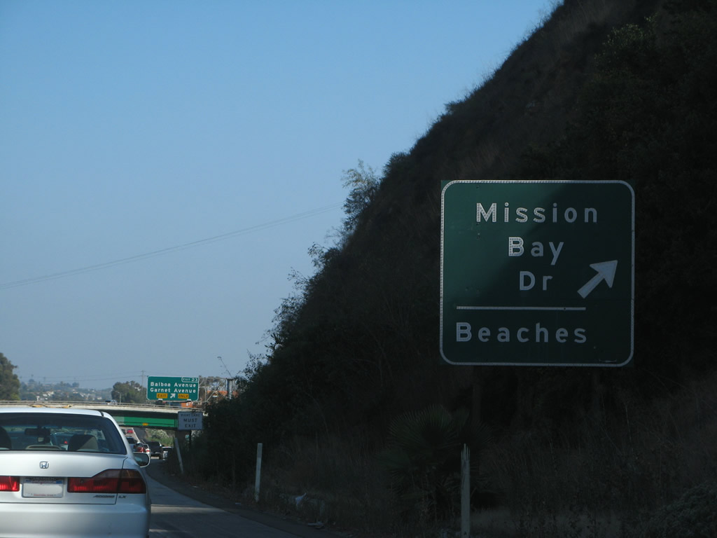
Use Garnet Avenue west to the community of Pacific Beach, which is located along a continuous sandy beach that extends from the mouth of Mission Bay north along Mission Beach and Pacific Beach. Together, Mission Beach and Pacific Beach offer some of the nicest sandy beaches in the city of San Diego. Pacific Beach is dominated at the north end by Mount Soledad, which is visible on the west side of this section of Interstate 5. Looking at this roadside guide sign (which was among the first exit number signs installed in San Diego), the "Route 5 Business" panel was one of the last signs left for the Mission Bay Drive business loop, but it was removed in January 2009 apparently after an accident damaged the sign. A solitary reassurance shield the only remnant of Business Loop I-5 along Mission Bay Drive; it is posted prior to the Grand Avenue intersection on southbound Mission Bay Drive. Photos taken 06/26/11, 08/01/08, and 09/01/03. |
|
|
|
A second roadside sign advises that Exit 23 connects to Mission Bay Drive and various beaches. To Pacific Beach, use Mission Bay Drive south to Garnet Avenue west. To Mission Beach, use Garnet Avenue west to Balboa Avenue west to Grand Avenue west to Mission Boulevard south. Photos taken 08/01/08. |
|
|
Southbound Interstate 5 meets Exit 23, the main Pacific Beach exit (Business Loop I-5 and U.S. 101/Mission Bay Drive south to former Balboa Avenue (old California 274) and Garnet Avenue). Note the green steel bridge in the background; that is the on-ramp for northbound Interstate 5 from Mission Bay Drive. The 2002 photo shows the older signage that used to feature a California 274 shield. Photos taken 06/26/11 and 02/10/02. |
|
Mission Bay Drive departs the southbound freeway; a direct connecting ramp leads from Mission Bay Drive north to Interstate 5 north as well. Photo taken 06/26/11. |
|
Shortly after the Mission Bay Drive exit, a flyover painted green crosses over the freeway. The overpass carries traffic from northbound Mission Bay Drive to Interstate 5 north. Soon after this overpass, Interstate 5 crosses over Rose Creek, which flows south toward Mission Bay. At this point, Interstate 5 leaves the shadow of Mount Soledad. Mission Bay will soon come into view on the west side of the freeway. Photo taken 05/19/08. |
|
Traffic from Balboa Avenue (former California 274) west merges onto Interstate 5 south via a loop ramp. This incomplete interchange only offers movements between Balboa Avenue west and Interstate 5 south and between Interstate 5 north and Balboa Avenue east. All other movements require access via Exit 23. Photo taken 05/19/08. |
|
This Interstate 5 south reassurance shield is posted after the on-ramp from Balboa Avenue west. Photo taken 05/19/08. |
|
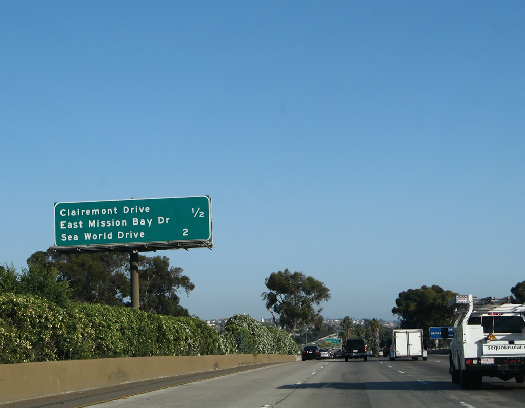
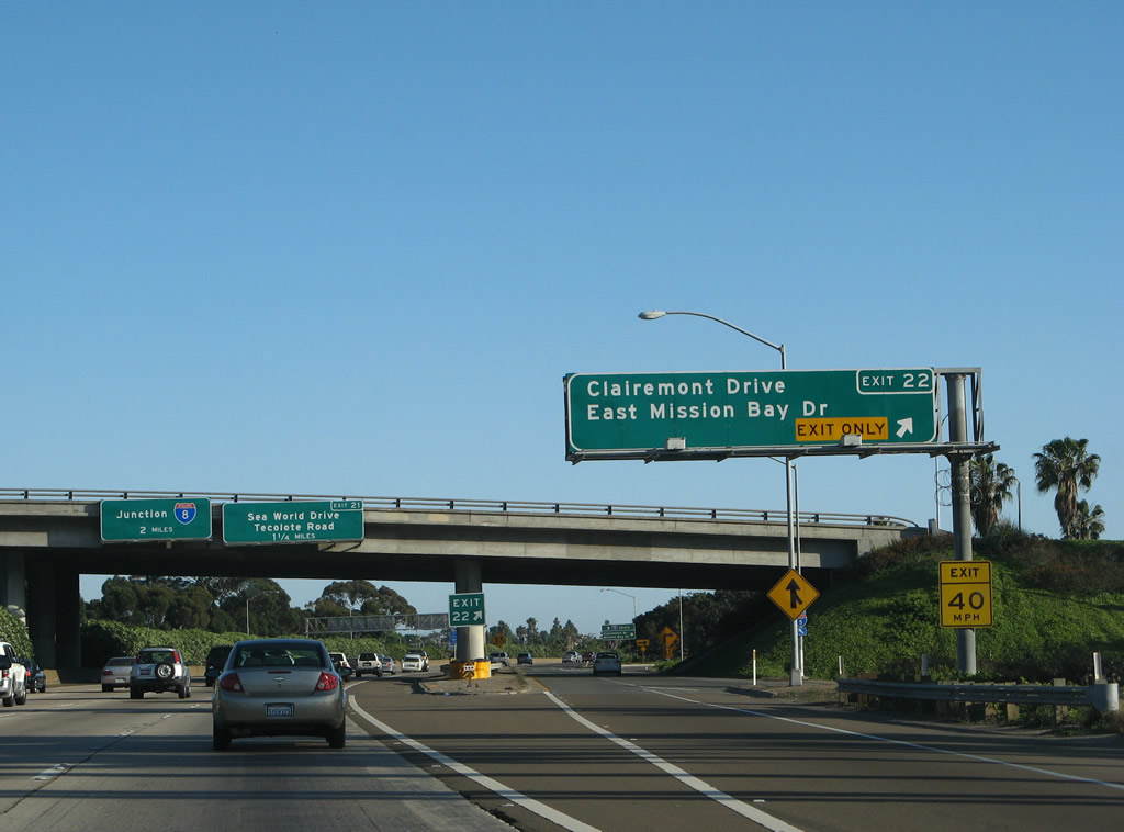
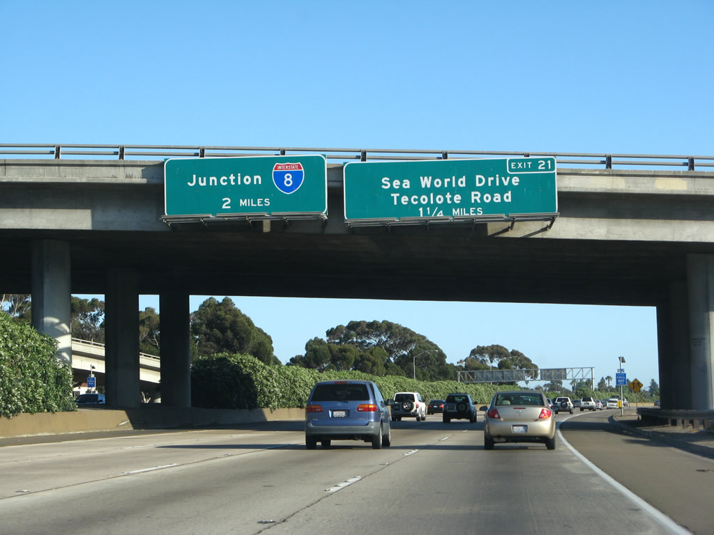
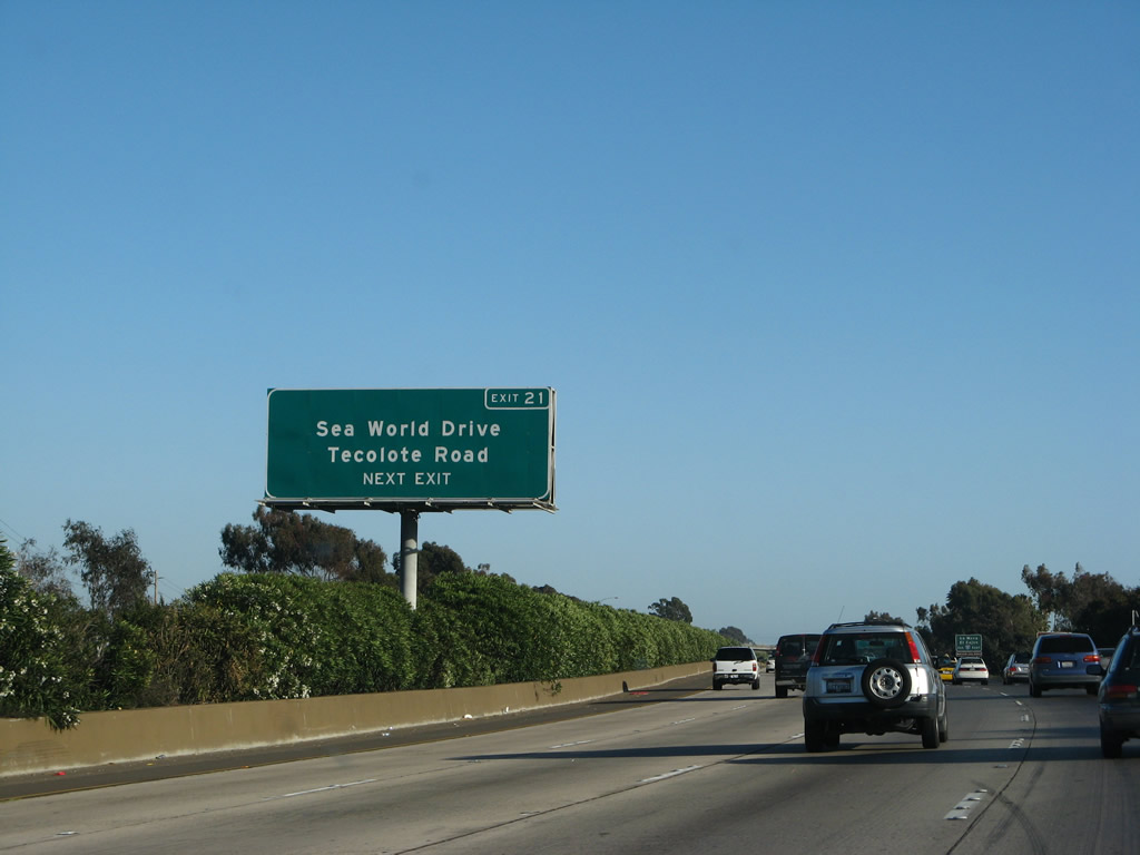
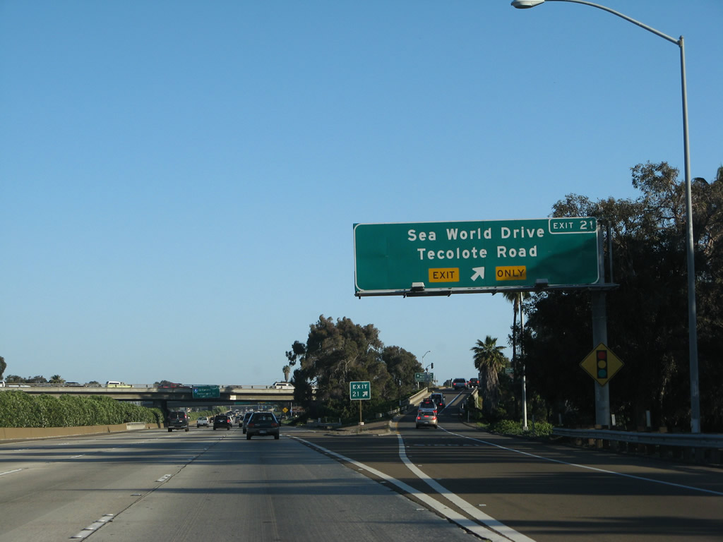
An interchange sequence sign provides the distance to the next two exits along Interstate 5 south: Exit 22, Clairemont Drive east to Clairemont and west to East Mission Bay Drive and Exit 21, Sea World Drive west and Tecolote Road east. Photo taken 05/19/08. |
|
Use Exit 22 (East Mission Bay Drive) to the Mission Bay Park Visitors Information Center. The center (temporarily) closed in 2010, so this sign was removed around the same time. Photo taken 05/19/08. |
|
Traffic from southbound Business Loop 5 (Mission Bay Drive) merges onto Interstate 5 (San Diego Freeway) south. The right lane becomes exit only for the collector distributor lane to Exit 22, Clairemont Drive and East Mission Bay Drive. Through traffic may use the exit only lane and still reconnect to Interstate 5 south if desired. Photo taken 05/17/08. |
|
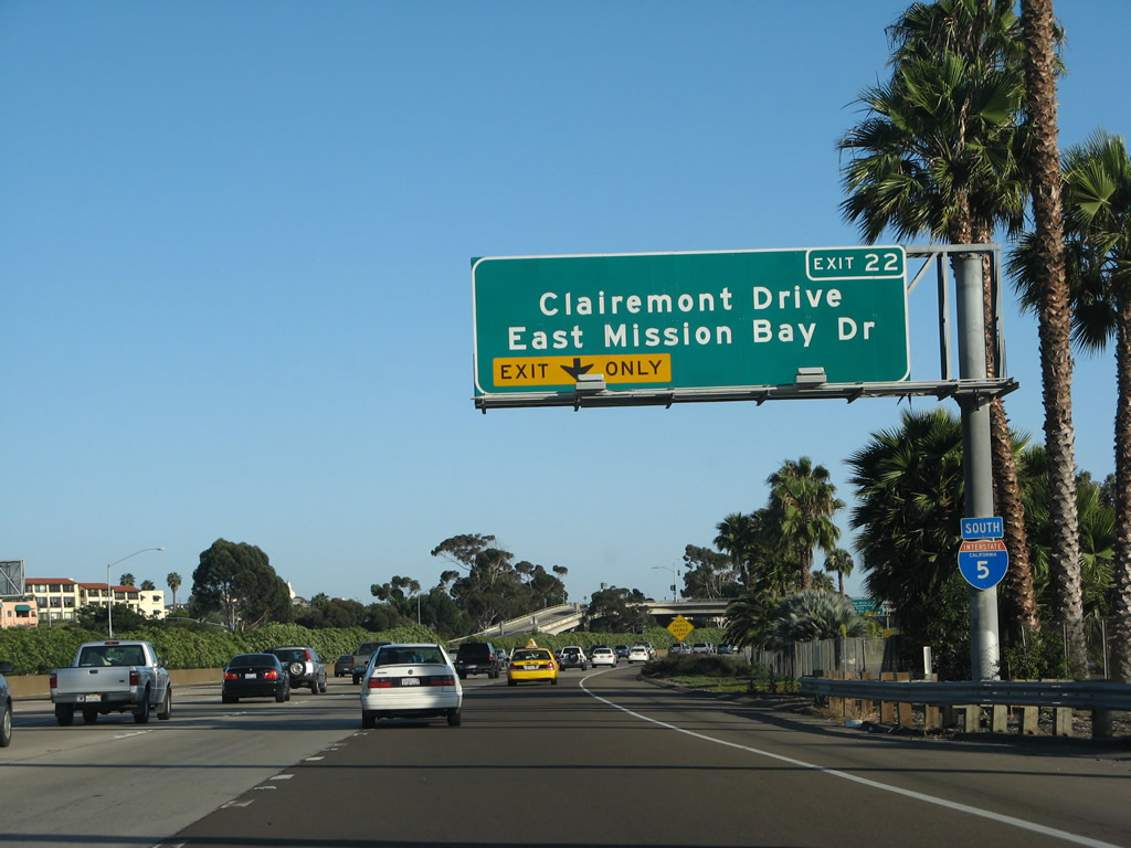
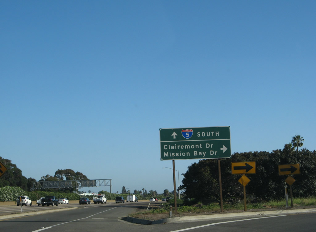
Southbound Interstate 5 (San Diego Freeway) reaches Exit 22, Clairemont Drive and East Mission Bay Drive. Use this exit to Mission Bay Park and the San Diego communities of Bay Park and Clairemont. Photo taken 05/17/08. |
|
Now on the transition ramp, an Interstate 5 trailblazer is posted on the transition ramp to allow motorists connecting from Clairemont Drive west to Interstate 5 south. Exiting traffic should merge right. Photo taken 05/19/08. |
|
At the end of the transition ramp, the left lane leads back to Interstate 5 south, while the right lane connects onto a loop ramp. At the top of the ramp, turn left to East Mission Bay Drive and the Mission Bay Park Visitors Center and right to Clairemont Drive east to the San Diego community of Clairemont. Photo taken 05/19/08. |
|
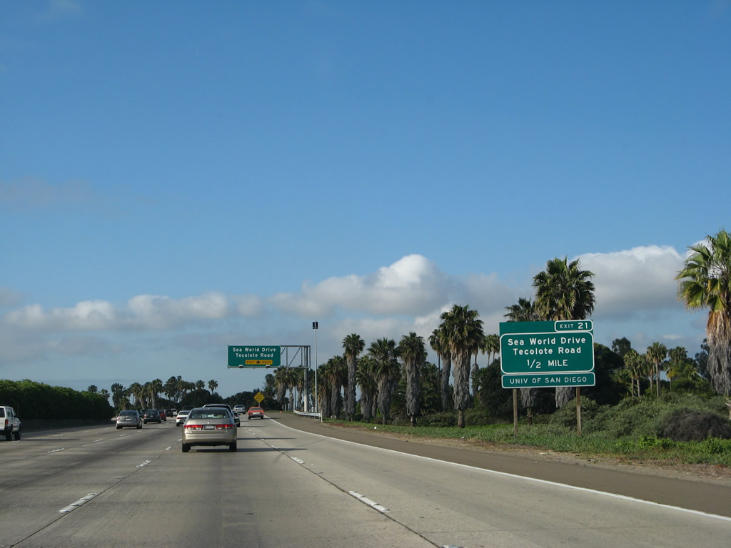
The next exit along southbound Interstate 5 is Exit 21, Sea World Drive/Tecolote Road, followed by Exit 20, Interstate 8 (Mission Valley Freeway) east and Camino del Rio south to Rosecrans Street. The exit number is omitted from the new Interstate 8 guide sign. These signs are mounted onto the Clairemont Drive overcrossing. Photo taken 05/17/08. |
|
This mileage sign along Interstate 5 (San Diego Freeway) south provides the distance to the next two exits: Exit 21, Sea World Drive and Tecolote Road and Exit 20, Interstate 8 and Camino del Rio south to Rosecrans Street. Photo taken 05/29/08. |
|
Follow Sea World Drive west to the SeaWorld amusement park, the home of Shamu the killer whale. Photo taken 05/29/08. |
|
An auxiliary exit number sign was placed on the side of the freeway in mid-August 2002, and it augments the overhead sign visible in the distance. The overhead sign does not have an exit number on it; perhaps these two signs could have been combined into one sign. Photo taken 05/29/08. |
|
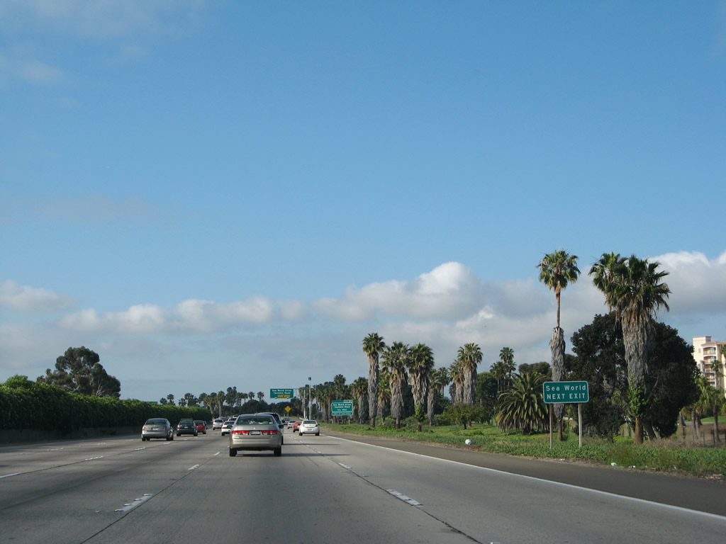
A new right lane becomes exit only for Sea World Drive and Tecolote Road. Use Sea World Drive west to reach Sea World, Mission Beach, and South Shore of Mission Bay. Use Tecolote Road east to reach Tecolote Canyon Nature Center and Open Space. Since there is no connection to westbound Interstate 8, use Sea World Drive and Sunset Cliffs Boulevard to reach Ocean Beach and Nimitz Boulevard in Point Loma. Photo taken 05/29/08. |
|
To the east, Tecolote Road is a fairly short road that connects Interstate 5 with Morena Boulevard (Old U.S. 101), then dead ends into the Tecolote Canyon Natural Park. A nature center and city recreation center are located at the end of the road. Tecolote Canyon Natural Park provides hiking, biking, and other outdoor activities. The canyon lies below the community of Linda Vista, and the canyon travels north into the Clairemont community. Photo taken 05/17/08. |
|
Use Sea World Drive west to Pacific Highway south to reach Old Town, which includes the state historic park, authentic cuisine and shops, and other attractions. The San Diego Mission is not in Old Town; it is located east of here at the eastern end of Mission Valley. Use Interstate 8 east to Mission Gorge Road north to the San Diego Mission. Photo taken 09/01/03. |
|
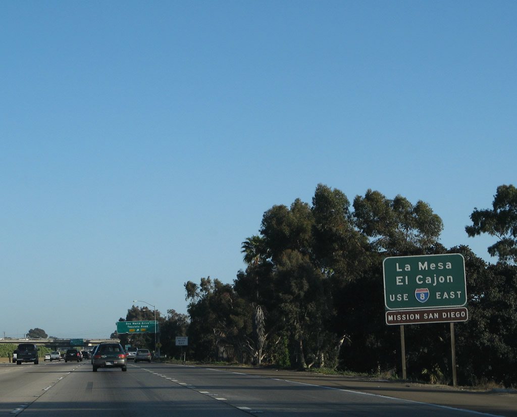
This auxiliary sign is posted for Exit 20, Interstate 8. Use Interstate 8 east to the cities of La Mesa and El Cajon, both of which are suburbs that lie east of San Diego. Photo taken 05/17/08. |
|
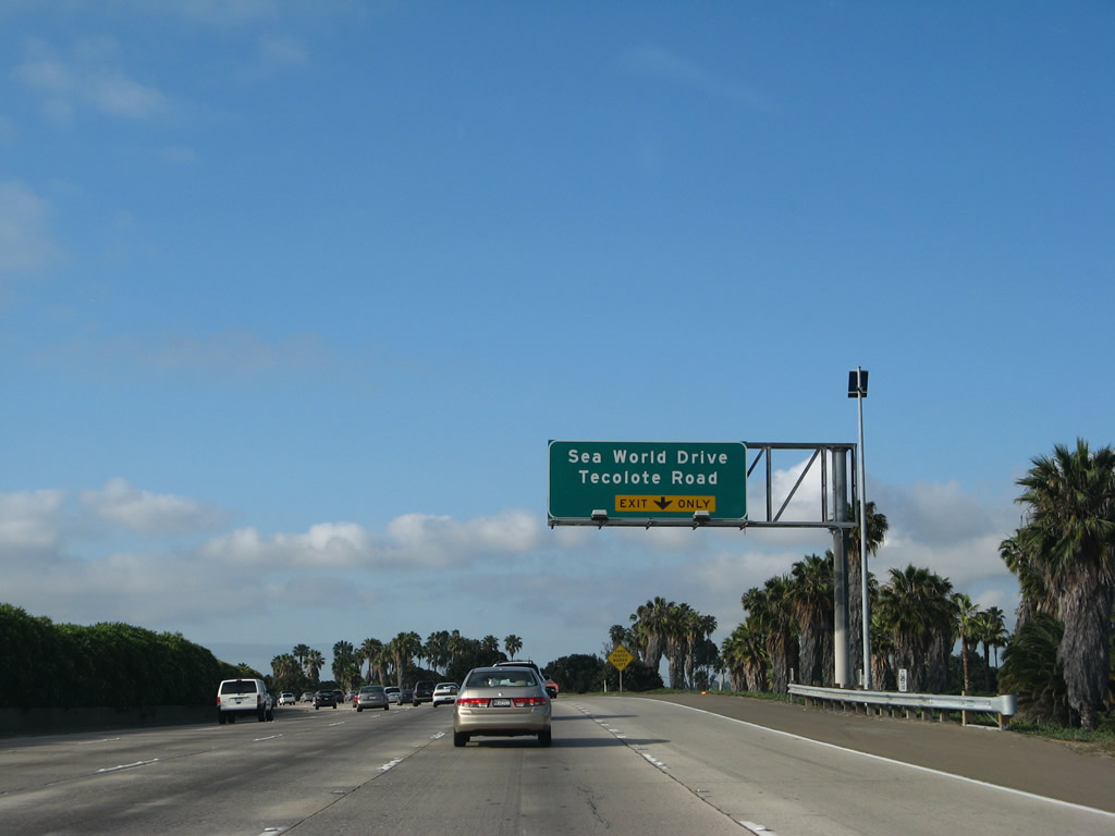
Southbound Interstate 5 meets Sea World Drive/Tecolote Road at Exit 21. Photo taken 05/17/08. |
|
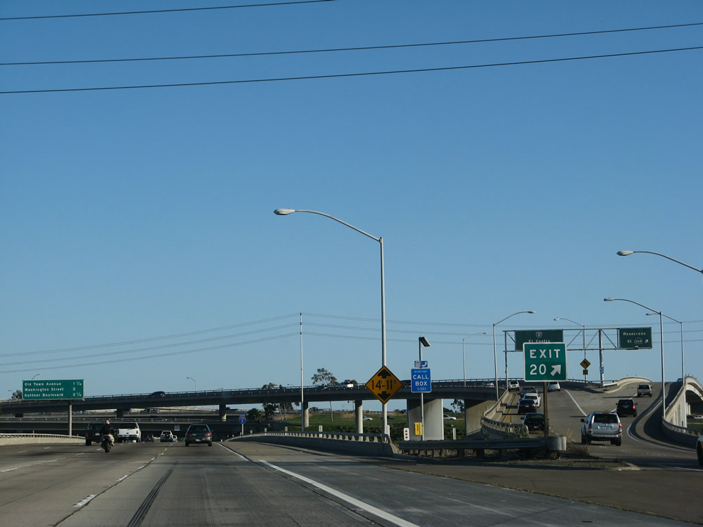
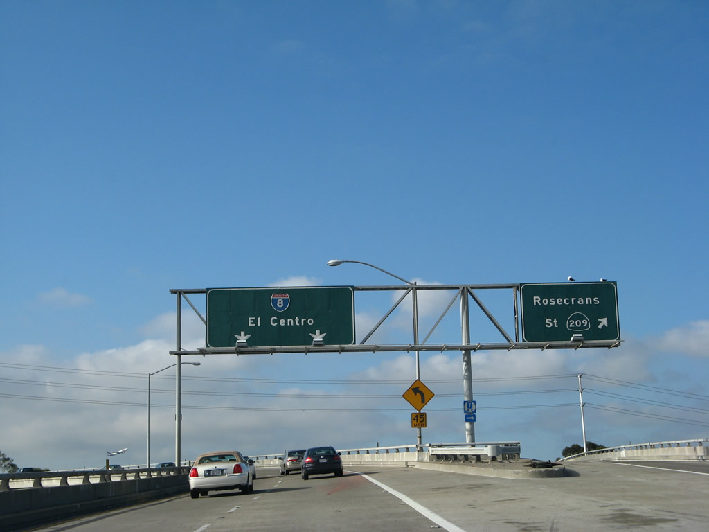
The next exit along southbound Interstate 5 is Exit 20, Interstate 8 and California 209. Former California 209 used to run the length of the Point Loma peninsula, culminating at the Cabrillo National Monument. However, the entire state route was decommissioned in May 2001 as a result of the city of San Diego taking control of the route from the state. California 274 was decommissioned at the state time. California 209 is not to be confused with California 109, which is the original designation of Interstate 8 (Ocean Beach Freeway) from Interstate 5 west to Sunset Cliffs Boulevard. California 109 was decommissioned back when Interstate 8 was extended west to its current terminus at Sunset Cliffs/Nimitz Boulevard. Photo taken 09/01/03. |
|
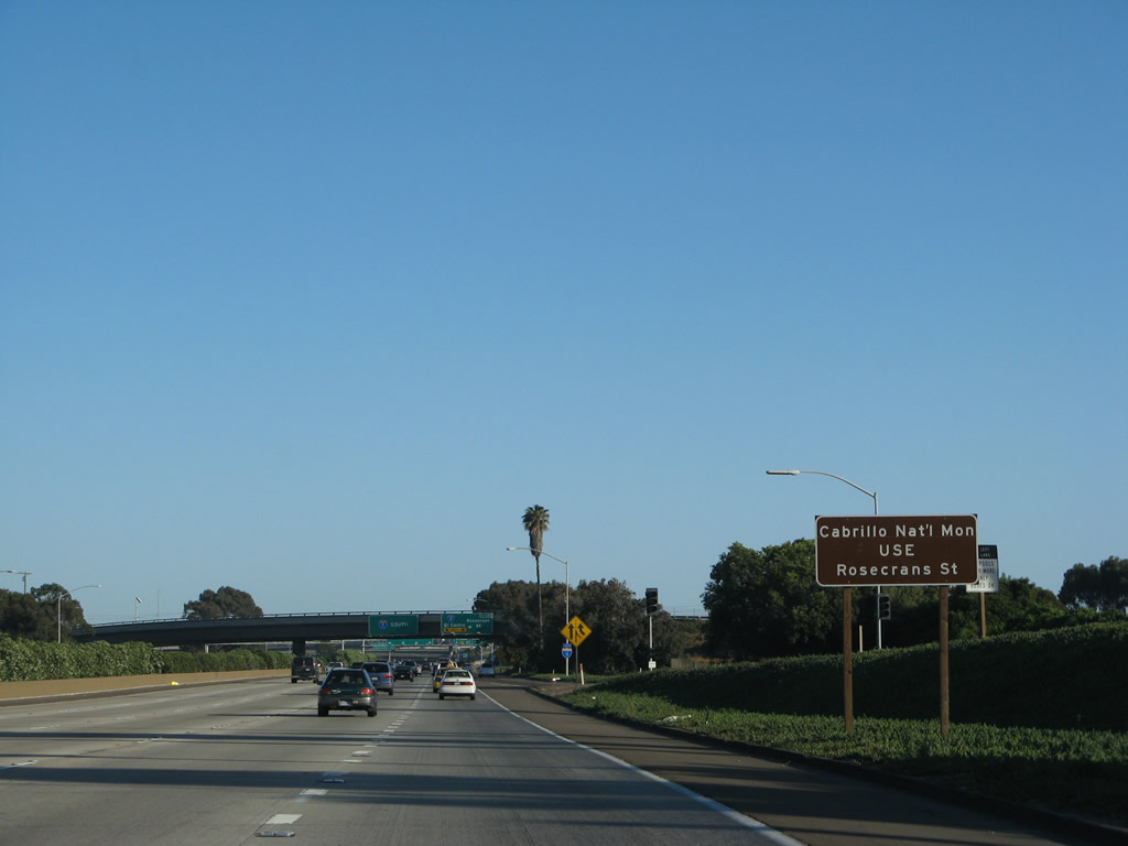
The path to Cabrillo National Monument requires a few turns, but it is generally easy to find. Follow Camino del Rio, Rosecrans Street, Ca-on Street, Catalina Boulevard, and Cabrillo Memorial Drive south to the monument, which offers stunning views of San Diego Bay, downtown San Diego, the North Island Naval Air Station, and Coronado, the Silver Strand. On clear days, Mexico is visible to the south. During whale migration season, whales can be seen passing through the waters of the Pacific Ocean. Photo taken 05/17/08. |
|
The on-ramp from Sea World Drive becomes the auxiliary lane that will depart for Exit 20, Interstate 8 and Camino del Rio south to Rosecrans Street. Photo taken 05/17/08. |
|
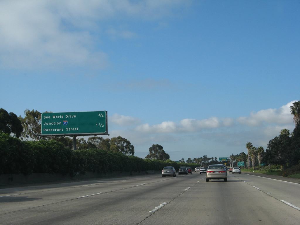
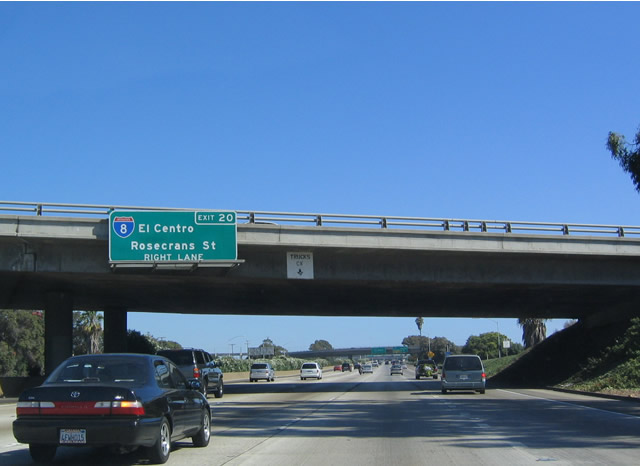
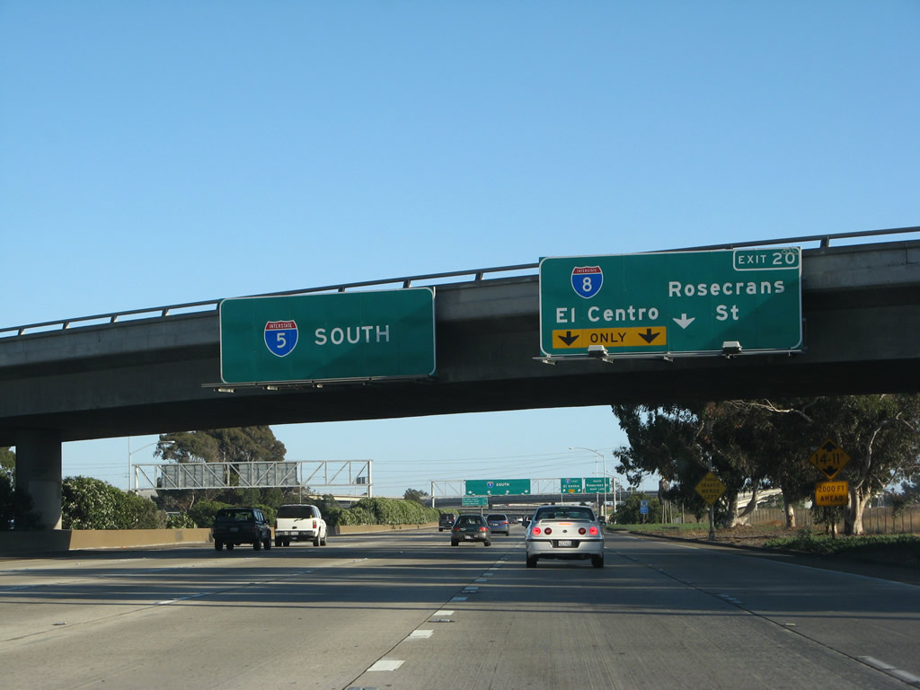
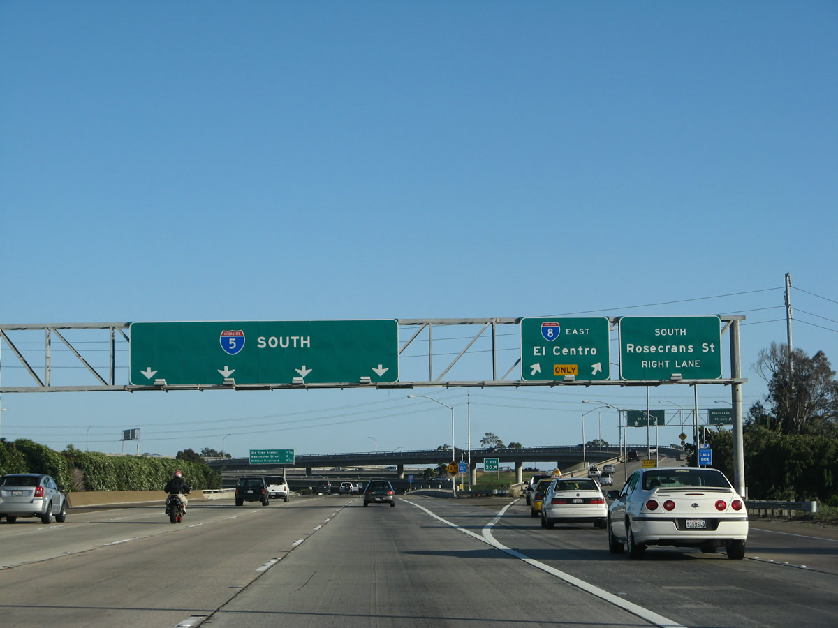
Southbound Interstate 5 (San Diego Freeway) reaches Exit 20, Interstate 8 (Mission Valley Freeway) east and Camino del Rio (former California 209) to Rosecrans Street south. Rosecrans Street serves the Midway-Sports Arena district of San Diego, then continues south into the Point Loma community. This interchange marks the northern terminus of former California 209. Future plans call for the construction of ramps that would connect Interstate 5 south with Interstate 8 west to Ocean Beach and Interstate 8 east to Interstate 5 north, but that is still many years away. Photo taken 05/17/08. |
|
The left four lanes continue south on Interstate 5, while the right two lanes depart to Interstate 5 and Rosecrans Street. Photo taken 05/17/08. |
|
Once on the Exit 20 transition ramp, the signs for Interstate 8 and former California 209 were not replaced, so the California 209 shield remains intact. California 209 was decommissioned in 2001, yet this sign and several others along Interstate 8 and even on the former alignment itself are still present today (as of 2008). Photo taken 05/29/08. |
|
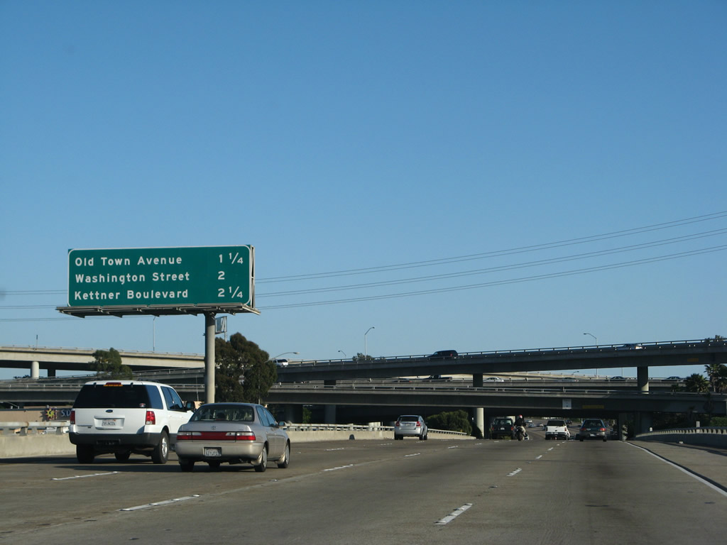
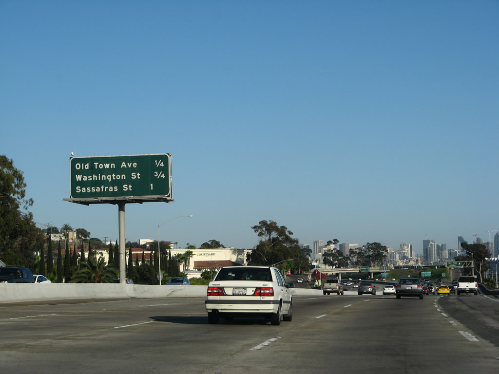
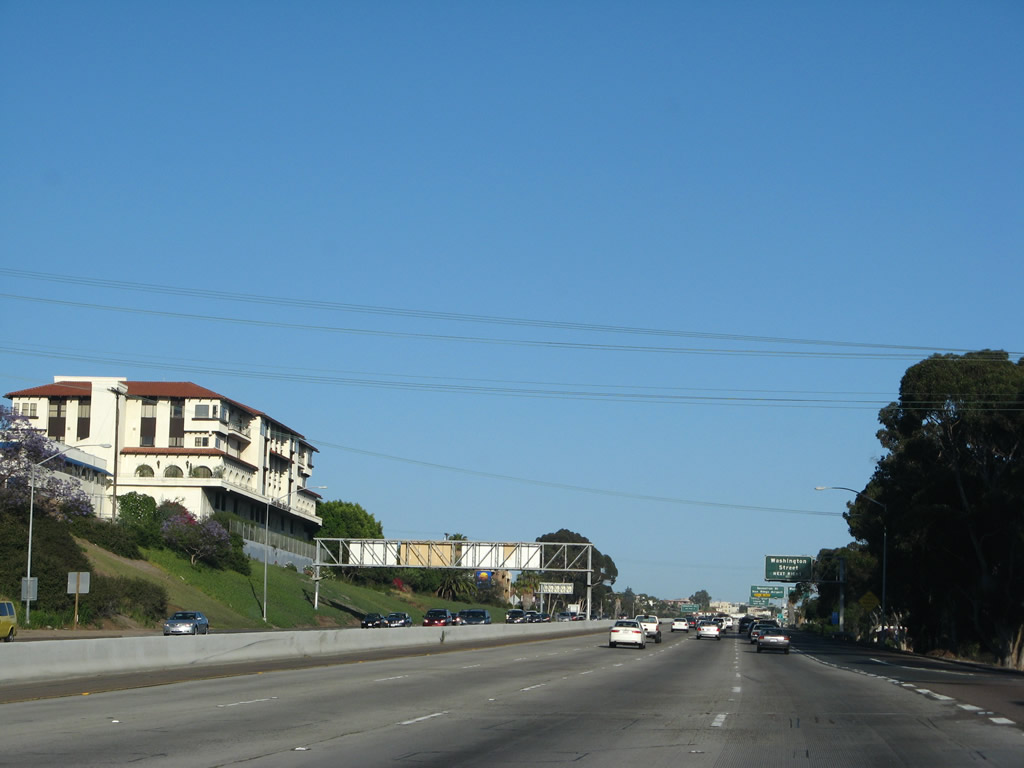
This mileage sign provides the distance to the next three exits along Interstate 5 (San Diego Freeway) south: Exit 19, Old Town Avenue; Exit 18B, Washington Street; and Exit 18A, Kettner Boulevard south to Sassafras Street and Laurel Street. At this point, Interstate 5 crosses over the San Diego River. Look west to see the river flow into the Pacific Ocean. The river flows from near Julian in the mountains on a southwesterly course, passing through Mission Trails Regional Park and Mission Valley before emptying into the sea. Photo taken 05/17/08. |
|
Passing through the Interstate 8 interchange, the top level is the transition ramp from Interstate 5 south to Interstate 8 east. The middle level carries Interstate 8 through the interchange, and Interstate 5 forms the lowest level. This stack interchange would likely gain some height if the missing connectors are built. Photo taken 05/17/08. |
|
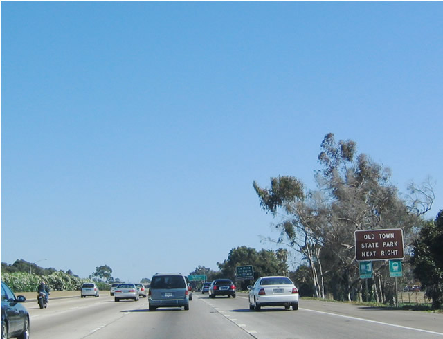
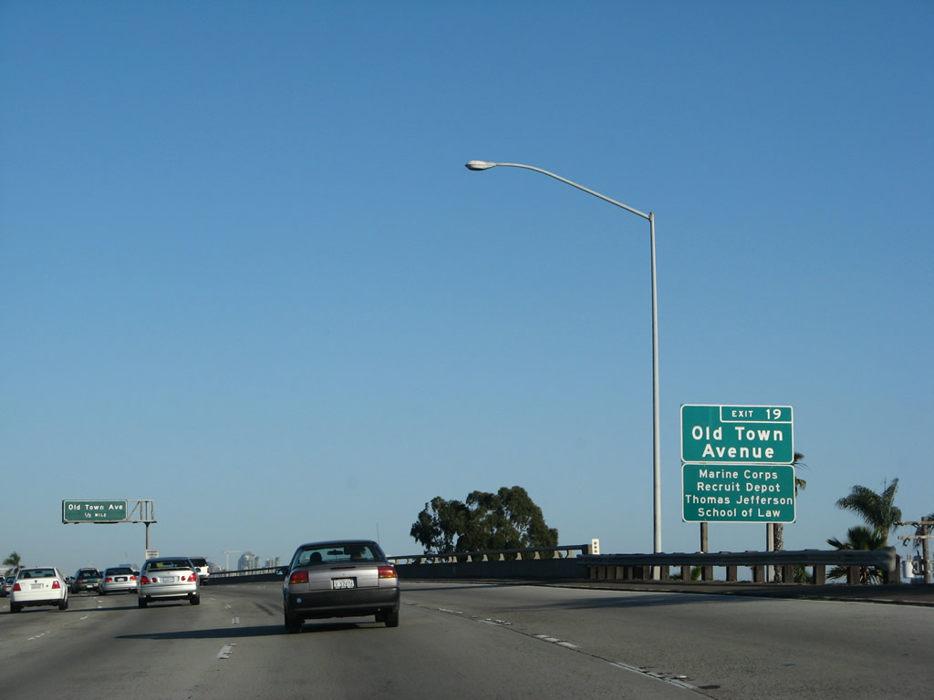
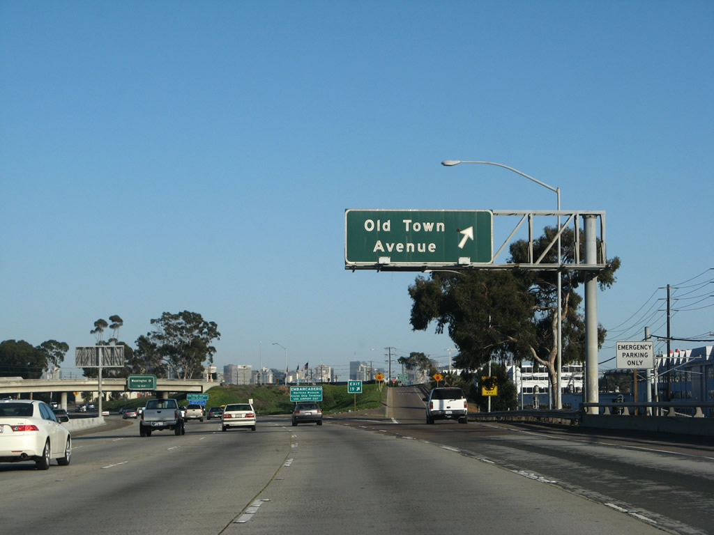
The next exit along southbound Interstate 5 is Exit 19, Old Town Avenue, which leads into the historic Old Town State Park. Use Exit 19 to the Marine Corps Recruit Depot (MCRD), which is situated southwest of Interstate 5. Photo taken 05/17/08. |
|
As the skyscrapers of downtown San Diego come into view, Interstate 5 passes over the railroad right of way. In addition to carrying Amtrak and commuter rail (Coaster), the line now includes light rail tracks for the famous red San Diego Trolley. The trolley offers service from Old Town east into Mission Valley and south to downtown San Diego. Photo taken 05/17/08. |
|
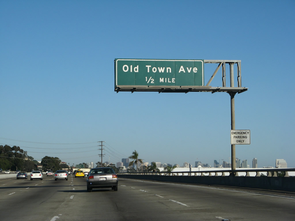
This mileage sign provides the distance to the next three exits on southbound Interstate 5 (San Diego Freeway): Exit 19, Old Town Avenue; Exit 18B, Washington Street; and Exit 18A, Kettner Boulevard south to Sassafras Street and Laurel Street. The aforementioned San Diego Trolley comes into view on the west side of the freeway; the trolley will closely parallel the freeway between Old Town and Downtown San Diego. Photo taken 05/17/08. |
|
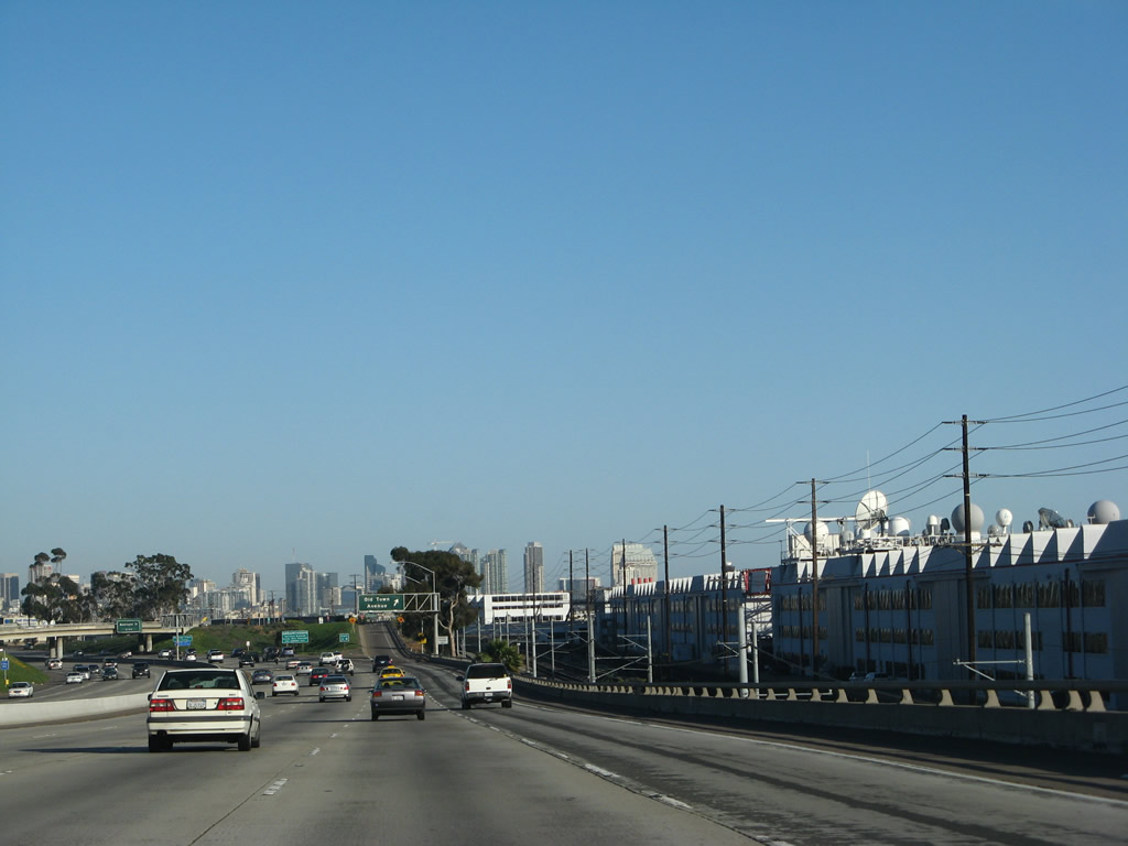
The massive SPAWAR complex and Interstate 5 sandwich the railroad rights of way. Photo taken 05/17/08. |
|
Southbound Interstate 5 reaches Exit 19, Old Town Avenue. Photo taken 05/17/08. |
|
This view shows the gore point signage for Exit 19. Photo taken 05/17/08. |
|
|
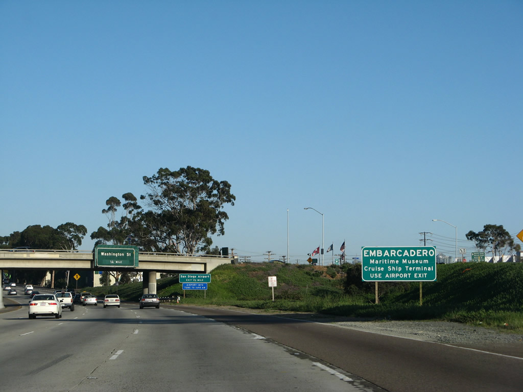
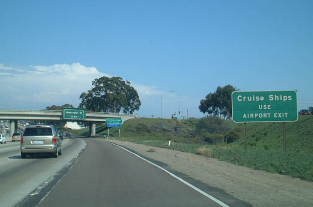
The signage here will benefit from exit numbers, because many of the signs relate to the airport, but there is still one more exit (Exit 18B, Washington Street) before motorists reach the actual airport exit (Exit 18A). One of the most infamous of these signs was "Cruise Ships use Airport Exit" (which has since been replaced with "EMBARCADERO - Maritime Museum and Cruise Ship Terminal). To the Port of San Diego's Cruise Ship Terminal, use Kettner Boulevard (Exit 18A) south to Laurel Street west to Harbor Drive south. The Maritime Museum is one of the most popular attractions at the Embarcadero and features tours of the Star of India, a ferry boat that used to shuttle passengers between San Francisco and the East Bay, the HMS Surprise from the movie Master and Commander: The Far Side of the World , and a Soviet Submarine (B-39). Photos taken 05/17/08 and 07/27/02. |
|
Interstate 5 passes under Old Town Avenue. The next exit is Exit 18B, Washington Street based on this overhead sign (one of the few porcelain enamel signs that remain on Interstate 5 in San Diego County). The second exit (Exit 18A) is Kettner Boulevard south to San Diego International Airport. Although the airport exit sign is newer (placed after 2002), it is not signed with an exit number. Photo taken 05/17/08. |
|
This view shows Interstate 5 (San Diego Freeway) south after passing under Old Town Avenue; this section briefly has five southbound lanes (and no shoulder). An on-ramp from Old Town Avenue merges onto the right lane. Photo taken 05/17/08. |
|
The right lane of Interstate 5 south becomes exit only the airport exit, and this auxiliary lane also connects to Exit 18B, Washington Street. A nice example of an older concrete expressway, eastbound Washington Street travels up the hill east into the San Diego communities of Mission Hills and Hillcrest (Uptown). A small wye interchange between Washington Street and University Avenue is located at the top of the hill, then Washington Street reverts to being a standard city street with two lanes in each direction plus auxiliary lanes and landscaped median. Photo taken 05/17/08. |
|
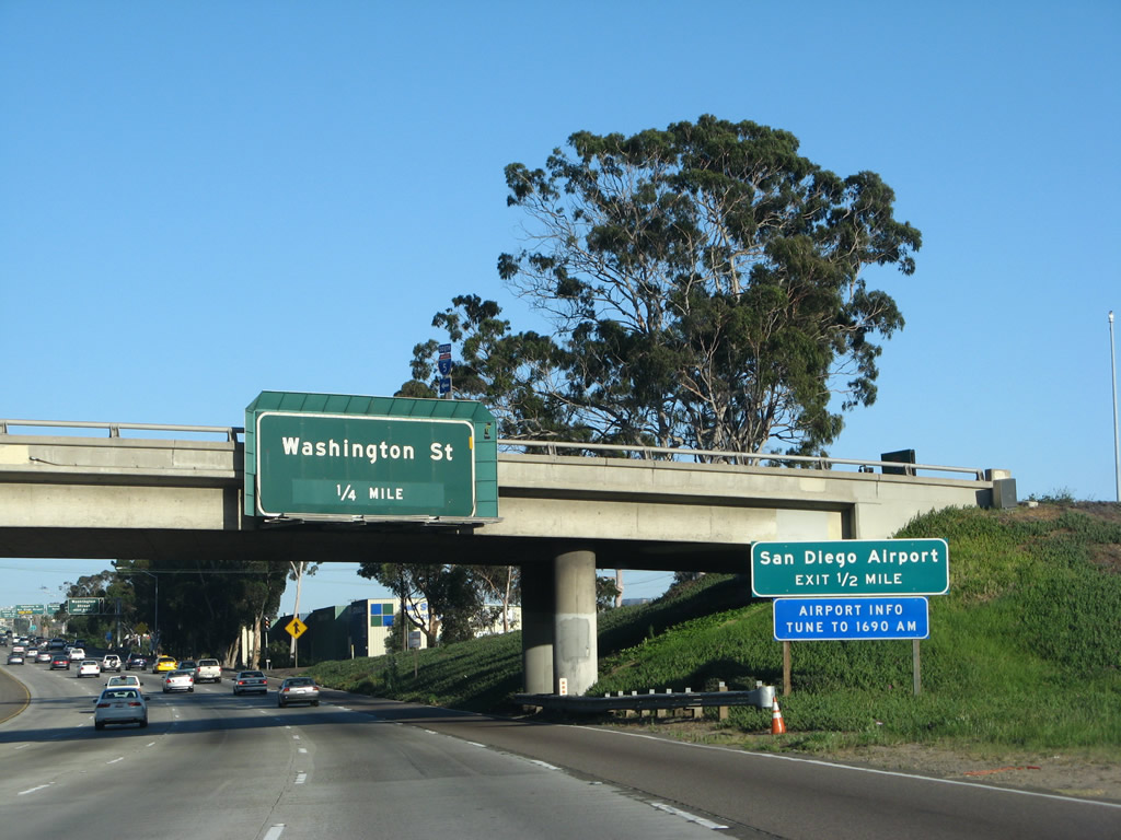
Southbound Interstate 5 (San Diego Freeway) reaches Exit 18B, Washington Street. The next exit is Exit 18A, Kettner Boulevard south to Sassafras Street and Laurel Street to the airport and Balboa Park. Photo taken 05/17/08. |
|
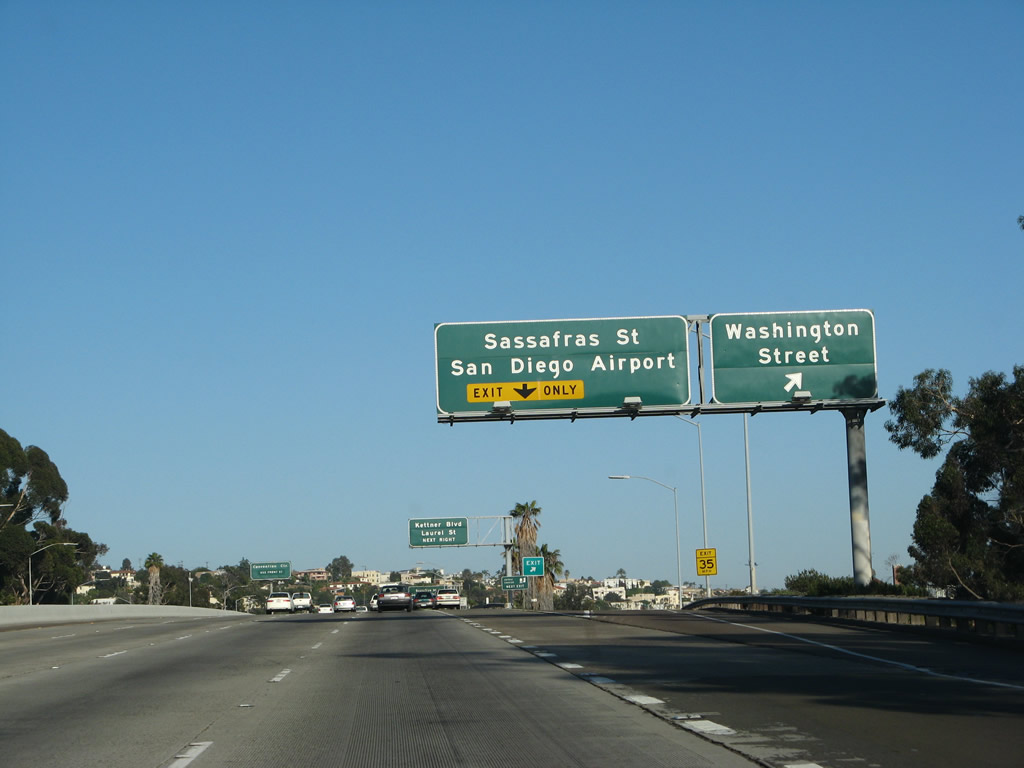
Immediately thereafter, Interstate 5 (San Diego Freeway) south approaches Exit 18A, which connects to Kettner Boulevard (a one-way southbound frontage road on the west side of Interstate 5) and allows access to Sassafras Street and Laurel Street. To San Diego International Airport, follow Kettner Boulevard south to Laurel Street west, then turn northwest on Harbor Drive. All access to the commercial gates of the airport is currently taken from Harbor Drive. Photo taken 05/17/08. |
|
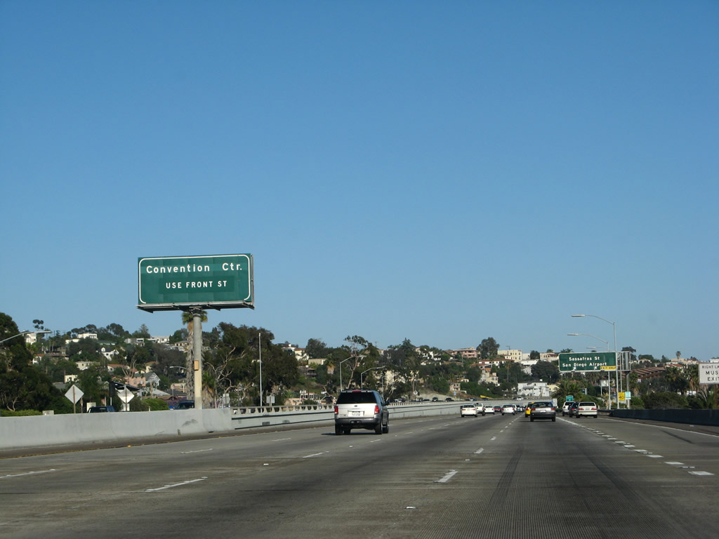
For most downtown destinations, including the Gaslamp Quarter, Civic Center, and Convention Center, use Exit 17, Front Street south. Photo taken 05/17/08. |
|
|
Southbound Interstate 5 (San Diego Freeway) reaches Exit 18A, Kettner Boulevard south to Sassafras Street and Laurel Street. South of Laurel Street, Kettner Boulevard continues south through the Marina District of downtown San Diego, and ultimately ends at Harbor Drive near Seaport Village and the Convention Center. A faster route to both destinations is afforded via Exit 17, Front Street. Photos taken 05/17/08 and 03/05/09. |
|
Between the Kettner Boulevard off-ramp and the Pacific Highway merge, the two directions of Interstate 5 are on different levels. The southbound lanes are significantly lower than the northbound lanes. However, the frontage road (Kettner Boulevard) is even lower than the southbound lanes. Photo taken 05/17/08. |
|
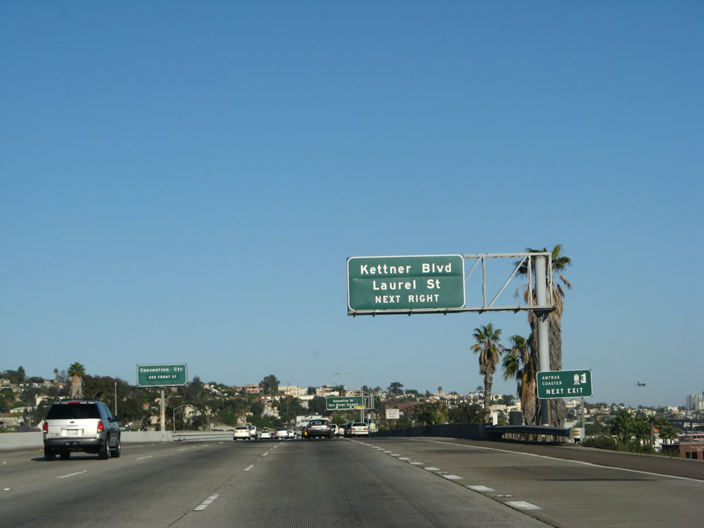
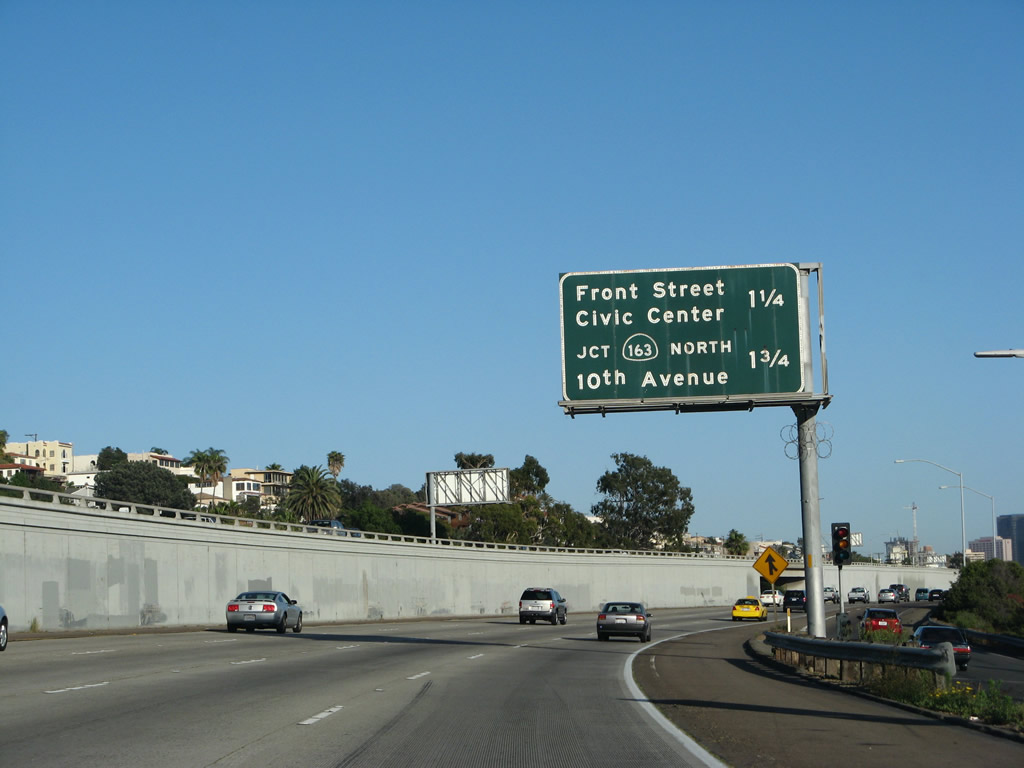
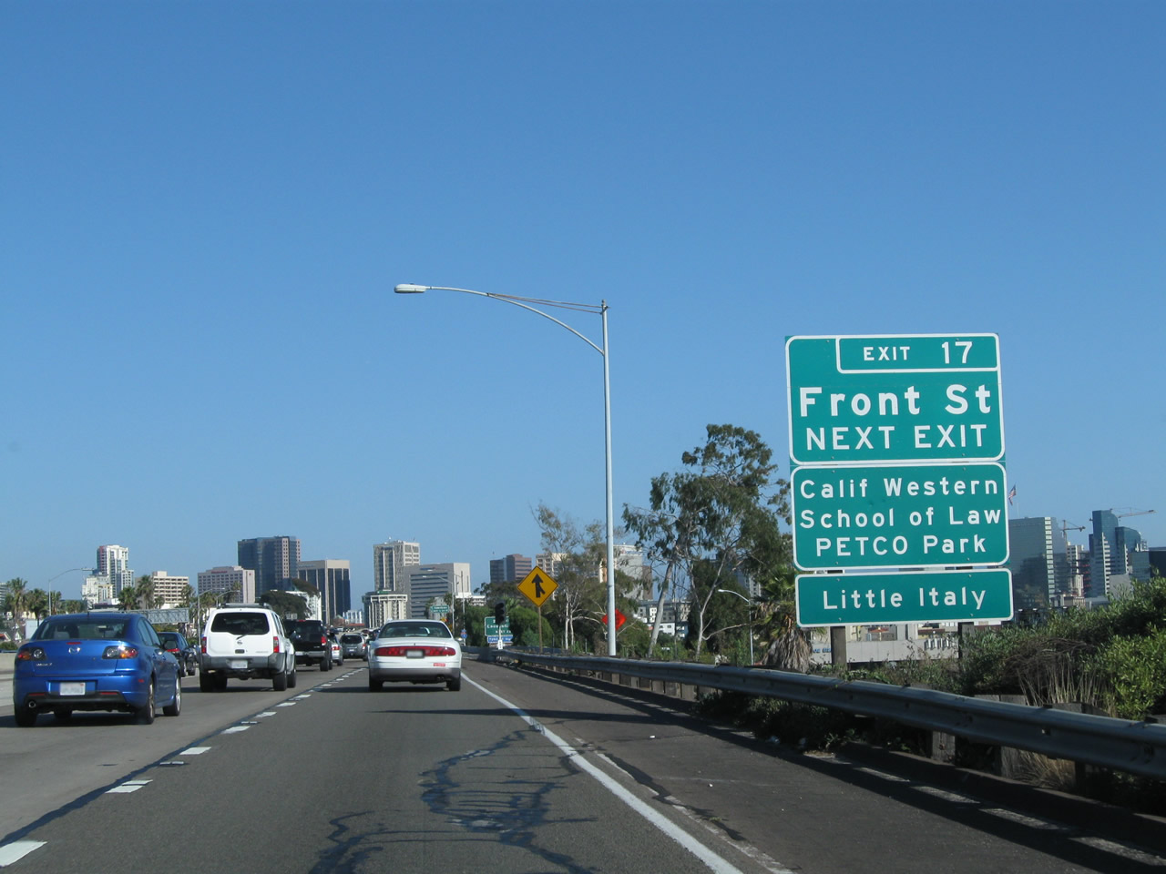
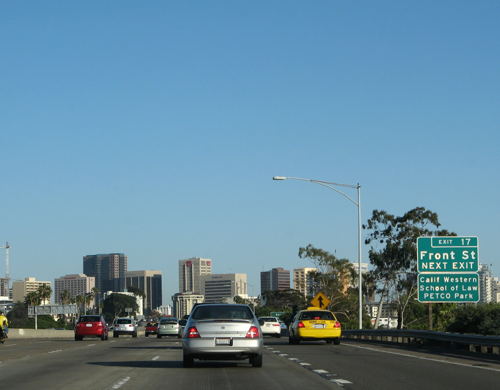
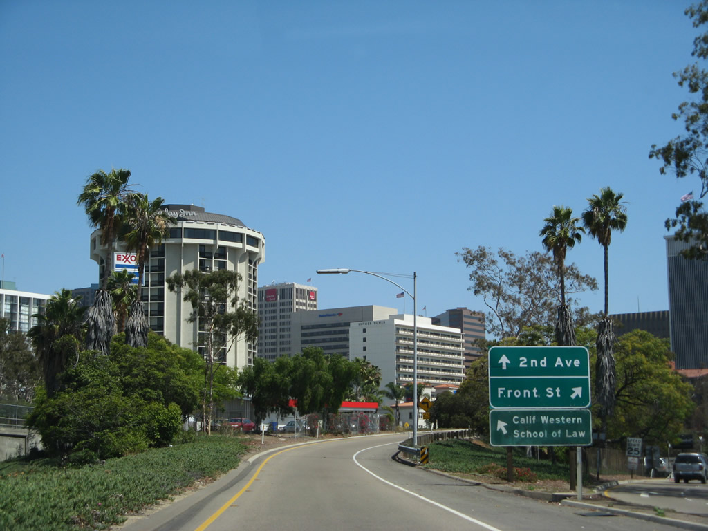
This mileage sign provides the distance to the next two exits along southbound Interstate 5: Exit 17, Front Street to the Civic Center and Convention Center and Exit 16, California 163 (Cabrillo Freeway) north and Tenth Avenue south to Petco Park. Exit 17 will connect to Front Street south to Second Street, Cedar Street, and the San Diego Civic Center (located at intersection of Second Street and C Street). Exit 16 connects to California 163 (Cabrillo Freeway) north and Tenth Avenue south to downtown San Diego and Petco Park (home of Major League Baseball's San Diego Padres). The ballpark is located off of Imperial Avenue; follow Tenth Avenue south to Imperial Avenue west. Tenth Avenue was a former alignment of California 163, but the state route was returned to city jurisdiction some time ago. Photo taken 05/17/08. |
|
An Interstate 5 reassurance shield is posted after the on-ramp from Washington Street merges onto southbound. Photo taken 05/17/08. |
|
The next exit along southbound Interstate 5 is Exit 17, Front Street, the primary exit into downtown. At this point, Interstate 5 passes over Sassafras Street. Photo taken 05/17/08. |
|
The transition ramp from Interstate 5 north to Pacific Highway (Old U.S. 101) north is the next overpass. While there is no access from Interstate 5 south to Pacific Highway north, there is a high speed ramp from Pacific Highway south to Interstate 5 south. Photo taken 05/17/08. |
|
This new auxiliary lane joins from southbound Pacific Highway merges onto Interstate 5 south. The downtown San Diego skyline dominates the view ahead. Photo taken 05/17/08. |
|
A pedestrian bridge crosses the freeway as Interstate 5 (San Diego Freeway) south approaches Exit 17, Front Street. The high rises of downtown San Diego come into view; for a while, it will seem as if Interstate 5 will go directly into downtown, even though the freeway ultimately skirts the northern and eastern edges of downtown instead. Photo taken 05/17/08. |
|
This Interstate 5 reassurance shield was placed in early summer 2002, and it is of the newer angular shape along with a larger numeral, but the route marker retains the state name. Photo taken 05/17/08. |
|
|
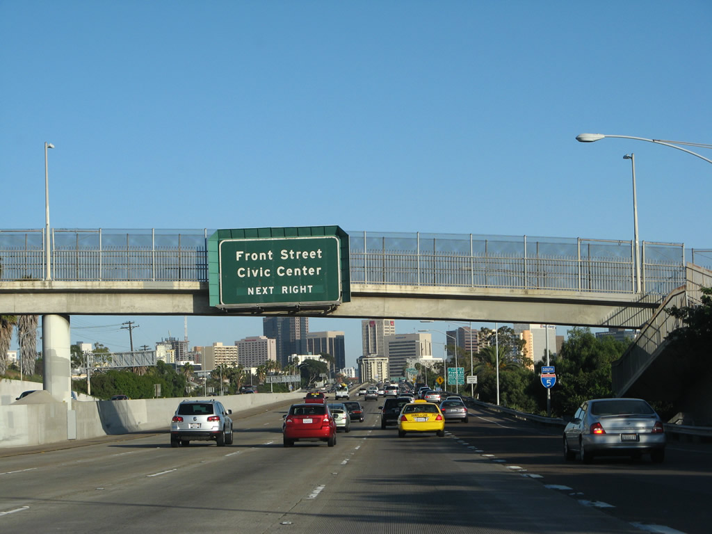
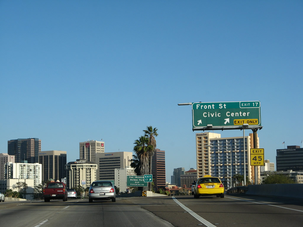
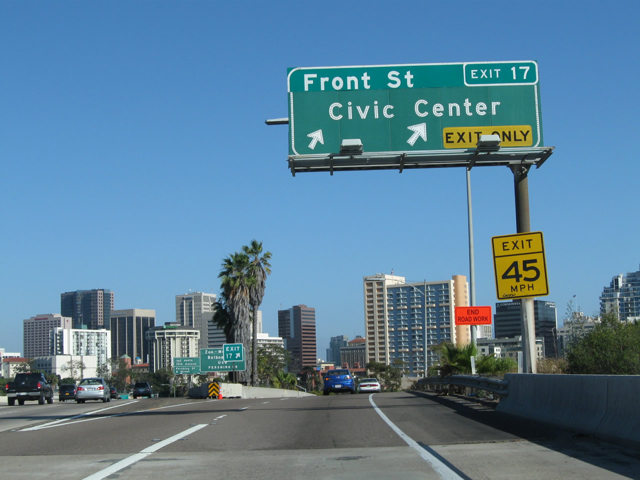
A roadside exit number sign for Front Street is posted soon thereafter. The right two lanes will exit to Front Street and Second Street. Front Street is a one-way southbound city street. It is a through route, however, leading past the Civic Center all the way to Harbor Drive and the Convention Center. By taking Front Street south to Market Street, motorists may reach the Gaslamp Quarter via this exit. In 2010, a placard was added to this sign to include Little Italy, a popular district with ample restaurants. Photos taken 06/24/11 and 05/17/08. |
|
|
Use Front Street south to the Civic Center, Convention Center, and Gaslamp Quarter. Photos taken 06/24/11 and 05/17/08. |
|
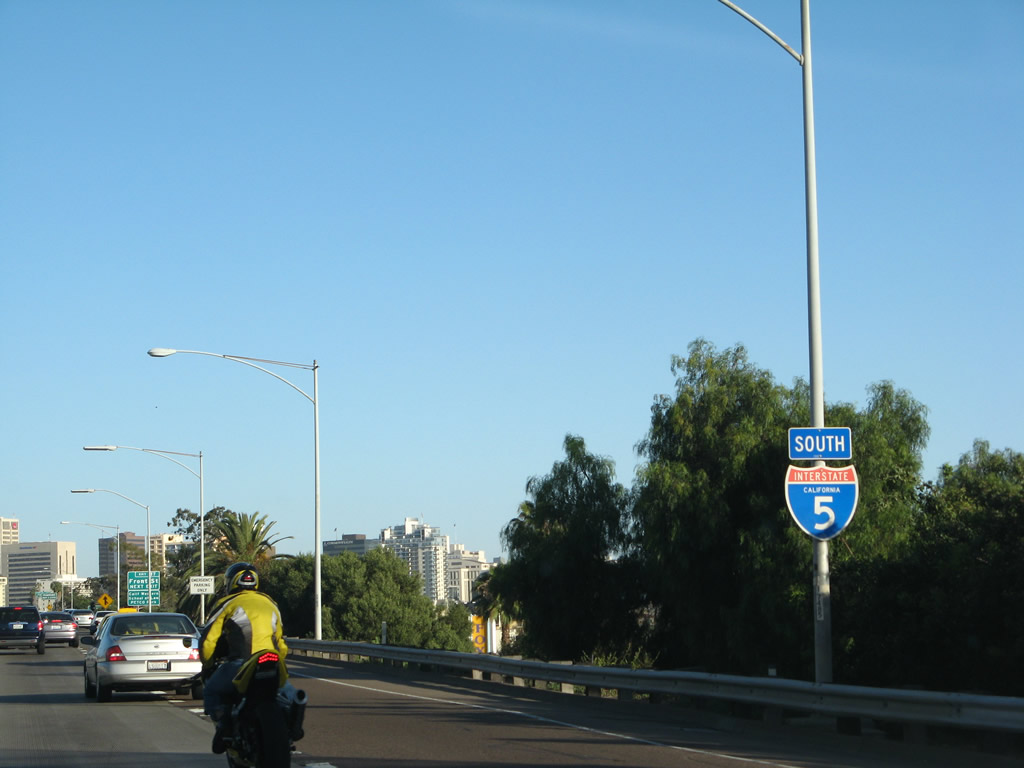
An Interstate 5 reassurance shield is posted after the on-ramp from Kettner Boulevard. Ahead, the right two lanes will connect to Front Street (Exit 17). Photo taken 06/24/11. |
|
Both Front Street (Exit 17) and Tenth Avenue (Exit 16) are good routes into downtown, although Front Street is more direct for most points of interest downtown. Tenth Avenue is more important with the opening of Petco Park (the San Diego Padres Ballpark) in April 2004. With its completion, Tenth Avenue plays a much more prominent role in routing traffic through downtown, especially on game days. Photo taken 06/24/11. |
|
|
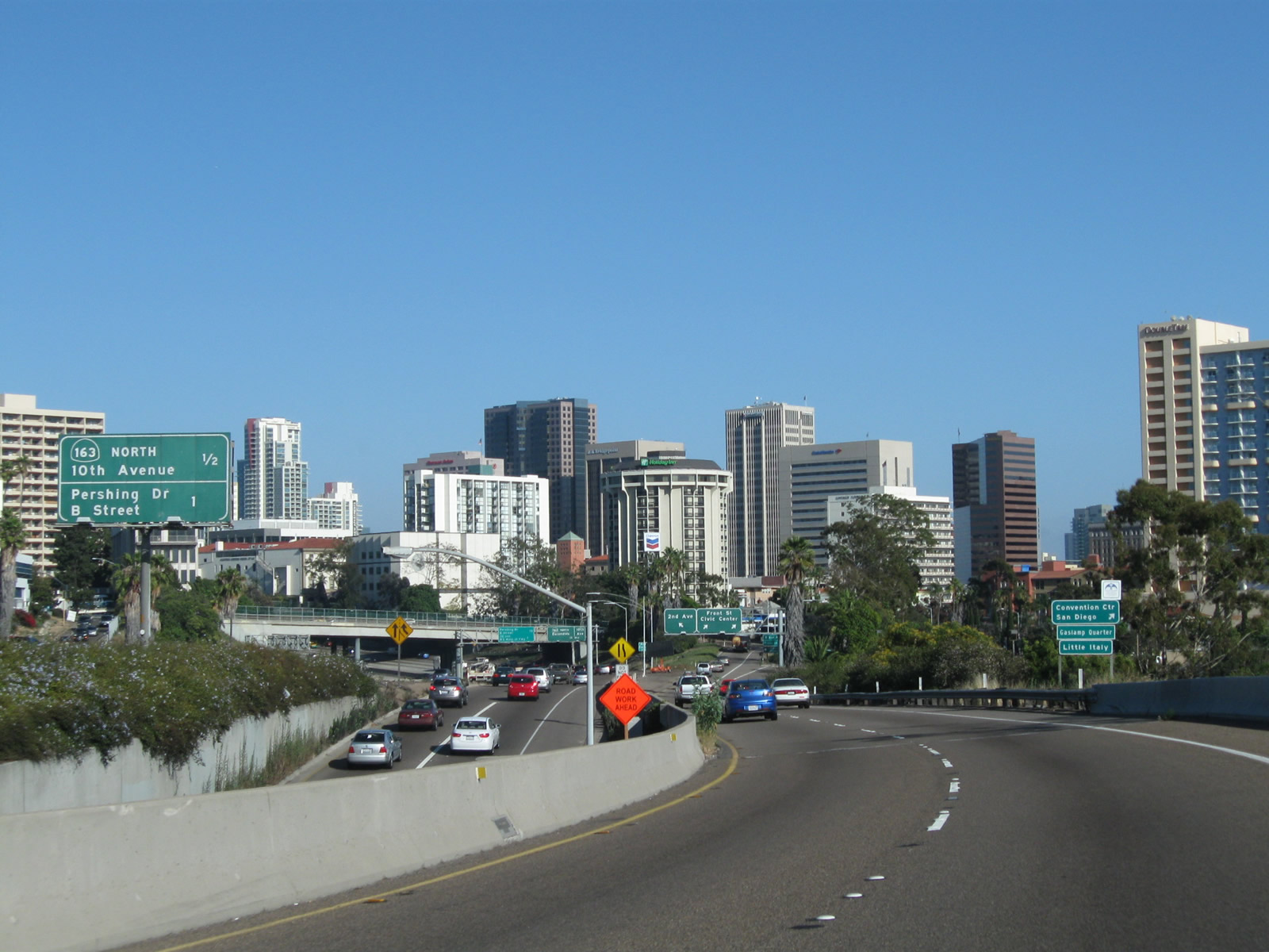
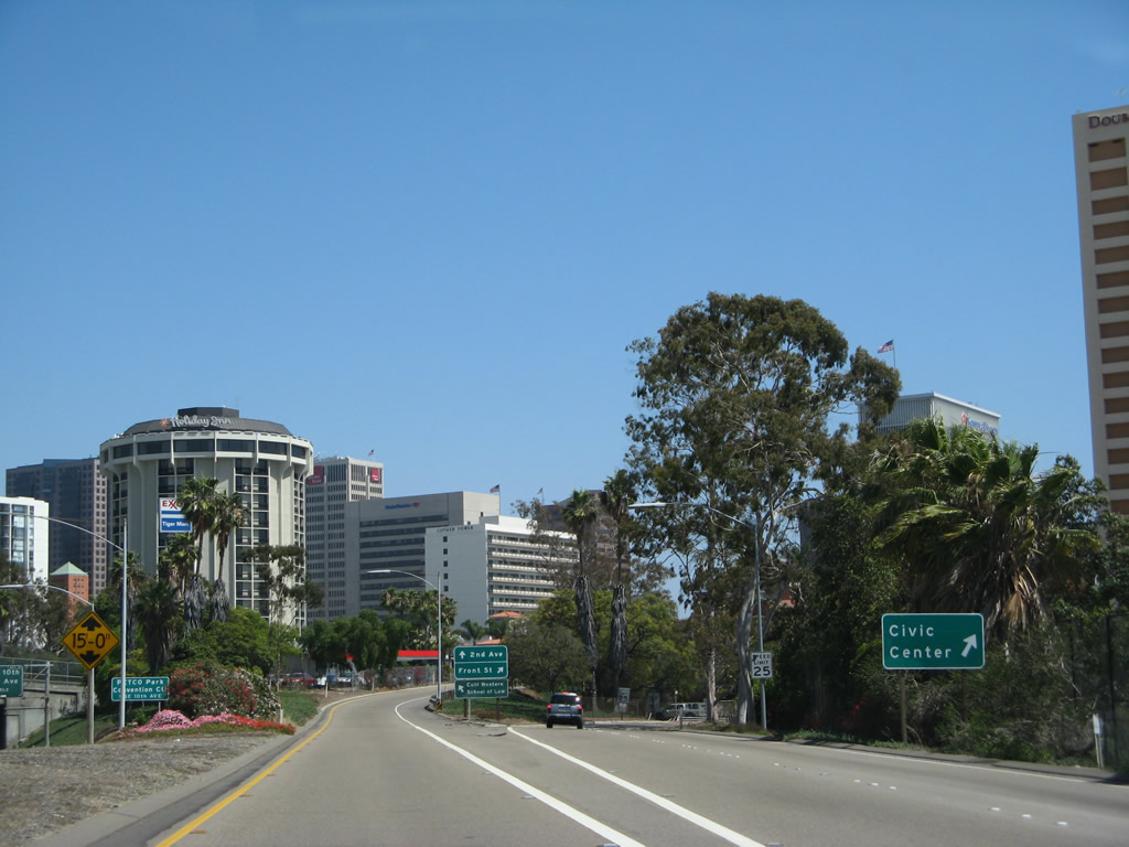
Southbound Interstate 5 (San Diego Freeway) reaches Exit 17, Front Street south to downtown San Diego. As seen in all of the approach pictures along Interstate 5 southbound, the freeway heads directly toward downtown. However, just before it seems like Interstate 5 will go right into those buildings, the freeway enters the Downtown S Curve, which pushes Interstate 5 to the east a couple miles, then turns the highway south again. Photos taken 05/17/08 and 06/24/11. |
|
A web of on-ramps and off-ramps comes into view as we depart Interstate 5 for the Front Street exit. Below is the on-ramp from Grape Street onto Interstate 5 south. Grape Street provides a direct link from Little Italy and San Diego International Airport to the southbound freeway. Photo taken 06/24/11. |
|
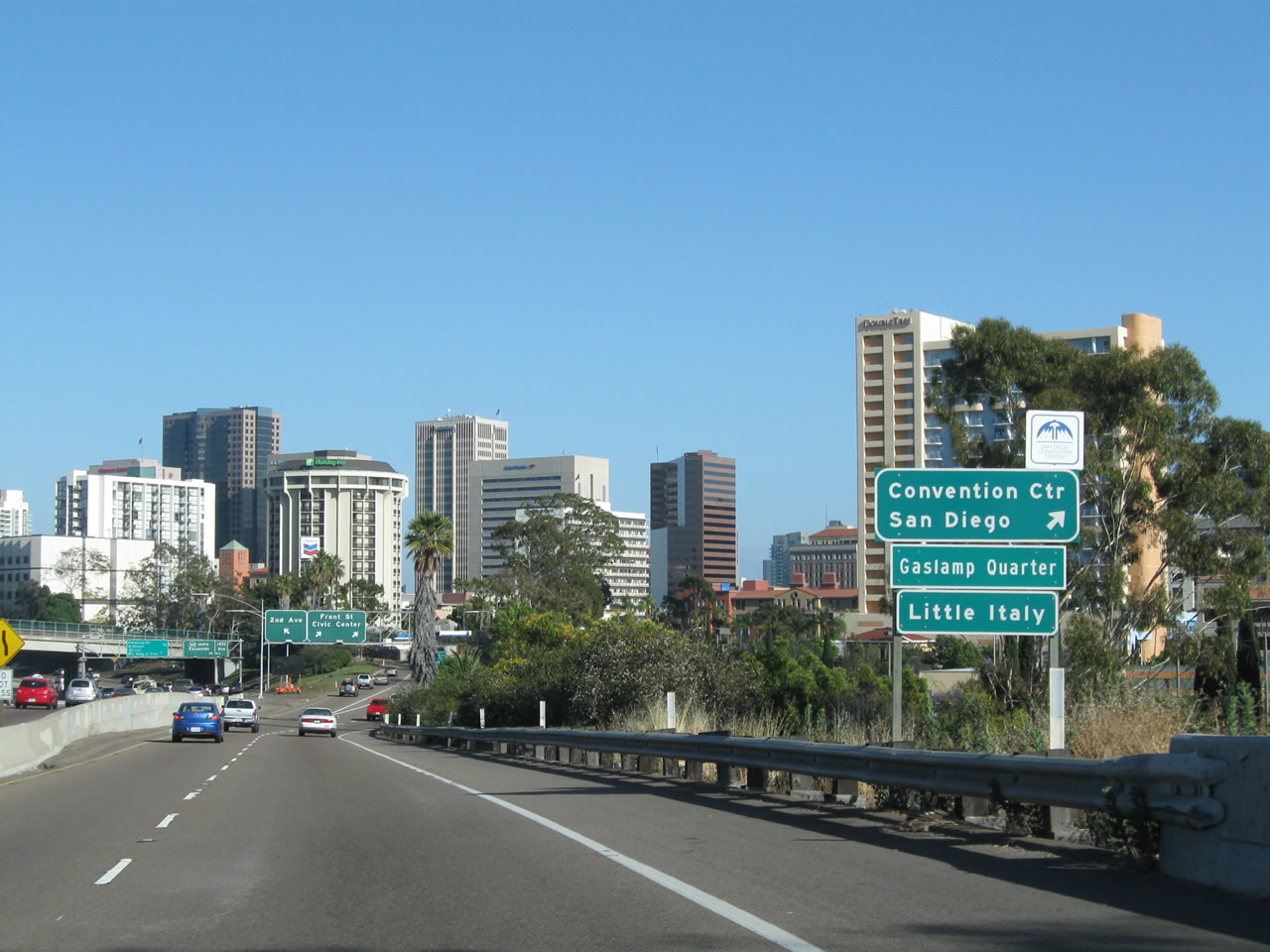
Stay right on the off-ramp for Front Street south to the San Diego Convention Center, Gaslamp Quarter, and Little Italy. Photo taken 06/24/11. |
|
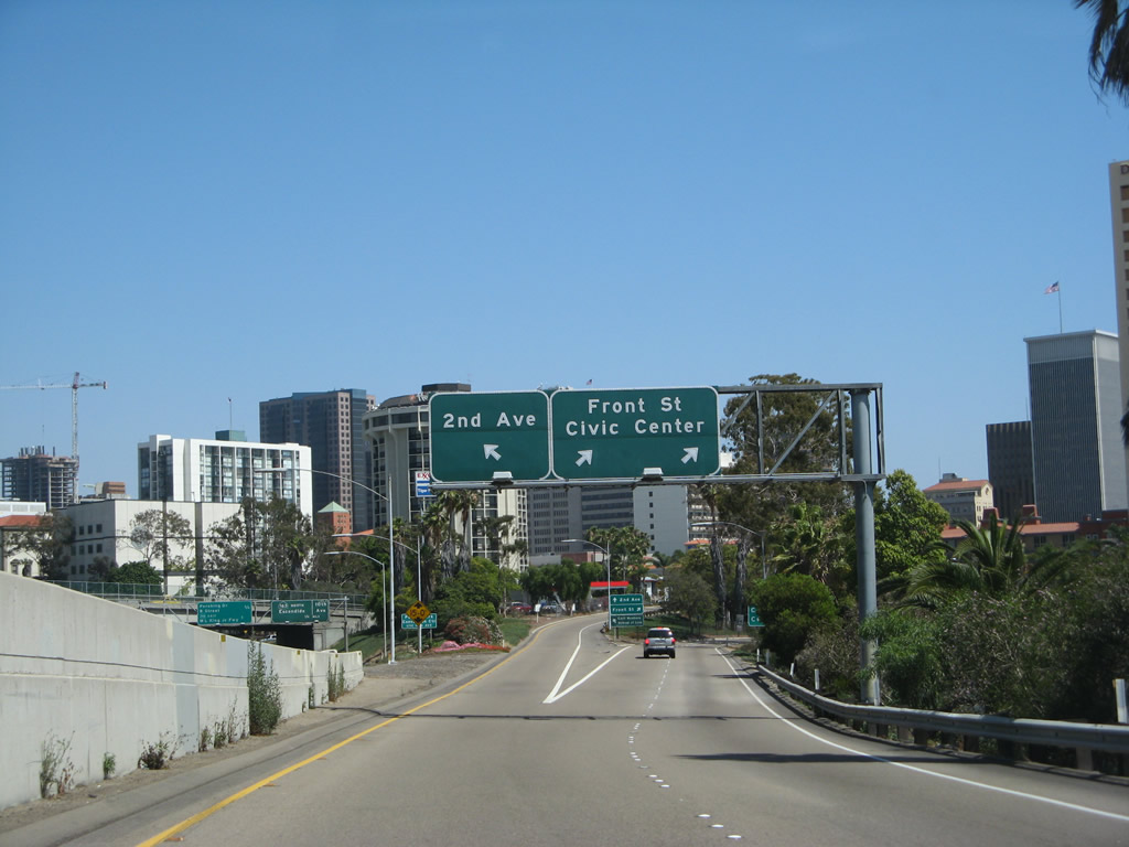
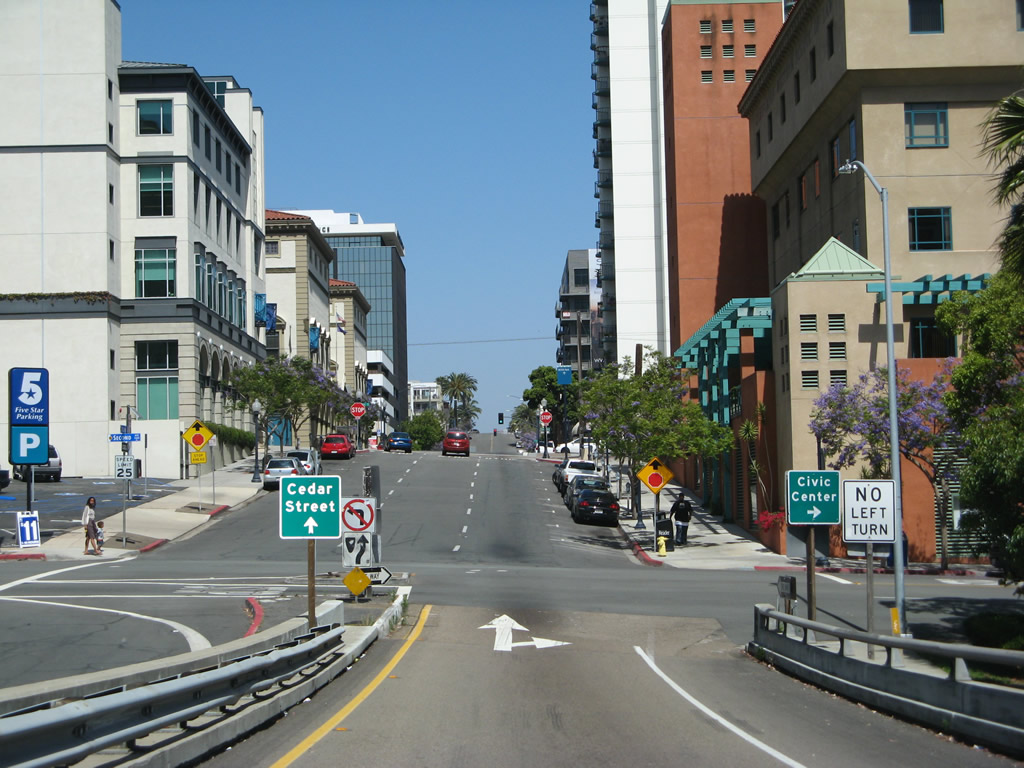
Now on the off-ramp to Exit 17, the right two lanes link to Front Street, while the left lane connects to Second Avenue and Cedar Street. Photo taken 06/05/08. |
|
Use Front Street south to the Civic Center and Convention Center. Photo taken 06/05/08. |
|
The ramp to Front Street and Cedar Street/Second Avenue split. The ramp to Second Street will take a bridge over First Avenue, then land at the intersection of Second Avenue and Cedar Street. Photo taken 06/05/08. |
|
A one-lane bridge connects to Cedar Street and Second Avenue in downtown San Diego. Photo taken 06/05/08. |
|
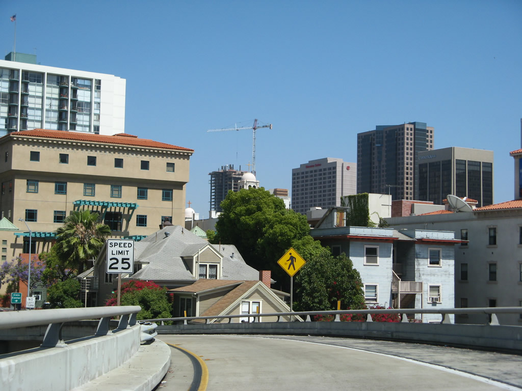
Proceed straight ahead to Cedar Street, or turn left/right to Second Avenue north/south. Second Avenue travels south to the Civic Center (including City Hall) and its parking structure. To the north, Second Avenue travels toward the Uptown district. Photo taken 06/05/08. |
Page Updated September 10, 2012.