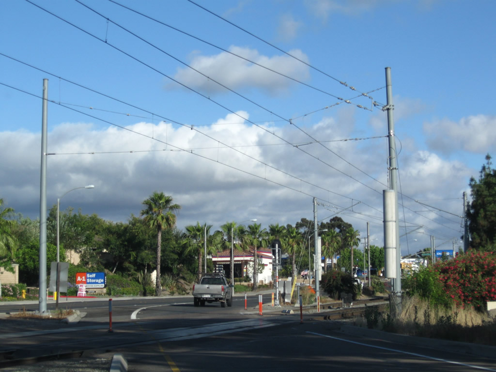
| Nimitz Boulevard north |
|
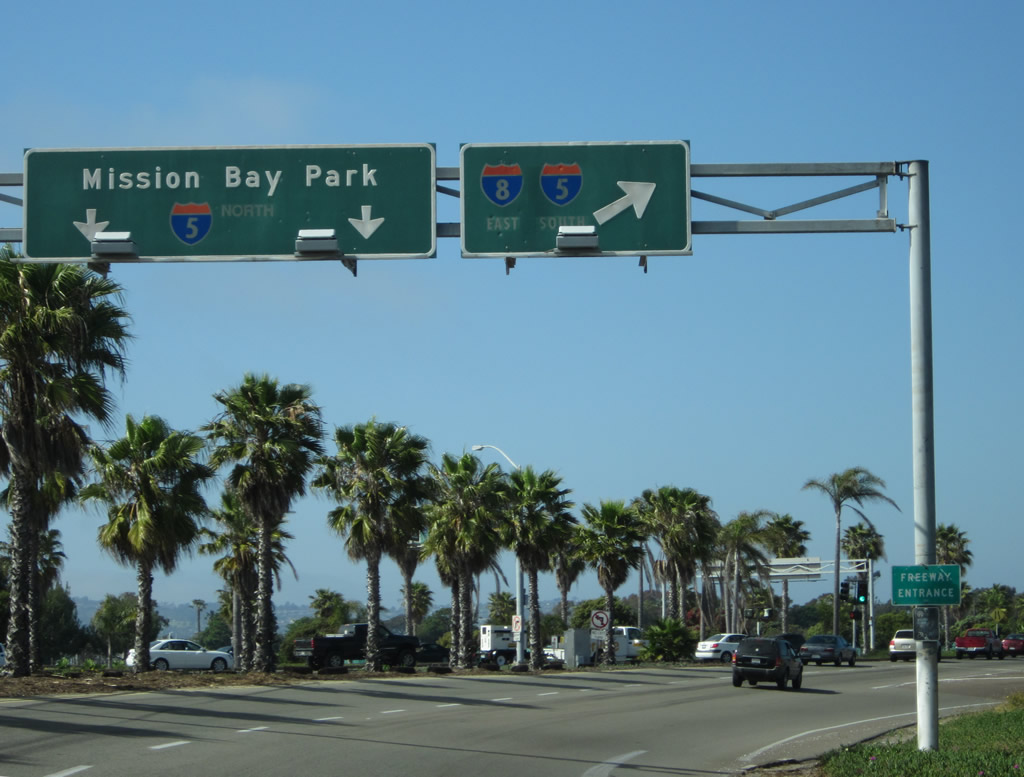
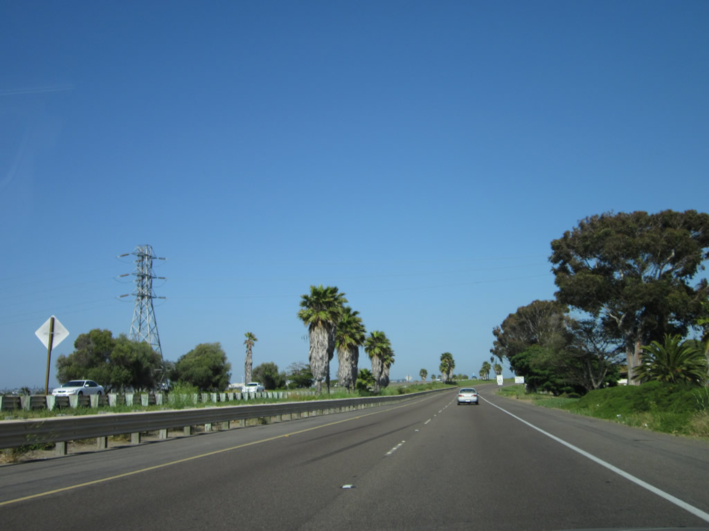
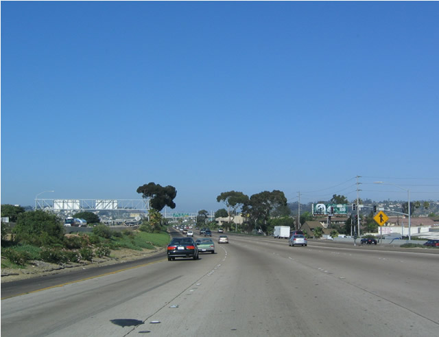
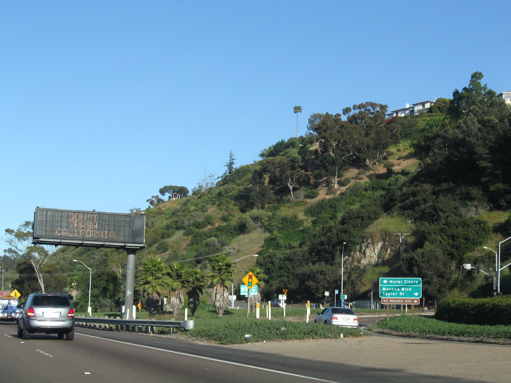
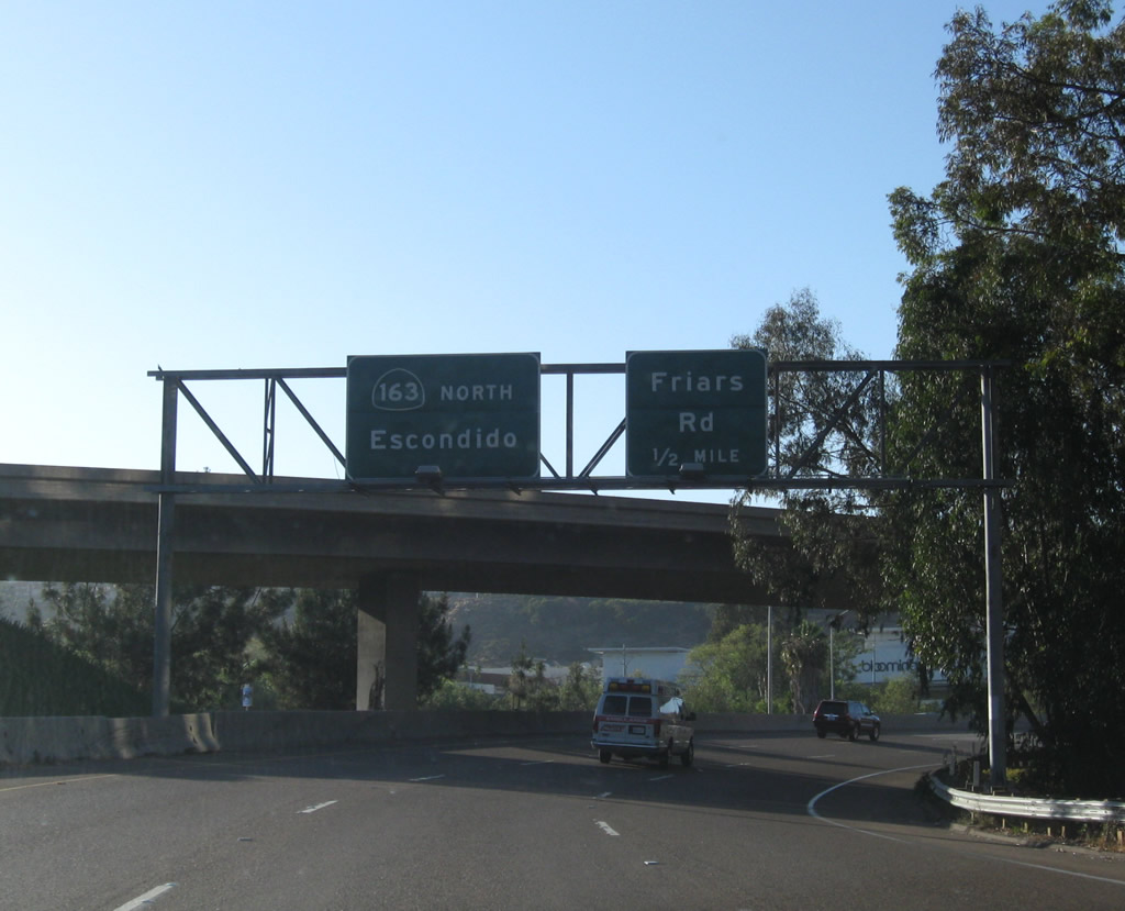
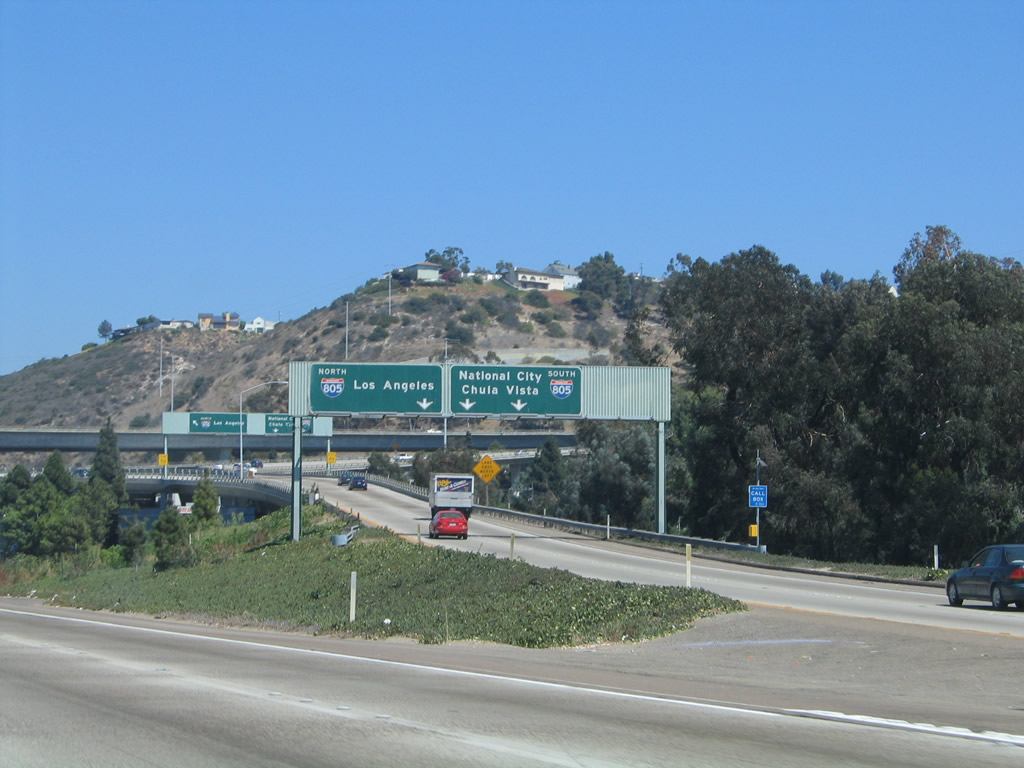
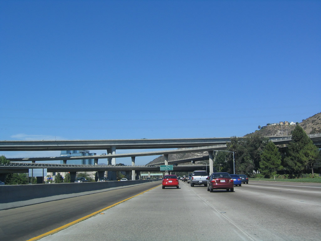
Northbound Nimitz Boulevard approaches the turnoff to Interstate 8 east and Interstate 5 south (right lane). The left two lanes will directly connect to Sunset Cliffs Boulevard north and Sea World Drive east to Mission Bay Park and Interstate 5 north. Photo taken 05/21/12. |
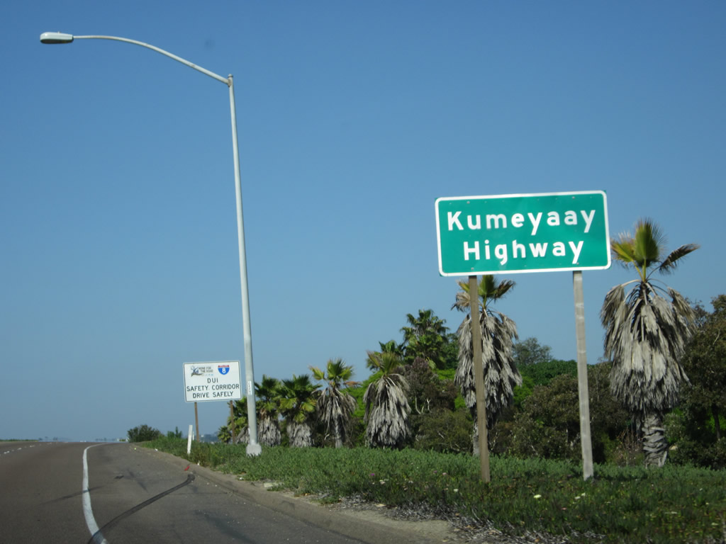
| Interstate 8 (Ocean Beach Freeway) (Kumeyaay Highway) east |
|
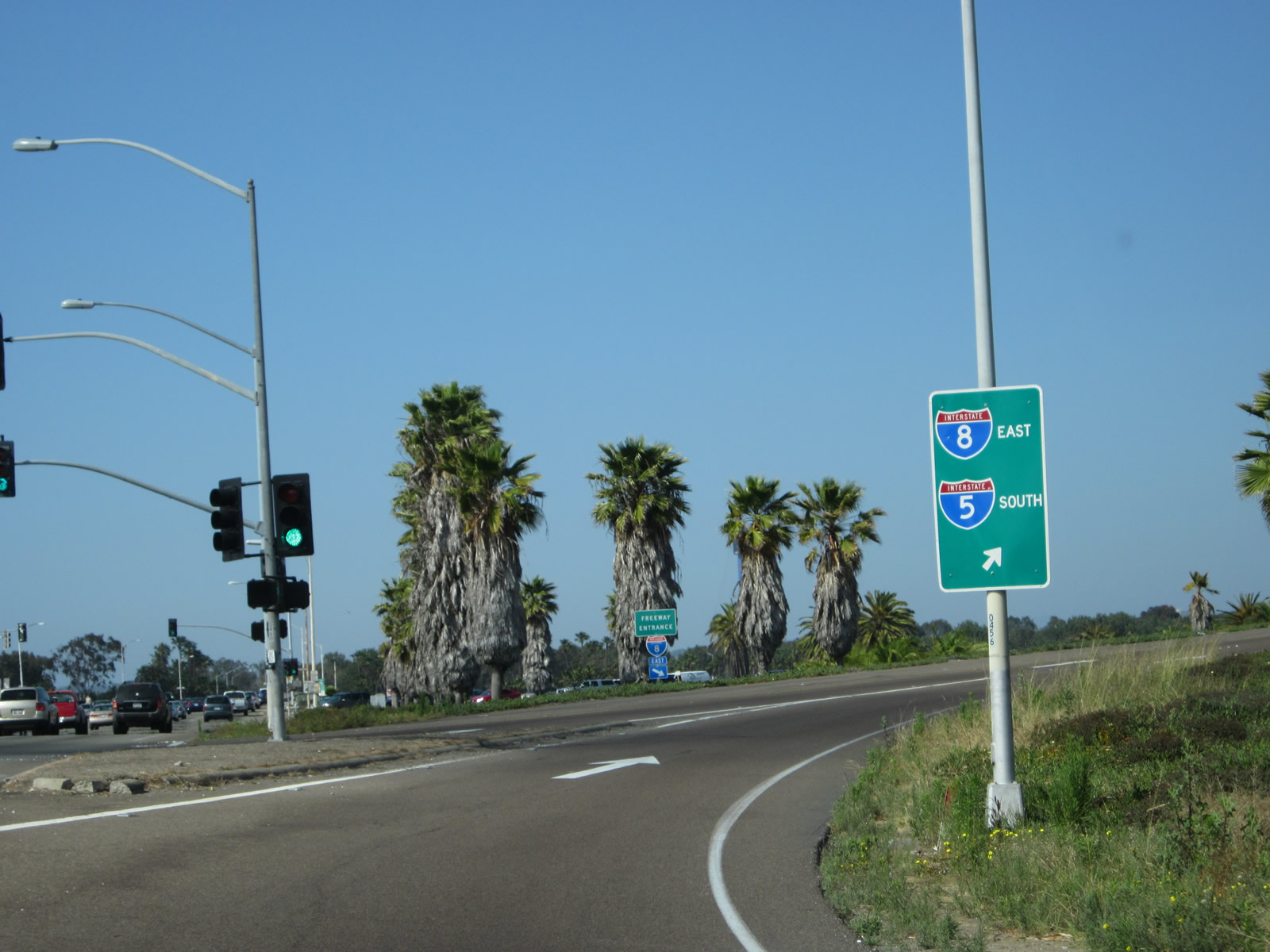
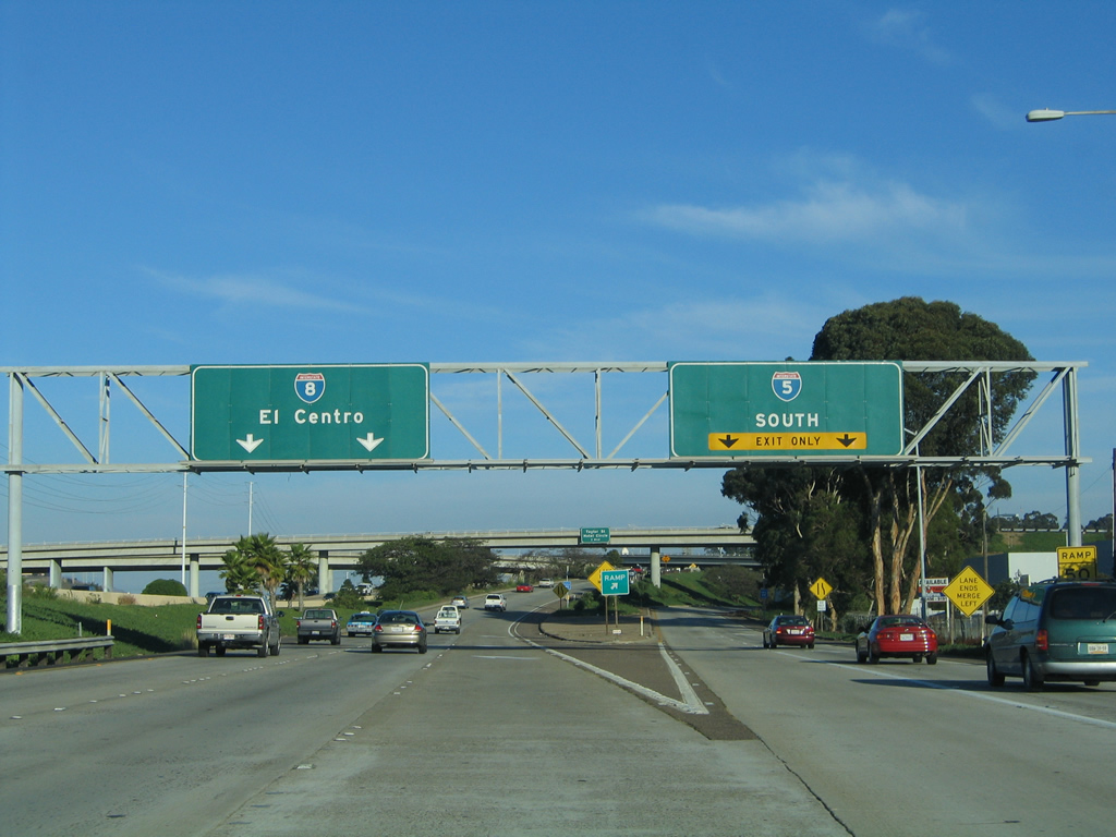
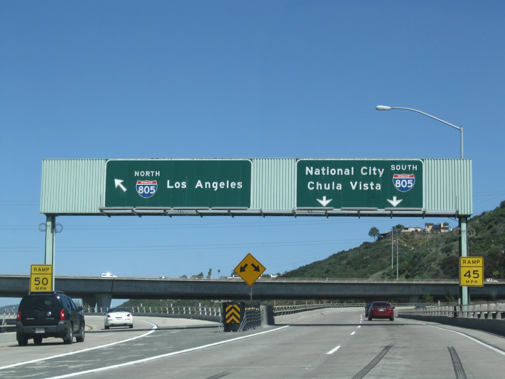
Welcome to Interstate 8! Traveling on the ramp from northbound Nimitz Boulevard to Interstate 8 east, this sign advises that taking Interstate 8 (Kumeyaay Highway) east will also link to Interstate 5 (San Diego Freeway) south. Photo taken 05/21/12. |
|
|
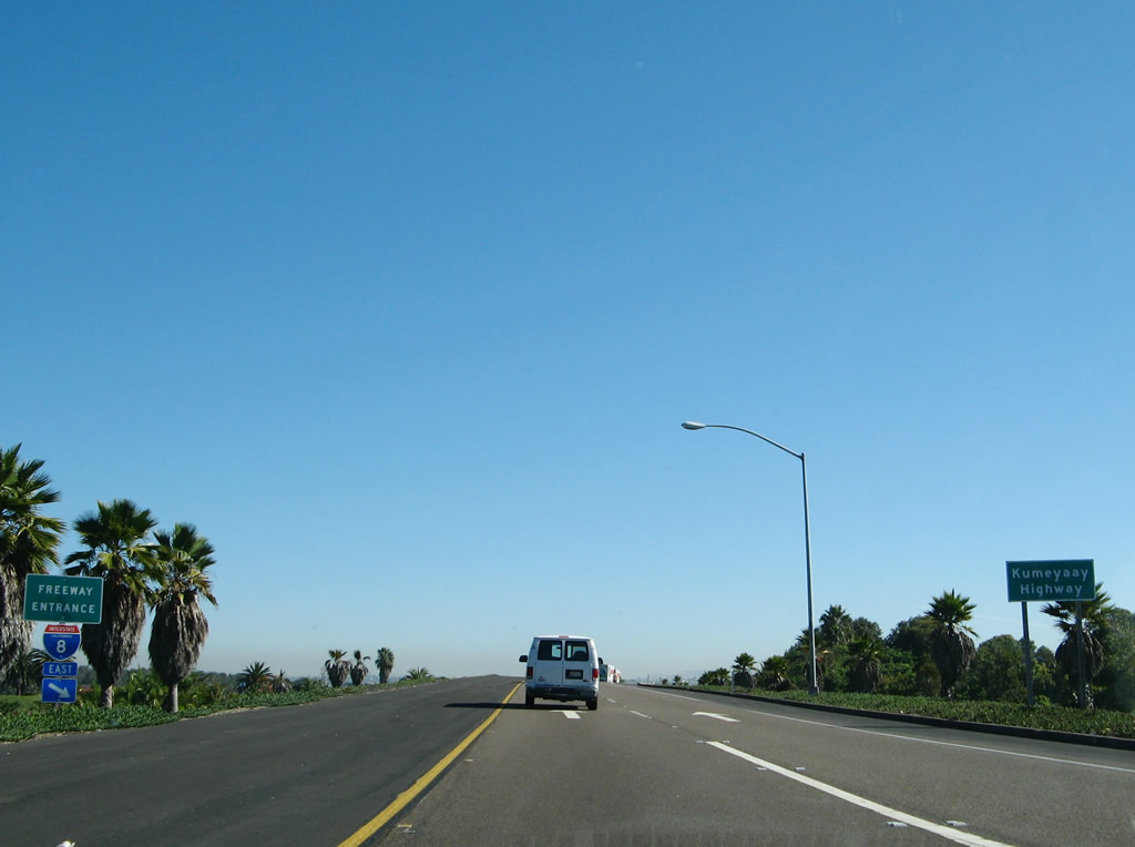
After passing through the traffic signals from northbound Nimitz Boulevard and eastbound Sunset Cliffs Boulevard, travelers will pass by a pair of Interstate 8 freeway entrance signs, then pass by this sign, which designates all of Interstate 8 through San Diego County as the Kumeyaay Highway. A similar sign is located along westbound after the In-ko-pah Drive interchange. The Kumeyaay were Native Americans who lived in San Diego County prior to the arrival of white men. Photos taken 10/19/07 and 05/21/12. |
|
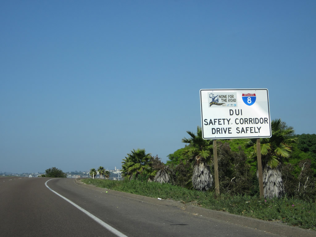
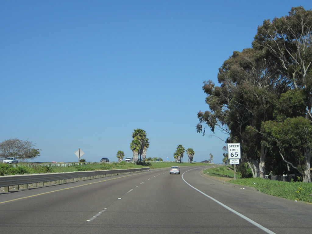
Interstate 8 is a DUI safety corridor. Photo taken 05/21/12. |
|
|
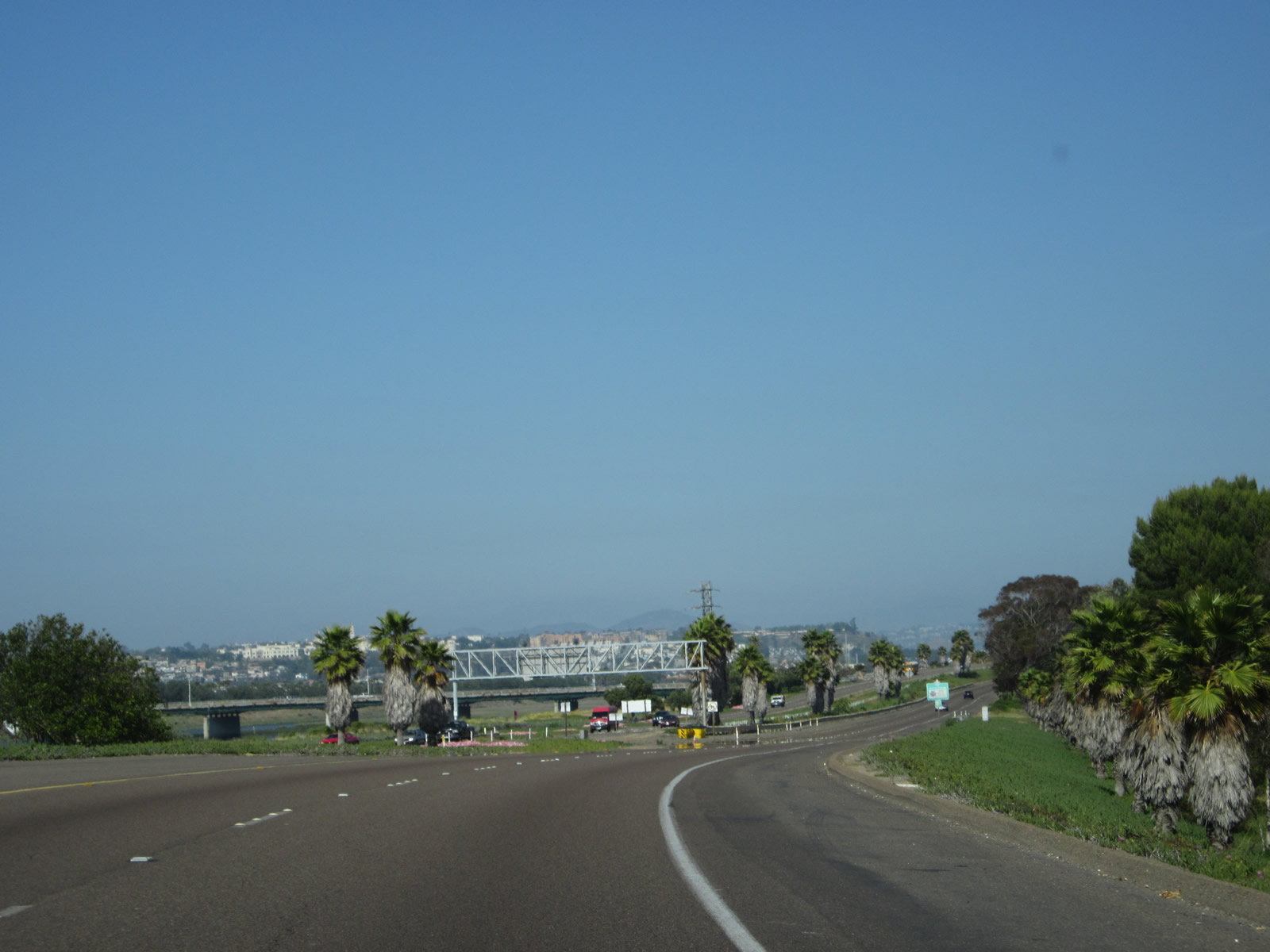
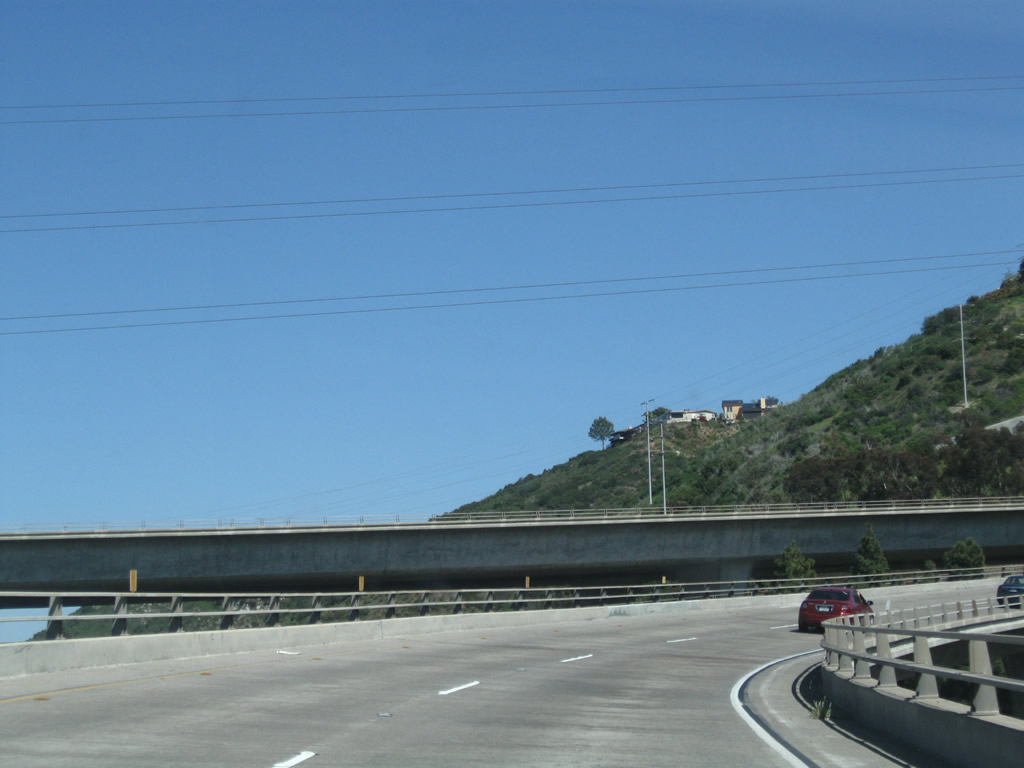
The first two miles of Interstate 8 follow the southern edge of the San Diego River as the freeway plies its way inland. In this photo, the river is visible to the left, along with stopped traffic along westbound. Initially, Interstate 8 only carries four lanes, but that temporarily changes after passing the on-ramp from Sports Arena Boulevard/Midway Drive/Ingraham Street. Photos taken 05/21/12. |
|
|
Staying close to the south bank of the San Diego River, eastbound Interstate 8 continues with only two lanes between Sunset Cliffs Drive and Sports Arena Boulevard. A set of 69kV San Diego Gas & Electric power lines pass overhead. Photos taken 05/21/12. |
|
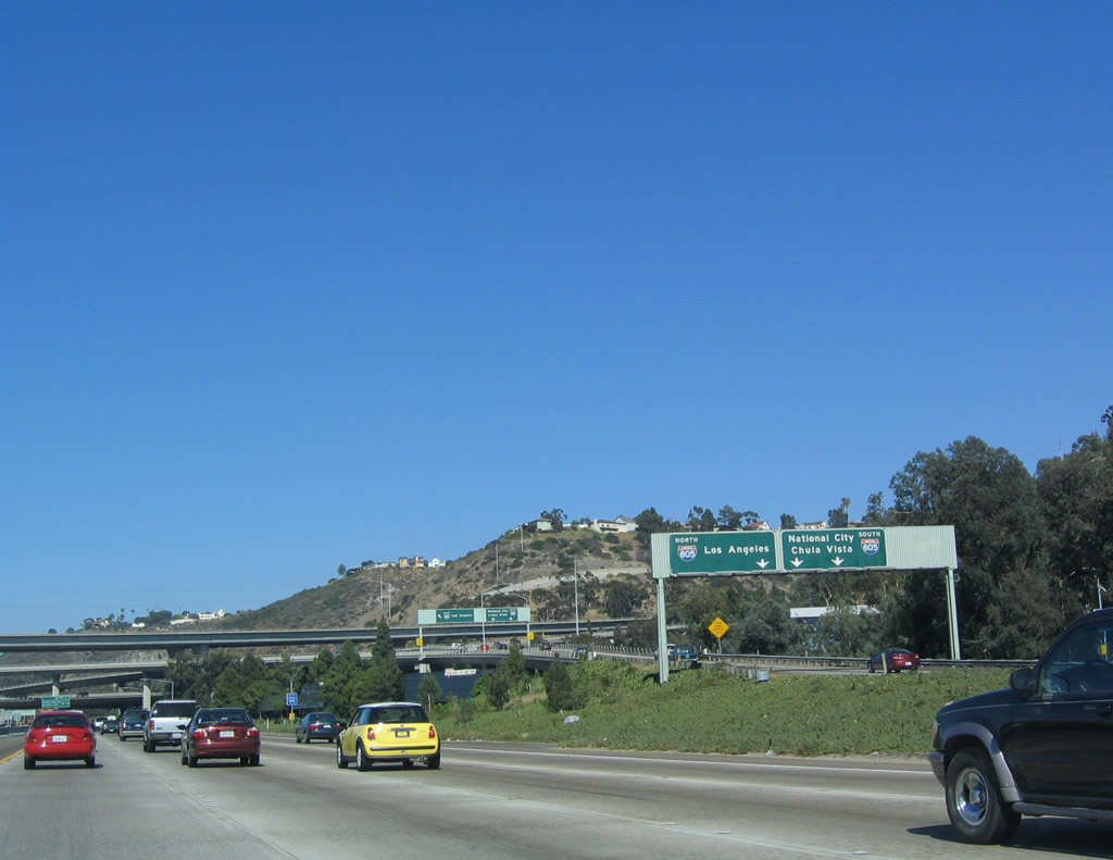
Two lanes of additional traffic contributes to Interstate 8 eastbound. These lanes arrive from southbound Ingraham Street/West Mission Bay Drive; the next set of lanes incoming arrive from northbound Sports Arena Boulevard and Midway Drive. Photo taken 05/21/12. |
|
|
After the on-ramp from Sports Arena Boulevard and Midway Drive, Interstate 8 briefly has four lanes headed eastbound; however, the two right lanes exit only onto southbound Interstate 5 and the two left lanes consolidate into only one lane as the freeway passes through the Interstate 5/8 interchange. Photo taken 05/21/12 and 07/17/04. |
|
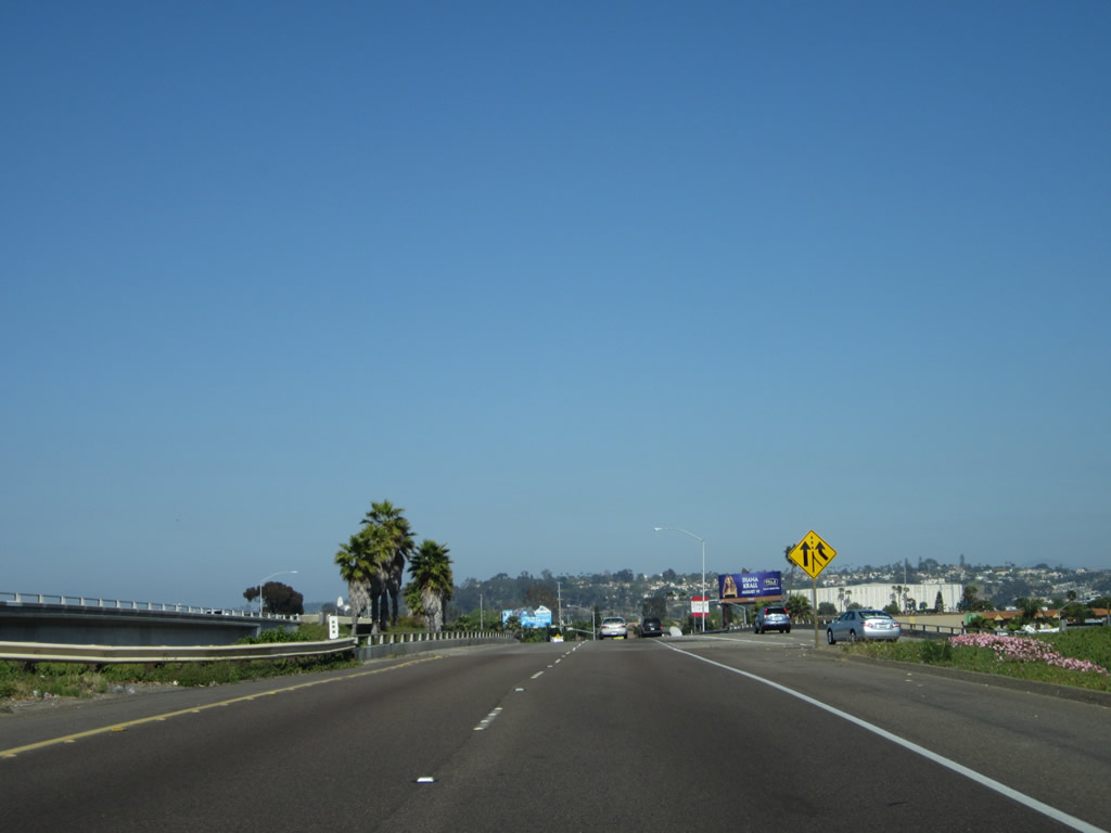
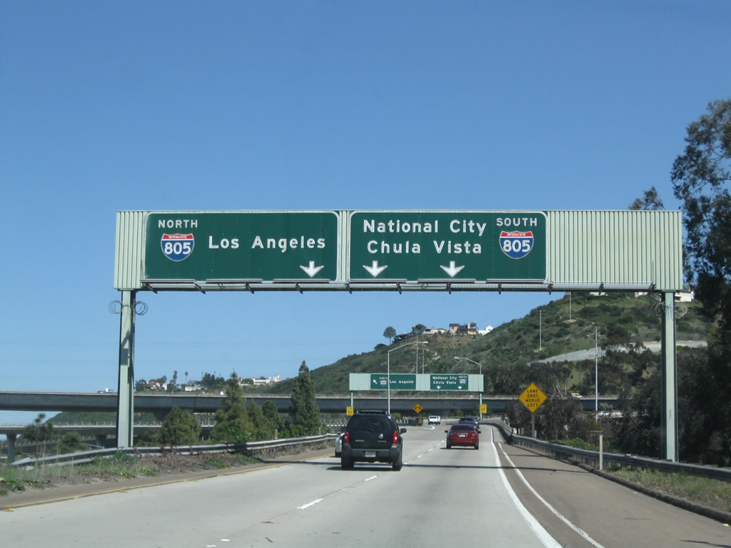
The first exit along eastbound Interstate 8 is Exit 2, Interstate 5 (San Diego Freeway) south. The interchange is visible in the background. Although not clearly seen in this picture, the San Diego River continues to parallel Interstate 8 to the north. Photo taken 10/29/04. |
|
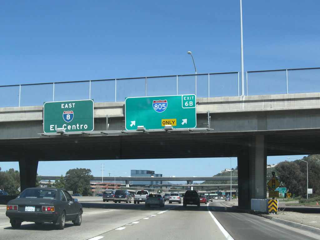
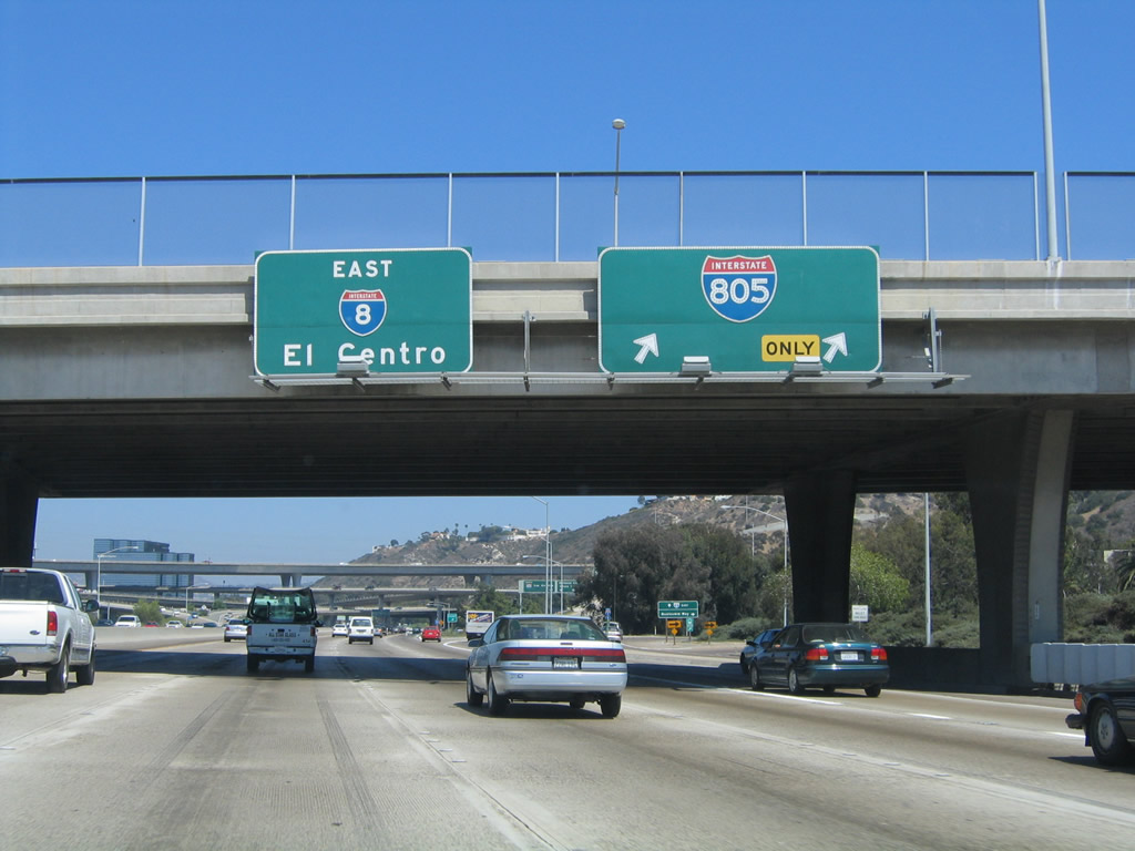
Eastbound Interstate 8 meets Interstate 5 southbound at Exit 2. No connections were made between eastbound Interstate 8 to northbound Interstate 5 or from southbound Interstate 5 to westbound Interstate 8. Both connections are badly needed, but neither is likely to be constructed any time soon. Beyond this exit ramp, through traffic on eastbound must merge into one lane before gaining lanes from incoming Interstate 5 traffic. Photo taken 10/29/04. |
|
As Interstate 8 ascends the bridge over Interstate 5, the eastbound lanes constrict from three to two to one lane! This is anticipation of traffic merging from the left (carrying traffic from southbound Interstate 5 to eastbound Interstate 8). As noted on the sign mounted on the ramp between westbound Interstate 8 and southbound Camino del Rio/Rosecrans Street, the next exit is Exit 3, Taylor Street/Hotel Circle. Photo taken 10/29/04. |
|
As shown here, through traffic reduces into one through lane. Traffic may slow or stop through this narrow section prior to the merge of traffic from Interstate 5 and Rosecrans Street (former California 209/Camino del Rio). Photo taken 05/06/09. |
| Interstate 8/Mission Valley (Alvarado) Freeway (Kumeyaay Highway) |
|
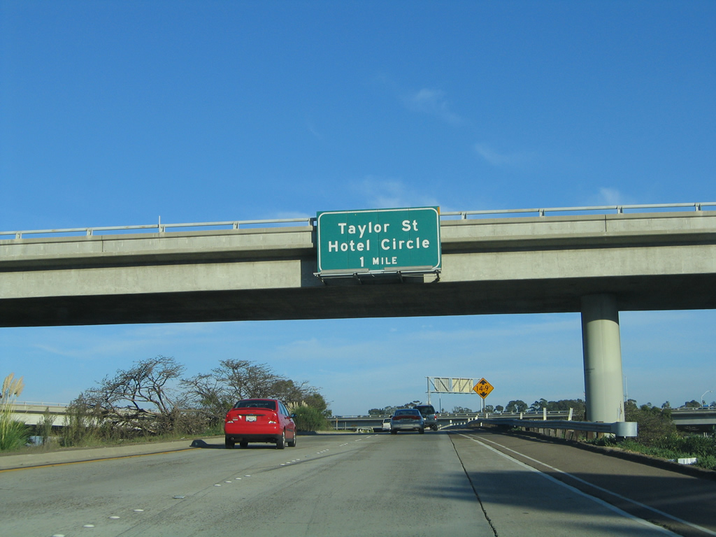
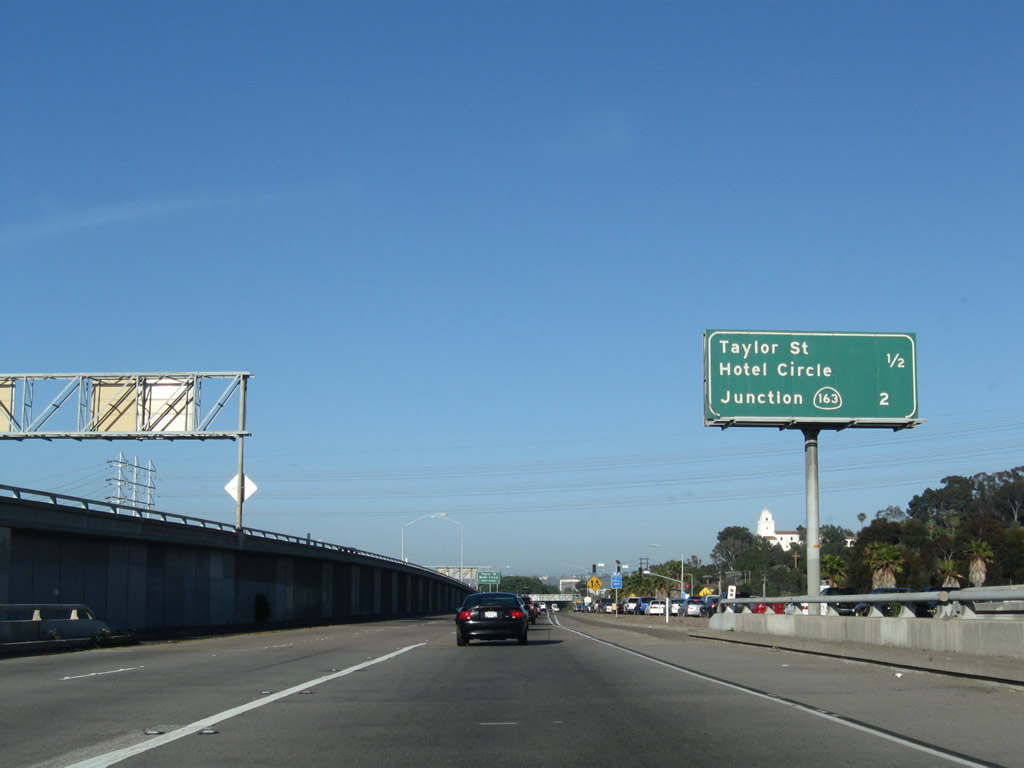
Eastbound Interstate 8 departs the Interstate 5 interchange complex as the traffic from southbound Interstate 5 merges onto Interstate 8. The next exit is for Taylor Street/Hotel Circle, Exit 3. Although not noted on this mileage sign, there is a second exit to Hotel Circle, Exit 4A. California 163 (Exit 4B) is the next exit after that (two miles). This section of Interstate 8 was originally constructed as part of U.S. 80 until the U.S. highway was decommissioned in favor of Interstate 8 in the 1960s. Photo taken 05/06/09. |
|
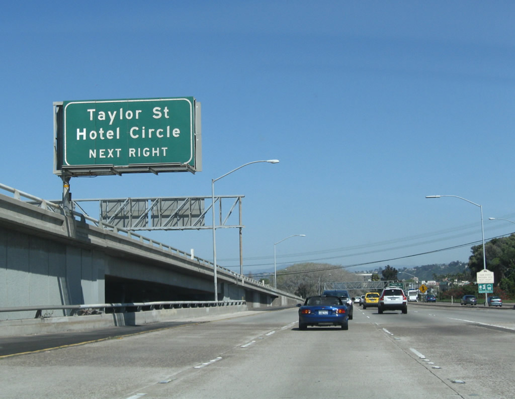
The next exit along Interstate 8 (Mission Valley Freeway) east is Exit 3, Taylor Street/Hotel Circle, next right. Photo taken 03/28/09. |
|
The San Diego Presidio, which sits on the side of the hill between Old Town and Mission Hills, comes into view along the south side of Interstate 8. A museum is located at the site of the presidio via Exit 3 (Taylor Street). Photo taken 05/06/09. |
|
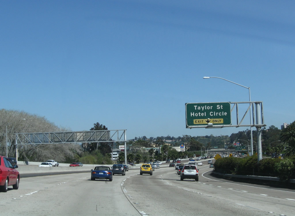
The exit-only lane for Exit 3 (Hotel Circle/Taylor Street) is formed by the fifth lane of traffic from the northbound Interstate 5 to eastbound Interstate 8 transition ramp. Photo taken 03/28/09. |
|
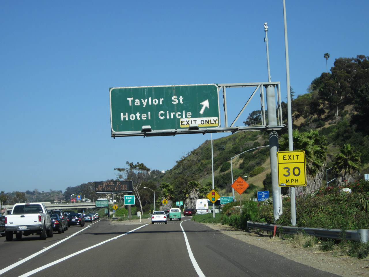
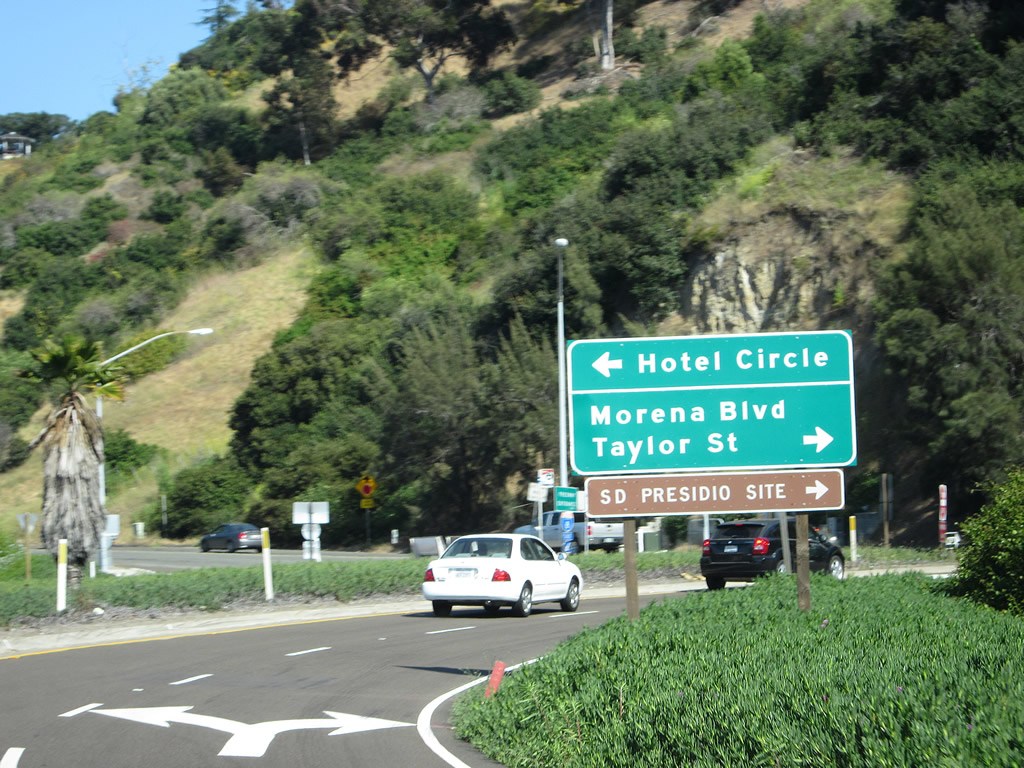
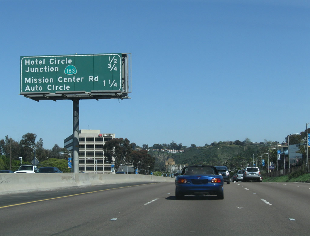
Eastbound Interstate 8 reaches Exit 3, Taylor Street/Hotel Circle. Taylor Street leads west parallel to the freeway on the southside into Old Town San Diego. Hotel Circle is a loop between Taylor Street and California 163 that acts as a frontage road for Interstate 8 to serve the hotels located on both the north and south sides of the freeway. There are two Hotel Circle exits; this exit (Exit 3) serves the western end of Hotel Circle, while the second exit (Exit 4A) serves the eastern end of Hotel Circle. The only access to the north side of Hotel Circle from eastbound are located near the off-ramps. Photo taken 05/21/12. |
|
|
Looking at the short off-ramp to Exit 3, at the traffic signal turn left to Hotel Circle and right to Taylor Street. Follow Taylor Street west to Old Town State Park and the San Diego Presidio. Photos taken 03/28/09 and 05/21/12. |
|
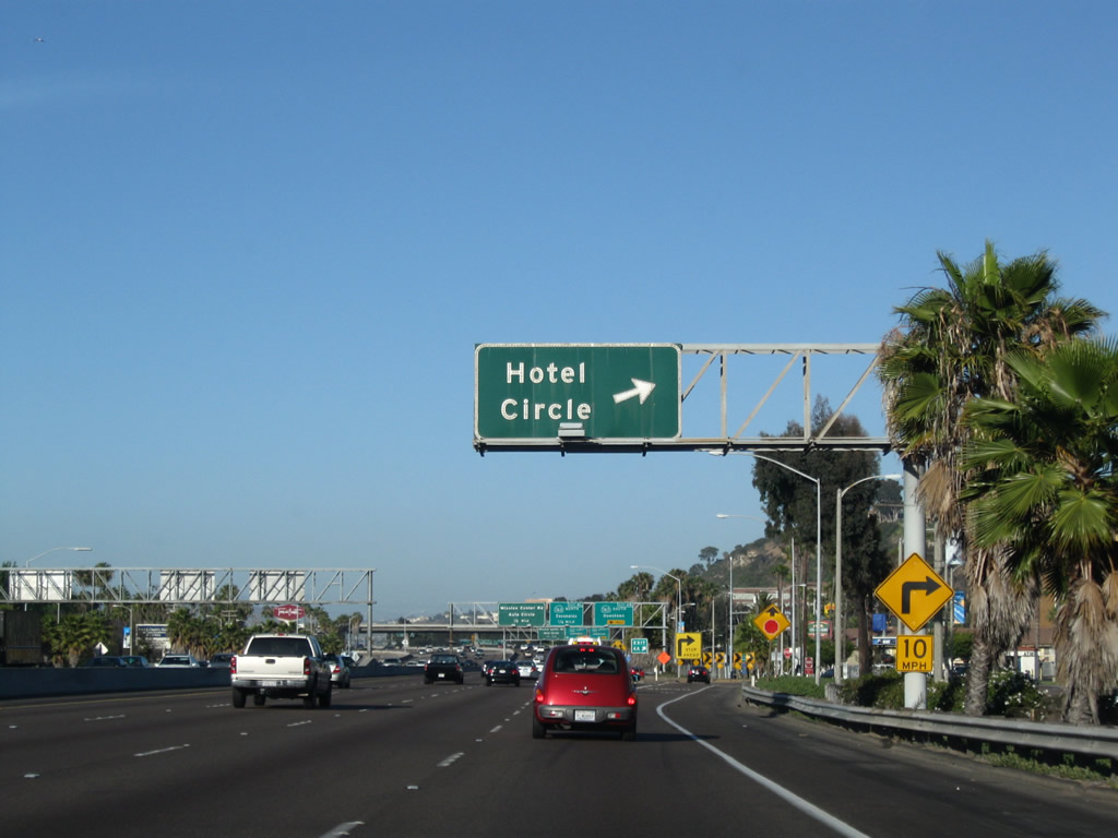
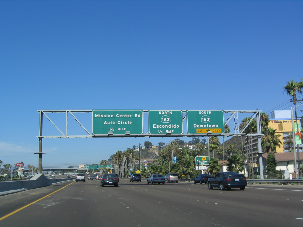
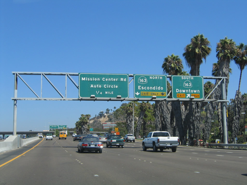
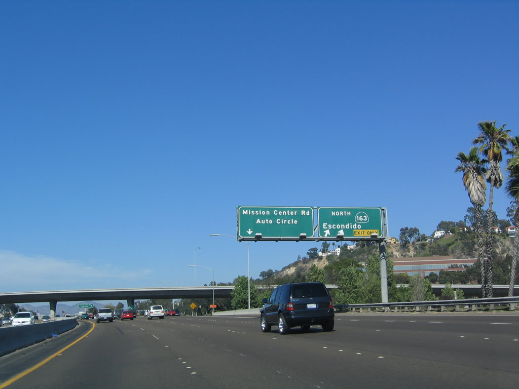
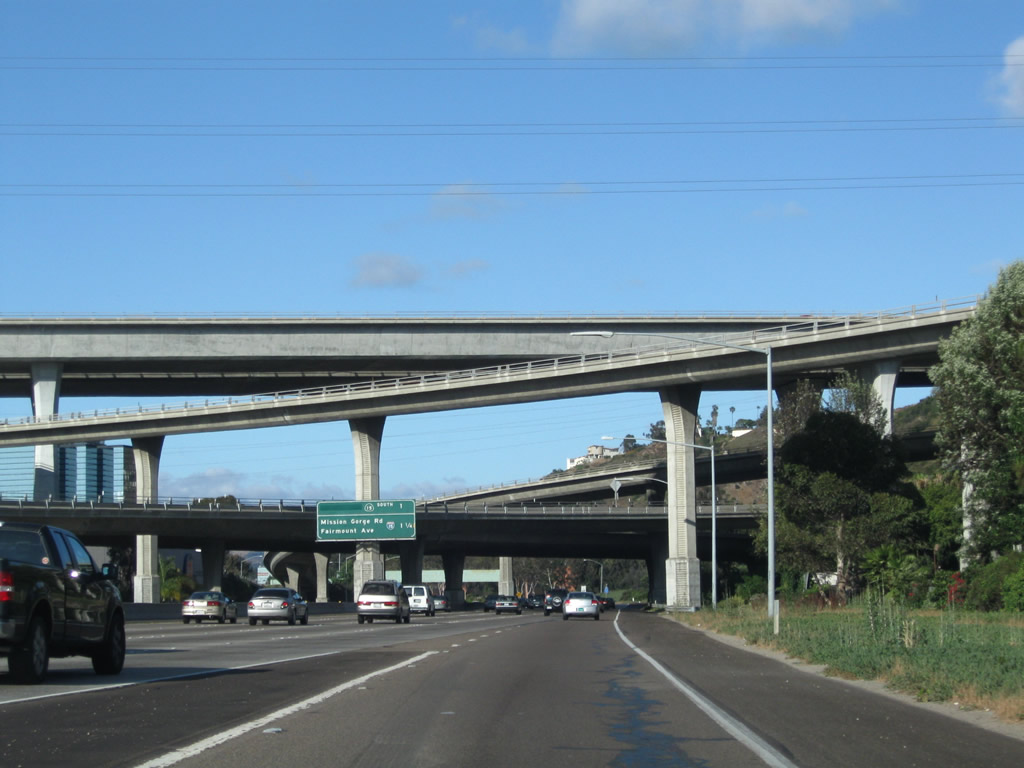
The next two exits along eastbound are Exit 4A, Hotel Circle, and Exits 4B-C, California 163 south/north. Interstate 8 through the Hotel Circle area has several businesses and establishments on both the north and south sides of the freeway. This picture also shows a rare asphalt section of freeway along Interstate 8. Most of Interstate 8 is concrete, but the asphalt section exists between Interstate 5 and California 163. This section is asphalt because it is was determined to be a better paving material given the type of soils in the ground underneath (which at one time may have been a riverbed perhaps due to the proximity of the San Diego River). As eastbound Interstate 8 approaches Exit 4A, Hotel Circle, the freeway enters the beginning of Mission Valley, through which Interstate 8 runs between Interstate 5 and just east of Interstate 15. Mission Valley was formed by the San Diego River, and the river used to plow through a variety of channels. Since development of residential and commercial properties has taken place, the San Diego River has since been constrained to its own manmade channels or worse, left to pass through dense thickets of weeds and trees. Photos taken 07/17/04 and 06/06/09. |
|
|
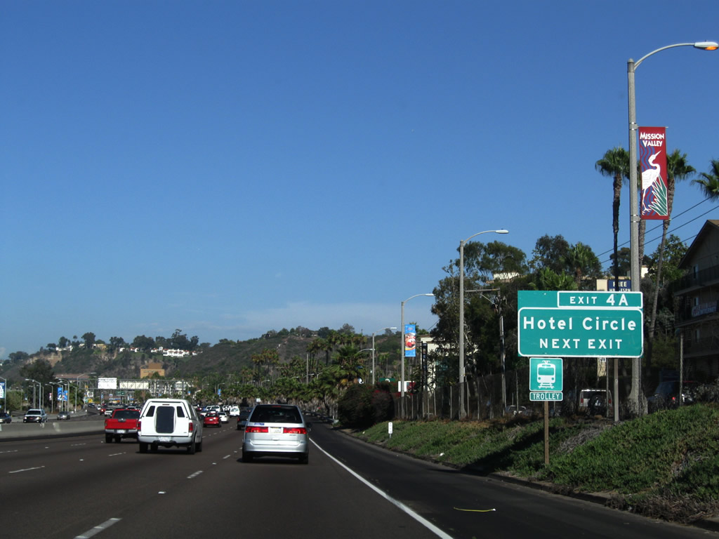
Eastbound Interstate 8 approaches Exit 4A, Hotel Circle. The next exits are for California 163 (Exits 4B-C) and Mission Center Road/Auto Circle (Exit 5). Until around 1999, the California 163 shield used to only have the numbers and no shield outline around them. The shield was pasted over the old numbers. Photo taken 05/06/09. |
|
This Exit 4A roadside guide sign was one of the first exit number signs to be installed along Interstate 8 in metro San Diego. Photo taken 08/25/08. |
|
Eastbound Interstate 8 reaches Exit 4A, Hotel Circle (east). Hotel Circle forms a loop around the north and south sides of the freeway, allowing for travelers to find lodging on either side of Interstate 8 in a location central to most activities in San Diego. Photo taken 05/06/09. |
|
|
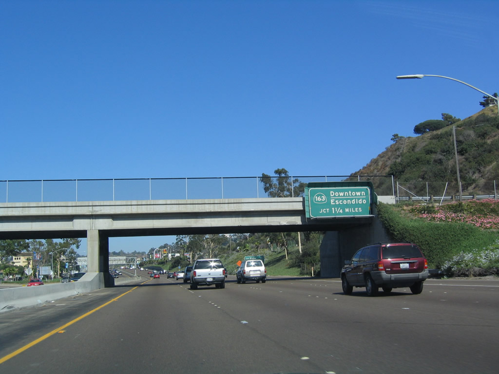
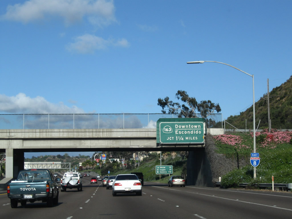
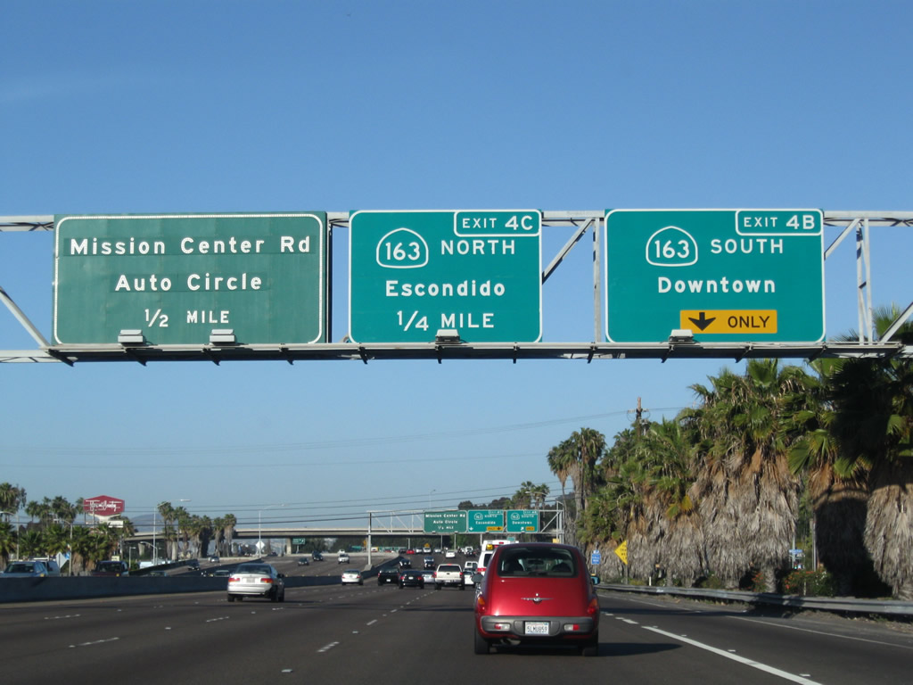
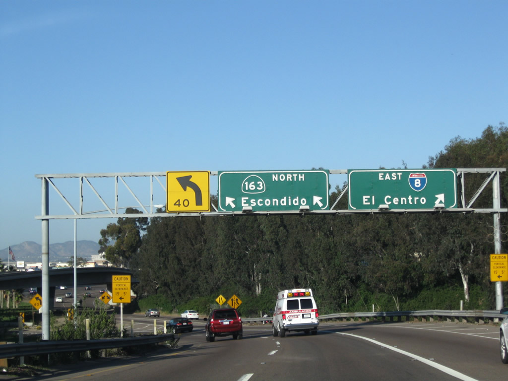
The next exit along eastbound Interstate 8 is Exits 4B-C, California 163, the Cabrillo Freeway (south and north). California 163 angles northeast from this interchange to connect to northbound Interstate 15 near Miramar Marine Corps Air Station. Escondido is actually located on Interstate 15 north of where California 163 terminates. Heading southbound, California 163 leads into downtown San Diego, connecting to Tenth Avenue and Fourth Avenue from southbound California 163. Photos taken 05/06/09 and 07/17/04. |
|
|
The far right lane leads to southbound, while two lanes connect to northbound. At one time, this interchange was the junction between U.S. 80 and U.S. 395. Both routes are decommissioned in San Diego County, but the interchange has vastly improved. What used to be cloverleaf interchange now incorporates flyover ramps to ease congestion at this busy connection. As noted to the right (south) of the freeway, the hotels continue unabated right up to the eastern end of Hotel Circle, which is located right against the California 163 interchange. The next exit is for California 163 northbound (Exit 4C), followed by Mission Center Road and Auto Circle (Exit 5). Photos taken 05/06/09 and 08/27/04. |
|
|
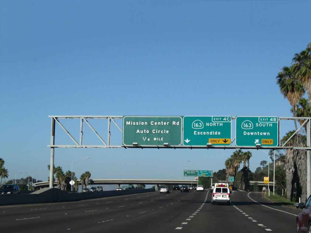
Eastbound Interstate 8 (Mission Valley Freeway) reaches Exit 4C, California 163 (Cabrillo Freeway) north. Traffic accessing Mission Center Drive (Exit 5) from eastbound should pay close attention to the correct lane, since it can be a bit confusing through here. Photos taken 03/28/09 and 07/17/04. |
|
Now on the off-ramp to Exit 4C, the ramp passes under another ramp that connects Interstate 8 west to California 163 south. Another ramp (connecting California 163 south to Interstate 8 east) merges onto the transition ramp from the right. Photo taken 05/06/09. |
|
Immediately thereafter, the left lanes connect to Exit 4C to California 163 (Cabrillo Freeway) north and the right lanes link back to Interstate 8 east. Photo taken 05/06/09. |
|
The transition lanes turn north to pass under the Interstate 8 freeway. Photo taken 05/06/09. |
|
After passing under the Interstate 8 freeway, the left lane connects to California 163 north and the right lane leads to Friars Road. Photo taken 05/06/09. |
|
|
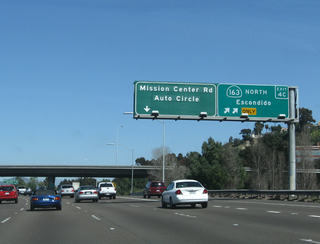
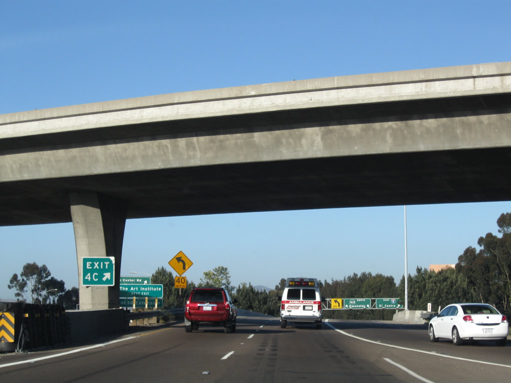
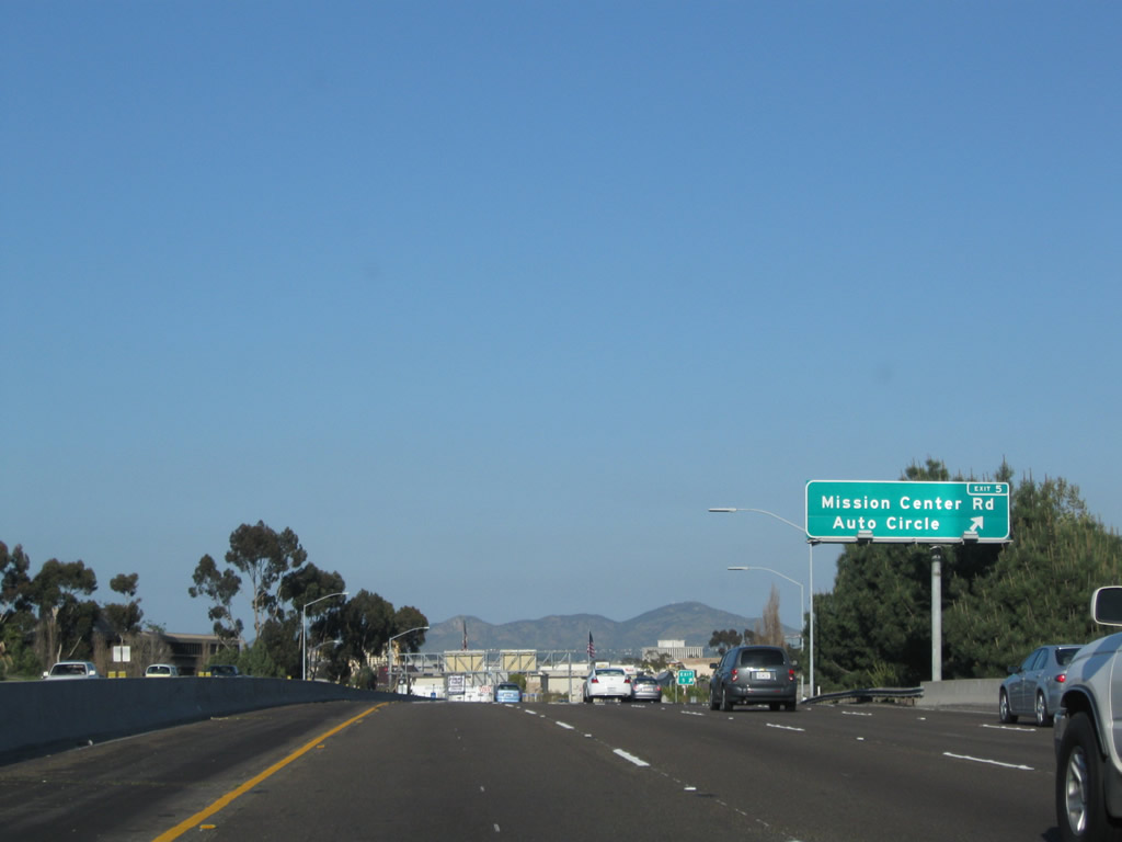
Returning to the mainline of Interstate 8, the next exit along eastbound Interstate 8 is Exit 5, Mission Center Road and Auto Circle. This exit is found immediately after the transition ramp to northbound California 163 (Exit 4C). A new exit number sign was posted in mid to late 2009. Photos taken 03/12/10 and 03/28/09. |
|
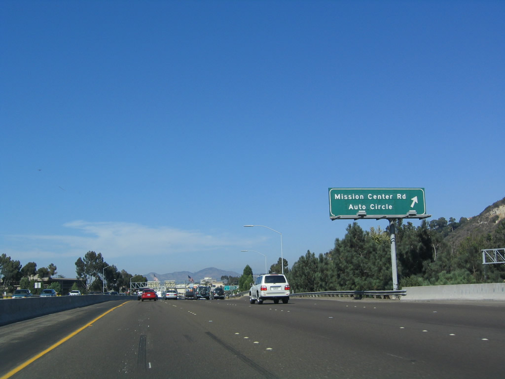
Rounding the turn at Exit 5's gore point, Cowles Mountain comes into view. This peak (el. 1,592 feet) is the highest point in the city of San Diego and is preserved as part of Mission Trails Regional Park. A hiking trail leads to the summit; follow Interstate 8 east to Mission Gorge Road east to the park. Photo taken 06/06/09. |
|
Once on the transition ramp from eastbound Interstate 8 to Exit 5, Mission Center Drive and Auto Circle, traffic is routed east to an intersection with Mission Center Road and Auto Circle, with a single ramp (shown here) that comes in from the transition ramp from northbound California 163 to eastbound Interstate 8. Photo taken 07/17/04. |
|
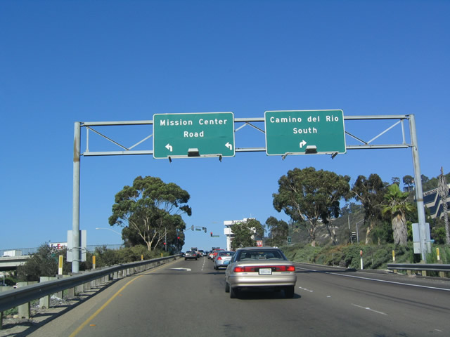
The ramp to Mission Center Road and Auto Circle comes to an end at a traffic signal. A left turn follows Mission Center Drive north, while a right turn connects to Camino del Rio South and a variety of automobile sales facilities. Photo taken 07/17/04. |
|
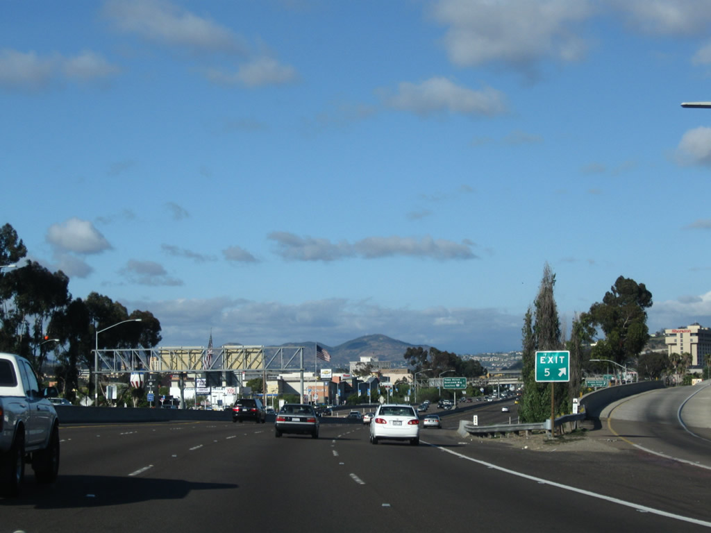
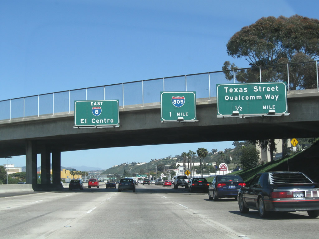
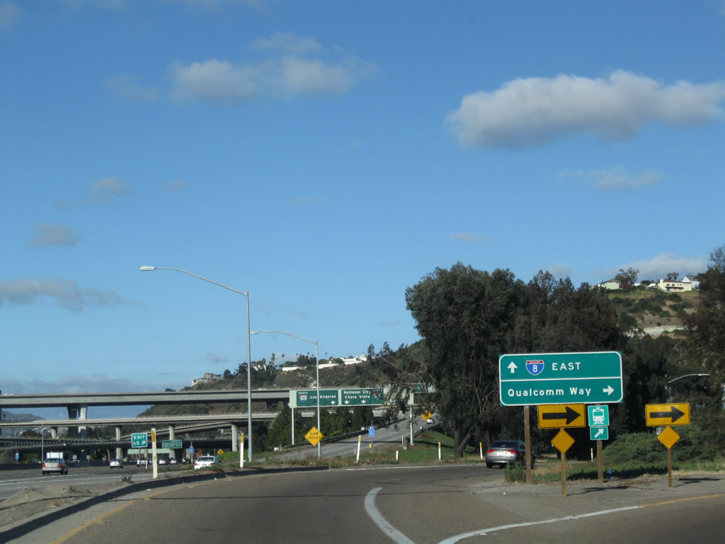
Back on the mainline, this mileage sign provides the distance to Exit 6A, Texas Street/Qualcomm Way and Exit 6B, Interstate 805 (Dekema Freeway). Photo taken 08/27/04. |
|
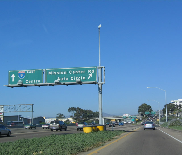
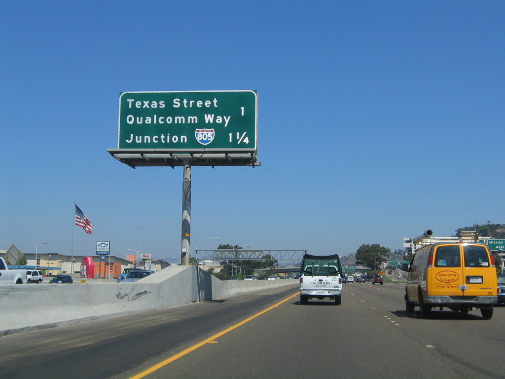
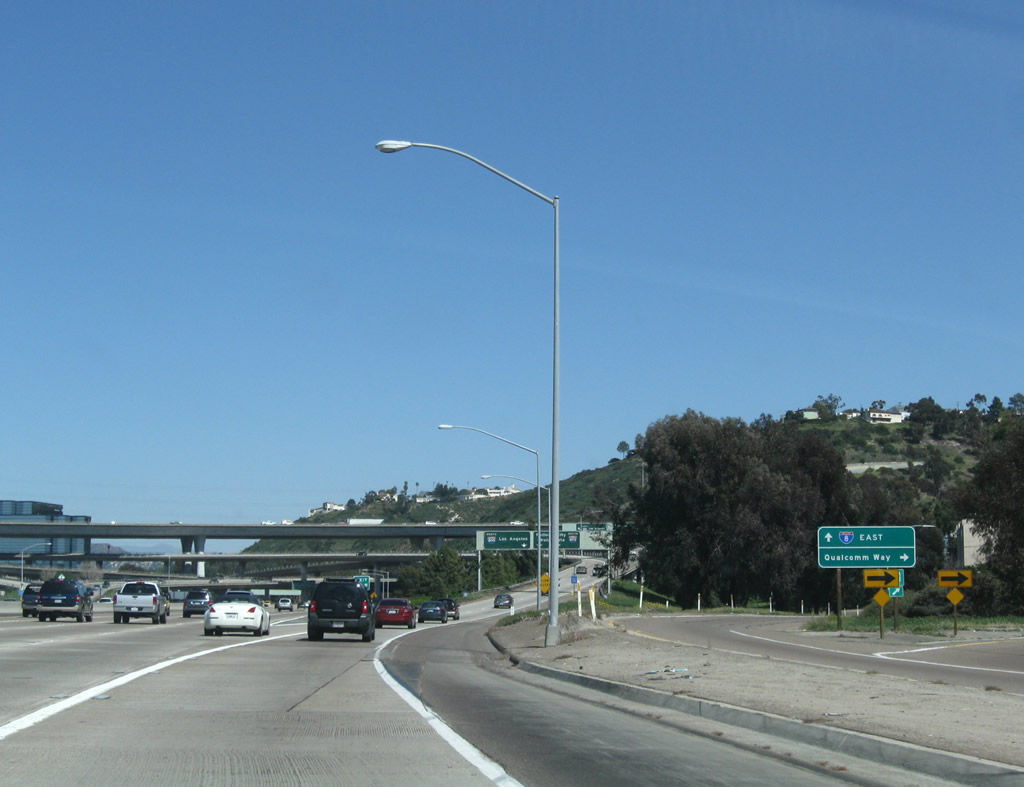
The next exit along eastbound Interstate 8 is Exit 6A, Texas Street and Qualcomm Way, one-half mile. The overpass above is for Mission Center Road and Auto Circle. Auto Circle is basically the name of the overpass and the connecting road south to Camino del Rio South (the frontage road). Mission Center Road begins just north of Interstate 8, and it connects to the heart of Mission Valley, leading to Mission Valley Center shopping mall, Mission Valley Center East shopping mall, Hazard Center, a variety of strip malls and big box stores, and many restaurants. Mission Valley is a regional attraction for central shopping in San Diego. The next exit is for Interstate 805, one mile. Photo taken 03/28/09. |
|
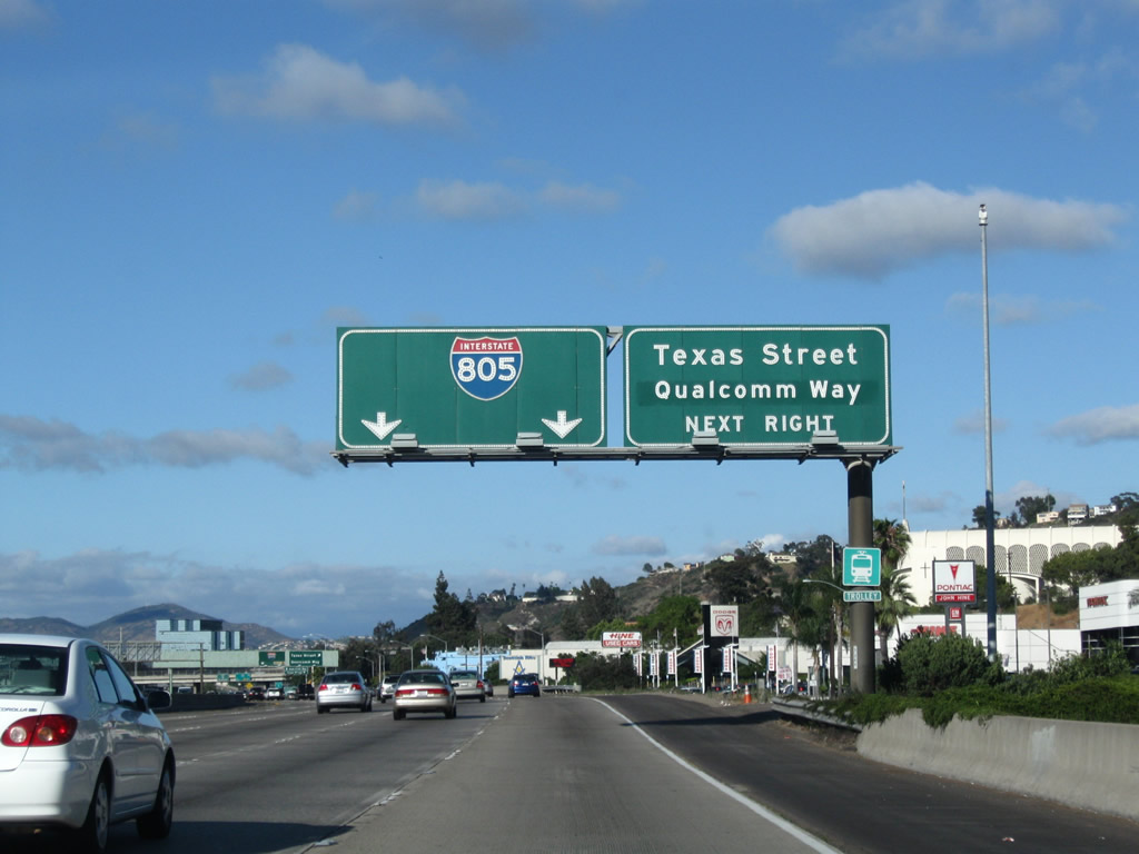
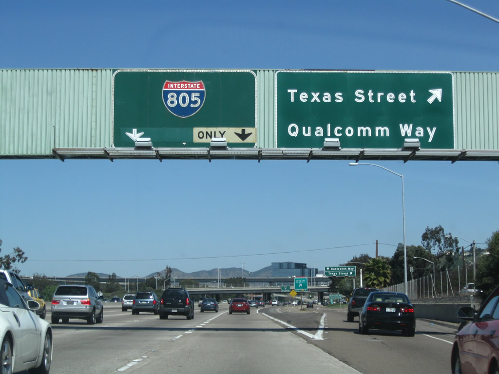
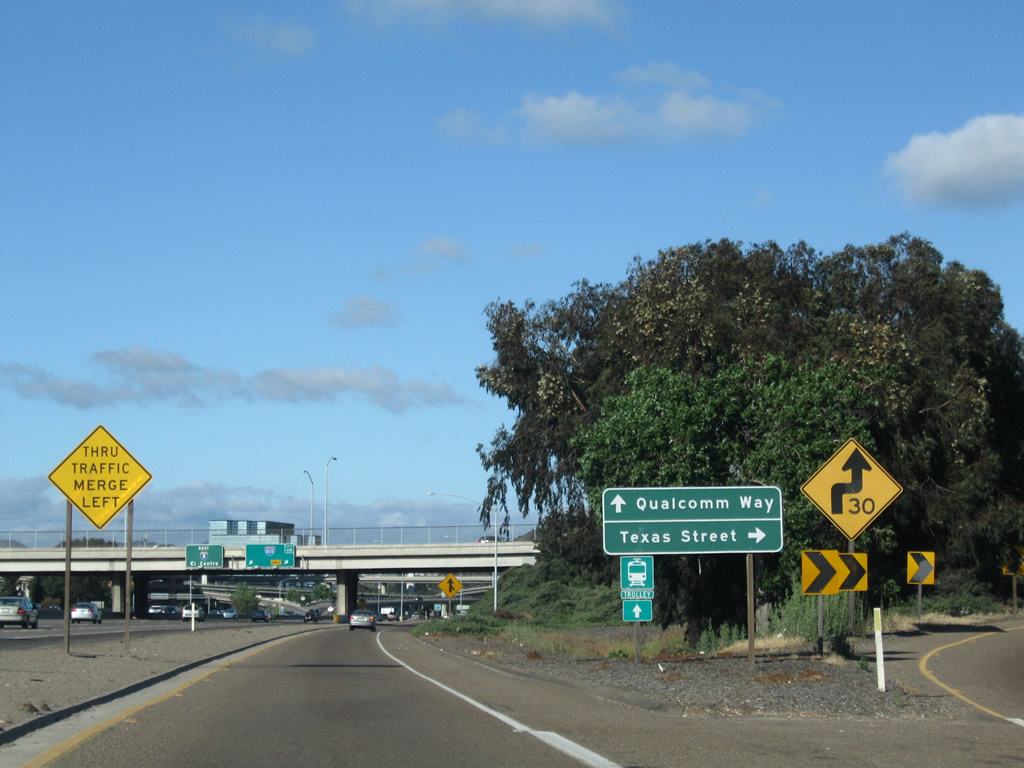
Eastbound Interstate 8 approaches Texas Street and Qualcomm Way, Exit 6A. Texas Street leads south into the North Park community of San Diego. It travels up a fairly steep hill to leave Mission Valley. Upon crossing Interstate 8, southbound Texas Street becomes southbound Qualcomm Way. Originally known as Stadium Way, Qualcomm Way was renamed in 1998 when Jack Murphy Stadium was renamed Qualcomm Stadium. Qualcomm Way is a good route to access the stadium from eastbound Interstate 8, but it is a bit too far west for westbound Interstate 8 travelers to use. Also note the car dealership to the south of the freeway in this picture; this is why Exit 5 is partially known as "Auto Circle." Photo taken 06/06/09. |
|
Eastbound Interstate 8 (Mission Valley Freeway) (Kumeyaay Highway) reaches Exit 6A, Texas Street and Qualcomm Way. The high bridge and ramps visible in the distance are for Interstate 805, Exit 6B. With Interstate 805 riding high above Mission Valley, the symmetrical stack interchange between Interstates 8 and 805 remains as one of the most incredible interchanges in San Diego County, if not the country. Photo taken 03/28/09. |
|
|
A collector distributor lane arrangement makes the connection from Interstate 8 (Mission Valley Freeway) east to Texas Street south to North Park and Qualcomm Way north to Mission Valley and Qualcomm Stadium. The first ramp on the c/d roadway leads to Texas Street, and the second ramp links to Qualcomm Way. Through traffic may use this exit ramp and still return to the freeway. Photos taken 03/28/09 and 06/06/09. |
|
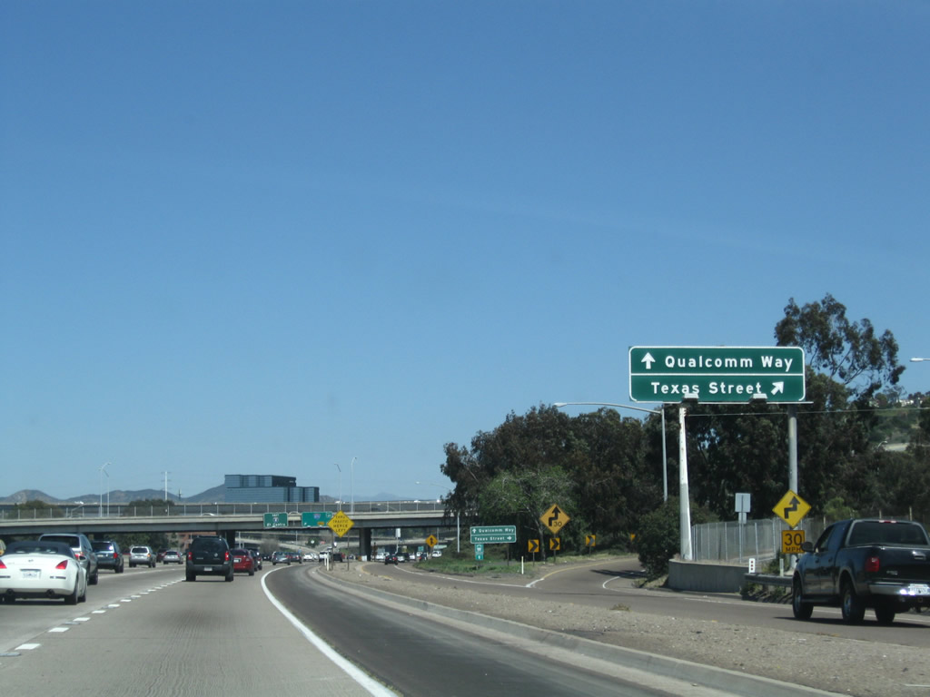
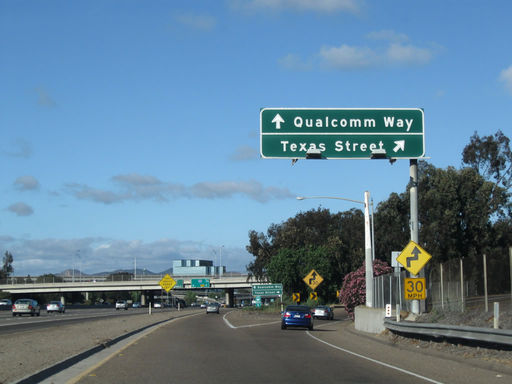
Now on the collector distributor lanes for Exit 6A, the first ramp connects to Texas Street south to North Park. Continue straight to connect to Qualcomm Way north to Mission Valley and Qualcomm Stadium. Photo taken 06/06/09. |
|
|
The massive Interstate 805 interchange comes into view along eastbound, and Interstate 8 reaches the ramp for Exit 6B, Interstate 805. The signs are mounted on the Texas Street/Qualcomm Way overpass. An exit number was added in 2005 at this location. Photos taken 03/28/09 and 08/27/04. |
|
|
This view shows the connection to Qualcomm (formerly Stadium) Way from the collector distributor lanes for Exit 6A. Photos taken 03/28/09 and 06/06/09. |
|
|
The collector distributor lanes for Exit 6A merge back to Interstate 8 after passing a ramp meter and going under the ramp to Interstate 805. Photos taken 06/06/09. |
|
|
Now shifting focus to the transition ramp from Interstate 8 east to Interstate 805: The left lane connects to Interstate 805/Dekema (Inland) Freeway north to northern San Diego, North County, and Los Angeles. The right lanes connect to Interstate 805 south to City Heights, National City, Chula Vista, and ulimately San Ysidro at the international border. Photo taken 03/28/09 and 08/27/04. |
|
The transition ramp splits between Interstate 805/Dekema (Inland) Freeway north to Los Angeles and south to National City and Chula Vista. Photo taken 03/28/09. |
|
Following the ramp to Interstate 805 south, the two-lane transition ramp gains enough elevation to merge onto the north-south freeway. Photo taken 03/28/09. |
|
Finally returning to the mainline of Interstate 8 east, this view shows the transition ramp to Interstate 805 as seen from the main lanes. Once on the ramp to Interstate 805, Exit 6B splits into two ramps: one to northbound Interstate 805 (Dekema Freeway) to Los Angeles and the other to southbound Interstate 805 (Dekema Freeway) to Chula Vista, National City, and the International Border Crossing (Otay Mesa or San Ysidro). Photo taken 07/17/04. |
|
Interstate 805 is the highest bridge in the Interstates 8/805 stack interchange, while Interstate 8 remains at the ground level. Flyover ramps lead in all directions for all connections, making this interchange full-service. A seismic retrofit of this bridge was completed in 1998, and it was one of the largest undertakings of the bridge retrofit program. Photo taken 07/17/04. |
|
|
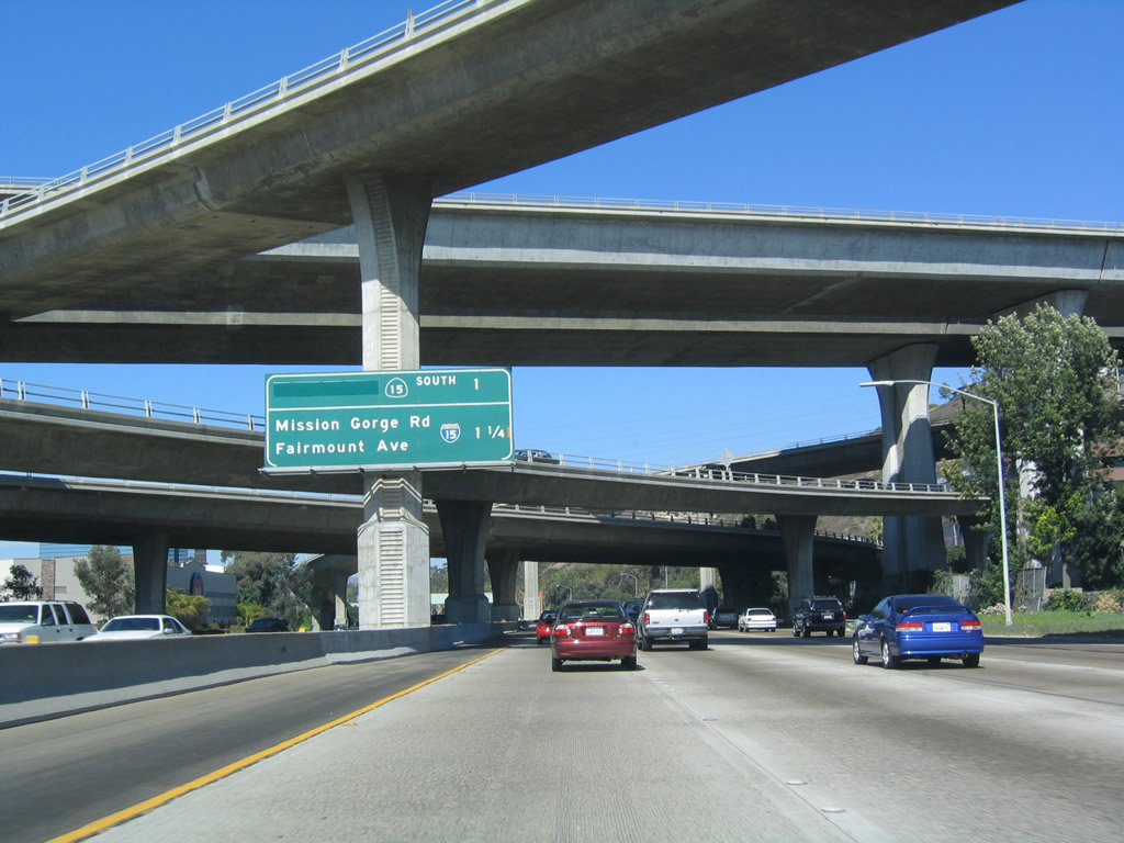
The next exit along eastbound Interstate 8 (Kumeyaay Highway) (Mission Valley Freeway) is Exit 7, Interstate 15 north, California 15 south, Fairmount Avenue north/south, Mission Gorge Road east, and Montezuma Road east. This segment of Interstate 8, between Interstate 805 and Interstate 15, is routinely one of the most traveled sections of freeway in the entire city, even surpassing the Interstate 5/805 merge in terms of average daily traffic counts in some years. Photos taken 06/06/09 and 07/17/04. |
|
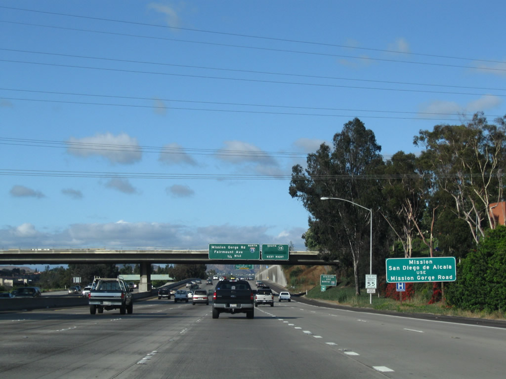
To Mission San Diego de Alcala ("California's First Church"), follow Mission Gorge Road east to Twain Avenue north. Twain Avenue becomes San Diego Mission Road, and the mission is on the right side of San Diego Mission Road. The historic mission was founded on July 16, 1769, by Father Junipero Serra. Photo taken 06/06/09. |
|
To Qualcomm Stadium, use Interstate 15 north to Friars Road west. Ahead, Interstate 8 passes under the Mission City Parkway bridge. Photo taken 06/06/09. |
|
This stretch of Interstate 8 can be very hectic, as traffic coming from Interstate 805 must weave out of the auxiliary lanes and into the main lanes, while traffic trying to get to Interstate 15 northbound, California 15 southbound, or Fairmount Avenue/Mission Gorge Road must merge over to the right. The result is a lot of weaving traffic on a very busy highway. Photo taken 08/27/04. |
|
When these overhead signs were installed, California 15 was designated as 40th Street. The green overlay covers up the words "40th St" because it is now a freeway south through City Heights toward Barrio Logan. In 1999, the freeway was completed. California 15 is planned to become Interstate 15 once the California 15/California 94 is reconstructed. Photo taken 06/06/09. |
|
Eastbound Interstate 8/Mission Valley (Alavarado) Freeway reaches Exit 7, California 15 (Escondido Freeway) south. This used to be 40th Street, but with the completion of the freeway section between Adams Avenue and Interstate 805 in 1999, California 15 does not carry the 40th Street designation. Photo taken 06/06/09. |
|
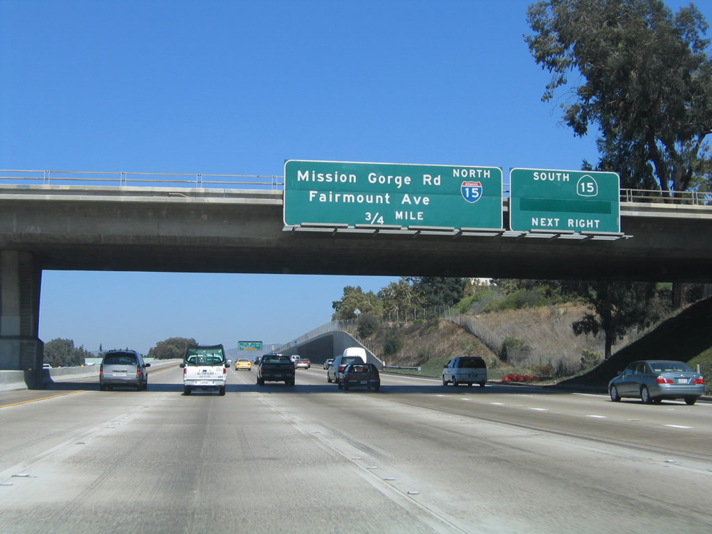
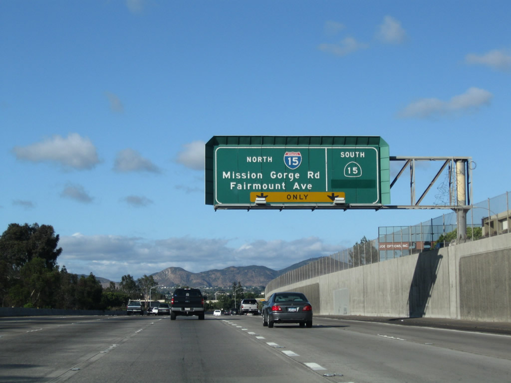
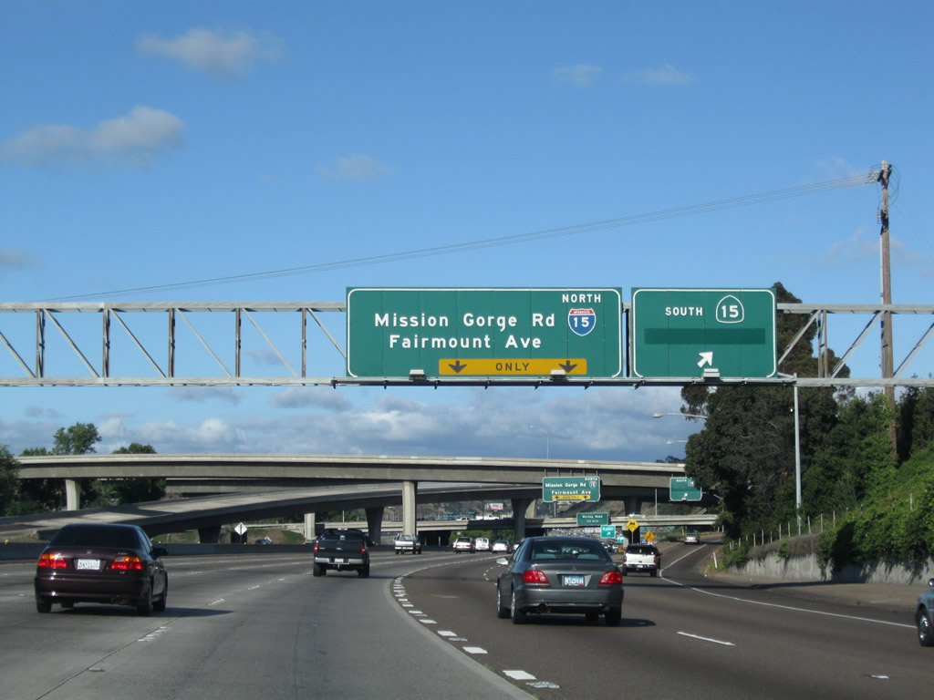
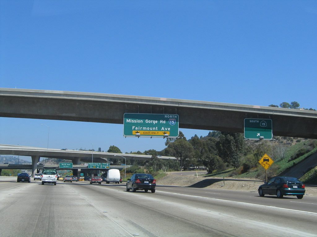
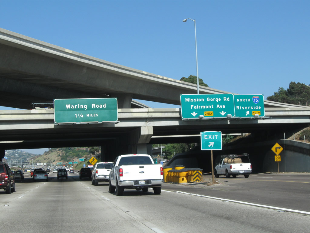
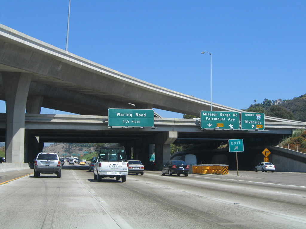
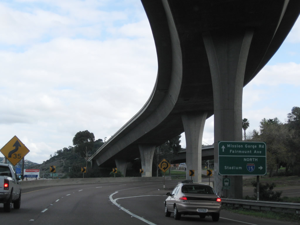
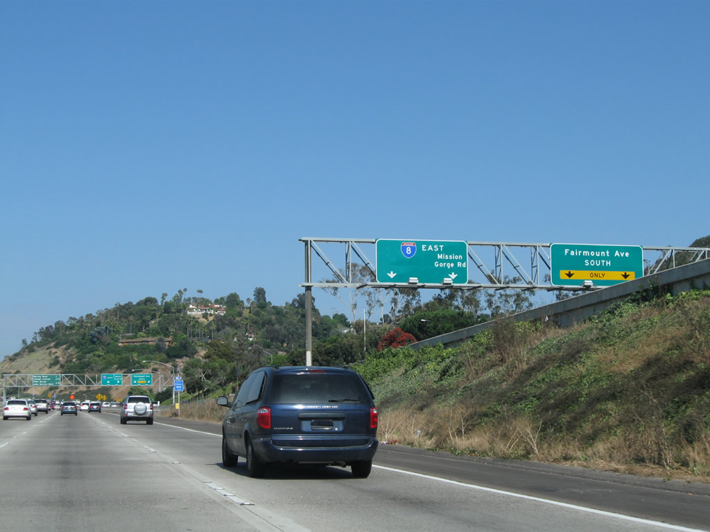
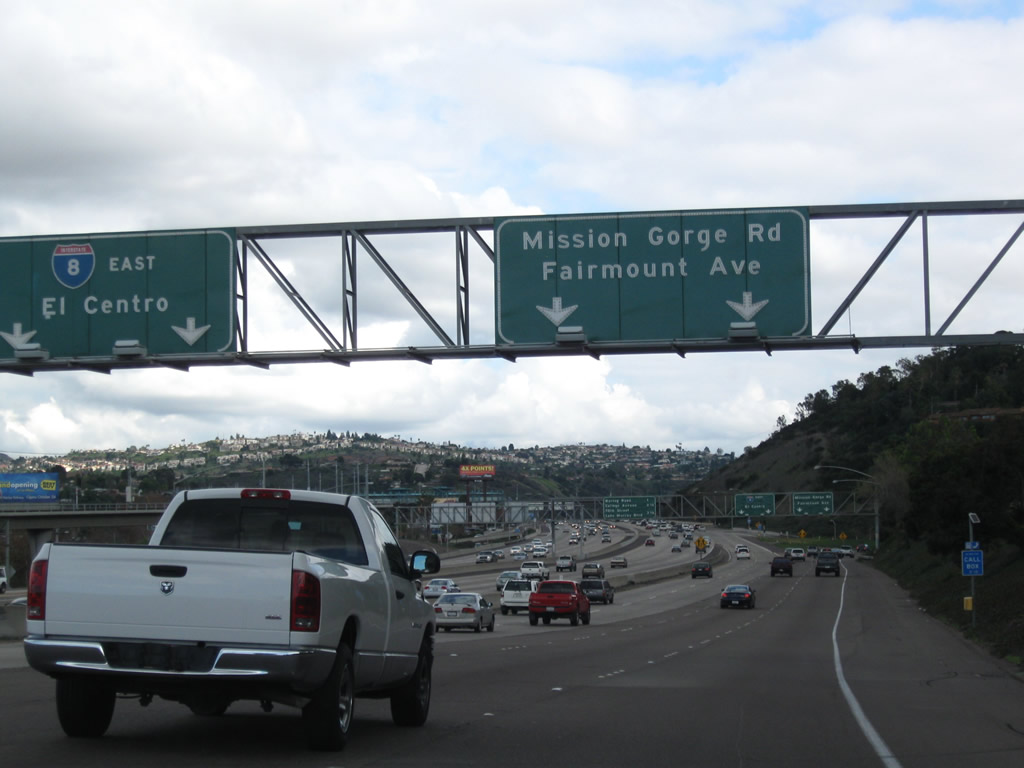
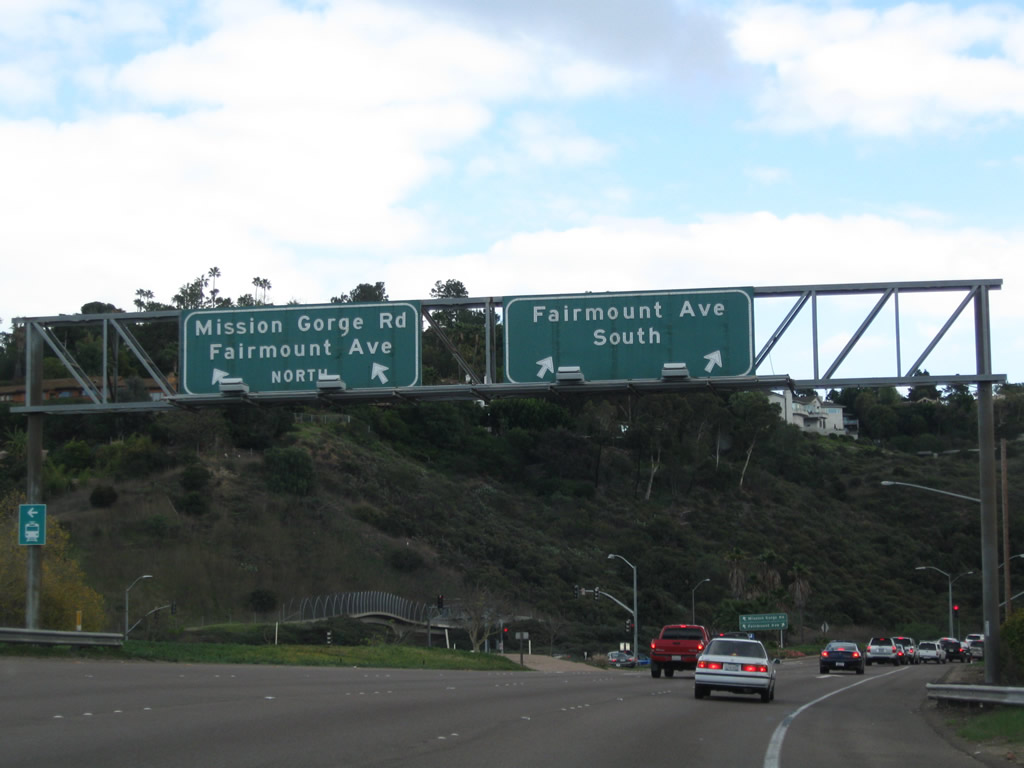
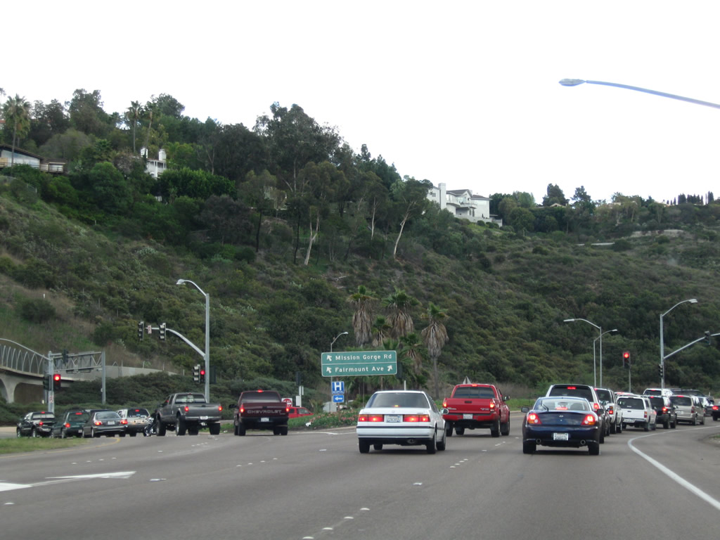
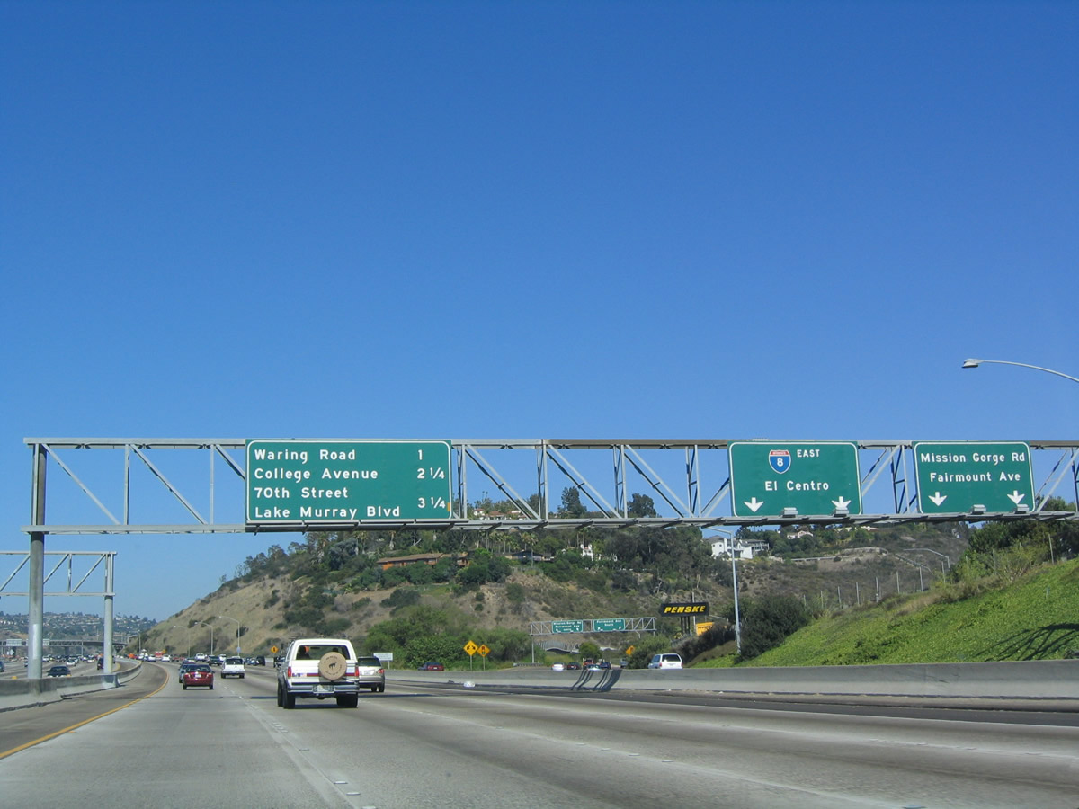
After the ramp to southbound California 15, the next exit along eastbound Interstate 8 is the ramp to Interstate 15 northbound and three city streets (see below). This overhead sign is hanging from a ramp connecting southbound Interstate 15 with Camino del Rio South, the Interstate 8 frontage road. As for the off-ramp to Interstate 15, it also connects to north-south Fairmount Avenue, a major city street that leads south into the Mid-City community (including City Heights). Mission Gorge Road is a major southwest to northeast route that cuts a path roughly parallel to the San Diego River from the Mission Gorge neighborhood near Interstate 8 all the way to California 52 at Santee. Although not signed, Fairmount Avenue southbound is an excellent route to take to San Diego State University, which may be reached by taking southbound Fairmount Avenue to eastbound Montezuma Road. Photo taken 08/27/04. |
|
|
|
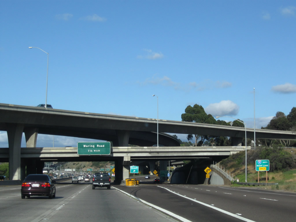
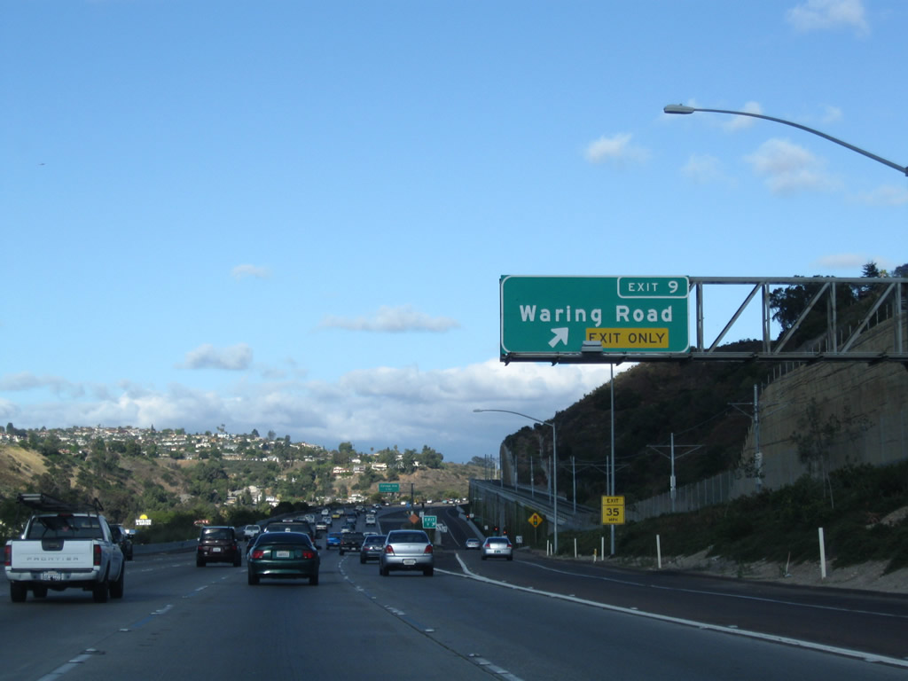
Eastbound Interstate 8 reaches Interstate 15/California 15 (Exit 7). For now, this interchange marks the current southern terminus of Interstate 15, which is expected to be extended south to the Interstate 5 interchange once the remainder of California 15 is upgraded to Interstate standards. The next exit is Exit 9, Waring Road. Photos taken 03/12/10, 06/06/09, and 08/27/04. |
|
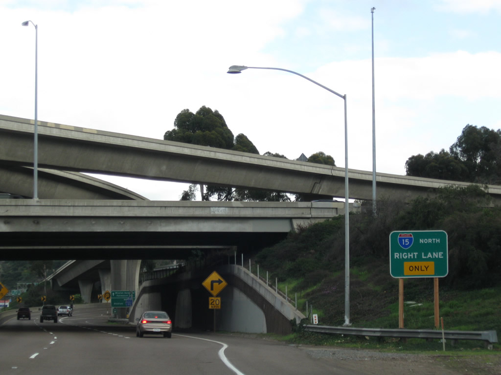
As we transition onto the transition lanes to Exit 7, an auxiliary sign for Interstate 15 north is posted prior to the freeway passing under the Interstate 15 mainline. Photo taken 01/24/09. |
|
Still on the transition ramp to Fairmount Avenue and Mission Gorge Road, the right lane departs on a loop ramp to Interstate 15. Many people come through here expecting the two left lanes of the ramp to connect to Interstate 15 north, but that is not the case. Stay right and exit on this sharp ramp to Interstate 15 north to Riverside (and Qualcomm Stadium). Photo taken 01/24/09. |
|
|
Traffic merges onto the transition from the left. These motorists are connecting from Interstate 15 south and may choose to follow Interstate 8 east (left lanes) or Mission Gorge Road and Fairmount Avenue (right lanes). The 2010 view is from the main lanes, while the 2009 view is from the off-ramp. Photos taken 07/29/10 and 01/24/09. |
|
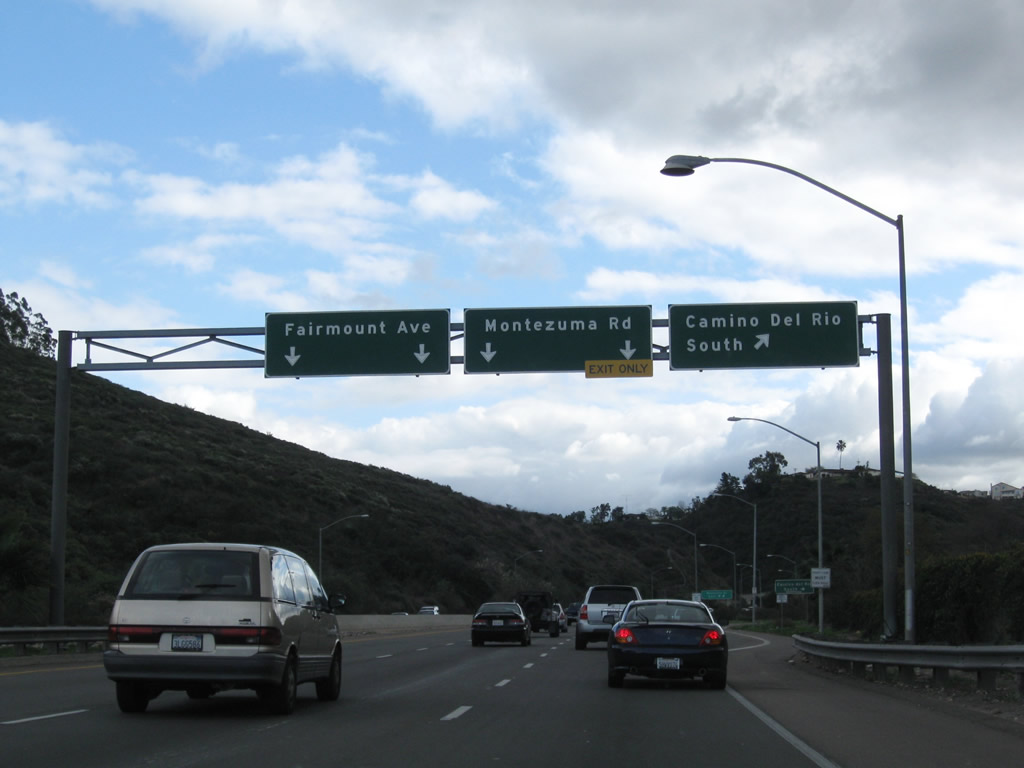
After traffic departs to Interstate 8 east, the transition ramp again splits. The left lanes connect to Mission Gorge Road east and Fairmount Avenue north. The right lanes connect to Fairmount Avenue south and Montezuma Road east. Photo taken 01/24/09. |
|
A gore point sign splits the traffic. Photo taken 01/24/09. |
|
Now traveling south on Fairmount Avenue, the first exit connects to Camino del Rio south, and the second exit leads to Montezuma Road east to San Diego State University. Use the left lanes to continue south on Fairmount Avenue into City Heights. Photo taken 01/24/09. |
|
|
|
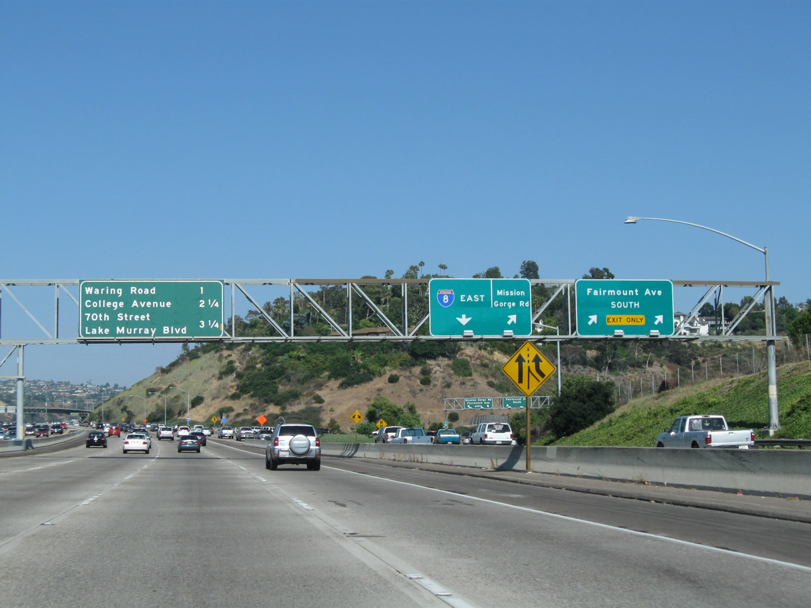
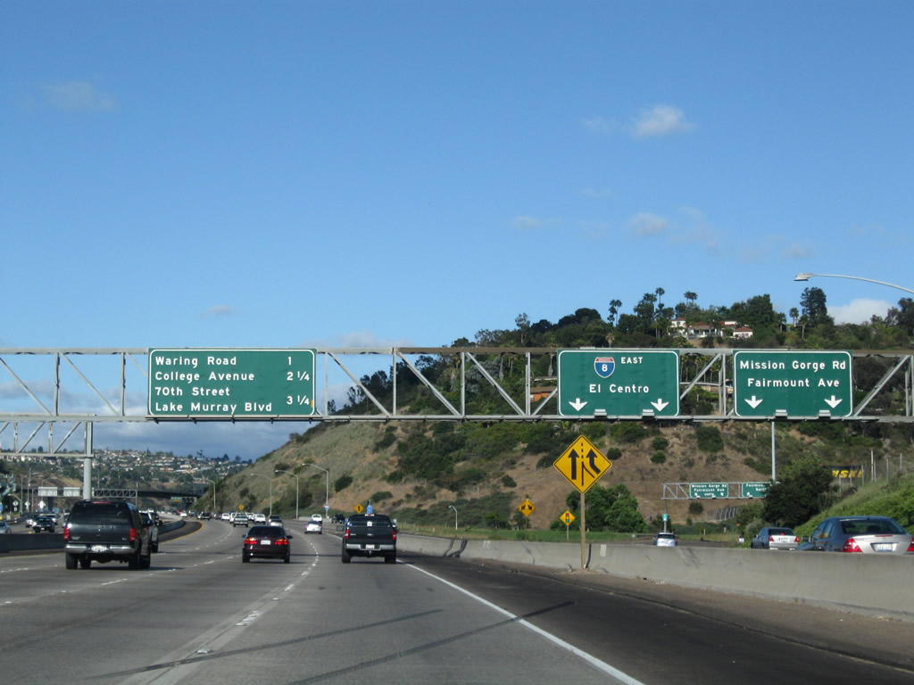
Back on the mainline, this mileage sign is hoisted above the eastbound lanes after the Interstate 15 interchange. The sign bridge spans across the auxiliary lanes too, and on that portion of the signbridge, signs direct traffic to Mission Gorge Road, Fairmount Avenue, and Eastbound Interstate 8 for traffic from both Interstate 8 and Interstate 15. Two new lanes of traffic merge onto the mainline; one of them exits onto Waring Drive (Exit 9), while the other lane remains with the freeway until 70th Street/Lake Murray Boulevard. Photos taken 07/29/10, 06/06/09, and 07/17/04. |
|
|
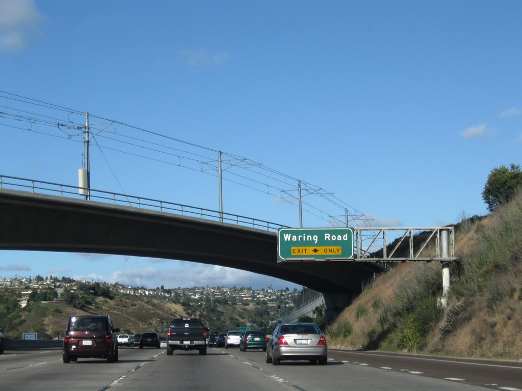
The next exit along Interstate 8 (Mission Valley Freeway) is Exit 9, Waring Road. This overpass carries the new San Diego Trolley over Interstate 8 as it approaches Waring Road. The trolley was not yet operational at the time this photo was taken. Photos taken 06/06/09 and 07/17/04. |
|
The Exit 9 (Waring Road) interchange was reconfigured as a result of the realignment of Alvarado Canyon Road and the new trolley extension, which will connect Qualcomm Stadium with San Diego State University and Grossmont Center in La Mesa. The interchange used to be a trumpet and now is a diamond. The trolley will closely parallel Interstate 8 for much of this journey, so some reconstruction was necessary to accommodate the double-tracked right of way. Photo taken 07/17/04. |
|
|
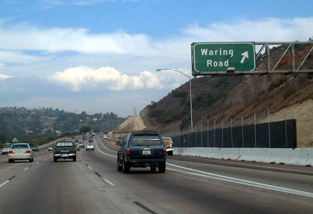
Eastbound Interstate 8/Mission Valley (Alvarado) Freeway reaches Waring Road (Exit 9). Waring Road heads northeast through Grantville and Allied Gardens before turning into southbound College Avenue at its intersection with Navajo Drive in Del Cerro. Photos taken 06/06/09 and 08/02/02. |
|
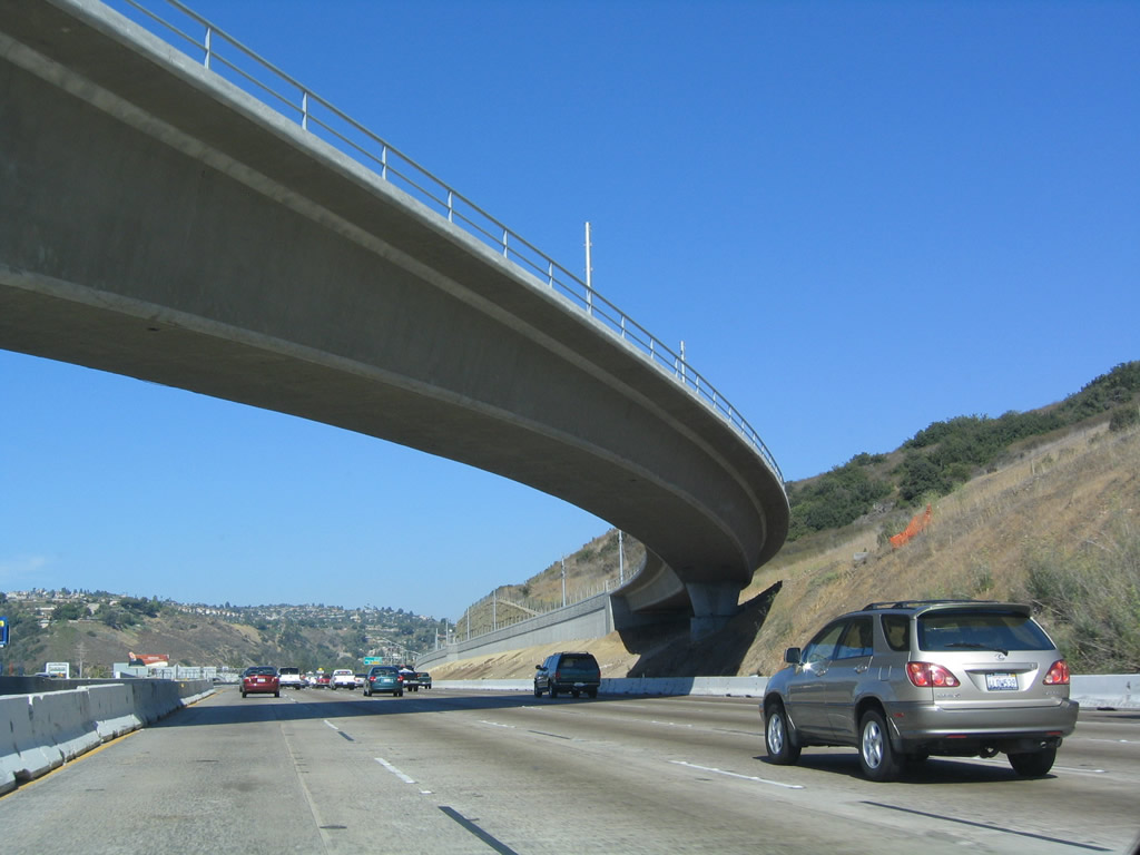
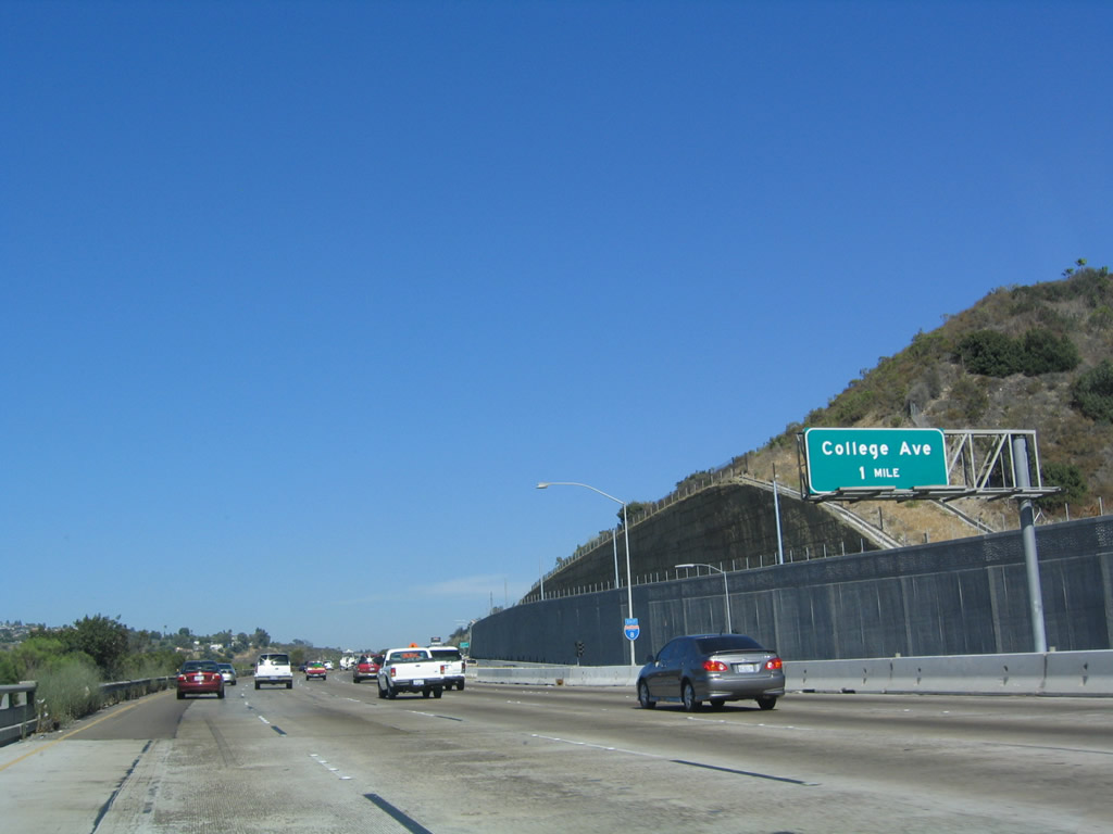
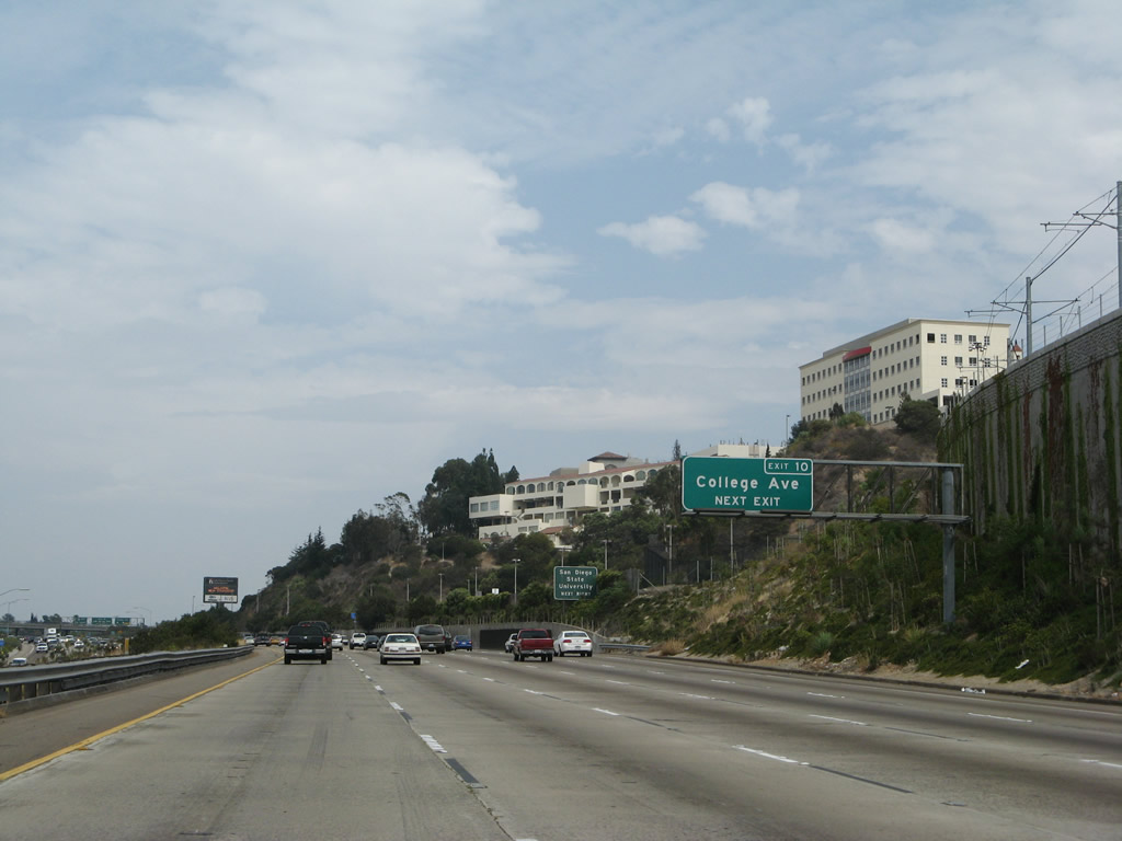
After the Waring Road interchange, eastbound Interstate 8 ascends toward San Diego State University (Montezuma Mesa) and Grossmont Summit. As the freeway ascends the grade, the Mission Valley Trolley climbs on the south side of the freeway. The next exit is Exit 10, College Avenue, one mile. Photo taken 07/17/04. |
|
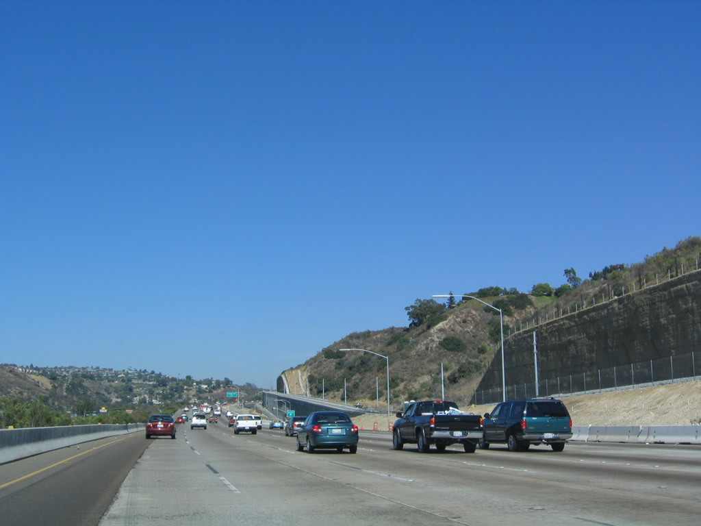
This mileage sign along eastbound provides the distance to the next two exits: Exit 10, College Avenue and Exit 11, 70th Street south and Lake Murray Boulevard northeast. San Diego State University, the largest university in San Diego County, is perched on the hillside as seen in the distance. The top of that hill, known as Montezuma Mesa, is home to a full-service public university that offers most degree programs for Bachelors and Masters. In accordance with the separation of masters and Ph.D. programs, only University of California schools offer Ph.D. programs, although San Diego State University participates in some joint doctoral programs. Photo taken 07/17/04. |
|
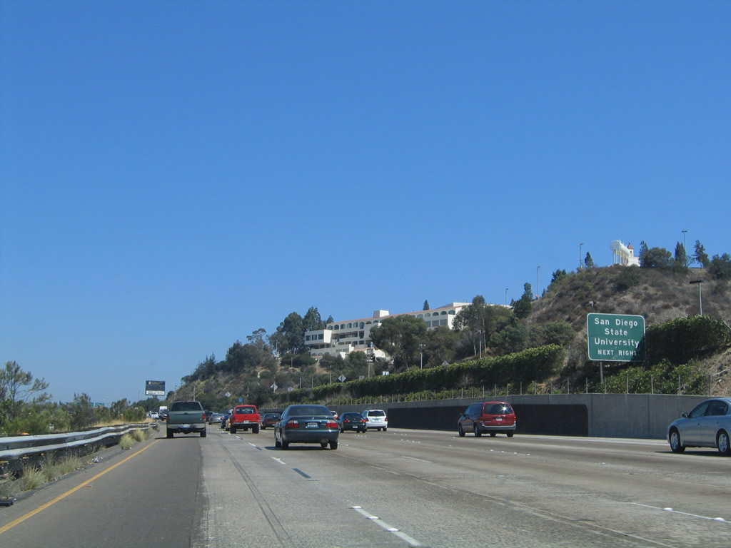
College Avenue heads north from this interchange to meet Waring Road at Navajo Road in Del Cerro and south past San Diego State University into the College Area and Rolando communities. College Avenue connects to California 94 (Martin Luther King, Jr. Freeway) to the south, with connections to Broadway in Lemon Grove. As Interstate 8 approaches the interchange with College Avenue, the trolley veers south into the campus of San Diego State University; it will rejoin Interstate 8 just east of the College Avenue interchange (Exit 10). Photo taken 08/25/07. |
|
Exit 10 (College Avenue) is the main exit for San Diego State University, the adjacent College Area community, and the Navajo community (including Del Cerro). This interchange has been gradually widened and improved over the years. The beginning of each semester always brings added traffic and congestion to campus, and that congestion almost always spills over onto Interstate 8. An appreciable increase in the amount of traffic along eastbound Interstate 8 is noticeable on school days. Traffic delays on campus are frequently due to the fact that there are more people trying to park on campus, but there are oftentimes not enough spaces available for parking, even with six (and counting) parking structures. Photo taken 08/27/04. |
|
Eastbound Interstate 8 meets Exit 10, College Avenue. This interchange has been gradually widened and improved over the years. Originally, the College Avenue overcrossing had only two through lanes; now it has four through lanes plus auxiliary lanes. College Avenue is the best route to reach San Diego State University. Photo taken 08/27/04. |
|
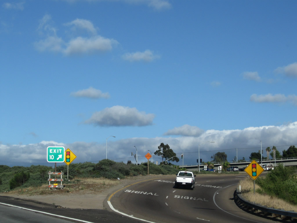
An Exit 10 gore point sign is posted for the two-lane off-ramp to College Avenue. Photo taken 06/06/09. |
|
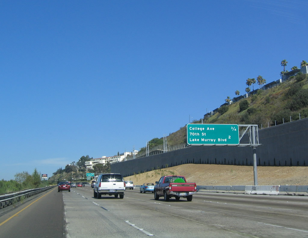
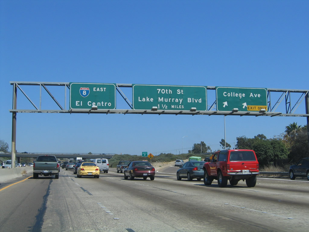
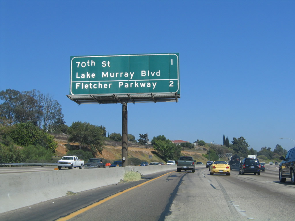
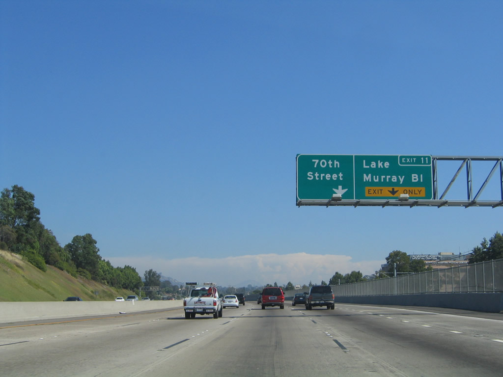
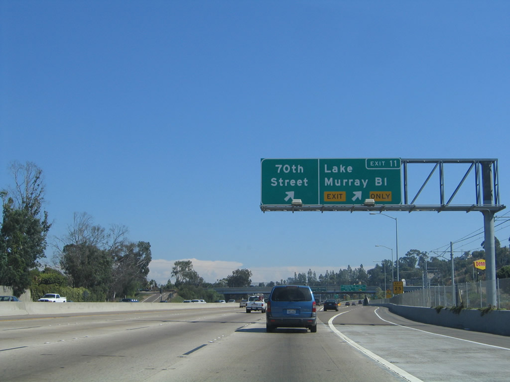
The next exit along eastbound Interstate 8 is Exit 11, 70th Street and Lake Murray Boulevard. From this interchange, 70th Street leads south into the College Area community of the city of San Diego, and with a bit of backtracking, can be used to reach San Diego State University via El Cajon Boulevard and Montezuma Road. Lake Murray Boulevard leads northeast from this interchange into the city of La Mesa, passing by the Lake Murray Reservoir on its way toward Grossmont Community College near Navajo Road. Photo taken 08/27/04. |
| Interstate 8/Alvarado Freeway (Kumeyaay Highway) |
|
Just like the section of Interstate 8 near Waring Road and Alvarado Canyon Road, this section of Interstate 8 changed between 2000 and 2004 as a result of the trolley construction. Some detours and lane adjustments have already been implemented to allow for the construction. This picture was taken before that construction began. The exit number signs through this area were installed in September 2003 as part of the reconfiguration of the freeway to accommodate the trolley right of way. Alvarado Hospital may be reached via Exit 11; just take Alvarado Road (frontage road) west to Reservoir Road. Photo taken 10/01/05. |
|
Interstate 8 leaves the city of San Diego and enters the city of La Mesa. Founded in 1869 and incorporated in 1912, La Mesa (Spanish for "The Table" due to its position on Grossmont Summit and is known as the "Jewel of the Hills") is a suburb of San Diego and sits at an elevation of 540 feet. Home to 54,749 people as of the 2000 Census, La Mesa (like El Cajon) has been seeing population growth as the region expands; however, La Mesa is landlocked and does not have as much developable acres as its neighbors to the north and east. Photo taken 06/06/09. |
|
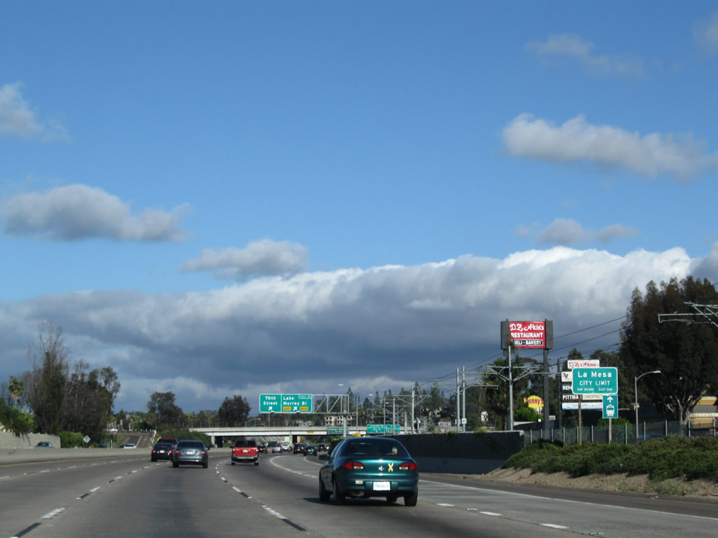
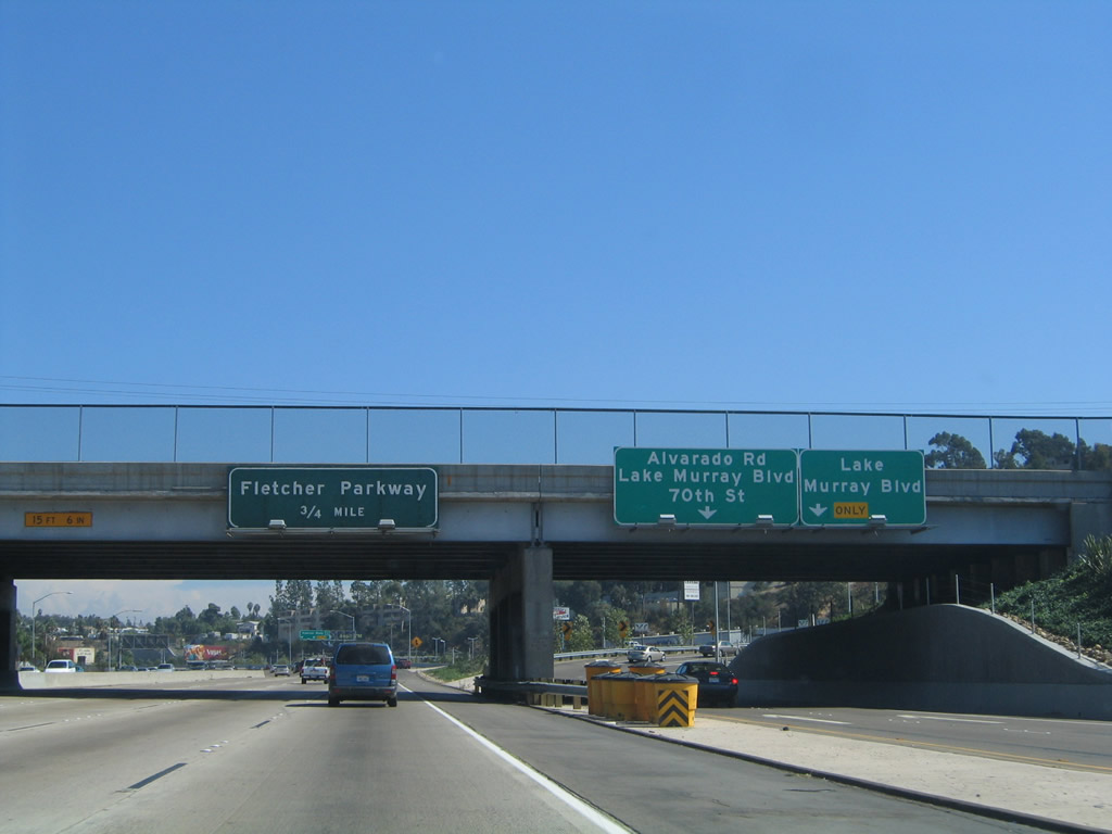
Eastbound Interstate 8/Alvarado Freeway reaches Exit 11, 70th Street south and Lake Murray Boulevard northeast. D.Z. Akins, a local sandwich shop and restaurant, is located at the 70th Street/Lake Murray Boulevard interchange. This eatery is well known locally for its kosher sandwiches, and it is very easy to reach it from the freeway. This exit, shown along eastbound, has one ramp to southbound 70th Street, a cloverleaf ramp to northbound Lake Murray Drive, and a supplemental off-ramp to Alvarado Road, the frontage road parallel to Interstate 8. Photo taken 10/01/05. |
|
The two exit lanes separate from the freeway main lanes and pass under the 70th Street/Lake Murray Boulevard overpass. Use the right lane to turn northeast on Lake Murray Boulevard and the left lane to reach 70th Street south, Lake Murray Boulevard, or either direction of Alvarado Road (frontage road). The next exit along eastbound is Exit 12, Fletcher Parkway. Fletcher Parkway is a major, six-lane highway that leads northeast from Interstate 8 toward Grossmont Center and ultimately El Cajon. Originally proposed as a freeway, it now has too many shops and lights along it to consider it as even an expressway. However, it carries a substantial traffic volume and is the best way to reach the trolley station at Grossmont Center. Photo taken 10/01/05. |
|
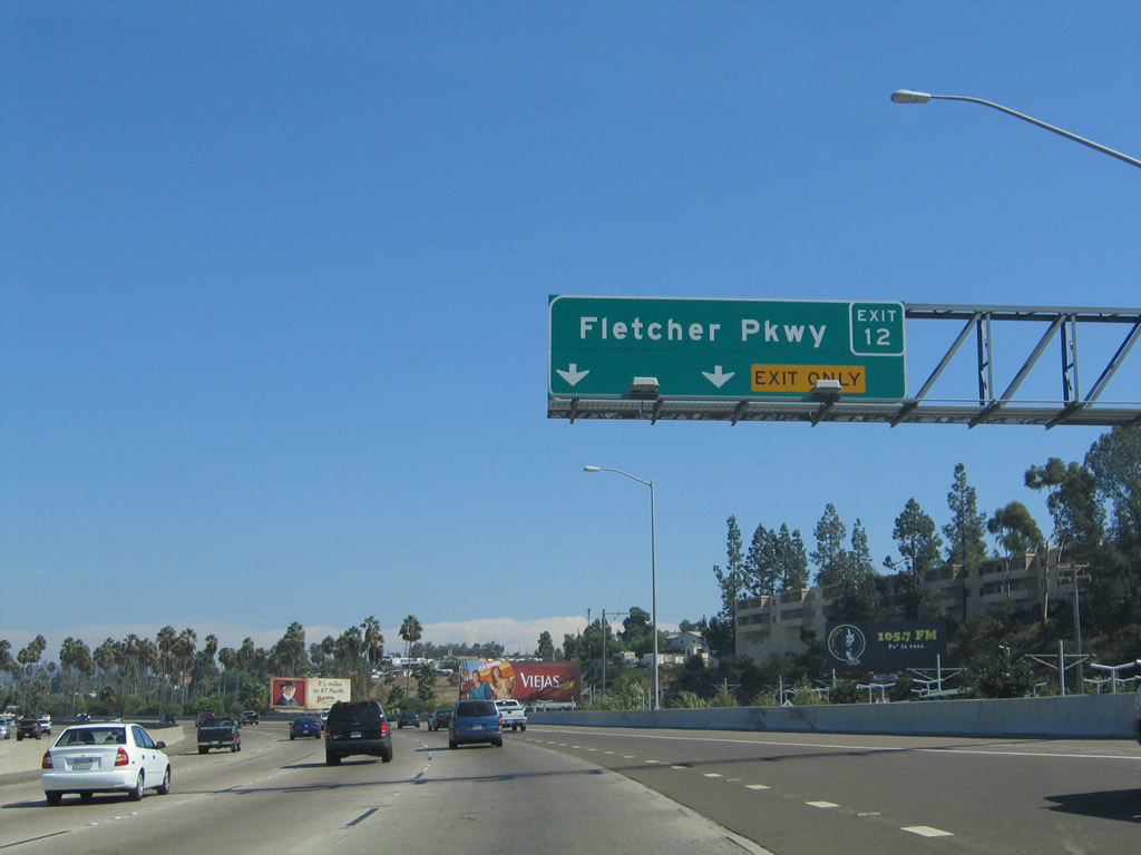
The next exit along Interstate 8 east is Exit 12, Fletcher Parkway. The tall palm trees in the background are from a recreational vehicle (RV) park. The billboard is for Viejas Casino, one of the relatively new Indian casinos located in San Diego's backcountry. Viejas itself is one of the most accessible casinos, located along Old U.S. 80 just east of Alpine. The new exit number sign was placed in September 2003. Photo taken 10/01/05. |
|
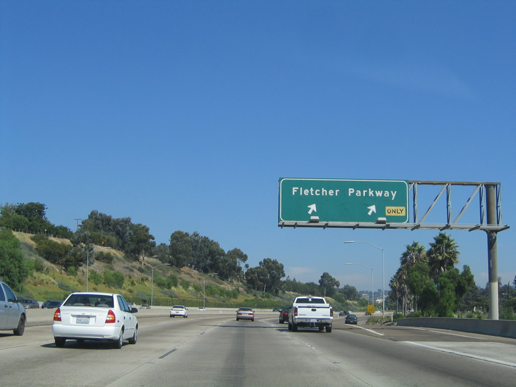
Upon reaching Exit 12, Fletcher Parkway, all traffic in the right lane must exit, and there is an optional exit from the number four lane. All services are available on Fletcher Parkway, including a Costco, Grossmont Center Mall, and Target. This sign has not yet been replaced, unlike the previous sign. Photo taken 10/01/05. |
|
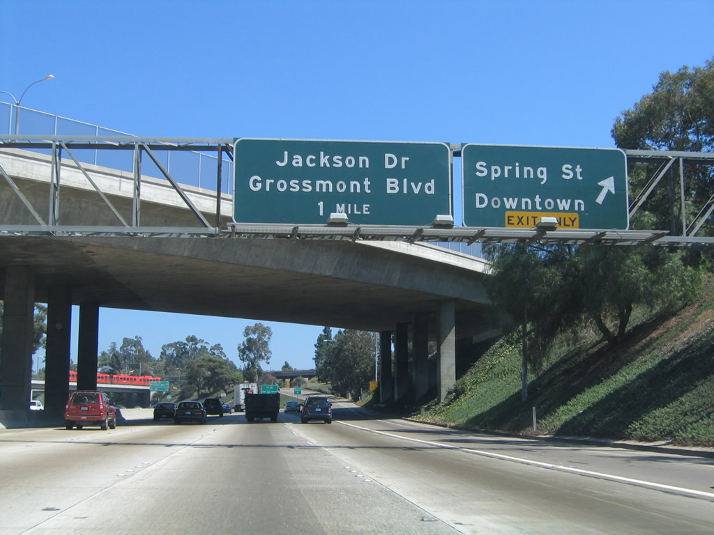
The next exit along Interstate 8/Alvarado Freeway east is Exit 13A, Spring Street. For the next half-mile or so, there are several overpasses to connect downtown La Mesa on the south side of Interstate 8 with several businesses and warehouses north of the freeway. These roads also provide a back way to reach Grossmont Center and the Grossmont Trolley Station without using Fletcher Parkway or Grossmont Center Drive. Photo taken 08/27/04. |
|
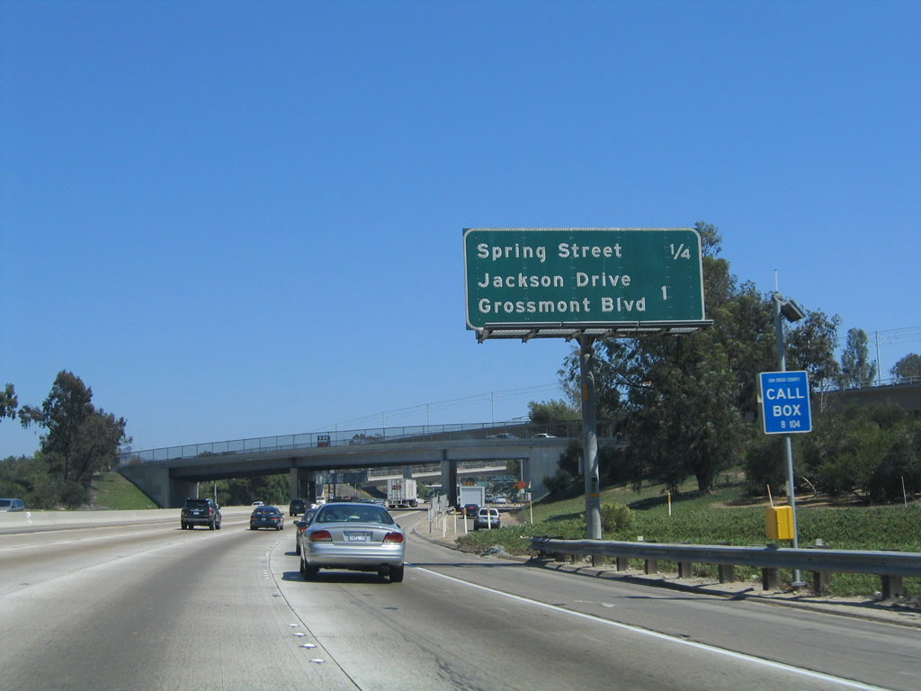
Eastbound Interstate 8 reaches Exit 13A, Spring Street. This city street leads south into the downtown area of La Mesa, and it also connects to the San Diego trolley line, which runs from Santee to downtown San Diego. Spring Street goes as far south as California 94 near the California 94/125 interchange. The next exit is for Grossmont Boulevard/Jackson Drive. Photo taken 08/27/04. |
|
A single lane departs Interstate 8 onto Spring Street southbound into downtown La Mesa. Spring Street offers connections to University Avenue (former U.S. 80 bypass) and La Mesa Boulevard (Old U.S. 80 business route) and eventually links with California 94 near the California 125 interchange. Photo taken 06/06/09. |
|
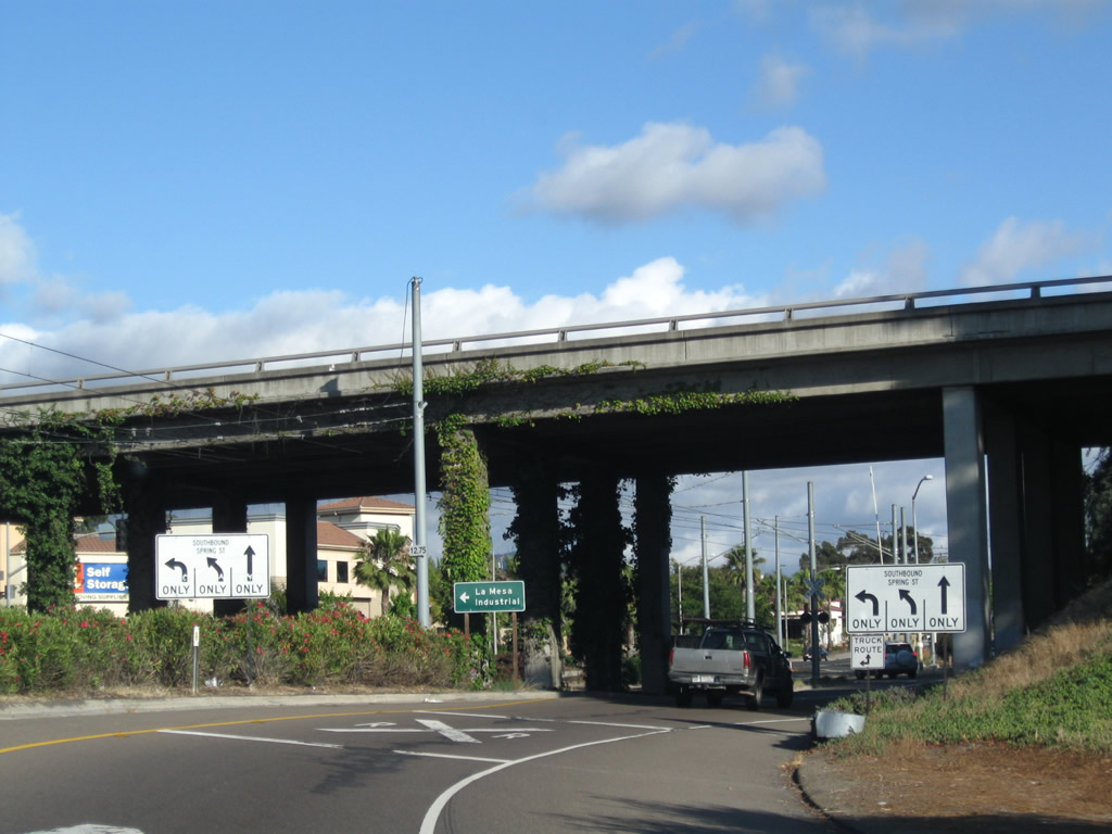
Now on the off-ramp to Exit 13A, a welcome to La Mesa sign is posted along with a warning sign for the upcoming at-grade trolley crossing. When trolleys cross, the road closes. Photo taken 06/06/09. |
|
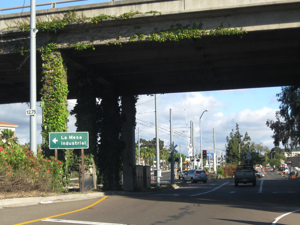
The off-ramp passes under El Cajon Boulevard (Business Loop I-8) prior to the trolley crossing. Photo taken 06/06/09. |
|
Turn left here to follow Spring Street north into the La Mesa industrial area north of Interstate 8. Stay right to merge onto Nebo Drive south to University Avenue (Old U.S. 80 bypass) west; Nebo Drive stays west of the trolley tracks. Photo taken 06/06/09. |
|
A single lane connects to Spring Street southbound. Photo taken 06/06/09. |
|
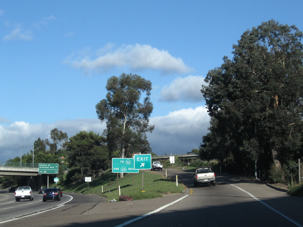
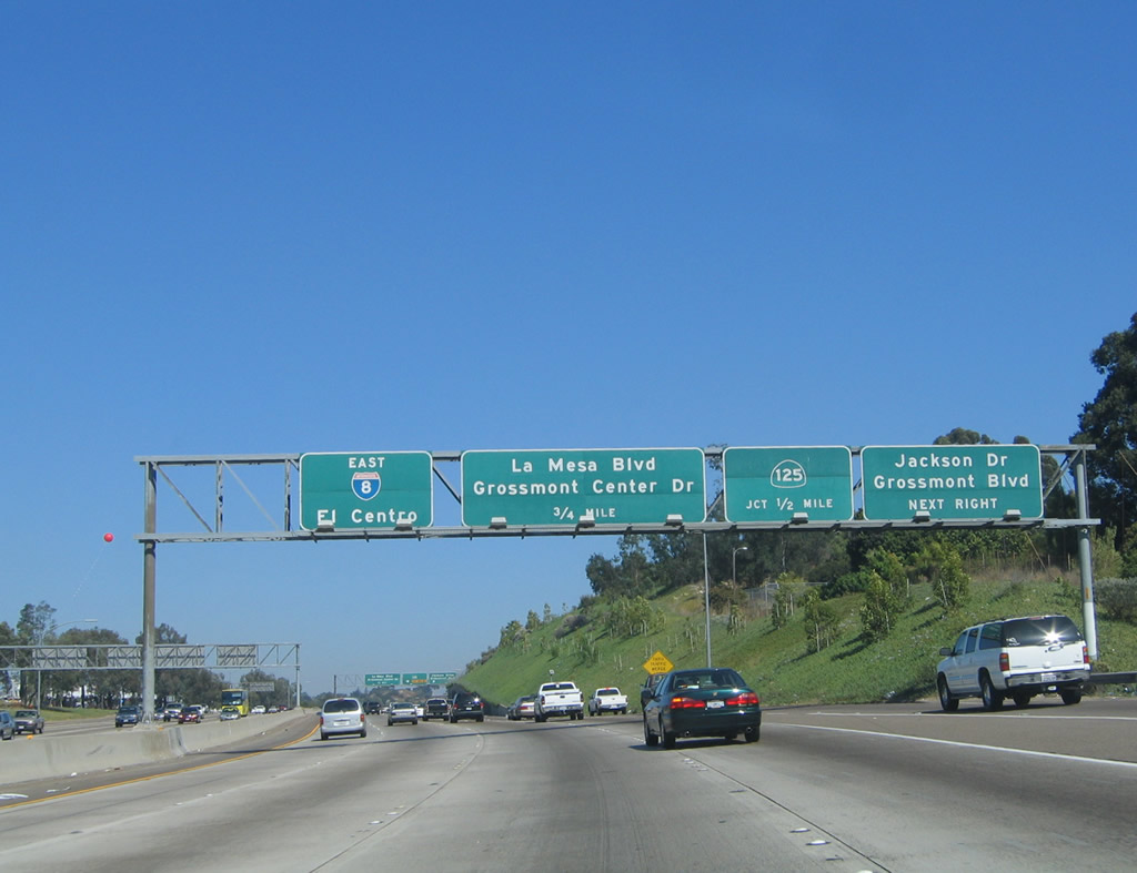
Returning to the mainline just after the Exit 13A off-ramp, this sign is posted for the upcoming California 125 freeway-to-freeway interchange. To reach California 94 east to Jamul, Tecate, and Campo, use California 125 south. California 125 is part of the inner loop that is created by California 52, California 125, and California 54. An outer loop would be created with California 56, California 125, and California 905, but it is questionable as to whether the California 124/California 56 will ever be constructed. The California 125 interchange is still a couple exits ahead. Photo taken 08/27/04. |
|
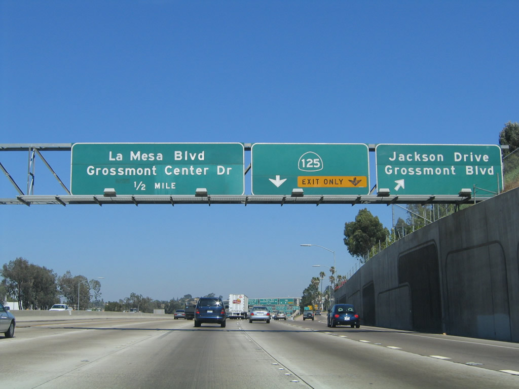
The next exit along eastbound Interstate 8 is Exit 13B, Grossmont Boulevard and Jackson Drive, followed by Exit 14A, California 125. This mileage sign is located immediately after the Spring Street exit ramp, as it approaches Grossmont Boulevard and Jackson Drive. El Cajon Boulevard, which is Business Loop I-8, returns to Interstate 8 eastbound after the last bridge shown in this photo. Photo taken 08/27/04. |
|
Eastbound Interstate 8/Alvarado Freeway approaches three exits in quick succession: Exit 13B, Grossmont Boulevard and Jackson Drive; Exit 14A, California 125 freeway north/south; and Exit 14B, Grossmont Center Drive/La Mesa Boulevard. Grossmont Boulevard is a city street that parallels Interstate 8 between Jackson Drive and Grossmont Center Drive/La Mesa Boulevard, then continues east past California 125. Jackson Drive, on the other hand, is a significant route in that it keeps going and going and does not get from one end to the other end along the most direct path. It was originally proposed to continue as far north as California 52, but that extension was canceled once the Mission Trails Regional Park was created. Jackson Drive also continues south to serve more of La Mesa. Photo taken 10/01/05. |
|
Eastbound Interstate 8 reaches Exit 13B, Grossmont Boulevard and Jackson Drive. Several businesses have been located along the south side of Interstate 8, but they generally do not attract as many customers as those businesses on the north side of Interstate 8 near the Grossmont Center mall. Photo taken 08/27/04. |
|
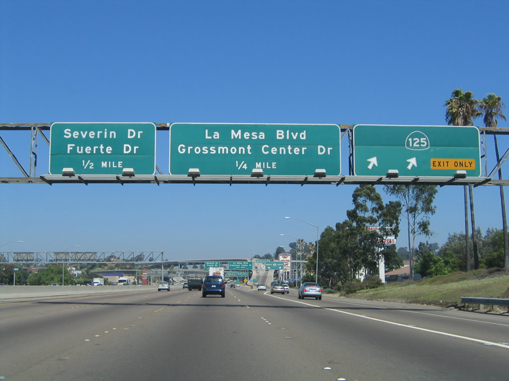
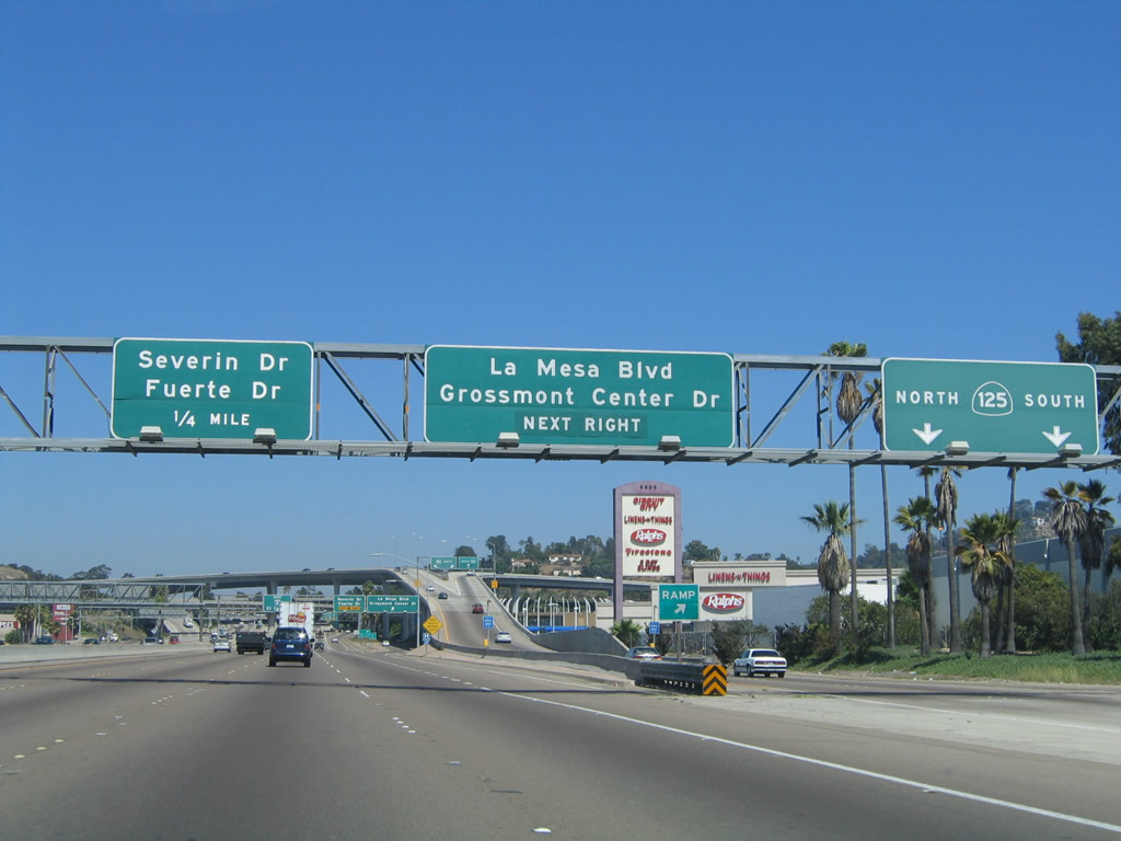
The next exit along eastbound is Exit 14A, California 125. This is a major interchange that will become even more important once the freeway is extended south to the International Border by 2006. In addition to California 125, the La Mesa Boulevard/Grossmont Center Drive exit (Exit 14B) is located underneath the massive stack interchange. This massive structure is only comparable to a few other interchanges in the county, including the Interstate 8/Interstate 805 interchange west of here and the California 94/California 125 interchange south of here. Photo taken 08/27/04. |
|
Eastbound Interstate 8 reaches Exit 14A, California 125 north to Santee and south to Chula Vista. California 125 forms the outer belt freeway as it travels from California 52 in Santee south to California 905 in Otay Mesa. The freeway corridor was extended gradually between the early 1990s and 2007. Most of the freeway (except the original California 67 section between California 94 and Interstate 8 and the toll road south of California 54) was constructed with TransNet half-cent sales tax; without the tax (which expired in 2008 and was renewed with voter approval a year prior), road projects such as this would have had limited or no mechanism for funding. As seen in this picture, California 125 is served by a very high flyover ramp from eastbound Interstate 8. This massive interchange was reconstructed through the late 1980s and early 1990s to its present configuration. The transition ramp passes over the top of a car dealership (Drew Ford) and La Mesa Boulevard before splitting into northbound and southbound. Northbound California 125 currently extends to the Fletcher Hills neighborhood of La Mesa, Grossmont College, and Santee. It is proposed to extend California 125 north from this point, but its exact northern terminus and routing are hotly debated and contested. The latest idea seems to be to merge California 67 and California 125 into a single freeway corridor that would reach Ramona and possibly meet Interstate 15 near Rainbow. However, this concept is in the discussion phases only. The city of Poway does not wish to see any part of California 125 within its limits, especially near downtown Poway, so that poses an obstacle to any extension. Southbound California 125 connects to California 94, then extends into Spring Valley and continues south past California 54 through eastern Chula Vista to California 905 at the Otay Mesa Port of Entry. The segment between a point south of California 54 and California 905 is a toll road. Photo taken 08/27/04. |
Page Updated September 10, 2012.