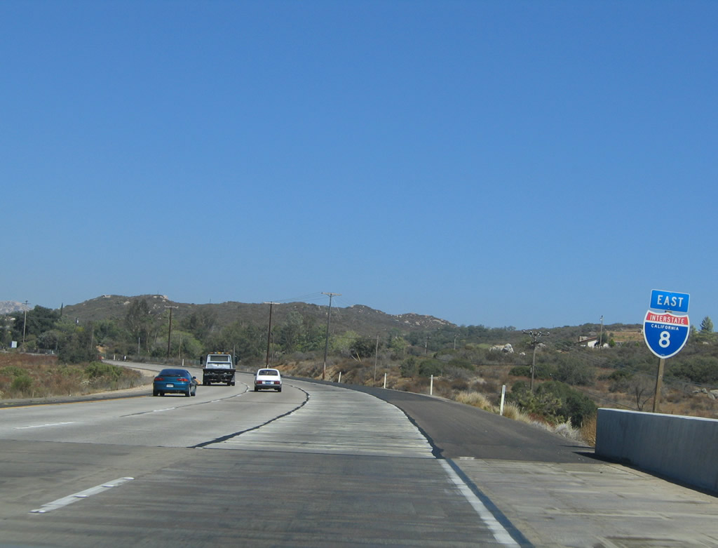
| Interstate 8 (Kumeyaay Highway) east |
|
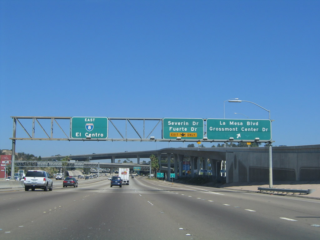
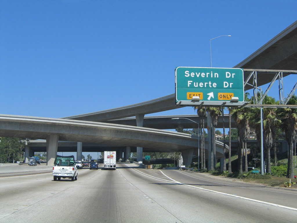
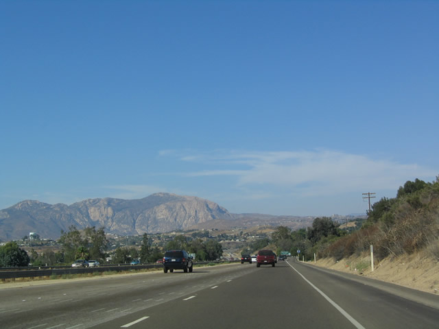
The next exit along eastbound Interstate 8 is part of the California 125 interchange complex: Exit 14B, Grossmont Center Drive and La Mesa Boulevard. The off-ramp to the right is the transition from eastbound Interstate 8 to California 125. The next exit is for Severin Drive and Fuerte Drive. Immediately after this interchange complex, Interstate 8 reaches the Grossmont Summit, and it begins its descent into the El Cajon Valley. Photo taken 08/27/04. |
|
Prior to the off-ramp for Exit 14B, Grossmont Center Drive and La Mesa Boulevard, this view shows the transition ramp to California 125, which climbs high above Interstate 8. Photo taken 08/27/04. |
|
Immediately after the off-ramp to Exit 14B, Grossmont Center Drive is Exit 14C, Fuerte Drive and Severin Drive. Interstate 8 reaches Grossmont Summit and prepares to descend from La Mesa ("the table") into the city El Cajon, translated as "the box." Note that as traffic merges onto Interstate 8 east from California 125, the freeway widens to six lanes along eastbound. This configuration will remain in place until reaching Exit 15. Photo taken 08/27/04. |
|
|
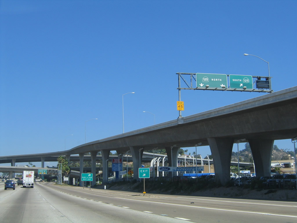
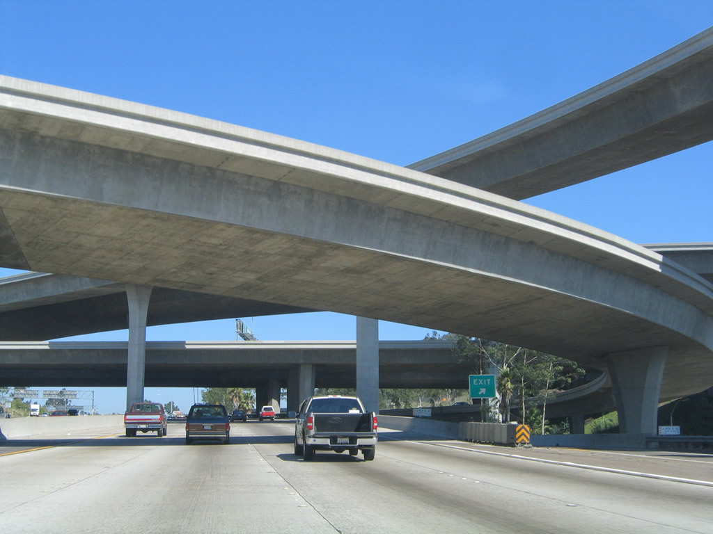
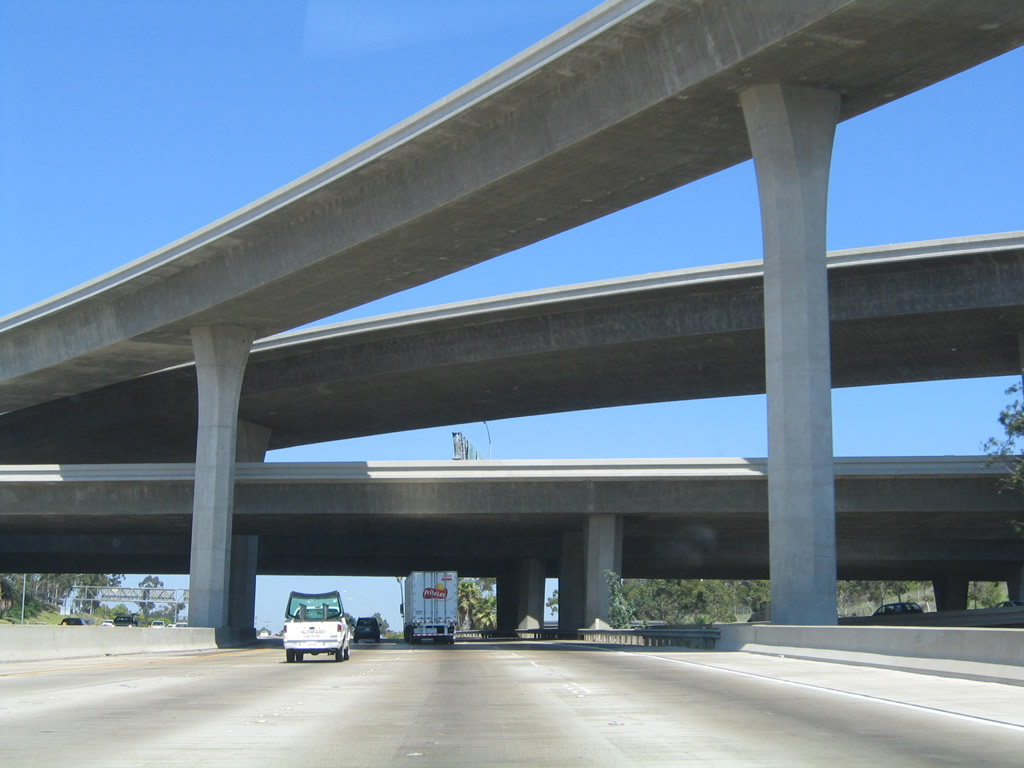
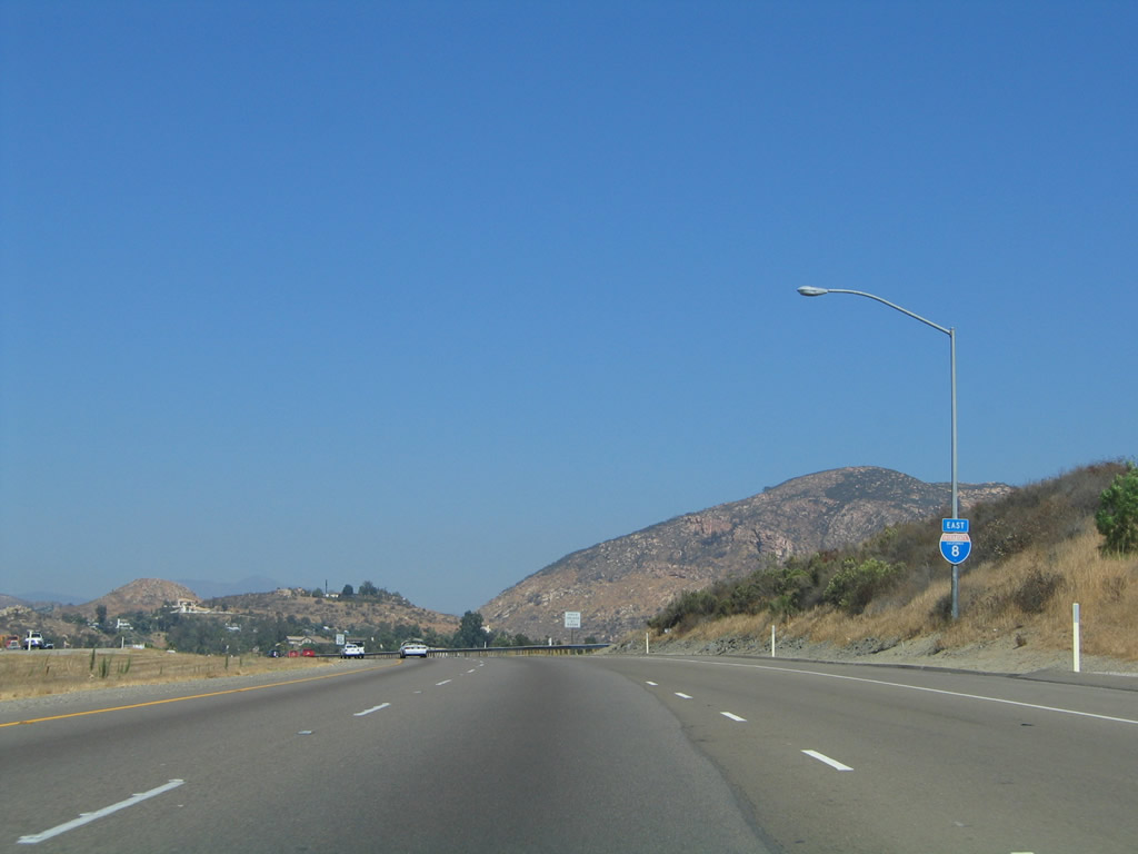
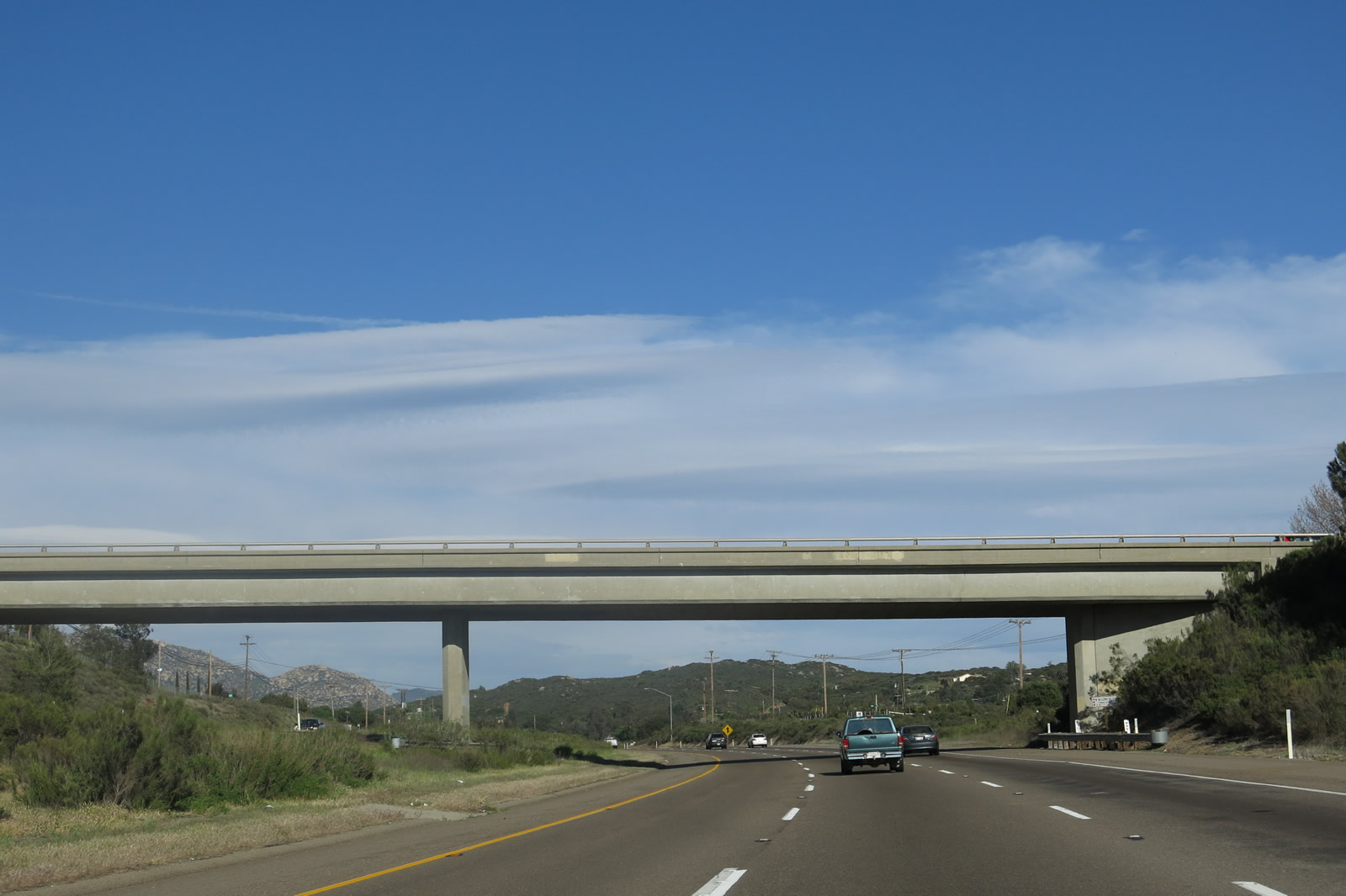
The freeway passes through a nearly symmetrical stack interchange with California 125. Believe it or not, this interchange was originally a cloverleaf interchange. Photos taken 10/01/05 and 08/27/04. |
|
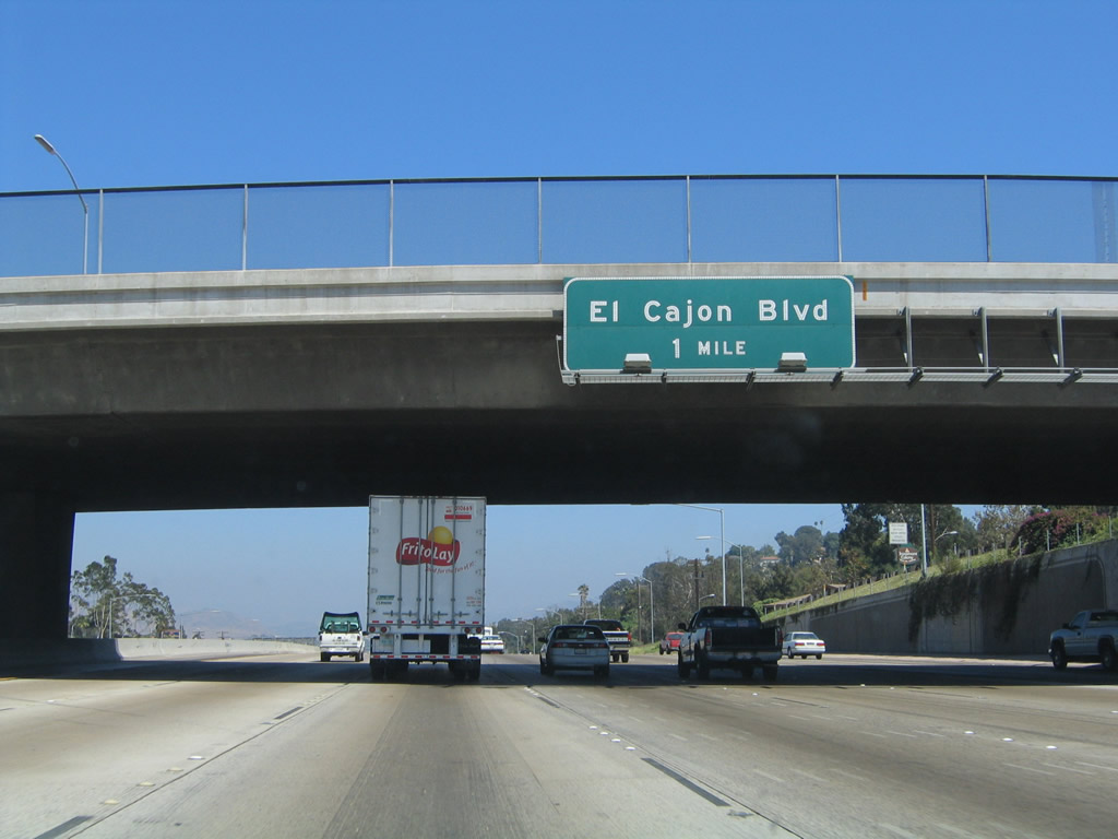
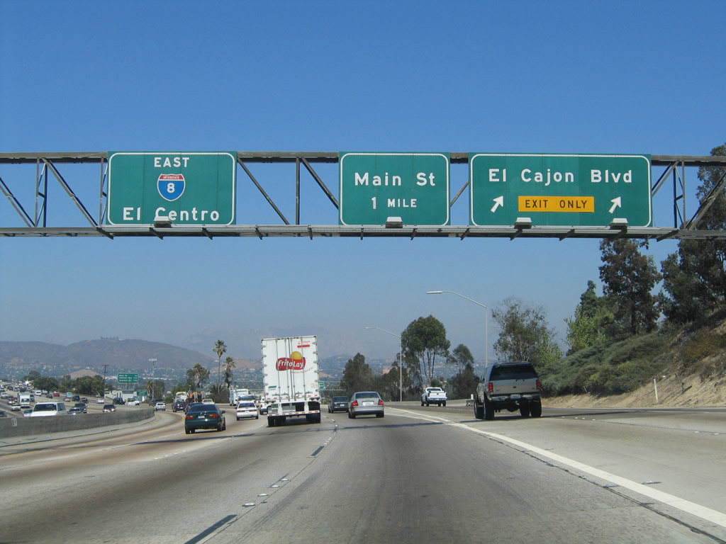
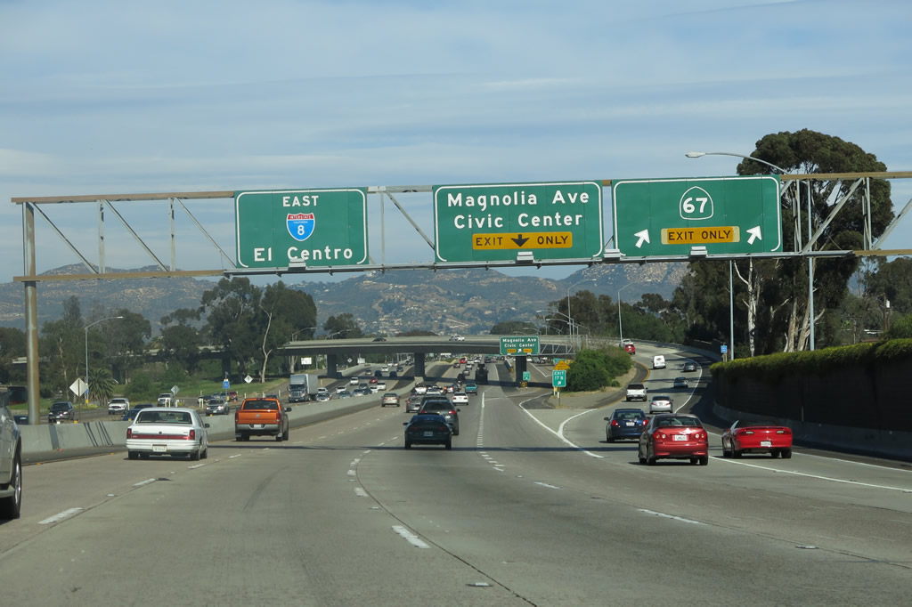
The next exit along eastbound Interstate 8 is Exit 15, Business Loop I-8 (El Cajon Boulevard), one mile. El Cajon Boulevard follows Old U.S. 80 through downtown El Cajon. The signed business route rejoins Interstate 8 at the Greenfield exit east of town, but the old alignment of U.S. 80 continues to be called "Business Route 8" as far east as Exit 22. Photo taken 08/27/04. |
|
Old U.S. 80 was pretty much buried up by the construction of Interstate 8 in the 1960s as the freeway crosses the Grossmont Summit. However, upon reaching Exit 15, Old U.S. 80 continues as an extant route from this exit all the way east to the Viejas Indian Reservation and Casino (East Willows Road exit), and it resumes as its own route again at Exit 40, California 79. Business Loop I-8 follows Historic U.S. 80 (El Cajon Boulevard) into downtown El Cajon (merging with Main Street just west of downtown). El Cajon is a Spanish word meaning "box," and the city may have been given this name due to the fact that it sits in a valley, and the valley inversion layer traps heat within the immediate vicinity. The summers can be significantly warmer in this area than in locations west of Grossmont Summit during summer months. Photo taken 08/27/04. |
|
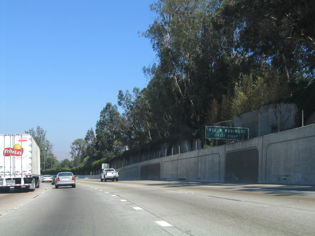
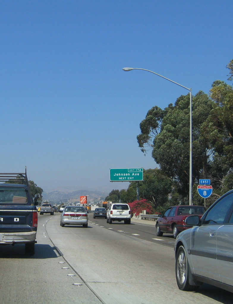
In typical Caltrans fashion, the business route is signed merely with this single advance sign, "Route 8 Business next right." Interstate 8 enters the city of El Cajon, the next eastern suburb after La Mesa. El Cajon had a population of 94,869 as of the 2000 Census and was incorporated on November 12, 1912. Photo taken 08/27/04. |
|
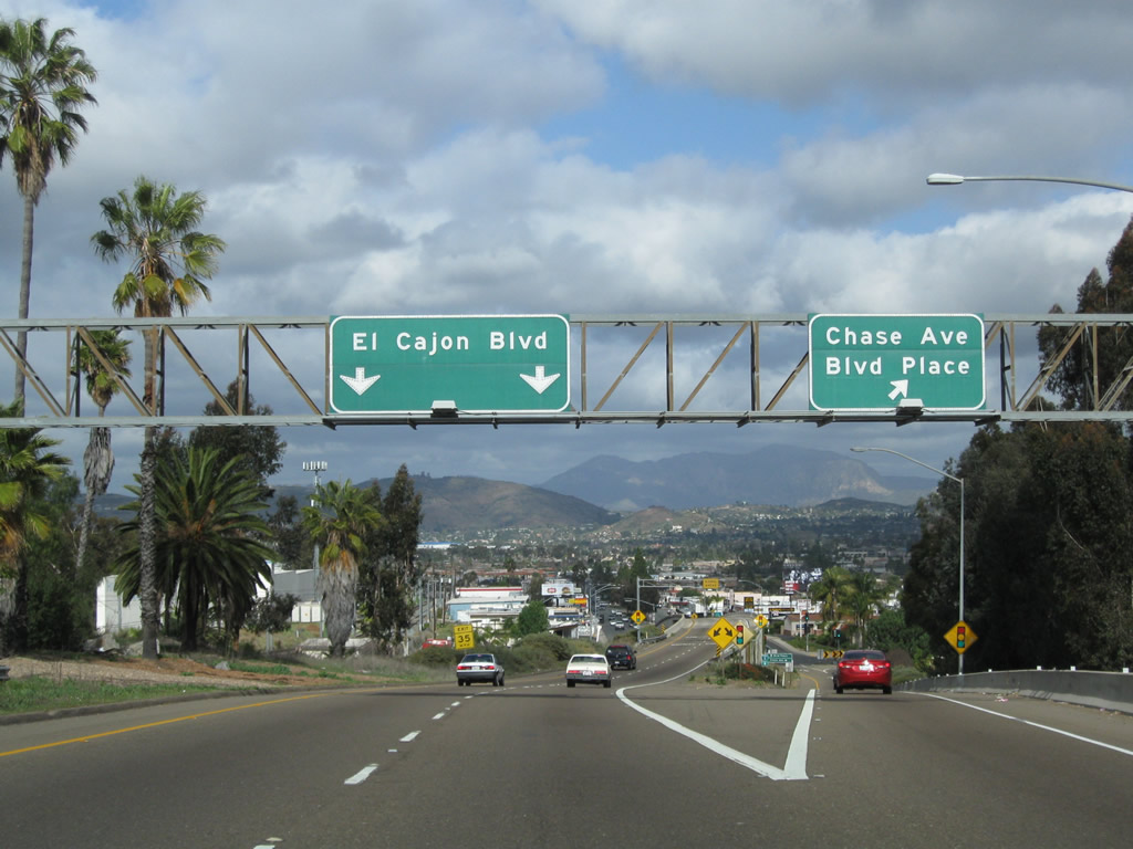
Eastbound Interstate 8 reaches Exit 15, Business Loop I-8 (El Cajon Boulevard) east to El Cajon. Both the number five and number six lanes are exit-only. To reach Chase Avenue, use the far right lane. For the business route, follow the signs for El Cajon Boulevard; a green reassurance shield is present at the bottom of the off-ramp after the Chase Avenue ramp. Photo taken 08/27/04. |
|
Now on the off-ramp to Exit 15, the right lane will depart to Chase Avenue, while the left two lanes continue east on Business Loop I-8 (El Cajon Boulevard) toward El Cajon Boulevard. Photo taken 11/06/04. |
|
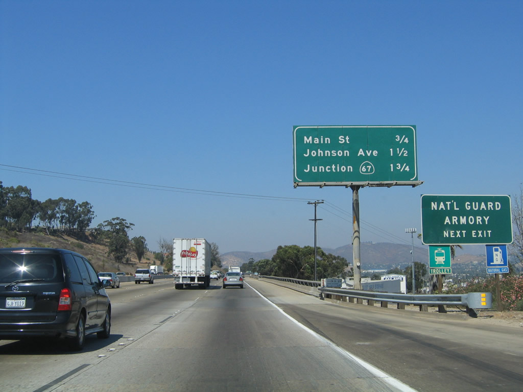
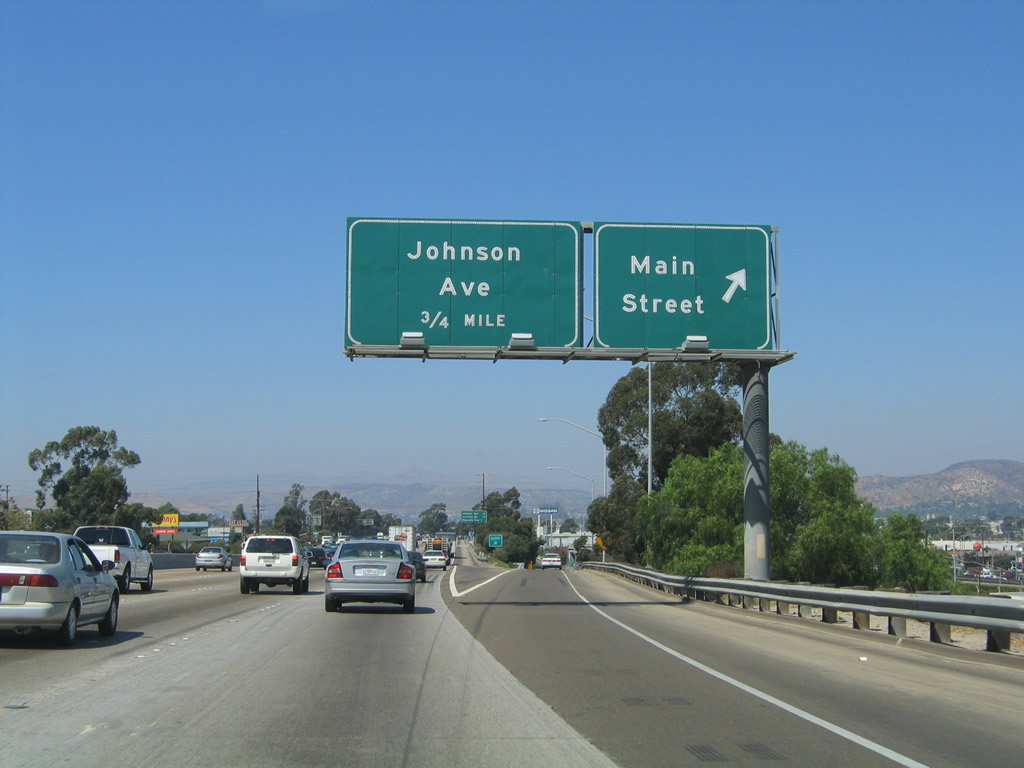
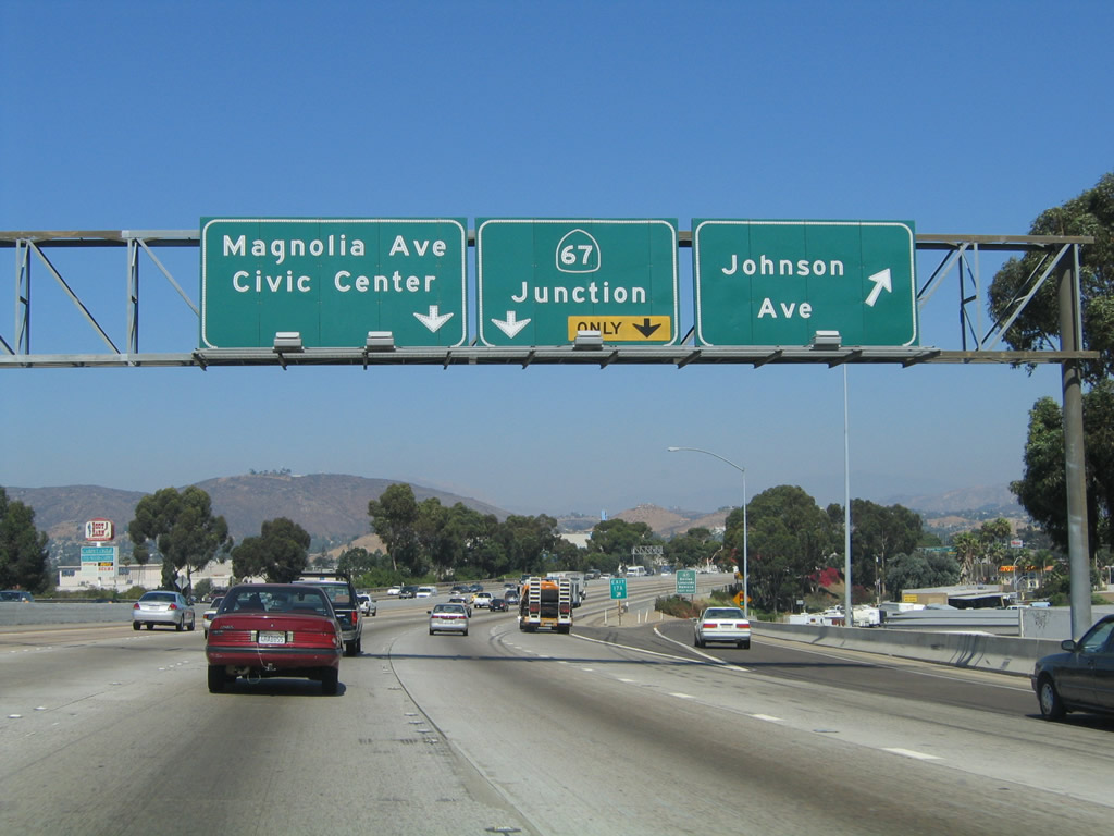
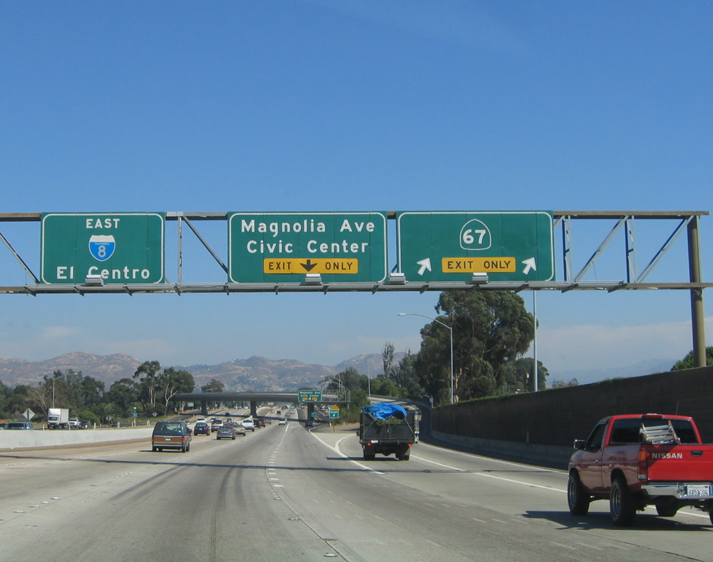
The next three exits along eastbound are Exit 16, Main Street east to downtown and west to Fletcher Hills; Exit 17A, Johnson Avenue; and Exit 17B, California 67 north to Ramona/Magnolia Avenue south to downtown. Photo taken 08/27/04. |
|
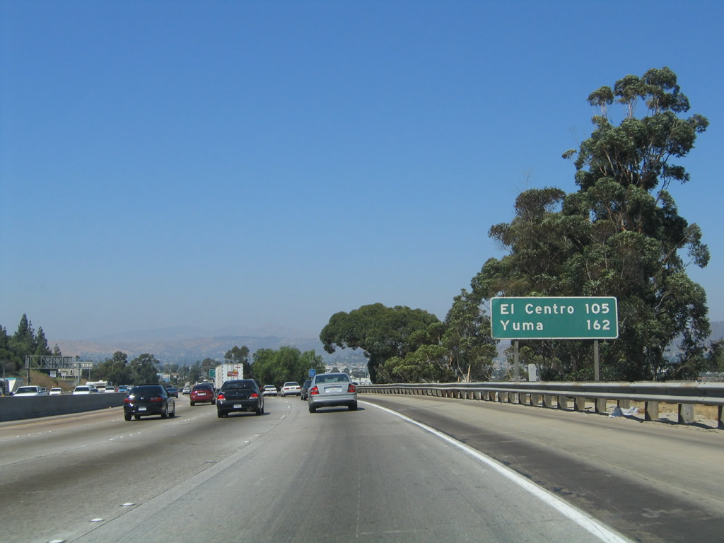
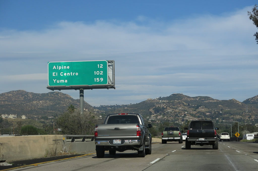
This mileage sign provides the distance to El Centro (105 miles) and Yuma (162 miles). Photo taken 08/27/04. |
|
Eastbound Interstate 8 reaches Exit 16, Main Street in El Cajon. Main Street meets El Cajon Boulevard a short distance east of here, near downtown El Cajon. At that intersection, Main Street continues east as Business Loop I-8. Photo taken 08/27/04. |
|
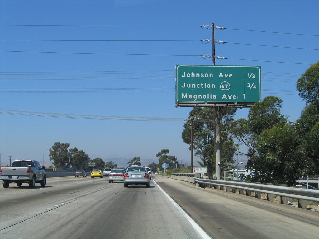
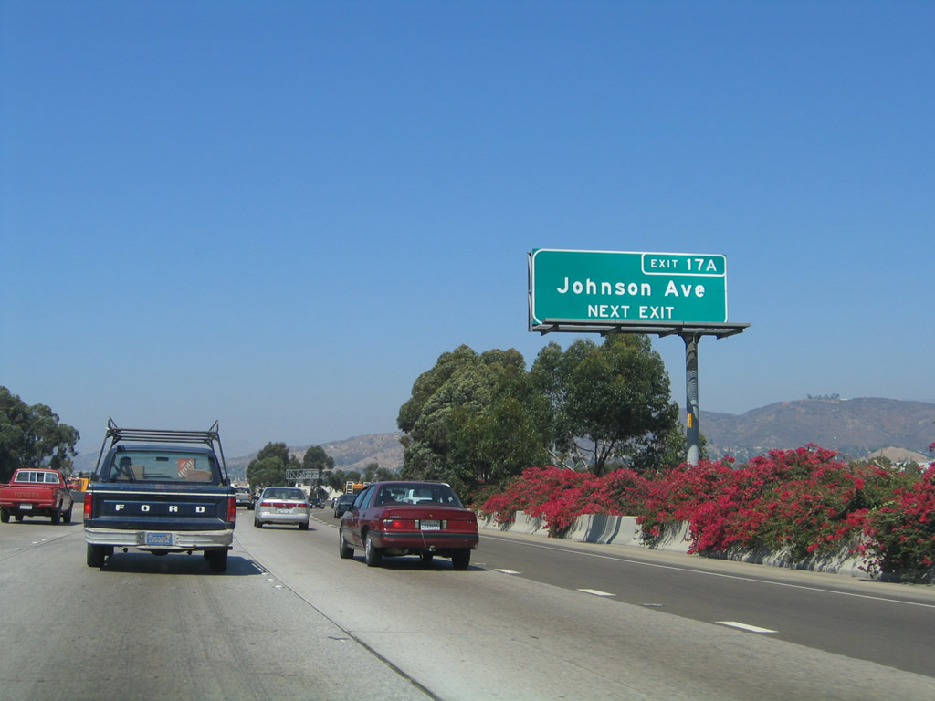
The next exit along eastbound Interstate 8 is Exit 17A, Johnson Avenue in El Cajon. To reach the El Cajon Mall, use Johnson Avenue north. Immediately after the Johnson Avenue off-ramp is the connection to northbound California 67/Ramona Freeway (Exit 17B) and Magnolia Avenue (Exit 17C). Photo taken 08/27/04. |
|
An extra-wide Interstate 8 shield is posted prior to Exit 17A. Photo taken 08/27/04. |
|
Exit 17A (Johnson Avenue) is one of the few overhead signs with exit numbers in El Cajon. Use this exit to Parkway Plaza and the large commercial area north of Interstate 8 via Johnson Avenue. Photo taken 08/27/04. |
|
Eastbound Interstate 8 reaches Exit 17A, Johnson Avenue in El Cajon. The next two exits are for California 67 freeway north and Magnolia Avenue south. Photo taken 08/27/04. |
|
|
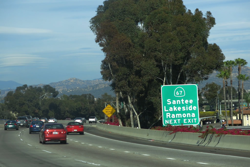
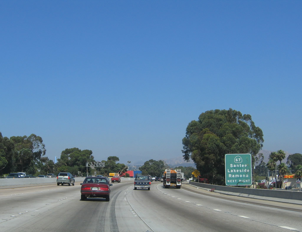
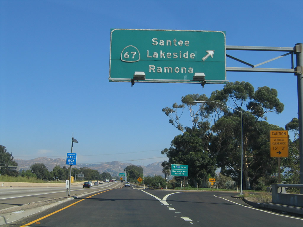
California 67, a freeway route, is the sixth and final north-south freeway encountered by Interstate 5 (after Interstate 5, California 163, Interstate 805, Interstate 15, and California 125). California 67 heads north toward the San Vicente Reservoir, passing through the San Diego River Valley en route to Santee and Lakeside, then takes a sharp grade up toward Poway and ultimately Ramona, where it ends at an intersection with California 78. This sign was replaced in 2011. Photo taken 04/04/13 and 08/27/04. |
|
|
Eastbound Interstate 8 reaches Exit 17B, California 67 in El Cajon. The next exit is Exit 17C, Magnolia Avenue, which leads south into the heart of downtown. From downtown, Magnolia Avenue northbound may be used to reach either Interstate 8 or California 67. This overhead sign changed sligntly (new pull-through sign) by 2011. Photos taken 04/04/13 and 10/01/05. |
|
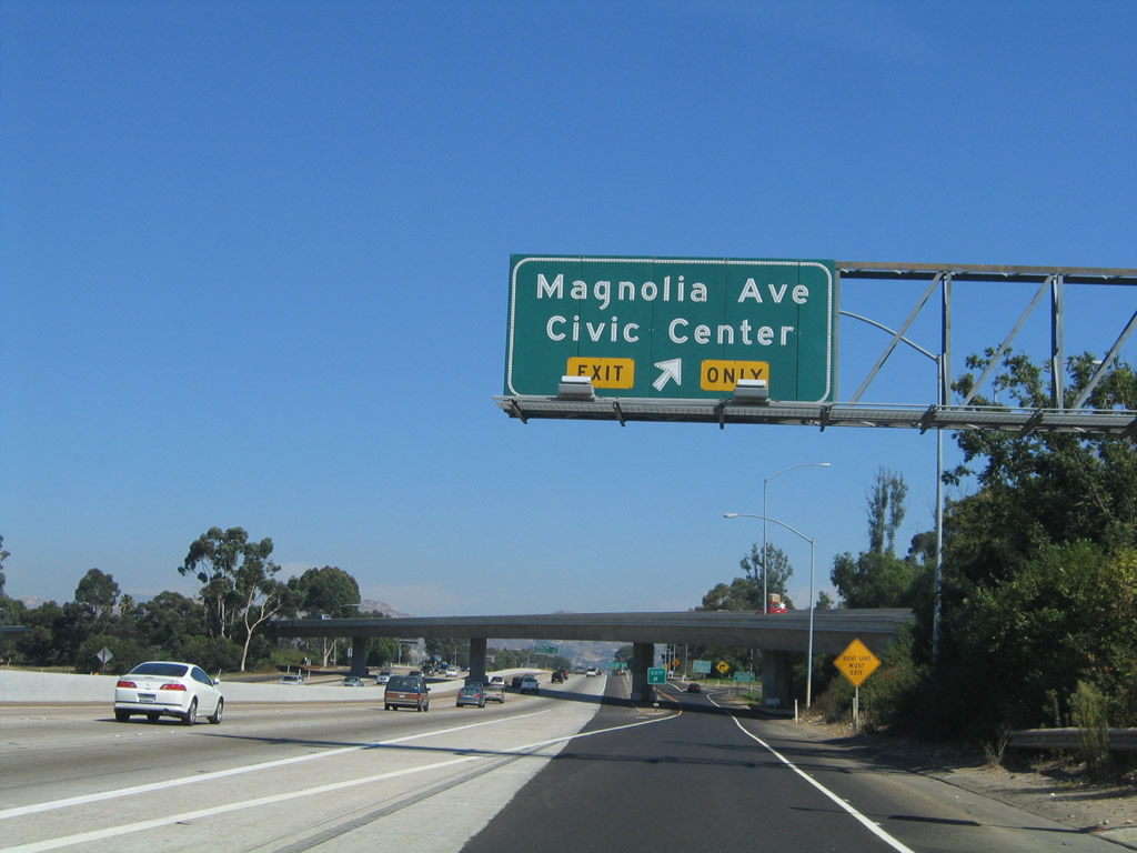
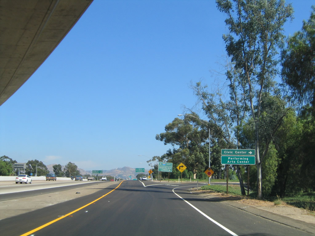
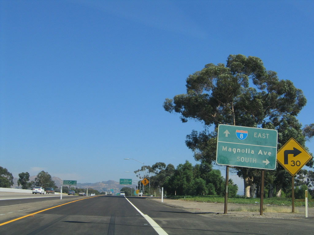
As part of the same interchange complex, eastbound Interstate 8 reaches Exit 17C, Magnolia Avenue south to downtown. Prior to the construction of the Exit 17B flyover ramp from eastbound to northbound, the interchange between Interstate 8 and California 67 was a cloverleaf. The interchange is now a modified cloverleaf with a collector distributor lane along with a flyover ramp. Additionally, prior to the construction of Interstate 8, California 67 used to continue south as a state highway into downtown El Cajon, then merged with U.S. 80 west over Grossmont Summit and then south into La Mesa along what is today California 125. California 67 at that time used to end at the approximate location of the California 125/California 94 interchange in Spring Valley. Photo taken 10/01/05. |
|
Now on the collector distributor lanes, the first ramp connects to Magnolia Avenue (former California 67) south to downtown El Cajon. Photo taken 10/01/05. |
|
Eastbound Interstate 8 meets the ramp to southbound Magnolia Avenue. Photo taken 10/01/05. |
|
|
|
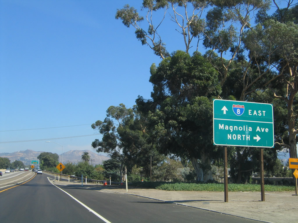
The next ramp connects to California 67 north, which means there are two ramps from Interstate 8 east to California 67 north (Exit 17B and Exit 17C). Since the original freeway was a cloverleaf, the loop ramp from eastbound to northbound was never removed. Therefore, there are two ways to get onto northbound California 67 from eastbound Interstate 8. A mileage sign for the next three exits is posted on the mainline as well. Photos taken 10/01/05, 08/27/04, and 03/12/10. |
|
Eastbound Interstate 8 meets the ramp to northbound California 67 to Lakeside and Ramona. Photo taken 10/01/05. |
|
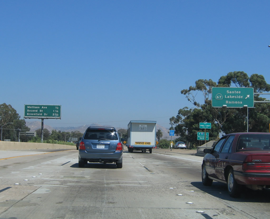
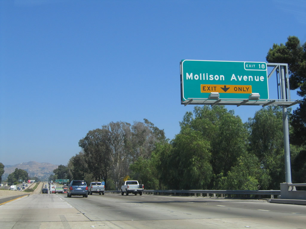
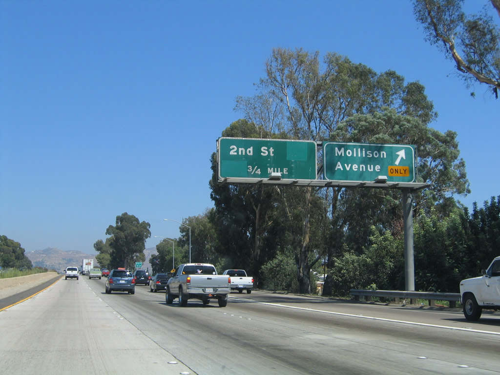
The next exit along eastbound Interstate 8 (Kumeyaay Highway) is Exit 18, Mollison Avenue (next right - exit only). This exit number sign and overhead sign bridge was placed in Summer 2003. Photo taken 08/27/04. |
|
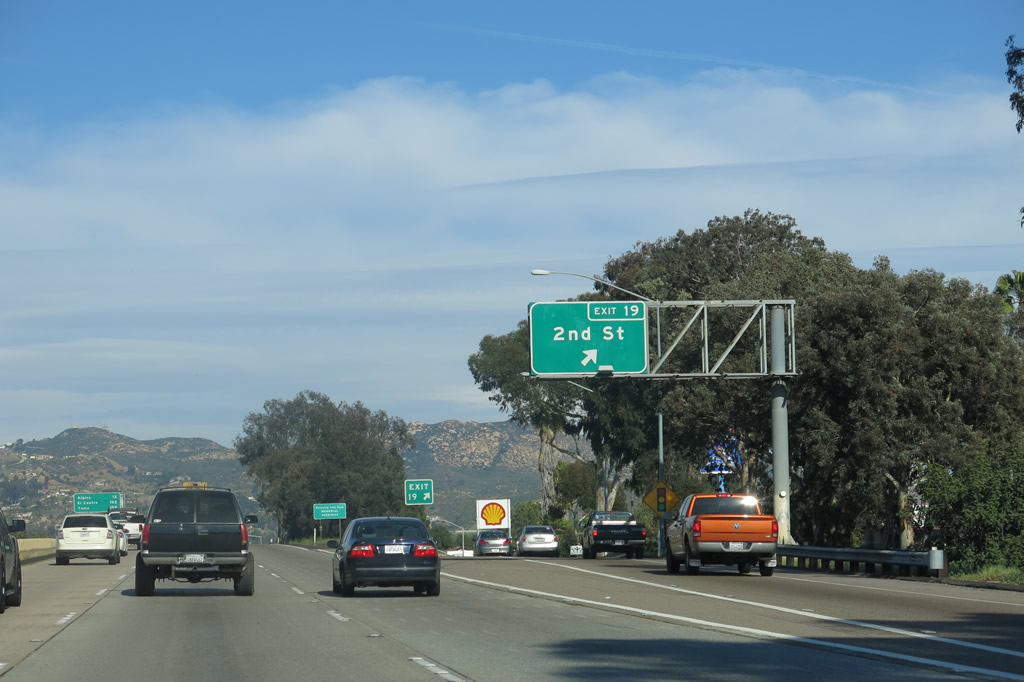
Eastbound Interstate 8 reaches Exit 18, Mollison Avenue. The next exit is Exit 19, Second Street (Former California 54). The California 54 shield on the Second Street panel is covered by a green overlay. Interstate 8 loses a lane from four to three lanes in each direction in this general vicinity. Photo taken 08/27/04. |
|
|
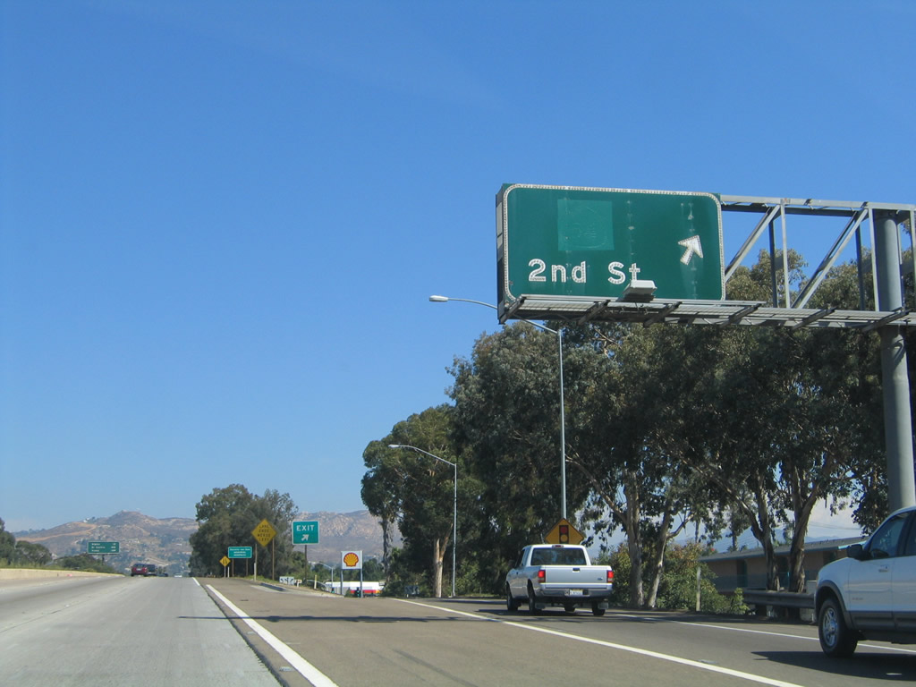
Immediately thereafter, eastbound Interstate 8 meets Exit 19, former California 54/Second Street. California 54 through the city of El Cajon was decommissioned in 1999 and is now signed as California 54 Business. The original state route 54 shield has been covered by a green sticker material, and the outline of the shield and number can be seen upon close inspection of the sign. This picture does not clearly show this feature, however. This route is now known as "California 54 Business." California 54 is still planned for extension north to meet Interstate 8, but the alignment has not yet been determined, nor have funds been allocated for this purpose. An exit number sign replaced the original sign in 2011. Photo taken 04/04/13 and 07/17/04. |
|
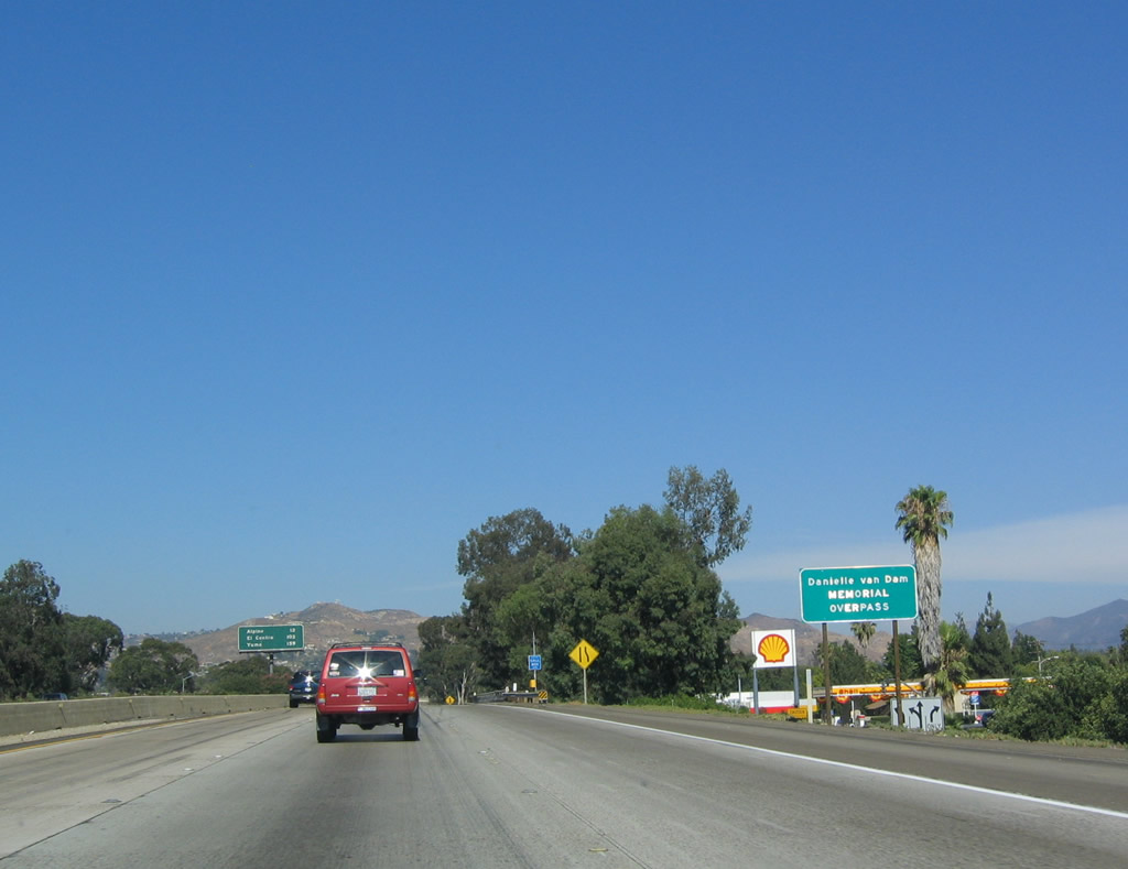
In Summer 2004, the Interstate 8 bridge over Second Street (Exit 20) was named in memory of Danielle Van Dam, the little girl who was kidnapped, assaulted, and murdered by a neighbor. Back in 2004, this interchange marked the point where Interstate 8 shrunk to only two lanes in each direction. However, a project completed in 2010 expanded Interstate 8 to three lanes in each direction as far east as Exit 20, Greefield Drive (Business Loop I-8). Photo taken 07/17/04. |
|
|
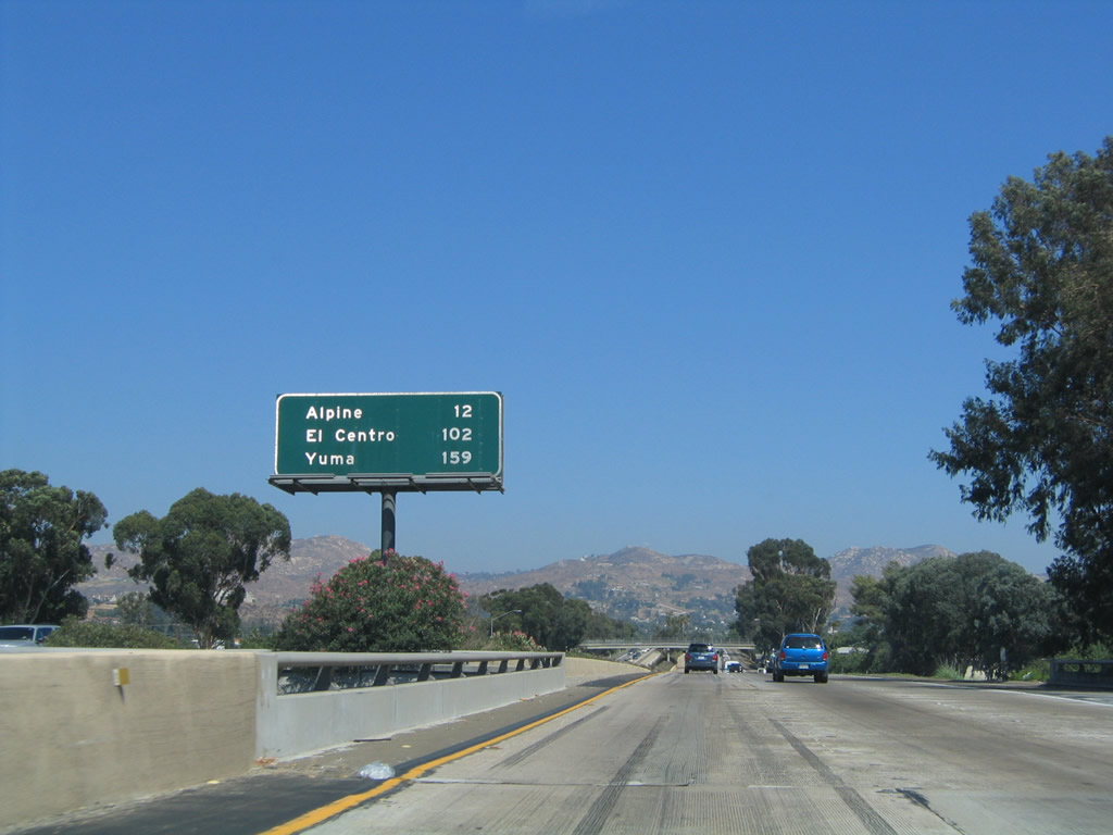
This mileage sign along eastbound shows the distance to Alpine (unincorporated community in San Diego County), El Centro (Imperial County), and Yuma (across the Colorado River in Arizona). This mileage sign is the first one to mention the distance to Yuma; until now, the control city has been El Centro. Mounted on the bridge over Second Street (Former California 54), this mileage sign is unusual for being located in the center of the freeway. Photos taken 04/04/13 and 08/27/04. |
|
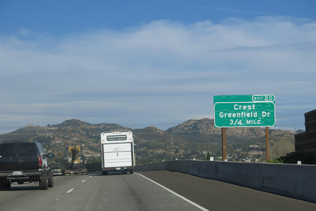
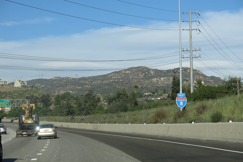
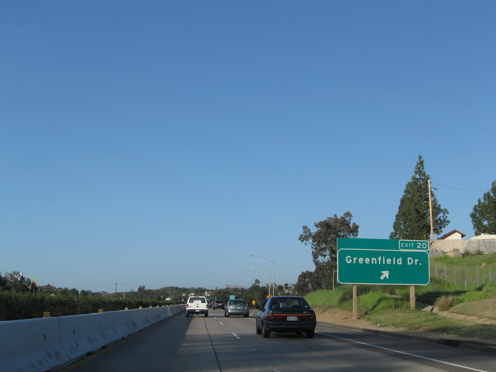
The next exit along Interstate 8 east is Exit 20, Greenfield Drive to the unincorporated community of Crest and Business Loop I-8 (Historic U.S. 80). Exit 20 also connects to Business Loop I-8 and Historic U.S. 80, which serve the city of El Cajon. Photo taken 04/04/13. |
|
Interstate 8 curves to the northeast prior to the Greenfield Drive interchange. Note the oleander plantings in the median strip. Photo taken 08/27/04. |
|
This Interstate 8 east reassurance shield is posted after the on-ramp from Business Loop I-8/Main Street. There is no direct access to Main Street; use the Greenfield Drive interchange instead. Photo taken 04/04/13. |
|
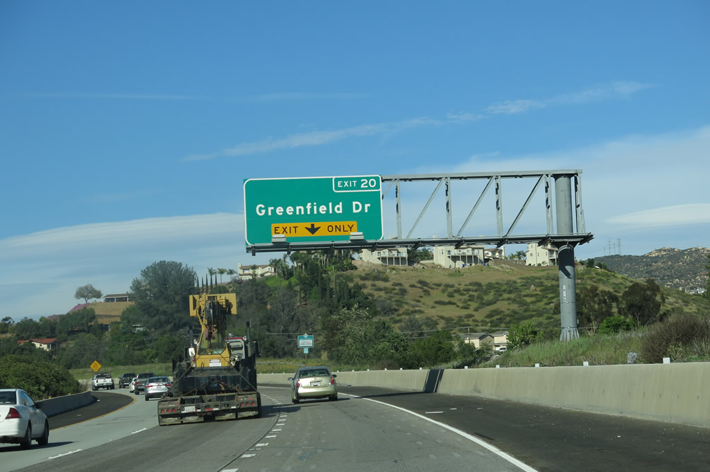
The right lane of Interstate 8 east becomes exit only for Exit 20, Greenfield Drive. Photo taken 04/04/13. |
|
|
|
Eastbound Interstate 8 (Kumeyaay Highway) meets Exit 20, Greenfield Drive to the unincorporated community of Crest. The wildfires of October 2003 nearly destroyed this small, unincorporated community. To Business Loop I-8 and U.S. 80, turn left on Greenfield Drive to Main Street (signed as Highway 8 Business in the unincorporated areas east of the city of El Cajon). Photos taken 04/04/13, 03/12/10, and 08/27/04. |
|
|
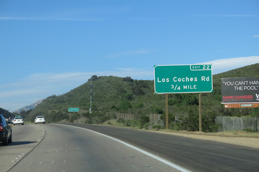
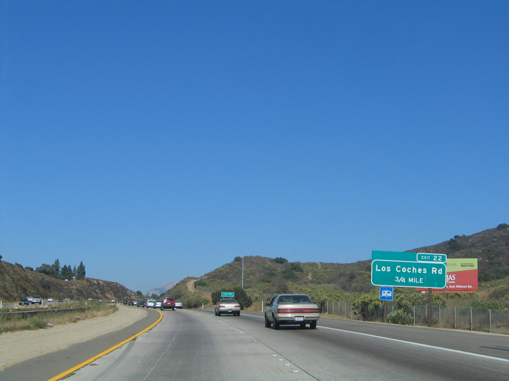
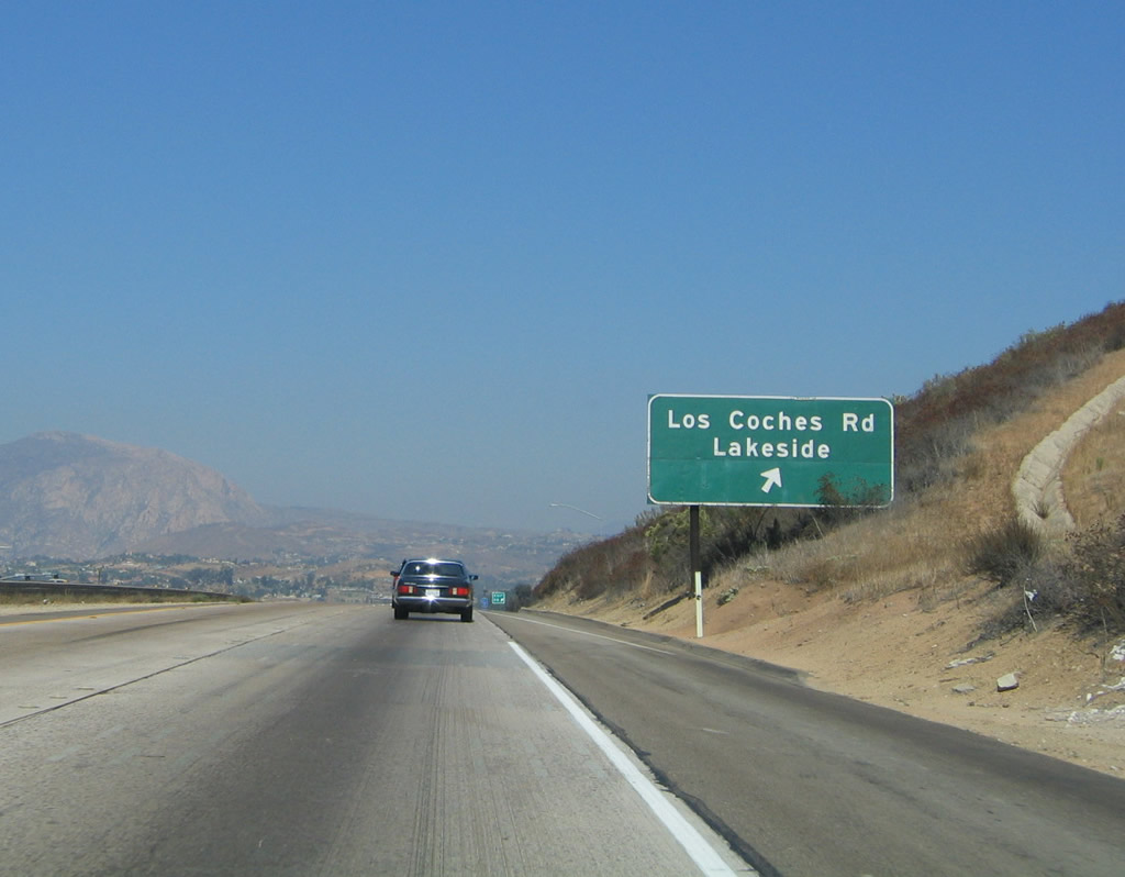
The next exit along eastbound is Exit 22, Los Coches Road (0.75 mile). This sign was changed at some point between 2005 and 2013. Photos taken 04/04/13 and 10/01/05. |
|
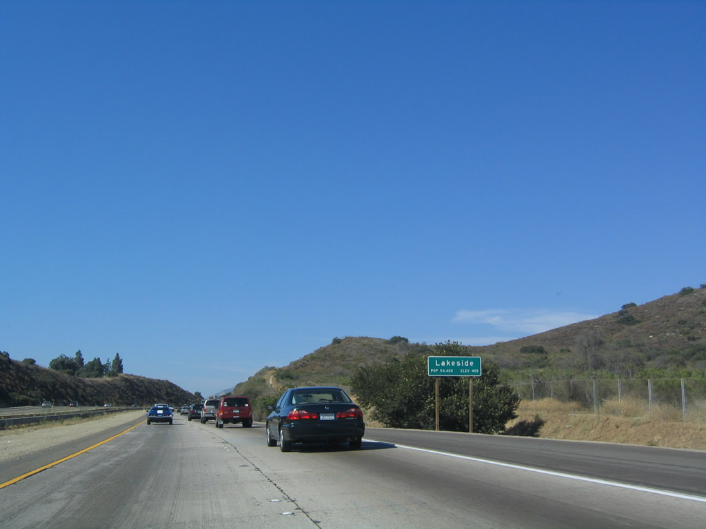
Interstate 8 leaves the city of El Cajon and enters the unincorporated community of Lakeside, which had a population of 20,648 as of the 2010 Census. Photo taken 07/17/04. |
|
|
Eastbound Interstate 8 reaches Exit 22, Los Coches Road. Photos taken 04/04/13 and 08/27/04. |
|
|
|
The Laguna Mountains rise in the distance as Interstate 8 begins its lengthy ascent to Laguna Summit (Exit 47). This picture, taken at Exit 22, Los Coches Road, indicates it will take approximately 25 miles to gain over 3,000 feet of elevation. Photos taken 07/17/04, 04/04/13, and 01/27/06. |
|
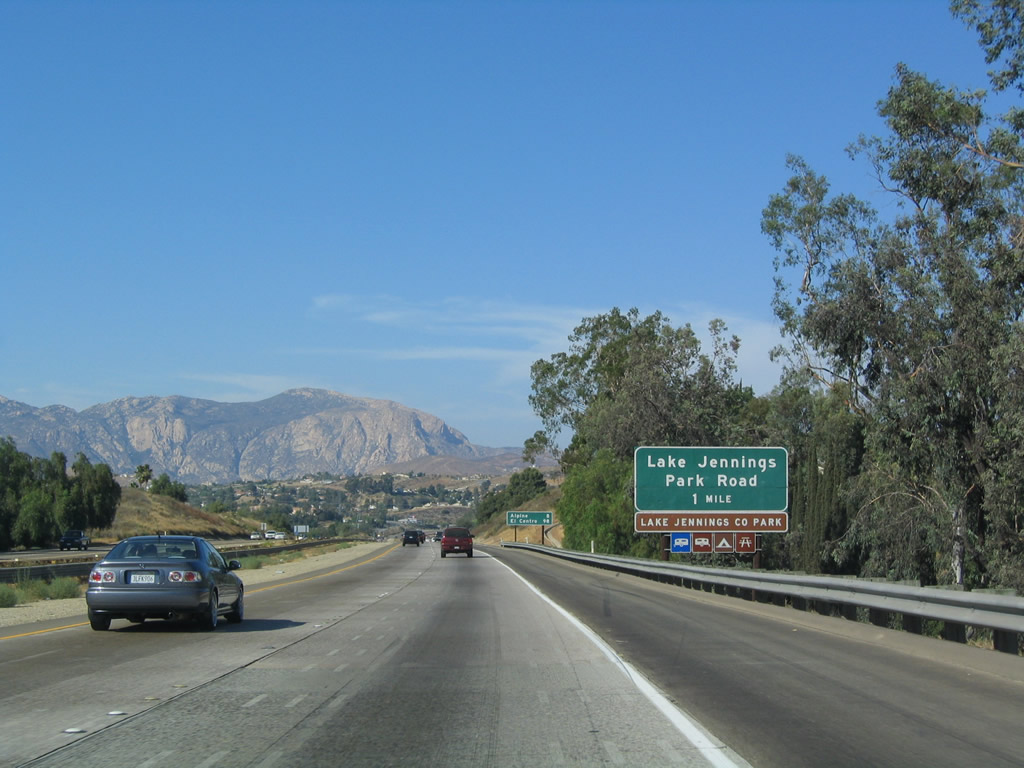
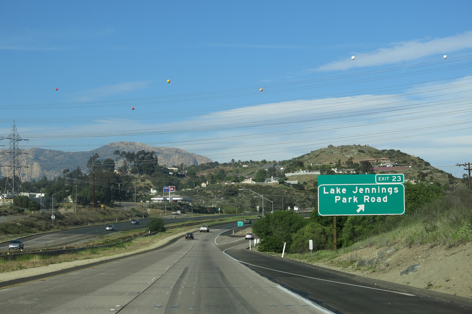
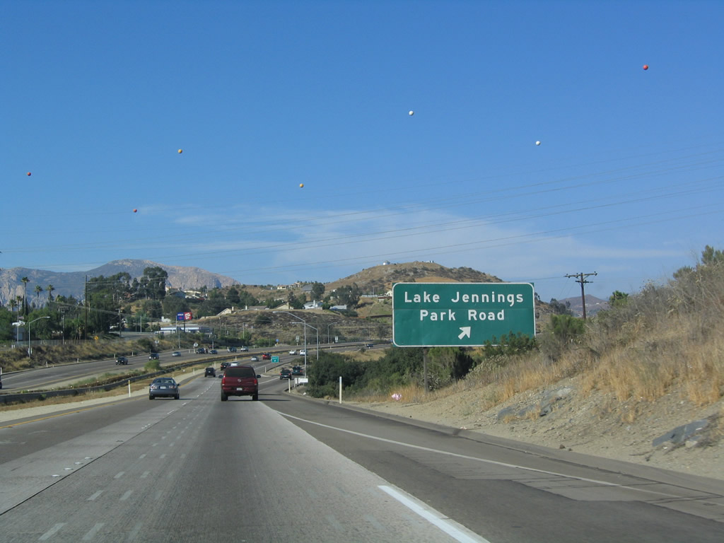
The next exit along eastbound Interstate 8 is Exit 23, Lake Jennings Park Road, one mile. Photo taken 07/17/04. |
|
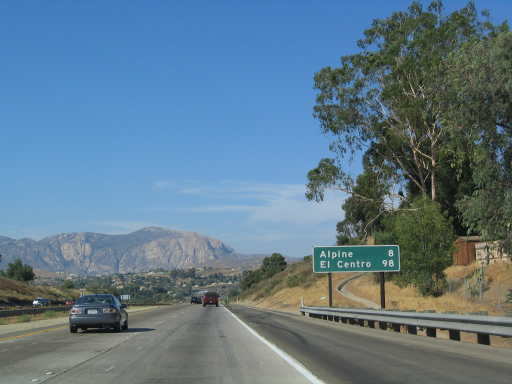
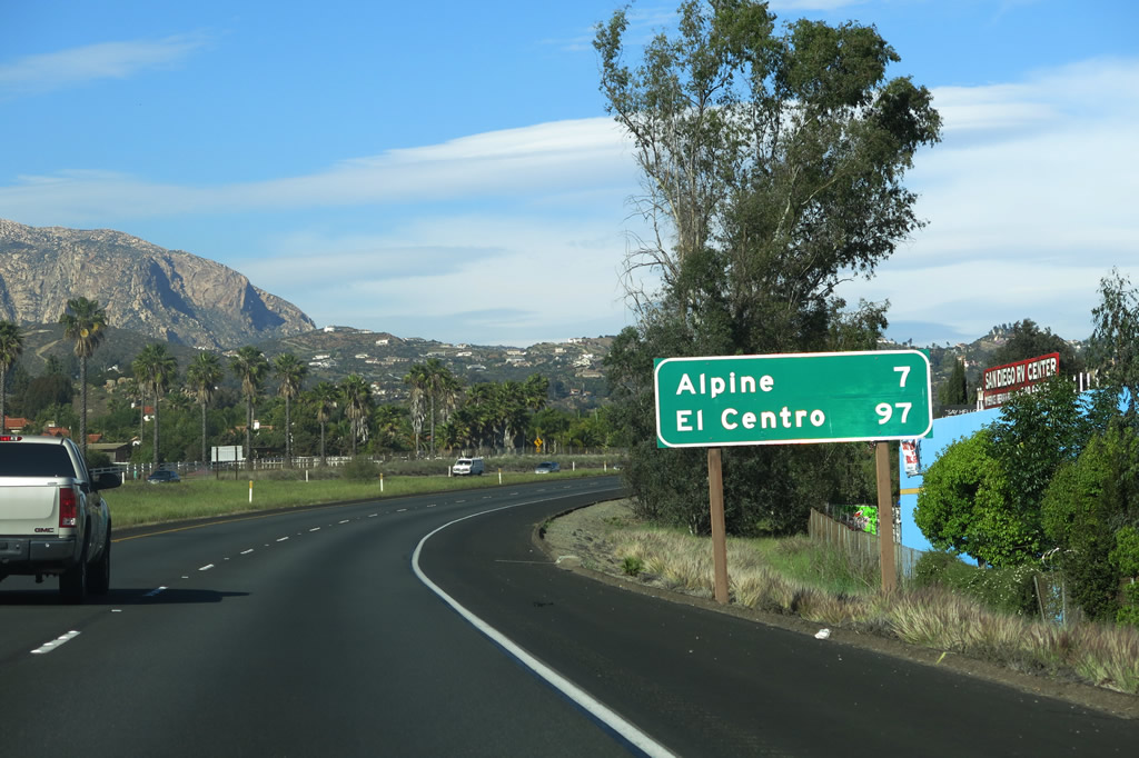
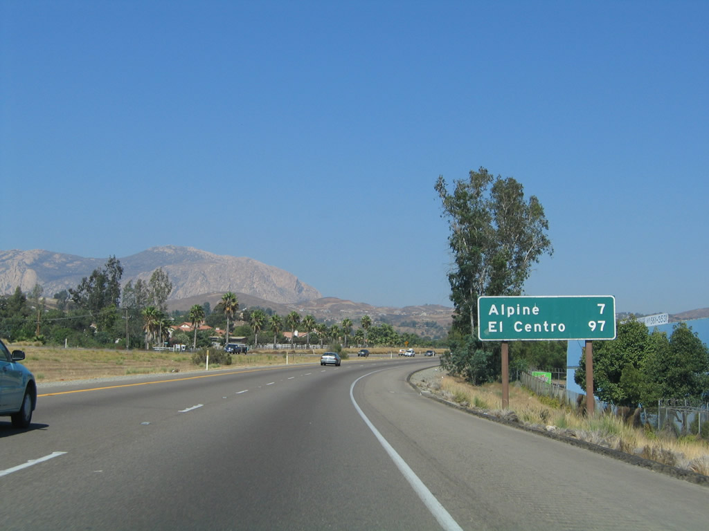
Alpine is eight miles ahead, and El Centro is another 90 miles east of Alpine. Those 90 miles were treacherous in the days of U.S. 80, back when motorist services were scarce and breakdowns were common. With the advent of a 70-miles per hour freeway, a trip that used to take a day can now be accomplished in an hour and a half. To relive the old days, much of old U.S. 80, especially between Descanso and Jacumba via Pine Valley, Live Oak Springs, and Boulevard, is still intact with twin-slab concrete poured in the 1930s. On that old road, asphalt shoulders are required to ensure sufficient width to accommodate today's larger vehicles. Photo taken 07/17/04. |
|
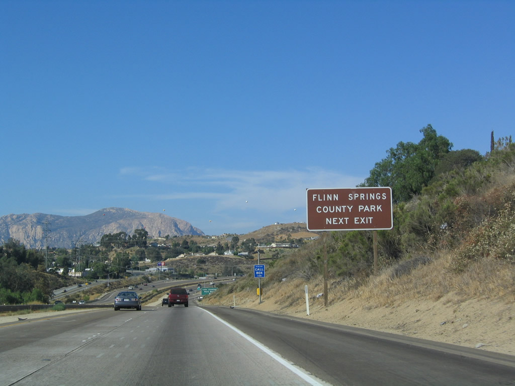
Flinn Springs County Park is accessible from Interstate 8 via Lake Jennings Park Road. Even though this sounds like a park with swimming, don't be fooled. There is no freshwater spring or lake swimming open to the public in San Diego County, as all reservoirs are closed to swimming. Photo taken 07/17/04. |
|
|
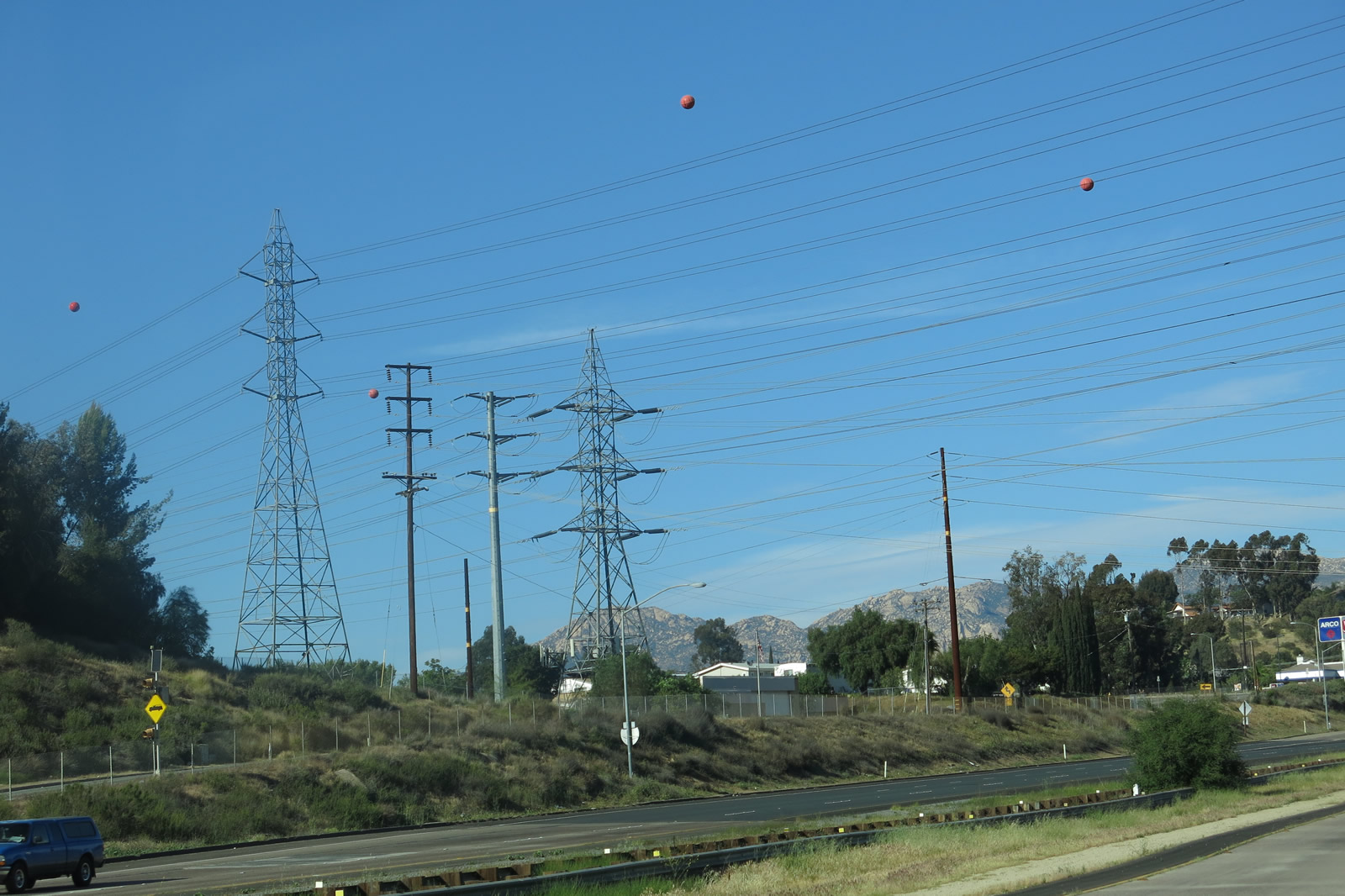
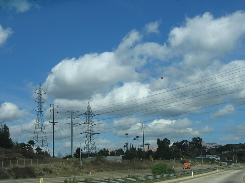
Eastbound Interstate 8 reaches Exit 23, Lake Jennings Park Road. An exit number sign was added here by 2012. High voltage transmission lines (San Diego Gas & Electric) cross over Interstate 8 at this point; they were upgraded in the mid-2000s to their current configuration). Photos taken 04/04/13 and 07/17/04. |
|
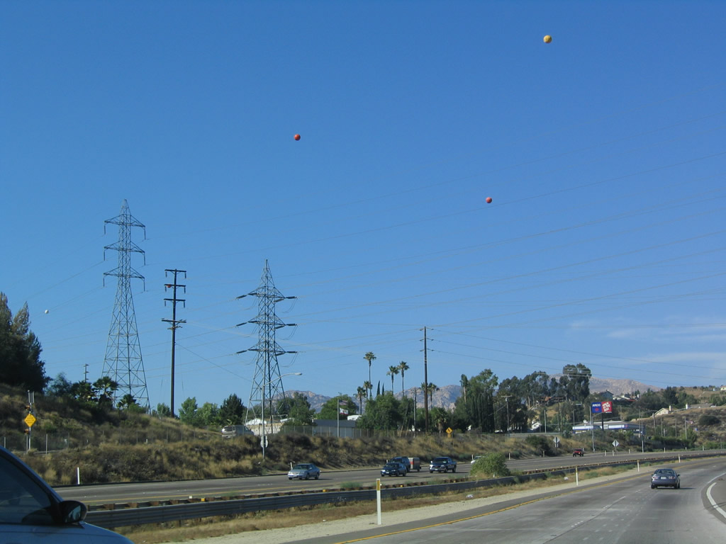
The power lines visible in the background of the Exit 23 interchange are part of a major transmission system taking power from the northern part of the county south to the San Miguel Substation (terminus of the San Diego-Imperial Valley Interconnect Transmission Line) and to Mexico. Mexico and the United States regularly import and export power depending upon needs and generation capacity. Additional generation facilities are being constructed in Mexico to meet the increase demand for electricity in Tijuana and San Diego. Photo taken 07/17/04. |
|
|
Only a year and a half later, the power lines were changed to allow for higher capacity transmission, as shown here. The new power lines were incomplete at this time. Photos taken 04/04/13 and 01/27/06. |
|
Interstate 8 crosses over Lake Jennings Park Road. Two on-ramps merge onto Interstate 8 east. The first connects southbound Lake Jennings Park Road with Interstate 8 east, while the second ramp connects northbound Lake Jennings Park Road with Interstate 8 east. Photo taken 04/04/13. |
|
|
This Interstate 8 east reassurance shield is posted after the on-ramp from Exit 23, Lake Jennings Park Road. It was replaced between 2004 and 2013. Photos taken 04/04/13 and 08/27/04. |
|
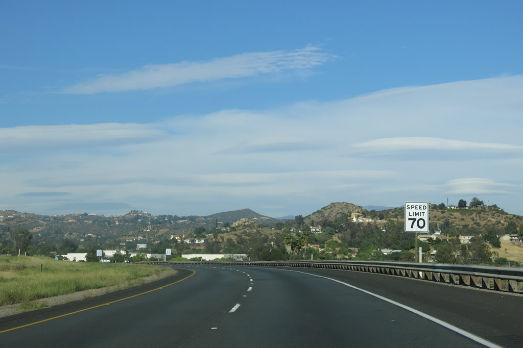
For the first time, Interstate 8 has a 70 miles-per-hour speed limit. Photo taken 04/04/13. |
|
|
This mileage sign again provides the distance to Alpine and El Centro along eastbound Interstate 8; Yuma and Tucson are omitted and will not appear regularly until east of El Centro in the Imperial Valley. Photos taken 04/04/13 and 08/27/04. |
|
|
Since leaving El Cajon, the freeway has gradually gained elevation, and this is documented in this 1,000-feet elevation sign. Photos taken 10/06/12 and 07/17/04. |
|
|
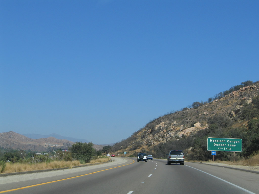
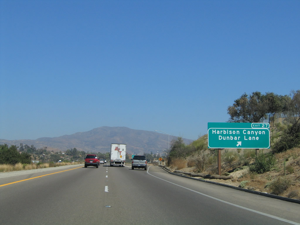
The next exit along eastbound Interstate 8 is Exit 27, Dunbar Lane north, Historic U.S. 80 (Alpine Boulevard) east to Harbison Canyon Road south, and Olde Highway 80 west. This exit serves unincorporated San Diego County east of El Cajon. However, suburban services are located at this exit. Although unsigned, this exit leads to Old U.S. 80. A new, reflective exit number sign was installed here in 2005. Photos taken 08/27/04 and 01/27/06. |
|
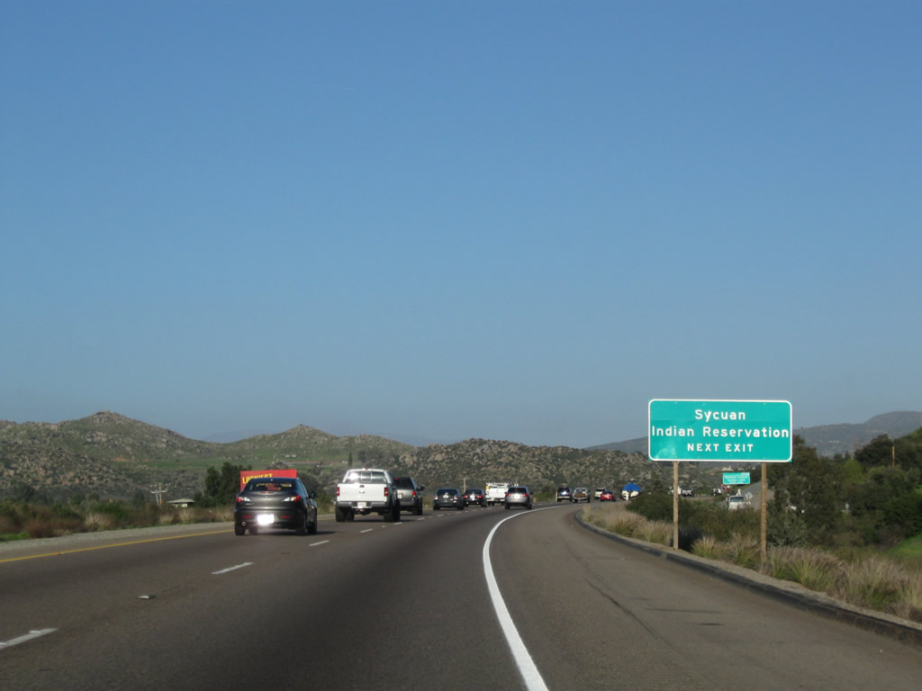
To Sycuan Indian Reservation, follow Alpine Boulevard (Old U.S. 80) east, Arnold Way southeast, and Harbison Canyon Road south. Guide signs help mark the way to the Sycuan Casino. Photo taken 04/04/13. |
|
The Cedar Fire of October 2003 burned the original guide sign, so this replacement sign with exit number was replaced in early 2004. Harbison Canyon features ranch style homes and was notable for a nudist resort. As San Diego grows, more and more people are turning to the urban fringes to make their homes. Alpine has been a hotspot of exurban development in the San Diego region. Photo taken 08/27/04. |
|
Eastbound Interstate 8 reaches Exit 27, Dunbar Lane north, Historic U.S. 80 (Alpine Boulevard) east to Harbison Canyon Road south, and Olde Highway 80 west. To Historic U.S. 80 (Alpine Boulevard) east, depart onto Exit 27 and proceed straight ahead. Old Historic U.S. 80 (Alpine Boulevard) continue alongside the freeway into the community of Alpine. Photo taken 08/27/04. |
|
This Interstate 8 east reassurance shield is posted after the on-ramp from Exit 27, Harbison Canyon Road and Dunbar Lane. Photo taken 08/27/04. |
|
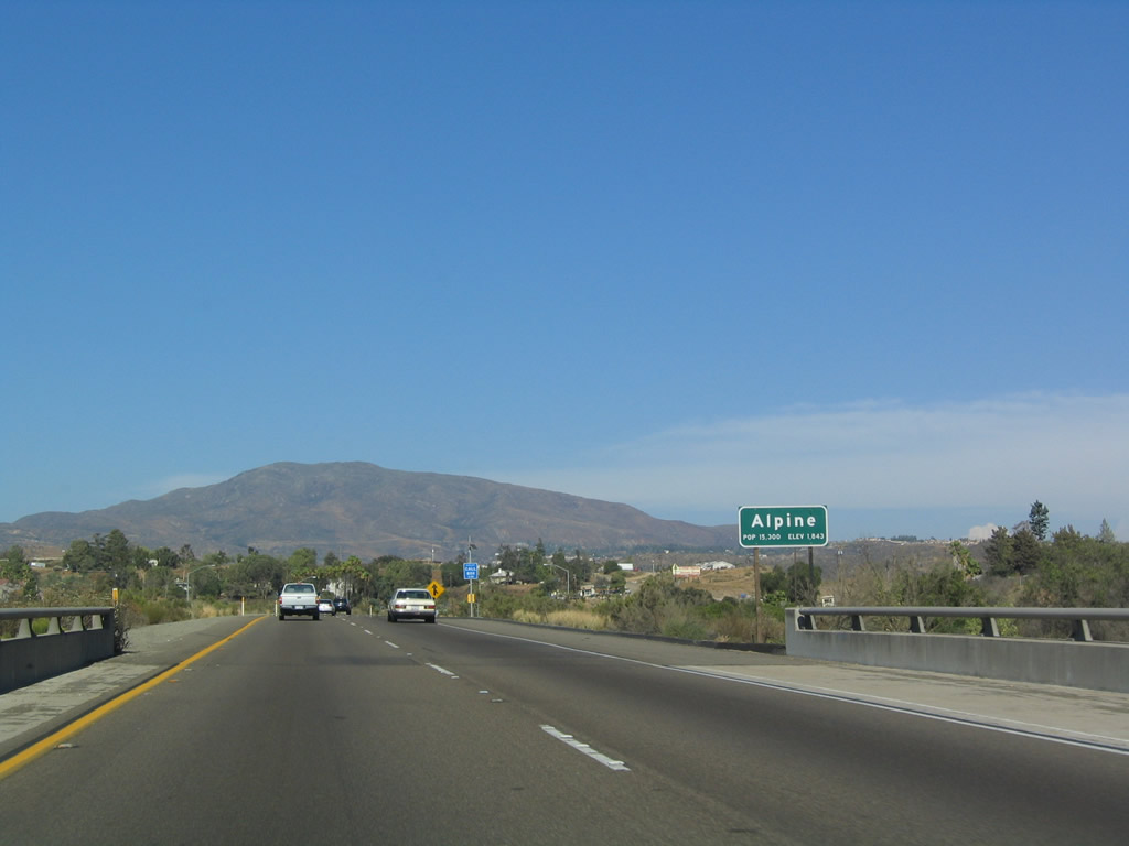
After Exit 27, Interstate 8 enters the unincorporated community of Alpine, which has a population of 15,300 (and growing). Photo taken 07/17/04. |
|
Beautiful Puetz Valley and Harbison Canyon come into view as Interstate 8 descends to a valley then ascends to the central part of Alpine. To the north, you can see El Capitan Reservoir, which is situated along the San Diego River. Photo taken 07/17/04. |
|
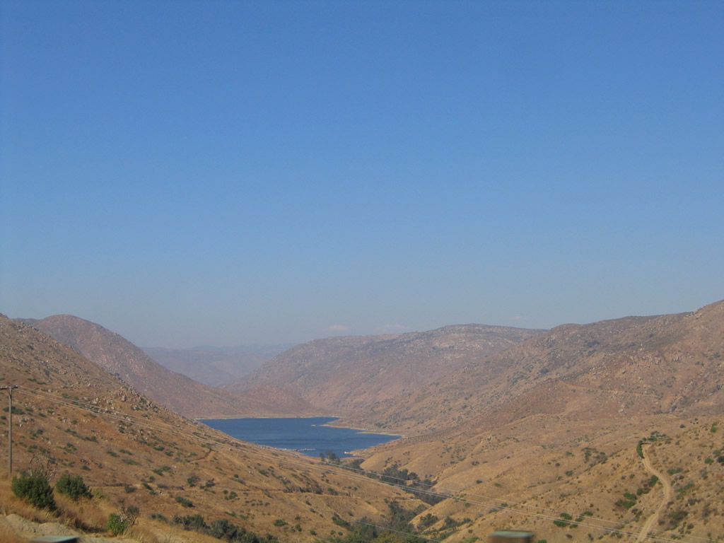
Look north from the freeway to see El Capitan Reservoir, which is situated along the San Diego River. This picture was taken in 2005, but the scene has changed since then. Power pylons now ply through this rugged landscape. The Sunrise Powerlink, which was built between 2010 and 2012 (activated on July 27, 2012), includes a 230kV San Diego Gas & Electric power line that now follows the western edge of El Capitan Reservoir. The lines drop below ground at the south edge of Interstate 8 for the journey between here and a point east of Alpine for the connection to the Suncrest Substation, where the 230kV line meets the larger 500kV power line bringing power from the east. We will see the 500kV Sunrise Powerlink east of here as Interstate 8 travels through the Laguna Mountains. Photo taken 10/01/05. |
|
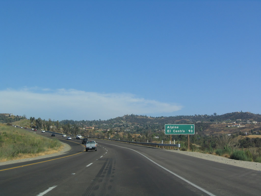
Another mileage sign provides the distance to Alpine and El Centro along eastbound Interstate 8. Photo taken 07/17/04. |
|
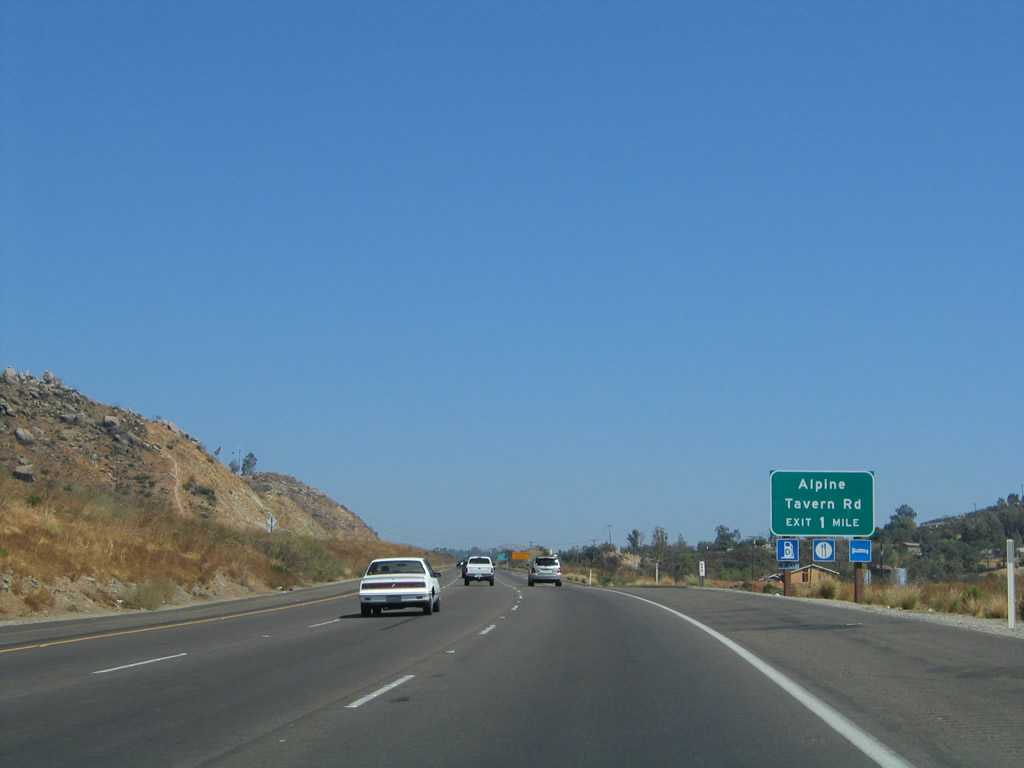
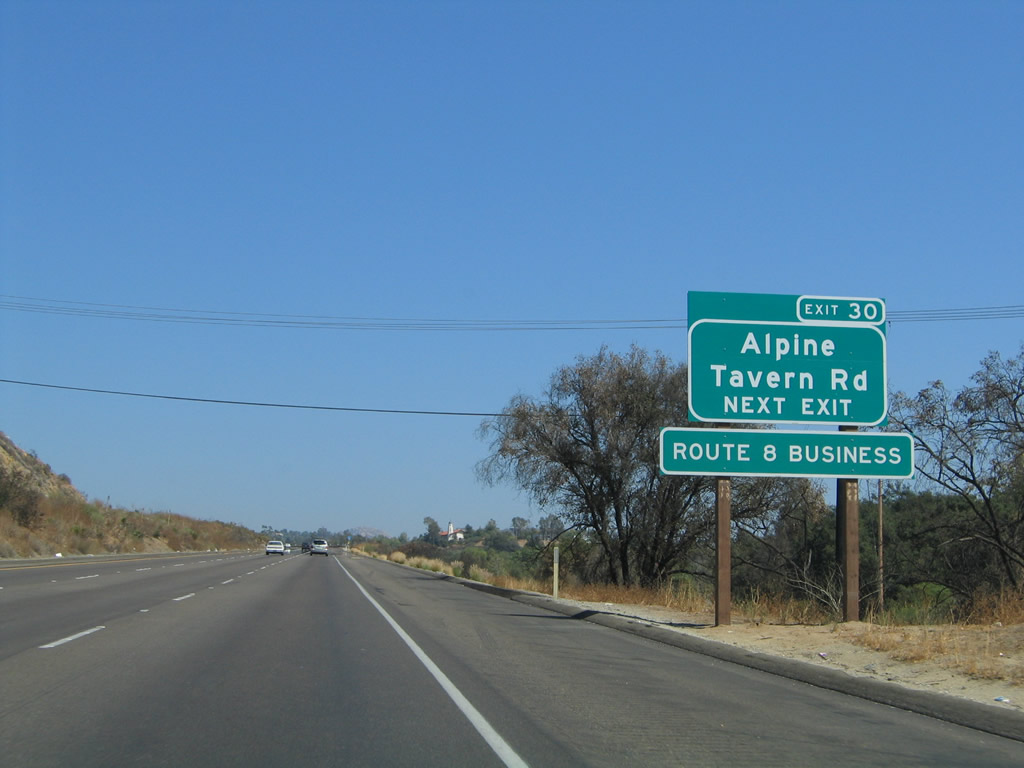
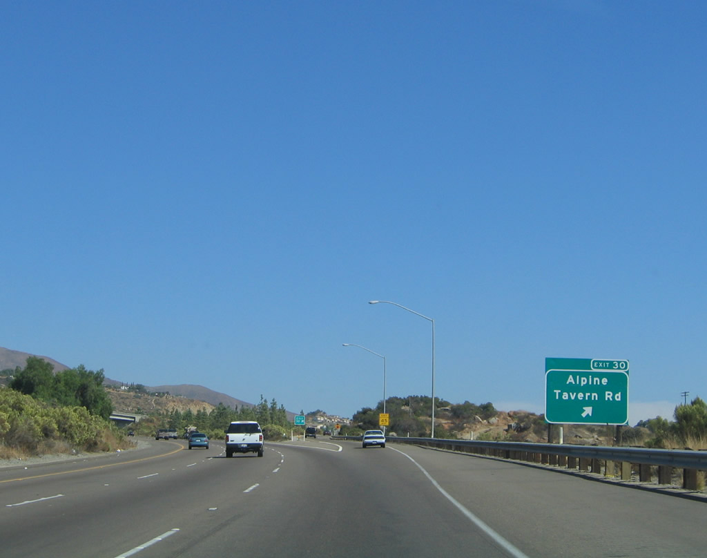
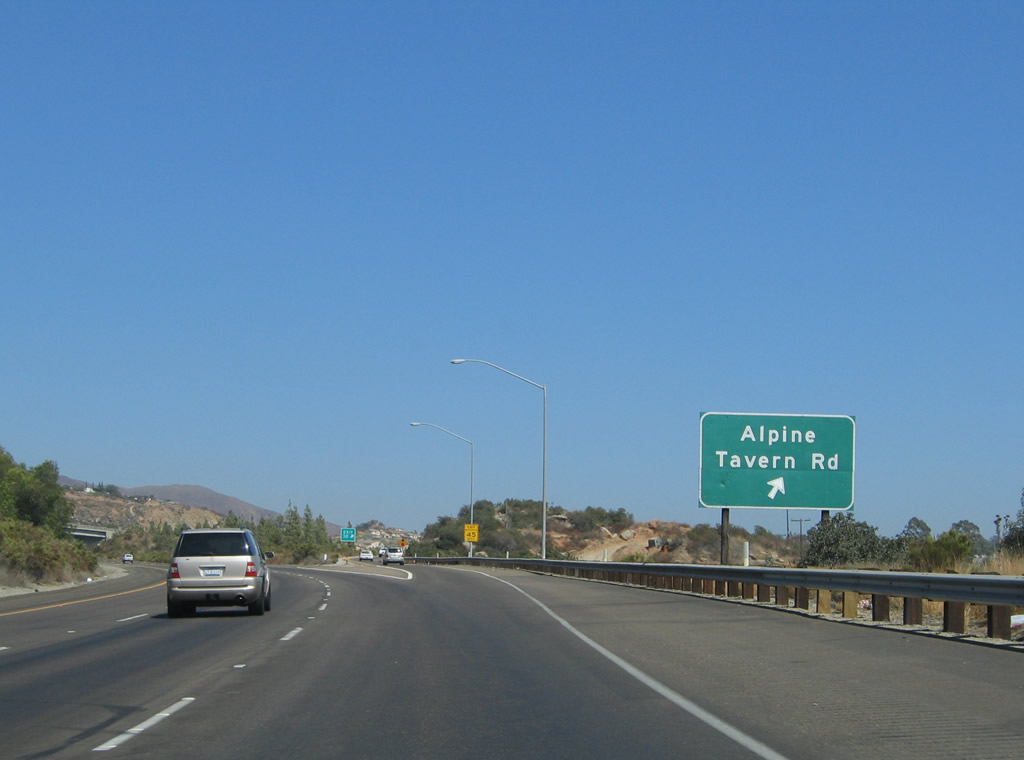
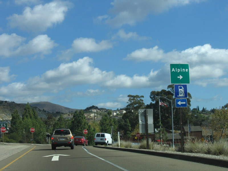
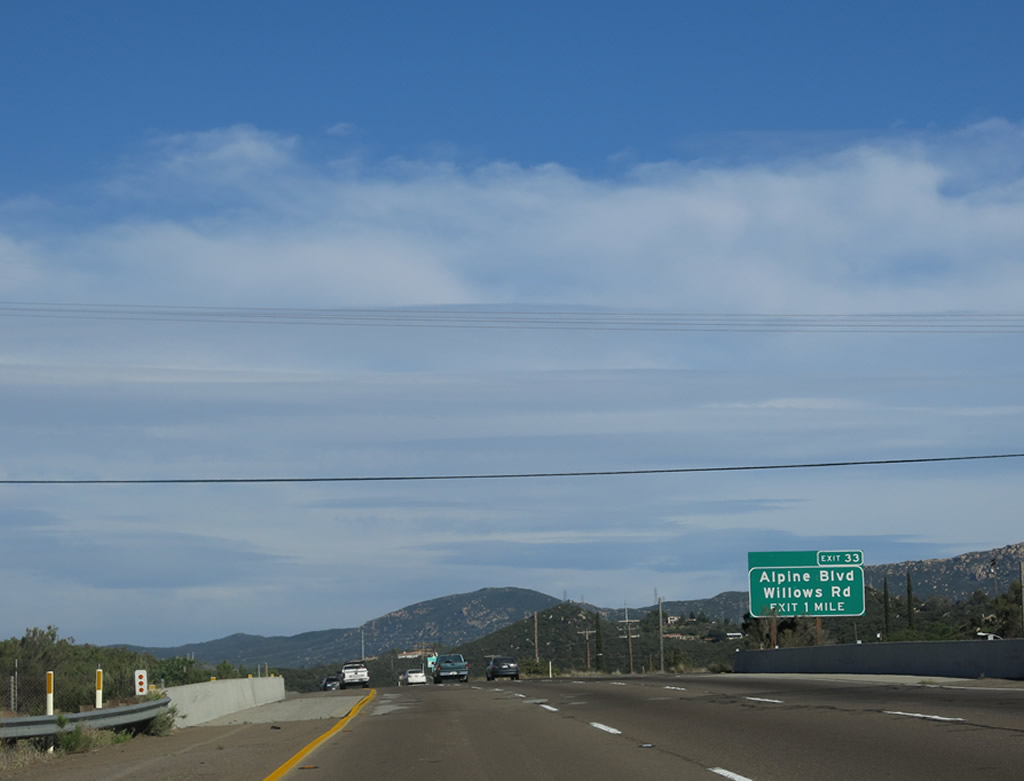
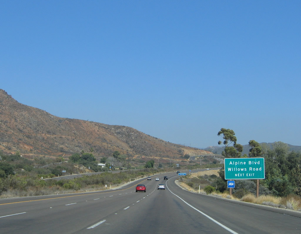
The next exit along eastbound Interstate 8 is Exit 30, Alpine Boulevard/Business Loop I-8 east and Tavern Road. This is the third instance of a business route for Interstate 8, but it is also the final Business Loop I-8 along eastbound until reaching El Centro. Alpine is a rapidly growing bedroom community that has seen its share of new developments springing up near the Interstate 8 interchanges. Photo taken 08/27/04. |
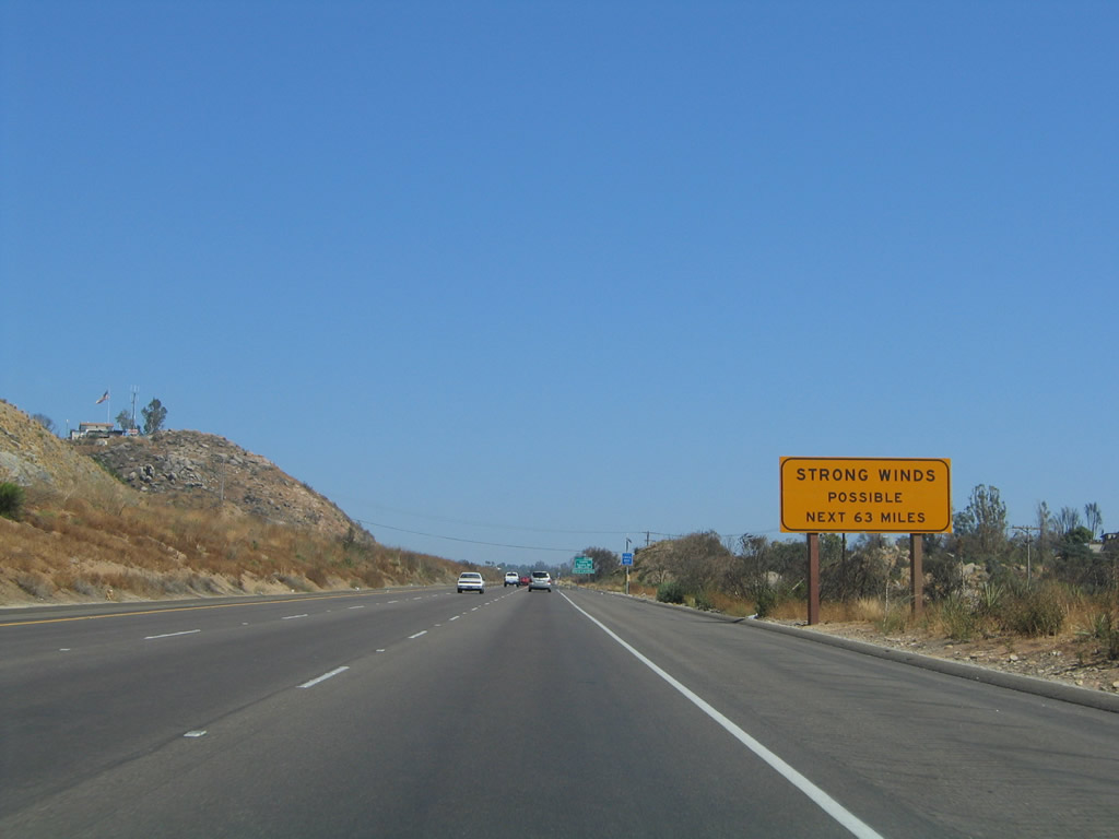
|
As Interstate 8 crosses the Laguna Mountains (and the Laguna Summit, Crestwood Summit, and Tecate Divide), the freeway may encounter strong winds, especially on the high rolling hills east of Laguna Summit. Wind advisories are common along Interstate 8 through the mountains both during the fall Santa Ana winds and winter storms. Photo taken 08/27/04. |
|
Business Loop I-8 east follows Alpine Boulevard from Exit 30 east through downtown Alpine and back to Exit 33/West Willows Road. Photo taken 08/27/04. |
|
|
Eastbound Interstate 8 reaches Exit 30, Business Loop I-8/Alpine Boulevard east and Tavern Road north/south. Tavern Road leads south from Alpine to connect to Dehesa Road near the Sycuan Indian Reservation and Casino. From eastbound, a better route to reach Sycuan Casino would be via Exit 19 (Second Street south) then east on Washington, which changes into Dehesa Road upon leaving the El Cajon city limits. Photos taken 10/01/05 and 07/17/04. |
|
At the top of the off-ramp from Interstate 8 east to Business Loop I-8/Alpine Boulevard, turn right to enter unincorporated Alpine. A small shopping plaza is located on the south side of Interstate 8, with retail, restaurants, and a motel available. Photo taken 01/27/06. |
|
Interstate 8 passes under the Tavern Road overpass. Photo taken 10/06/12. |
|
This Interstate 8 east shield is posted after the on-ramp from Exit 30, Alpine Boulevard. The freeway continues to travel uphill. Photo taken 08/27/04. |
|
|
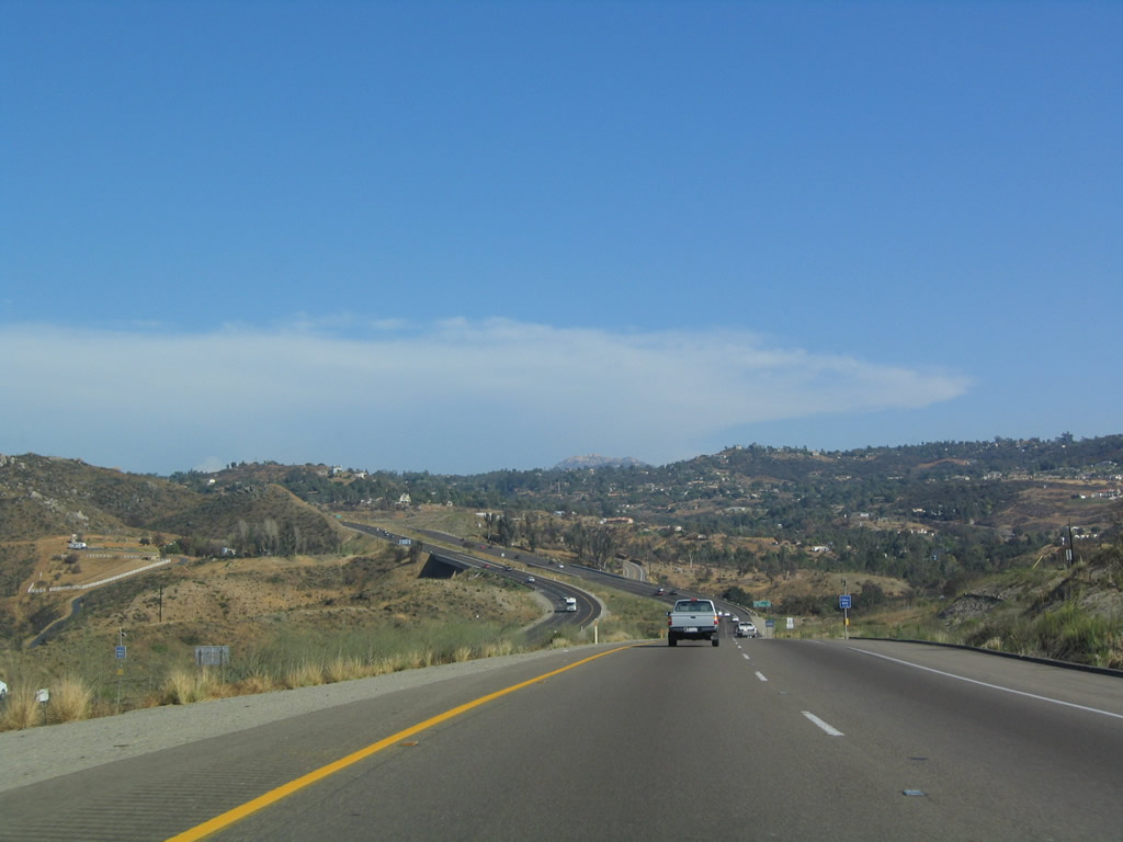
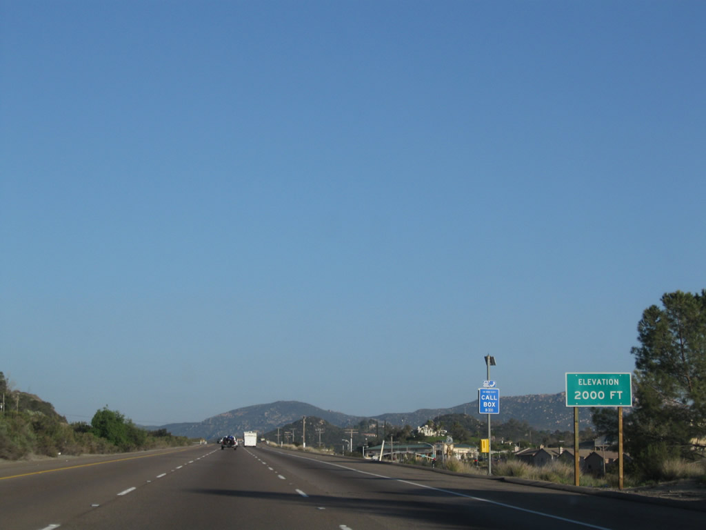
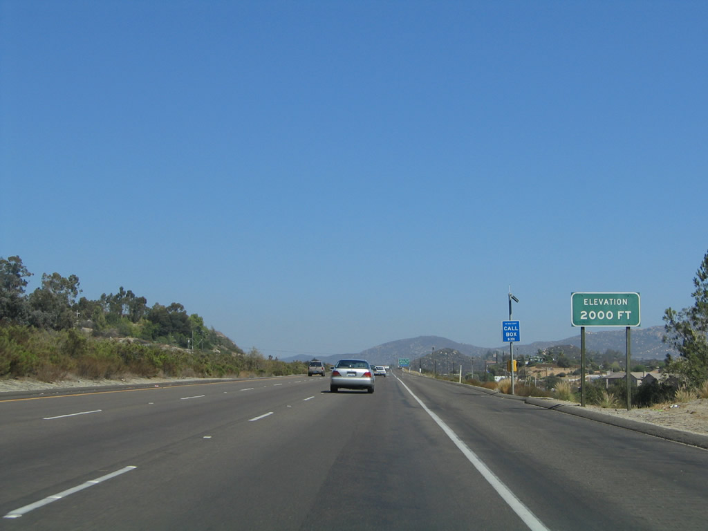
The elevation on Interstate 8 reaches 2,000 feet as the freeway bypasses Alpine. Photos taken 03/12/10 and 08/27/04. |
|
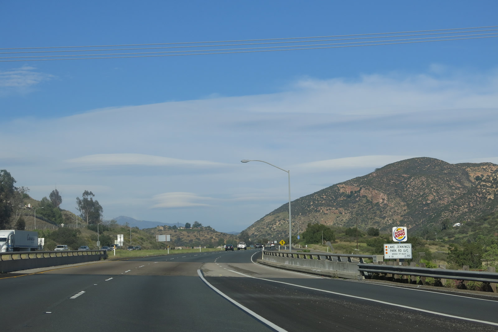
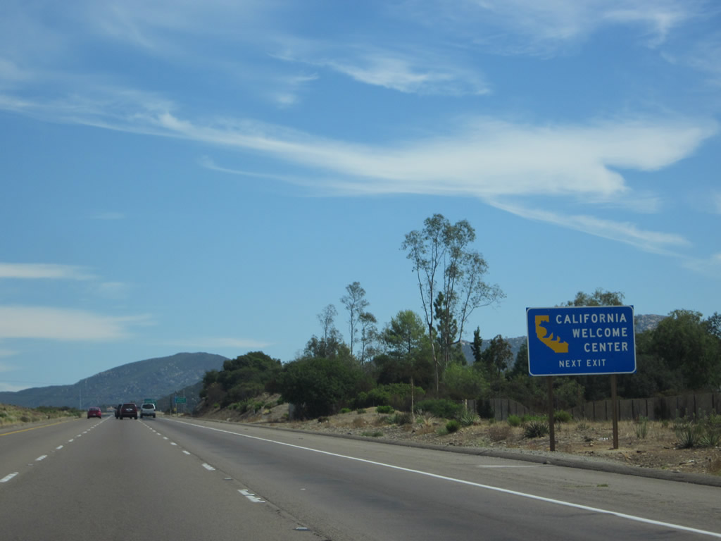
A California Welcome Center is located within the Viejas Outlet Shops; take exit 33 (Old U.S. 80/West Willows Road east to Viejas). Photo taken 10/06/12. |
|
|
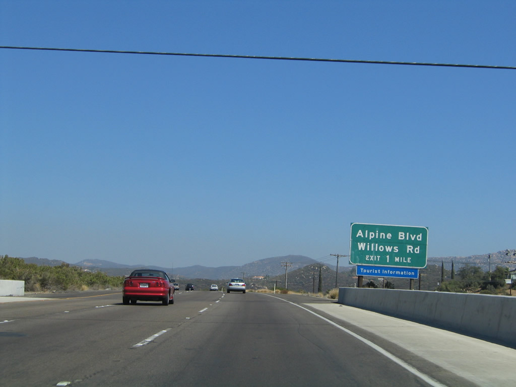
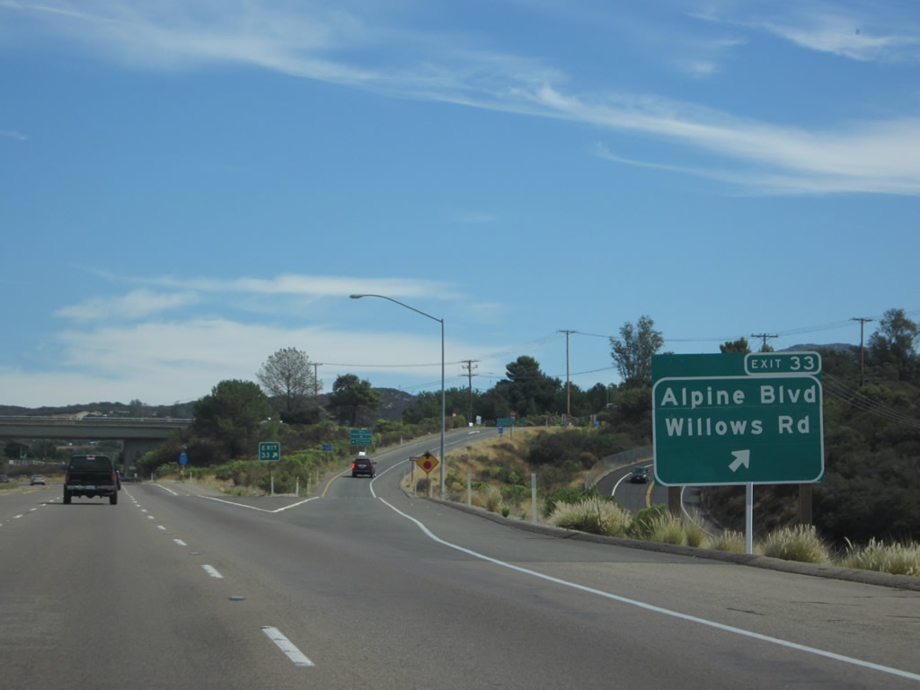
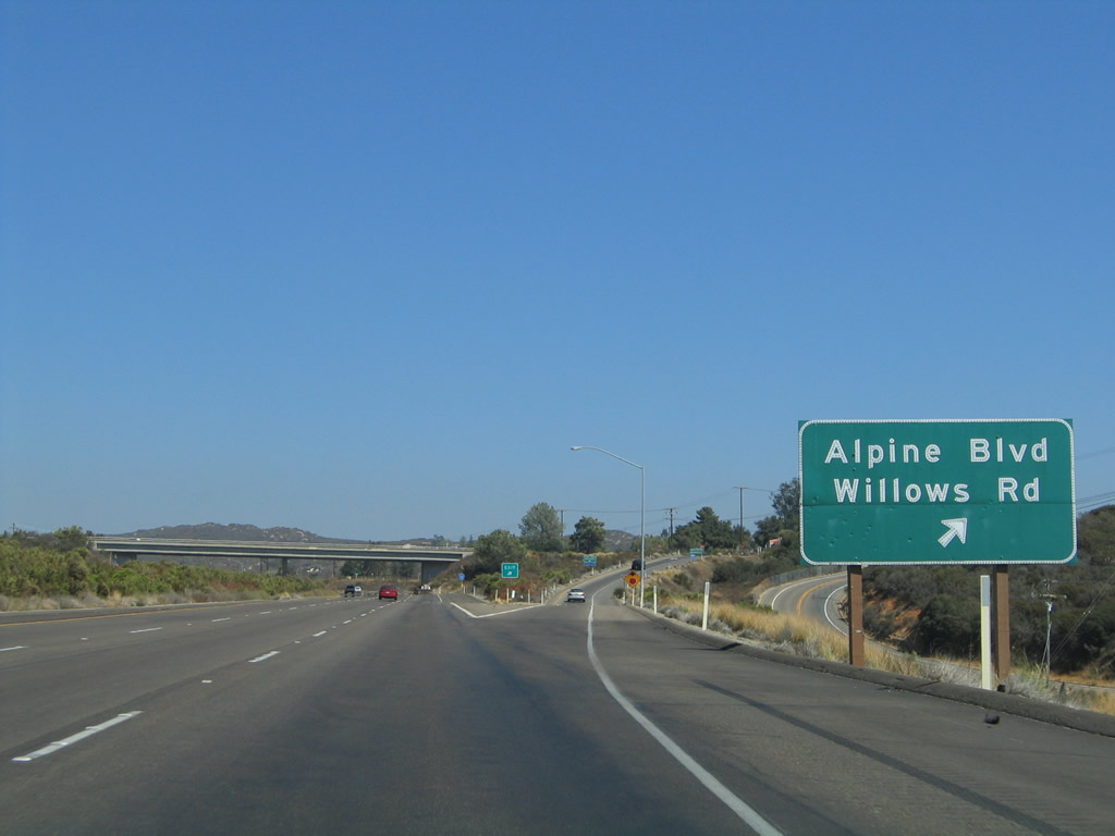
The next interchange along Interstate 8 (Kumeyaay Highway) is Exit 33, Business Loop I-8 and Old Historic U.S. 80 (Alpine Boulevard) west to Alpine and Old U.S. 80/West Willows Road east to Viejas Indian Reservation, which includes a casino and outlet shopping. Since Viejas is a regional attraction, West Willows Road is frequently busy on evenings and weekends. The traffic count on Willows Road has increased substantially over the past several years. Photos taken 04/04/13 and 08/27/04. |
|
As noted above, Exit 33 will serve Viejas Indian Reservation. Photo taken 10/06/12. |
|
Interstate 8 approaches Exit 33, U.S. 80/West Willows Road and Business Loop I-8/Alpine Boulevard. Between Harbison Canyon and Pine Valley Creek Bridge, Interstate 8 eastbound carries three lanes to allow slower traffic to stay in the far right lane. Photo taken 08/27/04. |
|
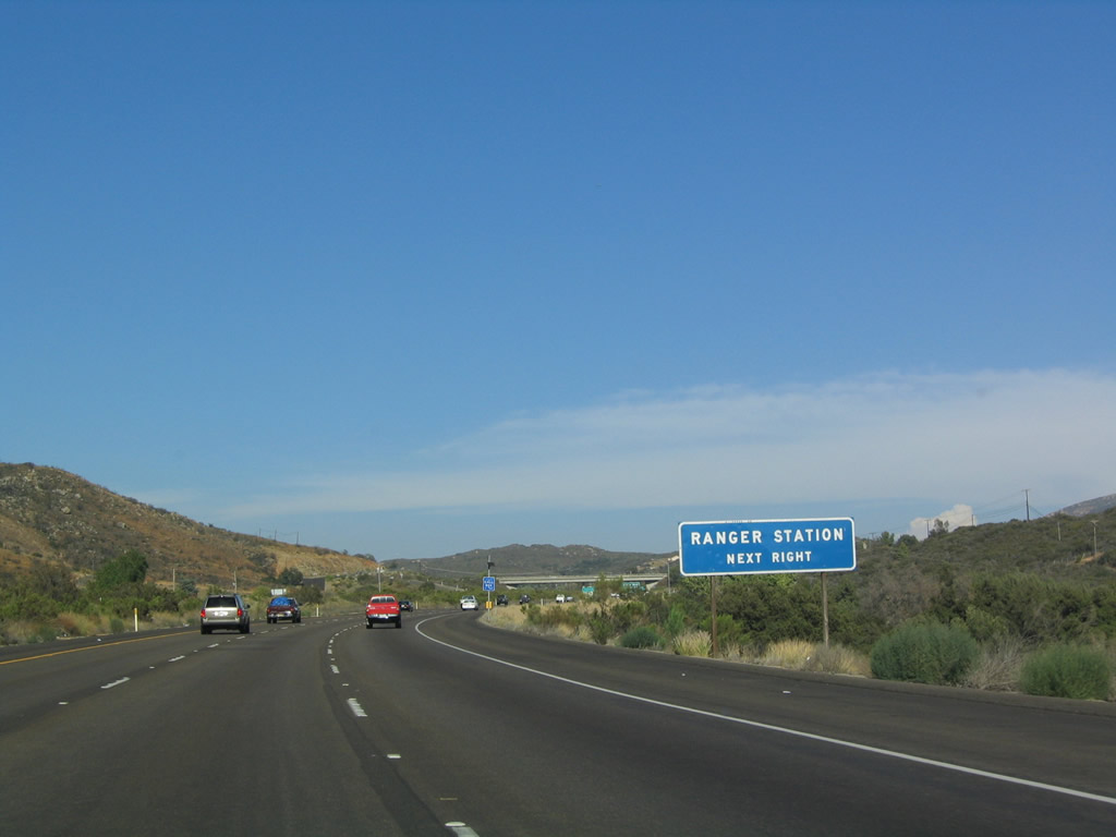
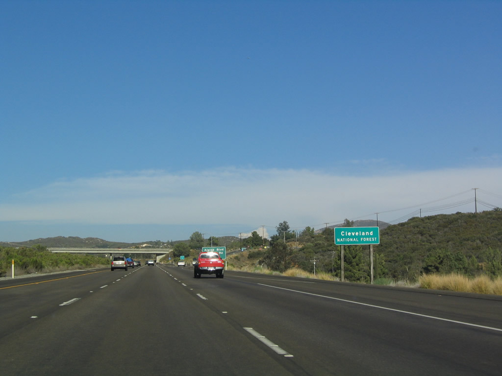
The Decansco Ranger Station for the Cleveland National Forest may be reached via Exit 33 along the south side of the freeway off Alpine Boulevard. Photo taken 07/17/04. |
|
Interstate 8 departs Alpine and enters the Cleveland National Forest. There are not many trees at this elevation in the national forest, but there are plenty of forests scattered among the Laguna Mountains. Photo taken 07/17/04. |
|
|
Eastbound Interstate 8 (Kumeyaay Highway) meets Exit 33, Alpine Boulevard and Business Loop I-8 west. This exit also leads to Willows Road. This is the eastern end of the business loop through unincorporated Alpine. Photos taken 10/06/12 and 08/27/04. |
|
The Exit 33 off-ramp has signage for the welcome center, ranger station, and indian reservation. Omitted are shields for Historic U.S. 80 and Business Loop I-8. Photo taken 04/04/13. |
|
Interstate 8 passes under West Willows Road. Photo taken 04/04/13. |
|
Another Interstate 8 east shield is posted after the on-ramp from Alpine Boulevard. Photo taken 08/27/04. |
|
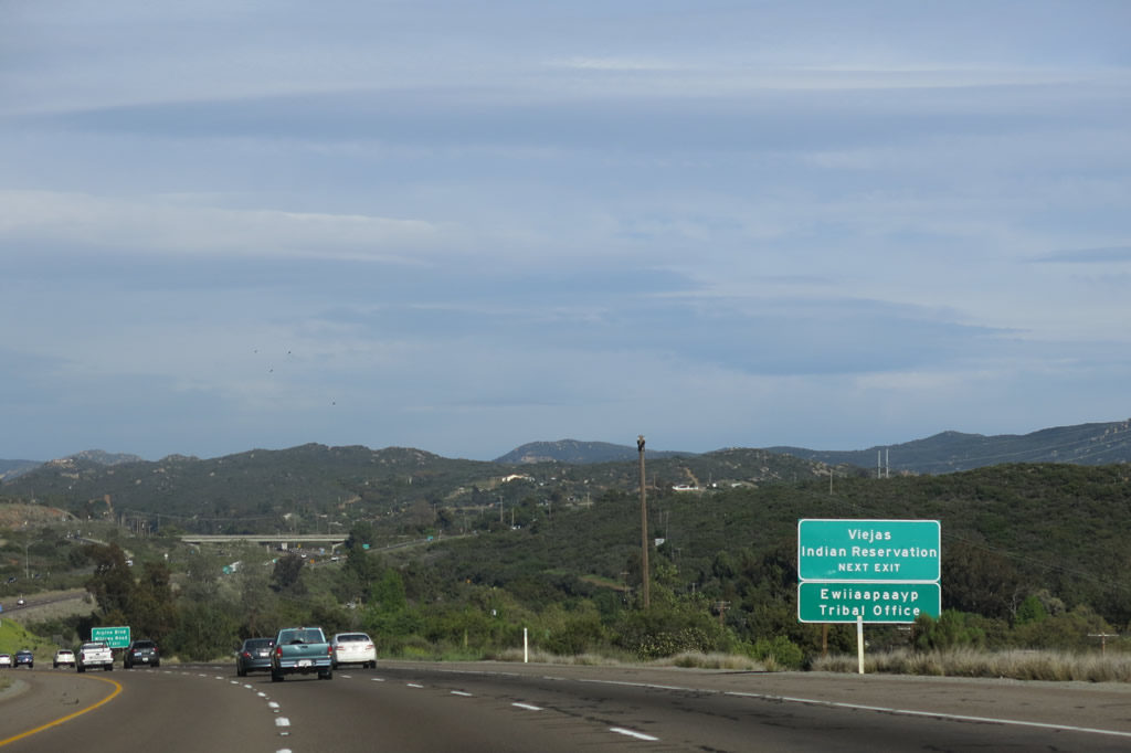
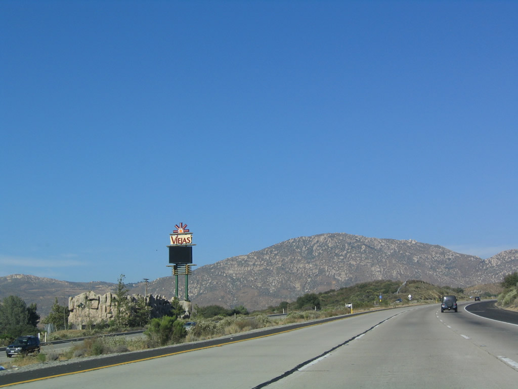
This tiny sign greets travelers to the Viejas Indian Reservation, which has one of the most prominent Indian Casinos in San Diego County due to its proximity to the freeway. Photo taken 07/17/04. |
|
The Viejas Indian Casino marquee sign and waterfall greets motorists. To reach the casino, use either Exits 33 or 36. Photo taken 07/17/04. |
|
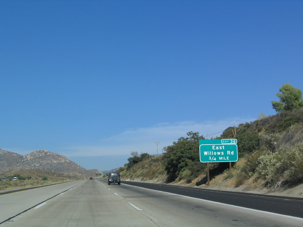
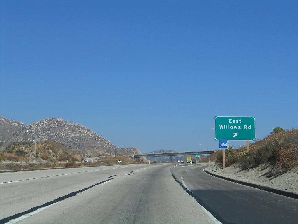
The next exit along eastbound is Exit 36, East Willows Road (0.75 mile). Photo taken 07/17/04. |
|
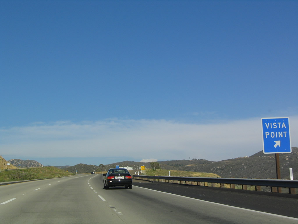
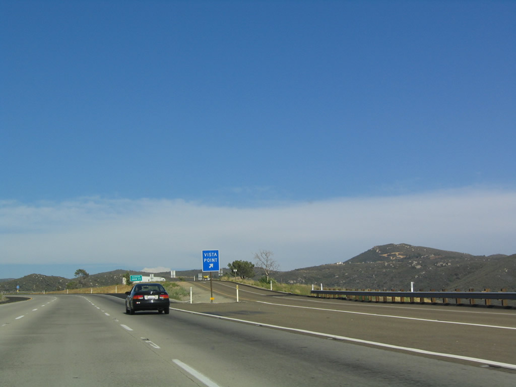
Eastbound Interstate 8 (Kumeyaay Highway) reaches Exit 36, East Willows Road. At this interchange old U.S. 80 is again underneath the freeway, so there is no extant frontage road. Rejoin old U.S. 80 at Exit 40, California 79. The next exit is a Vista Point (Exit 37). Photo taken 08/27/04. |
|
The first advance sign for the vista point (Exit 37) is mounted on the overpass for East Willows Road. Photo taken 07/17/04. |
|
This reassurance shield for Interstate 8 is posted immediately after the East Willows Road interchange just east of Viejas Indian Reservation. Between Exits 36 and 40, there is no parallel frontage road for Interstate 8. Photo taken 08/27/04. |
|
A sweeping view is afforded south of the freeway near the Vista Point. Photo taken 08/27/04. |
|
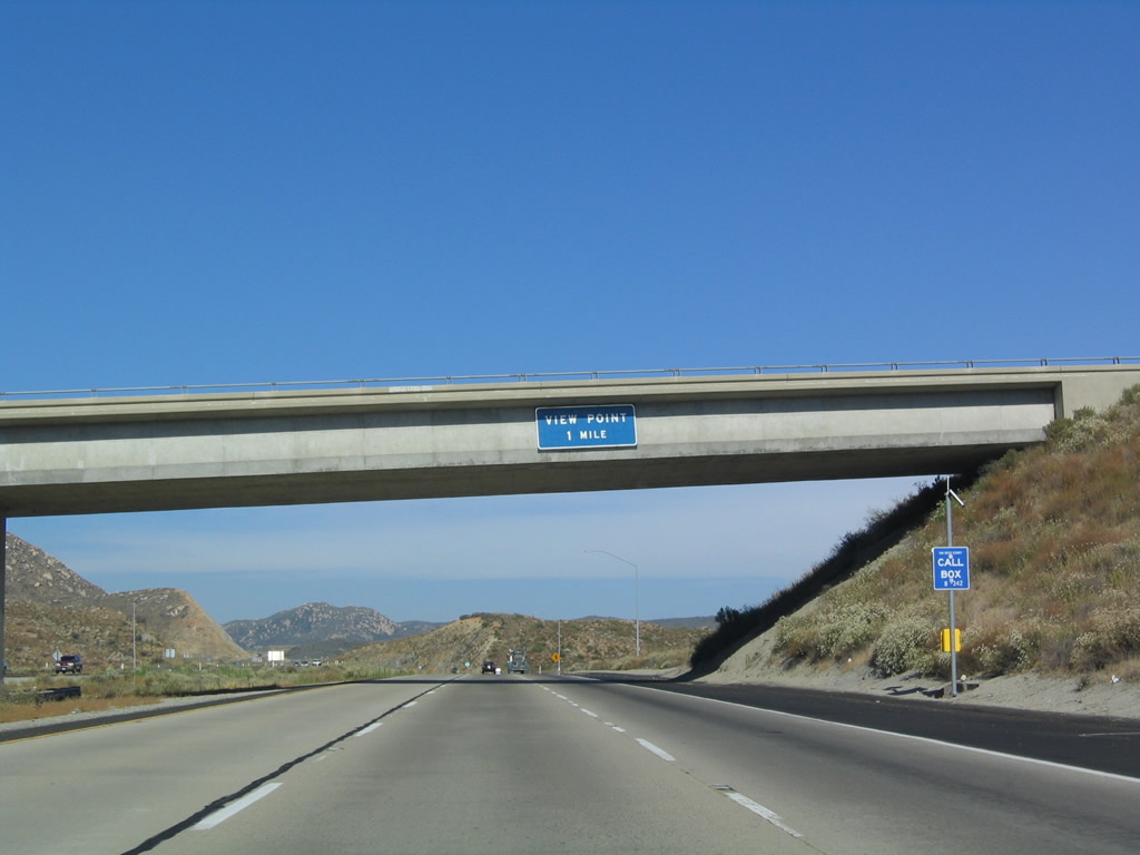
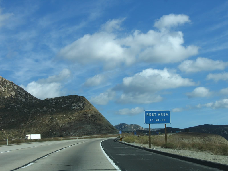
There are no facilities at the Vista Point, but a Rest Area is located 13 miles ahead at the Buckman Springs Road Interchange (Exit 51, San Diego County S-1 South). Photo taken 01/27/06. |
|
The Exit 37 Vista Point is a worthy stop for two reasons: (1) the old alignment of U.S. 80 used to swing out onto this ledge, and remnants of the old road can still be seen in the vista point parking area and (2) the view from Interstate 8 into Japatul Valley shows some of the impacts of the Alpine Fire from July 2000. Photo taken 07/17/04. |
|
Eastbound Interstate 8 reaches Exit 37, Vista Point. Although the valley views and old alignment of U.S. 80 are worthwhile, there are no facilities at this parking area. Photo taken 07/17/04. |
|
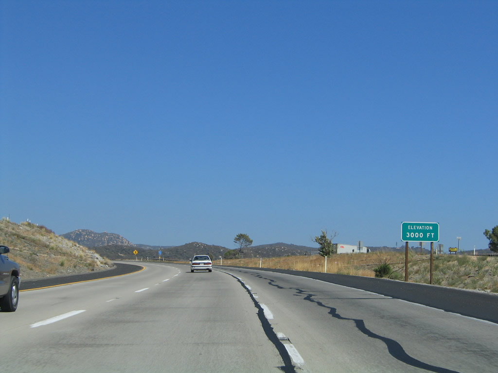
The freeway reaches 3,000 feet. Photo taken 08/27/04. |
|
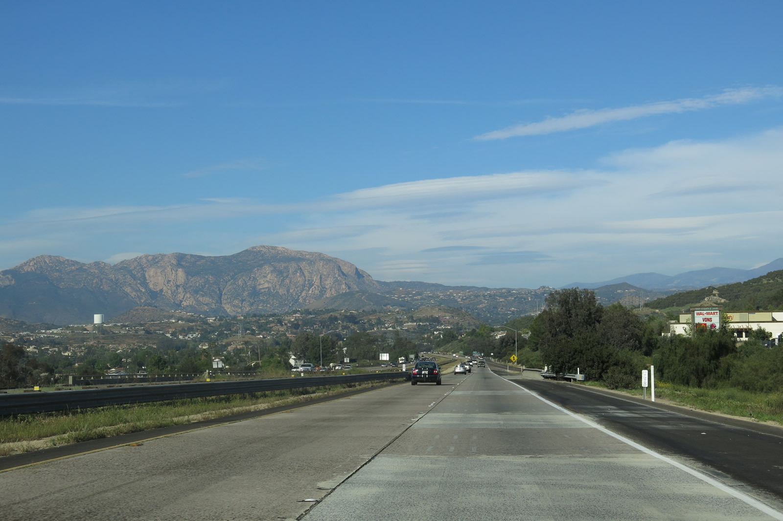
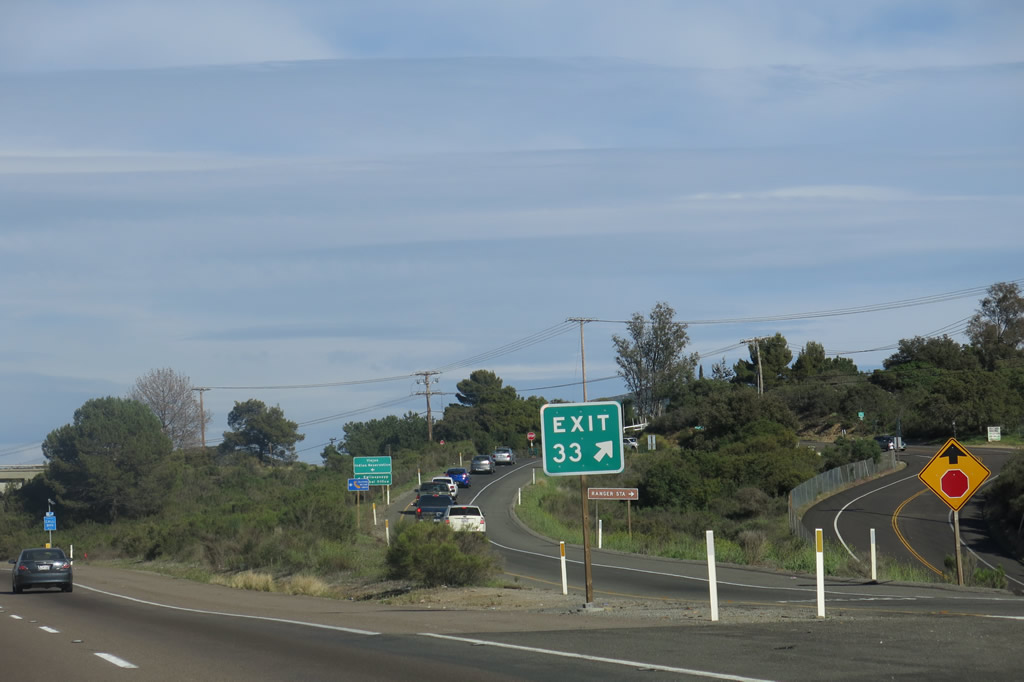
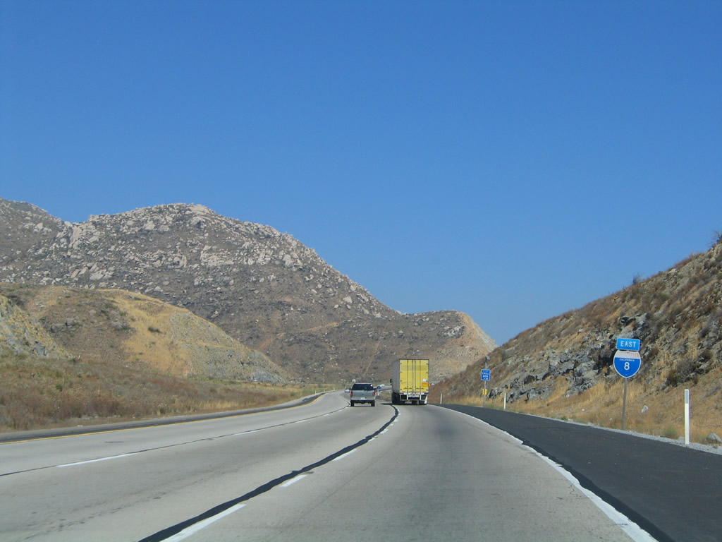
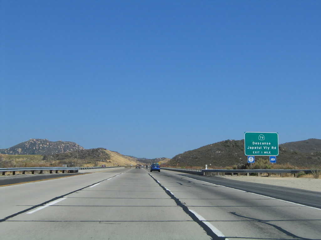
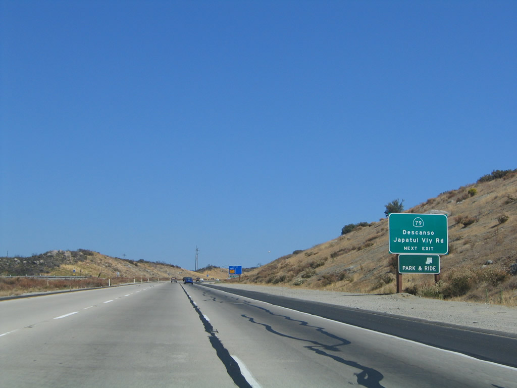
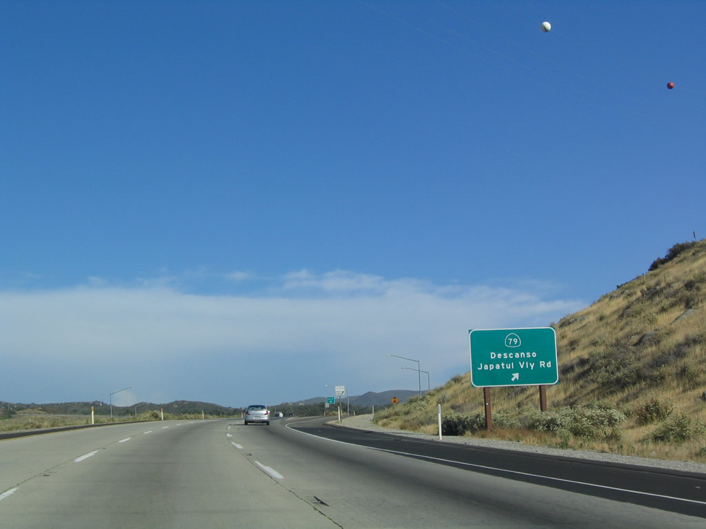
The next exit along eastbound Interstate 8 is Exit 40, California 79 north and Japatul Valley Road south. This exit leads to the communities of Descanso, Guatay, and Pine Valley, each of which are located along or near Historic U.S. 80. These communities are rural in nature, but an influx of city folks looking for country peace have slowly swelled the population counts in these areas. Most of the people who have moved into these areas commute daily to jobs in the city. Photo taken 08/27/04. |
|
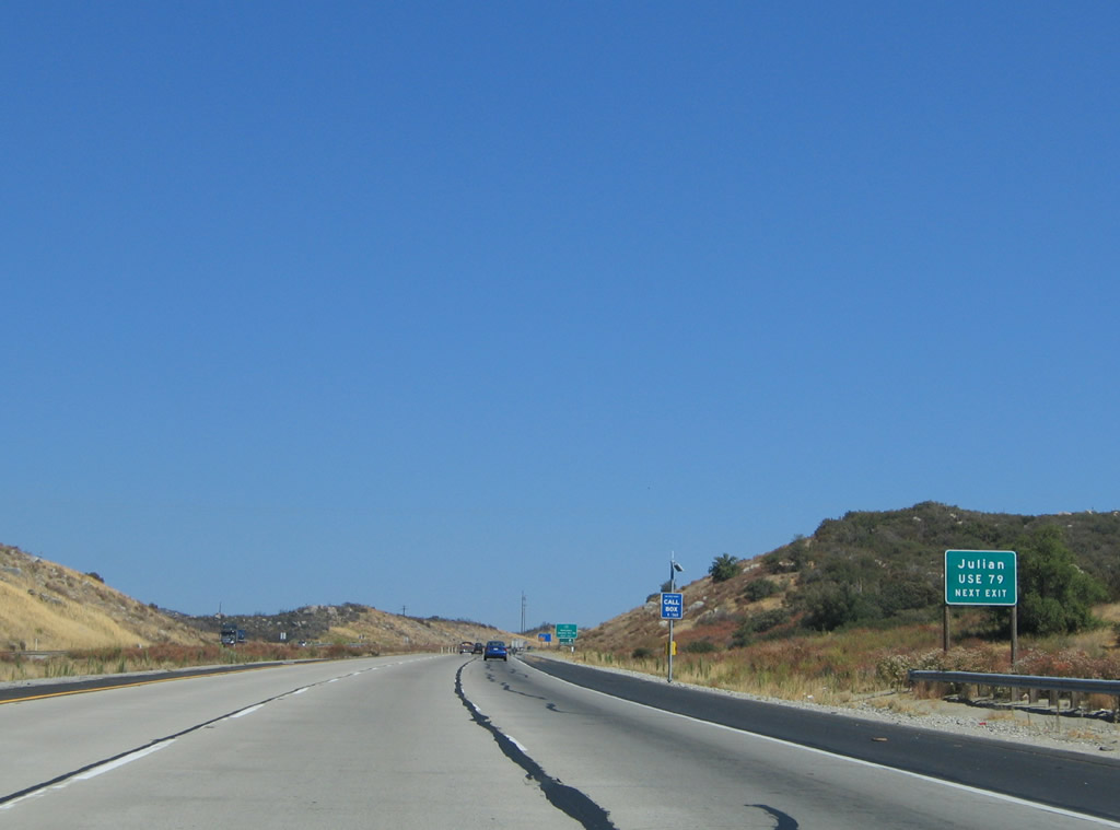
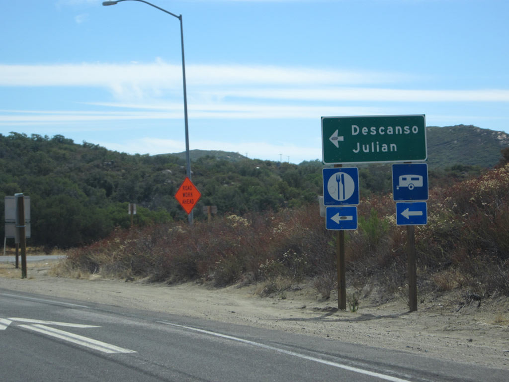
To reach Julian, Cuyamaca Rancho State Park, and Descanso, use California 79 north. Photo taken 08/27/04. |
|
California 79 leads north to the recreational areas of Cleveland National Forest and Rancho Cuyamaca State Park, so much of the highway is a rural, two-lane, winding road. This exit marks the southern terminus of California 79, but the highway continues southbound as Japatul Valley Road. Japatul Valley Road starts heading south, then turns west toward Dehesa Road. This is one of the most beautiful backcountry drives in San Diego County, and it is not too difficult to reach it from the freeway. Photo taken 08/27/04. |
|
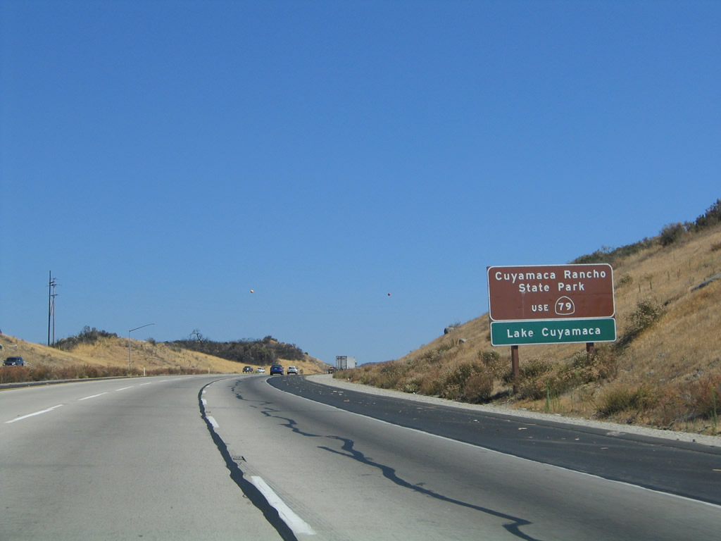
California 79 is signed on this brown shield for Cuyamaca Rancho State Park. During the height of the October 2003 wildfires, this park was closed. It initially reopened for limited camping and hiking. Lake Cuyamaca is a reservoir found in the state park. Photo taken 08/27/04. |
|
Eastbound Interstate 8 reaches Exit 40, California 79 north and Japatul Valley Road south. Deceleration for this exit can be challenging, since the exit ramp is on an upgrade and slow trucks are using the right lane. Photo taken 07/17/04. |
|
Now on the off-ramp to Exit 40, turn left for California 79 north, which connects to Old Highway 80 east to Guatay and Pine Valley. Turn right for Japatul Valley Road south. Photo taken 10/06/12. |
Page Updated April 14, 2013.