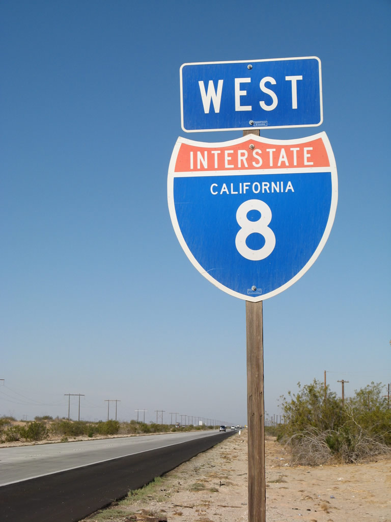
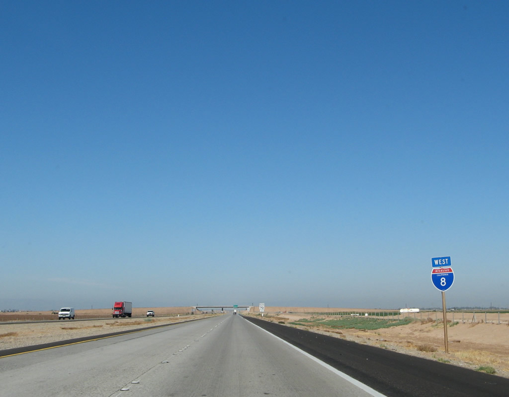
| Interstate 8 west |
|
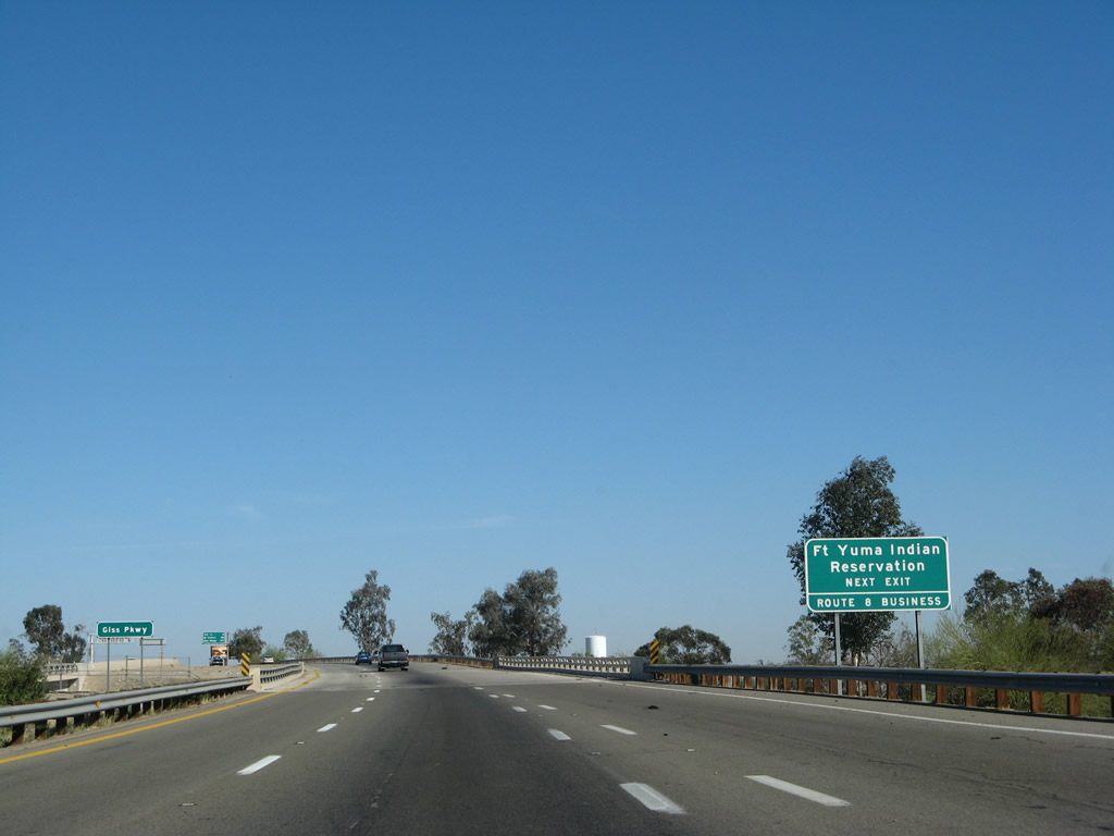
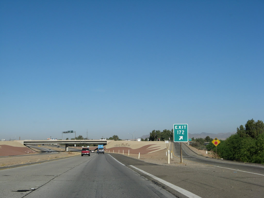
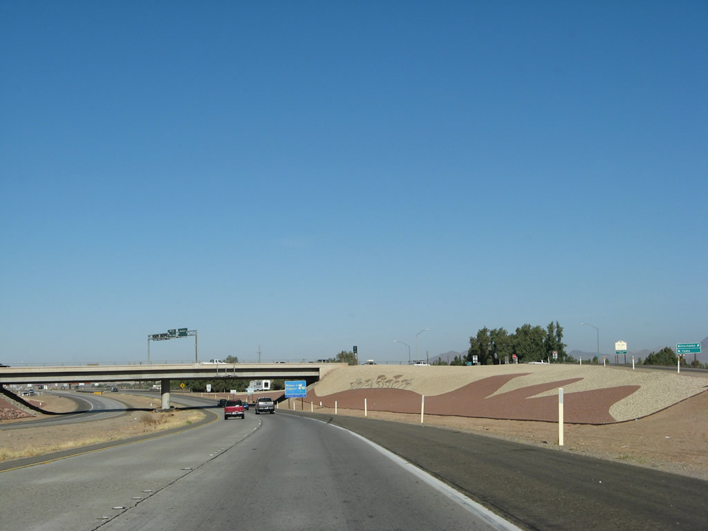
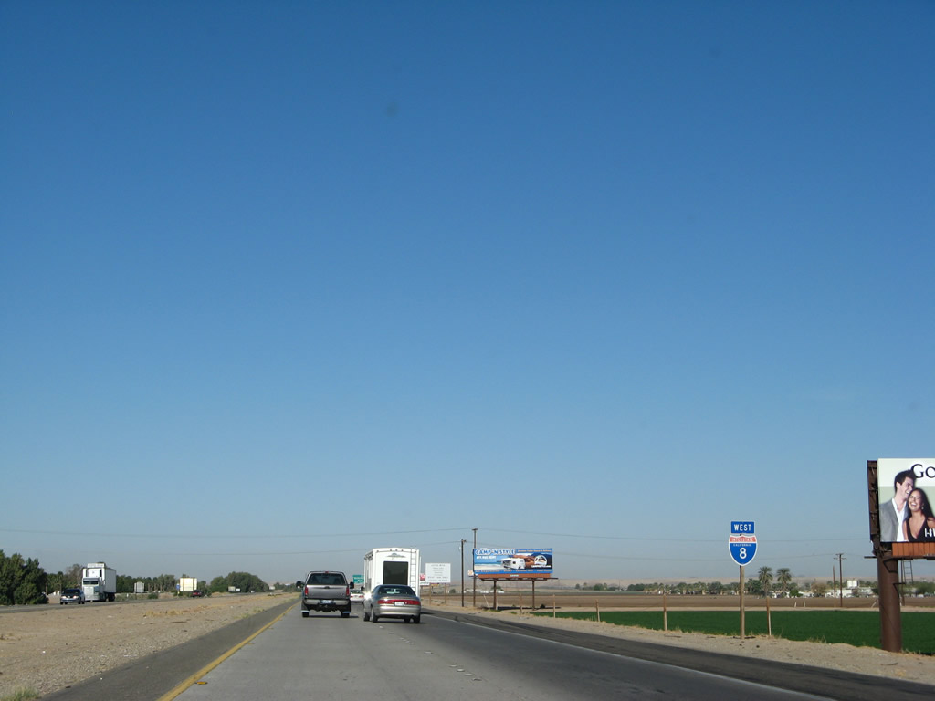
Although located in Arizona and placed by the Arizona Department of Transportation, this signage is for Exit 172, Business Loop I-8 to Winterhaven, the Fort Yuma Indian Reservation, and Imperial County S-24 north to Laguna Dam. It is located just before the Colorado River bridge. Photo taken 03/19/07. |
|
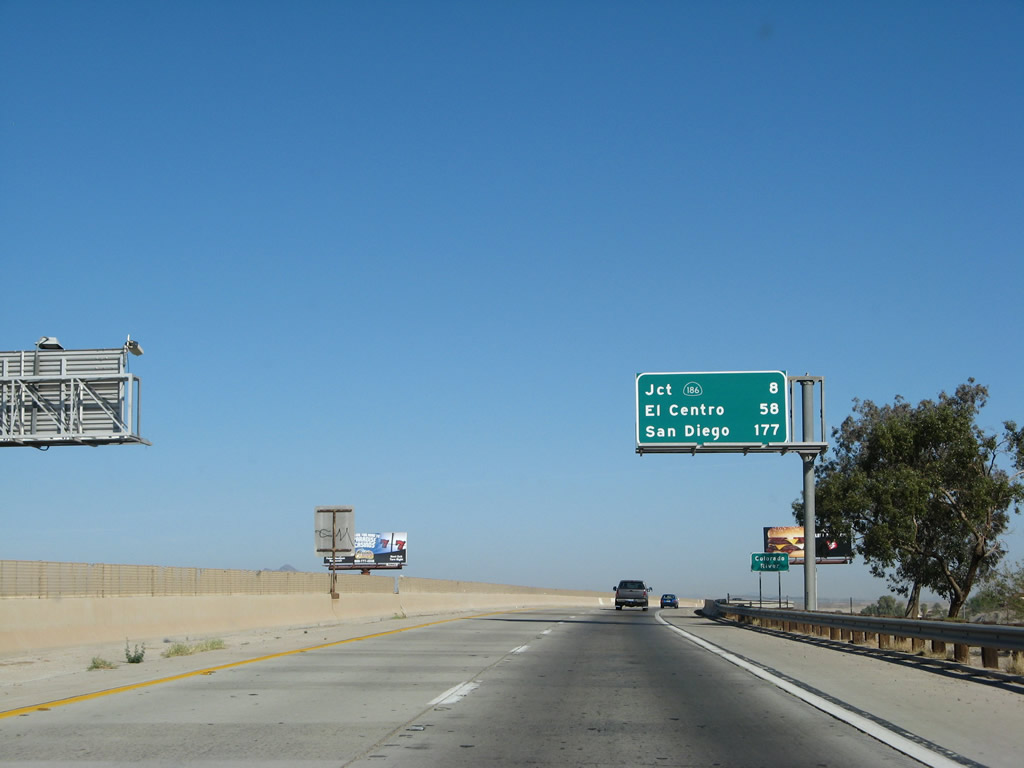
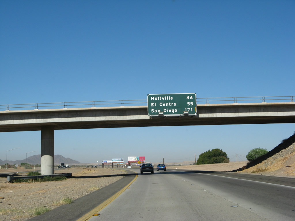
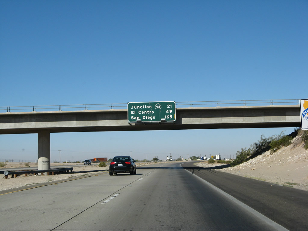
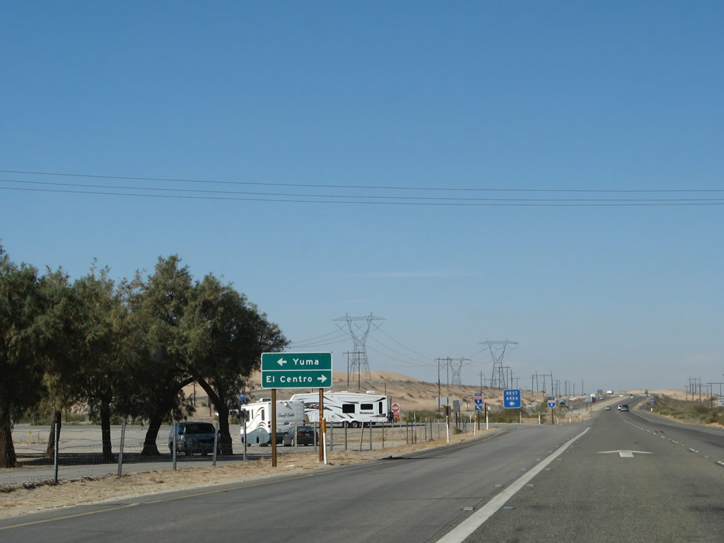
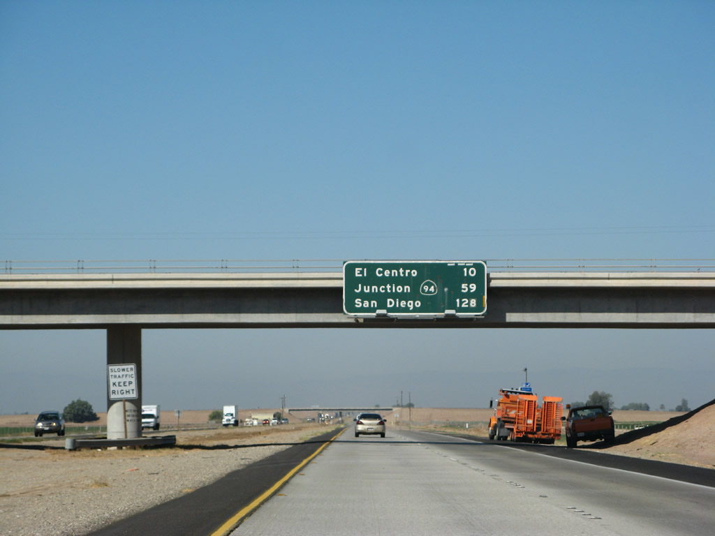
This mileage sign provides the distance to the three major destinations along westbound Interstate 8 in California: the interchange with California 186 (Algodones Road) south to Andrade (Exit 166), El Centro, and San Diego. Between Giss Parkway (Exit 1) and Winterhaven (Exit 172), Interstate 8 travels due north, then curves to the west. Photo taken 03/19/07. |
|
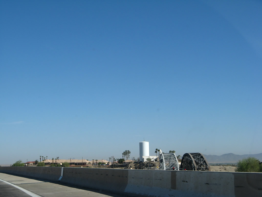
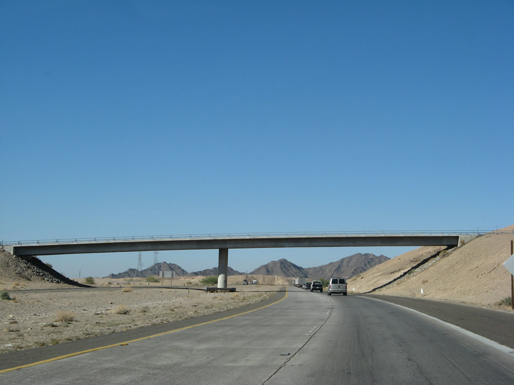
The Colorado River is a major body of water for Interstate 8 to cross, and the Colorado River bridge soars over the river on a concrete girder bridge built in 1978. Although partially located in Arizona, the Interstate 8 bridge was constructed by the California Department of Transportation (Caltrans), and it is built suitably high above the floodplain. As seen in this photo, the original old U.S. 80 (Ocean to Ocean Highway) steel through truss bridge (built in 1915, refurbished in 2002) and parallel railroad steel through truss bridge are visible from the Interstate 8 bridge. To the south of the freeway (and not visible in this photo) is the Business Loop I-8 (second generation U.S. 80 bridge) between Winterhaven and Yuma built in 1956. Photo taken 03/19/07. |
|
Crossing the Colorado River, the Interstate 8 bridge sweeps to the west. Winterhaven and the Fort Yuma Quechan Indian Reservation can be seen in the distance to the right of the bridge. Home to 529 people as of the 2000 Census, Winterhaven is the companion town to Yuma, Arizona. It is perhaps best known for the Quechan Indian Reservation Casino. Photo taken 03/19/07. |
|
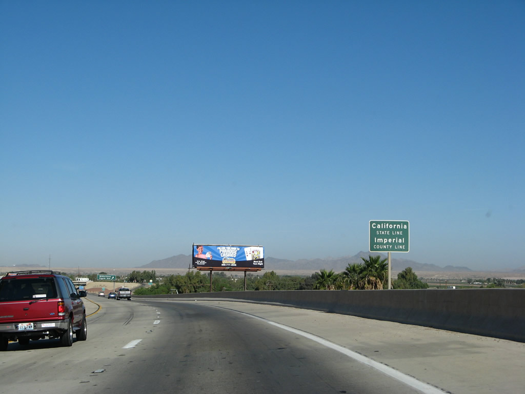
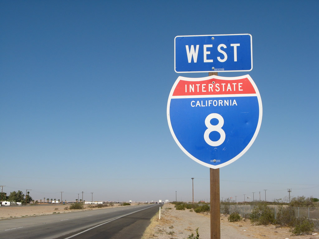
Interstate 8 west leaves the Grand Canyon State of Arizona and enters the Golden State of California. The most populous state in the United States, California is home to 33,871,648 people as of the 2000 Census and is home to some of the largest cities in the country, including Los Angeles, which is the second largest after New York City. Interstate 8 itself ends in the second most populated city in California, which is San Diego. Photo taken 03/19/07. |
|
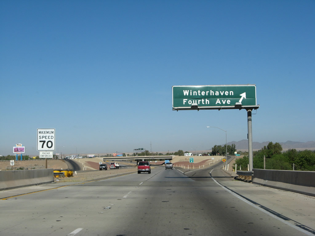
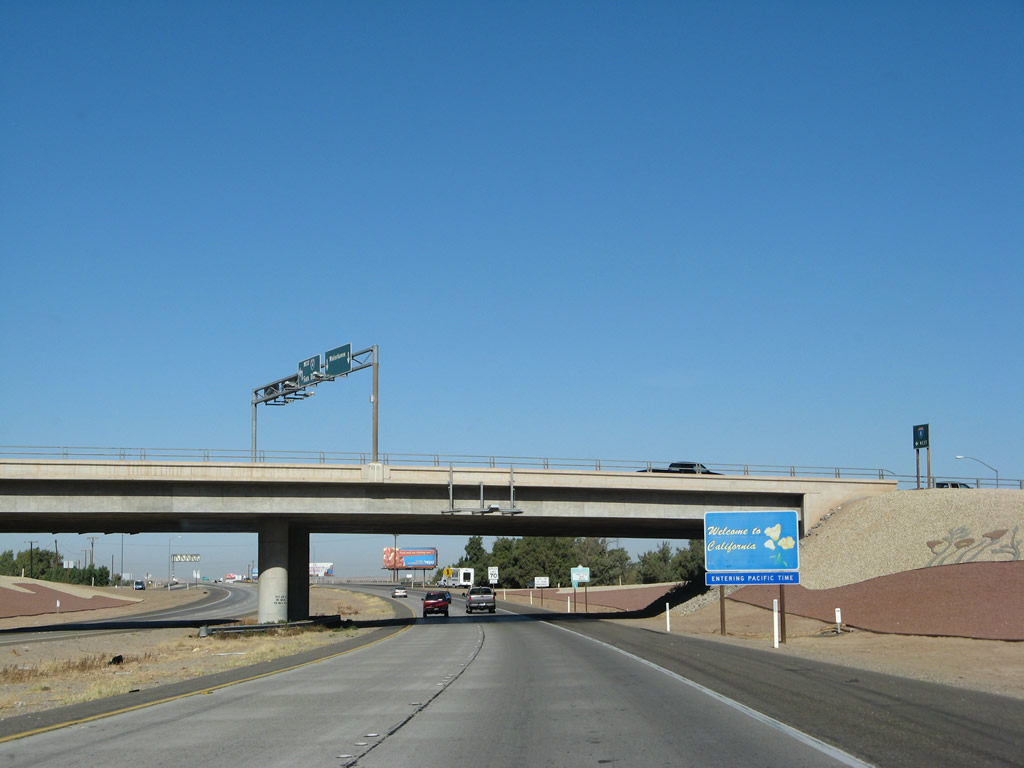
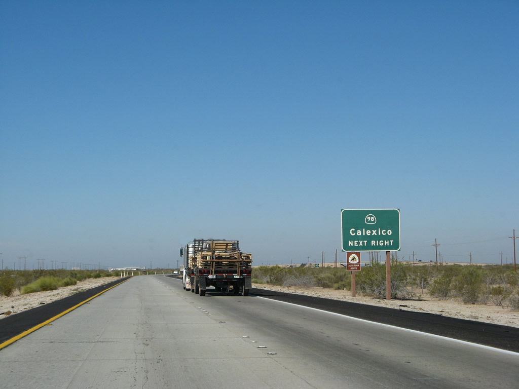
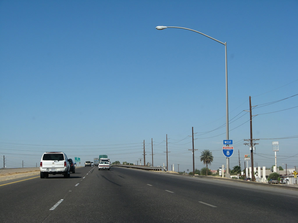
The first exit along westbound Interstate 8 in California is Exit 172, right after the Colorado River Bridge. Exit 172 is the junction with Business Loop I-8/Fourth Avenue in Winterhaven. This is the primary route into the town of Winterhaven, and it also travels back across the Colorado River into Yuma, Arizona via the second alignment of Old U.S. 80. The immediate area of the Colorado River Valley is fertile and agricultural, but the surrounding hills are arid and not irrigated for farming. Photo taken 03/19/07. |
|
The "Welcome to California" sign featuring the state flower (California Poppy) is found under the Fourth Avenue (Business Loop I-8) overpass. Upon entering California, Interstate 8 leaves the Mountain Time Zone and enters the Pacific Time Zone. Arizona stays on Mountain Standard Time the full year. This means that Arizona shares the same time with California during the spring and summer each year when California shifts to Daytime Savings Time. Photo taken 03/19/07. |
|
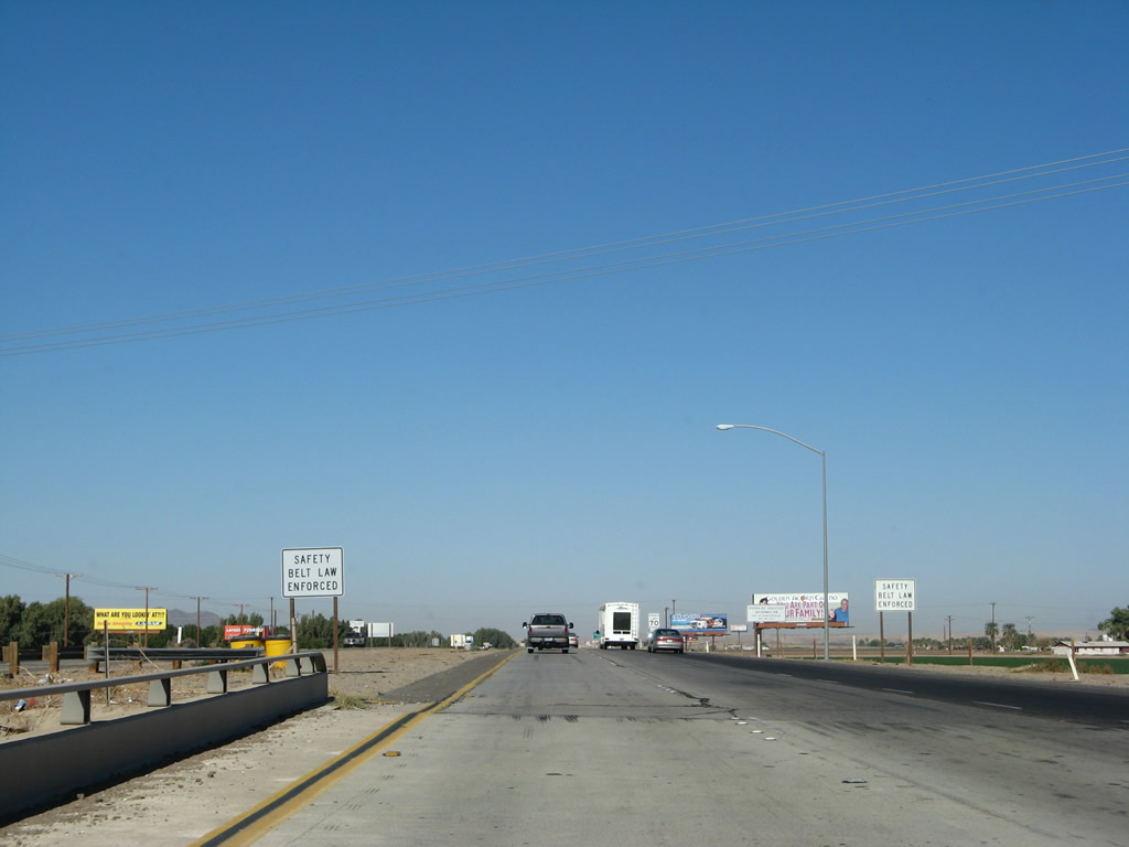
After Exit 172, a series of regulatory signs appear, starting with the state law requiring the use of seat belts. Another sign a bit further up the road advises that trucks and cars with trailers must remain in the right lane except to pass (in accordance with California Vehicle Code). Photo taken 03/19/07. |
|
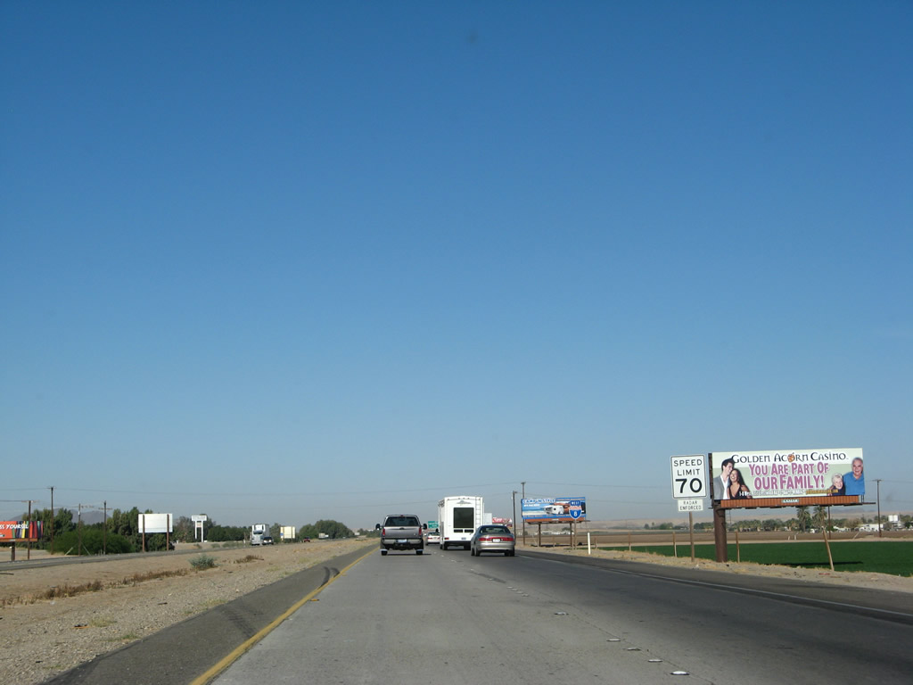
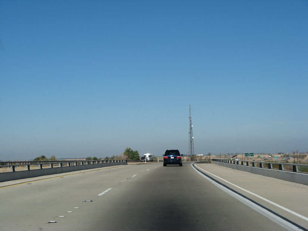
Through most of Imperial County (excluding Devils Canyon at the west end of the county near Desert View Tower), Interstate 8 features a 70 miles per hour speed limit. Between the Colorado River Bridge and Exit 166 (California 186), the Interstate 8 freeway was constructed in 1973. Photo taken 03/19/07. |
|
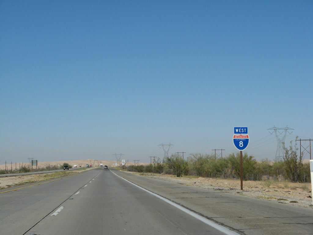
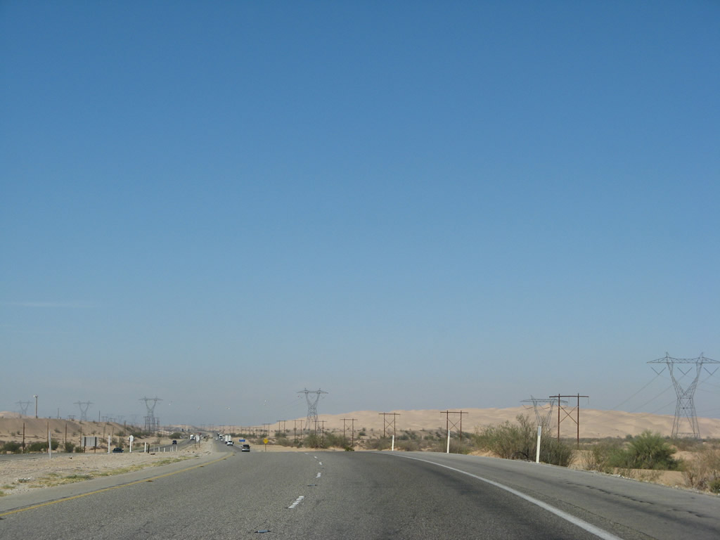
Interstate 8 is well-signed through California, and it is almost always signed with a state name shield such as this triangular-shaped shield west of Exit 172. It is also well-signed with state-named shields in Arizona, which makes Interstate 8 into a route that is almost totally signed with state-named shields. Photo taken 03/19/07. |
|
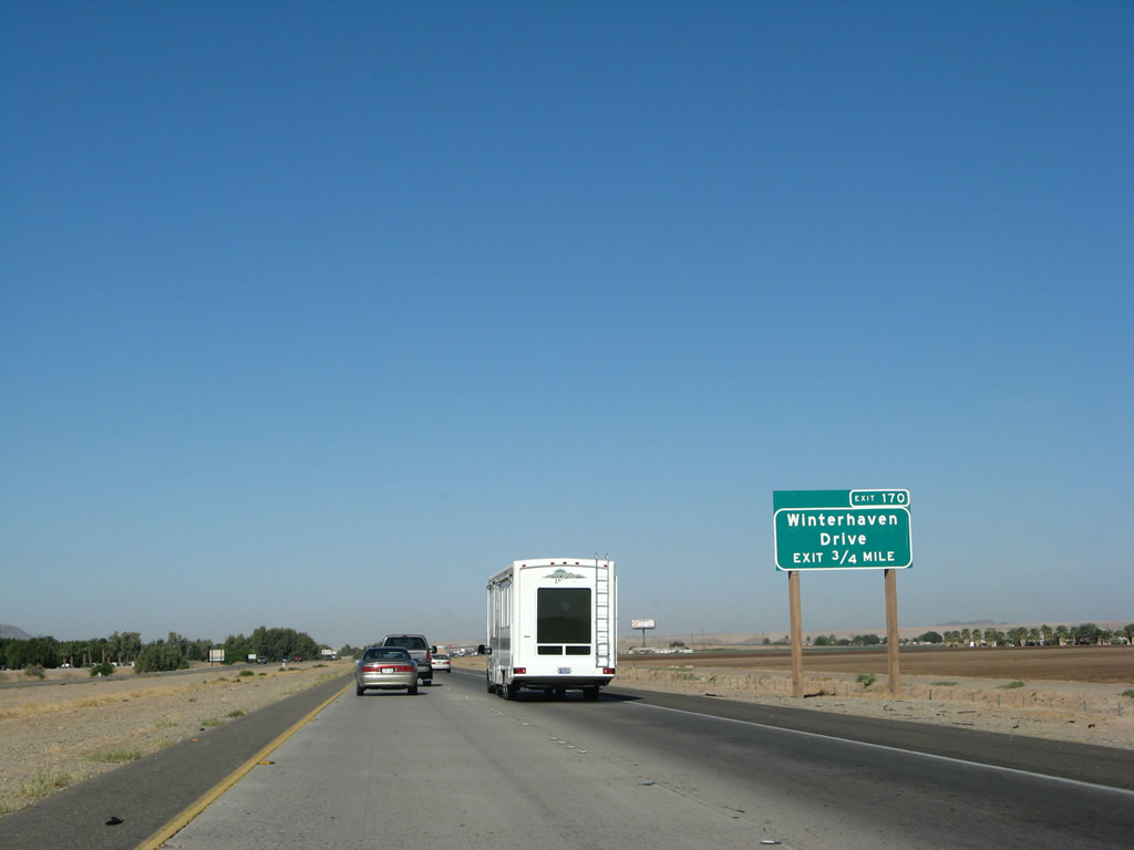
The next exit along westbound Interstate 8 is Exit 170, Business Loop I-8 east and Imperial County S-24 north, Winterhaven Drive. The exit is three-quarters of a mile west of here. Most of the reflective, exit number signs were posted by Caltrans in 2002 and 2003, and nearly every exit in Imperial County on Interstate 8 has at least one advance sign with the exit number for each exit as well as gore point exit number signs. This results in "minimal compliance" for exit numbering on for most exits on Interstate 8 in Imperial County. Photo taken 03/19/07. |
|
Exit 170 serves as the southern terminus of Imperial County S-24. The county route turns east from here, sharing alignment with Business Loop I-8/Winterhaven Drive into downtown Winterhaven, then turns north to serve the Fort Yuma-Quechan Indian Reservation. Imperial County S-24 uses Picacho Road, Ross Road, Colby Road, York Road, Merring Road, and Imperial Road as it passes through a rich agricultural region parallel to the Colorado River (watch for several 90-degree turns). After passing Laguna Dam, Imperial County S-24 crosses the Colorado River downstream of Imperial Dam, then ends upon crossing the California-Arizona state line. Continuing east as Laguna Dam Road into the U.S. Army Yuma Proving Ground, the highway ultimately ends at U.S. 95 north of Yuma. Taking County Route S-24 north to Laguna and Imperial Dams then east to U.S. 95 in Arizona is highly recommended, as the principal diversion of Colorado River water into the All-American Canal is located at Imperial Dam. The infrastructure is of an art deco construction, and dam and resulting reservoir are beautiful. Photo taken 03/19/07. |
|
Westbound Interstate 8 reaches Exit 170, Business Loop I-8 and Imperial County S-24, Winterhaven Drive. This is the western end of the Yuma-Winterhaven business loop that is shared by California and Arizona. The business route follows Old U.S. 80 through Winterhaven and ends at Interstate 8 Exit 9 east of Yuma, Arizona. To the west, Winterhaven Drive (Araz Road) continues along Old U.S. 80 all the way to Exit 166, California 186 (Algodones Road). Photo taken 03/19/07. |
|
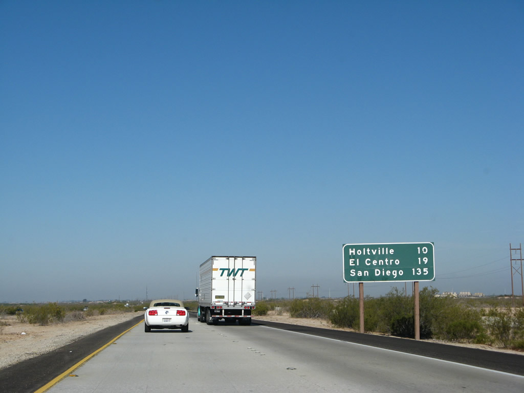
On the Business Loop I-8 overpass, this mileage sign provides the distance to Holtville (46 miles), El Centro (55 miles), and San Diego (171 miles). Photo taken 03/19/07. |
|
A 1972 specification Interstate 8 California shield is posted after Exit 170. While many of these 36-inch reassurance shields still remain (as well as the 24-inch version generally found on freeway entrance assemblies), the "triangular" shield shown above (after Exit 172) is becoming much more common on Interstate 8 and on other Interstates elsewhere in California. Photo taken 03/19/07. |
|
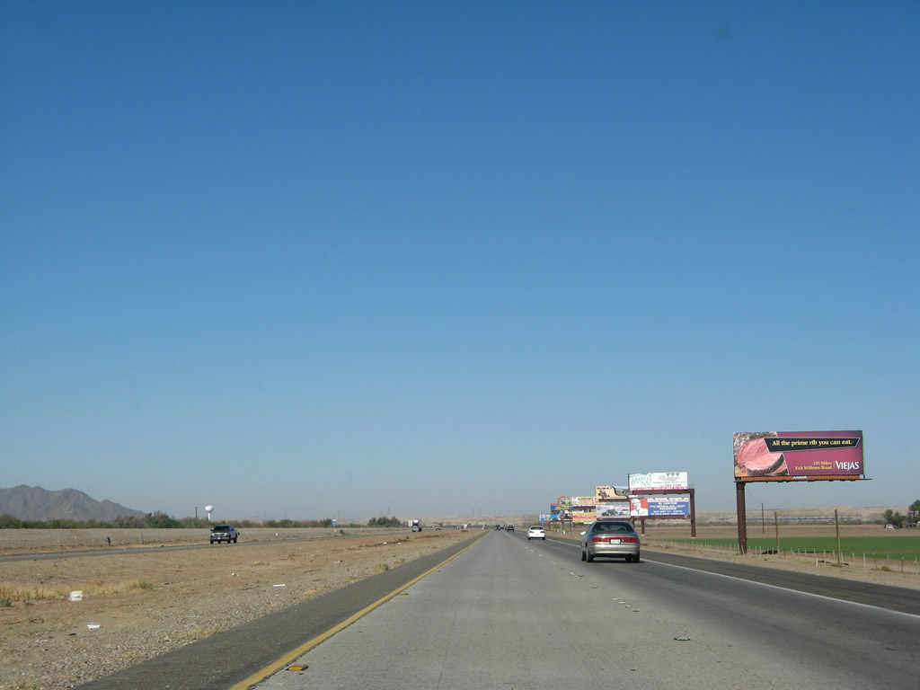
A ton of billboards lines Interstate 8 between Exits 172 and 166. Several of them advertise food and lodging in El Centro, and others advertise the various Indian casinos in San Diego County. For example, this one advertises the buffet at the Viejas Indian Reservation Casino, located at Exit 36, Willows Road. Photo taken 03/19/07. |
|
Between Exits 172 and 166, Interstate 8 closely parallels the Colorado River. After turning north from Yuma to serve Winterhaven, Interstate 8 then turns west to follow the river for about six miles. The vegetation to the south of the freeway is evidence of the river's presence. Photo taken 03/19/07. |
|
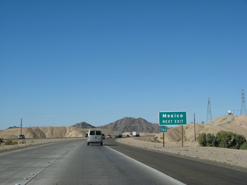
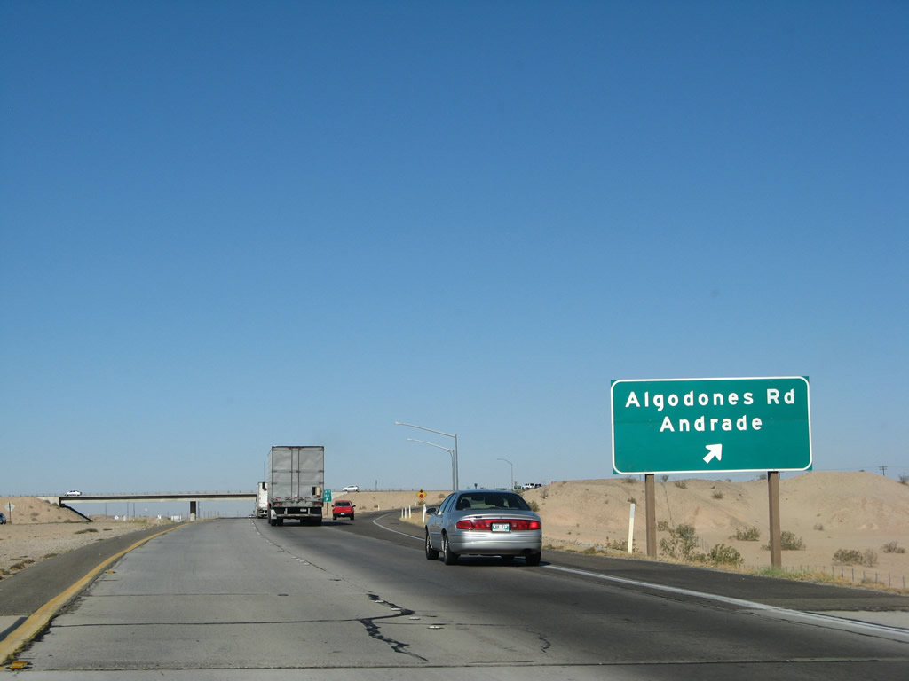
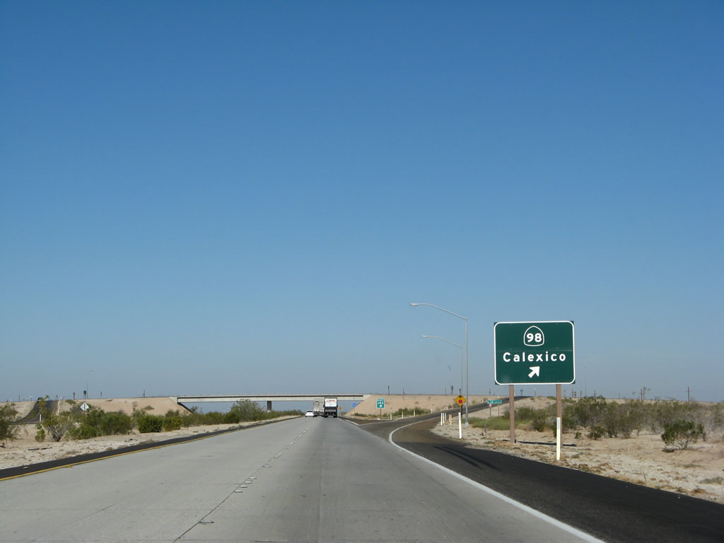
The next exit along westbound Interstate 8 is Exit 166, California 186 (Algodones Road). Originally, the state shield was omitted on this advance sign, but the new reflective signs now include the state shield. California 186 leads south from this interchange to Andrade and a border crossing into Mexico, which is open daily from 6:00 a.m. to 10:00 p.m. Photo taken 03/19/07. |
|
This overpass carries the All American Canal service road over Interstate 8; the freeway crosses over the canal shortly thereafter. The All American Canal begins its journey at Laguna Dam, carrying Colorado River water southwest to Andrade. The canal then turns west, following the United States-Mexico Border west before turning northwest briefly to meet Interstate 8 again at the Algodones Dunes. The water is conveyed to the fertile Imperial Valley, where it is used for farming and agriculture. Photo taken 03/19/07. |
|
Westbound Interstate 8 approaches Exit 166, California 186 (Algodones Road) south to Andrade and Mexico. This particular state shield was posted before the arrival of the reflective exit number signs, and it used to be the only California 186 shield posted in the line-up of guide signs for Exit 166. Pilot Knob Mesa, elevation 742 feet, comes into view behind the guide sign. Photo taken 03/19/07. |
|
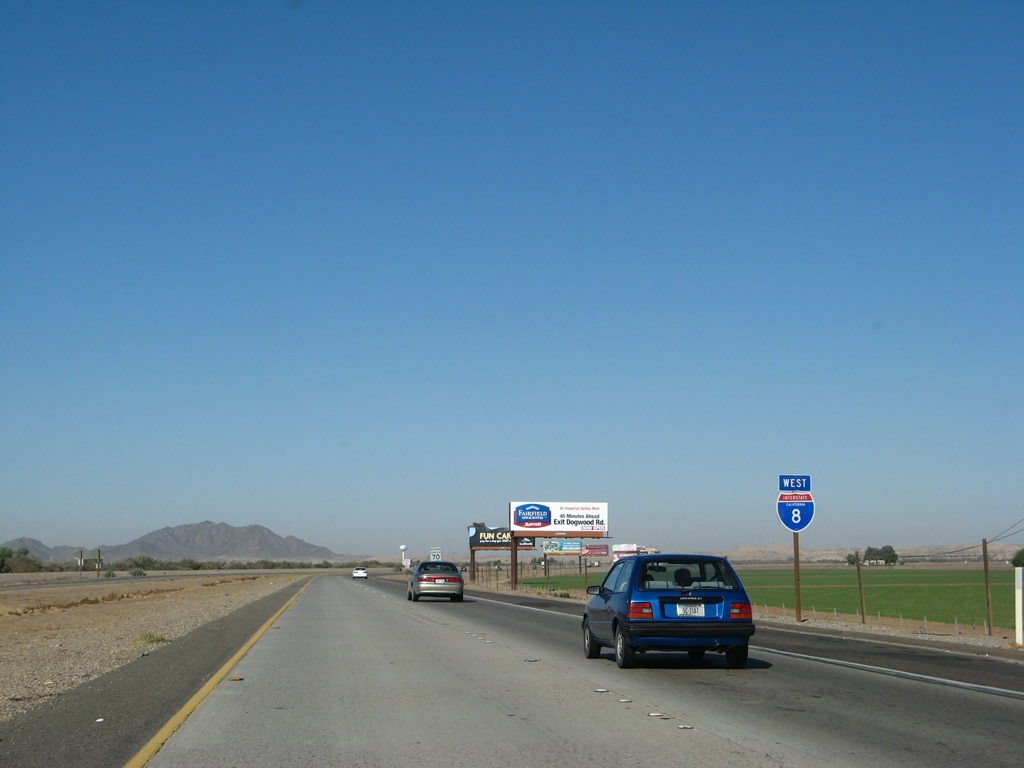
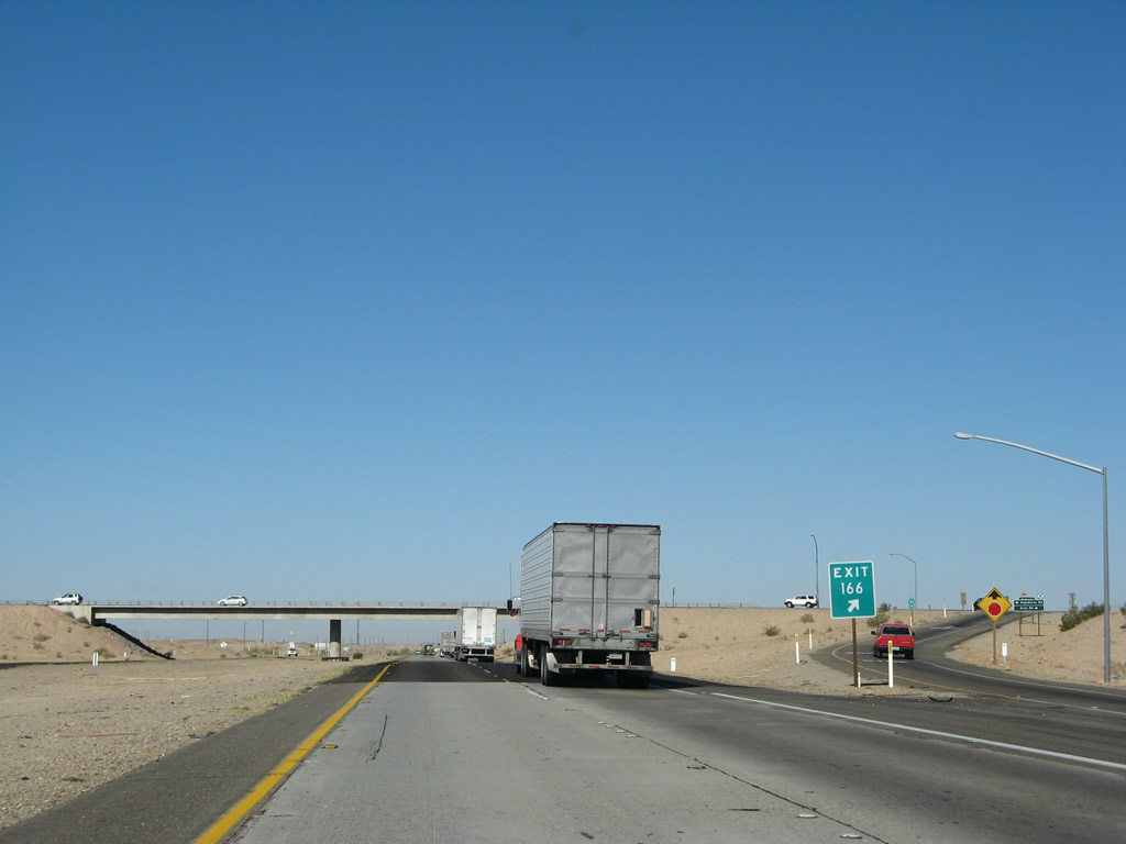
Reaching the off-ramp for Exit 166, California 186 (Algodones Road), this is the first connection into Mexico from the United States since leaving Arizona. This border crossing is the first of five that connect California with the state of Baja California Norte in Mexico. The next four border crossings are: California 7 (Calexico East/Garita Numero Dos), California 111 (Calexico/Mexicali), California 905 (Otay Mesa), and Interstate 5 (San Ysidro). A future border crossing is proposed via California 11 at Otay Mesa East in San Diego, and some have discussed the possibility of building another border crossing somewhere near Jacumba in eastern San Diego County, but that would be far off in the future. Photo taken 03/19/07. |
|
Ascending to the exit ramp, Interstate 8 crests over a high point separating Winterhaven from Felicity. While Winterhaven is at elevation 130 feet, Interstate 8 will descend below sea level upon entering the Imperial Valley on the west side of the Algodones (Imperial) Sand Dunes. Photo taken 03/19/07. |
|
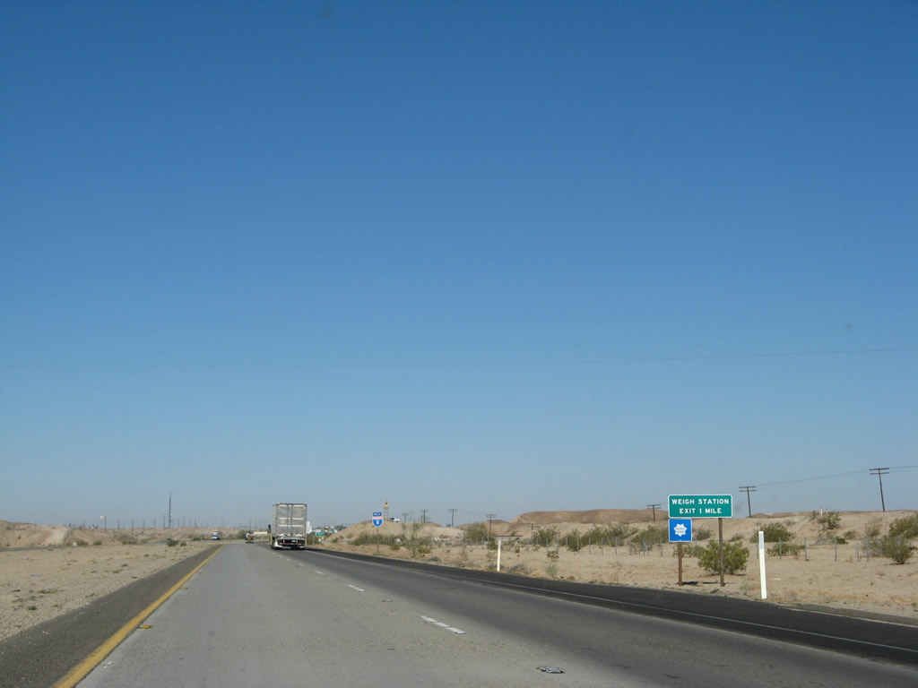
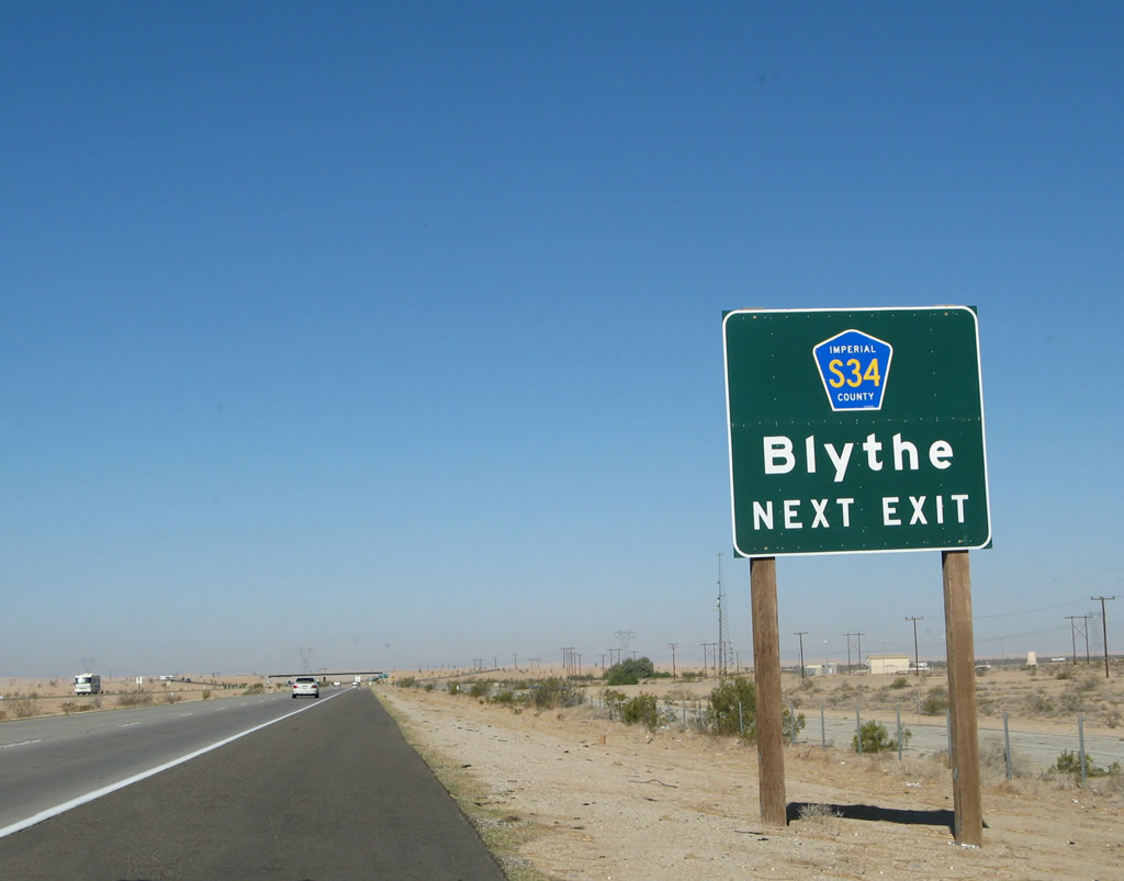
The next exit along westbound Interstate 8 is the weigh station and inspection station. All traffic (trucks and passenger vehicles) must stop. The section of Interstate 8 between Exit 166, California 186 and Exit 159, Imperial County S-34 was built in 1970. Photo taken 03/19/07. |
|
The weigh station also serves as the California Agricultural Inspection Station. All traffic will stop at the inspection station; then trucks and other commercial vehicles exit into the weigh station. Photo taken 03/19/07. |
|
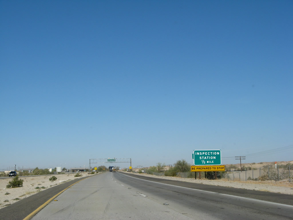
This overhead sign warns traffic to prepare to stop at the inspection station. The gray roof of the inspection station is visible in the distance. Located on every major entrance into California, these inspection stations are designed to prevent the accidental importation of pests, fruits, and vegetables that might damage California's farming industry. Motorists carrying backyard-grown fruit should be prepared to either eat the fruit or give it to the inspectors at the station. Photo taken 03/19/07. |
|
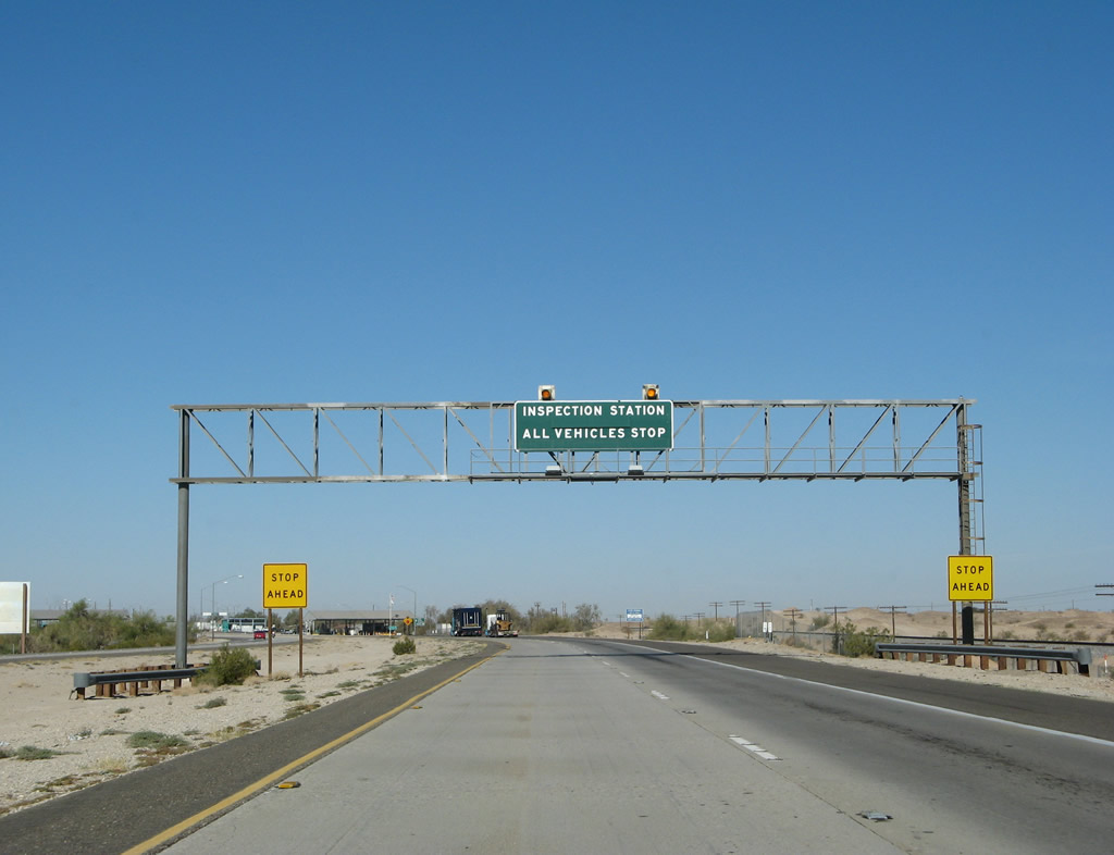
Westbound Interstate 8 approaches the California Agricultural Inspection Station. As seen in this photo, the freeway used to continue straight ahead here, but now all traffic is diverted into the inspection station. It is possible that this bypass might be used when the station is closed, but generally the inspections are required. A sister facility is located on the south side of the freeway to service eastbound traffic, but the State of Arizona abandoned it and does not use this facility anymore. Photo taken 03/19/07. |
|
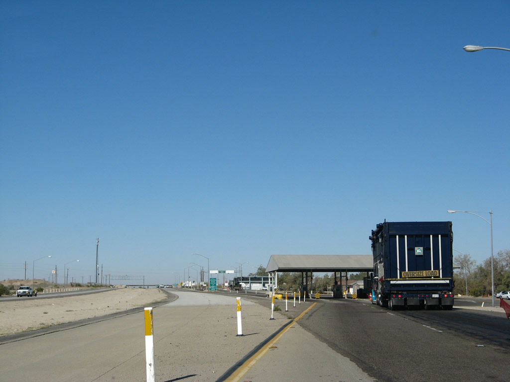
After leaving the inspection station, all commercial traffic must exit into the Weigh Station. The next exit along westbound Interstate 8 is Sidewinder Road (Exit 164). Photo taken 03/19/07. |
|
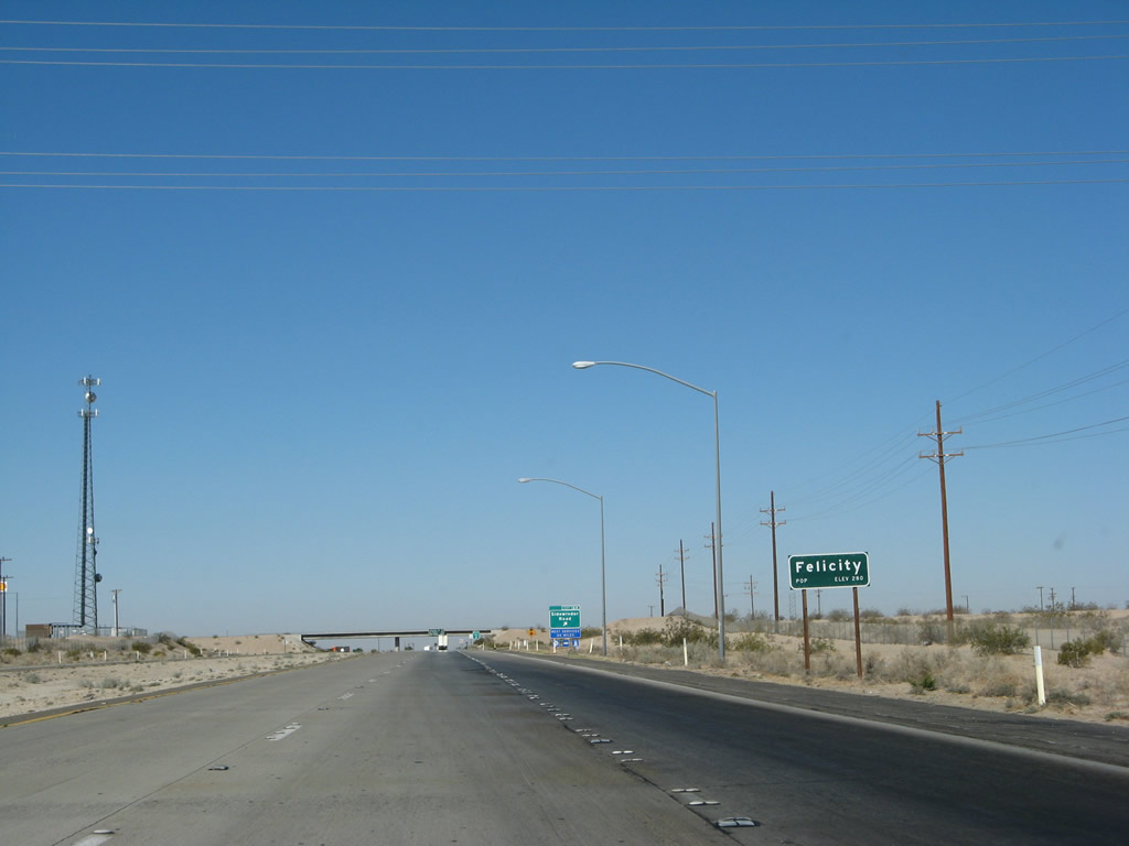
Interstate 8 enters the town of Felicity, the "Official Center of the World." Exit 164 connects Interstate 8 with to Felicity, a town that has a gas/service station on the south side of the freeway and the "Official Center of the World" tourist attraction on the north side of the freeway. A California Highway Patrol Station is also located on the north side frontage road. Note the elevation of 280 feet, which is higher than Winterhaven. Photo taken 03/19/07. |
|
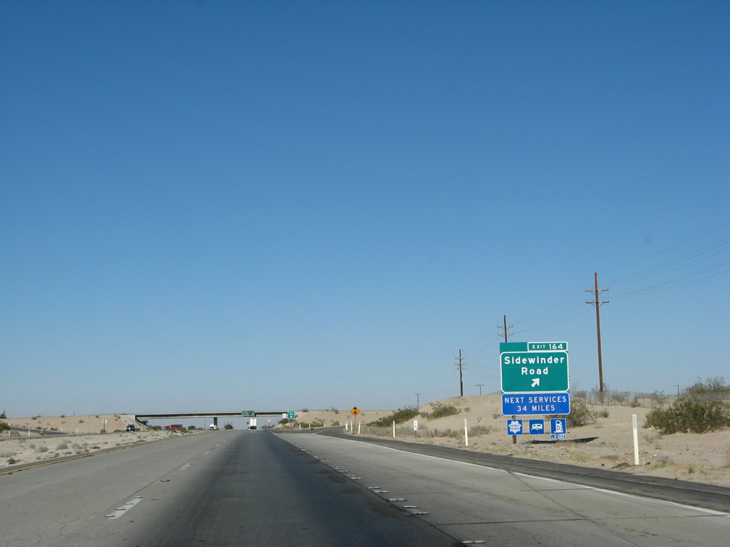
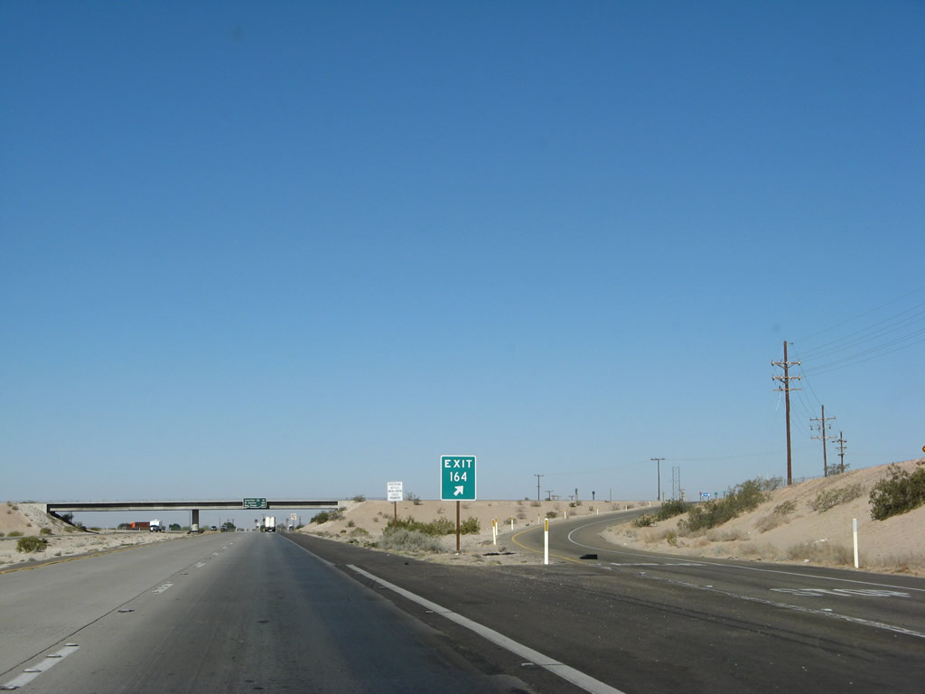
Westbound Interstate 8 reaches Exit 164, Sidewinder Road. The next exit that leads to services on westbound Interstate 8 is 34 miles distant, in the city of Holtville via California 115 at Exit 131. Even then, there are no roadside services; motorists must drive northwest on California 115 (and Old U.S. 80) six miles off the freeway into Holtville. Photo taken 03/19/07. |
|
Sidewinder Road travels north from Felicity to Sidewinder Pass, then becomes a dirt road before entering the Cargo Muchacho Mountains to the north. Photo taken 03/19/07. |
|
This porcelain enamel, button copy mileage sign is located on Interstate 8 west at the Sidewinder Road overpass. It provides the distance to California 98, El Centro, and San Diego. The next services are a good distance ahead on Interstate 8, with the next community of consequence at Holtville via California 115. There are no services at the junction with California 98. Photo taken 03/19/07. |
|
An Interstate 8 shield featuring 1972 specifications is posted after the on-ramp from Sidewinder Road. Photo taken 03/19/07. |
|
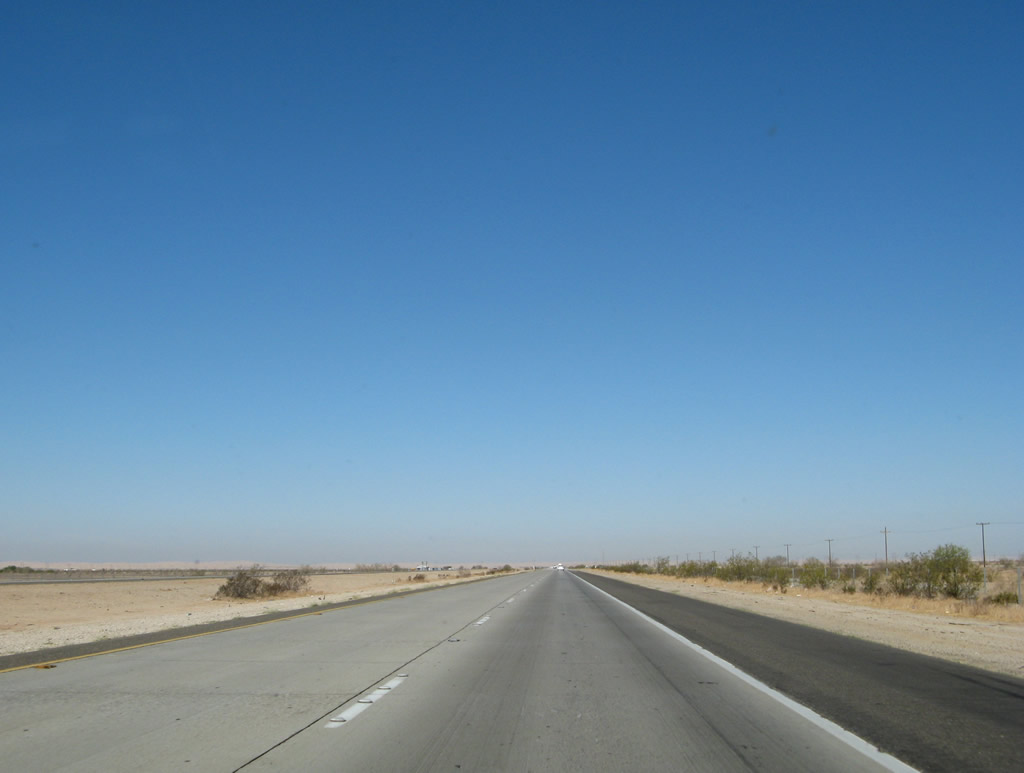
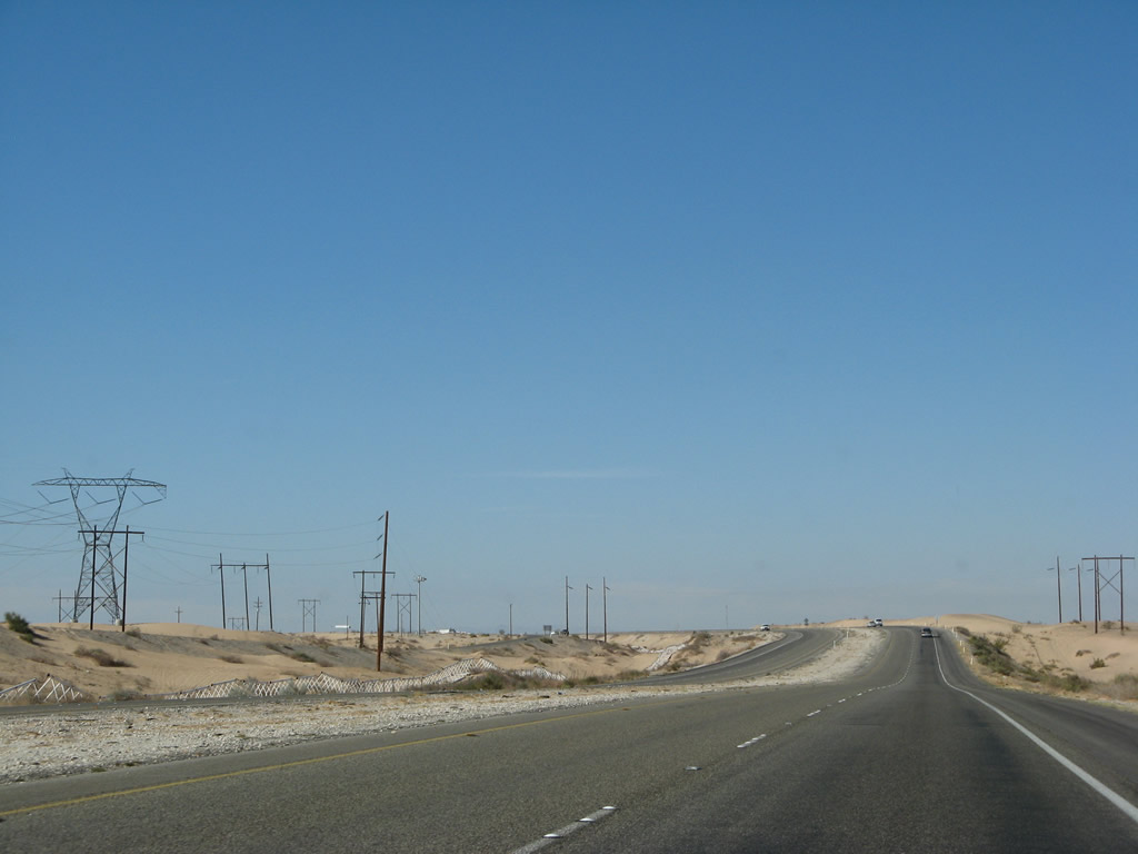
Interstate 8 passes through the Colorado Desert between the Colorado River and the Laguna Mountains, north to Joshua Tree National Park and south into Baja California. The Colorado Desert is part of the larger Sonoran Desert, which extends east into Arizona. Geographical features within the Colorado Desert include the Salton Sea, the Algodones Dunes, the southern reaches of the San Andreas Fault, Anza-Borrego Desert State Park, and the sprawling metropolis of Mexicali in Baja California, Mexico. This stretch of Interstate 8 shows the desert at its rawest, with sagebrush and sand on both sides of the freeway. Photo taken 03/19/07. |
|
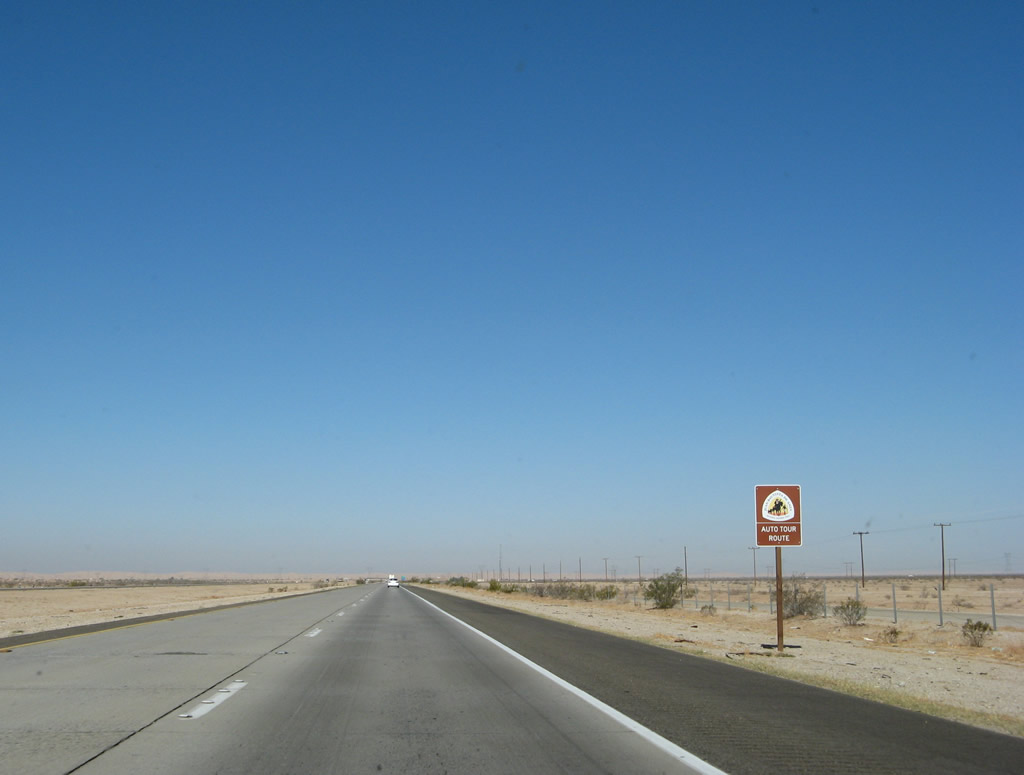
Traveling through Arizona and California, the Juan Bautista de Anza National Historic Trail follows Interstate 8 through eastern Imperial County. The route begins in Nogales, Arizona, and takes the path Juan Bautista de Anza took in 1775-1776 with 300 followers for 1200 miles all the way to San Francisco in "Alta" California. While the trail does not follow modern highways precisely, an auto route makes an approximation of the route. Starting in Nogales, the route generally follows Interstate 19 north, Interstate 10 west, Interstate 8 west, California 86 north, California 78 west, San Diego County S-3 to Borrego Springs, San Diego County S-22 west, California 79 north, California 371 east, California 74 west, Interstate 215 north, California 60 west, Interstate 15 north, Interstate 10 west, Interstate 5 north, California 134 west, and (generally) U.S. 101 north. This sign advises of the continuation of the auto tour of this national historic trail. Photo taken 03/19/07. |
|
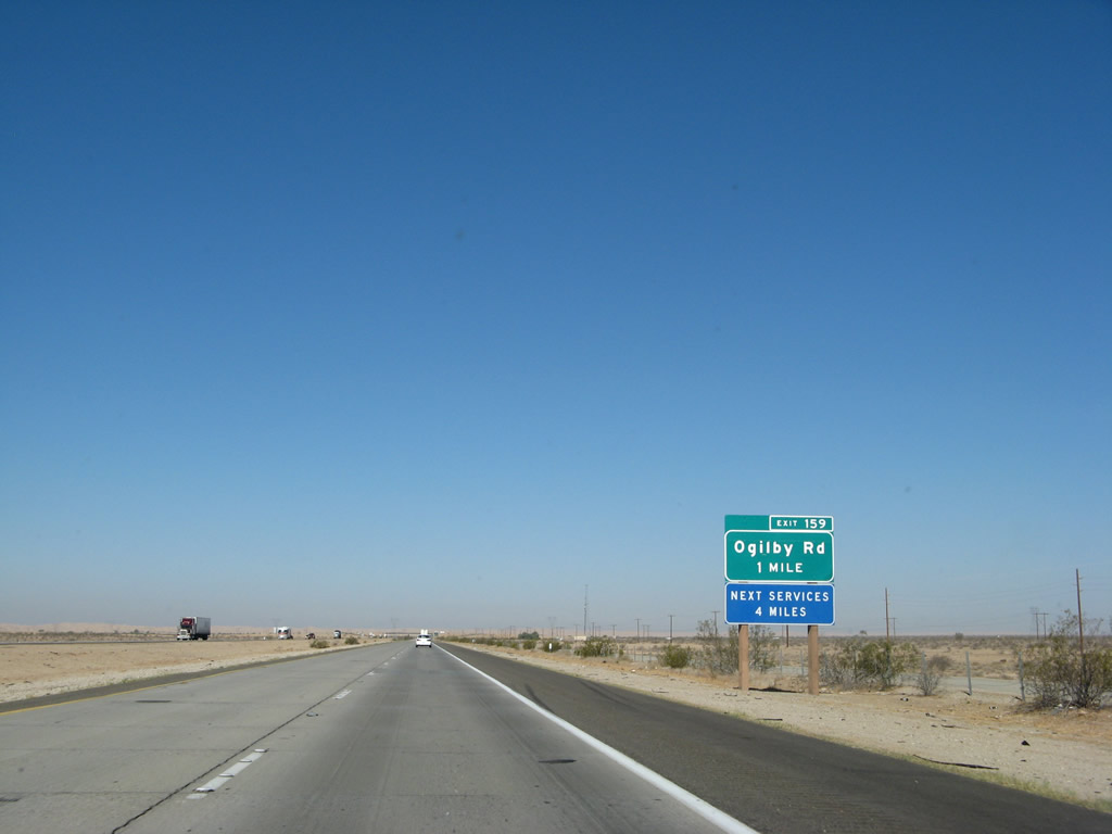
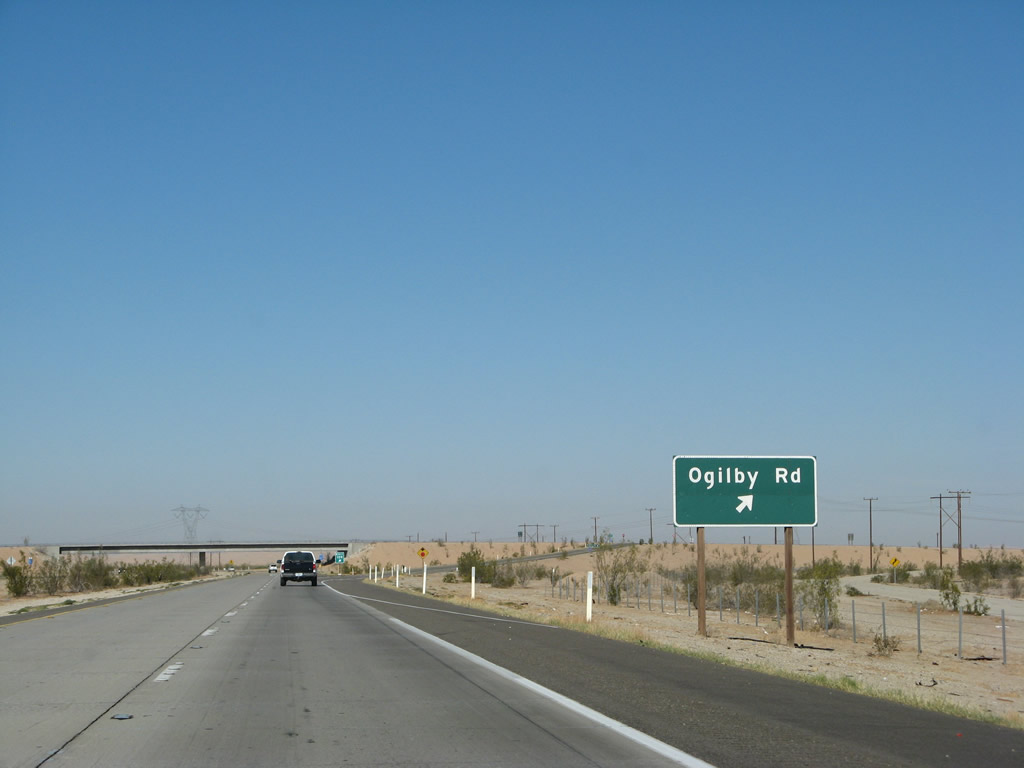
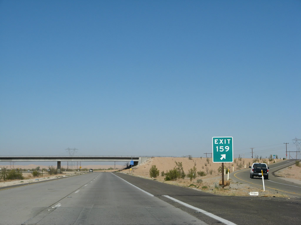
The next exit along westbound Interstate 8 is Exit 159, Imperial County S-34 (Ogilby Road). There are no services at this exit. Photo taken 03/19/07. |
|
Imperial County S-34 (Ogilby Road) leads from Interstate 8 (at Exit 159) north to California 78 east of Glamis and the Algodones (Imperial) Sand Dunes. The county highway is the first paved north-south through highway in California that connects to Interstate 10 to the north via the connection with California 78 east. (Imperial County S-24 (Picacho Road) also provides a through connection, but it crosses into Arizona to make the connection to Interstate 10 via U.S. 95 at Quartzsite.) Photo taken 03/19/07. |
|
Westbound Interstate 8 reaches Exit 159, northbound Imperial County S-34 (Ogilby Road). There are no settlements along County Route S-34 between Interstate 8 and California 78 except for the site of Ogilby at the railroad crossing. Photo taken 03/19/07. |
|
This picture shows the off-ramp from westbound Interstate 8 to Ogilby Road (Imperial County S-34). The gore point signage uses FHWA Highway Gothic Font Series E, which is not common for gore point signs in California. The section of Interstate 8 between Exit 159, Ogilby Road and Exit 143, California 98 was built in 1969. However, there are some exceptions at the two crossings over the All American Canal on either side of the dunes. Photo taken 03/19/07. |
|
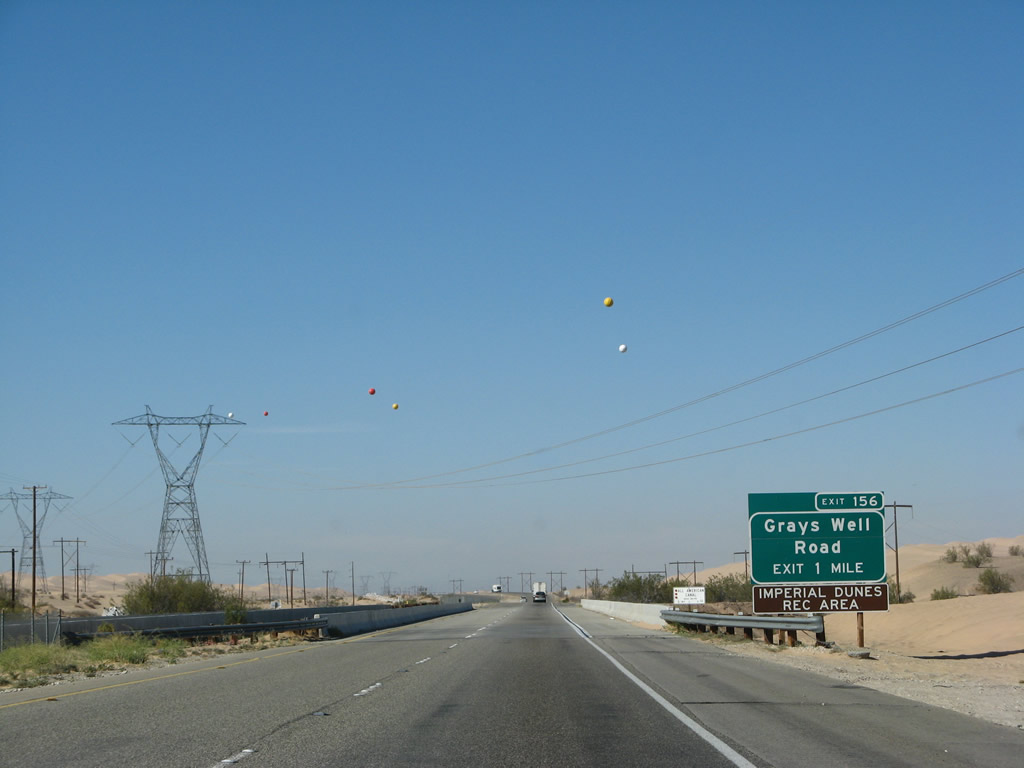
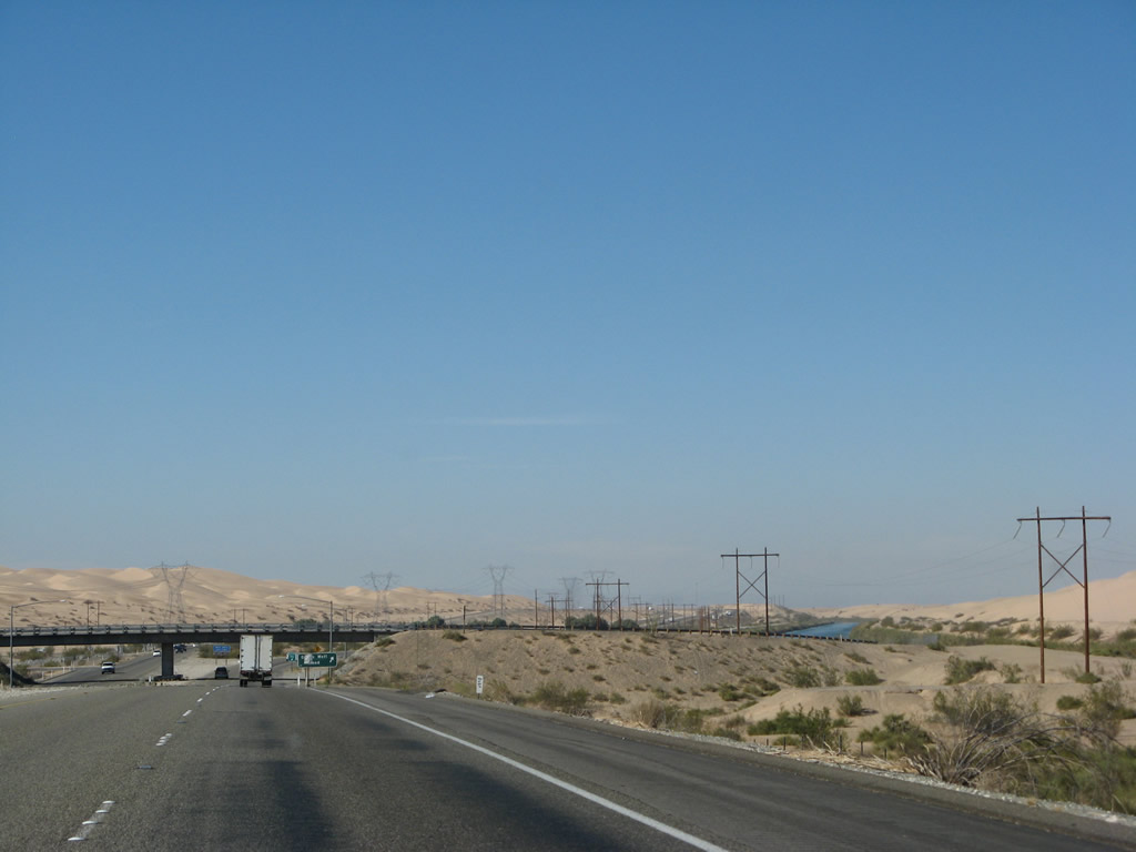
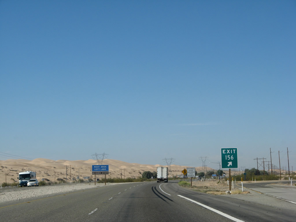
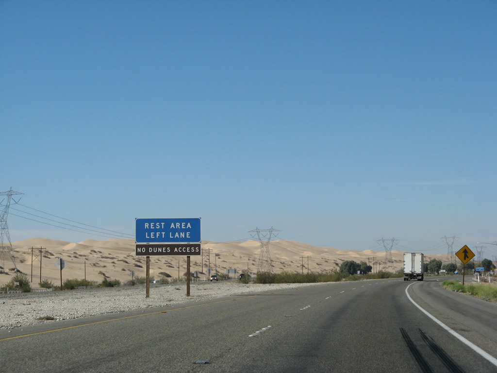
Shortly after the Ogilby Road (Imperial County S-34) interchange, this warning advises of the sand dunes. Interstate 8 is one of the few highways to traverse sand dunes, and it will do so over the next six miles. During times of high winds, watch for blowing or drifting sand across the freeway. People looking to recreate at the sand dunes should plan to use Exit 156, Grays Well Road. Photo taken 03/19/07. |
|
The Algodones (Imperial) Sand Dunes come into view in the distance beyond the Interstate 8 reassurance shield. The dunes follow a track from southeast to northwest, generally following the trajectory of the Chocolate Mountains. The dunes originate in Baja California Norte, then travel northwest before phasing out around Mammoth Wash east of Calipatria for a distance of about 45 miles. The dunes average about six miles in width. There is no known reason exactly why the dunes formed here, but opinions seem to point to the shoreline of ancient Lake Cahuilla or the various paths taken by the Colorado River through this region. Photo taken 03/19/07. |
|
Now entering the sand dunes, Interstate 8 shifts from concrete to asphalt. This is partially due to the unstable surface below the freeway. Power lines converge with the freeway here from the northeast, and the All American Canal comes in from the southeast. Photo taken 03/19/07. |
|
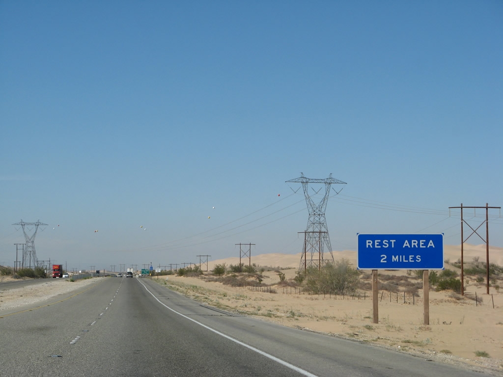
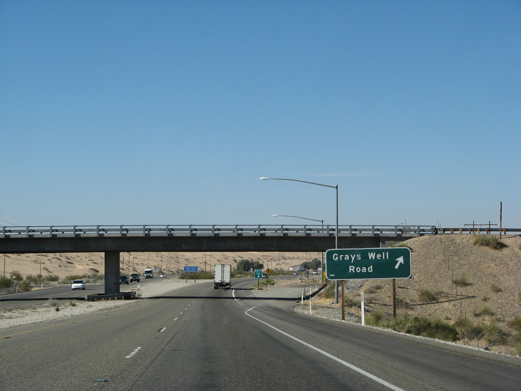
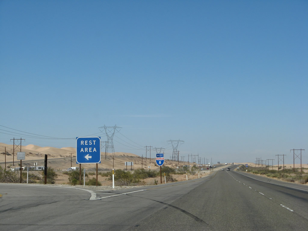
The next two exits are Exit 156, Grays Well Road, followed by a left exit to a Rest Area located in the median of Interstate 8. Photo taken 03/19/07. |
|
The All American Canal passes under Interstate 8 about one mile east of Exit 156, Grays Well Road. The canal will parallel Interstate 8 for the next several miles through the dunes, then turn southwest toward Calexico and the various farming interests of the Imperial Valley. The Imperial Sand Dunes are visible in the distance, and all the major east-west infrastructure consolidates into this narrow corridor (natural gas pipeline, Interstate highway, interstate transmission power lines, local power lines, and the All-American Canal). The westbound bridge (continuous steel girder) was built in 1938 and expanded in 1990, while the eastbound bridge (steel girder) was built in 1961. Photo taken 03/19/07. |
|
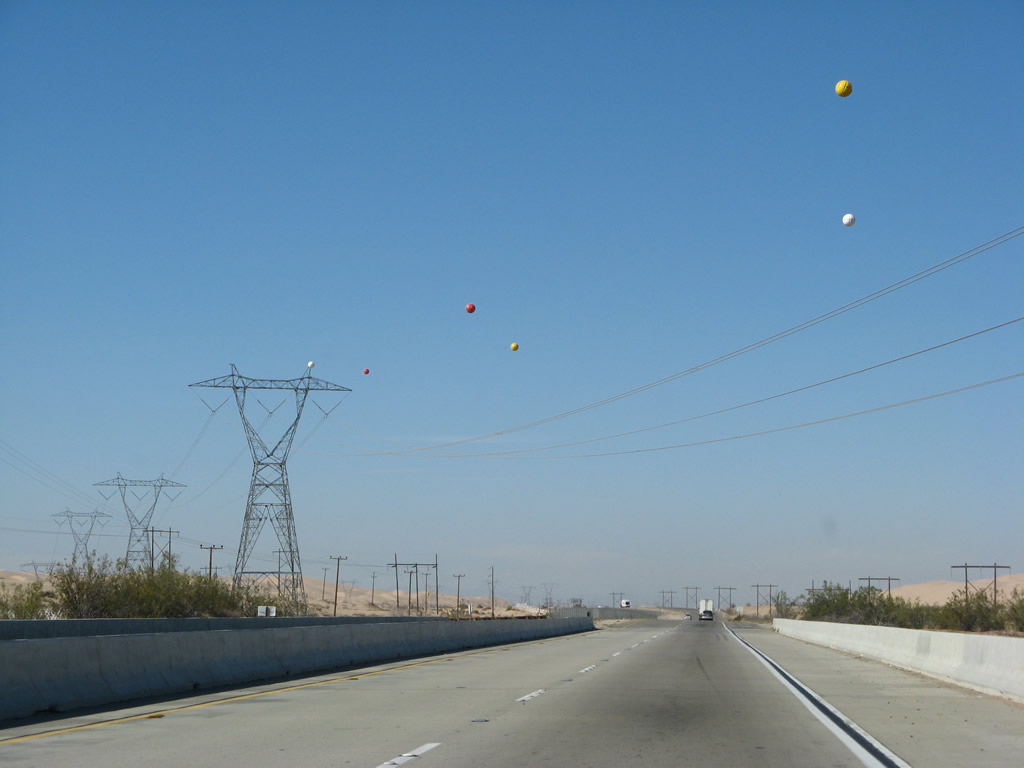
Another major piece of infrastructure connects with Interstate 8 at the Algodones Dunes (this pass through the dunes is known as Buttercup Valley): the Southwest Powerlink. This 500kV power line originates at the Palo Verde Nuclear Generating Station in Arizona southwest of Phoenix, and brings power from throughout the Southwest and channels it west to the Imperial Valley and San Diego. The Southwest Powerlink ends at the San Miguel Substation in Bonita southeast of San Diego. Between here and there, the Southwest Powerlink comes into view on Interstate 8 several more times. Photo taken 03/19/07. |
|
In this view, the All American Canal can be seen parallel to Interstate 8 as the freeway passes through Buttercup Valley. Photo taken 03/19/07. |
|
Westbound Interstate 8 reaches Exit 156, Grays Well Road. This exit connects to the Imperial Sand Dunes recreation area, popular with off-road vehicle enthusiasts. There is access to Old U.S. 80 here, as the old road acts as a local access to the dune recreation areas. However, the old road is not contiguous with other sections on either side of the sand dunes; the All American Canal cuts off access to the old road on both sides, because the original bridges over the canal are now used by Interstate 8. As a result, one must use Interstate 8 to depart the dunes area. Photo taken 03/19/07. |
|
The ramp to Grays Well Road is a loop ramp. Speaking of Old U.S. 80, the Old Plank Road remnants are located here. Follow Grays Well Road to the south side of the freeway, then travel along the frontage road to the last parking area before the road ends. Looking for a plaque and the remnants on a west-facing sand dune. Photo taken 03/19/07. |
|
Immediately after the Grays Well Road interchange, westbound Interstate 8 approaches the left exit for a Rest Area at Milepost 155. The freeway passes through the Imperial Sand Dunes through this narrow corridor, with the All American Canal located to the north of the freeway. Photo taken 03/19/07. |
|
Westbound Interstate 8 reaches Exit 155, Rest Area. This left exit is a bit antiquated and can be dangerous, especially when trucks merge back onto the freeway from the left. Photo taken 03/19/07. |
|
The left exit is very sharp. Merging traffic enter from an on-ramp first, and exiting traffic exits ahead. At this rest area is a small monument placed by the Daughters of the Confederacy for the Jefferson Davis Highway, which is a nationally designated highway that generally follows Interstate 8 (and U.S. 80 beforehand) through California to San Diego. Photo taken 03/19/07. |
|
This is the final chance for the rest area exit; a left-hand reassurance shield is posted shortly thereafter. Interstate 8 continues west through the dunes and Buttercup Valley. Photo taken 03/19/07. |
|
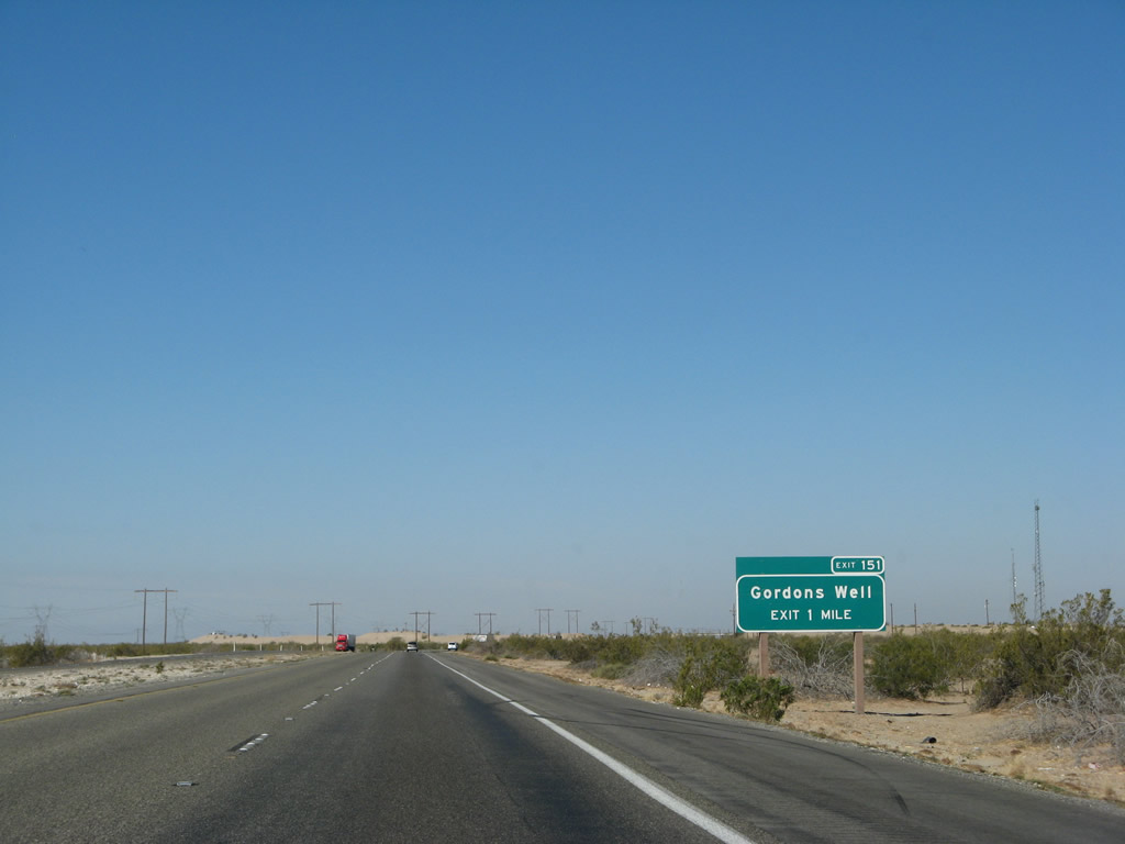
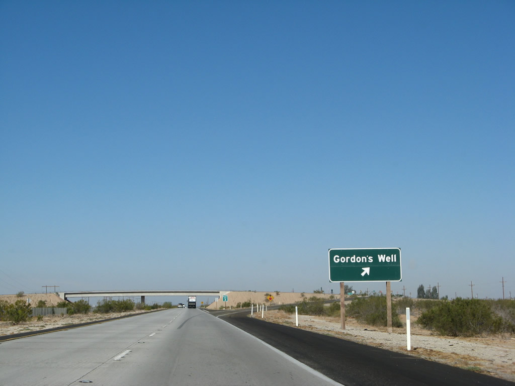
The next exit on Interstate 8 west is Exit 151, Old U.S. 80/Evan Hewes Highway to Gordon's Well. At this point, Interstate 8 comes its closest to Mexico, which is less than a mile south of the freeway for about a mile preceding the off-ramp for Exit 151. Photo taken 03/19/07. |
|
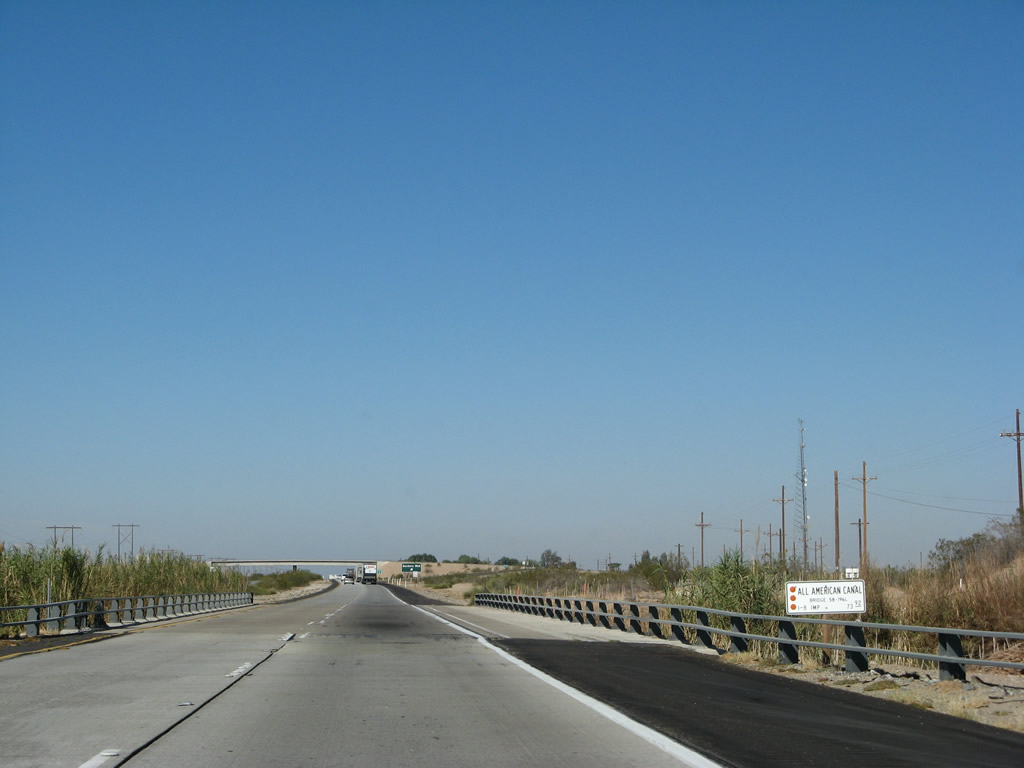
The All American Canal again crosses Interstate 8. The older bridge is again on the westbound side (having been built in 1938 and widened in 1969). The eastbound bridge over the canal was built in 1969 when the freeway was completed through here. Photo taken 03/19/07. |
|
Westbound Interstate 8 crosses over the All American Canal on the 1938 bridge. Tall reeds betray water in an otherwise arid landscape. The standard Caltrans bridge sign identifies this bridge as 58-196L. This number indicates the county number (58 is for Imperial) and the "L" identifies the westbound lanes in this case. Photo taken 03/19/07. |
|
Westbound Interstate 8 reaches Exit 151, Old U.S. 80/Evan Hewes Highway to Gordon's Well. U.S. 80 resumes as an extant section of highway parallel to the newer freeway along the north side of Interstate 8. There is no connection from this exit back to the dunes area since the bridges once used by old U.S. 80 over the All American Canal are instead used by modern Interstate 8. This extant section of Old U.S. 80 is continuous from Exit 151 until Exit 131 (California 115). Photo taken 03/19/07. |
|
After the Gordon's Well interchange (Exit 151), this reassurance shield is posted on Interstate 8 west. This is an example of a "triangular" shield, with has more angular features (compared to the 1972 specification shield shown after Exit 164, Sidewinder Road, above). Shields like this started to appear in California around 1999 and are increasingly more common. Photo taken 03/19/07. |
|
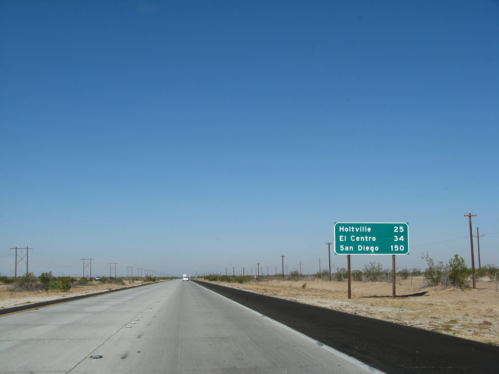
This mileage sign provides the distance to Holtville (25 miles via California 115/Old U.S. 80), El Centro (34 miles), and San Diego (150 miles, measured to downtown via California 163). Photo taken 03/19/07. |
|
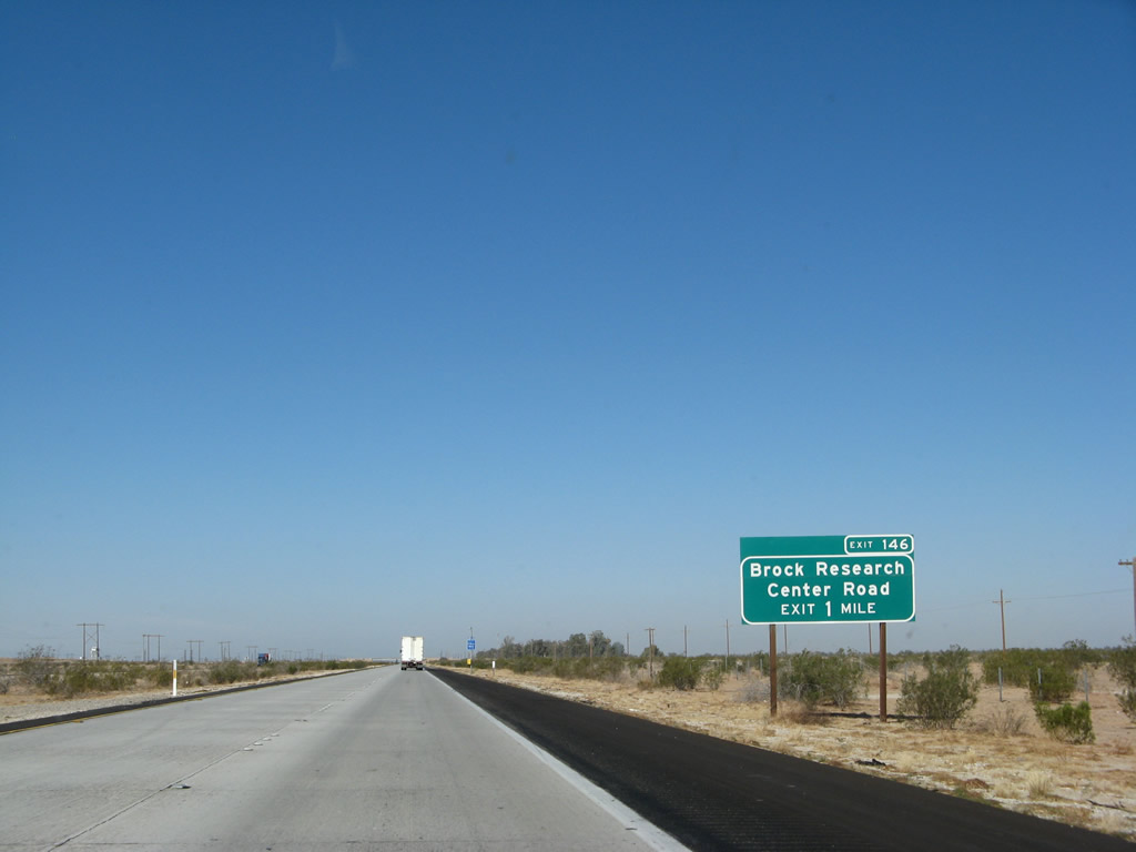
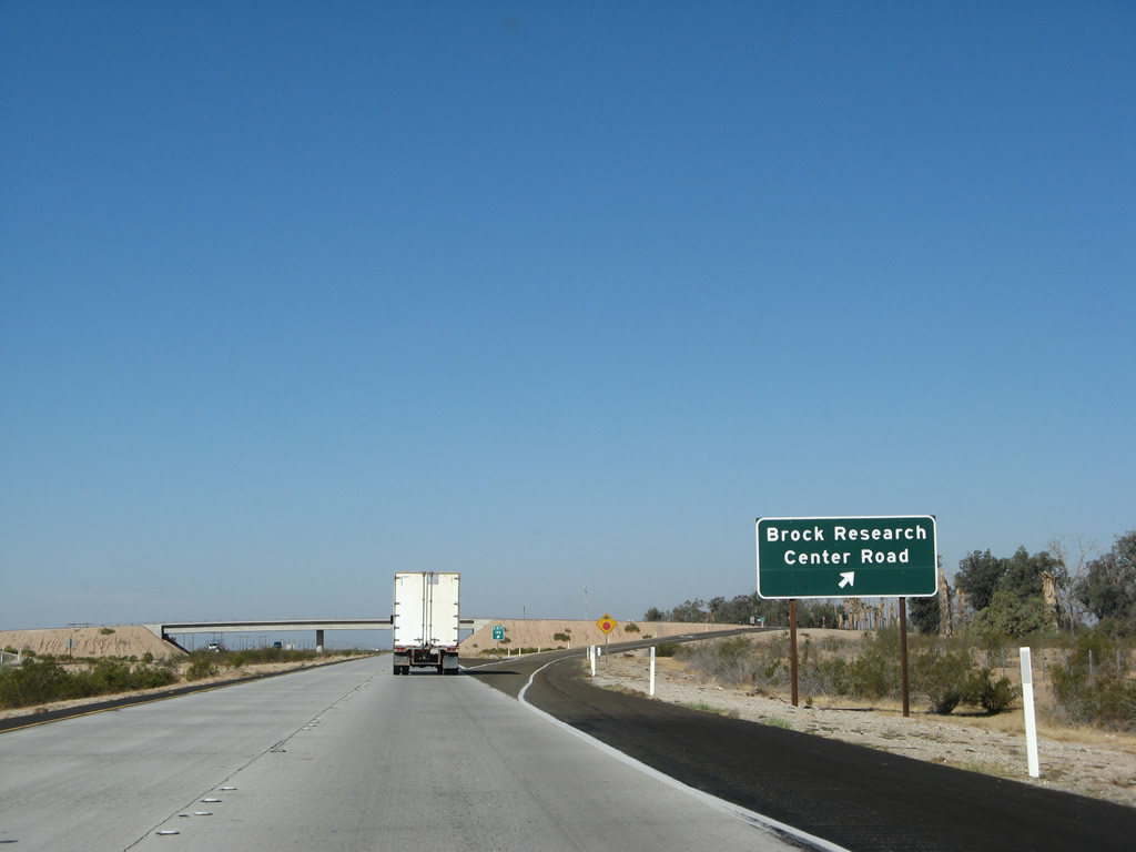
The next exit along Interstate 8 west is Exit 146, Brock Research Center Road, one mile. There is a connection from this interchange to Old U.S. 80, which parallels the freeway to the north. Brock Research Center (Brock Ranch Experimental Farms) is on the north side of the freeway off Old U.S. 80. Photo taken 03/19/07. |
|
Westbound Interstate 8 meets Brock Research Center Road at Exit 146. Again notice how the exit number was posted on the one-mile advance sign, is omitted on the final advance sign, and is posted at the gore point. Photo taken 03/19/07. |
|
After the Brock Research Center Road interchange (Exit 146), this reassurance shield is posted on Interstate 8 west. Photo taken 03/19/07. |
|
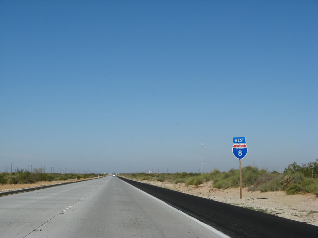
Use California 98 west to the Calexico East Border Crossing. One can also use California 7 south at Exit 125, but that is bit out of the way from here. The California 7/Calexico East (Garita Numero Dos) is the first border crossing since the California 186 (Algodones Road) border crossing at Andrade (Exit 166). Photo taken 03/19/07. |
|
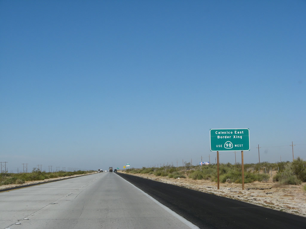
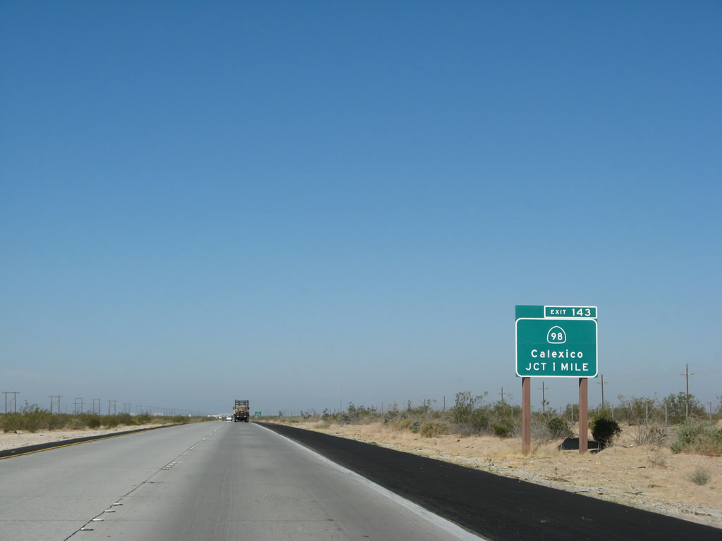
The next exit along westbound Interstate 8 is Exit 143, California 98, one mile. California 98 diverges from the freeway to serve the Calexico vicinity, and it also acts as a connector route to points south in Mexico via the Calexico East Border Crossing. Spanning the Imperial Valley, California 98 will merge back onto Interstate 8 at Exit 87. California 98 is not an old alignment of U.S. 80; Old U.S. 80 stays north of Interstate 8 through the Imperial Valley. Photo taken 03/19/07. |
|
We are traveling through the heart of the unirrigated portion of the Imperial Valley, which is vastly different from the agricultural portions of the county between the New River and Highline Canal. As such, this area is dominated by the native desert scrub plants. The plants are taller and more vibrant here than at the western end of California 98 because that interchange is located in the rainshadow of the Laguna Mountains, making that area one of the most arid in the Southwest. Shortly, Interstate 8 west intersects California 98. Photo taken 03/19/07. |
|
Westbound Interstate 8 reaches Exit 143, California 98. There are no services at this exit. The section of Interstate 8 between Exit 143, California 98 and Exits 118B-A, California 111 was built in 1971. Photo taken 03/19/07. |
|
This mileage sign is located along westbound Interstate 8 after the California 98 exit (Exit 143). The Holtville exit is next at Exit 131, which approximately ten miles west of here. The town of Holtville is another several miles northwest of Exit 131 via northbound California 115 (and old U.S. 80). Photo taken 03/19/07. |
|
These power lines carry electricity from a geothermal generating facility located near the California 115 interchange (Exit 131). Much of the geothermal activity in this region is due to the extensive geological activity occurring here, since the Salton Sea area serves as the southern end of the mighty San Andreas Fault. A hot spring is available for public use (soaking and swimming) at Exit 131 via Old U.S. 80 east. Photo taken 03/19/07. |
|
Interstate 8 passes over the Highline Canal, which carries irrigation and drinking water from the All American Canal near the international border north to Niland. Look north here to see a geothermal power plant. Photo taken 03/19/07. |
|
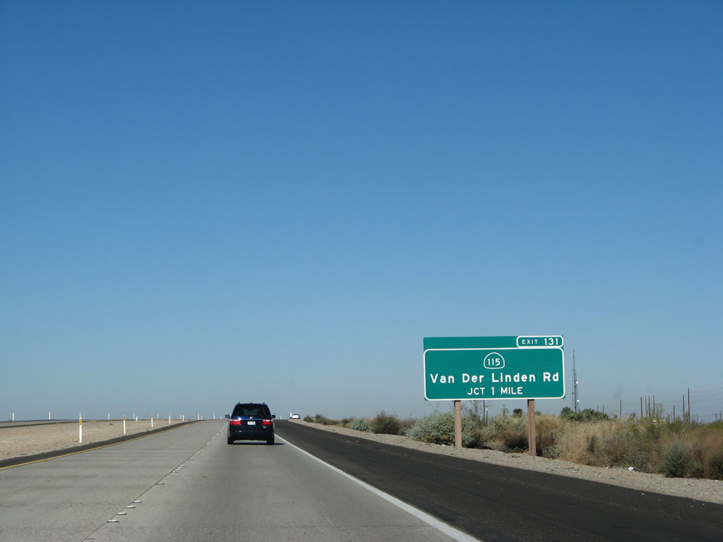
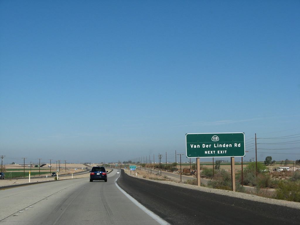
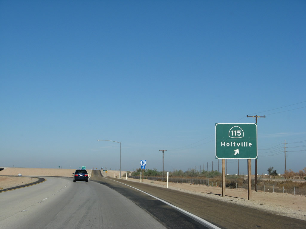
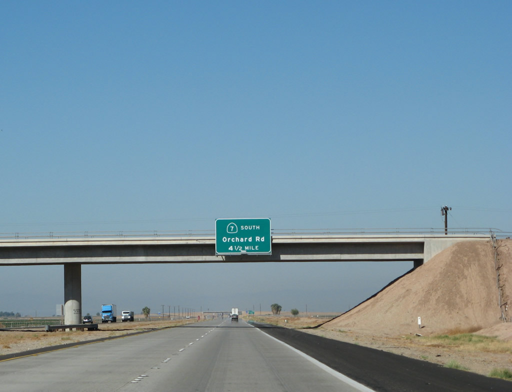
The next exit after California 98 is Exit 131, California 115 north and Van der Linden Road south. California 115 diverges from the freeway to serve Holtville via Historic U.S. 80. From Holtville, California 115 turns north to terminate at its junction with California 111 in Calipatria. Taking California 115 north to its terminus, then Imperial County S-30 west leads to one of the several units of the Sonny Bono Salton Sea National Wildlife Refuge. Photo taken 03/19/07. |
|
Westbound Interstate 8 approaches Exit 131, California 115. Van der Linden Road travels south from this interchange to provide local ranch and farming access. To Imperial County S-33 (Miller Road) and Highline Road, follow California 115 north. The county route connects California 98 near Bonds Corner with California 78 at Brunts Corner as it follows the Highline Canal. Photo taken 03/19/07. |
|
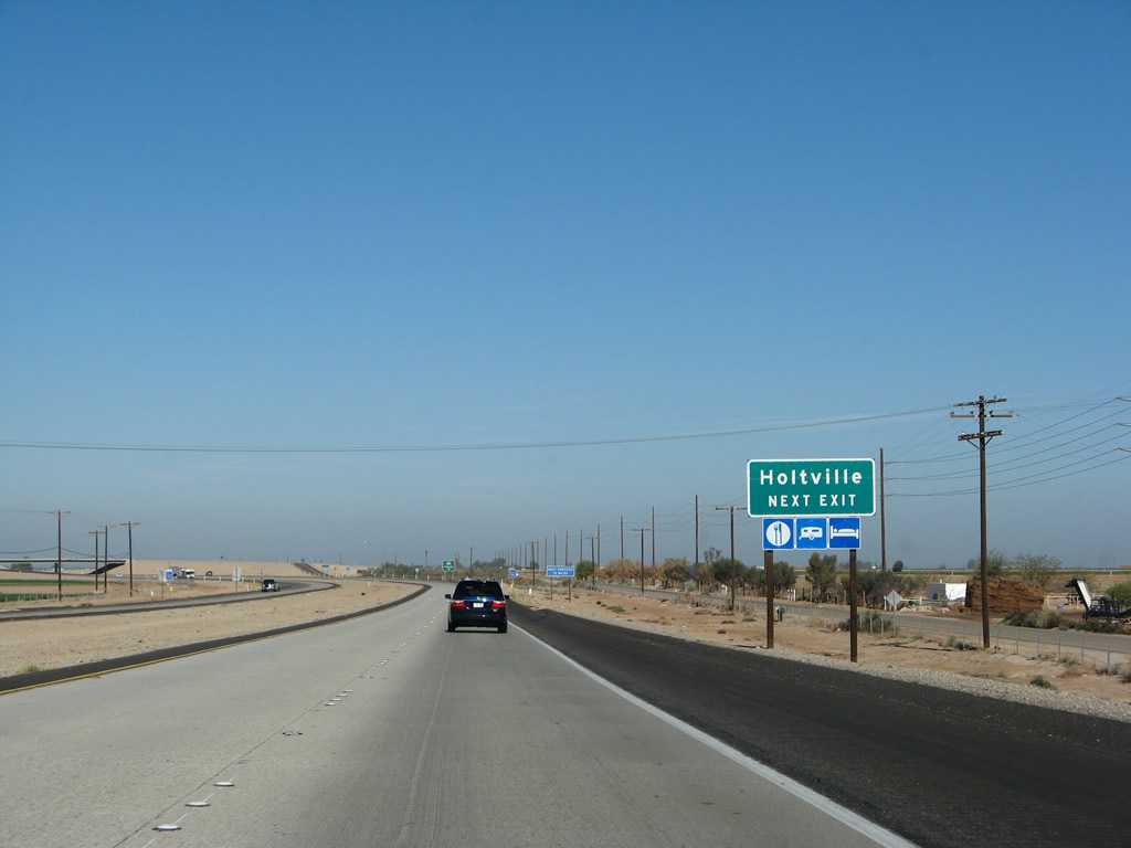
The farming community of Holtville is located six miles northwest of here via California 115 and Old U.S. 80. The city, which sits 12 feet below sea level, is home to 5,612 people as of the 2000 Census. Holtville has a full range of services; none of those services are located at this exit, since Holtville is six miles northwest of here. Interstate 8 crosses the East Highline Canal as it approaches Exit 131, and this marks the beginning of the fertile agricultural fields that extend between the East Highline Canal and the New River. Photo taken 03/19/07. |
|
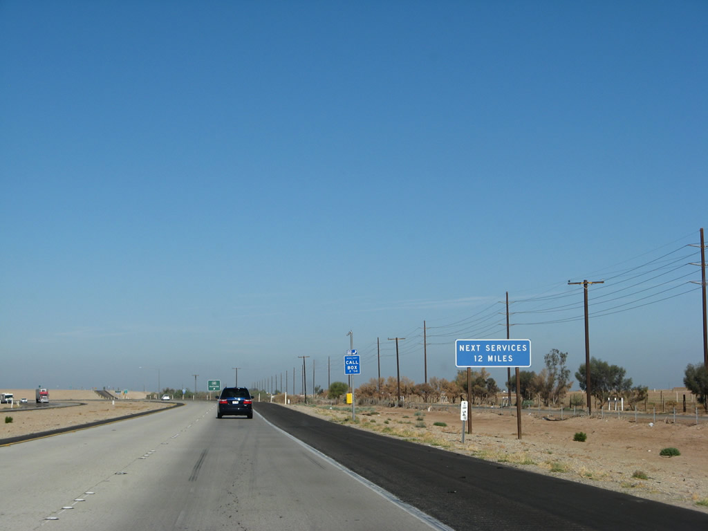
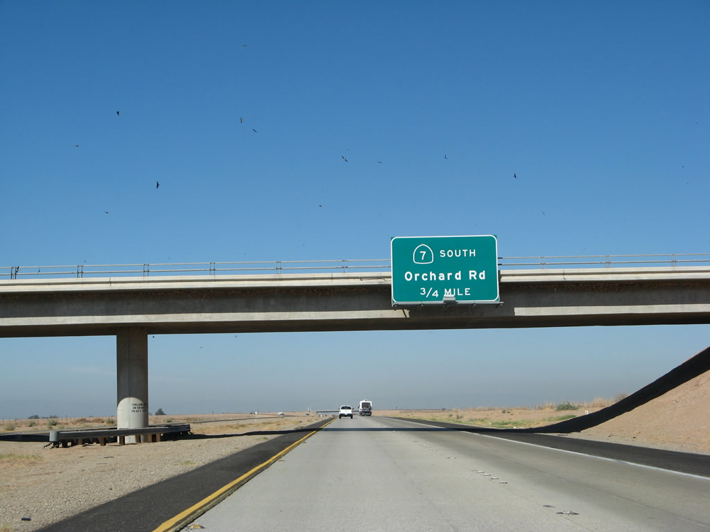
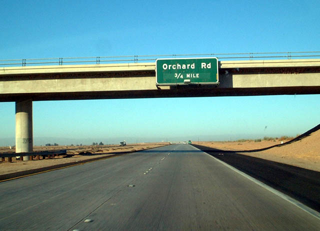
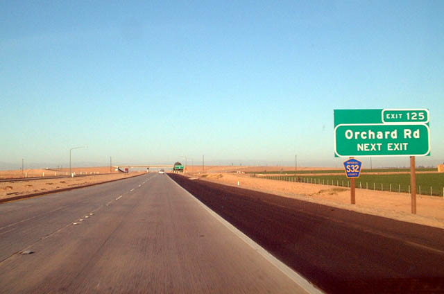
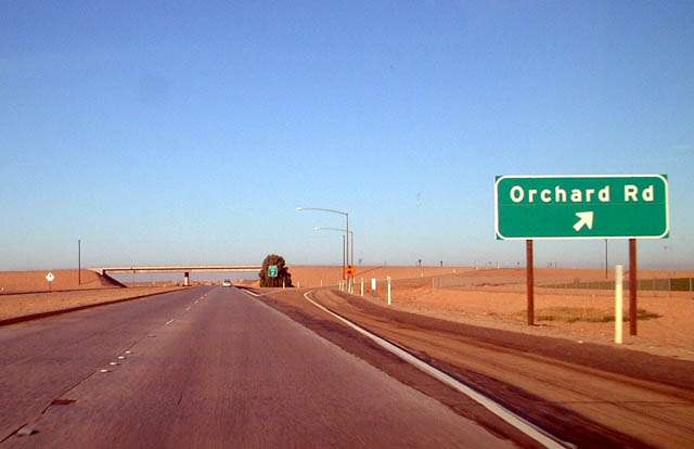
The next services on the freeway will be in 12 miles near El Centro. The services in Holtville are six miles northeast of the freeway, with freeway access from Holtville provided by Imperial County S-32/Orchard Road. Photo taken 03/19/07. |
|
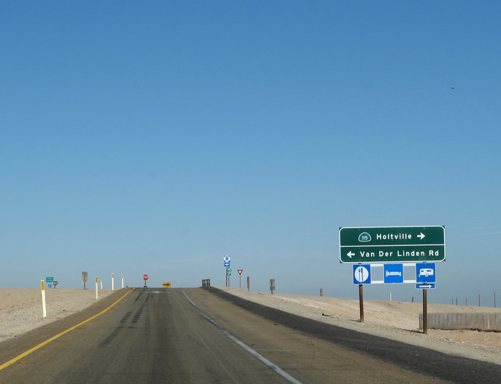
At Exit 131, westbound Interstate 8 meets California 115 north and Van der Linden Road south. A little-known feature of this interchange is a hot spring located on the north side of the freeway, sandwiched between the Historic U.S. 80 frontage road and the freeway itself. The hot spring is free to use, and there is a pair of outhouses with pit toilet. A campground is located across U.S. 80. For more on this hot spring, see the U.S. 80 page. This area is geothermally active, partially due to the thin crust of the earth and the variety of fault lines in the region. The infamous San Andreas Fault comes to its end in the Imperial Valley under the Salton Sea, and a variety of other faults cross the valley from north to south. Several of the industrial facilities in this otherwise arid area are actually geothermal power plants, producing electricity destined for Southern California users. The variety of power lines along Interstate 8 in this area generally interconnect the geothermal plants and the locks and dams of the canals in the area. A significant transmission line begins its northwesterly journey toward the Los Angeles Basin here at the junction of Interstate 8 and California 115; it collects power from other geothermal plants along its way. Photo taken 03/19/07. |
|
Now on the off-ramp from Interstate 8 west to California 115 north, turn right to Holtville and all services. Turn left to Van der Linden Road south. To Old U.S. 80, turn right; the old road westbound merges onto California 115 north through Holtville. Photo taken 03/19/07. |
|
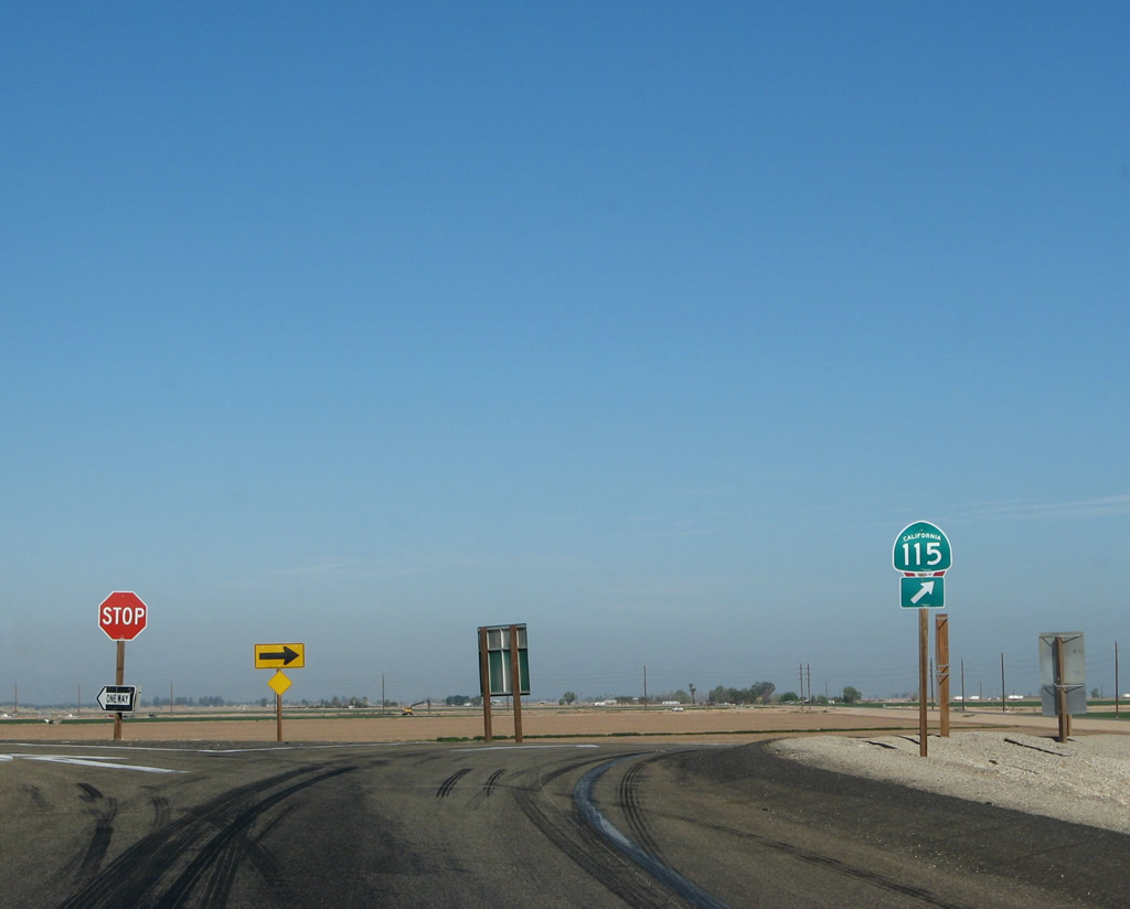
At the top of the ramp from Interstate 8 west to California 115 north is this trailblazer. This marks the southern terminus of California 115. To reach northbound Imperial County S-33 (Highline Road) and Miller Road, follow northbound California 115 to Date City. To reach southbound Imperial County S-33 (Miller Road), follow Van der Linden Road south from this interchange to Connelly Road west. Photo taken 03/19/07. |
|
This reassurance shield for Interstate 8 is posted after the California 115 interchange (Exit 131). From here west through the Imperial Valley, look for the terrain to become more agricultural and less desert. The elevation of the freeway drops below sea level for the first time as we approach the Alamo River, and it will remain there until west of the New River and the town of Seeley. Photo taken 03/19/07. |
|
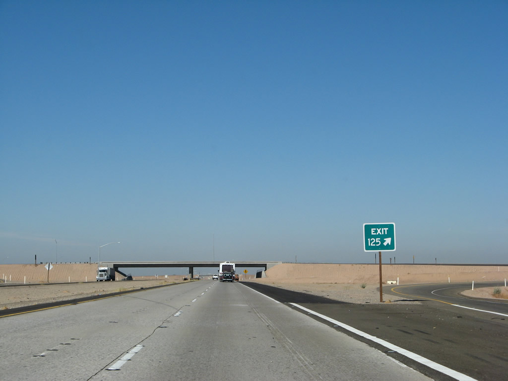
The next exit is Exit 128, Bonds Corner Road, but this advance sign is for the second exit, which is Exit 125, California 7 south to the Calexico East Port of Entry and Border Crossing into Mexico (4.50 miles). Photo taken 03/19/07. |
|
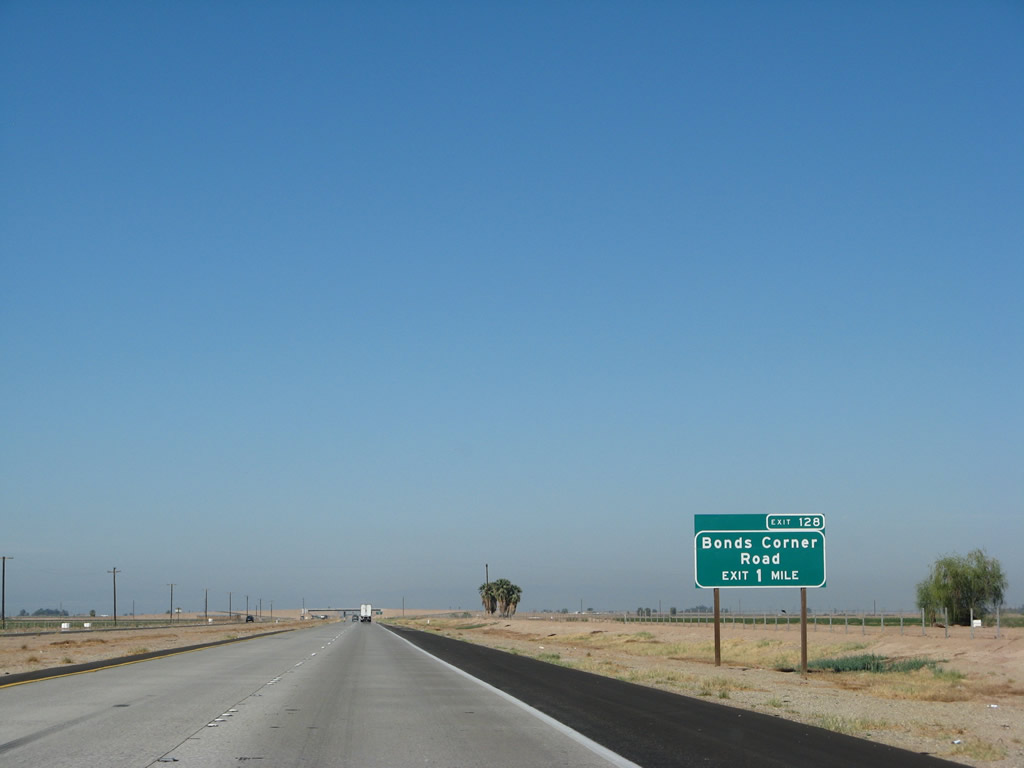
The next exit along westbound Interstate 8 is Exit 128, Bonds Corner Road, one mile. Bonds Corner Road leads north to Holtville and south to Bonds Corner, where the road meets California 98. Photo taken 03/19/07. |
|
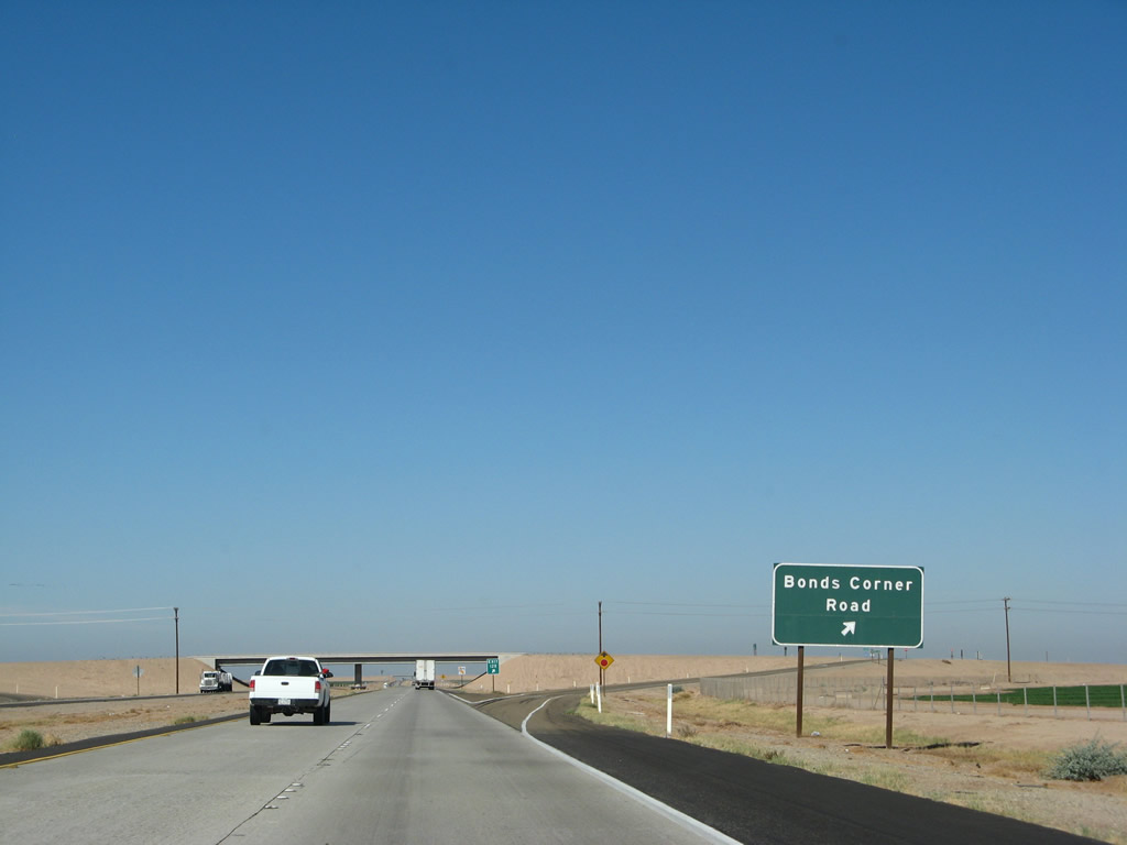
Westbound Interstate 8 reaches Exit 128, Bonds Corner Road. Photo taken 03/19/07. |
|
|
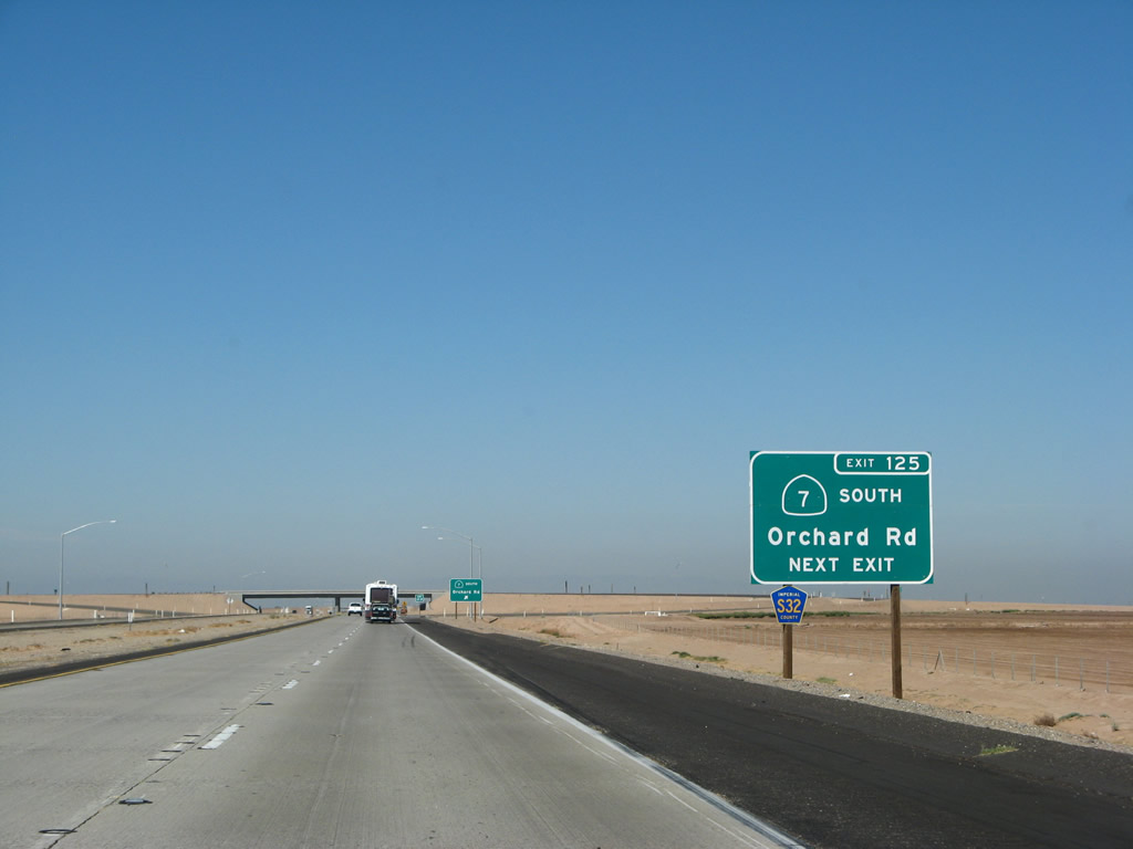
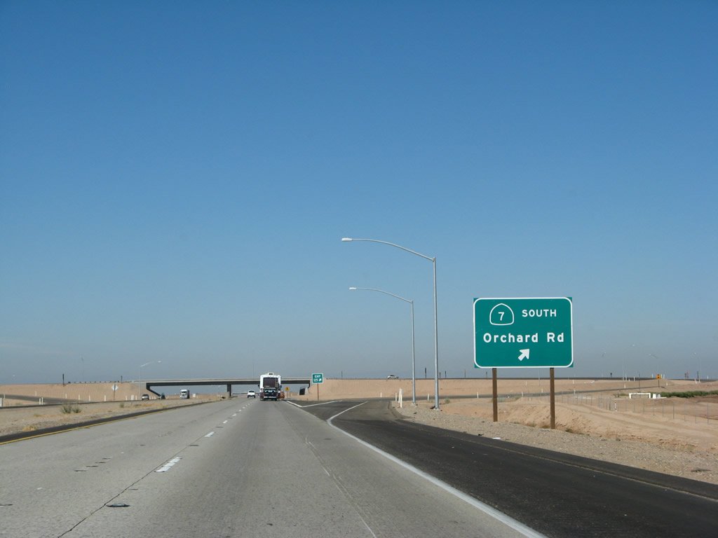
The next exit along westbound Interstate 8 is Exit 125, California 7 south to the Calexico East Border Crossing and Imperial County S-32/Orchard Road north to Holtville. This interchange was reconstructed in 2006 to accommodate the California 7 expressway extension from California 98 north to Interstate 8. California 7 is a four-lane divided expressway that provides direct access from the Interstate 8 freeway to the Calexico East port of entry. Photos taken 03/19/07 and 01/01/03. |
|
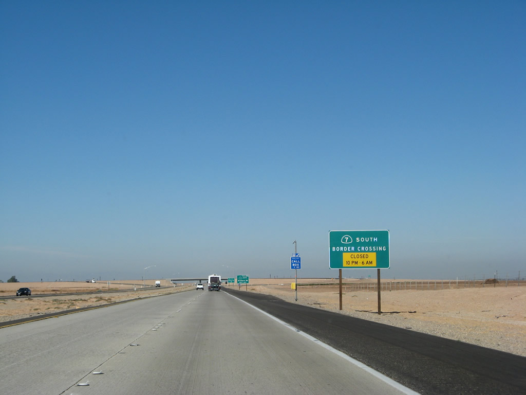
The Calexico East Border Crossing is open from 6:00 a.m. to 10:00 p.m. daily. These are the same operating hours as those at the Andrade border crossing (via California 186 at Exit 166). To the north, Imperial County S-32 follows Orchard Road north into Holtville, then follows Holt Road from there north to California 78 (Ben Hulse Highway) east of Brawley. The county route never extended south of Interstate 8, so California 7 follows a new alignment of highway. Photo taken 03/19/07. |
|
|
California 7 is a short, four-lane, concrete-paved expressway between the Calexico East International Border Crossing and Interstate 8 in the Imperial Valley. It is designed as a fast route between the border crossing and the Interstate Highway System that bypasses Calexico and El Centro. The designation of California 7 has appeared as a signed route in two other instances, both in Southern California: Sepulveda Boulevard was signed as California 7 until it was replaced with Interstate 405 (San Diego Freeway), and the Long Beach Freeway was known as California 7 until it was redesignated as Interstate 710 in 1984. Photos taken 03/19/07 and 01/01/03. |
|
|
Westbound Interstate 8 reaches Exit 125, California 7 south and Imperial County S-32/Orchard Road north to Holtville. Note the changes in signage between 2003 and 2007. Photos taken 03/19/07 and 01/01/03. |
|
The gore point signage for California 7 and Imperial County S-32 is of a recent design, featuring rounded corners. This interchange is not freeway-to-freeway, but it could be reconfigured to allow for higher speeds as traffic counts increase. To the north, the city of Holtville is considering whether California 7 can be extended to California 115/Old U.S. 80. Funding such a road is always a consideration. Photo taken 03/19/07. |
|
This mileage sign for westbound Interstate 8 is located on the overpass just after the California 7 interchange (Exit 125). El Centro is ten miles west of here. The other control points are California 94 (59 miles west of here) and San Diego (128 miles to downtown). Photo taken 03/19/07. |
|
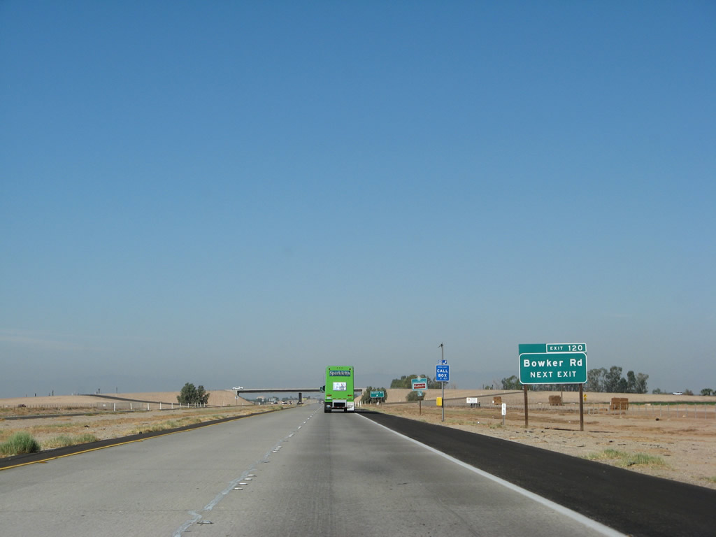
The next exit along westbound Interstate 8 is Exit 120, Bowker Road, one and one-quarter miles. Photo taken 03/19/07. |
|
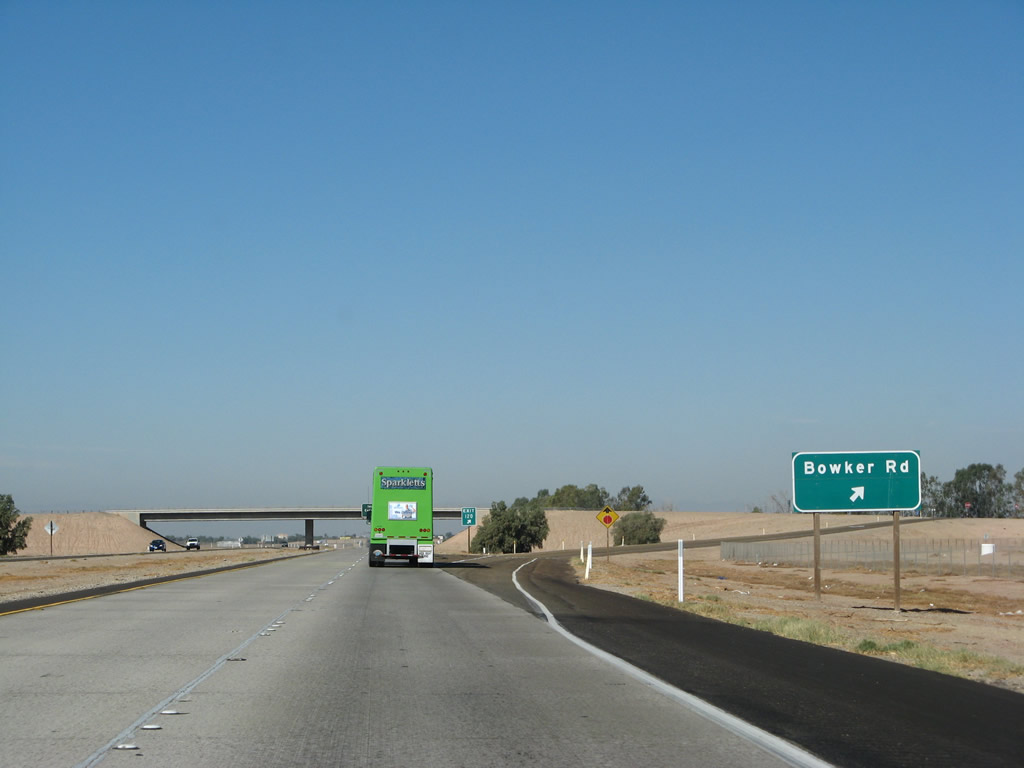
Bowker Road leads north to meet Imperial County S-80 west of Meloland, and it leads south to meet California 98 just east of Calexico. This is the obligatory exit number sign to achieve minimal compliance. Photo taken 03/19/07. |
|
Westbound Interstate 8 reaches Exit 120, Bowker Road. The next exit is California 111. Photo taken 03/19/07. |
|
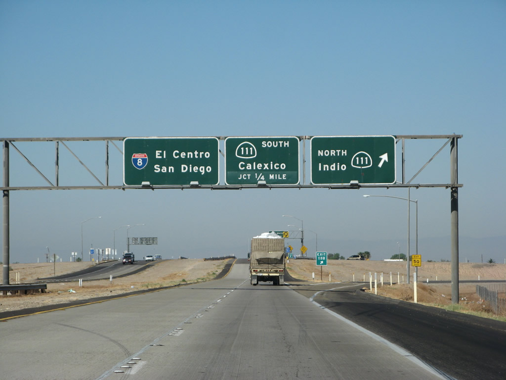
The next interchange on Interstate 8 west is Exits 118B-A, California 111 north and south. California 111 is an expressway that provides a fast connection from Brawley south to Calexico and Mexicali. The four-lane, concrete expressway currently extends north to Brawley, but it is still disjointed with the California 86 expressway. A bypass of the city of Brawley is currently under construction on the north side of the city to make that connection. Once completed, an expressway-grade road will connect Interstate 8 with Interstate 10 via the Imperial and Coachella Valleys along California 111 and California 86 (including California 86S). Photo taken 03/19/07. |
|
Northbound California 111 is a faster route than California 86 to reach Brawley, California 78, and the Salton Sea. Once in Brawley, it is faster to take California 86 north to Indio and Interstate 10. Between 2005 and 2012, it is anticipated that the Brawley and Westmorland bypass routes via California 111, California 78, and California 86 will be completed (in phases). The projects are not yet fully funded, but should be in time to meet scheduled construction. Photo taken 03/19/07. |
|
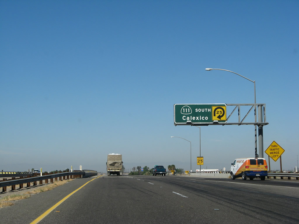
Meanwhile, California 111 south offers another convenient route to Mexico via the Calexico West Port of Entry. Commercial traffic must use the port of entry on California 7, which is best reached by taking california 111 south to California 98, then California 98 east to California 7 south. Other traffic, including tourist and residential traffic, may use the California 111 border crossing, which takes traffic from California 111 in Calexico onto Mexico Federal Route 5 in Mexicali. Mexicali is a sprawling city; from the air, the border is clearly defined at night by the lights of city ending at a seemingly arbitrary line (the border). Calexico dwarfs in comparison. Mexicali is the capital of the Mexican state of Baja California Norte. Photo taken 03/19/07. |
|
California 111 north follows the expressway alignment north to Brawley. While the California 86 expressway is the faster route around the Salton Sea to the Coachella Valley, California 111 also passes around the Salton Sea via Calipatria, Niland, Bombay Beach, North Shore, and Mecca. Meeting California 86S at Coachella, California 111 then turns northwest toward Palm Springs, ending at Interstate 10 near Whitewater. Photo taken 03/19/07. |
|
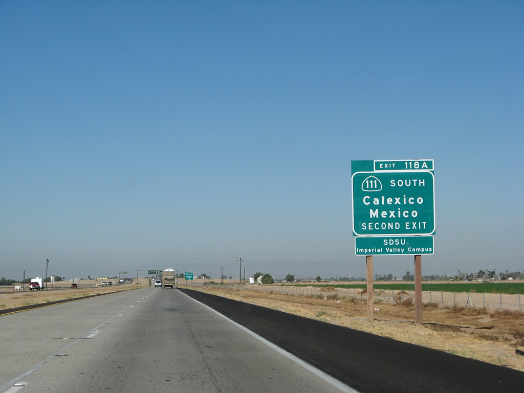
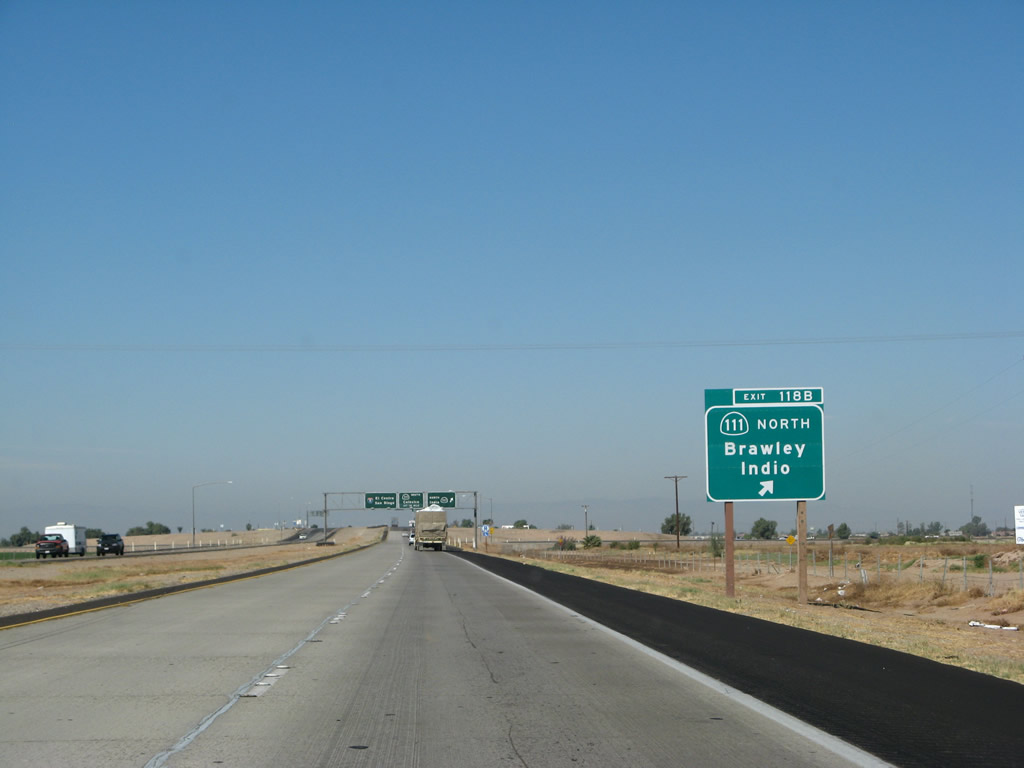
Westbound Interstate 8 reaches Exit 118B, California 111 north. These are original, porcelain-enamel button copy signs. The next ramp connects Interstate 8 west with California 111 south in this cloverleaf interchange. The section of Interstate 8 from Exit 118A, California 111 west to the New River culvert (after Exit 107, Imperial County S-29 (Drew Road)) was built in 1967. Photo taken 03/19/07. |
|
Shortly thereafter, Interstate 8 west reaches Exit 118A, California 111 south. Merging at this interchange can be a bit dicey, so watch for incoming traffic. Use the left lane if at all possible. To the south, California 111 is the best and most direct route to Calexico. Incorporated in 1908, Calexico is known as the city "Where California and Mexico Meet," hence the name. Covering about nine square miles, the city was home to 27,109 people as of the 2000 Census and is rapidly growing. New housing developments are appearing in the outskirts of Calexico. Despite its size, Calexico is overshadowed by behemoth Mexicali to the south. The capital of Baja California Norte, the sprawling Mexican city is home to over 900,000 people and is growing rapidly as well. Expect much development to continue in this region of the state. Photo taken 03/19/07. |
|
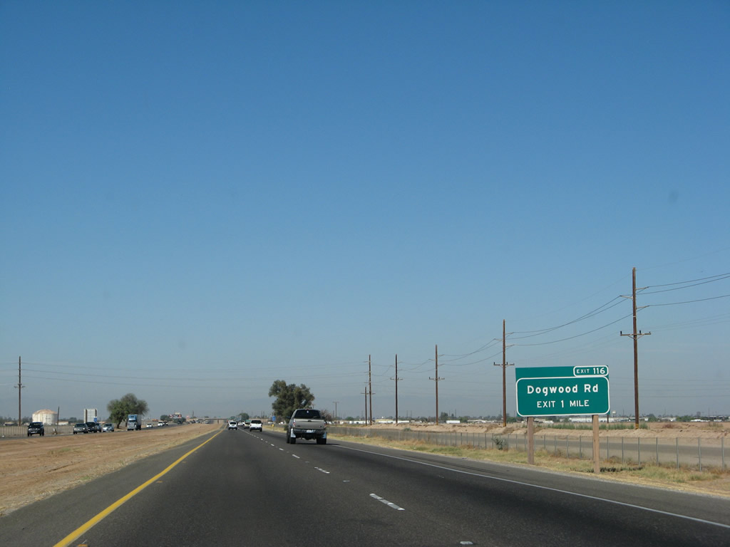
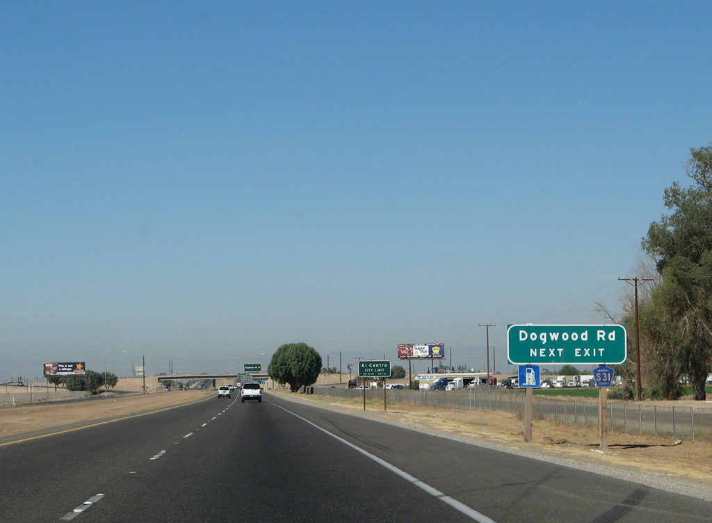
The next exit along westbound Interstate 8 is Exit 116, Imperial County S-31 (Dogwood Road). This is the first of three exits to serve the city of El Cajon: Exit 116, Imperial County S-31 (Dogwood Road); Exit 115, California 86/Business Loop I-8 (Fourth Street) north to downtown and south to Heber; and Exit 114, Business Loop I-8 (Imperial Avenue). California 111 bypasses the city to the east. Photo taken 03/19/07. |
|
Imperial County S-31 leads north to Brawley, following a path parallel to both California 86 and California 111. Following the county route south, it connects to California 86 in Heber and California 98 west of Calexico. Photo taken 03/19/07. |
|
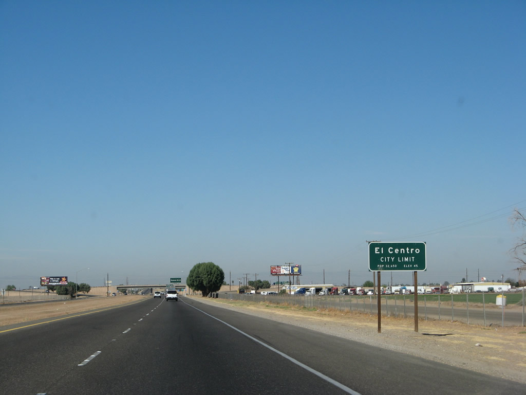
El Centro is the seat of Imperial County and the hub of the Imperial Valley. "El Centro" translates into "The Center," and it is located near the center of the valley. Home to 37,835 people as of the 2000 Census, El Centro is located at -45 feet elevation (or 45 feet below sea level). The freeway city limits sign incorrectly shows the elevation as "45 feet," not "-45 feet." Like neighboring Calexico, El Centro is growing at a rapid pace, with the south side of Interstate 8 poised for the next major development. Photo taken 03/19/07. |
|
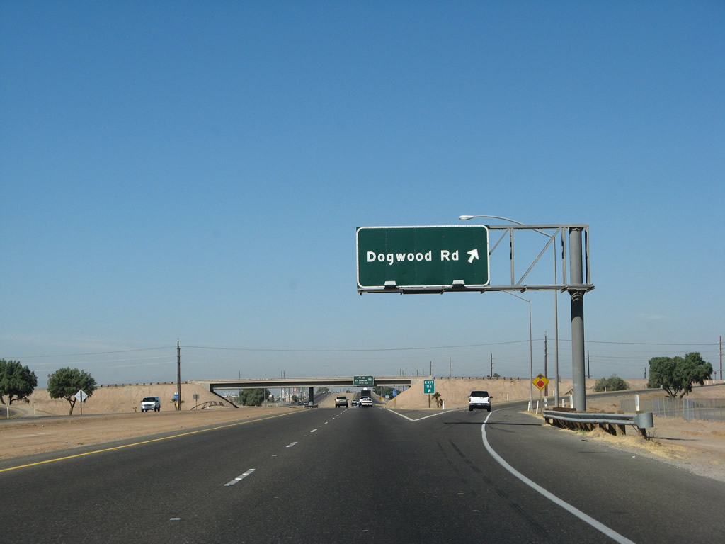
Westbound Interstate 8 reaches Exit 116, Imperial County S-31 (Dogwood Road). Use Dogwood Road south to the regional mall, which can be seen from the freeway. This is an original porcelain enamel sign for Dogwood Road. With a sign this large with so much green space, it's a shame that Caltrans won't put up a county route marker. Photo taken 03/19/07. |
|
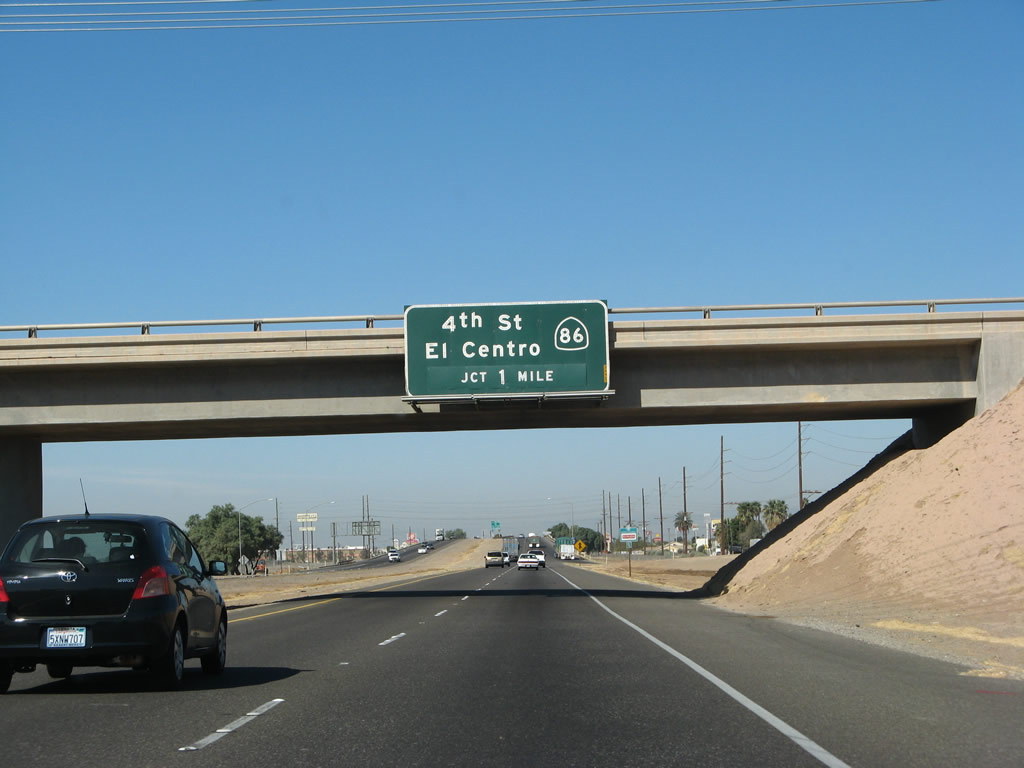
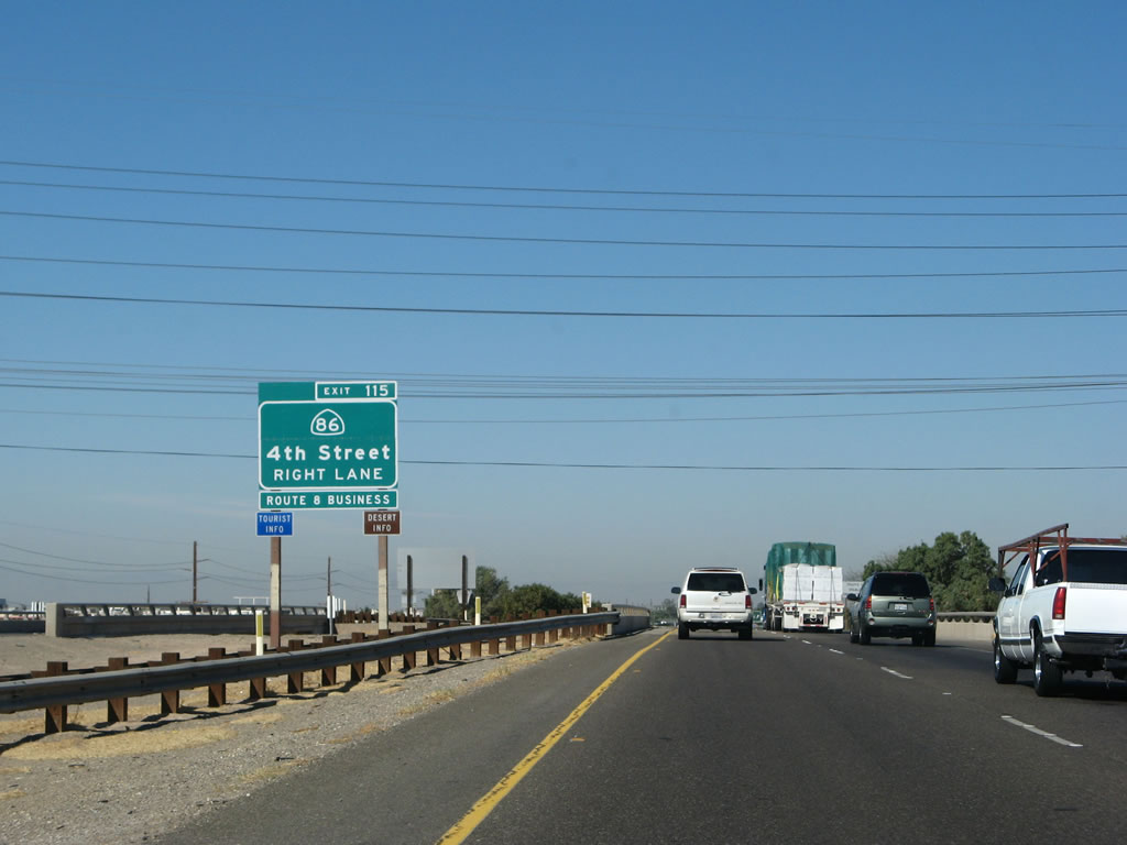
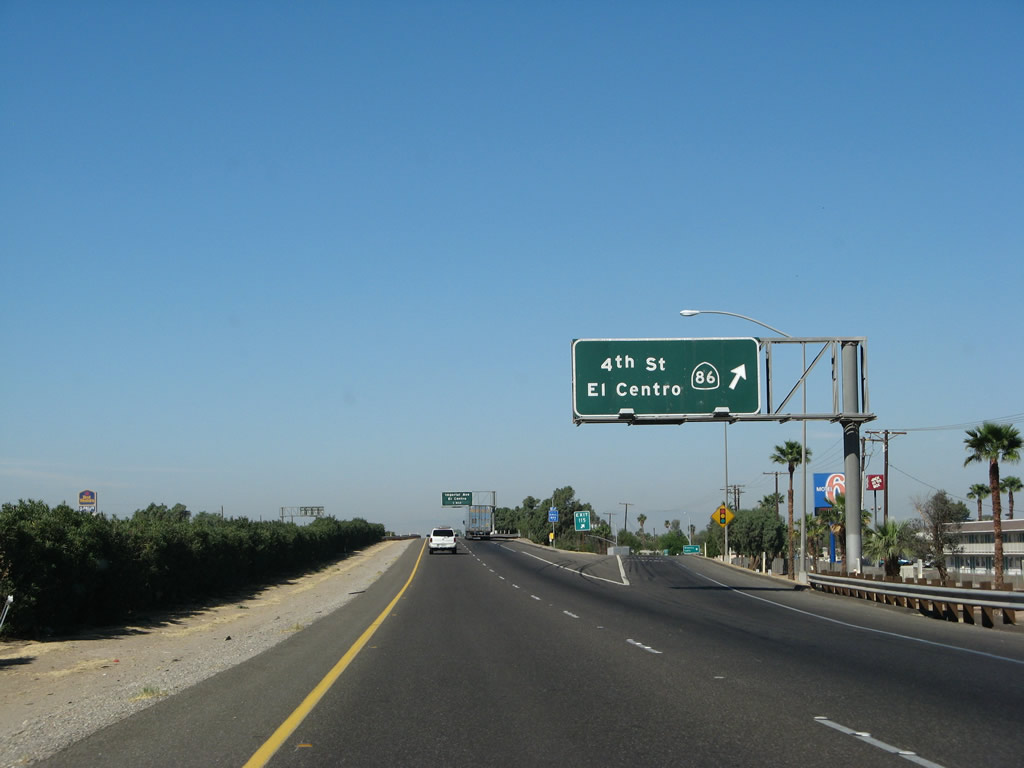
The next exit along westbound Interstate 8 is Exit 115, California 86 and Business Loop I-8 (Fourth Street), one mile. This is the main exit for El Centro, and a wide variety of services (gas, food, lodging, etc.) are all available at this exit. The business route leads west from this interchange into downtown El Centro via northbound California 86. Historic U.S. 99 follows California 86 from Heber north to Brawley via El Centro and Imperial. Photo taken 03/19/07. |
|
This reassurance shield for Interstate 8 west is posted after the Dogwood Road on-ramp. Most of El Centro can be seen to the north of the freeway. Photo taken 03/19/07. |
|
Business Loop I-8 begins at Exit 115, follows California 86 and Historic U.S. 99 north on 4th Street. After merging with Imperial County S-80 (Historic U.S. 80), the business route turns west into downtown El Centro. The original alignment is via Main Street, but the business route and state highway use Adams Street, which bypasses Main Street. At Imperial Avenue, Business Loop I-8 turns south to return to Interstate 8, while California 86 and Historic U.S. 99 turn north toward the city of Imperial. Historic U.S. 80 and Imperial County S-80 follow the Evan Hewes Highway west toward Seeley and Plaster City. Photo taken 03/19/07. |
|
California 86 follows the path of Historic U.S. 99 through El Centro and throughout the Imperial Valley. Originating in Indio, California 86 traces the west shore of the Salton Sea as an expressway, connecting with California 78 between Kane Spring and Brawley. between Brawley and El Centro, California 86 becomes a more localized route, providing the most direct route between these two cities. The highway leads south of Interstate 8 to Heber, then ends at its junction with California 111 north of Calexico. Old U.S. 99 follows California 111 from that point south into Calexico. the historic southern terminus of that once-great highway. Photo taken 03/19/07. |
|
Westbound Interstate 8 reaches Exit 115, California 86 and Business Loop I-8. All services are available at this exit. Note that no trucks are permitted on Business Loop I-8 (Imperial Avenue) (Exit 114), so through trucks should use California 86 north. Photo taken 03/19/07. |
Page Updated August 31, 2008.