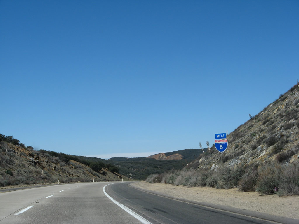
| Interstate 8 (Kumeyaay Highway) west |
|
Shortly after the In-Ko-Pah Park Road interchange (Exit 77), westbound Interstate 8 enters San Diego County (note sign in median). The postmiles switch at this point from Imperial County mileage to San Diego County mileage (postmile paddles are located next to right shoulder). Photo taken 03/19/07. |
|
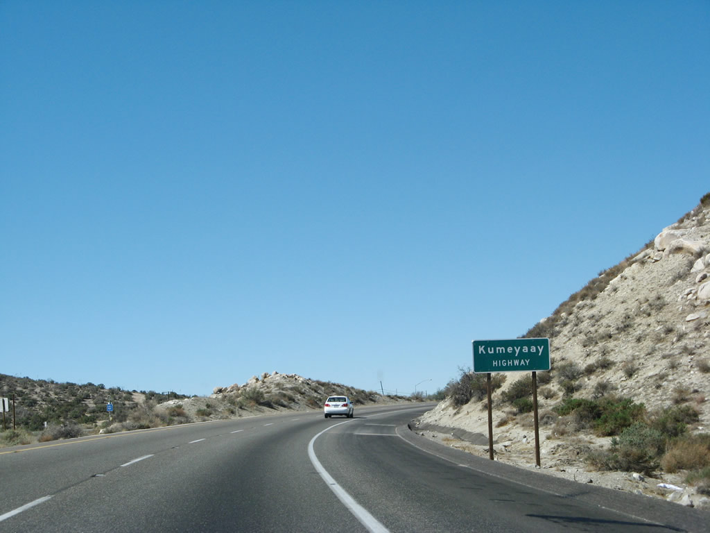
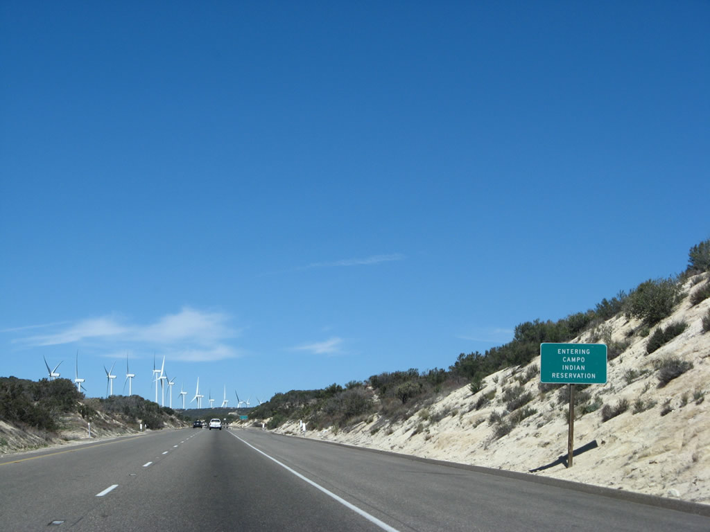
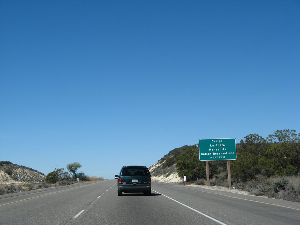
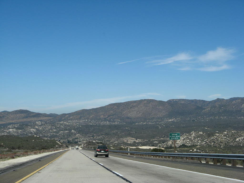
In San Diego County, Interstate 8 is known as the Kumeyaay Highway. A similar sign is posted at the west end of the freeway in Mission Bay Park. The Kumeyaay Indians were the original inhabitants of San Diego County, and the various tribes of these Native Americans are scattered throughout the county, including reservations for Campo, La Posta, and Viejas Indians. Many of these reservations have casinos and related facilities on them, making San Diego County something of a gambling mecca for Southern California. Photo taken 03/19/07. |
|
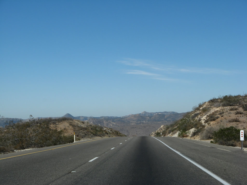
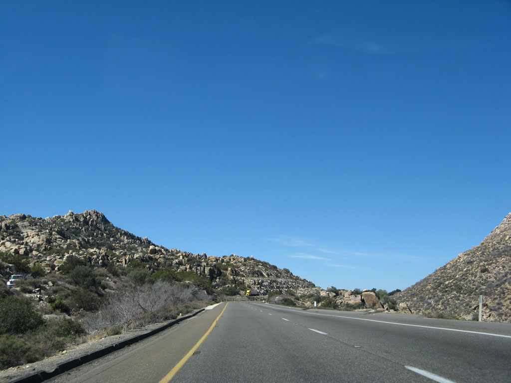
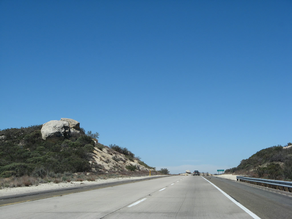
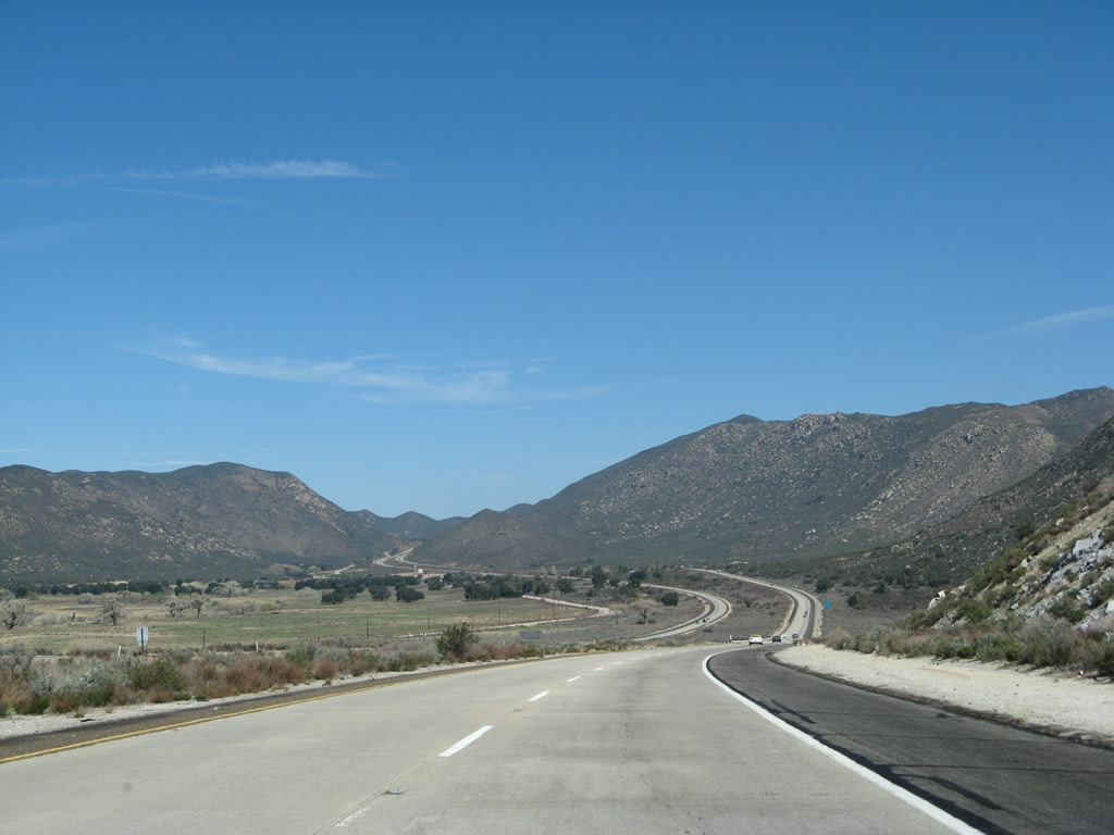
Interstate 8 west gradually gains elevation as it skirts Table Mountain (el. 4,089 feet; not visible here but is located to the north of the freeway), then drops into Jacumba Valley. Between Exit 73, In-Ko-Pah Road and Exit 62, Crestwood Road, Interstate 8 was built in 1967. Photo taken 03/19/07. |
|
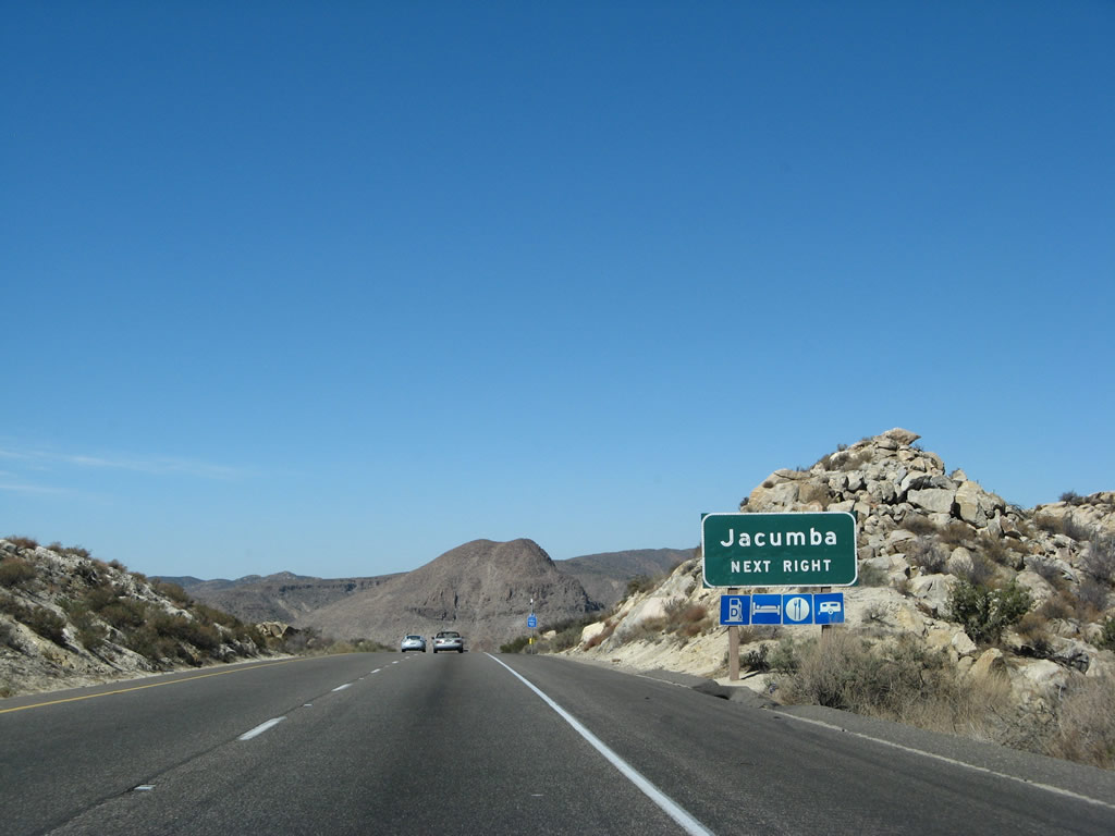
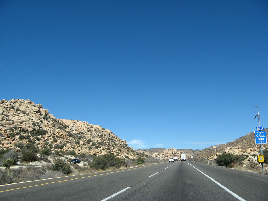
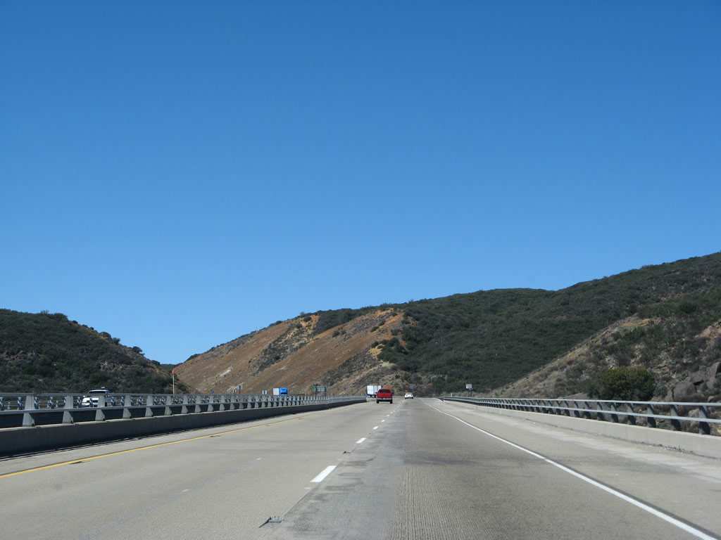
Continuing west, the next exit along westbound Interstate 8 is Exit 73, Carrizo Gorge Road, one mile. The signs approaches this interchange are for Jacumba, since Carrizo Gorge Road leads south to meet Old U.S. 80 east of Jacumba. Carrizo Gorge Road also leads north to the DeAnza Springs Resort, which is a nudist resort located on the northern edge of the freeway. The road ends at the entrance to the resort, but it is also an access point to the abandoned San Diego and Imperial Valley Railroad right of way. Hikers and mountain bikers routinely use the abandoned railroad as a trail, and they follow the railroad into Carrizo Gorge, passing through a variety of tunnels and over several trestles and bridges that span canyons along the way. In fact, the largest wooden railroad trestle in the country is located on this railroad in Carrizo Gorge. Photo taken 03/19/07. |
|
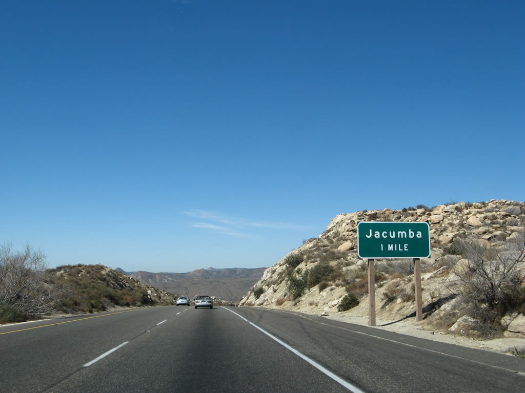
Jacumba, an unincorporated community of San Diego County, is home to a natural hot springs, and a small resort and motel is located around the springs. Jacumba is pronounced "Ha-Cum-Ba." This area may see increased traffic if a proposed border crossing between the United States and Mexico is constructed at Jacumba. There are no firm plans to construct such a facility at this time, but the concept is under consideration. Photo taken 03/19/07. |
|
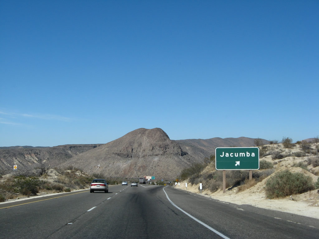
Westbound Interstate 8 reaches Exit 73, Carrizo Gorge Road south to Jacumba. The Carrizo Gorge is located north of the freeway, and the road does not actually enter it. However, the San Diego and Arizona Eastern (Imperial Valley) Railroad passes through the canyon en route to the Imperial Valley. The railroad was recently recommissioned but only with limited daily freight traffic. Capital investment restored the railroad to operating status, including replacement of decaying and unmaintained infrastructure and fixing a collapsed tunnel. However, since a portion of the railroad enters Mexico, some are unsure of its future given post-9/11 fears. Some local politicians refuse to support reopening the railroad because of concerns related to the safety of cargo shipped through Mexico. Photo taken 03/19/07. |
|
Exit 73 is a diamond interchange. Carrizo Gorge Road travels to the south, connecting with a frontage road on the south side of the freeway. Two gas stations are located along this frontage road - these are the first facilities since leaving Ocotillo. Gas, food, and beverages may be purchased here. Photo taken 03/19/07. |
|
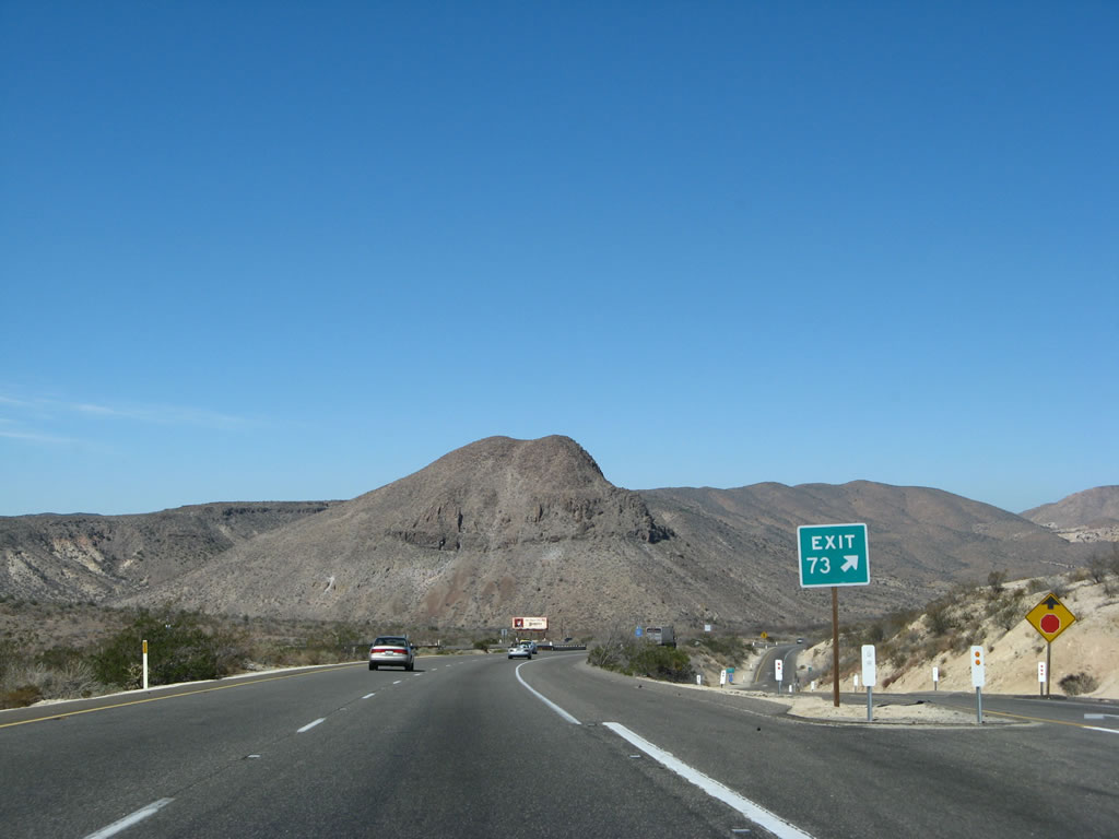
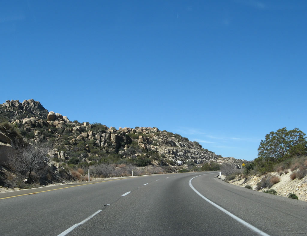
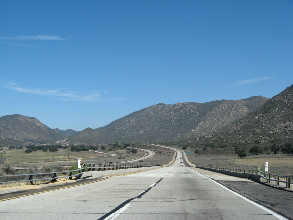
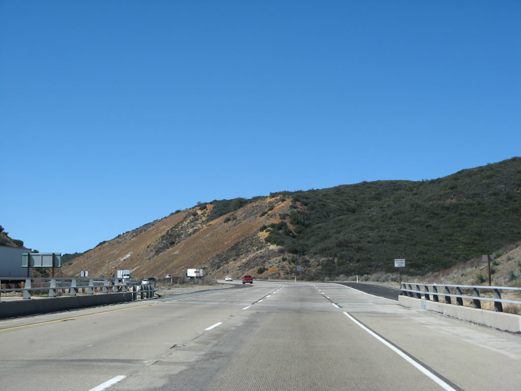
After Exit 73 (Carrizo Gorge Road), Interstate 8 west descends toward Carrizo Creek. Photo taken 03/19/07. |
|
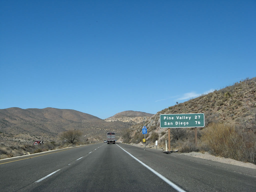
This mileage sign along westbound Interstate 8 after the Carrizo Gorge Road/Jacumba interchange (Exit 73) provides the distance to Pine Valley (27 miles) and San Diego (76 miles to downtown). Photo taken 03/19/07. |
|
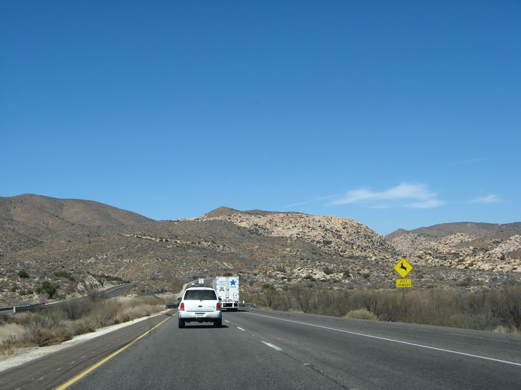
A wildlife crossing sign is posted prior to the Carrizo Creek Bridge. Photo taken 03/19/07. |
|
|
|
|
|
|
|
|
|
|
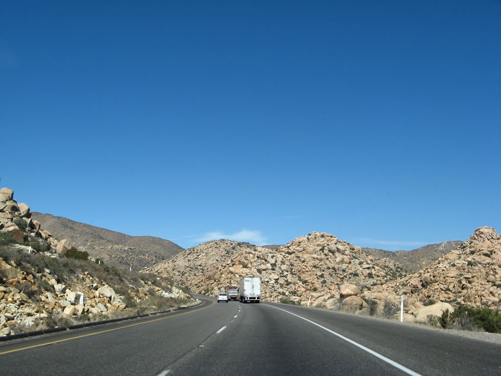
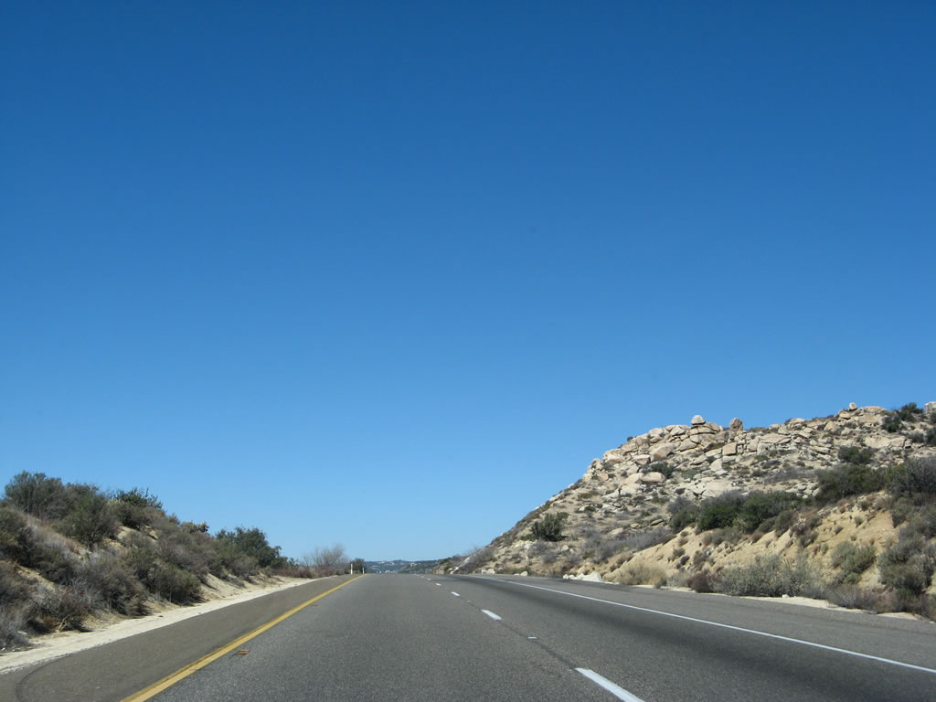
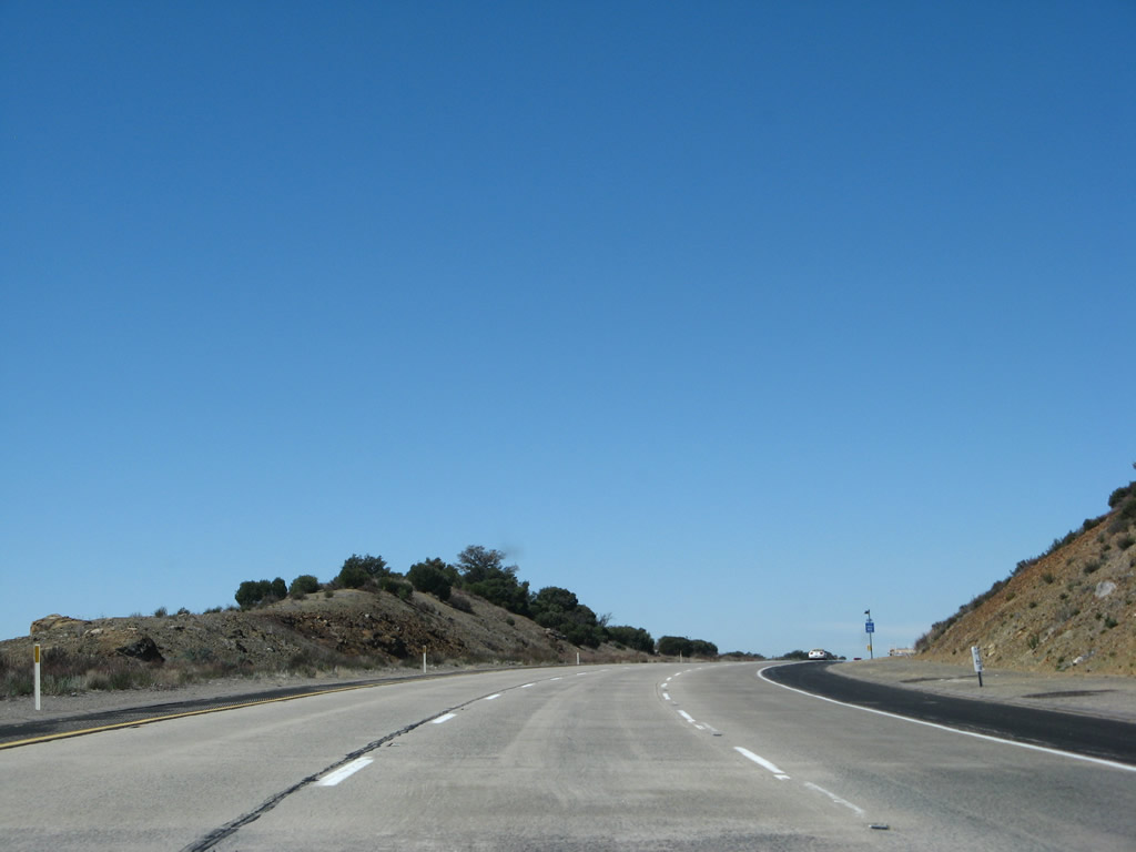
| After crossing Carrizo Creek, Interstate 8 west starts to climb up Walker Canyon. Not shown on many maps, Walker Canyon is defined by San Diego State University as follows: "Walker Canyon Ecological Reserve is located just north and adjacent to I-8, with its westernmost border about 3 miles east of the Ribbonwood Rd. exit. It is to be found in the 2003 Thomas Guide book on page 1300, sections C and D-6. The Reserve is a little over two miles long as it parallels Interstate 8. Its western edge is even with and below Tule Lake, the eastern edge is the Anza-Borrego State Park. To the north is BLM land and Tule Creek area. Access can be made at two locations along the Caltrans easement on the westbound lanes (north). Arrangements must be made with Caltrans and CHiP and usually requires notification over the telephone. This access is excellent for visiting the riparian zone. Access to the north via the BLM land is more difficult. The Reserve is located on the USGS Jacumba 7.5 minute series Quadrangle topographical map at about 116?14' and 32?40'. The Walker Canyon parcel consists of 514.13 acres."1 This suite of photos shows Interstate 8 as it passes through scenic Walker Canyon, which is located in the In-Ko-Pah Mountains. This is the second ridge of mountains encountered by Interstate 8 in the ascent to the Laguna Mountains; the ride up Devils Canyon was part of the ascent up the Jacumba Mountains. Photo taken 03/19/07. |
|
Now at the top of Walker Canyon, westbound Interstate 8 flattens out. The freeway will pass through McCain Valley before meeting California 94 in Manzanita-Boulevard. Photo taken 03/19/07. |
|
To the north of Interstate 8 is McCain Valley, which is formed between the In-Ko-Pah Mountains to the east and the Tecate Divide to the west. Several campgrounds and offroad areas are located in McCain Valley, which can be accessed by taking Exit 65, California 94/Ribbonwood Road south to Old U.S. 80 east. Take U.S. 80 east to McCain Valley Road north. Photo taken 03/19/07. |
|
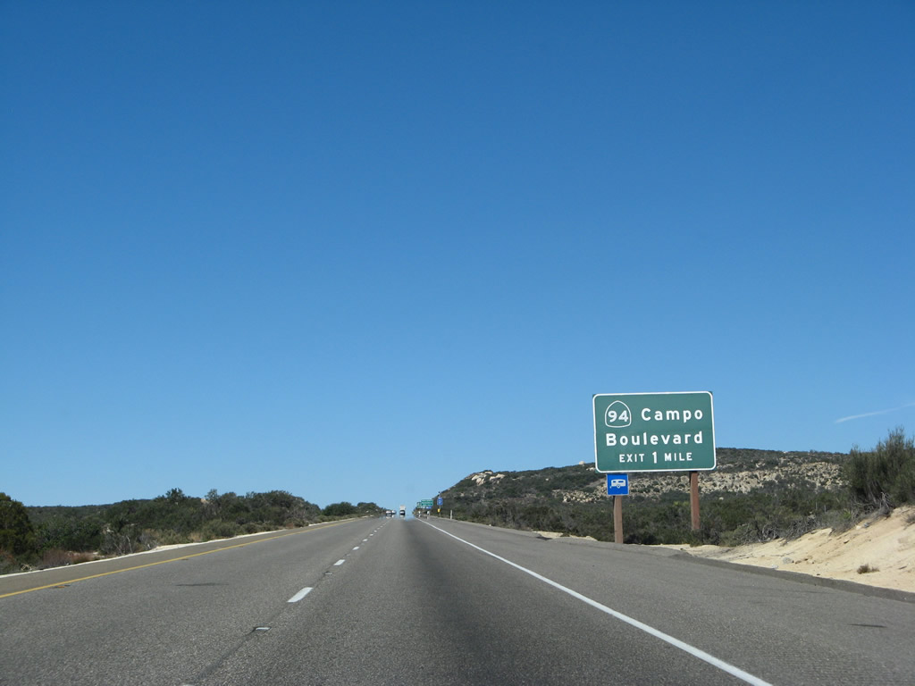
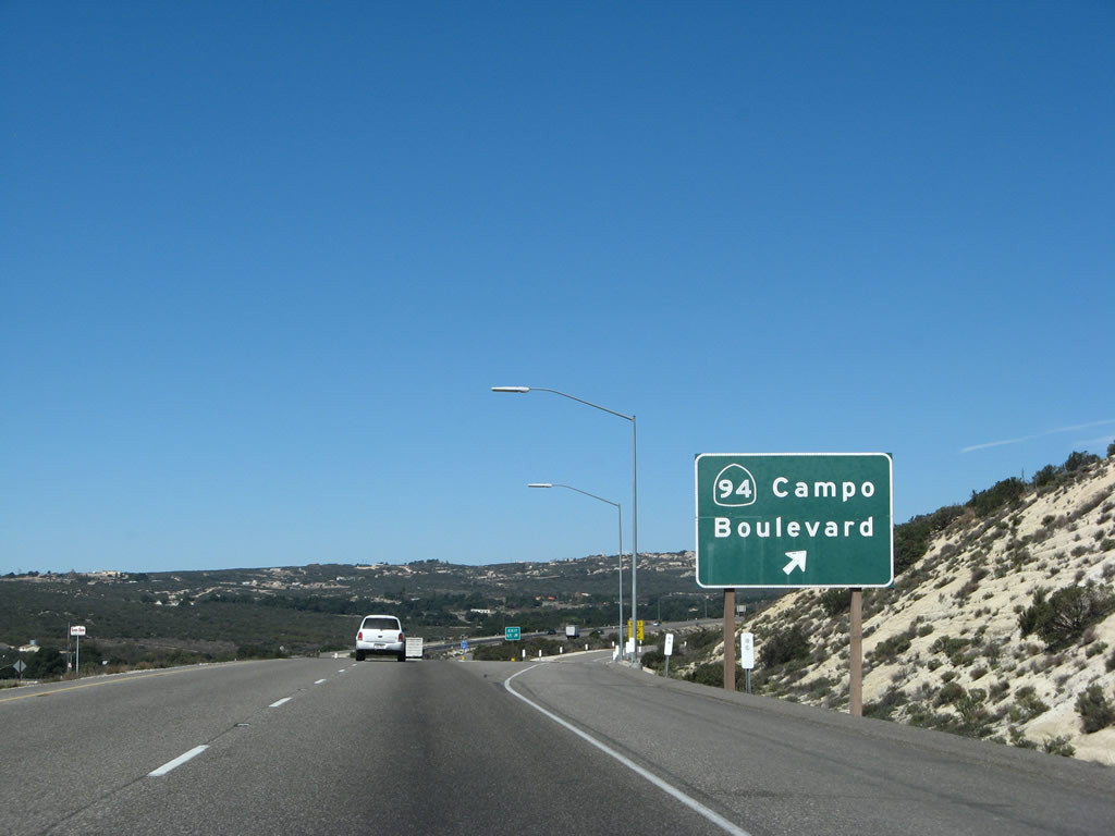
Ascending from Jacumba and Walker Canyon, the next exit along westbound Interstate 8 is Exit 65, California 94/Ribbonwood Road, one mile. California 94 begins its westward journey at its junction with Interstate 8 in Boulevard, turns south into Campo, then west toward the city of San Diego. It ends in downtown San Diego at its junction with Interstate 5. Photo taken 03/19/07. |
|
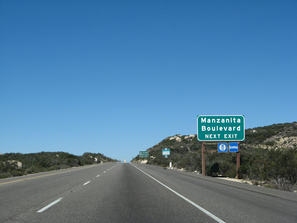
Exit 65 connects to Old U.S. 80 and the communities of Manzanita and Boulevard. Upon exiting onto California 94/Ribbonwood Road south, turn left on U.S. 80 to Boulevard, and follow California 94 and U.S. 80 west to Manzanita. The two towns are located adjacent to each other. The sign here is a bit confusing, as there is no "Manzanita Boulevard." Instead, the sign refers to the two towns. Boulevard received its name because of its location on the U.S. 80 Boulevard. Photo taken 03/19/07. |
|
Ribbonwood Road leads north from the Exit 65 interchange into the Campo Indian Reservation. To the south, Ribbonwood Road becomes California 94 and travels south into the town of Boulevard. The state route ends at this interchange. The relatively flat and undeveloped area around Boulevard has been considered as a potential site for the often-proposed but never constructed replacement international airport for San Diego. Photo taken 03/19/07. |
|
Westbound Interstate 8 reaches westbound California 94/Ribbonwood Road. Although not mentioned on the signs, California 94 is the fastest route to Tecate, Baja California Norte, in Mexico. To reach Tecate, follow California 94 west to California 188, then take California 188 south to the port of entry into Mexico. California 188 changes into Mexico Federal Route 3 upon crossing the border. Photo taken 03/19/07. |
|
The only exit number is posted at the gore point. The town of Manzanita can be seen in the valley in the background. Photo taken 03/19/07. |
|
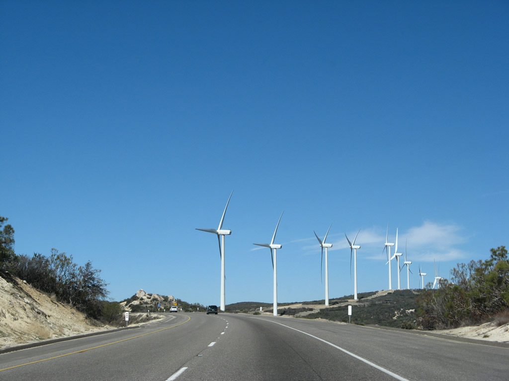
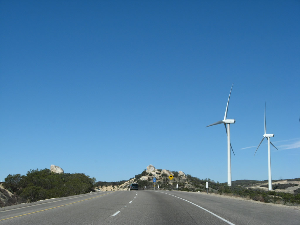
An Interstate 8 reassurance shield is posted after the California 94 interchange. Ascending again, we will crest at the Tecate Divide summit, elevation 4.140 feet. Wind turbines glide in the Campo Indian Reservation. Photo taken 03/19/07. |
|
This mileage sign provides the distance to Pine Valley (19 miles) and San Diego (68 miles). Photo taken 03/19/07. |
|
Interstate 8 enters the Campo Indian Reservation. Photo taken 03/19/07. |
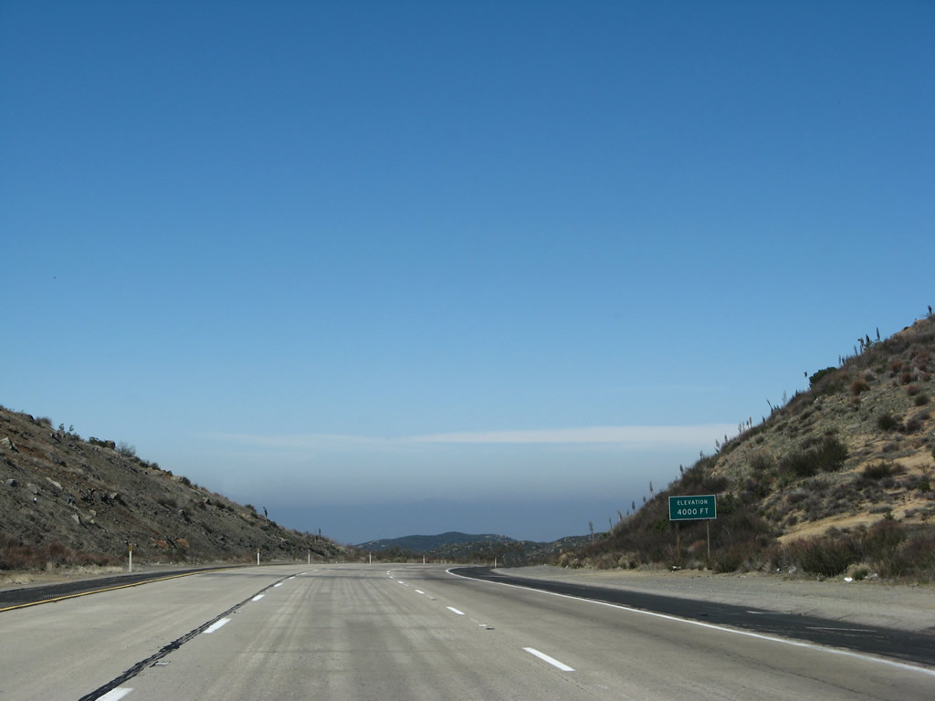
|
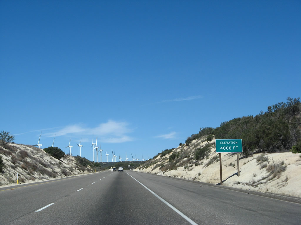
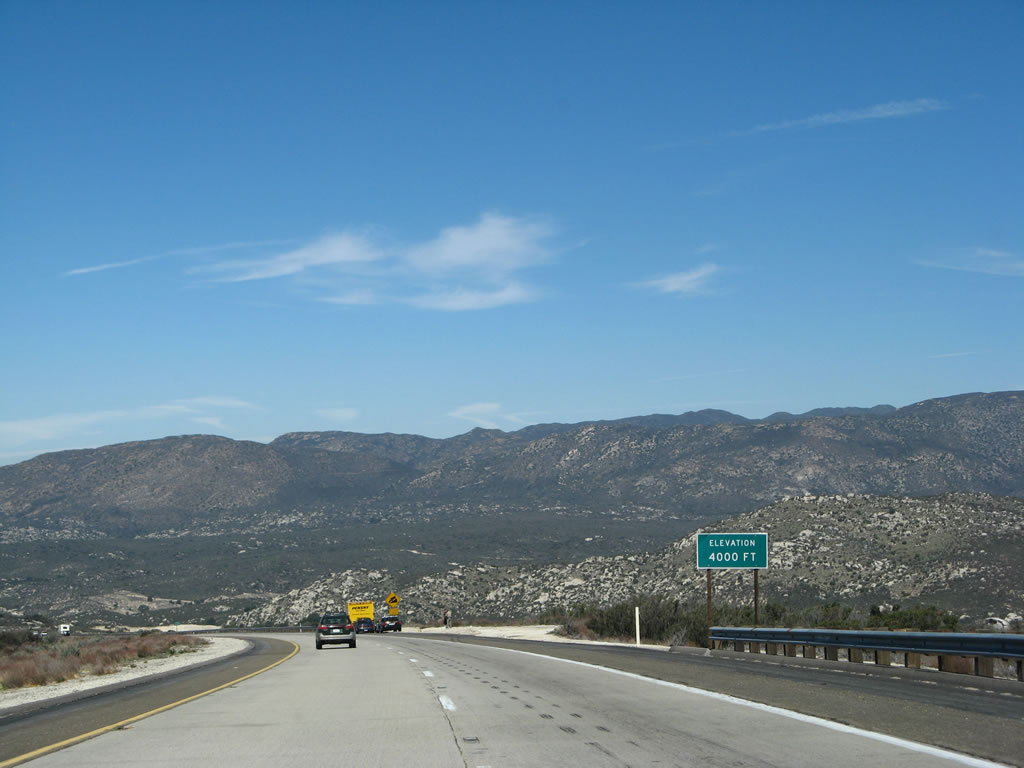
Shortly thereafter, we pass 4,000 feet. This amounts to a net gain of 1,000 feet in elevation between Exits 77 and 61, a distance of about 16 miles. However, some of that distance includes the westbound downgrade into Jacumba. Photo taken 03/19/07. |
|
|
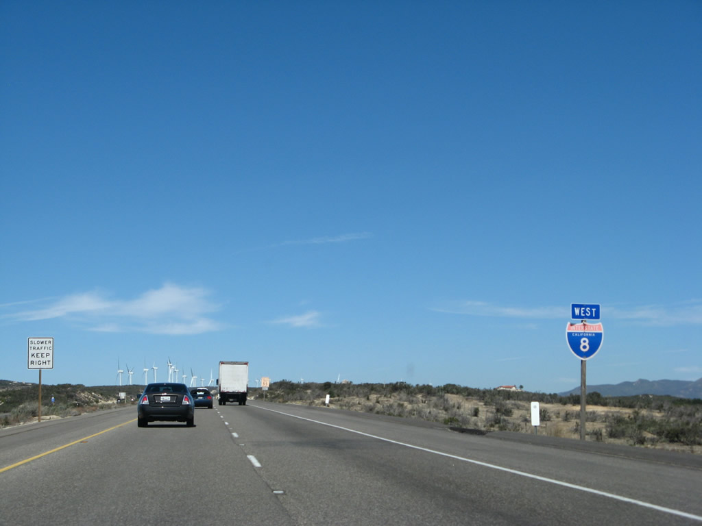
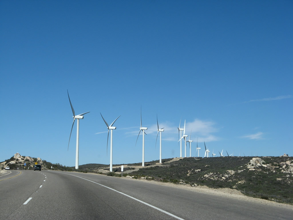
At the Tecate Divide, a line of 25 wind turbines generate electricity for the Campo Indians at the Kumeyaay Wind Farm. Babcock and Brown manages the wind power generation facility, and they sell excess generation back to the electrical grid. A set of wooden power lines carries the electricity to the San Diego Gas and Electric Company power grid. According to a press release from General Electric (GE Energy Financial Services), which helped finance construction of the facility along with Babcock and Brown, the wind power generation facility came on line on December 28, 2005.2 Photos taken 03/19/07. |
|
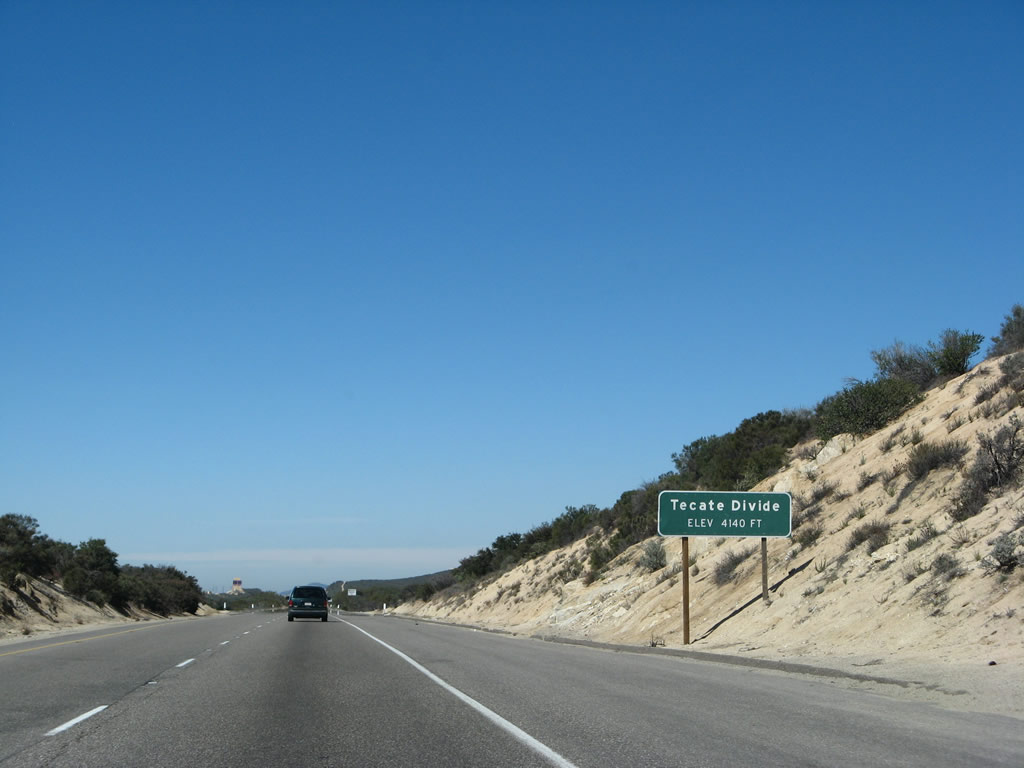
Interstate 8 crosses a series of high points between the top of In-Ko-Pah Gorge and Alpine. Along westbound, the first of these high points was In-Ko-Pah Gorge, and the next high point is here at Tecate Divide, elevation 4,140 feet. After this high point, the Interstate will cross two more high points, one each at Crestwood Summit and Laguna Summit at the Sunrise Highway interchange. Here we approach Tecate Divide, the second highest point on Interstate 8. Photo taken 03/19/07. |
|
Now at Tecate Divide (el. 4,140 feet), Interstate 8 again flattens out after a long climb uphill. In the distance is the Golden Acorn Casino, which is another enterprise of the Campo Band of Kumeyaay Indians. Interstate 8 will again flirt with Old U.S. 80 at that interchange. Photo taken 03/19/07. |
|
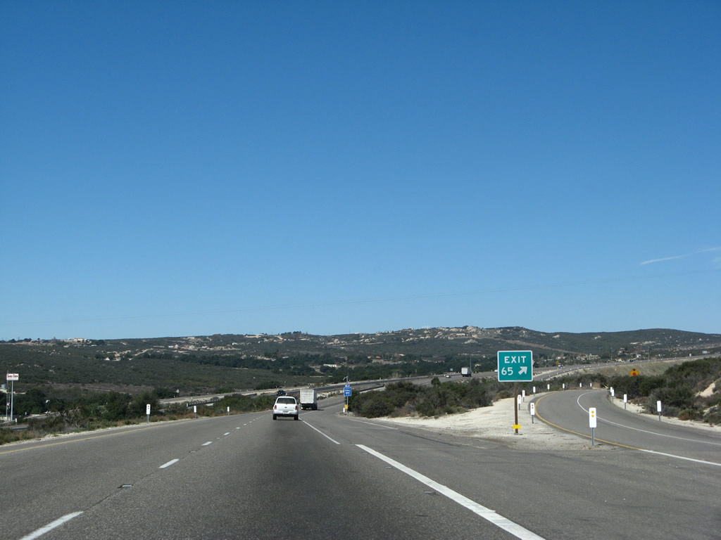
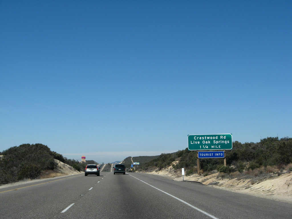
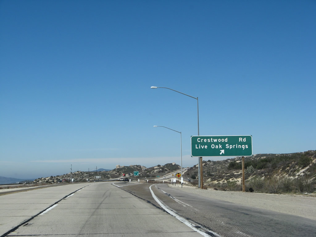
The next exit along westbound Interstate 8 is Exit 61, Crestwood Road, one and one-quarter miles. Crestwood Road leads south to Live Oak Springs, a community located along Old U.S. 80 as well as the Golden Acorn casino, one of two casinos located directly along Interstate 8 in the San Diego County backcountry. While the approach to Exit 61 was built in 1967, the interchange itself was built in 1974. Between 1967 and 1974, all traffic had to use Old U.S. 80. Photo taken 03/19/07. |
|
This blue services guide sign is the only indication that the next interchange is Exit 61. Food, lodging, and camping are all available at this exit, plus the motorist services (gas) offered by Golden Acorn Casino that are curiously omitted here. Photo taken 03/19/07. |
|
Use Exit 61, Crestwood Road to three bands of Kumeyaay Indians: Campo, La Posta, and Manzanita. This exit also connects to Historic U.S. 80. Follow Crestwood Road south to Old Highway 80, then choose east to Live Oak Springs or west to La Posta Road. Photo taken 03/19/07. |
|
Westbound Interstate 8 reaches Exit 61, Crestwood Road. The Golden Acorn Casino is a relatively recent addition to the landscape here, opening in the early 2000s. It is the first full-service truck stop along westbound since leaving El Centro. Photo taken 03/19/07. |
|
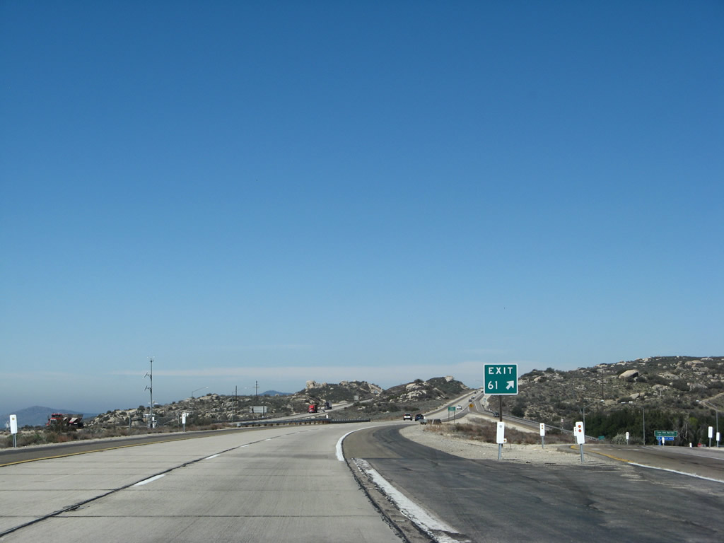
Once again, the exit number only appears at the gore point (unless we count the blue service guide sign). From here west to the interchange with California 79 (Exit 40), Interstate 8 was built in 1974, including the monumental Pine Valley Creek Bridge. Prior to that, all traffic had to use Old U.S. 80. Photo taken 03/19/07. |
|
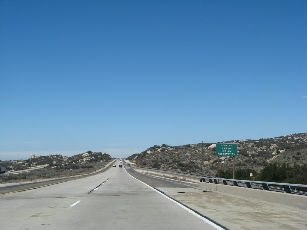
After Exit 61, Interstate 8 leaves the Campo Indian Reservation. Photo taken 03/19/07. |
|
This Interstate 8 west reassurance shield is posted after the Crestwood Road interchange. From here, the freeway begins another climb, this time to Crestwood Summit, which is the highest point on Interstate 8. Photo taken 03/19/07. |
|
Two boulders hang out on the south side of the freeway as westbound Interstate 8 ascends to Crestwood Summit. Photo taken 03/19/07. |
|
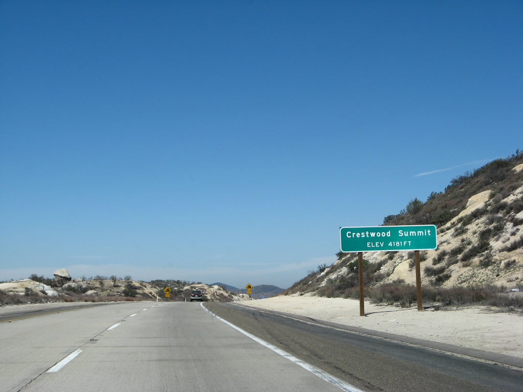
At an elevation of 4,181 feet, Crestwood Summit is only 41 feet higher in elevation than the Tecate Divide, but it is enough to make this point the highest anywhere along Interstate 8 in California and Arizona. This high point is located shortly after Exit 61. High winds frequently plague this area, causing troubles for trucks, high-profile vehicles, and towing vehicles. However, the views of the miles and miles of unspoiled terrain from these summits is unparalleled. Photo taken 03/19/07. |
|
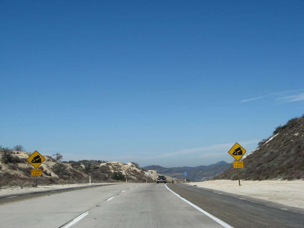
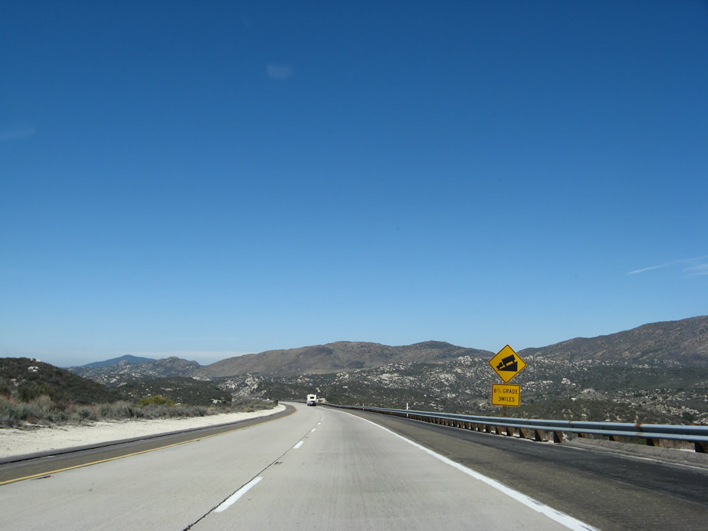
The next four miles involve a six percent downhill slope. Trucks are advised to use caution while descending from Crestwood Summit. Photo taken 03/19/07. |
|
Descending below 4,000 feet elevation again, the majestic Laguna Mountains, including Sheephead Mountain, come into view. Photo taken 03/19/07. |
|
Continuing down, we enter La Posta Indian Reservation, which is adjacent to the Campo Indian Reservation. Photo taken 03/19/07. |
|
|
With the Laguna Mountains in the distance, Interstate 8 continues downhill. Photo taken 03/19/07. |
|
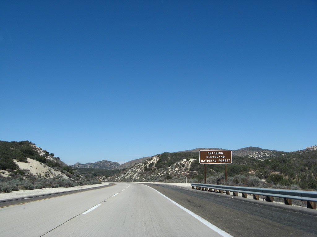
After the Crestwood Summit, Interstate 8 enters Cleveland National Forest. Cleveland National Forest does not have many trees present here to prove its status as a forest, but most of the trees are found at higher elevations. Photo taken 03/19/07. |
|
Reaching the bottom of the six percent grade, Interstate 8 crosses La Posta Creek and Thing Valley Road on two high-level bridges. These bridges were improved during summer 2006. Photo taken 03/19/07. |
|
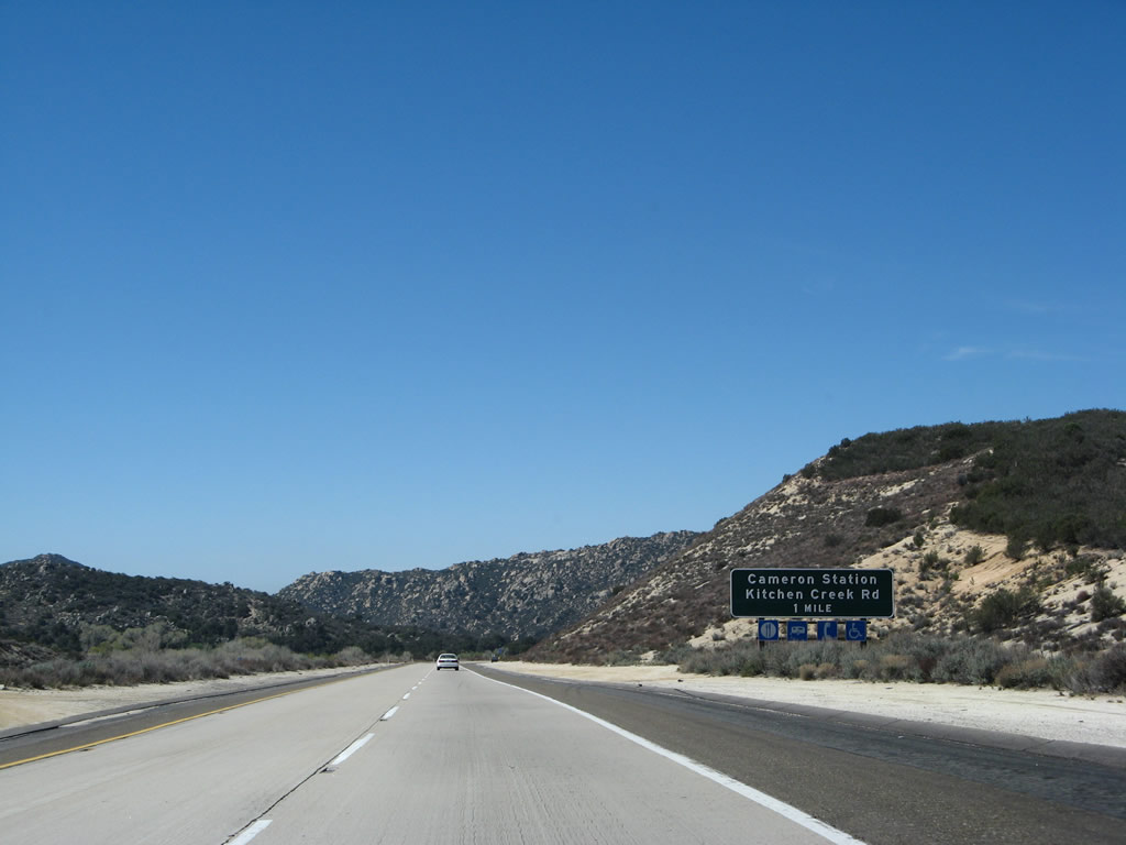
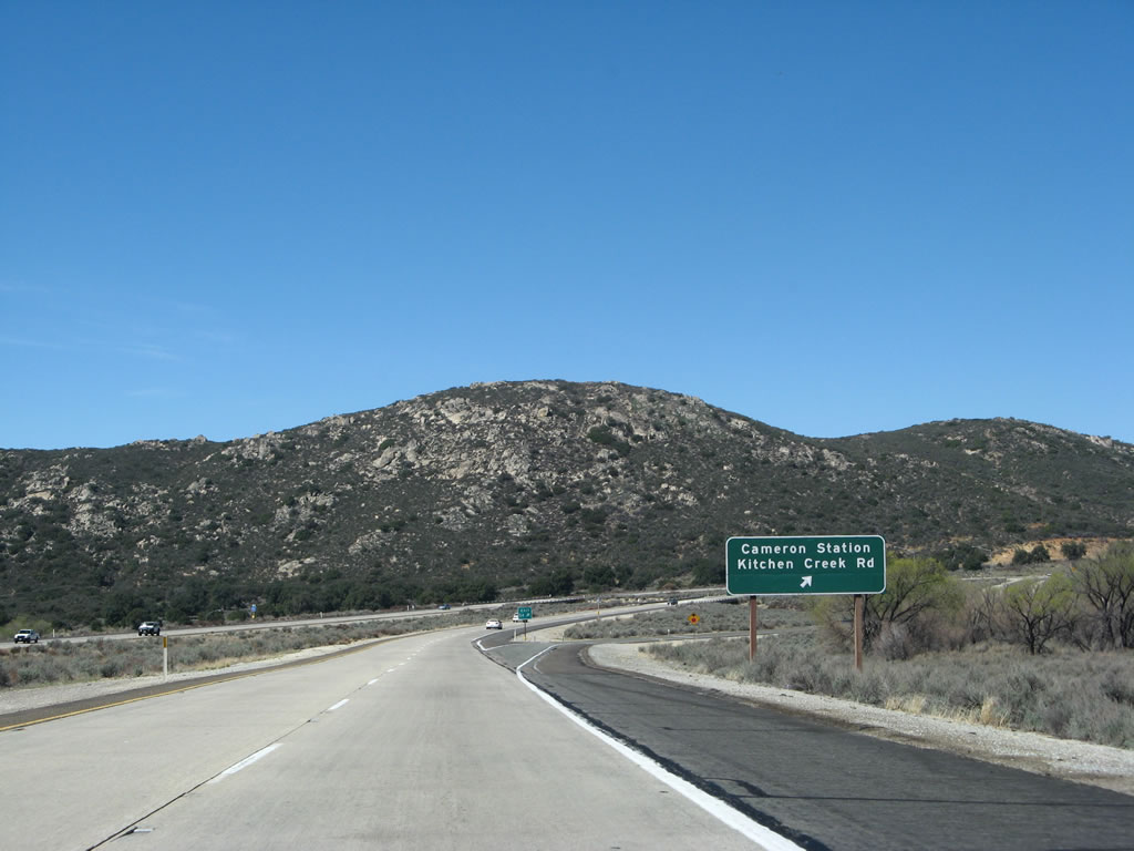
The next exit along westbound Interstate 8 is Exit 54, Kitchen Creek Road, one mile. Kitchen Creek Road leads south to Cameron Station and connects to Old U.S. 80. Photo taken 03/19/07. |
|
Westbound Interstate 8 reaches Exit 54, Kitchen Creek Road and Cameron Station. Photo taken 03/19/07. |
|
This reassurance shield for Interstate 8 west is posted after the Kitchen Creek Road interchange. In the distance is Los Pinos Mountain; to avoid it, Interstate 8 turns north between here and Laguna Summit. Photo taken 03/19/07. |
|
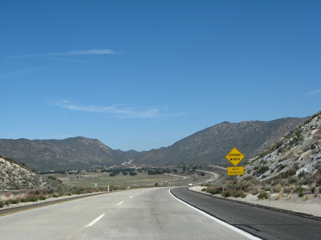
Strong winds remain possible on Interstate 8; this sign advises that 22 miles of wind gusts remain likely until near Alpine. Photo taken 03/19/07. |
|
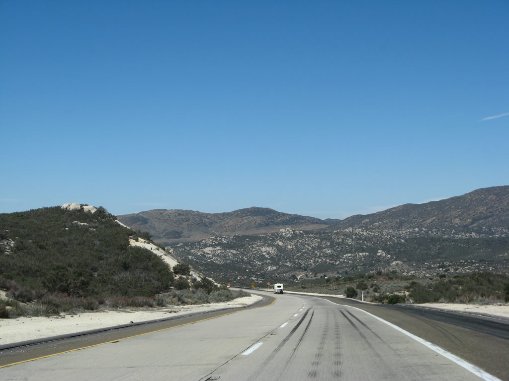
Coming into the valley where Interstate 8 will meet Buckman Springs Road, this expansive view shows Interstate 8 and U.S. 80 parallel to each other; together they will ascend the east slope of the Laguna Mountains to the Laguna Summit. Photo taken 03/19/07. |
|
Here, Interstate 8 crosses over Kitchen Creek. Now that we are briefly traveling north, Sheephead Mountain sits to the east of the freeway, while Long Valley Peak sits to the north and Los Pinos Mountain sits to the west near Lake Morena. Lake Morena is a reservoir owned by the city of San Diego and operated as a park by San Diego County. Both the Interstate 8 and U.S. 80 alignments can be seen in the distance. Photo taken 03/19/07. |
|
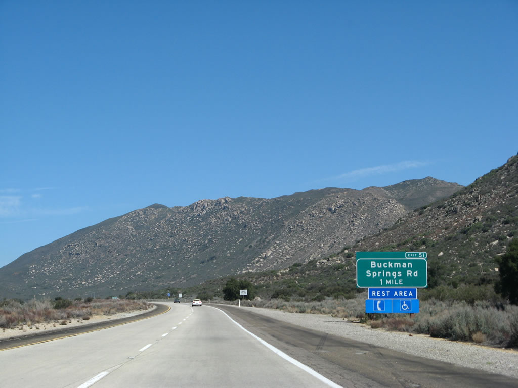
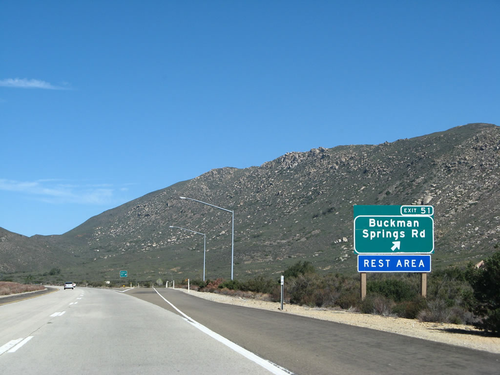
The next exit along westbound Interstate 8 is Exit 51, San Diego County S-1 (Buckman Springs Road), one mile. The final westbound rest area is located in the median of the freeway that may be accessed by taking this exit; like the Grays Well Rest Area in the sand dunes, the rest area is shared by both directions. Photo taken 03/19/07. |
|
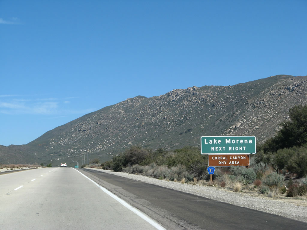
San Diego County S-1 (Buckman Springs Road) leads south to Lake Morena, one of the reservoirs in the City of San Diego system for water storage, and ends at its junction with California 94 at Cameron Corners just north of Campo. Photo taken 03/19/07. |
|
Westbound Interstate 8 reaches Exit 51, southbound San Diego County S-1 (Buckman Springs Road). For Northbound San Diego County S-1, use Exit 47. Between Exits 51 and 47, County Route S-1 follows Old U.S. 80, which parallels Interstate 8 to the west of the freeway (remember, we are still traveling north at this point). Photo taken 03/19/07. |
|
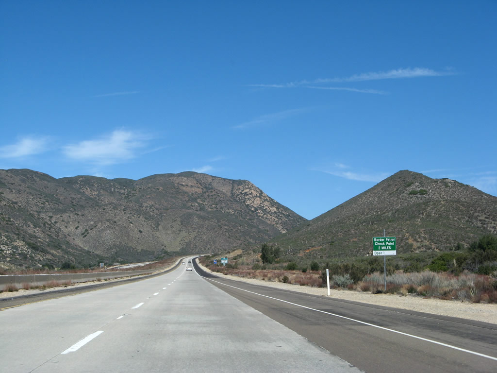
Both Interstate 8 and Old U.S. 80/San Diego County S-1 approach the U.S. Border Patrol Checkpoint within two miles of the Buckman Springs Road interchange (Exit 47). This tiny sign is the first advance warning of the pending checkpoint. Long Valley Peak dominates the view to the west of the freeway (el. 4,905 feet), while Sheephead Mountain is the tall peak on the east side of the freeway (el. 5,896 feet). Photo taken 03/19/07. |
|
This Interstate 8 reassurance shield is posted on westbound after the Buckman Springs Road interchange. Long Valley Peak continues to dominate the view looking north. Photo taken 03/19/07. |
|
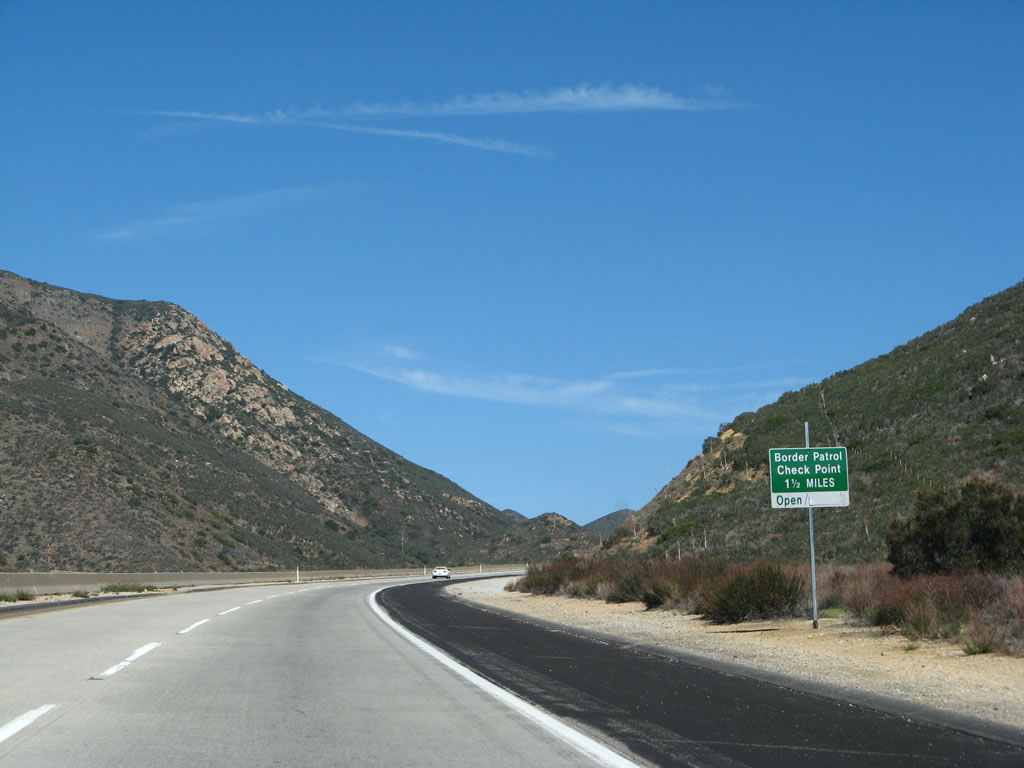
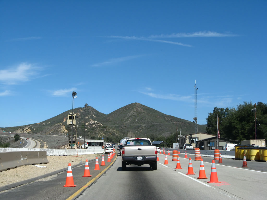
All vehicles must stop at the U.S. Border Patrol Checkpoint. Unlike other checkpoints, this one is not associated with a weigh station or port of entry. Federal agents reserve the right to ask questions about origin or destination of travel, and they may request a thorough inspection of vehicles if they have reason to investigate further. Photo taken 03/19/07. |
|
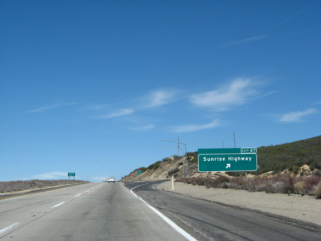
The next exit along westbound Interstate 8 is Exit 47, San Diego County S-1/Old U.S. 80/Sunrise Highway. San Diego County S-1 southbound follows Old U.S. 80 eastbound back to near the previous exit. Meanwhile, the right lane ends in advance of the checkpoint. Photo taken 03/19/07. |
|
Westbound Interstate 8 approaches the U.S. Border Patrol checkpoint. Traffic on eastbound Interstate 8 is not normally required to stop at this point, although there is increase lighting on both directions to allow agents to see people using the freeway especially at night. Photo taken 03/19/07. |
|
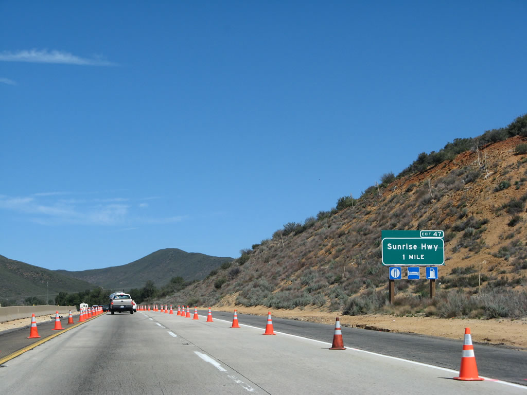
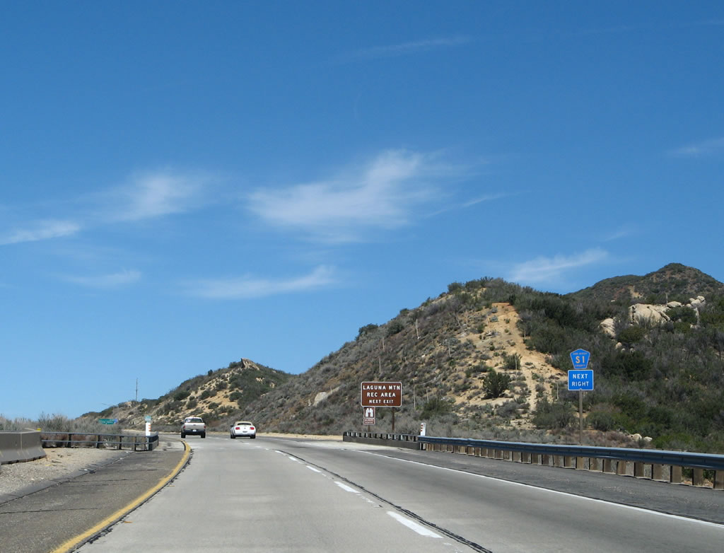
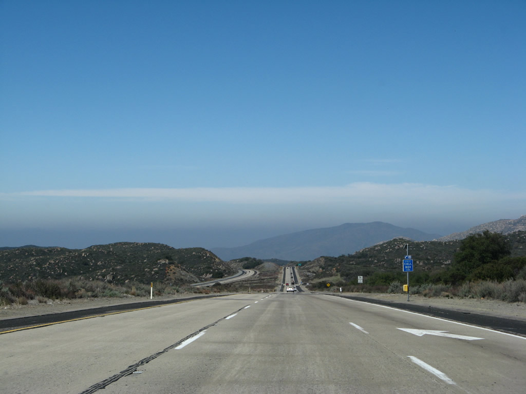
To the north, San Diego County S-1 follows the Sunrise Highway, a locally famous drive known for its magnificent views of the Imperial Valley desert spread out at the base of the tall Laguna Mountains. County Route S-1 leads to some of the highest points in this part of the Cleveland National Forest, with ample hiking opportunities and sometimes even abundant snowfall in the winter. Photo taken 03/19/07. |
|
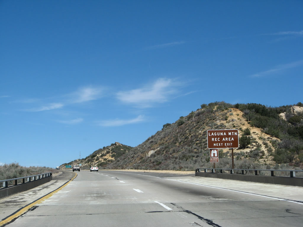
The Laguna Mountain Recreation Area includes a variety of trails and vista points located along San Diego County S-1 (Sunrise Highway) within the Cleveland National Forest. Around 5,000 feet in elevation, pine trees dominate the view, and the national forest earns its status as a forest. If you have time, it is well worth the trip, including views of the Imperial Valley from on top of the Laguna Mountains. Photo taken 03/19/07. |
|
Westbound Interstate 8 reaches Exit 47, San Diego County S-1/Old U.S. 80/Sunrise Highway. East of this interchange, Old U.S. 80 was paralleling the freeway to the south; it crosses over the freeway here, then continues along the north side of the freeway to enter Pine Valley and Guatay. Note the 4,000-foot elevation sign as we approach the Laguna Summit. Photo taken 03/19/07. |
|
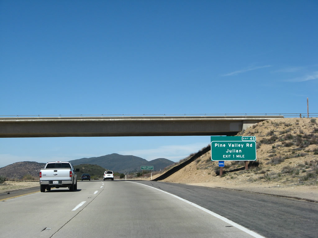
The next exit along westbound Interstate 8 is Exit 45, Pine Valley Road. This sign is located in front of the bridge carrying San Diego County S-1/Old U.S. 80/Sunrise Highway over the freeway and prior to the Laguna Summit. Photo taken 03/19/07. |
|
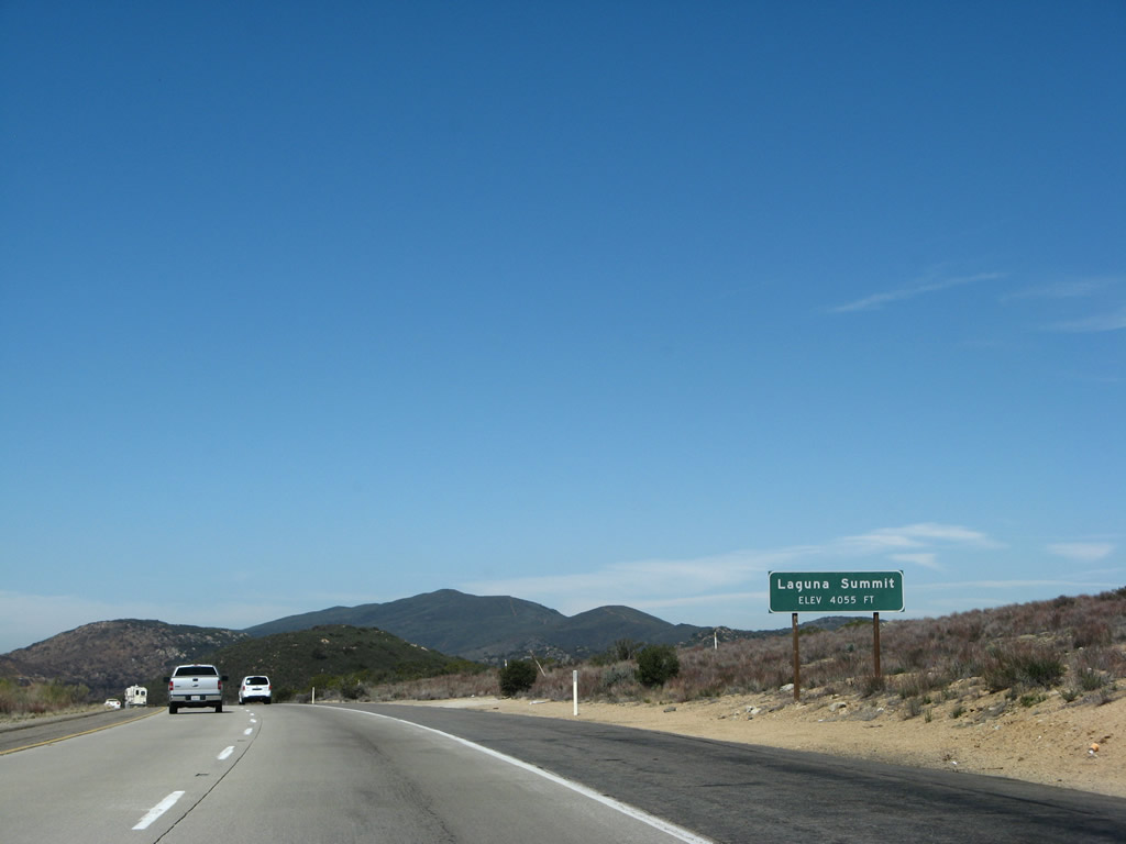
Located at an elevation that is lower than Crestwood Summit (4,181 feet) or Tecate Divide (4,140 feet), the Laguna Summit is the third highest point on Interstate 8, cresting at 4,055 feet. This is really not that much lower than either of the other two summits, but it is higher than the summit at the In-Ko-Pah Park Road interchange (which was around 3,000 feet). Photo taken 03/19/07. |
|
Descending toward Pine Valley, Interstate 8 again passes below 4,000 feet. The freeway will attain this elevation one more time before traveling down toward the coast. From here, Interstate 8 turns west again and will remain in that general trajectory all the way to the vicinity of Harbison Canyon. At that point, the freeway turns a bit southwest toward San Diego. Photo taken 03/19/07. |
|
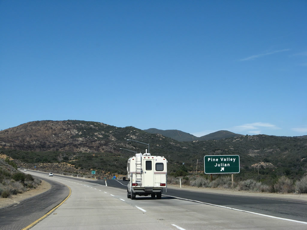
This Interstate 8 west reassurance shield is posted after the on-ramp from the Sunrise Highway interchange. Note the blue services sign that is posted after the shield; it features the exit number for Exit 45, Pine Valley Road. Exit 45 is the main exit to the community of Pine Valley, which features all services including food and gas and connects to Old U.S. 80, the main street through Pine Valley. Photo taken 03/19/07. |
|
Westbound Interstate 8 reaches Exit 45, Pine Valley/Julian. This connector road leads north to meet Old U.S. 80 in Pine Valley. The old highway westbound passes through Guatay on its way to meeting California 79 at Descanso. California 79 leads north from Descanso to Julian. Eastbound Old U.S. 80 leads to San Diego County S-1 (Sunrise Highway), which in turn leads to scenic Mount Laguna. Photo taken 03/19/07. |
|
An Interstate 8 reassurance shield is posted on westbound after Exit 45. Photo taken 03/19/07. |
|
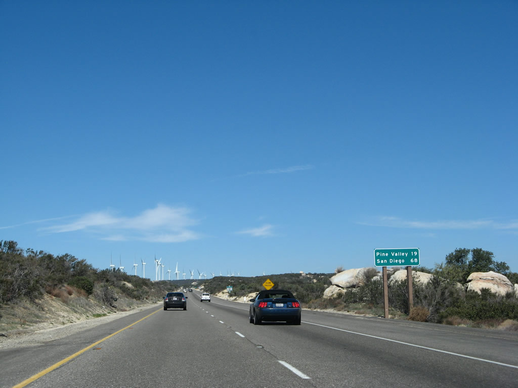
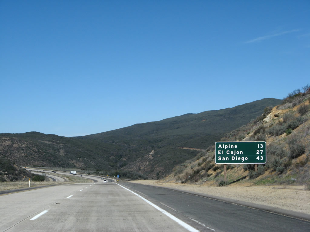
This mileage sign provides the distance to Alpine (13 miles), El Cajon (27 miles), and San Diego (43 miles). The next exit is in five miles at the junction with California 79. Photo taken 03/19/07. |
|
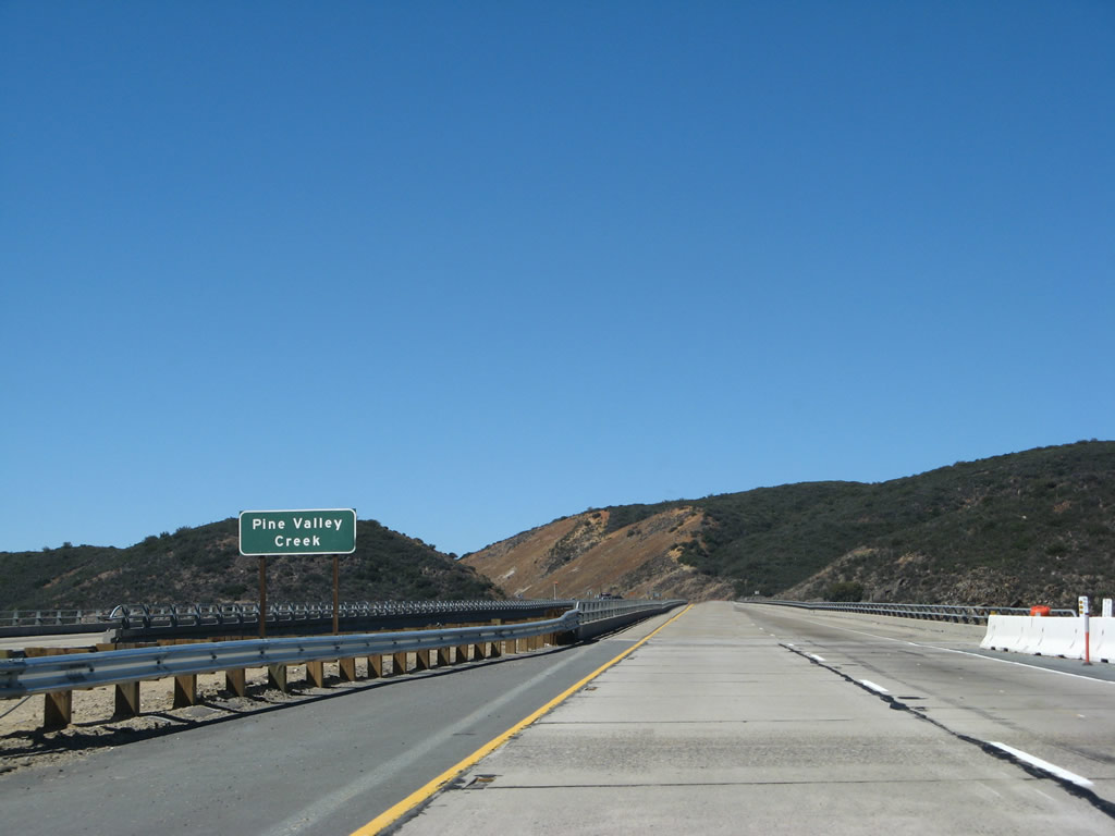
Interstate 8 west crosses over the Pine Valley Creek Bridge, which was the tallest bridge on the Interstate Highway System when it was constructed in 1974. The tallest bridge on the Interstate Highway System today is the Glade Creek Bridge on Interstate 64 in West Virginia, which passes 700 feet above Glade Creek. The Glade Creek Bridge is a deck steel truss bridge built in 1988.3, 4 The Pine Valley Creek Bridge was the first concrete bridge in the U.S. built by the segmental cantilever method. Under this construction method, the bridge superstructure was cantilevered out from the piers, segment by segment, until the two cantilevered sections met at mid-span.5 This method was used due to the height of the bridge. Photo taken 03/19/07. |
|
The Pine Valley Creek Bridge, which was built in 1974, carries the Interstate 8 freeway more than 300 feet above the Pine Valley Creek. Proposed California State Senate Concurrent Resolution 33 (SCR-33) was introduced on March 19, 2007, to rename the bridge in honor of Nello Irwin Greer. Mr. Greer was the project manager and engineer working for Caltrans at the time the Pine Valley Creek Bridge, and he was instrumental in helping to locate the bridge at this location rather than along the alignment of Old U.S. 80 in the communities of Guatay and Pine Valley.6 He made several design changes to keep the project within budget and became a consulting bridge engineer after he retired from Caltrans. Photo taken 03/19/07. |
|
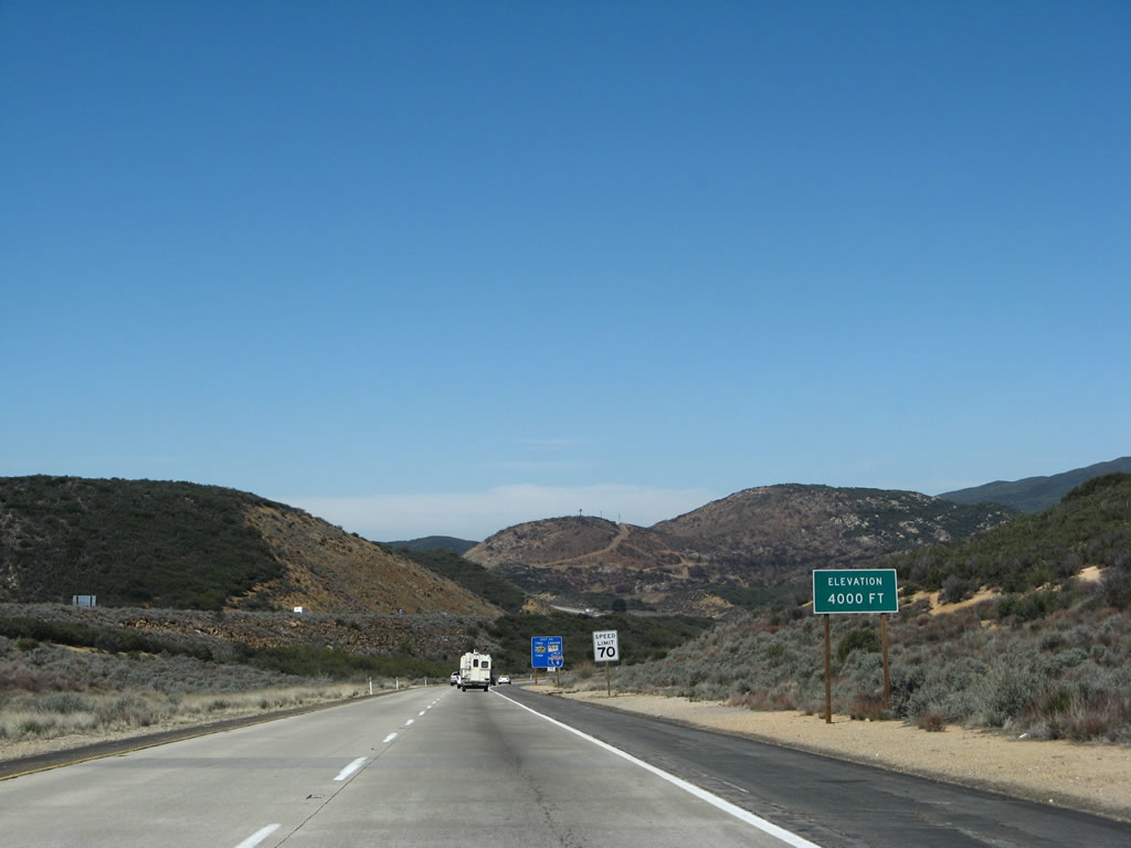
At the end of the Pine Valley Creek Bridge, westbound Interstate 8 expands to three lanes and begins its final ascent to the Pine Valley summit, the final point at which Interstate 8 reaches 4,000 feet. Photo taken 03/19/07. |
|
|
|
Approaching the Pine Valley summit, Interstate 8 will reach 4,000 feet, then begin its journey back toward sea level and west to the Pacific Ocean. Photos taken 03/19/07. |
|
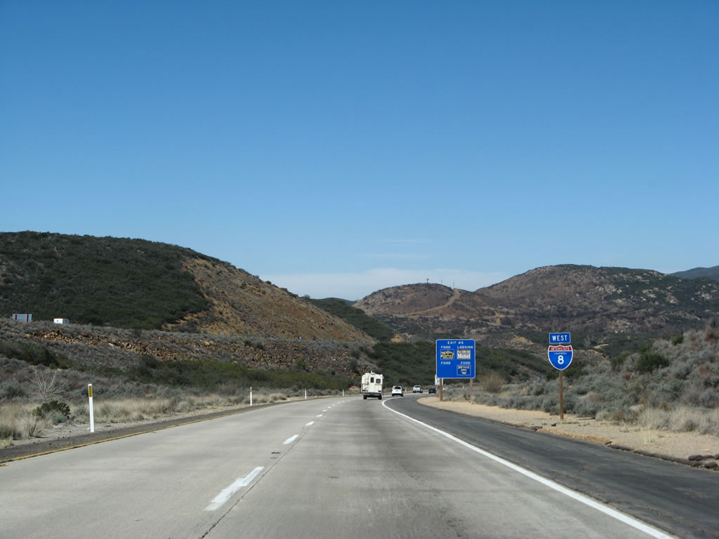
Continuing west on Interstate 8 (Kumeyaay Highway), the climbing lane ends. From here we begin a lengthy descent past Viejas Indian Reservation to Alpine. The clouds in the distance are the last of the morning clouds and fog to burn off from the coastal areas. Photo taken 03/19/07. |
|
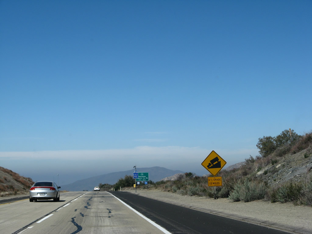
In fact, the descent is a full six percent grade for the next 13 miles, taking us from Milepost 41 to Milepost 28. Photo taken 03/19/07. |
|
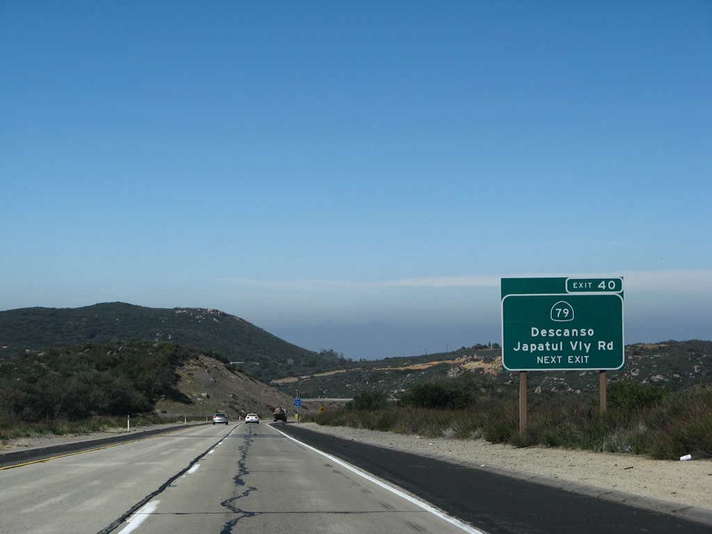
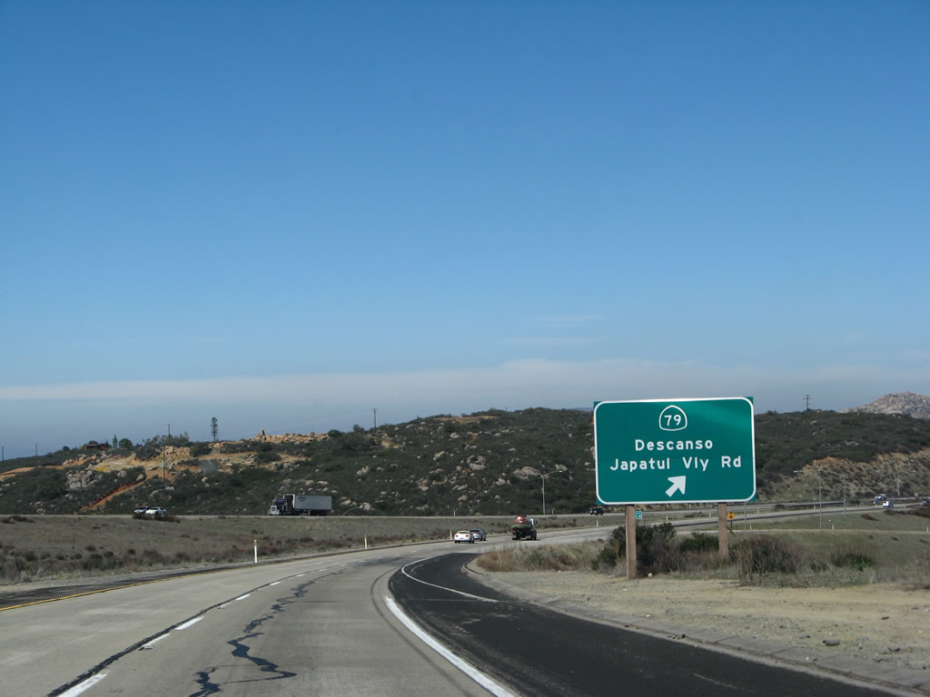
The next exit along westbound Interstate 8 is Exit 40, northbound California 79, one mile. California 79 passes through the Cleveland National Forest and Rancho Cuyamaca State Park en route to Julian and Temecula. It passes through some of the most rural, pristine, and scenic portions of San Diego County. Photo taken 03/19/07. |
|
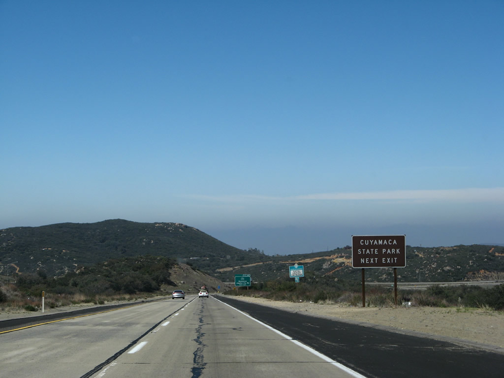
California 79 travels north to Cuyamaca Rancho State Park, which is experiencing a rebirth in the aftermath of the devastating October 2003 Cedar Fire. The park is mostly reopen after the blaze, and the area has rebounded especially after the soaking rains of Winter 2004-2005. Photo taken 03/19/07. |
|
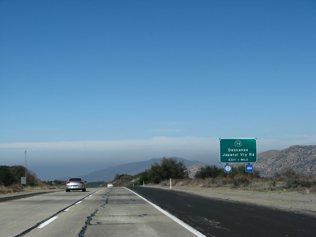
Use Exit 40 to connect to northbound California 79 en route to Rancho Cuyamaca State Park and Julian. To the south is locally maintained Japatul Valley Road. Japatul Valley Road leads south into Japatul Valley, then turns west to meet with Tavern Road south of Alpine. It can be used as a scenic alternate route to Dehesa Road, Sycuan Indian Reservation, and Singing Hills Golf Course. Photo taken 03/19/07. |
|
Westbound Interstate 8 reaches Exit 40, California 79 north to Descanso/Julian and Southbound (Westbound) Japatul Valley Road. There is an excellent extant section of Old U.S. 80 accessible from this interchange. Follow California 79 north to Los Terrinitos Road, then turn left, crossing an old arch bridge over the Sweetwater River that carried U.S. 80 traffic in the 1930s. Continuing along Los Terrinitos, turn left at Wildwood Glen Lane. Follow the concrete road west past the "End County Maintenance" sign (on foot, since the barricade added after the Cedar Fire of October 2003 has not been removed). Here is Old U.S. 80 in its glory, a road that has no outlet and is now used by hikers and old road buffs. The road ends at a bluff looking over Interstate 8. Heading back, you can check out the 1950s-era bridge crossing the Sweetwater River along Wildwood Glen Lane before returning to California 79. Photo taken 03/19/07. |
Page Updated August 31, 2008.