
Interstate 8 West - California 79 to California 125
| Interstate 8 (Kumeyaay Highway) west | |
|---|---|
 |
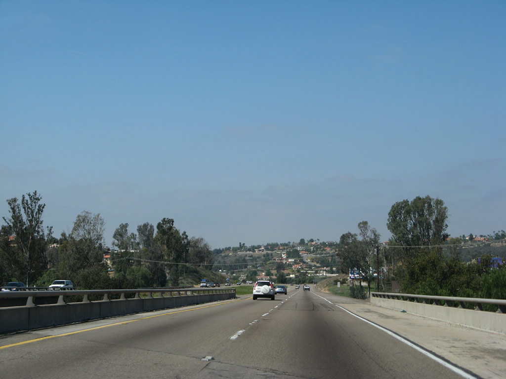
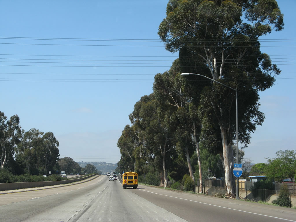
This reassurance shield for Interstate 8 (Kumeyaay Highway) west is posted after the California 79 interchange east of Alpine. Look to the north of the freeway to see the old alignment of U.S. 80, which was partially destroyed by the construction of Interstate 8 and is today impassable west of a barricade placed on the county road. Due to the lack of alternate routes, bicycles are allowed on Interstate 8 between Exits 40 and 36. This section of Interstate 8 was built in 1970. Near here, Interstate 8 passes over the Sweetwater River, which flows southeast toward San Diego Bay. Photo taken 03/19/07. |
 |
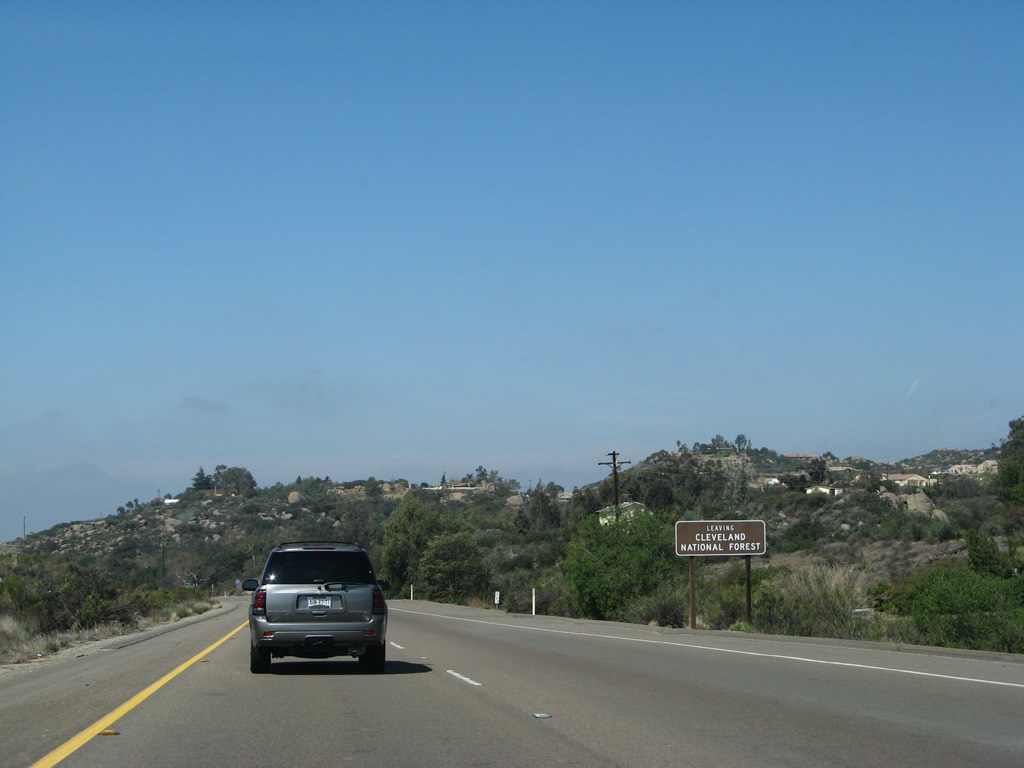
The view behind this mileage sign, located after the California 79 interchange, shows the undeveloped beauty of the Cleveland National Forest. Aforementioned segments of old U.S. 80 are visible in the distant cuts in the hillside to the right (north) of the freeway. The next community of significance is Alpine, the first "suburb" of San Diego along westbound. Some aspects of development, such as tract housing and strip malls, become evident for the first time since leaving El Centro. Photo taken 03/19/07. |
 |
The cut for the old alignment of U.S. 80 is clearly visible in this photo as the unused old alignment approaches the modern freeway. From here west to Exit 36, the freeway was blasted through the rock and overlays the original route of U.S. 80. As a result, the old alignment is not passable through here. All traffic must use the freeway. Photo taken 03/19/07. |
 |
The next exit along westbound Interstate 8 is Exit 36, East Willows Road, one mile. This is Old U.S. 80, which follows the north side of the freeway through Viejas Indian Reservation, then switches to the south side of the freeway to serve the unincorporated community of Alpine. Photo taken 03/19/07. |
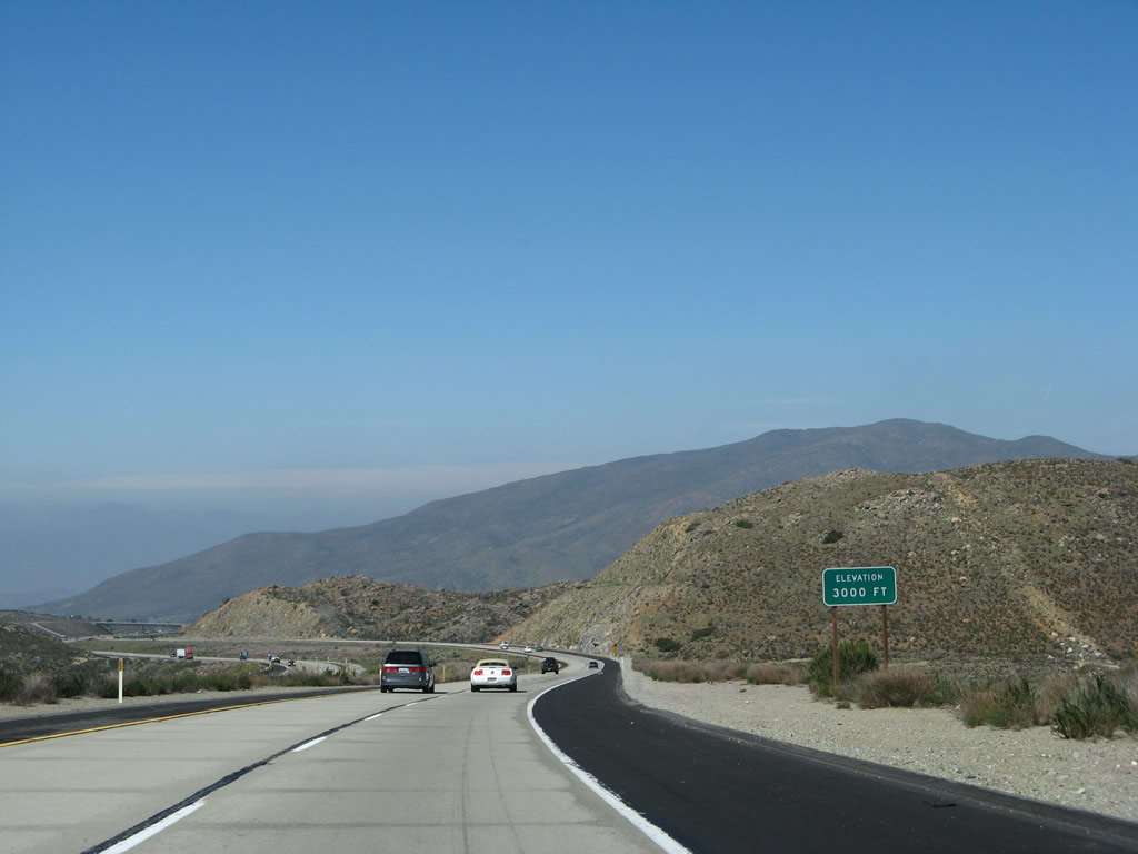 |
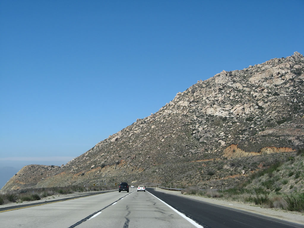
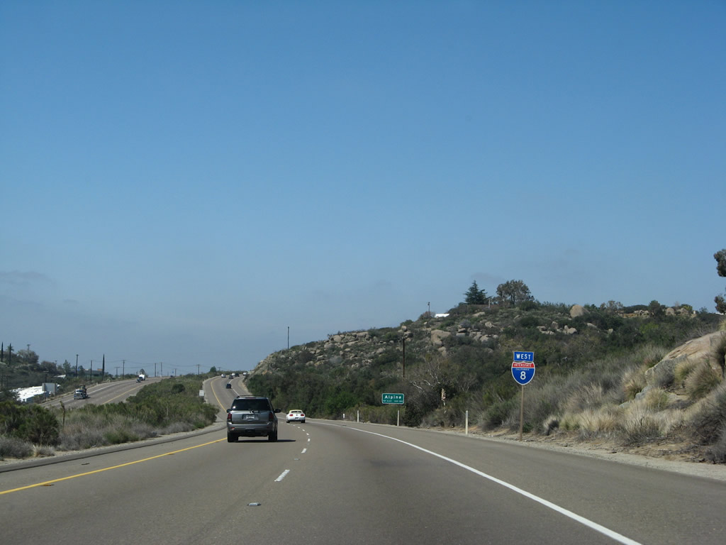
Over the course of about four miles, Interstate 8 has dropped 1,000 feet. The freeway is now 3,000 feet, and it will continue to swiftly lose elevation as it approaches Alpine. Interstate 8's bypass of Alpine was built in 1969, from Exit 36 west to Exit 27, Harbison Canyon Road. Photo taken 03/19/07. |
 |
Interstate 8 west connects to the Viejas Indian Reservation via Exit 36. A casino, food court, and outlet mall are located on the reservation via old U.S. 80 on the north side of the freeway. Photo taken 03/19/07. |
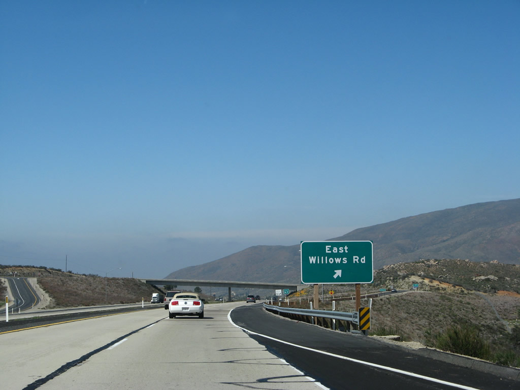 |
Westbound Interstate 8 reaches Exit 36, East Willows Road. East Willows Road is old U.S. 80, which leads west into Viejas Indian Reservation and the Viejas Casino. All bicycles must exit here. Photo taken 03/19/07. |
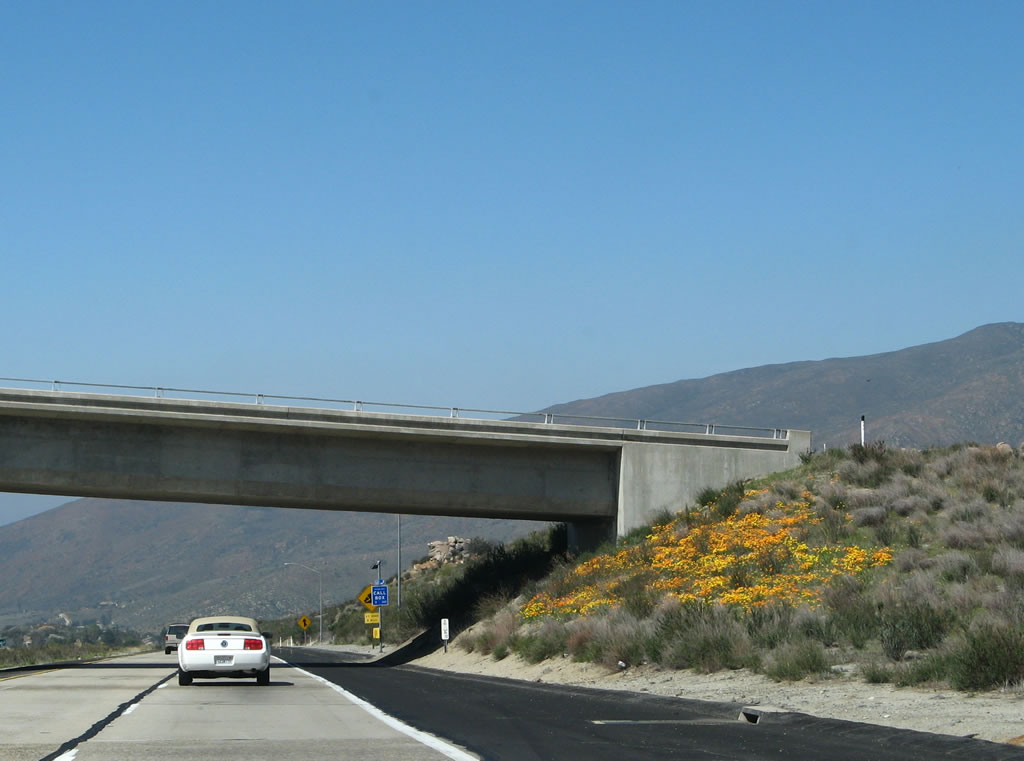 |
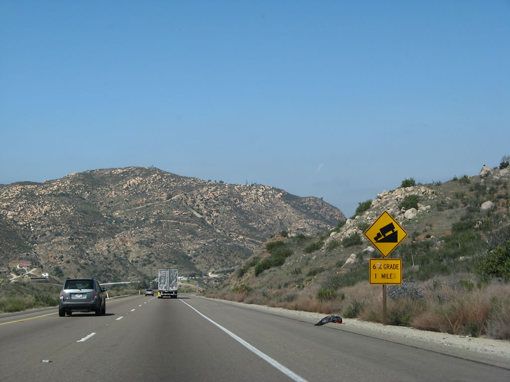
After the off-ramp to Exit 36, a small group of wildflowers offer color at the Willows Road overpass. Note the yellow warning sign in the distance, which advises that the steep downgrade continues for another eight miles. Photo taken 03/19/07. |
 |
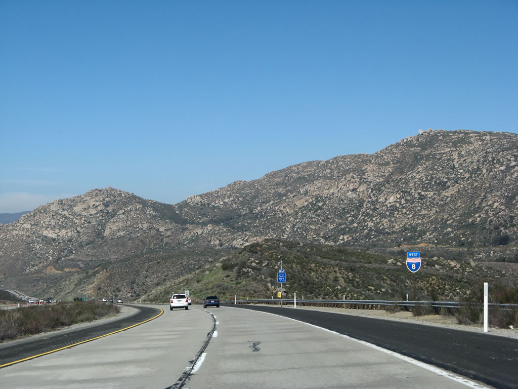
After Exit 36 is another triangular state named Interstate 8 shield. Photo taken 03/19/07. |
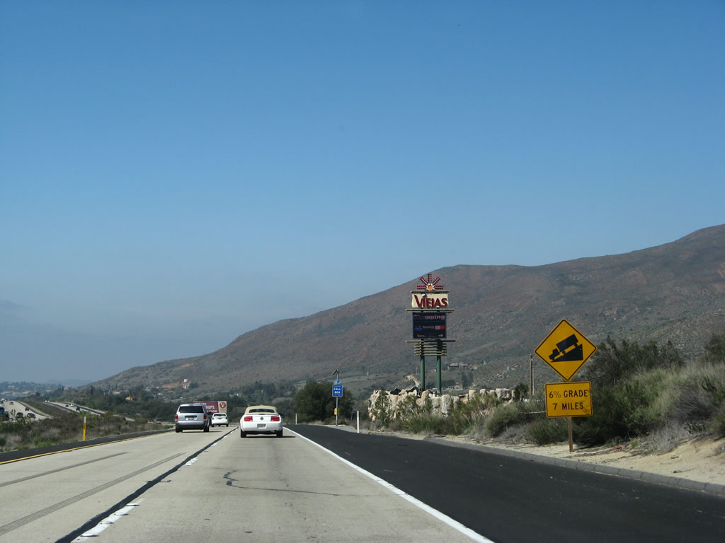 |
The bright lights and glare of the Viejas Casino can be especially visible at night after passing through the comparatively empty and serene mountain passes of the Laguna Mountains. This picture, which shows the Viejas marquee sign, was taken along westbound after Exit 36. Photo taken 03/19/07. |
|
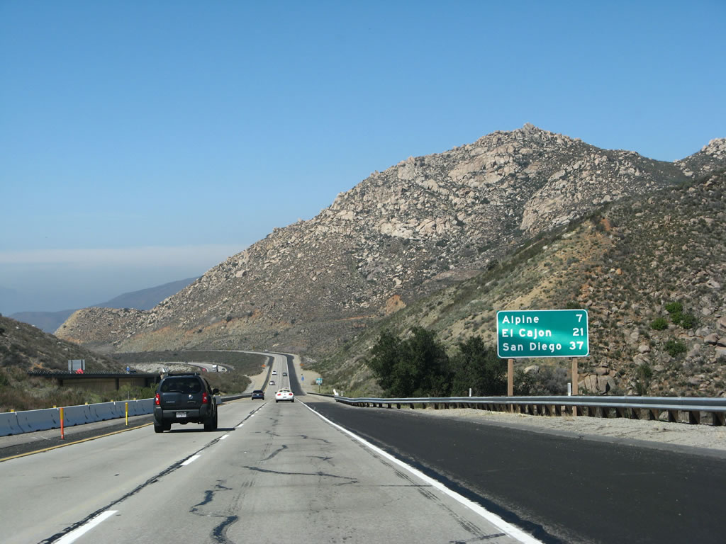
The next two interchanges serve the unincorporated community of Alpine. A business loop begins at Exit 33, travels along Alpine Boulevard through the community center, then returns to Interstate 8 at Exit 30, Tavern Road. This short business loop provides access into downtown Alpine, a young community that has experienced rapid growth and new development as a result of suburban expansion. Large tract housing developments are already prevalent, the result of the relatively cheaper land available for those willing to commute from here into the city. Photo taken 03/19/07. |
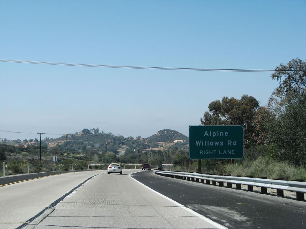 |
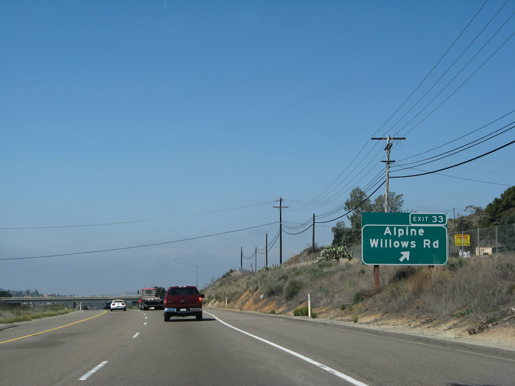
The next exit along westbound Interstate 8 is Exit 33, Business Loop I-8/Alpine Road and Willows Road. Willows Road is Old U.S. 80, and Business Loop I-8 also follows the historical alignment of U.S. 80 through Alpine. The old road was obliterated by the coming of Interstate 8, and now makes a hard turn to cross over Interstate 8. Photo taken 03/19/07. |
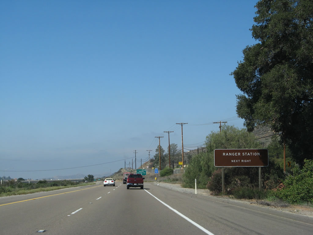 |
A Cleveland National Forest ranger station is located at Exit 33, U.S. 80 and Business Loop I-8 to Alpine. Photo taken 03/19/07. |
 |
Westbound Interstate 8 reaches Exit 33, Business Loop I-8 (U.S. 80)/Alpine Boulevard west and Old Historic U.S. 80 (Willows Road) east. Motorist services are available at Exit 30, Tavern Road, only three miles ahead. Photo taken 03/19/07. |
 |
Interstate 8 leaves Cleveland National Forest and enters the unincorporated community of Alpine shortly after Exit 33. Photo taken 03/19/07. |
 |
A reassurance shield for Interstate 8 west is posted shortly thereafter, and the Alpine community limits sign is posted beyond it. Photo taken 03/19/07. |
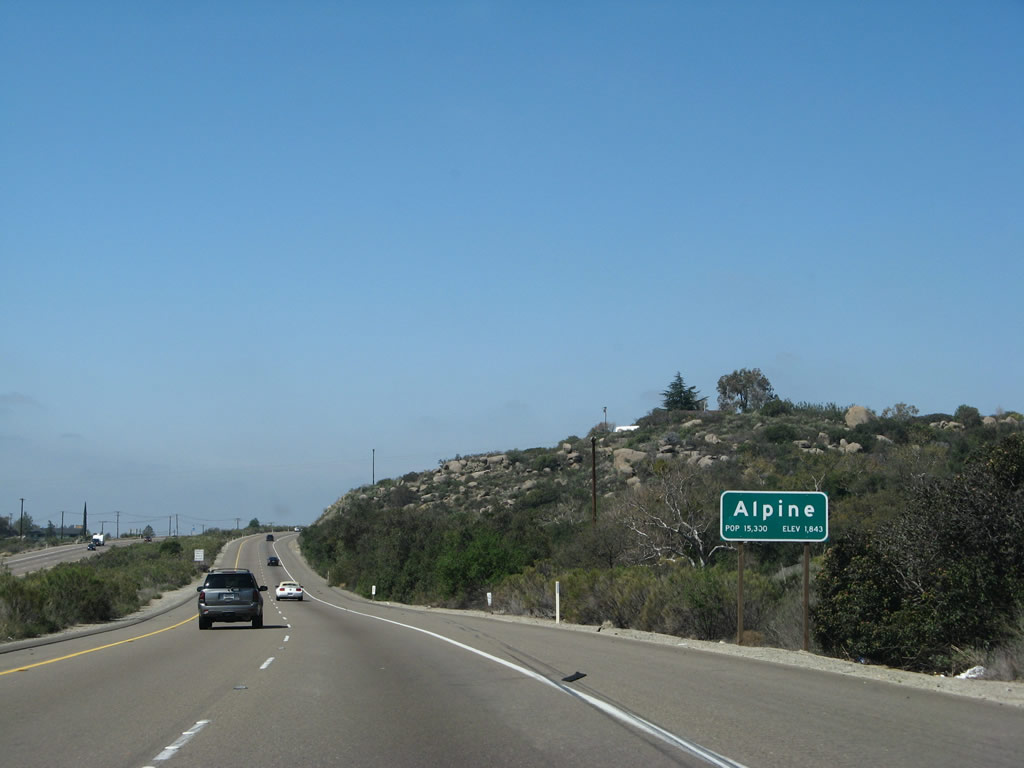 |
The community of Alpine, which is located at 1,843 feet at the town center, is home to 13,143 people as of the 2000 census. It is one of many "bedroom communities" that are growing rapidly in the San Diego region. Founded by Benjamin Arnold in 1887 while seeking a place suitable to cure his asthma, Alpine has grown through the years as a respite from urban living. Recently it has seen more development as the town continues to expand. Given this level of growth, some have considered whether Alpine should be incorporated as a city at some point in the future. This matter remains unresolved, and government services are provided by the county.1 Photo taken 03/19/07. |
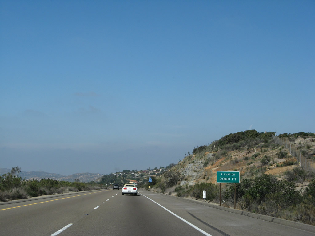 |
Continuing west, Interstate 8 descends below 2,000 feet. Photo taken 03/19/07. |
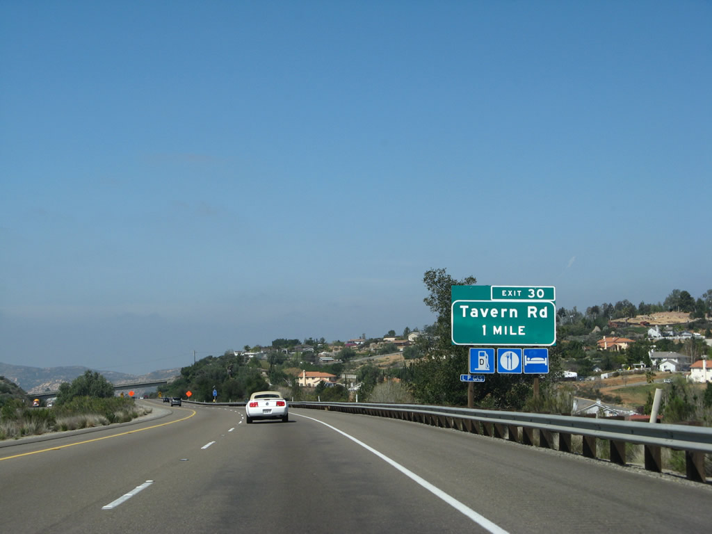 |
The next exit along westbound Interstate 8 is Exit 30, Eastbound Business Loop I-8, Tavern Road, one mile. The exit number sign was installed in November-December 2002 based on field checks. This exit features restaurants, motels, and gas stations, the first interchange with nationally recognized brands along westbound since leaving El Centro. Photo taken 03/19/07. |
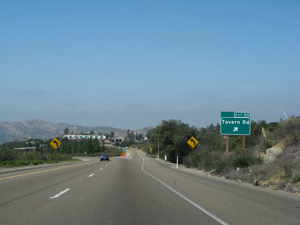 |
Westbound Interstate 8 reaches Exit 30, Business Loop I-8, Tavern Road. Business Loop I-8/Tavern Road leads east into Alpine. Services such as gas and food are available at Exit 30. Photo taken 03/19/07. |
 |
Interstate 8 passes under Tavern Road. Pine trees were planted around this diamond interchange, adding to the "Alpine" name. Photo taken 03/19/07. |
 |
This Interstate 8 west shield assembly is posted after the Tavern Road interchange (Exit 30). We are still descending on the six percent grade. Photo taken 03/19/07. |
 |
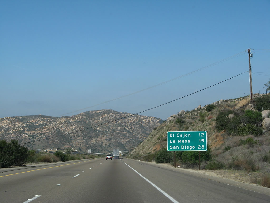
This mileage sign provides the distance to El Cajon (12 miles), La Mesa (15 miles), and San Diego (28 miles). Photo taken 03/19/07. |
 |
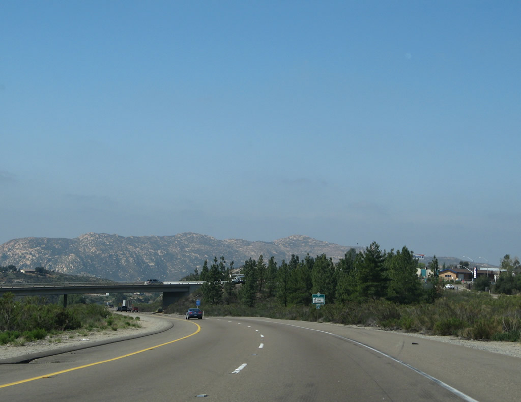
There is only one more mile for the six percent downgrade. Photo taken 03/19/07. |
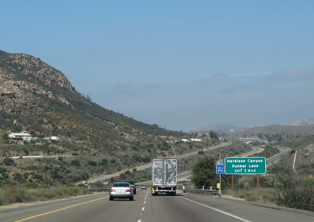 |
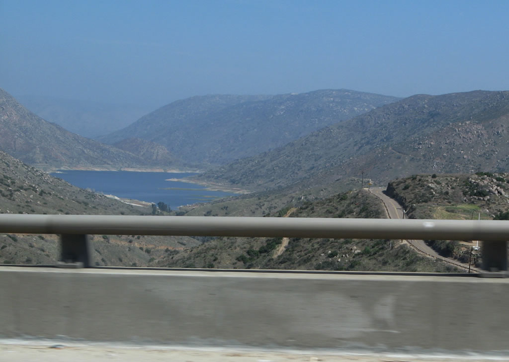
The next exit along westbound Interstate 8 is Exit 27, Harbison Canyon Road/Dunbar Lane, one mile. Look to the north at the bridge to see El Capitan Reservoir. Photo taken 03/19/07. |
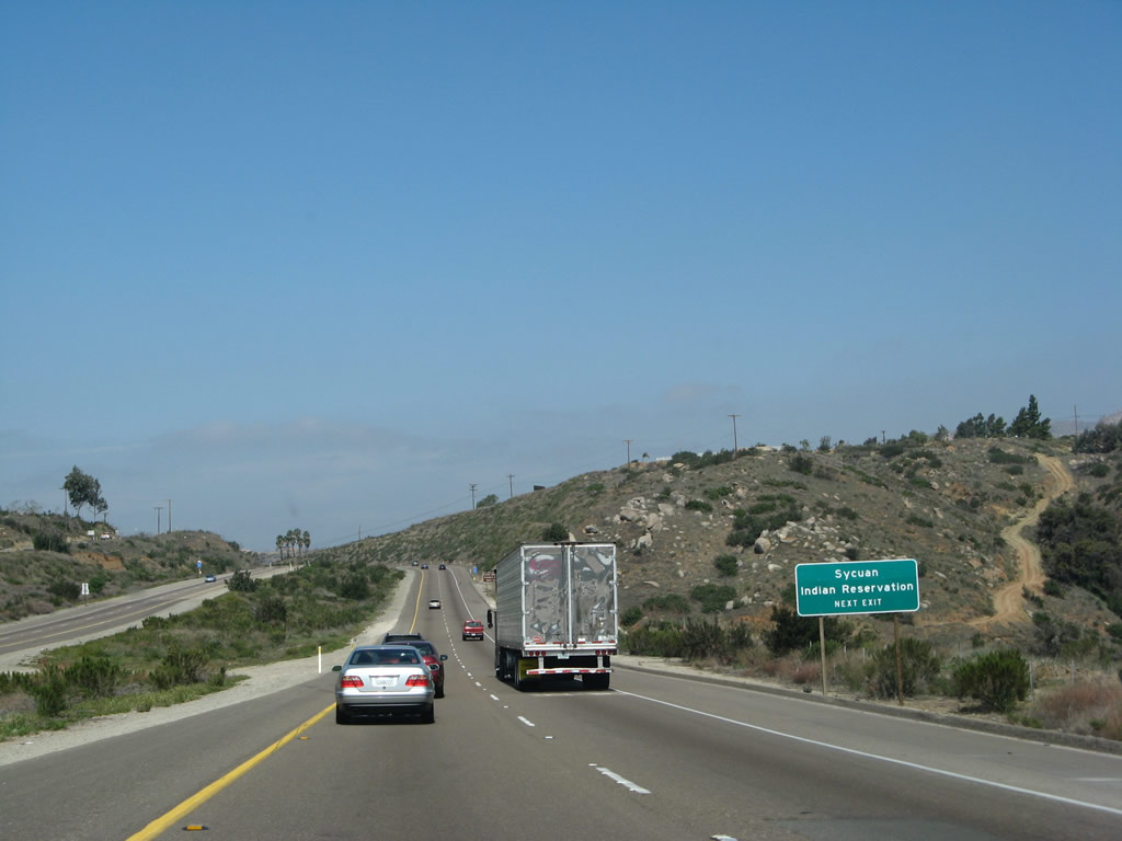 |
Use Exit 27 to follow Harbison Canyon Road south to Dehesa and Sycuan Indian Reservation. Photo taken 03/19/07. |
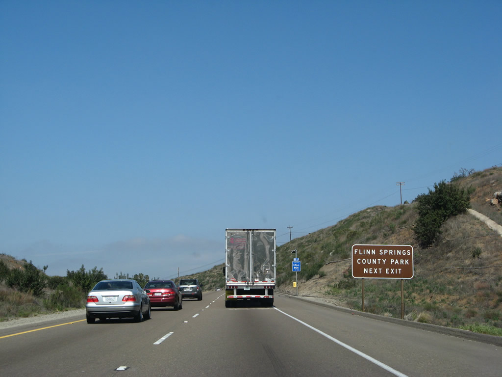 |
Use Old Highway 80 west from Exit 27 to Flinn Springs County Park. This 43-acre park is great for picnicking and active use. Photo taken 03/19/07. |
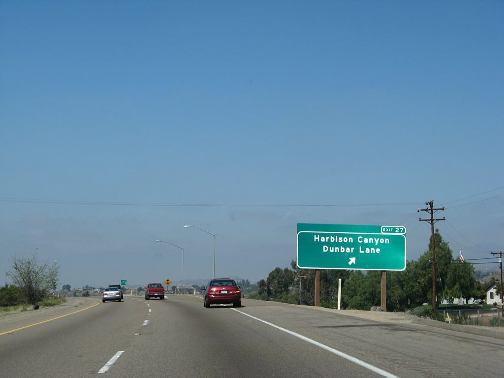 |
Westbound Interstate 8 reaches Exit 27, Harbison Canyon Road/Dunbar Lane. This exit connects to Old Highway 80 west to El Cajon and Old U.S. 80 east to Alpine via Alpine Boulevard. Between Exit 27 and Exit 20A, Business Loop I-8/Main Street, Interstate 8 was built in 1965. Photo taken 03/19/07. |
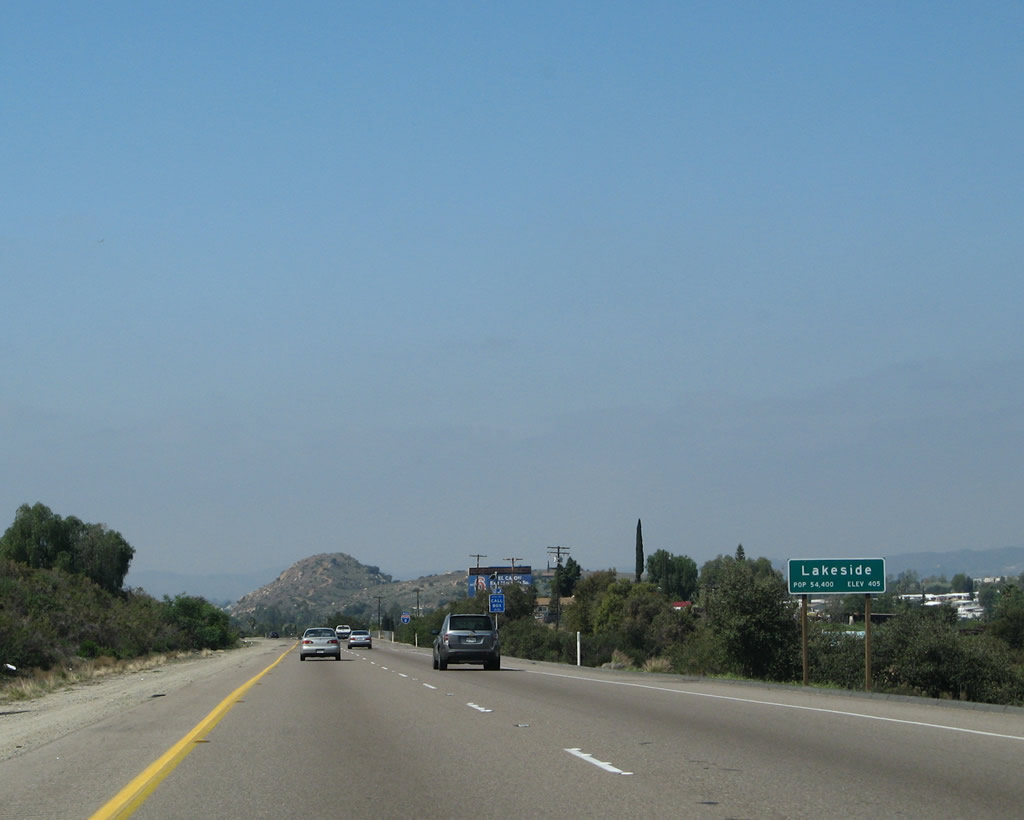 |
Leaving Alpine, Interstate 8 next enters the unincorporated community of Lakeside, which is home to 39,331 people as of the 2000 Census (including Winter Gardens). Interstate 8 touches the southeastern edge of Lakeside, then turns southeast toward El Cajon. Photo taken 03/19/07. |
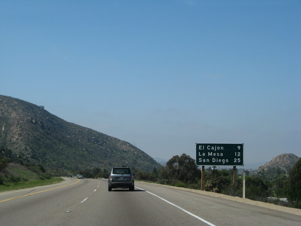 |
This mileage sign provides the distance to El Cajon (9 miles), La Mesa (12 miles), and San Diego (25 miles to downtown). Photo taken 03/19/07. |
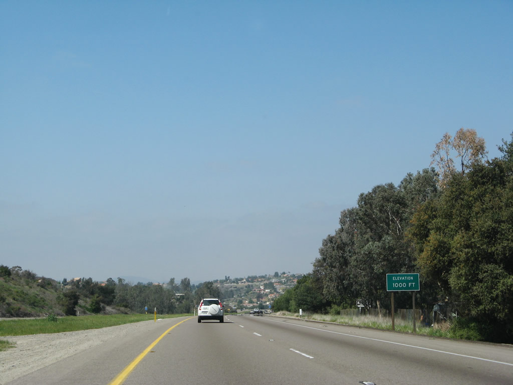 |
Interstate 8 again reaches 1,000 feet in elevation midway between Exit 27 (Harbison Canyon Road) and Exit 23 (Lake Jennings Park Road). Photo taken 03/19/07. |
 |
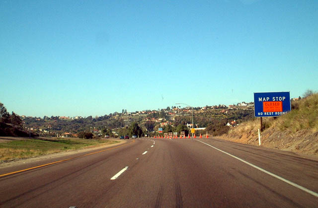
Interstate 8 passes over Olde Highway 80. A map stop (rest area with no facilities) used to be located at the curve in the freeway ahead, but the map stop was removed in 2003. Photo taken 03/19/07. |
 |
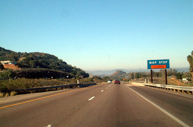 |
Back when it used to exist, these two photos show westbound Interstate 8 as it approaches the former Map Stop. The Map Stop was originally intended as a place to view a large map of San Diego and rest a bit prior to entering the city. However, this exit was closed in the early summer of 2002, because it was becoming a health hazard related to garbage and pollution. It is unclear if it will ever be reopened; the exit has since been barricaded and the lanes restriped so that the Map Stop is barely noticeable for westbound traffic. Photos taken 01/01/03. |
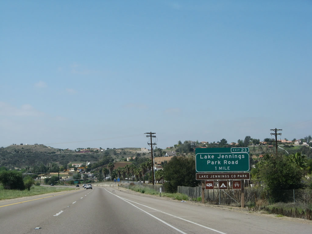 |
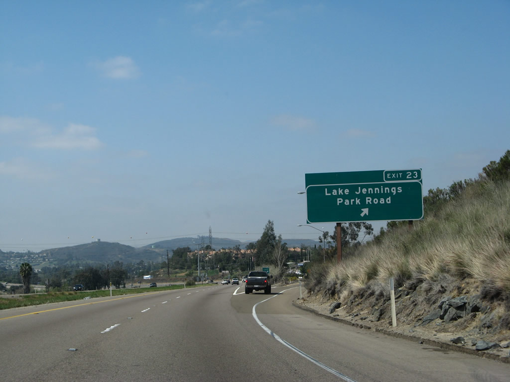
The next exit along westbound Interstate 8 is Exit 23, Business Loop I-8/Lake Jennings Park Road, one mile. Lake Jennings Park Road leads north to Lake Jennings County Park. This exit also connects to Old U.S. 80, known as "Olde Highway 80" east of this interchange and "Business Route 8" west of this interchange. Olde Highway 80 parallels the freeway to the south, while Business Route 8 is located north of the freeway. Both roads follow original U.S. 80. Business Route 8 is not signed with green business loop shields, but the road is shown as "Business Route 8" on each road sign (such as signs mounted on traffic signal mast arms). The next exit is Los Coches Road; Interstate 8 enters the city of El Cajon after that interchange. Photo taken 03/19/07. |
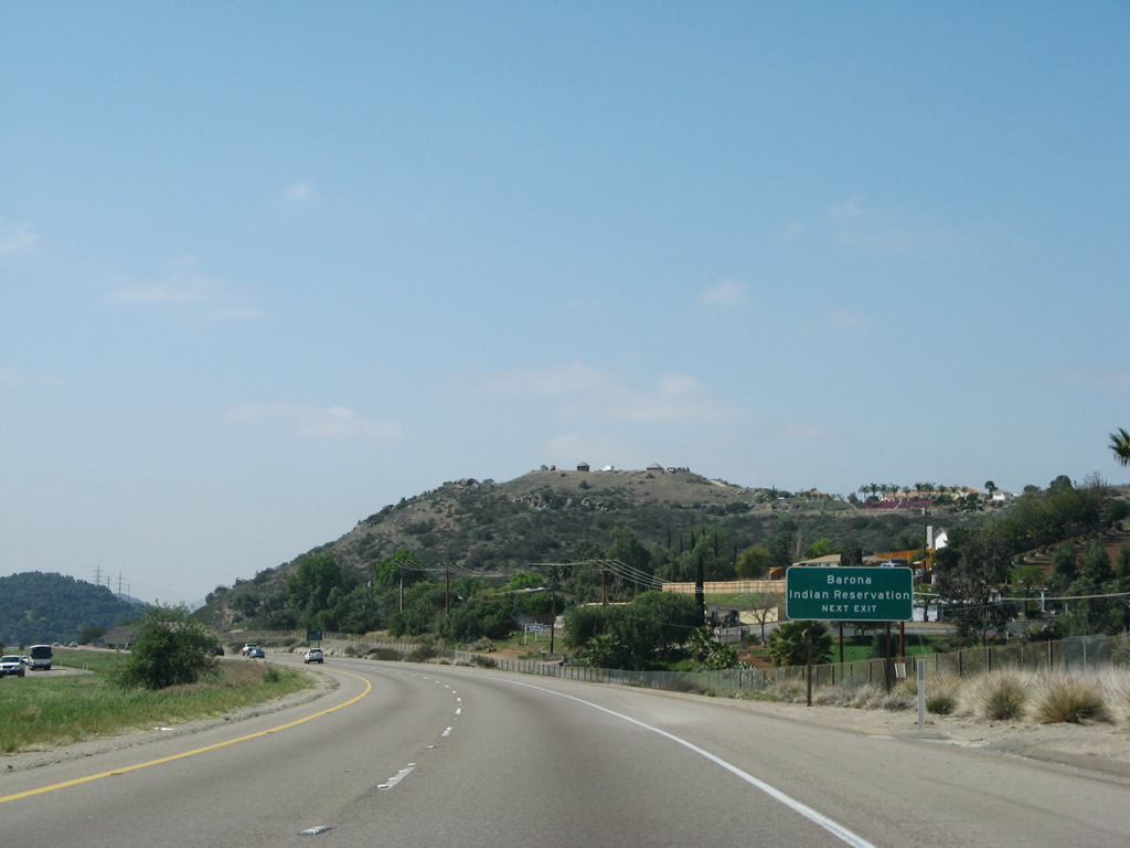 |
Barona Indian Reservation, which features a large casino, is reached via Lake Jennings Road west to Barona Road northeast. Photo taken 03/19/07. |
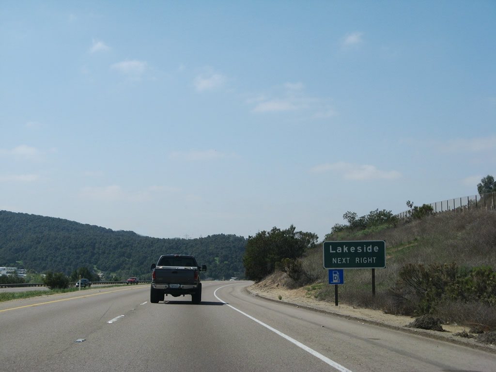 |
Use Lake Jennings Road west to Lakeside and to California 67 north to Ramona. Photo taken 03/19/07. |
 |
Westbound Interstate 8 reaches Exit 23, Business Loop I-8/Lake Jennings Park Road. At this interchange, turn northwest on Lake Jennings Park Road to Business Loop I-8 west to El Cajon. The highway is signed as "Business Route 8" between Lake Jennings Park Road and the city limits of El Cajon; the business route then transitions onto Main Street. The section of road named "Business 8" is not signed with green business loop shields; however, Main Street is signed with a few green shields (as well as brown Historic U.S. 80 signs). Photo taken 03/19/07. |
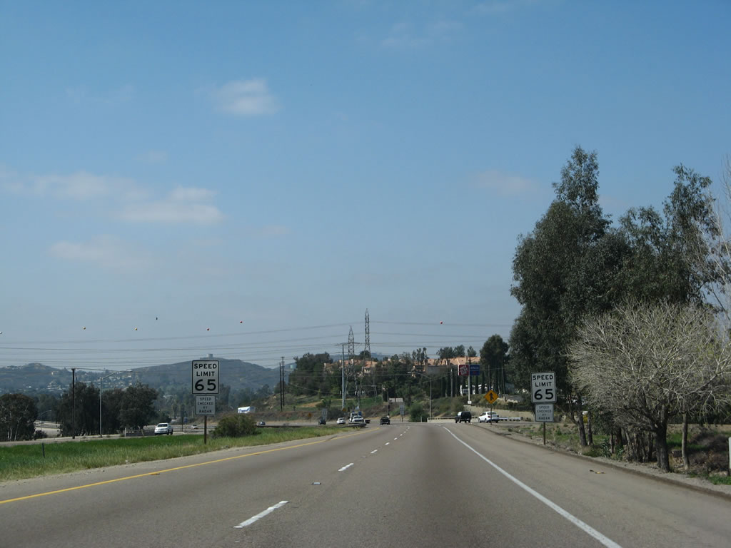 |
The speed limit on westbound Interstate 8 reduces from 70 miles per hour to 65 miles per hour. This will be the speed limit for Interstate 8 all the way to its western terminus in Mission Bay Park. Photo taken 03/19/07. |
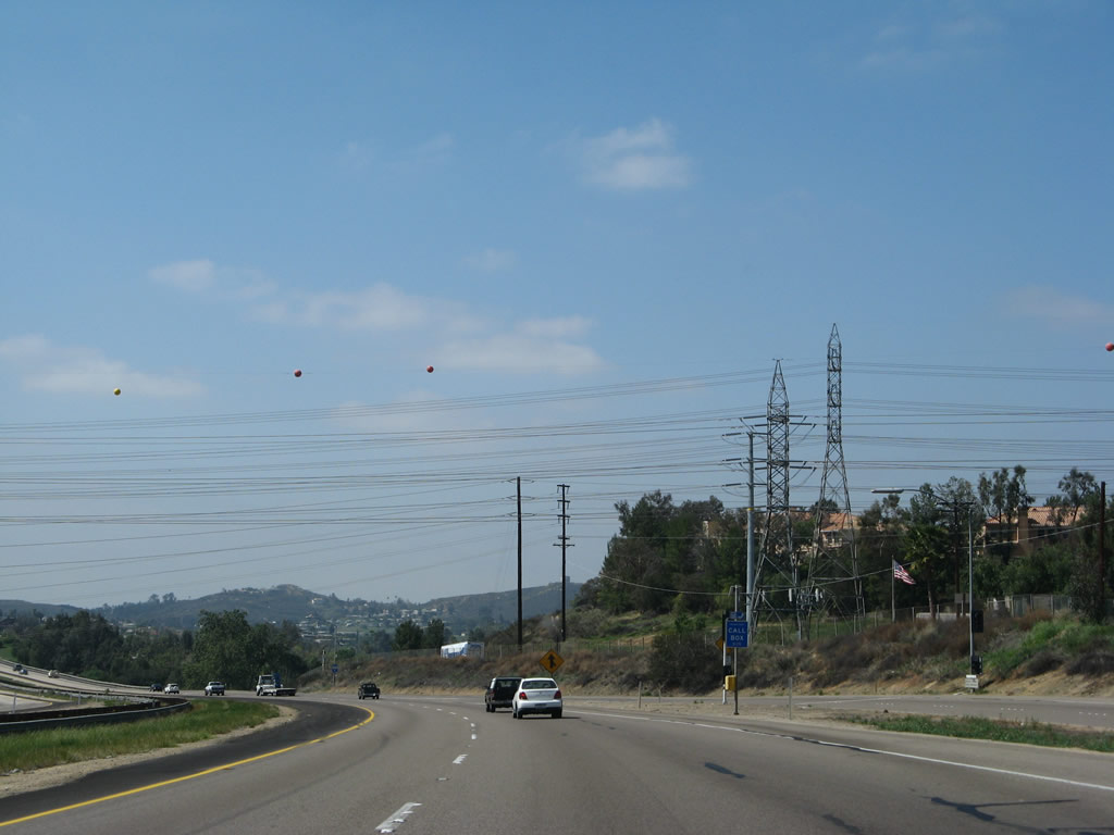 |
A major power line corridor crosses overhead at the Lake Jennings Park Road interchange. These power lines originate at the international border with Mexico and travel north to the San Miguel Substation where they meet the Southwest Powerlink 500 kV line that followed Interstate 8 through Devils Canyon and In-Ko-Pah Gorge. From San Miguel, the lines travel north through Rancho San Diego to here, then angle northwest toward Mission Trails Regional Park and Marine Corps Air Station - Miramar, where they connect with the regional grid. Photo taken 03/19/07. |
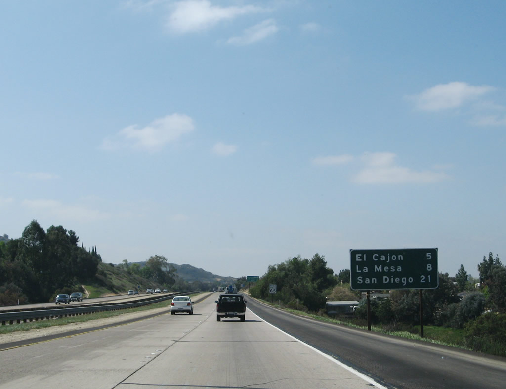 |
This mileage sign again provides the distance to El Cajon (5 miles), La Mesa (8 miles), and San Diego (21 miles to downtown). Photo taken 03/19/07. |
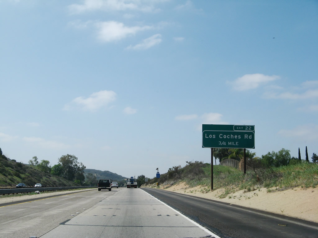 |
The next exit along Interstate 8 (Kumeyaay Highway) west is Exit 22, Los Coches Road (0.75 mile). Services (gas, food) are located on the south side of the freeway. This interchange provides local access to the neighborhoods in unincorporated San Diego County northeast of El Cajon. Photo taken 03/19/07. |
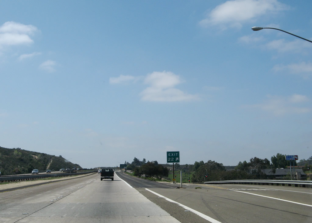 |
Westbound Interstate 8 reaches Exit 22, Los Coches Road to Glenview (south) and Lakeside (north). Photo taken 03/19/07. |
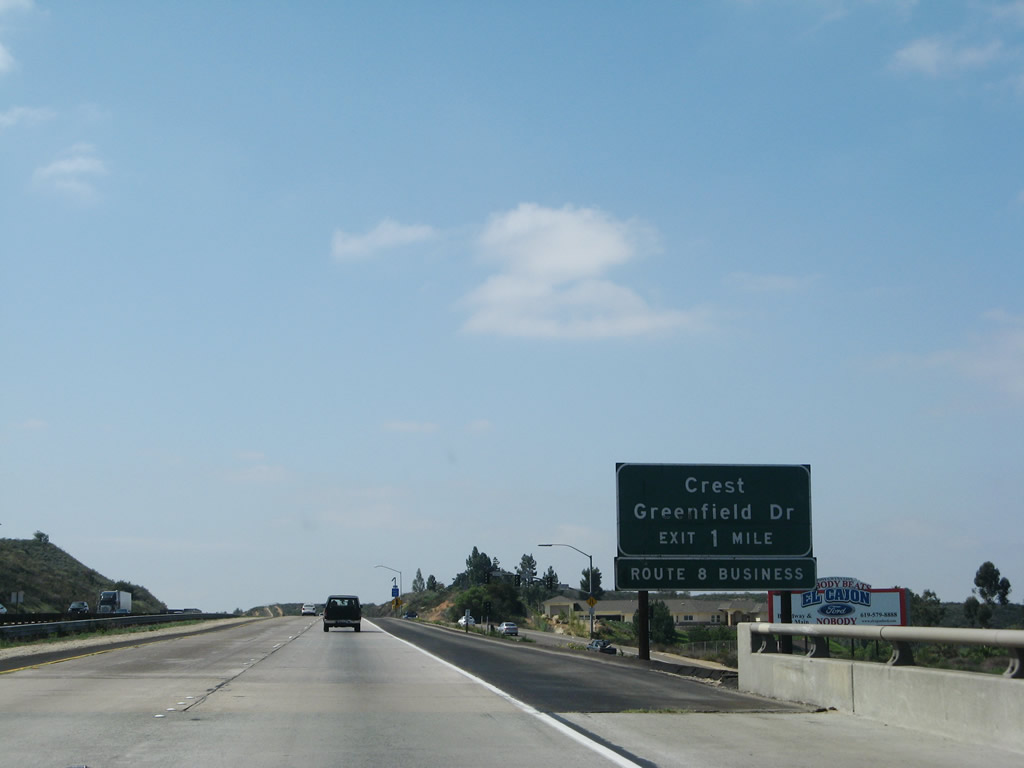 |
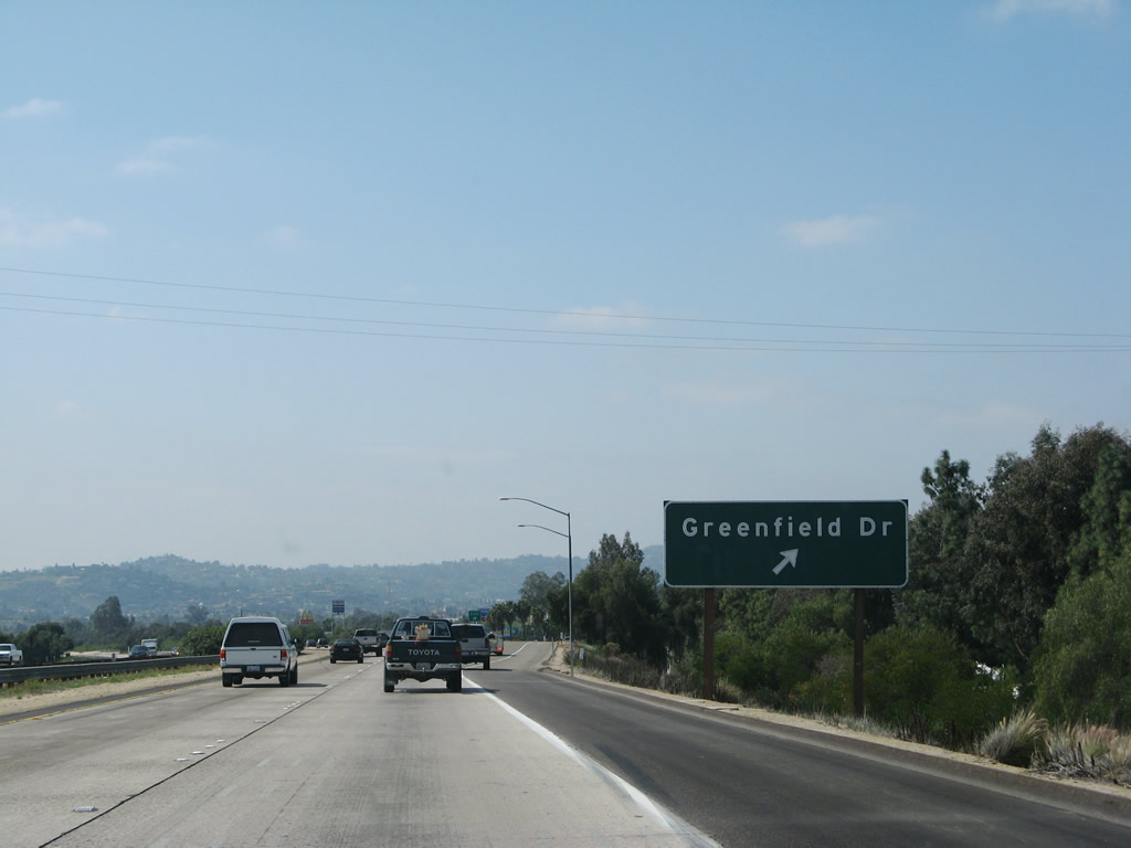
The next exit along westbound Interstate 8 is Exit 20B, Greenfield Drive to Business Loop I-8/Main Street. Use Greenfield Drive south to the unincorporated community of Crest or north into the Bostonia neighborhood of the city of El Cajon. Photo taken 03/19/07. |
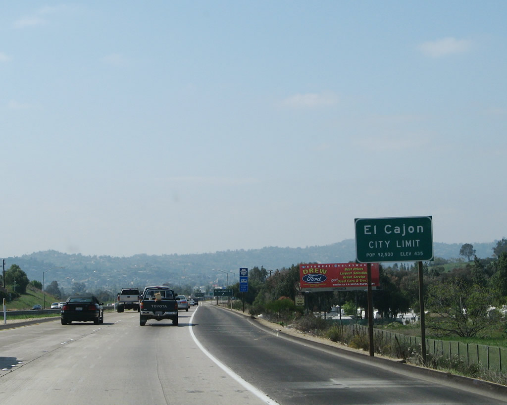 |
The city of El Cajon is the first incorporated city along Interstate 8 since leaving El Centro in the Imperial Valley. Another bustling and booming suburb of rapidly growing San Diego, El Cajon is home to 94,869 people as of the 2000 Census and consists of 14.6 square miles at an elevation of 435 feet. Photo taken 03/19/07. |
 |
Westbound Interstate 8 reaches Exit 20B, Greenfield Drive to Business Loop I-8/Main Street. Photo taken 03/19/07. |
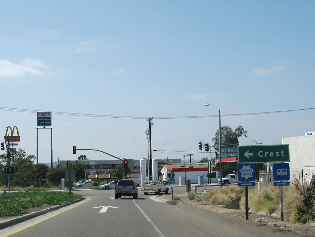 |
Use Greenfield Drive south to the unincorporated community of Crest. Sadly, during the 2003 Cedar Fire, significant portions of Crest were devastated. However, most areas have been rebuilt, and the area is growing. Photo taken 03/19/07. |
 |
A trailblazer for Business Loop I-8 is posted at the end of the ramp. Turn right (north) onto Greenfield Drive to Main Street, then make a left turn to follow Main Street west into El Cajon. Turn right on Main Street to exit the city of El Cajon, which is where Main Street becomes "Business 8." Photo taken 03/19/07. |
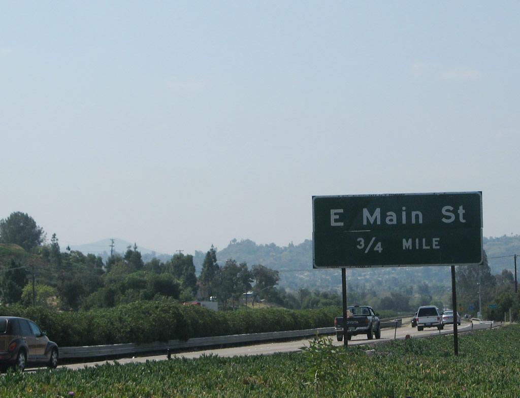 |
The next exit along westbound Interstate 8 is Exit 20A, Business Loop I-8/East Main Street. Use this exit to Business Loop I-8 west to downtown El Cajon and east to Bostonia. Photo taken 03/19/07. |
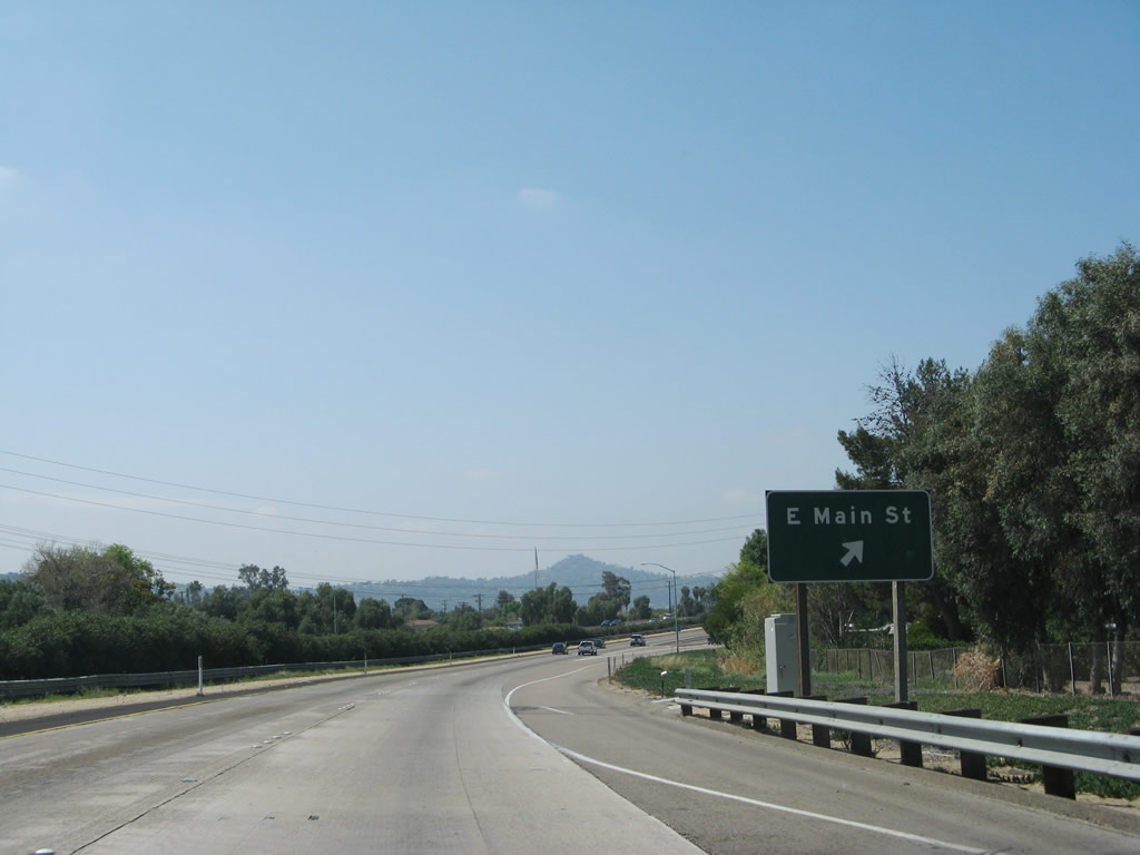 |
Westbound Interstate 8 reaches Exit 20A, Business Loop I-8/East Main Street. After this interchange, Interstate 8 turns toward due west again. The El Cajon freeway bypass that currently carries Interstate 8 was built in 1961 as part of a U.S. 80 freeway; Business Loop I-8 was briefly signed as U.S. 80 Business during this time. While U.S. 80 was officially decommissioned in 1964, signs on the route did not fully disappear until 1974 (as sections of new freeway were built). Photo taken 03/19/07. |
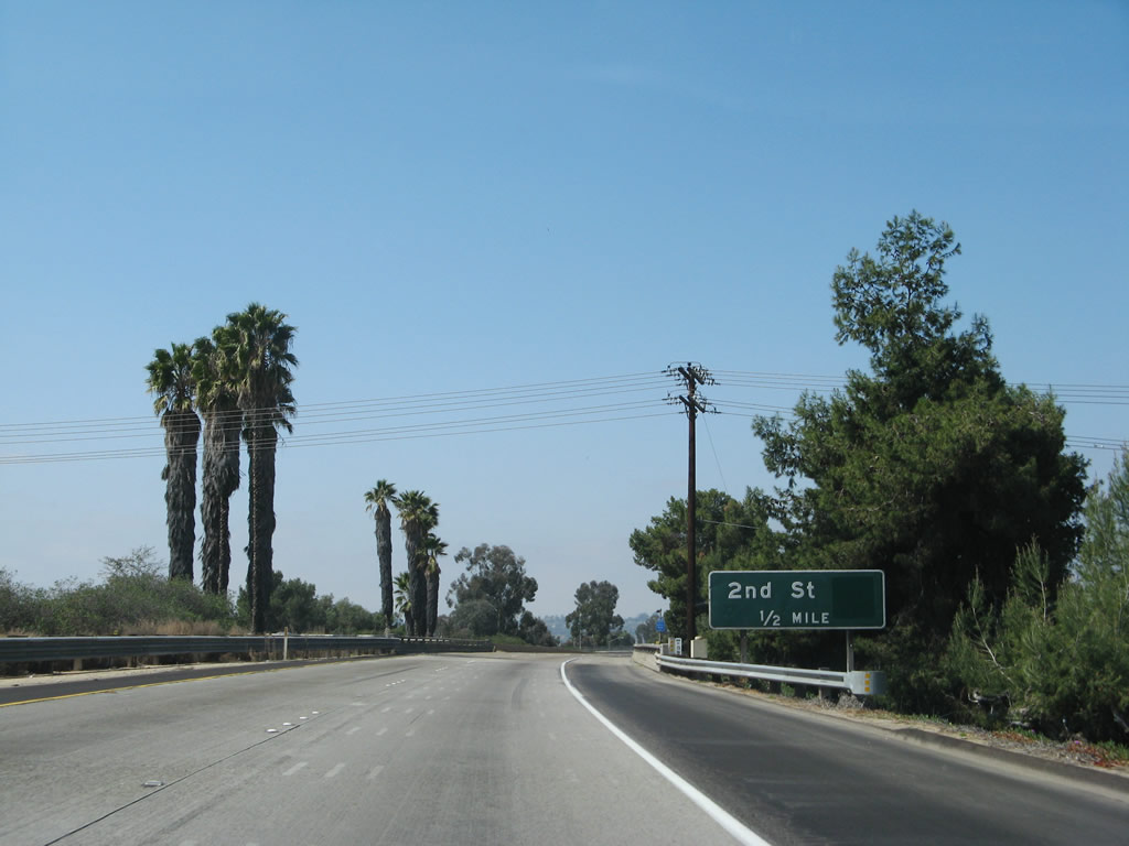 |
The next exit along Interstate 8 (Kumeyaay Highway) Exit 19, San Diego County S-17 and California 54 Business (Second Street). Neither route is signed on the approach along westbound, but the business route is well-signed along Second Street. The county route is shown on most maps, but there are no reassurance or trailblazers for it anywhere north of California 94. Second Street was previously California 54 until that route was decommissioned within the city of El Cajon in 1999. California 54 begins at the southern city limits along Jamacha Road. The next exit is Mollison Avenue. Photo taken 03/19/07. |
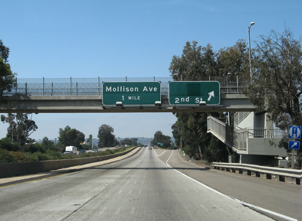 |
Westbound Interstate 8 reaches Exit 19, San Diego County S-17 and California 54 Business (Second Street). The next exit is Mollison Avenue. Photo taken 03/19/07. |
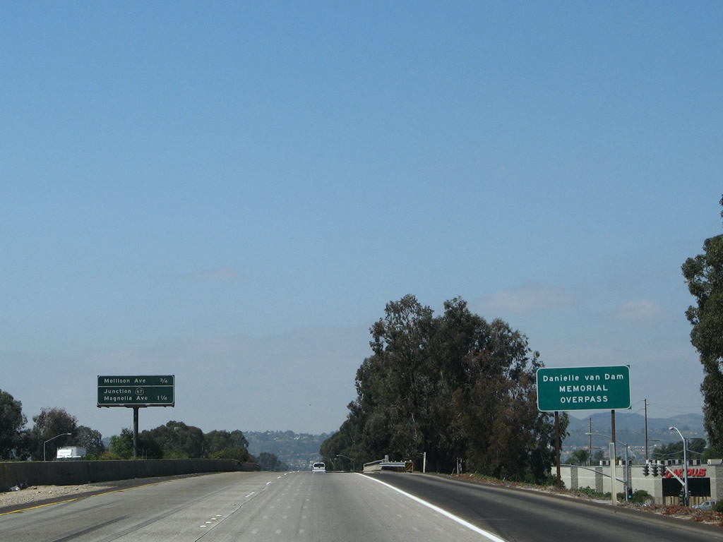 |
In Summer 2004, the Interstate 8 bridge over Second Street (Exit 19) was renamed in memory of Danielle Van Dam, the little girl who was kidnapped, assaulted, and murdered by a neighbor. Photo taken 03/19/07. |
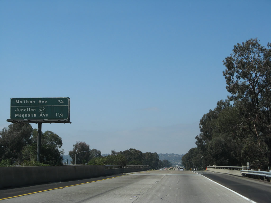 |
This mileage sign is the first to show upcoming exits along westbound Interstate 8. The next two exits are Exit 18, Mollison Avenue, followed by Exit 17, which connects to California 67/Ramona Freeway north and Magnolia Avenue (former California 67) south to downtown El Cajon. Photo taken 03/19/07. |
 |
An older Interstate 8 shield is posted along westbound after the on-ramp from Second Street (Old California 54). Note the eucalyptus trees that line the freeway; these were planted when the freeway was constructed. Interstate 8 west gains a third lane at this point. Photo taken 03/19/07. |
 |
The next exit along westbound Interstate 8 is Exit 18, Mollison Avenue. Mollison Avenue is commonly mentioned on traffic reports because it is a choke point along the freeway. Interstate 8 was a four-lane rural freeway; Mollison marks the current point where the freeway expands to eight lanes. Interstate 8 does not return to a four-lane configuration until reaching Mission Bay Park west of Interstate 5. This will change in coming years as Interstate 8 is expanded east of Mollison to accommodate the exploding suburban expansion in the foothills. Photo taken 03/19/07. |
 |
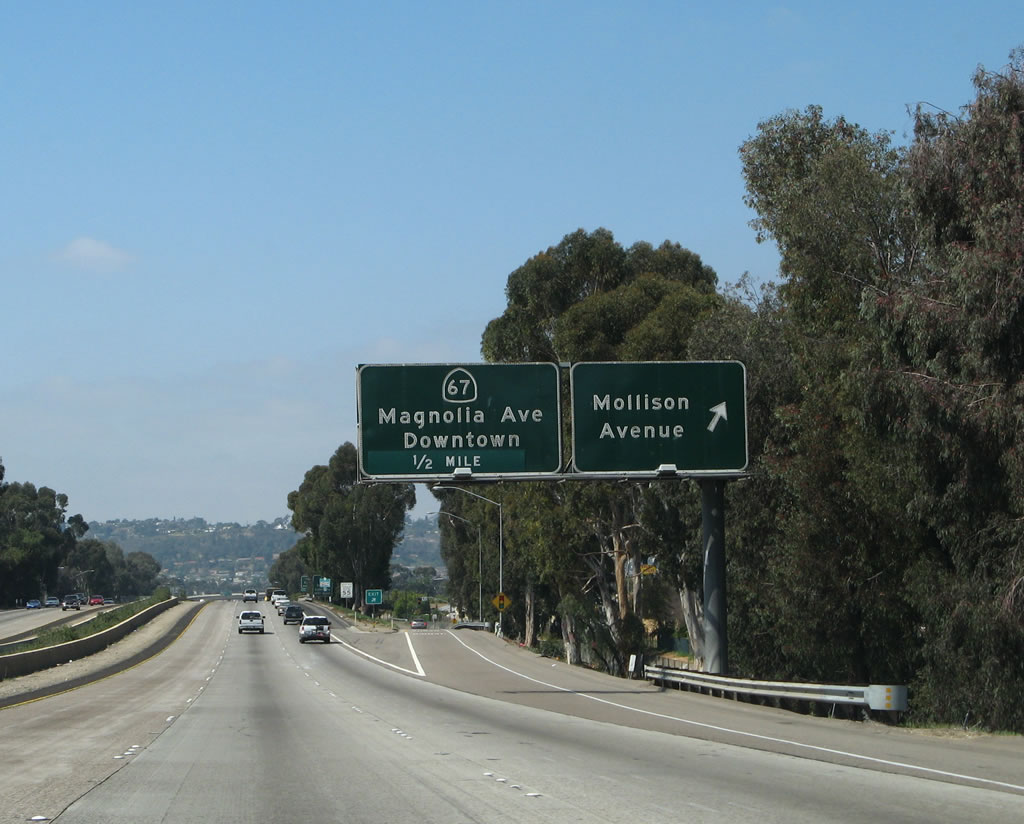
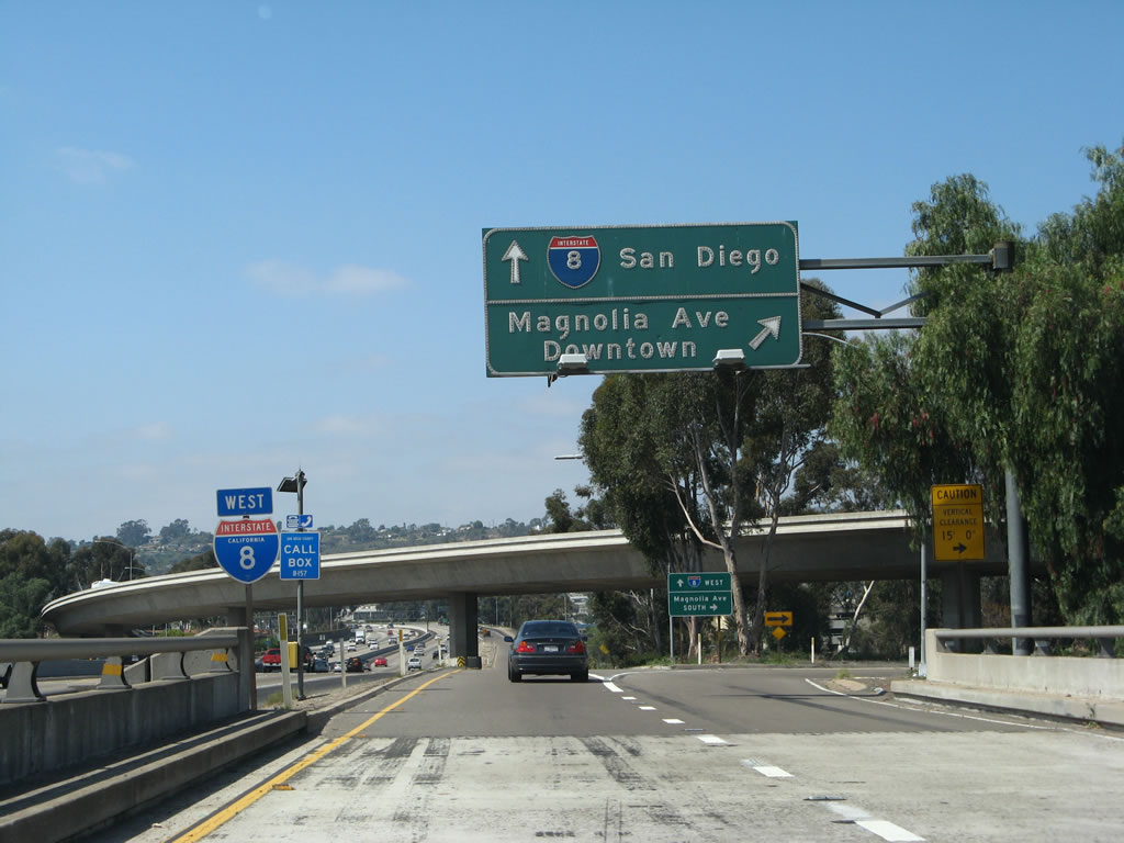
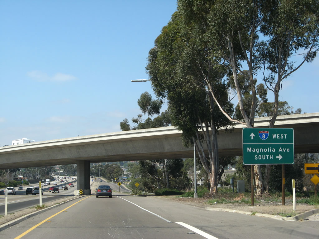
Meeting its first freeway since California 111, the next exit along westbound Interstate 8 is Exit 17, California 67 north and Magnolia Avenue south. California 67 is the Ramona Freeway, leading north to Santee, Lakeside, and Ramona (as well as the Barona Indian Reservation, home of one of the larger Indian casinos). It is a freeway from Interstate 8 north to Lakeside, but the two-lane road north of Lakeside carries a great deal of traffic and passes through hilly terrain. Plans call for additional passing lanes, turnouts, and other safety features to make California 67 a safer road. Magnolia Avenue, meanwhile, is a city-maintained street that leads south into downtown El Cajon, meeting Business Loop I-8/Old U.S. 80 near the city center. Photo taken 03/19/07. |
 |
Magnolia Avenue, meanwhile, is a city-maintained street that leads south into downtown El Cajon, meeting Business Loop I-8/Old U.S. 80 near the city center. With the construction of the modern freeway system, California 67 is truncated to the interchange with Interstate 8; prior to that, California 67 traveled south on Magnolia Avenue to U.S. 80, then followed U.S. 80 west to La Mesa via El Cajon Boulevard. At La Mesa, old California 67 turned south on today's California 125 to end at California 94 near Spring Valley. Photo taken 03/19/07. |
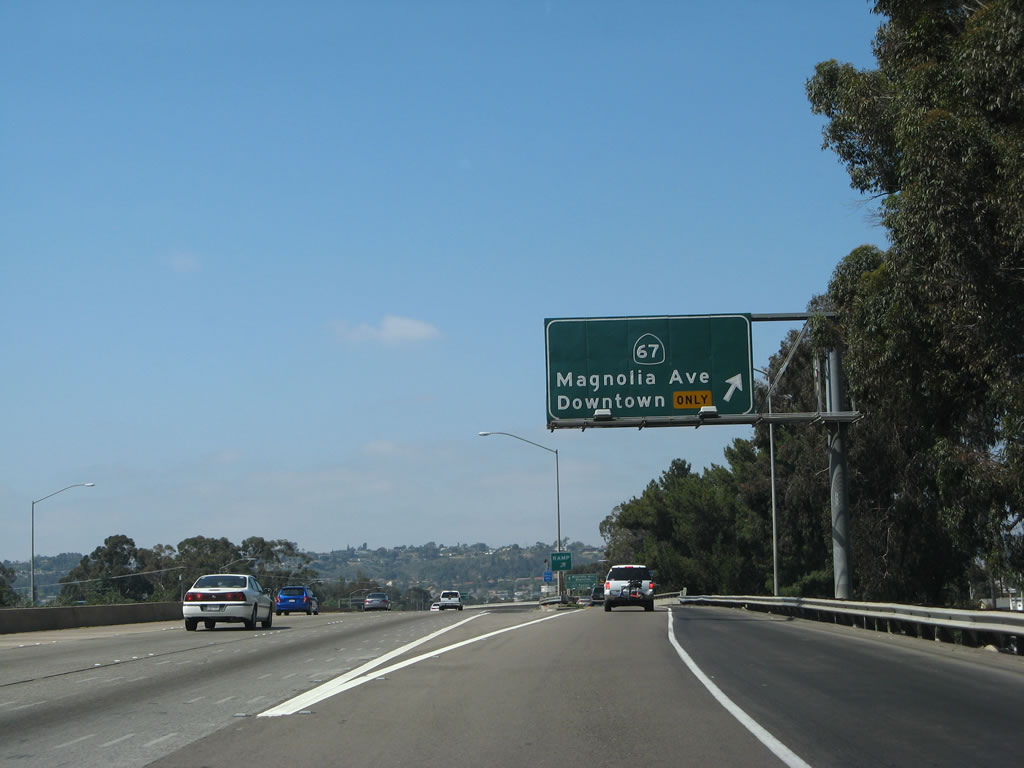 |
Westbound Interstate 8 (Kumeyaay Highway) reaches Exit 17, California 67 north and Magnolia Avenue south. This exit is a collector distributor lane, with separate exits for California 67 and Magnolia Avenue. Shortly thereafter, the lanes rejoin the main lanes. Photo taken 03/19/07. |
 |
The first ramp connects to California 67 north to Santee, Lakeside, and Ramona, while the second ramp loops onto Magnolia Avenue south to downtown El Cajon. Photo taken 03/19/07. |
 |
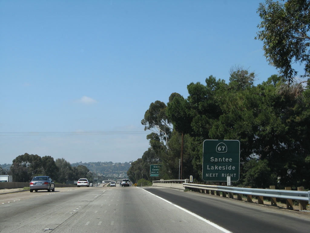
California 67 is the Ramona Freeway, but the freeway does not go all the way to Ramona. Instead, the freeway passes through Santee and Lakeside but ends at Lake Jennings Park Road. From there, California 67 reduces to an expressway configuration and eventually becomes a two-lane highway for the climb to Ramona. The route is generally well-traveled, and people drive fast! Old plans called for California 67 to be built to freeway standards, but those plans have been all but forgotten due to the limited funds available for such construction. Photo taken 03/19/07. |
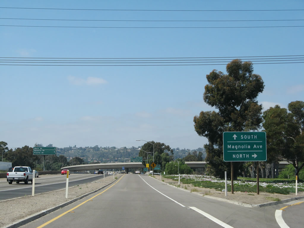 |
To Magnolia Avenue north, follow the ramp to California 67. The next ramp is the loop ramp connection to California 67 south. Photo taken 03/19/07. |
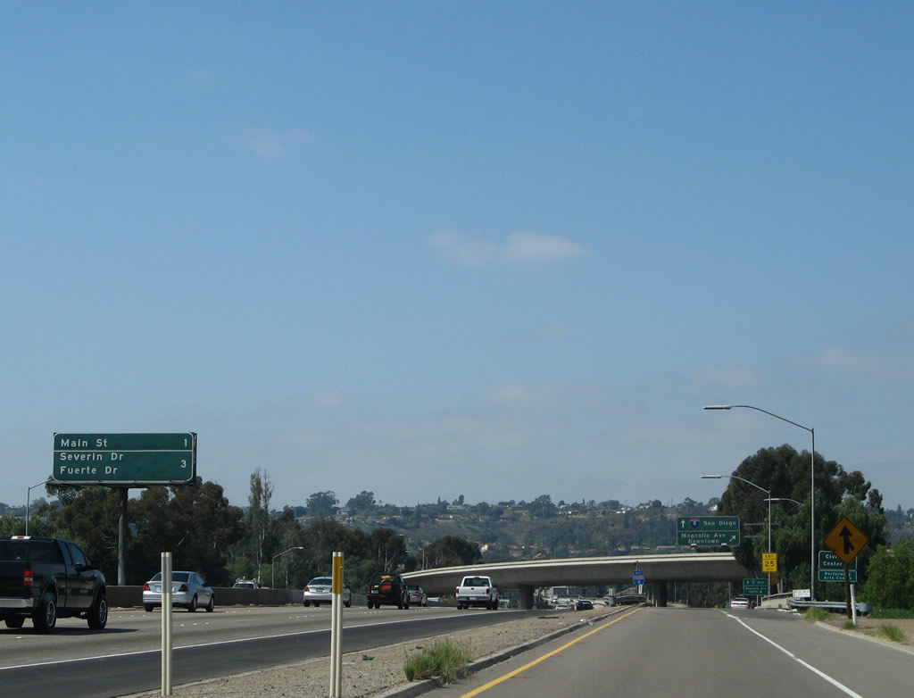 |
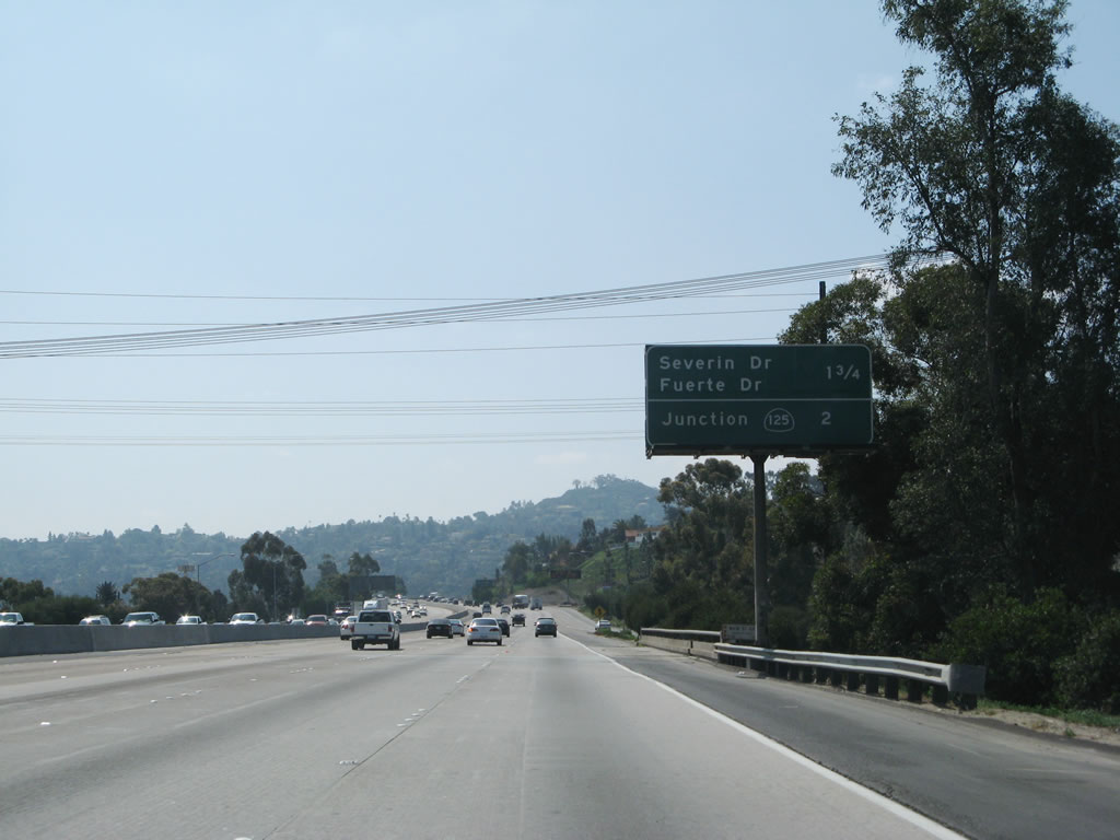
This mileage sign provides the distance to Exit 16, Main Street, and Exit 14C, Severin Drive and Fuerte Drive. Photo taken 03/19/07. |
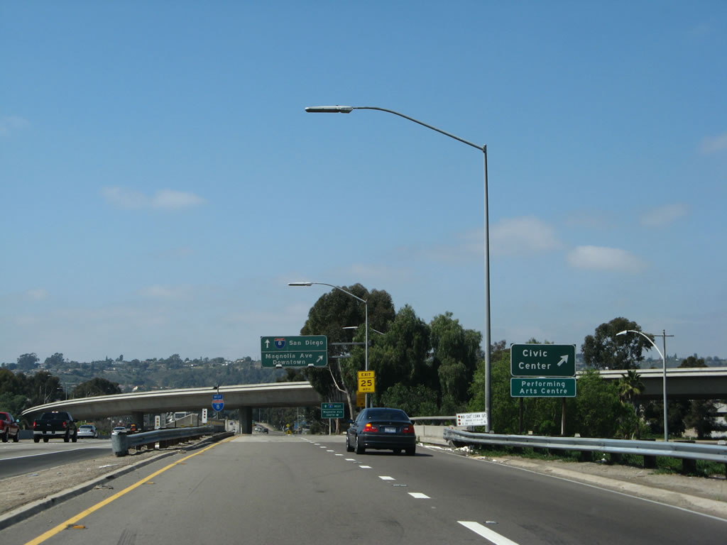 |
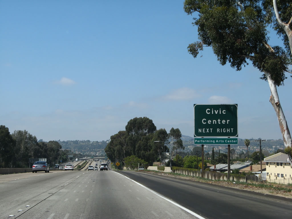
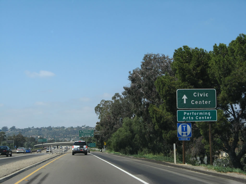
Use Magnolia Avenue south to the civic center for El Cajon and the performing arts center. The small bridge sign refers to this bridge as the "W8-S67 CONN O/C," or "west 8 south 67 connection overcrossing." Originally, the interchange between Interstate 8 and California 67 was built as a cloverleaf (in 1961), but it was modified to allow for the separation of exiting traffic. In 1985, a flyover connection was built from eastbound Interstate 8 to northbound California 67, which can be seen passing by overhead. Photo taken 03/19/07. |
 |
 |
Still on the collector distributor ramp from westbound Interstate 8, we meet the transition ramp to Magnolia Avenue south. The left lane will return traffic back to Interstate 8 west. A roadside sign with the same information is posted at the gore point. Photos taken 03/19/07. |
 |
Interstate 8 west widens out to five lanes! Talk about rapid growth between Old California 54 and California 67. The next exit along westbound Interstate 8 is Exit 16, Main Street, one-half mile. To reach Business Loop I-8 (El Cajon Boulevard) in the city of El Cajon, use this exit. There is no connection to El Cajon Boulevard at Exit 15 for westbound traffic. Photo taken 03/19/07. |
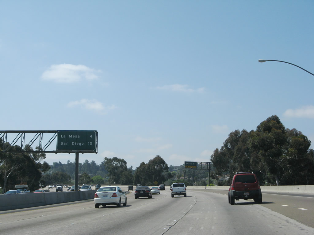 |
The final mileage sign that provides the distance to La Mesa (four miles) and San Diego (15 miles to downtown) is located after the California 67 interchange. Photo taken 03/19/07. |
 |
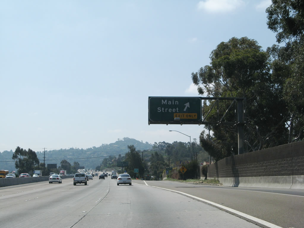
The right lane becomes exit only to Main Street at Exit 16. Photo taken 03/19/07. |
 |
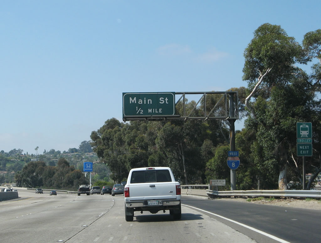
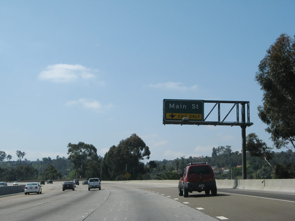
Westbound Interstate 8 reaches Exit 16, Main Street. Most major stores including a regional mall, Home Depot, Wal-Mart, Target, and more can be found at this interchange. Between Main Street and El Cajon Boulevard, Interstate 8 travels due south, then turns west again. Photo taken 03/19/07. |
 |
The next two exits along westbound Interstate 8 are Exit 14C, Severin Drive and Fuerte Drive and Exit 14B, California 125 south to California 94 and north to California 52. There is no access from westbound Interstate 8 at Exit 15, Business Loop I-8 (El Cajon Boulevard) east. Photo taken 03/19/07. |
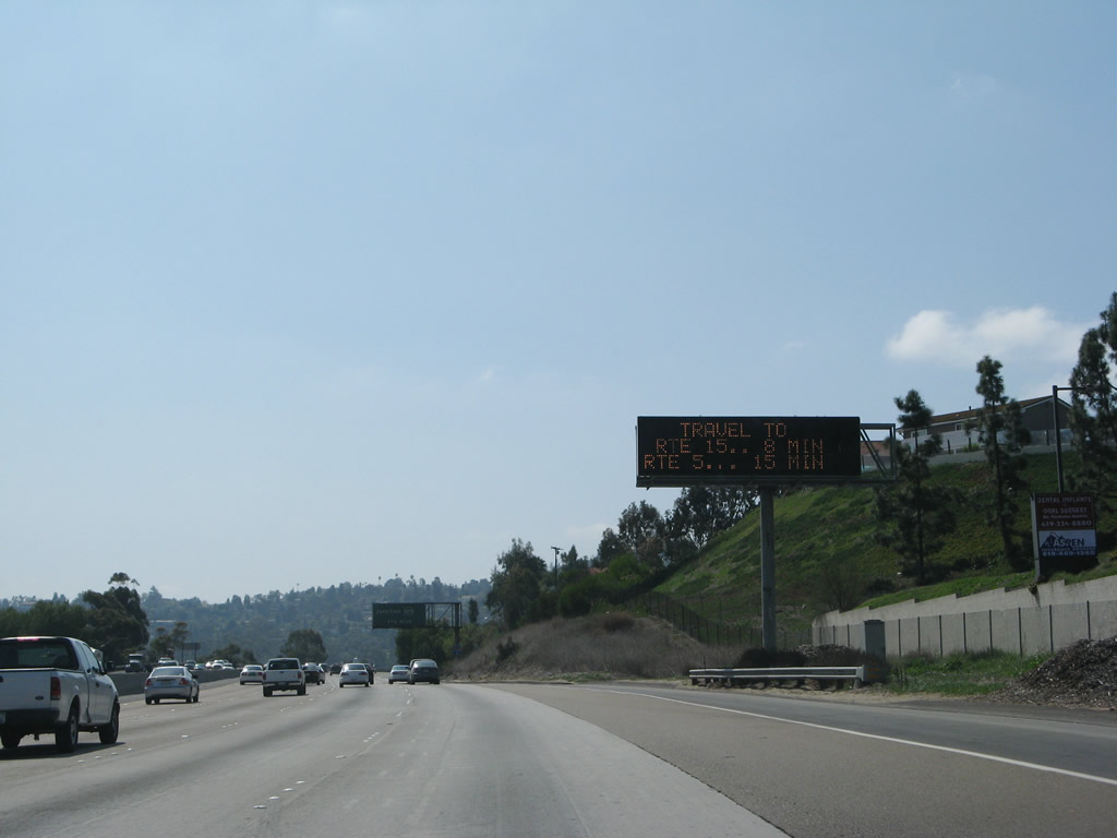 |
Variable message signs typically provide travel times to major destinations or freeways. In this case, the travel times to Interstate 15 and Interstate 5 are provided, and they are consistent with a normal flow of traffic for the remaining miles of Interstate 8 into San Diego. Photo taken 03/19/07. |
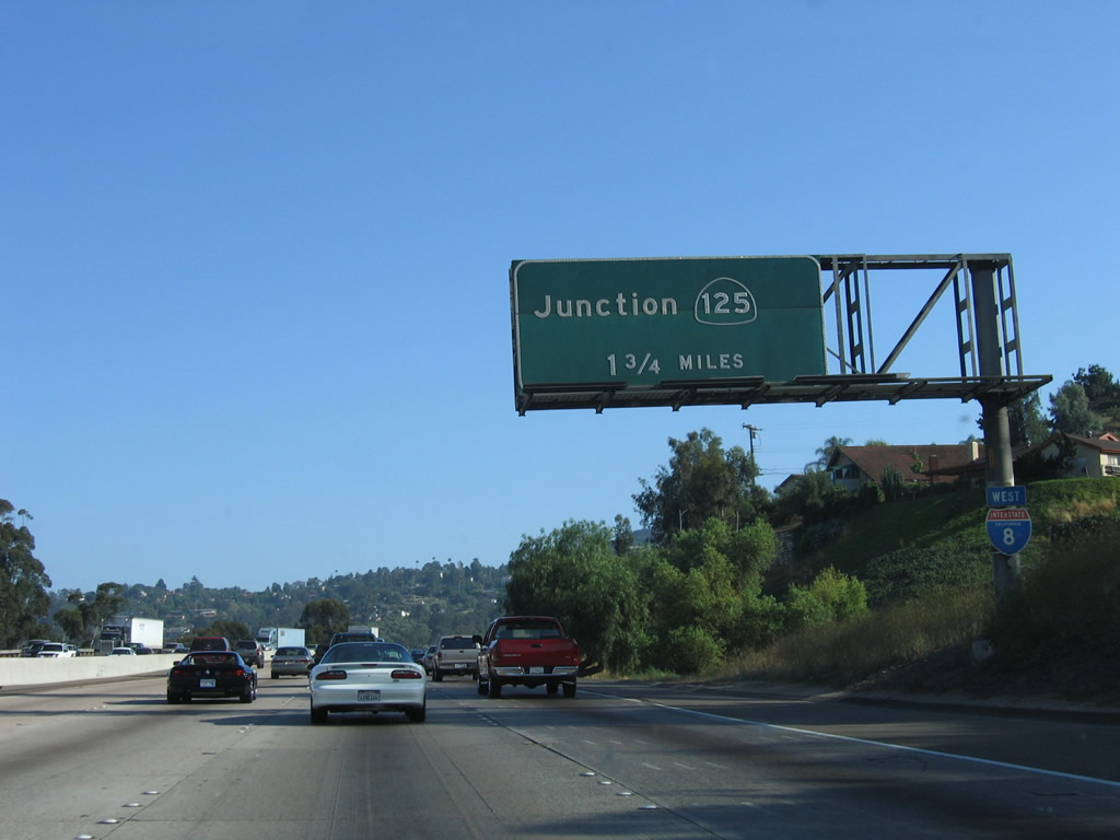 |
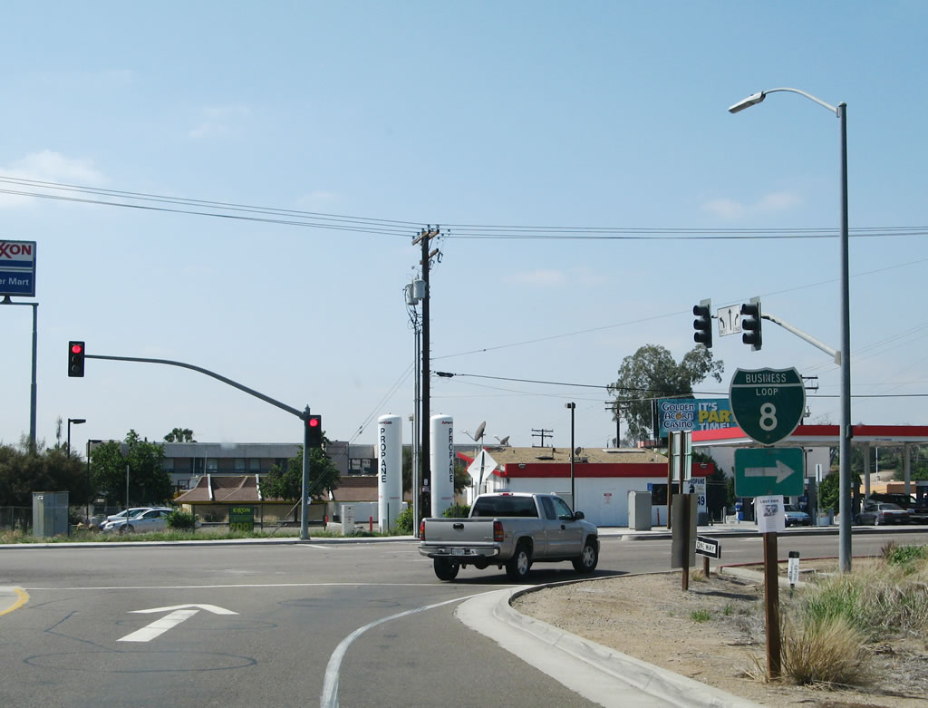
Exit 14B (the second exit after Exit 14C) is for California 125, a major north-south freeway that provides access from the International Border Crossing at Otay Mesa north to Santee via Chula Vista, Spring Valley, Lemon Grove, La Mesa, and El Cajon near Grossmont Community College. The freeway was constructed in stages, with the oldest section that connects Interstate 8 with California 94 being built in 1957 (it was originally designated as California 67). The section between California 905 and California 54 was built in 2007; the section between California 54 and California 94 was built in 2002; the section between Interstate 8 and Fletcher Parkway was built in 1992; the section from Fletcher Parkway to Navajo Road was built in 2001; the section from Navajo Road to Grossmont College was built in 2003; and the section from Grossmont College to California 52 was built in 1998. Photo taken 06/16/06. |
 |
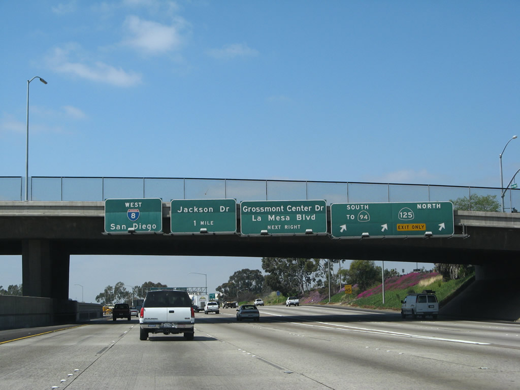
Traffic from westbound El Cajon Boulevard merges onto westbound Interstate 8; there is no access from westbound. The freeway curves to the west again at this point. Old U.S. 80 again joins the freeway, and it will remain under the freeway until Exit 14A, Grossmont Center Drive/La Mesa Boulevard. This section of Interstate 8 (from Exit 15 to Exit 14B) was built in 1961, but it was massively expanded with more lanes from 1984 through 1992, partially due to the expansion of the California 125 interchange. Photo taken 03/19/07. |
 |
To California 94 (Martin Luther King Jr. Freeway) west to downtown San Diego, use California 125 south. This sign harkens back to when California 125 was merely a connector between Interstate 8 and California 94. Interstate 8 leaves the El Cajon valley and ascends Grossmont Summit. This short hill is the final significant upslope on westbound Interstate 8. Photo taken 03/19/07. |
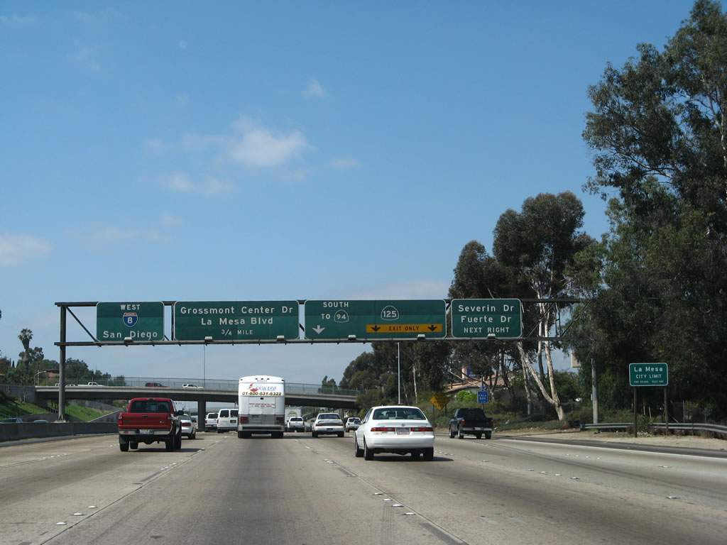 |
Westbound Interstate 8 approaches Exit 14C, Severin Drive/Fuerte Drive, next right. The next exit is Exit 14B, California 125 freeway, followed by Exit 14A, Grossmont Center Drive and La Mesa Boulevard into downtown La Mesa. At this point, Interstate 8 leaves El Cajon and enters the city of La Mesa. Founded in 1869 and incorporated in 1912, La Mesa (Spanish for "The Table" due to its position on Grossmont Summit and is known as the "Jewel of the Hills") is a suburb of San Diego and sits at an elevation of 540 feet. Home to 54,749 people as of the 2000 Census, La Mesa (like El Cajon) has been seeing population growth as the region expands; however, La Mesa is landlocked and does not have as much developable acres as its neighbors to the north and east. Photo taken 03/19/07. |
 |
The first exit to serve the city of La Mesa along westbound Interstate 8 is Exit 14C, which serves the Mount Helix area (south of Interstate 8) via Fuerte Drive and Severin Drive. Fuerte Drive leads south into Mount Helix, which is an unincorporated area of San Diego County (and is not part of the city of La Mesa). It connects with Avocado Boulevard and Calavo Drive. Both Fuerte Drive and Calavo Drive get their names from varieties of avocado, which is a fruit grown locally used to make guacamole. To the north, Severin Drive serves the Grossmont neighborhood of La Mesa, and it changes into Garfield Avenue upon entering the city of El Cajon. Photo taken 03/19/07. |
 |
Reaching the top of Grossmont Summit, Interstate 8 meets Exit 14B, California 125 north to Santee and south to Chula Vista and the International Border at Otay Mesa. California 125 is the second major north-south freeway corridor in San Diego (after California 67 and before Interstate 15, Interstate 805, California 163, and Interstate 5). Northbound California 125 leads to Santee, where it transitions into west California 52 en route to the city of San Diego communities of Kearny Mesa, Clairemont Mesa, and La Jolla. Southbound California 125 leads to southern La Mesa, Lemon Grove, and Spring Valley before transitioning onto a toll road past Bonita to Chula Vista and the international border crossing at Otay Mesa (part of the city of San Diego). Photo taken 03/19/07. |
 |
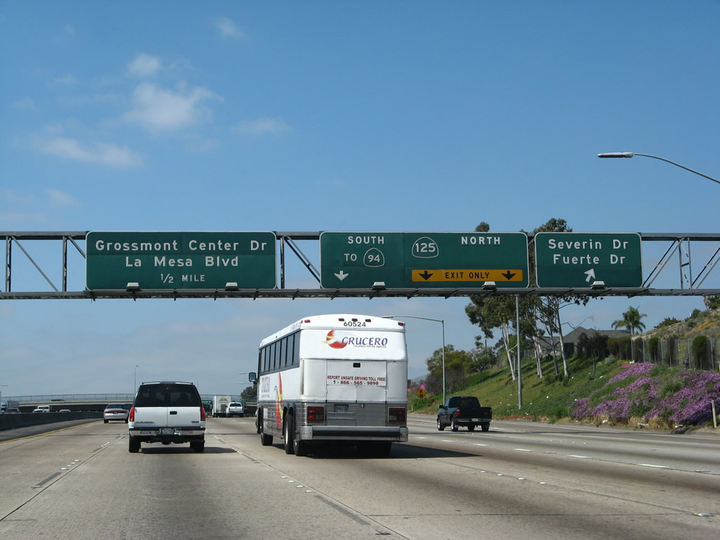
This view of the signage for California 125 north/south as seen from the main lanes along westbound Interstate 8 in La Mesa. Until the 1990s, this exit was only for California 125 south; California 125 was extended in stages north from Interstate 8. Today, California 125 ends at California 52, but there are long-range plans to extend the freeway at least as far north as Scripps-Poway Parkway if not to California 67. Photo taken 03/19/07. |
Sources:

Page Updated August 31, 2008.
|
About Contact Glossary |
In The News Interstate Guide |
Social Media:
 |
|
© 2000-25 AARoads.com | All Rights Reserved | Privacy Policy / Terms of Use
|
||