| Interstate 15/Mojave Freeway south |
|
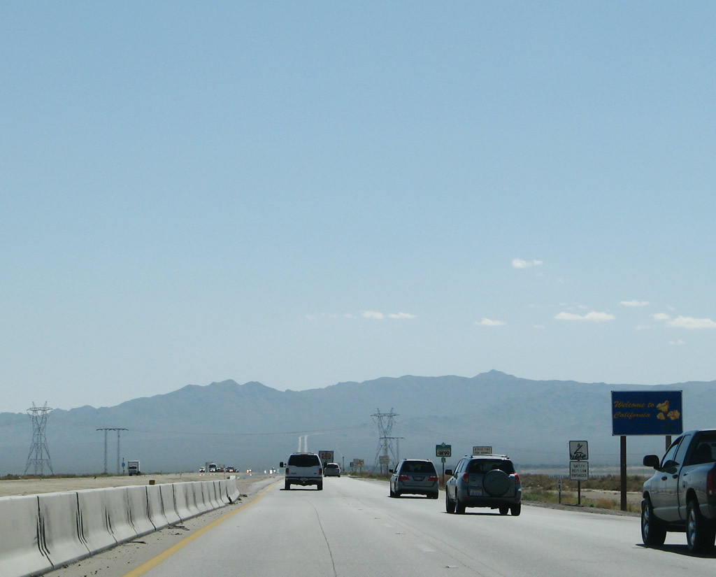
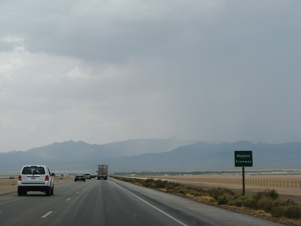
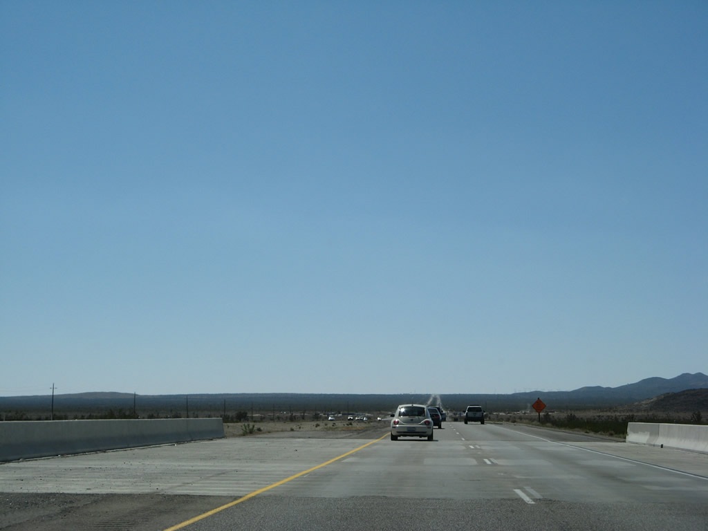
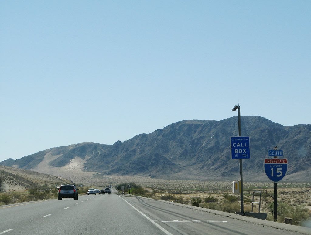
Soon after the Primm interchange (Nevada Exit 1), Interstate 15 leaves the Silver State of Nevada and enters the Golden State of California. At the state line, the Mojave Freeway begins. Photo taken 03/31/08. |
|
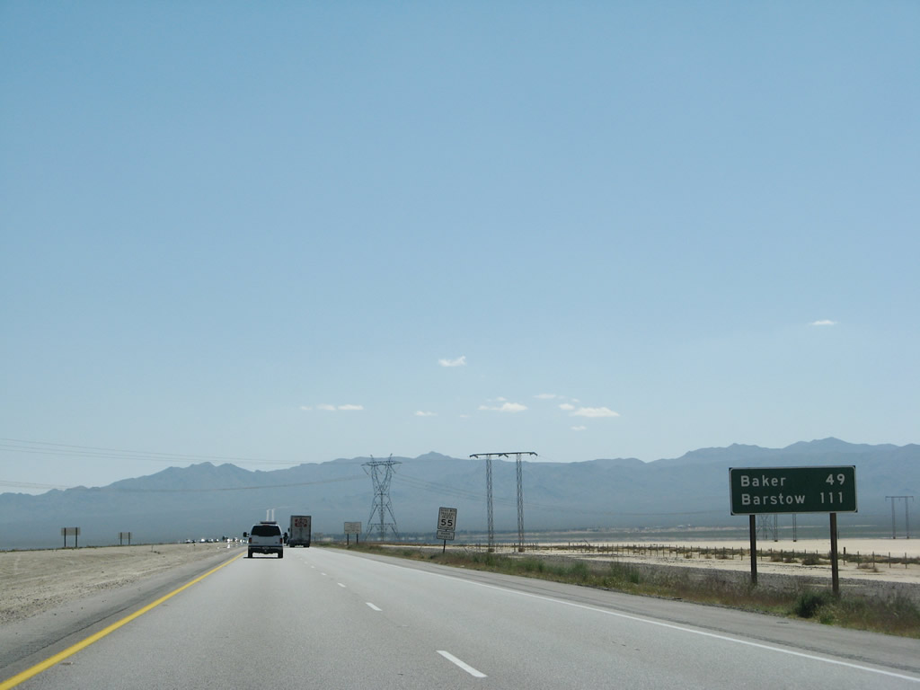
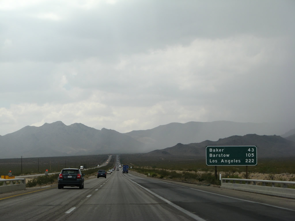
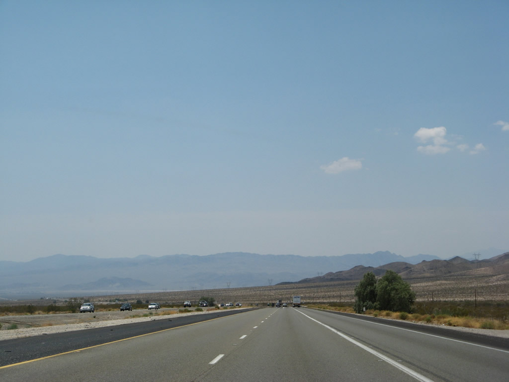
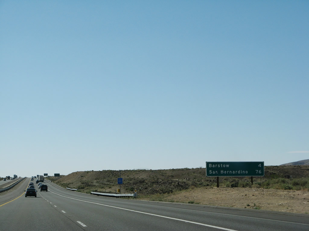
Interstate 15 also leaves Clark County and enters San Bernardino County, California, the largest county within the Golden State. The mileage sign provides the distance to the desert community of Baker, Barstow (Interstate 40), and Los Angeles. Photo taken 03/31/08. |
|
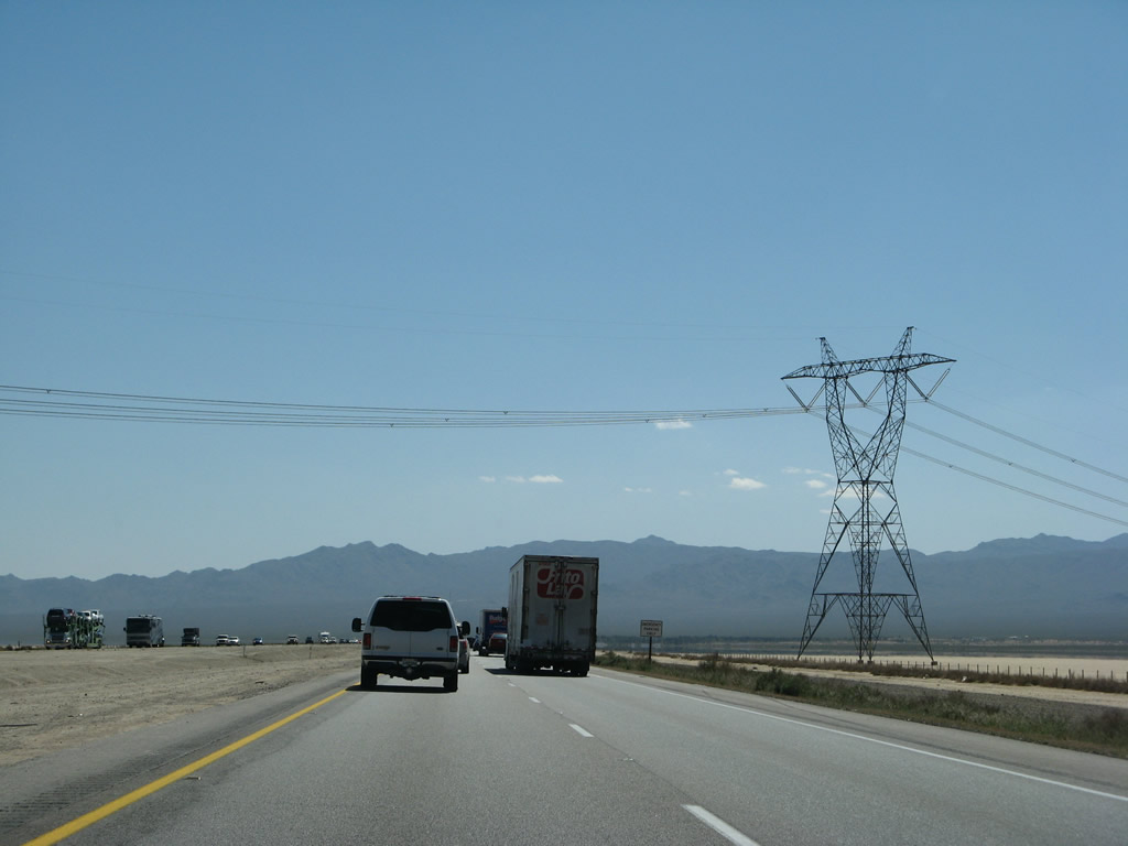
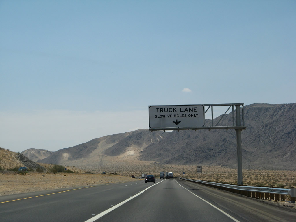
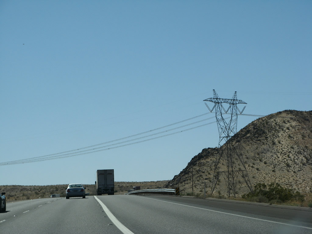
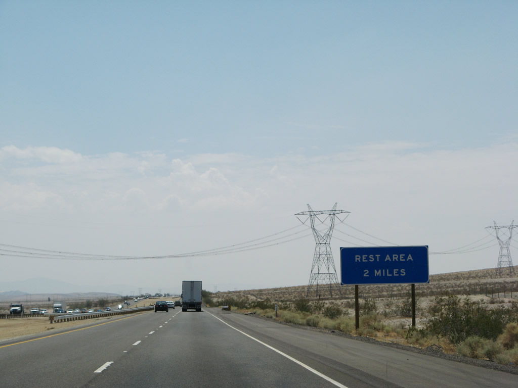
Path 64 power lines, which connect the Mead and Marketplace substations with the Adelanto substation, cross Interstate 15 for the first time. These power lines (owned by Los Angeles Department of Water and Power) will generally parallel Interstate 15 from here south past Baker to a point near the rest area at Milepost 217 (which is located close to Afton Canyon). At that point, they turn west toward the U.S. 395 corridor, then south again into Adelanto. Photo taken 03/31/08. |
|
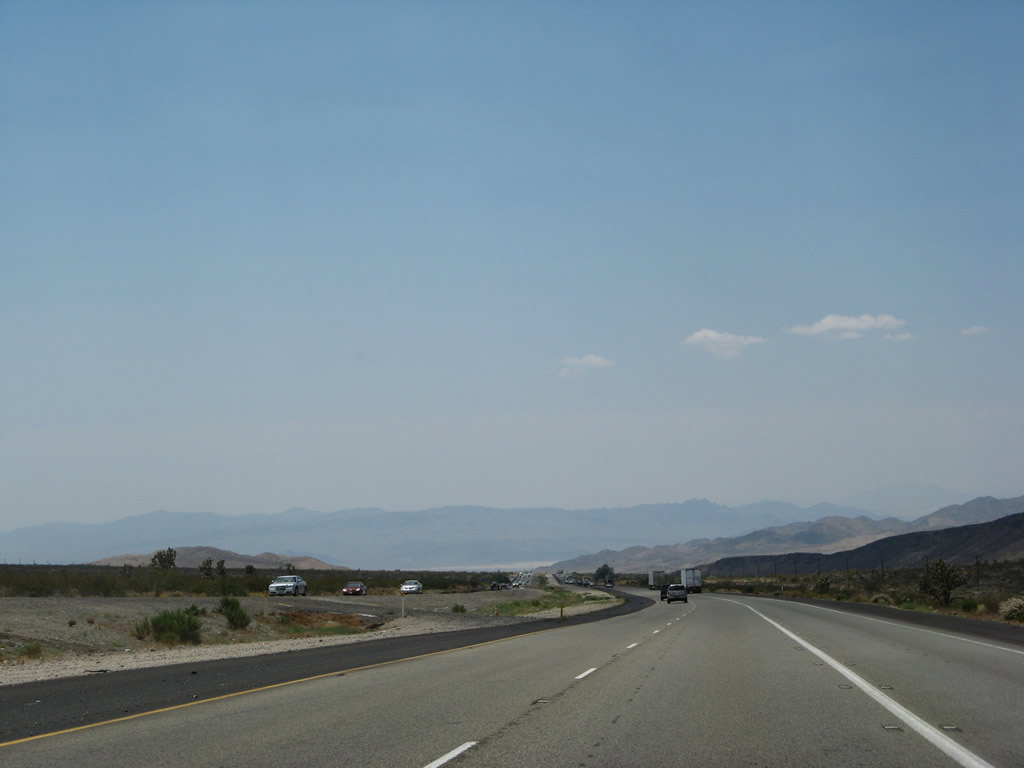
During monsoonal thunderstorms, rare desert rains bring welcome relief to hot summer temperatures. Interstate 15 is designated as the Mojave Freeway. Photo taken 07/14/08. |
|
|
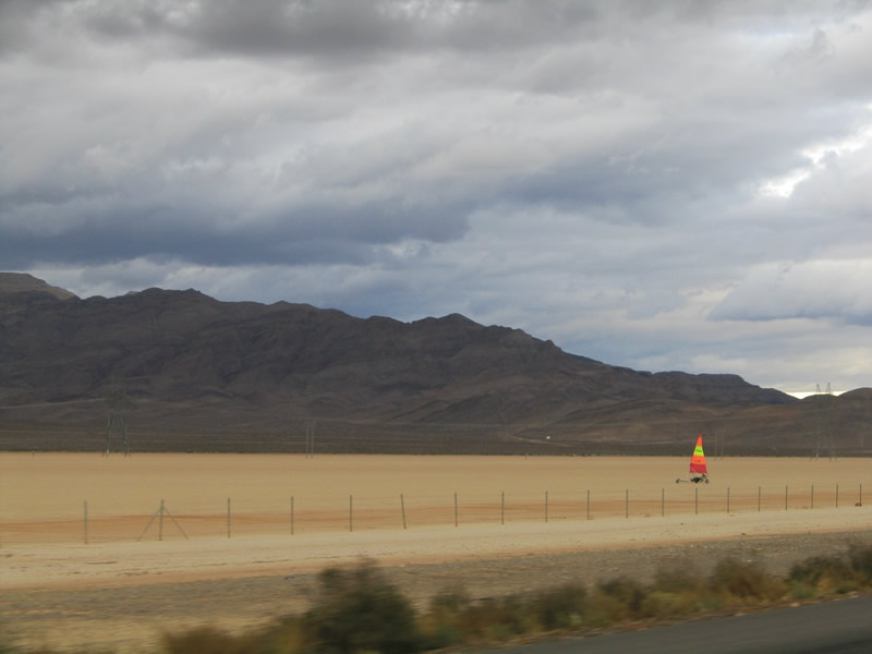
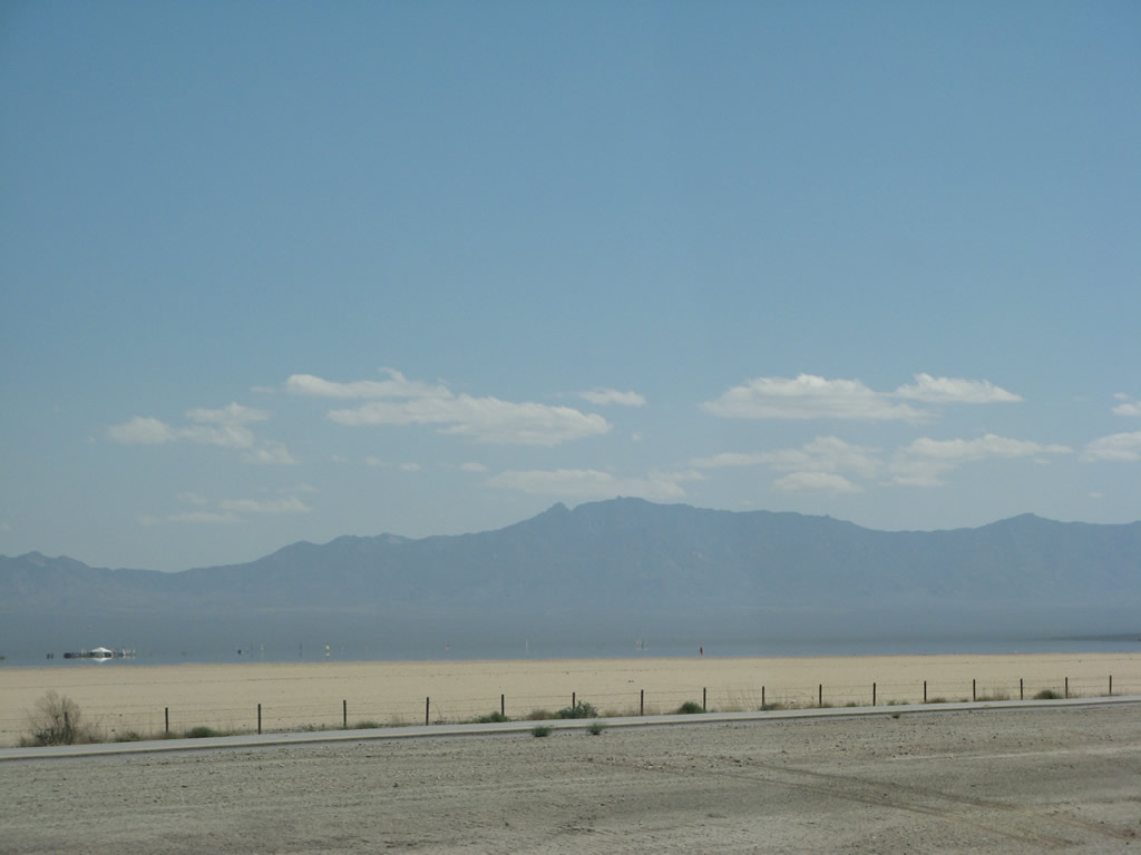
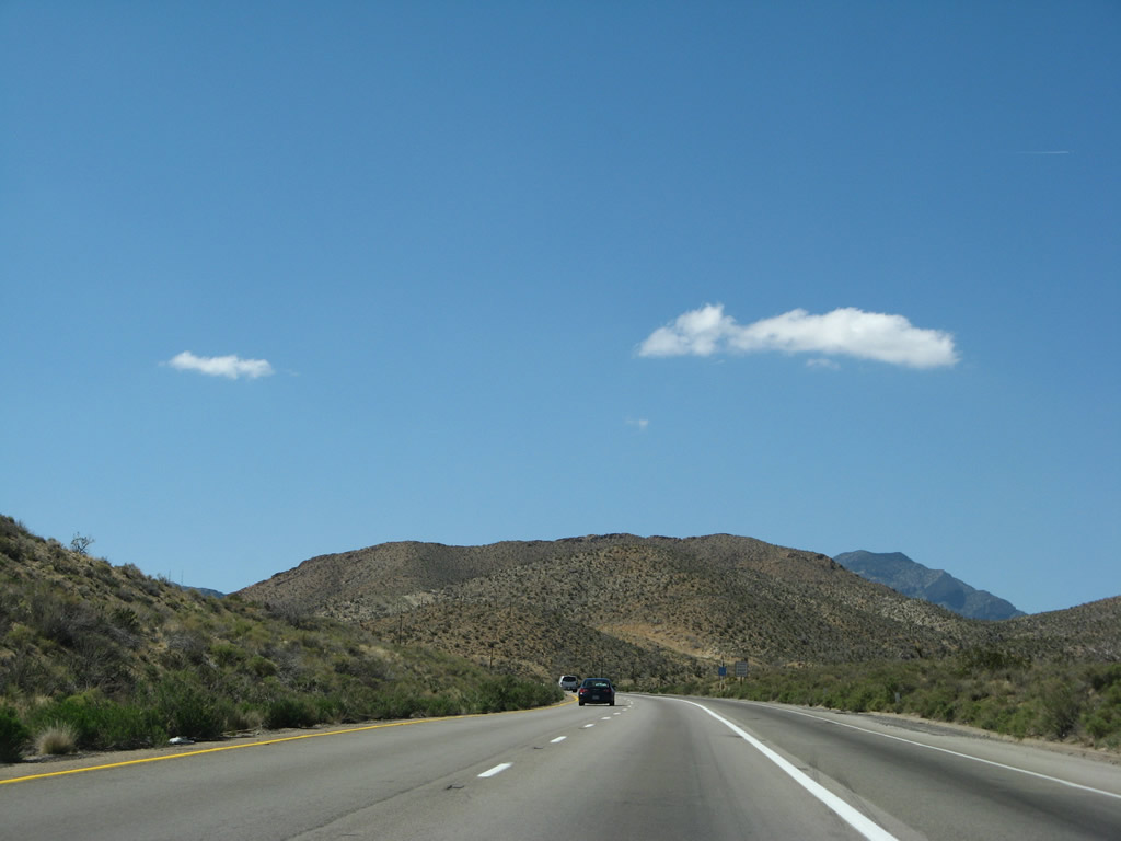
Interstate 15 travels generally southwest through the Ivanpah Valley, then turns west to cross Mountain Pass. The sandy flats in and around Primm, Nevada provide recreational opportunities for this land-based parasailer. Looking northwest from the freeway is this view of the Clark Mountain Range and the Path 64 power line, which crosses the northern edge of Ivanpah Dry Lake. Interstate 15 also cuts a swath across the dry lake bed. Photos taken 10/19/04 and 03/31/08. |
|
|
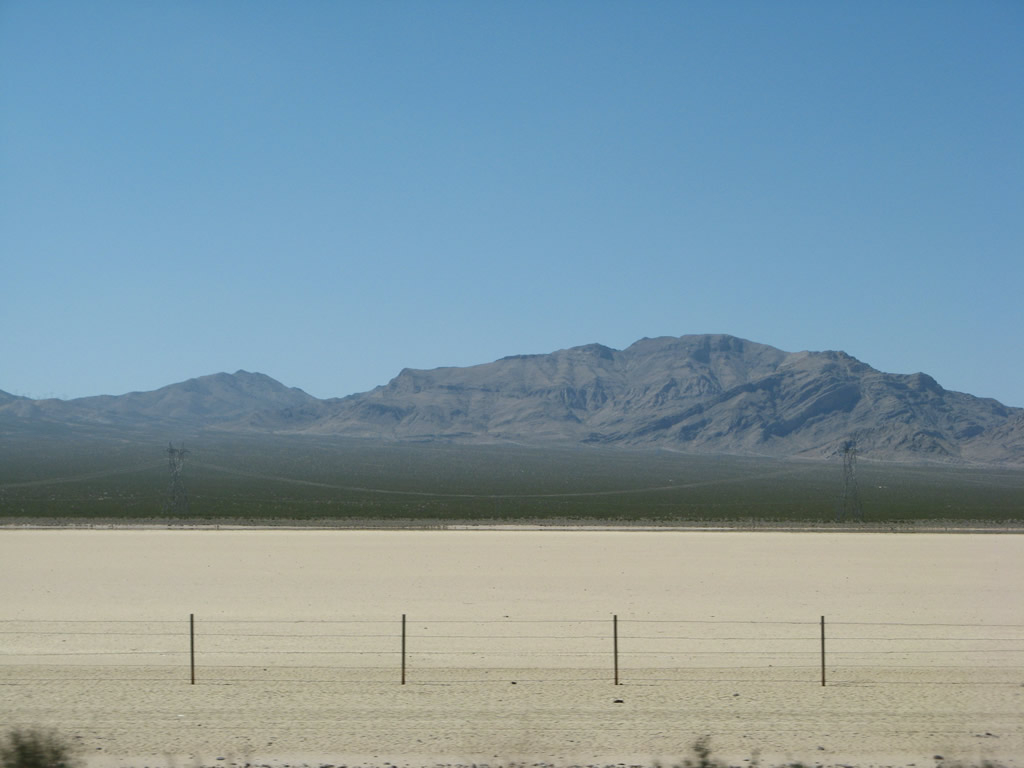
The dry lake bed (known as Ivanpah Dry Lake) is popular with land-based parasailers on the south side of the freeway as well. This view, looking southeast, shows a mirage effect that creates the illusion of water on this almost perennially dry lake bed. Interstate 15 will see another large dry lake bed near Baker (at Soda Dry Lake and Silver Dry Lake). Photos taken 03/31/08. |
|
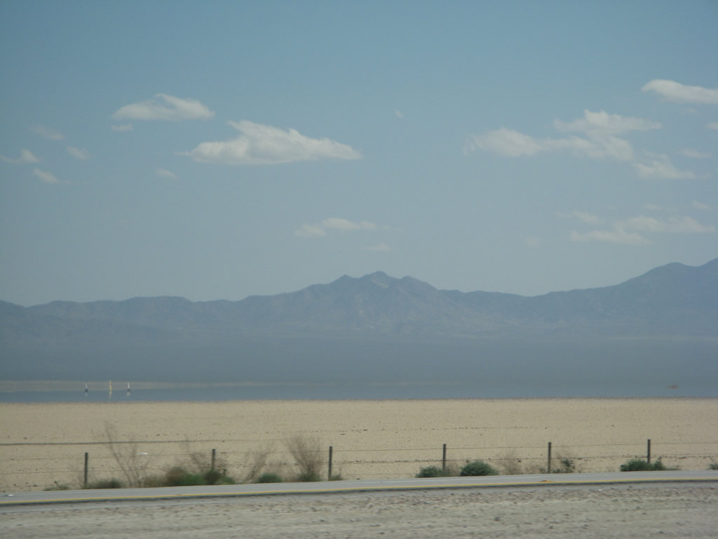
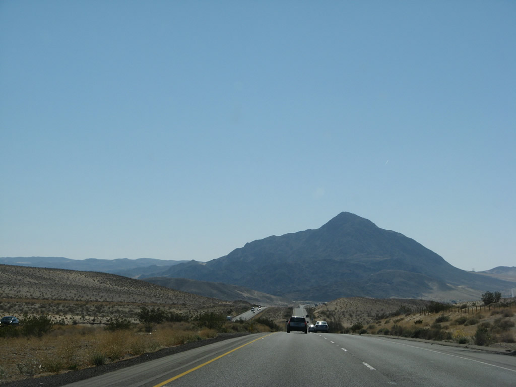
Sweeping views of the freeway such as this are common throughout the Mojave Desert as well as other deserts of Southern California. Interstate 15 continues southwest to Mountain Pass (el. 4,731 ft). Photo taken 10/19/04. |
|
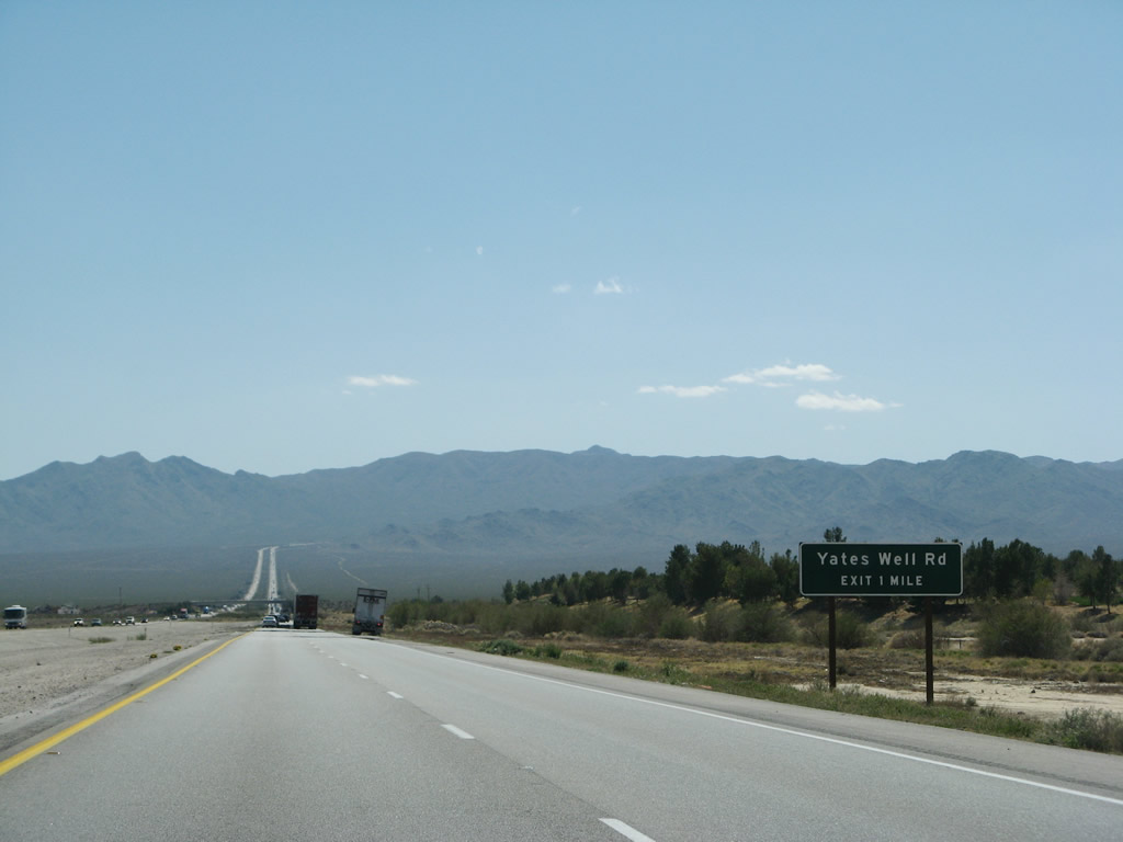
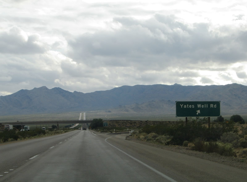
The first California exit of Interstate 15 southbound serves Yates Well Road (Exit 291), a local ranch road near the state line. Photo taken 03/31/08. |
|
On the northwest side of the freeway is a "Welcome to Primm Valley" landscaped sign. Photo taken 04/02/06. |
|
|
Southbound Interstate 15/Mojave Freeway reaches Exit 291, Yates Well Road. This is a diamond interchange. Yates Well Road serves a settlement nearby and a relatively new golf course that was carved out of the arid desert. Mountain Pass rises in the distance. Photos taken 07/14/08 and 10/19/04. |
|
|
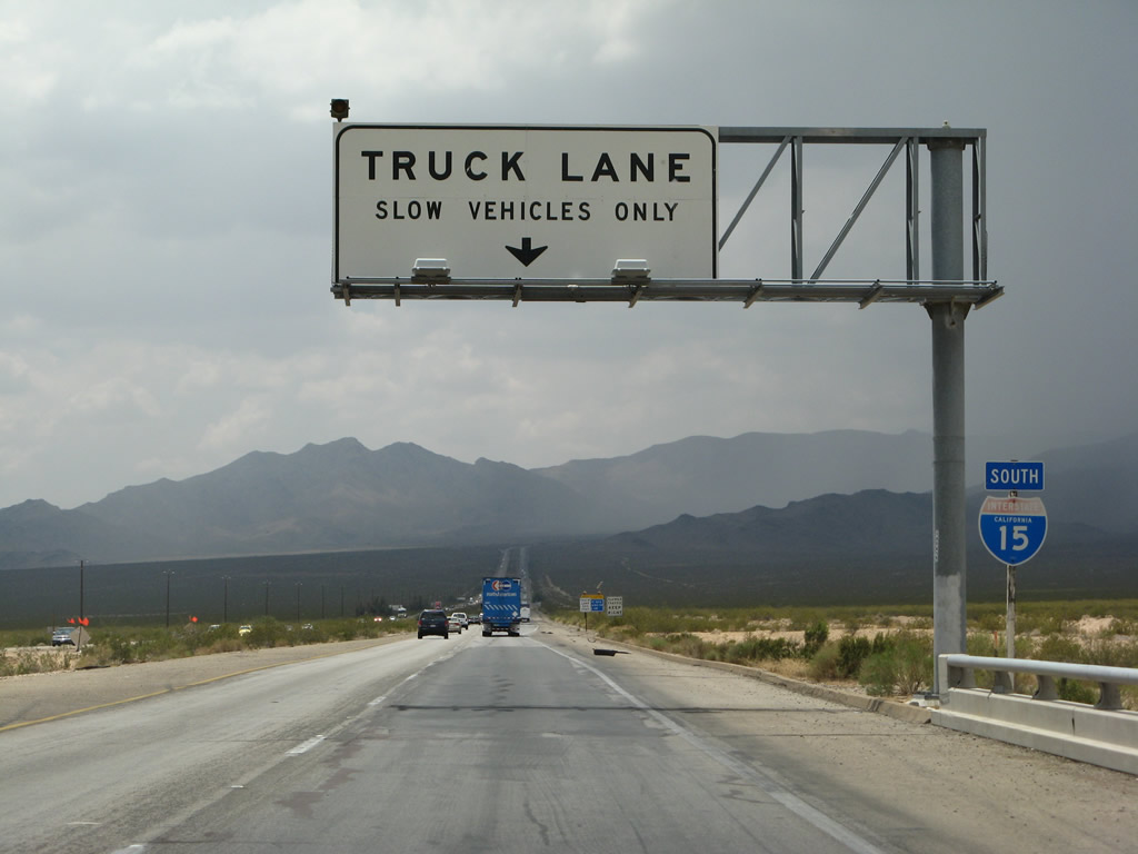
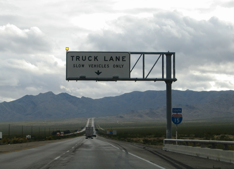
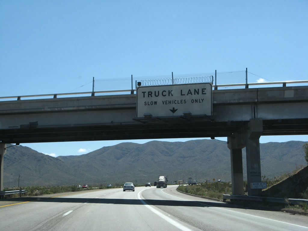
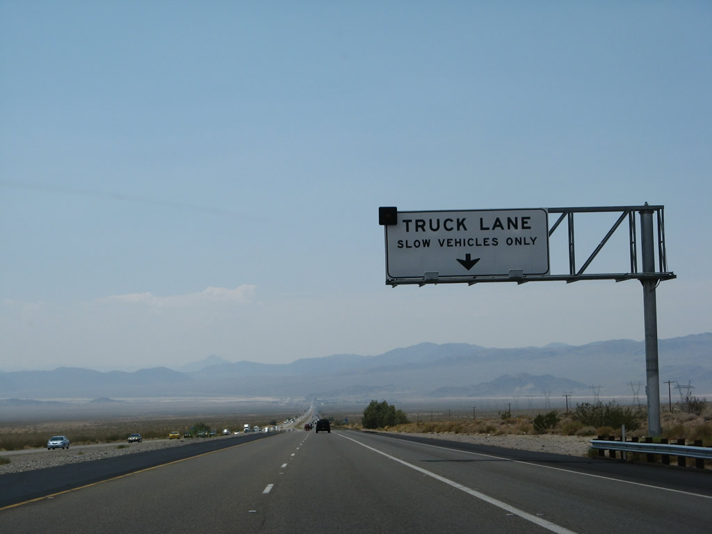
A look at the first southbound reassurance shield posted in California. Interstate 15 crosses a local wash and begins its ascent toward Mountain Pass. A truck climbing lane joins the southbound carriageway. Truck lanes are commonly found between Barstow and the Nevada state line. Photos taken 07/14/08 and 10/19/04. |
|
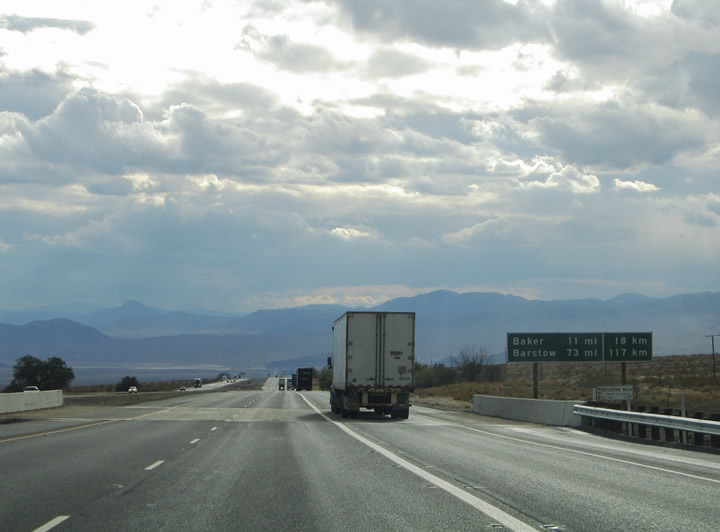
The distance to Los Angeles joins Baker and Barstow on this mileage sign found along Interstate 15 south between Yates Well Road (Exit 291) and Mountain Pass. Photo taken 07/14/08. |
|
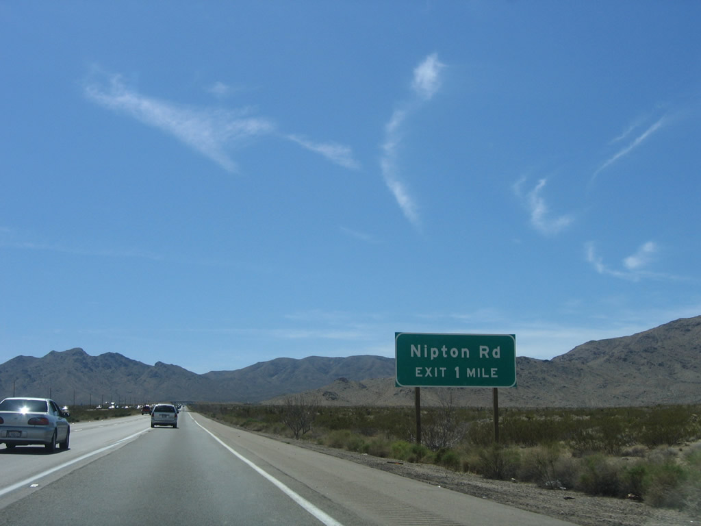
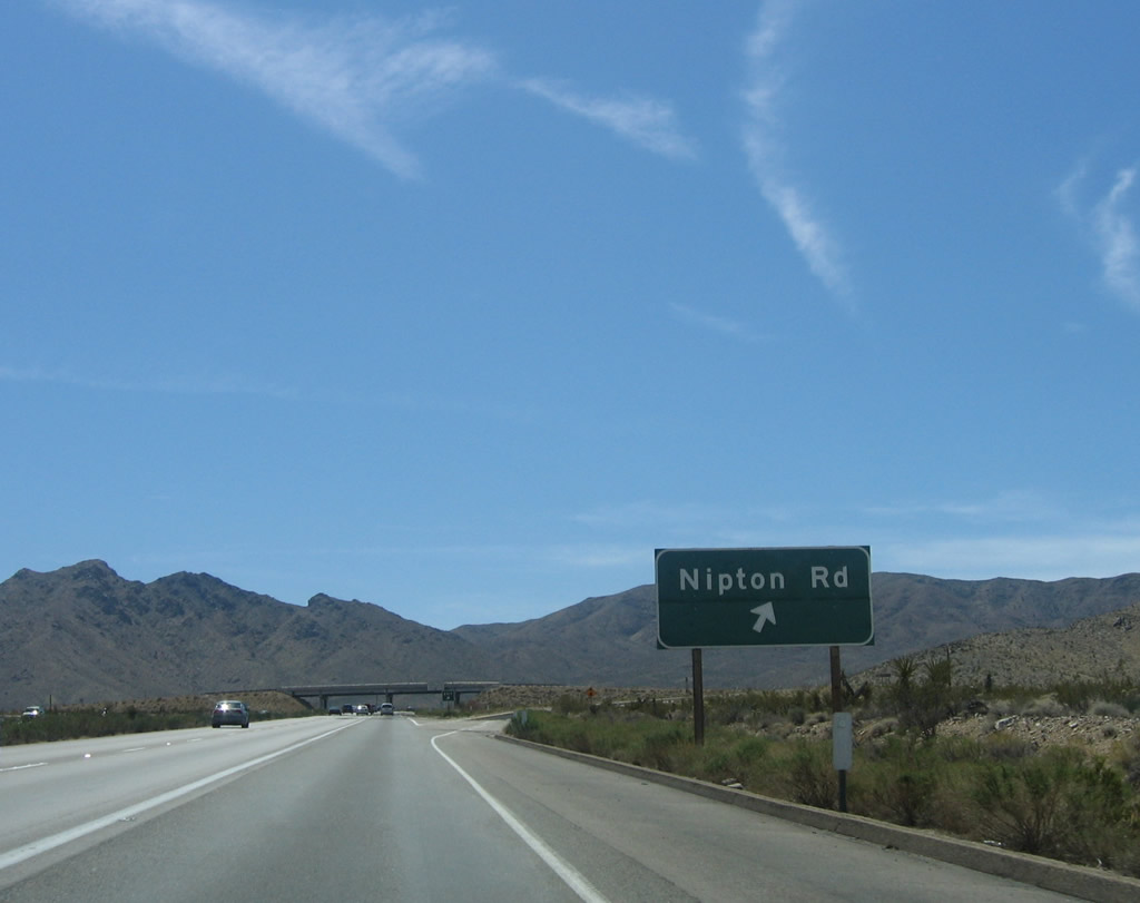
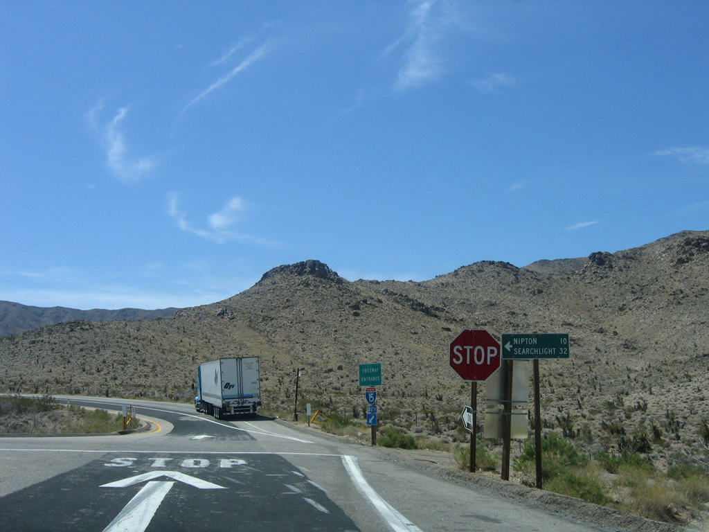
The next exit along Interstate 15 south is Exit 286, Nipton Road east to Nevada 164 en route to Searchlight, Nevada. Photo taken 04/02/06. |
|
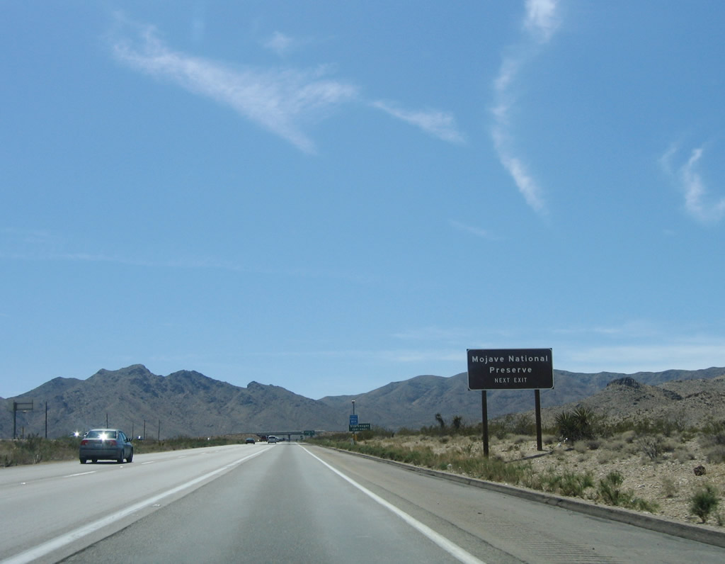
Interstate 15 skims the outskirts of the Mojave National Preserve at Exit 286 (Nipton Road). The preserve is home to a colorful mountain and desert landscape including rose-colored sand dunes, volcanic cinder cones and Joshua tree forests. Photo taken 04/02/06. |
|
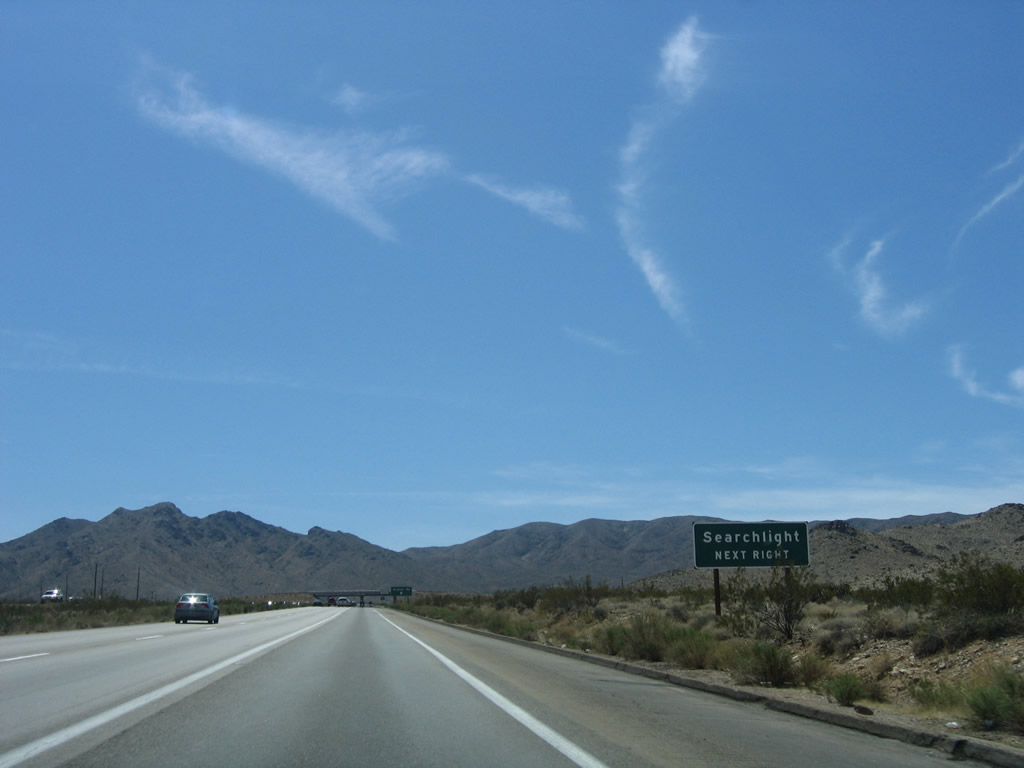
Travel interests to the Nevada town of Searchlight should use Nipton Road east from Exit 286 to U.S. 95 in Clark County. The desert road becomes Nevada 164 on the 31.5-mile between Interstate 15 and U.S. 95. Photo taken 04/02/06. |
|
Southbound Interstate 15/Mojave Freeway reaches Exit 286, Nipton Road east to Nevada 164, Searchlight, and U.S. 95. Photo taken 04/01/06. |
|
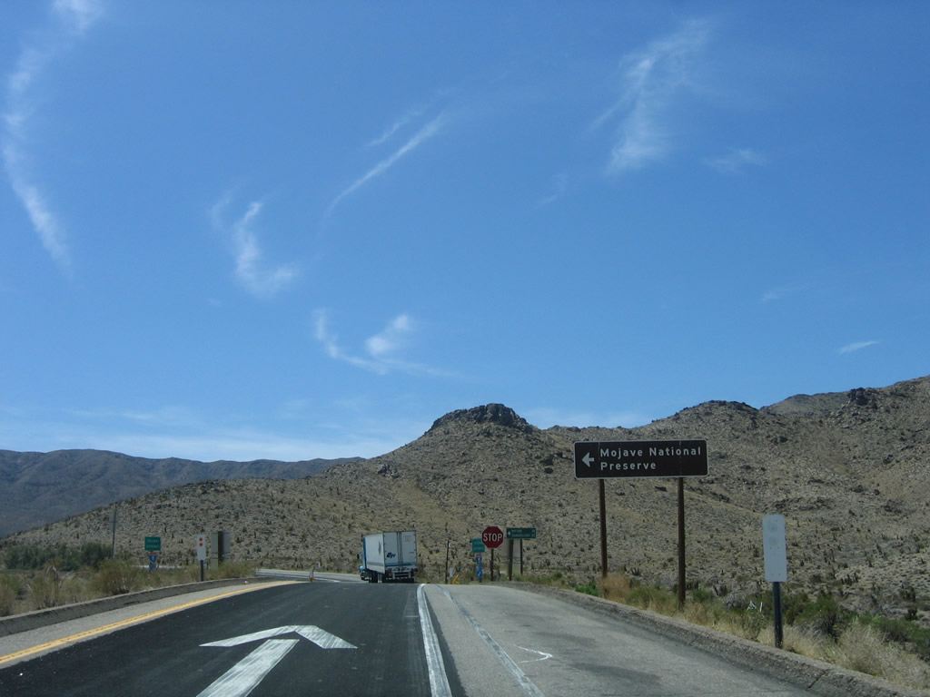
Now on the off-ramp to Nipton Road is this trailblazer sign to Mojave National Preserve (left turn on Nipton Road). Photo taken 04/02/06. |
|
A mileage sign provides the distance to Nipton (ten miles) and Searchlight (32 miles). Photo taken 04/02/06. |
|
Back on the mainline, this is another in a series of truck lane overheads. This particular sign is posted on the overpass for Nipton Road. Exit 286 is a diamond interchange; Nipton Road skirts the northern reaches of the Mojave National Preserve between the freeway and the state line. Nipton itself lies ten miles to the east at the Nipton Road intersection with Nipton Moore Road. Photo taken 03/31/08. |
|
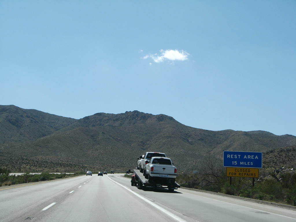
After the Nipton Road interchange, a rest area 15 miles ahead sign is posted. The rest area was closed for reconstruction at the time this photo was taken. Photo taken 03/31/08. |
|
|
|
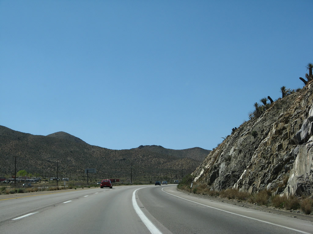
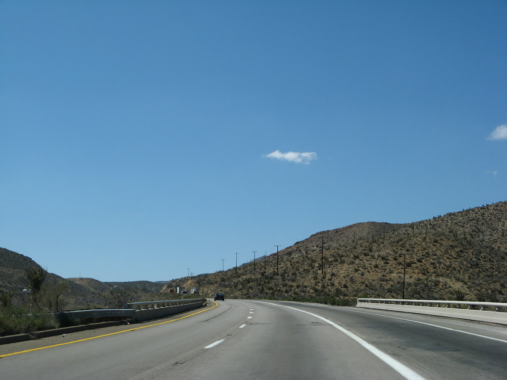
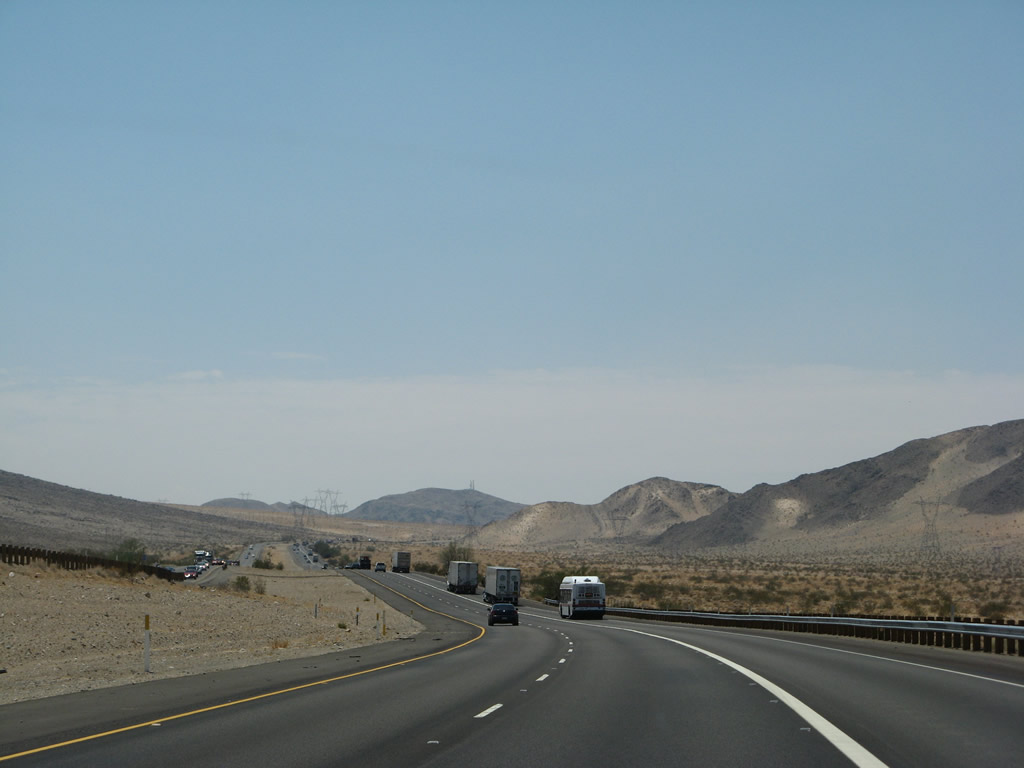
This series of photos follows Interstate 15/Mojave Freeway south we ascend toward Mountain Pass. Photos taken 03/31/08. |
|
|
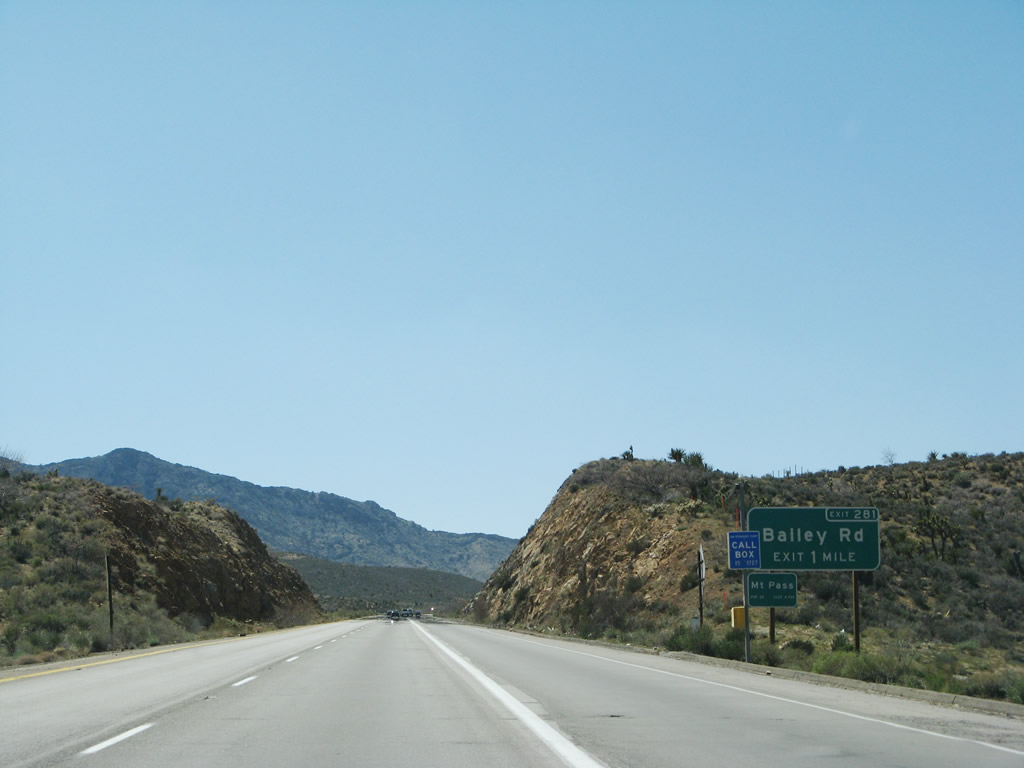
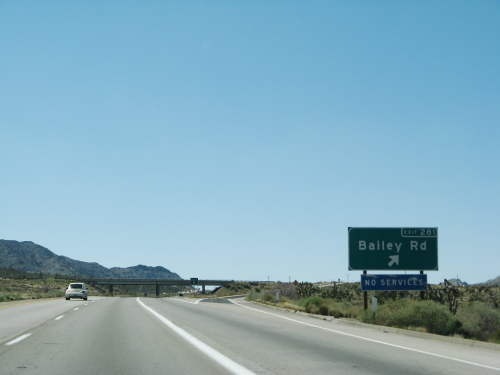
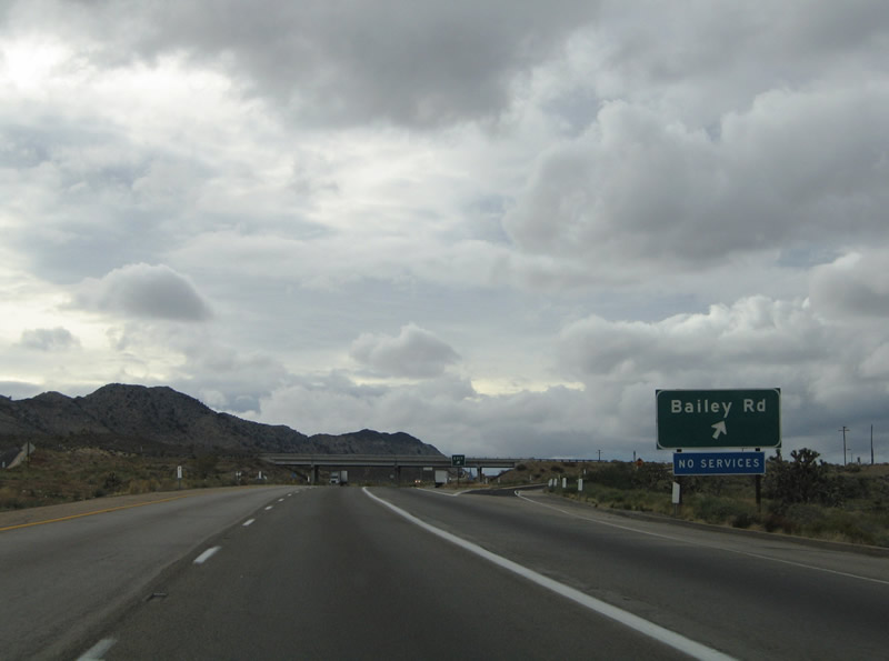
The next exit along Interstate 15 south is Exit 281, Bailey Road. This diamond interchange with Bailey Road serves the community of Mountain Pass. An exit number sign was added between 2004 and 2008. Photos taken 03/31/08 and 10/19/04. |
|
|
Bailey Road serves the settlement of Mountain Pass with connections to Clark Mountain Road. There are no outlets from the Exit 281 interchange other than Interstate 15. A blue sign indicates the lack of services at Mountain Pass. An exit number sign was added between 2004 and 2008. Photos taken 03/31/08 and 10/19/04. |
|
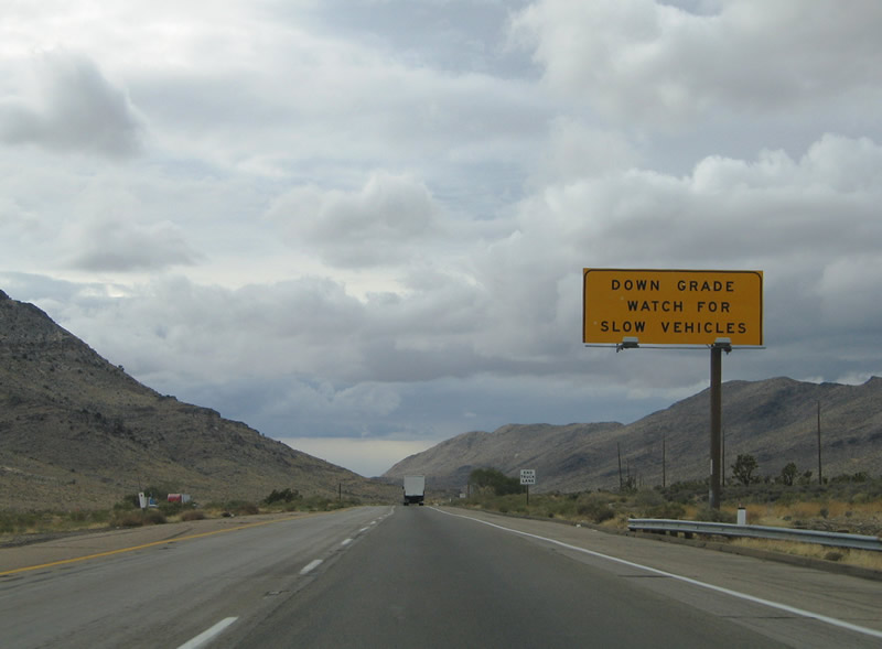
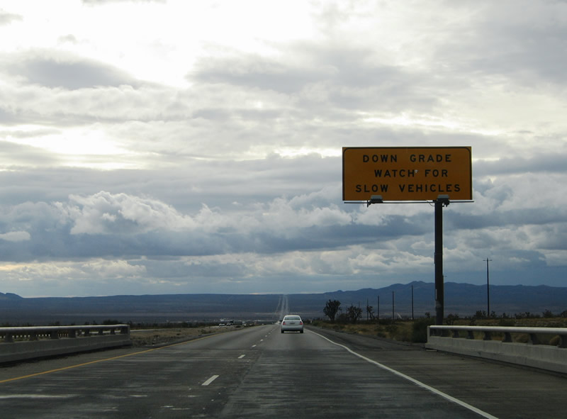
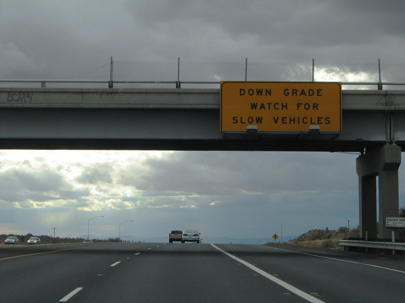
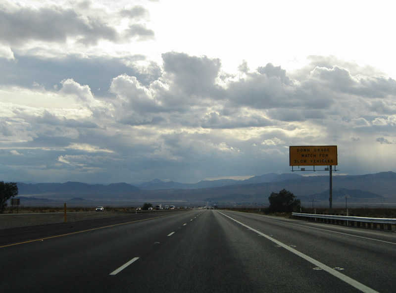
A large overhead warns truckers and vehicles carrying trailers of the long downgrade from Mountain Pass to Baker (el. 930 ft). Photo taken 10/19/04. |
|
Continuing the descent toward Baker and Barstow from Mountain Pass within the Clark Mountains. Photo taken 10/19/04. |
|
Interstate 15 leaves the Clark Mountains and recurves toward the southwest on the approach to Windmill Station and Baker. A second overhead reminds truckers and the like of the continued down grade. Photo taken 10/19/04. |
|
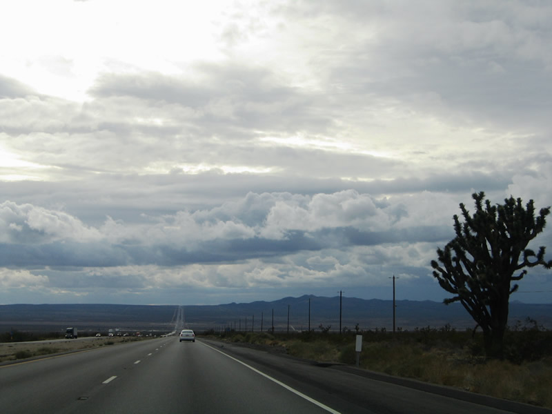
Interstate 15 crosses the northern tip of the Mojave National Preserve between Mountain Pass and Windmill Station. A scattering of Joshua Trees dot the landscape such as the one pictured here. Photo taken 10/19/04. |
|
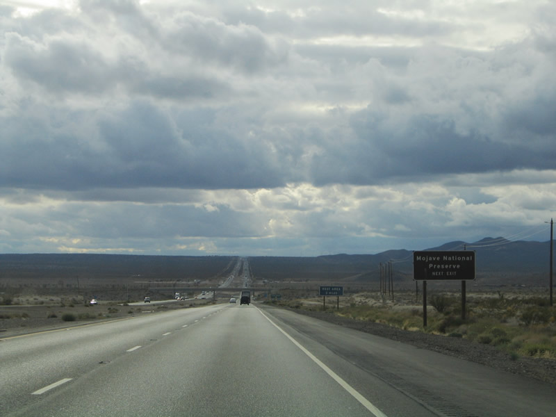
The next exit along Interstate 15/Mojave Freeway is Exit 272, Cima Road (one mile). Photo taken 03/31/08. |
|
The upcoming interchange (Exit 272) with Cima Road ahead provides a second gateway into the Mojave National Preserve from Interstate 15 southbound. A rest area lies beyond the upcoming diamond interchange. Photo taken 10/19/04. |
|
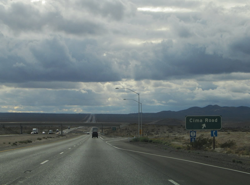
Exit 272 departs Interstate 15 southbound for Cima Road at Windmill Station. Cima Road flows southeast 18 miles into the Mojave National Preserve to Cima itself. The road cuts a swath between Teutonia and Kessler Peaks. Excelsior Mine Road stems north from the freeway toward Kingston Peak in the Shadow Mountains. Photo taken 10/19/04. |
|
Widening activities have resulted in a few bridge replacements. Eventually, this section of Interstate 15 will be expanded from four to six lanes. Photo taken 03/31/08. |
|
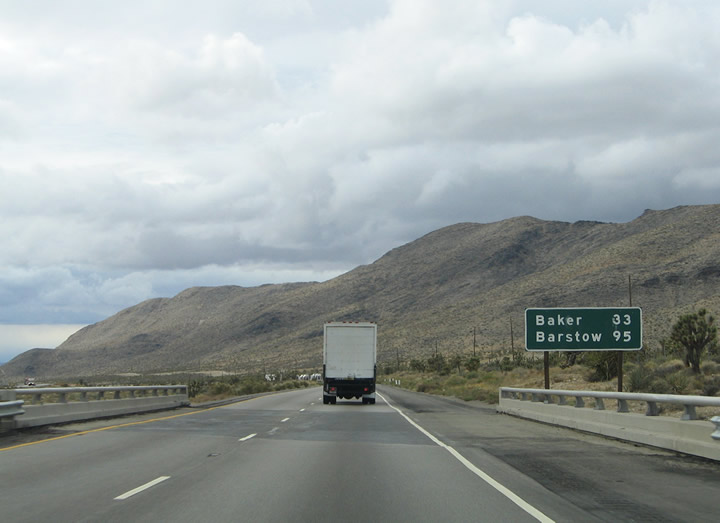
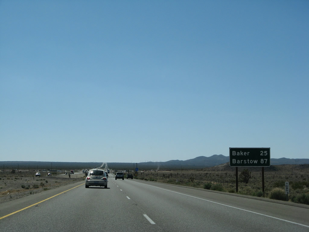
This mileage sign provides the distance to Baker (25 miles) and Barstow (87 miles). A distance of 62 miles separates the two. Photo taken 03/31/08. |
|
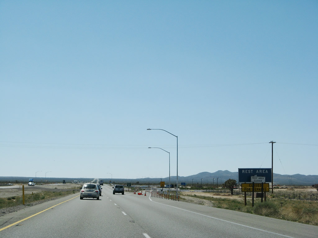
Interstate 15 sees a rest area between Windmill Station (Exit 272) and Yucca Grove (Exit 265). The rest area near Milepost 270 was closed for reconstruction at the time this photo was taken. Photo taken 03/31/08. |
|
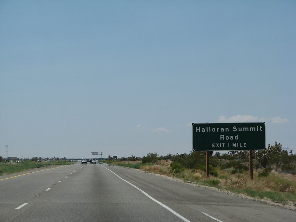
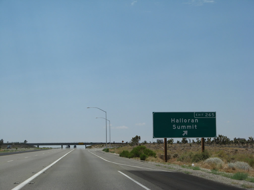
The next exit along Interstate 15/Mojave Freeway south is Exit 265, Halloran Summit Road (diamond interchange). This is a local ranch road that connects the freeway with local ranches both north and south of the freeway. Photo taken 07/14/08. |
|
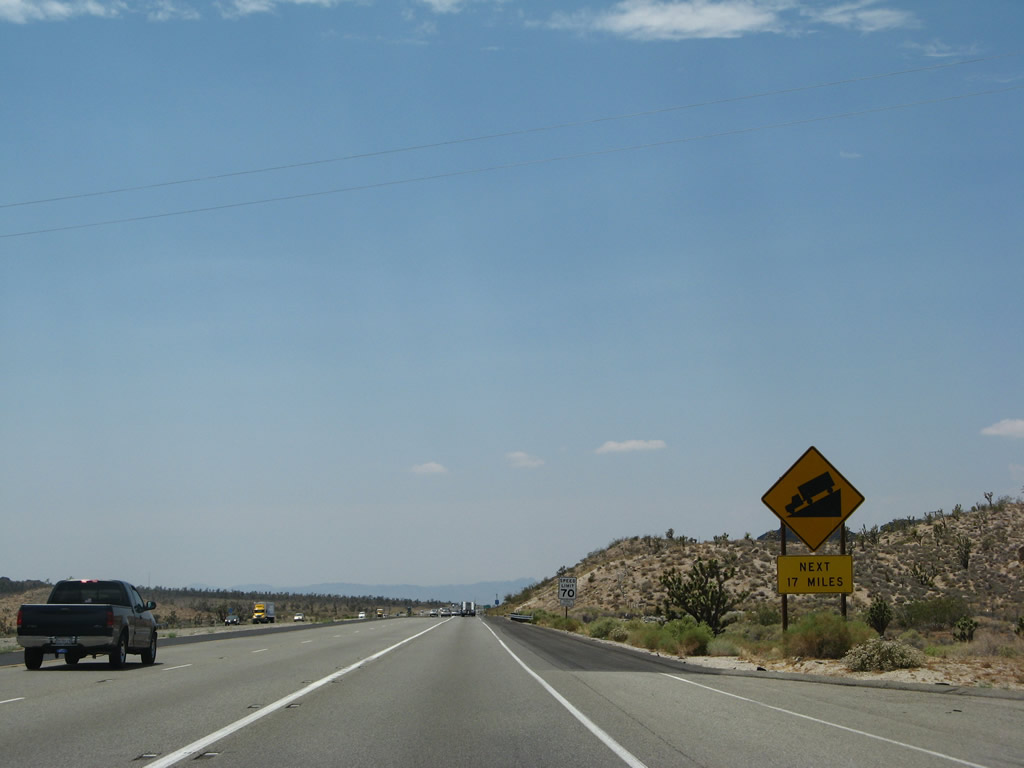
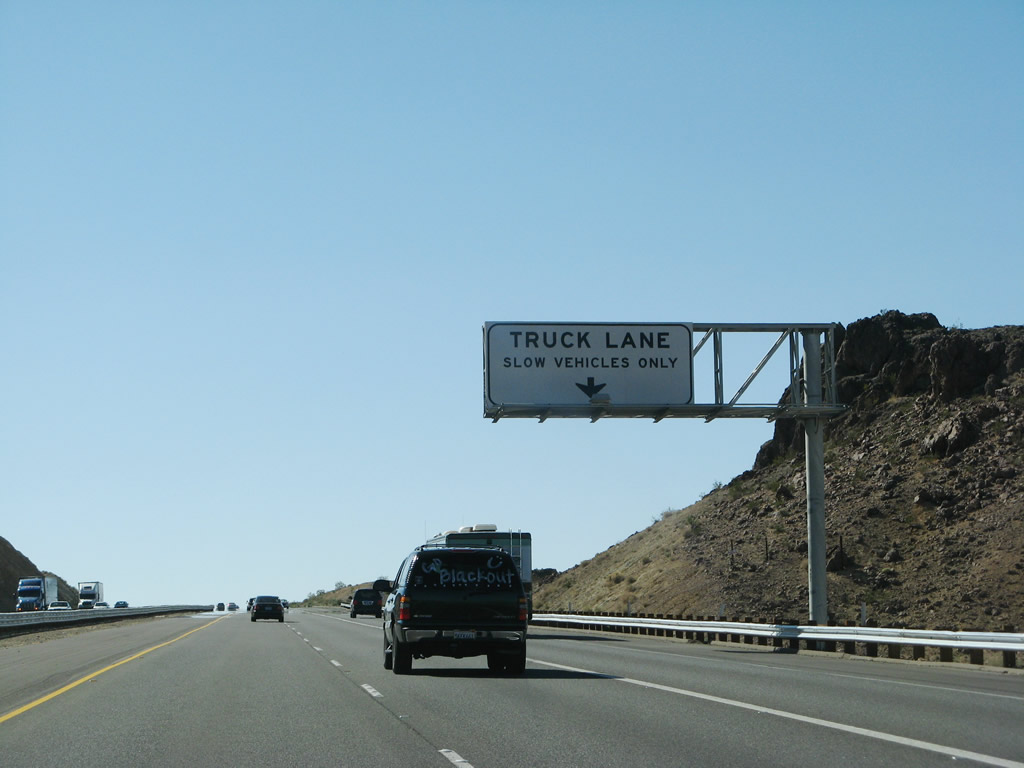
A third truck lane commences prior to the Halloran Summit exit and travels southward 17 miles to Baker. From Halloran Summit, Interstate 15 will descend toward Baker. Photo taken 07/14/08. |
|
A diamond interchange joins Halloran Summit Road with Interstate 15 at Exit 265. Photo taken 07/14/08. |
|
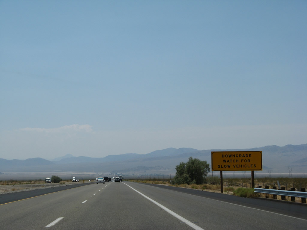
Mounted on the Halloran Summit Road overpass is a warning sign for the upcoming downgrade. Between the Halloran Summit/Yucca Grove interchange (Exit 265) and the Arrowhead interchange (Exit 259), the freeway will sink toward the dry Silver Lake and the Soda Mountains. Silver Lake is the northern end of the Mojave River, which flows from the area around the San Bernardino Mountains north into the desert. Photo taken 10/19/04. |
|
After the Halloran Summit Road interchange, southbound Interstate 15 continues southwest toward Baker. All traffic should be mindful of speed, as the freeway travels downhill for the next 17 miles (all the way into Baker). Photo taken 07/14/08. |
|
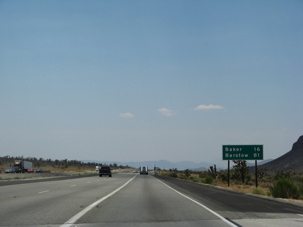
A mileage sign shortly thereafter provides the distance to Baker (16 miles) and Barstow (81 miles). Photo taken 07/14/08. |
|
Interstate 15 travels southwest toward Baker. Dry Silver Lake can be seen in the distance. Photo taken 07/14/08. |
|
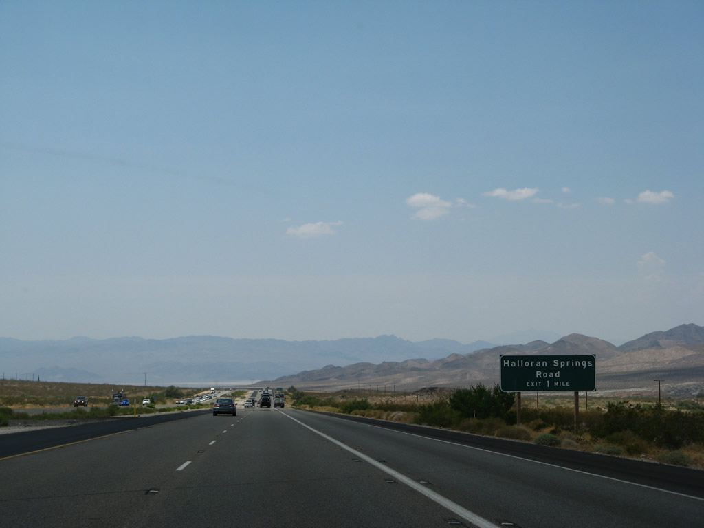
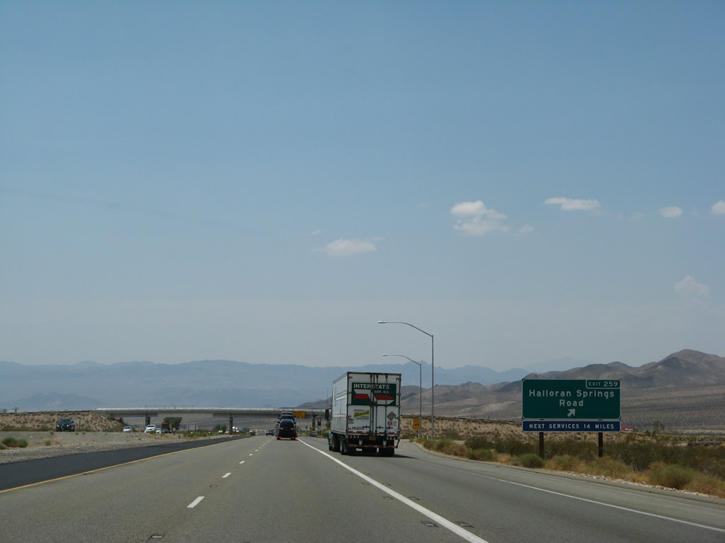
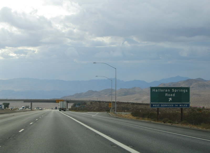
Still on the long downgrade toward Baker, Interstate 15 south next approaches Halloran Springs Road at the Exit 259 diamond interchange. Halloran Springs Road arcs 15 miles west from Arrowhead to California 127 at Silver Lake. Photo taken 03/31/08. |
|
|
Exit 259 leaves Interstate 15 southbound for Halloran Springs Road. Halloran Springs Road ends at the Mojave National Preserve south of the freeway. Services along Halloran Springs Road west lie 14 miles ahead near the junction with California 127. Photos taken 07/14/08 and 10/19/04. |
|
|
Continuing the descent toward Baker and Silver Lake. A metric/English unit mileage sign resides along the stretch between Arrowhead (Exit 259) and Baker (Exit 248). South of Baker is the dry Soda Lake, west of Baker are the Soda Mountains. Photos taken 07/14/08 and 10/19/04. |
|
Slow vehicles (trucks) should continue to use the right lane for the duration of the downhill trip. Photo taken 07/14/08. |
|
|
Another warning sign regarding the downhill slope is posted. It appears that the overhead sign was replaced by a roadside sign between 2004 and 2008. Photos taken 07/14/08 and 10/19/04. |
|
|
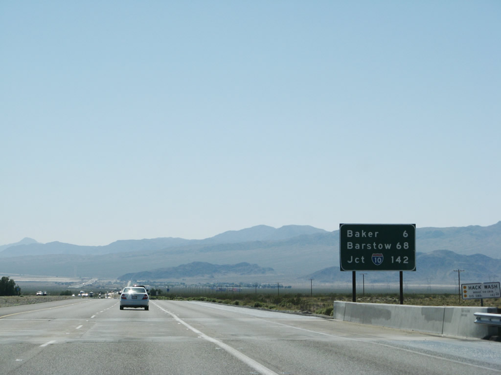
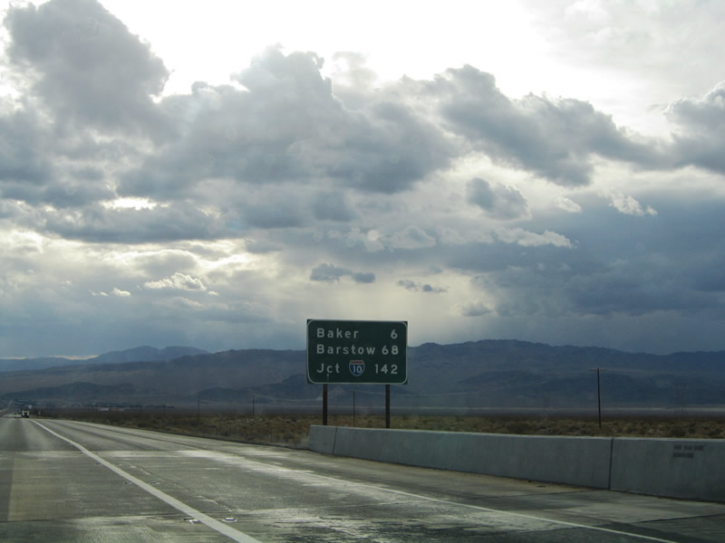
A second mileage sign placed six miles east of Baker includes the distance to Interstate 10 in lieu of Los Angeles. Photos taken 03/31/08 and 10/19/04. |
|
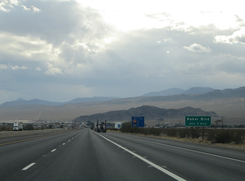
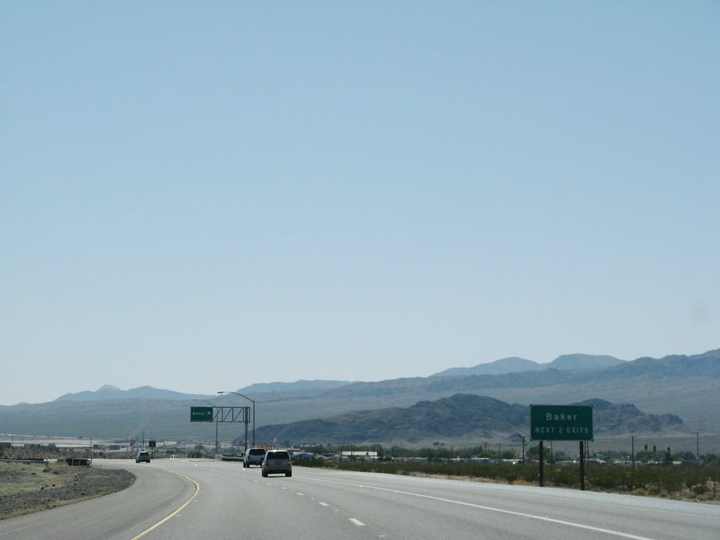
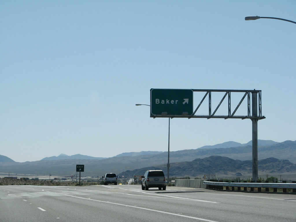
Interstate 15 finally reaches the town of Baker, with the next interchange at Exit 248 (Baker Boulevard). Traveling through the city from Interstate 15 is Baker Boulevard, the former alignment of U.S. 91 & 466. Baker Boulevard may have been a business route at one time, but there are currently no signs indicating such. Photo taken 10/19/04. |
|
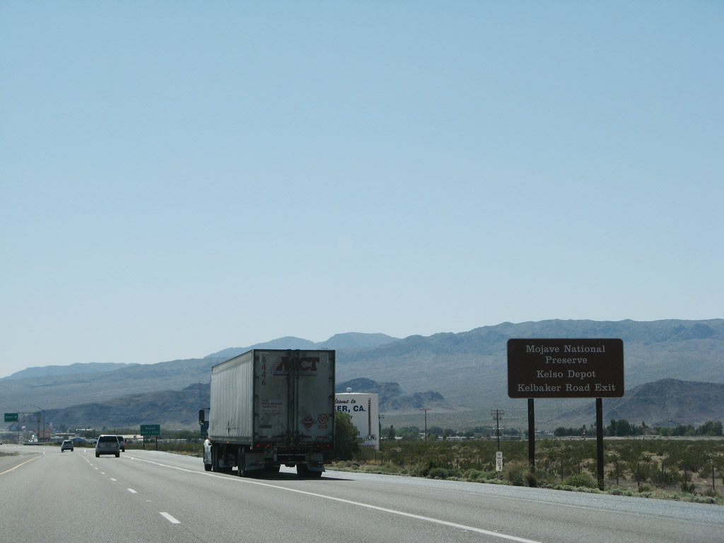
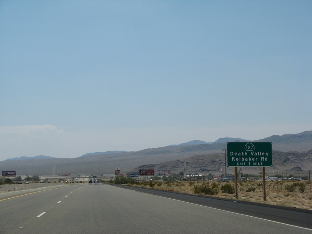
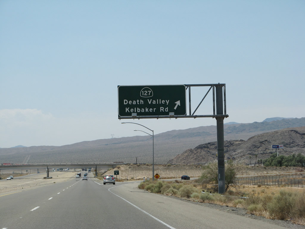
Use Exit 246, California 127 and Kelbaker Road south to the historic Kelso Depot, which houses the Mojave National Preserve visitors center. Photo taken 03/31/08. |
|
The next two exits along Interstate 15/Mojave Freeway south will serve the community of Baker (Exit 248, Baker Boulevard and Exit 246, California 127 (Kelbaker Road)). There is no access to Exit 245, which is the south Baker wye interchange. Photos taken 03/31/08. |
|
|
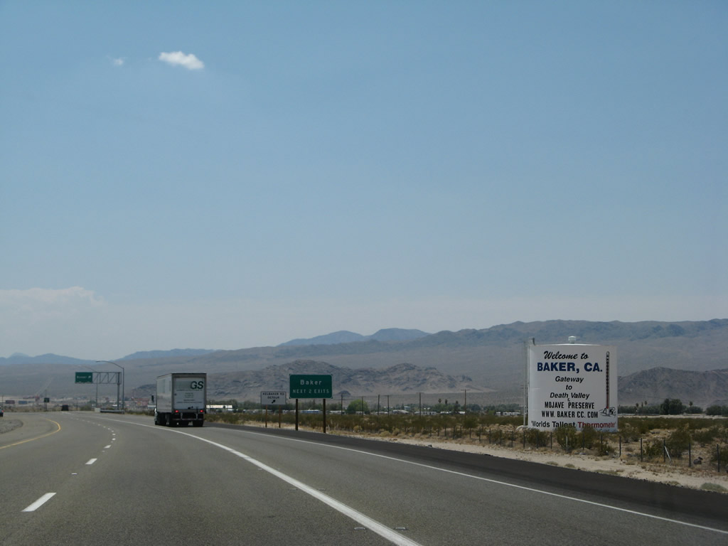
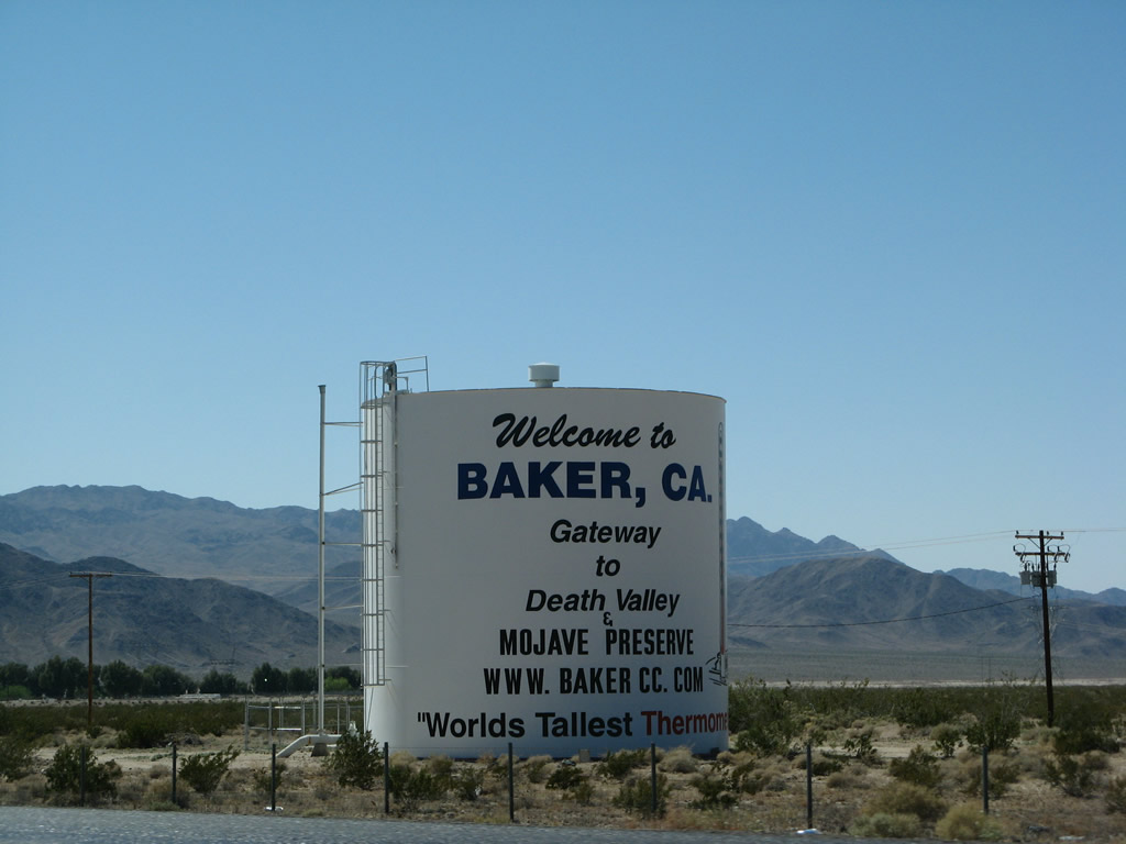
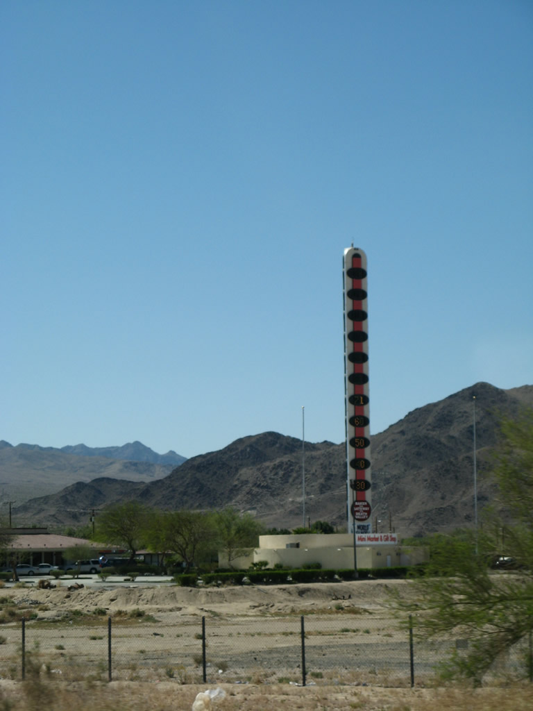
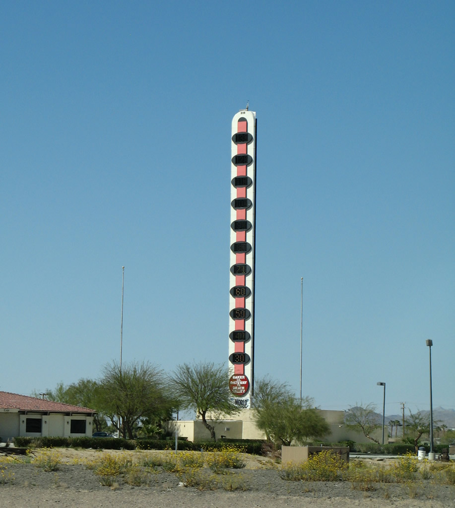
A water storage tank says, "Welcome to Baker - Gateway to Death Valley and Mojave Preserve - World's Tallest Thermometer." Photos taken 07/14/08 and 03/31/08. |
|
Baker Boulevard (old U.S. 91 and U.S. 466) leaves Interstate 15 south at Exit 248. A wye interchange constitutes the east end of the Baker loop. Note that although Baker Boulevard is not officially designated as a business loop, it functions as one. Home of the World's Tallest Thermometer, Baker provides travelers with the first travel amenities since Interstate 15 left Primm. Photo taken 03/31/08. |
|
Baker lies at the crossroads of former U.S. 91 & 466 with California 127 (Kelbaker Road). California 127 travels 84 miles north from Interstate 15 to Death Valley Junction to the east Death Valley National Park. Kelbaker Road leads south 57 miles through Mojave Natural Preserve before meeting Interstate 40. Photo taken 07/14/08. |
|
As seen in the background, most motorist services are available in Baker ("The Gateway to Death Valley"). Use Kelbaker Road south into Mojave National Preserve. Photo taken 07/14/08. |
|
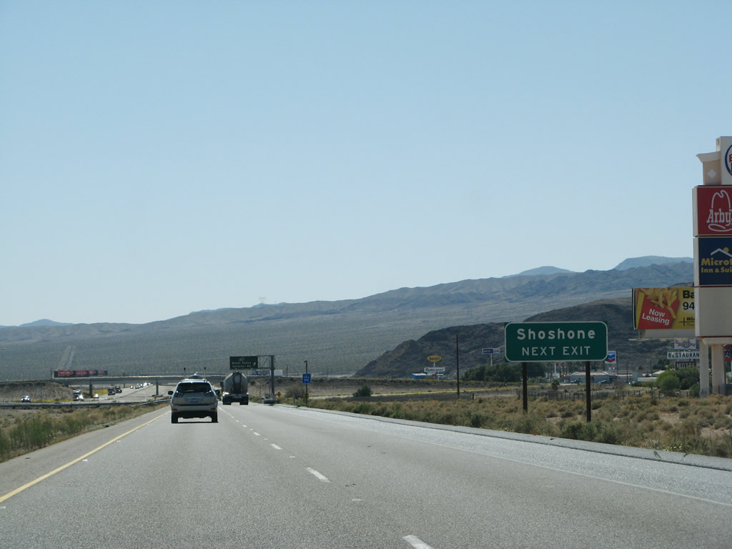
Use California 127 north to Shoshone and Death Valley. Photo taken 03/31/08. |
|
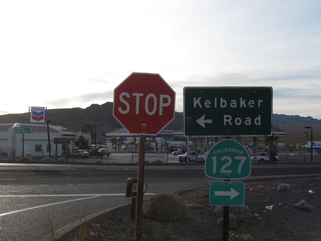
Southbound Interstate 15/Mojave Freeway reaches Exit 246, California 127 (Kelbaker Road). California 127 meets California 178 in 57 miles at Shoshone and crosses the state line and transitions to Nevada 373 in 91 miles. Kelbaker Road intersects Park Avenue south of Interstate 15 and Baker Boulevard (old U.S. 91 & 466) north of the freeway. Photo taken 07/14/08. |
|
|
The World's Tallest Thermometer registered a balmy 71 degrees at the time this photo was taken. Photos taken 03/31/08. |
|
|
These two signs are posted on the off-ramp from Interstate 15 south to California 127. Turn left on Kelbaker Road southeast to Kelso. Turn right for California 127 north to Baker, Shoshone, and Death Valley. Photos taken 11/11/08. |
|
Baker Boulevard (old U.S. 91 & 466) returns to Interstate 15 via a wye interchange (Exit 245). There is no access to Baker at this point; the next interchange is Exit 239, six miles ahead. Photo taken 03/31/08. |
|
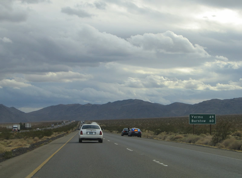
A mileage sign is posted after the on-ramp from Exit 245. The freeway continues 49 miles to Yermo and 60 miles to Barstow. Photo taken 10/19/04. |
|
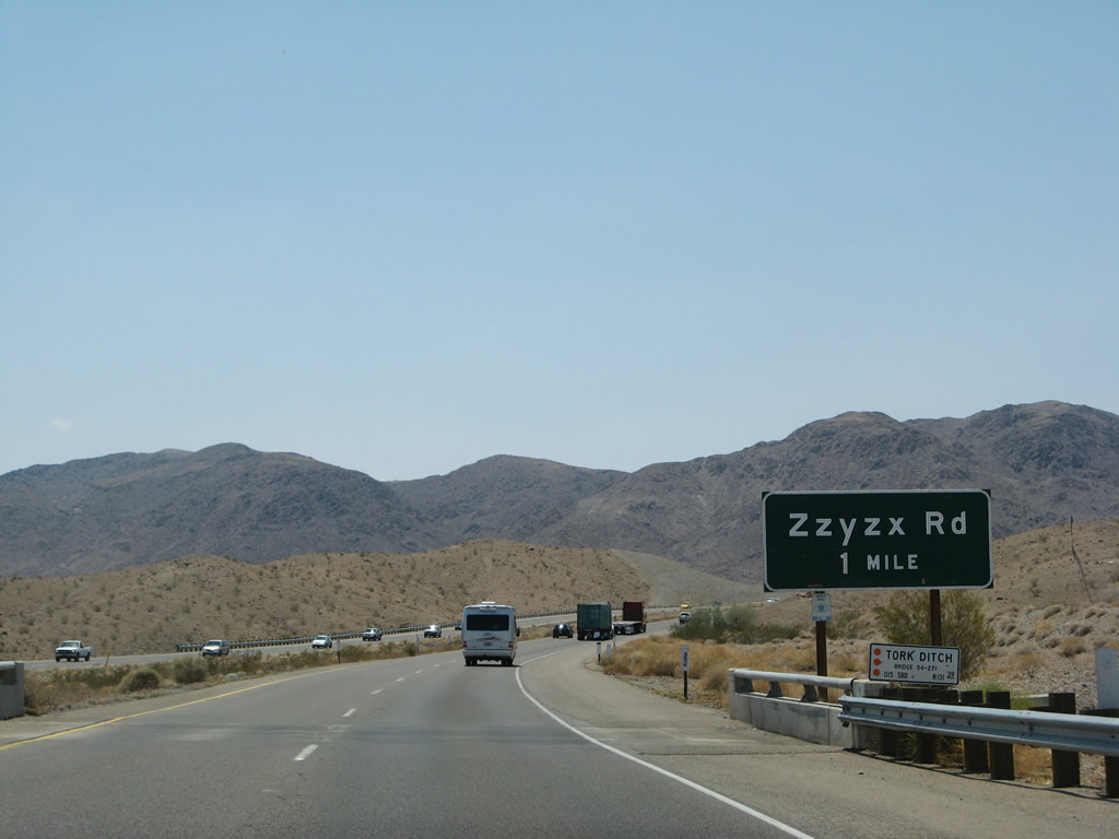
Nearing the Exit 239 diamond interchange with Zzyzx Road on Interstate 15 south. Zzyzx Road leads 4.5 miles to Zzyzx Springs. Zzyzx Springs began in 1944 on a 12,800 acre tract of land by entrepreneur Curtis Howe Springer. There Springer constructed a small hotel, castle, church, radio station, and health spa. The builder established himself as both a preacher and physician, and in the years that followed, broadcasted a national health and religious radio program from his station at Zzyzx Springs. His programs lasted until 1974, when he was arrested for food and drug violations and unauthorized use of federal land. In 1976 the Bureau of Land Management ceased the land and now it functions as the home for the California State University system Desert Studies Center. Read more about Zzyzx Springs at http://wordways.com/zzyzx.htm. Photo taken 07/14/08. |
|
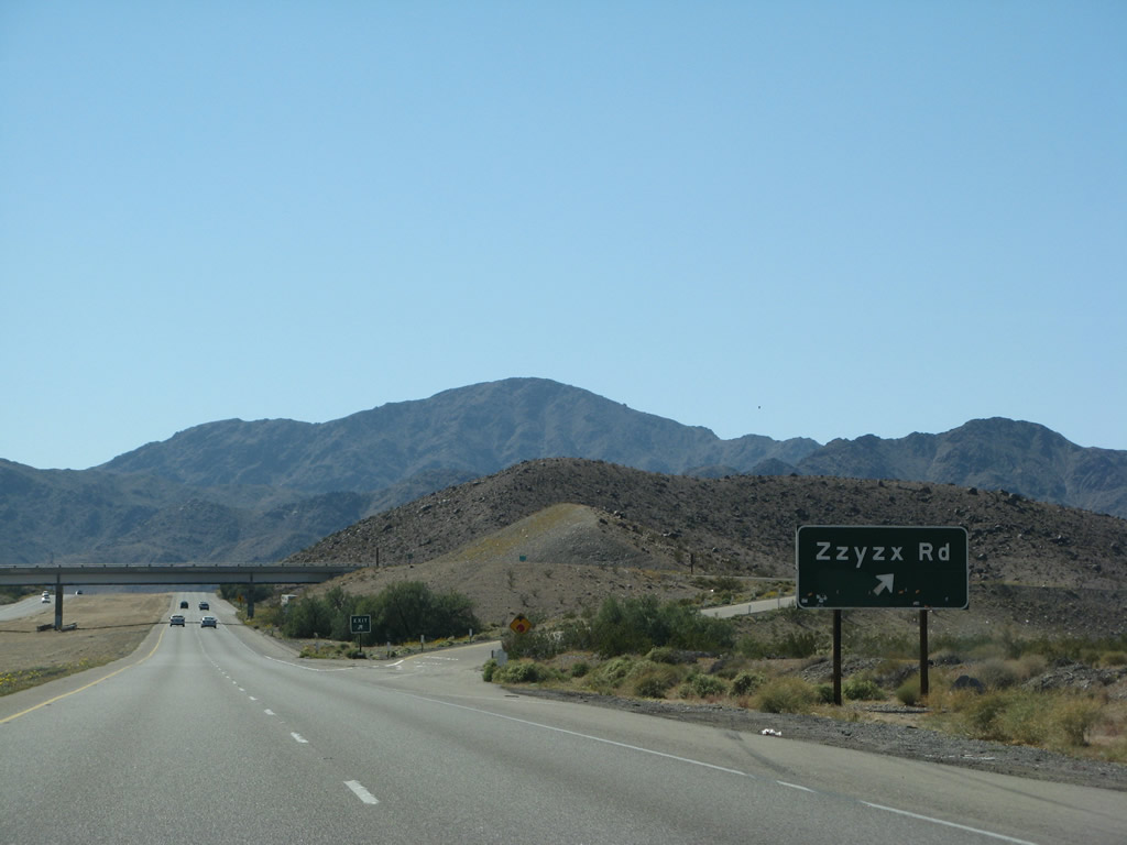
Interstate 15 southbound at the Exit 239 diamond interchange with Zzyzx Road. Pronounced "Zeye-zix", the word was the brainchild of Springer, who claimed it was the last word alphabetically in the English language. The United States Board on Geographic Names approved Zzyzx Springs as a place name on June 14, 1984. The hydrologic feature lies along the shore of the dry Soda Lake at the western edge of the Mojave National Preserve. Photo taken 03/31/08. |
|
This wide Interstate 15 reassurance shield is posted shortly after Exit 239 (Zzyzx Road). The white painted post suggests that the post itself may date back to the 1960s. Photo taken 03/31/08. |
|
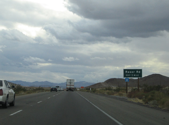
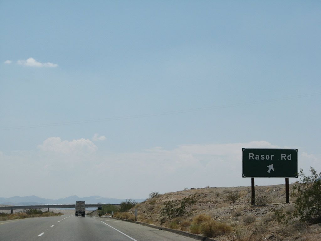
Nearing the Exit 233 diamond interchange with Rasor Road. Rasor Road spurs 6.4 miles southeast from Arrowhead Trail (old U.S. 91 & 466) & Interstate 15 to the settlement of Rasor at the Devil's Playground sand dunes. Photo taken 10/19/04. |
|
Southbound at the Exit 233 off-ramp to Rasor Road. Rasor Road heads south and Arrowhead Trail (old U.S. 91 & 466) branches westward toward the Cronese Valley. Photo taken 07/14/08. |
|
|
The Cronese Mountains (north) and Cave Mountain (south) come into view between Exit 233 (Rasor Road) and Exit 230 (Basin Road). Interstate 15 passes through the Cronese Valley between the two peaks. Photos taken 03/31/08 and 10/19/04. |
|
|
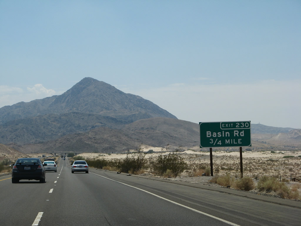
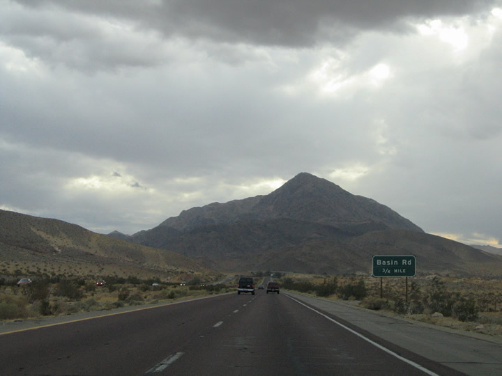
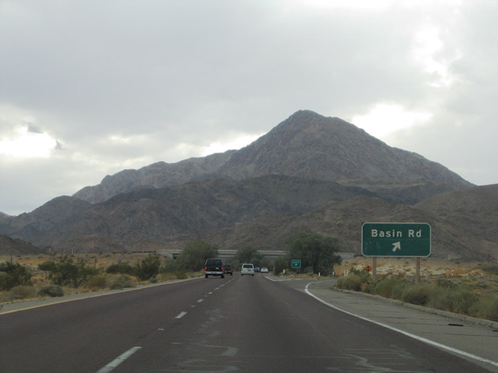
Next in line is the Exit 230 diamond interchange with Basin Road. Basin Road travels southward from Interstate 15 to the Mojave River Wash and Afton Canyon. The road ends at the Union Pacific Railroad line along the wash. Photos taken 07/14/08 and 10/19/04. |
|
|
Prior to the Basin Road interchange, this view shows the jog Interstate 15 takes around Cave Mountain by turning again to the west. Looking northwest, the Path 64 power line and the Cronese Mountains come into view from the freeway. Photos taken 03/31/08. |
|
Interstate 15 southbound reaches the Exit 230 off-ramp to Basin Road south and Cronese Lake Road north. Cronese Lake Road meanders northwest to Arrowhead Trail and the dry East and West Cronese Lake beds. Photo taken 10/19/04. |
|
This Interstate 15 south reassurance shield is posted after the Basin Road interchange. Photo taken 03/31/08. |
|
|
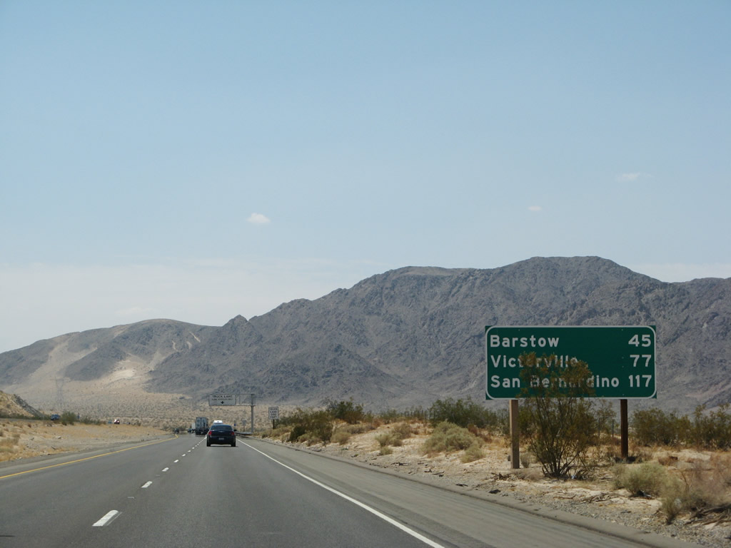
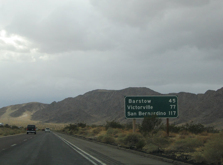
Victorville joins Barstow and San Bernardino on this Interstate 15 southbound mileage sign posted ascent through the Cronese Valley. Victorville is a rapidly growing suburban type community with a historic downtown emphasizing historic U.S. 66. Photos taken 07/14/08 and 10/19/04. |
|
Another truck lane overhead sign is posted on southbound Interstate 15. Photo taken 07/14/08. |
|
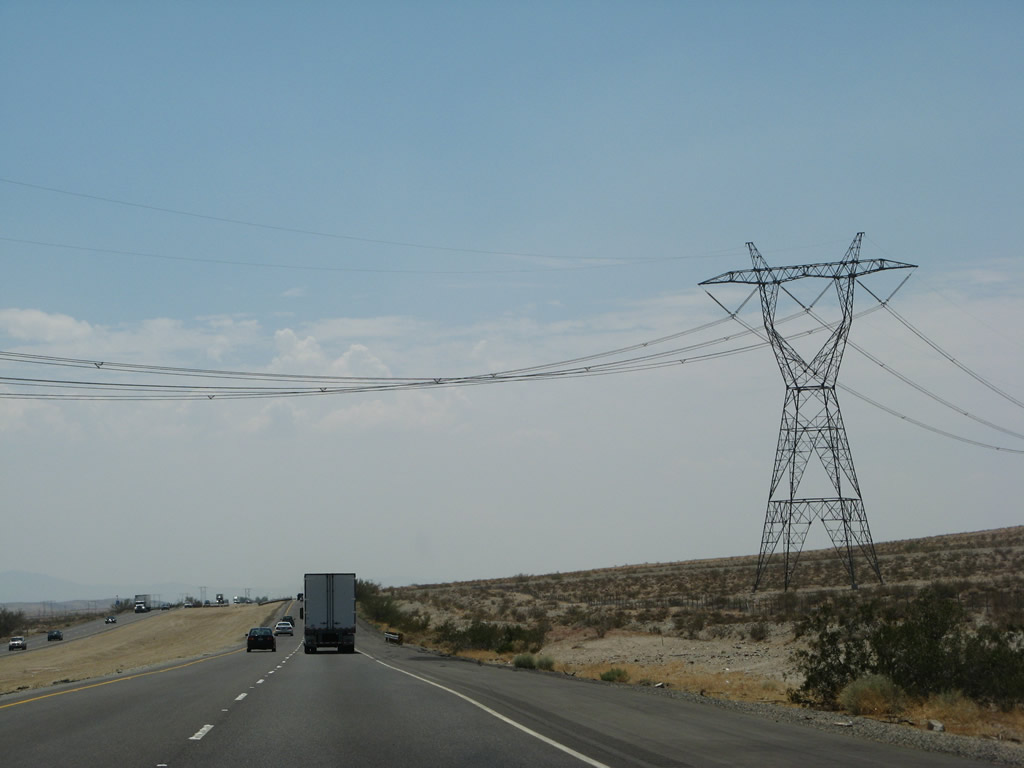
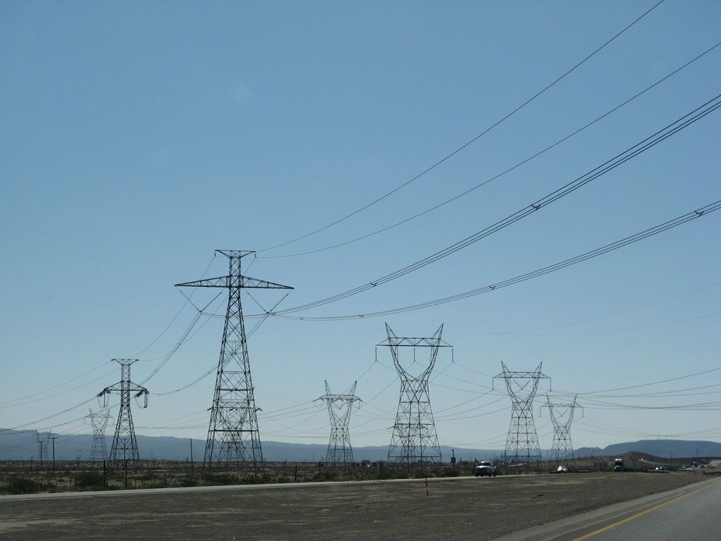
Six-lane Interstate 15 continues southwest toward Barstow. Path 64 power lines come into view as they intersect the freeway ahead. Photo taken 07/14/08. |
|
|
|
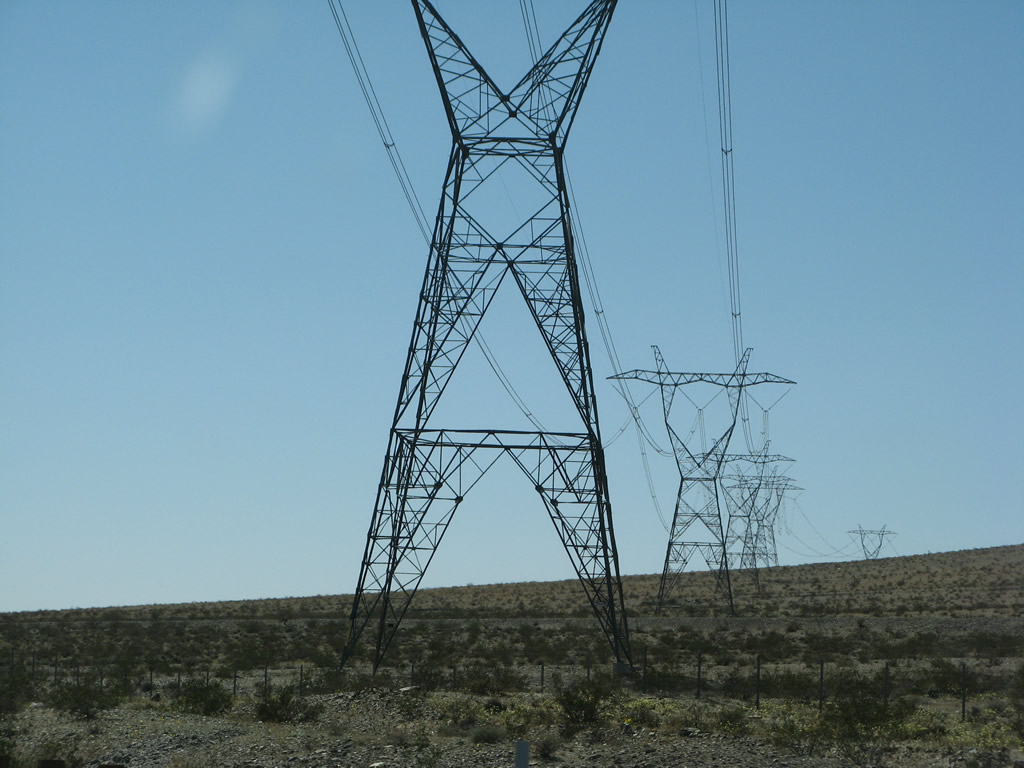
The Path 64 500kV power lines again cross Interstate 15/Mojave Freeway. Photos taken 03/31/08. |
|
After passing under the power lines, Interstate 15 ascends to the top of this rise, and the truck lane will end. Photo taken 07/14/08. |
|
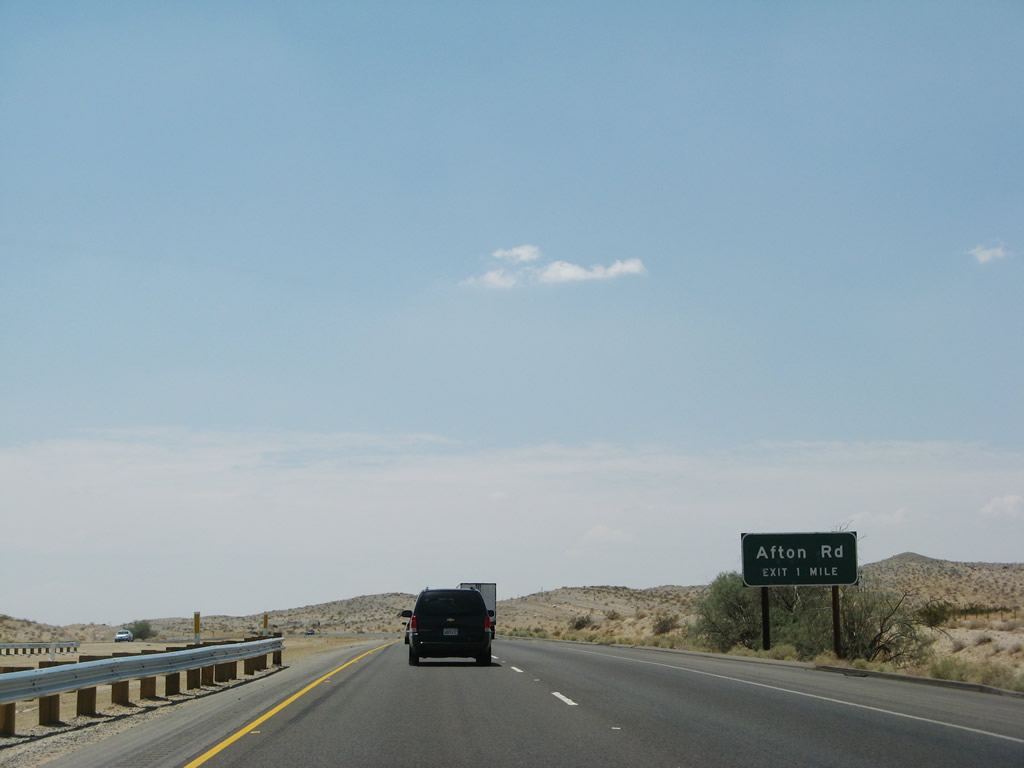
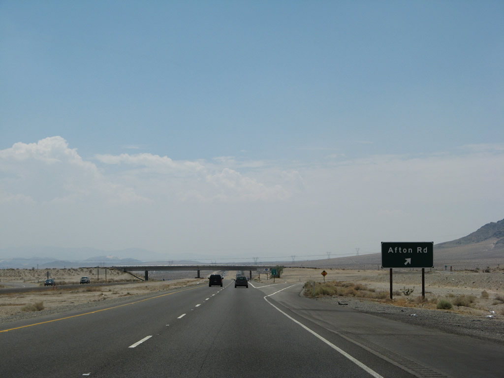
Continuing west of the Cronese and Cave Mountains toward the Afton Road interchange at Exit 221. Another drivable segment of the Arrowhead Trail appears next to Interstate 15 nearby. Afton Road otherwise travels south, becoming Afton Canyon Road, on the drive toward both the Afton Canyon and Cady Mountains. Photo taken 07/14/08. |
|
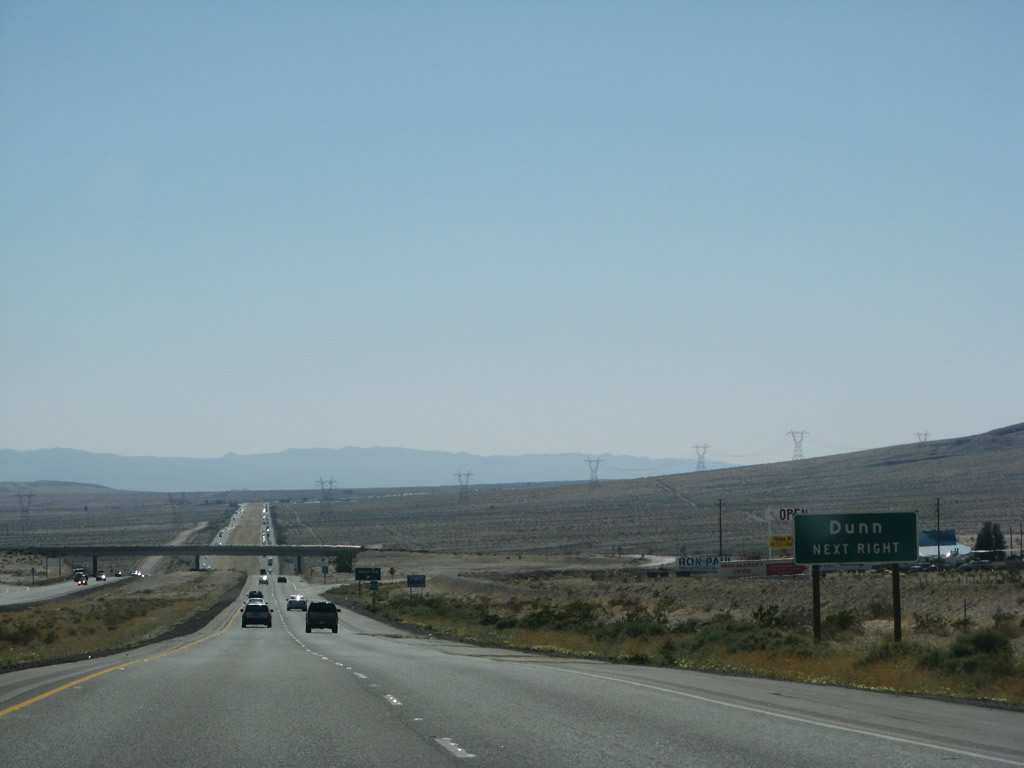
Use Afton Canyon Road south to Dunn Road west for the settlement of Dunn. Dunn lies along the Union Pacific Railroad corridor northwest of the Cady Mountains. Photo taken 03/31/08. |
|
Exit 221 departs Interstate 15/Mojave Freeway southbound for Afton Road. Afton Road ends north end of the diamond interchange at Arrowhead Trail. Afton Canyon Road heads southeast four miles to the railroad settlement of Afton otherwise. Photo taken 07/14/08. |
|
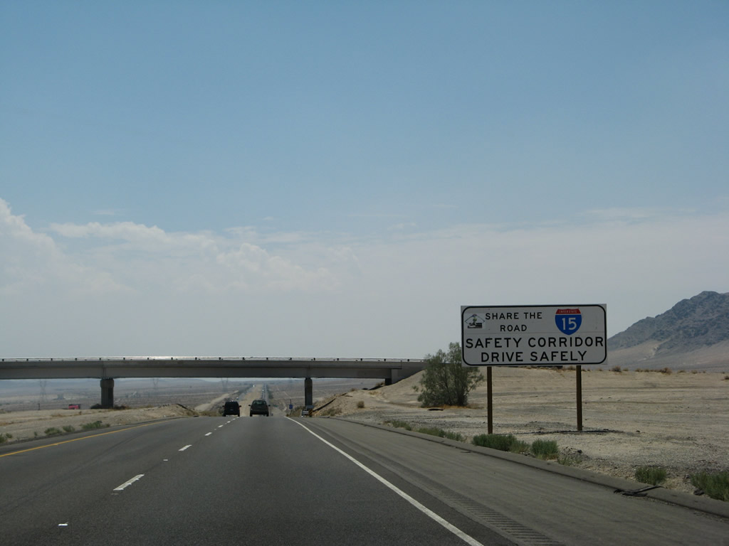
Embedded in the Afton Road interchange is this safety corridor sign for Interstate 15. Photo taken 07/14/08. |
|
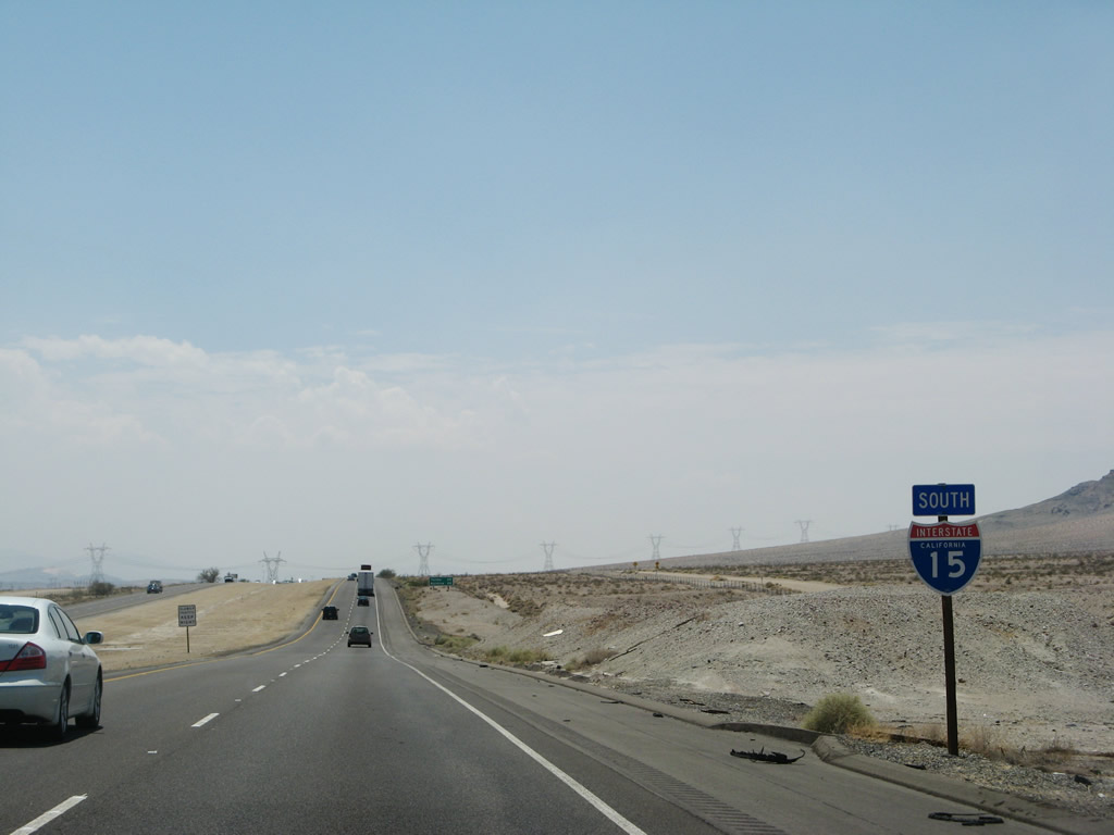
An Interstate 15 reassurance shield is posted after the Afton Road interchange. Photo taken 07/14/08. |
|
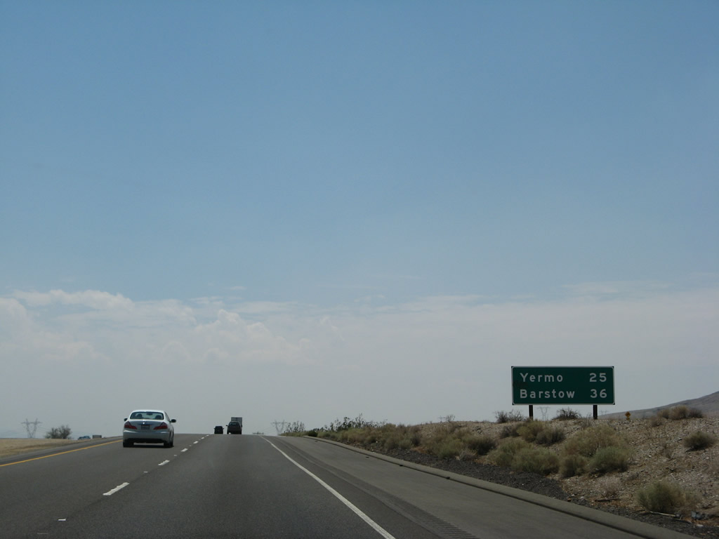
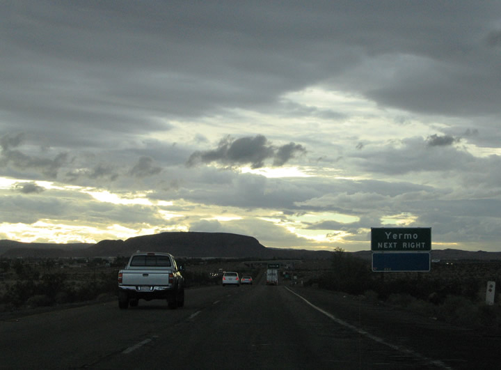
Interstate 15 continues southwest from Afton Road (Exit 221) toward the Midway Rest Area (Exit 217). A mileage sign provides the distance to Yermo and Barstow. Photo taken 03/31/08. |
|
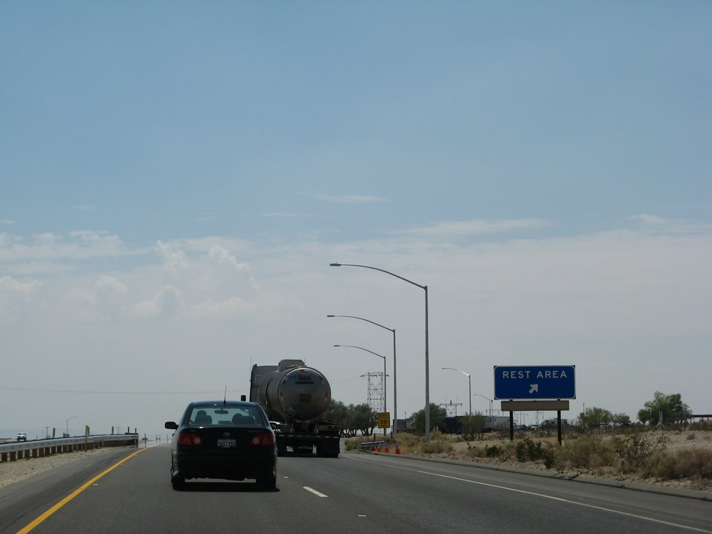
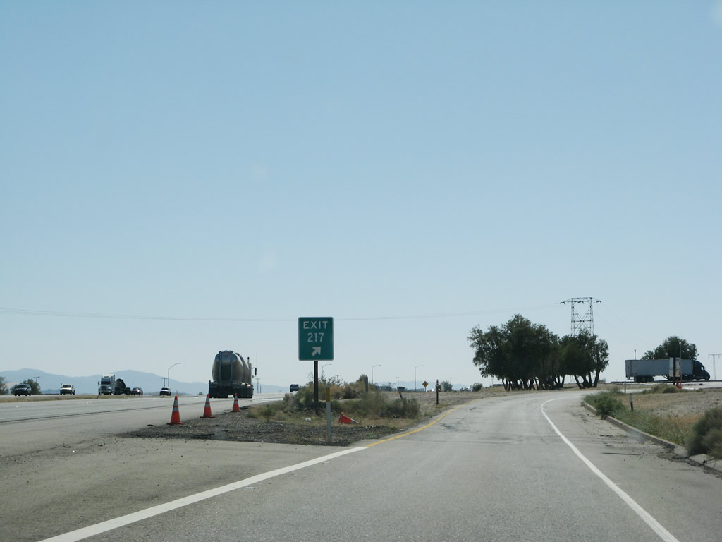
The next exit along Interstate 15/Mojave Freeway south is Exit 217, Midway Rest Area. Photo taken 07/14/08. |
|
|
Interstate 15 continues southwest from Afton Road (Exit 221) toward the Midway Rest Area (Exit 217). The Path 64 power line crosses Interstate 15 a final time before angling southwest toward the U.S. 395 corridor and ultimately Adelanto. Photos taken 07/14/08 and 03/31/08. |
|
|
Southbound Interstate 15/Mojave Freeway reaches Exit 217, Midway Rest Area (Exit 217). Photos taken 07/14/08 and 03/31/08. |
|
An older style Interstate 15 shield is posted after the rest area. Photo taken 10/19/04. |
|
|
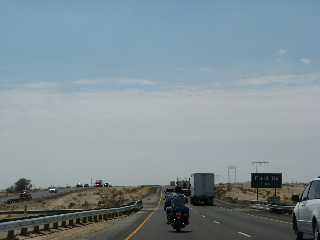
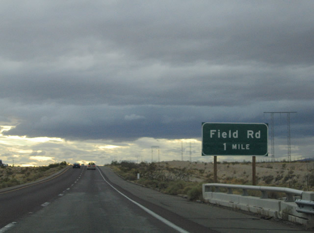
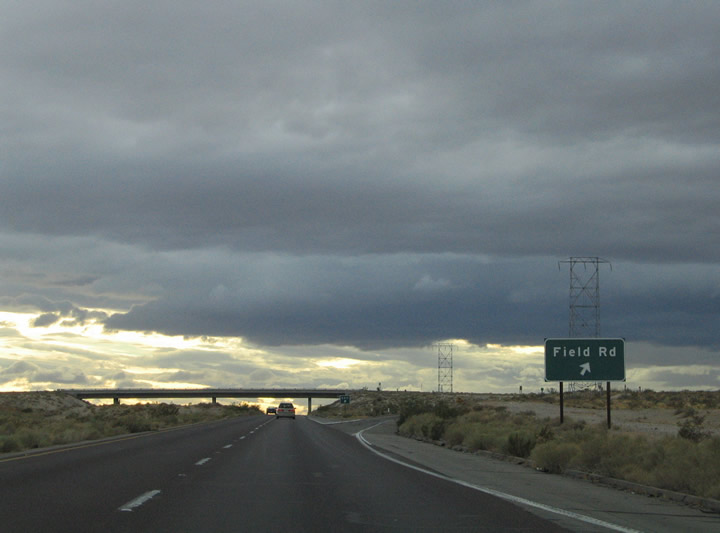
Interstate 15 crosses another local wash one mile northeast of the Field Road diamond interchange (Exit 213). Field Road spurs south a short distance from the freeway to the railroad settlement of Field. Photos taken 07/14/08 and 10/19/04. |
|
Exit 213 departs Interstate 15 south at the Field Road diamond interchange. Yermo Road parallels the freeway southwest from Field Road to Manix, Toomey, and Yermo. The Union Pacific Railroad travels west alongside Yermo Road and Interstate 15 closely. Photo taken 10/19/04. |
|
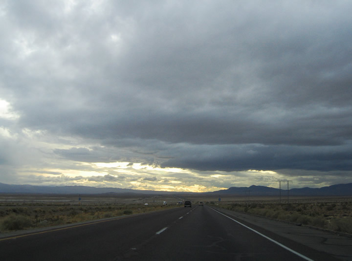
Interstate 15 enters a flat plain west of Field Road (Exit 213). The Calico Mountains lie to the northwest near Yermo. The Newberry Mountains encompass the southern horizon from south of Interstate 40 and Daggett. Photo taken 10/19/04. |
|
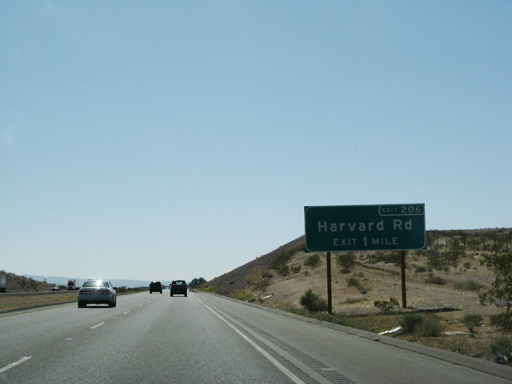
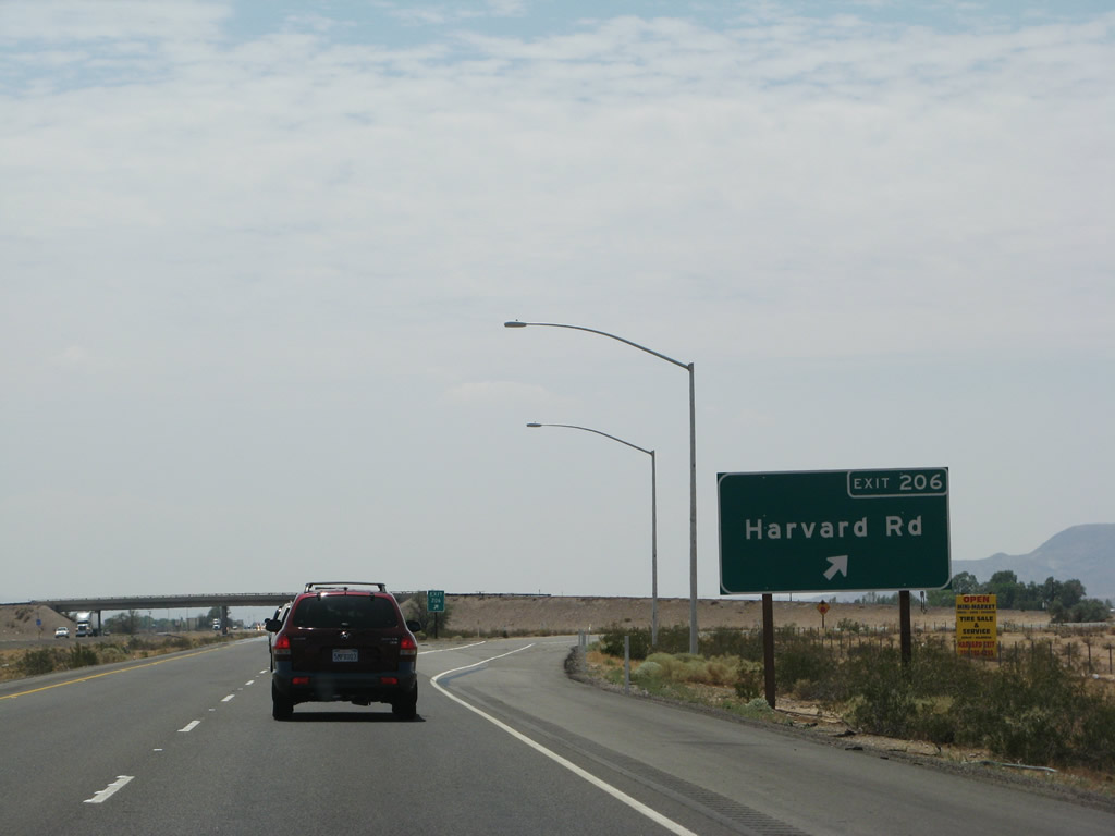
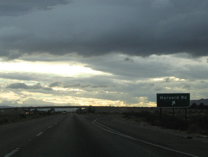
The next exit along southbound Interstate 15/Mojave Freeway is Exit 206, Harvard Road. Photo taken 03/31/08. |
|
Harvard Road intersects Interstate 15 at the Exit 206 diamond interchange. Harvard Road flows south three miles from Interstate 15 across the Mojave Rive to Cady Springs Road. From there travelers can continue along Harvard Road south of take Cady Springs Road south to Newberry Road to Newberry Springs. Newberry Springs lies 12 miles south of Exit 206 along the Interstate 40 (former U.S. 66) corridor west of Newberry Road. Photo taken 03/31/08. |
|
|
Interstate 15 southbound reaches Exit 206, Harvard Road. To north, Harvard Road peters out in desert lands. The settlement of Harvard lies west along Yermo Road and the Union Pacific Railroad. Hacienda Drive travels along the Interstate 15 southbound side frontage within the area. An exit number sign was added here between 2004 and 2008. Photos taken 07/14/08 and 10/19/04. |
|
A mileage sign after the on-ramp from Exit 206 provides the distance to Yermo (10 miles) and Barstow (23 miles). Photo taken 03/31/08. |
|
|
|
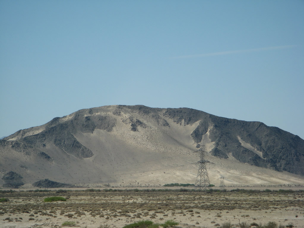
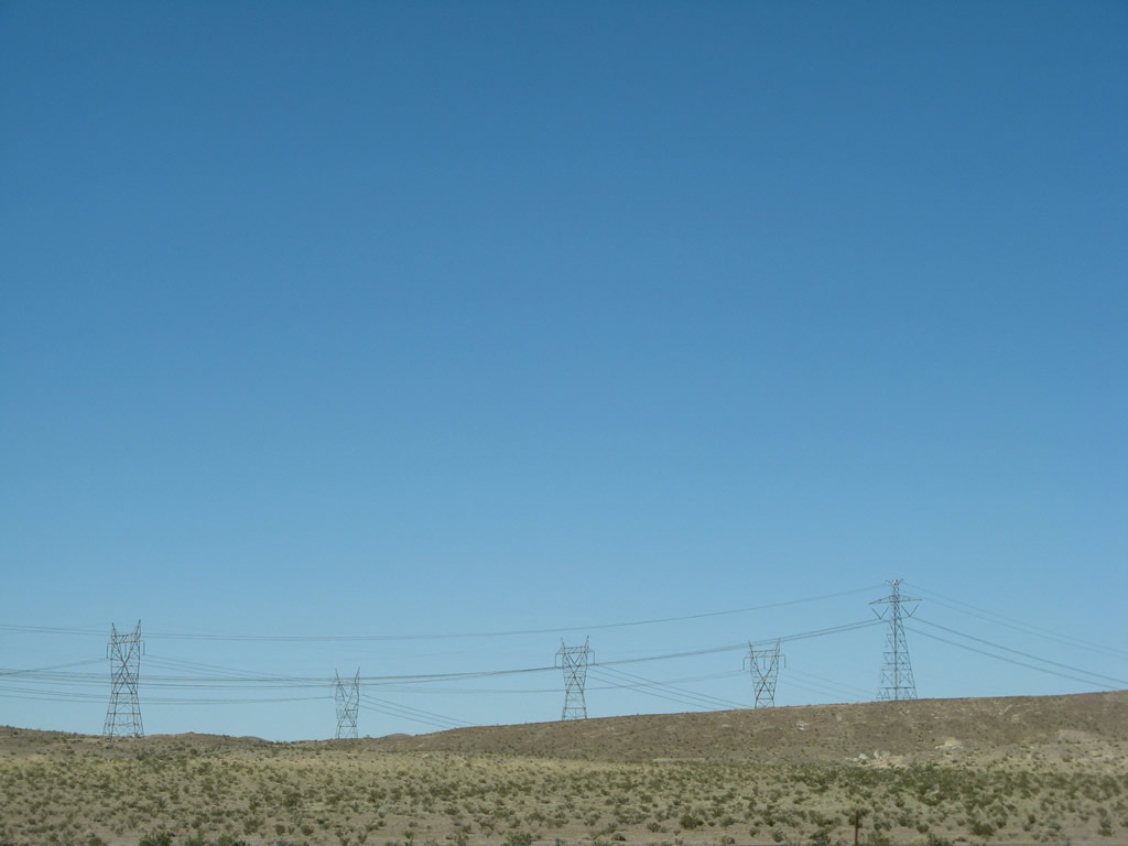
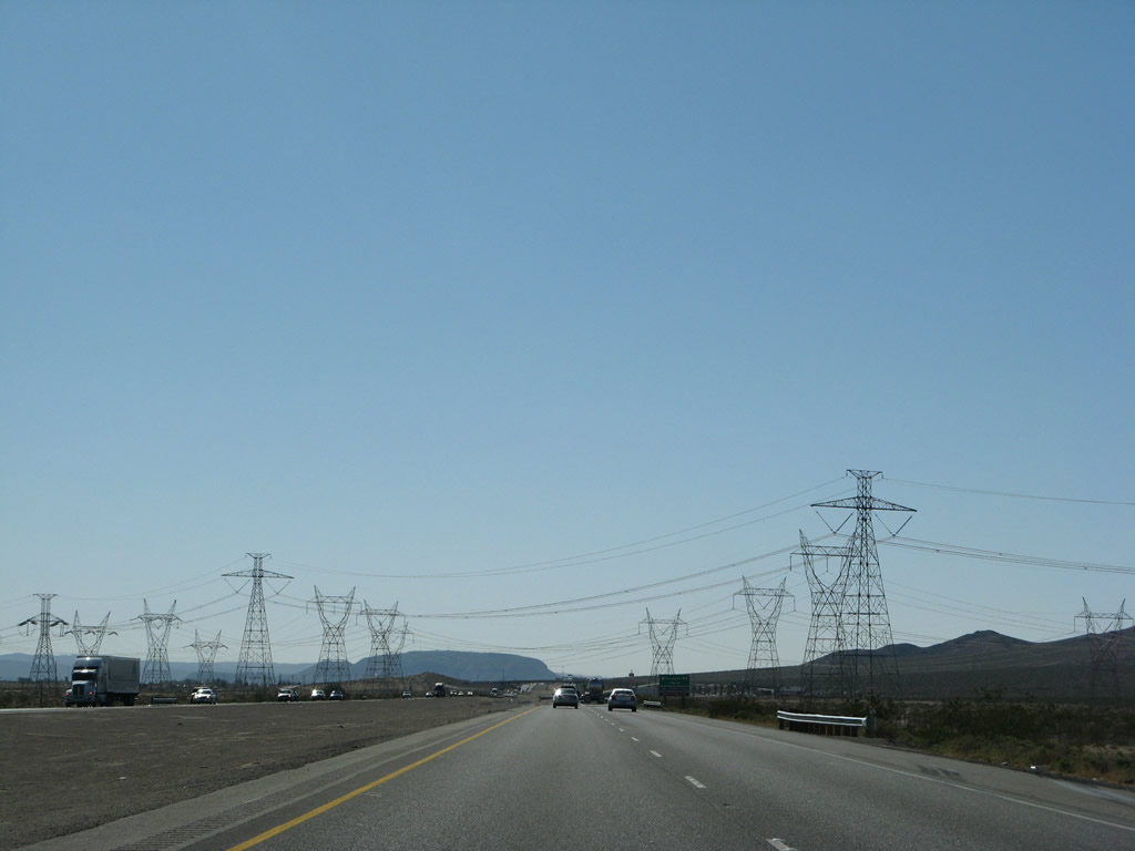
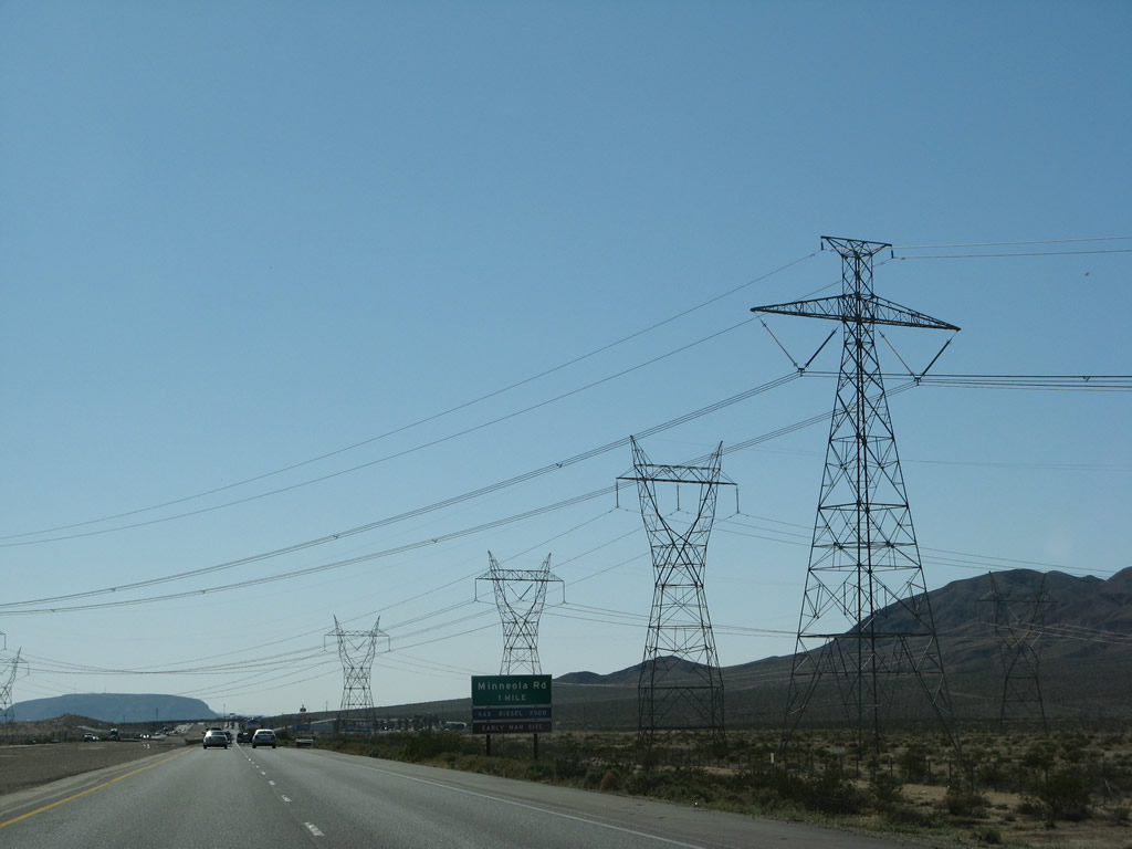
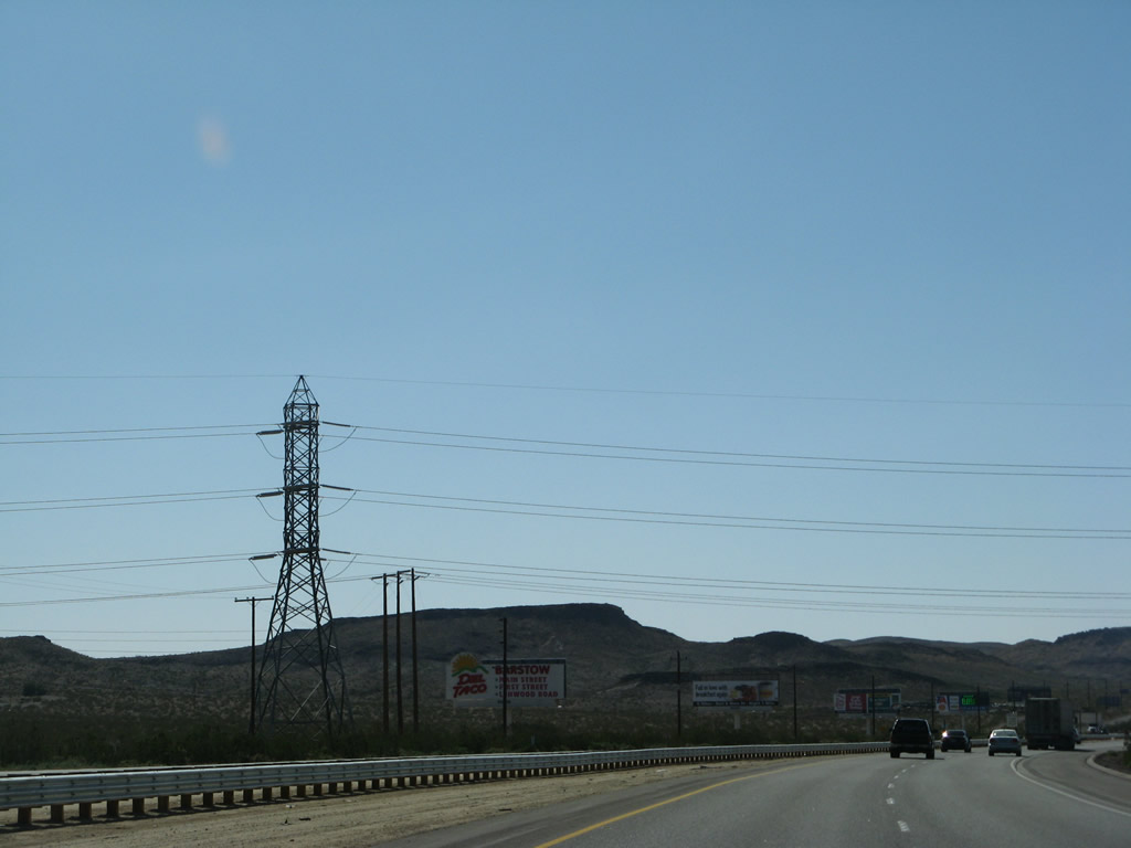
A major power corridor passes over Interstate 15 between Harvard and Yermo. The corridor (Los Angeles Department of Water and Power) joins the Los Angeles Basin with power generated in southern Nevada and points north and east. This group of 287, 500, and -500kV power lines had previously crossed Interstate 15 on the Nevada side of Primm (north of Exit 1). They again cross here, prior to Exit 198 (Minneola Road). The first line is Path 27, the -500kV Intermountain High Voltage Direct Current (HVDC) transmission line (hence two bundles of wires rather than three bundles, which is typical of alternating current power lines). The second line is the 287kV Hoover - Victorville line. The final two lines are the two 500kV Los Angeles Department of Water and Power's McCullough - Victorville transmission line (part of Path 46/West of Colorado River, Arizona-California West-of-the-River Path [WOR]). Photos taken 03/31/08. |
|
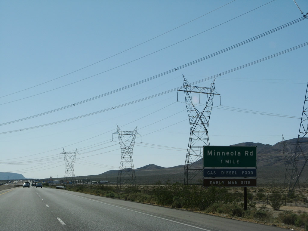
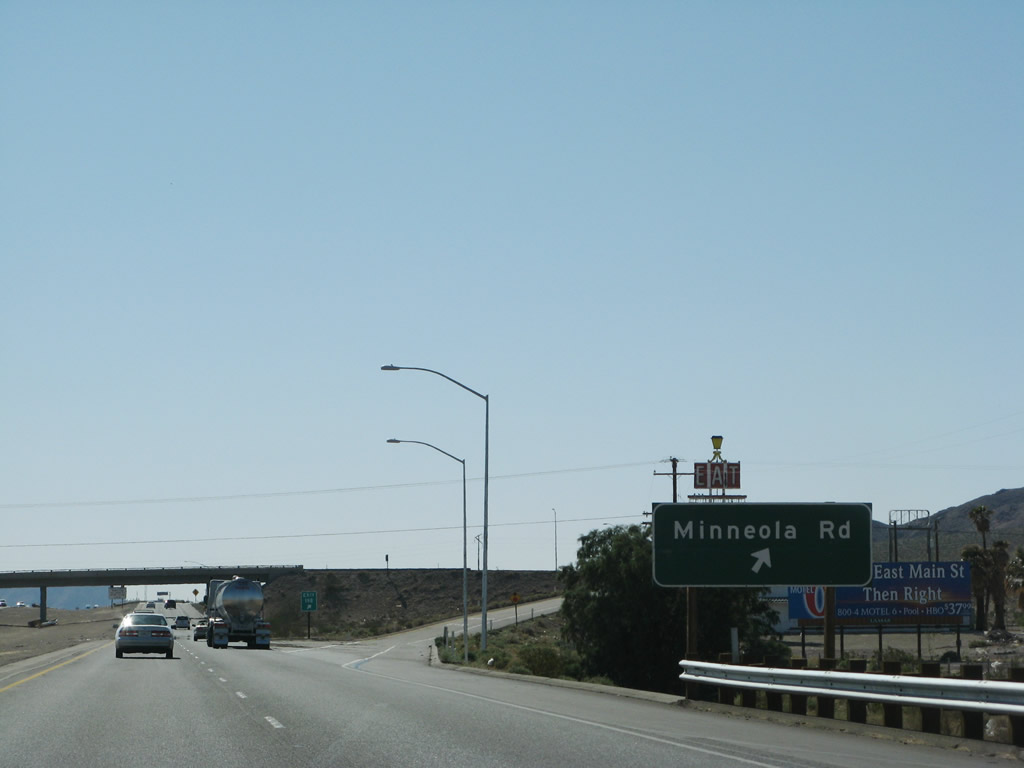
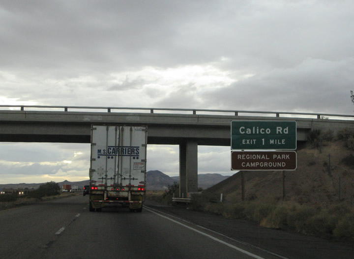
The next exit along Interstate 15 south is the Exit 198 diamond interchange with Minneola Road. Minneola Road, in conjunction with Paradise Springs Road, provides access to the Calico Early Man Archaeological Site. Read about the site at Calico Early Man Site. Continue southwest on Interstate 15 to Exit 194 (Calico Road) for Calico Ghost Town. Photo taken 03/31/08. |
|
This is another view of the four sets of power lines that cross Interstate 15 at this point. Photo taken 03/31/08. |
|
Southbound Interstate 15/Mojave Freeway reaches Exit 198, Minneola Road. Minneola Road continues south into the Mojave Valley five miles to Minneola (former U.S. 66) near Barstow-Daggett Airport. Use Minneola Road south to the adjacent Yermo Road east for Toomey. Photo taken 10/19/04. |
|
|
|
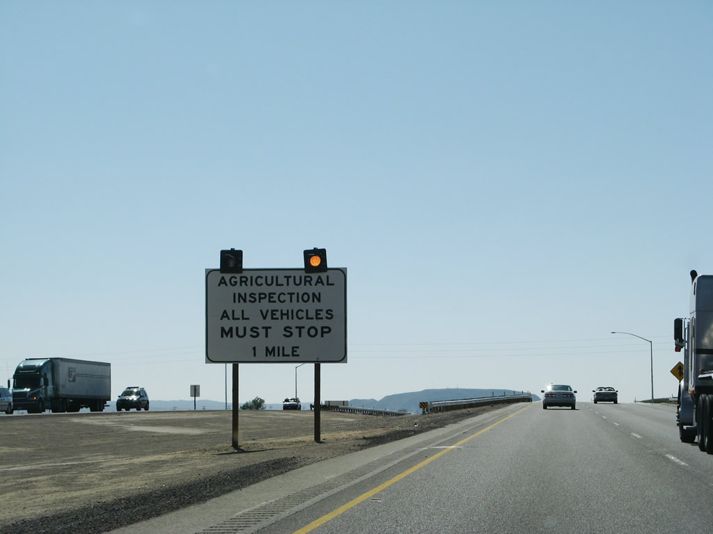
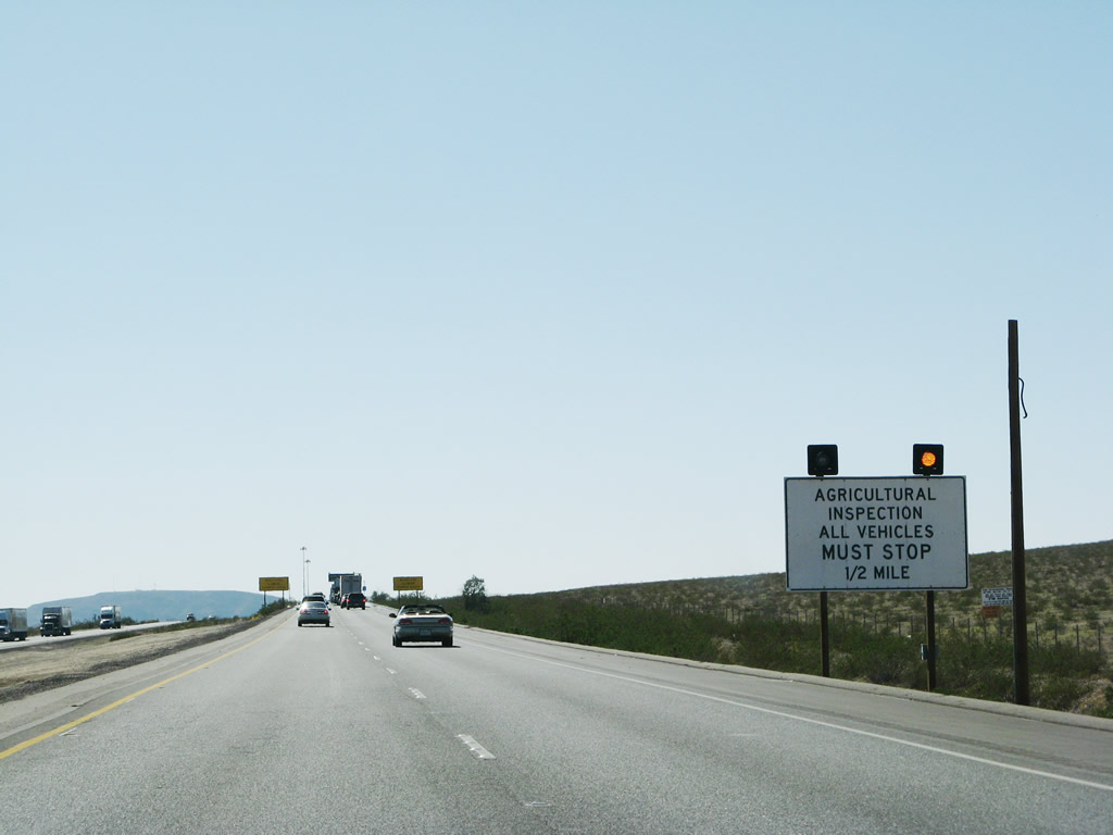
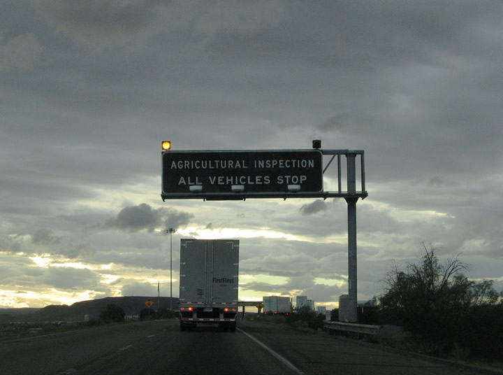
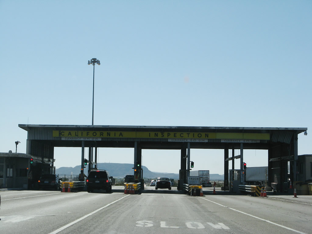
Unlike Interstates 8, 10, and 40, currently the California Agricultural Inspection Station lies well south of the state line. Plans call for the inspection station to be relocated closer to Primm as part of the ongoing improvements to Interstate 15, but for now the inspection station is located near Yermo. The facility provides for the inspection of all incoming agricultural goods into the state of California and doubles as a truck weigh station. All passenger vehicles must slow down to 5 mph or less to pass between the booths. Photos taken 03/31/08 and 10/19/04. |
|
|
|
|
A trumpet interchange joins Interstate 15 with Yermo Road (old U.S. 91 & 466) through the town of Yermo via Exit 196. Yermo Road travels through downtown south of the freeway between Exits 196 and 191. The Mitchell Range lies along the western horizon. Photo taken 10/19/04. |
|
Interstate 15 southbound at the Exit 196 ramp departure for the Yermo Road connector. Yermo Road (old U.S. 91 & 466). Yermo Road travels 1.5 miles west through Yermo to Marine Road. Marine Road and the Union Pacific Railroad branch southwest into the Marine Corps Supply Center - Yermo Area. Yermo Road otherwise comprises what should be a business loop for Interstate 15. Photo taken 10/19/04. |
|
Calico Road stems north from Yermo Road (old U.S. 91 & 466) 3.5 miles to Calico Ghost Town Regional Park. Calico existed as a mining town between 1881 and 1907 with a population of 1,200 at one time. The town was abandoned after a drop in the price of silver and the relocation of nearby mining operations to Death Valley. Photo taken 10/19/04. |
|
|
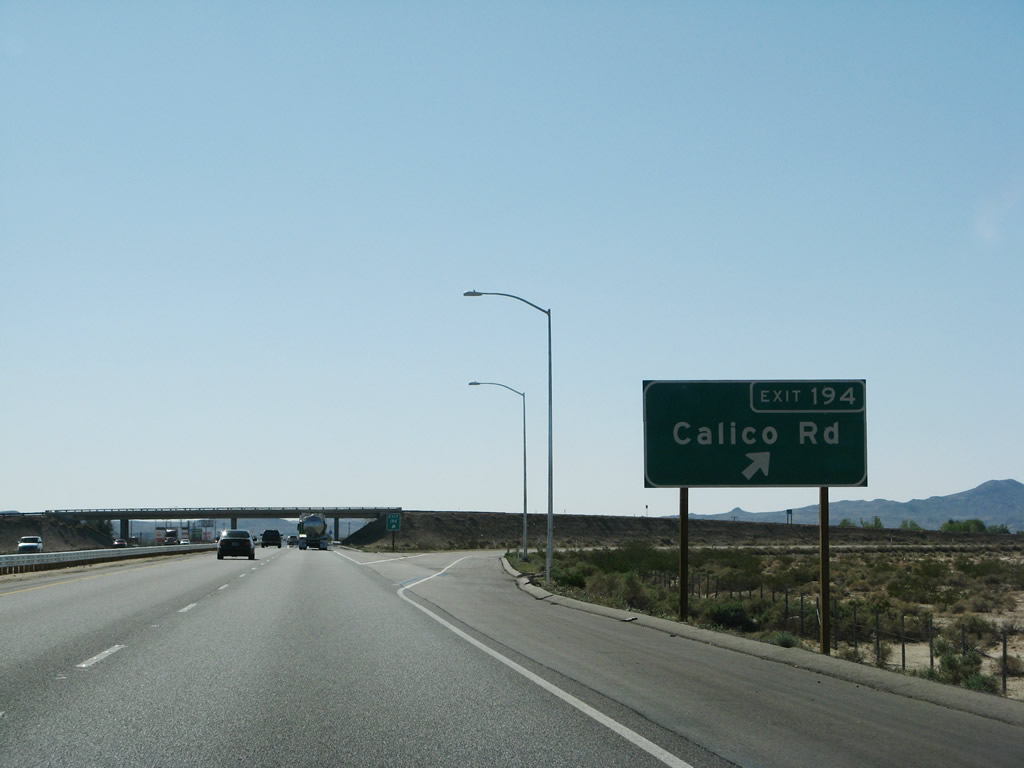
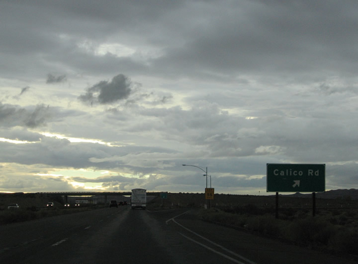
Southbound at the Exit 194 diamond interchange with Calico Road. Calico Road serves downtown Yermo to the south and transitions to Ghost Town Road northwest of Interstate 15. Ghost Town Road continues the loop back south to Interstate 15 at Exit 191. Photos taken 03/31/08 and 10/19/04. |
|
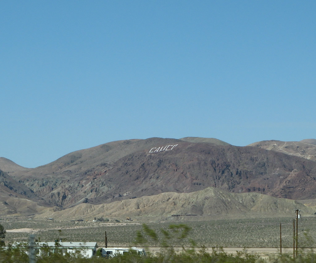
The word "Calico" is inscribed into the side of the Calico Mountains on the north side of Interstate 15. Photo taken 10/19/04. |
|
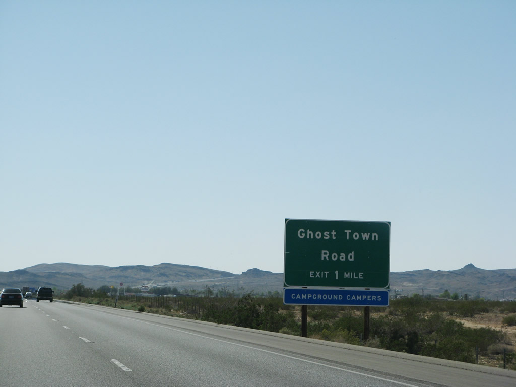
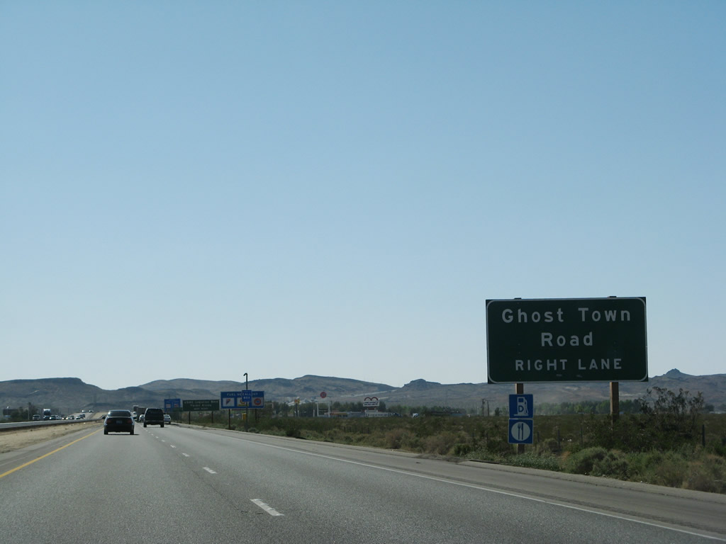
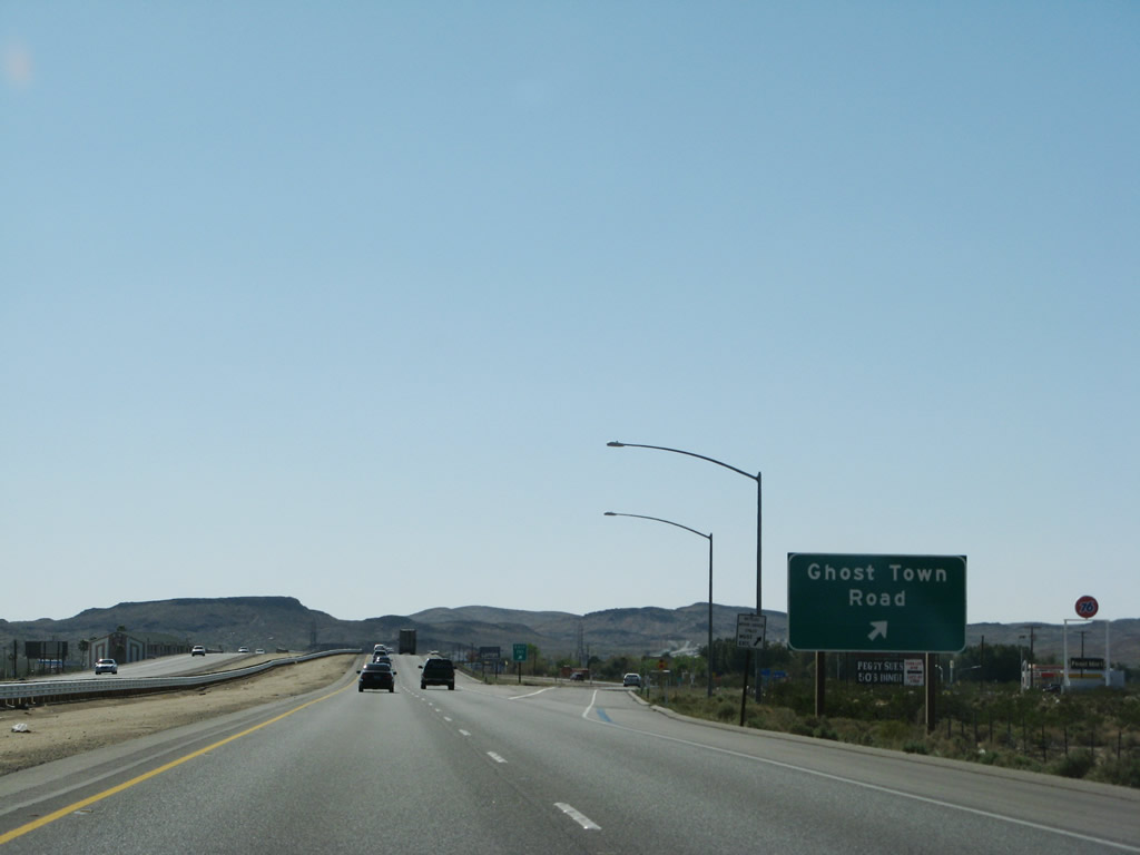
Continuing westbound toward the Exit 191 diamond interchange with Ghost Town Road. Ghost Town Road derives its name from the connections to Calico to the north. The road becomes Daggett-Yermo Road south of its nearby intersection with Yermo Road. Photo taken 03/31/08. |
|
|
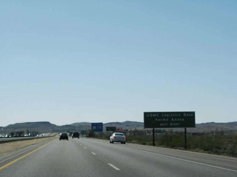
Drawing to within one half mile of the Ghost Town Road interchange on Interstate 15/Mojave Freeway south. Use Daggett-Yermo Road south from Ghost Town Road for the USMC Logistics Base - Yermo Annex. The north-south road provides a direct connection between Yermo Road (old U.S. 91 & 466) and old U.S. 66 (National Trails Highway) at Daggett. Photos taken 03/31/08. |
|
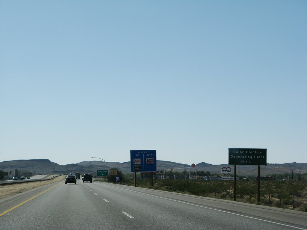
Use Ghost Town Road south to the Southern California Edison solar electric generating facility. Photo taken 03/31/08. |
|
Interstate 15 southbound reaches Exit 191, Ghost Town Road. Use Ghost Town Road north to Calico Boulevard (0.4 mile) and south via Daggett-Yermo Road to Daggett. Upon entering Daggett, Daggett-Yermo Road becomes A Street and ends at Interstate 40 3.2 miles south of here. Photo taken 03/31/08. |
|
|
A Southern California Edison set of power lines cross Interstate 15 at Ghost Town Road. These lines connect the solar power plant with the electric grid. Photos taken 03/31/08. |
|
|
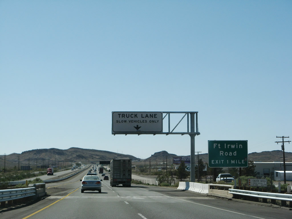
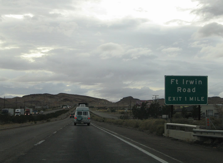
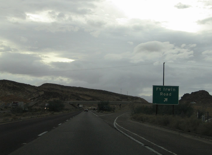
Next in line for southbound travelers is the Fort Irwin Road diamond interchange (Exit 189). Fort Irwin Road heads north 7.4 miles through the Calico Mountains to Irwin Road. From there Irwin Road heads northeast to Fort Irwin. A new truck climbing lane was added between 2004 and 2008. Photos taken 03/31/08 and 10/19/04. |
|
|
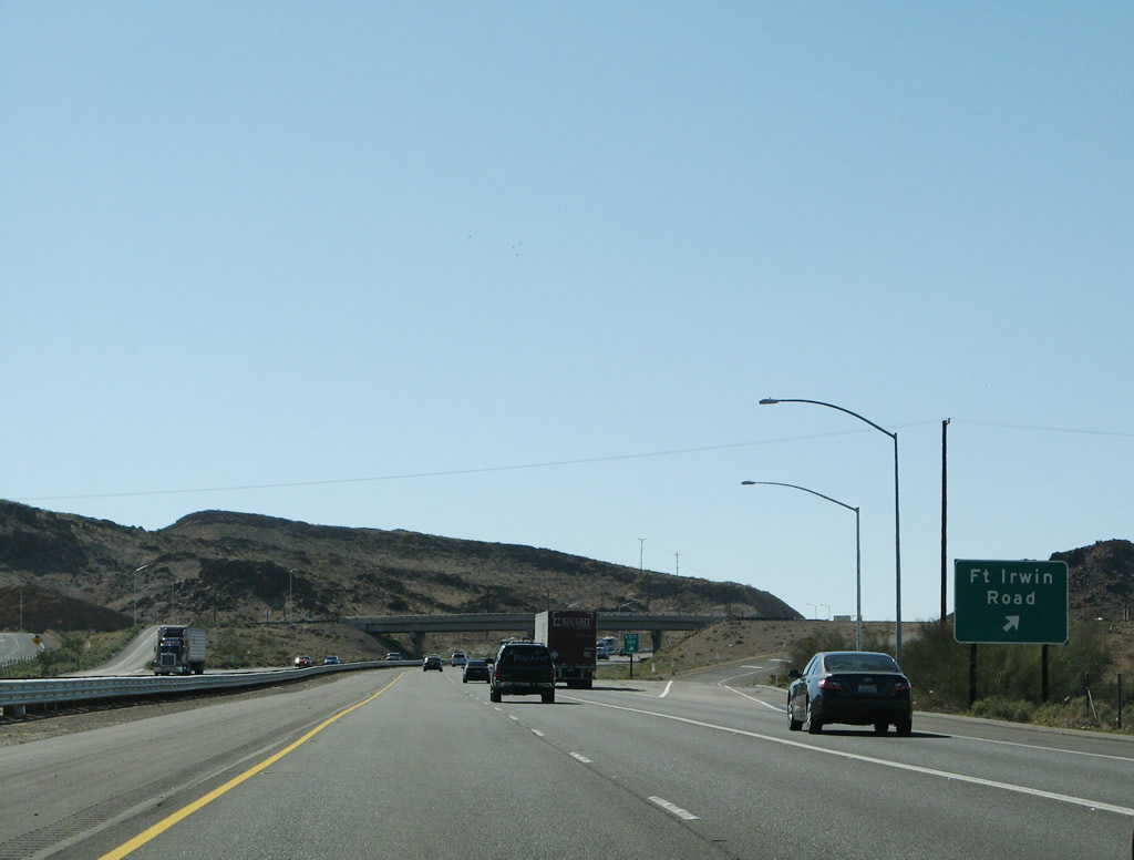
Yermo Road ends at Fort Irwin Road south of the Interstate 15 Exit 189 interchange. Meridian Road spurs into the nearby hillside from Fort Irwin Road South. Pictured here is the Fort Irwin Road off-ramp from the freeway southbound. Photos taken 03/31/08 and 10/19/04. |
|
Interstate 15 climbs a hill between the Fort Irwin Road and Old Highway 58 interchanges. Photo taken 03/31/08. |
|
Interstate 15 travels west approximately four miles from Fort Irwin Road into the city of Barstow. Photo taken 03/31/08. |
|
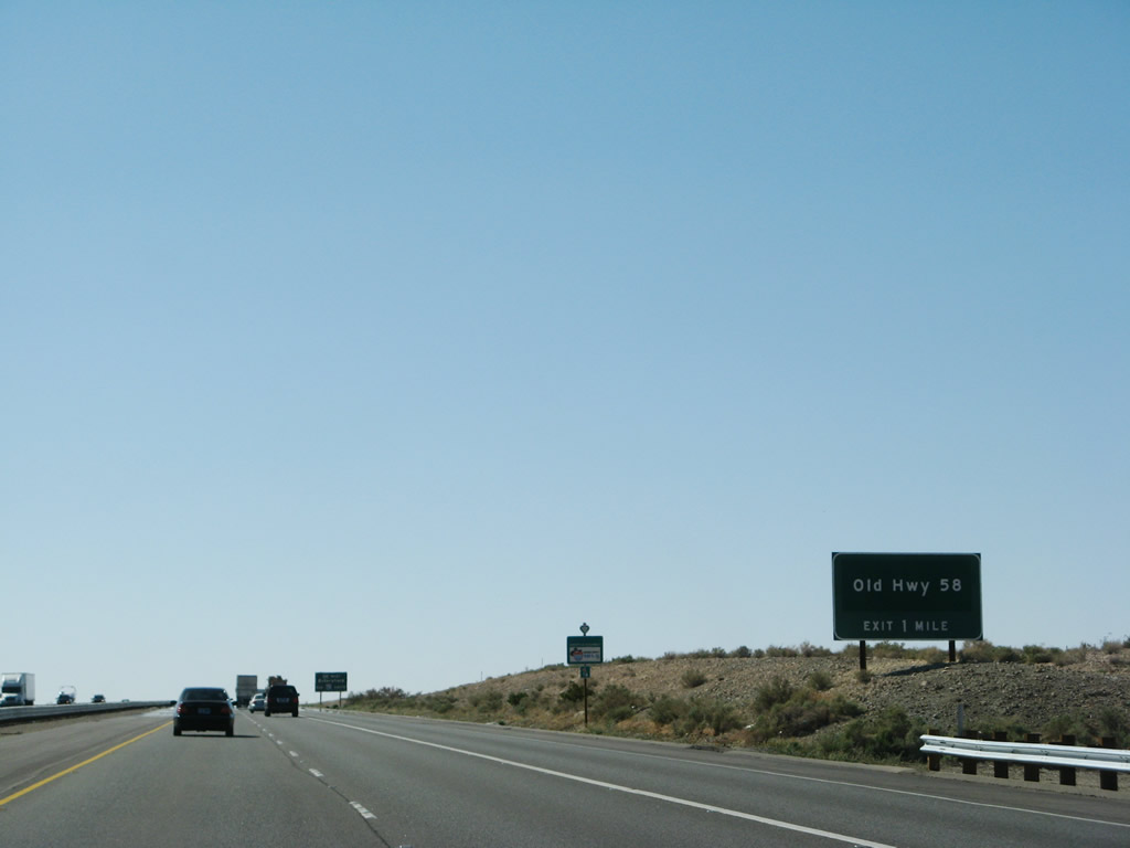
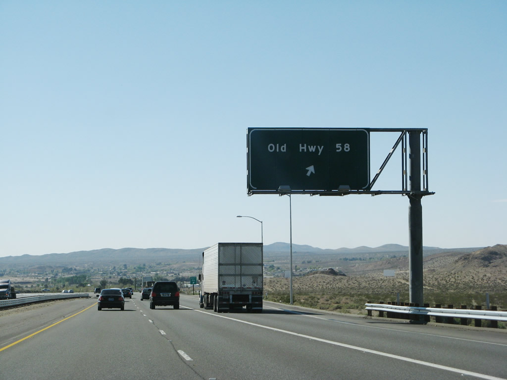
Old U.S. 466 departs Interstate 15 at the Exit 186 trumpet interchange. Now known simply as Old Highway 58, old U.S. 466 ventured west from Barstow to Bakersfield. Modern California 58 provides a direct route between Barstow and Bakersfield via a freeway bypass to the west. Old Highway 58 serves northern reaches of Barstow otherwise. Photo taken 03/31/08. |
|
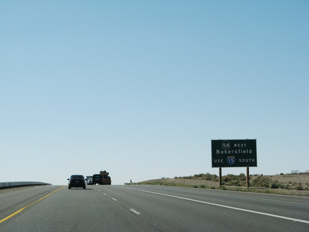
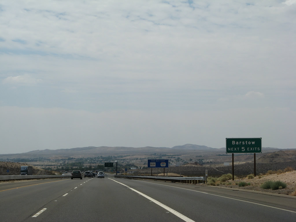
A button copy guide sign directs through traffic motorists bound for California 58 to remain on Interstate 15 south to Exit 179. California 58 bypasses Barstow to the west along a short freeway between the original California 58 (Barstow Bakersfield Highway) and Interstate 15. Photo taken 03/31/08. |
|
|
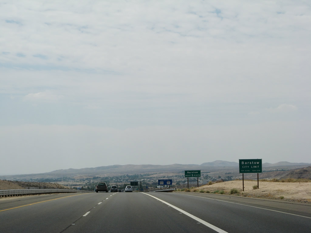
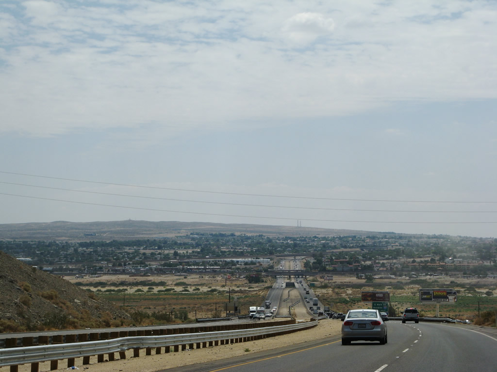
For the first time since leaving Las Vegas, Interstate 15 south enters a city. At this point, Interstate 15 enters the city of Barstow. With 33.59 square miles of desert, Barstow is huge, but large sections of the city are undeveloped. This includes the initial section of Barstow seen on Interstate 15 north. Photos taken 07/14/08 and 03/31/08. |
|
Barstow had a population of 21,119, and it was incorporated on September 30, 1947. Sitting at the intersection of Interstates 15 and 40, Barstow was previously at the confluence of U.S. 66, 91, and 466. today's Interstate 40 replaced U.S. 66 east of Barstow, and Interstate 15 replaced U.S. 91-466 northeast of Barstow. West of Barstow, California 58 replaced U.S. 466, and southwest of Barstow, California 58 replaced U.S. 466. Both the Union Pacific (UP) Railroad and the Burlington Northern Santa Fe (BNSF) Railroad enter Barstow, and BNSF has a large railyard in the city. The next five interchanges all serve the city of Barstow. Photo taken 07/14/08. |
|
Old California 58 departs Interstate 15 southbound via the Exit 186 trumpet interchange. Old California 58 travels west 2.5 miles to 1st Avenue, 3.1 miles to Irwin Road, and ten miles to California 58 (Barstow Bakersfield Highway). Old California 58 stays north of the Mojave River and downtown. Interstate 15 crosses the Mojave River on the southwest turn toward the merge with Interstate 40. Photo taken 03/31/08. |
|
The Mojave River valley and the city of Barstow comes into view on southbound Interstate 15. Photo taken 07/14/08. |
|
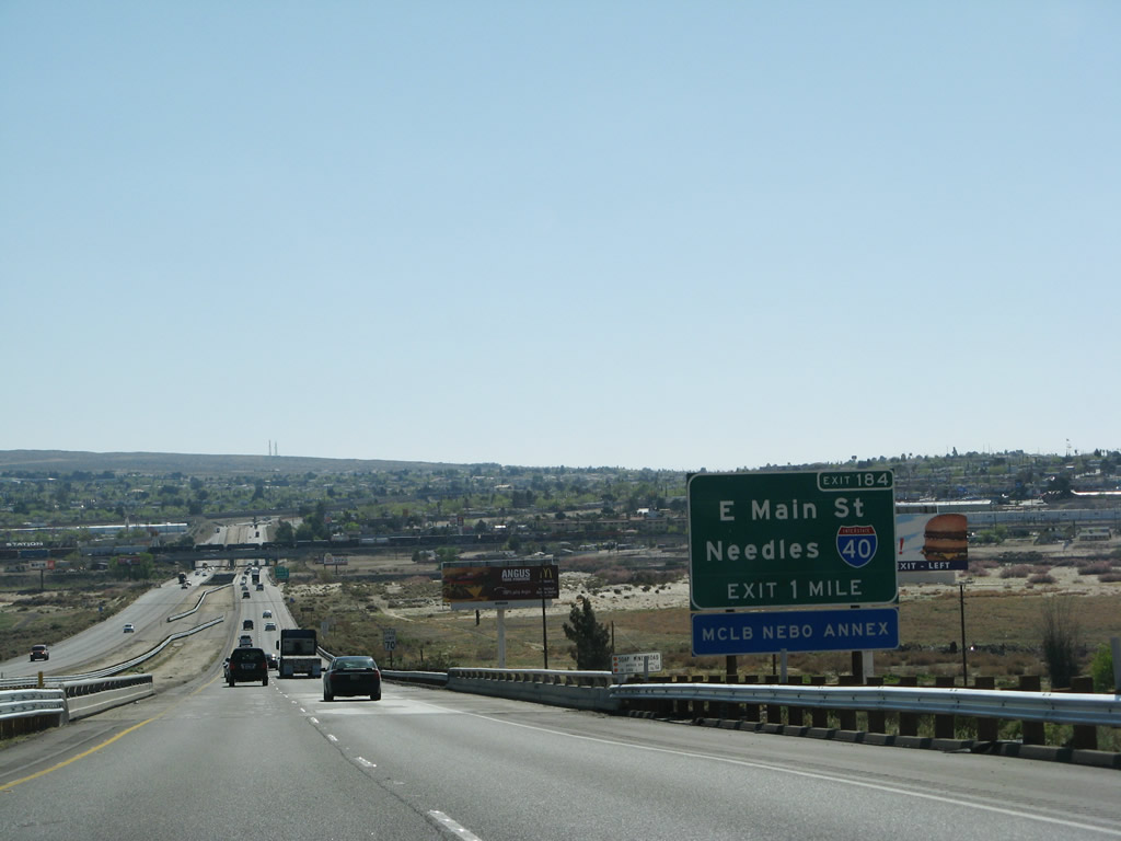
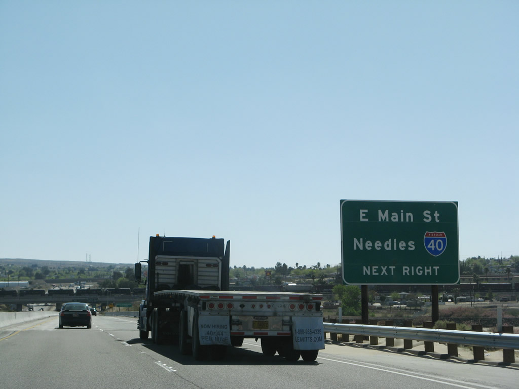
Turning southwest toward downtown Barstow on Interstate 15. Intersecting the freeway next is Main Street (old U.S. 66) at Exit 184. Main Street travels west from Nebo and the Barstow Marine Core Logistics Base along Interstate 40 into Barstow alongside the dry Mojave River. The surface street interchanges with Interstate 40 one half mile to the east. Photo taken 03/31/08. |
|
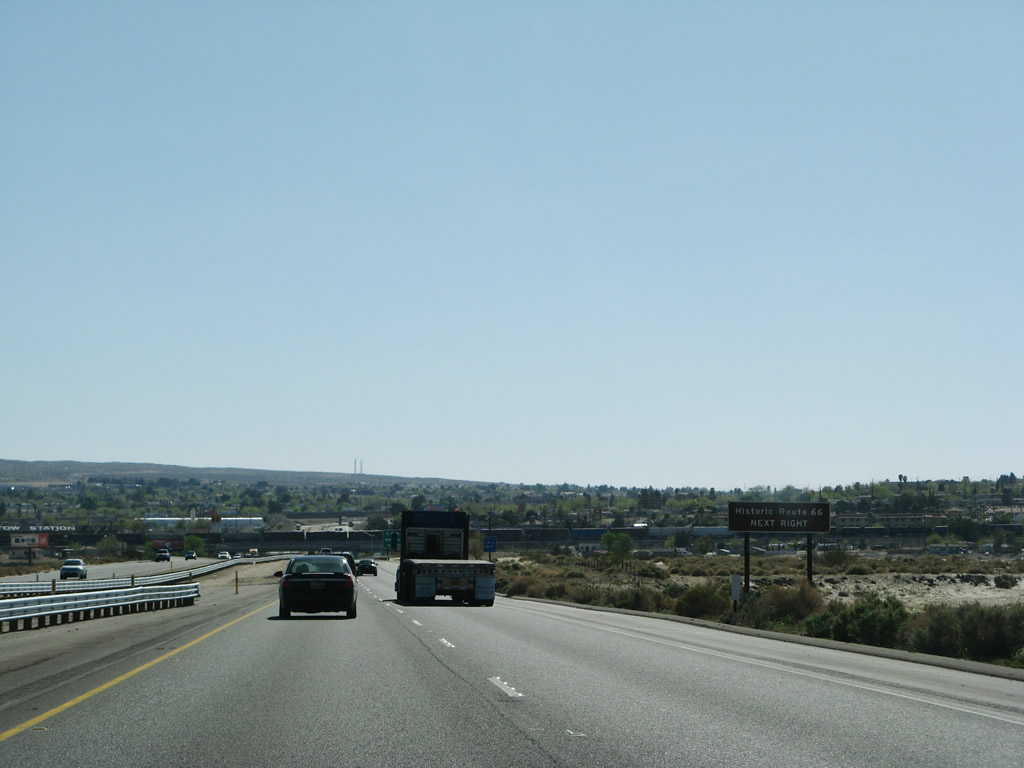
A small brown guide sign indicates the historic designation of Main Street as U.S. 66. U.S. 66 followed Main Street west to 1st Avenue where the highway merged with U.S. 91. From there U.S. 66 & 91 continued west along Main Street to Lenwood. A this point, Interstate 15 crosses over the Mojave River. Photo taken 03/31/08. |
|
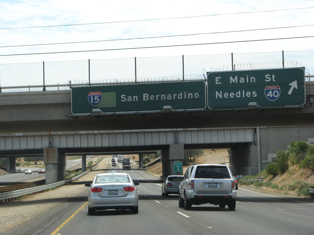
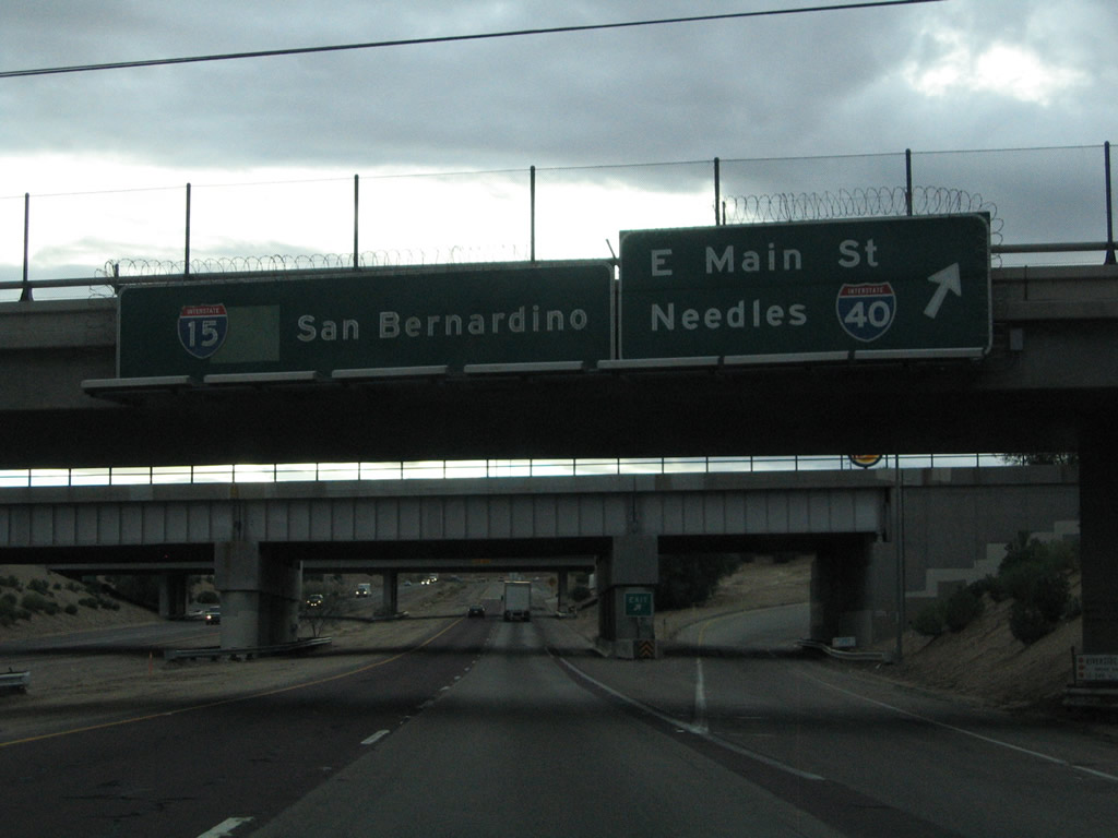
A partial-cloverleaf interchange facilitates the movements between Interstate 15 and Exit 184, Main Street (former U.S. 66). The exit lies just south of the Mojave River crossing. Exit 184 is the only access to Interstate 40 east; there is no direct ramp to Interstate 40 east. Photo taken 03/31/08. |
|
Exit 184 connects Interstate 15 to Main Street, the Barstow Business Loop. Since there is no direct freeway to freeway connection from Interstate 15 south to Interstate 40 east, motorists making that connection must use Main Street/Business Loop I-15 north/Historic U.S. 66 east to reach Interstate 40. In addition, this exit also provides access to southbound Business Loop I-15/westbound Historic U.S. 66 into downtown Barstow. Notably, the northern end of Business Loop I-15 is at its junction with Interstate 40, and its southern terminus is at Exit 181 (three miles south of this interchange). Photo taken 03/31/08. |
|
|
Southbound Interstate 15/Mojave Freeway reaches Exit 184, Interstate 40 east to Needles, Kingman, and Flagstaff; Business Loop I-15 (Main Street); and the first Historic U.S. 66 exit along southbound. The transition ramp from westbound Interstate 40 onto southbound Interstate 15 is located a little less than a mile south of here. Photos taken 07/14/08 and 10/19/04. |
Page Updated March 20, 2010.