| Interstate 80 (Eastshore Freeway) east (north) |
|
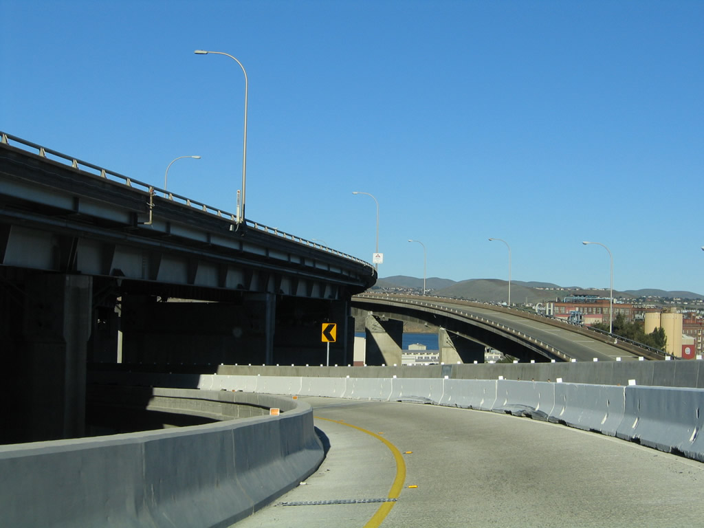
Interstate 80 (Eastshore Freeway) enters Contra Costa County and the city of Richmond (incorporated on August 7, 1905; population 99,216 as of 2000 Census). Photo taken 07/18/09. |
|
The next exit along Interstate 80 (Eastshore Freeway) east (north) is with Carlson Boulevard (Exit 14B). Carlson Boulevard crosses paths with the Eastshore Freeway between Tehama and Bayview Avenues. Bayview Avenue interchanges with Interstate 580 (John T. Knox Freeway) nearby. Photo taken 07/18/09. |
|
Eastbound Interstate 80 (Eastshore Freeway) reaches Exit 14B, Carlson Boulevard (diamond interchange). Carlson Boulevard heads northwest from Central Avenue and Interstate 80 alongside the Union Pacific (former Southern Pacific) Railroad toward downtown Richmond. Photo taken 07/18/09. |
|
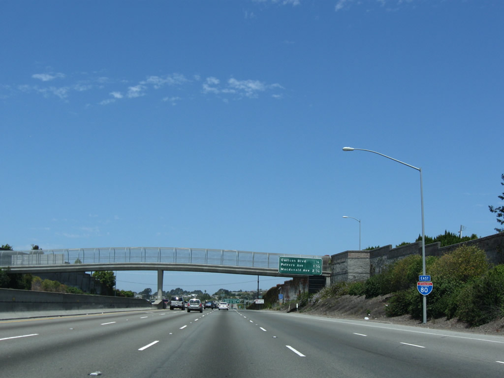
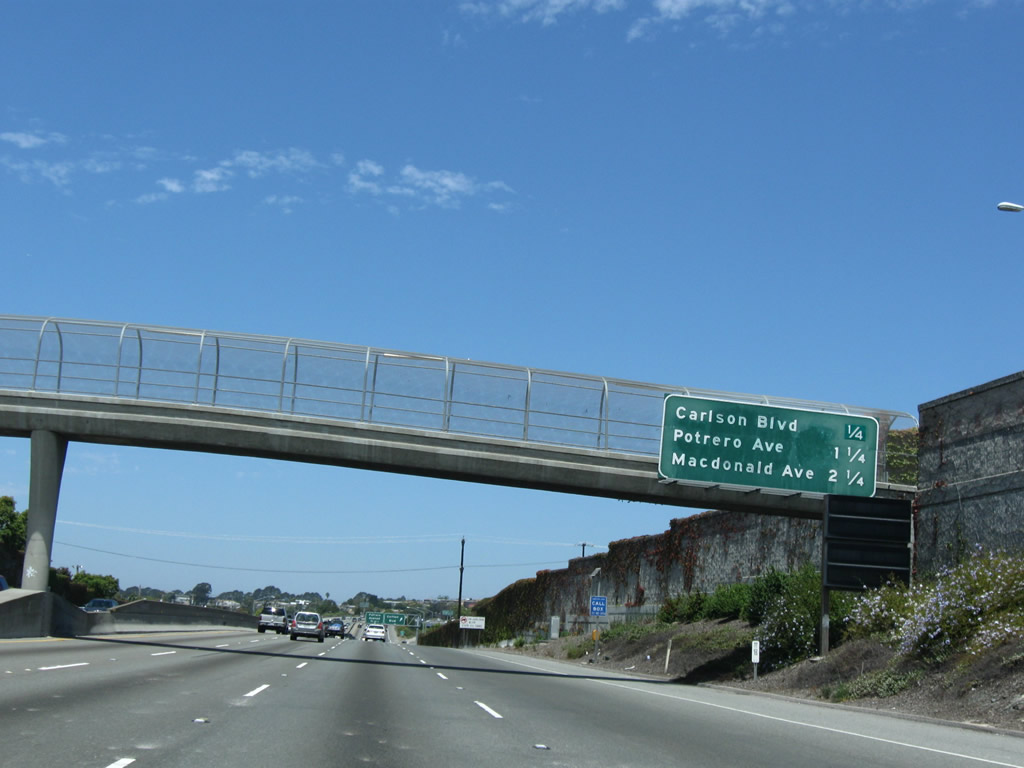
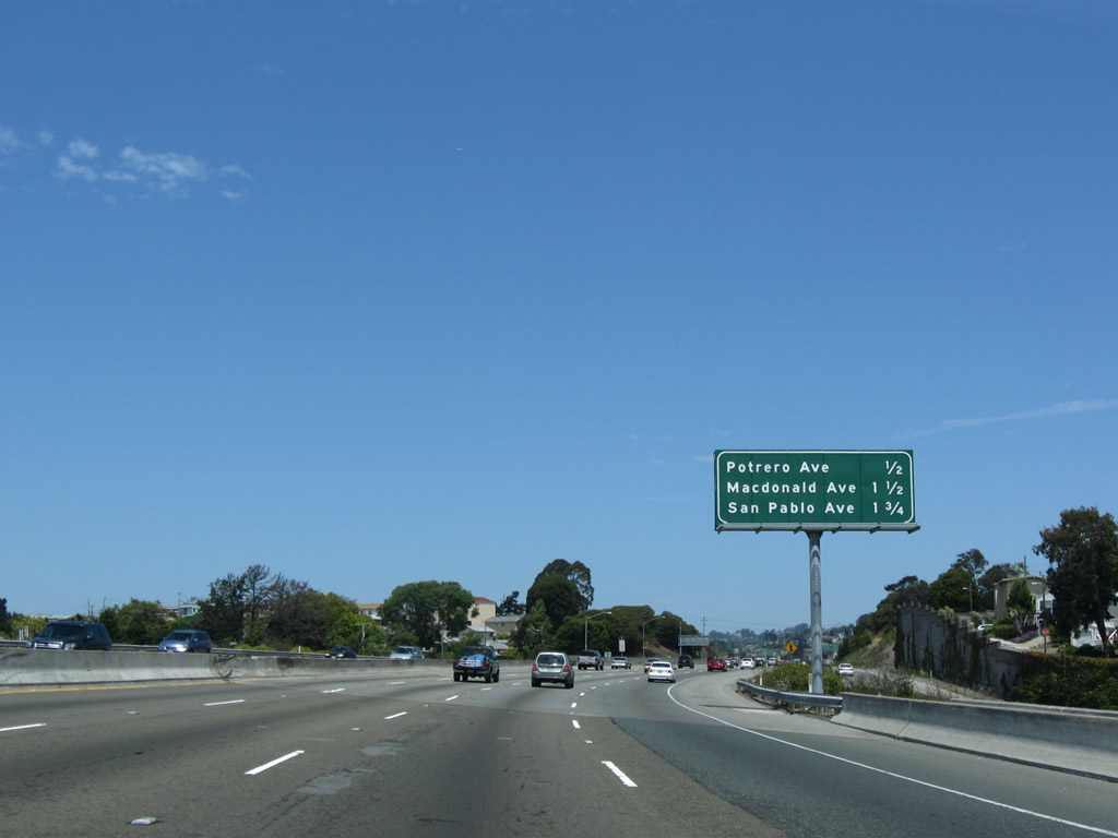
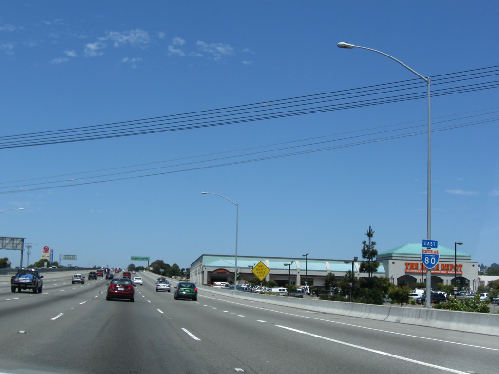
This mileage sign provides the distance to the next three exits along Interstate 80 (Eastshore Freeway) east (north): Exit 15, Potrero Avenue; Exit 16A, Macdonald Avenue; and Exit 16B, San Pablo Avenue (Historic U.S. 40). Photo taken 07/18/09. |
|
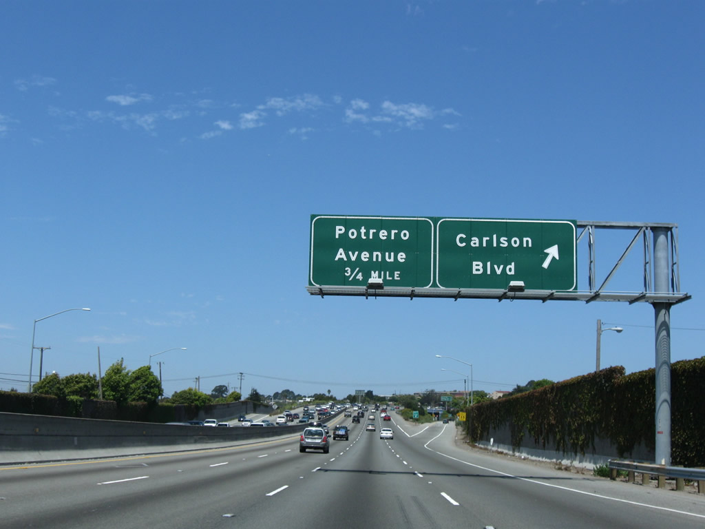
Eastbound Interstate 80 reaches Exit 15, Potrero Avenue (half-diamond interchange). Potrero Avenue travels east-west one mile between Carlson Boulevard and San Pablo Avenue in Richmond. Photo taken 07/18/09. |
|
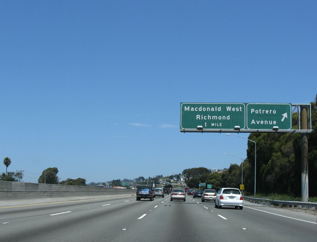
Interstate 80 continues east 0.75 miles to Exit 16A (Macdonald Avenue) from Potrero Avenue. Macdonald Avenue provides the most direct route from the Eastshore Freeway into downtown Richmond. Photo taken 07/18/09. |
|
Ramps from Cutting Boulevard join Interstate 80 eastbound ahead of the Macdonald Avenue off-ramp. Macdonald Avenue travels 1.4 miles west from San Pablo Avenue to downtown Richmond. Photo taken 07/18/09. |
|
An Interstate 80 east reassurance shield is posted shortly thereafter. Photo taken 07/18/09. |
|
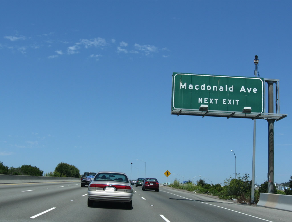
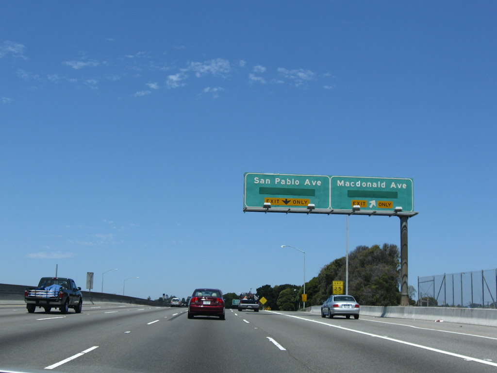
Exit 16A departs Interstate 80/Eastshore Freewya east for Macdonald Avenue westbound. San Pablo Avenue crosses paths with the Eastshore Freeway ahead at Exit 16B. San Pablo Avenue represents the historic alignment of U.S. 40 through Richmond and San Pablo. Photo taken 07/18/09. |
|
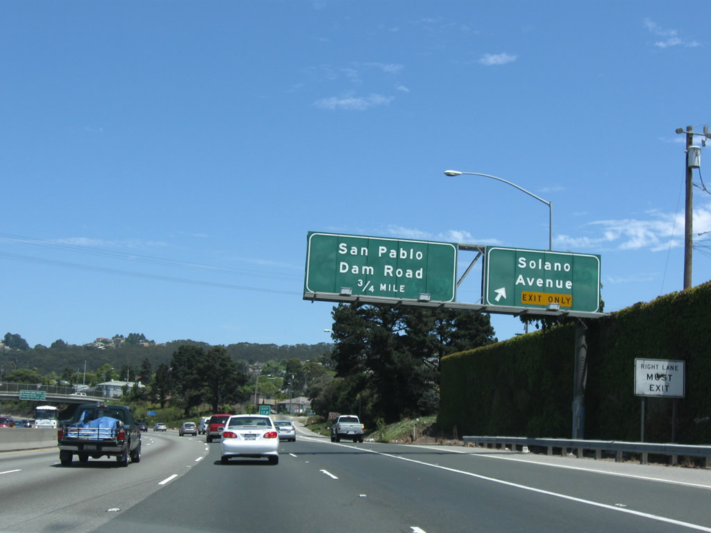
Interstate 80 eastbound at the Exit 16B diamond interchange with U.S. 40/San Pablo Avenue. San Pablo Avenue meanders two miles northwest into San Pablo. Garvin Avenue stems west from the avenue nearby toward downtown Richmond. Photo taken 07/18/09. |
|
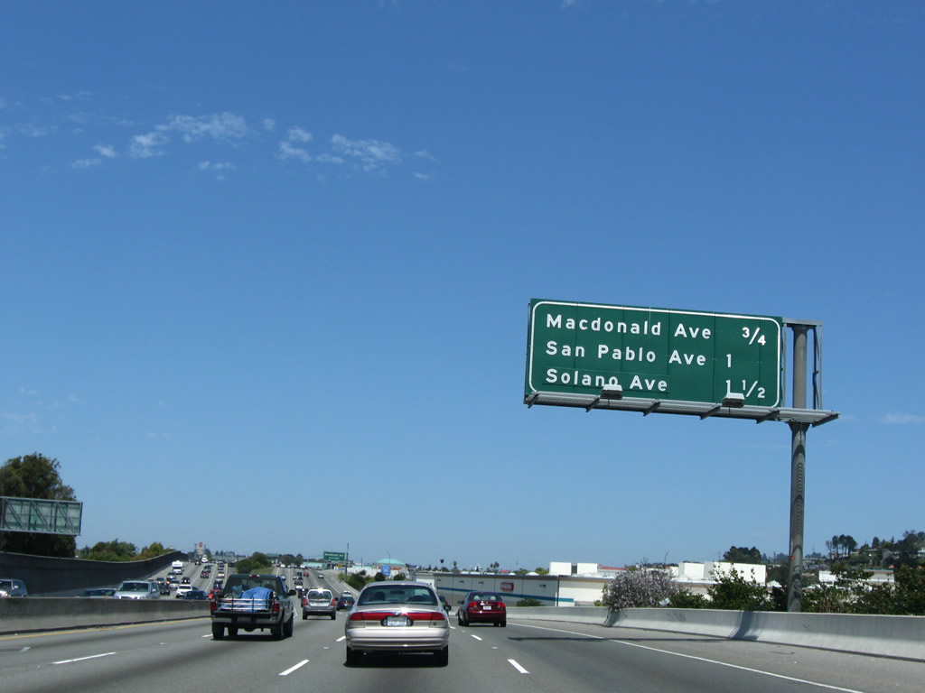
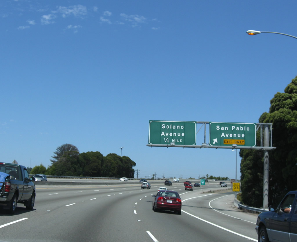
Departing the freeway next is Exit 17 onto Amador Street in east Richmond. Amador Street and nearby Solano Avenue serve residential areas between San Pablo Avenue and Arlington Boulevard. Photo taken 07/18/09. |
|
Interstate 80 eastbound at the Exit 17 half-diamond interchange for Solano Avenue. Amador Street (westbound) and Humboldt Street (eastbound) parallel closely to McBryde Avenue. Photo taken 07/18/09. |
|
Eastbound travelers next meet San Pablo Dam Road at the Exit 18 diamond interchange. San Pablo Dam Road heads east from San Pablo Avenue five miles to El Sobrante and San Pablo Reservoir. Photo taken 07/18/09. |
|
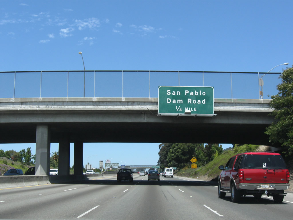
Attached to the McBryde Avenue over crossing is the one-quarter mile overhead for Exit 18 (San Pablo Dam Road). Sam Pablo Dam Road links San Pablo with Orinda via connections with Camino Pablo. Photo taken 07/18/09. |
|
Motorists bound for San Pablo Dam Road depart Interstate 80 (Eastshore Freeway) eastbound via Exit 18. San Pablo Dam Road ends at Evans and San Pablo Avenues nearby. From there San Pablo Avenue heads northwest into downtown San Pablo. Photo taken 07/18/09. |
|
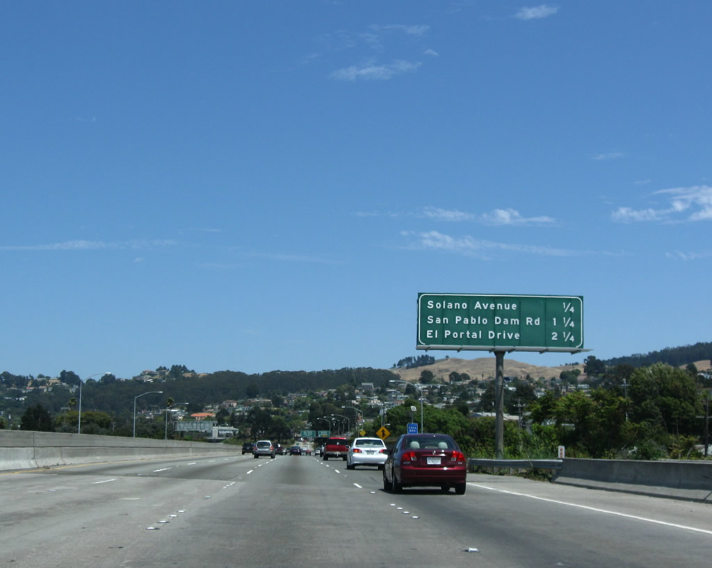
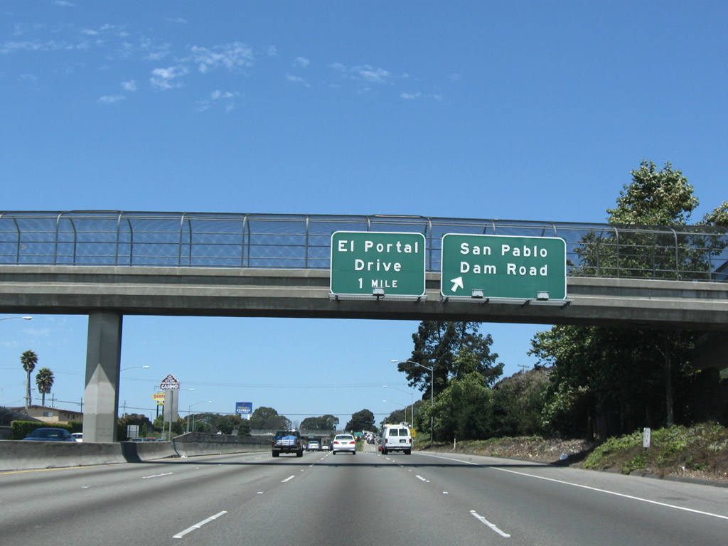
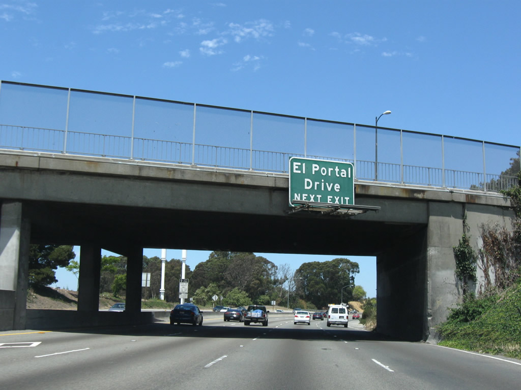
Interstate 80 eastbound curves northeast between the San Pablo Dam Road overpass and El Portal Drive (Exit 19A). El Portal Drive heads east 1.7 miles from downtown San Pablo to Exit 19A and San Pablo Dam Road. Photo taken 07/18/09. |
|
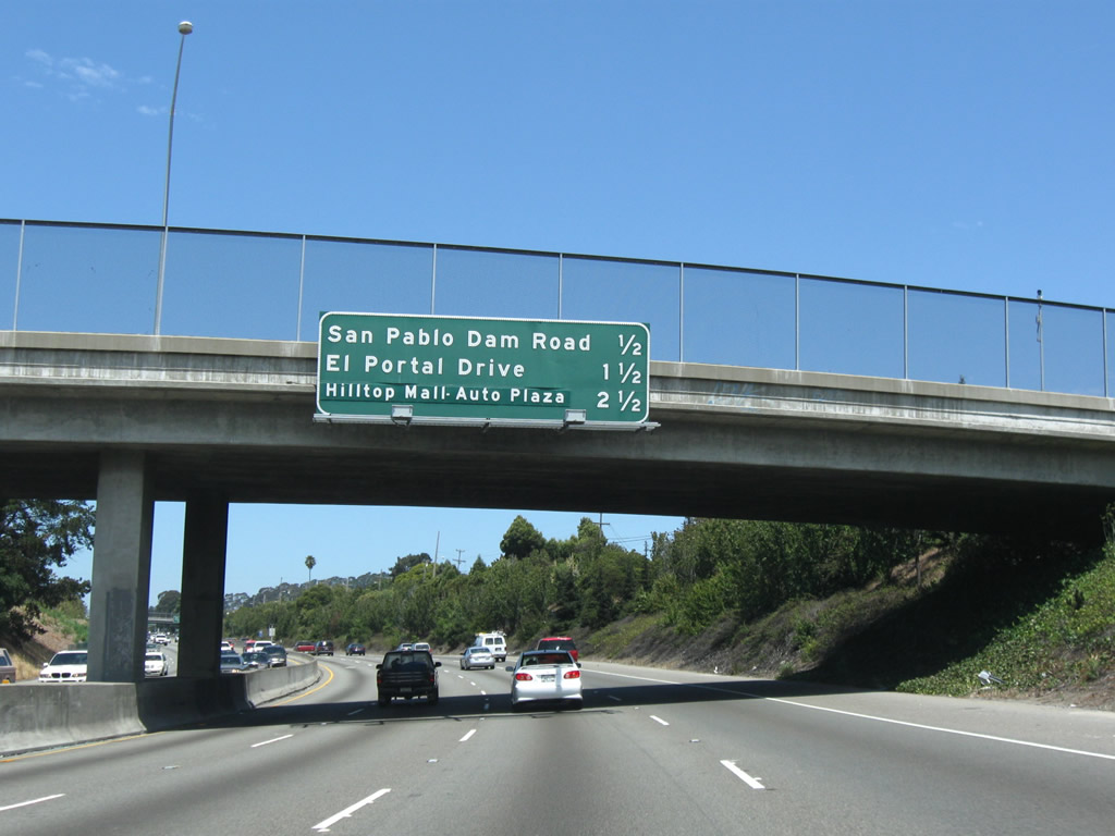
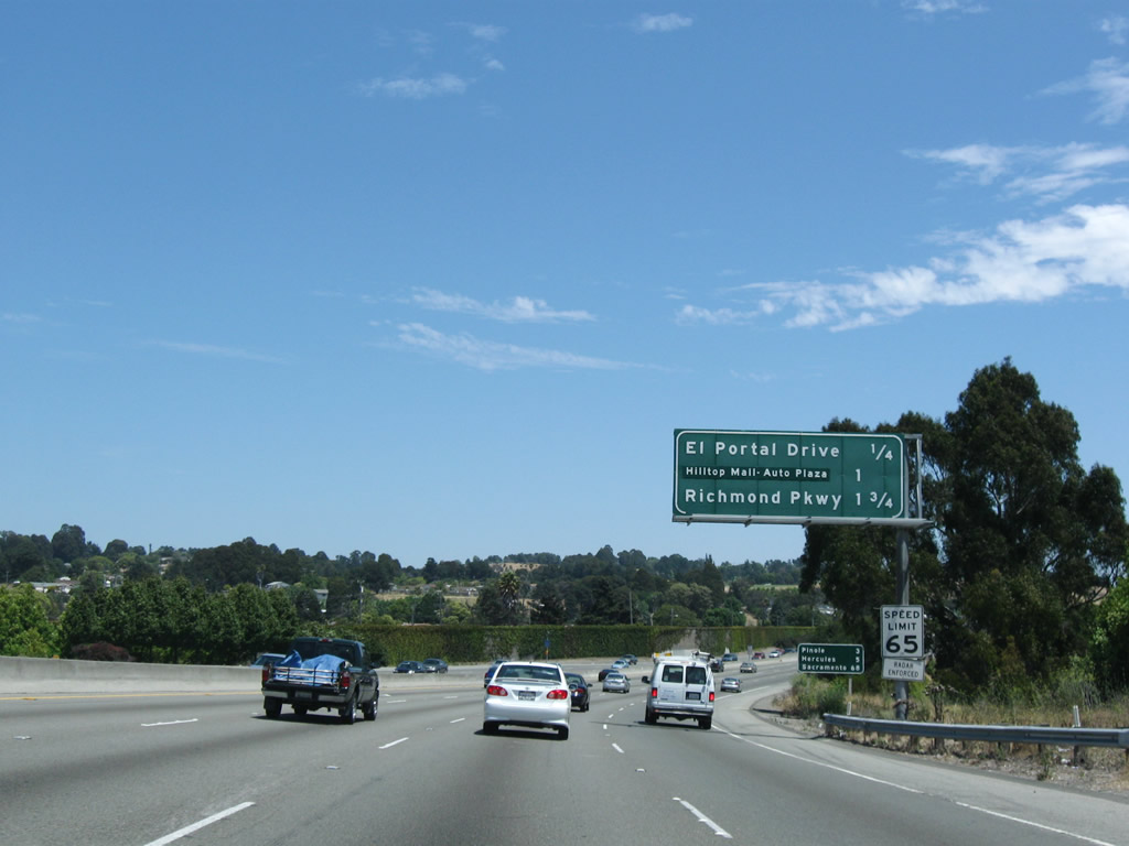
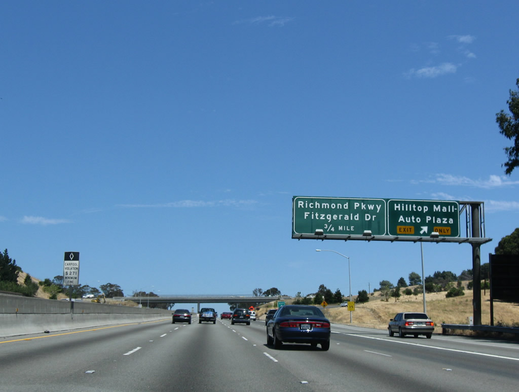
This interchange sequence sign lists the distances to El Portal Drive (Exit 19A), Hilltop Mall - Auto Plaza (Exit 19B), and Richmond Parkway (Planned California 93 Corridor) (Exit 20). All three interchanges serve San Pablo to the west. Photo taken 07/18/09. |
|
Interstate 80 eastbound at the Exit 19A off-ramp to El Portal Drive. El Portal Drive serves Contra Costa College north of its split with Road 20. Photo taken 07/18/09. |
|
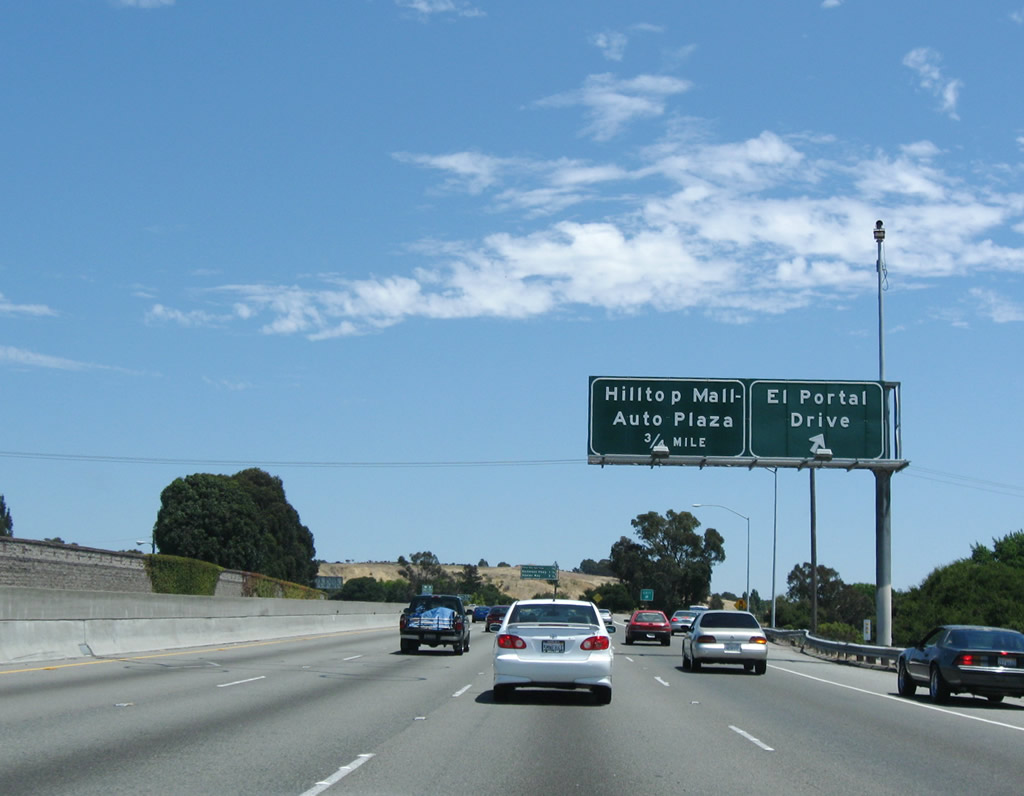
Continuing northward on the Eastshore Freeway toward the Hilltop Mall - Auto Plaza six-ramp partial-cloverleaf interchange (Exit 19B). Exit 19B serves the Hilltop Regional Shopping Center to the west and the community of El Sobrante to the east. Photo taken 07/18/09. |
|
Drivers merging onto Interstate 80 east from El Portal Drive form the exit-only lane for Hilltop Drive. Hilltop Drive arcs three miles east from Park Ridge Drive to Manor Road. Photo taken 07/18/09. |
|
Exit 19B leaves Interstate 80 (Eastshore Freeway) eastbound for Hilltop Drive. Hilltop Drive intersects Robert Mill Drive one mile to the west. Photo taken 07/18/09. |
|
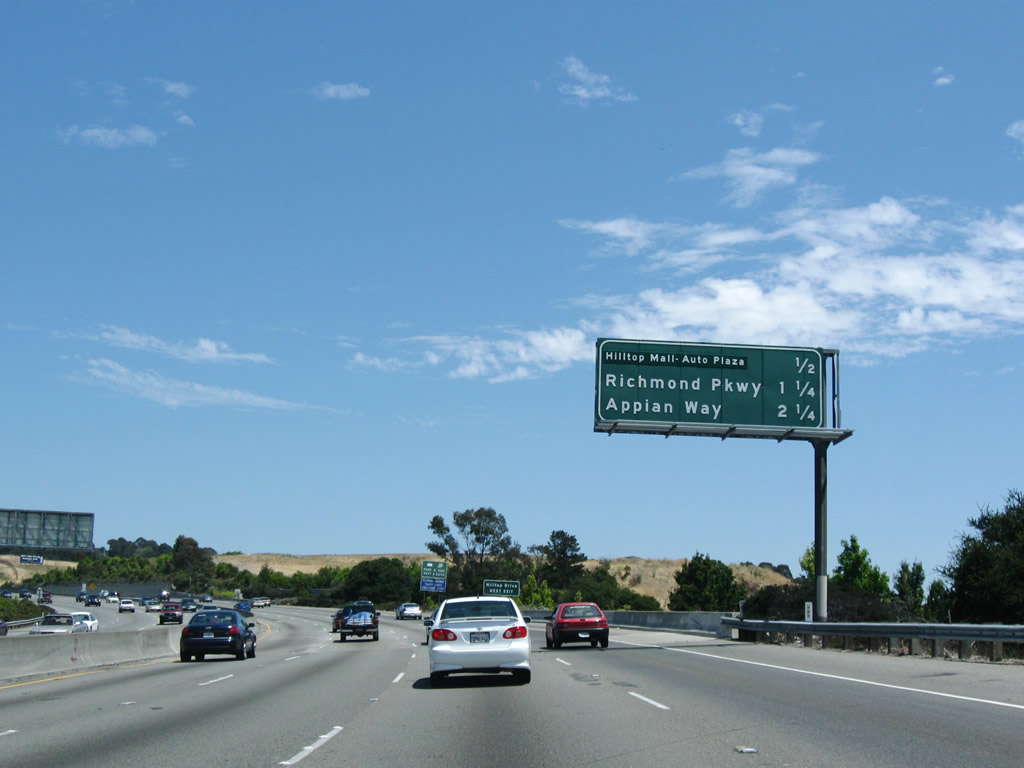
Interstate 80 passes under Hilltop Drive at this bridge crossing. The next three interchanges along eastbound are: Exit 20 (Richmond Parkway), Exit 21 (Appian Way), and Exit 22 (Pinole Valley Road). These exits serve the city of Pinole. This overhead sign was gone by 2009. Photo taken 07/18/09. |
|
Richmond Parkway (proposed California 93) provides a multi-lane divided highway between Interstate 80 at Exit 20 and Interstate 580 at Exit 8. A guide sign touts the connections between Richmond Parkway and the Interstate 580 Richmond-San Rafael Bridge. Photo taken 07/18/09. |
|
The Exit 20 partial-cloverleaf interchange includes HOV ramps to Richmond Parkway west and Fitzgerald Drive east. Fitzgerald Drive continues Richmond Parkway 0.8 miles east to Appian Way in Pinole. Richmond Parkway encircles San Pablo on the six mile drive to Castro Street in west Richmond. Photo taken 07/18/09. |
|
Interstate 80 continues northeast from Richmond Parkway (California 93) three quarters of a mile to Appian Way (Exit 21) and 3.75 miles to California 4 (John Muir Parkway) east. Photo taken 07/18/09. |
|
The Richmond Parkway (California 93) eastbound loop ramp onto Interstate 80 east forms an auxiliary lane for Exit 21 (Appian Way). Appian Way meanders 3.1 miles north from San Pablo Dam Road to San Pablo Avenue (Historic U.S. 40). Photo taken 07/18/09. |
|
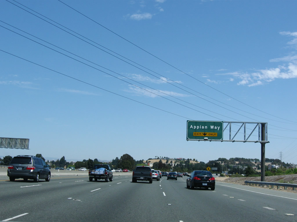
Eastbound Interstate 80 (Eastshore Freeway) reaches Exit 21, Appian Way (partial-cloverleaf interchange) in Pinole. Appian Way splits with Valley View Road one mile to the south at eastern reaches of Richmond. Fitzgerald Drive intersects Appian Way just south of Interstate 80. Photo taken 07/18/09. |
|
The next is a mileage sign that lists upcoming exits for Interstate 80 east after the Appian Way exit. The next three off-ramps serve Pinole, Hercules, and Rodeo. Photo taken 11/28/04. |
|
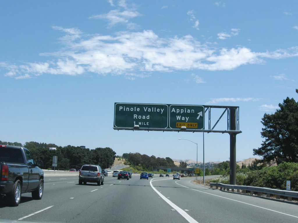
Interstate 80 travels northeast toward the Carquinez Bridge and Vallejo fro Pinole. The freeway next interchanges with Pinole Valley Road (Exit 22). Photo taken 07/18/09. |
|
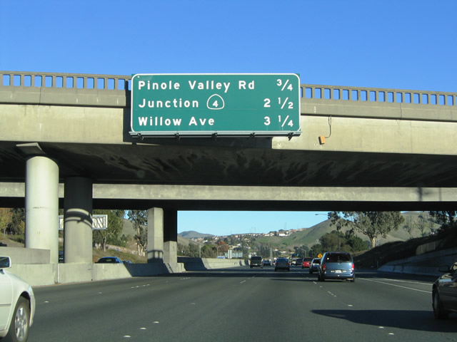
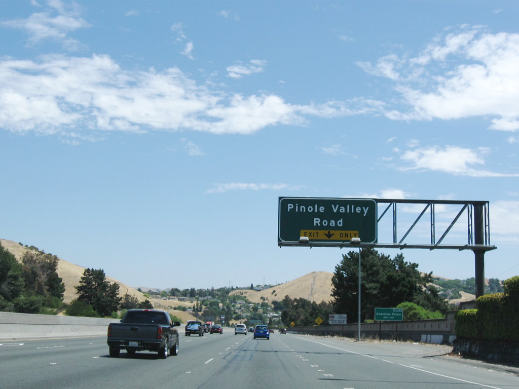
A diamond interchange joins Pinole Valley Road with Interstate 80 at Exit 22. Pinole Valley Road heads southeast three miles from Pinole to Alhambra Valley Road and Pinole Valley Park. Alhambra Valley Road ventures east to Martinez and Pleasant Hill. Photo taken 07/18/09. |
|
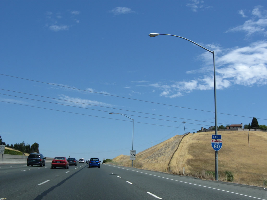
The next junction features the western terminus of California 4 (John Muir Parkway) at Exit 23. California 4, recently upgraded to a freeway in Hercules, provides a high speed route between Interstate 80 and Interstate 680 at Martinez and Concord. Ahead is the city of Hercules, the "Dynamic City on the Bay." With a population of 19,488 as of the 2000 Census, Hercules is a growing city situated on San Pablo Bay near the Carquinez Strait and several large oil refineries. Its location near the freeway, railroad, and water shipping network makes it a prime location for commercial interests. Originally founded as a company town, Hercules incorporated on December 15, 1900. Photo taken 07/18/09. |
|
This Interstate 80 east reassurance shield is posted shortly thereafter. Photo taken 07/18/09. |
|
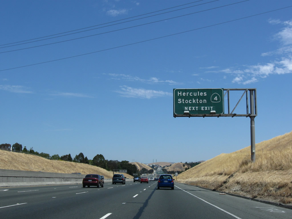
California 4 heads east from Hercules 8.6 miles to Martinez, 13.3 miles to Concord, and 63 miles to Stockton. The state route continues east from Stockton into the Sierra Nevada to a junction with California 89 near Markleeville in remote Alpine County. Photo taken 07/18/09. |
|
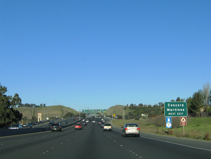
Looking east along California 4 (John Muir Parkway), the California 4 freeway meets Interstate 680 in the city of Martinez (Contra Costa County seat) and California 242 in the city of Concord. The California 4 freeway, which changes names to the California Delta Highway, continues east from there toward Pittsburgh, Antioch, and Oakley. Photo taken 11/28/04. |
|
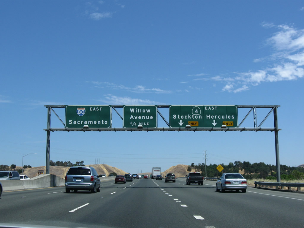
Interstate 80 eastbound expands to five lanes in anticipation of the California 4 (Exit 23) ramp departure at Hercules. Exit 23 splits into ramps for Bayberry Avenue west to San Pablo Avenue and California 4 (John Muir Parkway) east. John Muir Parkway spurs west from Interstate 80 to San Pablo Avenue and Alfred Nobel Drive. Photo taken 07/18/09. |
|
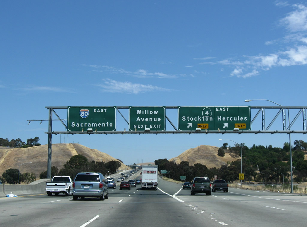
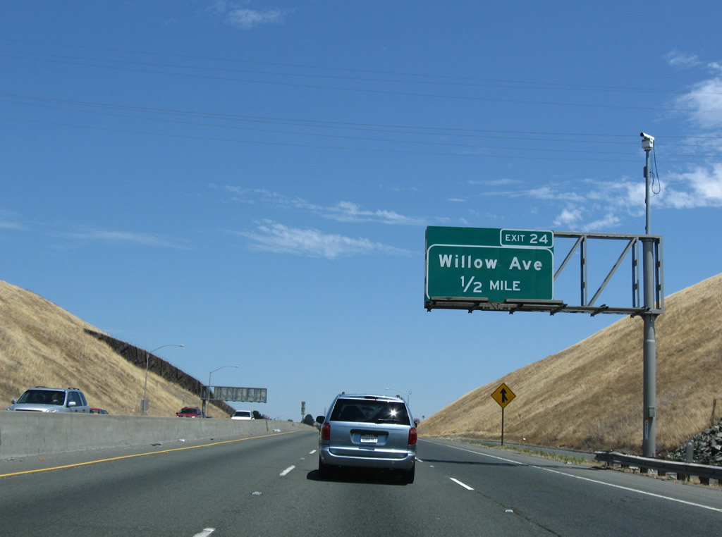
Interstate 80 passes over Bayberry Avenue and a parallel railroad line at the Exit 23 ramp departure to California 4 (John Muir Parkway) east. The directional interchange between the two freeways lacks a movement between Interstate 80 west and California 4 east. California 4 interchanges with Willow Avenue and Franklin Canyon Road in east Hercules. Photo taken 07/18/09. |
|
One half mile south of the Willow Road partial-cloverleaf interchange (Exit 24) at the California 4 (John Muir Parkway) under crossing. Willow Road continues Bayberry Avenue northwest to San Pablo Avenue (Historic U.S. 40) and Parker Avenue at Rodeo. Photo taken 11/28/04. |
|
|
Continuing north on Interstate 80 east toward the Willow Road interchange (Exit 24). Rodeo lies west of Interstate 80 along historic U.S. 40 (Parker Avenue and San Pablo Avenue). The original porcelain enamel sign was replaced in 2007 with the reflective exit number sign. Photos taken 11/28/04 and 07/18/09. |
|
This Interstate 80 east reassurance shield is posted after the on-ramp from California 4 west. Photo taken 07/07/07. |
|
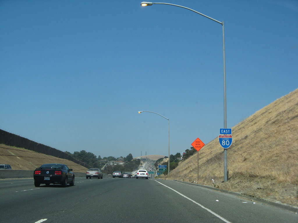
The next two exits along Interstate 80 (Eastshore Freeway) east serve the unincorporated community of Rodeo, which is billed as "West County's Best Kept Secret." Rodeo had a population of 8,717 people as of the 2000 Census. Photo taken 07/07/07. |
|
|
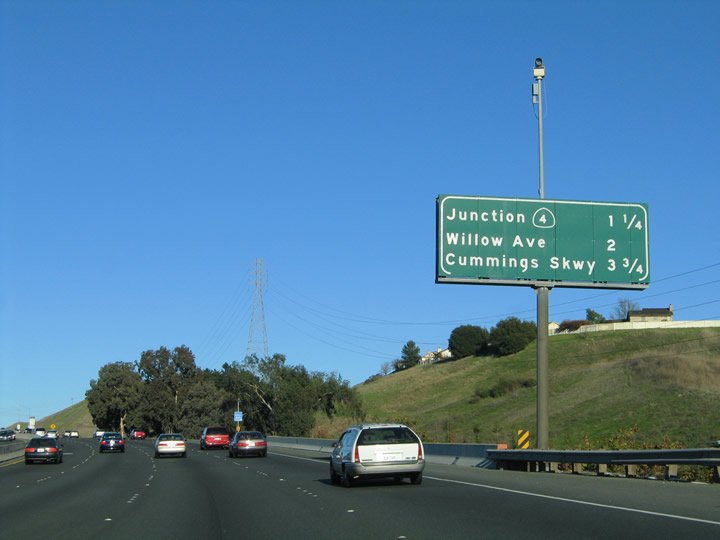
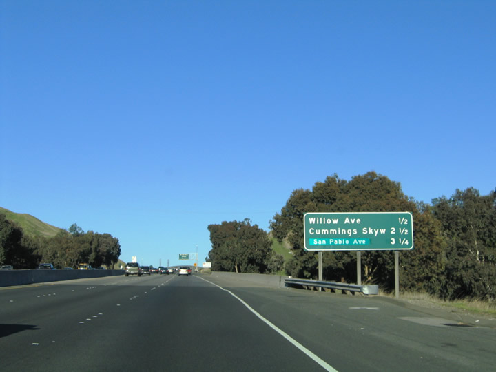
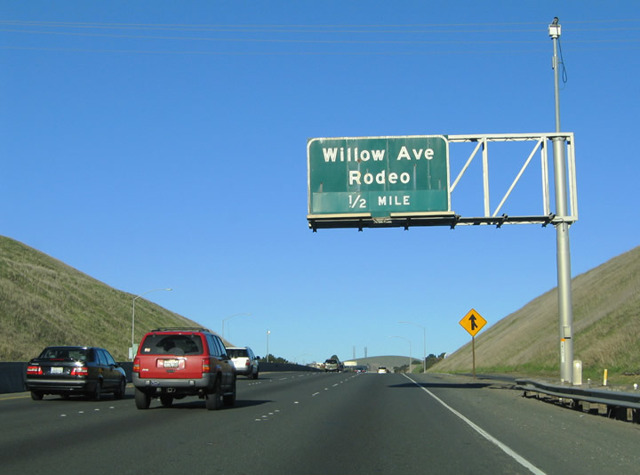
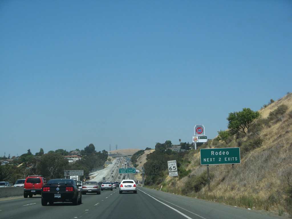
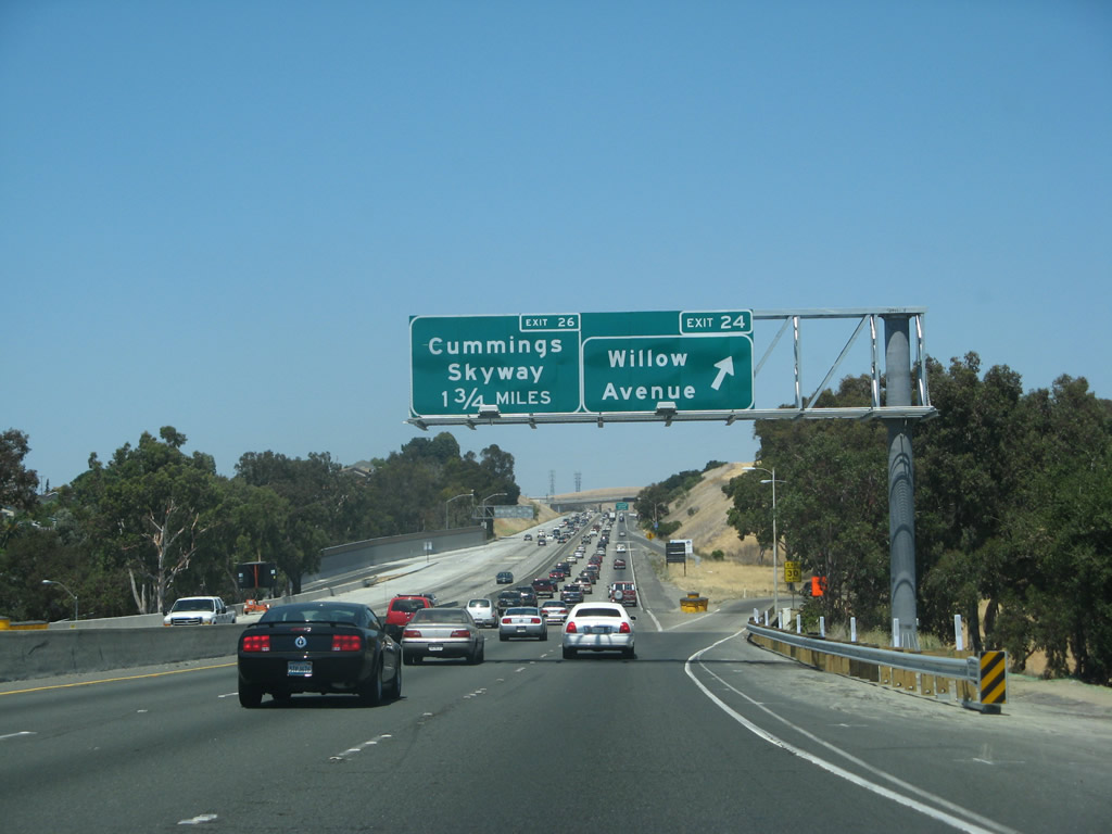
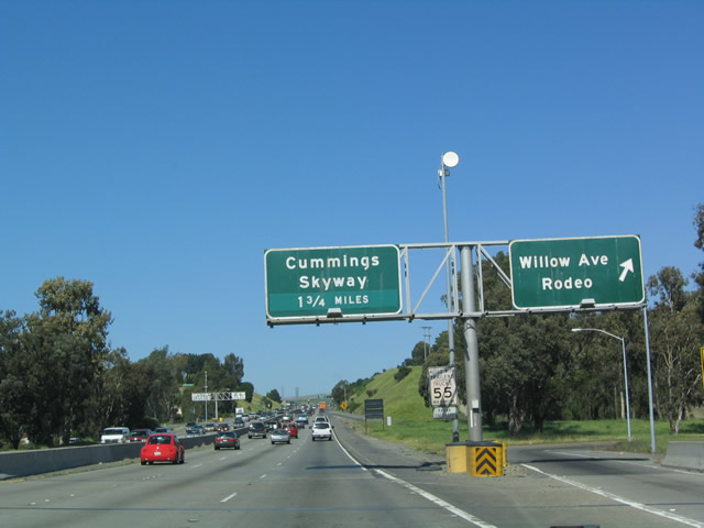
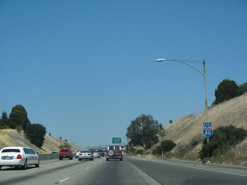
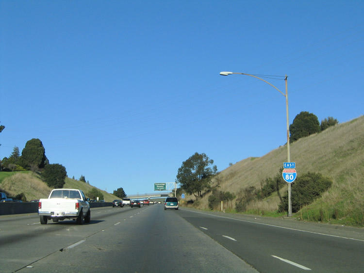
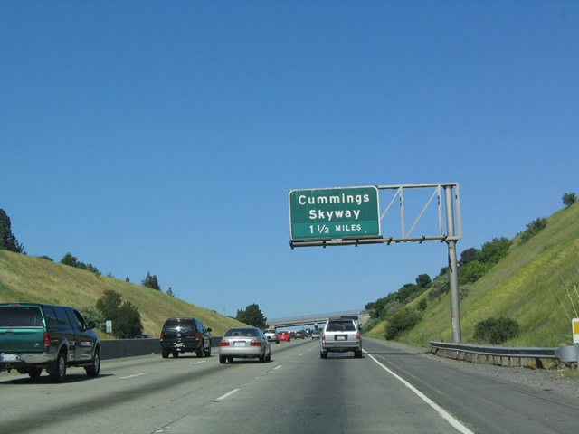
Exit 24 loops from Interstate 80 east to Willow Road. From here, Willow Road intersects Historic U.S. 40 about 0.33 mile to the north and intersects California 4 about 0.6 miles to the south. The next exit is Exit 26, Cummings Skyway. Photos taken 07/07/07 and 04/02/04. |
|
|
Many of the Interstate 80 reassurance shields in the bay area are attached to street light assemblies. This particular assembly resides after the Willow Road on-ramp from Exit 24. Photos taken 07/07/07 and 11/28/04. |
|
|
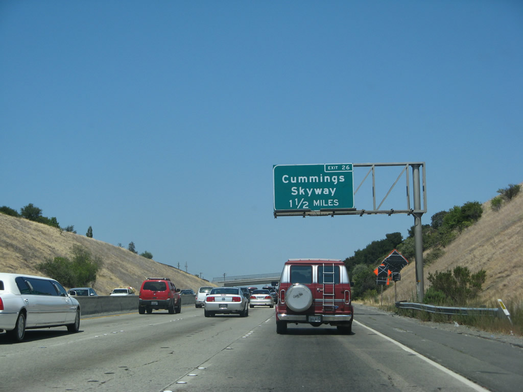
Ascending toward the Exit 26 diamond interchange with Cummings Skyway on Interstate 80 east. California Street passes over the freeway ahead from Rodeo. Photos taken 07/07/07 and 04/02/04. |
|
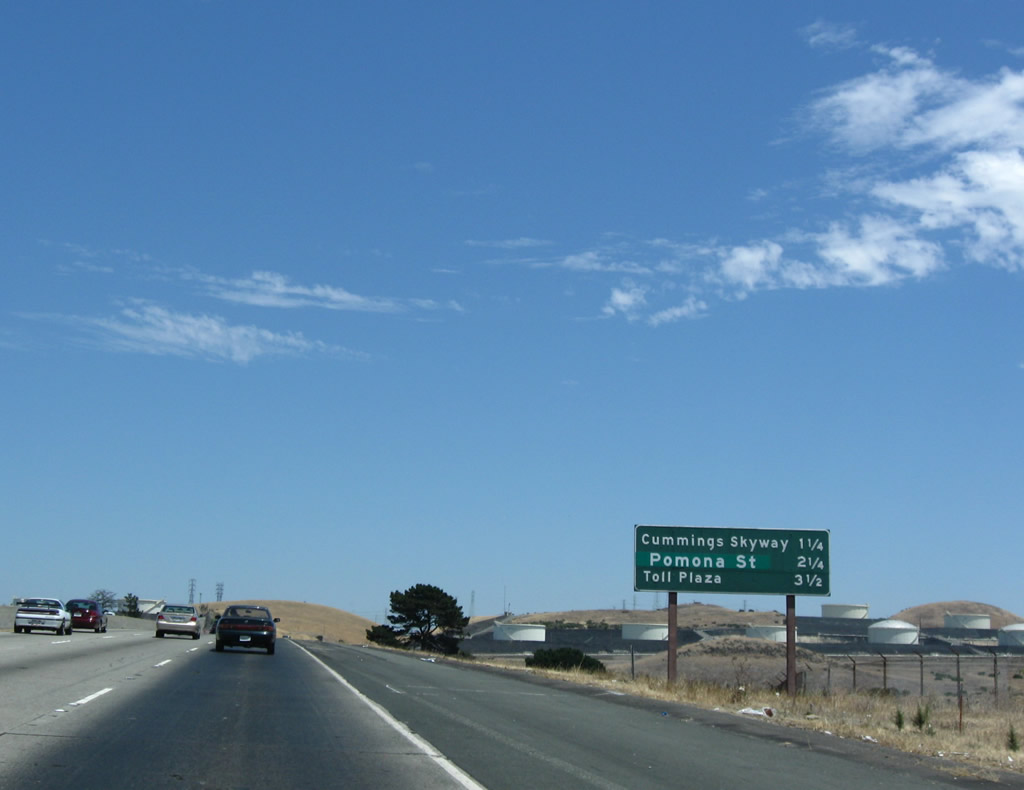
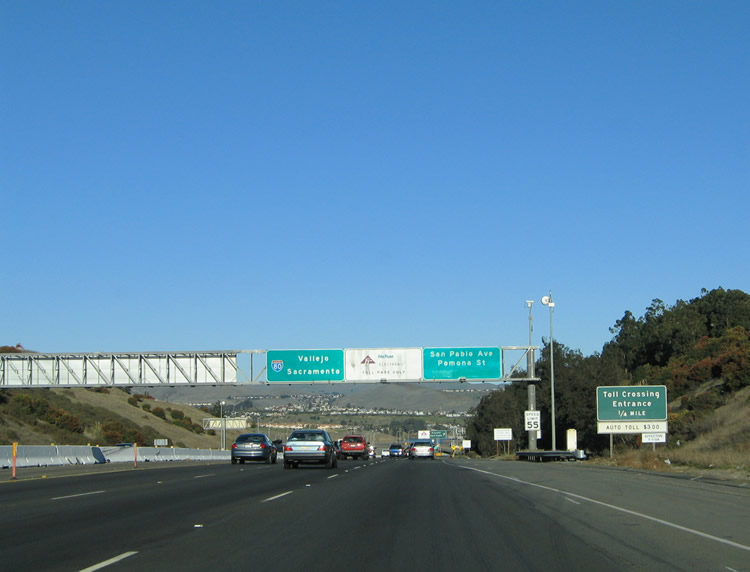
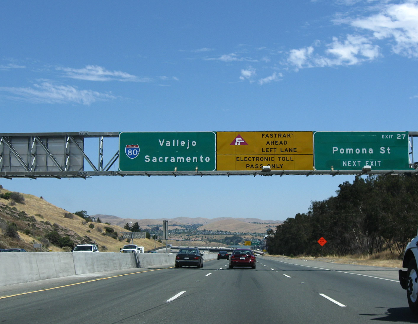
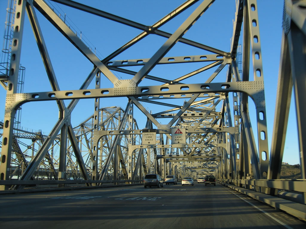
This mileage sign along eastbound Interstate 80 provides the distance to the next two exits and the upcoming toll plaza: Exit 26, Cummings Skyway; Exit 27, San Pablo Avenue/Crockett; and Exit 28, Carquinez Bridge Toll Plaza. The San Pablo Avenue green out replaces the original "Crockett Exit" on all guide signs on Interstate 80 east. Photo taken 07/18/09. |
|
|
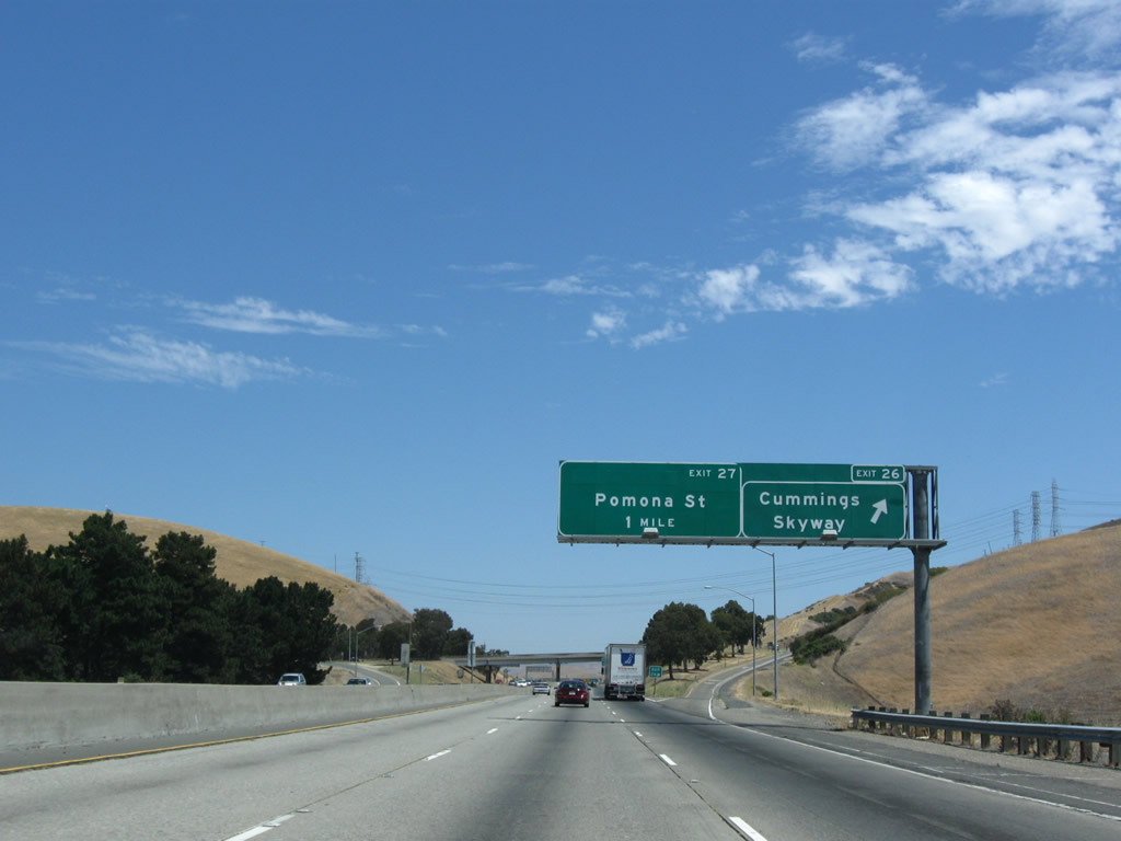
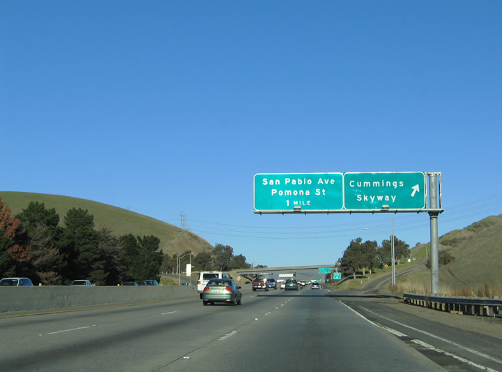
Eastbound Interstate 80 at Exit 26, Cummings Skyway, which heads east to meet California 4 west of Martinez. Cummings Skyway ends nearby at Historic U.S. 40 (San Pablo Avenue). Photos taken 07/18/09 and 11/28/04. |
|
Another interchange sequence sign is posted within the Cummings Skyway interchange. The area between Rodeo and Crockett are industrial in nature. Photo taken 07/18/09. |
|
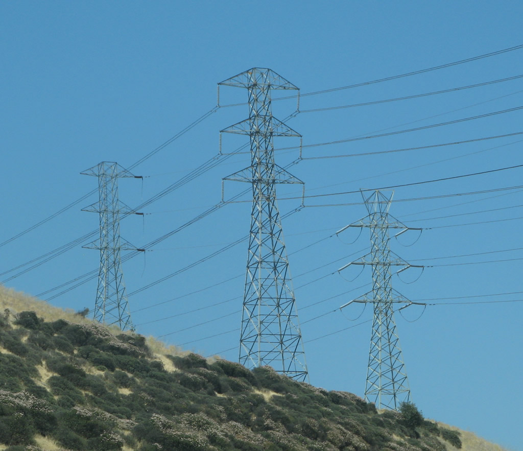
A set of Pacific Gas and Electric (PG&E) power lines cross over Interstate 80 at the Cummings Skyway interchange. Photo taken 07/07/07. |
|
Toll crossing sign posted one quarter mile south of the Carquinez Bridge on Interstate 80 eastbound. The Carquinez Bridge is a toll bridge along eastbound and a free bridge along westbound. The bridge uses the Fastrak system, like other toll bridges in the region, and carries a $4.00 passenger vehicle toll. Tolls on all bay area bridges increased to $4.00 on January 1, 2007. Photo taken 11/28/04. |
|
|
|
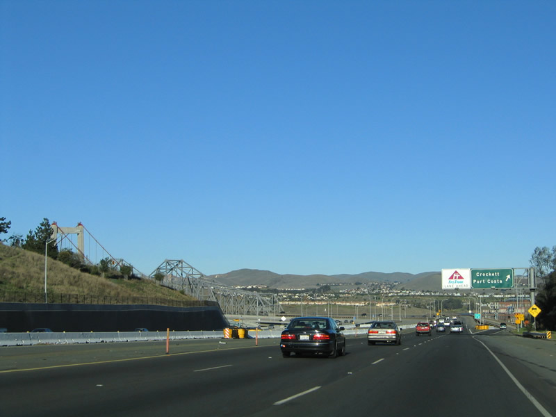
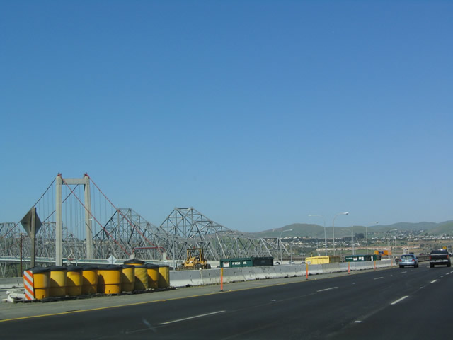
Interstate 80 descends toward the Carquinez Strait, the body of water that links San Pablo Bay with the Sacramento-San Joaquin River Delta. The freeway meets San Pablo Avenue (Historic U.S. 40) and Pomona Street before crossing the tolled Carquinez Bridge. Exit 27 serves the community of Crockett. Photos taken 07/18/09, 07/07/07, and 11/28/04. |
|
The towers of the new Alfred Zampa Bridge (suspension span) and original Carquinez Bridges (cantilever spans) come into view as we approach the toll crossing over the Carquinez Strait. High speed ramps carry motorists between Interstate 80 and Crockett at the bridge approach. Photo taken 11/28/04. |
|
|
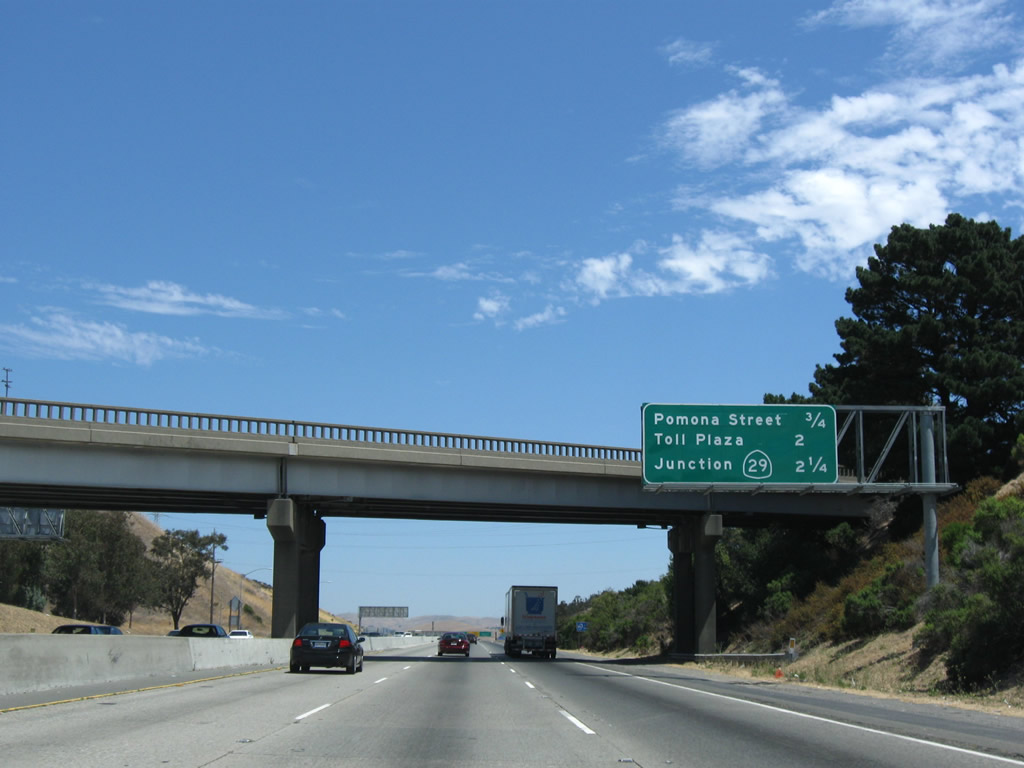
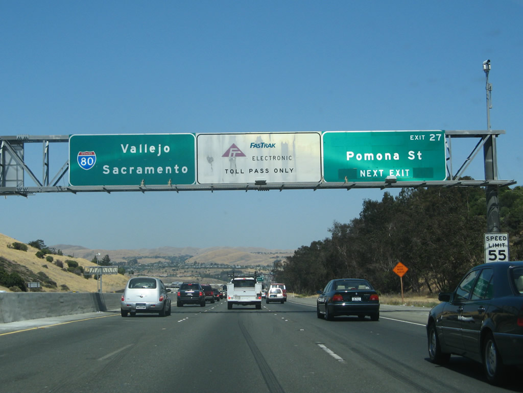
Eastbound Interstate 80 reaches Exit 27, Pomona Street to Crockett and U.S. 40/San Pablo Avenue. The original button copy sign for Exit 27 indicates Crockett and Port Costa. Pomona Street stems east from San Pablo Avenue (Historic U.S. 40) to Interstate 80 and Carquinez Scenic Drive. Carquinez Scenic Drive straddles the Carquinez Strait Regional Shoreline between Crockett and Port Costa. Crockett itself features port facilities along the south banks of the Carquinez Strait. An exit number was appended to this button copy sign sometime in 2007. Photos taken 07/18/09 and 11/28/04. |
|
|
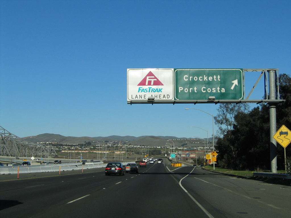
A long flyover ramp (Exit 27) descends from Interstate 80 eastbound and curves west to intersect San Pablo Avenue (Historic U.S. 40) and Pomona Street west of the freeway. An adjacent flyover ramp ascends from Pomona Street and downtown Crockett onto the Carquinez Bridge. Photos taken 11/28/04. |
|
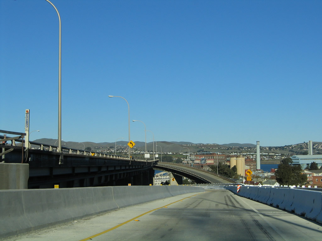
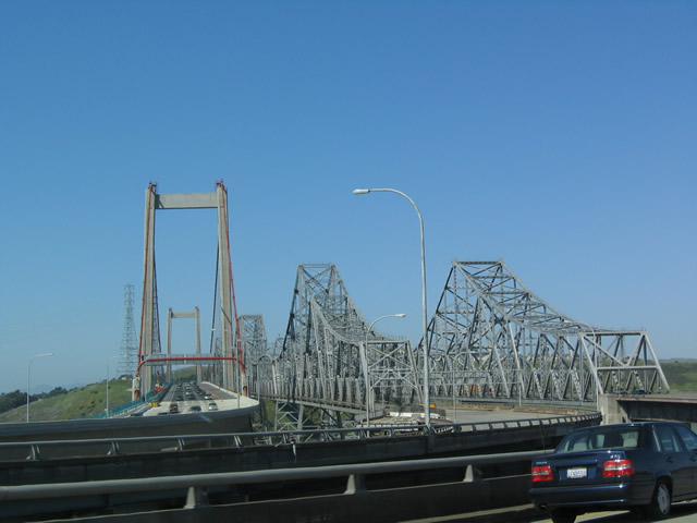
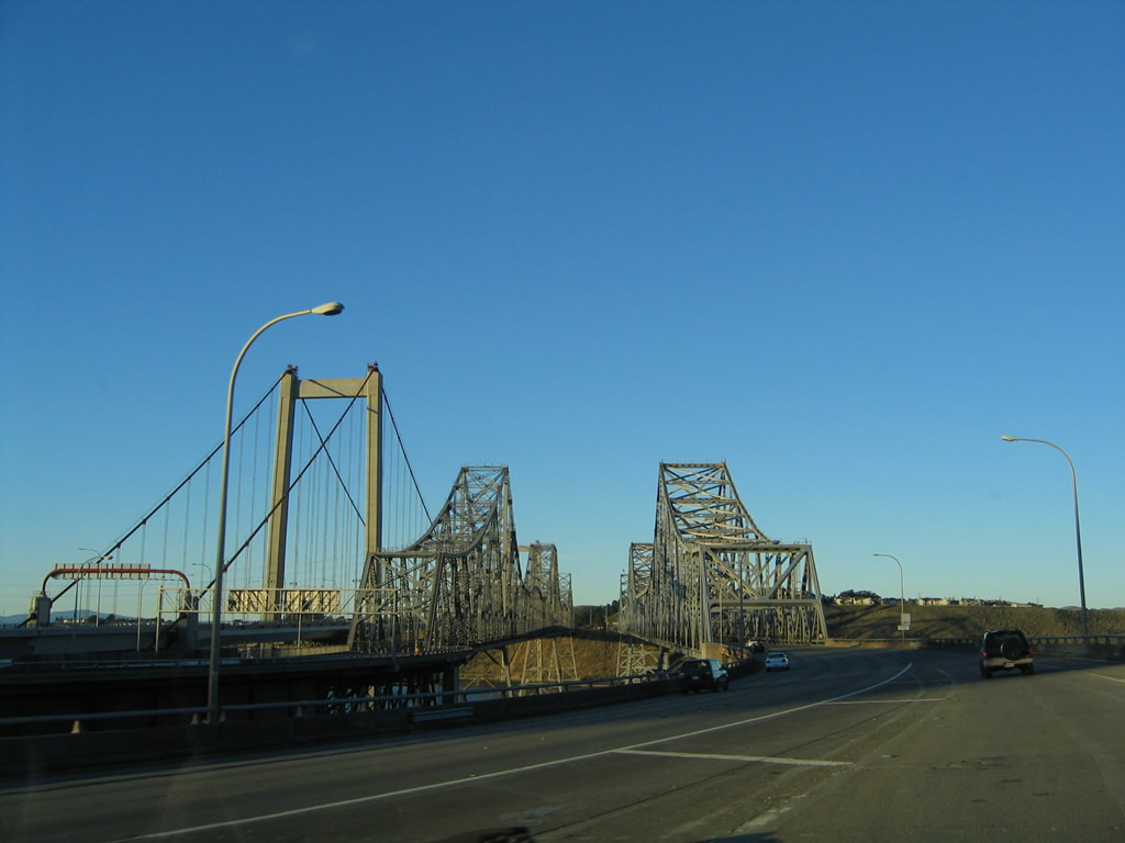
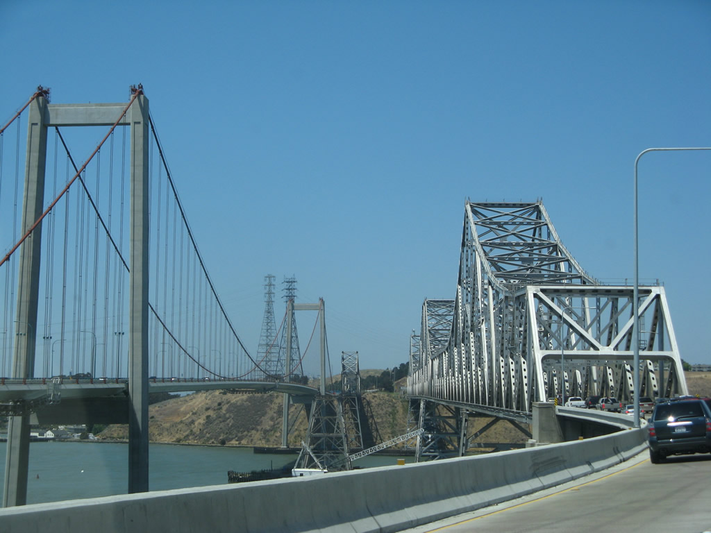
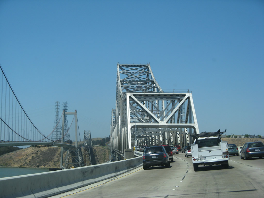
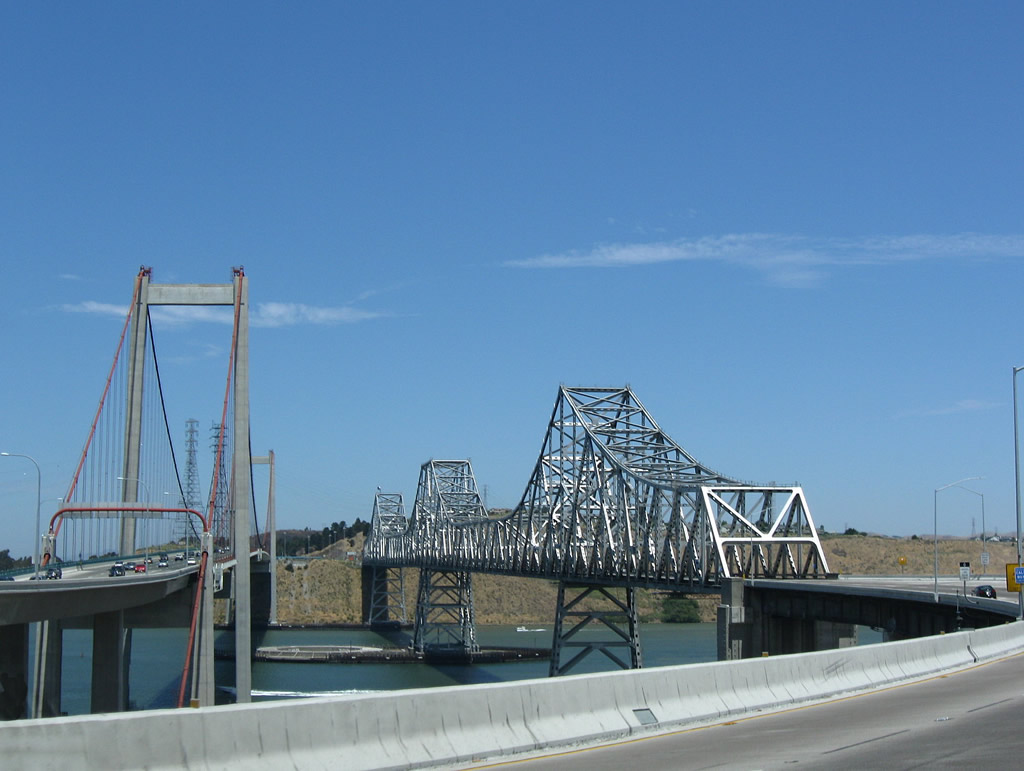
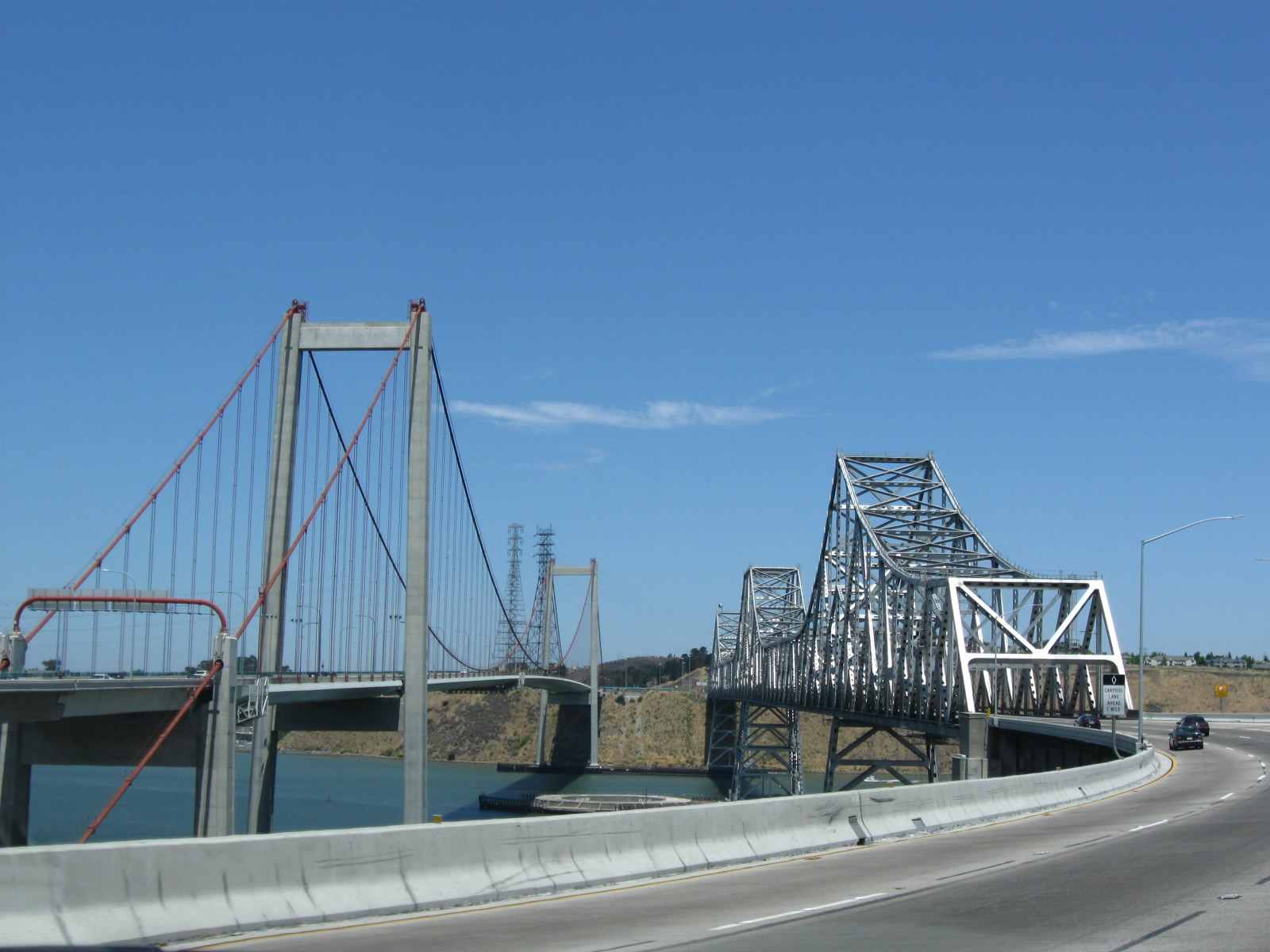
Eastbound Interstate 80 approaches the Carquinez Bridge, where the freeway exits Contra Costa County and enters Solano County. The 2004-completed Alfred Zampa suspension Bridge carries Interstate 80 westbound. Photo taken 04/02/04. |
|
This picture shows eastbound Interstate 80 as it approaches the Carquinez Bridge. Eastbound uses a 1950s-era bridge to cross the Carquinez Straits, which connects San Francisco Bay with the Sacramento-San Joaquin River Delta. Westbound uses the new Alfred Zampa bridge, the newest suspension span in the country. The middle bridge represents the original U.S. 40 Carquinez Bridge. The oldest bridge carried westbound traffic until 2004, and briefly carried eastbound traffic in 2005 while crews repaired the adjacent cantilever span for long term use. Photo taken 04/02/04. |
|
|
Even though westbound now follows a newer bridge, it used to cross the straits over the original bridge that was constructed at a time when Interstate 80 was only U.S. 40. This span, shown to the left of the eastbound bridge, has been demolished now that the new westbound span (the Alfred Zampa suspension bridge at the far left of the picture) was completed. Photos taken 04/02/04 and 11/28/04. |
|
|
|
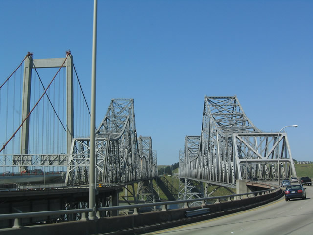
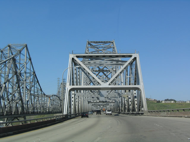
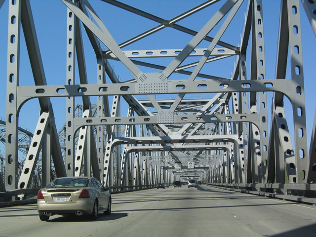
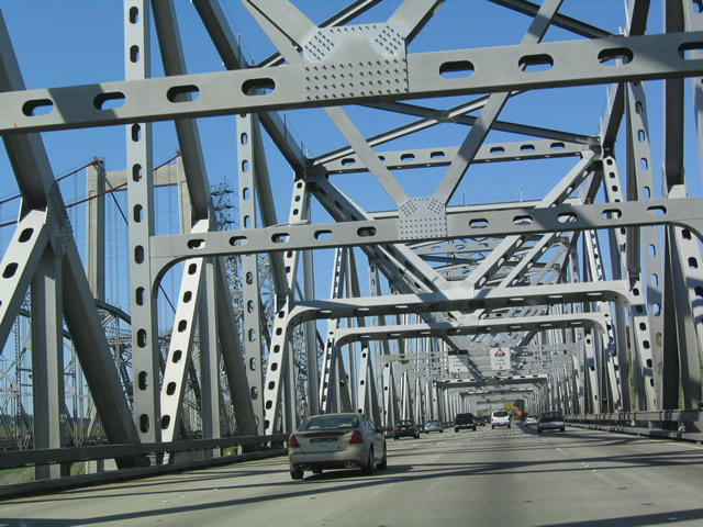
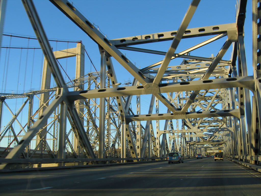
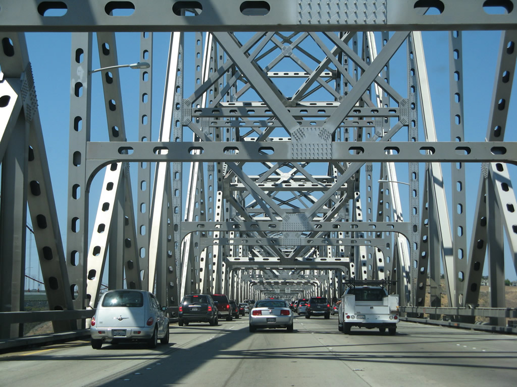
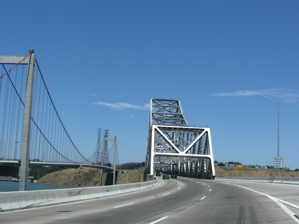
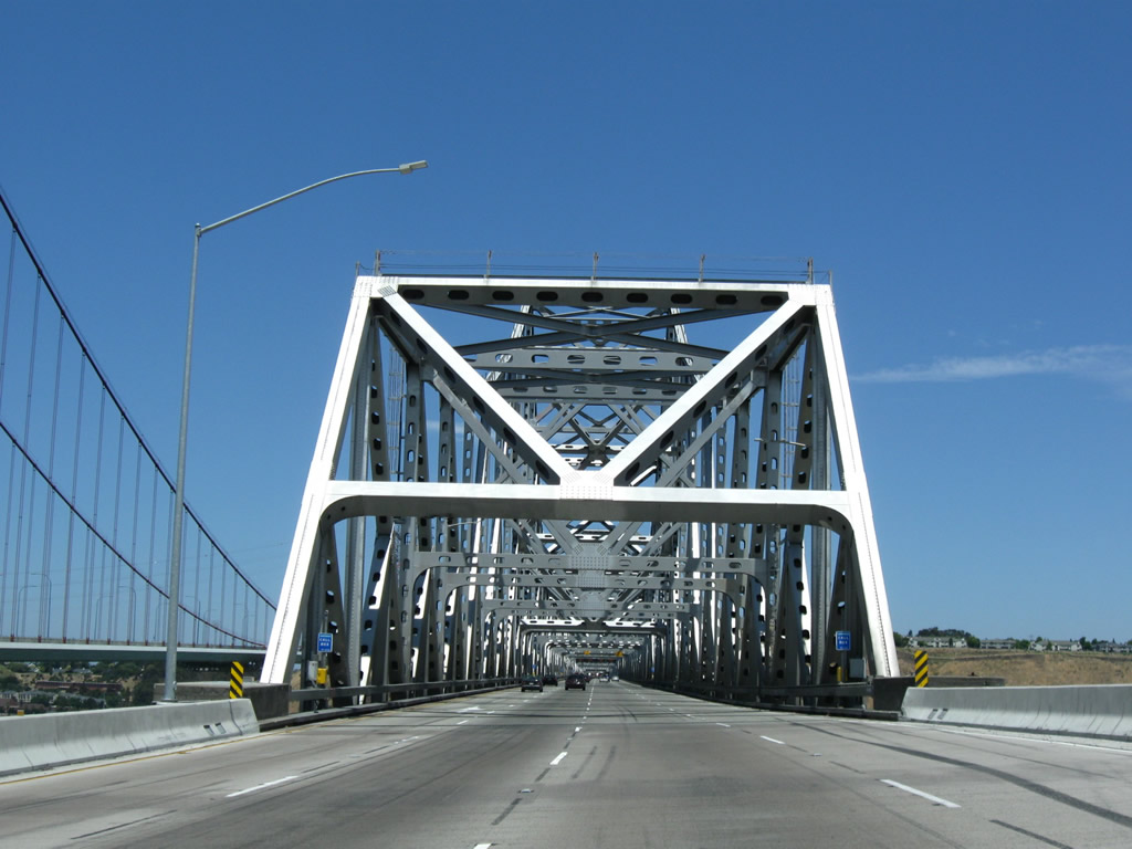
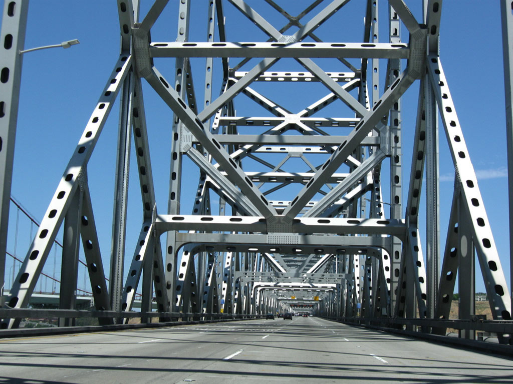
| Eastbound Interstate 80 crosses the Carquinez Strait on this cantilever bridge. This high bridge carries four lanes of traffic, and the elaborate support structure for the bridge's truss is a sight to behold. There is a toll booth, but it is located at the east end of the bridge. Only eastbound traffic is required to pay the toll. The Alfred Zampa suspension bridge carries four lanes of traffic, two full shoulders, and a wide sidewalk for pedestrians and bicyclists. There are no plans to replace the eastbound span in the near future, since it was retrofitted to withstand an earthquake. Photos taken 04/02/04. |
|
|
|
|
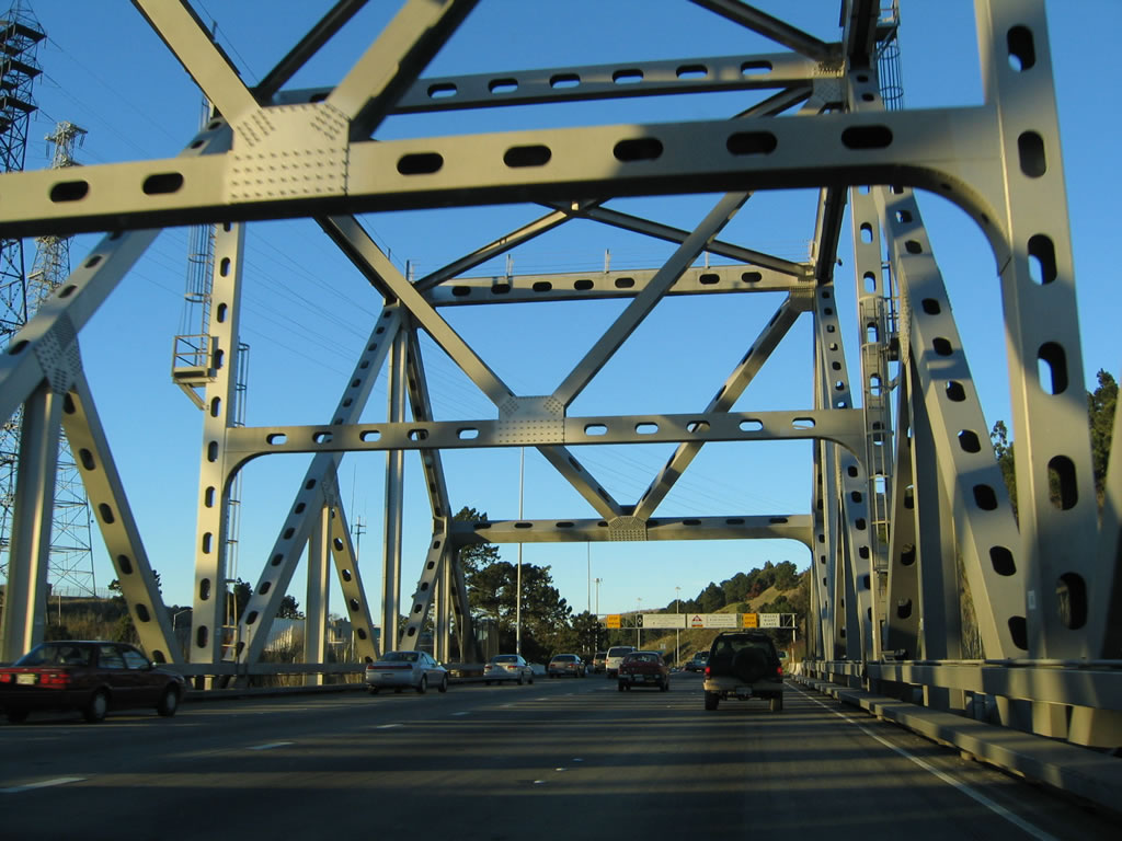
| This series of photos also follows eastbound Interstate 80 as it traverses the 1958 cantilever span. Photos taken 11/28/04. |
|
|
|
|
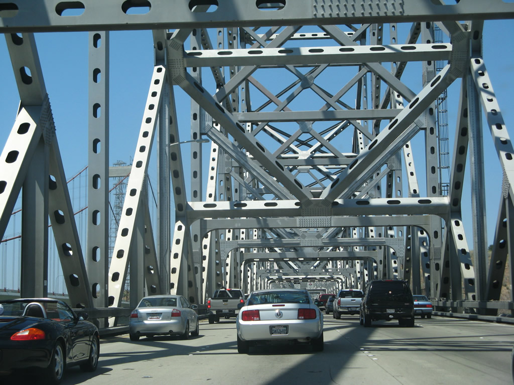
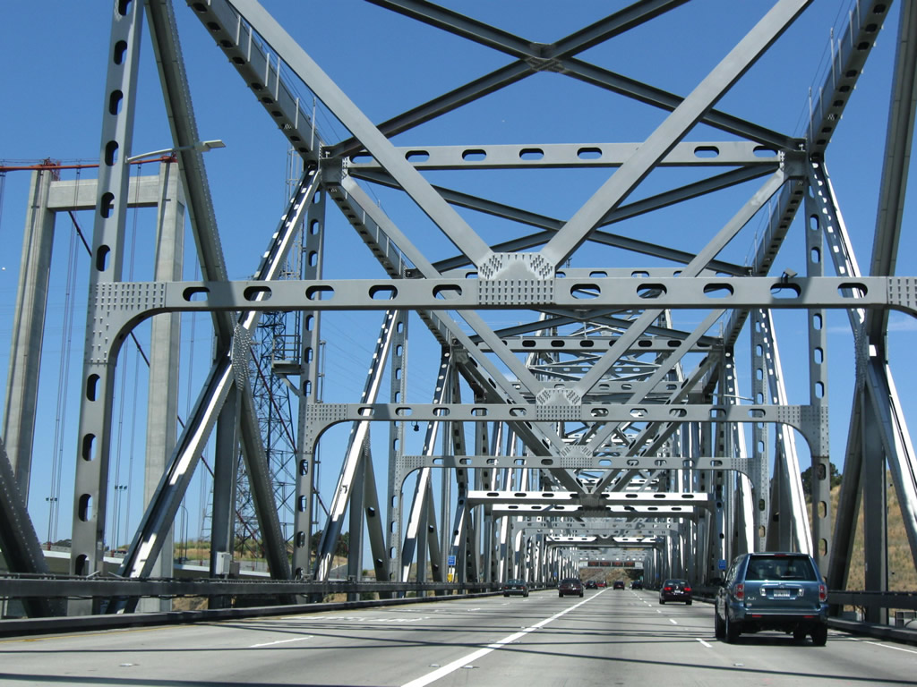
This series of photos shows Interstate 80 east (north) crossing the Carquinez Strait in July 2007, after the oldest span was mostly dismantled and gone. Photos taken 07/07/07. |
|
|
|
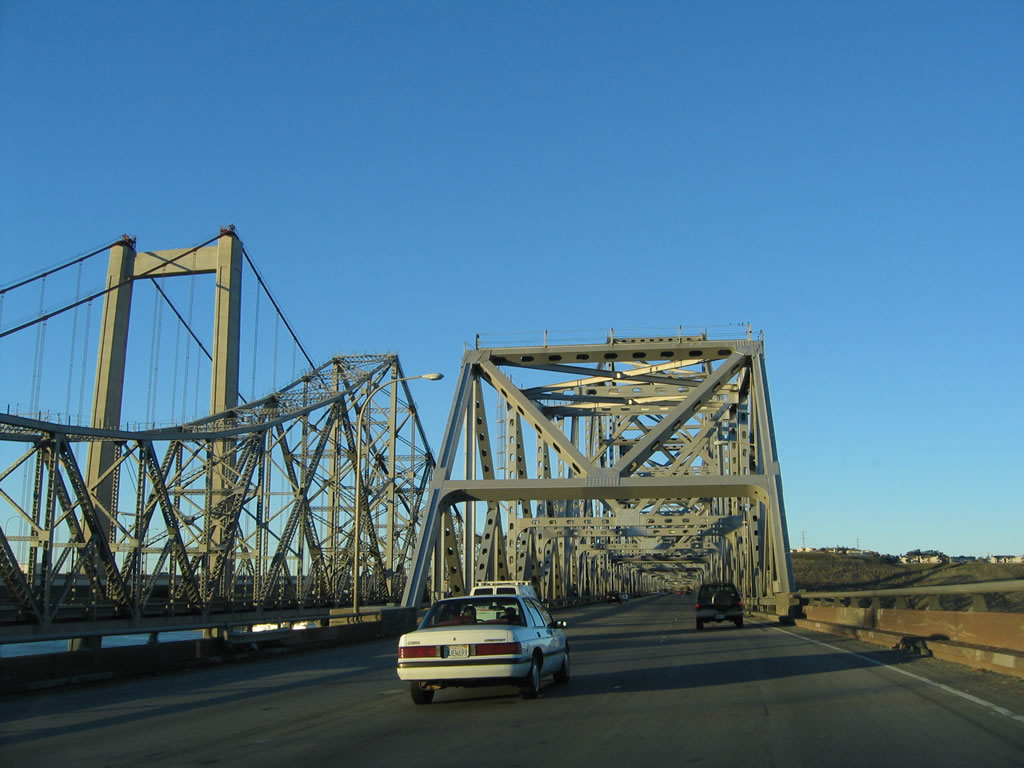
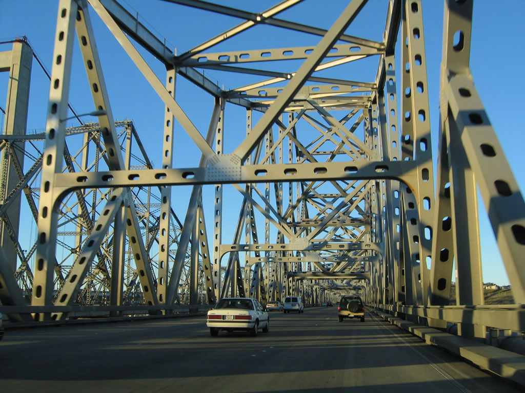
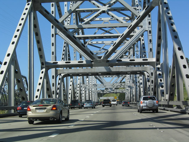
Two years later, the oldest span was completely gone, and there was substantially less traffic on this summer's day. All evidence of bridge construction was finally gone. Photos taken 07/18/09. |
|
|
|
|
|
Coming to the end of the bridge span, eastbound Interstate 80 approaches the north shore. Interstate 80 leaves Alameda County and enters Solano County and the city of Vallejo at this point. Photos taken 04/02/04 and 11/28/04. |
Page Updated November 5, 2009.