
Interstate 680 North - Santa Clara County
| Interstate 680 north | |
|---|---|
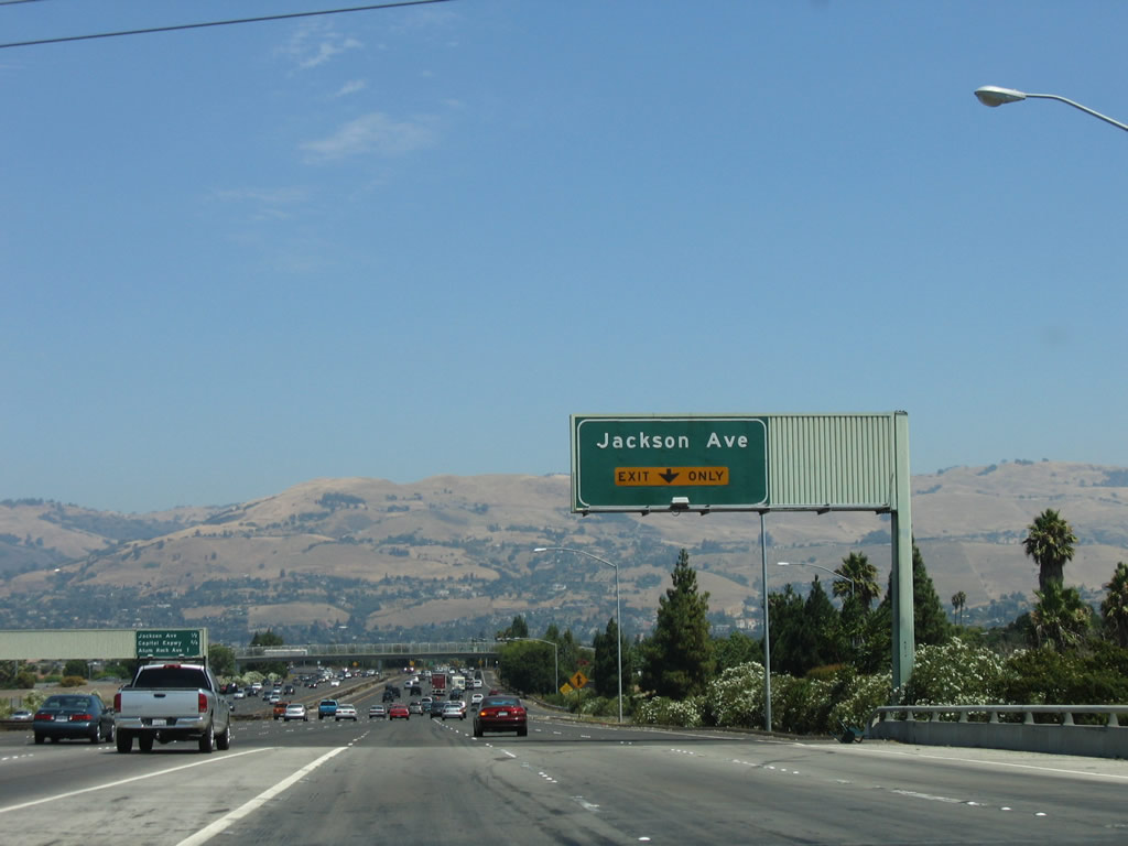 |
Southeast of downtown San Jose, Interstate 680 begins its northbound journey. The freeway begins at the junction of Interstate 280 (Sinclair Freeway) and U.S. 101 (Bayshore Freeway) near Prusch Park and extends northeast toward Alum Rock, then turns north toward Milpitas. This view shows the approach to the second exit, Exit 1B to Jackson Avenue, via the ramp from U.S. 101 south to Interstate 680 north. Photo taken 08/05/05. |
 |
The next three exits on Interstate 680 north are: Exit 1B, Jackson Avenue; Exit 1C, Capitol Expressway; and Exit 2A, California 130/Alum Rock Road. For the first six miles of Interstate 680, the freeway remains totally within the city of San Jose, which is the 10th largest city in the United States and 3rd largest in California (after Los Angeles and San Diego). As of the 2000 Census, 894,943 people lived in San Jose, which is also the seat of Santa Clara County and the capital of Silicon Valley. San Jose has been around since the mission days, having been founded on November 29, 1777. On March 20, 1850, San Jose became the first incorporated city in the state of California. While some spell San Jose with an accent mark (San Jos-) as a result of a City Council action in 1979, the original voter-approved city charter still spells the city name with an "e" rather than "-," so we'll use that spelling ("San Jose") here. taken 08/05/05. |
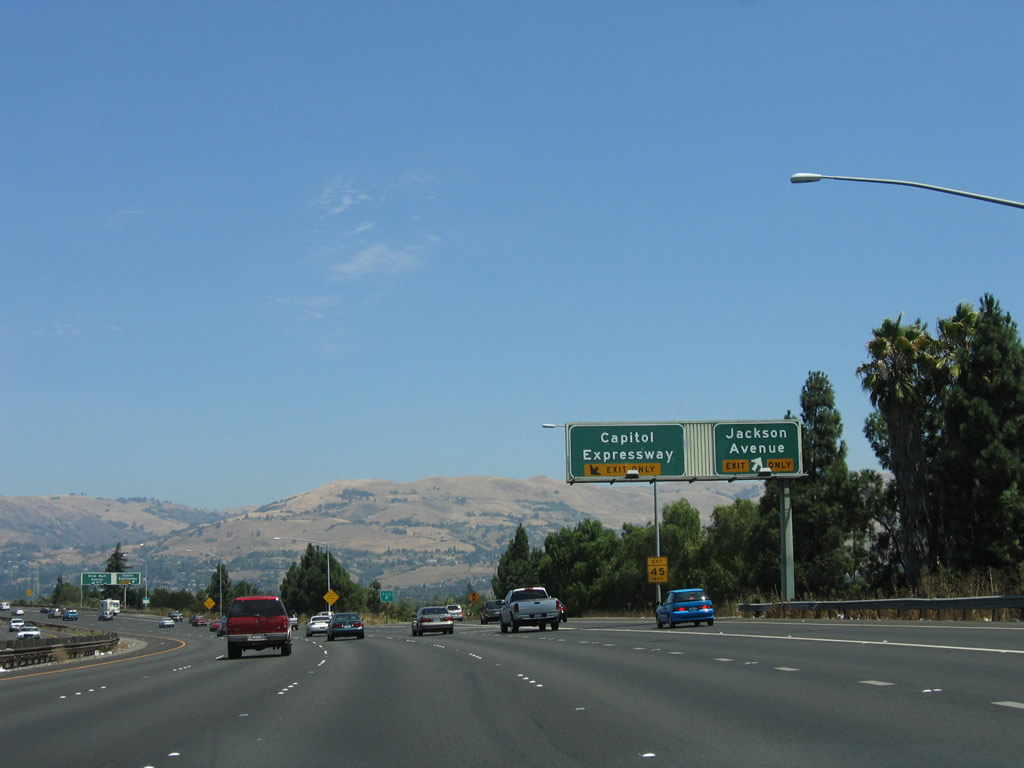 |
Southbound Interstate 280 (Sinclair Freeway) reaches Exit 1B, Jackson Avenue. Upon exiting here, there is no direct re-entry to Interstate 680 northbound. The next exit is Exit 1C, Capitol Expressway. Photo taken 08/05/05. |
 |
Immediately thereafter, northbound Interstate 680 meets Exit 1C, Capitol Expressway. Upon exiting, the ramp transitions directly onto southbound Capitol Expressway; there is no access to San Antonio Street. Although the Capitol Expressway is designated as an expressway, it has plenty of traffic signals and traffic. The freeway system is normally faster except when driving to nearby businesses and residential areas. Photo taken 08/05/05. |
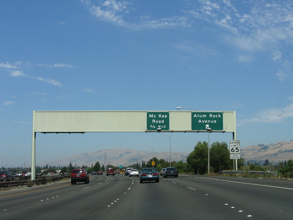 |
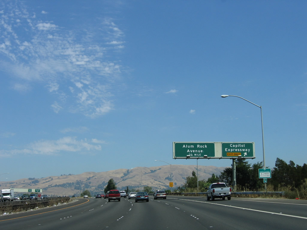
The Sinclair Freeway turns north before northbound Interstate 680 reaches Exit 2A, California 130 (Alum Rock Avenue). California 130 extends west along Alum Rock Avenue to U.S. 101 (Bayshore Freeway), where the state highway ends. To the east, California 130 follows Alum Rock Avenue to unincorporated Alum Rock and East San Jose before transitioning onto Mount Hamilton Road. From there, California 130 begins a long, winding journey from the Silicon Valley floor to Mount Hamilton (el. 4,213 feet) and the University of California's Lick Observatory. From there, California 130 ends, and San Antonio Valley Road and Del Puerto Road continue east as County Route 130 to meet Interstate 5 near Patterson. While this drive might look like a short cut on a map, it is actually a two to three hour drive on a good-weather day. Note the absence of California 130 shields on this overhead sign. The next exit is Exit 2B, McKee Road. Photo taken 08/05/05. |
 |
Crossing under California 130 (Alum Rock Avenue), a mileage sign is posted overhead for the next three exits: Exit 2B, McKee Road; Exit 4, Berryessa Road; and Exit 5A, Hostetter Road. Photo taken 08/05/05. |
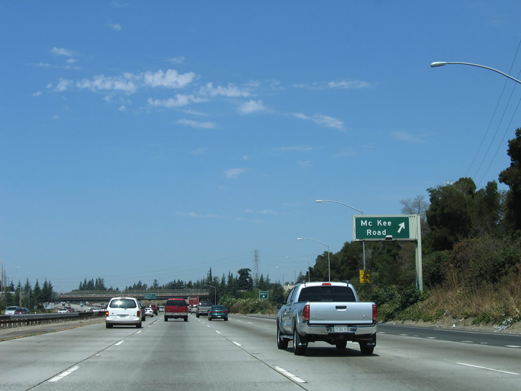 |
Northbound Interstate 680 (Sinclair Freeway) reaches Exit 2B, McKee Road. This interchange is a modified cloverleaf, with the first ramp connecting to McKee Road east and the second ramp looping onto westbound McKee Road. Use McKee Road west to a Park and Ride, Overfelt Gardens Park, Plata Arroyo Park, and U.S. 101 (where McKee Road transitions into Julian Street). Photo taken 08/05/05. |
 |
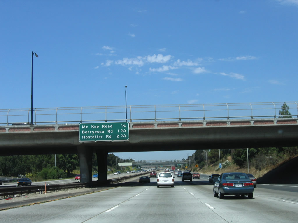
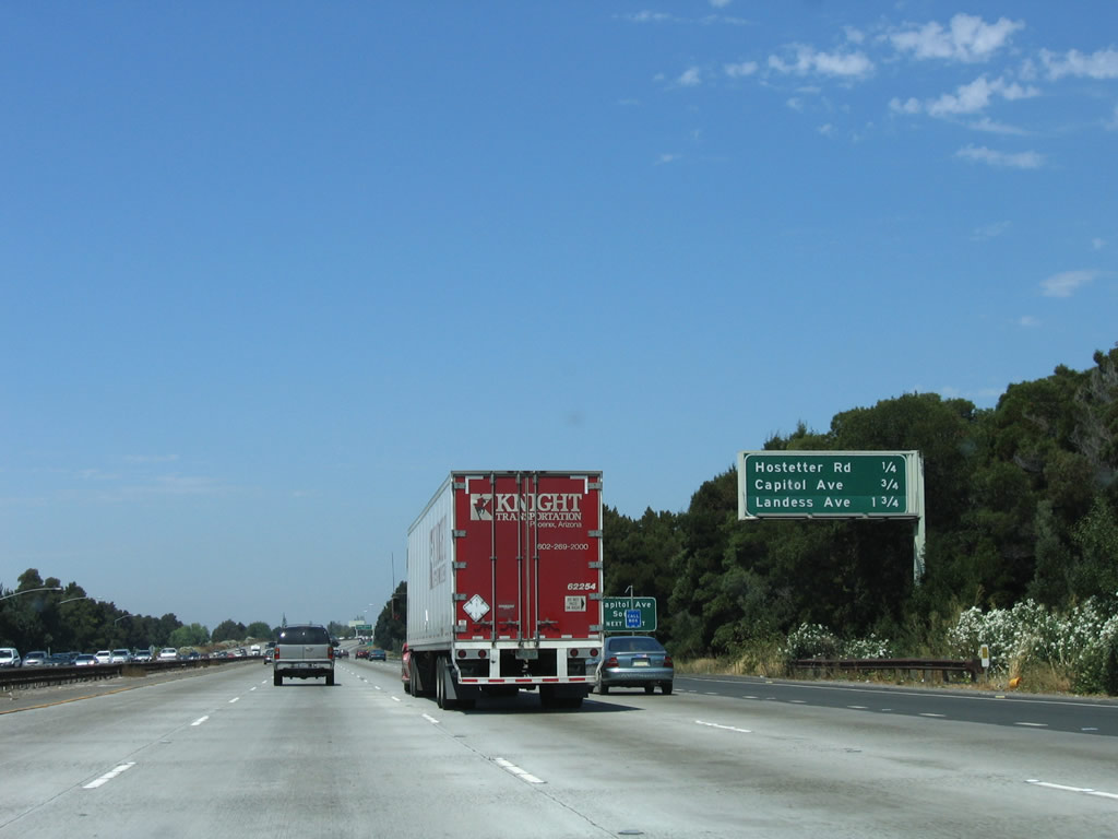
Crossing under McKee Road, a mileage sign is posted overhead for the next three exits on Interstate 680 north: Exit 4, Berryessa Road; Exit 5A, Hostetter Road; and Exit 5B, Capitol Avenue. The naming of Capitol Expressway and Capitol Avenue relates to the fact that San Jose was the original capital of the state of California when statehood was achieved in 1850. Photo taken 08/05/05. |
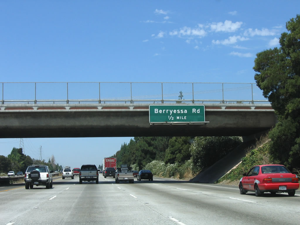 |
Berryessa Road is the next exit along northbound Interstate 680 (Sinclair Freeway). The freeway retains four through lanes on northbound between McKee Road and Berryessa Road. Photo taken 08/05/05. |
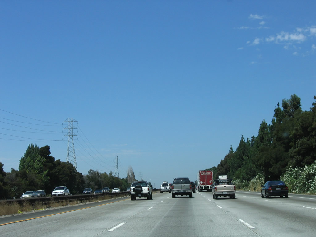 |
A Pacific Gas and Electric power line closely follows Interstate 680 for a bit north of McKee Road. Photo taken 08/05/05. |
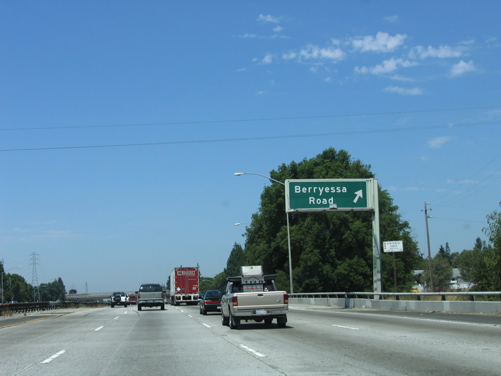 |
Southbound Interstate 680 (Sinclair Freeway) reaches Exit 4, Berryessa Road. The ramp begins at the point where Interstate 680 crosses over the Upper Penitencia Creek. Exit 4 is another modified cloverleaf, complete with collector distributor lanes. Use Berryessa Road east to the community of Berryessa within the city of San Jose. To the west, Berryessa Road eventually changes into Hedding Street before connecting to the San Jose Civic Center near California 87 (Guadalupe Parkway). Photo taken 08/05/05. |
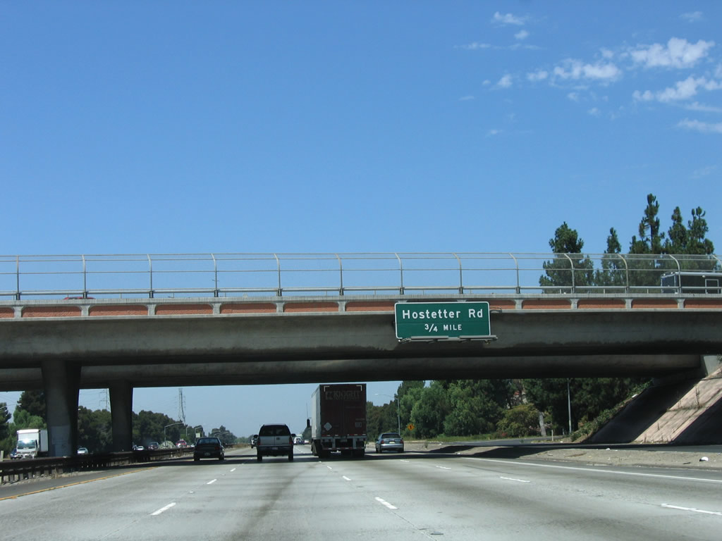 |
Crossing under Berryessa Road, an overhead sign for Exit 5A, Hostetter Road is posted on the overpass. Photo taken 08/05/05. |
 |
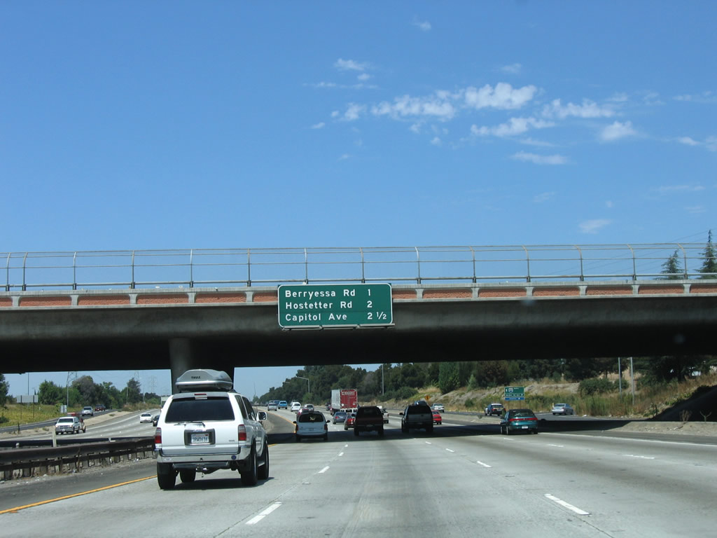
This mileage sign provides the distance to the next three exits on Interstate 680 north: Exit 5A, Hostetter Road; Exit 5B, Capitol Avenue; and Exit 6, Landess Avenue/Montague Expressway. Currently we don't have a photo of the Exit 5A off ramp signage. Photo taken 08/05/05. |
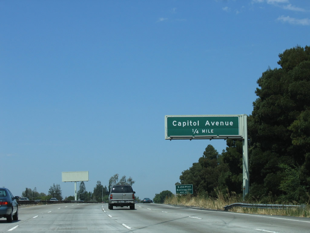 |
After Exit 5A/Hostetter Road, the next exit is Exit 5B, Capitol Avenue. This interchange connects to Capitol Avenue northwest to The Great Mall of Milpitas and southeast to the Berryessa neighborhood of the city of San Jose. Photo taken 08/05/05. |
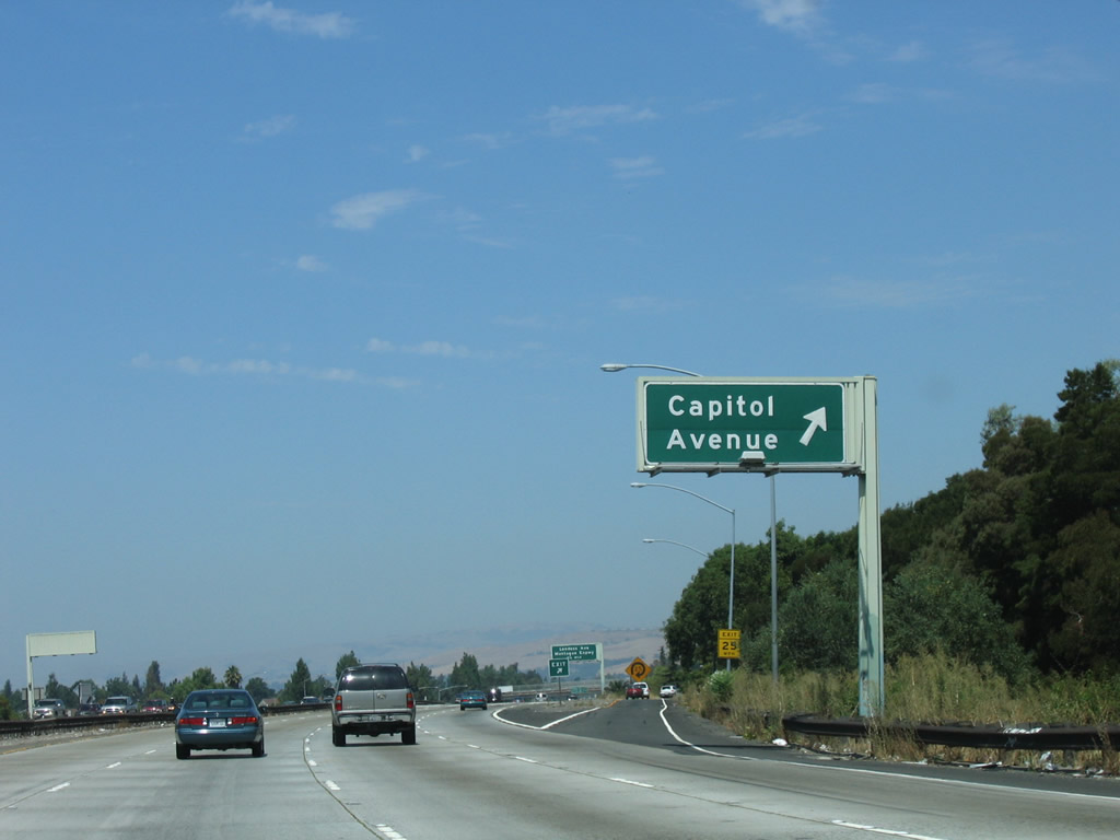 |
Northbound Interstate 680 reaches Exit 5B, Capitol Avenue. Photo taken 08/05/05. |
 |
The next interchange along northbound Interstate 680 (Sinclair Freeway) is Exit 6, Landess Avenue/Montague Expressway. This modified cloverleaf interchange will be the last interchange to serve the city of San Jose; Landess Avenue east serves as the city limits between San Jose and Milpitas. Photo taken 08/05/05. |
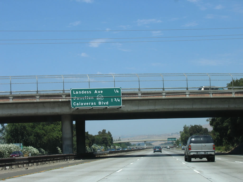 |
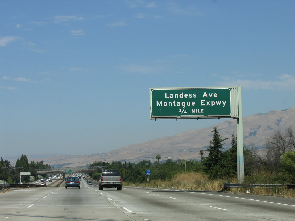
This mileage sign provides the distance to the next two exits on Interstate 680 north: Exit 6, Landess Avenue/Montague Expressway and Exit 8, California 237 (Calaveras Boulevard). Photo taken 08/05/05. |
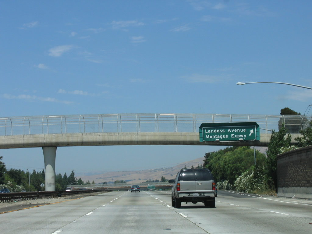 |
Northbound Interstate 680 reaches Exit 6, Landess Avenue/Montague Expressway. While Landess Avenue travels east toward Piedmont Drive, the Montague Expressway travels west past the Great Mall, then connects with Interstate 880. It is one of several direct connections between Interstate 680 and Interstate 880 in Milpitas (the others are California 237 (Calaveras Boulevard) and California 262 (Mission Boulevard)). Photo taken 08/05/05. |
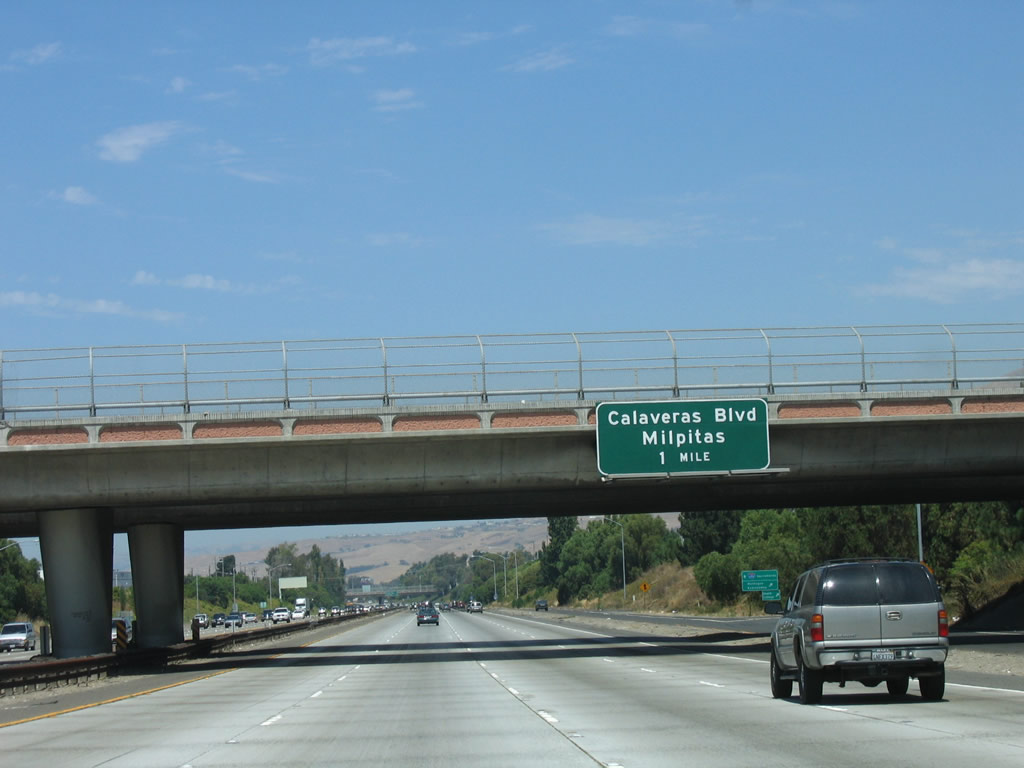 |
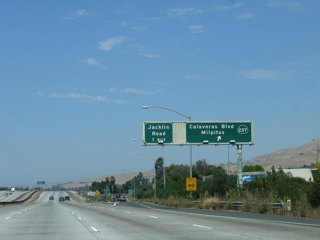
The next exit along northbound Interstate 680 is Exit 8, California 237 (Calaveras Boulevard). This sign is posted on the Landess Avenue/Montague Expressway overpass. At this point, Interstate 680 leaves San Jose and enters the city of Milpitas. Situated on Interstate 680, Interstate 880, and California 237, Milpitas is known as the "Crossroads of Silicon Valley" with its freeway access. Home to 62,698 people as of the 2000 Census, Milpitas was incorporated as a city on January 26, 1954, as it was threatened with potential annexation by the city of San Jose. Milpitas is the last city along Interstate 680 before leaving Santa Clara County and entering Alameda County; this county line is demarcation point between the regional nomenclature of "South Bay" and "East Bay." Photo taken 08/05/05. |
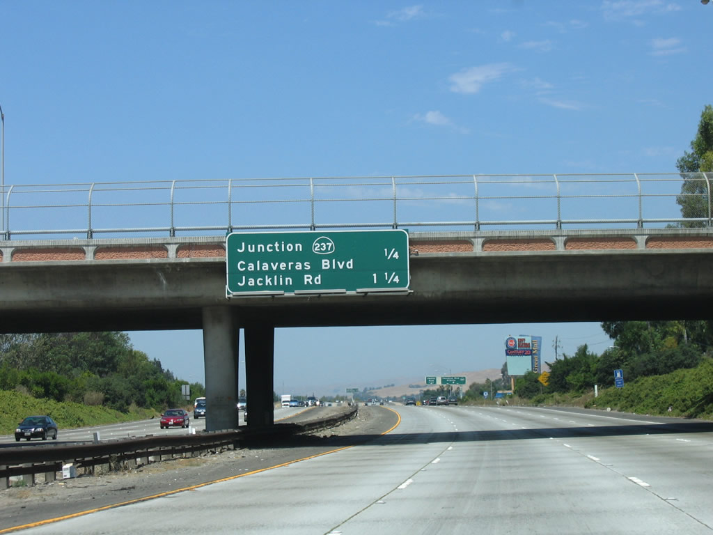 |
This mileage sign along northbound Interstate 680 provides the distance to Exit 8, California 237 (Calaveras Boulevard) and Exit 9, Jacklin Road. Photo taken 08/05/05. |
 |
Northbound Interstate 680 reaches Exit 8, California 237. This interchange marks the eastern terminus of this state highway, so Calaveras Boulevard east of here is not part of California 237. However, it passes through Milpitas, connects to the southern end of Ed R. Levin County Park, and then swings north as Calaveras Road past Calaveras Reservoir before reconnecting with Interstate 680 at the California 84/Sunol interchange in Alameda County. As for California 237, it is a major east-west corridor from Interstate 680 west to U.S. 101. The first section, from Interstate 680 to Interstate 880, is a surface street (Calaveras Boulevard), but the state highway from Interstate 880 west to U.S. 101 is the South Bay Freeway. Photo taken 08/05/05. |
 |
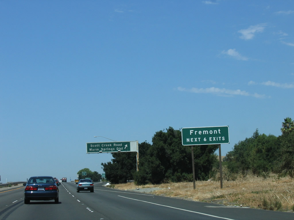
After the California 237 interchange, northbound Interstate 680 loses a lane. The next three exits on northbound are: Exit 9, Jacklin Road; Exit 10, Scott Creek Road/Warm Springs District; and Exit 12, California 262 (Mission Boulevard). Photo taken 08/05/05. |
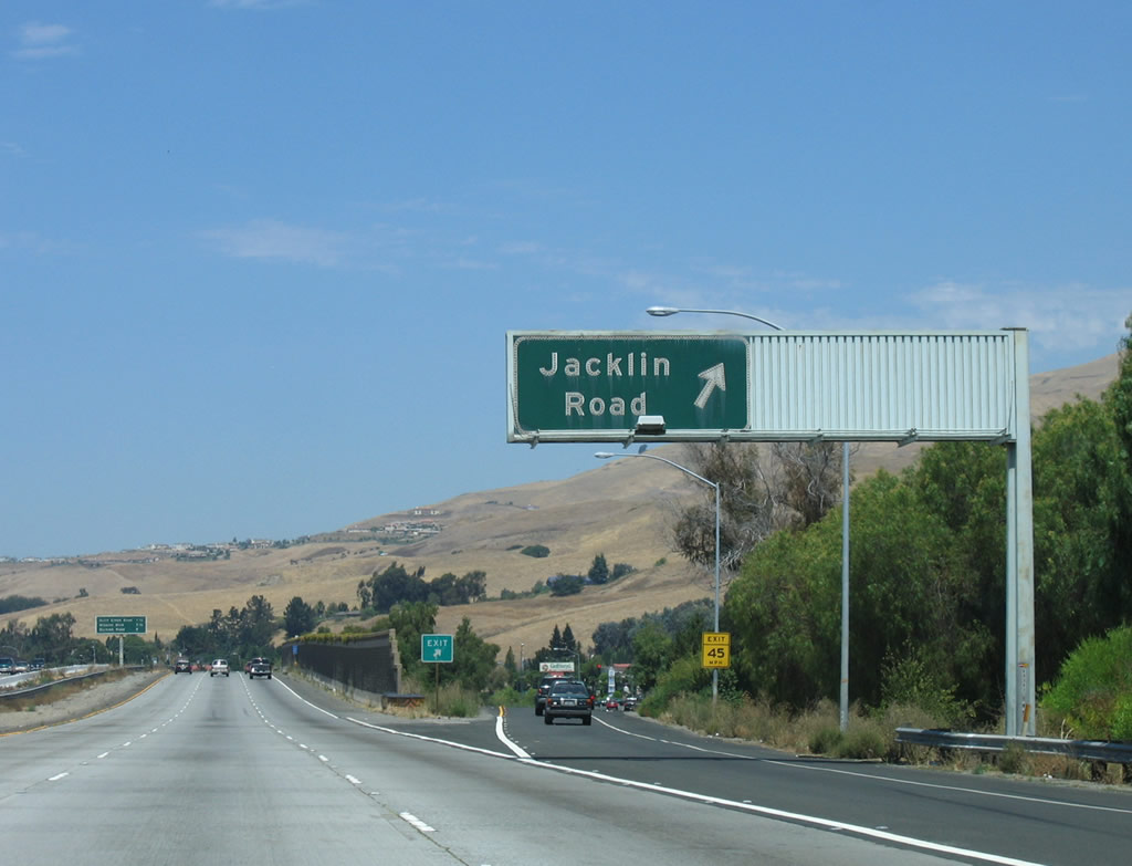 |
Northbound Interstate 680 reaches Exit 9, Jacklin Road/Evans Road. This is the second and final Milpitas exit. Note that this is the first in a series of porcelain-enamel overhead guide signs along northbound Interstate 680. South of here, most of the non-reflective signs were placed after California stopped using porcelain-enamel signs. Photo taken 08/05/05. |
 |
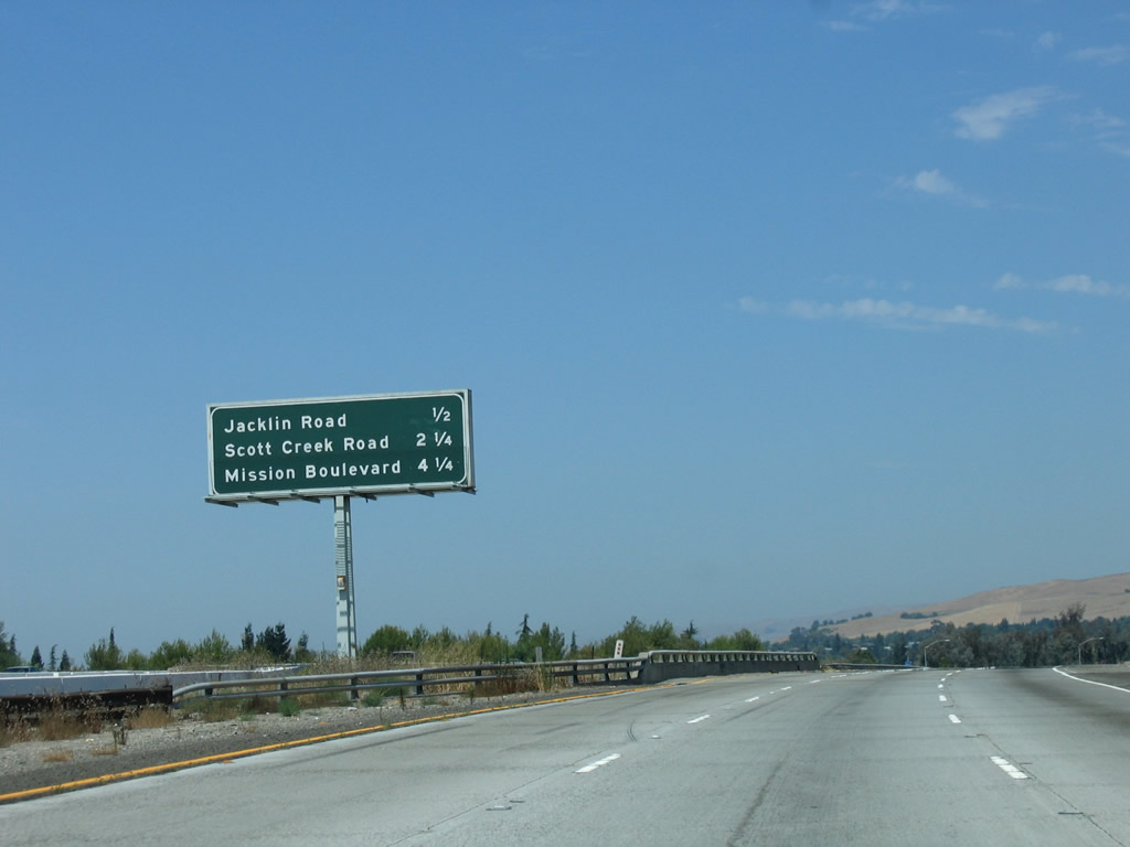
The next three exits on northbound Interstate 680 (Sinclair Freeway) are: Exit 10, Scott Creek Road/Warm Springs District; Exit 12, California 262 (Mission Boulevard); and Exit 14, Durham Road. Photo taken 08/05/05. |
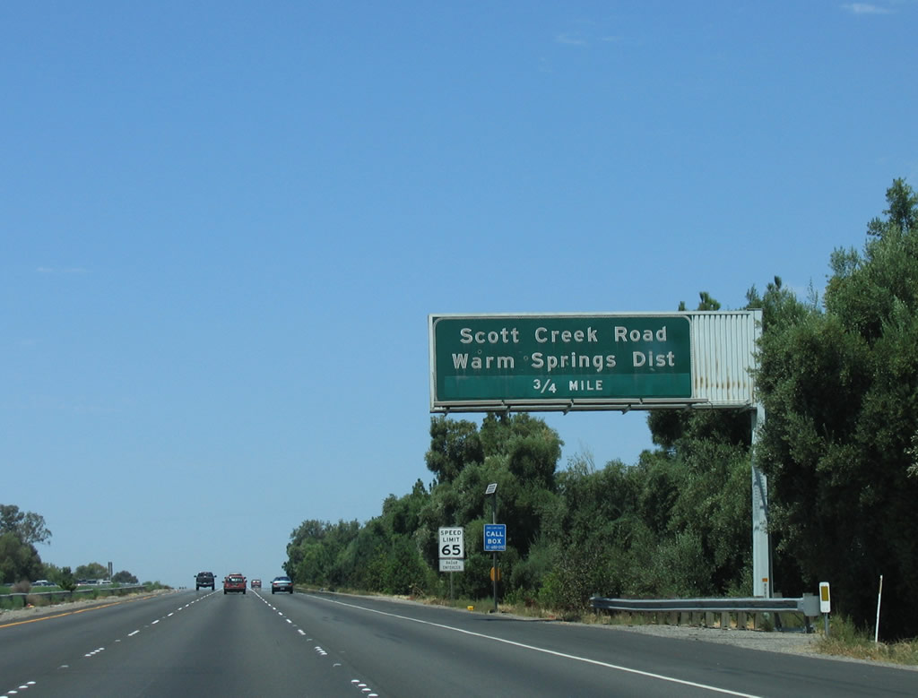 |
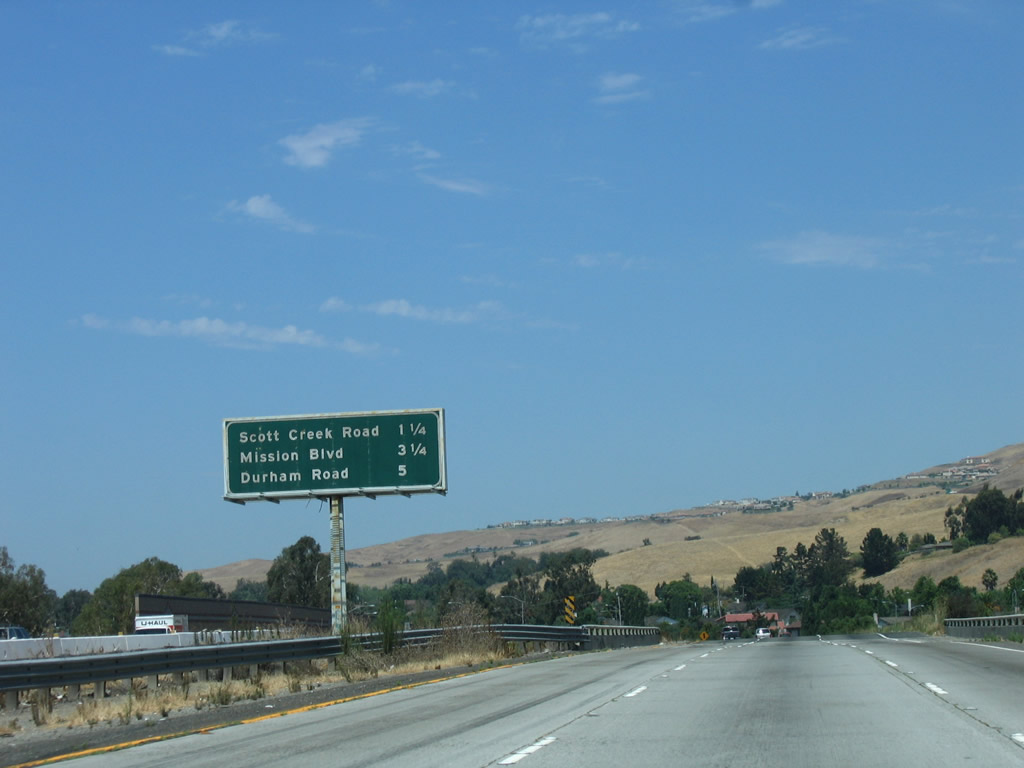
The next exit along Interstate 680 (Sinclair Freeway) north is Exit 10, Scott Creek Road/Warm Springs District. This interchange is the first to serve the city of Fremont, which is the southernmost city in Alameda County. Photo taken 08/05/05. |
 |
Incorporated on January 23, 1956, the city of Fremont is home to 203,413 people as of the 2000 Census and was formed from the merger of five smaller communities: Centerville, Irvington, Mission San Jose, Niles, and Warm Springs. The city consists of 87.1 square miles and is named for John C. Fremont, the Great Pathfinder. Photo taken 08/05/05. |
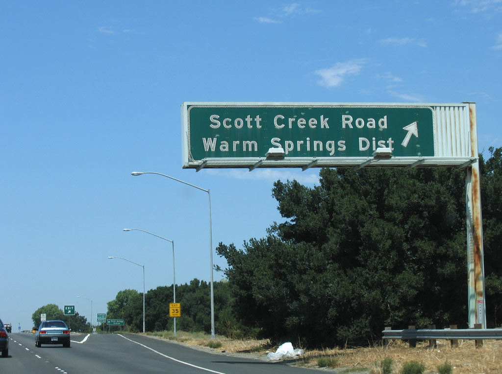 |
Northbound Interstate 680 (Sinclair Freeway) reaches Exit 10, Scott Creek Road/Warm Springs District of Fremont. At this point, Interstate 680 leaves Santa Clara County and enters Alameda County. The Sinclair Freeway designation also ends at this point; Interstate 680 currently has no other designation from the county line north to Exit 31, Alcosta Boulevard. Photo taken 08/05/05. |

Page Updated December 8, 2007.
|
About Contact Glossary |
In The News Interstate Guide |
Social Media:
 |
|
© 2000-25 AARoads.com | All Rights Reserved | Privacy Policy / Terms of Use
|
||