
Interstate 680 North - Alameda County
| Interstate 680 north | |
|---|---|
 |
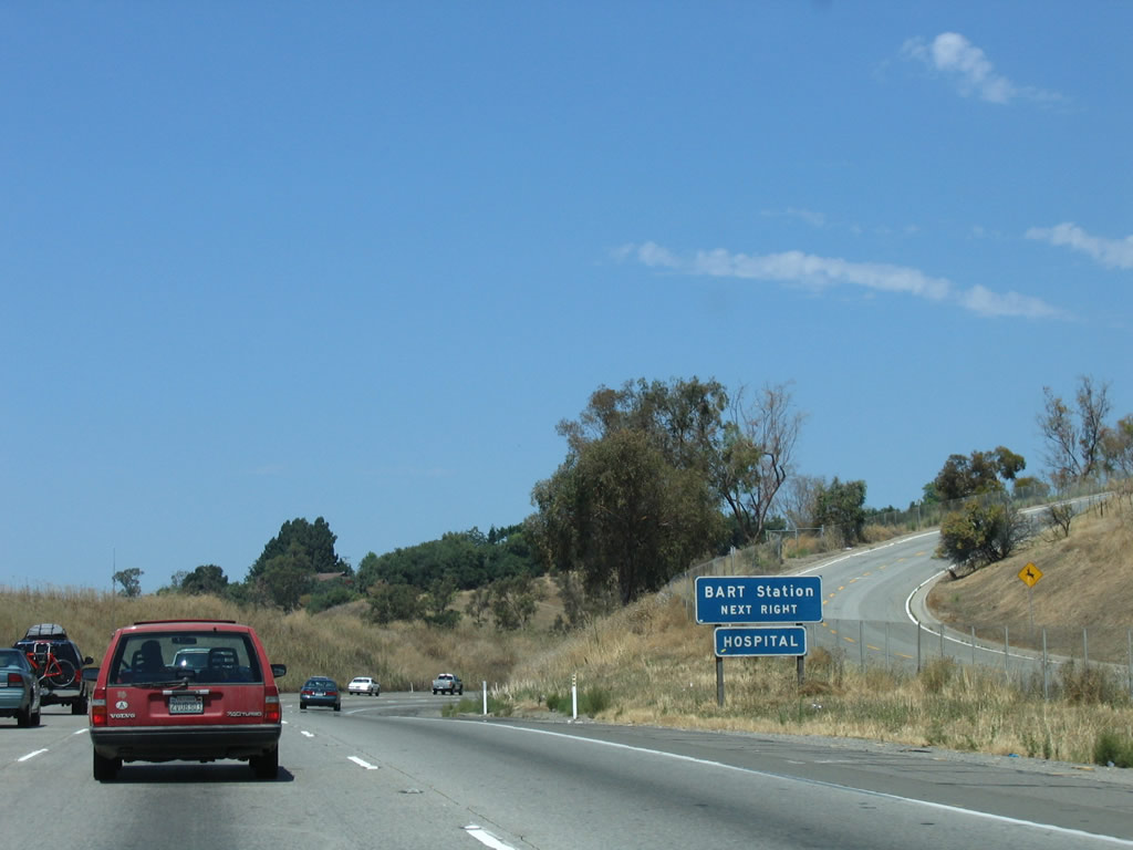
After Exit 10, Interstate 680 becomes an official state scenic route until the California 24 interchange in Walnut Creek. The next interchange along northbound Interstate 680 and the first in Alameda County is Exit 12, California 262 (Mission Boulevard). Although generally not signed, California 262 is a major east-west connector between Interstate 680 and Interstate 880. The short route is being upgraded currently for increased capacity, including new flyover ramps at Interstate 880. However, there is a traffic signal along California 262 at Warm Springs Boulevard. Photo taken 08/05/05. |
 |
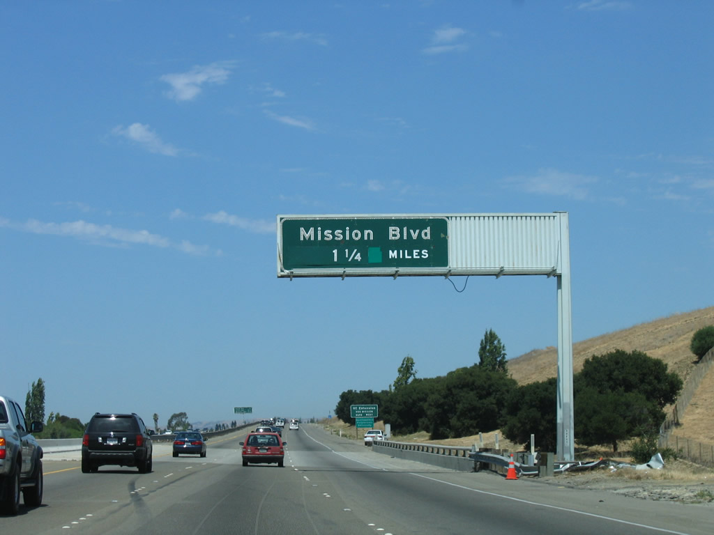
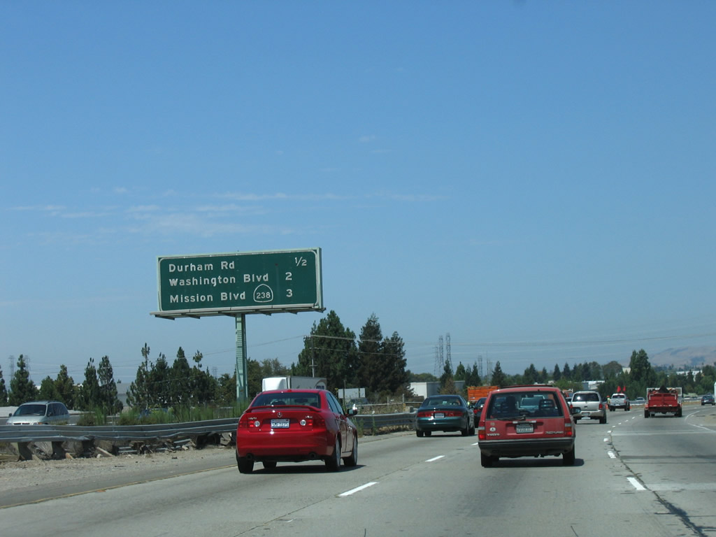
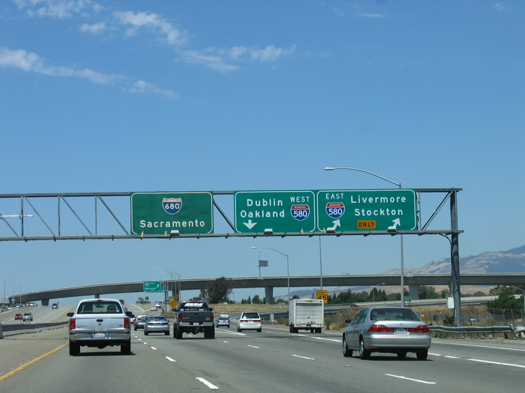
The next three exits along Interstate 680 north are Exit 12, California 262 (Mission Boulevard); Exit 14, Durham Road; and Exit 15, Washington Boulevard/Irvington District. Photo taken 08/05/05. |
 |
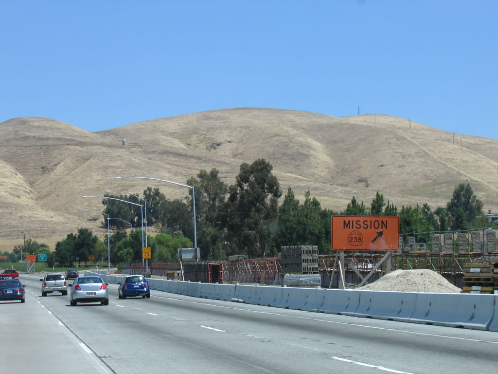
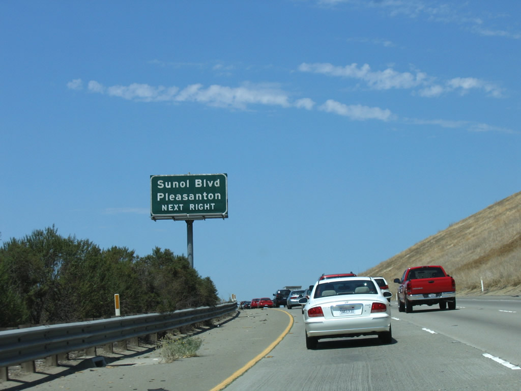
While not disclosing that Mission Boulevard west is part of California 262, this totem pole of shields suggests that Mission Boulevard provides a connection to Interstate 880 (Nimitz Freeway) north to Oakland and south to San Jose. In addition, several motorist services are located along the short state route. Photo taken 08/05/05. |
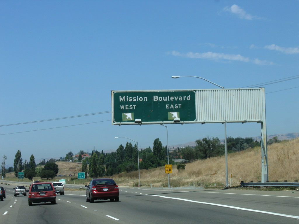 |
Northbound Interstate 680 reaches Exit 12, California 262 (Mission Boulevard). This two-lane exit features lane allocations for Mission Boulevard north and California 262 (Mission Boulevard) west. Use Mission Boulevard east (north) to Mission San Jose; eventually, Mission Boulevard becomes part of California 238 north. Photo taken 08/05/05. |
 |
The interchange between Interstate 680 and California 262 is a modified cloverleaf. Photo taken 08/05/05. |
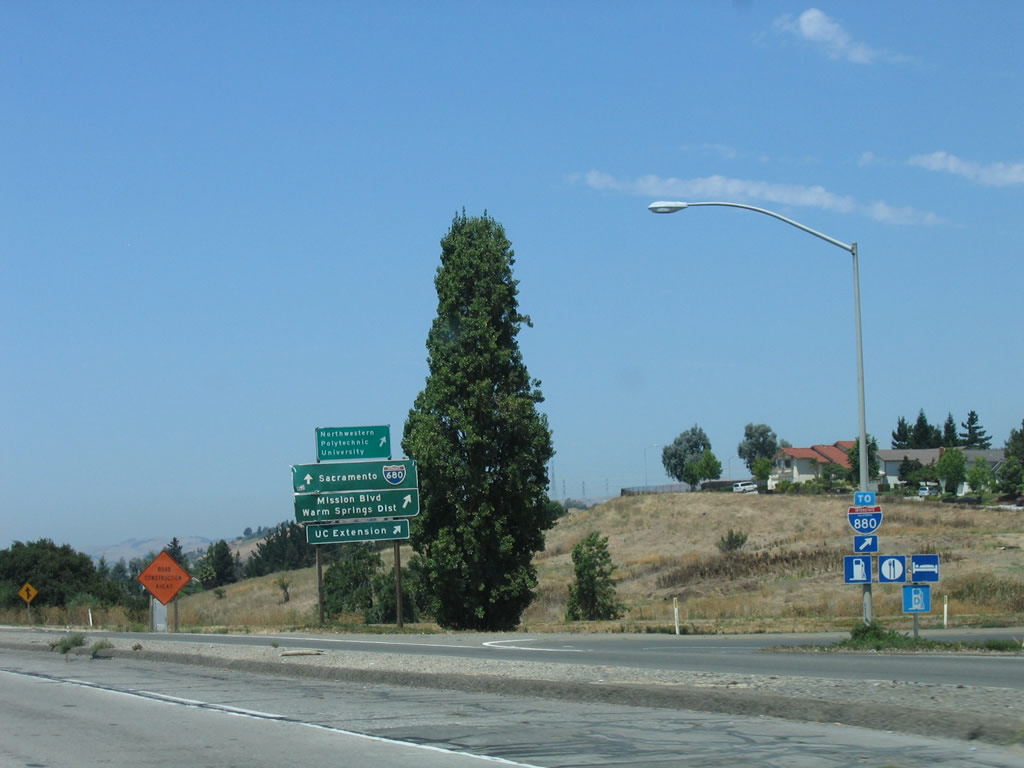 |
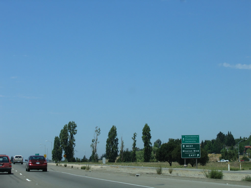
On the collector distributor lane, this is the connecting ramp from Interstate 680 north to California 262 (Mission Boulevard) west to Interstate 880. Photo taken 08/05/05. |
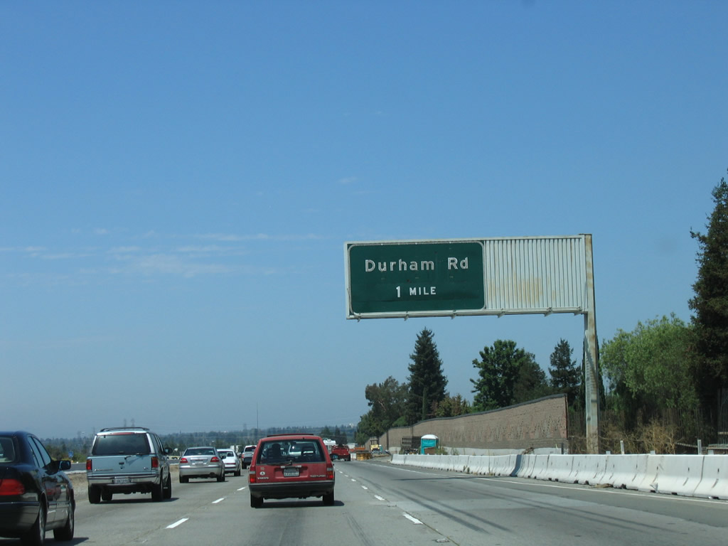 |
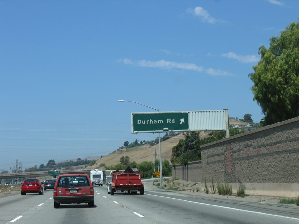
The next exit along Interstate 680 is Exit 14, Durham Road/Auto Mall Parkway. This is a folded diamond interchange. Photo taken 08/05/05. |
 |
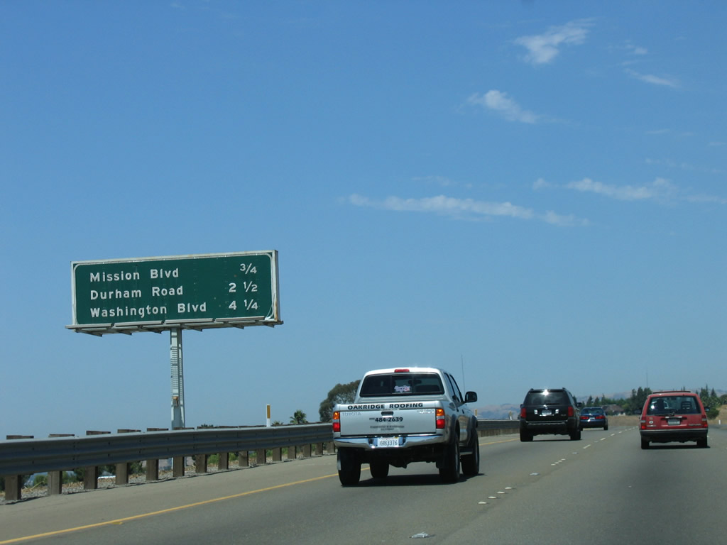
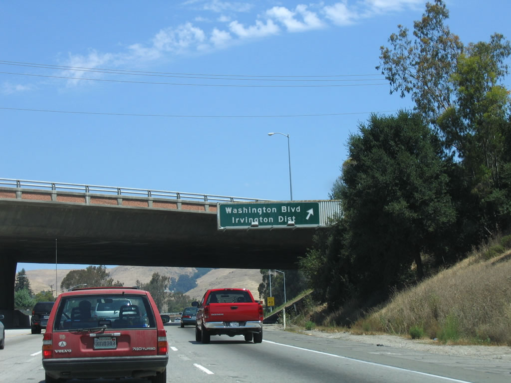
The next three exits along Interstate 680 north are Exit 14, Durham Road; Exit 15, Washington Boulevard/Irvington District; and Exit 16, California 238 (Mission Boulevard) north to Hayward and Mission Boulevard south to Mission San Jose. Photo taken 08/05/05. |
 |
Northbound Interstate 680 reaches Exit 14, Durham Road. A series of seven sets of major Pacific Gas and Electric (PG&E) power lines will cross over Interstate 680 after this interchange, and the median will widen out north of Durham Road for the planned but never-built connection to the Mission Freeway (California 238, which will probably never be built as a freeway between Fremont and Hayward). After that, Interstate 680 turns northeast to leave Fremont and travel toward Sunol. Photo taken 08/05/05. |
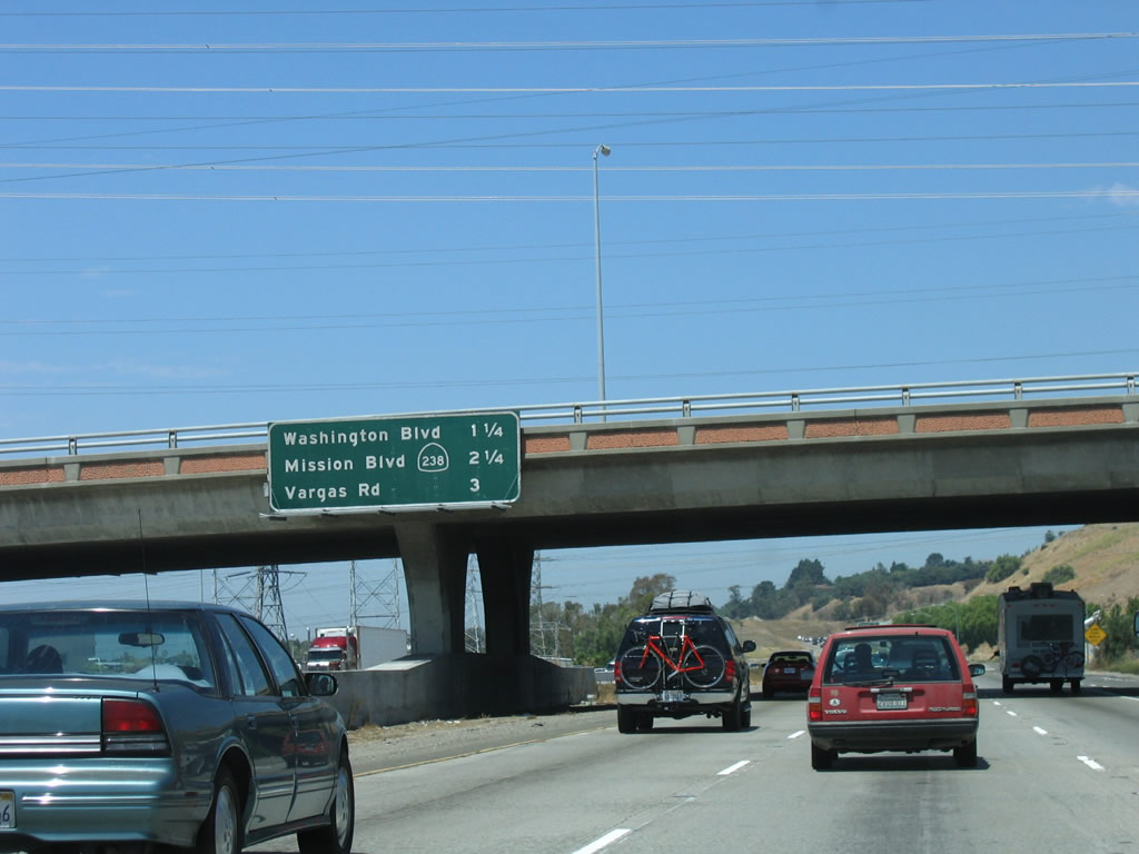 |
The next three exits along Interstate 680 north are Exit 15, Washington Boulevard/Irvington District; Exit 16, California 238 (Mission Boulevard) north to Hayward and Mission Boulevard south to the Mission San Jose District; and Exit 18A, Vargas Road. Photo taken 08/05/05. |
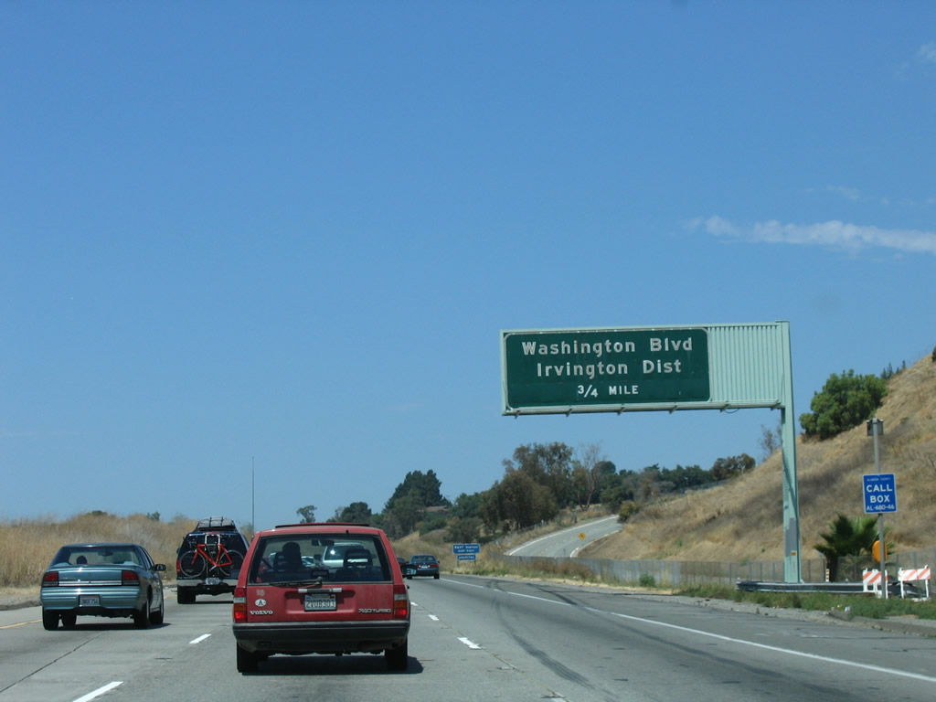 |
The interchange with Exit 15, Washington Boulevard/Irvington District is another folded diamond interchange. Washington Boulevard travels east into Mission San Jose and west toward the Irvington District of Fremont, the Fremont Hub Center, and the current south end of the Bay Area Rapid Transit (BART) System at the Fremont Station via Mowry Avenue. Photo taken 08/05/05. |
 |
The BART station is located a good distance away from the freeway. Follow Washington Street west to Fremont Boulevard, then take Fremont Boulevard northwest to Mowry Avenue. Turn northeast on Mowry Avenue and follow it all the way the BART Station (follow the signs). Eventually, BART will extend south to San Jose, but for now, the Fremont Station is the southernmost point on the BART system. Photo taken 08/05/05. |
 |
Northbound Interstate 680 reaches Exit 15, Washington Street/Irvington District of Fremont. Photo taken 08/05/05. |
 |
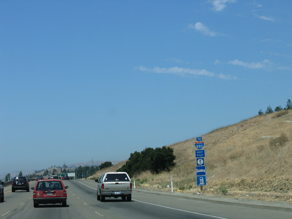
The next exit along Interstate 680 north is Exit 16, California 238 (Mission Boulevard) north to Hayward and Mission Boulevard south to Mission San Jose. This interchange marks the southern terminus of California 238, which travels north to Hayward, changes into Interstate 238, then ends at Interstate 880 in San Leandro. Photo taken 08/05/05. |
 |
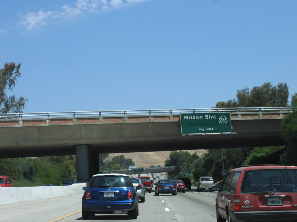
The next three exits along Interstate 680 north are Exit 16, California 238 (Mission Boulevard) north to Hayward and Mission Boulevard south to Mission San Jose; Exit 18A, Vargas Road; and Exit 18B, Sheridan Road. Photo taken 08/05/05. |
 |
Northbound Interstate 680 reaches Exit 16, California 238 (Mission Boulevard). At the time this picture was taken (2005), the approach to this exit was under construction, hence the temporary signage. Photo taken 08/05/05. |
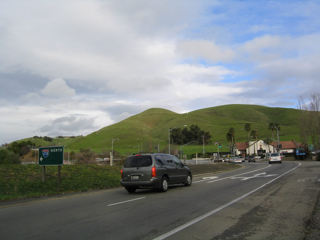 |
Exiting from Interstate 680 onto California 238, a surprising error Interstate 238 sign is posted, even though Interstate 238 does not exist this far south. This should be a state highway shield. Photo taken 08/05/05. |
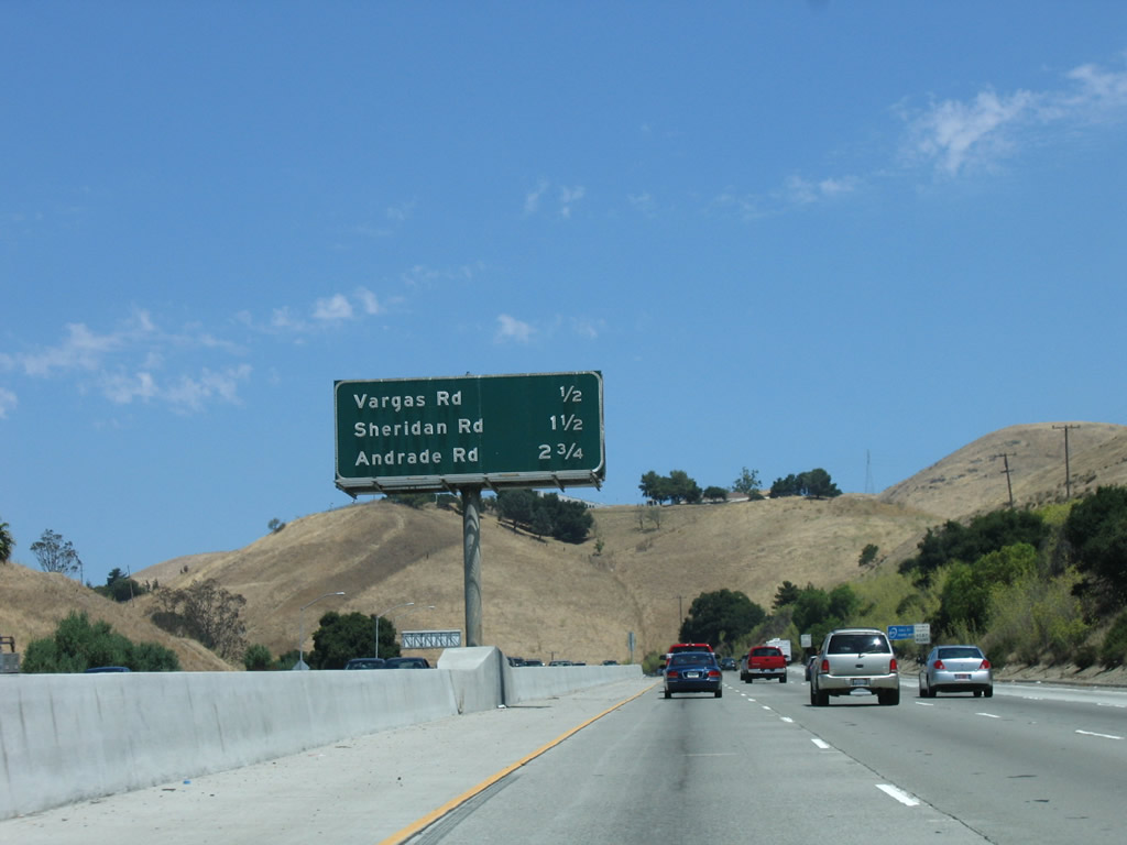 |
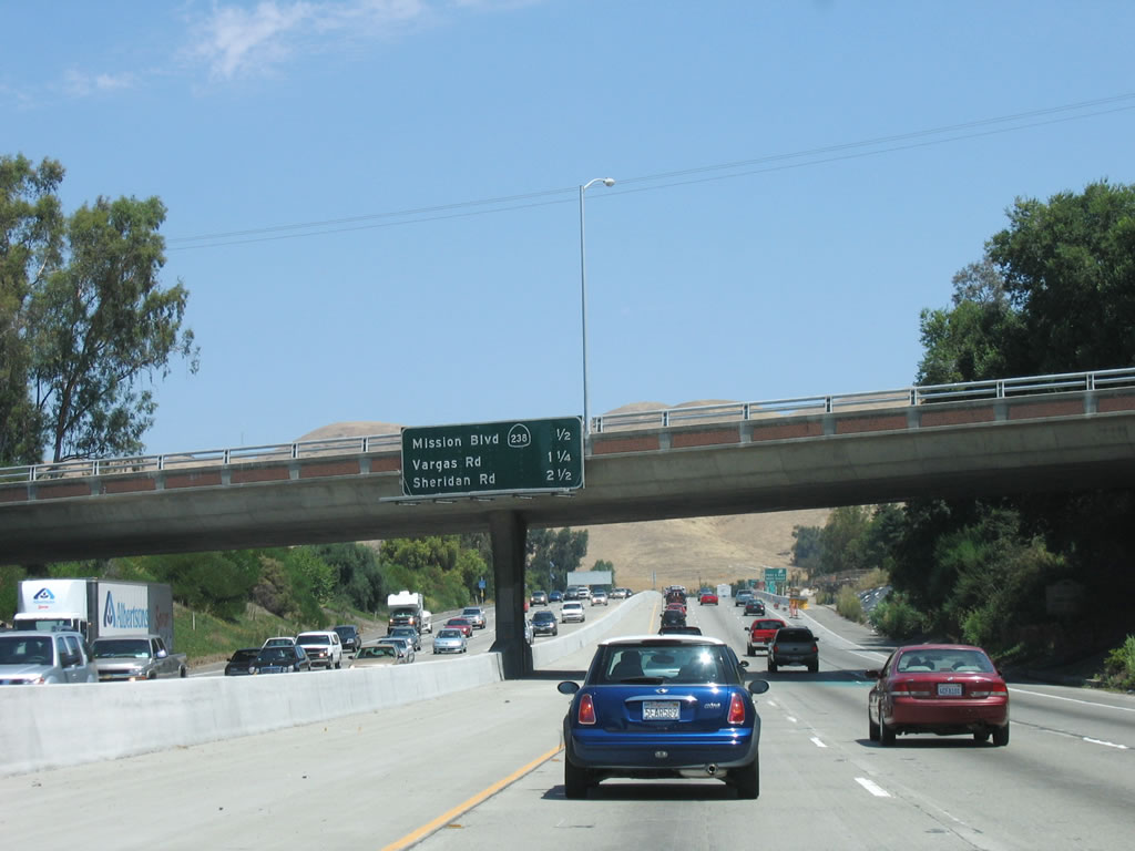
The next three exits along Interstate 680 north are Exit 18A, Vargas Road; Exit 18B, Sheridan Road; and Exit 20, Andrade Road. Photo taken 08/05/05. |
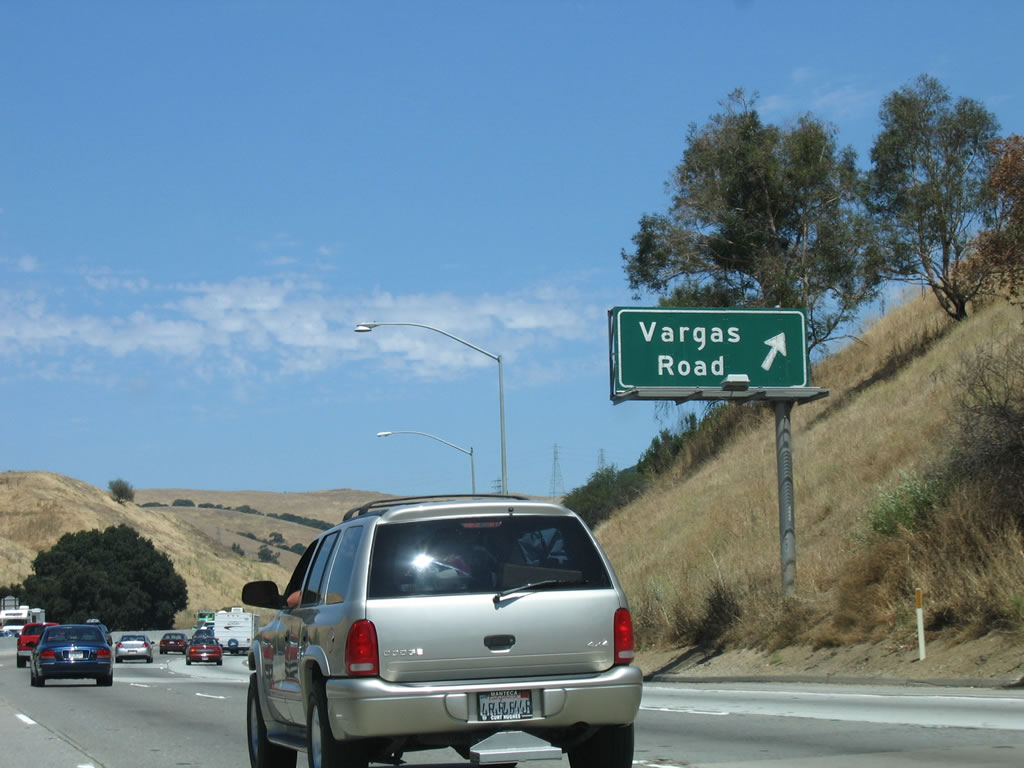 |
Northbound Interstate 680 reaches Exit 18A, Vargas Road, which is the final exit within the city of Fremont. After this interchange, Interstate 680 enters unincorporated Alameda County and turns toward the northeast. Photo taken 08/05/05. |
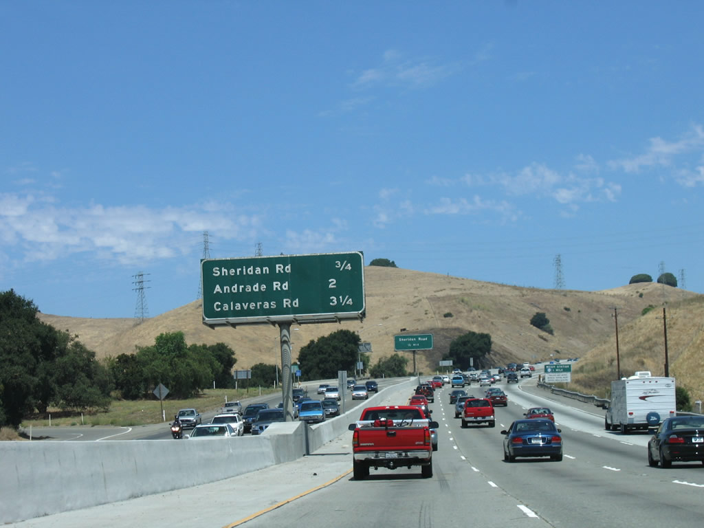 |
The next three exits along Interstate 680 north are Exit 18B, Sheridan Road; Exit 20, Andrade Road; and Exit 21A, California 84/Sunol and Calaveras Road. Photo taken 08/05/05. |
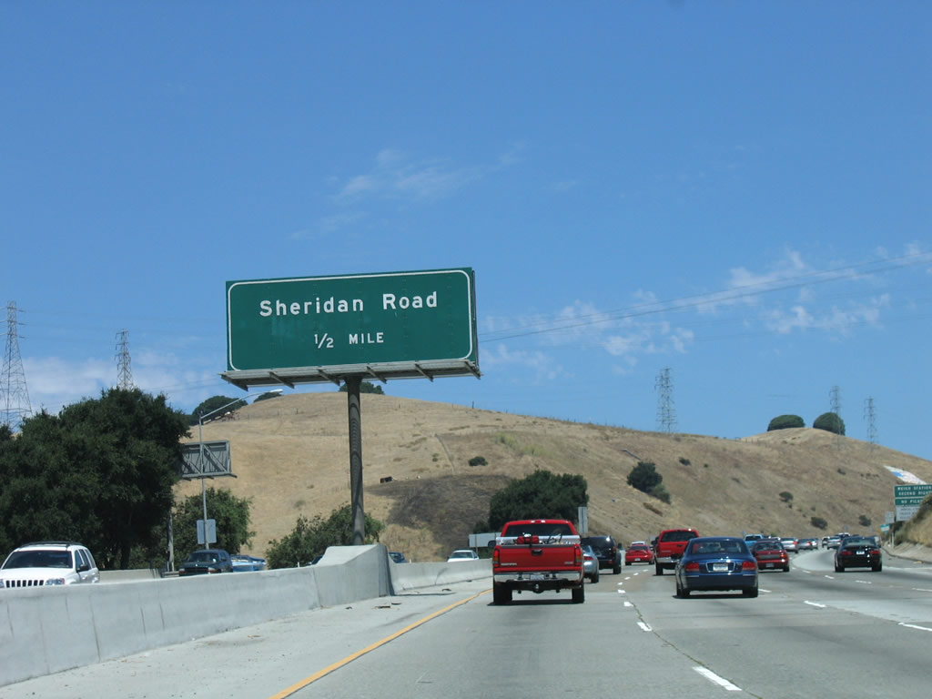 |
Northbound Interstate 680 next approaches Exit 18B, Sheridan Road, which is only accessible from northbound Interstate 680. This exit also connects Interstate 680 to the Mission Road frontage road, which follows the freeway on the northeast side and connects to Sunol Valley Golf Course. Photo taken 08/05/05. |
 |
Immediately after Exit 18B/Sheridan Road is a truck weigh station. Photo taken 08/05/05. |
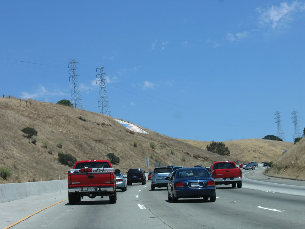 |
An American flag and a pair of power line towers follow a ridge line above Interstate 680. The next exit is Exit 18B, Sheridan Road. Photo taken 08/05/05. |
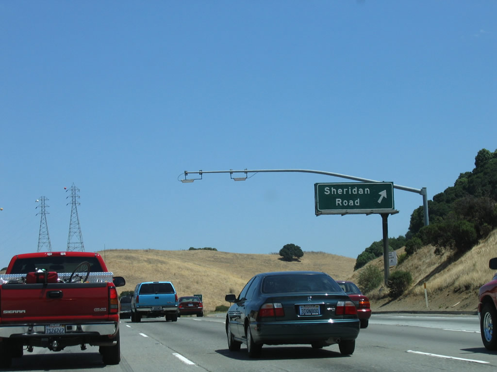 |
Northbound Interstate 680 reaches Exit 18B, Sheridan Road and Mission Road (frontage road) to Sunol Valley Golf Course. Photo taken 08/05/05. |
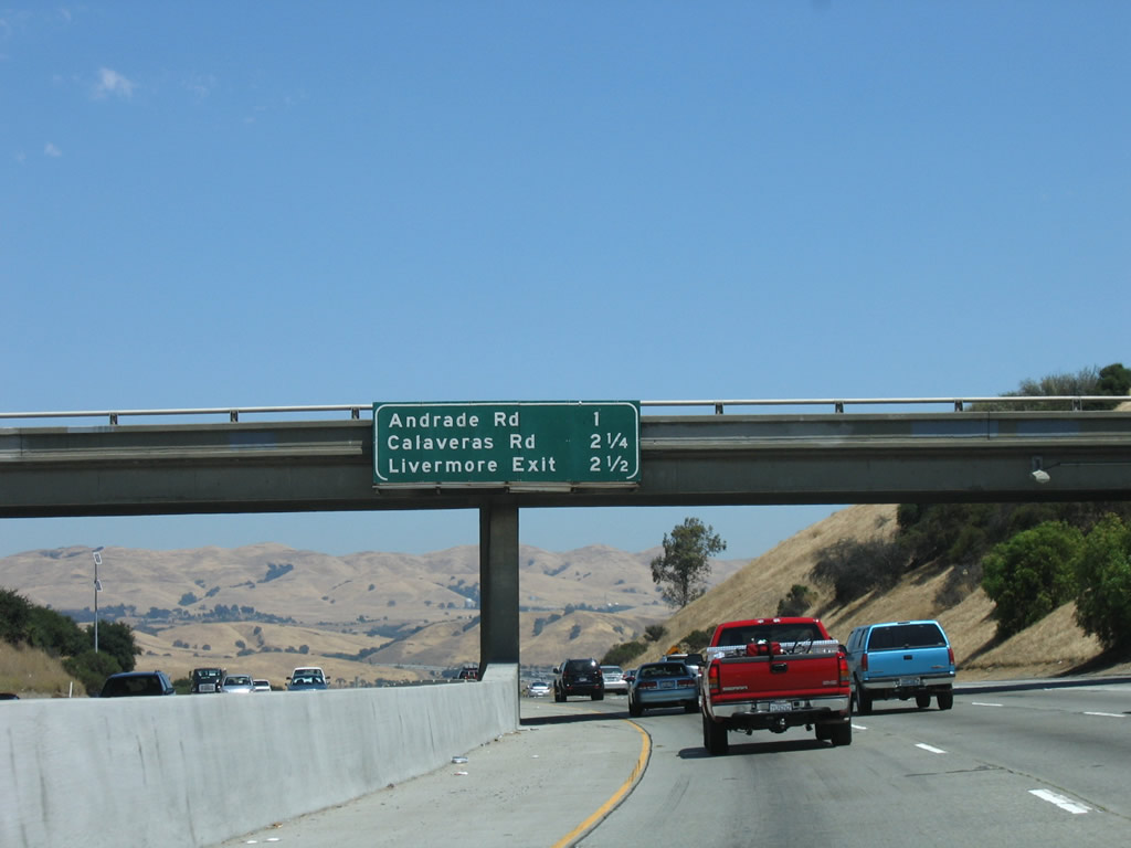 |
The next three exits along Interstate 680 north are (Exit 19, Weigh Station); Exit 20, Andrade Road; and Exit 21A, California 84 west to Sunol and Calaveras Road; and Exit 21B, California 84 east to Livermore. Photo taken 08/05/05. |
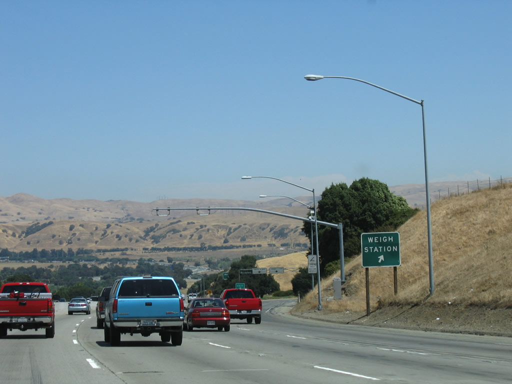 |
Shortly thereafter, northbound Interstate 680 reaches Exit 19, Weigh Station. During hours of operation, all trucks must exit. Photo taken 08/05/05. |
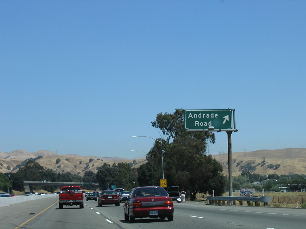 |
Northbound Interstate 680 next reaches Exit 20, Andrade Road to Sunol Valley Golf Course, with a connection to Mission Road (frontage). Photo taken 08/05/05. |
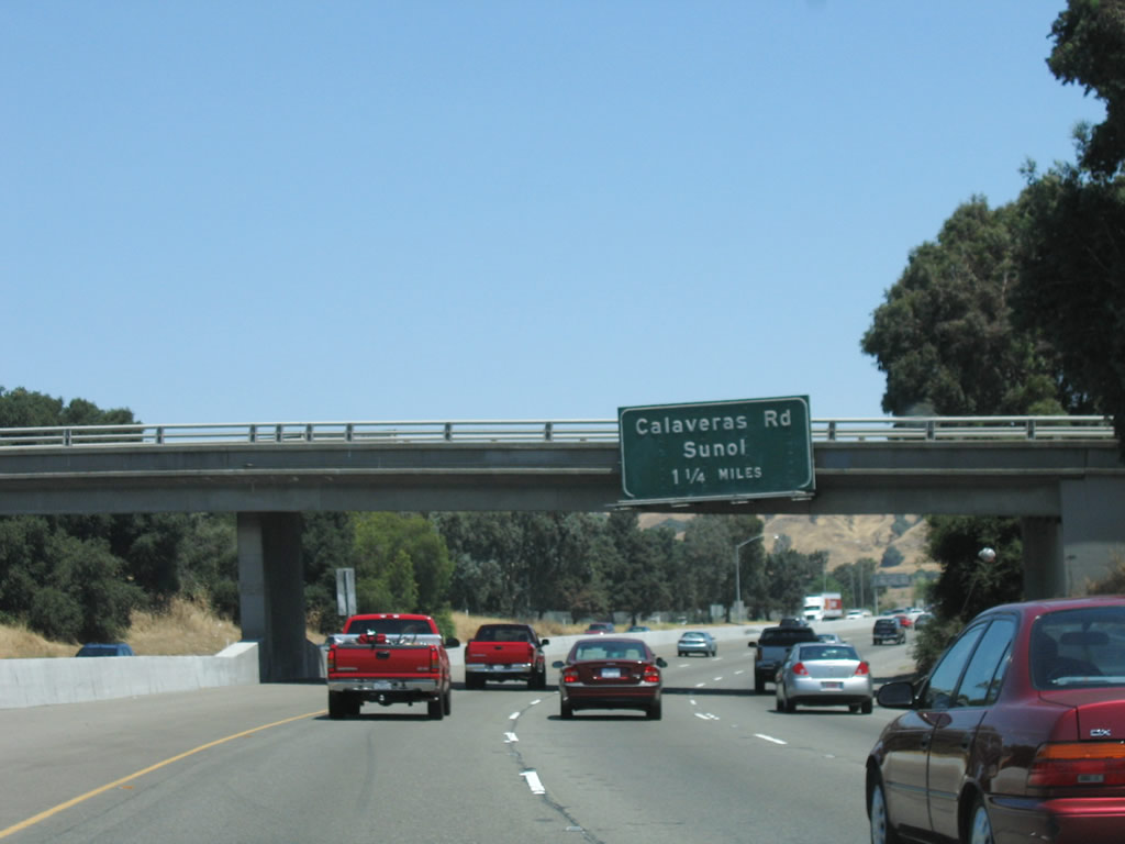 |
The next exit along Interstate 680 north is Exit 21, California 84 west to Sunol and Calaveras Road south to Calaveras Reservoir and Milpitas. Photo taken 08/05/05. |
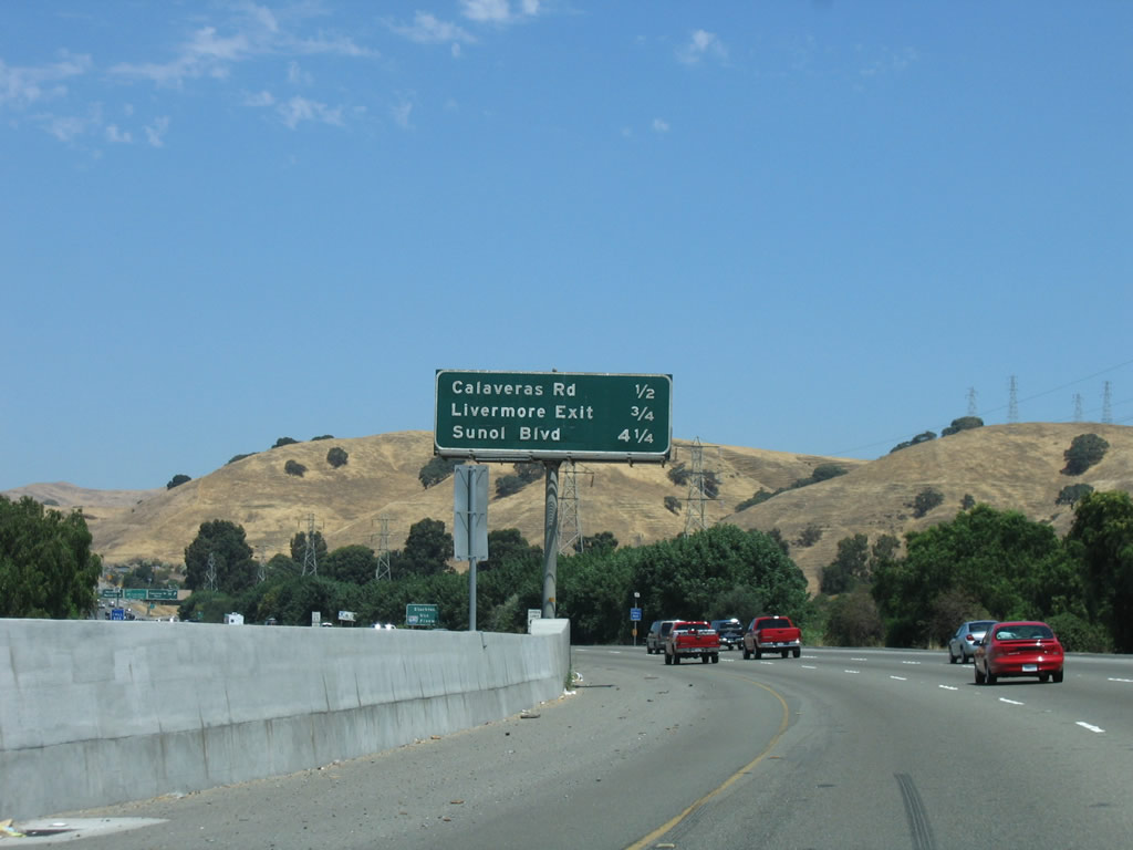 |
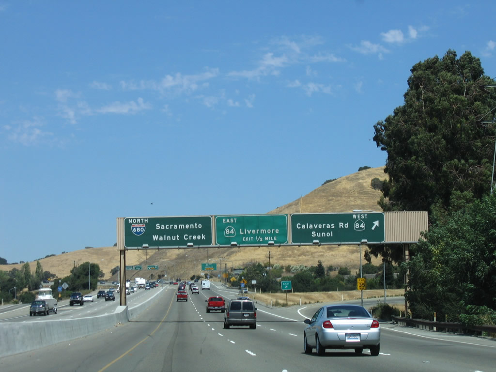
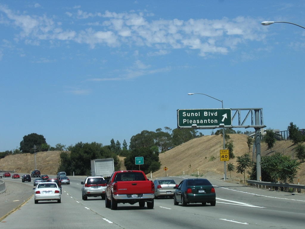
The next three exits along Interstate 680 north are Exit 21A, California 84 west to Sunol and Calaveras Road; Exit 21B, California 84 east to Livermore; and Exit 25, Sunol Boulevard and Castlewood Drive. Photo taken 08/05/05. |
 |
Although it may appear tempting to take California 84 east (via Exit 21B) to Interstate 580 by looking at the map, the route is not a high-speed route. All through traffic to Interstate 580 should continue north on Interstate 680 to Exit 30, Interstate 580/Arthur H. Breed Freeway. Interstate 580 proceeds east to Tracy, Stockton, and all Interstate 5 destinations including Los Angeles. The reason for not using California 84 includes the number of twists and turns on the route along Vallecitos Road as well as the indirect connection to Interstate 580 at the north end of Kitty Hawk Road/Airway Boulevard. Photo taken 08/05/05. |
 |
Northbound Interstate 680 reaches Exit 21A, California 84 west to Sunol and Calaveras Road. Trucks are restricted on westbound California 84 (Niles Canyon Road). Use this exit to Calaveras Road south as well as California 84/Paloma Road west to Sunol and Scotts Corner. Photo taken 08/05/05. |
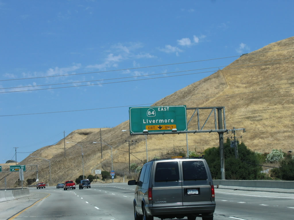 |
Immediately thereafter, the new right lane becomes exit only for the connection from Interstate 680 north to Exit 21B, California 84 east to Livermore. California 84 is proposed to be extended northeast of Livermore via Vasco Road to meet its northern section in Yolo County, but it is unclear when that connection will be made. Photo taken 08/05/05. |
 |
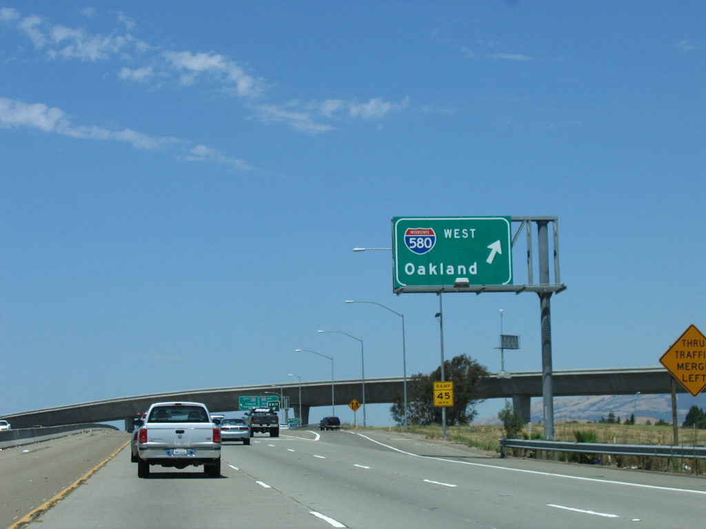
Northbound Interstate 680 meets Exit 21B, California 84 east to Livermore. The next interchange is Exit 25, Sunol Boulevard and Castlewood Drive. Interstate 680 enters the Tri-Valley, which encompasses the cities of Pleasanton, Dublin, San Ramon, and Livermore; and unincorporated Blackhawk, Sunol, and Tassajara. The Tri-Valley gets its name from the three valleys that converge in the area: Amador Valley, Livermore Valley and San Ramon Valley. Its centerpiece is the Interstate 580-680 interchange. Photo taken 08/05/05. |
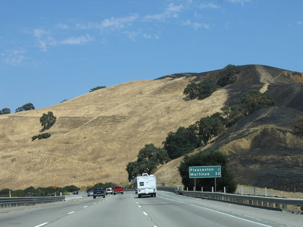 |
Leaving the California 84 interchange, a mileage sign provides the distance to Pleasanton (two miles) and Martinez (32 miles, in Contra Costa County). Note the burned area on the adjacent hillside to the right of the freeway. Photo taken 08/05/05. |
 |
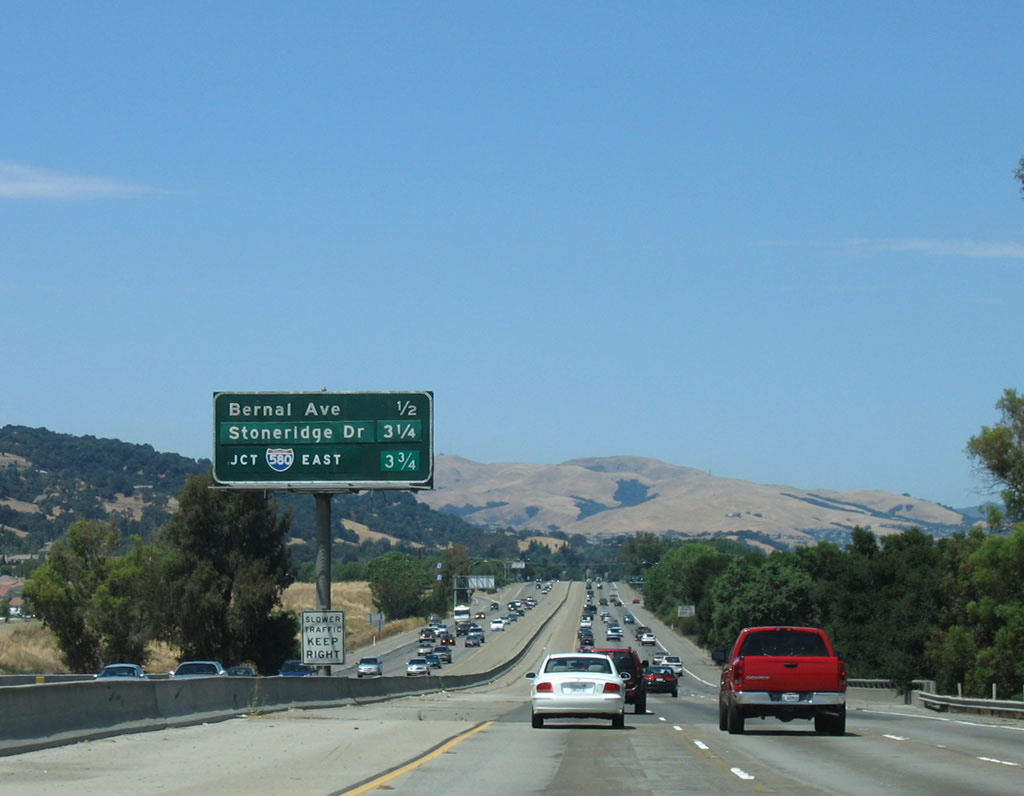
The next three exits along Interstate 680 north are Exit 25, Sunol Boulevard and Castlewood Drive; Exit 26, Bernal Avenue; and Exit 29, Stoneridge Drive. Photo taken 08/05/05. |
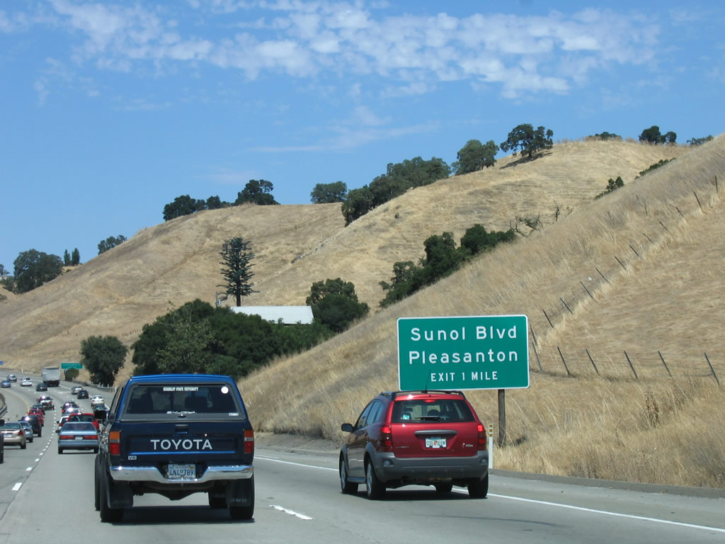 |
Exit 25 connects Interstate 680 north with Sunol Boulevard and Castlewood Drive in one mile. This is the first interchange to serve the city of Pleasanton. Incorporated in 1894, Pleasanton has 63,654 people as of 2000 Census and is located at the crossroads of Interstate 680 and Interstate 580. Photo taken 08/05/05. |
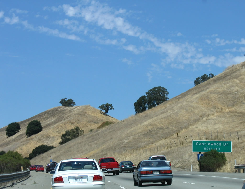 |
A separate auxiliary sign for Castlewood Drive (Exit 25) is posted shortly after the previous roadside sign. Even though these are reflective signs, these signs look old enough to possibly pre-date Caltrans' official conversion from non-reflective to reflective signs in 1999. Photo taken 08/05/05. |
 |
However, this older porcelain-enamel guide sign is still posted in the median of northbound Interstate 680 prior to Exit 25. Photo taken 08/05/05. |
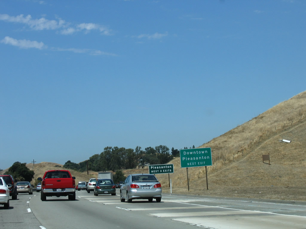 |
The next three exits all serve the city of Pleasanton: Exit 25, Sunol Boulevard/Castlewood Drive; Exit 26, Bernal Avenue; and Exit 29, Stoneridge Drive. Photo taken 08/05/05. |
 |
Northbound Interstate 680 reaches Exit 25, Sunol Boulevard/Castlewood Drive. The next two exits are Exit 26, Bernal Avenue and Exit 29, Stoneridge Drive. Photo taken 08/05/05. |
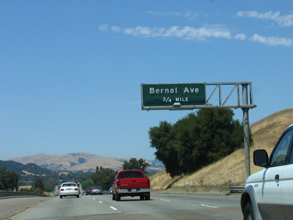 |
The next interchange along Interstate 680 north is Exit 26, Bernal Avenue, which also serves the city of Pleasanton. Photo taken 08/05/05. |
 |
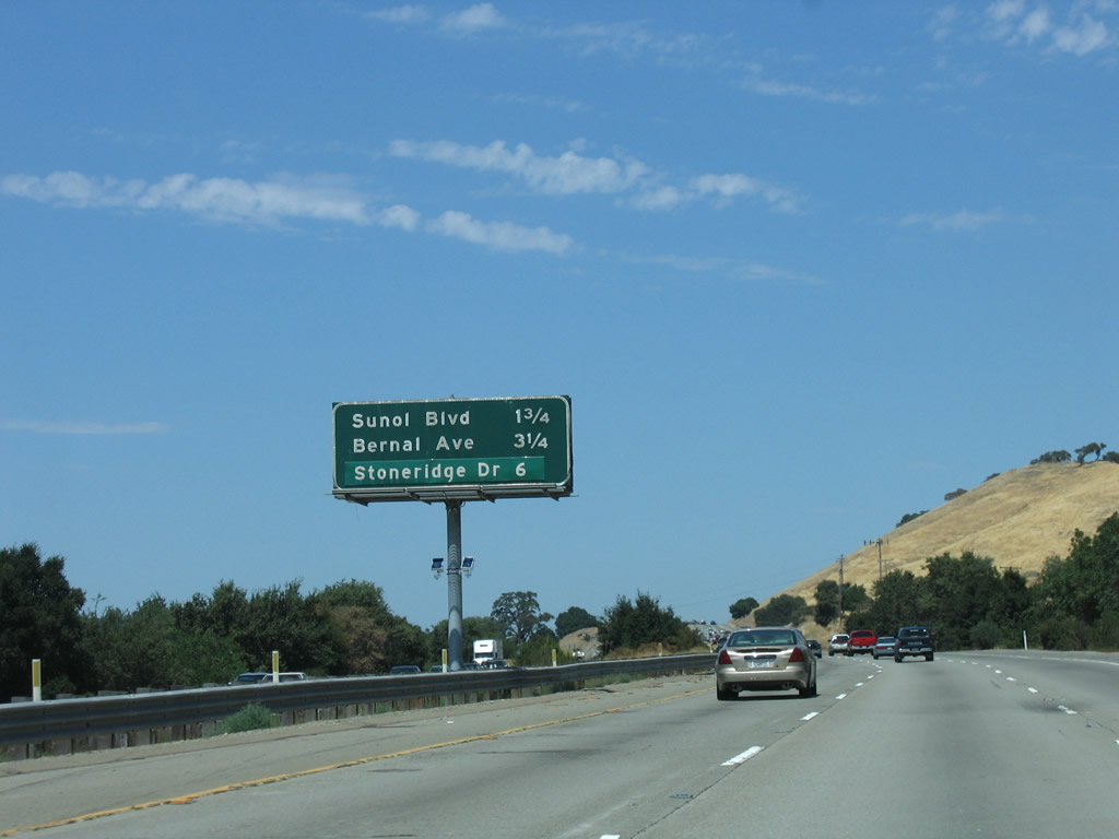
The next three interchanges along northbound Interstate 680 are Exit 26, Bernal Avenue; Exit 29, Stoneridge Drive; and Exits 30A-B, Interstate 580/Breed Freeway east to Tracy/Stockton and west to Oakland/San Francisco/Marin County. Photo taken 08/05/05. |
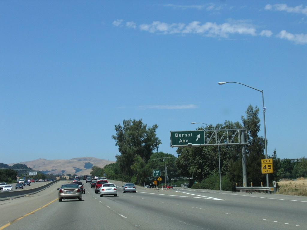 |
Northbound Interstate 680 reaches Exit 26, Bernal Avenue. Follow Bernal Avenue east to the Alameda County Fairgrounds, Pleasanton Fairways Golf Course, Library, Civic Center, and Centennial Park (via Sunol Boulevard). Photo taken 08/05/05. |
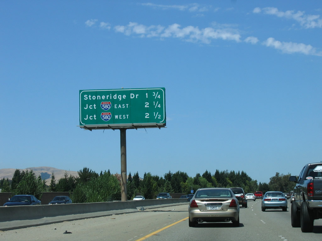 |
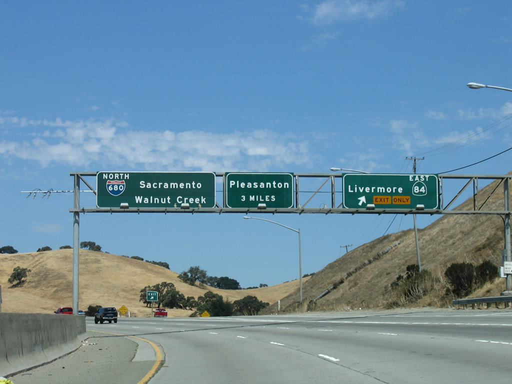
The next three exits along northbound Interstate 680 are Exit 29, Stoneridge Drive; Exit 30A, Interstate 580/Breed Freeway east to Tracy/Stockton; and Exit 30B, Interstate 580/Breed Freeway west to Oakland/San Francisco/Marin County. Note the placement of new reflective signs; these were added with the installation of the new flyover ramp from Interstate 680 south to Interstate 580 east. Photo taken 08/05/05. |
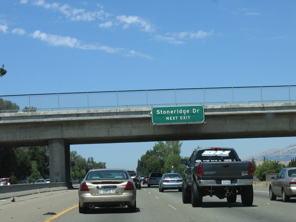 |
Passing under Las Positas Boulevard, northbound Interstate 680 approaches Exit 29, Stoneridge Drive. Photo taken 08/05/05. |
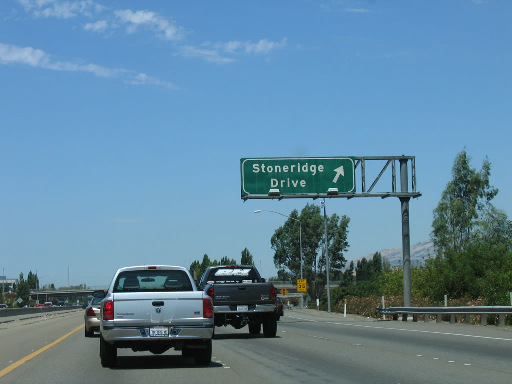 |
Northbound Interstate 680 reaches Exit 29, Stoneridge Drive. The interchange with Interstate 580 is next. Photo taken 08/05/05. |
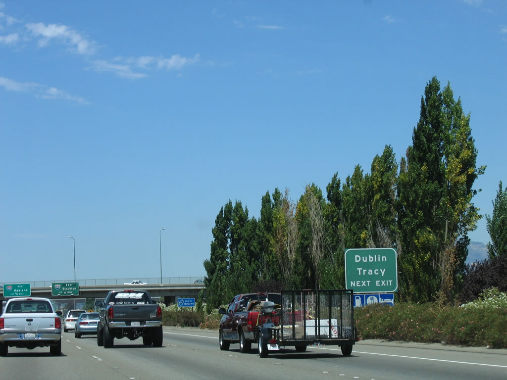 |
The next roadside auxiliary sign advises that the next exit (Exit 30A, Interstate 580 east to Stockton, Fresno, and the Central Valley) connects to Dublin and Tracy. Photo taken 08/05/05. |
 |
Interstate 580 is a major east-west corridor through the East Bay, connecting with Interstate 80 at Oakland and with Interstate 5 south of Tracy. With its diagonal alignment, Interstate 580 forms part of the fastest route from Los Angeles to San Francisco via Interstate 5 (Westside Highway). Photo taken by 08/05/05. |
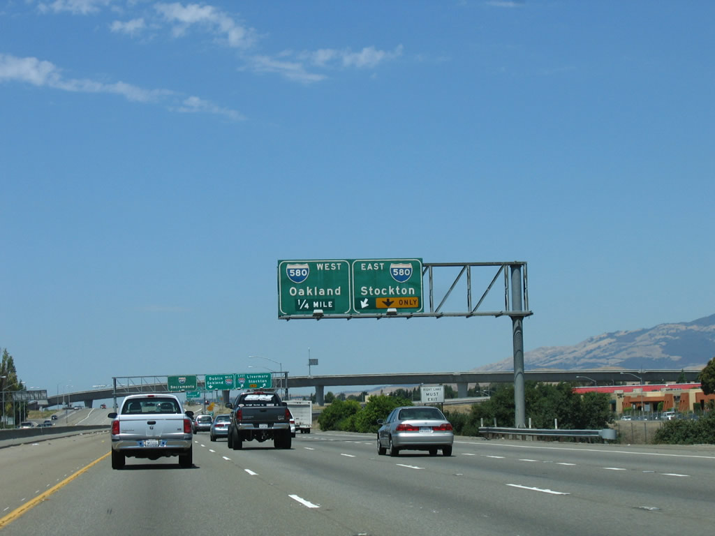 |
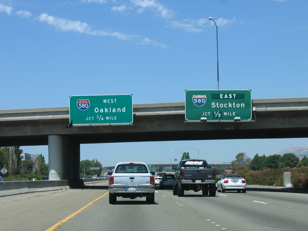
The right lane becomes exit only for Exit 30A, Interstate 580/Breed Freeway east to Livermore, Tracy, and Stockton. The number three lane will connect to Interstate 580/Breed Freeway west to Hayward, Oakland, and San Francisco. Photo taken 08/05/05. |
 |
Northbound Interstate 680 reaches Exit 30A, Interstate 580/Breed Freeway east to Livermore, Tracy, and Stockton (two-lane exit). The next exit is Exit 30B, Interstate 580/Breed Freeway west to Hayward and Oakland. The left three lanes continue north on Interstate 680 ... but the number of lanes will reduce from three to two after passing through the midpoint of the interchange. Photo taken 08/05/05. |
 |
Immediately thereafter, northbound Interstate 680 reaches Exit 30B, Interstate 580 west to Hayward and Oakland. Note this interchange used to be modified cloverleaf, hence why the exit ramp immediately meets the transition ramp from Interstate 580 east to Interstate 680 north. This interchange marks where Interstate 680 would have met U.S. 50, which was decommissioned west of Sacramento; old U.S. 50 (Lincoln Highway) now follows Dublin Boulevard north of and parallel to Interstate 580. Photo taken 08/05/05. |
 |
 |
Looking at the collector distributor lanes, this sign is posted at the point where traffic to Interstate 580 west must exit. The left lane of the collector distributor lanes merges back onto Interstate 680 north, which travels toward Dublin, San Ramon, Danville, Walnut Creek, and Concord. Upon crossing this midpoint, the three through lanes of Interstate 680 reduces down to two through lanes. In addition, Interstate 680 leaves Pleasanton and enters Dublin. The city of Dublin is home to 45,000 per state estimates in 2007 and was incorporated in February 1982. Photos taken 08/05/05 and 11/24/11. |
 |
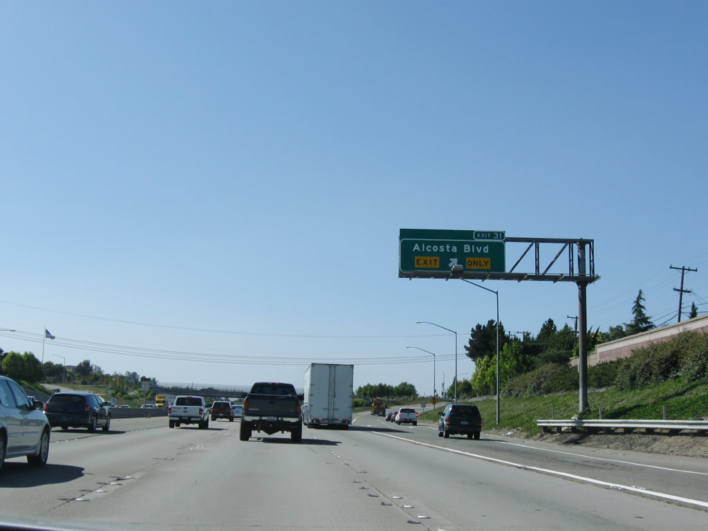
The next exit on Interstate 680 north is Exit 31, Alcosta Boulevard. This exit not only serves the city of Dublin, but it also serves the Contra Costa County city of San Ramon. Parallel to Interstate 680 to the west is Old California 21, which is now known as San Ramon Road. Photo taken 08/05/05. |
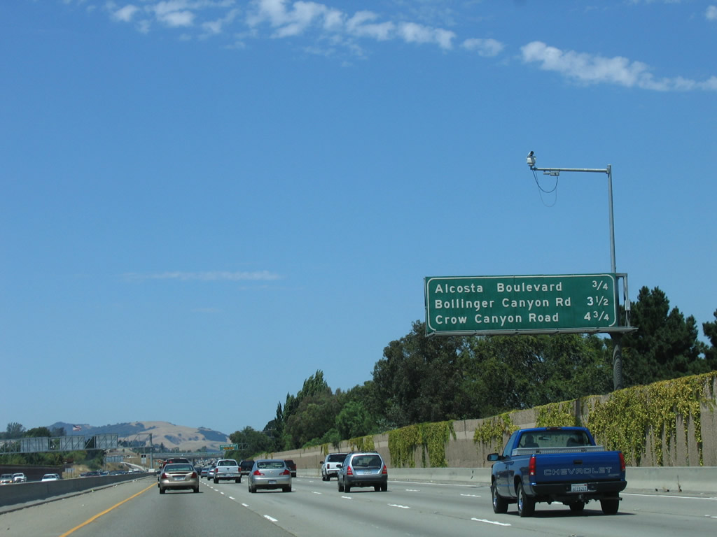 |
The next three interchanges along northbound Interstate 680 are Exit 31, Alcosta Boulevard; Exit 34 Bollinger Canyon Road; and Exit 36, Crow Canyon Road. Photo taken 08/05/05. |
 |
The right lane of northbound Interstate 680 is exit only for Exit 31, Alcosta Boulevard. Photo taken 08/05/05. |
 |
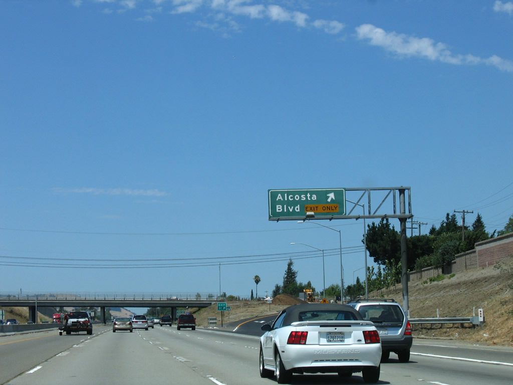 |
Northbound Interstate 680 meets Exit 31, Alcosta Boulevard. East-west Alcosta Boulevard serves as the boundary between Alameda and Contra Costa Counties and the cities of Dublin and San Ramon, and eastbound Alcosta Boulevard turns north to parallel Interstate 680 between here and Crow Canyon Road. An exit number sign was installed here by 2009. Photos taken 07/15/09 and 08/05/05. |
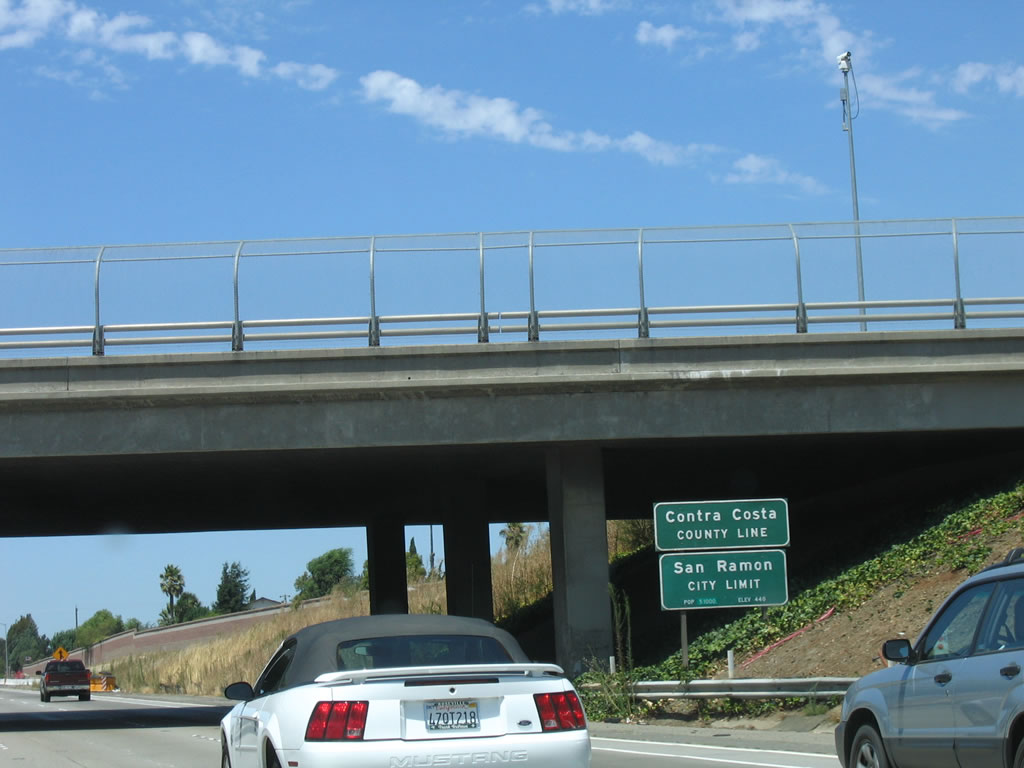 |
Upon crossing under Alcosta Boulevard, Interstate 680 leaves the city of Dublin and Alameda County. The freeway now enters Contra Costa County and the city of San Ramon. Welcome to San Ramon Valley! Photo taken 08/05/05. | |

Page Updated November 30, 2011.
|
About Contact Glossary |
In The News Interstate Guide |
Social Media:
 |
|
© 2000-25 AARoads.com | All Rights Reserved | Privacy Policy / Terms of Use
|
||