|
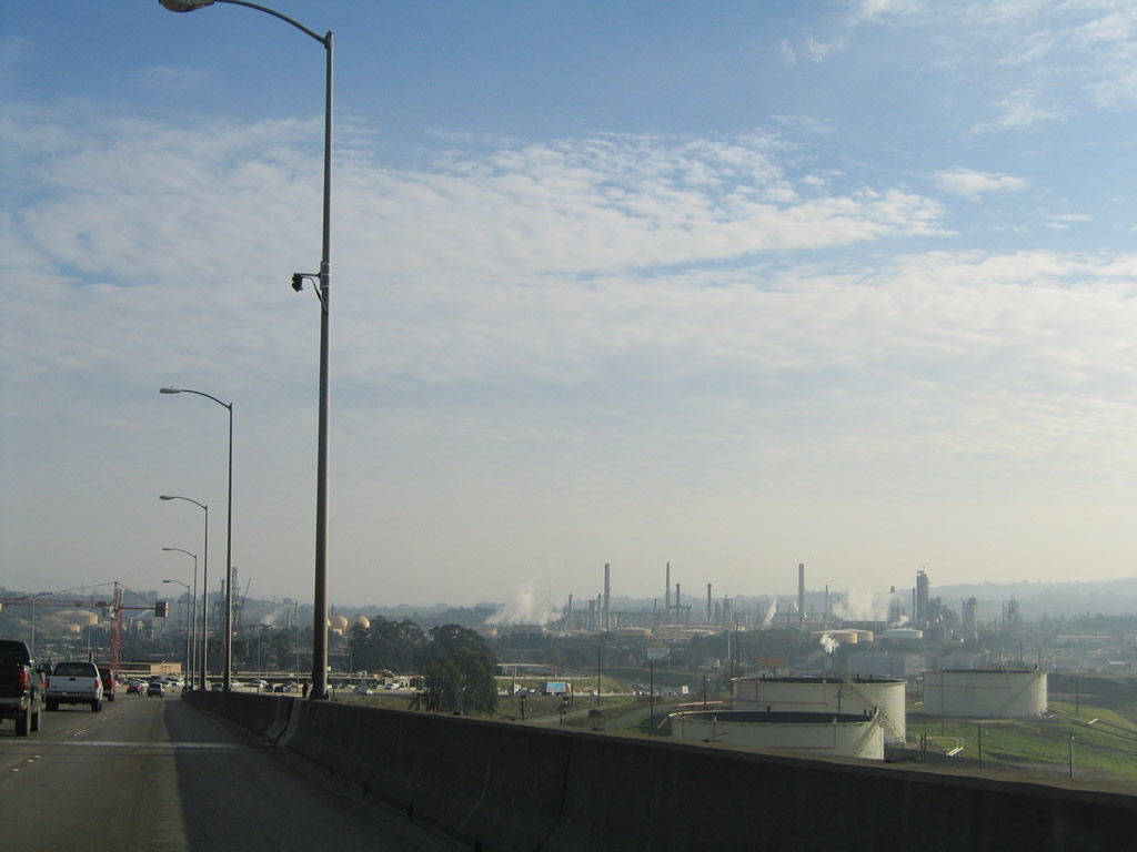
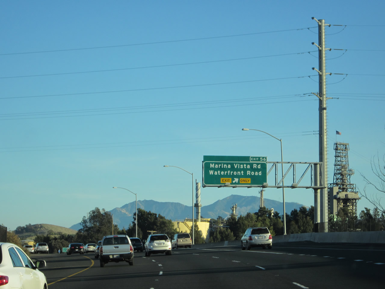
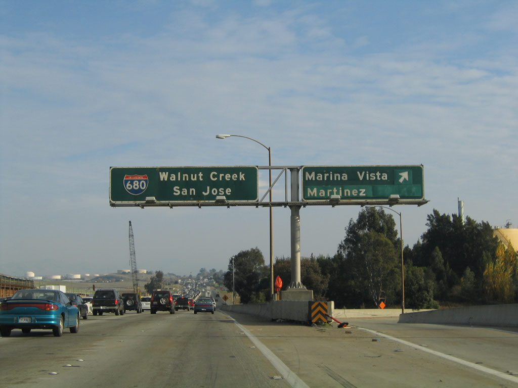
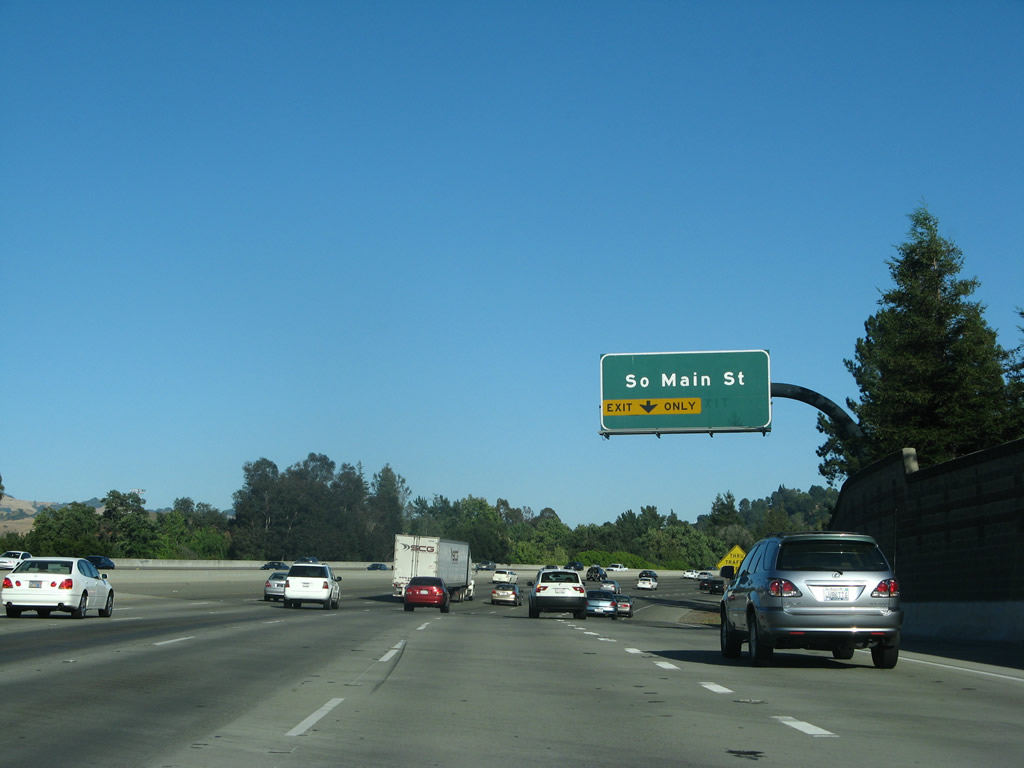
The first exit along southbound Interstate 680 in Contra Costa County is Exit 56, Marina Vista. Use Marina Vista west to downtown Martinez. Photo taken 12/29/04. |
|
|
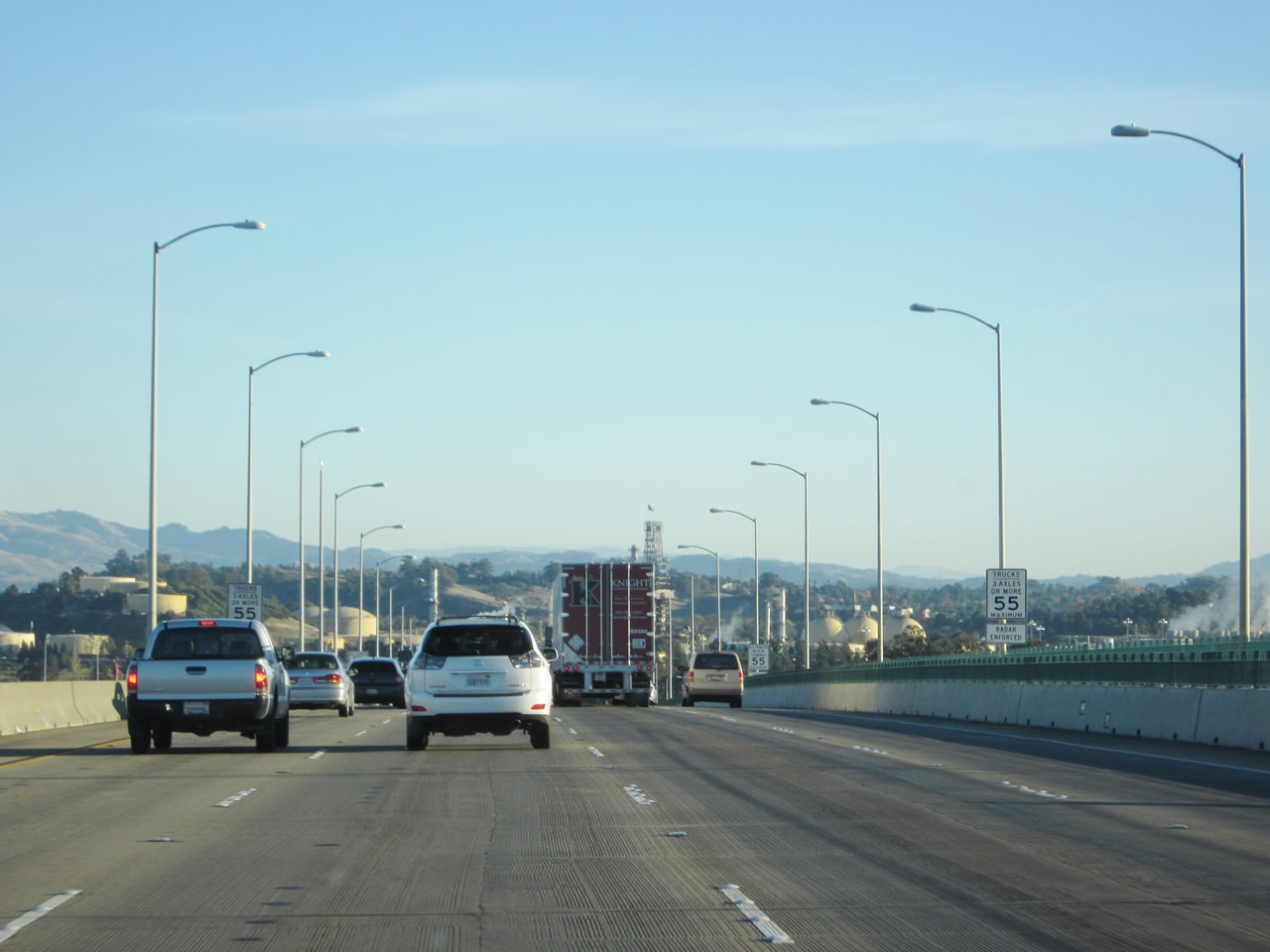
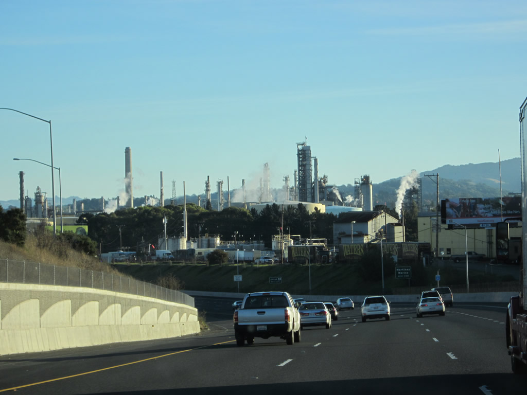
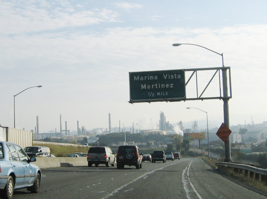
Southbound Interstate 680 reaches Exit 56, Marina Vista. Either Marina Vista (Exit 56) or Arnold Road/Pacheco Boulevard (Exit 54) travels west into downtown Martinez, the seat of Contra Costa County. Founded in 1876, Martinez contains 12.5 square miles and is home to over 36,700 residents. Interstate 680 skirts the city, only entering the city limits as it begins its journey across the Carquinez Strait via the Benicia-Martinez Bridge. Photos taken 11/21/12 and 12/29/04. |
|
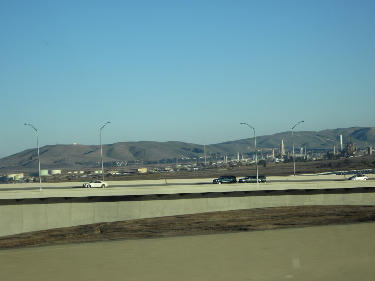
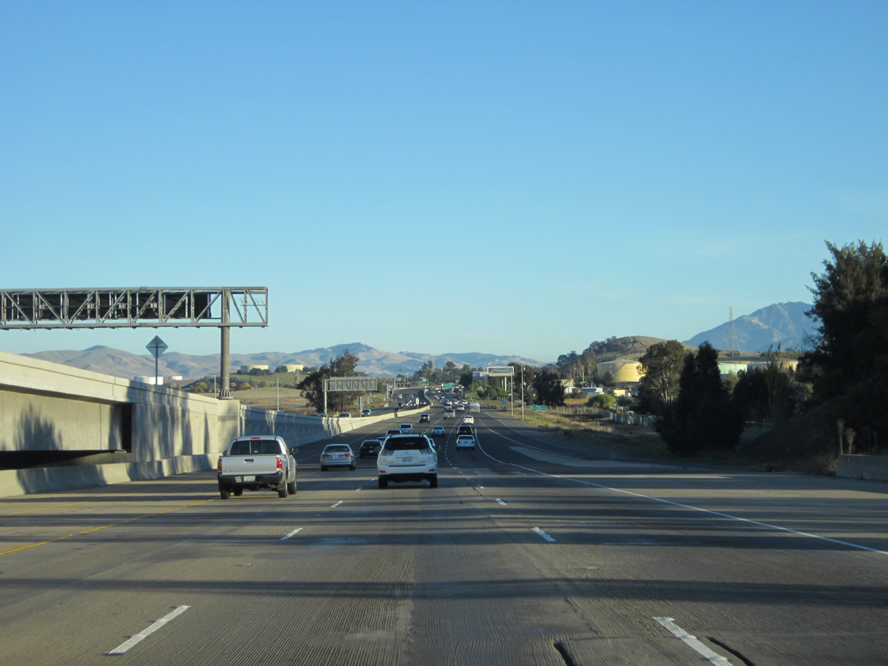
Interstate 680 continues south after the Marina Vista interchange through an industrial area in Martinez. The county seat mostly lies to the west of Interstate 680. Photo taken 11/21/12. |
|
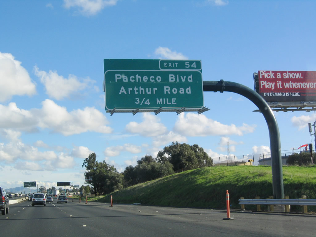
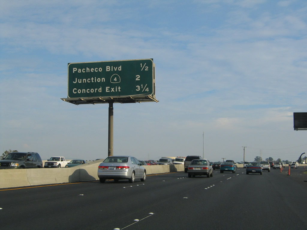
The next exit along southbound Interstate 680 is Exit 54, Arnold Road to Pacheco Boulevard (old California 21) north to Martinez and south to Pleasant Hill. Photo taken 12/29/04. |
|
|
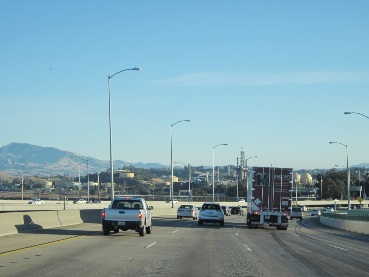
The next three exits along southbound Interstate 680 are Exit 54, Arnold Road to Pacheco Boulevard; Exit 53, California 4; and Exit 52, Concord Avenue. Photos taken 11/21/12 and 12/29/04. |
|
|
Southbound Interstate 680 reaches Exit 54, Arnold Road to Pacheco Boulevard. Note the change in signage, with the butterfly gantry in the process of being removed from the gore point. Photos taken 12/29/04. |
|
|
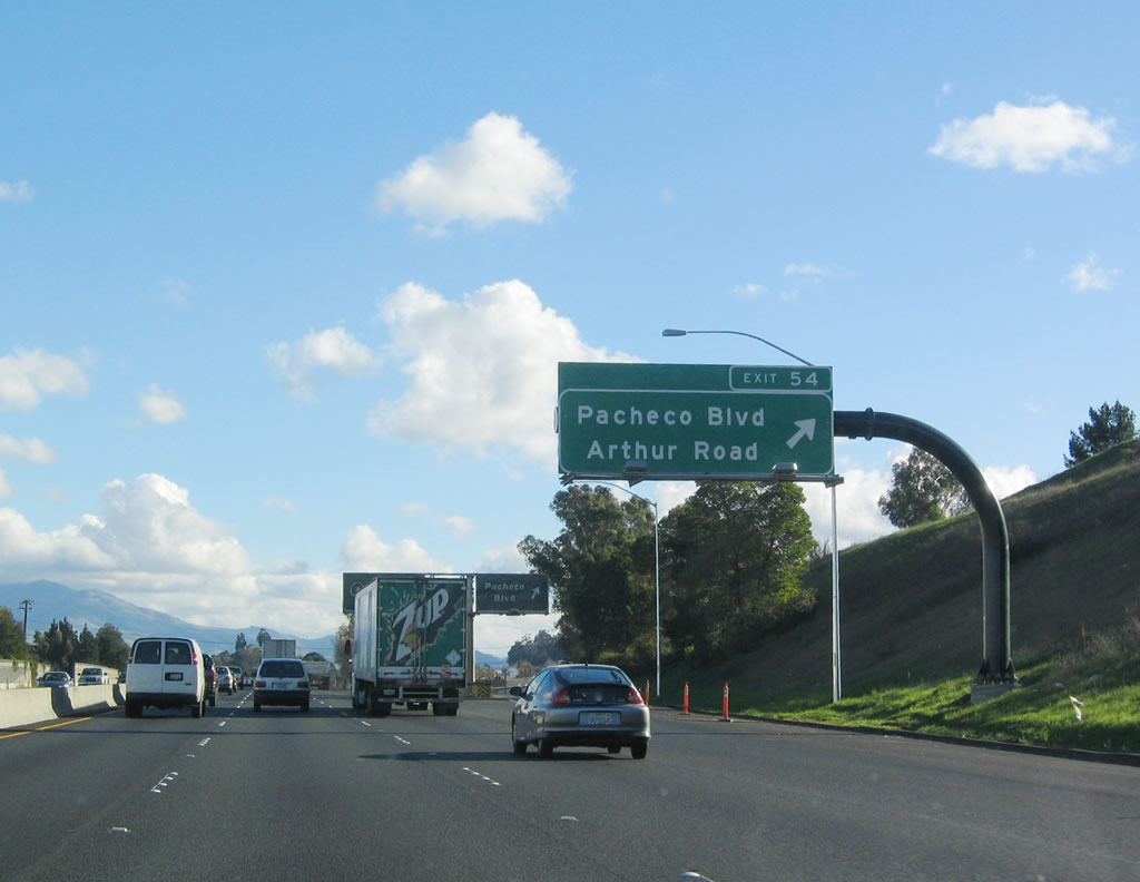
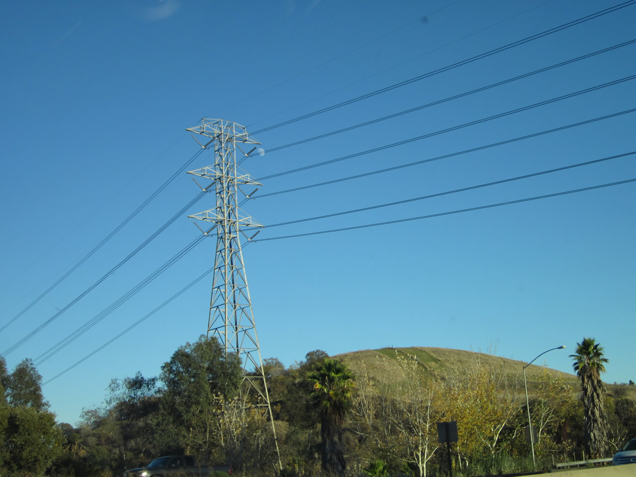
Interstate 680 passes through the directional interchange with the Pacheco Boulevard connector, which is only accessible from Interstate 680 north. Traffic from southbound Pacheco Boulevard will join Interstate 680 at this point. A Pacific Gas and Electric power line also passes overhead near this point. Photos taken 11/21/12. |
|
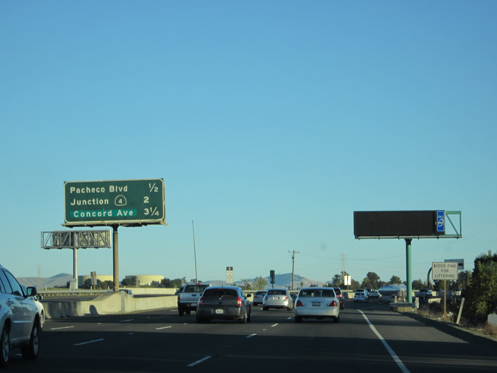
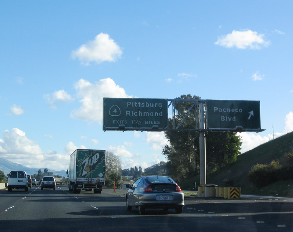
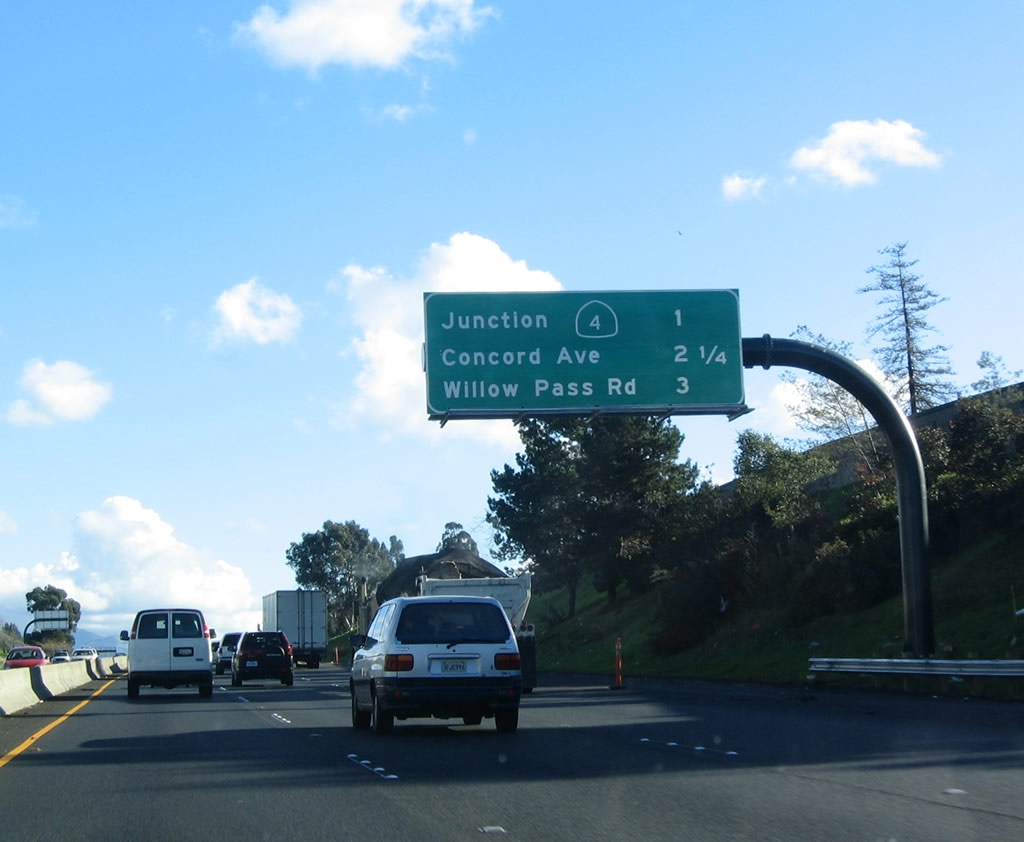
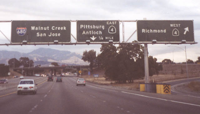
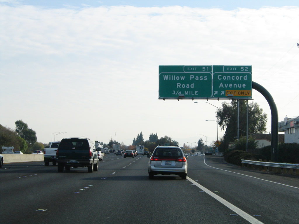
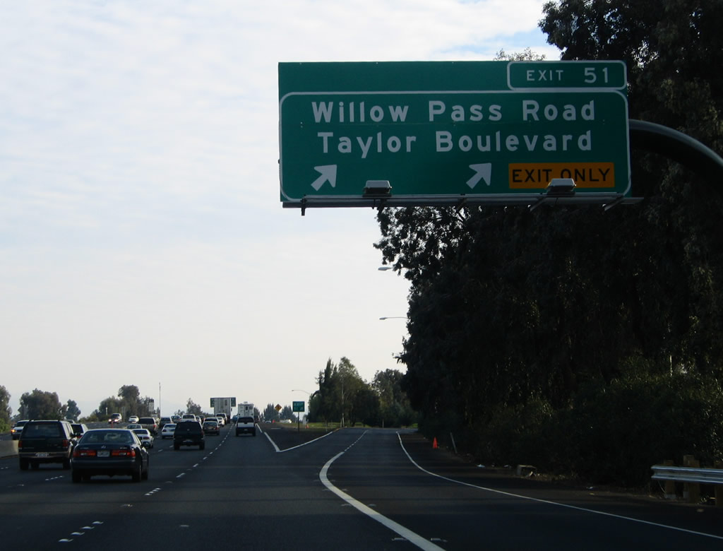
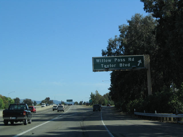
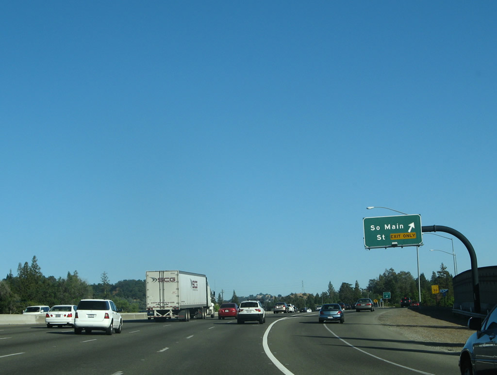
The next three exits along southbound Interstate 680 are Exit 53, California 4 freeway; Exit 52, Concord Avenue/Chilpancingo Parkway; and Exit 51, Willow Pass Road/Taylor Boulevard (Sunvalley Boulevard). Photo taken 12/29/04. |
|
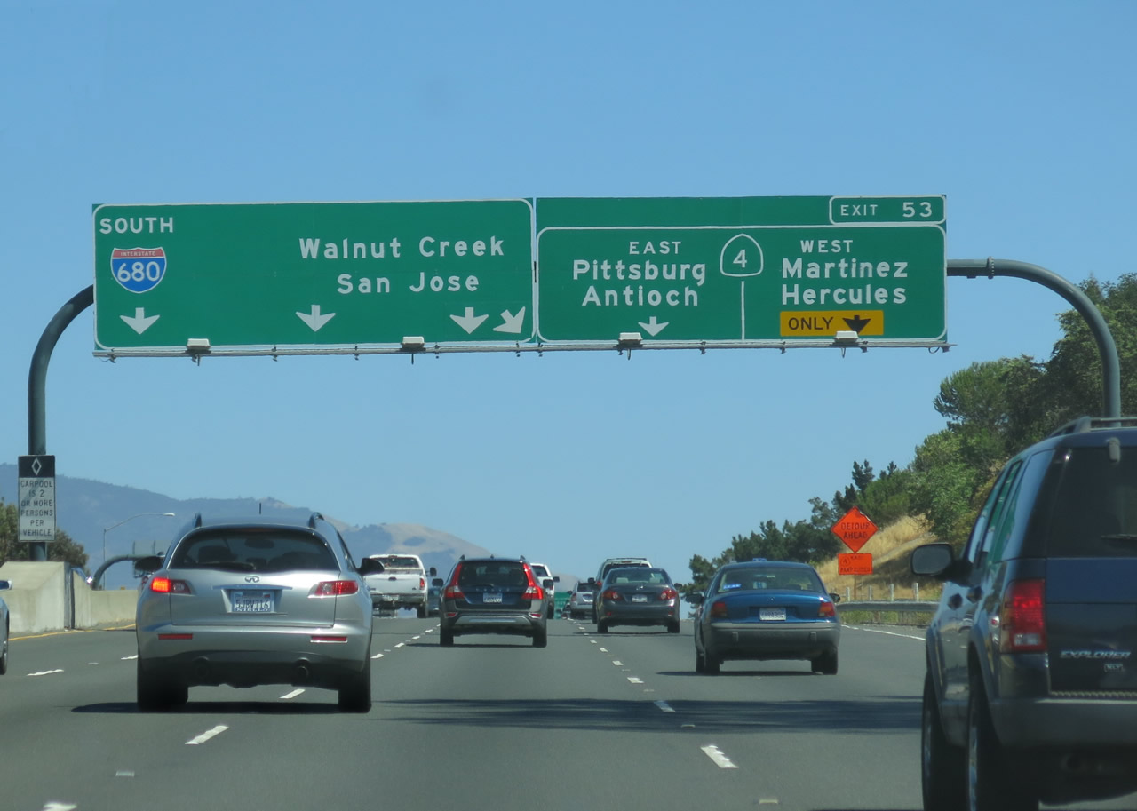
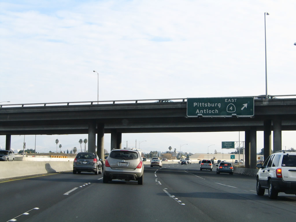
The left four lanes continue south on Interstate 680 toward Walnut Creek and San Jose, while the right lanes divert onto a collector distributor lane that serves Exit 53, California 4. California 4 (California Delta Highway) extends east from this interchange to Pittsburg, Antioch, and Stockton. To the west, California 4 (John Muir Parkway) travels through Martinez to its end at Interstate 80 in Hercules near the Carquinez Bridge/Alfred Zampa Bridge. Photo taken 07/06/13. |
|
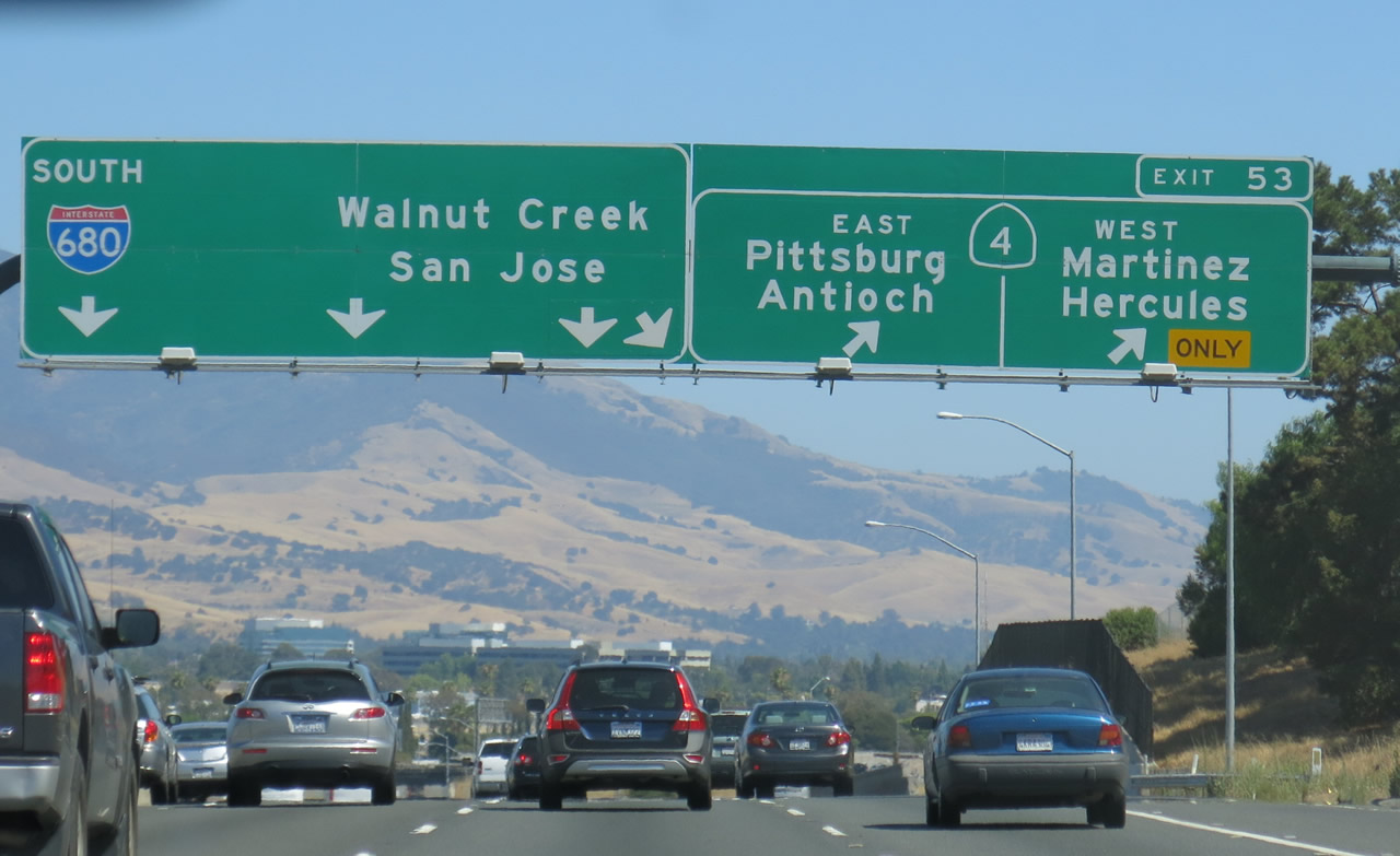
Southbound Interstate 680 meets Exit 53, California 4 west to Martinez and Hercules and east to Pittsburg and Antioch. The California 4 freeway has been extended toward Brentwood in eastern Contra Costa County. Photo taken 07/06/13. |
|
Reverting to the old configuration of the 680-4 interchange, the interchange with California 4 was formerly designated as Exits 53B-A with no collector distributor lanes. This is a major interchange, and it was reconstructed in 2006. Some sections of California 4 west of Martinez were upgraded to freeway standards in 2002. Since the time this photo was taken, the cloverleaf interchange was changed into a modified cloverleaf to reduce weaving and merging (as of 2006). Photo taken by Pete Sison (Summer 2001). |
|
Still looking at the old configuration, southbound Interstate 680 reaches former Exit 53A, California 4 east to Pittsburg and Antioch. With the completion of the redesign of this interchange, the cloverleaf was changed to a modified cloverleaf, thus eliminating several merge and weave points. The configuration depicted here is no longer in place. Photo taken 12/29/04. |
|
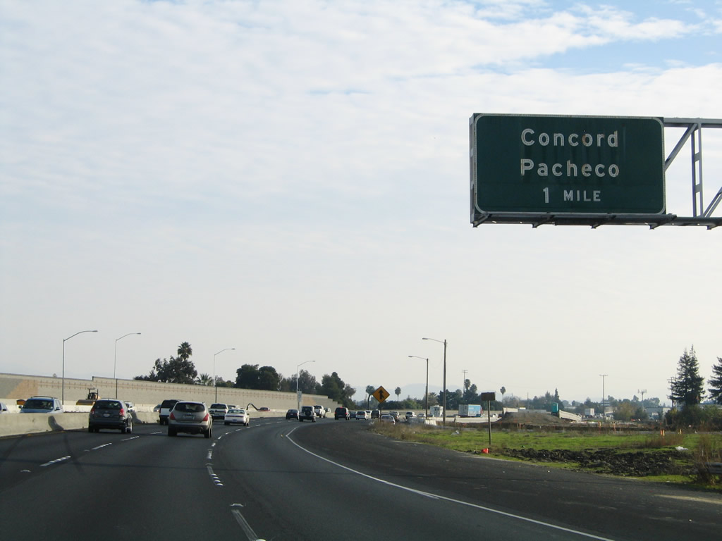
The next exit along Interstate 680 south is Exit 52, Contra Costa Boulevard, Concord Avenue, and Chilpancingo Parkway to Concord and unincorporated Pacheco. Both Exit 52 (Contra Costa Boulevard, Concord Avenue, and Chilpancingo Parkway) and Exit 51 (Willow Pass Road/Taylor Boulevard) serve Pleasant Hill and Concord. Photo taken 12/29/04. |
|
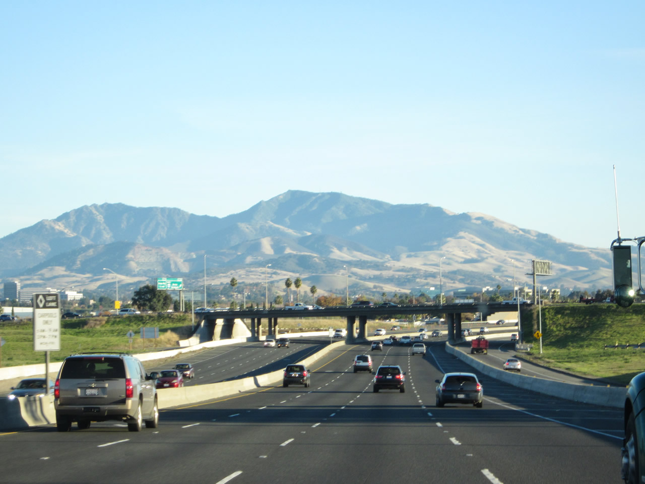
Southbound Interstate 680 reaches Exit 52, Contra Costa Boulevard, Concord Avenue, and Chilpancingo Parkway to Concord, Pleasant Hill, and unincorporated Pacheco. Interstate 680 south straddles the city of Pleasant Hill on the west and the city of Concord on the east. Pleasant Hill is home to 32,837 people as of the 2000 Census and was founded in 1961 as the region developed in the post-World War II construction boom. Concord is the largest city in Contra Costa County (but is not the county seat). Home to 121,780 people as of the 2000 Census, Concord contains 31.31 square miles and was incorporated as a town in February 1905. Photo taken 12/29/04. |
|
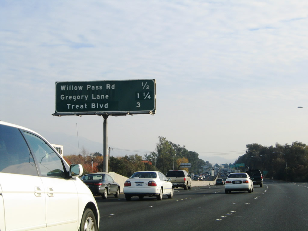
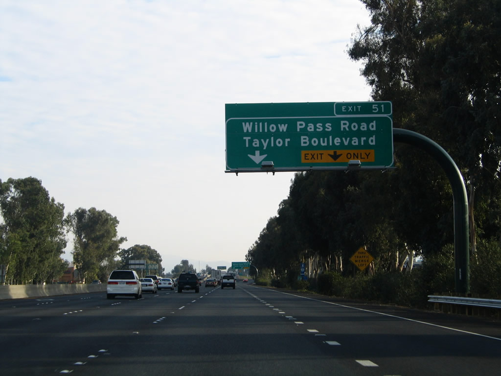
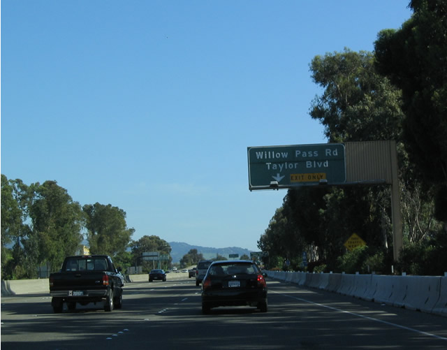
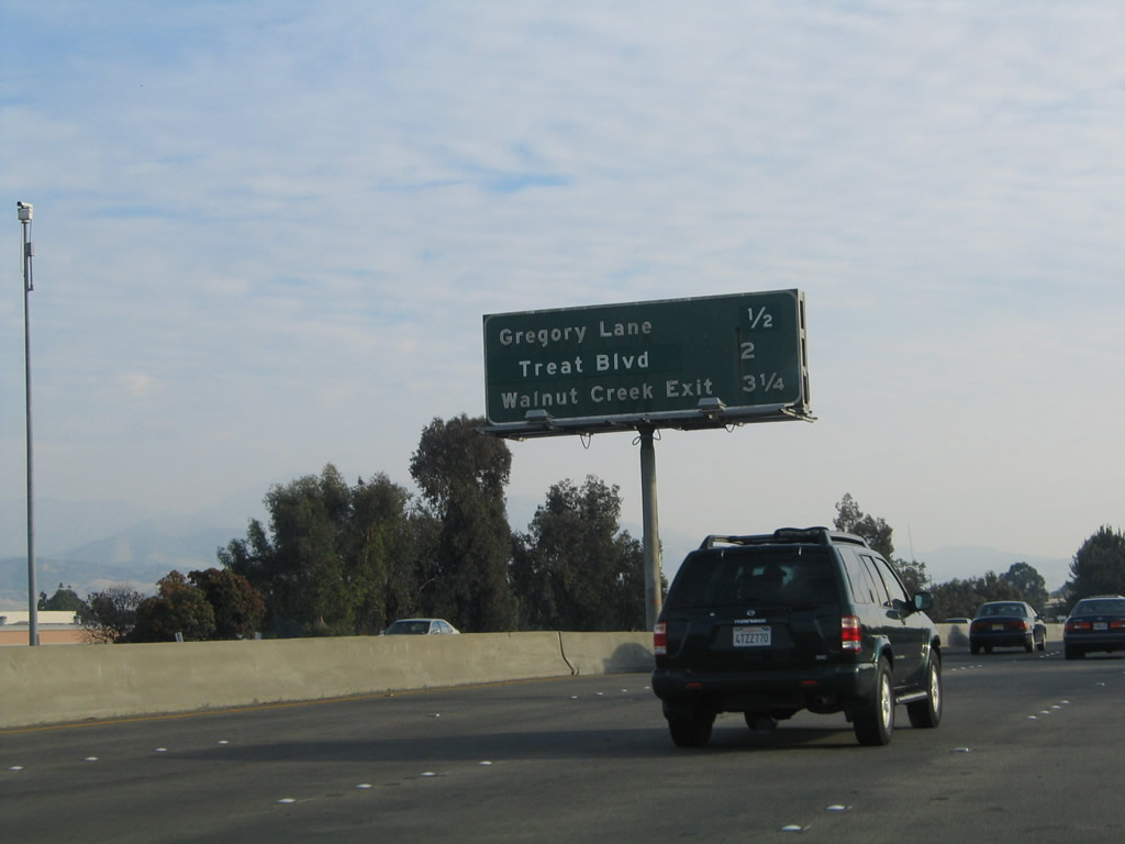
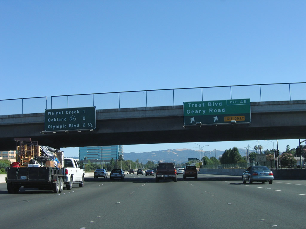
The next three exits along southbound Interstate 680 are Exit 51, Willow Pass Road/Taylor Boulevard (Sunvalley Boulevard); Exit 49, Gregory Lane/Monument Road; and Exit 48, Treat Boulevard. Photo taken 12/29/04. |
|
The next three exits along southbound Interstate 680 are Exit 49, Gregory Lane/Monument Road; Exit 48, Treat Boulevard; and Exit 48, North Main Street (Walnut Creek). Photo taken 12/29/04. |
|
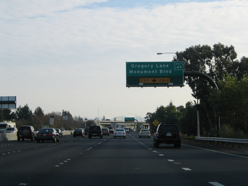
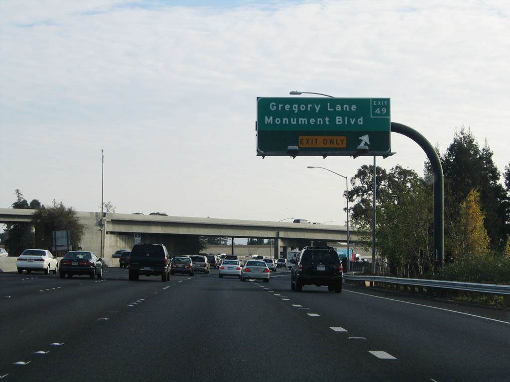
The left four lanes of Interstate 680 south continue toward Walnut Creek, while the right lane prepares to exit only to Exit 49, Gregory Lane/Monument Road. Photo taken 12/29/04. |
|
Southbound Interstate 680 reaches Exit 49, Gregory Lane/Monument Road. The overpass here carries southbound California 242 over Interstate 680 and brings three additional southbound lanes onto Interstate 680. Between California 242 and California 24, southbound Interstate 680 will carry between five and six through lanes (plus auxiliary lanes). Photo taken 12/29/04. |
|
This mileage sign provides the distance to the next three interchanges: Exit 48, Treat Boulevard/Geary Road; Exit 47, North Main Street; and Exit 46B, California 24 (Rumford Freeway) west to Oakland and San Francisco. Photo taken 07/03/06. |
|
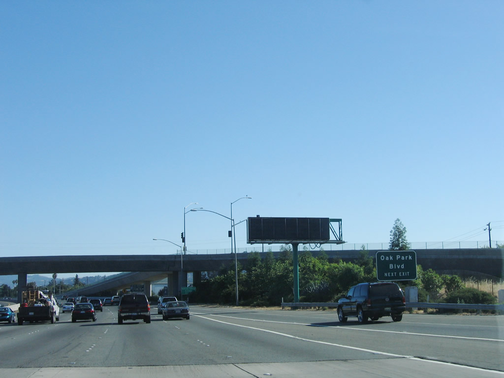
Use Exit 48 to Oak Park Boulevard in Pleasant Hill. Photo taken 07/03/06. |
|
The left five lanes continue south on Interstate 680, while the right two lanes prepare to exit onto Exit 48, which connects to North Main Street in the city of Walnut Creek. Turn left (south) on Main Street to Geary Road west and Treat Boulevard east. Photo taken 07/03/06. |
|
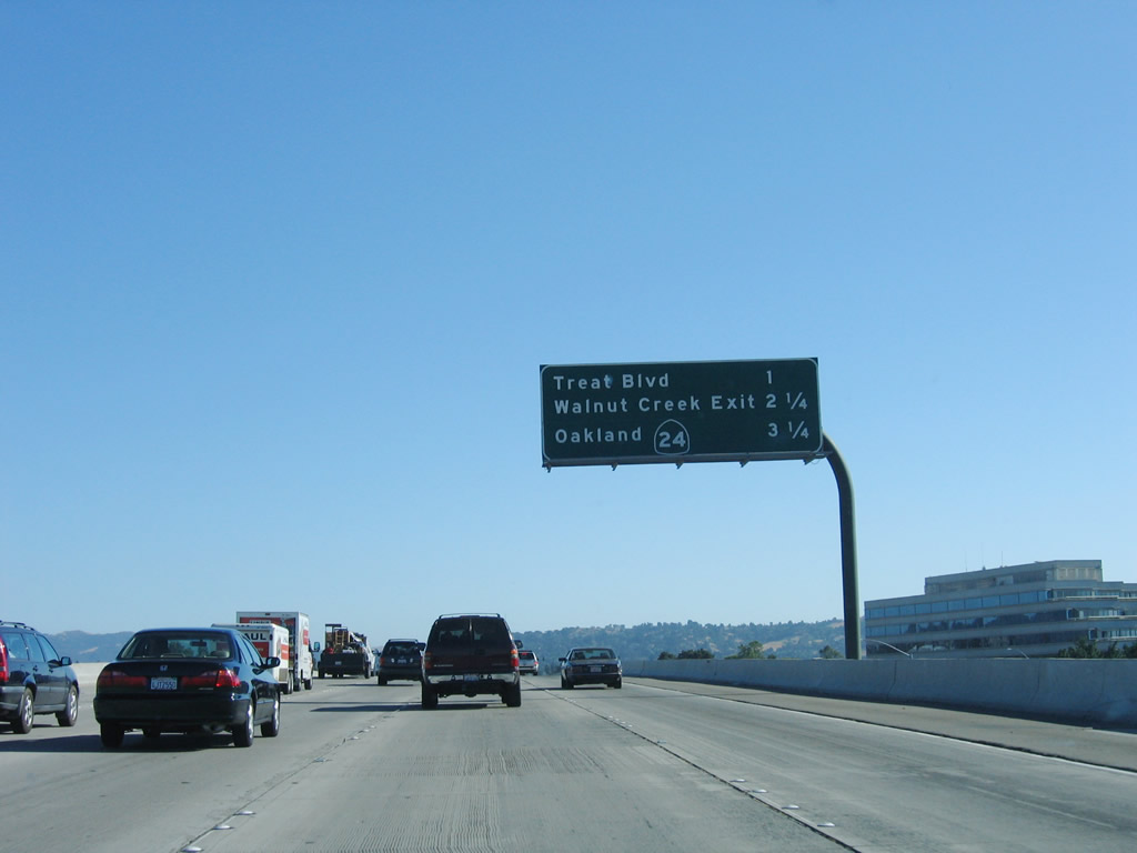
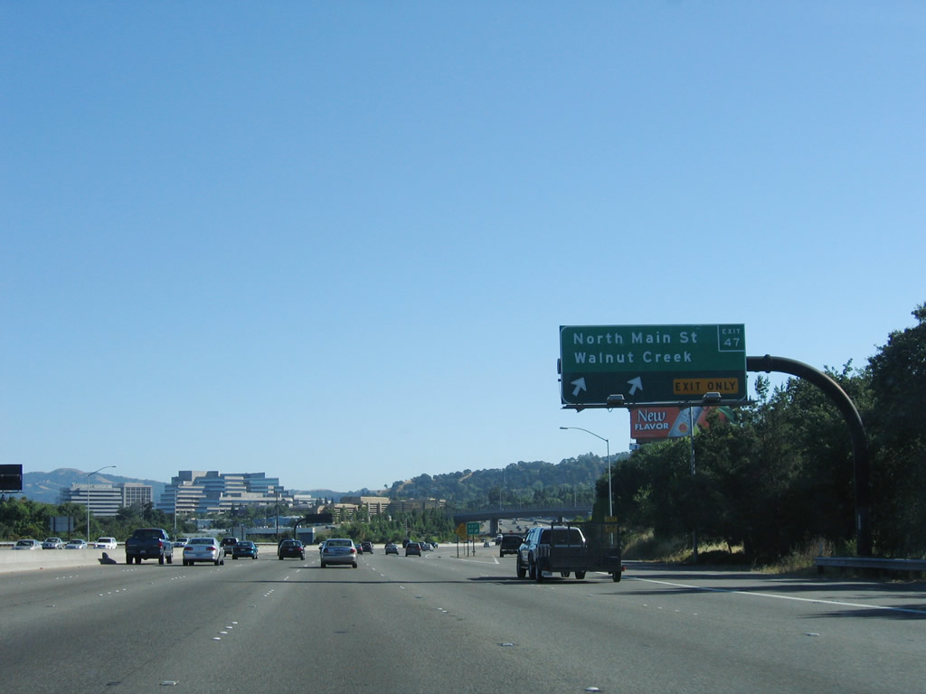
Reaching Exit 48, southbound Interstate 680 enters the city of Walnut Creek, home to 64,296 residents as of the 2000 Census. Walnut Creek was incorporated on October 21, 1914, and consists of 19.9 square miles. Situated at the junction of Interstate 680 and California 24, the area is a bedroom community for San Francisco but has a large business base. The Bay Area Rapid Transit (BART) system also passes through town, offering direct commuter service to Oakland and San Francisco. In addition to its downtown, Walnut Creek is renowned for its extensive system of preserved open space lands. This mileage sign provides the distance to three of the next four exits: Exit 47, North Main Street; Exit 46B, California 24 (Rumford Freeway) west to Oakland and San Francisco; Exit 46A, Olympic Boulevard; and Exit 45, South Main Street. Photo taken 07/03/06. |
|
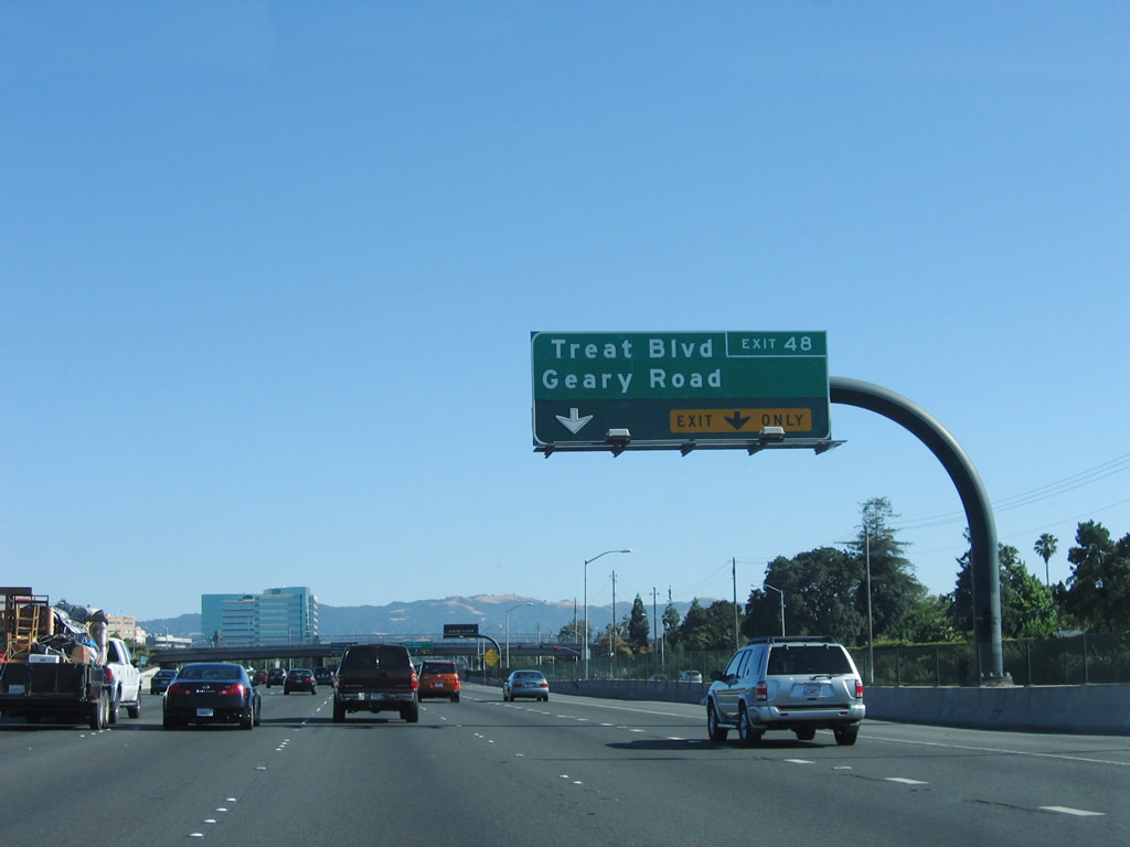
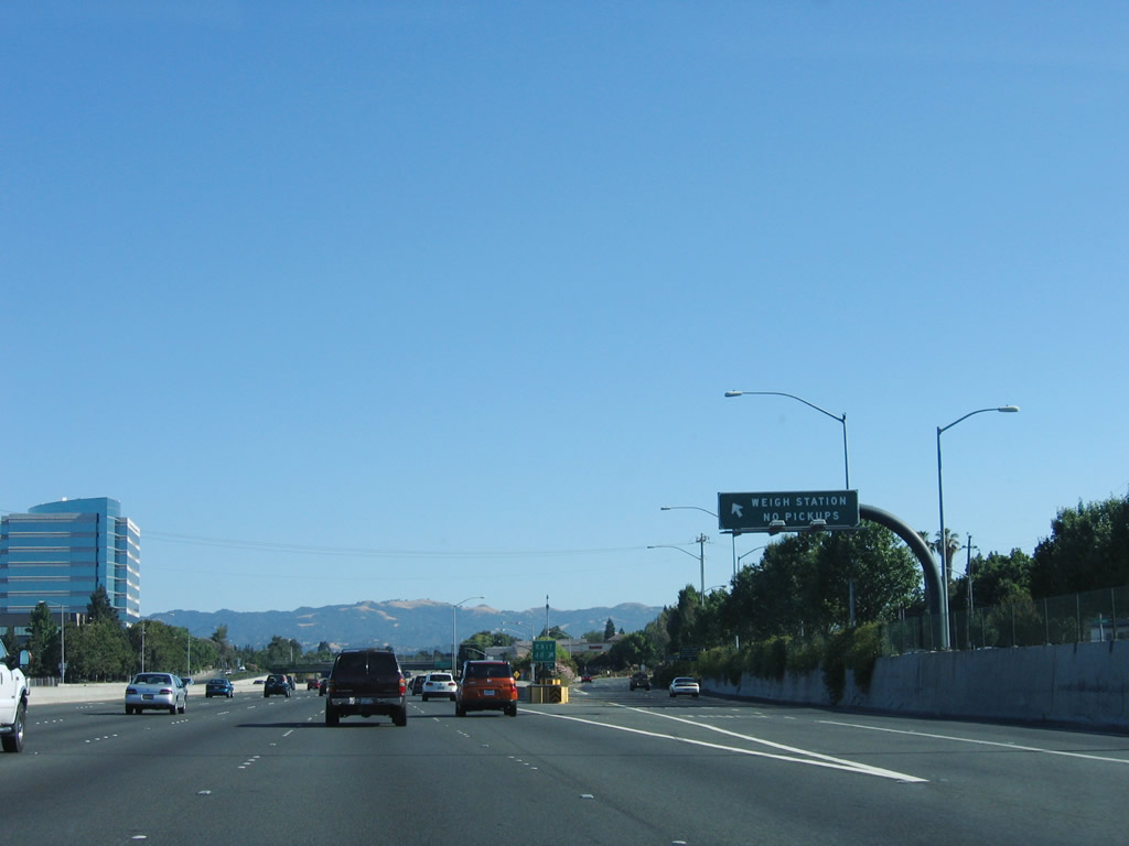
Southbound Interstate 680 meets Exit 48, Treat Boulevard and Geary Road in Walnut Creek. A weigh station for trucks is located at this off-ramp. Photo taken 07/03/06. |
|
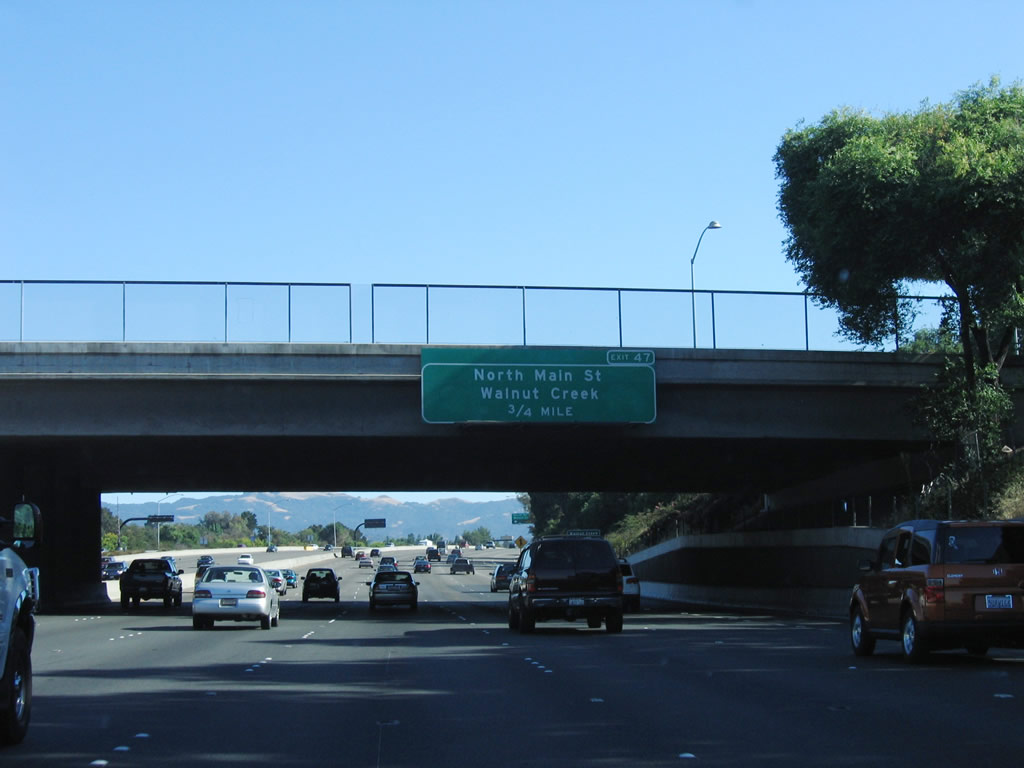
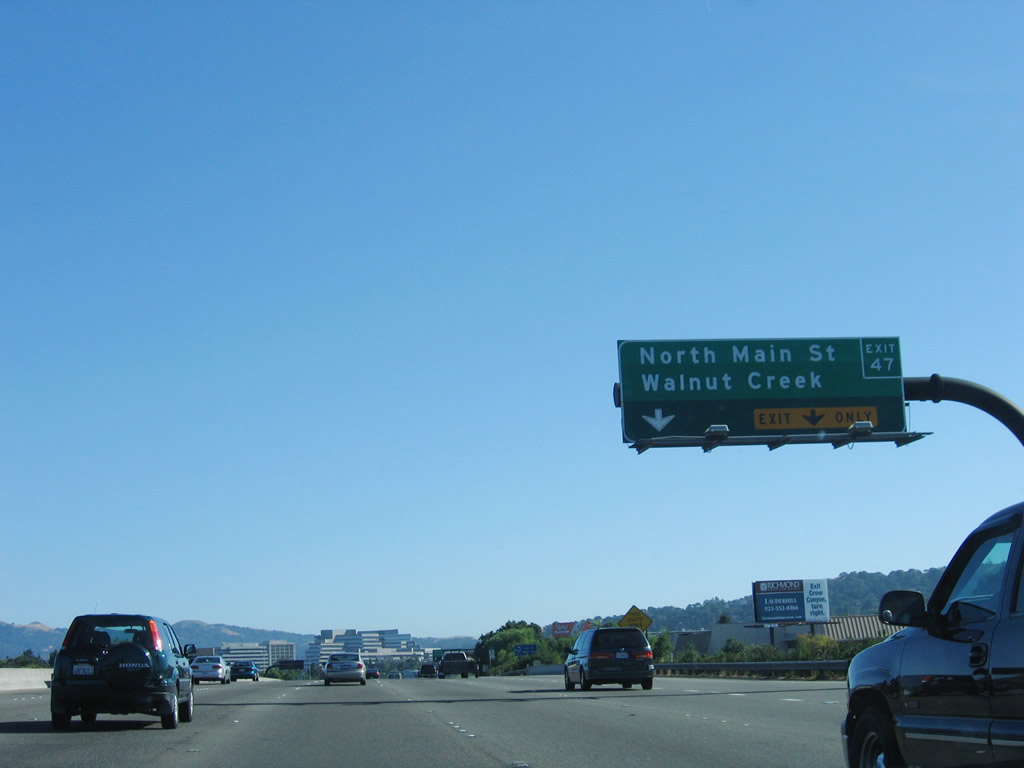
The next exit along southbound Interstate 680 is Exit 47, North Main Street. Along with Pacheco Boulevard in Martinez and Contra Costa Boulevard in Pleasant Hill, Main Street follows the old California 21 alignment through Walnut Creek. This route could be a business loop for Interstate 680 if such a route were to be designated, returning to Interstate 680 at Exit 45. Photo taken 07/03/06. |
|
These black, tubular sign bridges were placed in the late 1990s when the Interstate 680/California 24 interchange was reconstructed. In 2005, Caltrans placed exit number overlay strips on several of the existing signs, some which were only put in place during the late 1990s after the major reconstruction of the Interstate 680 and California 24 interchange. Photo taken 07/03/06. |
|
Southbound Interstate 680 retains six through lanes once it meets Exit 47, North Main Street to downtown Walnut Creek. The tall buildings in the distance are located in the downtown area of Walnut Creek. Photo taken 07/03/06. |
|
The next three exits along Interstate 680 south are Exit 46B, California 24 (Rumford Freeway) west to Oakland and San Francisco; Exit 46A, Olympic Boulevard; and Exit 45, South Main Street. Photo taken 07/03/06. |
|
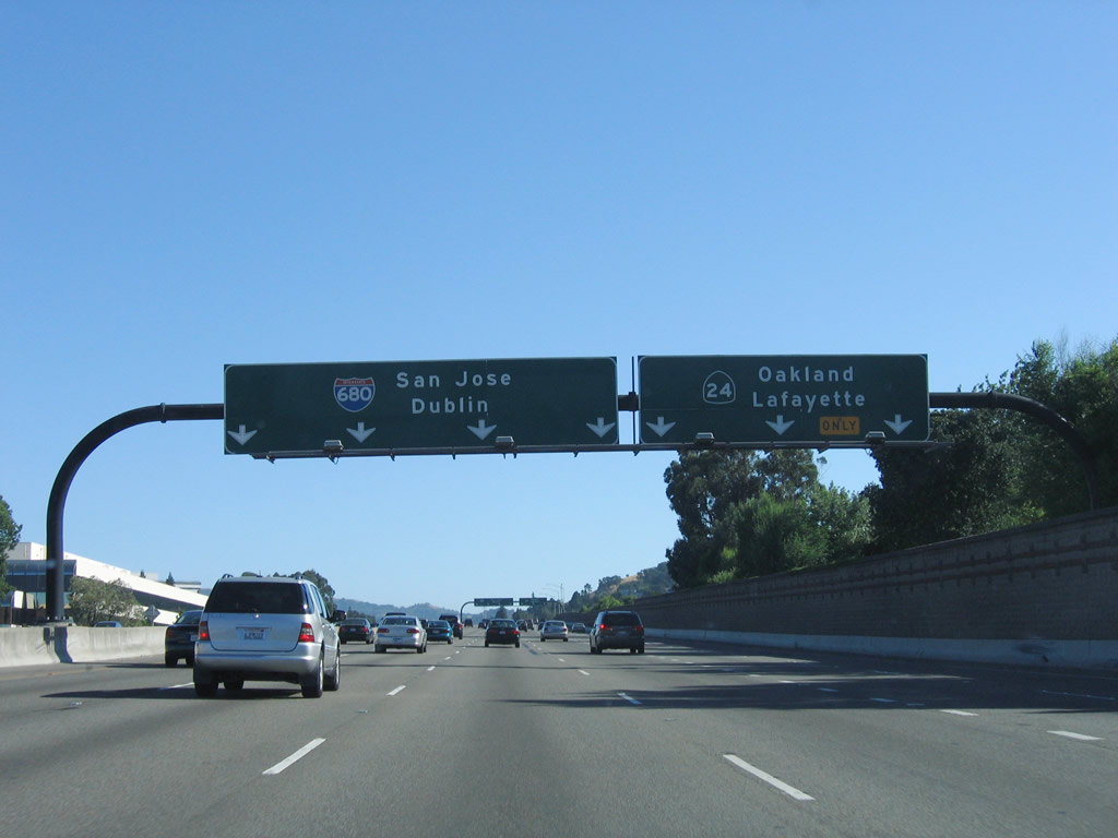
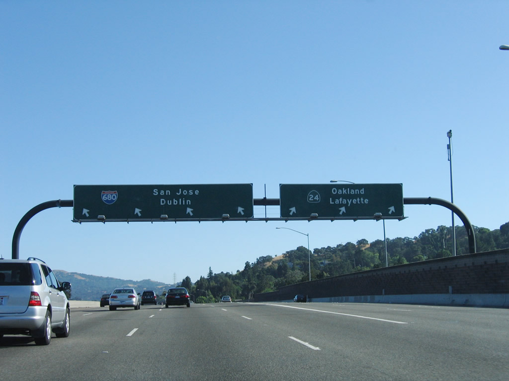
For through traffic on Interstate 680 south, use the left four lanes. Exiting traffic onto Exit 46B, California 24 (Rumford Freeway) west to Berkeley and Oakland should use the right three lanes. Photo taken 07/03/06. |
|
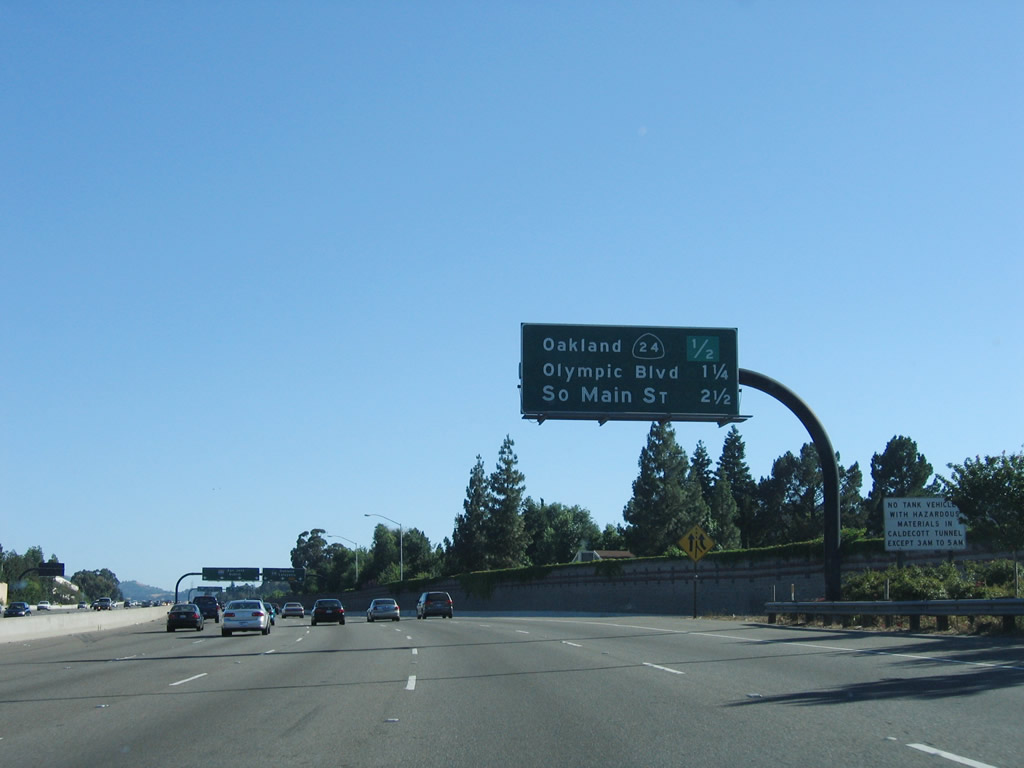
Southbound Interstate 680 reaches Exit 46B, California 24 (Rumford Freeway) west. Note the three-lane exit, which is indicative of the volume of traffic that utilizes Interstate 680 south and California 24 west to reach workplaces in Oakland and San Francisco. At one time, California 24 was a much longer route, extending north from this interchange through Concord and Pittsburg via California 242 and California 4, then following the Sacramento River northeast to Sacramento via California 160. California 24 then continues north toward Oroville via California 70, then crossed the Sierra Nevada via Feather River Canyon and California 70. Now the designation is used for just the Oakland to Walnut Creek segment of freeway. Photo taken 07/03/06. |
|
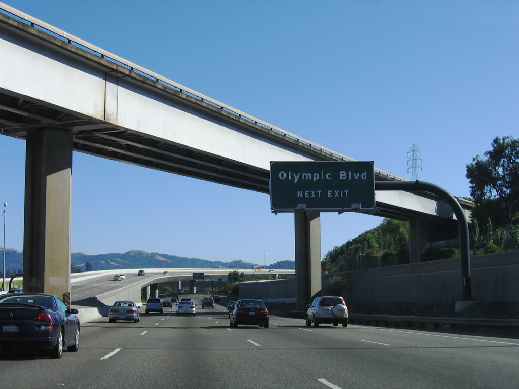
The next exit along southbound Interstate 680 is Exit 46A, Olympic Boulevard. This exit is located within the interchange complex between Interstate 680 and California 24 near downtown Walnut Creek. Note the view of eastbound California 24 flying over Interstate 680 south and preparing to merge onto Interstate 680 north. Photo taken 07/03/06. |
|
Southbound Interstate 680 meets Exit 46A, Olympic Boulevard. Use Olympic Boulevard east into downtown Walnut Creek, including Broadway Plaza and Plaza Escuela. A Kaiser Hospital is located south of Olympic Boulevard via Main Street and Newell Avenue. Photo taken 07/03/06. |
| Interstate 680/Donald D. Doyle Highway south |
|
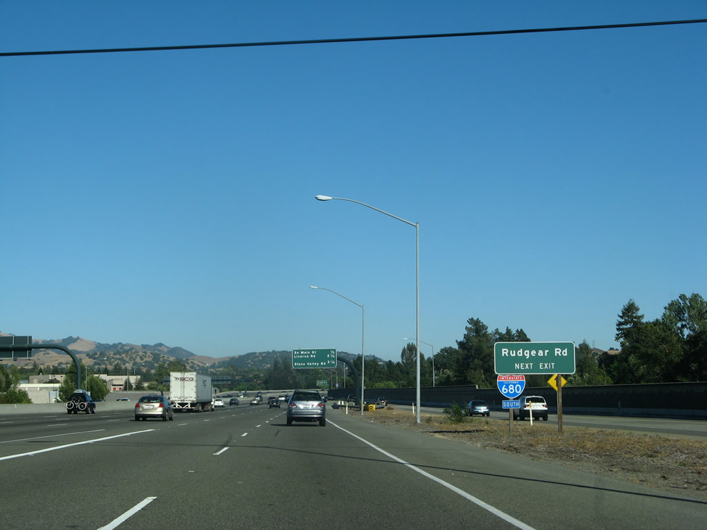
After the California 24 (Rumford Freeway) interchange, the next exit on southbound Interstate 680 is Exit 45, South Main Street and Rudgear Road. Photo taken 07/06/07. |
|
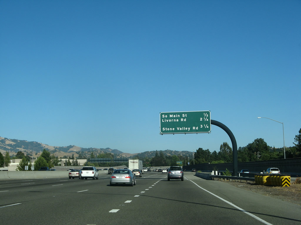
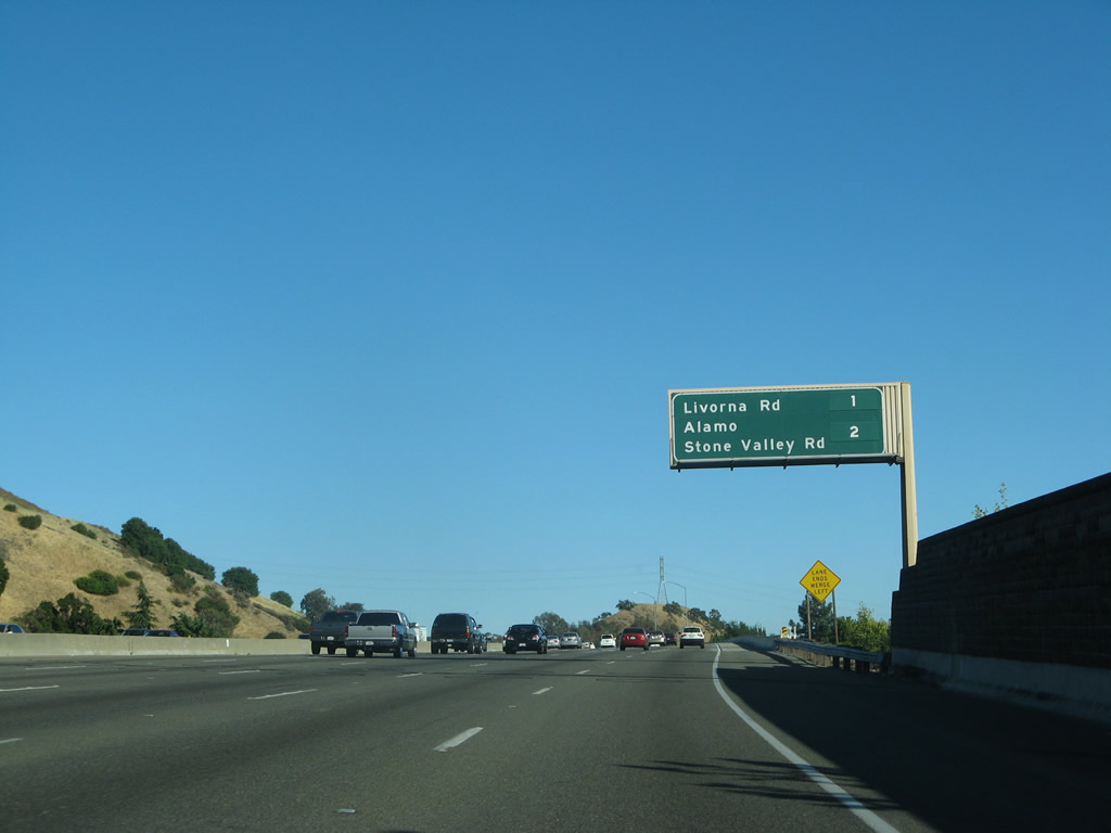
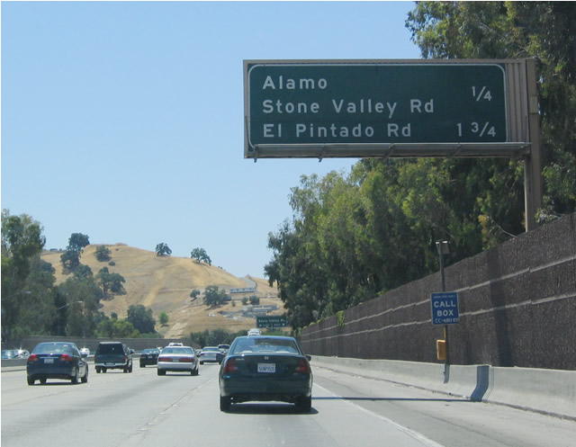
This mileage sign provides the distance to the next three interchanges: Exit 45, South Main Street/Rudgear Road; Exit 43, Livorna Road; and Exits 42B-A, Stone Valley Road/Alamo. Photo taken 07/06/07. |
|
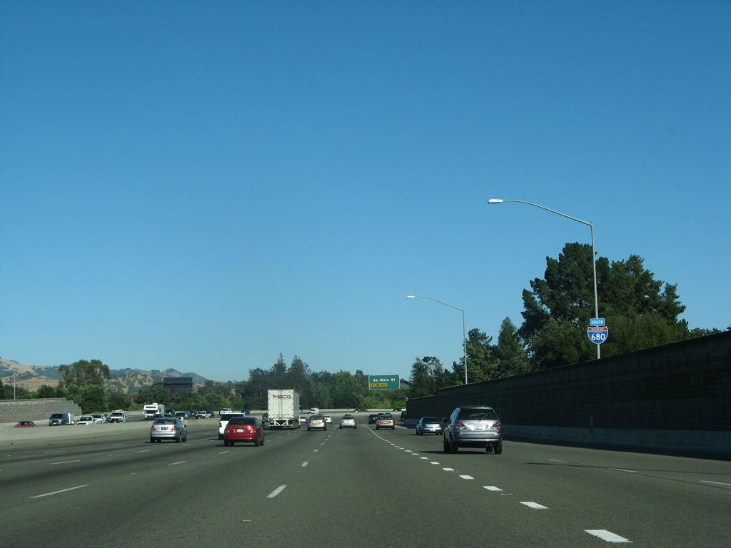
An Interstate 680 south reassurance shield is posted on top of the sound wall. Photo taken 07/06/07. |
|
The right lane becomes exit only for Exit 45, South Main Street and Rudgear Road. This is the final exit for the city of Walnut Creek. Photo taken 07/06/07. |
|
Southbound Interstate 680 reaches Exit 45, South Main Street and Rudgear Road in Walnut Creek. Photo taken 07/06/07. |
|
Interstate 680 is ann official state scenic route from South Main Street to the Contra Costa-Alameda County line. Photo taken 07/06/07. |
|
As a result, Interstate 680's reassurance shields are posted with scenic California poppy flower scenic route signs. Photo taken 07/06/07. |
|
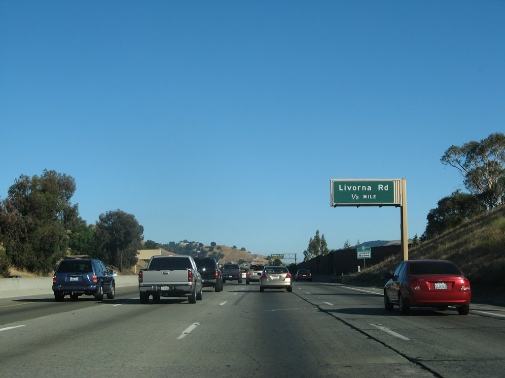
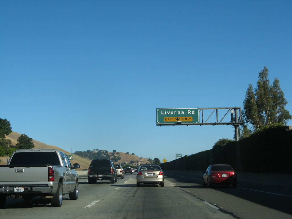
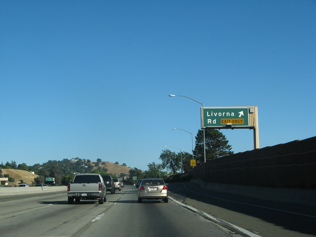
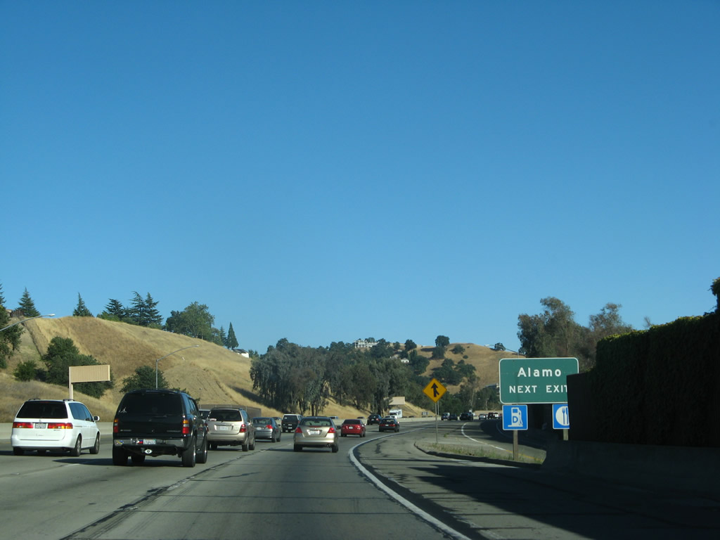
The next two exits on southbound Interstate 680 serve the unincorporated community of Alamo. Exit 43 is Livorna Road, and Exits 42B-A serves Stone Valley Road. Photo taken 07/06/07. |
|
Use Livorna Road west to Danville Road, which is old California 21 and parallels Interstate 680. Photo taken 07/06/07. |
|
Ahead, a new left lane forms for high occupancy vehicle (restrictions are applicable during commuting hours only), and the right lane becomes exit only for Livorna Road. Photo taken 07/06/07. |
|
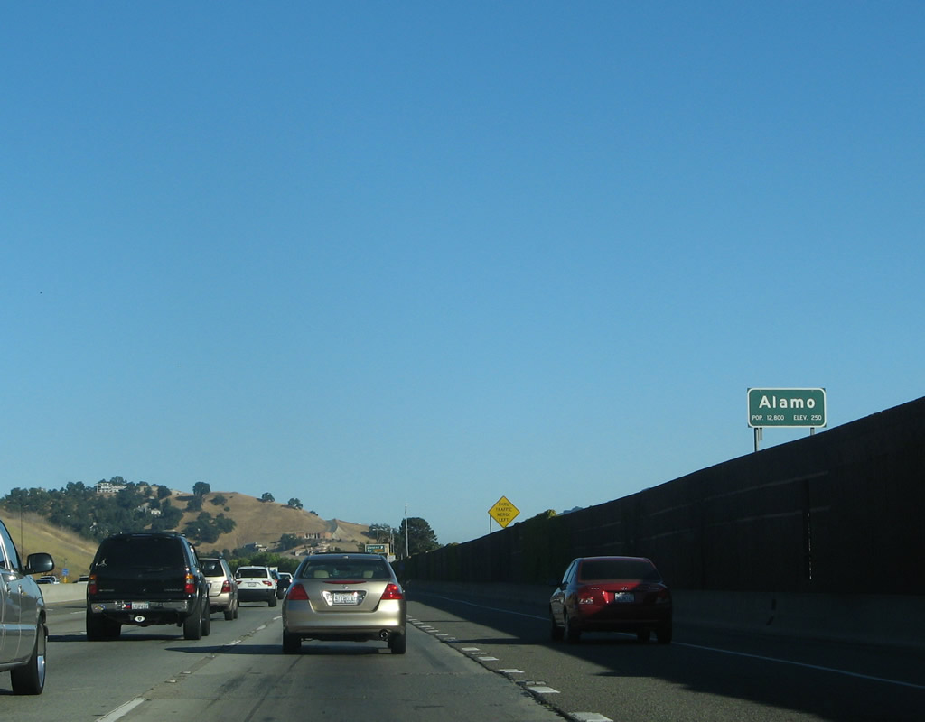
The community of Alamo is not incorporated and is located along Danville Boulevard between the city of Walnut Creek to the north and the town of Danville to the south. Photo taken 07/06/07. |
|
Southbound Interstate 680 connects to Exit 43 is Livorna Road. Photo taken 07/06/07. |
|
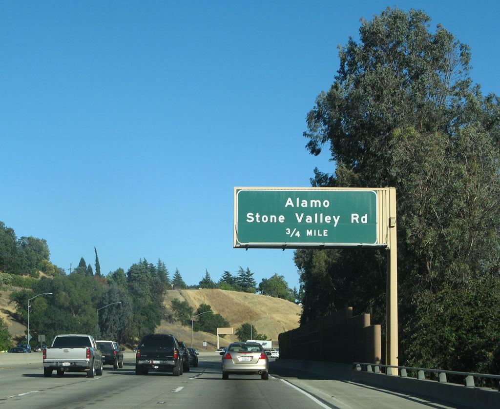
The next exit on southbound Interstate 680 is Exit 42B, Stone Valley Road west to Alamo, followed by Exit 42A, Stone Valley Road east. Photo taken 07/06/07. |
|
Exit 42B, Stone Valley Road west, serves downtown Alamo, which features a shopping plaza, post office, and restaurants. Exit 42A, Stone Valley Road east, connects to the various neighborhoods and residential developments located between Interstate 680 and the boundaries of Mount Diablo State Park to the east. Photo taken 07/06/07. |
|
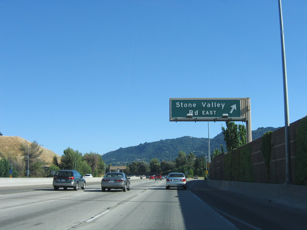
A bit further south, after the Main Street and Livorna Road exits, Interstate 680 next approaches Exits 42B-A, Stone Valley Road west and east. Use Stone Valley Road west (Exit 42B) to enter Alamo. Between Walnut Creek and Dublin, Interstate 680 passes through San Ramon Valley. Photo taken 07/06/07. |
|
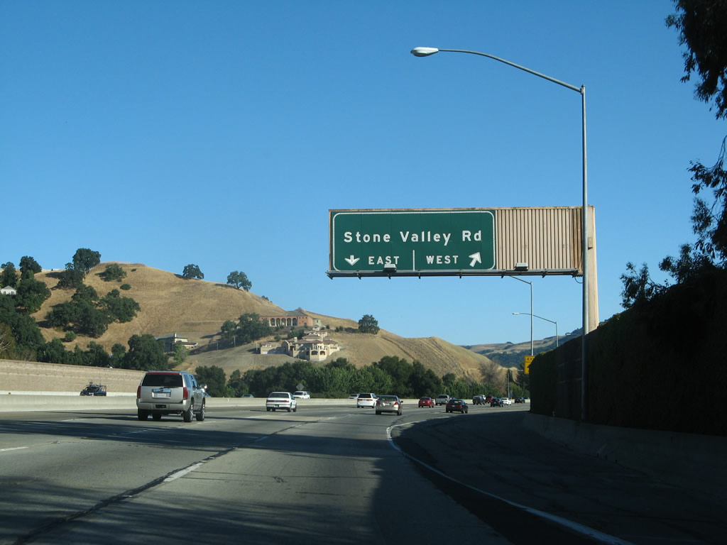
Southbound Interstate 680 reaches Exit 42B, Stone Valley Road west to Alamo. The Stone Valley Road interchange (Exits 42B-A) is not a full cloverleaf, but it does have two loop off ramps along both northbound and southbound. Photo taken 07/06/07. |
|
The second off-ramp of this interchange is Exit 42A, Stone Valley Road east to Danville (via Green Valley Road south) and Mount Diablo (via Diablo Road east). Photo taken 07/04/06. |
|
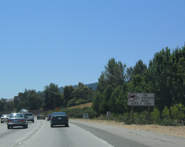
Some of the intersecting streets have truck restrictions, including El Pintado Road (Exit 41). Photo taken 07/06/04. |
|
Interstate 680 is designated as a scenic route as it passes through Alamo and Danville. Photo taken 07/06/04. |
|
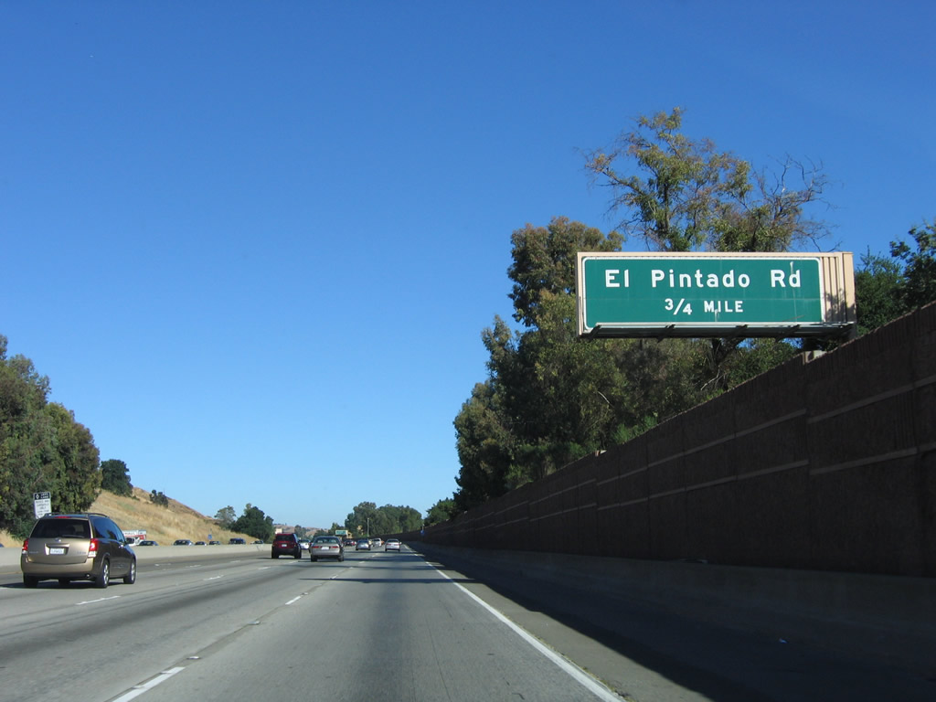
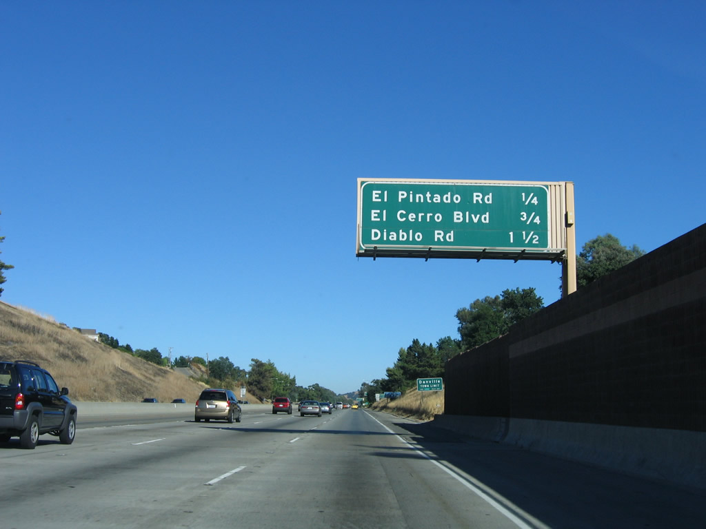
The next exit along southbound is Exit 41, El Pintado Road, three-quarters of a mile. Photo taken 07/04/06. |
|
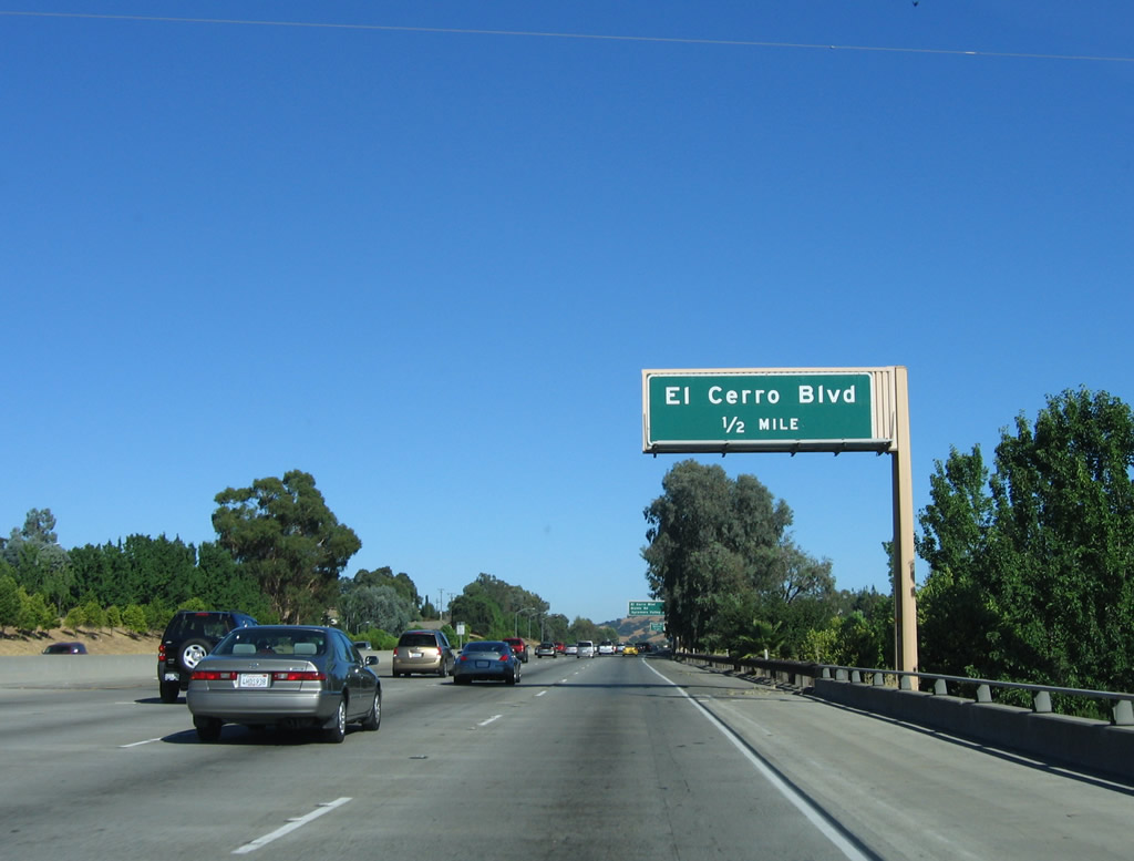
This mileage sign provides the distance to the next three exits: Exit 41, El Pintado Road; Exit 40, El Cerro Boulevard; and Exit 39, Diablo Road. Photo taken 07/06/04. |
|
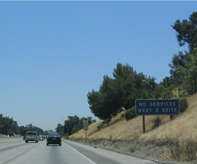
Even though Interstate 680 passes through some heavily populated areas, this sign advises that motorist services are not easily found on either El Pintado Road (Exit 41) or El Cerro Boulevard (Exit 40).Photo taken 07/06/04. |
|
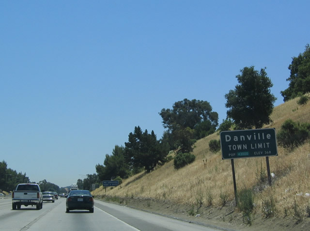
Interstate 680 leaves unincorporated Alamo and enters the town of Danville. Interstate 680 enters the Tri-Valley, which encompasses the town of Danville; the cities of San Ramon, Dublin, Pleasanton, and Livermore; and unincorporated Blackhawk, Sunol, and Tassajara. The Tri-Valley gets its name from the three valleys that converge in the area: Amador Valley, Livermore Valley and San Ramon Valley. Its centerpiece is the Interstate 580-680 interchange. Photo taken 07/06/04. |
|
The next four exits (Exit 41, El Pintado Road; Exit 40, El Cerro Boulevard; Exit 39, Diablo Road; and Exit 38, Sycamore Valley Road) all serve Danville. Photo taken 07/04/06. |
|
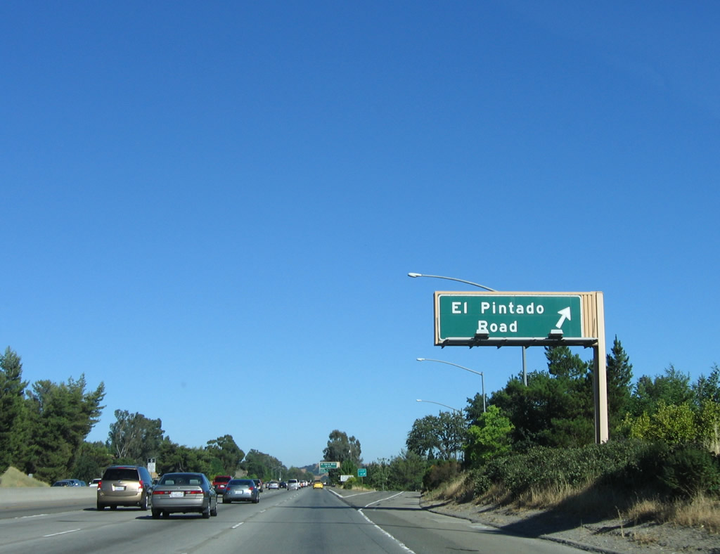
Southbound Interstate 680 meets Exit 41, El Pintado Road. Photo taken 07/04/06. |
|
The next exit along southbound is Exit 40, El Cerro Boulevard, one-half mile Photo taken 07/04/06. |
|
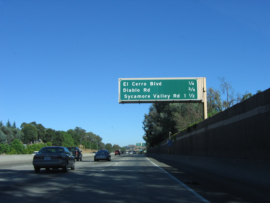
This mileage sign provides the distance to the next three exits along southbound Interstate 680: Exit 40, El Cerro Boulevard; Exit 39, Diablo Road; and Exit 38, Sycamore Valley Road. Photo taken 07/04/06. |
|
Southbound Interstate 680 reaches Exit 40, El Cerro Boulevard. Photo taken 07/04/06. |
|
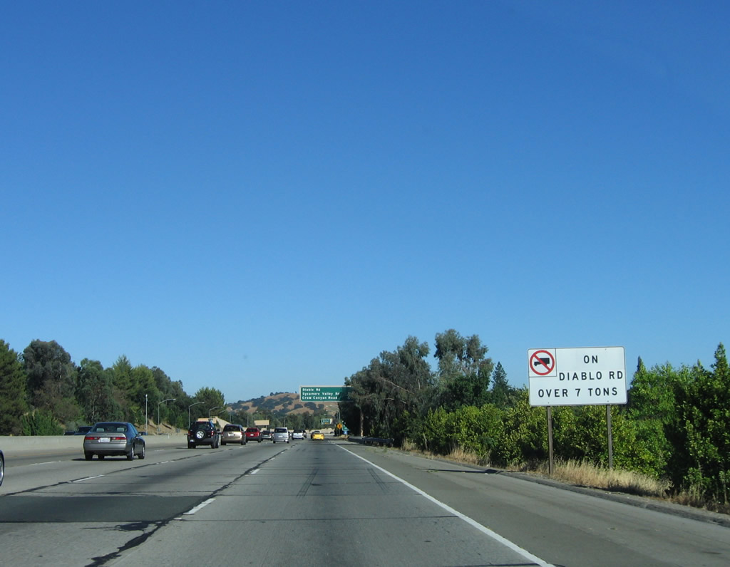
A truck restriction is also placed in Diablo Road into Danville as this sign attests. Photo taken 07/04/06. |
|
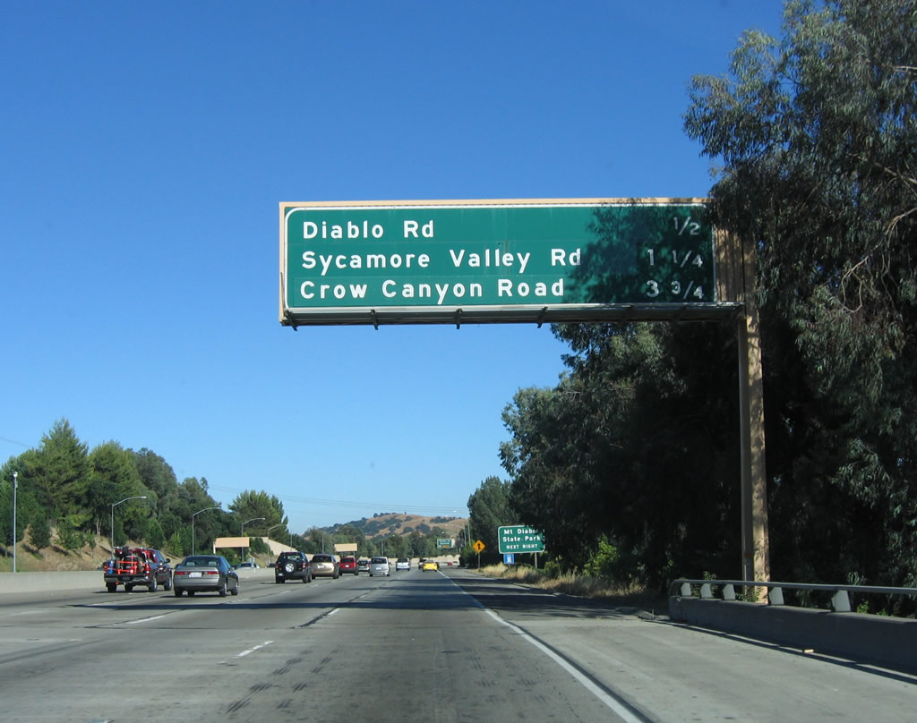
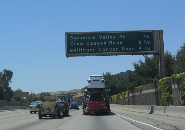
This mileage sign provides the distance to the next three exits along southbound Interstate 680: Exit 39, Diablo Road; Exit 38, Sycamore Valley Road; and Exit 36, Crow Canyon Road. Photo taken 07/04/06. |
|
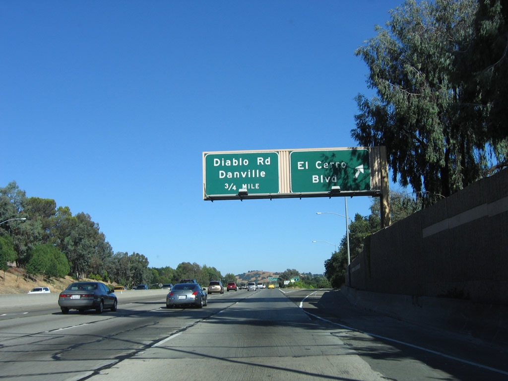
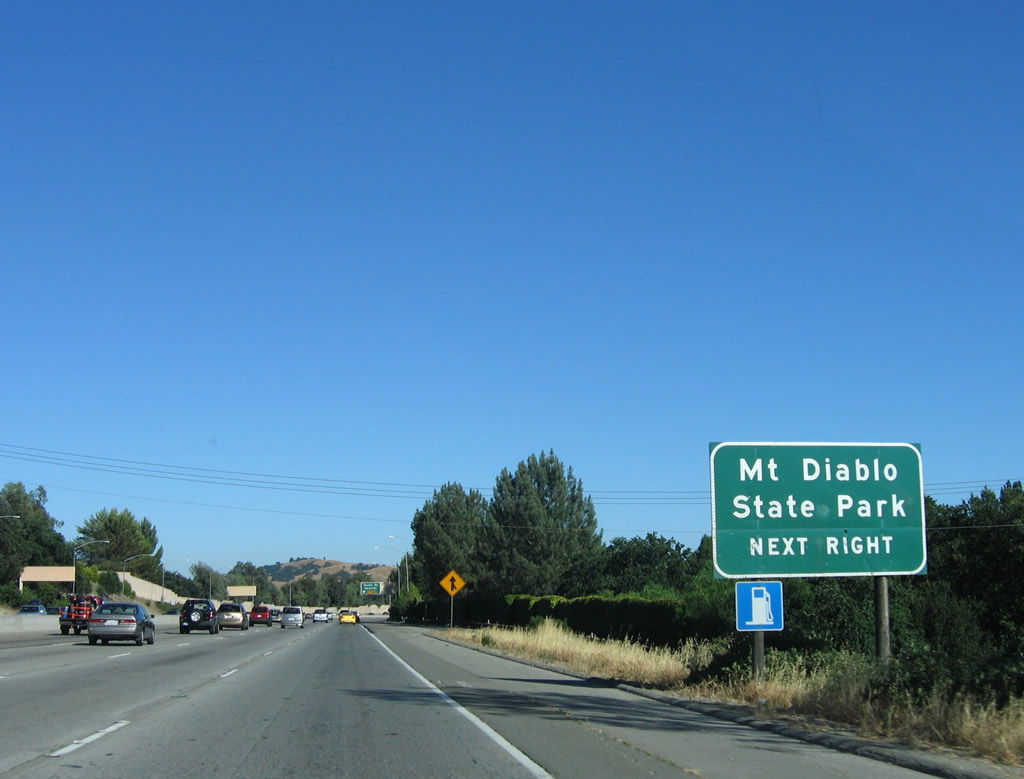
Use Diablo Road eastbound to Mount Diablo State Park. From southbound, El Cerro Boulevard may also be used, but motorists are dissuaded from using it because El Cerro Boulevard is a local street. Photo taken 07/04/06. |
|
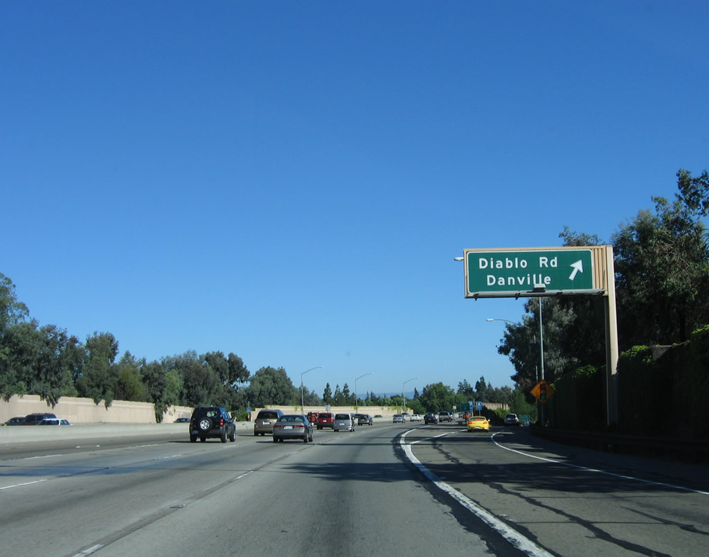
Take Diablo Road westbound to enter downtown Danville. Photo taken 07/04/06. |
|
Southbound Interstate 680 reaches Exit 39, Diablo Road, which leads into downtown Danville. The famous Danville oak tree grows in the median of Diablo Road, which is so named for the dominant Mount Diablo (el. 3,849 feet), visible east of the freeway. Photo taken 07/04/06. |
|
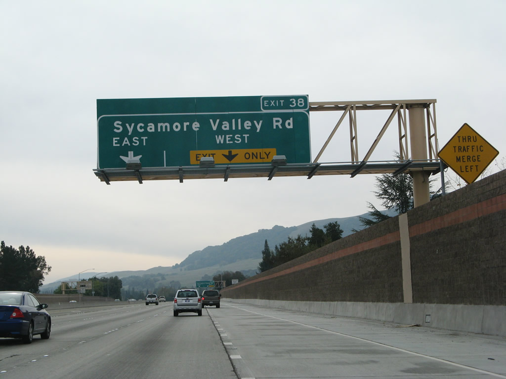
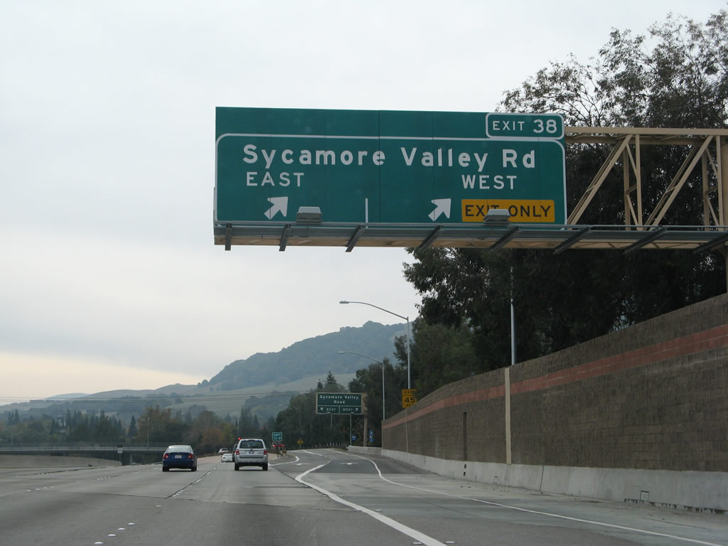
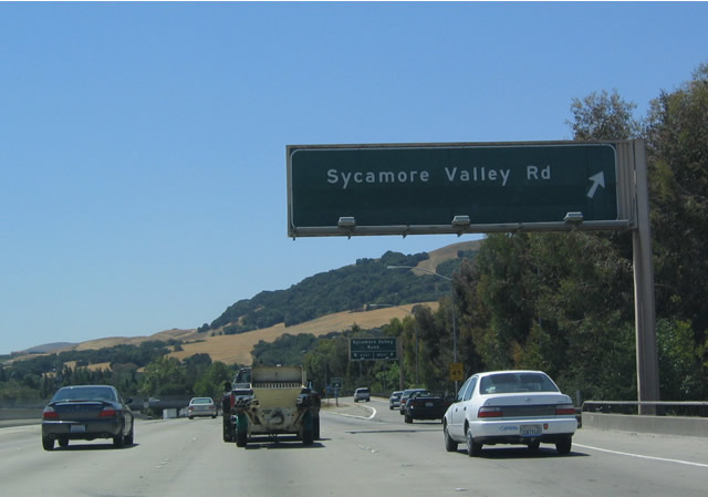
The next exit along southbound is Exit 38, Sycamore Valley Road, one-half mile. Photo taken 07/04/06. |
|
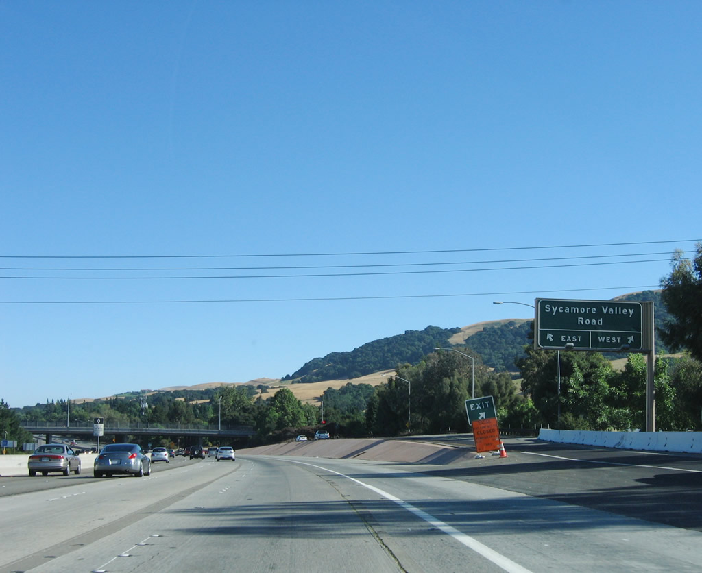
Looking at the transition ramp from southbound Interstate 680 to Exit 38, Sycamore Valley Road, the right lane exits first to westbound Sycamore Valley Road, and the left lane passes under Sycamore Valley Road to loop onto eastbound. Photo taken 07/04/06. |
|
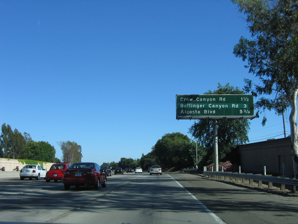
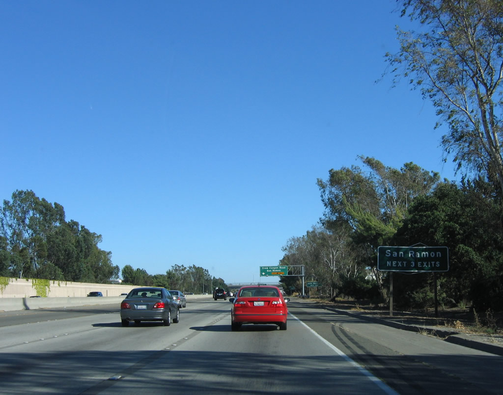
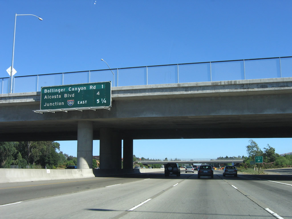
This mileage sign provides the distance to the next three exits along southbound Interstate 680: Exit 36, Crow Canyon Road; Exit 34, Bollinger Canyon Road; and Exit 31, Alcosta Boulevard. Interstate 680 enters San Ramon. Photo taken 07/04/06. |
|
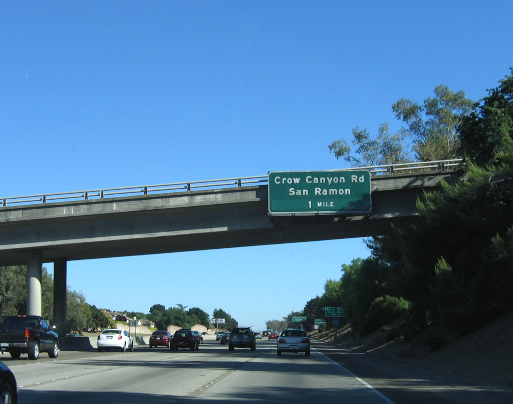
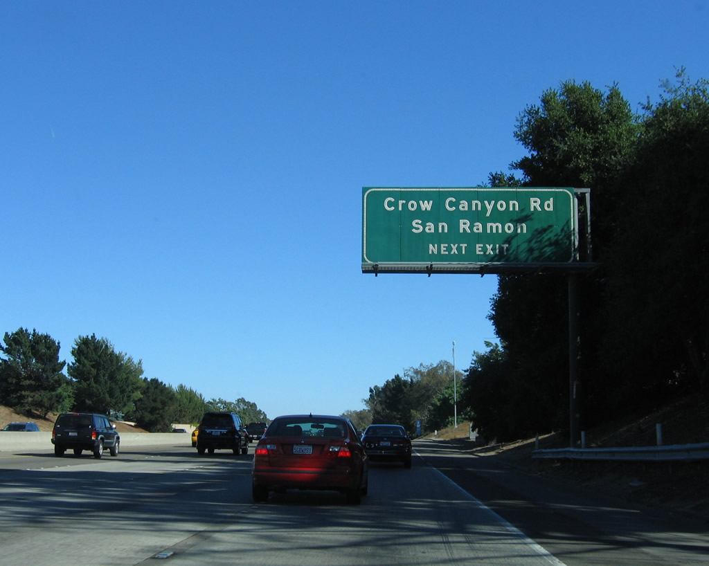
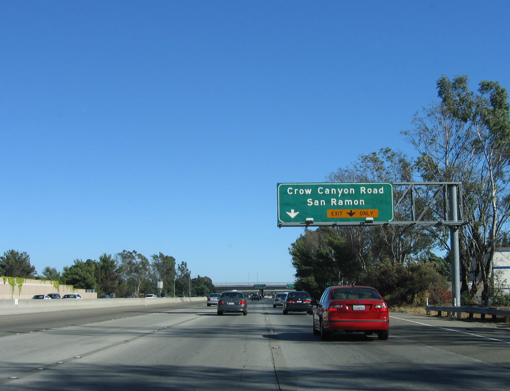
Southbound Interstate 680 approaches Exit 36, Crow Canyon Road in San Ramon, one mile. Each of these exits connects to San Ramon Valley Road, which is the original alignment of California 21, which was the original designation of the Interstate 680 corridor before the freeway was constructed. Photo taken 07/04/06. |
|
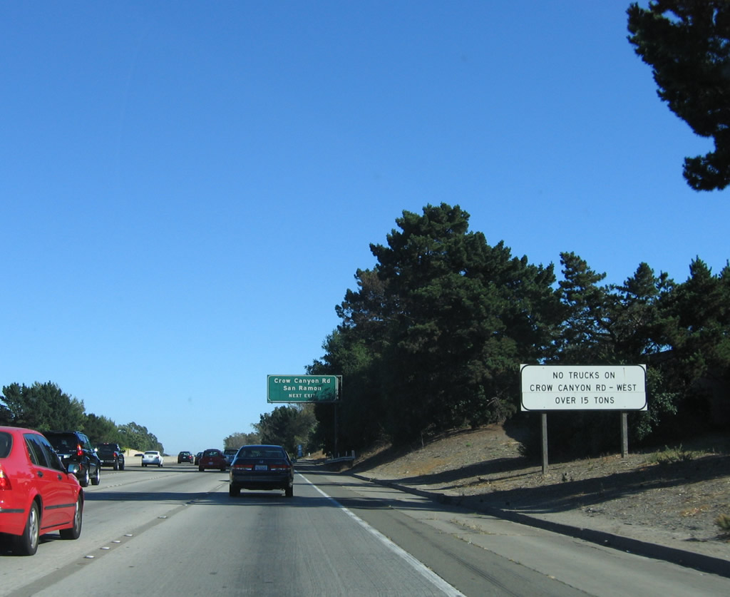
Trucks are not permitted on Crow Canyon Road west of Interstate 680. Crow Canyon Road is a through route to Interstate 580. Photo taken 07/04/06. |
|
Crow Canyon Road extends west from the freeway through San Ramon, exiting from Contra Costa County and entering Crow Canyon in rural Alameda County. The highway turns southwest, parallel to Crow Creek, and it intersects with Interstate 580 in Castro Valley, where it becomes Grove Way. Photo taken 07/04/06. |
|
The next three exits all serve San Ramon: Exit 36, Crow Canyon Road; Exit 34, Bollinger Canyon Road; and Exit 31, Alcosta Boulevard. Photo taken 07/04/06. |
|
Interstate 680 maintains its configuration of one high occupancy vehicle lane (restricted during rush hours only) and three through lanes, while a fifth lane is created to the right for entering and exiting traffic. Photo taken 07/04/06. |
|
|
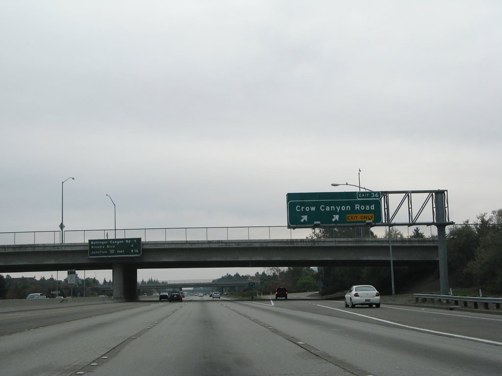
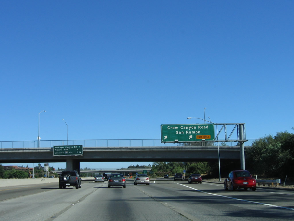
Southbound Interstate 680 reaches Exit 36, Crow Canyon Road. Note the changes to the signs between 2004 and 2007. The city name of San Ramon was removed and an exit number was added. Photos taken 11/27/07 and 07/04/06. |
|
This interchange sequence sign provides the distance to the next three exits along Interstate 680 south: Exit 34, Bollinger Canyon Road; Exit 31, Alcosta Boulevard; and Exti 30B, Interstate 580 east to Stockton, Tracy, and Los Angeles. Photo taken 07/04/06. |
|
|
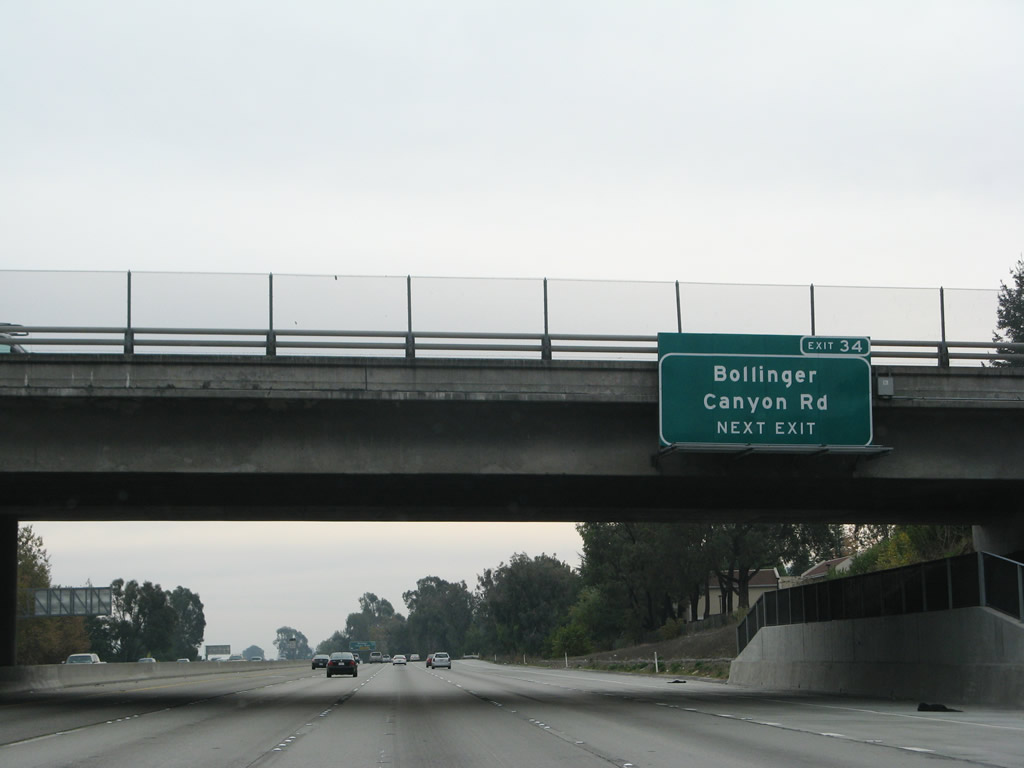
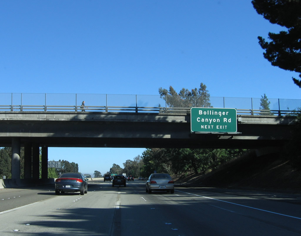
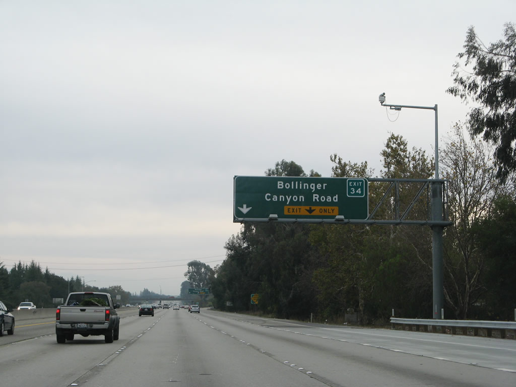
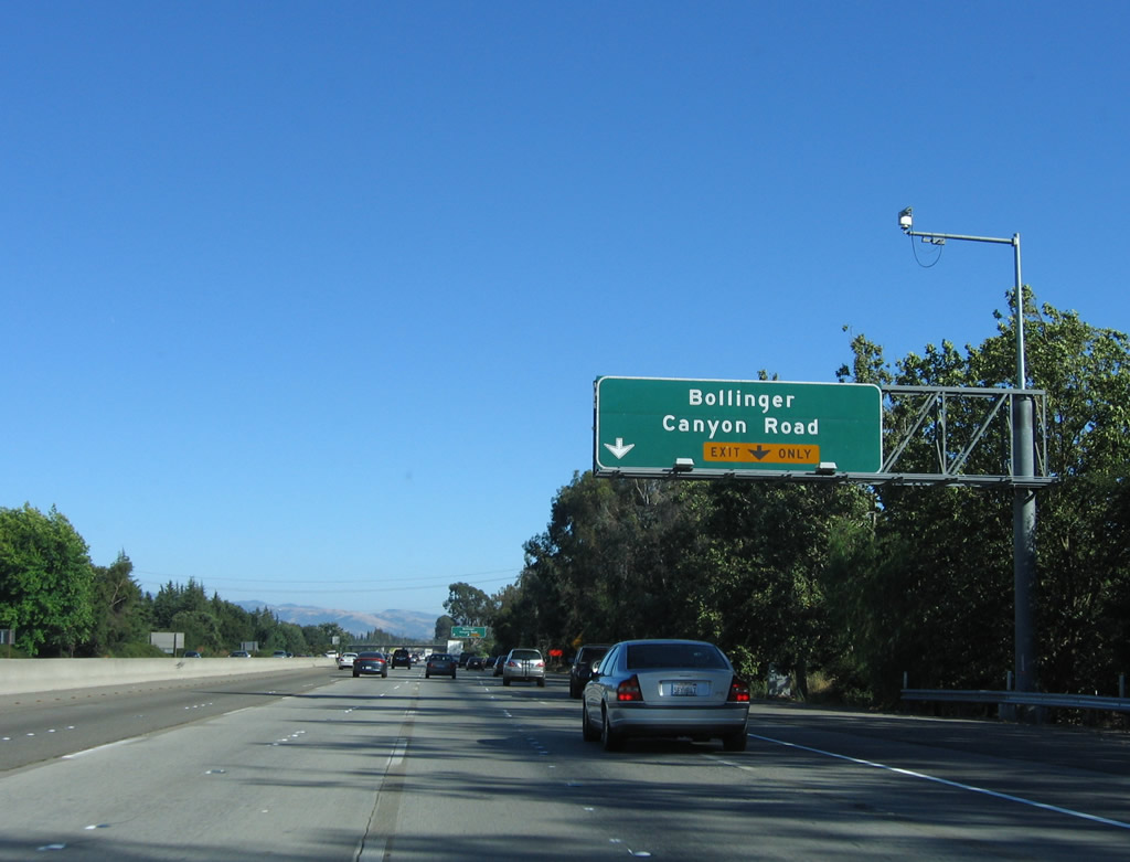
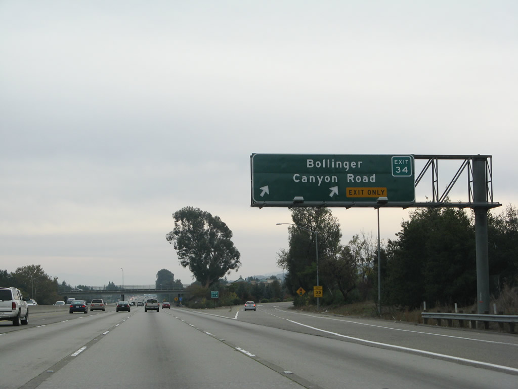
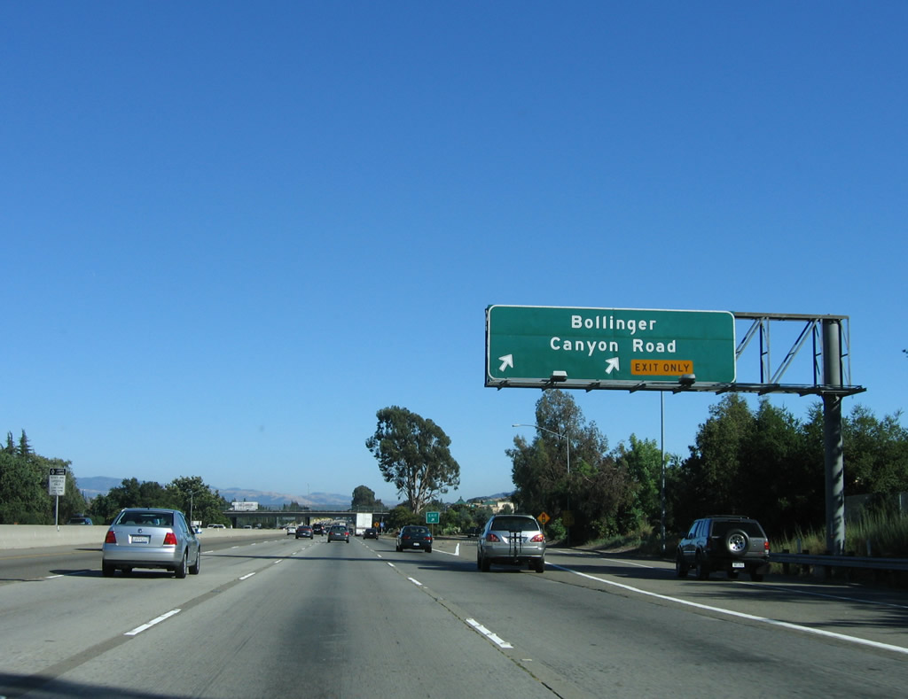
The next exit along Interstate 680 south is Exit 34, Bollinger Canyon Road, in San Ramon. Photos taken 11/27/07 and 07/04/06. |
|
|
Bollinger Canyon Road travels northwest to meet Crow Canyon Road in western San Ramon, and it travels east from this interchange to Alcosta Boulevard. Alcosta Boulevard parallels Interstate 680 to the east between Crow Canyon Road and Exit 31, which is the next interchange on Interstate 680 south. Photos taken 11/27/07 and 07/04/06. |
|
|
Southbound Interstate 680 reaches Exit 34, Bollinger Canyon Road. Again note the add-on plate for the exit number on the button copy, non-reflective sign. Photos taken 11/27/07 and 07/04/06. |
|
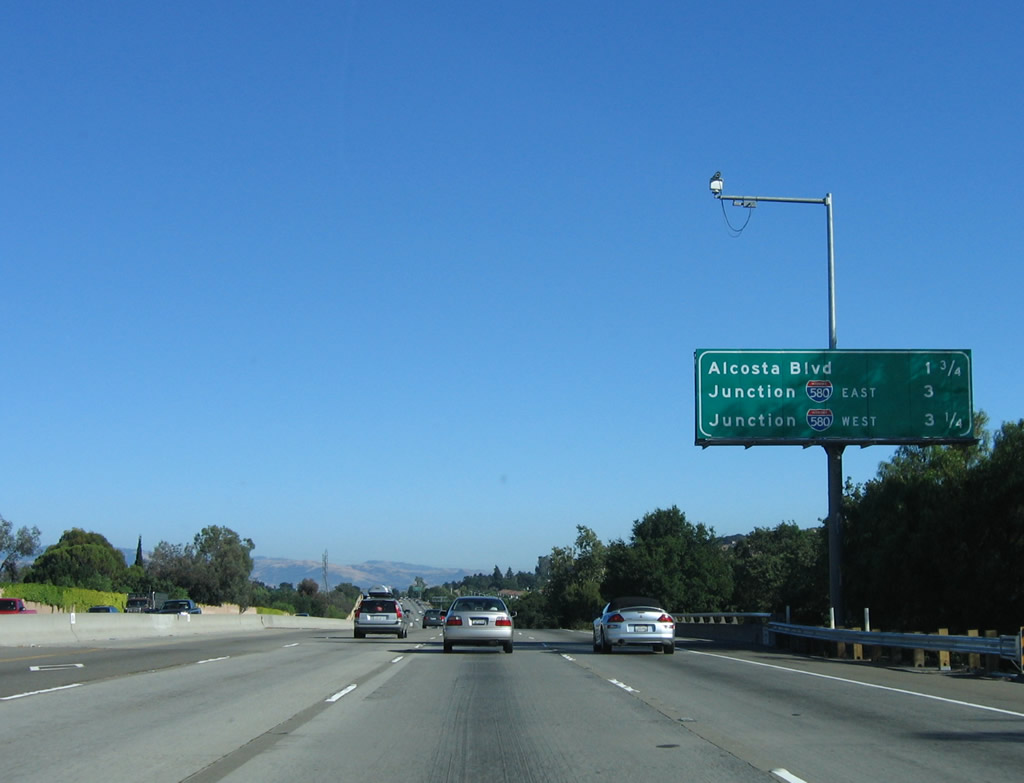
The next three exits along southbound are: Exit 31, Alcosta Boulevard; Exit 30B, Interstate 580 east; and Exit 30A, Interstate 580 west. Photo taken 07/04/06. |
|
The Alcosta Boulevard interchange serves as the county line between Contra Costa and Alameda Counties briefly, then turns north to serve the city of San Ramon in Contra Costa County. To Dublin in Alameda County, exit here and use San Ramon Road south (former California 21, which faithfully parallels Interstate 680 through San Ramon Valley on the west side of the freeway). Photo taken 07/04/06. |
|
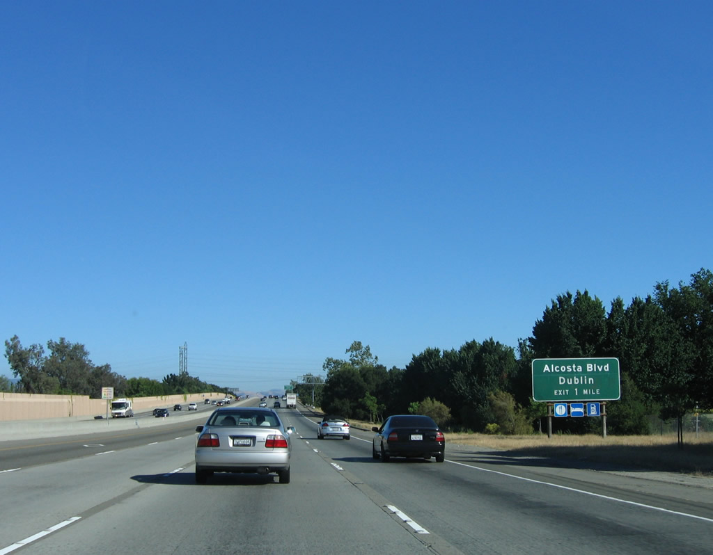
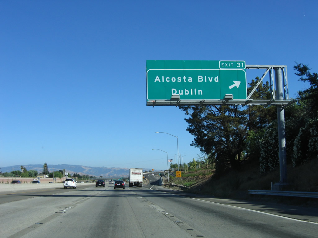
Southbound Interstate 680 reaches Exit 31, Alcosta Boulevard. With the reconstruction of the Alcosta Boulevard/Interstate 680 interchange, an exit number sign was added in 2006. Photo taken 07/04/06. |
|
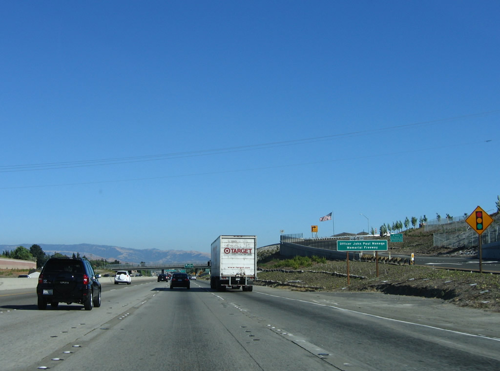
In the new configuration of the Alcosta Boulevard interchange, traffic is directed to San Ramon Boulevard. Turn south on San Ramon Boulevard to Alcosta Boulevard. Upon entering Alameda County, Interstate 680 becomes the Officer John Paul Monego Memorial Freeway. Photo taken 07/04/06. |
Page Updated August 30, 2013.