| Interstate 710 north |
|
Interstate 710 originates on Ocean Boulevard along the Seaside Freeway after its interchange with California 47 (Terminal Island Freeway) in the city of Long Beach. This view looks east from the on-ramp from California 47 to Interstate 710 north. Photo taken 09/28/08. |
|
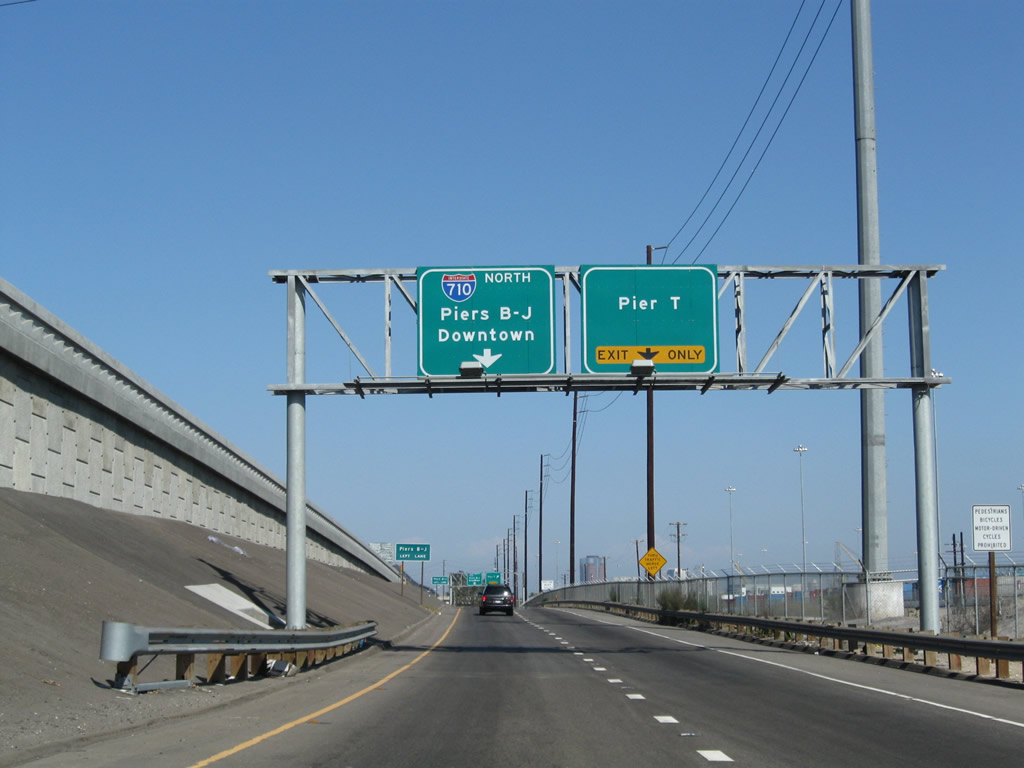
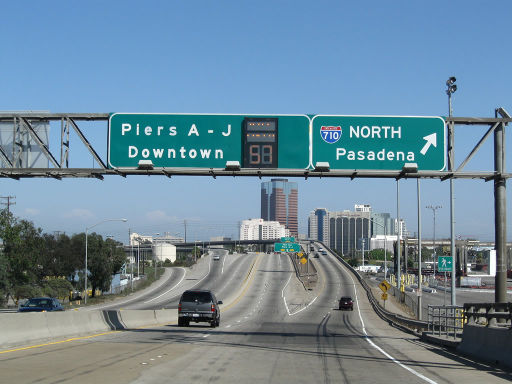
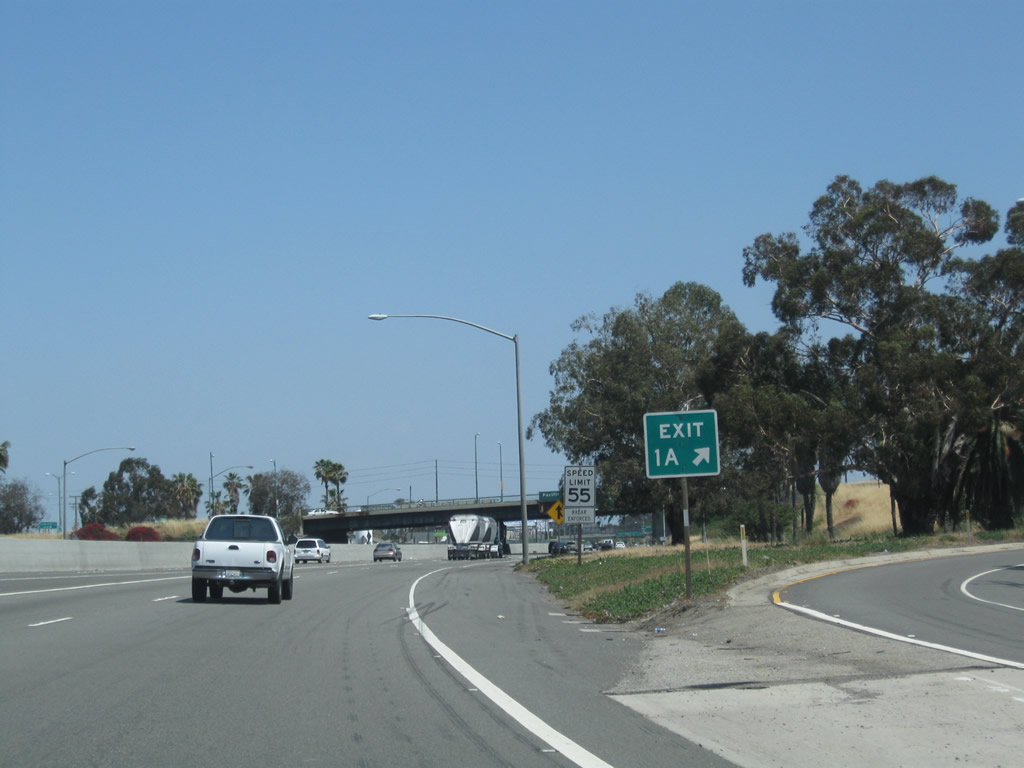
For Piers B through J, use the left lane. Stay right for Exit 1A, Pier T. Photo taken 09/28/08. |
|
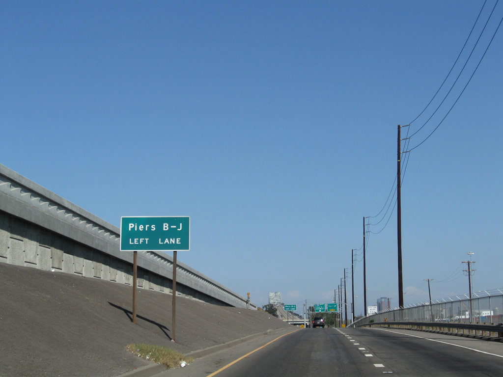
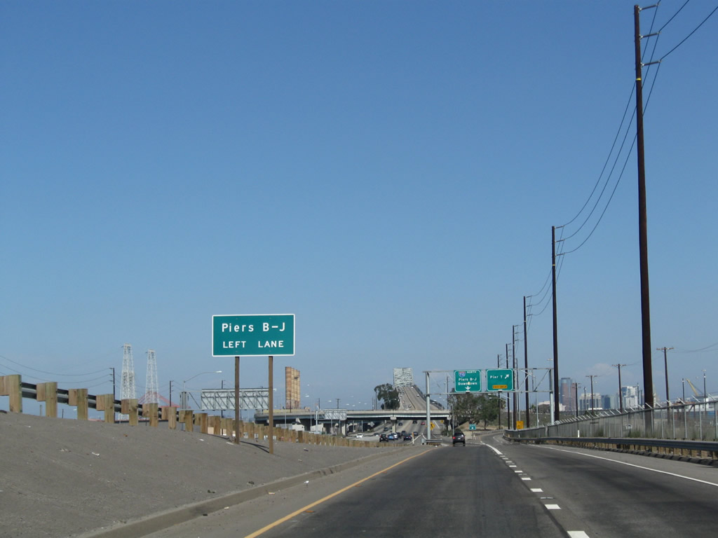
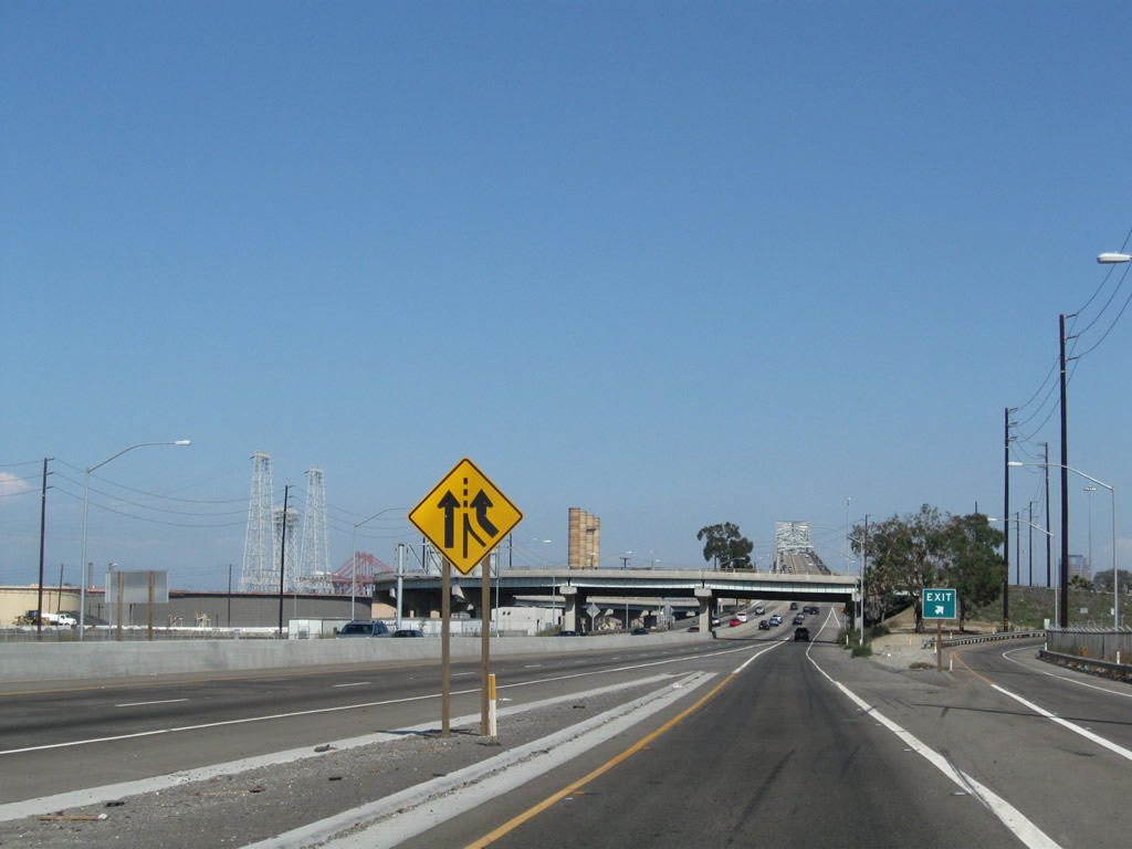
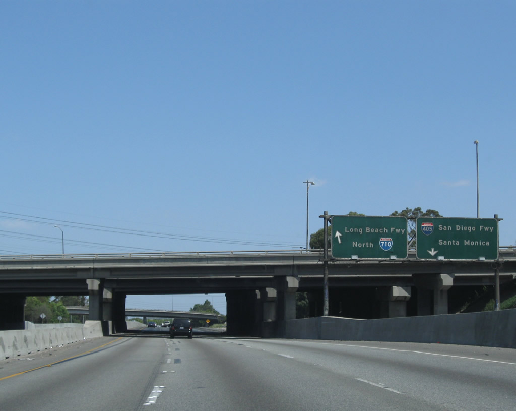
A second sign advises traffic to stay left for Piers B through J. These piers are on the east side of the Gerald Desmond Bridge. The next ramp connects to Exit 1A, Pier T. Ahead, traffic from California 47 merges onto Interstate 710 (Ocean Boulevard) from the left. Photo taken 09/28/08. |
|
Northbound Interstate 710 (Ocean Boulevard) meets Exit 1A, Pier T. Photo taken 09/28/08. |
|
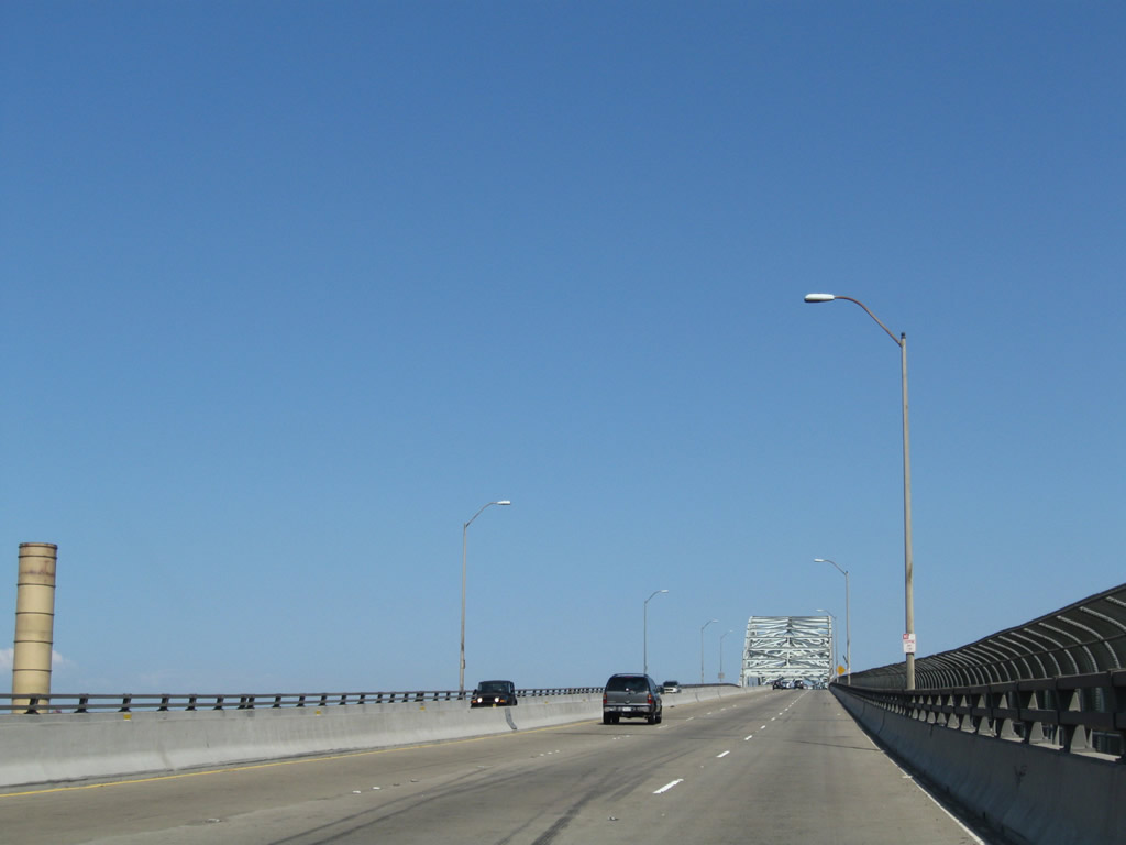
Two lanes of traffic from California 47 merge onto Interstate 710 north after the Pier T off-ramp. Ahead, Interstate 710 ascends the Gerald Desmond Bridge. Photo taken 09/28/08. |
|
The interchange with Pier T Avenue involves some looping ramps, including this one that connects Interstate 710 south with Pier T Avenue. Photo taken 09/28/08. |
|
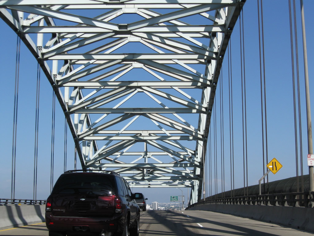
Leaving the Pier T interchange, Interstate 710 (Ocean Boulevard) next ascends the Gerald Desmond Bridge. This bridge was built high to allow for commercial shipping traffic to pass well below it, but with recent advances in shipping technology, today's container ships are sometimes too large to fit under the bridge. As a result, it is likely to be replaced within the next ten years or so (ideally scheduled for opening around 2016), pending identification of funding by the Port of Long Beach and Caltrans. The bridge deck would be raised from 150 feet above the water's surface to 200 feet. This new bridge would be cable stayed rather than through-arch. Photo taken 09/28/08. |
|
|
|
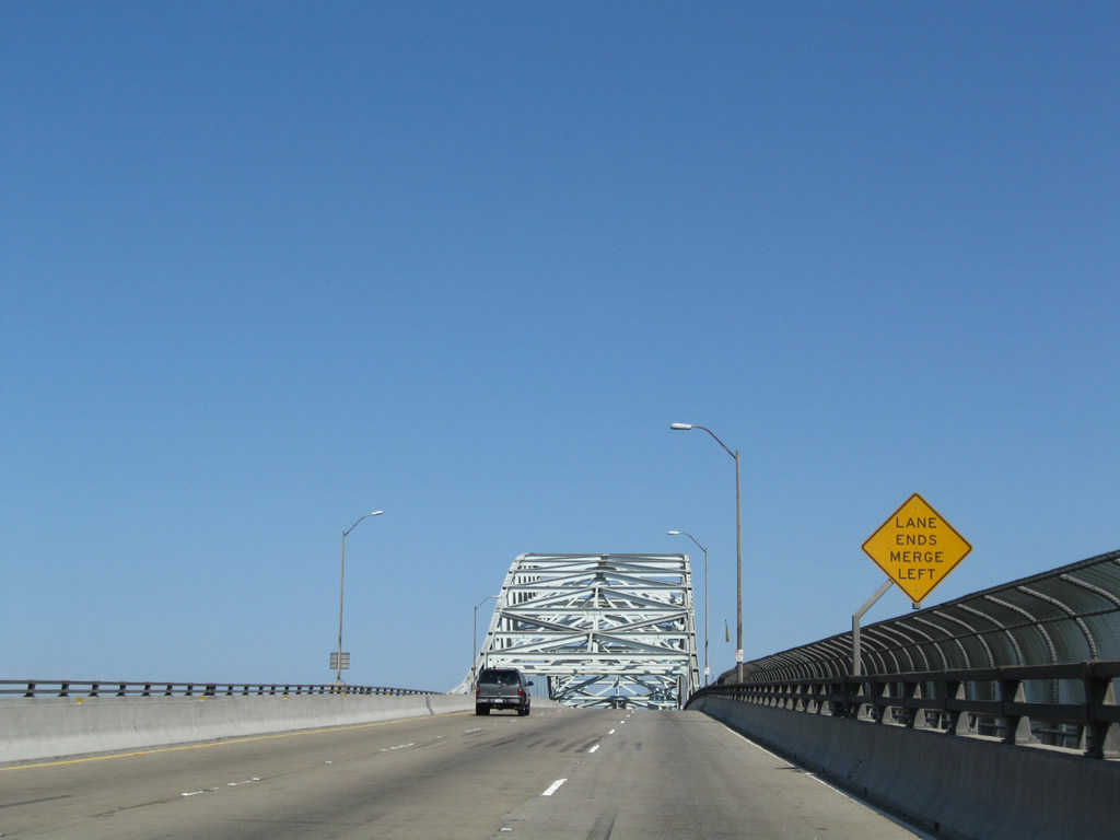
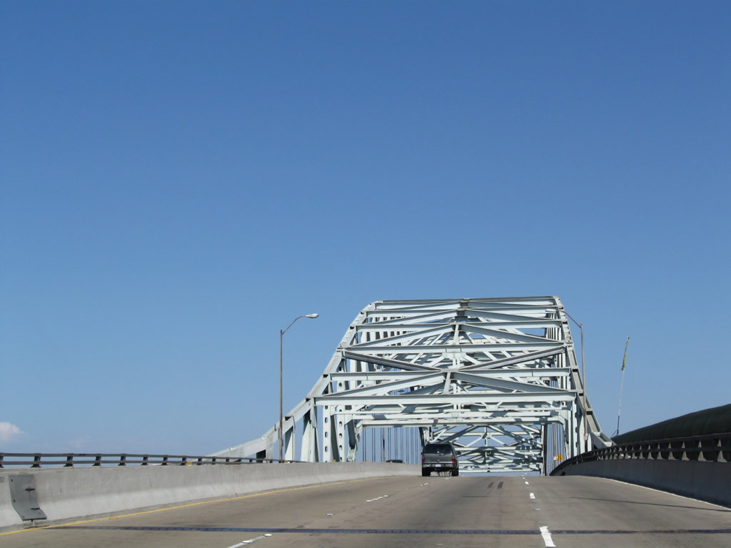
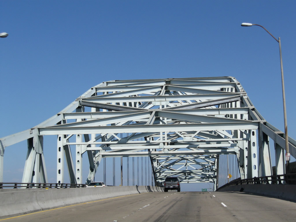
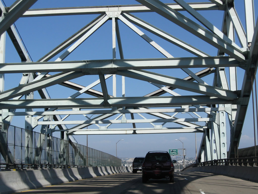
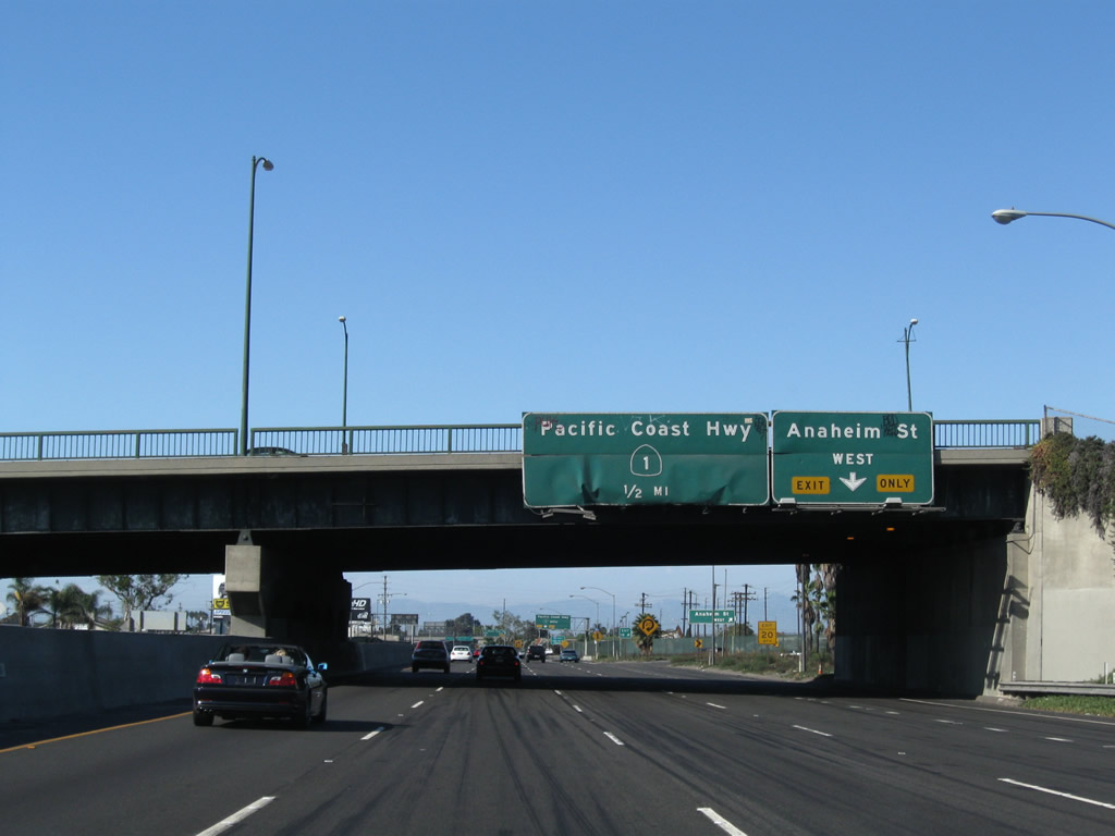
This series of pictures follows Interstate 710 as it travels north (east) over the Gerald Desmond Bridge. A pedestrian walkway lines the south side of the bridge (visible to the right in these pictures). This bridge was built in 1968 as a third route onto Terminal Island to serve the Ports of Long Beach and Los Angeles. Other bridges that connect to Terminal Island include the Commodore Heim Bridge (1948) and Vincent Thomas Bridge (1963), both of which are part of California 47. As seen by the lack of shoulders and tight lanes, this bridge is not Interstate standard and probably could not be upgraded cheaply to those standards. Photos taken 09/28/08. |
|
|
|
|
|
|
|
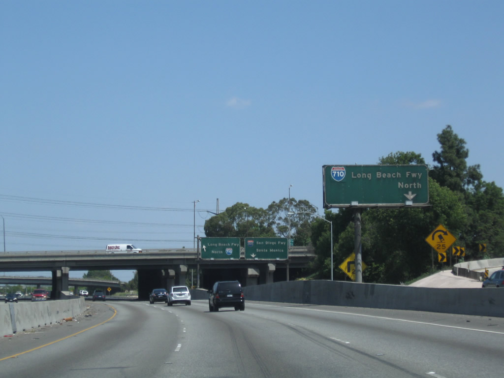
Nearing the base of the Gerald Desmond Bridge, northbound Interstate 710 and Ocean Boulevard split at Exit 1B. Stay left to follow Ocean Boulevard east into downtown Long Beach, or exit right for the continuation of Interstate 710 north to Pasadena. Photo taken 09/28/08. |
| Interstate 710 (Long Beach Freeway) north |
|
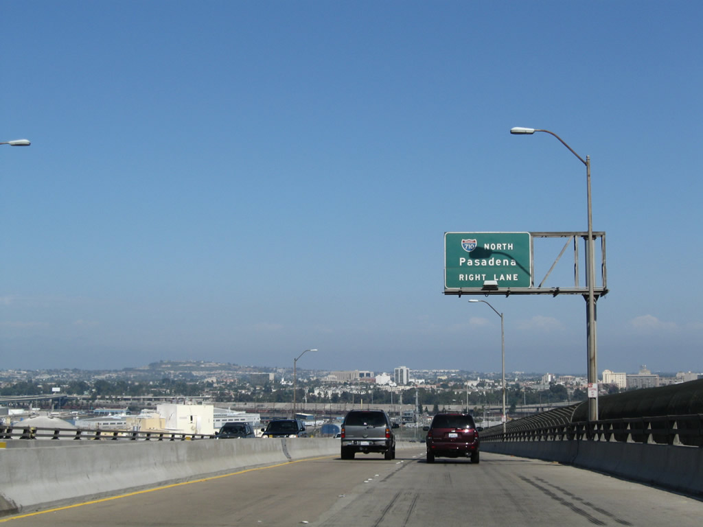
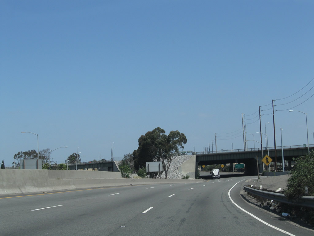
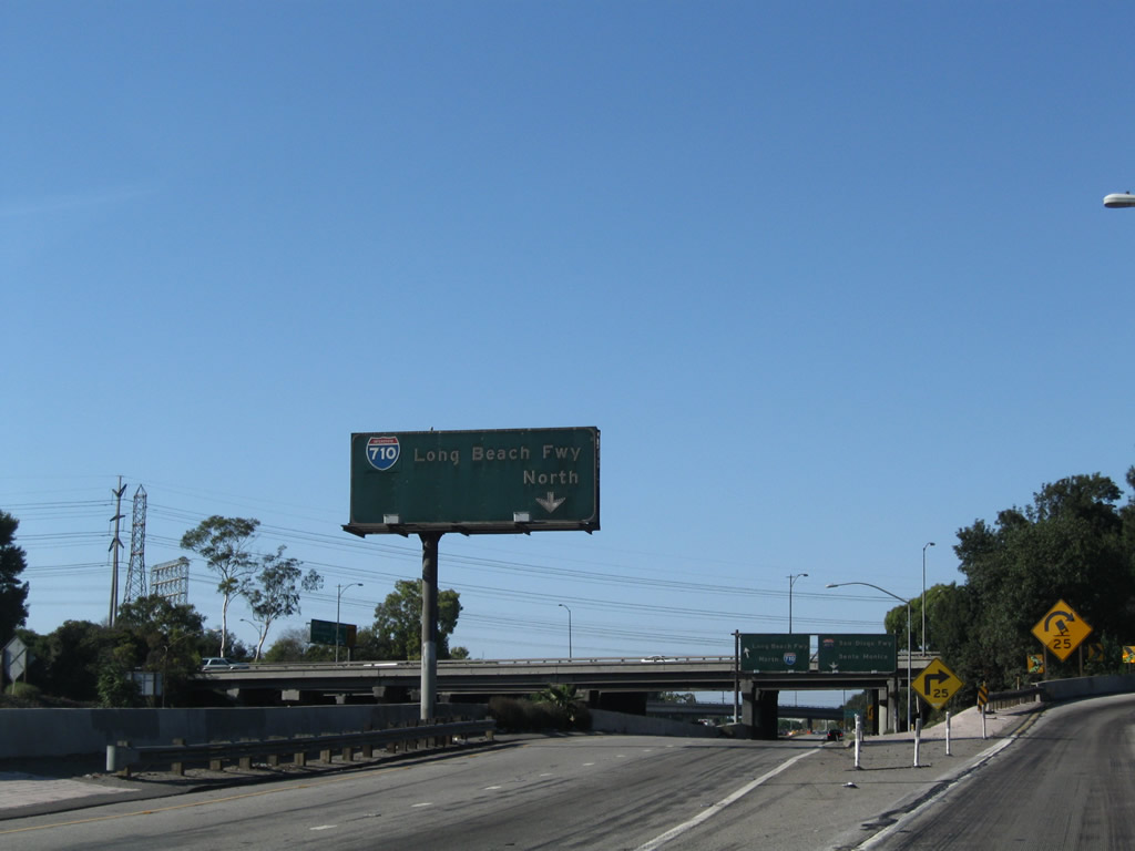
This is the first Interstate 710 north reassurance shield assembly after the mainline traffic on Gerald Desmond Bridge/Ocean Boulevard merges with traffic from Harbor Scenic Drive. The first exit is Exits 1A-B, Anaheim Street, in one mile. The overpass in the distance brings the third Interstate 710 spur from Terminal Island. Photo taken 05/02/10. |
|
This mileage sign provides the distance to the next six exits along Interstate 710 (Long Beach Freeway) north: Exits 1C-D, Anaheim Street; Exits 2A-B, California 1 (Pacific Coast Highway); and Exits 3A-B, Willow Street. Each of the first three interchanges are of the cloverleaf design. Photo taken 05/02/10. |
|
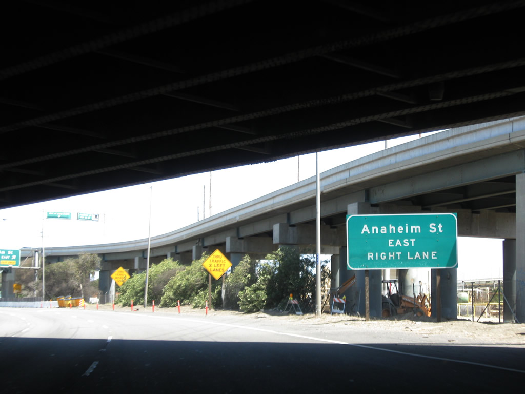
Use Exit 1D, Anaheim Street west to Piers A and B of the Port of Long Beach. Photo taken 05/02/10. |
|
This looping flyover ramp carries traffic from Pico Avenue and Ninth Street onto Interstate 710 north. Traffic on eastbound Ninth Street is ultimately defaulted directly onto Interstate 710 north via this ramp, which curves south, east, and then north to join the northbound freeway. Truck traffic from Piers B, C, and D could use this ramp to access Interstate 710 north toward Los Angeles and the regional freeway grid. Photo taken 05/02/10. |
|
The left three lanes of Interstate 710 continue north as traffic from Ninth Street merges onto the freeway on the right. Photo taken 05/02/10. |
|
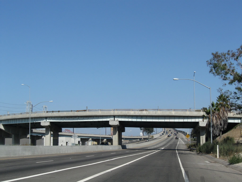
Interstate 710 north passes under the off-ramp from Interstate 710 south to Shoreline Drive south and the on-ramp from Shoreline Drive onto Interstate 710 north. This major freeway off-ramp is part of the most direct route from Interstate 710 south into downtown Long Beach. Traffic from Shoreline Drive will merge onto Interstate 710 north a short distance ahead from the left side. Photo taken 05/02/10. |
|
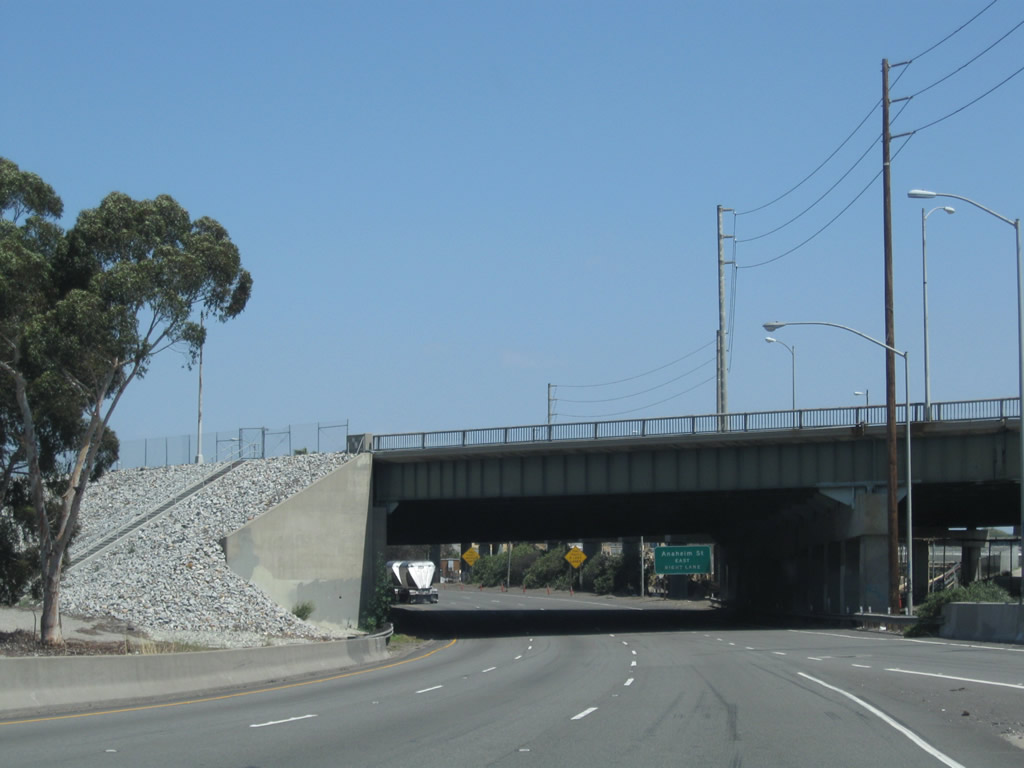
Passing under Shoreline Drive, the next exit along Interstate 710 (Long Beach Freeway) north is Exit 1C, Anaheim Street east into residential Long Beach. Photo taken 05/02/10. |
|
Northbound Interstate 710 (Long Beach Freeway) reaches Exit 1C, Anaheim Street east to Long Beach. The next exit along northbound is Exit 1D, Anaheim Street west to Piers A and B of the Port of Long Beach. Overhead, a ramp connecting Shoreline Drive north to Ninth Street east flies over Interstate 710. To Ninth Street west from Interstate 710 north, use Exit 1D (Anaheim Street west). Note that the right lane ends at the point where Exit 1C departs from the freeway. Photo taken 05/02/10. |
|
As Caltrans assumes maintenance of Interstate 710 at the point where the ramps from Ocean Boulevard east and Harbor Scenic Drive north. As a result, Caltrans considers Anaheim Street to be the first official interchange along Interstate 710 and thus refers to this exit as "Exit 1A." However, that designation omits the previous two interchanges along Interstate 710 north (Exit 1A, Pier T and Exit 1B, Ocean Boulevard east to downtown Long Beach). So for our purposes, we refer to this off-ramp as Exit 1C even though officially it is Exit 1A. Photo taken 05/02/10. |
|
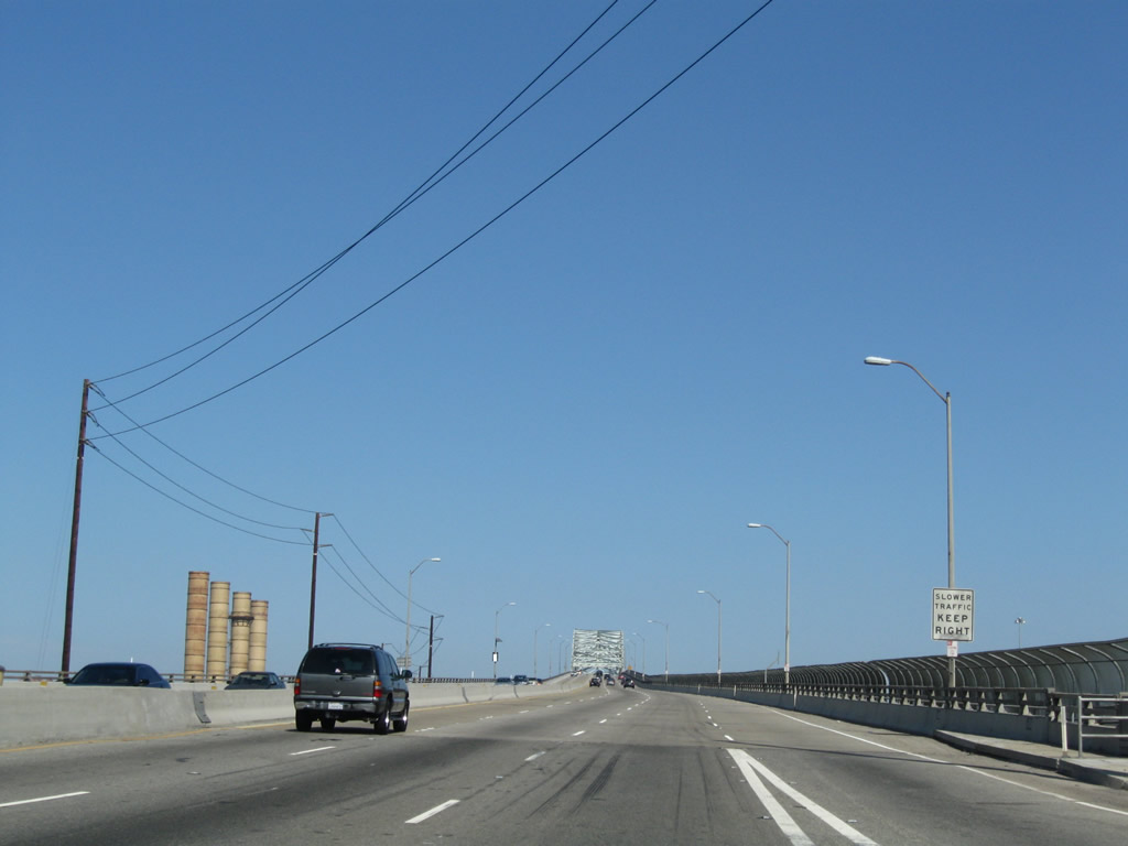
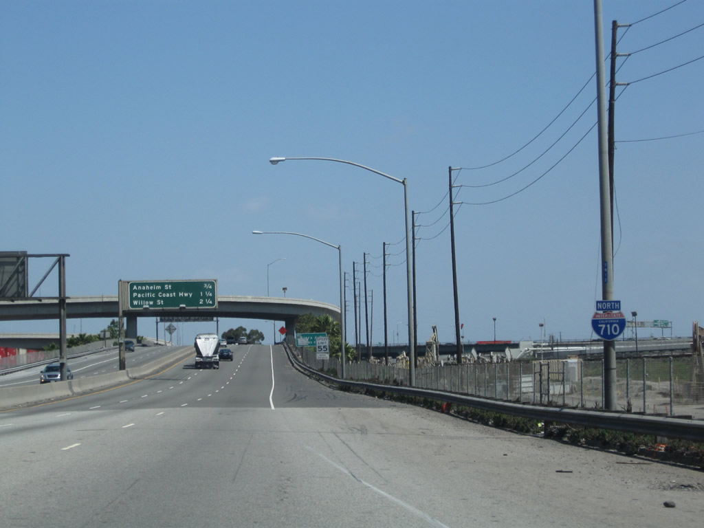
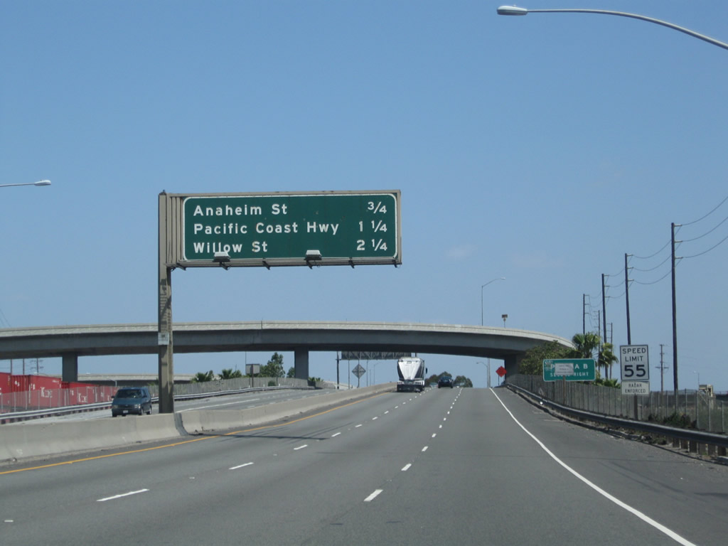
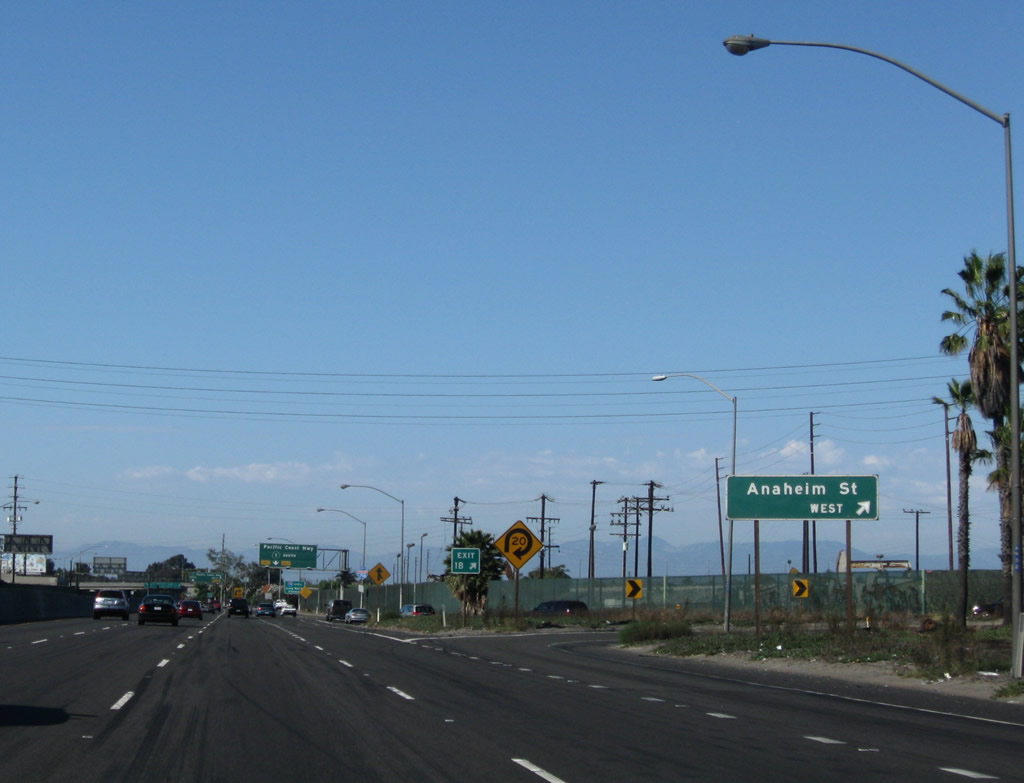
Traffic from Shoreline Drive north merges onto Interstate 710 north. The freeway promptly passes under the Anaheim Street bridge. The next three exits from Interstate 710 north are Exit 1D, Anaheim Street west and Exits 2A-B, California 1 (Pacific Coast Highway). These are some old and battered signs. Note the unusual abbreviation of the word "mile" on the signage for Exit 2, California 1 (Pacific Coast Highway). By 2010, the bottom of this sign was ripped off; look for a replacement sign here soon. Photo taken 09/28/08. |
|
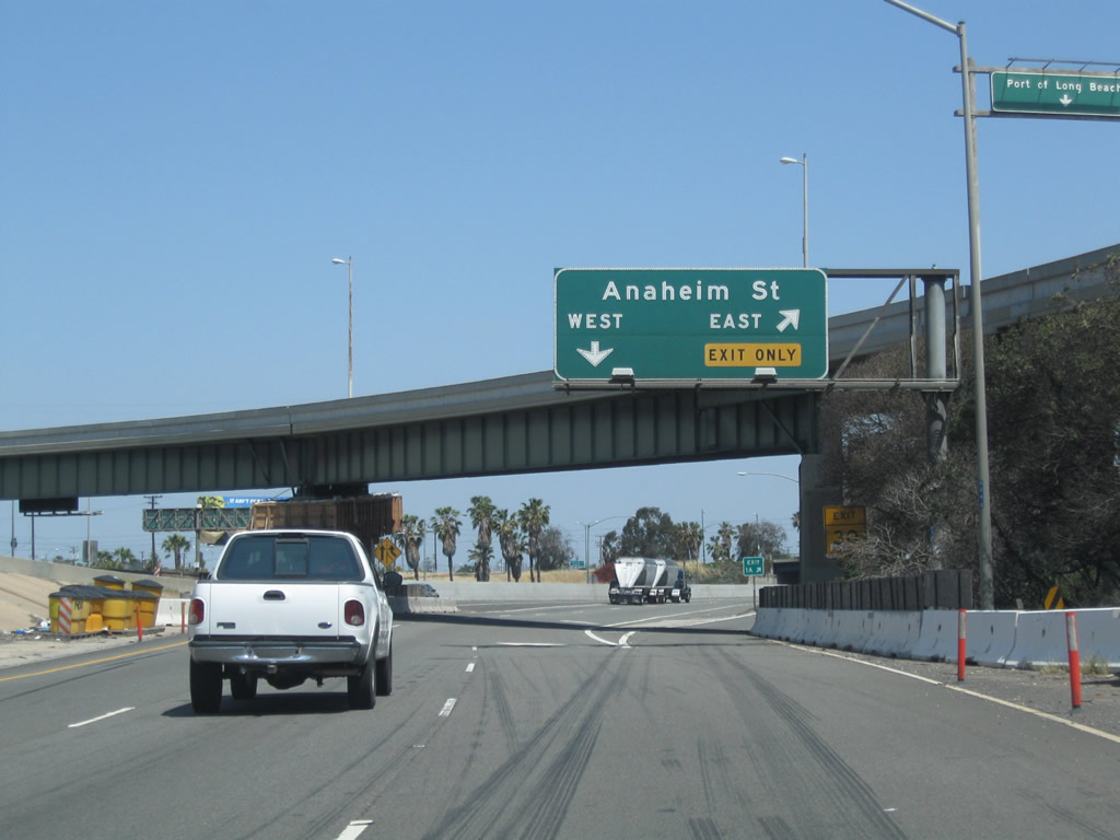
Northbound Interstate 710 (Long Beach Freeway) reaches Exit 1B, Anaheim Street west to the Port of Long Beach Piers A and B. With the added traffic from Shoreline Drive, Interstate 710 north widens to four lanes. Photo taken 09/28/08. |
|
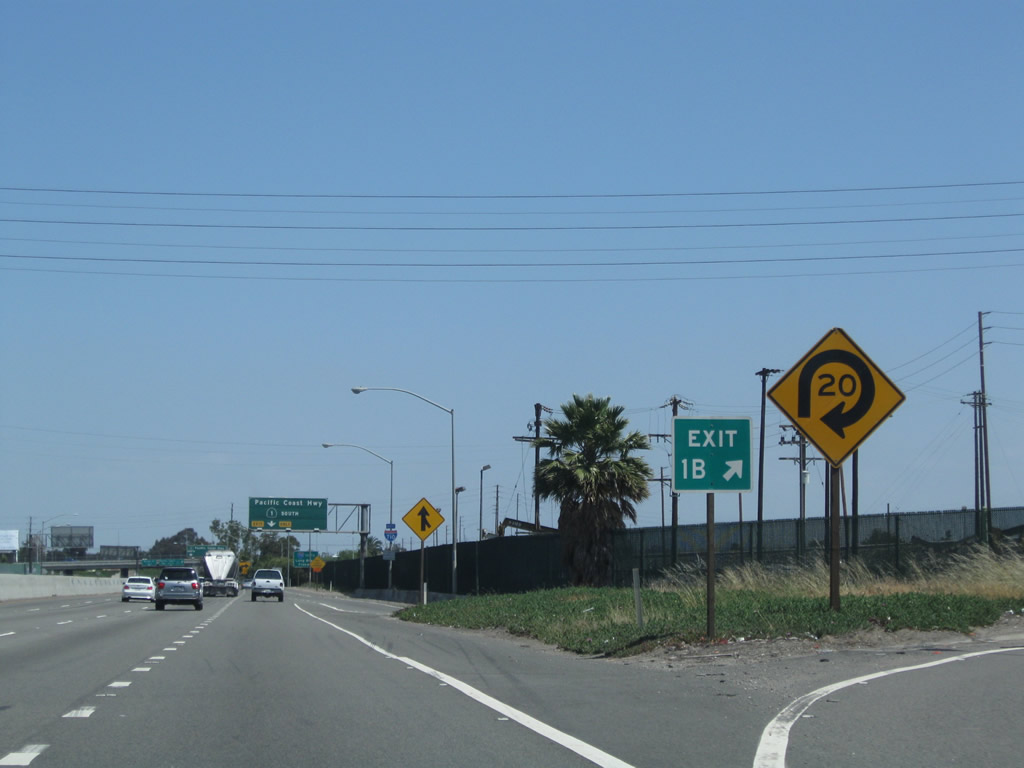
The loop ramp to Anaheim Street west has a sharp curve requiring significant slowing. Exit 1D is signed here as Exit 1B for the reasons described at the entry for the Exit 1A gore point (see above). Photo taken 09/28/08. |
|
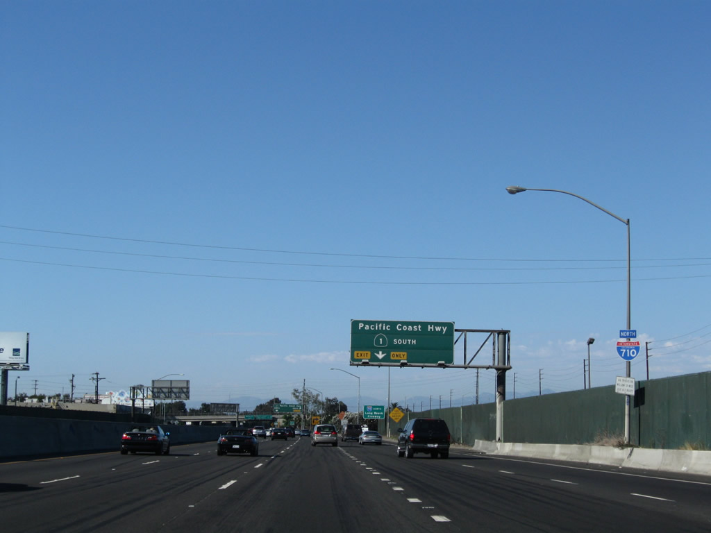
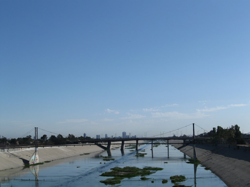
An Interstate 710 north reassurance shield is posted after the on-ramp from Anaheim Street. The next exit along northbound is Exits 2A-B, California 1 (Pacific Coast Highway). Not visible from the freeway is the Los Angeles River, which is behind the green fence and closely follows Interstate 710 just east of here. Photo taken 09/28/08. |
|
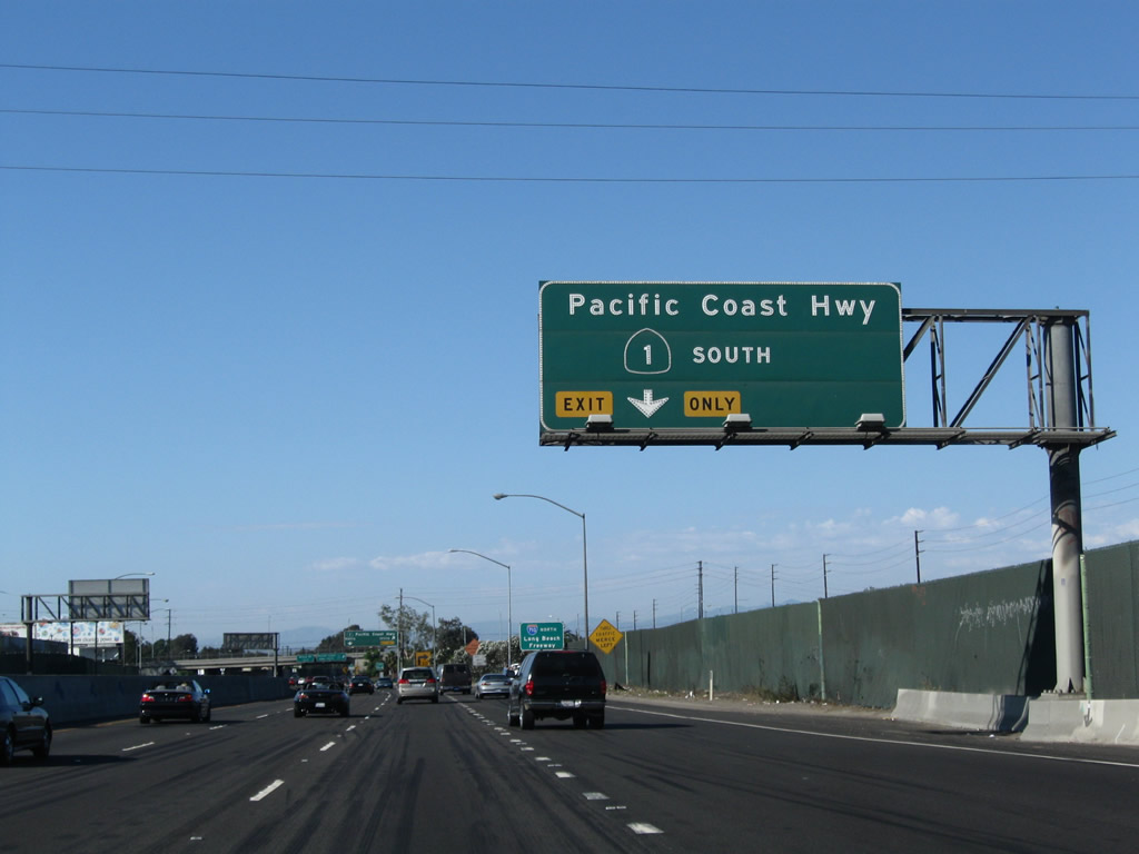
The right lane of Interstate 710 (Long Beach Freeway) north becomes exit only for the next off-ramp, which connects to Exit 2A, California 1 (Pacific Coast Highway) south (east). California 1 actually travels east-west through Long Beach, so the directions may be a bit confusing. Use California 1 north to travel west or California 1 south to travel east. Photo taken 09/28/08. |
|
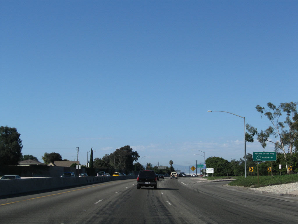
Interstate 710 is the Long Beach Freeway; signs similar to this one may be found elsewhere on the Los Angeles freeway system to inform motorists of the designated name of the freeway in addition to the route number. Photo taken 05/02/10. |
|
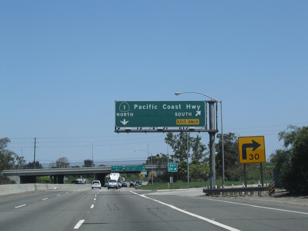
Northbound Interstate 710 (Long Beach Freeway) reaches Exit 2A, California 1 (Pacific Coast Highway) south (east). Use California 1 east to the community of Wrigley (part of the city of Long Beach) and the city of Signal Hill. The left three lanes of the freeway continue north along Interstate 710. Photo taken 05/02/10. |
|
|
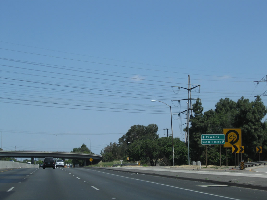
The next exit on Interstate 710 (Long Beach Freeway) north is Exit 2B, California 1 (Pacific Coast Highway) north (west). This is a cloverleaf interchange, but it is very tight due to the presence of the Los Angeles River to the east of the freeway. Hopefully the construction work will help revise this interchange to make the exit less sharp. The next exit is Exit 3, Willow Street, one mile. Note the changes between the original guide signs (porcelain enamel) and the newer reflective signs. Photos taken 05/02/10 and 03/30/03. |
|
Northbound Interstate 710 (Long Beach Freeway) reaches Exit 2B, California 1 (Pacific Coast Highway) north. The roadside sign is rather unusual and is generally not found on freeways in this manner. Normally there is only the overhead sign. Photo taken 09/28/08. |
|
This Interstate 710 north reassurance shield is posted after the on-ramp from California 1 (Pacific Coast Highway). Photo taken 09/28/08. |
|
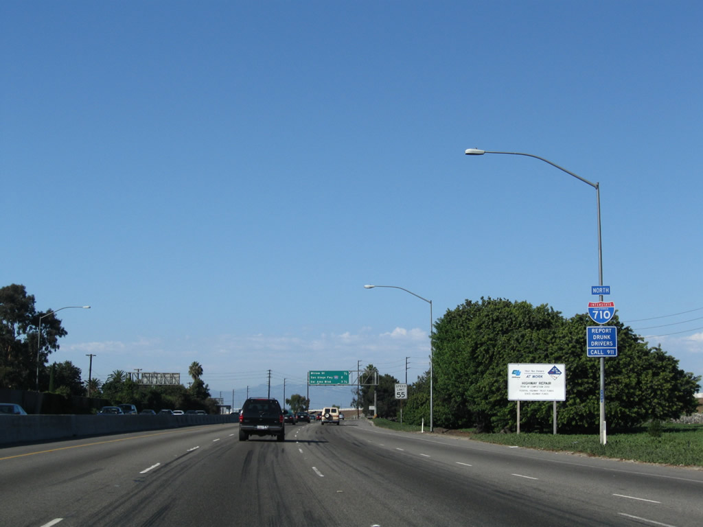
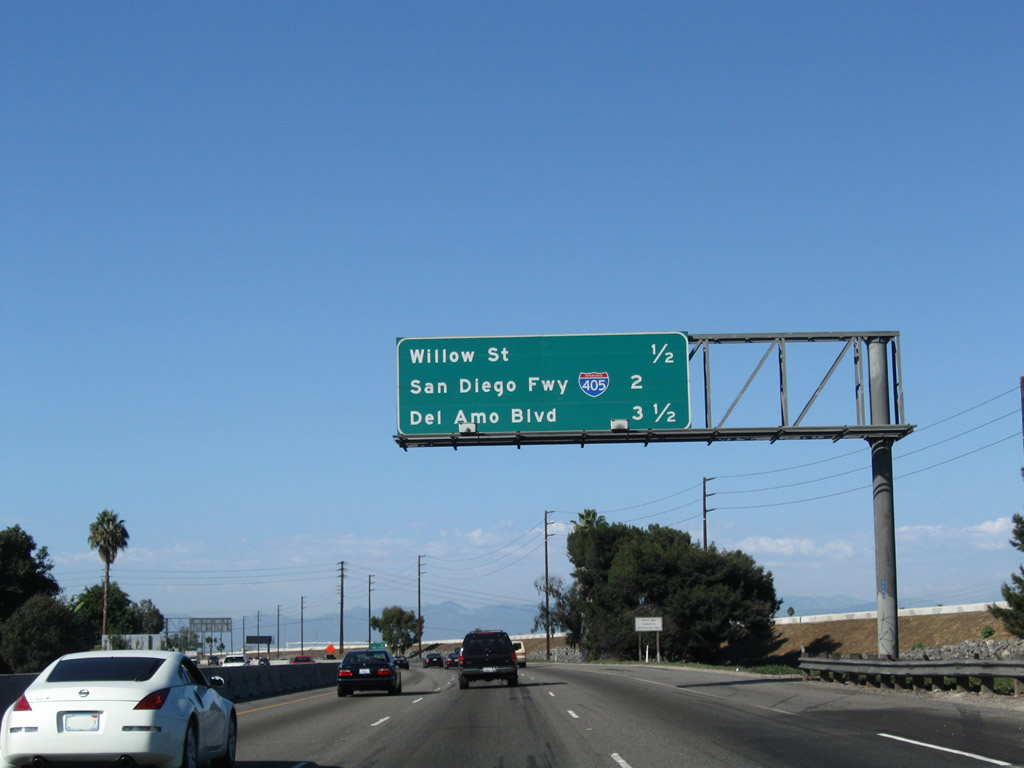
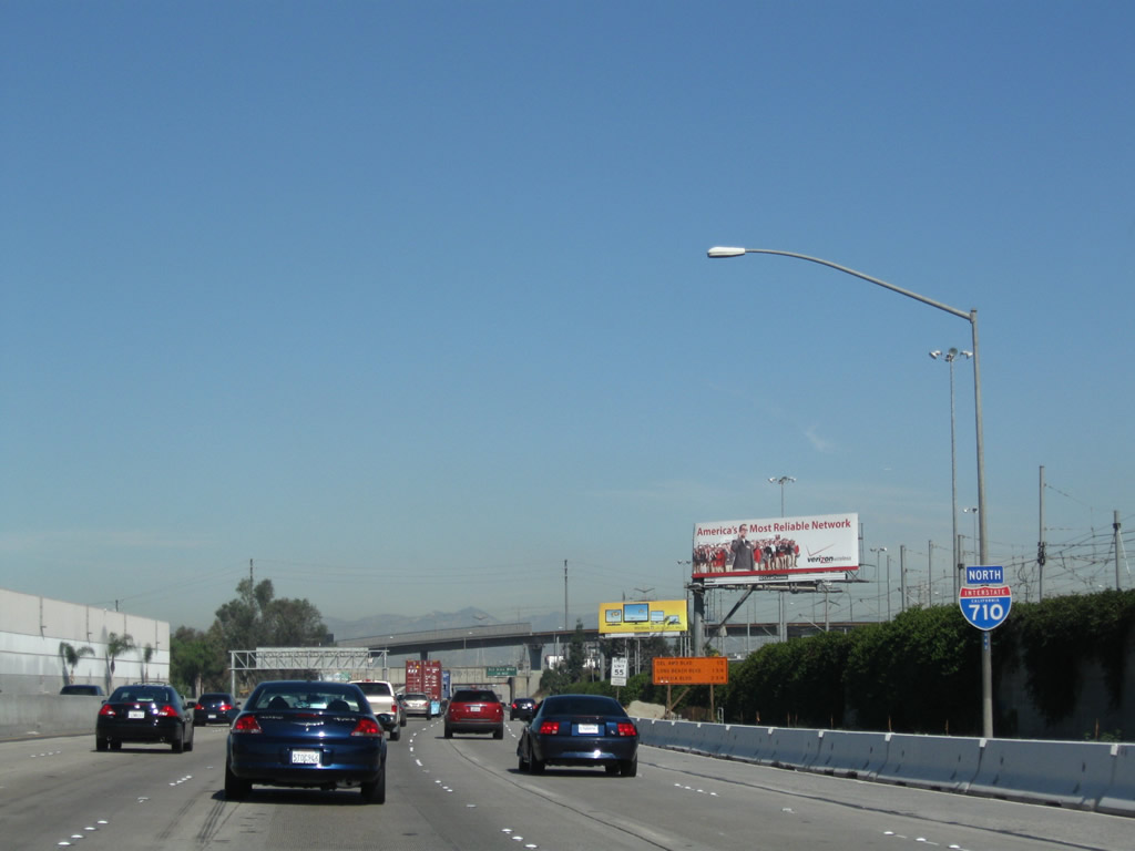
The next five exits along Interstate 710 (Long Beach Freeway) north are Exits 3A-B, Willow Street; Exit 4, Interstate 405 (San Diego Freeway); and Exits 6A-B, Del Amo Boulevard. This is a rare new sign that still includes the freeway name; many other newer signs in Los Angeles do not use the freeway name. Photo taken 09/28/08. |
|
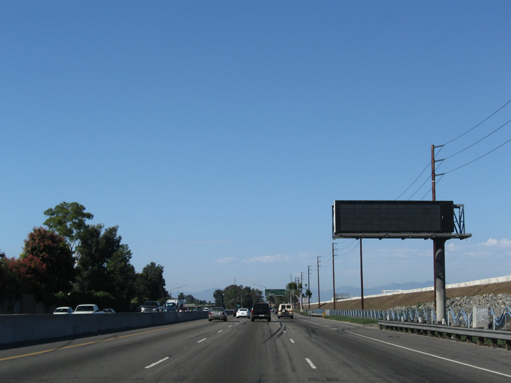
A dynamic message sign is posted on Interstate 710 north. Photo taken 09/28/08. |
|
Northbound Interstate 710 (Long Beach Freeway) reaches Exit 3A, Willow Street eastbound. The next ramp for this stretched cloverleaf is Exit 3B, Willow Street westbound. Photo taken 09/28/08. |
|
The gore point is posted as Exit 3A for Willow Street east. Photo taken 09/28/08. |
|
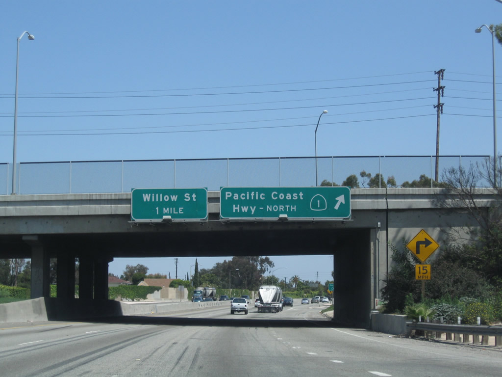
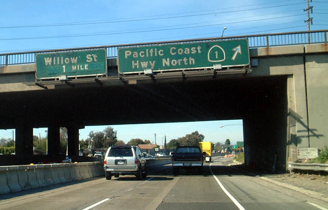
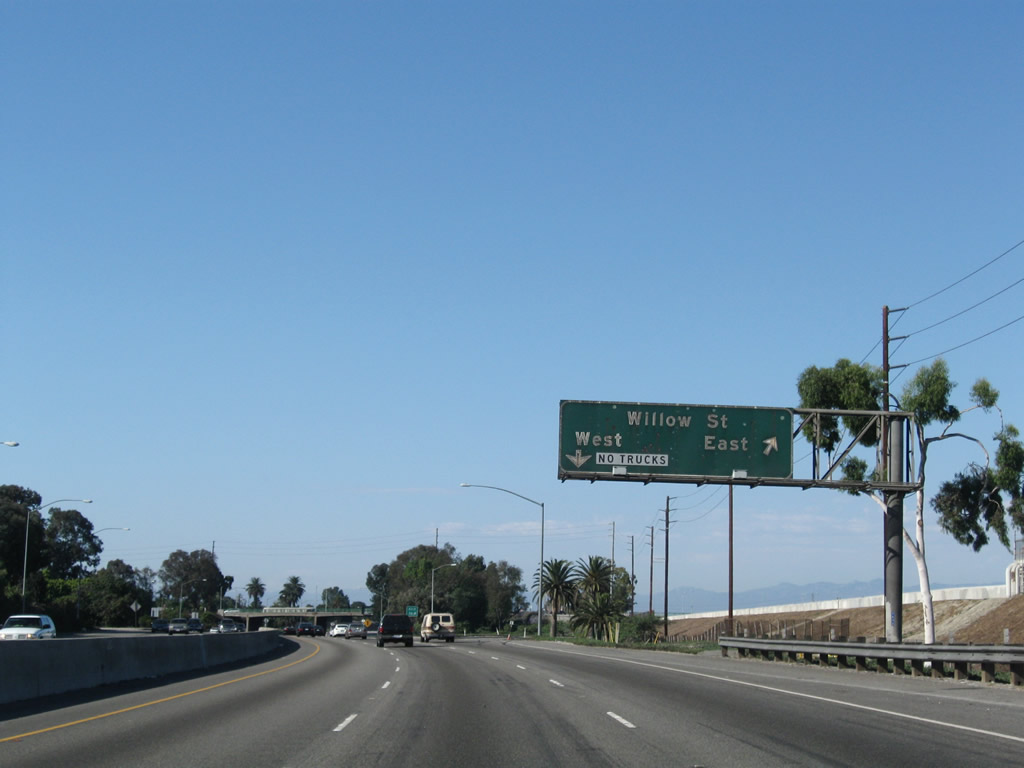
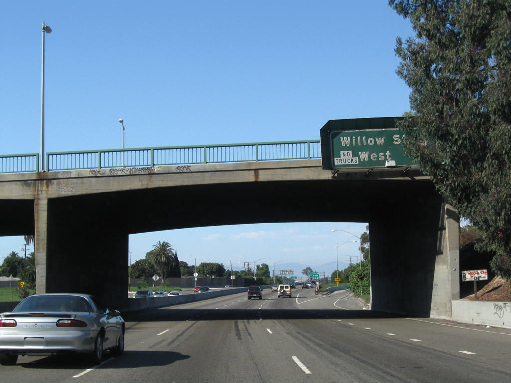
The next exit along northbound Interstate 710 (Long Beach Freeway) is Exit 3B, Willow Street westbound. Use Willow Street west to reach Santa Fe Avenue, the northern terminus of California 103 (Terminal Island Freeway), and California 47/Alameda Corridor. Even though Interstate 710 has been marked as the alternative to California 47, no signs are present here to advise motorists to depart Interstate 710 at Exit 3B to rejoin California 47 (Alameda Street) northbound. Photo taken 09/28/08. |
|
The off-ramp to Exit 3B is a loop ramp that curves onto Willow Street west. Use Willow Street west to California 103 (Terminal Island Freeway). Upon entering Los Angeles, Willow Street changes into Sepulveda Boulevard. Photo taken 09/28/08. |
|
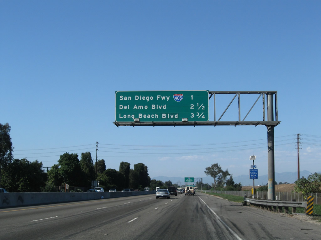
This mileage sign along Interstate 710 (Long Beach Freeway) north provides the distance to the next three exits: Exit 4, Interstate 405 (San Diego Freeway) south to Irvine and San Diego and north to Los Angeles International Airport and Santa Monica; Exits 6A-B, Del Amo Boulevard; and Exit 7, Long Beach Boulevard. Photo taken 09/28/08. |
|
Interstate 405 is a major north-south freeway in greater Los Angeles. Originating at the El Toro Y Interchange in Irvine, Interstate 405 travels northwest parallel to the coastline in Orange County, then turns west to pass through Long Beach. In Torrance, Interstate 405 curves north and parallels Sepulveda Boulevard (former California 7) past Los Angeles International Airport and Santa Monica en route to merging back with Interstate 5 in Sylmar. The entire route is known as the San Diego Freeway, which also includes Interstate 5 from Irvine south to San Diego. Photo taken 09/28/08. |
|
The left three lanes continue along northbound Interstate 710 (Long Beach Freeway), while the right lane becomes exit only for Interstate 405 north to Santa Monica and Los Angeles International Airport (LAX) and south to Irvine and San Diego. Like California 1, Interstate 405 travels east/west through Long Beach even though it is signed north/south. Photo taken 09/28/08. |
|
Interstate 710 passes under Wardlow Road prior to the Interstate 405 off-ramp. Photo taken 09/28/08. |
|
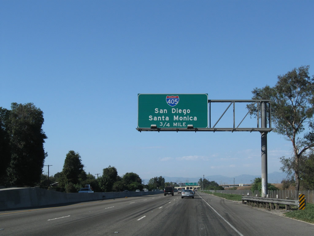
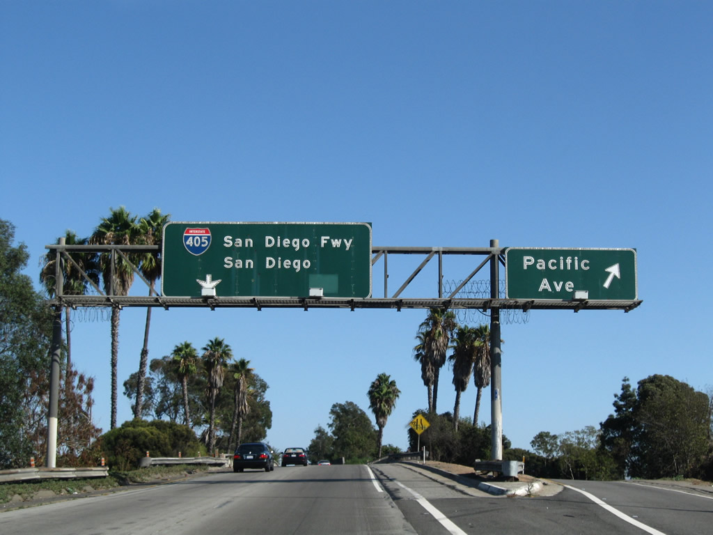
Northbound Interstate 710 (Long Beach Freeway) reaches Exit 4, Interstate 405 (San Diego Freeway) north to Santa Monica and Los Angeles International Airport (LAX) and south to Irvine and San Diego. Upon exiting, traffic from Wardlow Road merges onto the off-ramp, making Exit 4 a collector distributor lane configuration. This means that traffic exiting here may return to Interstate 710 north. Photo taken 09/28/08. |
|
Now on the transition ramp, the two left lanes will connect to Interstate 405 (San Diego Freeway) northwest to Santa Monica and Los Angeles International Airport (LAX), while the right lane exits onto Interstate 405 southeast to Westminster, Costa Mesa, Irvine, and Interstate 5 to San Diego. Photo taken 09/28/08. |
|
|
An old porcelain enamel overhead guide sign advises that the collector distributor lanes will continue north to rejoin Interstate 710 north. The next exit from the c-d lanes is the loop ramp connecting to Interstate 405 (San Diego Freeway) north. Photos taken 05/02/10 and 09/28/08. |
|
Traveling along the transition ramp from Interstate 710 (Long Beach Freeway) north to Interstate 405 (San Diego Freeway) south, an off-ramp links to Pacific Avenue. Photo taken 09/28/08. |
|
This view looks south down the Los Angeles River as seen from the transition ramp from Interstate 710 north to Interstate 405 north. Photo taken 09/28/08. |
|
Back on the mainline, this view looks at the connection from the northbound collector distributor lanes to Interstate 405 (San Diego Freeway) north to Santa Monica and Los Angeles International Airport (LAX). Photo taken 05/02/10. |
|
After the gore point for the ramp to Interstate 405 north (signed as "Santa Monica"), traffic from the collector distributor lanes merges back onto Interstate 710 north. Photo taken 05/02/10. |
|
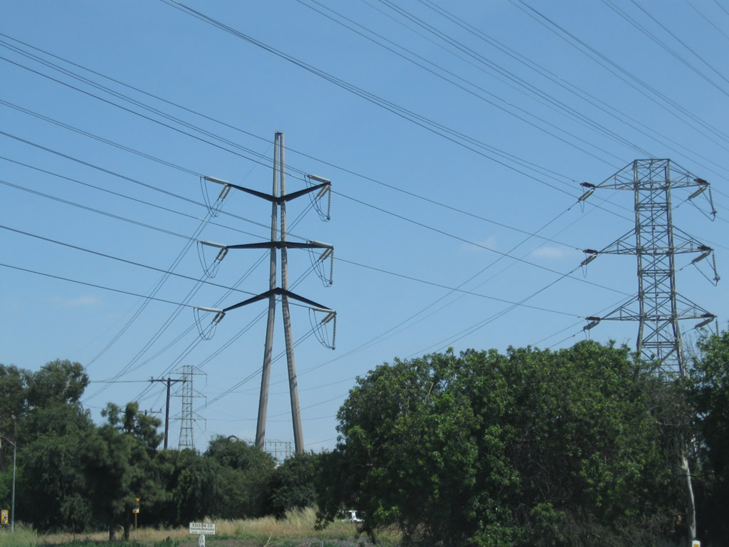
A set of Southern California Edison power lines cross over Interstate 710 and Interstate 405 at their interchange. These lines carry power from a power generating facility on Terminal Island and a substation near the Gerald Desmond Bridge north to the power grid. Photo taken 05/02/10. |
|
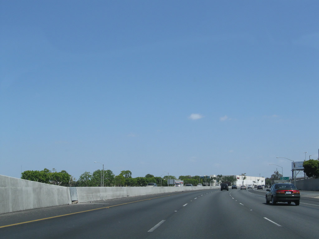
Three lanes carry Interstate 710 north through the Interstate 405 interchange. Photo taken 05/02/10. |
|
A sign announcing that Interstate 710 is the Long Beach Freeway was posted shortly thereafter, but this sign appears to be gone as of May 2010. Photo taken 11/08/08. |
|
An Interstate 710 north reassurance shield is posted shortly thereafter. Photo taken 11/08/08. |
|
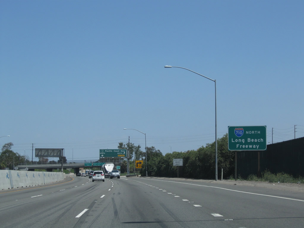
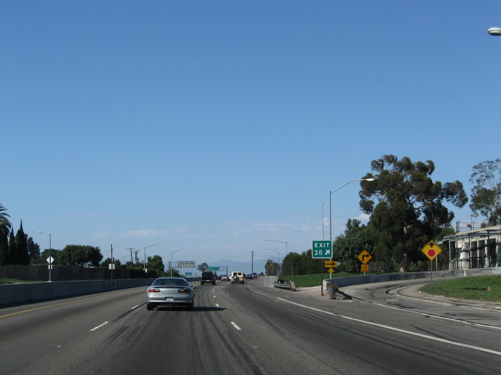
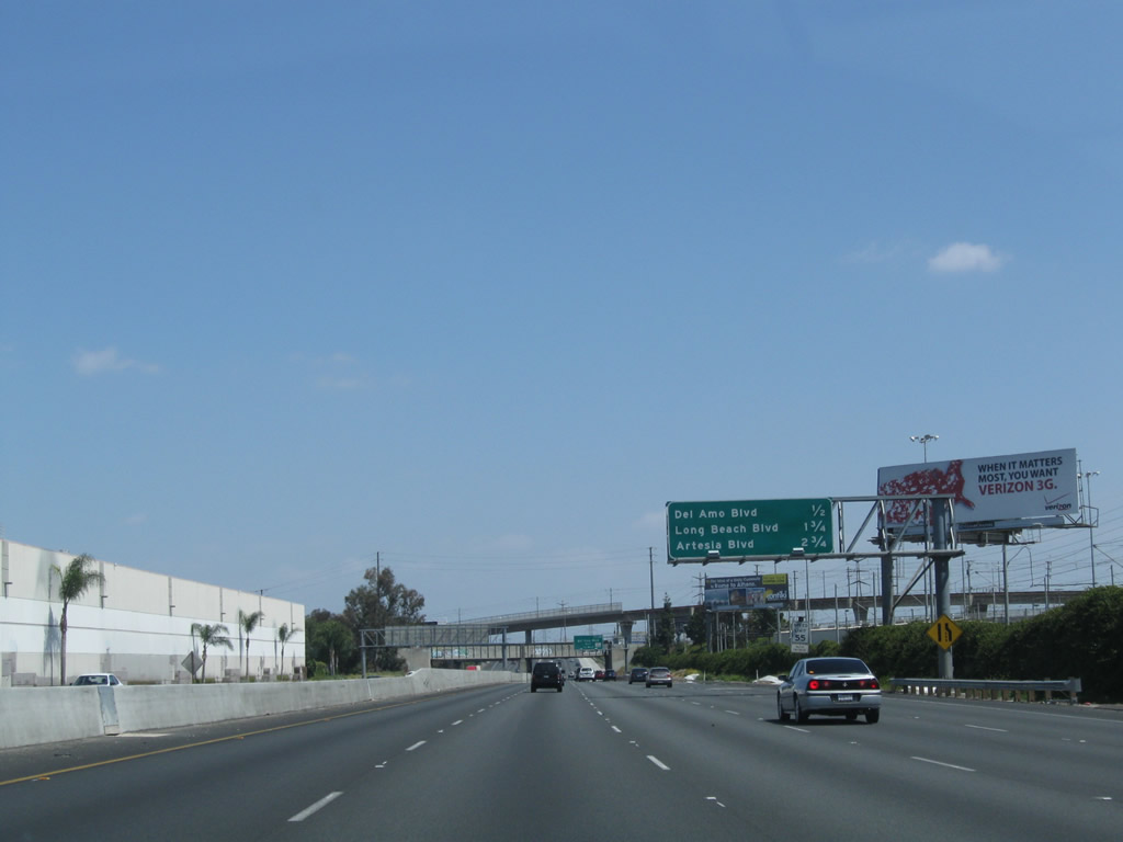
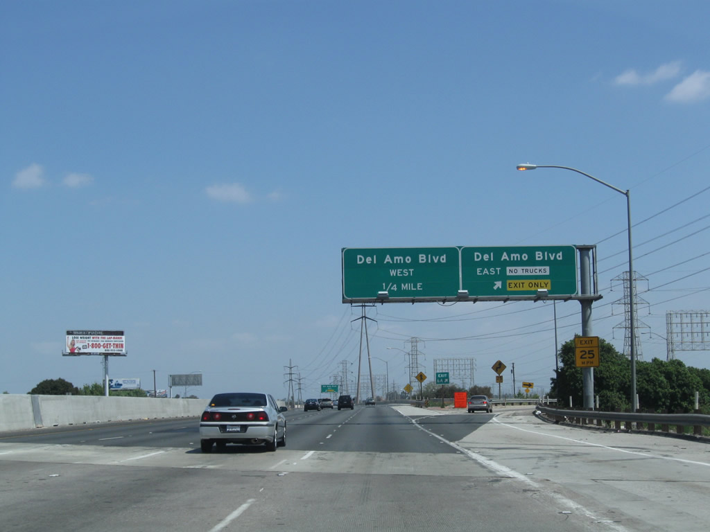
The next four exits along Interstate 710 (Long Beach Freeway) north are Exits 6A-B, Del Amo Boulevard east/west; Exit 7, Long Beach Boulevard; and Exit 8A, Artesia Boulevard and California 91 (Artesia Freeway) east. Photo taken 05/02/10. |
|
|
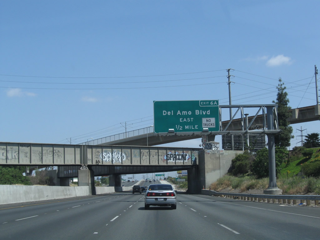
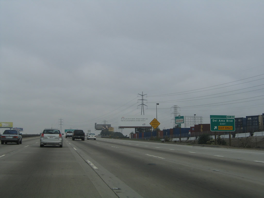
The next exit from Interstate 710 (Long Beach Freeway) north is Exit 6A, Del Amo Boulevard east. The original porcelain enamel guide sign for Exit 6A was replaced during the project to construct a new auxiliary lane. Photos taken 05/02/10 and 11/08/08. |
|
One of the first exit number signs to be placed in Los Angeles County is this roadside guide sign for Exit 6A, Del Amo Boulevard east. Photo taken 11/25/04. |
|
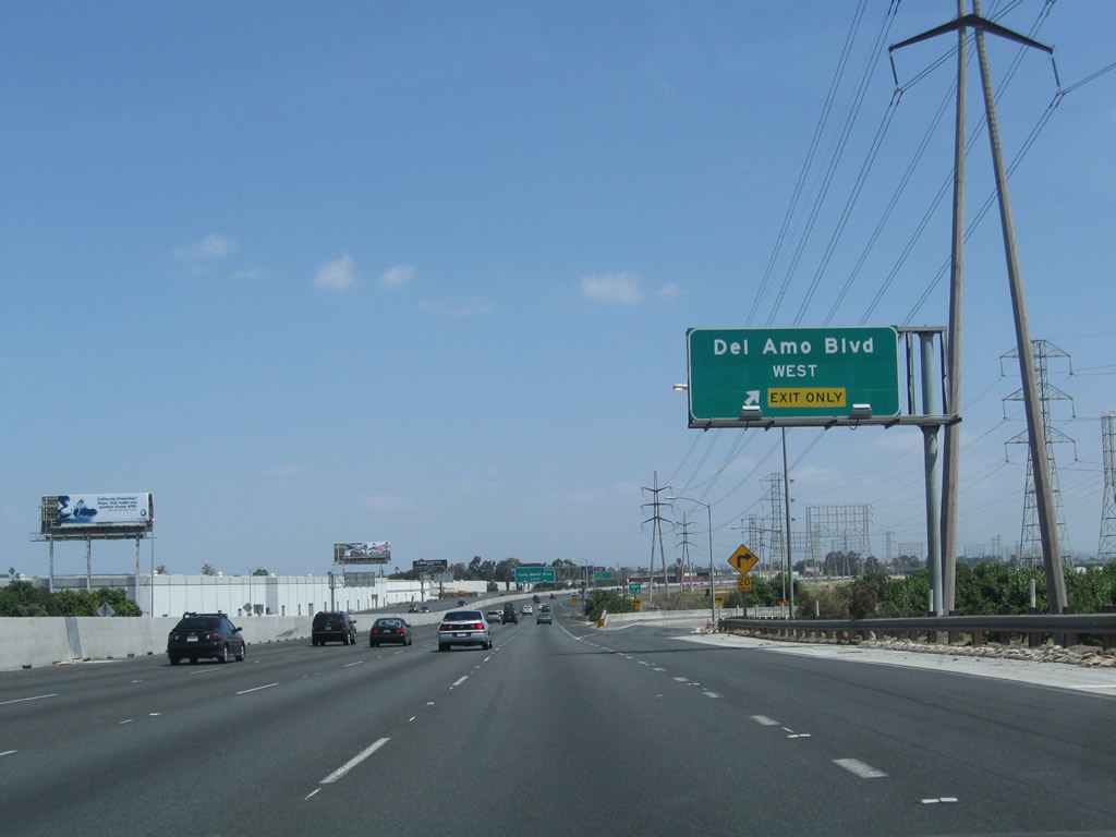
Northbound Interstate 710 (Long Beach Freeway) meets Exit 6A, Del Amo Boulevard east. The next exit connects to Del Amo Boulevard west via Exit 6B. Photo taken 05/02/10. |
|
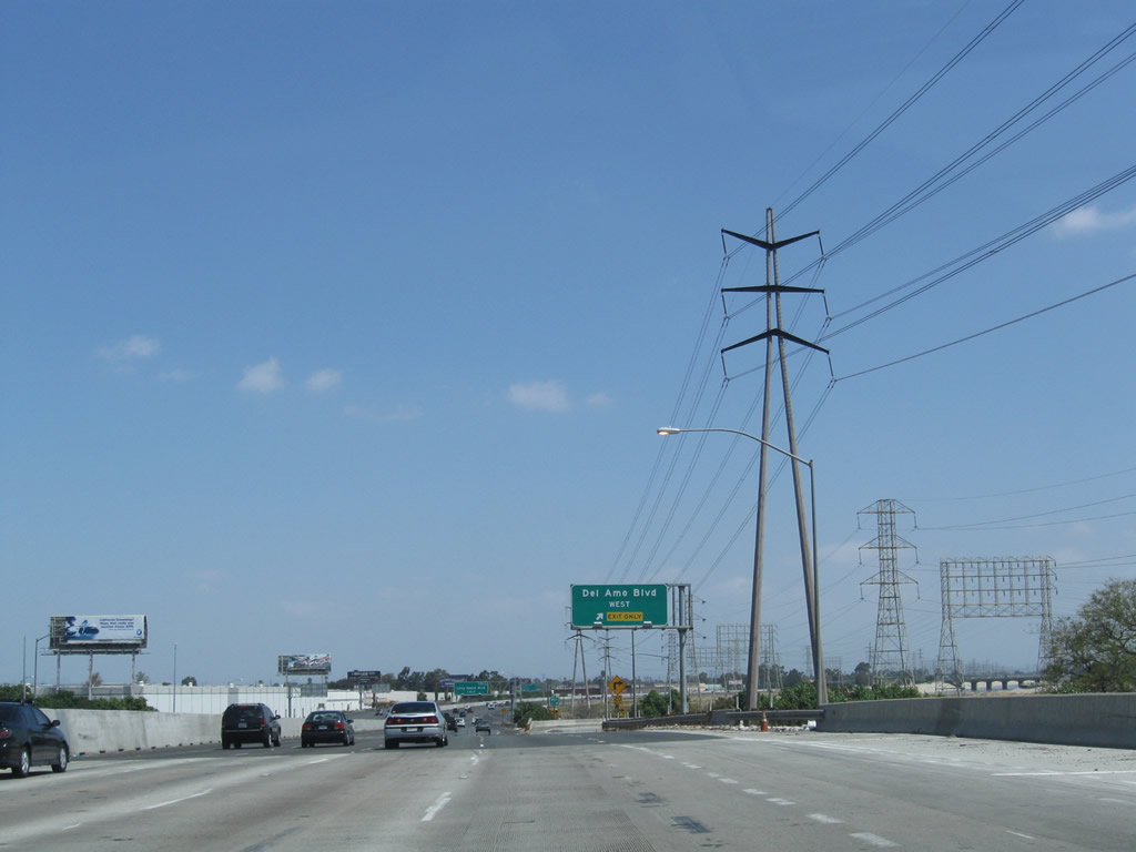
Towering Southern California Edison power lines parallel the freeway. Photo taken 05/02/10. |
|
Northbound Interstate 710 meets Exit 6B, Del Amo Boulevard west. This reflective sign was in place from at least November 2004. Photo taken 05/02/10. |
Page Updated November 22, 2010.