
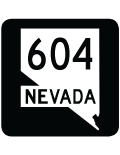
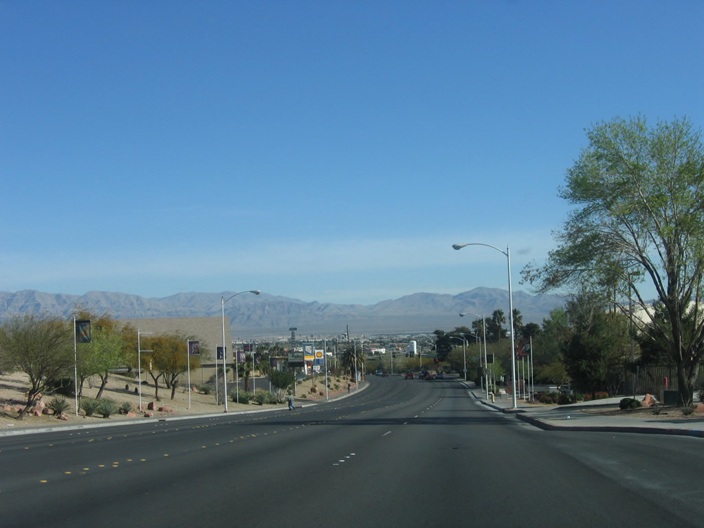
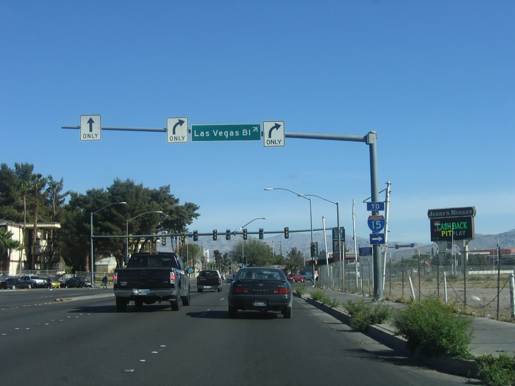
State Route 604 - Las Vegas Boulevard North
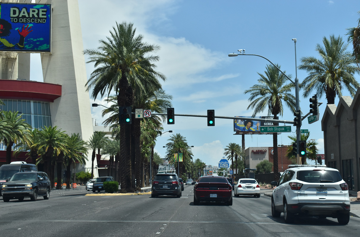
Las Vegas Boulevard intersects Bob Stupak Avenue (former Baltimore Avenue) west by the Strat. Originally named the Stratosphere, the casino and tower opened on April 30, 1996.
07/14/18
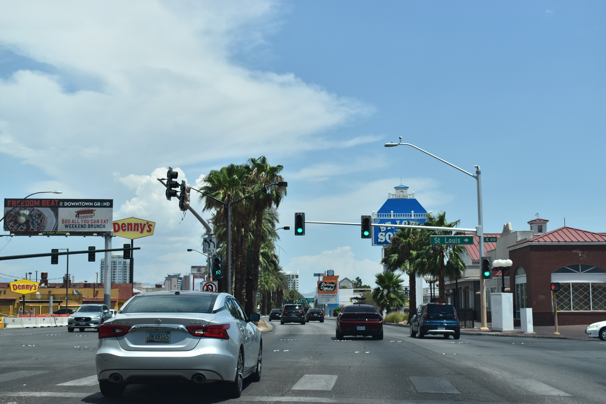
St. Louis Avenue west and Main Street south come together at the ensuing northbound traffic light along Las Vegas Boulevard (former SR 604). Main Street was historically a part of U.S. 91 Alternate and later SR 601 north into Downtown Las Vegas. Paradise Road (former SR 605) stems south from St. Louis Avenue nearby to Harry Reid International Airport (LAS).
07/14/18
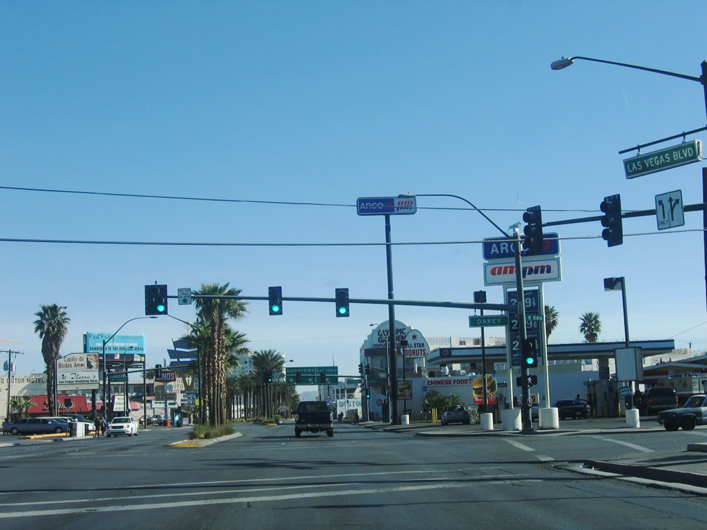
Northbound Las Vegas Boulevard meets Oakey Avenue at this traffic signal.
07/14/18
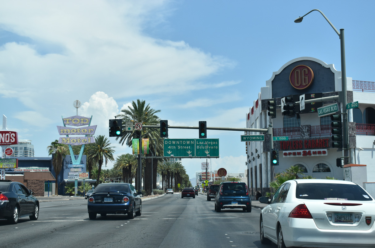
Wyoming Avenue leads west to become the western continuation of Oakey Boulevard below Interstate 15.
07/14/18
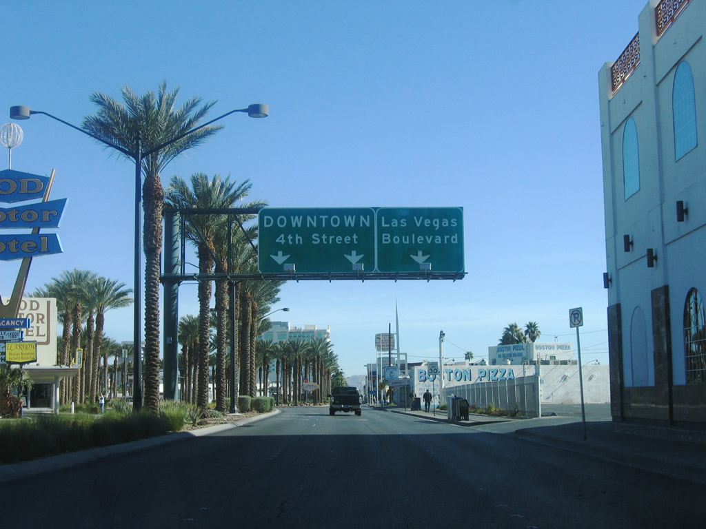
S 4th Street separates from Las Vegas Boulevard north at a wye intersection beyond Wyoming Avenue. Fourth Avenue is a one way street paralleling Las Vegas Boulevard northward to Downtown Las Vegas.
07/14/18
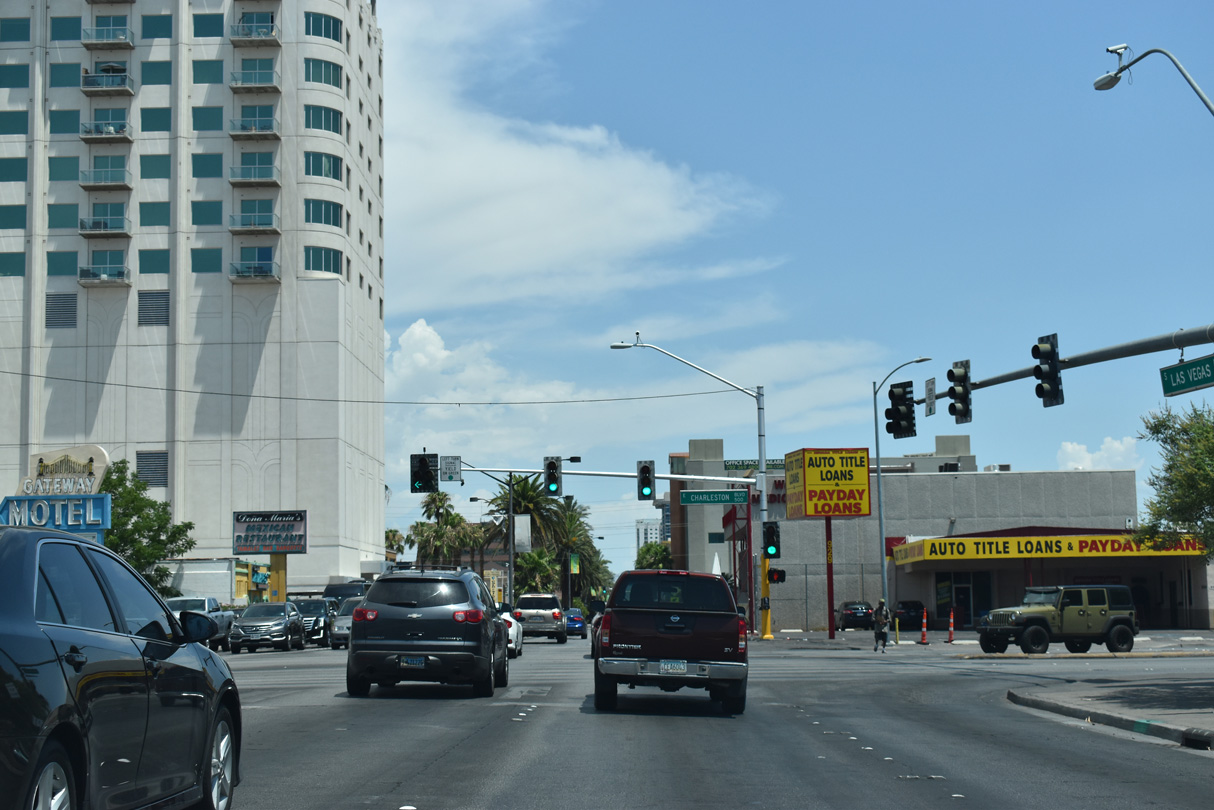
Formerly SR 159, Charleston Boulevard is an arterial stretching across the Las Vegas east to Nellis Boulevard (SR 612) and west toward Red Rock Canyon.
07/14/18
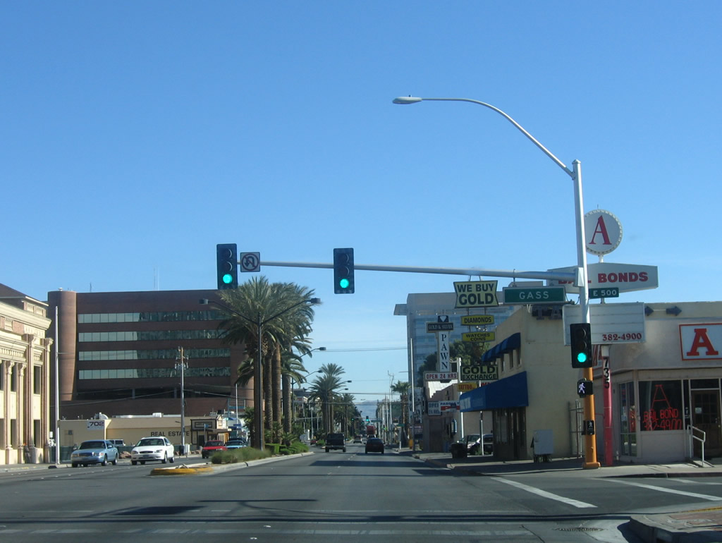
Continuing northeast, Las Vegas Boulevard intersects Gass Avenue at this traffic signal.
07/14/18
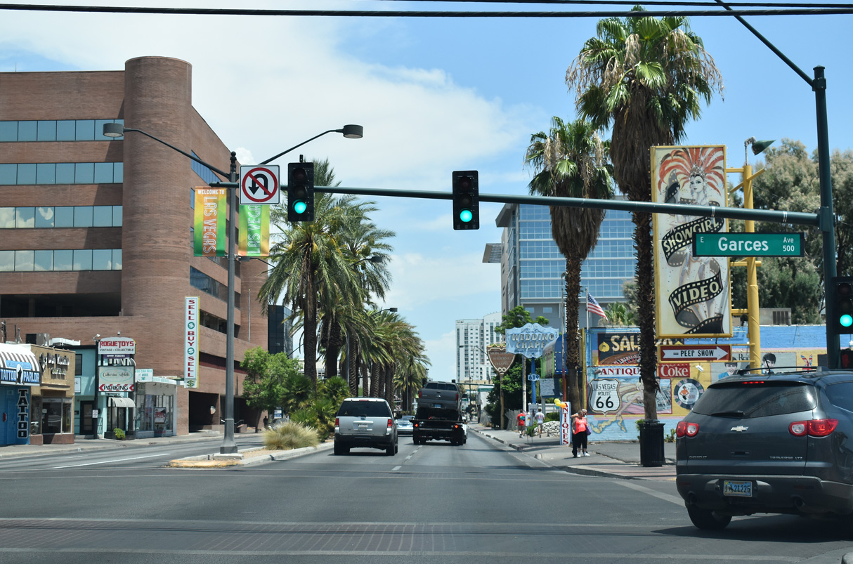
Las Vegas Boulevard north at Garces Avenue.
07/14/18
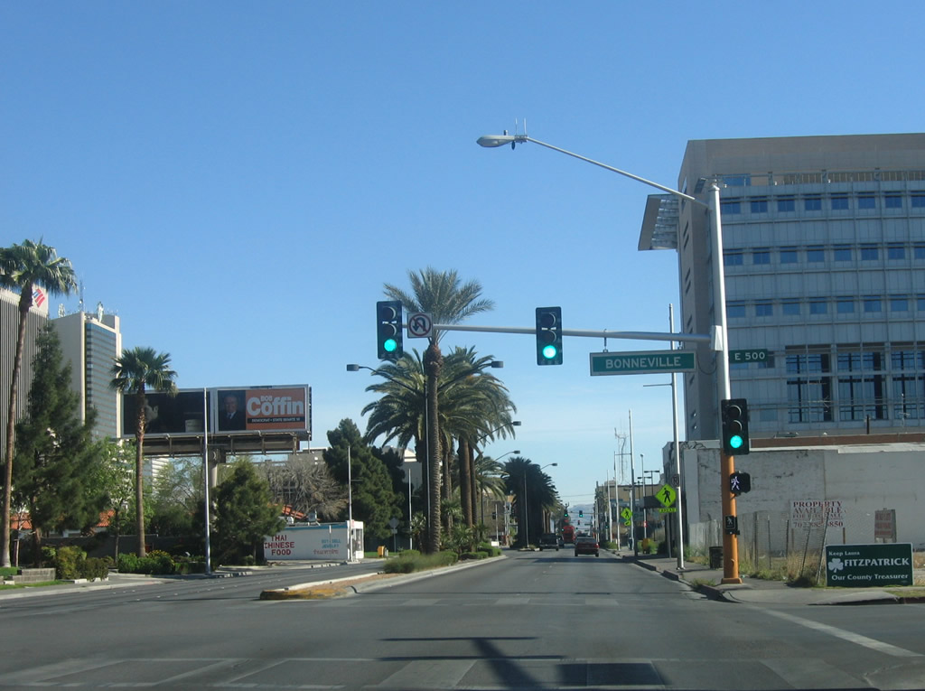
The succeeding traffic signal along northbound is with Bonneville Avenue, a one way street eastbound.
07/14/18
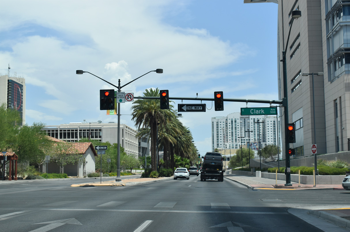
Clark Avenue intersects Las Vegas Boulevard by the Lloyd D George Courthouse.
07/14/18
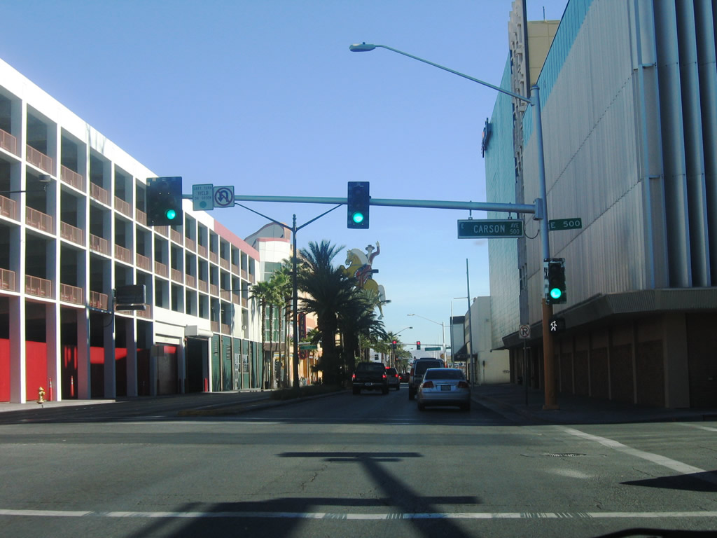
Northbound Las Vegas Boulevard intersects Carson Avenue one block ahead of the Fremont Street Experience.
07/14/18
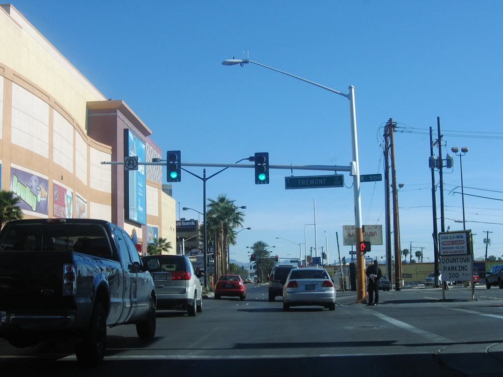
Northbound Las Vegas Boulevard intersects Fremont Avenue southeast beyond the Hacienda Casino neon sign. This intersection is notable historically for the place where U.S. 466 turned southeast toward Kingman, Arizona, and U.S. 93 combined with U.S. 91 north toward North Las Vegas.
07/14/18
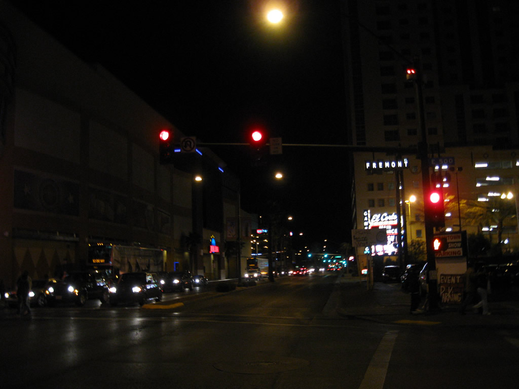
The Fremont Street Experience opened on December 13, 1995. The northernmost five blocks of Fremont Street were converted to a pedestrian mall covered by a large canopy. The canopy displays a light show / music video during the evening, while music stages and zip lines are among the attractions below.
07/14/18
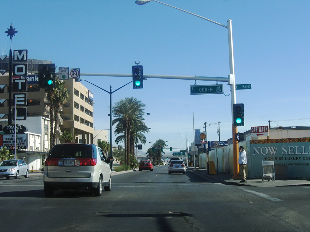
Northbound Las Vegas Boulevard meets Ogden Avenue between The Ogden condominiums and the Neonopolis retail complex.
07/14/18

Operating since 2013, the Zappos Downtown Las Vegas Headquarters stands at the northwest corner of Las Vegas Boulevard and Stewart Avenue. The building was formerly Las Vegas City Hall.
03/09/19
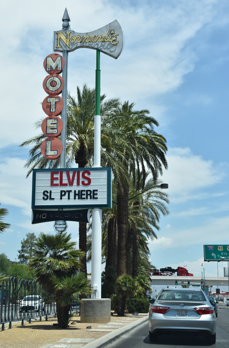
The vintage Normandie Motel neon sign precedes Mesquite Avenue northbound from within the median of Las Vegas Boulevard.
07/14/18
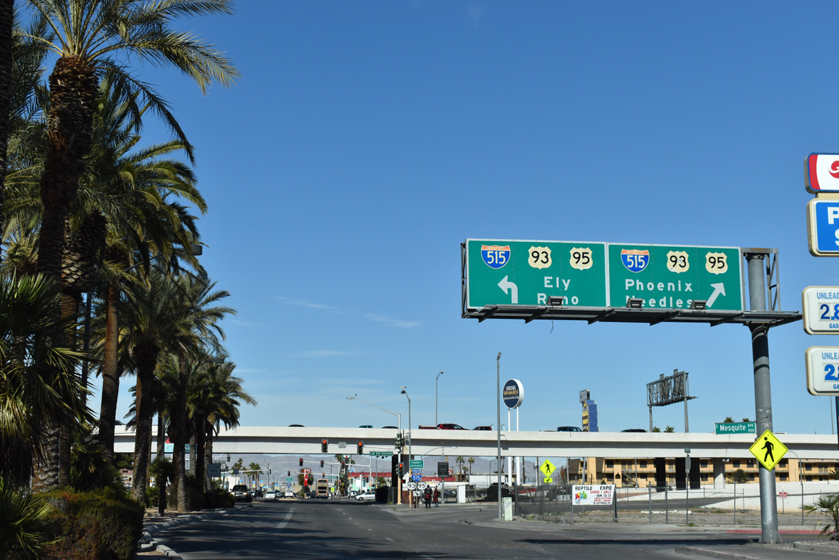
I-11/U.S. 93-95 (Oran K. Gragson Freeway) line the north side of Downtown Las Vegas. Las Vegas Boulevard meets the elevated Oran K. Gragson Freeway at a diamond interchange.
03/09/19
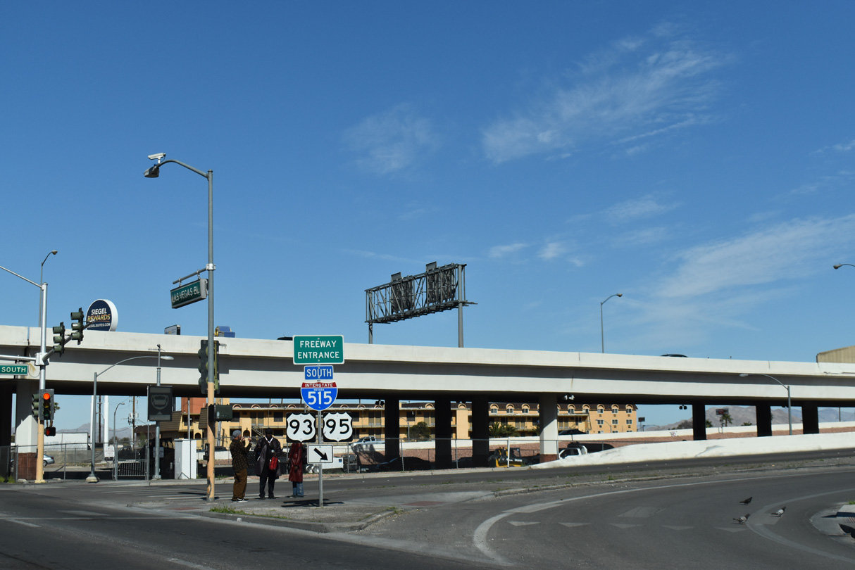
Freeway entrance assembly for the southbound I-11 entrance ramp to Henderson and Boulder City.
03/09/19
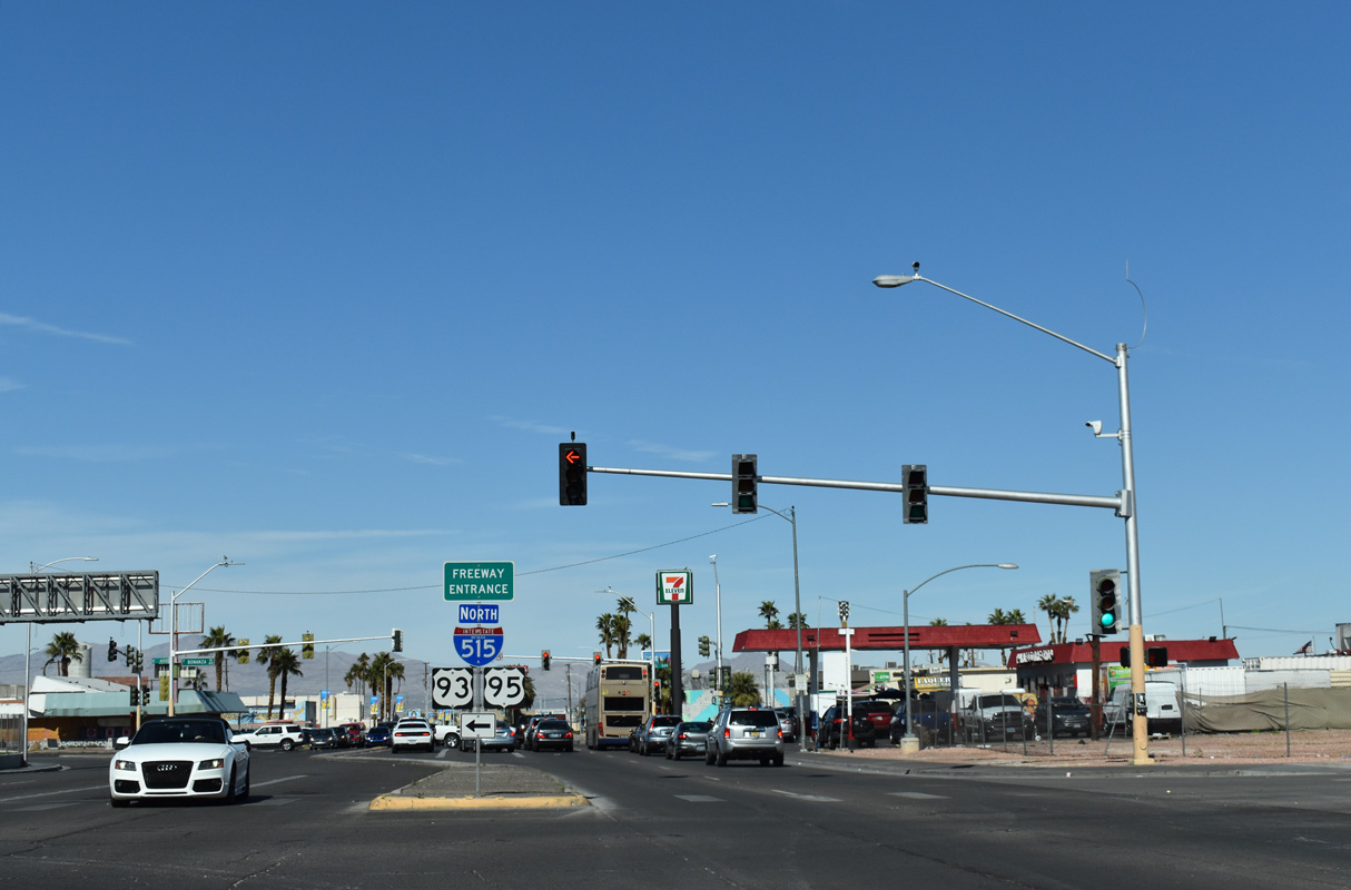
Las Vegas Boulevard passes under I-11/U.S. 93-95 ahead of the northbound entrance ramp to Summerlin, Ely (via U.S. 93) and Reno (via U.S. 95).
03/09/19
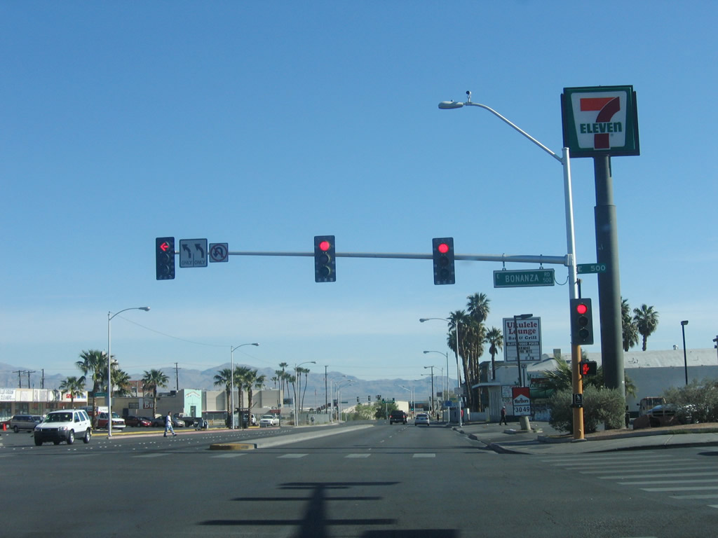
Bonanza Road intersects Las Vegas Boulevard (former SR 604) just north of I-11/U.S. 93-95. Bonanza Road parallels the Oran K. Gragson Freeway west as SR 579 to SR 599 (Rancho Drive).
07/14/18
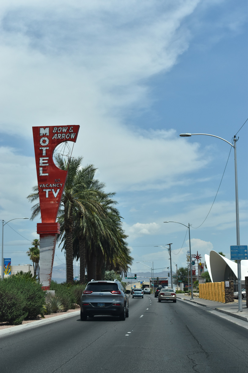
The vintage Bow & Arrow Motel neon sign stands within the median of Las Vegas Boulevard north of Wilson Avenue.
07/14/18
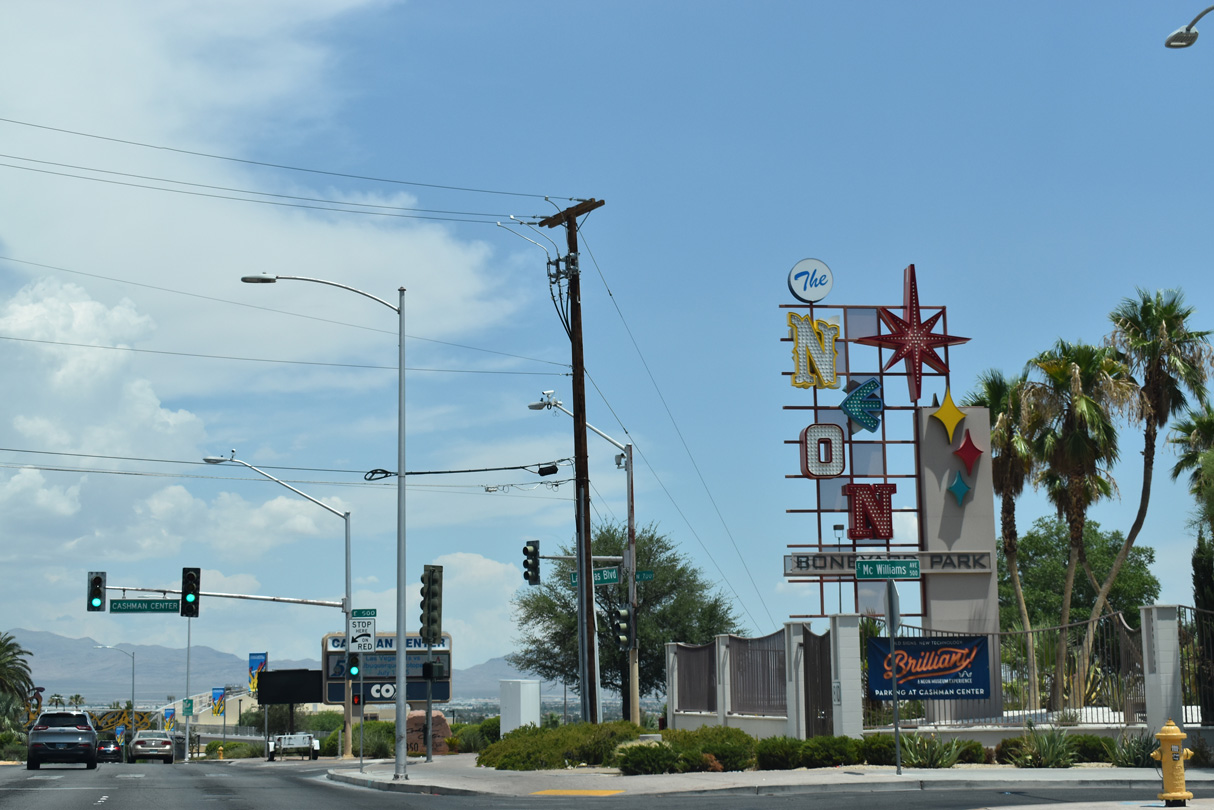
Las Vegas Boulevard intersects McWilliams Street between The Neon Museum and The Neon Boneyard Park.
07/14/18
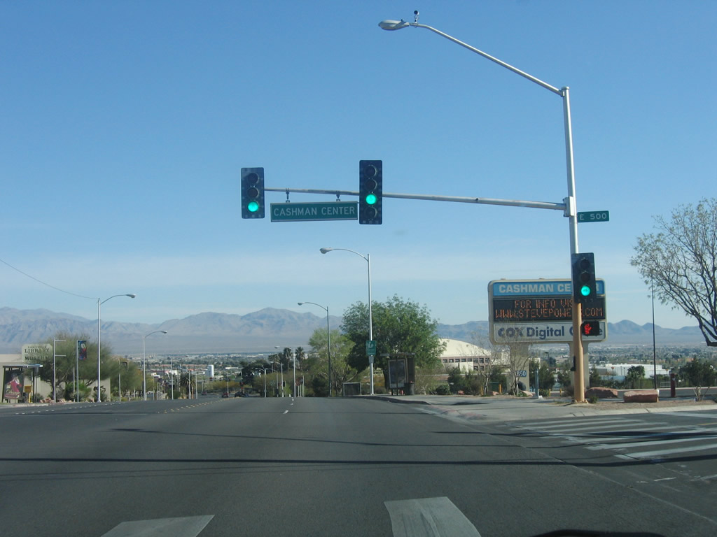
Northbound Las Vegas Boulevard at the west entrance to the Cashman Complex.
10/21/25
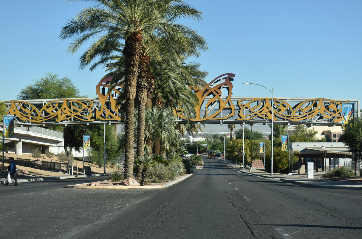
A pedestrian bridge spans Las Vegas Boulevard as part of the Pioneer Trail by Heritage Park, Old Las Vegas Mormon Fort State Historic Park and the Las Vegas National History Museum.
10/21/25
The Nevada Scenic Byway designation for Las Vegas Boulevard north from The Strip and through Downtown concludes at Washington Avenue. This end sign for the byway was no longer legible by 2024.
07/14/18
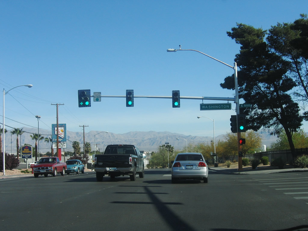
Washington Avenue (SR 578) constitutes a four lane, divided arterial or five lane boulevard as it connects Las Vegas Boulevard with I-15 to the west and residential areas including Washington and College Park to the east.
10/21/25
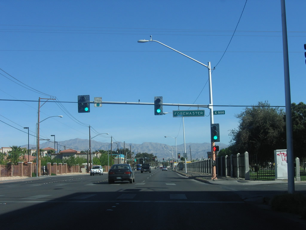
Las Vegas Boulevard turns north from Washington Avenue to run alongside Woodlawn Cemetery beyond the signal with Foremaster Lane.
07/14/18
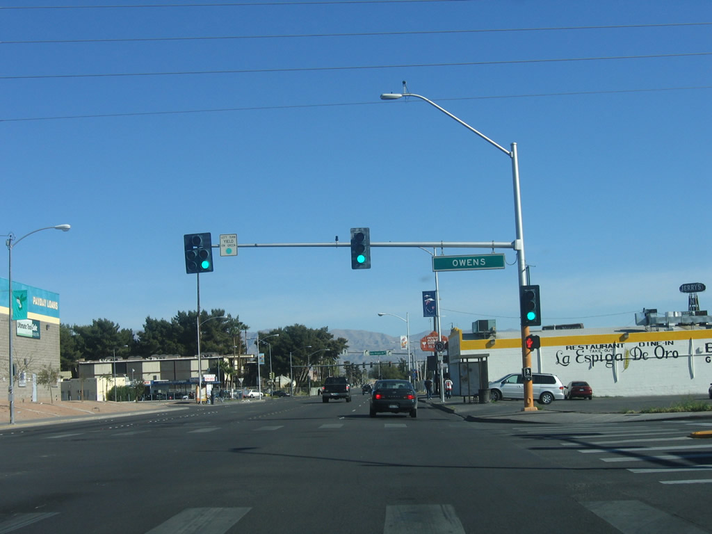
Las Vegas Boulevard leaves the city of Las Vegas and enters north Las Vegas at Owens Avenue. Owens Avenue is an arterial running between I-15 and Hollywood Boulevard in unincorporated Sunrise Manor.
07/14/18
Main Street (old SR 601) reconvenes with Las Vegas Boulevard north just beyond Owens Avenue.
07/14/18
The previous intersection joining the Main Street and Las Vegas Boulevard with N 5th Street was reconfigured into a rotary by 2011.
07/14/18
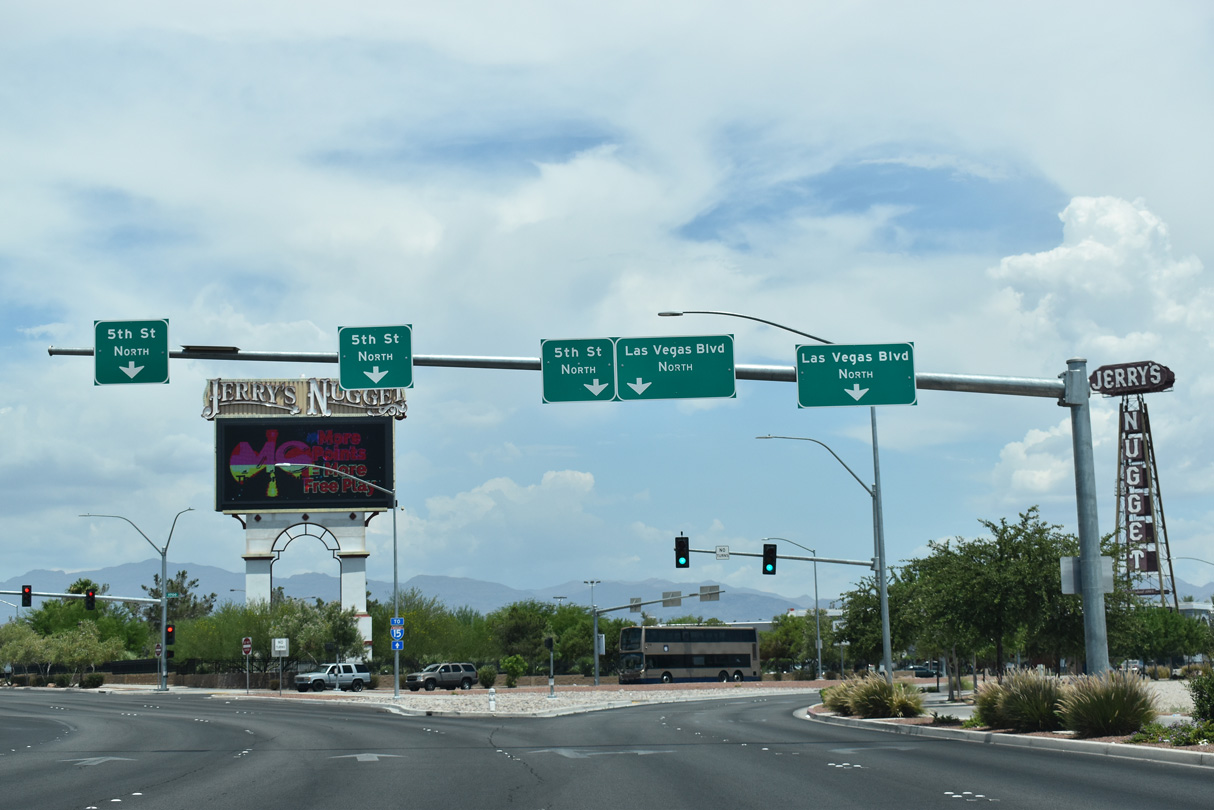
Las Vegas Boulevard resumes a northeastern course from the rotary with Main Street south and N 5th Street.
07/14/18
Prior to 2018, state maintenance along Las Vegas Boulevard commenced north of Tonopah Avenue and the junction with 5th and Main Streets.
07/14/18
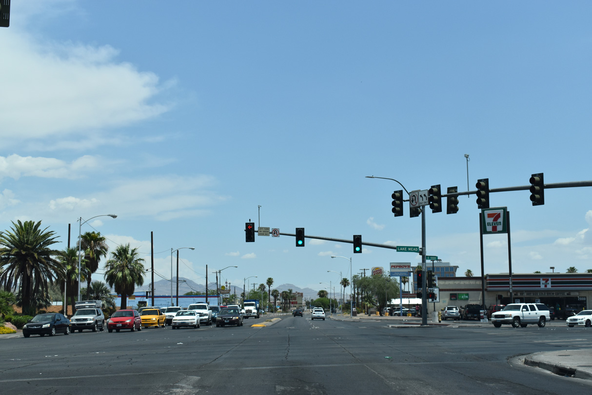
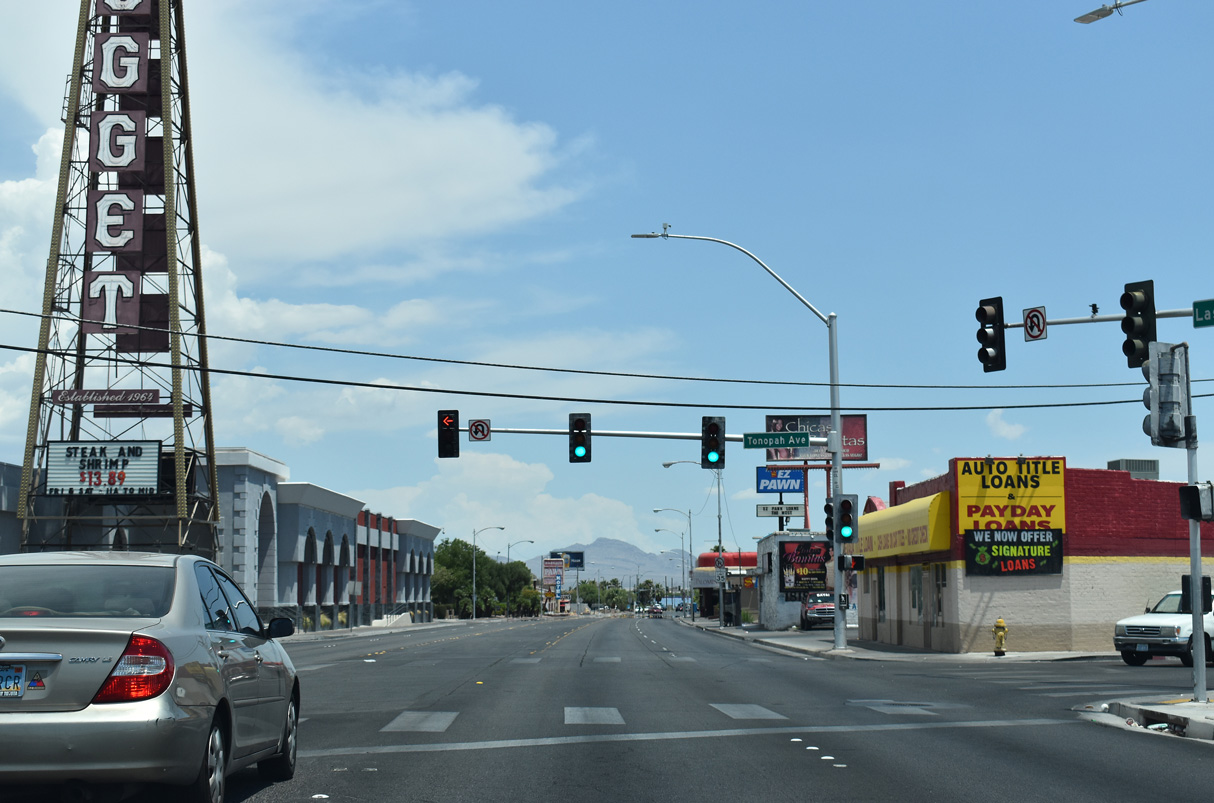
Las Vegas Boulevard angles northeast across Lake Mead Boulevard at the succeeding traffic light north of Tonopah Avenue. Lake Mead Boulevard was formerly part of SR 147 west to I-15 and east to Pecos Road, where state maintenance takes over east to Lake Mead National Recreation Area.
07/14/18
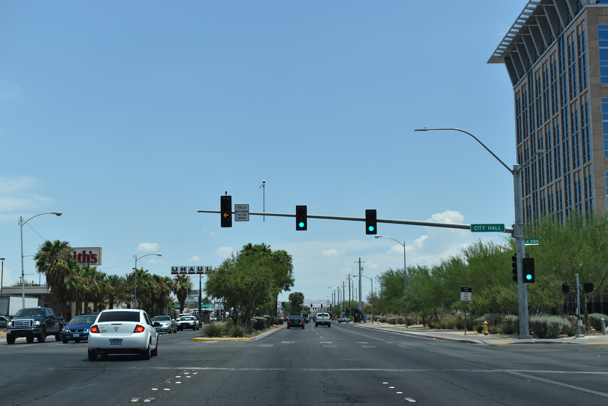
Las Vegas Boulevard intersects Hamilton Street north at the driveway to North Las Vegas City Hall.
07/14/18
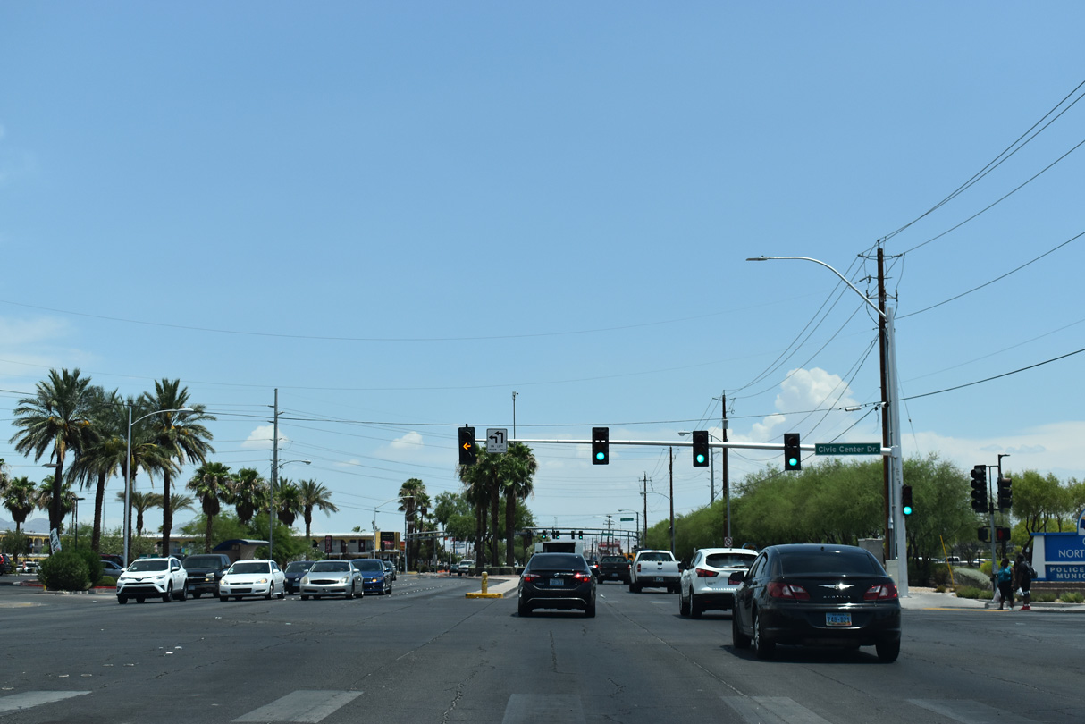
Las Vegas Boulevard north at Civic Center Drive.
07/14/18
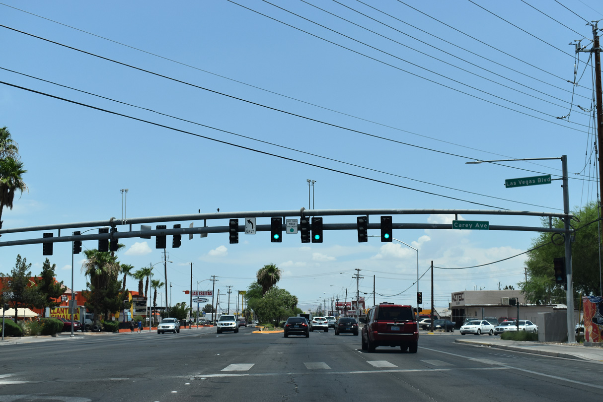
Nevada State Route 604 commences northbound along Las Vegas Boulevard at Carey Avenue. Carey Avenue west leads to North Las Vegas Airport (VGT).
07/14/18
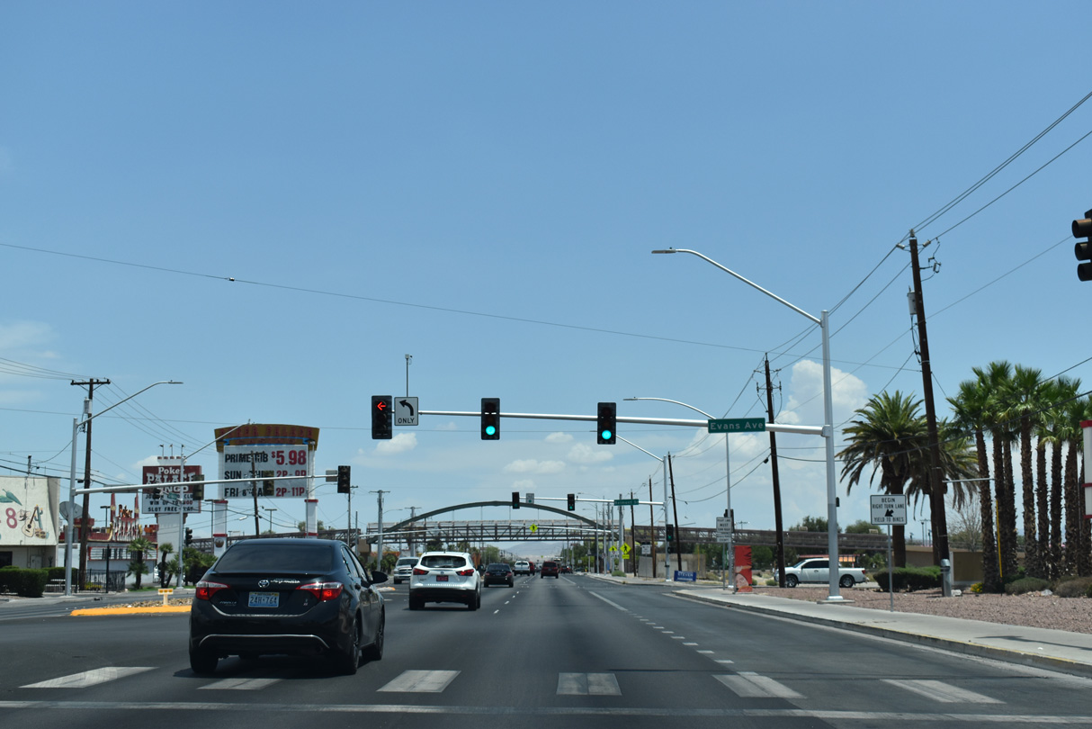
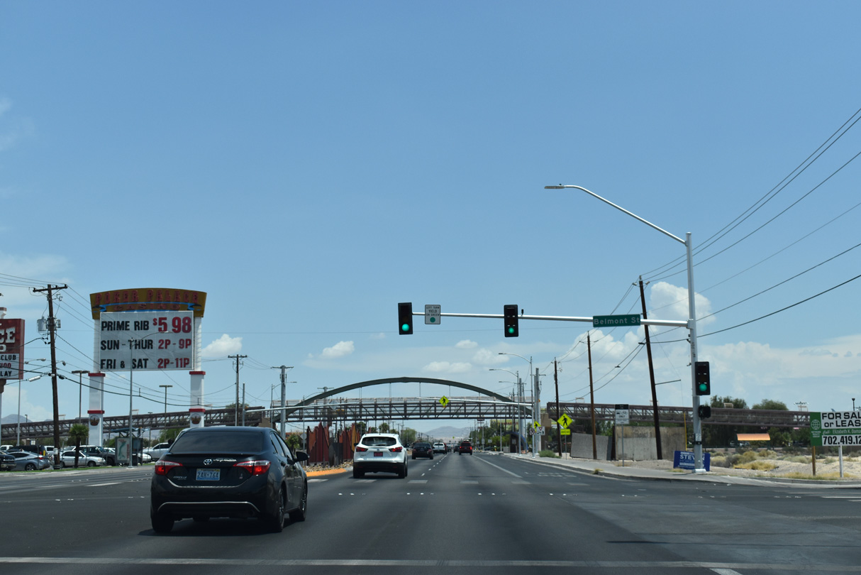
Evans Avenue east and Belmont Street north at succeeding traffic lights on SR 604 (Las Vegas Boulevard) northbound.
07/14/18
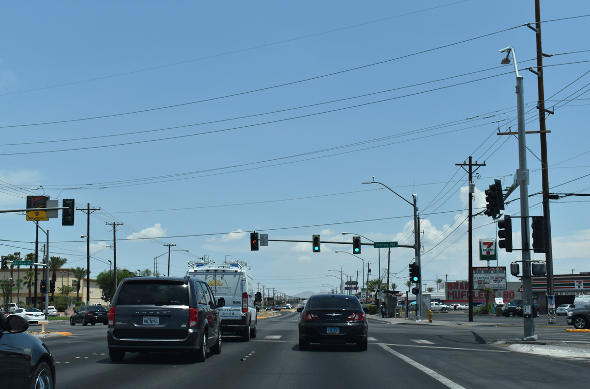
Pecos Road runs along the east North Las Vegas city line from Owens Avenue north to Alexander Road. SR 604 enters the unincorporated community of Sunrise Manor beyond the signal at Pecos Road.
07/14/18
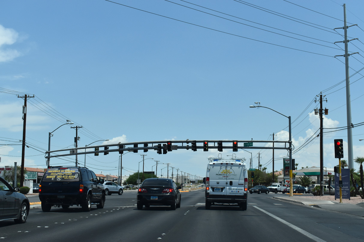
Cheyenne Avenue crosses SR 604 (Las Vegas Boulevard) north between Cheyenne Sports Complex in North Las Vegas and a large area of distribution centers east of Walnut Road. Cheyenne Avenue is SR 574 between Decatur Road and SR 612 (Nellis Boulevard).
07/14/18
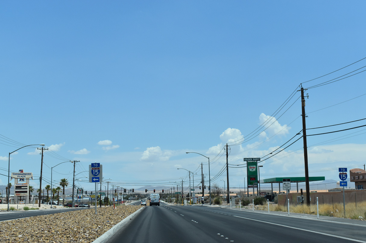
Lamb Boulevard extends north from Las Vegas through Sunrise Manor to I-15/U.S. 93 at Exit 50.
07/14/18
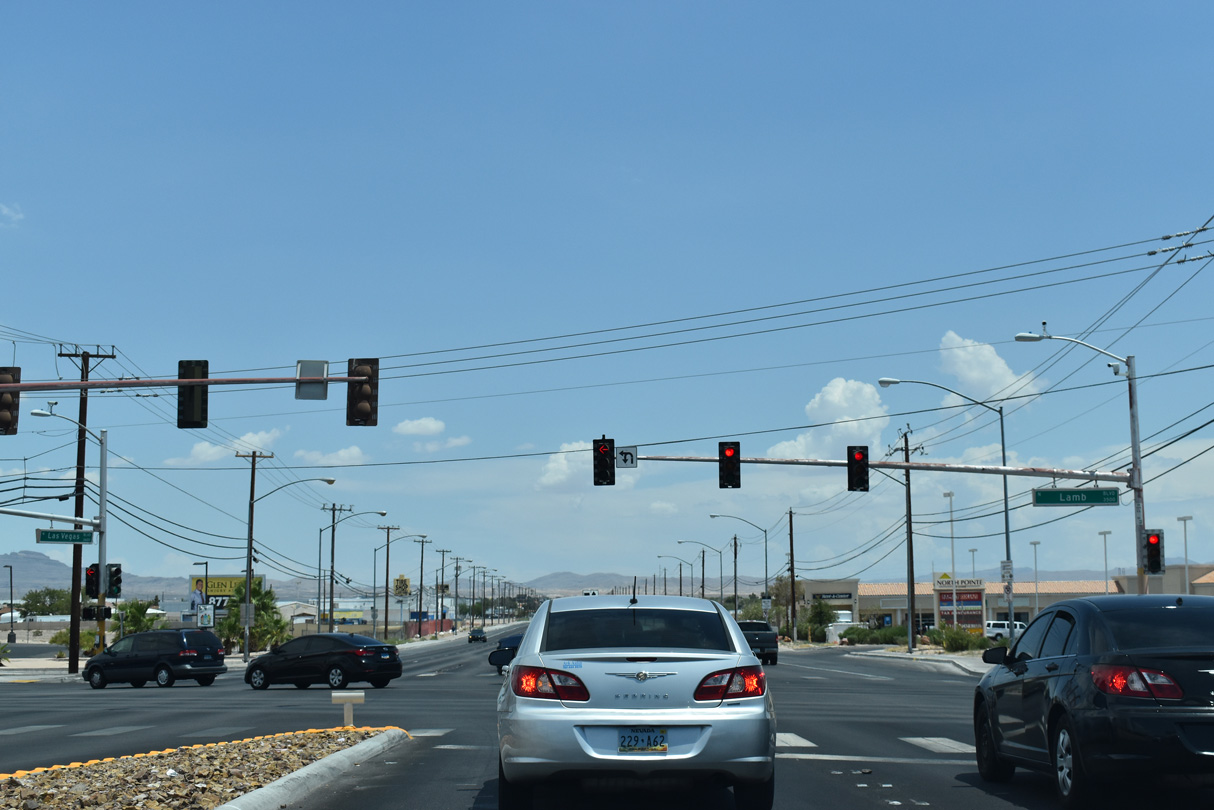
Lamb Boulevard is State Route 604 north from SR 604 (Las Vegas Boulevard) 2.37 miles to Interstate 15.
07/14/18
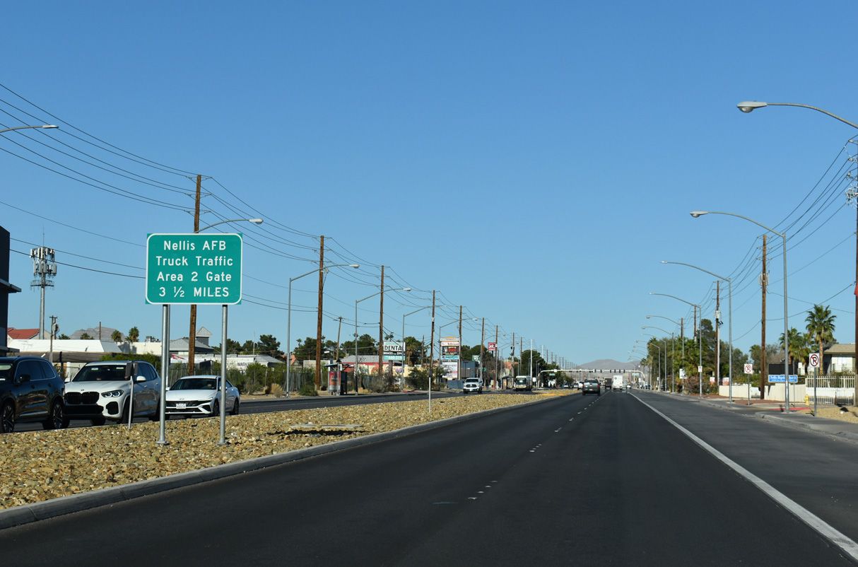
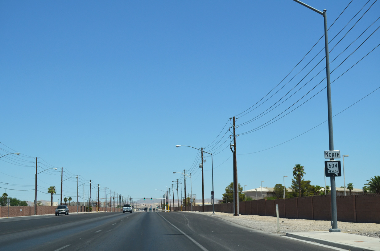
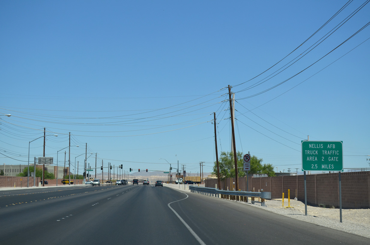
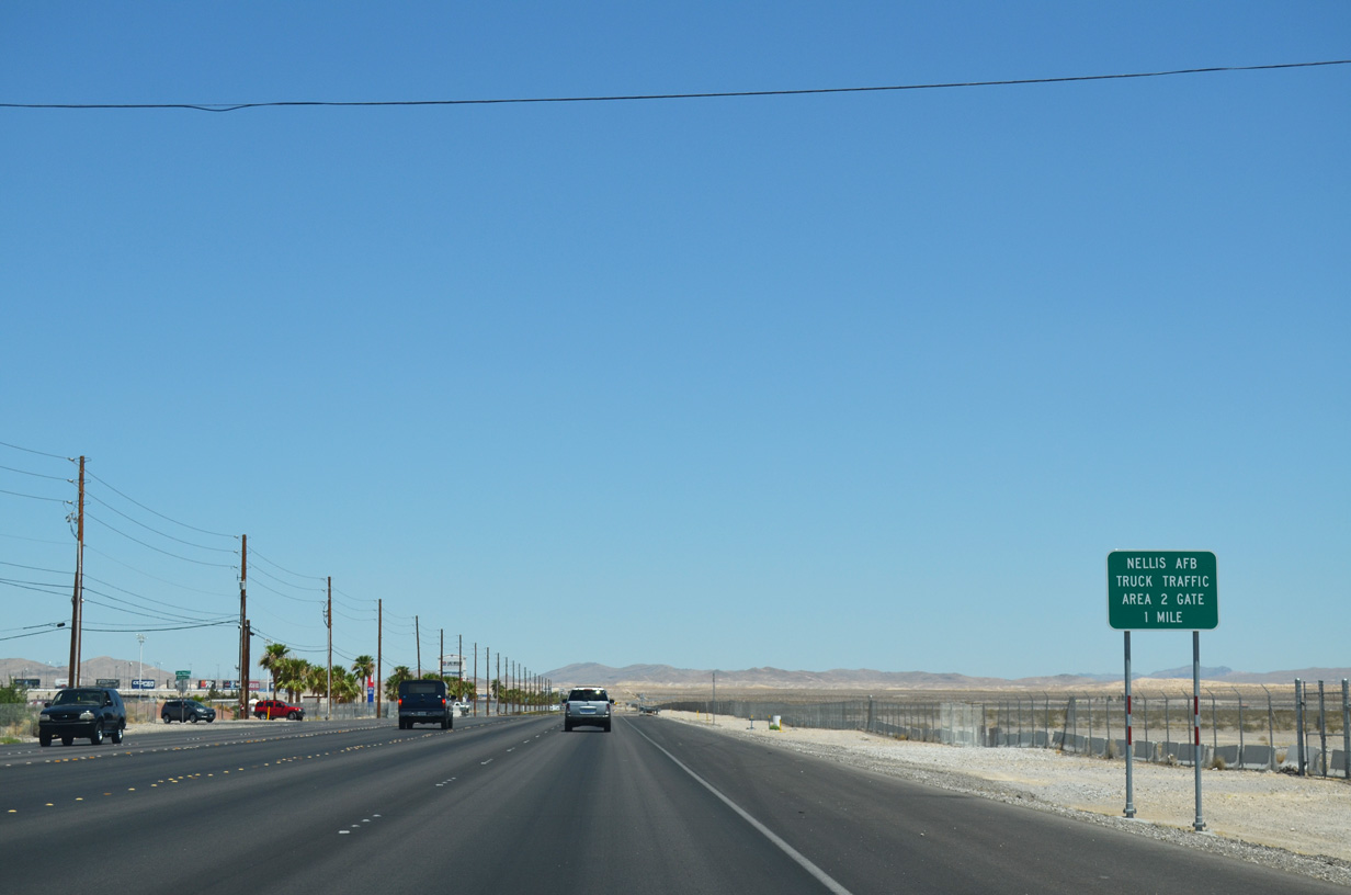
The north end of SR 612 ties into SR 604 at Nellis Boulevard. Las Vegas Boulevard proceeds 3.5 miles northeast from there to the Nellis AFB Area 2 Gate.
10/20/25
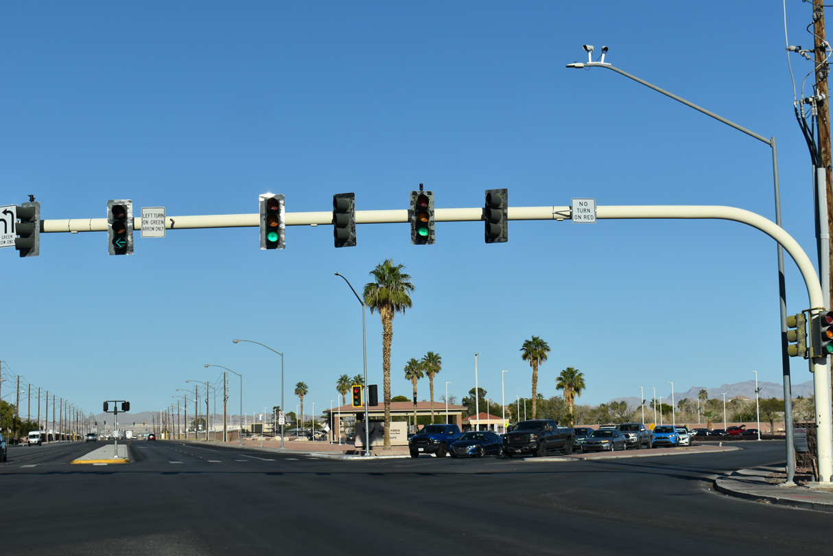
SR 573 (Craig Road) concludes east at SR 604 (Las Vegas Boulevard) across from Fitzgerald Boulevard into Nellis Air Force Base. Craig Road is SR 573 west to Frehner Road, and from Decatur Boulevard to I-11/U.S. 95.
10/20/25
The first shield for Nevada State Route 604 north appears along Las Vegas Boulevard after Craig Road (SR 573).
07/21/14
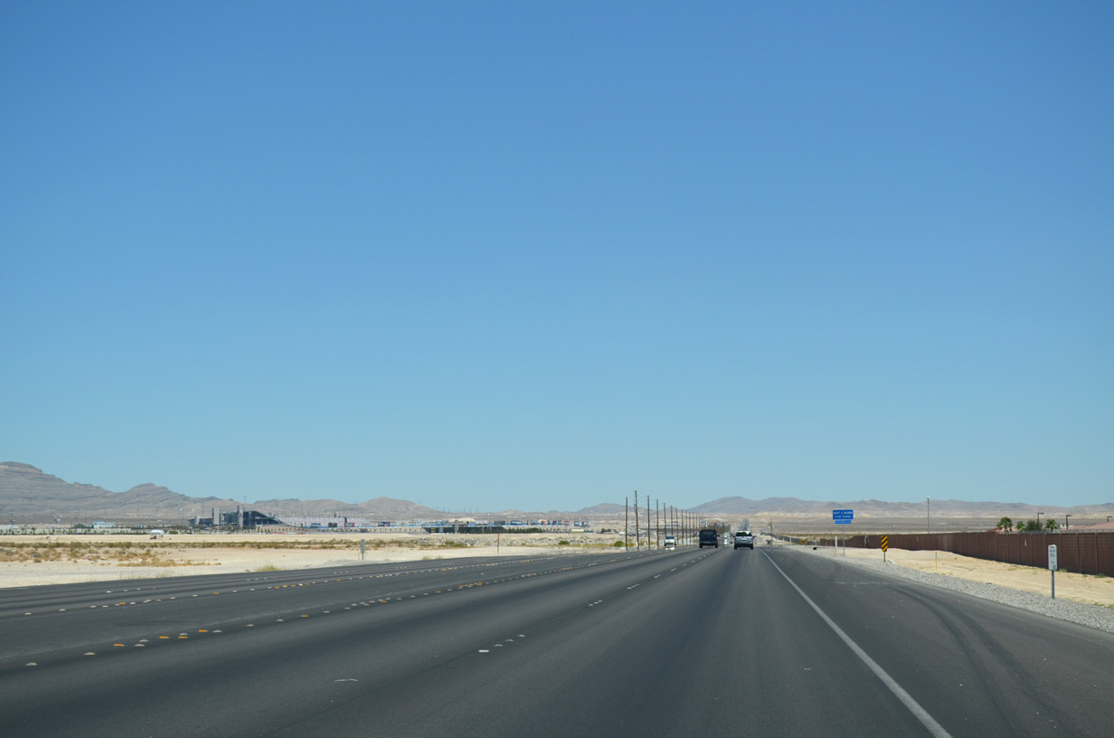
The Nellis Air Force Base Area II Gate is another 2.5 miles beyond the Beale Gate at forthcoming Beale Avenue.
07/21/14
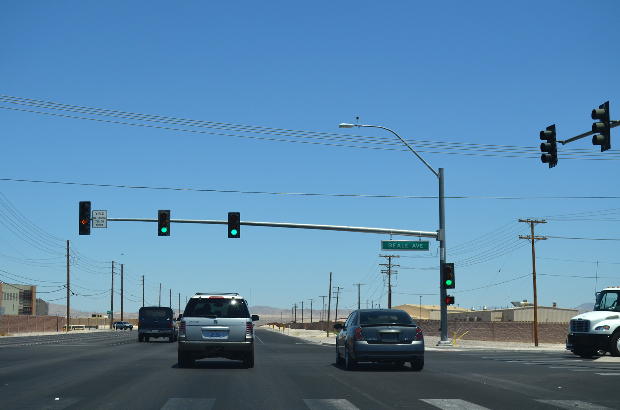
The signalized intersection joining Las Vegas Boulevard with Beale Avenue also serves the Nellis AFB Range Gate.
07/21/14
Clark County mile marker 7.00 for SR 604 was posted along Las Vegas Boulevard near Beasley Drive.
07/21/14
Hollywood Boulevard stems north from SR 604 (Las Vegas Boulevard) to Speedway Boulevard, one mile southwest of Minot Avenue and the Nellis AFB Area II Gate.
07/21/14

Entry 2 to Las Vegas Motor Speedway is located along Las Vegas Boulevard as SR 604 mile marker 8.21.
07/21/14
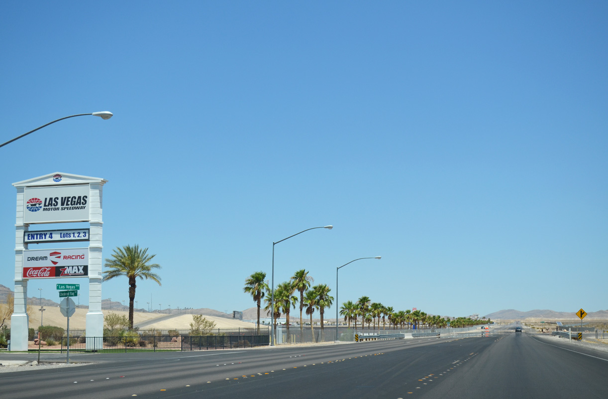
Checkered Flag Lane runs along the west side of Las Vegas Motor Speedway. The 1.5 mile oval is part of the NASCAR Cup Series.
07/21/14
Photo Credits:
- ABRoads: 07/14/18, 10/20/25, 10/21/25
- Brent Ivy: 03/09/19
- Alex Nitzman: 07/21/14
Connect with:
Page Updated Tuesday November 18, 2025.