


Recently tallied all the photos taken throughout the Sunshine State for the site over the last 15 plus years and ended up with over 45,000. That is not to say that every one will make the site, as there are many duplicates, several blurry photos, and ones that were taken with bad context — but many will get posted in the coming weeks, months and years. Continuing the site work of the last three weeks, added more new pages for Florida Panhandle roads:
- State Road 2 – lengthy route extending west from Southwest Georgia to Malone, Campbellton, Graceville into Holmes County.
- State Road 267 – two section route running north through Quincy to South Georgia and east to U.S. 98 at Newport.
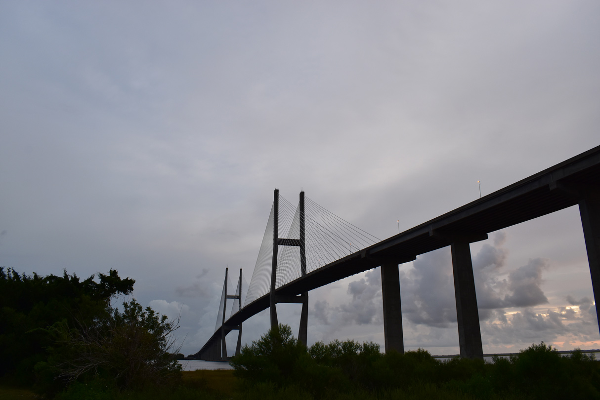
- State Road 300 – crosses the third longest bridge in the state of Florida south to St. George Island.
- County Road 69A – four segments in Calhoun and Jackson Counties.
- County Road 160 – two rural connectors in northern Holmes County.
- County Road 162 – originates in Holmes County and travels east to Greenwood in Jackson County.
- County Road 164 – three branches of CR 164 are designated in Jackson County.
- County Roads 164B / 165A – connections from Bascom to the west and south.
- County Road 165 – cutoff from SR 71 north to SR 2 east and vice versa.
- County Road 173 – southwest to northeastern route joining Bonifay with Washington County and Lower Alabama.
- County Road 175 – a short spur linking SR 2 with the town of Noma.
- County Road 193 – a loop east of Graceville and linear route south from SR 2 to SR 273 in Jackson County.
- County Road 194 – short connector between CR 69A and SR 69 in Calhoun County.
- County Road 195 – links CR 280 with U.S. 90 near Cottondale.
- County Road 271 – 18 mile route north from Sneads to CR 164 and a 1.92 mile spur to the southeast of Sneads.
- County Road 274 – lengthy route across northern Calhoun County serving the town of Altha.
- County Road 275 – four segments south and west of Blountstown and north to Cypress in Jackson County.
- County Roads 275A/275B – CR 275A linked SR 71 with CR 275 north of Altha, CR 275B is a mile long spur north to the Jackson County line.
- County Roads 284/284A – Both in rural Washington County, CR 284 loops west of SR 79 to Hinsons Crossing. CR 284A spurs south from Miller’s Ferry to a boat ramp.
- County Road 286 – highway connecting Interstate 10 with Sneads and SR 69/CR 274 in Calhoun County.
- County Roads 287/287A – rural highways providing an alternate to SR 20 and SR 73 in the vicinity of Clarksville and Chason.
- County Roads 392/392B – highway west to Broad Branch and east to SR 71 at Scotts Ferry in Calhoun County.
- County Road 549 – a 2.88 mile long loop west from SR 69 to the north of Blountstown.
Also ongoing is progress on Jacksonville area pages from the daytrip there on March 20th along with photos from previous drives to the First Coast.
- State Road 101 – spur from SR A1A to Naval Station Mayport.
- State Road 105 – arterial route along Zoo Parkway from I-95 to I-295 and a coastal route along Heckscher Drive east to SR A1A at the St. Johns River Ferry.
- State Road 134 – arterial and commercialized boulevard branching east from SR 228 by Cecil Field to U.S. 17 at Venetia in southwest Jacksonville.
Also got started on revising pages for Interstate 69 in Indiana with photos sent by Thomas Decker last year. The initial update for I-69 covers where it replaced Interstate 164 northbound out of Evansville.


