
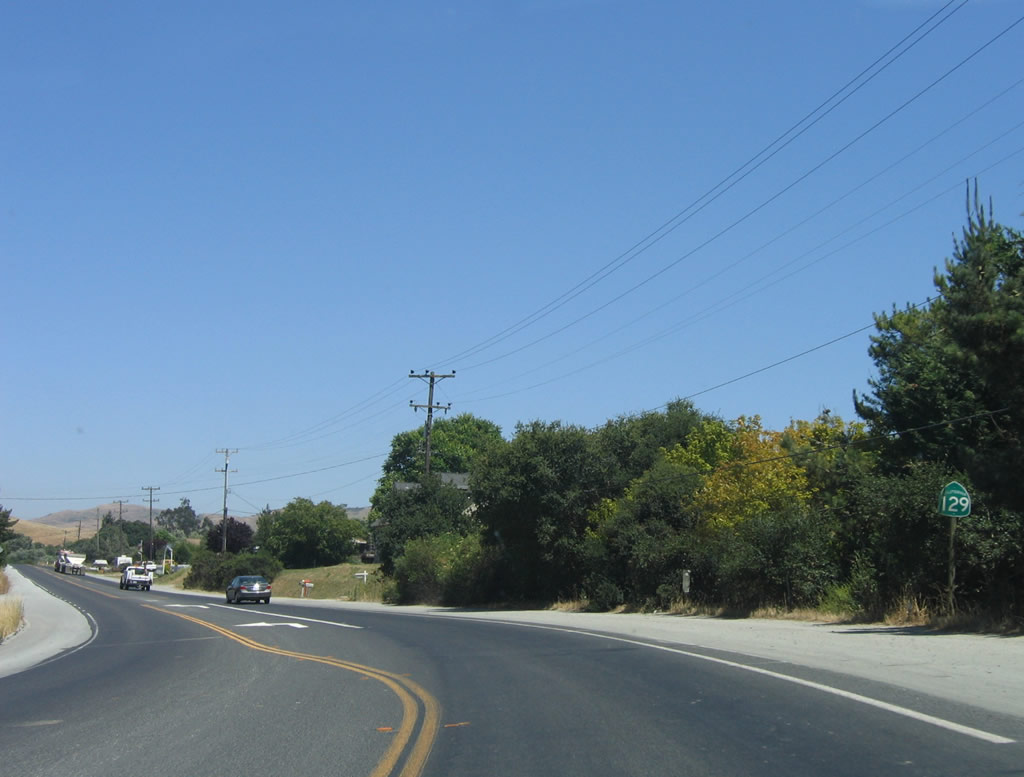
California 129
California 129 connects U.S. 101 with Watsonville and California 1. It is a faster route to the coast than California 152, which ascends a mountain pass before entering Watsonville.
| California 129/Riverside Drive east | |
|---|---|
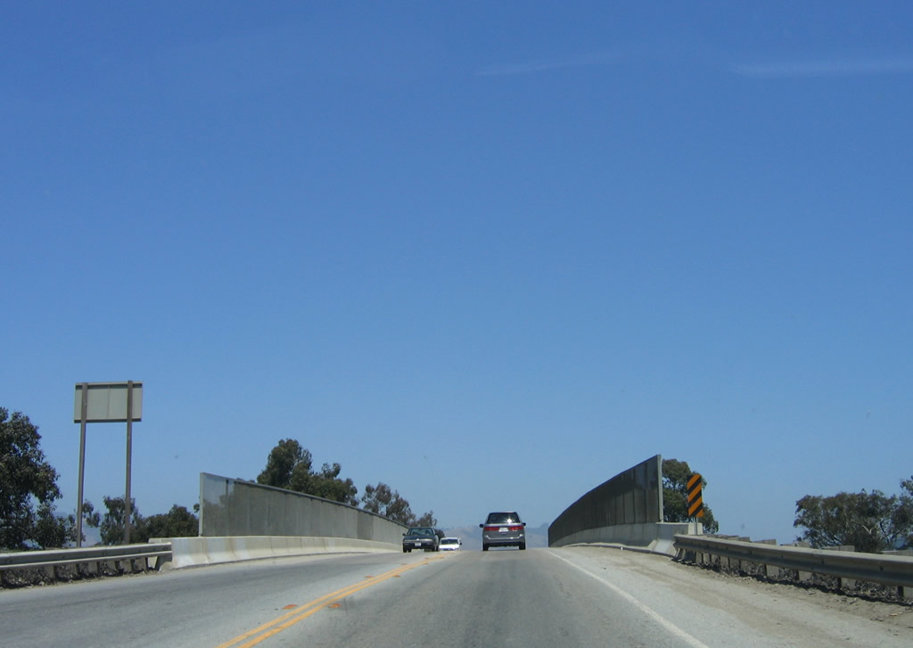 |
Eastbound California 129 crosses over California 1 (Cabrillo Highway). The initial two-lane highway follows Riverside Drive east toward Watsonville. Photo taken 07/05/06. |
 |
After crossing over California 1, a left turn connects eastbound California 129 with northbound California 1 to Santa Cruz. Continue straight ahead to Watsonville. A ramp connecting California 1 north with California 129 east merges on the right. Photo taken 07/05/06. |
 |
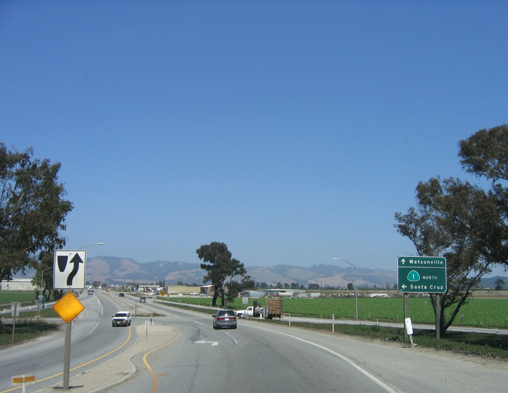
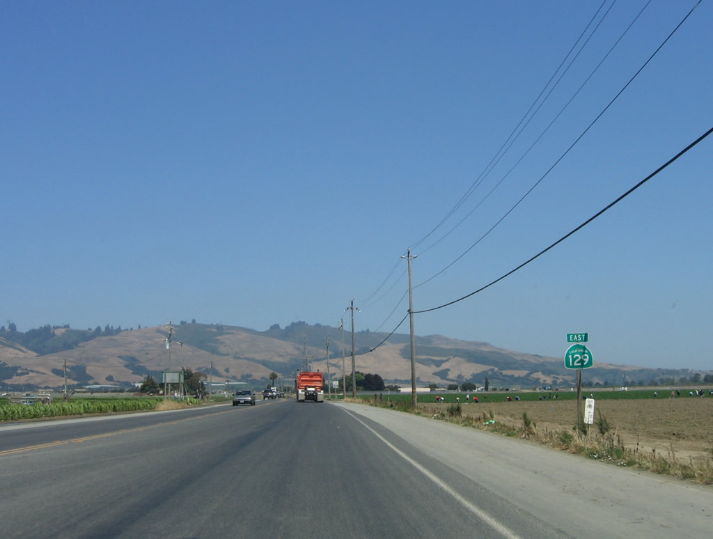
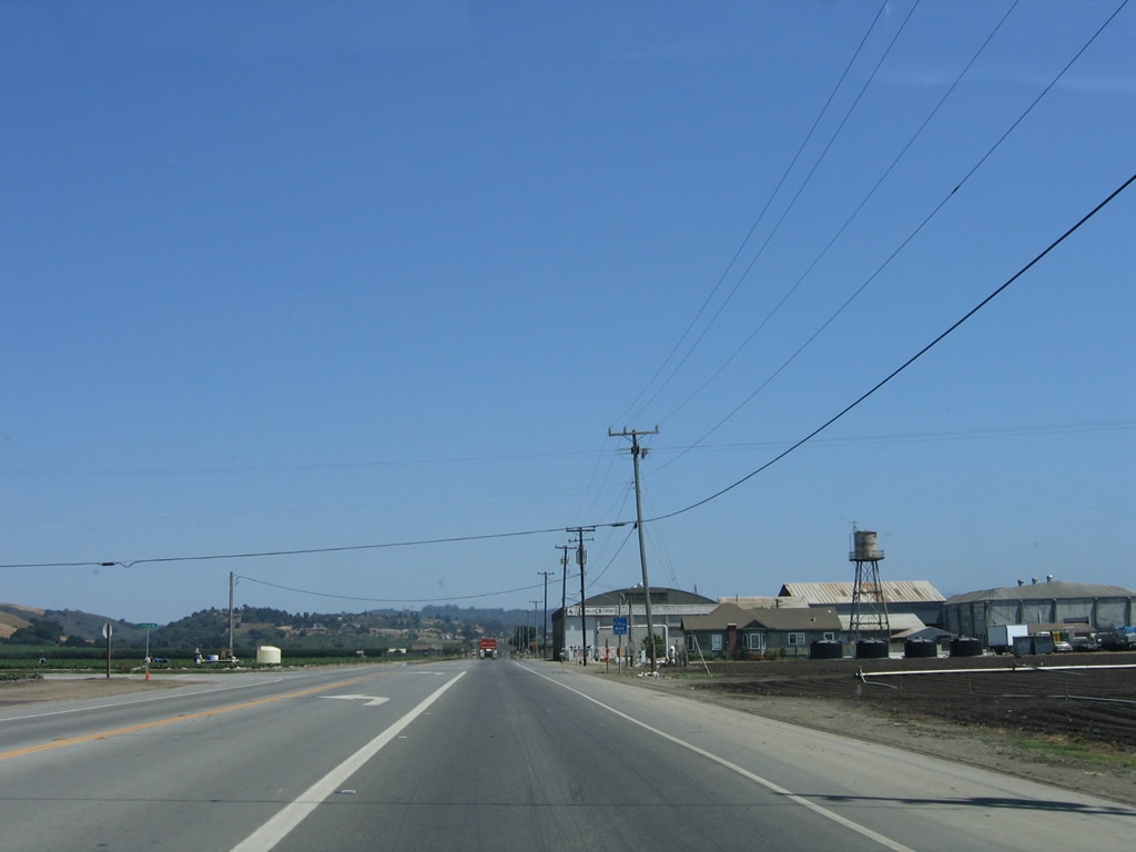
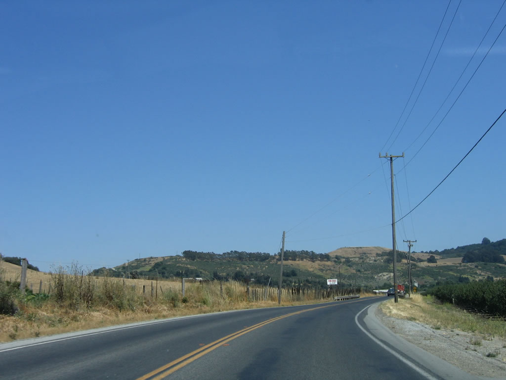
The first reassurance shield on westbound California 129 is posted after the California 1 north off-ramp, which forms a new right lane and makes California 129 into a four-lane, divided highway. California 129 is posted as To California 152 so that through traffic can connect to California 152 without driving through downtown Watsonville. Photo taken 07/05/06. |
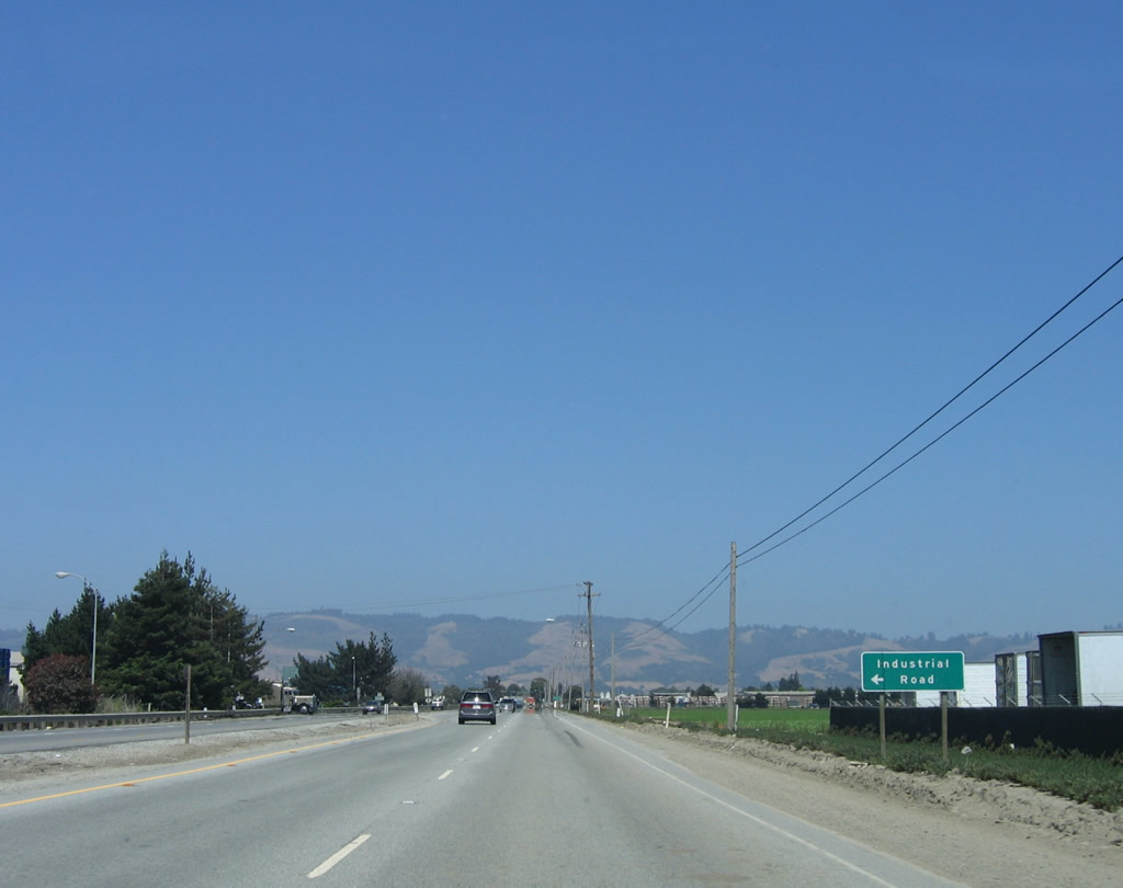 |
Eastbound California 129/Riverside Drive approaches Industrial Road. The state route passes through mostly agricultural land as it continues east toward Watsonville. Riverside Drive received its name because it follows the Pajaro River, which serves as the county line between Santa Cruz County on the north and Monterey County on the south. Photo taken 07/05/06. |
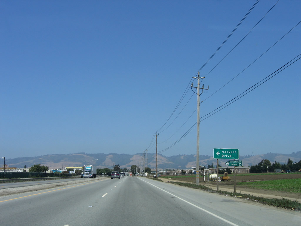 |
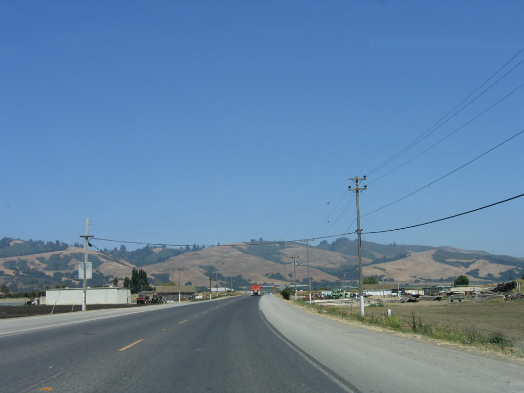
Soon thereafter, California 129 west approaches Harvest Road. Photo taken 07/05/06. |
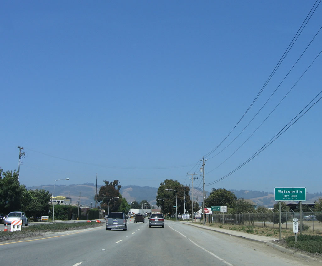 |
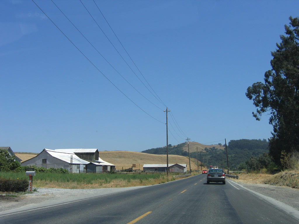
California 129 enters the city of Watsonville. Incorporated on March 30, 1868, and chartered in 1903, Watsonville is a regional agricultural and food processing hub and is home to 44,265 people as of the 2000 Census. The infamous Loma Prieta earthquake of October 17, 1989, was centered near Watsonville and caused a great deal of damage both to the city and to the San Francisco Bay Area. Photo taken 07/05/06. |
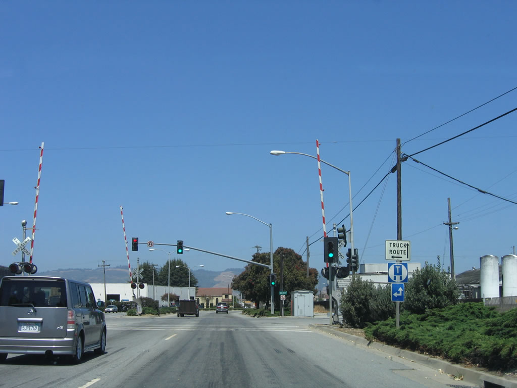 |
Eastbound California 129/Riverside Drive approaches Walker Street and the railroad tracks. Walker Street serves as part of a truck route to facilitate truck traffic routing in and around downtown Watsonville. To the northwest, Walker Street connects to Beach Street and Ford Street before changing into Harkins Slough Road near Ramsay Park. Photo taken 07/05/06. |
 |
A city of Watsonville wayfinder sign is posted in the median after the Walker Street traffic signal. To downtown, city hall, and city plaza, continue straight ahead on eastbound California 129. Photo taken 07/05/06. |
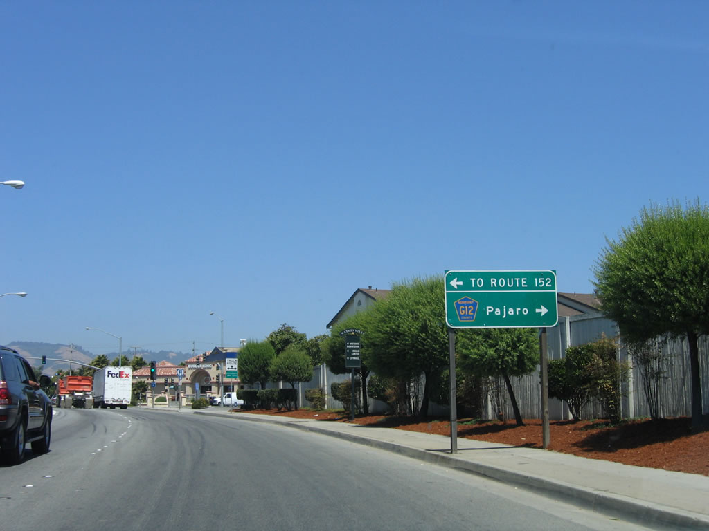 |
Eastbound California 129/Riverside Drive approaches a major intersection with Main Street. From this intersection, Main Street travels about six blocks north to meet California 152 at Beach Street. For through traffic to California 152 east to Gilroy, continue along California 129 east until the Lakeview Road intersection (or stay on California 129 east to U.S. 101 (El Camino Real), which is faster). This intersection also serves as the junction with Santa Cruz County G-12/Salinas Road south to Pajaro, Royal Oaks, and Prunedale (U.S. 101 and California 156). Santa Cruz County G-12 changes into Monterey County G-12 after crossing over the Pajaro River - and at that point, County Route G-12 crosses the county line. Interestingly, the county route shield in this sign says "Monterey County," not "Santa Cruz County." Use Monterey County G-12 south to Monterey County G-11/San Juan Road east to U.S. 101 and California 156 en route to San Juan Bautista and Hollister in San Benito County. Photo taken 07/05/06. |
 |
Main Street is the best route from California 129 into downtown Watsonville. City hall, City Plaza Park, and the central business district are only a few blocks north of here. At the Beach Street intersection, turn right to follow California 152 east to Hecker Pass. Continue straight ahead to follow California 152 northwest to California 1 en route to Capitola, Aptos, and Santa Cruz. Photo taken 07/05/06. |
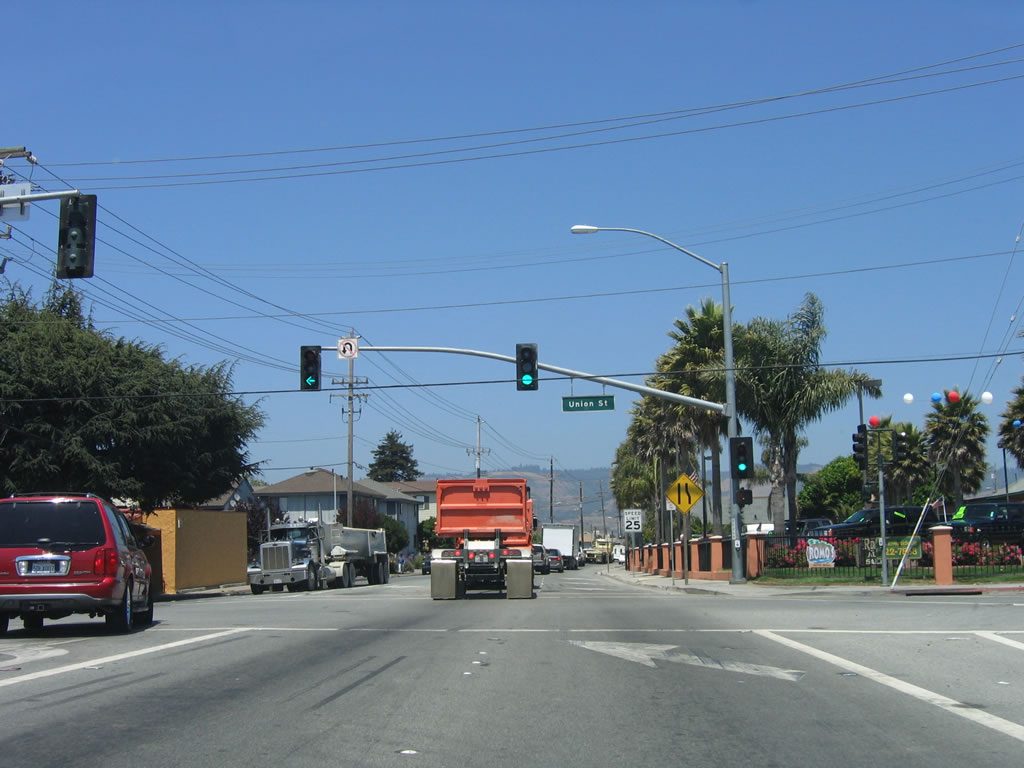 |
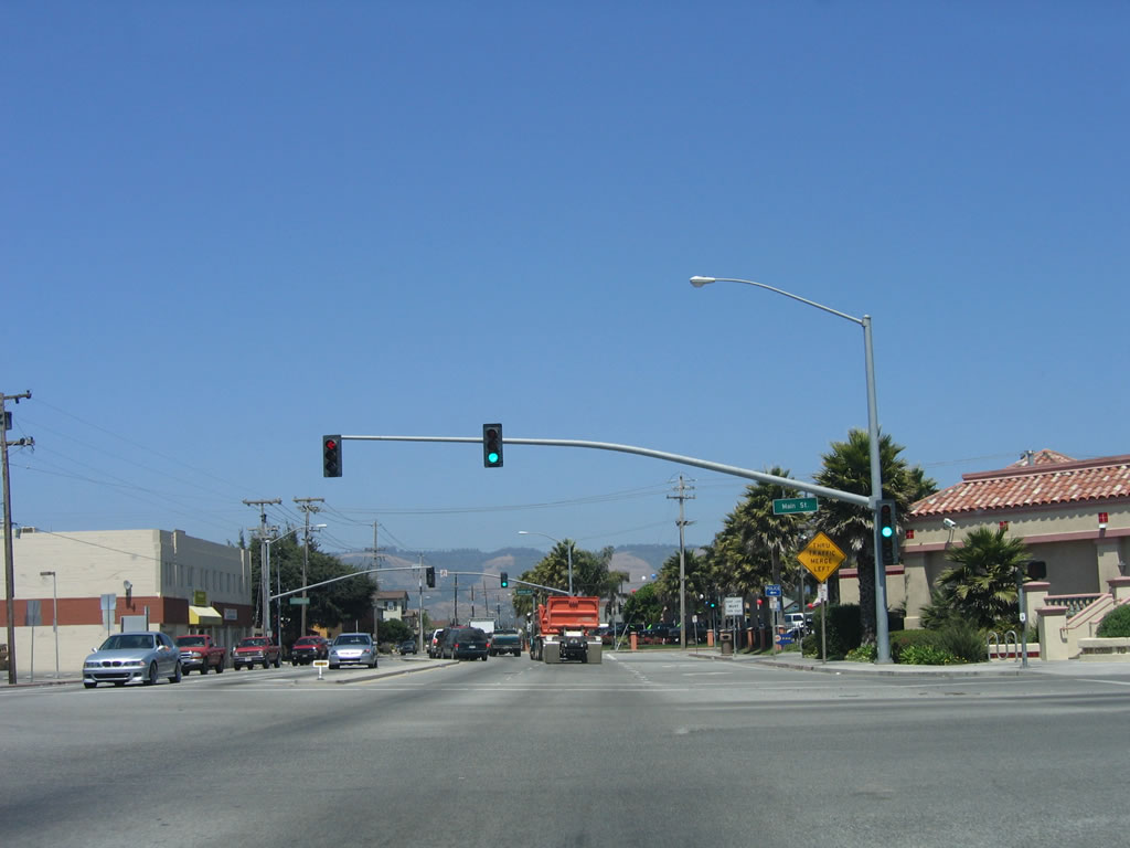
One block later, California 129/Riverside Drive meets Union Street. The four-lane highway reduces to two lanes. Photo taken 07/05/06. |
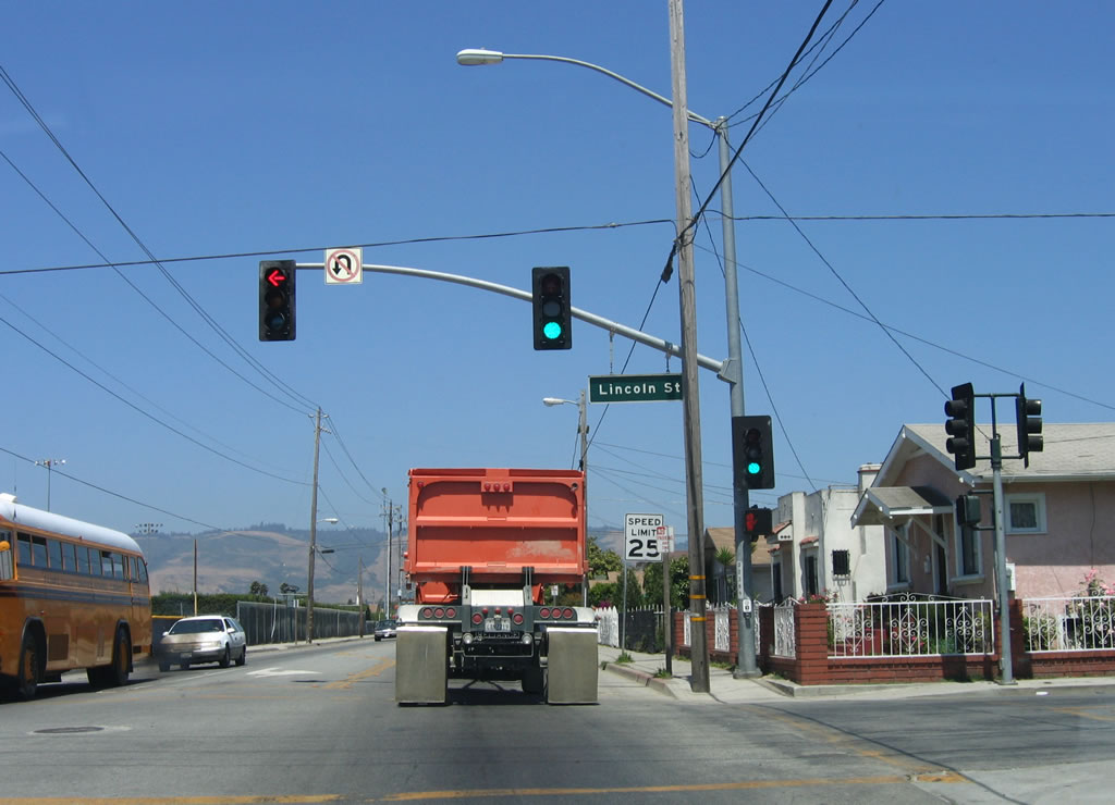 |
Four blocks later, California 129 approaches Lincoln Street. This major arterial briefly carries a block-long section of California 152 east, then merges onto Freedom Boulevard north en route to Freedom. Only blocks from downtown Watsonville, California 129 passes through residential areas and houses. Note the speed limit of 25 miles per hour is well-enforced. Photo taken 07/05/06. |
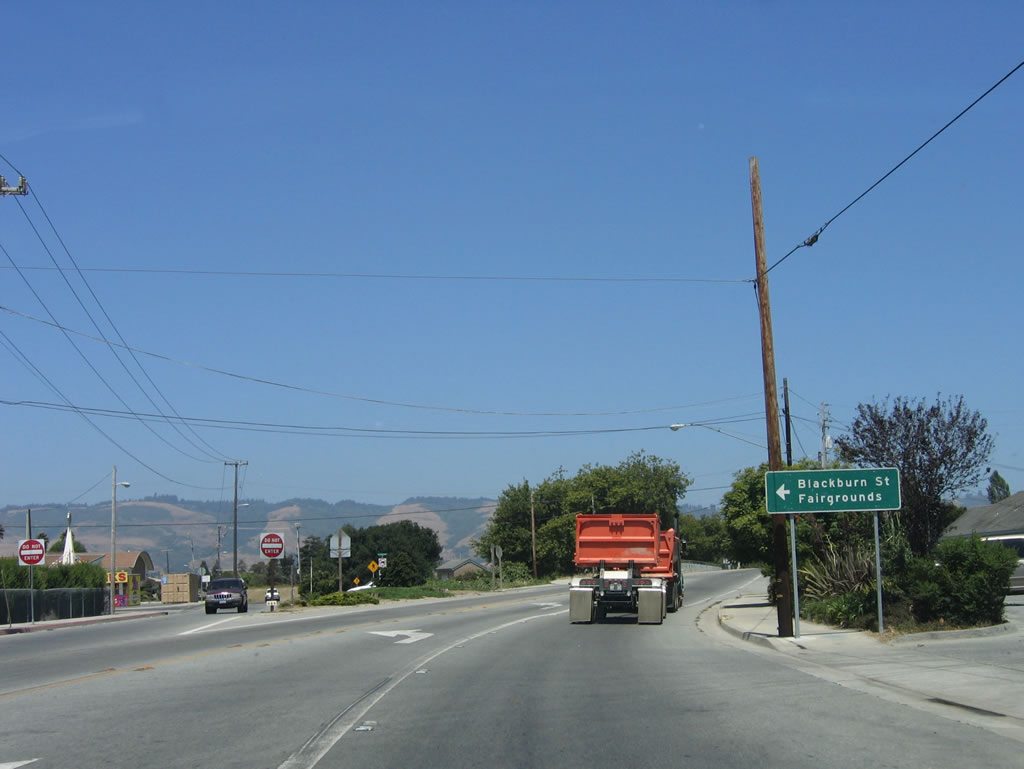 |
At this fork in the road, California 129/Riverside Drive turns a bit to the southeast, thus leaving the urban area of Watsonville. Farms and ranches will again come into view soon. Turn left here to Blackburn Street north to California 152 (Lake Avenue) or follow the left fork to Bridge Street, which takes a more indirect path to California 152. Photo taken 07/05/06. |
 |
A California 129 east reassurance shield is posted shortly thereafter, at the Salsipuedes Creek bridge (built in 1938, widened in 1990). Photo taken 07/05/06. |
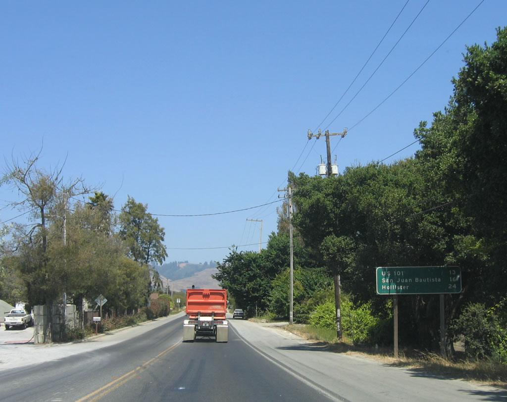 |
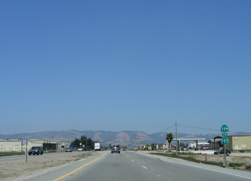
A mileage sign is posted shortly thereafter for the junction with U.S. 101 (El Camino Real) (13 miles), San Juan Bautista (16 miles), and Hollister (20 miles). The latter two destinations are reached via U.S. 101 south to California 156 east. Photo taken 07/05/06. |
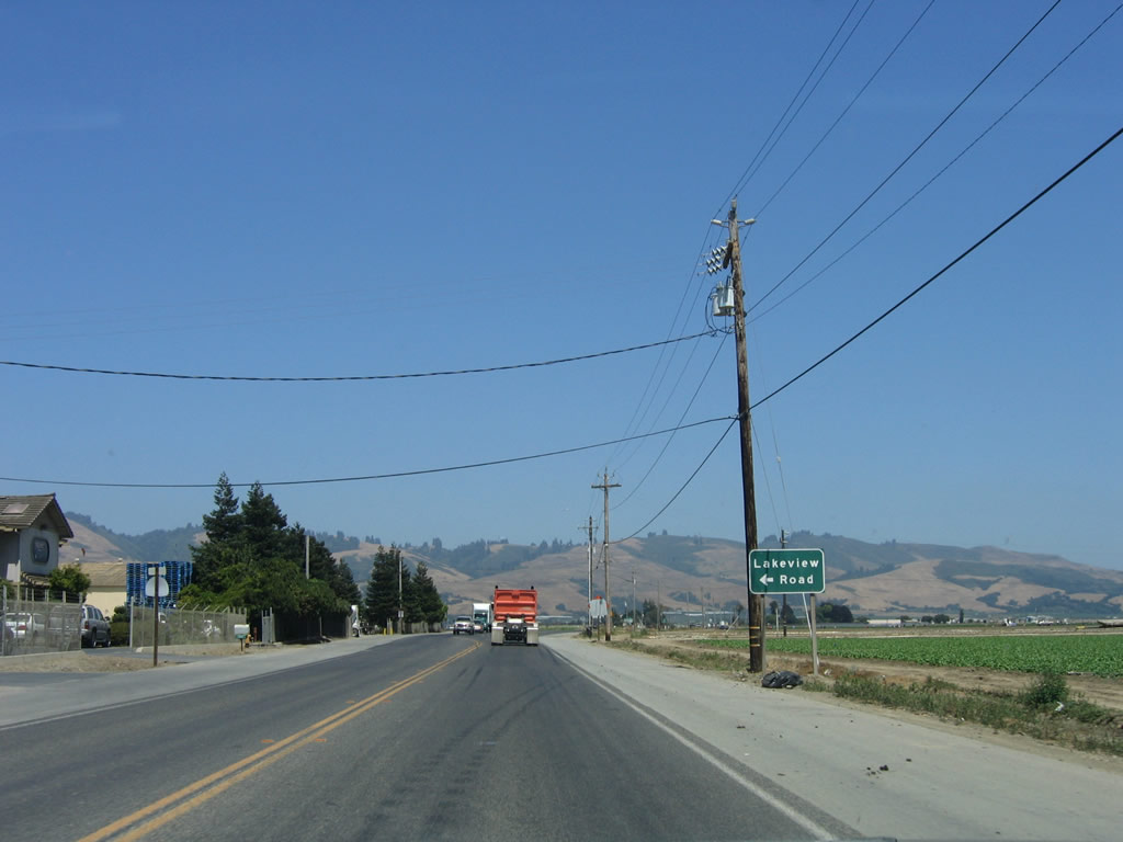 |
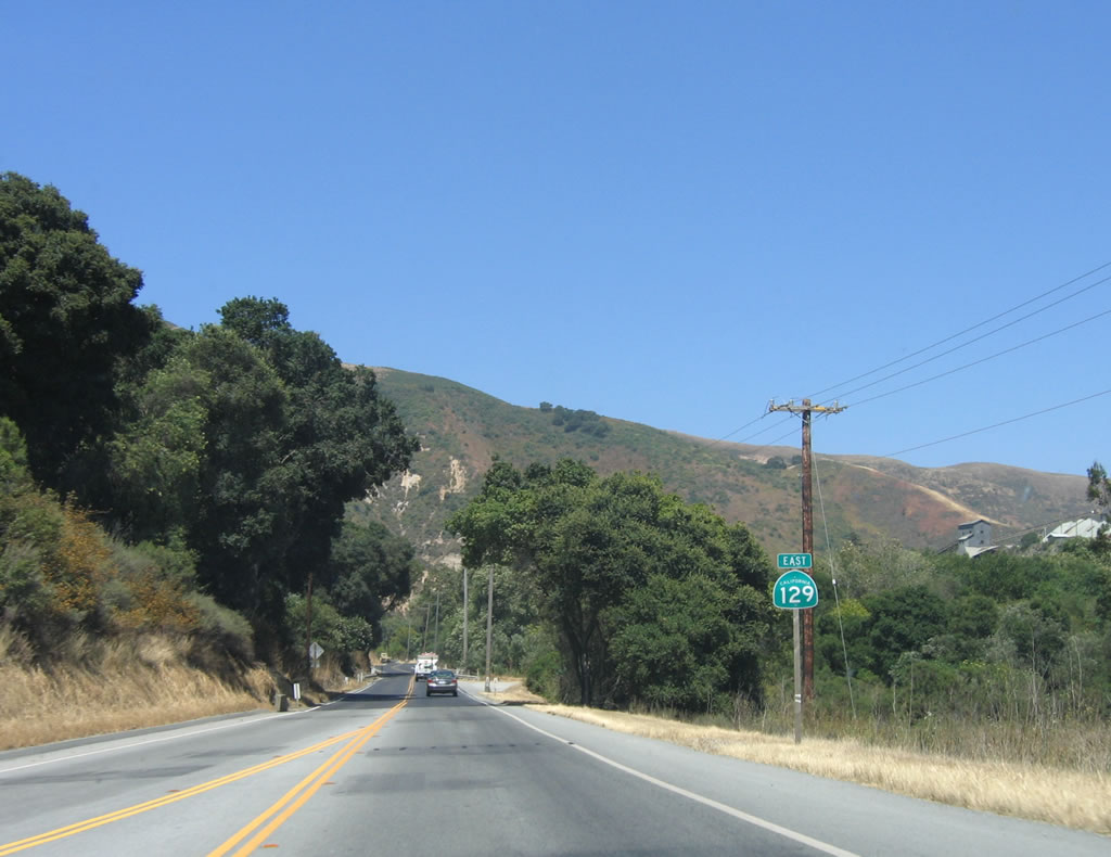
Farms and agriculture again grace the landscape as California 129 leaves Watsonville. Eastbound California 129/Riverside Drive approaches Lakeview Road north to California 152 (Hecker Pass Road). Through traffic to Gilroy can use California 152 east or California 129 east to U.S. 101 north. Photo taken 07/05/06. |
 |
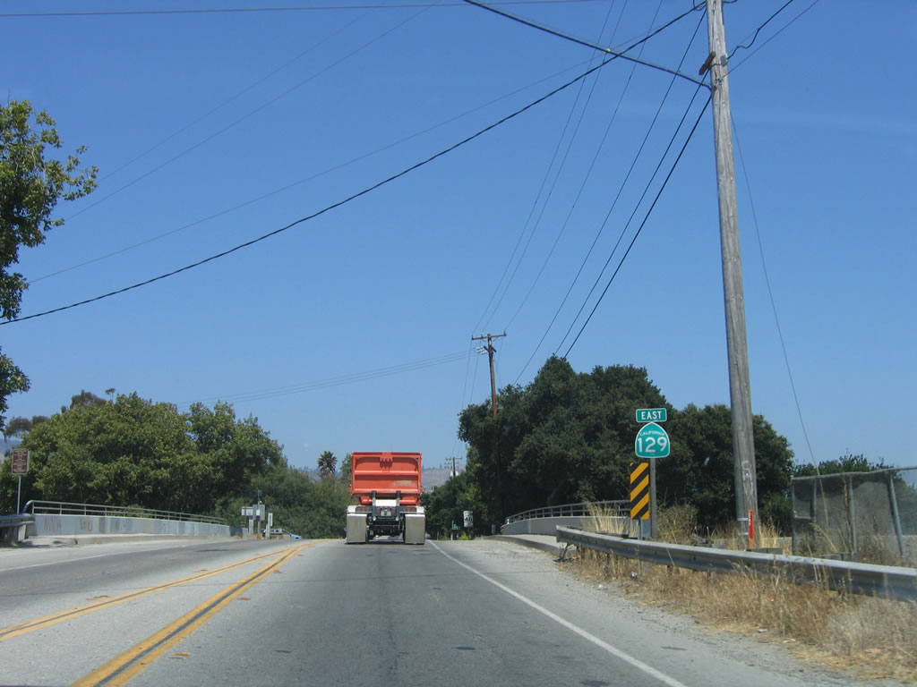
After the Lakeview Road intersection, a California 129 east reassurance shield is posted. The southern flank of the Santa Cruz Mountains come into view. Whereas California 152 crosses the Santa Cruz Mountains via Hecker Pass near Mount Madonna, California 129 chooses to follow the Pajaro River through the Pajaro Gap, which separates the Santa Cruz Mountains from Fremont Peak and the Gabilan Range to the south. In fact, U.S. 101 & California 156 use the same gap to turn southwest from San Juan Bautista to Prunedale. Photo taken 07/05/06. |
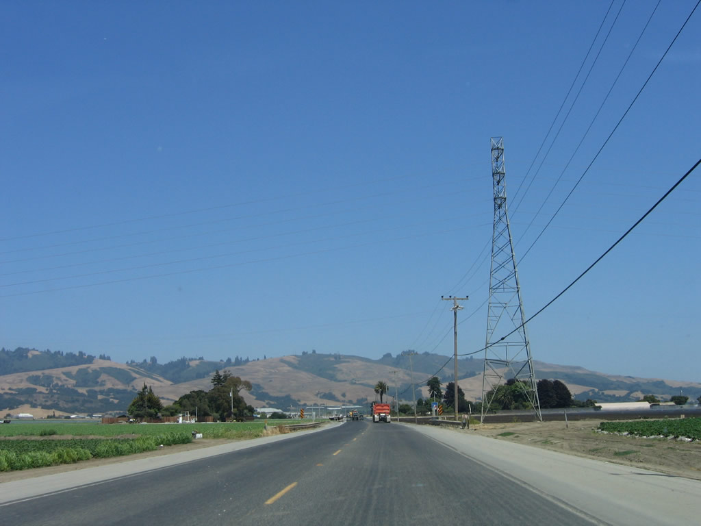 |
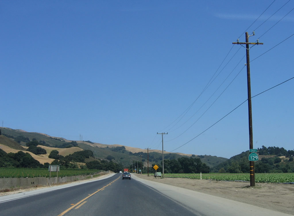
A 138-kV Pacific Gas and Electric (PG&E) power line crosses California 129. Photo taken 07/05/06. |
 |
Continuing east, California 129 serves as a farm-to-market road for a variety of farms, ranches, and orchards. Photo taken 07/05/06. |
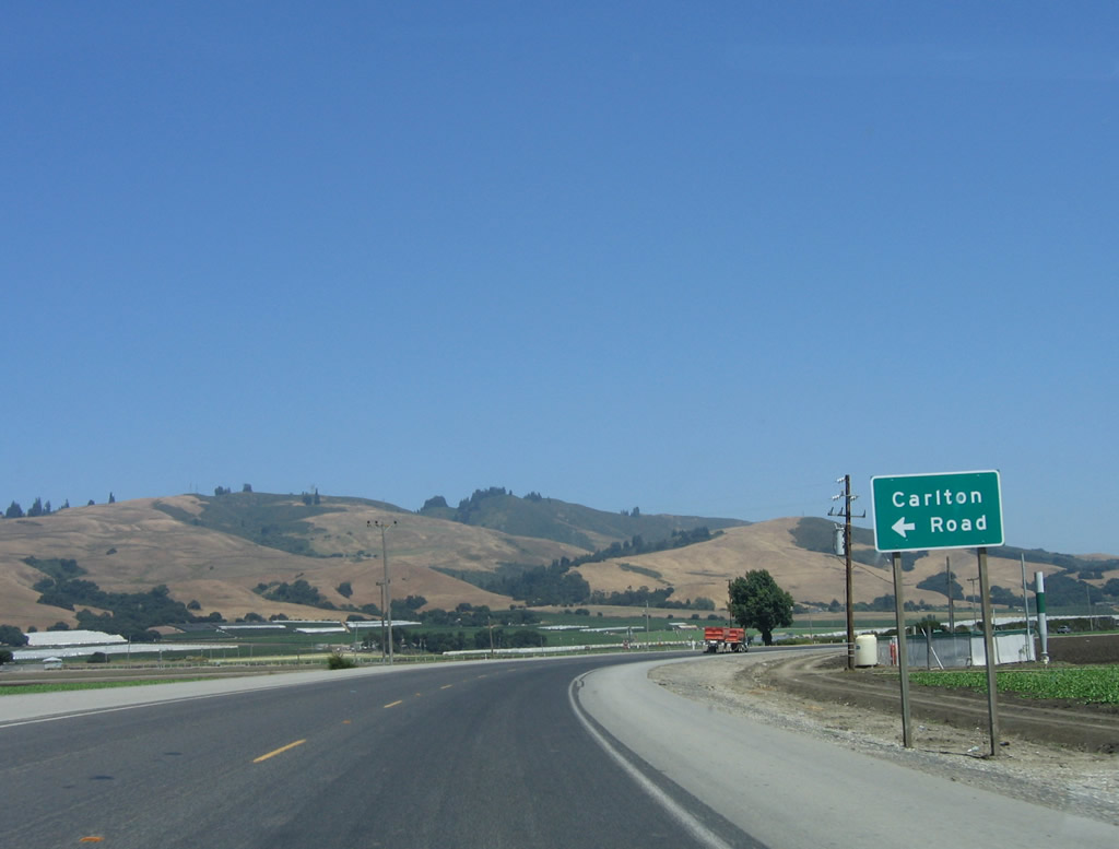 |
Eastbound California 129/Riverside Drive approaches Thompson Road northeast to Carlton Road north. Use Carlton Road north to California 152 (Hecker Pass Road); Carlton Road also serves as a farm-to-market road in this fertile plain. After this intersection, California 129 turns southeast toward Pajaro Gap. Photo taken 07/05/06. |
 |
Now traveling southeast, California 129 approaches Silliman Road and a somewhat industrial looking area. Photo taken 07/05/06. |
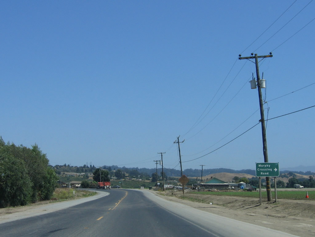 |
California 129 will again turn east at the intersection with Murphy Crossing Road. True to its name, Murphy Crossing Road travels south over the Pajaro River and connects to Monterey County G-11/San Juan Road. Photo taken 07/05/06. |
 |
Another California 129 east reassurance shield is posted after the Murphy Crossing Road intersection. The southern flank of the Santa Cruz Mountains and Pajaro Gap loom ahead; barely visible is the 500-kV power transmission line that connects Moss Landing Power Generating Station with the San Francisco Bay Area power grid. Photo taken 07/05/06. |
 |
Now entering Pajaro Gap, California 129 squeezes with the Pajaro River and the railroad for the final distance to U.S. 101. Photo taken 07/05/06. |
 |
The 500 kV power line and a companion 230-kV power line cross high above Pajaro Gap. California 129 continues east toward its junction with U.S. 101. Photo taken 07/05/06. |
 |
Pajaro Gap briefly widens out prior to reaching the Aromas cut off, and California 129 again passes by farms and ranches. At the Rogge Lane intersection (not photographed), turn south to the community of Aromas. Photo taken 07/05/06. |
 |
After the intersection with Rogge Lane (which connects California 129 with the community of Aromas and Carpinteria Road south to Monterey County G-11/San Juan Road), this California 129 east reassurance shield is posted. Photo taken 07/05/06. |
 |
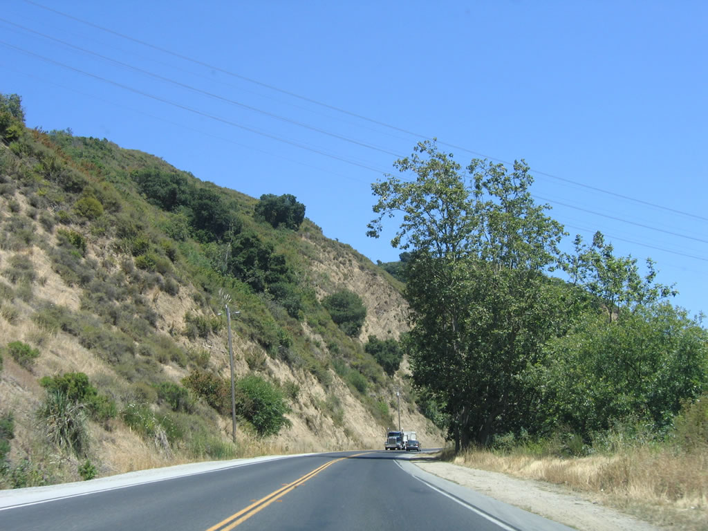
More narrow sections of California 129 and sharp curves lie ahead before the state highway emerges from Pajaro Gap. Photo taken 07/05/06. |
 |
Leaving Pajaro Gap, California 129 approaches Soda Lake on the north and the Chittenden cut off. Photo taken 07/05/06. |
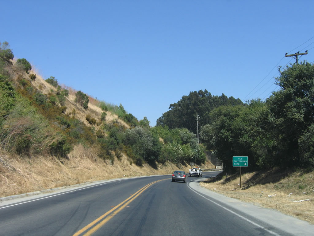 |
Eastbound California 129 approaches Old Chittenden Road, which is located immediately after passing through the subway undercrossing for the Union Pacific Railroad. Photo taken 07/05/06. |
 |
California 129 passes under this railroad subway, which dates to 1931. Photo taken 07/05/06. |
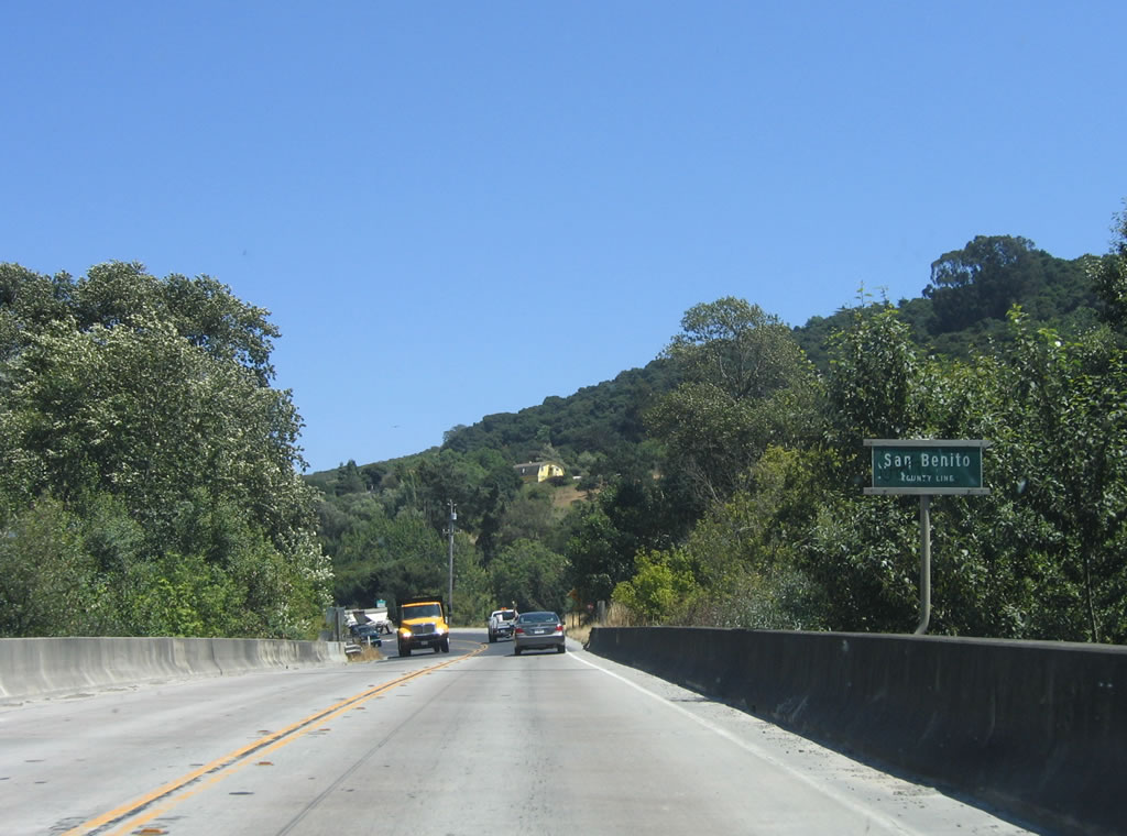 |
Shortly thereafter, California 129 crosses the Pajaro River on this 1949 bridge and enters San Benito County. Photo taken 07/05/06. |
| California 129/Chittenden Road east | |
|---|---|
 |
A reassurance shield for California 129/Chittenden Road is posted after the Pajaro River bridge. Photo taken 07/05/06. |
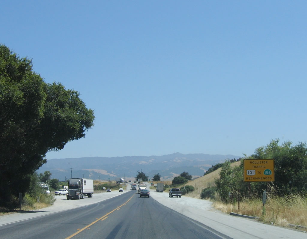 |
The best route for through traffic to Hollister is via California 129 east to U.S. 101 south to California 156 east. This is recommended over taking San Juan Highway, which is not on the state highway system. Photo taken 07/05/06. |
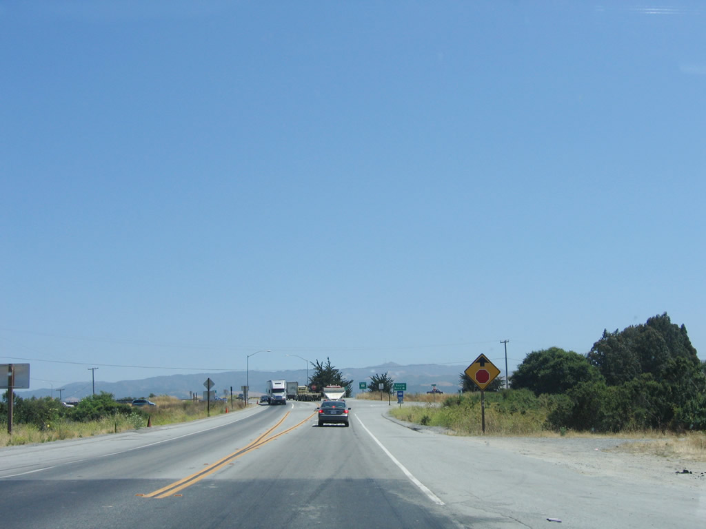 |
A stop ahead sign is posted on eastbound California 129/Chittenden Road as we approach the junction with U.S. 101 (El Camino Real). Photo taken 07/05/06. |
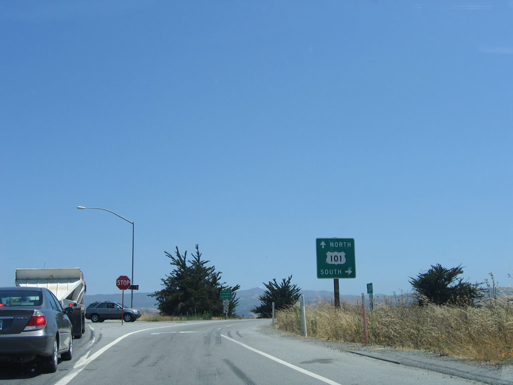 |
After the intersection with Searle Road, California 129 ends at U.S. 101. The first right turn connects to U.S. 101 south to California 156 east to Hollister, Prunedale, Salinas, and ultimately Los Angeles. A left turn at this diamond interchange connects to U.S. 101 north to Gilroy, San Jose, and San Francisco. An end shield is posted shortly after the turn off to southbound U.S. 101, but it is not shown here. Photo taken 07/05/06. |
| California 129 scenes | |
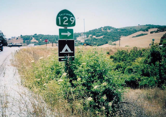 |
This California 129 trailblazer is posted on the off-ramp from U.S. 101 (El Camino Real) south to California 129 west to Watsonville. Photo taken by Trevor Carrier (2002). |

Page Updated October 19, 2007.
|
About Contact Glossary |
In The News Testimonials Interstate Guide |
Social Media:
 |
|
© 2000-23 AARoads.com | All Rights Reserved | Privacy Policy / Terms of Use
|
||