
California 156
California 156 connects California 152 with the Monterey Peninsula, forming part of the most direct route from the Central Valley to Monterey. Portions of the route are freeway, and those that are not are highly traveled. It shares pavement with U.S. 101 between Prunedale and San Juan Bautista.
| California 156 west | ||
|---|---|---|
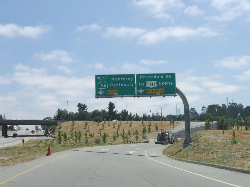 |
Upon exiting U.S. 101 (El Camino Real) south at Exit 335, California 156 continues southwest toward the Monterey Peninsula. On the transition ramp, the left lane carries California 156 west to Monterey, while the right lane connects to Prunedale Road east to U.S. 101 north. The reason U.S. 101 north is signed here is because some side traffic is required to use U.S. 101 south to access U.S. 101 north due to its expressway configuration near Prunedale. Photo taken 07/05/06. | |
 |
The right lane exits onto Prunedale Road, while the left lane will continue west on California 156. This area was formerly an at-grade intersection and was the source of countless delays on U.S. 101 and California 156. Although the reconfiguration addresses connections at the interchange, it did not fix capacity improvements needed for California 156 west to Monterey. Photo taken 07/05/06. | |
 |
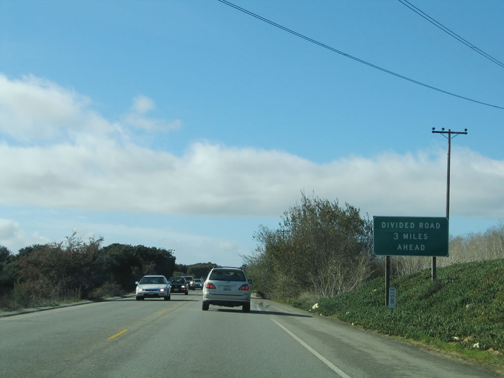
California 156 west reduces to a two-lane conventional highway, with cross traffic ahead for the next four miles. This section of highway is generally very busy, as it is one of the major routes to Monterey. There is no direct freeway connection to the Monterey Peninsula, even though California 1 is a freeway through Monterey. California 1, California 68, and California 156 all have two-lane segments on their way to the peninsula. Photo taken 07/05/06. | |
 |
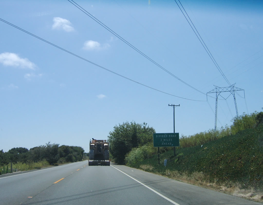 |
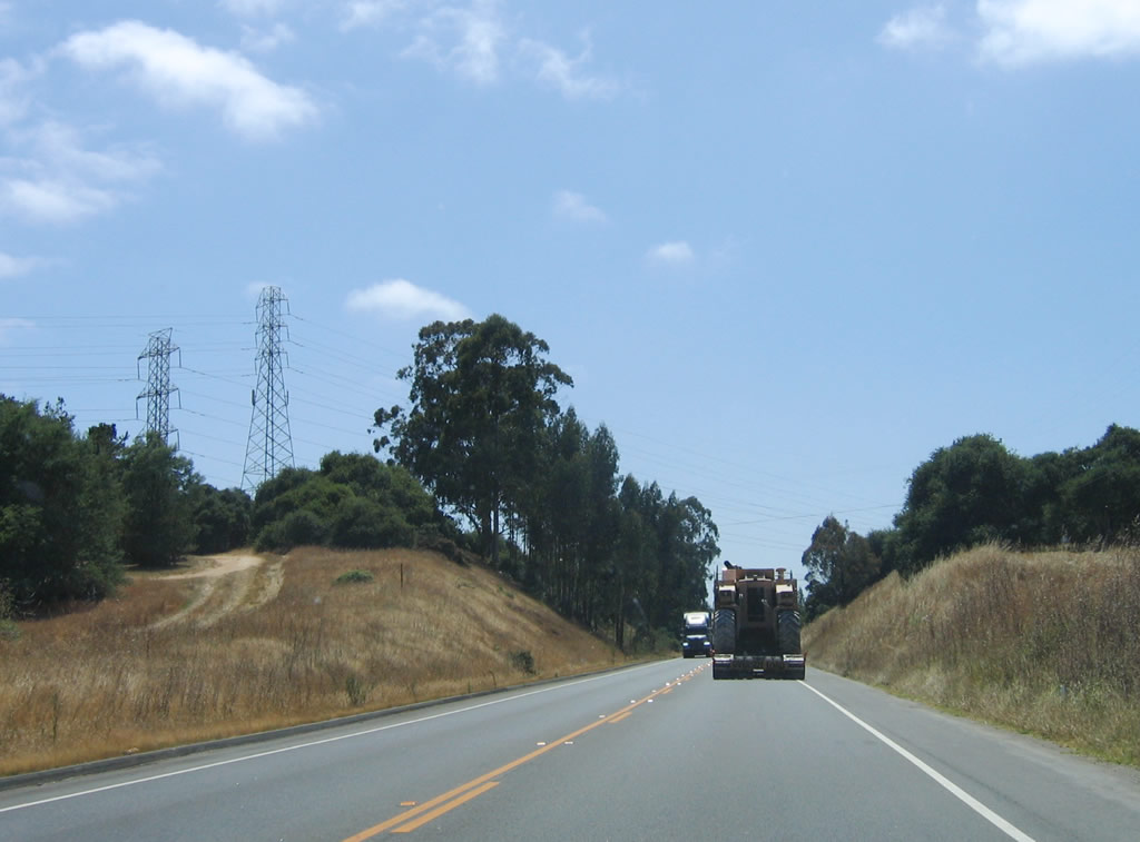
Trucks, farmers, commuters, and vacationers all must squeeze onto two-lane California 156. Overhead, a set of 138 kV, 230 kV, and 500 kV power lines (three different towers) cross California 156. The first photo shows the first two lines, and the second photo shows the long-distance, 500 kV tranmission line. These lines emanate from the Moss Landing Power Generating Station, and the 500 kV line travels northwest to the Los Banos Substation located south of the California 33-152 interchange near Santa Nella and west of Interstate 5. Photo taken 07/05/06. |
 |
California 156 will widen to expressway standards in three miles. The postmile indicates that only five miles of California 156 west remain (until the interchange with California 1 (Cabrillo Highway) at the coast). The distance to Seaside, Monterey, and Pacific Grove is a bit further, since a bit of travel south on California 1 is required. Photo taken 11/27/04. |
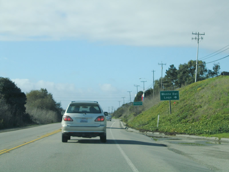 |
Near the intersection with Monte del Lago, California 156 enters the unincorporated community of Castroville, the "Artichoke Center of the World." Home to 6,724 people as of the 2000 Census, artichokes are produced in vast quantity in the Pajaro Valley along the coastal plain. An annual artichoke festival is held in Castroville. Photo taken 11/27/04. |
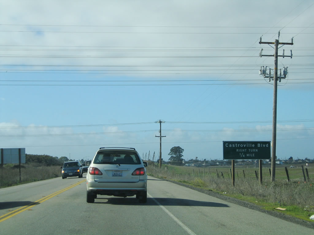 |
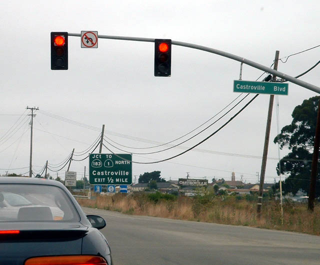
The only traffic signal along this stretch of California 156 is with Castroville Boulevard. After this intersection, California 156 will become a freeway for its final distance to California 1 (Cabrillo Highway). Photo taken 11/27/04. |
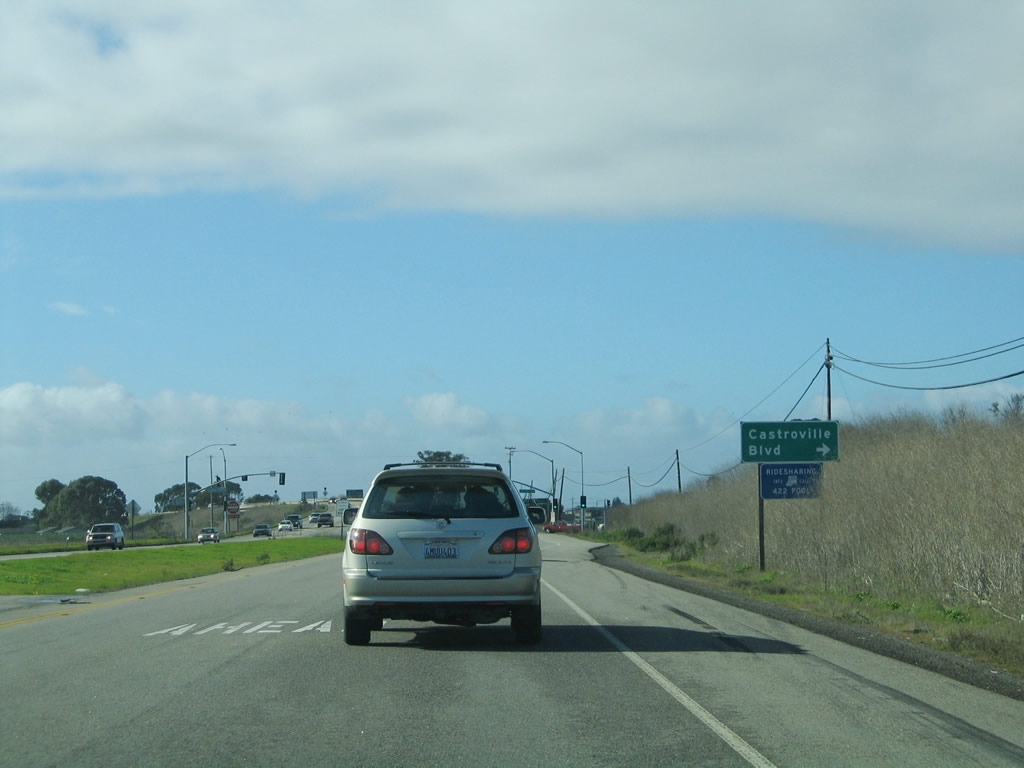 |
Turn right on Castroville Boulevard to Elkhorn. To downtown Castroville, continue west on California 156 to California 183 north. Photo taken 11/27/04. |
 |
The only traffic signal along this stretch of California 156 is with Castroville Boulevard. After this intersection, California 156 will become a freeway for its final distance to California 1 (Cabrillo Highway). Photo taken 08/18/03. |
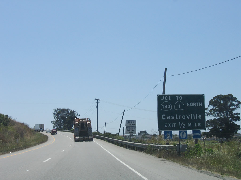 |
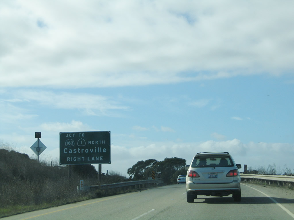
After the Castroville Boulevard intersection, westbound California 156 changes into a freeway configuration. The only independent exit on this short freeway is Exit 1B, California 183 north to Castroville and south to Salinas. Photo taken 07/05/06. |
 |
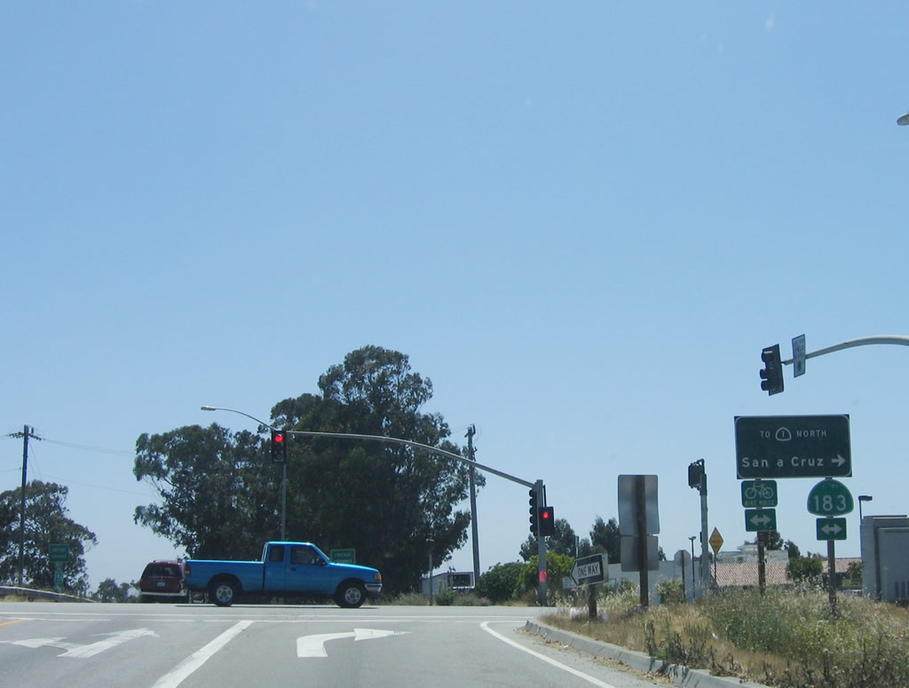
California 183 is a short, north-south state route that originates on U.S. 101 at Exit 328-329 and travels northwest to Castroville, ending at California 1 (Cabrillo Highway). The state route is mostly a two-lane rural highway that serves as a farm-to-market route. Photo taken 07/05/06. |
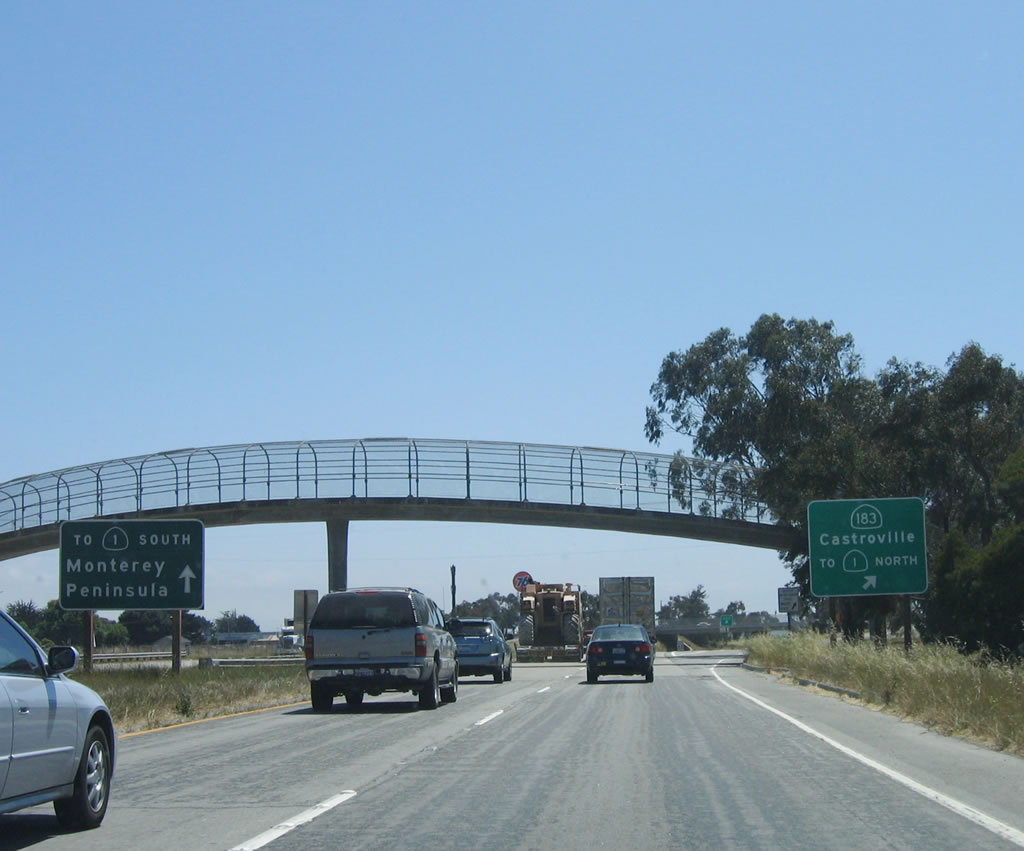 |
Nearing a pedestrian bridge, the left two lanes of westbound California 156 will connect directly onto California 1 (Cabrillo Highway) south to the Monterey Peninsula. The right lane connects to Exit 1B, California 183. Photo taken 07/05/06. |
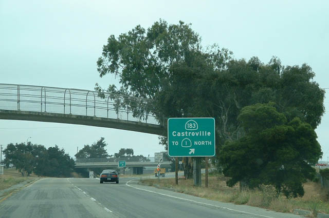 |
Westbound California 156 reaches Exit 1B, California 183 north to Castroville and California 1 north. Photo taken 08/18/03. |
 |
Reaching the top of the ramp from California 156 west to California 183 is this traffic signal. Turn left to follow California 183 south to Salinas and turn right to Castroville via California 183 north. Photo taken 07/05/06. |
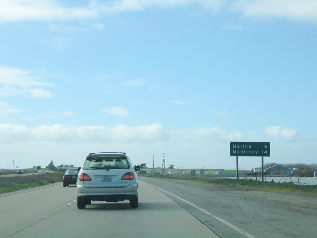 |
This mileage sign provides the distance to Marina (six miles) and Monterey (14 miles). Photo taken 11/24/04. |
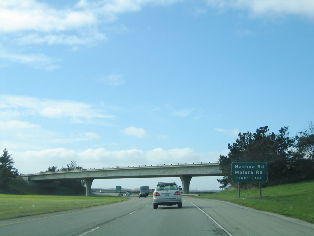 |
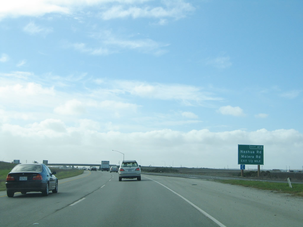
The next exit is Exit 414, Nashua Road and Molera Road. In the distance ahead (under the bridge) is the end California 156 shield (not photographed). Photo taken 11/24/04. |
 |
Traffic from westbound California 156 merges onto California 1 (Cabrillo Highway) south. Another sign for upcoming Exit 414 (to Nashua Road and Molera Road) appears in the distance. The left two lanes will merge with the incoming California 1 lanes, and the freeway will travel the remaining distance along the coast to Monterey and Pacific Grove. Photo taken 11/24/04. |

Page Updated October 20, 2007.
|
About Contact Glossary |
In The News Testimonials Interstate Guide |
Social Media:
 |
|
© 2000-23 AARoads.com | All Rights Reserved | Privacy Policy / Terms of Use
|
||