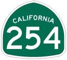
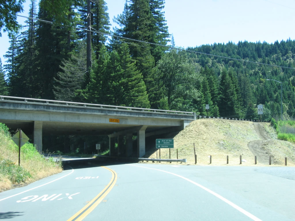
California 254 is the Avenue of the Giants, following Old U.S. 101 between Exit 645 and Exit 674 through the Humboldt Redwoods State Park. California 254 (Avenue of the Giants) travels north through Phillipsville, Miranda, and Humboldt Redwoods State Park. The bypass of the Avenue of the Giants (now U.S. 101) was built in three stages: from Exit 645 north to Exit 656, 1962-1964; from Exit 656 north to Exit 667, 1961; and from Exit 667 north to Exit 674, 1958-1967. The old alignment is still in the state highway system.
| California 254 north |
|
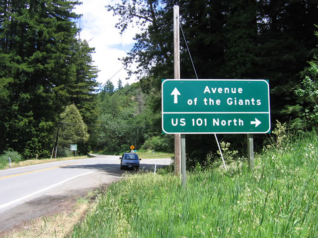
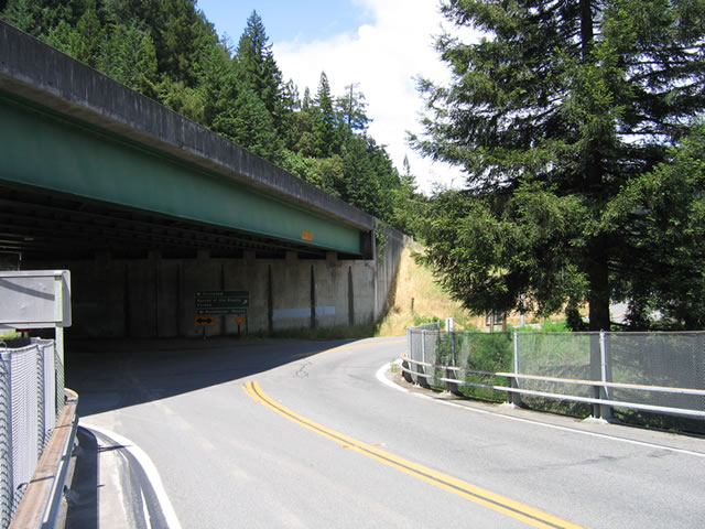
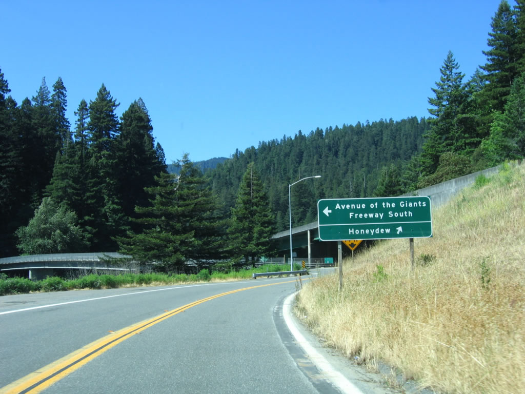
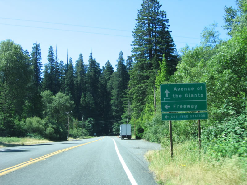
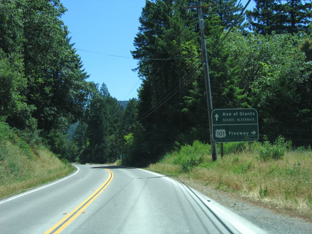
The first sign for Avenue of the Giants is located on northbound Hooker Creek Road. After passing under the U.S. 101 freeway, a right turn is required for the loop ramp to northbound U.S. 101. Note the use of text U.S. 101 rather than a shield. Photo taken 05/25/06. |
|
|
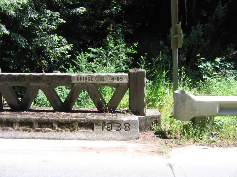
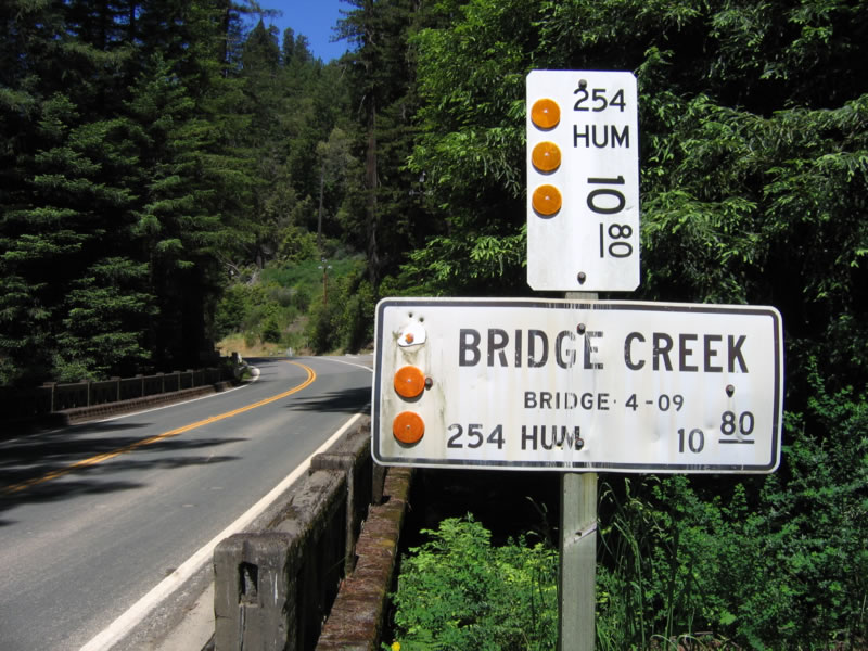
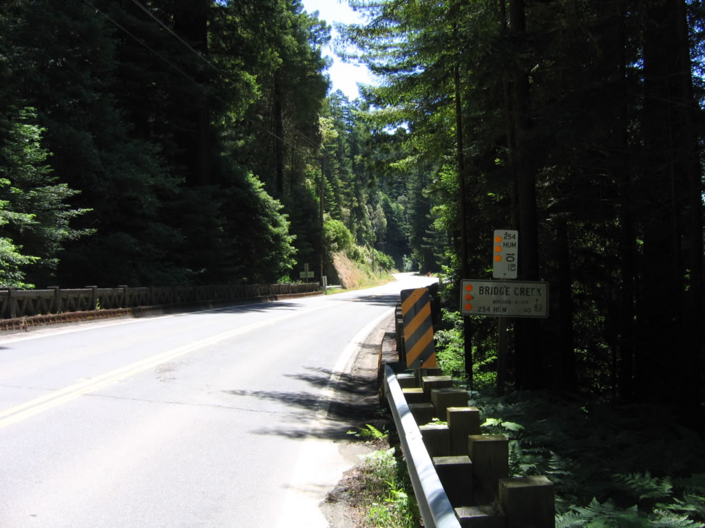
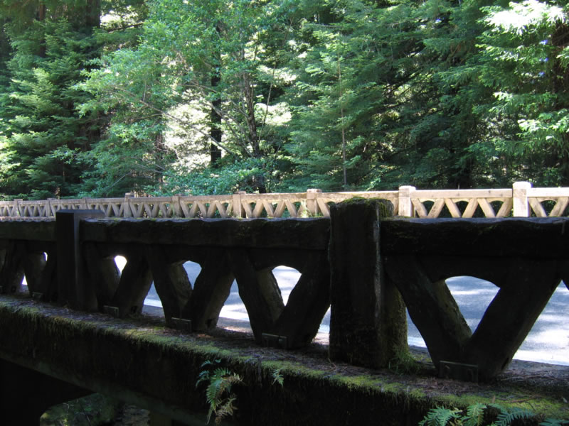
Northbound California 254 (Avenue of the Giants) crosses this 1938 bridge over Bridge Creek. Photos taken 05/29/06. |
|
California 254 (Avenue of the Giants) follows the Eel River as it passes through Humboldt Redwoods State Park. Photo taken 05/29/06. |
|
Near the Founders Tree within Humboldt Redwoods State Park, this flood gauge is posted to show the height of the 1964 flood of the Eel River (orange line at the top). This flood ravaged much of the North Coast and resulted in the destruction of bridges within the Eel River, Mad River, and Klamath River watersheds due to copious rainfall during that winter. Somehow Caltrans crews still found a way to remove all of the U.S. 299 and replace them with California 299 shields despite the obvious drain on their resources to repair flood damaged roads. Photo taken 05/25/06. |
|
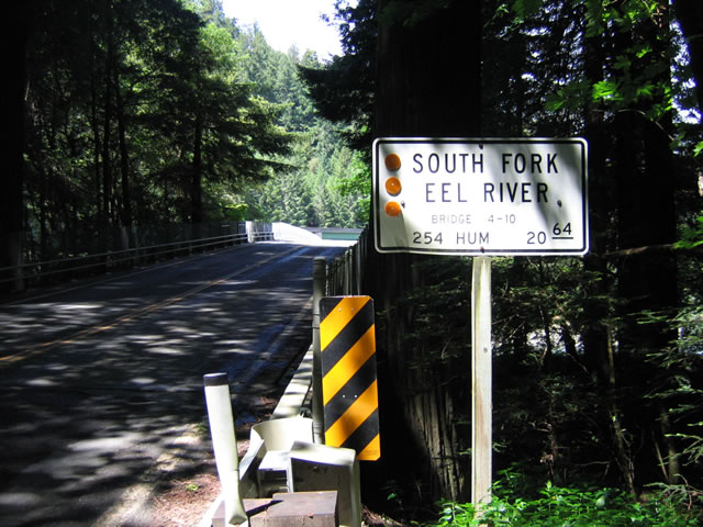
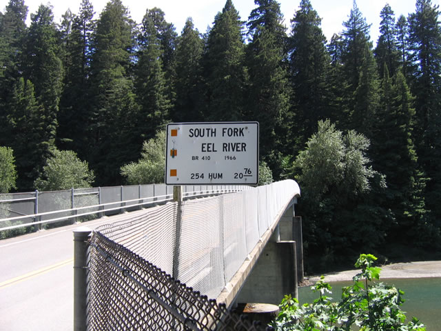
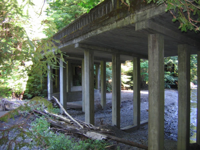
This bridge carries California 254 north over the South Fork of the Eel River at postmile 20.64. The flood of 1964 did not destroy this 1931 bridge, but it was reconstructed in 1966 to raise its height. Photo taken 05/25/06. |
|
The new bridge deck looks more like a mid-1960s bridge than a 1930s bridge. The South Fork of the Eel River flows below the Avenue of the Giants. Photo taken 05/25/06. |
|
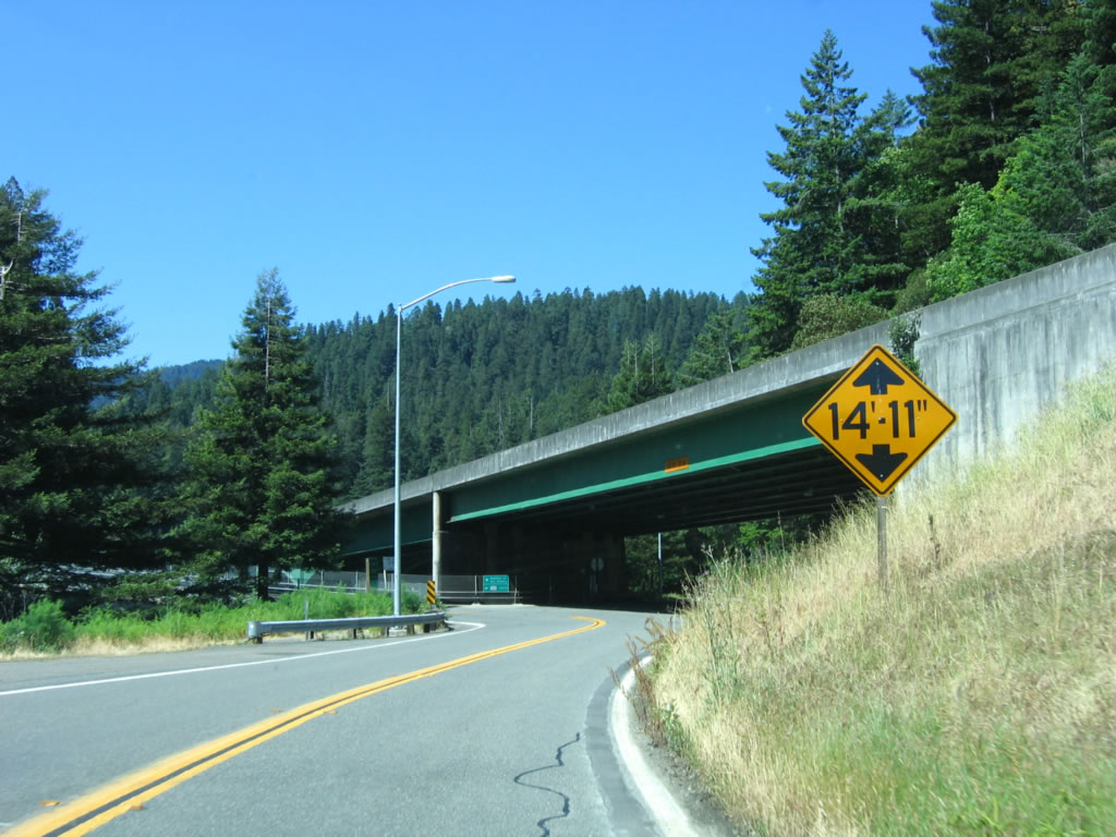
At the north end of the bridge over the South Fork of the Eel River, California 254 brushes under the U.S. 101 (Redwood Highway) freeway overpass, then turns northeast as a frontage road. Photo taken 05/25/06. |
|
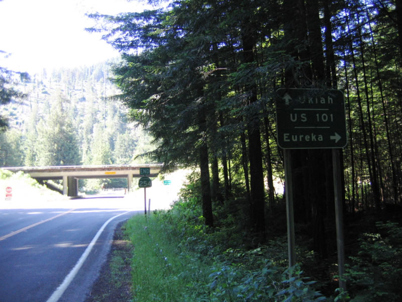
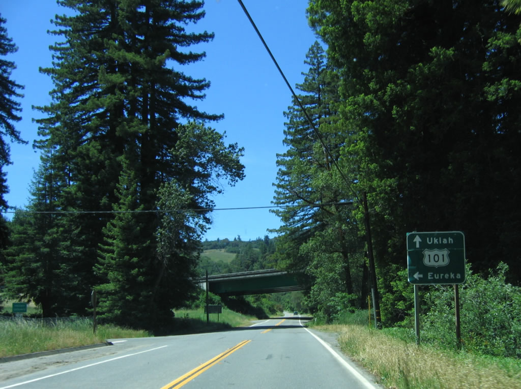
Near the north end of California 254 along Jordan Road is the final junction with U.S. 101 (Redwood Highway). The first right connects to U.S. 101 north to Eureka, and the next left connects to U.S. 101 south to Ukiah and Santa Rosa. Photo taken 05/29/06. |
|
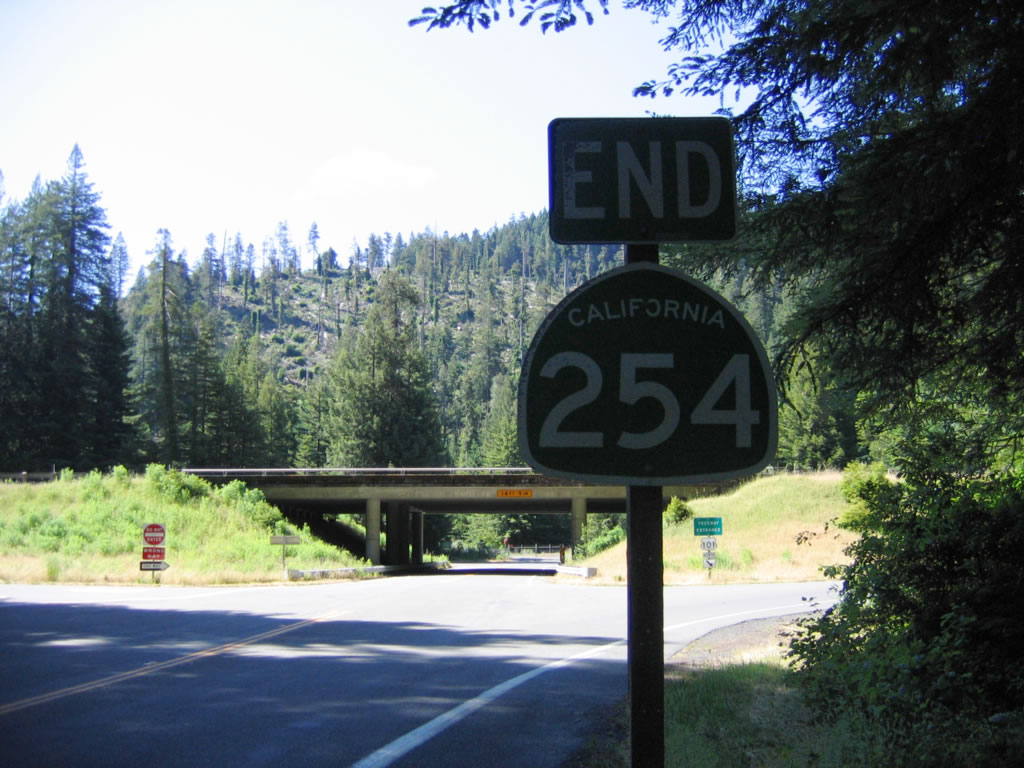
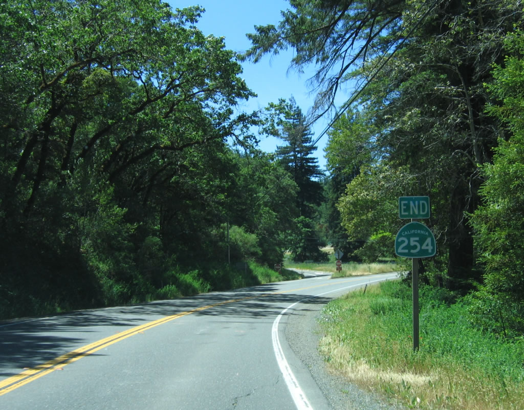
An end California 254 shield assembly is posted prior to the U.S. 101 interchange. At this point, the state highway leaves the state park. Photo taken 05/29/06. |
| California 254 south |
|
Upon leaving U.S. 101 (Redwood Highway), southbound California 254 follows Jordan Road north to the Avenue of the Giants, then turns east onto the Avenue. Photo taken 05/29/06. |
|
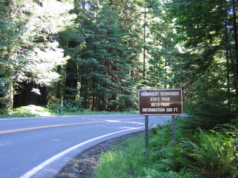
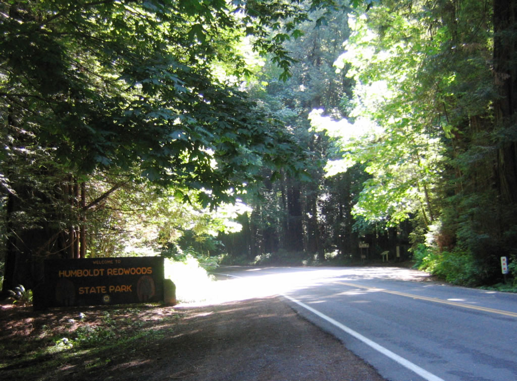
Humboldt Redwoods State Park includes 17,000 acres of old growth redwoods (such as the Rockefeller Forest, which is the largest such old growth stand left in the world). Humboldt Redwoods State Park features a large and very informative visitors center (use this exit) and includes hiking, camping, and other outdoor activities. The third largest state park in California, the park contains about 53,000 acres total, including the old growth redwood forests as well as the Bull Creek watershed. Photo taken 05/29/06. |
|
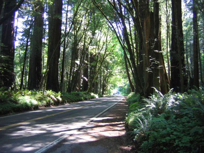
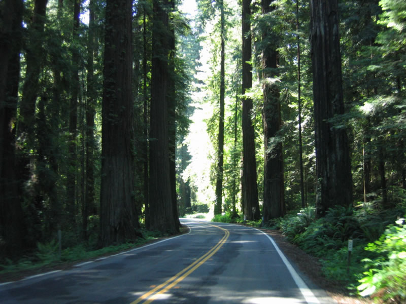
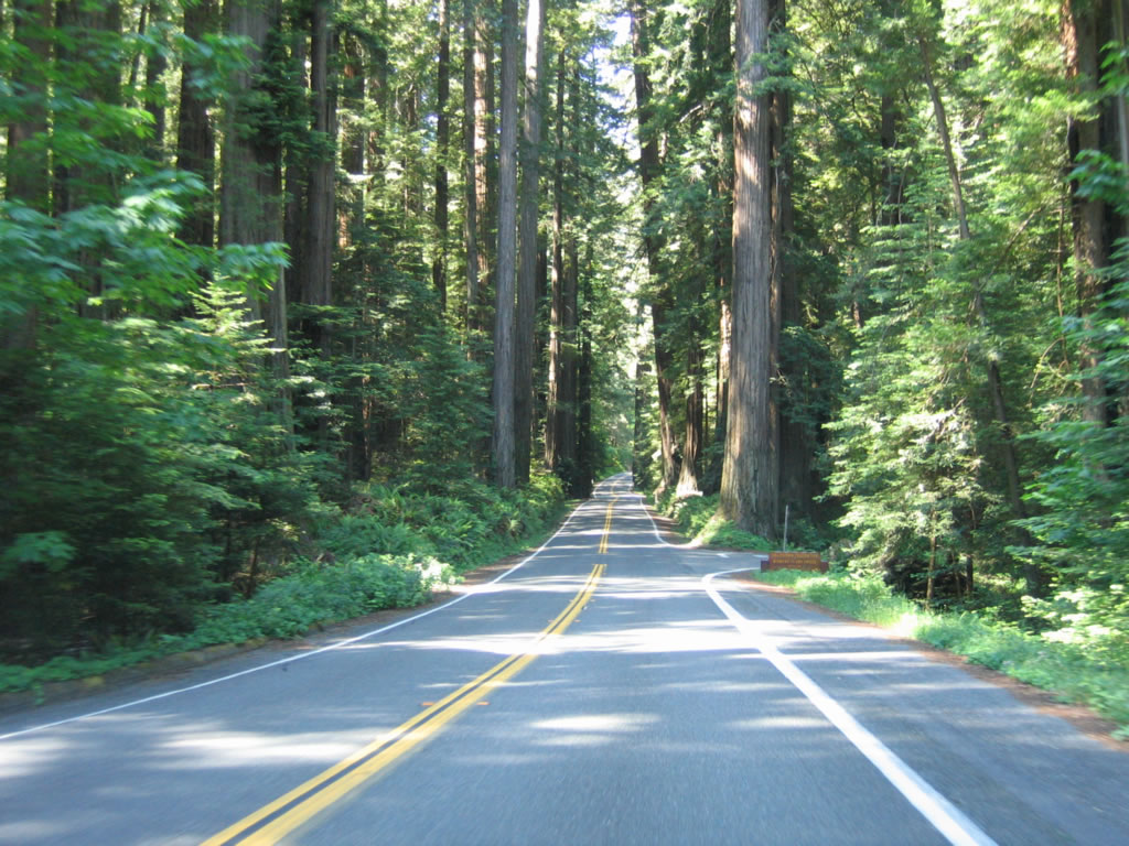
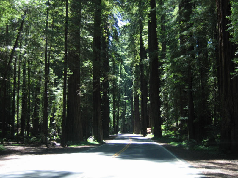
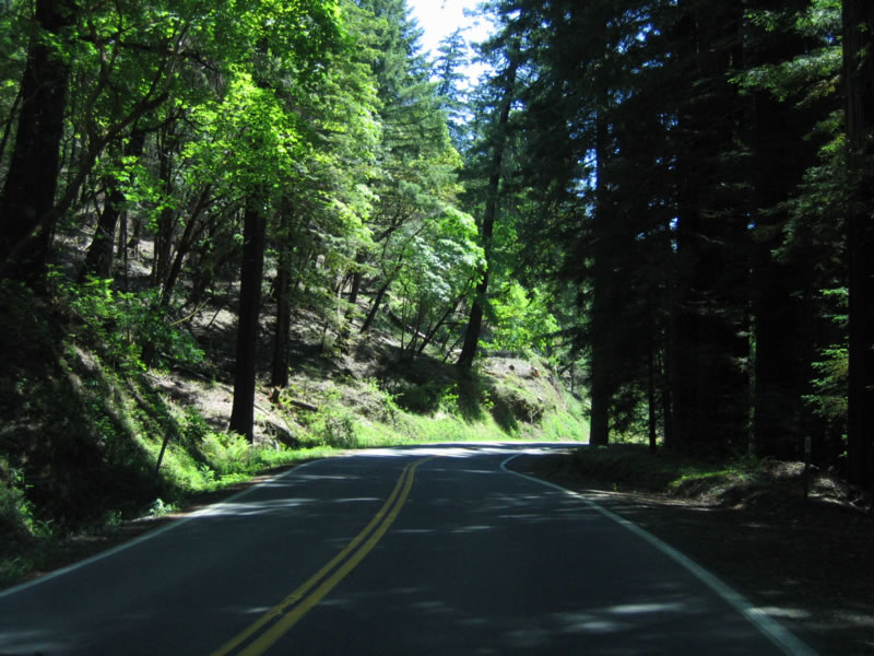
Redwoods line both sides of California 254 (Avenue of the Giants) as the old alignment of U.S. 101 travels south through the state park. Photo taken 05/29/06. |
|
Continuing south, California 254 crosses over Greenlaw Creek. Photo taken 05/29/06. |
|
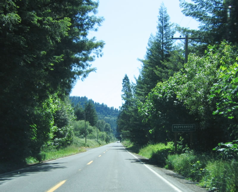
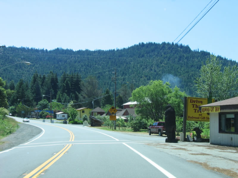
Southbound California 254 (Avenue of the Giants) enters the community of Pepperwood after briefly leaving the state park. From here, California 254 turns south. Photo taken 05/29/06. |
|
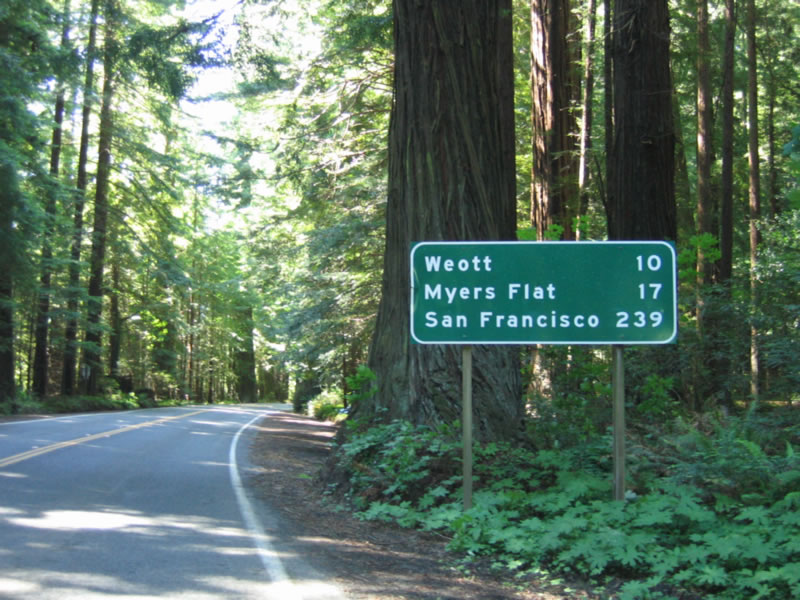
After leaving Pepperwood, this mileage sign along California 254 south provides the distance to Weott (10 miles), Myers Flat (17 miles), and San Francisco (239 miles). Photo taken 05/29/06. |
|
The Eel River comes into view as the redwoods part ways briefly. Photo taken 05/29/06. |
|
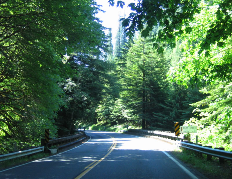
After the Barkdull Road intersection (which links to U.S. 101 (Redwood Highway)), southbound California 254 (Avenue of the Giants) crosses over Bear Creek. Photo taken 05/29/06. |
|
The Eel River comes into view again to the east of California 254 (Avenue of the Giants). Photo taken 05/29/06. |
|
An Avenue of the Giants reassurance marker is posted after the Immortal Tree entrance and Holmes Flat Road turn off. Photo taken 05/29/06. |
|
|
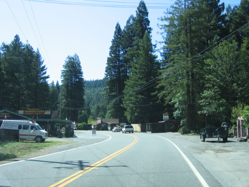
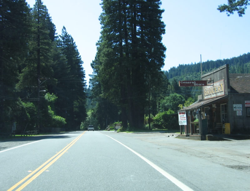
Southbound California 254 (Avenue of the Giants) enters the community of Redcrest. Some services including a general store are located here. Photos taken 05/29/06. |
|
Southbound California 254 (Avenue of the Giants) approaches Sorenson Road southwest to U.S. 101 Exit 667 and Englewood Ranch Road northeast (local access, not a through road). Photo taken 05/29/06. |
|
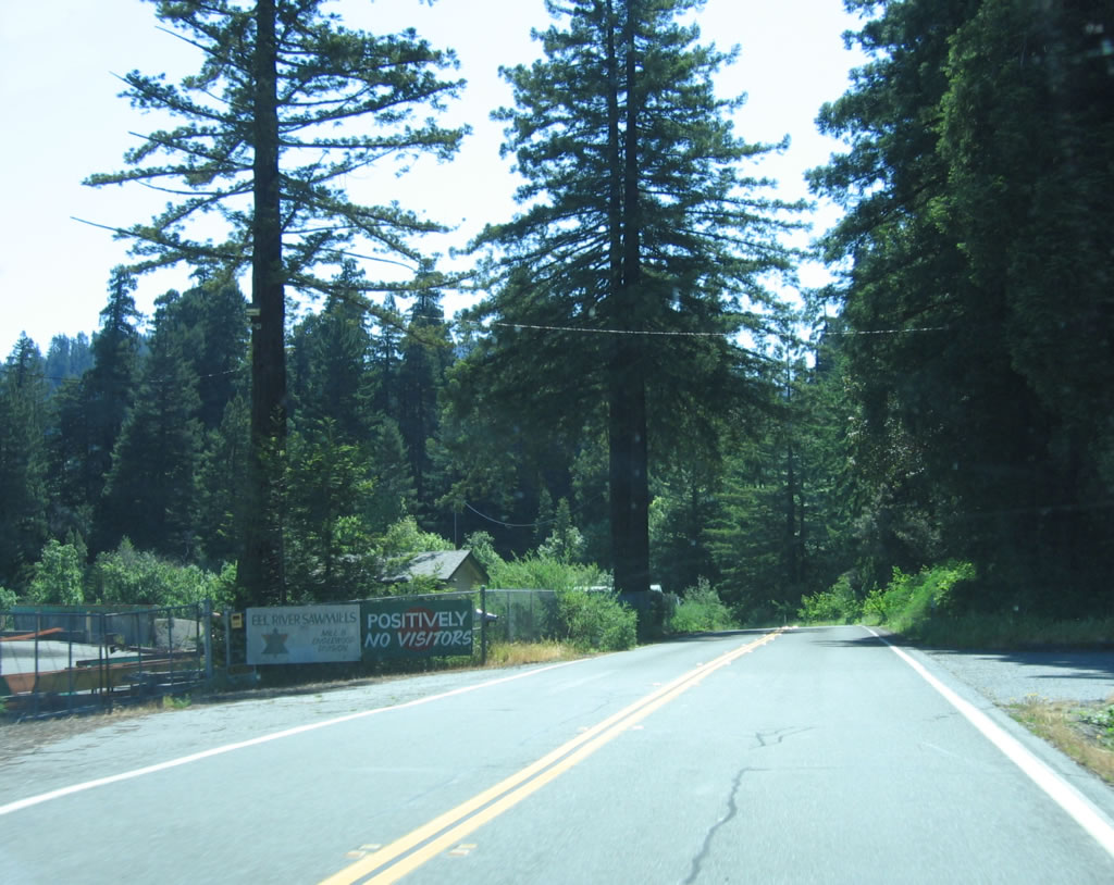
On the left side of the Avenue of the Giants is the entrance to the Eel River Sawmill, notable for its sign not welcoming visitors. Photo taken 05/29/06. |
|
After the off-ramp from U.S. 101 Exit 667A connects with California 254, the Avenue of the Giants reenters the state park. Redwoods line both sides of the highway. Photo taken 05/29/06. |
|
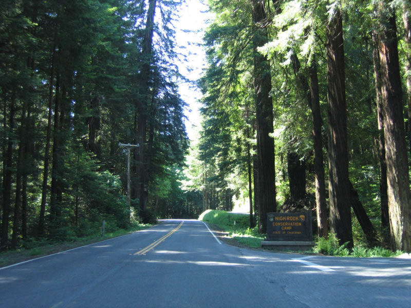
A right turn here connects to the High Rock Conservation Camp. Photo taken 05/29/06. |
|
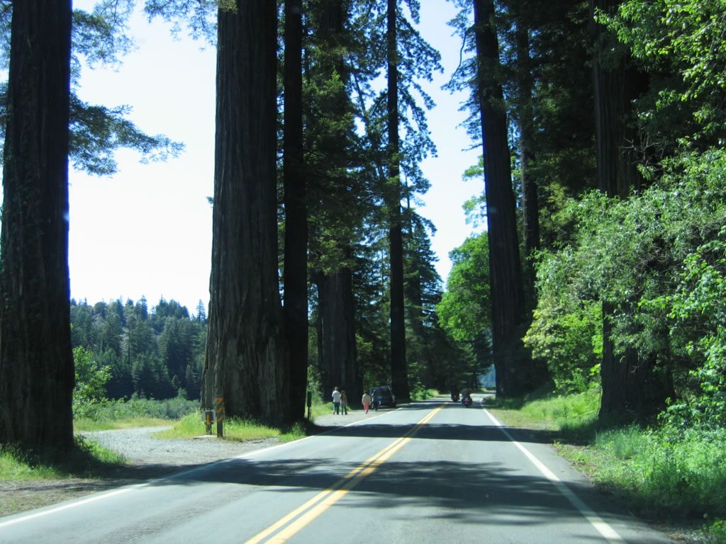
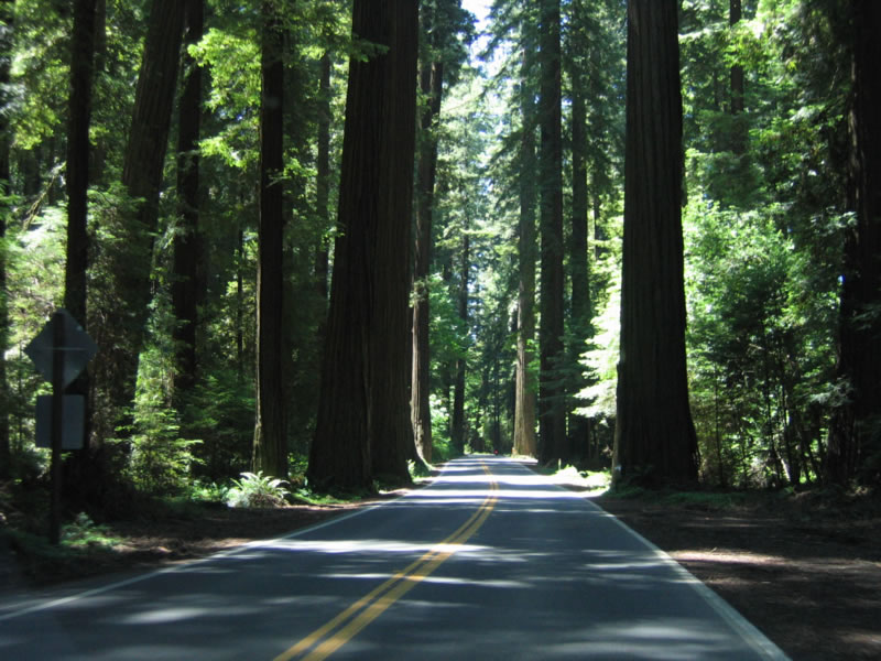
The sheer scale of redwood trees compared to people and cars can be seen in this photo along southbound. Photo taken 05/29/06. |
|
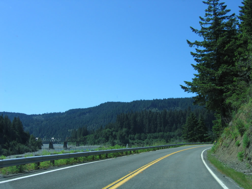
The Eel River widens out as California 254 briefly emerges from the redwood forest. A steel through truss bridge carries a nearby railroad. Photo taken 05/29/06. |
|
Southbound California 254 bumps into Bull Creek Road (Mattole Road) and U.S. 101 (Redwood Highway) at this intersection. Photo taken 05/29/06. |
|
Continue straight ahead to follow Bull Creek Road (Mattole Road) west or make a left to follow California 254 (Avenue of the Giants) south through more of Humboldt Redwoods State Park. Photo taken 05/29/06. |
|
Southbound California 254 (Avenue of the Giants) passes over the South Fork of the Eel River on this 1931 bridge. While the bridge survived the 1964 flood of the Eel River, it was raised and reconstructed in 1966 to mitigate damage after its was determined to be structurally sound. Bridges in the North Coast were ravaged by the storms of 1964, and this one was not exempted from being damaged. Photo taken 05/25/06. |
|
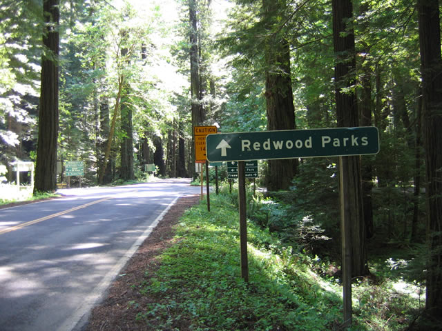
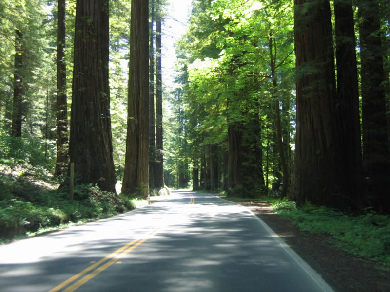
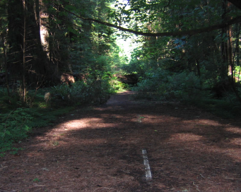
Towering redwoods allow limited sunlight into the world of the Humboldt Redwoods State Park. These magnificent giants are among the several stands of old growth redwood trees along the North Coast. While the freeway avoids the redwoods, the old route of U.S. 101 (California 254) passes right through the groves. Turn outs and hiking trails abound in nature's wonderland. This area can consume a full day of hiking, biking, or longer for camping. Photo taken 05/25/06. |
|
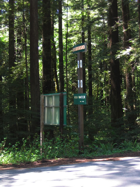
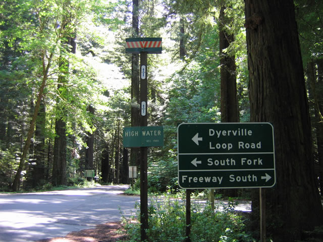
Approaching Dyerville Loop Road on southbound California 254 (Avenue of the Giants) near Founders Grove, a high water mark sign is posted for the extent of water during the 1964 floods. To U.S. 101 south, turn right at this intersection. Photo taken 05/25/06. |
|
|
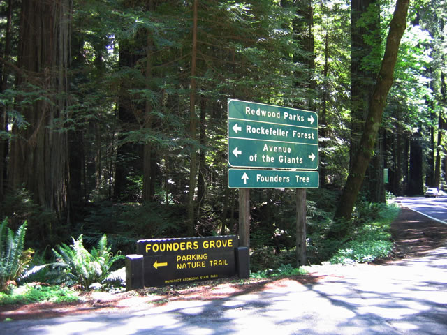
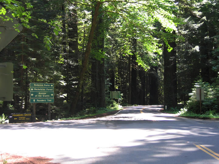
On the opposite corner is this sign for Founders Tree and Rockefeller Forest. Photos taken 05/25/06. |
|
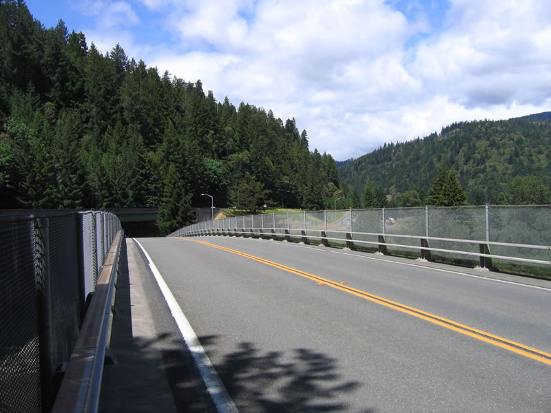
California 254 (Avenue of the Giants) crosses over U.S. 101 (Redwood Highway). Photo taken 05/29/06. |
|
Shortly thereafter, this view of the Avenue of the Giants is afforded along southbound California 254. Photo taken 05/29/06. |
|
Entering the community of Weott, southbound California 254 (Avenue of the Giants) approaches Newton Road east to U.S. 101 (Redwood Highway). Photo taken 05/29/06. |
|
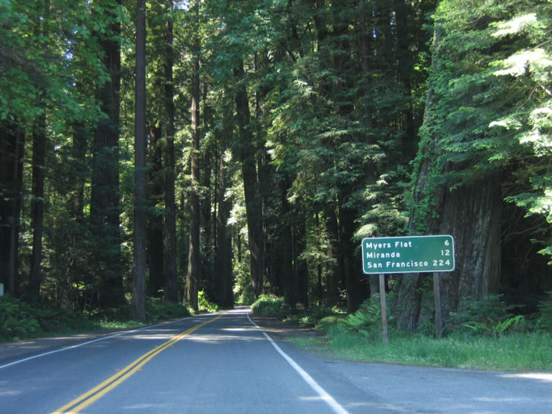
This mileage sign on southbound California 254 (Avenue of the Giants) provides the distance to Myers Flat (six miles), Miranda (12 miles), and San Francisco (224 miles). Photo taken 05/29/06. |
|
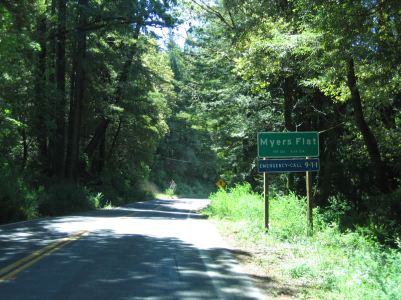
Six miles south of there, southbound California 254 enters Myers Flat. Photo taken 05/29/06. |
|
A private drive-through tree attraction is located in Myers Flat. Photo taken 05/29/06. |
|
Southbound California 254 (Avenue of the Giants) approaches U.S. 101 again. The first left turn connects to U.S. 101 south to Ukiah and Santa Rosa; the second left connects to U.S. 101 north to Eureka. Photo taken 05/29/06. |
|
Southbound California 254 (Avenue of the Giants) passes under U.S. 101 and approaches the ramp to U.S. 101 north. Photo taken 05/29/06. |
|
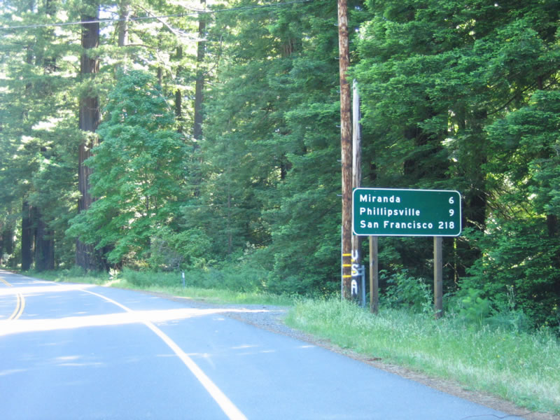
This mileage sign on southbound California 254 (Avenue of the Giants) provides the distance to Miranda (6 miles), Phillipsville (9 miles), and San Francisco (218 miles). Photo taken 05/29/06. |
|
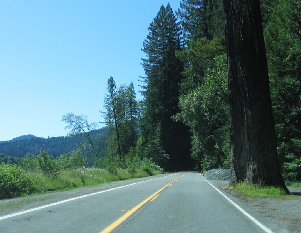
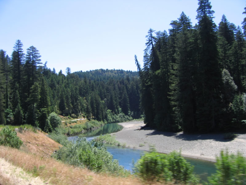
Southbound California 254 (Avenue of the Giants) follows the Eel River. Photo taken 05/29/06. |
|
|
|
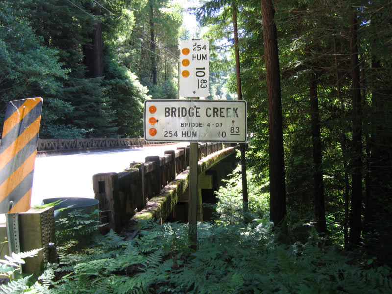
Southbound California 254 (Avenue of the Giants) crosses the 1938 bridge over Bridge Creek. Photos taken 05/29/06. |
|
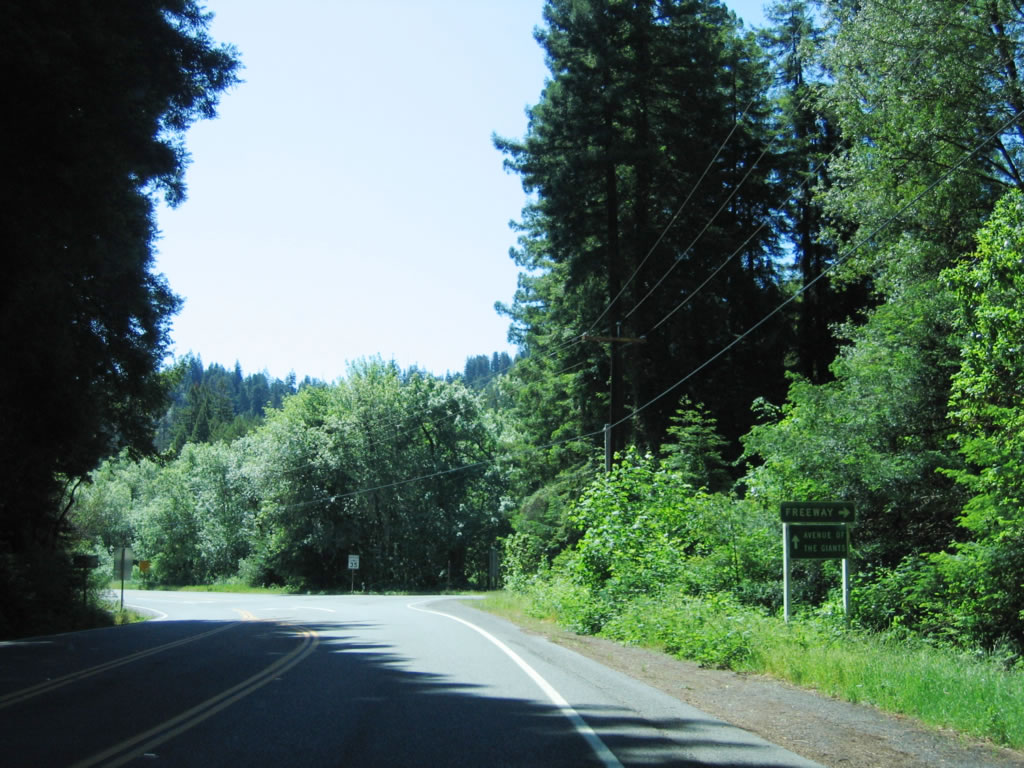
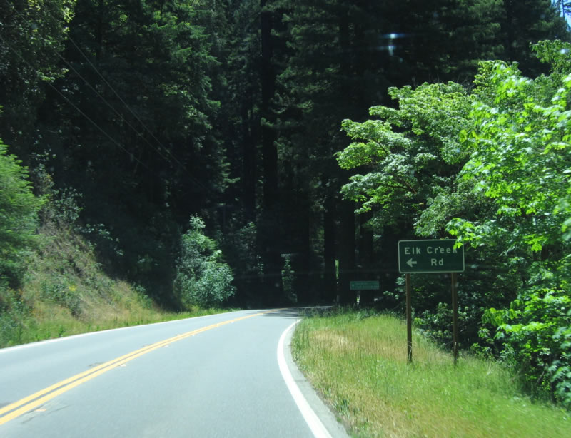
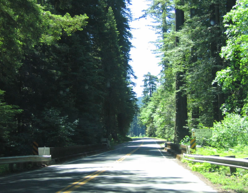
Continuing south, California 254 (Avenue of the Giants) approaches the left turn to Elk Creek Road to Eel Rock and Fort Seward. Photo taken 05/29/06. |
|
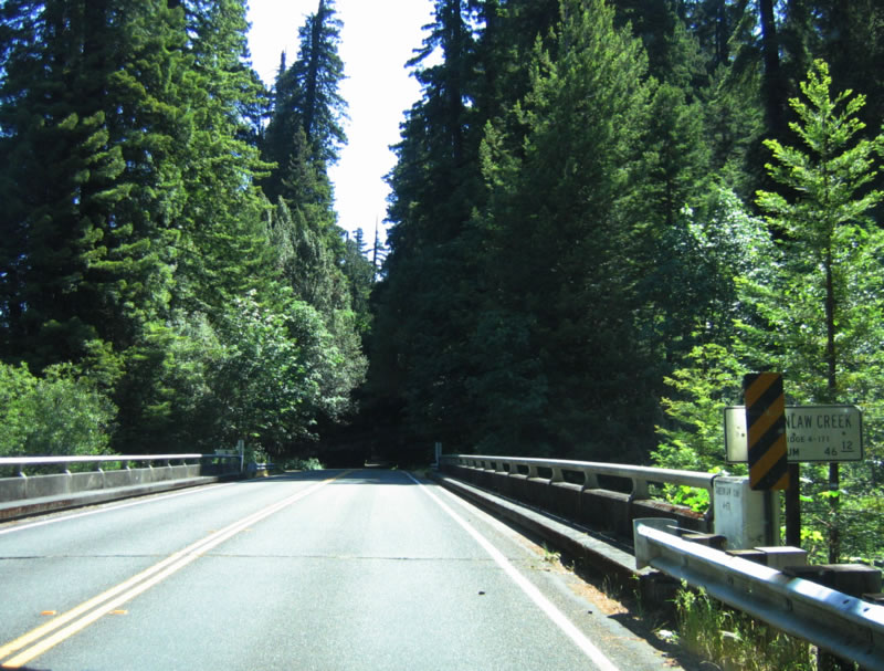
California 254 (Avenue of the Giants) crosses over Elk Creek on this old bridge. Photo taken 05/29/06. |
|
Emerging into the sunlight again, California 254 (Avenue of the Giants) continues south after the Elk Creek bridge. Photo taken 05/29/06. |
|
California 254 (Avenue of the Giants) crosses over Elk Creek on this old bridge. Photo taken 05/29/06. |
|
|
|
The two-lane Avenue of the Giants enters another grove of redwoods prior to entering Miranda. Photos taken 05/29/06. |
|
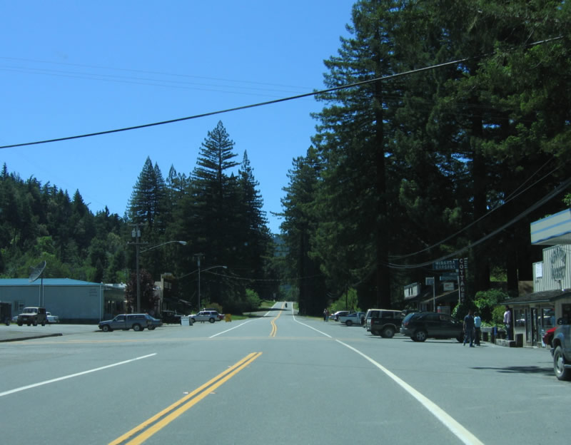
Southbound California 254 (Avenue of the Giants) enters the town of Miranda. Photo taken 05/29/06. |
|
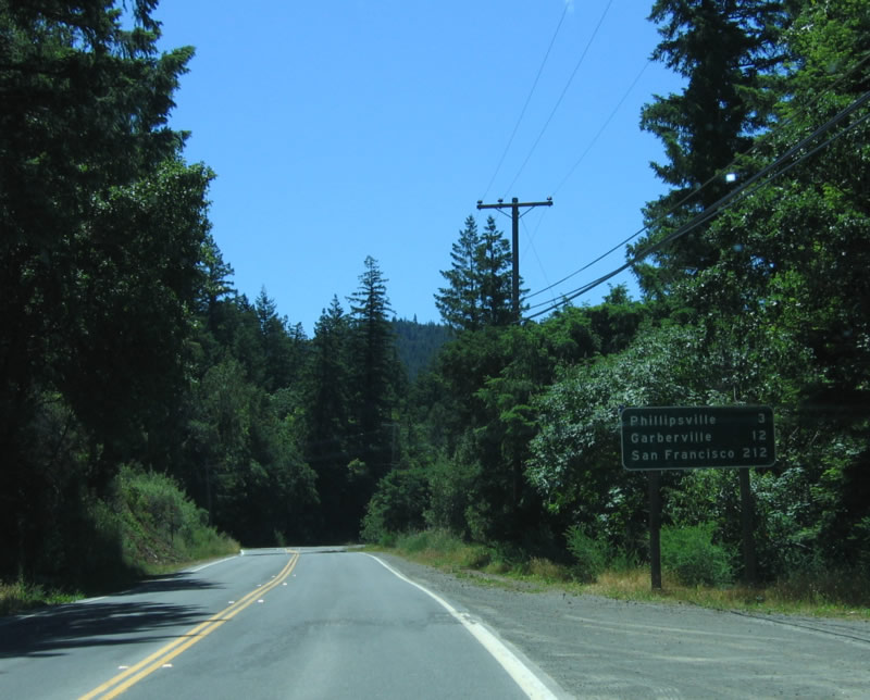
This mileage sign along southbound California 254 (Avenue of the Giants) provides the distance to Phillipsville (3 miles), Garberville (12 miles), and San Francisco (212 miles). Photo taken 05/29/06. |
|
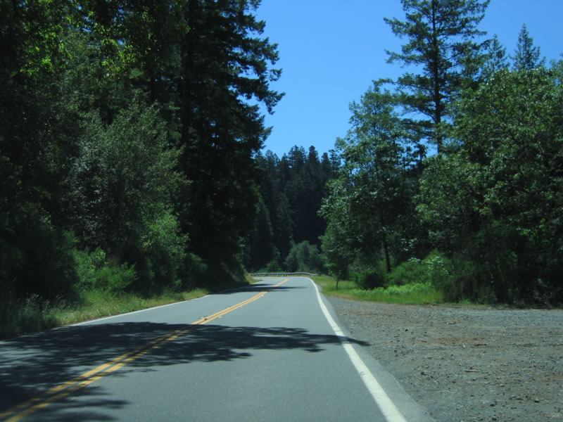
Scenic California 254 (Avenue of the Giants) continues south toward Phillipsville. Photo taken 05/29/06. |
|
Southbound California 254 (Avenue of the Giants) meets Maple Hills Road, which travels west to U.S. 101 Exit 650. Photo taken 05/29/06. |
|
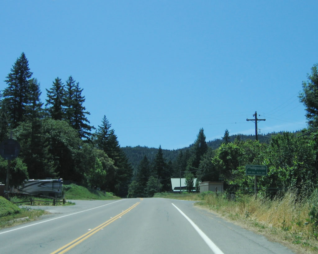
California 254 (Avenue of the Giants) enters Phillipsville and again leaves Humboldt Redwoods State Park. Photo taken 05/29/06. |
|
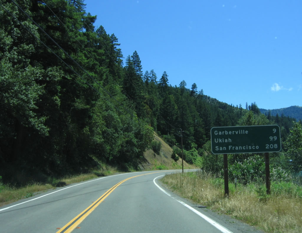
This mileage sign along southbound California 254 (Avenue of the Giants) provides the distance to Garberville (9 miles), Ukiah (99 miles), and San Francisco (208 miles). Photo taken 05/29/06. |
|
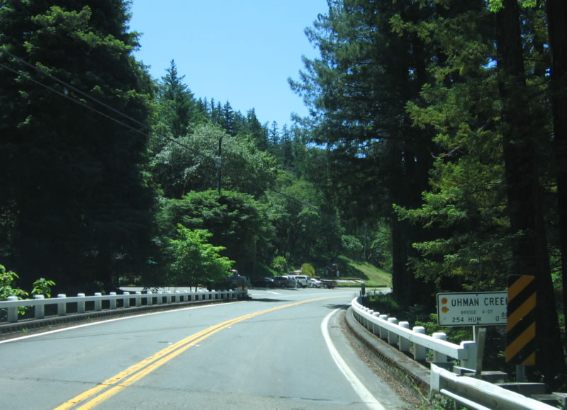
Shortly thereafter, California 254 crosses Ohman Creek on this bridge. Note the old-style white, wooden bridge railing still in place. Photo taken 05/29/06. |
|
The only southbound reassurance shield for California 254 is this end shield. Photo taken 05/29/06. |
|
Immediately after the end shield, southbound California 254 (Avenue of the Giants) approaches U.S. 101 (Redwood Highway). Photo taken 05/29/06. |
|
After passing under U.S. 101, all traffic on southbound California 254 (Avenue of the Giants) will merge onto U.S. 101 south. Turn right to follow Hooker Creek Road south along the South Fork Eel River. Photo taken 05/29/06. |
| California 254 Scenes - Bridge Creek Bridge |
|
|
|
Northbound California 254 (Avenue of the Giants) crosses the 1938 bridge over Bridge Creek. Photos taken 05/29/06. |
| California 254 Scenes - Historic U.S. 101 Madsen Bridge |
|
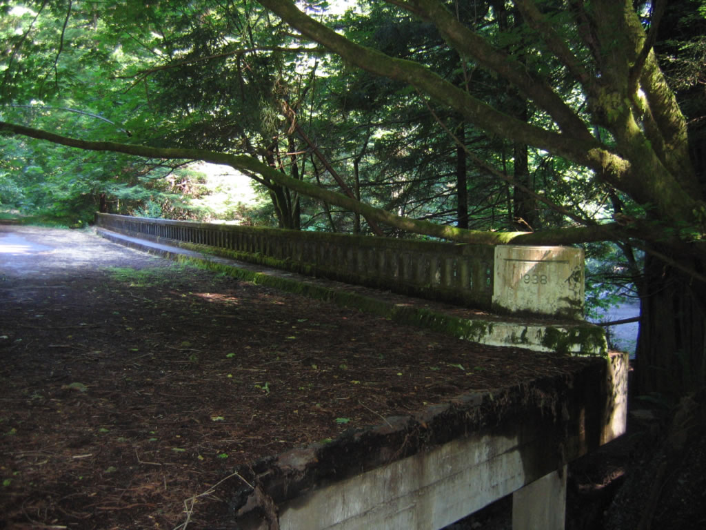
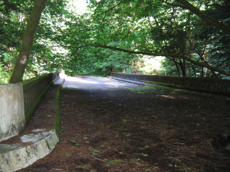
The old Avenue of the Giants (California 254) extends west from the Jordan Road intersection toward the Robert H. Madsen Bridge. Back in the day, this was signed as northbound U.S. 101 until the bypass was built to the south of this alignment. Old white centerline striping is still found on the old alignment of U.S. 101 within Humboldt Redwoods State Park. Photo taken 05/29/06. |
|
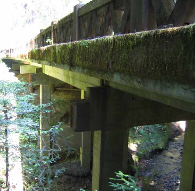
West of the intersection of Avenue of the Giants (California 254) and Jordan Road, the Madsen Bridge is an old 1938 concrete bridge that is in disrepair. Photo taken 05/29/06. |
|
|
|
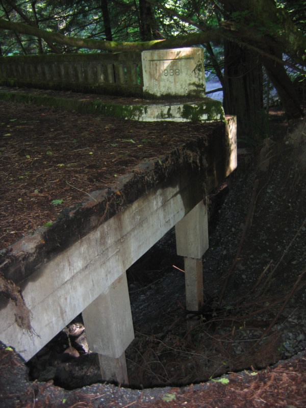
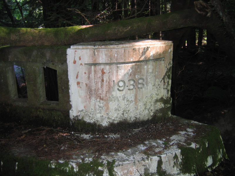
The Madsen Bridge features a large sinkhole on the eastern approach, making the journey to the bridge somewhat treacherous. A date stamp verifies the year of construction as 1938. Photos taken 05/29/06. |
|
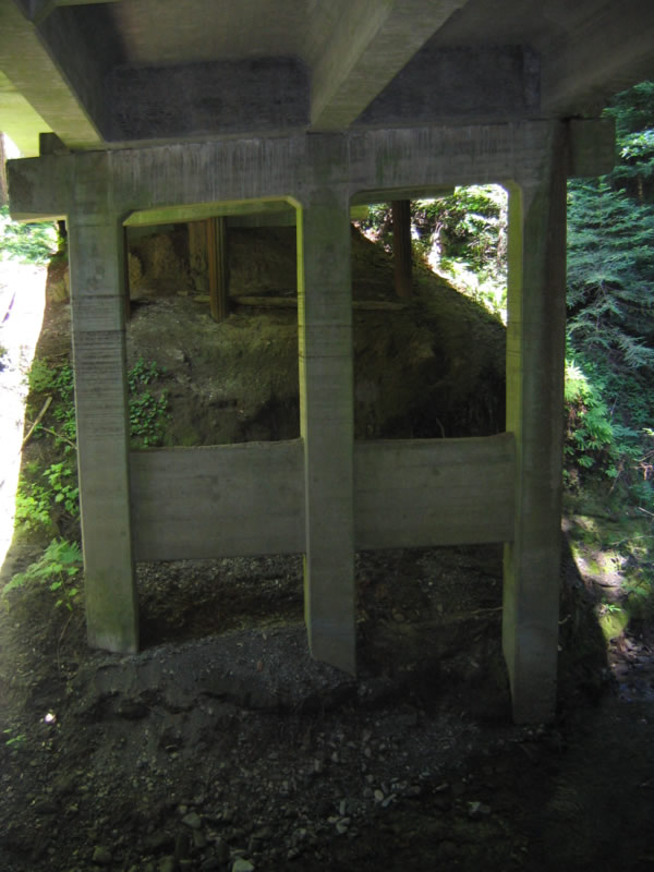
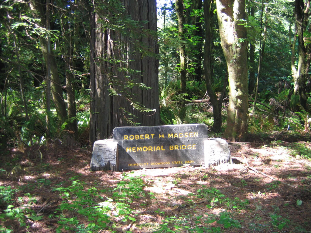
The Madsen Bridge crosses the creek, then ends on the west end amid trees and poison oak. The Madsen Bridge is named for a college student who helped construct the concrete span. Photo taken 05/29/06. |
|
The unique bridge rail provides the foreground view of the U.S. 101 bridge in the background. Photo taken 05/29/06. |
|
From creek level, here is the view of the 1938 Madsen Bridge looking north. Photo taken 05/29/06. |
Page Updated February 7, 2007.