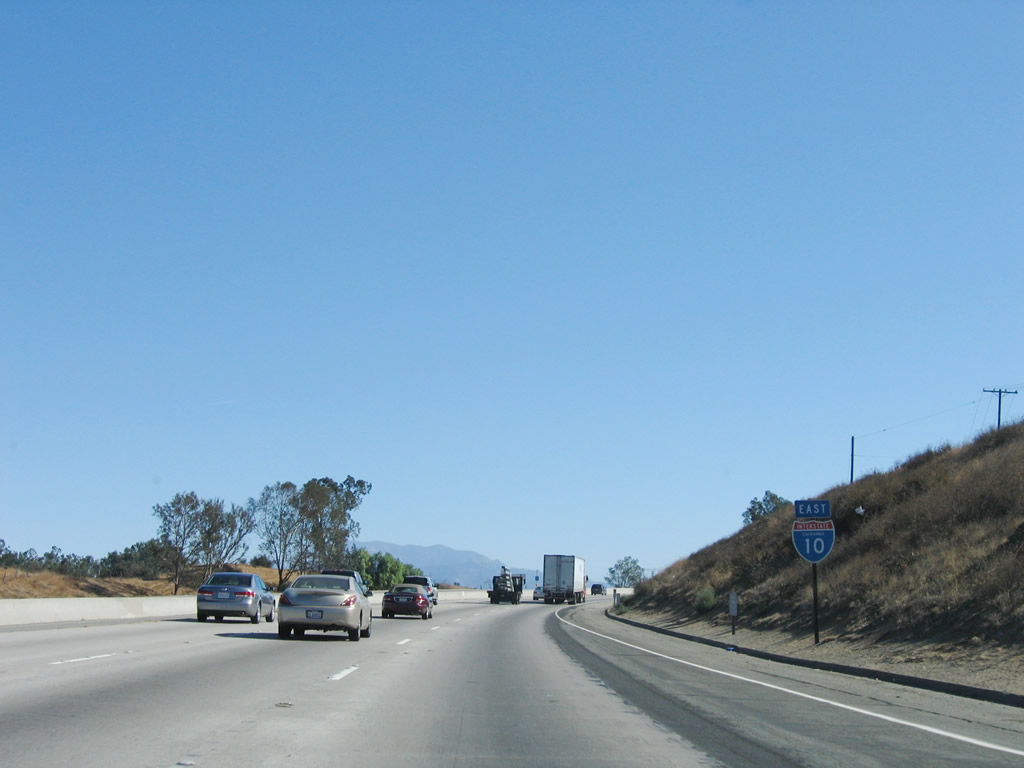
| Interstate 10 (San Bernardino Freeway) east |
|
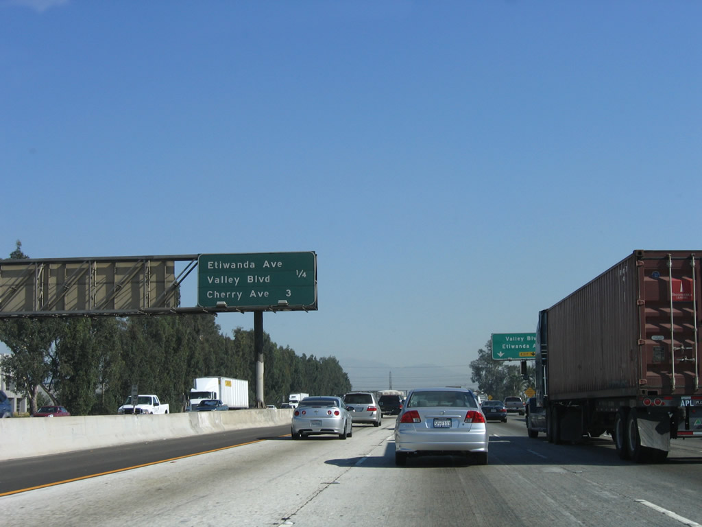
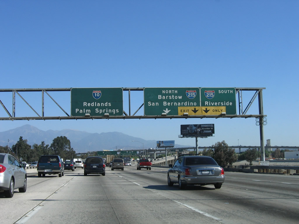
After the Interstate 15 symmetrical stack interchange, this mileage sign provides the distance to the next two exits along Interstate 10 (San Bernardino Freeway) east: Exit 59, Etiwanda Avenue and Valley Boulevard and Exit 61, Cherry Avenue. Photo taken 11/10/06. |
|
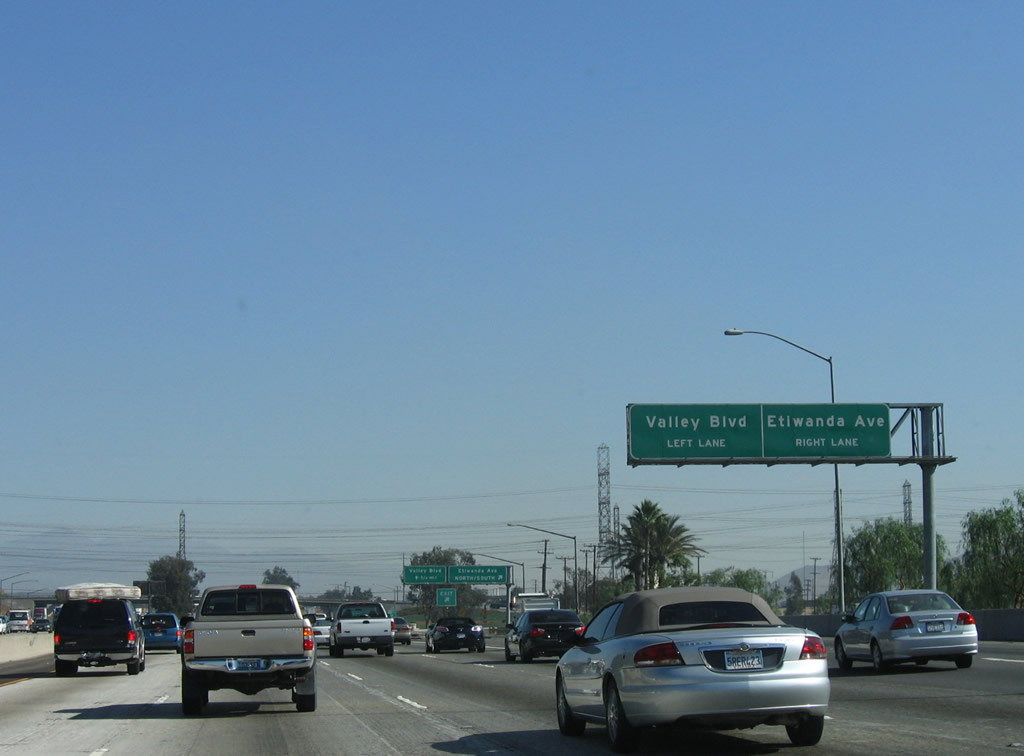
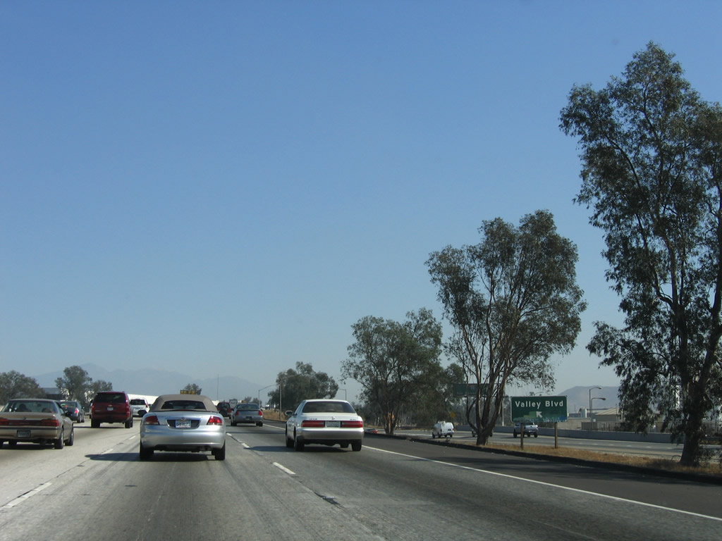
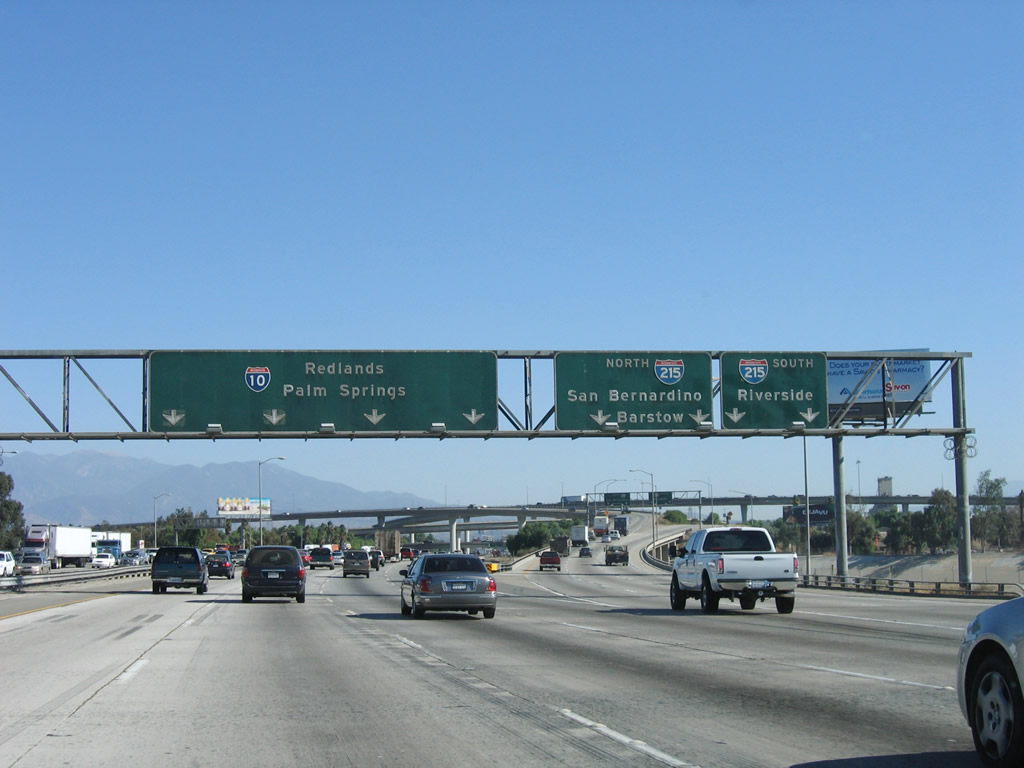
The right two lanes of Interstate 10 (San Bernardino Freeway) east will connect to Exit 59, Etiwanda Avenue and Valley Boulevard. Photo taken 11/10/06. |
|
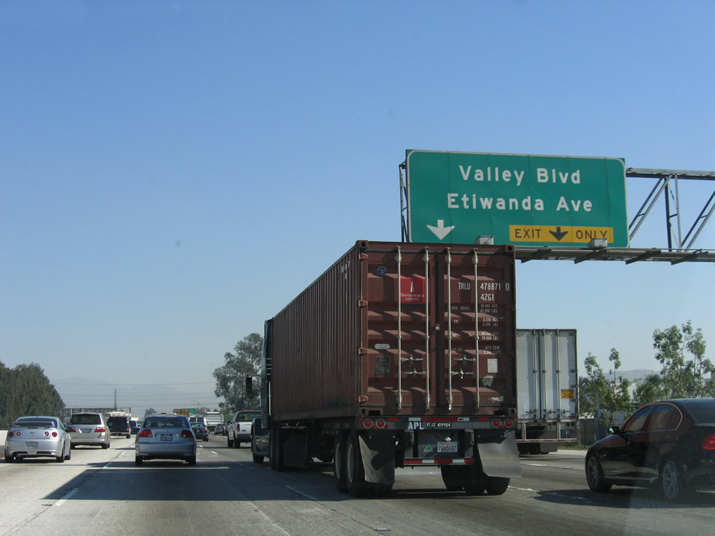
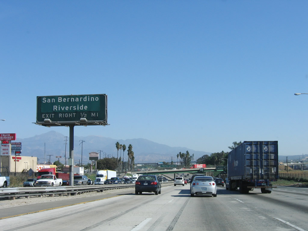
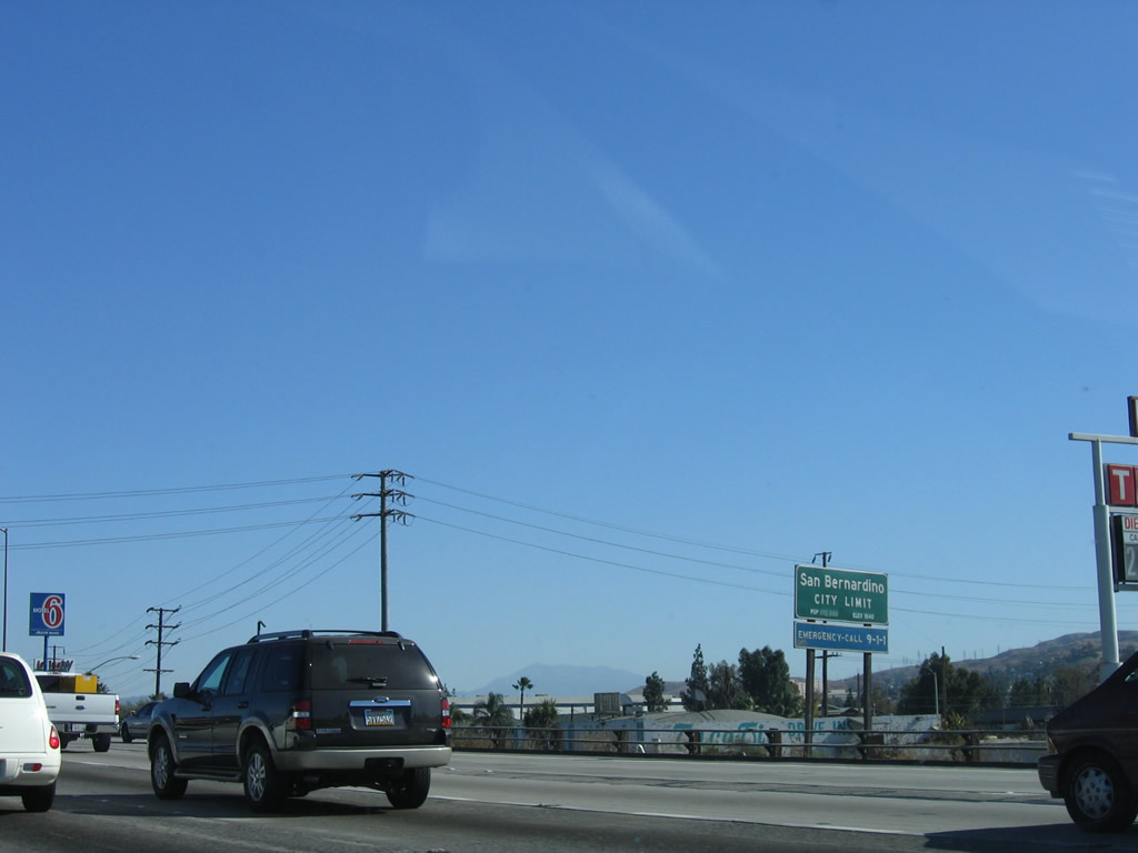
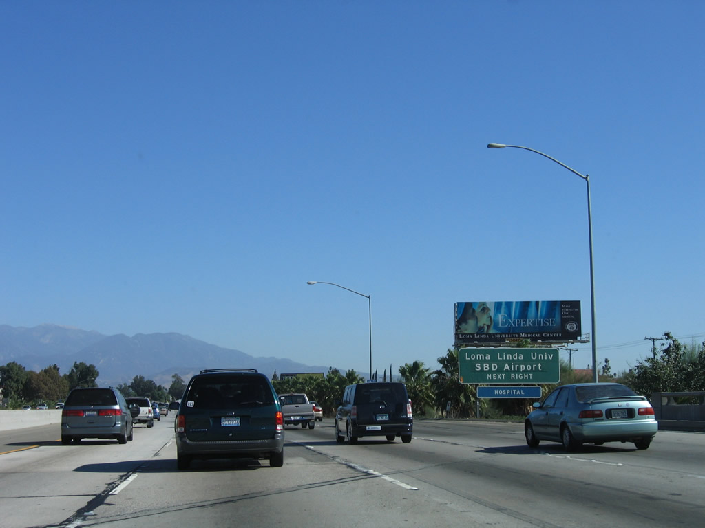
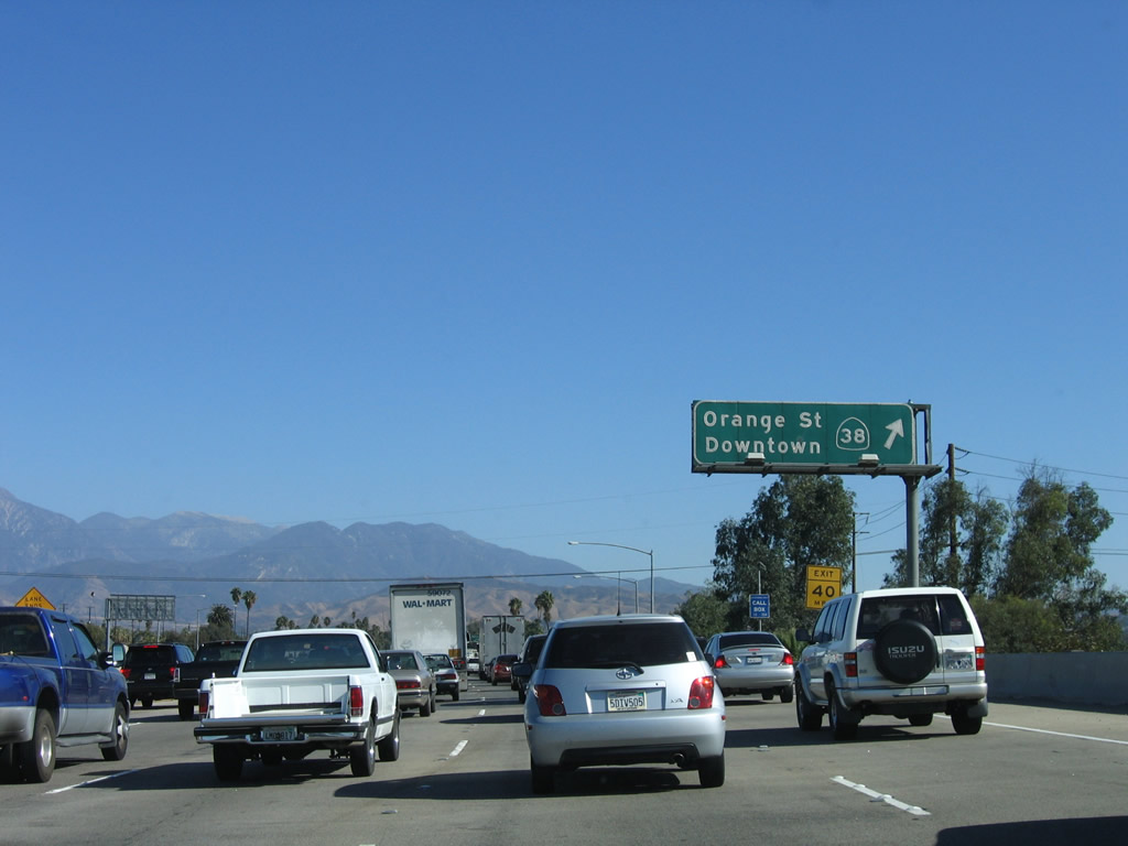
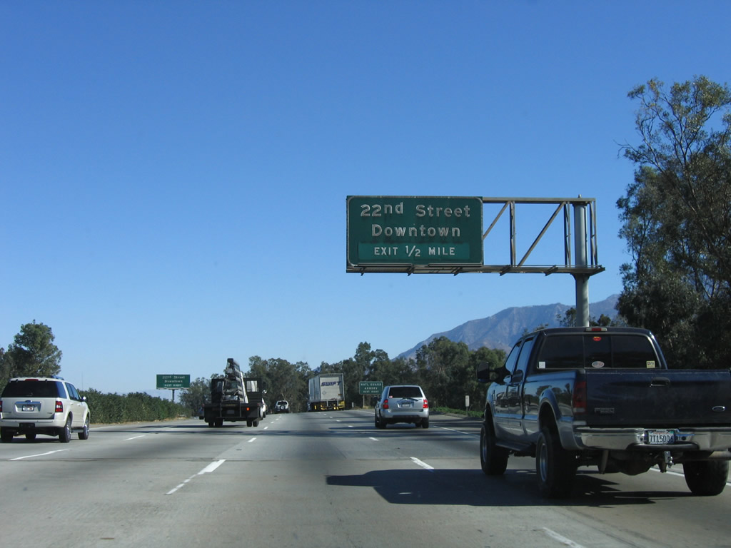
Eastbound Interstate 10 (San Bernardino Freeway) reaches Exit 59, Etiwanda Avenue and Valley Boulevard. A partial cloverleaf interchange serves north-south Etiwanda Avenue, while a direct connection ramp leads to Valley Boulevard, which is old U.S. 70-99. Business Loop I-10, which extends east to the city of Colton, begins at this point (but the signage is not conclusive). Photo taken 11/10/06. |
|
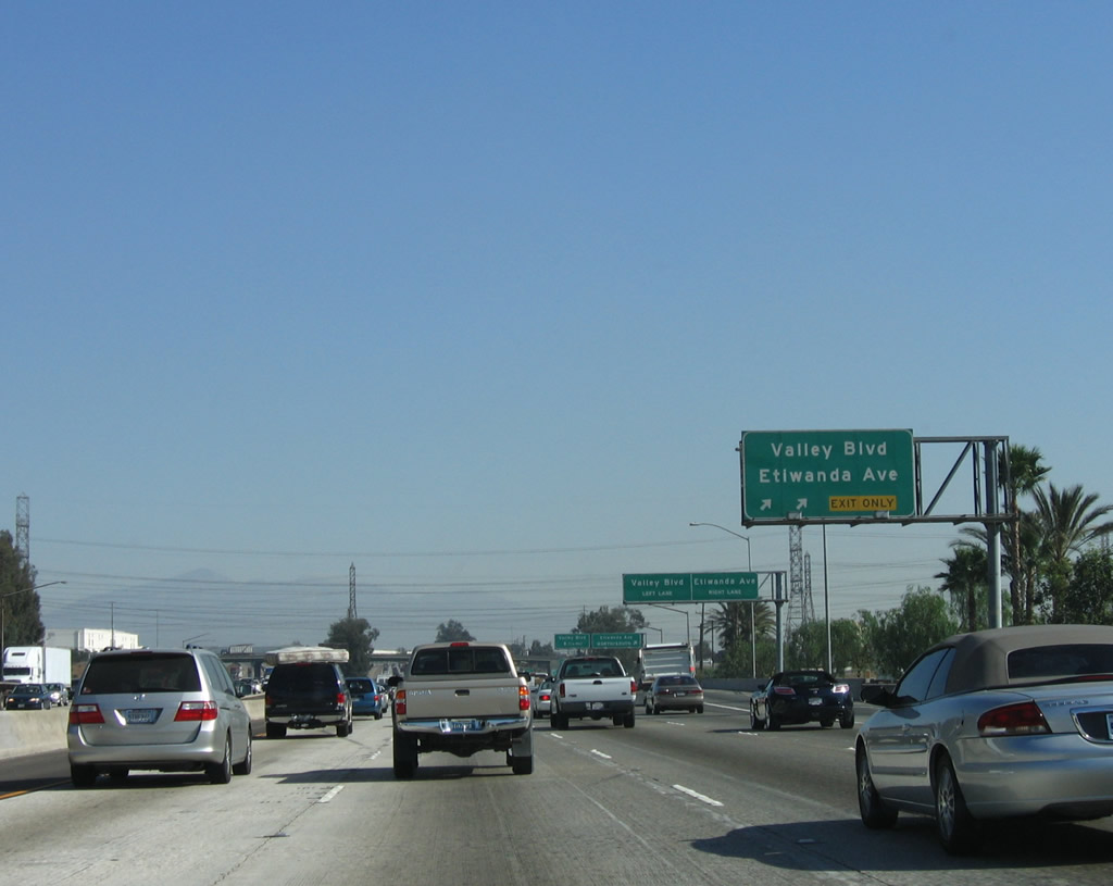
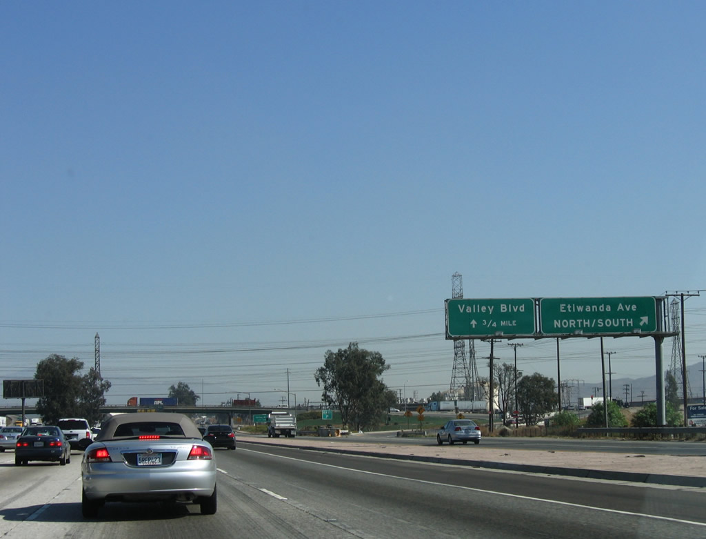
Once on the off-ramp from Interstate 10 (San Bernardino Freeway) east, the two-lane ramp splits, with the left lane connecting to Business Loop I-10/Valley Boulevard east, and the right lane connecting to Etiwanda Avenue north/south. Photo taken 11/10/06. |
|
The exit to Etiwanda Avenue and Business Loop I-10/Valley Boulevard serves as a collector distributor lane. Looking at the collector distributor lanes from the mainline, the first off-ramp connects to Etiwanda Avenue north/south. Photo taken 11/10/06. |
|
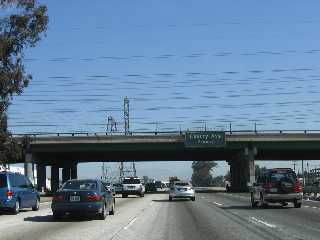
The next exit along eastbound Interstate 10 (San Bernardino Freeway) is Exit 61, Cherry Avenue. Passing under Etiwanda Avenue, Interstate 10 leaves the city of Ontario and enters the city of Fontana. Photo taken 11/10/06. |
|
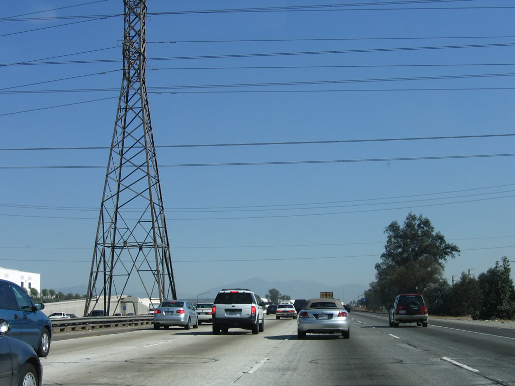
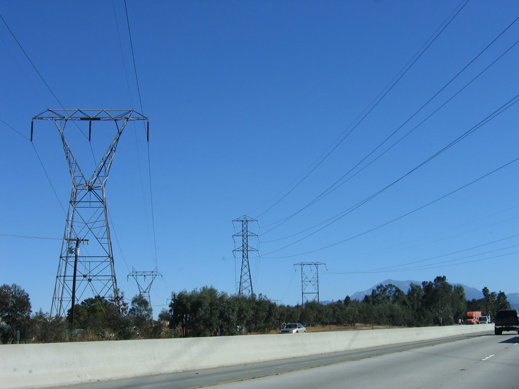
Shortly after the Etiwanda Avenue overcrossing, a set of Southern California Edison power lines cross Interstate 10. A rare double-circuit 500kV power line, along with several 230kV circuits pass over the freeway. One of the 230kV towers is situated in the median of the freeway, which is rather unusual. The 500kV power lines originate in the Mojave Desert and carry power southwest toward the greater Los Angeles area. Photo taken 11/10/06. |
|
Looking over at the collector distributor lanes, they prepare to split, with the left two lanes connecting to Valley Boulevard (Business Loop I-10) and the right lane returning to Interstate 10 east. Photo taken 11/10/06. |
|
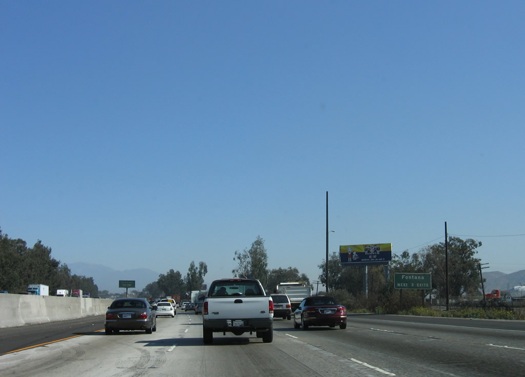
This mileage sign along eastbound Interstate 10 provides the distance to the next three exits: Exit 61, Cherry Avenue; Exit 63, Citrus Avenue; and Exit 64, Sierra Avenue. Photo taken 11/10/06. |
|
Use any of the next three exits to the city of Fontana: Exit 61, Cherry Avenue; Exit 63, Citrus Avenue; and Exit 64, Sierra Avenue. Photo taken 11/10/06. |
|
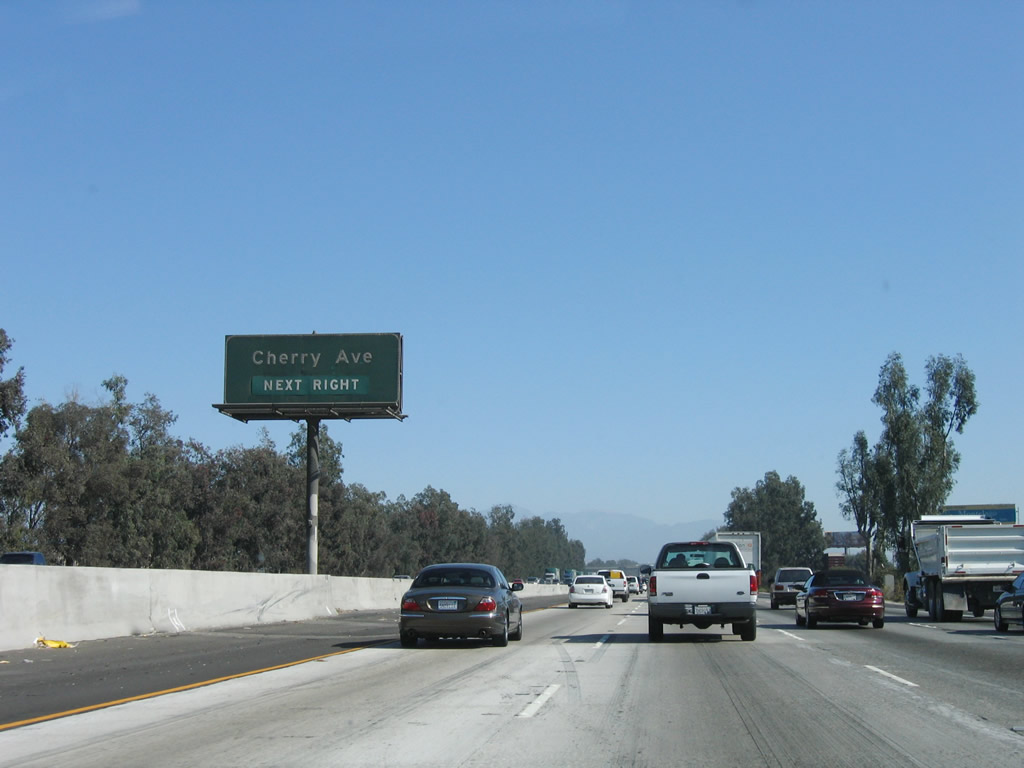
Cherry Avenue travels north to the California Speedway and south to Jurupa Hills (part of the city of Fontana). On the south side of Interstate 10 through Fontana, Rialto, and Colton is the Union Pacific Railroad, which is visible from Valley Boulevard east to Interstate 215. Photo taken 11/10/06. |
|
Interstate 10 enters the city of Fontana. Founded in 1913 and incorporated on June 25, 1952, Fontana sits along Historic U.S. 66 (Foothill Boulevard). The city's population was 128,929 as of the 2000 Census, but that number is estimated to be 188,498 as of a 2008 Census estimate. The boundaries of Fontana have changed with several annexations in 2006 and 2007, thus helping increase its overall population. Development has also increased through the first decade of the 2000s. Photo taken 11/10/06. |
|
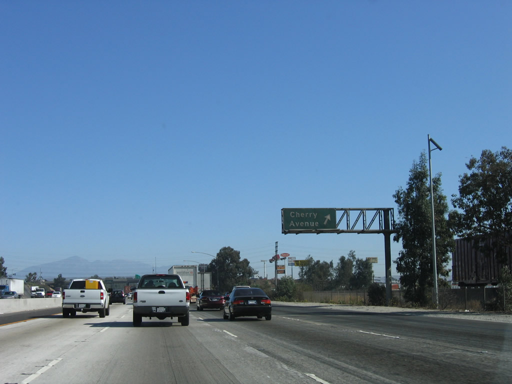
Eastbound Interstate 10 (San Bernardino Freeway) reaches Exit 61, Cherry Avenue. Use Cherry Avenue north to the California Speedway. Photo taken 11/10/06. |
|
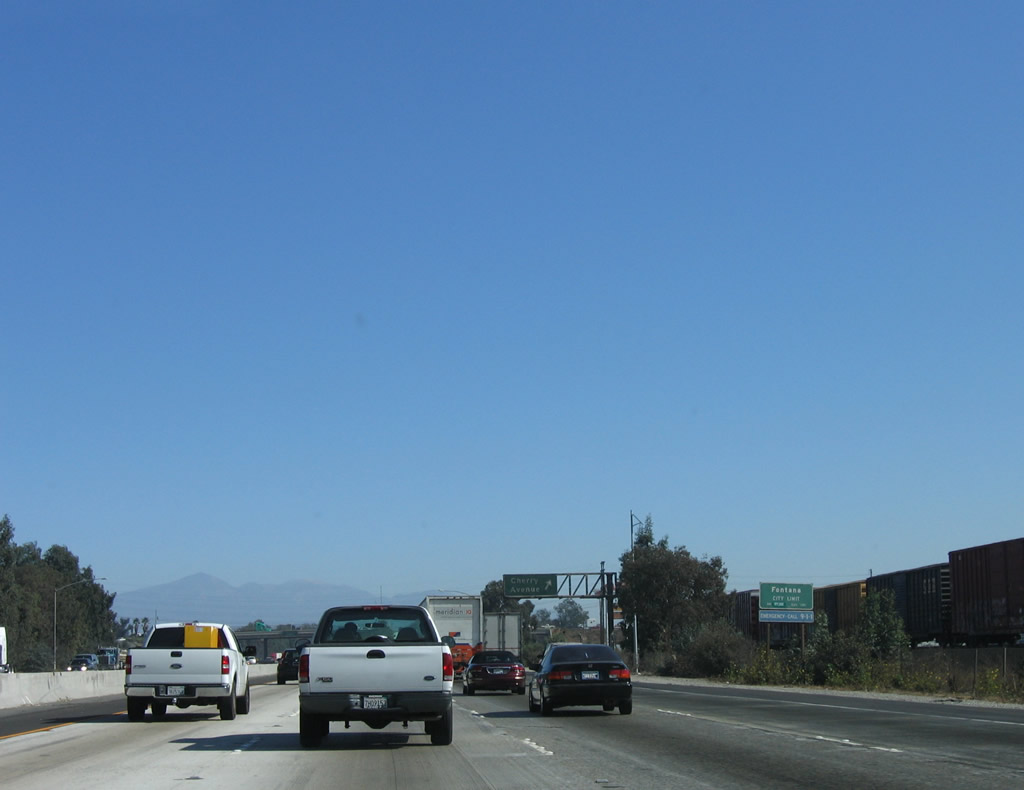
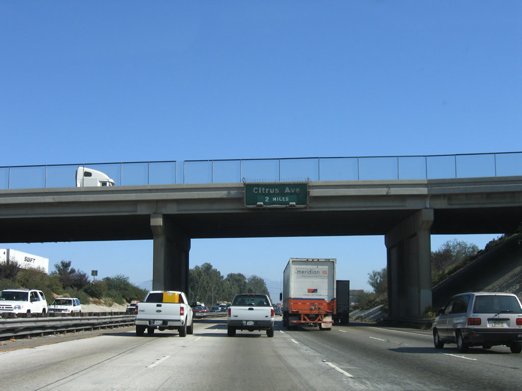
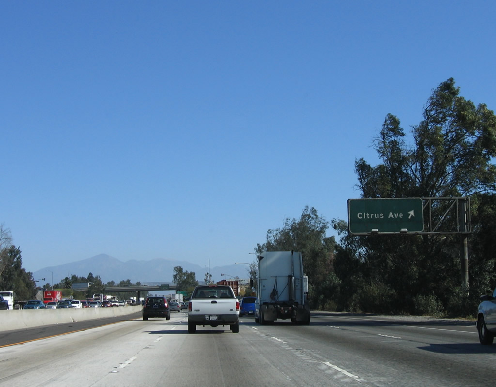
The next exit along Interstate 10 east is Exit 63, Citrus Avenue (two miles). This street serves the city of Fontana. Photo taken 11/10/06. |
|
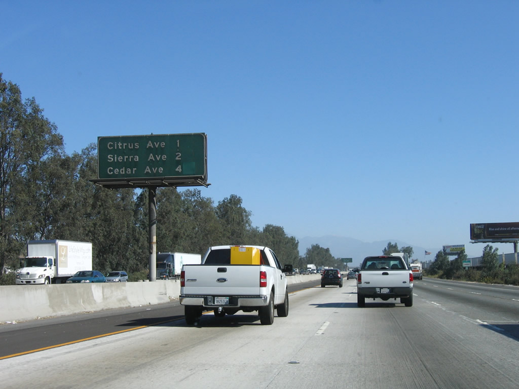
This interchange sequence sign along eastbound Interstate 10 provides the distance to the next three exits: Exit 63, Citrus Avenue; Exit 64, Sierra Avenue; and Exit 66, Cedar Avenue and Bloomington Avenue. Photo taken 11/10/06. |
|
Use Citrus Avenue north to Fontana High School and south to Jurupa Hills. Photo taken 11/10/06. |
|
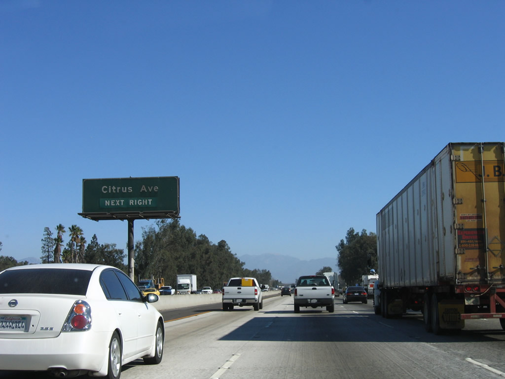
Eastbound Interstate 10 (San Bernardino Freeway) reaches Exit 63, Citrus Avenue. At one time, much of this land (known as the Inland Empire) was citrus groves, but some of that agriculture is now located in the Imperial Valley and in the Palm Springs area. The farms that remain are constantly threatened by encroaching suburban development. "Citrus Avenue" is named for the region's former role in that industry. Photo taken 11/10/06. |
|
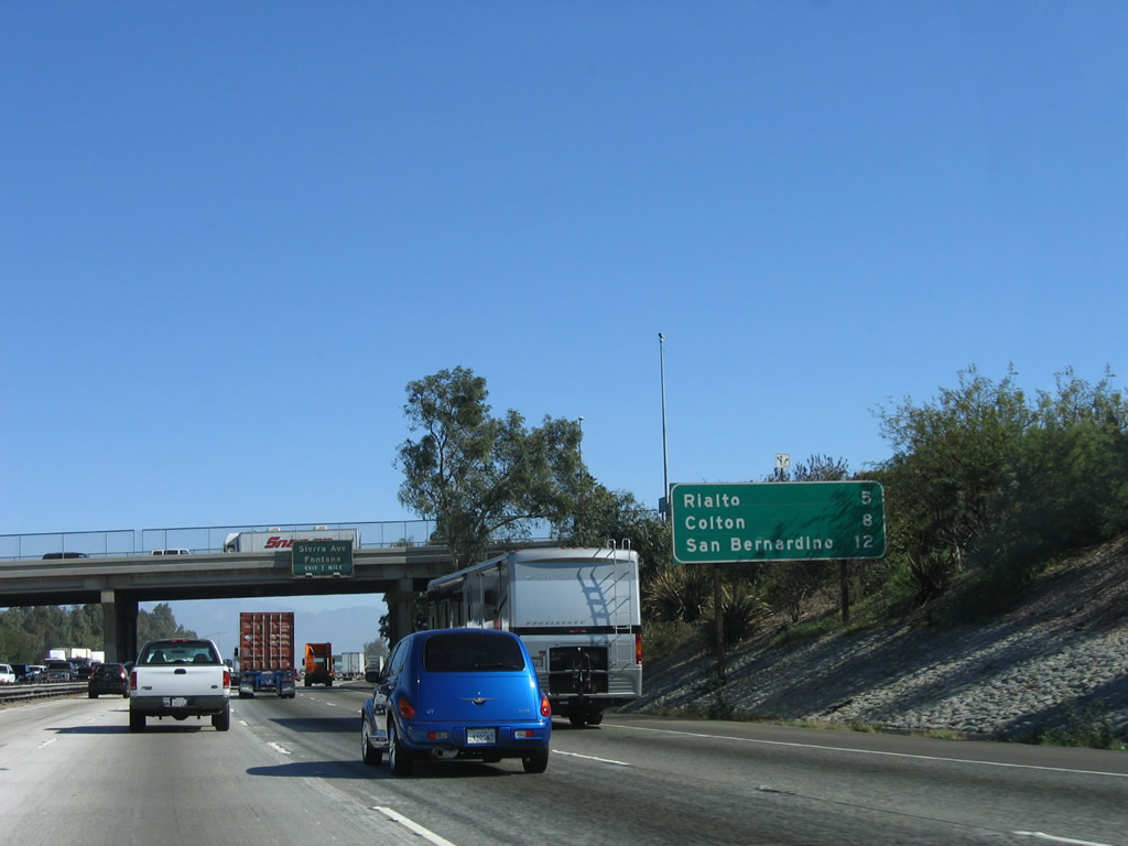
This mileage sign provides the distance to the cities of Rialto (five miles), Colton (eight miles), and San Bernardino (12 miles). Photo taken 11/10/06. |
|
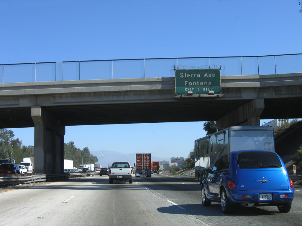
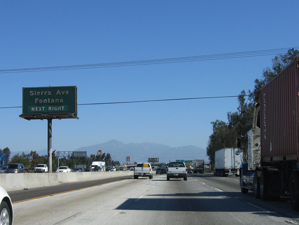
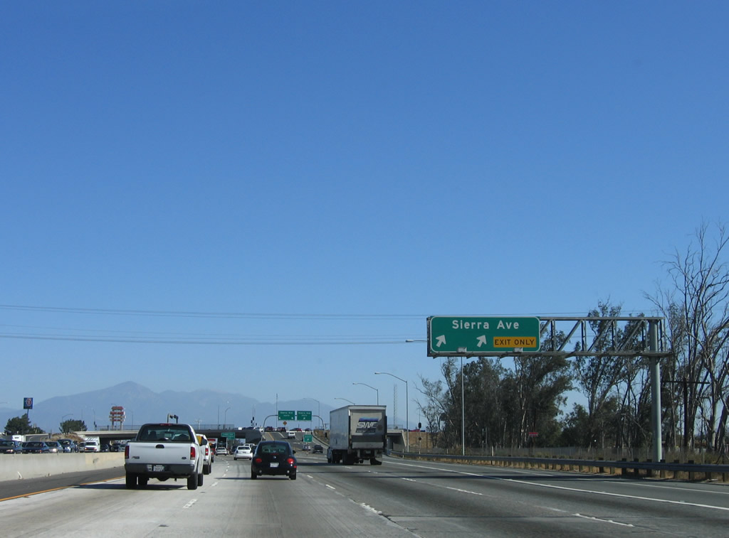
The next exit along Interstate 10 (San Bernardino Freeway) east is Exit 64, Sierra Avenue. Photo taken 11/10/06. |
|
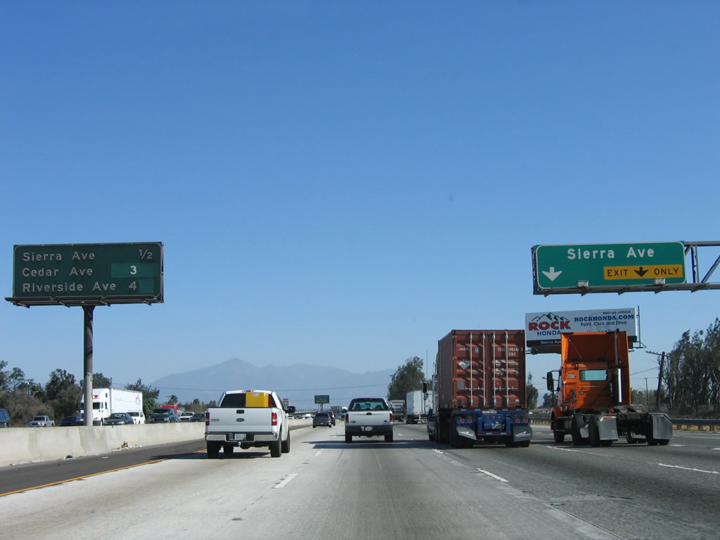
This interchange sequence sign along eastbound Interstate 10 provides the distance to the next three exits: Exit 64, Sierra Avenue; Exit 66, Cedar Avenue and Bloomington Avenue; and Exit 68, Riverside Avenue. The right lane becomes exit only for Exit 64. Photo taken 11/10/06. |
|
Use Sierra Avenue north to Inland Empire Center, Kaiser Foundation Hospital, and Sierra Lakes. To the south, Sierra Avenue travels to the unincorporated community of Rubidoux in Riverside County. Photo taken 11/10/06. |
|
Eastbound Interstate 10 (San Bernardino Freeway) reaches Exit 64, Sierra Avenue. This interchange is a single-point urban interchange (commonly called a SPUI). Photo taken 11/10/06. |
|
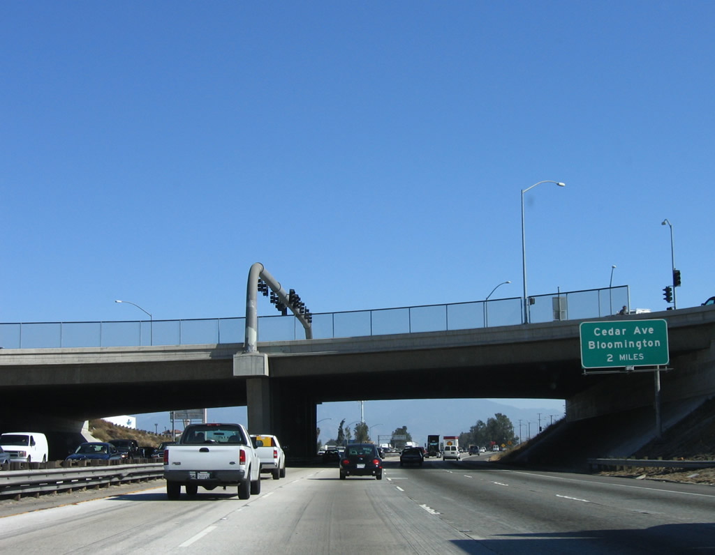
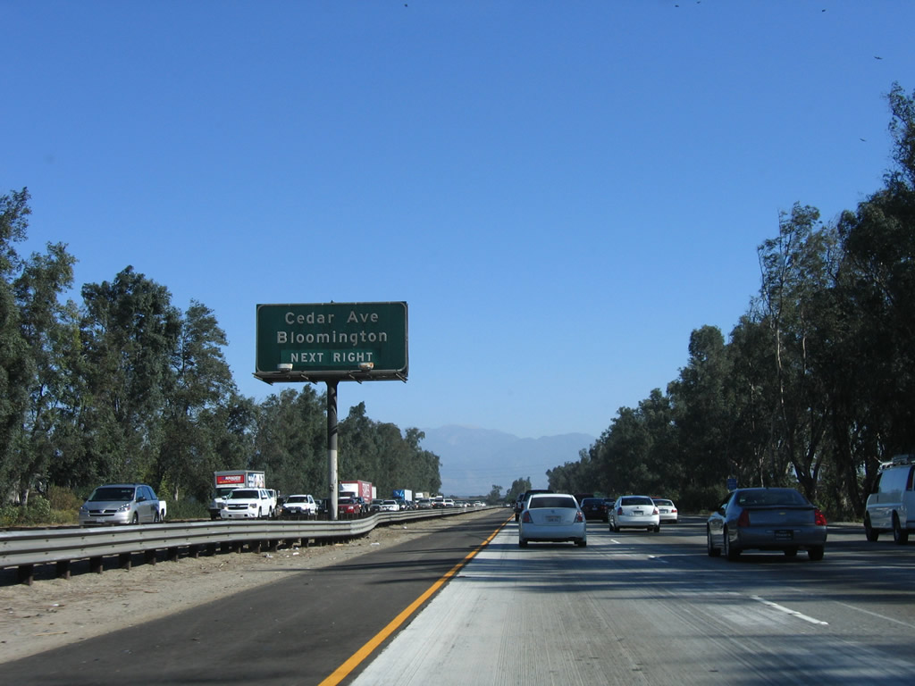
The next exit along Interstate 10 (San Bernardino Freeway) east is Exit 66, Cedar Avenue and Bloomington Avenue. Exit 66 is located in the unincorporated community of Bloomington; Interstate 10 leaves the city of Fontana after the Sierra Avenue interchange and enters Bloomington shortly thereafter. As of the 2000 Census, Bloomington had a population of 19,318. As of 2008, this area may incorporate in order to avoid annexation by either Fontana or Rialto. Photo taken 11/10/06. |
|
This interchange sequence sign along eastbound Interstate 10 provides the distance to the next three exits: Exit 66, Cedar Avenue and Bloomington Avenue; Exit 68, Riverside Avenue; and Exit 69, Pepper Avenue. The right lane becomes exit only for Exit 64. Photo taken 11/10/06. |
|
Cedar Avenue travels north through Bloomington to western Rialto, while it eventually changes into Rubidoux Boulevard upon crossing the Riverside County line before leading into the community of Belltown. Use Cedar Avenue north to Bloomington Avenue northeast to downtown Rialto. Photo taken 11/10/06. |
|
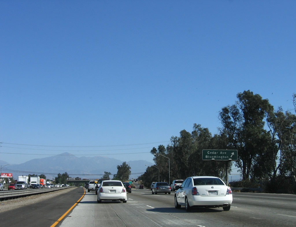
Eastbound Interstate 10 (San Bernardino Freeway) reaches Exit 66, Cedar Avenue and Bloomington Avenue. Photo taken 11/10/06. |
|
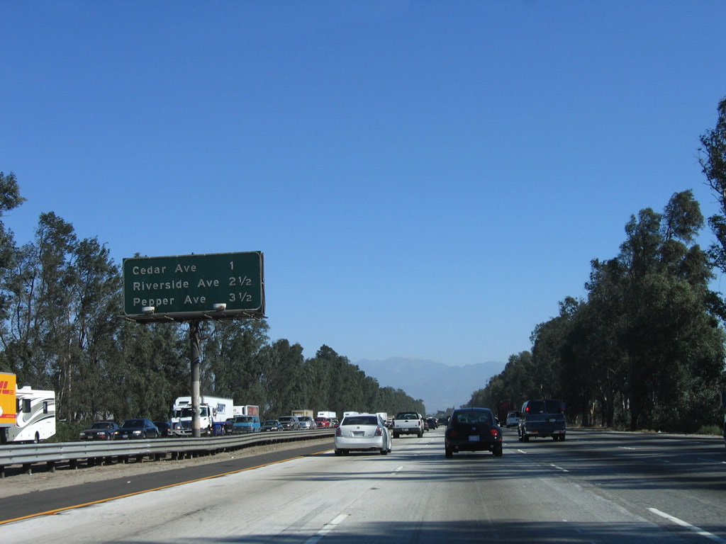
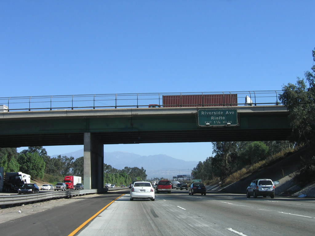
The next exit along Interstate 10 (San Bernardino Freeway) east is Exit 68, Riverside Avenue in Rialto, one and one-quarter miles. This sign is posted on the Cedar Avenue overpass. Photo taken 11/10/06. |
|
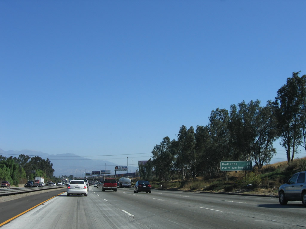
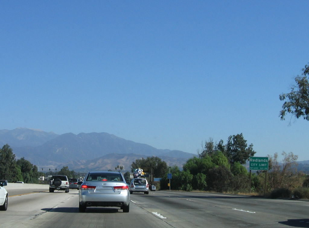
This mileage sign provides the distance to Redlands (12 miles) and Palm Springs (56 miles). Photo taken 11/10/06. |
|
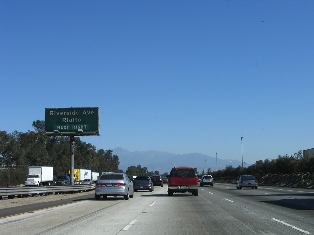
Use Riverside Avenue north into the city of Rialto and south to Riverside. The city of Rialto is known as the "Bridge to Progress" (as Rialto may have been named after a bridge of the same name in Venice, Italy). Rialto was home to 91,873 people as of the 2000 Census and was incorporated on November 17, 1911. To the south, Riverside Avenue becomes Main Street after crossing into the city limits of Riverside. Photo taken 11/10/06. |
|
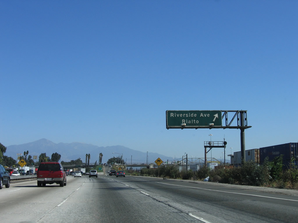
Eastbound Interstate 10 (San Bernardino Freeway) reaches Exit 68, Riverside Avenue to Rialto. Photo taken 11/10/06. |
|
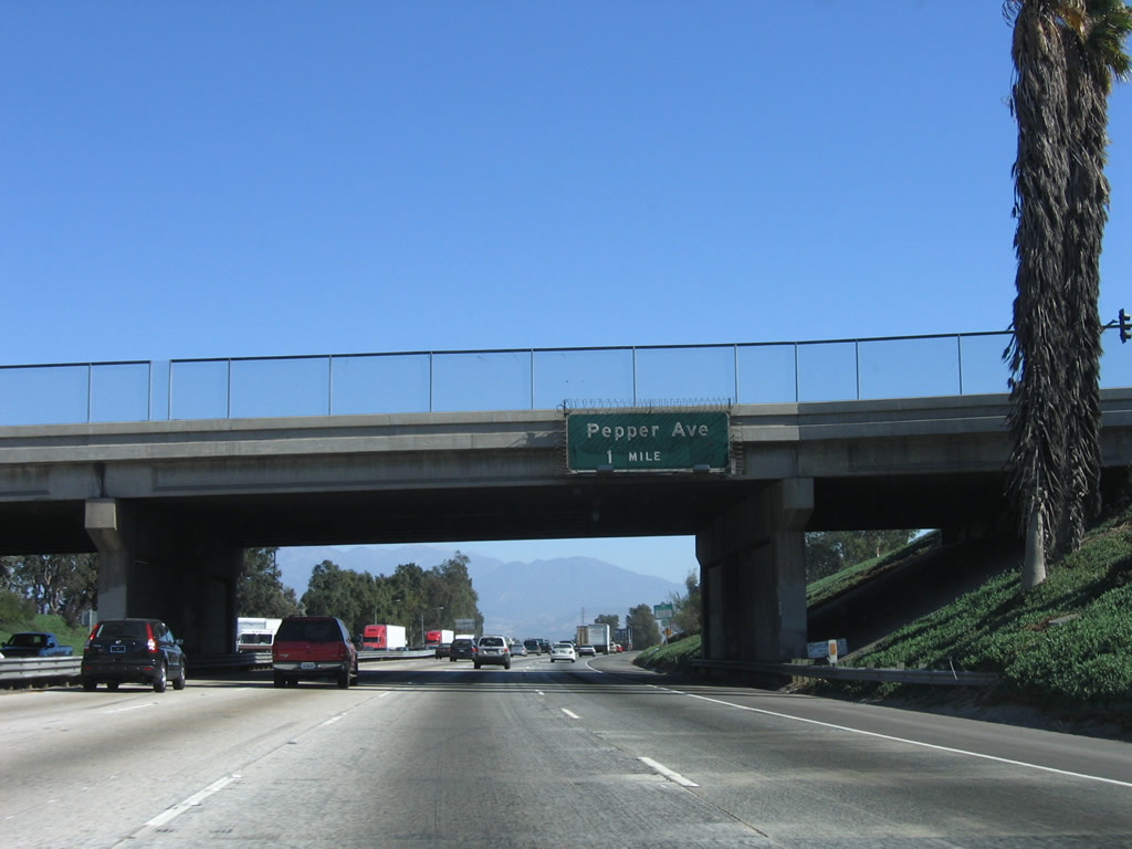
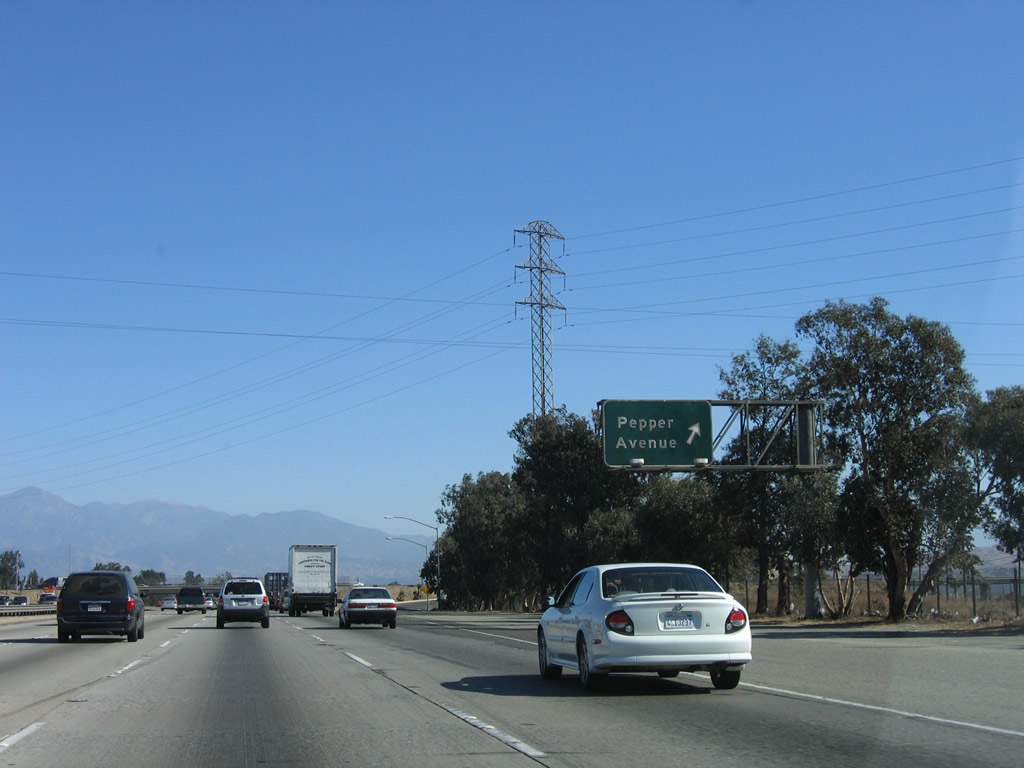
The next exit along Interstate 10 (San Bernardino Freeway) east is Exit 69, Pepper Avenue (one mile). This sign is posted on the Riverside Avenue overpass. Photo taken 11/10/06. |
|
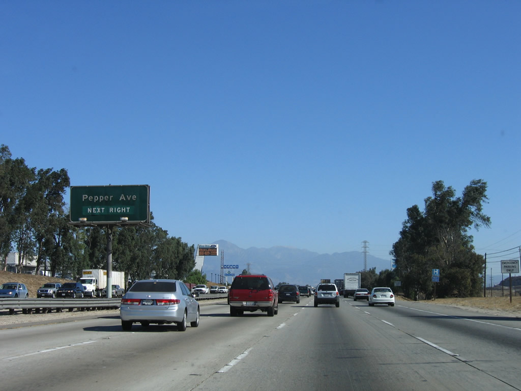
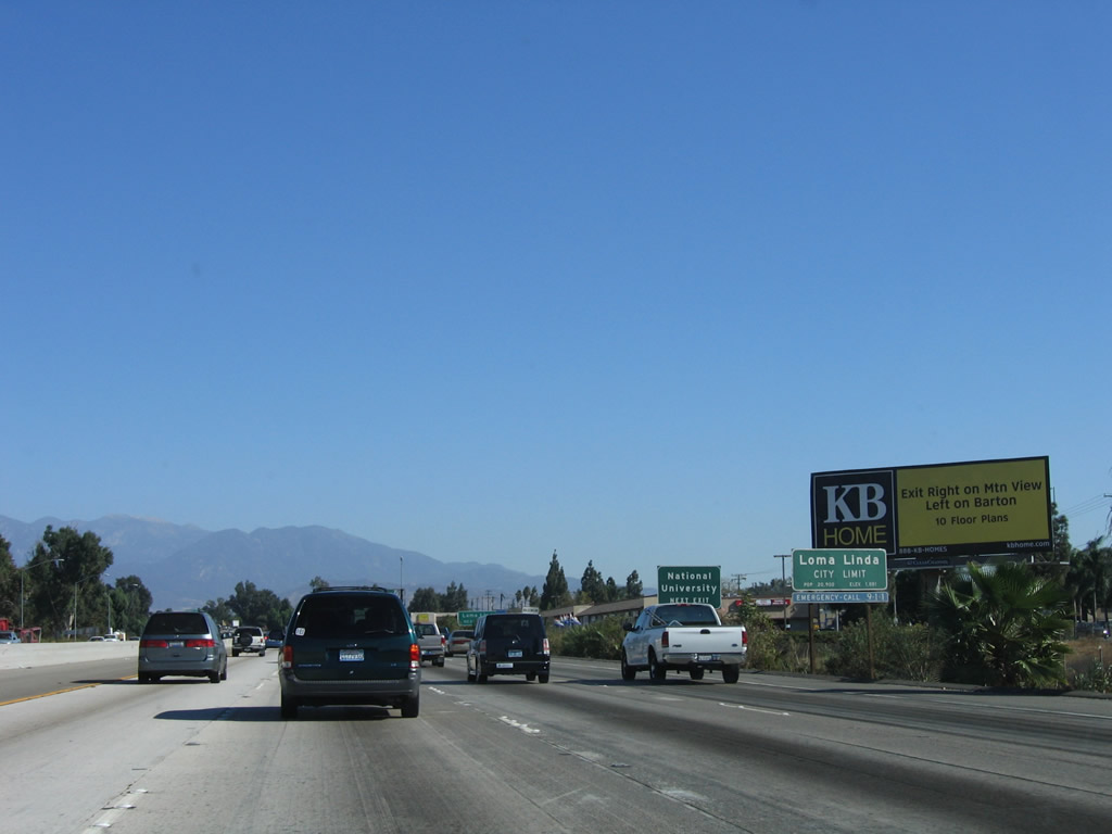
Use Pepper Avenue north to the Arrowhead Regional Medical Center and the western edges of the city of San Bernardino. To the south, Pepper Avenue does not go through to Riverside; it essentially ends adjacent to a large cement plant. Around this point, Interstate 10 leaves the city of Rialto and enters the city of Colton. The city of Colton had a population of 47,662 as of the 2000 Census and constitutes 15.7 square miles at an elevation of 1,004 feet. The city of Colton is a major transportation crossroads due to the location of the interchange between Interstate 10 and Interstate 215 within its city limits, as well as the connection between the Union Pacific Railroad and Burlington Northern Santa Fe (BNSF) Railroad. Photo taken 11/10/06. |
|
Eastbound Interstate 10 (San Bernardino Freeway) reaches Exit 69, Pepper Avenue. While Rialto has both U.S. 66/Foothill Boulevard and U.S. 70-99/Valley Boulevard passing through its boundaries, the city of Colton only has U.S. 70-99. It may be for that recent that several Business Loop I-10 shields remain posted along both directions of Valley Boulevard in Colton. Use Pepper Avenue, Rancho Avenue, or La Cadena Drive north to see Valley Boulevard and the old business loop shields. Photo taken 11/10/06. |
|
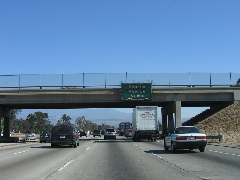
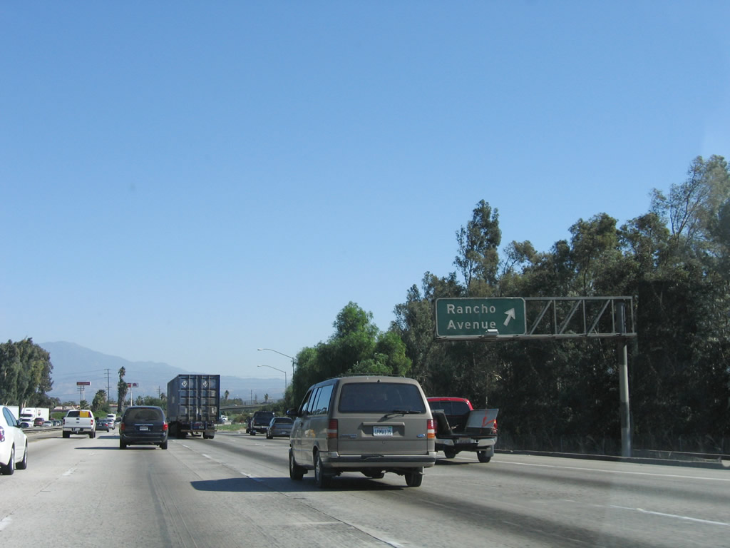
The next exit along Interstate 10 (San Bernardino Freeway) east is Exit 70A, Rancho Avenue, which also serves the city of Colton. This old porcelain enamel sign is posted on the Pepper Avenue overpass. Photo taken 11/10/06. |
|
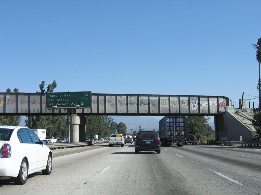
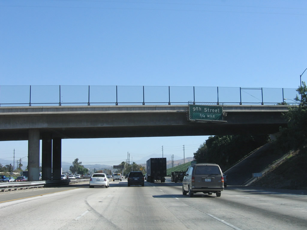
This mileage sign provides the distance to the next three exits along Interstate 10 (San Bernardino Freeway) east: Exit 70A, Rancho Avenue; Exit 70B, 9th Street to La Cadena Drive (Old U.S. 91-395); and Exit 71, Mount Vernon Avenue. All three of these exits serve the city of Colton. Immediately after Mount Vernon Avenue is the junction with Interstate 215/Riverside Freeway (Exit 72). Photo taken 11/10/06. |
|
Eastbound Interstate 10 (San Bernardino Freeway) reaches Exit 70A, Rancho Avenue. Photo taken 11/10/06. |
|
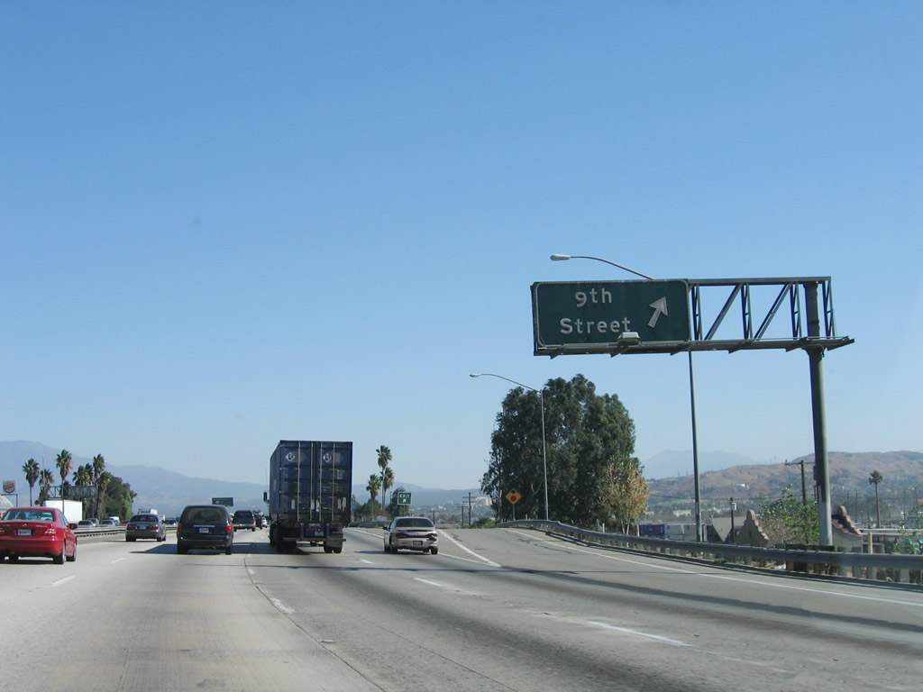
The next exit along Interstate 10 (San Bernardino Freeway) east is Exit 70B, Ninth Street to La Cadena Drive (Old U.S. 91-395). Photo taken 11/10/06. |
|
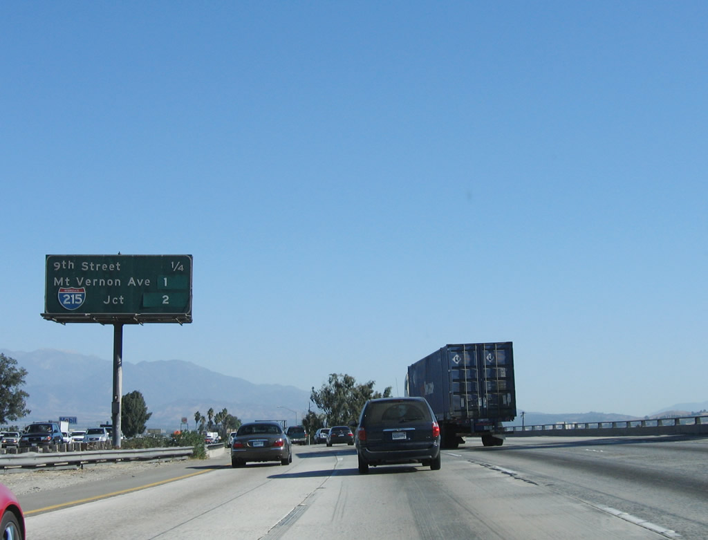
This mileage sign provides the distance to the next three exits along Interstate 10 (San Bernardino Freeway) east: Exit 70B, 9th Street to La Cadena Drive (Old U.S. 91-395); Exit 71, Mount Vernon Avenue; and Exit 72, Interstate 215/Riverside Freeway north to Downtown San Bernardino and south to Riverside and San Diego. Photo taken 11/10/06. |
|
Eastbound Interstate 10 (San Bernardino Freeway) reaches Exit 70B, Ninth Street to La Cadena Drive. Photo taken 11/10/06. |
|
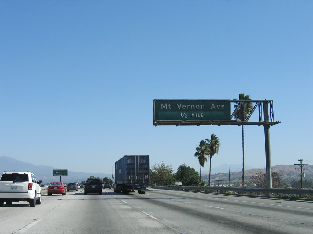
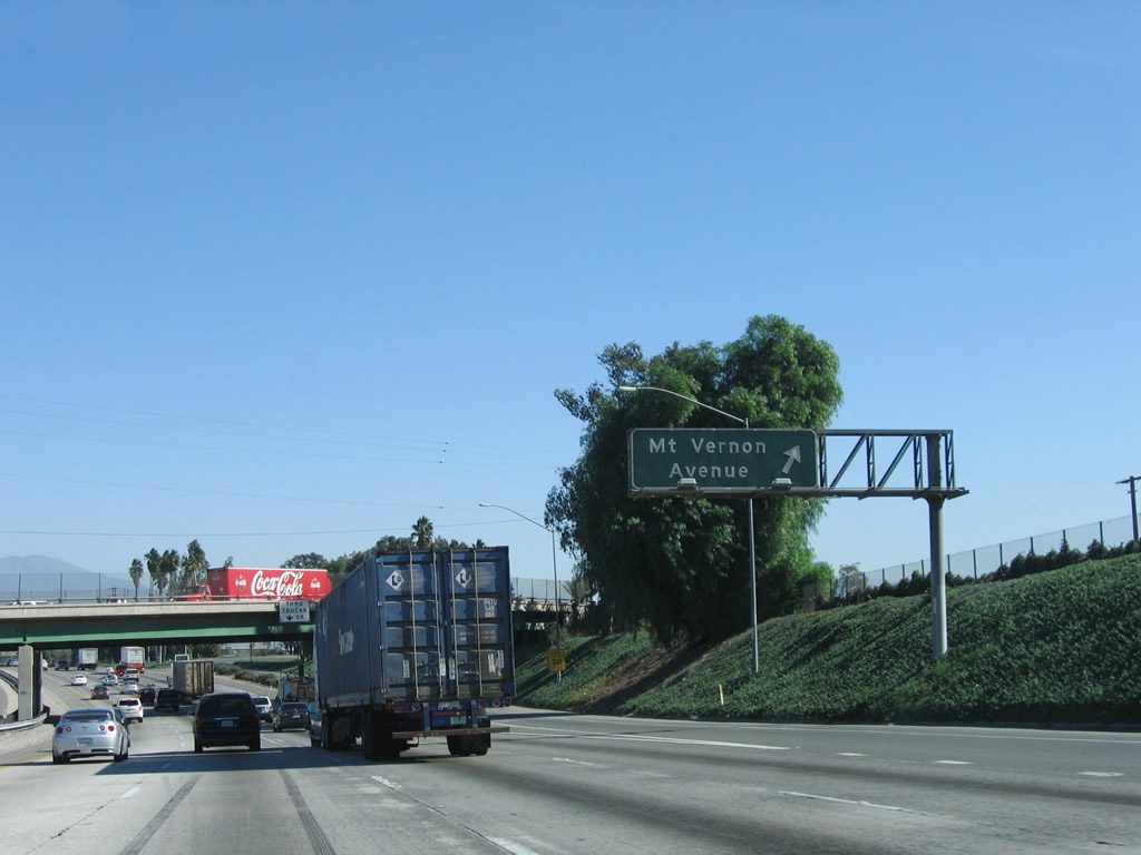
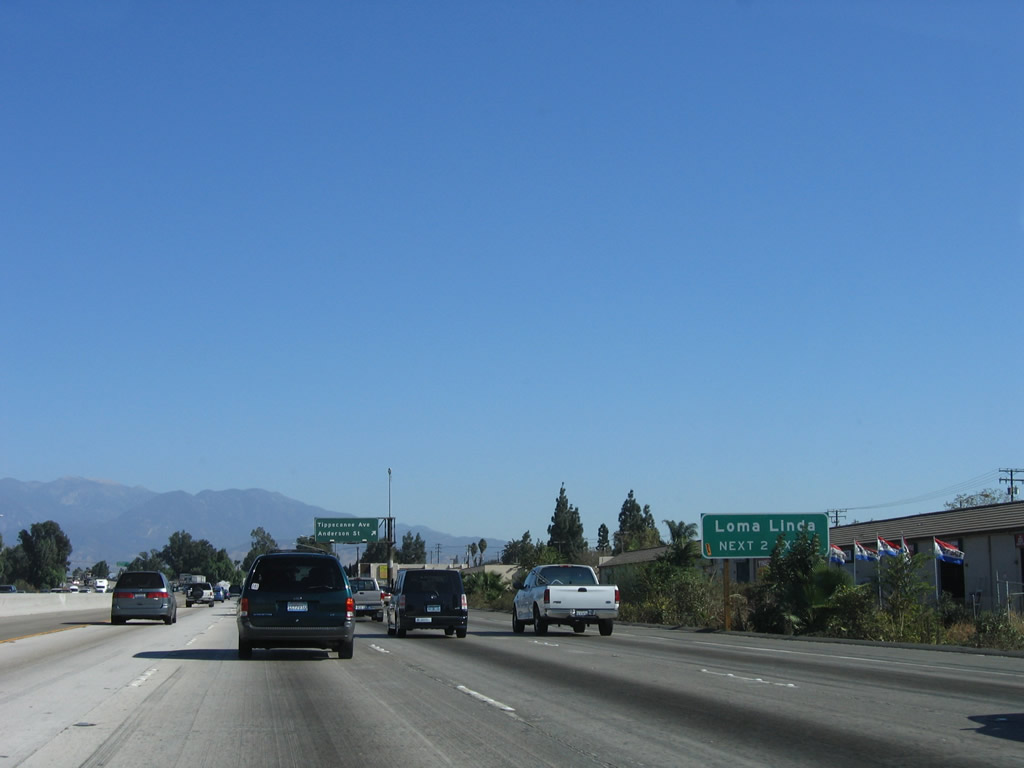
The next exit along Interstate 10 (San Bernardino Freeway) east is Exit 71, Mount Vernon Avenue to Business Loop I-10/Valley Boulevard west to Colton. The business loop, which began at Exit 59 in Fontana, returns to the freeway at Exit 71. Shields for the loop are still in place along Valley Boulevard in the city of Colton. Photo taken 11/10/06. |
|
This mileage sign provides the distance to the next three exits along Interstate 10 (San Bernardino Freeway) east: Exit 71, Mount Vernon Avenue and Business Loop I-10/Valley Boulevard west; Exit 72, Interstate 215/Riverside Freeway north to Downtown San Bernardino and south to Riverside and San Diego; and Exit 73A, Redlands Boulevard. Photo taken 11/10/06. |
|
Interstate 215 basically follows the path of U.S. 395 through San Bernardino and Riverside. Use Interstate 215 (San Bernardino Freeway) north to downtown San Bernardino and all points north via Interstate 15. To the south, Interstate 215 leads to the cities of Grand Terrace, Riverside, Moreno Valley, Perris, Menifee, Murrieta, Temecula, and San Diego. Photo taken 11/10/06. |
|
Eastbound Interstate 10 (San Bernardino Freeway) reaches Exit 71, Mount Vernon Avenue north/south and Business Loop I-10/Valley Boulevard west. Use Mount Vernon Avenue north through the city of Colton to San Bernardino Valley College and into San Bernardino; to the south, Mount Vernon Avenue travels through Colton to Grand Terrace and the unincorporated Riverside County community of Highgrove. Photo taken 11/10/06. |
|
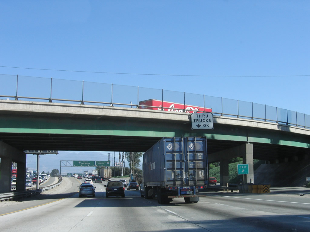
As Interstate 10 (San Bernardino Freeway) passes under the Mount Vernon Avenue bridge, a "Thru Trucks OK" sign is posted in the right lane. This lets truckers know that they will not have to make left merges due to an exit only configuration. (The off-ramp for Mount Vernon Avenue is a loop ramp; follow Mount Vernon Avenue north to Business Loop I-10/Valley Boulevard west.) The next exit is Exit 72, Interstate 215. Photo taken 11/10/06. |
|
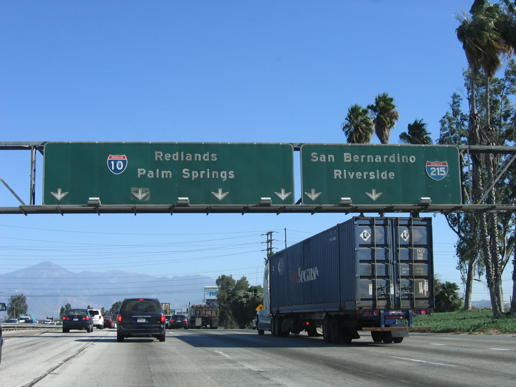
The right two lanes connect to Interstate 215, while the left four lanes carry Interstate 10 east to Redlands, Palm Springs, and Phoenix (the latter of which is not listed on any pull-through signs along this stretch of Interstate 10 east). Interstate 215 (San Bernardino Freeway) leads north into downtown San Bernardino before it joins Interstate 15 north of that city. Heading south, Interstate 215/Riverside Freeway travels to Riverside, connecting with both California 60 (Pomona Freeway) and California 91 (Riverside Freeway). A recent interchange improvement project at the 215-60-91 interchange vastly improved traffic flow through what used to be a cloverleaf interchange. Photo taken 11/10/06. |
|
These signs provide the lane allocations for the connection from eastbound Interstate 10 to Interstate 215 at Exit 72. Note that the lane allocations provide for one exit only lane onto Interstate 215 north and south as well as one optional lane for either Interstate 10 or Interstate 215. Photo taken 11/10/06. |
|
Eastbound Interstate 10 reaches Exit 72, Interstate 215. A three-lane off-ramp carries traffic to Interstate 215. At this point, the San Bernardino Freeway designation transfers onto Interstate 215 north, leaving Interstate 10 without a freeway designation name since its inception in Santa Monica. Photo taken 11/10/06. |
| Interstate 10 east |
|
The interchange between Interstate 10 and Interstate 215 is almost a symmetrical stack interchange, with flyover ramps making most direct connections. However, a loop ramp connects Interstate 215 north with Interstate 10 west, so it is just a nice four-level stack. Photos taken 11/10/06. |
|
Passing under the mainline of Interstate 215, the next two exits along Interstate 10 east is Exits 73A-B, Redlands Boulevard and Waterman Avenue (three-quarters of a mile). A portion of this stack interchange sits on top of the Santa Ana River, which goes by unnoticed by most of the thousands of motorists who pass through this interchange daily. Photo taken 11/10/06. |
|
Although the majority of the Interstate 10 and Interstate 215 stack interchange is within the city of Colton, the city limits sign for the city of San Bernardino appears immediately after passing under the Interstate 215 main line. At this point, Interstate 10 enters the city of San Bernardino. Named on May 20, 1810 (for Roman Catholic St. Bernardino de Sienna), the city of San Bernardino was incorporated in 1854. Home of the first McDonald's restaurant (opened by the McDonald brothers in 1948 on U.S. 66 Business at 1398 North E Street), San Bernardino is the seat of San Bernardino County. The city consists of 59.2 square miles, has about 16 inches of rainfall annually, sits at an elevation of 1,046 feet, and had a population of 185,401 people as of the 2000 Census. Downtown San Bernardino is located north along Interstate 215. Photo taken 11/10/06. |
|
Eastbound Interstate 10 reaches Exit 73A, Redlands Boulevard to Waterman Avenue south. Redlands Boulevard is the old alignment of U.S. 70-99 through southern San Bernardino and Redlands; it was not assigned a business loop designation, but Redlands Boulevard served briefly as U.S. 70-99 Business. Redlands Boulevard rejoins Interstate 10 at Exit 81. Photo taken 11/10/06. |
|
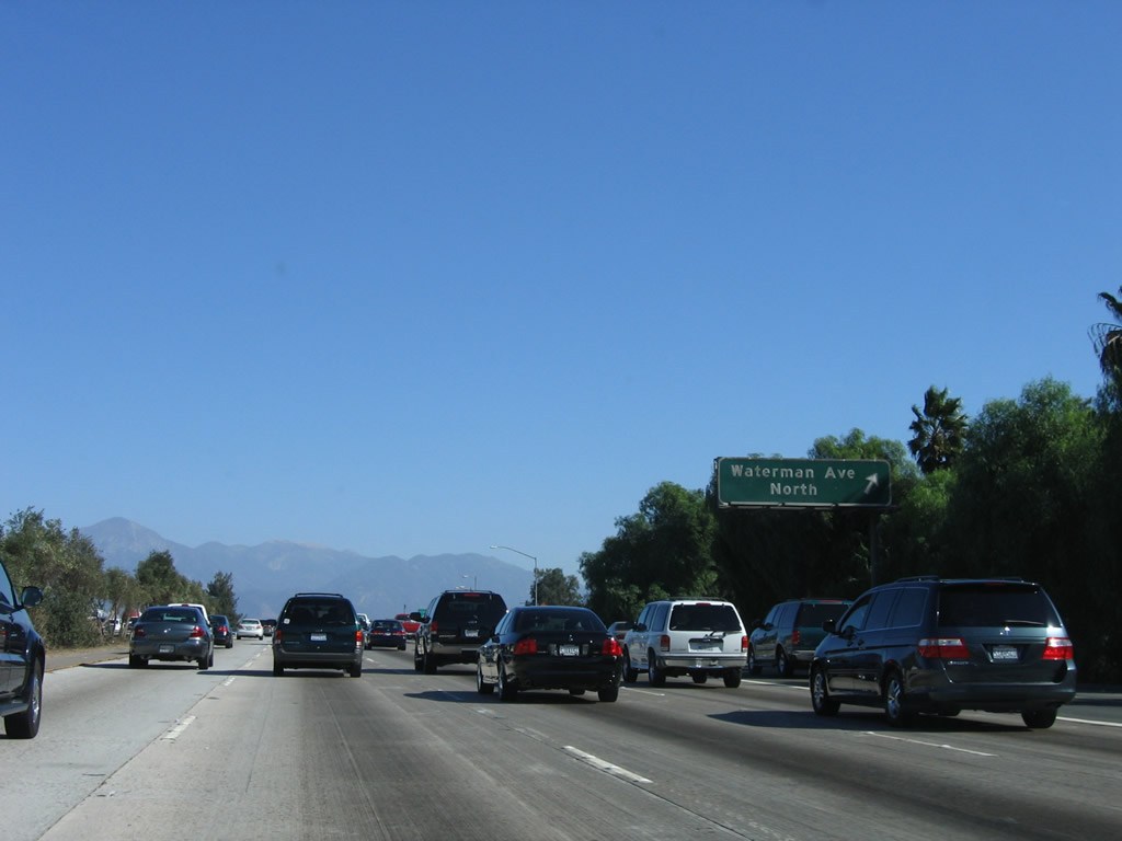
Immediately thereafter, eastbound Interstate 10 reaches Exit 73B, Waterman Avenue north to downtown San Bernardino. To California 18 north, follow Waterman Avenue north through the city; the state route begins after the California 210 interchange. Photo taken 11/10/06. |
|
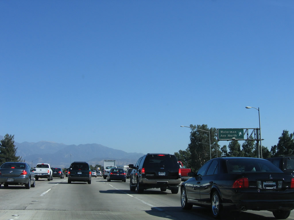
A second off-ramp sign for Waterman Avenue north is posted on the collector distributor lane. Photo taken 11/10/06. |
|
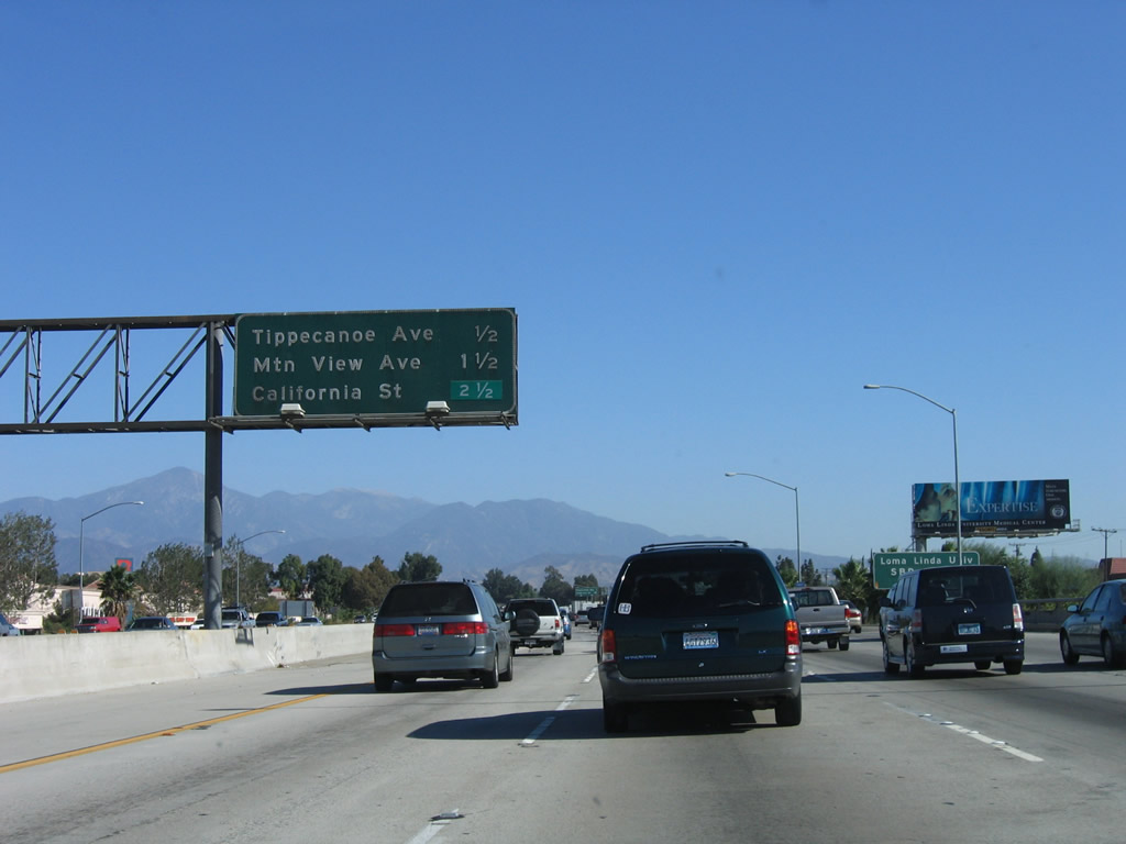
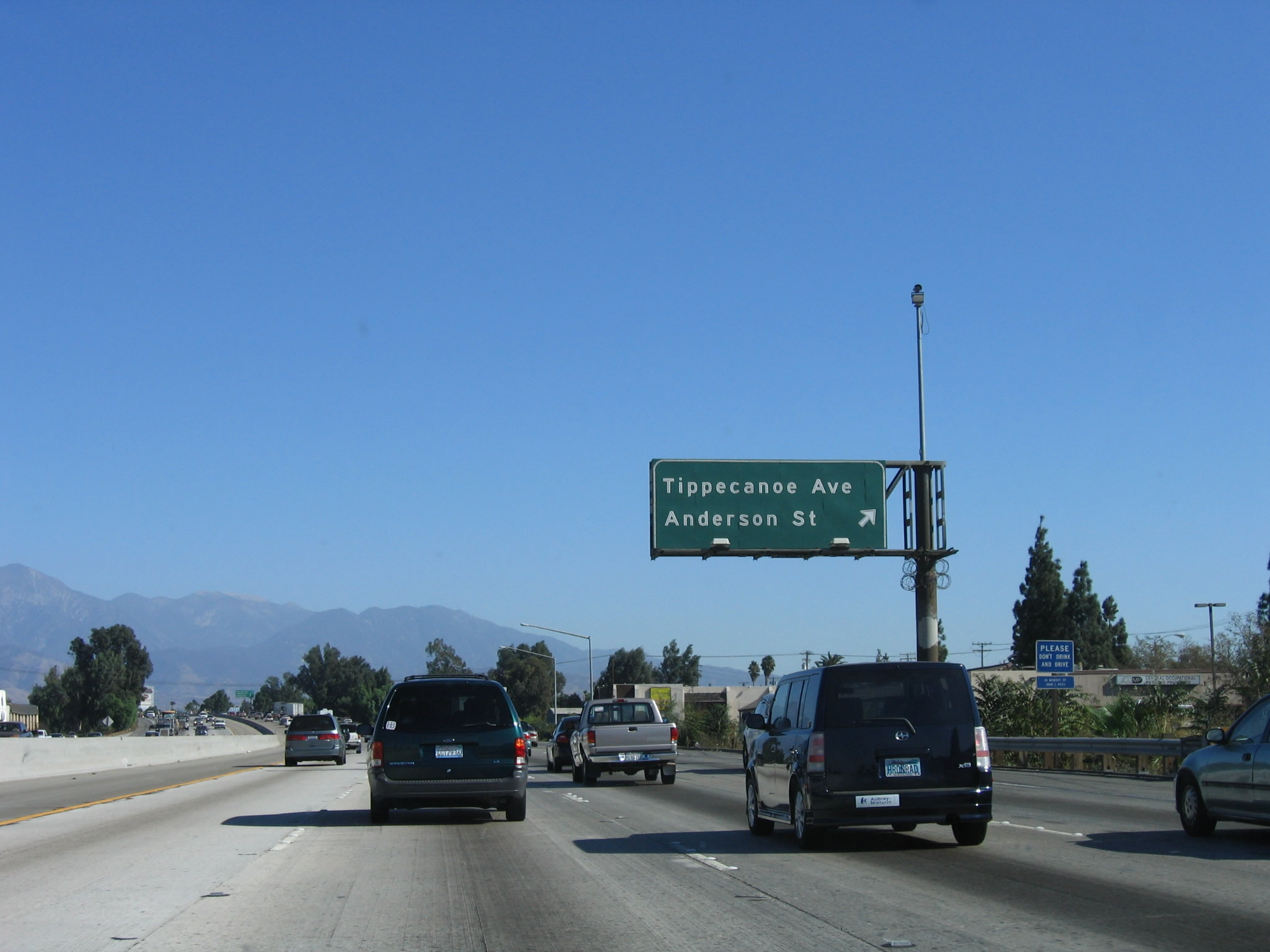
This interchange sequence sign along eastbound Interstate 10 provides the distance to Exit 74, Tippecanoe Avenue and Anderson Street; Exit 75, Mountain View Avenue; and Exit 76, California Street. Photo taken 11/10/06. |
|
Use Tippecanoe Avenue north to San Bernardino International Airport (former Norton Air Force Base) and Anderson Street south to the city of Loma Linda. Around this point, Interstate 10 becomes the city limits between San Bernardino on the north side of the freeway and Loma Linda on the south side of the freeway. Use Anderson Street south to Loma Linda University. Photo taken 11/10/06. |
|
Interstate 10 passes along the north side of the city of Loma Linda. Home to Loma Linda University, the city of Loma Linda. The population of Loma Linda was 18,681 as of the 2000 Census and incorporated in 1970. Photo taken 11/10/06. |
|
The next two exits (Exit 74 and Exit 75) serve the city of Loma Linda. Photo taken 11/10/06. |
|
Eastbound Interstate 10 reaches Exit 74, Tippecanoe Avenue north to San Bernardino and Anderson Street south to Loma Linda. Use Anderson Street south to Redlands Boulevard (old U.S. 70-99). Photo taken 11/10/06. |
|
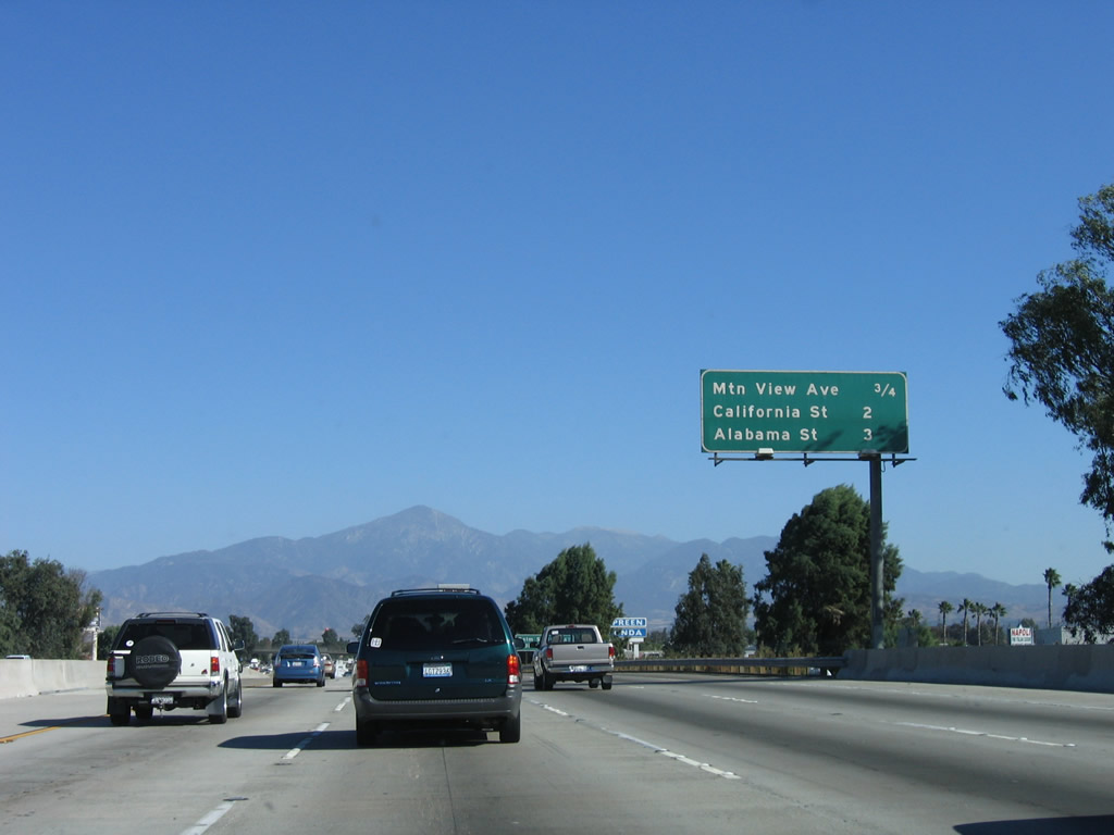
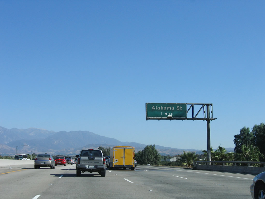
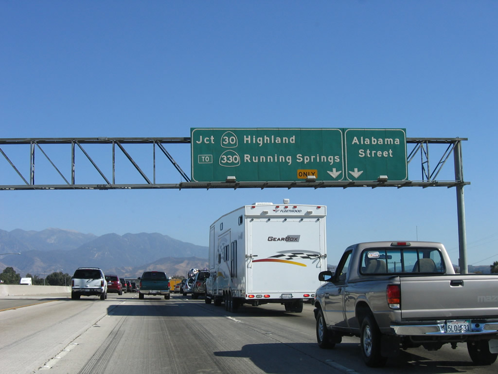
This interchange sequence sign along eastbound Interstate 10 provides the distance to Exit 75, Mountain View Avenue; Exit 76, California Street; and Exit 77A, Alabama Street. Photo taken 11/10/06. |
|
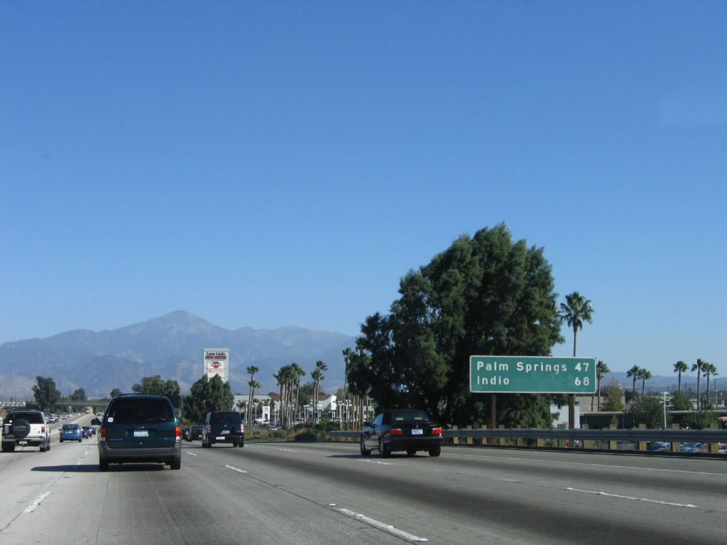
A second mileage sign along eastbound Interstate 10 provides the distance to Palm Springs (47 miles) and Indio (68 miles). Phoenix is omitted, which is interesting since the Interstate 10 west control city in Phoenix is Los Angeles. Photo taken 11/10/06. |
|
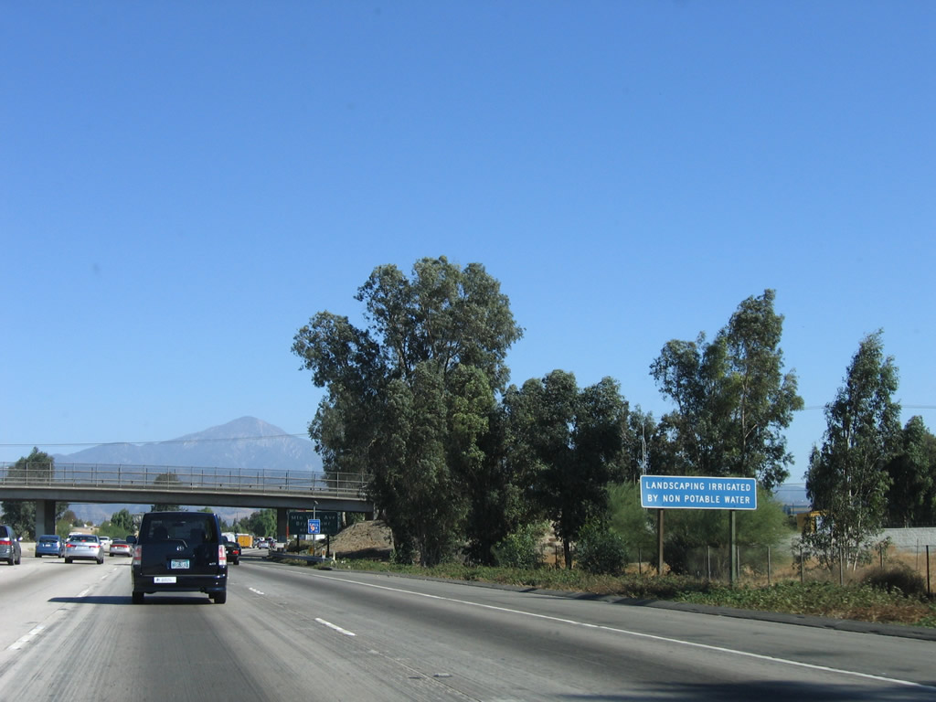
Landscape irrigation by non-potable or reclaimed water is becoming more and more common as potable (drinking) water supplies become scarcer. Southern California has been in the grip of a multiple-year drought, so water supplies both local and imported are constrained. Photo taken 11/10/06. |
|
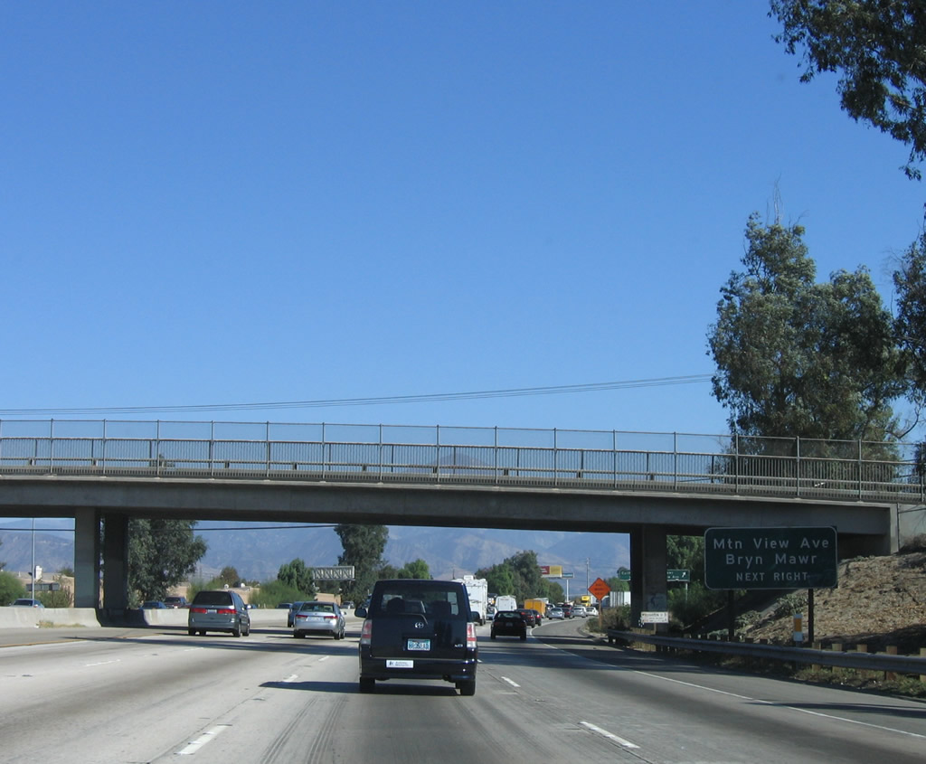
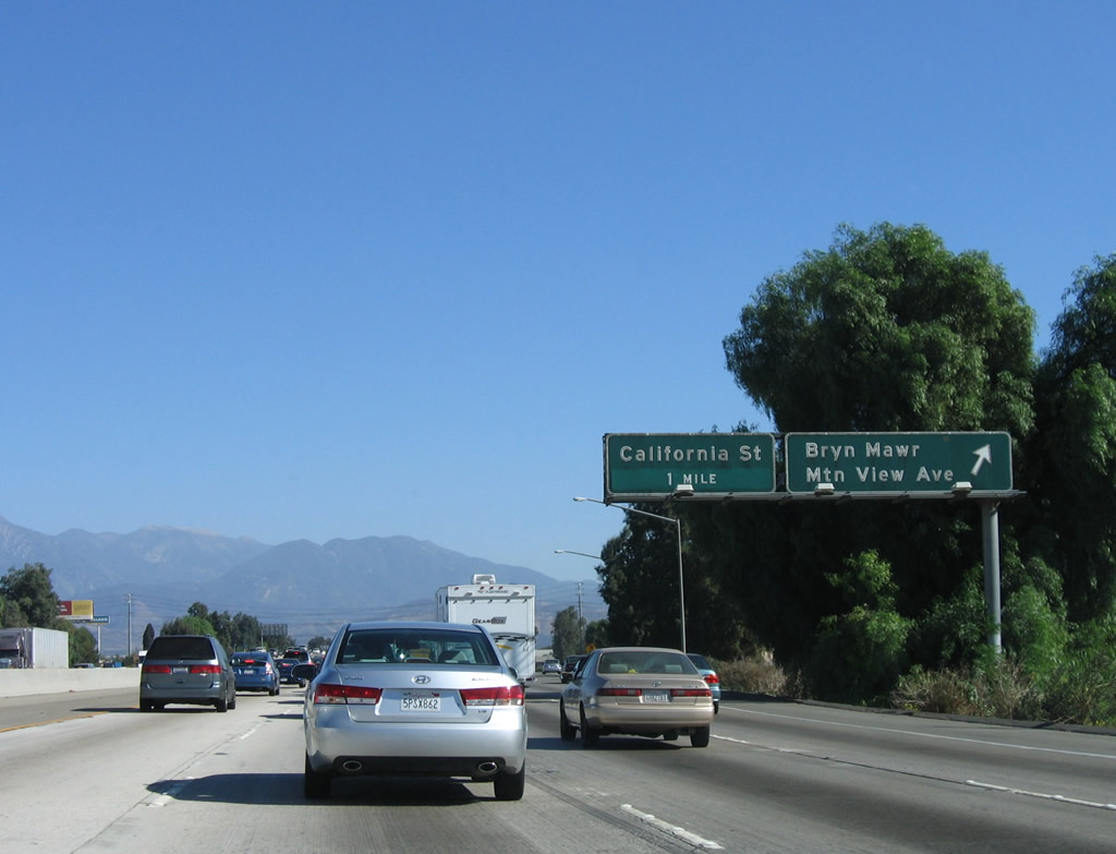
The next exit along Interstate 10 east is Exit 75, Mountain View Avenue south to the Loma Linda community of Bryn Mawr and north to eastern San Bernardino and western Redlands. Photo taken 11/10/06. |
|
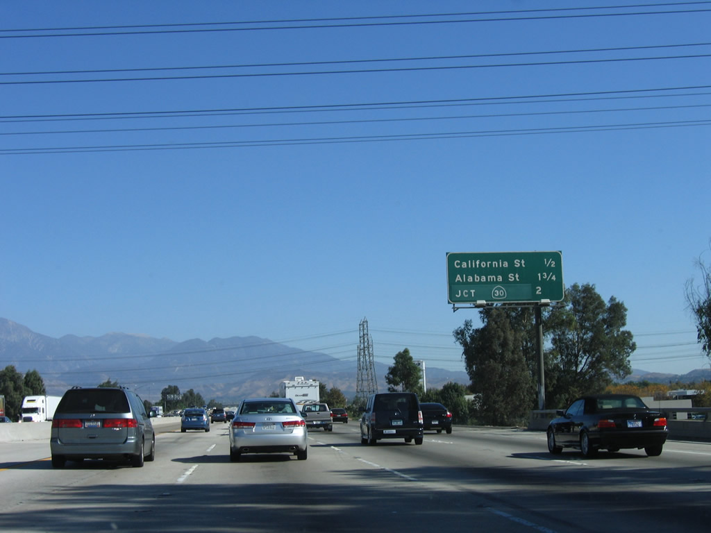
Eastbound Interstate 10 reaches Exit 75, Mountain View Avenue. The next exit along Interstate 10 east is Exit 76, California Street. Photo taken 11/10/06. |
|
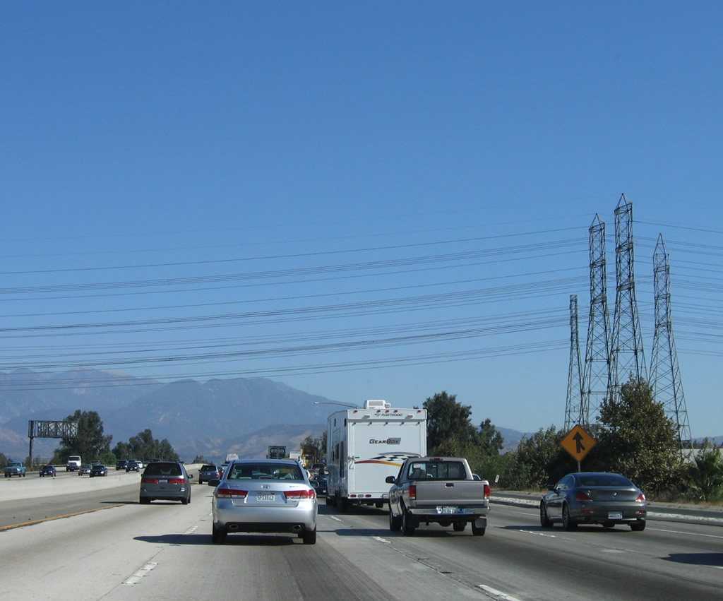
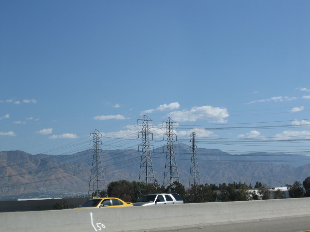
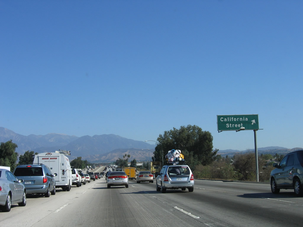
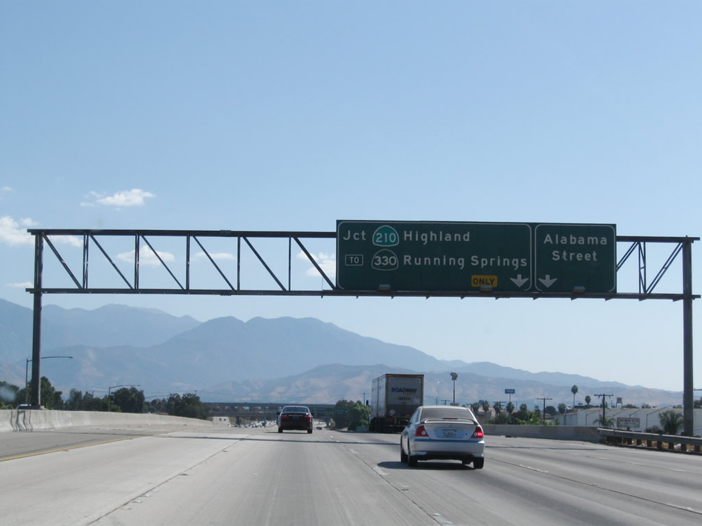
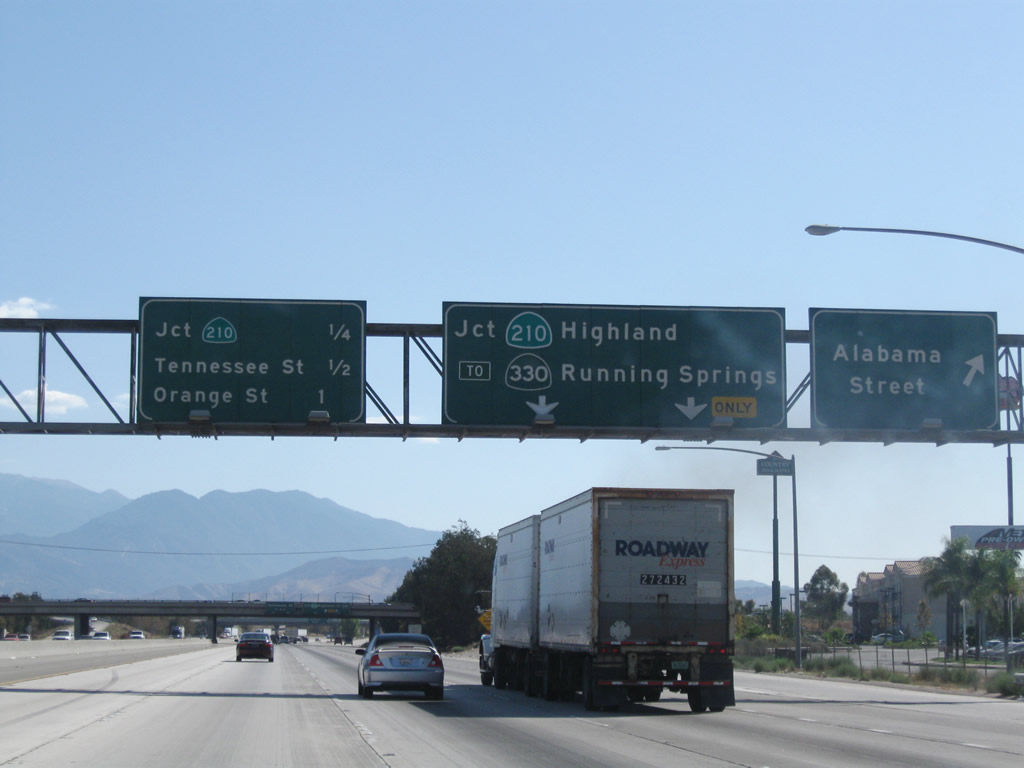
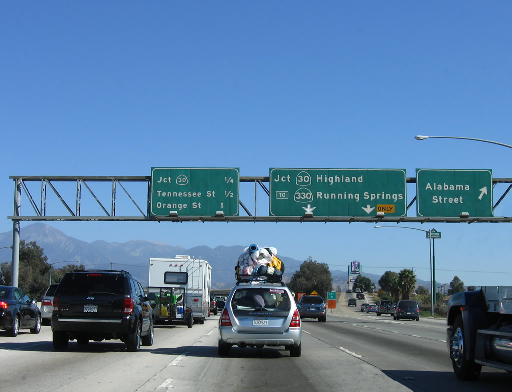
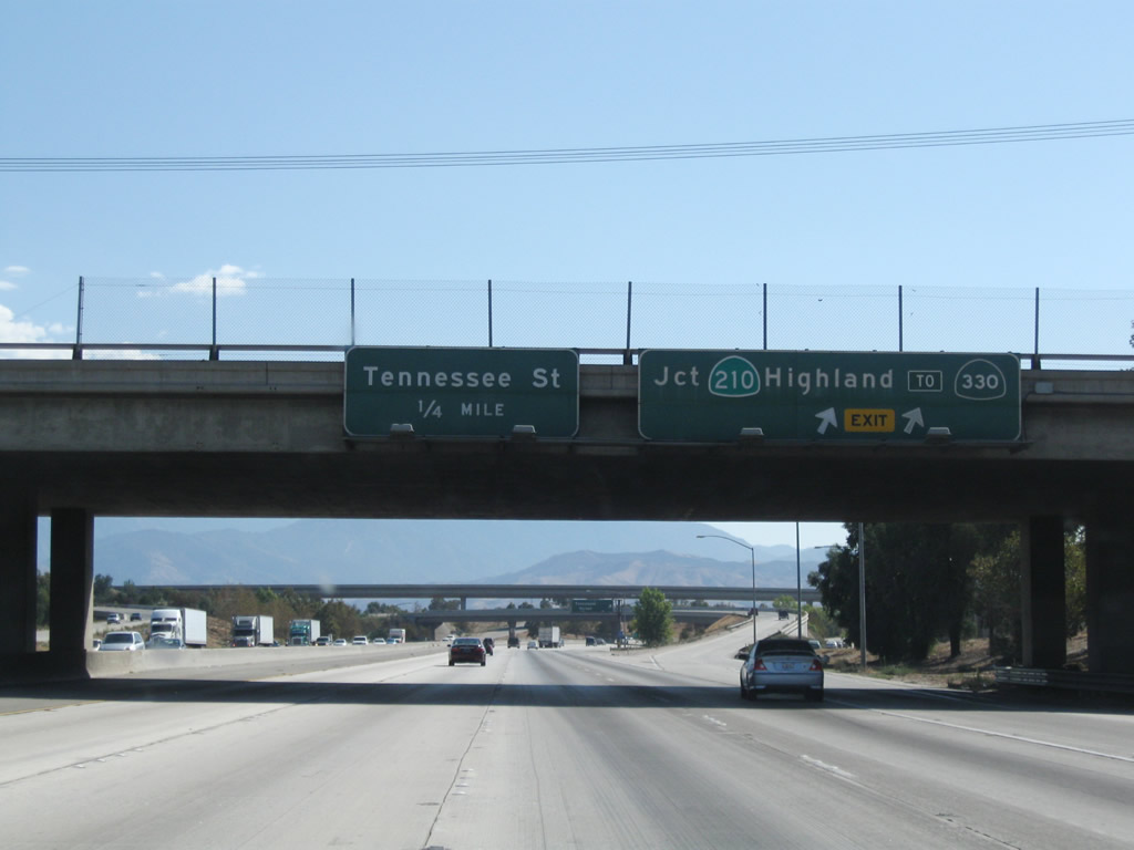
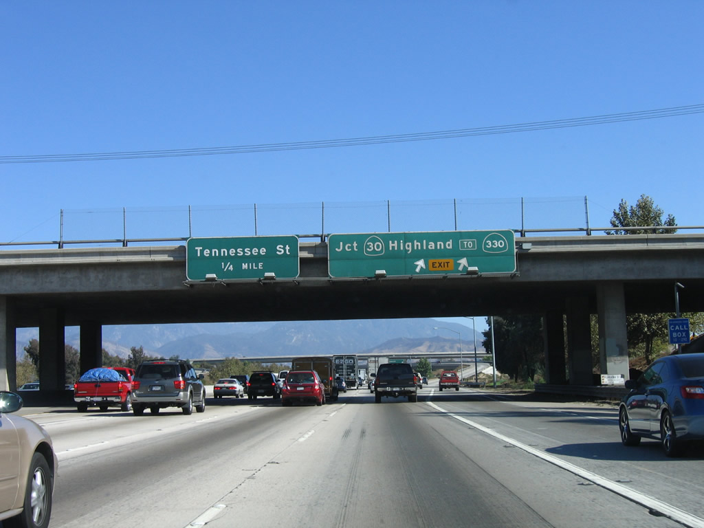
Passing under a set of Southern California Edison power lines, an interchange sequence sign along eastbound Interstate 10 provides the distance to Exit 76, California Street; Exit 77A, Alabama Street; and Exit 77B, California 210 north to Highland and west to Pasadena. At the time this photo was taken, California 210 was still signed as California 30. Photo taken 11/10/06. |
|
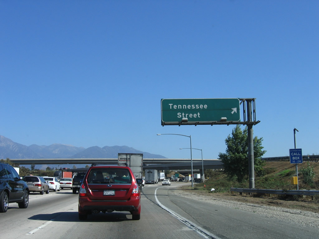
Immediately thereafter, eastbound Interstate 10 reaches Exit 77C, Tennessee Street. The flyover ramp from Interstate 10 east to California 210 west crosses the freeway after this exit ramp. Photo taken 05/02/02. |
|
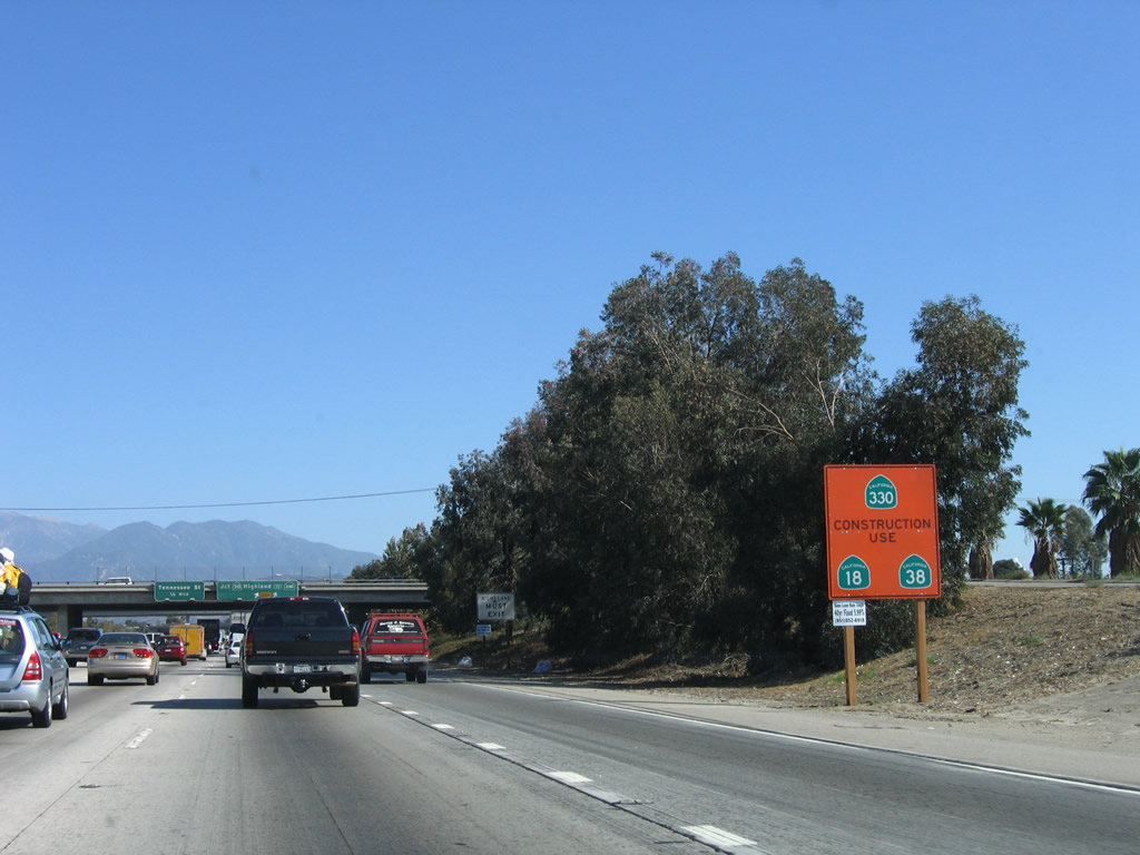
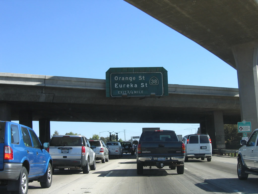
The next exit along Interstate 10 east is Exit 79, Pearl Avenue east to Eureka Street south and California 38/Orange Street north. Photo taken 11/10/06. |
|
After traffic from California 210 merges onto Interstate 10 east, the freeway meets the off-ramp to Exit 79, Pearl Avenue east to Eureka Street south and California 38/Orange Street north and Orange Street south to downtown Redlands. California 38, along with California 18 and California 330, is a route into the San Bernardino Mountains by way of Onyx Summit. At an elevation of 8,440 feet, California 38 is the highest elevation state highway in Southern California. After traveling east to Onyx Summit, California 38 turns north to meet California 18 in Big Bear City. After a brief overlap, California 38 turns west to traverse the north shore of Big Bear Lake, then ends at its second junction with California 18 near the Big Bear Lake dam. Photo taken 11/10/06. |
|
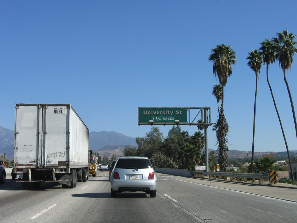
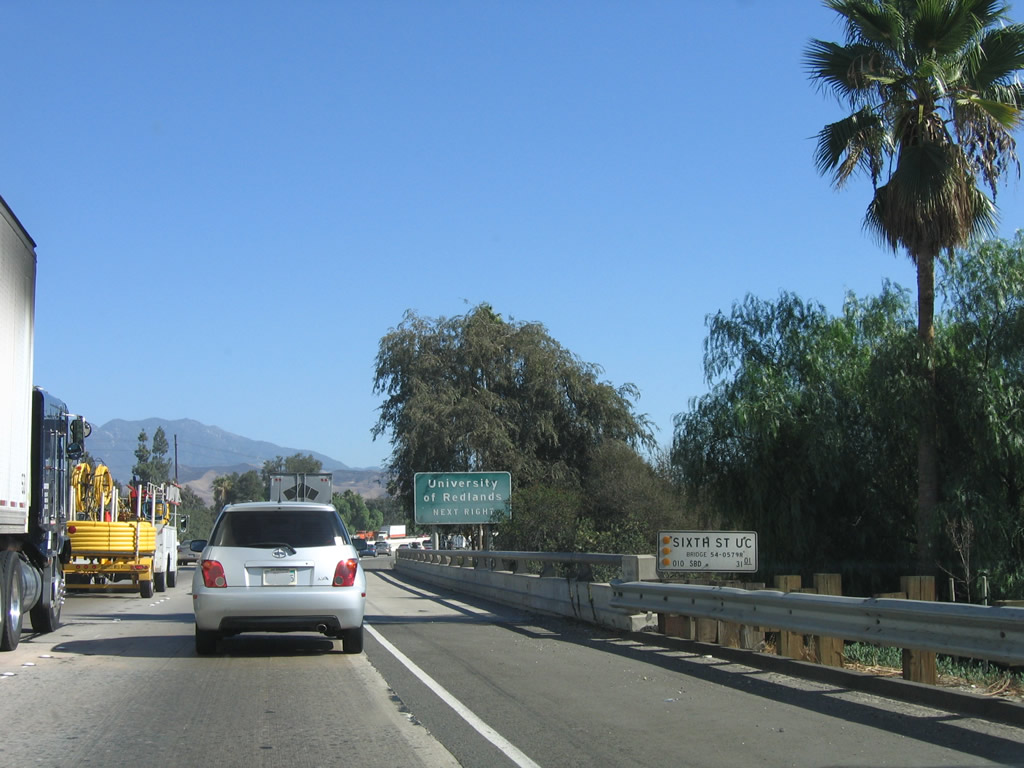
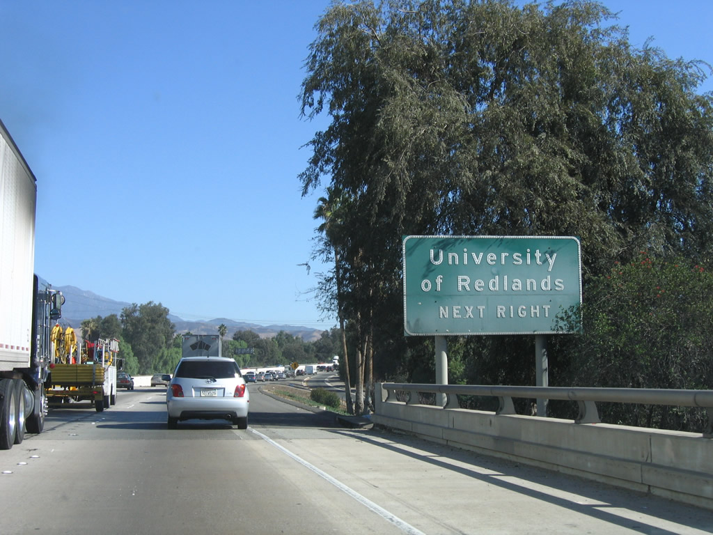
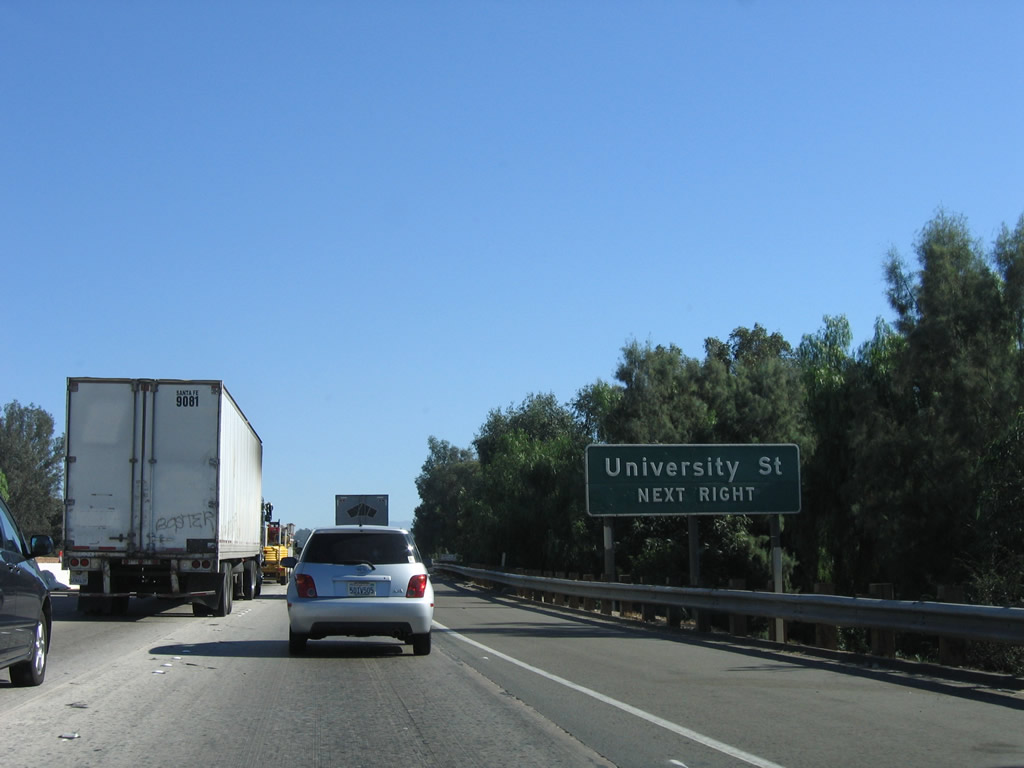
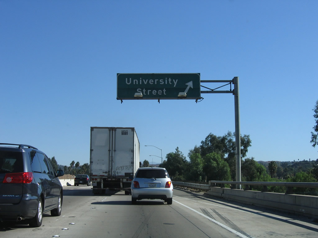
The next exit along Interstate 10 east is Exit 80, University Street to the University of Redlands. Photo taken 11/10/06. |
|
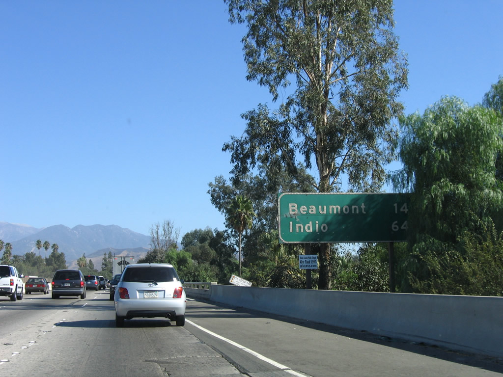
This mileage along Interstate 10 east provides the distance to Beaumont (14 miles) and Indio (64 miles). Photo taken 11/10/06. |
|
A damaged Caltrans postmile marker for Interstate 10 (Mile 31 in San Bernardino County) is posted alongside the freeway. Photo taken 11/10/06. |
|
A bridge identification marker is posted shortly thereafter for the Sixth Street undercrossing. Photo taken 11/10/06. |
|
Use University Street north to the University of Redlands. This sign looks very dirty! Photo taken 11/10/06. |
|
A roadside sign advises of the next interchange (Exit 80, University Street). Photo taken 11/10/06. |
|
Eastbound Interstate 10 reaches Exit 80, University Street. Photo taken 11/10/06. |
|
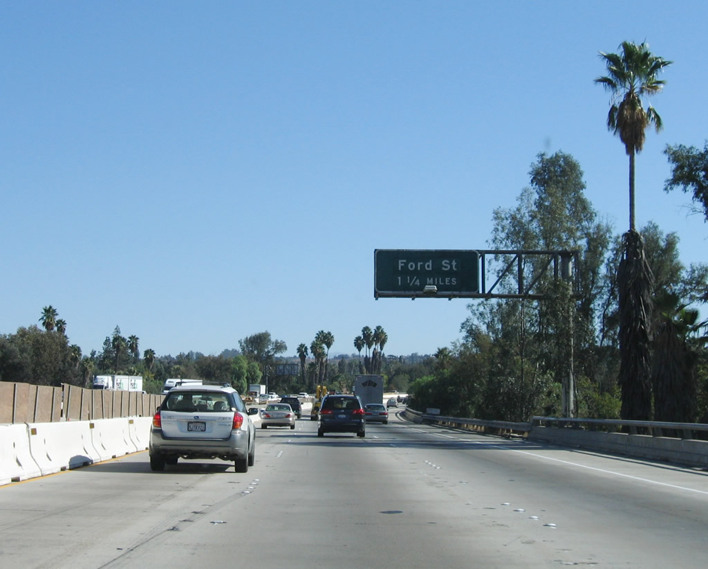
The next exit along Interstate 10 east is Exit 81, Ford Street. These are some very old signs! At this point, Interstate 10 (and Old U.S. 70-99) turns southeast and will follow that trajectory all the way to Beaumont, where Interstate 10 meets California 60 (Old U.S. 60). Photo taken 11/10/06. |
|
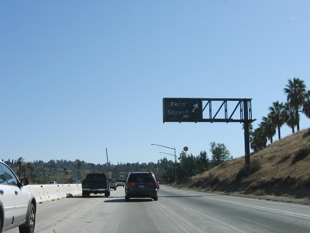
Eastbound Interstate 10 reaches Exit 81, Ford Street. At this point, Redlands Boulevard (Old U.S. 70-99) merge back onto the freeway mainline. The next interchange is two miles east of here, at Exit 83. There is no access to Exit 82, Wabash Avenue from eastbound Interstate 10. Photo taken 11/10/06. |
|
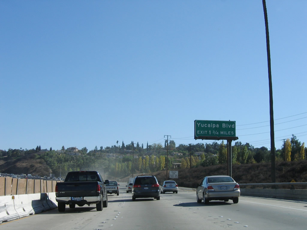
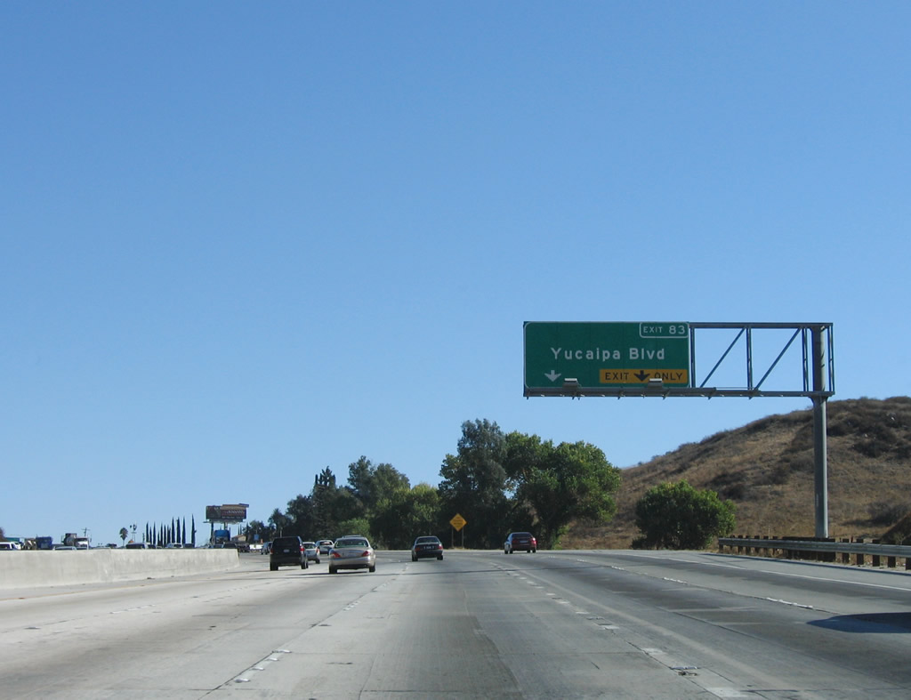
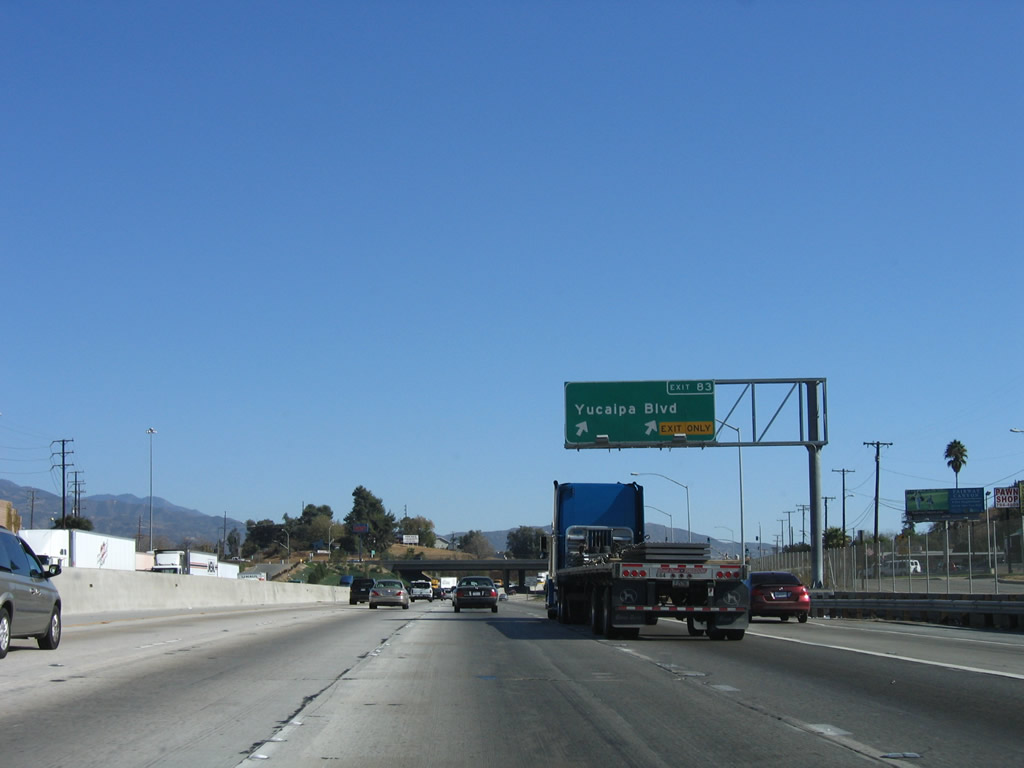
The next exit along Interstate 10 east is Exit 83, Yucaipa Boulevard (1.75 miles). Photo taken 11/10/06. |
|
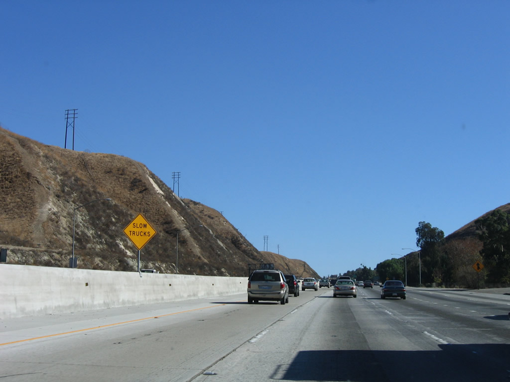
As traffic from Wabash Avenue (Exit 82) merges onto eastbound Interstate 10, the freeway ascends from Redlands toward Yucaipa through the Crafton Hills. Watch for slow traffic on the uphill climb. Photo taken 11/10/06. |
|
Use Yucaipa Boulevard east to Crafton Hills College. Photo taken 11/10/06. |
|
The right two lanes of eastbound Interstate 10 connect to Exit 83, Yucaipa Boulevard east to the city of Yucaipa. Photo taken 11/10/06. |
|
Eastbound Interstate 10 reaches Exit 83, Yucaipa Boulevard. Despite the fact that the boulevard leads away from the freeway to the city center, Yucaipa Boulevard is not an old alignment of U.S. 70-99. The U.S. routes stayed generally close to the current alignment of Interstate 10 southeast toward Calimesa. This is the first series of exit number signs seen on Interstate 10 in quite some time (at least as of 2006). Photo taken 11/10/06. |
|
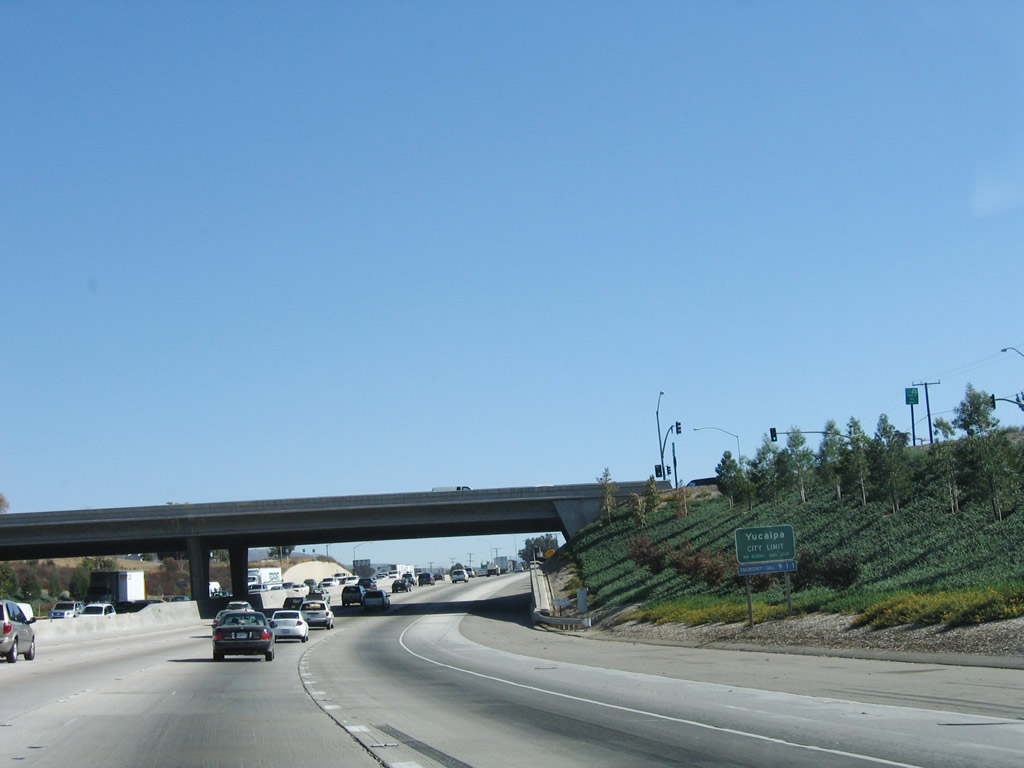
Prior to passing through the Yucaipa Boulevard interchange, eastbound Interstate 10 leaves the city of Redlands and enters the city of Yucaipa (population 41,207 as of 2000 Census, incorporated in 1989, and elevation of 2,618 feet). Photo taken 11/10/06. |
|
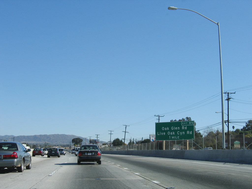
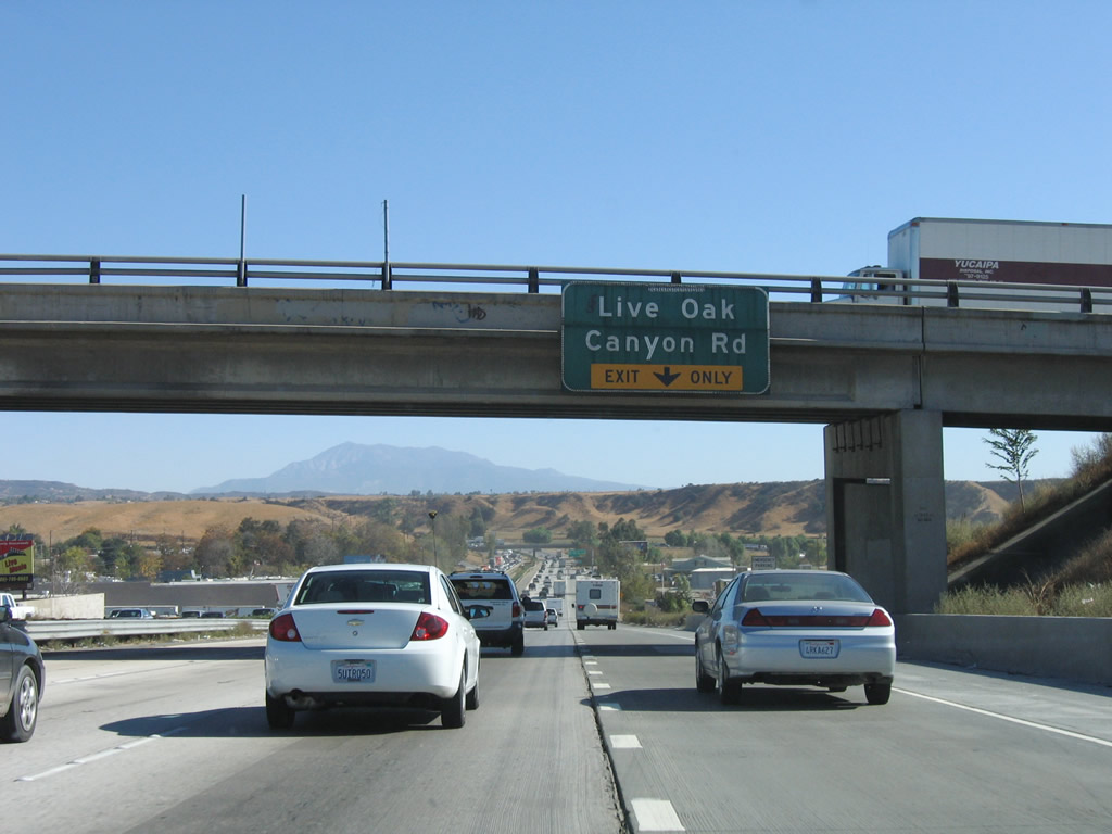
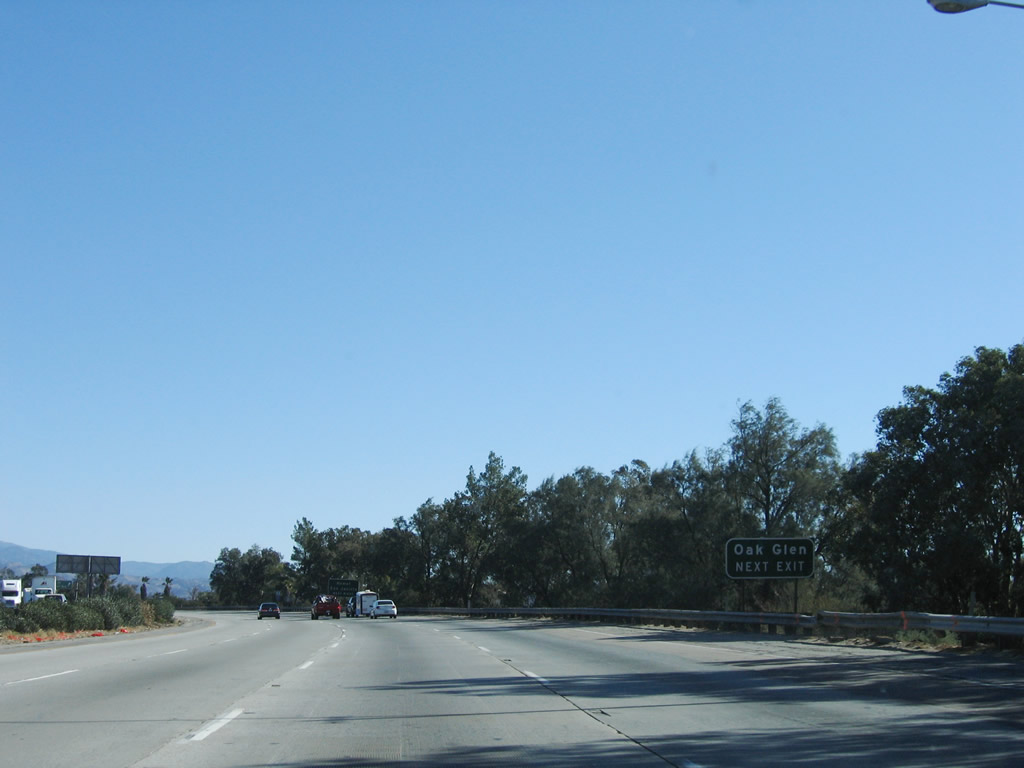
The next exit along Interstate 10 east is Exit 85, Live Oak Canyon Road and Oak Glen Road (one mile). Photo taken 11/10/06. |
|
The right lane of Interstate 10 east becomes exit only for Exit 85, Live Oak Canyon Road and Oak Glen Road. Sixteenth Street passes overhead. Photo taken 11/10/06. |
|
Eastbound Interstate 10 reaches Exit 85, Live Oak Canyon Road/Oak Glen Road. Photo taken 11/10/06. |
|
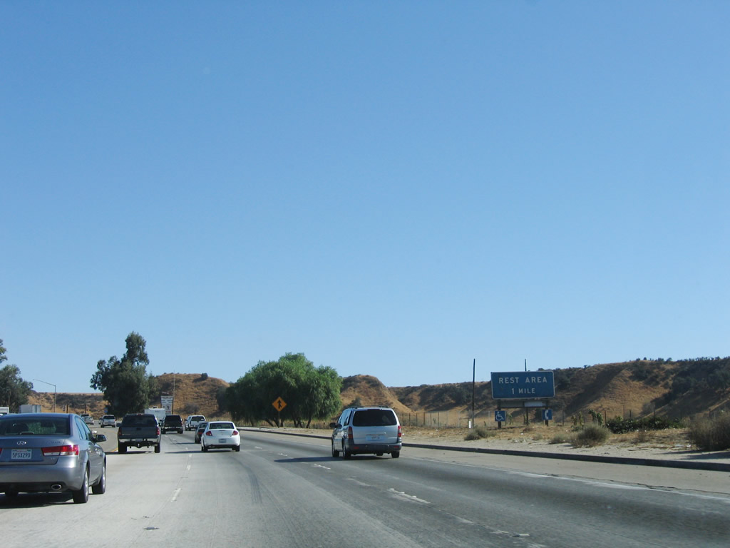
The next exit along Interstate 10 east is Exit 86, Rest Area (one mile). Photo taken 11/10/06. |
|
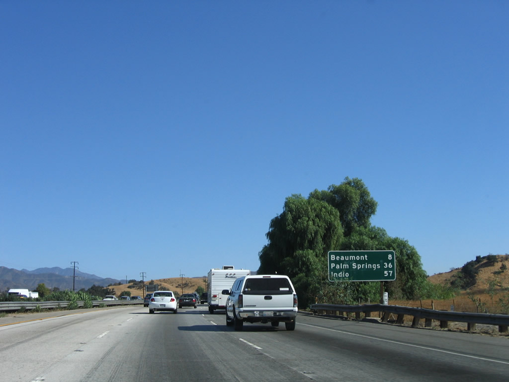
This mileage sign provides the distance to Beaumont (eight miles), Palm Springs (36 miles), and Indio (57 miles). Photo taken 11/10/06. |
|
Eastbound Interstate 10 reaches Exit 86, Rest Area. This is the first rest area along eastbound Interstate 10. The next rest area is 27 miles ahead. Photo taken 11/10/06. |
|
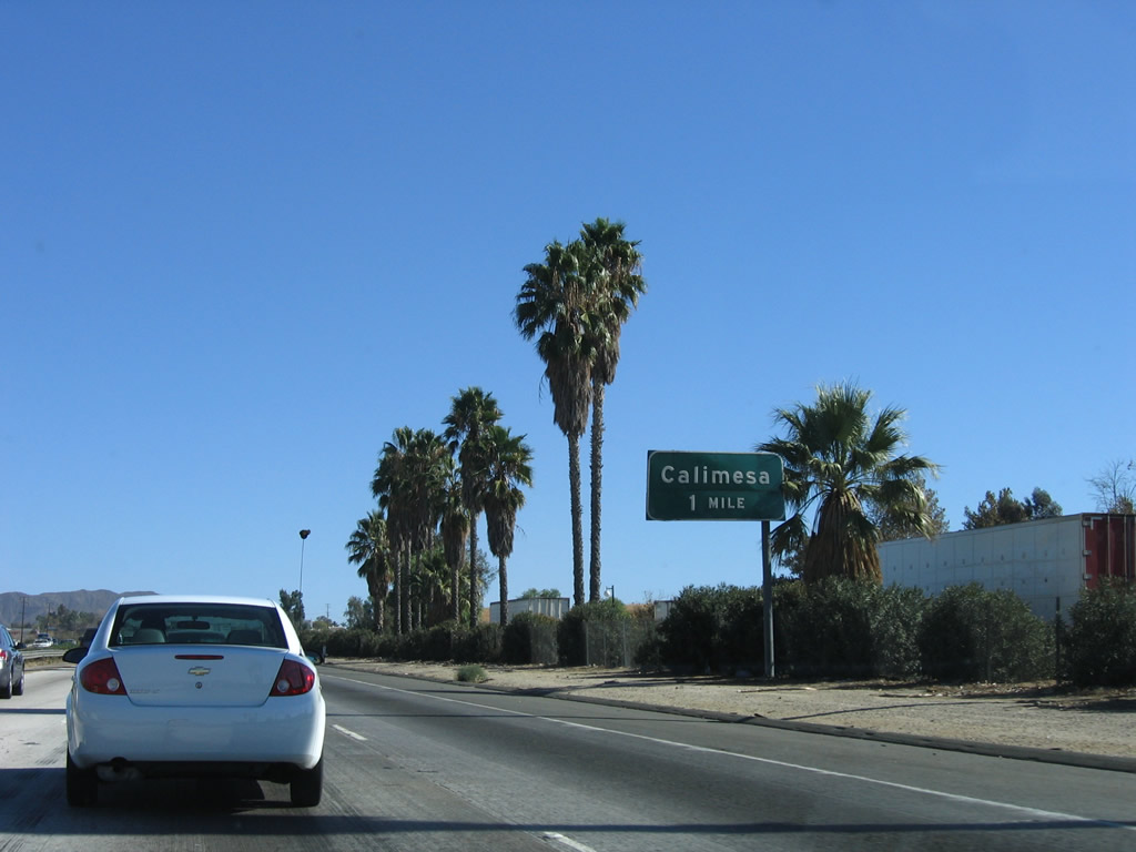
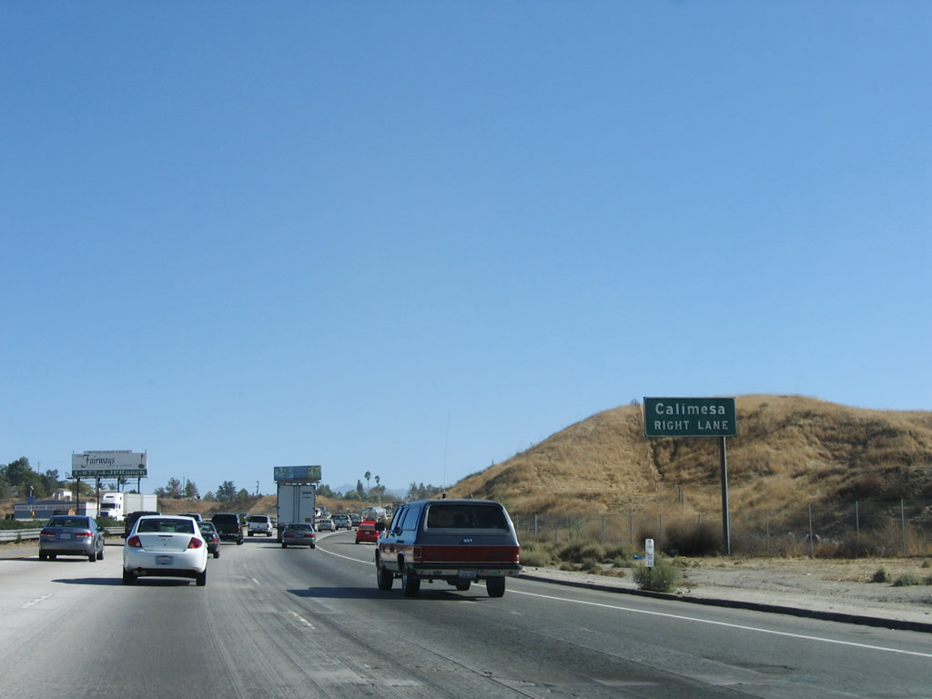
The next exit along Interstate 10 east is Exit 87, County Line Road to the city of Calimesa in Riverside County. As Interstate 10 dips southwest, it will cross the county line between San Bernardino County and Riverside County at Exit 87. Photo taken 11/10/06. |
|
Eastbound Interstate 10 approaches Exit 87, County Line Road to the city of Calimesa in Riverside County. Photo taken 11/10/06. |
|
Soon thereafter, eastbound Interstate 10 reaches Exit 87, County Line Road to the city of Calimesa. Photo taken 11/10/06. |
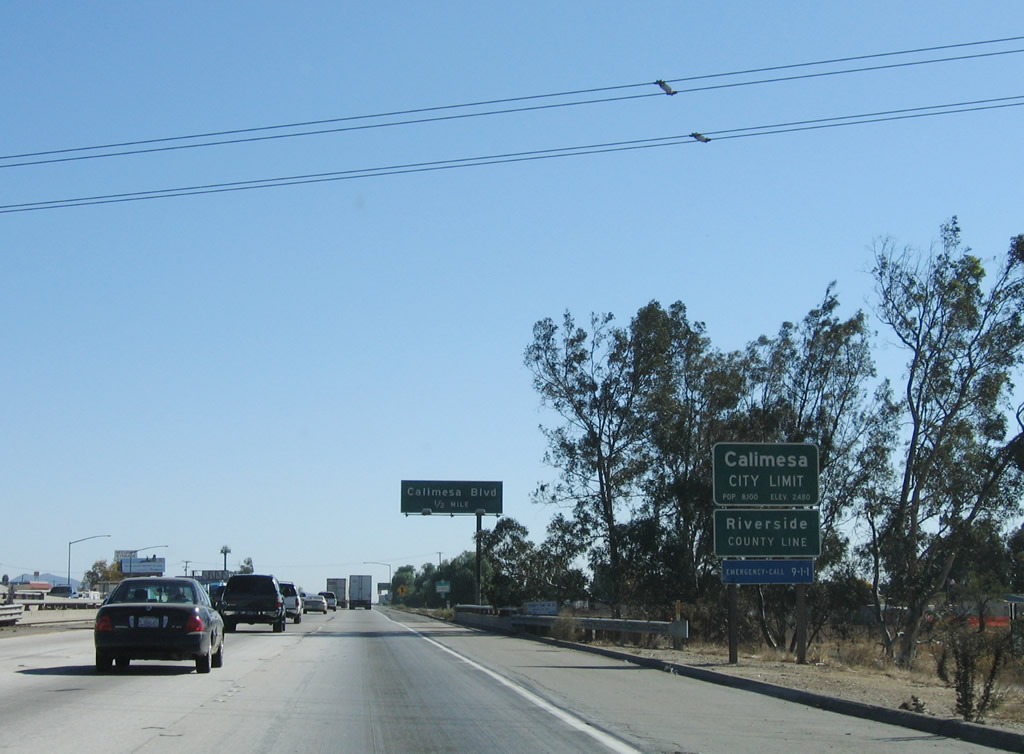
|
Interstate 10 leaves the city of Yucaipa and San Bernardino County and enters the city of Calimesa and Riverside County. The city of Calimesa was home to 7,139 people as of the 2000 Census. The next two exits also serve the city of Calimesa before Interstate 10 travels into the city of Beaumont. Photo taken 11/10/06. |
|
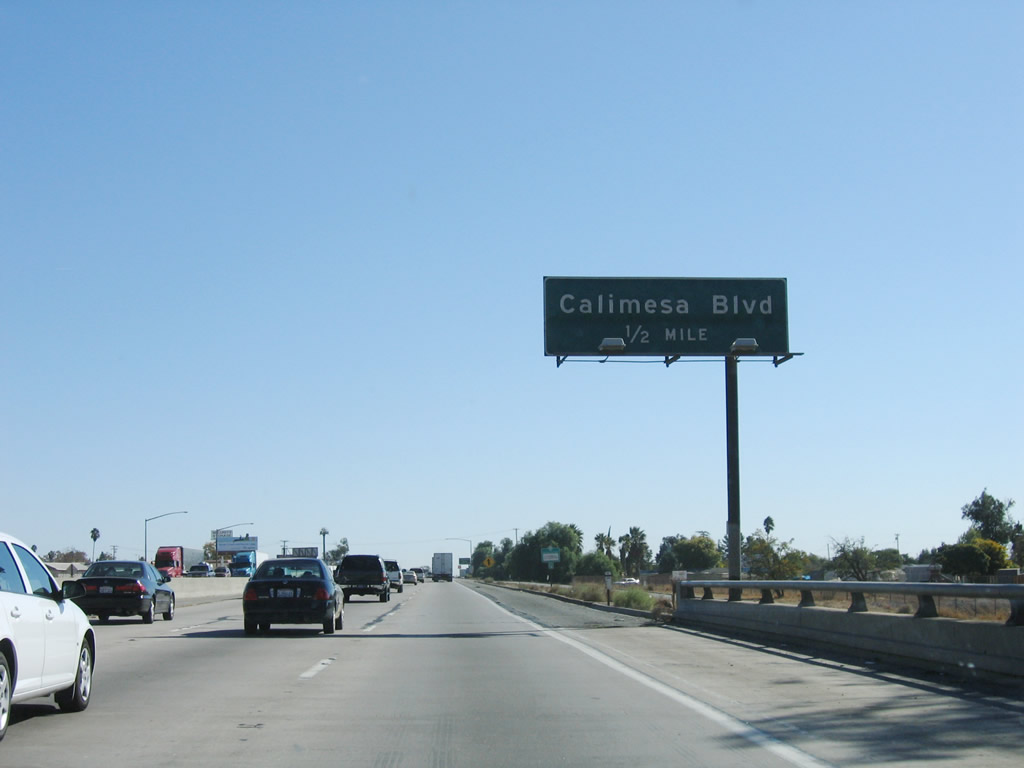
The next exit along Interstate 10 east is Exit 88, Calimesa Boulevard and Fifth Street. Photo taken 11/10/06. |
|
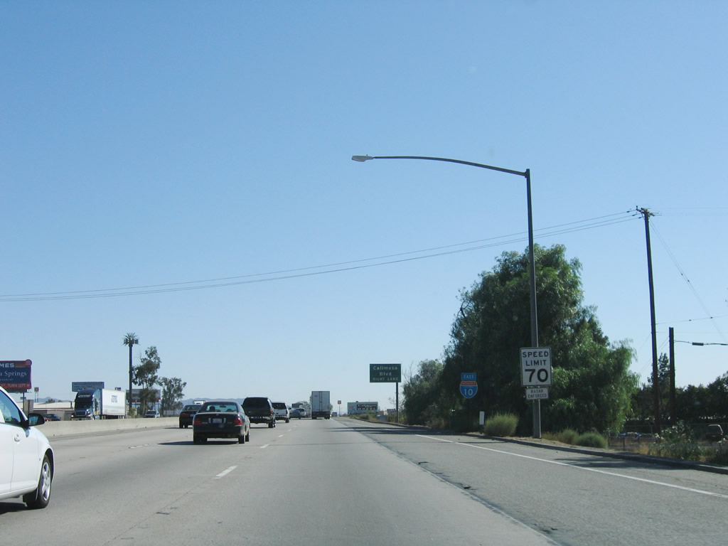
With more rural freeway characteristics, the speed limit of Interstate 10 rises to 70 miles per hour. Photo taken 11/10/06. |
|
Eastbound Interstate 10 approaches Exit 88, Calimesa Boulevard and Fifth Street. Photo taken 11/10/06. |
|
Soon thereafter, eastbound Interstate 10 reaches Exit 88, Calimesa Boulevard and Fifth Street. Photo taken 11/10/06. |
|
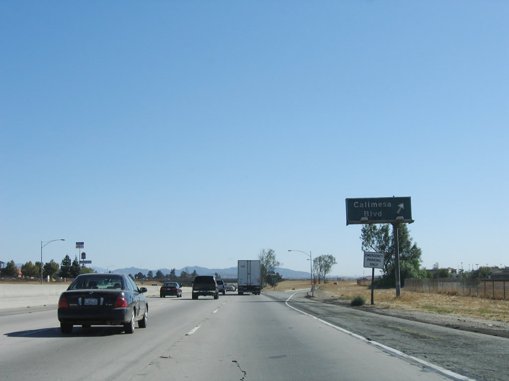
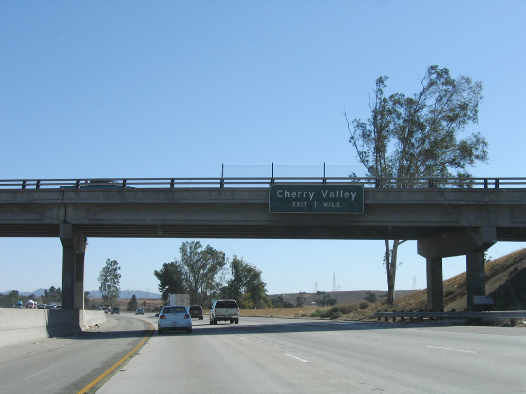
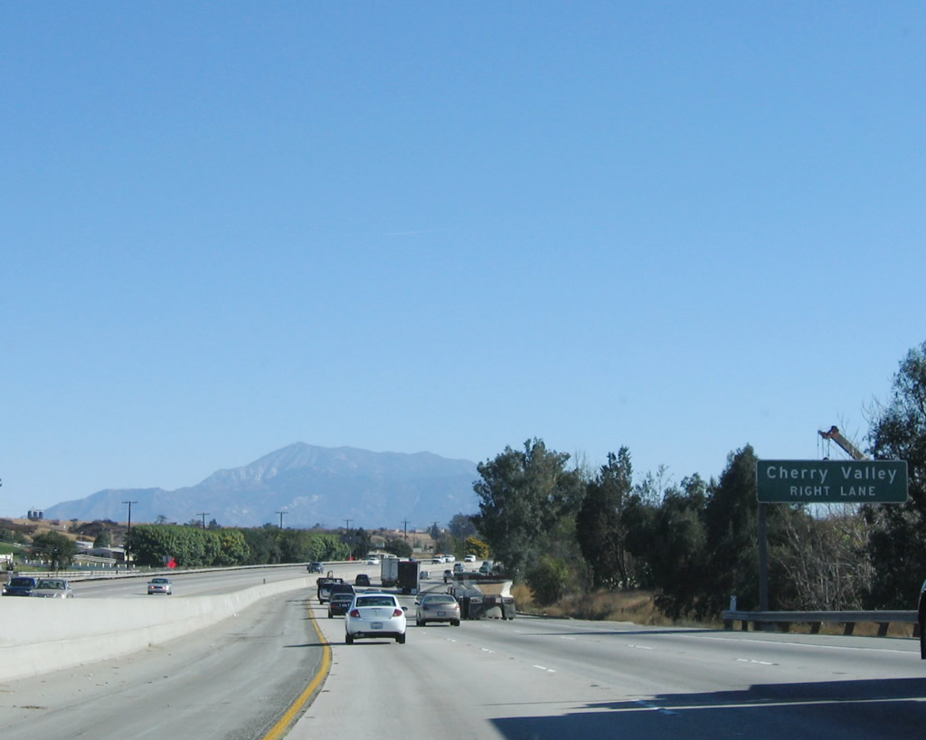
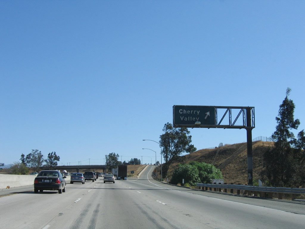
The next exit along Interstate 10 east is Exit 90, Cherry Valley Boulevard. This sign is posted on the Singleton Road overpass, which has access from westbound Interstate 10 but offers no access from eastbound Interstate 10. An on-ramp merge is visible in the distance. Photo taken 11/10/06. |
|
Mount San Jacinto dominates the view as Interstate 10 continues southeast toward its next interchange, Exit 90, Cherry Valley Boulevard. Photo taken 11/10/06. |
|
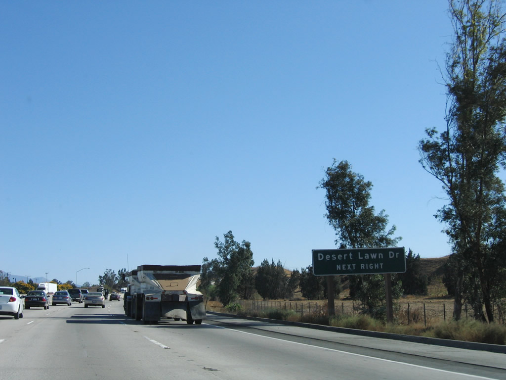
Use Exit 90 to Desert Lawn Drive, which is a frontage road along the southwestern side of the freeway. Photo taken 11/10/06. |
|
Eastbound Interstate 10 reaches Exit 90, Cherry Valley Boulevard. Photo taken 11/10/06. |
|
An Interstate 10 east reassurance shield (new angular style) is posted after the on-ramp from Cherry Valley Boulevard. Photo taken 11/10/06. |
|
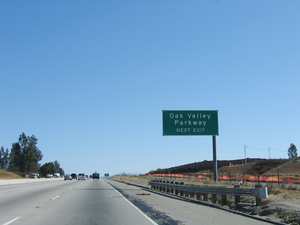
The next exit along Interstate 10 east is Exit 92, Oak Valley Parkway and San Timeteo Canyon Road (1.50 miles). This sign is posted on the Brookside Avenue overpass. Accommodations have been made to allow a future interchange at Brookside Avenue should the need arise in the future. Photo taken 11/10/06. |
|
Another set of Southern California Edison power lines cross over Interstate 10 (mostly 230kV). Photo taken 11/10/06. |
|
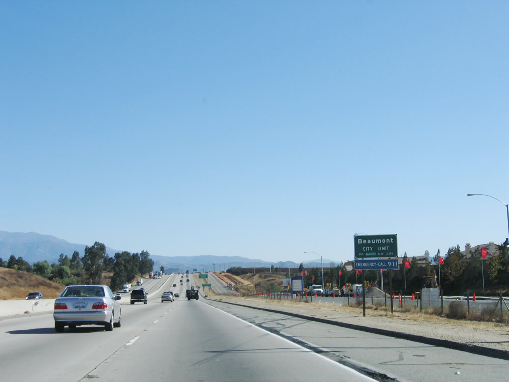
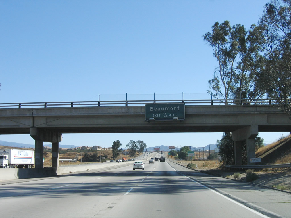
Interstate 10 leaves the city of Calimesa and enters the city of Beaumont. The population of Beaumont was 11,384 people as of the 2000 Census, but new housing developments have increased the population significantly in the ensuing eight years. Incorporated on November 18, 1912, Beaumont is located near the San Gorgonio Pass, which separates Mount San Gorgonio on the north from Mount San Jacinto on the south. Interstate 10 will pass through this gap into the mountains at a relatively low elevation (as compared to other mountain passes). Sitting at an elevation of 2,612 feet, Beaumont sits at the confluence of Interstate 10, California 60 (Moreno Valley Freeway), and California 79 (Lamb Canyon Road). Photo taken 11/10/06. |
|
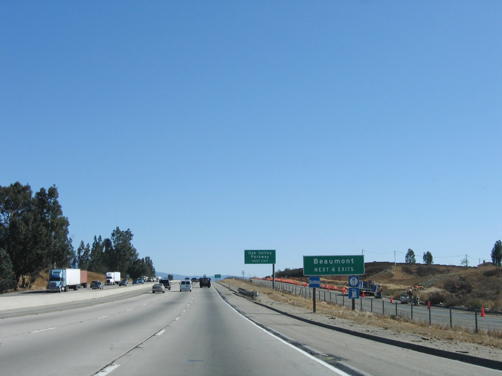
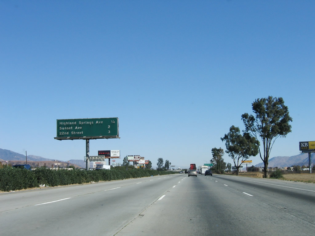
The next four exits all serve the city of Beaumont: Exit 92, Oak Valley Parkway and San Timeteo Canyon Road; Exit 93, California 60 (Moreno Valley Freeway) west and Sixth Street (Old U.S. 60-70-99) east; Exit 94, California 79 (Beaumont Avenue); and Exit 96, Highland Springs Avenue. Photo taken 11/10/06. |
|
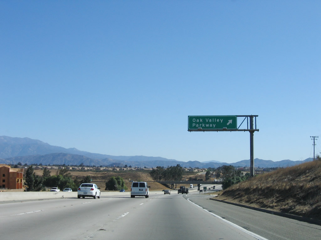
Despite the reflective sign posted for Exit 92, Oak Valley Parkway (and San Timeteo Canyon Road), no exit number is signed on this advance sign. Photo taken 11/10/06. |
|
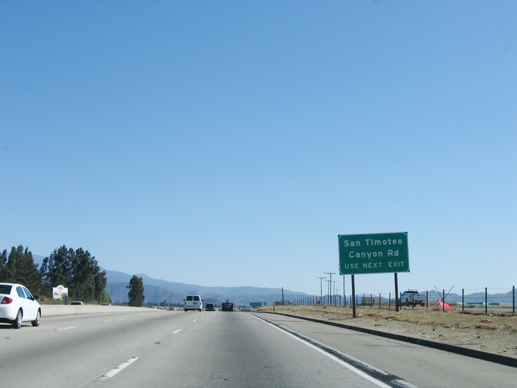
Exit 92 also serves San Timeteo Canyon Road, which travels west along the Union Pacific Railroad into the Norton Younglove Reserve in the Badlands. San Timeteo Canyon Road generally parallels Interstate 10 northwest back to Loma Linda. Photo taken 11/10/06. |
|
Eastbound Interstate 10 reaches Exit 92, Oak Valley Parkway east and San Timeteo Canyon Road west. Again this sign is reflective but does not have an exit number. This is because the sign was posted in 2001, which is prior to the exit number directive. Photo taken 11/10/06. |
|
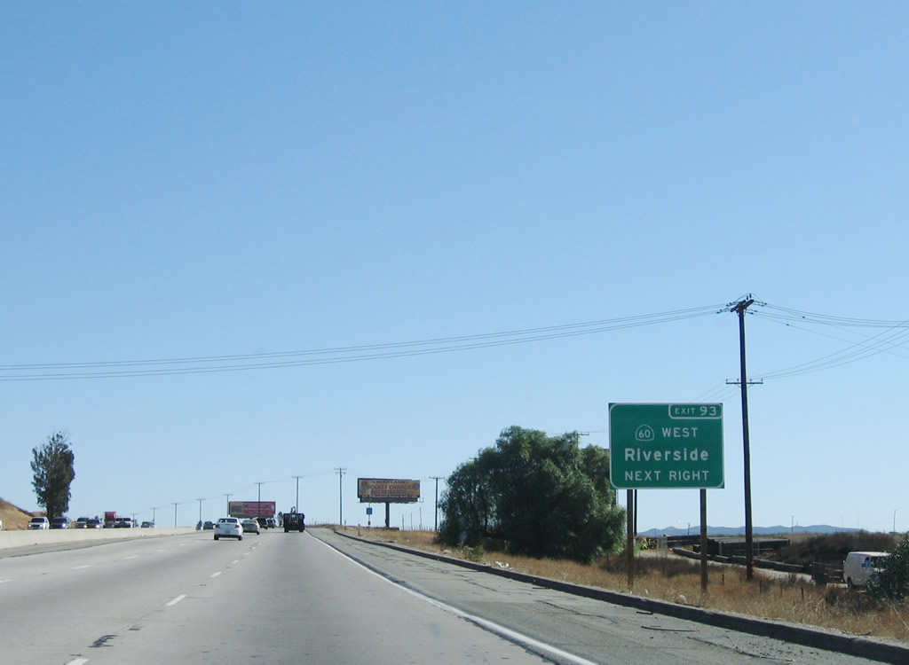
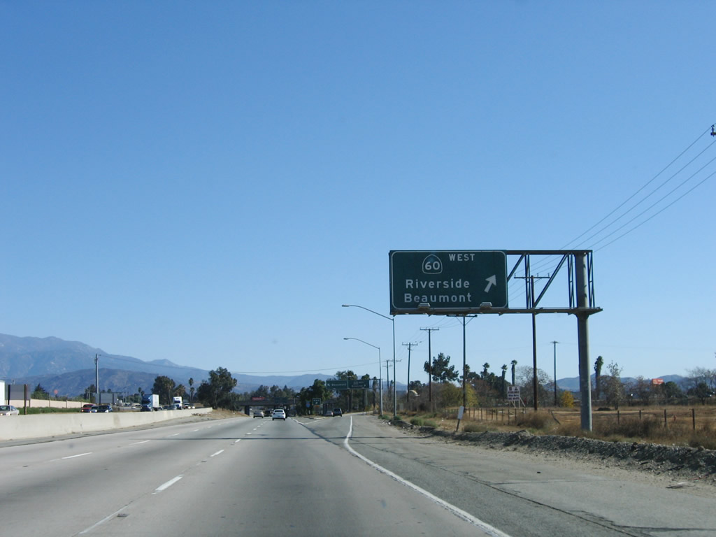
The next exit along Interstate 10 east is Exit 93, California 60 (Moreno Valley Freeway) west and Sixth Street east to Beaumont. This first sign is an old, button-copy sign that only indicates the city, but does not mention California 60. Photo taken 11/10/06. |
|
Use Exit 93 to California 60 (Moreno Valley Freeway) west to Riverside. California 60 travels west through the Badlands to the city of Moreno Valley, connects with Interstate 215 in Riverside, then continues west toward Pomona and East Los Angeles before ending at Interstate 10 (Santa Monica Freeway) south of Downtown Los Angeles. This reflective exit number sign was placed in 2002. Photo taken 11/10/06. |
|
Eastbound Interstate 10 reaches Exit 93, California 60 (Moreno Valley Freeway) west and Sixth Street east to Beaumont. Photo taken 11/10/06. |
|
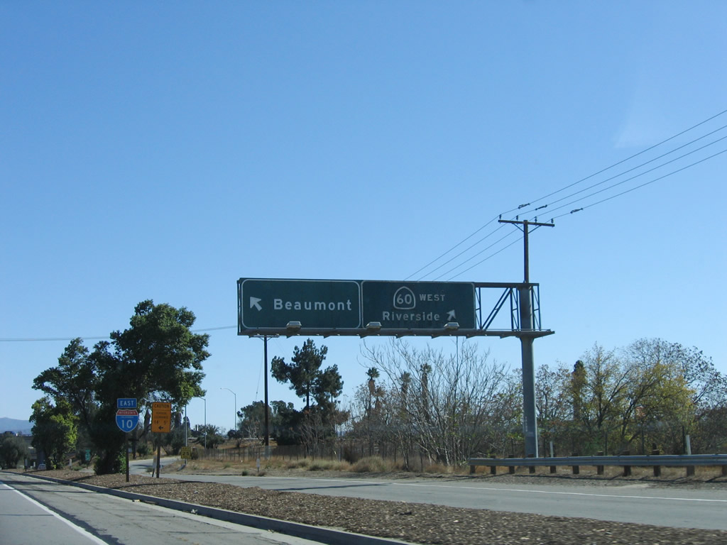
The off-ramp splits between Sixth Street to Beaumont (left lane) and California 60 (Moreno Valley Freeway) west to Riverside. Photo taken 11/10/06. |
|
The next exit along Interstate 10 east is Exit 94, California 79 (Beaumont Avenue) (0.75 mile). This sign is posted prior to passing under the California 60 freeway ramps, and Interstate 10 will finally turn from southeast to due east once again. California 79 leads south toward Hemet, Temecula, and Julian from this interchange. Photo taken 11/10/06. |
|
With Mount San Jacinto still in the distance, traffic from California 60 east merges onto Interstate 10 east. Once again, Interstate 10 widens to four eastbound lanes. Photo taken 11/10/06. |
|
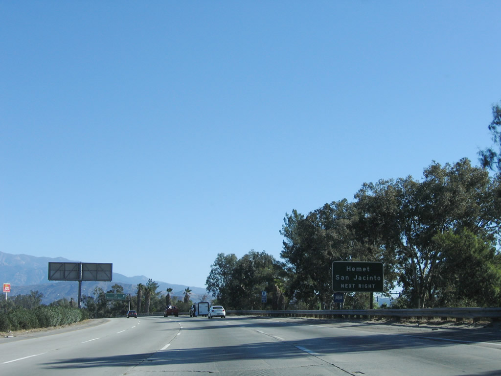
California 79 travels between Riverside and San Diego Counties. The state route follows Lamb Canyon Road, Sanderson Avenue, and Ramona Expressway south through Gilman Hot Springs to San Jacinto and Hemet. After a brief merge with California 74, southbound California 79 follows Winchester Road southwest to Temecula and joins Interstate 15 south. At Temecula Parkway, California 79 departs southeast toward Warner Springs, then turns south toward Julian and Descanso before ending at Interstate 8 Exit 40. Photo taken 11/10/06. |
|
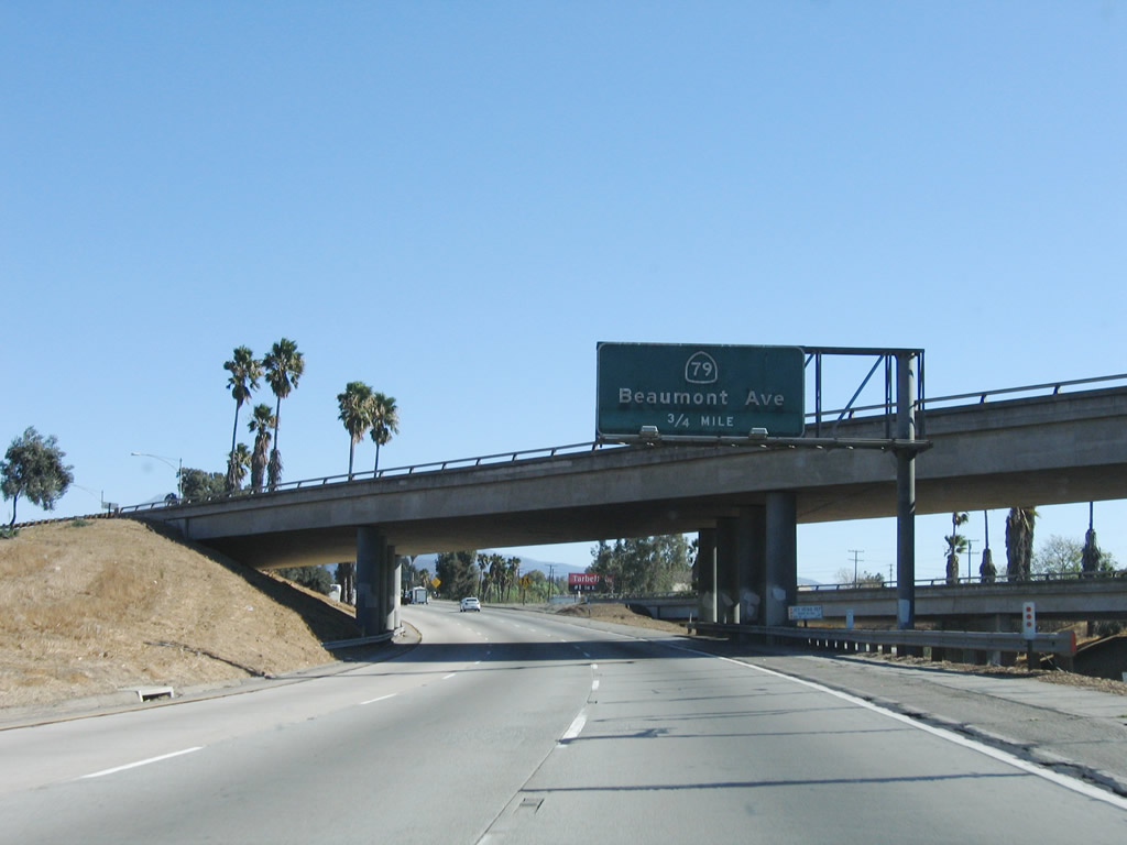
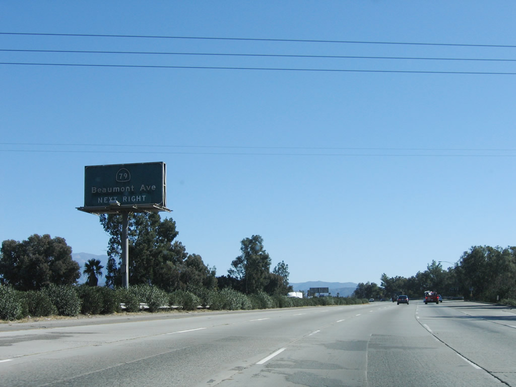
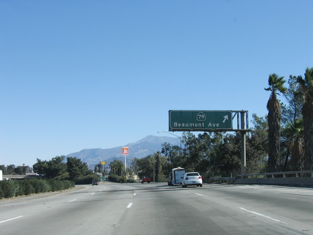
Use Beaumont Avenue north to Cherry Valley and Oak Glen. Photo taken 11/10/06. |
|
Follow California 79 (Beaumont Avenue) south to San Jacinto and Hemet. Photo taken 11/10/06. |
|
Eastbound Interstate 10 reaches Exit 94, California 79 (Beaumont Avenue) south and Beaumont Avenue north. Photo taken 11/10/06. |
|
This view shows eastbound Interstate 10 at the Beaumont Avenue interchange in the city of Beaumont. Photo taken 11/10/06. |
|
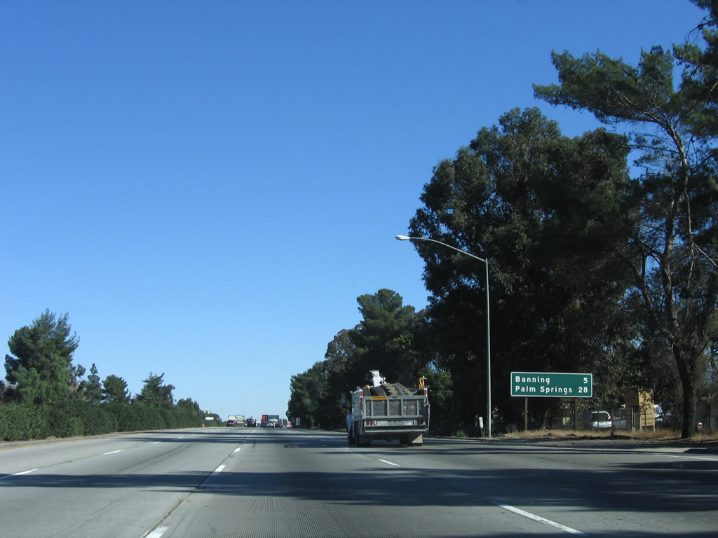
This mileage sign provides the distance to Banning (five miles) and Palm Springs (28 miles). Around this point, Interstate 10 reaches its highest summit in the San Gorgonio Pass area at an elevation of 2,600 feet. The freeway will now gradually descend toward Cabazon and Palm Springs. Photo taken 11/10/06. |
|
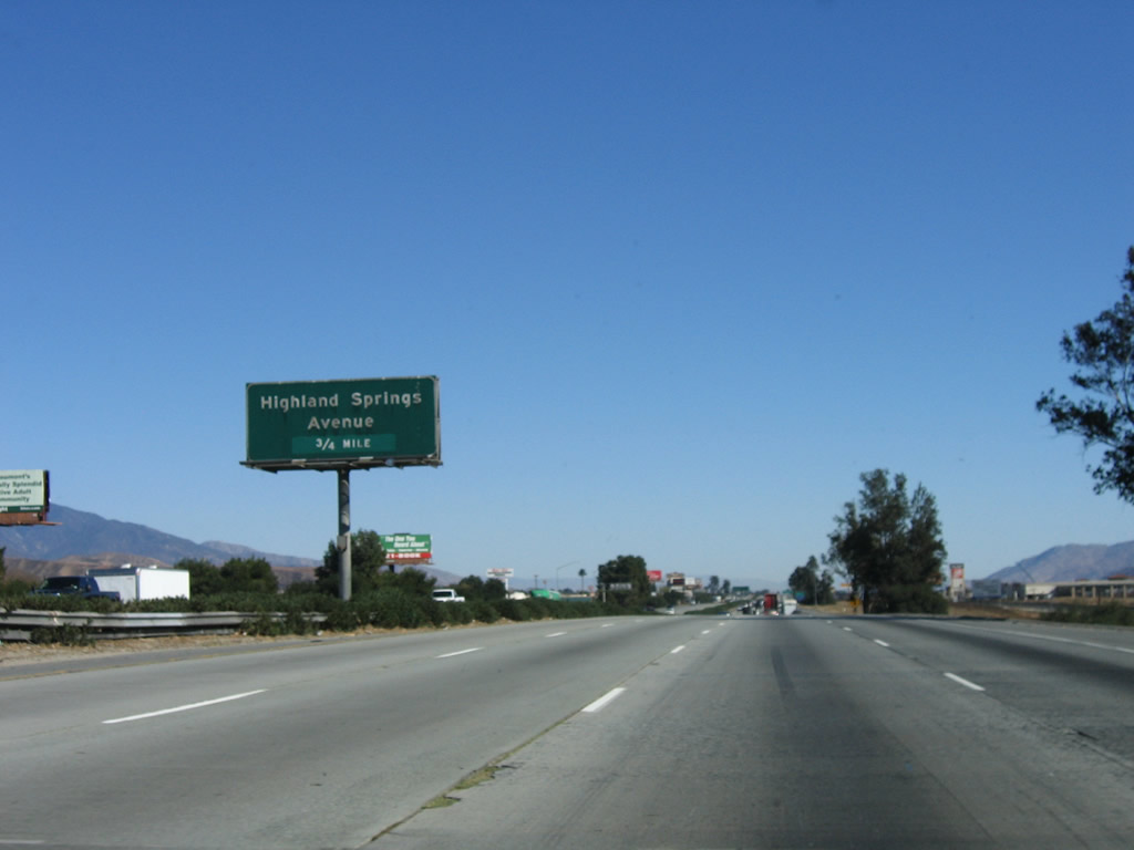
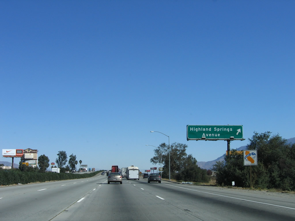
The next exit along Interstate 10 east is Exit 96, Highland Springs Avenue (0.75 mile). Photo taken 11/10/06. |
|
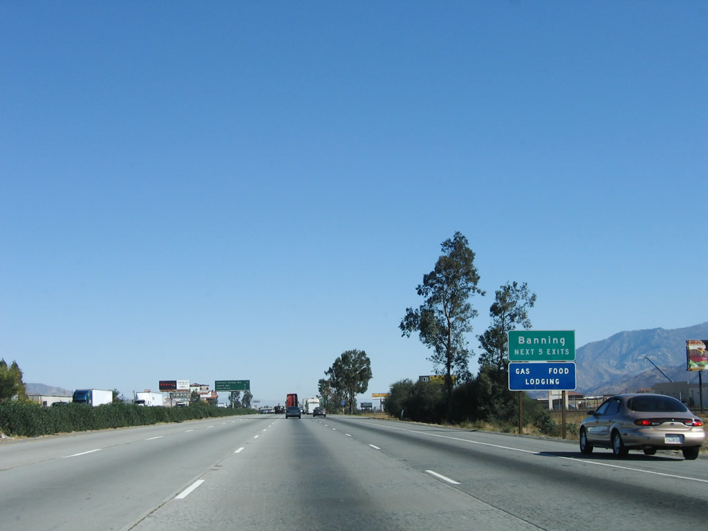
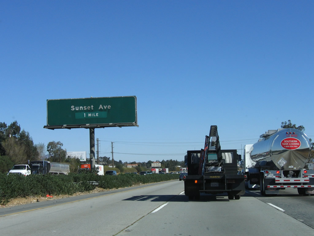
At Exit 96, Interstate 10 will depart the city of Beaumont and enter the city of Banning. The next five exits all serve the city of Banning: Exit 96, Highland Springs Avenue; Exit 98, Sunset Avenue; Exit 99, 22nd Street; Exit 100, California 243/Eighth Street; and Exit 101, Hargrave Street. Photo taken 11/10/06. |
|
This mileage sign provides the distance to the next three exits along Interstate 10 east: Exit 96, Highland Springs Avenue; Exit 98, Sunset Avenue; and Exit 99, 22nd Street. Photo taken 11/10/06. |
|
Eastbound Interstate 10 reaches Exit 96, Highland Springs Avenue. At this point, Interstate 10 leaves Beaumont and enters the city of Banning. Home to 23,562 people as of the 2000 Census, Banning was incorporated on February 6, 1913, and sits at an elevation of 2,349 feet. Photo taken 11/10/06. |
|
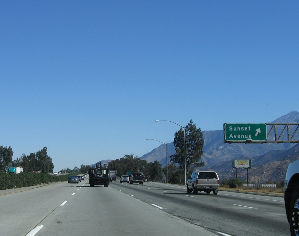
The next exit along Interstate 10 east is Exit 98, Sunset Avenue (one mile). Photo taken 11/10/06. |
|
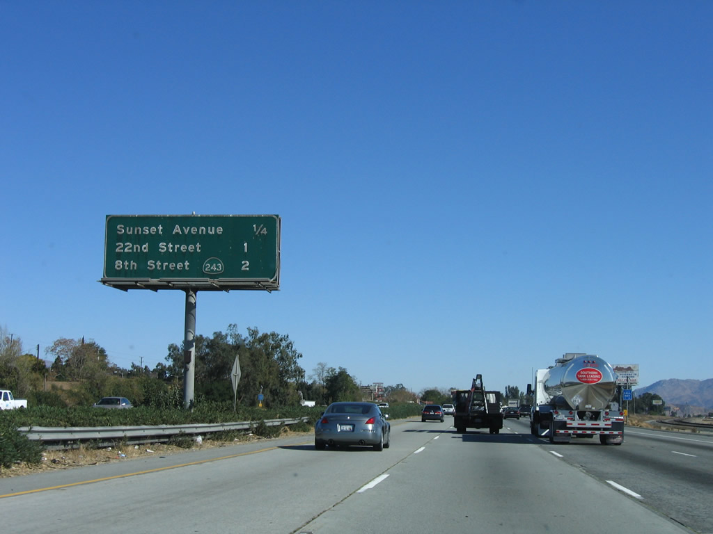
This mileage sign provides the distance to the next three exits along Interstate 10 east: Exit 98, Sunset Avenue; Exit 99, 22nd Street; and Exit 100, California 243/Eighth Street. Photo taken 11/10/06. |
|
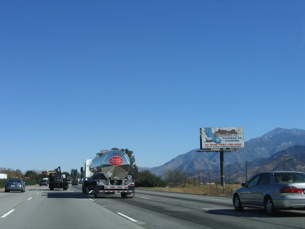
The Banning Chamber of Commerce placed this older billboard, which touts Banning as a place that has "what you need." Massive Mount San Jacinto dominates the background, and it becomes clear that Interstate 10 will pass to the north of that peak. Photo taken 11/10/06. |
|
Eastbound Interstate 10 reaches Exit 98, Sunset Avenue. Photo taken 11/10/06. |
|
The next exit along Interstate 10 east is Exit 99, 22nd Street (one-half mile). Photo taken 11/10/06. |
|
Twenty-second Street travels north to Old U.S. 60-70-99 (Ramsey Street) and downtown Banning. To the south, 22nd Street connects to Westward Avenue. Photo taken 11/10/06. |
|
Eastbound Interstate 10 reaches Exit 99, 22nd Street. Photo taken 11/10/06. |
|
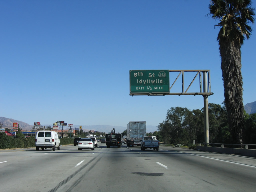
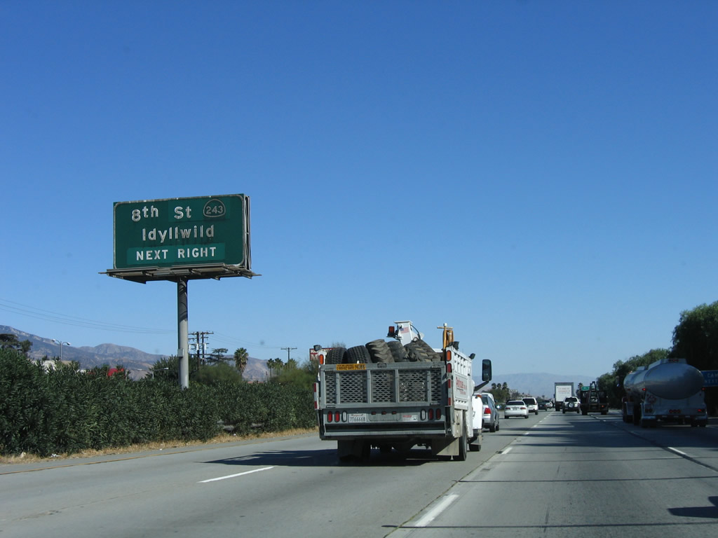
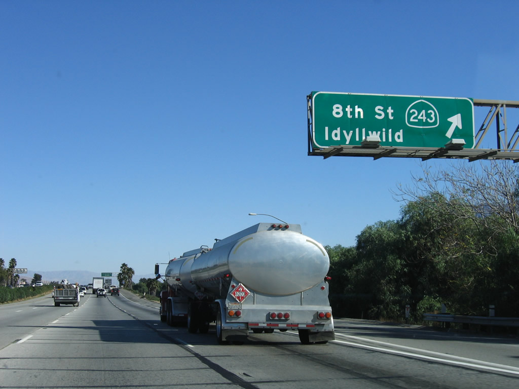
The next exit along Interstate 10 east is Exit 100, California 243/8th Street south to Idyllwild and north to Banning. All motorist services are available at this interchange. Photo taken 11/10/06. |
|
California 243 is former Riverside County R-1; it travels south from Banning to Idyllwild before ending at California 74 (Pines to Palms Highway). Ascending along the west flank of Mount San Jacinto, this mountainous road has ample curves and steep grades. The views and hikes on top can be breathtaking. Photo taken 11/10/06. |
|
Eastbound Interstate 10 reaches Exit 100, California 243/8th Street south to Idyllwild and 8th Street north to Banning. Photo taken 11/10/06. |
|
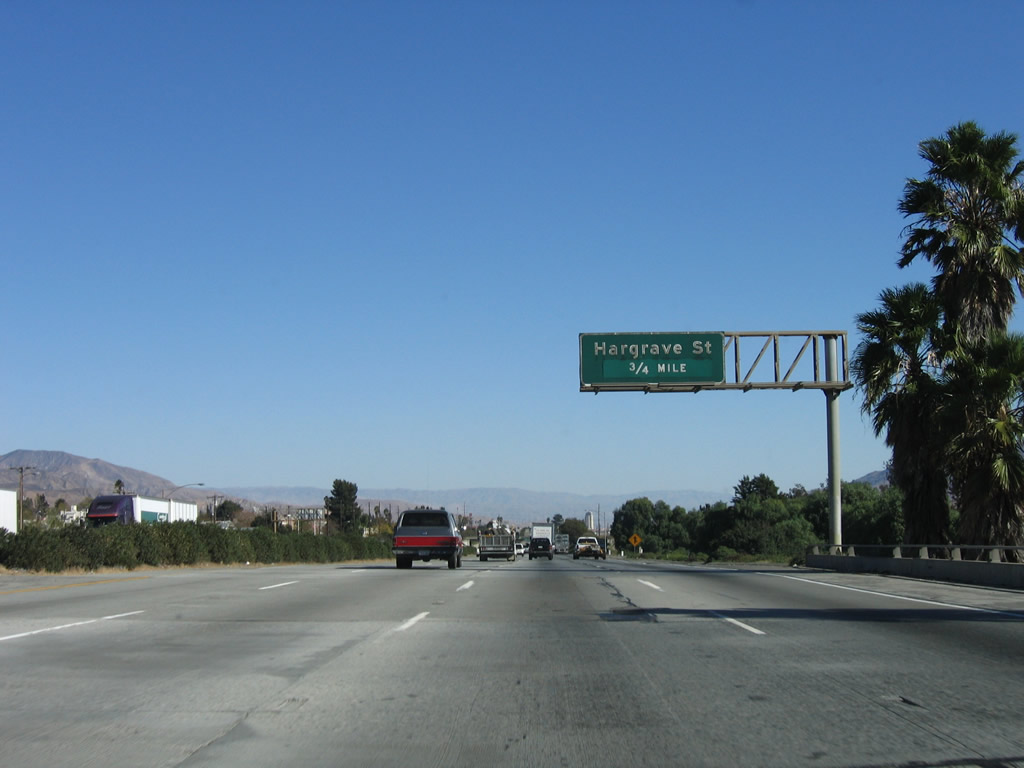
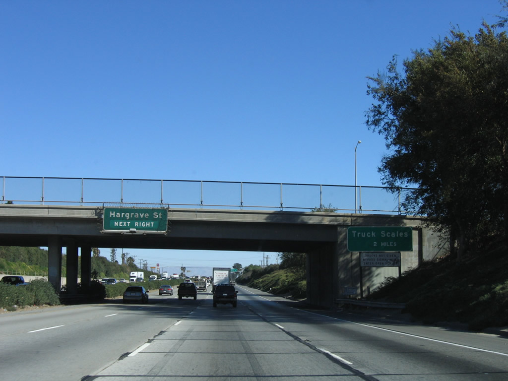
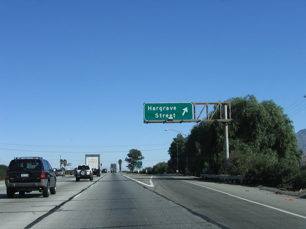
The next exit along Interstate 10 east is Exit 101, Hargrave Street (0.75 mile). Photo taken 11/10/06. |
|
Hargrave Street travels north into Banning and south to Lincoln Street and the Banning Municipal Airport. Photo taken 11/10/06. |
|
Eastbound Interstate 10 reaches Exit 101, Hargrave Street. Photo taken 11/10/06. |
|
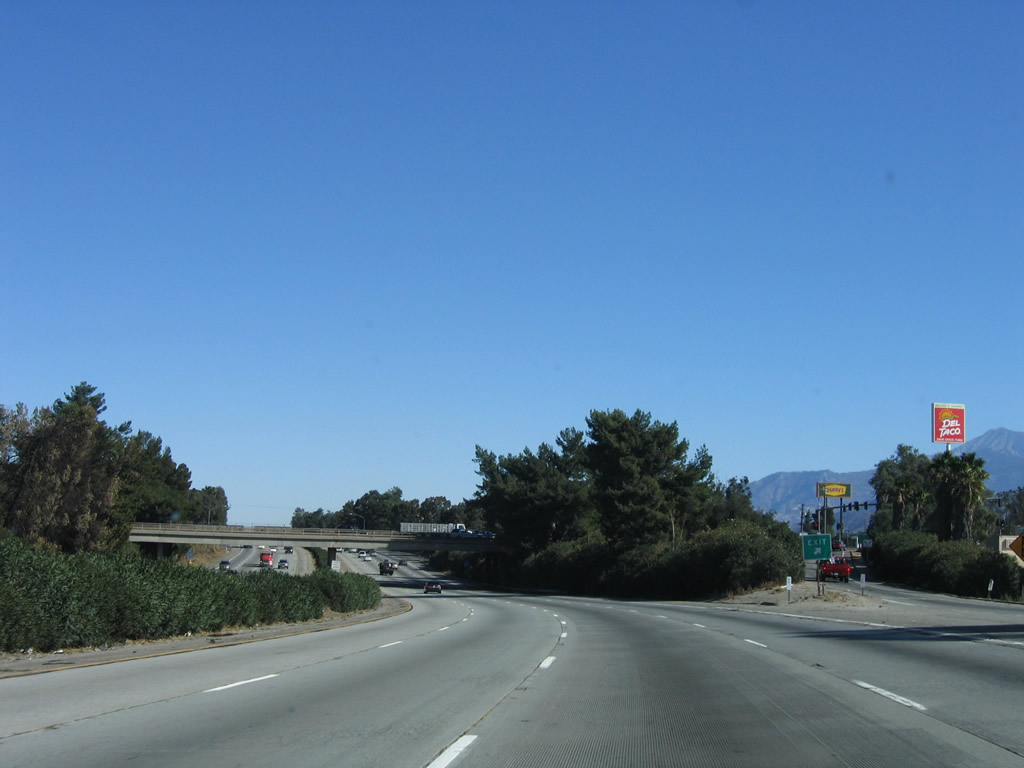
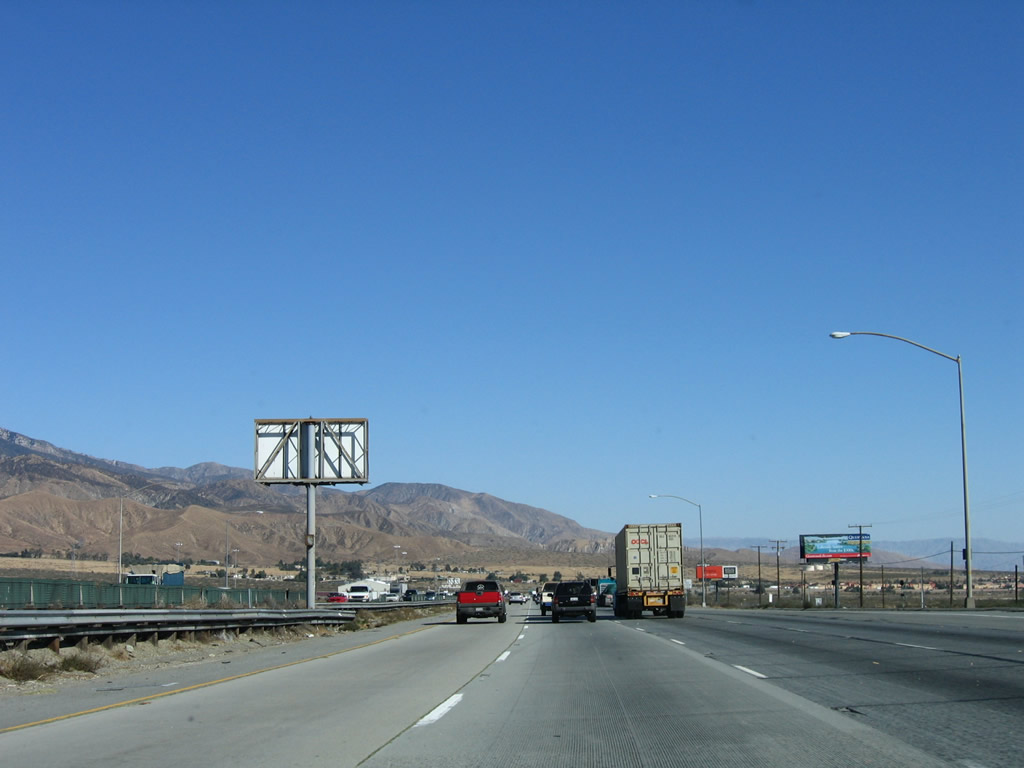
The next exit along Interstate 10 east is a weigh station (truck scales). The terrain changes to true desert scenery, and this view shows the lack of vegetation on the hills in the distance. Desert will be the theme for Interstate 10 for hundreds of miles to come. Interstate 10 leaves the city of Banning and enters unincorporated Riverside County. Photo taken 11/10/06. |
|
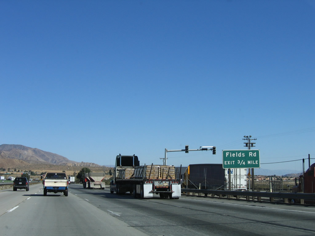
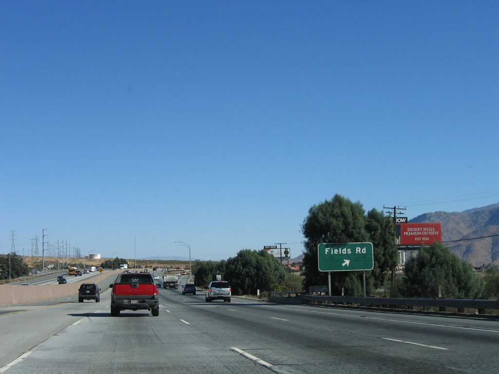
Adjacent to the weigh station is the first advance sign for Exit 103, Fields Road (0.75 mile). Photo taken 11/10/06. |
|
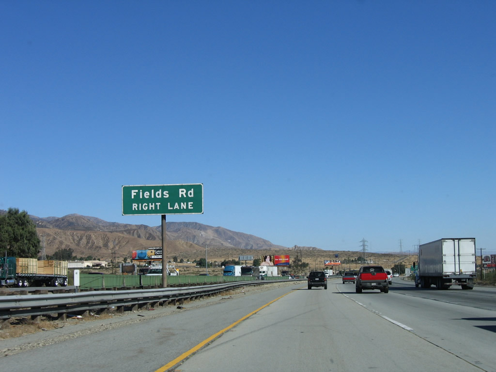
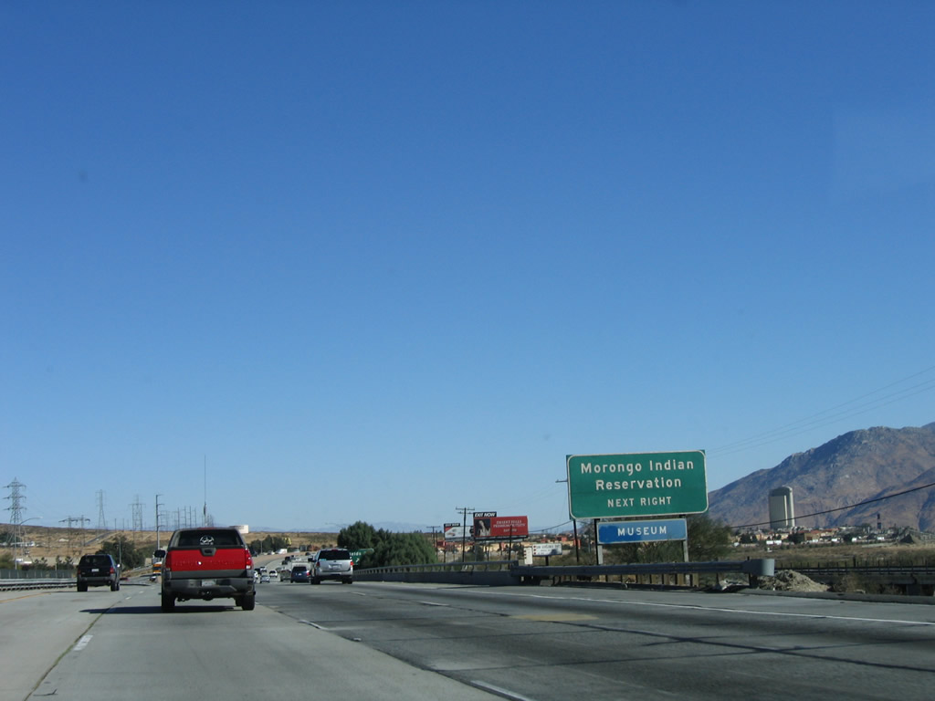
Fields Road travels north to Desert Hills Premium Outlets and the Morongo Indian Reservation. Photo taken 11/10/06. |
|
The Morongo Indian Reservation is generally located north of the freeway. The outlet center and a casino are also close to the freeway. Photo taken 11/10/06. |
|
Eastbound Interstate 10 reaches Exit 103, Fields Road. Photo taken 11/10/06. |
|
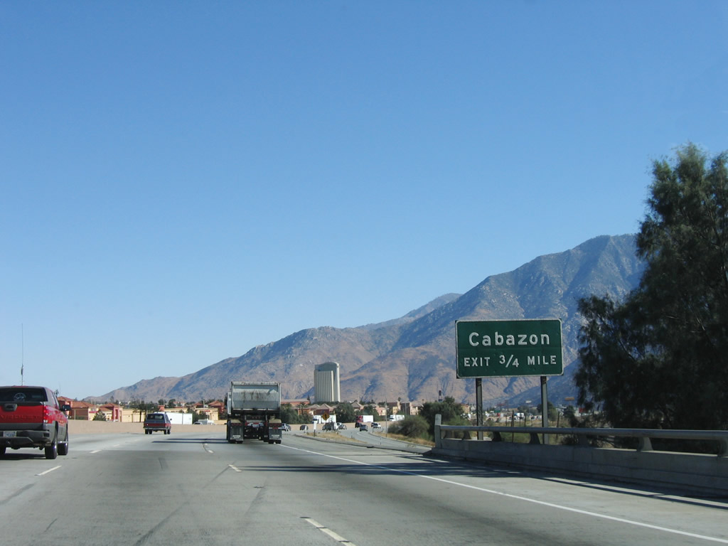
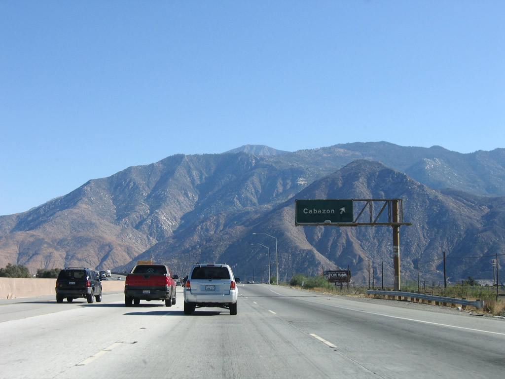
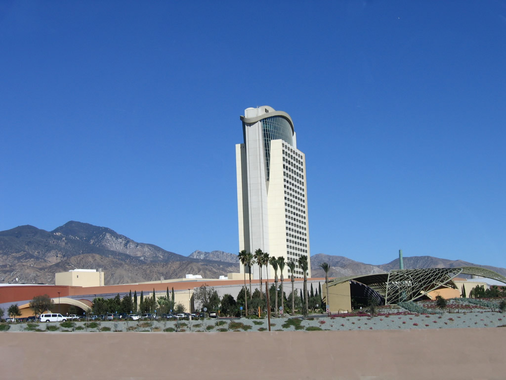
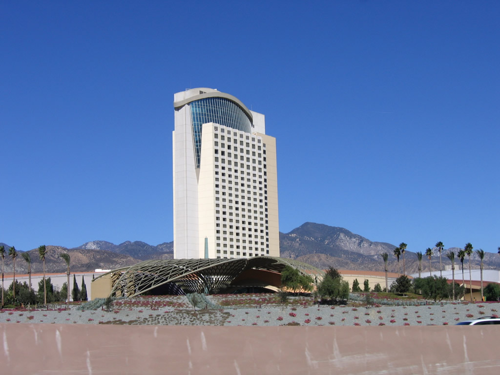
The next exit along Interstate 10 east is Exit 104, Main Street (Old U.S. 60-70-99) east to the unincorporated community of Cabazon. The Morongo Indian Reservation casino-hotel tower comes into view in the distance. Photo taken 11/10/06. |
|
Cabazon is an unincorporated community within Riverside County; it had 2,229 people as of the 2000 Census. This town is notable for the casino owned and operated by the Morongo Band of Mission Indians. A towering 27-story hotel with a large video screen can be seen for miles in either direction on Interstate 10, especially at night. Cabazon is also known for Desert Hills Premium Outlets (see Exit 103) and Claude Bell's dinosaurs, which are large scale dinosaur replicas on the north side of Interstate 10. A Brontosaurus and a Tyrannosaurus Rex are included among the dinosaurs. To reach the dinosaurs, locate the Wheel Inn Diner on Seminole Drive. The dinosaurs have been prominently featured in Cabazon since the mid-1960s at the diner, and they were designed by Knott's Berry Farm designer Claude K. Bell. The two dinosaurs are hollow and habitable inside. Photo taken 11/10/06. |
|
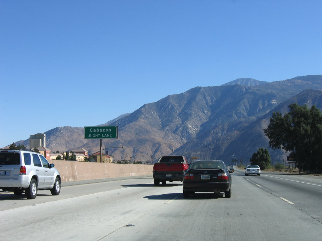
Eastbound Interstate 10 reaches Exit 104, Main Street (Old U.S. 60-70-99) east to the unincorporated community of Cabazon. Mount San Jacinto again dominates the view looking southeast. Photo taken 11/10/06. |
Page Updated October 21, 2008.