
Interstate 80 West - Sacramento County
| Interstate 80 west | |
|---|---|
 |
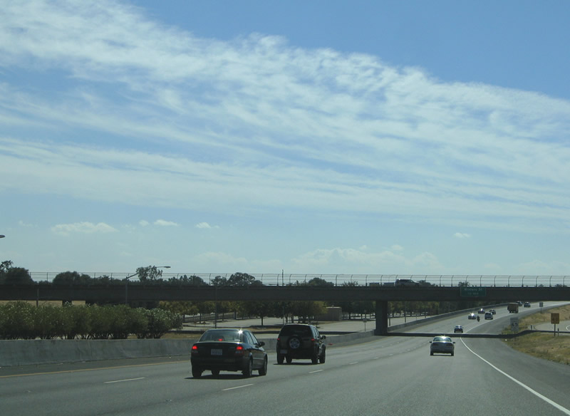
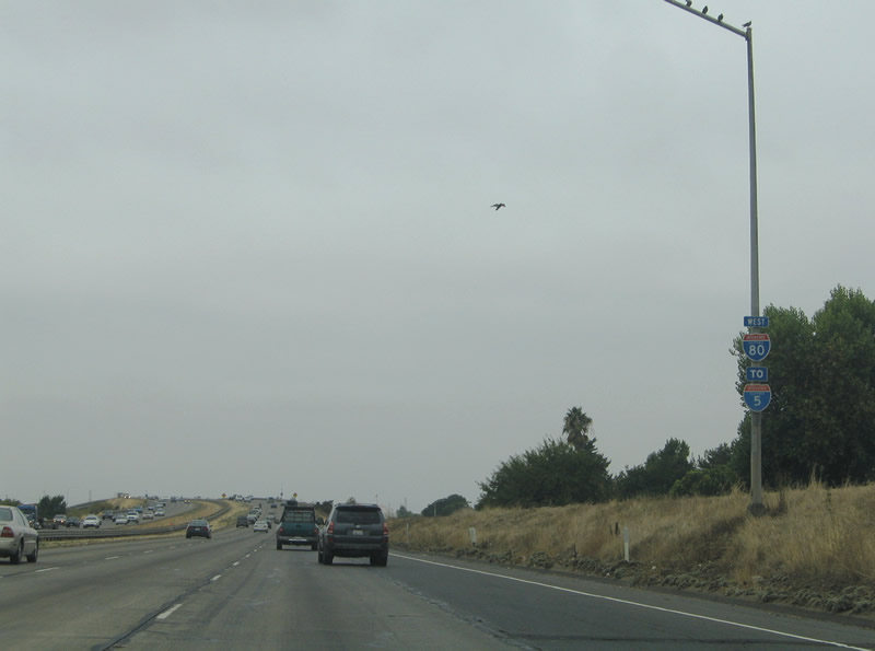
Between Exit 102 (Auburn Boulevard and Riverside Avenue) and Exit 100 (Antelope Road), Interstate 80 leaves the city of Roseville and Placer and enters the city of Citrus Heights (incorporated January 1, 1997, with a population of 83,301 as of the 2010 Census) and Sacramento County (population 1,418,788 as of the 2010 Census). The seat of the county is Sacramento, which is also the capital city of California. Photo taken 07/02/13. |
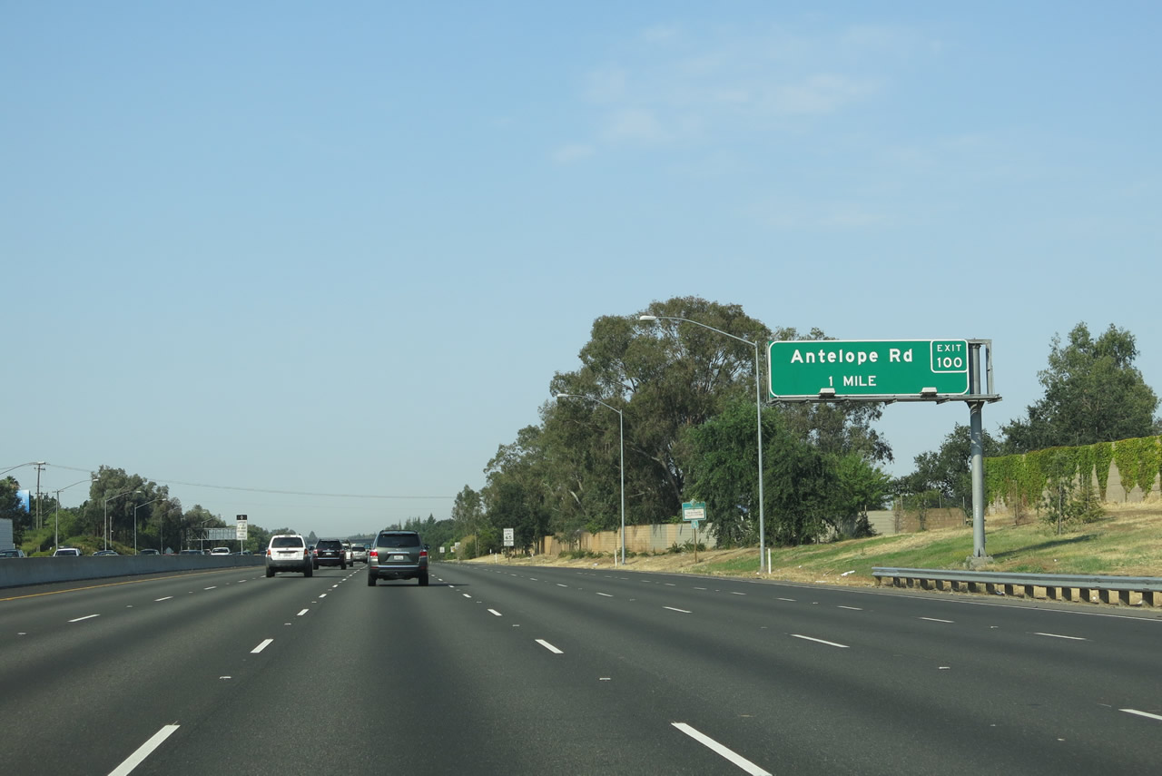 |
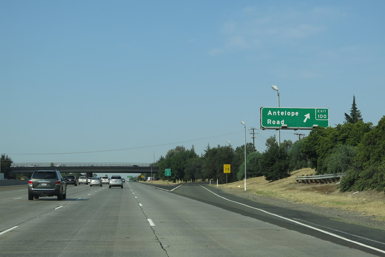
The next interchange along Interstate 80 west is Exit 100, Antelope Road. Photo taken 07/02/13. |
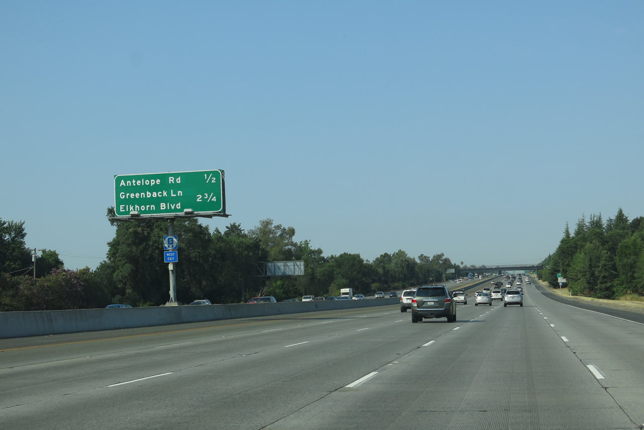 |
This overhead mileage sign along Interstate 80 west provides the distance to two of the next three interchanges: Exit 100, Antelope Road; Exit 99, Weigh Station; and Exit 98, Sacramento County Route E-14 (Greenback Lane) and Elkhorn Boulevard. The weigh station is not indicated on this overhead sign. Five lanes carry Interstate 80 southwest toward Sacramento at this point, including the high occupancy vehicle (carpool) lane. Photo taken 07/02/13. |
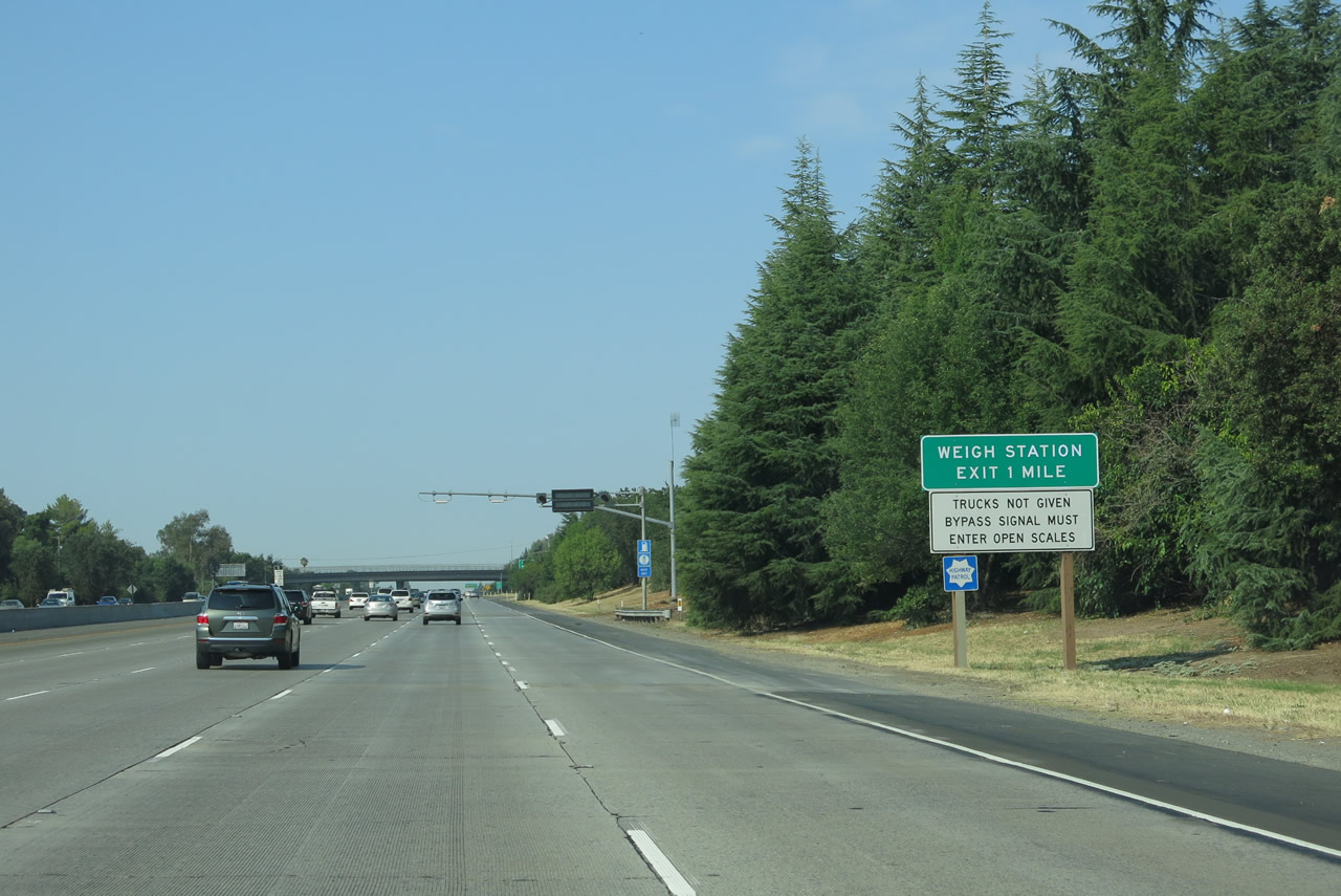 |
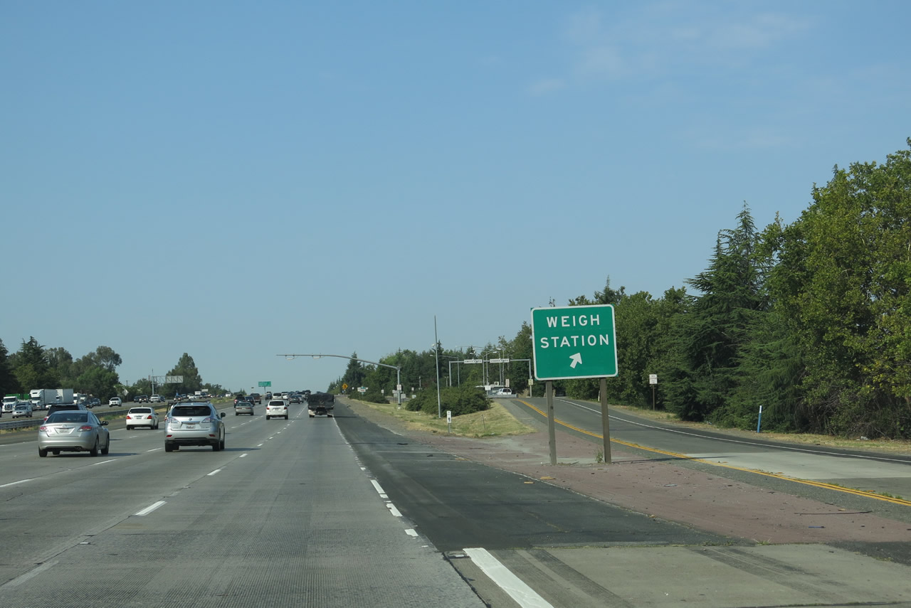
A truck weigh station is located between Exits 100 and 98. This sign is posted just prior to the off-ramp to Antelope Road, which serves the city of Citrus Heights. Photo taken 07/02/13. |
 |
Westbound Interstate 80 reaches Exit 100, Antelope Road. This east-west arterial connects neighborhoods across Citrus Heights. The freeway continues its southwesterly path toward the capital city. Photo taken 07/02/13. |
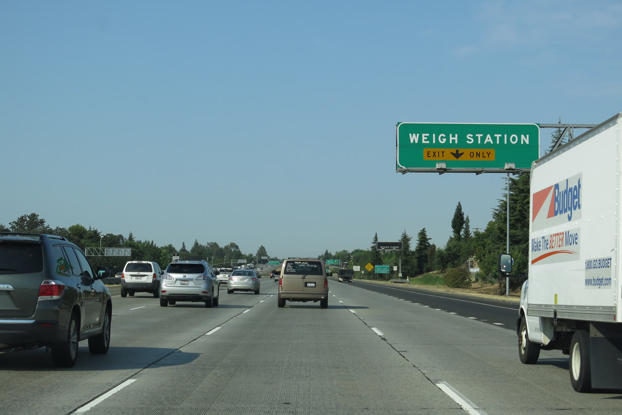 |
The right lane of Interstate 80 west becomes exit only for the truck weigh station (approximately located somewhere near Milepost 99 or 100 but not given a signed exit number). Photo taken 07/02/13. |
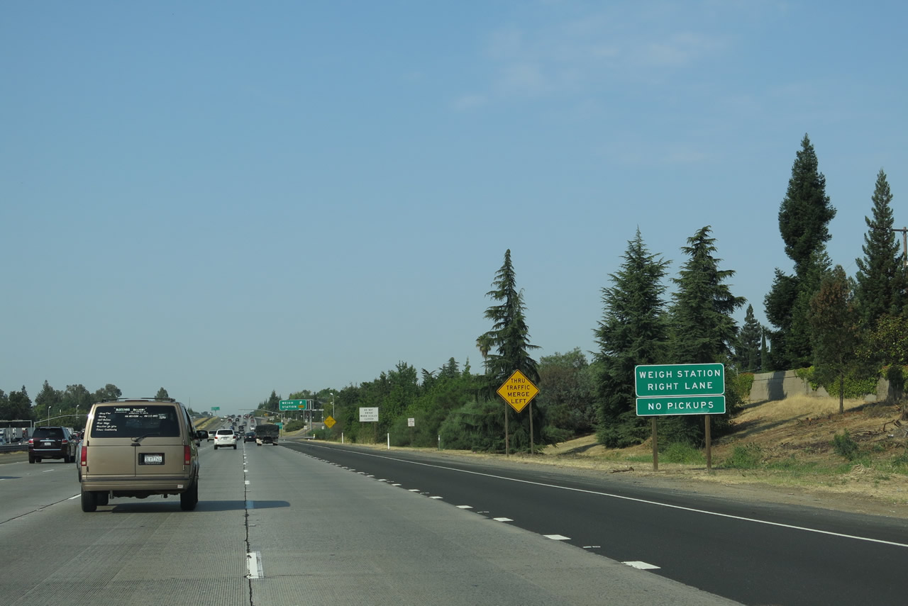 |
This is fairly typical Caltrans weigh station signage. Photo taken 07/02/13. |
 |
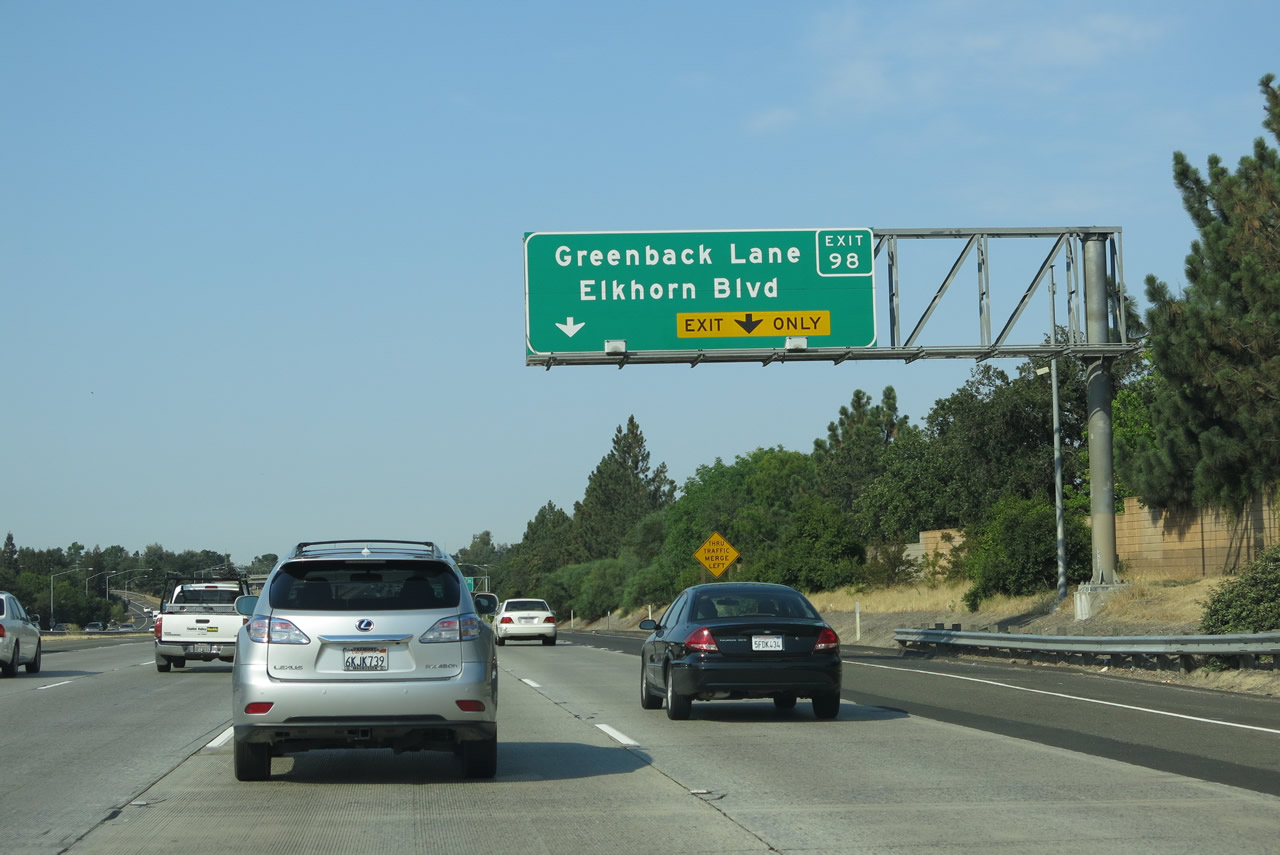
Westbound Interstate 80 meets Exit 99, Weigh Station. A median sign provides the advance notice of Exit 98, Sacramento County Route E-14 (Greenback Lane) and Elkhorn Boulevard. Photo taken 07/02/13. |
 |
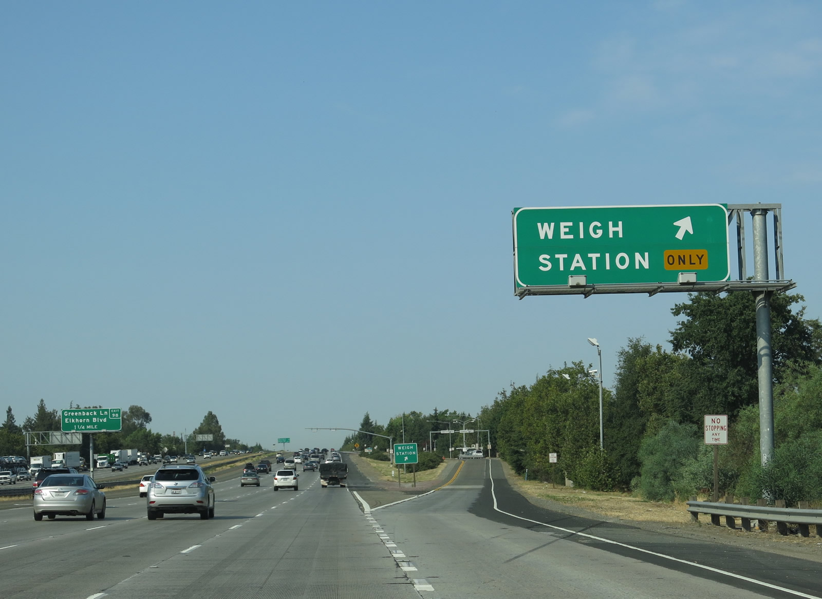
The gore point signage reads "weigh station" rather than "exit." Photo taken 07/02/13. |
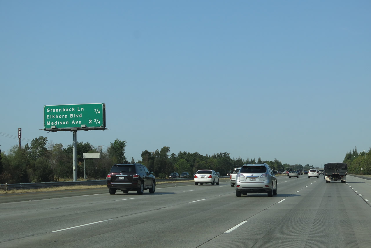 |
This mileage sign along Interstate 80 west provides the distance to the next two interchanges: Exit 98, Sacramento County Route E-14 (Greenback Lane) and Elkhorn Boulevard and Exit 96, Madison Avenue. Photo taken 07/02/13. |
 |
The right two lanes of Interstate 80 west connect to Exit 98, Sacramento County Route E-14 (Greenback Lane) east and Sacramento County Route E-14 (Elkhorn Boulevard) west. CR E-14 is an east-west county route that begins at CR E-3 (Hazel Avenue) in Orangevale and follows Greenback Lane west to the interchange with Interstate 80 in Citrus Heights. (Some E-14 shields may be found indicating CR E-14 extends further to the east, perhaps as far as Folsom, but the official designation ends at Hazel Avenue per Daniel Faigin's California Highways page. At Interstate 80, CR E-14 becomes known as Elkhorn Boulevard, and CR E-14 continues west to end at California 99. Photo taken 07/02/13. |
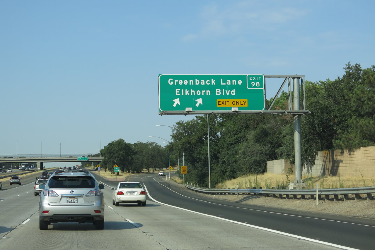 |
Westbound Interstate 80 reaches Exit 98, Sacramento County Route E-14 (Greenback Lane) east and Sacramento County Route E-14 (Elkhorn Boulevard) west. Photo taken 07/02/13. |
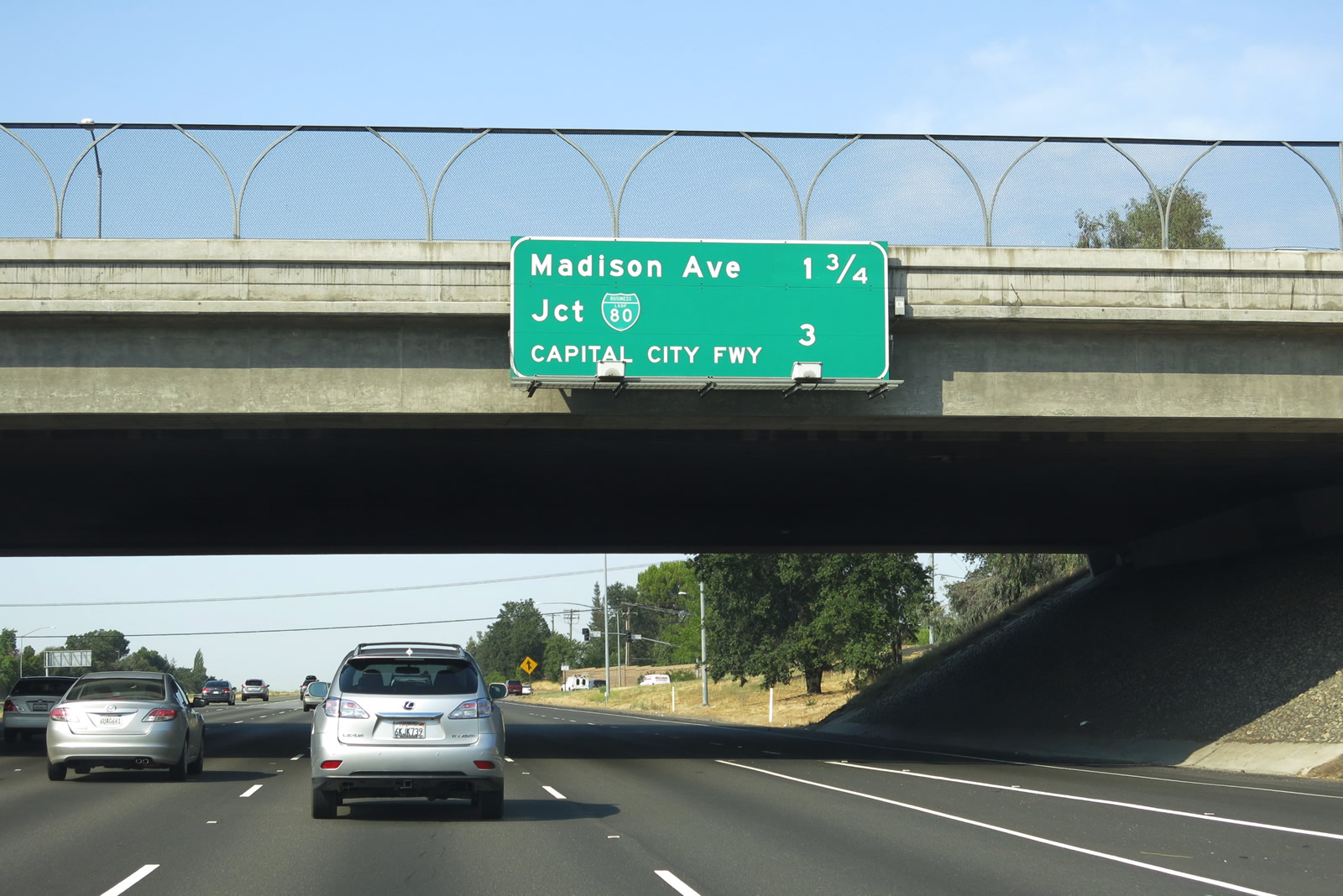 |
Now passing under the Greenback Lane / Elkhorn Boulevard overpass, a mileage sign provides the distance to the next two interchanges along Interstate 80 west: Exit 96, Madison Avenue and Exit 95, Business Loop I-80 (California 51)/Capital City Freeway southwest to downtown Sacramento. Photo taken 07/02/13. |
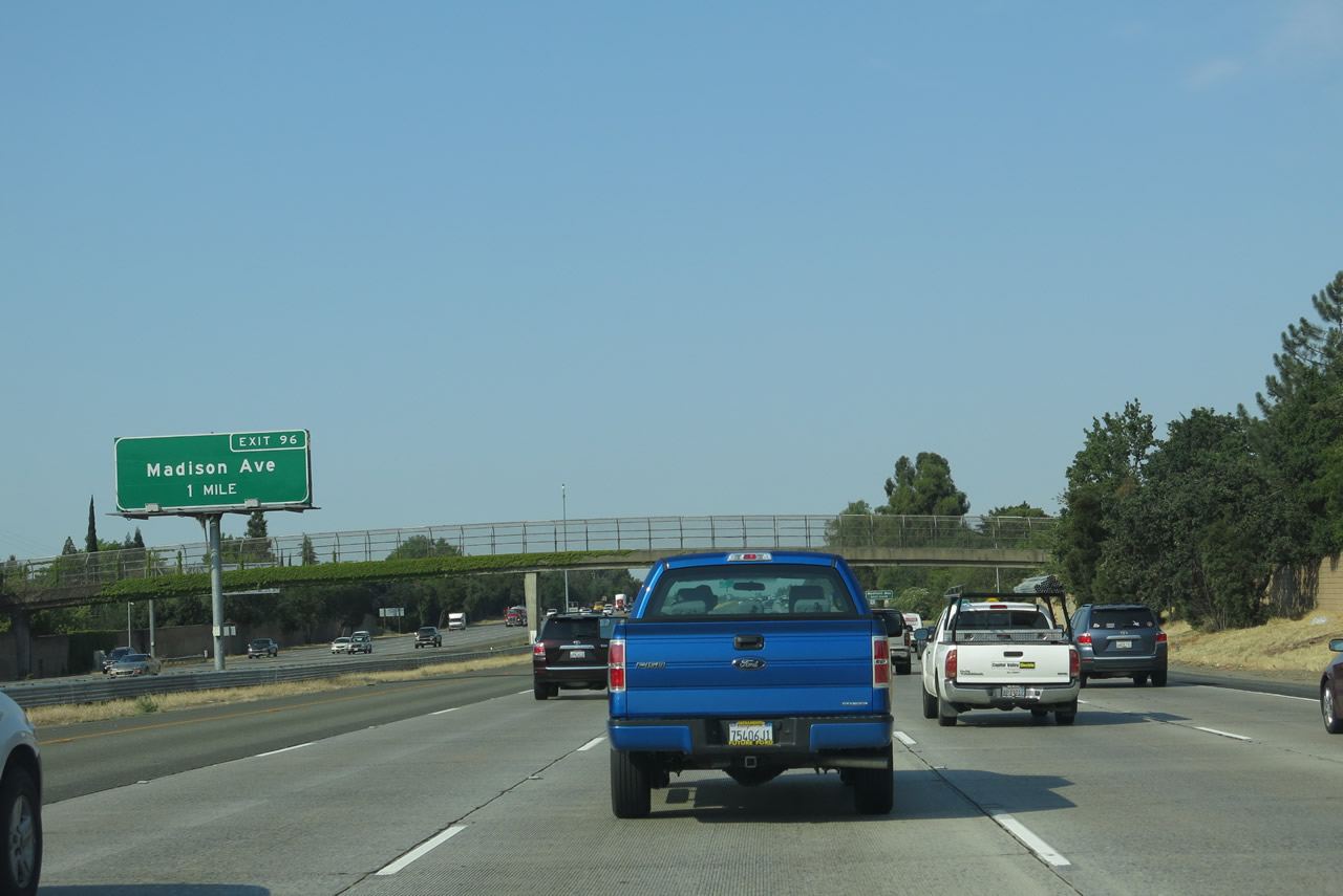 |
Interstate 80 approaches Exit 96, which is a six-ramp parclo interchange with Madison Avenue. A busy, east-west arterial, Madison Avenue travels 11.4 miles between Watt Avenue at North Highlands and Greenback Lane (Sacramento County Route E-14) at Orangevale. Interstate 80 connects with Watt Avenue approximately 1.50 miles west of here (at the split with Business Loop I-80 (Capital City Freeway)). Photo taken 07/02/13. |
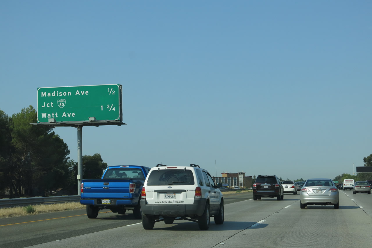 |
Another mileage sign again provides the distance to the next two interchanges along Interstate 80 west: Exit 96, Madison Avenue and Exit 95, Business Loop I-80 (California 51)/Capital City Freeway southwest to downtown Sacramento. This sign also includes the distance to Watt Avenue, which is Exit 14B off of Business Loop I-80. Unlike most off-Interstate business loops, Business Loop I-80 in Sacramento is a freeway for its entire length and thus is assigned its own set of exit numbers. Photo taken 07/02/13. |
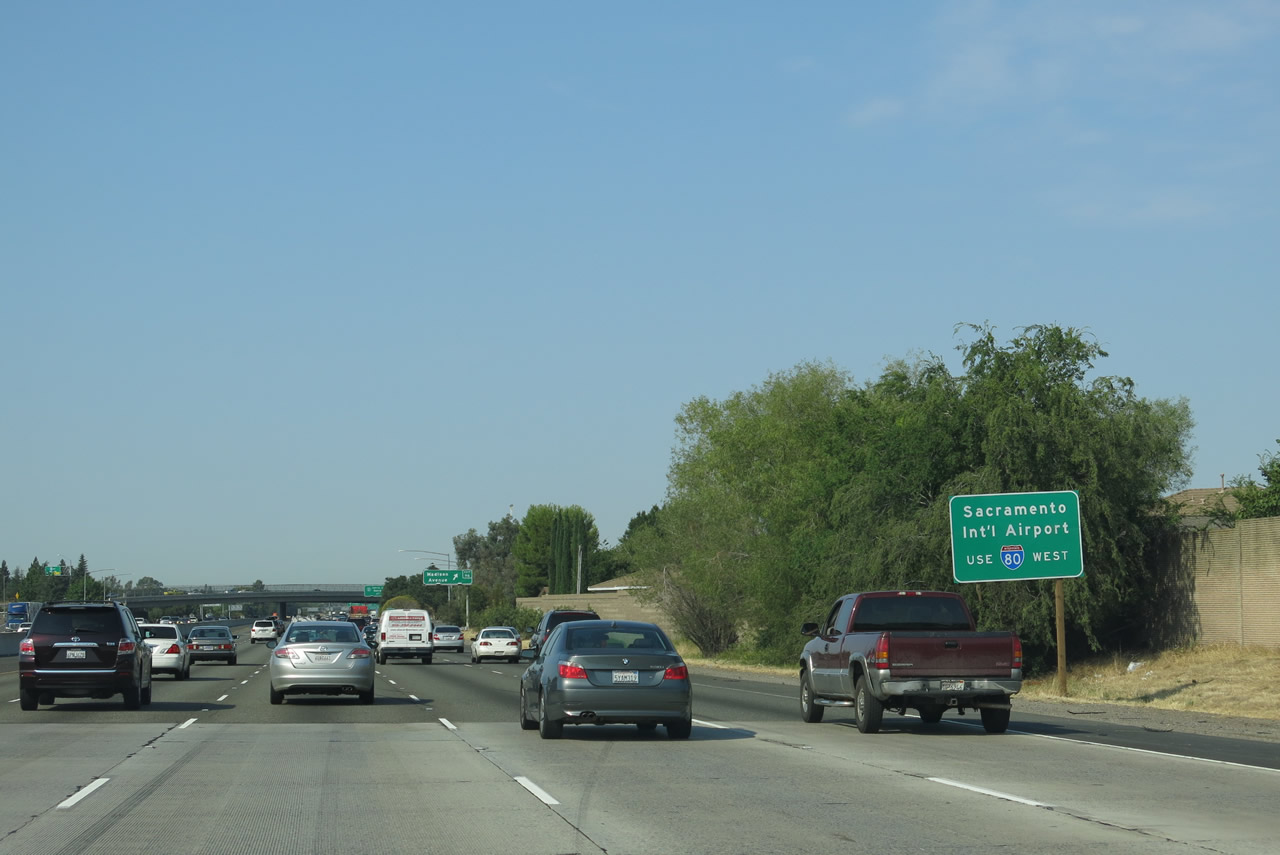 |
Traffic for Sacramento International Airport should use Interstate 80 east to Interstate 5 north, avoiding Business Loop I-80. The airport lies north of Interstate 5 Exit 528 (Airport Boulevard). Photo taken 07/02/13. |
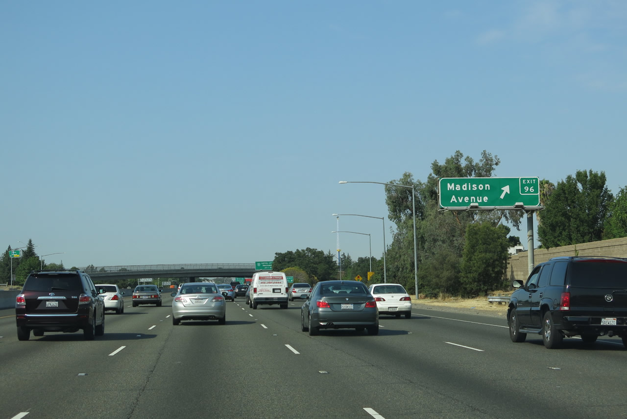 |
Westbound Interstate 80 meets Exit 96, Madison Avenue. To the west of here, Madison Avenue directly connects with Roseville Road, which is another northeast-southwest angled roadway, just like Interstate 80 and Historic U.S. 40-99E (Auburn Boulevard). Roseville Road connects with Watt Avenue and the former McClellan Air Force Base. President Clinton signed the orders to close McClellan Air Force Base, and the installation closed in 2001. To the east, Madison Avenue travels through residential and suburban areas en route to Orangevale and the vicinity of Folsom via Greenback Lane. Connecting roads to the east include Date Avenue, College Oak Drive, and Auburn Boulevard (Historic U.S. 40-99E). Photo taken 07/02/13. |
 |
 |
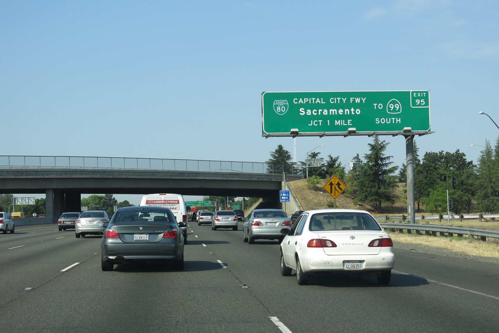
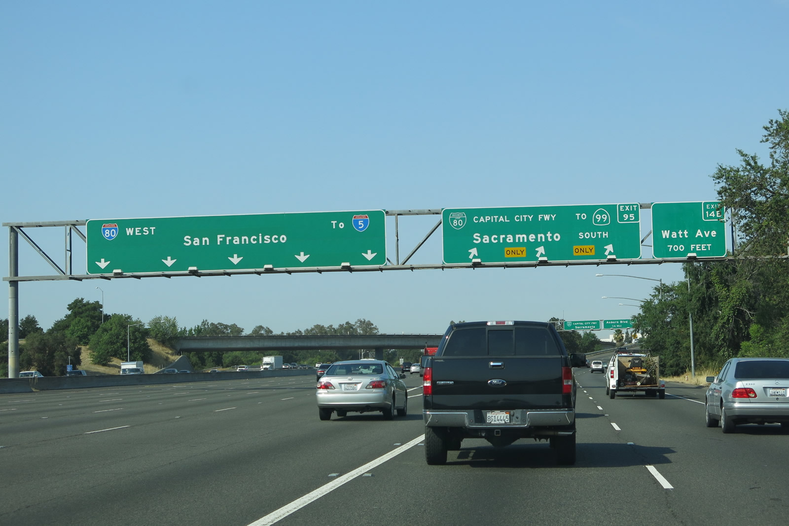
The next exit along Interstate 80 west is Exit 95, Business Loop I-80 and California 51/Capital City Freeway southwest to downtown Sacramento. Originally, the first guide sign for Business Loop I-80 was posted on the Madison Avenue overpass. In winter 2003-2004, it was relocated to its own sign bridge just prior to the overpass. The sign replacement occurred in conjunction with a freeway widening project that was underway. Photos taken 07/02/13 and 01/19/03. |
 |
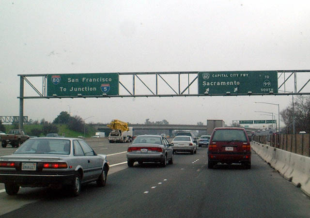
Business Loop I-80 is designated legislatively as California 51 by the state yet ordered signed as a business route by the same legislation. The business loop freeway follows the route of the original Interstate 80 through downtown Sacramento. Numbering changes occurred in 1982, when Interstate 80 was transferred onto the North Sacramento Bypass (also known as the "Across the Top" or "Over the Top" section of Interstate 80). Prior to 1982, the northern bypass was signed as Interstate 880. With the change, Interstate 880 became Interstate 80, and old Interstate 80 became Business Loop I-80 (with the north-south section designated as California 51 and the east-west section designated as U.S. 50). Interstate 880 only disappeared from California for two years; it was recommissioned in the San Francisco Bay Area along the California 17 corridor between Oakland and San Jose in 1984. Photo taken 07/02/13. |
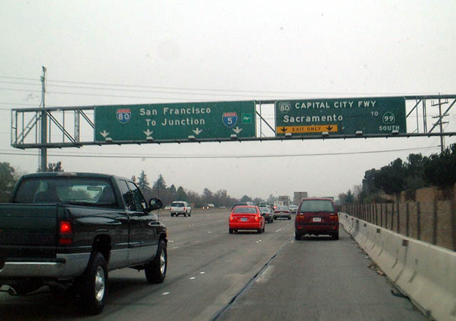 |
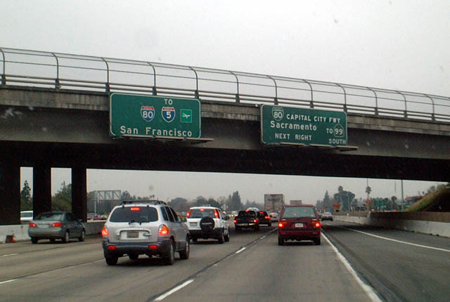
Looking back to 2003, this set of overheads (like the previous set) represents the prior generation of button copy signs for Exit 95. Both the old and new overhead signs advise motorists en route to California 99 south to use Business Loop I-80 west, while motorists en route to Interstate 5 are advised to use Interstate 80 west. The "Capital City Freeway" overlay covers up "Business Loop Freeway"; the overlay was installed in 1996 when the "Capital City Freeway" moniker was adopted. An earlier name for the initial section of Business Loop I-80 is the Elvas Freeway, but that name is largely unused now. Local traffic reporters sometimes refer to this area as the "80-80 Split," although most refer to the north-south segment of Business Loop I-80 as the Capital City Freeway. Photo taken 01/19/03. |
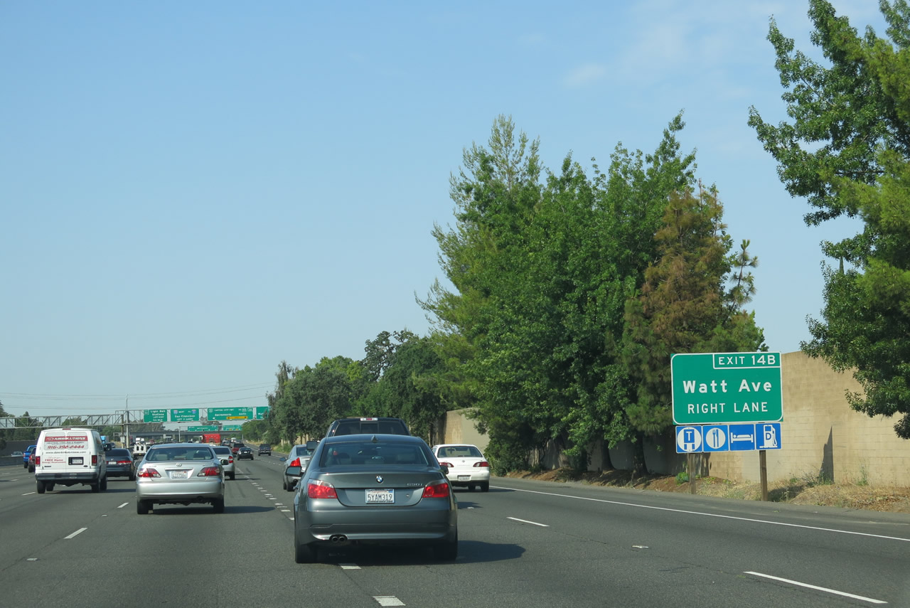 |
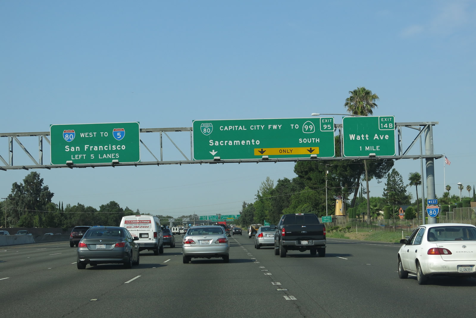
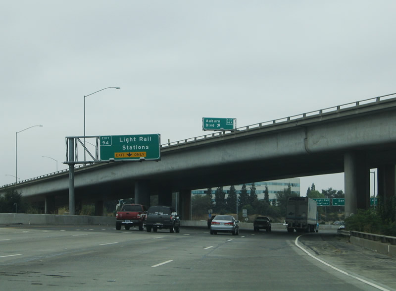
Interstate 80 widens to seven lanes in anticipation of the Exit 53 directional interchange. The first off-ramp from Business Loop I-80 is Exit 14B, Watt Avenue, a major north-south arterial that connects to U.S. 50 to the south and to McClellan Air Force Base to the north. Five lanes continue west onto the "Across the Top" segment of Interstate 80 toward Interstate 5, Sacramento International Airport, and the San Francisco Bay Area. Finally, for those connecting to the Sacramento Light Rail System, use left Exit 94. Photo taken 07/02/13. |
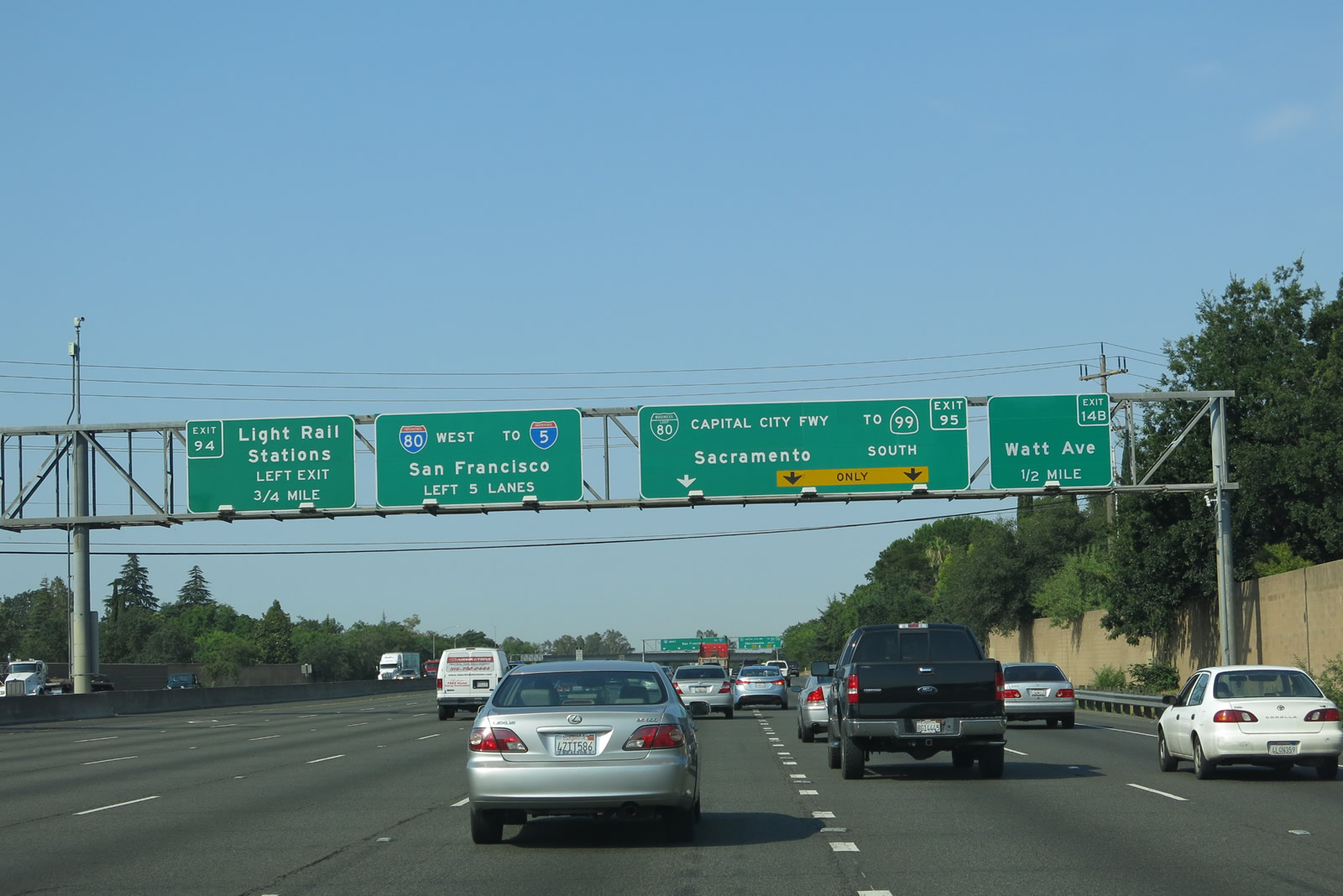 |
The right three lanes will connect to Exit 95, Business Loop I-80 and California 51 southwest to downtown Sacramento. The left five lanes will continue along the northern bypass of Sacramento. Business Loop I-80 will rejoin Interstate 80 at Exit 82 in West Sacramento. California 51 is the unsigned designation of the north-south portion of Business Loop I-80; the business route transfers onto U.S. 50 for the final six or so miles through downtown Sacramento and West Sacramento. The final 8.44 miles of Business Loop I-80, roughly from C Street just southwest of the American River crossing to the western terminus of the business loop in West Sacramento, is also designated by the Federal Highway Administration in its Interstate Route Log and Finder List as Interstate 305. California does not acknowledge this designation in its legislative definitions of state routes, nor is Interstate 305 signed in any fashion. However, since FHWA includes the Interstate-standard portion of former Interstate 80 within its route log as Interstate 305, we can state that Interstate 305 does exist and is considered an unsigned, "secret" route designation. The elevated viaduct portion of Business Loop I-80, U.S. 50, and Interstate 305 is known as the WX Freeway, due to its location above W and X Streets. Photo taken 07/02/13. |
 |
Westbound Intestate 80 splits with Business Loop I-80 at Exit 95. For Watt Avenue, take the far right lane and depart at Exit 14B, the first off-ramp from westbound Business Loop I-80. California 244, a very short, state-maintained freeway, ties into the 80-80 Split Interchange by connecting Interstate 80 with Auburn Boulevard (Historic U.S. 40-99E). The city of Sacramento planned for a replacement of Interstate 80 (the pre-1982 alignment) from here southwest to roughly California 160. The $1 billion project never came to fruition, however, and the intended mainline of the freeway west of Exit 95 remains in use as the corridor of the Sacramento Light Rail System. To see the only portion of the realigned Interstate 80 that was built prior to 1982, use Exit 94. The off-ramp is a slip ramp connecting Interstate 80 west with the planned "new" Interstate 80 mainline. There are no plans to build the once-proposed realignment of Interstate 80 at this time. Photo taken 07/02/13. |
 |
Again looking back to 2003, we see the pre-widening 80-80 split (Exit 95). A set of button copy signs used to be posted here, including another overlay that covers what used to read "Business Loop Freeway." The Business Loop Freeway moniker was applied to Business Loop I-80 until the route was reclassified the Capital City Freeway. Only a few business routes have freeway segments, and even fewer off-Interstate business routes are freeways for their entire length. Photo taken 01/19/03. |
 |
This view is a final look at the Business Loop I-80 westbound split as well as the Exit 14B ramp departure onto Watt Avenue. Exit 14A follows suit on the Capital City Freeway and departs via California 244 eastbound to Auburn Boulevard (Historic U.S. 40-99E). Historic U.S. 40 follows Business Loop I-80 closely from Watt Avenue west to Howe Avenue. Photo taken 09/10/05. |
 |
Interstate 80 passes underneath the Business Loop I-80 westbound mainline ahead of the Exit 94 slip ramp onto the once-planned yet now abandoned Interstate 80 mainline (pre-1982). The abandoned route now serves as an access road and parking area for the nearby light rail stations; the end of the park and ride facility for the light rail ultimately links to Winters Road. Despite the proximity of Roseville Road, there are no connections via Exit 94. However, Roseville Road can be reached via Exit 93 (Longview Drive). The Sacramento Light Rail corridor occupies the freeway right of way westward from Exit 94 to approximately California 160 (North Sacramento Freeway). Had the freeway been built, it would have replaced the existing Capital City Freeway from Exit 95 southwest to the American River. When the $1 billion Interstate 80 project was cancelled, the money was diverted to the Sacramento Regional Transit District. Photo taken 09/10/05. |
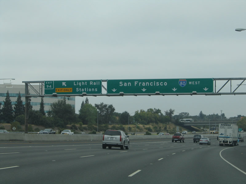 |
Interstate 80 reduces to four through lanes at the Exit 94 ramp departure to the light rail stations. The "Across the Top" section carries eight overall lanes between Exit 95 and Exit 93, and six lanes west from there to the merge with Business Loop I-80, U.S. 50, and unsigned Interstate 305. Photo taken 09/10/05. |
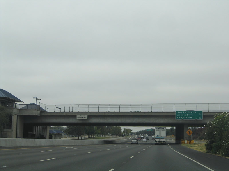 |
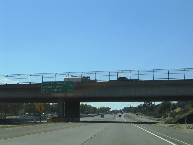
Westbound Interstate 80 passes the Watt Avenue over crossing and Sacramento Regional Transit District light rail station accessible from Exit 94. Another transit station lies one mile to the west at Longview Drive (Exit 93). Photo taken 09/10/05. |
 |
Now on the California 244 westbound on-ramp to Interstate 80 west, we see this mileage sign providing distances to Longview Drive (Exit 93) and Winters Street (Exit 92). California 244 originally was planned as an east-west freeway between Interstate 80 and the unconstructed California 143 freeway. The highway remains as a legislative route, but no construction is currently planned, and formerly held rights of way have been relinquished. Photo taken 09/10/05. |
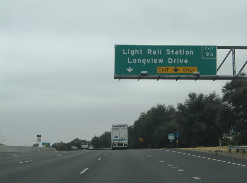 |
Traffic from westbound California 244 merges with Interstate 80 west of the Watts Avenue parclo interchange. Exit 93 claims the right-hand lane as it departs the freeway for both Longview Drive and the second Sacramento light rail station. Photo taken 09/10/05. |
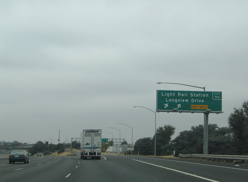 |
Exit 93 leaves Interstate 80 westbound for Longview Drive and the light rail station. Longview Drive meanders westward from Watt Avenue through Del Paso Park to nearby Roseville Road. Photo taken 09/10/05. |
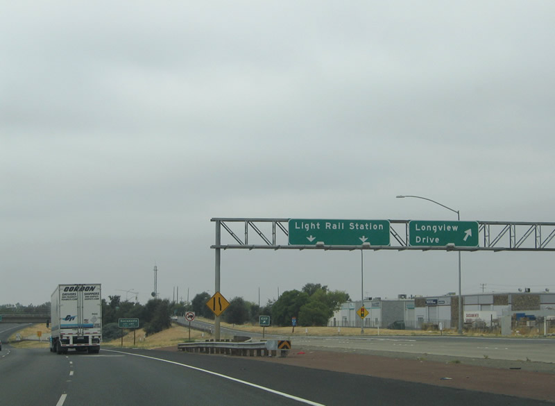 |
Exit 93 partitions into ramps for Longview Drive and the light rail station. The light rail ramp loops into the station west of Longview Drive before returning to Interstate 80 eastbound. Photo taken 09/10/05. |
 |
Approaching the Longview Drive over crossing on Interstate 80 westbound. Note the abandoned freeway mainline within the median of Interstate 80 that was intended for the "new" Interstate 80. This alignment for I-80 was cancelled in 1979, relegating the mainline to remain along the sub-standard route through Downtown until 1982. Photo taken 09/10/05. |
 |
Interstate 80 westbound passes under the Longview Drive overpass, which is about one-half mile east of the Winters Street diamond interchange. The freeway passes over the Union Pacific Railroad line and Roseville Road between Del Prado Park and the Del Paso Heights neighborhood of Sacramento. Photo taken 09/10/05. |
 |
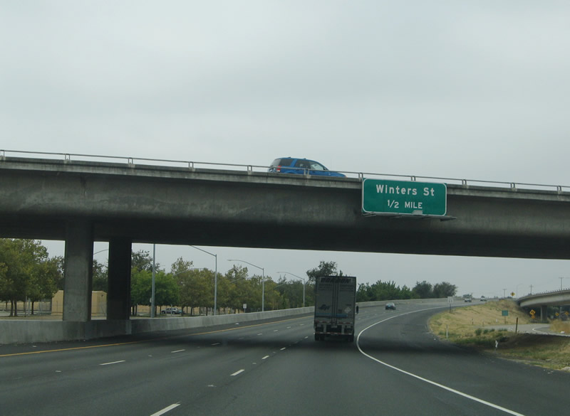
Westbound Interstate 80 reaches Exit 92, Winters Street. Winters Street stems north from a portion of the "new" Interstate 80 built between the Longview Drive area light rail station. What would have been the westbound mainline of Interstate 80 crosses the railroad and Roseville Road before ending prematurely at Winters Street. A short access ramp connects the viaduct with the Winters Street cul-de-sac south of Grand Avenue. Winters Street otherwise heads north to Bell Avenue and the former Mc Clellan Air Force Base. Photo taken 09/10/05. |
 |
This westbound Interstate 80 reassurance shield and Interstate 5 trailblazer assembly are posted after the Winters Street on-ramp (Exit 92). Photo taken 09/10/05. |
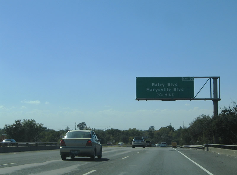 |
Intersecting the freeway next is Marysville Boulevard and Raley Boulevard at Exit 91. Marysville Boulevard travels south to the Hagginwood and Del Paso Boulevard. Raley Boulevard continues the arterial northward to Bell Avenue. Photo taken 09/10/05. |
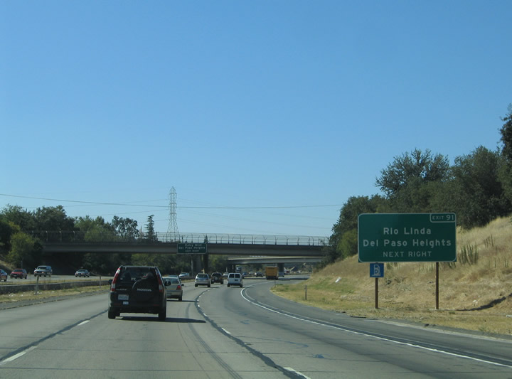 |
Nearing the Pinell Street over crossing on Interstate 80 westbound, the Exit 91 six-ramp parclo interchange resides within the Del Paso Heights community of Sacramento. Rio Linda lies north of the freeway via the continuation of Marysville Boulevard from north of Bell Avenue. Marysville Boulevard was severed due to the construction of Interstate 80. Photo taken 09/10/05. |
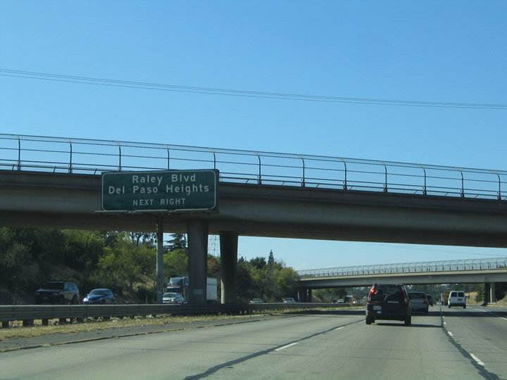 |
North Avenue and Pinell Street both cross over Interstate 80 and intersect nearby in the Del Paso Heights neighborhood. A button copy overhead advises motorists bound for Exit 91 to move into the right-hand lane for the upcoming Raley Boulevard off-ramp. Photo taken 09/10/05. |
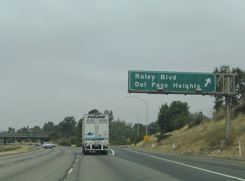 |
Motorists bound for Raley Boulevard north and Marysville Boulevard south depart Interstate 80 westbound at Exit 91. Raley Boulevard transitions to 16th Street and meets Elkhorn Boulevard (Sacramento County Route E-14) in three miles. Marysville Boulevard stems 1.5 miles northwest from Raley Boulevard via Bell Avenue to Rio Linda Boulevard and the Robla neighborhood of the city. Photo taken 09/10/05. |
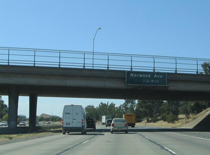 |
The first overhead for Norwood Avenue (Exit 90) resides within the Raley Boulevard interchange on Interstate 80 west. Norwood Avenue travels three miles north-south between Grove Avenue and Main Avenue. Photo taken 09/10/05. |
 |
Westbound Interstate 80 meets Exit 90, Norwood Avenue (diamond interchange). Use Norwood Avenue south for Robertson Park and North Sacramento, and north for the Robla community. Photo taken 09/10/05. |
 |
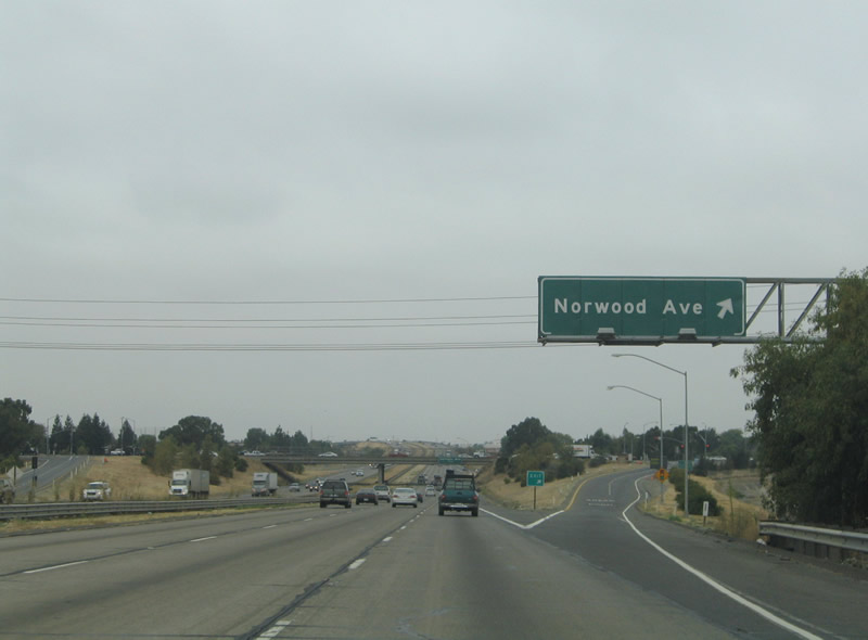
The one-mile overhead for Northgate Boulevard (Exit 89) is attached to the Northwood Avenue overpass. Northgate Boulevard serves North Sacramento to the south and Del Paso Road to the north. Photo taken 09/10/05. |
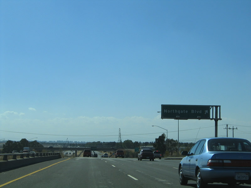 |
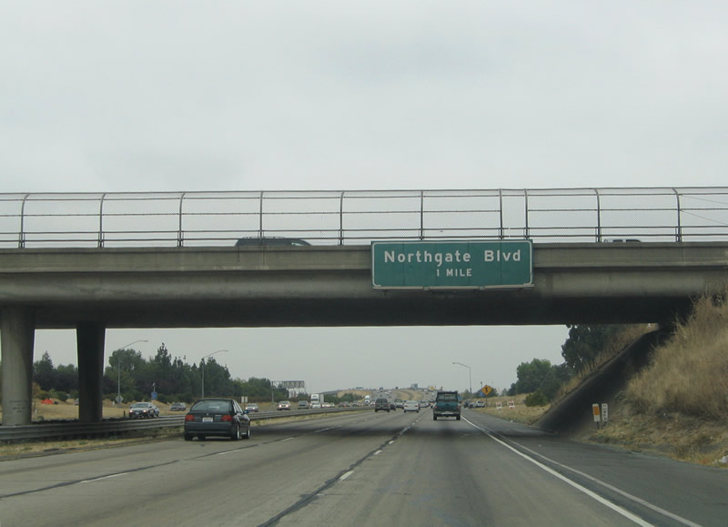
Interstate 80 crosses over the Sacramento levee system and a parallel railroad line ahead of the Exit 89 six-ramp parclo interchange with Northgate Boulevard. Northgate Boulevard ends one mile to the north at Del Paso Road. Southward the road travels 3.1 miles to California 160 at the American River. Photo taken 09/10/05. |
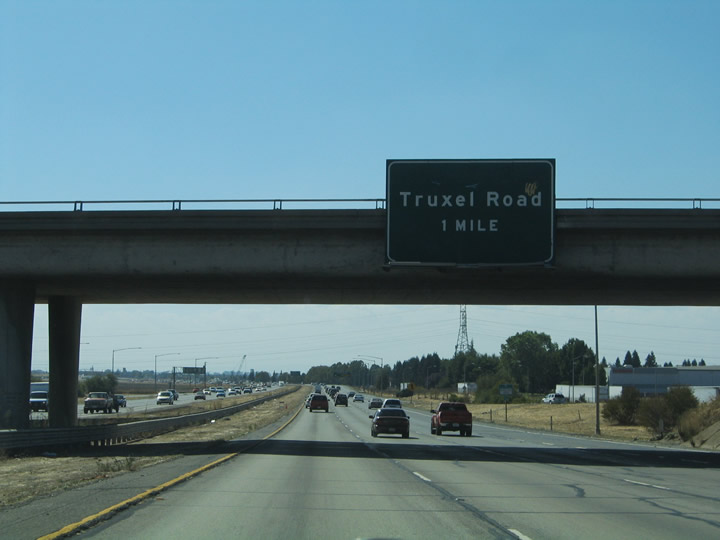 |
Next in line for westbound motorists is the Truxel Road six-ramp parclo interchange (Exit 88). Truxel Road journeys 2.9 miles north from Garden Highway to Arena Boulevard and North Market Boulevard. Photo taken 09/10/05. |
 |
Another set of Interstate 80 west and to Interstate 5 shields posted between Northgate Boulevard (Exit 89) and Truxel Road (Exit 88). The freeway begins its southwesterly curve back to Business Loop I-80 here. Photo taken 09/10/05. |
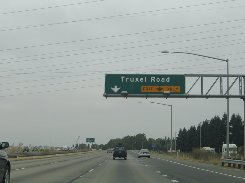 |
A two-lane off-ramp serves the Truxel Road north-south arterial. Truxel Road connected to Sleep Train Arena (formerly Arco Arena) about 1.1 miles north here. With the Sacramento Kings relocating to a new arena, the Sleep Train Arena closed in December 2016. Photo taken 09/10/05. |
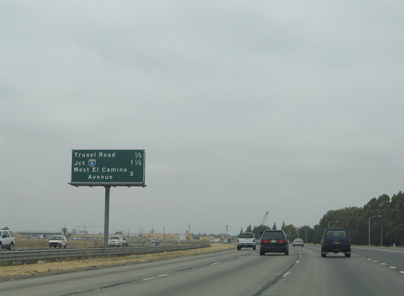 |
The first sign of the forthcoming interchange (Exit 86) with Interstate 5 and California 99 appears one half mile east of Truxel Road. Photo taken 09/10/05. |
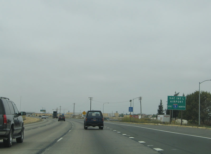 |
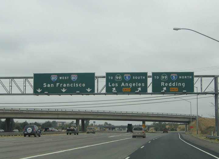
Sacramento International Airport traffic should remain on Interstate 80 west to Interstate 5 and California 99 north (Exit 88). The airport resides six miles to the northwest of Exit 88. Photo taken 09/10/05. |
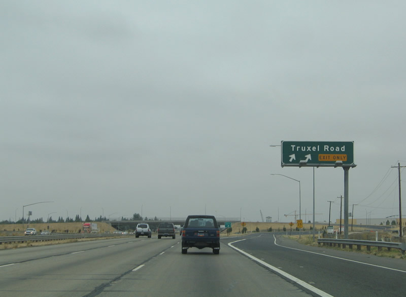 |
Westbound Interstate 80 meets Exit 88, Truxel Road. Use Truxel Road south one-half mile to San Juan Road and West El Camino Avenue. It is two miles to Garden Highway at the American River Parkway. Photo taken 09/10/05. |
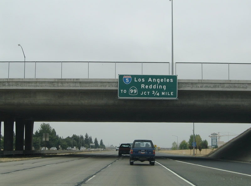 |
Interstate 80 continues west three-quarters of a mile from Truxel Road to Interstate 5 and California 99. Interstate 5 and California 99 split three miles to the north. From there Interstate 5 heads 150 miles north to Redding at the end of the Central Valley. California 99 ventures 40 miles north to Yuba City. Photo taken 09/10/05. |
 |
Westbound Interstate 80 widens to five lanes in anticipation of the Exit 86 directional-cloverleaf interchange. Construction was underway in this area as of 2012. Although signs indicate Interstate 5 as "To California 99," and Caltrans refers to the segment of California 99 that is shared along Interstate 5 officially as a "route break", one can argue that the two routes overlap for the 7.3 miles through Sacramento (essentially between the Business Loop I-80 interchange and the 5-99 split north of here). Interstate 5 and California 99 constitute the main north-south freeway through the capital city. Photo taken 09/10/05. |
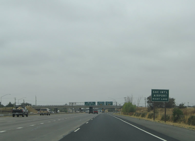 |
For Sacramento International Airport, use Interstate 5 north. Photo taken 09/10/05. |
 |
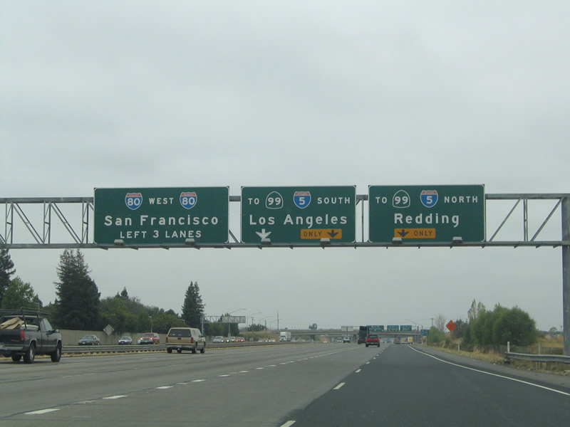
Three lanes depart the Interstate 80 westbound mainline for Interstate 5 and California 99 (Exit 86). Interstate 5 and California 99 head south four miles to their split at Business Loop I-80, U.S. 50, and unsigned Interstate 305 (Capital City Freeway). California 99 south turns east on the Capital City Freeway briefly before resuming a southward trek via the Golden State Highway to Stockton, Fresno, and Bakersfield. Following Interstate 305, the next Interstate highway to intersect Interstate 5 to the south will be Interstate 205, which is approximately 60 miles south of here, near Lathrop and Tracy. Photo taken 09/10/05. |
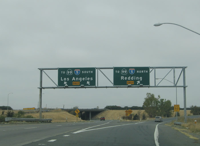 |
Exit 86 splits into ramps for Interstate 5 and California 99 north and south. Interstate 5 south heads 50 miles to Stockton and 388 miles to Los Angeles. Interstate 5 north travels through Northern California toward Portland, Oregon; this is a 576-mile drive. The next Interstate highway junction to the north will be with Interstate 505 near Dunnigan. Photo taken 09/10/05. |
 |
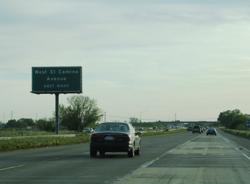
Interstate 80 continues one mile west from Interstate 5 and California 99 to Exit 85, West El Camino Avenue. This arterial roadway ventures 11.5 miles east from El Centro Road nearby to Fair Oaks Boulevard in Carmichael. Photo taken 09/10/05. |
 |
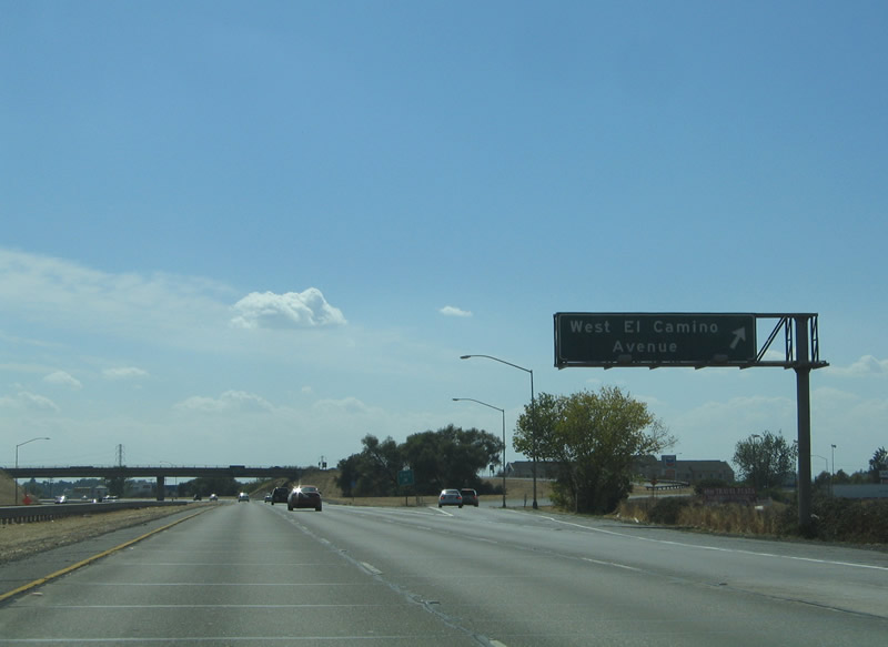
West El Camino Avenue meets Interstate 80 at a six-ramp parclo interchange. West El Camino Avenue travels east 1.25 miles to have its own interchange with Interstate 5 and California 99 in Sacramento. Photo taken 04/02/05. |
 |
Westbound Interstate 80 meets Exit 86, West El Camino Avenue. While much of the land north and west of the freeway is vastly rural, suburban sprawl exists south of West El Camino Avenue via Orchard Lane and West River Drive. El Centro Road heads north from West El Camino Avenue to San Juan Road, Del Paso Road and Bayou Way adjacent to the Interstate 5 and California 99 split. Photo taken 09/10/05. |
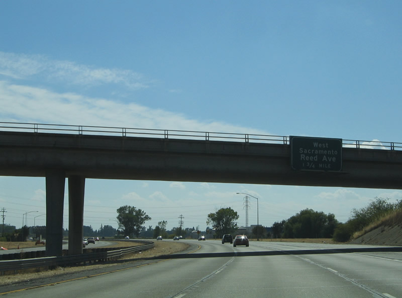 |
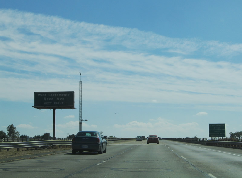
Interstate 80 continues southwest 1.75 miles to Exit 83 and West Sacramento. Meeting the freeway ahead is Reed Avenue, unsigned/former California 84. California 84 begins at Exit 83 and follows Reed and Sacramento Avenues east and Jefferson Boulevard south through West Sacramento to the Solano County line. Within the city limits of West Sacramento, California 84 has been decommissioned and relinquished to the city for maintenance. While California 84 is unsigned in Yolo County, the route is signed on its portion through Solano County. Photo taken 09/10/05. |
 |
A traditional style westbound reassurance shield for Interstate 80 was posted between the West El Camino Avenue interchange and the American River crossing. Photo taken 09/10/05. |
 |
Interstate 80 ascends over the "Caltrans Maintenance Worker Memorial Bridge," a six-lane span over the Sacramento River. The Exit 83 folded-diamond interchange with former California 84 (Reed Avenue) lies just south of the bridge in West Sacramento. Reed Avenue travels east-west between Riverside Parkway and Sunset Avenue. Photo taken 09/10/05. |
 |
At the top of the Sacramento River bridge, Interstate 80 west leaves Sacramento County and enters Yolo County. The Sacramento River constitutes the county line between Yolo and Sacramento Counties from Courtland northward to Sacramento International Airport. Photo taken 09/10/05. |

Page Updated July 13, 2013.
|
About Contact Glossary |
In The News Interstate Guide |
Social Media:
 |
|
© 2000-25 AARoads.com | All Rights Reserved | Privacy Policy / Terms of Use
|
||