| Interstate 80 west |
|
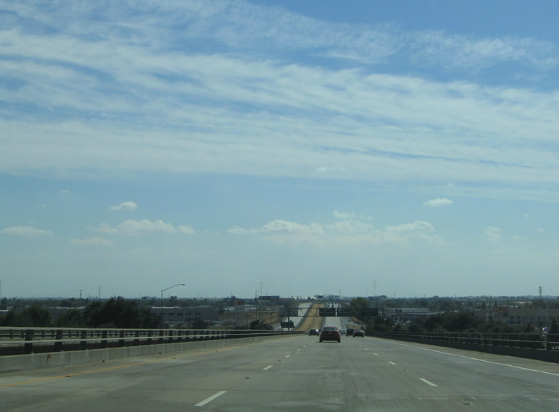
Descending from the crest of the American River bridge on Interstate 80 westbound. Interstate 80 leaves Sacramento County and enters West Sacramento in Yolo County. Photo taken 09/10/05. |
|
|
A before and after look at the Exit 83 folded-diamond interchange with Reed Avenue (California 84). Note the pavement change in the five months that transpired between photos. Reed Avenue joins Interstate 80 with Riverside Parkway to the west and Harbor Boulevard & Sacramento Avenue to the east, all within West Sacramento. Unsigned California 84 travels east along Reed Avenue and Sacramento Avenue to Jefferson Boulevard south. Photos taken 04/02/05 & 09/10/05. |
|
Business Loop I-80 (Capital City Freeway) returns to Interstate 80 at Exit 82 in West Sacramento. The business route follows the pre-1982 routing of Interstate 80 through downtown Sacramento. U.S. 50 and hidden Interstate 305 overlap with Business Loop I-80 from the east junction with California 99 west to Exit 82. A flyover ramp allows Interstate 80 westbound motorists to the eastbound business loop. Photo taken 09/10/05. |
|
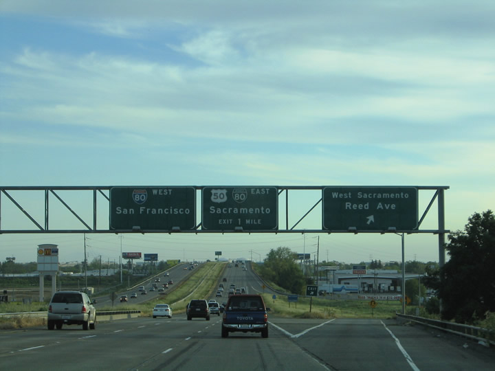
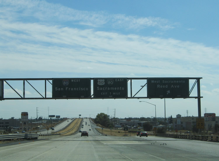
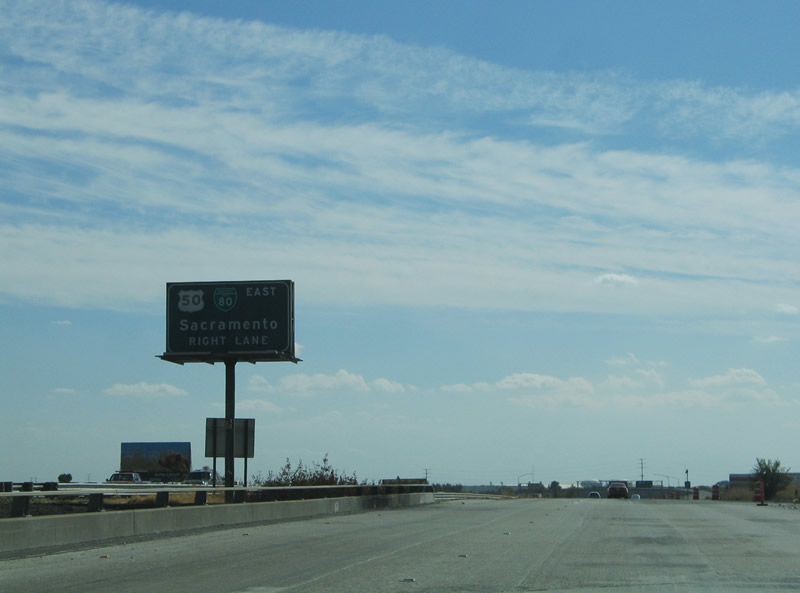
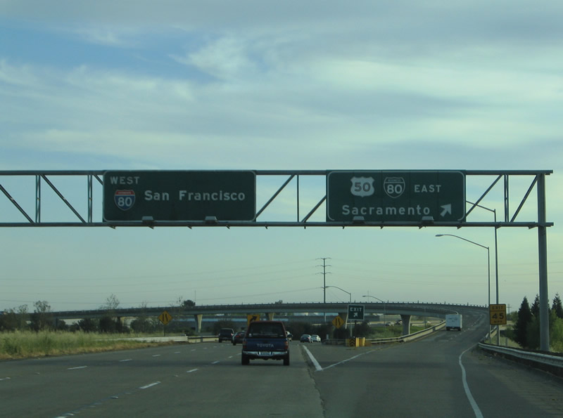
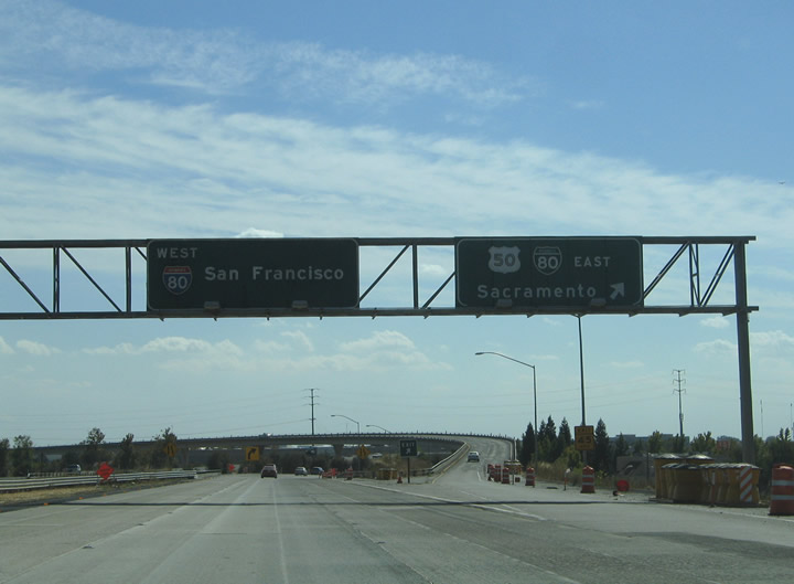
Westbound Interstate 80 meets Exit 82, Business 80, Interstate 305, and U.S. 50 east at a directional interchange. The trio head back toward West Sacramento and cross the American River near Sacramento central business district. U.S. 50 shares alignment with the western half of the Capital City Freeway for continuity purposes between Interstate 80 and its freeway east to Rancho Cordova, Folsom, Placerville, and Lake Tahoe. The U.S. route originally traveled south to Tracy and west to Oakland by way of the Interstate 580 corridor. Business Loop I-80 replaced Interstate 80 in 1982 after the Sacramento City Government voted against construction of a new Interstate-standard freeway from the east end (Exit 95) to California 160 and the American River. The withdraw of that proposal resulted in the loss of Interstate 80 along the substandard section of freeway between U.S. 50 east to Interstate 80. Thus the original Interstate 880 bypass of Sacramento became the new Interstate 80 mainline, old Interstate 80 became Business Loop I-80, and the Interstate-standard section of highway from West Sacramento to U.S. 50 became unsigned Interstate 305. Photos taken 04/02/05 and 09/10/05. |
|
|
West Capitol Avenue (Historic U.S. 40 and U.S. 99W) passes underneath Interstate 80 ahead of the merge with Business Loop I-80 and U.S. 50. From there the surface street continues west and interchanges with Interstate 80 at Exit 81. The east-west street constitutes the original alignment of U.S. 40 in West Sacramento. Photo taken 09/10/05. |
|
|
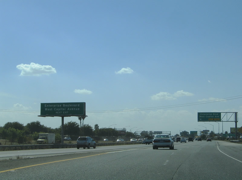
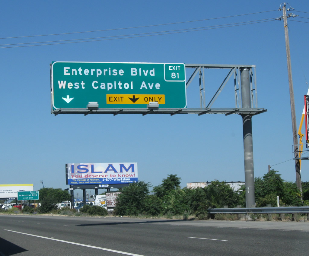
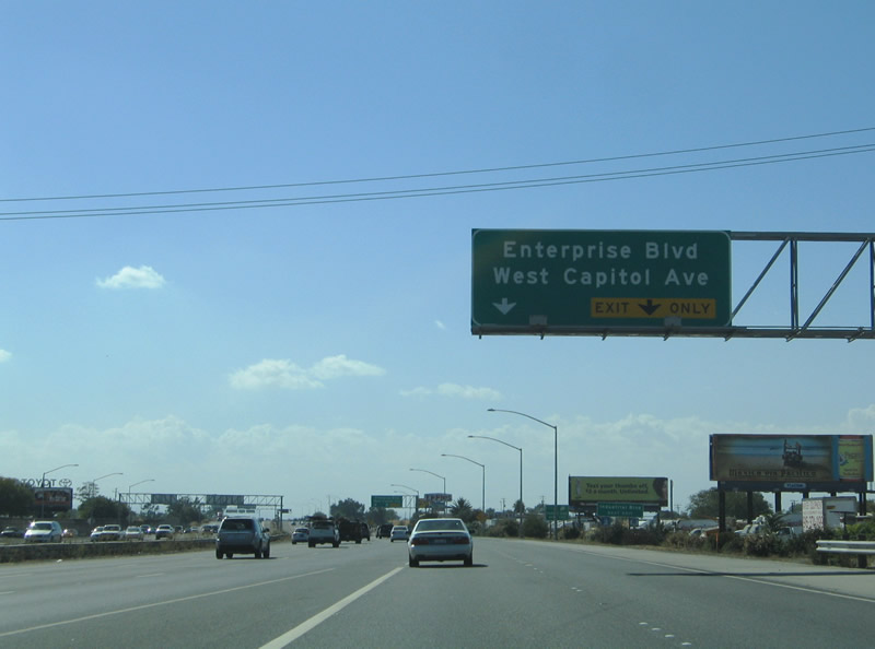
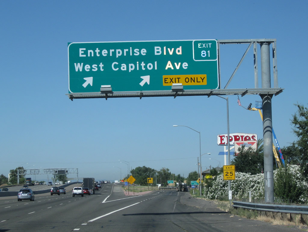
Interstate 80 travelers must merge to the left ahead of the Exit 81 partial-cloverleaf interchange with West Capital Avenue and Enterprise Boulevard. Enterprise Boulevard heads south from the junction to Industrial and Seaport Boulevards and Channel Drive. At this point, traffic from Business 80 merges onto Interstate 80 west from the west. This is the former end of Interstate 880 (until that designation was removed from the Sacramento north beltline in 1980). Photos taken 08/02/11 and 09/10/05. |
|
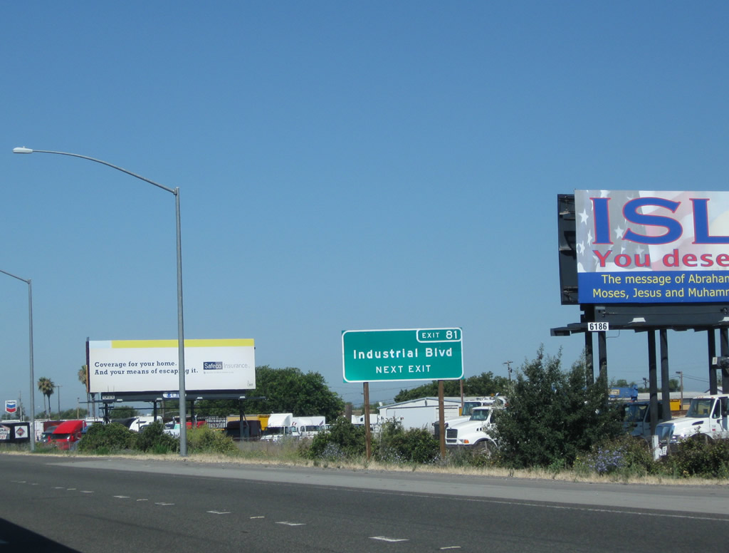
Use Exit 81 to Industrial Boulevard. Photo taken 08/02/11. |
|
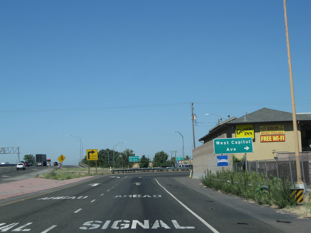
Westbound Interstate 80 meets Exit 81, West Capital Avenue (U.S. 40-99W) east and Enterprise Boulevard south. West Capitol Avenue returns east 1.6 miles to Harbor Boulevard en route to downtown West Sacramento. Enterprise Boulevard serves a warehouse and industrial area south of the freeway. Photo taken 08/02/11. |
|
At the bottom of the ramp, turn right for U.S. 40-99W/West Capitol Boulevard east to West Sacramento and Sacramento. Photo taken 08/02/11. |
|
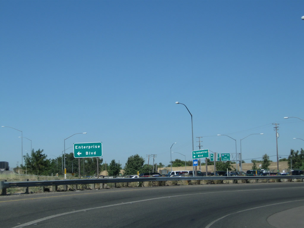
Turn left for Enterprise Boulevard and Industrial Boulevard. Photo taken 08/02/11. |
|
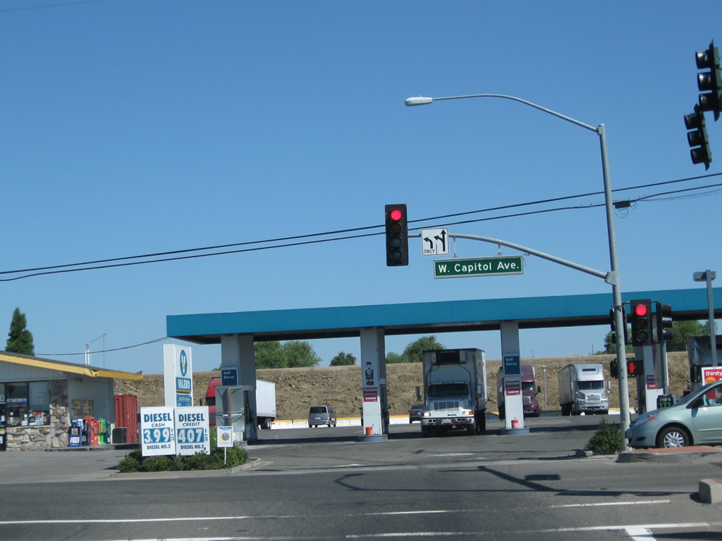
At the end of the ramp is this traffic signal with Historic U.S. 40-99W/West Capitol Boulevard. Photo taken 08/02/11. |
|
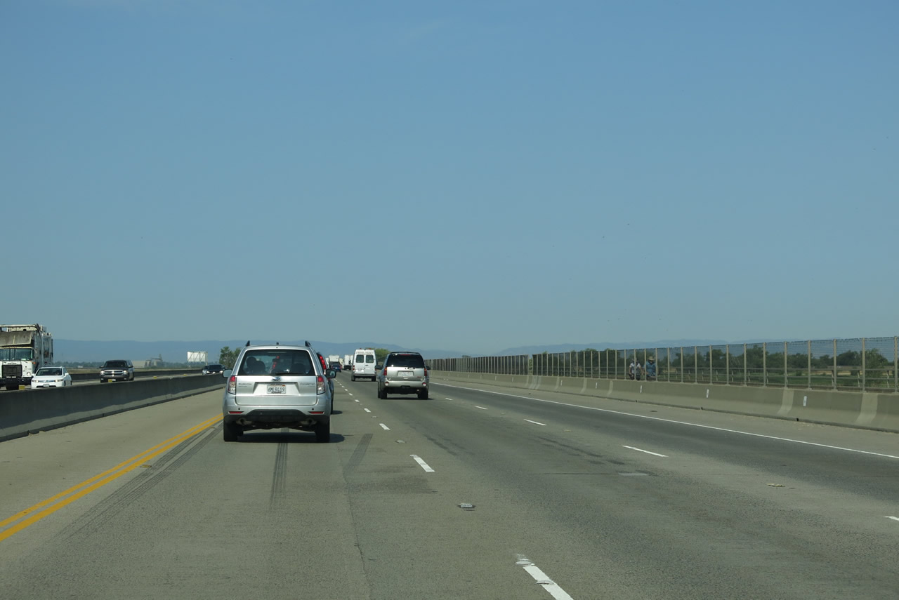
Back on the mainline, westbound Interstate 80 narrows a bit in preparation for merging onto the Yolo Causeway (Blecher-Freeman Memorial Causeway), which carries the freeway over the Yolo Bypass. This lengthy bridge means no entrances/exits on Interstate 80 for just over three miles. As noted by the brown auxiliary sign, use Exit 78, Chiles Road/Road 32A to the Vic Fazio Yolo Bypass Wildlife Area. Photo taken 07/02/13. |
|
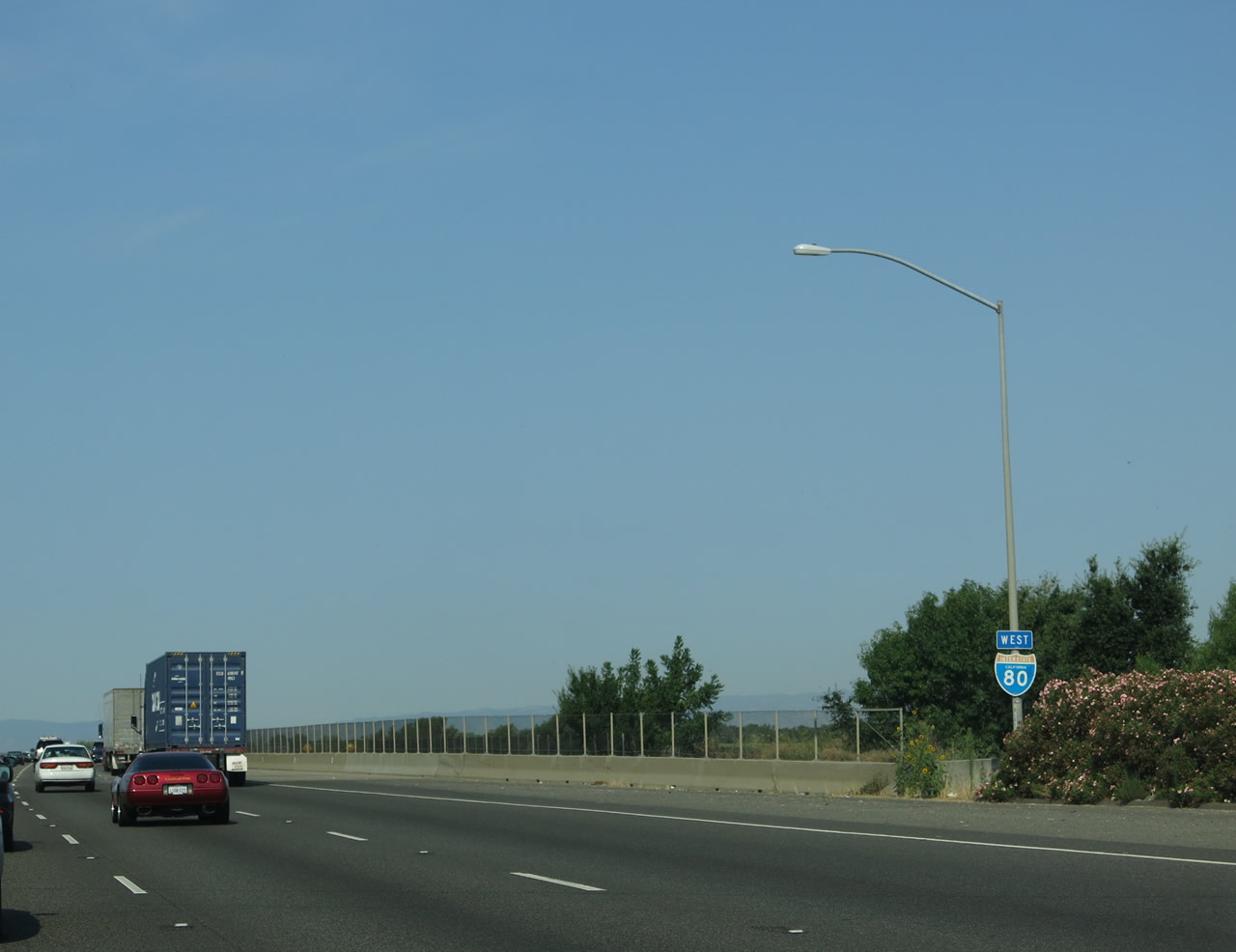
An Interstate 80 west reassurance shield is posted after Exit 81 and before the Yolo Causeway (Blecher-Freeman Memorial Causeway) begins. Photo taken 07/02/13. |
|
Interstate 80 crosses the Yolo Causeway, which bridges the Yolo Bypass (part of the Sacramento River Flood Control Project). Part of a flood control network that keeps floodwaters from inundating low-lying Sacramento and West Sacramento, the Yolo Bypass can carry excess water that would otherwise flow in the Sacramento River. Water is diverted from three sources: the Fremont Weir, the Sacramento Weir, and Cache Creek. The Fremont Weir is the primary water input, and it allows water to flow over its top and into the bypass when the river reaches a certain level; the weir is located on the Sacramento River upstream of the confluence with the Feather River. The Sacramento Weir, located downstream from the same confluence, can opened manually to divert floodwaters into the bypass. While the Yolo Bypass is typically dry in the summer, it can be flooded anytime during the winter, especially during periods of ongoing, heavy rain. Sometimes the entire width of the bypass is full of water, creating what appears to be a temporary lake. The water eventually flows south to the California Delta, where the Sacramento and San Joaquin Rivers approach and enter the San Francisco and San Pablo Bays. Interstate 80 crosses over this water on this 1962 causeway, which was part of U.S. 40-99W. The 1962 structure replaced the original causeway, which was built in 1916 as part of the Lincoln Highway. Photo taken 07/02/13. |
|
|
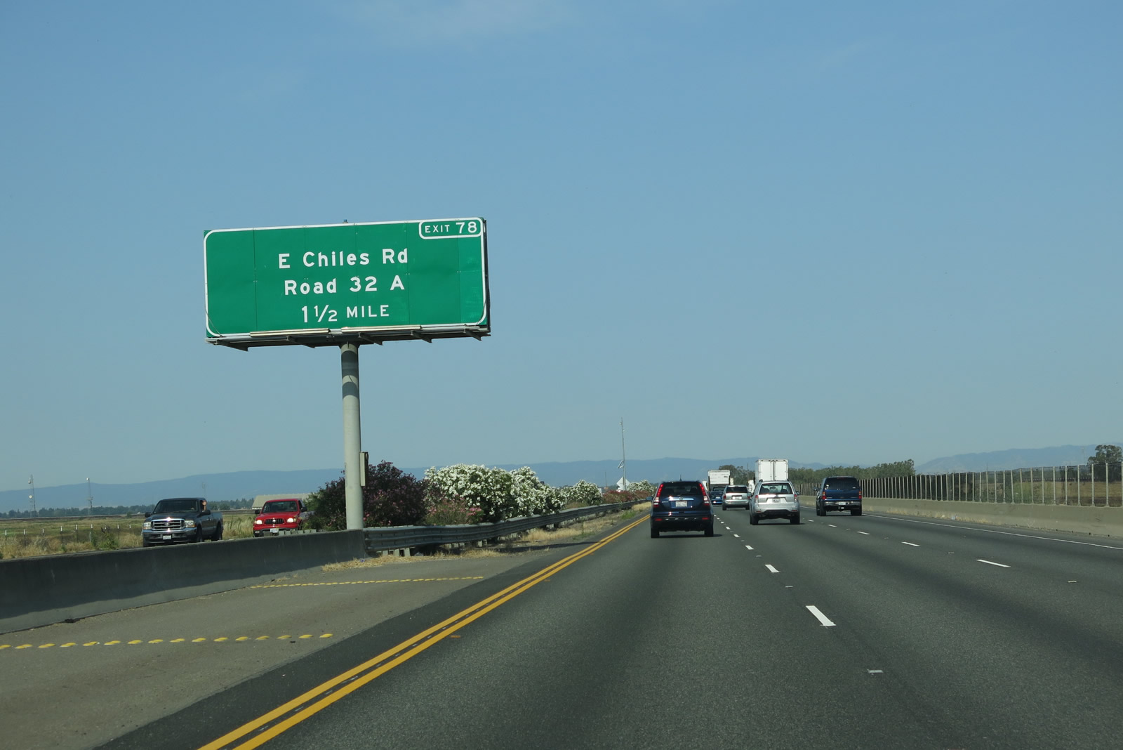
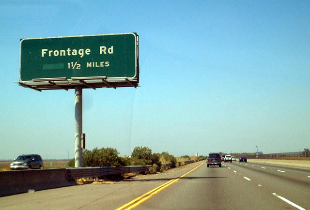
The next exit along Interstate 80 west is Exit 78, Chiles Road and Road 32A. This interchange was formerly named "Frontage Road" in the 2003 picture. Chiles Road travels along the south side of the freeway and serves as a frontage road. It connects the freeway to the Vic Fazio Yolo Bypass Wildlife Area. Note the button copy sign replacement and name change between the 2003 and 2013 pictures. Photos taken 07/02/13 and 08/20/03. |
|
Westbound Interstate 80 meets Exit 78, Chiles Road and Road 32A. This is a folded-diamond interchange that connects to the north and south frontage roads of Interstate 80. The frontage roads both travel west toward Mace Boulevard and east to a turnaround at the edge of the wildlife area. Photo taken 09/10/05. |
|
Interstate 80 descends from the Chiles Road interchange and leaves the vicinity of the Yolo Bypass. Ahead, Interstate 80 will pass under the first of three major, north-south, 500kV power transmission lines that connect with Path 15 and Path 66. All three lines pass through the Delta Region and travel south toward the San Joaquin Valley and ultimately Southern California. They also travel north toward a variety of electricity generation stations situated in the Pacific Northwest, including the massive hydroelectric power plants located along the Columbia River. Photo taken 07/02/13. |
|
The first of the three 500kV power lines that form the California-Oregon Intertie Project is this Pacific Gas & Electric power line. It carries power between Tracy and the Table Mountain substation near Oroville. The line continues north into Oregon toward the Columbia River. Photo taken 07/02/13. |
|
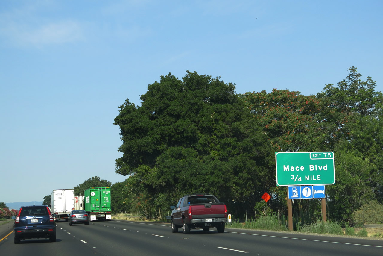
Entering the vicinity of the city of Davis , the next exit along Interstate 80 west is Exit 75, Mace Boulevard and Yolo County E-6 (Covell Boulevard) west. Yolo County E-6 follows Covell Boulevard to skirt the northern edge of Davis, while Mace Boulevard leads south to Tremont Road and areas near the west edge of the Yolo Bypass flood control system. Photo taken 07/02/13. |
|
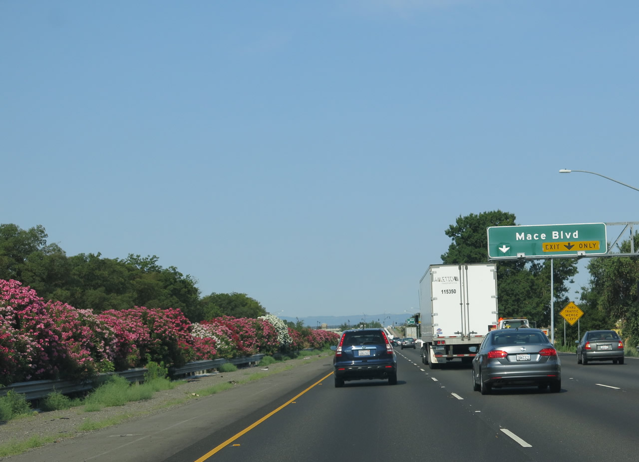
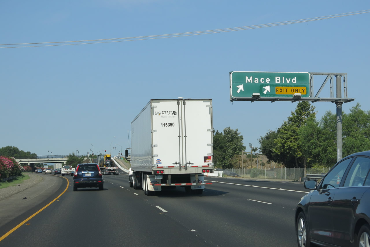
The right two lanes of Interstate 80 westbound become exit only for Exit 75, Mace Boulevard, which is the first exit into Davis. Photo taken 07/02/13. |
|
Westbound Interstate 80 meets Exit 75, Mace Boulevard and Yolo County E-6 (Covell Boulevard) west. A partial-cloverleaf interchange joins Interstate 80 with Exit 75. Yolo County E-6 (Covell Boulevard) and meets Yolo County E-8/Pole Line Road approximately 2.7 miles from here. Mace Boulevard serves nearby El Macero to the south. Photo taken 07/02/13. |
|
Interstate 80 passes under Mace Boulevard and enters the city of Davis, which is home to the University of California at Davis. The city of Davis had a population of 65,622 as of the 2010 Census, sits at an elevation of 52 feet, and was incorporated on March 28, 1917. Now on the west side of the Yolo Bypass, Interstate 80 will start to gain elevation gradually as it approaches the west side of the Central Valley. Photo taken 07/02/13. |
|
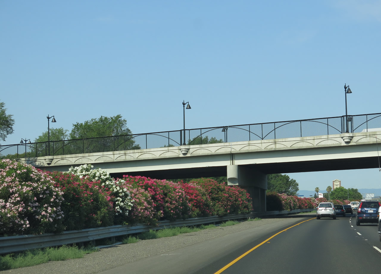
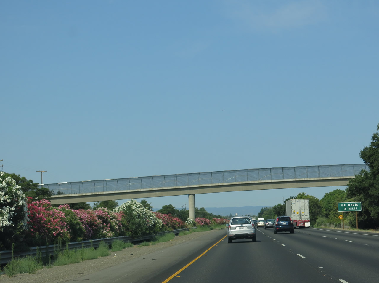
Colorful oleander lines the median strip of Interstate 80 as a pedestrian bridge crosses over the busy freeway. A guide sign advises that the University of California at Davis can be accessed in three miles (at Exit 71). Photo taken 07/02/13. |
|
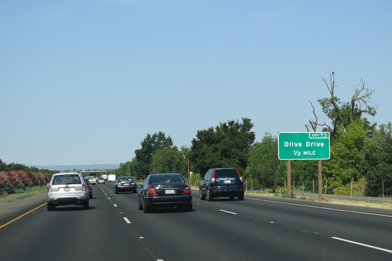
The next interchange along Interstate 80 is Exit 73, Olive Drive. This interchange does not directly serve U.C. Davis; continue west to Exit 71. Olive Drive is a westbound side frontage road from near Pole Line Road to Richards Boulevard. Photo taken 07/02/13. |
|
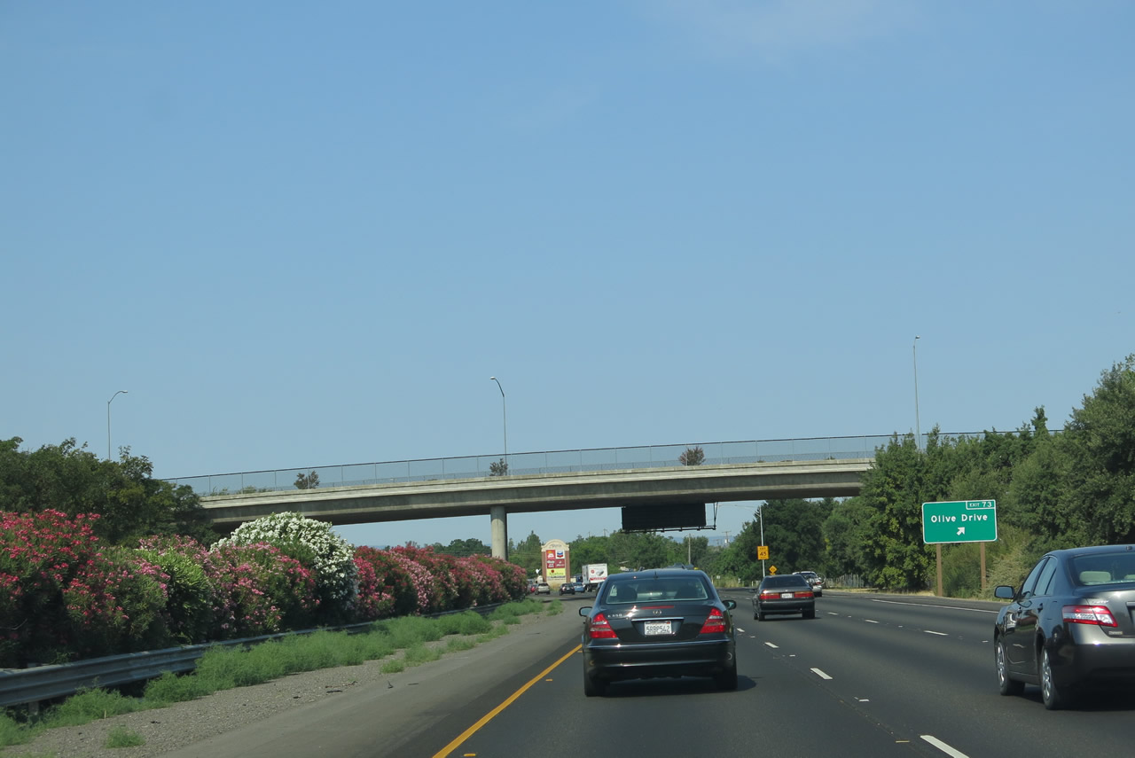
Westbound Interstate 80 meets Exit 73, Olive Road. Pole Line Road passes over Interstate 80 at the Exit 73 off-ramp to Olive Road. There is no access between Olive Road and Pole Line Road. Olive Road otherwise parallels the Union Pacific Railroad area before turning south and intersecting Richards Boulevard near Exit 72 of Interstate 80. Photo taken 07/02/13. |
|
|
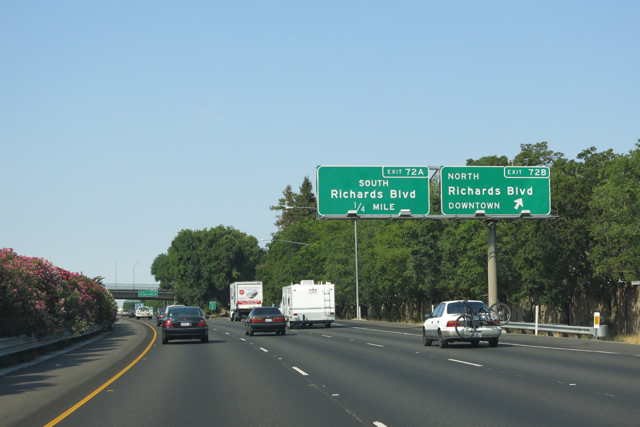
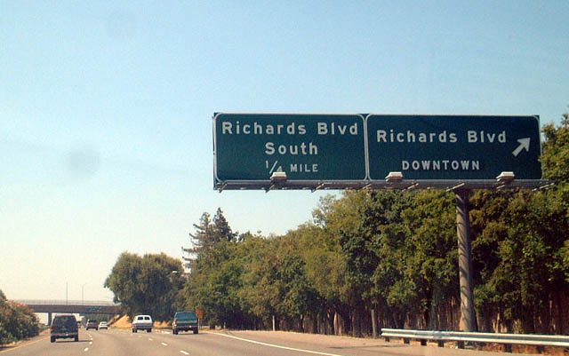
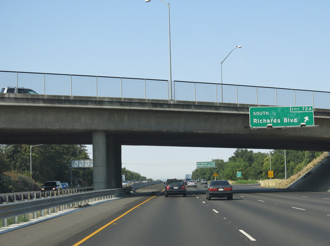
Quickly thereafter, westbound Interstate 80 meets Exit 72B, Richards Boulevard north, which is primary exit into Davis. This sign was replaced around 2005, but the replacement signs initially had switched the exit numbers between Exit 72B and Exit 72A. It was later corrected as shown in this picture. Richards Boulevard enters Davis at the intersection of 1st and E Streets. Photos taken 07/02/13 and 08/20/03. |
|
|
The second ramp links Interstate 80 west with Exit 72A, Richards Boulevard south via a loop ramp. Interstate 80 meets the Yolo-Solano County Line at this interchange, but the highway will straddle the county line from here west until Exit 70, California 113/Vic Fazio Freeway north. Richards Boulevard heads east from the three-quarter cloverleaf interchange to Research Park Drive where it becomes Cowell Boulevard. Cowell Boulevard meanders east to Pole Line Road, Drummond Avenue, and Mace Boulevard. Photos taken 07/02/13 and 08/20/03. |
|
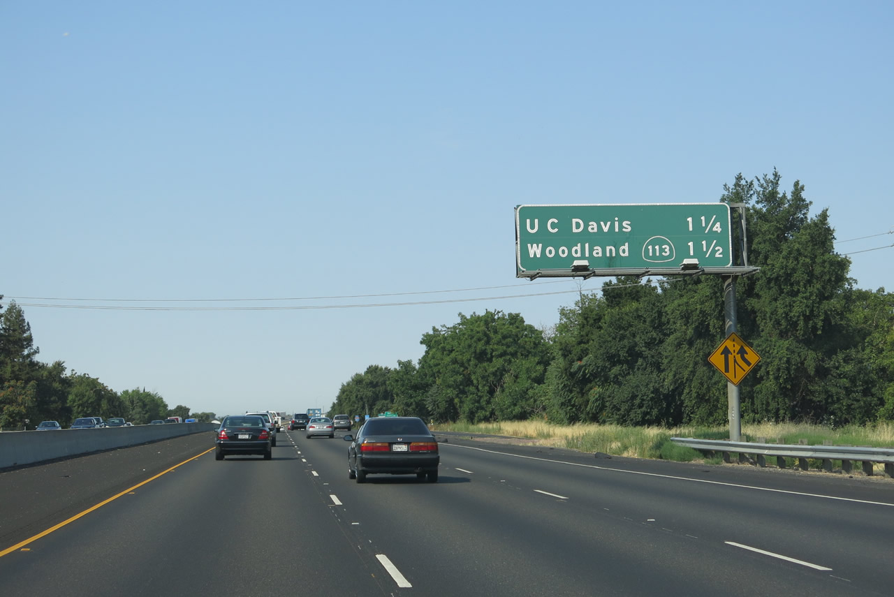
This mileage sign along Interstate 80 west provides the distance to Exit 71, the University of California at Davis and Exit 70, northbound California 113 Freeway. The two ramps are part of the same interchange complex. Photo taken 07/02/13. |
|
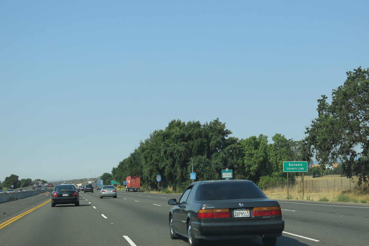
Continuing west, Interstate 80 is signed as leaving Yolo County and entering Solano County at this point. However, the freeway will straddle the county line for another mile or so. Photo taken 07/02/13. |
|
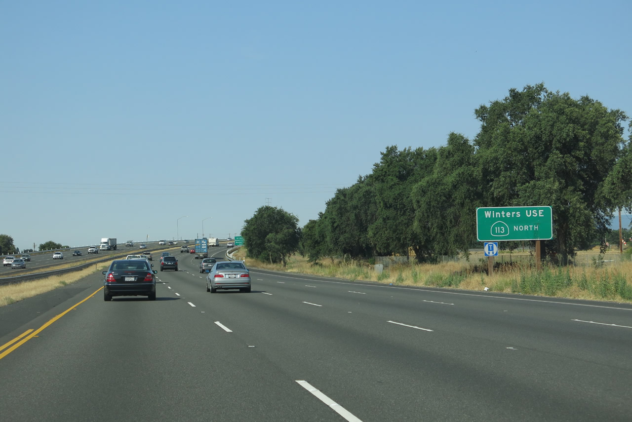
To Winters, follow California 113 north to Yolo County E-6/Russell Boulevard west. Winters sits at the junction between Interstate 505, California 128, and County Route E-6. Photo taken 07/02/13. |
|
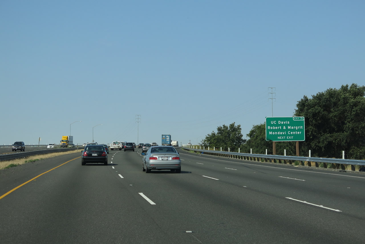
Interstate 80 nears the Exit 71 diamond interchange with Old Davis Road and the campus of UC Davis. Old Davis Road heads north from Becker Road into the University. Use Exit 71 for the Robert and Magrit Mondavi Center for the Performing Arts. The university itself constitutes a sprawling facility that occupies the area north and east of the Interstate 80 and California 113 interchange. Photo taken 07/02/13. |
|
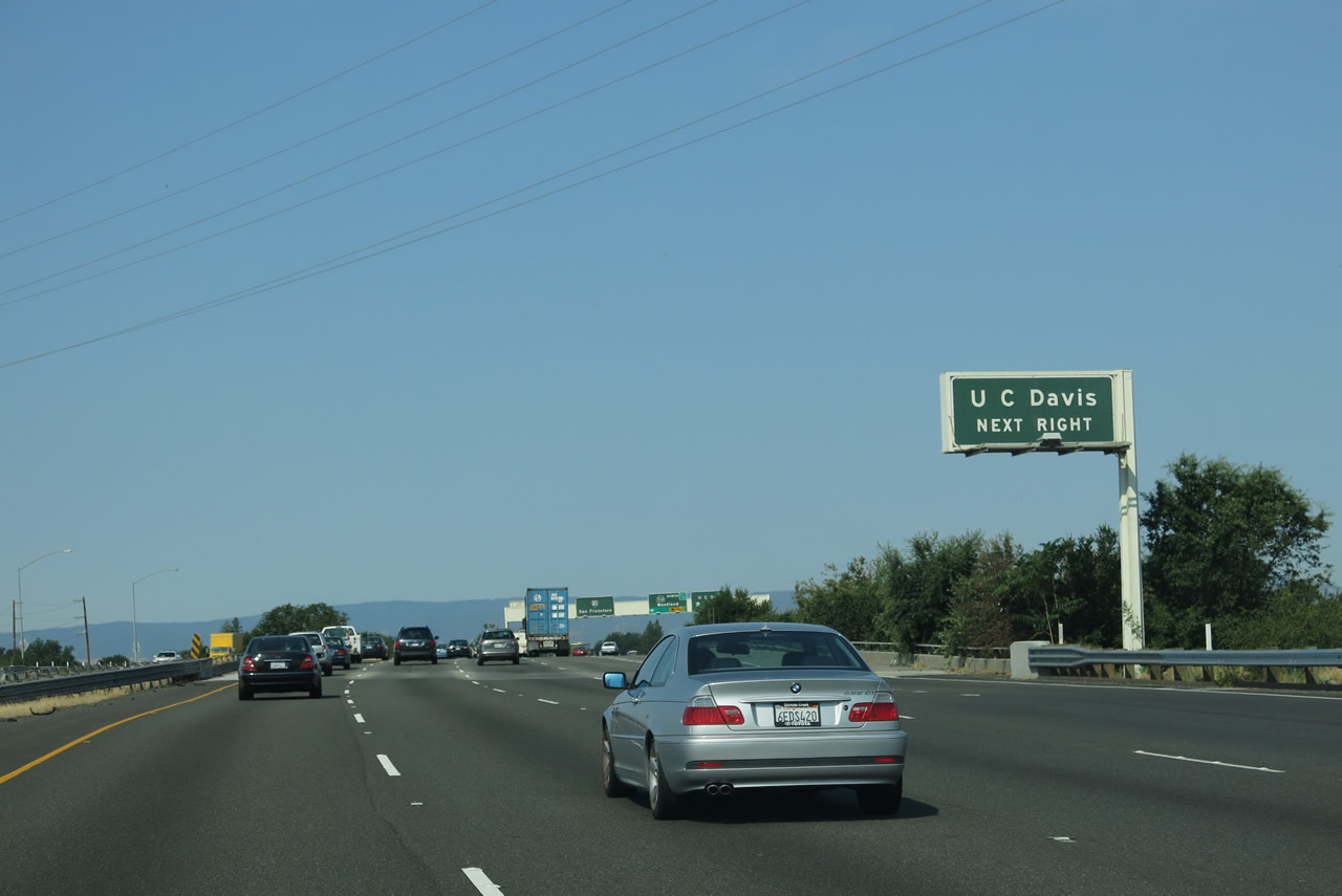
An older button copy overhead reminds motorists of the Exit 71 off-ramp to UC Davis. Old Davis Road straddles the county line from California Avenue to A Street through the university campus. Photo taken 07/02/13. |
|
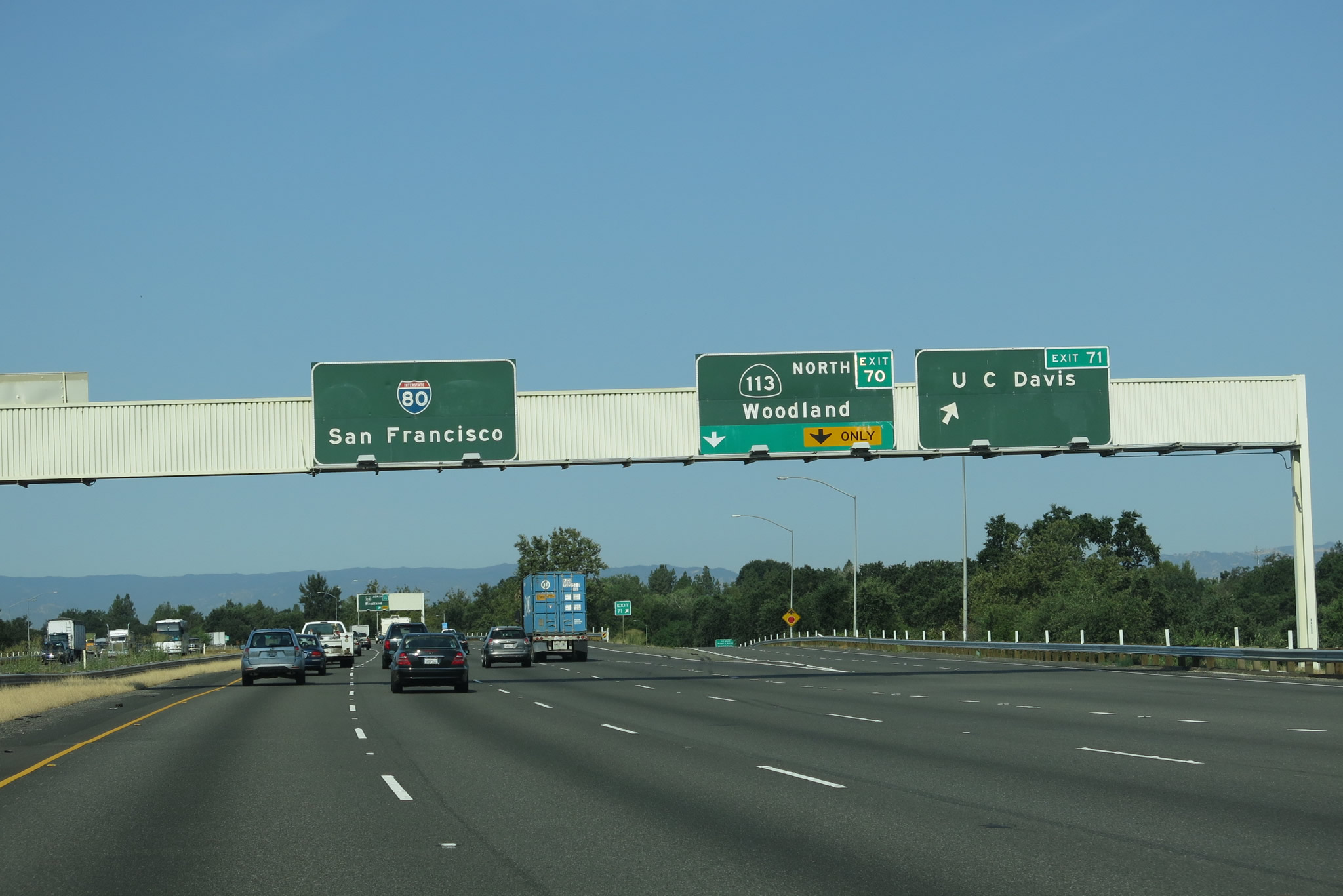
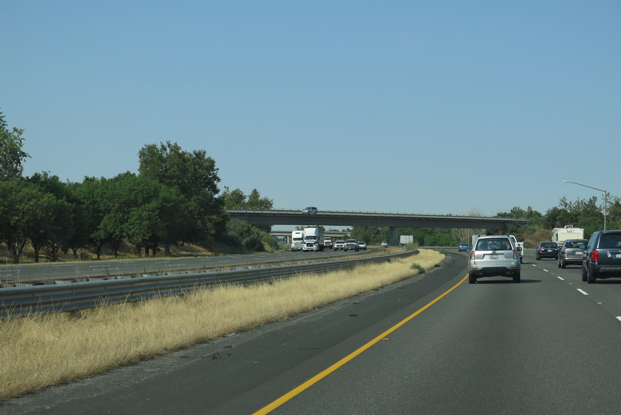
Westbound Interstate 80 meets Exit 71, Old Davis Road and UC Davis. The freeway prepares to merge with California 113 southbound from between Exits 70 and 66B. California 113 (Vic Fazio Highway) constitutes a freeway between Interstate 80 at Davis and Interstate 5 at Woodland. Two pairs of sweeping directional ramps join the two highways at Exit 70. Photo taken 07/02/13. |
|
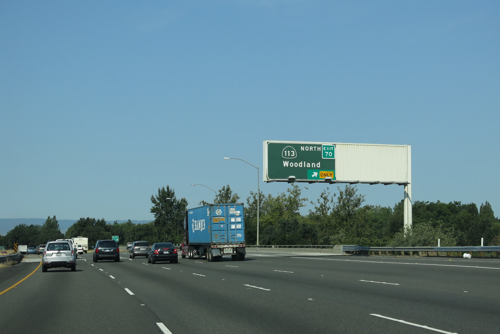
Immediately thereafter, westbound Interstate 80 reaches Exit 70, California 113 north to Woodland and Yuba City. At this point, Historic U.S. 99W used to follow the modern California 113 alignment toward Yuba City and its reconnection with U.S. 99E approaching from Lincoln and Marysville. The section of California 113 between Interstate 80 and Interstate 5 is full freeway. North of Woodland, California 113 provides connections to California 99. Continuing westbound, Interstate 80 and California 113 are merged on the freeway between Davis and Dixon. Photo taken 07/02/13. |
|
Interstate 80 proceeds through the California 113 interchange in Davis. In this vicinity, Interstate 80 leaves Yolo County and enters Solano County. Photo taken 07/02/13. |
Page Updated July 15, 2013.