
Interstate 280 South - Santa Clara County
| Interstate 280/Junipero Serra Freeway south | |
|---|---|
| The first 12 exits in Santa Clara County along southbound Interstate 280 -- Exit 22, Alpine Road and Portola Valley; Exit 20, Page Mill Road to Palo Alto; Exit 16, El Monte Road and Moody Road; Exit 15, Magdelena Avenue; Exit 13, Foothill Expressway and Grant Road; Exit 12B, California 85 south to Gilroy; Exit 12A, California 85 north to Mountain View; Exit 11, De Anza Bouelvard; Exit 10, Wolfe Road; Exit 9, Stevens Creek Boulevard and Santa Clara County G-2 (Lawrence Expressway); Exit 7, Saratoga Avenue to the city of Santa Clara; and Exit 6, Winchester Boulevard to Campbell -- are not photographed currently (except the Exit 12B photo shown next). | |
 |
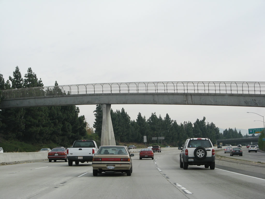
Southbound Interstate 280 reaches Exit 12B, California 85 south to Gilroy and approaching Exit 12A, California 85 north to Mountain View and U.S. 101. Photo taken by Pete Sison (05/23/03). |
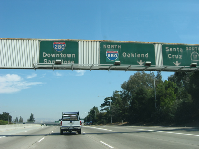 |
Southbound Interstate 280 reaches Exit 5B, Interstate 880 North to Oakland and California 17 South to Santa Cruz. Photo taken by Pete Sison (05/23/03). |
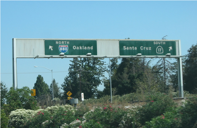 |
View of the signage for Interstate 880 and California 17 as seen from the main lanes of Interstate 280. Photo taken by Pete Sison (05/23/03). |
| Interstate 280 (Sinclair Freeway) south | |
|---|---|
 |
The next three exits along southbound Interstate 280 (now the Sinclair Freeway) are: Exit 5A, Leigh Avenue and Bascom Avenue; Exit 4, Meridian Road; and Exit 3B, Bird Avenue. Interstate 280 briefly has six southbound (eastbound) lanes after the California 17 and Interstate 880 interchange. The Sinclair Freeway is named in honor of Joseph Sinclair, who was in charge of California State Division of Highways (now Caltrans) District 4 from 1959 to 1964. Sinclair was involved in the development of the freeway that now bears his name, and the Sinclair Freeway was added into the Interstate Highway System in 1962.1 Photo taken 11/25/07. |
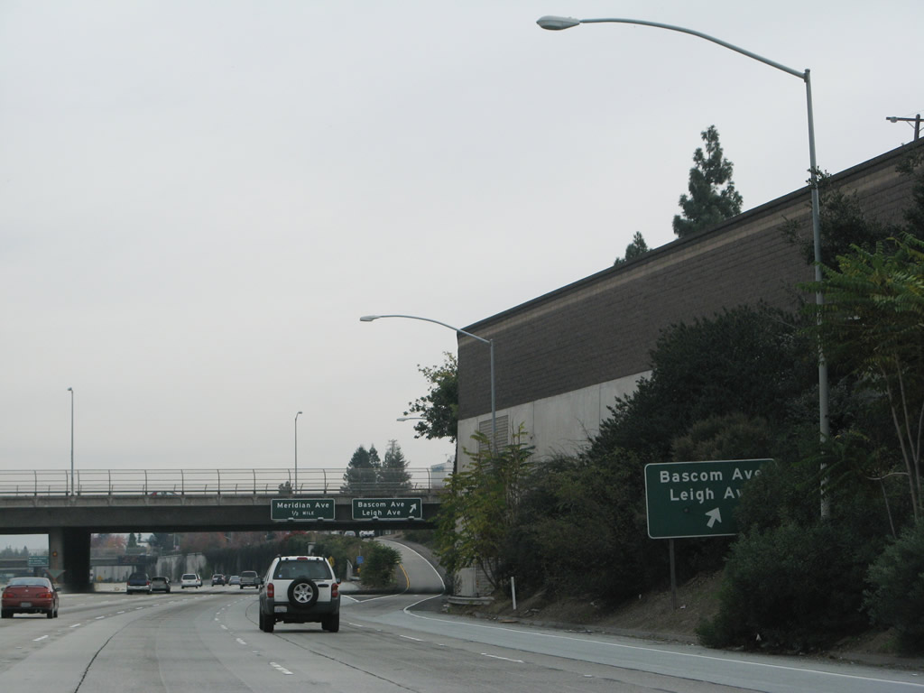 |
The exit signage for Exit 5A, Leigh Avenue and Bascom Avenue, is partially obscured by decorative landscaping. Use this exit for San Jose City College and the Santa Clara Valley Health and Hospital System. Both facilities are located along the south side of the freeway, which is traveling due east at this point. This exit is a slip ramp onto Moorpark Avenue, which functions as a frontage road on the south side of the freeway. Photo taken 11/25/07. |
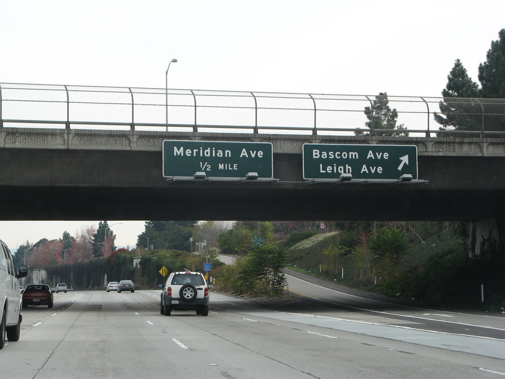 |
Southbound Interstate 280 (Sinclair Freeway) reaches Exit 5A, Leigh Avenue and Bascom Avenue. The next exit is Exit 4, Meridian Road. Photo taken 11/25/07. |
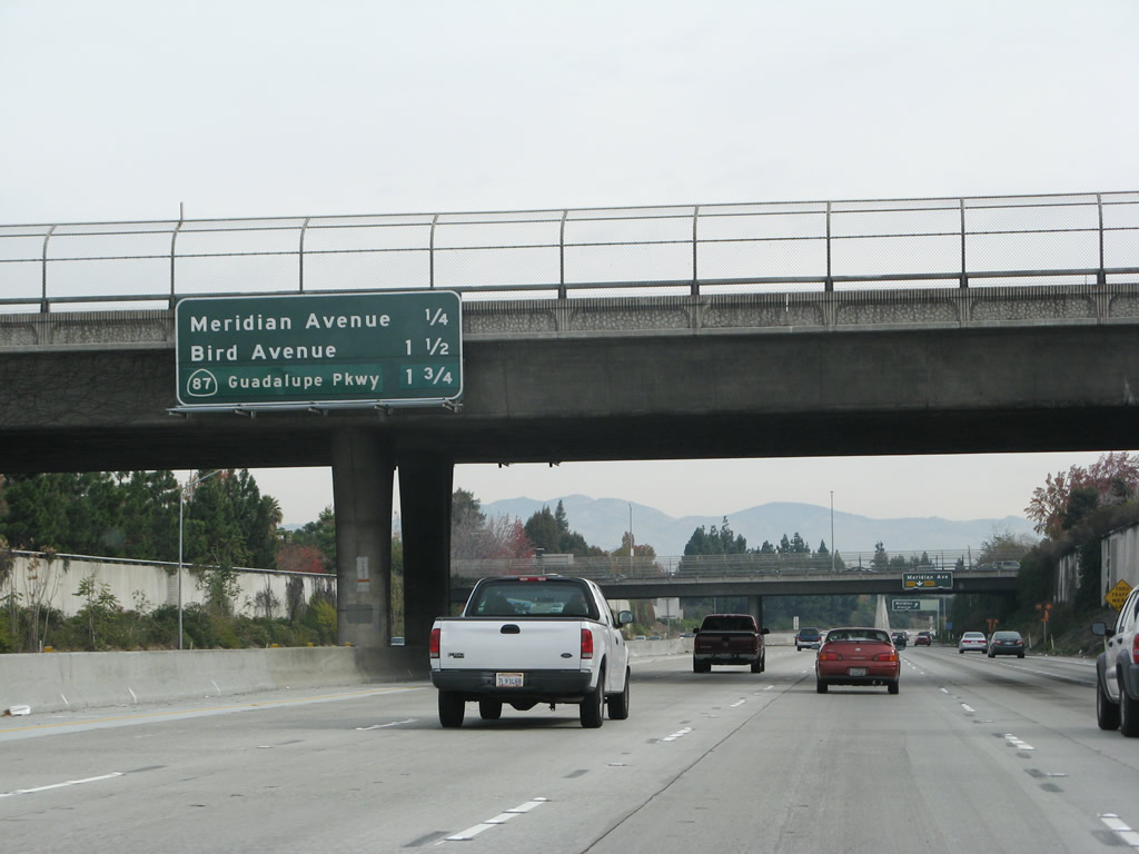 |
The next three exits along southbound Interstate 280 (Sinclair Freeway) are: Exit 4, Meridian Road; Exit 3B, Bird Avenue; and Exit 3A, California 87 (Guadalupe Parkway). Photo taken 11/25/07. |
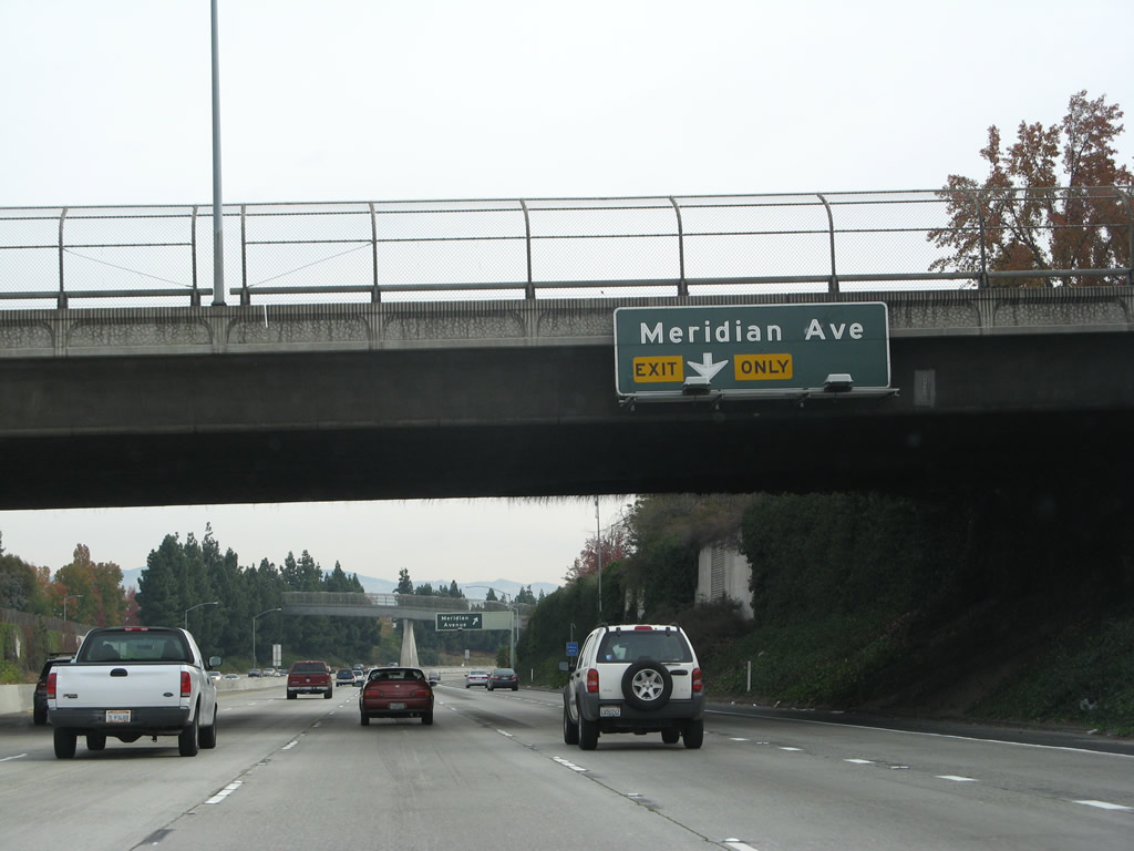 |
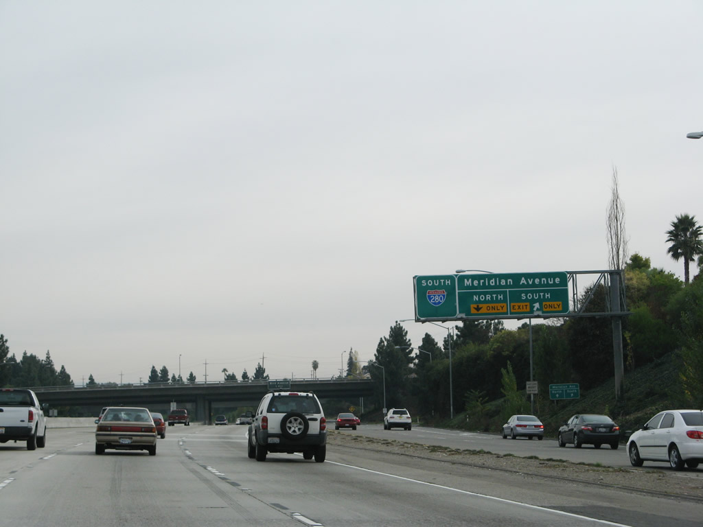
The right lane of Interstate 280 (Sinclair Freeway) south becomes exit only for Exit 4, Meridian Road. This exit also connects to the Southwest Expressway, which travels southwest toward the city of Campbell. Photo taken 11/25/07. |
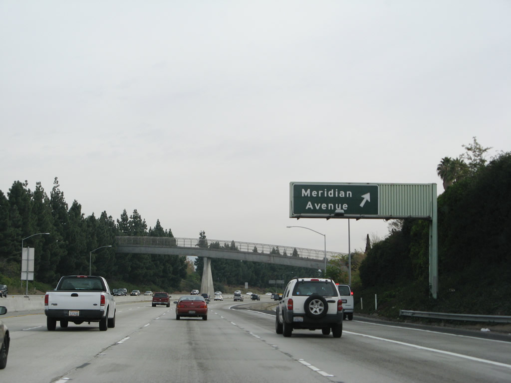 |
Southbound Interstate 280 (Sinclair Freeway) reaches Exit 4, Meridian Road. Photo taken 11/25/07. |
 |
An arched pedestrian bridge crosses over Interstate 280 after the slip ramp to the collector distributor lanes for Exit 4. Photo taken 11/25/07. |
 |
The collector distributor lanes receive traffic from Moorpark Avenue (south frontage road), and the right lanes connect first to Meridian Avenue south to Southwest Expressway south and Meridian Avenue north. Photo taken 11/25/07. |
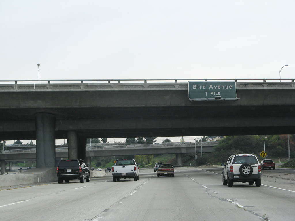 |
The next exit along southbound Interstate 280 (Sinclair Freeway) is Exit 3B, Bird Avenue. Photo taken 11/25/07. |
 |
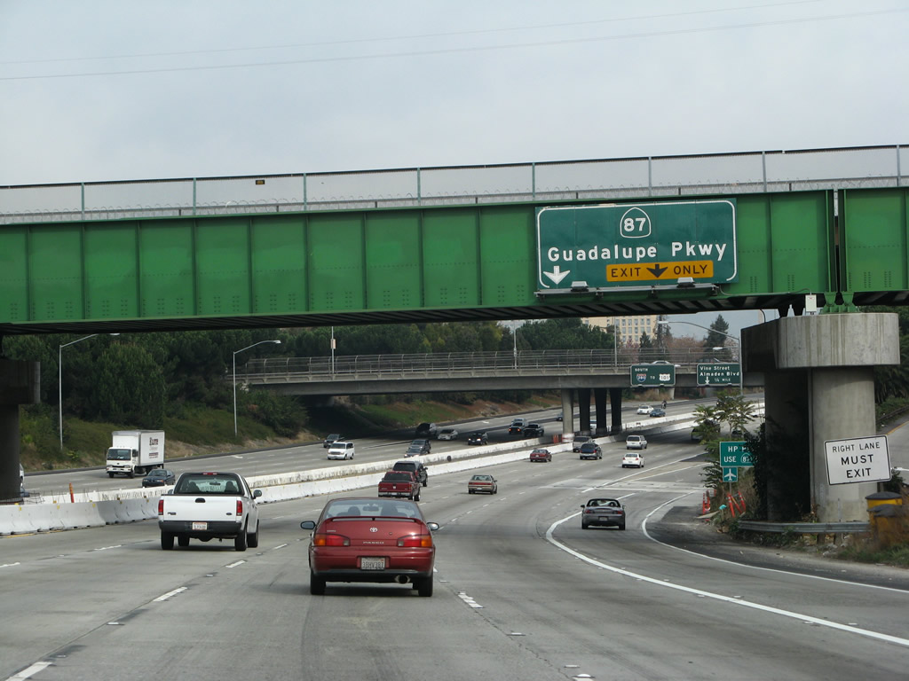
After Exit 3B (Bird Avenue), the second exit is Exit 3A, California 87 (Guadalupe Parkway). Photo taken 11/25/07. |
 |
Although California 87 (Guadalupe Parkway) is open to all traffic, California 85 has a truck restriction. Since California 87 south ends at California 85, through trucks should remain on Interstate 280 east to U.S. 101 for all points south. Photo taken 11/25/07. |
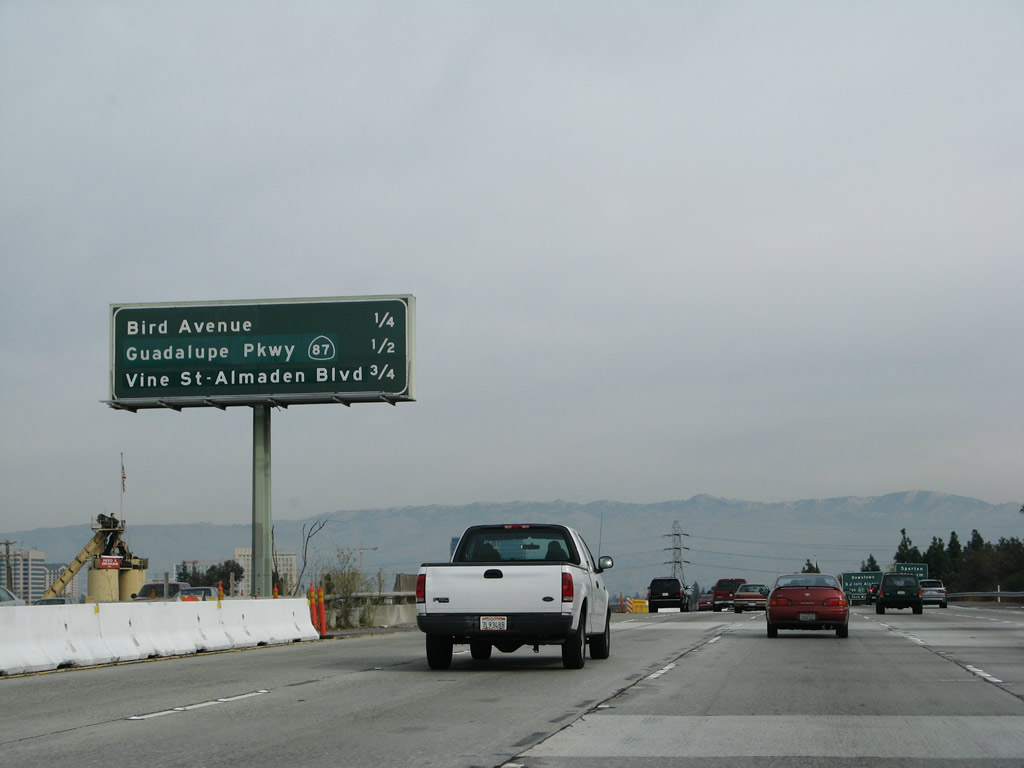 |
The next three exits along southbound Interstate 280 (Sinclair Freeway) are: Exit 3B, Bird Avenue; Exit 3A, California 87 (Guadalupe Parkway); and Exit 2B, Vine Street and Almaden Avenue. Photo taken 11/25/07. |
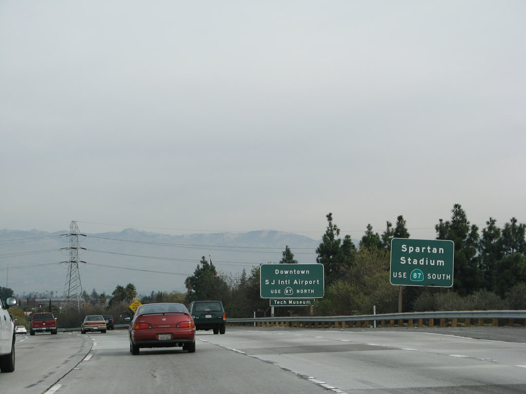 |
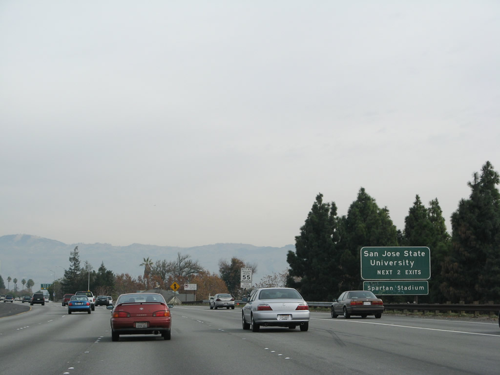
California 87 (Guadalupe Parkway) serves as the main north-south cross-town freeway in San Jose. Use California 87 north to the Norman Y. Mineta San Jose International Airport, downtown San Jose, and HP Pavilion at San Jose (home of the National Hockey League San Jose Sharks). To the south, California 87 connects with Spartan Stadium and Santa Clara County Fairgrounds. To San Jose State University, use Exit 2A. Photo taken 11/25/07. |
 |
Southbound Interstate 280 (Sinclair Freeway) reaches Exit 3B, Bird Avenue. The next exit along southbound is Exit 3A, California 87 (Guadalupe Parkway). Photo taken 11/25/07. |
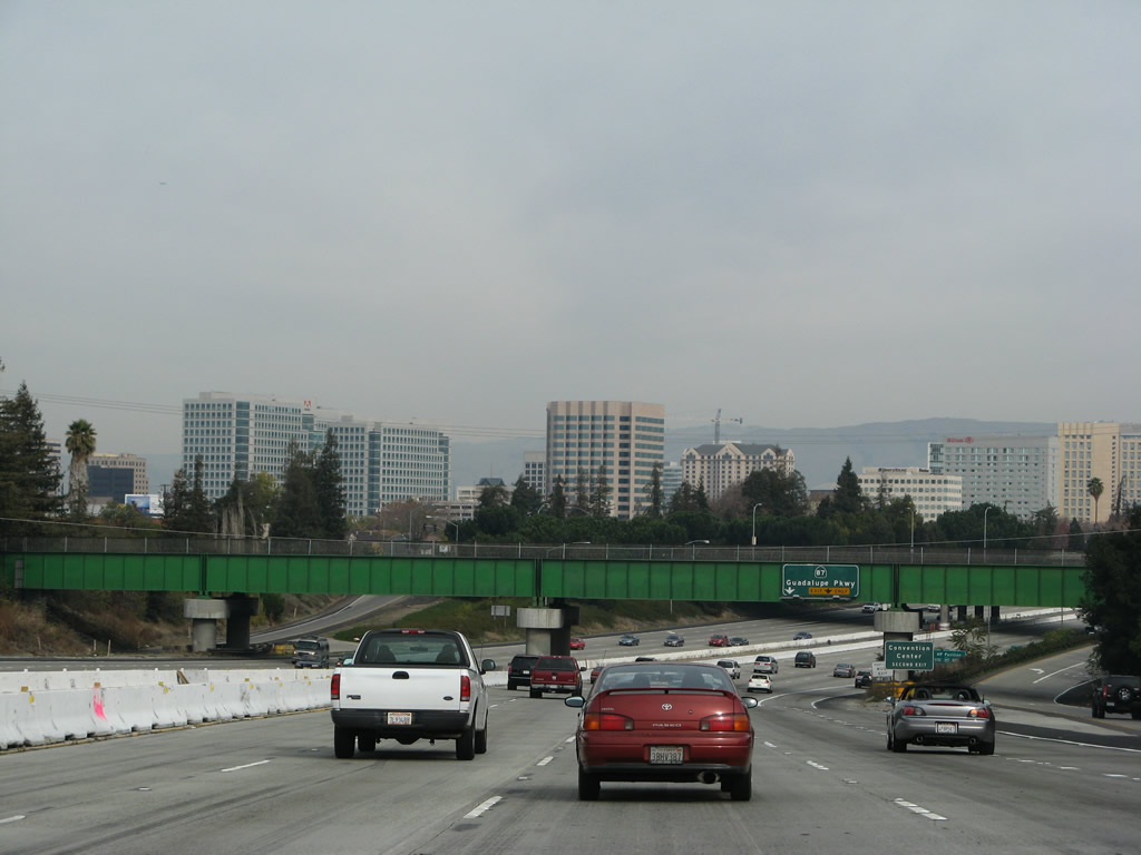 |
Downtown San Jose comes into view as Interstate 280 continues east toward the Guadalupe Parkway (California 87) interchange. The green bridge in the foreground carries the CalTrain over the Interstate 280 freeway. Photo taken 11/25/07. |
 |
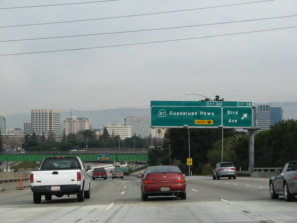
The right lane of Interstate 280 becomes exit only for Exit 3A, California 87 north to downtown San Jose and south to the Spartan Stadium and southern San Jose. Photo taken 11/25/07. |
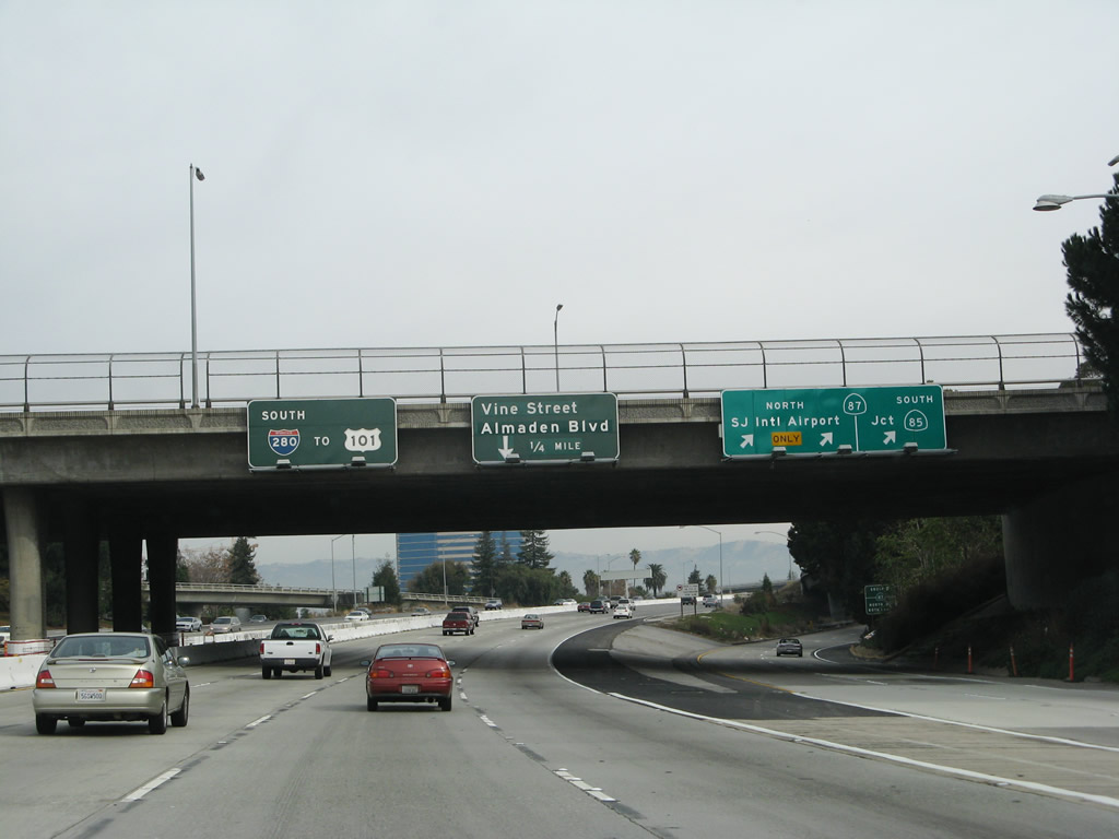 |
Southbound Interstate 280 reaches Exit 3A, California 87 (Guadalupe Parkway) north to the international airport and south to California 85 and the county fairgrounds. The next exit is Exit 2B, Vine Street and Almaden Avenue. Photo taken 11/25/07. |
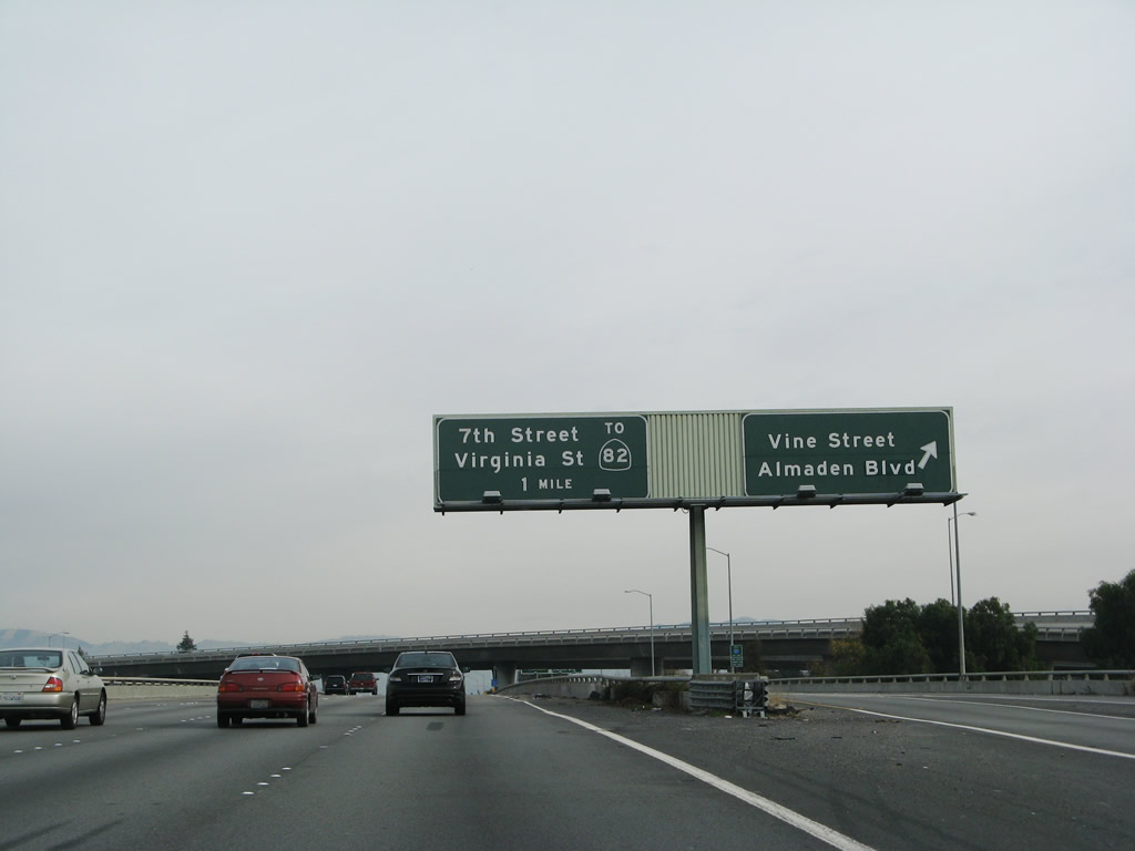 |
Immediately thereafter, southbound Interstate 280 (Sinclair Freeway) reaches Exit 2B, Vine Street and Almaden Avenue. The next exit along southbound is Exit 2A, Seventh Street south to California 82 (Monterey Highway) and east-west Virginia Street, which parallels Interstate 280 here. Photo taken 11/25/07. |
 |
This view shows the collector distributor lane signage for Exit 2B, Vine Street and Almaden Avenue. The Interstate 280 pull through sign is probably an original sign from the early 1960s, including the once-common practice of squeezing three-digit Interstate numbers into a two-digit sized shield. Photo taken 11/25/07. |
 |
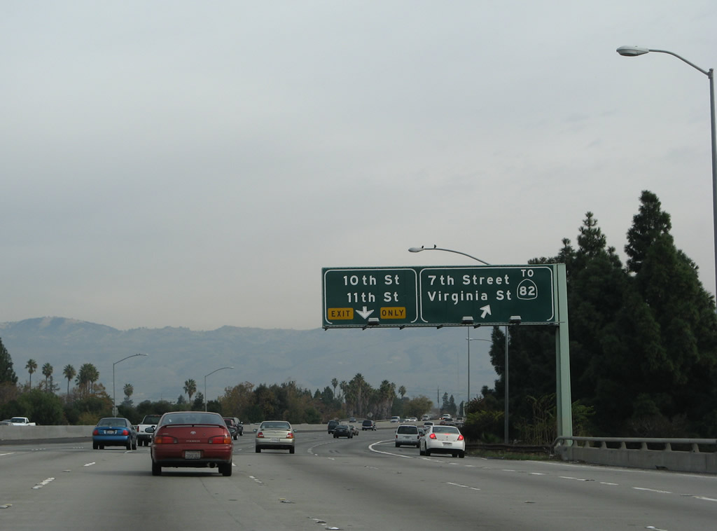
The next two exits both serve San Jose State University, which is located north of Interstate 280 and is bounded by Fourth Street on the west, San Salvador Street on the south, Tenth Street on the east, and San Fernando Street on the north. From Interstate 280, use Exit 2A, Seventh Street north or Exit 1B, 11th Street north to the university campus. Photo taken 11/25/07. |
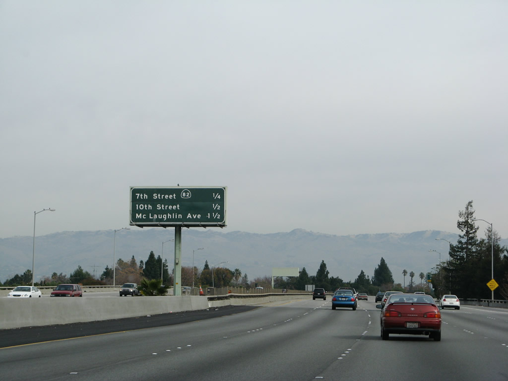 |
The next three exits on Interstate 280 south are Exit 2A, Virginia Street and Seventh Street to California 82; Exit 1B, 10th Street south and 11th Street north; and Exit 1A, McLaughlin Avenue. Photo taken 11/25/07. |
 |
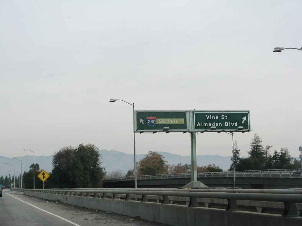
Southbound Interstate 280 reaches Exit 2A, Virginia Street and Seventh Street to California 82. The connection to California 82 is via Virginia Street west. The next off-ramp is Exit 1B to 10th Street south and 11th Street north. Photo taken 11/25/07. |
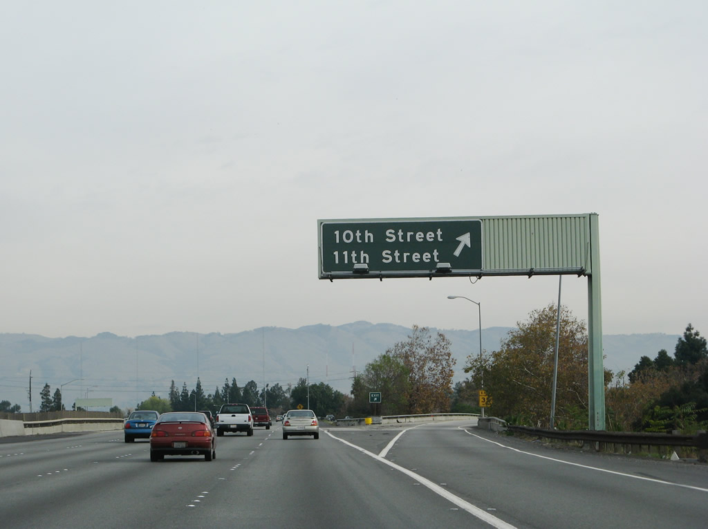 |
Southbound Interstate 280 (Sinclair Freeway) reaches Exit 1B, 10th Street south and 11th Street north. Photo taken 11/25/07. |
 |
This reassurance shield for Interstate 280 south is posted after Exit 1B, 10th Street south and 11th Street north. It is the final reassurance shield along southbound. Photo taken 11/25/07. |
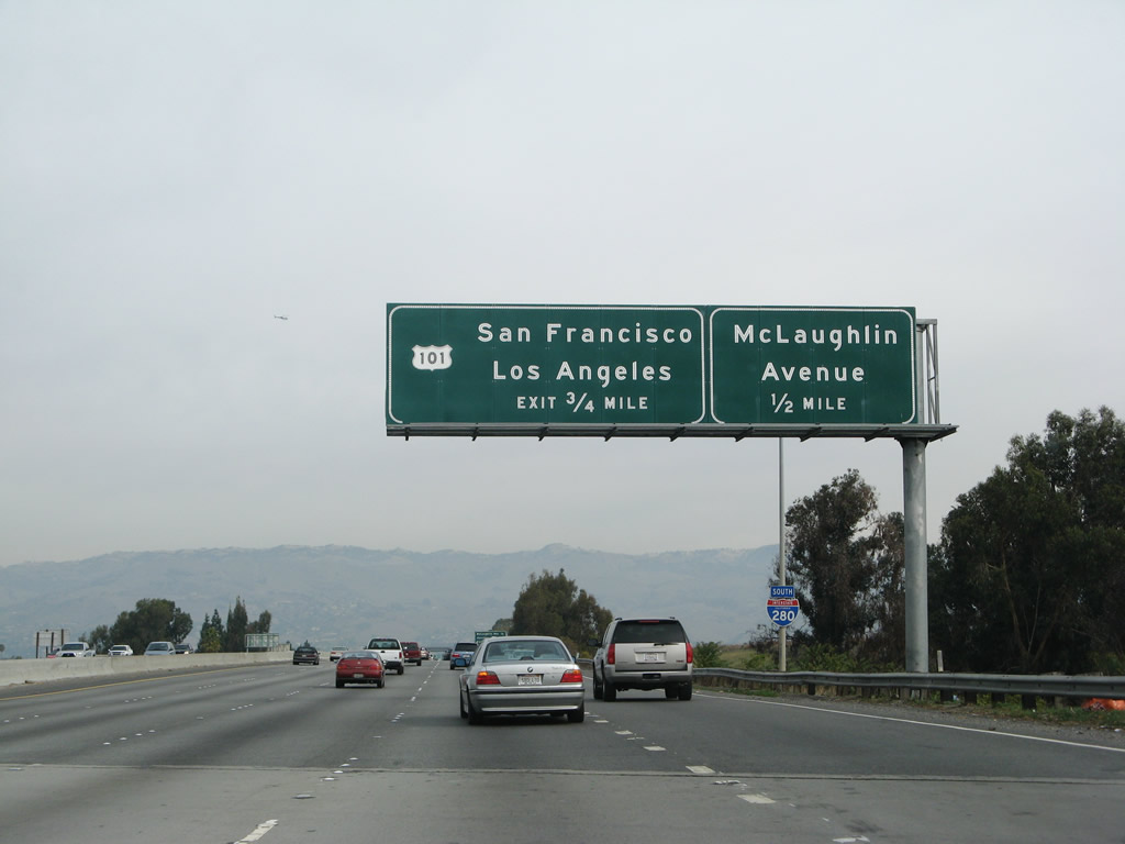 |
The final three exits on Interstate 280 south are Exit 1A, McLaughlin Avenue; Exit 0B, U.S. 101 south to Los Angeles; and Exit 0A, U.S. 101 north to San Francisco. Photo taken 11/25/07. |
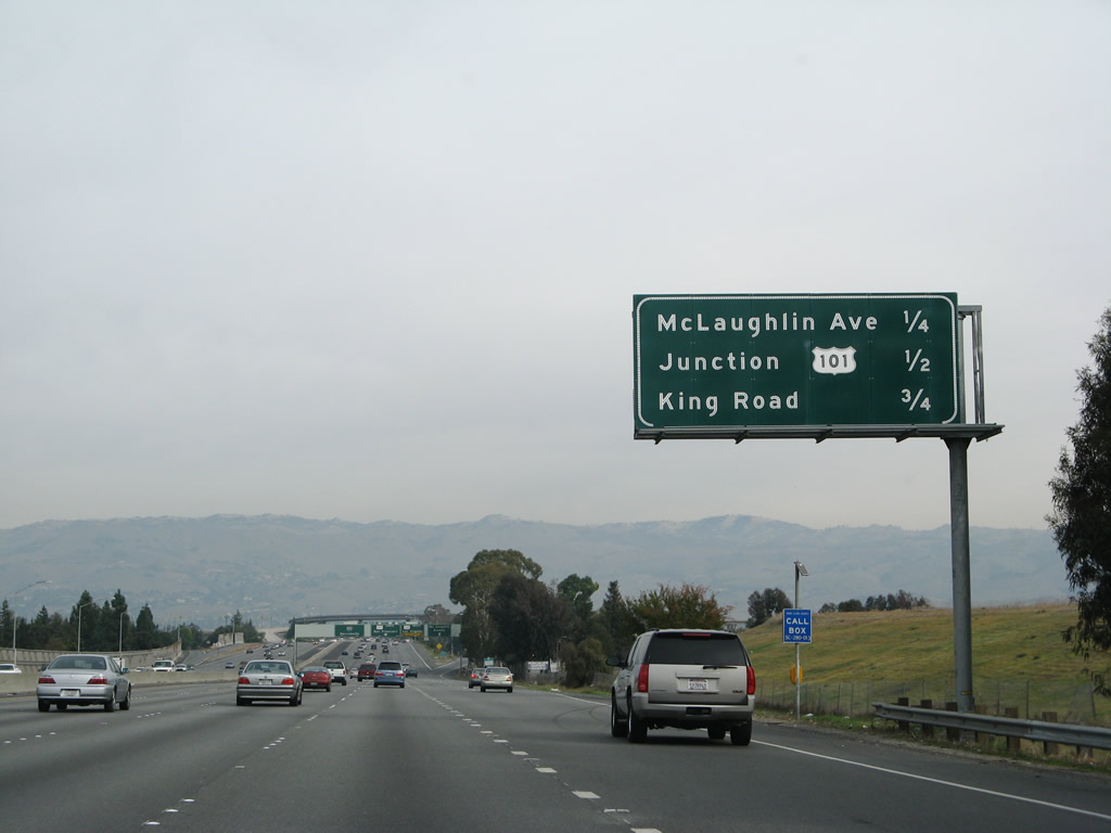 |
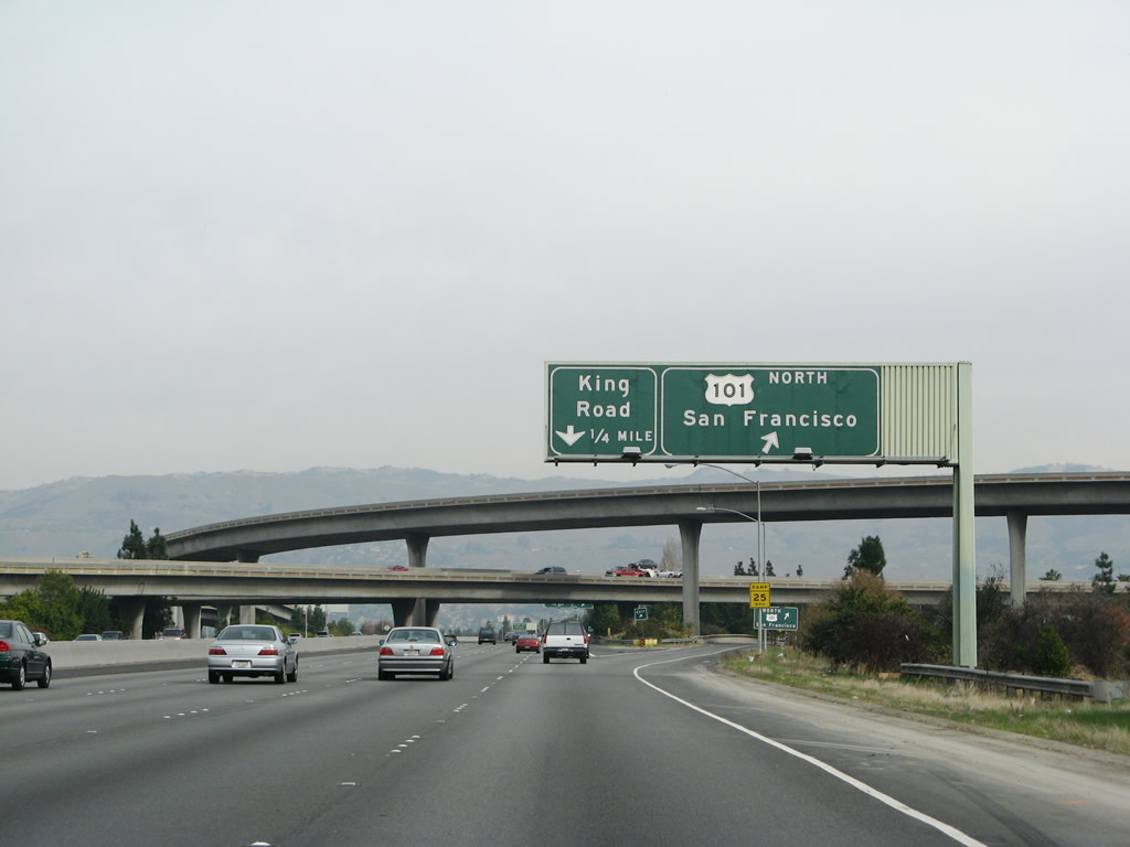
This mileage sign provides the distance to the final three exits on Interstate 280 (Exit 1A, McLaughlin Avenue; Exit 0B, U.S. 101 south to Los Angeles; and Exit 0A, U.S. 101 north to San Francisco) as well as the first exit on Interstate 680 north: Exit 1A, King Road. Interstate 680 is not mentioned on any of these advance signs prior to the U.S. 101 interchange. Photo taken 11/25/07. |
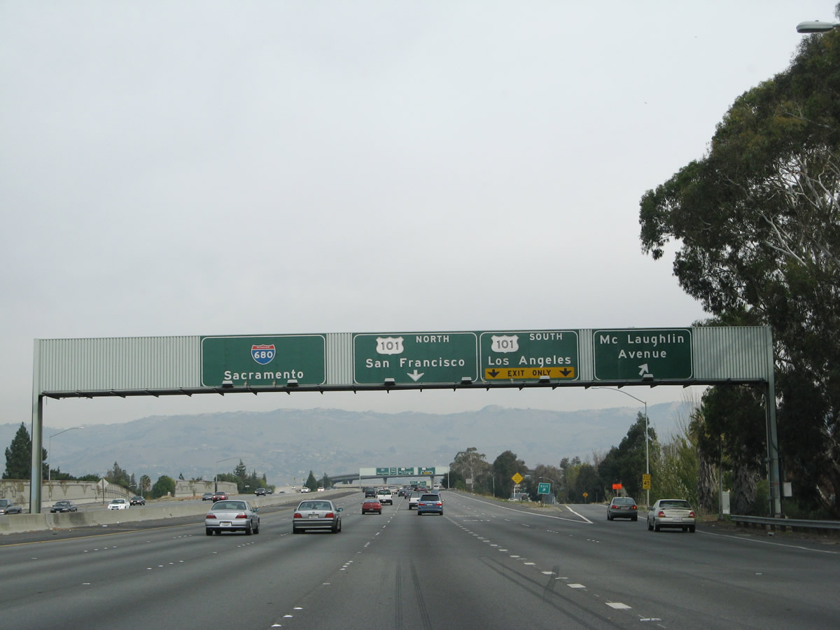 |
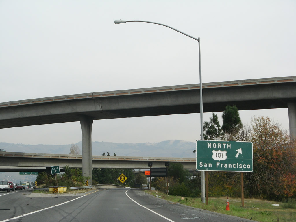
Southbound Interstate 280 reaches Exit 1A, McLaughlin Avenue. The next ramp connects to Exit 0B, U.S. 101 south to Los Angeles, followed by the ramp to Exit 0A, U.S. 101 north to San Francisco. The pull-through sign advises "Interstate 680 to Sacramento." Photo taken 11/25/07. |
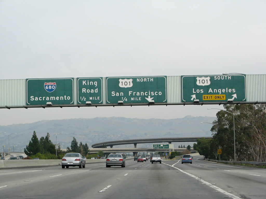 |
Immediately thereafter, southbound Interstate 280 (Sinclair Freeway) reaches Exit 0B, southbound U.S. 101/Los Angeles. Although not signed, U.S. 101 serves the Central California coastal region as well as provides the most direct route to the Monterey Peninsula. Photo taken 11/25/07. |
 |
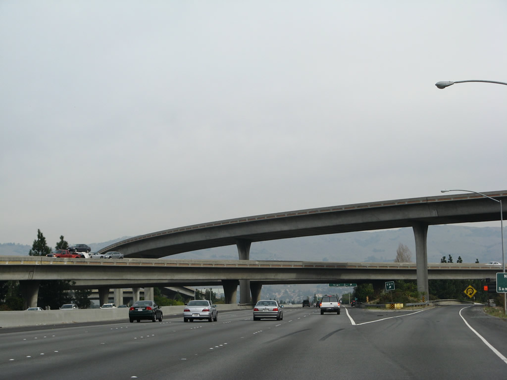
Interstate 280 ends at the interchange with U.S. 101 north to San Francisco. If not for this loop ramp from Interstate 280 south to U.S. 101 north, this interchange would be a symmetrical stack. The next exit ramp is for Interstate 680 north Exit 1A, King Road. Photo taken 11/25/07. |
 |
This maze of flyover ramps is located at the southern terminus of Interstate 280 after the transition ramps to U.S. 101. It took time for this massive interchange to be finished. When Governor Jerry Brown cut the funding for freeway building in the 1970s, the interchange was not yet complete. The bents for the tall flyover ramps were built, but the roadway sections connecting them were only complete near the center of the interchange, but did not connect to anything else. Due to lack of funds, Caltrans decided not to complete the interchage as originally planned, and instead chose to build "underpowered" ramps. After much frustration about the situation, a San Jose city councilman used a crane to put a car up on top of one of the unfinished flyover ramps, as a protest to the state. That got the state moving, and the interchange was soon completed with the flyover ramps. Northbound Interstate 680 continues straight ahead. (Thanks to Jeff Waller for this information). Photo taken 11/25/07. |
 |
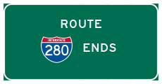
There is no end Interstate 280 shield assembly as southbound Interstate 280 connects with U.S. 101 north at this loop ramp. Interstate 680 now follows the Sinclair Freeway northeast toward eastern San Jose and eventually Milpitas and points northeast in Alameda County. Photo taken 11/25/07. |

Sources:
- Joseph Pierce Sinclair (1910-1964) by Mike Sinclair - "By a special act of the California State Legislature, [Assembly Concurrent Resolution 104, Chapter 168 in 1967.] the portions of Interstate Route 280 between Route 17 and Route 101 in San Jose, and of Interstate Route 680 from Route 101 north to the Alameda County line were officially named the Sinclair Freeway."
Page Updated February 26, 2008.
|
About Contact Glossary |
In The News Interstate Guide |
Social Media:
 |
|
© 2000-25 AARoads.com | All Rights Reserved | Privacy Policy / Terms of Use
|
||