Profiled below are some of the roads, highways and scenery located in Marin County, along with routes that connect with U.S. 101.
| Alexander Avenue south - Sausalito |
|---|
|
|
|
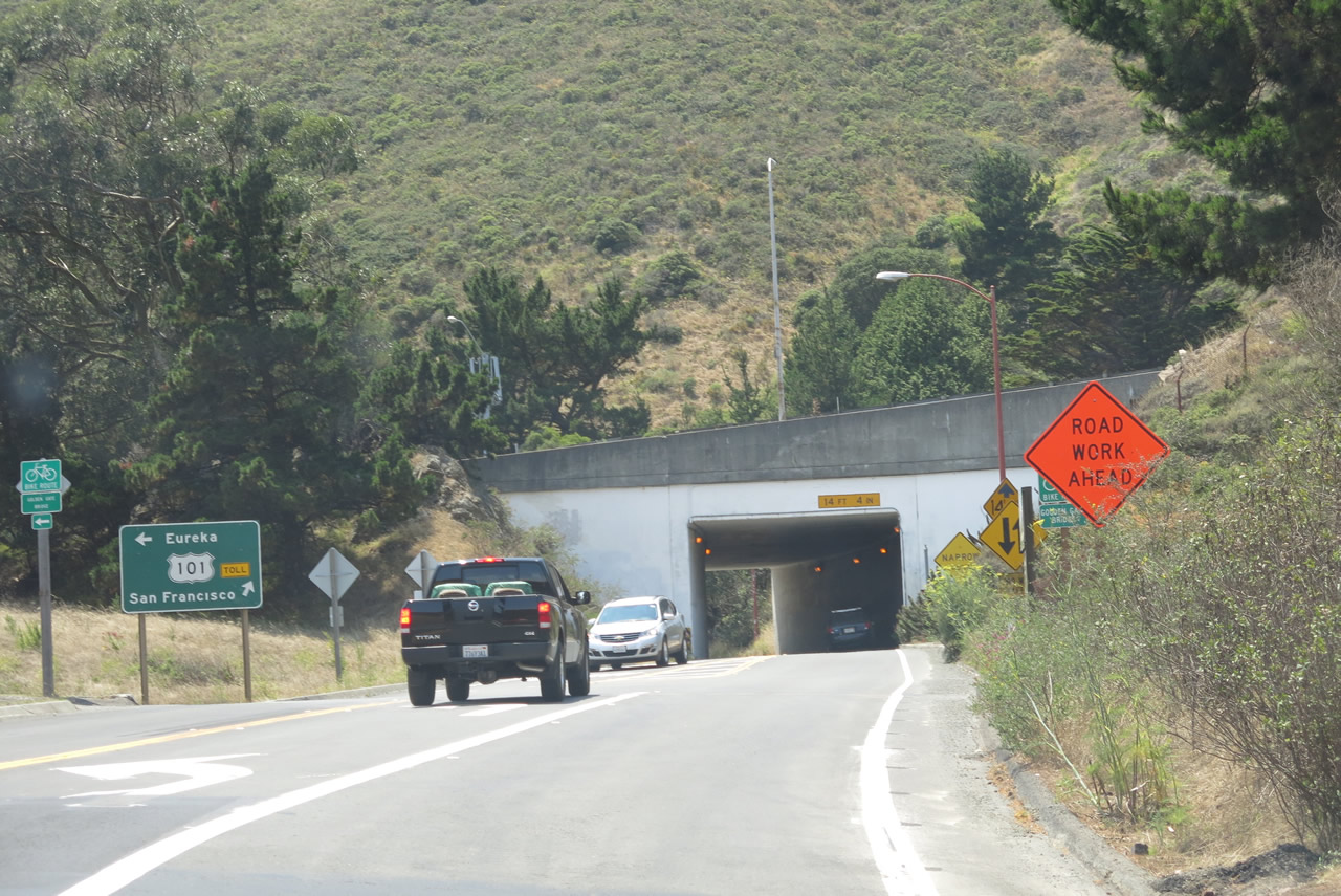
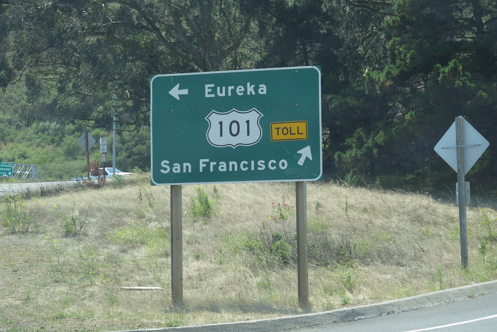
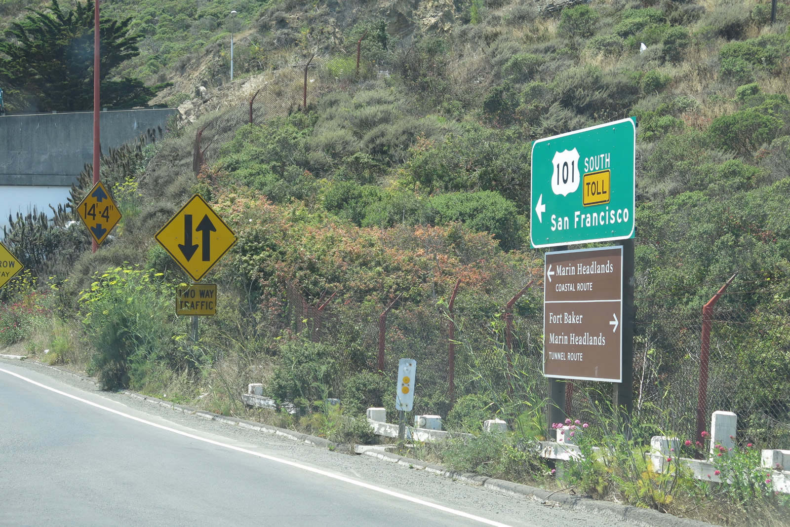
Southbound Alexander Avenue approaches U.S. 101. The first left connects to U.S. 101 and California 1 north to Santa Rosa and Eureka via the Waldo Tunnel. The second left will connect to U.S. 101 and California 1 south to San Francisco via the Golden Gate Bridge. Note the TOLL banners on the guide signs associated with U.S. 101 south. Photos taken 07/02/13. |
| Bunker Road east - Marin Headlands |
|
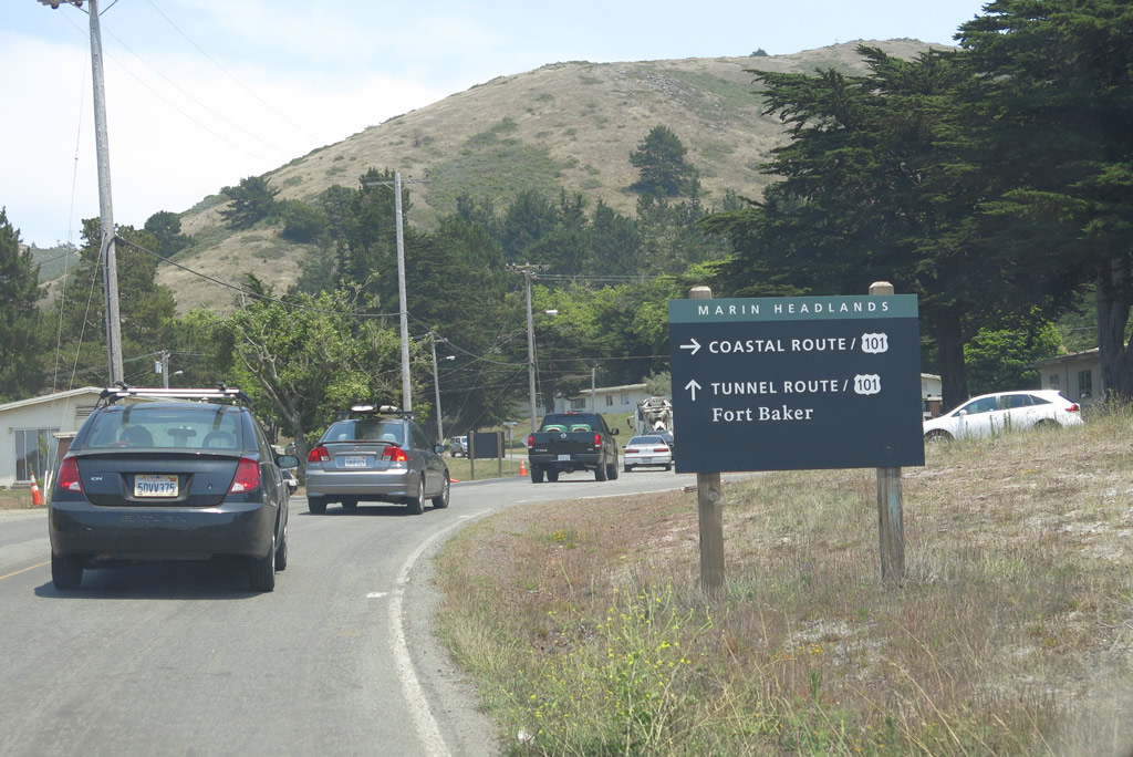
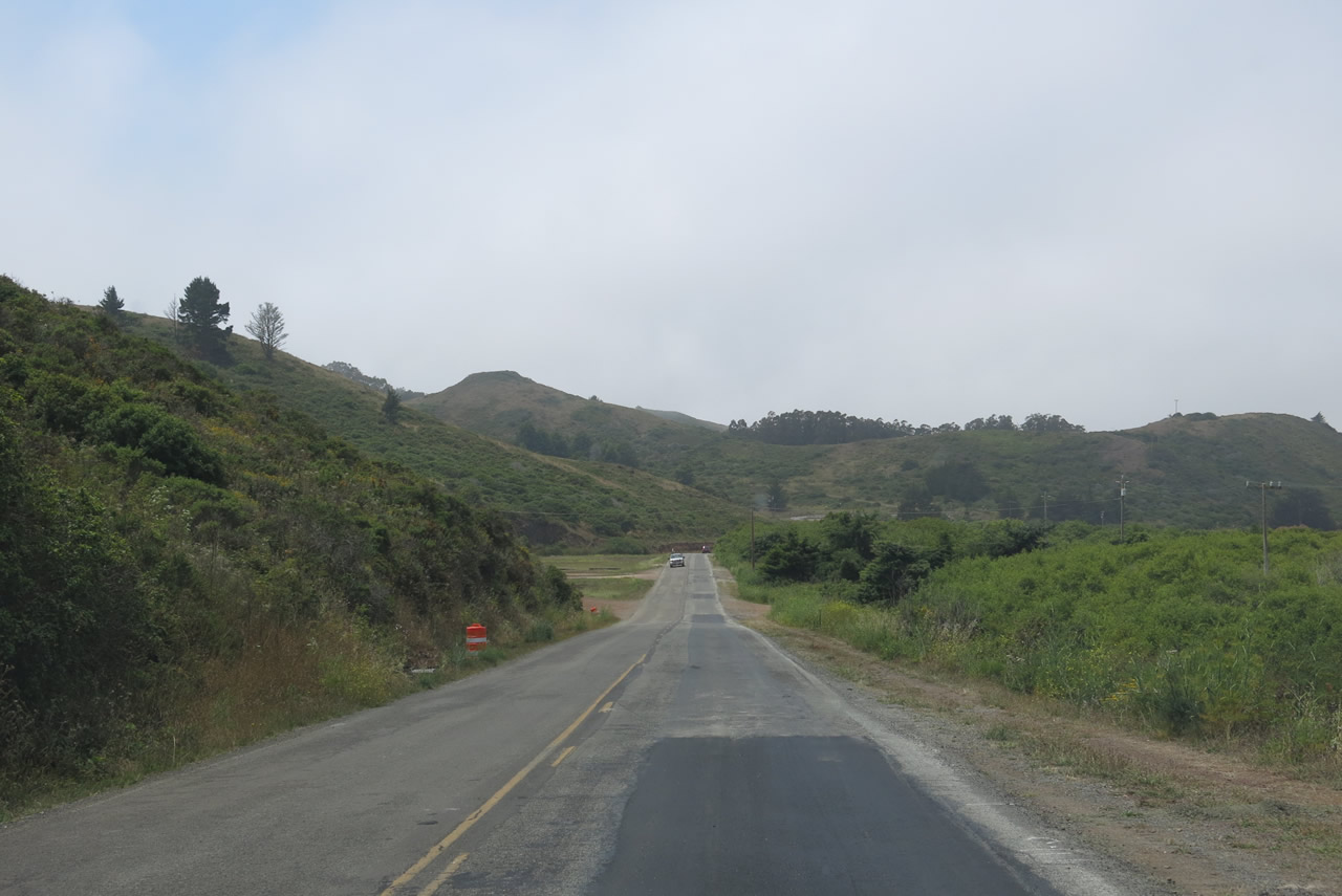
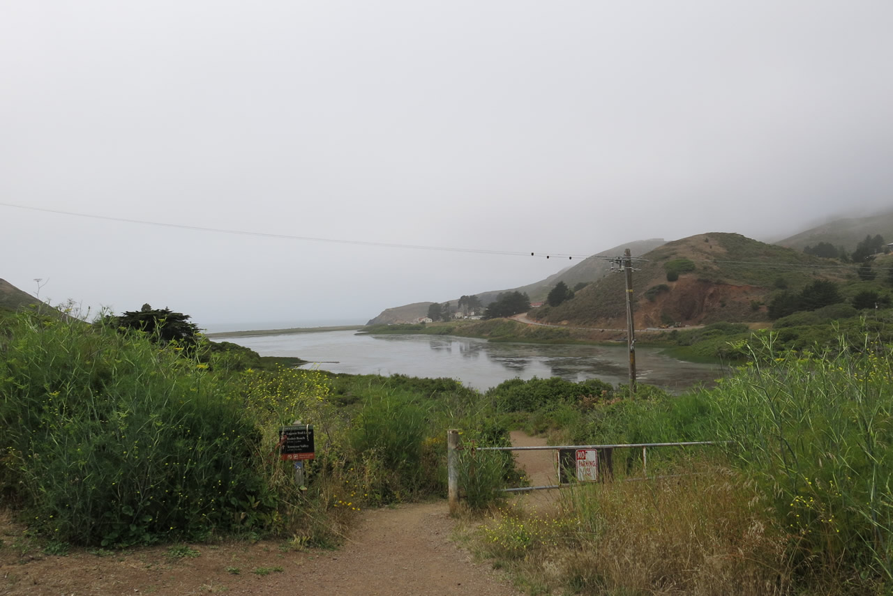
Within Golden Gate National Recreation Area in the Rodeo Valley, eastbound Bunker Road passes through Rodeo Valley on its way to the junction with McCullough Road. Follow Bunker Road east for the "tunnel route" to U.S. 101 and Sausalito or turn right (south) on McCullough Road for the "coastal route" to U.S. 101. Photo taken 07/02/13. |
|
|
|
|
|
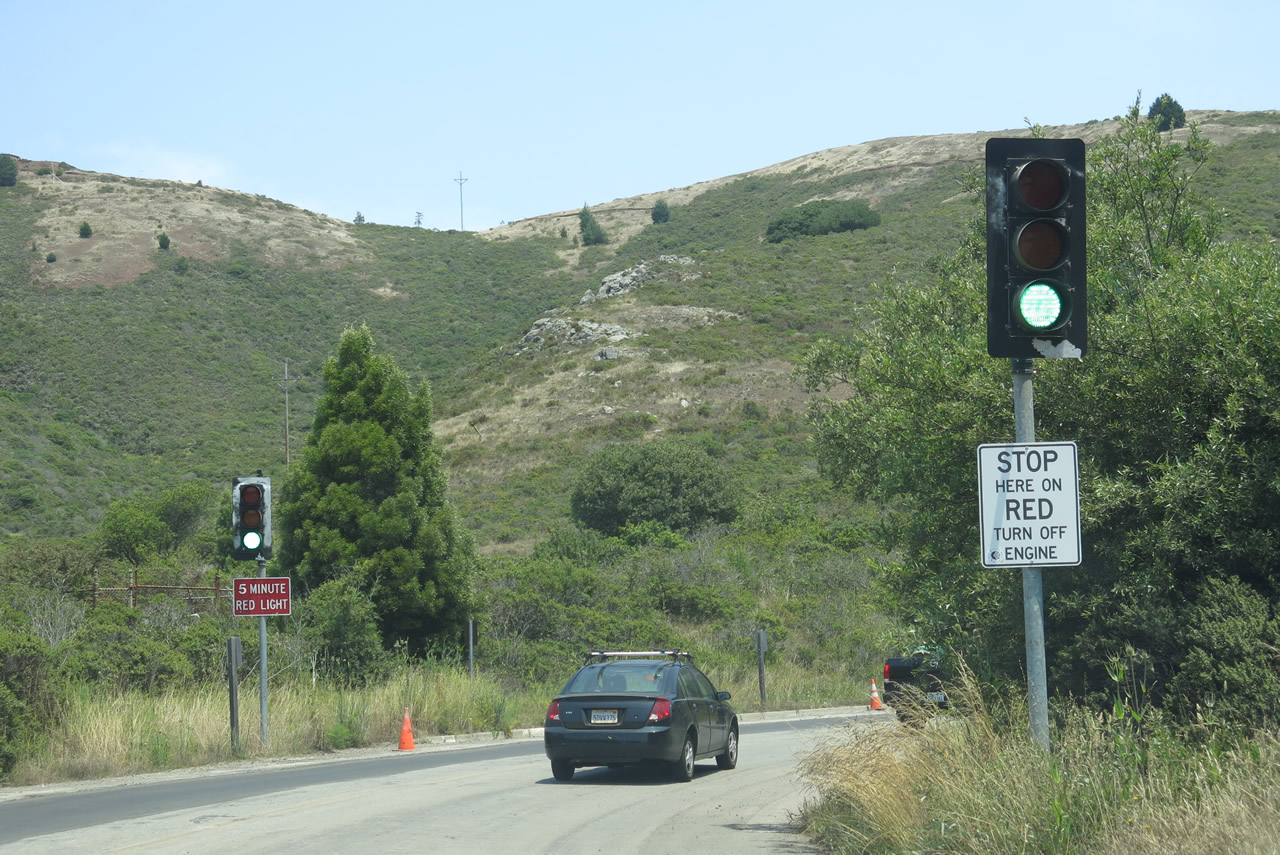
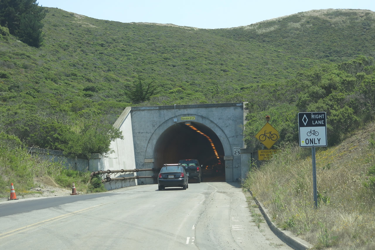
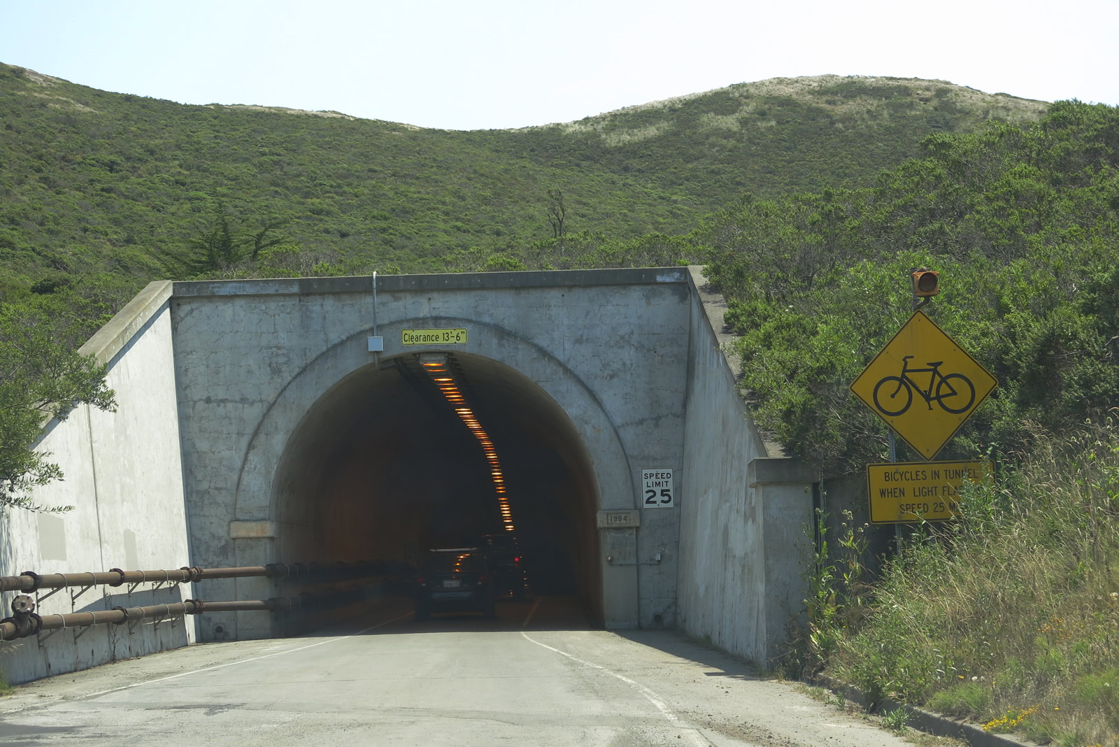
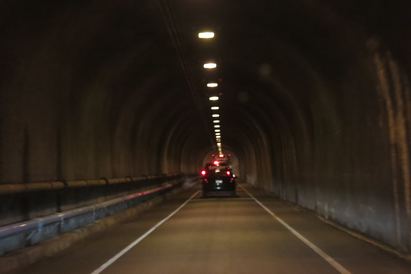
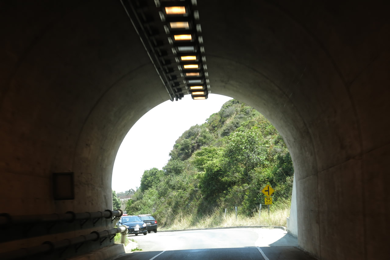
| A single-lane tunnel carries Bunker Road from the Rodeo Valley to U.S. 101. Built in 1918, this tunnel is known as Baker-Berry Tunnel but also known as the Bunker Road Tunnel or the Five Minute Tunnel. A date stamp on the western entrance to the Baker-Barry Tunnel lists 1994, which may have been the year the tunnel was retrofitted for earthquake protection or reconstructed for other reasons. Additional work was completed in 2013 to allow for wider approaches for bicyclists. A traffic signal governs the flow of traffic into the tunnel, since only one direction may proceed at a time. Photos taken 07/02/13. |
|
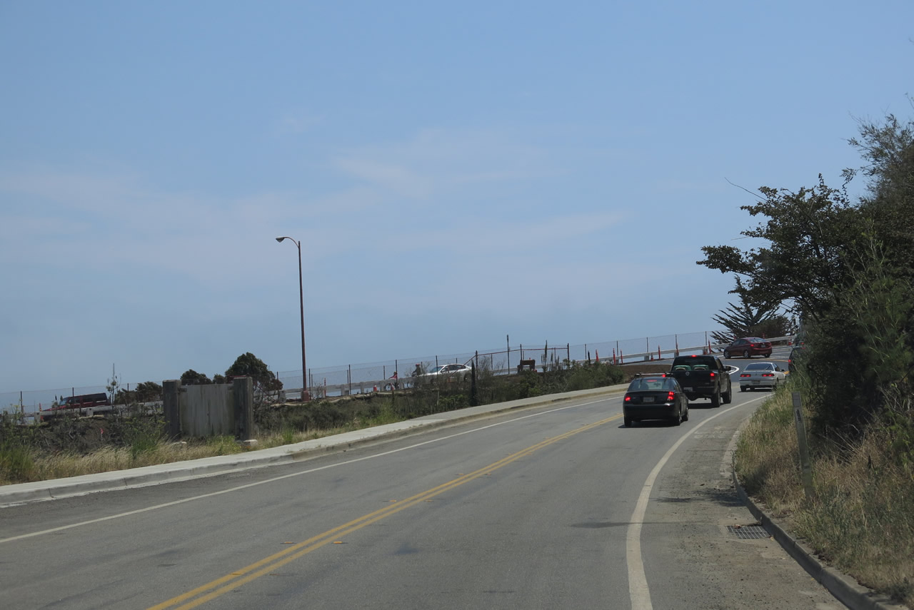
Eastbound Bunker Road leaves the Baker-Berry Tunnel and approaches Alexander Avenue, which travels north to Sausalito and south to U.S. 101/Golden Gate Bridge. Watch for a left turnoff that leads to Fort Baker, which is situated on the bayshore south of Sausalito. Photo taken 07/02/13. |
|
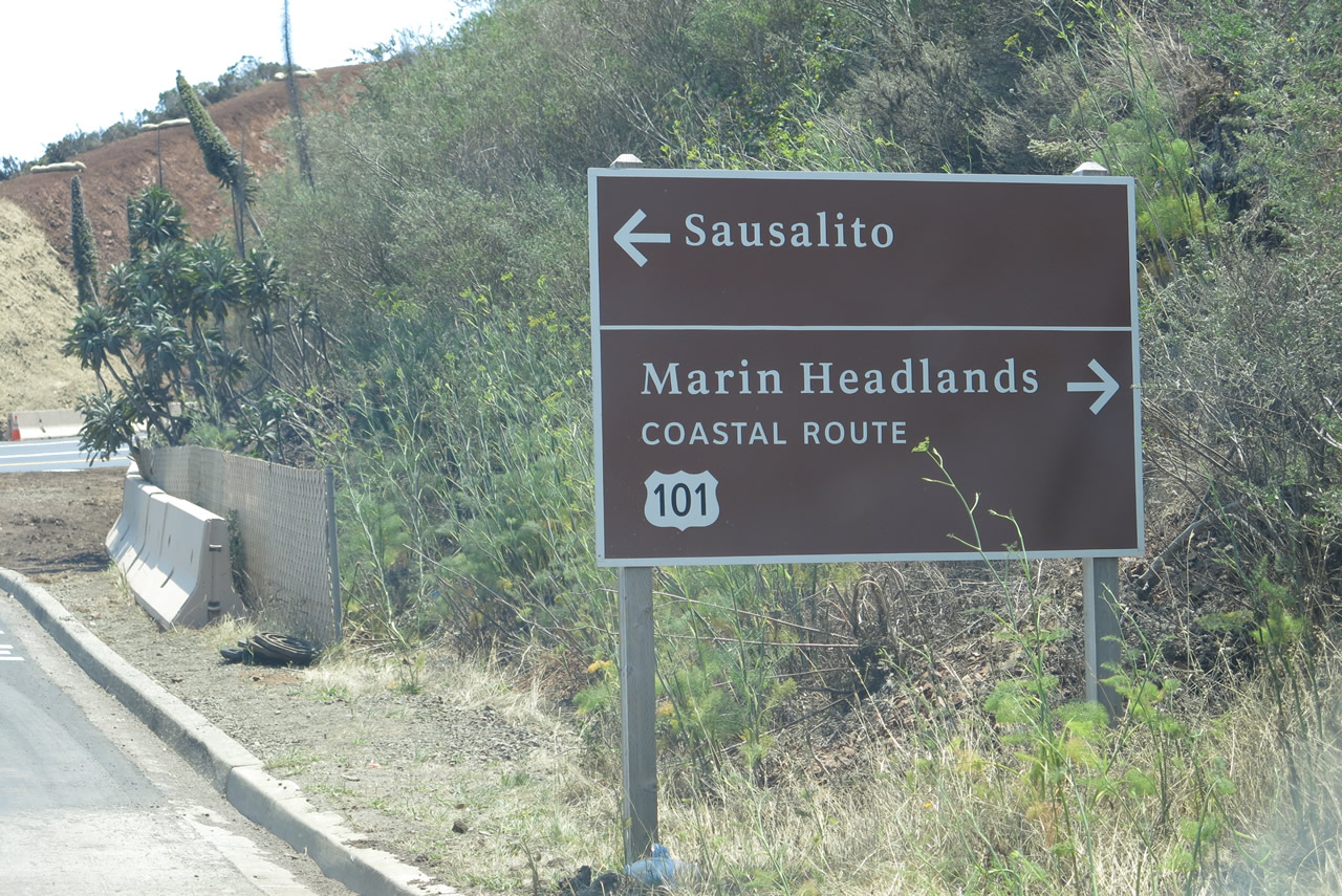
This brown sign points the way to Sausalito and U.S. 101 via Alexander Avenue. Bunker Road ends at this intersection. Photo taken 07/02/13. |
| Bunker Road west - Marin Headlands |
|
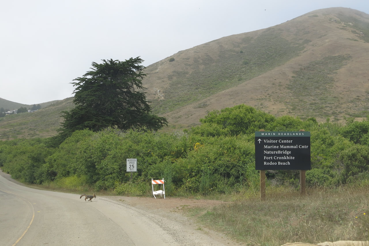
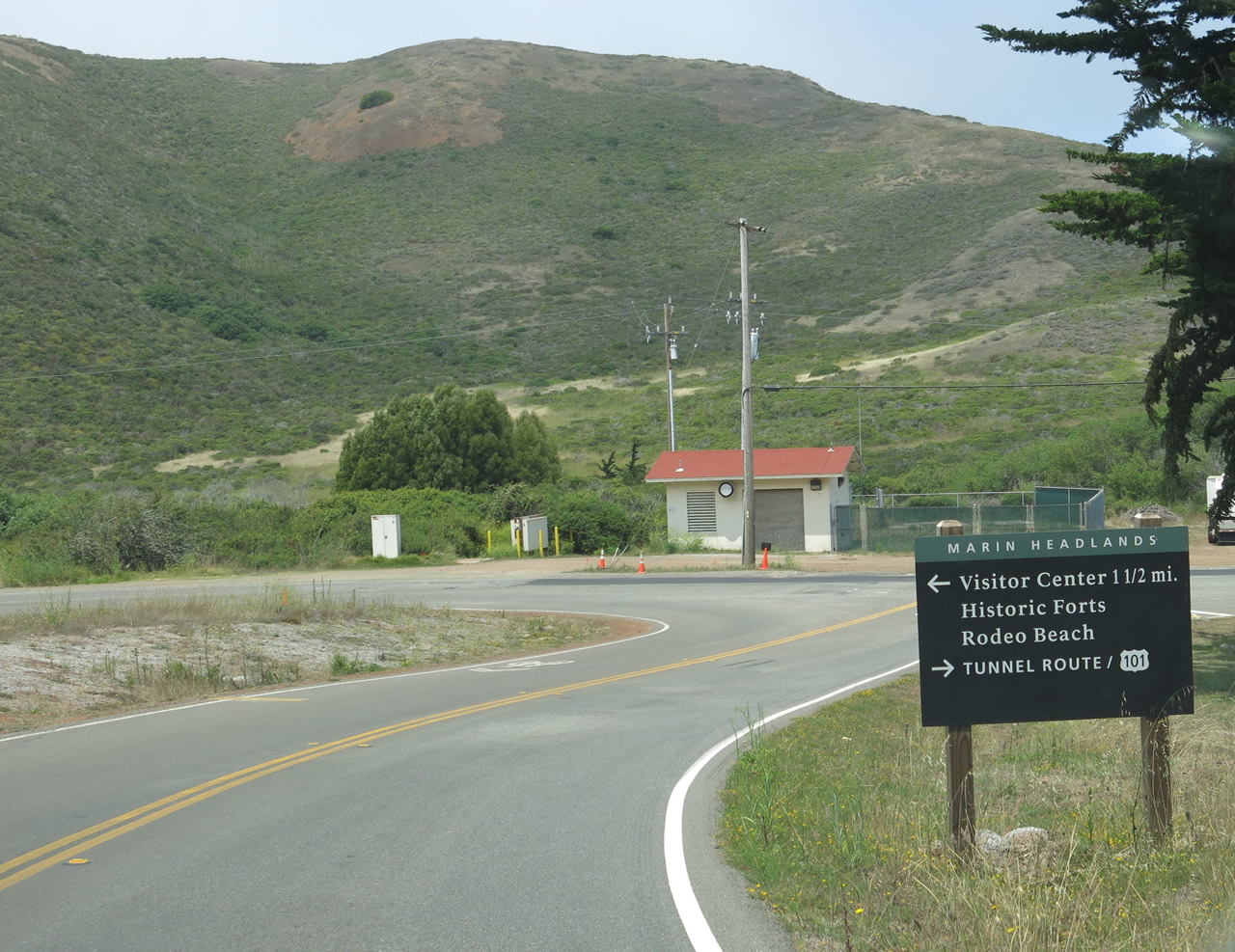
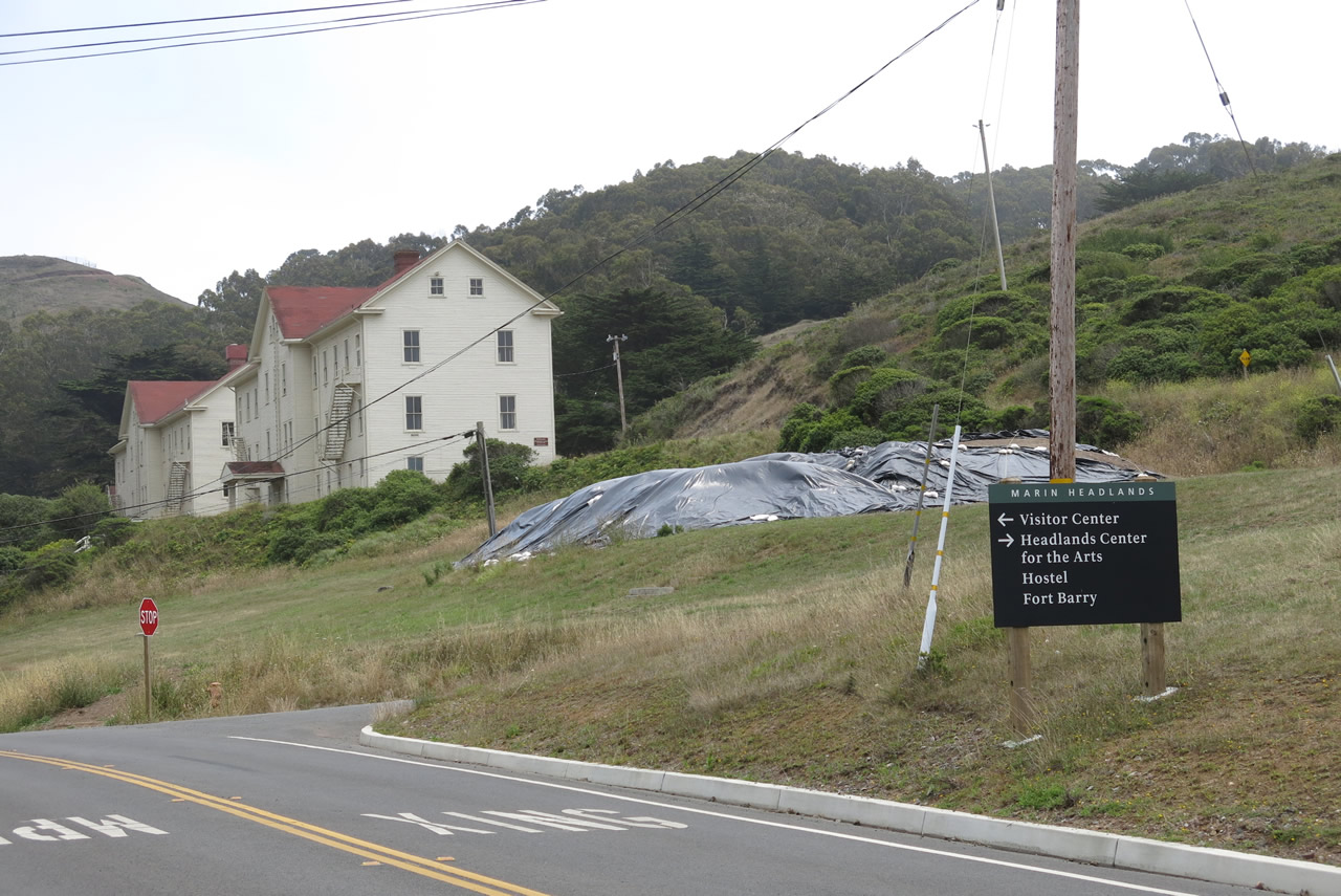
Westbound Bunker Road leaves its intersection with McCullough Road. Follow Bunker Road west to Fort Barry and Rodeo Beach. A National Park Service visitors center is located about 1.5 miles west of here. Photo taken 07/02/13. |
|
Small trailblazer signs like this one point to attractions and points of interest within the Golden Gate National Recreation Area. This sign points the way to the visitors center, Fort Cronkhite, and Rodeo Beach. Photo taken 07/02/13. |
|
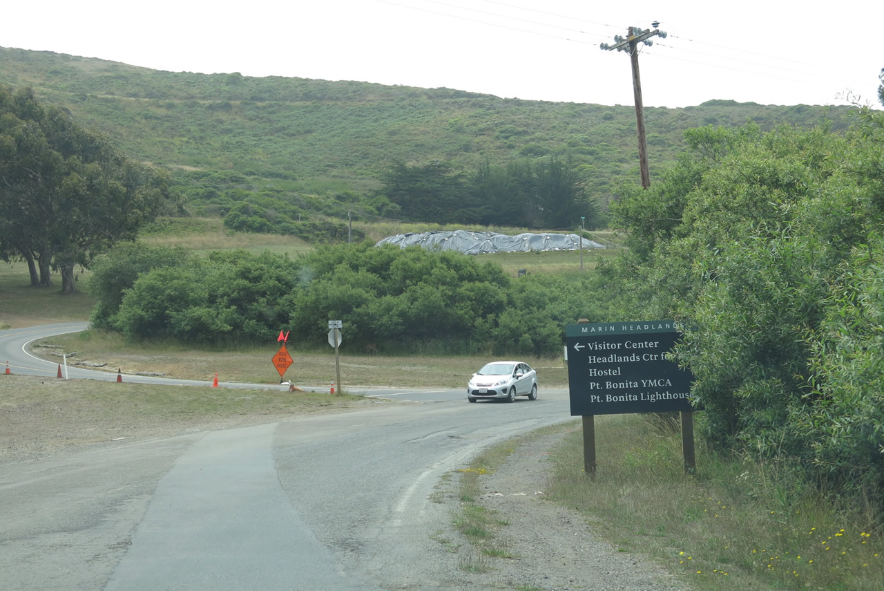
Westbound Bunker Road approaches the left turnoff to the national recreation area visitors center. Photo taken 07/02/13. |
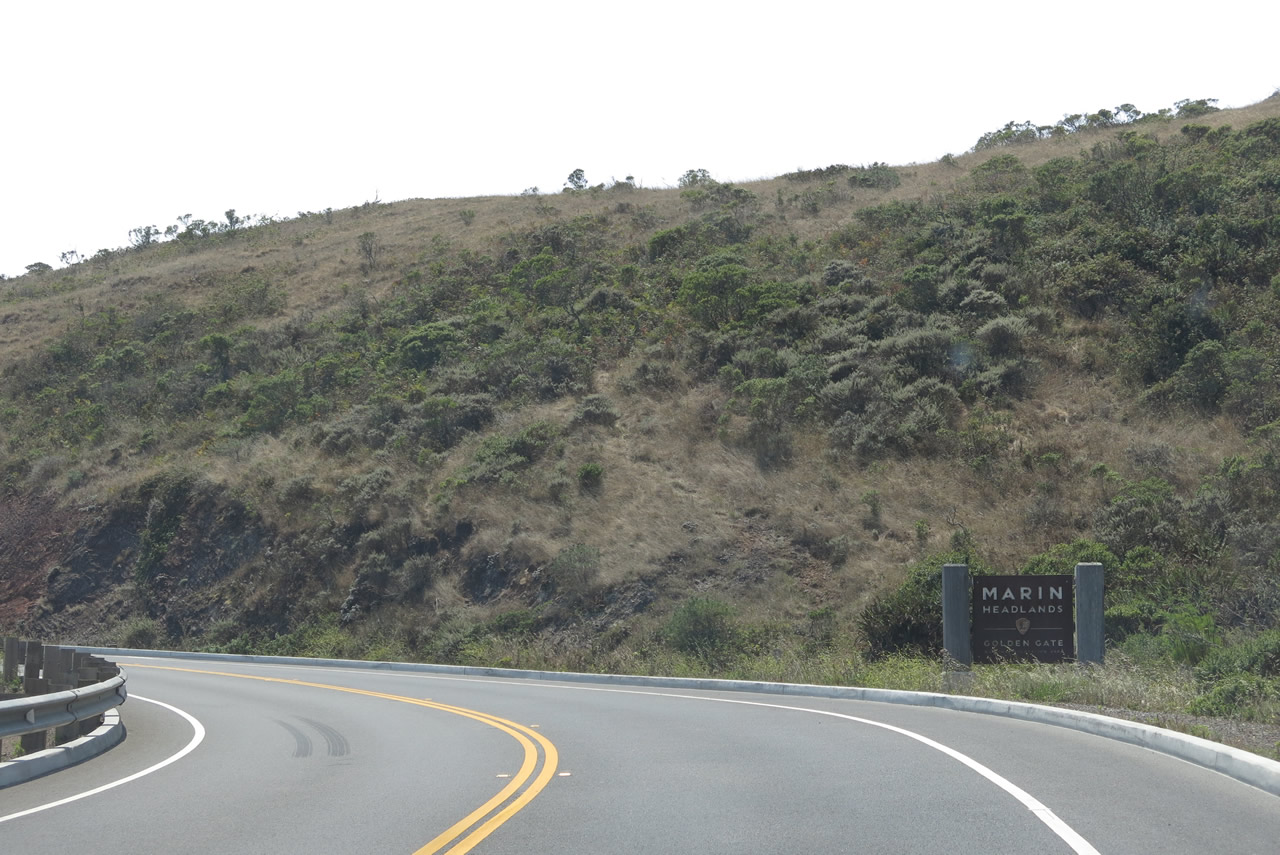
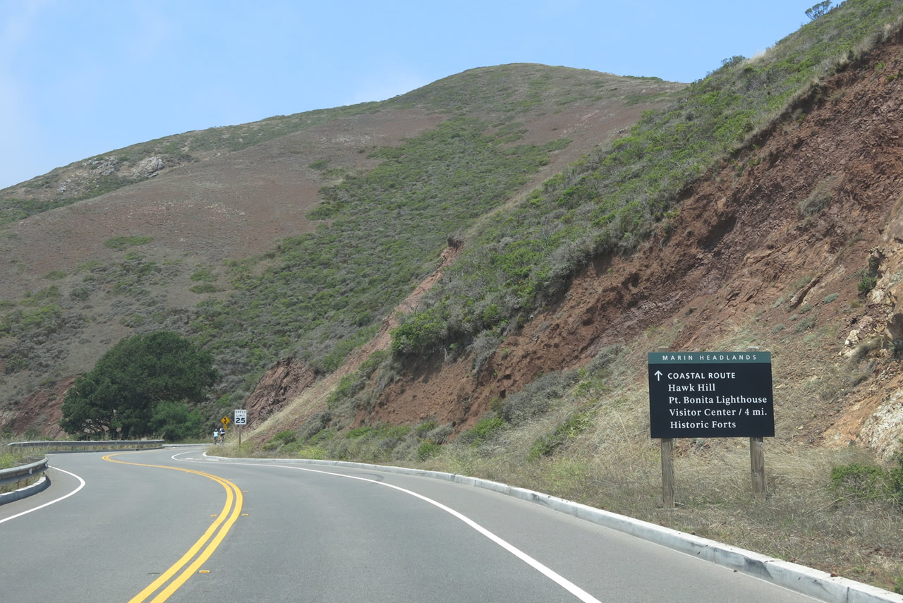
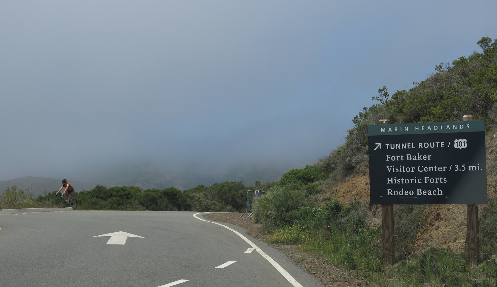
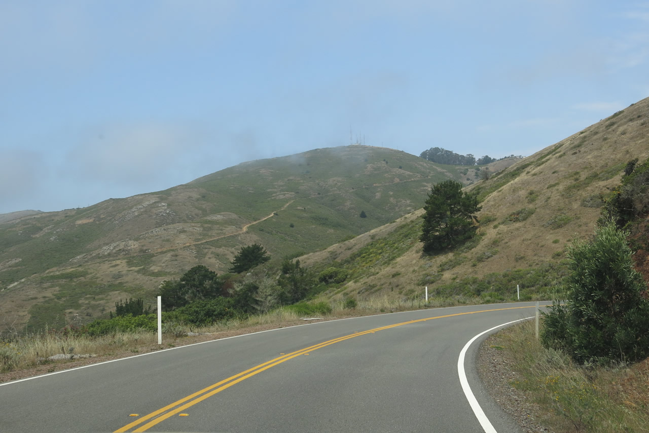
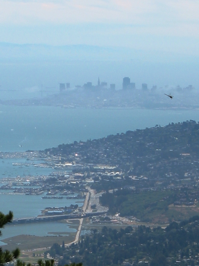
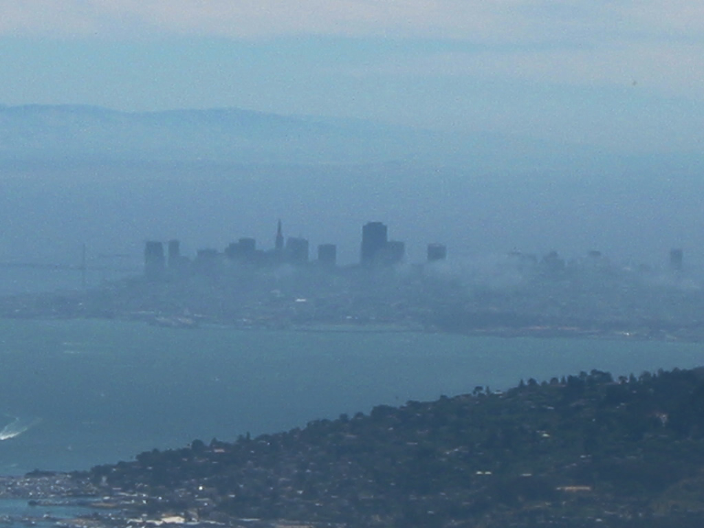
| Conzelman Road west - Marin Headlands |
|
Conzelman Road follows the coastal bluffs along Marin Headlands (and a companion road stays inland to connect to Fort Baker via a single-lane tunnel). The scenic overlooks can provide outstanding views of the Golden Gate, San Francisco, and Pacific Ocean. On this day, fog ruled and prevented any of these views. The north tower of the Golden Gate Bridge was faintly visible through the fog, not worthy of picture taking. Photo taken 07/02/13. |
|
|
The Marin Headlands are a unit of Golden Gate National Recreation Area, which includes multiple units scattered throughout Marin County and San Francisco, including coastal areas near Stinson Beach in Marin County and Ocean Beach in San Francisco. A prominent urban park, Golden Gate National Recreation Area is well known for its protection of natural features in the face of urban development. Photos taken 07/02/13. |
|
|
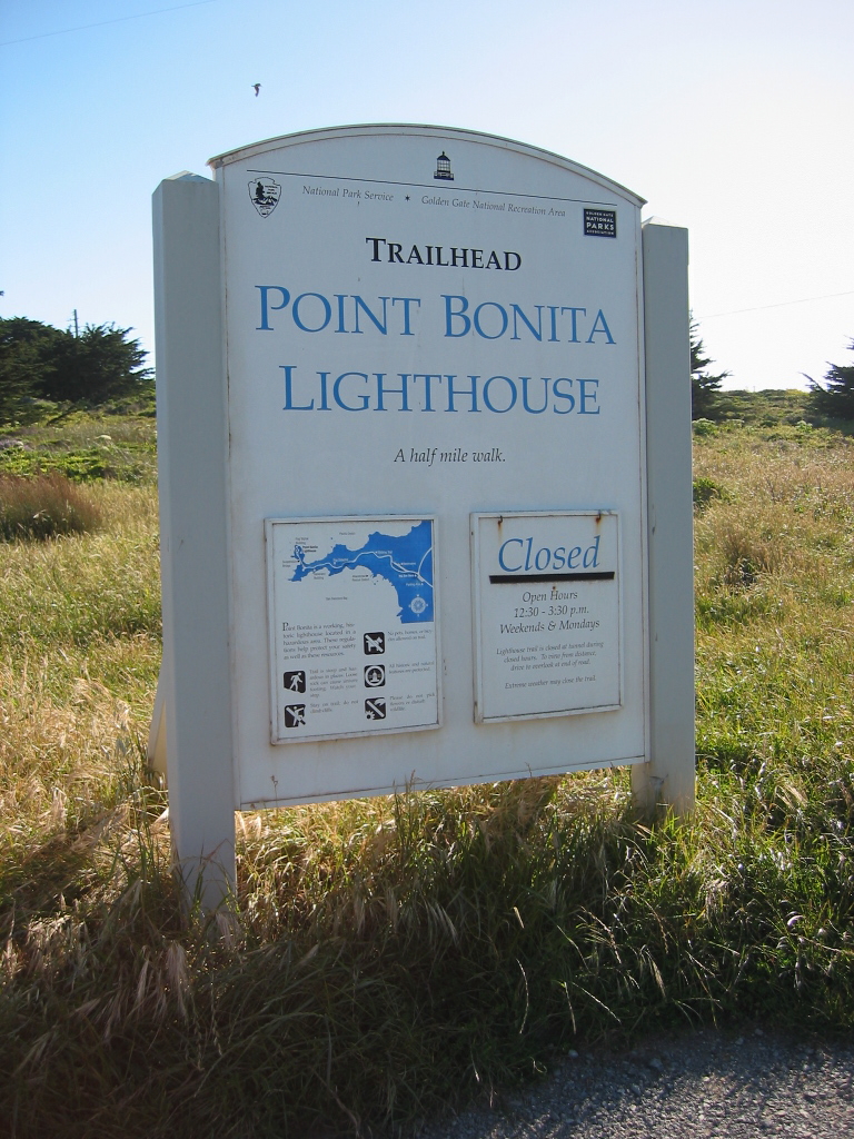
Use the coastal route (Conzelman Road) to Hawk Hill, Point Bonita Lighthouse, and a visitors Center. Photos taken 07/02/13. |
|
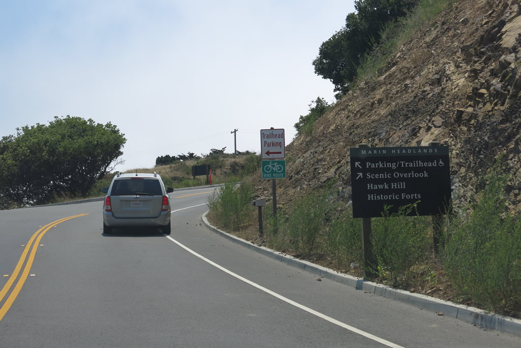
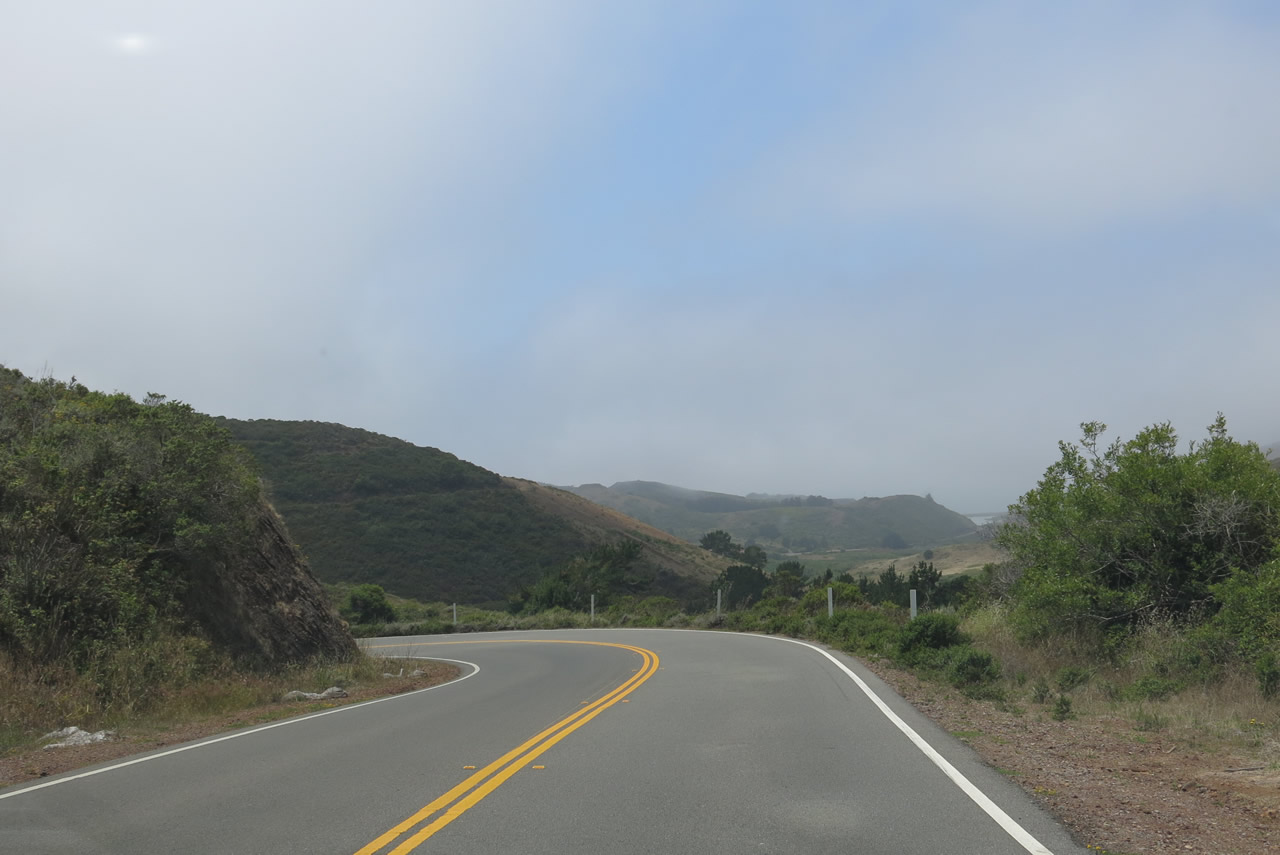
Westbound Conzelman Road meets McCullough Road at this roundabout. Aim right for northbound McCullough Road, which provides the connection to the Inland Route, which returns to U.S. 101 and provides access to Rodeo Beach. Continue ahead on Conzelman Road to Point Bonita Lighthouse. Photo taken 07/02/13. |
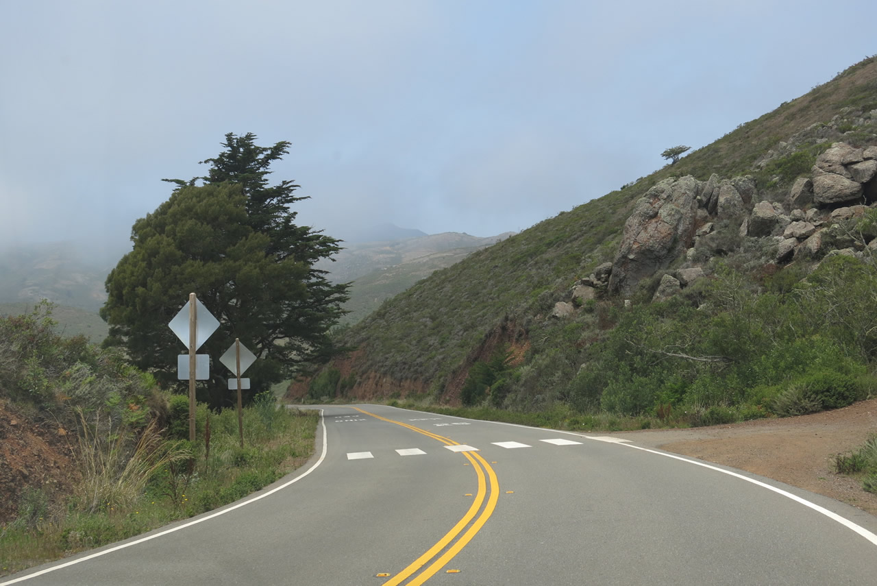
| McCullough Road north - Marin Headlands |
|---|
|
|
|
|
|
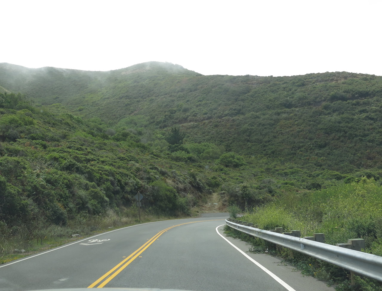
| McCullough Road leaves the roundabout intersection with Conzelman Road and proceeds north and downhill through the coastal bluffs along Marin Headlands within Golden Gate National Recreation Area. The road will wind its way downhill to meet up with Bunker Road at the bottom of the hill. Use Bunker Road west to Rodeo Beach or east to U.S. 101 (via a one-lane tunnel). Photo taken 07/02/13. |
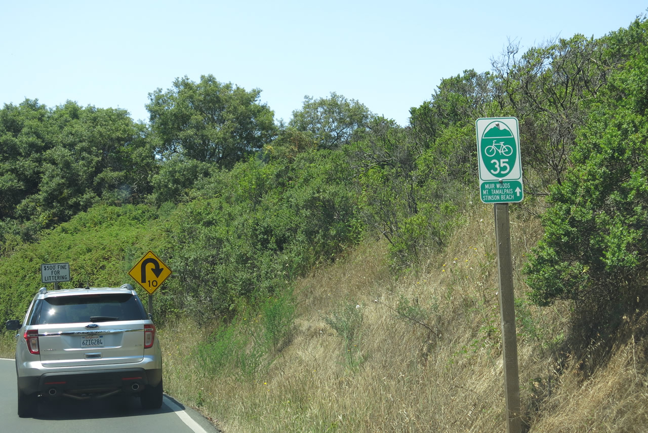
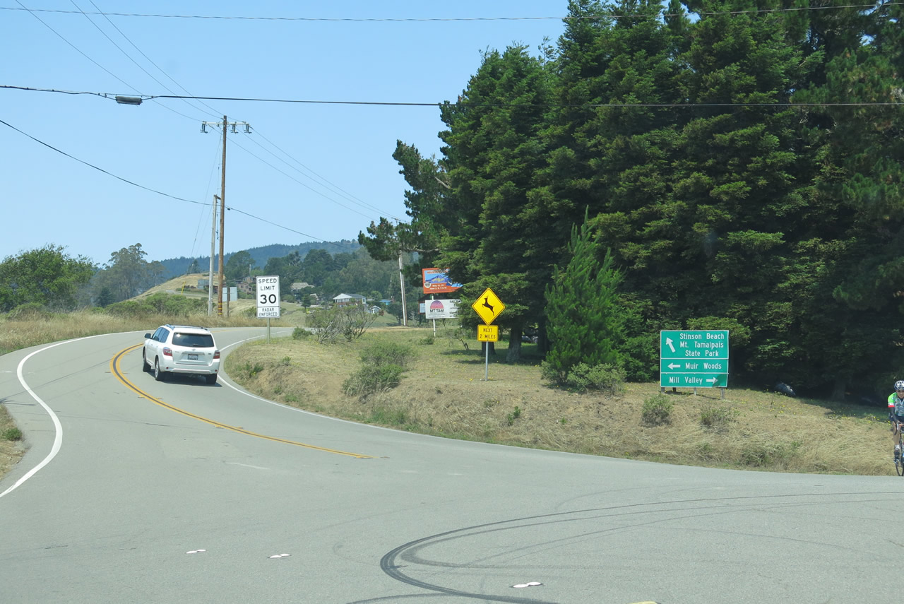
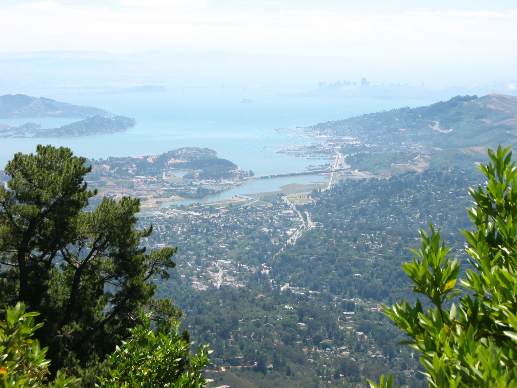
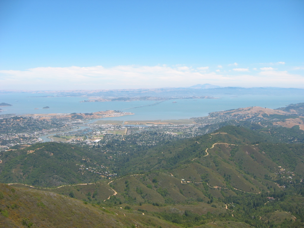
| Panoramic Highway north |
|
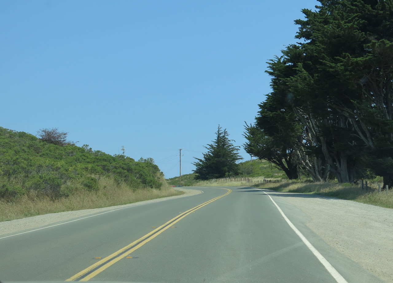
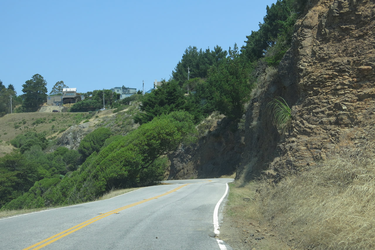
Panoramic Highway is a long, scenic route that traverses Mount Tamalpais and connects California 1 near Muir Woods with California 1 near Stinson Beach. Panoramic Highway initially travels north from the southern junction with California 1, then northwest toward the coast. Panoramic Highway is assigned as Marin County Bike Route 35, which is suspiciously numbered similar to California 35's Skyline Boulevard segment in San Francisco and San Mateo County. Perhaps this numbering is a coincidence? Photo taken 07/02/13. |
|
Almost immediately, Panoramic Highway starts to gain elevation to climb toward Mount Tamalpais. An older bridge carries Panoramic Highway over a small creek. Photo taken 07/02/13. |
|
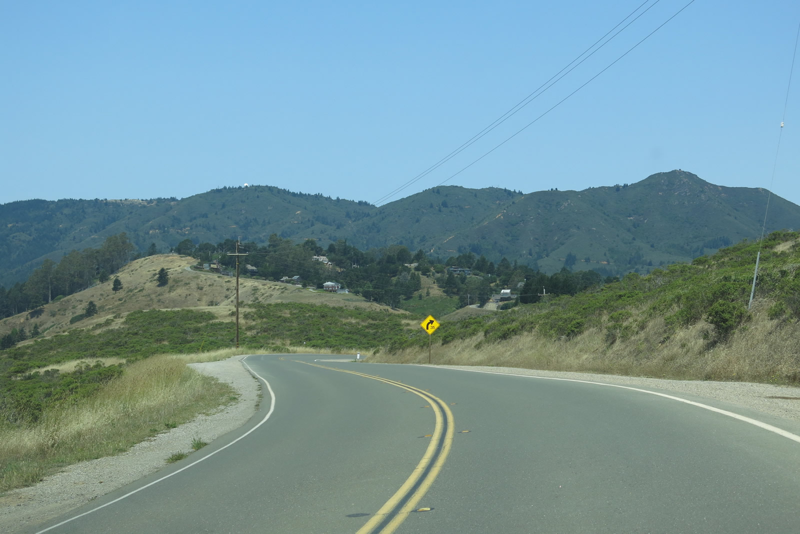
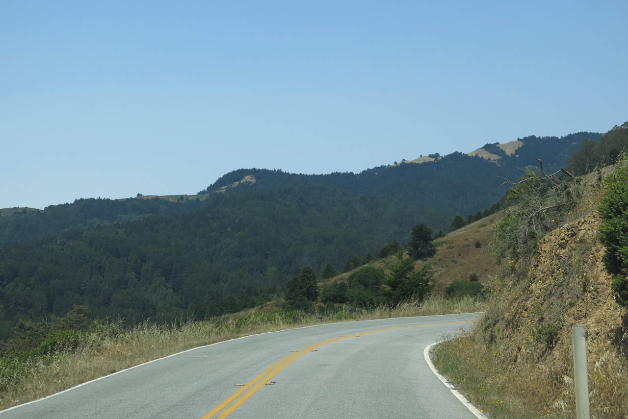
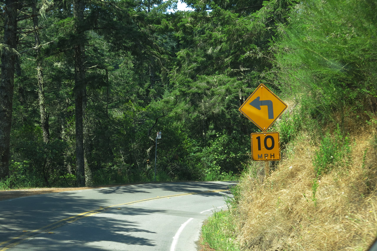
Panoramic Highway has several turnouts for scenic views and also to allow slower vehicles to pull over. Steep elevation and switchbacks are common along this route. Photo taken 07/02/13. |
|
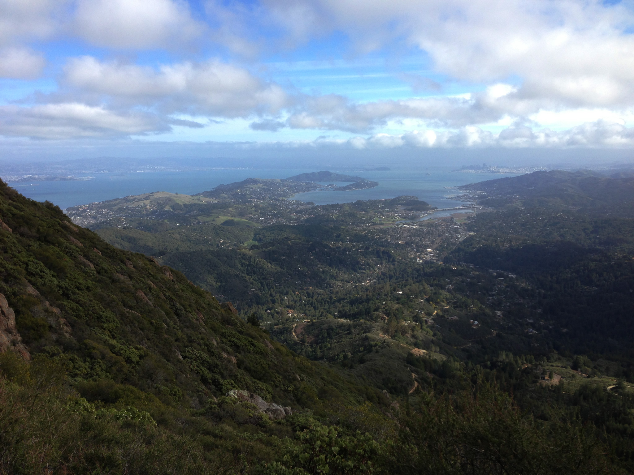
Mount Tamalpais dominates the view along northbound Panoramic Highway. The mountain is within the Marin Hills segment of the Coast Range, and it actually includes two peaks: West Peak (el. 2,563 feet; notice the white radar dome on top of the flattened peak) and East Peak (el. 2,571 feet). A scenic overlook with commanding views of the San Francisco Bay Area is available at the east peak, with is accessed via Panoramic Highway north to Pan Toll Road north to Ridgecrest Boulevard east. Photo taken 07/02/13. |
|
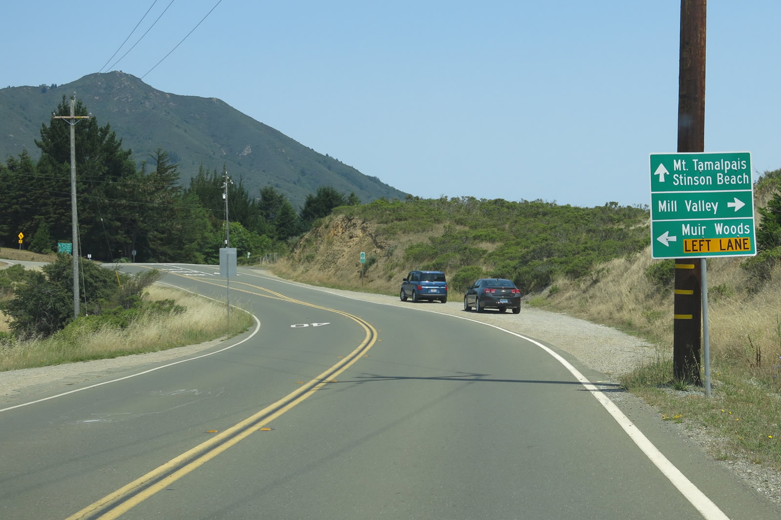
Northbound Panoramic Highway approaches Muir Woods Road. Continue ahead to follow Panoramic Highway north to Mount Tamalpais. Turn right ahead onto Sequoia Valley Road to the city of Mill Valley. Photo taken 07/02/13. |
|
Panoramic Highway meets Muir Woods Road and Sequoia Valley Road. Photo taken 07/02/13. |
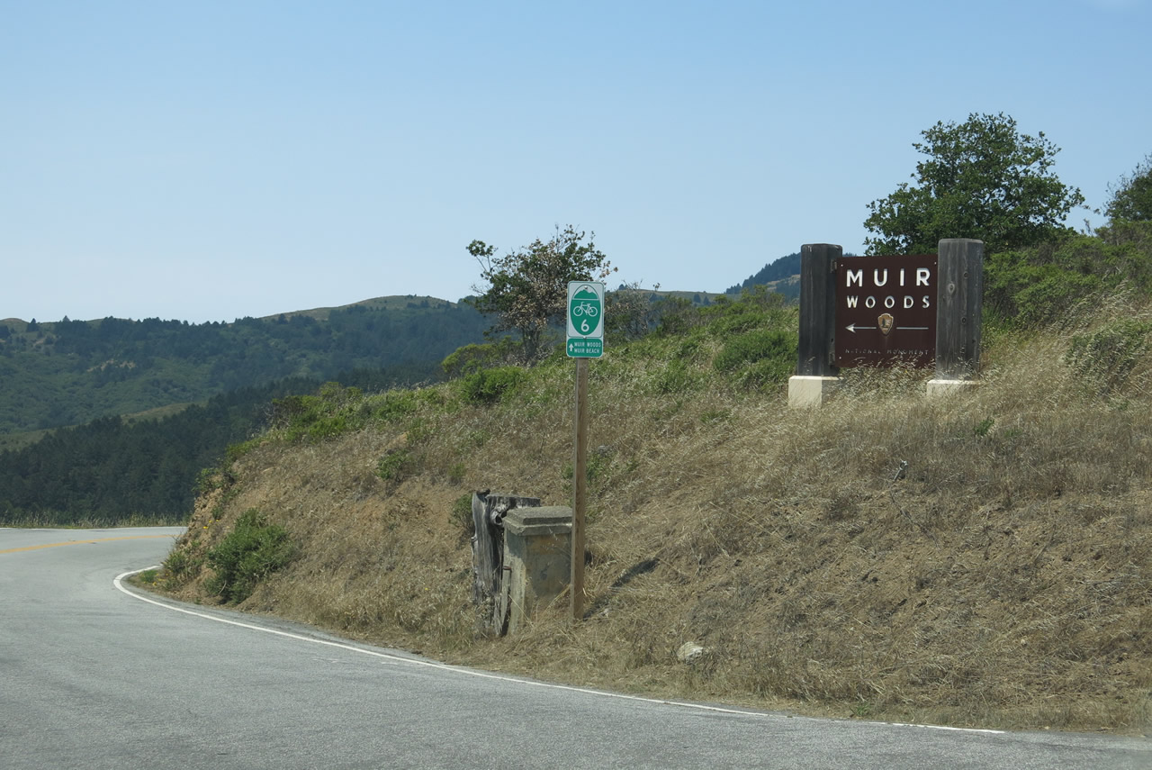
| Muir Woods Road west |
|
Leaving the intersection with Panoramic Highway, Muir Woods Road begins its westbound journey toward Muir Woods National Monument. This widening, twisting, and often congested road descends toward Redwood Creek, where the namesake redwoods reside. Muir Woods Road is designated as part of Marin County Bike Route 6. Photo taken 07/02/13. |
|
|
|
|
|
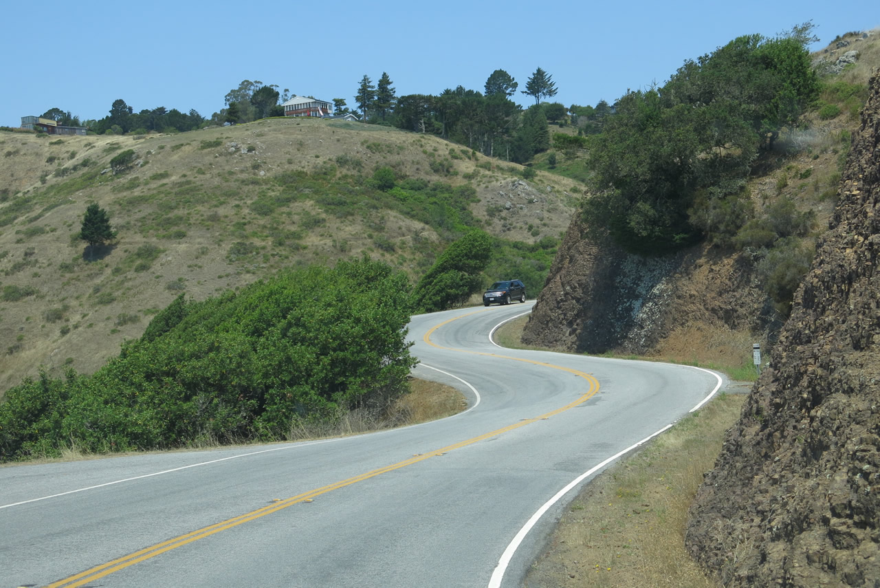
| This series of pictures follows Muir Woods Road as it travels downhill toward Redwood Creek and Muir Woods National Monument. On this narrow, busy road, keep an eye out for bicyclists and, as we approach the bottom, pedestrians. The road descends rather rapidly and has ample curves and switchbacks along its way. Parking at the national monument is limited, so some folks will park along Muir Woods Road away from the entrance. Photos taken 07/02/13. |
|
Nearing the bottom of the hill is this fairly sharp curve, followed by the entrance to the national monument. Photo taken 07/02/13. |
|
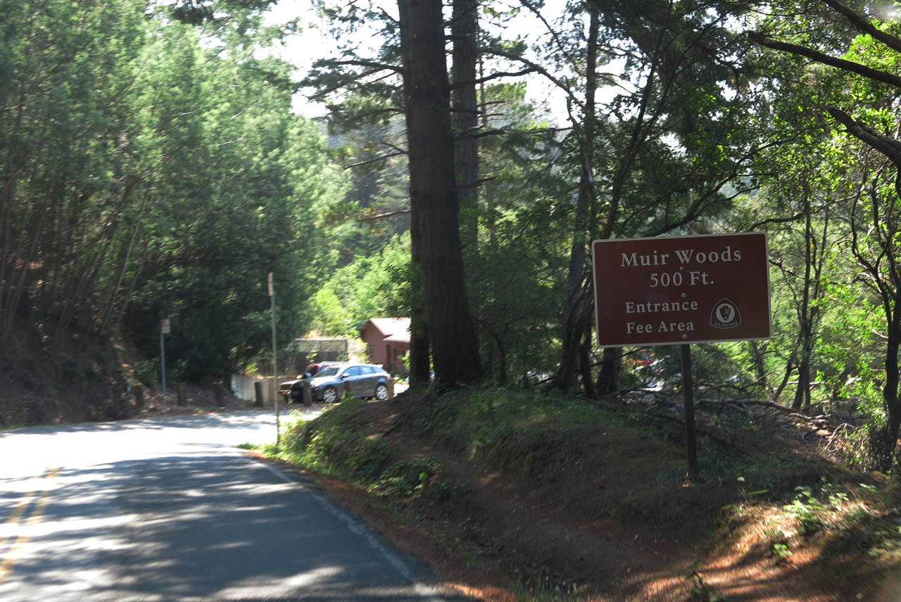
The turnoff to Muir Woods National Monument is located at the bottom of the grade. A small parking lot is located here; overflow is common, so plan to arrive early if possible. Photo taken 07/02/13. |
|
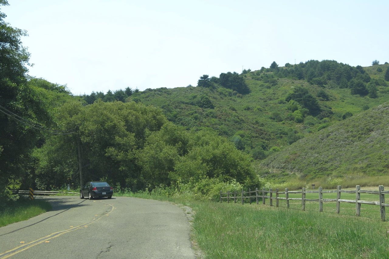
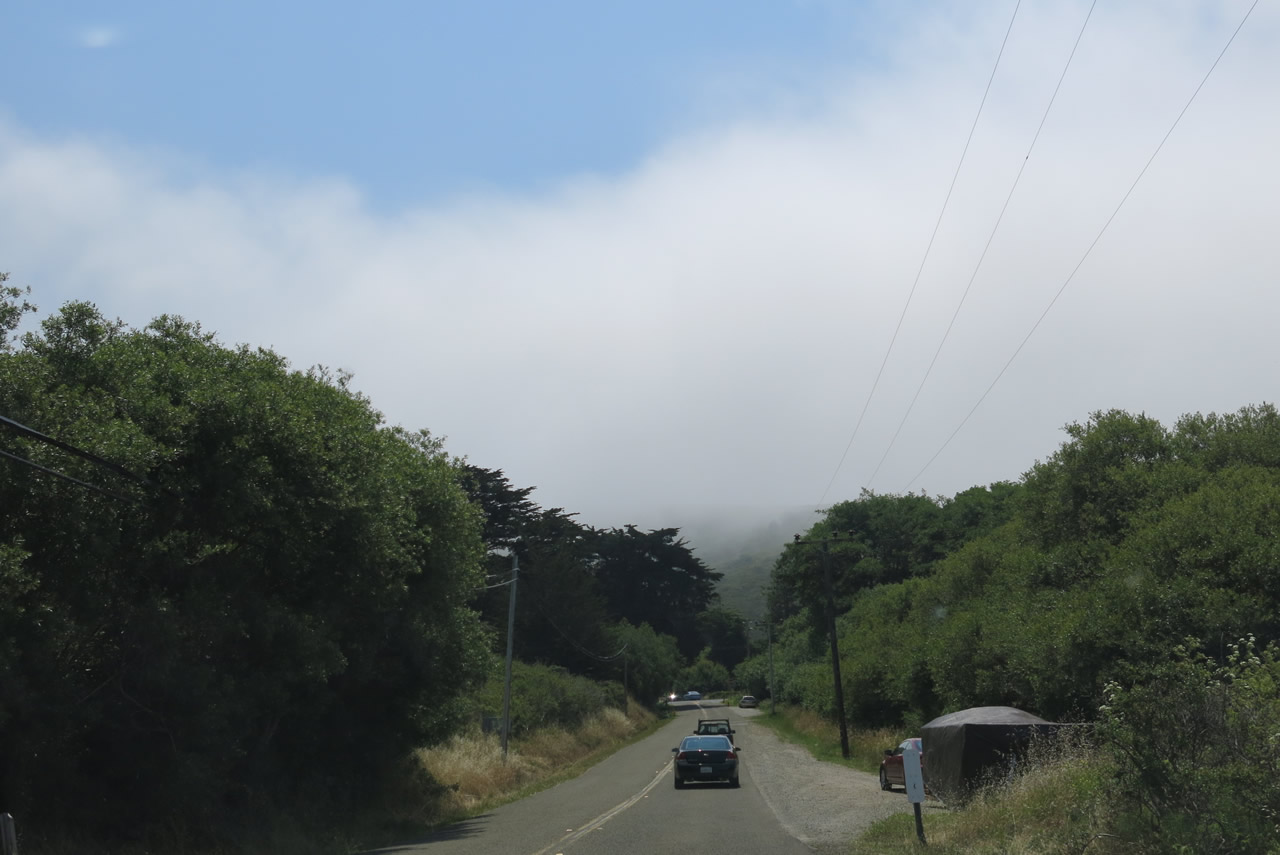
Muir Woods Road leaves the vicinity of the national monument and proceeds west toward Muir Beach and California 1 (Shoreline Highway). Photo taken 07/02/13. |
|
As is common during the summer months, a fog bank loomed as Muir Woods Road continues west toward the coast. Photo taken 07/02/13. |
|
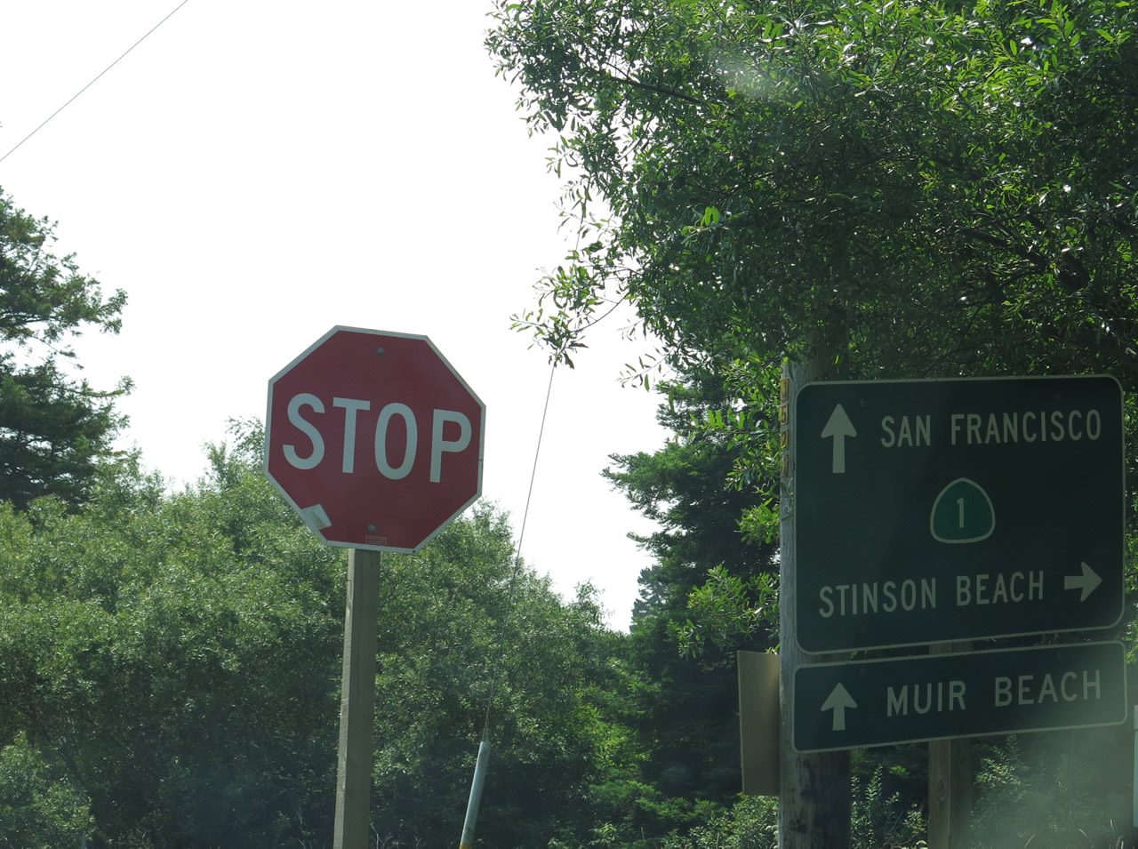
Muir Woods Road ends at its junction with California 1 (Shoreline Highway). At this intersection, turn right for California 1 (Shoreline Highway) north to Stinson Beach and Point Reyes Station. Continue ahead for California 1 (Shoreline Highway) south to the entrance to Muir Beach, as well as the return to Tamalpais Valley, U.S. 101, and San Francisco. Photo taken 07/02/13. |
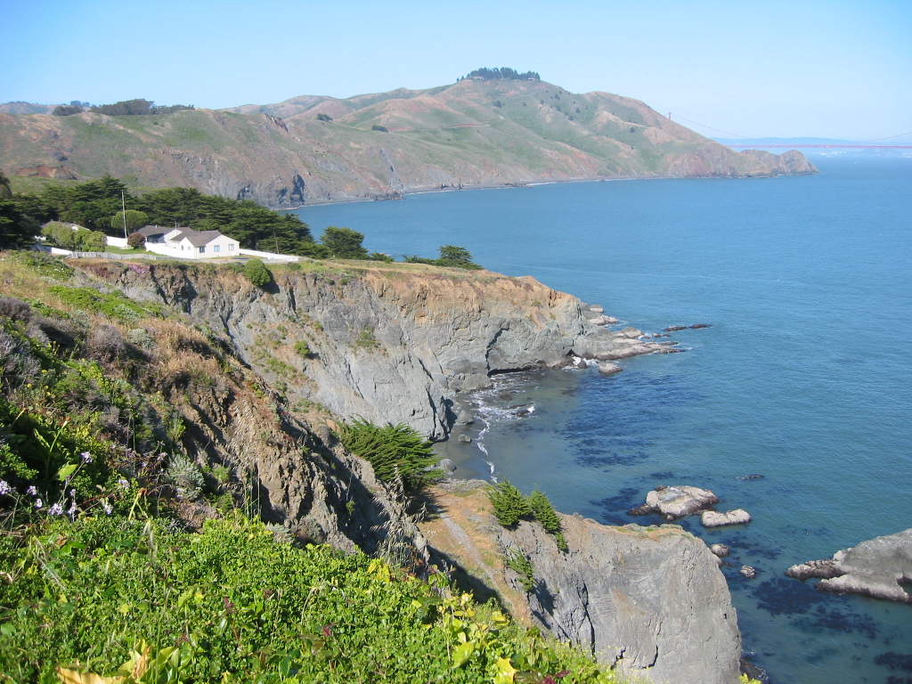
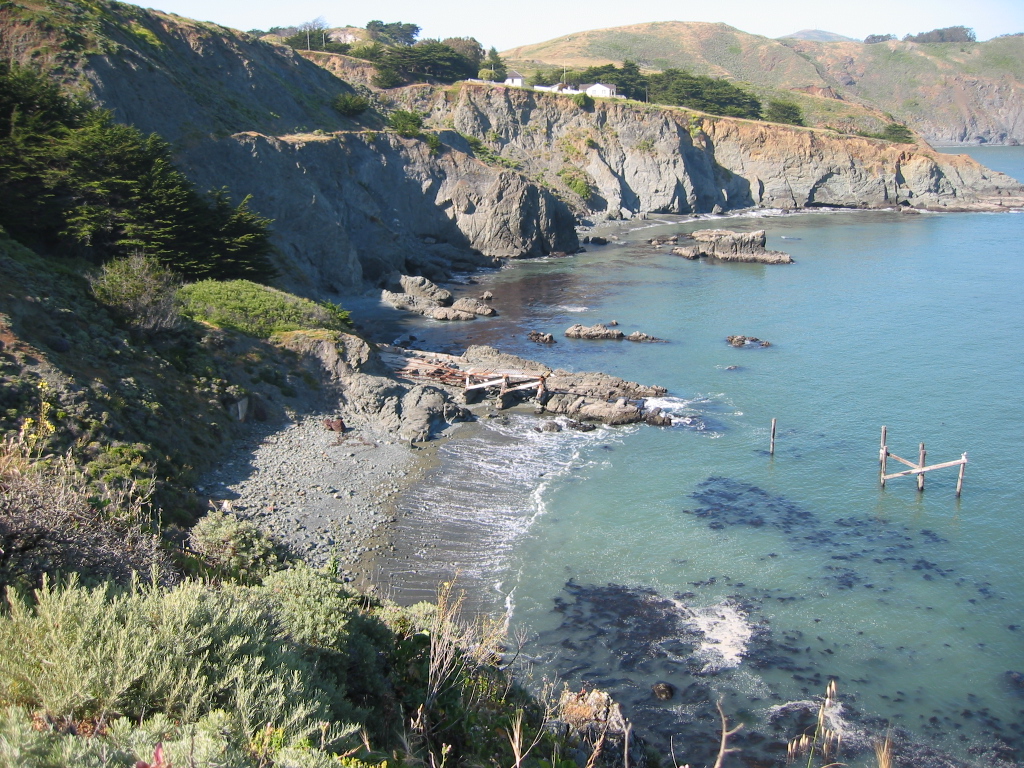
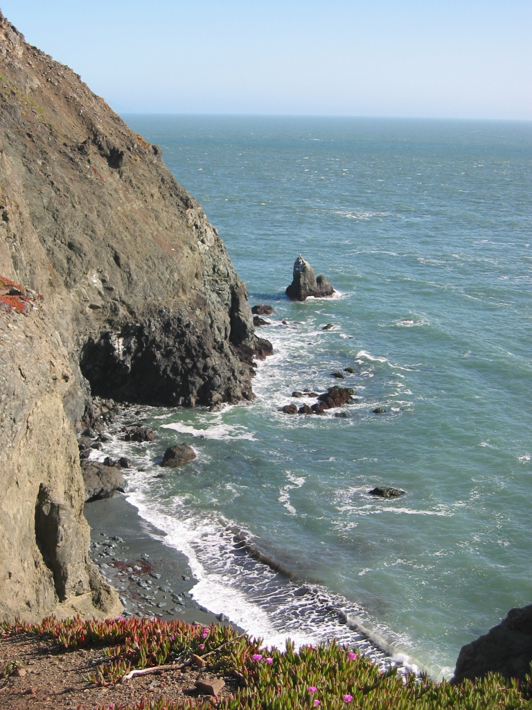
| Marin Headlands - Golden Gate National Recreation Area scenes |
|---|
|
|
|
|
|
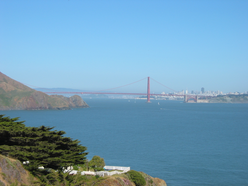
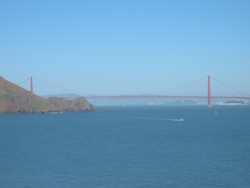
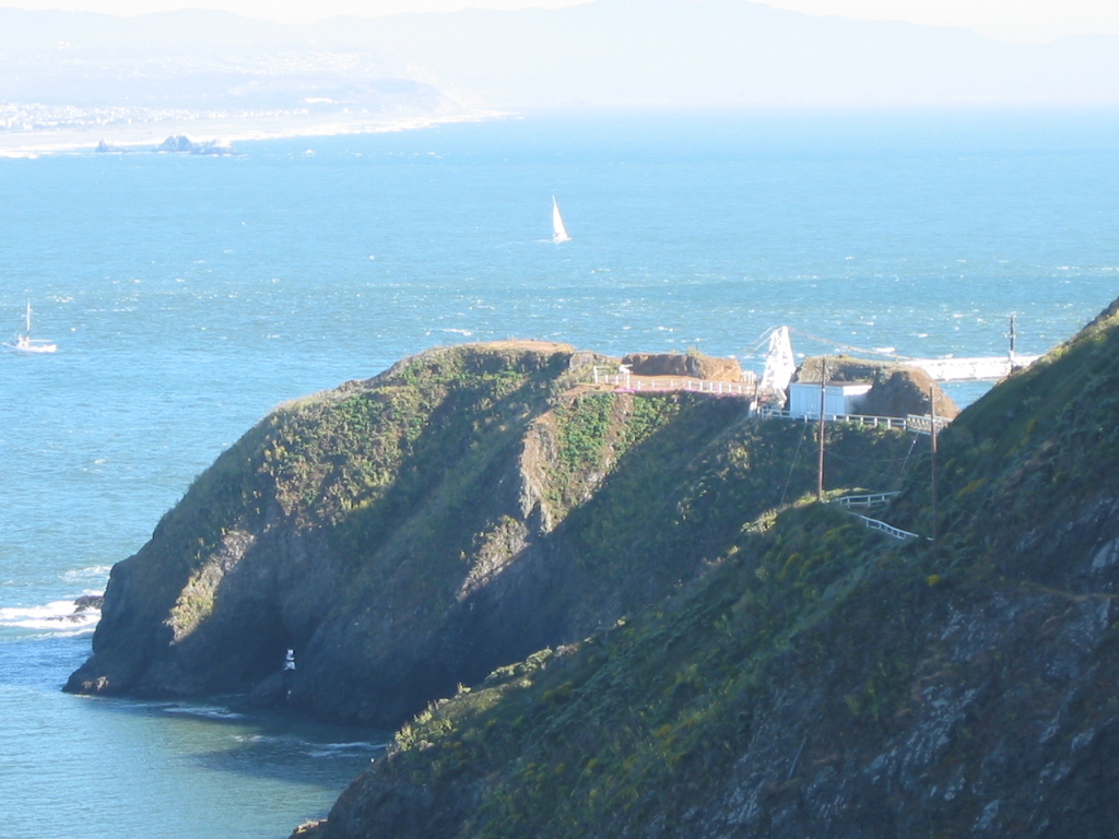
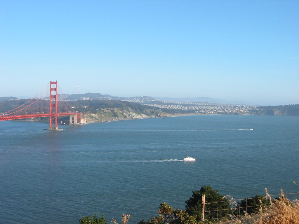
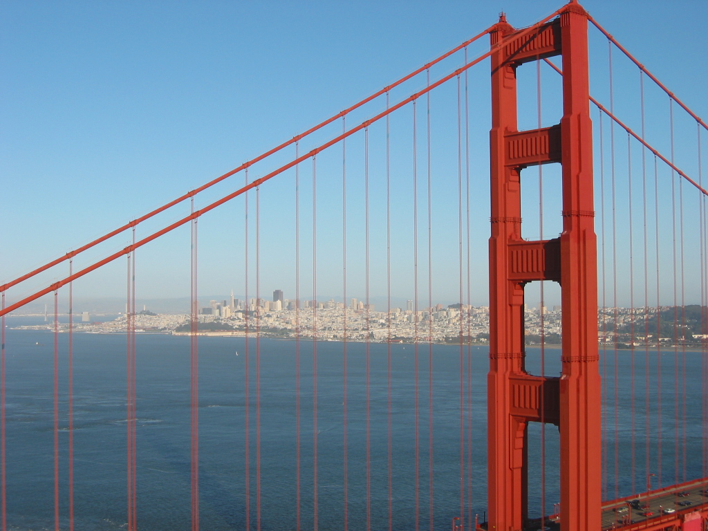
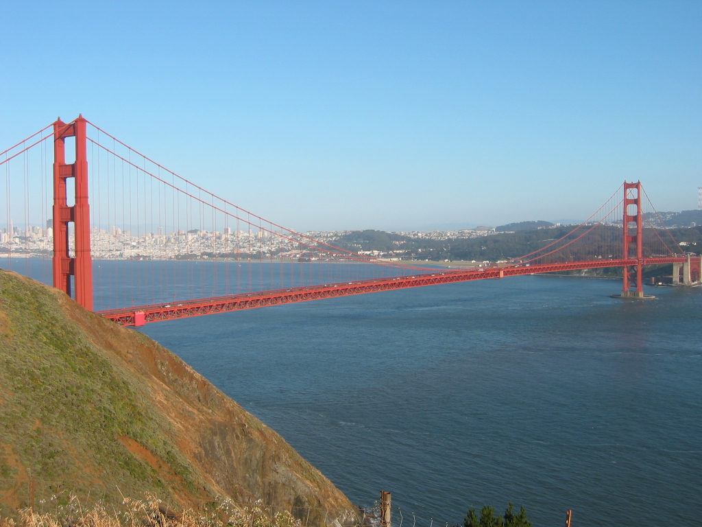
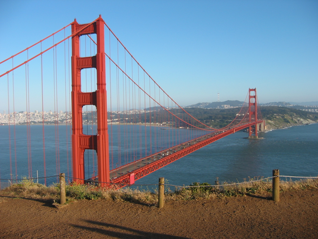
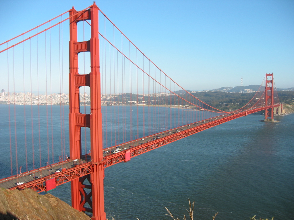
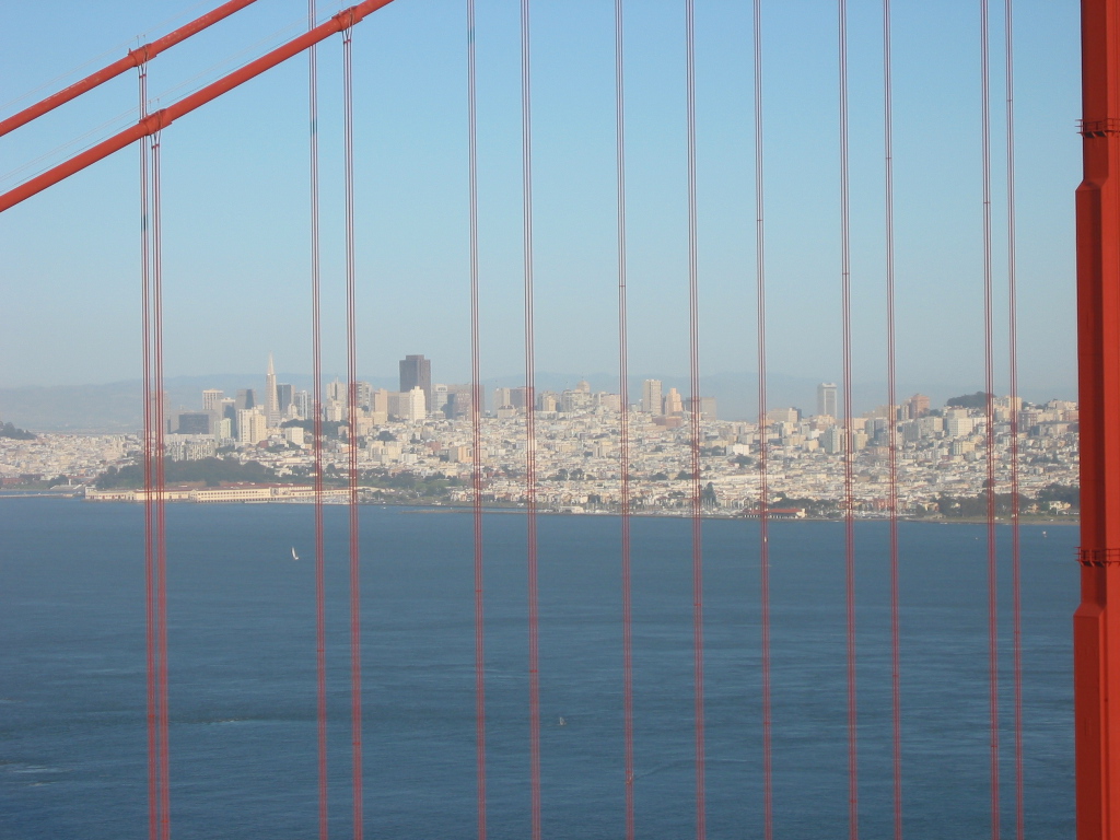
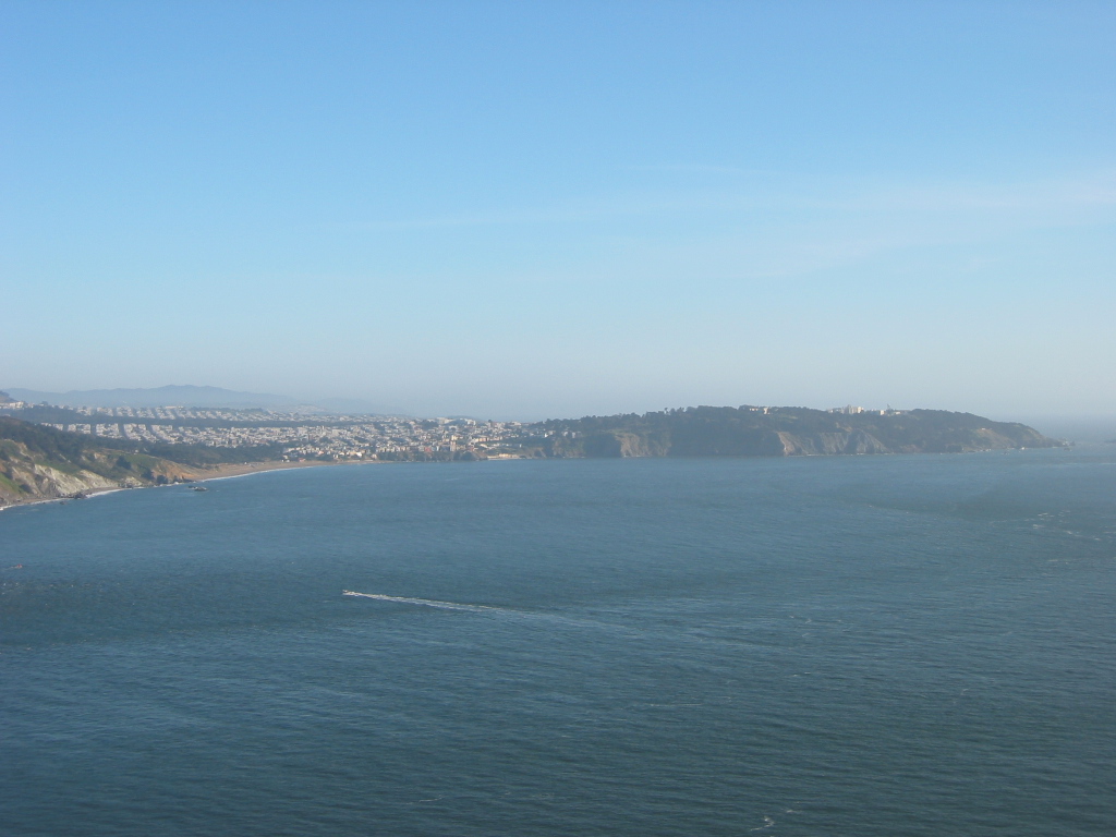
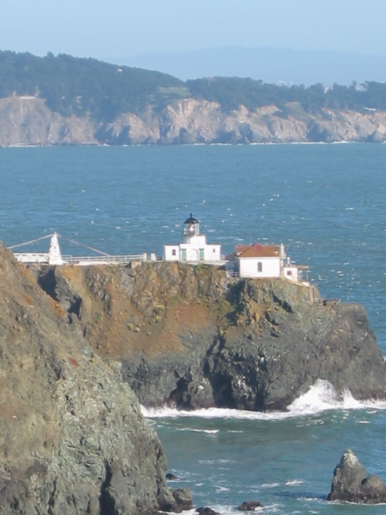
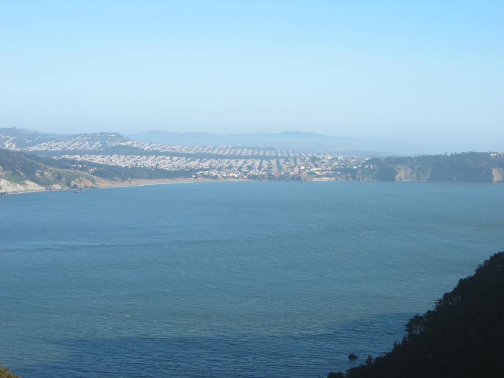
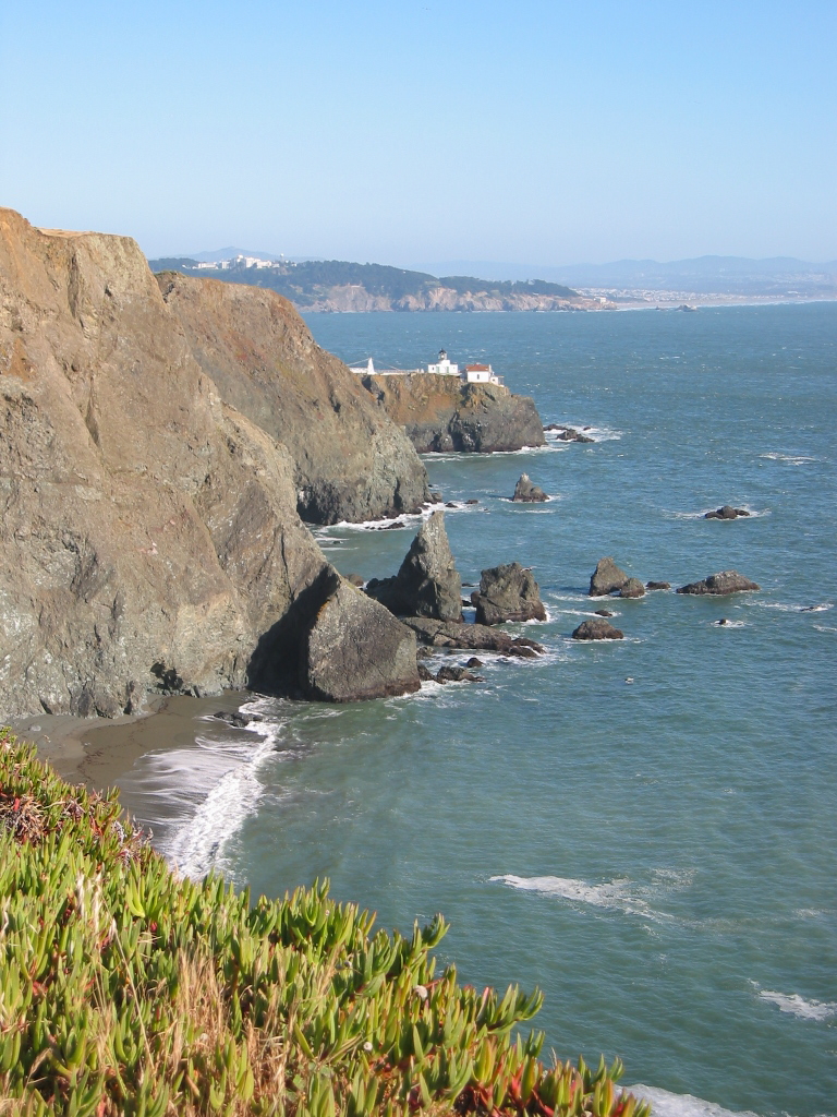
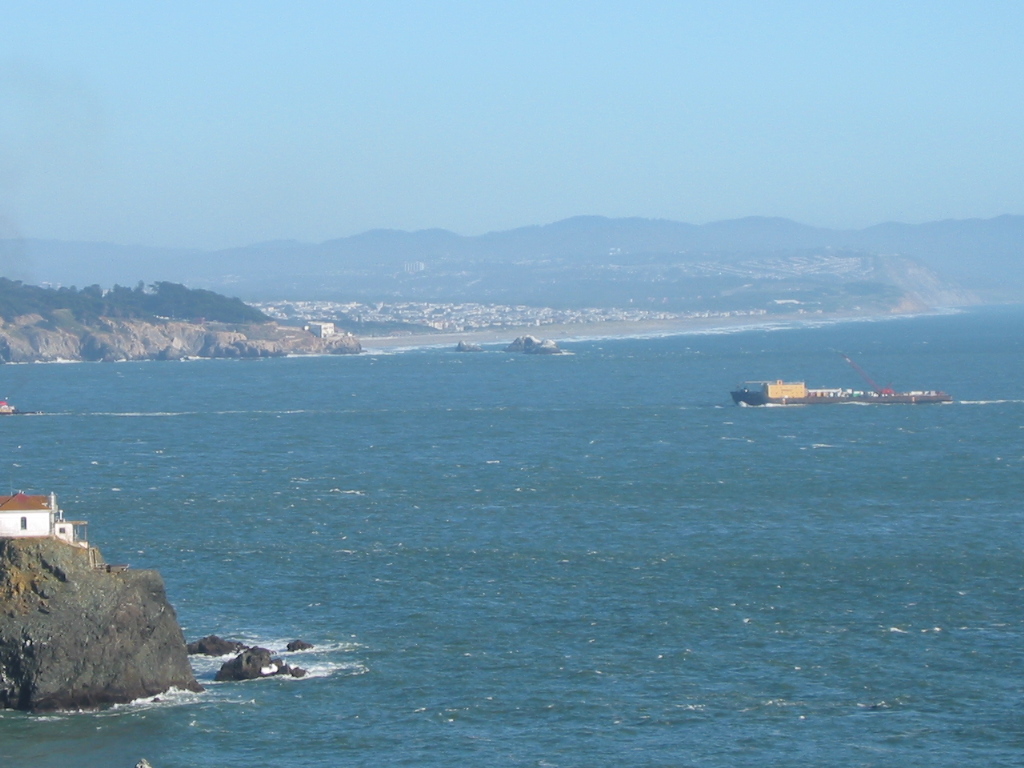
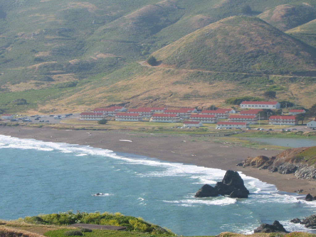
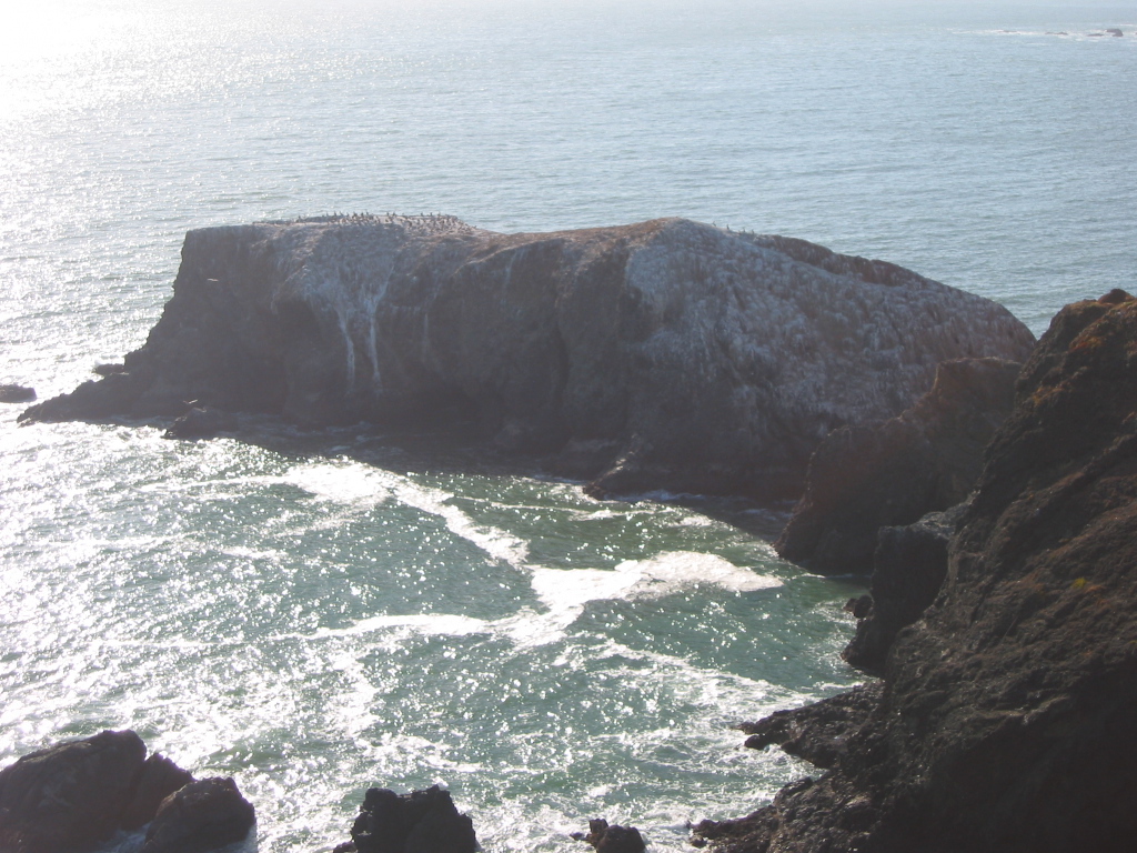
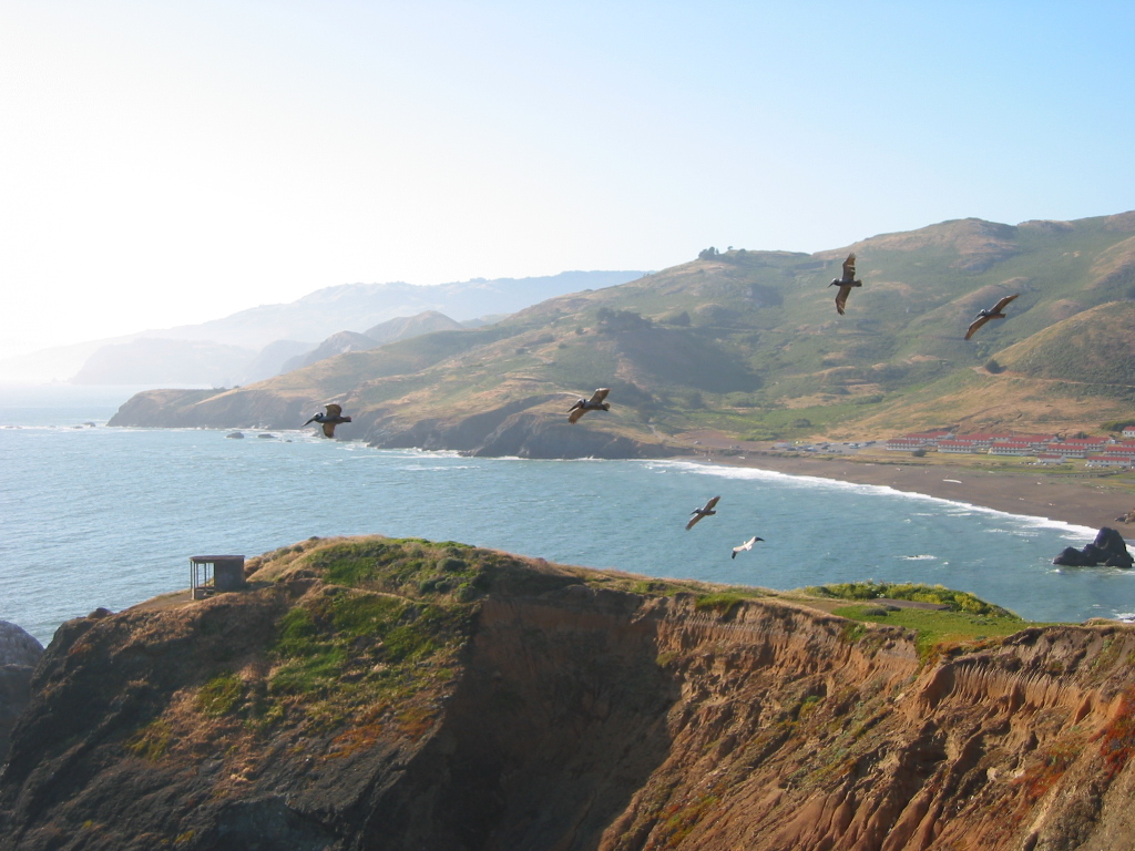
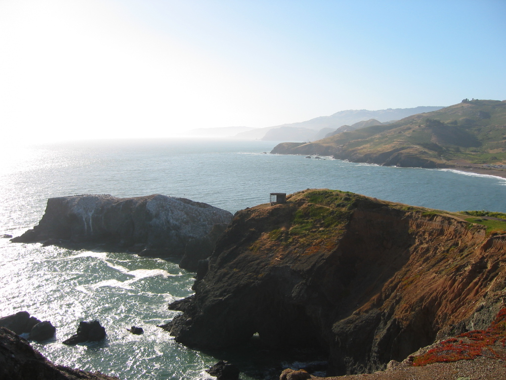
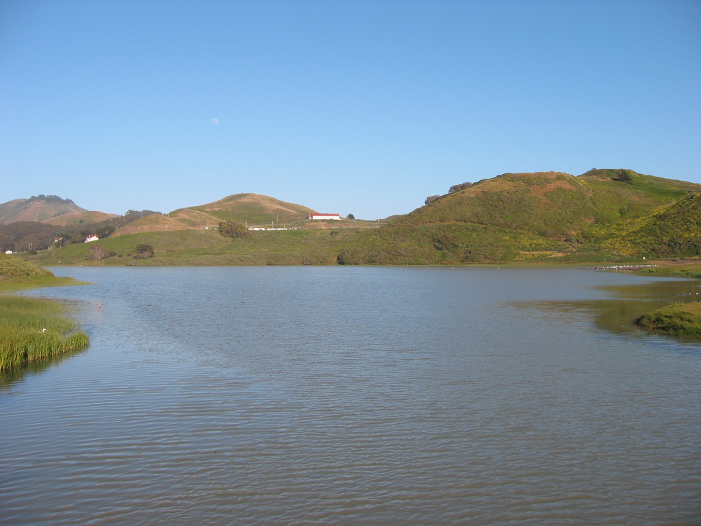
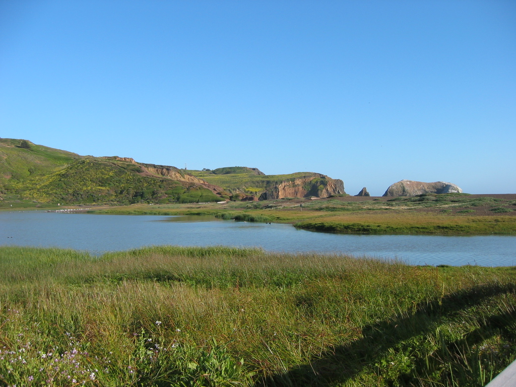
| The undeveloped Marin Headlands, protected as part of the Golden Gate National Recreation Area, offer incredible views of San Francisco, the Golden Gate Bridge, San Francisco Bay, and Pacific Ocean. This series of pictures showcases the scenic headlands, the bridge, and Rodeo Beach along with the historic Point Bonita Lighthouse, which sits at the far southwestern corner of Marin Headlands. Photos taken 07/29/02 by Pete Sison. |
|
|
|
|
|
|
|
|
|
|
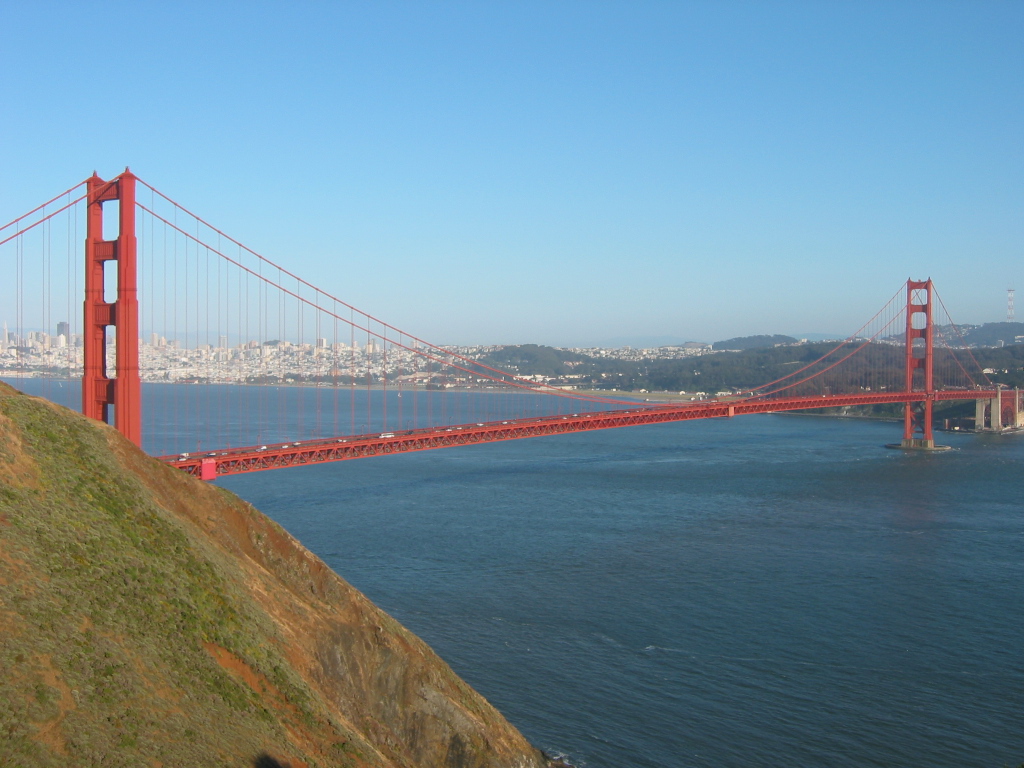
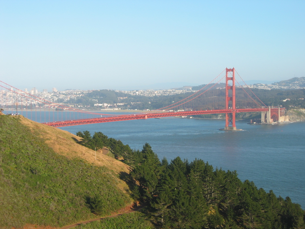
| The Golden Gate Bridge, a suspension bridge painted primarily in the "international orange" color, is 8,981 feet long and has two prominent towers (each 500 feet tall above the roadway) to support the cables. The bridge opened to traffic on May 28, 1937 (with pedestrians able to cross the preceding day). Plenty more statistics are available at the official web page of the Golden Gate Bridge. Photos taken 07/29/02 by Pete Sison. |
|
|
|
|
|
|
|
|
|
|
|
|
|
|
|
|
|
|
|
|
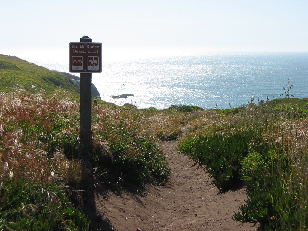
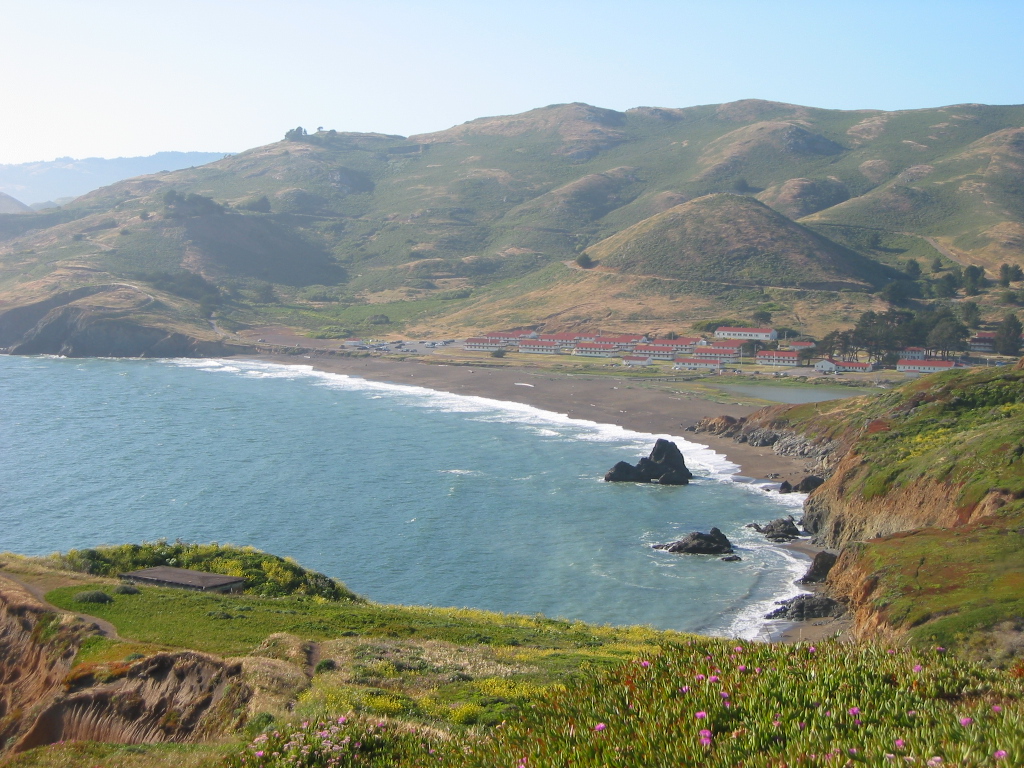
| The last few pictures showcase Rodeo Beach, another portion of Golden Gate National Recreation Area. The beach includes a lagoon that is often separated from the ocean by a narrow spit of land. Photos taken 07/29/02 by Pete Sison. |
|
|
|
|
|
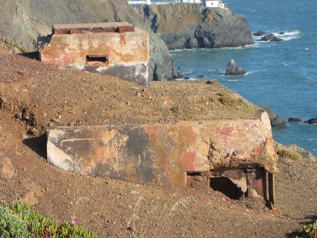
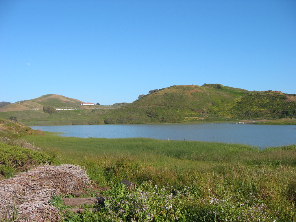
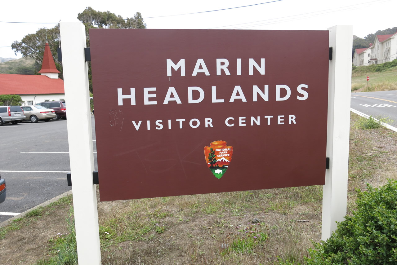
| The Golden Gate National Recreation Area visitors center for Marin Headlands is located in a converted church. Rodeo Lagoon can be seen from the visitors center parking lot. The park also preserves several other military buildings that are no longer in use. Photos taken 07/02/13. |
| Mount Tamalpais State Park scenes |
|---|
|
|
|
|
|
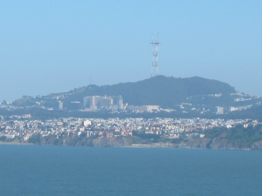
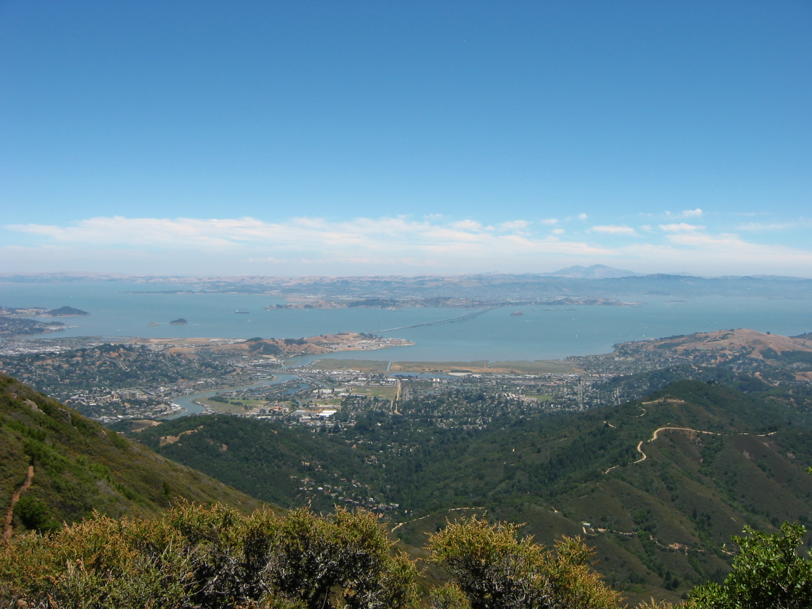
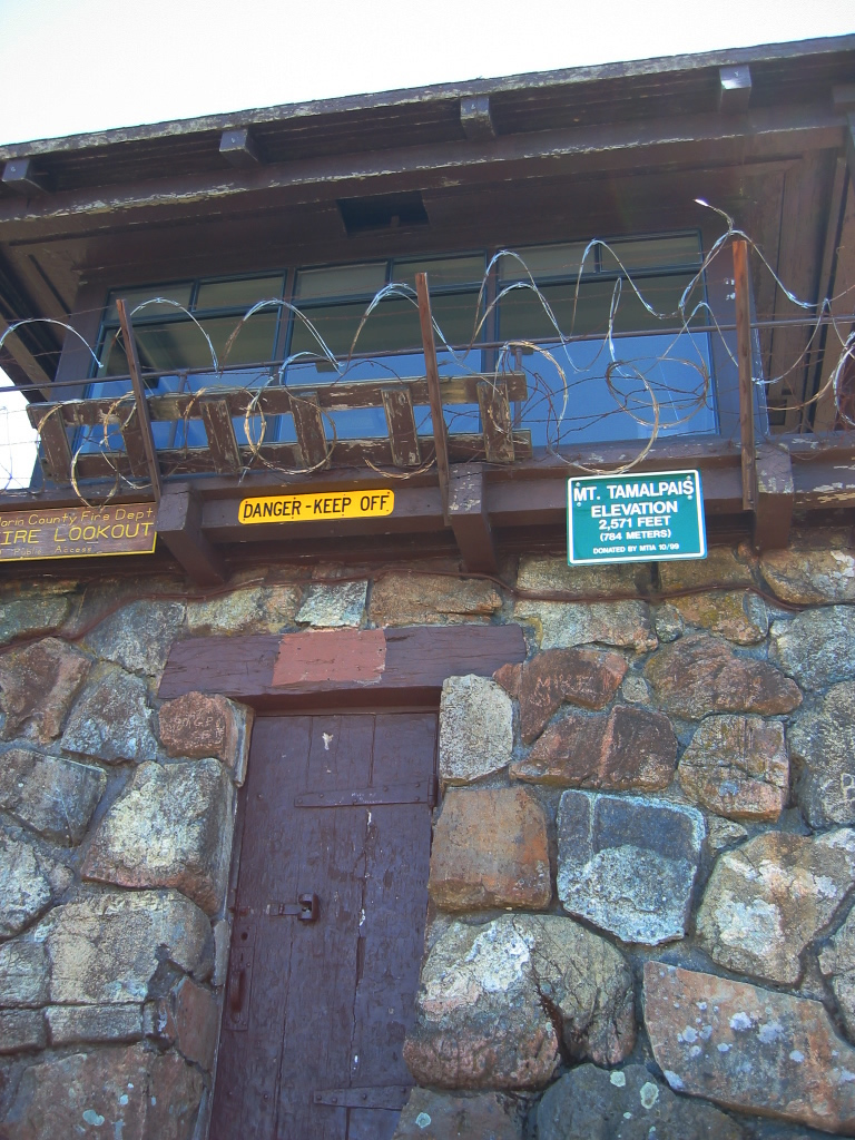
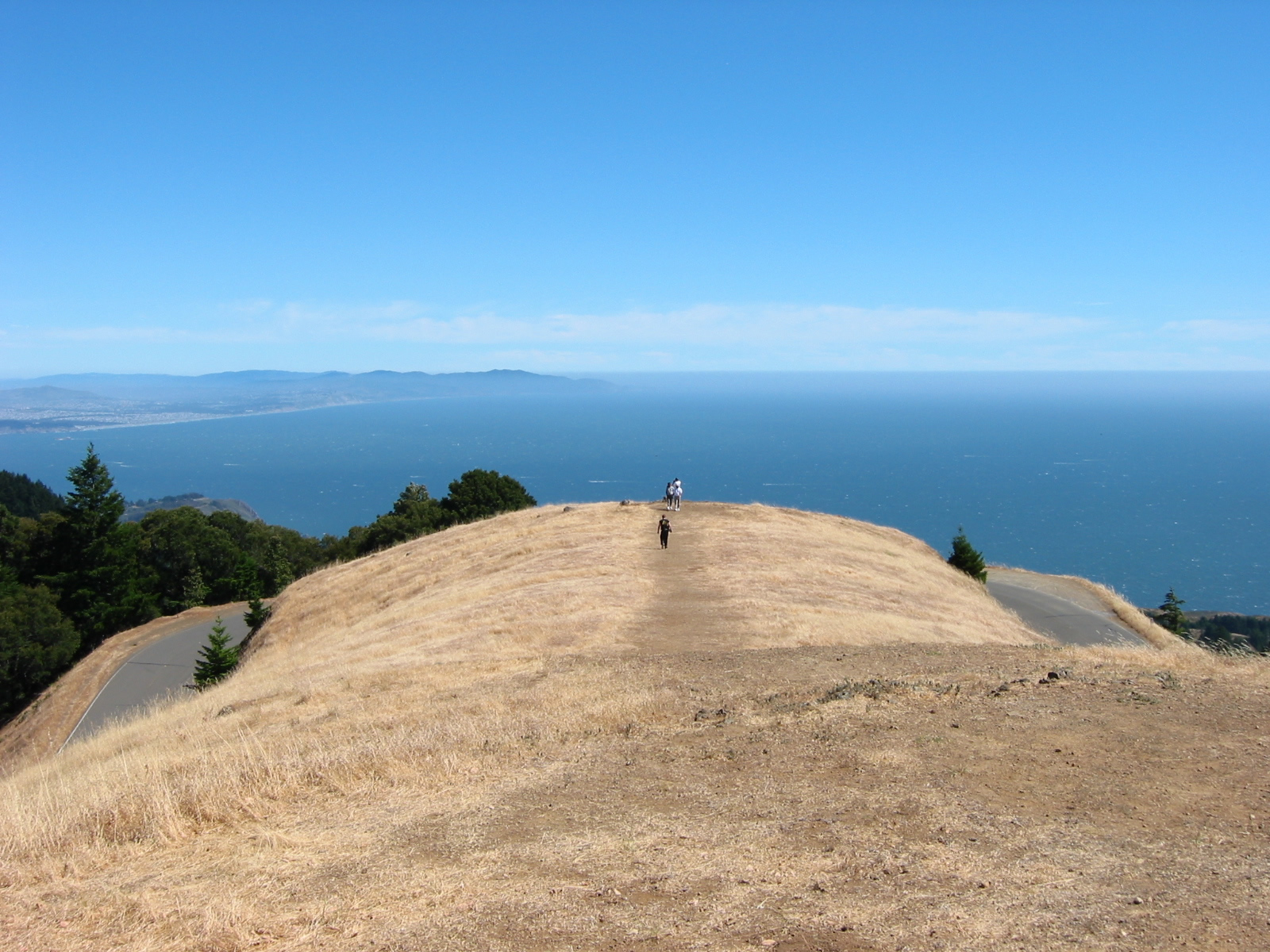
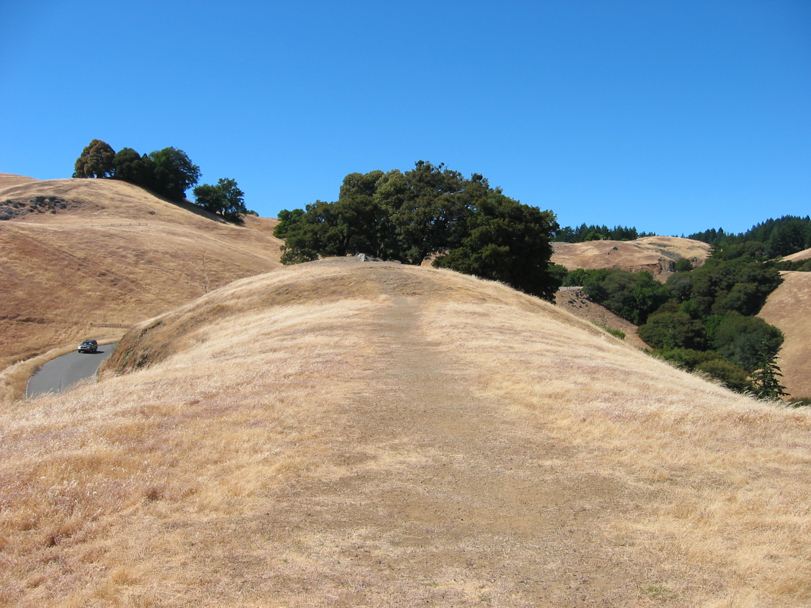
| These pictures show the incredible, scenic views available from the East Peak of Mount Tamalpais (el. 2,571 feet) within the state park boundaries. Some of the notable features visible from the peak include Angel Island, Tiburon, Richardson Bay, San Pablo Bay, distant Mount Diablo, San Francisco Bay, the Richmond-San Rafael Bridge (Interstate 580), the San Francisco-Oakland Bay Bridge (Interstate 80), Treasure Island/Yerba Buena Island, and downtown San Francisco. A fire watch tower is also located at the East Peak. Photos taken 07/29/02 by Pete Sison. |
|
|
|
|
|
|
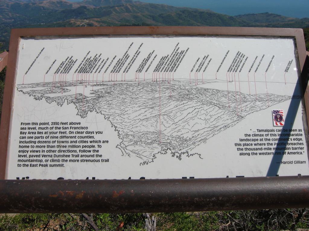
An interpretive sign at East Peak describes the many geographical points of interest visible from Mount Tamalpais, including some geological and some man-made creations. Photo taken 07/29/02 by Pete Sison. |
|
|
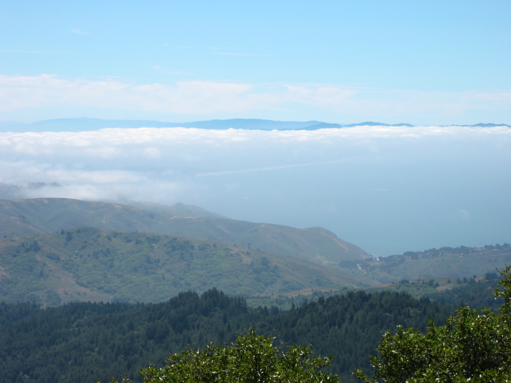
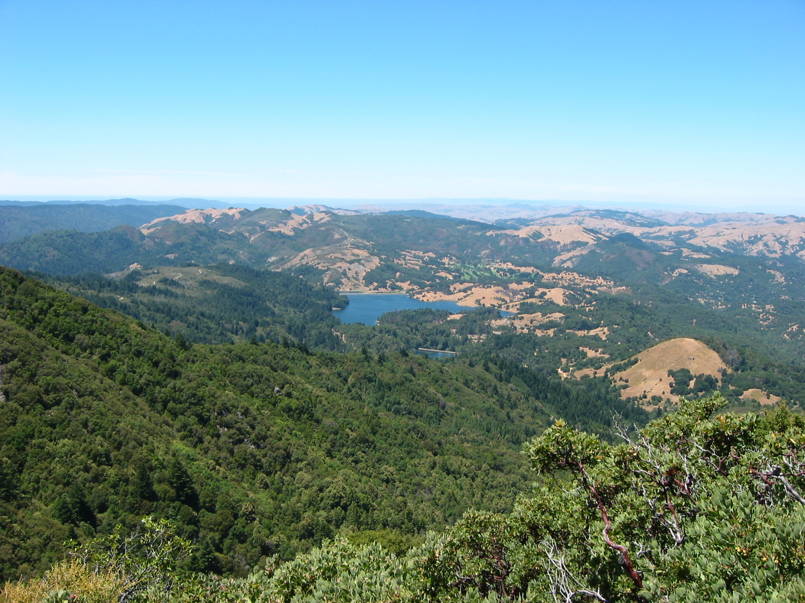
Also on Mount Tamalpais one can seen westward toward the Pacific Ocean. The fog bank often intrudes on this dramatic view. Also notable is the summer-dry grass and widening roads that lead to the summit. Photos taken 07/29/02 by Pete Sison. |
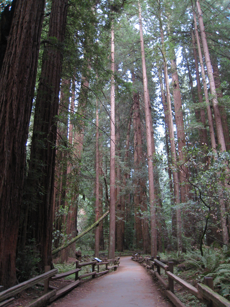
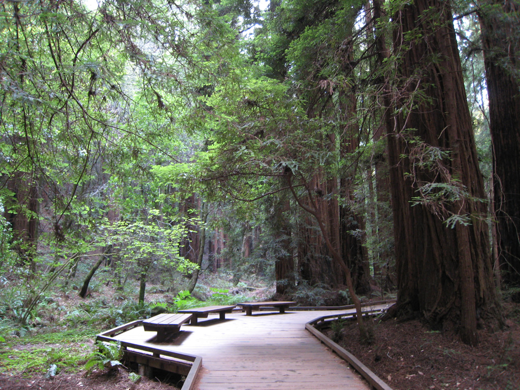
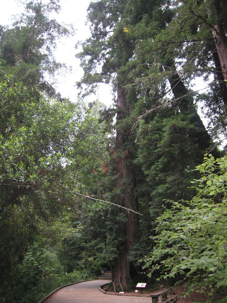
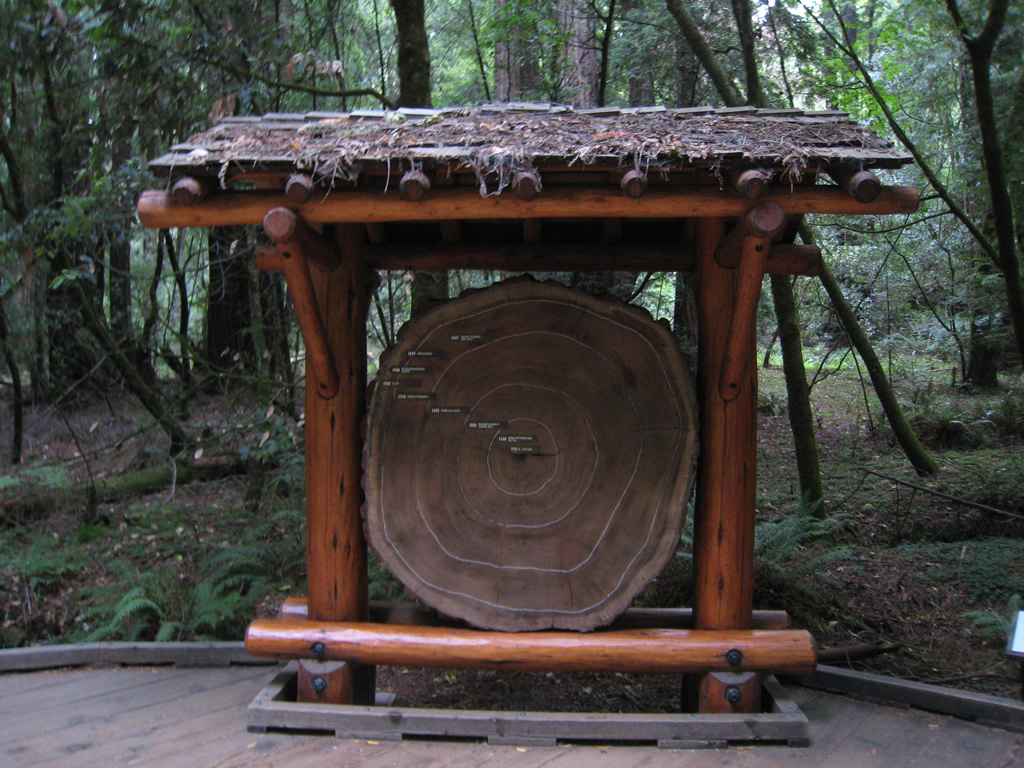
| Muir Woods National Monument scenes |
|
|
|
|
|
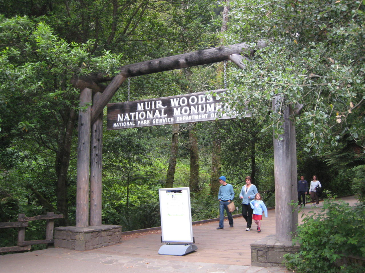
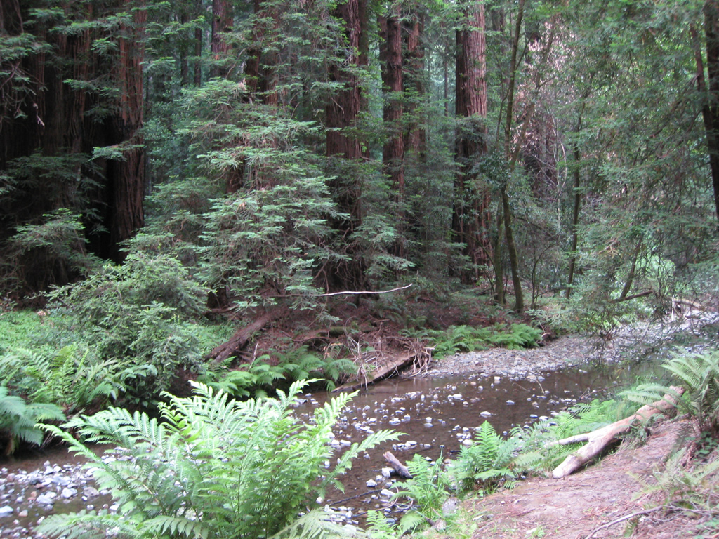
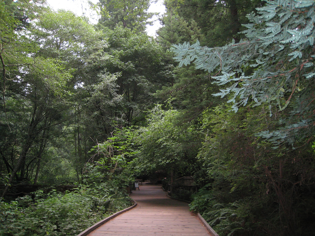
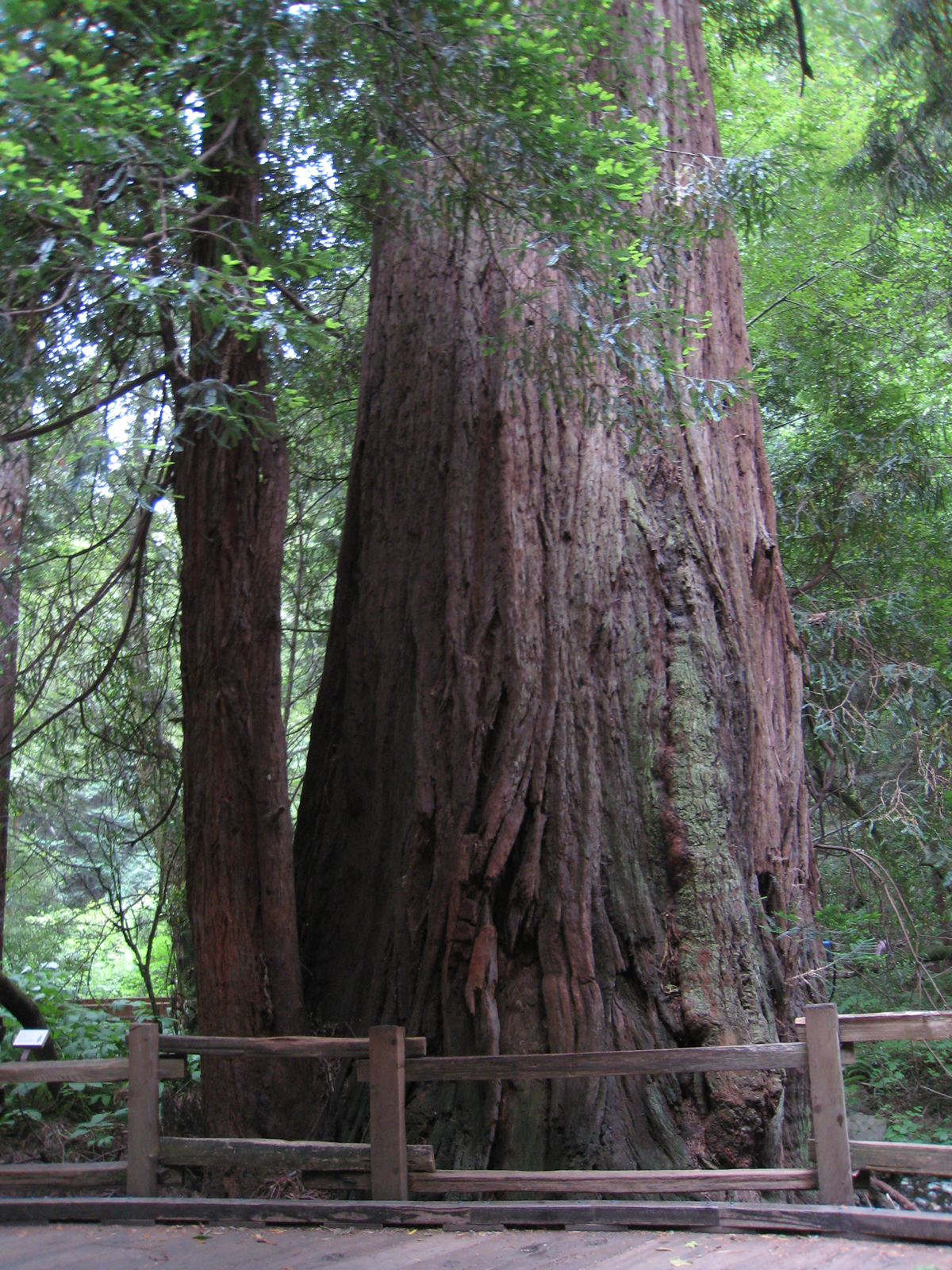
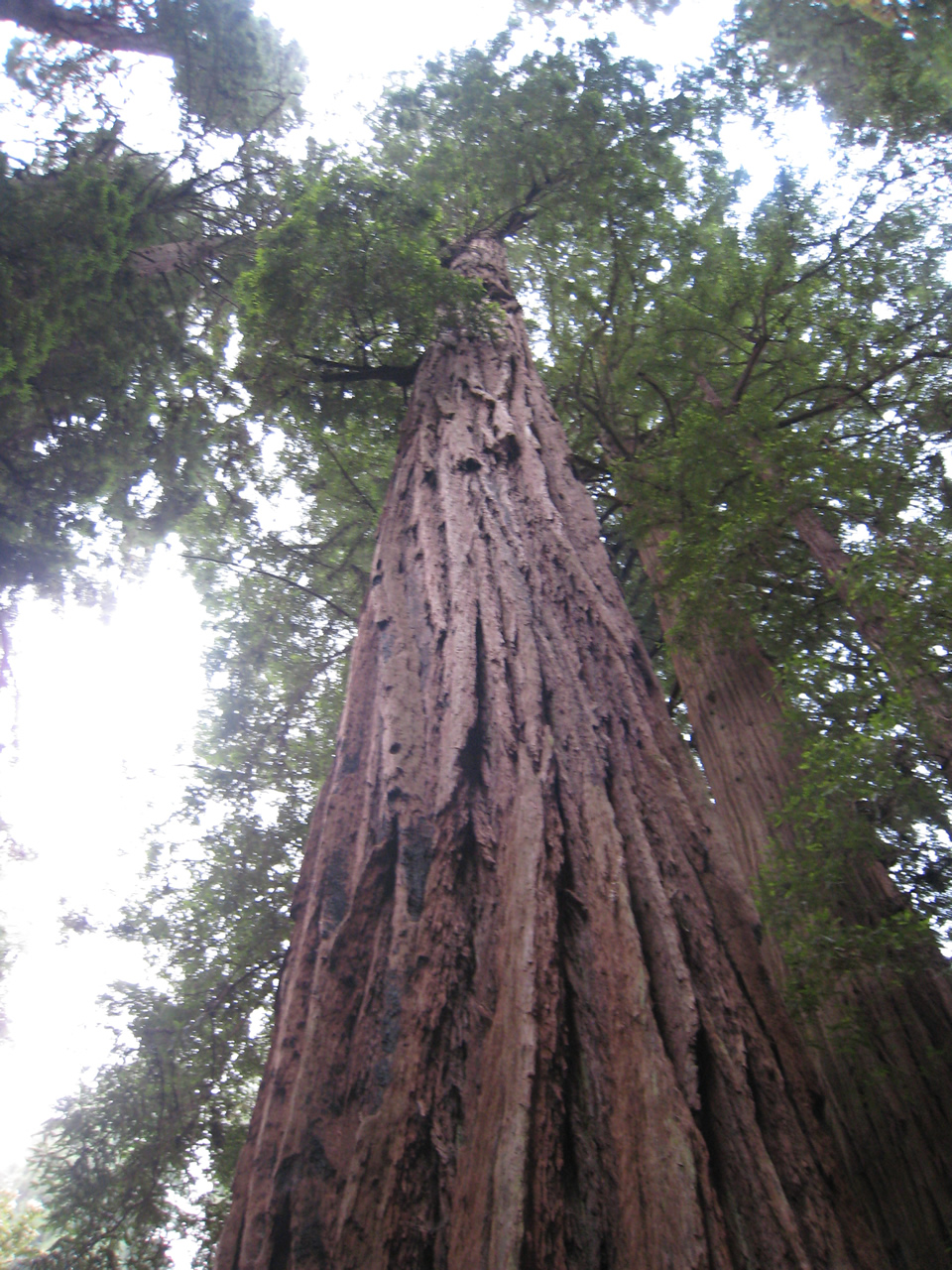
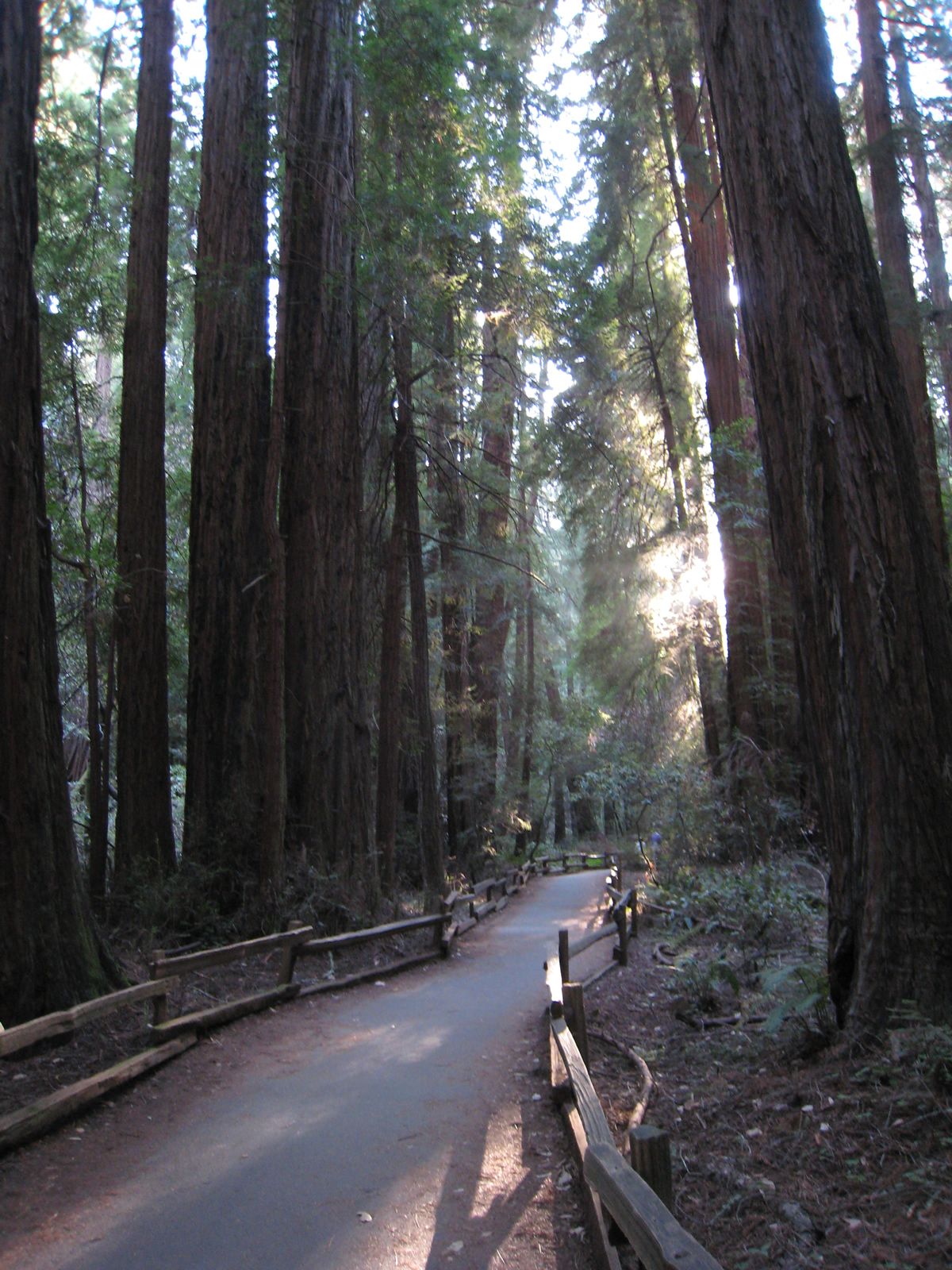
| These pictures show the pathways that lead to the tall trees found within Muir Woods National Monument, located off California 1 in Marin County. Limited parking is available, so early arrival is advised. Paved and wooden walkways connect the groves of redwood trees. While pictures are nice, this is another of those experiences best had in person. Photos taken 05/25/12 and 07/30/02 by Pete Sison. |
|
|
|
|
|
| Point Reyes National Seashore scenes |
|---|
|
|
|
|
|
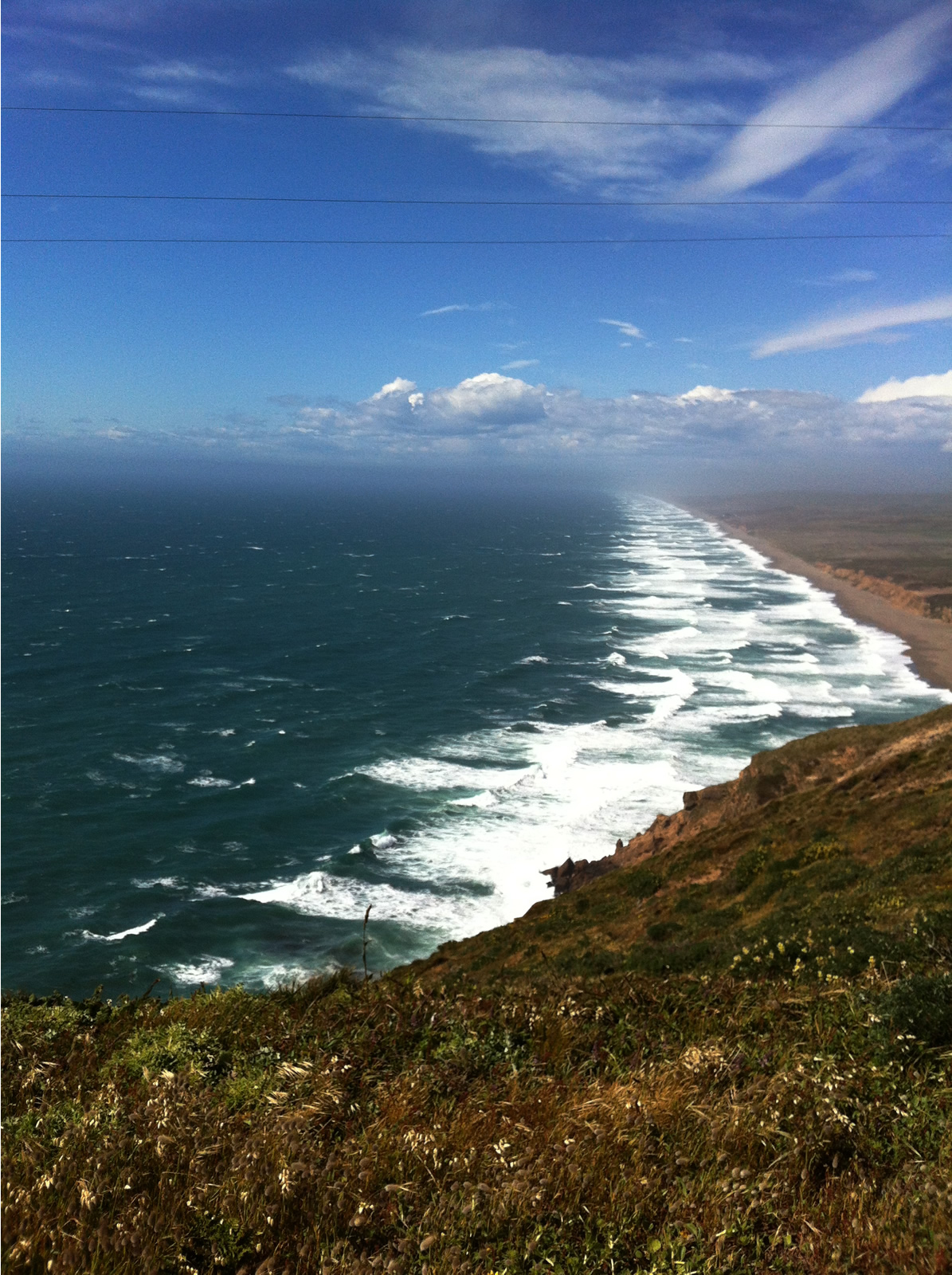
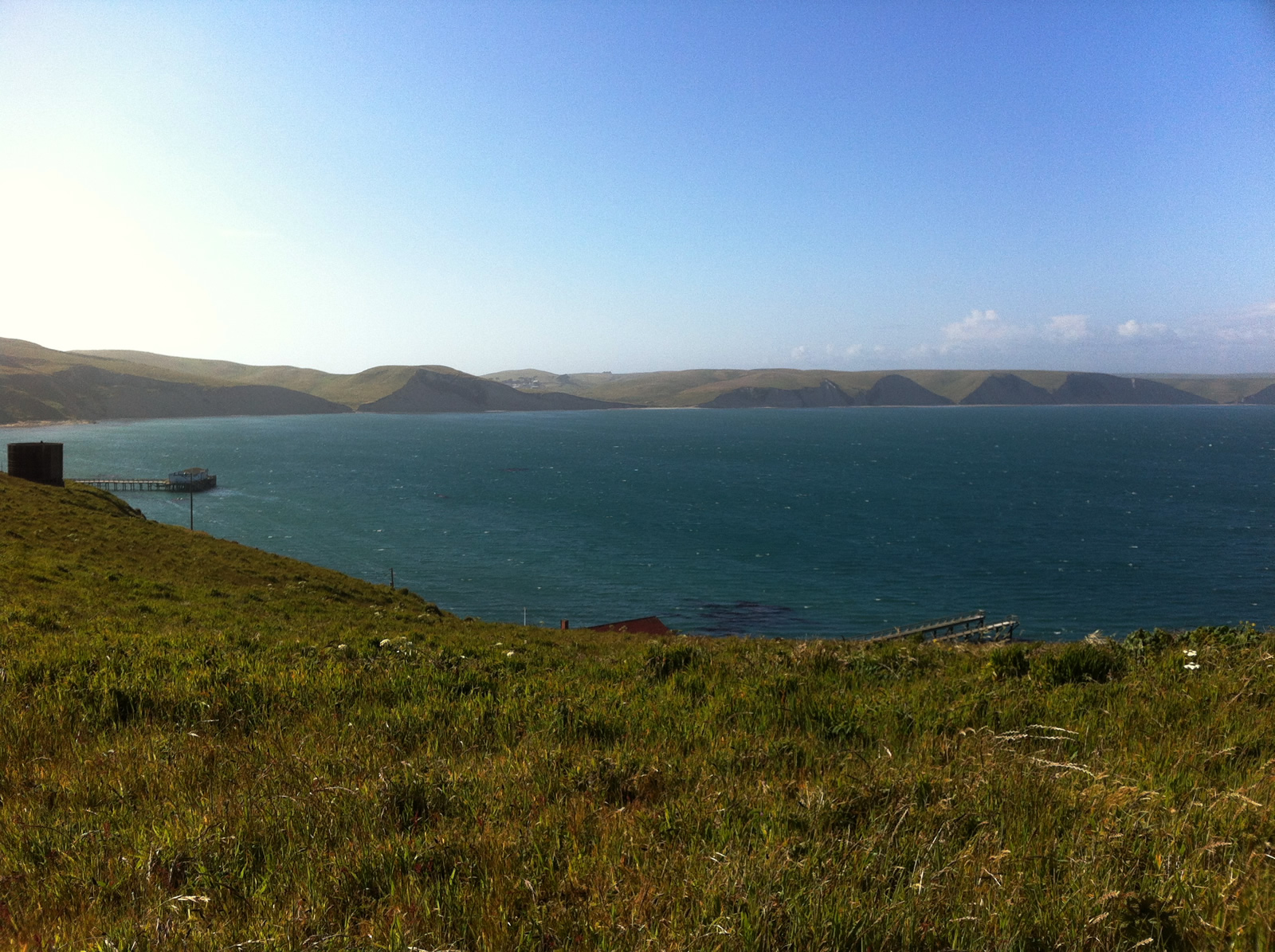
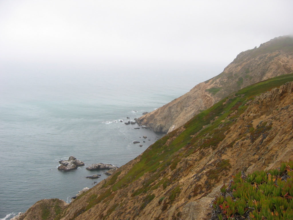
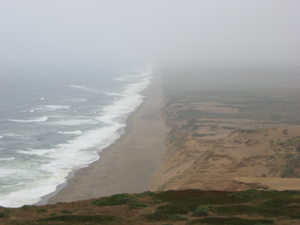
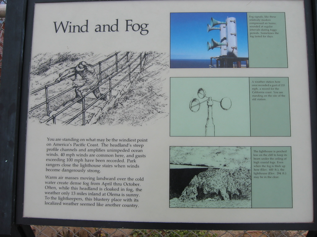
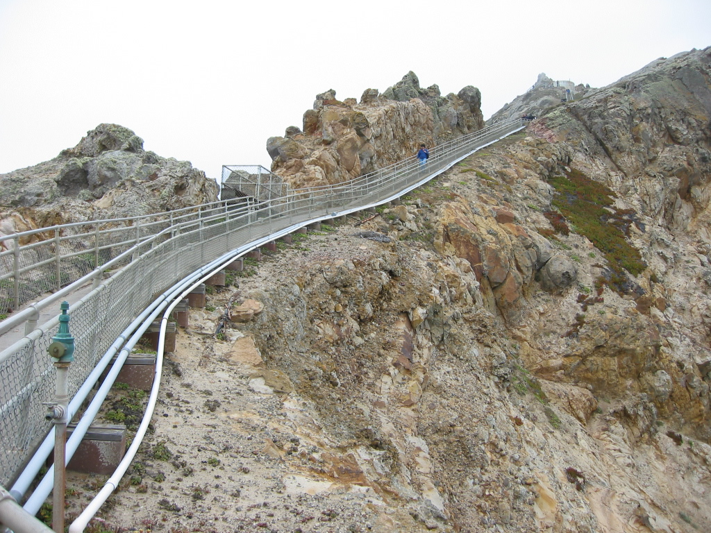
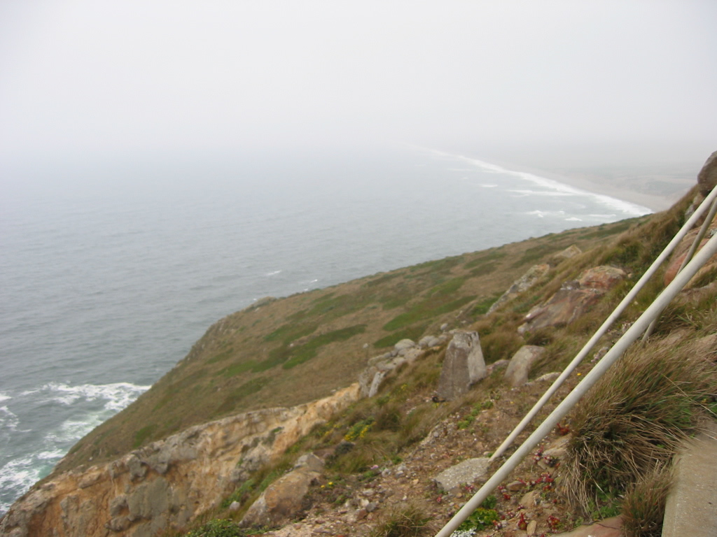
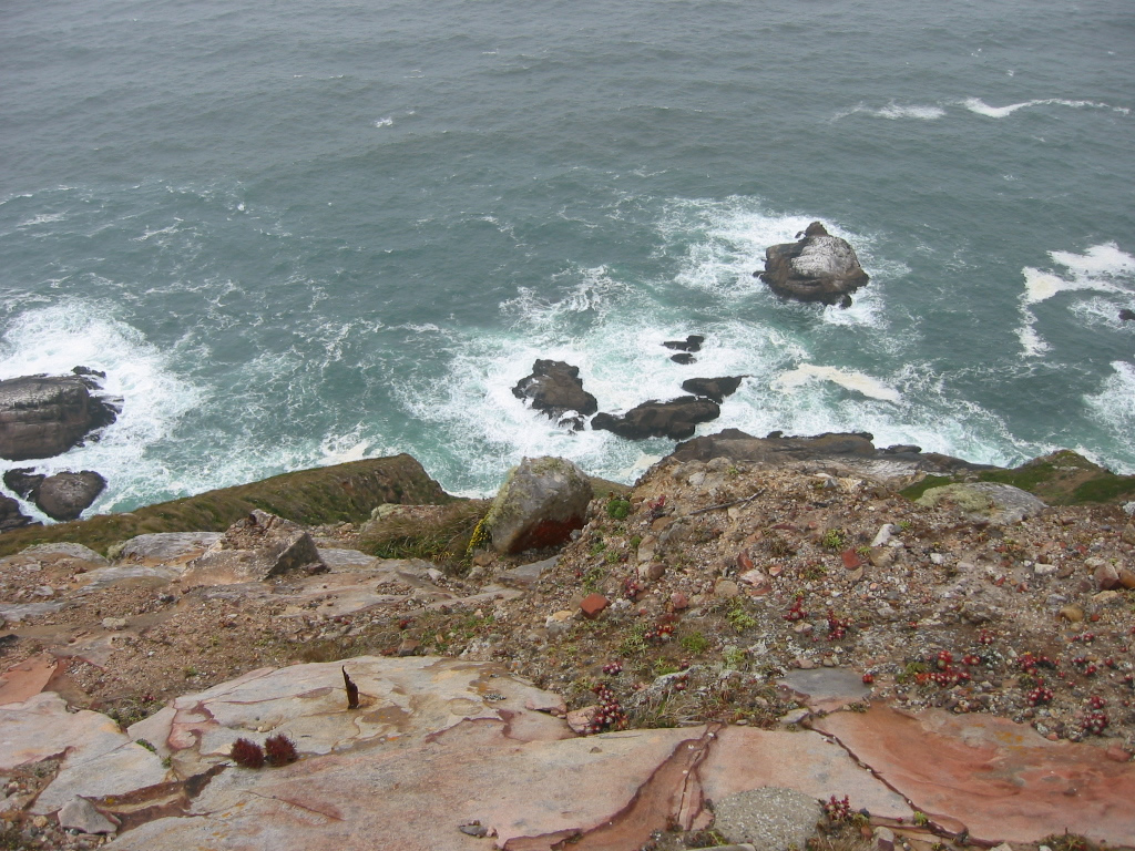
| These pictures show the shoreline within Point Reyes National Seashore; the westernmost coast is accessible via Sir Francis Drake Boulevard. Bluffs line the oceanfront, which has been shaped by the San Andreas Fault as well as the relentless impact of ocean waves. The ever-present fog was very pronounced in 2002 as compared to the visit in 2012; this area is one of the foggiest (as well as windiest) on the west coast. Photos taken 05/25/12 and 07/30/02 by Pete Sison. |
|
|
|
|
|
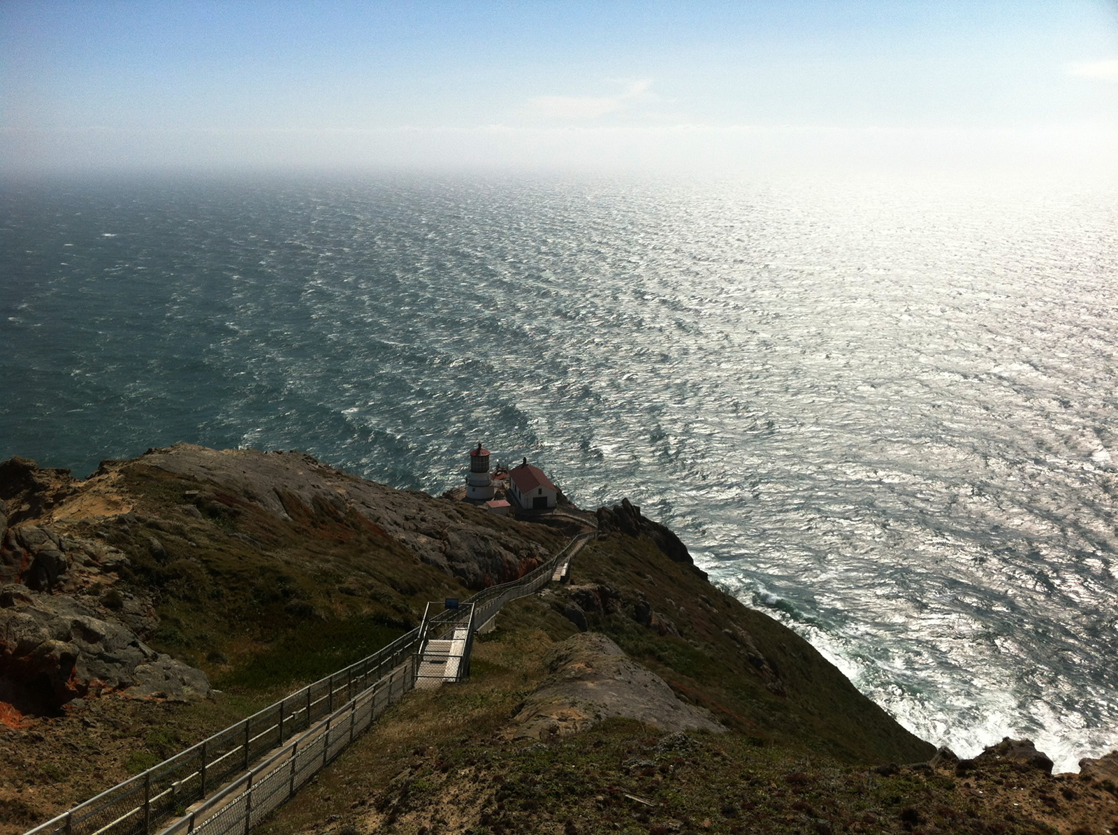
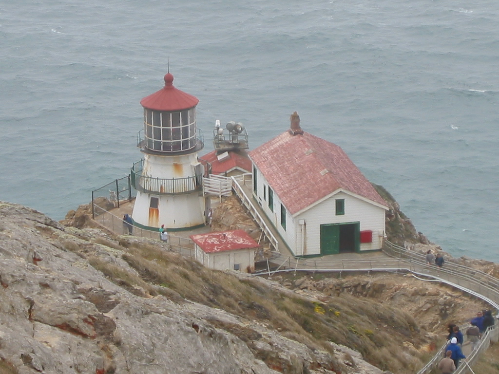
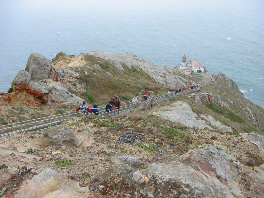
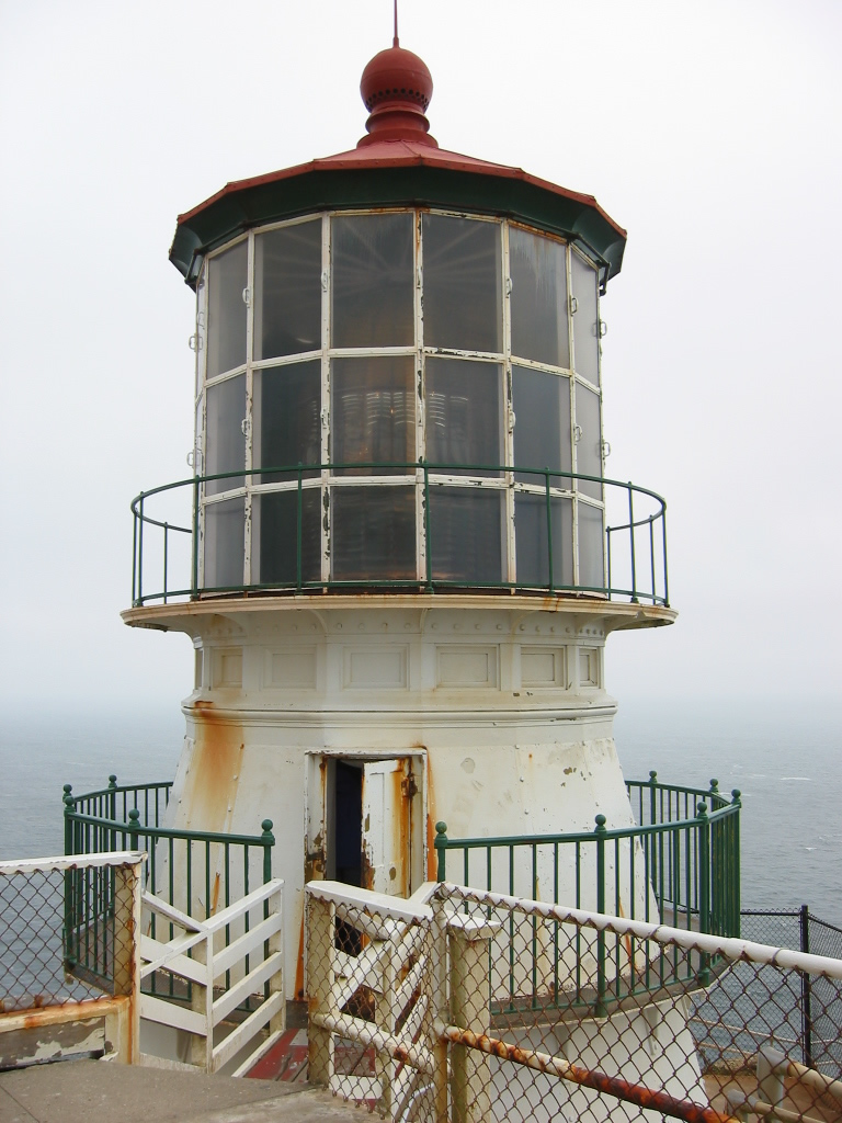
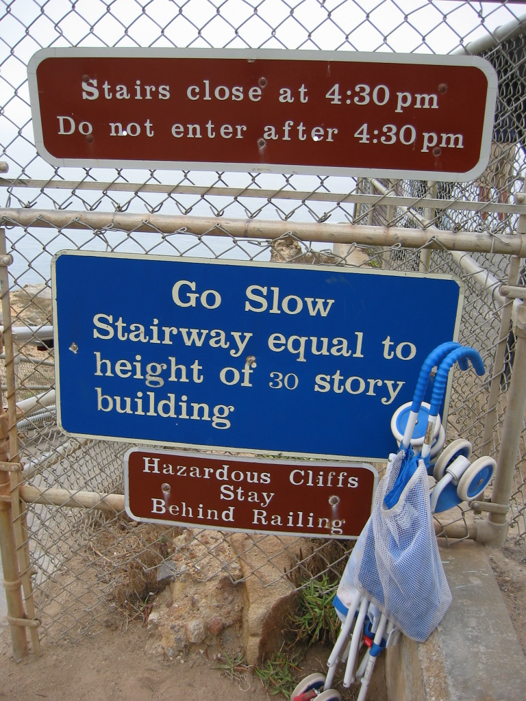
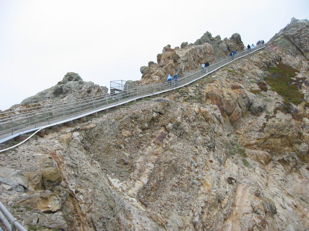
| The Point Reyes Lighthouse (built 1870) is located at the tip of Point Reyes, a promontory notable for its extreme fog and winds. As a result, the point is hazardous for mariners, and a lighthouse was erected at the point to help guide ships around the land. For visitors, a walk to the lighthouse involves a trek down a series of steps equivalent to a 30-story building. The lighthouse is open to the public on certain days. Photos taken 05/25/12 and 07/30/02 by Pete Sison. |
|
|
|
|
|
Page Updated August 23, 2013.