
With the holidays back again, many are hitting the road to visit friends and family across the country. For the last seven years, that means another drive for some of us at AARoads to Southwest Florida along Interstate 75. Over the Thanksgiving holiday, we’ve done a lot of driving on state and county roads throughout Lee and Collier Counties.
Our backlog for road photos from Southwest Florida dates back to 2007, with some sections updated over the years, but many untouched since we first posted area pages. Started uploading photos late last week with an overhaul of the Lee County guides for U.S. 41 north and south. Both pages were still posted on southeastroads.com and vastly unchanged since 2008. There was also no coverage of Charlotte County at all for U.S. 41, so new entries were posted there as well.
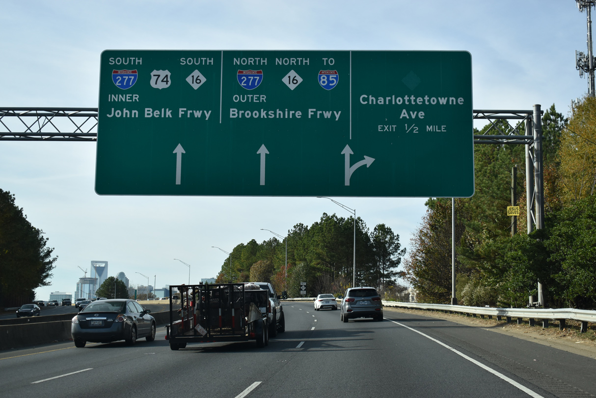
Redrove some of the streets in and around Downtown Fort Myers back in May, and finally posted those photos on the pages for State Road 80 and a previously unpublished page for State Road 82. A disconnected section of SR 80 and U.S. 41 Business remains posted along the triangle formed by Main and Monroe Streets north of SR 82 (Dr. Martin Luther King, Jr. Boulevard). SR 80 previously extended along a one-way couplet from Monroe Street northeast along 1st and 2nd Streets. Both streets were turned over from FDOT maintenance to the city of Fort Myers, leaving a gap in the state road system.
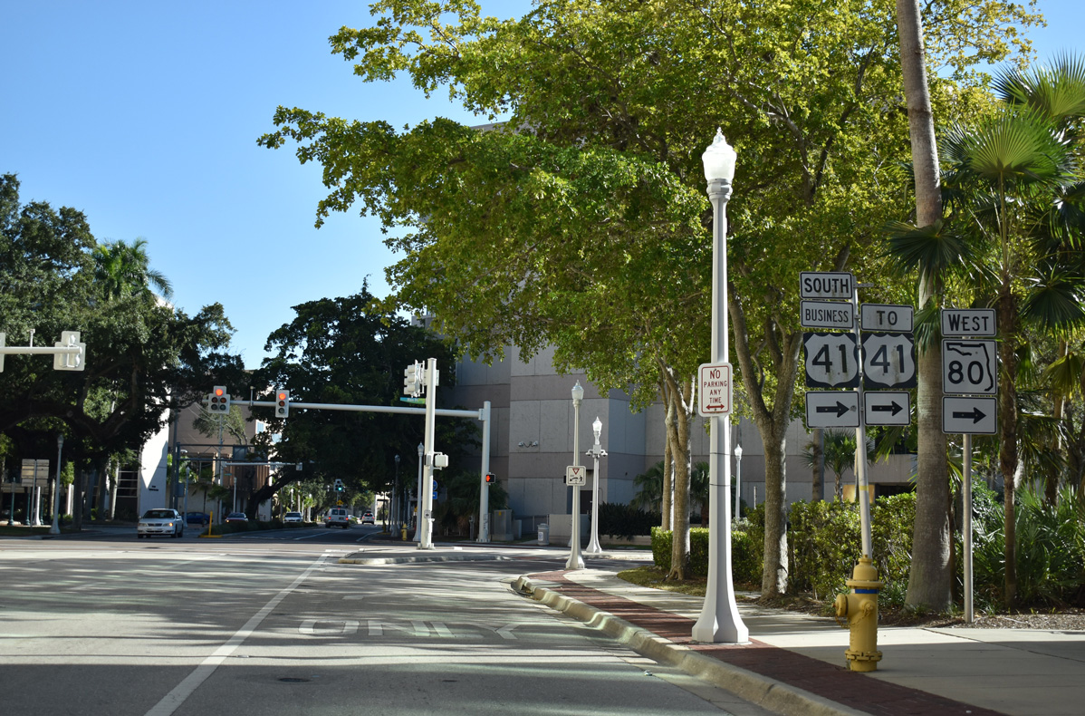
U.S. 41 Business and SR 80 historically overlapped west along 1st Street to Monroe Street south in Downtown Fort Myers. Main Street returned the business loop to U.S. 41 along Cleveland Avenue. 11/30/19
The two blocks of Main Street between U.S. 41 (Cleveland Avenue) and Monroe Street in Downtown Fort Myers are still state maintained and recognized as U.S. 41 Business/SR 80. 11/30/19
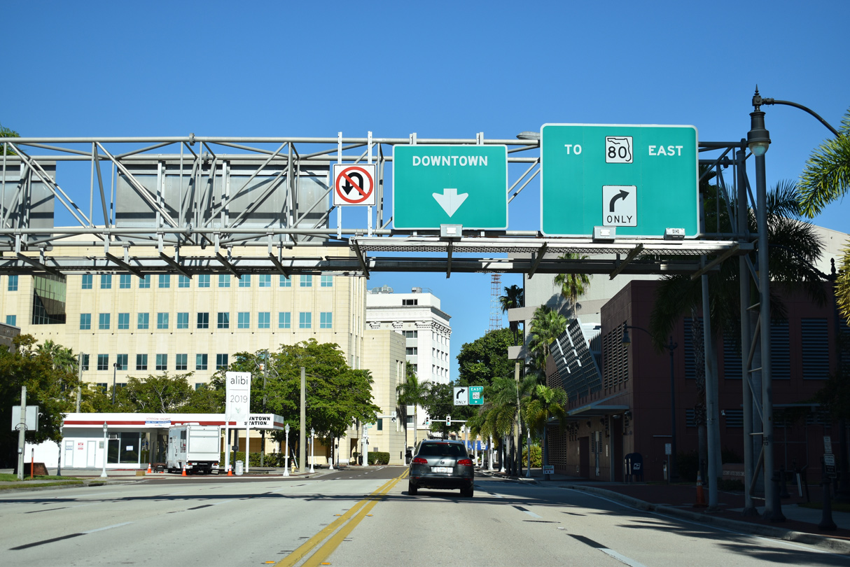
One problem with this relinquishment is that U.S. 41 Business along Park Avenue and Fowler Street does not seamlessly connect with U.S. 41 along Cleveland Avenue. Signs for the route appear in Downtown, but with no indication for drivers of how to continue northbound to Park Avenue. Traveling south from the Edison Bridge, an assembly still referenced the former turn of U.S. 41 Business onto First Street with SR 80 west until 2018. With its removal, there are no remaining signs indicating where U.S. 41 Business continues from Fowler Avenue. Despite this, remaining assemblies on SR 80 west reference the route as continuing south along Fowler Street (SR 739). At this point, U.S. 41 Business in Fort Myers and North Fort Myers should be decommissioned with the portion north of SR 80 posted simply as SR 739.
Carbon copying of signs continues to be a problem in Florida with outdated assemblies carried over on a routine basis. While going through photos from last May, we discovered a pair of assemblies along U.S. 41 southbound leading into Fort Myers that were replaced since 2011:


Among the issues with these new signs, “signal ahead” should not be in a white on green guide sign format. The backplate for U.S. 41 was retained (this is Florida, not New Jersey!). State Road 867 along McGregor Boulevard was truncated a decade or so ago, so that it no longer extends north of Colonial Boulevard (SR 884). Aforementioned, SR 80 is discontinuous through Downtown Fort Myers, and acknowledging it here does not benefit the traveling public. Lastly, the connection to SR 82 from U.S. 41 southbound is not direct, so signs should display the shield with a preceding “TO”.
Suburban development continues at an extremely fast pace in the Fort Myers area, with rural stretches falling further east of the I-75 corridor, or through protected areas along the coast and area waterways. Widening is underway until the end of 2020 along all of State Road 82 from Lehigh Acres to the Hendry County line. Expansion completed this Summer included Florida’s first continuous flow intersection (CFI) at SR 82, Daniels Parkway (CR 876) west and Gunnery Road north.
Future upgrades in Lee County include rebuilding the exchange joining Interstate 75 with State Road 884 (Colonial Boulevard) into a diverging diamond interchange (DDI). A PD&E study is also underway for widening State Road 31 from SR 80 (Palm Beach Boulevard) north to CR 78 near Babcock Ranch. Updated the State Road 31 guide with 15 new photos northbound (4/15/16) and eight photos southbound (11/26/16).
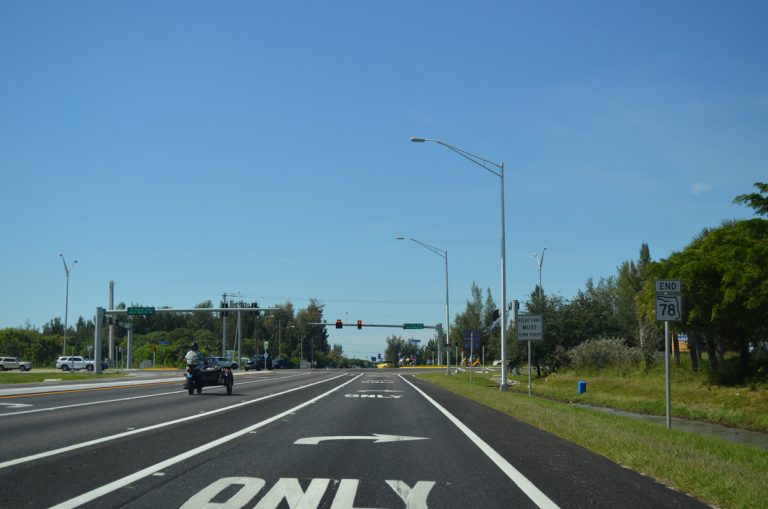
The westernmost section of State Road 78 (Pine Island Road) in Cape Coral was widened to a four lane arterial by Fall 2014.
Pine Island is a rural coastal community beyond Matlachas Pass and the Cape Coral urban area. County Road 767 (Stringfellow Road) connects both ends of the island with CR 78 (Pine Island Road). Posted a page covering Lee County Road 767 along with pages also for various Charlotte County Roads further north including CR 762 (Tuckers Grade), CR 765A (Taylor Road) and CR 768 (Jones Loop Road).
Continuing with page updates, added a new page for State Road 78 westbound and updated the eastbound guide from Pine Island to SR 31. This includes updated photos for the County Road 78 portion extending west onto Pine Island. Pine Island Road is the main commercial arterial across north Cape Coral, and in fill development continues at a rapid pace, with few vacant lots remaining.
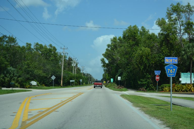
County Road 767 north of CR 78 at Pine Island Center. 10/01/17
Expanding site updates further east into Hendry County, the guides for State Road 80 were updated with photos from November 26, 2016 and July 2, 2019. The entire route is at least four lanes east to Port LaBelle, and construction underway through Summer 2020 expands the last two lane stretch 11 miles from Dalton Lane to CR 833.
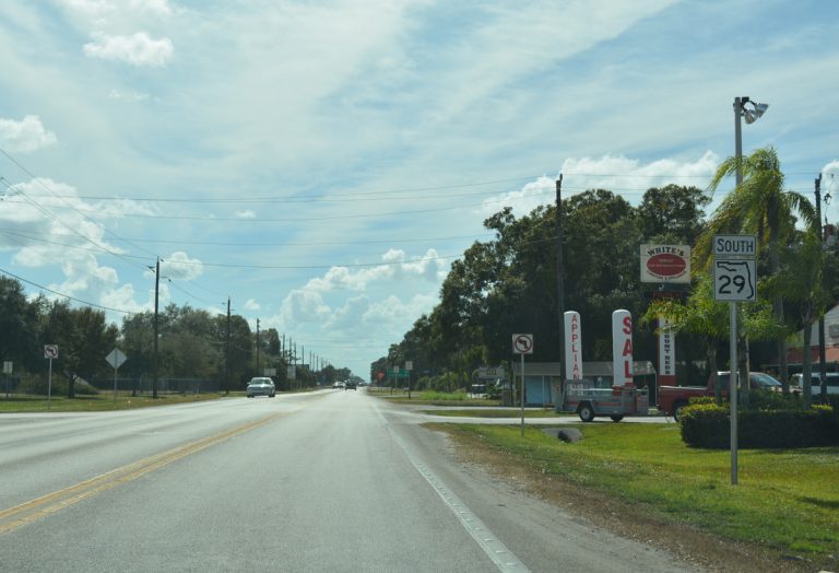
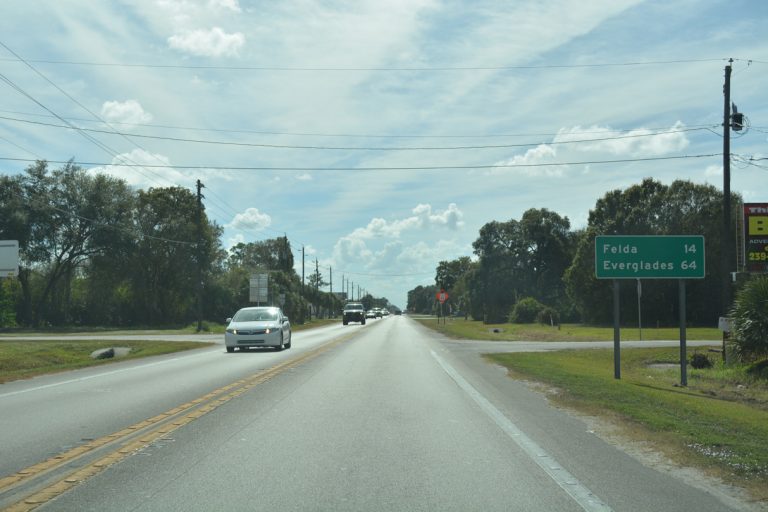
Photos from both dates were also taken along State Road 29, and northbound content was split into a separate page and updated with photos at Miles City, Immokalee, LaBelle and near Palmdale. Also posted two pages covering the entire length of SR 29 southbound.
A PD&E Study underway from May 2018 to April 2021 evaluates expanding SR 29 from two to four lanes south from Oil Well Road to Interstate 75 in Collier County. A previously completed PD&E Study focused on widening SR 29 north 17 miles from Oil Well Road to a point south of SR 82. Further north, SR 29 from SR 82 into Hendry County will be improved into a four lane, divided highway. Design work for the four phase project is presently underway.


