
California 36
California 36 is an east-west state route between U.S. 101 at Alton and U.S. 395 near Susanville. The state route links the North Coast with the Susanville area, passing through Red Bluff and Lake Almanor along the way.
| California 36 west | |
|---|---|
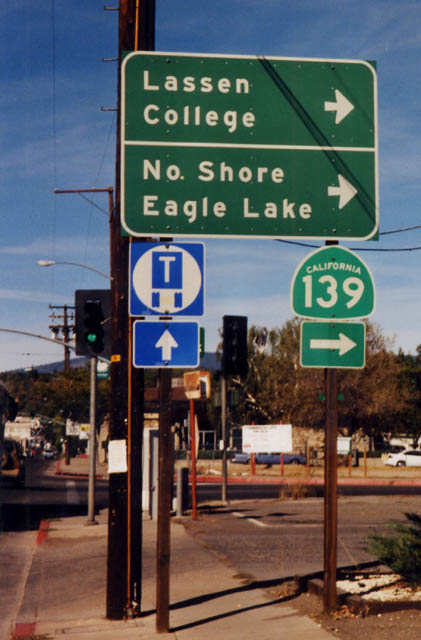 |
Serving the northeastern part of the Golden State, westbound California 36 meets California 139 in Susanville. Photo taken by Dominic Ielati (10/01). |
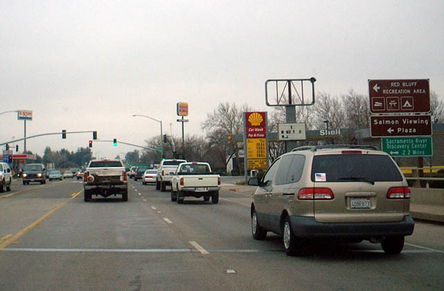 |
Westbound California 36 approaches Interstate 5 in Red Bluff, just west of its junction with California 99. Turn left here for the salmon viewing area. Photo taken 01/20/03. |
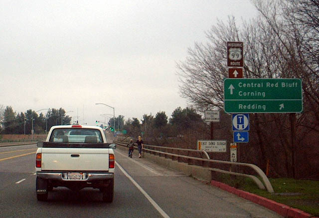 |
A historic U.S. 99 shield is posted along westbound California 36 as the highway enters metropolitan Red Bluff. Originally we thought Caltrans erected this sign, consdering that it's on a state route. However, Warren Jensen corrected us: "Historic 99 shields are paid for by community groups in our area, so thank the people of Red Bluff. Thanks, folks! Ironically, the section pictured was never part of U.S. 99. The original alignment was north of this point (the original bridges across these flood channels of the Sacramento are historic landmarks and are worth a side trip)." Photo taken 01/20/03. |
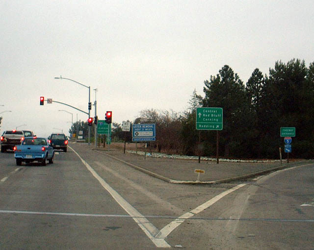 |
California 36 meets Interstate 5 north just east of downtown Red Bluff. Photo taken 01/20/03. |
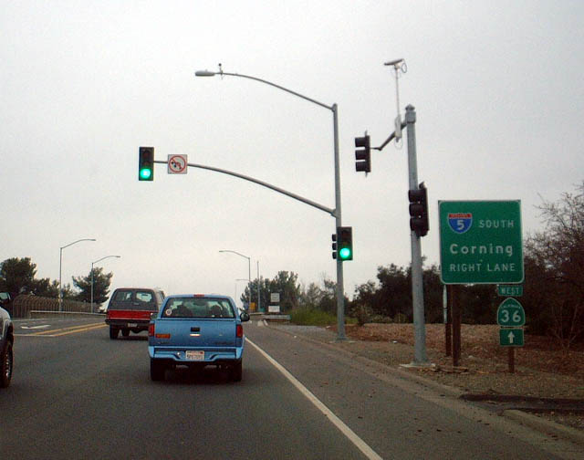 |
Westbound California 36 meets Interstate 5 southbound just east of downtown Red Bluff. From here, Business Loop I-5 joins California 36 for the journey into Red Bluff. Photo taken 01/20/03. |
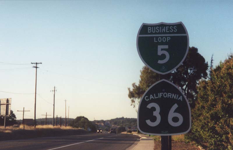 |
Shortly therafter, California 36 west and Business Loop I-5 are posted together as they approach downtown Red Bluff. Photo taken by Joel Windmiller (03/29/01). |

Page Updated January 26, 2012.
|
About Contact Glossary |
In The News Testimonials Interstate Guide |
Social Media:
 |
|
© 2000-23 AARoads.com | All Rights Reserved | Privacy Policy / Terms of Use
|
||