
California 85
California 85 consists of the Stevens Creek Freeway and the West Valley Freeway. The state route is entirely freeway, and it provides a loop around San Jose to the west and offering a connection from U.S. 101 to many Santa Clara County cities and towns. The freeway passes through the heart of the Silicon Valley. California 85 directly serves Mountain View, Cupertino, Sunnyvale, Saratoga, Campbell, Los Gatos, and San Jose.
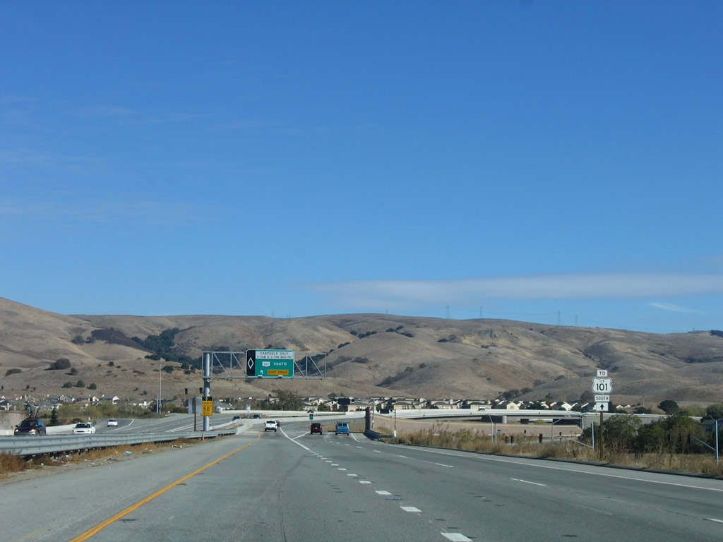
California 85 was built in phases, with the original segment at the northwestern end built first. The northern section from U.S. 101 to Interstate 280 was built between 1965-1967. The remaining section of California 85 was built after much controversy from Interstate 280 southeast to U.S. 101 between 1990 and 1994. Major interchange upgrading and reconstruction was performed at the California 87 interchange in 2003 and the southern U.S. 101 interchange in 2004.
| California 85 - West Valley Freeway north | |
|---|---|
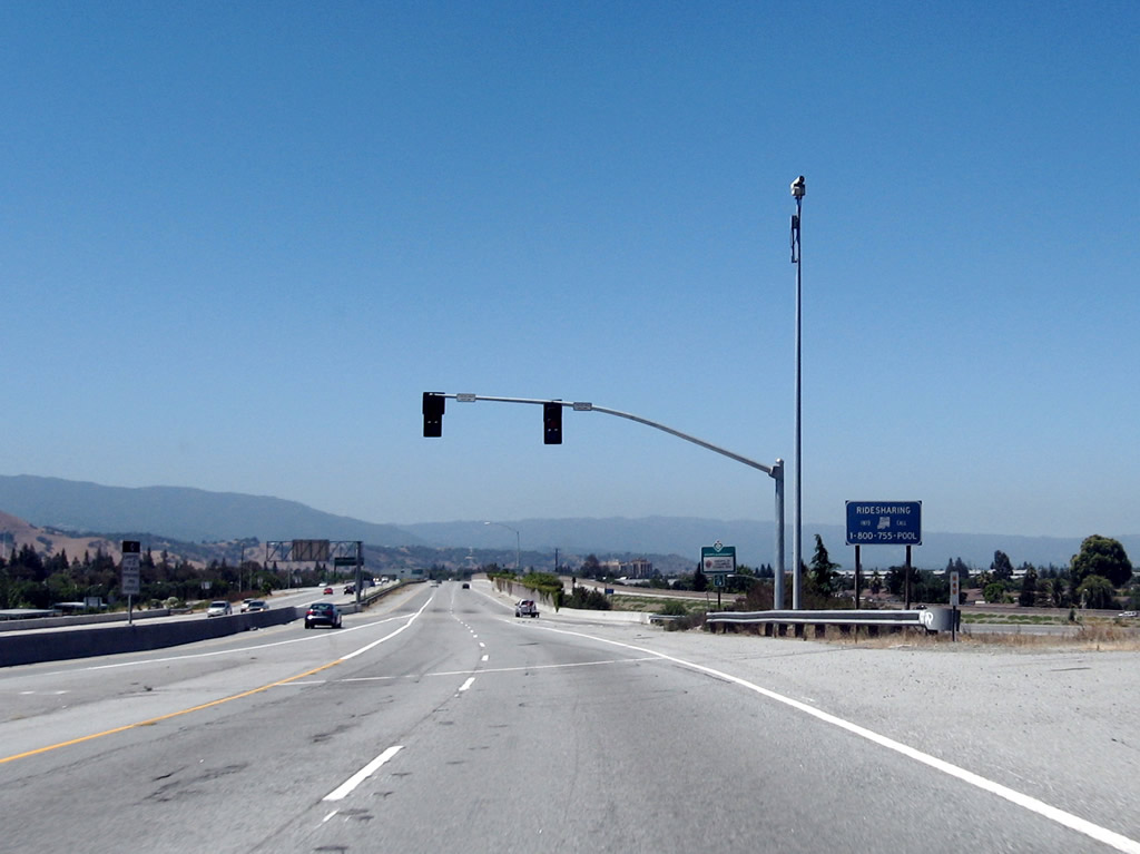 |
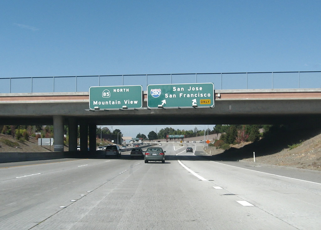
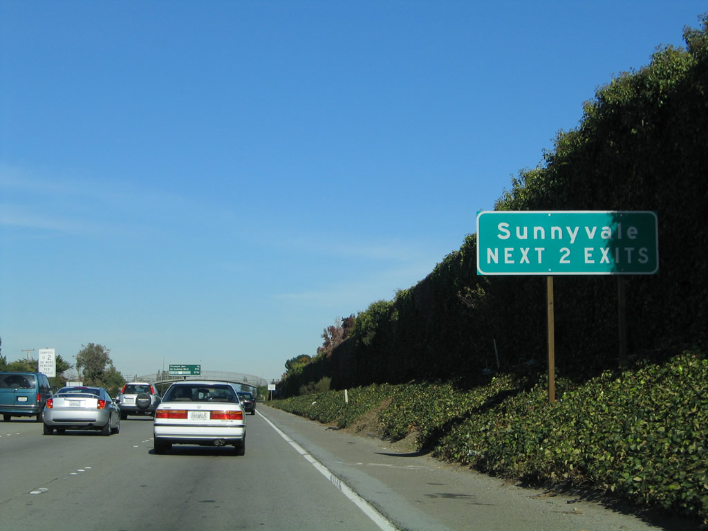
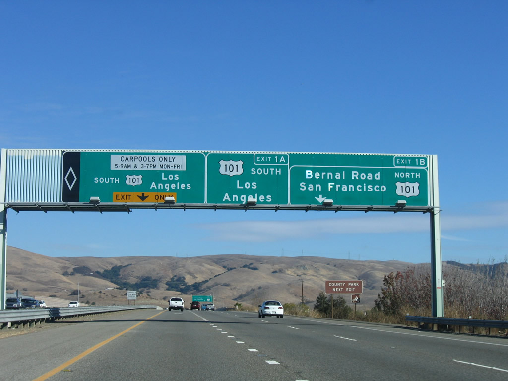
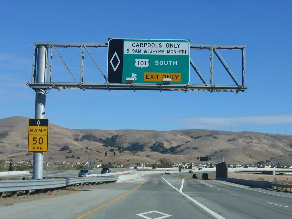
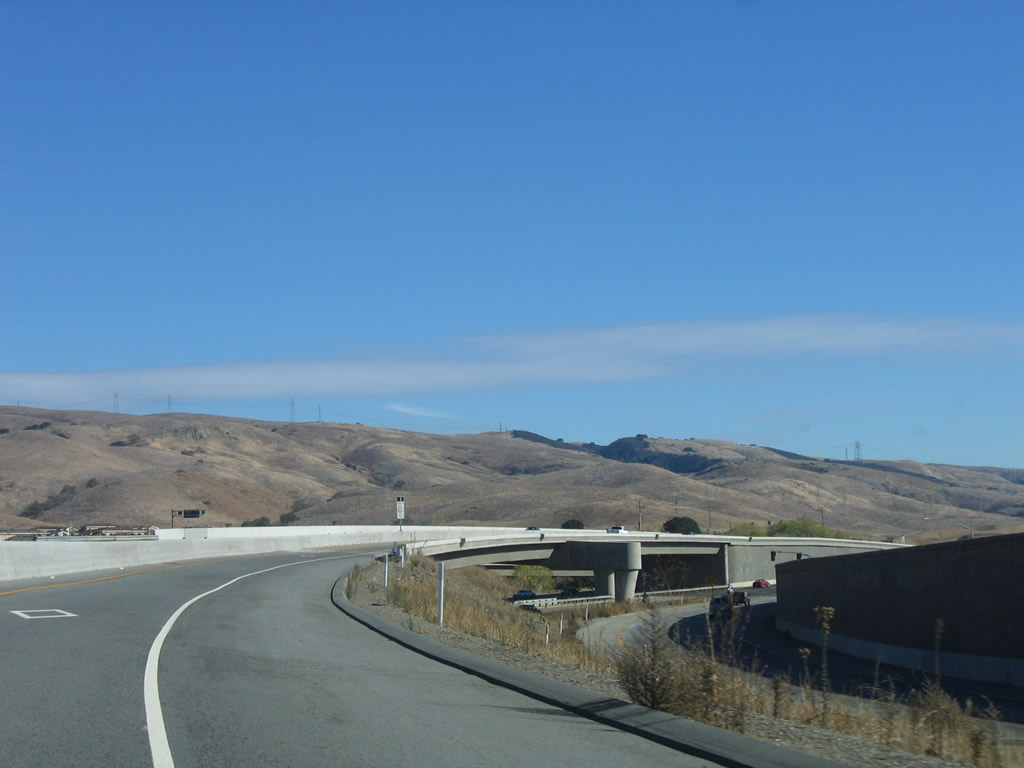
California 85 (West Valley Freeway) begins and leads west from an interchange with U.S. 101. A set of ramp metering signals governs the flow of traffic during commuting hours. California 85 begins in the city of San Jose, home to 894,943 people as of the 2000 Census. Founded on November 29, 1777, and incorporated on March 27, 1850, San Jose is the third largest city in California (behind Los Angeles and San Diego). San Jose consists of 178.2 square miles and sits at an elevation of 85 feet. Rainfall in San Jose is much less than San Francisco due to its location at the south end of the San Francisco Bay and enclosure within mountains. The average annual precipitation is 14.4 inches. Photo taken by Jeff Waller (08/11/07). |
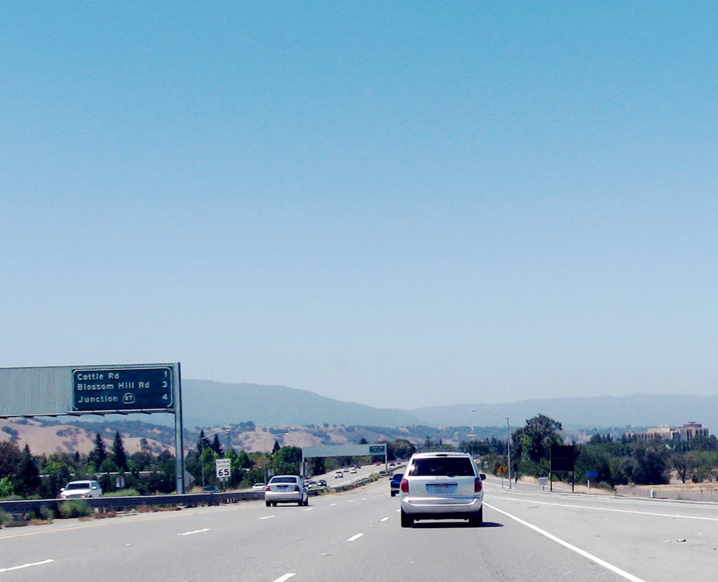 |
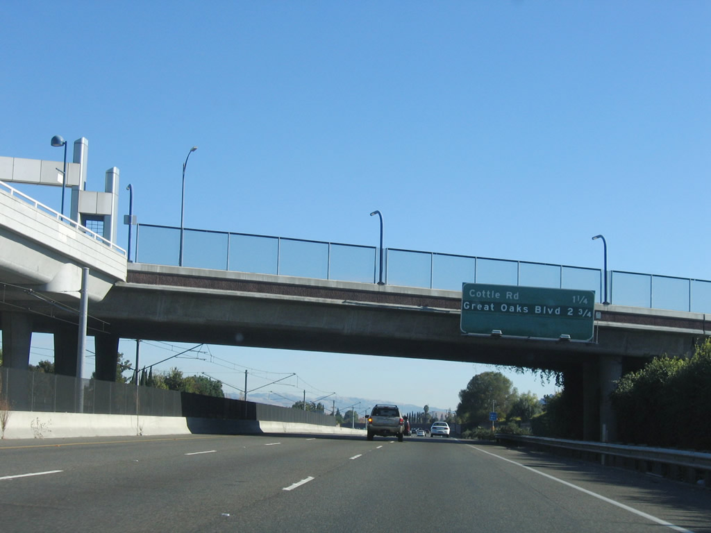
The first three exits along California 85 (West Valley Freeway) north are: Exit 2, Cottle Road; Exit 4, Blossom Hill Road; and Exit 5A; California 87 (Guadalupe Parkway). Photo taken by Jeff Waller (08/11/07). |
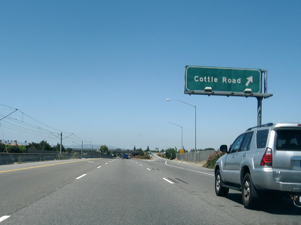 |
Northbound California 85 (West Valley Freeway) reaches Exit 2, Cottle Road. Photo taken by Jeff Waller (08/11/07). |
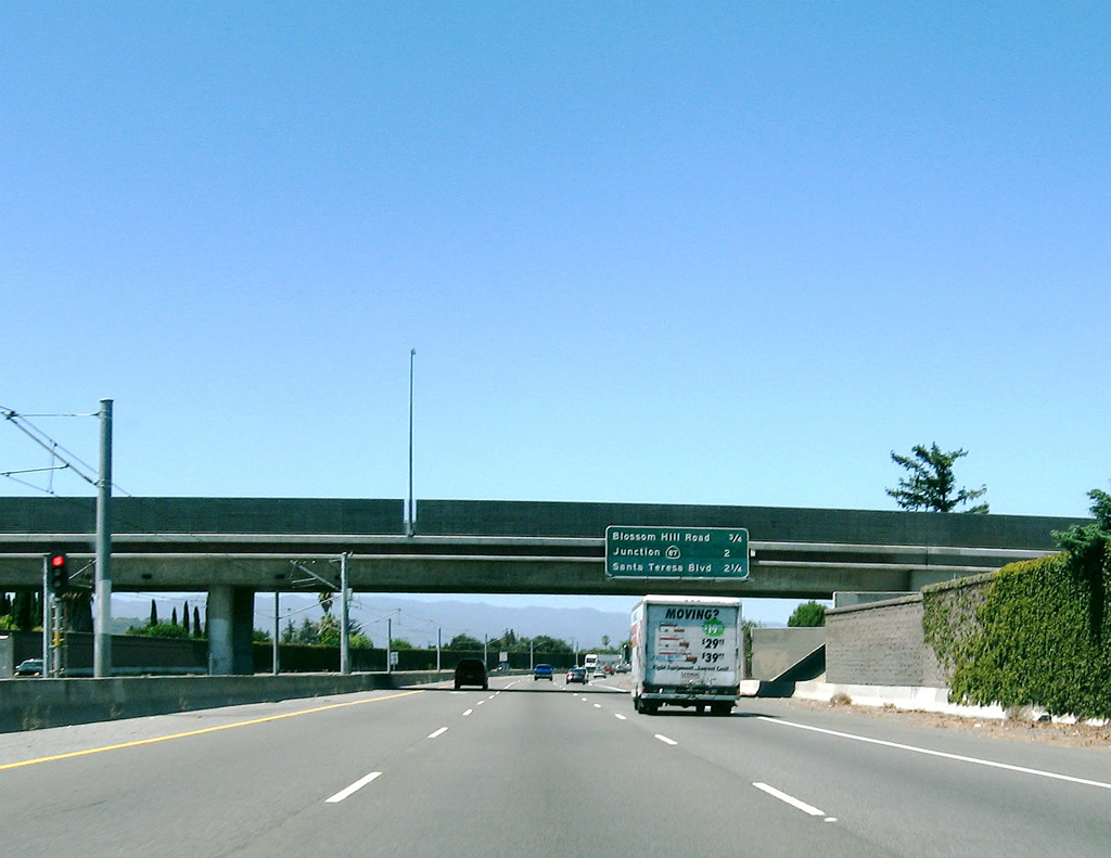 |
The next three exits along California 85 (West Valley Freeway) north are: Exit 4, Blossom Hill Road; Exit 5A; California 87 (Guadalupe Parkway); and Exit 5B, Santa Teresa Boulevard. Photo taken by Jeff Waller (08/11/07). |
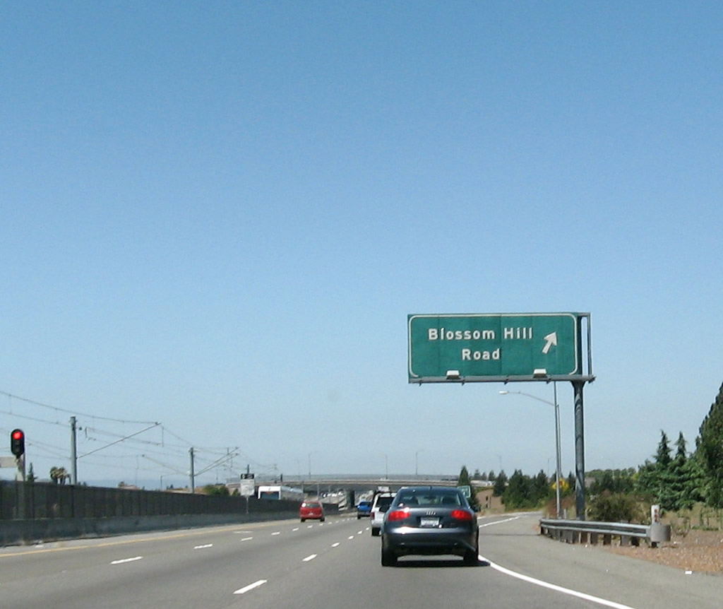 |
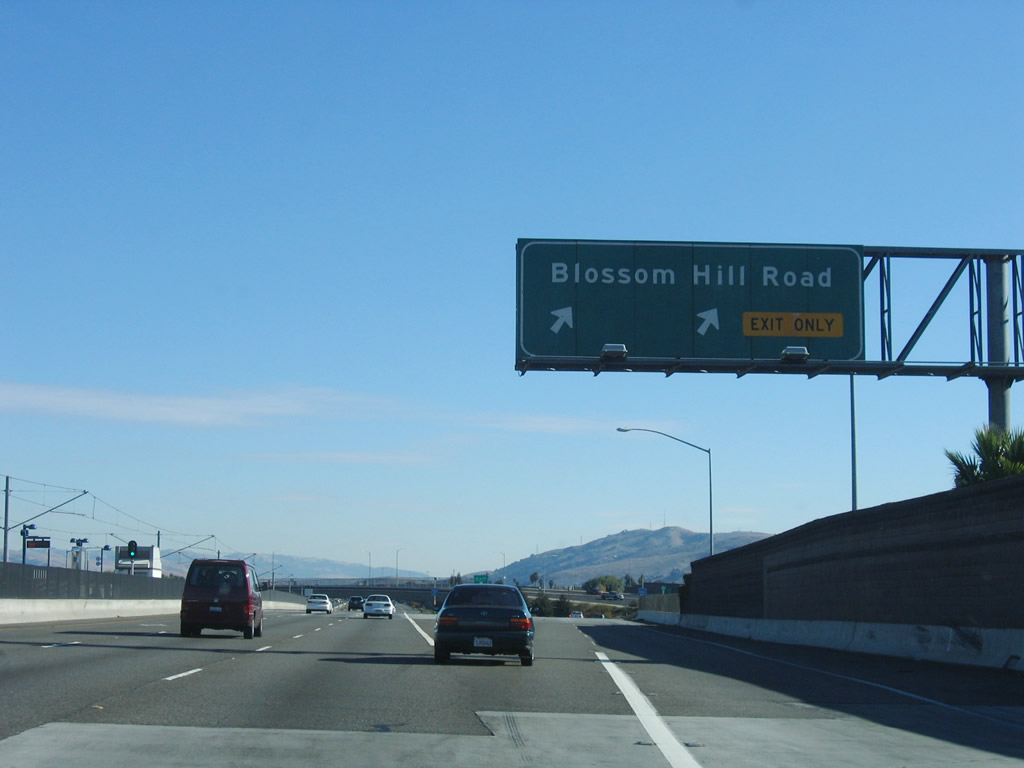
Northbound California 85 (West Valley Freeway) reaches Exit 4, Blossom Hill Road. Photo taken by Jeff Waller (08/11/07). |
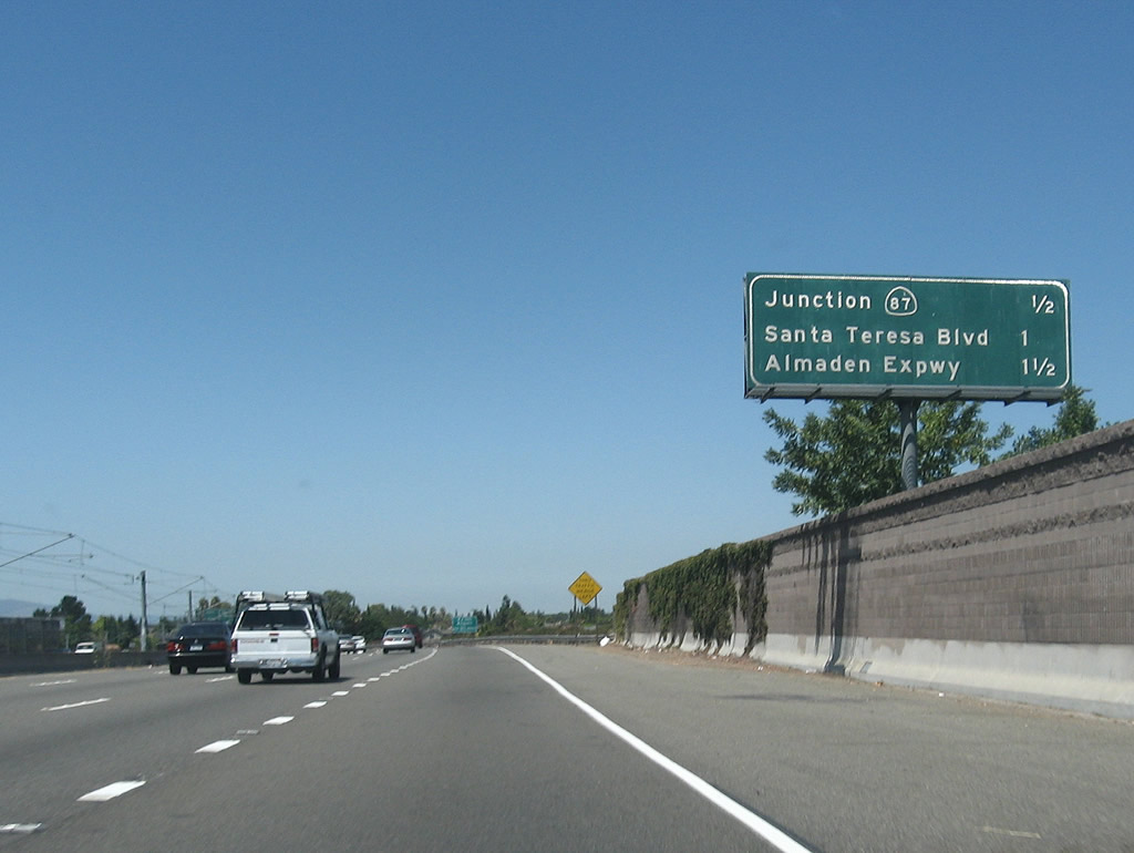 |
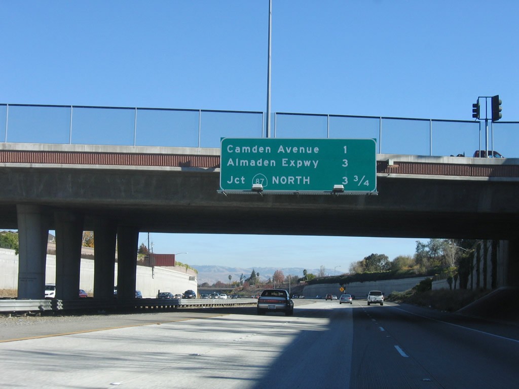
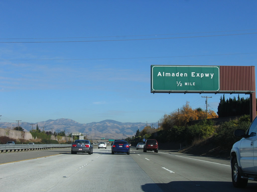
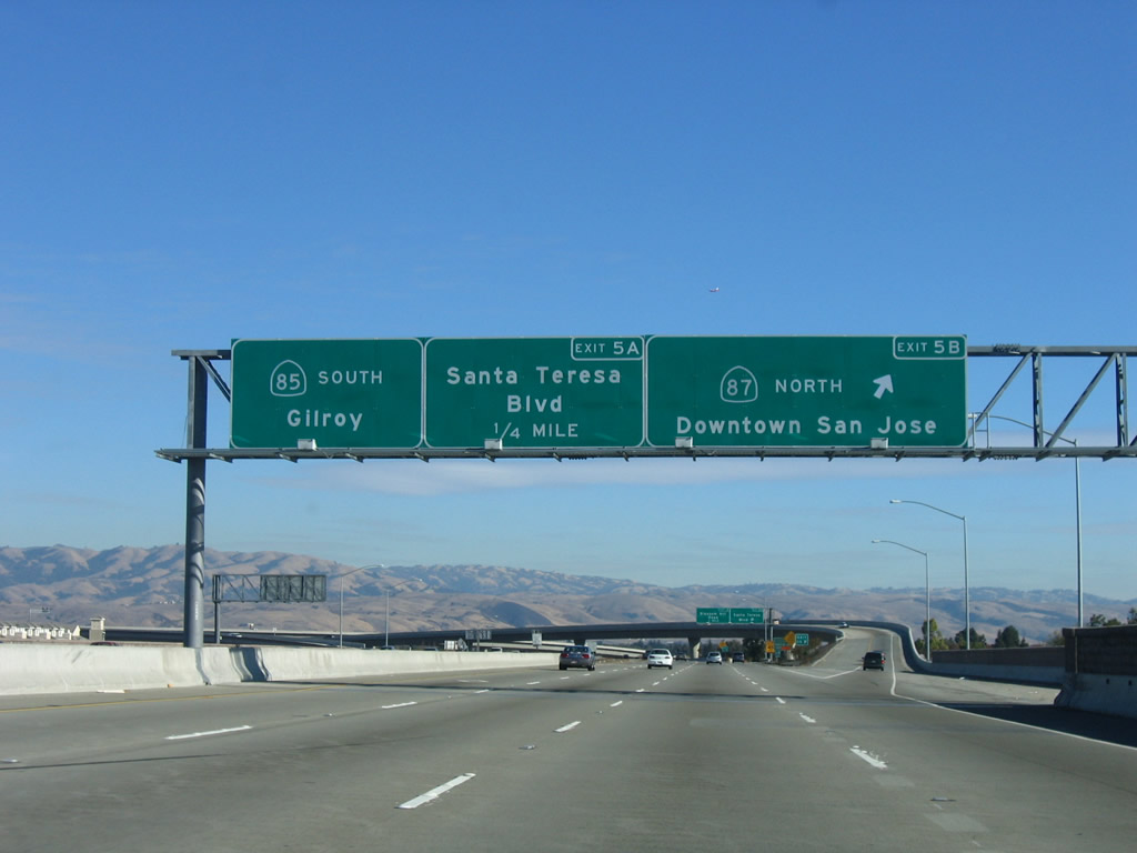
The next three exits along California 85 (West Valley Freeway) north are: Exit 5A; California 87 (Guadalupe Parkway); Exit 5B, Santa Teresa Boulevard; and Exit 6, Santa Clara County G-8 (Almaden Expressway). Photo taken by Jeff Waller (08/11/07). |
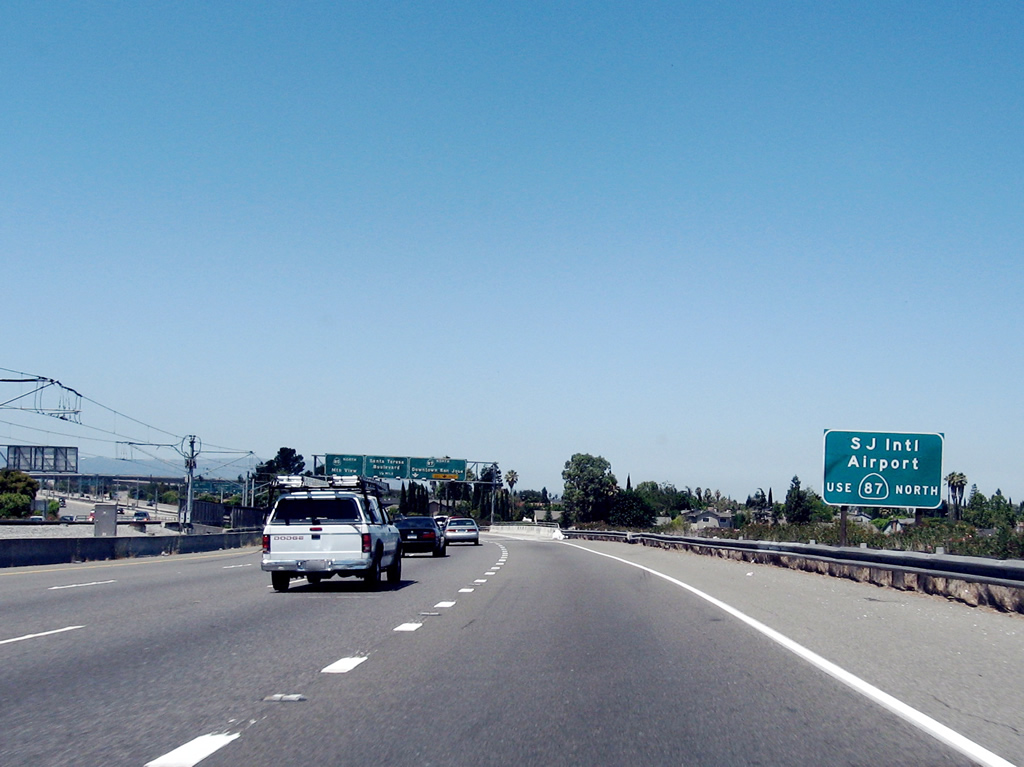 |
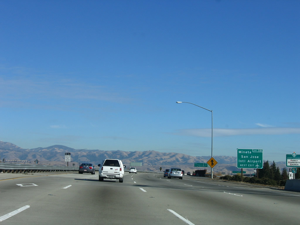
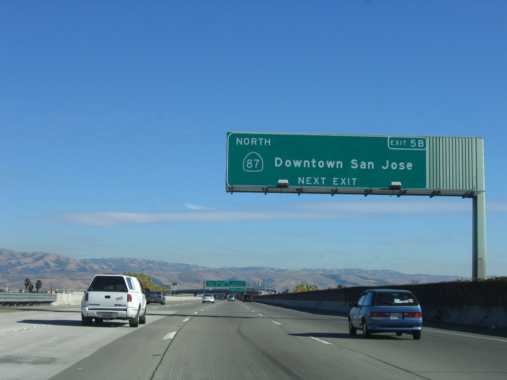
To Norman Y. Mineta San Jose International Airport, use Exit 5A, California 87 (Guadalupe Parkway) north to downtown San Jose. The freeway parallels the Guadalupe River and connects California 85 with U.S. 101 through downtown San Jose. Photo taken by Jeff Waller (08/11/07). |
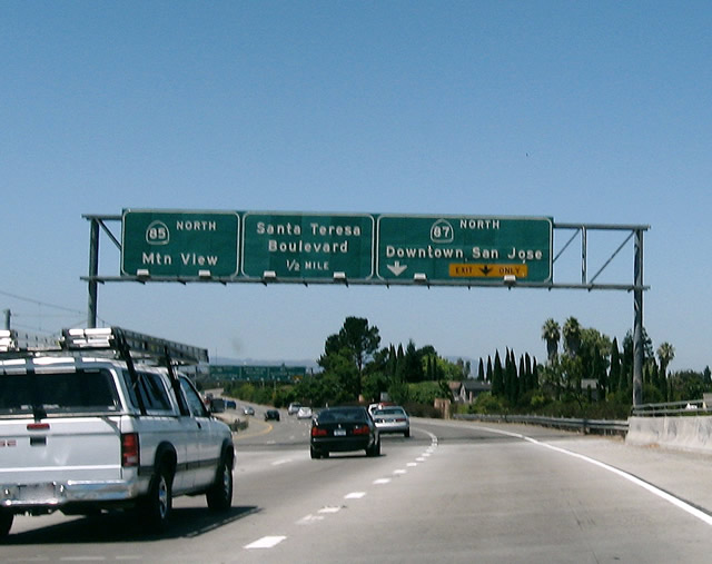 |
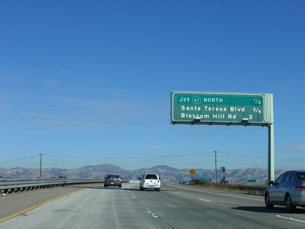
The off-ramp for Exit 5B, Santa Teresa Boulevard will immediately follow after the Exit 5A off-ramp, so stay right for this exit. The right lane connects to California 87 north to downtown San Jose and the airport. California 87, also known as the Guadalupe Parkway, was constructed in phases (California 85 to Interstate 280: 1989 through 1993; Interstate 280 to California 82: 1971-1973; and California 82 to U.S. 101: 2000-2004). After this interchange, the VTA light rail will leave the median and proceed north along California 87 toward downtown. Photo taken by Jeff Waller (08/11/07). |
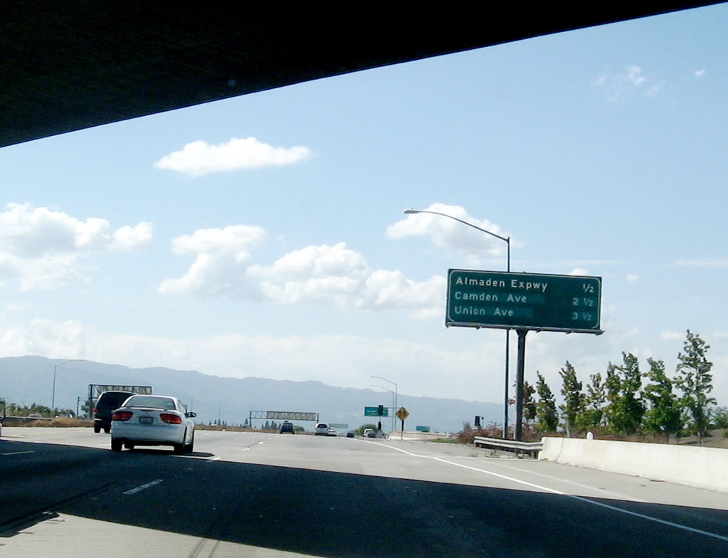 |
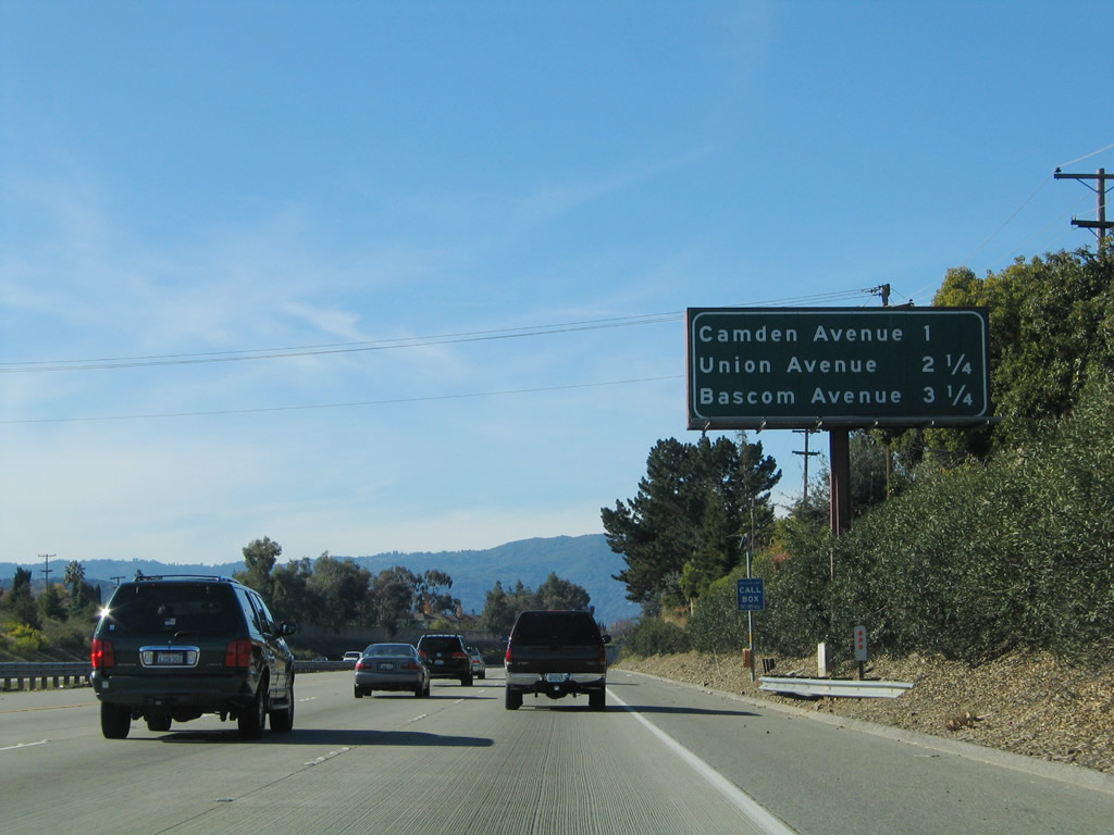
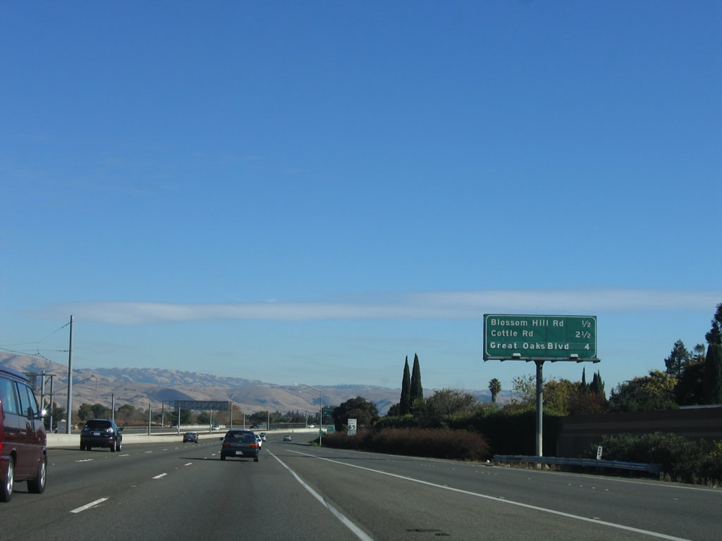
The next three exits along California 85 (West Valley Freeway) north are: Exit 6, Santa Clara County G-8 (Almaden Expressway); Exit 8, Camden Avenue; and Exit 9, Union Avenue. Photo taken by Jeff Waller (09/20/07). |
 |
Santa Clara County G-8 begins as Uvas Road on California 152 east of Hecker Pass. The county route travels north on an alignment parallel to U.S. 101 via Uvas Road and McKean Road before shifting onto the Almaden Expressway in southern San Jose. The county route then travels north on the expressway (with limited access and traffic signals), ending in downtown San Jose in the shadow of California 87 (Guadalupe Parkway). Photo taken by Jeff Waller (09/20/07). |
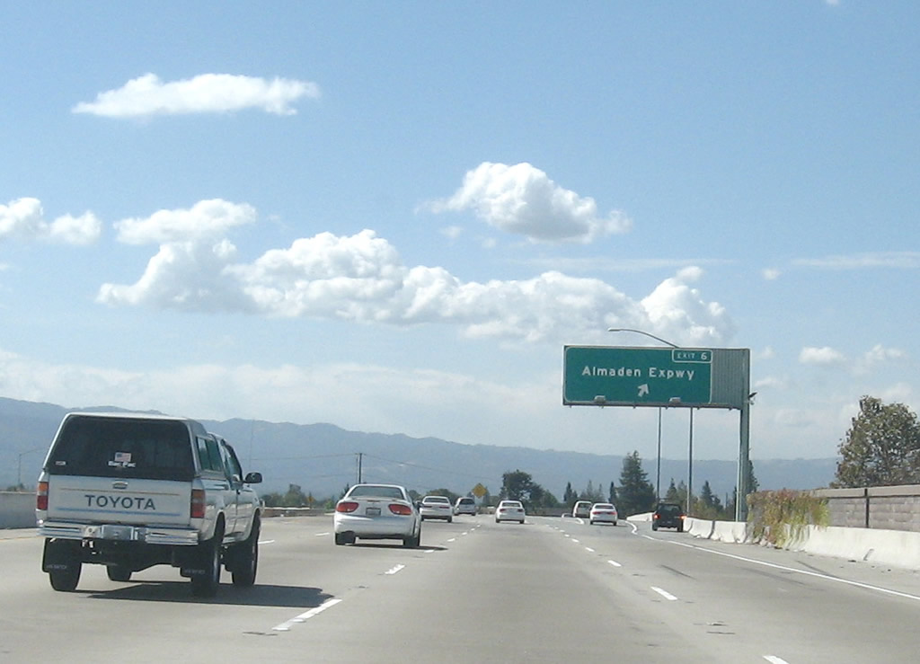 |
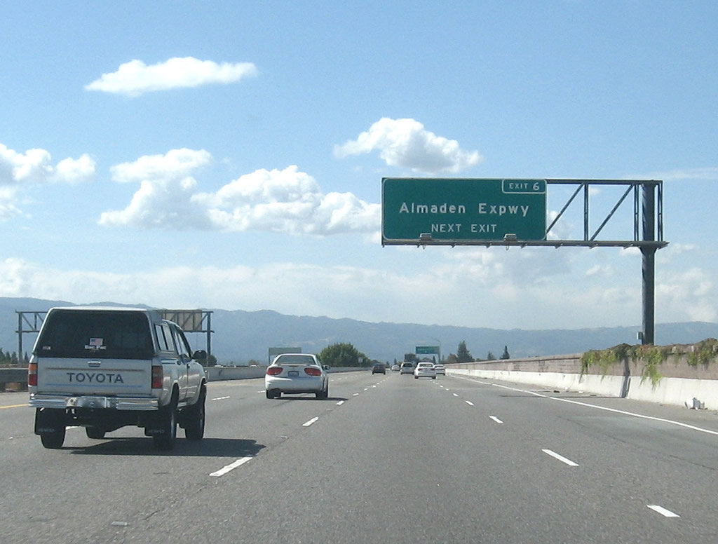
Northbound California 85 (West Valley Freeway) reaches Exit 6, Santa Clara County G-8 (Almaden Expressway). Photo taken by Jeff Waller (09/20/07). |
 |
After the Almaden Expressway interchange, the next three exits are Exit 8, Camden Avenue; Exit 9, Union Avenue; and Exit 10, Bascom Avenue and Los Gatos Boulevard. Photo taken 11/29/04. |
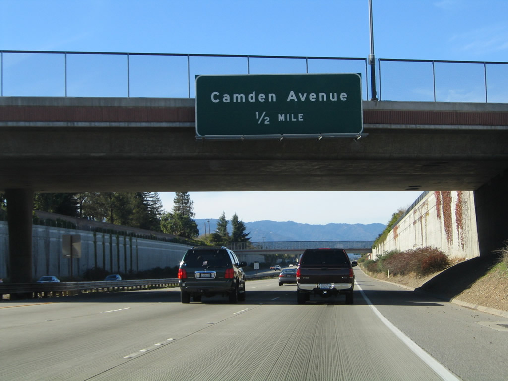 |
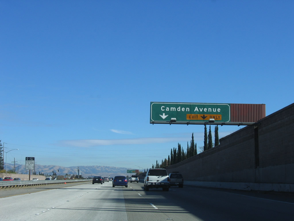
The next exit along California 85 north is Exit 8, Camden Avenue, which provides local access to western San Jose and a park and ride. Photo taken 11/29/04. |
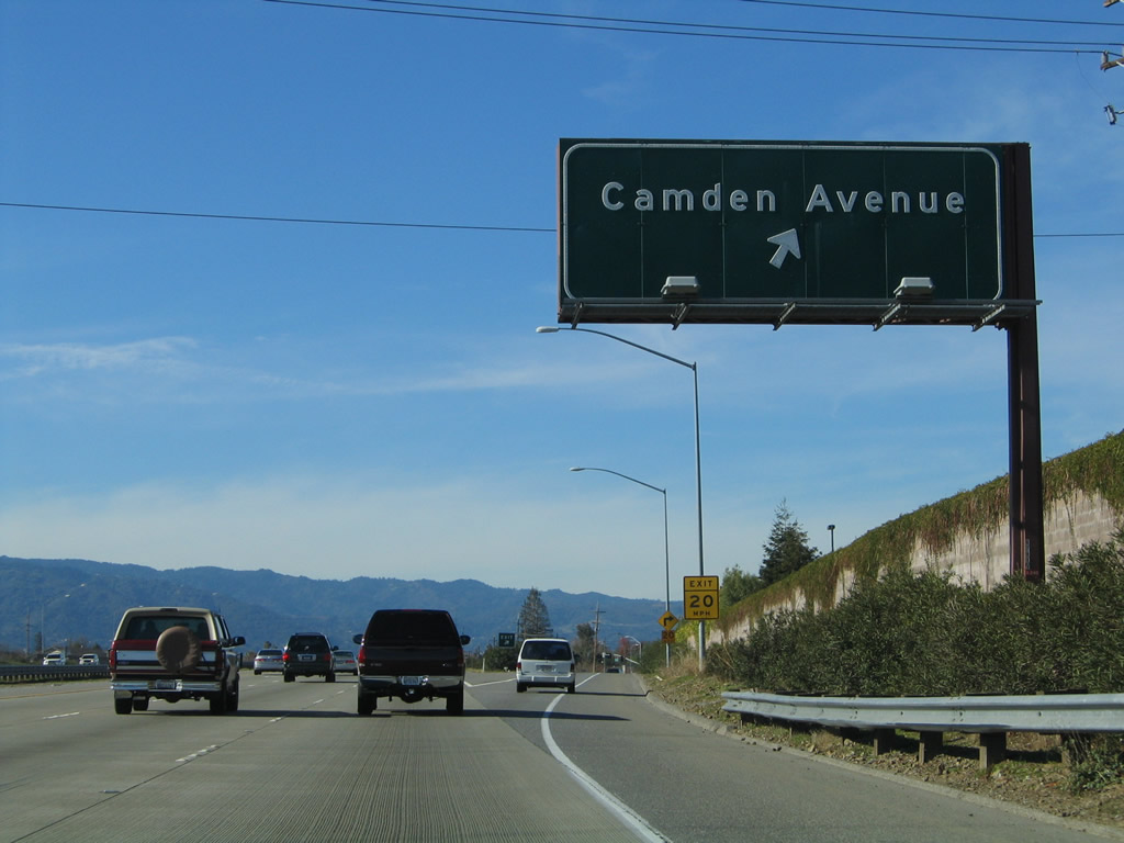 |
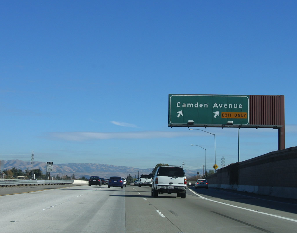
Northbound California 85 reaches Exit 8, Camden Avenue. The next exit is Exit 9, Union Avenue. Photo taken 11/29/04. |
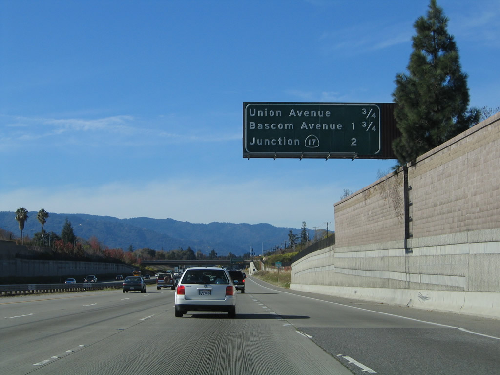 |
The next three exits on California 85 north are Exit 9, Union Avenue; Exit 10, Bascom Avenue and Los Gatos Boulevard; and Exit 11, California 17. Photo taken 11/29/04. |
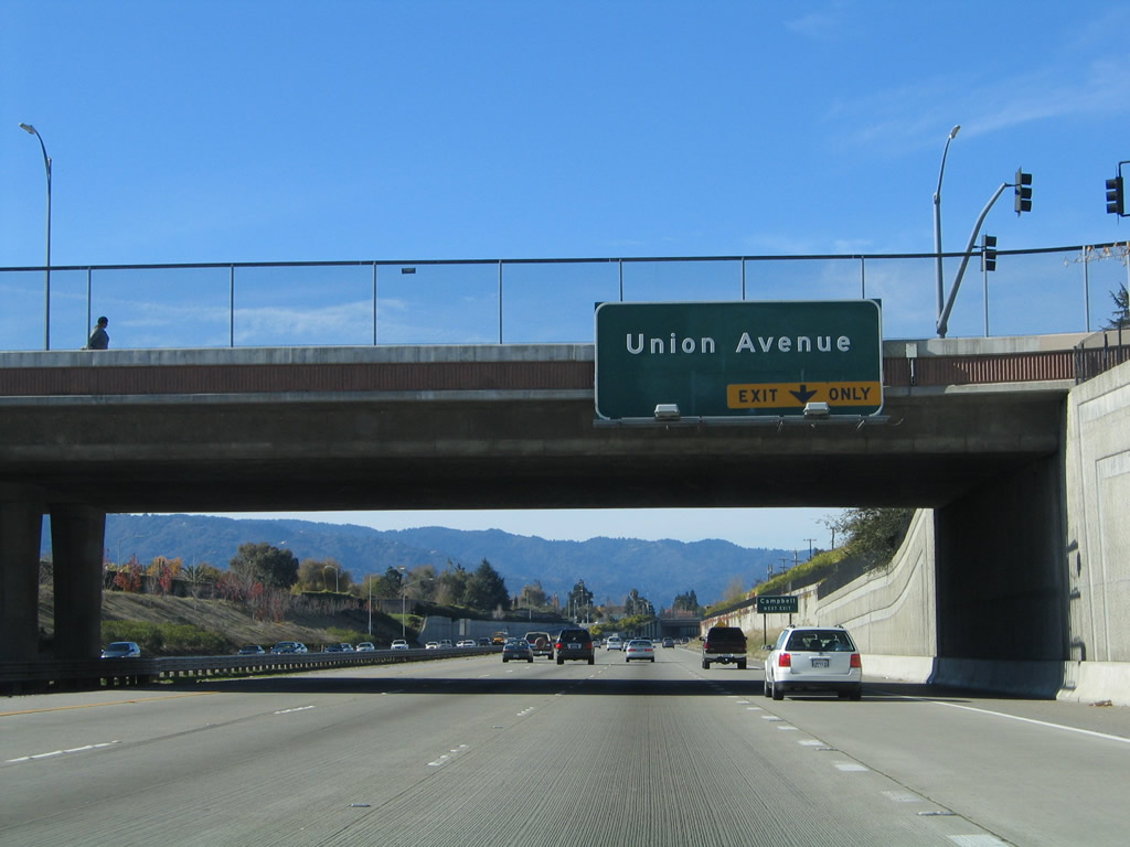 |
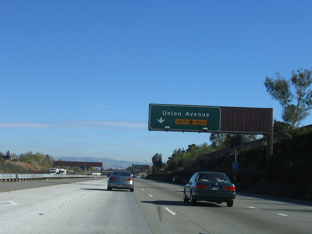
The right lane of California 85 north becomes exit only for Exit 9, Union Avenue. Photo taken 11/29/04. |
 |
Northbound California 85 reaches Exit 9, Union Avenue. Photo taken 11/29/04. |
 |
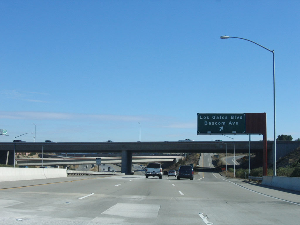
The next three exits on California 85 north are Exit 10, Bascom Avenue and Los Gatos Boulevard; Exit 11, California 17; Exit 14, Saratoga Avenue. Photo taken 11/29/04. |
 |
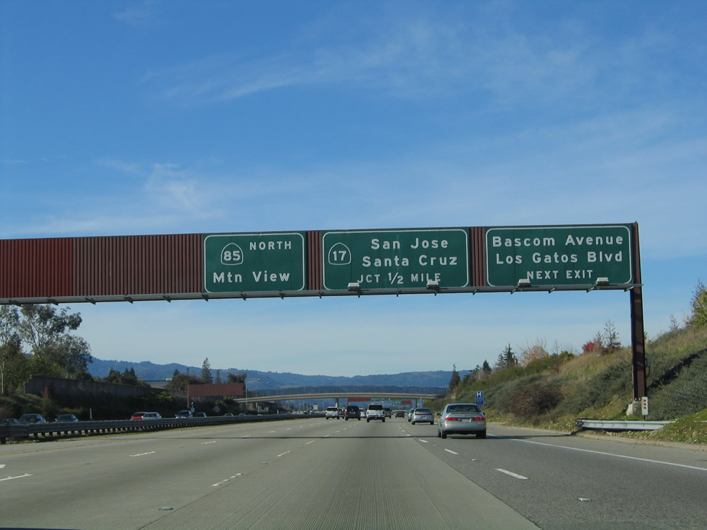
Northbound California 85 reaches Exit 10, Bascom Avenue and Los Gatos Boulevard. The next interchange is Exit 11, California 17 north to San Jose and south to Santa Cruz. Photo taken 11/29/04. |
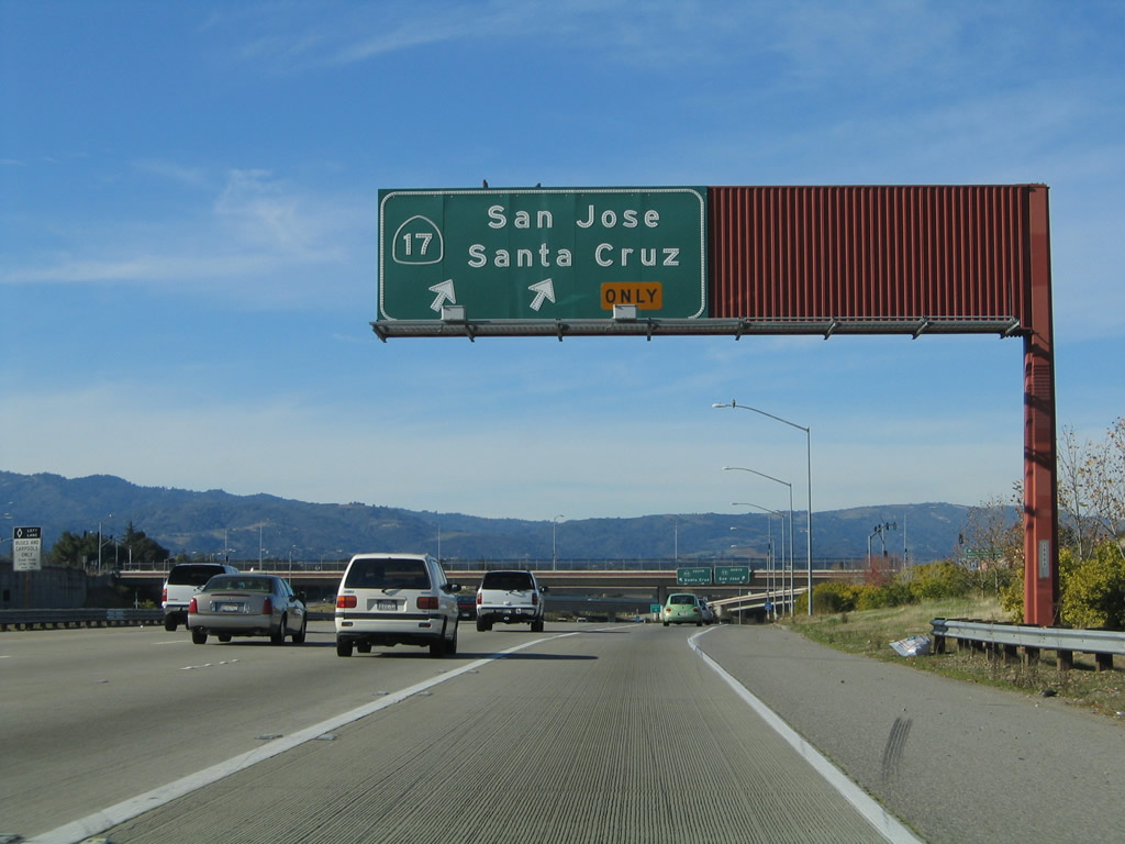 |
The right lane on California 85 north becomes exit only for California 17 (Exit 11). California 17 (Exit 11A) is a major north-south expressway corridor from Santa Cruz to San Jose. The state route is mostly freeway in the San Jose metropolitan area, but it is an expressway with intersections south of Los Gatos and over Patchen Pass (el. 1,800 feet). With a narrow right of way and heavy traffic conditions, California 17 is a very busy highway and can be dangerous during periods of inclement weather. It is the fastest way from San Jose to the Pacific Ocean, and it ends at California 1 in the city of Santa Cruz. To the north, California 17 changes into Interstate 880 at the Interstate 280 interchange. Interstate 880 then follows a freeway alignment north to Interstate 80 in the city of Oakland. Photo taken 11/29/04. |
 |
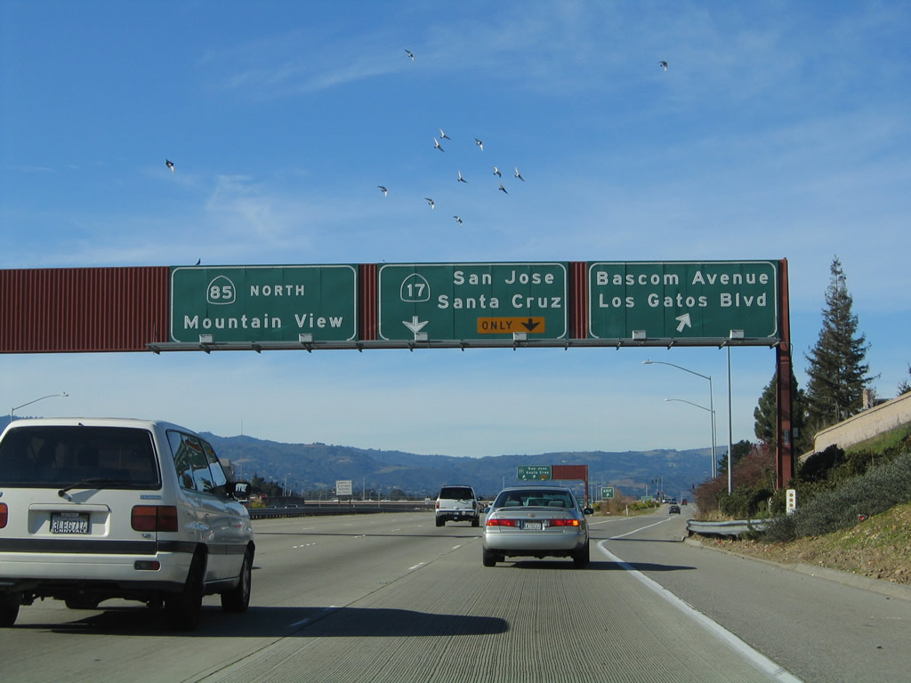
Now on the transition ramp from California 85 to California 17, the left lane connects to California 17 south to Santa Cruz, and the right lane connects to California 17 north to San Jose. At this interchange, California 85 leaves San Jose and enters the town of Los Gatos ("Small Town Service, Community Stewardship, and Future Focus," pop. 28,592 per 2000 Census). Photo taken 11/29/04. |
 |
The next three exits along northbound are: Exit 14, Saratoga Avenue; Exit 16, De Anza Boulevard and Saratoga-Sunnyvale Road; and Exit 18, Stevens Creek Boulevard. Photo taken by Jeff Waller (09/20/07). |
 |
California 85 leaves Los Gatos and enters a slice of the city of Campbell ("The Orchard City," pop. 39,200 per 2000 Census). Photo taken by Jeff Waller (09/20/07). |
 |
Continuing northwest, California 85 approaches Exit 14, Saratoga Avenue and next enters the city of Saratoga, which was incorporated in 1956 and is home to 29,843 people as of the 2000 Census. Photo taken by Jeff Waller (09/20/07). |
 |
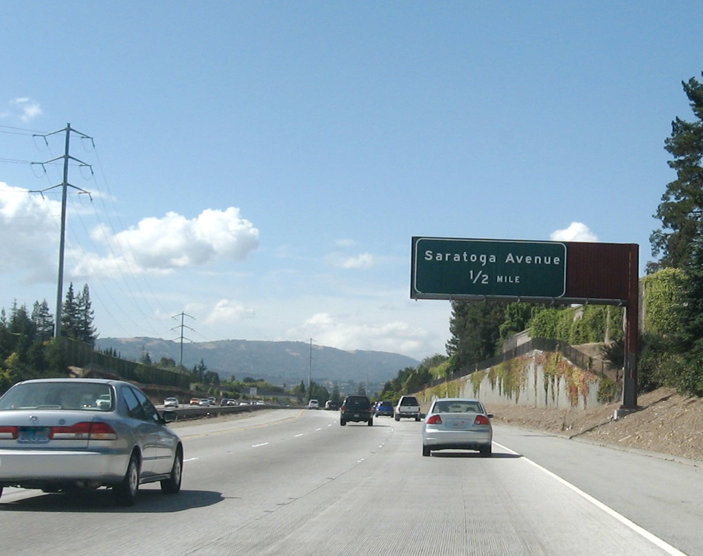
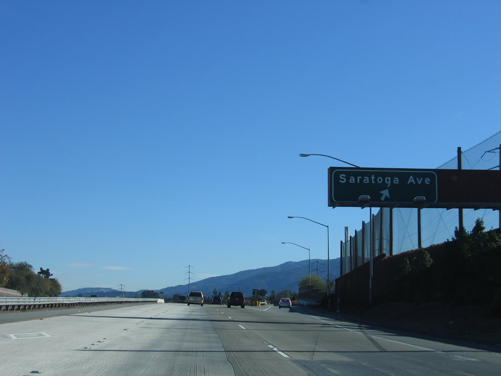
Northbound California 85 reaches Exit 14, Saratoga Avenue. Photo taken by Jeff Waller (09/20/07). |
 |
This mileage sign along northbound California 85 provides the distance to the next three exits: Exit 16, DeAnza Boulevard; Exit 17, Stevens Creek Boulevard; and Exit 18, Interstate 280 (Father Junipero Serra Freeway). Photo taken by Jeff Waller (09/20/07). |
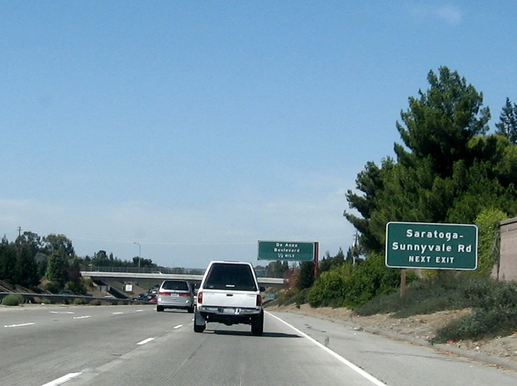 |
Exit 16 serves both De Anza Boulevard and Saratoga-Sunnyvale Road. Photo taken by Jeff Waller (09/20/07). |
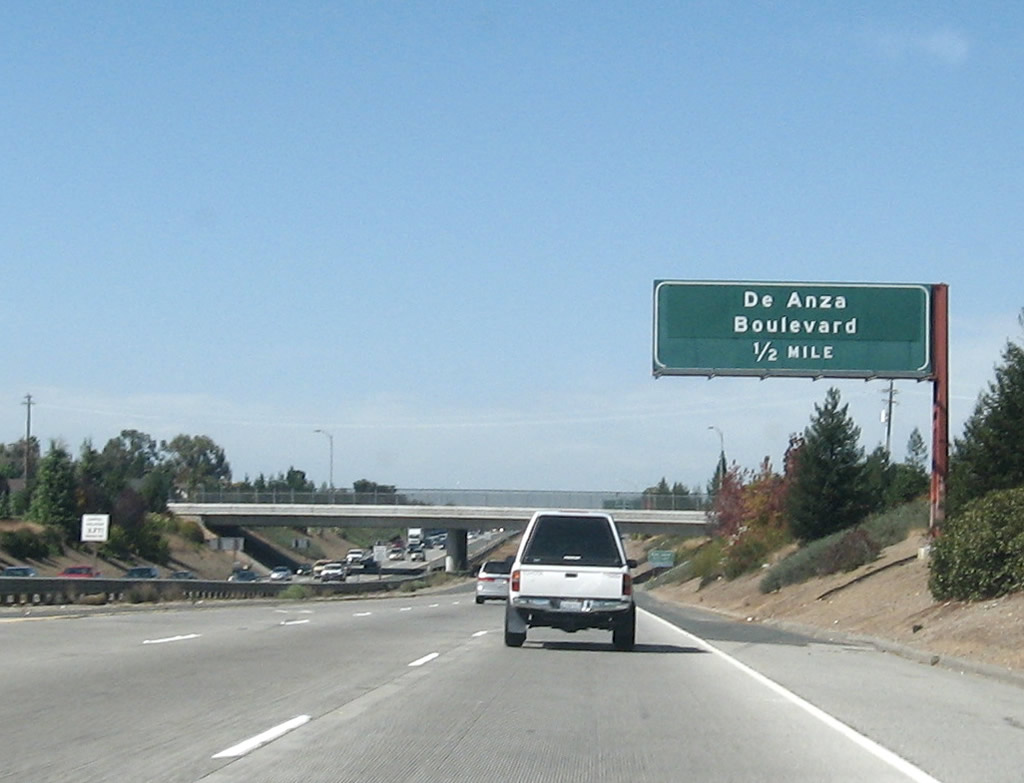 |
California 85 (West Valley Freeway) north approaches Exit 16, De Anza Boulevard and Saratoga-Sunnyvale Road (one-half mile). After this interchange, California 85 leaves San Jose and enters the city of Cupertino. Cupertino was home to 50,546 people as of the 2000 Census and consists of 10.9 square miles. The city sits at an elevation of 236 feet and was incorporated on October 10, 1955. Photo taken by Jeff Waller (09/20/07). |
 |
This exit serves the westernmost branch of the city of San Jose, which California 85 again enters briefly prior to the next exit. After this interchange, California 85 again leaves San Jose and will enter the city of Cupertino. Photo taken by Jeff Waller (09/20/07). |
 |
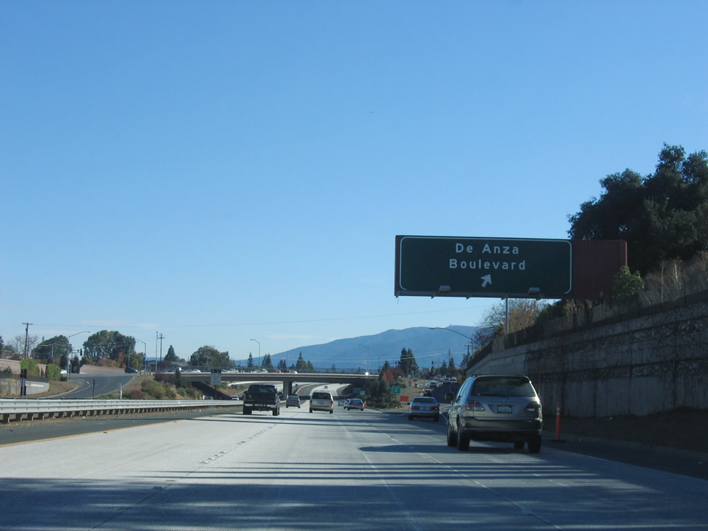
Northbound California 85 (West Valley Freeway) reaches Exit 16, De Anza Boulevard and Saratoga-Sunnyvale Road. Cupertino and San Jose call this road De Anza Boulevard, while Saratoga and Sunnyvale call it Saratoga-Sunnyvale Road. Photo taken by Jeff Waller (09/20/07). |
 |
At the Exit 16 (De Anza Boulevard and Saratoga-Sunnyvale Road) interchange, California 85 again leaves San Jose and enters the city of Cupertino. Cupertino was home to 50,546 people as of the 2000 Census and consists of 10.9 square miles. The city sits at an elevation of 236 feet and was incorporated on October 10, 1955. Photo taken by Jeff Waller (09/20/07). |
 |
Prior to Exit 17, Stevens Creek Boulevard, this advance sign for Exit 18, Interstate 280 (Father Junipero Serra Freeway) is posted on California 85 north. Photo taken by Jeff Waller (09/20/07). |
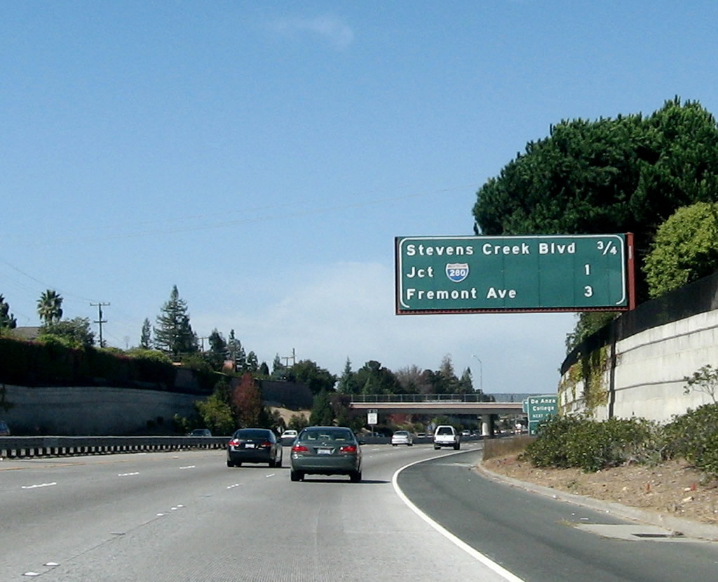 |
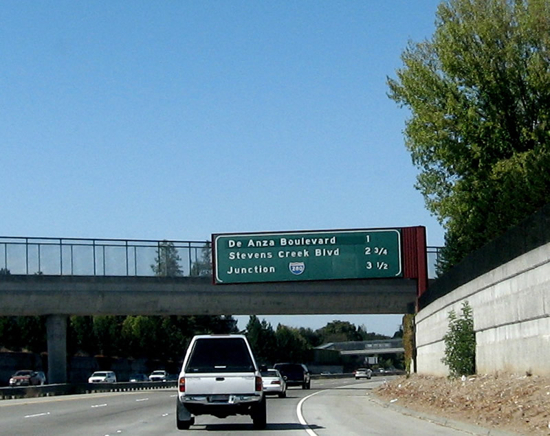
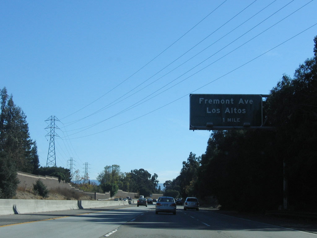
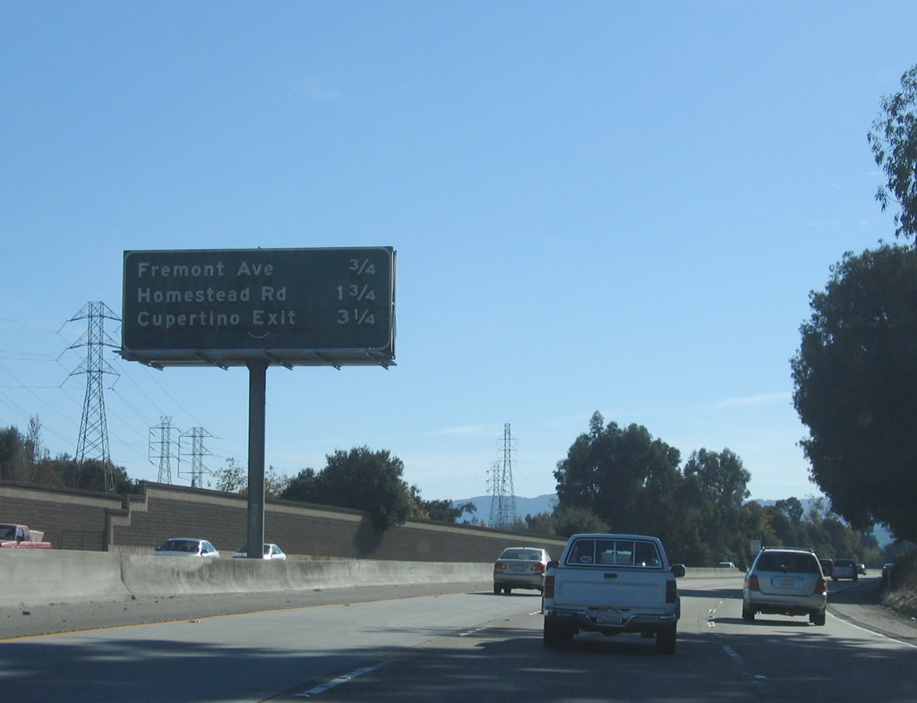
This mileage sign along northbound California 85 provides the distance to the next three exits: Exit 17, Stevens Creek Boulevard; Exit 18, Interstate 280 (Father Junipero Serra Freeway); and Exit 20, Fremont Avenue. Photo taken by Jeff Waller (09/20/07). |
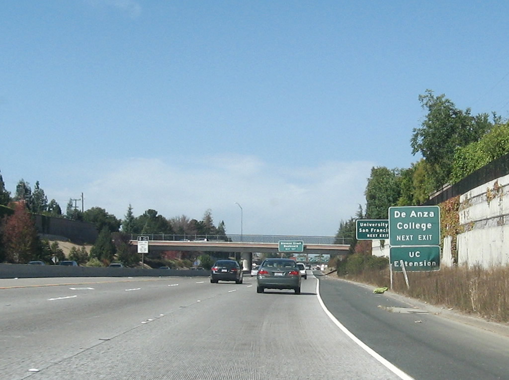 |
Use Exit 17, Stevens Creek Boulevard to De Anza College, which sits on the southeastern corner of this interchange. Photo taken by Jeff Waller (09/20/07). |
 |
This overhead guide sign for Exit 17, Stevens Creek Boulevard is posted on the McClellan Road overpass. Photo taken by Jeff Waller (09/20/07). |
 |
A tiny guide sign for Exit 18, Interstate 280 (right two lanes) is posted prior to the off-ramp for Exit 17, Stevens Creek Boulevard. Photo taken by Jeff Waller (09/20/07). |
 |
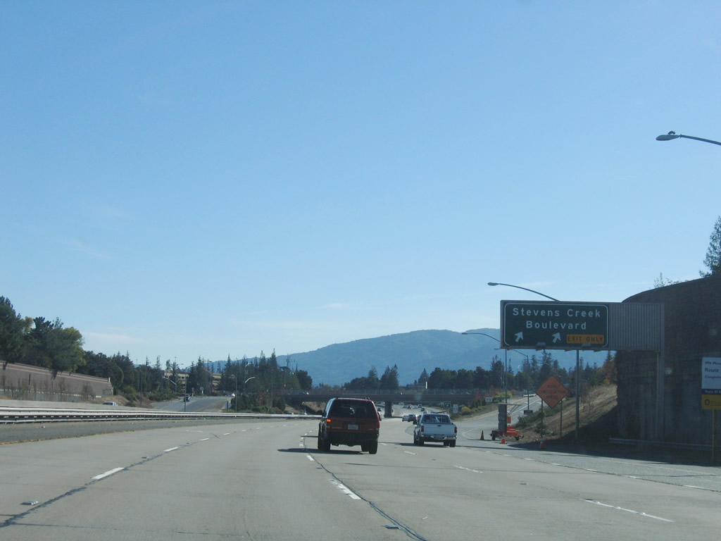
Northbound California 85 reaches Exit 17, Stevens Creek Boulevard; the next exit is Exit 18, Interstate 280 (Father Junipero Serra Freeway). Photo taken by Jeff Waller (09/20/07). |
 |
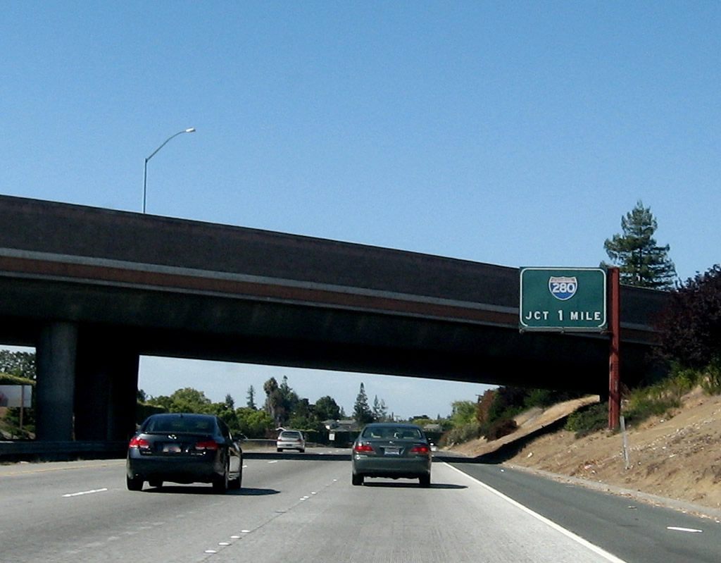
Immediately thereafter, northbound California 85 reaches Exit 18, Interstate 280 (Father Junipero Serra Freeway). Photo taken by Jeff Waller (09/20/07). |
 |
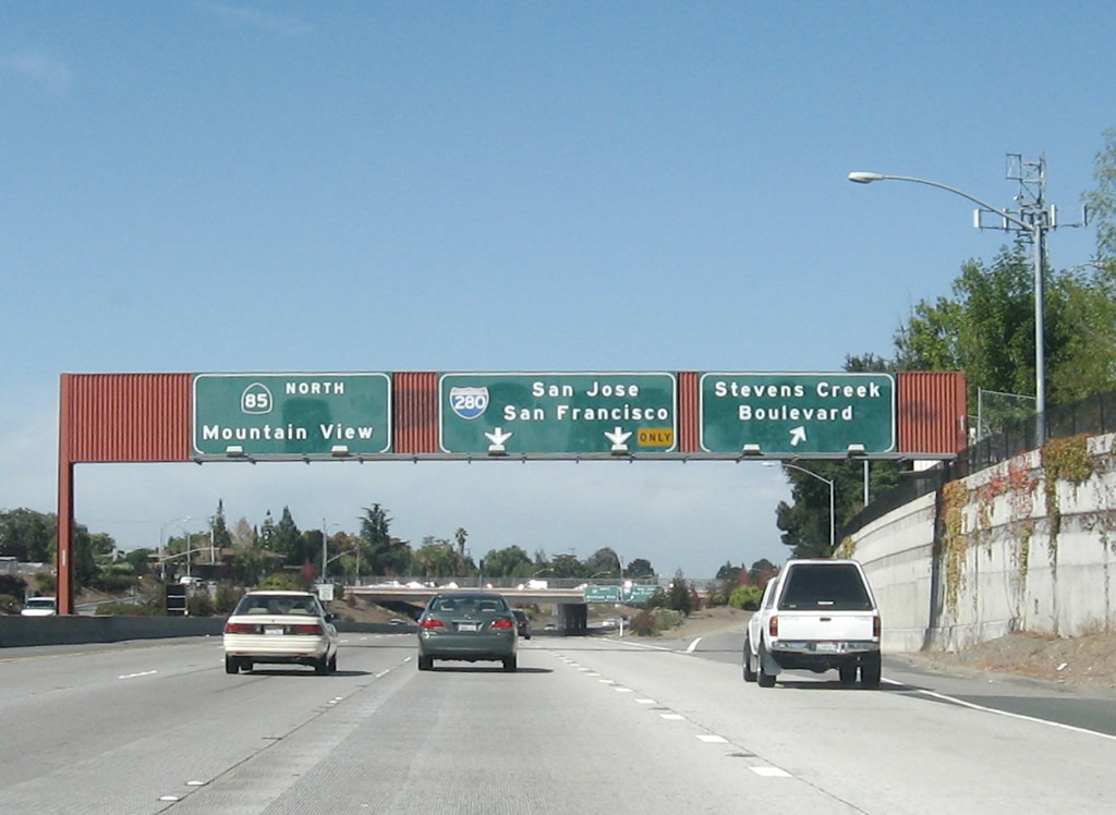
The left three lanes continue north on California 85, while the right lanes depart to Exit 18, Interstate 280 (Father Junipero Serra Freeway) north to San Francisco and south (east) to downtown San Jose. The right lanes function as a collector distributor system due to the on-ramp from Stevens Creek Boulevard. Photo taken by Jeff Waller (09/20/07). |
 |
The collector distributor lanes split, with the first off-ramp leading to Interstate 280 south. Photo taken by Jeff Waller (09/20/07). |
| California 85 - Stevens Creek Freeway north | |
|---|---|
 |
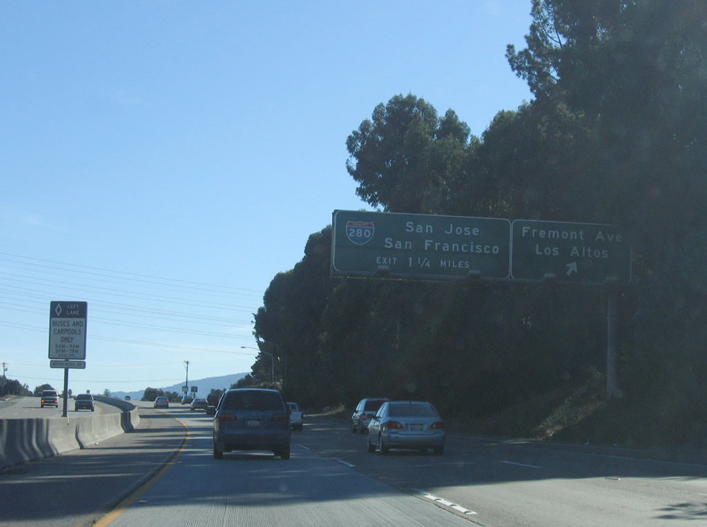
After the Interstate 280 interchange, the next exit along northbound California 85 (Stevens Creek Freeway) is Exit 20, Fremont Avenue. Photo taken 11/29/04. |
 |
Both Exit 20, Fremont Avenue and Exit 22A, California 82 (El Camino Real) south serve the city of Sunnyvale. Sunnyvale, the "Heart of Silicon Valley," is situated between Los Altos and Santa Clara. The city is home to 131,760 people as of the 2000 Census and consists of 22.6 square miles. Sunnyvale incorporated in 1912 after being settled in the late 1800s. Photo taken 11/29/04. |
 |
After the Interstate 280 interchange, the next four exits along northbound California 85 (Stevens Creek Freeway) are Exit 20, Fremont Avenue; Exit 22A, California 82 (El Camino Real) south to Sunnyvale; Exit 22B, California 82 (El Camino Real) north to Mountain View; and Exit 22C, California 237 east to U.S. 101 (Bayshore Freeway) south. Photo taken 11/29/04. |
 |
Northbound California 85 (Stevens Creek Freeway) reaches Exit 20, Fremont Avenue. Photo taken 11/29/04. |
 |
This California 85 north reassurance shield is posted after Exit 20, Fremont Avenue. Photo taken 11/29/04. |
 |
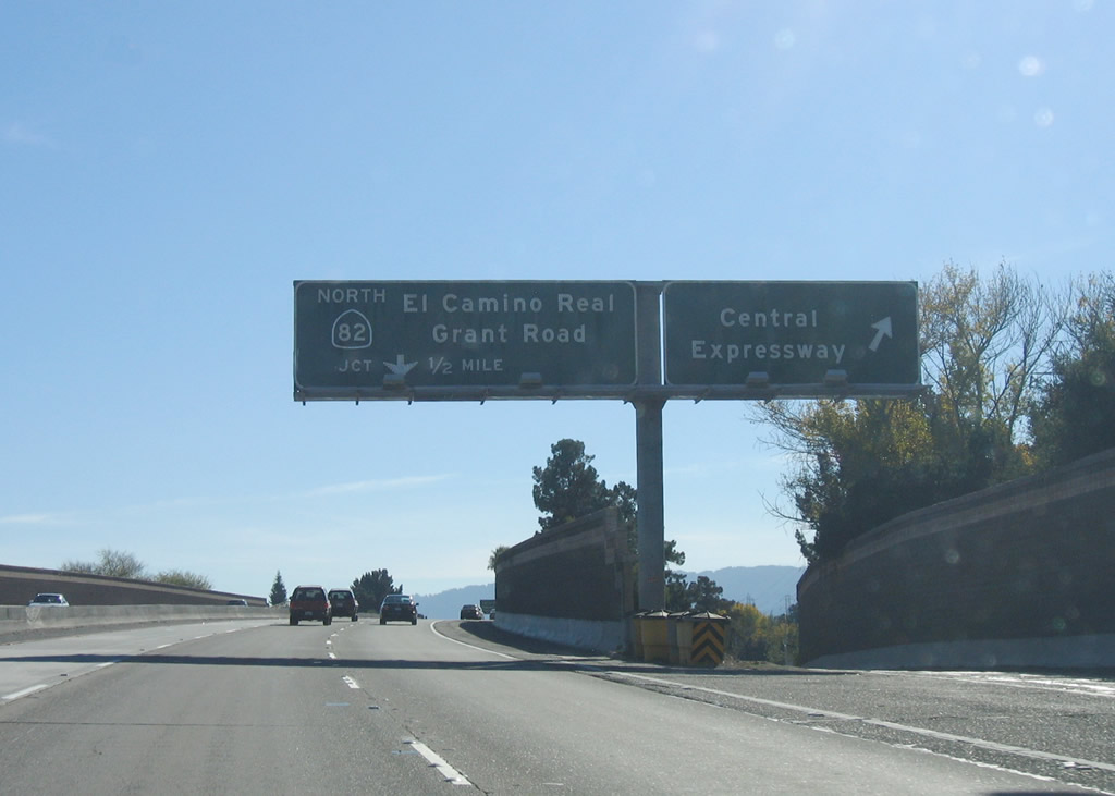
After Exit 22A, California 82 (El Camino Real) south, use Exit 22B, California 82 (El Camino Real) north to Mountain View. Photo taken 11/29/04. |
 |
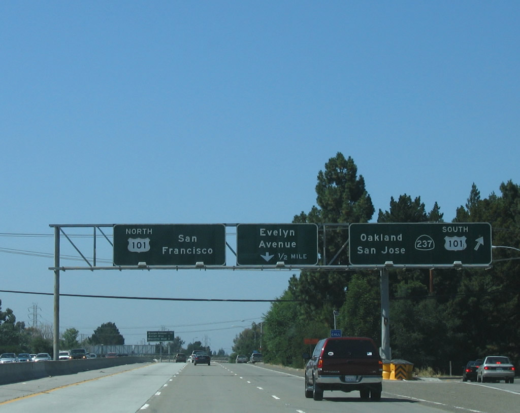
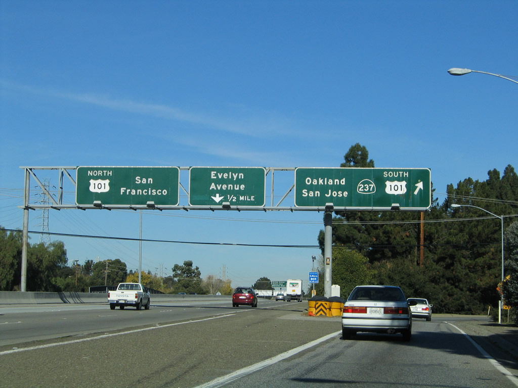
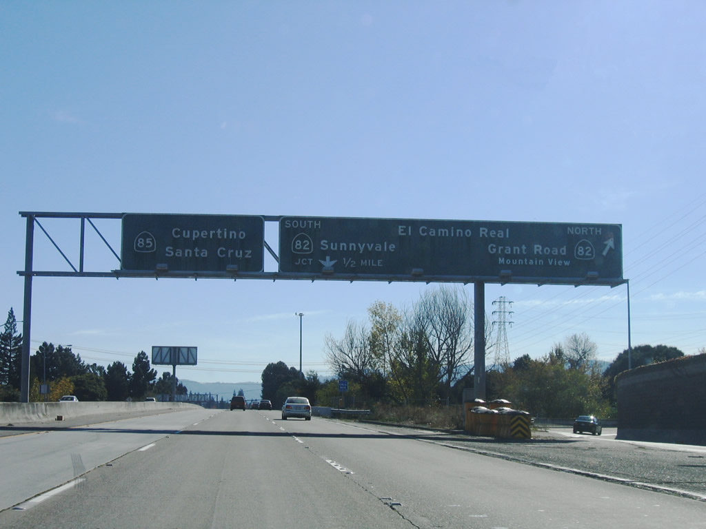
The next four exits along northbound California 85 (Stevens Creek Freeway) are Exit 22A, California 82 (El Camino Real) south to Sunnyvale; Exit 22B, California 82 (El Camino Real) north to Mountain View; Exit 22C, California 237 east to U.S. 101 (Bayshore Freeway) south; and Exit 23, Evelyn Avenue. Photo taken 11/29/04. |
 |
California 82 follows the original U.S. 101 alignment along the peninsula between San Jose and San Francisco. Much of the route is known as El Camino Real, and it is heavily used by local traffic connecting through the various cities of the peninsula. Photo taken 11/29/04. |
 |
Northbound California 85 (Stevens Creek Freeway) reaches Exit 22A, California 82 (El Camino Real) south to Sunnyvale. The next exit is Exit 22B, California 82 (El Camino Real) north to Mountain View. Photo taken 11/29/04. |
 |
Immediately thereafter, northbound California 85 (Stevens Creek Freeway) reaches Exit 22B, California 82 (El Camino Real) north to Mountain View. Photo taken 11/29/04. |
 |
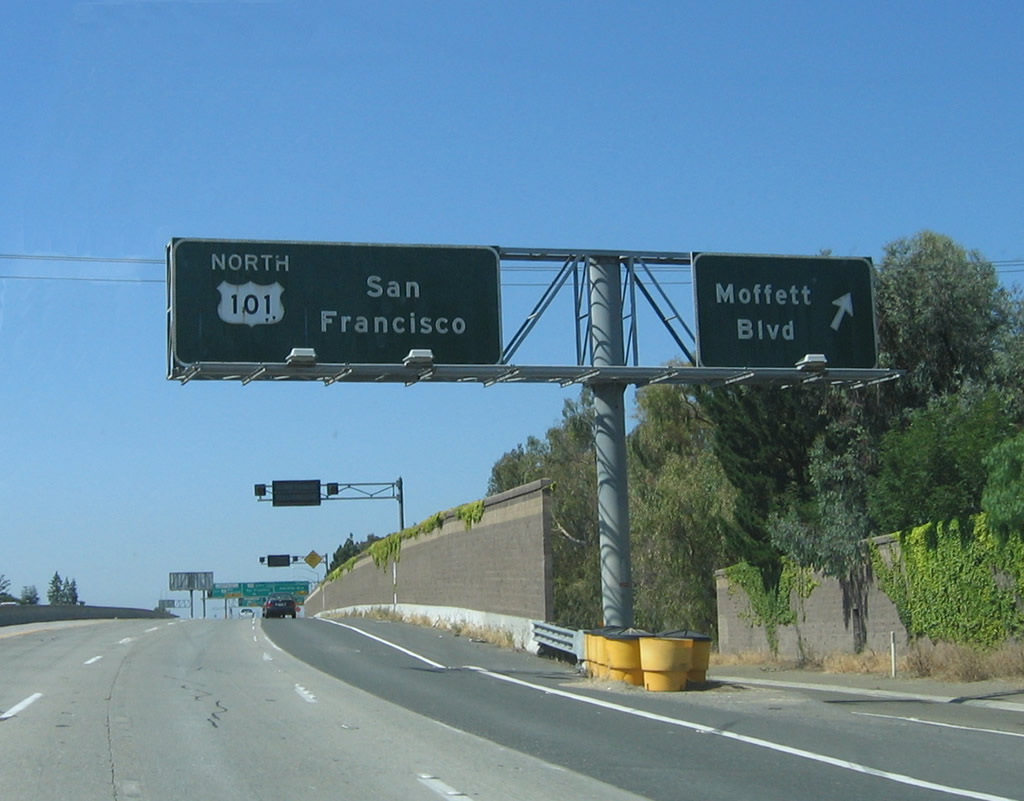
The next three exits along northbound California 85 (Stevens Creek Freeway) are Exit 22C, California 237 east to U.S. 101 (Bayshore Freeway) south; Exit 23, Evelyn Avenue; and Exit 24A, Moffett Boulevard. Photo taken 11/29/04. |
 |
 |
 |
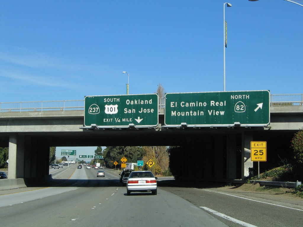
Northbound California 85 (Stevens Creek Freeway) reaches Exit 22C, California 237 east to U.S. 101 (Bayshore Freeway) south. California 237 is the South Bay Freeway, and it travels as a freeway between California 85 and Interstate 880 (then reverts to a surface street alignment for the final distance to Interstate 680 - Sinclair Freeway). Photo taken 06/29/06, 11/29/04, and by Jeff Waller (09/04/07). |
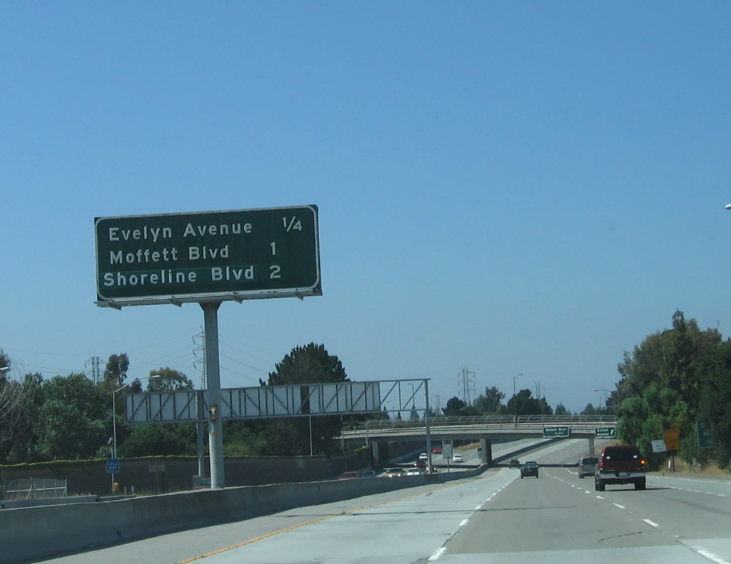 |
The final three exits along northbound California 85 (Stevens Creek Freeway) are Exit 23, Evelyn Avenue; Exit 24A, Moffett Boulevard; Exit 24B, U.S. 101 (Bayshore Freeway) north to San Francisco; and Exit 24C, Shoreline Boulevard. A direct connection to U.S. 101's Exit 399 via California 85's Exit 24C is offered from California 85 to avoid merging onto U.S. 101. Photo taken 06/29/06. |
 |
Northbound California 85 (Stevens Creek Freeway) reaches Exit 23, Evelyn Avenue. The next exit is Exit 24A, Moffett Boulevard and NASA Parkway. Photo taken 06/29/06. |
 |
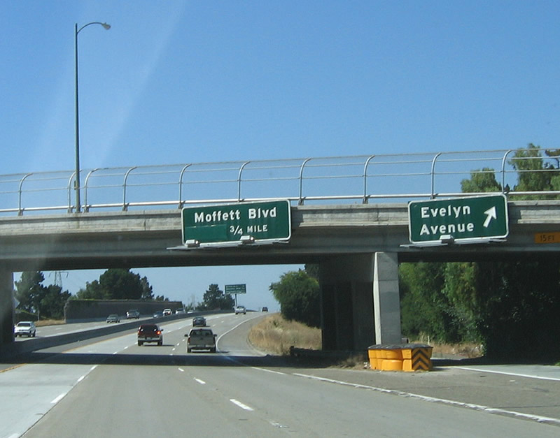
The next three exits along northbound California 85 and U.S. 101 are Exit 24A, Moffett Boulevard; Exit 24B, U.S. 101 (Bayshore Freeway) north to San Francisco; Exit 24C, Shoreline Boulevard; and U.S. 101's Exits 400A-B, Rengstorff Avenue and Amphitheatre Parkway. Photo taken 06/29/06. |
 |
Northbound California 85 reaches Exit 24A, Moffett Boulevard. From here, all lanes will merge onto U.S. 101 north (Exit 24B) or exit onto Exit 24C, Shoreline Boulevard. Photo taken 06/29/06. |
 |
Use the right lane to Exit 24C to Shoreline Boulevard. The left three lanes will all transition onto U.S. 101 (Bayshore Freeway) north (Exit 24B), but a dedicated high occupancy vehicle (carpool) lane makes a direct connection in the left (number one) lane. Photo taken 06/29/06. |
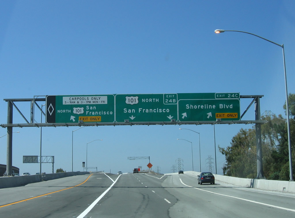 |
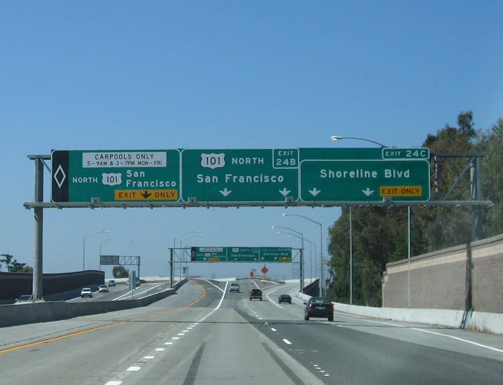
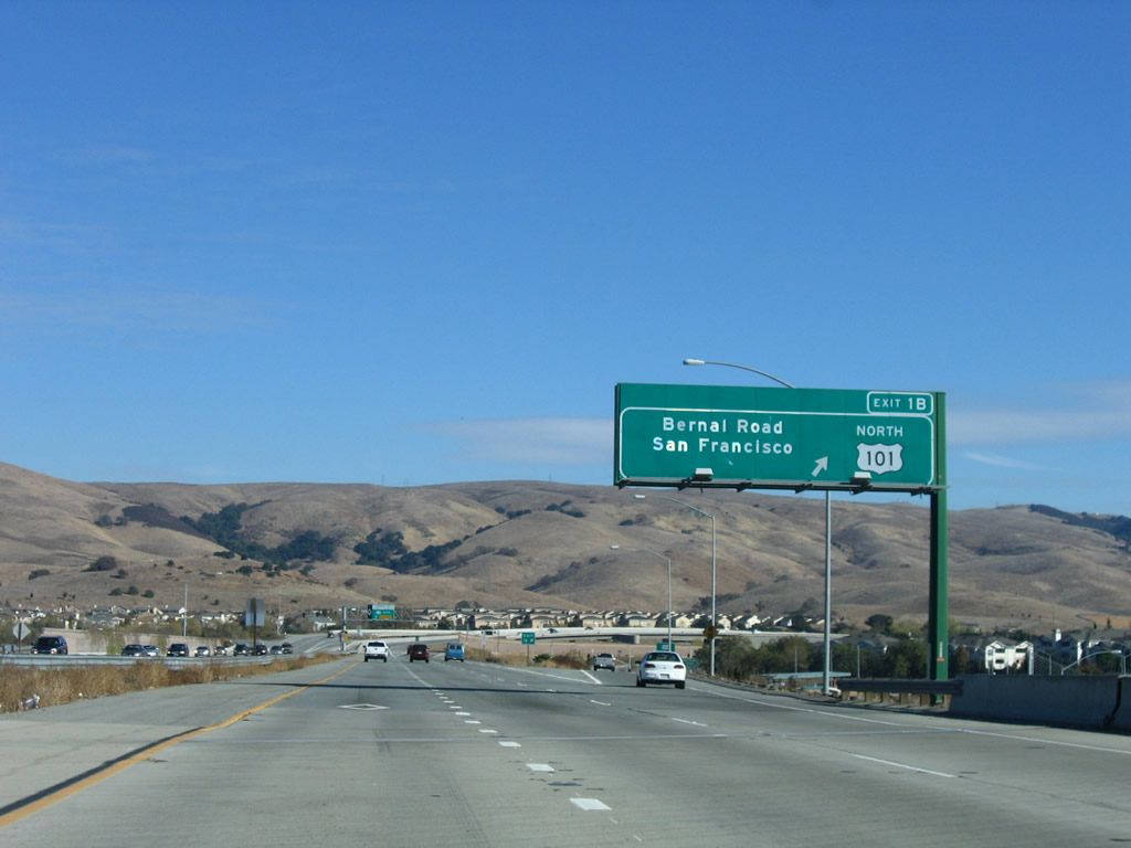
California 85 north ends as the freeway splits into Exit 24B, U.S. 101 north and Exit 24C, Shoreline Boulevard. To Exits 400A-B, Rengstorff Avenue and Amphitheatre Parkway, follow U.S. 101 north. Photo taken 06/29/06. |
| California 85 - Stevens Creek Freeway south | |
|---|---|
 |
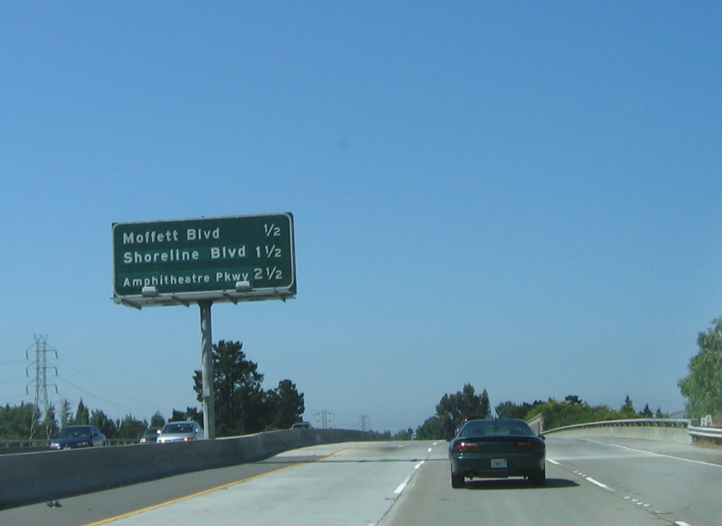
Leaving U.S. 101 (Bayshore Freeway) south, California 85 (Stevens Creek Freeway) begins by passing under the collector distributor lanes that carry traffic from Shoreline Boulevard onto southbound U.S. 101. California 85 originates in the city of Mountain View, which is home to 70,708 people as of the 2000 Census, sits at an elevation of 105 feet, and consists of 12.2 square miles. Photo taken 11/27/05. |
 |
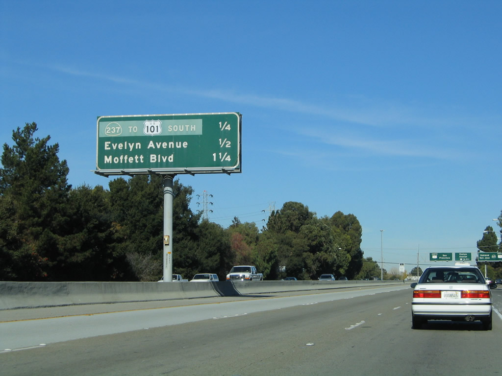
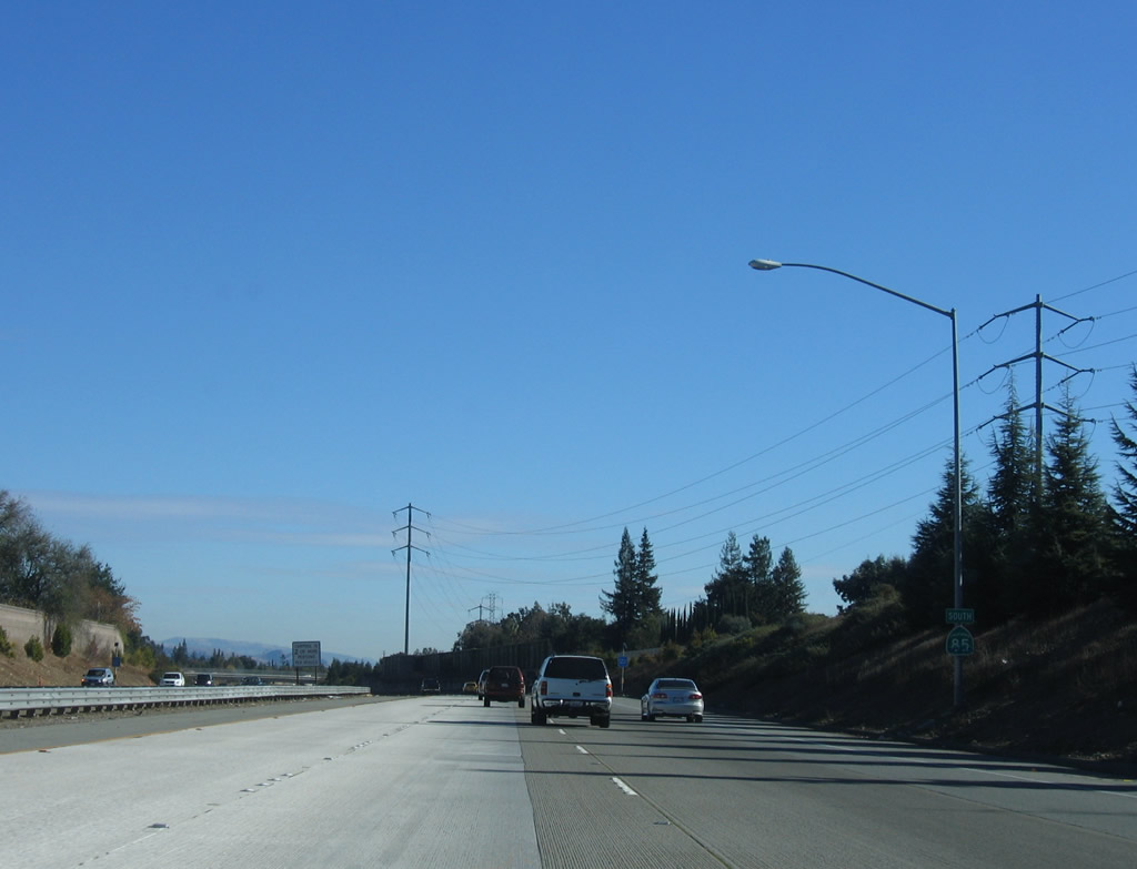
The first four exits along California 85 (Stevens Creek Freeway) south are Exit 23, Santa Clara County G-6 (Central Expressway); Exit 22B, California 82 (El Camino Real) north to Mountain View; Exit 22A, California 82 (El Camino Real) south to Sunnyvale; and Exit 20, Fremont Avenue to Los Altos. The entire route of California 85 has a high occupancy vehicle lane in the left lane during commuting hours. Photo taken 11/27/05. |
 |
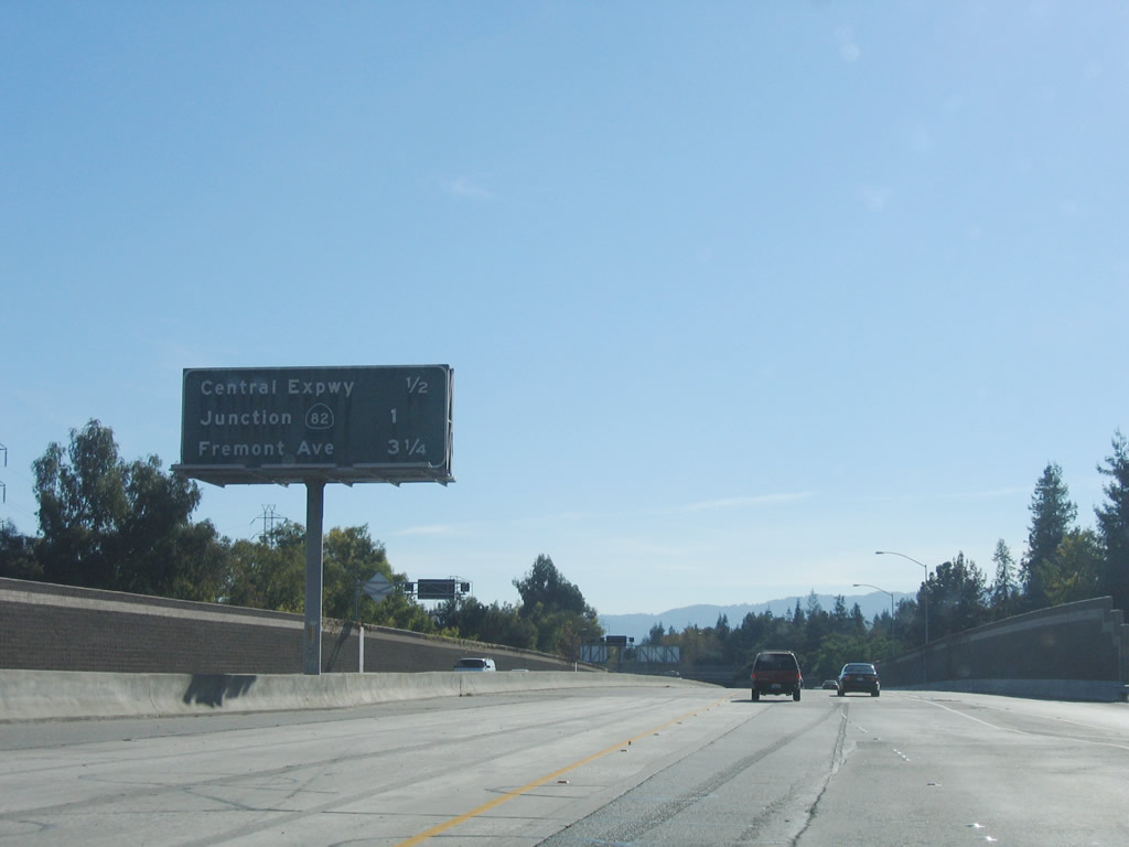
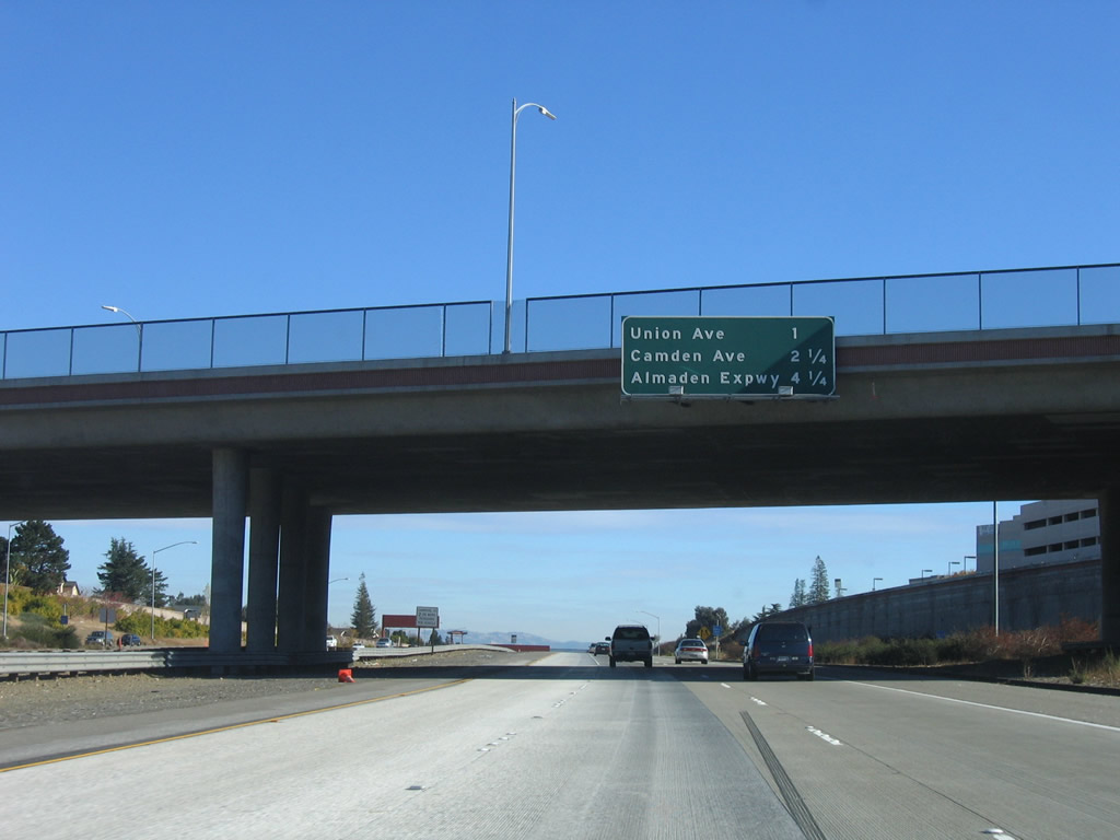
Southbound California 85 (Stevens Creek Freeway) reaches Exit 23, Santa Clara County G-6 (Central Expressway). Photo taken 11/27/05. |
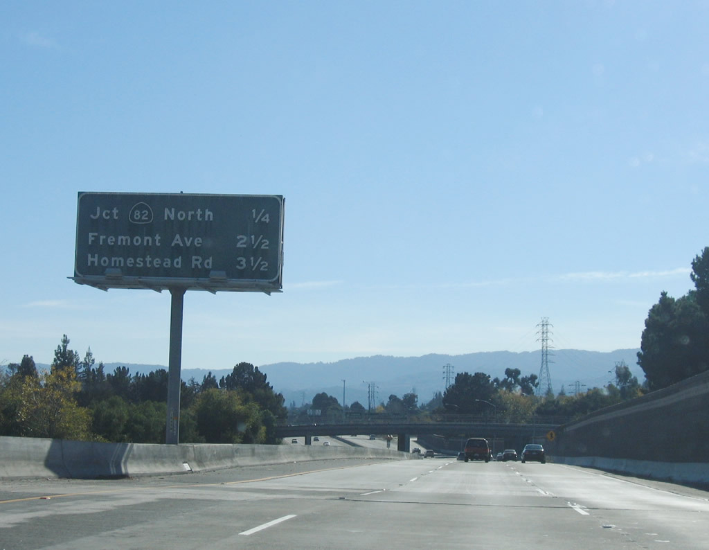 |
The next four exits along California 85 (Stevens Creek Freeway) south are Exit 22B, California 82 (El Camino Real) north to Mountain View; Exit 22A, California 82 (El Camino Real) south to Sunnyvale; Exit 20, Fremont Avenue to Los Altos; and Exit 19B, Homestead Road. Photo taken 11/27/05. |
 |
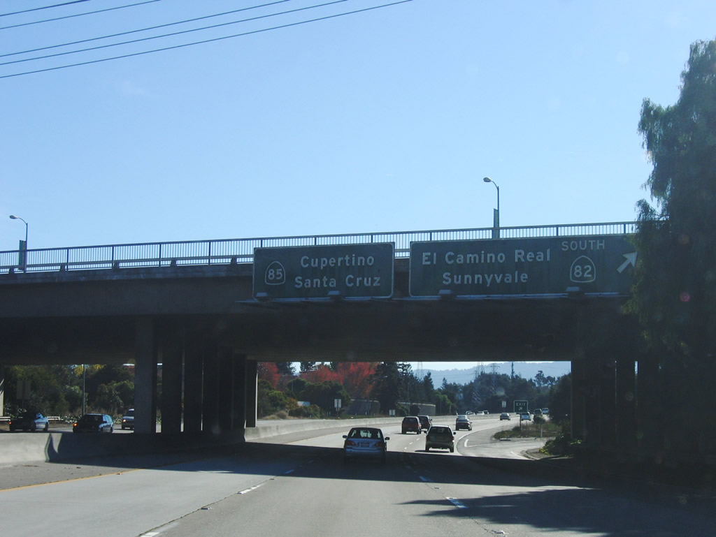
Southbound California 85 (Stevens Creek Freeway) reaches Exit 22B, California 82 (El Camino Real) north to Mountain View. This off-ramp technically connects to the west end of California 237 (South Bay Freeway), which changes into Mountain View-Alviso Road and Grant Road after crossing over California 82 (El Camino Real). Photo taken 11/27/05. |
|
The next four exits along California 85 (Stevens Creek Freeway) south are Exit 22B, California 82 (El Camino Real) north to Mountain View; Exit 22A, California 82 (El Camino Real) south to Sunnyvale; Exit 20, Fremont Avenue to Los Altos; and Exit 19B, Homestead Road. Photo taken 11/27/05. |
 |
Immediately thereafter, southbound California 85 (Stevens Creek Freeway) reaches Exit 22A, California 82 (El Camino Real) south to Sunnyvale on a loop ramp. Photo taken 11/27/05. |
 |
The next exit along California 85 (Stevens Creek Freeway) south is Exit 20, Fremont Avenue to Los Altos. Around this point, California 85 leaves Mountain View and briefly straddles the cities of Los Altos to the west and Sunnyvale to the east. Los Altos is home to 27,693 people as of the 2000 Census and consists of 6.3 square miles. Sunnyvale, the "Heart of Silicon Valley," is situated between Los Altos and Santa Clara. The city is home to 131,760 people as of the 2000 Census and consists of 22.6 square miles. Sunnyvale incorporated in 1912 after being settled in the late 1800s. Photo taken 11/27/05. |
 |
The next three exits along California 85 (Stevens Creek Freeway) south are Exit 20, Fremont Avenue to Los Altos; Exit 19B, Homestead Road; and Exit 19A, Interstate 280 (Father Junipero Serra Freeway). Photo taken 11/27/05. |
 |
Southbound California 85 (Stevens Creek Freeway) reaches Exit 20, Fremont Avenue west to Los Altos and east to Sunnyvale. An advance sign is placed at this exit for the pending interchange with Interstate 280 (Father Junipero Serra Freeway) at Exit 19A (south to San Jose and north to San Francisco). Photo taken 11/27/05. |
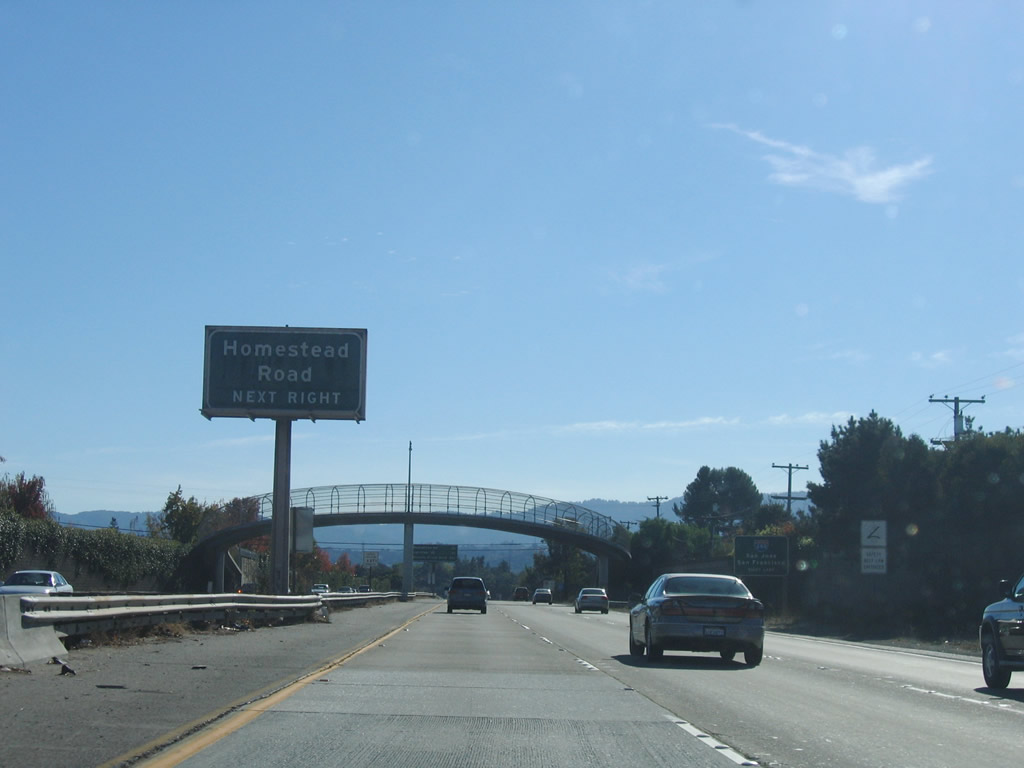 |
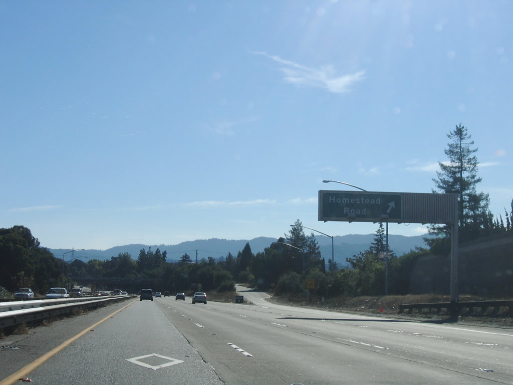
The next exit along California 85 (Stevens Creek Freeway) south is Exit 19B, Homestead Road, followed by Exit 19A, Interstate 280 (Father Junipero Serra Freeway). Photo taken 11/27/05. |
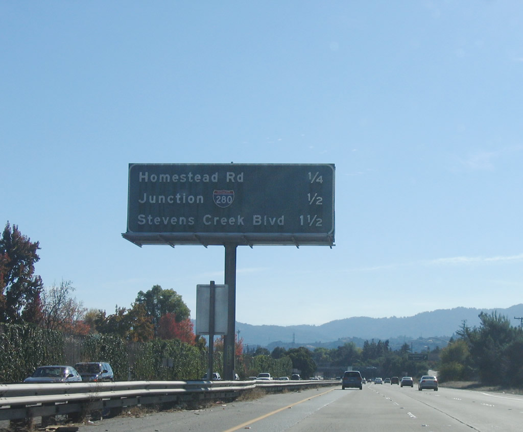 |
The next three exits along California 85 (Stevens Creek Freeway) south are Exit 19B, Homestead Road; Exit 19A, Interstate 280 (Father Junipero Serra Freeway); and Exit 18, Stevens Creek Boulevard. Photo taken 11/27/05. |
 |
Southbound California 85 (Stevens Creek Freeway) reaches Exit 19B, Homestead Road. The next exit along southbound is Exit 19A, Interstate 280 (Father Junipero Serra Freeway). Photo taken 11/27/05. |
 |
Immediately thereafter, southbound California 85 (Stevens Creek Freeway) reaches Exit 19A, Interstate 280 (Father Junipero Serra Freeway). The off-ramp splits for Interstate 280 south to downtown San Jose and north to San Francisco via what is regarded as one of the most scenic urban freeways in the United States. Photo taken 11/27/05. |
| California 85 - West Valley Freeway south | |
 |
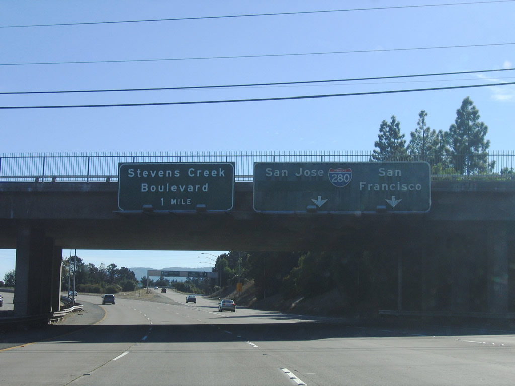
The next exit along California 85, which is now known as the West Valley Freeway, is Exit 18, Stevens Creek Boulevard. At this point, California 85 leaves Sunnyvale and enters the city of Cupertino. Cupertino was home to 50,546 people as of the 2000 Census and consists of 10.9 square miles. The city sits at an elevation of 236 feet and was incorporated on October 10, 1955. Photo taken 11/27/05. |
 |
Southbound California 85 (West Valley Freeway) reaches Exit 18, Stevens Creek Boulevard. To the east, Stevens Creek Boulevard leads to Vallco Fashion Park. To the west, Stevens Creek Boulevard leads into Anza College and the Monta Vista neighborhood of Cupertino. From here, the California 85 freeway starts to turn southeast. Photo taken 11/27/05. |
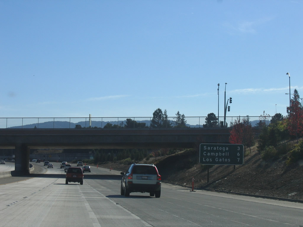 |
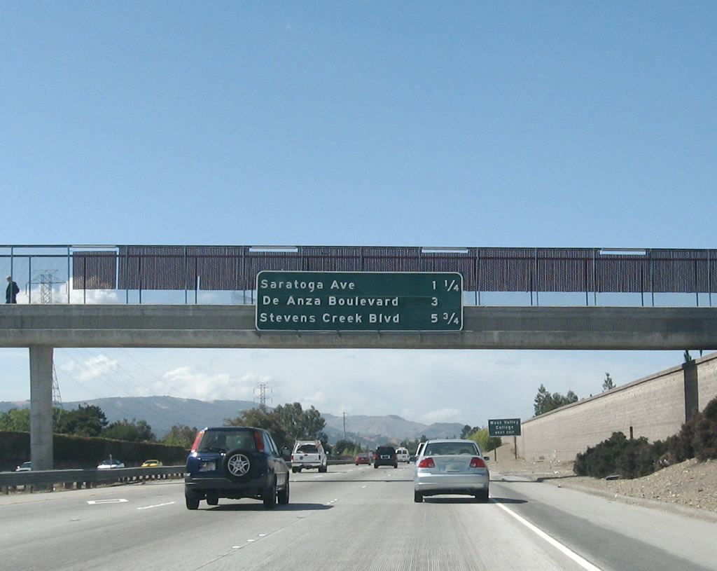
This mileage sign provides the distance to Saratoga (three miles), Campbell (six miles), and Los Gatos (seven miles). Photo taken 11/27/05. |
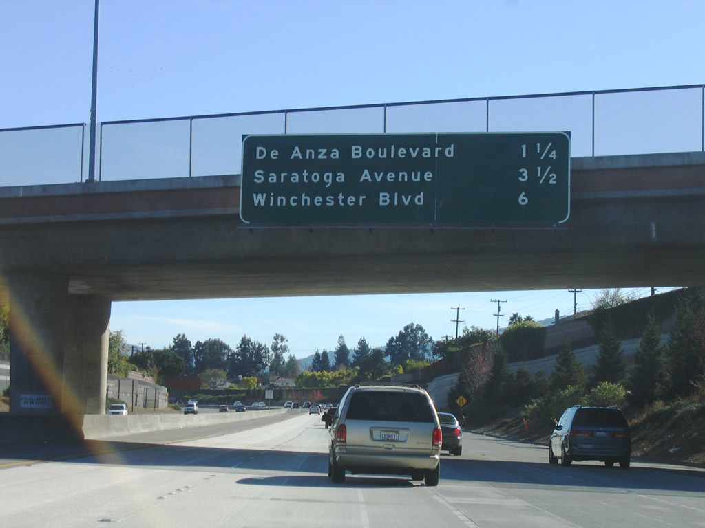 |
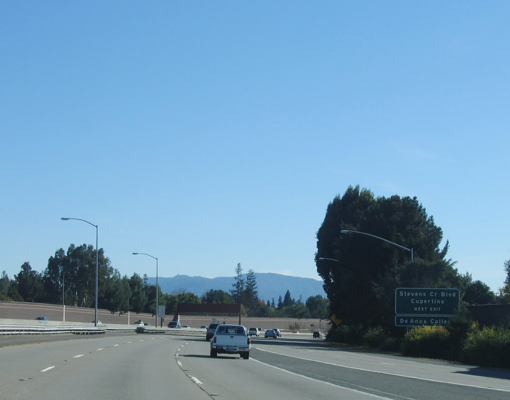
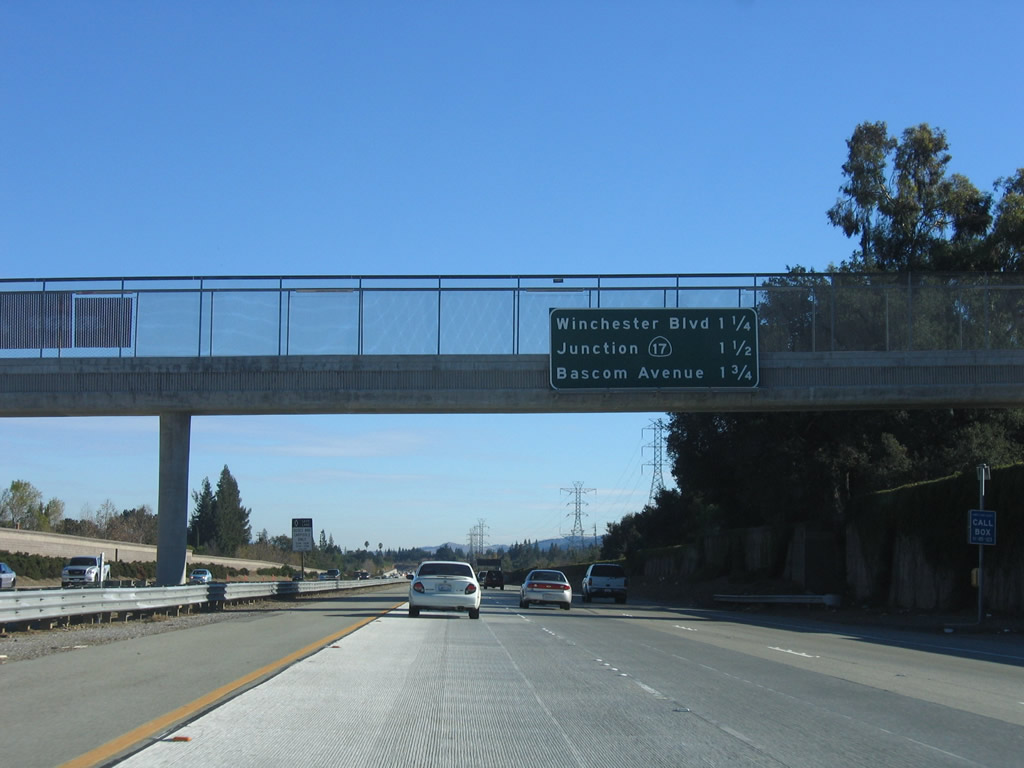
The next three exits along California 85 (West Valley Freeway) south are Exit 16, De Anza Boulevard; Exit 14, Saratoga Avenue; and Exit 11B, Winchester Boulevard. Photo taken 11/27/05. |
 |
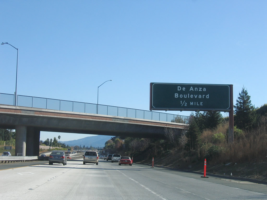
Southbound California 85 (West Valley Freeway) approaches Exit 16, De Anza Boulevard. Use De Anza Boulevard south to Saratoga-Sunnyvale Road south to the city of Saratoga and California 9/Big Basin Way south to Big Basin Redwoods State Park. Photo taken 11/27/05. |
 |
To the north, De Anza Boulevard passes through the westernmost section of the city of San Jose, then enters the city of Cupertino. Photo taken 11/27/05. |
 |
Southbound California 85 (West Valley Freeway) reaches Exit 16, De Anza Boulevard. Photo taken 11/27/05. |
 |
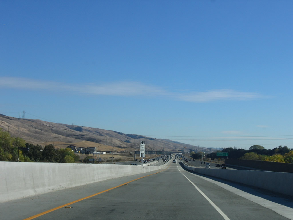
California 85 (West Valley Freeway) leaves the city of Cupertino and briefly enters the city of San Jose, home to 894,943 people as of the 2000 Census. Founded on November 29, 1777, and incorporated on March 27, 1850, San Jose is the third largest city in California (behind Los Angeles and San Diego). San Jose consists of 178.2 square miles and sits at an elevation of 85 feet. Rainfall in San Jose is much less than San Francisco due to its location at the south end of the San Francisco Bay and enclosure within mountains. The average annual precipitation is 14.4 inches. Photo taken 11/27/05. |
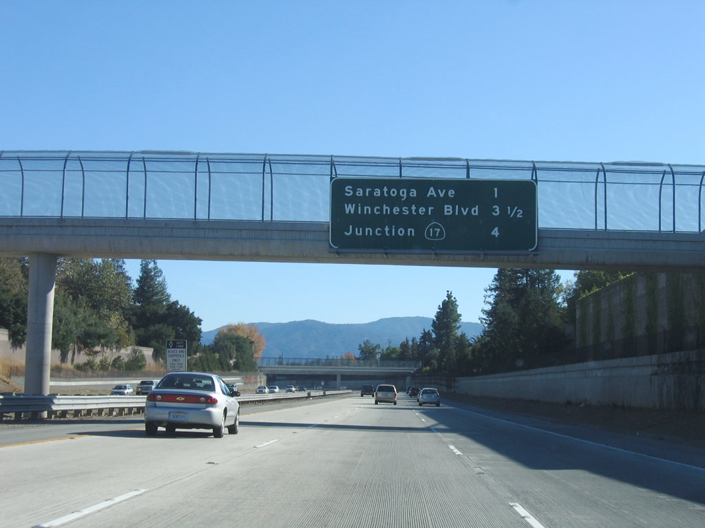 |
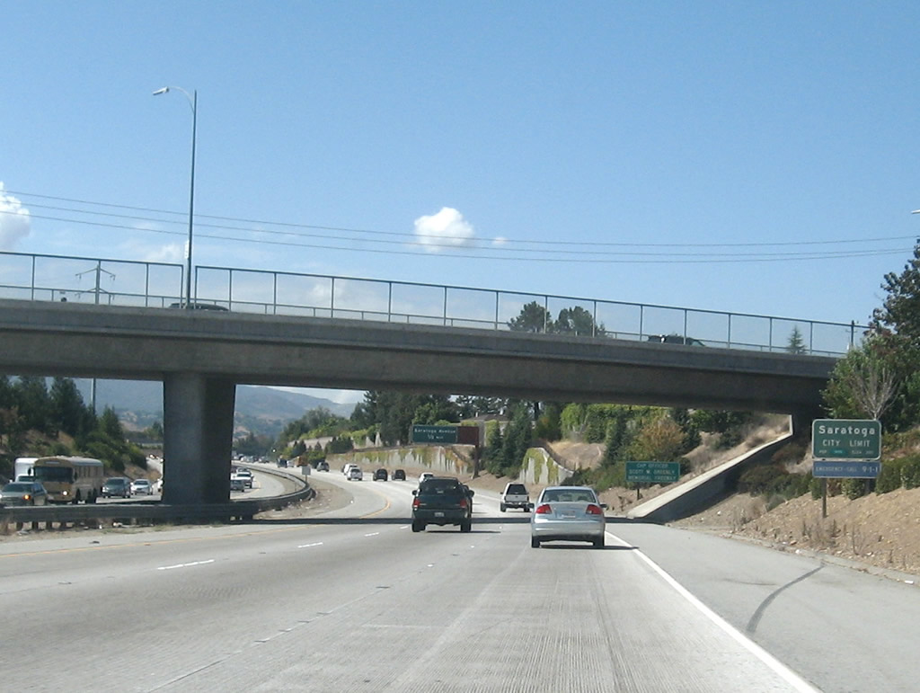
The next three exits along California 85 (West Valley Freeway) south are: Exit 14, Saratoga Avenue; Exit 11B, Winchester Boulevard; and Exit 11A, California 17. California 85 now leaves San Jose briefly and enters the city of Saratoga, which was incorporated in 1956 and is home to 29,843 people as of the 2000 Census. Photo taken 11/27/05. |
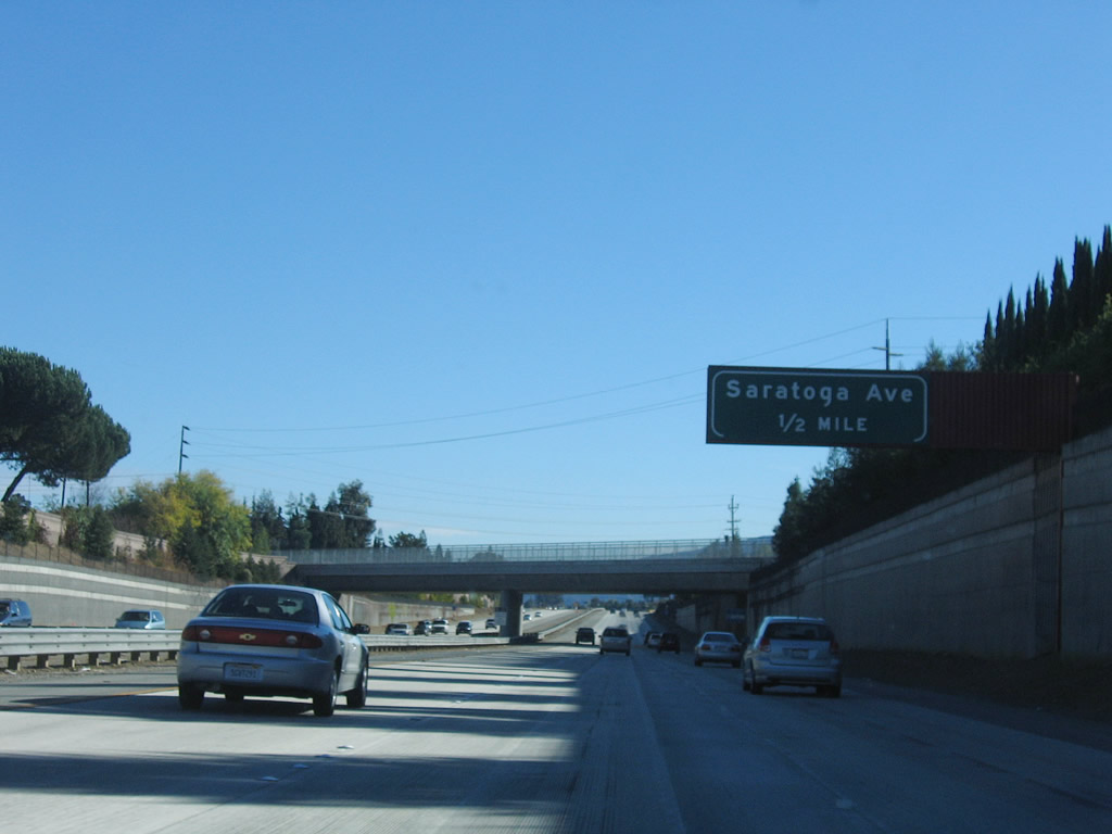 |
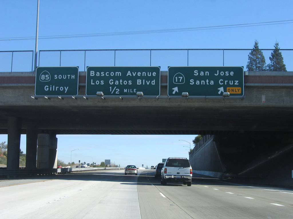
The next exit along California 85 (West Valley Freeway) south is Exit 14, Saratoga Avenue. This exit serves the city of Saratoga and connects West Valley College. Use Saratoga Avenue northeast to Santa Clara County G-2 (Lawrence Expressway). There is no direct access to Santa Clara County G-2/Quito Road south from California 85 south. Photo taken 11/27/05. |
 |
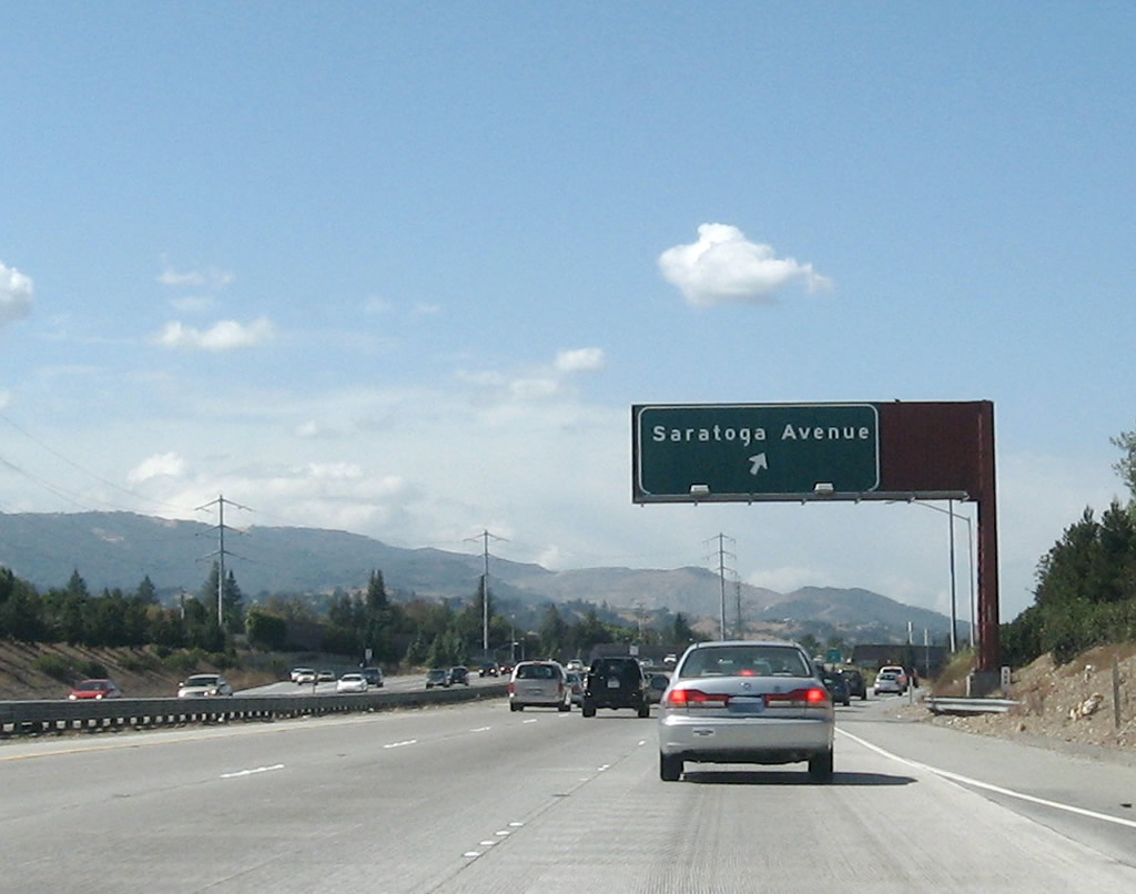
Southbound California 85 (West Valley Freeway) reaches Exit 14, Saratoga Avenue. Photo taken 11/27/05. |
 |
Pacific Gas and Electric 230kV power lines come close to California 85 as the freeway turns to the east, leaving Cupertino and entering a slice of the city of Campbell ("The Orchard City," pop. 39,200 per 2000 Census) and then entering the town of Los Gatos ("Small Town Service, Community Stewardship, and Future Focus," pop. 28,592 per 2000 Census). The power lines follow the route of the Union Pacific Railroad, which is aligned on the south side of California 85. Photo taken 11/27/05. |
 |
The next three exits along California 85 (West Valley Freeway) south are: Exit 11B, Winchester Boulevard; Exit 11A, California 17; and Exit 10, Los Gatos Boulevard and Bascom Avenue. Photo taken 11/27/05. |
 |
California 17 (Exit 11A) is a major north-south expressway corridor from Santa Cruz to San Jose. The state route is mostly freeway in the San Jose metropolitan area, but it is an expressway with intersections south of Los Gatos and over Patchen Pass (el. 1,800 feet). With a narrow right of way and heavy traffic conditions, California 17 is a very busy highway and can be dangerous during periods of inclement weather. It is the fastest way from San Jose to the Pacific Ocean, and it ends at California 1 in the city of Santa Cruz. To the north, California 17 changes into Interstate 880 at the Interstate 280 interchange. Interstate 880 then follows a freeway alignment north to Interstate 80 in the city of Oakland. Photo taken 11/27/05. |
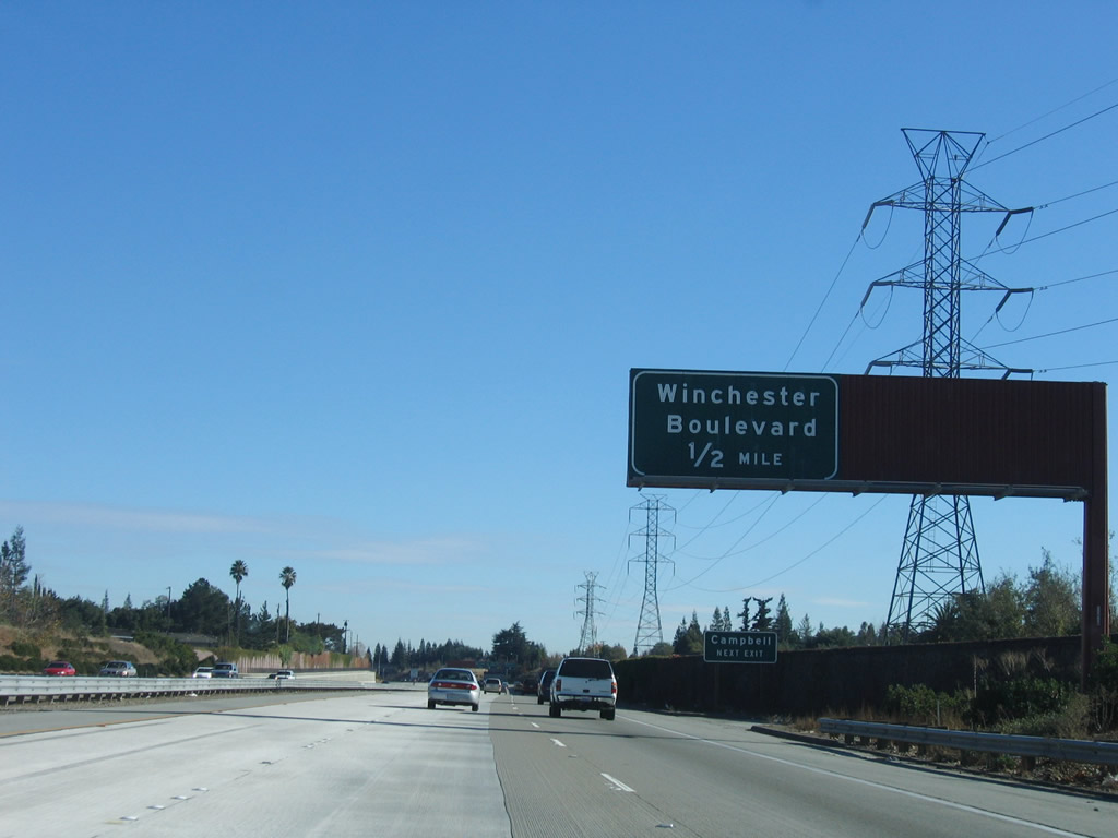 |
Meanwhile, the next exits along California 85 (West Valley Freeway) south is Exit 11B, Winchester Boulevard. As noted by the auxiliary sign, use Winchester Boulevard north to Campbell and south to Los Gatos and Monte Sereno. Photo taken 11/27/05. |
 |
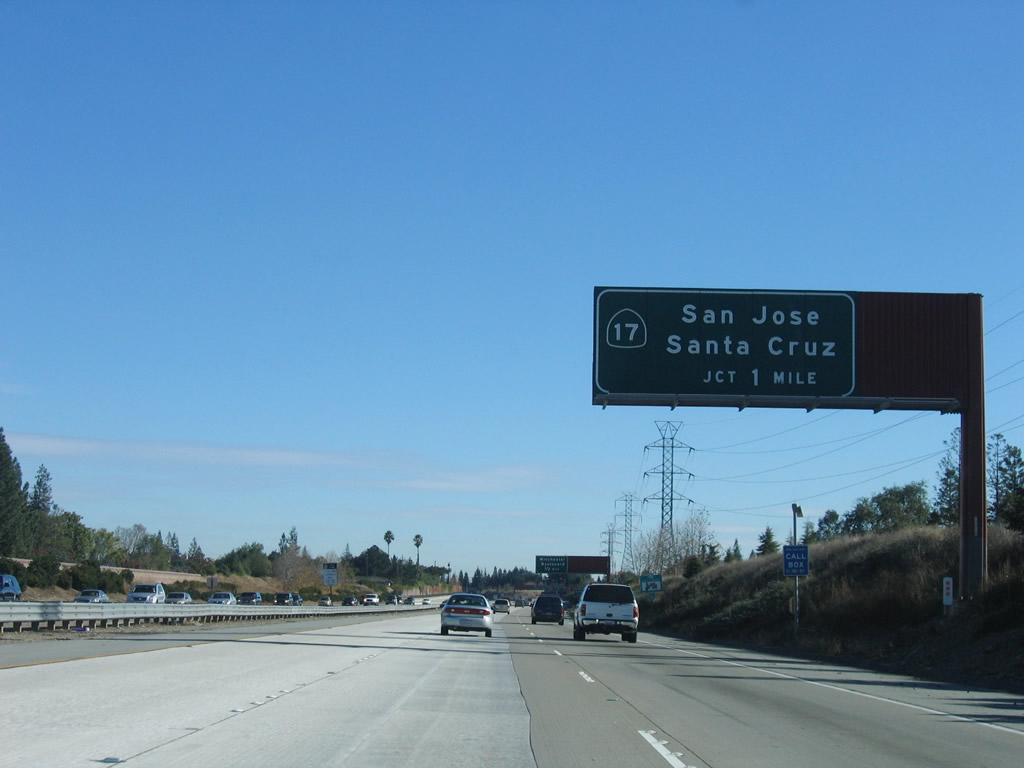
Southbound California 85 reaches Exit 11B, Winchester Boulevard. The next interchange along southbound is Exit 11A, California 17. The control city for southbound California 85 shifts to Gilroy after this interchange. Photo taken 11/27/05. |
 |
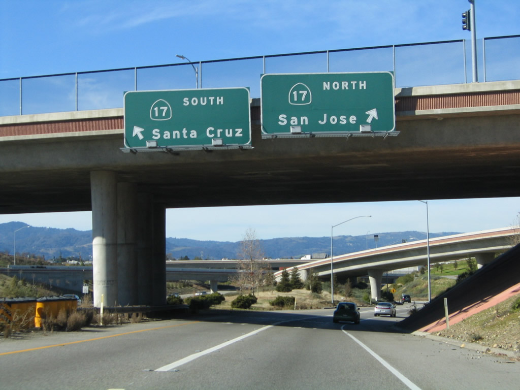
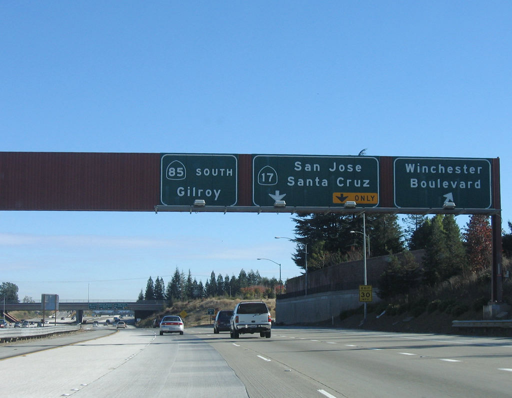
Southbound California 85 reaches Exit 11A, California 17 north to San Jose and south to Santa Cruz. Photo taken 11/27/05. |
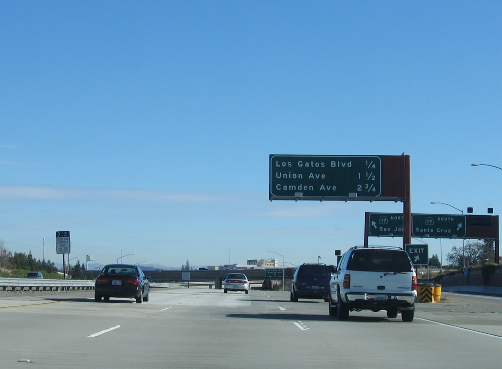 |
The next three exits along California 85 south are Exit 10, Los Gatos Boulevard and Bascom Avenue; Exit 9, Union Avenue; and Exit 8, Camden Avenue. Note the transition ramp to California 17, which can be seen to the right of the freeway. At this point, California 85 is traveling nearly due east. The freeway leaves the town of Los Gatos and reenters the city of San Jose. Photo taken 11/27/05. |
 |
Southbound California 85 reaches Exit 10, Los Gatos Boulevard and Bascom Avenue. The California 85 freeway passes under the California 17 freeway. Photo taken 11/27/05. |
 |
The next three exits along California 85 south are Exit 9, Union Avenue; Exit 8, Camden Avenue; and Exit 6, Santa Clara County G-8 (Almaden Expressway). Photo taken 11/27/05. |
 |
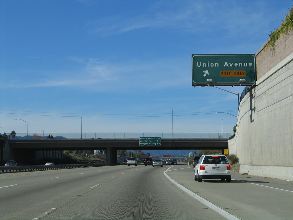
The right lane of California 85 south becomes exit only for Exit 9, Union Avenue. Use Union Avenue north to the Cambrian Park neighborhood of San Jose and south to Santa Clara County G-10 (Blossom Hill Road) in Los Gatos. Photo taken 11/27/05. |
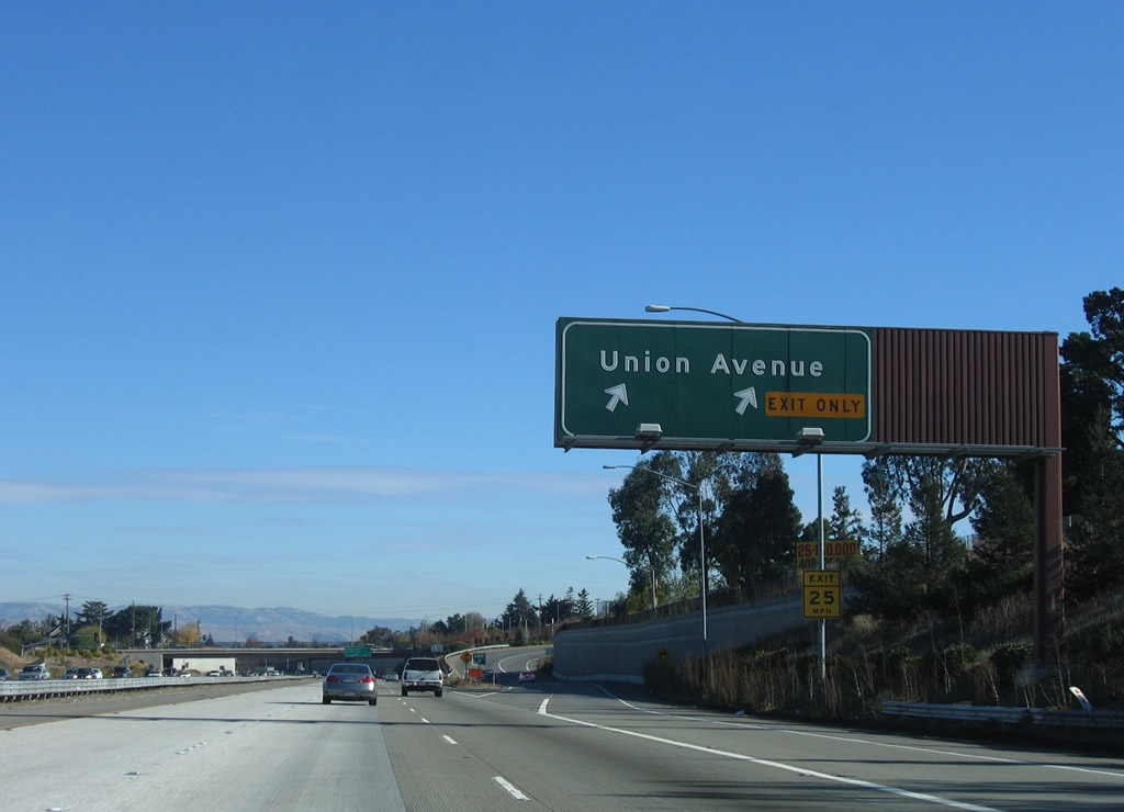 |
Southbound California 85 reaches Exit 9, Union Avenue. The next exit is Exit 8, Camden Avenue. Photo taken 11/27/05. |
 |
The next three exits along California 85 south are Exit 8, Camden Avenue; Exit 6, Santa Clara County G-8 (Almaden Expressway); and Exit 5B, California 87 (Guadalupe Parkway) north to downtown San Jose. Photo taken 11/27/05. |
 |
Camden Avenue provides residential and commercial access to southwestern San Jose. Photo taken 11/27/05. |
 |
Southbound California 85 reaches Exit 8, Camden Avenue. The next interchange is Exit 6, Santa Clara County G-8 (Almaden Expressway). Photo taken 11/27/05. |
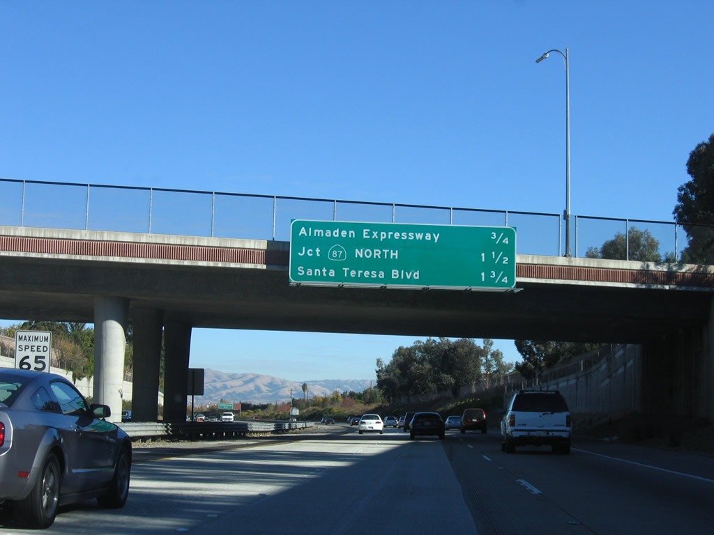 |
The next three exits along California 85 (West Valley Freeway) south are Exit 6, Santa Clara County G-8 (Almaden Expressway); Exit 5B, California 87 (Guadalupe Parkway) north to downtown San Jose; and Exit 5A, Santa Teresa Boulevard. Photo taken 11/27/05. |
 |
Santa Clara County G-8 begins as Uvas Road on California 152 east of Hecker Pass. The county route travels north on an alignment parallel to U.S. 101 via Uvas Road and McKean Road before shifting onto the Almaden Expressway in southern San Jose. The county route then travels north on the expressway (with limited access and traffic signals), ending in downtown San Jose in the shadow of California 87 (Guadalupe Parkway). Photo taken 11/27/05. |
 |
Southbound California 85 reaches Exit 6, Santa Clara County G-8 (Almaden Expressway). Photo taken 11/27/05. |
 |
The next three exits along California 85 south are Exit 5B, California 87 (Guadalupe Parkway) north to downtown San Jose; Exit 5A, Santa Teresa Boulevard; and Exit 4, Santa Clara County G-10 (Blossom Hill Road). Photo taken 11/27/05. |
 |
To Norman Y. Mineta San Jose International Airport, use Exit 5B, California 87 (Guadalupe Parkway) north to downtown San Jose. The off-ramp for Exit 5A, Santa Teresa Boulevard will immediately follow after the Exit 5B off-ramp, so stay right for this exit. Photo taken 11/27/05. |
 |
The right lane connects to California 87 north to downtown San Jose and the airport. California 87, also known as the Guadalupe Parkway, was constructed in phases (California 85 to Interstate 280: 1989 through 1993; Interstate 280 to California 82: 1971-1973; and California 82 to U.S. 101: 2000-2004). The freeway parallels the Guadalupe River and connects California 85 with U.S. 101 through downtown San Jose. Photo taken 11/27/05. |
 |
Southbound California 85 (West Valley Freeway) reaches Exit 5B, California 87 (Guadalupe Parkway) north to downtown San Jose. A flyover ramp will make the connection from California 85 south to California 87 north. Photo taken 11/27/05. |
 |
Immediately thereafter, southbound California 85 reaches Exit 5A, Santa Teresa Boulevard. Use Santa Teresa Boulevard south to Westfield Shoppingtown Oakridge at the Blossom Hill Road intersection. The next exit is Exit 4, Santa Clara County G-10 (Blossom Hill Road). Photo taken 11/27/05. |
 |
The next three exits along California 85 south are Exit 4, Santa Clara County G-10 (Blossom Hill Road); Exit 2, Cottle Road; and Exit 1C, Great Oaks Boulevard. Photo taken 11/27/05. |
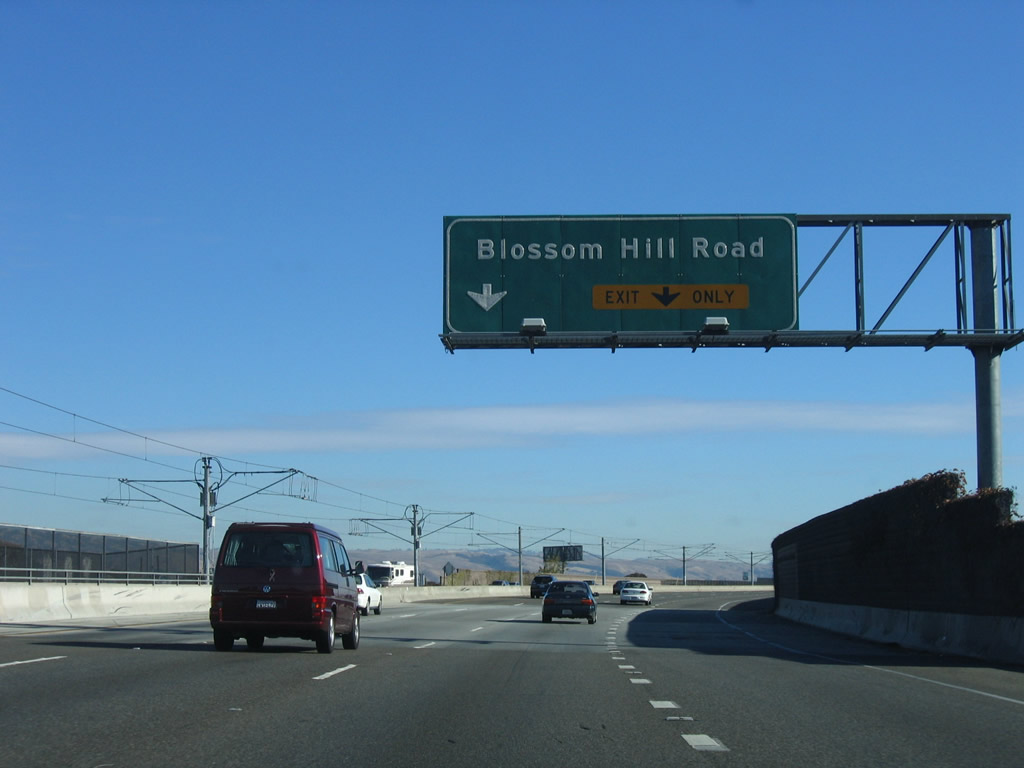 |
The right lane becomes exit only for Exit 4, Santa Clara County G-10 (Blossom Hill Road). VTA light rail merges onto the median of the California 85 freeway between the California 87 interchange and at a point near the Perimeter Road bridge after the Cottle Road interchange (Exit 2). Photo taken 11/27/05. |
 |
Southbound California 85 reaches Exit 4, Santa Clara County G-10 (Blossom Hill Road). Use Blossom Hill Road east to Monterey Highway north to California 82 and Silver Creek Valley Road east. To the west, Blossom Creek Road travels back toward the Westfield Shoppingtown Oakridge (at the intersection with Santa Teresa Boulevard). Photo taken 11/27/05. |
 |
The final four exits along California 85 (West Valley Freeway) south are Exit 2, Cottle Road; Exit 1C, Great Oaks Boulevard; Exit 1B, Bernal Road to Monterey Highway (Old U.S. 101 (El Camino Real)) south and U.S. 101 (South Valley Freeway) north; and Exit 1A, U.S. 101 (South Valley Freeway) south to Gilroy and Los Angeles. Photo taken 11/27/05. |
 |
The right lane of California 85 becomes exit only for Exit 2, Cottle Road. Photo taken 11/27/05. |
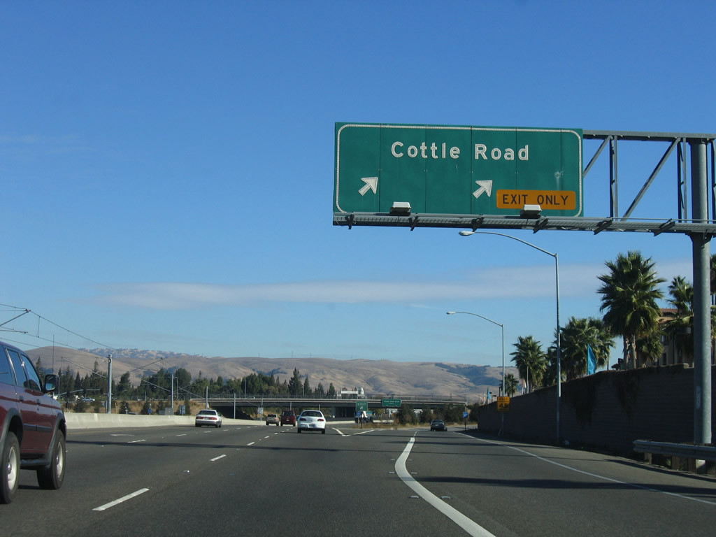 |
Southbound California 85 reaches Exit 2, Cottle Road. Photo taken 11/27/05. |
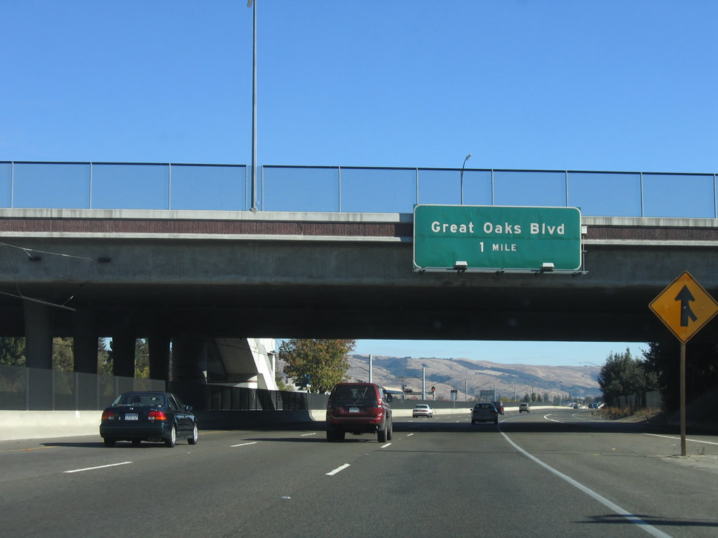 |
The next exit along California 85 south is Exit 1C, Great Oaks Boulevard. Photo taken 11/27/05. |
 |
The final three exits along southbound are: Exit 1C, Great Oaks Boulevard; Exit 1B, Bernal Road to Monterey Highway (El Camino Real) south and U.S. 101 (South Valley Freeway) north; and Exit 1A, U.S. 101 (South Valley Freeway) south to Gilroy and Los Angeles. Photo taken 11/27/05. |
 |
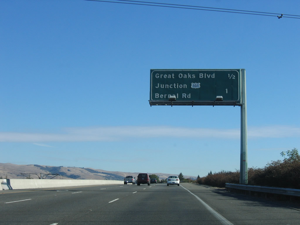
Southbound California 85 reaches Exit 1C, Great Oaks Boulevard. The next two exits are Exit 1B, Bernal Road to Monterey Highway (El Camino Real) south and U.S. 101 (South Valley Freeway) north and Exit 1A, U.S. 101 (South Valley Freeway) south to Gilroy and Los Angeles. There is a high occupancy vehicle lane connector directly from California 85 south onto U.S. 101 south; the left lane will make that transition. Photo taken 11/27/05. |
 |
The right lane will connect to Exit 1B, Bernal Road to Old U.S. 101/Monterey Highway (El Camino Real) south and U.S. 101 (South Valley Freeway) north; otherwise, all lanes will connect to Exit 1A, U.S. 101 (South Valley Freeway) south to Gilroy and Los Angeles. Photo taken 11/27/05. |
 |
Southbound California 85 reaches Exit 1B, Bernal Road to Monterey Highway (El Camino Real) south and U.S. 101 (South Valley Freeway) north. Use Bernal Road south to Old U.S. 101 (El Camino Real/Monterey Highway) and north to U.S. 101 north to San Jose and San Francisco. Photo taken 11/27/05. |
 |
A trailblazer for U.S. 101 south is posted prior to the split between the carpool lanes and main lanes. The right two lanes are for through traffic; the left lane is for high occupancy vehicles (during regulated hours). Photo taken 11/27/05. |
 |
The carpool lanes and main lanes split at this point, with the right two lanes are for through traffic and the left lane is for high occupancy vehicles (during regulated hours). On the hill in the distance are Pacific Gas and Electric 500kV power lines that connect Path 15 in the Central Valley with the Moss Landing Power Generating Station on the coast northwest of Salinas. Photo taken 11/27/05. |
 |
View of the transition from California 85 south to U.S. 101 south as seen from the high occupancy vehicles (carpool) lanes. Photo taken 11/27/05. |
 |
The California 85 high occupancy vehicle lanes prepare to merge onto U.S. 101 south to Morgan Hill and Gilroy. Photo taken 11/27/05. |

Page Updated February 20, 2008.
|
About Contact Glossary |
In The News Testimonials Interstate Guide |
Social Media:
 |
|
© 2000-23 AARoads.com | All Rights Reserved | Privacy Policy / Terms of Use
|
||