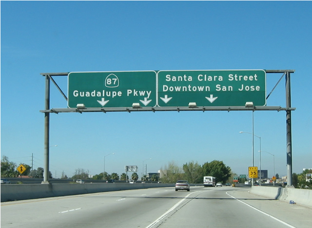
California 87 is the Guadalupe Parkway, following the Guadalupe River through downtown San Jose. It begins at California 85 and travels north to U.S. 101 near San Jose International Airport. The freeway was constructed in phases. The section from California 85 to Interstate 280 was built between 1989 through 1993; the section between Interstate 280 and California 82 was built in 1971-1973; and the section from California 82 north to U.S. 101 was built in 2000-2004.
| California 87 - Guadalupe Parkway north |
|
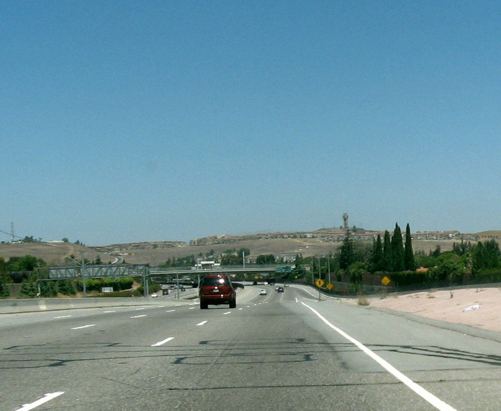
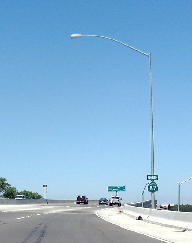
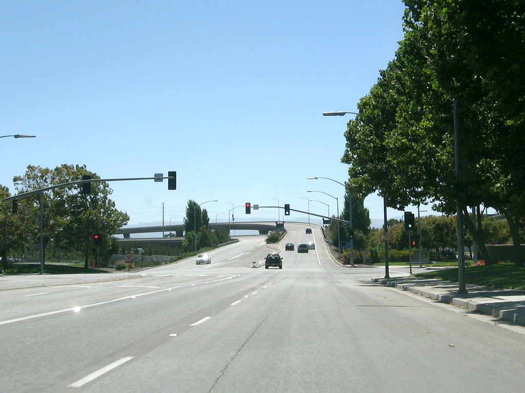
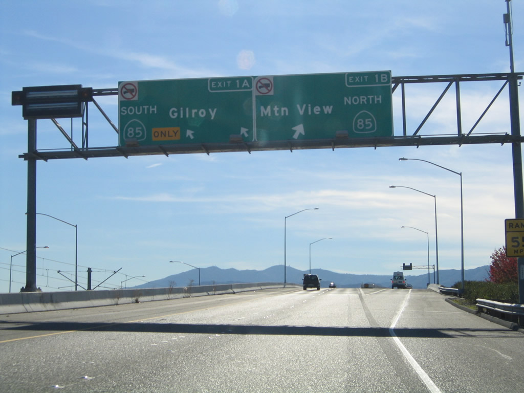
Guadalupe Parkway leads north from California 85 toward Downtown San Jose and San Jose International Airport. The entire freeway corridor is located within the city of San Jose (population 894,943 as of 2000 Census). Photo taken by Jeff Waller (08/11/07). |
|
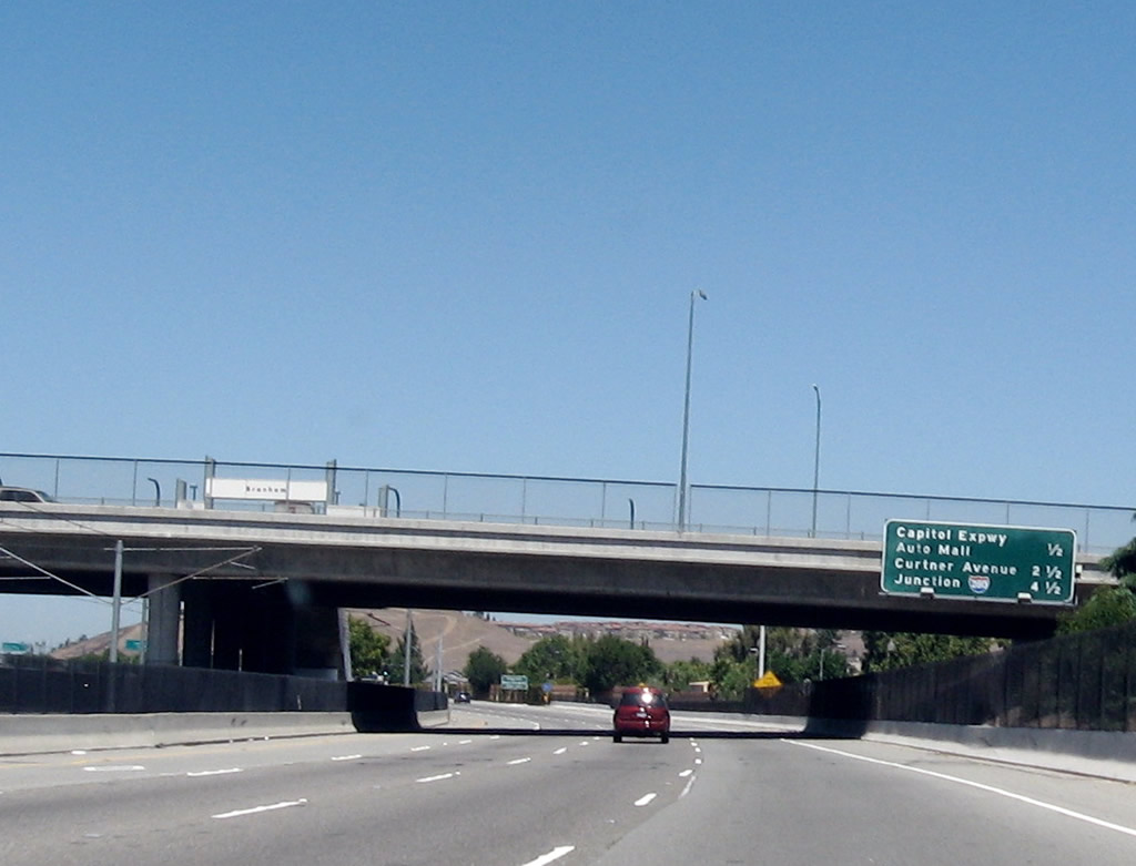
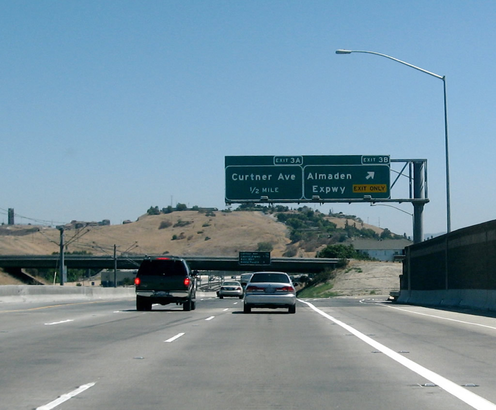
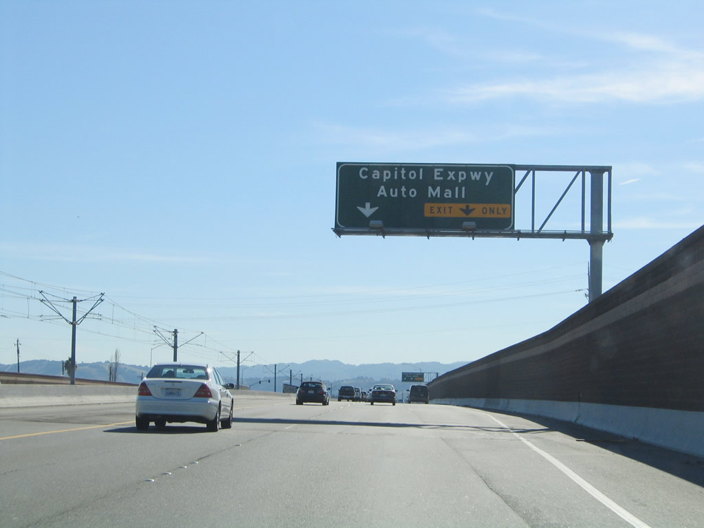
The first three exits on California 87 (Guadalupe Parkway) are: Exit 1, Santa Clara County G-21 (Capitol Expressway); Exit 3, Curtner Avenue; and Exit 5, Interstate 280 (Sinclair Freeway). Photo taken by Jeff Waller (08/11/07). |
|
The Capitol Expressway is unsigned Santa Clara County G-21. The expressway corridor begins at Santa Clara County G-8 (Almaden Expressway) and travels east past California 82 (folded diamond interchange) and U.S. 101 before turning north to connect with Interstate 680. Most maps do not show the G-21 designation, and thus far no shields have been found in the field. Photo taken by Jeff Waller (08/11/07). |
|
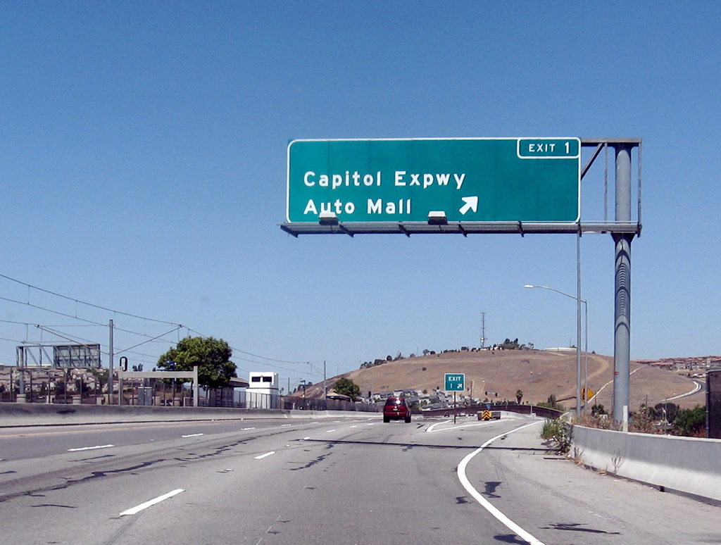
Northbound California 87 (Guadalupe Parkway) reaches Exit 1, Santa Clara County G-21 (Capitol Expressway). A transit station for the light rail (which follows the California 87 median from here north to Interstate 280) can be seen in the middle of the freeway. Photo taken by Jeff Waller (08/11/07). |
|
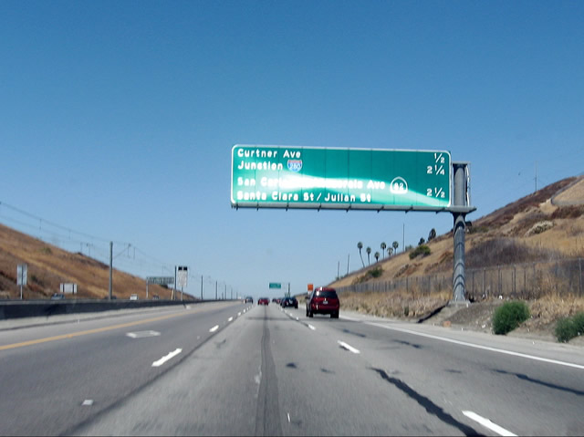
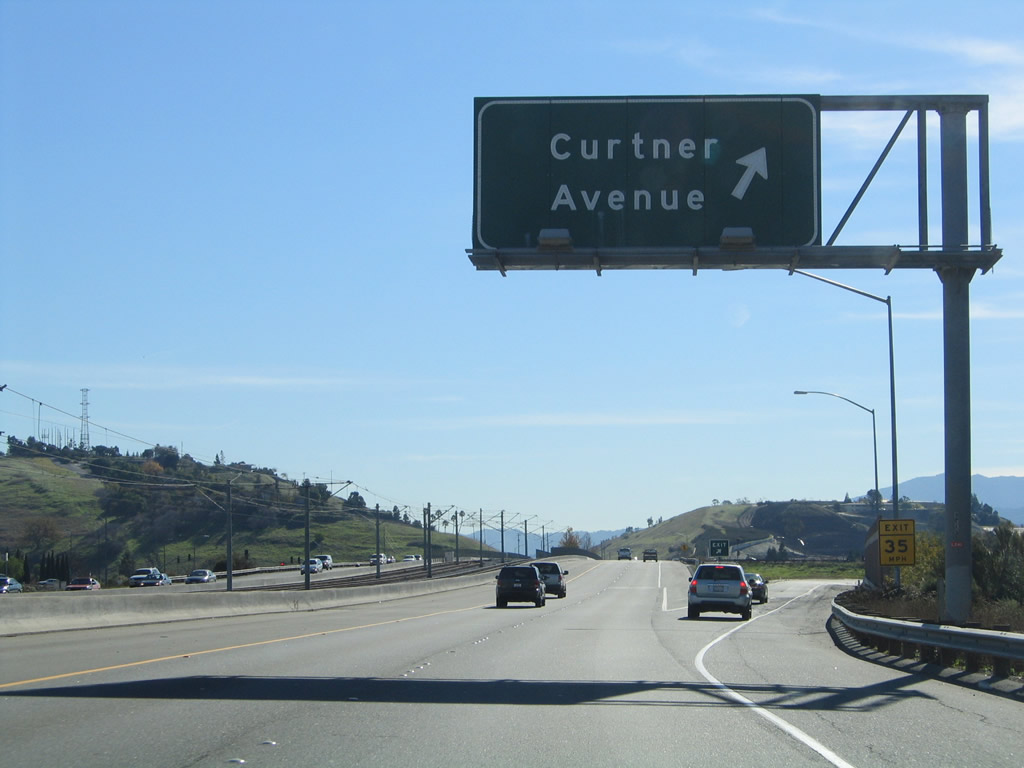
The next three exits on California 87 (Guadalupe Parkway) are: Exit 3, Curtner Avenue; Exit 5, Interstate 280 (Sinclair Freeway); and Exit 6, Auzerais Street, California 82 (West San Carlos Street), Santa Clara Street, and Julian Street (all four streets under Exit 6 are served by a collector distributor lane arrangement with multiple off-ramps through downtown San Jose). Photo taken by Jeff Waller (08/11/07). |
|
Use Exit 3, Curtner Avenue to San Jose State University's Spartan Stadium. From California 87, the stadium is found via Curtner Avenue east to California 82 (Monterey Highway) north to Alma Street east. Use Curtner Avenue east to the Santa Clara County Fairgrounds and Stonegate Park along Coyote Creek. Photo taken by Jeff Waller (08/11/07). |
|
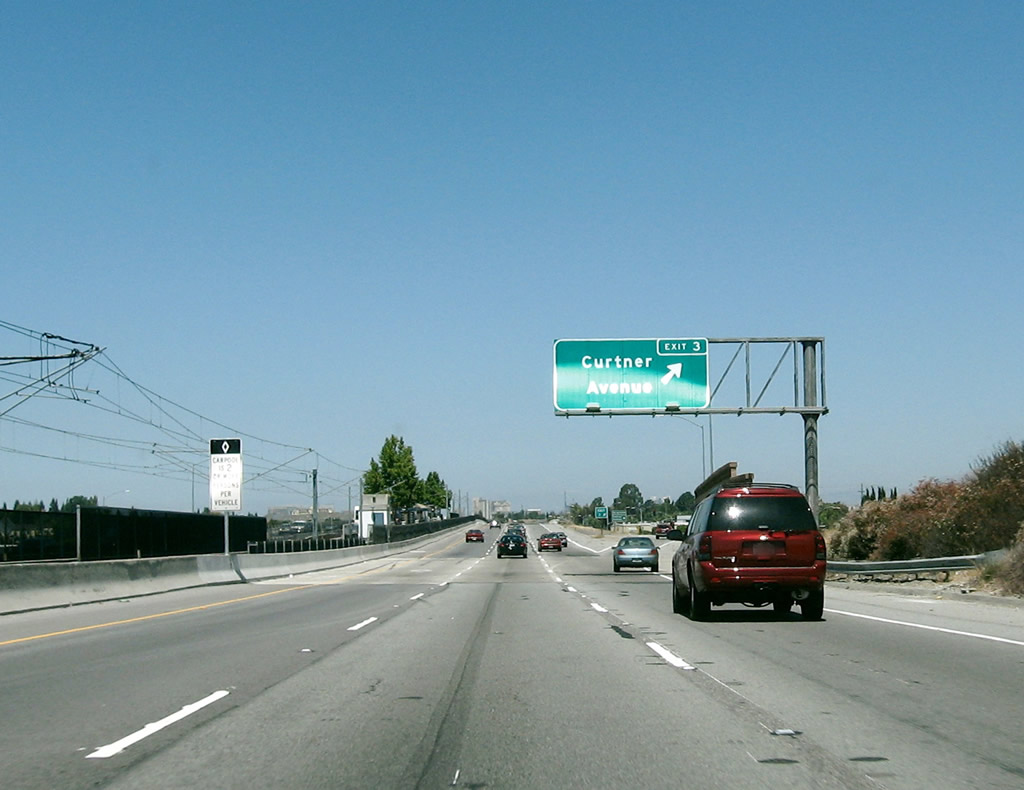
Northbound California 87 (Guadalupe Parkway) reaches Exit 3, Curtner Avenue. Another light rail station is located in the median at this interchange. Photo taken by Jeff Waller (08/11/07). |
|
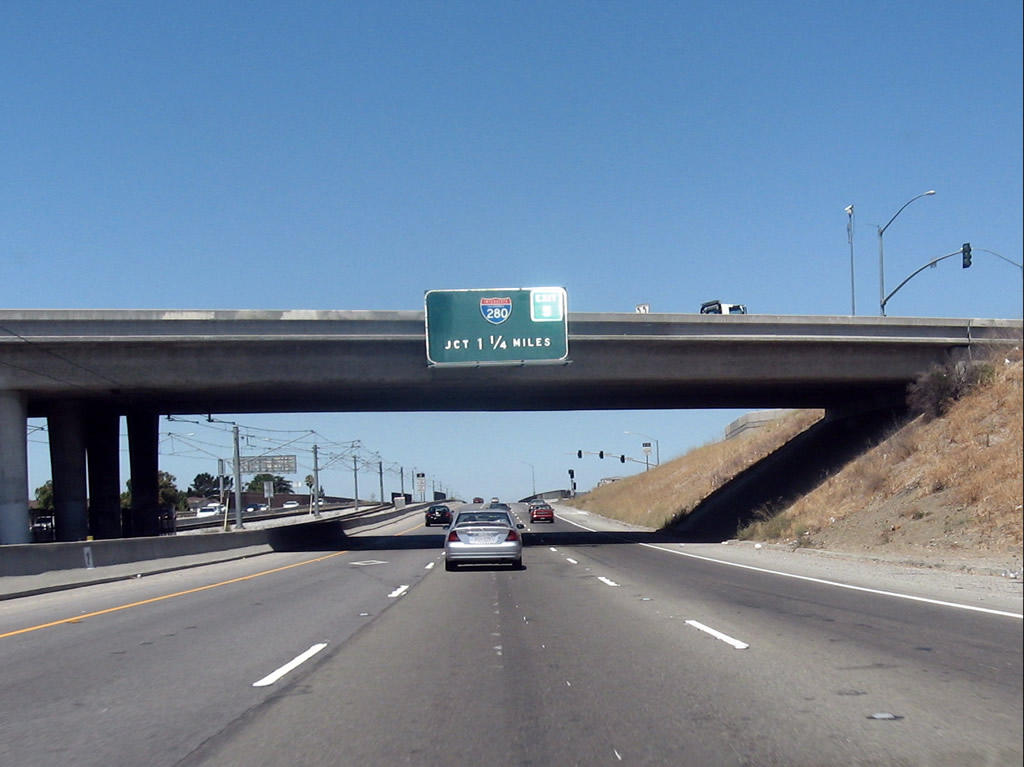
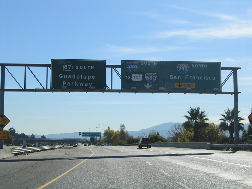
The next exit on California 87 (Guadalupe Parkway) is Exit 5, Interstate 280 (Sinclair Freeway). Through San Jose, Interstate 280 travels east-west (signed south-north). Use Interstate 280 east (south) to Interstate 680 north to Sacramento and U.S. 101 (Bayshore Freeway) north/south. Use Interstate 280 west (north) to Cupertino and to all points north en route to San Francisco. Photo taken by Jeff Waller (08/11/07). |
|
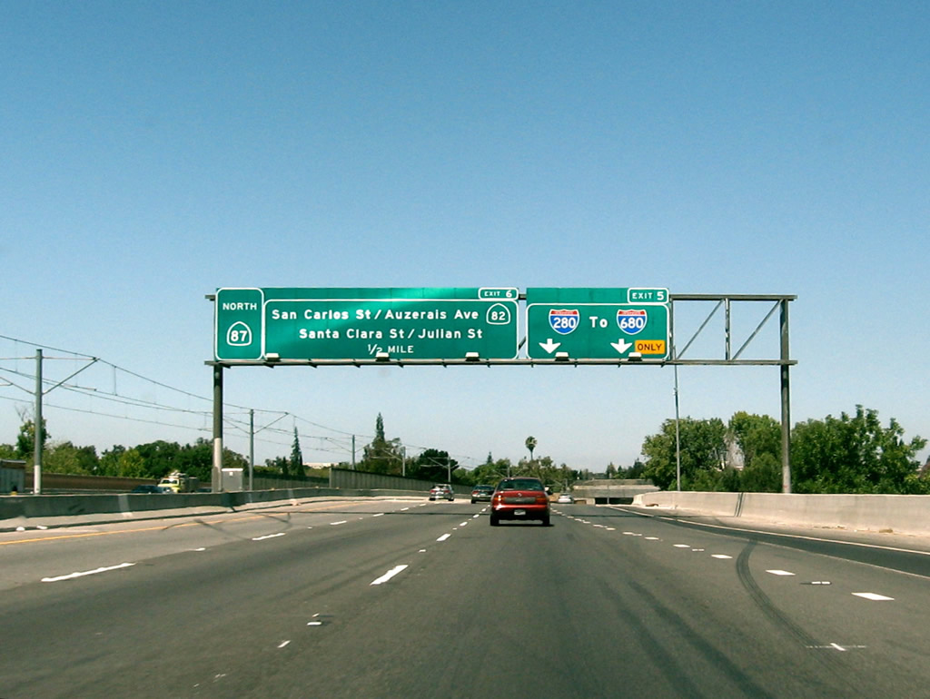
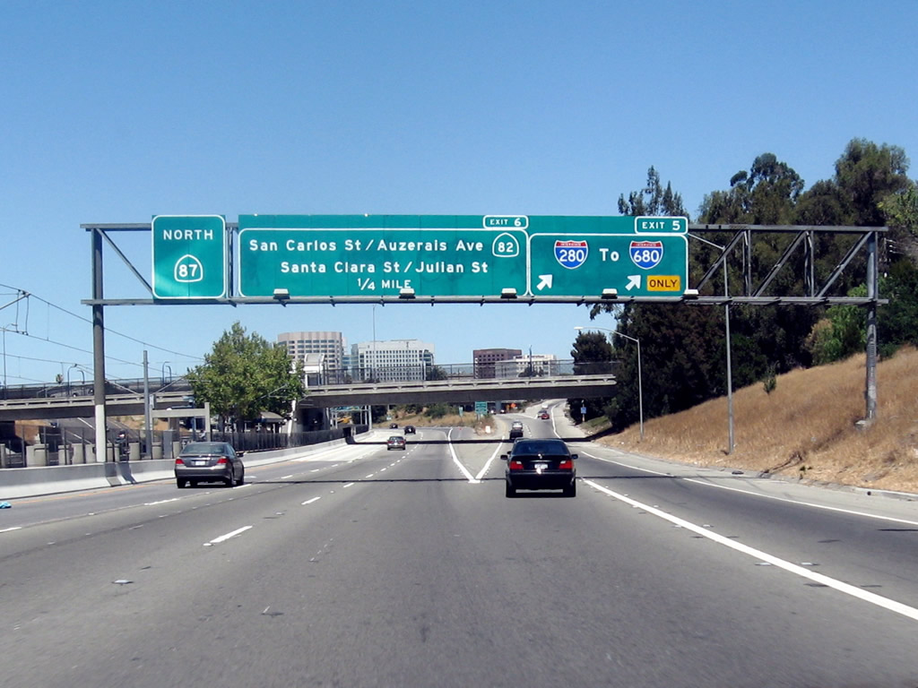
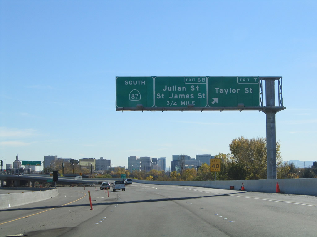
The next two exits on California 87 (Guadalupe Parkway) are: Exit 5, Interstate 280 (Sinclair Freeway) and Exit 6, Auzerais Street, California 82 (West San Carlos Street), Santa Clara Street, and Julian Street (all four streets under Exit 6 are served by a collector distributor lane arrangement with multiple off-ramps through downtown San Jose). Photo taken by Jeff Waller (08/11/07). |
|
The right lane of California 87 (Guadalupe Parkway) becomes exit only for Exit 5, Interstate 280 (Sinclair Freeway) north (west) to San Francisco and south (east) to Interstate 680 and U.S. 101. A separate sign is posted for major Exit 6, which serves four direct ramps into downtown San Jose via Auzerais Street, California 82 (West San Carlos Street), Santa Clara Street, and Julian Street. Photo taken by Jeff Waller (08/11/07). |
|
Use Exit 6 (Auzerais Street, California 82 (West San Carlos Street), Santa Clara Street, and Julian Street) to downtown San Jose, including the Guadalupe River Park (via California 82 south/east), The Alameda (via Santa Clara Street west), Childrens Discovery Museum (via Auzerais Street), San Jose State University (via California 82 east), Plaza de Cesar Chavez (via California 82 east), HP Pavilion at San Jose (via Santa Clara Street west), and the Santa Clara County Courthouse (via Julian Street east). Photo taken by Jeff Waller (08/11/07). |
|
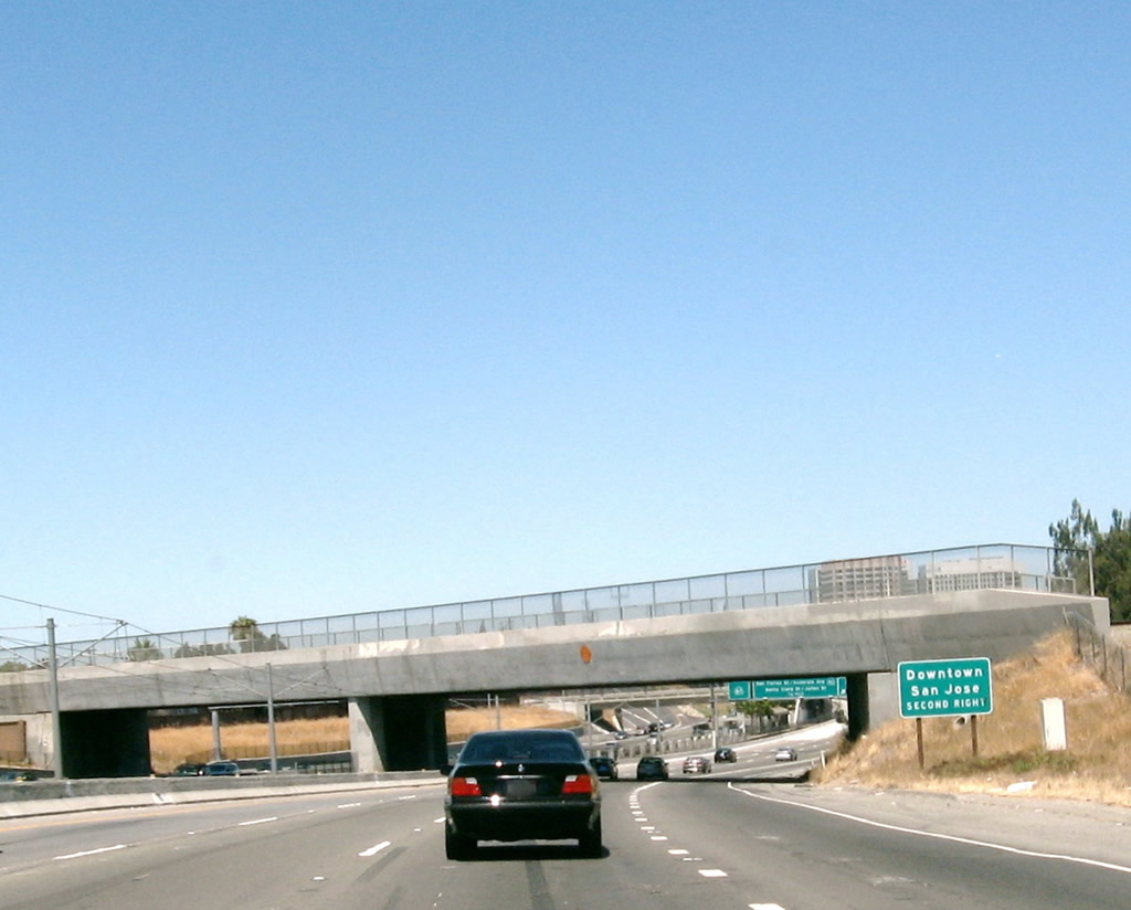
Northbound California 87 (Guadalupe Parkway) reaches Exit 5, Interstate 280 (Sinclair Freeway). The downtown San Jose interchange (Exit 6, Auzerais Street, California 82 (West San Carlos Street), Santa Clara Street, and Julian Street) is next. Photo taken by Jeff Waller (08/11/07). |
|
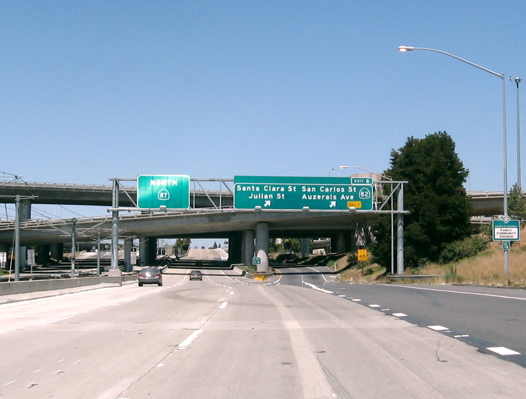
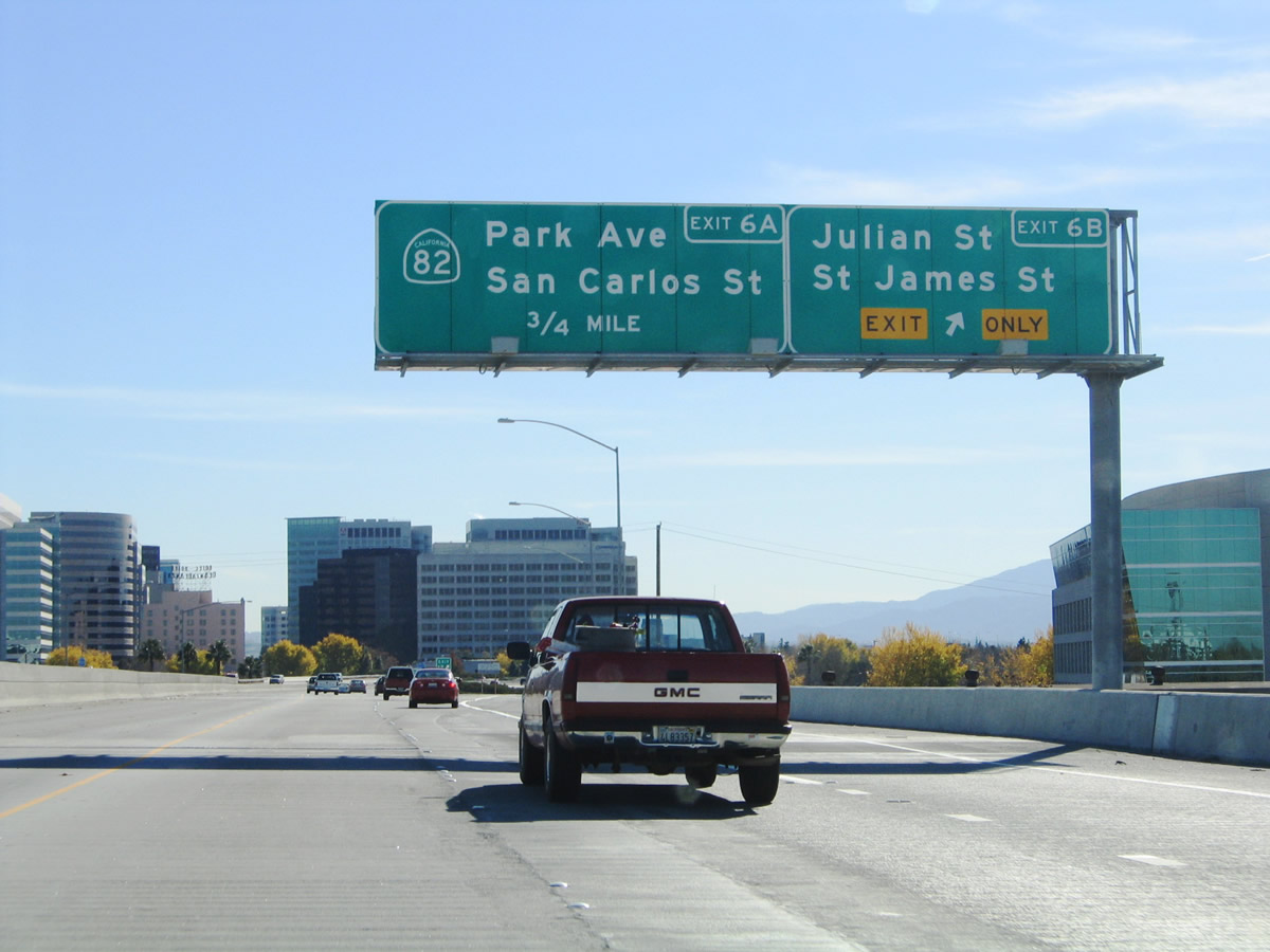
Immediately thereafter, northbound California 87 reaches Exit 6, Auzerais Street, California 82 (West San Carlos Street), Santa Clara Street, and Julian Street to downtown San Jose. Use Santa Clara Street west to reach California 82 and The Alameda northbound. Photo taken by Jeff Waller (08/11/07). |
|
Now on the collector distributor lanes, the first ramp connects to San Carlos Street (California 82) and Auzerais Street. The second ramp, shown here, offers the connection to Santa Clara Street, and the third ramp connects to Julian Street. Photo taken by Pete Sison (05/24/03). |
|
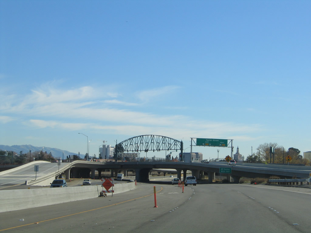
Back on the mainline, northbound California 87 ascends onto an elevated viaduct to carry the freeway through downtown San Jose while remaining above the Guadalupe River, which passes below the freeway. From here one can see the exit to Julian Street on the collector distributor lanes. A mileage sign is posted for San Jose International Airport; the exit is three miles ahead. Photo taken by Jeff Waller (08/11/07). |
|
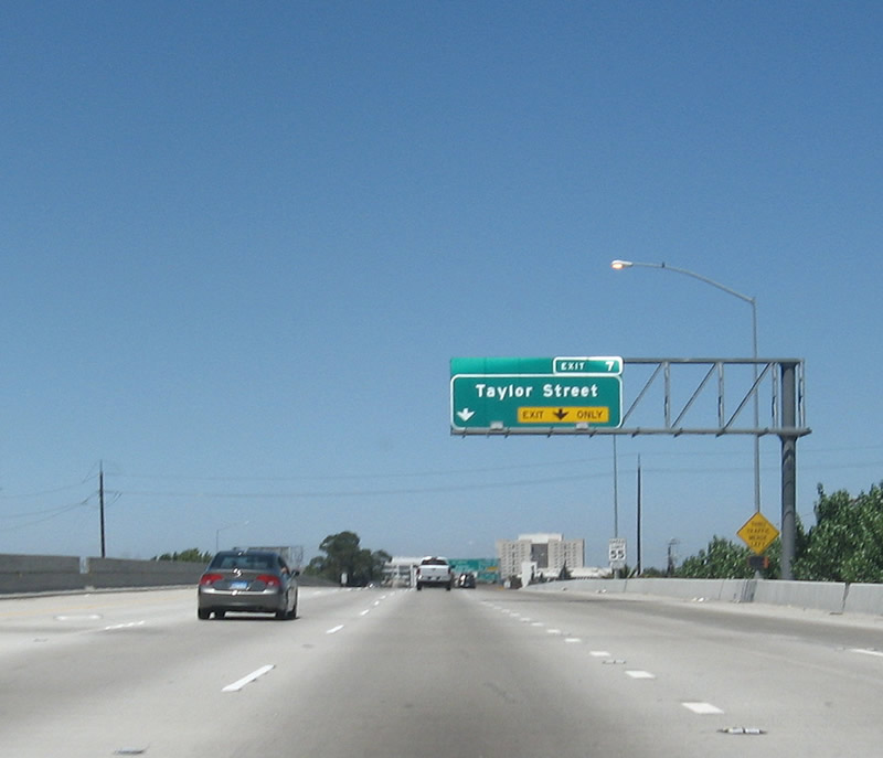
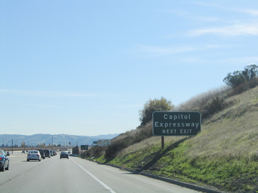
The next exit along northbound California 87 is Exit 7, Taylor Street. The collector distributor lanes merge back onto California 87 north. Photo taken by Jeff Waller (08/11/07). |
|
Northbound California 87 reaches Exit 7, Taylor Street at a single point urban interchange. Photo taken by Jeff Waller (08/11/07). |
|
View of the Exit 7 (Taylor Street) interchange from California 87 north. Photo taken by Jeff Waller (08/11/07). |
|
A California 87 north reassurance shield is posted after the Exit 7 on-ramp. Photo taken by Jeff Waller (08/11/07). |
|
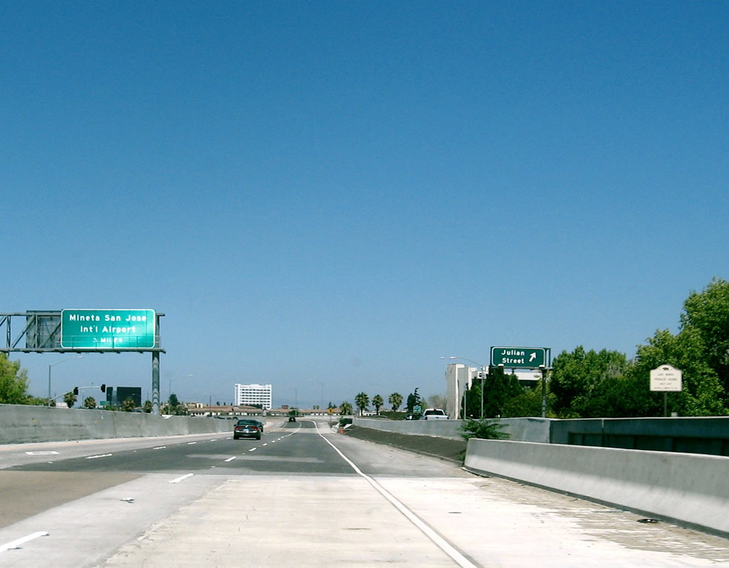
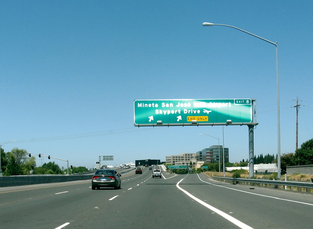
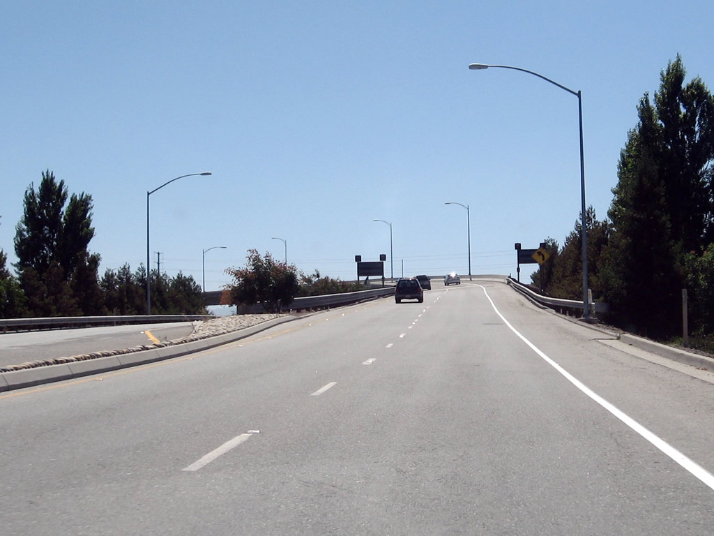
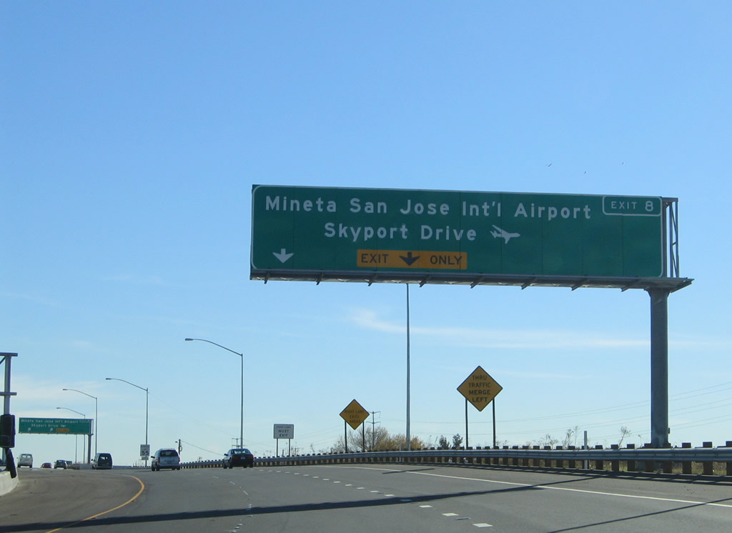
The next two exits along northbound California 87 are Exit 8, Airport Parkway to Norman Y. Mineta San Jose International Airport and Exit 9A, U.S. 101 (Bayshore Freeway) north. Photo taken by Jeff Waller (08/11/07). |
|
Northbound California 87 reaches Exit 8, Airport Parkway to Norman Y. Mineta San Jose International Airport. The final two exits along California 87 north are Exit 9A, North First Street and Exit 9B, U.S. 101 (Bayshore Freeway) north. Photo taken by Jeff Waller (08/11/07). |
|
California 87 prepares to end as the right lanes connect to Exit 9A, North First Street and the left lanes connect to Exit 9B, U.S. 101 (Bayshore Freeway) north. Photo taken by Jeff Waller (08/11/07). |
|
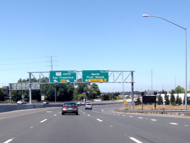
After Exit 9A (North First Street) splits to the right, all lanes default onto Exit 9B, U.S. 101 (Bayshore Freeway) north. There is no end California 87 shield assembly. An exit to Trimble Road and De La Cruz Boulevard is offered on the transition ramp from California 87 north to U.S. 101 north. Photo taken by Jeff Waller (08/11/07). |
| California 87 - Guadalupe Parkway south |
|
After turning from southbound North First Street, southbound California 87 (Guadalupe Parkway) has one traffic signal at Onel Drive (shown here) before the parkway connects with incoming traffic from U.S. 101 south. Photo taken by Jeff Waller (08/11/07). |
|
Two lanes carry southbound Guadalupe Parkway over the ramp from U.S. 101 south to California 87 south. Photo taken by Jeff Waller (08/11/07). |
|
Upon reaching ground level, the two-lane flyover ramp reduces to one lane and merges onto the ramp from U.S. 101 south to California 87 south. The rest of the overhead sign can be seen in the next photobox. Photo taken by Jeff Waller (08/11/07). |
|
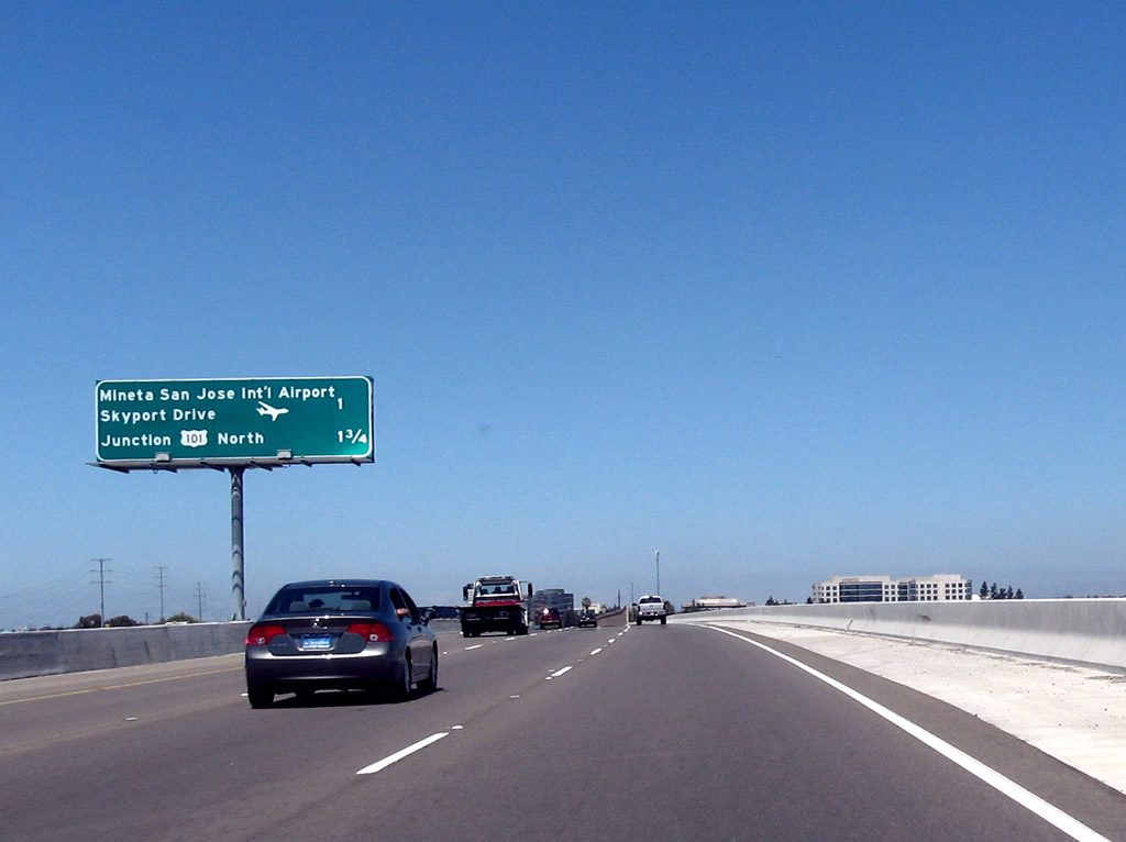
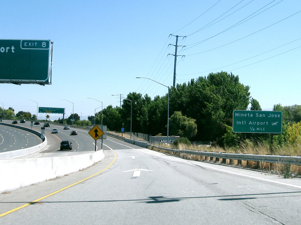
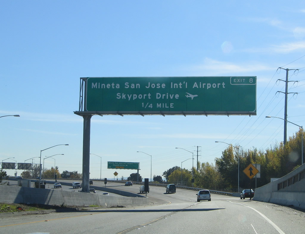
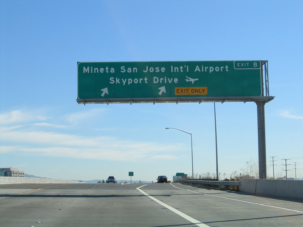
Meanwhile, upon exiting from U.S. 101 (Bayshore Freeway), the first exit on California 87 (Guadalupe Parkway) is Exit 8, Skyport Drive and Airport Parkway to the Norman Y. Mineta International Airport (a portion of this sign can be seen in the previous photobox). The terminals are located closest to this interchange, so this is the best exit from any San Jose freeway to the airport. All of California 87 is located within the city of San Jose, which is home to 894,943 people as of the 2000 Census. Founded on November 29, 1777, and incorporated on March 27, 1850, San Jose is the third largest city in California (behind Los Angeles and San Diego). San Jose consists of 178.2 square miles and sits at an elevation of 85 feet. Rainfall in San Jose is much less than San Francisco due to its location at the south end of the San Francisco Bay and enclosure within mountains. The average annual precipitation is 14.4 inches. Photo taken 11/29/04. |
|
The right lane becomes exit only for Exit 8, Skyport Drive and Airport Parkway to the Norman Y. Mineta International Airport. The left two lanes continue south on California 87 along the Guadalupe River toward downtown San Jose. Photo taken 11/29/04. |
|
Southbound California 87 (Guadalupe Parkway) reaches Exit 8, Skyport Drive and Airport Parkway to the Norman Y. Mineta International Airport. Photo taken 11/29/04. |
|
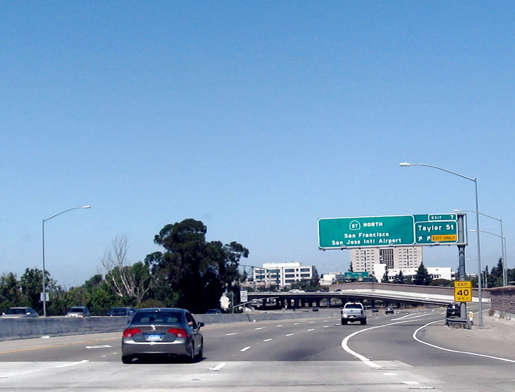
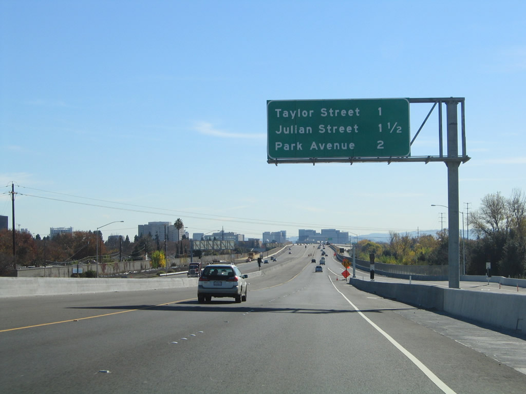
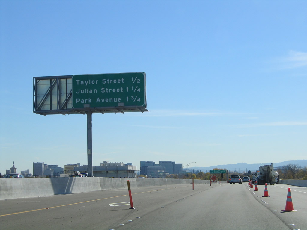
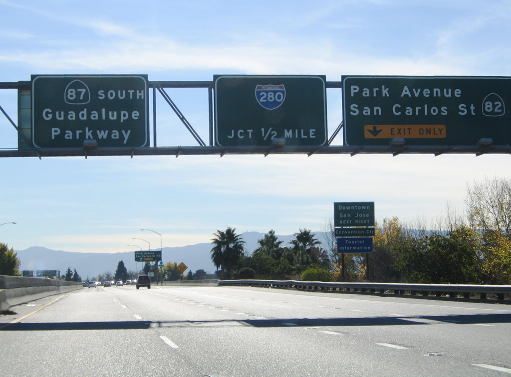
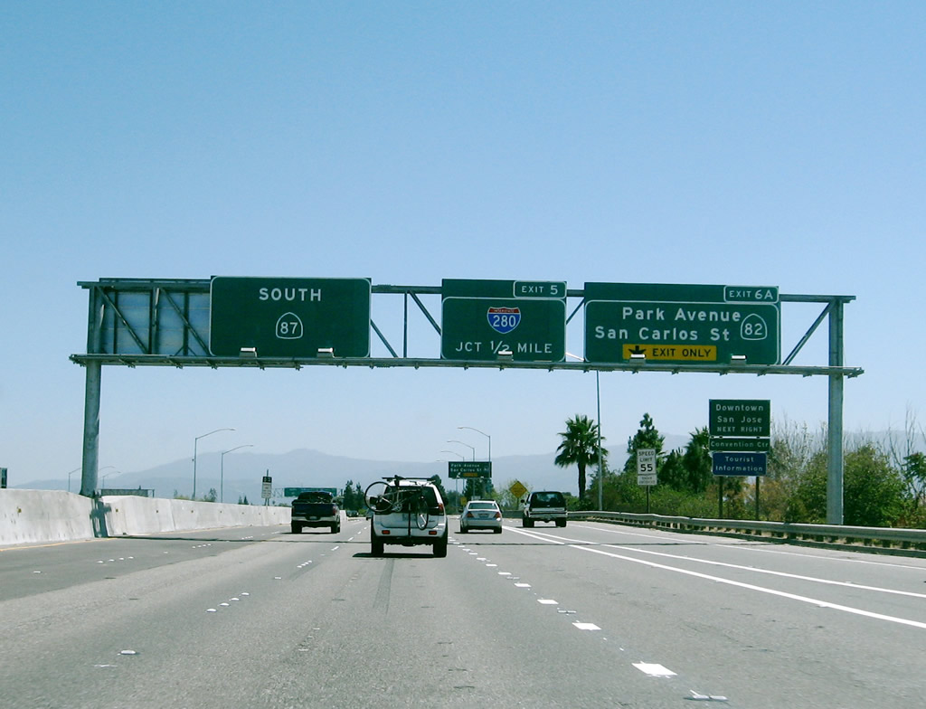
The next three exits along California 87 (Guadalupe Parkway) south are: Exit 7, Taylor Street; Exit 6B, Julian Street; and Exit 6A, Park Avenue and California 82 (West San Carlos Street). Photo taken 11/29/04. |
|
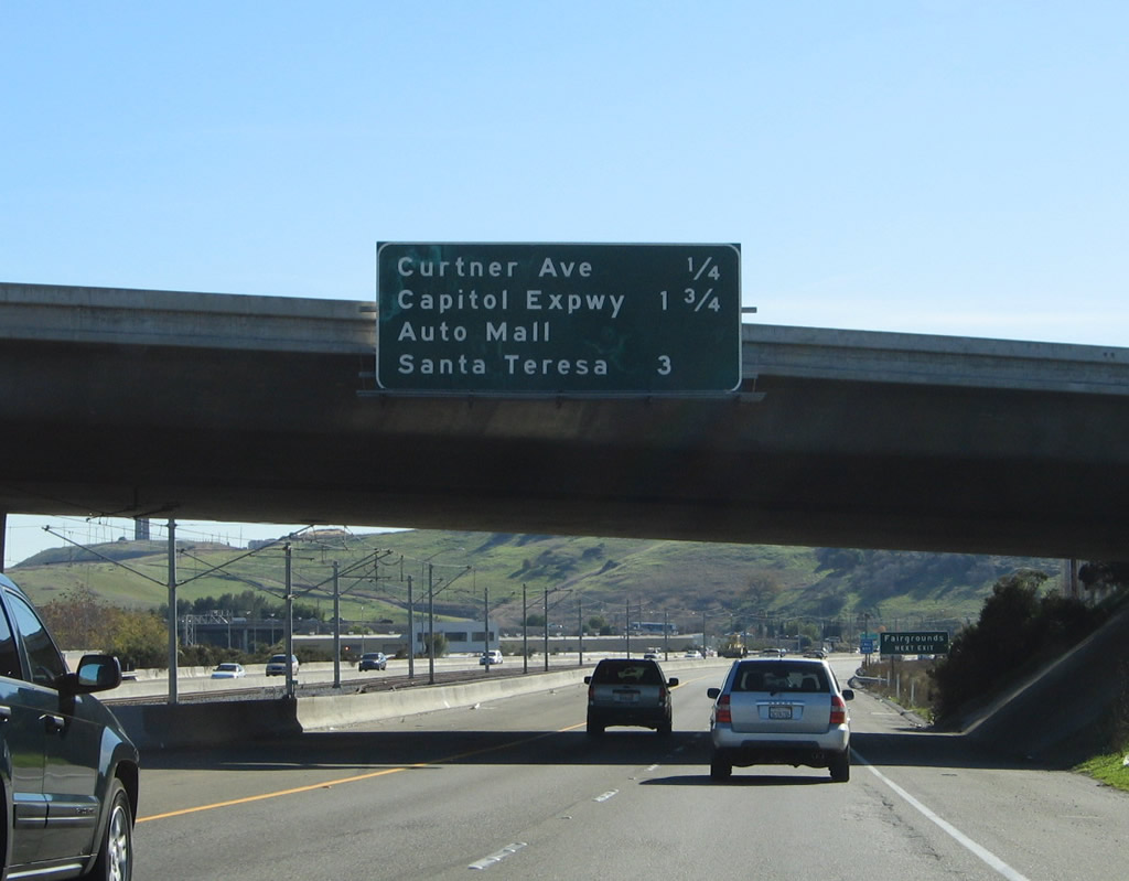
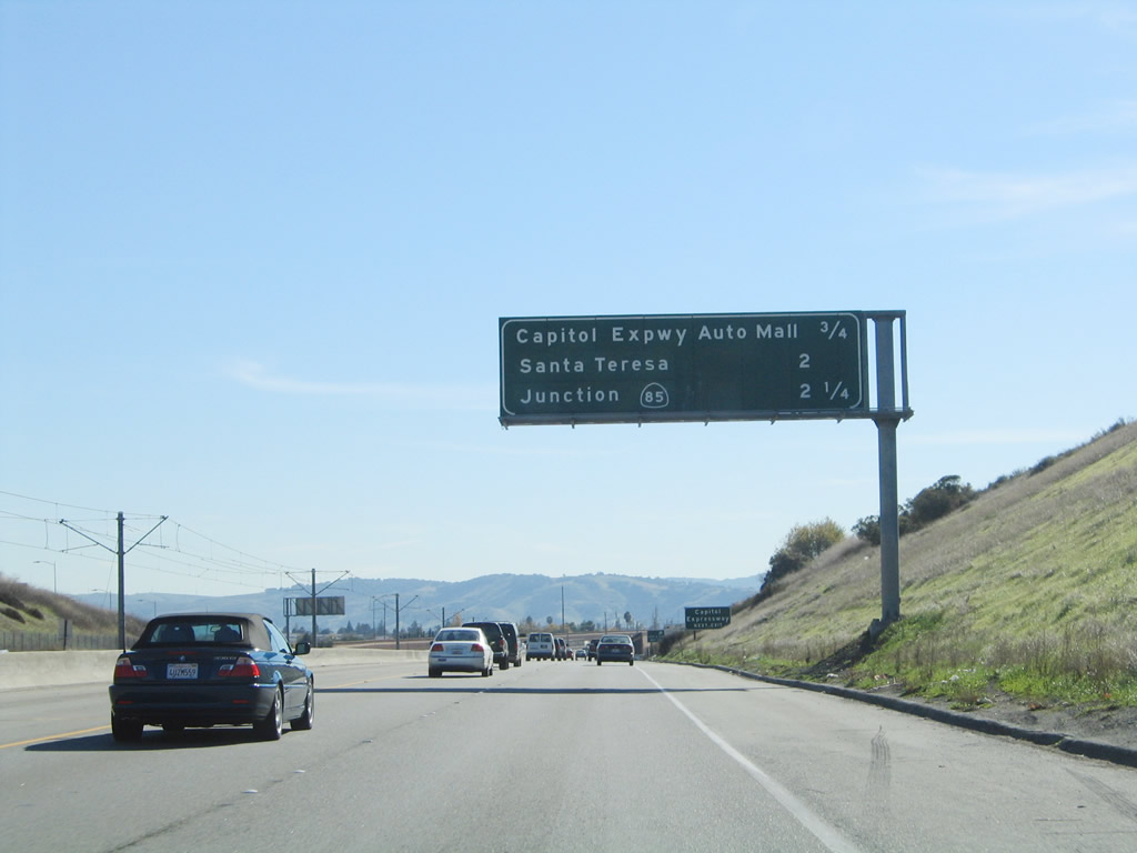
Another mileage sign provides the distance to the next three exits along California 87 (Guadalupe Parkway) south: Exit 7, Taylor Street; Exit 6B, Julian Street; and Exit 6A, Park Avenue and California 82 (West San Carlos Street). In this area, California 87 passes Interstate 880, but there are no connectors between the two freeways. Photo taken 11/29/04. |
|
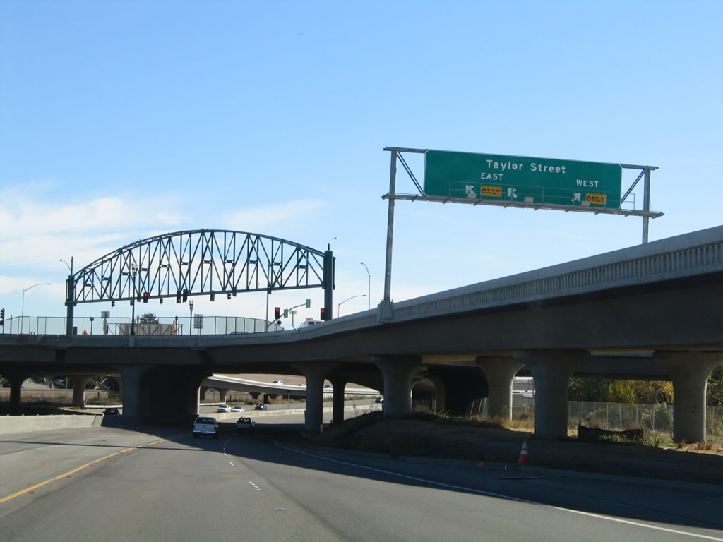
Southbound California 87 (Guadalupe Parkway) reaches Exit 7, Taylor Street. The next exit along southbound is Exit 6B, Julian Street. Photo taken 11/29/04. |
|
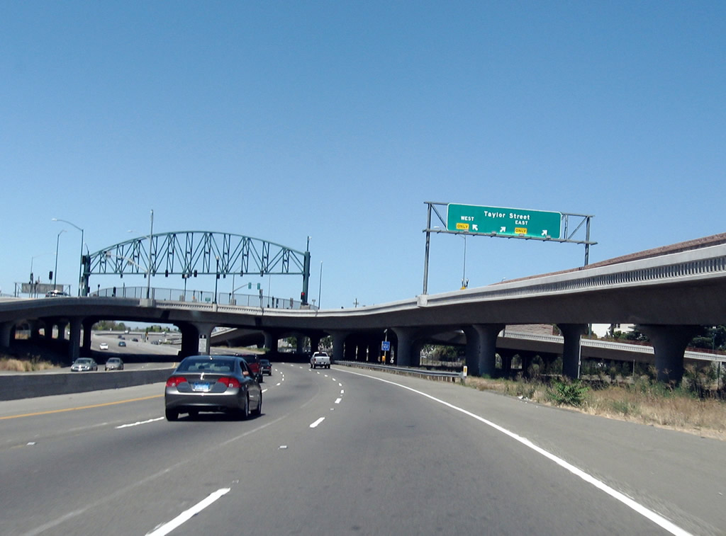
The interchange between California 87 (Guadalupe Parkway) and Exit 7, Taylor Street is a single point urban interchange (SPUI). The tall truss structure across the overpass supports the traffic signals needed for this single point intersection. Photo taken 11/29/04. |
|
A closer look reveals that the two left lanes of the off-ramp will connect to Taylor Street west, while the right lane connects to Taylor Street east. All movements at this intersection are controlled by the single set of traffic signals on the truss span. Use Taylor Street east to First Street north to the San Jose Civic Center complex. Photo taken 11/29/04. |
|
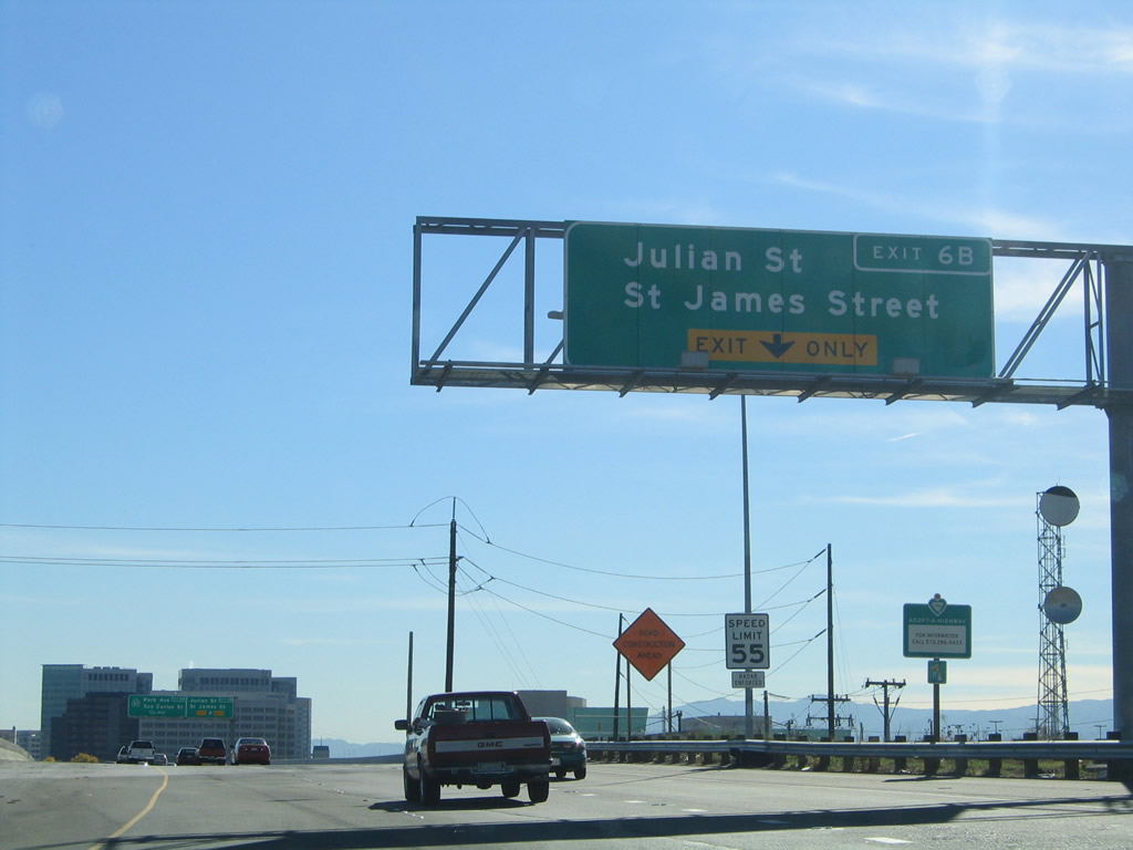
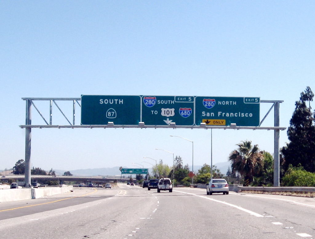
The next exit along California 87 (Guadalupe Parkway) south is Exit 6B, Julian Street. Note the 55 miles per hour speed limit, which is lower than most other San Jose-area freeways. Downtown San Jose skyscrapers come into view on both sides of the freeway. To the west of the freeway via the Julian Street exit is the HP Pavilion at San Jose. To the east of the freeway are hotels, bank buildings, San Jose State University, and Museum of Art; use Exit 6A (California 82) to the downtown area. Photo taken 11/29/04. |
|
Southbound California 87 (Guadalupe Parkway) reaches Exit 6B, Julian Street. The next exit along southbound is Exit 6A, Park Avenue and California 82 (West San Carlos Street). Note the California 82 shield contains the state name, which is a bit unusual in the new generation of reflective signs that have been placed in the early to mid-2000s. Photo taken 11/29/04. |
|
|
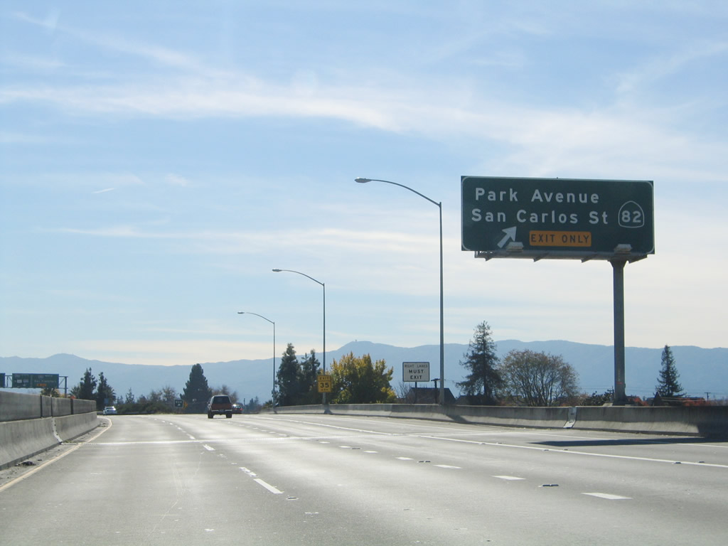
The right two lanes become exit only for Exit 6A, Park Avenue and California 82 (West San Carlos Street) and Exit 5, Interstate 280 (Sinclair Freeway). Use Exit 6A to downtown San Jose: exit on Park Avenue and turn east into downtown. Park Avenue crosses the Guadalupe River Park and ends at the Plaza de Cesar Chavez. The Paseo de San Antonio Walk continues east past this point as a pedestrian plaza to San Jose State University. Photos taken 11/29/04 and by Jeff Waller (08/11/07). |
|
Southbound California 87 (Guadalupe Parkway) reaches Exit 6A, Park Avenue and California 82 (West San Carlos Street) to downtown San Jose and San Jose State University. The next interchange is Exit 5, Interstate 280 (Sinclair Freeway). Photo taken 11/29/04. |
|
|
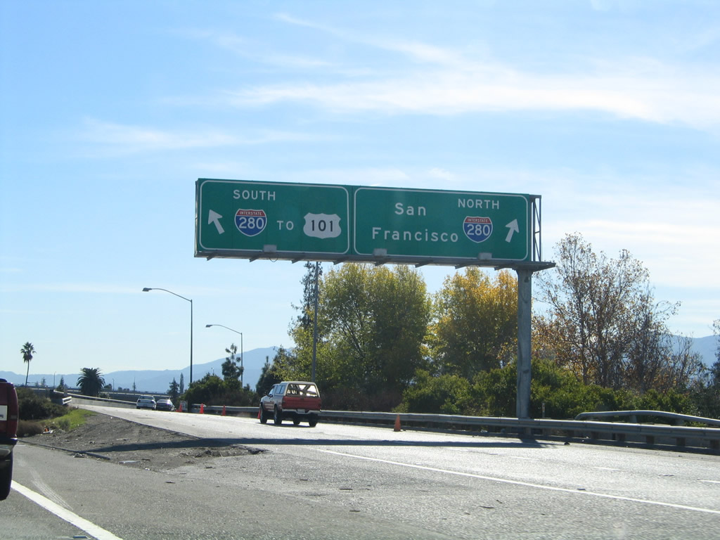
The right lane is exit only for Exit 5, Interstate 280 (Sinclair Freeway). Use Interstate 280 north to Cupertino, Los Altos Hills, and ultimately San Francisco. To the east, Interstate 280 travels about three miles to the major U.S. 101 and Interstate 680 interchange. At that point, U.S. 101 south leads toward Gilroy and ultimately Los Angeles. Interstate 680 travels north to Sacramento via Interstate 80 east. Photos taken 11/29/04 and by Jeff Waller (08/11/07). |
|
The transition ramp at Exit 5 from California 87 south to Interstate 280 immediately splits, with the left lane connecting to Interstate 280 east (south) to Interstate 680 and U.S. 101 and the right lane connecting to Interstate 280 north to California 17 and Cupertino. Photo taken 11/29/04. |
|
|
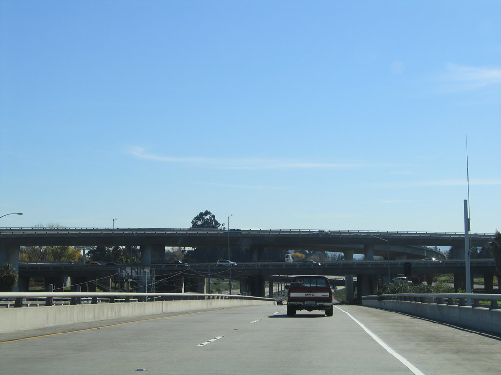
California 87 passes under the Interstate 280 freeway. Light rail joins California 87 in the median; the light rail will remain in the median until the California 85 interchange. Photos taken 11/29/04 and by Jeff Waller (08/11/07). |
|
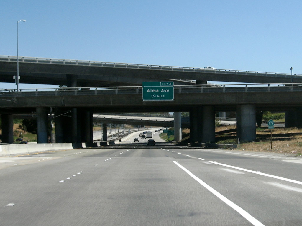
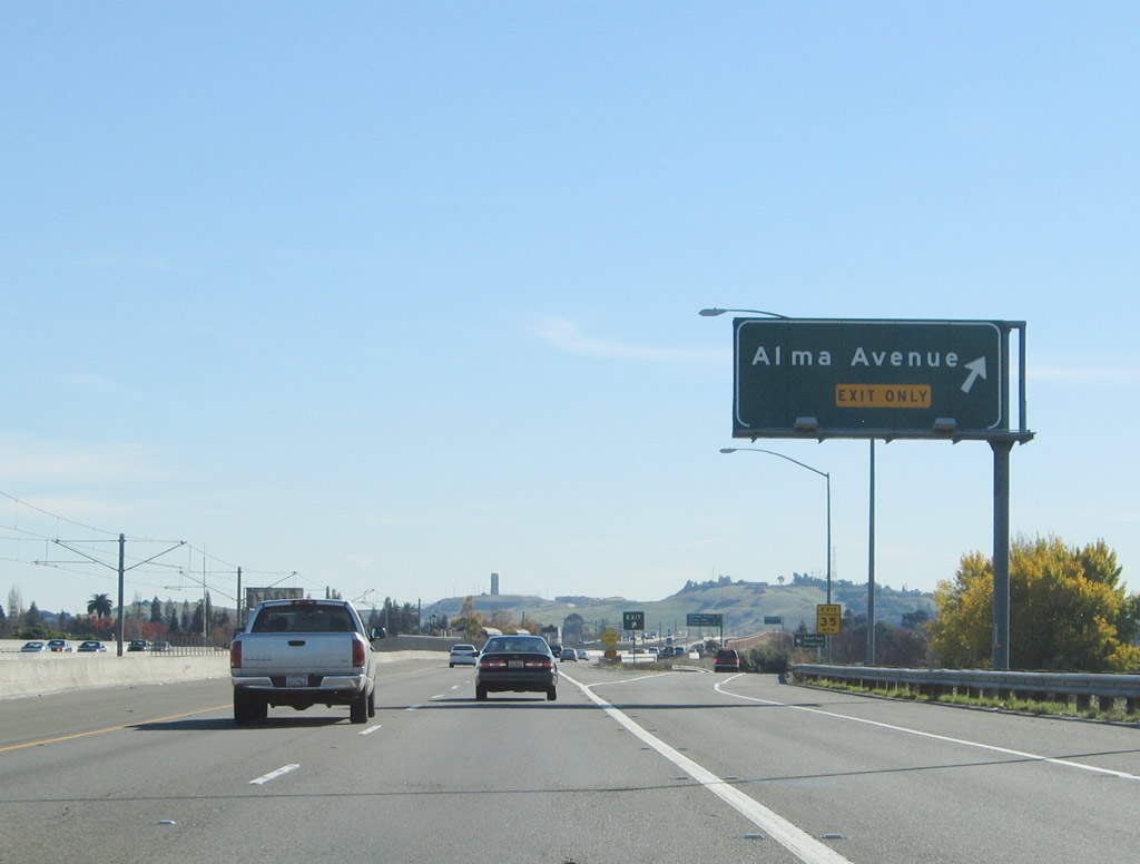
As the CalTrain passes overhead, southbound California 87 approaches the next three exits: Exit 4, Alma Avenue; Exit 3B, Santa Clara County G-8 (Almaden Expressway); and Exit 3A, Curtner Avenue. Photo taken 11/29/04. |
|
|
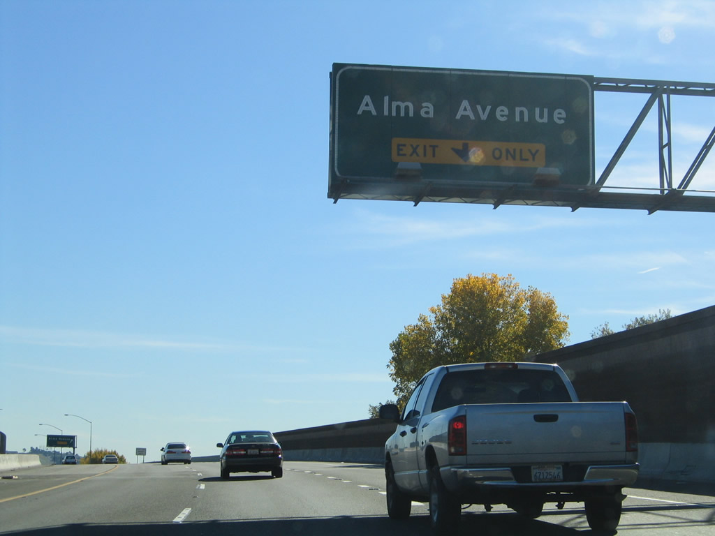
In 2004, at this point the right lane of southbound California 87 becomes exit only for Exit 4, Alma Avenue. With the introduction of a high occupancy vehicle lane and collector distributor lane system added as part of the Interstate 280 interchange, the configuration between 2004 and 2007. The interchange was reconfigured in 2006, and the new high occupancy vehicle lanes opened in Summer 2007. Photos taken 11/29/04 and by Jeff Waller (08/11/07). |
|
|
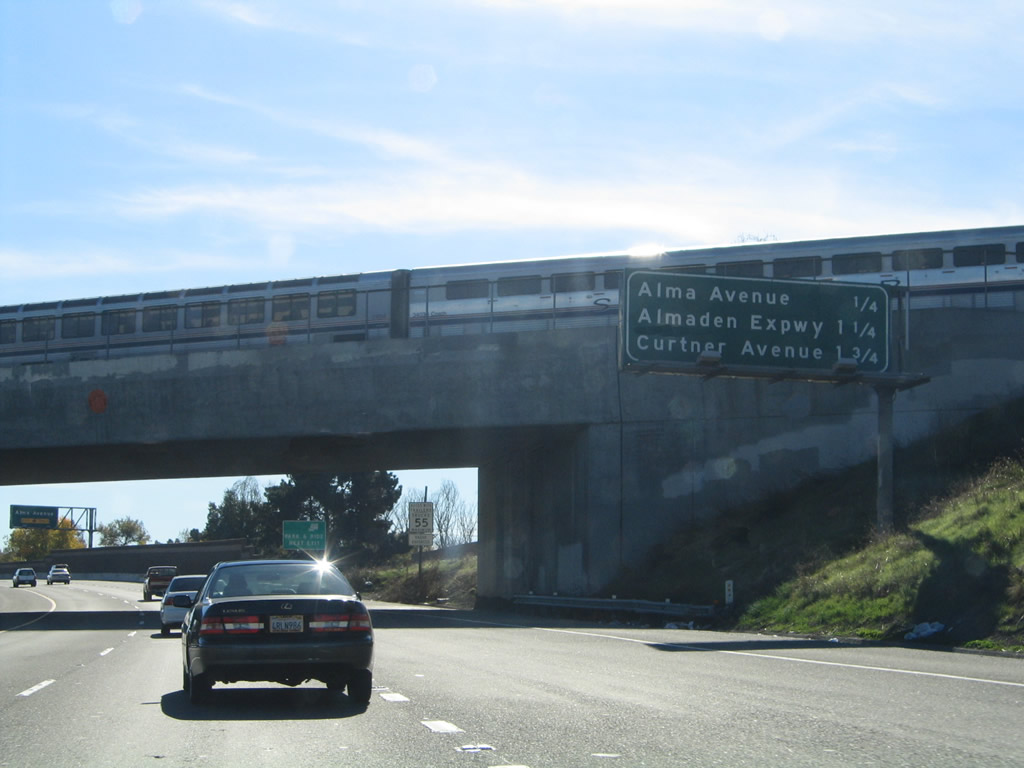
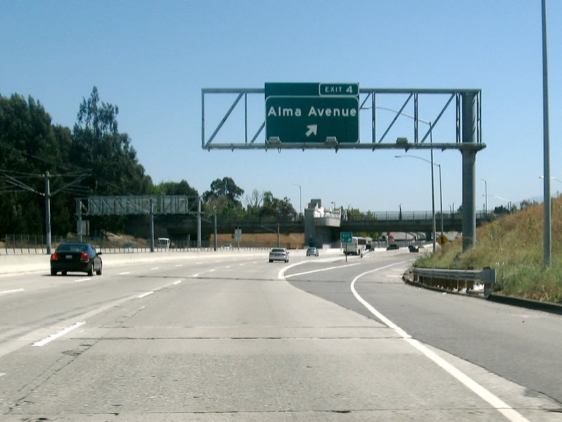
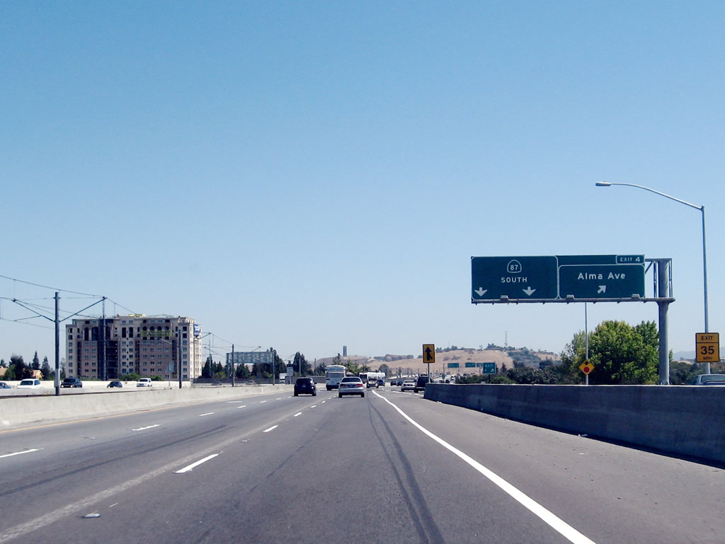
Southbound California 87 reaches Exit 4, Alma Avenue. The signage changed between 2004 and 2007 to incorporate a collector distributor lane arrangement and an exit number. Photos taken 11/29/04 and by Jeff Waller (08/11/07). |
|
|
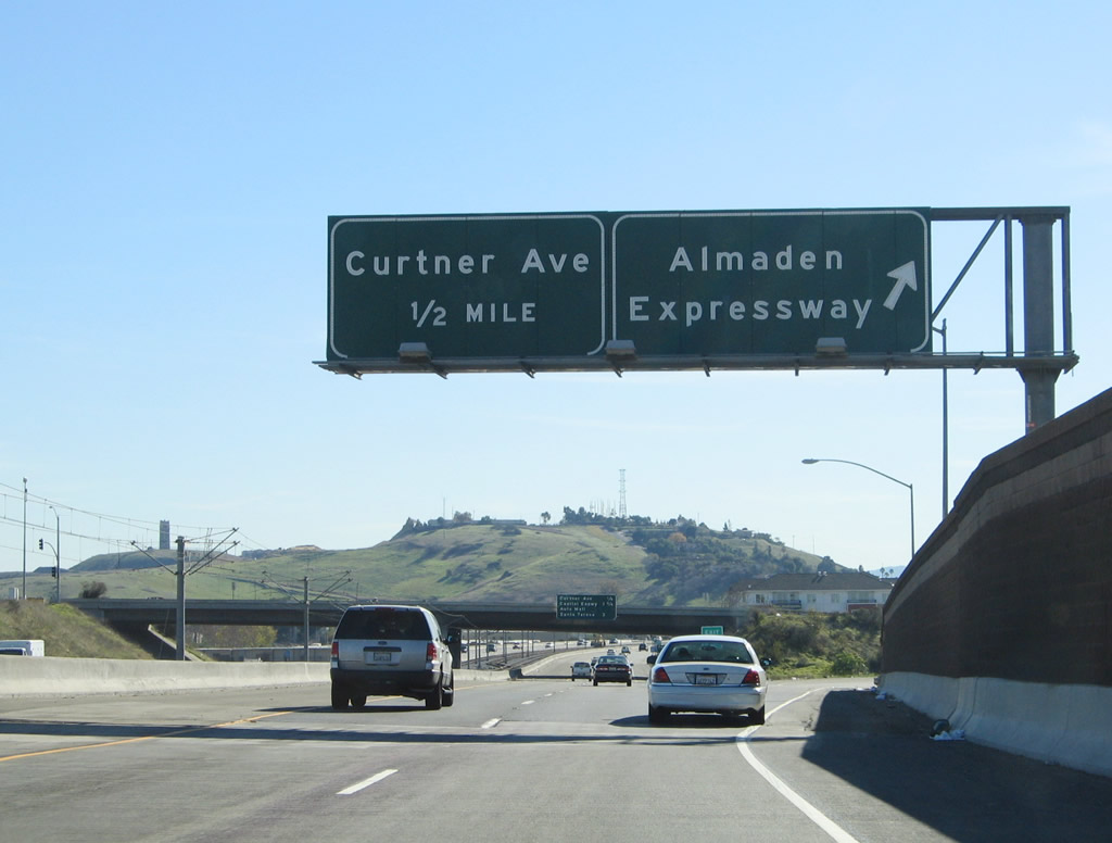
The next three exits along California 87 south are Exit 3B, Santa Clara County G-8 (Almaden Expressway); Exit 3A, Curtner Avenue; and Exit 1D, Capitol Expressway/Auto Mall. A new right lane exit only sign was added in 2007, along with the mileage sign for upcoming exits. Photos taken 11/29/04 and by Jeff Waller (08/11/07). |
|
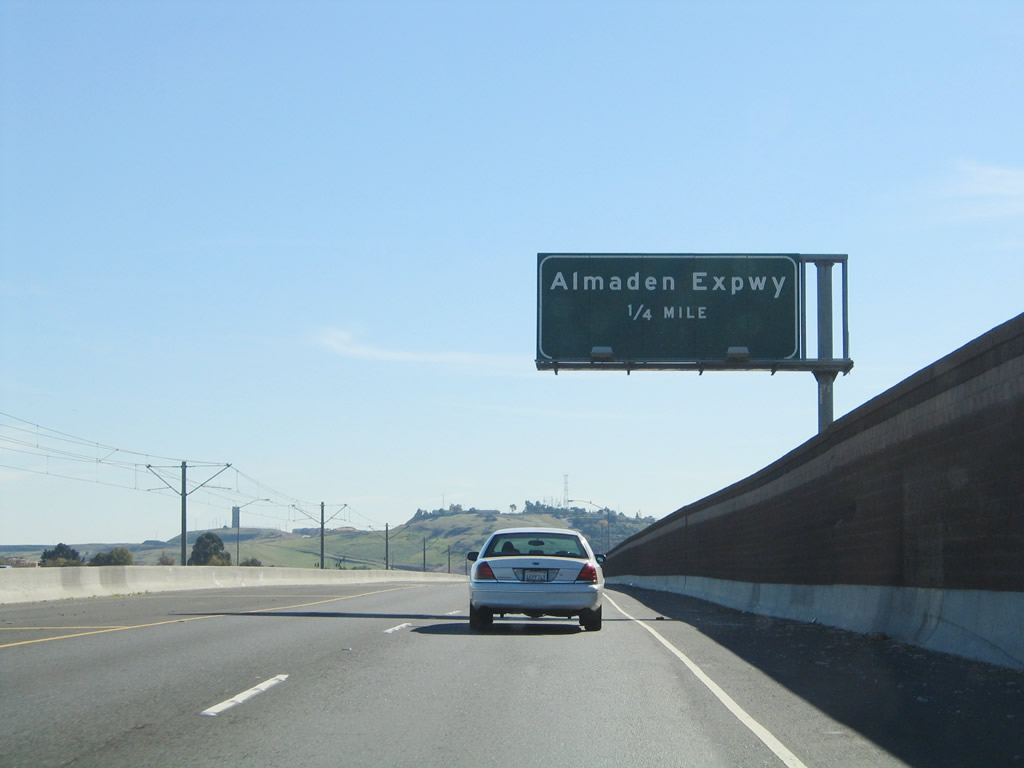
Santa Clara County G-8 is a north-south route that follows the Almaden Expressway south from downtown San Jose through residential and suburban areas. The signed county route then connects to McKean Road and follows that alignment south all the way to Uvas Road, ending at California 152 south of Uvas Reservoir and east of Hecker Pass. Photo taken 11/29/04. |
|
|
Southbound California 87 (Guadalupe Parkway) reaches Exit 3B, Santa Clara County G-8 (Almaden Expressway). The next exit is Exit 3A, Curtner Avenue. These signs were replaced between 2004 and 2007. Photos taken 11/29/04 and by Jeff Waller (08/11/07). |
|
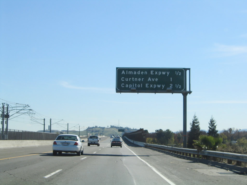
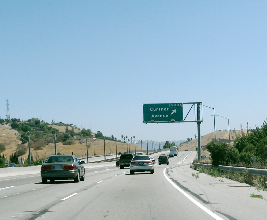
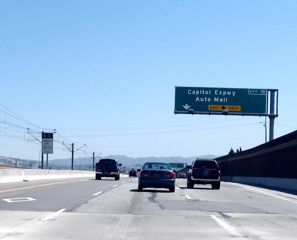
The next three exits along California 87 south are Exit 3A, Curtner Avenue; Exit 1D, Capitol Expressway/Auto Mall; and Exit 1C, Santa Teresa Boulevard. Photo taken 11/29/04. |
|
|
Southbound California 87 (Guadalupe Parkway) reaches Exit 3A, Curtner Avenue. Use Curtner Avenue east to the Santa Clara County Fairgrounds (next to California 82 (Monterey Highway)). A new exit sign was installed with exit number between 2004 and 2007. Photos taken 11/29/04 and by Jeff Waller (08/11/07). |
|
The final four exits along California 87 south are Exit 1D, Capitol Expressway/Auto Mall; Exit 1C, Santa Teresa Boulevard south; Exit 1B, California 85 (West Valley Freeway) north; and Exit 1A, California 85 (West Valley Freeway) south. Photo taken 11/29/04. |
|
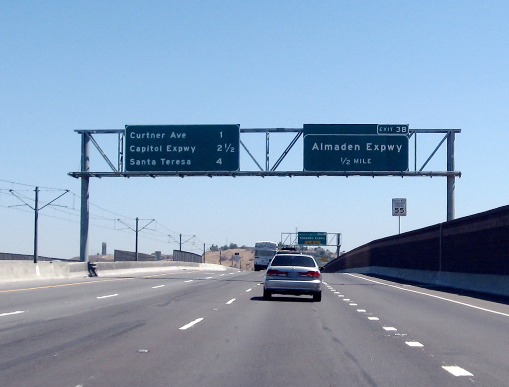
The Capitol Expressway begins at the Santa Clara County G-8 (Almaden Expressway) interchange west of here, then travels east and then north in an arc. The expressway crosses U.S. 101 at Exit 382, then turns north to join Interstate 680 at Exit 1C. Unlike most expressways in San Jose, the Capitol Expressway has no signed county route designation. Photo taken 11/29/04. |
|
|
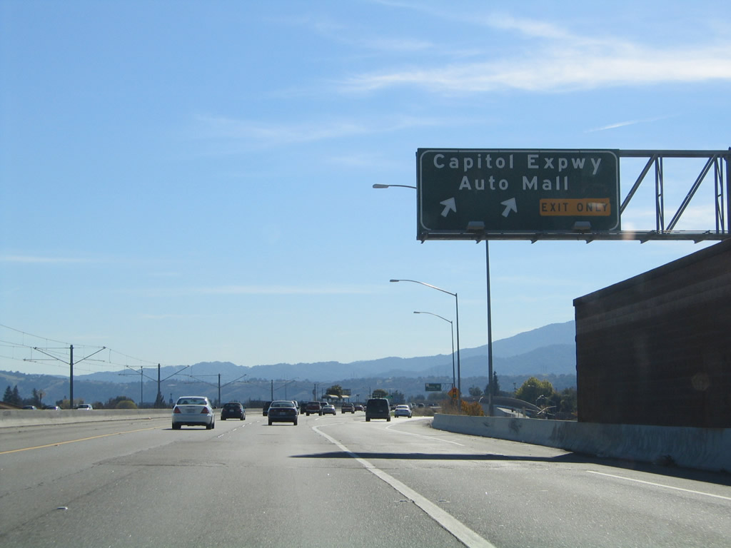
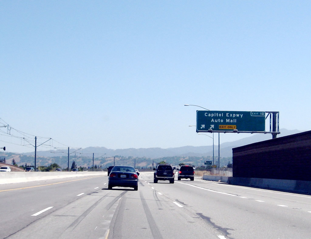
The right lane of California 87 south becomes exit only for Exit 1D, Santa Clara County G-21 (unsigned)/Capitol Expressway and Auto Mall. Photos taken 11/29/04 and by Jeff Waller (08/11/07). |
|
|
Southbound California 87 (Guadalupe Parkway) reaches Exit 1D, Santa Clara County G-21 (Capitol Expressway) and Auto Mall (a two-lane exit). Photo taken 11/29/04 and by Jeff Waller (08/11/07). |
|
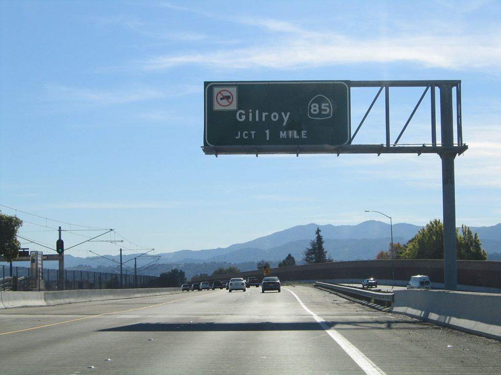
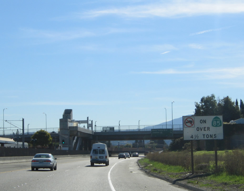
The final interchange along California 87 south is the connection to California 85 and Santa Teresa Boulevard. No trucks are permitted on this section of California 85 (West Valley Freeway). Photo taken 11/29/04. |
|
An auxiliary sign again advises that no trucks are permitted on this section of California 85 (West Valley Freeway). Photo taken 11/29/04. |
|
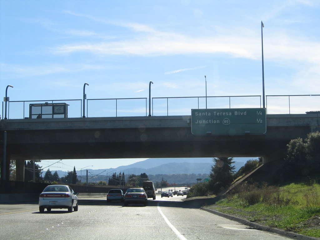
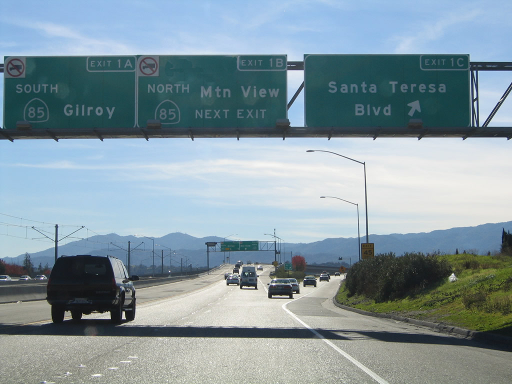
The final three exits along California 87 (Guadalupe Parkway) south are Exit 1C, Santa Teresa Boulevard south; Exit 1B, California 85 (West Valley Freeway) north; and Exit 1A, California 85 (West Valley Freeway) south. Photo taken 11/29/04. |
|
Southbound California 87 (Guadalupe Parkway) reaches Exit 1C, Santa Teresa Boulevard south. The next exit is Exit 1B, California 85 (West Valley Freeway) north to Cupertino. The two left lanes will transition directly onto Exit 1A, California 85 (West Valley Freeway) south. Photo taken 11/29/04. |
|
California 87 (Guadalupe Parkway) south ends as the two left lanes connect to Exit 1A, California 85 (West Valley Freeway) south, and the right lane connects to Exit 1A, California 85 (West Valley Freeway) north. No end shield is posted. Photo taken 11/29/04. |
Page Updated February 26, 2008.