California 121 follows a zigzag course from California 37 at Sears Point northeast to California 128 south of Lake Berryessa via the city of Napa, where it meets California 12 and California 29.
| California 121 north |
|
California 121 is known as the Carneros Highway between Sears Point (California 37) and Napa (California 29), including the overlap with California 12. Signs such as this one appear sporadically to identify it as such. This area, where Napa Valley meets the northern edge of San Pablo Bay, is known as the Carneros region of wineries. Photo taken 05/25/06. |
|
The first left turn from northbound California 121 (Carneros Highway) is the connection to the Sears Point (Infineon) Raceway. Photo taken 05/25/06. |
|
With only two lanes and limited sight distance, California 121 (Carneros Highway) is designated as a safety corridor (as evidenced by this sign). While daytime headlights are not required (unlike California 37, the "Blood Alley" to the south), California 121 sees its own share of accidents from those traveling the Carneros Highway too quickly or looking at all the beautiful scenery. Photo taken 05/25/06. |
|
One of the first wineries on northbound California 121 (Carneros Highway) is the Roche Winery. Vineyards line both sides of California 121 as the highway travels north toward Schellville, where California 121 meets California 12. Photo taken 05/25/06. |
|
Beautiful manicured vineyards line California 121 (Carneros Highway) on the east, while rolling hills and grasslands line the west side of the highway. Photo taken 05/25/06. |
|
Prior to 1964, California 121 from California 37 to California 128 was signed as California 37, while the section of today's California 37 between California 121 and Interstate 80 was signed as California 48. With the transfer in designations as part of the Great Renumbering of 1964, California 37 became the common designation for the route that passes north of San Pablo Bay, while California 121 is the route from Sears Point to near Lake Berryessa. Photo taken 05/25/06. |
|
Northbound California 121 approaches California 116. This intersection marks the eastern terminus of California 116, which travels northwest to Petaluma, Sebastopol, and Guerneville before turning west to meet California 1 on the Pacific coast. Turn right at this intersection to follow California 121 east to meet California 12. The two routes (California 12-121) travel east along the Carneros Highway to Napa. Photo taken 05/25/06. |
|
After the merged section of Carneros Highway, California 121 turns north onto California 29, then turns east into Napa via Imola Avenue, then turns north onto Soscol Avenue (which is known as California 221 south of Imola Avenue). This photo shows northbound California 121 (Soscol Avenue) approaching Shetler Avenue. Photo taken 05/25/06. |
|
The next signalized intersection on northbound California 121 (Soscol Avenue) in Napa is with Kansas Avenue. Car dealerships, strip malls, and related commercial activities can be found along Soscol Avenue. Photo taken 05/25/06. |
|
California 121 leaves Soscol Avenue at Silverado Trail. Northbound California 121 follows Silverado Trail briefly, then turns northeast via Monticello Road toward Lake Berryessa. Old California 121 continues straight ahead toward downtown Napa via Soscol Avenue. Photo taken 05/25/06. |
|
The right lane becomes exit only for the continuation of California 121 north on Silverado Trail. The left two lanes continue straight ahead into Napa via Soscol Avenue. The city of Napa was incorporated in 1872, is the seat of Napa County, and is home to 72,585 people as of the 2000 Census. The Napa River, which flows through downtown and runs the length of Napa Valley, is known to flood; a major flood in 2005 caused damage throughout downtown Napa.1 Photo taken 05/25/06. |
|
The Silverado Trail is a long road that parallels California 29 through the Napa Valley from the city of Napa north to Calistoga. It is named for the silver mining that brought people to the valley before wine making became as widespread as it is today; the Silverado mine was located near the base of Mt. St. Helena (which dominates the view of Napa Valley to the north on a clear day). A wide variety of wineries are located along the Silverado Trail, which follows the eastern edge of Napa Valley. California 29 generally stays toward the west end of the valley. California 121 stays on Silverado Trail for only a brief distance, and it separates at the intersection with Monticello Avenue east and Trancas Street west. Photo taken 05/25/06. |
|
Northbound California 121 (Silverado Trail) approaches Third Street. Use Third Street west to downtown Napa. The downtown area is a historic area. In addition, the Third Street bridge over the Napa River (west of here) was rehabilitated in 2002, replacing a 1932 bridge.2 This bridge replacement is part of the overall strategy to protect the city of Napa in the event of a 100-year flood. Photo taken 05/25/06. |
|
A right turn connects to Coombsville Road, which leads to Fairview Park and Tulocay Cemetery. Upon leaving the suburban areas around Napa, it changes into Wild Horse Valley Road, which passes by Lake Madigan (not a through road). A California 121 shield is posted on the traffic signal mast arm for through traffic on northbound Silverado Trail. Photo taken 05/25/06. |
|
The next signalized intersection on northbound California 121 (Silverado Trail) is First Street. Use First Street west to downtown Napa; the bridge crossing into downtown Napa is historic and has not been replaced (although plans call for its replacement to ensure the bridge can whether a 100-year flood). The First Street Bridge was built in 1914, is listed on the National Register of Historic Places, and is photographed in detail below (see scenes pertaining to California 121). However, construction of a replacement bridge that is less of an impediment to flood waters is planned to begin in Spring 2007 and be completed in Fall 2008. The existing bridge will be demolished, and First Street will be closed during construction. Photo taken 05/25/06. |
|
Northbound California 121 (Silverado Trail) meets First Street at this traffic signal. Use First Street west to the Napa Civic Center as well as the most direct route from California 121 west to California 29. Photo taken 05/25/06. |
| California 121 south |
|
Now traveling south on Soscol Avenue after the Silverado Trail intersection, southbound California 121 crosses over the Tulocay Creek via a 1949 bridge/culvert. It was widened in 1997. Photo taken 05/25/06. |
|
Passing through car dealerships and strip malls, California 121 (Soscol Avenue) passes through urban Napa and meets Shetler Avenue at this traffic signal. Photo taken 05/25/06. |
|
Southbound California 121 prepares to split at Imola Avenue. Continue straight ahead to follow almost-unsigned California 221 south to California 12-29 en route to Vallejo and Fairfield. Turn right onto Imola Avenue to continue southwest on California 121. Photo taken 05/25/06. |
|
Turning west on Imola Avenue, California 121 meets South Napa Market Place shopping center before preparing to use the Maxwell Bridge to cross the Napa River. The new Maxwell Bridge, which opened only weeks before this picture was taken, is a high bridge that replaces an old lift bridge. Photo taken 05/25/06. |
|
The original Maxwell Bridge was built in 1949 and was replaced by the new bridge in 2005. The opening took place in stages: the north half of the new Maxwell Bridge opened to traffic in February 2005, and demolition of the old bridge was complete by the end of March 2005. On May 17, 2006, eastbound traffic was moved onto the south half of the new bridge, making the bridge four lanes with bike lanes and full shoulders.3 We photographed this bridge only one week after it opened! The street light poles are not very common, but they look like those found along Interstate 15 (Escondido Freeway) in San Diego County. Photo taken 05/25/06. |
|
|
|
This suite of photos shows the new Maxwell Bridge as it carries California 121 (Imola Avenue) west over the Napa River. The bridge has provisions for pedestrians, a median barrier, and a great view. The old bridge, which used to sit below the eastbound lanes, is now gone. Plans call for construction of a bypass of the Napa River to allow floodwaters a faster route to the bay; one of the impediments to floodwaters was the old Maxwell Bridge, so removal was necessary. Once the First Street bridge is replaced, most bridges will be compliant with the 100-year flood requirements. At the end of the Maxwell bridge, California 121 approaches Cabot Way and South Coombs Street. Photos taken 05/25/06. |
|
|
|
|
The next major intersection along southbound California 121 (Imola Avenue eastbound) is with South Jefferson Street. California 121 remains four lanes wide with a median dividing the two directions of Imola Avenue. Photo taken 05/25/06. |
|
Shortly thereafter, southbound California 121 (westbound Imola Avenue) approaches north-south California 29. Use California 29 north to St. Helena, Calistoga, and Clear Lake (first ramp). Photo taken 05/25/06. |
|
This section of California 29, from California 121 north to Trancas and Redwood Roads, is a freeway. Photo taken 05/25/06. |
|
An overhead sign advises that California 121 merges onto southbound California 29 with the control cities of Sonoma for California 121 and Vallejo for California 29. Photo taken 05/25/06. |
|
Now at the ramp from California 121 west to California 29 south, no California 121 shield is placed alongside California 29 on this freeway entrance shield assembly. Imola Avenue continues west briefly until it ends at Foster Road. Photo taken 05/25/06. |
|
California 121 south splits from California 29, then follows the Carneros Highway west along with California 12 to a point near Schellville, where the routes divide. Less than a mile west of the split is the junction with California 116 west to Petaluma. California 121 turns south along with the Carneros Highway toward Sears Point and California 37. A flashing red signal governs the flow of traffic at the intersection. Photo taken 05/25/06. |
|
Shortly after the California 116 intersection is this California 121 south reassurance shield. Photo taken 05/25/06. |
|
The few trees to be found along the Carneros Highway tend to be angled due to the wind that often blows through this area with a great deal of ferocity. Photo taken 05/25/06. |
|
|
|
California 121 passes through rolling hills and vineyards as it travels through the Carneros region of wine making. Photo taken 05/25/06. |
|
Southbound California 121 approaches the Roche Winery. Photo taken 05/25/06. |
|
A sweeping curve carries California 121 (Carneros Highway) south toward Sears Point near the Roche Winery. Photo taken 05/25/06. |
|
This roadside sign is the first warning of the pending junction with California 37, which travels east to Vallejo and west to Novato and U.S. 101. Use California 37 west to U.S. 101 south to San Francisco. Photo taken 05/25/06. |
|
An end California 121 shield is posted in front of Sears Point Racetrack (not photographed), and the road splits. The left lane must pass through a traffic signal to follow California 37 east, while the right lane merges directly onto California 37 west to Novato. Photo taken 05/25/06. |
|
A freeway entrance sign for California 37 is posted on the ramp from California 121 south to California 37 west, even though it is debatable as to whether California 37 is truly a freeway initially west of California 121. Photo taken 05/25/06. |
| California 121 scenes |
|
|
|
|
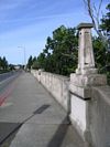
Due to flooding concerns and structural deficiencies, the First Street bridge over the Napa River (built in 1914 per the plaque) is slated for removal and replacement with a new bridge that allows for better river flow and provides for a structural stability in the event of the 100-year flood. Photos taken 05/25/06. |
|
|
View of the First Street bridge westbound over the Napa River. Note that this 1914 bridge is not on the state highway system and is not part of California 121, but it is located nearby. Photos taken 05/25/06. |
|
View of the First Street bridge eastbound over the Napa River. Replacement of the bridge begins in spring 2007 and slated for completion in fall 2008. Photo taken 05/25/06. |
|
|
|
Transitioning now to the Third Street bridge over the Napa River (looking west toward downtown Napa), this bridge was replaced in 2002 (replacing another old bridge that was built in 1932). A small park (Veterans Memorial Park) sits on the west bank of the river and north of Third Street. Photos taken 05/25/06. |
Page Updated February 4, 2007.


