
California 120
California 120 is a major east-west route that connects Interstate 5 near Manteca in the Central Valley with U.S. 6 near the Nevada state line. The state route travels through the Central Valley, foothills, and the Sierra Nevada (Tioga Pass) via Yosemite National Park. Starting as a four-lane freeway near the eastern terminus of Interstate 205, California 120 provides a continuation of the east-west freeway corridor from Interstate 205 and Interstate 580 in the Bay Area across the Central Valley into the Sierra Nevada foothills. At California 99, California 120 reduces to a two-lane rural highway, but it carries significant traffic, including commuter traffic to and from the Bay Area. California 120 joins with California 108 at Oakdale, and those two routes continue together for 26 miles, one of the longest signed state route multiplexes in the state. Much of this shared route is a four-lane expressway. While most traffic continues east along California 108 toward Sonora at the route split, many also turn off along California 120 to travel toward Yosemite National Park. California 120 turns southeast toward Chinese Camp, then climbs a lengthy, twisty grade on the way to Groveland and the western entrance into Yosemite National Park.
At Yosemite National Park, California 120 has a route break, since Tioga Pass Road is maintained by the National Park Service. The drive through the park along Tioga Pass Road is spectacular, crossing Tuolumne Meadows en route to Tioga Pass, elevation 9,945 feet. This route is closed during winter. At the pass, the park road leaves Yosemite National Park, resumes state maintenance, and begins a rapid descent of the eastern face of the Sierra Nevada, a common feature of most trans-Sierra routes. California 120 meets U.S. 395 near Lee Vining and within view of Mono Lake, and the highway skirts the Mono National Forest en route to meet with U.S. 6 at Benton, within view of Boundary Peak, which straddles the state line between California and Nevada and is the tallest mountain in Nevada.
| California 120 east | |
|---|---|
 |
The first eastbound California 120 shield, which is posted after the transition that connects northbound Interstate 5 to eastbound California 120. Between Interstate 5 and California 99, California 120 functions as a freeway that was a Super Two until the 1990s. The flow of traffic from Interstate 205 to California 120 allows for a smooth transition. Photo taken 06/21/09. |
 |
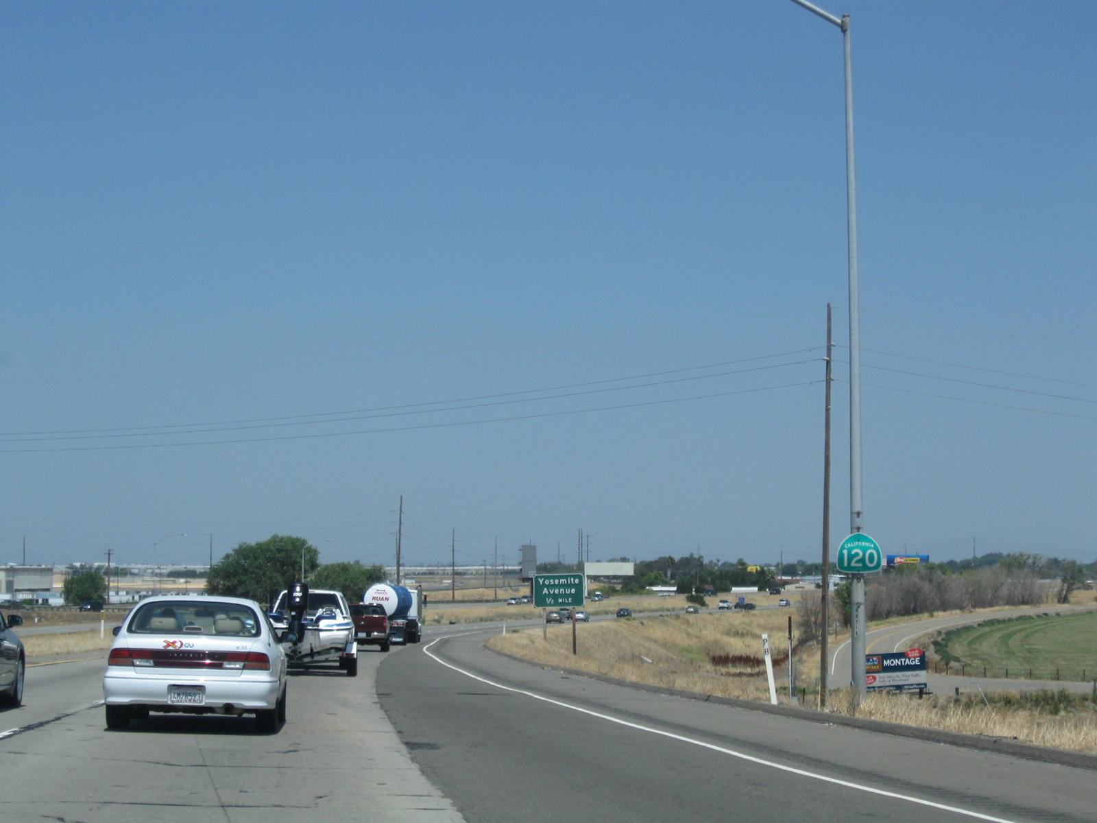
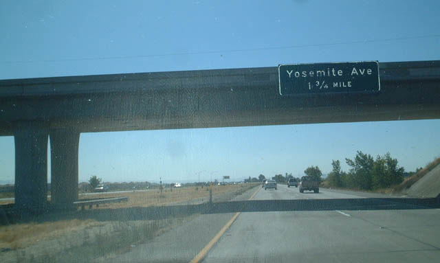
The first exit along California 120 east is Exit 1, Yosemite Avenue. Photo taken 06/21/09. |
 |
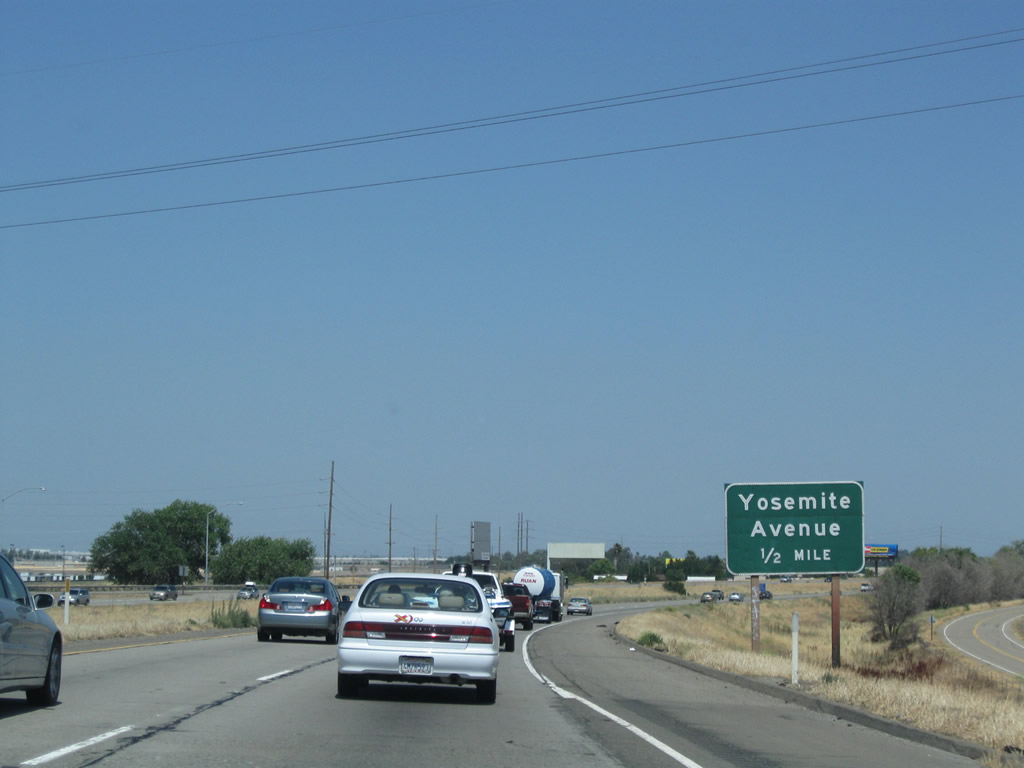
Eastbound California 120 meets Exit 1, Yosemite Avenue. This the old alignment of California 120 and could have been signed as a business route but was not. This exit follows the old route into downtown Manteca, and it also serves Lathrop via north-south McKinley Avenue. Photo taken 06/21/09. |
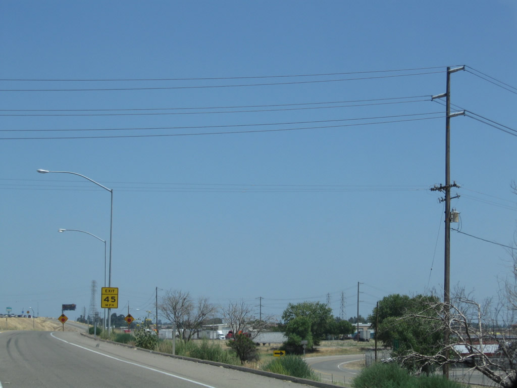 |
Power lines cross over the California 120 freeway at the Yosemite Avenue off-ramp. Photo taken 06/21/09. |
 |
A California 120 east reassurance shield is posted after the on-ramp from Exit 1, Yosemite Avenue. Photo taken 06/21/09. |
 |
Additional power lines cross over the California 120 freeway just after the Yosemite Avenue off-ramp. Photo taken 06/21/09. |
 |
The next three exits along California 120 east serve the city of Manteca: Exit 3, San Joaquin County J-3 (Airport Way); Exit 4, Union Road; and Exit 5, Main Street. Photo taken 06/21/09. |
 |
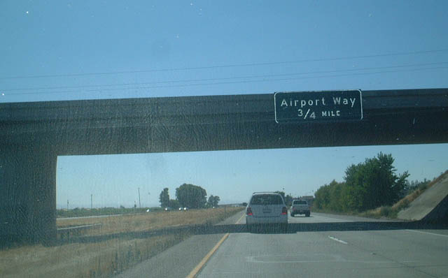
The next exit along eastbound California 120 is Exit 3, San Joaquin County J-3 (Airport Way). This highway separates Lathrop from Manteca, and it meets old California 120 to the north of this interchange. CR J-3 is a 42-mile county route that begins at Stanislaus County J-16 (Grayson Road) in Grayson, proceeds north past California 132, continues past California 120 and eventually extends north to California 12 via River Road in Grayson, Kasson Road, Airport Way in Manteca, West Lane in Stockton, and South Hutchins Street in Lodi. Photo taken 06/21/09. |
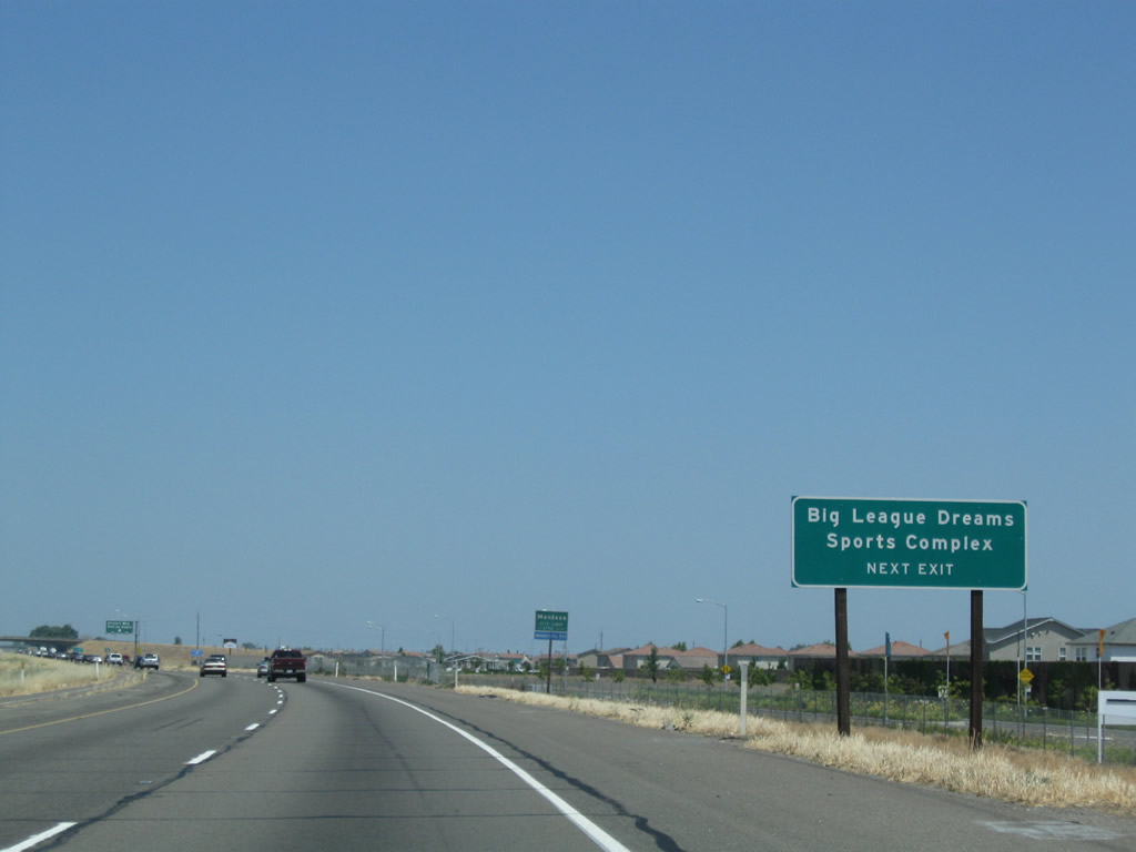 |
Use Exit 3 to a Big League Dreams Sports Complex; this one is located in Manteca. Photo taken 06/21/09. |
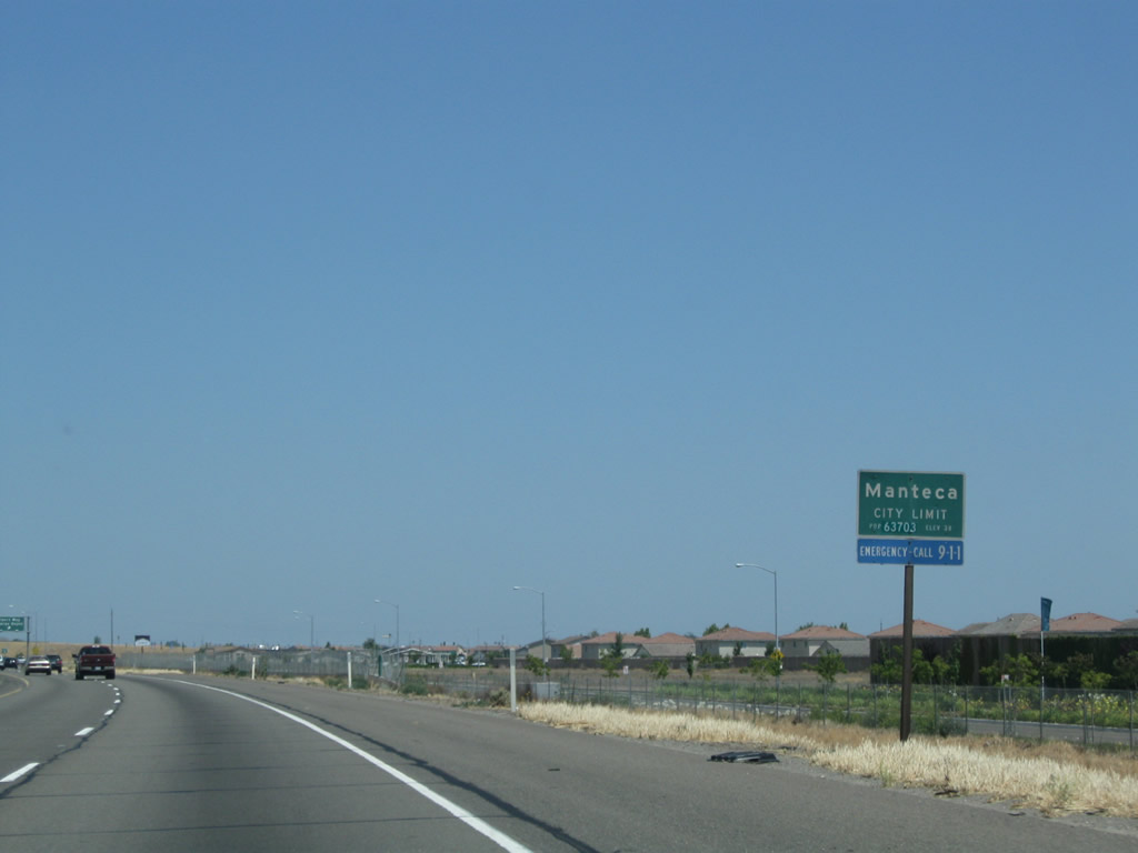 |
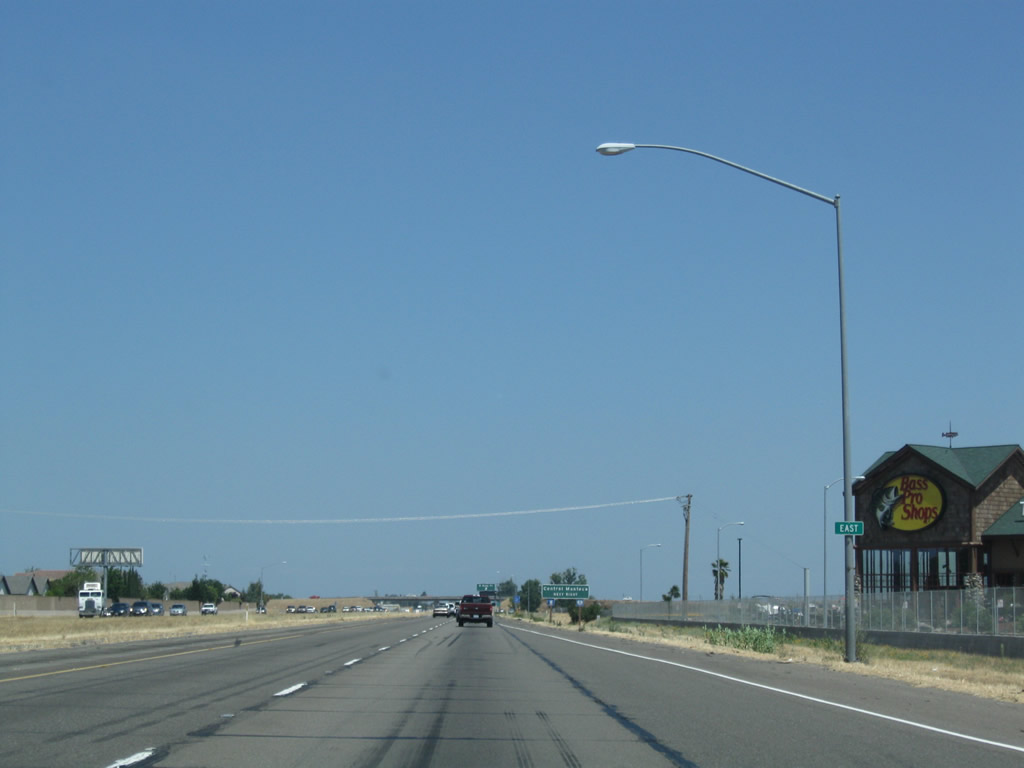
California 120 enters the city of Manteca, noted as a "friendly city located at the crossroads in the heart of California: the family city." Manteca had a population of 67,096 as of the 2010 Census and was incorporated on June 5, 1918. Its elevation is about 36 feet, as it resides not far from the San Joaquin River. Photo taken 06/21/09. |
 |
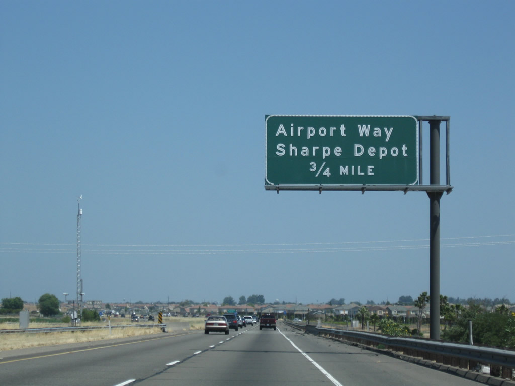
Eastbound California 120 reaches Exit 3, San Joaquin County J-3 and Airport Way. CR J-3 heads north to Sharpe Depot and south to Durham Ferry State Recreation Area and San Joaquin National Wildlife Refuge. CR J-3 carves a line midway between Interstate 5 and California 99 between Manteca, Stockton, and Lodi by following surface streets through these three cities. The county road also continues south along Airport Way, connecting with CR J-4 (Kasson Road) after crossing the San Joaquin River. From the junction with CR J-4, CR J-3 continues south along Kasson Road in the rural area near Durham Ferry to meet both California 132 east of Vernalis and also CR J-16 (Grayson Road) east of Westley. J-3 ends at J-16. Photo taken 06/21/09. |
 |
The next exit along eastbound California 120 is Exit 4, Union Road to Manteca. Photo taken 06/21/09. |
 |
The old lines on the road show how California 120 used to be a twos rather than the four-lane freeway it is today. Both directions of traffic used the current eastbound lanes prior to completion of the westbound lanes in the late 1990s. Note the removed white lane striping visible to the left of the current yellow median line. Photo taken 06/21/09. |
 |
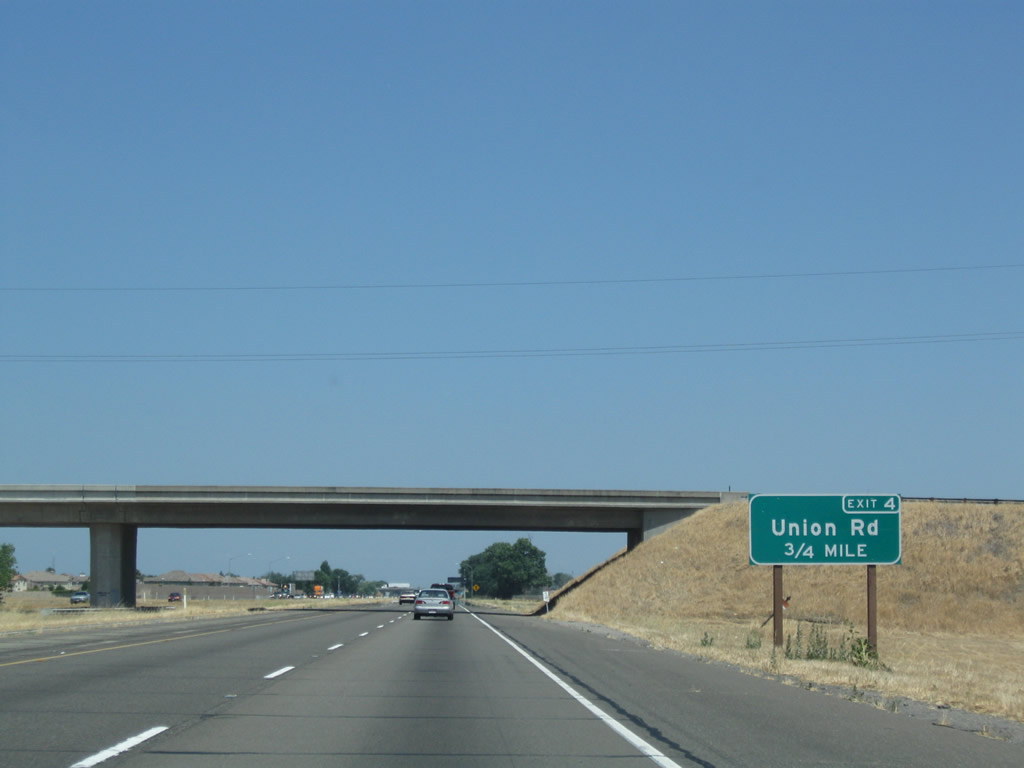
Eeastbound California 120 reaches Exit 4, Union Road. Photo taken 06/21/09. |
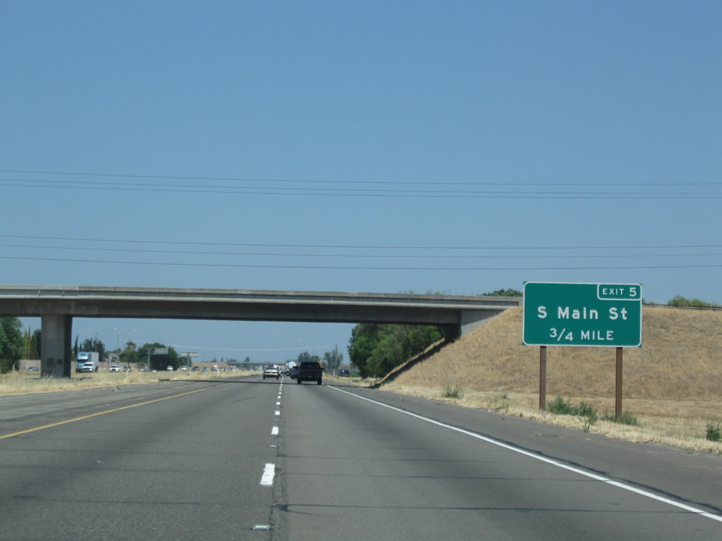 |
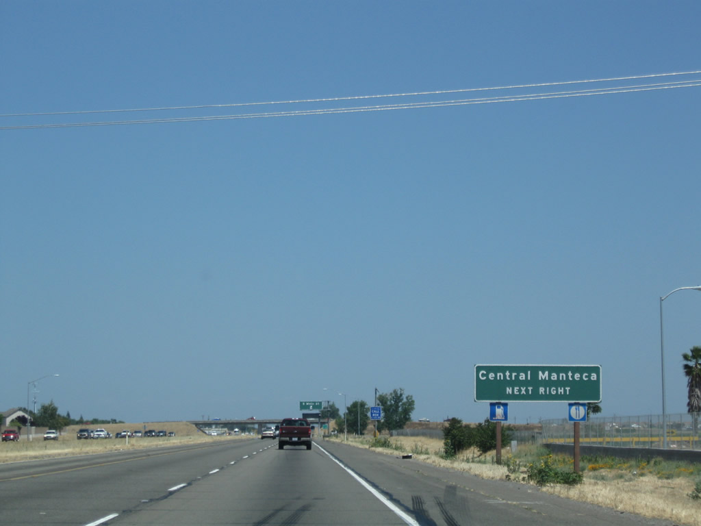
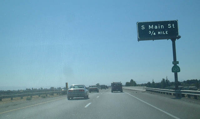
The next exit for Manteca along eastbound California 120 is Exit 5, Main Street. It is possible that Main Street is an old alignment of U.S. 99, but it is not signed as a business route of California 99. Photo taken 06/21/09. |
 |
A reassurance shield assembly for California 120 was actually missing its shield, leaving only the east banner in place. Photo taken 06/21/09. |
 |
Use Main Street north to downtown Manteca. Photo taken 06/21/09. |
 |
Eastbound California 120 reaches Exit 5, Main Street. Photo taken 06/21/09. |
|
California 120 passes under the Main Street overpass. Photo taken 06/21/09. |
 |
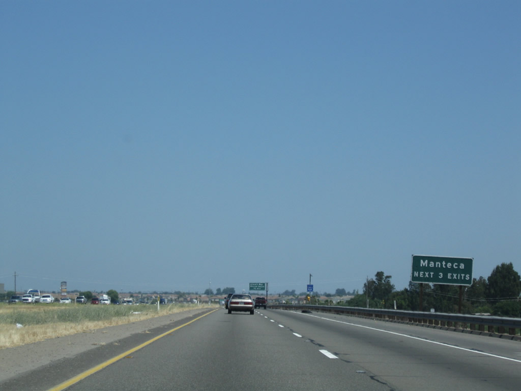
The final exit along the freeway segment of eastbound California 120 is Exit 6, California 99. Prior to the late 1990s, California 120 was two-lane expressway. The older alignment is today's eastbound lanes, and the age of the freeway shows in the lines in the concrete pavement. Photo taken 06/21/09. |
 |
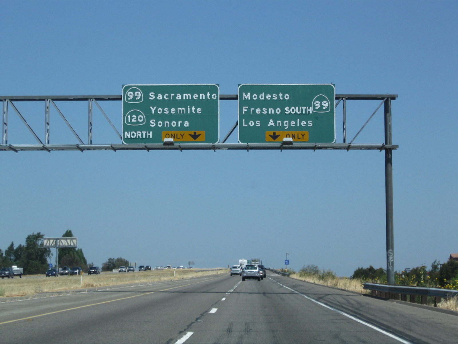
The eastbound California 120 freeway meets its current end at California 99. There are ideas to extend the freeway east of California 99, perhaps as far as Oakdale, but funding may be an issue. Notice that these signs carry an unprecedented six destination cities, with three on each panel. It is unusual for Caltrans to place so many cities on one sign assembly. Photo taken 06/21/09. |
 |
At Exit 6, California 120 splits into two ramps. The right lane heads onto southbound California 99, while the left lane defaults onto northbound California 99 and carries California 120 to its original, two- to four-lane alignment it uses to reach Oakdale. Photo taken 06/21/09. |
 |
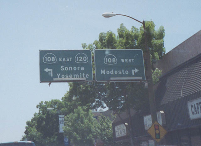 |
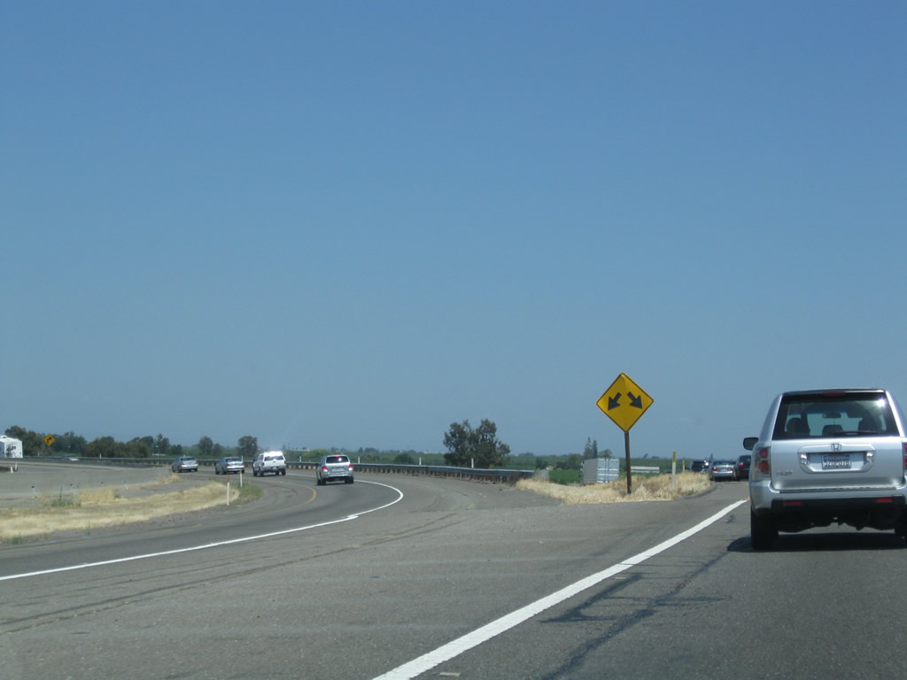
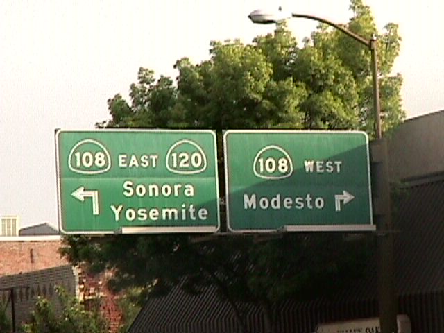
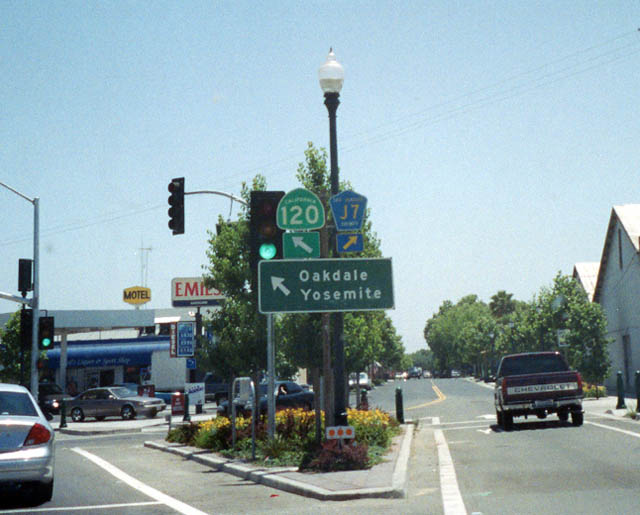
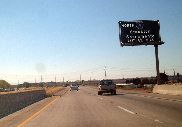
Now in Oakdale, eastbound California 120 and southbound Stanislaus County J-9 and J-14 approach California 108 in Oakdale. The county roads are not represented on this overhead, but they continue straight ahead through this intersection. First photo taken by Joel Windmiller (06/19/01); second photo taken by Pete Sison (05/02). |
 |
Eastbound California 120 meets San Joaquin County J-7 in Escalon. San Joaquin County J-7 continues south from here, changes into Stanislaus County J-7 upon crossing the county line and river of the same name, and meets California 108 in Riverbank. The highway then skirts the eastern fringe of the Modesto metropolitan area, crosses the Merced County Line, and ends at California 59 in Merced as Merced County J-7. Heading north, San Joaquin County J-7 pairs with San Joaquin County J-6 briefly, then turns northwest into Stockton, terminating at California 4 Business, Charter Way. Photo taken by Pete Sison (05/02). |
 |
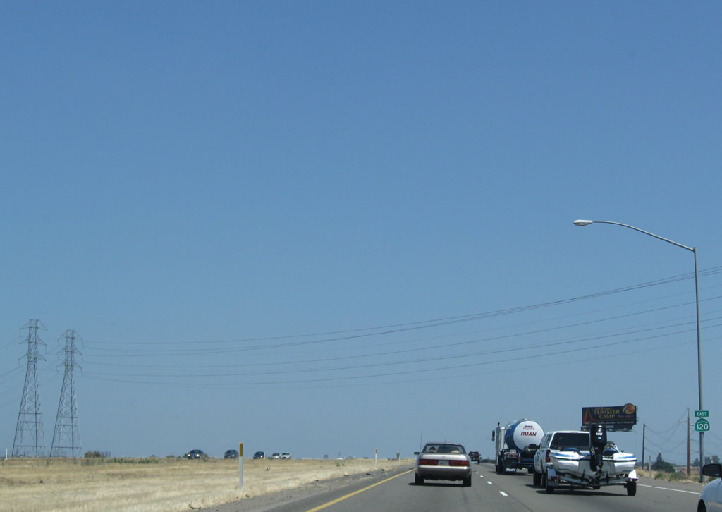
Traveling east on California 120 about one mile east of the U.S. 395 intersection near Lee Vining, this view takes in the dramatic scenery just south of Mono Lake in Mono County. The highway undulates through the terrain, turning to connect with U.S. 6 at Benton near the Nevada state line. Photo taken by Rich Piehl (07/17/06). |
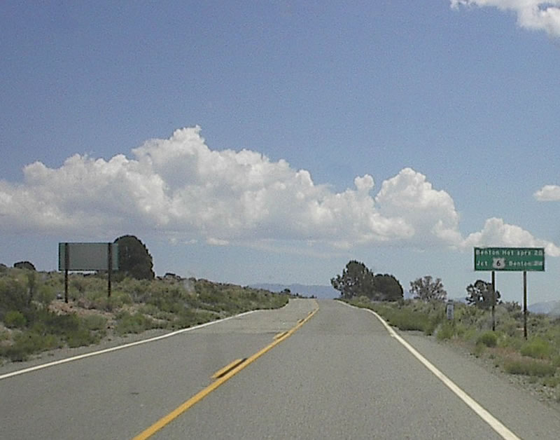 |
Some distance to the east, this mileage sign along eastbound California 120 provides the distance to Benton Hot Springs (20 miles) and U.S. 6 (24 miles). Photo taken by Rich Piehl (07/17/06). |
 |
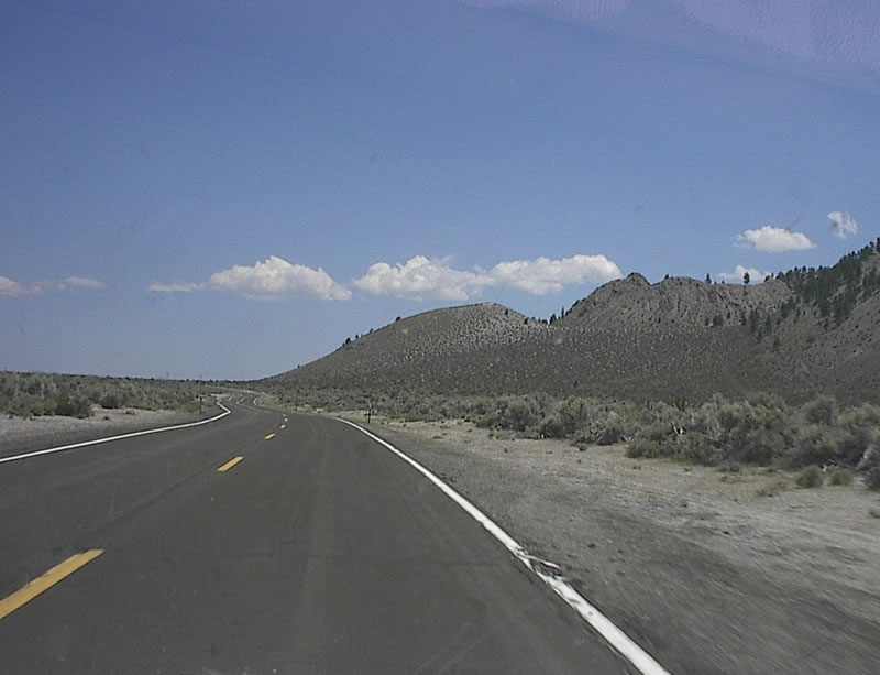
Skirting the north edge of Inyo National Forest, eastbound California 120 continues on its lonely journey between Lee Vining and Benton. Photo taken by Rich Piehl (07/17/06). |
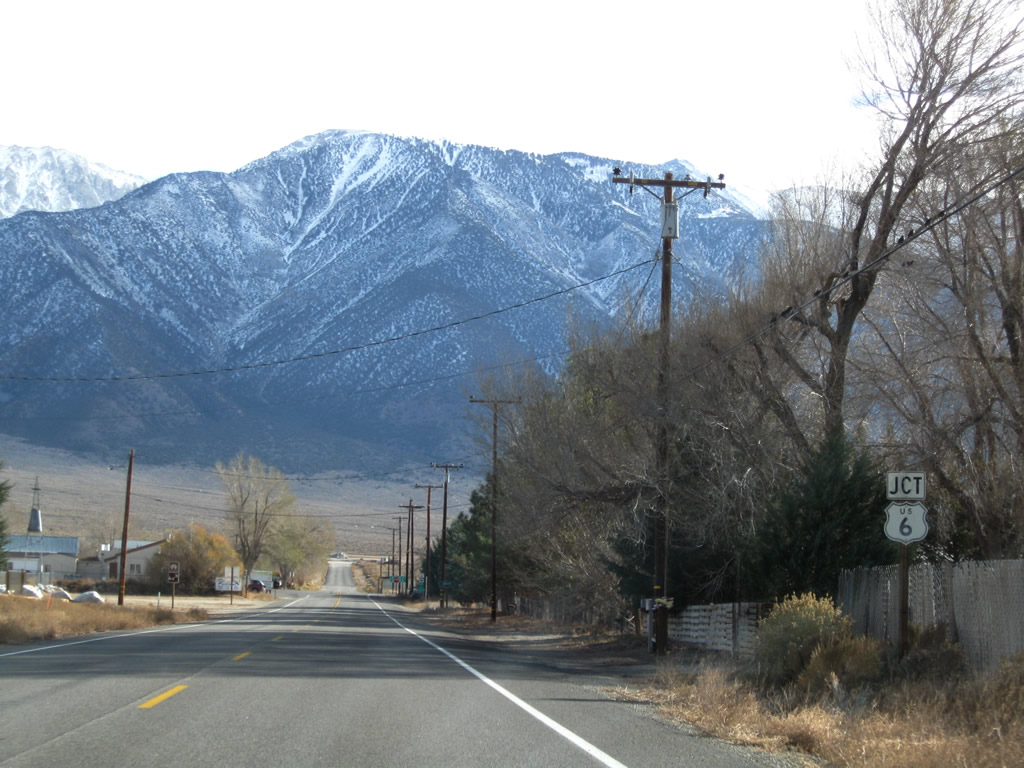 |
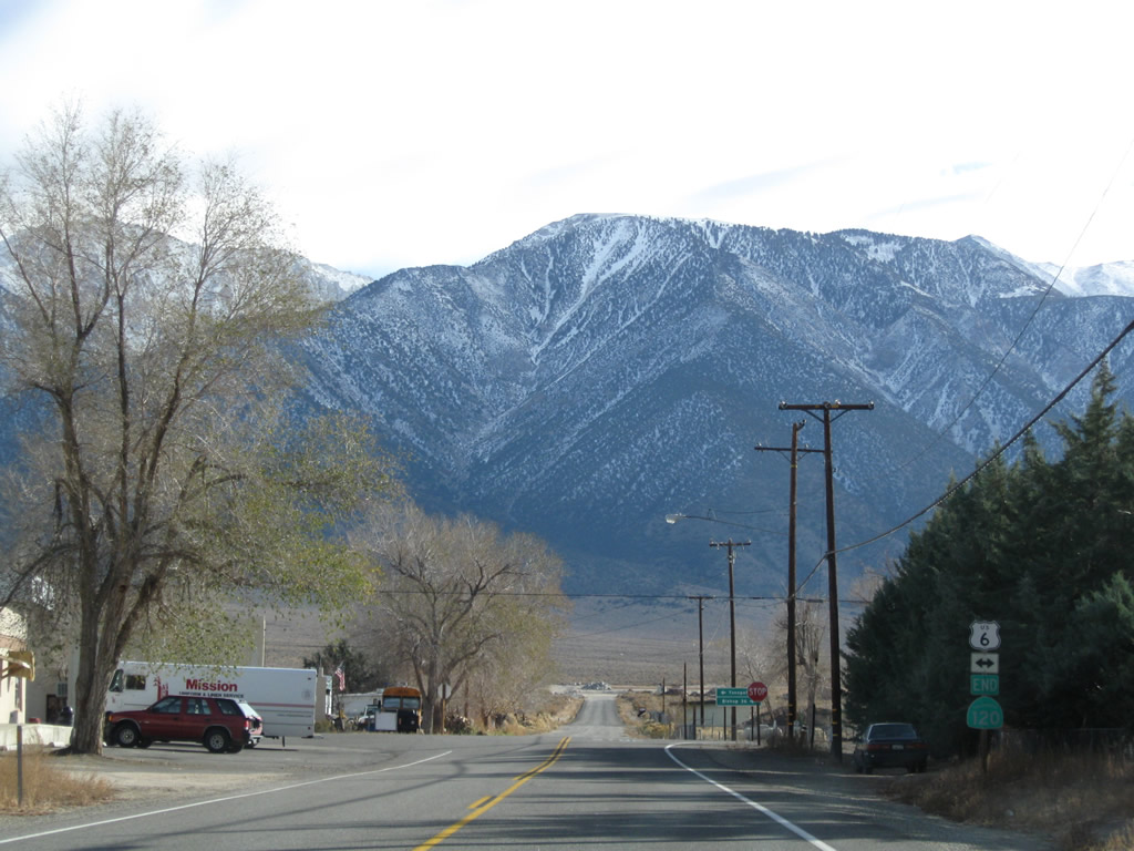
Skipping ahead, eastbound California 120 enters the unincorporated community of Benton and approaches its final intersection: a junction with U.S. 6, which travels east to Tonopah and south to Bishop. Use U.S. 6 west (south) to U.S. 395 south to Los Angeles and points south. Photo taken 11/10/08. |
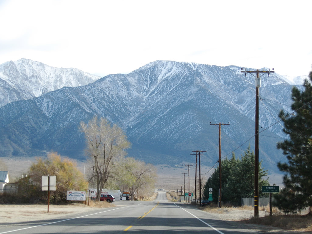 |
California 120 enters the unincorporated community of Benton (el. 5,377 feet, population 164 per the Caltrans entry sign). Benton was founded primarily due to its location near Benton Hot Springs. The area was settled in the 1850s as part of the mining boom of that era (with the ghost town of Bodie an example of mining towns from that era). Photo taken 11/10/08. |
 |
 |
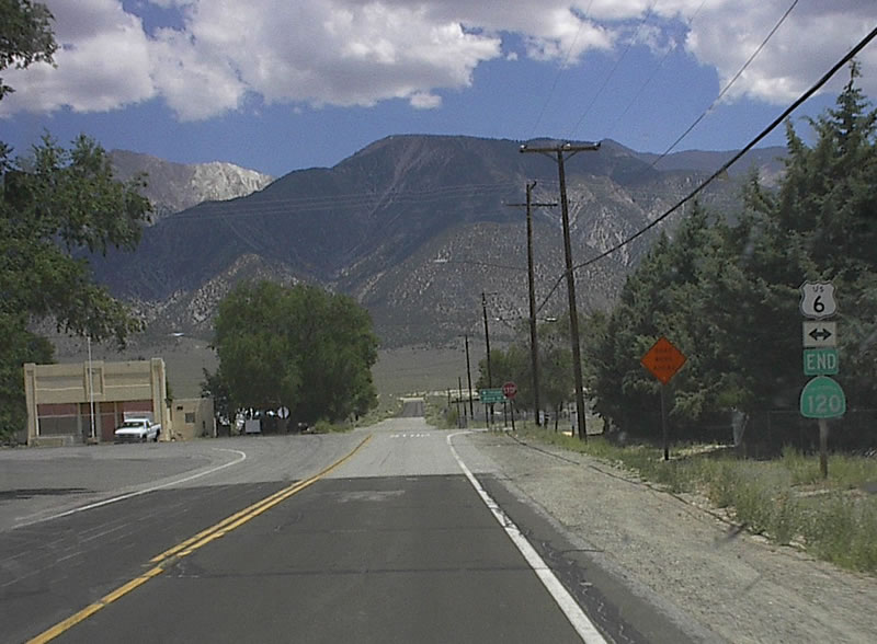 |
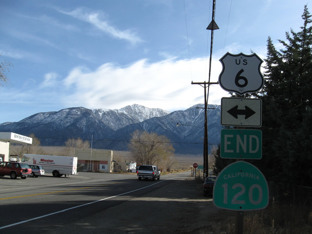
California 120 reaches its eastern terminus at U.S. 6 in Benton, complete with end shield assembly. Turn left to follow U.S. 6 into Nevada and over Montgomery Pass; turn right to follow U.S. 6 southwest to Bishop. Montgomery Peak, Boundary Peak, and The Jumpoff are all in excess of 13,000 feet and can be seen looking east from this intersection. Photos taken 11/10/08 and by Rich Piehl (07/17/06). |
| California 120 west | |
|---|---|
 |
The first reassurance shield for California 120 west is posted after the intersection with U.S. 6 in the unincorporated community of Benton (el. 5,377 feet, population 164 per the Caltrans entry sign found on U.S. 6). Benton was founded primarily due to its location near Benton Hot Springs. The area was settled in the 1850s as part of the mining boom of that era (with the ghost town of Bodie an example of mining towns from that era). Photo taken 11/10/08. |
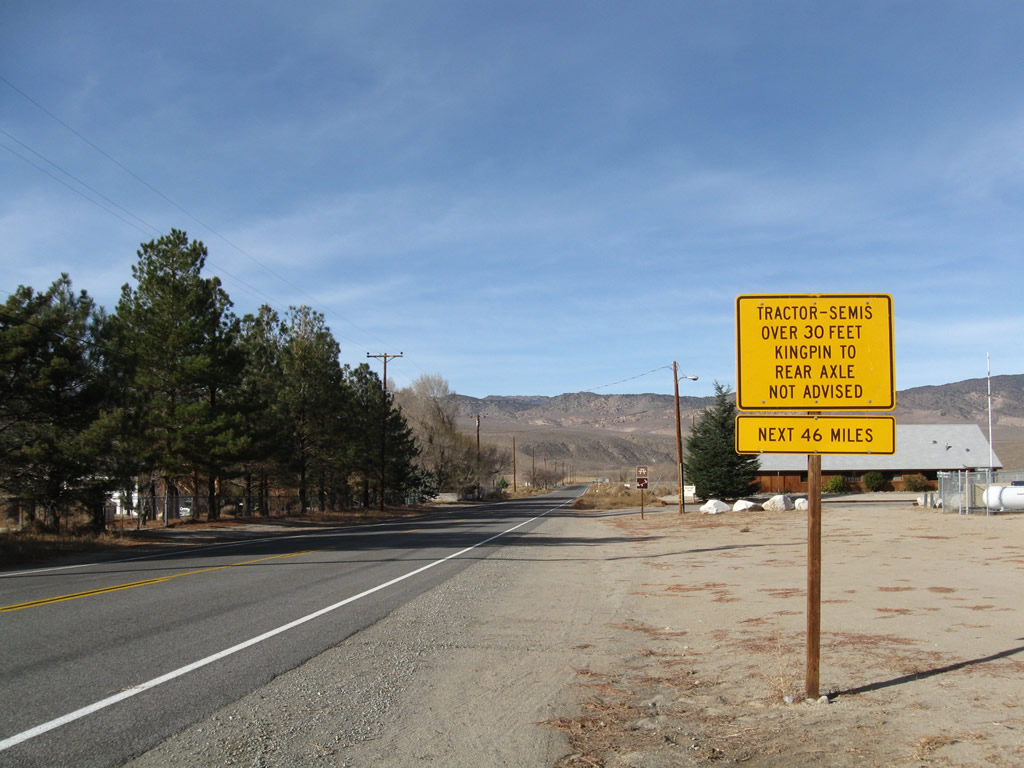 |
Due to the winding and undulating nature of California 120 between Benton and Lee Vining, a cautionary sign is posted for through truck and high profile vehicle traffic. Photo taken 11/10/08. |
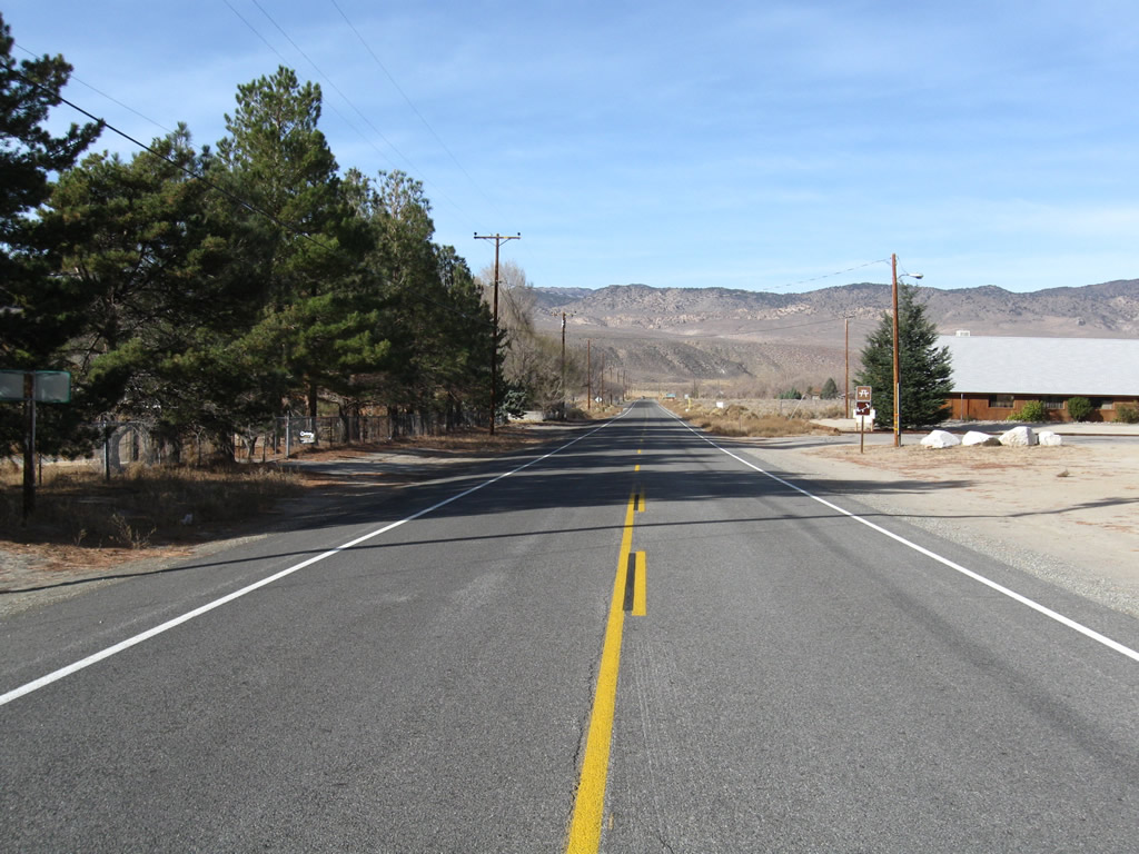 |
This view looks west along California 120 as it travels toward Benton Hot Springs, Black Lake, and Adobe Valley. Photo taken 11/10/08. |
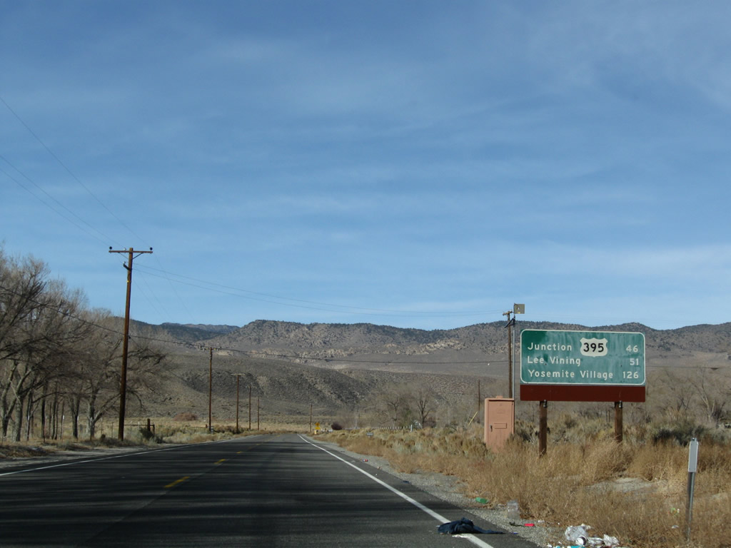 |
Apparently graffiti is a problem all the way out here in Benton, as this mileage sign was tagged. The mileage sign shows the distance along California 120 to U.S. 395 (46 miles), Lee Vining (51 miles), and Yosemite Village (126 miles). Omitted are Benton Hot Springs (only a few miles west of here) and Sagehen Summit. A flip sign below the mileage sign advises if the road ahead is closed in seven miles (near Black Lake). Photo taken 11/10/08. |
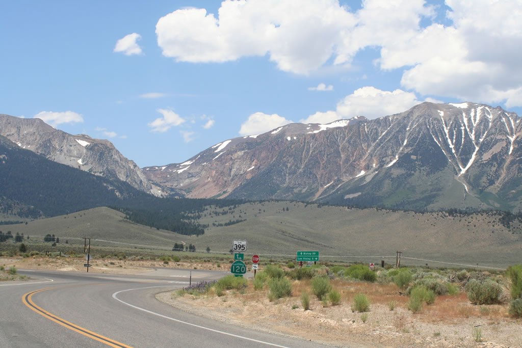 |
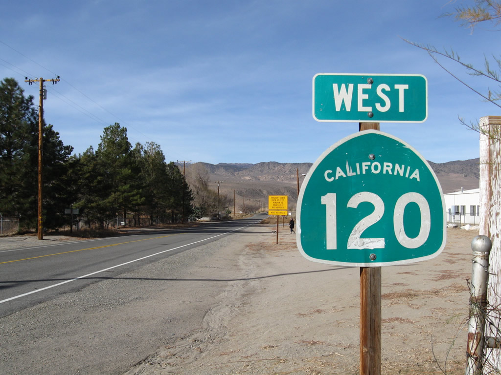
Westbound California 120 approaches U.S. 395. Turn left to follow U.S. 395 south to California 158 for June Lake, California 203 to Mammoth Lakes, and U.S. 6 to Bishop. Turn right to follow U.S. 395 north and California 120 west to Lee Vining, where the routes divide. California 120 then turns west to cross Tioga Pass (open summer only) to Yosemite National Park, Groveland, Oakdale, and Manteca. Photo taken by Rich Piehl (07/17/06). |
 |
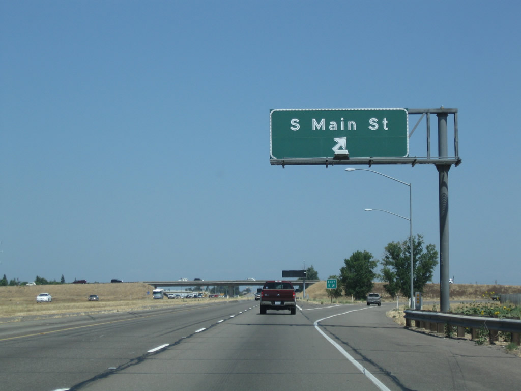
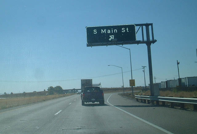
The first of three exits from SR 120 west in Manteca connects with South Main Street in three quarters of a mile. South Main Street leads north into Manteca and continues as Manteca Road south to meet San Joaquin County J-3 near the confluence of the San Joaquin and Stanislaus Rivers. Photo taken 08/20/03. |
 |
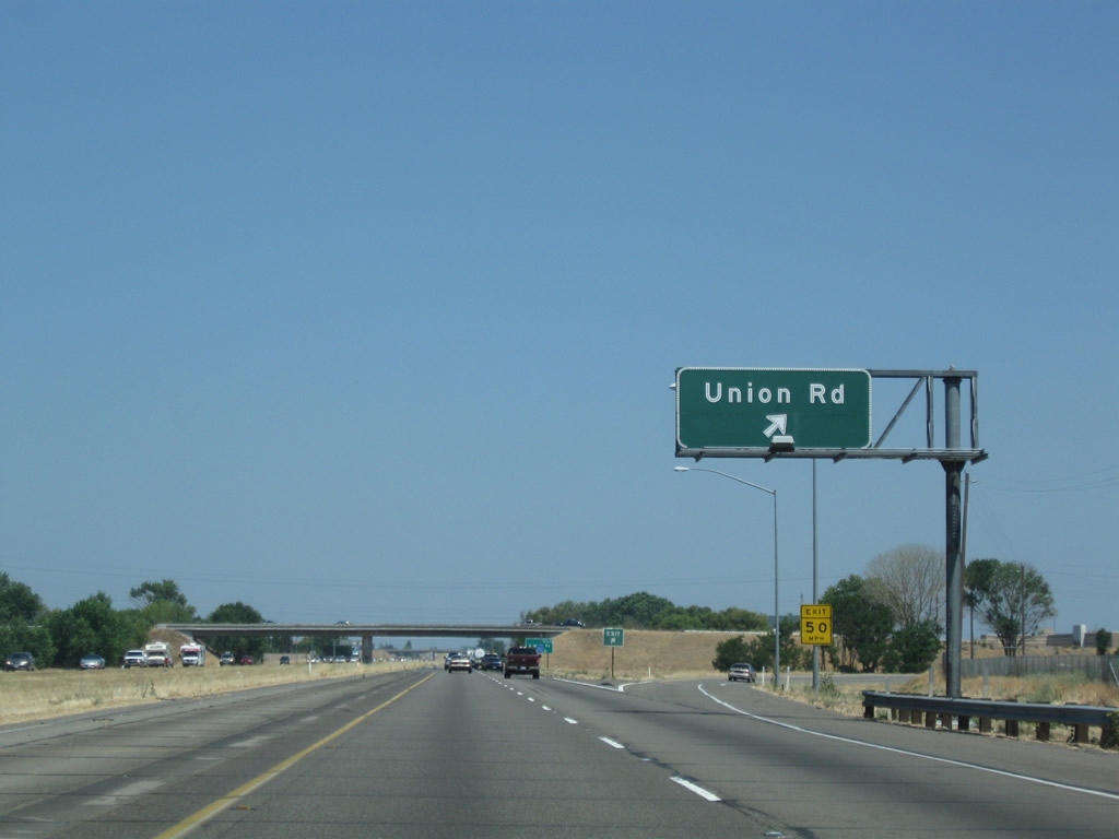
Westbound California 120 reaches Exit 5, South Main Street. The next exit is Exit 4/Union Road, which is not photographed. Photo taken 08/20/03. |
 |
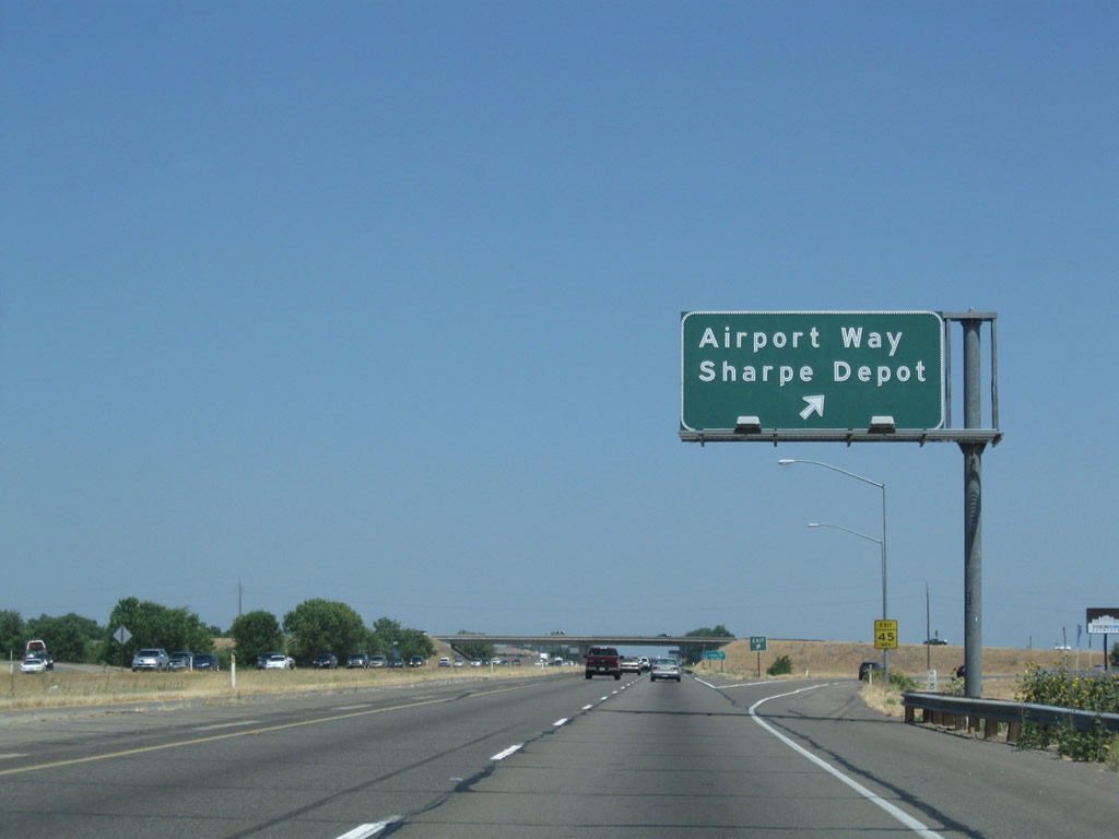
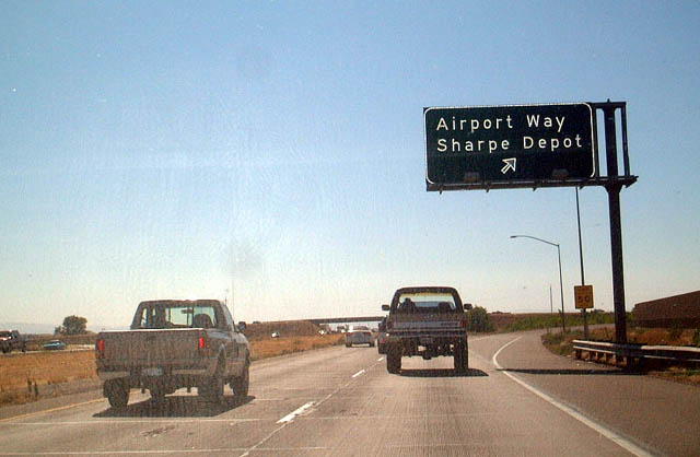
The next exit along westbound California 120 is Exit 3 for Airport Road to Sharpe Army Depot and Lathrop, 0.75 mile. Photo taken 08/20/03. |
 |
Westbound California 120 reaches Exit 3, San Joaquin County J-3 (Airport Road). The Sharpe Army Depot is located north of Lathrop and east of Airport Road. Photo taken 08/20/03. |
 |
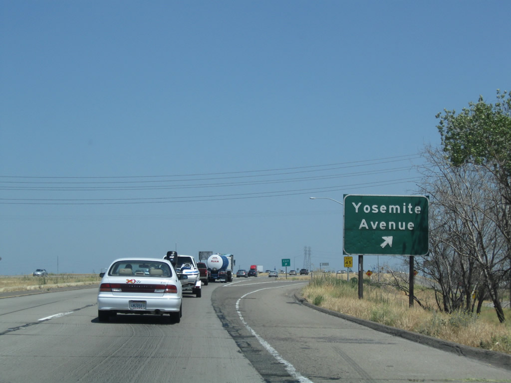
The next exit along westbound California 120 is Exit 1C, Yosemite Avenue (old California 120), 1.75 miles. Photo taken 08/20/03. |
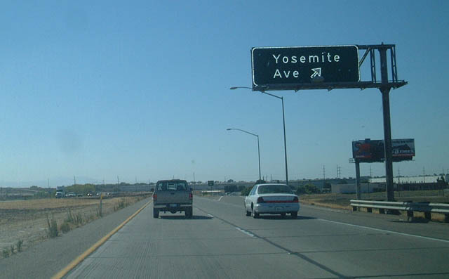 |
Westbound California 120 overtakes its former route at Yosemite Avenue and Exit 1C. Photo taken 08/20/03. |
 |
Advance signage for northbound Interstate 5 (Exit 1B) appears along westbound as California 120 reaches its terminus. Photo taken 08/20/03. |
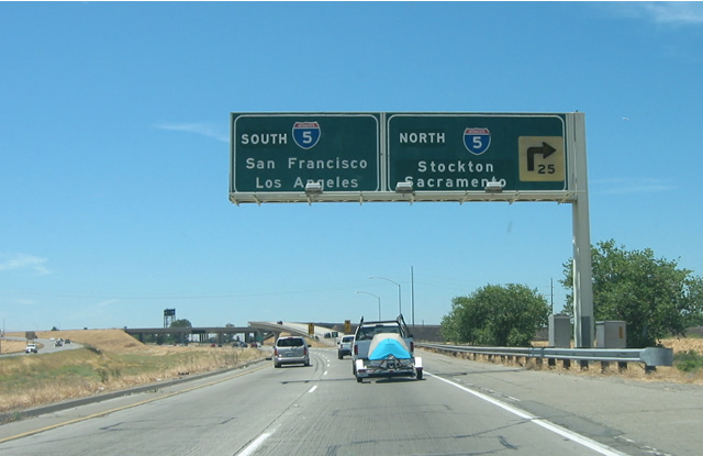 |
Reaching its western terminus, westbound California 120 traffic must chose between north and south Interstate 5. The ramp to northbound Interstate 5 is Exit 1B; the ramp to southbound Interstate 5 is Exit 1A. As for southbound Interstate 5, the control cities are unusual in that San Francisco and Los Angeles both appear in the same direction. This is because Interstates 205 and 580 provide access to San Francisco, while Interstate 5 continues south along the Westside Freeway toward Los Angeles and Southern California. Photo taken 05/25/03 by Pete Sison. |
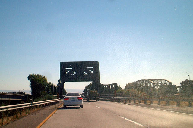 |
As westbound California 120 transitions onto southbound Interstate 5, these two older, truss bridges still carry traffic over the San Joaquin River. These bridges date back to the days when this route was part of Historic U.S. 50, which used to extend south from Sacramento to Galt, Lodi, Stockton, Manteca, and Tracy en route to the Altamont Pass (which is the current routing of Interstate 580). Photo taken 08/20/03. |

Page Updated March 21, 2015.
|
About Contact Glossary |
In The News Testimonials Interstate Guide |
Social Media:
 |
|
© 2000-23 AARoads.com | All Rights Reserved | Privacy Policy / Terms of Use
|
||