
California 204
California 204 follows historic U.S. 99 from the California 58 freeway northwest to California 99 via Union Avenue and Golden State Avenue. It is cosigned with California 99 Business for its entire length. The northernmost portion of California 204 and California 99 Business is up to freeway standards, including the bridge over the Kern River.
| California 99 Business & 204 north | |
|---|---|
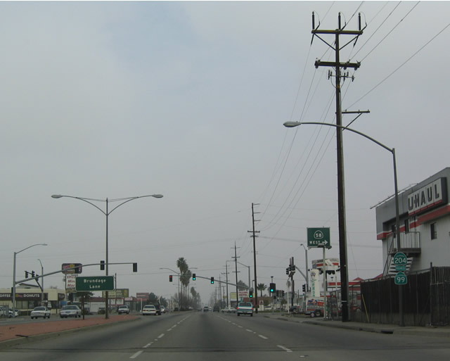 |
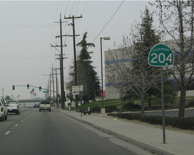
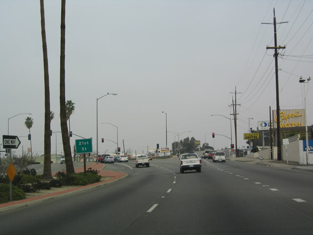
First shield along northbound California 204 and California 99 Business as Union Avenue approaches Brundage Lane and the loop ramp to westbound California 58. Photo taken 01/21/04. |
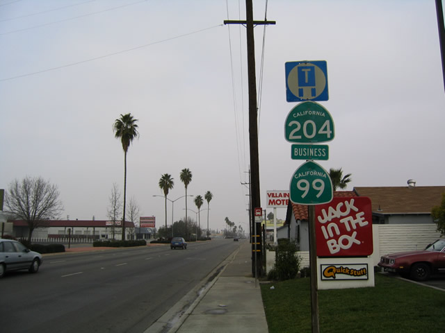 |
Northbound California 204 & California 99 Business after Brundage Lane. Photo taken 01/21/04. |
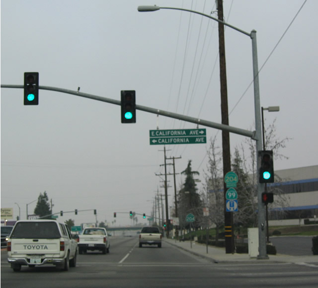 |
Northbound California 204 & California 99 Business at California Avenue, which leads west to California 99 and east to Martin Luther King, Jr. Park and Union Cemetery. Photo taken 01/21/04. |
 |
Although the business route is generally signed consistently with California 204, this shield assembly near Alpine Street/Hayden Court just north of California Avenue only displays a California 204 shield. Photo taken 01/21/04. |
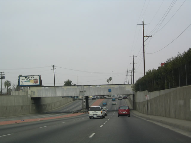 |
This subway carries California 204 under the BNSF Railroad, and Union Avenue emerges to meet Truxtun Avenue on the north side of the subway. Photo taken 01/21/04. |
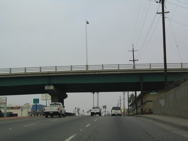 |
Truxtun Avenue passes over California 204 & California 99 Business, but access may be afforded via frontage roads. Photo taken 01/21/04. |
 |
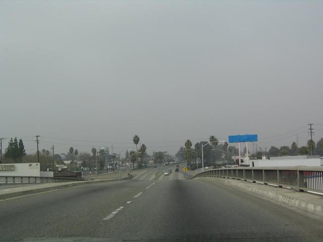
Northbound California 204 & California 99 Business split from Union Avenue a few blocks north of the Truxtun Street overcrossing. California 204 & California 99 Business turn northwest onto Golden State Avenue en route to California 99, while Union Avenue continues due north to Panorama Drive and Manor Street. Photo taken 01/21/04. |
 |
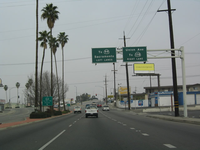
Union Avenue also provides the easiest connection from northbound California 204 to eastbound California 178. Photo taken 01/21/04. |
 |
Northbound California 204 & California 99 Business after the split from Union Avenue. Photo taken 01/21/04. |
 |
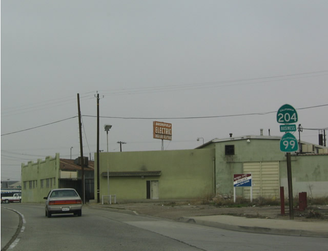
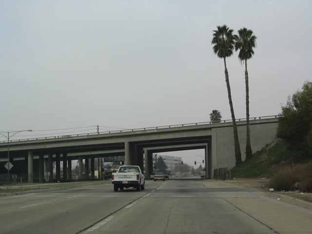
Northbound California 204 & California 99 Business next approach 24th Street; the California 178 overpass is visible in the distance. Photo taken 01/21/04. |
 |
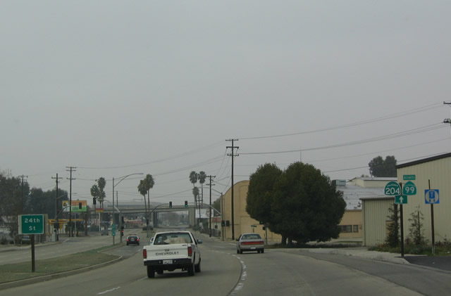
Northbound California 204 & California 99 Business at 24th Street, which is the best route to westbound California 178. Photo taken 01/21/04. |
 |
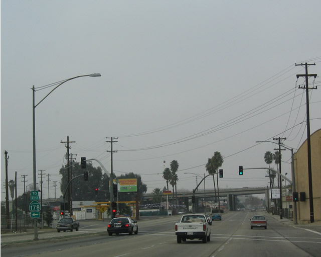
California 178 has no direction interchange links with northbound California 204 & California 99 Business (Golden State Avenue). Photo taken 01/21/04. |
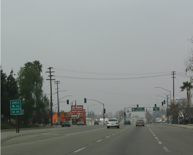 |
Now that northbound California 204 & California 99 Business (Golden State Avenue) is angled to the northwest, it has intersections that accommodate multiple directions. This next traffic signal serves both 28th Street and M Street. Photo taken 01/21/04. |
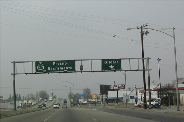 |
This overhead sign assembly was in place at a time when California 99 used to pass through downtown Bakersfield rather than bypass the city to the west. The "Oildale" turnoff is actually a connection to Garces Circle and Chester Avenue, which crosses the Kern River to enter Oildale. Photo taken 01/21/04. |
 |
After the Chester Avenue exit, California 204 & California 99 Business north pass over Garces Circle on this overpass. Photo taken 01/21/04. |
 |
Garces Circle, which is situated under this bridge along northbound, forms the intersection between 30th Street and Chester Avenue. Photo taken 01/21/04. |
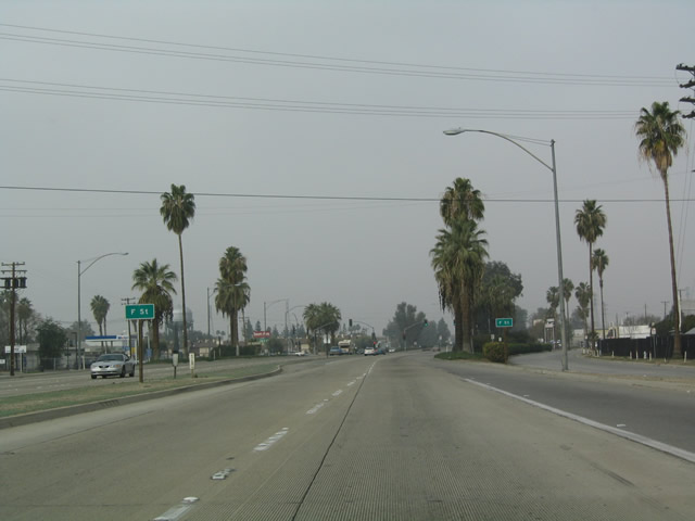 |
Northbound California 204 & California 99 Business approaching F Street. Photo taken 01/21/04. |
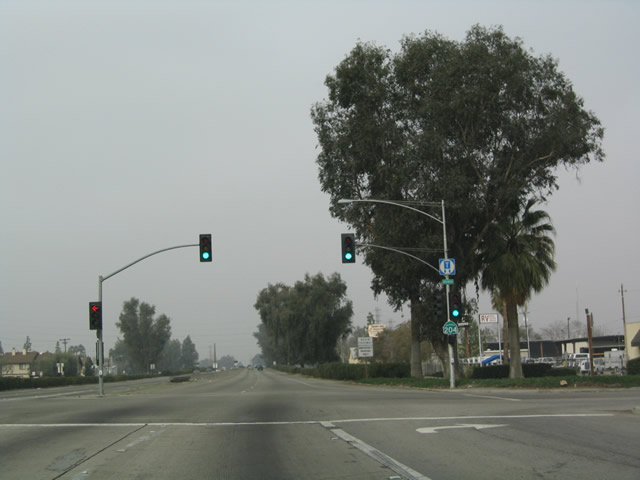 |
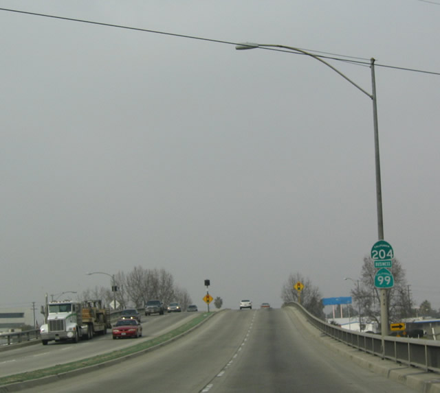
The final traffic signal along northbound California 204 & California 99 Business is at F Street. Photo taken 01/21/04. |
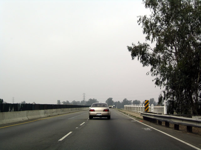 |
After the last traffic signal, California 204 & California 99 Business become a freeway, complete with ornamental white guardrail as it approaches the Kern River Bridge. Photo taken 01/21/04. |
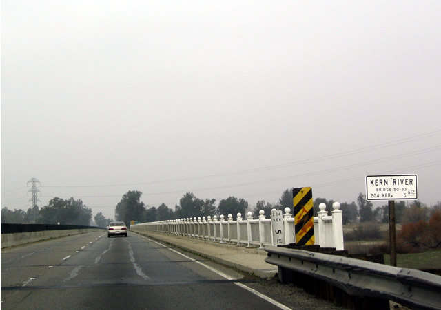 |
Northbound California 204 & California 99 Business crosses the Kern River, which flows in a southwesterly direction from Lake Isabella to a drainage in the valley west of Bakersfield. The Kern River does not connect with the San Joaquin River system. Photo taken 01/21/04. |
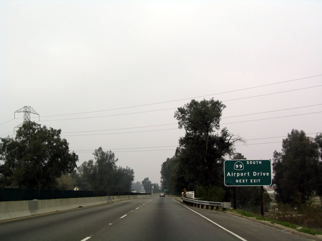 |
The first and only exit along northbound California 204 & California 99 Business is Exit 6, Airport Drive. Since there is no direct connection to southbound California 99, traffic must use Airport Drive to make that connection. Photo taken 01/21/04. |
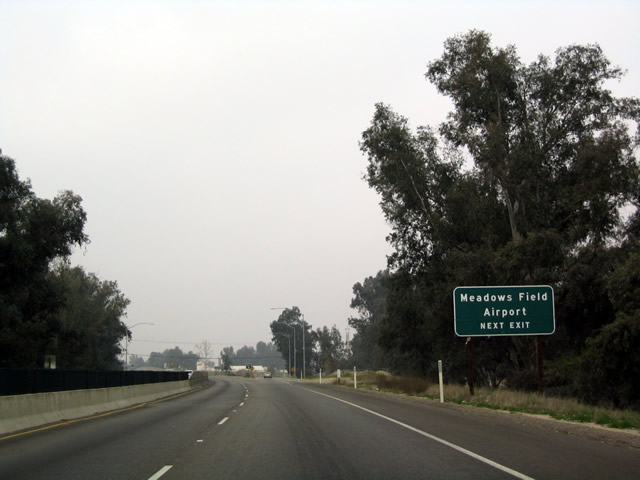 |
As the name implies, Airport Drive leads north to Meadows Field, which is one of two airports in Bakersfield; the other is Bakersfield Municipal Airport south of downtown off Union Avenue/California 99 Business. The gore point for this exit is visible just ahead, but it is not signed. Photo taken 01/21/04. |
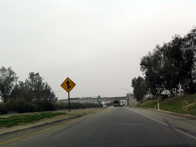 |
Northbound California 204 & California 99 Business end as they merge onto northbound California 99 north of Bakersfield and west of Oildale. Photo taken 01/21/04. |

Page Updated March 22, 2004.
|
About Contact Glossary |
In The News Testimonials Interstate Guide |
Social Media:
 |
|
© 2000-23 AARoads.com | All Rights Reserved | Privacy Policy / Terms of Use
|
||