| U.S. 66 (San Bernardino County 66) - National Trails Highway west |
|
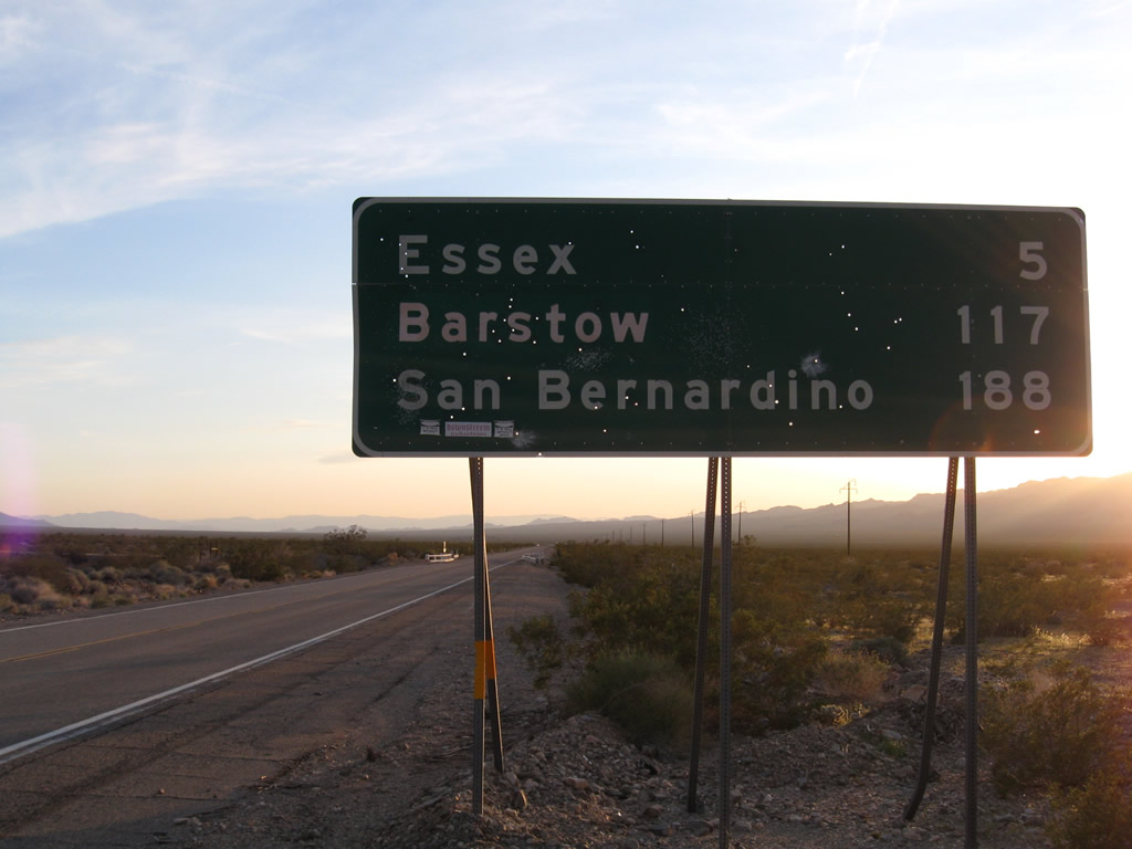
This mileage sign along Historic U.S. 66 (National Trails Highway) west provides the distance to Essex (five miles), Barstow (117 miles), and San Bernardino (188 miles). Photo taken 03/14/09. |
|
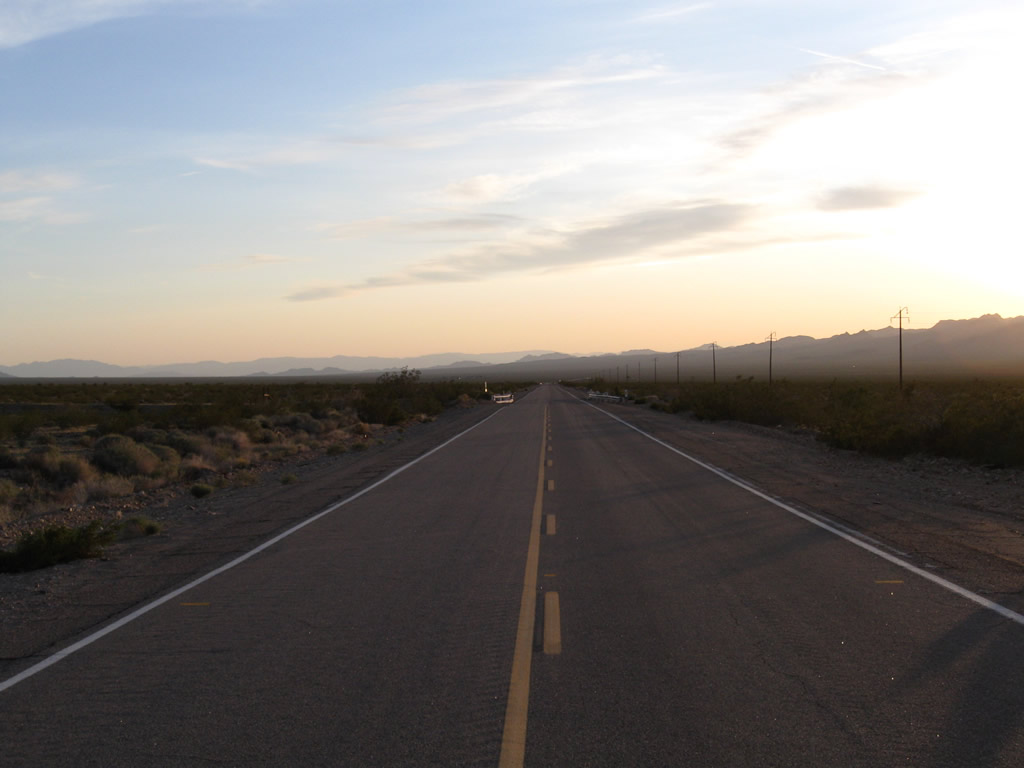
Looking west along Historic U.S. 66 (National Trails Highway) five miles east of Essex, this area has seen little human development. Photo taken 03/14/09. |
|
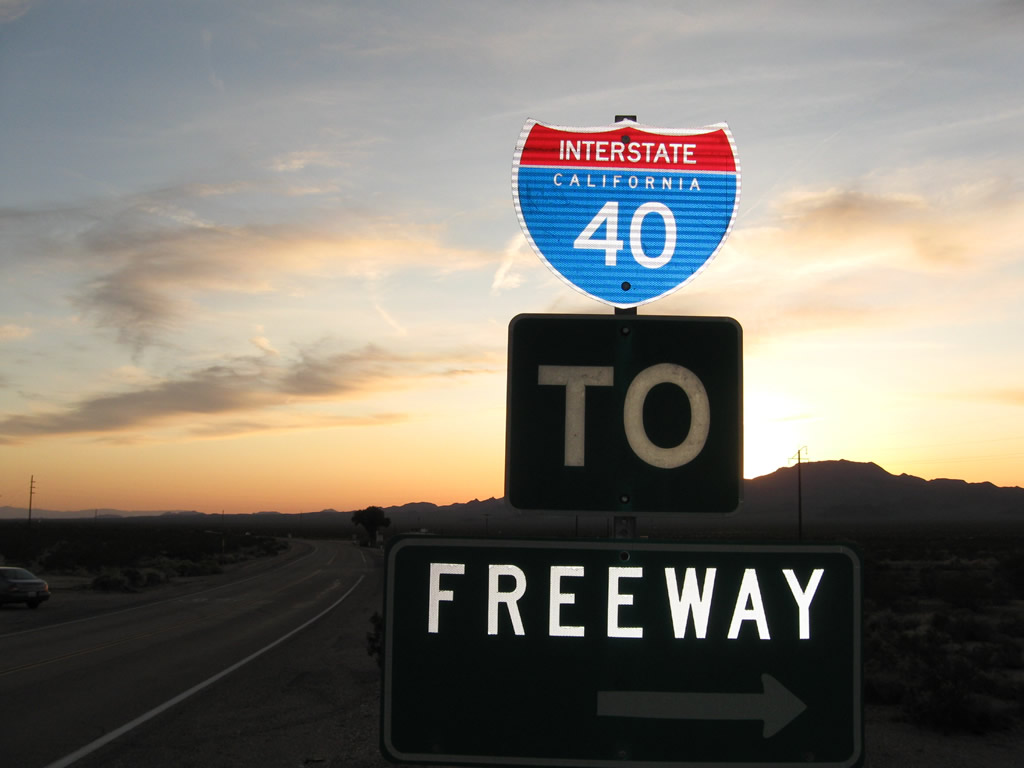
A trailblazer for Interstate 40 is posted on westbound U.S. 66 prior to the Goffs Road intersection. Photo taken 03/14/09. |
|
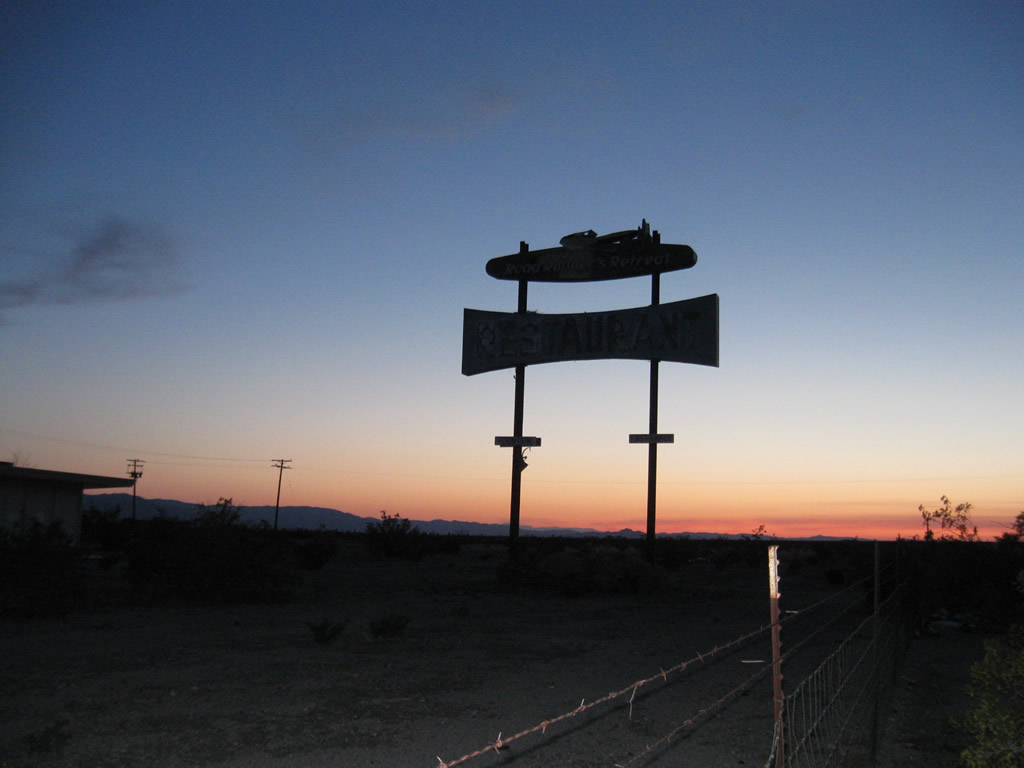
The abandoned Roadrunner's Retreat is located along the south side of U.S. 66. The Roadrunner's Retreat used to feature a restaurant and gas station for travelers on U.S. 66. Nowadays, the site is no longer in use even through the marquee sign is a reminder of days past. Photo taken 03/14/09. |
|
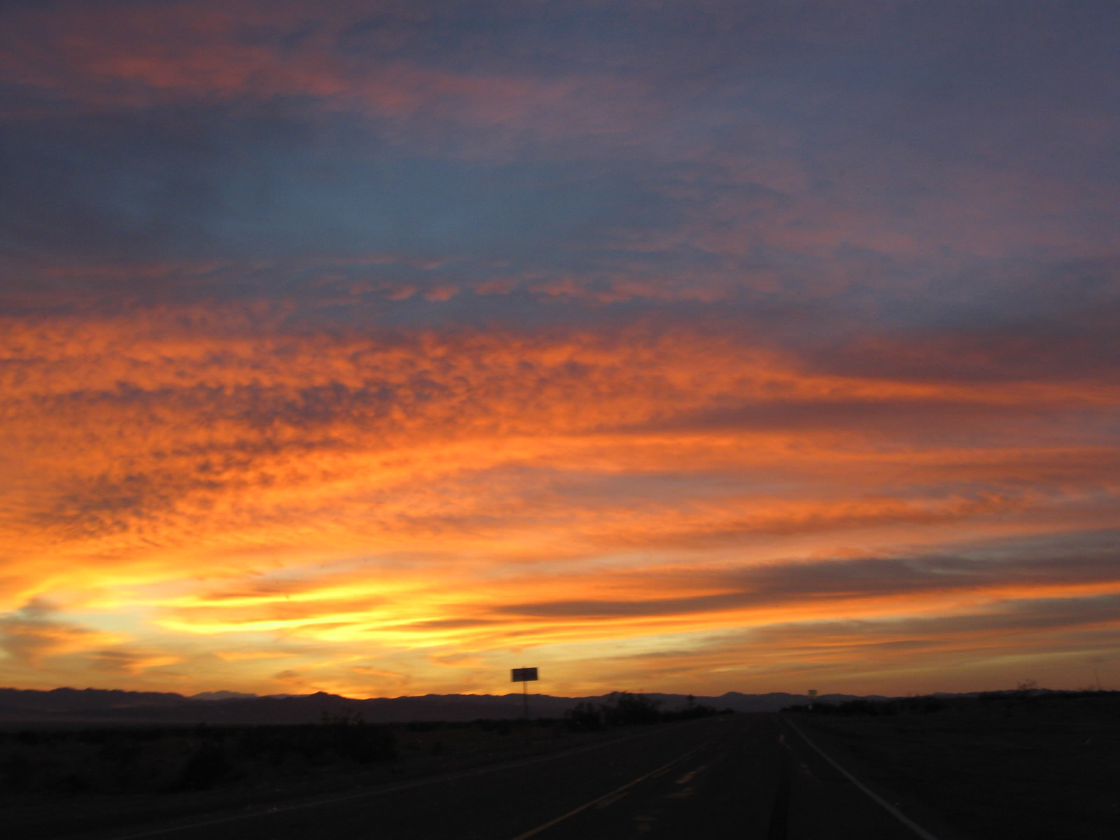
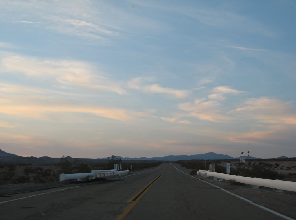
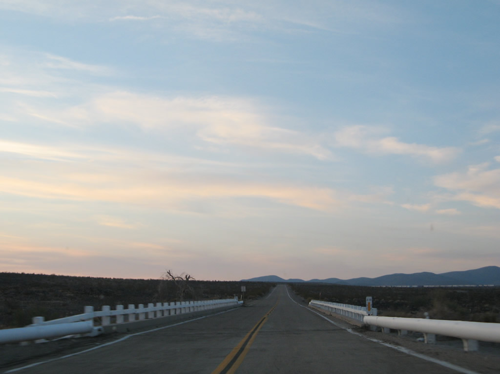
The sun sets along U.S. 66 west near the Roadrunner's Retreat. Photo taken 03/14/09. |
|
After the intersection with Kelbaker Road, we see a terrific sunset along westbound Historic U.S. 66 (National Trails Highway). Photo taken 11/11/08. |
|
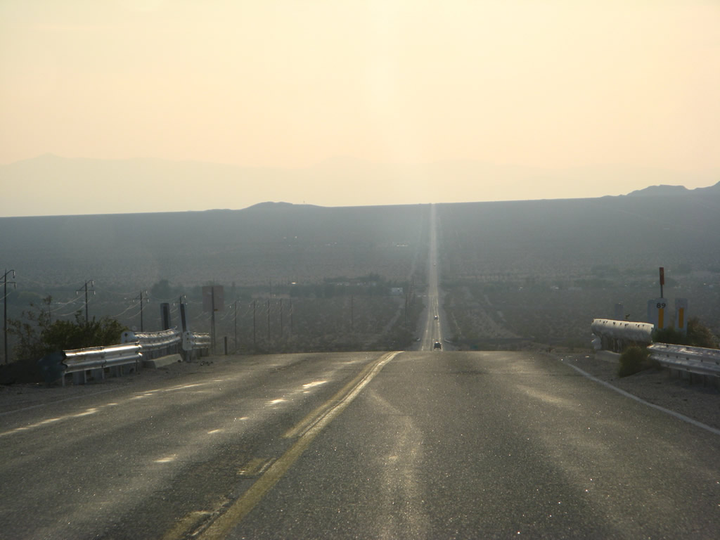
Westbound U.S. 66 approaches the unincorporated community of Amboy as it crests over a hill in the Mojave Desert. Photo taken 04/01/07. |
|
|
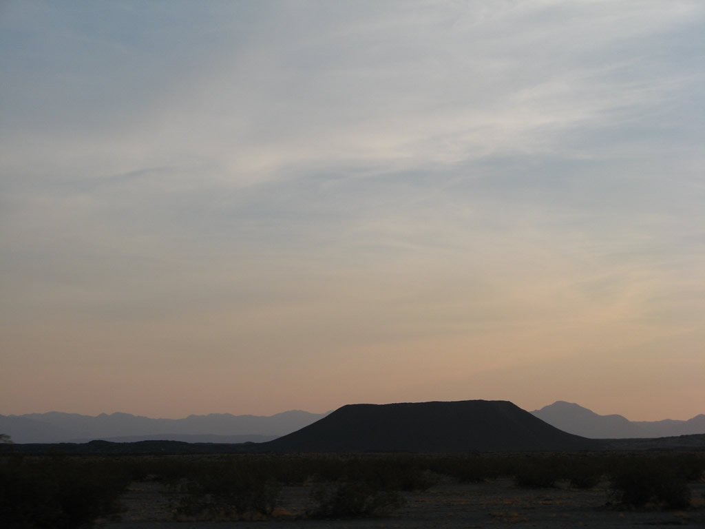
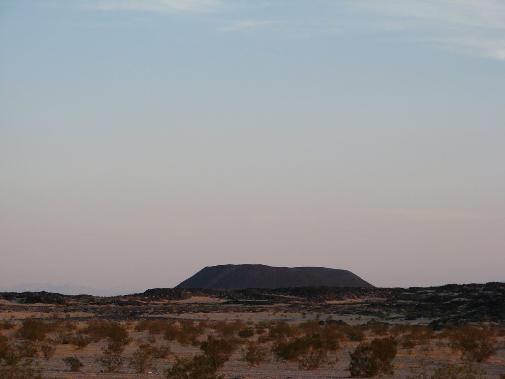
Flat-topped Amboy Crater comes into view on the south side of U.S. 66 after passing by Amboy Road. This extinct volcano is 6,000 years old, 944 feet, and is responsible for the 27-square-mile lava field that surrounds the cinder cone. Photos taken 04/01/07. |
|
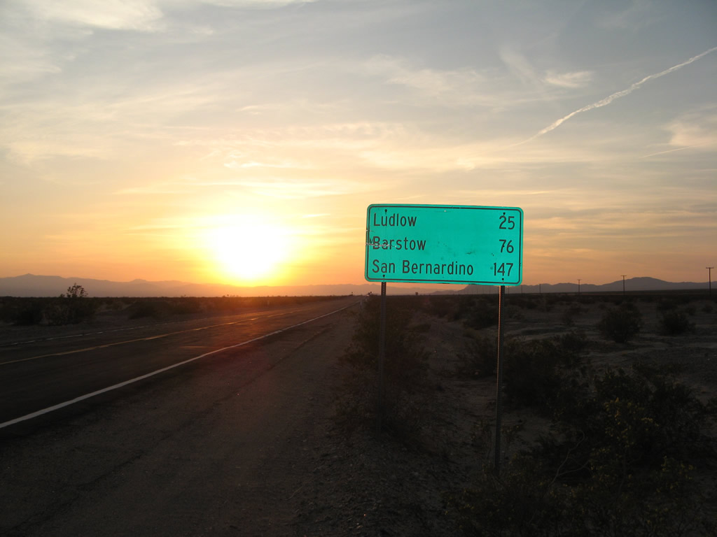
This mileage sign along U.S. 66 west provides the distance to Ludlow (25 miles), Barstow (76 miles), and San Bernardino (147 miles). The camera flash made the letters look black, when they are normally white. Photo taken 04/01/07. |
|
Old style white guardrail lines both sides of U.S. 66 prior to this bridge over another wash. Photo taken 04/01/07. |
|
This bridge, which has white wooden railing, is longer than many of the prior wash bridges and looks more like a typical California Division of Highways bridge from that era. Photo taken 04/01/07. |
|
The sun finally set over the Bullion Mountains to the west of here. U.S. 66 swings northwest in order to reconnect with Interstate 40 near Ludlow. Photo taken 04/01/07. |
|
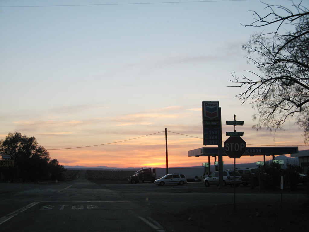
Westbound U.S. 66 meets Crucero Road in Ludlow at this stop sign. Turn right to reconnect to Interstate 40, or continue straight to follow a dead-end stretch of U.S. 66 west. Gas, food, and lodging are available here. Photo taken 04/01/07. |
| Historic U.S. 66 (San Bernardino County) west & Historic U.S. 91 south |
|
|
|
|
|
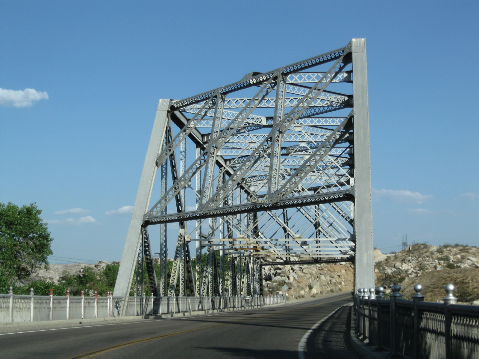
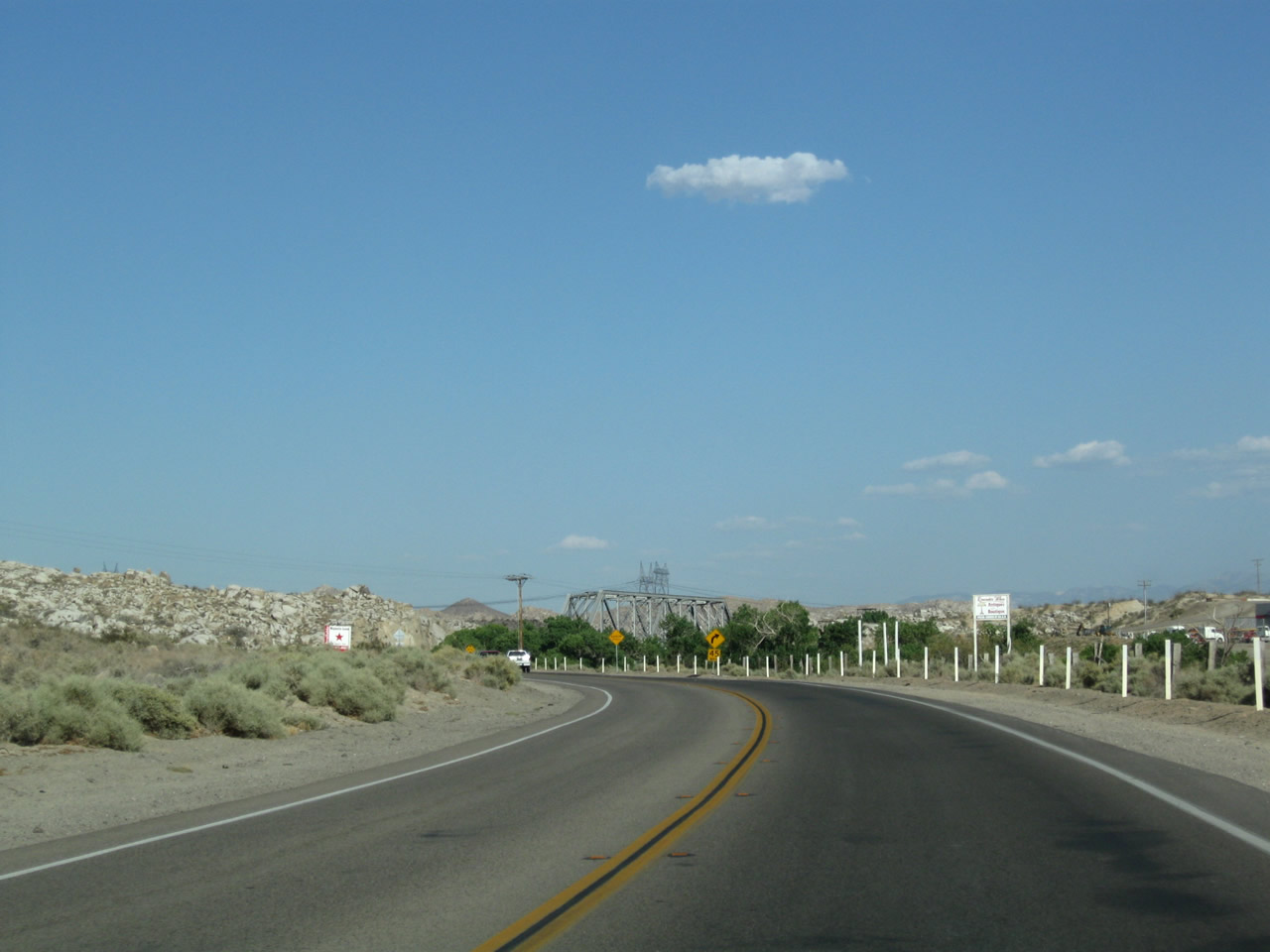
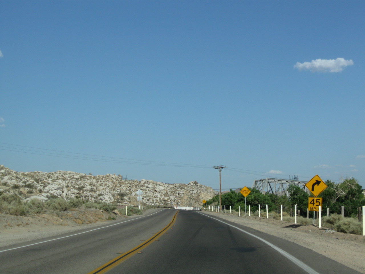
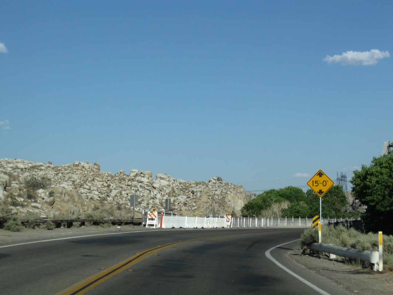
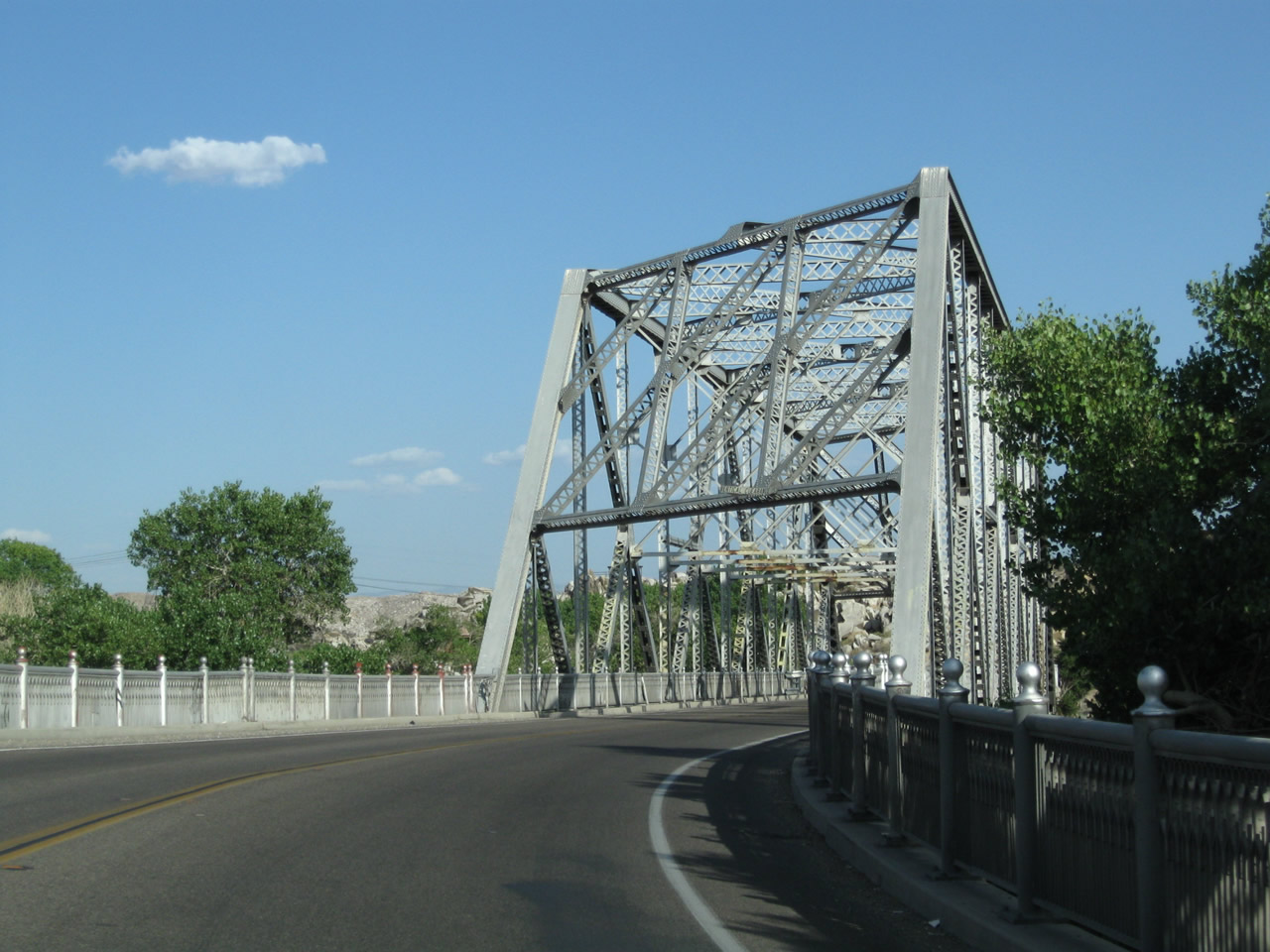
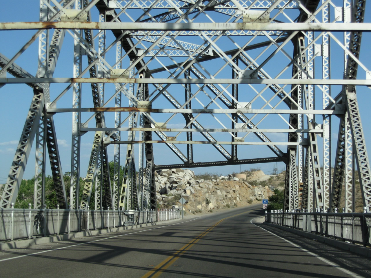
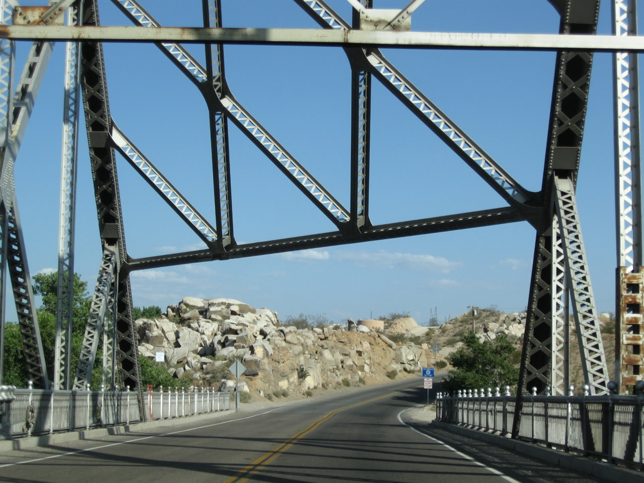
| This series of pictures follows Historic U.S. 66 (National Trails Highway) west and U.S. 91/Arrowhead Highway south on the approach and crossing of the Oro Grande Bridge (Rockfield Bridge). The Oro Grande (Rockfield) Bridge is a through truss bridge that carries Historic U.S. 66-91 (San Bernardino County 66) south across the Mojave River just northwest of Victorville. This bridge was built in 1930 and is approximately 575 feet in length. A Los Angeles Department of Water and Power substation is located on a bluff behind the bridge; the high-voltage power transmission lines visible here lead into this substation. Photos taken 06/27/09. |
|
|
|
The Oro Grande (Rockfield) Bridge has a 15-foot clearance as evidenced by the white regulatory sign mounted above the bridge deck. U.S. 66-91 cross the Mojave River and will enter the city of Victorville on the opposite bank of the river. Photos taken 06/27/09. |
|
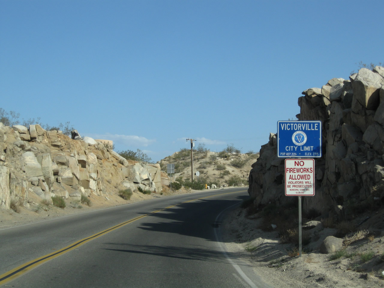
U.S. 66-91 enters the city of Victorville after crossing the Mojave River on the Oro Grande (Rockfield) Bridge. The city of Victorville (known as the "Key City of the High Desert") had a population of 115,903 per the 2010 Census and was incorporated on September 21, 1962. The California Route 66 Museum is located at the intersection of D Street and Sixth Street in Old Town Victorville, alongside Business Loop I-15, Historic U.S. 66-91, and California 18. Photo taken 06/27/09. |
|
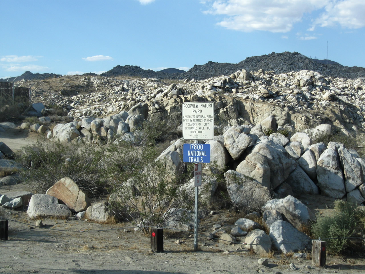
The Oro Grande (Rockfield) Bridge is named for the nearby community of Oro Grande and the Rockfield Nature Park on the east side of the historic highway. A small parking area (shown) is located adjacent to the National Trails Highway for visitors to the park. Photo taken 06/27/09. |
|
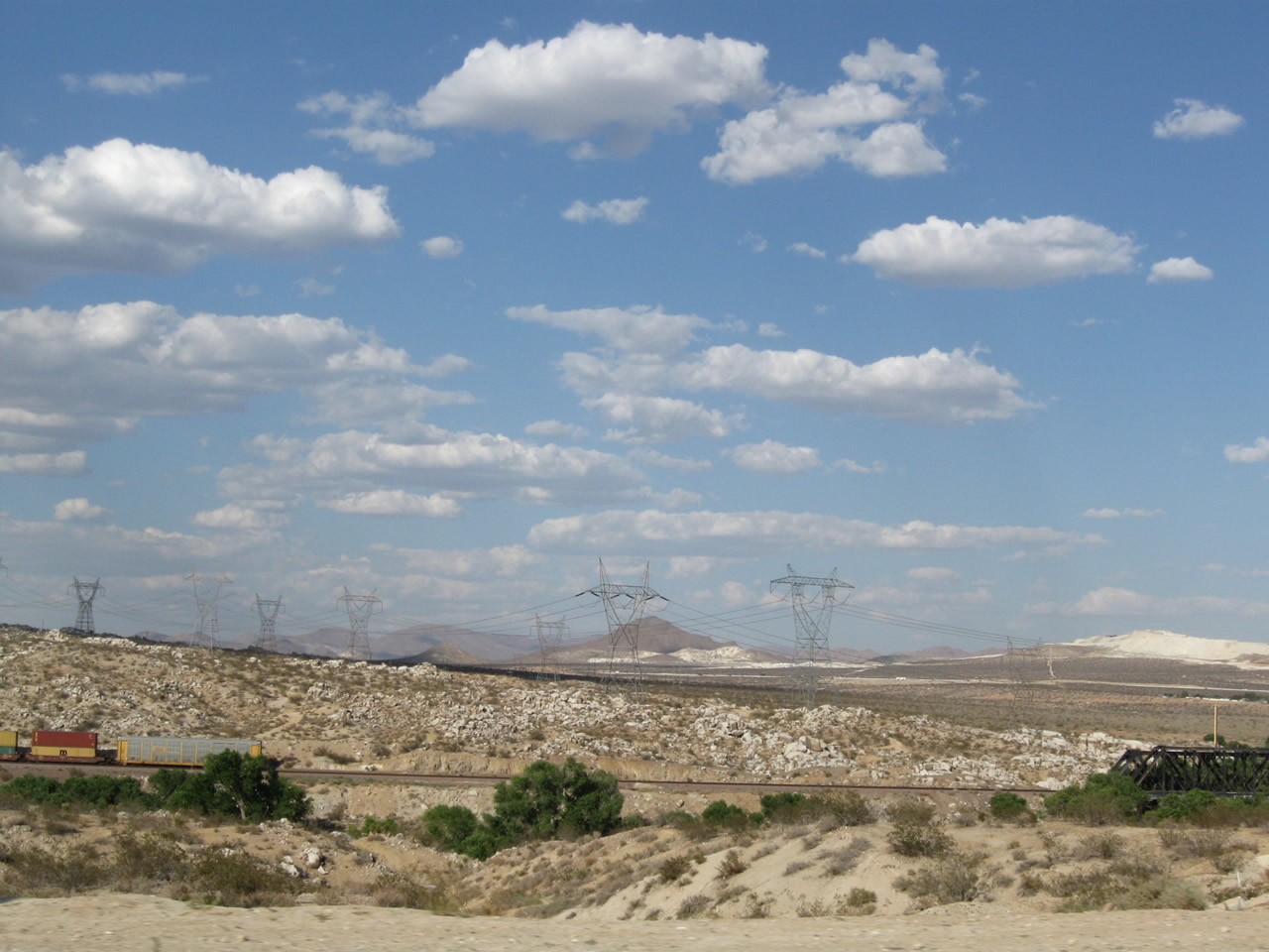
Power lines march across the Mojave Desert, connecting several power substations in the vicinity of Hoover Dam with substations in the Victorville-Adelanto area. These Los Angeles Department of Water and Power lines are visible from National Trails Highway south of the Oro Grande Bridge. Photo taken 06/27/09. |
| Historic U.S. 66 west |
|
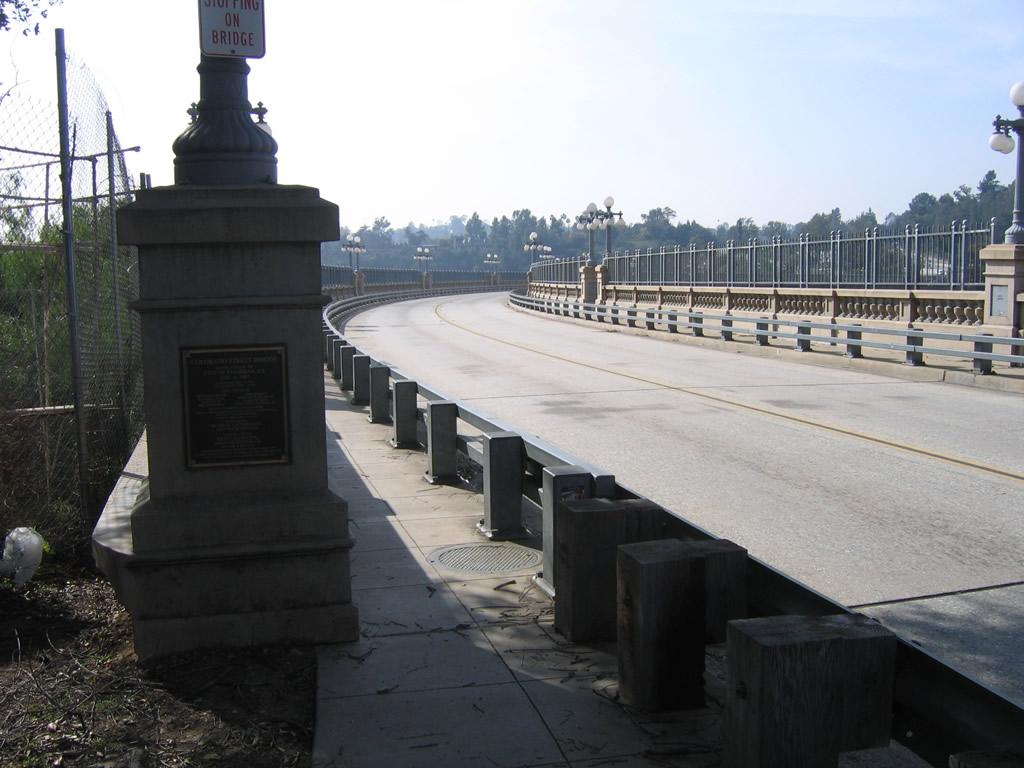
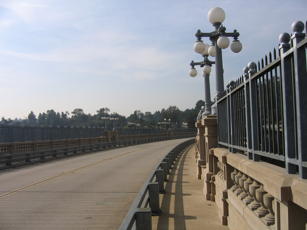
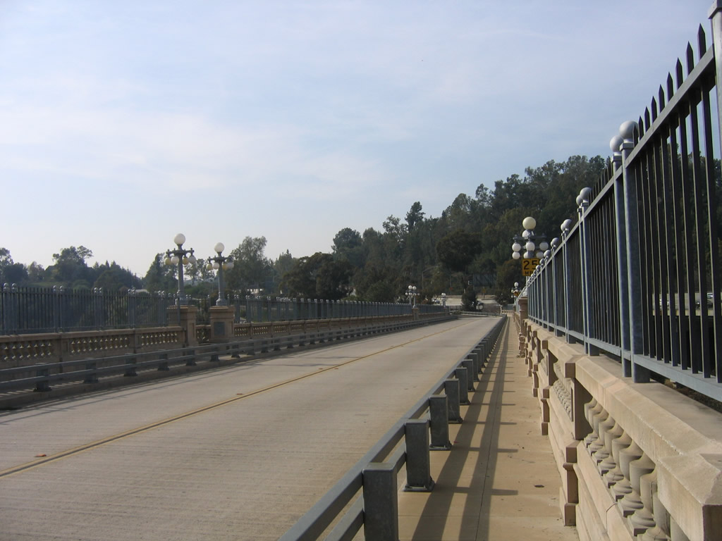
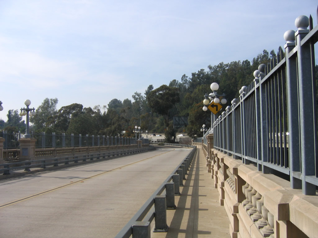
This view looks west along the Colorado Street Pioneer Bridge just west of Old Town Pasadena. Dedicated on December 13, 1913, the bridge carries the historic route over the Arroyo Seco. A small plaque commemorating the construction of the bridge is posted on the south side of the bridge. Photo taken 01/28/06. |
|
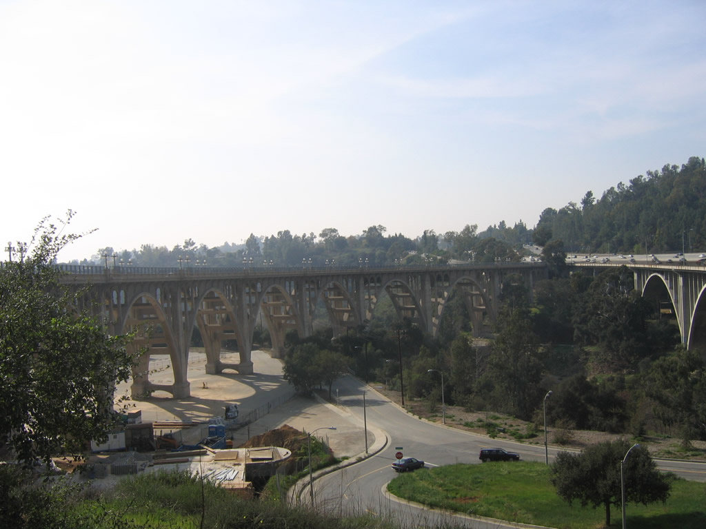
Looking west toward the Arroyo Seco is this view showing both the Colorado Street Pioneer Bridge and the nearby California 134 (Ventura Freeway) bridge. Photo taken 01/28/06. |
|
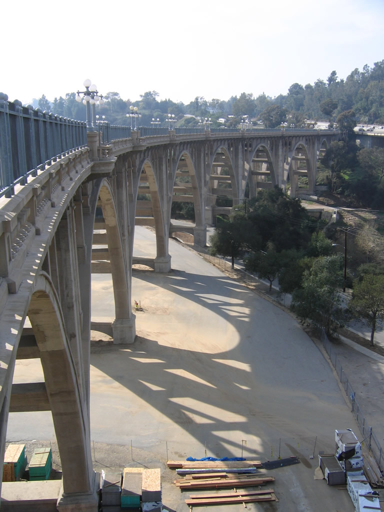
This view looks west toward the arches of the Colorado Street Pioneer Bridge. Photo taken 01/28/06. |
|
|
|
|
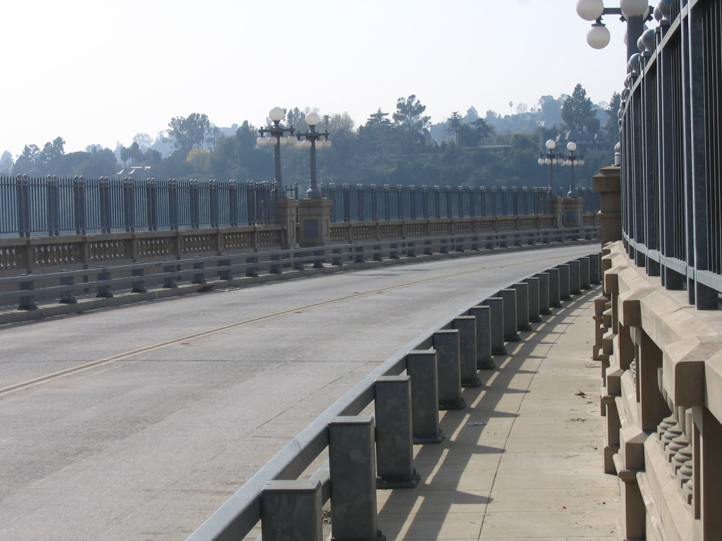
| Ornate touches such as decorative lighting, art deco and concrete bridge rails adorn the historic, 1913 Colorado Street Pioneer Bridge carrying west U.S. 66 high above the Arroyo Seco. Photos taken 01/28/06. |
| Historic U.S. 66 - Sunset Boulevard west & Historic U.S. 101 north |
|
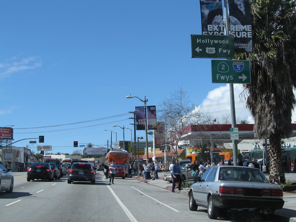
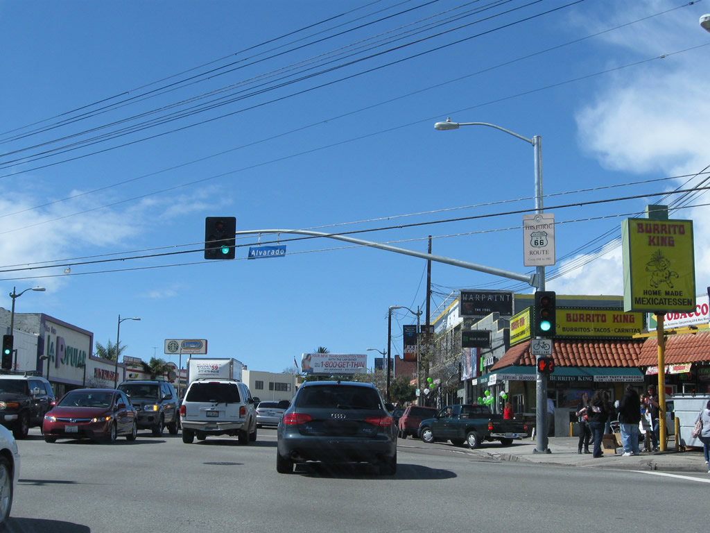
Westbound U.S. 66/Sunset Boulevard and northbound Historic U.S. 101 approach California 2 (Alvarado Street). Turn left on Alvarado Street to U.S. 101 (Hollywood Freeway) or right for California 2 (Glendale Freeway) and Interstate 5 (Golden State Freeway). Photo taken 02/26/11. |
|
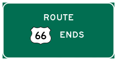
At the intersection with California 2 (Alvarado Street), a Historic U.S. 66 route marker is posted on the traffic signal pole. The historic route marker indicates that Sunset Boulevard served as U.S. 66 between 1935 and 1952. Prior to 1935, U.S. 66 ended in downtown Los Angeles. In 1935, it was extended west to Santa Monica via Sunset Boulevard and Santa Monica Boulevard. U.S. 66 ends at the intersection of Lincoln Boulevard and Olympic Boulevard. Photo taken 02/26/11. |
|
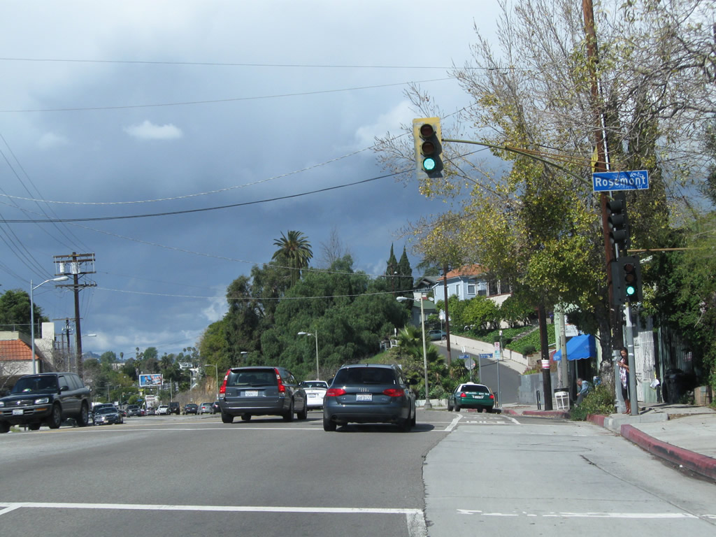
U.S. 66 next approaches the intersection with Rosemont Avenue. U.S. 66 continues northwest. Photo taken 02/26/11. |
|
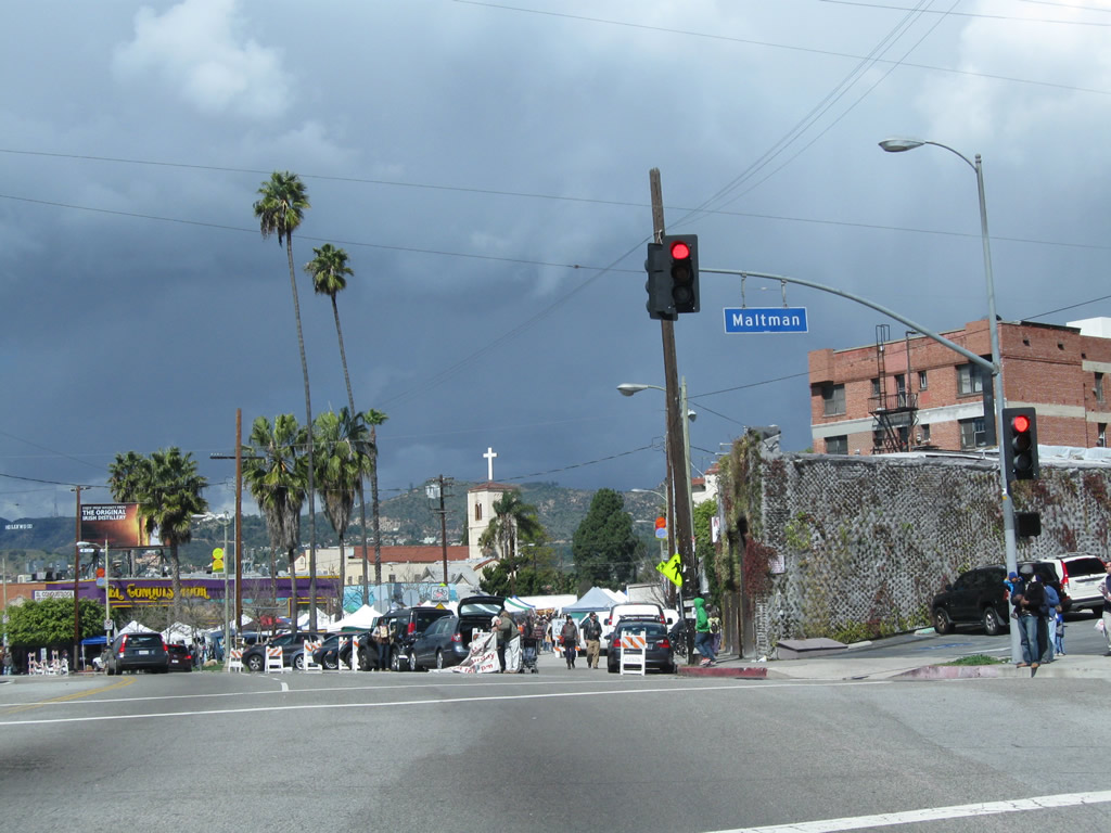
Some distance northwest of there (after Silver Lake Boulevard), U.S. 66 meets Maltman Avenue and Griffith Park Boulevard in Silver Lake. Stay left for U.S. 66. Photo taken 02/26/11. |
|
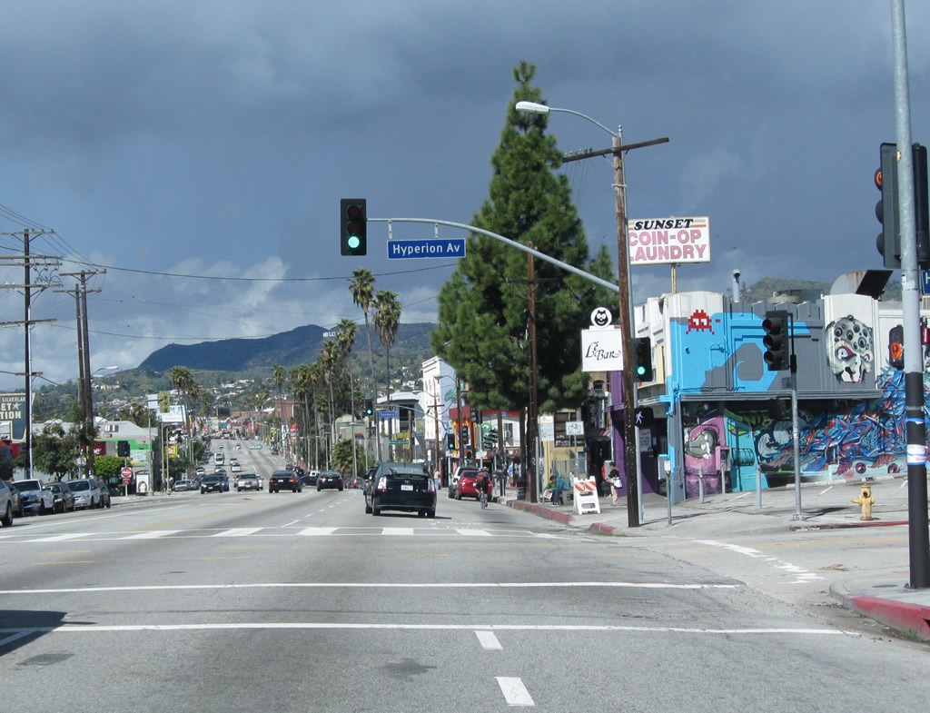
Westbound U.S. 66 and northbound Historic U.S. 101 approaches Hyperion Avenue. Photo taken 02/26/11. |
|
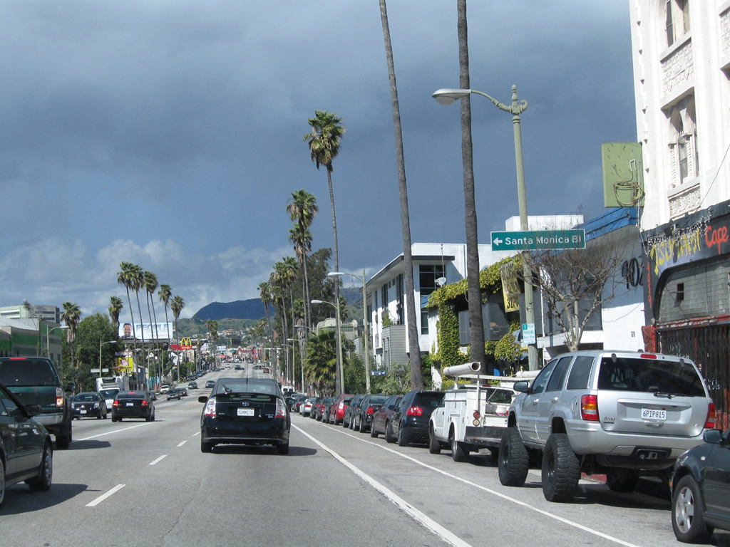
U.S. 66 turns off Sunset Boulevard at Santa Monica Boulevard. Historic U.S. 101 continues north on Sunset Boulevard. Photo taken 02/26/11. |
Page Updated January 12, 2013.


 >
>